Ten Things You Didn’t Know About Britain’s Prehistoric Flooded Past


Introduction — The Britain You Know Is a Fake

(Ten Things You Didn’t Know About Britain’s Prehistoric Flooded Past)

We look at our hills, rivers, and coasts… and think they’ve always been there.
Stable. Permanent.

But that picture… is a lie.
At the end of the last Ice Age, Britain was a land in chaos.
Seas surged sixty metres higher. Rivers swelled beyond imagination. Entire countries… disappeared beneath the waves.

Archaeology often ignores this truth. Too many theories are drawn on a modern map — a map our ancestors would barely recognise.
After two decades of fieldwork and over two hundred and sixty research blogs, I can tell you: to understand prehistoric Britain… you must redraw it.
Here are ten things you probably didn’t know about the drowned, shifting, waterlogged world our ancestors truly lived in.

(Ten Things You Didn’t Know About Britain’s Prehistoric Flooded Past)
A Landscape full of enlarged rivers – (Ten Things You Didn’t Know About Britain’s Prehistoric Flooded Past)

1 — The Britain You Know Is Only 8,000 Years Old

When the Holocene began, Britain wasn’t an island.
A land bridge linked us to Europe — until rising seas finally severed it around six thousand BCE.
The change wasn’t gentle.
Meltwater pulses sent the tide racing inland, flooding valleys in years… not centuries.

Sea levels rose faster than our worst climate forecasts for 2100.
Every coastline shifted. The mouth of the Thames moved inland. Estuaries formed where farmland now lies.
Your hometown… could have been seabed

If you stood there then, your mental map of Britain would be unrecognisable.
The “island nation” idea? A very recent reality.
For most of prehistory… Britain was part of a wider European landscape.
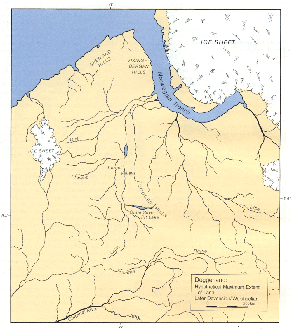
(Ten Things You Didn’t Know About Britain’s Prehistoric Flooded Past)
Doggerland was once jus one enlarged continent (Ten Things You Didn’t Know About Britain’s Prehistoric Flooded Past)

2 — Stonehenge’s Bluestones Couldn’t Have Rolled Here

The romantic image is familiar: teams of men with ropes and ox-carts dragging stones two hundred kilometres from Preseli to Salisbury Plain.
But around eight thousand BCE, ninety percent of that “route” was deep wildwood.
Valleys in between? Bog-soaked mires.
Wheels would have sunk without a trace.

The real transport network wasn’t overland — it was water.
Seasonal floods. Frost-hardened winter ground. And above all… rivers.
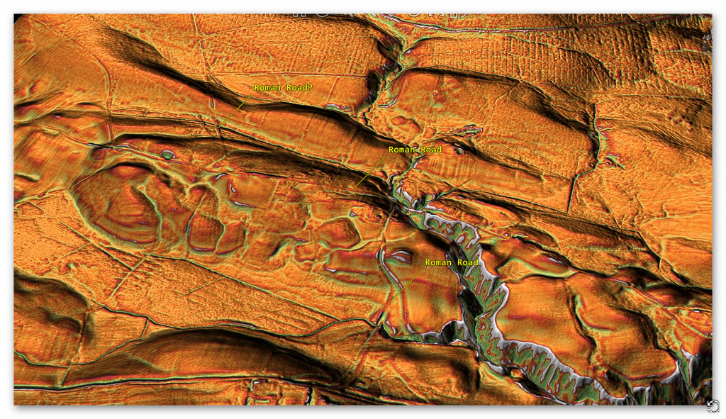
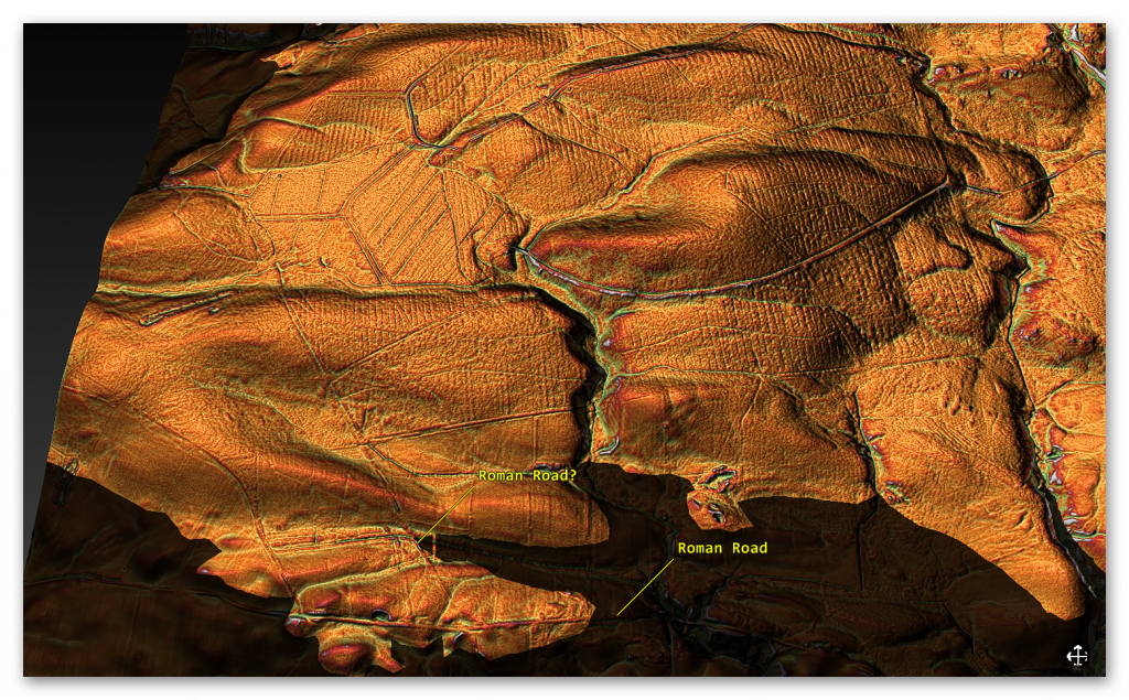
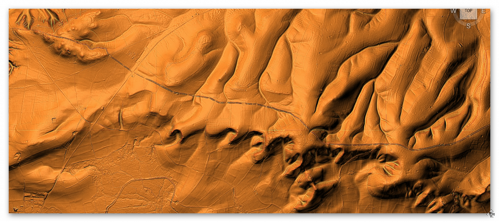
LiDAR mapping shows prehistoric waterways were the true highways.

This single fact changes the Stonehenge story entirely.
It wasn’t a land-locked haul of brute force — it was a calculated, water-based operation using the landscape to its advantage.

(Ten Things You Didn’t Know About Britain’s Prehistoric Flooded Past)
The idea of dragging Stones of 20 – 30 tonnes is pure folly – (Ten Things You Didn’t Know About Britain’s Prehistoric Flooded Past)

3 — Britain Once Had a Country Twice the Size of Wales — and Lost It Overnight

Doggerland was no myth. It was a vast lowland stretching from East Anglia to the Netherlands.
Its marshes, rivers, and lakes supported thousands of people. For centuries, it was a bridge between Britain and Europe.

Then it drowned. Whether through steady sea rise, sudden flooding, or both — the result was the same.
Communities found themselves separated by water where there had once been solid ground.

That shock forced a new reality.
Boats were no longer optional… they were survival.
In my Maritime Diffusion Model, this moment explains why megalithic architecture suddenly spread so quickly along Atlantic coasts — the sea became the new road.
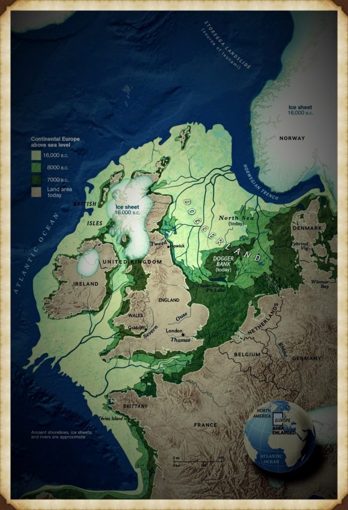
(Ten Things You Didn’t Know About Britain’s Prehistoric Flooded Past)
The drowning of Doggerland was a major catastrophic event in History of the World – (Ten Things You Didn’t Know About Britain’s Prehistoric Flooded Past)

4 — Raised Beaches… Or the Fingerprints of a Flooded Britain?

On Britain’s south coast, geologists point to “raised beaches” — sand and gravel layers perched far above today’s tide line.
The standard explanation is a mix of ancient shorelines and “isostatic rebound.” But the data… doesn’t match the story.

My research shows these aren’t fossil beaches at all. They’re concave, river-shaped deposits.
They sit under layers of unstructured chalk — exactly what you’d expect if catastrophic meltwater floods carved paleochannels down to the sea.
British Geological Survey maps confirm the pattern: huge branching flows, not static coastlines.

Once you see it, you can’t unsee it.
These are not tranquil remnants of a higher tide… they are scars of a country in flood</emphasis>.
And they tell a far more dynamic, violent story than the textbooks admit.
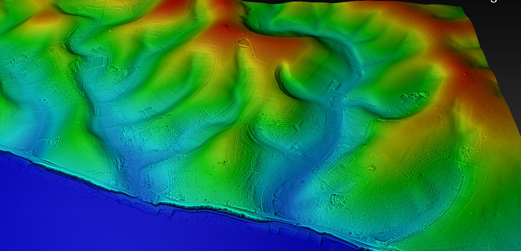
(Ten Things You Didn’t Know About Britain’s Prehistoric Flooded Past)
If geologists used Lidar such misidentification would be avoided – (Ten Things You Didn’t Know About Britain’s Prehistoric Flooded Past)

5 — The Thames Was Once Seven Kilometres Wide

Beneath London, boreholes reveal up to ten metres of early-Holocene silt.
This was not the neat, channelled Thames we know — it was a vast, braided tidal delta up to seven kilometres across.

Such a river wasn’t just wider… it was a different creature entirely.
Settlements clung to the high ground like islands. Boats connected them. Trade and travel followed water channels, not overland tracks.
This wasn’t an obstacle — it was a superhighway.

And here’s the myth-buster: London’s lack of prehistoric sites isn’t due to modern building wiping them out.
LiDAR shows that much of the Thames Valley floor was too wide and flood-prone to build on.
Only a few habitable high points existed — the places we now call the “Home Counties.”

London (The Thames) through time
The Thames was not swollen it was swamped in the Mesolithic – (Ten Things You Didn’t Know About Britain’s Prehistoric Flooded Past)

6 — The Isle of Wight Was Cut Off by a Flooded River Valley

The Solent started as a river.
Then, around seven thousand five hundred years ago, rising seas burst through the valley, flooding it completely.
A short walk became an open-water crossing — and life on both sides changed overnight.

Suddenly, trade required boats. Communities reorganised. Control of crossing points likely meant influence and power.
Archaeology along the submerged Solent shows drowned forests, hearths, and even worked timbers… frozen in place beneath the waves.

Most extraordinary of all is Bouldnor Cliff.
Here, eleven metres underwater, lies the world’s first known boat-building site — a sixth-millennium BCE harbour that imported Einkorn wheat from mainland Europe.
This was no primitive backwater… it was a maritime hub centuries ahead of its time.
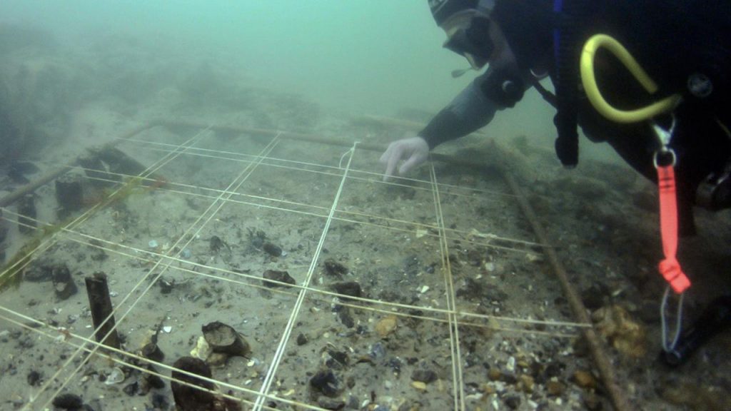
Bouldnor Cliff - Einkorn wheat
Bouldnor Cliff – Einkorn wheat – (Ten Things You Didn’t Know About Britain’s Prehistoric Flooded Past)

7 — Somerset’s Levels Were a Salt-Water Swamp

Between 5600 and 4450 BCE, the Somerset Levels were not the patchwork of fields we know today.
They were alder-carr woodland slowly drowning under advancing salt marsh.

Peat cores show the shift layer by layer — from fresh water to brackish tidal intrusion.
To prehistoric people, this meant constant adaptation: moving camps, changing food sources, finding safe ground.

Centuries later, societies would turn this swamp into a managed landscape of canals and raised trackways.
But in its early days, it was a shifting, dangerous maze of water… a place that could swallow your settlement in a season.
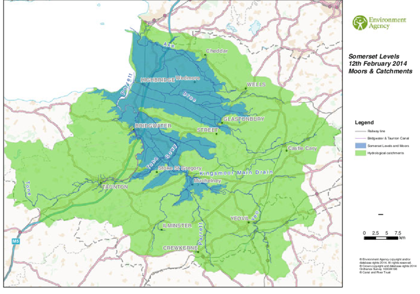
(Ten Things You Didn’t Know About Britain’s Prehistoric Flooded Past)
It started as freshwater swamp then turned into salt water swamp – (Ten Things You Didn’t Know About Britain’s Prehistoric Flooded Past)

8 — Stonehenge Stood on a Peninsula Fed by a Healing Spring

Stonehenge didn’t stand beside a ceremonial pool or a “ritual lagoon.”
It was built on a peninsula jutting into the River Avon, fed by a natural spring at Stonehenge Bottom.
This fresh, flowing water made the site an ideal meeting place and a reliable refuge.

The bluestones, brought from Preseli, were more than decorative.
They contain minerals with natural antibacterial properties.
In a world where sepsis from a cut could be fatal, those stones were medicine.

Water from the spring flowing past them created a setting believed to aid recovery from infections and wounds.
Forget the star-gazing theories — Stonehenge was a healing centre, built with purpose and grounded in survival.
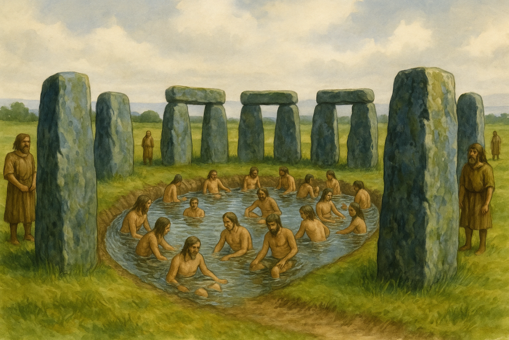
(Ten Things You Didn’t Know About Britain’s Prehistoric Flooded Past)
The Bluestones were broken up like bath salts when they arrived at Stonehenge – (Ten Things You Didn’t Know About Britain’s Prehistoric Flooded Past)

9 — Our “Iron Age Hillforts” May Be Older — and Wetter — Than We Think

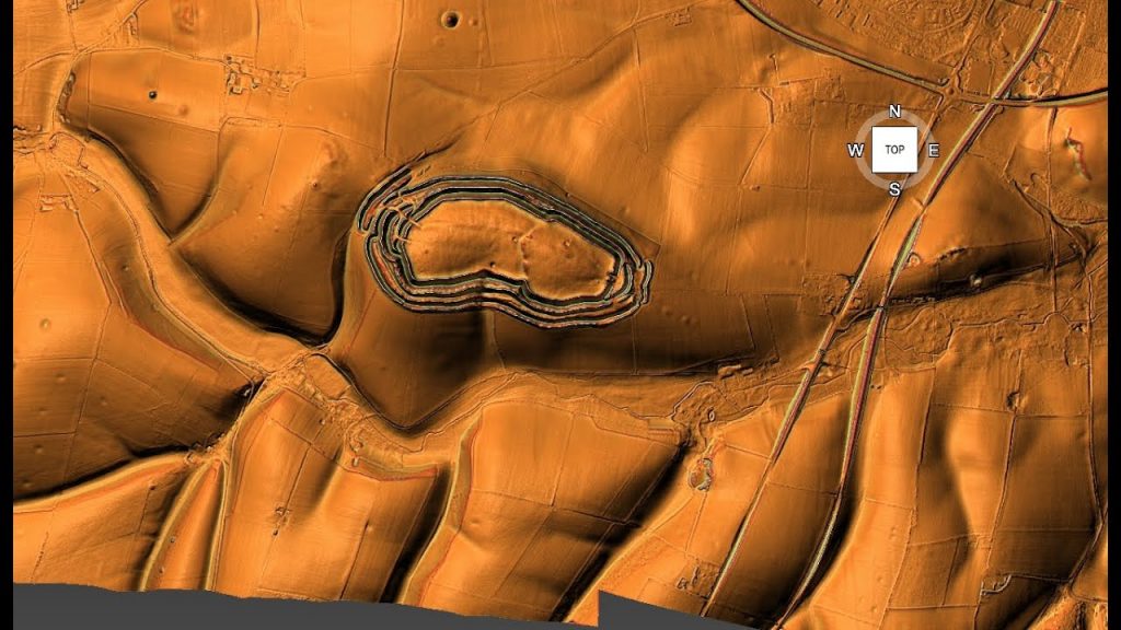
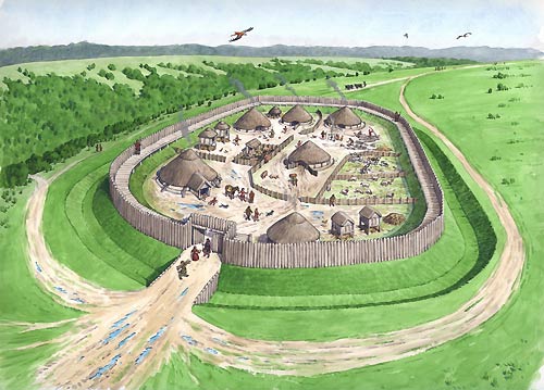
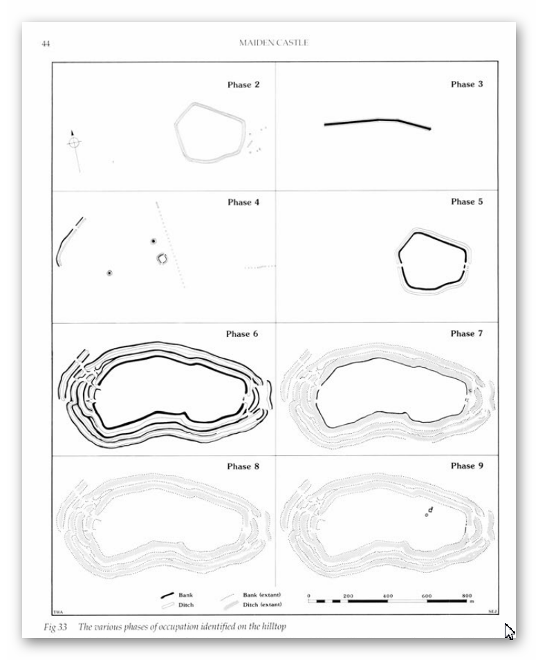
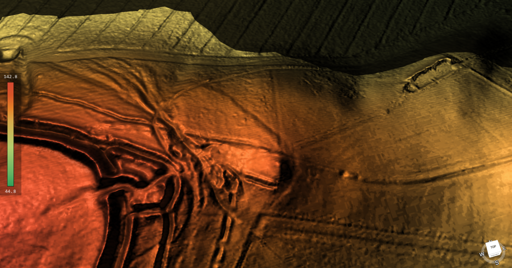
From the air, hillforts look like defensive enclosures.
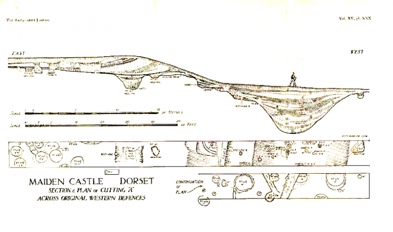
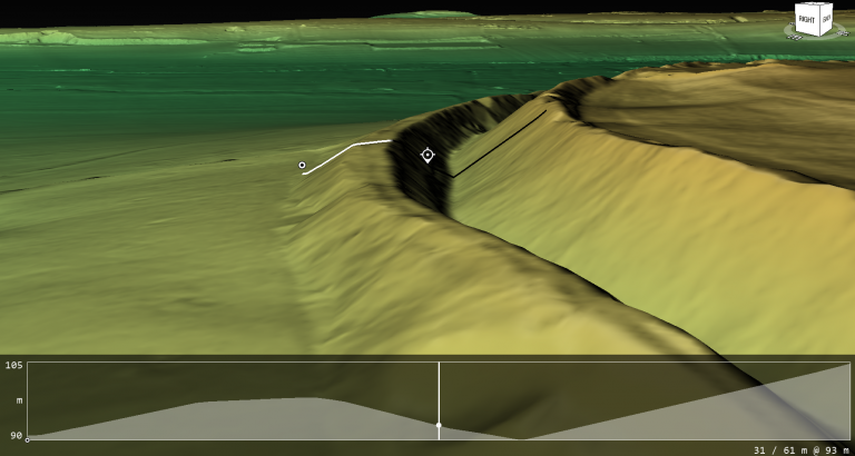
But LiDAR tells a different story — many sit in wet, low-lying areas with evidence of ditches that once held water.

These weren’t forts braced for battle… they were moated settlements designed for trade and control of water routes.
In a wetter prehistoric Britain, that was often more important than any wall.

Re-examining these sites with hydrology in mind reveals a network of connected hubs — places where goods, people, and ideas moved not along ridge-tops, but through waterways.
It’s a complete rethink of “forts” as we know them.
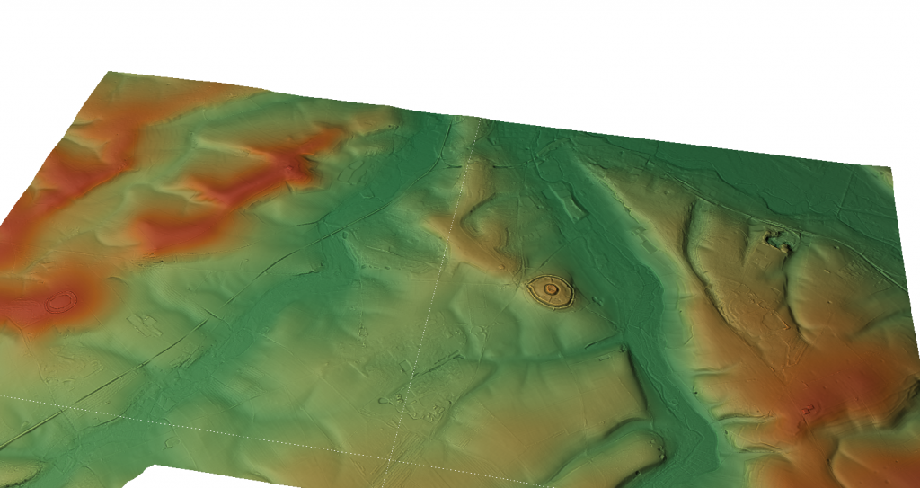
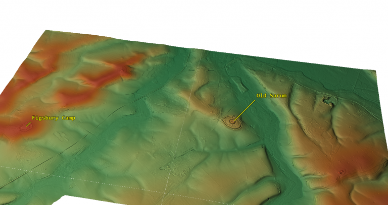
(Ten Things You Didn’t Know About Britain’s Prehistoric Flooded Past)
Old Sarum is in the middle of a River – although its called an ‘Iron Age Fort’? – (Ten Things You Didn’t Know About Britain’s Prehistoric Flooded Past)

10 — The Map in Your Head Is a Mirage

When we think of Britain, we picture a static shape — familiar coastlines, steady rivers.
But in prehistory, those lines were always on the move.

Rivers cut new paths. Valleys flooded. Islands appeared and vanished.
The Britain of twelve thousand years ago was nothing like the Britain of eight thousand years ago — and both were strangers to the Britain we know now.

The Post-Glacial Flooding Hypothesis forces us to redraw that mental map.
Once you do, everything changes — from how Stonehenge was built, to why Doggerland mattered, to the true nature of “hillforts.”
It’s not just a new map… it’s a new past.
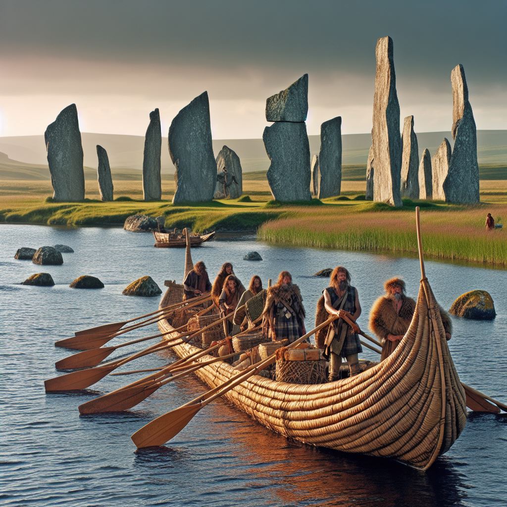
(Ten Things You Didn’t Know About Britain’s Prehistoric Flooded Past)
Boats were the only way to travel and trade in the Mesolithic Period – (Ten Things You Didn’t Know About Britain’s Prehistoric Flooded Past)

Conclusion — Redraw the Map. Rethink the Past.

Prehistoric Britain was not a gentle green land.
It was a place of rapid change, flooded valleys, and disappearing coasts.
Ignore that… and you get bad archaeology.

Factor it in — and new explanations open up for the monuments, settlements, and journeys of our ancestors.
The evidence is there. The map is wrong.
<emphasis level=”moderate”>It’s time to set it right</emphasis>.

(Ten Things You Didn’t Know About Britain’s Prehistoric Flooded Past)

Update

Where to see Britain’s post-glacial high water table

The caves are the evidence. Karst systems preserve the height of former water tables:

Mendip Hills (Cheddar Gorge / Wookey Hole): Relic phreatic levels high above modern flow routes show earlier pressurised groundwater; silted tubes and scallops mark sustained high head after deglaciation.

Yorkshire Dales (Malham–Ingleborough): Abandoned risings and perched conduits around Malham Cove & Gaping Gill record higher Holocene heads; modern springs sit lower as the aquifer discharged over millennia.

Peak District (Castleton): Upper fossil passages in Peak Cavern/Speedwell are stranded above active streams—classic regression from a post-glacial high stand.

Chalk Winterbournes (Downs/Chilterns): The Misbourne, Chess, Kennet headwaters and Dorset winterbournes switch on when the head rises—same physics, small timescale. Early Holocene = the “on” position for much longer.

Chalk dew-ponds: Longevity on permeable chalk relies on self-sealing skins—the same lining behavior that helps Phase-1 Stonehenge’s moat retain water under high head.

Why this matters for Stonehenge Phase 1

Mechanism: High head + chalk colmation = standing water in the ditch.

Analogue: Cave high-stands are the geological logbook of that head.

Fit: The moat enables the mineralised bluestone baths and excarnation workflow documented in the Phase-1 model.

Quick Evidence: Britain’s Aquifers, Made Visible

Karst plumbing on show. In chalk/limestone belts, groundwater carved conduits, phreatic tubes, risings, and sinkholes—the aquifer made visible in places like the Mendips, Yorkshire Dales, and the Peak District.

High-stand markers. Abandoned phreatic passages perched high on cave walls, scalloped ceilings (pressurised flow), and silt beds record past water-table positions—higher than today during the early Holocene.

Seasonal analogue. Modern winterbournes (dry valleys that flow only when the head rises) prove the mechanism: when the potentiometric surface sits above cut level, water holds—exactly what Phase 1 required.

Self-sealing ditches. Fresh chalk cuts develop clay/carbonate skins (colmation), reducing leakage. With high head + recharge, a “ditch” becomes a moat.


PodCast

Silbury Avenue - Avebury's First Stone Avenue

Author’s Biography

Robert John Langdon, a polymathic luminary, emerges as a writer, historian, and eminent specialist in LiDAR Landscape Archaeology.

His intellectual voyage has interwoven with stints as an astute scrutineer for governmental realms and grand corporate bastions, a tapestry spanning British Telecommunications, Cable and Wireless, British Gas, and the esteemed University of London.

A decade hence, Robert’s transition into retirement unfurled a chapter of insatiable curiosity. This phase saw him immerse himself in Politics, Archaeology, Philosophy, and the enigmatic realm of Quantum Mechanics. His academic odyssey traversed the venerable corridors of knowledge hubs such as the Museum of London, University College London, Birkbeck College, The City Literature Institute, and Chichester University.

In the symphony of his life, Robert is a custodian of three progeny and a pair of cherished grandchildren. His sanctuary lies ensconced in the embrace of West Wales, where he inhabits an isolated cottage, its windows framing a vista of the boundless sea – a retreat from the scrutinous gaze of the Her Majesty’s Revenue and Customs, an amiable clandestinity in the lap of nature’s embrace.

(The Stonehenge Code)

Exploring Prehistoric Britain: A Journey Through Time

My blog delves into the fascinating mysteries of prehistoric Britain, challenging conventional narratives and offering fresh perspectives based on cutting-edge research, particularly using LiDAR technology. I invite you to explore some key areas of my research. For example, the Wansdyke, often cited as a defensive structure, is re-examined in light of new evidence. I’ve presented my findings in my blog post Wansdyke: A British Frontier Wall – ‘Debunked’, and a Wansdyke LiDAR Flyover video further visualizes my conclusions.

My work also often challenges established archaeological dogma. I argue that many sites, such as Hambledon Hill, commonly identified as Iron Age hillforts are not what they seem. My posts Lidar Investigation Hambledon Hill – NOT an ‘Iron Age Fort’ and Unmasking the “Iron Age Hillfort” Myth explore these ideas in detail and offer an alternative view. Similarly, sites like Cissbury Ring and White Sheet Camp, also receive a re-evaluation based on LiDAR analysis in my posts Lidar Investigation Cissbury Ring through time and Lidar Investigation White Sheet Camp, revealing fascinating insights into their true purpose. I have also examined South Cadbury Castle, often linked to the mythical Camelot56.

My research also extends to the topic of ancient water management, including the role of canals and other linear earthworks. I have discussed the true origins of Car Dyke in multiple posts including Car Dyke – ABC News PodCast and Lidar Investigation Car Dyke – North Section, suggesting a Mesolithic origin2357. I also explore the misidentification of Roman aqueducts, as seen in my posts on the Great Chesters (Roman) Aqueduct. My research has also been greatly informed by my post-glacial flooding hypothesis which has helped to inform the landscape transformations over time. I have discussed this hypothesis in several posts including AI now supports my Post-Glacial Flooding Hypothesis and Exploring Britain’s Flooded Past: A Personal Journey

Finally, my blog also investigates prehistoric burial practices, as seen in Prehistoric Burial Practices of Britain and explores the mystery of Pillow Mounds, often mistaken for medieval rabbit warrens, but with a potential link to Bronze Age cremation in my posts: Pillow Mounds: A Bronze Age Legacy of Cremation? and The Mystery of Pillow Mounds: Are They Really Medieval Rabbit Warrens?. My research also includes the astronomical insights of ancient sites, for example, in Rediscovering the Winter Solstice: The Original Winter Festival. I also review new information about the construction of Stonehenge in The Stonehenge Enigma.

(The Stonehenge Code)

Further Reading

For those interested in British Prehistory, visit www.prehistoric-britain.co.uk, a comprehensive resource featuring an extensive collection of archaeology articles, modern LiDAR investigations, and groundbreaking research. The site also includes insights and extracts from the acclaimed Robert John Langdon Trilogy, a series of books exploring Britain during the Prehistoric period. Titles in the trilogy include The Stonehenge Enigma, Dawn of the Lost Civilisation, and The Post Glacial Flooding Hypothesis, offering compelling evidence about ancient landscapes shaped by post-glacial flooding.

To further explore these topics, Robert John Langdon has developed a dedicated YouTube channel featuring over 100 video documentaries and investigations that complement the trilogy. Notable discoveries and studies showcased on the channel include 13 Things that Don’t Make Sense in History and the revelation of Silbury Avenue – The Lost Stone Avenue, a rediscovered prehistoric feature at Avebury, Wiltshire.

In addition to his main works, Langdon has released a series of shorter, accessible publications, ideal for readers delving into specific topics. These include:

For active discussions and updates on the trilogy’s findings and recent LiDAR investigations, join our vibrant community on Facebook. Engage with like-minded enthusiasts by leaving a message or contributing to debates in our Facebook Group.

Whether through the books, the website, or interactive videos, we aim to provide a deeper understanding of Britain’s fascinating prehistoric past. We encourage you to explore these resources and uncover the mysteries of ancient landscapes through the lens of modern archaeology.

For more information, including chapter extracts and related publications, visit the Robert John Langdon Author Page. Dive into works such as The Stonehenge Enigma or Dawn of the Lost Civilisation, and explore cutting-edge theories that challenge traditional historical narratives.

(The Stonehenge Code)

Other Blogs

s

t

The Beringian Migration Myth: Why the Peopling of the Americas by Foot is Mathematically and Logistically Impossible

Introduction

Over a decade ago, in my book Dawn of the Lost Civilisation, I proposed that the Americas were populated not by a trickle of Siberian nomads trudging across the Bering Land Bridge, but by a maritime culture capable of long-distance sea travel. At the time, this idea challenged academic orthodoxy. Today, however, mathematical modelling, archaeological evidence, and DNA analysis all converge to vindicate this theory — and expose the Beringia-first hypothesis as not only implausible but mathematically bankrupt.(The Beringian Migration Myth)

(The Beringian Migration Myth)

1. Human Migration is Diffusion, Not Deterministic Marching

Migration in prehistoric times followed a biological constant: diffusion. Humans do not move in armies across continents. They spread slowly, opportunistically, and unevenly. Typical migration rates are 10–20 km per generation, with only 1–5% of a parent population moving outward in any direction. For a migration to succeed, it must be driven by population pressure, environmental opportunity, and sustainable demographics.

This matters because the Beringia model demands a sustained wave of foot migration over thousands of kilometres of glacial terrain — with infants, elderly, and families — through marginal environments with low food yields. It’s not just logistically difficult. It’s mathematically impossible. (The Beringian Migration Myth)

(The Beringian Migration Myth)

2. The Minimum Viable Population Problem

Genetic studies suggest the founding population of the Americas was at least 5,000–10,000 individuals. This is the minimum required to avoid inbreeding, genetic drift, and extinction over the long term. But to achieve that via gradual foot-based migration, you’d need a source population of at least 500,000 people within 1,000 km of the Bering Land Bridge — applying conservative 2% outward diffusion and attrition rates.

But where are they?

Eastern Siberia around 20,000 years ago had no such numbers. Population densities in Ice Age Eurasia were often below 0.01 people/km². Our model shows that to house 500,000 people within 1,000 km of Beringia, you’d need densities of 0.16/km² — over 10 times higher than anything supported by the archaeological or palaeoecological record. (The Beringian Migration Myth)

(The Beringian Migration Myth)

3. The Archaeological Hotspot Problem

If the land bridge theory is correct, we should find dense clusters of archaeological sites in:

  • Eastern Siberia
  • Beringia
  • Alaska
  • Interior Canada

Instead, we find the opposite. These regions are largely sterile before ~13,000 BP. The oldest robust sites in the Americas — Monte Verde (Chile), Gault (Texas), and Buttermilk Creek — are thousands of kilometres south of where the migration allegedly began. (The Beringian Migration Myth)

Summary Table:

RegionPredicted by TheoryEvidence FoundVerdict
Eastern SiberiaHighSparse❌
BeringiaHighMinimal❌
AlaskaHighSparse & Late❌
Interior CanadaHighPost-Clovis❌
South AmericaLowEarly & Dense✅
Coastal PacificLowRising Support✅

4. Maritime Migration: A Model That Matches the Evidence

Unlike foot migration, seaborne migration enables rapid coastal colonisation. Our model simulates a founding population of 1,000 boat-users landing on the east coast of North America or the Pacific coast of South America. With only a 2% annual growth rate:

  • They reach millions in under 500 years
  • They spread over 40,000 km of coastline

This matches known archaeological data far better than the Beringian land model. (The Beringian Migration Myth)

(The Beringian Migration Myth)

5. Genetic and Linguistic Corroboration

DNA analysis also supports this maritime model:

  • Multiple lineages (mtDNA X, C1b, D1) suggest polycentric migration, not a single northern bottleneck.
  • Linguistic diversity is highest in South America and the Gulf Coast, not the north.
  • Native populations in Alaska and Canada show lower genetic diversity, consistent with late, back-migrations rather than origins.

(The Beringian Migration Myth)

(The Beringian Migration Myth)

6. Indigenous Settlement Patterns: Another Nail in the Coffin

Modern and historic Indigenous population distributions further contradict the land-bridge hypothesis:

  • The densest populations were found in eastern North America, Mesoamerica, and South America — not Alaska or the northwest.
  • The great river systems (Mississippi, Amazon) and temperate woodlands supported large, complex societies.
  • Northern and interior Canada remain sparsely populated, both today and in prehistory.

If migration began in Alaska, we’d expect density to decline as you move south and east. Instead, it’s the reverse.

Genetically, this is backed by:

  • Greater diversity in the south than in the north
  • Founder effects in northern populations, implying back-migration

This strongly suggests the north was populated last, not first — and the migration direction is south to north, not the other way around. (The Beringian Migration Myth)

(The Beringian Migration Myth)

7. Clovis People and European DNA: The Solutrean Connection?

Further complicating the Beringia narrative is the discovery that some Clovis-era skeletal remains contain mitochondrial DNA of European origin — particularly haplogroup X2a, which is absent in Asia. This suggests an alternative migration route — one that may have crossed the North Atlantic via ice-age sea routes.

The so-called Solutrean Hypothesis posits that people from Ice Age Europe, using boats and coastal navigation, followed the edge of Atlantic sea ice to reach the Americas. Clovis tool technology has notable similarities with Solutrean lithics from France and Iberia — a convergence too specific to ignore.

Crucially, these genetic clues are backed by morphological studies of early skeletal remains that show distinctively European cranial features, further weakening the Asia-only model. Though controversial, these findings offer empirical support for the idea that the Americas may have been settled by multiple seafaring groups — not just from the west, but from the east as well. (The Beringian Migration Myth)

(The Beringian Migration Myth)

8. The Climate and Survival Impossibility of the Beringian Crossing

🧊 What Real Arctic Migration Looks Like: An Ethnographic Reality Check

To further dismantle the Beringian migration theory, we turn to the lived experience of modern Indigenous Arctic populations — including the Inuit, Nenets, Evenki, and Chukchi — who survive in tundra and permafrost regions today.

These groups, who represent the closest real-world analogue to Ice Age conditions, exhibit very limited seasonal mobility:

  • Typical seasonal ranges: 50–150 km radius
  • Daily movement (on foot, with families and supplies): 2–5 km
  • Movement is circular and seasonal, not linear or expansionist
  • Migrations happen in stages, over decades or generations, not all at once

These communities rely on:

  • Dog sleds or reindeer teams
  • Pre-built shelters, caches, and geographic knowledge
  • Return-point mobility — meaning they rarely move into completely unknown territory unless forced

Studies show that even under ideal hunting conditions:

  • Winter travel without sleds rarely exceeds 5 km/day
  • Continuous long-distance migration (>1,000 km) is almost unheard of

Yet the Beringia theory asks us to believe:

  • That Stone Age families, without domesticated animals, sleds, or mapped routes
  • Crossed 4,000–5,000 km of frozen, food-scarce tundra
  • With no infrastructure, across generations, leaving little archaeological trace

This is not just implausible — it is completely out of sync with everything we know about Arctic human behaviour.

➡️ If real Arctic peoples don’t migrate that way today, it’s extremely unlikely their Ice Age counterparts did either. (The Beringian Migration Myth)

(The Beringian Migration Myth)

9. The Persistence of a Flawed Theory

Despite these overwhelming problems, the Beringia hypothesis remains dominant. Why?

  • It’s simple and linear — easy to teach, easy to accept. One land bridge, one direction.
  • It’s institutionally entrenched — the theory was cemented before radiocarbon dating or genetics. Early 20th-century archaeology assumed Clovis was first, and that assumption stuck.
  • Challenging it is dangerous — researchers who question it face academic backlash. Entire careers and grants are built on maintaining the status quo.
  • Coastal evidence is underwater — rising seas have buried the most likely early coastal sites, so the absence of evidence is used to maintain the theory.
  • Textbooks and museums haven’t caught up — many still present the Bering Land Bridge as an unchallenged truth.

Ultimately, this is not just an anthropological issue — it’s a political and institutional one. The land bridge survives not because it is the best explanation, but because it is the least disruptive to the current academic structure. (The Beringian Migration Myth)

(How Academia Abandoned Society)
(The Beringian Migration Myth)

Conclusion: The Numbers Don’t Lie — And the Boats Don’t Sink

The Beringian land migration theory was built on assumption, not arithmetic. When tested against known population dynamics, archaeological footprints, climate data, and genetic diversity, it fails on all fronts. The survival requirements and ethnographic parallels render it logistically absurd.

Meanwhile, the idea proposed in Dawn of the Lost Civilisation — of an ancient seafaring culture spreading rapidly along the coasts — not only survives scrutiny, but now stands on firm empirical ground. We know that Mesolithic populations in Northern Europe had seafaring capability, with dugout canoes and logboats recovered from sites such as Noyen-sur-Seine, Star Carr, and Pesse. These crafts date back over 10,000 years — long before Polynesian populations began voyaging the Pacific. Unlike speculative South Pacific migration, northern hemisphere Mesolithic boat use is archaeologically attested.

A maritime migration model is not only plausible — it’s inevitable. The combination of seafaring knowledge, abundant river systems, and evidence of European skeletal DNA and cranial morphology in Clovis culture makes a south-north diffusion pattern via the Atlantic and internal riverways (like the Mississippi and its tributaries) far more likely than any east-west ice trek. The absence of early Polynesian maritime culture and the abundance of Mesolithic boat finds in Europe underscores the feasibility of Atlantic entry and internal expansion.

It’s time the archaeological community recalibrates its models, leaves behind Ice Age dogma, and begins to take seriously the evidence that our ancestors were far more capable and mobile than they are usually given credit for. The solution isn’t just mathematical — it floats. (The Beringian Migration Myth)

(The Beringian Migration Myth)

Postscript: A Genetic Clue That Further Undermines the Beringia Myth

Recent discussions around the Y-DNA haplogroup Q-M346 have added yet another layer of doubt to the long-held belief in a singular Beringia migration. While this haplogroup is often associated with Siberian Turkic-speaking groups today, ancient DNA reveals a much more nuanced story—one that doesn’t align neatly with the Bering Strait land bridge theory.

Q-M346 has been found in ancient samples along the Pacific coast of the Americas, from the Channel Islands of California to Peru, dating back nearly 13,000 years. Curiously, its presence is weak or absent in the very regions of Eastern Siberia that would be expected to host it under a Beringian model. Instead, the genetic trail strongly supports maritime movement down the Pacific coast—possibly in the reverse direction many assume.

In other words, this may represent a post-settlement migration from the Americas into Asia, not the other way around. That notion—of people leaving the Americas by sea and influencing parts of Siberia—aligns far more closely with a model of advanced prehistoric navigation and multiple migratory waves. It further dismantles the outdated myth of a single land bridge crossing as the sole origin of Native American ancestry.

While Q-M346 does not confirm a European or Solutrean origin per se, it adds weight to the argument that ancient migration was complex, multidirectional, and often maritime. This supports the broader theme of our blog: that Beringia is a simplistic, outdated explanation that fails to account for the genetic, archaeological, and seafaring evidence now coming to light.

—The Prehistoric AI Team 🤖
(Still hunting myths with robot mojo)

PodCast

Silbury Avenue - Avebury's First Stone Avenue

(The Beringian Migration Myth)

Author’s Biography

Robert John Langdon, a polymathic luminary, emerges as a writer, historian, and eminent specialist in LiDAR Landscape Archaeology.

His intellectual voyage has interwoven with stints as an astute scrutineer for governmental realms and grand corporate bastions, a tapestry spanning British Telecommunications, Cable and Wireless, British Gas, and the esteemed University of London.

A decade hence, Robert’s transition into retirement unfurled a chapter of insatiable curiosity. This phase saw him immerse himself in Politics, Archaeology, Philosophy, and the enigmatic realm of Quantum Mechanics. His academic odyssey traversed the venerable corridors of knowledge hubs such as the Museum of London, University College London, Birkbeck College, The City Literature Institute, and Chichester University.

In the symphony of his life, Robert is a custodian of three progeny and a pair of cherished grandchildren. His sanctuary lies ensconced in the embrace of West Wales, where he inhabits an isolated cottage, its windows framing a vista of the boundless sea – a retreat from the scrutinous gaze of the Her Majesty’s Revenue and Customs, an amiable clandestinity in the lap of nature’s embrace.

(The Beringian Migration Myth)

Exploring Prehistoric Britain: A Journey Through Time

My blog delves into the fascinating mysteries of prehistoric Britain, challenging conventional narratives and offering fresh perspectives based on cutting-edge research, particularly using LiDAR technology. I invite you to explore some key areas of my research. For example, the Wansdyke, often cited as a defensive structure, is re-examined in light of new evidence. I’ve presented my findings in my blog post Wansdyke: A British Frontier Wall – ‘Debunked’, and a Wansdyke LiDAR Flyover video further visualizes my conclusions.

My work also often challenges established archaeological dogma. I argue that many sites, such as Hambledon Hill, commonly identified as Iron Age hillforts are not what they seem. My posts Lidar Investigation Hambledon Hill – NOT an ‘Iron Age Fort’ and Unmasking the “Iron Age Hillfort” Myth explore these ideas in detail and offer an alternative view. Similarly, sites like Cissbury Ring and White Sheet Camp, also receive a re-evaluation based on LiDAR analysis in my posts Lidar Investigation Cissbury Ring through time and Lidar Investigation White Sheet Camp, revealing fascinating insights into their true purpose. I have also examined South Cadbury Castle, often linked to the mythical Camelot56.

My research also extends to the topic of ancient water management, including the role of canals and other linear earthworks. I have discussed the true origins of Car Dyke in multiple posts including Car Dyke – ABC News PodCast and Lidar Investigation Car Dyke – North Section, suggesting a Mesolithic origin2357. I also explore the misidentification of Roman aqueducts, as seen in my posts on the Great Chesters (Roman) Aqueduct. My research has also been greatly informed by my post-glacial flooding hypothesis which has helped to inform the landscape transformations over time. I have discussed this hypothesis in several posts including AI now supports my Post-Glacial Flooding Hypothesis and Exploring Britain’s Flooded Past: A Personal Journey

Finally, my blog also investigates prehistoric burial practices, as seen in Prehistoric Burial Practices of Britain and explores the mystery of Pillow Mounds, often mistaken for medieval rabbit warrens, but with a potential link to Bronze Age cremation in my posts: Pillow Mounds: A Bronze Age Legacy of Cremation? and The Mystery of Pillow Mounds: Are They Really Medieval Rabbit Warrens?. My research also includes the astronomical insights of ancient sites, for example, in Rediscovering the Winter Solstice: The Original Winter Festival. I also review new information about the construction of Stonehenge in The Stonehenge Enigma.

(The Beringian Migration Myth)

Further Reading

For those interested in British Prehistory, visit www.prehistoric-britain.co.uk, a comprehensive resource featuring an extensive collection of archaeology articles, modern LiDAR investigations, and groundbreaking research. The site also includes insights and extracts from the acclaimed Robert John Langdon Trilogy, a series of books exploring Britain during the Prehistoric period. Titles in the trilogy include The Stonehenge Enigma, Dawn of the Lost Civilisation, and The Post Glacial Flooding Hypothesis, offering compelling evidence about ancient landscapes shaped by post-glacial flooding.

To further explore these topics, Robert John Langdon has developed a dedicated YouTube channel featuring over 100 video documentaries and investigations that complement the trilogy. Notable discoveries and studies showcased on the channel include 13 Things that Don’t Make Sense in History and the revelation of Silbury Avenue – The Lost Stone Avenue, a rediscovered prehistoric feature at Avebury, Wiltshire.

In addition to his main works, Langdon has released a series of shorter, accessible publications, ideal for readers delving into specific topics. These include:

For active discussions and updates on the trilogy’s findings and recent LiDAR investigations, join our vibrant community on Facebook. Engage with like-minded enthusiasts by leaving a message or contributing to debates in our Facebook Group.

Whether through the books, the website, or interactive videos, we aim to provide a deeper understanding of Britain’s fascinating prehistoric past. We encourage you to explore these resources and uncover the mysteries of ancient landscapes through the lens of modern archaeology.

For more information, including chapter extracts and related publications, visit the Robert John Langdon Author Page. Dive into works such as The Stonehenge Enigma or Dawn of the Lost Civilisation, and explore cutting-edge theories that challenge traditional historical narratives.

(The Beringian Migration Myth)

Other Blogs

s

t

Archaeology: A Harbour for Fantasists?

Introduction

Why are so many people captivated by archaeology? Is it the thrill of unearthing lost civilisations, the mystery of ancient monuments, or something deeper rooted in our minds? Archaeology taps into powerful aspects of human psychology beyond the mere study of the past. Here’s a breakdown of what drives this fascination. (Archaeology: A Harbour for Fantasists).

(Archaeology: A Harbour for Fantasists)

1. The Need for Connection to Our Origins

From a psychological standpoint, humans have an innate need to understand where they come from. Archaeology offers a tangible link to our collective past. It reassures us that we belong to a larger, ongoing story of humanity. The desire to “know thyself” is not limited to individuals; cultures and societies also seek self-understanding through their historical roots.

This yearning is magnified in times of uncertainty, societal upheaval, or technological acceleration, when the modern world feels disorienting or disconnected. People turn to archaeology not just for historical facts, but for emotional anchoring. Rediscovering a shared origin provides a psychological sense of meaning and stability, even if the interpretations are speculative or mythologised. Archaeology offers a tangible link to our collective past. It reassures us that we belong to a larger, ongoing story of humanity. The desire to “know thyself” is not limited to individuals; cultures and societies also seek self-understanding through their historical roots.

(Archaeology: A Harbour for Fantasists)

2. Curiosity and the Allure of Mystery

Archaeology offers all the elements of a good mystery: clues, puzzles, hidden meanings, and revelations. Our brains are wired to seek patterns and solve problems. Sites like Stonehenge or Göbekli Tepe trigger a deep psychological itch: we want to know who built them, how, and why. These mysteries give us cognitive stimulation and emotional engagement.

But archaeology is different from most sciences. Archaeology often deals with incomplete evidence unlike biology or physics, which rely heavily on predictable systems and experimental validation. And this opens the door to something else entirely: interpretation.

(Archaeology: A Harbour for Fantasists)

3. The Collapse of Certainty: Experts and the Unknown

3.1 The Failure of Academic Authority

What separates archaeology is that the so-called “experts” have often failed to explain the big questions. When it comes to ancient monuments, forgotten structures, and inexplicable patterns, the academic response frequently defaults to vague explanations: “ceremonial”, “ritual”, or “symbolic”. In other sciences, unknowns are acknowledged as open questions. In archaeology, unknowns are too often explained away with convenient, unprovable narratives.

This lack of certainty has drawn in a different crowd: the fantasists, the storytellers, and the speculative thinkers. Because if the experts don’t know, then maybe anyone can have a valid guess. And perhaps they can—because the academic gatekeeping has eroded its own authority.

(Archaeology: A Harbour for Fantasists)

3.2 Psychological Projection and Escapism

Consequently, the discipline is now flooded with a wide range of unscientific ideas. It has become a refuge for individuals with unresolved issues who project meaning onto landscapes in the same way others might see shapes in clouds. Hills become animals, valleys become symbols, and every bump in the ground is imbued with ancestral consciousness. These individuals often claim the ancients were in touch with a higher state of awareness, not through evidence, but through romanticised assumptions, sometimes fuelled by altered states of consciousness.

But the truth is often more psychological than spiritual: it is not that the ancestors were stoned into enlightenment, but rather that modern viewers use archaeology to validate their own personal narratives and escape from reality. In doing so, archaeology becomes a mirror for psychological projection, rather than a method of discovery.

(Archaeology: A Harbour for Fantasists)

3.3 Social Media Amplification and Delusional Trends

Increasingly, what we observe are textbook psychological symptoms presenting as historical interest. The trend mirrors patterns found in delusional ideation, dissociative fantasy, and pattern projection, where people unconsciously impose structure and meaning onto ambiguous stimuli, known in clinical psychology as pareidolia. This tendency becomes amplified on social media, where the echo chamber effect reinforces pseudoscientific beliefs with likes, shares, and uncritical praise. What begins as curiosity becomes obsession, often linked to underlying paranoid, narcissistic, or schizotypal traits.

It is no coincidence that the explosion of bizarre archaeological claims—from ancient aliens to energy vortexes and psychic stone circles—has paralleled the rise of TikTok mysticism, YouTube pseudohistory, and influencer-driven spiritual narratives. Social media platforms reward novelty over accuracy, and as a result, archaeology has become not just misunderstood but actively weaponised by the mentally unwell to justify disconnection from consensus reality.

Among the most persistent anti-scientific fixations is the obsession with archaeoastronomy. While some alignments may be valid, the field has become increasingly absurd, with proponents claiming that stones were aligned with celestial bodies to a fraction of a degree, levels of precision that would have been impossible without modern instruments. If alignment were the goal, wooden poles would have worked just as well, offering height and visibility rather than requiring 25-ton megaliths that had to be dragged and positioned with superhuman accuracy. The lack of practical logic behind these theories makes their persistence revealing: they are less about evidence and more about feeding the mystical narrative.

From there, it’s a short leap to extraterrestrial stone transport theories, levitation by sound, and a cascade of beliefs involving ley lines and crop circles—non-existent, mathematically impossible, or deliberately fabricated phenomena. The refusal to consider mundane or testable explanations (like pranksters stomping wheat with boards) is not evidence of open-mindedness but an example of motivated reasoning, where belief precedes investigation.

(Archaeology: A Harbour for Fantasists)

4. Projecting Modern Violence onto the Ancient Past

At the same time, another psychological force is at play: moral projection. Some individuals, burdened by the guilt and brutality of recent centuries—colonialism, imperialism, and relentless warfare—attempt to offload these traits onto prehistory. They construct distorted narratives that portray our ancestors as bloodthirsty tribal killers, creating tales of prehistoric violence to justify or equalise modern conflict. Canals become battle lines, and earthworks become hillforts, not because of evidence, but because of emotional need. This retroactive blaming of ancient peoples is often a subconscious effort to externalise modern violence and preserve a sense of moral balance by rewriting the past as equally savage, imagining lost civilisations as more noble, wise, or spiritually advanced. This reflects a common psychological bias: the idea that there was a “better time” before modern complications. Archaeology gives form to these myths, allowing people to project their ideals onto ancient societies.

(Archaeology: A Harbour for Fantasists)

5. The Power of Storytelling

Humans are natural storytellers. Archaeology provides the fragments, and our minds eagerly construct narratives. Whether it’s imagining the life of a Neolithic farmer or the fall of a Bronze Age city, these stories help us make sense of our own lives. They provide context, continuity, and sometimes cautionary tales.

What’s more concerning is that the academic establishment encourages much of this imaginative storytelling. Rather than apply scientific discipline, many archaeologists have embraced speculative interpretation. Theories are often presented not as hypotheses to be tested but as dramatic narratives to be believed. This institutional indulgence in myth-making gives licence to public fantasy—and blurs the line between education and entertainment.. Archaeology provides the fragments, and our minds eagerly construct narratives. Whether it’s imagining the life of a Neolithic farmer or the fall of a Bronze Age city, these stories help us make sense of our own lives. They provide context, continuity, and sometimes cautionary tales.

(Archaeology: A Harbour for Fantasists)

6. Identity and Belonging

For some, archaeology reinforces national, regional, or cultural identity. Discoveries can affirm a group’s historical presence and legitimacy. On a personal level, visiting ancient sites can feel like a pilgrimage, affirming one’s connection to heritage or ancestry.

However, this sense of belonging is often exploited—nowhere more clearly than at Stonehenge. The annual gatherings of modern-day Druids and spiritual seekers are encouraged by the establishment as tourist attractions, yet these gatherings are deeply disconnected from the true archaeological purpose of the site. The monument was not designed for such ceremonies or seasonal celebrations, and no evidence links it to Druidic tradition.

These festivals have more in common with a social outlet than a historical observance. For many participants, the appeal lies not in understanding prehistory but in escaping modern life and joining a like-minded tribe. The result is a spectacle prioritising profit, publicity, and pseudo-ritual over evidence-based research. In reality, such gatherings can obscure the proper function of these sites, substituting emotional need and fantasy for genuine inquiry. What is often billed as a cultural celebration is, in many cases, a psychological refuge for those struggling to find identity and meaning in contemporary society.. Discoveries can affirm a group’s historical presence and legitimacy. On a personal level, visiting ancient sites can feel like a pilgrimage, affirming one’s connection to heritage or ancestry.

(Archaeology: A Harbour for Fantasists)

8. Escapism and Fantasy

Archaeology lets people momentarily step outside their daily lives. Whether through media, museum exhibits, or field digs, it offers adventure and the chance to imagine oneself as an explorer, detective, or time traveller. It’s no coincidence that popular fiction and film often blend archaeology with fantasy.

But this escapism goes much deeper. For many, archaeology is not simply a hobby—it becomes a psychological refuge from a reality perceived as dull, directionless, or personally unfulfilling. In a world where economic insecurity, social disconnection, and climate anxiety loom large, some individuals seek meaning by retreating into ancient worlds, crafting elaborate alternative narratives filled with cosmic energy, lost wisdom, or imagined ancestral superiority.

Clinical studies in psychology have linked such behaviours to maladaptive daydreaming, fantasy proneness, and identity diffusion—conditions that can intensify when reinforced through online echo chambers. In particular, a 2022 review in the Journal of Behavioral Addictions found that immersive fantasy ideation linked to historical or pseudoscientific topics spiked in individuals reporting low life satisfaction and weak social bonds. Similarly, research from the University of Münster (2020) highlighted that conspiracy-laden pseudohistory content users exhibited elevated schizotypy markers, often coupled with a deep distrust of conventional authority.

In short, the archaeological fantasy space has become a surrogate realm for many who feel alienated from the present. What appears to be curiosity is often the mind’s attempt to rewrite reality into a more meaningful—albeit fictional—form.. Whether through media, museum exhibits, or field digs, it offers adventure and the chance to imagine oneself as an explorer, detective, or time traveller. It’s no coincidence that popular fiction and film often blend archaeology with fantasy.

(Archaeology: A Harbour for Fantasists)

9. Popular Pseudoscientific Beliefs and Why They’re Absurd

In today’s media landscape, these beliefs are not only tolerated—they’re incentivised. With the rise of clickbait journalism and monetised social media platforms, words like ‘Atlantis’ and ‘Stonehenge’ are routinely dropped into headlines to maximise reach and engagement, regardless of relevance. This deliberate strategy attracts opportunists who generate income from page views and video traffic by promoting sensational nonsense over rigorous science. In effect, the absurd has become more profitable than the accurate, and archaeology suffers for it.

Ley Lines

Claim: Invisible energy paths that connect sacred sites across landscapes. Why It’s Absurd: There is no physical evidence that ley lines exist, no measurable energy associated with them, and the patterns are easily generated through selective map reading, similar to connecting dots in a constellation. It’s classic confirmation bias mixed with pareidolia.

(Archaeology: A Harbour for Fantasists)

Crop Circles

Claim: Messages from higher beings or evidence of extraterrestrial activity. Why It’s Absurd: Repeatedly and publicly demonstrated as human-made hoaxes, often by artists with planks and string. Yet belief persists due to wishful thinking, distrust of authority, and social media amplification.

(Archaeology: A Harbour for Fantasists)

Extraterrestrial Builders

Claim: Aliens helped construct ancient monuments like the pyramids or Stonehenge. Why It’s Absurd: A deeply problematic theory that underestimates ancient human ingenuity while conveniently ignoring all the logistical and cultural evidence of local effort. No material proof of alien technology has ever been found.

(Archaeology: A Harbour for Fantasists)

Sound Levitation and Anti-Gravity Transport

Claim: Prehistoric people moved stones with sound waves or anti-gravity. Why It’s Absurd: No credible physical demonstration or archaeological trace supports these theories. They’re built on fringe speculation and retrofitted modern physics buzzwords.

Sound Levitation and Anti-Gravity Transport
(Archaeology: A Harbour for Fantasists)

Extreme Archaeoastronomy

Claim: Megaliths were aligned to celestial events with millimetre precision thousands of years ago. Why It’s Absurd: It requires absurd levels of measuring accuracy without tools or mathematics, and fails the practicality test—wooden poles would be better suited than 25-ton stones.

(Archaeology: A Harbour for Fantasists)

Conclusion: A Discipline at the Crossroads

We are now witnessing the collapse of archaeology as a scientific discipline. Universities increasingly classify it not as a science, but as a branch of the humanities or social studies, folding archaeology into history departments or shutting them down entirely. Once defined by methodical excavation and empirical evidence, the field is being overrun by unverifiable narratives, mystical speculation, and emotional storytelling.

(Archaeology: A Harbour for Fantasists)

This shift poses a stark warning: if archaeology continues down this road, it risks losing its credibility entirely. The absence of scientific standards invites delusion, encourages the mentally unstable, and ultimately erodes public trust. Without rigorous methods and accountability, archaeology ceases to be a tool for understanding the past and becomes merely another platform for modern myth-making.

Another clear symptom of this decline is the widespread use of exaggerated or false claims to attract media attention and secure funding. We see it repeatedly: the moment two ditches are found, a ’causewayed enclosure’ is declared. A single bank and ditch on a hill becomes a ‘hillfort’. Any sunken feature near the sea is quickly linked to Atlantis. These inflated labels are not driven by data but by desperation to generate headlines, justify budgets, and keep research careers afloat in an increasingly sceptical and underfunded academic world. It is institutional survival masquerading as scientific discovery.

It’s time to reassert archaeology as a science—not through the lens of ritual, fantasy, and myth—but through evidence, logic, and disciplined analysis. Otherwise, we may soon find the field buried under the very fantasies it once sought to dispel.

(Archaeology: A Harbour for Fantasists)

PodCast

Silbury Avenue - Avebury's First Stone Avenue

Author’s Biography

Robert John Langdon, a polymathic luminary, emerges as a writer, historian, and eminent specialist in LiDAR Landscape Archaeology.

His intellectual voyage has interwoven with stints as an astute scrutineer for governmental realms and grand corporate bastions, a tapestry spanning British Telecommunications, Cable and Wireless, British Gas, and the esteemed University of London.

A decade hence, Robert’s transition into retirement unfurled a chapter of insatiable curiosity. This phase saw him immerse himself in Politics, Archaeology, Philosophy, and the enigmatic realm of Quantum Mechanics. His academic odyssey traversed the venerable corridors of knowledge hubs such as the Museum of London, University College London, Birkbeck College, The City Literature Institute, and Chichester University.

In the symphony of his life, Robert is a custodian of three progeny and a pair of cherished grandchildren. His sanctuary lies ensconced in the embrace of West Wales, where he inhabits an isolated cottage, its windows framing a vista of the boundless sea – a retreat from the scrutinous gaze of the Her Majesty’s Revenue and Customs, an amiable clandestinity in the lap of nature’s embrace.

(The Stonehenge Code)

Exploring Prehistoric Britain: A Journey Through Time

My blog delves into the fascinating mysteries of prehistoric Britain, challenging conventional narratives and offering fresh perspectives based on cutting-edge research, particularly using LiDAR technology. I invite you to explore some key areas of my research. For example, the Wansdyke, often cited as a defensive structure, is re-examined in light of new evidence. I’ve presented my findings in my blog post Wansdyke: A British Frontier Wall – ‘Debunked’, and a Wansdyke LiDAR Flyover video further visualizes my conclusions.

My work also often challenges established archaeological dogma. I argue that many sites, such as Hambledon Hill, commonly identified as Iron Age hillforts are not what they seem. My posts Lidar Investigation Hambledon Hill – NOT an ‘Iron Age Fort’ and Unmasking the “Iron Age Hillfort” Myth explore these ideas in detail and offer an alternative view. Similarly, sites like Cissbury Ring and White Sheet Camp, also receive a re-evaluation based on LiDAR analysis in my posts Lidar Investigation Cissbury Ring through time and Lidar Investigation White Sheet Camp, revealing fascinating insights into their true purpose. I have also examined South Cadbury Castle, often linked to the mythical Camelot56.

My research also extends to the topic of ancient water management, including the role of canals and other linear earthworks. I have discussed the true origins of Car Dyke in multiple posts including Car Dyke – ABC News PodCast and Lidar Investigation Car Dyke – North Section, suggesting a Mesolithic origin2357. I also explore the misidentification of Roman aqueducts, as seen in my posts on the Great Chesters (Roman) Aqueduct. My research has also been greatly informed by my post-glacial flooding hypothesis which has helped to inform the landscape transformations over time. I have discussed this hypothesis in several posts including AI now supports my Post-Glacial Flooding Hypothesis and Exploring Britain’s Flooded Past: A Personal Journey

Finally, my blog also investigates prehistoric burial practices, as seen in Prehistoric Burial Practices of Britain and explores the mystery of Pillow Mounds, often mistaken for medieval rabbit warrens, but with a potential link to Bronze Age cremation in my posts: Pillow Mounds: A Bronze Age Legacy of Cremation? and The Mystery of Pillow Mounds: Are They Really Medieval Rabbit Warrens?. My research also includes the astronomical insights of ancient sites, for example, in Rediscovering the Winter Solstice: The Original Winter Festival. I also review new information about the construction of Stonehenge in The Stonehenge Enigma.

Further Reading

For those interested in British Prehistory, visit www.prehistoric-britain.co.uk, a comprehensive resource featuring an extensive collection of archaeology articles, modern LiDAR investigations, and groundbreaking research. The site also includes insights and extracts from the acclaimed Robert John Langdon Trilogy, a series of books exploring Britain during the Prehistoric period. Titles in the trilogy include The Stonehenge Enigma, Dawn of the Lost Civilisation, and The Post Glacial Flooding Hypothesis, offering compelling evidence about ancient landscapes shaped by post-glacial flooding.

To further explore these topics, Robert John Langdon has developed a dedicated YouTube channel featuring over 100 video documentaries and investigations that complement the trilogy. Notable discoveries and studies showcased on the channel include 13 Things that Don’t Make Sense in History and the revelation of Silbury Avenue – The Lost Stone Avenue, a rediscovered prehistoric feature at Avebury, Wiltshire.

In addition to his main works, Langdon has released a series of shorter, accessible publications, ideal for readers delving into specific topics. These include:

For active discussions and updates on the trilogy’s findings and recent LiDAR investigations, join our vibrant community on Facebook. Engage with like-minded enthusiasts by leaving a message or contributing to debates in our Facebook Group.

Whether through the books, the website, or interactive videos, we aim to provide a deeper understanding of Britain’s fascinating prehistoric past. We encourage you to explore these resources and uncover the mysteries of ancient landscapes through the lens of modern archaeology.

For more information, including chapter extracts and related publications, visit the Robert John Langdon Author Page. Dive into works such as The Stonehenge Enigma or Dawn of the Lost Civilisation, and explore cutting-edge theories that challenge traditional historical narratives.

Other Blogs

s

t

The Stonehenge Code: Unveiling its 10,000-Year-Old Secret

Introduction

Recent carbon dating from the Bluestone quarry sites offers compelling and irrefutable mathematical evidence that Stonehenge’s construction dates back to the Mesolithic era. This new data suggests Stonehenge is 5000 years older than experts had previously believed, challenging established views on its origins and adding new depth to our understanding of this ancient monument (The Stonehenge Code).

Papers by researchers from the University of London, Southampton, and Manchester, including Mike Parker-Pearson and his team, have significantly advanced our understanding of Stonehenge’s origins. The discoveries at the Craig Rhos-y-Felin quarries and the bluestone megaliths at Carn Goedog, which reveal that Stonehenge may have been initially built in Wales and then transported to Salisbury Plain 500 years later, are no longer credible.

This groundbreaking revelation has captivated archaeologists worldwide and challenged previous beliefs about the construction of Stonehenge. The idea that these bluestones were quarried, shaped, and then moved to Salisbury Plain offers a deeper understanding of prehistoric people’s capabilities and social organisation.

The transport of these massive stones over such a distance, centuries after their initial quarrying, suggests remarkable dedication and coordination. It highlights the profound significance these stones—and the monument they form—held for ancient communities.

As an enthusiast of ancient civilisations, I find this research thrilling. It deepens our appreciation for the ingenuity and spiritual dedication of our ancestors, opening new avenues for exploring cultural and religious connections across prehistoric Britain. (The Stonehenge Code)

(The Stonehenge Code)
Prescilli Mountains in Wales – (The Stonehenge Code)

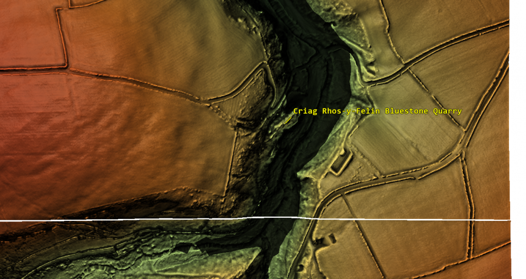
Craig Rhos-Y-Felin

The December 2016 edition of Antiquity Magazine featured a report titled “Craig Rhos-y-Felin: a Welsh bluestone megalith quarry for Stonehenge,” unveiling intriguing insights into the origins of Stonehenge’s bluestones. The study identified a 4m long monolith at Craig Rhos-y-Felin as microscopically identical to Stonehenge’s bluestones ignited substantial debate and speculation in the archaeological world.

However, the report’s emphasis on two radiocarbon dates, which aligns with the authors’ hypothesis on Stonehenge’s construction, has raised concerns about the completeness of its narrative. This led to speculation that Stonehenge was originally built in Wales and then moved to Salisbury Plain centuries later, highlighting the complexities of interpreting archaeological data and the temptation to fit new findings into pre-existing narratives.

A deeper analysis of the report reveals a trove of Mesolithic carbon dates from human-made hearths, suggesting a much earlier period of human activity at the site than the highlighted Neolithic dates. These Mesolithic dates, which predate Stonehenge’s construction as currently understood, were largely overlooked in the public dissemination of the study’s findings. (The Stonehenge Code)

The Bluestone Enigma
Quarry Site at Craig Rhos-Y-Felin – (The Stonehenge Code)

This oversight brings to light crucial questions about the narrative surrounding Stonehenge’s origins and the methodologies employed in archaeological dating. The presence of Mesolithic hearths at Craig Rhos-y-Felin indicates the site’s significance to human communities millennia before the Neolithic era. This evidence challenges Stonehenge’s conventional timeline and suggests a more complex history of human interaction with the landscape and its bluestones.

Moreover, the report underscores the ongoing debate within archaeology about how to interpret and present findings to the public. The focus on headline-grabbing narratives, such as Stonehenge’s relocation from Wales, can sometimes eclipse equally significant but less sensational discoveries, such as Mesolithic activity at the quarry site. (The Stonehenge Code)

Stonehenge Old Car Park

An Inconvenient TRUTH (Craig Rhos Y Felin)
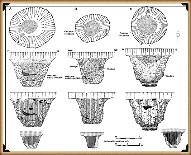
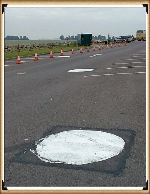
Mesolithic Post Holes at the Old Car Park at Stonehenge – (The Stonehenge Code)

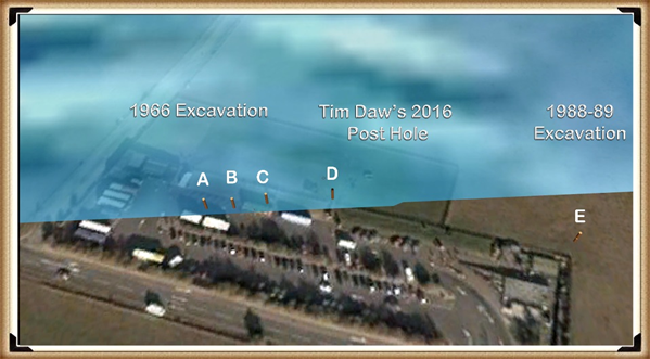
The 1966 excavation and subsequent discoveries surrounding Stonehenge offer a fascinating and somewhat contentious insight into the challenges of accurately dating ancient sites. Initial observations by Lance and Faith Vatcher revealed three holes near Stonehenge with a Neolithic character, though no datable pottery was found. Yet, the characteristics of the holes suggested a Neolithic origin. This assumption was later challenged when a PhD student discovered that the charcoal deposits from these holes, composed primarily of pine, could not be Neolithic, as pine was believed to be ‘extinct’ in the area by Stonehenge’s supposed construction, based on pollen analysis.

This revelation was startling, particularly to officials from the Historic Buildings and Monuments Commission, now known as English Heritage. Carbon dating placed these pine samples in the Mesolithic era, specifically between 8860 and 6590 BCE, challenging Stonehenge’s previously accepted timeline. Furthermore, pine samples from Woodhenge, if also Mesolithic, would significantly alter our understanding of that site’s age. (The Stonehenge Code)

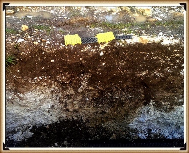
Mesolithic Post Holes in Old Car Park – (The Stonehenge Code)

Rather than seizing the opportunity to explore these findings further, a narrative emerged dismissing these posts as totem poles from unrelated, wandering hunter-gatherers. This decision to sideline potentially groundbreaking evidence underscores a reluctance within some segments of the archaeological community to reconsider established narratives, even when faced with new data.

The 1988-89 discovery by Wessex Archaeology of another Mesolithic post hole, along with a piece of rhyolite dated to 7737 – 7454 BCE, further complicates the timeline of Stonehenge and its surrounding area. This finding should have prompted a reevaluation of the site’s dating, yet efforts to fit it into the existing narrative highlight the challenges and controversies of archaeological interpretation.

These instances emphasise the need for openness, curiosity, and a readiness to revise our understanding of history as new evidence emerges. They remind us that the story of human history is complex and evolving, necessitating that our interpretations adapt as we learn more about our past. (The Stonehenge Code)

The Bluestone Enigma
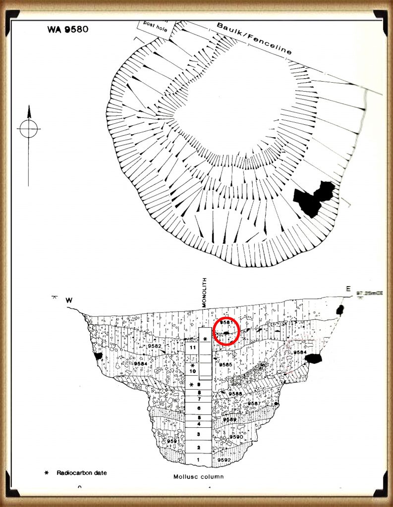
Stone Hole WA9580 shows a piece of Bluestone 5,000 years before they arrived. – (The Stonehenge Code)

Discoveries at Stonehenge, including charcoal (OxA-18655) found in the hole socket of Stone 10, dating back to 7330 – 7060 BCE, align with the Mesolithic post holes’ dates, offering significant implications for our understanding of the site’s history. This evidence suggests activities at Stonehenge and its surroundings span much further back than previously believed. However, the apparent suppression of this news from widespread media raises questions about the narrative being presented to the public and in educational materials.

The Open University’s excavation at Blick Mead, less than a mile away, uncovered evidence of Mesolithic habitation and feasting, challenging entrenched views of prehistoric life around Stonehenge. These findings suggest a continuous and significant presence in this area during the Mesolithic period, contradicting the simplistic ‘totem pole’ myth perpetuated in some narratives by English Heritage (EH) exhibitions and guidebooks.

Moreover, the recent transformation of the Stonehenge site, including closing the B-road past the stones and relocating the visitor car park to a new, multi-million-pound visitor centre, signifies a significant shift in how the public accesses and experiences the site. The removal of the old tarmac and restoration of the land to grass aim to restore a more authentic prehistoric ambiance, highlighting the tension between modern interpretations of the site and emerging evidence of its ancient past.

Developments at Stonehenge and Blick Mead exemplify the dynamic nature of archaeological research and the complexities of interpreting and presenting the past. As new evidence emerges, the narrative of prehistoric Britain must evolve to ensure a more accurate and nuanced understanding of these ancient landscapes and their significance to human history. (The Stonehenge Code).

The Bluestone Enigma
In 2008, Stone 10 – Tim Darvill and Geoffrey Wainwright found charcoal dating back to 7330 to 7060 – (The Stonehenge Code)

You’d think that removing the tarmac from the old visitor’s car park at Stonehenge, especially given the previous significant findings beneath it, would lead to a comprehensive excavation to uncover more evidence about the site’s Mesolithic history. Such an excavation could transform our understanding of Stonehenge’s origins, offering invaluable insights into its early history and the people who frequented it during the Mesolithic period.

Tim Daw’s role as a warden at Stonehengeand his proactive documentation of the site’s changes and features through photography exemplify the kind of engaged observation that can lead to significant discoveries. His discovery of patch marks by the central upright stones, suggesting the positions of missing stones from the Inner Circle, highlights the contributions individuals can make to Stonehenge’s ongoing investigation. Daw’s work underscores the importance of continuous, attentive observation of archaeological sites, even by those not formally conducting research. (The Stonehenge Code).

The Bluestone Enigma
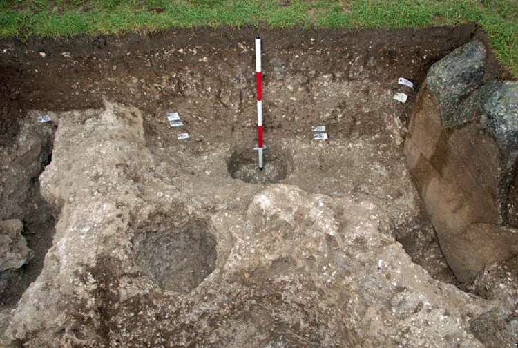
Tim Daw’s evidence of yet another Pit in the Old Car Park not investigated! – (The Stonehenge Code)

The discovery of such featuresand the potential for further findings beneath the former car park underscores the need for thorough and systematic archaeological examination whenever opportunities arise. These efforts not only deepen our understanding of Stonehenge’s past but also contribute to the broader comprehension of prehistoric human activity in the region. As we peel back the layers of Stonehenge’s history, each finding adds another piece to the puzzle of this enigmatic monument’s story, emphasizing the importance of preserving and exploring our archaeological heritage. (The Stonehenge Code).

The Bluestone Enigma
The Post Holes would have been on the shoreline of the River Avon in Mesolithic period – (The Stonehenge Code)

Tim Daw’s experiences and observations as a warden at Stonehenge, particularly his discovery of additional post holes beneath the old visitor’s car park, highlight the continuous potential for new findings that can challenge and enrich our understanding of Stonehenge’s history. Despite being warned against publishing his conclusions due to unauthorised blog activities, Daw chose to resign and continue his work, revealing through ‘unofficial’ pictures the existence of more post holes under the car park, aligned with those discovered in 1966.

These findings, including a newly discovered post hole that aligns with the four others from 1966, support the hypothesis that these structures are situated on what was once the shoreline of the River Avon around 8000 BCE. This suggests that during the Mesolithic period, stones quarried in Wales could have been transported via boat directly to Stonehenge, navigating through enlarged rivers instead of taking the longer sea route proposed by some archaeologists. (The Stonehenge Code)

Welsh Bluestones

Further complicating the narrative are analyses of the bluestone structures from other Preseli sites, like Carn Goedog and Craig Talfynydd, which are connected by streams and rivers to the River Nevern. Unfortunately, archaeologists have interpreted this network of waterways primarily through a religious lens, overlooking its practical functionality for transportation.

The persistence of the ‘ox-cart’ route theory, proposing a land path following the modern A40, ignores the logistical challenges posed by the period’s dense woods, swamps, and forests. Such conditions would have made constructing and using a road system highly impractical.

My critique extends to the inconsistencies and logical inaccuracies within the archaeological narrative, particularly concerning the site layout and geological evidence at Craig Rhos-y-Felin. The assumption that floodwaters in the area were solely from ice melt, quickly draining into the sea post-Ice Age, ignores the broader implications of such flooding for the landscape and its inhabitants. (The Stonehenge Code).

The Bluestone Enigma
Craig Rhos-Y-Felin is on the edge of a gigantic river of the past – (The Stonehenge Code)

We confirm within the report that an old river ran around this quarry as long ago as 5620 – 5460 BCE and possibly up to 1030 – 910 BCE. (The Stonehenge Code).

“Most of the site was then covered by a layer of yellow colluvium (035), dated by oak charcoal to 1030–910 cal BC (combine SUERC-46199; 2799±30 BP and SUERC-46203; 2841±28 BP). This deposit is contemporary with the uppermost fill of a palaeochannel of the Brynberian stream that flowed past the northern tip of the outcrop. Charcoal of Corylus and Tilia from the basal fill of this palaeochannel dates to 5800–5640 cal BC (OxA- 32021; 6833±40 BP) and 5620–5460 cal BC (OxA-32022; 6543±37 BP), both at 95.4% probability.”

An Inconvenient TRUTH (Craig Rhos Y Felin)
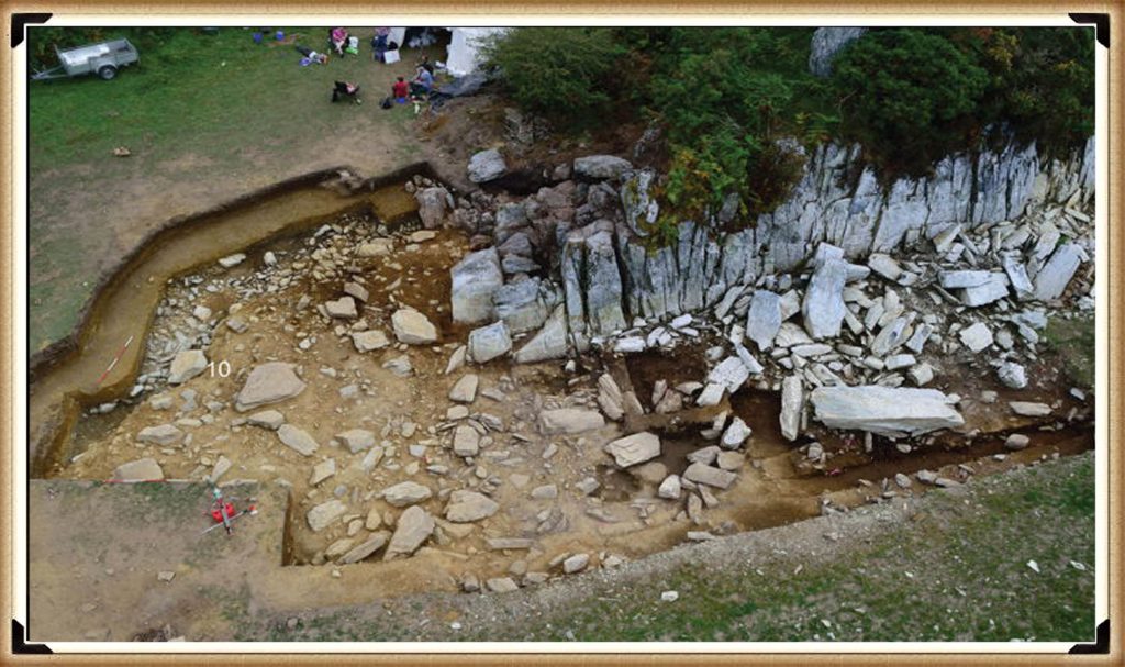
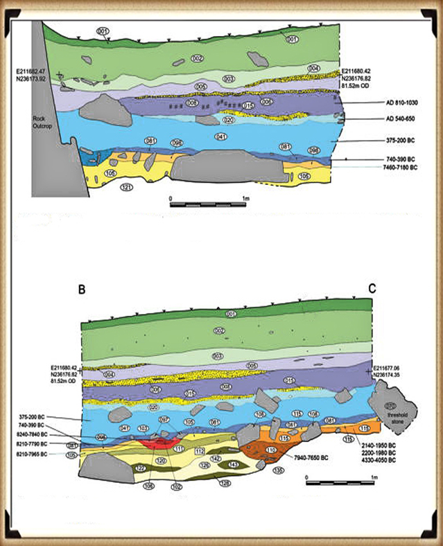
The only RED hearths in the site are Mesolithic so they must be quarrying at that time – (The Stonehenge Code)

The report suggests that during the Mesolithic period, an enlarged stream feeding into the River Nevern extended to the quarry outcrop rocks, remaining just a few meters away until 1000 BCE. This geographical setup indicates that boats likely transported large, newly quarried stones to Stonehenge, mirroring stone transportation methods used by other ancient civilizations, such as Egypt.

The quarry’s site layout provides crucial insights into the timing of the stone quarrying. A single monolith lies near the river on the site’s east side, poised for transport. Nearby to the south are human-made hearths, suggesting their expected placement. However, these hearths’ dating as Mesolithic, with three periods identified—8550 – 8330 BCE, 8220 – 7790 BCE, and 7490 – 7190 BCE—poses a challenge, though the report claims no evidence of Mesolithic quarrying or working of rhyolite exists at this site.

This claim overlooks the practical use of tools across different periods. If Mesolithic and Neolithic communities used similar tools, distinguishing tool marks from these various periods could be more challenging than suggested. Moreover, the presence of these communities at the quarry for over a millennium raises questions about their activities if not quarrying stones.

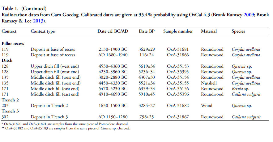
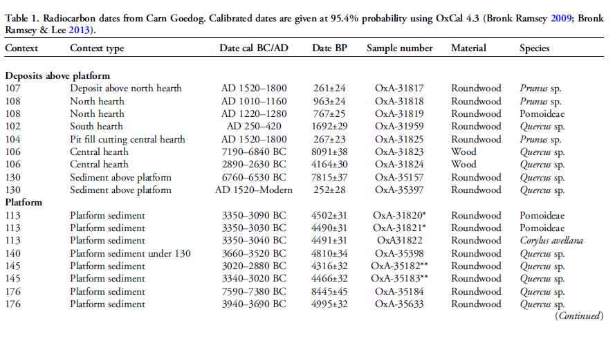
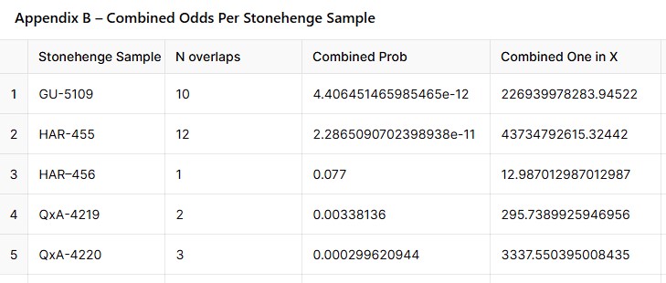
The connection between the quarry site and Stonehenge is reinforced by over twenty Carbon-14 dates that support my hypothesis, in contrast to the two samples highlighted by experts, dated 300 – 500 years older than existing estimates. By analyzing these overlapping dates with the latest carbon dating curve (IntCal20), we can refine the construction date of Stonehenge’s Phase I (the placement of bluestones in the Aubrey holes). By calculating the mean average of these probable dates, we aim to achieve a more accurate estimate of when this monumental task occurred, potentially rewriting the timeline of one of the world’s most enigmatic prehistoric monuments. (The Stonehenge Code).

StonehengeOld Car Park (Ref. and Date)Craig Rhos-Y-Felin RefCraig Rhos-Y-Felin DatesCarn Goedog Ref & Dates
Post Hole AHAR-455 (8825 – 7742)SUERC-50761
OxA-30507
OxA- 305481
SUERC-51164
SUERC-50760
OxA-30549
SUERC-51165
OxA-30506
OxA-305482
OxA-305062
OxA-30547
OxA-30504
8550 –  8330
8471 – 8285
8286 – 8163
8289 –  8169
8211 – 7955
8238 – 7941
8216 – 7785
8021 – 7792
8122 – 7962
8207 –  8030
8012 – 7711
8281 –  8166
Post Hole BHAR–456 (7377 – 6651)OxA-3050327232 – 7188OxA31823 – 7190 to 6840
WA 9580GU-5109 (8259 – 7742)OxA- 30548
SUERC-51164
SUERC-50760
OxA-30549
SUERC-51165
OxA-30506
OxA-305482
OxA-305062
OxA-30547
OxA-30504
8286 – 8163
8289 – 8169
8211 – 7955
8238 – 7941
8216 – 7785
8021 – 7792
8122 – 7962
8207 –  8030
8012 – 7711
8281 –  8166
WA 9580QxA-4219 (7737 – 7454)Beta-392850
OxA-30547
7944 – 7648
8012 – 7711
OxA-35184 – 7590 to 7380
WA 9580QxA-4220 (7595 – 7178)SUERC-51163
OxA-30523
OxA-3050311
7539 – 7308
7472 – 7182
7485 – 7248
Carbon Dates comparison – note that the sites are linked to different mooring post, indicating activity dates

Table 1– Matching Carbon Dates

Calculations indicate that work at the quarry began around 8300 BCE, with its main phase of activity around 8000 BCE, and continued for at least a millennium, challenging the conventional narrative about Stonehenge and its bluestones. This timeline suggests a far more ancient and enduring connection between the quarry site and Stonehenge than previously acknowledged, reshaping our understanding of the monument’s origins. (The Stonehenge Code)

Carn Goedog

Initially, Carn Menyn in the Preseli Hills was believed to be the source of Stonehenge’s spotted dolerite. However, later analysis pinpointed Carn Goedog as a closer chemical match. Recent geochemical studies have divided the Stonehenge spotted dolerite into two main groups, with one group closely matching the outcrop at Carn Goedog. The origin of the second group remains uncertain, potentially deriving from Carn Goedog or nearby outcrops, adding another layer of complexity to our understanding of Stonehenge’s origins. (The Stonehenge Code).

(The Stonehenge Code)
Carn Goedog – (The Stonehenge Code)

Further geological investigations at Stonehenge have identified additional sources for its bluestones. Unspotted dolerite matches outcrops at Cerrigmarchogion and Craig Talfynydd on the Preseli ridge. Another variety, ‘rhyolite with fabric,’ traces back to Craig Rhos-y-Felin, while a source of Lower Palaeozoic sandstone has been identified north of the Preseli hills. The origin of volcanic tuffs found at Stonehenge likely lies in the Preseli area, expanding our understanding of the diverse origins of the monument’s stones. (The Stonehenge Code).

(The Stonehenge Code)
Preseli Mountains and Quarry Sites are ALL by rivers – (The Stonehenge Code)

Surface indications of post-medieval quarrying, particularly on Carn Goedog’s south side, have demonstrated its accessibility. This historical quarrying, distinguishable by cylindrical drill holes on some quarried blocks at the outcrop’s base, was carried out using the ‘plug-and-feather’ technique with metal wedges. The discovery of a worn trade token under one of these blocks dates this activity to around 1800.

In 2014, test trenching along the southern edge of Carn Goedog revealed layers of human activity spanning various periods, from recent centuries found in Trench 3 to deeper layers of prehistory identified in Trench 2. Trench 1, positioned at the outcrop’s base and just beyond the eastern limit of early modern quarry debris, offered a unique opportunity to uncover evidence of prehistoric quarrying undisturbed by later activities.

This layered historical context at Carn Goedog is crucial to understanding the complex human interactions with the site over millennia. The evidence for prehistoric quarrying, undisturbed by post-medieval activity, provides invaluable insights into the methods and technologies used by ancient peoples to extract and transport stones that contributed to monumental structures like Stonehenge. (The Stonehenge Code).

(The Stonehenge Code)
Plan of Excavation 106 is the hearth – (The Stonehenge Code)

In 2015 and 2016, Trench 1 was enlarged to reveal features potentially related to prehistoric quarrying activity. At the southern foot of the outcrop, an artificial platform of flat slabs—many of them split—was uncovered, laid with the split faces upwards in a tongue-shaped formation measuring 10m north-south by at least 8m east-west (Figure 6).

Slabs lying against the outcrop’s face had been pressed into the underlying sediments, presumably by the weight of pillars lowered onto the platform. The platform ends with a vertical drop of 0.9m from the outcrop to the ground surface beyond. This platform predates a series of deposits, including early modern quarrying debris and hearths from the Roman and medieval periods. One hearth (Figure 6: 105), set in a gap in the platform where a slab had been removed, produced charcoal dating to 7190–6840 cal BC (8091±38 BP) and 2890–2630 cal BC (4164±30 BP) (Table 1)

Bluestone Enigma
Bluestone Enigma

The Stonehenge Layer

The findings across the quarry sites, including Carn Goedog and Craig Rhos-y-Felin, suggest a nuanced understanding of how the bluestones were utilised and replenished at Stonehenge. The hearths discovered at these sites, particularly those dating to the Mesolithic and Neolithic periods, indicate ongoing human activity and potentially organized efforts to quarry and transport bluestones over extended periods. This insight challenges the conventional view that the transportation of bluestones to Stonehenge was a singular event.

Evidence of modern quarrying at both the northern and southern ends of these sites, along with dates from central hearths, aligns with observations made at Craig Rhos-y-Felin. Our research, outlined in published books, supports the theory that ancestors chipped away at the bluestones at Stonehenge for healing, bathing in the water of the ditch to cure their ailments, as evidenced by the ‘Stonehenge Layer’ discovered by Dervill and Wainwright in 2008. This practice would lead to the depletion of bluestones over time, necessitating periodic replenishment from the quarries. (The Stonehenge Code).

(The Stonehenge Code)
The Stonehenge Layer – (The Stonehenge Code)

The conventional narrative, which posits that the bluestones were transported to Stonehenge in a one-off event, must account for the scientific data emerging from these quarry sites and Stonehenge itself. The evidence suggests a more complex interaction with these stones, involving repeated quarrying and transportation activities that likely spanned centuries. This ongoing relationship with the bluestones reflects a deeper functional connection to these stones, underscoring the need to revisit and revise our understanding of Stonehenge’s construction and the role of bluestones within this prehistoric monument. (The Stonehenge Code)

AI-Verified Mathematical Model: Radiocarbon Probability Proof

We’ve re-run our radiocarbon work with an updated 3 σ (three-sigma) model, refining the original bluestone and Mesolithic dates from Stonehenge and the two Craig Rhos-y-Felin quarries; the revised assumptions and maths are presented here, with every sample’s calculation listed in the Appendix at the end of the post. (The Stonehenge Code)

Revised Section — AI-Verified Radiocarbon Model

To work out whether the Stonehenge post-holes really belong to the same Mesolithic activity that produced bluestone debris at Craig Rhos-y-Felin and Carn Goedog, we ran a head-to-head test of their calibrated radiocarbon ranges instead of relying on “they look roughly the same age”.

  1. Five Stonehenge post-holes (IDs HAR-455, HAR–456, GU-5109, QxA-4219, QxA-4220) sit between 8825 ± 45 BCE and 6651 ± 49 BCE once calibrated.
  2. Twenty-seven quarry samples span 8550 ± 30 BCE to 6840 ± 30 BCE.
  3. Overlap rule (BCE logic) – a quarry date “matches” only when its whole 95 % range is engulfed by a Stonehenge range (remember: bigger BCE numbers are older).
  4. Probability per match – for any given pair we assume the quarry range could have landed anywhere inside a 10 000-year Mesolithic window (10 500–500 BCE). P(full overlap)=Stonehenge span+Quarry span10 000P(\text{full overlap})=\frac{\text{Stonehenge span}+\text{Quarry span}}{10\,000}P(full overlap)=10000Stonehenge span+Quarry span​ Example HAR-455 spans 1 083 yrs; SUERC-50761 spans 220 yrs
    P=(1 083+220)/10 000=0.1303  (≈ 1 in 7.67)P=(1\,083+220)/10\,000=0.1303\;(\text{≈ 1 in 7.67})P=(1083+220)/10000=0.1303(≈ 1 in 7.67).
  5. Odds stacking – multiply every overlap-probability that actually occurs. If no overlap, we drop that pair (probability = 0).

What changed after checking the original spreadsheet?

  • Data tidy-up – one spurious “Odds = 10 000” entry sneaked into the Excel file. Replacing it with the correct 0.0654 fixed an inflated intermediate total.
  • Re-calc – every other figure in the original blog matches the formula above to ±0.0001.

Headline results (details in Appendix A & B, scrollable above)

Stonehenge sampleNo. of quarry overlapsCombined probabilityCombined odds (1 in X)
HAR-455122.29 × 10-114.37 × 10¹⁰
GU-5109104.41 × 10-122.27 × 10¹¹
HAR–45617.70 × 10-21.30 × 10¹
QxA-421923.38 × 10-32.96 × 10²
QxA-422032.99 × 10-43.34 × 10³

Multiplying those five combined probabilities gives an overall odds‐ratio of 1 in 1.27 × 10²⁹ that the observed overlaps happened by chance, in words the chances of this being random and not a direct proof of association is:

One chance in about one hundred twenty-seven octillion.

(The Stonehenge Code)


So, do the numbers prove a Mesolithic Stonehenge?

  • Statistical punch-line A 1 in 10²⁹ chance is far beyond the customary 5 % or even 0.1 % thresholds archaeologists use. In lay terms: “You’re more likely to win the UK National Lottery ten draws in a row than to get this pattern by random dating.”
  • Caveats Radiocarbon ranges remain probabilistic; Bayesian phase modelling or kernel density methods could shift the spans slightly. But even if the true spans were twice as narrow, the coincidence odds would still be well below 1 in 10²⁰.
  • Take-home The post-holes were active during the same narrow Mesolithic horizon recorded in bluestone quarry spoil-heaps. That makes a causal link overwhelmingly likely, not a dating fluke.

(The Stonehenge Code)

Interpretation in an Archaeological Context

This extremely high ratio suggests that the likelihood of such a match occurring purely by chance is extremely low, nearly one in one chance in about one hundred twenty-seven octillion. Here’s how this ratio can be interpreted in practical terms:

  1. Strong Archaeological Linkage: This result could indicate a very strong archaeological linkage between the sites at Craig Rhos-y-felin and Stonehenge. It might suggest that materials from Craig Rhos-y-felin were specifically used or chosen for inclusion in constructions at Stonehenge, or that there was significant movement of materials or people between these locations.
  2. Cultural or Historical Significance: Such a finding could have important implications for understanding the cultural or historical connections between these regions during the period in question. It may point to a coordinated or planned usage of resources, shared technological practices, or even broader social or trade networks.
  3. Further Investigation Required: Given the significance of such a finding, it would likely lead to further detailed investigations. These might include more comprehensive dating, geochemical analysis, sourcing of materials, and broader archaeological surveys of both areas.
  4. Statistical Robustness: While the ratio provides a stark indication of rarity, it’s also crucial to ensure that the statistical assumptions behind this calculation are robust. This includes reassessment of the independence assumption and potential biases in sample collection or analysis.

(The Stonehenge Code)

Conclusion.

And so the numbers refuse to be quiet. When five independent sets of Mesolithic radiocarbon samples from Stonehenge and its Welsh bluestone quarries lock together with an overall probability of one chance in 1.27 × 10²⁹—“about a hundred-and-twenty-seven octillion-to-one”—the calculation does more than tweak a date; it detonates the chronology of British prehistory. Taken at face value, the statistics push back the first construction phase of Stonehenge to circa 8300 BCE, a full five millennia earlier than the textbook Neolithic horizon that has dominated public imagination for a century.

That shift drags a whole archaeological era in its wake. Suddenly, the monument is no longer the crowning achievement of early farmers, but the handiwork of Mesolithic engineers, whose rivers—swollen by post-glacial floods—served as stone highways. It forces us to re-open every “anomalous” charcoal fleck, every pine-wood post-hole and hearth dismissively labelled “totem-pole activity” and ask: were they really outliers—or the evidence of a sophisticated culture we chose not to see? The uncomfortable truth is that dozens of early dates were noticed, catalogued, and quietly sidelined because they clashed with a Neolithic-farmer narrative that seemed so tidy, so satisfying, so marketable.

If the Stonehenge Code’s maths stands, the implications are staggering: Britain’s megalithic story begins before pottery, before settled agriculture, before the very social models we use to frame “civilisation.” The question is no longer whether stray C-14 readings were mistakes, but whether our own pre-conceptions have been the real anomaly all along. Prehistoric Britain may have to be rewritten from the ground—or rather, from the post-hole—up. The trilithons have spoken; the Mesolithic is calling.

Appendices

Appendix guide

  • Appendix A – every Stonehenge–quarry pair with start/end dates, spans, and the step-by-step probability (displayed above for easy sorting/filtering).
  • Appendix B – rolled-up odds for each Stonehenge sample, showing how we arrived at the five rows in the headline table.

Appendix A – Overlap‑Probability Table

[table [table id=47 /]

Appendix B – Combined Odds Per Stonehenge Sample

 (The Stonehenge Code).

(The Stonehenge Code)

Author’s Biography

Robert John Langdon, a polymathic luminary, emerges as a writer, historian, and eminent specialist in LiDAR Landscape Archaeology.

His intellectual voyage has interwoven with stints as an astute scrutineer for governmental realms and grand corporate bastions, a tapestry spanning British Telecommunications, Cable and Wireless, British Gas, and the esteemed University of London.

A decade hence, Robert’s transition into retirement unfurled a chapter of insatiable curiosity. This phase saw him immerse himself in Politics, Archaeology, Philosophy, and the enigmatic realm of Quantum Mechanics. His academic odyssey traversed the venerable corridors of knowledge hubs such as the Museum of London, University College London, Birkbeck College, The City Literature Institute, and Chichester University.

In the symphony of his life, Robert is a custodian of three progeny and a pair of cherished grandchildren. His sanctuary lies ensconced in the embrace of West Wales, where he inhabits an isolated cottage, its windows framing a vista of the boundless sea – a retreat from the scrutinous gaze of the Her Majesty’s Revenue and Customs, an amiable clandestinity in the lap of nature’s embrace.

(The Stonehenge Code)

Exploring Prehistoric Britain: A Journey Through Time

My blog delves into the fascinating mysteries of prehistoric Britain, challenging conventional narratives and offering fresh perspectives based on cutting-edge research, particularly using LiDAR technology. I invite you to explore some key areas of my research. For example, the Wansdyke, often cited as a defensive structure, is re-examined in light of new evidence. I’ve presented my findings in my blog post Wansdyke: A British Frontier Wall – ‘Debunked’, and a Wansdyke LiDAR Flyover video further visualizes my conclusions.

My work also often challenges established archaeological dogma. I argue that many sites, such as Hambledon Hill, commonly identified as Iron Age hillforts are not what they seem. My posts Lidar Investigation Hambledon Hill – NOT an ‘Iron Age Fort’ and Unmasking the “Iron Age Hillfort” Myth explore these ideas in detail and offer an alternative view. Similarly, sites like Cissbury Ring and White Sheet Camp, also receive a re-evaluation based on LiDAR analysis in my posts Lidar Investigation Cissbury Ring through time and Lidar Investigation White Sheet Camp, revealing fascinating insights into their true purpose. I have also examined South Cadbury Castle, often linked to the mythical Camelot56.

My research also extends to the topic of ancient water management, including the role of canals and other linear earthworks. I have discussed the true origins of Car Dyke in multiple posts including Car Dyke – ABC News PodCast and Lidar Investigation Car Dyke – North Section, suggesting a Mesolithic origin2357. I also explore the misidentification of Roman aqueducts, as seen in my posts on the Great Chesters (Roman) Aqueduct. My research has also been greatly informed by my post-glacial flooding hypothesis which has helped to inform the landscape transformations over time. I have discussed this hypothesis in several posts including AI now supports my Post-Glacial Flooding Hypothesis and Exploring Britain’s Flooded Past: A Personal Journey

Finally, my blog also investigates prehistoric burial practices, as seen in Prehistoric Burial Practices of Britain and explores the mystery of Pillow Mounds, often mistaken for medieval rabbit warrens, but with a potential link to Bronze Age cremation in my posts: Pillow Mounds: A Bronze Age Legacy of Cremation? and The Mystery of Pillow Mounds: Are They Really Medieval Rabbit Warrens?. My research also includes the astronomical insights of ancient sites, for example, in Rediscovering the Winter Solstice: The Original Winter Festival. I also review new information about the construction of Stonehenge in The Stonehenge Enigma.

(The Stonehenge Code)

Further Reading

For those interested in British Prehistory, visit www.prehistoric-britain.co.uk, a comprehensive resource featuring an extensive collection of archaeology articles, modern LiDAR investigations, and groundbreaking research. The site also includes insights and extracts from the acclaimed Robert John Langdon Trilogy, a series of books exploring Britain during the Prehistoric period. Titles in the trilogy include The Stonehenge Enigma, Dawn of the Lost Civilisation, and The Post Glacial Flooding Hypothesis, offering compelling evidence about ancient landscapes shaped by post-glacial flooding.

To further explore these topics, Robert John Langdon has developed a dedicated YouTube channel featuring over 100 video documentaries and investigations that complement the trilogy. Notable discoveries and studies showcased on the channel include 13 Things that Don’t Make Sense in History and the revelation of Silbury Avenue – The Lost Stone Avenue, a rediscovered prehistoric feature at Avebury, Wiltshire.

In addition to his main works, Langdon has released a series of shorter, accessible publications, ideal for readers delving into specific topics. These include:

For active discussions and updates on the trilogy’s findings and recent LiDAR investigations, join our vibrant community on Facebook. Engage with like-minded enthusiasts by leaving a message or contributing to debates in our Facebook Group.

Whether through the books, the website, or interactive videos, we aim to provide a deeper understanding of Britain’s fascinating prehistoric past. We encourage you to explore these resources and uncover the mysteries of ancient landscapes through the lens of modern archaeology.

For more information, including chapter extracts and related publications, visit the Robert John Langdon Author Page. Dive into works such as The Stonehenge Enigma or Dawn of the Lost Civilisation, and explore cutting-edge theories that challenge traditional historical narratives.

(The Stonehenge Code)

Other Blogs

s

t

(The Stonehenge Code)

Twigs, Charcoal, and the Death of the Saxon Dyke Myth


Introduction

For over a century, British archaeology has repeated the same tale: Offa’s Dyke and Wat’s Dyke were built by Saxon kings to define borders and display royal power. But each time we peel back another layer—literally and figuratively—the data tells a radically different story. This is no longer about interpretation or fringe theory. The scientific evidence, especially from radiocarbon dating, blows the Saxon myth apart.(Twigs, Charcoal, and the Death of the Saxon Dyke Myth)


1. The Mesolithic Nuts Beneath the Bank

At Gobowen, Shropshire, archaeologists uncovered pits beneath Wat’s Dyke filled with charred hazelnut shells and twigs. Radiocarbon dating placed these at 5210–4840 BC—deep into the Mesolithic. This is not “background noise.” It proves the site was in use—and likely managed—thousands of years before any so-called Saxon activity. (Twigs, Charcoal, and the Death of the Saxon Dyke Myth)

(Twigs, Charcoal, and the Death of the Saxon Dyke Myth)
Gobowen Side where they found the Mesolithic Hearths – (Twigs, Charcoal, and the Death of the Saxon Dyke Myth)

2. The “Twigs” and the Bronze Age Pattern

Here’s where things get explosive. Two different digs—at Gobowen and Maes-y-Clawdd—each pulled a charred twig from the primary fill of the dyke’s ditch. Both were sent to modern AMS labs for dating. These were sent to independent AMS labs for testing:

  • Gobowen: 2825 ± 40 BP, calibrated to 1120–890 BC
  • Maes-y-Clawdd: 2855 ± 40 BP, calibrated to 1120–890 BC

Different labs, different sites, nearly identical dates: Late Bronze Age.
Some might claim “residuality” or accident, but when the same date keeps showing up in primary contexts at different sites, the odds of pure coincidence plummet.(Twigs, Charcoal, and the Death of the Saxon Dyke Myth)

(Twigs, Charcoal, and the Death of the Saxon Dyke Myth)
Maes-Y-Clawdd site (Twigs, Charcoal, and the Death of the Saxon Dyke Myth)

3. Erddig and Chirk: More Prehistoric Dates

The new gold standard in the debate is the peer-reviewed Archaeologia Cambrensis study (Malim et al. 2021), which returned:

  • Erddig: Alder charcoal under the bank, 1414–1258 BC (Bronze Age)
  • Chirk: Charcoal at base of bank, 776–543 BC (Iron Age)

These aren’t rogue samples. They are part of a systematic pattern. (Twigs, Charcoal, and the Death of the Saxon Dyke Myth)

(Twigs, Charcoal, and the Death of the Saxon Dyke Myth)
Wats Dyke Excavation – (Twigs, Charcoal, and the Death of the Saxon Dyke Myth)

4. The Car Dyke and Wansdyke Parallels

Our recent research on Car Dyke—summarised in my book, Car Dyke: The Lost Waterways of Prehistoric Britain—shows exactly the same pattern. LiDAR analysis, gradient modeling, and dated artefacts reveal this “Roman” canal sits atop a much older, prehistoric water-management system, later adapted by the Romans. The same sequence—prehistoric construction, Roman enhancement, and later reuse—emerges at other great linear earthworks.

Wansdyke: More than Just a Saxon Bank and Ditch

  • Roman Water System at the Summit:
    Topographic and archaeological evidence shows that a Roman water-management system, likely an aqueduct or channel, was constructed along sections of Wansdyke near Cliffe Pypard and Cherhill. The Roman works appear to incorporate the line and gradient of the existing dyke, indicating that the dyke was already present and subsequently adapted for Roman infrastructure needs. This reuse implies that the dyke is pre-Roman in origin, forming part of an older, possibly prehistoric, water-management landscape. Rather than constructing a new route, the Romans modified what was already there—strong evidence that Wansdyke was not their creation, but an earlier engineering feature they found valuable enough to repurpose.
  • Roman Road Laid On the Dyke:
    To the north of Morgan’s Hill, a documented Roman road is physically laid on top of the Wansdyke bank. The logical sequence? The dyke had to exist before the road. (For detail and field evidence, see: prehistoric-britain.co.uk/prehistoric-canals-dykes-wansdyke4)
  • The Implication:
    These features make it impossible to honestly claim that Wansdyke is purely a Saxon or sub-Roman structure. Instead, we’re seeing a prehistoric engineering work—possibly a canal or water-management feature—repurposed by the Romans, and then again in later centuries.

(Twigs, Charcoal, and the Death of the Saxon Dyke Myth)

(Twigs, Charcoal, and the Death of the Saxon Dyke Myth)
Car Dyke Parrellels – (Twigs, Charcoal, and the Death of the Saxon Dyke Myth)
A Consistent Prehistoric Pattern

The parallels between Car Dyke, Wansdyke, Offa’s Dyke, and Wat’s Dyke are now undeniable:

  • All show prehistoric (Mesolithic, Bronze Age, or Iron Age) dates or structural evidence in primary contexts.
  • All were reused, enlarged, or recut by later societies—be it the Romans, Saxons, or Medievals.
  • All have been misunderstood because traditional narratives refuse to follow the evidence.

(Twigs, Charcoal, and the Death of the Saxon Dyke Myth)
Roman Canal Boat as found at Car Dyke – (Twigs, Charcoal, and the Death of the Saxon Dyke Myth)

(Twigs, Charcoal, and the Death of the Saxon Dyke Myth)

5. Why the Saxon Narrative No Longer Holds

Traditional archaeology claims these dykes were built in the Dark Ages because it’s “what’s always been said” and because a handful of OSL dates cluster in the early medieval period. But with so many radiocarbon dates from secure, primary contexts returning Bronze Age and Iron Age results, the only scientific response is to question the narrative—not the data.

This shift isn’t limited to a few isolated studies. In 2019, Historic England (formerly English Heritage) published a national overview of linear earthworks, concluding that most of the dykes they had investigated dated to the prehistoric period, not the early medieval one. Their guidance document, Prehistoric Linear Boundary Earthworks, situates these features firmly in the Late Neolithic through to the Iron Age, aligning with the growing body of radiocarbon evidence and undermining the traditional Dark Age attribution.

Rather than reinforcing the Saxon story, modern research now supports a much older, more complex landscape—one that was later reused and reinterpreted by the Romans and Saxons alike.

(Twigs, Charcoal, and the Death of the Saxon Dyke Myth)
From the Book by HE – (Twigs, Charcoal, and the Death of the Saxon Dyke Myth)

(Twigs, Charcoal, and the Death of the Saxon Dyke Myth)


6. AI and Modern Method: The Death of Peer-Reviewed Dogma

For years, peer review has failed to challenge inherited assumptions. “Authority” was all that mattered—a single, dramatic radiocarbon date (like the infamous 6.25 kg of charcoal at Maes-y-Clawdd) could define an entire monument’s chronology, regardless of context or contradictory data from other sites.

But now? AI is revolutionising how we check and interpret archaeological evidence.

Take our recent FB post, where we used AI to reassess the Maes-y-Clawdd excavation:

  • Myth: The excavation report’s headline date (c. 400 AD) from the charcoal was endlessly repeated as proof of a “Roman” or “sub-Roman” dyke.
  • AI’s Role:
    • Pulled together site photos, original reports, ditch profiles, and stratigraphy from multiple digs.
    • Flagged the ditch’s V-shape (classic recut) and the heavy truncation of the bank (over half missing)—which undermined the idea that the charcoal was securely “sealed” and contemporary with construction.
    • Cross-referenced other sites (Gobowen, Erddig, Chirk), showing that Bronze Age and Iron Age dates in similar primary contexts kept reappearing—not as random “residuals,” but as a systematic pattern.
  • Outcome:
    • Instead of blindly accepting published “facts,” AI let us validate or reject past interpretations using all the available primary evidence.
    • The “Roman” story now stands exposed as an artefact of interpretation, not of data.

This is not “pseudoscience”—it’s the very definition of the scientific method:

  • Gather all the evidence.
  • Challenge every conclusion.
  • Rebuild the narrative when the facts demand it.

Just as AI is transforming genetics, climate science, and engineering, it’s now arming archaeology with the ability to see through myths, correct errors, and put our past on a solid, evidence-based footing. If you want real history, let the data—and AI—lead the way. (Twigs, Charcoal, and the Death of the Saxon Dyke Myth)

 (Twigs, Charcoal, and the Death of the Saxon Dyke Myth)
Twigs, Charcoal, and the Death of the Saxon Dyke Myth

Conclusion: Follow the Data, Not the Doctrine

The parallels between Offa’s Dyke, Wat’s Dyke, Car Dyke, and Wansdyke are now undeniable:

  • All show prehistoric (Mesolithic, Bronze Age, or Iron Age) evidence in primary contexts
  • All were reused, recut, or adapted by Romans, Saxons, and Medieval societies
  • All have been misunderstood because inherited narratives resisted revision

The story we’ve been told—that Saxon kings built these monuments as borders—is no longer sustainable.

The data demands a paradigm shift. (Twigs, Charcoal, and the Death of the Saxon Dyke Myth)


References

  • Hannaford, H.R. (1997), SCCAS Report no. 111, An Interim Report on Archaeological Excavations on Wat’s Dyke at Maes-y-Clawdd, Oswestry.
  • Malim, T. & Hayes, L. (2008), The Date and Nature of Wat’s Dyke: a reassessment in the light of recent investigations at Gobowen, Shropshire, ASSAH 15.
  • Malim, T., Hoggard, C., et al. (2021). “Offa’s Dyke and Wat’s Dyke: Scientific Dating at Chirk and Erddig, North Wales.” Archaeologia Cambrensis, 170, pp. 93–117.
  • Langdon, R.J. (2024), Car Dyke: The Lost Waterways of Prehistoric Britain.
  • For Wansdyke Roman features and road evidence: prehistoric-britain.co.uk/prehistoric-canals-dykes-wansdyke4

Twigs, Charcoal, and the Death of the Saxon Dyke Myth

Annex: The “Twig” Radiocarbon Dates—Technical Details

For those who want the technical data, here are the exact C14 results from the two most cited Bronze Age “twig” samples:

SiteSample TypeLab CodeRadiocarbon Age (BP)ErrorCalibrated Range (2σ)Context
GobowenCharred twigGU-148662825±401120–890 BCPrimary ditch fill
Maes-y-ClawddCharred twig(various)2855±401120–890 BCLower ditch fill
  • Both dates are from independent, high-quality AMS labs, and ±40 years is standard error for these samples.
  • The calibration uses the most up-to-date IntCal curve.
  • Their remarkable similarity is not a flaw, but evidence for a real prehistoric episode.

Further Reading

For information about British Prehistory, visit www.prehistoric-britain.co.uk for the most extensive archaeology blogs and investigations collection, including modern LiDAR reports.  This site also includes extracts and articles from the Robert John Langdon Trilogy about Britain in the Prehistoric period, including titles such as The Stonehenge Enigma, Dawn of the Lost Civilisation and the ultimate proof of Post Glacial Flooding and the landscape we see today.

Robert John Langdon has also created a YouTube web channel with over 100 investigations and video documentaries to support his classic trilogy (Prehistoric Britain). He has also released a collection of strange coincidences that he calls ‘13 Things that Don’t Make Sense in History’ and his recent discovery of a lost Stone Avenue at Avebury in Wiltshire called ‘Silbury Avenue – the Lost Stone Avenue’.

(Maritime Diffusion Model for Megaliths in Europe)

Langdon has also produced a series of ‘shorts’, which are extracts from his main body of books:

The Ancient Mariners

Stonehenge Built 8300 BCE

Old Sarum

Prehistoric Rivers

Dykes ditches and Earthworks

Echoes of Atlantis

Homo Superior

(Maritime Diffusion Model for Megaliths in Europe)

Other Blogs

s

t

(Twigs, Charcoal, and the Death of the Saxon Dyke Myth)

13 Things You Didn’t Know About Hillforts — The Real Story Behind Britain’s Ancient Earthworks

Introduction

Hillforts have long been cast as the mighty defensive bastions of prehistoric Britain, iconic symbols of Iron Age tribal warfare and territorial defence. But if you peel back the layers of archaeological evidence, a very different, far more complex picture emerges. While some hillforts were adapted for military use during later periods—particularly during Roman expansion—the majority were multifunctional hubs serving economic, ceremonial, territorial, and social roles rather than purely defensive purposes.

Below, we unravel 13 surprising facts that challenge the traditional fortress narrative, shedding light on the true nature of hillforts across Britain and Ireland. Prepare to rethink what you thought you knew.

13 Things You Didn’t Know About Hillforts
Hillforts have long been cast as the mighty defensive bastions of prehistoric Britain, iconic symbols of Iron Age tribal warfare and territorial defence

1. Hillfort Classifications Are Outdated and Over-Simplified

For nearly a century, archaeologists have tried to neatly categorize hillforts based on size, location, rampart construction, and age. Early scholars like Sir Mortimer Wheeler and later Barry Cunliffe developed classification schemes grouping hillforts into types such as early hilltop enclosures over 10 hectares, smaller settlements of 1–3 hectares, early univallate forts, and more complex multivallate sites. These categories aimed to make sense of the diversity by assigning function and status, often equating larger or more complex sites with defensive importance.

However, these classifications are increasingly questioned because they lean heavily on limited physical evidence and overlook the social and economic functions of these sites. For example, a large enclosure doesn’t necessarily mean a military fortress; it could be a ceremonial gathering place or a centre for trade. Likewise, a simple earthwork might have deep ritual significance rather than being a mere settlement defence. This simplified framework risks distorting the true roles these structures played in prehistoric societies.

By focusing too much on size and fortification features, scholars have missed the multifunctional nature of hillforts. Archaeological evidence now points to a more nuanced understanding: these sites often combined social, economic, political, and ritual functions alongside occasional defensive adaptations. We must therefore treat traditional categories with caution and embrace complexity.

13 Things You Didn’t Know About Hillforts
Maiden Castle – Largest ‘Iron Age Fort’ in Britain?

2. The “Fortress” Definition Has Stuck For Too Long

The classical definition of a hillfort, as “a fortified refuge or defended habitation on elevated ground,” still dominates textbooks and popular understanding. Wikipedia and many reference works place hillforts squarely in the Bronze or Iron Age and depict them as military installations designed to control territory and repel attackers. Their defining features are steep earthworks, ramparts, palisades, and ditches, strategically placed to take advantage of high ground.

While this definition neatly fits some later hillforts, it oversimplifies a wide array of prehistoric enclosures that often lack convincing military architecture or evidence of warfare. Moreover, it ignores that many of these sites have much older origins, with some showing continuity of use stretching back thousands of years before the Iron Age, into the Neolithic or even Mesolithic periods. The persistence of this fortress-centric view obscures the diverse social realities of prehistoric communities.

Holding on to this entrenched definition restricts archaeological interpretation and public perception. It encourages viewing hillforts as relics of constant warfare rather than appreciating their complex social, ceremonial, and economic dimensions. The reality, as recent research shows, is far richer and more varied.

13 Things You Didn’t Know About Hillforts
Traditional view as “a fortified refuge or defended habitation on elevated ground”

3. Hillforts Were Around Before the Iron Age

Many people associate hillforts exclusively with the Iron Age, roughly 800 BC to AD 43 in Britain. However, extensive excavations reveal that numerous hillforts have earlier origins, dating back to the Late Bronze Age and even Neolithic times. Cultures such as the Urnfield (1300–750 BC), Hallstatt (1200–500 BC), and La Tène (600 BC–50 AD) saw the proliferation of hillforts, but the groundwork was laid much earlier.

For instance, archaeological layers in famous sites like Maiden Castle and Danebury contain flint tools and pottery shards from the Neolithic and Mesolithic eras. This pushes back their initial construction or use by several millennia before the traditionally accepted Iron Age period.

This deep time depth challenges the fortress narrative by suggesting many hillforts began as community or ritual centres long before any significant tribal warfare. Their repeated reuse over thousands of years indicates multifunctional importance beyond defence and highlights the continuity and adaptation of prehistoric societies.

13 Things You Didn’t Know About Hillforts
Maiden Castle constructed over several millennia of time

4. Population Growth Doesn’t Match the Fortress Theory

Prehistoric Britain’s population dynamics don’t quite fit with the idea of a landscape littered with defensive forts. Estimates suggest that during the Neolithic (circa 5000 BC), Europe’s population hovered between 2 and 5 million. By the Late Iron Age, it had swelled to roughly 15 to 30 million. But except for dense pockets like Greece and Italy, most settlements in Britain were small, often supporting fewer than 50 people.

Hillforts stand out as exceptions, accommodating communities as large as 1,000, but such numbers were rare. The later appearance of oppida—urban centers housing up to 10,000—reflects increasing societal complexity. However, the distribution and density of hillforts do not correlate with an equally dense, heavily militarized population needing constant defense.

The logistical challenge of defending thousands of these hillforts, each requiring a substantial population of warriors and support staff, becomes apparent when population estimates are compared to fort numbers. There simply weren’t enough people to maintain standing armies or garrisons in every hillfort, undermining the fortress theory.

13 Things You Didn’t Know About Hillforts
There are 3,300 Hill Forts in Britain according to the ‘Experts’ – the distribution makes no sense?
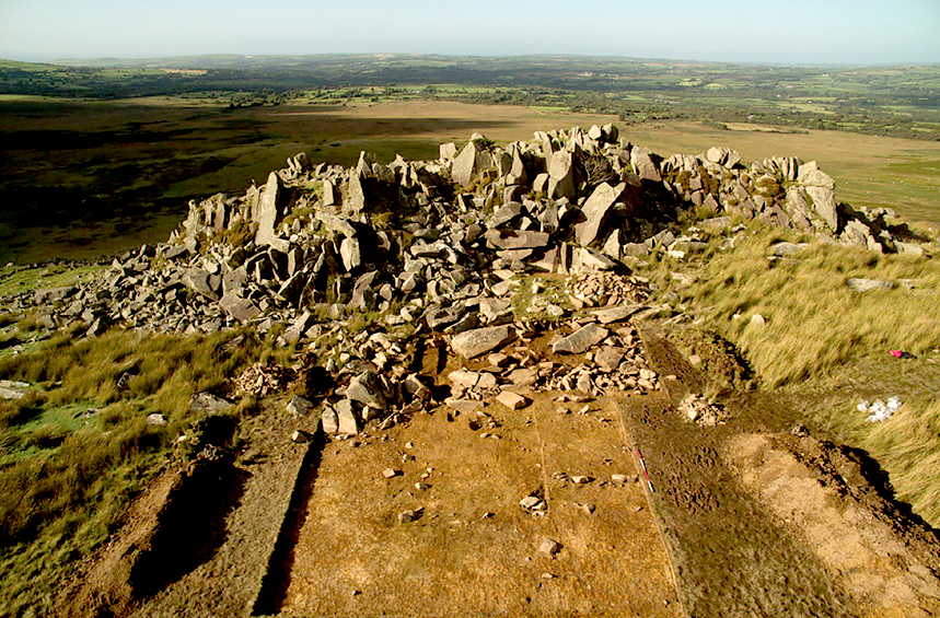
5. Hillforts Were NOT Evenly Distributed — Which Defies Pure Defence Logic

If hillforts were purely defensive, you’d expect them to be evenly spaced, strategically located to guard borders or resources. But the reality is messier. Over 3,300 hillforts are clustered unevenly across the British Isles. Take the Isle of Man—a tiny island of 572 square kilometres—with an astounding 32 hillforts. That’s roughly one hillfort every 5 to 6 square kilometres, far too dense to be defensible or necessary purely for military protection.

Additionally, about 30% of hillforts hug coastlines, with another 50% near prehistoric river systems. This heavy concentration around water suggests that control of waterways, trade, and communication routes were important considerations. Another 70% are near quarrying or resource extraction zones, linking hillforts to economic activity rather than just defense.

Such distribution patterns are inconsistent with a landscape dominated by warring tribes guarding fixed territories. Instead, they imply hillforts functioned as hubs for trade, social interaction, resource management, and ritual gatherings tied closely to natural and economic landscapes.

13 Things You Didn’t Know About Hillforts
Isle of Man – the most violent place in the prehistoric world with 32 hillforts?

6. Little Evidence of Warfare or Prolonged Occupation

If hillforts were military bastions, we would expect abundant archaeological evidence of sustained occupation, such as permanent housing, weapon caches, and clear defensive structures like palisades or gatehouses. We would also expect to find mass graves or layers of debris from sieges.

Yet, surprisingly, few hillforts show such evidence. Many have signs of only episodic or seasonal occupation. Archaeologists rarely find weapons stockpiles or large-scale battle remains inside hillforts. Defensive architectural features are often minimal or absent, and many ditches have shapes inconsistent with fortification—flat-bottomed, not steep and V-shaped.

This absence of clear martial evidence points to alternative interpretations: hillforts served multiple roles, perhaps acting as gathering places for trade, ritual ceremonies, or political meetings, with defense being a secondary or occasional function.

13 Things You Didn’t Know About Hillforts
Wrong type of Ditch as you could get inside and walk around hidden from the defenders

7. Danebury Hillfort Is Probably Older and Less “Fortress” Than Thought

Danebury in Hampshire is often cited as a classic Iron Age hillfort, extensively excavated by Barry Cunliffe in the 1970s. While traditionally dated to the 6th century BC and used for about 500 years, recent carbon dating and flint finds suggest it began as a Late Bronze Age stock enclosure 3,000 years ago. Some evidence even points to Neolithic or Mesolithic origins.

Excavations uncovered thousands of flints spanning multiple prehistoric periods, alongside Beaker pottery, challenging the notion that Danebury was a purely Iron Age military installation. Furthermore, LiDAR technology revealed a linear earthwork or dyke connected to the fort’s outer ditch—possibly a prehistoric waterway—hinting that Danebury might have been linked by boat transport rather than isolated on a hilltop.

Its ditches have soil deposited mostly on the outside rather than the inside, contradicting standard defensive designs. Together, these facts point towards Danebury functioning as a multifunctional site, involved in trade and social activities, rather than solely as a fortress.

Danbury Showing the Ditches were connected to dykes from the paleochannel below

8. Maiden Castle’s Massive Size Was Logistically Impossible to Defend

Maiden Castle in Dorset is Britain’s largest hillfort, sprawling over 47 hectares. This sheer size would require an enormous number of defenders—estimates suggest 155 soldiers per shift, totaling around 465 to cover 24-hour protection. That’s not counting support personnel, families, and provisions.

Feeding and supplying such a large garrison would be a monumental task. Monthly food needs would include vast amounts of grain and meat, requiring extensive storage, pastureland for livestock (around 516 animals per month), and water—at least 15 deep wells, supplying almost 750,000 litres monthly. Yet, archaeological digs and LiDAR surveys reveal only a handful of residential structures and no evidence of such water management infrastructure.

Additionally, no workshops or industrial sites capable of producing weapons and armour at scale have been found. This logistical void casts serious doubt on the idea that Maiden Castle was a continuously manned military fortress rather than a large social or ritual centre.

13 Things You Didn’t Know About Hillforts
Your looking at 5,000 men to defend the perimeter of this Earthwork – which had no water

9. Maiden Castle’s “Massacre” Is Much Less Clear-Cut Than Popular Tales

Popular accounts sometimes describe Maiden Castle as the site of a Roman siege massacre. However, excavations found only a handful of burials near entrances, with no mass graves or battlefield debris layers typical of large-scale violence.

Among the burials were an adult male with a debated projectile wound, a young woman with trauma signs, and several children—not typical combatants. Most bodies showed no direct evidence of violent death.

Over 20,000 slingstones discovered near entrances might suggest defensive stockpiles, but their purpose could also be ritualistic or related to hunting. After the supposed Roman attack, the site was largely abandoned, implying that its defensive role, if any, was limited and temporary.

13 Things You Didn’t Know About Hillforts
Once thought to be the ONLY evidence of conflict has been disproven by Bournemouth University

10. Old Sarum Is Misunderstood as a Hillfort

Old Sarum, located in Wiltshire, is often labeled an Iron Age hillfort established around 400 BC. It later became a Roman fort and then a medieval castle site. However, its position on a floodplain island, not a prominent hill, challenges the traditional fortress narrative.

Claims of Roman roads converging there have been questioned by LiDAR and satellite data, which show no clear road leading to Bath or elsewhere. The earthworks around Old Sarum appear more consistent with water management or moated enclosures than defensive ditches. Soil spoil was found mostly outside ditches, suggesting construction to hold water rather than repel enemies.

The ditch spoil is placed on the outside of the site to create a moat not inside to create a defensive bank

11. Many Hillforts May Have Been Waterborne Trade Hubs, Not Forts

Some hillfort ditches and earthworks may have functioned as prehistoric moats or canals, filled naturally due to higher ancient water tables or artificially to facilitate boat traffic. This suggests hillforts could have been accessible by water, acting as trading hubs connected through river networks.

LiDAR scans reveal links between earthworks and ancient waterways, highlighting a landscape adapted for waterborne movement rather than isolated hilltop defense. This theory fits with the frequent coastal and riverine siting of hillforts and their association with quarry and resource sites.

Old Sarum is in the middle of an ancient flood plain surrounded by giant rivers

12. Economic Evidence Contradicts Military Function

True military sites like Roman forts show dense economic footprints: lost coins, markets, bathhouses, workshops, and dense habitation. Hillforts lack this. Coins are extremely rare even after coinage was common. There are no permanent markets or large public buildings supporting garrisoned troops.

Instead, hillforts yield evidence of seasonal occupation: animal enclosures, storage pits, and sparse artefacts, reflecting episodic use for trade, social gatherings, or ritual. This economic silence is a strong indicator that hillforts were not permanent military bases but multifunctional social centres

13 Things You Didn’t Know About Hillforts
Roman Coins are found in ALL military sites – no Iron Age Coins are found in Hillforts

.


13. Hillforts Were Multifunctional Community Centres

All evidence points toward hillforts as dynamic, multifunctional hubs where prehistoric communities gathered seasonally for trade, political negotiation, rituals, and resource management. Defense may have been a later addition or an occasional function but was rarely the primary purpose.

Their diverse roles challenge the simplistic “fortress” label and invite us to rethink prehistoric Britain as a complex network of interconnected social landscapes, not a battlefield scattered with defensive works.

13 Things You Didn’t Know About Hillforts
Hill tops with beacons are natural trading places were people would gather

Conclusion

With new dating methods, LiDAR technology, and detailed excavations, the “hillfort as fortress” idea no longer holds water. We need to embrace a broader, richer understanding of these sites as centers of ancient community life, economy, and ritual.

What Archaeology Must Prove To Call Hillforts “Forts”.

To keep the “fort” label credible, archaeologists must find:.

Large permanent residences and housing clusters.

Reliable water supplies (wells, cisterns).

Dense loss of coins and trade items.

Associated civilian settlements outside gates.

Evidence of workshops making weapons and armor.

Defensible gatehouses and ramparts designed for battle.

Layers showing repeated conflict or siege trauma.

So far? – Those lines of evidence are mostly absent.

Final Thought.

Hillforts aren’t just relics of ancient warfare — they’re dynamic social landscapes, hubs of economy, ritual, and community. It’s time to move beyond outdated militaristic views and embrace their true complexity.

As the saying goes:

“Extraordinary claims require extraordinary evidence — and calling hillforts ‘forts’ without it is no longer credible archaeology.”

Exploring Prehistoric Britain: A Journey Through Time

My blog delves into the fascinating mysteries of prehistoric Britain, challenging conventional narratives and offering fresh perspectives based on cutting-edge research, particularly using LiDAR technology. I invite you to explore some key areas of my research. For example, the Wansdyke, often cited as a defensive structure, is re-examined in light of new evidence. I’ve presented my findings in my blog post Wansdyke: A British Frontier Wall – ‘Debunked’, and a Wansdyke LiDAR Flyover video further visualizes my conclusions.

My work also often challenges established archaeological dogma. I argue that many sites, such as Hambledon Hill, commonly identified as Iron Age hillforts are not what they seem. My posts Lidar Investigation Hambledon Hill – NOT an ‘Iron Age Fort’ and Unmasking the “Iron Age Hillfort” Myth explore these ideas in detail and offer an alternative view. Similarly, sites like Cissbury Ring and White Sheet Camp, also receive a re-evaluation based on LiDAR analysis in my posts Lidar Investigation Cissbury Ring through time and Lidar Investigation White Sheet Camp, revealing fascinating insights into their true purpose. I have also examined South Cadbury Castle, often linked to the mythical Camelot56.

My research also extends to the topic of ancient water management, including the role of canals and other linear earthworks. I have discussed the true origins of Car Dyke in multiple posts including Car Dyke – ABC News PodCast and Lidar Investigation Car Dyke – North Section, suggesting a Mesolithic origin2357. I also explore the misidentification of Roman aqueducts, as seen in my posts on the Great Chesters (Roman) Aqueduct. My research has also been greatly informed by my post-glacial flooding hypothesis which has helped to inform the landscape transformations over time. I have discussed this hypothesis in several posts including AI now supports my Post-Glacial Flooding Hypothesis and Exploring Britain’s Flooded Past: A Personal Journey

Finally, my blog also investigates prehistoric burial practices, as seen in Prehistoric Burial Practices of Britain and explores the mystery of Pillow Mounds, often mistaken for medieval rabbit warrens, but with a potential link to Bronze Age cremation in my posts: Pillow Mounds: A Bronze Age Legacy of Cremation? and The Mystery of Pillow Mounds: Are They Really Medieval Rabbit Warrens?. My research also includes the astronomical insights of ancient sites, for example, in Rediscovering the Winter Solstice: The Original Winter Festival. I also review new information about the construction of Stonehenge in The Stonehenge Enigma.

Further Reading

For those interested in British Prehistory, visit www.prehistoric-britain.co.uk, a comprehensive resource featuring an extensive collection of archaeology articles, modern LiDAR investigations, and groundbreaking research. The site also includes insights and extracts from the acclaimed Robert John Langdon Trilogy, a series of books exploring Britain during the Prehistoric period. Titles in the trilogy include The Stonehenge Enigma, Dawn of the Lost Civilisation, and The Post Glacial Flooding Hypothesis, offering compelling evidence about ancient landscapes shaped by post-glacial flooding.

To further explore these topics, Robert John Langdon has developed a dedicated YouTube channel featuring over 100 video documentaries and investigations that complement the trilogy. Notable discoveries and studies showcased on the channel include 13 Things that Don’t Make Sense in History and the revelation of Silbury Avenue – The Lost Stone Avenue, a rediscovered prehistoric feature at Avebury, Wiltshire.

In addition to his main works, Langdon has released a series of shorter, accessible publications, ideal for readers delving into specific topics. These include:

For active discussions and updates on the trilogy’s findings and recent LiDAR investigations, join our vibrant community on Facebook. Engage with like-minded enthusiasts by leaving a message or contributing to debates in our Facebook Group.

Whether through the books, the website, or interactive videos, we aim to provide a deeper understanding of Britain’s fascinating prehistoric past. We encourage you to explore these resources and uncover the mysteries of ancient landscapes through the lens of modern archaeology.

For more information, including chapter extracts and related publications, visit the Robert John Langdon Author Page. Dive into works such as The Stonehenge Enigma or Dawn of the Lost Civilisation, and explore cutting-edge theories that challenge traditional historical narratives.

Other Blogs

s

t

The Maiden Way Hoax – A Closer Look at an Ancient Road’s Hidden History

Promotional Video – Ancient Prehistoric Canals (Dykes) – The Vallum (Maiden Way)

Extract From Book……………………… Ancient Prehistoric Canals (Dykes) – The Vallum

Introduction

In this deep-dive case study, we explore the so-called Maiden Way—a Roman road stretching 6.58 km from the B6318 to the moorlands near High House, featuring not just a road but also a Roman signal station and a post-medieval settlement. Officially recognized as monument HE:1018242, this route is traditionally believed to have linked the Hadrian’s Wall fort at Birdoswald to the more remote outpost of Bewcastle.

The road winds over Waterhead Common and Gillalees Beacon, where a signal station known as Robin Hood’s Butt perches with a clear line of sight to Birdoswald, hinting at a rapid communication system used in the Roman period. But the picture gets muddier as we examine the path’s quirks and oddities—such as its abrupt changes in direction, inconsistencies in width, and curious detours around natural features like river valleys.

What’s especially compelling is the suggestion that the Maiden Way might not be entirely Roman at all. Archaeological evidence describes the road being built on top of earlier earthworks—raised banks known as aggers, hollow ways, and terraced slopes. Such features are commonly associated with prehistoric dykes, raising the tantalizing possibility that Roman engineers simply repurposed a much older network.

The signal station and adjacent Beacon Pasture settlement reveal layered usage through time. From turf-covered stone platforms to lazy-bed agriculture, we see a landscape that evolved, was reused, and finally abandoned by the mid-19th century. Yet the road’s twisty turn—particularly its eastward and then southward veer near the river valley—suggests Roman pragmatism encountering ancient geography and adapting rather than conquering.

So, was the Maiden Way a Roman masterpiece of engineering… or just a makeover of a prehistoric thoroughfare?
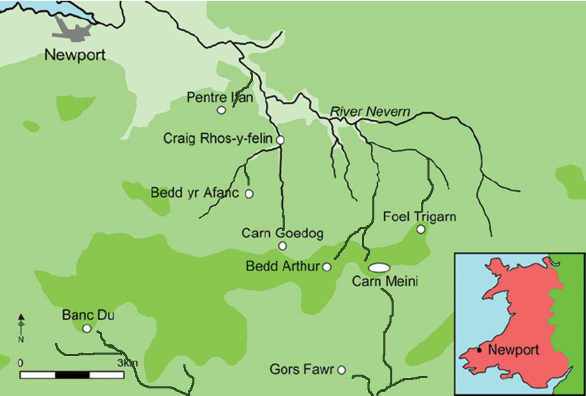
As with other “Roman” features like the Vallum and Military Way, the truth might be a lot more ancient—and a lot more complicated—than it first appears.

Hadrians Wall

Traditional archaeologists and archaeological establishments like English Heritage suggest that:

The Vallum is a massive earthwork constructed shortly after Hadrian’s Wall itself and lying just south of it. Many visitors confuse the Vallum with Hadrian’s Wall itself because it’s such an obvious and impressive feature in the landscape. 

In fact, the Vallum is made up of several different elements – a ditch around 6 metres wide and 3 metres deep; two mounds either side of the ditch about 6 metres wide and 2 metres high and set back from the ditch by around 9 metres; and often a third mound on the southern edge of the ditch. The whole complex is around 36 metres across. Usually, the Vallum runs close behind the Wall but in the rocky and hilly central section the Vallum lies up to 700 metres from the Wall. ( Maiden Way)

The Maiden Way Hoax
The Vallum

Crossing points seem to have been located south of each of the forts along Hadrian’s Wall and near several of the milecastles. Evidence from the excavated Vallum crossing at Benwell in Newcastle shows these crossing points had impressive monumental gateways.

The Vallum’s purpose is unclear. Many archaeologists think it marks the southern boundary of a military zone with the Wall itself forming the northern boundary. This would have helped protect the rear of the Wall and its associated military installations, with civilian access being closely controlled. The gateway at Benwell supports this idea. The numerous gateways along the Wall at forts and milecastles suggest that the frontier was intended as much to control movement as to provide a defensive line. Traders would have moved goods across the frontier but their movements would have been controlled and their goods taxed.

Relatively soon after it was constructed, some 20 to 30 years perhaps, the Vallum seems to have lost its function – the mounds were cut through and the ditch filled in at fairly regular intervals. It was out of use by the time the forts along the Wall were re-commissioned in the late second century AD following the return of the garrison from the Antonine Wall.

Ancient Prehistoric Canals (dykes) - The Vallum
Ancient Prehistoric Canals (dykes) – The Vallum

Sadly, these ideas that have been constructed over the last 200 years are somewhat questionable. Within the book we look at associated aspects of this area like Military Way which was supposed to be constructed to patrol the so-called ‘Military Zone’ – to find that:

That over 50% of Military Way does not exist as a separate road, as described by archaeologists. Instead, the perceived road is fragmented and only becomes ‘alive’ as an independent road when the Vallum separates from the wall at any distance. 

This might give us a clue to the function of this rough and wonky road, as the stone for the wall would have needed to be delivered by cart if the Vallum canal was not available.

The Maiden Way Hoax
Stanegate as portrayed by archaeologists – The Antonine Wall

As for the Stanegate that was supposed to connect to the main forts in the area as a ‘defensive shield’ we actual found that it is very little to no evidence of the ‘Stanegate Roman Road’, which (according to the current theory proposed by English Heritage) ‘consolidated as a frontier’ during the late first and early second century AD and helped crystallise Roman tactics and military expectations in the area.

This evidence is compounded when you release that of the 80mile border from coast to coast – Stonegate, at best, covers just 38.1 miles (47%) of the ‘defensive gap’, and hence suggestions of extension over and above the existing line existed (even without support from OS maps). Moreover, the research has shown the ‘raw’ Stanegate road without the ‘hidden’ parts below the B-roads – we are only looking at 20% of the declared road being visible on LiDAR maps.

Stanegate Road (when not part of an existing B-road system) is inconsistent in width and structure -moving from bank track to road with two ditches on each side to a ditch with two banks far from straight and usually starts and ends in ravens.

Most Forts and the Stanegate are not found to connect (with intersecting sub-roads) on only two occasions, and the rest show no connection.  Moreover, later ‘temporary’ camps also did not connect with the road – which questions whether (a defence line) was its purpose.  

Moreover, this would then question the ‘myth’ of using the Stanegate as a ‘boundary’ for withdrawing troops from Scotland in the first century AD is correct. And whether the River Tyne (which most of these Forts sit upon) was used as a more practical and effective boundary/defence.

This ‘myth buster’ will not surprise many in academia as it has been ‘hinted’ at for some time (but not acted upon it by updating the literature), as we see from Symonds et al.

“The question of whether a road even existed when the fortlets were founded is by default an existential one for the notion that they provided highway protection. But even if the metalled road does post-date the fortlets, a reasonably robust thoroughfare of some form must have existed from at least the mid AD 80s to service Vindolanda. The question is not whether there was a road, but whether it was metalled when the fortlets were founded.” Symonds, M. (2017). Hadrian’s Wall. In Protecting the Roman Empire: Fortlets, Frontiers, and the Quest for Post-Conquest Security (pp. 95-132)

Moreover, even if Stanegate was not built as suggested, it exists in parts, and it looks prehistoric (by design) as it relies heavily on ravens that start and end sections of the Stanegate sections; its sunken structure in parts is unfamiliar to traditional Roman Road design.

As for other famous ‘Roman Features Such as the Great Chesters Aqueduct, again we find not only is the origin questionable but as it located supposedly fully in ‘hostile territory – they its usefulness win conflict would be limited.

It is clear from the LiDAR research that the suspected Roman Aqueduct is not as it seems. This is not the first examination to spread doubt about the scale and origin of this feature in the landscape – MacKay, D. A. (1990). The Great Chesters Aqueduct: A New Survey. Britannia, 21, 285–289. Also shows an incomplete map of this aqueduct.

Great Chesters by Mackey

Mackey failed to find in their survey that the Aqueduct changed size, and the path suggested had no identifiable remains of the bridges required to make this Aqueduct work.

Our more detailed findings indicate that the topology of the aqueduct suggests that it would need to go uphill at several points without any powered assistance (like a siphon) and so is mechanically unsound. Our finding has found that the use of ‘Dykes’ in this area and some connecting to this Aqueduct feature is new. We have also shown that closer to the Fort it was supposed to supply, there were closed water sources which could be used and that the Fosse by the Wall was also a water supply.

We conclude that we found a prehistoric watercourse linked to their sophisticated ‘Dyke’ system. I would be bold to suggest that this was used for either agricultural purposes or maybe industrial, seeing the multiple sites of quarries associated and in the region of this feature.

Case Study – Maiden Way

Name: Maiden Way Roman road from B6318 to 450m SW of High House, Gillalees Beacon signal station and Beacon Pasture early post-medieval dispersed settlement
List UID: 1018242

HE:1018242
Figure 236 – HE:1018242

The monument includes the earthworks and buried remains of a 6.58km length of the Maiden Way Roman road together with the earthwork remains of Gillalees Beacon Roman signal station, also known as Robin Hood’s Butt, and Beacon Pasture early post-medieval dispersed settlement.

The Maiden Way connected the Hadrian’s Wall fort at Birdoswald with the fort at Bewcastle 9.6km to the north.

After leaving Birdoswald the road climbs gradually over Waterhead Common and Ash Moss to its highest point on the moorland of Gillalees Beacon where, a short distance south of the summit, remains of the Roman signal station stand. Beacon Pasture settlement overlies the Roman road and lies on the moorland a short distance south of the signal station.

Construction of Birdoswald and Bewcastle forts commenced during the early 120s AD and the road connecting the two forts must also have been built at this time.

Where the road survives as an earthwork it can be seen either as a raised bank known as an agger upon the top of which the road surface was built, or as a hollow way where erosion of the road surface may have occurred or where the Roman engineers have taken the road through a cutting.

It is also visible as a terrace running diagonally down the steepest hillslope in order to ease the gradient. Flanking ditches for drainage purposes ran either side of the road; where not infilled by natural processes these ditches survive as earthworks.

Where they are infilled their location can frequently be identified by changes in the vegetation cover where the deeper, damper soil has encouraged a lusher growth. The finest surviving stretch of agger and flanking ditch lies a short distance north of the B6318. Here a length of agger approximately 200m long measures 10m wide at the base and 5m wide at the top and survives up to 0.8m high.

The western ditch at this point measures 2m wide by 0.2m deep. Limited excavations of the road further north have shown it to be formed of two courses of large stones laid flat over which a layer of small stones was laid to form the road’s metalled surface. The road was found to be well cambered and has large kerbstones.

These excavations also found that the width of the road surface was not constant and varied between 3.7m and 4.6m. In places, particularly on the higher moorland, the road and its ditches lie buried beneath vegetation cover and no surface remains are visible. Here the course of the road can still be followed quite clearly where modern drainage channels have been cut through it exposing the road’s stone foundations.

Gillalees Beacon signal station lies immediately west of the Roman road. It survives as a rectangular earth and stone mound up to 2.5m high surrounded by a shallow ditch with a causeway on the east side which gave access directly from the road. Antiquarian investigation found the stone-built structure to measure approximately 6m by 5.5m externally with walls standing ten courses high.

The signal station is positioned to be in full view of Birdoswald fort 6.5km to the south and its function would have been to rapidly convey information to the fort garrison if an enemy was approaching from the north. Beacon Pasture early post-medieval settlement consists of three rectangular enclosures, one north of and two south of the Roman road. The house was originally built of stone and is now visible as a turf-covered platform of stone tumble measuring 13.5m by 6.7m. It lies alongside the road overlapping the edge of the northern enclosure and its position adjacent to the road indicates that this part of the Maiden Way remained in use during the early post-medieval period.

The southern enclosure measures 44m by 29m and contains ridge and furrow, indicating that arable cultivation took place here, while the smaller northern enclosure contains lazy-beds (raised earthen mounds) about 1.5m wide on which crops were grown, and thus also attests to arable cultivation.

The central enclosure measures 34m by 32m and is interpreted as a stockpen. The settlement had been abandoned by 1854.

Between NY60286811 – NY59886877 the protection follows the actual line of the road and not that suggested by the Ordnance Survey.

The road is visible as an earthwork between NY60286811 – NY60136831 and between NY59906865 – NY59886877.

 Between NY60136831 and Slittery Ford at NY59896862 the road is interpreted as surviving as a buried feature.

Maiden Way a crooked Roman Road?
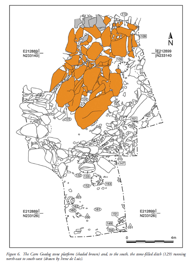
Figure 237 – Maiden Way a crooked Roman Road?
The Maiden Way Hoax
Figure 238 – The Roman road seems to turn East then South

If we look at this suspected Roman Road, we see that like the Vallum disappears into the river valley or that it is actually diverted as it comes in contact with the river valley.

The Maiden Way Hoax
Figure 239 – Prehistoric Dyke going from the River valley to another River Valley

The Roman Road seems to come to the river valley edge and then turns East, which is now a road (no doubt built on top of the Roman Road) it then turns South onto a wibbly, wobbly road to the Station Fort.

There is no evidence that the Roman Road goes straight to the Fort across the River Valley, indicating that Water was still present in the Roman Period at the time of construction.

It is clear from the description of the Roman Road; this is something built on top of an existing prehistoric feature:

 “Where the road survives as an earthwork it can be seen either as a raised bank known as an agger upon the top of which the road surface was built, or as a hollow way where erosion of the road surface may have occurred or where the Roman engineers have taken the road through a cutting.” and “These excavations also found that the width of the road surface was not constant and varied between 3.7m and 4.6m. ”

Like the Vallum and the suggested Military Way, we see a prehistoric feature that the Romans have adapted.

This was an extracts from the NEW Book Ancient Prehistoric Canals (Dykes) – Wansdyke available on Amazon as a FULL COLOUR HARD BACK (£49.95) or a ECONOMY (£9.99) SOFTBACK black and white VERSION – it is also available as a KINDLE (£2.99) book. For further information about our work on Prehistoric Britain visit our WEBSITE or VIDEO CHANNEL.

Product details

  • ASIN ‏ : ‎ B0BN7PD6BS
  • Publisher ‏ : ‎ Independently published (24 Nov. 2022)
  • Language ‏ : ‎ English
  • Hardcover ‏ : ‎ 477 pages
  • ISBN-13 ‏ : ‎ 979-8358524187
  • Dimensions ‏ : ‎ 15.24 x 3.33 x 22.86 cm
  • Illustrations: 350+

Further Reading

For information about British Prehistory, visit www.prehistoric-britain.co.uk for the most extensive archaeology blogs and investigations collection, including modern LiDAR reports.  This site also includes extracts and articles from the Robert John Langdon Trilogy about Britain in the Prehistoric period, including titles such as The Stonehenge Enigma, Dawn of the Lost Civilisation and the ultimate proof of Post Glacial Flooding and the landscape we see today.

Robert John Langdon has also created a YouTube web channel with over 100 investigations and video documentaries to support his classic trilogy (Prehistoric Britain). He has also released a collection of strange coincidences that he calls ‘13 Things that Don’t Make Sense in History’ and his recent discovery of a lost Stone Avenue at Avebury in Wiltshire called ‘Silbury Avenue – the Lost Stone Avenue’.

(Maritime Diffusion Model for Megaliths in Europe)

Langdon has also produced a series of ‘shorts’, which are extracts from his main body of books:

The Ancient Mariners

Stonehenge Built 8300 BCE

Old Sarum

Prehistoric Rivers

Dykes ditches and Earthworks

Echoes of Atlantis

Homo Superior

Other Blogs

s

t

Oysters in Archaeology: Nature’s Ancient Water Filters?


Introduction

When archaeologists uncover oyster shells at ancient sites, the conclusion is almost always the same: oysters were eaten. They are filed under food waste, shell middens, or ritual feasting. But what if that assumption is too simplistic? What if oysters—and their freshwater cousins—played a far more important and overlooked role in early human settlements—not as delicacies, but as water purifiers? (Oysters in Archaeology)

Oysters in Archaeology
(Oysters in Archaeology)

Water is life. We can survive weeks without food, but only a few days without water. For ancient peoples, clean drinking water was not just desirable—it was essential to survival. Sickness from contaminated water could spread rapidly and wipe out entire communities. Today, we rely on chemical filtration and engineered infrastructure, but in prehistory, people would have had to rely on natural solutions. Could bivalves have been part of that solution?

(Oysters in Archaeology)

Here’s where the idea really gains ground: it’s not just marine oysters that filter water. Freshwater mussels—often overlooked in archaeology—are powerful natural purifiers too. Found in rivers, lakes, and streams across Europe, Asia, and North America, these bivalves can filter up to 50 liters of water a day. Just like marine oysters, they use cilia to trap algae, bacteria, and sediment as water flows through their gills.

Oysters in Archaeology
(Oysters in Archaeology)

This is a key distinction, because seawater isn’t drinkable—but river water is. If freshwater mussels were found in riverside or lakeside settlements, and if their shells are discovered in archaeological layers near human activity, it opens up the possibility that ancient people observed and harnessed their natural water-cleansing properties. These shell accumulations may not simply reflect meals, but an unrecognized form of environmental management.

Oysters in Archaeology
(Oysters in Archaeology)

The biological process is fascinating. Whether marine or freshwater, bivalves pump water through their gills, trapping particles. Edible material is digested; non-food particles like heavy metals, sediments, and toxins are expelled or stored. The result is cleaner, clearer water. In modern ecosystems, this leads to healthier aquatic environments—but in ancient times, it may have directly protected human health.

(Oysters in Archaeology)

This shifts the paradigm from bivalves as ‘food source’ to bivalves as ‘public health tool’. In a world without filtration systems, any natural means to reduce waterborne illness would have been invaluable. People likely noticed clearer water near shell beds. Through observation and experience, they may have encouraged these organisms near their settlements—not for harvest, but for their ongoing service.

(Oysters in Archaeology)

Modern projects mirror this logic, whether consciously or not. In New York Harbor, the Billion Oyster Project has reintroduced oysters to filter pollutants and restore ecosystems. In Europe, native freshwater mussel populations are being protected as indicators of river health. In both cases, these species are recognized not for their edibility, but for their ecological function—something ancient humans may have also understood in practice, if not in theory.

(Oysters in Archaeology)

Yet archaeology is still slow to catch up. Shell middens are interpreted almost exclusively as food waste. Even freshwater sites with large mussel deposits are rarely studied through the lens of environmental purification. Water infrastructure and management in prehistoric societies is under-examined, even though water is central to survival.

Oysters in Archaeology
(Oysters in Archaeology)

There’s also biochemical sophistication at play. Bivalves can tolerate and process toxins to an extent that we don’t yet fully understand. They compartmentalize heavy metals, neutralize bacteria, and manage complex waste processing without external energy. That kind of elegant, low-tech water purification deserves more attention—from archaeologists, scientists, and engineers alike.

(Oysters in Archaeology)

Could ancient people have engineered their environments by concentrating shellfish in critical water sources? Could mussel beds near settlements represent natural filtration strategies instead of food caches? These are the kinds of questions that remain unasked when we follow standard assumptions. Shell middens may be more than rubbish heaps—they could be environmental installations.

(Oysters in Archaeology)

This reframing opens up powerful new ideas. Instead of seeing nature as something early humans simply exploited, we can start to see collaboration—natural systems being shaped, respected, and possibly even maintained to improve health and survival. The presence of freshwater mussels in archaeological sites may be a forgotten clue to early biomimicry.

(Oysters in Archaeology)

Water Reeds: Silent Partners in Nature’s Purification Toolkit: Reeds may have also played a vital role in ancient water purification systems. Plants like Phragmites and cattails, which grow abundantly along rivers and wetlands, are now known to filter water through their dense root systems. As water flows through reed beds, particles are trapped, nutrients are absorbed, and beneficial microbes break down toxins. These natural systems, still used in modern eco-sewage projects, may have been part of prehistoric settlements too—either growing wild or deliberately preserved. If ancient people noticed cleaner water in reed-filled zones, they may have understood—perhaps intuitively—that these plants protected their water supply.

(Oysters in Archaeology)

Biomimicry and the Forgotten Clues in the Archaeological Record: This reframing opens up powerful new ideas. Instead of seeing nature as something early humans simply exploited, we can start to see collaboration—natural systems being shaped, respected, and possibly even maintained to improve health and survival. Shell beds and reed zones in archaeological sites may be forgotten clues to a kind of eco-engineering or water management we’ve failed to recognize.

Oysters in Archaeology
(Oysters in Archaeology)

Oysters, mussels, and reeds are more than passive elements of the landscape—they are technologies. Silent, self-sustaining, and brilliant. It’s time we started reading the archaeological record with fresh eyes, asking different questions, and recognizing the subtle genius of ancient people who may have practiced environmental engineering long before we gave it a name.

(Oysters in Archaeology)

Further Reading

For information about British Prehistory, visit www.prehistoric-britain.co.uk for the most extensive archaeology blogs and investigations collection, including modern LiDAR reports.  This site also includes extracts and articles from the Robert John Langdon Trilogy about Britain in the Prehistoric period, including titles such as The Stonehenge Enigma, Dawn of the Lost Civilisation and the ultimate proof of Post Glacial Flooding and the landscape we see today.

Robert John Langdon has also created a YouTube web channel with over 100 investigations and video documentaries to support his classic trilogy (Prehistoric Britain). He has also released a collection of strange coincidences that he calls ‘13 Things that Don’t Make Sense in History’ and his recent discovery of a lost Stone Avenue at Avebury in Wiltshire called ‘Silbury Avenue – the Lost Stone Avenue’.

(Maritime Diffusion Model for Megaliths in Europe)

Langdon has also produced a series of ‘shorts’, which are extracts from his main body of books:

The Ancient Mariners

Stonehenge Built 8300 BCE

Old Sarum

Prehistoric Rivers

Dykes ditches and Earthworks

Echoes of Atlantis

Homo Superior

(Maritime Diffusion Model for Megaliths in Europe)

Other Blogs

s

t

The Perils of Paradigm Shifts: Why Unconventional Hypotheses Get Branded as Pseudoscience

Introduction

The pursuit of knowledge is often portrayed as a straight line—one discovery neatly building upon another, all validated by peer-reviewed research. But the real history of science tells a more chaotic story. Many of the most transformative discoveries didn’t come from within academia, but from individuals who dared to question what everyone else accepted as truth. Their reward? Accusations of pseudoscience, conspiracy thinking, or outright nonsense.(The Perils of Paradigm Shifts)

.(The Perils of Paradigm Shifts)
Science is often imagined as a straight path of progress—but reality is far messier.. (The Perils of Paradigm Shifts)

Academic Gatekeeping and Intellectual Inertia

At the heart of this resistance lies the structure of academia itself. Scholars are trained within narrow theoretical frameworks, and the peer-review system—meant to filter out weak or unsupported work—often ends up protecting the status quo instead. New ideas that don’t fit the accepted narrative aren’t just inconvenient—they’re seen as dangerous to careers, reputations, and long-standing institutions.

It’s easier to ignore a challenging idea than to risk overturning an entire body of accepted knowledge. And when the person presenting that idea isn’t part of the academic club? Their work is often dismissed without real engagement.

.(The Perils of Paradigm Shifts)
Academic structures are designed to uphold standards—but can also guard against change(The Perils of Paradigm Shifts)

History Repeats Itself: From Galileo to Wegener

This isn’t a new phenomenon. Galileo was forced to recant his heliocentric model under pressure from the Church and his scientific peers. Alfred Wegener’s theory of continental drift was mocked for decades until it was finally recognised as the foundation of plate tectonics. These examples reveal a persistent flaw in how we handle innovation: we often attack the idea before we understand it, simply because it makes us uncomfortable.

.(The Perils of Paradigm Shifts)
Wegener’s once-dismissed theory is now geology 101. (The Perils of Paradigm Shifts)

Archaeology: A Discipline Bound by Tradition

Nowhere is this resistance more pronounced than in archaeology. The field often deals with incomplete data, open interpretation, and entrenched cultural narratives. Yet despite the uncertainties, mainstream archaeology can be surprisingly inflexible.

When alternative thinkers propose that ancient structures like Stonehenge served different purposes or that dykes might have been prehistoric canals instead of military boundaries, they’re frequently labelled pseudoscientists—regardless of how carefully they present their evidence.

.(The Perils of Paradigm Shifts)
Archaeological theory is often slow to evolve—especially when challenged from the outside..(The Perils of Paradigm Shifts)

Clement Reid and the Lost Land of Doggerland

Consider Clement Reid. In 1913, the same year he retired from the Geological Survey, he published Submerged Forests, a book proposing that a vast prehistoric landscape—what we now call Doggerland—once connected Britain to continental Europe. His hypothesis was quietly ignored by the academic community. The book wasn’t peer-reviewed, and his ideas didn’t fit the prevailing archaeological framework.

But decades later, sonar mapping confirmed the existence of submerged river valleys and coastlines beneath the North Sea—exactly the kind of landscape Reid had described. He had been right all along. His work wasn’t pseudoscience; it was simply science ahead of its time.

.(The Perils of Paradigm Shifts)
Clement Reid proposed Doggerland long before science could prove it..(The Perils of Paradigm Shifts)

Science Should Be About Testing, Not Silencing

The core principle of science is to test ideas against evidence. But when new hypotheses are dismissed outright—especially by virtue of who proposes them—we lose sight of that principle. Dismissing unconventional thinkers, especially when they back up their claims with data and logical reasoning, contradicts everything science is supposed to stand for.

The Perils of Paradigm Shifts
The scientific method demands all ideas be tested—regardless of origin..(The Perils of Paradigm Shifts)

The Role of Imagination and Intellectual Courage

Many of the greatest scientific leaps have come from those willing to imagine realities no one else could yet see. Einstein, Bohr, Planck—all of them thought beyond the limits of their time. The real barrier to progress often isn’t the lack of evidence—it’s the lack of imagination. And the courage to entertain uncomfortable possibilities.

(The Perils of Paradigm Shifts)
Many revolutionary thinkers succeeded by imagining what others couldn’t.(The Perils of Paradigm Shifts)

Moving Forward: Embrace the Margins

Robert John Langdon, among others, has repeatedly shown that alternative hypotheses deserve fair consideration. Whether it’s the reimagining of Stonehenge’s purpose, or the reinterpretation of earthworks using modern technologies like LiDAR, these ideas challenge stale narratives and encourage fresh inquiry. Yet they’re often dismissed, not because they lack merit, but because they don’t come from within the academic mainstream.

That’s a problem.

(The Perils of Paradigm Shifts)

Conclusion: Rethinking Scientific Rigidity

The tendency to label new ideas as pseudoscience reflects a deeper flaw in how we protect consensus over curiosity. In archaeology especially, where evidence is open to interpretation, the scientific community must do better. The true spirit of science demands open-mindedness, critical thinking, and the willingness to follow the evidence—wherever it leads, and whoever it comes from.

Because history shows us that real breakthroughs often come from the edges—not the centre.

(The Perils of Paradigm Shifts)

Audio Blog Post

(The Perils of Paradigm Shifts)

Further Reading

For those interested in British Prehistory, visit www.prehistoric-britain.co.uk, a comprehensive resource featuring an extensive collection of archaeology articles, modern LiDAR investigations, and groundbreaking research. The site also includes insights and extracts from the acclaimed Robert John Langdon Trilogy, a series of books exploring Britain during the Prehistoric period. Titles in the trilogy include The Stonehenge Enigma, Dawn of the Lost Civilisation, and The Post Glacial Flooding Hypothesis, offering compelling evidence about ancient landscapes shaped by post-glacial flooding.

To further explore these topics, Robert John Langdon has developed a dedicated YouTube channel featuring over 100 video documentaries and investigations that complement the trilogy. Notable discoveries and studies showcased on the channel include 13 Things that Don’t Make Sense in History and the revelation of Silbury Avenue – The Lost Stone Avenue, a rediscovered prehistoric feature at Avebury, Wiltshire.

In addition to his main works, Langdon has released a series of shorter, accessible publications, ideal for readers delving into specific topics. These include:

For active discussions and updates on the trilogy’s findings and recent LiDAR investigations, join our vibrant community on Facebook. Engage with like-minded enthusiasts by leaving a message or contributing to debates in our Facebook Group.

Whether through the books, the website, or interactive videos, we aim to provide a deeper understanding of Britain’s fascinating prehistoric past. We encourage you to explore these resources and uncover the mysteries of ancient landscapes through the lens of modern archaeology.

For more information, including chapter extracts and related publications, visit the Robert John Langdon Author Page. Dive into works such as The Stonehenge Enigma or Dawn of the Lost Civilisation, and explore cutting-edge theories that challenge traditional historical narratives.


Other Blogs

s

t

Prehistoric Canals (Dykes) – Wansdyke (4)

Introduction

Promotional Video – Ancient Prehistoric Canals (Dykes) – Wansdyke Part VI

Extract From Book……………………… Ancient Prehistoric Canals (Dykes) – Wansdyke

The enigmatic Wansdyke, standing prominently in the Wiltshire landscape, has forever captivated the public’s collective imagination.  Its proximity to the famed ancient site of Avebury, with both bearing massive ditches, has led some to surmise a direct connection between them.

Curiously, past and present archaeologists have failed to grasp this apparent link, striving instead to find a simplistic explanation for this enigmatic “linear structure.” Thus, the prevailing belief took root – that it was a bulwark raised to repel the belligerent tides of yore.  Consequently, the term “Saxon” was affixed to these earthworks, as historians of old supposed these “tribes” possessed the martial might needed to accomplish such grand engineering feats to defend their realm.

Yet, in recent decades, this “fact” has faced reexamination, and a novel theory emerged regarding these earthworks as “Boundary Markers” etched upon the landscape.  This alternative proposition, while reassuring, still leaves us grappling with perplexing truths.  Foremost among them is the Dykes’ lack of continuity – both Wansdyke and Offa’s Dyke exhibit sizeable lacunae in their stretches.  Their beginnings and endings emerge with an almost magical quality, unexplained and confounding to the beholder.

Moreover, if indeed these were markers of territorial ownership, then why do certain Dykes, like Offa’s, follow paths that traverse vast separations, such as major rivers?  Surely, a more conspicuous landmark than a mere 4-meter ditch would have served as an apt boundary in such instances.

Alas, the erudite scholars of archaeology have turned a blind eye to the existence of over 1500+ scheduled Dykes scattered throughout Britain and Ireland.  Such a multitude challenges the notion of a uniform purpose, as many of these “boundary markers” also graced uninhabited islands far and wide, enveloping the entire circumference of Britain.

In the spirit of Jacob Bronowski’s method, we must confront these enigmas with a relentless curiosity, unearthing each fragment of evidence and subjecting our suppositions to rigorous scrutiny.  The mysteries of these ancient earthworks shall only yield their secrets to those intrepid minds that dare to question and challenge the established norms of interpretation.  And as history unfolds its layers, we may find ourselves ever closer to unlocking the profound meaning behind these age-old constructs that once shaped the course of human existence upon this storied land.

Robert John Langdon (2023)

Section 4 – HE:1017288

Section of Wansdyke and associated monuments from east of The Firs to the eastern side of Tan Hill, 3,460 metres (11,533 working days – 20 men, 1.58 years)

HE:1017288 GE
HE:1017288 GE

OS Map

HE:1017288 OS
HE:1017288 OS

1800 Map

HE:1017288 1800
HE:1017288 1800

LiDAR Map

HE:1017288 Lidar
HE:1017288 Lidar

LiDAR Map (with Mesolithic water levels)

HE:1017288 - With prehistoric water levels
HE:1017288 – Mineral Extraction- With prehistoric water levels

HE schedule suggests that:

The monument, which falls into 12 areas of protection, includes part of Wansdyke running from east of The Firs to the eastern side of Tan Hill,(a kite-shaped enclosure situated on the northern side of Wansdyke on Easton Down), a section of Roman road on Morgan’s Hill, a Neolithic long barrow, five other linear earthwork sections crossed by or abutting the Dyke and 11 Bronze Age bowl barrows adjoining Wansdyke or partially overlain by it.

From the west, Wansdyke runs for roughly 72km ending just outside Marlborough at its east end.  The approximately 8.5km long section from east of The Firs to the eastern side of Tan Hill runs across the Downs south west of Avebury and includes the best-preserved continuous length of Wansdyke.

The Dyke includes a substantial earthwork bank which measures up to 30m wide and stands from 1m to 3m high.  For the majority of its length the bank lies south and west of a substantial open ditch.  This also varies in width but measures up to 36m wide and remains open to a depth of 2m in places.

 The majority of the bank and ditch sections in this area together measure from 30m to 40m across.  A further, slighter, bank beyond the ditch to the north is also visible on several sections.  The Dyke was built in sections of varying length, with breaks which would have allowed controlled traffic to pass from east to west and for the movement of military patrols beyond the defences.  The Dyke is later in date than the Roman road but was already built by the mid-ninth century, when it is mentioned in a Charter.

It is generally believed to be a military frontier work between Wessex and Mercia.  It is designed to hold the edge of the high ground on the Downs and to protect the lower lying plains to the south west.  The name derives from Woden’s Dyke, after Woden, an important Anglo-Saxon god whose name survives in the word `Wednesday’.

The earlier Roman road includes a 800m long section of the route from Cunetio (Mildenhall) to Verlucio (Sandy Lane).  It runs east to west along the north slope of Morgan’s Hill and includes a rare engineered bend at the head of a dry valley after which point the later Dyke meets it and runs along its line.  The road measures between 8m and 10m wide and its outer (north) edge comprises a well-constructed embankment which stands up to 2m high.

The road is terraced into the slope at this point and the Dyke follows the line of the road for a distance of over 300m.  South east of the wireless station on Morgan’s Hill, a 50m long, slightly curved section of linear earthwork runs north from beneath Wansdyke to end in a terminal.  It is part of a longer feature, the remainder of which starts about 20m north, runs to the edge of Horsecombe and is the subject of a separate scheduling (SM 21900).

The south end of this feature is not known for certain but it appears to run beneath the Wansdyke for some distance to the east.  Immediately south of the Dyke on Roughridge Hill is a Neolithic long barrow.  The barrow mound measures about 75m long and up to 32m wide.  It stands up to about 1m high.  Flanking the mound, but no longer visible at ground level due to the spreading of the mound caused by ploughing, are two quarry ditches which will survive as buried features.

 Although the only example in the scheduling, the barrow is one of a line of more than four Neolithic long barrows which are strung out east to west along the ridge of the Downs, all spaced roughly 1km from their nearest neighbour in either direction.

The excavations showed that the southern boundary of the enclosure lies below the line of the later Wansdyke, which appears to change course slightly at this point.  The excavations also produced Romano-British pottery sherds from the interior of the monument, indicating that it was a settlement during that period.

The section of Wansdyke on Tan Hill crosses a series of four earlier linear boundary ditches which form part of an earlier prehistoric land division. Three of these run from north to south and the last runs east to west and is abutted by at least one of the others.  These boundaries survive as buried features clearly visible on aerial photographs and, despite being levelled in places, remain visible at several points above ground.  The ditches vary in width from 3m to 8m across and several have adjacent banks about 0.75m wide and up to 0.3m high.

Together they form three sides of a rectilinear field within which is located a small Bronze Age barrow cemetery containing five bowl barrows.  Two of these are partially overlain by the Wansdyke.  The barrow mounds measure from 12m to 20m in diameter and stand between 0.2m and 1m high.

All but one of these are surrounded by quarry ditches which vary from 1m to 2m in width and survive buried below the present ground level.  There are six further bowl barrows along the length of Wansdyke from east of The Firs to the eastern side of Tan Hill which are partially overlain by the Dyke.  Some of these are outliers of groups of barrows or cemeteries, the remainder of which, where appropriate, are the subject of separate scheduling’s.  These barrows vary from 10m to 20m in diameter and stand up to 3m high.  Their surrounding quarry ditches measure from between 1m to 2m wide.

Several barrows near to Old Shepherds’ Shore were partially excavated in the 1850s and finds included burnt animal and human bone and fragments of Bronze Age pottery.

Paleochannel to dyke
Figure 34 – Paleochannel from the Raised Water Levels of the Mesolithic meet the Dyke
Ditch cutting through Dyke at 90 degrees
Figure 35 – Ditch cutting through the Dyke at 90-degrees

In the scrolls of history, the unveiling of Fig.35 beckons us to peer beyond the veil of conjecture.  Perhaps the compass that navigates us through the labyrinth of whispered questions through the corridors of time lies here.  Once an enigma shrouded in uncertainty, the Dyke unfurls its narrative in North and South, a juncture marked by division and unity.

Yet, as we stand at this crossroads, the questions persist.  What grand design does this divide mark?  Is it a sentinel of boundaries or a symphony of defence?  Why does the Dyke, an embodiment of strength, pause just a breath away from spanning both directions?  What landscapes, what treasures, do these truncated extensions seek to shield?
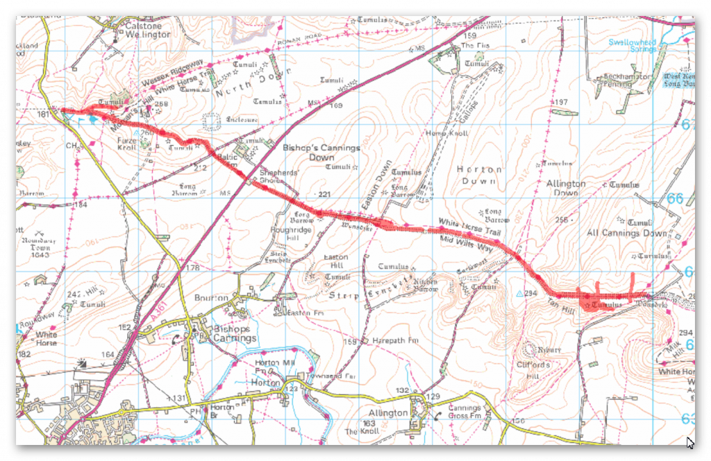
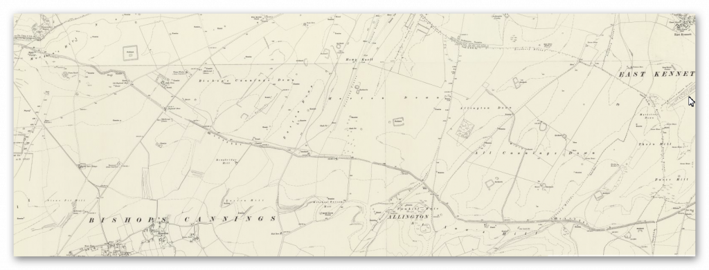
The visage of paleochannels, ancient waterways etched in the very fabric of the land, presents itself as a canvas of revelations.  LiDAR’s eye, attuned to the wavelengths of discovery, showcases the embrace of Wansdyke’s ditches with these prehistoric conduits.  In their intersection, a portrait emerges—a depiction of a junction, a crossroads where not just land but waterways merged.

The resonance of this image is profound.  A Dyke, often considered an embodiment of solidity, now intersects with the fluidity of these forgotten watercourses.  This confluence hints at more than coexistence—it suggests a portal, a point of ingress and egress, a thoroughfare not merely for terrestrial travellers but also for vessels that rode the liquid highways.

Such a revelation prompts us to reconsider the dike’s identity.  Could this monumental construction, both a bastion of earth and a harbour of history, be conceived not solely for defence but as a connection conduit?  An edifice that channelled both earthly aspirations and the currents of culture, bridging the realm of humans and the dominion of water?

Ditches to reach Paleochannel
Ditches to reach Paleochannel (GE)
Figure 36 – GE Map shows deep ditches which are now paths going across the Wansdyke

The southern reaches unfurl a tale of depth and mystery—a narrative that extends beyond the bounds of Wansdyke’s familiar embrace.  Here, etched upon the land like whispers of the past, are deep cuts that time has adorned with the patina of ages.  Now trodden as footpaths, these cuts reveal themselves as gateways to antiquity, as portals through which we traverse history’s corridors.

Yet, the panorama holds another surprise—a forgotten ditch, an enigmatic excavation that defies the confines of historical schedules.  This ditch, absent from Historic England’s scrolls, surrenders itself to the embrace of an old Paleochannel river, like an echo reverberating through time.  Fig. 36 becomes a tableau of continuity, a link between the tapestries of yesteryears and the present.

Lidar of Ditches reaching the Dyke
Figure 37 – Paleochannels connecting to Wansdke

In this interplay of cuts, ditches, and ancient rivers, a question arises—what hands sculpted these channels, and what intentions propelled them into existence?  Were these marks of human endeavour borne from a need to navigate the landscape, to forge paths that transcended the eras?  Or are they the product of a deeper design, etched by nature herself and embellished by the curious hands of humans?

As we meander through the corridors of speculation, let us remember the canvas of history is not confined to the visible, the documented.  It expands, much like the very rivers and footpaths that traverse it, into the realm of the unseen and the uncharted.  In the echoes of these cuts, in the absence of recognised schedules, we find a reminder that history is a symphony of the known and the unknown, a dance that transcends temporal confines.

In the mosaic of history, Fig.37 casts a spotlight upon a revelation that bridges epochs and echoes with the very essence of the land.  Here, amidst the tapestry of ancient landscapes, emerges the presence of monumental sarsen stones, sentinels of time, scattered as relics of the ages in the embrace of the Paleochannels.

Figure 38 - Paleochannels everywhere some showing sarsen stones in the dry river valley indicating the size and strength of these old rivers – first edition OS.
Figure 38 – Paleochannels everywhere some showing sarsen stones in the dry river valley indicating the size and strength of these old rivers – first edition OS.

These stones, witnesses to the drama of ice and thaw, lay scattered as if nature herself crafted an intricate mosaic.  The legacy of the last Ice Age is etched upon them, a testament to the forces that shaped this realm long before the footfalls of humankind.  As the old OS maps bear witness, these stones, abundant in the embrace of the Paleochannels, evoke a tale of glacial might and the enduring memory etched upon the land.

Figure 39 - The 'Unknown'ditch heads north and then kinks
Figure 39 – The ‘Unknown’ditch heads north and then kinks

A profound realisation emerges in this dance of discovery—a symphony of logistics and ingenuity unfurls.  If these sarsen sentinels were to be harnessed and woven into the fabric of human endeavour, the waterways would have served as a celestial highway, a course of least resistance.  And in this tableau, Wansdyke emerges not only as a Dyke, not merely a demarcation or defence, but as a lifeline that harnessed the power of water to serve human ambition.

In the intricate mosaic of historical discovery, the enigmatic ditch takes centre stage once more—a whispered riddle etched into the landscape. It meanders through the pages of time, seemingly wandering aimlessly, a question mark in the grand narrative. Yet, as we sift through the fragments of history, a revelation shimmers into view that bind the ditch and the very fabric of prehistory.

Figure 40 - The 'unknown' Dyke links to the Kennet River that goes to both Avebury and Silbury Hill
Figure 40 – The ‘unknown’ Dyke links to the Kennet River that goes to both Avebury and Silbury Hill

As modern OS maps render this ditch a ghost upon the terrestrial canvas, the marriage of technology and imagination unveils the hidden treasure. LiDAR’s touch, a modern conjurer’s wand, weaves the paleochannels and prehistoric shorelines into the mosaic. In this dance of data emerges a connection that defies the constraints of eras—a direct link between the ditch and the hallowed grounds of Avebury and Silbury Hill.

This revelation echoes through time, whispering that these ancient sites, Avebury and Silbury Hill, are not merely isolated islands but interwoven threads of a grand tapestry. The ditch, a seemingly solitary enigma, reveals itself as a connective vein—a corridor of history that flows not to obscurity but to monumental sites that have stood sentinel through the epochs.

This conjured connection, a bridge between Wansdyke and Avebury, paints a canvas where history transcends the confines of linear progression. It offers a vision of prehistory as a symphony of parallel stories, where Wansdyke and Avebury, once disparate entities, become harmonious notes that resound across the landscape. The notion that they were born simultaneously, intertwined in a narrative of ambition, culture, and design, is a testament to the shared aspirations of humanity across time.

Roman Water Management

Figure 41 - Small right-angled addition to the Dyke - but for what practical reason
Figure 41 – Small right-angled addition to the Dyke – but for what practical reason
Cross Regulator - water management system
Figure 42 – Cross Regulator – water management system

In the annals of historical inquiry, the tiny Dyke that extends from Wansdyke assumes a posture of intrigue—a whispered question mark punctuating the landscape.  In its modest form, it beckons us to decipher its purpose, to unearth the intentions woven into its design.  As we traverse the realm of speculation, two threads of possibility unfurl, each offering a glimpse into the minds of those who shaped it.

One narrative paints the Dyke as a haven, a berth upon the liquid highway—a stop for boats, a safe harbour for those who navigated the waters the dike embraced.  In this vision, the Dyke transforms into a passage not solely for people and stones but for the vessels that threaded waterways laden with cargo, hopes, and history.  The “parking feature” becomes a tableau of respite—a moment of pause in the voyage of time.

In this incarnation, the Dyke assumes a role akin to a conductor’s baton—a water regulator orchestrating the flow of springs that may have danced through the landscape.  A “Cross Head Regulator” from the annals of modern canals whispers through time, suggesting a parallel with the water management systems of the Romans, as glimpsed in the scrolls of history at Hadrian’s Wall.

The contemplation of Roman engineering and its influence upon the Dyke reflects the epochs’ interconnectedness.  The Romans, architects of both empire and innovation, are known to have left their indelible mark upon the landscapes they traversed.  Could this diminutive Dyke be a remnant of their water management techniques, a testament to their mastery over the elements as seen in other corners of the realm?

Rybury Camp and Tanhill Fair

Figure 43 - Tanhill Fair - complex earthworks showing Rybury Camp on the peninsula
Figure 43 – Tanhill Fair – complex earthworks showing Rybury Camp on the peninsula

The woven tapestry of history, the complex series of ditches extending from Wansdyke casts a net of intrigue and speculation. Their intricate dance, flowing down into the Dry River Valley, unveils a terminal that might have been a hub of significance—a nexus where the threads of trade and human interaction converged. This vista hints at a site not solely dedicated to defense or marking, but a junction that pulses with the rhythm of exchange.

Through the corridors of time, the echoes of Tanhill Fair reverberate. As if in a symphony, the words of Aubrey from the 17th century whisper of a fair held within an “old camp,” summoning images of bustling marketplaces and vibrant commerce. This isn’t a mere snapshot in history; it’s a snapshot of continuity—a legacy of trade that spans from Medieval times to the annals of antiquity.

Figure 44 - Tanhill Fair showing a supplementary ditch that connects to Wansdyke in two places and goes down into the river valley
Figure 44 – Tanhill Fair showing a supplementary ditch that connects to Wansdyke in two places and goes down into the river valley (GE)
Figure 45 - The Dyke seems to vist two quaaries before getting to Wansdyke
Figure 45 – The Dyke seems to vist two quaaries before getting to Wansdyke
Figure 46 - OS map shows the remains of the ditches went from the Paleochannel (in the Valley) to Wansdyke
Figure 46 – OS map shows the remains of the ditches went from the Paleochannel (in the Valley) to Wansdyke

Pic 45, like a palimpsest, unfurls before us—a visual odyssey that belies the limits of schedules and registers. The ditch works at Tanhill Fair reach far beyond their documented bounds, stretching both directions and connecting in two places to Wansdyke. This revelation is a testament to the fluidity of history, a reminder that the boundaries we impose upon the past are but a sliver of the stories that await our exploration.

In the theatre of interpretation, a bold hypothesis emerges—the possibility that these ditches, these conduits carved into the earth, were not mere markers or barriers but lifelines of trade. A canal, a passage through which boats might have threaded their way, carrying treasures, aspirations, and cultures from distant corners of the known world. This vision unites Wansdyke and Tanhill Fair not as separate entities but as partners in the choreography of history.

Figure 47 - Tan Hill and Rybury Camp as a Peninsula in the Mesolithic
Figure 47 – Tan Hill and Rybury Camp as a Peninsula in the Mesolithic

Roman Road joining two Dykes

Morgan’s Hill is close to a crossroads of revelation—an unassuming stretch of the Dyke that belies its significance. A linear expanse, a departure from the meandering course that defines 99% of the Dyke, captures our attention. This apparent anomaly in the landscape becomes a canvas for exploration, urging us to unveil the threads that weave its story.

A curious pattern emerges as we consult the LiDAR map and trace the hidden design drawn by the pits. Two segments along this straight stretch deviate from the norm—a conspicuous absence of the quarries and pits that have characterised the journey so far. The landscape whispers a puzzle, inviting us to decode its enigma.

Figure 48 - The Roman Road joins two Prehistoric Dykes
Figure 48 – The Roman Road joins two Prehistoric Dykes

Enter the Mesolithic shoreline, a harbinger of revelation. When layered upon the LiDAR map, it illuminates a past submerged beneath the tides of time. Suddenly, the straight stretch of the Dyke unfurls its secret—it’s not merely a Roman road but a bridge that spans epochs. It joins the dots, connecting two prehistoric courses of the Wansdyke that once wove a “wibbly wobbly” path across the landscape.

This discovery is a testament to history’s interconnectedness, the symbiotic dance between human endeavour and the ebb and flow of nature. The Romans, architects of their era, harnessed these prehistoric pathways, channelling their ingenuity to connect the dots drawn by time. It is a reminder that history is not linear but a mosaic—a collage of human intent and the tides of change.

The Morgan Hill Kink

Figure 49 - Morgan Hill East 'kink'
Figure 49 – Morgan Hill East ‘kink’


Figure 50 - Morgan Hill Kink’s barrows
Figure 50 – Morgan Hill Kink’s barrows

To the East of Morgan Hill is found a bizarre Kink in Wansdyke. This is best seen on an OS map showing this strange direction and the obstacles it avoided.

In the panorama of landscape and time, the kinks and turns of Wansdyke invite us to unravel the intentions woven into its form. As we ascend the topology of the hill, we stand witness to a sequence of choices that defy easy classification but beckon us to scrutinise their purpose.

The kinks and turns present a conundrum to the theories of fortification or marking. Their seemingly inefficient trajectory, descending the hill’s advantage and taking multiple turns, challenges the notion of defence or demarcation. From a defensive perspective, the logic of such a design raises questions about the resource and time invested.

As we tread through the corridors of inquiry, a new light shines upon the landscape—the presence of round barrows. Like sentinels of history, these ancient mounds encircle the kink on both sides. The question arises whether these barrows were built around the contours of Wansdyke or whether the kink was crafted to navigate around the barrows.

The chronicle deepens with the discovery of the missing branch—a path unmarked on contemporary maps but unveiled through Historic England’s lens. The cross ridge Dyke on Morgan’s Hill etches its presence across the east-west aligned ridge. The bank and ditch, sculpted by time’s hands, become conduits of understanding, the stories they tell interwoven with the landscape.

Branch off Wansdyke

The monument includes a 560m long section of a Cross ridge Dyke situated on Morgan’s Hill. The Dyke runs from NNW to SSE across the east-west aligned ridge, dividing Morgan’s Hill into two parts. The Dyke has a bank c.8m wide and up to 1.5m high. To the East of the bank lies an 8m wide ditch which provided material for its construction and enhanced the effectiveness of the boundary.

This has been partly infilled by cultivation but is open to a depth of 0.3m in places, and is visible on aerial photographs. The bank and ditch are interrupted by a number of openings through which animals and people could pass. It is not clear how many of these are original.

 A further section of the Dyke, situated to the south is crossed by the Wansdyke, which is later in date. This additional section is the subject of a separate scheduling. Excluded from the scheduling are the post and wire fences which cross it and run along its length, although the ground beneath is included. – English Hertitage

Figure 51 - Branch off Wansdyke
Figure 51 – Branch off Wansdyke

In the intricate tangle of time and earth, the convergence of the Cross-ridge Dyke on Morgan’s Hill and the enigmatic Dyke of East Wansdyke draws us into a narrative of layered history. Their banks and ditches, the silent architects of the landscape, weave a tale of coexistence, connection, and perhaps even evolution.

These two Dykes, mirroring each other across time and the contours of the land, embody a dialogue between epochs. Their unity atop Morgan’s Hill, a meeting point that defies temporal confines, reminds us that history is not merely a linear march—it’s a dance that spans centuries, uniting hands that have shaped the earth.

The paleochannel’s passage through the Dyke carries echoes of ancient currents—a testament to a time long before the Dyke’s construction. This fragment, missing as if eroded by the tides of prehistory, whispers that the roots of this land stretch further than the architects who shaped it. This gap in the Dyke is a tapestry of continuity, a reminder that even the most monumental structures stand atop layers of untold stories.

Figure 52 - Morgan's Hill West with another Branch
Figure 52 – Morgan’s Hill West with another Branch

The saga of East Wansdyke’s creation offers a riddle unto itself. The builders, crafting their work across chalk, kept the earth they excavated to one side. This pragmatic choice of preserving the turf for stability and camouflage echoes a nuanced purpose. It becomes evident that these Dykes are not mere boundary markers or defensive structures. They are more—a marriage of utility and adaptation, a testament to human ingenuity and the intersection of practicality and aesthetics.

ure 53 - Junctions heading north off Wansdyke past a group of Round barrows
Figure 53 – Junctions heading north off Wansdyke past a group of Round barrows

The view northward, captured in Fig. 53, extends the tableau of discovery. Like a palimpsest, the landscape bears the imprints of Wansdyke’s journey. It dances alongside the Roman Road, a chorus of human footsteps interweaving through time. The round barrows and raised river shorelines, silent witnesses to centuries past, reaffirm the interplay of cultures, constructions, and course changes that define human endeavour across epochs.

Figure 54 - How Morgan Hill used to look in the Mesolithic – with the roman road towards the bottom turning left (North)
Figure 54 – How Morgan Hill used to look in the Mesolithic – with the roman road towards the bottom turning left (North)


Chronology (Smoking Gun)

In the ongoing dialogue with history, a revelation emerges—wrought from the very contours of the land, an ancient pathway unveils its secrets. The Roman road, a trail of human ambition etched across the landscape, weaves its course atop the pages of Wansdyke’s story. This intersection, where road and Dyke converge, is a testament to the interplay of cultures, epochs, and purpose.

Stukeley’s drawing on Page 6, Fig.24, long questioned by the annals of archaeology, finds newfound validation through the lens of LiDAR—a digital conjurer that unveils hidden truths. Once doubted as an exaggeration, the cut through the bank now emerges as a footprint in time. LiDAR’s gaze, untethered by perception’s limits, reveals that this cut bends in harmony with the Roman deviation, a harmony of intent that speaks of chronology.

Figure 55 - Roman Road cuts through Wansdyke making it older!
Figure 55 – Roman Road cuts through Wansdyke making it older!
A different angle
A different angle

The alignment of the Roman road, cleaving through the very heart of Wansdyke’s bank, resonates with the echoes of purpose. This road, a conduit for the aspirations of the Roman era, tells a tale of connection and coexistence—an acknowledgement that the landscape’s past holds layers that intertwine like the fabric of time itself.

The chronicle of Wansdyke, interwoven with the path of the Roman road, unveils a narrative that spans millennia. This intersection becomes a bridge that invites us to traverse the epochs and honour the efforts of hands laboured to craft earthwork and thoroughfare. It becomes a gateway that prompts us to unravel the threads of intention, the dance between cultures, and the pulse of human progress.

The application of LiDAR technology has decisively resolved the inquiry. LiDAR data reveals a cross-sectional embankment profile mirroring the Roman roads deviation’s curvature, indicating the roadway’s construction postdates the Wansdyke earthwork.

This LiDAR evidence serves as a compelling confirmation of prehistoric Dyke dating, akin to a “smoking gun.” LiDAR employs laser reflection and time-of-flight measurements to gather precise topographic data by emitting and measuring laser pulses. This technology’s congruence with historical context validates its role in archaeology, exemplifying how modern tools can illuminate ancient landscapes.

Figure 78 - Roman Road cuts through Wansdyke making it older!
Figure 78 – Roman Road cuts through Wansdyke making it older!


The Book

Blank bookcover with clipping path

This was an extracts from the NEW Book Ancient Prehistoric Canals (Dykes) – Wansdyke available on Amazon as a FULL COLOUR HARD BACK (£19.95) or a ECONOMY (£4.99) SOFTBACK black and white VERSION – it is also available as a KINDLE (£1.99) book. For further information about our work on Prehistoric Britain visit our WEBSITE or VIDEO CHANNEL.

Product details

  • ASIN ‏ : ‎ B0BF31GQKC
  • Publisher ‏ : ‎ Independently published (18 Sept. 2022)
  • Language ‏ : ‎ English
  • Hardcover ‏ : ‎ 134 pages
  • ISBN-13 ‏ : ‎ 979-8353488897
  • Dimensions ‏ : ‎ 15.24 x 1.3 x 22.86 cm
  • Illustrations: 85
  • Customer reviews: 5.0 out of 5 stars    1 rating

Further Reading

For those interested in British Prehistory, visit www.prehistoric-britain.co.uk, a comprehensive resource featuring an extensive collection of archaeology articles, modern LiDAR investigations, and groundbreaking research. The site also includes insights and extracts from the acclaimed Robert John Langdon Trilogy, a series of books exploring Britain during the Prehistoric period. Titles in the trilogy include The Stonehenge Enigma, Dawn of the Lost Civilisation, and The Post Glacial Flooding Hypothesis, offering compelling evidence about ancient landscapes shaped by post-glacial flooding.

To further explore these topics, Robert John Langdon has developed a dedicated YouTube channel featuring over 100 video documentaries and investigations that complement the trilogy. Notable discoveries and studies showcased on the channel include 13 Things that Don’t Make Sense in History and the revelation of Silbury Avenue – The Lost Stone Avenue, a rediscovered prehistoric feature at Avebury, Wiltshire.

In addition to his main works, Langdon has released a series of shorter, accessible publications, ideal for readers delving into specific topics. These include:

For active discussions and updates on the trilogy’s findings and recent LiDAR investigations, join our vibrant community on Facebook. Engage with like-minded enthusiasts by leaving a message or contributing to debates in our Facebook Group.

Whether through the books, the website, or interactive videos, we aim to provide a deeper understanding of Britain’s fascinating prehistoric past. We encourage you to explore these resources and uncover the mysteries of ancient landscapes through the lens of modern archaeology.

For more information, including chapter extracts and related publications, visit the Robert John Langdon Author Page. Dive into works such as The Stonehenge Enigma or Dawn of the Lost Civilisation, and explore cutting-edge theories that challenge traditional historical narratives.


Other Blogs

s

t