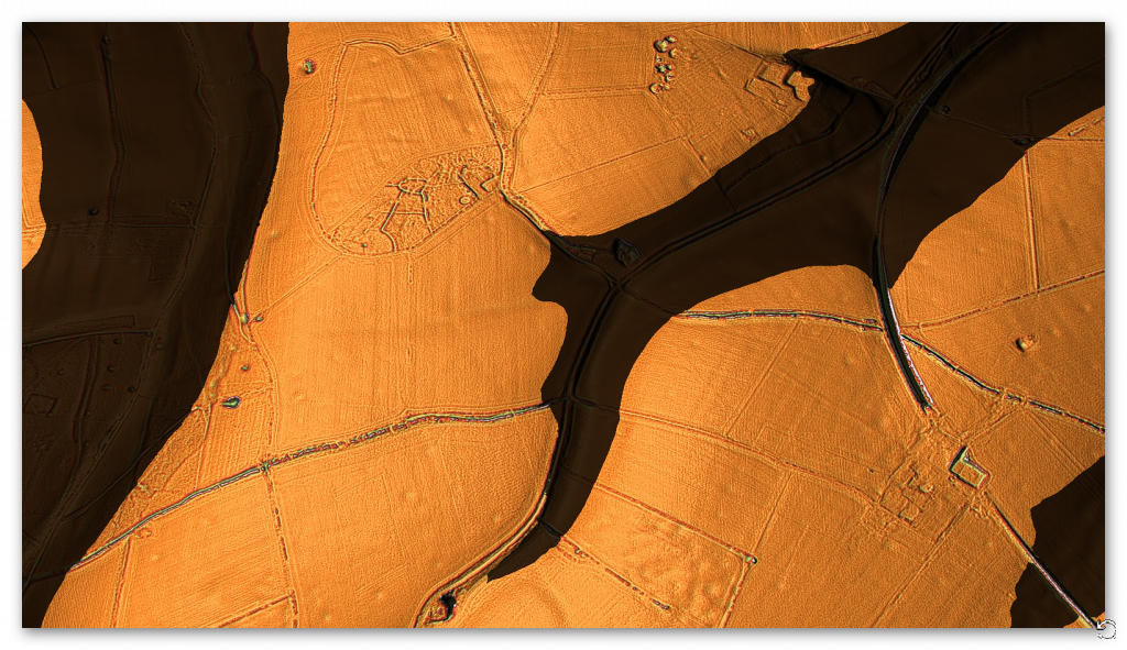
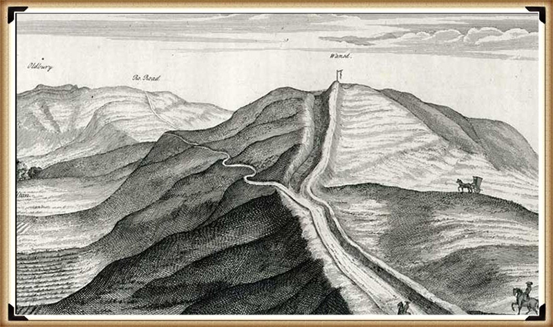
In the vast tapestry of human history, there are moments when a single technological shift forces us to stop… reassess… and begin again. (How Lidar will change Archaeology)
Innovation in Archaeology has always pushed the boundaries of understanding.
LiDAR is one of those moments.
For centuries, archaeology has relied on what could be seen from the ground — fragments of banks, ditches, crop marks, and partial excavations. From these fragments, entire narratives have been constructed. Boundaries have been drawn. Timelines fixed. Functions assumed.
With tools like LiDAR, the field of Archaeology is evolving rapidly.
But what happens… when we can suddenly see everything?
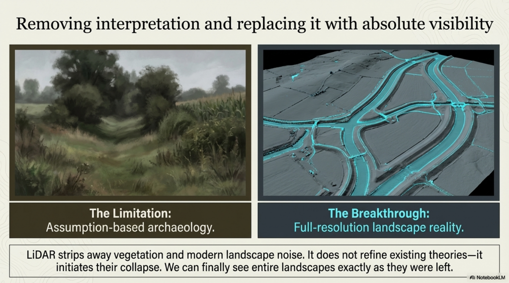
Not just isolated sections… but entire landscapes… in full resolution… stripped of vegetation… revealed exactly as they were left.
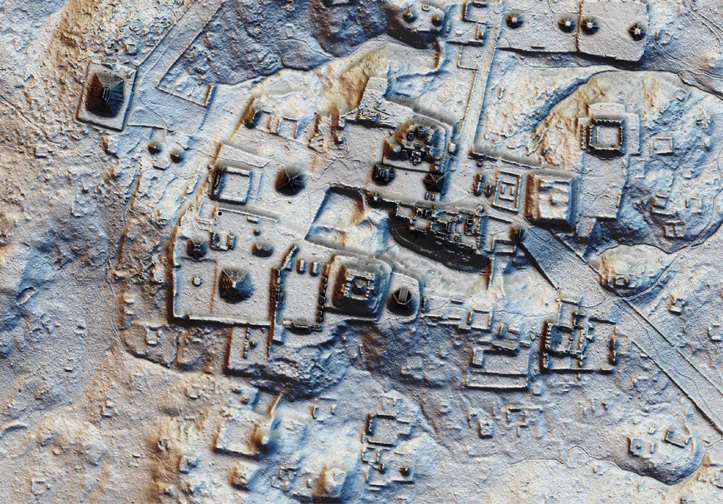
Lost Myan Structues found by LiDAR Archaeology
This paradigm shift in Archaeology is crucial for future research.
That is what LiDAR has done.
And what it is revealing… is not a refinement of existing theories.
It is their collapse.
New findings in Archaeology challenge our previous beliefs.
The Illusion of the “Defensive Dyke”
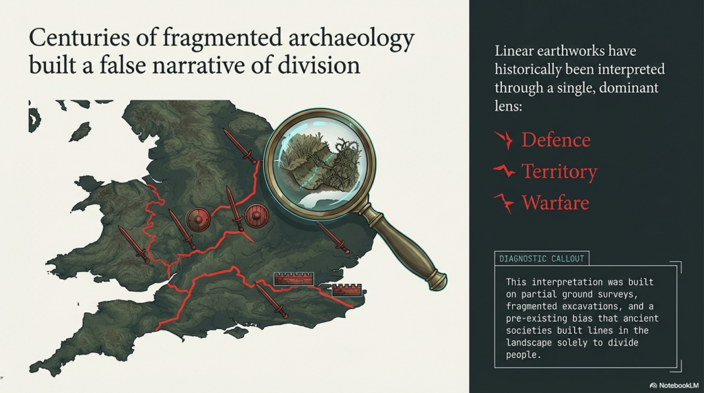
Linear Earthworks have long been interpreted through a single dominant lens:
👉 Defence 👉 Territory 👉 Warfare
From Offa’s Dyke to Wansdyke, from the Antonine Wall to the Vallum, the assumption has remained largely unchanged — these were barriers. Lines in the landscape built to divide people.
But this interpretation was never based on full evidence.
It was based on partial observation.
(How Lidar will change Archaeology)
Ground surveys… fragmented excavation… and most importantly… a pre-existing belief that these features must be defensive.
LiDAR removes that limitation.
Understanding landscapes through Archaeology offers fresh insights.
These revelations in Archaeology reveal ancient practices.
And when you remove the trees… the crops… and the modern landscape noise…
A very different picture emerges.
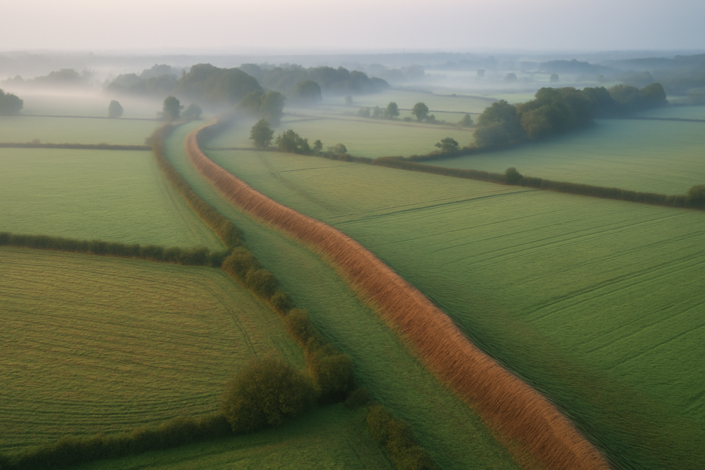
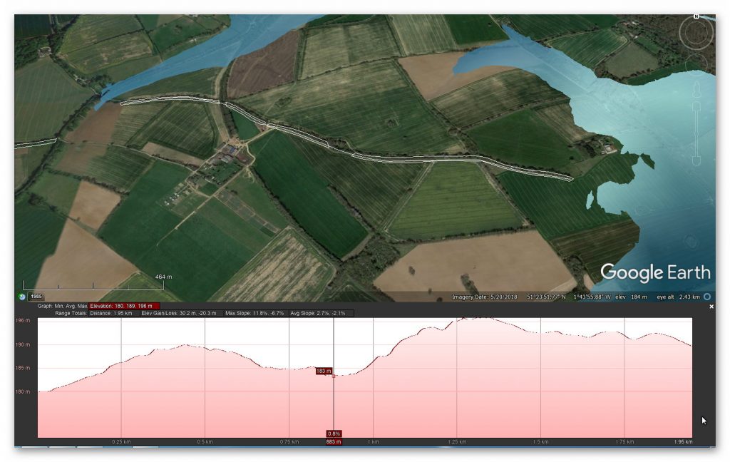
Car Dyke — Britain’s Longest Engineered Water System
One of the most striking discoveries is the true scale of Car Dyke.
In Archaeology, understanding water management is critical.
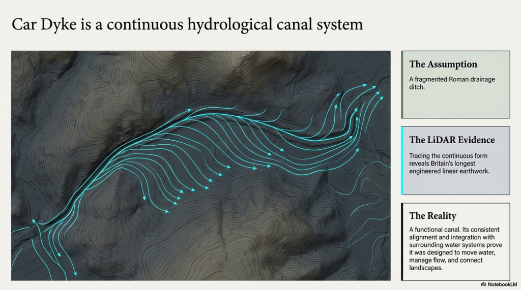
Previously understood as a Roman drainage feature… its full extent was never properly mapped or understood.
LiDAR changes that completely.
For the first time, we can trace its continuous form across the landscape — revealing it not as a fragmented ditch… but as Britain’s longest engineered linear earthwork.
And critically…
Its form is not defensive.
It is hydrological.
(How Lidar will change Archaeology)
Its consistent alignment… its relationship to natural gradients… and its integration with surrounding water systems…
Through Archaeology, we can explore human ingenuity.
All point to a single conclusion:
👉 Car Dyke is a canal system.
Not symbolic. Not territorial. But functional.
Designed to move water… manage flow… and connect landscapes.
(How Lidar will change Archaeology)
Collaboration in Archaeology is vital for comprehensive studies.
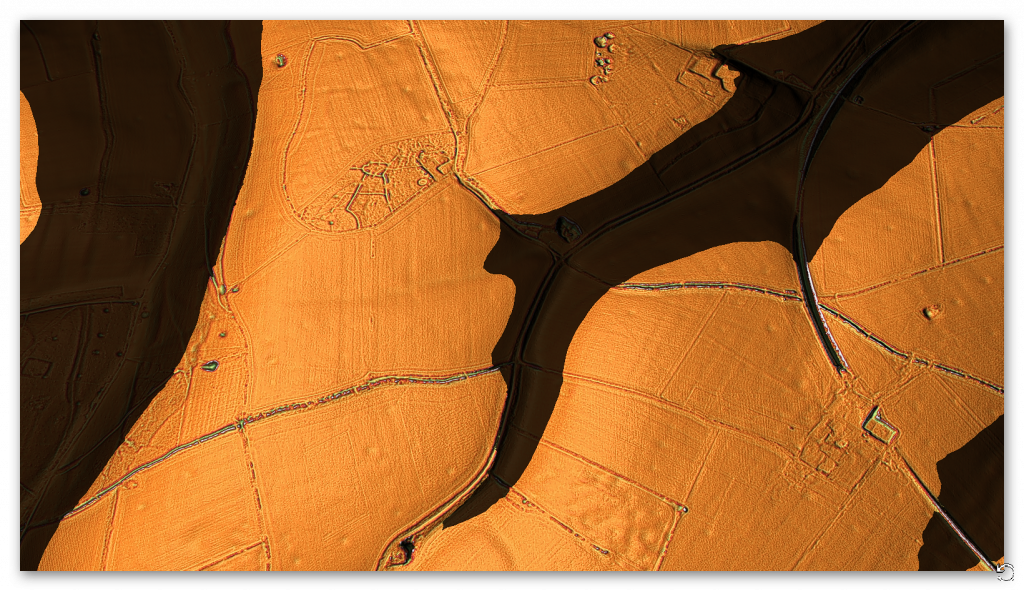
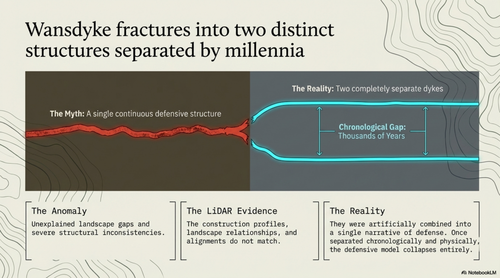
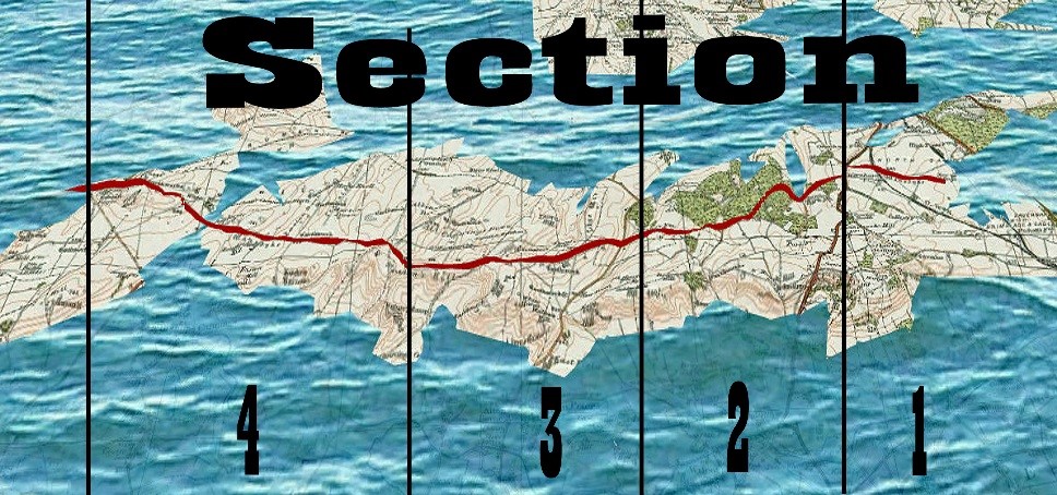
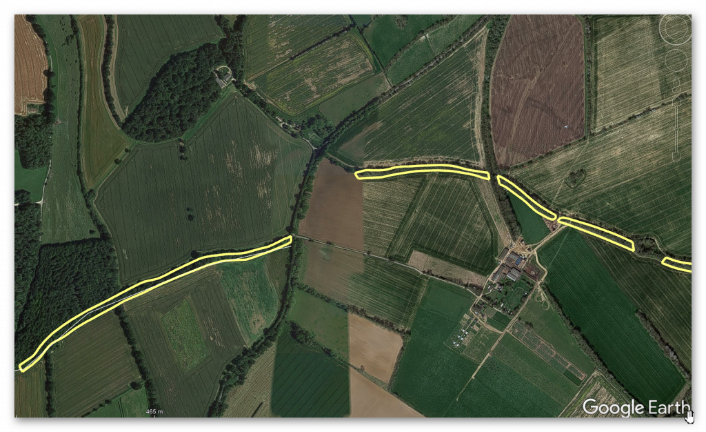
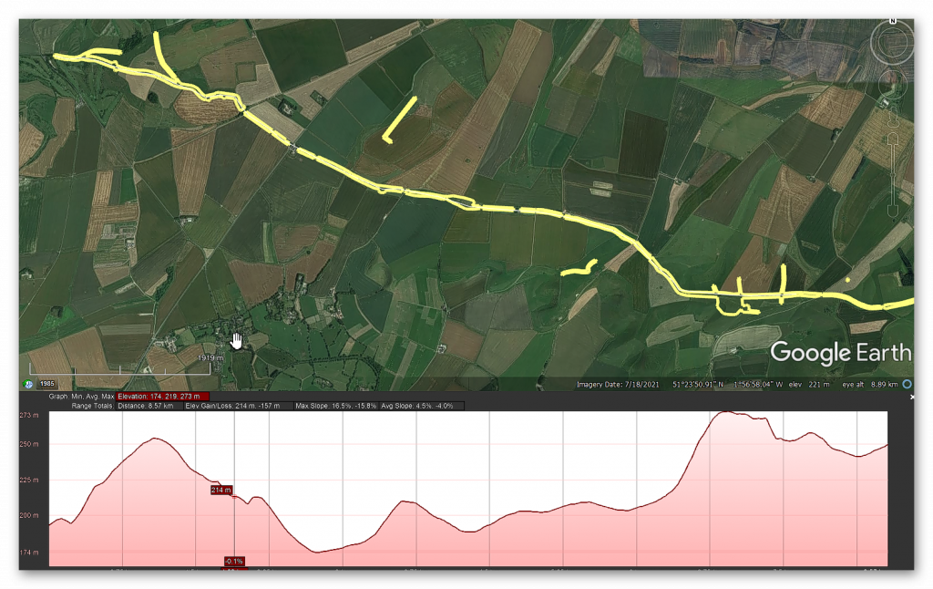
Wansdyke — Not One Dyke, But Two
LiDAR has also resolved one of the long-standing inconsistencies surrounding Wansdyke.
The role of community in Archaeology cannot be overstated.
Traditionally treated as a single continuous defensive structure, its gaps and inconsistencies have always been difficult to explain.
Now we can see why.
Because it isn’t one structure.
👉 It is two completely separate dykes.
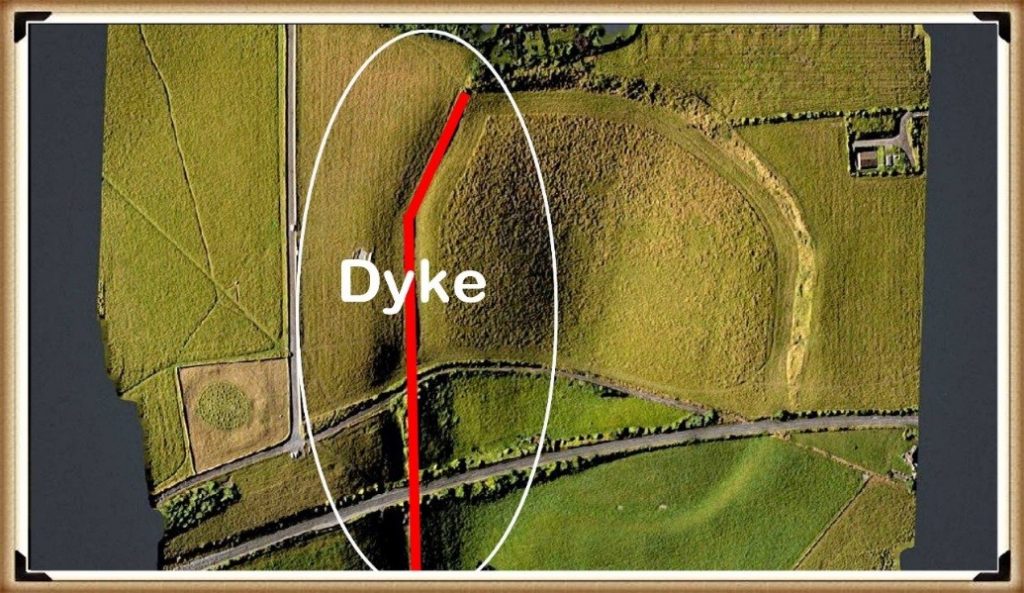
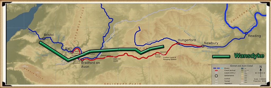
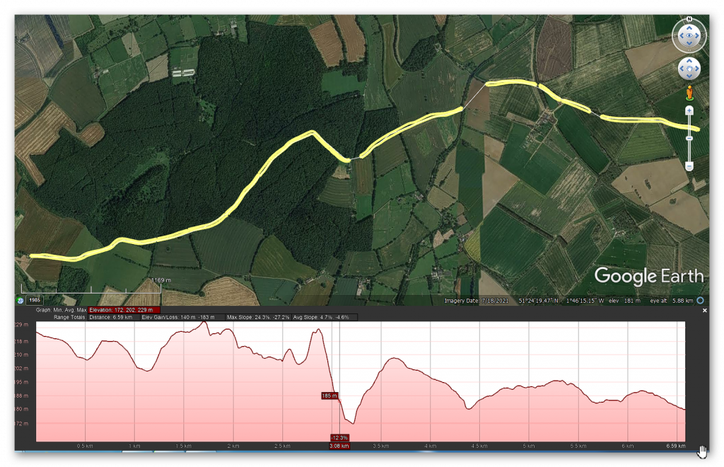
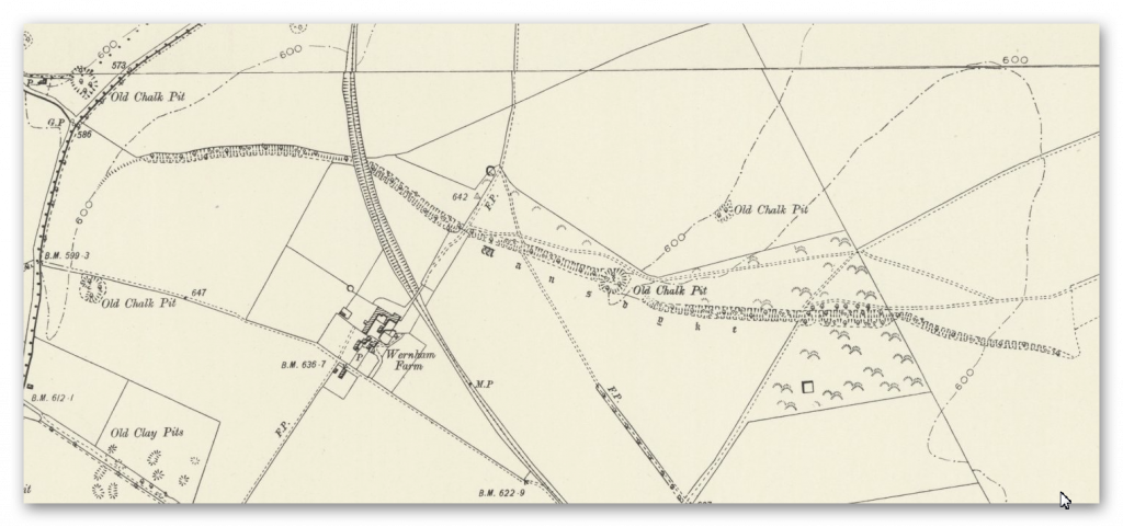
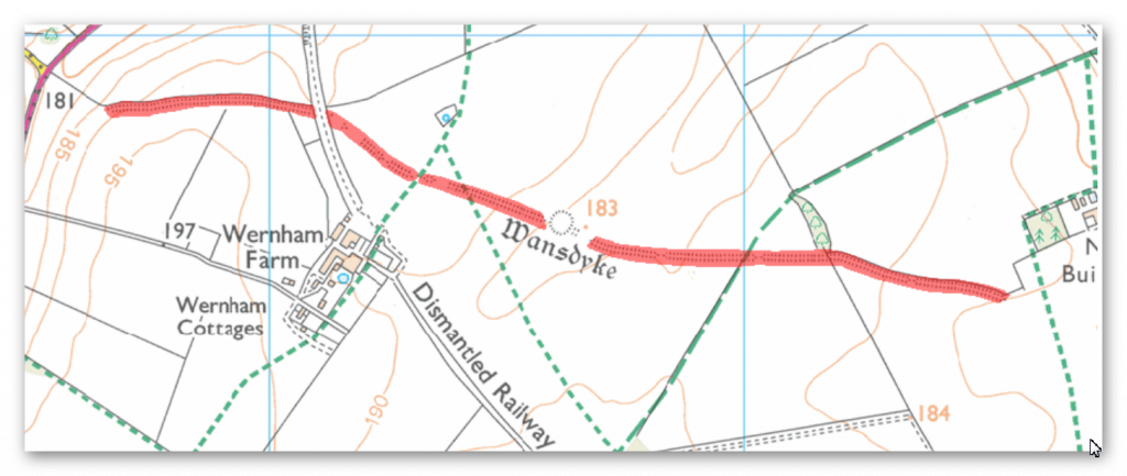
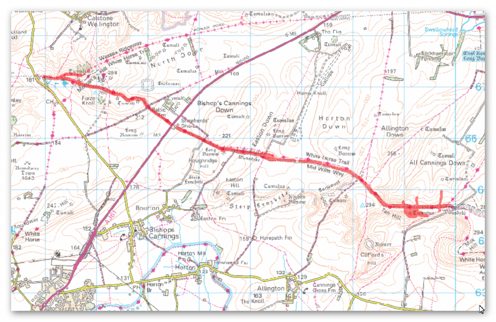
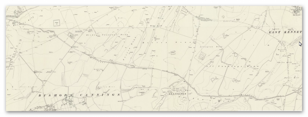
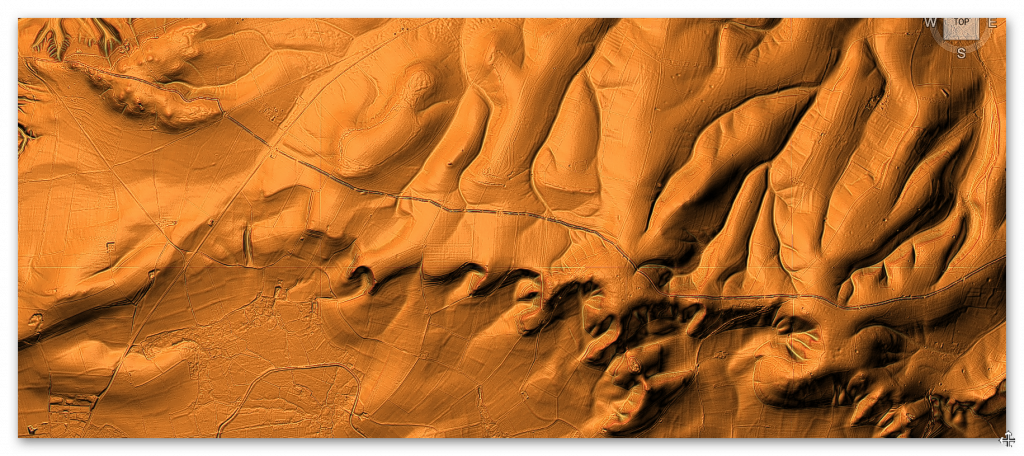
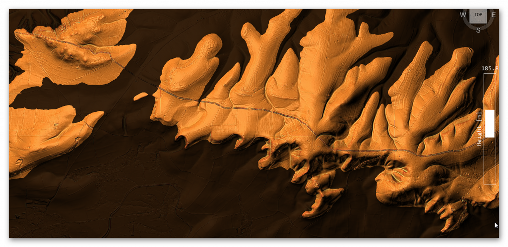
The gaps in Wansdyke proves its not a defensive feature but once held water
Constructed in different periods, with thousands of years between them.
Their alignments… their construction profiles… and their landscape relationships do not match.
They have been artificially combined into a single narrative… because that narrative required them to be one.
LiDAR shows they are not.
And once separated…
The defensive model collapses entirely.
(How Lidar will change Archaeology)
Insights from Archaeology reveal the complexities of history.
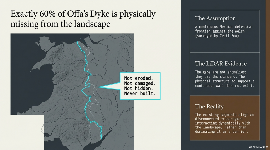
Offa’s Dyke — The Missing 60%
Perhaps the most telling example of interpretive bias is Offa’s Dyke.
For decades, it has been presented as a continuous Mercian frontier — a monumental defensive barrier dividing England and Wales.
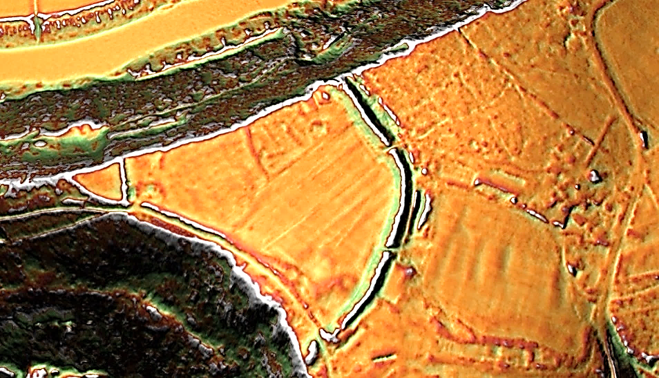
Offa’s Dyke nr Chepstow – shows not only is it not (as reported by Cecil Fox) a defensive structure against the Welsh but a Cross-Dyke
But LiDAR reveals a critical truth:
👉 Around 60% of Offa’s Dyke is missing.
Not eroded. Not damaged. Not hidden.
Simply… never there.
What has been presented as a continuous defensive structure is in reality a series of disconnected segments.
And those segments do not behave like a defensive line.
New methodologies in Archaeology enhance our understanding.
They align as cross-dykes — interacting with the landscape rather than dominating it.
The earlier surveys… most notably those influenced by Cecil Fox… were not neutral observations.
They were shaped by the assumption of defence.
And once that assumption is removed…
The structure no longer supports the theory.
(How Lidar will change Archaeology)
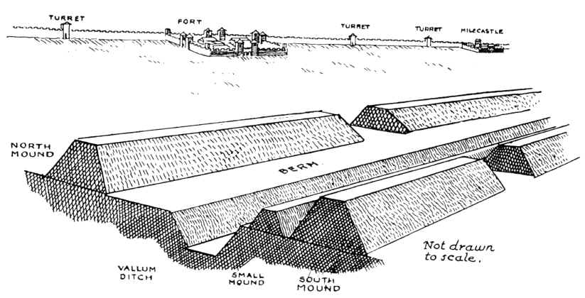
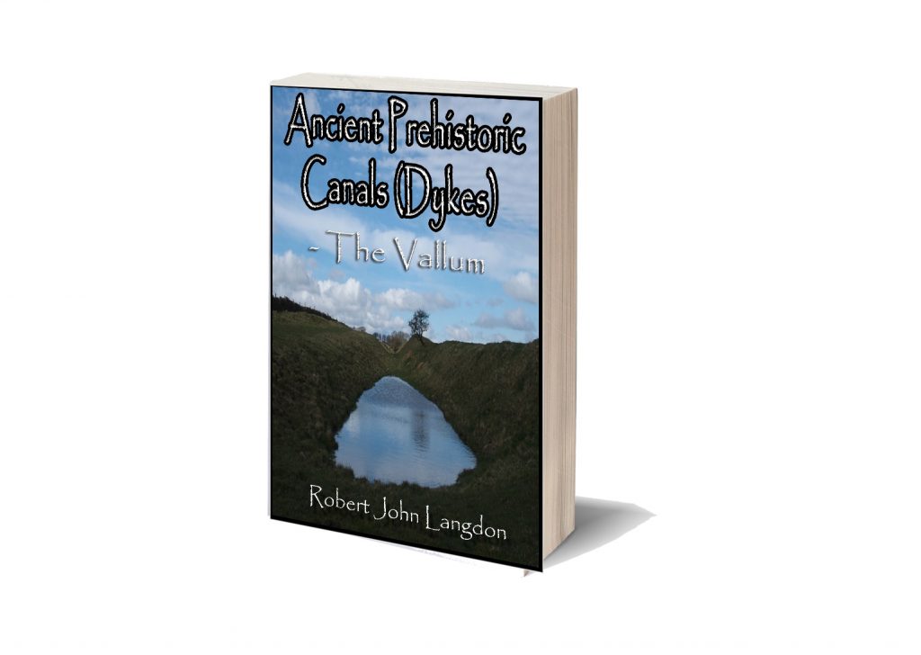
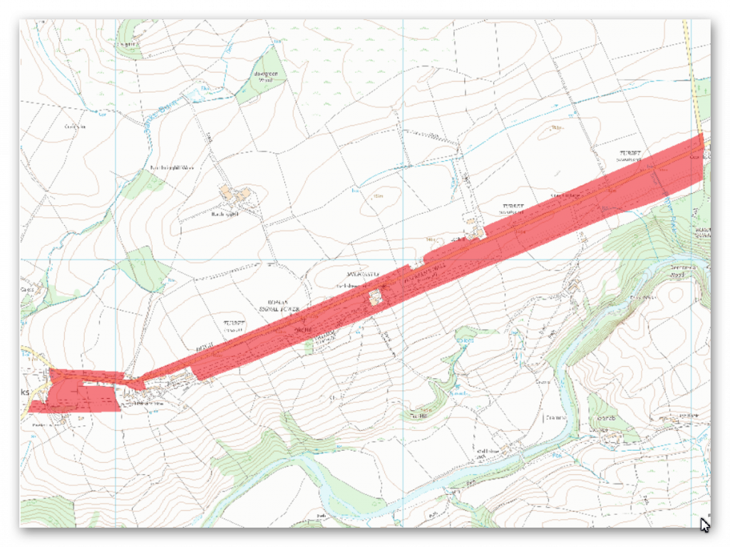
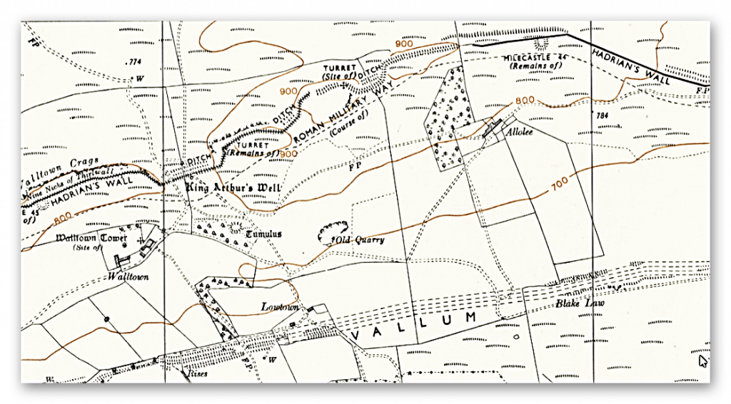
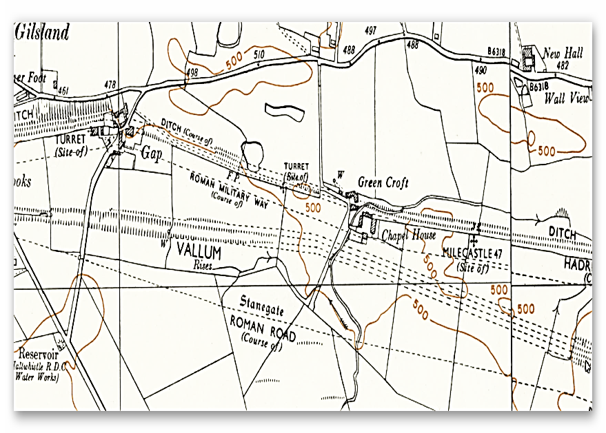
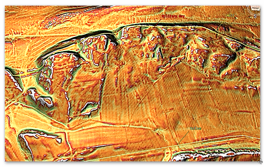
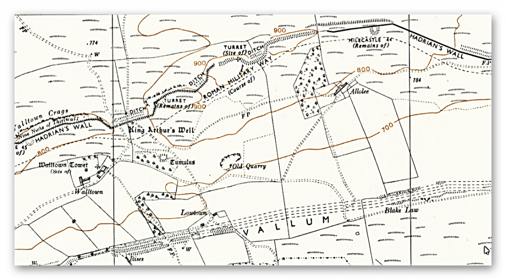
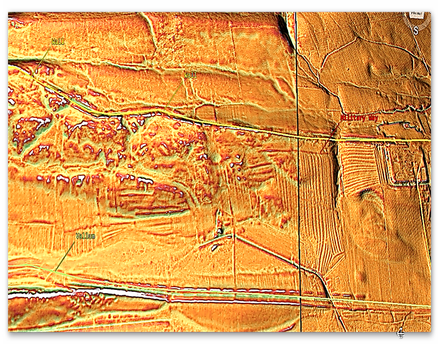
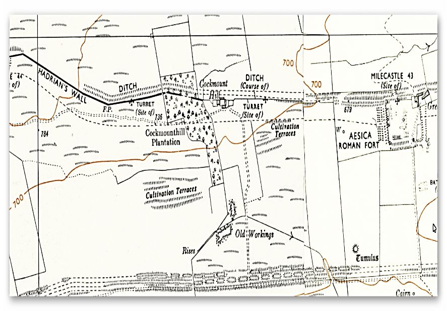
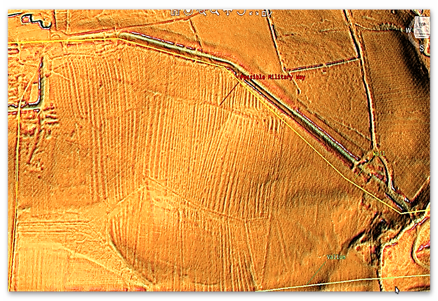
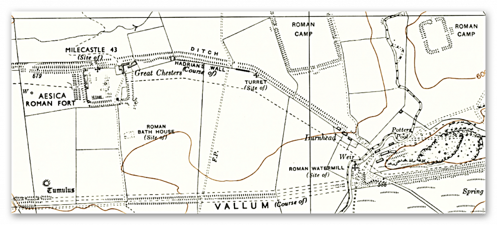
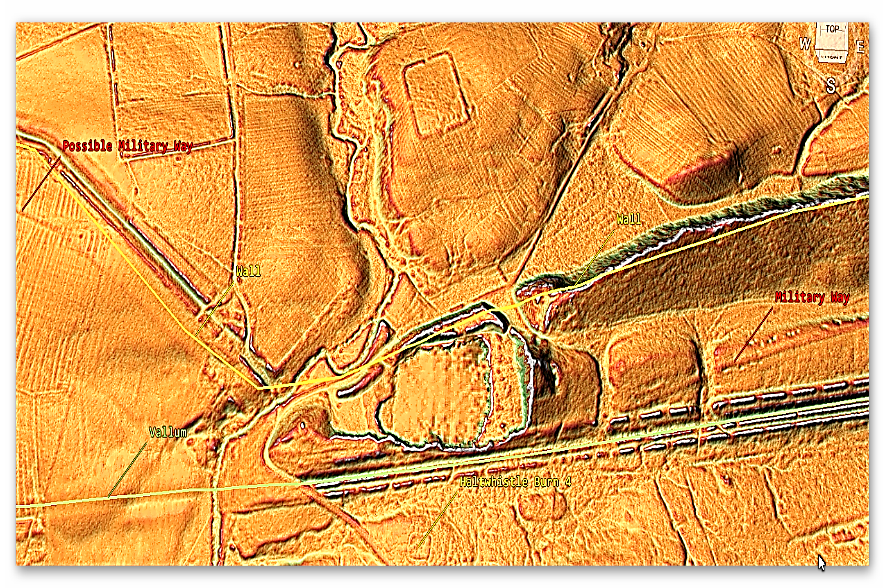
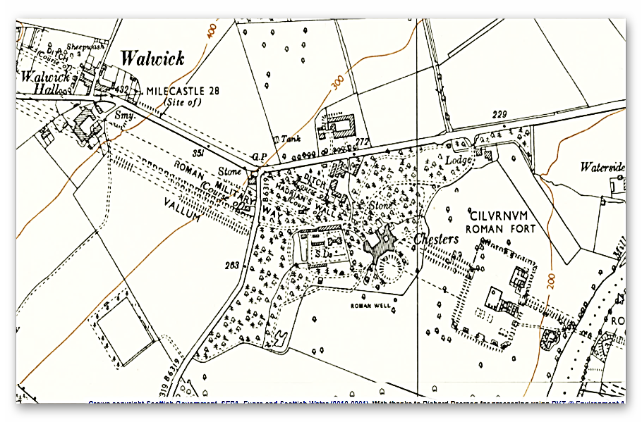
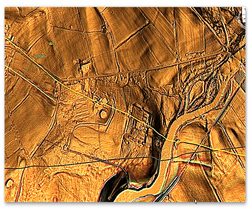
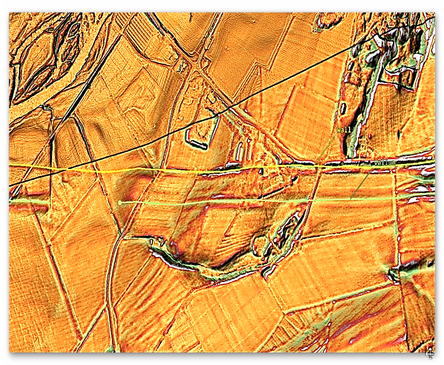
The Vallum — Not a Barrier, But a Transport System
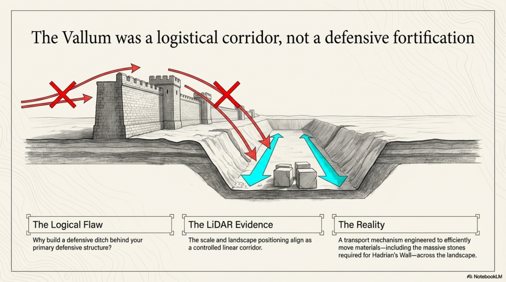
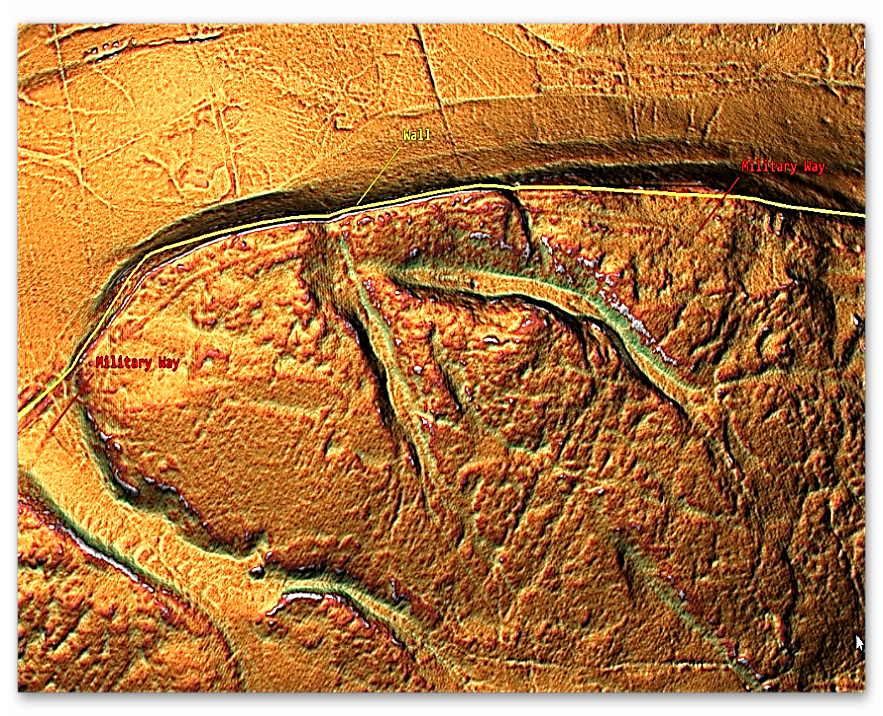
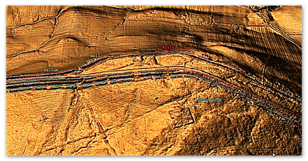
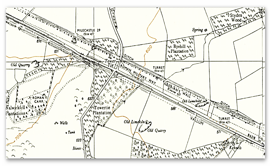
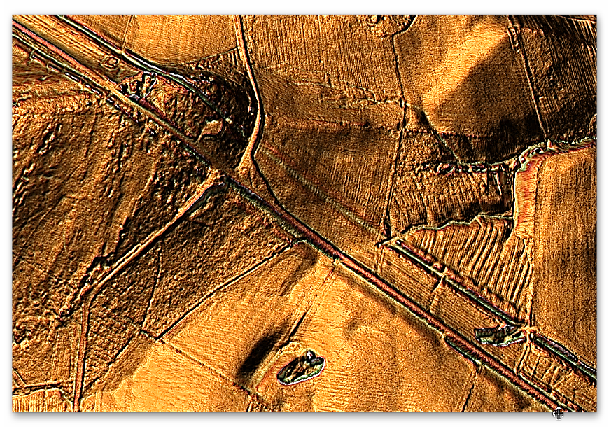
The Vallum, running alongside Hadrian’s Wall, has long been described as a defensive ditch — part of a complex military boundary.
But again… this interpretation struggles under scrutiny.
Its position… its scale… and its relationship to the Wall itself raise a fundamental question:
Why build a defensive ditch behind your primary defensive structure?
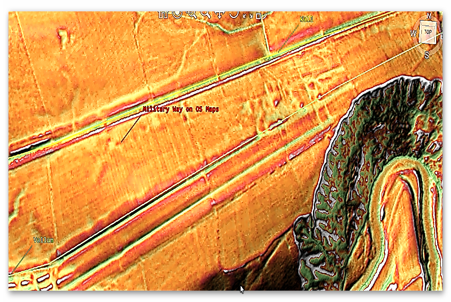
LiDAR provides the answer.
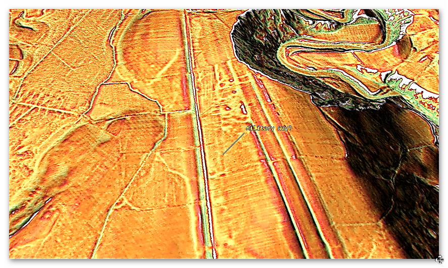
The Vallum aligns not as a barrier… but as a controlled linear corridor.
A route.
A system.
(How Lidar will change Archaeology)
👉 A transport mechanism.
Used to move materials — including the massive stones required for Hadrian’s Wall — efficiently across the landscape.
Not defence…
But logistics.
(How Lidar will change Archaeology)
A New Interpretation — Water, Not War
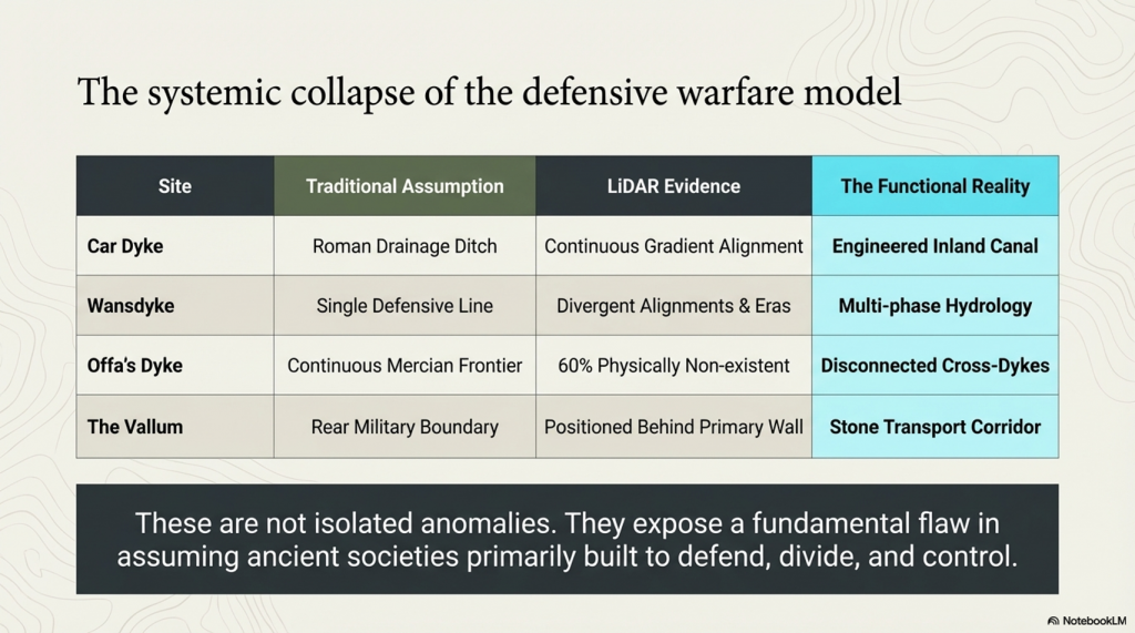
When these examples are brought together, a pattern becomes impossible to ignore:
Car Dyke — a canal
Wansdyke — multiple phases, not a single barrier
Offa’s Dyke — incomplete, non-defensive
Vallum — transport, not fortification
(How Lidar will change Archaeology)
These are not isolated anomalies.
They are part of a systemic misinterpretation.
A framework built on the assumption that ancient societies primarily built to defend… divide… and control territory.
LiDAR shows something very different.
👉 They built to manage water 👉 They built to connect landscapes 👉 They built to enable movement and trade
In short…
They engineered environments.
(How Lidar will change Archaeology)
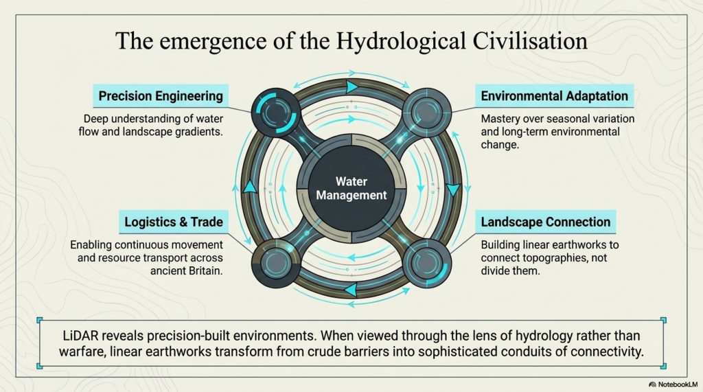
The Hydrological Civilisation
What LiDAR is revealing is not just new data…
But a new type of civilisation.
One that understood:
Water flow
Landscape gradients
Seasonal variation
Long-term environmental change
These Linear Earthworks are not crude barriers.
They are precision-built systems.
And when viewed through the lens of hydrology rather than warfare…
They begin to make sense.
(How Lidar will change Archaeology)
Conclusion — The End of Assumption-Based Archaeology
It removes interpretation… and replaces it with visibility.
No longer are we limited to fragments.
No longer can gaps be filled with assumption.
The landscape is now visible in its entirety.
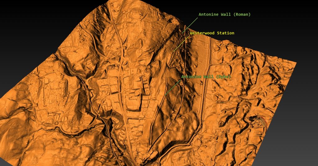
The Antonine Wall was originally a Dyke
And what it shows… is clear:
👉 The defensive model of Linear Earthworks in Archaeology is no longer sustainable 👉 The traditional surveys in Archaeology were incomplete — and in many cases, biased 👉 A hydrological and engineering interpretation fits the evidence more closely
LiDAR does something archaeology has long struggled with:
This is not a minor adjustment.
It is a fundamental shift.
(How Lidar will change Archaeology)
A moment where technology forces us to reconsider everything we thought we knew.
As Jacob Bronowski once championed — knowledge advances not by defending old ideas…
…but by having the courage to replace them.
LiDAR has given us that opportunity.
The question now is:
👉 Will archaeology take it?
(How Lidar will change Archaeology)
PodCast
Author’s Biography
Robert John Langdon, a polymathic luminary, emerges as a writer, historian, and eminent specialist in LiDAR Landscape Archaeology.
His intellectual voyage has been interwoven with stints as an astute scrutineer in government and grand corporate bastions, a tapestry spanning British Telecommunications, Cable and Wireless, British Gas, and the esteemed University of London.
A decade hence, Robert’s transition into retirement unfurled a chapter of insatiable curiosity. This phase saw him immerse himself in Politics, Archaeology, Philosophy, and the enigmatic realm of Quantum Mechanics. His academic odyssey traversed the venerable corridors of knowledge hubs such as the Museum of London, University College London, Birkbeck College, The City Literature Institute, and Chichester University.
In the symphony of his life, Robert is a custodian of three progeny and a pair of cherished grandchildren. His sanctuary lies ensconced in the embrace of West Wales, where he inhabits an isolated cottage, its windows framing a vista of the boundless sea – a retreat from the scrutinising gaze of Her Majesty’s Revenue and Customs, an amiable clandestinity in the lap of nature.
Exploring Prehistoric Britain: A Journey Through Time
My blog delves into the fascinating mysteries of prehistoric Britain, challenging conventional narratives and offering fresh perspectives grounded in cutting-edge research, particularly LiDAR technology. I invite you to explore some key areas of my research. For example, the Wansdyke, often cited as a defensive structure, is re-examined in light of new evidence. I’ve presented my findings in my blog post Wansdyke: A British Frontier Wall – ‘Debunked’, and a Wansdyke LiDAR Flyover video further visualises my conclusions.
My work also often challenges established archaeological dogma. I argue that many sites, such as Hambledon Hill, commonly identified as Iron Age hillforts, are not what they seem. My posts Lidar Investigation Hambledon Hill – NOT an ‘Iron Age Fort’ and Unmasking the “Iron Age Hillfort” Myth explore these ideas in detail and offer an alternative view. Similarly, sites like Cissbury Ring and White Sheet Camp receive re-evaluations based on LiDAR analysis in my posts “Lidar Investigation Cissbury Ring through time”and “Lidar Investigation White Sheet Camp,“ revealing fascinating insights into their true purpose. I have also examined South Cadbury Castle, often linked to the mythical Camelot56.
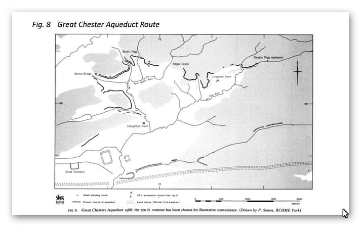
My research also extends to ancient water management, including the role of canals and other linear earthworks. I have discussed the true origins of Car Dyke in multiple posts, including Car Dyke – ABC News Podcast and Lidar Investigation Car Dyke – North Section, which suggest a Mesolithic origin 2357. I also explore the misidentification of Roman aqueducts, as seen in my posts on the Great Chesters (Roman) Aqueduct. My research has also been greatly informed by my post-glacial flooding hypothesis, which has helped explain landscape transformations over time. I have discussed this hypothesis in several posts, including AI now supports my Post-Glacial Flooding Hypothesis and Exploring Britain’s Flooded Past: A Personal Journey
For those interested in British Prehistory, visit www.prehistoric-britain.co.uk, a comprehensive resource featuring an extensive collection of archaeology articles, modern LiDAR investigations, and groundbreaking research. The site also includes insights and excerpts from the acclaimed Robert John Langdon Trilogy, a series of books that explore Britain during the Prehistoric period. Titles in the trilogy include The Stonehenge Enigma, Dawn of the Lost Civilisation, and The Post-Glacial Flooding Hypothesis, which offer compelling evidence of ancient landscapes shaped by post-glacial flooding.
To further explore these topics, Robert John Langdon has developed a dedicated YouTube channel featuring over 100 video documentaries and investigations that complement the trilogy. Notable discoveries and studies showcased on the channel include 13 Things that Don’t Make Sense in History and the revelation of Silbury Avenue – The Lost Stone Avenue, a rediscovered prehistoric feature at Avebury, Wiltshire.
In addition to his main works, Langdon has released a series of shorter, accessible publications, ideal for readers delving into specific topics. These include:
For active discussions and updates on the trilogy’s findings and recent LiDAR investigations, join our vibrant community on Facebook. Engage with like-minded enthusiasts by leaving a message or contributing to debates in our Facebook Group.
Whether through the books, the website, or interactive videos, we aim to provide a deeper understanding of Britain’s fascinating prehistoric past. We encourage you to explore these resources and uncover the mysteries of ancient landscapes through the lens of modern archaeology.
For more information, including chapter extracts and related publications, visit the Robert John Langdon Author Page. Dive into works such as The Stonehenge Enigma or Dawn of the Lost Civilisation, and explore cutting-edge theories that challenge traditional historical narratives.
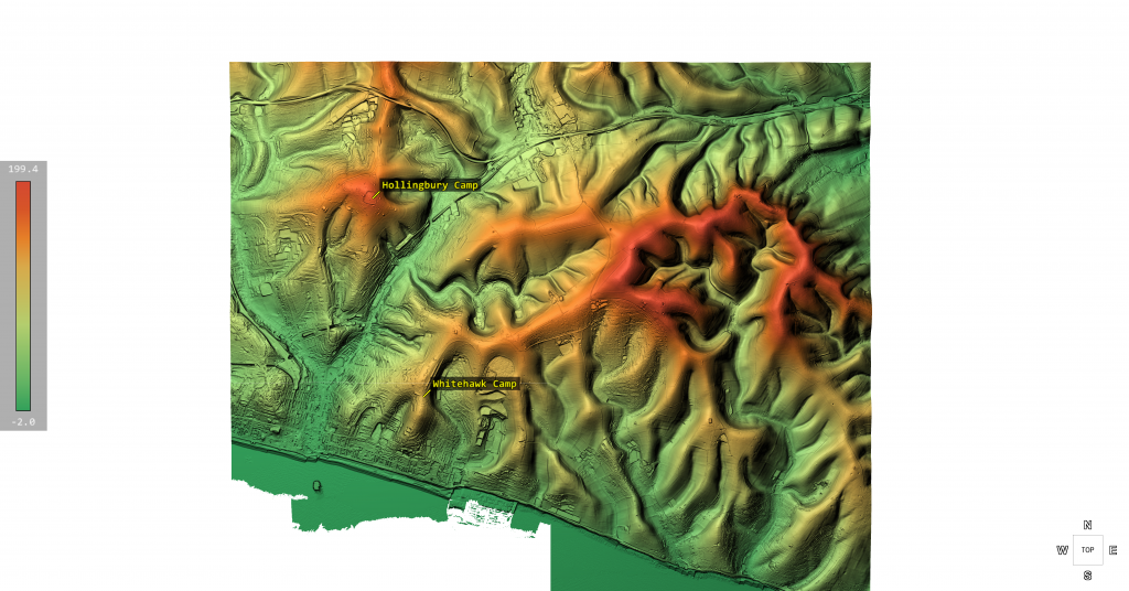
There is a single bank and ditch at Hollingbury, roughly square with rounded corners, enclosing around 9 acres (3.6 ha). The original entrances lie to the east and west, with the western entrance distinctly inturned—classic “defensive” design, we’re told. Pottery recovered during excavation places it neatly in the Iron Age, around 450–250 BC.
And that’s where the story usually stops.
But let’s actually look at the landscape.
Lidar Map of Brighton – Hollingsbury Camp
Inside the enclosure sit three Bronze Age bowl barrows, aligned north–south near the centre. That alone tells us the site had significance long before the so-called Iron Age “fort” was constructed. This isn’t a one-phase monument—it’s a reused landscape.
Now here’s where it gets interesting.
The Harbour That Nobody Talks About
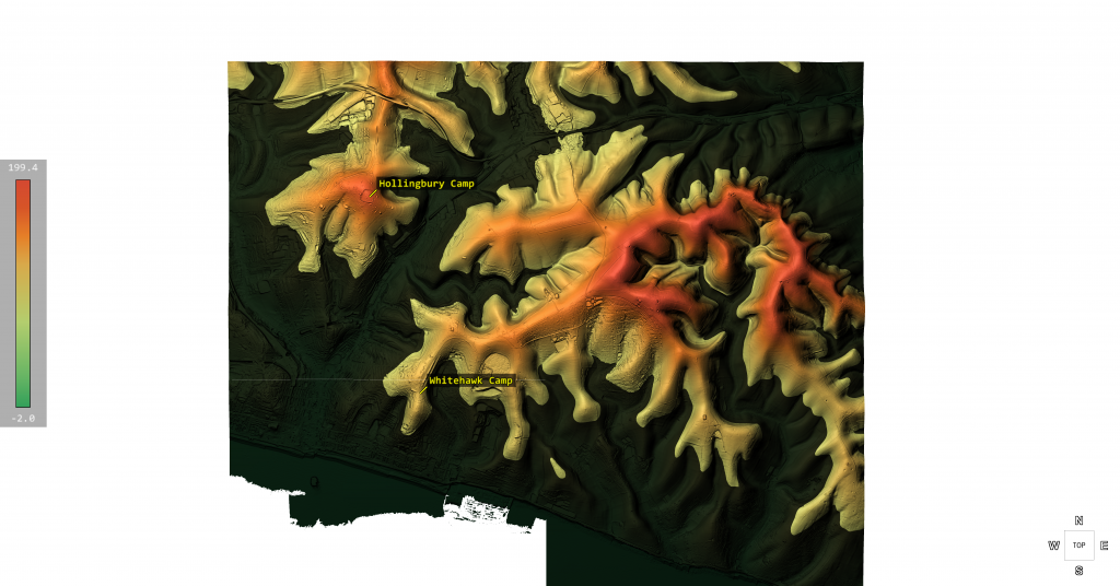
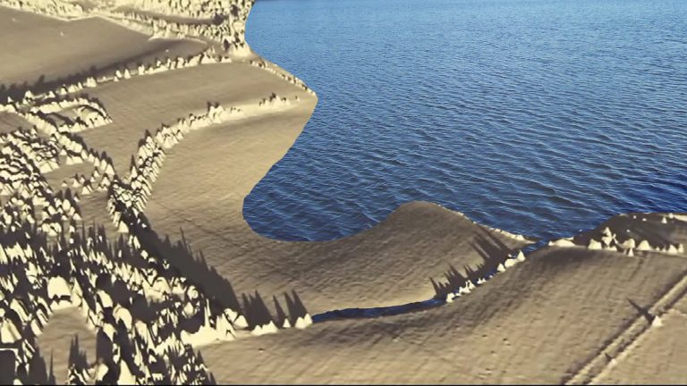
LiDAR Map of Hollingbury Camp in the Mesolithic Period – Hollingbury Camp Brighton
When you strip away the modern assumptions and look at the terrain model, Hollingbury reveals something far more compelling—a natural basin, a sheltered hollow with clear defensive sides.
In other words:
➡️ A harbour.
Not a symbolic one. A functional one.
A place where vessels could shelter, protected from prevailing conditions, connected to wider water systems leading toward the Channel.
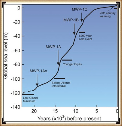
If you accept—based on measurable hydrology—that early Holocene Britain operated under significantly higher water tables and river levels, then sites like Hollingbury stop being “hillforts” and start being coastal or inland port infrastructure.
This is not speculation—it follows directly from the physics of post-glacial drainage and landscape response.
Trade, Not Tribes
Look around the perimeter and you’ll find pits and quarries.
Archaeology calls them “extraction features.”
But ask the obvious question:
➡️ Extraction for what purpose?
The answer is trade.
Minerals, flint, chalk products—materials that had value and were moved. You don’t build infrastructure like this for isolation. You build it for exchange.
The Dating Problem Nobody Wants to Address
The conventional timeline—Iron Age construction—relies heavily on pottery and standard dating frameworks.
But those frameworks have known limitations:
➡️ Reworked material ➡️ Contamination ➡️ Reservoir effects ➡️ Post-depositional movement
All of which can shift dates significantly, especially in water-influenced environments .
So if the landscape itself was water-dominated for thousands of years after the Ice Age…
➡️ Then the context in which those artefacts were deposited is already compromised.
Which raises the uncomfortable possibility:
👉 The site could be far older than the assigned Iron Age label 👉 Potentially Late Mesolithic / Early Neolithic (~6000 years ago)
Midsummer, Memory, and Meaning
We’re told Hollingbury is a place of ritual—midsummer fires, folklore, Druids, dragons in burial mounds.
And yes, those traditions matter.
But they’re secondary.
They are memory, not origin.
People return to meaningful places. They reuse them. They mythologise them.
But they rarely build them without purpose in the first place.
So What Is Hollingbury?
Not just a hillfort. Not just a burial ground. Not just a ritual landscape.
➡️ It is infrastructure. ➡️ It is positioned for water. ➡️ It is aligned with trade. ➡️ It is reused across millennia.
And once you factor in post-glacial hydrology, it makes perfect sense.
What archaeology calls “hillforts” may in many cases be the fossilised remains of a water-based transport and trading network—one that existed in a very different Britain.
A Britain that was still draining from the Ice Age.
The question isn’t whether these sites were reused in the Iron Age.
They clearly were.
The question is:
👉 What were they before that?
The Prehistoric AI Team 🤖 (Still following the water… because the archaeology won’t 😎)
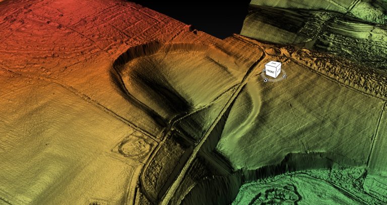
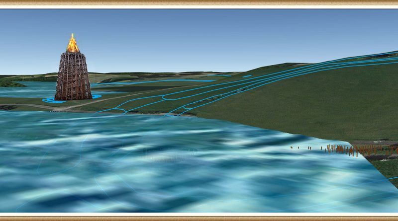
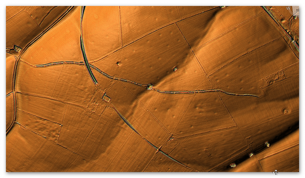
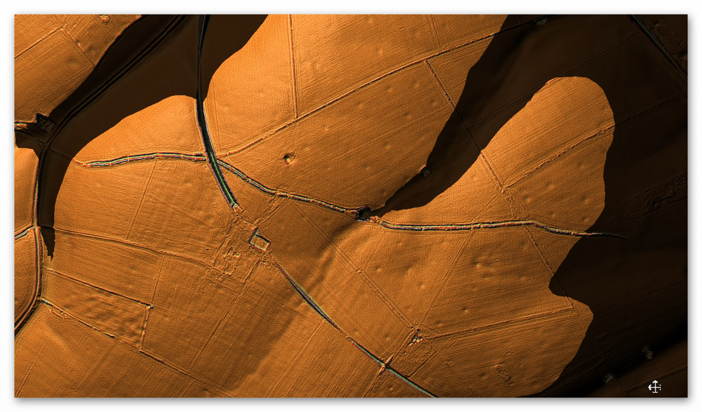
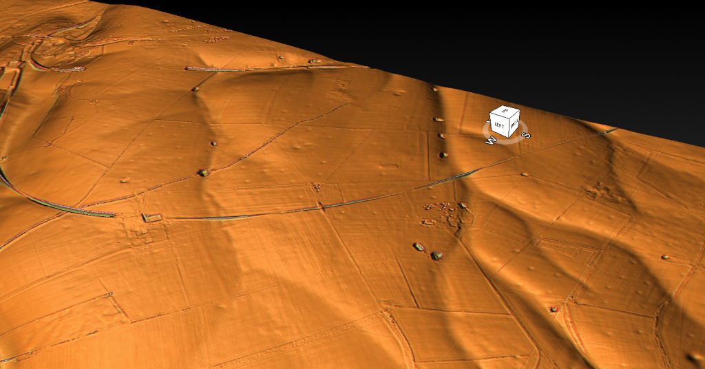
Use mouse and Left hand click (Ctrl) to PAN – Mouse and RIGHT hand Click to move UP and Down – and Wheel to zoom in the 3D Image
Durrington Walls has long been treated as a problem site. Despite decades of excavation, reinterpretation, and popular retelling, it has never settled comfortably into any single explanatory model. It is alternately described as a village, a ritual aggregation centre, a ceremonial counterpart to Stonehenge, or a symbolic landscape without a clear economic function. Each interpretation resolves one difficulty only by creating several others. The result is a site that is endlessly described, but never fully explained.
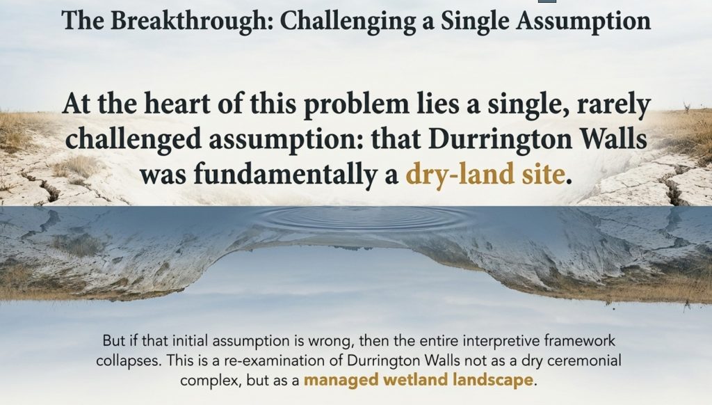
At the heart of this problem lies a single, rarely challenged assumption: that Durrington Walls was fundamentally a dry-land site.
Once this assumption is adopted, everything else follows automatically. Timber circles must be buildings. Ditches must be boundaries. Irregular features must be symbolic, incomplete, or poorly preserved. Water becomes incidental, a backdrop rather than an organising force. The site is then interpreted through analogy with later prehistoric monuments built on stable ground in fundamentally different environmental conditions.
But if that initial assumption is wrong, then the entire interpretive framework collapses.
This essay re-examines Durrington Walls not as a dry ceremonial complex, but as a managed wetland landscape, operating within a Mesolithic or early Neolithic hydrological regime characterised by elevated groundwater, seasonal flooding, and an expanded River Avon system. When water is treated as an active variable rather than an inconvenience, features that once appeared anomalous begin to behave coherently. Structures that resisted architectural explanation begin to make functional sense.
Crucially, this reassessment does not rely on speculation, symbolism, or ethnographic metaphor. It is driven by structure: by the physical geometry of post-holes, the mechanics of timber insertion and removal, the engineering logic of ditches, and the spatial relationships between features. The question throughout is not “what did this mean?” but “what does this do?”
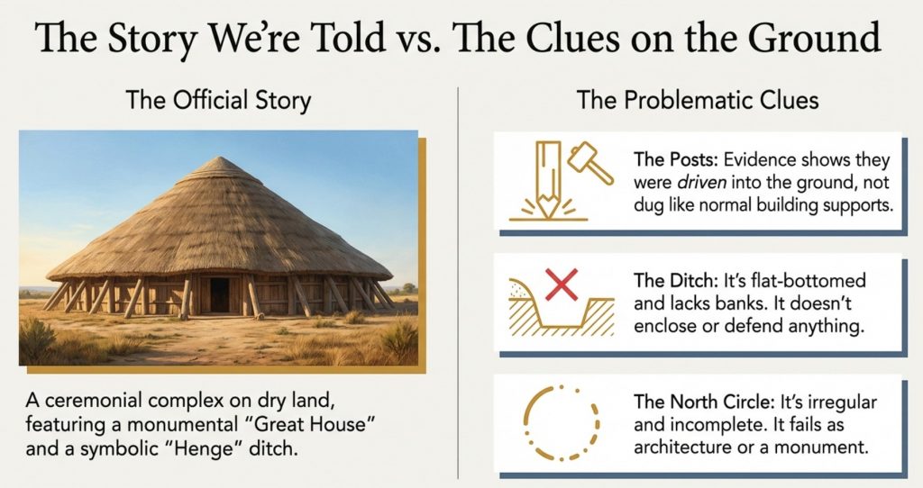
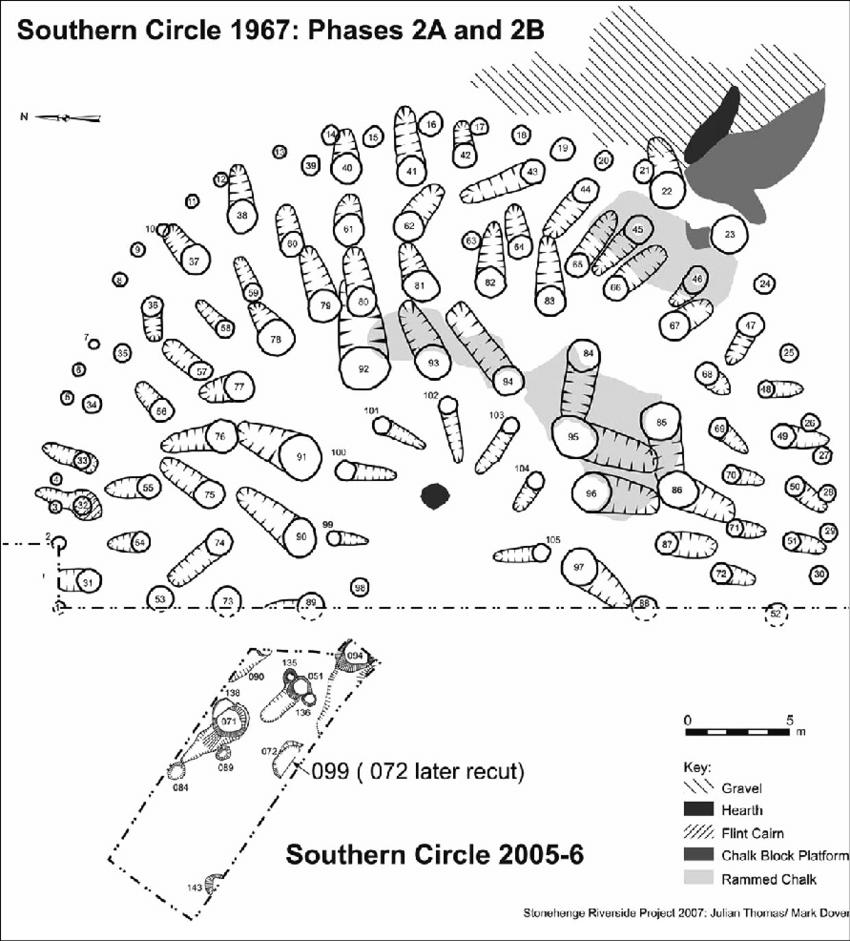
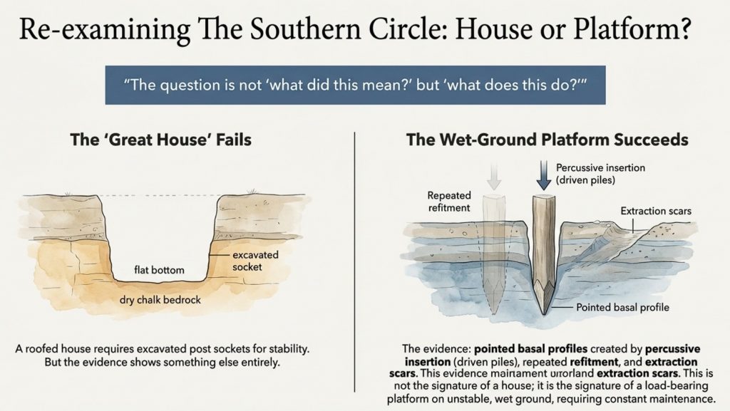
Previous discussions have already demonstrated that the Southern Circle at Durrington Walls does not conform to the construction logic of a domestic “great house.” Its post-holes show evidence of driven piles rather than excavated sockets, repeated refitment, extraction scars, and maintenance over time—behaviour entirely inconsistent with a single-phase roofed structure, but entirely consistent with a load-bearing platform operating in wet or unstable ground. That argument will be summarised here, not repeated in full.
What has received far less attention, however, is the Northern Circle.
The North Circle has always been awkward for orthodox interpretations. It is irregular, incomplete, and structurally incoherent if treated as architecture. It lacks symmetry, closure, and any plausible roof logic. As a result, it has often been marginalised in discussion, treated as a secondary or failed monument, or folded into vague ceremonial narratives that demand little mechanical explanation.
This essay takes a different approach.
Instead of asking why the North Circle fails to resemble a building, it asks whether it was ever intended to be one.
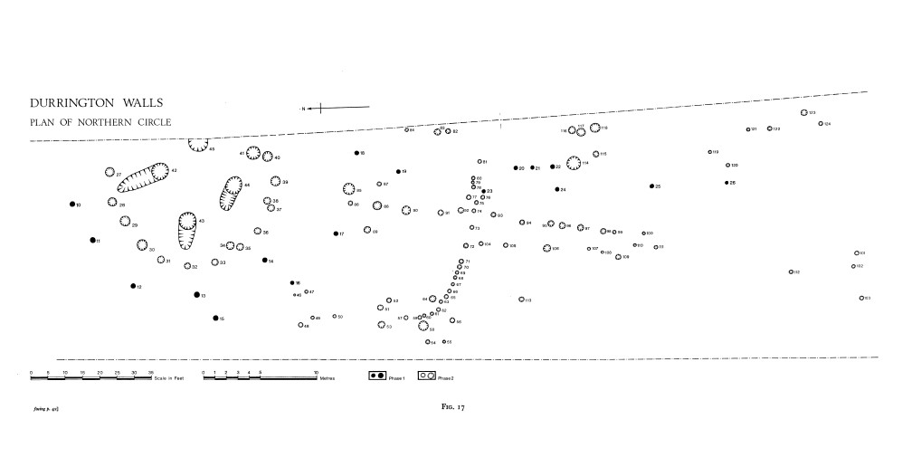
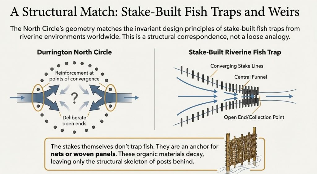
When the North Circle post-hole pattern is examined without architectural preconceptions, a very different structure emerges. The arrangement is directional rather than radial. Post density varies by position rather than by ritual importance. Open-ended alignments replace enclosed rings. Linear elements appear that make no sense as walls, but perfect sense as access routes. In plan, the structure resembles neither a house nor a monument, but a capture and control system.
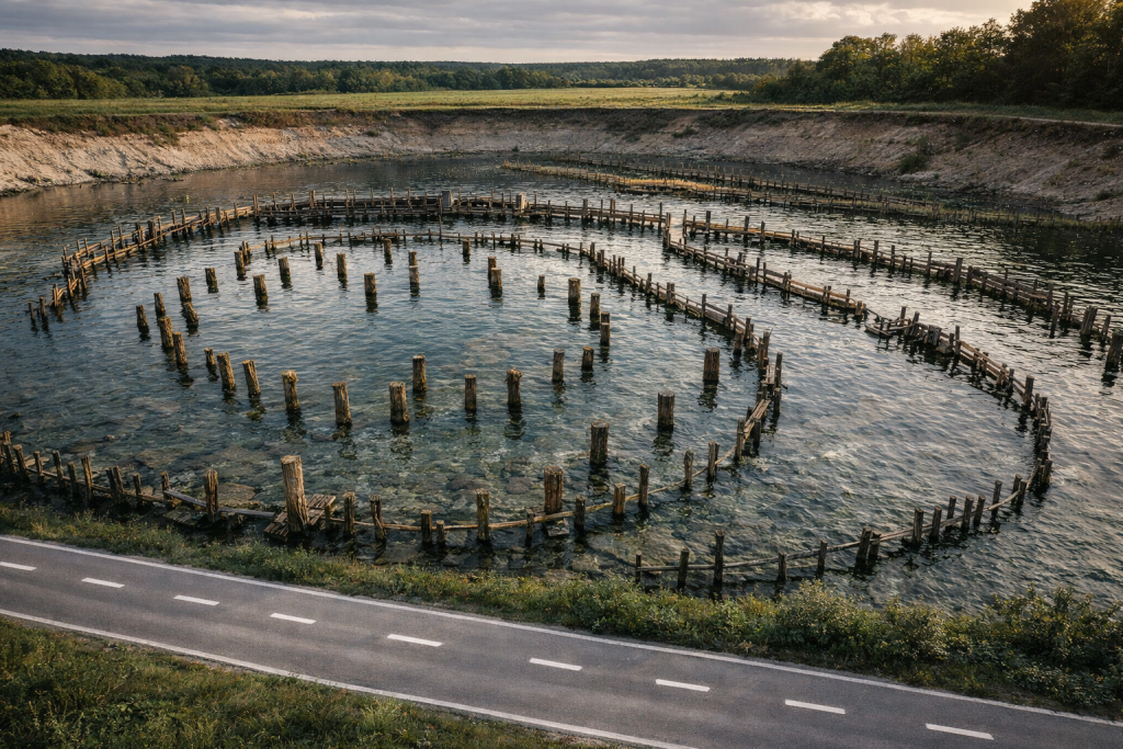
Specifically, it resembles a stake-built fish trap or weir, integrated into a seasonally flooded landscape and connected—directly or indirectly—to the Avon system.
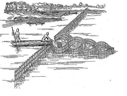
This proposal is not based solely on analogy. Fish traps across riverine and wetland environments worldwide share a remarkably consistent structural logic: converging stake lines, funnel geometries, selective reinforcement, open ends, and maintenance walkways. These traits recur because they work. When these same traits appear at Durrington, they deserve to be evaluated functionally rather than dismissed symbolically.
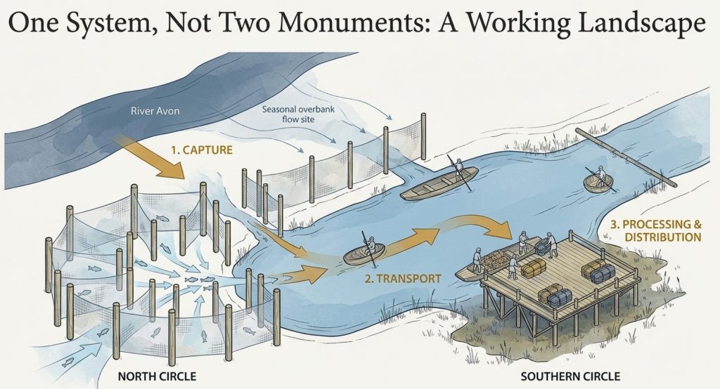
The argument developed in the sections that follow is therefore straightforward, but far-reaching. Durrington Walls was not a village decorated with monuments. It was a working landscape, engineered to manage water, movement, and resources. The Southern Circle and Northern Circle were not paired symbols, but paired components within a single operational system: one concerned with capture and provisioning, the other with unloading, staging, and redistribution.
Once this is recognised, Durrington ceases to be enigmatic.
It becomes intelligible.
Durrington Walls Revisited
The Southern Circle Revisited: Why It Was Never a “Great House”
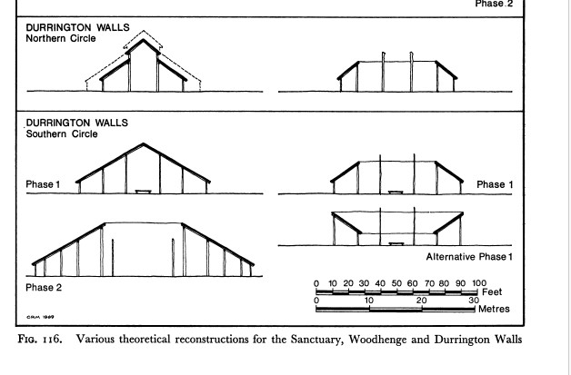
The interpretation of the Southern Circle at Durrington Walls as a monumental timber “great house” has become so familiar that it is rarely interrogated at a mechanical level. The idea is attractive: a vast roofed hall, domestic or ceremonial in nature, forming a symbolic counterpart to Stonehenge. Yet when the excavation evidence is examined in detail—particularly the published section drawings rather than the interpretive summaries—the great house model begins to fail almost immediately.
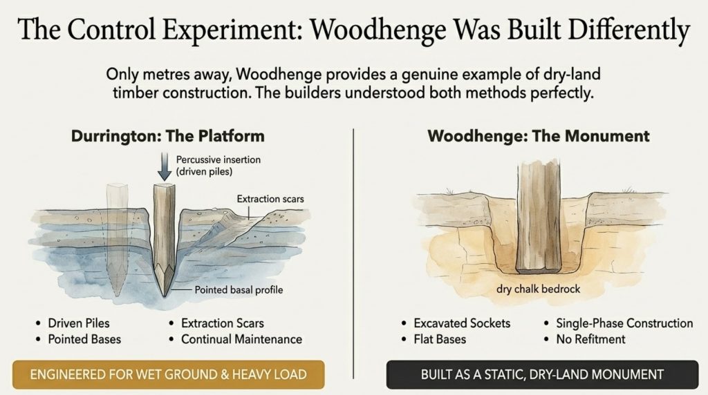
The most revealing comparison lies only a short distance away. Woodhenge provides a genuine example of dry-land timber construction in the same landscape. There, the post-holes behave exactly as expected for excavated sockets: bases are flat or gently scooped, profiles widen with depth, and the construction appears largely single-phase. There is no evidence for repeated refitment, no extraction scars, and no need for structural revision once the building was complete. This is what dry-ground timber architecture looks like.
The Southern Circle shows none of these characteristics.
Instead, a significant proportion of its post-holes display pointed or strongly convergent basal profiles. This is not a minor detail. In chalk geology, a pointed base cannot be created—or preserved—by excavation using antler picks or stone tools. Digging necessarily destroys such geometry almost immediately: chalk fractures, loosens, and collapses under levering action. The only reliable way to create and preserve a pointed basal profile in chalk is through percussive insertion—repeatedly driving a sharpened timber pole vertically into the ground.
In other words, these posts were driven, not dug.
This single observation has far-reaching consequences. Driven posts imply a construction method closer to pile-driving than pit excavation. They imply a concern with vertical load transfer rather than lateral stability. And they imply ground conditions in which excavation was either impractical or unnecessary—conditions consistent with saturated or semi-saturated substrates, not dry stable ground.
The Southern Circle also shows extensive evidence of refitment and maintenance. Many post-holes were re-cut, enlarged, or overlapped by later insertions. Some show multiple phases of intervention, with earlier sockets truncated or partially reused. This behaviour is incompatible with a roofed hall. Large timber buildings are constructed once, used for their lifespan, and then abandoned or dismantled. They are not repeatedly re-engineered at the level of individual load-bearing elements.
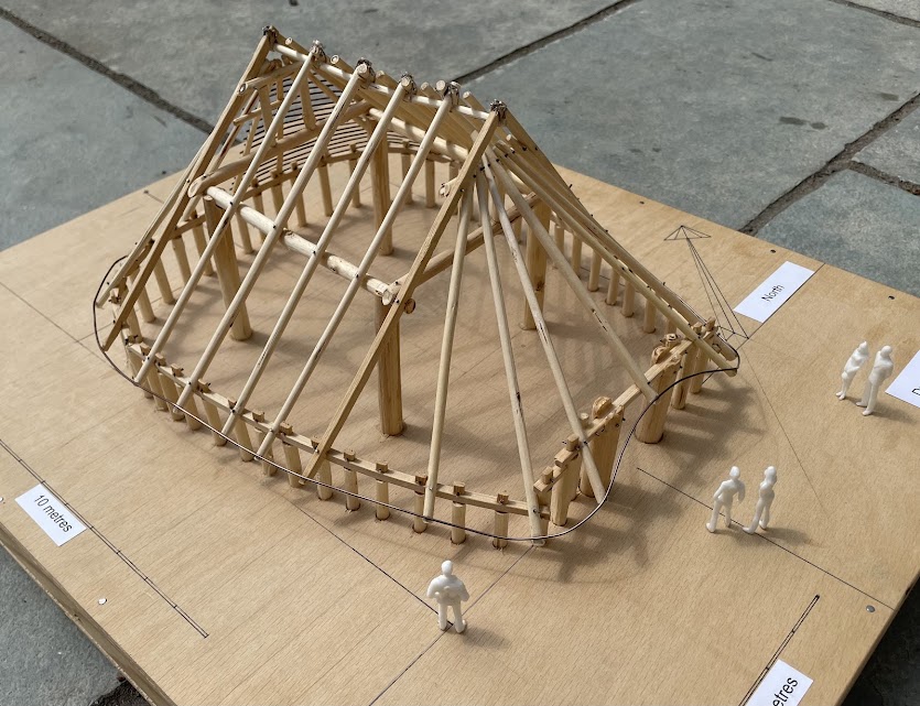
The Graet House – being constructed at the Stonehenge Visitors site – Durrington Walls Revisited
Platforms, by contrast, are.
A load-bearing platform operating in wet ground is subject to continual stress. Timber piles rot, shift, or fail below the waterline. Loads change seasonally. Maintenance is not optional; it is a structural necessity. The Southern Circle’s pattern of intervention fits this logic precisely. It behaves like a working structure that requires periodic repair, not like a symbolic or domestic building.
The so-called “ramps” associated with many of the Southern Circle post-holes reinforce this conclusion. These features have traditionally been interpreted as construction aids, used to insert large timbers into excavated pits. Mechanically, this interpretation is weak. A pointed timber pile does not require a ramp to be driven vertically. It does, however, require leverage and access when being removed—especially from wet or compacted ground.
The ramps at Durrington are irregular in orientation, inconsistent in form, and closely associated with refitment episodes. They make little sense as planned construction features. They make perfect sense as extraction scars, created when failing piles were levered out at oblique angles prior to replacement.
Water also resolves several subsidiary problems that have long accompanied the Southern Circle. The relative absence of charcoal, often cited as anomalous for a timber structure, is easily explained in wet conditions, where organic debris is floated away, oxidised, or redeposited elsewhere. The preservation of pointed basal profiles becomes more plausible when chalk fines slump and seal around driven posts in saturated ground. Even the subtlety of the ramps themselves is better explained by soft, infilling sediments than by erosion on dry surfaces.
Finally, the location of the Southern Circle is deeply uncomfortable for a “great house” interpretation. It sits at the head of a coombe, above the River Avon, on chalk geology prone to elevated groundwater, and within a broad flat-bottomed ditch. This is a poor location for a monumental roofed building. It is an excellent location for a pile-supported platform designed to interface with water.
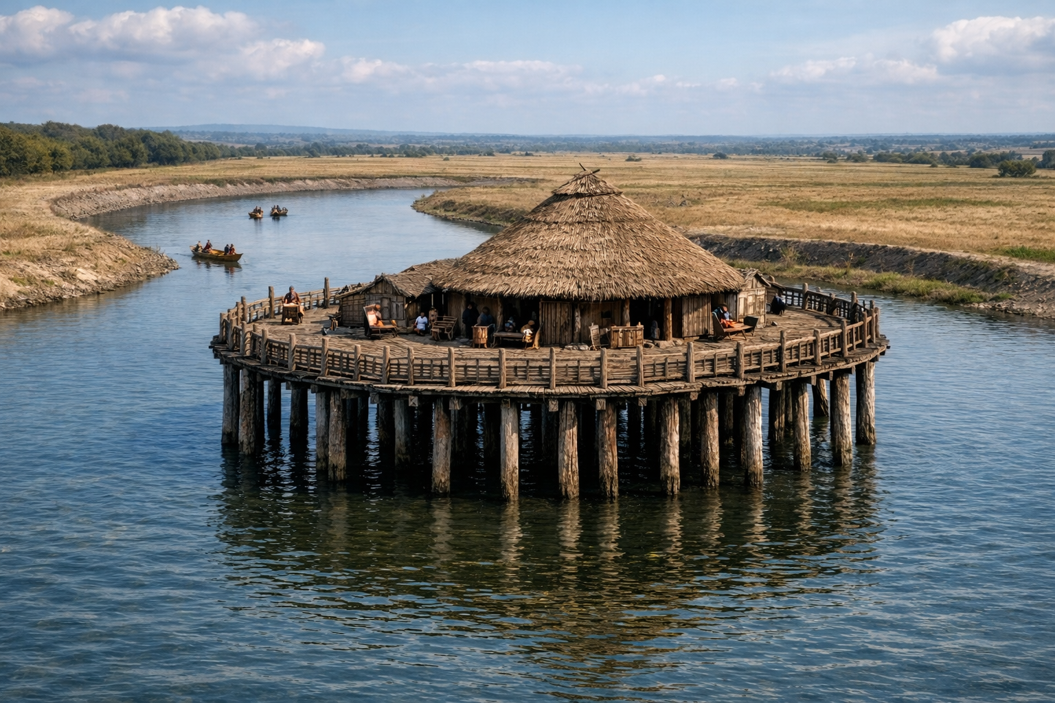
When all of these observations are taken together, the conclusion is difficult to avoid. The Southern Circle at Durrington Walls was not constructed like a house, not maintained like one, and not positioned like one. It behaves instead as a load-bearing, wet-ground-adapted platform, built using driven timber piles and maintained through repeated intervention.
This reclassification is not speculative. It follows directly from the published excavation evidence. And once accepted, it provides the foundation for understanding the rest of the site—particularly the Northern Circle—not as isolated monuments, but as components within a single, coherent system.
Durrington Walls Revisited
The Ditch That Isn’t a Henge
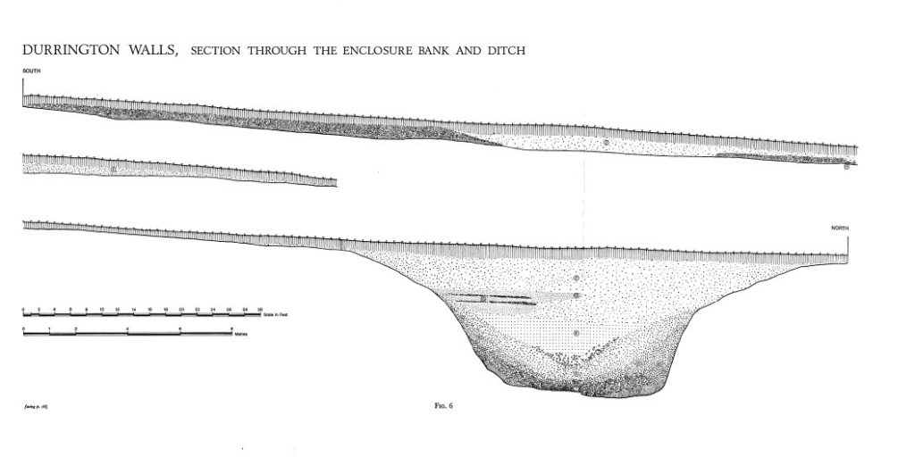
Encircling much of Durrington Walls is a substantial ditch, approximately six metres wide, flat-bottomed, and conspicuously lacking many of the features usually associated with a defensive or symbolic enclosure. For decades, this feature has been described almost reflexively as a “henge ditch.” Yet this label explains little. Instead, it obscures a series of mechanical and spatial problems that have never been satisfactorily resolved.
If the ditch is examined as part of a conventional henge monument, its design is baffling. It has no associated bank, either internal or external. It does not create a visual boundary, nor does it restrict movement in any meaningful way. In places, it terminates abruptly, particularly near the Southern Circle, rather than forming a closed circuit. Its scale is excessive for symbolism alone, yet insufficient for defence. These inconsistencies have been noted repeatedly, but they are usually brushed aside as idiosyncrasies or later disturbances.
The difficulty lies not in the ditch itself, but in the assumption that it must be a boundary.
Boundaries—whether defensive, ritual, or social—require continuity. They are designed to enclose, exclude, or demarcate. They demand banks, palisades, or visual markers that signal a transition from one space to another. The Durrington ditch does none of these things. It is flat-bottomed rather than V-shaped, open rather than enclosed, and discontinuous rather than circuital. As a boundary, it fails on every functional criterion.
As an element of water infrastructure, however, it begins to make sense almost immediately.
Flat-bottomed channels are not arbitrary. They are used where predictable draft matters, where grounding without capsizing is desirable, and where loading and unloading must occur repeatedly. A flat base allows small craft to settle safely as water levels fluctuate. It facilitates the transfer of people, animals, or goods. And crucially, it will enable vessels to wait—either moored or grounded—without blocking movement elsewhere in the system.
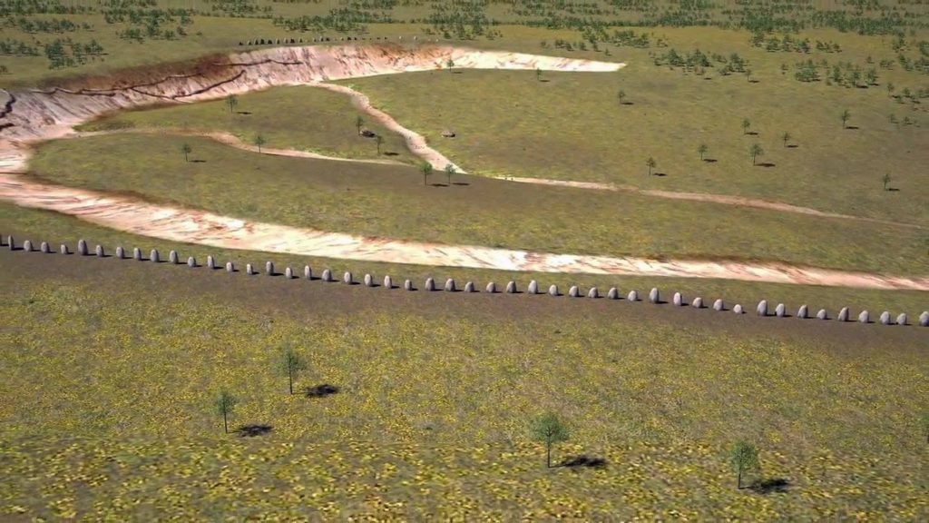
Inadequate representation of the ditch – for Propaganda purposes – Durrington Walls Revisited
In such a context, a bank would be a liability rather than an asset. Banks restrict access, create instability through slumping, and impede lateral movement. The absence of a bank at Durrington is not an omission; it is a design choice.
The ditch also stops where it stops being useful. Near the Southern Circle platform, where water-managed access converges, the ditch terminates rather than looping neatly around the structure. This behaviour is inexplicable in symbolic terms, but entirely logical if the ditch functions as an access basin or secondary channel — infrastructure ends where function ends, not where geometry demands closure.
Further reinforcing this interpretation is the presence of smaller, narrow linear ditches within the enclosure. These features cut across activity areas, vary in depth according to slope, do not enclose anything, and extend beyond the immediate vicinity of the Southern Circle. They are often dismissed as later intrusions, drainage attempts, or poorly understood disturbances. Such labels may account for reuse, but they do not explain origin.
The site drawings are not the same as the excvation Record view of the ditch – Durrington Walls Revisited
In a dry landscape, these features are indeed awkward. They serve no obvious purpose. In a seasonally flooded chalk landscape, however, they behave exactly as secondary redistribution channels. They guide shallow flows, drain saturated areas, and create controlled pathways for water, people, or small craft moving between functional zones.
The critical point is that none of this infrastructure makes sense unless water was a recurring and significant presence. In permanently dry conditions, the ditch is redundant. The platform is unnecessary. The engineering is absurd. In wet conditions—where wheeled transport fails, livestock must be controlled, and movement across saturated ground is hazardous—water becomes the safest and most efficient route. The ditch, the channels, and the platform together form a coherent system.
This reinterpretation also dissolves the artificial separation between the ditch and the Southern Circle. Traditionally, the ditch is treated as a framing device, a symbolic container for the monument within. Under a functional reading, the relationship is reversed. The ditch exists for the platform, not around it. It facilitates access, movement, and staging at the point where loads are transferred between water and land, or vice versa.
Once the ditch is understood as an access basin rather than a boundary, it becomes clear that Durrington Walls was never intended to be enclosed in the conventional sense. It was designed to be entered, exited, and worked within. Control was achieved not through exclusion, but through channelling movement along predictable routes.
This reframing is not radical. It simply requires taking the physical form of the ditch seriously and asking what it is mechanically suited to do. When that question is asked honestly, the answer is no longer “henge,” but hydraulic infrastructure.
And that infrastructure, as the next section will show, connects directly to the site’s most misunderstood element: the Northern Circle.
Durrington is NOT a Henge as it has no banks and it’s a natural water feature – Durrington Walls Revisited
Introducing the North Circle: The Forgotten Half of the System
If the Southern Circle has been misread because it was forced into the category of a “great house,” then the North Circle has been misread because it has never fit comfortably into any category at all. Its awkwardness is not accidental. It is the clearest signal that the interpretive framework applied to Durrington Walls has been wrong from the outset.
The North Circle has typically been described in vague or dismissive terms: an incomplete timber circle, a subsidiary structure, a poorly preserved monument, or a ceremonial feature whose purpose remains unclear. These descriptions all share a common trait—they treat the North Circle as a failed version of something else, rather than asking what it actually is.
When examined on its own terms, the North Circle does not behave like architecture.
Architectural timber circles, whether domestic or ceremonial, tend to display several consistent characteristics. They favour regular spacing, because loads must be distributed predictably. They favour symmetry because roof structures require balanced support. They favour closure, because walls and roofs must enclose space. And they usually exhibit clear entrance logic aligned with internal organisation.
The North Circle exhibits none of these traits.
Instead, its post-holes are irregularly spaced, with zones of dense clustering and zones of relative absence. The arrangement is incomplete rather than closed. There is no coherent radial symmetry, no central focus, and no plausible roof geometry that could span the pattern without extraordinary and unnecessary complexity. Attempts to “complete” the circle or impose a regular geometry on it require heavy interpretive intervention—joining dots that the ground itself does not join.
This failure has often been attributed to truncation, later disturbance, or erosion. Yet this explanation becomes increasingly strained when the pattern is viewed as a whole. The irregularities are not random. They are structured. They display directionality, not decay.
Several alignments within the North Circle converge or taper, forming subtle V- or funnel-like shapes. These are not centred on a focal point, but biased toward particular orientations. Post density increases in some areas precisely where a structural or functional constraint would be expected, and decreases where openness would be advantageous. The plan reads not as a ring, but as a system of guidance and control.
Equally telling is what the North Circle does not attempt to do. It does not demarcate a sacred interior. It does not create an enclosed performance space. It does not separate inside from outside. Instead, it remains porous, open-ended, and accessible. These are not failures of design; they are the opposite. They indicate that containment was never the goal.
The persistent mistake has been to assume that posts must define walls.
Posts can just as easily define routes, channels, funnels, and working edges. In wetland and riverine environments, timber stakes are rarely used to enclose space. They are used to shape the movement of water, animals, and people. When the North Circle is read with this in mind, its structure stops looking defective and starts looking purposeful.
The spatial relationship between the North and South Circles reinforces this interpretation. The two are not redundant repetitions of the same idea. They occupy different positions within the enclosure, relate differently to slope and hydrology, and exhibit radically different construction logic. If they were both ceremonial timber monuments, built by the same community for the same symbolic purpose, this divergence would be inexplicable.
If they are components of a functional system, it is expected.
The Southern Circle, with its deep driven piles and heavy maintenance signature, behaves like a load-bearing interface—a place where weight, stress, and repeated use demanded structural robustness. The North Circle, by contrast, exhibits lighter construction, selective reinforcement, and directional geometry. It appears designed to work with movement rather than resist it.
This distinction has important implications. It suggests that Durrington Walls was not organised around a single focal monument, but around distributed functions. Different tasks required different structures, each optimised for its role within a larger operational landscape. In such a system, symmetry and monumentality are irrelevant. Efficiency and adaptability matter far more.
The North Circle has been forgotten not because it is unimportant, but because it does not conform to expectations. It does not announce itself as a monument. It does not demand reverence. It looks messy, irregular, and practical. In other words, it looks like infrastructure.
Recognising the North Circle as such does more than rehabilitate a neglected feature. It completes the picture begun with the Southern Circle and the ditch. It suggests that Durrington Walls was organised around movement and control, not static display. And it prepares the ground for a closer examination of the North Circle’s post-hole structure—an examination that points, quite consistently, toward a specific functional model.
That model is not architectural.
It is economic.
And it is aquatic
Simplistic Archaeologist’s View of The Southern Circle – Durrington Walls Revisited
Reading the Post-Hole Structure Correctly
The North Circle at Durrington Walls has resisted interpretation primarily because it has been read as architecture. Once that assumption is removed, the post-hole pattern stops appearing chaotic and begins to behave coherently. The key is to read the structure directionally, not radially.
This section does not argue by analogy or symbolism. It reads the geometry as preserved in plan.
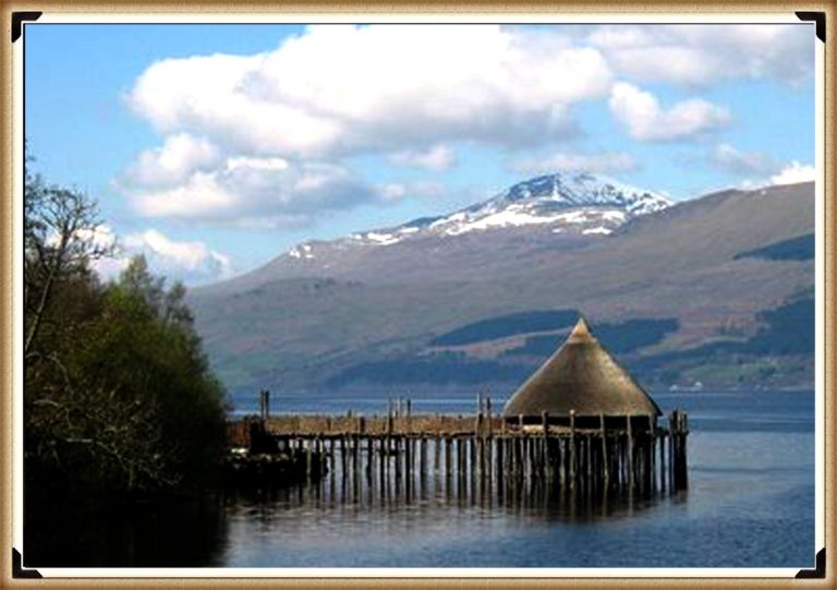
A Crannog lives in water and has an evident footprint – Durrington Walls Revisited
5.1 Directionality, Not Radial Design
Architectural timber circles—whether domestic or ceremonial—are organised radially. Posts are arranged around a centre, spacing is broadly consistent, and geometry prioritises balance. The North Circle does none of this.
Instead, the post-holes form directional alignments.
Several lines of posts converge, narrowing toward specific zones rather than orbiting a central point. These alignments do not mirror one another, nor do they divide space evenly. They are biased in orientation, favouring particular directions across the enclosure rather than reinforcing a circular interior.
Most importantly, these converging lines form funnel-like geometries.
Funnels are not architectural devices. They are control devices. They are used to guide movement—of water, animals, or material—toward predictable points. In buildings, funnels are undesirable; they create uneven load and instability. In capture systems, they are essential.
The absence of any true radial symmetry is therefore not a problem to be explained away. It is diagnostic. The structure was never intended to define a central space.
Northern Circle showing a classic Crannog connected walkway- Durrington Walls Revisited
5.2 Variable Density and Open Ends
Equally revealing is the uneven density of post-holes across the structure.
Some zones show closely spaced posts, reinforced and clustered. Other areas are sparse, open, or entirely absent of posts. This pattern is inconsistent with walls or supports, which demand relatively uniform spacing to function structurally.
Instead, the density varies where stress or control would be required.
Reinforced zones occur at points of convergence and directional change. These are precisely the locations where pressure—hydraulic, biological, or mechanical—would be concentrated. Open zones occur where flow must continue unimpeded. This is not accidental variation; it is selective reinforcement.
Just as important is what the structure does not do.
The North Circle does not close.
There is no continuous ring, no sealed boundary, and no attempt to demarcate an “inside” and “outside.” Gaps are not randomly distributed but aligned with the directional geometry of the posts themselves. These open ends allow movement through the structure rather than confinement within it.
Containment is the defining feature of architecture. Controlled permeability is the defining feature of movement systems.
The North Circle is consistently permeable.
5.3 Structural Implication
Taken together, these characteristics are decisive:
Converging lines rather than radial symmetry
Funnel-shaped geometries rather than enclosed spaces
Biased orientation rather than balanced layout
Reinforced zones paired with deliberate openness
Absence of closure
This is not architectural geometry.
It is movement-control geometry.
The posts do not define walls. They define paths. They do not enclose space. They shape flow.
Once read correctly, the North Circle ceases to be an “incomplete monument” and becomes a purpose-built control structure designed to operate within a fluid, changing environment. The geometry is functional, not symbolic, and it does exactly what it needs to do—no more, no less.
The remaining question is therefore not whether this structure controlled movement, but what kind of movement it was designed to control.
The answer to that question lies in a close comparison with known prehistoric and ethnographic examples of stake-built capture systems—specifically, fish traps and weirs.
That comparison is structural, not metaphorical, and it is the subject of the next section.
Durrington Walls Revisited
Fish Traps, Weirs, and Walkways: A Structural Match
Once the North Circle is read as movement-control geometry rather than architecture, the range of plausible functions narrows rapidly. Among known prehistoric structures, one class matches the observed geometry with remarkable consistency: stake-built fish traps and weirs in riverine and wetland environments.
This is not a loose analogy. It is a structural correspondence.
Across Europe and beyond, fish traps built from driven wooden stakes share a small number of invariant design principles. These principles recur because they solve the same physical problems—guiding aquatic movement, managing variable water levels, and allowing human access for maintenance and harvesting. The North Circle conforms to these principles point by point.
6.1 Core Structural Traits of Stake-Built Fish Traps
Fish traps are not enclosures. They are guidance systems.
Their defining features include:
Converging stake lines forming V- or funnel-shaped geometries
Biased orientation aligned to current, slope, or tidal movement
Selective reinforcement at points of pressure or convergence
Open ends to prevent blockage and allow controlled release
Replaceable driven posts, not permanent load-bearing timbers
These systems are designed to be worked, not admired. Stakes are driven, removed, replaced, and re-set as conditions change. Precision is functional, not geometric. Symmetry is irrelevant.
This description matches the North Circle far more closely than any architectural model ever proposed for it.
6.2 Funnel Geometry and Capture Logic
At the heart of most fish traps lies a simple idea: narrowing space increases predictability.
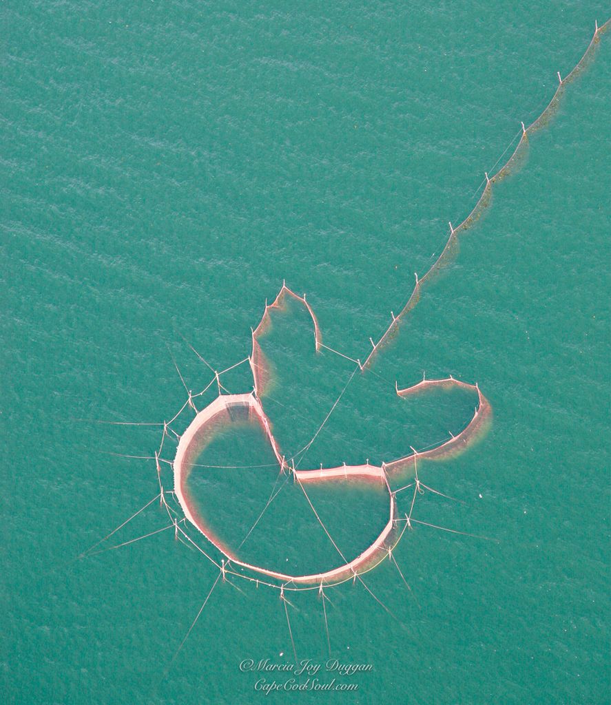
Fish moving with current, tide, or seasonal flow tend to follow the path of least resistance. Converging stake lines exploit this behaviour, reducing lateral escape while avoiding complete obstruction. The narrowing geometry concentrates fish into a manageable zone where they can be collected, speared, netted, or temporarily held.
The North Circle exhibits precisely this behaviour.
Its post alignments converge rather than encircle. Density increases toward specific zones rather than around a centre. There is no attempt to close the structure, because closure would be counterproductive. A fully enclosed trap risks blockage, damage, and loss of control during high flow.
Instead, permeability is engineered.
6.3 Walkways and Working Edges
A further diagnostic feature of fish traps is the presence of access routes.
Fish traps require continual human intervention:
clearing debris
repairing or replacing stakes
harvesting catch
adjusting geometry to seasonal conditions
For this reason, many prehistoric traps incorporate walkways or linear access edges—not formal platforms, but narrow zones where people can move alongside or into the structure without disrupting flow.
The North Circle includes precisely such linear elements.
These alignments do not contribute to enclosure or support. They make no sense as walls or screens. But as working edges, they are entirely intelligible. They allow access to key points within the structure while maintaining the integrity of the funnel geometry.
This feature is difficult to explain symbolically. It is trivial to explain functionally.
6.4 Driven Posts and Maintenance Cycles
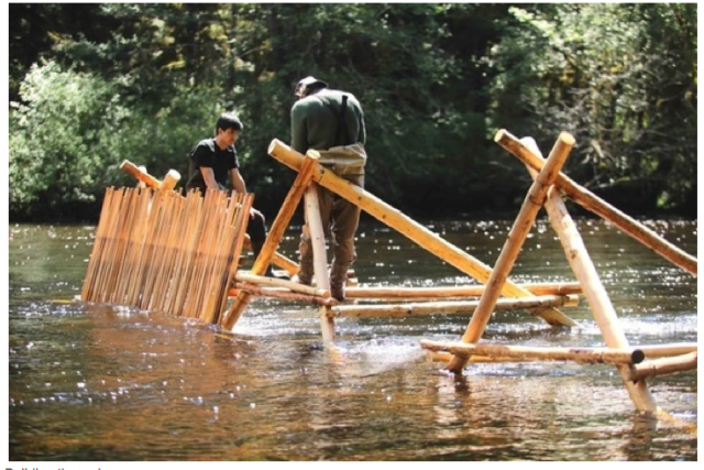
Fish traps almost universally employ driven stakes rather than excavated post-holes. Speed of construction, ease of replacement, and adaptability matter more than permanence. Stakes are sharpened, driven into soft or saturated ground, and replaced as needed.
This construction logic mirrors what has already been observed at Durrington, particularly in the Southern Circle, but at a lighter scale appropriate to a capture system rather than a load-bearing platform.
Crucially, fish traps leave minimal artefactual signatures. They are economic infrastructure, not ritual deposition sites. Their primary archaeological trace is geometric: the pattern of post-holes themselves. This explains both the long-standing interpretive discomfort and the lack of “confirmatory” finds.
Durrington Walls Revisited
6.5 Structural Conclusion
The correspondence between the North Circle and known fish-capture systems is not based on superficial resemblance. It is grounded in:
Directional funnel geometry
Variable post density
Open, non-enclosing design
Evidence for driven, replaceable posts
Presence of access alignments
Taken together, these traits identify the North Circle as a capture and control structure operating in a wetland context. Fish traps are not the only structures that control movement, but they are the only ones that match all of the observed characteristics without forcing the evidence.
The remaining task is to situate this structure within its environmental setting. Geometry alone suggests function; hydrology makes it inevitable.
That context—specifically the relationship between the North Circle, seasonal flooding, and the River Avon—is the focus of the next section.
6.6 Stakes Alone Do Not Capture Fish: The Role of Nets and Panels
It is essential to clarify a common misconception when interpreting prehistoric fish traps. Wooden stakes by themselves do not usually trap fish. Their primary role is to define geometry—to create funnels, guide movement, and provide anchoring points. Actual capture is achieved through flexible barriers fixed between those stakes.
Across ethnographic and archaeological examples, fish traps consistently combine:
driven poles or stakes
nets, woven reed panels, or wattle screens
removable or seasonal barriers
These soft components perform the critical work. Nets stretch between adjacent stakes, forming semi-permeable walls that allow water to pass while restricting fish movement. Wattle panels can be lifted, lowered, or removed entirely, enabling selective harvesting and preventing damage during high flow.
This distinction is crucial for interpreting the North Circle at Durrington Walls.
The post-hole pattern defines where barriers were anchored, not the barriers themselves. The absence of preserved nets or panels is therefore not a problem. Organic woven materials decay rapidly, particularly in fluctuating wet–dry conditions. What survives archaeologically is the system’s structural skeleton: the stake pattern.
This also explains the variable spacing observed in the North Circle. Where fine control was needed—such as at funnel throats or retention zones—posts are closer together, providing frequent anchor points for nets or woven screens. Where guidance alone was sufficient, spacing increases, allowing flow without excessive material resistance.
Importantly, this arrangement allows for adaptive management. Nets can be tightened or slackened. Panels can be reconfigured seasonally. Sections can be opened to release non-target species or to clear debris. The post system remains, while the soft infrastructure changes.
This behaviour aligns precisely with what is seen at Durrington. The North Circle shows:
permanent stake positions
selective reinforcement
no attempt at full enclosure
evidence for ongoing maintenance
These traits are incompatible with rigid architectural forms, but entirely consistent with net-assisted capture systems.
The presence of linear access alignments—interpreted in the previous section as walkways or working edges—becomes even more significant in this context. Nets must be set, checked, lifted, repaired, and cleared. This requires controlled human access along the structure. The North Circle provides that access structurally, without interfering with flow or capture zones.
Finally, this model explains why such a system would coexist with the Southern Circle platform rather than replace it. Fish traps capture and concentrate fish; platforms are needed to:
process catches
distribute food
store or dry fish
provision larger groups
The two structures are complementary, not redundant.
Durrington Walls Revisited
Hydrology and the Avon Connection
The functional interpretation of the North Circle as a net-assisted fish capture system only becomes fully coherent when placed within its hydrological context. Without water, the structure is inexplicable. With water, it is inevitable. The controlling variable is not symbolism or ritual intent, but the behaviour of the River Avon system during the Mesolithic and early Holocene.
Post-glacial Britain was not a dry, stable landscape punctuated by neatly contained rivers. It was a wet, dynamic environment characterised by elevated groundwater tables, seasonally inundated floodplains, and laterally mobile channels. Chalk landscapes in particular respond to rising water tables by spreading water across broad areas rather than confining it to discrete banks. Springs emerge unpredictably, coombes fill, and low gradients produce slow-moving, shallow flows ideal for fish movement—and capture.
In such conditions, the Avon would not have been the narrow, incised river seen today. It would have occupied a much broader floodplain, with multiple shallow channels, seasonal overbank flow, and temporary wetlands forming and dissipating across the valley floor. This is precisely the kind of environment in which stake-built fish traps are most effective.
Durrington Walls’ location places it at a critical junction within this system. Situated above the Avon, at the head of a coombe, the site occupies a natural transition zone between higher ground and floodplain. This is where water slows, spreads, and becomes manageable. Fish moving upstream or laterally with seasonal flooding are naturally funnelled into such areas. Human intervention needs only enhance an existing pattern.
The North Circle sits downslope from the main enclosure, in a position consistent with intermittent or seasonal water flow rather than permanent submersion. This is important. Fish traps are rarely placed in deep, fast-flowing channels. They are placed where water is shallow enough to control, slow enough to guide, and predictable enough to exploit repeatedly. The North Circle occupies exactly such a zone.
The Southern Circle platform, by contrast, occupies a slightly higher and more stable position. This spatial separation is not accidental. Capture systems are messy, dynamic, and exposed to fluctuating conditions. Processing and redistribution require firmer footing. The two structures are therefore arranged along a hydrological gradient rather than a ceremonial axis.
When the ditch system is reintroduced into this picture, the integration becomes clearer still. The broad flat-bottomed ditch functions as a controlled water body—part basin, part channel—linking capture zones, working areas, and access points. Smaller linear ditches act as secondary channels, draining or redistributing water as conditions change. Together, these features create a managed waterscape rather than a bounded monument.
This model also explains why Durrington Walls does not behave like a settlement. Permanent domestic occupation is poorly suited to fluctuating wet ground. Infrastructure, however, thrives on predictability rather than permanence. Fish runs are seasonal but reliable. Flooding is disruptive but cyclical. A site organised around provisioning and aggregation does not need year-round habitation; it requires timing.
The Avon connection further explains the scale of the system. Fish capture at this level is not a subsistence afterthought. It is provisioning infrastructure capable of supporting large numbers of people over short periods. This aligns neatly with isotopic evidence from nearby sites indicating the movement of cattle over long distances. Aggregation events require reliable food sources. Fish, preserved by drying or smoking, provide exactly that.
Crucially, none of this requires speculative reconstructions of ritual behaviour. It requires only an honest assessment of how water behaves in chalk landscapes and how people respond to it. Once hydrology is treated as an active force rather than a passive backdrop, the site stops fragmenting into unrelated anomalies and starts functioning as a system.
The North Circle does not need to be reimagined as symbolic. The Southern Circle does not need to be elevated into a hall. The ditch does not need to enclose anything.
They need only to be wet.
With the hydrological framework in place, the final step is to integrate all components—North Circle, Southern Circle, ditch, and channels—into a single operational model. That integration, and its wider implications for how Durrington Walls is understood, forms the basis of the next section.
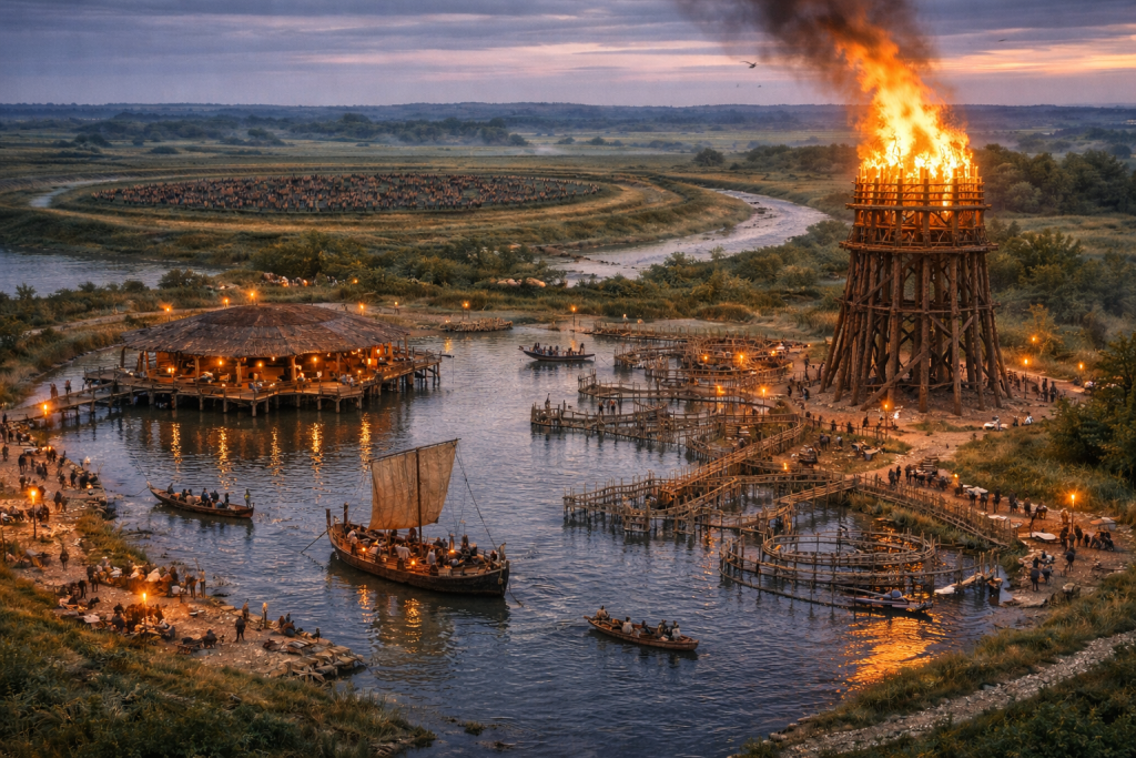
Avon in the Mesolithic – Durrington Walls Revisited
One System, Not Two Monuments
Once the North Circle is understood as a net-assisted fish capture structure operating within a flooded landscape, and the Southern Circle as a pile-supported platform adapted to wet ground, the most important interpretive shift becomes unavoidable: these were not two monuments serving parallel symbolic roles. They were two components within a single operational system, each designed for a different task but dependent on the other to function effectively.
Traditional interpretations have treated the two circles as variants of the same idea—timber equivalents of stone monuments, perhaps reflecting social or ritual dualism. This approach struggles to explain why the two structures differ so profoundly in construction logic, geometry, maintenance signature, and placement. If they were built by the same community, at roughly the same time, for the same symbolic purpose, such divergence would be inexplicable.
If they were built for different functions, it is exactly what we should expect.
The North Circle, with its directional geometry, variable post density, open ends, and reliance on nets or panels fixed between stakes, is optimised for capture and control. It operates in shallow, slow-moving water. It is light, adaptable, and continuously reworked. Its success depends on guiding movement rather than resisting it.
The Southern Circle, by contrast, is heavy, vertical, and structurally intensive. Driven piles, pointed bases, extraction scars, and repeated refitment indicate a structure designed to carry load and withstand repeated use. It is not concerned with guiding movement, but with supporting weight—people, animals, goods, or equipment—above unstable ground.
These are not alternative expressions of monumentality. They are complementary solutions to different problems posed by the same environment.
The spatial relationship between the two reinforces this reading. They are positioned along a hydrological gradient rather than a symbolic axis. Capture occurs where water spreads and slows; processing and redistribution occur where footing is more reliable. Movement between the two is short, direct, and controlled, minimising loss and maximising efficiency. This is how working landscapes are organised.
The ditch system binds these elements together. Far from enclosing or separating, it facilitates the circulation of water, people, and resources. The broad flat-bottomed ditch provides a holding basin and access route. Smaller linear ditches redistribute flow internally. Together, they create a managed network rather than a ceremonial boundary.
This integrated system also explains features that have long resisted interpretation. The absence of domestic architecture ceases to be a problem once the site is recognised as seasonal or task-specific rather than permanently inhabited. The lack of ritual deposition around the North Circle becomes irrelevant once its function is understood as economic rather than symbolic. The repeated maintenance of the Southern Circle stops being anomalous and becomes expected.
Importantly, this model does not diminish the social or cultural importance of Durrington Walls. On the contrary, it elevates it. The infrastructure of this scale implies coordination, planning, and shared knowledge. Fish capture systems require an understanding of seasonal cycles, water behaviour, and animal movement. Platforms that support heavy, repeated use demand engineering competence and long-term investment.
What it does reject is the idea that meaning must always precede function.
In many prehistoric contexts, function generates meaning, not the other way around. Aggregation sites become socially significant because they work—because they feed people, enable exchange, and bring groups together at predictable times. Ritualisation follows success; it does not replace it.
Seen in this light, Durrington Walls begins to resemble other large-scale provisioning landscapes known from wetland contexts worldwide. These are places where food is captured, processed, and distributed; where people gather seasonally; where social bonds are renewed around shared labour rather than abstract symbolism.
The persistent attempt to read Durrington as a dry ceremonial complex has obscured this possibility for decades. Once water is reintroduced as the organising force, the site stops fragmenting into unrelated anomalies. The North Circle, Southern Circle, ditch, and channels lock together into a coherent whole.
They were never meant to be read separately.
The next question, then, is not how this system functioned internally—that is now clear—but what it was capable of supporting. The answer lies in the scale of provisioning required to sustain aggregation, movement, and long-distance exchange. That evidence comes from the animals themselves.
Durrington Walls Revisited
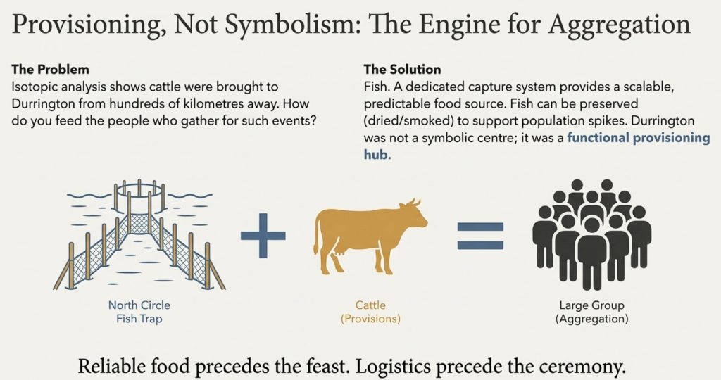
Provisioning, Not Symbolism: Fish, Cattle, and Aggregation
The integrated model proposed for Durrington Walls—combining fish capture, water-managed access, and load-bearing platforms—only makes sense if it served a substantial provisioning role. Infrastructure of this scale is not built to support small household groups. It is built to sustain aggregation: the periodic gathering of large numbers of people for social, economic, or logistical purposes. The archaeological evidence strongly supports this interpretation.
One of the most compelling lines of evidence comes from animal remains, particularly cattle. Isotopic analysis of cattle teeth from the Durrington area has demonstrated that animals were brought to the site from hundreds of kilometres away, including regions as distant as northern Britain. This level of movement cannot be explained by casual exchange or local herding. It implies planned transport, coordination across landscapes, and a clear reason for convergence.
Moving cattle over such distances presents a fundamental logistical challenge: feeding people during aggregation events. Large numbers of humans and animals arriving simultaneously create immediate provisioning demands. Terrestrial resources alone are insufficient unless extensive storage or long-term settlement is present. Durrington Walls shows no convincing evidence for either.
Fish solve this problem elegantly.
Riverine and wetland fish resources are highly productive, predictable, and scalable. Seasonal runs concentrate biomass naturally, allowing capture systems to harvest large quantities with relatively low labour input once infrastructure is in place. Fish can be consumed fresh, but more importantly, they can be preserved—dried or smoked—for use over extended periods. This makes them ideal for supporting short-term population spikes.
The presence of a dedicated fish capture system adjacent to a processing and redistribution platform transforms Durrington from a symbolic gathering place into a functional provisioning hub. Fish provide the caloric baseline that allows cattle to be moved and exchanged without exhausting local resources. In this context, cattle become socially and economically meaningful assets rather than primary food sources.
This also clarifies why the North Circle shows no signs of ritual elaboration. Fish traps are invisible when they work well. Their success is measured in output, not display. What mattered was reliability, not monumentality. The South Circle, by contrast, may well have acquired social significance over time—not because it was symbolic in origin, but because it became central to the site’s functioning.
Aggregation sites do not need to be permanently occupied to be socially powerful. In many ethnographic and archaeological examples, the opposite is true. Places that are visited seasonally, but reliably, acquire meaning precisely because they structure time, movement, and interaction. Durrington Walls fits this pattern far better than that of a permanent village.
The combined fish-and-cattle model also resolves the persistent question of scale. Why build such large earthworks and timber structures if they were not continuously inhabited? The answer is that scale reflects capacity, not population. Infrastructure is built to accommodate peak demand, not average use. The apparent over-engineering of the ditch, the maintenance-heavy nature of the Southern Circle, and the extensiveness of the enclosure all make sense once the site is understood as an aggregation and provisioning landscape.
This interpretation further undermines attempts to explain Durrington solely through ritual or cosmology. Ritual does not require such logistical redundancy. Symbolism does not demand maintenance cycles. Meaning does not require fish traps.
Provisioning does.
None of this denies the possibility that social or ceremonial activities occurred at Durrington Walls. On the contrary, they almost certainly did. But those activities were enabled by an infrastructure that worked first. The sequence matters. Food precedes feast; logistics precede ceremony.
By reframing Durrington as a provisioning hub rather than a symbolic centre, long-standing interpretive tensions dissolve. The absence of domestic architecture is no longer a problem. The scale of construction is no longer puzzling. The presence of multiple specialised structures becomes expected rather than anomalous.
The final issue to address is not whether this model fits the evidence—it does—but why it has been so persistently overlooked. That question speaks less to the site itself and more to the habits of the discipline that has studied it.
Durrington Walls Revisited
Woodhenge Reconsidered: Why a Real Timber Monument Was Built
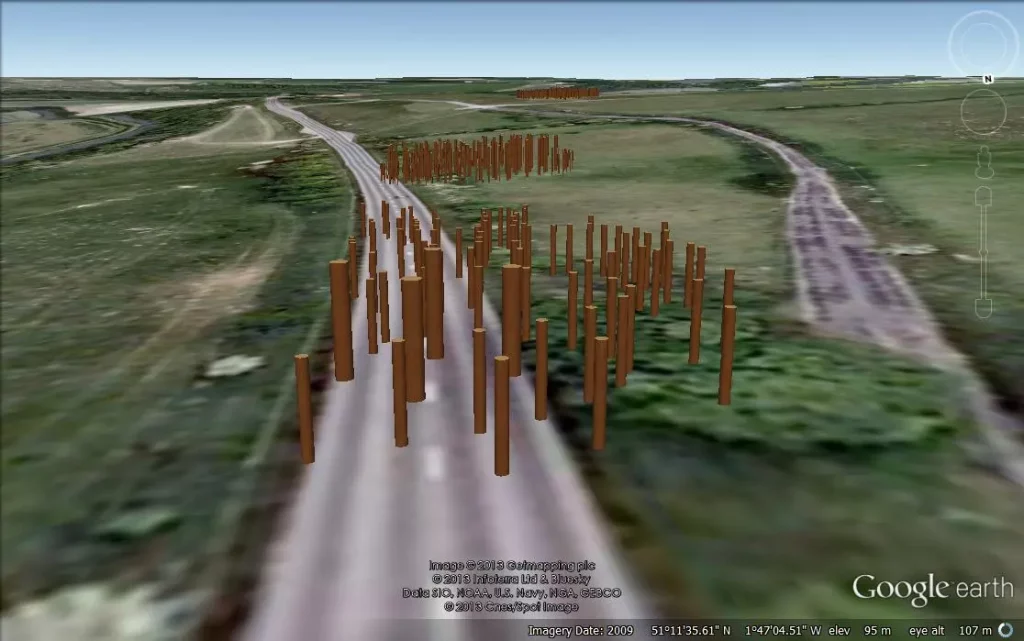
Any serious reinterpretation of Durrington Walls must confront an uncomfortable but decisive fact: Woodhenge exists only metres away, and it behaves entirely differently. This proximity removes any excuse for misinterpretation. If archaeologists wish to argue that the Southern Circle and the North Circle are misunderstood timber monuments, they must also explain why Woodhenge—built in the same landscape, by the same culture, using the same materials—follows a completely different construction logic.
When the excavation evidence is read honestly, Woodhenge is exactly what orthodox archaeology claims it to be: a dry-land timber monument. Its post-holes are excavated, not driven. Bases are flat or scooped. Spacing is regular and concentric. Construction appears largely single-phase. There is no evidence of refitment, no extraction scars, and no requirement for continual maintenance. This is what architecture looks like when it is built on stable ground.
In other words, Woodhenge behaves precisely as a monument should.
This matters because it means cultural incompetence, technological limitations, or preservation bias cannot explain away the anomalous behaviour observed at the Southern Circle. The builders clearly understood how to construct dry-land timber structures when they wanted to. They did so successfully at Woodhenge.
The question, then, is not whether they could build a great house or ceremonial monument at Durrington.
It is why they chose not to – The answer lies in function.
Durrington Walls Revisited
Woodhenge occupies a slightly higher, drier position in the landscape, removed from the most unstable ground and from the immediate water interface. Its geometry is regular, enclosed, and inward-facing. It defines a space rather than guiding movement. Everything about it suggests a static, symbolic structure—a place designed to be stood within, observed, or marked, rather than worked.
By contrast, the Southern Circle is engineered for load, not enclosure. Its driven piles, pointed bases, extraction scars, and repeated refitment demonstrate adaptation to unstable ground and continual stress. It is outward-facing, practical, and structurally redundant. These are not symbolic choices; they are engineering responses.
The North Circle pushes this contrast even further. Where Woodhenge is concentric and enclosed, the North Circle is directional and open. Where Woodhenge emphasises symmetry, the North Circle emphasises flow. Where Woodhenge creates a place, the North Circle creates a process.
Seen together, the three structures form a deliberate functional triad:
Woodhenge: a true dry-land timber monument, static and symbolic
Southern Circle: a pile-supported working platform, load-bearing and maintained
North Circle: a net-assisted capture system, guiding movement in water
This arrangement is not accidental, nor is it contradictory. It reflects task differentiation within a single managed landscape.
Woodhenge demonstrates that symbolism had a place here—but not everywhere. Meaning was spatially segregated from function. Ritual did not need to sit on unstable ground. Infrastructure did not need to be monumental. Each structure was optimised for its role, not forced into a single interpretive category.
This observation alone dismantles the “timber monument everywhere” assumption that has distorted interpretations of Durrington Walls for decades. The presence of Woodhenge proves that the builders were capable of symbolic timber architecture. The absence of similar behaviour at the Southern and North Circles proves that those structures were intended for something else.
Woodhenge is not the key to explaining Durrington by analogy. It is the key to explaining why analogy fails.
Durrington Walls Revisited
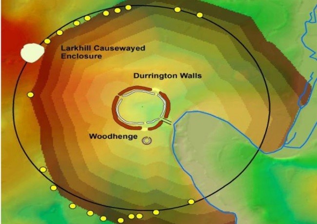
Why the Site Is There: Woodhenge as Beacon, Durrington Walls as Harbour
Once the structures at Durrington Walls are understood functionally—rather than symbolically—the final and most important question can finally be adequately asked: why here? Not why these monuments look the way they do, but why this landscape was chosen in the first place.
The answer lies not in cosmology, ritual abstraction, or seasonal feasting alone, but in navigation, visibility, and access.
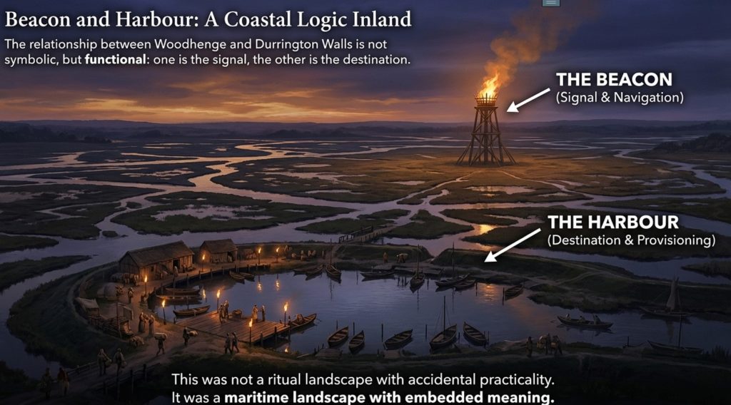
The relationship between Woodhenge and Durrington Walls has been consistently mischaracterised as a symbolic pairing. In reality, it is a functional pairing—beacon and harbour, signal and destination.
Woodhenge as a Beacon, Not a Gathering Place
Woodhenge occupies a slightly elevated, dry position in the landscape, visible across the surrounding floodplain. Its regular concentric structure, excavated post-holes, and lack of maintenance scars indicate a static, dry-land monument rather than a working platform. This alone sets it apart from the Southern Circle at Durrington.
But crucially, Woodhenge also occupies the wrong position to be economically useful in provisioning, capture, or water management. It does not sit at a hydrological interface. It does not control movement. It does not support load. It does not guide flow.
What it does do exceptionally well is stand.
When the post heights implied by the excavated sockets are reconstructed, Woodhenge becomes a tall vertical structure in an otherwise low-relief landscape. In a flooded or waterlogged plain, such verticality is not ornamental—it is navigational. A timber ring supporting a raised superstructure, fire platform, or beacon would have been visible from a considerable distance across open water or marsh.
This places Woodhenge firmly within a known class of prehistoric structures: fire beacons and navigation markers, used to attract, guide, and signal to approaching vessels. Such beacons are not inventions of historic or classical societies. They are a logical response wherever waterborne movement dominates, and shorelines are unstable or indistinct.
Woodhenge does not need to be interpreted as exclusively ritual to fulfil this role. A beacon is both practical and symbolic. Fire marks presence. Height marks authority. Visibility marks safety.
Durrington Walls as Harbour and Trading Point
If Woodhenge is the signal, Durrington Walls is the destination.
The scale, layout, and infrastructure of Durrington Walls are entirely consistent with a harbour complex rather than a village. The broad flat-bottomed ditch functions as a controlled basin. The Southern Circle provides a pile-supported platform for unloading, staging, and redistribution. The North Circle captures and concentrates aquatic resources. Linear channels manage movement internally.
This is what harbours look like before stone quays and masonry piers.
In a Mesolithic or early Holocene environment dominated by water transport, harbours do not require monumental stonework. They require predictable access, controlled grounding, and reliable provisioning. Durrington provides all three.
The presence of long-distance cattle movement reinforces this interpretation. Harbours are exchange points. They are where inland routes meet water routes. They are where goods arrive, are processed, redistributed, and moved on. Cattle arriving from hundreds of kilometres away do not converge on ritual centres by accident. They converge on logistical hubs.
Durrington Walls occupies precisely such a node: accessible from the Avon system, provisioned by fish capture, stabilised by platforms, and signalled by a visible beacon.
Dual-Purpose Monuments and Excarnation
This civilisation did not separate function and meaning. It layered them.
The same structures that guided ships and provisioned people could also serve mortuary functions. Elevated timber platforms—especially those associated with fire and visibility—are ideal for excarnation. This practice is well attested ethnographically, including the Silent Towers of India, where bodies are exposed on raised structures for defleshing by birds.
Woodhenge’s elevated, open timber form is well suited to such use. Fire, height, and exposure are not contradictions; they are complementary. A beacon can signal to the living while serving the dead. A harbour can receive goods and bodies alike. In water-based cultures, the boundary between journey, trade, and afterlife is often deliberately thin.
This dual-purpose logic explains why these structures were invested with care but not rebuilt endlessly. Their power lay in continuity, not replacement.
Durrington Walls Revisited
Conclusion: A Coastal Logic Inland
Woodhenge and Durrington Walls together form a system that only looks strange if interpreted through dry-land assumptions.
Seen through the lens of navigation and water management, the logic is simple:
Woodhenge marks the place
Durrington Walls services the place
Water connects the place
This is not a ritual landscape with accidental practicality. It is a maritime landscape with embedded meaning.
The site exists where it does because it had to.
Podcast
Author’s Biography
Robert John Langdon, a polymathic luminary, emerges as a writer, historian, and eminent specialist in LiDAR Landscape Archaeology.
His intellectual voyage has interwoven with stints as an astute scrutineer for governmental realms and grand corporate bastions, a tapestry spanning British Telecommunications, Cable and Wireless, British Gas, and the esteemed University of London.
A decade hence, Robert’s transition into retirement unfurled a chapter of insatiable curiosity. This phase saw him immerse himself in Politics, Archaeology, Philosophy, and the enigmatic realm of Quantum Mechanics. His academic odyssey traversed the venerable corridors of knowledge hubs such as the Museum of London, University College London, Birkbeck College, The City Literature Institute, and Chichester University.
In the symphony of his life, Robert is a custodian of three progeny and a pair of cherished grandchildren. His sanctuary lies ensconced in the embrace of West Wales, where he inhabits an isolated cottage, its windows framing a vista of the boundless sea – a retreat from the scrutinous gaze of the Her Majesty’s Revenue and Customs, an amiable clandestinity in the lap of nature’s embrace.
Exploring Prehistoric Britain: A Journey Through Time
My blog delves into the fascinating mysteries of prehistoric Britain, challenging conventional narratives and offering fresh perspectives based on cutting-edge research, particularly using LiDAR technology. I invite you to explore some key areas of my research. For example, the Wansdyke, often cited as a defensive structure, is re-examined in light of new evidence. I’ve presented my findings in my blog post Wansdyke: A British Frontier Wall – ‘Debunked’, and aWansdyke LiDAR Flyover video further visualizes my conclusions.
For those interested in British Prehistory, visit www.prehistoric-britain.co.uk, a comprehensive resource featuring an extensive collection of archaeology articles, modern LiDAR investigations, and groundbreaking research. The site also includes insights and extracts from the acclaimed Robert John Langdon Trilogy, a series of books exploring Britain during the Prehistoric period. Titles in the trilogy include The Stonehenge Enigma, Dawn of the Lost Civilisation, and The Post Glacial Flooding Hypothesis, offering compelling evidence about ancient landscapes shaped by post-glacial flooding.
To further explore these topics, Robert John Langdon has developed a dedicated YouTube channel featuring over 100 video documentaries and investigations that complement the trilogy. Notable discoveries and studies showcased on the channel include 13 Things that Don’t Make Sense in History and the revelation of Silbury Avenue – The Lost Stone Avenue, a rediscovered prehistoric feature at Avebury, Wiltshire.
In addition to his main works, Langdon has released a series of shorter, accessible publications, ideal for readers delving into specific topics. These include:
For active discussions and updates on the trilogy’s findings and recent LiDAR investigations, join our vibrant community on Facebook. Engage with like-minded enthusiasts by leaving a message or contributing to debates in our Facebook Group.
Whether through the books, the website, or interactive videos, we aim to provide a deeper understanding of Britain’s fascinating prehistoric past. We encourage you to explore these resources and uncover the mysteries of ancient landscapes through the lens of modern archaeology.
For more information, including chapter extracts and related publications, visit the Robert John Langdon Author Page. Dive into works such as The Stonehenge Enigma or Dawn of the Lost Civilisation, and explore cutting-edge theories that challenge traditional historical narratives.
This blog post challenges traditional interpretations of the Vallum and associated Roman infrastructure near Hadrian’s Wall. It posits that the Vallum may have originated as a prehistoric canal system, later repurposed by the Romans. The article critiques the conventional view of the Military Way as a continuous Roman road, highlighting its fragmented nature and inconsistent construction. Additionally, it questions the existence and connectivity of the Stanegate road, suggesting that many forts lack direct road links and may have relied on river transport instead. The piece advocates for a reevaluation of these structures, considering them as part of a complex, multi-period landscape rather than solely Roman military installations.(The Roman Military Way Hoax)
Traditional archaeologists and archaeological establishments like English Heritage suggest that:
The Vallum is a massive earthwork constructed shortly after Hadrian’s Wall itself and lying just south of it. Many visitors confuse the Vallum with Hadrian’s Wall itself because it’s such an obvious and impressive feature in the landscape.
In fact, the Vallum is made up of several different elements – a ditch around 6 metres wide and 3 metres deep; two mounds either side of the ditch about 6 metres wide and 2 metres high and set back from the ditch by around 9 metres; and often a third mound on the southern edge of the ditch. The whole complex is around 36 metres across. Usually, the Vallum runs close behind the Wall but in the rocky and hilly central section the Vallum lies up to 700 metres from the Wall.
The Vallum –Roman Military Way
Crossing points seem to have been located south of each of the forts along Hadrian’s Wall and near several of the milecastles. Evidence from the excavated Vallum crossing at Benwell in Newcastle shows these crossing points had impressive monumental gateways.
The Vallum’s purpose is unclear. Many archaeologists think it marks the southern boundary of a military zone with the Wall itself forming the northern boundary. This would have helped protect the rear of the Wall and its associated military installations, with civilian access being closely controlled. The gateway at Benwell supports this idea. The numerous gateways along the Wall at forts and milecastles suggest that the frontier was intended as much to control movement as to provide a defensive line. Traders would have moved goods across the frontier but their movements would have been controlled and their goods taxed.
Relatively soon after it was constructed, some 20 to 30 years perhaps, the Vallum seems to have lost its function – the mounds were cut through and the ditch filled in at fairly regular intervals. It was out of use by the time the forts along the Wall were re-commissioned in the late second century AD following the return of the garrison from the Antonine Wall.
The Vallum –Roman Military Way
Sadly, these ideas that have been constructed over the last 200 years are somewhat questionable. Within the book we look at associated aspects of this area like Military Way which was supposed to be constructed to patrol the so-called ‘Military Zone’ – to find that:
That over 50% of Military Way does not exist as a separate road, as described by archaeologists. Instead, the perceived road is fragmented and only becomes ‘alive’ as an independent road when the Vallum separates from the wall at any distance.
This might give us a clue to the function of this rough and wonky road, as the stone for the wall would have needed to be delivered by cart if the Vallum canal was not available.
Stanegate as portrayed by archaeologists –Roman Military Way
As for the Stanegate that was supposed to connect to the main forts in the area as a ‘defensive shield’ we actual found that it is very little to no evidence of the ‘Stanegate Roman Road’, which (according to the current theory proposed by English Heritage) ‘consolidated as a frontier’ during the late first and early second century AD and helped crystallise Roman tactics and military expectations in the area.
This evidence is compounded when you release that of the 80mile border from coast to coast – Stonegate, at best, covers just 38.1 miles (47%) of the ‘defensive gap’, and hence suggestions of extension over and above the existing line existed (even without support from OS maps). Moreover, the research has shown the ‘raw’ Stanegate road without the ‘hidden’ parts below the B-roads – we are only looking at 20% of the declared road being visible on LiDAR maps.
Stanegate Road (when not part of an existing B-road system) is inconsistent in width and structure -moving from bank track to road with two ditches on each side to a ditch with two banks far from straight and usually starts and ends in ravens.
Most Forts and the Stanegate are not found to connect (with intersecting sub-roads) on only two occasions, and the rest show no connection. Moreover, later ‘temporary’ camps also did not connect with the road – which questions whether (a defence line) was its purpose.
Moreover, this would then question the ‘myth’ of using the Stanegate as a ‘boundary’ for withdrawing troops from Scotland in the first century AD is correct. And whether the River Tyne (which most of these Forts sit upon) was used as a more practical and effective boundary/defence.
This ‘myth buster’ will not surprise many in academia as it has been ‘hinted’ at for some time (but not acted upon it by updating the literature), as we see from Symonds et al.
“The question of whether a road even existed when the fortlets were founded is by default an existential one for the notion that they provided highway protection. But even if the metalled road does post-date the fortlets, a reasonably robust thoroughfare of some form must have existed from at least the mid AD 80s to service Vindolanda. The question is not whether there was a road, but whether it was metalled when the fortlets were founded.” Symonds, M. (2017). Hadrian’s Wall. In Protecting the Roman Empire: Fortlets, Frontiers, and the Quest for Post-Conquest Security (pp. 95-132)
Moreover, even if Stanegate was not built as suggested, it exists in parts, and it looks prehistoric (by design) as it relies heavily on ravens that start and end sections of the Stanegate sections; its sunken structure in parts is unfamiliar to traditional Roman Road design.
As for other famous ‘Roman Features Such as the Great Chesters Aqueduct, again we find not only is the origin questionable but as it located supposedly fully in ‘hostile territory – they its usefulness win conflict would be limited.
It is clear from the LiDAR research that the suspected Roman Aqueduct is not as it seems. This is not the first examination to spread doubt about the scale and origin of this feature in the landscape – MacKay, D. A. (1990). The Great Chesters Aqueduct: A New Survey. Britannia, 21, 285–289. Also shows an incomplete map of this aqueduct.
Great Chesters by Mackey –Roman Military Way
Mackey failed to find in their survey that the Aqueduct changed size, and the path suggested had no identifiable remains of the bridges required to make this Aqueduct work.
Our more detailed findings indicate that the topology of the aqueduct suggests that it would need to go uphill at several points without any powered assistance (like a siphon) and so is mechanically unsound. Our finding has found that the use of ‘Dykes’ in this area and some connecting to this Aqueduct feature is new. We have also shown that closer to the Fort it was supposed to supply, there were closed water sources which could be used and that the Fosse by the Wall was also a water supply.
We conclude that we found a prehistoric watercourse linked to their sophisticated ‘Dyke’ system. I would be bold to suggest that this was used for either agricultural purposes or maybe industrial, seeing the multiple sites of quarries associated and in the region of this feature.
Case Study – The Roman Military Way
Many, new to the famous Whin Sill section of the Roman Wall frontier, confuse the Military Road (B6318) with the Roman Military Way. They have nothing in common either in time or purpose; in fact, the Military Road was only constructed after the Jacobite Rising of 1745, mainly upon the ruin of the wall!
The Romans created the Military Way (according to Historic England) to relay goods speedily along the line of the Wall. It was used to support the running of the frontier wall during the Roman period.
When Hadrian’s first grand plan was executed, The Stanegate (another Case Study in this book) was created as an east/west military road. But when Hadrian’s successor, Antonius Pius, pushed the frontier north through the isthmus between the Forth and Clyde, creating the Antonine Wall (yet another case study in this book), the supply road was installed integral to the turf-banked frontier linking the forts and milecastles.
Figure 83- Section H (HE:1010996)
When the frontier retreated to consolidate upon the original Hadrianic line over time, it was essential to have the same flexibility close to Hadrian’s Wall.
But does it exist, and what was it for in reality?
If we look at the first instance of this ‘alleged’ road, we need to go to Section E – schedule Monuments section 1010979, although this is some 24.2 km from the western flank of Hadrian’s Wall – which must ask the question – what was used for that 20% of the wall that is missing?
Yet another mystery occurs when we find this ‘road’ – there is nothing on LiDAR! Further investigation into why HE included it in its report shows that – it probably never existed in the first place.
“The course of the Roman road known as the Military Way, which ran along the corridor linking turrets, milecastles and forts, has been identified for a short distance to the east of Wallhead.
No remains are visible on the surface except for a short section of a turf-covered mound, 4m-5m wide and up to 0.4m high.
Its course was confirmed during excavation in 1894 by Haverfield. The road consisted of a gravel layer laid over larger stones with a stone kerb and central spine. Its survival here was confirmed by a geophysical survey in 1981. However, the unusual survival of this section suggests the possibility that it was reused in the medieval period serving as access to Bleatarn Quarry”
It was misidentified over a hundred years ago and was found to be a better quarry road – so the search continues….. So, we now move to Section H (HE 1010996), some 33.5 km from the Western start of the Wall (27.5%) – so what do we have here?
“The exact course of the Roman road known as the Military Way, which ran along the corridor between the Wall and the Vallum linking the turrets, milecastles and forts, is known intermittently throughout this section where it survives as an earthwork feature.
Opposite the disused quarry west of Bankshead Farm the Military Way survives as a terrace, 3m-5m wide, on the north side of an old hedge line. Occasional rises in hedgelines denote traces of its course”
Again, it does not appear on the OS (1800) map, and what we find on the LiDAR maps seems to indicate it is linked to the Old Quarry rather than ‘connecting turrets and milecastles’.
Figure 84 – Military Way on OS Maps
Moreover, the Vallum has disappeared from this section and what we might be seeing is a shallow bank of the Vallum of a replacement.
In Section HE: 1010994 (Section I), it is reported that:
Excavations in 1911 by Simpson showed there to be two early floor levels and late pottery, demonstrating that the turret had continued in use, unlike many other turrets. The course of the Roman road known as the Military Way, which ran along the corridor between the Wall and the Vallum linking turrets, milecastles and forts, is known throughout this section. West of the fort, it survives as an intermittent low linear mound, 0.1m in maximum height. East of the fort a geophysical survey in 1986 by Walker confirmed the existence of the Military Way below the turf cover.”
Figure 85 – Little to no evidence of Military Way
There looks like a partial road in between the Wall and The Vallum. Which may join the Station (Amboglanna) to the Milecastle in that region – but it’s not a connecting road that continues past this isolated point (less than 1000m in length)?
Figure 86 – Military Way? If so, it seems to connect the Mile Castle to the Vallum and then the Station (Fort)
The road disappears for another 7km and then reappears again in Section I on the OS maps.
Figure 87 Military Way clearly shown on OS maps
Then it is report in Section J as:
“The course of the Roman road known as the Military Way, which ran along the corridor between the Wall and the Vallum linking the turrets, milecastles and forts, is known throughout this section. It is visible as a low causeway, 0.2m high, or as a terrace, 5m wide, winding between rock outcrops to the south of the Wall. Turret 45a is situated on a high point on Walltown Crags with extensive views in all directions. It survives as an upstanding exposed feature, which is consolidated and in the care of the Secretary of State”
Flimsy evidence on LiDARFigure 89 – Military Way on OS Maps
“The road which connected the milecastle to the Military Way survives as a causeway 3.5m wide and 0.2m high. Milecastle 45 is situated on the crest of Walltown Crags with commanding views to the north and south.”
“It survives as a low turf covered causeway 5.5m wide and up to 0.5m high, or as a terrace in the hillside with a minimum width of 3m. It is straight for most of its course except where it deviates around rock outcrops.”
“West of the Cockmount Hill Plantation the foundations of two large regularly laid out rectangular buildings overlie the Military Way, using it as a hard standing. Their form suggests they are post-medieval or later in date. South east of King Arthur’s Well a spur road branched off the Military Way, the remains of which can be seen as a turf covered causeway leading south east towards Lowtown.
“Its course from the Caw Burn is known where it survives as a low turf-covered mound, 6m to 8m wide and 0.2m to 0.5m high. Occasional sections of this low turf-covered causeway reappear on the line up to the east gateway of Great Chesters fort. Beyond the field boundary west of the fort the Military Way is visible again as a discontinuous terrace with a slightly sinuous course which avoids the rock outcrops. Field gates are positioned on its course at the east and west end of this stretch. A road linking the Military Way and the Stanegate Roman road to the south via Great Chesters fort is overlain by the modern trackway to Great Chesters Farm which enters the fort through the south gateway.”
From these strong descriptions, we imagine that the course and evidence for the road will show strongly on LiDAR – but it’s invisible for a small 260m section.
Figure 92- Military Way – showing just 260m of roadFigure 91 – OS map showing how the road is ‘supposedly’ layout
In Section K we find in Schedule HE: 1010975:
“The course of the Roman road known as the Military Way, which ran along the corridor between the Wall and the Vallum linking the turrets, milecastles and forts is known throughout this section except around Cawfields Quarry where its precise course has not yet been confirmed. It survives as a linear causeway which is most prominent at the east end of this section. Here it measures between 3.5m and 5.2m wide with a revetment containing large stones on the south side and with evidence of a stone kerb. Further west the causeway, where extant, averages about 0.1m in height and 7m in width.
Where there is no trace of the causeway the line of the road has been identified by changes in vegetation growth with grass growing less well above the former road surface. Around Cawfields Quarry the remains of the Military Way may have been destroyed by the quarry, however it is possible that here the Military Way was built on the line of the Vallum, as it was further to the east at the crossing site of the Caw Burn and thus survives. About 200m east of milecastle 42 and 10m to the south of the Military Way is a fallen Roman milestone. It measures 1.38m high by 0.4m by 0.3m. It is oblong in shape and crudely rounded at the corners. This uninscribed milestone now lies in long grass. Two other milestones from this vicinity have been removed and are now in Chesters museum.”
Figure 94 – Observable Military Way on the LiDARFigure 93 – Military Way from Chesters Fort
The LiDAR map shows that the road did not go to the Quarry but terminated in the River Valley (Like the Vallum) – was there a bridge across (no foundations) shown on the LiDAR map?
Figure 95 – No Military Road to the Quarry – but one coming out of the Vallum
Section HE: 1010973 suggest that:
“Its course is marked usually by a slight causeway, up to 0.2m high, or by differing vegetation marks seen in grass colour. This differentiation in vegetation cover reflects differing growing conditions on the compacted road surface. It is best preserved where it crosses a gully running into Green Slack. Here it survives as a built up causeway, 1.7m high and 2m wide. South of milecastle 41 the causeway survives up to 0.7m high with kerb stones on its south side.”
Figure 96 – Clear evidence of a Roman road – Military Way
“The course of the Roman road known as the Military Way, which ran along the corridor between the Wall and the Vallum linking turrets, milecastles and forts, survives well as a linear causeway throughout this section. Some stone is visible on the south scarp where it has been built up to make a level surface. This scarp appears to have had a stone revetment. The south scarp averages 0.4m in height, although it reaches up to 1.2m high in places. West of Peel Farm the Military Way is overlain by the road to Steel Rigg car park. To the south of Sycamore Gap are the remains of a prehistoric field boundary running roughly from north to south, probably dating to the Bronze Age.
The Roman Military Way overlies this boundary, indicating that it is certainly pre-Roman in date. The peat bog, which has grown over remains of this boundary further to the south, is of Bronze Age origin. A second boundary is located running transversely to the Sycamore Gap boundary, to the west of it, south of the Military Way. Their assumed junction is masked by the peat bog which has built up to the south.”
Section L – Schedule HE:1010964:
“The course of the Roman road known as the Military Way, which ran along the corridor between the Wall and the Vallum linking turrets, milecastles and forts survives as a turf-covered linear mound throughout most of this section. It is visible as a disturbed causeway averaging 5m wide with traces of a stone revetment on the south side. It was partly excavated between 1978 and 1980 when it was shown to have a damaged metalled surface 4m wide, a stone revetment on the south scarp, and to have been overlain by later roadways. Branch roads link the Military Way with the south gates of milecastles 35 and 36. At milecastle 35 the low, uneven turf-covered mound of the causeway is up to 5.5m wide and 0.2m high.”
Section M – Schedule: HE:1010963:
“The course of the Roman road known as the Military Way, which ran along the corridor between the Wall and the Vallum linking the turrets, milecastles and forts, was carried on the north mound of the Vallum in the east half of this section. Its buried remains survive below grassland east of milecastle 33, until the B6318 road coincides with the north mound of the Vallum where it lies below the modern road surface.
South of turret 33b the Military Way leaves the north mound of the Vallum and follows a course parallel to that of the Wall. Here it survives as a distinct linear mound up to 6m wide and up to 0.3m high. The Vallum survives well as an upstanding earthwork visible on the ground throughout this section. It runs roughly parallel with the line of the Wall until south of turret 33b where it turns to the south west and follows the tail of the escarpment. In the east half of this section the Vallum ditch averages 3.5m in depth, while the north and south mounds average 1.5m in height.
The course of the Roman road known as the Military Way, which ran along the corridor linking turrets, milecastles and forts is not yet known with certainty in this section. However, there is a slight rise alongside the field wall on the south side of the wooded area to the south of Carraw Farm which could be the remains of the `agger’, or raised spine, of the road. The antiquarian Horsley, writing in the 1730s, stated that the Military Way was carried on the north mound of the Vallum in this general area.”
Section N – Schedule HE:1010959
“It is visible as a low turf covered causeway immediately south of the car park heading directly for the east gate of the fort, though it fades before it reaches the fort. On the west side of the fort it re-emerges heading from the west gateway to the north mound of the Vallum which was used to carry the road in this section. The road is visible as a low linear mound, 0.2m high, along the summit of the north mound of the Vallum. The Vallum survives as an intermittent earthwork throughout this section.
The Military Way survives as a turf-covered causeway leading up to the south gateway of the milecastle. Milecastle 31 is situated immediately to the east of Carrawburgh car park with wide views to the north and south but a restricted outlook to the east and west. It survives as a low turf covered platform 0.25m high. The remains of north wall of the milecastle lies beneath the B6318 road. Traces of the road connecting the milecastle to the Military Way survive as a causeway 0.15m high. Turret 29b survives as a turf-covered mound with parts of the north, west and east walls surviving up to two courses. The road connecting the turret to the Military Way is discernible as a slight linear mound.
It was excavated during 1912 by Newbold who found the doorway in the east end of the south side and a ladder platform in the south west corner. Heavily burnt masonry and rubbish indicated that the turret had been destroyed by fire and was then left in ruins. Turret 30a is situated about 400m east of Carrawbrough Farm below the B6318 road. It was located during 1912, though there are no surface remains visible now. Turret 30b is located about 50m west of the drive to Carrawbrough Farm partly below the B6318 road. The south side of the turret is visible in the field to the south of the road as a turf covered scarp, 0.5m high.
At Limestone Corner the Military Way is visible as a low causeway, 0.6m high, leading to the south gateway of milecastle 30. Beyond the milecastle it rejoins the north mound of the well preserved vallum. Excavations during 1911 confirmed this to be the case.
Figure 97 – Military Way added to the Vallum to meet Milecastle 30
There are no upstanding remains of the road to the west of the fort. However, the antiquarian Horsley considered that the Military Way exited Chesters and then converged gradually with the Vallum’s north mound where they continued to unite for a considerable distance.”
Figure 98- Military Way on OS MapsFigure 99 – No sign of Military Way on LiDAR Maps by Milecastle 29
Section O – Schedule HE:1010959
The course of the Roman road known as the Military Way, which ran along the corridor between the Wall and the Vallum linking turrets, milecastles and forts, survives well in the section between the North Tyne and the fort.
The road line is clearly defined on the ground leaving the fort by the east gateway and heading towards the Roman bridge. Initially, it is a depression and then becomes a causeway with a maximum height of 0.8m with a kerb to the south visible for 1.3m.
Figure 99 – Military Way, west of the fort on OS MapsFigure 100 – Military Way does not exist!!
There are no upstanding remains of the road to the west of the fort. However, the antiquarian Horsley considered that the Military Way exited Chesters and then converged gradually with the north mound of the Vallum, where they continued united for a considerable distance
Schedule: HE:1018581
The course of the Roman road known as the Military Way, which ran along the corridor between the Wall and the Vallum linking turrets, milecastles and forts, is considered to be on the line of the north mound of the Vallum in this section. Throughout this section the north mound of the Vallum has been largely levelled by ploughing and so it is doubtful whether the Military Way survives intact here. The exception to this is where the angle of descent down to the North Tyne is particularly steep opposite Black Pasture Cottage, and here a turf-covered trackway leaves the line of the north mound to run down the side of a dry valley to rejoin it some 180m further on. This diversion effectively eases the gradient. Where the valley opens, this track is visible as a raised causeway 7m wide and 0.2m high.
Figure 101 – Still no sign of any Military Road
The course of the Roman road known as the Military Way, which ran along the corridor between the Wall and the Vallum linking turrets, milecastles and forts, is known for most of this section. It uses the north mound of the Vallum as its base, certainly up to milecastle 25, along which it could be seen by Horsley who recorded it in his 1732 publication. A recent survey by the Royal Commission on the Historical Monuments of England shows that the Military Way probably continued along the north mound of the Vallum beyond milecastle 25, where Horsley could no longer trace it.
Section O shows us that there is no Military Way as an independent road and only as an assumption of the Northern Bank of the Vallum – which was not continuous in this section due to the River Tyne.
Sections P to W have the same excuse for the loss of the Military Way, a total of 35km (28%) of the wall length.
The course of the Roman road known as the Military Way, which ran along the corridor between the Wall and the Vallum linking turrets, milecastles and forts, is known for most of this section. It uses the north mound of the Vallum as its base.
Conclusion
Our investigation has found that over 50% of Military Way does not exist as a separate road, as described by archaeologists. Instead, the perceived road is fragmented and only becomes ‘alive’ as an independent road when the Vallum separates from the wall at any distance.
This might give us a clue to the function of this rough and wonky road, as the stone for the wall would have needed to be delivered by cart if the Vallum canal was not available.
This was an extracts from the NEW Book Ancient Prehistoric Canals (Dykes) – Wansdyke available on Amazon as a FULL COLOUR HARD BACK (£49.95) or a ECONOMY (£9.99) SOFTBACK black and white VERSION– it is also available as aKINDLE (£2.99) book. For further information about our work on Prehistoric Britain visit our WEBSITE or VIDEO CHANNEL.
Product details
ASIN : B0BN7PD6BS
Publisher : Independently published (24 Nov. 2022)
This blog re-examines Britain’s ancient linear earthworks, such as Offa’s Dyke and Wansdyke, through the lens of hydrology and groundwater science, proposing that these structures were not ritual boundaries or defensive embankments, but part of a sophisticated, prehistoric mining and transport network. By tracing their unusual paths and comparing them with aquifer data, the post makes a compelling case: these dykes were built to move minerals via water—not soldiers.(Hidden Purpose of Ancient Dykes)
Contrary to the long-held belief that these features served military or symbolic functions, their actual design raises major questions. Many dykes are non-continuous, curve unpredictably, and pass through remote, uninhabited areas, far from any strategic stronghold or settlement. Instead of defending anything, they seem to follow the landscape’s natural water flow—especially the edges of aquifers and groundwater discharge zones.
Wansdyke is on the edge of one of Britains largest Aquifers – Hidden Sources of Ancient Dykes – Source BGS
By overlaying dyke locations onto hydrogeological maps, a pattern emerges: nearly every major dyke in Britain correlates with aquifer systems or zones of high groundwater productivity. This includes saturated mineral-bearing soils, limestone and chalk formations, and ancient springs—features critical not for spiritual rituals, but for extracting and transporting resources. These dykes, the blog suggests, were likely built to channel groundwater seasonally or year-round, enabling flat-bottomed boats to move ore, stone, and other extracted materials from inland mining zones to major river systems for wider distribution.
The wibbly-wobbly routes of these earthworks make far more sense when viewed through this lens. Rather than being arbitrarily drawn or spiritually significant, they seem to trace fractally distributed groundwater flow patterns—the same paths water would naturally take through porous rock and sediment. By tapping into these natural routes, prehistoric engineers could move heavy materials across considerable distances without the need for roads or pack animals.
The Vallum at Hadrian’s Wall is on a major Aquifer – Hidden Sources of Ancient Dykes – Source BGS
Sites along these dykes often yield clues of quarrying, digging pits, or early metallurgy, further suggesting an industrial—not ritualistic—function. Combined with LiDAR mapping and terrain modelling, many of these ancient dykes also show characteristics of canal-like trenching, including embankments, towpaths, and level gradients consistent with water management rather than warfare.
Importantly, the blog challenges modern archaeology’s tendency to label such constructions as “ritual” simply because their purpose is not immediately understood. By reframing these dykes as functional infrastructure, it positions prehistoric Britons not as superstitious monument builders, but as skilled engineers, capable of manipulating water to serve economic and industrial goals—centuries, perhaps millennia, before similar systems appeared in written history.
Offa’s Dyke is on the edge of THREE major Aquifers – Hidden Sources of Ancient Dykes – Source BGSHidden Sources of Ancient Dykes – Source BGSHidden Sources of Ancient Dykes – Source BGS
In conclusion, the blog argues that Britain’s ancient dykes were part of a hydrological logistics network designed for resource movement and mining operations, aligning deliberately with groundwater systems and aquifer boundaries. These were routes of commerce and industry, not symbols or borders. It’s time to stop viewing them as mysterious relics—and start seeing them as evidence of a forgotten era of practical innovation and environmental mastery.
Dykes Follow Water: The 68.6% Aquifer Overlap Nobody’s Talking About
In a GIS-based analysis of prehistoric dyke placements across Britain, using official aquifer mapping from the British Geological Survey, we found that over two-thirds (68.6%) of dyke segments intersect directly with known aquifer zones.
This finding severely undermines the long-standing assumption that dykes were purely ritual or defensive. Instead, it supports a far more practical theory: these features may have followed underground water fractures or aquifer boundaries — possibly to aid water transport, trade, or seasonal canal usage.
When linear earthworks like Offa’s Dyke and Wansdyke are mapped alongside hydrogeological data, patterns emerge that are too precise to be coincidental. Whether through environmental observation or water dowsing, the builders clearly knew something about the ground beneath their feet.
Forget chalk and ritual. This is water engineering.
AI’s Take
1. Introduction: Revisiting the Landscape Through Water
Across Britain, a network of ancient linear earthworks—often labelled dykes—traverse the landscape in puzzling patterns. Traditionally interpreted as defensive structures, many of these dykes do not conform to military logic. They often wind across hills, valleys, and open terrain in apparently arbitrary routes. However, by examining these features through the lens of hydrology, particularly groundwater distribution and fractal flow paths, an alternative explanation emerges: these ancient monuments may have been constructed in response to the hidden patterns of water beneath our feet.
Ancient dykes like Offa’s Dyke snake across the landscape with no obvious military logic.- Hidden Purpose of Ancient Dykes
2. The Science of Groundwater Flow
Groundwater moves beneath the Earth’s surface through porous materials like gravel, sand, and fractured rock. Governed by the laws of hydrogeology—most notably Darcy’s Law—its movement follows gradients in pressure and elevation. Contrary to the perception of random underground seepage, groundwater flow is directional, structured, and often forms recognizable spatial patterns when viewed over time.
Hidden Purpose of Ancient Dykes
3. Hydrological Predictability and Fractal Geometry
Groundwater doesn’t spread uniformly. Instead, it forms branching, tree-like pathways that closely resemble fractal geometry—irregular yet mathematically structured patterns found in nature. These fractal patterns can be seen in river systems, lightning strikes, and even blood vessels. When mapped in detail, groundwater follows similar structures: splitting, rejoining, and fanning out with a logic dictated by rock permeability and hydraulic gradients.
Groundwater often follows fractal patterns, mirroring trees, veins, and rivers. – Hidden Purpose of Ancient Dykes
4. The Role of Aquifers
An aquifer is a body of rock or sediment that holds usable groundwater. Britain’s principal aquifers—such as the Chalk Aquifer of southeast England or the Triassic sandstones in Wales and the Midlands—are well-documented by the British Geological Survey. These aquifers are not just water sources; they shape ecosystems, influence agriculture, and determine human settlement patterns over millennia.
Britain’s major aquifers form the nation’s underground reservoirs. – Hidden Purpose of Ancient Dykes
5. Linear Earthworks: Not So Linear in Purpose
Earthworks like Offa’s Dyke, Wansdyke, and Grim’s Ditch often deviate from straight lines, curving and looping across the countryside. Many historians and archaeologists have noted this “wibbly-wobbly” quality and chalked it up to terrain negotiation. But what if these bends follow not just topography, but subterranean water flows?
Dykes appear “linear” in name only—many follow winding, unpredictable paths.- Hidden Purpose of Ancient Dykes
6. Evidence of Groundwater-Aware Design
Recent overlays of dyke paths on hydrogeological maps reveal compelling alignments. Dykes often trace the edges of aquifers, follow groundwater discharge zones (where springs emerge), or align with the boundaries between permeable and impermeable strata. These alignments are unlikely to be accidental, particularly when they persist across multiple sites.
Car Dyke aligns with underground water flow zones and aquifer edges which are still flowing..- Hidden Purpose of Ancient Dykes
7. Mapping the Invisible: Fractals in the Field
Using LiDAR data, some researchers have started mapping the subtle undulations in landscape that coincide with earthworks. When these are overlaid with known groundwater discharge points and aquifer margins, a fractal pattern begins to emerge. The ancient builders, whether consciously or through long experience, appear to have traced these subtle cues in the environment—potentially to access, mark, or manage water resources.
LiDAR data reveals invisible patterns matching ancient earthworks and water flows..- Hidden Purpose of Ancient Dykes
8. Offa’s Dyke and the Welsh Aquifers
One of the most prominent linear monuments in Britain, Offa’s Dyke, cuts through a landscape rich in aquifers. From the carboniferous limestone of the Brecon Beacons to the sandstones of the Cheshire Basin, the dyke’s route seems to skim or run adjacent to many known water-bearing formations. While once considered a boundary between Anglo-Saxon and Welsh territories, it now appears the dyke might also be a hydrological boundary marker.
Hidden Purpose of Ancient Dykes
9. Wansdyke and Water Corridors
Wansdyke in southern England similarly defies defensive logic. Its route is discontinuous and loops across high ridges with no clear military advantage. However, much of it aligns with chalk geology—a major aquifer type in the UK. The chalk aquifer not only stores groundwater but releases it gradually into the landscape through springs, many of which lie near or along Wansdyke’s path.
Hidden Purpose of Ancient Dykes
10. Dyke Placement and the Absence of Settlements
Another clue lies in what’s not present. Many dykes pass through areas far from settlements, agriculture, or known defensive frontiers. These otherwise “inconvenient” locations begin to make sense when viewed hydrologically: they traverse zones of high groundwater potential, or cross landscape features connected to seasonal flooding and spring emergence.
Most Dykes are in the middle of nowhere and small – Hidden Purpose of Ancient Dykes
11. Ancient Hydroengineering?
Alternatively, these dykes may represent early attempts at hydrological management—channeling water, controlling flood plains, or marking safe grazing zones. If water was seasonally abundant or scarce, understanding its patterns would have been vital. Building linear earthworks along aquifer boundaries could have allowed communities to delineate water-rich areas from drier zones without modern instrumentation.
Durrington Walls kept the water but adding a Dyke when the River water levels fell – Hidden Purpose of Ancient Dykes
12. Mathematical Validation of Dyke Placement
Using fractal analysis and mathematical modelling tools (like GIS or QGIS), modern researchers can now test the statistical probability of dyke placement aligning with hydrological features. Preliminary data suggests a non-random correlation—that is, dykes are significantly more likely to intersect aquifer boundaries or discharge zones than random lines across the same landscape would.
Fractal flow modeling suggests non-random alignment of dykes and water.- Hidden Purpose of Ancient Dykes
13. A Landscape Language We’re Only Starting to Understand
Our ancestors may not have used scientific terminology, but they read the land through observation, oral tradition, and environmental memory. Dykes may have formed part of this unspoken language of the landscape—an early cartography of water, built in earth and stone. Rediscovering this language could reshape not only our understanding of earthworks, but of ancient Britain itself.
Dykes may be part of an ancient “language” that mapped water underground.- Hidden Purpose of Ancient Dykes
14. Conclusion: From Defensive Lines to Water Lines
What appears as haphazard or defensive may, in fact, be ecological and intentional. Groundwater distribution patterns—fractal, functional, and factual—offer a powerful lens through which to reinterpret the placement and purpose of Britain’s linear earthworks. These dykes might not be walls at all—but lines drawn in reverence to the veins of the Earth, acknowledging the life-giving force of water hidden just beneath the surface.
The Wansdyke, a significant linear earthwork in southwestern England, has long intrigued historians and archaeologists. Traditionally interpreted as an early medieval defensive structure, recent analyses suggest it may have served a different purpose. The blog “Prehistoric Canals – Wansdyke” explores the theory that Wansdyke functioned as a prehistoric canal system, challenging conventional understandings of its role in ancient Britain.
This perspective is rooted in the observation that Wansdyke’s design resembles that of ancient canals. The earthwork features a substantial ditch accompanied by an embankment, a configuration commonly associated with water management systems. Moreover, the alignment of Wansdyke with natural watercourses and its proximity to prehistoric sites suggest it may have facilitated transportation and trade, rather than solely serving as a military fortification.
Further supporting this hypothesis is the presence of flint pits and barrows along Wansdyke’s route. These archaeological features indicate areas of significant prehistoric activity, implying that the earthwork played a role in the economic and social practices of the time. Additionally, the strategic placement of Wansdyke in relation to the ancient landscape suggests it was designed to harness natural waterways, enhancing connectivity between settlements and resource sites.
Reevaluating Wansdyke as a prehistoric canal system offers a fresh perspective on the engineering capabilities of ancient societies in Britain. It underscores the complexity of their infrastructure and their adeptness at manipulating the environment to support transportation and trade. This interpretation invites a broader reconsideration of similar earthworks and their functions, highlighting the need for ongoing research and open-mindedness in archaeological discourse.
Start of Wansdyke East -Prehistoric Canals – Wansdyke 2
The modern word dike or Dyke most likely derives from the Dutch word “dijk”, with the construction of dikes in the Netherlands well attested as early as the 12th century. The 126 kilometres (78 mi) long Westfriese Omringdijk was completed by 1250 and was formed by connecting existing older dikes. The Roman chronicler Tacitus even mentions that the rebellious Batavi pierced dikes to flood their land and protect their retreat (AD 70). The word dijk initially indicated both the trench and the bank.– Wikipedia
If you study archaeology at university or even on an ordinance survey map at length, you will notice strange earthworks on the sides of hills of Britain, with no rational explanation as to why they are there and for what reason. These features are mostly ignored at university, or an excuse is made for their construction. The reality is that these features do not make any sense unless there are other factors in operation which have been ignored.
The first thing to notice is that the word ‘Dyke’ is associated with water. It does seem strange you would call an earthwork on top of a hill a Dyke, unless there was some history passed down through the years to its actual use. If we look at the most famous Dyke in Britain, ‘Offa’, we notice that it is attributed to a Saxon King and, therefore, could not be prehistoric. Or is this a clear indication of how archaeologists find excuses for these features rather than factual, empirical evidence?
“Offa’s Dyke (Welsh: Clawdd Offa) is a massive linear earthwork, roughly followed by some of the current borders between England and Wales. In places, it is up to 65 feet (19.8 m) wide (including its flanking ditch) and 8 feet (2.4 m) in height. In the 8th century, it formed some kind of delineation between the Anglian kingdom of Mercia and the Welsh kingdom of Powys.” – Wikipedia
At face value, this explanation seems to answer all the questions about Dykes (except the water connection). But suppose you delve further down to look at the evidence, such as findings from the Dyke and any written history. In that case, you get a different version for the Roman historian Eutropius in his book, Historiae Romanae Breviarium, written around 369 AD, mentions the Wall of Severus, a structure built by Septimius Severus who was Roman Emperor between 193 AD and 211 AD:
“He had his most recent war in Britain, and to fortify the conquered provinces with all security; he built a wall for 133 miles from sea to sea. He died at York, a reasonably old man, in the sixteenth year and third month of his reign.” – Eutropius (369 AD)
This ‘wall’ need not be made of stone as we know from their Scottish endeavours that the first structure as a defence was usually a bank and a ditch – just like a Dyke!!
The problem with this account is that none of the known Roman defences are 133 miles long – Harridan’s Wall is only 70 miles, so are they talking about Offa’s Dyke, which is much longer?
Chapter 2 – The Post-Glacial Flooding Hypothesis
Rise of Sea Levels – Prehistoric Canals – Wansdyke 2
Before we show you what these ‘Linear Earthworks‘ were used for in prehistoric times. We need to give you an idea of how the environment was at the time of construction and why it is so different today.
In ‘The Post-Glacial Flooding Hypothesis,’ we looked at the new mathematical models that allowed us to calculate the amount of water released during and after the Last Glacial Maximum just over ten thousand years ago.
If the Dykes of Britain are canals (and not markers or defensive ditches), we must prove that the water table was higher in the past than today (otherwise, they would still be flooded).
The models contained in the PGFH showed us that a minimum of 8.42 quadrillion tonnes of water was released on the UK at the end of the last ice age. This is equivalent to 98425.2 inches of rain falling on every square inch of Britain’s landmass or the same as – One Inch of rain steadily falling every day for the next 270 years
The worst known flooding in British history occurred in 1947 when just six inches of rain (149mm) fell on up to 12″ of snow (so a maximum of 15″ of rain if melted) over three months. The flooding, which inundated nearly all the main rivers in the South, Midlands, and the Northeast of England, was notable for its origins, geographical extent, and duration.
It impacted thirty out of the forty English counties over two weeks, when around 700,000 acres of land flooded. As a result, tens of thousands of people were temporarily displaced from their homes, and thousands of acres of crops were lost; and this was just 15 of the estimated equivalent of 98,425 inches of water that was shed on the British landscape after the last Ice Age.
Raised Water Table
According to William Donn (Donn et al., 1962). The Fennoscandian and Great Britain ice sheet covered 4.7 106 km2, which is equivalent to:
• 8.42 106 Gigatonnes of water / 4.7 106 km2, which gives us 1.79 Gt per km2
• 1.79 Gt of water at a penetration rate of 43%, give us 0.77 Gt of water per km2
• 0.77 Gigatonnes of water by UK landmass 242,495 km² give us 186,804 Gt of groundwater
This water will be released at a rate of 1 – 12mm per annum and possibly at a depth of 75km. Therefore, to release groundwater at a depth of 75km at an average rate of 6mm per annum would take 12,500 years – not the 1,200 years previously believed, which is just the surface water from the last stages of the meltwater ice.
This is why rivers (like the Thames) still flow even after months of drought, as the groundwater is constantly leaking into the river, which was at its highest rate at the start of the Mesolithic, just after the great meltwater floods.
Sea-Level Changes
If this model is correct, we should be able to get verification via other empirical evidence, as shown in sea level water rises, to see if it has been constant over the last 12,500 years.
Most geologists and paleoclimatologists, when talking about the end of the last ice age, refer people to the phenomenon called the ‘Meltwater Pulse’ – which is the rapid rise in sea level (20m) between 13,500 and 14,700 years before present, over a 400 – 500 year period. Although it is a tremendous value, it should be recognised that this ‘pulse’ as only 16% of the total sea rise since the end of the last ice age.
When it comes to the use of ‘linear earthworks’ (we call ‘Dykes’), there is massive confusion amongst both professionals and amateur archaeologists about how such structures could function when they are dry today?
The incorrect perception of these ‘Dykes’ is either they are ‘rivers’ (like the Thames) that flow uphill or Victorian Canals with locks and wooden gates regulating the flow of the water – which are equally nonsensical as a prehistoric structures. Basic Hydrology that most people (should be but not necessarily ALL) learnt at school is that water is under the ground – not just a little water but 30% of all the fresh water on the planet.
This abundance of ‘groundwater’ is evident as it is the source of ALL rivers and supplies the Wells that have been dug since the beginning of time when rivers were absent. Even today, if you go into your garden and dig a hole, it will eventually fill with groundwater, whether in a valley or on top of a hill or mountain.
How and why water is on hills is very challenging for individuals as most people have a simplistic view of water being flat and sitting at ground level – but the earth is a far more complicated structure as this is the reason that it took centuries for people to recognise that we lived on a sphere and not a ‘flat-earth’ as such complex concepts such as gravity are hard to comprehend.
The reality is that ‘streams’ of water are encapsulated within the bedrock allowing ‘springs’ to start rivers at a great height as the groundwater is under pressure and erupts to the surface from BELOW and does not flow up or down the hill internally – but can flow downhill AFTER it escapes from the soil, because at the point of escape gravity then becomes the greater force overcoming the water pressure when within the bedrock – which stops it flowing down the landscape and can push it up to the top of hills and mountains.
Consequently, wells work even on hills as the groundwater is encapsulated in the bedrock and soil. The above illustration shows that if wells are dug halfway up a hill where there is a groundwater pocket, they will fill – if we join up these wells, the entire ditch will also fill with water – sourced from the ground.
The central aspect that must be remembered when considering the reasons behind the construction and maintenance of these earthworks (Dykes) is that the environment was so much different in the Mesolithic Period, which changed rapidly when entering the Neolithic and then even more changes in the Bronze and Iron Ages.
Once the ice sheets had melted and the climate began to warm, the landscape gradually changed from open tundra to dense woodland. By around 8000 BC, pine and birch dominated the woodland cover. These were slowly replaced by lime, elm and oak with some hazel. By 6500 BC, pine and birch woodland would only have been found on the thinner limestone soils of the uplands.
Case Study Wansdyke – Morgan’s Hill West
The steepest aspect of Wansdyke is the rise over Morgan’s Hill, which is an incline from 182m OD to 252m OD.
Figure 34 – Morgan Hill West (Wansdyke) – Prehistoric Canals – Wansdyke 2
If we are correct with our assumption, we need to show that you can transverse this massive incline using natural springs and basic wooden weirs. If we split the gradient into four parts, we can see better the profile and problems our ancestors faced.
Figure 35 Morgan’s Hill West in Sections – Prehistoric Canals – Wansdyke 2
Section A – 0 to 300 downhill
Length is 300m, and the inclination lowers from 251m OD to 242m OD at a ratio of 3% or 1:33 – If we accept that within this section, we had four cat A ‘springs’ that would release 11.2 cu. metres of water PER SECOND (11,200 litres per second) would fill a 10m ditch that is 1.5 deep by one-metre width of the Dyke’s ditch every SECOND.
According to the mathematical formula (v = k * C * R0.63 * S0.54 ), water at the end of section A would be travelling at 5 MPH – the speed of the Thames at Henley (so quite navigable) and, therefore, no need for any Weirs to reduce the water flow.
Section B – 300 to 800m downhill
This section would receive water at one metre per second from Section A, travelling at 5 MPH – The length of this section is 500m in length, and the inclination lowers from 242m OD to 200m at a ratio of 8% or 1:12 this would accelerate the water to 15 mph which is too fast the navigate uphill. Therefore, a series of weirs would have been placed either under the water or, as the early Victorians achieved, by a paddle weir or both.
An underwater weir (blocking 50% of the water but allowing boats to move over the top without hindrance) would reduce the flow by 50% – so if placed at the End of Section A (at 5 MPH) would reduce the water flow to 2.5 MPH and down to 12.5 MPH at the End of Section B. Consequently, if we place one of these 50% reduction weirs at 100m intervals the water flow would not go over the 5-mph mark and would probably be in the region of 3 – 5 MPH which again is easily navigable.
Chapter 4 – Wansdyke
Wansdyke v Avon and Kennet Canal – Prehistoric Canals – Wansdyke 2
According to Wikipedia, “Wansdyke consists of two sections of 14 and 19 kilometres (9 and 12 mi) long with some gaps in between. East Wansdyke is an impressive linear earthwork, consisting of a ditch and bank running approximately east-west, between Savernake Forest and Morgan’s Hill. West Wansdyke is also a linear earthwork, running from Monkton Combe south of Bath to Maes Knoll south of Bristol, but less impressive than its eastern counterpart. The middle section, 22 kilometres (14 mi) long, is sometimes referred to as ‘Mid Wansdyke’ but is formed by the remains of the London to Bath Roman road. It used to be thought that these sections were all part of one continuous undertaking, especially during the Middle Ages when the pagan name Wansdyke was applied to all three parts.
East Wansdyke in Wiltshire, on the south of the Marlborough Downs, has been less disturbed by later agriculture and building and remains more clearly traceable on the ground than the western part. Here the bank is up to 4 m (13 ft) high with a ditch up to 2.5 m (8.2 ft) deep. Wansdyke’s origins are unclear, but archaeological data shows that the eastern part was probably built during the 5th or 6th century. That is after the withdrawal of the Romans and before the takeover by Anglo-Saxons. The ditch is on the north side, so presumably it was used by the British as a defence against West Saxons encroaching from the upper Thames Valley westward into what is now the West Country.
West Wansdyke, although the antiquarians like John Collinson considered West Wansdyke to stretch from south East of Bath to the west of Maes Knoll, a review in 1960 considered that there was no evidence of its existence to the west of Maes Knoll. Keith Gardner refuted this with newly discovered documentary evidence. In 2007 a series of sections were dug across the earthwork which showed that it had existed where there are no longer visible surface remains.
It was shown that the earthwork had a consistent design, with stone or timber revetment. There was little dating evidence, but it was consistent with either a late Roman or post-Roman date. A paper in “The Last of the Britons” conference in 2007 suggests that the West Wansdyke continues from Maes Knoll to the hill forts above the Avon Gorge and controls the crossings of the river at Saltford and Bristol as well as at Bath.
As there is little archaeological evidence to date the western Wansdyke, it may have marked a division between British Celtic kingdoms or have been a boundary with the Saxons. The evidence for its western extension is earthworks along the north side of Dundry Hill, its mention in a charter and a road name.
Book Sections
Sections covered in the Book – Prehistoric Canals – Wansdyke 2
Section 1
HE:1003784 Wansdyke: section 610yds (560m) NW of Wernham Farm to 250yds (230m) SW of New Buildings (560m = 1680 working days – 20 men taking 84 days to complete)
Figure 44 Wansdyke NW of Wernham (with added water levels) – Prehistoric Canals – Wansdyke 2
No, HE Historic Details or Excavations Registered
OS Map
Prehistoric Canals – Wansdyke 2
1800 OS Map
Prehistoric Canals – Wansdyke 2
LiDAR Map
Prehistoric Canals – Wansdyke 2
LiDAR (with Mesolithic water levels)
Prehistoric Canals – Wansdyke 2
A feature called ‘firs’ is a gap on the OS Map – there is a strange quarry pit (no relevant substances under the surface to quarry?) – this pit is two metres deep and probably built later to the original ditch.
Are we looking for a hole to find the groundwater to keep the canal working with fresh water? As we will discover, this is not the first pit cut deep on the line of Wansdyke.
The Mesolithic water levels certainly explain the strange start of Wansdyke and the unexplained gaps (if it’s not a canal) in the Dyke.
Notice on the LiDAR maps the extensive ‘pits’ surrounding the Dyke, which are not below the Mesolithic river shoreline and are 14m in diameter.
Figure 45 – Quarry pits found in Paleochannels – Prehistoric Canals – Wansdyke 2
These features seem to be connected to even larger quarry holes (some under the Mesolithic shoreline), indicating that minerals have been extracted here for thousands of years and may be the reason for the Dykes construction to take minerals away – as have also found these pits in other mineral-rich areas of Britain such as Hadrian’s Wall.
Durrington Walls
The pits are about 20m in diameter and up to 5m deep, as revealed by further geophysical surveys using ground-penetrating radar and mechanical coring around Durrington Walls. Small quantities of struck flint, shell, and animal bone have been recovered from them, with the bone providing radiocarbon dates from about 2500 BC to 1200 BC.
Prehistoric Canals – Wansdyke 2
What we see is that this type of quarrying was commonplace in the past and has confused archaeologists – but as this was a trading nation, the solution is evident and straightforward.
Gap in the Dyke route
At the end of Section 1, we find the first gap (if you exclude the massive gap at the start of the Dyke) – this gap appears as the Dyke dips into a paleochannel. The obvious conclusion for the break in Wansdyke is that it must have been full of water at the construction time.
Prehistoric Canals – Wansdyke 2Figure 46 – Mesolithic Water levels show gap disappears – Prehistoric Canals – Wansdyke 2Ancient Prehistoric Canals – Wansdyke (The Book) – Prehistoric Canals – Wansdyke 2
This was an extracts from the NEW Book Ancient Prehistoric Canals (Dykes) – Wansdyke available on Amazon as a FULL COLOUR HARD BACK (£19.95) or a ECONOMY (£4.99) SOFTBACK black and white VERSION – it is also available as a KINDLE (£1.99) book. For further information about our work on Prehistoric Britain visit our WEBSITE or VIDEO CHANNEL.
Product details
ASIN : B0BF31GQKC
Publisher : Independently published (18 Sept. 2022)
The enigmatic Wansdyke, standing prominently in the Wiltshire landscape, has forever captivated the public’s collective imagination. Its proximity to the famed ancient site of Avebury, with both bearing massive ditches, has led some to surmise a direct connection between them.
Curiously, past and present archaeologists have failed to grasp this apparent link, striving instead to find a simplistic explanation for this enigmatic “linear structure.” Thus, the prevailing belief took root – that it was a bulwark raised to repel the belligerent tides of yore. Consequently, the term “Saxon” was affixed to these earthworks, as historians of old supposed these “tribes” possessed the martial might needed to accomplish such grand engineering feats to defend their realm.
Yet, in recent decades, this “fact” has faced reexamination, and a novel theory emerged regarding these earthworks as “Boundary Markers” etched upon the landscape. This alternative proposition, while reassuring, still leaves us grappling with perplexing truths. Foremost among them is the Dykes’ lack of continuity – both Wansdyke and Offa’s Dyke exhibit sizeable lacunae in their stretches. Their beginnings and endings emerge with an almost magical quality, unexplained and confounding to the beholder.
Moreover, if indeed these were markers of territorial ownership, then why do certain Dykes, like Offa’s, follow paths that traverse vast separations, such as major rivers? Surely, a more conspicuous landmark than a mere 4-meter ditch would have served as an apt boundary in such instances.
Alas, the erudite scholars of archaeology have turned a blind eye to the existence of over 1500+ scheduled Dykes scattered throughout Britain and Ireland. Such a multitude challenges the notion of a uniform purpose, as many of these “boundary markers” also graced uninhabited islands far and wide, enveloping the entire circumference of Britain.
In the spirit of Jacob Bronowski’s method, we must confront these enigmas with a relentless curiosity, unearthing each fragment of evidence and subjecting our suppositions to rigorous scrutiny. The mysteries of these ancient earthworks shall only yield their secrets to those intrepid minds that dare to question and challenge the established norms of interpretation. And as history unfolds its layers, we may find ourselves ever closer to unlocking the profound meaning behind these age-old constructs that once shaped the course of human existence upon this storied land.
Robert John Langdon (2023)
Section 4 – HE:1017288
Section of Wansdyke and associated monuments from east of The Firs to the eastern side of Tan Hill, 3,460 metres (11,533 working days – 20 men, 1.58 years)
HE:1017288 GE
OS Map
HE:1017288 OS
1800 Map
HE:1017288 1800
LiDAR Map
HE:1017288 Lidar
LiDAR Map (with Mesolithic water levels)
HE:1017288 – Mineral Extraction- With prehistoric water levels
HE schedule suggests that:
The monument, which falls into 12 areas of protection, includes part of Wansdyke running from east of The Firs to the eastern side of Tan Hill,(a kite-shaped enclosure situated on the northern side of Wansdyke on Easton Down), a section of Roman road on Morgan’s Hill, a Neolithic long barrow, five other linear earthwork sections crossed by or abutting the Dyke and 11 Bronze Age bowl barrows adjoining Wansdyke or partially overlain by it.
From the west, Wansdyke runs for roughly 72km ending just outside Marlborough at its east end. The approximately 8.5km long section from east of The Firs to the eastern side of Tan Hill runs across the Downs south west of Avebury and includes the best-preserved continuous length of Wansdyke.
The Dyke includes a substantial earthwork bank which measures up to 30m wide and stands from 1m to 3m high. For the majority of its length the bank lies south and west of a substantial open ditch. This also varies in width but measures up to 36m wide and remains open to a depth of 2m in places.
The majority of the bank and ditch sections in this area together measure from 30m to 40m across. A further, slighter, bank beyond the ditch to the north is also visible on several sections. The Dyke was built in sections of varying length, with breaks which would have allowed controlled traffic to pass from east to west and for the movement of military patrols beyond the defences. The Dyke is later in date than the Roman road but was already built by the mid-ninth century, when it is mentioned in a Charter.
It is generally believed to be a military frontier work between Wessex and Mercia. It is designed to hold the edge of the high ground on the Downs and to protect the lower lying plains to the south west. The name derives from Woden’s Dyke, after Woden, an important Anglo-Saxon god whose name survives in the word `Wednesday’.
The earlier Roman road includes a 800m long section of the route from Cunetio (Mildenhall) to Verlucio (Sandy Lane). It runs east to west along the north slope of Morgan’s Hill and includes a rare engineered bend at the head of a dry valley after which point the later Dyke meets it and runs along its line. The road measures between 8m and 10m wide and its outer (north) edge comprises a well-constructed embankment which stands up to 2m high.
The road is terraced into the slope at this point and the Dyke follows the line of the road for a distance of over 300m. South east of the wireless station on Morgan’s Hill, a 50m long, slightly curved section of linear earthwork runs north from beneath Wansdyke to end in a terminal. It is part of a longer feature, the remainder of which starts about 20m north, runs to the edge of Horsecombe and is the subject of a separate scheduling (SM 21900).
The south end of this feature is not known for certain but it appears to run beneath the Wansdyke for some distance to the east. Immediately south of the Dyke on Roughridge Hill is a Neolithic long barrow. The barrow mound measures about 75m long and up to 32m wide. It stands up to about 1m high. Flanking the mound, but no longer visible at ground level due to the spreading of the mound caused by ploughing, are two quarry ditches which will survive as buried features.
Although the only example in the scheduling, the barrow is one of a line of more than four Neolithic long barrows which are strung out east to west along the ridge of the Downs, all spaced roughly 1km from their nearest neighbour in either direction.
The excavations showed that the southern boundary of the enclosure lies below the line of the later Wansdyke, which appears to change course slightly at this point. The excavations also produced Romano-British pottery sherds from the interior of the monument, indicating that it was a settlement during that period.
The section of Wansdyke on Tan Hill crosses a series of four earlier linear boundary ditches which form part of an earlier prehistoric land division. Three of these run from north to south and the last runs east to west and is abutted by at least one of the others. These boundaries survive as buried features clearly visible on aerial photographs and, despite being levelled in places, remain visible at several points above ground. The ditches vary in width from 3m to 8m across and several have adjacent banks about 0.75m wide and up to 0.3m high.
Together they form three sides of a rectilinear field within which is located a small Bronze Age barrow cemetery containing five bowl barrows. Two of these are partially overlain by the Wansdyke. The barrow mounds measure from 12m to 20m in diameter and stand between 0.2m and 1m high.
All but one of these are surrounded by quarry ditches which vary from 1m to 2m in width and survive buried below the present ground level. There are six further bowl barrows along the length of Wansdyke from east of The Firs to the eastern side of Tan Hill which are partially overlain by the Dyke. Some of these are outliers of groups of barrows or cemeteries, the remainder of which, where appropriate, are the subject of separate scheduling’s. These barrows vary from 10m to 20m in diameter and stand up to 3m high. Their surrounding quarry ditches measure from between 1m to 2m wide.
Several barrows near to Old Shepherds’ Shore were partially excavated in the 1850s and finds included burnt animal and human bone and fragments of Bronze Age pottery.
Figure 34 – Paleochannel from the Raised Water Levels of the Mesolithic meet the Dyke
Figure 35 – Ditch cutting through the Dyke at 90-degrees
In the scrolls of history, the unveiling of Fig.35 beckons us to peer beyond the veil of conjecture. Perhaps the compass that navigates us through the labyrinth of whispered questions through the corridors of time lies here. Once an enigma shrouded in uncertainty, the Dyke unfurls its narrative in North and South, a juncture marked by division and unity.
Yet, as we stand at this crossroads, the questions persist. What grand design does this divide mark? Is it a sentinel of boundaries or a symphony of defence? Why does the Dyke, an embodiment of strength, pause just a breath away from spanning both directions? What landscapes, what treasures, do these truncated extensions seek to shield?
The visage of paleochannels, ancient waterways etched in the very fabric of the land, presents itself as a canvas of revelations. LiDAR’s eye, attuned to the wavelengths of discovery, showcases the embrace of Wansdyke’s ditches with these prehistoric conduits. In their intersection, a portrait emerges—a depiction of a junction, a crossroads where not just land but waterways merged.
The resonance of this image is profound. A Dyke, often considered an embodiment of solidity, now intersects with the fluidity of these forgotten watercourses. This confluence hints at more than coexistence—it suggests a portal, a point of ingress and egress, a thoroughfare not merely for terrestrial travellers but also for vessels that rode the liquid highways.
Such a revelation prompts us to reconsider the dike’s identity. Could this monumental construction, both a bastion of earth and a harbour of history, be conceived not solely for defence but as a connection conduit? An edifice that channelled both earthly aspirations and the currents of culture, bridging the realm of humans and the dominion of water?
Ditches to reach Paleochannel (GE)
Figure 36 – GE Map shows deep ditches which are now paths going across the Wansdyke
The southern reaches unfurl a tale of depth and mystery—a narrative that extends beyond the bounds of Wansdyke’s familiar embrace. Here, etched upon the land like whispers of the past, are deep cuts that time has adorned with the patina of ages. Now trodden as footpaths, these cuts reveal themselves as gateways to antiquity, as portals through which we traverse history’s corridors.
Yet, the panorama holds another surprise—a forgotten ditch, an enigmatic excavation that defies the confines of historical schedules. This ditch, absent from Historic England’s scrolls, surrenders itself to the embrace of an old Paleochannel river, like an echo reverberating through time. Fig. 36 becomes a tableau of continuity, a link between the tapestries of yesteryears and the present.
Figure 37 – Paleochannels connecting to Wansdke
In this interplay of cuts, ditches, and ancient rivers, a question arises—what hands sculpted these channels, and what intentions propelled them into existence? Were these marks of human endeavour borne from a need to navigate the landscape, to forge paths that transcended the eras? Or are they the product of a deeper design, etched by nature herself and embellished by the curious hands of humans?
As we meander through the corridors of speculation, let us remember the canvas of history is not confined to the visible, the documented. It expands, much like the very rivers and footpaths that traverse it, into the realm of the unseen and the uncharted. In the echoes of these cuts, in the absence of recognised schedules, we find a reminder that history is a symphony of the known and the unknown, a dance that transcends temporal confines.
In the mosaic of history, Fig.37 casts a spotlight upon a revelation that bridges epochs and echoes with the very essence of the land. Here, amidst the tapestry of ancient landscapes, emerges the presence of monumental sarsen stones, sentinels of time, scattered as relics of the ages in the embrace of the Paleochannels.
Figure 38 – Paleochannels everywhere some showing sarsen stones in the dry river valley indicating the size and strength of these old rivers – first edition OS.
These stones, witnesses to the drama of ice and thaw, lay scattered as if nature herself crafted an intricate mosaic. The legacy of the last Ice Age is etched upon them, a testament to the forces that shaped this realm long before the footfalls of humankind. As the old OS maps bear witness, these stones, abundant in the embrace of the Paleochannels, evoke a tale of glacial might and the enduring memory etched upon the land.
Figure 39 – The ‘Unknown’ditch heads north and then kinks
A profound realisation emerges in this dance of discovery—a symphony of logistics and ingenuity unfurls. If these sarsen sentinels were to be harnessed and woven into the fabric of human endeavour, the waterways would have served as a celestial highway, a course of least resistance. And in this tableau, Wansdyke emerges not only as a Dyke, not merely a demarcation or defence, but as a lifeline that harnessed the power of water to serve human ambition.
In the intricate mosaic of historical discovery, the enigmatic ditch takes centre stage once more—a whispered riddle etched into the landscape. It meanders through the pages of time, seemingly wandering aimlessly, a question mark in the grand narrative. Yet, as we sift through the fragments of history, a revelation shimmers into view that bind the ditch and the very fabric of prehistory.
Figure 40 – The ‘unknown’ Dyke links to the Kennet River that goes to both Avebury and Silbury Hill
As modern OS maps render this ditch a ghost upon the terrestrial canvas, the marriage of technology and imagination unveils the hidden treasure. LiDAR’s touch, a modern conjurer’s wand, weaves the paleochannels and prehistoric shorelines into the mosaic. In this dance of data emerges a connection that defies the constraints of eras—a direct link between the ditch and the hallowed grounds of Avebury and Silbury Hill.
This revelation echoes through time, whispering that these ancient sites, Avebury and Silbury Hill, are not merely isolated islands but interwoven threads of a grand tapestry. The ditch, a seemingly solitary enigma, reveals itself as a connective vein—a corridor of history that flows not to obscurity but to monumental sites that have stood sentinel through the epochs.
This conjured connection, a bridge between Wansdyke and Avebury, paints a canvas where history transcends the confines of linear progression. It offers a vision of prehistory as a symphony of parallel stories, where Wansdyke and Avebury, once disparate entities, become harmonious notes that resound across the landscape. The notion that they were born simultaneously, intertwined in a narrative of ambition, culture, and design, is a testament to the shared aspirations of humanity across time.
Roman Water Management
Figure 41 – Small right-angled addition to the Dyke – but for what practical reason
Figure 42 – Cross Regulator – water management system
In the annals of historical inquiry, the tiny Dyke that extends from Wansdyke assumes a posture of intrigue—a whispered question mark punctuating the landscape. In its modest form, it beckons us to decipher its purpose, to unearth the intentions woven into its design. As we traverse the realm of speculation, two threads of possibility unfurl, each offering a glimpse into the minds of those who shaped it.
One narrative paints the Dyke as a haven, a berth upon the liquid highway—a stop for boats, a safe harbour for those who navigated the waters the dike embraced. In this vision, the Dyke transforms into a passage not solely for people and stones but for the vessels that threaded waterways laden with cargo, hopes, and history. The “parking feature” becomes a tableau of respite—a moment of pause in the voyage of time.
In this incarnation, the Dyke assumes a role akin to a conductor’s baton—a water regulator orchestrating the flow of springs that may have danced through the landscape. A “Cross Head Regulator” from the annals of modern canals whispers through time, suggesting a parallel with the water management systems of the Romans, as glimpsed in the scrolls of history at Hadrian’s Wall.
The contemplation of Roman engineering and its influence upon the Dyke reflects the epochs’ interconnectedness. The Romans, architects of both empire and innovation, are known to have left their indelible mark upon the landscapes they traversed. Could this diminutive Dyke be a remnant of their water management techniques, a testament to their mastery over the elements as seen in other corners of the realm?
Rybury Camp and Tanhill Fair
Figure 43 – Tanhill Fair – complex earthworks showing Rybury Camp on the peninsula
The woven tapestry of history, the complex series of ditches extending from Wansdyke casts a net of intrigue and speculation. Their intricate dance, flowing down into the Dry River Valley, unveils a terminal that might have been a hub of significance—a nexus where the threads of trade and human interaction converged. This vista hints at a site not solely dedicated to defense or marking, but a junction that pulses with the rhythm of exchange.
Through the corridors of time, the echoes of Tanhill Fair reverberate. As if in a symphony, the words of Aubrey from the 17th century whisper of a fair held within an “old camp,” summoning images of bustling marketplaces and vibrant commerce. This isn’t a mere snapshot in history; it’s a snapshot of continuity—a legacy of trade that spans from Medieval times to the annals of antiquity.
Figure 44 – Tanhill Fair showing a supplementary ditch that connects to Wansdyke in two places and goes down into the river valley (GE)
Figure 45 – The Dyke seems to vist two quaaries before getting to Wansdyke
Figure 46 – OS map shows the remains of the ditches went from the Paleochannel (in the Valley) to Wansdyke
Pic 45, like a palimpsest, unfurls before us—a visual odyssey that belies the limits of schedules and registers. The ditch works at Tanhill Fair reach far beyond their documented bounds, stretching both directions and connecting in two places to Wansdyke. This revelation is a testament to the fluidity of history, a reminder that the boundaries we impose upon the past are but a sliver of the stories that await our exploration.
In the theatre of interpretation, a bold hypothesis emerges—the possibility that these ditches, these conduits carved into the earth, were not mere markers or barriers but lifelines of trade. A canal, a passage through which boats might have threaded their way, carrying treasures, aspirations, and cultures from distant corners of the known world. This vision unites Wansdyke and Tanhill Fair not as separate entities but as partners in the choreography of history.
Figure 47 – Tan Hill and Rybury Camp as a Peninsula in the Mesolithic
Roman Road joining two Dykes
Morgan’s Hill is close to a crossroads of revelation—an unassuming stretch of the Dyke that belies its significance. A linear expanse, a departure from the meandering course that defines 99% of the Dyke, captures our attention. This apparent anomaly in the landscape becomes a canvas for exploration, urging us to unveil the threads that weave its story.
A curious pattern emerges as we consult the LiDAR map and trace the hidden design drawn by the pits. Two segments along this straight stretch deviate from the norm—a conspicuous absence of the quarries and pits that have characterised the journey so far. The landscape whispers a puzzle, inviting us to decode its enigma.
Figure 48 – The Roman Road joins two Prehistoric Dykes
Enter the Mesolithic shoreline, a harbinger of revelation. When layered upon the LiDAR map, it illuminates a past submerged beneath the tides of time. Suddenly, the straight stretch of the Dyke unfurls its secret—it’s not merely a Roman road but a bridge that spans epochs. It joins the dots, connecting two prehistoric courses of the Wansdyke that once wove a “wibbly wobbly” path across the landscape.
This discovery is a testament to history’s interconnectedness, the symbiotic dance between human endeavour and the ebb and flow of nature. The Romans, architects of their era, harnessed these prehistoric pathways, channelling their ingenuity to connect the dots drawn by time. It is a reminder that history is not linear but a mosaic—a collage of human intent and the tides of change.
The Morgan Hill Kink
Figure 49 – Morgan Hill East ‘kink’
Figure 50 – Morgan Hill Kink’s barrows
To the East of Morgan Hill is found a bizarre Kink in Wansdyke. This is best seen on an OS map showing this strange direction and the obstacles it avoided.
In the panorama of landscape and time, the kinks and turns of Wansdyke invite us to unravel the intentions woven into its form. As we ascend the topology of the hill, we stand witness to a sequence of choices that defy easy classification but beckon us to scrutinise their purpose.
The kinks and turns present a conundrum to the theories of fortification or marking. Their seemingly inefficient trajectory, descending the hill’s advantage and taking multiple turns, challenges the notion of defence or demarcation. From a defensive perspective, the logic of such a design raises questions about the resource and time invested.
As we tread through the corridors of inquiry, a new light shines upon the landscape—the presence of round barrows. Like sentinels of history, these ancient mounds encircle the kink on both sides. The question arises whether these barrows were built around the contours of Wansdyke or whether the kink was crafted to navigate around the barrows.
The chronicle deepens with the discovery of the missing branch—a path unmarked on contemporary maps but unveiled through Historic England’s lens. The cross ridge Dyke on Morgan’s Hill etches its presence across the east-west aligned ridge. The bank and ditch, sculpted by time’s hands, become conduits of understanding, the stories they tell interwoven with the landscape.
Branch off Wansdyke
The monument includes a 560m long section of a Cross ridge Dyke situated on Morgan’s Hill. The Dyke runs from NNW to SSE across the east-west aligned ridge, dividing Morgan’s Hill into two parts. The Dyke has a bank c.8m wide and up to 1.5m high. To the East of the bank lies an 8m wide ditch which provided material for its construction and enhanced the effectiveness of the boundary.
This has been partly infilled by cultivation but is open to a depth of 0.3m in places, and is visible on aerial photographs. The bank and ditch are interrupted by a number of openings through which animals and people could pass. It is not clear how many of these are original.
A further section of the Dyke, situated to the south is crossed by the Wansdyke, which is later in date. This additional section is the subject of a separate scheduling. Excluded from the scheduling are the post and wire fences which cross it and run along its length, although the ground beneath is included. – English Hertitage
Figure 51 – Branch off Wansdyke
In the intricate tangle of time and earth, the convergence of the Cross-ridge Dyke on Morgan’s Hill and the enigmatic Dyke of East Wansdyke draws us into a narrative of layered history. Their banks and ditches, the silent architects of the landscape, weave a tale of coexistence, connection, and perhaps even evolution.
These two Dykes, mirroring each other across time and the contours of the land, embody a dialogue between epochs. Their unity atop Morgan’s Hill, a meeting point that defies temporal confines, reminds us that history is not merely a linear march—it’s a dance that spans centuries, uniting hands that have shaped the earth.
The paleochannel’s passage through the Dyke carries echoes of ancient currents—a testament to a time long before the Dyke’s construction. This fragment, missing as if eroded by the tides of prehistory, whispers that the roots of this land stretch further than the architects who shaped it. This gap in the Dyke is a tapestry of continuity, a reminder that even the most monumental structures stand atop layers of untold stories.
Figure 52 – Morgan’s Hill West with another Branch
The saga of East Wansdyke’s creation offers a riddle unto itself. The builders, crafting their work across chalk, kept the earth they excavated to one side. This pragmatic choice of preserving the turf for stability and camouflage echoes a nuanced purpose. It becomes evident that these Dykes are not mere boundary markers or defensive structures. They are more—a marriage of utility and adaptation, a testament to human ingenuity and the intersection of practicality and aesthetics.
Figure 53 – Junctions heading north off Wansdyke past a group of Round barrows
The view northward, captured in Fig. 53, extends the tableau of discovery. Like a palimpsest, the landscape bears the imprints of Wansdyke’s journey. It dances alongside the Roman Road, a chorus of human footsteps interweaving through time. The round barrows and raised river shorelines, silent witnesses to centuries past, reaffirm the interplay of cultures, constructions, and course changes that define human endeavour across epochs.
Figure 54 – How Morgan Hill used to look in the Mesolithic – with the roman road towards the bottom turning left (North)
Chronology (Smoking Gun)
In the ongoing dialogue with history, a revelation emerges—wrought from the very contours of the land, an ancient pathway unveils its secrets. The Roman road, a trail of human ambition etched across the landscape, weaves its course atop the pages of Wansdyke’s story. This intersection, where road and Dyke converge, is a testament to the interplay of cultures, epochs, and purpose.
Stukeley’s drawing on Page 6, Fig.24, long questioned by the annals of archaeology, finds newfound validation through the lens of LiDAR—a digital conjurer that unveils hidden truths. Once doubted as an exaggeration, the cut through the bank now emerges as a footprint in time. LiDAR’s gaze, untethered by perception’s limits, reveals that this cut bends in harmony with the Roman deviation, a harmony of intent that speaks of chronology.
Figure 55 – Roman Road cuts through Wansdyke making it older!
A different angle
The alignment of the Roman road, cleaving through the very heart of Wansdyke’s bank, resonates with the echoes of purpose. This road, a conduit for the aspirations of the Roman era, tells a tale of connection and coexistence—an acknowledgement that the landscape’s past holds layers that intertwine like the fabric of time itself.
The chronicle of Wansdyke, interwoven with the path of the Roman road, unveils a narrative that spans millennia. This intersection becomes a bridge that invites us to traverse the epochs and honour the efforts of hands laboured to craft earthwork and thoroughfare. It becomes a gateway that prompts us to unravel the threads of intention, the dance between cultures, and the pulse of human progress.
The application of LiDAR technology has decisively resolved the inquiry. LiDAR data reveals a cross-sectional embankment profile mirroring the Roman roads deviation’s curvature, indicating the roadway’s construction postdates the Wansdyke earthwork.
This LiDAR evidence serves as a compelling confirmation of prehistoric Dyke dating, akin to a “smoking gun.” LiDAR employs laser reflection and time-of-flight measurements to gather precise topographic data by emitting and measuring laser pulses. This technology’s congruence with historical context validates its role in archaeology, exemplifying how modern tools can illuminate ancient landscapes.
Figure 78 – Roman Road cuts through Wansdyke making it older!
The Book
Blank bookcover with clipping path
This was an extracts from the NEW Book Ancient Prehistoric Canals (Dykes) – Wansdyke available on Amazon as a FULL COLOUR HARD BACK (£19.95) or a ECONOMY (£4.99) SOFTBACK black and white VERSION – it is also available as a KINDLE (£1.99) book. For further information about our work on Prehistoric Britain visit our WEBSITE or VIDEO CHANNEL.
Product details
ASIN : B0BF31GQKC
Publisher : Independently published (18 Sept. 2022)
For those interested in British Prehistory, visit www.prehistoric-britain.co.uk, a comprehensive resource featuring an extensive collection of archaeology articles, modern LiDAR investigations, and groundbreaking research. The site also includes insights and extracts from the acclaimed Robert John Langdon Trilogy, a series of books exploring Britain during the Prehistoric period. Titles in the trilogy include The Stonehenge Enigma, Dawn of the Lost Civilisation, and The Post Glacial Flooding Hypothesis, offering compelling evidence about ancient landscapes shaped by post-glacial flooding.
To further explore these topics, Robert John Langdon has developed a dedicated YouTube channel featuring over 100 video documentaries and investigations that complement the trilogy. Notable discoveries and studies showcased on the channel include 13 Things that Don’t Make Sense in History and the revelation of Silbury Avenue – The Lost Stone Avenue, a rediscovered prehistoric feature at Avebury, Wiltshire.
In addition to his main works, Langdon has released a series of shorter, accessible publications, ideal for readers delving into specific topics. These include:
For active discussions and updates on the trilogy’s findings and recent LiDAR investigations, join our vibrant community on Facebook. Engage with like-minded enthusiasts by leaving a message or contributing to debates in our Facebook Group.
Whether through the books, the website, or interactive videos, we aim to provide a deeper understanding of Britain’s fascinating prehistoric past. We encourage you to explore these resources and uncover the mysteries of ancient landscapes through the lens of modern archaeology.
For more information, including chapter extracts and related publications, visit the Robert John Langdon Author Page. Dive into works such as The Stonehenge Enigma or Dawn of the Lost Civilisation, and explore cutting-edge theories that challenge traditional historical narratives.