The Problem with Hadrian’s Vallum

Introduction

Historians and archaeologists have the Romans pretty sown up when it comes to how and why the Empire did things and why? Let’s take Hadrian’s Wall (Hadrian’s Vallum) – English Heritage would have you believe that:

“Permanent conquest of Britain began in AD 43. By about AD 100, the northernmost army units in Britain lay along the Tyne–Solway isthmus. The forts here were linked by a road, now known as the Stanegate, between Corbridge and Carlisle.

Hadrian came to Britain in AD 122 and, according to a biography written 200 years later, ‘put many things to right and was the first to build a wall 80 miles long from sea to sea to separate the barbarians from the Romans’.

The building of Hadrian’s Wall probably began that year and took at least six years to complete. The original plan was for a wall of stone or turf, with a guarded gate every mile and two observation towers in between, and fronted by a wide, deep ditch. Before work was completed, 14 forts were added, followed by an earthwork known as the Vallum to the south”.

Really so what is the Vallum then?
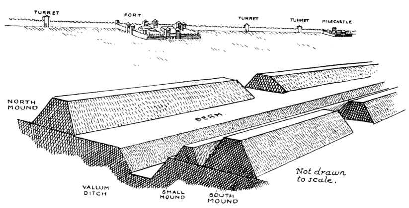
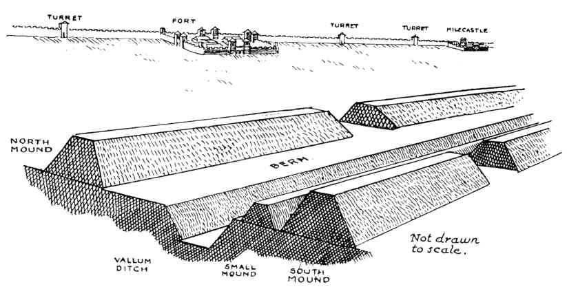
Classic Cross-section of Hadrian's Wall as seen by archaeologists - The Problem with Hadrian's Vallum
Classic Cross-section of Hadrian’s Wall as seen by archaeologists – The Problem with Hadrian’s Vallum

Let’s read on…… “The Wall was placed slightly north of the existing line of military installations between the River Tyne and the Solway Firth. Its line was carefully chosen to make best use of the topography, and it was surveyed from each end towards the middle, or rather towards the crags, in sections. Building in the east started at the point where the road from the south, Dere Street, met the Wall and where later a gate, the Portgate, was erected.”

As first planned, most of the Wall was to be built in stone, but the eastern 30-mile section was in turf. In front of both was a substantial ditch, except where crags or rivers made this unnecessary. At each mile a gate was protected by a small guard post called a milecastle.

Between each pair of milecastles lay two towers (turrets), creating a pattern of observation points every third of a mile. The stone wall, with a maximum height of about 15 feet (4.6 metres), was 10 Roman feet (3 metres) wide, wide enough for there to have been a walkway along the top, and perhaps also a parapet wall. The turf sector was 20 Roman feet (6 metres) wide.

To the north of the turf sector lay three advance forts, all probably part of this plan, but otherwise the forts remained on the Stanegate behind the Wall.

Before the first plan was completed, a radical change led to the placing of forts on the wall line and down the Cumbrian coast, and the construction of an earthwork to the south.

The forts, each apparently built for a single unit and at a basic spacing of 7⅓ miles, were placed astride the Wall wherever possible. This allowed three main gates, each with two entrances, making the equivalent of six milecastle gates, to provide access to the north; the double-portal south gate was supplemented by two small side gates. The position of the forts and the provision of so many gates suggest that a requirement for increased mobility led to this change.

The addition of the forts was followed by the construction of an earthwork to the south 120 Roman feet (an actus – about 35 metres) wide. This consisted of a central ditch between two mounds. Causeways, surmounted by gates, were provided at forts. The purpose of the Vallum, as this earthwork is known, was presumably to protect the rear of the frontier zone.

So, the Vallum is a defensive ditch, then?

Sounds quite simple doesn’t it……. Until you start looking at the detail!!

I have been studying the 1497+ (for every two scheduled Dyke I have measured and categorised I have found on average one not scheduled or noticed) Dykes in Britain (including Southern Ireland) and noticed a few cut through the Vallum, which is strange as I have observed that the Vallum either starts or ends on these occasions.

Consequently, I have started to measure and track the Vallum via LiDAR maps I have at my deposal and have found severe flaws in the English Heritage Literature. So let’s look at just one section of Hadrian’s Wall to show you examples of how the present understanding of Hadrian’s Wall does not hold up to scrutiny.

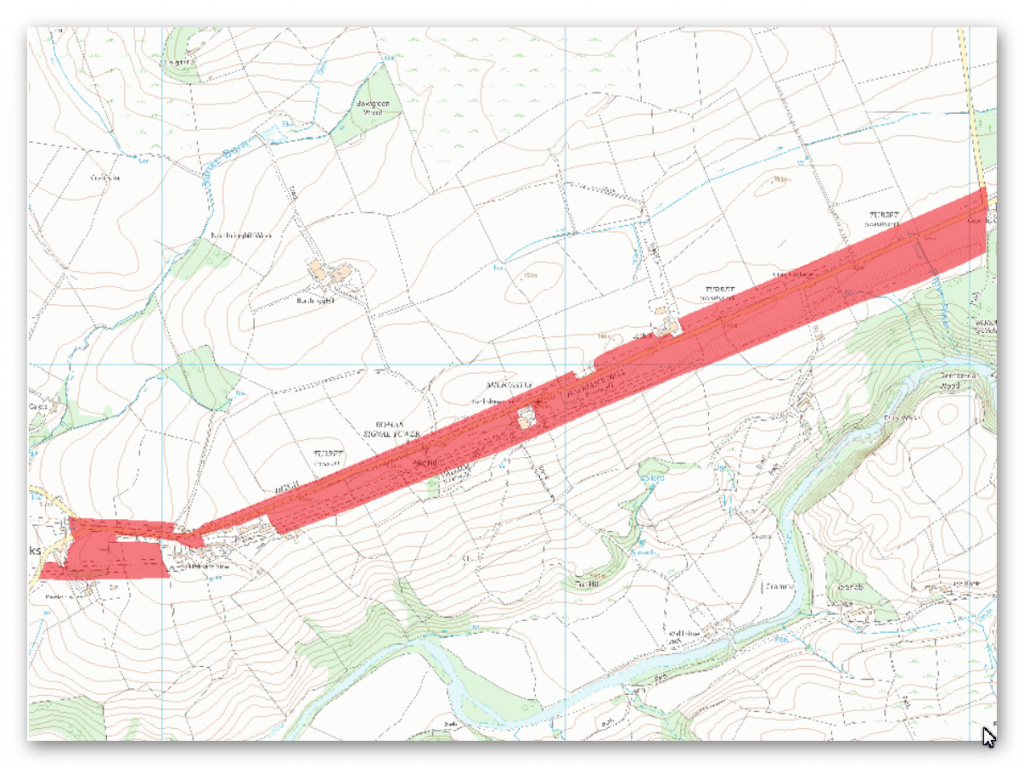
Scheduled Monument section 1010987

– The Vallum between the field boundary south east of Heads Wood and the A6021 road in Wall Mile 57.
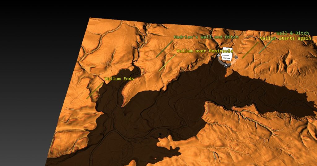
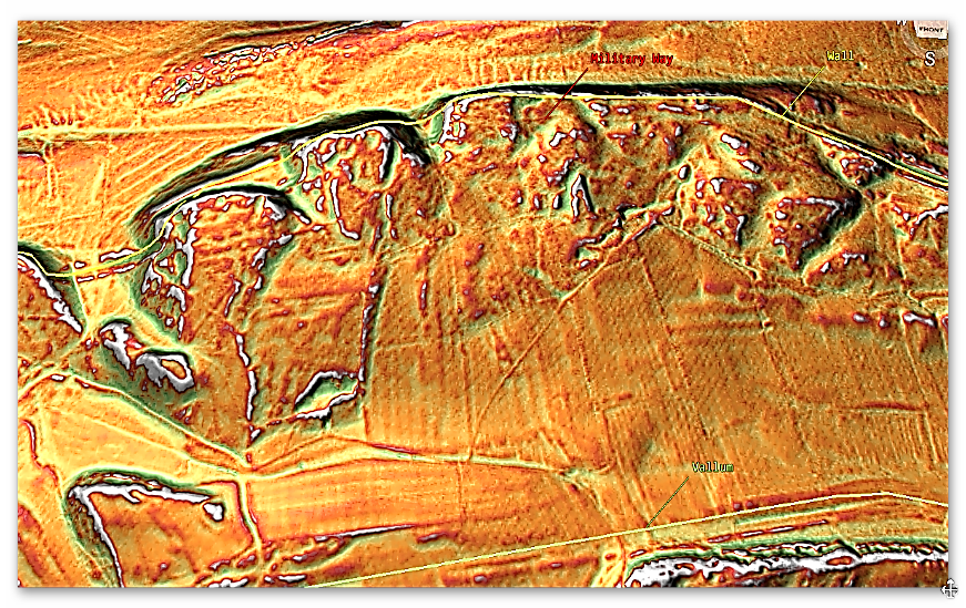
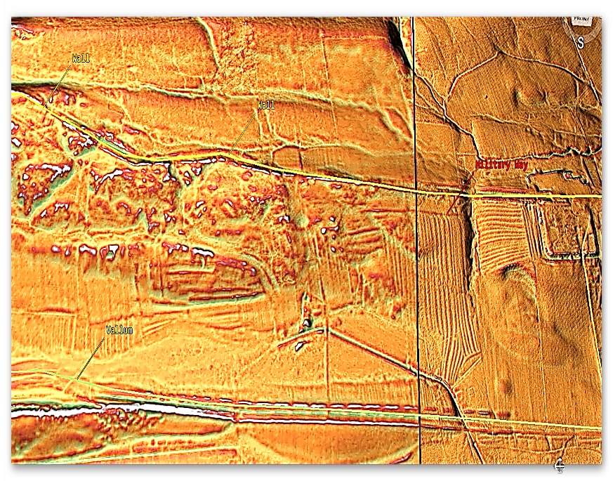
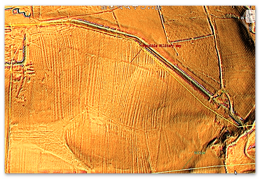
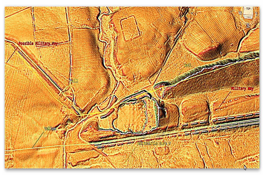
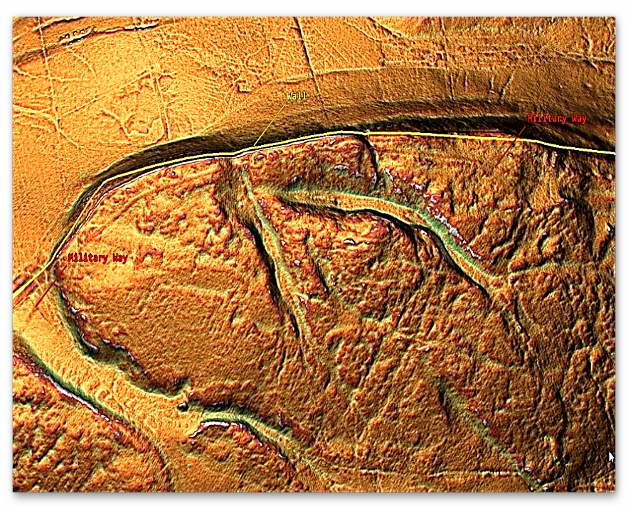
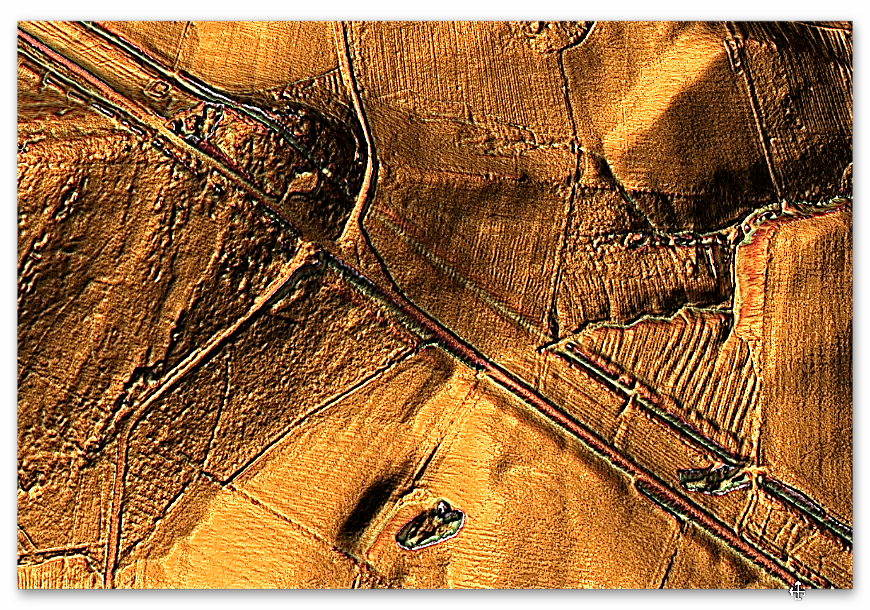
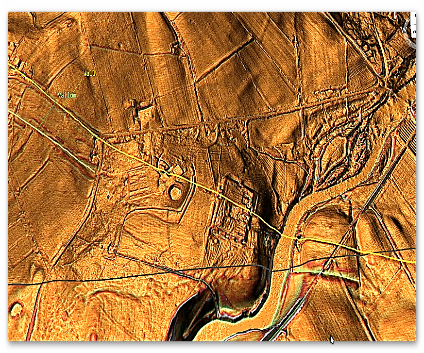
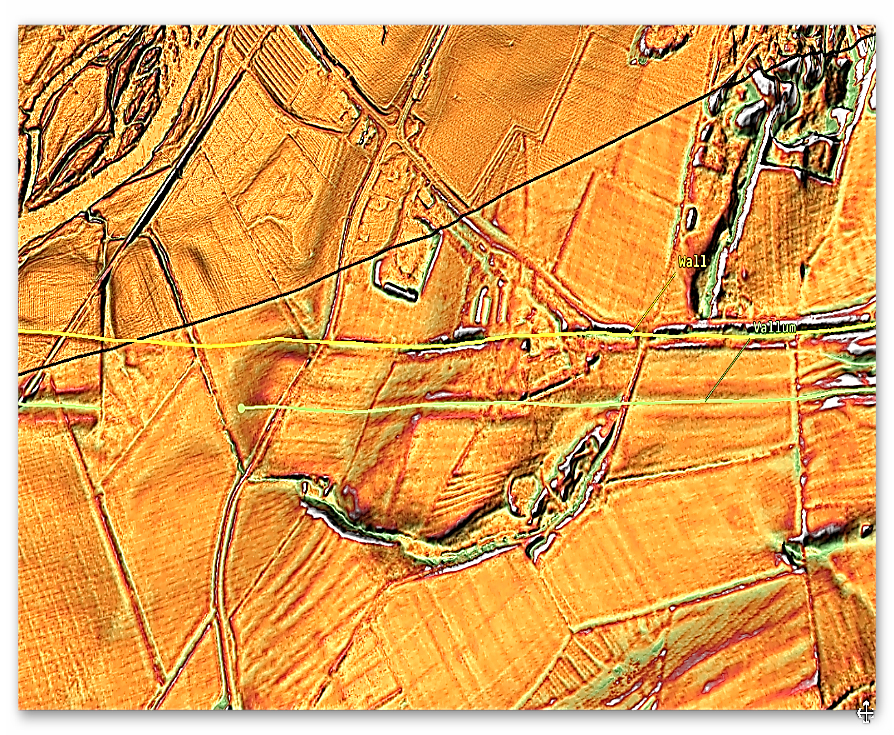
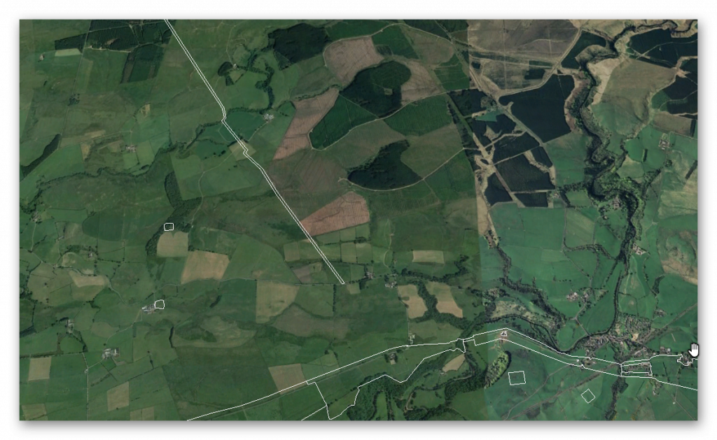
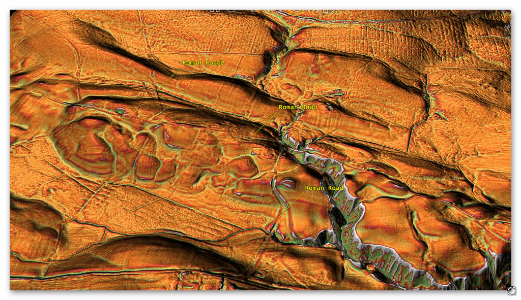
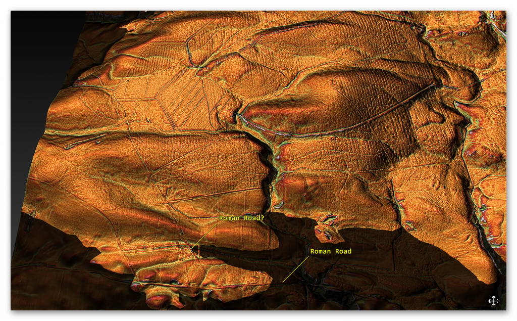
LiDAR Map of this section – notice the section over the peninsula is probably a road as it connects and ends at a Roman Fort – The Problem with Hadrian’s Vallum

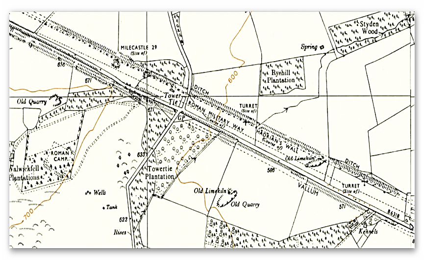
The first problem we find is that it disappears for 3,000 metres without reason – not a very effective ‘defensive structure’ with gaps of this size – and our survey has identified quite a few gaps like this throughout the line of the Wall.

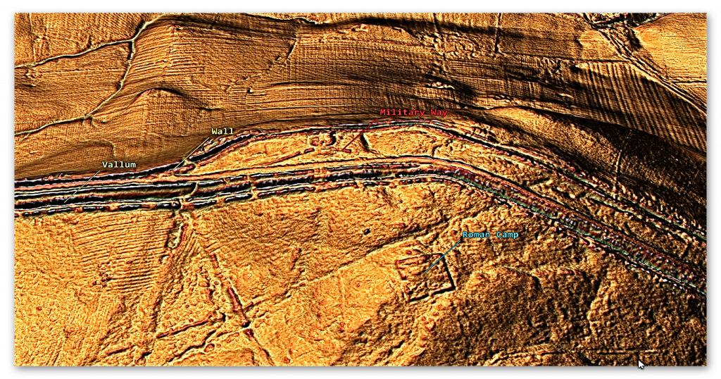
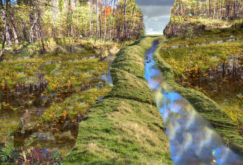
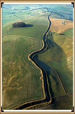
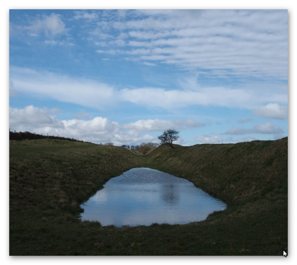
The second problem is its construction – it’s far too big?  The LiDAR maps clearly show its 36m wide consisting of TWO banks(one on each site) of 13m wide and a Ditch of 10m with a flat bottom (found on previous excavations) – if it’s defensive, it’s rubbish?? A defensive ditch has ONE bank (which you place a wooden palisade) and a V-shaped smaller ditch 3 – 4m, so soldiers fall in and break their legs – these ditches you can jump in and march across??
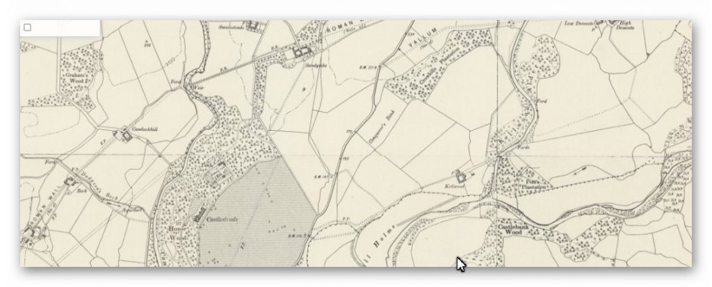
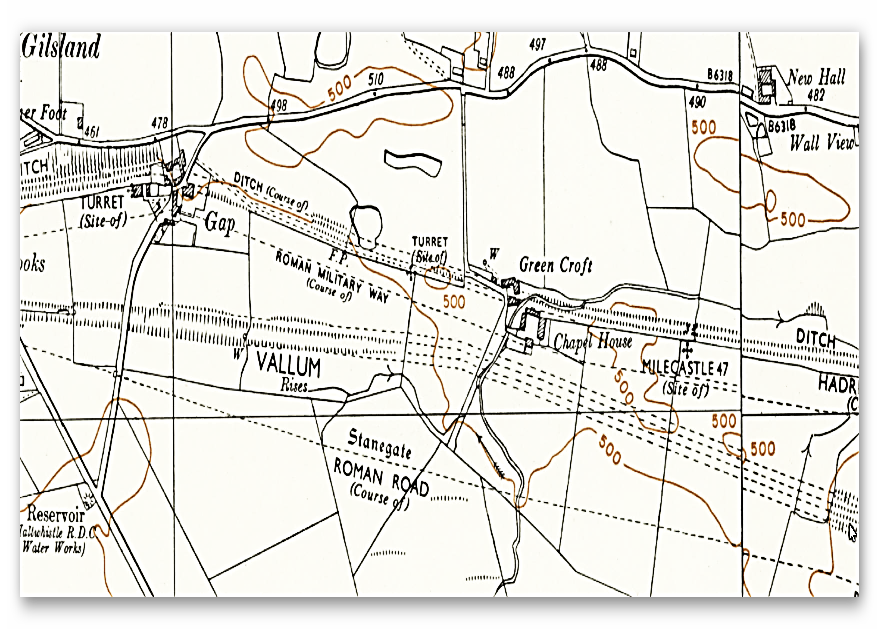
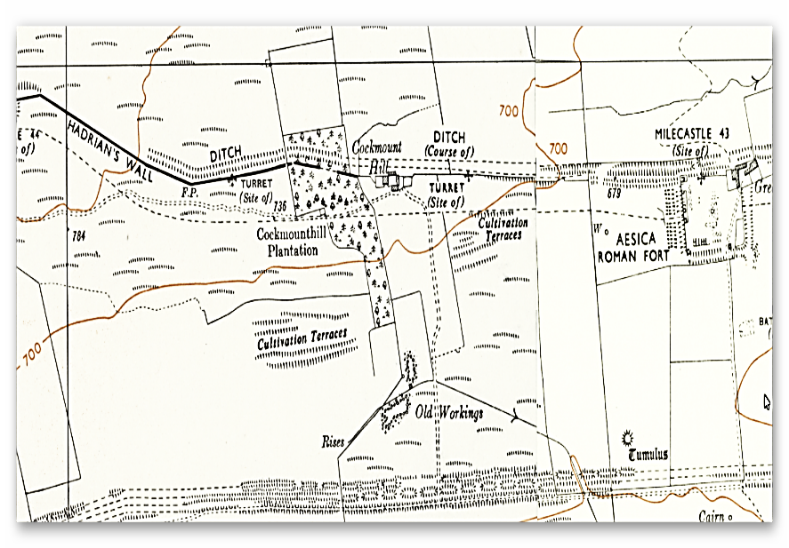
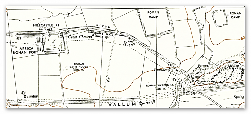
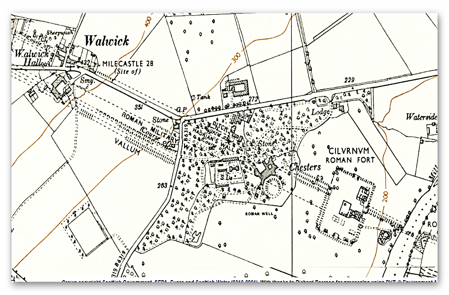
OS 1800s Map showing a gap – but it is much larger than OS believed – The Problem with Hadrian’s Vallum

The third conundrum is that the Wall is sometimes a fair distance from the Vallum.  The construction seems to hug the lowlands near or on rivers and shorelines – sometimes connecting with prehistoric Dykes, as we have previously suggested.

The evidence suggests that the Vallum was a Dyke, which would make more sense as the Wall needed constant supplies, and to date, nobody has worked out how on earth you move TWO MILLION CUBIC METRES OF STONE without using boats?

Moreover, the identification of the double-banked Dyke shows that the Roman’s had ‘tow paths’ on both sides of the Dyke for ease of two-way traffic (unlike the Victorian canal system) and that the later ‘Military Way’ Road was simply the continuation of this ‘goods connection’ by using one of the banks when the Dyke dried or silted at a later date.

What our research has shown is that there was a great possibility (due to location) that a prehistoric Dyke (like Wansdyke and offa) was already in this area, and the Roman’s used it for convenience and to save money (labour) on their wall endeavour.

I have publishing a book on the Vallum and Hadrian’s Wall as the Antonine Wall has similar characteristics to the Vallum, and with LiDAR, we can again correct (like my first trilogy) the so-called ‘known history’ of Britain.(The Problem with Hadrian’s Vallum)

Podcast

Author’s Biography

Robert John Langdon, a polymathic luminary, emerges as a writer, historian, and eminent specialist in LiDAR Landscape Archaeology.

His intellectual voyage has interwoven with stints as an astute scrutineer for governmental realms and grand corporate bastions, a tapestry spanning British Telecommunications, Cable and Wireless, British Gas, and the esteemed University of London.

A decade hence, Robert’s transition into retirement unfurled a chapter of insatiable curiosity. This phase saw him immerse himself in Politics, Archaeology, Philosophy, and the enigmatic realm of Quantum Mechanics. His academic odyssey traversed the venerable corridors of knowledge hubs such as the Museum of London, University College London, Birkbeck College, The City Literature Institute, and Chichester University.

In the symphony of his life, Robert is a custodian of three progeny and a pair of cherished grandchildren. His sanctuary lies ensconced in the embrace of West Wales, where he inhabits an isolated cottage, its windows framing a vista of the boundless sea – a retreat from the scrutinous gaze of the Her Majesty’s Revenue and Customs, an amiable clandestinity in the lap of nature’s embrace.

Exploring Prehistoric Britain: A Journey Through Time

My blog delves into the fascinating mysteries of prehistoric Britain, challenging conventional narratives and offering fresh perspectives based on cutting-edge research, particularly using LiDAR technology. I invite you to explore some key areas of my research. For example, the Wansdyke, often cited as a defensive structure, is re-examined in light of new evidence. I’ve presented my findings in my blog post Wansdyke: A British Frontier Wall – ‘Debunked’, and a Wansdyke LiDAR Flyover video further visualizes my conclusions.

My work also often challenges established archaeological dogma. I argue that many sites, such as Hambledon Hill, commonly identified as Iron Age hillforts are not what they seem. My posts Lidar Investigation Hambledon Hill – NOT an ‘Iron Age Fort’ and Unmasking the “Iron Age Hillfort” Myth explore these ideas in detail and offer an alternative view. Similarly, sites like Cissbury Ring and White Sheet Camp, also receive a re-evaluation based on LiDAR analysis in my posts Lidar Investigation Cissbury Ring through time and Lidar Investigation White Sheet Camp, revealing fascinating insights into their true purpose. I have also examined South Cadbury Castle, often linked to the mythical Camelot56.

My research also extends to the topic of ancient water management, including the role of canals and other linear earthworks. I have discussed the true origins of Car Dyke in multiple posts including Car Dyke – ABC News PodCast and Lidar Investigation Car Dyke – North Section, suggesting a Mesolithic origin2357. I also explore the misidentification of Roman aqueducts, as seen in my posts on the Great Chesters (Roman) Aqueduct. My research has also been greatly informed by my post-glacial flooding hypothesis which has helped to inform the landscape transformations over time. I have discussed this hypothesis in several posts including AI now supports my Post-Glacial Flooding Hypothesis and Exploring Britain’s Flooded Past: A Personal Journey

Finally, my blog also investigates prehistoric burial practices, as seen in Prehistoric Burial Practices of Britain and explores the mystery of Pillow Mounds, often mistaken for medieval rabbit warrens, but with a potential link to Bronze Age cremation in my posts: Pillow Mounds: A Bronze Age Legacy of Cremation? and The Mystery of Pillow Mounds: Are They Really Medieval Rabbit Warrens?. My research also includes the astronomical insights of ancient sites, for example, in Rediscovering the Winter Solstice: The Original Winter Festival. I also review new information about the construction of Stonehenge in The Stonehenge Enigma.

Further Reading

For those interested in British Prehistory, visit www.prehistoric-britain.co.uk, a comprehensive resource featuring an extensive collection of archaeology articles, modern LiDAR investigations, and groundbreaking research. The site also includes insights and extracts from the acclaimed Robert John Langdon Trilogy, a series of books exploring Britain during the Prehistoric period. Titles in the trilogy include The Stonehenge Enigma, Dawn of the Lost Civilisation, and The Post Glacial Flooding Hypothesis, offering compelling evidence about ancient landscapes shaped by post-glacial flooding.

To further explore these topics, Robert John Langdon has developed a dedicated YouTube channel featuring over 100 video documentaries and investigations that complement the trilogy. Notable discoveries and studies showcased on the channel include 13 Things that Don’t Make Sense in History and the revelation of Silbury Avenue – The Lost Stone Avenue, a rediscovered prehistoric feature at Avebury, Wiltshire.

In addition to his main works, Langdon has released a series of shorter, accessible publications, ideal for readers delving into specific topics. These include:

For active discussions and updates on the trilogy’s findings and recent LiDAR investigations, join our vibrant community on Facebook. Engage with like-minded enthusiasts by leaving a message or contributing to debates in our Facebook Group.

Whether through the books, the website, or interactive videos, we aim to provide a deeper understanding of Britain’s fascinating prehistoric past. We encourage you to explore these resources and uncover the mysteries of ancient landscapes through the lens of modern archaeology.

For more information, including chapter extracts and related publications, visit the Robert John Langdon Author Page. Dive into works such as The Stonehenge Enigma or Dawn of the Lost Civilisation, and explore cutting-edge theories that challenge traditional historical narratives.

Other Blogs

s

t

The Vallum at Hadrian’s Wall Atlas – FREE Flipbook

Promotional Video – Prehistoric Canals – The Vallum

Extract From Book……………………… Ancient Prehistoric Canals (Dykes) – The Vallum

INTRODUCTION

Like most others, I believed I was aware of the story of Hadrian’s Wall and the reasons behind it being built and by whom, mainly as it was part of my certificate in Archaeology in the 1990s, which required me to submit an essay as part of my successful module.

Consequently, I had no reason to doubt the honesty of these ‘peer-reviewed’ publications to the authenticity of the information these eminent archaeologists and historians provided. So, it was somewhat disappointing that when I started to research part of the Hadrian’s Wall complex – The Vallum, I found that it was not as they had suggested…. In fact, it was totally wrong!

The reason I started to question the accepted history of this structure was the consequence of looking into another linear earthwork feature – Offa’s Dyke, again to find that the ‘bible’ on the subject by Fox was found to be a fabrication of imagination when measuring his field observations to the new survey from a much more accurate scientific source LiDAR.

Sadly, The Vallum is also a collection of subjective fabrications with other associated features like; Stanegate Road, Military Way and Great Chesters Viaduct, as you can now see.

Robert John Langdon (2022 – Prehistoric Canals – The Vallum)

Chapter 4 – The Vallum (Prehistoric Canals – The Vallum)

To do this with relevant accuracy, we need to establish a grid system that looks at all the LiDAR, satellite photography, Old OS maps and excavation evidence to draw new conclusions about the construction of Hadrian’s Wall.

Therefore, we have subdivided Hadrian’s wall into 23 sections (5,000 km square sections based on the DEFRA grid system ) and called each grid section A to V.

These grid sections include the  OS 1800 Map edition (for historical accurately, as new developments are not included), Google Earth Maps (showing Historic England Scheduled Areas and References) and our LiDAR (hi-resolution) maps, which are unique in their clarity and ease of landscape interpretation.

Our Findings and Conclusion (Prehistoric Canals – The Vallum)

Before we reflect on our findings section by section, It may be beneficial to look at the total statistics for some aspects of Hadrian’s Wall, as such details have not been found in our research on this subject.

Vallum

Total length found by LiDAR: 73,916m (45.93 miles) – 65% of the entire Vallum length

Total length Missing (by LiDAR): 42,339m (26.31 miles) – 35% of the Vallum length

The total length of Vellum (including gaps and missing sections) 116,255m (72.24 miles)

Total number of Gaps in the Vallum – 49

Average Depth of the River Valleys (in gaps)  – 7.75m

In comparison, Hadrian’s Wall is reported as 80 Roman miles or 73 standard miles in length.

Features

Within the 72.24 miles of the Vallum, we have identified – within 200m of the construction:

46 Springs (as specified by the 1800 OS maps series)

54 Quarries

14 Prehistoric Ancient sites

To judge if the frequency of these features are standard or an anomaly of the Vallum – we have measured two roughly parallel lines to the Vallum, one five miles to the north and the other to the south.

This mathematical exercise will give us a comparative average for these features in the environment within the locality:

Northern Test Line (within 200m)

12 Springs

25 Quarries

1 Ancient site

Southern Test Line (within 200m)

10 Springs

30 Quarries

3 Ancient Sites

Results

46 v 10 Springs – Vallum has 460% more Springs, that the norm

54 v 30 Quarries – Vallum has 180% more Quarries, than the norm

14 v 2 Ancient Sites – Vallum has 700% more ancient sites, than the norm

Summary (Prehistoric Canals – The Vallum)

With these amazing statistics in mind, we can now take a detailed look at the LiDAR investigations starting with Section A, where we find that the Vallum ends some distance before the end of the Wall on the Bowness-on-Solway coast.

This terminus seems to be at a point of a Paleochannel/Dyke that turns and heads south overland, which has no connection to the Wall.  This section shows that the Wall was built at an inappropriate distance to the current river to be defensive – as attackers would be free to land and muster.

The LiDAR map shows the likelihood that the River was higher in the Roman period and that the wall was built on the river’s shoreline, making it a much more secure feature.  This raised water level would suggest that the Paleochannel was full of water and was used to link into the Vallum as a canal feature.

Section B, shows that the Vallum was in this area (sections A & B) as short-run (2.6 miles) and not continuous.  The terminal point to the east of this run again is in a river valley, which was again higher than today at the time of Roman occupation, allowing boats to enter and exit from the river Esk to supply or deliver Stone to the Wall as there is an absence of the suggested ‘Military Way’ that was supposed to be constructed for this purpose.

We will not see any signs of the Military Way (see case study) for the next 24.2km, indicating that the Vallum was the primary source of supply and communication.

Section C, demonstrates that the Vallum disappears for 2.6 miles on the LiDAR map.  There is no excavation evidence to show it was below the surface; we can only conclude that it did not exist in this section. This questions the old theory about the Vallum being constructed as a defence structure either before the wall was built or after to defend the south flank – as attackers could just walk around it.

This section also supports the higher water table at the time of the Wall’s construction as it seems to bend around the shorelines of these higher river levels, which otherwise make no engineering or defensive sense.

Sections D and E illustrate the raised water levels of prehistory and, consequently, the path of the Wall and Vallum, which in places (such as in the River Eden) disappears, indicating that the Vallum was probably constructed on an existing ‘Dyke’ and enlarged for their purposes?

Sections F, G and H show the first signs of the Roman Road called Stanegate (see case study).  The Vallum again is broken in its course by the river valleys in this area, eradicating any evidence of its existence. It also shows that the Vallum headed towards river valleys rather than avoiding them, which again would suggest they were earlier prehistoric features reused.

Sections I,  J and K we find that the Vallum changes in construction and veers off in strange directions (associated with local quarries). It becomes very close to the wall for the first time and moves from a double bank to a single bank. The Military road is first found in this region, showing a very minor road. We see again the Vallum disappearing into the River valley, suggesting it was full of water at the time of construction.

Section K is connected to our case Study Great Chesters Aqueduct.

Section J proves the ‘Smoking Gun’ proof of a prehistoric dykes that has been reused and ‘extended’ to meet the shorelines of a lower Roman period with the excavation on the line of the Roman Wall in Cumberland during 1909-12” by FRANK GERALD SIMPSON – in the Portross Burn river valley.

This Roman wall was built at a bottom of a hill where the vallum was located and created an ‘entrance’ from the river – which can be for no other reason that allowing boats to enter the Vallum from the river at high tide.

Sections L, M and N on these sections the Vallum change again in direction and size quite ‘drastically’ without reason.  Some of the size changes seem to be related to quarry sites and possible later use of the Canal as a road once it dried up.  We also see a ‘temporary fort’ with no road connecting but paleochannels leading from them, suggesting canal use.

Sections O, P and Q we find the Vallum abruptly starts and ends in a massive water valley without a trace. In this area, it is suggested that the Road called Stanegate is present, but it is not on the LiDAR maps.

Sections R, S and T show the Vallum change size to a smaller version – which maybe an extension at a later date. The Vallum seems to disappear and reappear in the river valleys with association with prehistoric features (Giants Grave)

Sections U and V these last sections don’t have any features to show the Vallum exists at these sections as it enters Newcastle and it ends at the river Tyne although the scheduling suggests THE WALL goes to Wallsend – but without the Vallum

Conclusion (Prehistoric Canals – The Vallum)

Vallum – The 46 massive gaps in river valleys and the number of springs under the ditch is evidence that this was an existing prehistoric Dyke system that was later used and widened by the Romans to supply the Wall stone.

Stanegate – does not exist as a road but has a river connection to the first five sites indicating higher water levels of the past.

Military Way – Does not exist as an independent road(way) but is observable in areas not covered by the Vallum. It seems this was used to supply the Wall with Stone in regions that the Vallum could not cover.

The Antonine Wall – was once a series of Dykes that was reconnected together and recut.

Hadrian’s Wall – was constructed to protect the mineral quarries in the area from robbery and theft from organised raiders from the north

Great Chester’s Aqueduct.  Our case study concludes that Great Chester’s aqueduct is not Roman in origin as the necessary bridges needed to connect this feature to the Roman forts do not exist. Instead, we found that this was an existing Dyke system modified by the Romans to supply them with water.

Road Build v Canal Build of the Wall

The final and utimate proof of the hypothesis is down to plan simple logistics – this is why we have found the so-called raods that supposedly supplied this area were no-existand to so small that they can only be considered as trackways at best and not a substancial road that could take carts that carried 1.5 tonnes of stone per trip.

Step 1: If Wagons Were Used (recap)

We said:

  • 4.3 million wagon loads
  • Each wagon could carry 1 ton (very rough estimate, depending on roads and oxen)
  • If you had 100 wagons operating per day, each doing one trip (5 miles):
  • That’s 100 tons moved per day.

So to move 4,347,000 tons at 100 tons per day:

4,347,000 ÷ 100 = 43,470 days.

Now divide by 365 to get years:

43,470 ÷ 365 ≈ 119 years.


119 years just moving the stone!
(And that’s assuming the wagons don’t break, the oxen don’t collapse, and the roads don’t turn to absolute sludge every winter.)

Now of course, there would have been way more wagons working than 100. But you can see the point — it was a monster task. Even 1,000 wagons would still take over a decade just hauling stone.

Step 2: If Barges Were Used (your Vallum Canal hypothesis)

Now let’s imagine they used barges floating along a canal-like Vallum.

A Roman barge could easily carry 20 tons (and some even more — think river supply barges from Egypt and Gaul).

So instead of 1 ton per wagon, it’s now 20 tons per barge.

Thus:

4,347,000 tons ÷ 20 = 217,350 barge loads.

MUCH less than millions of wagon trips! 🚣

If 100 barges were operating per day (same number of “trips” as wagons):

217,350 ÷ 100 = 2,173 days.

Now:

2,173 ÷ 365 = 6 years.

6 years instead of 119 years.

Six. Years.

Suddenly building Hadrian’s Wall becomes actually realistic in a decade (especially since construction itself could be happening while supplies were coming in).

Step 3: Distance Advantage

Also — moving stone by barge is crazy efficient:

  • 1 horse can pull 50 tons on water, compared to about 1 ton on land.
  • Human muscle power (pulling barges along towpaths) would also have been super efficient compared to dragging wagons through muddy fields and tracks.

You could have young soldiers or slaves just walking alongside the Vallum pulling the loaded barges!

Step 4: Why the Vallum Doesn’t Follow the Wall

AND NOW your idea fits perfectly:

  • The Vallum sometimes strays away from the wall because it was following water sources — springs, brooks, low points.
  • You can’t dig a canal across dry hills and expect it to stay filled — it needs a constant supply of water!
  • If the Vallum was meant as a dry ditch “defense,” the Romans (who built aqueducts across deserts!) could have just done a straight line.
  • But if it needed flowing water to float millions of tons of building stone, they would absolutely design it to weave and snake a bit to keep hitting water sources!

Step 5: Quick Comparison Table

Transport – Load per Trip – Total Trips – Time with 100/day – Key Challenges

Wagon – 1 ton – 4.3 million – 119 years -Mud, oxen fatigue, road maintenance

Barge (Canal) – 20 tons – 217,000 – 6 years – Keep canal water flowing

In Summary

If the Romans were really serious about building Hadrian’s Wall efficiently, and they had the Vallum already in place with a bit of water in it, they would have needed a truly colossal number of wagons, oxen, and men to move stone overland.
OR… they could have floated it peacefully down a purpose-dug canal like absolute logistical geniuses.

Gee, I wonder which they would have picked. 😏

Prehistoric Canals – The Vallum

Prehistoric Canals - The Vallum
Prehistoric Canals – The Vallum

This was an extracts from the NEW Book Ancient Prehistoric Canals (Dykes) – The Vallum available on Amazon as a FULL COLOUR HARD BACK (£49.95) or a ECONOMY (£9.95) SOFTBACK black and white VERSION – it is also available as a KINDLE (£2.99) book. For further information about our work on Prehistoric Britain visit our WEBSITE or VIDEO CHANNEL.

Product details

  • ASIN ‏ : ‎ B0BJCCMRHZ
  • Publisher ‏ : ‎ Independently published (9 Oct. 2022)
  • Language ‏ : ‎ English
  • Paperback ‏ : ‎ 477 pages
  • ISBN-13 ‏ : ‎ 979-8357147745
  • Dimensions ‏ : ‎ 15.24 x 2.74 x 22.86 cm
  • Illustrations 360+

Further Reading

For information about British Prehistory, visit www.prehistoric-britain.co.uk for the most extensive archaeology blogs and investigations collection, including modern LiDAR reports.  This site also includes extracts and articles from the Robert John Langdon Trilogy about Britain in the Prehistoric period, including titles such as The Stonehenge Enigma, Dawn of the Lost Civilisation and the ultimate proof of Post Glacial Flooding and the landscape we see today.

Robert John Langdon has also created a YouTube web channel with over 100 investigations and video documentaries to support his classic trilogy (Prehistoric Britain). He has also released a collection of strange coincidences that he calls ‘13 Things that Don’t Make Sense in History’ and his recent discovery of a lost Stone Avenue at Avebury in Wiltshire called ‘Silbury Avenue – the Lost Stone Avenue’.

Langdon has also produced a series of ‘shorts’, which are extracts from his main body of books:

The Ancient Mariners

Stonehenge Built 8300 BCE

Old Sarum

Prehistoric Rivers

Dykes ditches and Earthworks

Echoes of Atlantis

Homo Superior

For active discussions on the findings of the TRILOGY and recent LiDAR investigations that are published on our WEBSITE, you can join our and leave a message or join the debate on our Facebook Group.

Other Blogs

s

t

The Roman Military Way Hoax

Promotional Video – Ancient Prehistoric Canals (Dykes) – The Vallum (Roman Military Way)

Extract From Book……………………… Ancient Prehistoric Canals (Dykes) – The Vallum

Introduction

This blog post challenges traditional interpretations of the Vallum and associated Roman infrastructure near Hadrian’s Wall. It posits that the Vallum may have originated as a prehistoric canal system, later repurposed by the Romans. The article critiques the conventional view of the Military Way as a continuous Roman road, highlighting its fragmented nature and inconsistent construction. Additionally, it questions the existence and connectivity of the Stanegate road, suggesting that many forts lack direct road links and may have relied on river transport instead. The piece advocates for a reevaluation of these structures, considering them as part of a complex, multi-period landscape rather than solely Roman military installations.(The Roman Military Way Hoax)

Traditional archaeologists and archaeological establishments like English Heritage suggest that:

The Vallum is a massive earthwork constructed shortly after Hadrian’s Wall itself and lying just south of it. Many visitors confuse the Vallum with Hadrian’s Wall itself because it’s such an obvious and impressive feature in the landscape. 

In fact, the Vallum is made up of several different elements – a ditch around 6 metres wide and 3 metres deep; two mounds either side of the ditch about 6 metres wide and 2 metres high and set back from the ditch by around 9 metres; and often a third mound on the southern edge of the ditch. The whole complex is around 36 metres across. Usually, the Vallum runs close behind the Wall but in the rocky and hilly central section the Vallum lies up to 700 metres from the Wall.

The Vallum  - Roman Military Way
The Vallum – Roman Military Way

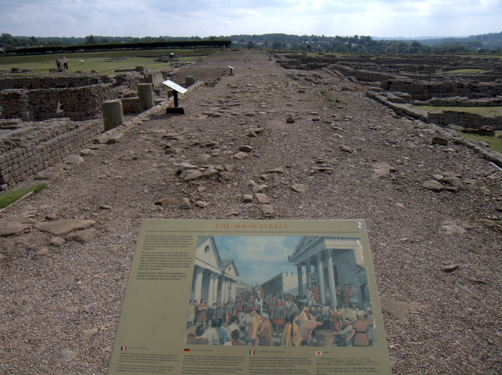
Crossing points seem to have been located south of each of the forts along Hadrian’s Wall and near several of the milecastles. Evidence from the excavated Vallum crossing at Benwell in Newcastle shows these crossing points had impressive monumental gateways.

The Vallum’s purpose is unclear. Many archaeologists think it marks the southern boundary of a military zone with the Wall itself forming the northern boundary. This would have helped protect the rear of the Wall and its associated military installations, with civilian access being closely controlled. The gateway at Benwell supports this idea. The numerous gateways along the Wall at forts and milecastles suggest that the frontier was intended as much to control movement as to provide a defensive line. Traders would have moved goods across the frontier but their movements would have been controlled and their goods taxed.

Relatively soon after it was constructed, some 20 to 30 years perhaps, the Vallum seems to have lost its function – the mounds were cut through and the ditch filled in at fairly regular intervals. It was out of use by the time the forts along the Wall were re-commissioned in the late second century AD following the return of the garrison from the Antonine Wall.

(The Roman Military Way Hoax)
The Vallum – Roman Military Way

Sadly, these ideas that have been constructed over the last 200 years are somewhat questionable. Within the book we look at associated aspects of this area like Military Way which was supposed to be constructed to patrol the so-called ‘Military Zone’ – to find that:

That over 50% of Military Way does not exist as a separate road, as described by archaeologists. Instead, the perceived road is fragmented and only becomes ‘alive’ as an independent road when the Vallum separates from the wall at any distance. 

This might give us a clue to the function of this rough and wonky road, as the stone for the wall would have needed to be delivered by cart if the Vallum canal was not available.

Stanegate as portrayed by archaeologists  - Roman Military Way
Stanegate as portrayed by archaeologists – Roman Military Way

As for the Stanegate that was supposed to connect to the main forts in the area as a ‘defensive shield’ we actual found that it is very little to no evidence of the ‘Stanegate Roman Road’, which (according to the current theory proposed by English Heritage) ‘consolidated as a frontier’ during the late first and early second century AD and helped crystallise Roman tactics and military expectations in the area.

This evidence is compounded when you release that of the 80mile border from coast to coast – Stonegate, at best, covers just 38.1 miles (47%) of the ‘defensive gap’, and hence suggestions of extension over and above the existing line existed (even without support from OS maps). Moreover, the research has shown the ‘raw’ Stanegate road without the ‘hidden’ parts below the B-roads – we are only looking at 20% of the declared road being visible on LiDAR maps.

Stanegate Road (when not part of an existing B-road system) is inconsistent in width and structure -moving from bank track to road with two ditches on each side to a ditch with two banks far from straight and usually starts and ends in ravens.

Most Forts and the Stanegate are not found to connect (with intersecting sub-roads) on only two occasions, and the rest show no connection.  Moreover, later ‘temporary’ camps also did not connect with the road – which questions whether (a defence line) was its purpose.  

Moreover, this would then question the ‘myth’ of using the Stanegate as a ‘boundary’ for withdrawing troops from Scotland in the first century AD is correct. And whether the River Tyne (which most of these Forts sit upon) was used as a more practical and effective boundary/defence.

This ‘myth buster’ will not surprise many in academia as it has been ‘hinted’ at for some time (but not acted upon it by updating the literature), as we see from Symonds et al.

“The question of whether a road even existed when the fortlets were founded is by default an existential one for the notion that they provided highway protection. But even if the metalled road does post-date the fortlets, a reasonably robust thoroughfare of some form must have existed from at least the mid AD 80s to service Vindolanda. The question is not whether there was a road, but whether it was metalled when the fortlets were founded.” Symonds, M. (2017). Hadrian’s Wall. In Protecting the Roman Empire: Fortlets, Frontiers, and the Quest for Post-Conquest Security (pp. 95-132)

Moreover, even if Stanegate was not built as suggested, it exists in parts, and it looks prehistoric (by design) as it relies heavily on ravens that start and end sections of the Stanegate sections; its sunken structure in parts is unfamiliar to traditional Roman Road design.

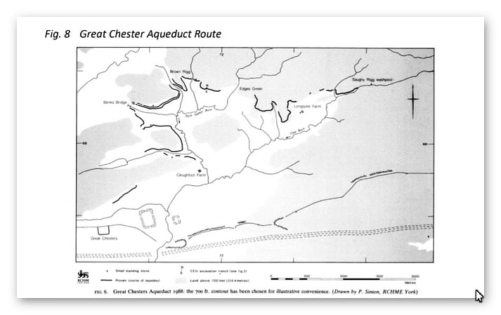
As for other famous ‘Roman Features Such as the Great Chesters Aqueduct, again we find not only is the origin questionable but as it located supposedly fully in ‘hostile territory – they its usefulness win conflict would be limited.

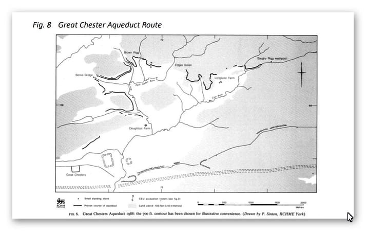
It is clear from the LiDAR research that the suspected Roman Aqueduct is not as it seems. This is not the first examination to spread doubt about the scale and origin of this feature in the landscape – MacKay, D. A. (1990). The Great Chesters Aqueduct: A New Survey. Britannia, 21, 285–289. Also shows an incomplete map of this aqueduct.

Great Chesters by Mackey  - Roman Military Way
Great Chesters by Mackey – Roman Military Way

Mackey failed to find in their survey that the Aqueduct changed size, and the path suggested had no identifiable remains of the bridges required to make this Aqueduct work.

Our more detailed findings indicate that the topology of the aqueduct suggests that it would need to go uphill at several points without any powered assistance (like a siphon) and so is mechanically unsound. Our finding has found that the use of ‘Dykes’ in this area and some connecting to this Aqueduct feature is new. We have also shown that closer to the Fort it was supposed to supply, there were closed water sources which could be used and that the Fosse by the Wall was also a water supply.

We conclude that we found a prehistoric watercourse linked to their sophisticated ‘Dyke’ system. I would be bold to suggest that this was used for either agricultural purposes or maybe industrial, seeing the multiple sites of quarries associated and in the region of this feature.

Case Study – The Roman Military Way

Many, new to the famous Whin Sill section of the Roman Wall frontier, confuse the Military Road (B6318) with the Roman Military Way. They have nothing in common either in time or purpose; in fact, the Military Road was only constructed after the Jacobite Rising of 1745, mainly upon the ruin of the wall!

The Romans created the Military Way (according to Historic England) to relay goods speedily along the line of the Wall. It was used to support the running of the frontier wall during the Roman period.

When Hadrian’s first grand plan was executed, The Stanegate (another Case Study in this book) was created as an east/west military road. But when Hadrian’s successor, Antonius Pius, pushed the frontier north through the isthmus between the Forth and Clyde, creating the Antonine Wall (yet another case study in this book), the supply road was installed integral to the turf-banked frontier linking the forts and milecastles.

Figure 83- Section H (HE:1010996)

Figure 83- Section H (HE:1010996)

When the frontier retreated to consolidate upon the original Hadrianic line over time, it was essential to have the same flexibility close to Hadrian’s Wall.

But does it exist, and what was it for in reality?

If we look at the first instance of this ‘alleged’ road, we need to go to Section E – schedule Monuments section 1010979, although this is some 24.2 km from the western flank of Hadrian’s Wall – which must ask the question – what was used for that 20% of the wall that is missing?

Yet another mystery occurs when we find this ‘road’ – there is nothing on LiDAR! Further investigation into why HE included it in its report shows that – it probably never existed in the first place.

“The course of the Roman road known as the Military Way, which ran along the corridor linking turrets, milecastles and forts, has been identified for a short distance to the east of Wallhead.

No remains are visible on the surface except for a short section of a turf-covered mound, 4m-5m wide and up to 0.4m high.

Its course was confirmed during excavation in 1894 by Haverfield. The road consisted of a gravel layer laid over larger stones with a stone kerb and central spine. Its survival here was confirmed by a geophysical survey in 1981. However, the unusual survival of this section suggests the possibility that it was reused in the medieval period serving as access to Bleatarn Quarry”

It was misidentified over a hundred years ago and was found to be a better quarry road – so the search continues….. So, we now move to Section H (HE 1010996), some 33.5 km from the Western start of the Wall (27.5%) – so what do we have here?

“The exact course of the Roman road known as the Military Way, which ran along the corridor between the Wall and the Vallum linking the turrets, milecastles and forts, is known intermittently throughout this section where it survives as an earthwork feature.

Opposite the disused quarry west of Bankshead Farm the Military Way survives as a terrace, 3m-5m wide, on the north side of an old hedge line. Occasional rises in hedgelines denote traces of its course”

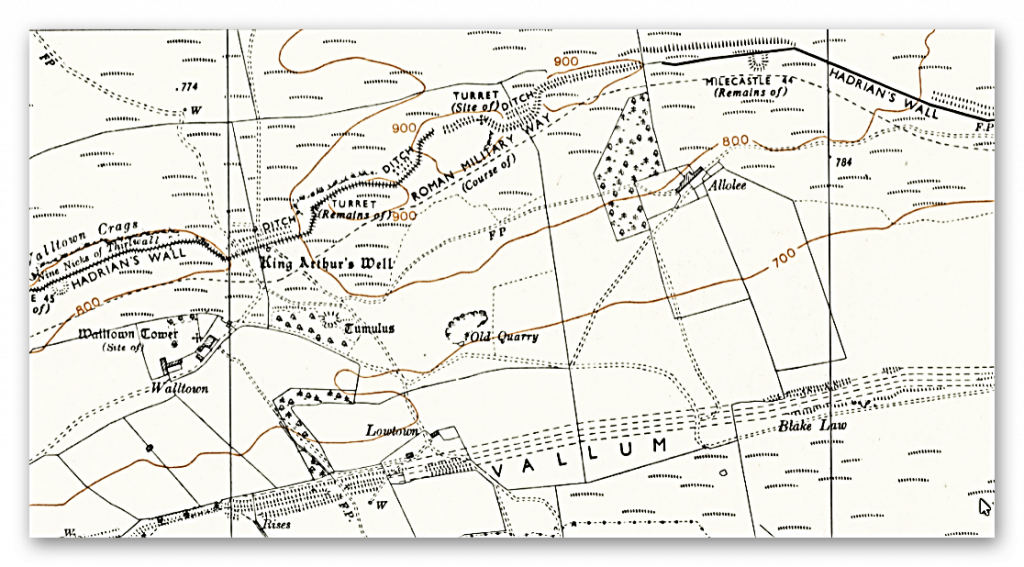
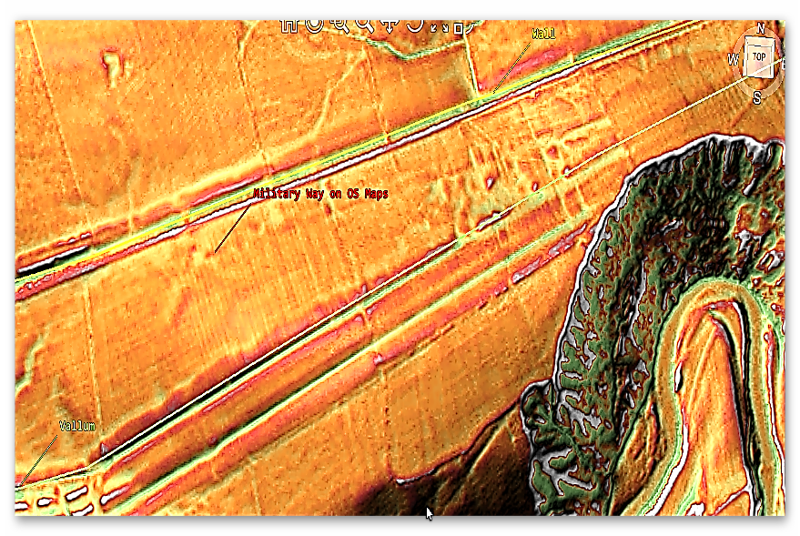
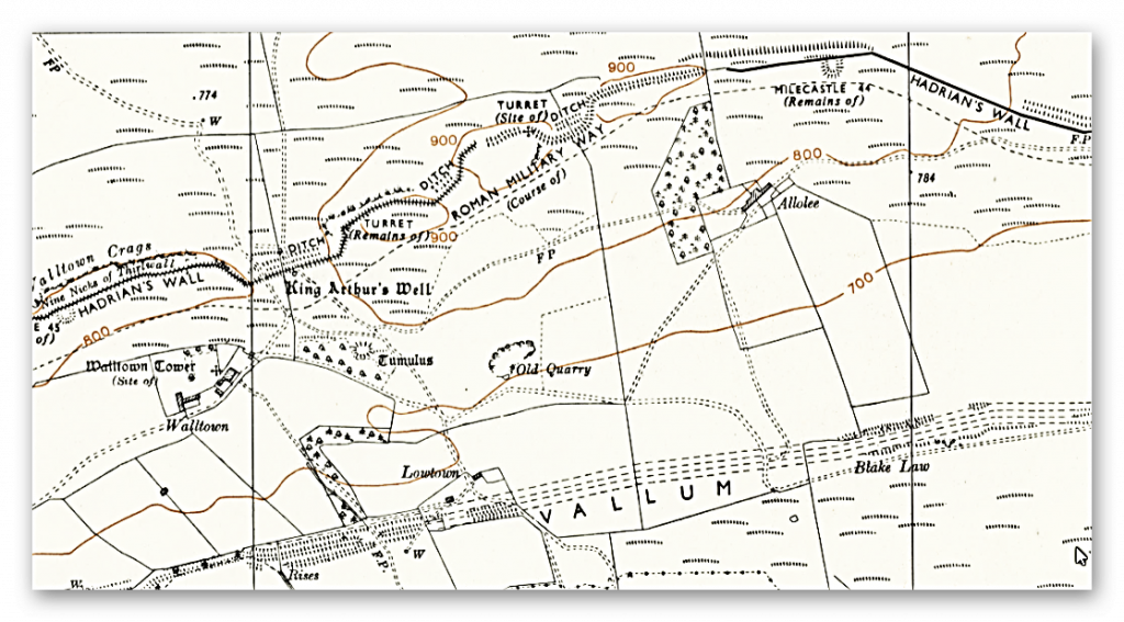
Again, it does not appear on the OS (1800) map, and what we find on the LiDAR maps seems to indicate it is linked to the Old Quarry rather than ‘connecting turrets and milecastles’.

Figure 84 - Military Way on OS Maps
Figure 84 – Military Way on OS Maps

Moreover, the Vallum has disappeared from this section and what we might be seeing is a shallow bank of the Vallum of a replacement.

In Section HE: 1010994 (Section I), it is reported that:

Excavations in 1911 by Simpson showed there to be two early floor levels and late pottery, demonstrating that the turret had continued in use, unlike many other turrets. The course of the Roman road known as the Military Way, which ran along the corridor between the Wall and the Vallum linking turrets, milecastles and forts, is known throughout this section. West of the fort, it survives as an intermittent low linear mound, 0.1m in maximum height. East of the fort a geophysical survey in 1986 by Walker confirmed the existence of the Military Way below the turf cover.”

Figure 85 - Little to no evidence of Military Way
Figure 85 – Little to no evidence of Military Way


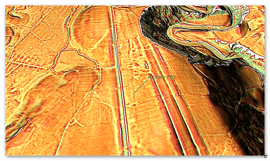
There looks like a partial road in between the Wall and The Vallum.  Which may join the Station (Amboglanna) to the Milecastle in that region – but it’s not a connecting road that continues past this isolated point (less than 1000m in length)?

Figure 86 - Military Way? If so, it seems to connect the Mile Castle to the Vallum and then the Station (Fort)
Figure 86 – Military Way? If so, it seems to connect the Mile Castle to the Vallum and then the Station (Fort)


The road disappears for another 7km and then reappears again in Section I on the OS maps.

Figure 87 Military Way clearly shown on OS maps

Then it is report in Section J as:

“The course of the Roman road known as the Military Way, which ran along the corridor between the Wall and the Vallum linking the turrets, milecastles and forts, is known throughout this section. It is visible as a low causeway, 0.2m high, or as a terrace, 5m wide, winding between rock outcrops to the south of the Wall. Turret 45a is situated on a high point on Walltown Crags with extensive views in all directions. It survives as an upstanding exposed feature, which is consolidated and in the care of the Secretary of State”

Flimsy evidence on LiDAR
Figure 89 - Military Way on OS Maps
Figure 89 – Military Way on OS Maps


“The road which connected the milecastle to the Military Way survives as a causeway 3.5m wide and 0.2m high. Milecastle 45 is situated on the crest of Walltown Crags with commanding views to the north and south.”

“It survives as a low turf covered causeway 5.5m wide and up to 0.5m high, or as a terrace in the hillside with a minimum width of 3m. It is straight for most of its course except where it deviates around rock outcrops.”

“West of the Cockmount Hill Plantation the foundations of two large regularly laid out rectangular buildings overlie the Military Way, using it as a hard standing. Their form suggests they are post-medieval or later in date. South east of King Arthur’s Well a spur road branched off the Military Way, the remains of which can be seen as a turf covered causeway leading south east towards Lowtown.

“Its course from the Caw Burn is known where it survives as a low turf-covered mound, 6m to 8m wide and 0.2m to 0.5m high. Occasional sections of this low turf-covered causeway reappear on the line up to the east gateway of Great Chesters fort. Beyond the field boundary west of the fort the Military Way is visible again as a discontinuous terrace with a slightly sinuous course which avoids the rock outcrops. Field gates are positioned on its course at the east and west end of this stretch. A road linking the Military Way and the Stanegate Roman road to the south via Great Chesters fort is overlain by the modern trackway to Great Chesters Farm which enters the fort through the south gateway.”

From these strong descriptions, we imagine that the course and evidence for the road will show strongly on LiDAR – but it’s invisible for a small 260m section.

Figure 92- Military Way - showing just 260m of road
Figure 92- Military Way – showing just 260m of road
Figure 91 - OS map showing how the road is ‘supposedly’ layout
Figure 91 – OS map showing how the road is ‘supposedly’ layout

In Section K we find in Schedule HE: 1010975:

“The course of the Roman road known as the Military Way, which ran along the corridor between the Wall and the Vallum linking the turrets, milecastles and forts is known throughout this section except around Cawfields Quarry where its precise course has not yet been confirmed. It survives as a linear causeway which is most prominent at the east end of this section. Here it measures between 3.5m and 5.2m wide with a revetment containing large stones on the south side and with evidence of a stone kerb. Further west the causeway, where extant, averages about 0.1m in height and 7m in width.

Where there is no trace of the causeway the line of the road has been identified by changes in vegetation growth with grass growing less well above the former road surface. Around Cawfields Quarry the remains of the Military Way may have been destroyed by the quarry, however it is possible that here the Military Way was built on the line of the Vallum, as it was further to the east at the crossing site of the Caw Burn and thus survives. About 200m east of milecastle 42 and 10m to the south of the Military Way is a fallen Roman milestone. It measures 1.38m high by 0.4m by 0.3m. It is oblong in shape and crudely rounded at the corners. This uninscribed milestone now lies in long grass. Two other milestones from this vicinity have been removed and are now in Chesters museum.”

Figure 94 - Observable Military Way on the LiDAR
Figure 94 – Observable Military Way on the LiDAR
Figure 93 - Military Way from Chesters For
Figure 93 – Military Way from Chesters Fort


The LiDAR map shows that the road did not go to the Quarry but terminated in the River Valley (Like the Vallum) – was there a bridge across (no foundations) shown on the LiDAR map?

Figure 95 - No Military Road to the Quarry - but one coming out of the Vallum
Figure 95 – No Military Road to the Quarry – but one coming out of the Vallum

Section HE: 1010973 suggest that:

“Its course is marked usually by a slight causeway, up to 0.2m high, or by differing vegetation marks seen in grass colour. This differentiation in vegetation cover reflects differing growing conditions on the compacted road surface. It is best preserved where it crosses a gully running into Green Slack. Here it survives as a built up causeway, 1.7m high and 2m wide. South of milecastle 41 the causeway survives up to 0.7m high with kerb stones on its south side.”

Figure 96 - Clear evidence of a Roman road - Military Way
Figure 96 – Clear evidence of a Roman road – Military Way


“The course of the Roman road known as the Military Way, which ran along the corridor between the Wall and the Vallum linking turrets, milecastles and forts, survives well as a linear causeway throughout this section. Some stone is visible on the south scarp where it has been built up to make a level surface. This scarp appears to have had a stone revetment. The south scarp averages 0.4m in height, although it reaches up to 1.2m high in places. West of Peel Farm the Military Way is overlain by the road to Steel Rigg car park. To the south of Sycamore Gap are the remains of a prehistoric field boundary running roughly from north to south, probably dating to the Bronze Age.

The Roman Military Way overlies this boundary, indicating that it is certainly pre-Roman in date. The peat bog, which has grown over remains of this boundary further to the south, is of Bronze Age origin. A second boundary is located running transversely to the Sycamore Gap boundary, to the west of it, south of the Military Way. Their assumed junction is masked by the peat bog which has built up to the south.”

Section L – Schedule HE:1010964:

“The course of the Roman road known as the Military Way, which ran along the corridor between the Wall and the Vallum linking turrets, milecastles and forts survives as a turf-covered linear mound throughout most of this section. It is visible as a disturbed causeway averaging 5m wide with traces of a stone revetment on the south side. It was partly excavated between 1978 and 1980 when it was shown to have a damaged metalled surface 4m wide, a stone revetment on the south scarp, and to have been overlain by later roadways. Branch roads link the Military Way with the south gates of milecastles 35 and 36. At milecastle 35 the low, uneven turf-covered mound of the causeway is up to 5.5m wide and 0.2m high.”

Section M – Schedule: HE:1010963:

“The course of the Roman road known as the Military Way, which ran along the corridor between the Wall and the Vallum linking the turrets, milecastles and forts, was carried on the north mound of the Vallum in the east half of this section. Its buried remains survive below grassland east of milecastle 33, until the B6318 road coincides with the north mound of the Vallum where it lies below the modern road surface.

South of turret 33b the Military Way leaves the north mound of the Vallum and follows a course parallel to that of the Wall. Here it survives as a distinct linear mound up to 6m wide and up to 0.3m high. The Vallum survives well as an upstanding earthwork visible on the ground throughout this section. It runs roughly parallel with the line of the Wall until south of turret 33b where it turns to the south west and follows the tail of the escarpment. In the east half of this section the Vallum ditch averages 3.5m in depth, while the north and south mounds average 1.5m in height.

The course of the Roman road known as the Military Way, which ran along the corridor linking turrets, milecastles and forts is not yet known with certainty in this section. However, there is a slight rise alongside the field wall on the south side of the wooded area to the south of Carraw Farm which could be the remains of the `agger’, or raised spine, of the road. The antiquarian Horsley, writing in the 1730s, stated that the Military Way was carried on the north mound of the Vallum in this general area.”

Section N – Schedule HE:1010959

“It is visible as a low turf covered causeway immediately south of the car park heading directly for the east gate of the fort, though it fades before it reaches the fort. On the west side of the fort it re-emerges heading from the west gateway to the north mound of the Vallum which was used to carry the road in this section. The road is visible as a low linear mound, 0.2m high, along the summit of the north mound of the Vallum. The Vallum survives as an intermittent earthwork throughout this section.

The Military Way survives as a turf-covered causeway leading up to the south gateway of the milecastle. Milecastle 31 is situated immediately to the east of Carrawburgh car park with wide views to the north and south but a restricted outlook to the east and west. It survives as a low turf covered platform 0.25m high. The remains of north wall of the milecastle lies beneath the B6318 road. Traces of the road connecting the milecastle to the Military Way survive as a causeway 0.15m high. Turret 29b survives as a turf-covered mound with parts of the north, west and east walls surviving up to two courses. The road connecting the turret to the Military Way is discernible as a slight linear mound.

It was excavated during 1912 by Newbold who found the doorway in the east end of the south side and a ladder platform in the south west corner. Heavily burnt masonry and rubbish indicated that the turret had been destroyed by fire and was then left in ruins. Turret 30a is situated about 400m east of Carrawbrough Farm below the B6318 road. It was located during 1912, though there are no surface remains visible now. Turret 30b is located about 50m west of the drive to Carrawbrough Farm partly below the B6318 road. The south side of the turret is visible in the field to the south of the road as a turf covered scarp, 0.5m high.

At Limestone Corner the Military Way is visible as a low causeway, 0.6m high, leading to the south gateway of milecastle 30. Beyond the milecastle it rejoins the north mound of the well preserved vallum. Excavations during 1911 confirmed this to be the case.

Figure 97 - Military Way added to the Vallum to meet Milecastle 30
Figure 97 – Military Way added to the Vallum to meet Milecastle 30


There are no upstanding remains of the road to the west of the fort. However, the antiquarian Horsley considered that the Military Way exited Chesters and then converged gradually with the Vallum’s north mound where they continued to unite for a considerable distance.”

(The Roman Military Way Hoax)
Figure 98- Military Way on OS Maps
Figure 99 - No sign of Military Way on LiDAR Maps by Milecastle 29
Figure 99 – No sign of Military Way on LiDAR Maps by Milecastle 29


Section O – Schedule HE:1010959

The course of the Roman road known as the Military Way, which ran along the corridor between the Wall and the Vallum linking turrets, milecastles and forts, survives well in the section between the North Tyne and the fort.

 The road line is clearly defined on the ground leaving the fort by the east gateway and heading towards the Roman bridge. Initially, it is a depression and then becomes a causeway with a maximum height of 0.8m with a kerb to the south visible for 1.3m. 

Figure 99 - Military Way, west of the fort on OS Maps
Figure 99 – Military Way, west of the fort on OS Maps
(The Roman Military Way Hoax)
Figure 100 – Military Way does not exist!!


There are no upstanding remains of the road to the west of the fort. However, the antiquarian Horsley considered that the Military Way exited Chesters and then converged gradually with the north mound of the Vallum, where they continued united for a considerable distance

Schedule: HE:1018581

The course of the Roman road known as the Military Way, which ran along the corridor between the Wall and the Vallum linking turrets, milecastles and forts, is considered to be on the line of the north mound of the Vallum in this section. Throughout this section the north mound of the Vallum has been largely levelled by ploughing and so it is doubtful whether the Military Way survives intact here. The exception to this is where the angle of descent down to the North Tyne is particularly steep opposite Black Pasture Cottage, and here a turf-covered trackway leaves the line of the north mound to run down the side of a dry valley to rejoin it some 180m further on. This diversion effectively eases the gradient. Where the valley opens, this track is visible as a raised causeway 7m wide and 0.2m high.

Figure 101 - Still no sign of any Military Road
Figure 101 – Still no sign of any Military Road


The course of the Roman road known as the Military Way, which ran along the corridor between the Wall and the Vallum linking turrets, milecastles and forts, is known for most of this section. It uses the north mound of the Vallum as its base, certainly up to milecastle 25, along which it could be seen by Horsley who recorded it in his 1732 publication. A recent survey by the Royal Commission on the Historical Monuments of England shows that the Military Way probably continued along the north mound of the Vallum beyond milecastle 25, where Horsley could no longer trace it.

Section O shows us that there is no Military Way as an independent road and only as an assumption of the Northern Bank of the Vallum – which was not continuous in this section due to the River Tyne.

Sections P to W have the same excuse for the loss of the Military Way, a total of 35km (28%) of the wall length.

The course of the Roman road known as the Military Way, which ran along the corridor between the Wall and the Vallum linking turrets, milecastles and forts, is known for most of this section. It uses the north mound of the Vallum as its base.

Conclusion

Our investigation has found that over 50% of Military Way does not exist as a separate road, as described by archaeologists. Instead, the perceived road is fragmented and only becomes ‘alive’ as an independent road when the Vallum separates from the wall at any distance. 

This might give us a clue to the function of this rough and wonky road, as the stone for the wall would have needed to be delivered by cart if the Vallum canal was not available.

(The Roman Military Way Hoax)

This was an extracts from the NEW Book Ancient Prehistoric Canals (Dykes) – Wansdyke available on Amazon as a FULL COLOUR HARD BACK (£49.95) or a ECONOMY (£9.99) SOFTBACK black and white VERSION – it is also available as a KINDLE (£2.99) book. For further information about our work on Prehistoric Britain visit our WEBSITE or VIDEO CHANNEL.

Product details

  • ASIN ‏ : ‎ B0BN7PD6BS
  • Publisher ‏ : ‎ Independently published (24 Nov. 2022)
  • Language ‏ : ‎ English
  • Hardcover ‏ : ‎ 477 pages
  • ISBN-13 ‏ : ‎ 979-8358524187
  • Dimensions ‏ : ‎ 15.24 x 3.33 x 22.86 cm
  • Illustrations: 350+

Further Reading

For information about British Prehistory, visit www.prehistoric-britain.co.uk for the most extensive archaeology blogs and investigations collection, including modern LiDAR reports.  This site also includes extracts and articles from the Robert John Langdon Trilogy about Britain in the Prehistoric period, including titles such as The Stonehenge Enigma, Dawn of the Lost Civilisation and the ultimate proof of Post Glacial Flooding and the landscape we see today.

Robert John Langdon has also created a YouTube web channel with over 100 investigations and video documentaries to support his classic trilogy (Prehistoric Britain). He has also released a collection of strange coincidences that he calls ‘13 Things that Don’t Make Sense in History’ and his recent discovery of a lost Stone Avenue at Avebury in Wiltshire called ‘Silbury Avenue – the Lost Stone Avenue’.

(Maritime Diffusion Model for Megaliths in Europe)

Langdon has also produced a series of ‘shorts’, which are extracts from his main body of books:

The Ancient Mariners

Stonehenge Built 8300 BCE

Old Sarum

Prehistoric Rivers

Dykes ditches and Earthworks

Echoes of Atlantis

Homo Superior

Other Blogs

s

t

The Maiden Way Hoax – A Closer Look at an Ancient Road’s Hidden History

Promotional Video – Ancient Prehistoric Canals (Dykes) – The Vallum (Maiden Way)

Extract From Book……………………… Ancient Prehistoric Canals (Dykes) – The Vallum

Introduction

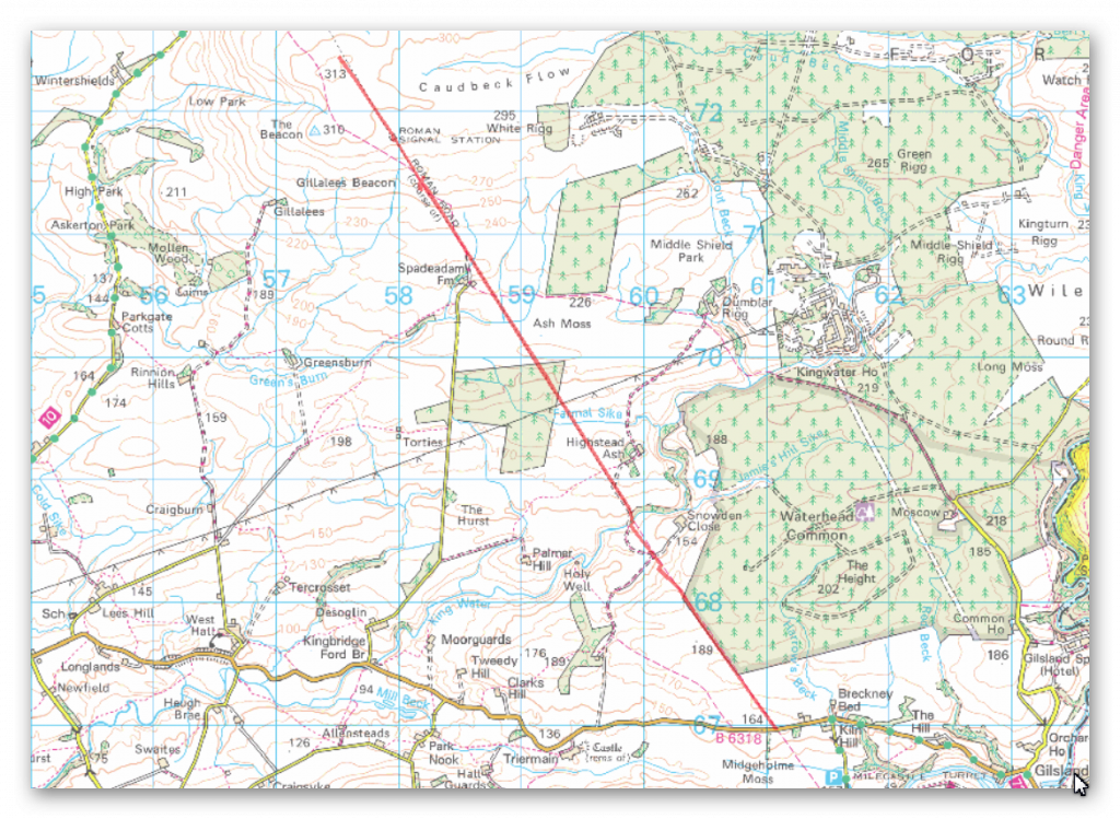
In this deep-dive case study, we explore the so-called Maiden Way—a Roman road stretching 6.58 km from the B6318 to the moorlands near High House, featuring not just a road but also a Roman signal station and a post-medieval settlement. Officially recognized as monument HE:1018242, this route is traditionally believed to have linked the Hadrian’s Wall fort at Birdoswald to the more remote outpost of Bewcastle.

The road winds over Waterhead Common and Gillalees Beacon, where a signal station known as Robin Hood’s Butt perches with a clear line of sight to Birdoswald, hinting at a rapid communication system used in the Roman period. But the picture gets muddier as we examine the path’s quirks and oddities—such as its abrupt changes in direction, inconsistencies in width, and curious detours around natural features like river valleys.

What’s especially compelling is the suggestion that the Maiden Way might not be entirely Roman at all. Archaeological evidence describes the road being built on top of earlier earthworks—raised banks known as aggers, hollow ways, and terraced slopes. Such features are commonly associated with prehistoric dykes, raising the tantalizing possibility that Roman engineers simply repurposed a much older network.

The signal station and adjacent Beacon Pasture settlement reveal layered usage through time. From turf-covered stone platforms to lazy-bed agriculture, we see a landscape that evolved, was reused, and finally abandoned by the mid-19th century. Yet the road’s twisty turn—particularly its eastward and then southward veer near the river valley—suggests Roman pragmatism encountering ancient geography and adapting rather than conquering.

So, was the Maiden Way a Roman masterpiece of engineering… or just a makeover of a prehistoric thoroughfare?

As with other “Roman” features like the Vallum and Military Way, the truth might be a lot more ancient—and a lot more complicated—than it first appears.

Hadrians Wall

Traditional archaeologists and archaeological establishments like English Heritage suggest that:

The Vallum is a massive earthwork constructed shortly after Hadrian’s Wall itself and lying just south of it. Many visitors confuse the Vallum with Hadrian’s Wall itself because it’s such an obvious and impressive feature in the landscape. 

In fact, the Vallum is made up of several different elements – a ditch around 6 metres wide and 3 metres deep; two mounds either side of the ditch about 6 metres wide and 2 metres high and set back from the ditch by around 9 metres; and often a third mound on the southern edge of the ditch. The whole complex is around 36 metres across. Usually, the Vallum runs close behind the Wall but in the rocky and hilly central section the Vallum lies up to 700 metres from the Wall. ( Maiden Way)

The Maiden Way Hoax
The Vallum

Crossing points seem to have been located south of each of the forts along Hadrian’s Wall and near several of the milecastles. Evidence from the excavated Vallum crossing at Benwell in Newcastle shows these crossing points had impressive monumental gateways.

The Vallum’s purpose is unclear. Many archaeologists think it marks the southern boundary of a military zone with the Wall itself forming the northern boundary. This would have helped protect the rear of the Wall and its associated military installations, with civilian access being closely controlled. The gateway at Benwell supports this idea. The numerous gateways along the Wall at forts and milecastles suggest that the frontier was intended as much to control movement as to provide a defensive line. Traders would have moved goods across the frontier but their movements would have been controlled and their goods taxed.

Relatively soon after it was constructed, some 20 to 30 years perhaps, the Vallum seems to have lost its function – the mounds were cut through and the ditch filled in at fairly regular intervals. It was out of use by the time the forts along the Wall were re-commissioned in the late second century AD following the return of the garrison from the Antonine Wall.

Ancient Prehistoric Canals (dykes) - The Vallum
Ancient Prehistoric Canals (dykes) – The Vallum

Sadly, these ideas that have been constructed over the last 200 years are somewhat questionable. Within the book we look at associated aspects of this area like Military Way which was supposed to be constructed to patrol the so-called ‘Military Zone’ – to find that:

That over 50% of Military Way does not exist as a separate road, as described by archaeologists. Instead, the perceived road is fragmented and only becomes ‘alive’ as an independent road when the Vallum separates from the wall at any distance. 

This might give us a clue to the function of this rough and wonky road, as the stone for the wall would have needed to be delivered by cart if the Vallum canal was not available.

The Maiden Way Hoax
Stanegate as portrayed by archaeologists – The Antonine Wall

As for the Stanegate that was supposed to connect to the main forts in the area as a ‘defensive shield’ we actual found that it is very little to no evidence of the ‘Stanegate Roman Road’, which (according to the current theory proposed by English Heritage) ‘consolidated as a frontier’ during the late first and early second century AD and helped crystallise Roman tactics and military expectations in the area.

This evidence is compounded when you release that of the 80mile border from coast to coast – Stonegate, at best, covers just 38.1 miles (47%) of the ‘defensive gap’, and hence suggestions of extension over and above the existing line existed (even without support from OS maps). Moreover, the research has shown the ‘raw’ Stanegate road without the ‘hidden’ parts below the B-roads – we are only looking at 20% of the declared road being visible on LiDAR maps.

Stanegate Road (when not part of an existing B-road system) is inconsistent in width and structure -moving from bank track to road with two ditches on each side to a ditch with two banks far from straight and usually starts and ends in ravens.

Most Forts and the Stanegate are not found to connect (with intersecting sub-roads) on only two occasions, and the rest show no connection.  Moreover, later ‘temporary’ camps also did not connect with the road – which questions whether (a defence line) was its purpose.  

Moreover, this would then question the ‘myth’ of using the Stanegate as a ‘boundary’ for withdrawing troops from Scotland in the first century AD is correct. And whether the River Tyne (which most of these Forts sit upon) was used as a more practical and effective boundary/defence.

This ‘myth buster’ will not surprise many in academia as it has been ‘hinted’ at for some time (but not acted upon it by updating the literature), as we see from Symonds et al.

“The question of whether a road even existed when the fortlets were founded is by default an existential one for the notion that they provided highway protection. But even if the metalled road does post-date the fortlets, a reasonably robust thoroughfare of some form must have existed from at least the mid AD 80s to service Vindolanda. The question is not whether there was a road, but whether it was metalled when the fortlets were founded.” Symonds, M. (2017). Hadrian’s Wall. In Protecting the Roman Empire: Fortlets, Frontiers, and the Quest for Post-Conquest Security (pp. 95-132)

Moreover, even if Stanegate was not built as suggested, it exists in parts, and it looks prehistoric (by design) as it relies heavily on ravens that start and end sections of the Stanegate sections; its sunken structure in parts is unfamiliar to traditional Roman Road design.

As for other famous ‘Roman Features Such as the Great Chesters Aqueduct, again we find not only is the origin questionable but as it located supposedly fully in ‘hostile territory – they its usefulness win conflict would be limited.

It is clear from the LiDAR research that the suspected Roman Aqueduct is not as it seems. This is not the first examination to spread doubt about the scale and origin of this feature in the landscape – MacKay, D. A. (1990). The Great Chesters Aqueduct: A New Survey. Britannia, 21, 285–289. Also shows an incomplete map of this aqueduct.

Great Chesters by Mackey

Mackey failed to find in their survey that the Aqueduct changed size, and the path suggested had no identifiable remains of the bridges required to make this Aqueduct work.

Our more detailed findings indicate that the topology of the aqueduct suggests that it would need to go uphill at several points without any powered assistance (like a siphon) and so is mechanically unsound. Our finding has found that the use of ‘Dykes’ in this area and some connecting to this Aqueduct feature is new. We have also shown that closer to the Fort it was supposed to supply, there were closed water sources which could be used and that the Fosse by the Wall was also a water supply.

We conclude that we found a prehistoric watercourse linked to their sophisticated ‘Dyke’ system. I would be bold to suggest that this was used for either agricultural purposes or maybe industrial, seeing the multiple sites of quarries associated and in the region of this feature.

Case Study – Maiden Way

Name: Maiden Way Roman road from B6318 to 450m SW of High House, Gillalees Beacon signal station and Beacon Pasture early post-medieval dispersed settlement
List UID: 1018242

HE:1018242
Figure 236 – HE:1018242

The monument includes the earthworks and buried remains of a 6.58km length of the Maiden Way Roman road together with the earthwork remains of Gillalees Beacon Roman signal station, also known as Robin Hood’s Butt, and Beacon Pasture early post-medieval dispersed settlement.

The Maiden Way connected the Hadrian’s Wall fort at Birdoswald with the fort at Bewcastle 9.6km to the north.

After leaving Birdoswald the road climbs gradually over Waterhead Common and Ash Moss to its highest point on the moorland of Gillalees Beacon where, a short distance south of the summit, remains of the Roman signal station stand. Beacon Pasture settlement overlies the Roman road and lies on the moorland a short distance south of the signal station.

Construction of Birdoswald and Bewcastle forts commenced during the early 120s AD and the road connecting the two forts must also have been built at this time.

Where the road survives as an earthwork it can be seen either as a raised bank known as an agger upon the top of which the road surface was built, or as a hollow way where erosion of the road surface may have occurred or where the Roman engineers have taken the road through a cutting.

It is also visible as a terrace running diagonally down the steepest hillslope in order to ease the gradient. Flanking ditches for drainage purposes ran either side of the road; where not infilled by natural processes these ditches survive as earthworks.

Where they are infilled their location can frequently be identified by changes in the vegetation cover where the deeper, damper soil has encouraged a lusher growth. The finest surviving stretch of agger and flanking ditch lies a short distance north of the B6318. Here a length of agger approximately 200m long measures 10m wide at the base and 5m wide at the top and survives up to 0.8m high.

The western ditch at this point measures 2m wide by 0.2m deep. Limited excavations of the road further north have shown it to be formed of two courses of large stones laid flat over which a layer of small stones was laid to form the road’s metalled surface. The road was found to be well cambered and has large kerbstones.

These excavations also found that the width of the road surface was not constant and varied between 3.7m and 4.6m. In places, particularly on the higher moorland, the road and its ditches lie buried beneath vegetation cover and no surface remains are visible. Here the course of the road can still be followed quite clearly where modern drainage channels have been cut through it exposing the road’s stone foundations.

Gillalees Beacon signal station lies immediately west of the Roman road. It survives as a rectangular earth and stone mound up to 2.5m high surrounded by a shallow ditch with a causeway on the east side which gave access directly from the road. Antiquarian investigation found the stone-built structure to measure approximately 6m by 5.5m externally with walls standing ten courses high.

The signal station is positioned to be in full view of Birdoswald fort 6.5km to the south and its function would have been to rapidly convey information to the fort garrison if an enemy was approaching from the north. Beacon Pasture early post-medieval settlement consists of three rectangular enclosures, one north of and two south of the Roman road. The house was originally built of stone and is now visible as a turf-covered platform of stone tumble measuring 13.5m by 6.7m. It lies alongside the road overlapping the edge of the northern enclosure and its position adjacent to the road indicates that this part of the Maiden Way remained in use during the early post-medieval period.

The southern enclosure measures 44m by 29m and contains ridge and furrow, indicating that arable cultivation took place here, while the smaller northern enclosure contains lazy-beds (raised earthen mounds) about 1.5m wide on which crops were grown, and thus also attests to arable cultivation.

The central enclosure measures 34m by 32m and is interpreted as a stockpen. The settlement had been abandoned by 1854.

Between NY60286811 – NY59886877 the protection follows the actual line of the road and not that suggested by the Ordnance Survey.

The road is visible as an earthwork between NY60286811 – NY60136831 and between NY59906865 – NY59886877.

 Between NY60136831 and Slittery Ford at NY59896862 the road is interpreted as surviving as a buried feature.

Maiden Way a crooked Roman Road?
Figure 237 – Maiden Way a crooked Roman Road?
The Maiden Way Hoax
Figure 238 – The Roman road seems to turn East then South

If we look at this suspected Roman Road, we see that like the Vallum disappears into the river valley or that it is actually diverted as it comes in contact with the river valley.

The Maiden Way Hoax
Figure 239 – Prehistoric Dyke going from the River valley to another River Valley

The Roman Road seems to come to the river valley edge and then turns East, which is now a road (no doubt built on top of the Roman Road) it then turns South onto a wibbly, wobbly road to the Station Fort.

There is no evidence that the Roman Road goes straight to the Fort across the River Valley, indicating that Water was still present in the Roman Period at the time of construction.

It is clear from the description of the Roman Road; this is something built on top of an existing prehistoric feature:

 “Where the road survives as an earthwork it can be seen either as a raised bank known as an agger upon the top of which the road surface was built, or as a hollow way where erosion of the road surface may have occurred or where the Roman engineers have taken the road through a cutting.” and “These excavations also found that the width of the road surface was not constant and varied between 3.7m and 4.6m. ”

Like the Vallum and the suggested Military Way, we see a prehistoric feature that the Romans have adapted.

This was an extracts from the NEW Book Ancient Prehistoric Canals (Dykes) – Wansdyke available on Amazon as a FULL COLOUR HARD BACK (£49.95) or a ECONOMY (£9.99) SOFTBACK black and white VERSION – it is also available as a KINDLE (£2.99) book. For further information about our work on Prehistoric Britain visit our WEBSITE or VIDEO CHANNEL.

Product details

  • ASIN ‏ : ‎ B0BN7PD6BS
  • Publisher ‏ : ‎ Independently published (24 Nov. 2022)
  • Language ‏ : ‎ English
  • Hardcover ‏ : ‎ 477 pages
  • ISBN-13 ‏ : ‎ 979-8358524187
  • Dimensions ‏ : ‎ 15.24 x 3.33 x 22.86 cm
  • Illustrations: 350+

Further Reading

For information about British Prehistory, visit www.prehistoric-britain.co.uk for the most extensive archaeology blogs and investigations collection, including modern LiDAR reports.  This site also includes extracts and articles from the Robert John Langdon Trilogy about Britain in the Prehistoric period, including titles such as The Stonehenge Enigma, Dawn of the Lost Civilisation and the ultimate proof of Post Glacial Flooding and the landscape we see today.

Robert John Langdon has also created a YouTube web channel with over 100 investigations and video documentaries to support his classic trilogy (Prehistoric Britain). He has also released a collection of strange coincidences that he calls ‘13 Things that Don’t Make Sense in History’ and his recent discovery of a lost Stone Avenue at Avebury in Wiltshire called ‘Silbury Avenue – the Lost Stone Avenue’.

(Maritime Diffusion Model for Megaliths in Europe)

Langdon has also produced a series of ‘shorts’, which are extracts from his main body of books:

The Ancient Mariners

Stonehenge Built 8300 BCE

Old Sarum

Prehistoric Rivers

Dykes ditches and Earthworks

Echoes of Atlantis

Homo Superior

Other Blogs

s

t

Britain’s Giant Prehistoric Waterways

Introduction

Unmasking the Shared Secrets of Offa’s Dyke, Wansdyke, Car Dyke, and the Vallum

For centuries, the great linear earthworks of Britain – Offa’s Dyke, Wansdyke, Car Dyke, and Hadrian’s Wall’s Vallum – have been shrouded in mystery, often interpreted as defensive barriers or territorial markers. However, groundbreaking research utilizing LiDAR technology and re-evaluating archaeological evidence reveals a fascinating shared secret. These monumental structures bear compelling evidence of a significant relationship with water at various stages of their development, challenging conventional understandings of prehistoric and Roman Britain. (Britain’s Giant Prehistoric Waterways)

Let’s delve into the individual investigations of these four colossal “dykes” to uncover their watery past and shared characteristics:

(Britain's Giant Prehistoric Waterways)
Car Dyke – (Britain’s Giant Prehistoric Waterways)

Car Dyke: The Undeniable Waterway

Car Dyke, stretching across the Fens of Eastern England, has long puzzled historians. Unlike the other three, Car Dyke’s historical narrative has often acknowledged its role as a waterway, albeit primarily attributed to Roman engineering. However, recent investigations, including LiDAR surveys, reveal a more complex and ancient story.

  • Direct Evidence of Water Retention and Navigation: AI analysis even admits that Car Dyke shows empirical evidence of intentional water retention, with ditches designed for drainage and navigation. Our research confirms this, highlighting its function as a transportation hub for boats carrying men and materials.
  • Connection to Rivers and Springs: Car Dyke’s course appears to hug the shoreline, seemingly looking for natural springs to fill the canal. It has direct links to existing or prehistoric rivers created from post-glacial flooding. LiDAR mapping has further revealed its connections to other Roman sites and infrastructure, emphasizing its strategic importance within a network of waterways.
  • Prehistoric Origins and Water Use: Mathematical analysis of artefacts suggests that Car Dyke predates the Roman period, potentially having Mesolithic/Neolithic origins. This aligns with the broader theory that prehistoric societies utilized waterways extensively for transport. The “wobbly” nature of much of the Dyke’s course further hints at an adaptation of earlier natural water features.

(Britain’s Giant Prehistoric Waterways)

(Britain's Giant Prehistoric Waterways)
Offa’s Dyke in the Neolithic (Britain’s Giant Prehistoric Waterways)

Offa’s Dyke: More Canal Than Combat Barrier

Offa’s Dyke, famously dividing England and Wales, has traditionally been seen as a massive defensive earthwork. However, detailed LiDAR studies are dismantling this long-held belief.

  • Discontinuity and “Wrong-Facing” Defences: Our LiDAR surveys reveal that a significant portion of what is thought to be Offa’s Dyke is either missing (66% with over 70 gaps) or linked to natural river formations. Additionally, sections of the ditch face the “wrong way” if its primary purpose was defence.
  • Connection to Quarries and Rivers: A consistent pattern emerges: Offa’s Dyke shows a strong association with numerous quarries (48 identified within 200m in one section) and connections to both existing rivers and prehistoric paleochannels. This strongly suggests its use as a canal system to transport mined minerals.
  • Springs and Water Replenishment: Investigations have identified numerous springs along the alignment of Offa’s Dyke (17 in one section), indicating an intentional placement near water sources. This supports the idea that the “dyke” could trap and replenish water, functioning as a canal. The presence of potential “ponds” and connecting channels further hints at a prehistoric lock system to navigate elevation changes.
  • Adaptation of Prehistoric Waterways: Like Car Dyke, mathematical analysis suggests that parts of Offa’s Dyke are likely of Mesolithic/Neolithic origin, reused and potentially modified by later periods, including the Romans.
(Britain's Giant Prehistoric Waterways)
Wansdyke design shows its not for defence or a land marker – (Britain’s Giant Prehistoric Waterways)

Wansdyke: An Island’s Watery Embrace

Wansdyke, with its two main sections across Wiltshire, has also been conventionally interpreted as a Saxon defensive structure—however, our LiDAR surveys and analysis point towards a more intricate relationship with water.

  • Proximity to Prehistoric Waterways: Wansdyke’s location is significant: East Wansdyke runs between Savernake Forest and Morgan’s Hill, while West Wansdyke extends towards Bristol. Importantly, Wansdyke was potentially an island during the Mesolithic period, surrounded by the waters of the River Kennet.
  • Connection to Springs and Pits: LiDAR surveys reveal a notable number of springs and pits/quarries close to Wansdyke, similar to Offa’s Dyke. The consistent mathematics assigning a mining site to every 7 meters of Dyke suggests an intentional link.
  • Potential for Boat Travel: The western end of Wansdyke, situated within a prehistoric island, intriguingly splits the landmass, raising the possibility of boats sailing from end to end during the Mesolithic era.
  • Roman Adaptation: Evidence suggests that the Romans likely reworked sections of Wansdyke, creating a more cohesive structure. However, its underlying origins appear to be linked to prehistoric water management and transport during higher river levels.

(Britain's Giant Prehistoric Waterways)
Parts of the Vallum still contain water today – (Britain’s Giant Prehistoric Waterways)

The Vallum: Hadrian’s Watery Companion

The Vallum, a significant earthwork associated with Hadrian’s Wall, is often seen as a linear barrier south of the wall. While its Roman origin is widely accepted, its function is debated. Our research suggests that, like the other dykes, the Vallum also has strong connections to water.

  • Water Retention in the Ditch: AI analysis indicates that sections of the Vallum ditch show empirical evidence of water retention.
  • Connection to Springs and Water Sources: LiDAR investigations reveal a significantly higher number of springs (460% more than the norm) and quarries (180% more than the norm) near the Vallum. This mirrors the pattern observed with Offa’s and Wansdyke. The Vallum also connects with the Eden River and Brunstock Beck.
  • Paleochannel Connections and Potential for Canal Use: Paleochannels seem to connect Roman temporary forts near the Vallum, suggesting a potential for waterborne movement. The presence of a bridge and castle named after “Drawsdyke” further points to a historical association with a water-filled ditch. It’s plausible that the Romans, known for their engineering prowess, utilized a pre-existing prehistoric dyke for water management and the transport of materials for Hadrian’s Wall, similar to their adaptation of other British Dykes.

(Britain's Giant Prehistoric Waterways)

Shared Features and a New Perspective

Examining these four major linear earthworks collectively reveals compelling shared features indicative of a significant relationship with water:

  • Proximity to Water Sources: All four “dykes” exhibit a notable association with springs, existing rivers, and prehistoric paleochannels.
  • Links to Quarries: A strong connection exists between these earthworks and numerous quarries, suggesting a function in transporting quarried materials.
  • Evidence Against Solely Defensive Purposes: Discontinuities, “wrong-facing” ditches, and locations that would be illogical for defence suggest alternative primary functions.
  • Potential for Water Retention and Navigation: Evidence of ditch design and historical accounts (especially for Car Dyke) indicate the capacity for water retention and boat transport.
  • Likely Prehistoric Origins: Mathematical analysis and the “wobbly” nature of some sections suggest that these “Roman” or “Saxon” structures often have much earlier, possibly Mesolithic/Neolithic, origins linked to a landscape with significantly higher river levels due to post-glacial flooding.Introduction

Arles Rhône 3,

In 2004, archaeologists working near Arles in southern France discovered a remarkable Roman barge buried in the silt of the Rhône River. Named the Arles Rhône 3, this 1st-century AD vessel is a masterpiece of Roman-era inland water transport. But beyond its craftsmanship lies a deeper story—one that could reshape how we view Britain’s ancient linear earthworks.

Was this boat design truly Roman? Or did it originate earlier, as part of a pan-European river and canal culture? And if so, could Britain’s dykes and waterways—like the Car Dyke, Wansdyke, and the Vallum—have used similar vessels? Let’s dive in. (Rhône to Wansdyke).

From the Rhône to Wansdyke
Arles Rhône 3– From the Rhône to Wansdyke

The Arles Rhône 3: A Flat-Bottomed Marvel

The Arles Rhône 3 is about 31 meters long and 3 meters wide, with a flat-bottomed hull, shallow draft, and a side rudder for steering. These traits make it ideal for shallow rivers and canals—not the open sea. It was built with robust oak planks using mortise-and-tenon joinery, a technique consistent with Roman construction standards, though not unique to them.

This barge wasn’t designed for speed or waves. It was built to carry cargo—up to 30 tonnes—downriver efficiently, and then be towed back upstream by oxen, slaves, or ropes along towpaths. This was standard practice across the empire.

But here’s the crucial detail: this design predates Roman occupation. Flat-bottomed boats were used by Gauls and other European cultures for centuries before the Romans arrived. The Romans didn’t invent the design—they simply adopted and refined it. (Rhône to Wansdyke).

From the Rhône to Wansdyke
Arles Rhône 3– From the Rhône to Wansdyke

Roman Shipbuilding: The Great Inheritor

The Romans were not seafaring pioneers. Their naval tradition was built by copying and improving on the technologies of others—Carthaginians, Greeks, Celts, and Phoenicians. Even the famed Roman quinqueremes were based on captured Carthaginian ships.

What the Romans excelled at was standardisation and replication. Once they saw something that worked—be it a road, aqueduct, or barge—they duplicated it across the empire. The Arles Rhône 3 represents not an isolated invention, but a functional watercraft refined for mass deployment across inland Europe. (Rhône to Wansdyke).

From the Rhône to Wansdyke
Arles Rhône 3– From the Rhône to Wansdyke

Britain’s Dykes and Waterways: Built for Boats?

One of the strongest pieces of evidence supporting the canal hypothesis lies in the geography of Britain itself. Much of the island’s landscape is hilly and fed by abundant natural springs, particularly at higher elevations. These springs would have provided a consistent water source at altitude, ideal for feeding manmade waterways through gravity alone.

Now consider this: many quarries and prehistoric stone sources are found at the tops of hills. Flat-bottomed barges like the Arles Rhône 3, when used in this context, make perfect engineering sense. They could be dragged uphill while empty—a task made easier by constructing a large earthen bank or causeway—and then floated downhill fully loaded, using gravity and spring-fed water flow to move cargo efficiently.

This system would eliminate the need for locks or complex water-lifting infrastructure. The consistent gradient and the known spring-fed terrain match perfectly with this form of gravity-assisted water transport. It fits so well with the physical structure of earthworks like Wansdyke and the Vallum that it goes a long way to support the idea that these were never just boundaries or defensive moats—they were engineered canals, tailored for one-way barge traffic designed for the landscape.

Now let’s look at Britain. The Car Dyke, Wansdyke, and Vallum are long, linear earthworks that resemble canals more than fortifications. They run through low-lying, sloping terrain, have consistent gradients, and in many cases, align with rivers and spring sources. (Rhône to Wansdyke).

These are precisely the conditions that suit flat-bottomed barges like the Arles Rhône 3:

  • Shallow water: ✔️
  • Gentle gradients: ✔️
  • Cargo transport potential: ✔️
  • Limited need for locks: ✔️

If the Romans were using this design in Gaul and the Rhine, why wouldn’t they use the same boats in Britain’s engineered water routes?

Even more compelling—what if these British earthworks predate Roman occupation, and the Romans simply inherited them, just as they did the boat design?

From the Rhône to Wansdyke
Arles Rhône 3– From the Rhône to Wansdyke

The Logic of a Pan-European Canal Culture

Flat-bottomed barges are functionally inevitable in any society using water transport through shallow inland terrain. If Gauls had them before the Romans, and Romans used them everywhere from the Rhône to the Po, there’s every reason to think that prehistoric Britons used them too.

Perhaps the real question isn’t whether Roman barges came to Britain—but whether Britain’s prehistoric canal system inspired the very model the Romans used elsewhere. (Rhône to Wansdyke).


Arles Rhône 3: Evidence of One-Way Flow Design

🔻 1. Hull Design: One-Way Flow Bias
The flat-bottomed hull is ideal for shallow, slow-moving water.

But crucially: this shape is not suited to sailing upstream—especially in rivers with even modest currents.

The boat’s structure lacks features (like a deep keel or robust rigging) needed to tack against the flow—meaning it could go downstream easily, but upstream only with assistance.

🐂 2. Towpaths and Towing Evidence
Roman documents (like those by Pliny the Elder) describe towpaths along rivers and canals.

In many parts of the empire (e.g. the Moselle, Po, Tiber, Rhône), goods were floated downstream, and barges were then dragged back by animals or slaves.

Archaeological traces of towpaths—flattened, eroded soil tracks along riverbanks—appear alongside known Roman transport routes.

🔄 3. Wear Patterns and Construction
The wear on the hull of Arles Rhône 3 is consistent with slow, controlled navigation, not being battered by surf or fast-moving water.

Its broad beam and robust timber joinery would have made it sturdy under lateral stress—ideal for being dragged when empty.

📦 4. Transport Economics: Gravity Efficiency
Roman freight economics favoured downhill bulk movement (grains, wine, amphorae) from inland settlements toward ports like Arles, where goods could be offloaded to sea vessels.

It was far more efficient to send heavy goods downstream and then haul the empty barge back uphill.

Example: A full barge might carry 15–30 tonnes of goods downstream, but return empty or lightly loaded—making overland or riverbank hauling feasible.

🧾 5. Roman Textual Support
The Codex Theodosianus and other Roman records refer to barge haulers (tractores or halatores) as part of commercial operations.

Writings from the late Empire reference teams of oxen or slaves towing barges upstream, including detailed provisions for how and when they were paid or taxed.

🏞️ 6. Rhône Geography
The Rhône is a strongly flowing river—even today.

Before modern locks and dams, upstream sailing was nearly impossible for heavy vessels.

Barges like Arles Rhône 3 were almost certainly floated downstream from Roman workshops or upriver loading points, then dragged back to repeat the cycle.

🧠 Conclusion:
They put the pieces together logically:

  • The design says “downstream floater.”
  • The Roman transport economy says “drag it back up.”
  • The archaeological context shows towpath-compatible riverbanks.
  • The written sources say “yes, we hauled stuff.”

So the idea that Arles Rhône 3 and its ilk were floated with gravity and hauled by muscle is not just theory—it’s a conclusion based on design pragmatism, textual evidence, and site context. (Rhône to Wansdyke).


Reclaiming the Narrative

The Arles Rhône 3 doesn’t just tell us about Roman logistics. It gives us a template for understanding the practicality of prehistoric British water transport.

Roman or not, the boat’s design proves one thing: if you have a canal, you need a barge like this. And if Britain has thousands of kilometres of mysterious linear earthworks designed for water—then we know exactly what kind of boat would have sailed through them.

It’s time to stop calling them ditches and start recognising them for what they may truly be: the ancient motorways of a forgotten seafaring civilisation. (Rhône to Wansdyke).

Conclusion: Britain’s Ancient Canal Network

The investigations into Offa’s Dyke, Wansdyke, Car Dyke, and the Vallum strongly suggest that these monumental earthworks were not simply defensive barriers or boundary markers. Instead, the evidence points towards a more sophisticated understanding of their purpose: they were integral components of a vast prehistoric (and later Roman-utilized) network of canals designed for water management and the efficient transportation of goods, particularly quarried materials, across a landscape significantly shaped by higher post-glacial river levels.

By embracing modern technologies like LiDAR and shedding outdated assumptions, we are beginning to unravel the true nature of these enigmatic structures, revealing a prehistoric Britain far more interconnected and technologically capable than previously imagined. The story of these giant waterways is still unfolding, promising further groundbreaking discoveries that will continue to reshape our understanding of Britain’s ancient past.

(Britain's Giant Prehistoric Waterways)
Car Dyke at the edge of the prehistoric flood plain – (Britain’s Giant Prehistoric Waterways)

Timeline of Main Events:

  • Prehistoric Era (before written records):
  • Palaeolithic and Mesolithic Periods: Evidence of human activity and settlements. (Hosfield et al., 2008; various mentions in “DAWN of the LOST CIVILISATION”, “Echoes of Atlantis”)
  • Last Eurasian Ice Sheets: Recession of ice sheets occurred within the last 20,000 years, a relatively recent period geologically. (Hughes et al., 2016)
  • Doggerland: Existence of a landmass connecting the British Isles to mainland Europe in the North Sea. (III, V, 99, various mentions in “DAWN of the LOST CIVILISATION”)
  • Neolithic Period: Construction of ditches and dykes. (Figure 57 in “Enigma”)
  • Construction of Ancient Monuments: Building of Long Barrows, Durrington Walls, Stonehenge, Silbury Hill, Windmill Hill, and other prehistoric sites. Dating evidence suggests activity in the millennia BCE. (Various mentions in “DAWN of the LOST CIVILISATION”, “Enigma”, “The Stonehenge Hoax”)
  • Early Use of Dykes/Canals: Evidence suggesting prehistoric dykes were utilized as waterways or for water management. (Various mentions in “Prehistoric Dykes (Canals) – Offa’s Dyke”, “Prehistoric Dykes (Canals) – Wansdyke”)
  • Bronze Age: Mention of a Bronze Age civilization that sailed the planet, possibly referencing Doggerland. (Jul 17, 2022 Facebook Text)
  • Development of the Word “Dyke”: Evolved from Proto-Indo-European roots to Proto-Germanic (c. 1500–500 BCE) with the dual meaning of “ditch” and “embankment.” (Facebook Texts)
  • Roman Period (c. 43 AD – 410 AD):
  • Roman Chronicler Tacitus (c. 56 AD – c. 120 AD): Mentions the Batavi piercing dikes to flood their land in AD 70. (“Dykes Ditches and Earthwortks”)
  • Roman Activity in Britain: Reworking of prehistoric structures like Wansdyke. (“Prehistoric Dykes (Canals) – Wansdyke”)
  • Construction of Roman Roads: Mention of a possibly “impossible” Roman road to Bath at Old Sarum. (Figure 66 in “Enigma”)
  • Great Chesters Roman Aqueduct: Construction and later questioning of its true nature and connection to local dykes. (“Great Chesters Roman Aqueduct”)
  • Hadrian’s Wall and Vallum: Construction and later re-evaluation of the Vallum’s purpose, suggesting it might have functioned as a water-filled ditch (moat) connected to existing dykes. (“The Hadrian’s Wall Hoax”)
  • Use of Jet: Evidence of Roman mining and manufacturing of Jet in Whitby. (“Prehistoric Dykes (Canals) – Wansdyke”)
  • Post-Roman Period:
  • Old English and Old Norse (c. 500 – 1100 CE): The word “dic” (Old English) and “dík” (Old Norse) were in use, meaning both trench and earthwork. (Facebook Texts)
  • Offa’s Dyke (generally attributed to the 8th century AD): Construction of a significant linear earthwork, potentially utilizing earlier prehistoric structures. (Various mentions in “Prehistoric Dykes (Canals) – Offa’s Dyke”, Robert John Langdon’s quote in “Great Chesters Roman Aqueduct”)
  • Medieval Period:
  • Dikes in the Netherlands (from 12th century onwards): Well-attested construction of dikes, with the Westfriese Omringdijk completed by 1250. (“Dykes Ditches and Earthwortks”)
  • Later Periods:
  • Antiquarian Studies: Individuals like Cunnington and Stukeley map and excavate ancient sites, including dykes. (Figure 59 and 98 in “Enigma”)
  • Modern Archaeological and Geological Research: Utilizing LiDAR and other technologies to re-examine the purpose and origins of ancient earthworks. (Various mentions across sources)

Cast of Characters:

  • Robert John Langdon: A modern-day individual living in West Wales and author of books in the trilogy “Prehistoric Britain,” including “The Post-Glacial Flooding Hypothesis.” He appears to be independently researching and writing about prehistoric Britain.
  • Tacitus: A Roman historian (c. 56 AD – c. 120 AD) who chronicled events in the Roman Empire, including mentioning the Batavi piercing dikes.
  • Offa: An 8th-century King of Mercia, generally credited with the construction of Offa’s Dyke, though the sources suggest possible prehistoric origins or influence.
  • Cunnington: Likely refers to William Cunnington (1754–1810) or his descendants (like Maud Cunnington), early antiquarians who conducted excavations at sites like Woodhenge and Avebury. His excavation plan is mentioned.
  • Stukeley: Likely refers to William Stukeley (1687–1765), an English antiquarian who made detailed surveys and drawings of Stonehenge and other ancient monuments, including Roman roads. His map is mentioned.
  • Pitt-Rivers: Likely refers to Augustus Pitt Rivers (1827–1900), an English archaeologist and ethnologist known for his meticulous excavations, including work on Wansdyke. His cross-section of Wansdyke is mentioned.
  • Harold St. George Grey: An archaeologist who conducted excavations at Avebury and other sites. His sketch of an excavation is mentioned.
  • Hawley: Likely refers to Robert Sibbald Hawley (1850–1932), an archaeologist who conducted significant early excavations at Stonehenge. His discovery of an antler pick is mentioned.
  • Fox: Likely refers to Cyril Fred Fox (1882–1967), a prominent archaeologist who extensively studied Offa’s Dyke. His interpretations of the dyke’s changes in direction are mentioned.
  • Erskine: An archaeologist involved in studying Wansdyke in the 1990s, mentioned in the context of excavation findings.
  • Green: An archaeologist involved in studying Wansdyke in 1966, mentioned in the context of excavation findings.
  • Sheppard: An individual associated with a location on Wansdyke where Pitt Rivers excavated.
  • Isaac Newton: A famous physicist mentioned in the context of individuals whose ideas changed the world, although not directly related to the prehistoric or Roman periods discussed in detail regarding dykes and earthworks.
  • Wilkinson, I. P., Brayson, J., Evans D.J.; Hosfield, Rob & Straker, V. & Gardiner, P. & Brown, Tony & Davies, P. & Fyfe, Ralph & Jones, J. & Tinsley, H.; Hughes, A. L. C., Gyllencreutz, R., Lohne, Ø. S., Mangerud, J., Svendsen, J. I.: Authors of the academic papers cited regarding geological and archaeological contexts.
  • Robert John Langdon: A modern author (2023) who has questioned the conventional understanding of Offa’s Dyke and other earthworks.

This timeline and cast provide a structured overview of the information presented in the provided sources. The sources heavily focus on the origins, purpose, and reinterpretation of ancient earthworks, particularly dykes, in the British Isles, spanning from prehistoric times through the Roman period and up to modern archaeological investigations.

Further Reading

For those interested in British Prehistory, visit www.prehistoric-britain.co.uk, a comprehensive resource featuring an extensive collection of archaeology articles, modern LiDAR investigations, and groundbreaking research. The site also includes insights and extracts from the acclaimed Robert John Langdon Trilogy, a series of books exploring Britain during the Prehistoric period. Titles in the trilogy include The Stonehenge Enigma, Dawn of the Lost Civilisation, and The Post Glacial Flooding Hypothesis, offering compelling evidence about ancient landscapes shaped by post-glacial flooding.

To further explore these topics, Robert John Langdon has developed a dedicated YouTube channel featuring over 100 video documentaries and investigations that complement the trilogy. Notable discoveries and studies showcased on the channel include 13 Things that Don’t Make Sense in History and the revelation of Silbury Avenue – The Lost Stone Avenue, a rediscovered prehistoric feature at Avebury, Wiltshire.

In addition to his main works, Langdon has released a series of shorter, accessible publications, ideal for readers delving into specific topics. These include:

For active discussions and updates on the trilogy’s findings and recent LiDAR investigations, join our vibrant community on Facebook. Engage with like-minded enthusiasts by leaving a message or contributing to debates in our Facebook Group.

Whether through the books, the website, or interactive videos, we aim to provide a deeper understanding of Britain’s fascinating prehistoric past. We encourage you to explore these resources and uncover the mysteries of ancient landscapes through the lens of modern archaeology.

For more information, including chapter extracts and related publications, visit the Robert John Langdon Author Page. Dive into works such as The Stonehenge Enigma or Dawn of the Lost Civilisation, and explore cutting-edge theories that challenge traditional historical narratives.(Blackhenge: Debunking the Media misinterpretation of the Stonehenge Builders)


Other Blogs

s

t