THE ODYSSEY PROBLEM: WHY DID A WEEK-LONG VOYAGE BECOME A TEN-YEAR EPIC?

If Troy was really at Hisarlık, Homer has given us a geographical problem hiding in plain sight

Before We Follow Odysseus: How Old Is the Story We Are Actually Reading?

Before attempting to place Troy, Ithaca or any of the strange lands described in the Odyssey on a modern map, there is a more fundamental question that is rarely given enough attention:

What exactly are the Iliad and Odyssey?
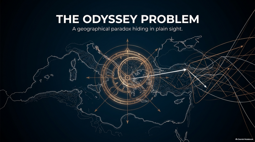
THE ODYSSEY PROBLEM
THE ODYSSEY PROBLEM

Today we encounter them as books. They have numbered books, fixed lines, recognised place-names and an author conventionally called Homer. That creates the natural impression that somebody sat down approximately 2,700 years ago and wrote the stories much as a modern novelist would.

Almost certainly, that is not how they began.

Modern Homeric scholarship broadly accepts that the Iliad and Odyssey emerged from a much older oral performance tradition. For generations before the poems became stable written texts, professional singers told and retold stories about Troy, Achilles, Helen, Odysseus and the other heroes. The tradition operated over a wide geographical area and for hundreds of years; some scholars allow that parts of the underlying poetic tradition may reach back into the Bronze Age, while aspects of the poetic language itself may preserve still older Indo-European inheritances.

That distinction is crucial to this investigation.

We are therefore probably not reading an eyewitness report written shortly after a war.

Nor, however, are we necessarily reading a completely invented story created in the eighth century BCE.

What we have is something much more interesting:

A VERY OLD STORY THAT WAS KEPT ALIVE BY HUMAN MEMORY BEFORE IT BECAME A BOOK.
THE ODYSSEY PROBLEM
THE ODYSSEY PROBLEM

🗣️ HOW COULD A STORY THIS LARGE SURVIVE WITHOUT WRITING?

At first this sounds almost impossible.

The Iliad contains more than 15,000 lines and the Odyssey more than 12,000. How could stories of this scale survive for centuries before being written down?

The answer lies in the way oral poetry worked.

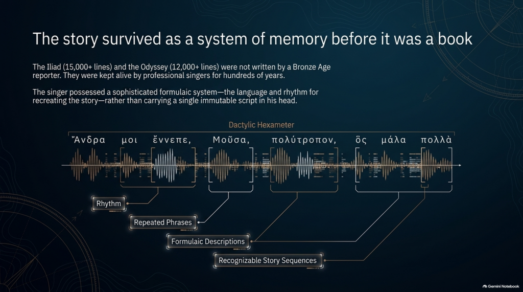
The pioneering studies of Milman Parry and Albert Lord demonstrated that oral epic singers did not normally memorise a gigantic text word-for-word in the way an actor memorises a script.

Instead, they mastered a specialised system of:

rhythm,

repeated phrases,

formulaic descriptions,

stock scenes,

traditional characters,

recognisable story sequences

and

metrical structures.

Thus Achilles can repeatedly be described by a familiar epithet, ships can be introduced through standard phrases, dawn arrives through recognised verbal formulas, and battles, feasts, departures and assemblies follow structures that both singer and audience understand.

The metre itself—dactylic hexameter—acted as part of the memory system.

The singer possessed the story and the language for recreating it, rather than carrying a single immutable script in his head. Parry and Lord’s work on surviving oral traditions showed that a trained singer could reconstruct an enormous epic during performance using this formulaic system.

This produces a very important consequence.

Each performance could preserve the essential story while changing some of its details.

An episode might become longer.

Another could be shortened.

A hero could receive greater prominence.

A description could change.

And details meaningful to one audience could be emphasised more heavily than details important to another.

The story could therefore remain recognisably the same story for centuries without remaining exactly the same text.

THE ODYSSEY PROBLEM
THE ODYSSEY PROBLEM

⏳ HOW FAR BACK COULD THE TROJAN STORY GO?

This is where matters become particularly interesting.

The poems we possess are usually associated in something close to their recognisable monumental form with the late eighth or early seventh century BCE, although exactly when they first became written texts remains heavily debated.

But the traditions from which they were created are considerably older.

Cambridge’s modern guide to Homer describes the poems as products of songs composed and recomposed over many hundreds of years, potentially drawing on traditions extending much deeper into prehistory. Some scholarship has specifically argued that Greek epic traditions may have been developing from the middle or later Bronze Age.

That creates a possible chronological gap of several centuries between:

whatever historical events originally generated the tradition

and

the written geographical names we eventually inherit.

If the conventional Trojan War date of around the late second millennium BCE were approximately correct, then several hundred years may separate an original conflict from the period in which the surviving poems began crystallising into something resembling our texts.

And during those centuries the story was travelling.


🌍 STORIES TRAVEL — AND GEOGRAPHY CAN TRAVEL WITH THEM

This point is central to our investigation.

An oral epic does not survive in a vacuum.

It survives because people want to hear it.

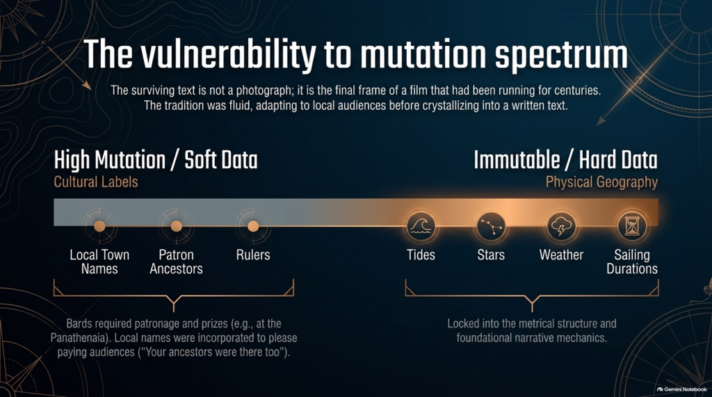
A singer performs before an audience. That audience knows its own towns, rulers, landscapes, ancestors and political rivalries.

Successful oral storytelling therefore contains an unavoidable process of adaptation.

Modern Homeric scholarship explicitly recognises that the flexibility of oral performance allowed heroic tales to be adapted to their immediate contexts. The Homeric language itself demonstrates this history: it is not the ordinary language of one place or date but a remarkable composite containing predominantly Ionic forms together with older Aeolic and Arcado-Cypriot elements and later Attic features.

In other words:

THE LANGUAGE ITSELF HAS A HISTORY OF MOVEMENT AND MODIFICATION.

Why should we automatically assume every geographical label escaped the same process untouched?

Suppose an ancient story originally described a distant king, harbour, island or people whose original name had become meaningless to an audience centuries later.

A performer had several choices.

He could preserve a meaningless archaic name.

He could reinterpret it.

He could associate it with a place his listeners knew.

Or different regional traditions could gradually absorb their own places and heroes into the greater Trojan story.

We cannot prove that this happened to every disputed Homeric town.

But critically:

WE KNOW THE ORAL SYSTEM WAS CAPABLE OF DOING IT.

That alone means geographical names cannot be treated with the same evidential weight as physical descriptions.
THE ODYSSEY PROBLEM
THE ODYSSEY PROBLEM

🏛️ COULD LOCAL TOWNS HAVE BEEN ADDED TO PLEASE LOCAL AUDIENCES?

Yes—it is a genuine possibility, although it must be treated as a hypothesis rather than assumed.

There were even disputes in antiquity and later scholarship concerning possible Athenian additions to Homer. Passages involving Athens and Salamis in the Catalogue of Ships have attracted particularly long-running arguments about interpolation and political influence. Modern scholarship does not simply agree that these lines were inserted, but the fact that such passages remain controversial demonstrates that alteration of local geographical material is not some outrageous modern suggestion.

And there was an obvious incentive.

Imagine performing this great heroic story before an audience in a particular Greek city.

Which version is likely to receive the better reception?

One saying:

“Your people played no part in the greatest war in heroic history.”

Or one announcing:

“Your ancestors were there too.”

The Catalogue of Ships is especially interesting in this respect because it gives an extraordinary roll-call of communities incorporated into the expedition.

That does not prove the Catalogue was fabricated.

But it means we should recognise its social function.

The Trojan story eventually became a shared heroic past through which numerous Greek communities could locate themselves inside history.

That creates exactly the circumstances in which local geographical incorporation becomes plausible.


💰 WAS THERE A COMMERCIAL MOTIVE?

Not initially in the modern sense of an author writing a book and hoping to sell thousands of copies.

For much of the poem’s early existence, the product being consumed was the:

PERFORMANCE.

Bards performed at elite households, feasts and public occasions. Later professional rhapsodes performed Homeric poetry competitively at major festivals such as the Panathenaia, where contests and prizes existed. For most people in Archaic and Classical Greece, Homer would originally have been encountered through performance rather than privately reading a book.

So although we should avoid imagining a Bronze Age publishing company selling copies of the Iliad, there was still an economic reality.

A successful performer needed:

patronage,

invitations,

prestige,

prizes

and above all:

AN AUDIENCE THAT WANTED TO HEAR HIS VERSION.

That provides exactly the same commercial pressure that exists in entertainment today.

Tell people a story that relates to them, and they are more likely to listen.

Eventually the oral tradition increasingly became textual. The poems became books, educational texts and cultural possessions, while regulated festival performances also helped constrain what had previously been a much more fluid tradition. Yet even by the second century BCE, textual variation had not disappeared completely.

So the surviving text is better imagined not as a photograph taken at one moment in history, but as the final surviving frame of a film that had already been running for centuries.


📜 FROM BARD TO “HOMER”

There is another uncomfortable problem.

We do not actually know who Homer was.

Ancient cities competed to claim him as their own, particularly communities in Ionia such as Smyrna and Chios. Even the association of the name “Homer” with the Iliad and Odyssey developed within the later tradition.

Modern scholarship continues to debate whether:

one extraordinary poet monumentalised each epic,

different poets created the Iliad and Odyssey,

the poems were dictated by oral singers,

or their written forms emerged progressively from a much wider performance tradition.

What is considerably less controversial is that the tradition preceding the surviving text was oral.

That fact changes how geographical evidence should be handled.

THE ODYSSEY PROBLEM
THE ODYSSEY PROBLEM

🧭 NAMES ARE NOT THE SAME AS GEOGRAPHY

This is why, throughout this investigation, we will not begin by saying:

“Homer mentions a place later identified as being in Greece, therefore the story happened in Greece.”

That is circular reasoning.

A place-name can be:

preserved,

translated,

reapplied,

updated,

misunderstood

or

incorporated during centuries of oral retelling.

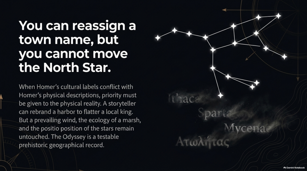
A river behaving in a particular way cannot.

A tide cannot.

A seventeen-day voyage cannot.

The position of a star cannot.

A prevailing wind cannot.

The length of winter darkness cannot.

The ecology of a marsh cannot.

A mountain visible after a stated number of sailing days cannot.

Those are the clues that deserve greater weight.

So our methodology deliberately separates:

🏛️ CULTURAL LABELS

from

🌍 PHYSICAL GEOGRAPHY.

The names remain important.

But they do not get to prove themselves.

THE ODYSSEY PROBLEM
THE ODYSSEY PROBLEM

🔍 THE STORY MAY BE OLDER THAN ITS MAP

And this leads directly to the central problem of the Odyssey.

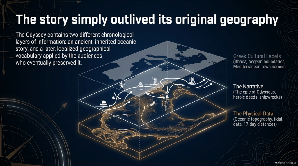
It is entirely possible that the written poem contains two different chronological layers of information:

an ancient inherited story,

and

a later geographical vocabulary familiar to the audiences who eventually preserved and recorded it.

If so, conflicts between Homer’s names and Homer’s physical descriptions become extremely important.

Which should we trust?

The town name that could have travelled through centuries of human storytelling?

Or the description of:

🌊 the sea,

🌫️ the climate,

⭐ the stars,

🧭 the sailing direction,

⏳ the voyage duration,

🌲 the vegetation,

🏔️ the landscape

and

👥 the people?

Our investigation gives priority to the latter.

Because oral tradition can move a name.

IT CANNOT MOVE THE NORTH STAR.
THE ODYSSEY PROBLEM
THE ODYSSEY PROBLEM

And once that distinction is understood, the Odyssey stops being merely one of the world’s greatest stories.

It becomes something else:

🧭 A POTENTIALLY TESTABLE PREHISTORIC GEOGRAPHICAL RECORD.

That is where our investigation begins.

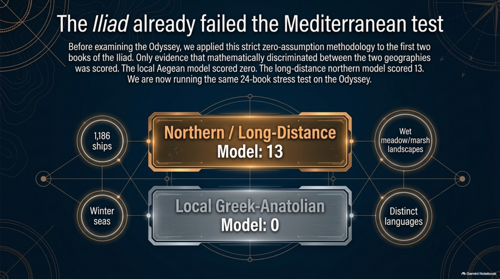
Our examination of the first two books of Homer’s Iliad has already produced an unexpected result.

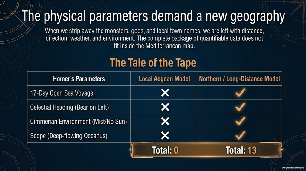
After removing traditional place-name assumptions and scoring only evidence that actually discriminates between the competing geographical models, the result currently stands at:

🌊 NORTHERN / LONG-DISTANCE MODEL: 13

☀️ LOCAL GREEK–ANATOLIAN MODEL: 0

But we may have overlooked an even more powerful test.

Because Homer didn’t only leave us the story of the war.

He also left us:

🧭 THE JOURNEY HOME.

And that creates a very awkward question for the traditional identification of Troy.


🚢 THE JOURNEY SHOULD BE SIMPLE

The conventional interpretation tells us:

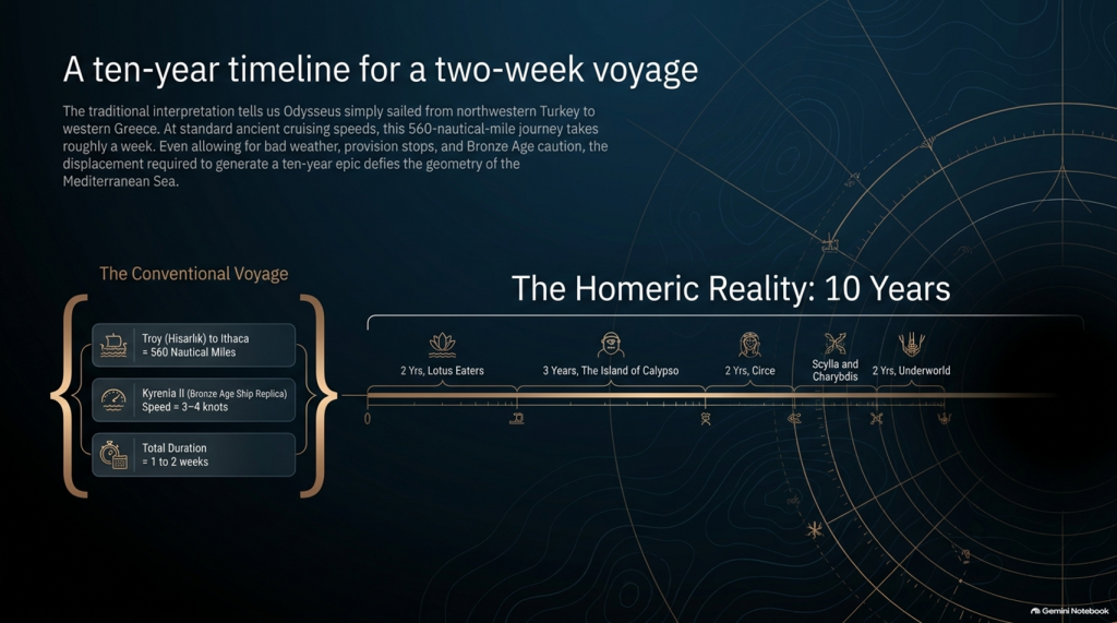
🏛️ Troy = Hisarlık in north-western Turkey

and

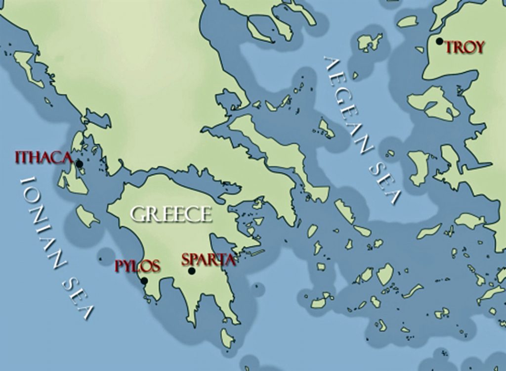
🏠 Odysseus’ home = Ithaca in western Greece.

So when Troy falls, Odysseus has a straightforward objective:

TROY ➡️ ITHACA

Nothing mysterious about that.

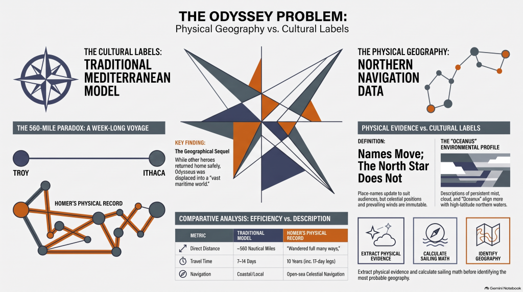
The conventional sea distance is approximately:

🌊 560 NAUTICAL MILES

roughly 645 statute miles

Now compare that with experimental ancient Mediterranean sailing.

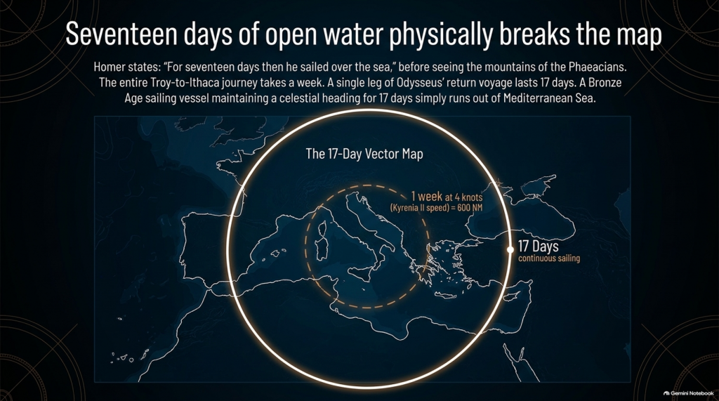
The reconstructed fourth-century BC merchant vessel Kyrenia II demonstrated cruising speeds around 3–4 knots, sometimes considerably faster. On its experimental voyage from Piraeus to Cyprus it covered almost 600 nautical miles despite stops, tests and variable conditions.

At that sort of speed, a direct 560-mile voyage is not a journey measured in years.

It is measured in:

📅 DAYS.

Allow for poor winds, overnight stops, provisioning and Bronze Age caution and perhaps we are looking at roughly:

ONE TO TWO WEEKS

under reasonably favourable circumstances.

And yet Homer gives us:

⏳ TEN YEARS.

Immediately people will say:

“But Odysseus didn’t spend ten years sailing!”

Correct.

And that distinction actually makes the geographical problem more interesting.

THE ODYSSEY PROBLEM
THE ODYSSEY PROBLEM

⏳ THE TEN YEARS WERE NOT TEN YEARS OF CONTINUOUS SAILING

Odysseus gets delayed.

He is shipwrecked.

He loses companions.

He encounters hostile populations.

He becomes stranded.

He spends years unable to get home.

So it would be scientifically wrong to calculate:

ship speed × ten years = distance from Troy.

We aren’t doing that.

The real question is much more basic:

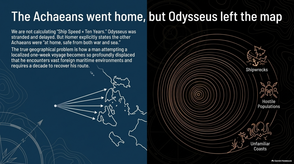
How does a man attempting a voyage whose conventional start and finish are only about a week’s sailing apart become so geographically displaced that returning home consumes ten years?

That is the problem.


📖 HOMER TELLS US FROM THE FIRST LINES THAT THIS IS A GEOGRAPHICAL JOURNEY

The Odyssey opens by describing Odysseus as the man who:

“wandered full many ways”

after he had destroyed Troy.

Homer says:

“Many were the men whose cities he saw”

and tells us that he suffered repeatedly:

“upon the sea.”

This isn’t simply a story about somebody stuck around the corner.

It is explicitly a story about:

🌍 travelling through different lands

👥 encountering different peoples

🌊 crossing seas

🌪️ experiencing extreme maritime conditions

and

🧭 struggling to recover the route home.

THE ODYSSEY PROBLEM
THE ODYSSEY PROBLEM

🚨 EVEN MORE IMPORTANTLY — EVERYONE ELSE HAS ALREADY GONE HOME

Book 1 gives us another striking statement.

Homer says that the other surviving Achaeans were:

“at home, safe from both war and sea.”

Odysseus alone remained unable to complete his return.

This is extremely important.

The war is finished.

The surviving coalition disperses.

The men undertake their return journeys from Troy.

That means the Odyssey isn’t some unrelated maritime fantasy.

It is the geographical sequel to the Trojan War.

We therefore have another independent dataset with which to test the location of Troy.


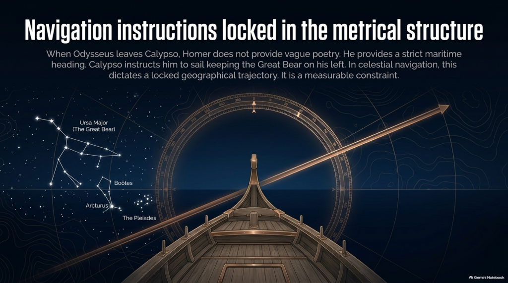
🧭 AND HOMER ACTUALLY GIVES US NAVIGATION INSTRUCTIONS

This is where things become particularly interesting.

When Odysseus finally leaves Calypso, Homer doesn’t simply say:

“He sailed away.”

He tells us how he navigated.

Odysseus watches:

⭐ the Pleiades

⭐ Boötes

⭐ Orion

⭐ the Great Bear.

And Calypso instructs him to keep the Bear:

ON HIS LEFT

while sailing.

That is potentially geographical evidence.

Because now we have:

⭐ CELESTIAL NAVIGATION

🧭 DIRECTION

🌊 OPEN-SEA TRAVEL

⏳ AND SAILING DURATION.

That can potentially be tested mathematically.

THE ODYSSEY PROBLEM
THE ODYSSEY PROBLEM

🚢 THEN HOMER GIVES US THE NUMBER: SEVENTEEN DAYS

Odysseus sails continuously enough for Homer to state:

“For seventeen days then he sailed over the sea”

and on the eighteenth he finally sees the mountains of the Phaeacians.

Stop there.

The entire conventional Troy-to-Ithaca journey could potentially be completed in something around a week or somewhat longer under reasonable sailing conditions.

Yet one single later leg of Odysseus’ wandering lasts:

🌊 17 DAYS AT SEA

before land appears.

That doesn’t automatically prove the Atlantic.

But scientifically it demands investigation.

Where had he travelled?

How far away from Ithaca had he become?

What heading does keeping the Great Bear on the left imply?

What distance can a Bronze Age sailing vessel cover in seventeen days?

And does the conventional Mediterranean reconstruction actually satisfy those constraints?

These are measurable questions.


🌫️ THEN WE REACH THE CIMMERIANS

And the environment becomes even stranger.

Odysseus reaches the land of the Cimmerians.

Homer describes it as:

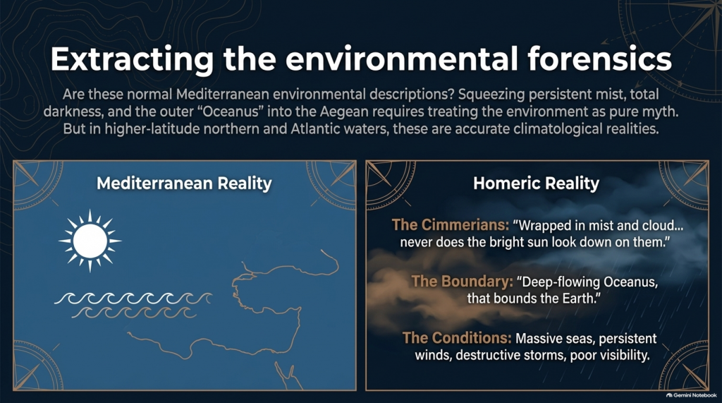
“wrapped in mist and cloud.”

Then he says:

“Never does the bright sun look down on them”

and describes oppressive darkness hanging over the inhabitants.

Again, we must be careful.

This could be mythological geography.

It could represent Homer’s conception of the edge of the world.

We cannot simply announce:

Cimmerians = Britain.

But scientifically we are entitled to ask:

🌞 Is this a normal Mediterranean environmental description?

Or is:

🌫️ persistent mist

☁️ cloud

🌑 darkness

and

🌊 the remote Ocean

more naturally compatible with the traditions of higher-latitude northern waters?

That becomes another test.


🌊 HOMER EVEN TAKES US TO “OCEANUS”

Immediately before reaching the Cimmerians, Homer says Odysseus’ vessel reaches:

“deep-flowing Oceanus, that bounds the Earth.”

This is extremely significant conceptually.

The poem’s geography has now expanded far beyond an ordinary little voyage between Turkey and western Greece.

We are being taken to what Homer’s tradition regards as the outer ocean.

Whether Oceanus represents a literal Atlantic geography, mythical world-ocean, or a mixture of inherited geographical memory and mythology is precisely what needs testing.

But simply squeezing every episode into the Mediterranean because we have already decided Troy belongs there is not evidence.

It is circular reasoning.

THE ODYSSEY PROBLEM
THE ODYSSEY PROBLEM

🌪️ THE WEATHER NEEDS TESTING TOO

Throughout the Odyssey, maritime conditions aren’t background decoration.

They drive the story.

Odysseus encounters:

🌊 enormous seas

🌬️ persistent winds

⛈️ destructive storms

🌫️ mist and poor visibility

🏝️ unfamiliar coasts

and repeated difficulty determining his position.

Mediterranean storms can unquestionably be severe.

So:

storm = Atlantic

is not acceptable science.

But just as with our Iliad investigation, the correct question is:

Which maritime environment produces the complete collection of conditions more naturally and more frequently?

The Mediterranean?

Or the Atlantic/North Sea world?


🗺️ THE PEOPLE ARE JUST AS IMPORTANT AS THE WEATHER

The journey takes Odysseus through populations whose cultures and lifestyles differ radically.

We meet:

👥 Cimmerians

👥 Phaeacians

👥 Cyclopes

👥 Laestrygonians

and numerous other populations and communities.

Some may be mythical.

Some may preserve distorted memories of real peoples.

Some may combine both.

But we should not begin by assigning them to Mediterranean locations simply because later scholars did so.

Instead we should record:

🏠 housing

⛵ boat technology

🌾 agriculture

🐄 animals

🍖 diet

👕 clothing

🗣️ language

🌲 vegetation

🌦️ climate

🏔️ geography

and then ask:

WHERE DOES THAT COMPLETE PACKAGE FIT BEST?
THE ODYSSEY PROBLEM
THE ODYSSEY PROBLEM

⚠️ THIS IS THE SAME MISTAKE WE FOUND WITH THE ILIAD

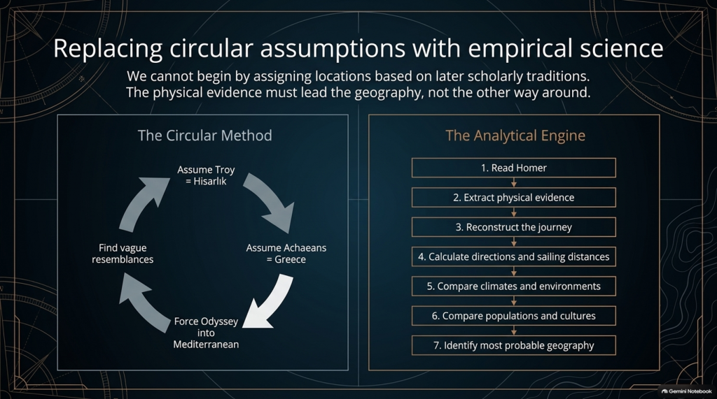
Traditional scholarship frequently begins with:

Troy = Hisarlık

therefore:

Achaeans = Greece

therefore:

the war must be Mediterranean

therefore:

the Odyssey must largely be Mediterranean

and then attempts to find Mediterranean locations resembling Homer’s descriptions.

That reverses the scientific process.

The correct sequence should be:

1️⃣ Read Homer.

2️⃣ Extract the physical evidence.

3️⃣ Reconstruct the journey.

4️⃣ Calculate directions and sailing distances.

5️⃣ Compare climates and environments.

6️⃣ Compare populations and cultures.

7️⃣ THEN identify the most probable geography.

Not the other way around.


🔬 AND THIS TIME WE CAN ACTUALLY DO THE MATHEMATICS

The Iliad gave us powerful clues such as:

🌍 “far from home”

🌊 mountains and sea separating populations

🚢 1,186 ships

🗣️ different languages

🌍 allies “from afar”

👱 repeated xanthos individuals

🌧️ winter seas

🌿 wet meadow and marsh landscapes.

But the Odyssey potentially gives us something even stronger.

It gives us:

⏱️ TIME

🧭 DIRECTION

⭐ NAVIGATION

🌊 DISTANCE

🌬️ WEATHER

🌍 ENVIRONMENT.

Those are quantifiable.


🚨 THE CENTRAL PROBLEM

Strip away all the monsters and gods for a moment.

The basic story says:

Odysseus leaves Troy.

He intends to sail home.

Home is Ithaca.

Other Achaeans successfully make their own returns.

Odysseus becomes displaced through a vast maritime world.

He encounters numerous foreign peoples and environments.

He reaches extraordinarily remote locations.

One later sailing leg alone lasts seventeen days.

His complete return takes ten years.

And the conventional interpretation asks us to place the beginning and end of that extraordinary adventure only about:

560 NAUTICAL MILES APART.

That doesn’t prove the traditional map is wrong.

But scientifically:

IT IS A PROBLEM THAT DEMANDS AN EXPLANATION.
THE ODYSSEY PROBLEM
THE ODYSSEY PROBLEM

🧪 SO WE ARE GOING TO TEST THE ODYSSEY TOO

After our detailed examination of the 24 books of the Iliad, we will now have a second investigation:

📚 ALL 24 BOOKS OF THE ODYSSEY

And we will use exactly the same rules.

No points for traditional names.

No location accepted because “experts agree”.

No northern point merely because something also happens in Britain.

No Mediterranean point merely because something can happen in Greece.

If both environments fit:

0–0

If one environment is substantially more probable:

it scores.

And where Homer gives us distances, directions and sailing durations:

WE DO THE MATHS.


🔥 THIS MAY BECOME THE BIGGER PROBLEM

After two books of the Iliad our score currently stands at:

🌊 NORTH / LONG-DISTANCE: 13

☀️ LOCAL AEGEAN: 0

Twenty-two Iliad books remain.

But after that we now have another twenty-four books containing the actual journey home.

That means this investigation is no longer simply:

“Where was Troy?”
THE ODYSSEY PROBLEM
THE ODYSSEY PROBLEM

The bigger question has become:

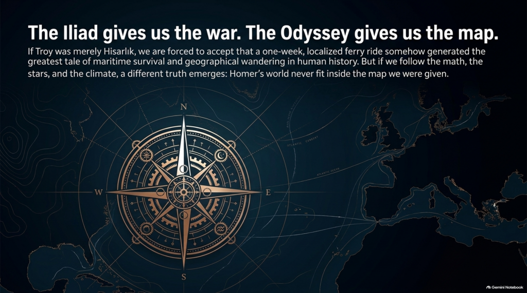
🧭 DOES HOMER’S ENTIRE GEOGRAPHICAL WORLD FIT INSIDE THE MAP WE HAVE BEEN GIVEN?

Because if Troy really was Hisarlık and Ithaca really was Odysseus’ destination, then a journey whose conventional endpoints are roughly a week or two of ordinary ancient sailing apart somehow generated one of the greatest tales of geographical wandering ever written.

Perhaps mythology explains everything.

Perhaps the Mediterranean really does reproduce Homer’s journey.

Perhaps the traditional geography eventually wins.

But those are hypotheses.

They now need testing.

And if the sailing directions, durations, climates, peoples and landscapes repeatedly point outside the Mediterranean, then the traditional identification of this as an obviously local Greek–Anatolian conflict becomes increasingly difficult to defend scientifically.

🌊 THE ILIAD GIVES US THE WAR.

🧭 THE ODYSSEY MAY GIVE US THE MAP.

And that may prove to be the most important test of them all. 🔍🌍⚔️
THE ODYSSEY PROBLEM
THE ODYSSEY PROBLEM

PODCAST

Author’s Biography

Robert John Langdon, a polymathic luminary, emerges as a writer, historian, and eminent specialist in LiDAR Landscape Archaeology.

His intellectual voyage has been interwoven with stints as an astute scrutineer in government and grand corporate bastions, a tapestry spanning British Telecommunications, Cable and Wireless, British Gas, and the esteemed University of London.

A decade hence, Robert’s transition into retirement unfurled a chapter of insatiable curiosity. This phase saw him immerse himself in Politics, Archaeology, Philosophy, and the enigmatic realm of Quantum Mechanics. His academic odyssey traversed the venerable corridors of knowledge hubs such as the Museum of London, University College London, Birkbeck College, The City Literature Institute, and Chichester University.

In the symphony of his life, Robert is a custodian of three progeny and a pair of cherished grandchildren. His sanctuary lies ensconced in the embrace of West Wales, where he inhabits an isolated cottage, its windows framing a vista of the boundless sea – a retreat from the scrutinising gaze of Her Majesty’s Revenue and Customs, an amiable clandestinity in the lap of nature.

Exploring Prehistoric Britain: A Journey Through Time

My blog delves into the fascinating mysteries of prehistoric Britain, challenging conventional narratives and offering fresh perspectives grounded in cutting-edge research, particularly LiDAR technology. I invite you to explore some key areas of my research. For example, the Wansdyke, often cited as a defensive structure, is re-examined in light of new evidence. I’ve presented my findings in my blog post Wansdyke: A British Frontier Wall – ‘Debunked’, and a Wansdyke LiDAR Flyover video further visualises my conclusions.

My work also often challenges established archaeological dogma. I argue that many sites, such as Hambledon Hill, commonly identified as Iron Age hillforts, are not what they seem. My posts Lidar Investigation Hambledon Hill – NOT an ‘Iron Age Fort’ and Unmasking the “Iron Age Hillfort” Myth explore these ideas in detail and offer an alternative view. Similarly, sites like Cissbury Ring and White Sheet Camp receive re-evaluations based on LiDAR analysis in my posts “Lidar Investigation Cissbury Ring through time” and “Lidar Investigation White Sheet Camp,“ revealing fascinating insights into their true purpose. I have also examined South Cadbury Castle, often linked to the mythical Camelot56.

My research also extends to ancient water management, including the role of canals and other linear earthworks. I have discussed the true origins of Car Dyke in multiple posts, including Car Dyke – ABC News Podcast and Lidar Investigation Car Dyke – North Section, which suggest a Mesolithic origin 2357. I also explore the misidentification of Roman aqueducts, as seen in my posts on the Great Chesters (Roman) Aqueduct. My research has also been greatly informed by my post-glacial flooding hypothesis, which has helped explain landscape transformations over time. I have discussed this hypothesis in several posts, including AI now supports my Post-Glacial Flooding Hypothesis and Exploring Britain’s Flooded Past: A Personal Journey

Finally, my blog also investigates prehistoric burial practices, as seen in Prehistoric Burial Practices of Britain and explores the mystery of Pillow Mounds, often mistaken for medieval rabbit warrens, but with a potential link to Bronze Age cremation in my posts: Pillow Mounds: A Bronze Age Legacy of Cremation? and The Mystery of Pillow Mounds: Are They Really Medieval Rabbit Warrens?. My research also includes astronomical insights into ancient sites, for example, in Rediscovering the Winter Solstice: The Original Winter Festival. I also review new information about the construction of Stonehenge in The Stonehenge Enigma.

Further Reading

For those interested in British Prehistory, visit www.prehistoric-britain.co.uk, a comprehensive resource featuring an extensive collection of archaeology articles, modern LiDAR investigations, and groundbreaking research. The site also includes insights and excerpts from the acclaimed Robert John Langdon Trilogy, a series of books that explore Britain during the Prehistoric period. Titles in the trilogy include The Stonehenge Enigma, Dawn of the Lost Civilisation, and The Post-Glacial Flooding Hypothesis, which offer compelling evidence of ancient landscapes shaped by post-glacial flooding.

To further explore these topics, Robert John Langdon has developed a dedicated YouTube channel featuring over 100 video documentaries and investigations that complement the trilogy. Notable discoveries and studies showcased on the channel include 13 Things that Don’t Make Sense in History and the revelation of Silbury Avenue – The Lost Stone Avenue, a rediscovered prehistoric feature at Avebury, Wiltshire.

In addition to his main works, Langdon has released a series of shorter, accessible publications, ideal for readers delving into specific topics. These include:

For active discussions and updates on the trilogy’s findings and recent LiDAR investigations, join our vibrant community on Facebook. Engage with like-minded enthusiasts by leaving a message or contributing to debates in our Facebook Group.

Whether through the books, the website, or interactive videos, we aim to provide a deeper understanding of Britain’s fascinating prehistoric past. We encourage you to explore these resources and uncover the mysteries of ancient landscapes through the lens of modern archaeology.

For more information, including chapter extracts and related publications, visit the Robert John Langdon Author Page. Dive into works such as The Stonehenge Enigma or Dawn of the Lost Civilisation, and explore cutting-edge theories that challenge traditional historical narratives.

Other Blogs

[sitemap_posts]
Troy Debunked – Troy did not exist in Asia Minor, but in fact, the North Sea island of Doggerland

Introduction

Troy, Atlantis — and the North-West European Connection

The search for Atlantis has always felt like chasing a shadow on the edge of history. Yet the deeper I read, the more the shadow begins to take shape — and not in the Mediterranean.

What if both Atlantis and Troy belonged not to the eastern Mediterranean, but to the lost landscapes of north-west Europe?

That suggestion is not as wild as it first sounds.(Troy Debunked – Troy did not exist in Asia Minor)

Plato Was Not Writing Fantasy

The Atlantis story comes to us through Plato, primarily in Timaeus and Critias. The account was said to have been passed from Egyptian priests at Sais to Solon around 590 BCE, and from Solon down to Plato’s own family line.

Now, here is the uncomfortable point for mainstream thinking: Plato was not a myth-maker in the modern sense of the term. His works are studied in the world’s leading universities for their philosophical depth. Aristotle, his student, did not dismiss Atlantis as an invention. Nor did thinkers such as Theophrastus or Poseidonios. Several ancient writers treated Atlantis as a historical tradition.

(Troy Debunked - Troy did not exist in Asia Minor)
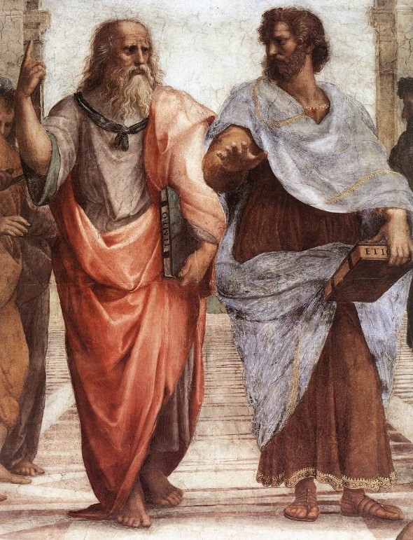
Plato and Aristotle – (Troy Debunked – Troy did not exist in Asia Minor)

If Plato intended pure allegory, it is strange that later classical authors debated its geography rather than dismissing it outright.

The Egyptian connection is particularly important. Sais was said to hold records carved on sacred pillars — records describing a great civilisation destroyed by a deluge. That word alone — deluge — should make us pause. Nearly every ancient culture preserves a flood memory. If prehistoric societies were heavily maritime, boats would have been survival tools. Flood traditions and seafaring cultures go hand in hand.

The Pillars of Hercules — A Directional Clue

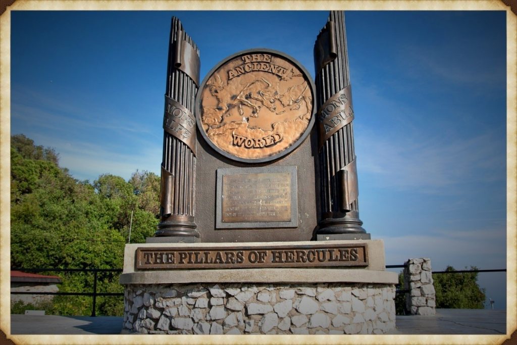
Plato situates Atlantis beyond the “Pillars of Hercules.” The conventional interpretation places these at the Straits of Gibraltar.

But Plato’s terminology is fluid. “Mouth” can mean “strait.” He refers to the Mediterranean as being “within the straits,” suggesting a perspective looking outward — not inward.

If Atlantis lay beyond the Pillars, then by definition it was Atlantic.

(Troy Debunked - Troy did not exist in Asia Minor)

Even the name survives in geography: the Atlantic Ocean.

Critics argue that Atlantis was said to be “larger than Libya and Asia together.” But Libya in Plato’s time referred only to North Africa west of Egypt, and “Asia” generally meant Asia Minor — modern Turkey. Combined, they are not vast in comparison to the landmass that once connected Britain to Europe during lower sea levels.

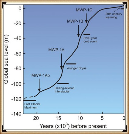
At the end of the last Ice Age, sea levels were dramatically lower. The North Sea was not sea — it was land. We now call it Doggerland. Britain was not an island. It was a peninsula of a much larger north-west European landmass.

If that land later drowned beneath rising seas, Plato’s description of a powerful Atlantic civilisation destroyed by water suddenly becomes less mythical and more geological.

Island — or Peninsula?

Another linguistic trap lies in the word “island.” In the ancient world, the term could describe large peninsulas or territories bordered by water on multiple sides. If Atlantis was a north-west European peninsula connected to Britain and continental Europe, it could still fit the description.

And if we look at that Ice Age landscape — stretching from eastern Britain through the Low Countries and into Scandinavia — we have a region that easily exceeds the size comparison Plato gives.

The Circular Capital

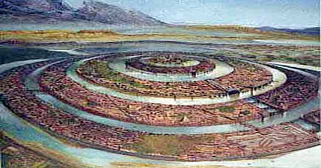
Plato describes Atlantis’ central city as formed in concentric rings of earth and water.

Now consider this: Neolithic Europe is filled with circular earthworks — causewayed enclosures, henges, and ringed settlements. Whitehawk Camp in Sussex, for example, once displayed multiple circular ditches and banks. Similar circular designs occur across Britain and northern Europe.

(Troy Debunked - Troy did not exist in Asia Minor)

These are not Mediterranean urban forms.

They are north-west European.

Even more intriguing are the turf mazes scattered across England and the Isles of Scilly — many named “Troy Town” or “The City of Troy.” These labyrinths follow the classical pattern seen on coins from Knossos, linking the labyrinth myth and Troy. Why do so many northern European earthworks preserve Troy in their naming tradition?

Coincidence?

Or cultural memory?

The People of Homer

Then we come to something even more uncomfortable.

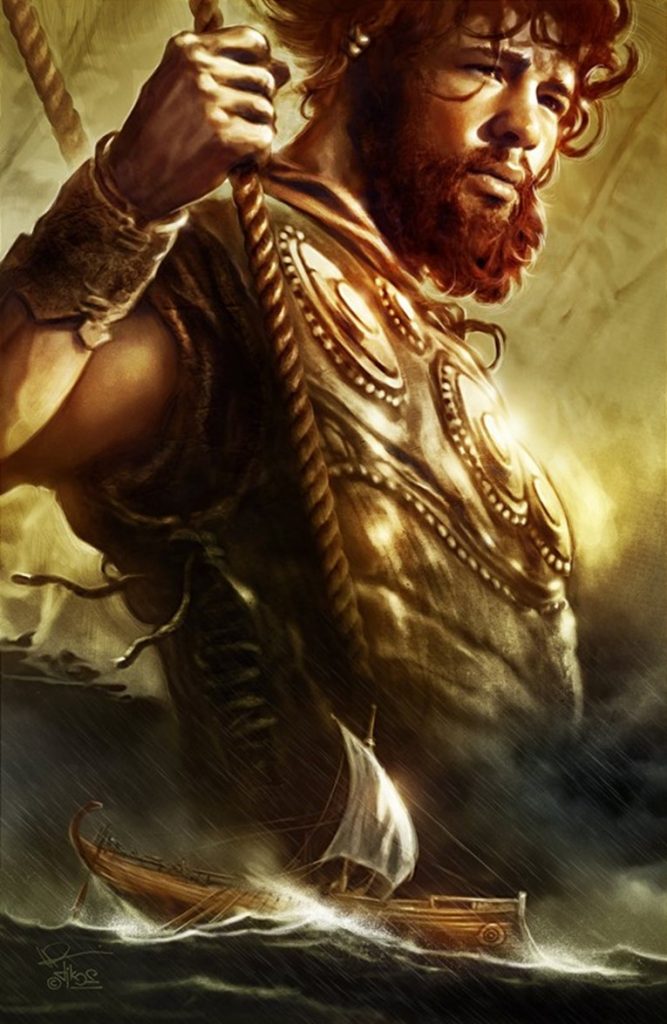
In Homer’s epics, the Achaeans — the supposed Greeks — are frequently described as blond, red-haired, or light-skinned. Menelaus is repeatedly called “blond.” Achilles is described with yellow hair. Odysseus is described in terms that imply light or reddish colouring. Helen is “white-armed,” “fair-tressed,” luminous.

Even the gods — Zeus, Athena, Apollo, Aphrodite — are repeatedly described as blue-eyed or golden-haired in ancient sources.

(Troy Debunked - Troy did not exist in Asia Minor)
“he was blond “and seized the son of Peleus by his yellow hair” (I:197). – (Troy Debunked – Troy did not exist in Asia Minor)

This is not a Mediterranean phenotype.

Now, it is dangerous to oversimplify ancient descriptions, but the repeated emphasis on fair hair and light features is striking. If the Homeric tradition preserves older northern memories, then the epic heroes may reflect populations from farther north.

What if the poems travelled south, rather than originating there?

Troy and the North Sea

The idea that Troy lay in north-west Europe has been proposed before. Iman Wilkens argued for a British location. Others suggested links to the North Sea basin. While these ideas have been dismissed by mainstream scholarship, geological evidence now confirms that Doggerland existed — and drowned — between 10,000 and 6,000 BCE.

We know that vast prehistoric landscapes lie submerged beneath the North Sea. We know that rising waters displaced populations. We know that maritime networks existed far earlier than once believed.

(Troy Debunked - Troy did not exist in Asia Minor)
Odysseus -This “hyacinth colour” is, however, as Wilhelm Sieglin has shown, to be described as “reddish” because the hyacinth was cultivated in Hellas as a sub-type with reddish blooms.- (Troy Debunked – Troy did not exist in Asia Minor)

If a powerful Atlantic civilisation flourished on that land — and was later lost to the sea — the memory of it could have travelled.

Plato speaks of Atlantis fielding twelve hundred ships.

The Trojan War tradition speaks of a thousand ships.

Both traditions centre on maritime coalitions and northern powers confronting southern territories.

The parallels are uncomfortable — but they exist.

The Larger Pattern

Let us step back.

We have:

• A flood-destroyed Atlantic civilisation described by Plato
• A lost North Sea landmass proven by geology
• Circular monumental architecture concentrated in northern Europe
• Troy-named labyrinths across Britain
• Homeric heroes repeatedly described with northern physical traits
• Persistent ancient belief that Troy and Atlantis were historical, not fictional

Individually, each point can be dismissed.

Collectively, they form a pattern.

Is this definitive proof?

No.

(Troy Debunked - Troy did not exist in Asia Minor)
Zeus – King of the gods – he was the father of both Helen and Athena, both blue-eyed blondes – (Troy Debunked – Troy did not exist in Asia Minor)

But it is far more than a coincidence.

If Atlantis was north-west Europe — if Troy belonged not to Anatolia but to a lost Atlantic world — then the centre of early European civilisation shifts dramatically.

And perhaps the reason these traditions feel mythical is not because they were invented…

…but because the land they describe now lies beneath the sea.

Where Troy Once Stood

Where Troy Once Stood (Troy – Debunked) is a book by Iman Wilkens that argues that the city of Troy was located in England and the Trojan War was fought between groups of Celts. The standard view is that Troy is located near the Dardanelles in Turkey. Wilkens claims that Homer’s Iliad and Odyssey, though products of ancient Greek culture, is originally orally transmitted epic poems from Western Europe. Wilkens disagrees with conventional ideas about the Iliad’s historicity and the location and participants of the Trojan War.

Copies of his book ranked high on BookFinder’s list of most wanted out-of-print books until 2005, when the latest revised edition was published. His work has had little impact among professional scholars. Anthony Snodgrass, Emeritus Professor in Classical Archaeology at Cambridge University, has named Wilkens as an example of an ‘infinitely less-serious’ writer.

Troy Debunked - traditional view showing the short distance between the two waring groups
Traditional view showing the short distance between the two warring groups – Troy Debunked

So, what evidence does Wilkens use to prove that Troy was in Northern Europe?

Wilkens argues that Troy was located in England on the Gog Magog Downs in Cambridgeshire. He believes that Celts living there were attacked around 1200 BCE by fellow Celts from the continent to battle over access to the tin mines in Cornwall as tin was an essential component for bronze production.

Wilkens writes that there are similarities between the river names in the Iliad and in present-day England: “Homer names no less than fourteen rivers in the region of Troy.” The rivers Thames, Cam, Great Ouse and Little Ouse, to name a few, can respectively be identified as Temese, Scamander, Simois and Satniois, according to Wilkens. The revised edition of 2005 contains a ‘reconstruction’ of the Trojan battlefield in Cambridgeshire.

Wilkens further hypothesises that the Sea Peoples found in the Late Bronze Age Mediterranean were Celts, who settled in Greece and the Aegean Islands as the Achaeans and Pelasgians. They named new cities after the places they had come from (similar to the migration of many place names to North America) and brought the oral poems that formed the Iliad and the Odyssey with them from Western Europe. Wilkens writes that, after being orally transmitted for about four centuries, the poems were translated and written down in Greek around 750 BCE.

The Greeks, who had forgotten about the origins of the poems, located the Mediterranean’s stories, where many Homeric place names could be found, but the poems’ descriptions of towns, islands, sailing directions and distances were not altered to fit the reality of the Greek setting. He also writes that “It also appears that Homer’s Greek contains a large number of loan words from western European languages, more often from

Dutch rather than English, French or German.” These languages are considered by linguists to have not existed until around 1000 years after Homer.

Wilkens argues that the Atlantic Ocean was the theatre for the Odyssey instead of the Mediterranean. For example, he locates Scylla and Charybdis at present-day St Michael’s Mount.

To prove his theory Wilkens produces archaeological evidence, for instance, the Isleham Hoard in the battlefield, and etymological evidence, for instance, the location of Ismaros in Brittany at Ys or the location of Homer’s Sidon at Medina Sidonia in Spain. He also brings forth indications that Homer described areas around the Atlantic with distinctive topographical features.

Cádiz would match Ithaca’s description; There is in the land of Ithaca a particular harbour of Phorcys, the older man of the sea, and at its mouth two projecting headlands sheer to seaward, but sloping down on the side toward the harbour…

Wilkens believes that Havana’s topography much resembles the description of Telepylos: The harbour, about which on both sides, a sheer cliff runs continuously, and projecting headlands opposite to one another stretch out at the mouth, and the entrance is narrow, …, and the ships were moored within the hollow harbour, for therein no wave ever swelled, great or small, but all about was a bright calm……

Troy Debunked  - Map of the rivers contained within the Iliad
Map of the rivers contained within the Iliad – Troy Debunked

Wilkens mentions several sources for his ideas. Belgian lawyer Théophile Cailleux wrote that Odysseus sailed the Atlantic Ocean, starting from Troy, which was situated near the Wash in England (1879).  Charles-Joseph de Grave thought that the historical and mythological background of Homer’s work should be sought in Western Europe (1806).

However, this is not the only source that shows the story could be of a different origin.  The late Sir Moses Finley, Professor of Ancient History at the University of Cambridge, concluded that ‘we are confronted with this paradox and that the more we know; the ‘worse off, we are’ and he, therefore, suggested that ‘Homer’s Trojan War must be evicted from the history of the Greek Bronze Age’. As it seems complicated to disagree with his conclusion, we are, in my view, left with only two options: the great Trojan War never took place in northwest Turkey and consequently; the Iliad is the fruit of pure imagination, or else; the war did take place but in another country.

Troy Debunked - according to Wilkens, St michael's mount is the site of Scylia and Charybdis
According to Wilkens, St michael’s mount is the site of Scylia and Charybdis – – Troy Debunked

And Professor P H Damste (Universities of Utrecht and Leuven) “Valuable knowledge is to be discovered about the people of the Northwest European coast around 1 200 BCE, how they navigated the oceans and a great war between the Kings of continental Europe and the Trojan king in England, who held a monopoly of tin-mining in Cornwall. Such information is encoded in the Iliad and Odyssey.”

And other facts show that the story may not be as straight forward as we once imagined, for when we look at Northern Europe for signs of Troy, we get some interesting facts such as an old legend that Britain was founded by Brutus, who led survivors from Troy here. Geoffrey of Monmouth wrote in his Historia Regum Britanniae an origin myth that traced the foundation of Britain back to the Trojans.  This account described how Brutus, great-grandson of Troy’s Aeneas, landed at Totnes, subdued the race of giants who lived there and gave his name to the country he had pacified (Britain = Brutus).

The Romans called the Celtic tribe that occupied this part of Essex the Trinovantes or ‘Trinovante’, which means New Troy or Troy of New.

The Baltic Origins of Homer’s Epic Tales is an essay written by Felice Vinci, a nuclear engineer and amateur historian, published for the first time in 1995. The book, translated into several languages, submits a revolutionary idea about the Iliad and Odyssey’s geographical setting. Felice Vinci started reading Greek classics and learned about a passage from the De facie quae in orbe lunae apparet, by Plutarch, which points out the location of Ogygia. This island became the point of departure of Vinci’s theory.

According to his assumptions, the events told by Homer did not take place in the Mediterranean area, as the tradition asserts, but rather in the seas of Northern Europe, the Baltic Sea and Northern Atlantic. This theory has been widely considered (both in Italy, where the author has been invited to present it in some universities and high schools and the rest of the world) and has caused heated debate among the academic community.

Troy Debunked - 'Trinovante', which means New Troy or Troy of New.
‘Trinovante’, which means New Troy or Troy of New – Troy Debunked

According to Vinci, the Achaeans would have lived at the beginning of the 2nd millennium BCE on the coasts of the Baltic Sea and, towards the middle of the millennium, as the climate grew harsher, they would have moved southward along the Dnepr, reaching the Black and Aegean Seas. The newcomers would have founded the Mycenaean cities (the most ancient Mycenaean graves are rich in amber, a typical Baltic product, whereas the latest ones are not) and would have named them with the names of their previous settlements in Scandinavia, although not precisely in correspondence of their location, because of the physical differences between the two areas.

During their migration, they would have brought their traditional oral tales, poetic sagas set in their original homeland. Therefore, the Trojan War would not have occurred around the 13th century BCE, as is usually thought, but around the 18th century BCE. Then the poems would have been transcribed later, after 800 or 900 years of oral tradition.

In support of the theory, it is essential to remember that the Mycenaeans are not considered an aboriginal population but are thought to have come to Greece around the 16th century BCE. Felice Vinci also reports the hypothesis formulated in the late 19th century by the Indian scholar Bal Gangadhar Tilak, who argued that Indo-European populations had lived around the Arctic Circle in the past. On the other hand, the so-called ‘Linear B’ documents appear to have been written in a language that was a precursor of what later became Greek.

The main topic of Vinci’s hypothesis is the incongruence between the geography described by Homer and the configuration of the Mediterranean lands, a point already noted by Strabo. The geographical descriptions provided by the Iliad and the Odyssey, on the contrary, perfectly adapt to Northern Europe, and the incongruity regarding the Mediterranean localities would be due to the application of old Scandinavian names.  Furthermore, Homer’s description of the climate would be more suitable for the Baltic regions.

According to Vinci, Ulysses’ journey would have taken place along the coasts of Norway. After being held back in Ogygia (identified with one of the Faroe Islands, following Plutarch’s passage mentioned above), the Odyssey relates that, after seventeen days on the sea, Ulysses reached Scheria, home of the Phaiakians, described as a high rocky coast and densely wooded: this region, impossible to locate in the Mediterranean area, could be instead identified with the environs of Bergen, at the mouth of river Figgjo, where several Bronze Age objects have been founded (Scheria is never mentioned in the Odyssey as an island).

The new position would explain why Ulysses had noticed that the sea used to flow back into the river: this phenomenon is due to ocean tides and does not occur in the Mediterranean. Other places visited by Ulysses could be located on the Norwegian coasts, too: Circe’s island, Aeaea, and the areas she describes (the Sirens, Scylla and Charybdis) may be placed in the Lofoten archipelago, where tides on the ebb create the so-called maelstrom, corresponding with the Scylla whirlpool which swallowed up Ulysses’ ship and is described as forming three times a day, just like the maelstrom. In the end, Aeolus’s island would be located somewhere in the Shetland archipelago, where winds exceeding 200 km/h often blow.

Other Greek mythological tales are set in the same region. Among these, the Argonauts’ journey, who are said to have reached Colchis sailing eastwards and arriving there at Aeaea, from where they came back to Greece going westwards. The identification of Colchis in the Black Sea and of Aeaea in the Tyrrhenian Sea would lead to hypothesising an improbable itinerary for the Argonauts by ship across Continental Europe, along the rivers Danube, Po, and Rhone. The navigation would be instead the memory of an ancient counter-clockwise circumnavigation of Scandinavia starting from the Baltic Sea, crossing Lapponia overland along the rivers which run through it and reaching Lofoten, where Aeaea was identified. According to what Circe tells Ulysses, the Argonauts chose for their journey home the course passing through the Wanderers Rocks, which are to be identified with the narrow straits covered by the streams between the islands and the mainland.

Another reference to an ancient Nordic setting can be found, according to Vinci, in an assertion by Plato in his dialogue Critias, where the philosopher reminds him that Athens used to rise formerly in a flat fertile zone, not harsh and mountainous: this particular is presented in the book as a reference to the ancient Baltic Athens.

So, how is it possible that Troy was in Northern Europe?

The climate described by Homer is cold and stormy: mist and wind often appear, and storms are heavy. The characters are usually covered in thick cloaks and are never described sweating from the heat. Although in the period generally chosen to date the Trojan War (8th century BCE) the average temperature was lower than it is nowadays, the Homeric weather conditions are difficult to adapt to the Aegean area, especially considering that the events are likely to behave happened in summer, instead, this description would be perfect for the Prehistoric Baltic regions when temperatures in Northern Europe were by far higher than now: the drop in temperatures at a later time would have forced Achaeans to emigrate southwards.

Some passages in the Iliad and the Odyssey can be interpreted as descriptions of typical Nordic phenomena. For example, in the great battle between Achaeans and Trojans, the linchpin of the Iliad’s central books, the time of noon is quoted at two different moments; this wouldn’t be a mistake: the battle would have continued for two consecutive days, thanks to the midnight sun, which let the warriors carry on fighting. Other references to this phenomenon are the exceptional duration of the day among the Laestrygonians and Ulysses’ uncertainty when trying to find his way to Aeaea, since he cannot figure out where the sun rises and where it sets.

Troy Debunked - The Viking connection
The Viking connection – Troy Debunked

In Homeric poems and among the Vikings, it is possible to find similar features regarding traditions, mythology and literature. The custom of assembling for a meeting, the majestic convivial banquets and the kind of exile imposed to unintentional homicide. Also, the Achaean ships would have in common with the Viking ones the dismountable mast, considered useful, especially in the Northern seas to avoid the formation of ice, and the double bow, which allowed oarsmen to travel backwards too (a reference to this aspect might be the Greek term meaning “curved on both sides,” frequently used by Homer; Tacitus describes the same feature concerning the Germans.)

Moreover, the Greek aoidos would be similar to the Old Norse skald, as Homer would often make use of a figure of speech known as kenning in Nordic literature.  Also, some mythological figures would be similar in the two cultures (for example, Ulysses to the archer Ull in an Icelandic saga and Hamlet, the main character of an ancient Danish legend reported in Saxo Grammaticus’ Gesta Danorum), as well as many divinities: Aphrodite corresponds with Freyja, Ares with Thor, Zeus with Wotan and the Keres (who come down on the battlefield to take the souls of dead warriors, with the Valkyries).

Wilken’s main points

•             The Achaeans built 1186 ships for their attack on Troy; they could have travelled the short-distance overland far quicker and cheaper if Troy had been in the Turkish setting.

•             Odysseus claimed to have got home by travelling as a passenger on a ship going from Crete to Sidon (present-day Saïda in Lebanon), but that is the opposite direction he needed to go in the Mediterranean setting.

•             Agamemnon tells us it took him a full month to sail from his kingdom Argos to Ithaca; we know the trip takes less than 24 hours in the Mediterranean setting.

•             The mythical location for Troy in Turkey is far too small to accommodate the invading army of about 100,000 men and the long pursuits in horse-drawn chariots.

•             The extensively travelled Greek geographer Strabo who lived 2000 years ago (1200 years after the Trojan War), believed that some of the ports of call in the Odyssey should be found in the Atlantic because of the mention of tides that do not exist in the Mediterranean.

More information about Troy – Debunked can be found here on our web site: http://prehistoric-britain.co.uk/dawn-of-the-lost-civilisation and on our video channel: www.prehistoric-britain.online

PodCast

Author’s Biography

Robert John Langdon, a polymathic luminary, emerges as a writer, historian, and eminent specialist in LiDAR Landscape Archaeology.

His intellectual voyage has interwoven with stints as an astute scrutineer for governmental realms and grand corporate bastions, a tapestry spanning British Telecommunications, Cable and Wireless, British Gas, and the esteemed University of London.

A decade hence, Robert’s transition into retirement unfurled a chapter of insatiable curiosity. This phase saw him immerse himself in Politics, Archaeology, Philosophy, and the enigmatic realm of Quantum Mechanics. His academic odyssey traversed the venerable corridors of knowledge hubs such as the Museum of London, University College London, Birkbeck College, The City Literature Institute, and Chichester University.

In the symphony of his life, Robert is a custodian of three progeny and a pair of cherished grandchildren. His sanctuary lies ensconced in the embrace of West Wales, where he inhabits an isolated cottage, its windows framing a vista of the boundless sea – a retreat from the scrutinous gaze of the Her Majesty’s Revenue and Customs, an amiable clandestinity in the lap of nature’s embrace.

Exploring Prehistoric Britain: A Journey Through Time

My blog delves into the fascinating mysteries of prehistoric Britain, challenging conventional narratives and offering fresh perspectives based on cutting-edge research, particularly using LiDAR technology. I invite you to explore some key areas of my research. For example, the Wansdyke, often cited as a defensive structure, is re-examined in light of new evidence. I’ve presented my findings in my blog post Wansdyke: A British Frontier Wall – ‘Debunked’, and a Wansdyke LiDAR Flyover video further visualizes my conclusions.

My work also often challenges established archaeological dogma. I argue that many sites, such as Hambledon Hill, commonly identified as Iron Age hillforts are not what they seem. My posts Lidar Investigation Hambledon Hill – NOT an ‘Iron Age Fort’ and Unmasking the “Iron Age Hillfort” Myth explore these ideas in detail and offer an alternative view. Similarly, sites like Cissbury Ring and White Sheet Camp, also receive a re-evaluation based on LiDAR analysis in my posts Lidar Investigation Cissbury Ring through time and Lidar Investigation White Sheet Camp, revealing fascinating insights into their true purpose. I have also examined South Cadbury Castle, often linked to the mythical Camelot56.

My research also extends to the topic of ancient water management, including the role of canals and other linear earthworks. I have discussed the true origins of Car Dyke in multiple posts including Car Dyke – ABC News PodCast and Lidar Investigation Car Dyke – North Section, suggesting a Mesolithic origin2357. I also explore the misidentification of Roman aqueducts, as seen in my posts on the Great Chesters (Roman) Aqueduct. My research has also been greatly informed by my post-glacial flooding hypothesis which has helped to inform the landscape transformations over time. I have discussed this hypothesis in several posts including AI now supports my Post-Glacial Flooding Hypothesis and Exploring Britain’s Flooded Past: A Personal Journey

Finally, my blog also investigates prehistoric burial practices, as seen in Prehistoric Burial Practices of Britain and explores the mystery of Pillow Mounds, often mistaken for medieval rabbit warrens, but with a potential link to Bronze Age cremation in my posts: Pillow Mounds: A Bronze Age Legacy of Cremation? and The Mystery of Pillow Mounds: Are They Really Medieval Rabbit Warrens?. My research also includes the astronomical insights of ancient sites, for example, in Rediscovering the Winter Solstice: The Original Winter Festival. I also review new information about the construction of Stonehenge in The Stonehenge Enigma.

Further Reading

For those interested in British Prehistory, visit www.prehistoric-britain.co.uk, a comprehensive resource featuring an extensive collection of archaeology articles, modern LiDAR investigations, and groundbreaking research. The site also includes insights and extracts from the acclaimed Robert John Langdon Trilogy, a series of books exploring Britain during the Prehistoric period. Titles in the trilogy include The Stonehenge Enigma, Dawn of the Lost Civilisation, and The Post Glacial Flooding Hypothesis, offering compelling evidence about ancient landscapes shaped by post-glacial flooding.

To further explore these topics, Robert John Langdon has developed a dedicated YouTube channel featuring over 100 video documentaries and investigations that complement the trilogy. Notable discoveries and studies showcased on the channel include 13 Things that Don’t Make Sense in History and the revelation of Silbury Avenue – The Lost Stone Avenue, a rediscovered prehistoric feature at Avebury, Wiltshire.

In addition to his main works, Langdon has released a series of shorter, accessible publications, ideal for readers delving into specific topics. These include:

For active discussions and updates on the trilogy’s findings and recent LiDAR investigations, join our vibrant community on Facebook. Engage with like-minded enthusiasts by leaving a message or contributing to debates in our Facebook Group.

Whether through the books, the website, or interactive videos, we aim to provide a deeper understanding of Britain’s fascinating prehistoric past. We encourage you to explore these resources and uncover the mysteries of ancient landscapes through the lens of modern archaeology.

For more information, including chapter extracts and related publications, visit the Robert John Langdon Author Page. Dive into works such as The Stonehenge Enigma or Dawn of the Lost Civilisation, and explore cutting-edge theories that challenge traditional historical narratives.

Other Blogs

[sitemap_posts]
The Maiden Way Hoax – A Closer Look at an Ancient Road’s Hidden History

Promotional Video – Ancient Prehistoric Canals (Dykes) – The Vallum (Maiden Way)

Extract From Book……………………… Ancient Prehistoric Canals (Dykes) – The Vallum

Introduction

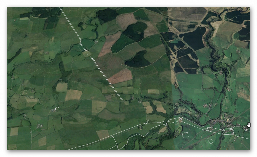
In this deep-dive case study, we explore the so-called Maiden Way—a Roman road stretching 6.58 km from the B6318 to the moorlands near High House, featuring not just a road but also a Roman signal station and a post-medieval settlement. Officially recognized as monument HE:1018242, this route is traditionally believed to have linked the Hadrian’s Wall fort at Birdoswald to the more remote outpost of Bewcastle.

The road winds over Waterhead Common and Gillalees Beacon, where a signal station known as Robin Hood’s Butt perches with a clear line of sight to Birdoswald, hinting at a rapid communication system used in the Roman period. But the picture gets muddier as we examine the path’s quirks and oddities—such as its abrupt changes in direction, inconsistencies in width, and curious detours around natural features like river valleys.

What’s especially compelling is the suggestion that the Maiden Way might not be entirely Roman at all. Archaeological evidence describes the road being built on top of earlier earthworks—raised banks known as aggers, hollow ways, and terraced slopes. Such features are commonly associated with prehistoric dykes, raising the tantalizing possibility that Roman engineers simply repurposed a much older network.

The signal station and adjacent Beacon Pasture settlement reveal layered usage through time. From turf-covered stone platforms to lazy-bed agriculture, we see a landscape that evolved, was reused, and finally abandoned by the mid-19th century. Yet the road’s twisty turn—particularly its eastward and then southward veer near the river valley—suggests Roman pragmatism encountering ancient geography and adapting rather than conquering.

So, was the Maiden Way a Roman masterpiece of engineering… or just a makeover of a prehistoric thoroughfare?

As with other “Roman” features like the Vallum and Military Way, the truth might be a lot more ancient—and a lot more complicated—than it first appears.

Hadrians Wall

Traditional archaeologists and archaeological establishments like English Heritage suggest that:

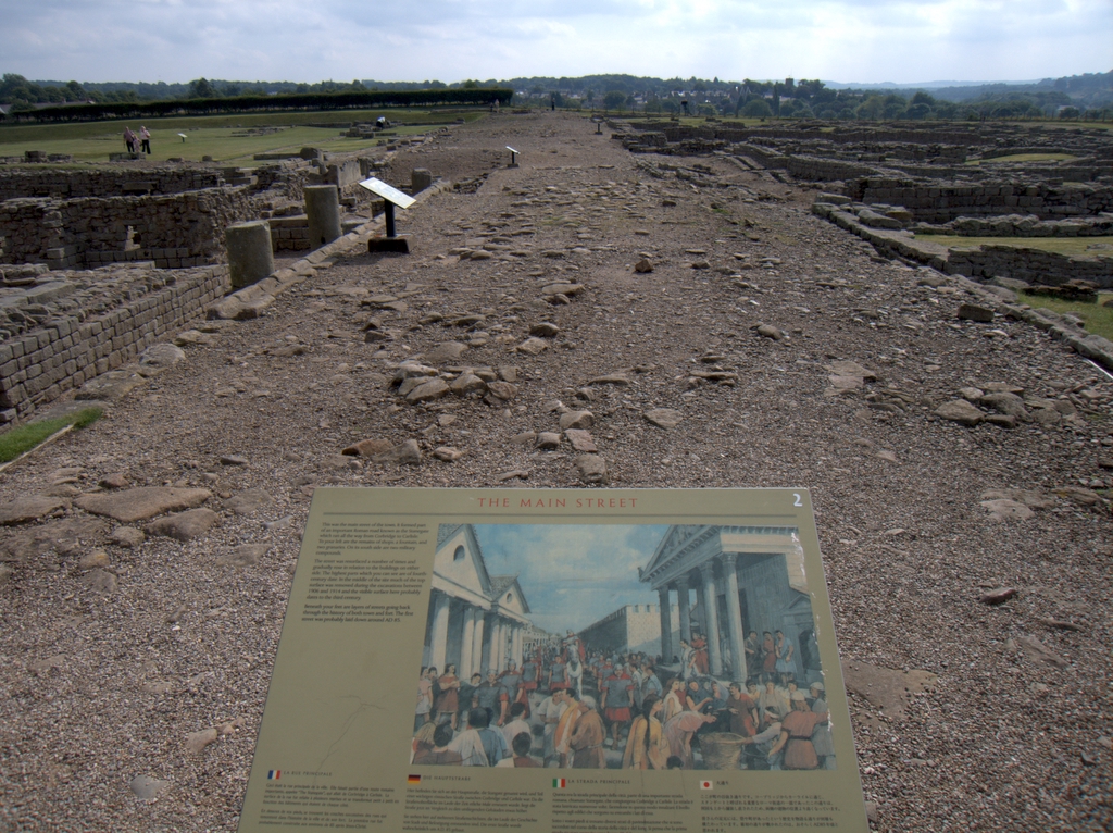
The Vallum is a massive earthwork constructed shortly after Hadrian’s Wall itself and lying just south of it. Many visitors confuse the Vallum with Hadrian’s Wall itself because it’s such an obvious and impressive feature in the landscape. 

In fact, the Vallum is made up of several different elements – a ditch around 6 metres wide and 3 metres deep; two mounds either side of the ditch about 6 metres wide and 2 metres high and set back from the ditch by around 9 metres; and often a third mound on the southern edge of the ditch. The whole complex is around 36 metres across. Usually, the Vallum runs close behind the Wall but in the rocky and hilly central section the Vallum lies up to 700 metres from the Wall. ( Maiden Way)

The Maiden Way Hoax
The Vallum

Crossing points seem to have been located south of each of the forts along Hadrian’s Wall and near several of the milecastles. Evidence from the excavated Vallum crossing at Benwell in Newcastle shows these crossing points had impressive monumental gateways.

The Vallum’s purpose is unclear. Many archaeologists think it marks the southern boundary of a military zone with the Wall itself forming the northern boundary. This would have helped protect the rear of the Wall and its associated military installations, with civilian access being closely controlled. The gateway at Benwell supports this idea. The numerous gateways along the Wall at forts and milecastles suggest that the frontier was intended as much to control movement as to provide a defensive line. Traders would have moved goods across the frontier but their movements would have been controlled and their goods taxed.

Relatively soon after it was constructed, some 20 to 30 years perhaps, the Vallum seems to have lost its function – the mounds were cut through and the ditch filled in at fairly regular intervals. It was out of use by the time the forts along the Wall were re-commissioned in the late second century AD following the return of the garrison from the Antonine Wall.

Ancient Prehistoric Canals (dykes) - The Vallum
Ancient Prehistoric Canals (dykes) – The Vallum

Sadly, these ideas that have been constructed over the last 200 years are somewhat questionable. Within the book we look at associated aspects of this area like Military Way which was supposed to be constructed to patrol the so-called ‘Military Zone’ – to find that:

That over 50% of Military Way does not exist as a separate road, as described by archaeologists. Instead, the perceived road is fragmented and only becomes ‘alive’ as an independent road when the Vallum separates from the wall at any distance. 

This might give us a clue to the function of this rough and wonky road, as the stone for the wall would have needed to be delivered by cart if the Vallum canal was not available.

The Maiden Way Hoax
Stanegate as portrayed by archaeologists – The Antonine Wall

As for the Stanegate that was supposed to connect to the main forts in the area as a ‘defensive shield’ we actual found that it is very little to no evidence of the ‘Stanegate Roman Road’, which (according to the current theory proposed by English Heritage) ‘consolidated as a frontier’ during the late first and early second century AD and helped crystallise Roman tactics and military expectations in the area.

This evidence is compounded when you release that of the 80mile border from coast to coast – Stonegate, at best, covers just 38.1 miles (47%) of the ‘defensive gap’, and hence suggestions of extension over and above the existing line existed (even without support from OS maps). Moreover, the research has shown the ‘raw’ Stanegate road without the ‘hidden’ parts below the B-roads – we are only looking at 20% of the declared road being visible on LiDAR maps.

Stanegate Road (when not part of an existing B-road system) is inconsistent in width and structure -moving from bank track to road with two ditches on each side to a ditch with two banks far from straight and usually starts and ends in ravens.

Most Forts and the Stanegate are not found to connect (with intersecting sub-roads) on only two occasions, and the rest show no connection.  Moreover, later ‘temporary’ camps also did not connect with the road – which questions whether (a defence line) was its purpose.  

Moreover, this would then question the ‘myth’ of using the Stanegate as a ‘boundary’ for withdrawing troops from Scotland in the first century AD is correct. And whether the River Tyne (which most of these Forts sit upon) was used as a more practical and effective boundary/defence.

This ‘myth buster’ will not surprise many in academia as it has been ‘hinted’ at for some time (but not acted upon it by updating the literature), as we see from Symonds et al.

“The question of whether a road even existed when the fortlets were founded is by default an existential one for the notion that they provided highway protection. But even if the metalled road does post-date the fortlets, a reasonably robust thoroughfare of some form must have existed from at least the mid AD 80s to service Vindolanda. The question is not whether there was a road, but whether it was metalled when the fortlets were founded.” Symonds, M. (2017). Hadrian’s Wall. In Protecting the Roman Empire: Fortlets, Frontiers, and the Quest for Post-Conquest Security (pp. 95-132)

Moreover, even if Stanegate was not built as suggested, it exists in parts, and it looks prehistoric (by design) as it relies heavily on ravens that start and end sections of the Stanegate sections; its sunken structure in parts is unfamiliar to traditional Roman Road design.

As for other famous ‘Roman Features Such as the Great Chesters Aqueduct, again we find not only is the origin questionable but as it located supposedly fully in ‘hostile territory – they its usefulness win conflict would be limited.

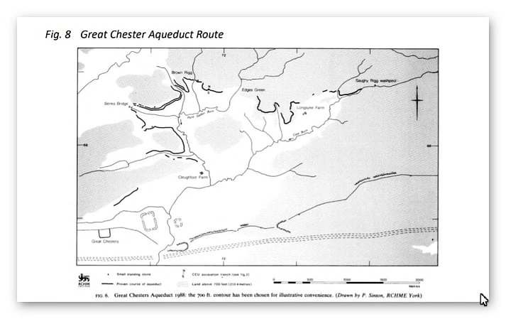
It is clear from the LiDAR research that the suspected Roman Aqueduct is not as it seems. This is not the first examination to spread doubt about the scale and origin of this feature in the landscape – MacKay, D. A. (1990). The Great Chesters Aqueduct: A New Survey. Britannia, 21, 285–289. Also shows an incomplete map of this aqueduct.

Great Chesters by Mackey

Mackey failed to find in their survey that the Aqueduct changed size, and the path suggested had no identifiable remains of the bridges required to make this Aqueduct work.

Our more detailed findings indicate that the topology of the aqueduct suggests that it would need to go uphill at several points without any powered assistance (like a siphon) and so is mechanically unsound. Our finding has found that the use of ‘Dykes’ in this area and some connecting to this Aqueduct feature is new. We have also shown that closer to the Fort it was supposed to supply, there were closed water sources which could be used and that the Fosse by the Wall was also a water supply.

We conclude that we found a prehistoric watercourse linked to their sophisticated ‘Dyke’ system. I would be bold to suggest that this was used for either agricultural purposes or maybe industrial, seeing the multiple sites of quarries associated and in the region of this feature.

Case Study – Maiden Way

Name: Maiden Way Roman road from B6318 to 450m SW of High House, Gillalees Beacon signal station and Beacon Pasture early post-medieval dispersed settlement
List UID: 1018242

HE:1018242
Figure 236 – HE:1018242

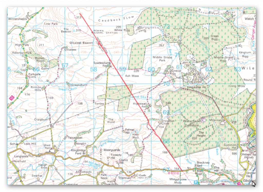
The monument includes the earthworks and buried remains of a 6.58km length of the Maiden Way Roman road together with the earthwork remains of Gillalees Beacon Roman signal station, also known as Robin Hood’s Butt, and Beacon Pasture early post-medieval dispersed settlement.

The Maiden Way connected the Hadrian’s Wall fort at Birdoswald with the fort at Bewcastle 9.6km to the north.

After leaving Birdoswald the road climbs gradually over Waterhead Common and Ash Moss to its highest point on the moorland of Gillalees Beacon where, a short distance south of the summit, remains of the Roman signal station stand. Beacon Pasture settlement overlies the Roman road and lies on the moorland a short distance south of the signal station.

Construction of Birdoswald and Bewcastle forts commenced during the early 120s AD and the road connecting the two forts must also have been built at this time.

Where the road survives as an earthwork it can be seen either as a raised bank known as an agger upon the top of which the road surface was built, or as a hollow way where erosion of the road surface may have occurred or where the Roman engineers have taken the road through a cutting.

It is also visible as a terrace running diagonally down the steepest hillslope in order to ease the gradient. Flanking ditches for drainage purposes ran either side of the road; where not infilled by natural processes these ditches survive as earthworks.

Where they are infilled their location can frequently be identified by changes in the vegetation cover where the deeper, damper soil has encouraged a lusher growth. The finest surviving stretch of agger and flanking ditch lies a short distance north of the B6318. Here a length of agger approximately 200m long measures 10m wide at the base and 5m wide at the top and survives up to 0.8m high.

The western ditch at this point measures 2m wide by 0.2m deep. Limited excavations of the road further north have shown it to be formed of two courses of large stones laid flat over which a layer of small stones was laid to form the road’s metalled surface. The road was found to be well cambered and has large kerbstones.

These excavations also found that the width of the road surface was not constant and varied between 3.7m and 4.6m. In places, particularly on the higher moorland, the road and its ditches lie buried beneath vegetation cover and no surface remains are visible. Here the course of the road can still be followed quite clearly where modern drainage channels have been cut through it exposing the road’s stone foundations.

Gillalees Beacon signal station lies immediately west of the Roman road. It survives as a rectangular earth and stone mound up to 2.5m high surrounded by a shallow ditch with a causeway on the east side which gave access directly from the road. Antiquarian investigation found the stone-built structure to measure approximately 6m by 5.5m externally with walls standing ten courses high.

The signal station is positioned to be in full view of Birdoswald fort 6.5km to the south and its function would have been to rapidly convey information to the fort garrison if an enemy was approaching from the north. Beacon Pasture early post-medieval settlement consists of three rectangular enclosures, one north of and two south of the Roman road. The house was originally built of stone and is now visible as a turf-covered platform of stone tumble measuring 13.5m by 6.7m. It lies alongside the road overlapping the edge of the northern enclosure and its position adjacent to the road indicates that this part of the Maiden Way remained in use during the early post-medieval period.

The southern enclosure measures 44m by 29m and contains ridge and furrow, indicating that arable cultivation took place here, while the smaller northern enclosure contains lazy-beds (raised earthen mounds) about 1.5m wide on which crops were grown, and thus also attests to arable cultivation.

The central enclosure measures 34m by 32m and is interpreted as a stockpen. The settlement had been abandoned by 1854.

Between NY60286811 – NY59886877 the protection follows the actual line of the road and not that suggested by the Ordnance Survey.

The road is visible as an earthwork between NY60286811 – NY60136831 and between NY59906865 – NY59886877.

 Between NY60136831 and Slittery Ford at NY59896862 the road is interpreted as surviving as a buried feature.

Maiden Way a crooked Roman Road?
Figure 237 – Maiden Way a crooked Roman Road?
The Maiden Way Hoax
Figure 238 – The Roman road seems to turn East then South

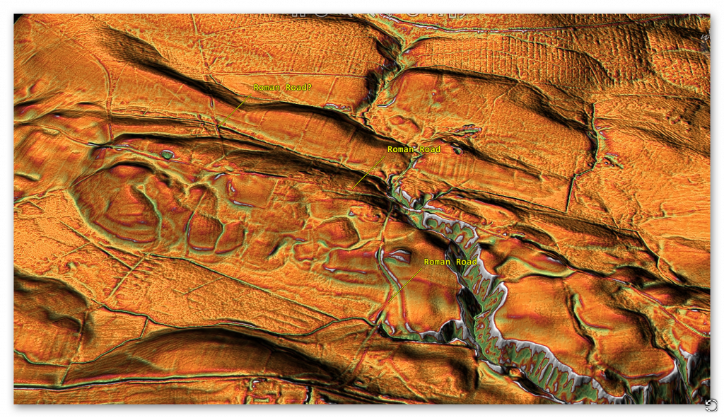
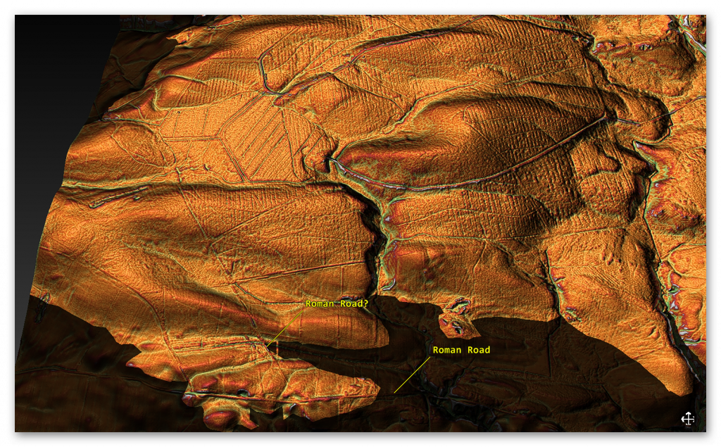
If we look at this suspected Roman Road, we see that like the Vallum disappears into the river valley or that it is actually diverted as it comes in contact with the river valley.

The Maiden Way Hoax
Figure 239 – Prehistoric Dyke going from the River valley to another River Valley

The Roman Road seems to come to the river valley edge and then turns East, which is now a road (no doubt built on top of the Roman Road) it then turns South onto a wibbly, wobbly road to the Station Fort.

There is no evidence that the Roman Road goes straight to the Fort across the River Valley, indicating that Water was still present in the Roman Period at the time of construction.

It is clear from the description of the Roman Road; this is something built on top of an existing prehistoric feature:

 “Where the road survives as an earthwork it can be seen either as a raised bank known as an agger upon the top of which the road surface was built, or as a hollow way where erosion of the road surface may have occurred or where the Roman engineers have taken the road through a cutting.” and “These excavations also found that the width of the road surface was not constant and varied between 3.7m and 4.6m. ”

Like the Vallum and the suggested Military Way, we see a prehistoric feature that the Romans have adapted.

This was an extracts from the NEW Book Ancient Prehistoric Canals (Dykes) – Wansdyke available on Amazon as a FULL COLOUR HARD BACK (£49.95) or a ECONOMY (£9.99) SOFTBACK black and white VERSION – it is also available as a KINDLE (£2.99) book. For further information about our work on Prehistoric Britain visit our WEBSITE or VIDEO CHANNEL.

Product details

  • ASIN ‏ : ‎ B0BN7PD6BS
  • Publisher ‏ : ‎ Independently published (24 Nov. 2022)
  • Language ‏ : ‎ English
  • Hardcover ‏ : ‎ 477 pages
  • ISBN-13 ‏ : ‎ 979-8358524187
  • Dimensions ‏ : ‎ 15.24 x 3.33 x 22.86 cm
  • Illustrations: 350+

Further Reading

For information about British Prehistory, visit www.prehistoric-britain.co.uk for the most extensive archaeology blogs and investigations collection, including modern LiDAR reports.  This site also includes extracts and articles from the Robert John Langdon Trilogy about Britain in the Prehistoric period, including titles such as The Stonehenge Enigma, Dawn of the Lost Civilisation and the ultimate proof of Post Glacial Flooding and the landscape we see today.

Robert John Langdon has also created a YouTube web channel with over 100 investigations and video documentaries to support his classic trilogy (Prehistoric Britain). He has also released a collection of strange coincidences that he calls ‘13 Things that Don’t Make Sense in History’ and his recent discovery of a lost Stone Avenue at Avebury in Wiltshire called ‘Silbury Avenue – the Lost Stone Avenue’.

(Maritime Diffusion Model for Megaliths in Europe)

Langdon has also produced a series of ‘shorts’, which are extracts from his main body of books:

The Ancient Mariners

Stonehenge Built 8300 BCE

Old Sarum

Prehistoric Rivers

Dykes ditches and Earthworks

Echoes of Atlantis

Homo Superior

Other Blogs

[sitemap_posts]
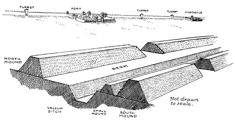
Prehistoric Canals Wansdyke 2

Introduction

​The Wansdyke, a significant linear earthwork in southwestern England, has long intrigued historians and archaeologists. Traditionally interpreted as an early medieval defensive structure, recent analyses suggest it may have served a different purpose. The blog “Prehistoric Canals – Wansdyke” explores the theory that Wansdyke functioned as a prehistoric canal system, challenging conventional understandings of its role in ancient Britain.​

This perspective is rooted in the observation that Wansdyke’s design resembles that of ancient canals. The earthwork features a substantial ditch accompanied by an embankment, a configuration commonly associated with water management systems. Moreover, the alignment of Wansdyke with natural watercourses and its proximity to prehistoric sites suggest it may have facilitated transportation and trade, rather than solely serving as a military fortification.​

Further supporting this hypothesis is the presence of flint pits and barrows along Wansdyke’s route. These archaeological features indicate areas of significant prehistoric activity, implying that the earthwork played a role in the economic and social practices of the time. Additionally, the strategic placement of Wansdyke in relation to the ancient landscape suggests it was designed to harness natural waterways, enhancing connectivity between settlements and resource sites.​

Reevaluating Wansdyke as a prehistoric canal system offers a fresh perspective on the engineering capabilities of ancient societies in Britain. It underscores the complexity of their infrastructure and their adeptness at manipulating the environment to support transportation and trade. This interpretation invites a broader reconsideration of similar earthworks and their functions, highlighting the need for ongoing research and open-mindedness in archaeological discourse.

Promotional Video

– Ancient Prehistoric Canals (Dykes) – Wansdyke (Prehistoric Canals – Wansdyke 2)

Book Extracts

Chapter 1 – Dykes, Ditches and Earthworks

Start of Wansdyke East  -Prehistoric Canals - Wansdyke 2
Start of Wansdyke East -Prehistoric Canals – Wansdyke 2

The modern word dike or Dyke most likely derives from the Dutch word “dijk”, with the construction of dikes in the Netherlands well attested as early as the 12th century. The 126 kilometres (78 mi) long Westfriese Omringdijk was completed by 1250 and was formed by connecting existing older dikes. The Roman chronicler Tacitus even mentions that the rebellious Batavi pierced dikes to flood their land and protect their retreat (AD 70).  The word dijk initially indicated both the trench and the bank.– Wikipedia

If you study archaeology at university or even on an ordinance survey map at length, you will notice strange earthworks on the sides of hills of Britain, with no rational explanation as to why they are there and for what reason.  These features are mostly ignored at university, or an excuse is made for their construction.  The reality is that these features do not make any sense unless there are other factors in operation which have been ignored.

The first thing to notice is that the word ‘Dyke’ is associated with water.  It does seem strange you would call an earthwork on top of a hill a Dyke, unless there was some history passed down through the years to its actual use.  If we look at the most famous Dyke in Britain, ‘Offa’, we notice that it is attributed to a Saxon King and, therefore, could not be prehistoric.   Or is this a clear indication of how archaeologists find excuses for these features rather than factual, empirical evidence?

“Offa’s Dyke (Welsh: Clawdd Offa) is a massive linear earthwork, roughly followed by some of the current borders between England and Wales. In places, it is up to 65 feet (19.8 m) wide (including its flanking ditch) and 8 feet (2.4 m) in height.  In the 8th century, it formed some kind of delineation between the Anglian kingdom of Mercia and the Welsh kingdom of Powys.” – Wikipedia

At face value, this explanation seems to answer all the questions about Dykes (except the water connection).  But suppose you delve further down to look at the evidence, such as findings from the Dyke and any written history. In that case, you get a different version for the Roman historian Eutropius in his book, Historiae Romanae Breviarium, written around 369 AD, mentions the Wall of Severus, a structure built by Septimius Severus who was Roman Emperor between 193 AD and 211 AD:

“He had his most recent war in Britain, and to fortify the conquered provinces with all security; he built a wall for 133 miles from sea to sea. He died at York, a reasonably old man, in the sixteenth year and third month of his reign.” – Eutropius (369 AD)

This ‘wall’ need not be made of stone as we know from their Scottish endeavours that the first structure as a defence was usually a bank and a ditch – just like a Dyke!!

The problem with this account is that none of the known Roman defences are 133 miles long – Harridan’s Wall is only 70 miles, so are they talking about Offa’s Dyke, which is much longer?

Chapter 2 – The Post-Glacial Flooding Hypothesis

Rise of Sea Levels - Prehistoric Canals - Wansdyke 2
Rise of Sea Levels – Prehistoric Canals – Wansdyke 2

Before we show you what these ‘Linear Earthworks‘ were used for in prehistoric times.  We need to give you an idea of how the environment was at the time of construction and why it is so different today.

In ‘The Post-Glacial Flooding Hypothesis,’ we looked at the new mathematical models that allowed us to calculate the amount of water released during and after the Last Glacial Maximum just over ten thousand years ago.

If the Dykes of Britain are canals (and not markers or defensive ditches), we must prove that the water table was higher in the past than today (otherwise, they would still be flooded).

The models contained in the PGFH showed us that a minimum of 8.42 quadrillion tonnes of water was released on the UK at the end of the last ice age.  This is equivalent to 98425.2 inches of rain falling on every square inch of Britain’s landmass or the same as – One Inch of rain steadily falling every day for the next 270 years

The worst known flooding in British history occurred in 1947 when just six inches of rain (149mm) fell on up to 12″ of snow (so a maximum of 15″ of rain if melted) over three months. The flooding, which inundated nearly all the main rivers in the South, Midlands, and the Northeast of England, was notable for its origins, geographical extent, and duration.

It impacted thirty out of the forty English counties over two weeks, when around 700,000 acres of land flooded. As a result, tens of thousands of people were temporarily displaced from their homes, and thousands of acres of crops were lost; and this was just 15 of the estimated equivalent of 98,425 inches of water that was shed on the British landscape after the last Ice Age. 

Raised Water Table

According to William Donn (Donn et al., 1962). The Fennoscandian and Great Britain ice sheet covered 4.7 106 km2, which is equivalent to: 

•          8.42 106 Gigatonnes of water / 4.7 106 km2, which gives     us 1.79 Gt per km2

•          1.79 Gt of water at a penetration rate of 43%, give us   0.77 Gt of water per km2

•          0.77 Gigatonnes of water by UK landmass 242,495 km² give us 186,804 Gt of groundwater

This water will be released at a rate of 1 – 12mm per annum and possibly at a depth of 75km. Therefore, to release groundwater at a depth of 75km at an average rate of 6mm per annum would take 12,500 years – not the 1,200 years previously believed, which is just the surface water from the last stages of the meltwater ice.

This is why rivers (like the Thames) still flow even after months of drought, as the groundwater is constantly leaking into the river, which was at its highest rate at the start of the Mesolithic, just after the great meltwater floods.

Sea-Level Changes

If this model is correct, we should be able to get verification via other empirical evidence, as shown in sea level water rises, to see if it has been constant over the last 12,500 years.

Most geologists and paleoclimatologists, when talking about the end of the last ice age, refer people to the phenomenon called the ‘Meltwater Pulse’ – which is the rapid rise in sea level (20m) between 13,500 and 14,700 years before present, over a 400 – 500 year period. Although it is a tremendous value, it should be recognised that this ‘pulse’ as only 16% of the total sea rise since the end of the last ice age.

Chapter 3 – Hydrology 101

Groundwater Sources - Prehistoric Canals - Wansdyke 2
Groundwater Sources – Prehistoric Canals – Wansdyke 2

When it comes to the use of ‘linear earthworks’ (we call ‘Dykes’), there is massive confusion amongst both professionals and amateur archaeologists about how such structures could function when they are dry today?

The incorrect perception of these ‘Dykes’ is either they are ‘rivers’ (like the Thames) that flow uphill or Victorian Canals with locks and wooden gates regulating the flow of the water – which are equally nonsensical as a prehistoric structures. Basic Hydrology that most people (should be but not necessarily ALL) learnt at school is that water is under the ground – not just a little water but 30% of all the fresh water on the planet.

This abundance of ‘groundwater’ is evident as it is the source of ALL rivers and supplies the Wells that have been dug since the beginning of time when rivers were absent. Even today, if you go into your garden and dig a hole, it will eventually fill with groundwater, whether in a valley or on top of a hill or mountain.

How and why water is on hills is very challenging for individuals as most people have a simplistic view of water being flat and sitting at ground level – but the earth is a far more complicated structure as this is the reason that it took centuries for people to recognise that we lived on a sphere and not a ‘flat-earth’ as such complex concepts such as gravity are hard to comprehend.

The reality is that ‘streams’ of water are encapsulated within the bedrock allowing ‘springs’ to start rivers at a great height as the groundwater is under pressure and erupts to the surface from BELOW and does not flow up or down the hill internally – but can flow downhill AFTER it escapes from the soil, because at the point of escape gravity then becomes the greater force overcoming the water pressure when within the bedrock – which stops it flowing down the landscape and can push it up to the top of hills and mountains.

Consequently, wells work even on hills as the groundwater is encapsulated in the bedrock and soil. The above illustration shows that if wells are dug halfway up a hill where there is a groundwater pocket, they will fill – if we join up these wells, the entire ditch will also fill with water – sourced from the ground.

The central aspect that must be remembered when considering the reasons behind the construction and maintenance of these earthworks (Dykes) is that the environment was so much different in the Mesolithic Period, which changed rapidly when entering the Neolithic and then even more changes in the Bronze and Iron Ages.

Once the ice sheets had melted and the climate began to warm, the landscape gradually changed from open tundra to dense woodland. By around 8000 BC, pine and birch dominated the woodland cover. These were slowly replaced by lime, elm and oak with some hazel. By 6500 BC, pine and birch woodland would only have been found on the thinner limestone soils of the uplands.

Case Study Wansdyke – Morgan’s Hill West

The steepest aspect of Wansdyke is the rise over Morgan’s Hill, which is an incline from 182m OD to 252m OD.

Figure 34 - Morgan Hill West (Wansdyke)  - Prehistoric Canals - Wansdyke 2
Figure 34 – Morgan Hill West (Wansdyke) – Prehistoric Canals – Wansdyke 2

If we are correct with our assumption, we need to show that you can transverse this massive incline using natural springs and basic wooden weirs.  If we split the gradient into four parts, we can see better the profile and problems our ancestors faced.

Prehistoric Canals - Wansdyke 2
Figure 35 Morgan’s Hill West in Sections – Prehistoric Canals – Wansdyke 2

Section A – 0 to 300 downhill

Length is 300m, and the inclination lowers from 251m OD to 242m OD at a ratio of 3% or 1:33 – If we accept that within this section, we had four cat A ‘springs’ that would release 11.2 cu. metres of water PER SECOND (11,200 litres per second) would fill a 10m ditch that is 1.5 deep by one-metre width of the Dyke’s ditch every SECOND.

According to the mathematical formula (v = k * C * R0.63 * S0.54 ), water at the end of section A would be travelling at 5 MPH – the speed of the Thames at Henley (so quite navigable) and, therefore, no need for any Weirs to reduce the water flow.

Section B – 300 to 800m downhill

This section would receive water at one metre per second from Section A, travelling at 5 MPH – The length of this section is 500m in length, and the inclination lowers from 242m OD to 200m at a ratio of 8% or 1:12 this would accelerate the water to 15 mph which is too fast the navigate uphill. Therefore, a series of weirs would have been placed either under the water or, as the early Victorians achieved, by a paddle weir or both.

An underwater weir (blocking 50% of the water but allowing boats to move over the top without hindrance) would reduce the flow by 50% – so if placed at the End of Section A (at 5 MPH) would reduce the water flow to 2.5 MPH and down to 12.5 MPH at the End of Section B. Consequently, if we place one of these 50% reduction weirs at 100m intervals the water flow would not go over the 5-mph mark and would probably be in the region of 3 – 5 MPH which again is easily navigable.

Chapter 4 – Wansdyke

Wansdyke v Avon and Kennet Canal  - Prehistoric Canals - Wansdyke 2
Wansdyke v Avon and Kennet Canal – Prehistoric Canals – Wansdyke 2

According to Wikipedia, “Wansdyke consists of two sections of 14 and 19 kilometres (9 and 12 mi) long with some gaps in between. East Wansdyke is an impressive linear earthwork, consisting of a ditch and bank running approximately east-west, between Savernake Forest and Morgan’s Hill. West Wansdyke is also a linear earthwork, running from Monkton Combe south of Bath to Maes Knoll south of Bristol, but less impressive than its eastern counterpart. The middle section, 22 kilometres (14 mi) long, is sometimes referred to as ‘Mid Wansdyke’ but is formed by the remains of the London to Bath Roman road. It used to be thought that these sections were all part of one continuous undertaking, especially during the Middle Ages when the pagan name Wansdyke was applied to all three parts.

East Wansdyke in Wiltshire, on the south of the Marlborough Downs, has been less disturbed by later agriculture and building and remains more clearly traceable on the ground than the western part. Here the bank is up to 4 m (13 ft) high with a ditch up to 2.5 m (8.2 ft) deep. Wansdyke’s origins are unclear, but archaeological data shows that the eastern part was probably built during the 5th or 6th century. That is after the withdrawal of the Romans and before the takeover by Anglo-Saxons. The ditch is on the north side, so presumably it was used by the British as a defence against West Saxons encroaching from the upper Thames Valley westward into what is now the West Country.

West Wansdyke, although the antiquarians like John Collinson considered West Wansdyke to stretch from south East of Bath to the west of Maes Knoll, a review in 1960 considered that there was no evidence of its existence to the west of Maes Knoll.   Keith Gardner refuted this with newly discovered documentary evidence.  In 2007 a series of sections were dug across the earthwork which showed that it had existed where there are no longer visible surface remains.

It was shown that the earthwork had a consistent design, with stone or timber revetment. There was little dating evidence, but it was consistent with either a late Roman or post-Roman date. A paper in “The Last of the Britons” conference in 2007 suggests that the West Wansdyke continues from Maes Knoll to the hill forts above the Avon Gorge and controls the crossings of the river at Saltford and Bristol as well as at Bath.

As there is little archaeological evidence to date the western Wansdyke, it may have marked a division between British Celtic kingdoms or have been a boundary with the Saxons. The evidence for its western extension is earthworks along the north side of Dundry Hill, its mention in a charter and a road name.

Book Sections

Sections covered in the Book - Prehistoric Canals - Wansdyke 2
Sections covered in the Book – Prehistoric Canals – Wansdyke 2

Section 1

HE:1003784 Wansdyke: section 610yds (560m) NW of Wernham Farm to 250yds (230m) SW of New Buildings (560m = 1680 working days – 20 men taking 84 days to complete)

Figure 44 Wansdyke NW of Wernham (with added water levels)  - Prehistoric Canals - Wansdyke 2
Figure 44 Wansdyke NW of Wernham (with added water levels) – Prehistoric Canals – Wansdyke 2


No, HE Historic Details or Excavations Registered

OS Map

1800 OS Map -Prehistoric Canals - Wansdyke 2
Prehistoric Canals – Wansdyke 2

1800 OS Map

OS Map -Prehistoric Canals - Wansdyke 2
Prehistoric Canals – Wansdyke 2

LiDAR Map

LiDAR Map -Prehistoric Canals - Wansdyke 2
Prehistoric Canals – Wansdyke 2

LiDAR (with Mesolithic water levels)

Prehistoric Canals - Wansdyke 2
Prehistoric Canals – Wansdyke 2

A feature called ‘firs’ is a gap on the OS Map – there is a strange quarry pit (no relevant substances under the surface to quarry?) – this pit is two metres deep and probably built later to the original ditch.


Are we looking for a hole to find the groundwater to keep the canal working with fresh water? As we will discover, this is not the first pit cut deep on the line of Wansdyke.


The Mesolithic water levels certainly explain the strange start of Wansdyke and the unexplained gaps (if it’s not a canal) in the Dyke.


Notice on the LiDAR maps the extensive ‘pits’ surrounding the Dyke, which are not below the Mesolithic river shoreline and are 14m in diameter.

Figure 45 - Quarry pits found in Paleochannels  - Prehistoric Canals - Wansdyke 2
Figure 45 – Quarry pits found in Paleochannels – Prehistoric Canals – Wansdyke 2

These features seem to be connected to even larger quarry holes (some under the Mesolithic shoreline), indicating that minerals have been extracted here for thousands of years and may be the reason for the Dykes construction to take minerals away – as have also found these pits in other mineral-rich areas of Britain such as Hadrian’s Wall.


Durrington Walls


The pits are about 20m in diameter and up to 5m deep, as revealed by further geophysical surveys using ground-penetrating radar and mechanical coring around Durrington Walls. Small quantities of struck flint, shell, and animal bone have been recovered from them, with the bone providing radiocarbon dates from about 2500 BC to 1200 BC.

Prehistoric Canals - Wansdyke 2
Prehistoric Canals – Wansdyke 2

What we see is that this type of quarrying was commonplace in the past and has confused archaeologists – but as this was a trading nation, the solution is evident and straightforward. 


Gap in the Dyke route


At the end of Section 1, we find the first gap (if you exclude the massive gap at the start of the Dyke) – this gap appears as the Dyke dips into a paleochannel. The obvious conclusion for the break in Wansdyke is that it must have been full of water at the construction time.

Prehistoric Canals - Wansdyke 2
Prehistoric Canals – Wansdyke 2
Figure 46 - Mesolithic Water levels show gap disappears - Prehistoric Canals - Wansdyke 2
Figure 46 – Mesolithic Water levels show gap disappears – Prehistoric Canals – Wansdyke 2
Ancient Prehistoric Canals - Wansdyke (The Book) -Prehistoric Canals - Wansdyke 2
Ancient Prehistoric Canals – Wansdyke (The Book) – Prehistoric Canals – Wansdyke 2

This was an extracts from the NEW Book Ancient Prehistoric Canals (Dykes) – Wansdyke available on Amazon as a FULL COLOUR HARD BACK (£19.95) or a ECONOMY (£4.99) SOFTBACK black and white VERSION – it is also available as a KINDLE (£1.99) book. For further information about our work on Prehistoric Britain visit our WEBSITE or VIDEO CHANNEL.

Product details

  • ASIN ‏ : ‎ B0BF31GQKC
  • Publisher ‏ : ‎ Independently published (18 Sept. 2022)
  • Language ‏ : ‎ English
  • Hardcover ‏ : ‎ 134 pages
  • ISBN-13 ‏ : ‎ 979-8353488897
  • Dimensions ‏ : ‎ 15.24 x 1.3 x 22.86 cm
  • Illustrations: 85
  • Customer reviews: 5.0 out of 5 stars    1 rating

Further Reading

For information about British Prehistory, visit www.prehistoric-britain.co.uk for the most extensive archaeology blogs and investigations collection, including modern LiDAR reports.  This site also includes extracts and articles from the Robert John Langdon Trilogy about Britain in the Prehistoric period, including titles such as The Stonehenge Enigma, Dawn of the Lost Civilisation and the ultimate proof of Post Glacial Flooding and the landscape we see today.

Robert John Langdon has also created a YouTube web channel with over 100 investigations and video documentaries to support his classic trilogy (Prehistoric Britain). He has also released a collection of strange coincidences that he calls ‘13 Things that Don’t Make Sense in History’ and his recent discovery of a lost Stone Avenue at Avebury in Wiltshire called ‘Silbury Avenue – the Lost Stone Avenue’.

(Maritime Diffusion Model for Megaliths in Europe)

Langdon has also produced a series of ‘shorts’, which are extracts from his main body of books:

The Ancient Mariners

Stonehenge Built 8300 BCE

Old Sarum

Prehistoric Rivers

Dykes ditches and Earthworks

Echoes of Atlantis

Homo Superior

(Maritime Diffusion Model for Megaliths in Europe)

Other Blogs

[sitemap_posts]