If Troy was really at Hisarlık, Homer has given us a geographical problem hiding in plain sight
Before We Follow Odysseus: How Old Is the Story We Are Actually Reading?
Before attempting to place Troy, Ithaca or any of the strange lands described in the Odyssey on a modern map, there is a more fundamental question that is rarely given enough attention:
What exactly are the Iliad and Odyssey?
Today we encounter them as books. They have numbered books, fixed lines, recognised place-names and an author conventionally called Homer. That creates the natural impression that somebody sat down approximately 2,700 years ago and wrote the stories much as a modern novelist would.
Almost certainly, that is not how they began.
Modern Homeric scholarship broadly accepts that the Iliad and Odyssey emerged from a much older oral performance tradition. For generations before the poems became stable written texts, professional singers told and retold stories about Troy, Achilles, Helen, Odysseus and the other heroes. The tradition operated over a wide geographical area and for hundreds of years; some scholars allow that parts of the underlying poetic tradition may reach back into the Bronze Age, while aspects of the poetic language itself may preserve still older Indo-European inheritances.
That distinction is crucial to this investigation.
We are therefore probably not reading an eyewitness report written shortly after a war.
Nor, however, are we necessarily reading a completely invented story created in the eighth century BCE.
What we have is something much more interesting:
A VERY OLD STORY THAT WAS KEPT ALIVE BY HUMAN MEMORY BEFORE IT BECAME A BOOK.
🗣️ HOW COULD A STORY THIS LARGE SURVIVE WITHOUT WRITING?
At first this sounds almost impossible.
The Iliad contains more than 15,000 lines and the Odyssey more than 12,000. How could stories of this scale survive for centuries before being written down?
The answer lies in the way oral poetry worked.
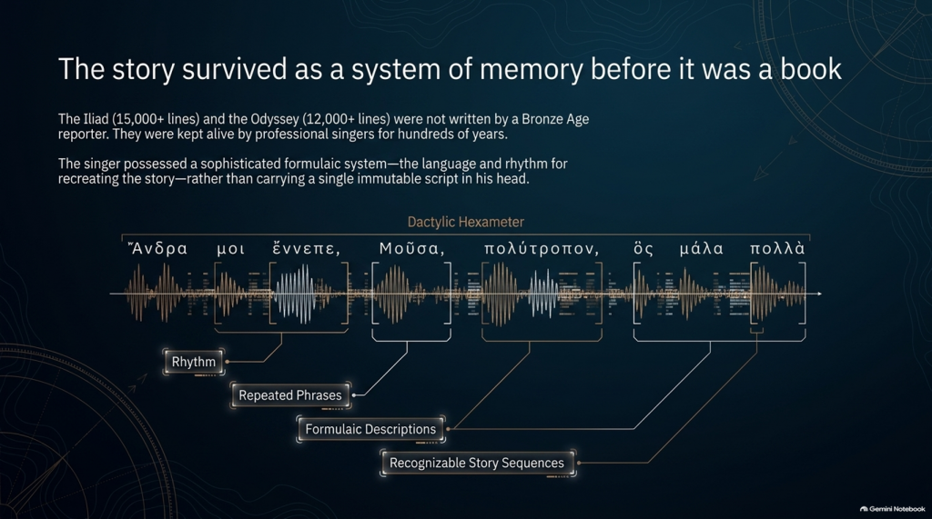
The pioneering studies of Milman Parry and Albert Lord demonstrated that oral epic singers did not normally memorise a gigantic text word-for-word in the way an actor memorises a script.
Instead, they mastered a specialised system of:
rhythm,
repeated phrases,
formulaic descriptions,
stock scenes,
traditional characters,
recognisable story sequences
and
metrical structures.
Thus Achilles can repeatedly be described by a familiar epithet, ships can be introduced through standard phrases, dawn arrives through recognised verbal formulas, and battles, feasts, departures and assemblies follow structures that both singer and audience understand.
The metre itself—dactylic hexameter—acted as part of the memory system.
The singer possessed the story and the language for recreating it, rather than carrying a single immutable script in his head. Parry and Lord’s work on surviving oral traditions showed that a trained singer could reconstruct an enormous epic during performance using this formulaic system.
This produces a very important consequence.
Each performance could preserve the essential story while changing some of its details.
An episode might become longer.
Another could be shortened.
A hero could receive greater prominence.
A description could change.
And details meaningful to one audience could be emphasised more heavily than details important to another.
The story could therefore remain recognisably the same story for centuries without remaining exactly the same text.
⏳ HOW FAR BACK COULD THE TROJAN STORY GO?
This is where matters become particularly interesting.
The poems we possess are usually associated in something close to their recognisable monumental form with the late eighth or early seventh century BCE, although exactly when they first became written texts remains heavily debated.
But the traditions from which they were created are considerably older.
Cambridge’s modern guide to Homer describes the poems as products of songs composed and recomposed over many hundreds of years, potentially drawing on traditions extending much deeper into prehistory. Some scholarship has specifically argued that Greek epic traditions may have been developing from the middle or later Bronze Age.
That creates a possible chronological gap of several centuries between:
whatever historical events originally generated the tradition
and
the written geographical names we eventually inherit.
If the conventional Trojan War date of around the late second millennium BCE were approximately correct, then several hundred years may separate an original conflict from the period in which the surviving poems began crystallising into something resembling our texts.
And during those centuries the story was travelling.
🌍 STORIES TRAVEL — AND GEOGRAPHY CAN TRAVEL WITH THEM
This point is central to our investigation.
An oral epic does not survive in a vacuum.
It survives because people want to hear it.
A singer performs before an audience. That audience knows its own towns, rulers, landscapes, ancestors and political rivalries.
Successful oral storytelling therefore contains an unavoidable process of adaptation.
Modern Homeric scholarship explicitly recognises that the flexibility of oral performance allowed heroic tales to be adapted to their immediate contexts. The Homeric language itself demonstrates this history: it is not the ordinary language of one place or date but a remarkable composite containing predominantly Ionic forms together with older Aeolic and Arcado-Cypriot elements and later Attic features.
In other words:
THE LANGUAGE ITSELF HAS A HISTORY OF MOVEMENT AND MODIFICATION.
Why should we automatically assume every geographical label escaped the same process untouched?
Suppose an ancient story originally described a distant king, harbour, island or people whose original name had become meaningless to an audience centuries later.
A performer had several choices.
He could preserve a meaningless archaic name.
He could reinterpret it.
He could associate it with a place his listeners knew.
Or different regional traditions could gradually absorb their own places and heroes into the greater Trojan story.
We cannot prove that this happened to every disputed Homeric town.
But critically:
WE KNOW THE ORAL SYSTEM WAS CAPABLE OF DOING IT.
That alone means geographical names cannot be treated with the same evidential weight as physical descriptions.
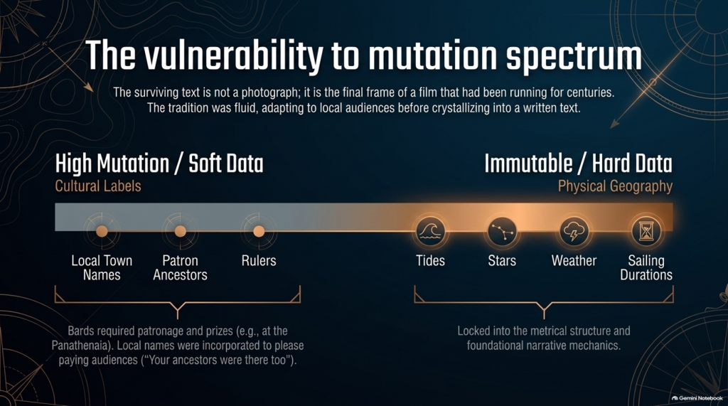
🏛️ COULD LOCAL TOWNS HAVE BEEN ADDED TO PLEASE LOCAL AUDIENCES?
Yes—it is a genuine possibility, although it must be treated as a hypothesis rather than assumed.
There were even disputes in antiquity and later scholarship concerning possible Athenian additions to Homer. Passages involving Athens and Salamis in the Catalogue of Ships have attracted particularly long-running arguments about interpolation and political influence. Modern scholarship does not simply agree that these lines were inserted, but the fact that such passages remain controversial demonstrates that alteration of local geographical material is not some outrageous modern suggestion.
And there was an obvious incentive.
Imagine performing this great heroic story before an audience in a particular Greek city.
Which version is likely to receive the better reception?
One saying:
“Your people played no part in the greatest war in heroic history.”
Or one announcing:
“Your ancestors were there too.”
The Catalogue of Ships is especially interesting in this respect because it gives an extraordinary roll-call of communities incorporated into the expedition.
That does not prove the Catalogue was fabricated.
But it means we should recognise its social function.
The Trojan story eventually became a shared heroic past through which numerous Greek communities could locate themselves inside history.
That creates exactly the circumstances in which local geographical incorporation becomes plausible.
💰 WAS THERE A COMMERCIAL MOTIVE?
Not initially in the modern sense of an author writing a book and hoping to sell thousands of copies.
For much of the poem’s early existence, the product being consumed was the:
PERFORMANCE.
Bards performed at elite households, feasts and public occasions. Later professional rhapsodes performed Homeric poetry competitively at major festivals such as the Panathenaia, where contests and prizes existed. For most people in Archaic and Classical Greece, Homer would originally have been encountered through performance rather than privately reading a book.
So although we should avoid imagining a Bronze Age publishing company selling copies of the Iliad, there was still an economic reality.
A successful performer needed:
patronage,
invitations,
prestige,
prizes
and above all:
AN AUDIENCE THAT WANTED TO HEAR HIS VERSION.
That provides exactly the same commercial pressure that exists in entertainment today.
Tell people a story that relates to them, and they are more likely to listen.
Eventually the oral tradition increasingly became textual. The poems became books, educational texts and cultural possessions, while regulated festival performances also helped constrain what had previously been a much more fluid tradition. Yet even by the second century BCE, textual variation had not disappeared completely.
So the surviving text is better imagined not as a photograph taken at one moment in history, but as the final surviving frame of a film that had already been running for centuries.
📜 FROM BARD TO “HOMER”
There is another uncomfortable problem.
We do not actually know who Homer was.
Ancient cities competed to claim him as their own, particularly communities in Ionia such as Smyrna and Chios. Even the association of the name “Homer” with the Iliad and Odyssey developed within the later tradition.
Modern scholarship continues to debate whether:
one extraordinary poet monumentalised each epic,
different poets created the Iliad and Odyssey,
the poems were dictated by oral singers,
or their written forms emerged progressively from a much wider performance tradition.
What is considerably less controversial is that the tradition preceding the surviving text was oral.
That fact changes how geographical evidence should be handled.
🧭 NAMES ARE NOT THE SAME AS GEOGRAPHY
This is why, throughout this investigation, we will not begin by saying:
“Homer mentions a place later identified as being in Greece, therefore the story happened in Greece.”
That is circular reasoning.
A place-name can be:
preserved,
translated,
reapplied,
updated,
misunderstood
or
incorporated during centuries of oral retelling.
A river behaving in a particular way cannot.
A tide cannot.
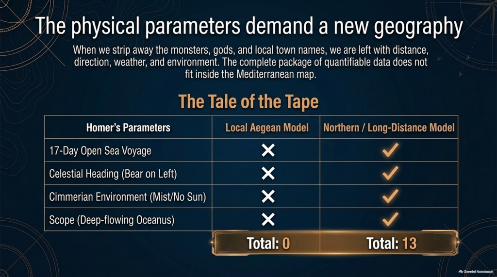
A seventeen-day voyage cannot.
The position of a star cannot.
A prevailing wind cannot.
The length of winter darkness cannot.
The ecology of a marsh cannot.
A mountain visible after a stated number of sailing days cannot.
Those are the clues that deserve greater weight.
So our methodology deliberately separates:
🏛️ CULTURAL LABELS
from
🌍 PHYSICAL GEOGRAPHY.
The names remain important.
But they do not get to prove themselves.
🔍 THE STORY MAY BE OLDER THAN ITS MAP
And this leads directly to the central problem of the Odyssey.
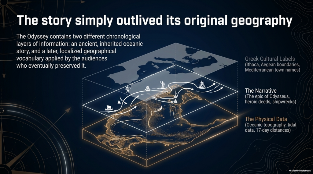
It is entirely possible that the written poem contains two different chronological layers of information:
an ancient inherited story,
and
a later geographical vocabulary familiar to the audiences who eventually preserved and recorded it.
If so, conflicts between Homer’s names and Homer’s physical descriptions become extremely important.
Which should we trust?
The town name that could have travelled through centuries of human storytelling?
Or the description of:
🌊 the sea,
🌫️ the climate,
⭐ the stars,
🧭 the sailing direction,
⏳ the voyage duration,
🌲 the vegetation,
🏔️ the landscape
and
👥 the people?
Our investigation gives priority to the latter.
Because oral tradition can move a name.
IT CANNOT MOVE THE NORTH STAR.
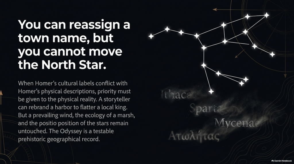
And once that distinction is understood, the Odyssey stops being merely one of the world’s greatest stories.
It becomes something else:
🧭 A POTENTIALLY TESTABLE PREHISTORIC GEOGRAPHICAL RECORD.
That is where our investigation begins.
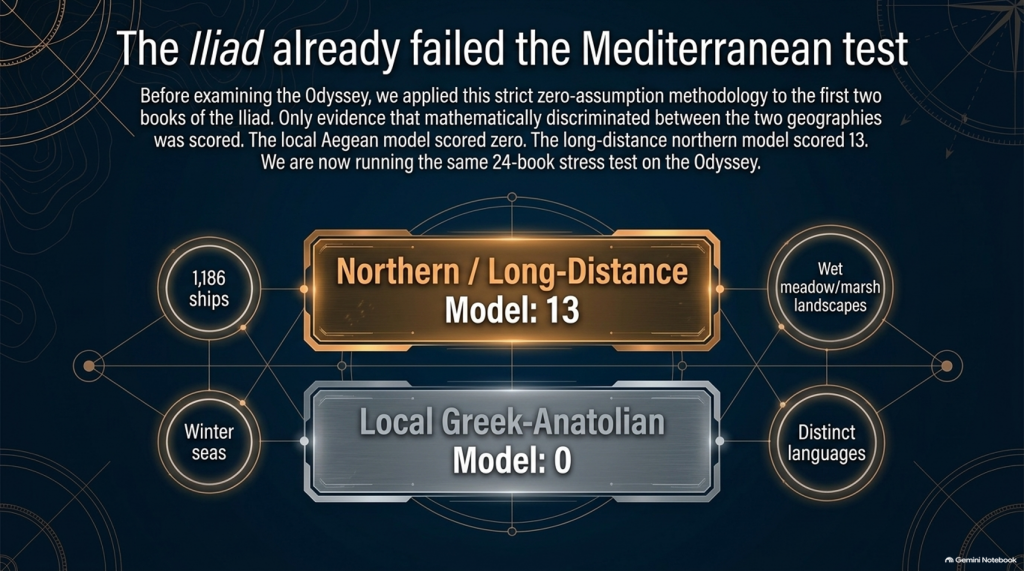
Our examination of the first two books of Homer’s Iliad has already produced an unexpected result.
After removing traditional place-name assumptions and scoring only evidence that actually discriminates between the competing geographical models, the result currently stands at:
🌊 NORTHERN / LONG-DISTANCE MODEL: 13
☀️ LOCAL GREEK–ANATOLIAN MODEL: 0
But we may have overlooked an even more powerful test.
Because Homer didn’t only leave us the story of the war.
He also left us:
🧭 THE JOURNEY HOME.
And that creates a very awkward question for the traditional identification of Troy.
🚢 THE JOURNEY SHOULD BE SIMPLE
The conventional interpretation tells us:
🏛️ Troy = Hisarlık in north-western Turkey
and
🏠 Odysseus’ home = Ithaca in western Greece.
So when Troy falls, Odysseus has a straightforward objective:
TROY ➡️ ITHACA
Nothing mysterious about that.
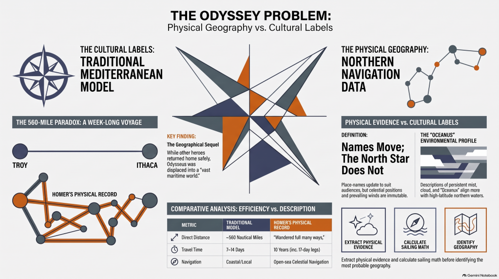
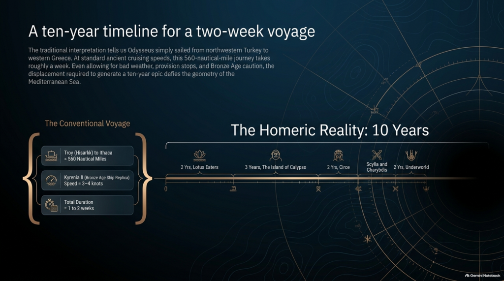
The conventional sea distance is approximately:
🌊 560 NAUTICAL MILES
roughly 645 statute miles
Now compare that with experimental ancient Mediterranean sailing.
The reconstructed fourth-century BC merchant vessel Kyrenia II demonstrated cruising speeds around 3–4 knots, sometimes considerably faster. On its experimental voyage from Piraeus to Cyprus it covered almost 600 nautical miles despite stops, tests and variable conditions.
At that sort of speed, a direct 560-mile voyage is not a journey measured in years.
It is measured in:
📅 DAYS.
Allow for poor winds, overnight stops, provisioning and Bronze Age caution and perhaps we are looking at roughly:
ONE TO TWO WEEKS
under reasonably favourable circumstances.
And yet Homer gives us:
⏳ TEN YEARS.
Immediately people will say:
“But Odysseus didn’t spend ten years sailing!”
Correct.
And that distinction actually makes the geographical problem more interesting.
⏳ THE TEN YEARS WERE NOT TEN YEARS OF CONTINUOUS SAILING
Odysseus gets delayed.
He is shipwrecked.
He loses companions.
He encounters hostile populations.
He becomes stranded.
He spends years unable to get home.
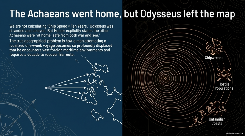
So it would be scientifically wrong to calculate:
ship speed × ten years = distance from Troy.
We aren’t doing that.
The real question is much more basic:
How does a man attempting a voyage whose conventional start and finish are only about a week’s sailing apart become so geographically displaced that returning home consumes ten years?
That is the problem.
📖 HOMER TELLS US FROM THE FIRST LINES THAT THIS IS A GEOGRAPHICAL JOURNEY
The Odyssey opens by describing Odysseus as the man who:
“wandered full many ways”
after he had destroyed Troy.
Homer says:
“Many were the men whose cities he saw”
and tells us that he suffered repeatedly:
“upon the sea.”
This isn’t simply a story about somebody stuck around the corner.
It is explicitly a story about:
🌍 travelling through different lands
👥 encountering different peoples
🌊 crossing seas
🌪️ experiencing extreme maritime conditions
and
🧭 struggling to recover the route home.
🚨 EVEN MORE IMPORTANTLY — EVERYONE ELSE HAS ALREADY GONE HOME
Book 1 gives us another striking statement.
Homer says that the other surviving Achaeans were:
“at home, safe from both war and sea.”
Odysseus alone remained unable to complete his return.
This is extremely important.
The war is finished.
The surviving coalition disperses.
The men undertake their return journeys from Troy.
That means the Odyssey isn’t some unrelated maritime fantasy.
It is the geographical sequel to the Trojan War.
We therefore have another independent dataset with which to test the location of Troy.
🧭 AND HOMER ACTUALLY GIVES US NAVIGATION INSTRUCTIONS
This is where things become particularly interesting.
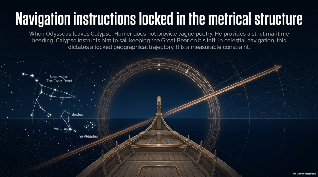
When Odysseus finally leaves Calypso, Homer doesn’t simply say:
“He sailed away.”
He tells us how he navigated.
Odysseus watches:
⭐ the Pleiades
⭐ Boötes
⭐ Orion
⭐ the Great Bear.
And Calypso instructs him to keep the Bear:
ON HIS LEFT
while sailing.
That is potentially geographical evidence.
Because now we have:
⭐ CELESTIAL NAVIGATION
🧭 DIRECTION
🌊 OPEN-SEA TRAVEL
⏳ AND SAILING DURATION.
That can potentially be tested mathematically.
🚢 THEN HOMER GIVES US THE NUMBER: SEVENTEEN DAYS
Odysseus sails continuously enough for Homer to state:
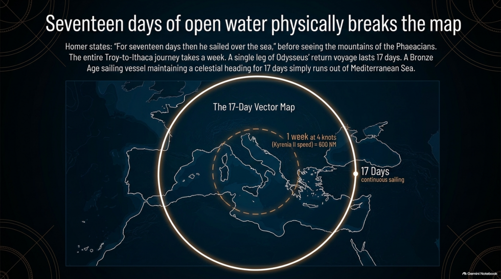
“For seventeen days then he sailed over the sea”
and on the eighteenth he finally sees the mountains of the Phaeacians.
Stop there.
The entire conventional Troy-to-Ithaca journey could potentially be completed in something around a week or somewhat longer under reasonable sailing conditions.
Yet one single later leg of Odysseus’ wandering lasts:
🌊 17 DAYS AT SEA
before land appears.
That doesn’t automatically prove the Atlantic.
But scientifically it demands investigation.
Where had he travelled?
How far away from Ithaca had he become?
What heading does keeping the Great Bear on the left imply?
What distance can a Bronze Age sailing vessel cover in seventeen days?
And does the conventional Mediterranean reconstruction actually satisfy those constraints?
These are measurable questions.
🌫️ THEN WE REACH THE CIMMERIANS
And the environment becomes even stranger.
Odysseus reaches the land of the Cimmerians.
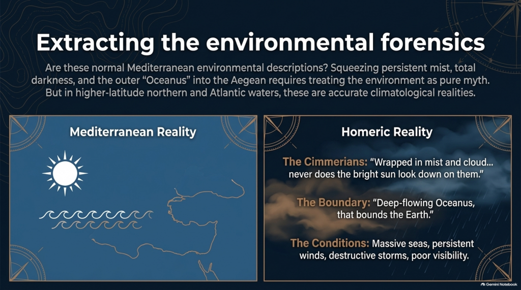
Homer describes it as:
“wrapped in mist and cloud.”
Then he says:
“Never does the bright sun look down on them”
and describes oppressive darkness hanging over the inhabitants.
Again, we must be careful.
This could be mythological geography.
It could represent Homer’s conception of the edge of the world.
We cannot simply announce:
Cimmerians = Britain.
But scientifically we are entitled to ask:
🌞 Is this a normal Mediterranean environmental description?
Or is:
🌫️ persistent mist
☁️ cloud
🌑 darkness
and
🌊 the remote Ocean
more naturally compatible with the traditions of higher-latitude northern waters?
That becomes another test.
🌊 HOMER EVEN TAKES US TO “OCEANUS”
Immediately before reaching the Cimmerians, Homer says Odysseus’ vessel reaches:
“deep-flowing Oceanus, that bounds the Earth.”
This is extremely significant conceptually.
The poem’s geography has now expanded far beyond an ordinary little voyage between Turkey and western Greece.
We are being taken to what Homer’s tradition regards as the outer ocean.
Whether Oceanus represents a literal Atlantic geography, mythical world-ocean, or a mixture of inherited geographical memory and mythology is precisely what needs testing.
But simply squeezing every episode into the Mediterranean because we have already decided Troy belongs there is not evidence.
It is circular reasoning.
🌪️ THE WEATHER NEEDS TESTING TOO
Throughout the Odyssey, maritime conditions aren’t background decoration.
They drive the story.
Odysseus encounters:
🌊 enormous seas
🌬️ persistent winds
⛈️ destructive storms
🌫️ mist and poor visibility
🏝️ unfamiliar coasts
and repeated difficulty determining his position.
Mediterranean storms can unquestionably be severe.
So:
storm = Atlantic
is not acceptable science.
But just as with our Iliad investigation, the correct question is:
Which maritime environment produces the complete collection of conditions more naturally and more frequently?
The Mediterranean?
Or the Atlantic/North Sea world?
🗺️ THE PEOPLE ARE JUST AS IMPORTANT AS THE WEATHER
The journey takes Odysseus through populations whose cultures and lifestyles differ radically.
We meet:
👥 Cimmerians
👥 Phaeacians
👥 Cyclopes
👥 Laestrygonians
and numerous other populations and communities.
Some may be mythical.
Some may preserve distorted memories of real peoples.
Some may combine both.
But we should not begin by assigning them to Mediterranean locations simply because later scholars did so.
Instead we should record:
🏠 housing
⛵ boat technology
🌾 agriculture
🐄 animals
🍖 diet
👕 clothing
🗣️ language
🌲 vegetation
🌦️ climate
🏔️ geography
and then ask:
WHERE DOES THAT COMPLETE PACKAGE FIT BEST?
⚠️ THIS IS THE SAME MISTAKE WE FOUND WITH THE ILIAD
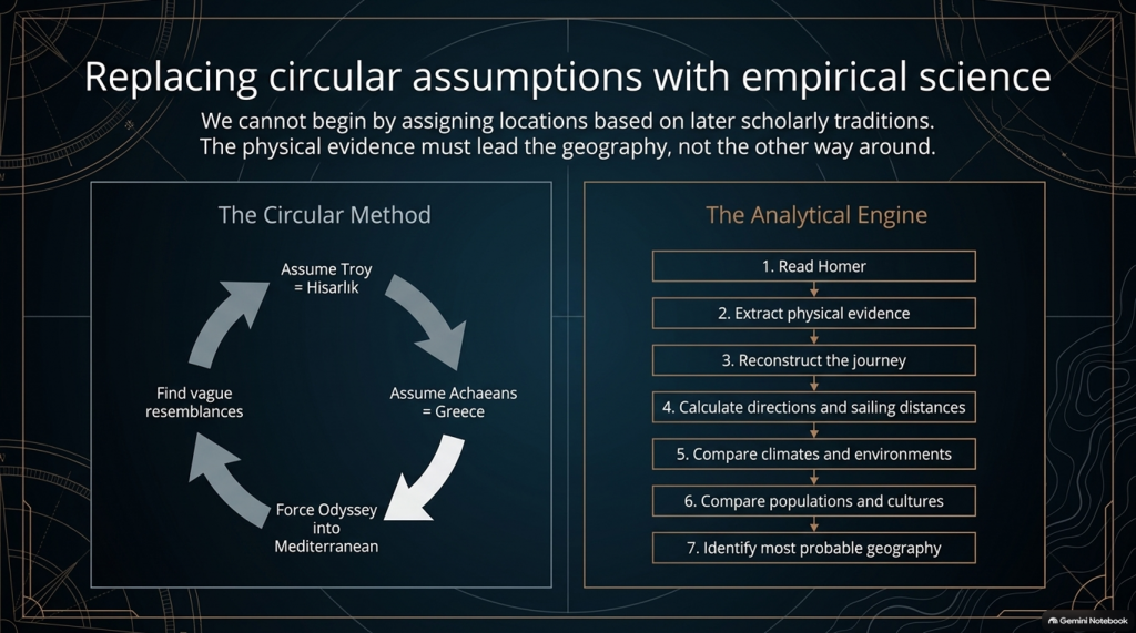
Traditional scholarship frequently begins with:
Troy = Hisarlık
therefore:
Achaeans = Greece
therefore:
the war must be Mediterranean
therefore:
the Odyssey must largely be Mediterranean
and then attempts to find Mediterranean locations resembling Homer’s descriptions.
That reverses the scientific process.
The correct sequence should be:
1️⃣ Read Homer.
2️⃣ Extract the physical evidence.
3️⃣ Reconstruct the journey.
4️⃣ Calculate directions and sailing distances.
5️⃣ Compare climates and environments.
6️⃣ Compare populations and cultures.
7️⃣ THEN identify the most probable geography.
Not the other way around.
🔬 AND THIS TIME WE CAN ACTUALLY DO THE MATHEMATICS
The Iliad gave us powerful clues such as:
🌍 “far from home”
🌊 mountains and sea separating populations
🚢 1,186 ships
🗣️ different languages
🌍 allies “from afar”
👱 repeated xanthos individuals
🌧️ winter seas
🌿 wet meadow and marsh landscapes.
But the Odyssey potentially gives us something even stronger.
It gives us:
⏱️ TIME
🧭 DIRECTION
⭐ NAVIGATION
🌊 DISTANCE
🌬️ WEATHER
🌍 ENVIRONMENT.
Those are quantifiable.
🚨 THE CENTRAL PROBLEM
Strip away all the monsters and gods for a moment.
The basic story says:
Odysseus leaves Troy.
He intends to sail home.
Home is Ithaca.
Other Achaeans successfully make their own returns.
Odysseus becomes displaced through a vast maritime world.
He encounters numerous foreign peoples and environments.
He reaches extraordinarily remote locations.
One later sailing leg alone lasts seventeen days.
His complete return takes ten years.
And the conventional interpretation asks us to place the beginning and end of that extraordinary adventure only about:
560 NAUTICAL MILES APART.
That doesn’t prove the traditional map is wrong.
But scientifically:
IT IS A PROBLEM THAT DEMANDS AN EXPLANATION.
🧪 SO WE ARE GOING TO TEST THE ODYSSEY TOO
After our detailed examination of the 24 books of the Iliad, we will now have a second investigation:
📚 ALL 24 BOOKS OF THE ODYSSEY
And we will use exactly the same rules.
No points for traditional names.
No location accepted because “experts agree”.
No northern point merely because something also happens in Britain.
No Mediterranean point merely because something can happen in Greece.
If both environments fit:
0–0
If one environment is substantially more probable:
it scores.
And where Homer gives us distances, directions and sailing durations:
WE DO THE MATHS.
🔥 THIS MAY BECOME THE BIGGER PROBLEM
After two books of the Iliad our score currently stands at:
🌊 NORTH / LONG-DISTANCE: 13
☀️ LOCAL AEGEAN: 0
Twenty-two Iliad books remain.
But after that we now have another twenty-four books containing the actual journey home.
That means this investigation is no longer simply:
“Where was Troy?”
The bigger question has become:
🧭 DOES HOMER’S ENTIRE GEOGRAPHICAL WORLD FIT INSIDE THE MAP WE HAVE BEEN GIVEN?
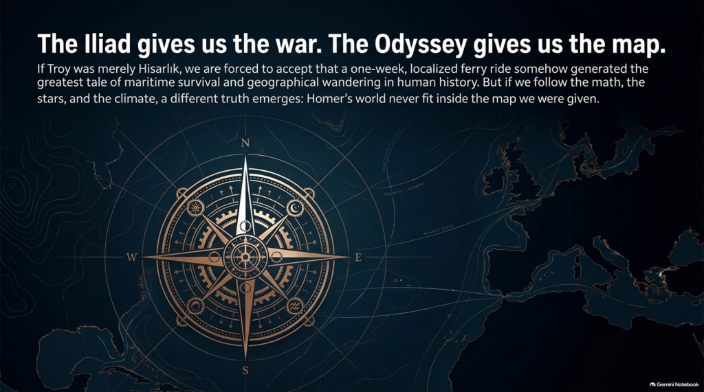
Because if Troy really was Hisarlık and Ithaca really was Odysseus’ destination, then a journey whose conventional endpoints are roughly a week or two of ordinary ancient sailing apart somehow generated one of the greatest tales of geographical wandering ever written.
Perhaps mythology explains everything.
Perhaps the Mediterranean really does reproduce Homer’s journey.
Perhaps the traditional geography eventually wins.
But those are hypotheses.
They now need testing.
And if the sailing directions, durations, climates, peoples and landscapes repeatedly point outside the Mediterranean, then the traditional identification of this as an obviously local Greek–Anatolian conflict becomes increasingly difficult to defend scientifically.
🌊 THE ILIAD GIVES US THE WAR.
🧭 THE ODYSSEY MAY GIVE US THE MAP.
And that may prove to be the most important test of them all. 🔍🌍⚔️
PODCAST

Author’s Biography

Robert John Langdon, a polymathic luminary, emerges as a writer, historian, and eminent specialist in LiDAR Landscape Archaeology.
His intellectual voyage has been interwoven with stints as an astute scrutineer in government and grand corporate bastions, a tapestry spanning British Telecommunications, Cable and Wireless, British Gas, and the esteemed University of London.
A decade hence, Robert’s transition into retirement unfurled a chapter of insatiable curiosity. This phase saw him immerse himself in Politics, Archaeology, Philosophy, and the enigmatic realm of Quantum Mechanics. His academic odyssey traversed the venerable corridors of knowledge hubs such as the Museum of London, University College London, Birkbeck College, The City Literature Institute, and Chichester University.
In the symphony of his life, Robert is a custodian of three progeny and a pair of cherished grandchildren. His sanctuary lies ensconced in the embrace of West Wales, where he inhabits an isolated cottage, its windows framing a vista of the boundless sea – a retreat from the scrutinising gaze of Her Majesty’s Revenue and Customs, an amiable clandestinity in the lap of nature.
Exploring Prehistoric Britain: A Journey Through Time
My blog delves into the fascinating mysteries of prehistoric Britain, challenging conventional narratives and offering fresh perspectives grounded in cutting-edge research, particularly LiDAR technology. I invite you to explore some key areas of my research. For example, the Wansdyke, often cited as a defensive structure, is re-examined in light of new evidence. I’ve presented my findings in my blog post Wansdyke: A British Frontier Wall – ‘Debunked’, and a Wansdyke LiDAR Flyover video further visualises my conclusions.
My work also often challenges established archaeological dogma. I argue that many sites, such as Hambledon Hill, commonly identified as Iron Age hillforts, are not what they seem. My posts Lidar Investigation Hambledon Hill – NOT an ‘Iron Age Fort’ and Unmasking the “Iron Age Hillfort” Myth explore these ideas in detail and offer an alternative view. Similarly, sites like Cissbury Ring and White Sheet Camp receive re-evaluations based on LiDAR analysis in my posts “Lidar Investigation Cissbury Ring through time” and “Lidar Investigation White Sheet Camp,“ revealing fascinating insights into their true purpose. I have also examined South Cadbury Castle, often linked to the mythical Camelot56.
My research also extends to ancient water management, including the role of canals and other linear earthworks. I have discussed the true origins of Car Dyke in multiple posts, including Car Dyke – ABC News Podcast and Lidar Investigation Car Dyke – North Section, which suggest a Mesolithic origin 2357. I also explore the misidentification of Roman aqueducts, as seen in my posts on the Great Chesters (Roman) Aqueduct. My research has also been greatly informed by my post-glacial flooding hypothesis, which has helped explain landscape transformations over time. I have discussed this hypothesis in several posts, including AI now supports my Post-Glacial Flooding Hypothesis and Exploring Britain’s Flooded Past: A Personal Journey
Finally, my blog also investigates prehistoric burial practices, as seen in Prehistoric Burial Practices of Britain and explores the mystery of Pillow Mounds, often mistaken for medieval rabbit warrens, but with a potential link to Bronze Age cremation in my posts: Pillow Mounds: A Bronze Age Legacy of Cremation? and The Mystery of Pillow Mounds: Are They Really Medieval Rabbit Warrens?. My research also includes astronomical insights into ancient sites, for example, in Rediscovering the Winter Solstice: The Original Winter Festival. I also review new information about the construction of Stonehenge in The Stonehenge Enigma.
Further Reading
For those interested in British Prehistory, visit www.prehistoric-britain.co.uk, a comprehensive resource featuring an extensive collection of archaeology articles, modern LiDAR investigations, and groundbreaking research. The site also includes insights and excerpts from the acclaimed Robert John Langdon Trilogy, a series of books that explore Britain during the Prehistoric period. Titles in the trilogy include The Stonehenge Enigma, Dawn of the Lost Civilisation, and The Post-Glacial Flooding Hypothesis, which offer compelling evidence of ancient landscapes shaped by post-glacial flooding.
To further explore these topics, Robert John Langdon has developed a dedicated YouTube channel featuring over 100 video documentaries and investigations that complement the trilogy. Notable discoveries and studies showcased on the channel include 13 Things that Don’t Make Sense in History and the revelation of Silbury Avenue – The Lost Stone Avenue, a rediscovered prehistoric feature at Avebury, Wiltshire.
In addition to his main works, Langdon has released a series of shorter, accessible publications, ideal for readers delving into specific topics. These include:
- The Ancient Mariners
- Stonehenge Built 8300 BCE
- Old Sarum
- Prehistoric Rivers
- Dykes, Ditches, and Earthworks
- Echoes of Atlantis
- Homo Superior
- 13 Things that Don’t Make Sense in History
- Silbury Avenue – The Lost Stone Avenue
- Offa’s Dyke
- The Stonehenge Enigma
- The Post-Glacial Flooding Hypothesis
- The Stonehenge Hoax
- Dawn of the Lost Civilisation
- Darwin’s Children
- Great Chester’s Roman Aqueduct
- Wansdyke
For active discussions and updates on the trilogy’s findings and recent LiDAR investigations, join our vibrant community on Facebook. Engage with like-minded enthusiasts by leaving a message or contributing to debates in our Facebook Group.
Whether through the books, the website, or interactive videos, we aim to provide a deeper understanding of Britain’s fascinating prehistoric past. We encourage you to explore these resources and uncover the mysteries of ancient landscapes through the lens of modern archaeology.
For more information, including chapter extracts and related publications, visit the Robert John Langdon Author Page. Dive into works such as The Stonehenge Enigma or Dawn of the Lost Civilisation, and explore cutting-edge theories that challenge traditional historical narratives.
Other Blogs
1
a
- AI now Supports – Homo Superior
- AI now supports my Post-Glacial Flooding Hypothesis
- Alexander the Great sailed into India – where no rivers exist today
- Ancient Secrets of Althorp – debunked
- Antler Picks built Ancient Monuments – yet there is no real evidence
- Antonine Wall – Prehistoric Canals (Dykes)
- Archaeological ‘pulp fiction’ – has archaeology turned from science?
- Archaeological Pseudoscience
- Archaeology in the Post-Truth Era
- Archaeology: A Bad Science?
- Archaeology: A Harbour for Fantasists?
- Archaeology: Fact or Fiction?
- Archaeology: The Flaws of Peer Review
- Archaeology’s Bayesian Mistake: Stop Averaging the Past
- Are Raised Beaches Archaeological Pseudoscience?
- Atlantis Found: The Mathematical Proof That Plato’s Lost City Was Doggerland
- ATLANTIS: Discovery with Dan Snow Debunked
- Avebury Ditch – Avebury Phase 2
- Avebury through time
- Avebury’s great mystery revealed
- Avebury’s Lost Stone Avenue – FREE Flipbook
b
- Battlesbury Hill – Wiltshire
- Beyond Stone and Bone: Rethinking the Megalithic Architects of Northern Europe
- BGS Prehistoric River Map
- Blackhenge: Debunking the Media misinterpretation of the Stonehenge Builders
- Brain capacity (Cro-Magnon Man)
- Britain’s First Road – Stonehenge Avenue
- Britain’s Giant Prehistoric Waterways
- British Roman Ports miles away from the coast
c
- Caerfai Promontory Fort – Archaeological Nonsense
- Car Dyke – ABC News PodCast
- Car Dyke – North Section
- Car Dyke Atlas – Prehistoric Canals – FREE Flipbook
- CASE STUDY – An Inconvenient TRUTH (Craig Rhos Y Felin)
- Case Study – River Avon
- Case Study – Woodhenge Reconstruction
- Chapter 2 – Craig Rhos-Y-Felin Debunked
- Chapter 2 – Stonehenge Phase I
- Chapter 2 – Variation of the Species
- Chapter 3 – Post Glacial Sea Levels
- Chapter 3 – Stonehenge Phase II
- Chapter 7 – Britain’s Post-Glacial Flooding
- Cissbury Ring through time
- Clement Reid, Doggerland, and the Archaeological Establishment
- Cro-Magnon Brain Capacity
- Cro-Magnon Megalithic Builders: Measurement, Biology, and the DNA
- Cro-Magnons – An Explainer
d
- Darwin’s Children – Flipbook
- Darwin’s Children – The Cro-Magnons
- Dawn of the Lost Civilisation – FREE Flipbook
- Dawn of the Lost Civilisation – Introduction
- Digging for Britain – Cerne Abbas
- Digging for Britain Debunked – Cerne Abbas 2
- Digging Up Britain’s Past – Debunked
- DLC Chapter 1 – The Ascent of Man
- Durrington Walls – Woodhenge through time
- Durrington Walls Revisited: Platforms, Fish Traps, and a Managed Mesolithic Landscape
- Dyke Construction – Hydrology 101
- Dykes Ditches and Earthworks
- DYKES of Britain
e
f
g
h
- Hadrian’s Wall – Military Way Hoax
- Hadrian’s Wall – the Stanegate Hoax
- Hadrian’s Wall LiDAR investigation
- Hambledon Hill – NOT an ‘Iron Age Fort’
- Hayling Island Lidar Maps
- Hidden Sources of Ancient Dykes: Tracing Underground Groundwater Fractals
- Historic River Avon
- Hollingsbury Camp Brighton – A Hillfort… or a Forgotten Harbour?
- Hollows, Sunken Lanes and Palaeochannels
- Homo Superior – Flipbook
- Homo Superior – History’s Giants
- How Lidar will change Archaeology
- Hydrology 101 Simplified: Why Britain’s Dykes Worked Without Rivers
i
l
m
- Maiden Castle through time
- Mathematics Meets Archaeology: Discovering the Mesolithic Origins of Car Dyke
- Mesolithic River Avon
- Mesolithic Stonehenge
- Minerals found in Prehistoric and Roman Quarries
- Mining in the Prehistoric to Roman Period
- Mount Caburn through time
- Mysteries of the Oldest Boatyard Uncovered
- Mythological Dragons – a non-existent animal that is shared by the World.
o
- Offa’s Dyke – FREE Flipbook
- Old Sarum Lidar Map
- Old Sarum Through Time…………….
- On Sunken Lands of the North Sea – Lived the World’s Greatest Civilisation.
- OSL Chronicles: Questioning Time in the Geological Tale of the Avon Valley
- Oswestry LiDAR Survey
- Oswestry through time
- Oysters in Archaeology: Nature’s Ancient Water Filters?
p
- Pillow Mounds: A Bronze Age Legacy of Cremation?
- Pinkery Canal
- Plato Was Right: The Archaeological Evidence the Academics Never Expected
- Post Glacial Flooding – Flipbook
- Prehistoric Burial Practices of Britain
- Prehistoric Canals – Wansdyke
- Prehistoric Canals – Wansdyke
- Prehistoric Canals (Dykes) – Great Chesters Aqueduct (The Vallum Pt. 4)
- Prehistoric Canals (Dykes) – Hadrian’s Wall Vallum (pt 1)
- Prehistoric Canals (Dykes) – Offa’s Dyke (Chepstow)
- Prehistoric Canals (Dykes) – Offa’s Dyke (LiDAR Survey)
- Prehistoric Canals (Dykes) – Offa’s Dyke Survey (End of Section A)
- Prehistoric Canals (Dykes) – Wansdyke (4)
- Prehistoric Canals Wansdyke 2
- Professor Bonkers and the mad, mad World of Archaeology
r
- Real-World Confirmation of Post-Glacial Flooding
- Rebirth in Stone: Decrypting the Winter Solstice Legacy of Stonehenge
- Rediscovering the Winter Solstice: The Original Winter Festival
- Rethinking Ancient Boundaries: The Vallum and Offa’s Dyke”
- Rethinking Ogham: Could Ireland’s Oldest Script Have Begun as a Tally System?
- Rethinking The Past: Mathematical Proof of Langdon’s Post-Glacial Flooding Hypothesis
- Rising Evidence, Falling Rivers: The Real Story of Europe’s First Farmers
- Rivers of the Past Were Higher: A Fresh Perspective on Prehistoric Hydrology
s
- Sea Level Changes
- Section A – NY26SW
- Section B – NY25NE & NY26SE
- Section C – NY35NW
- Section D – NY35NE
- Section E – NY46SW & NY45NW
- Section F – NY46SE & NY45NE
- Section G – NY56SW
- Section H – NY56NE & NY56SE
- Section I – NY66NW
- Section J – NY66NE
- Section K – NY76NW
- Section L – NY76NE
- Section M – NY87SW & NY86NW
- Section N – NY87SE
- Section O – NY97SW & NY96NW
- Section P – NY96NE
- Section Q – NZ06NW
- Section R – NZ06NE
- Section S – NZ16NW
- Section T – NZ16NE
- Section U – NZ26NW & NZ26SW
- Section V – NZ26NE & NZ26SE
- Silbury Avenue – Avebury’s First Stone Avenue
- Silbury Hill
- Silbury Hill / Sanctuary – Avebury Phase 3
- Sky Maps of Prehistoric Britain
- Somerset Plain – Signs of Post-Glacial Flooding
- South Cadbury Castle – Camelot
- Statonbury Camp near Bath – an example of West Wansdyke
- Stone me – the druids are looking the wrong way on Solstice day
- Stone Transportation and Dumb Censorship
- Stonehenge – Monument to the Dead
- Stonehenge Hoax – Dating the Monument
- Stonehenge Hoax – Round Monument?
- Stonehenge Hoax – Summer Solstice
- Stonehenge LiDAR tour
- Stonehenge Phase 1 – 8300 BCE Documentary
- Stonehenge Phase 1 — Britain’s First Monument
- Stonehenge Phase I (The Stonehenge Landscape)
- Stonehenge Solved – Pythagorean maths put to use 4,000 years before he was born
- Stonehenge Through Time
- Stonehenge, Doggerland and Atlantis connection
- Stonehenge: Borehole Evidence of Post-Glacial Flooding
- Stonehenge: Discovery with Dan Snow Debunked
- Stonehenge: The World’s First Computer – FREE Flipbook
- Stonehenge: The Worlds First Computer
- Stonehenge’s The Lost Circle Revealed – DEBUNKED
t
- Ten Reasons Why Car Dyke Blows Britain’s Earthwork Myths Out of the Water
- Ten Things You Didn’t Know About Britain’s Prehistoric Flooded Past
- Ten thousand year old boats found on Northern Europe’s Hillsides
- Ten thousand-year-old boats found on Northern Europe’s Hillsides
- Testing Plato’s Atlantis Against Reality
- The “Hunter-Gatherer” Myth: Why It’s Time to Bury This Outdated Term
- The Ancient Mariners – Flipbook
- The Ancient Mariners – Prehistoric seafarers of the Mesolithic
- The Ascent of Man — From Survival to Systems
- The Beringian Migration Myth: Why the Peopling of the Americas by Foot is Mathematically and Logistically Impossible
- The Bluestone Enigma
- The Bulford Hoax: The “Simpler, Older Stonehenge” That Wasn’t
- The Cheddar Man Hoax
- The Cro-Magnon Cover-Up: How DNA and PR Labels Erased Our Real Ancestry
- The Dolmen and Long Barrow Connection
- The Durrington Mega-Monument Hoax: What Lies Beneath? – Debunked
- The Durrington Walls Hoax – it’s not a henge?
- The Dyke Myth Collapses: Excavation and Dating Prove Britain’s Great Dykes Are Prehistoric Canals
- The First European Smelted Bronzes
- The Fury of the Past: Natural Disasters in Historical and Prehistoric Britain
- The Giant’s Graves of Cumbria
- The Giants of Prehistory: Cro-Magnon and the Ancient Monuments
- The Great Ancient DNA Illusion: How Statistical Models Became Archaeological “Facts”
- The Great Antler Pick Hoax
- The Great Bell Beaker Migration Myth
- The Great Chichester Hoax – A Bridge too far?
- The Great Dorchester Aqueduct Hoax
- The Great Farming Hoax – (Einkorn Wheat)
- The Great Farming Migration Hoax
- The Great Hadrian’s Wall Hoax
- The Great Iron Age Hill Fort Hoax
- The Great Offa’s Dyke Hoax
- The Great Prehistoric Migration Hoax
- The Great Stone Transportation Hoax
- The Great Stonehenge Hoax
- The Great Wansdyke Hoax
- The Henge and River Relationship
- The Logistical Impossibility of Defending Maiden Castle
- The Long Barrow and Dolmen Enigma
- The Long Barrow Mystery
- The Long Barrow Mystery: Unravelling Ancient Connections
- The Lost Island of Avalon – revealed
- The Maiden Way Hoax – A Closer Look at an Ancient Road’s Hidden History
- The Maths – LGM total ice volume
- The Mystery of Pillow Mounds: Are They Really Medieval Rabbit Warrens?
- THE ODYSSEY PROBLEM: WHY DID A WEEK-LONG VOYAGE BECOME A TEN-YEAR EPIC?
- The Old Sarum Hoax
- The Oldest Boat Yard in the World found in Wales
- The Perils of Paradigm Shifts: Why Unconventional Hypotheses Get Branded as Pseudoscience
- The Post-Glacial Flooding Hypothesis – 1/11
- The Post-Glacial Flooding Hypothesis – FREE Flipbook
- The Post-Glacial Flooding Theory
- The Problem with Hadrian’s Vallum
- The Rise of the Cro-Magnon (Homo Superior)
- The Roman Military Way Hoax
- The Silbury Hill Lighthouse?
- The Stone Money – Credit System
- The Stonehenge Avenue
- The Stonehenge Avenue
- The Stonehenge Code: Unveiling its 10,000-Year-Old Secret
- The Stonehenge Crescent: A Monument to a Lost World
- The Stonehenge Enigma – FREE Flipbook
- The Stonehenge Enigma: Part 1/6
- The Stonehenge Hoax – Bluestone Quarry Site
- The Stonehenge Hoax – FREE Flipbook
- The Stonehenge Hoax – FREE Flipbook
- The Stonehenge Hoax – Moving the Bluestones
- The Stonehenge Hoax – Periglacial Stripes
- The Stonehenge Hoax – Station Stones
- The Stonehenge Hoax – Stonehenge’s Location
- The Stonehenge Hoax – The Ditch
- The Stonehenge Hoax – The Slaughter Stone
- The Stonehenge Hoax – The Stonehenge Layer
- The Stonehenge Hoax – Totem Poles
- The Stonehenge Hoax – Woodhenge
- The Stonehenge Hospital
- The Stonehenge Transportation Mystery
- The Subtropical Britain Hoax
- The Troy, Hyperborea and Atlantis Connection
- The Vallum @ Hadrian’s Wall – it’s Prehistoric!
- The Vallum at Hadrian’s Wall Atlas – FREE Flipbook
- The Woodhenge Hoax
- Three Dykes – Kidland Forest
- Thurnam’s 137 Skulls: The Forgotten People Behind Britain’s Megaliths.
- Top Ten Misidentified Fire Beacons in British History
- Troy Debunked – Troy did not exist in Asia Minor, but in fact, the North Sea island of Doggerland
- TSE – DVD Barrows
- TSE DVD – An Inconvenient Truth
- TSE DVD – Antler Picks
- TSE DVD – Avebury
- TSE DVD – Durrington Walls & Woodhenge
- TSE DVD – Dykes
- TSE DVD – Epilogue
- TSE DVD – Stonehenge Phase I
- TSE DVD – Stonehenge Phase II
- TSE DVD – The Post-Glacial Hypothesis
- TSE DVD Introduction
- TSE DVD Old Sarum
- Twigs, Charcoal, and the Death of the Saxon Dyke Myth
w
- Wansdyke – Short Film
- Wansdyke Atlas – FREE Flipbook
- Wansdyke East – Prehistoric Canals
- Wansdyke LiDAR Flyover
- Wansdyke: A British Frontier Wall – ‘Debunked’
- Was Columbus the first European to reach America?
- What Archaeology Missed Beneath Stonehenge
- White Sheet Camp
- Why a Simple Fence Beats a Massive Dyke (and What That Means for History)
- Windmill Hill – Avebury Phase 1
- Winter Solstice – Science, Propaganda and Indoctrination
- Woodhenge – the World’s First Lighthouse?