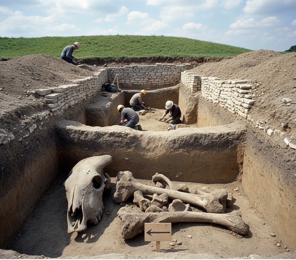
THE ODYSSEY PROBLEM: WHY DID A WEEK-LONG VOYAGE BECOME A TEN-YEAR EPIC?

If Troy was really at Hisarlık, Homer has given us a geographical problem hiding in plain sight

Before We Follow Odysseus: How Old Is the Story We Are Actually Reading?

Before attempting to place Troy, Ithaca or any of the strange lands described in the Odyssey on a modern map, there is a more fundamental question that is rarely given enough attention:

What exactly are the Iliad and Odyssey?
THE ODYSSEY PROBLEM
THE ODYSSEY PROBLEM

Today we encounter them as books. They have numbered books, fixed lines, recognised place-names and an author conventionally called Homer. That creates the natural impression that somebody sat down approximately 2,700 years ago and wrote the stories much as a modern novelist would.

Almost certainly, that is not how they began.

Modern Homeric scholarship broadly accepts that the Iliad and Odyssey emerged from a much older oral performance tradition. For generations before the poems became stable written texts, professional singers told and retold stories about Troy, Achilles, Helen, Odysseus and the other heroes. The tradition operated over a wide geographical area and for hundreds of years; some scholars allow that parts of the underlying poetic tradition may reach back into the Bronze Age, while aspects of the poetic language itself may preserve still older Indo-European inheritances.

That distinction is crucial to this investigation.

We are therefore probably not reading an eyewitness report written shortly after a war.

Nor, however, are we necessarily reading a completely invented story created in the eighth century BCE.

What we have is something much more interesting:

A VERY OLD STORY THAT WAS KEPT ALIVE BY HUMAN MEMORY BEFORE IT BECAME A BOOK.
THE ODYSSEY PROBLEM
THE ODYSSEY PROBLEM

🗣️ HOW COULD A STORY THIS LARGE SURVIVE WITHOUT WRITING?

At first this sounds almost impossible.

The Iliad contains more than 15,000 lines and the Odyssey more than 12,000. How could stories of this scale survive for centuries before being written down?

The answer lies in the way oral poetry worked.

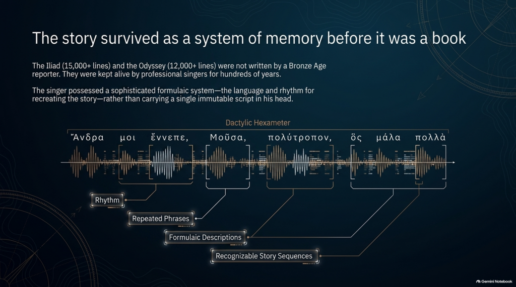
The pioneering studies of Milman Parry and Albert Lord demonstrated that oral epic singers did not normally memorise a gigantic text word-for-word in the way an actor memorises a script.

Instead, they mastered a specialised system of:

rhythm,

repeated phrases,

formulaic descriptions,

stock scenes,

traditional characters,

recognisable story sequences

and

metrical structures.

Thus Achilles can repeatedly be described by a familiar epithet, ships can be introduced through standard phrases, dawn arrives through recognised verbal formulas, and battles, feasts, departures and assemblies follow structures that both singer and audience understand.

The metre itself—dactylic hexameter—acted as part of the memory system.

The singer possessed the story and the language for recreating it, rather than carrying a single immutable script in his head. Parry and Lord’s work on surviving oral traditions showed that a trained singer could reconstruct an enormous epic during performance using this formulaic system.

This produces a very important consequence.

Each performance could preserve the essential story while changing some of its details.

An episode might become longer.

Another could be shortened.

A hero could receive greater prominence.

A description could change.

And details meaningful to one audience could be emphasised more heavily than details important to another.

The story could therefore remain recognisably the same story for centuries without remaining exactly the same text.

THE ODYSSEY PROBLEM
THE ODYSSEY PROBLEM

⏳ HOW FAR BACK COULD THE TROJAN STORY GO?

This is where matters become particularly interesting.

The poems we possess are usually associated in something close to their recognisable monumental form with the late eighth or early seventh century BCE, although exactly when they first became written texts remains heavily debated.

But the traditions from which they were created are considerably older.

Cambridge’s modern guide to Homer describes the poems as products of songs composed and recomposed over many hundreds of years, potentially drawing on traditions extending much deeper into prehistory. Some scholarship has specifically argued that Greek epic traditions may have been developing from the middle or later Bronze Age.

That creates a possible chronological gap of several centuries between:

whatever historical events originally generated the tradition

and

the written geographical names we eventually inherit.

If the conventional Trojan War date of around the late second millennium BCE were approximately correct, then several hundred years may separate an original conflict from the period in which the surviving poems began crystallising into something resembling our texts.

And during those centuries the story was travelling.


🌍 STORIES TRAVEL — AND GEOGRAPHY CAN TRAVEL WITH THEM

This point is central to our investigation.

An oral epic does not survive in a vacuum.

It survives because people want to hear it.

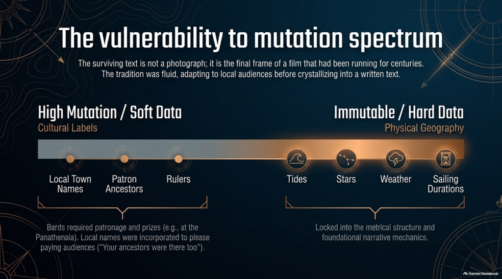
A singer performs before an audience. That audience knows its own towns, rulers, landscapes, ancestors and political rivalries.

Successful oral storytelling therefore contains an unavoidable process of adaptation.

Modern Homeric scholarship explicitly recognises that the flexibility of oral performance allowed heroic tales to be adapted to their immediate contexts. The Homeric language itself demonstrates this history: it is not the ordinary language of one place or date but a remarkable composite containing predominantly Ionic forms together with older Aeolic and Arcado-Cypriot elements and later Attic features.

In other words:

THE LANGUAGE ITSELF HAS A HISTORY OF MOVEMENT AND MODIFICATION.

Why should we automatically assume every geographical label escaped the same process untouched?

Suppose an ancient story originally described a distant king, harbour, island or people whose original name had become meaningless to an audience centuries later.

A performer had several choices.

He could preserve a meaningless archaic name.

He could reinterpret it.

He could associate it with a place his listeners knew.

Or different regional traditions could gradually absorb their own places and heroes into the greater Trojan story.

We cannot prove that this happened to every disputed Homeric town.

But critically:

WE KNOW THE ORAL SYSTEM WAS CAPABLE OF DOING IT.

That alone means geographical names cannot be treated with the same evidential weight as physical descriptions.
THE ODYSSEY PROBLEM
THE ODYSSEY PROBLEM

🏛️ COULD LOCAL TOWNS HAVE BEEN ADDED TO PLEASE LOCAL AUDIENCES?

Yes—it is a genuine possibility, although it must be treated as a hypothesis rather than assumed.

There were even disputes in antiquity and later scholarship concerning possible Athenian additions to Homer. Passages involving Athens and Salamis in the Catalogue of Ships have attracted particularly long-running arguments about interpolation and political influence. Modern scholarship does not simply agree that these lines were inserted, but the fact that such passages remain controversial demonstrates that alteration of local geographical material is not some outrageous modern suggestion.

And there was an obvious incentive.

Imagine performing this great heroic story before an audience in a particular Greek city.

Which version is likely to receive the better reception?

One saying:

“Your people played no part in the greatest war in heroic history.”

Or one announcing:

“Your ancestors were there too.”

The Catalogue of Ships is especially interesting in this respect because it gives an extraordinary roll-call of communities incorporated into the expedition.

That does not prove the Catalogue was fabricated.

But it means we should recognise its social function.

The Trojan story eventually became a shared heroic past through which numerous Greek communities could locate themselves inside history.

That creates exactly the circumstances in which local geographical incorporation becomes plausible.


💰 WAS THERE A COMMERCIAL MOTIVE?

Not initially in the modern sense of an author writing a book and hoping to sell thousands of copies.

For much of the poem’s early existence, the product being consumed was the:

PERFORMANCE.

Bards performed at elite households, feasts and public occasions. Later professional rhapsodes performed Homeric poetry competitively at major festivals such as the Panathenaia, where contests and prizes existed. For most people in Archaic and Classical Greece, Homer would originally have been encountered through performance rather than privately reading a book.

So although we should avoid imagining a Bronze Age publishing company selling copies of the Iliad, there was still an economic reality.

A successful performer needed:

patronage,

invitations,

prestige,

prizes

and above all:

AN AUDIENCE THAT WANTED TO HEAR HIS VERSION.

That provides exactly the same commercial pressure that exists in entertainment today.

Tell people a story that relates to them, and they are more likely to listen.

Eventually the oral tradition increasingly became textual. The poems became books, educational texts and cultural possessions, while regulated festival performances also helped constrain what had previously been a much more fluid tradition. Yet even by the second century BCE, textual variation had not disappeared completely.

So the surviving text is better imagined not as a photograph taken at one moment in history, but as the final surviving frame of a film that had already been running for centuries.


📜 FROM BARD TO “HOMER”

There is another uncomfortable problem.

We do not actually know who Homer was.

Ancient cities competed to claim him as their own, particularly communities in Ionia such as Smyrna and Chios. Even the association of the name “Homer” with the Iliad and Odyssey developed within the later tradition.

Modern scholarship continues to debate whether:

one extraordinary poet monumentalised each epic,

different poets created the Iliad and Odyssey,

the poems were dictated by oral singers,

or their written forms emerged progressively from a much wider performance tradition.

What is considerably less controversial is that the tradition preceding the surviving text was oral.

That fact changes how geographical evidence should be handled.

THE ODYSSEY PROBLEM
THE ODYSSEY PROBLEM

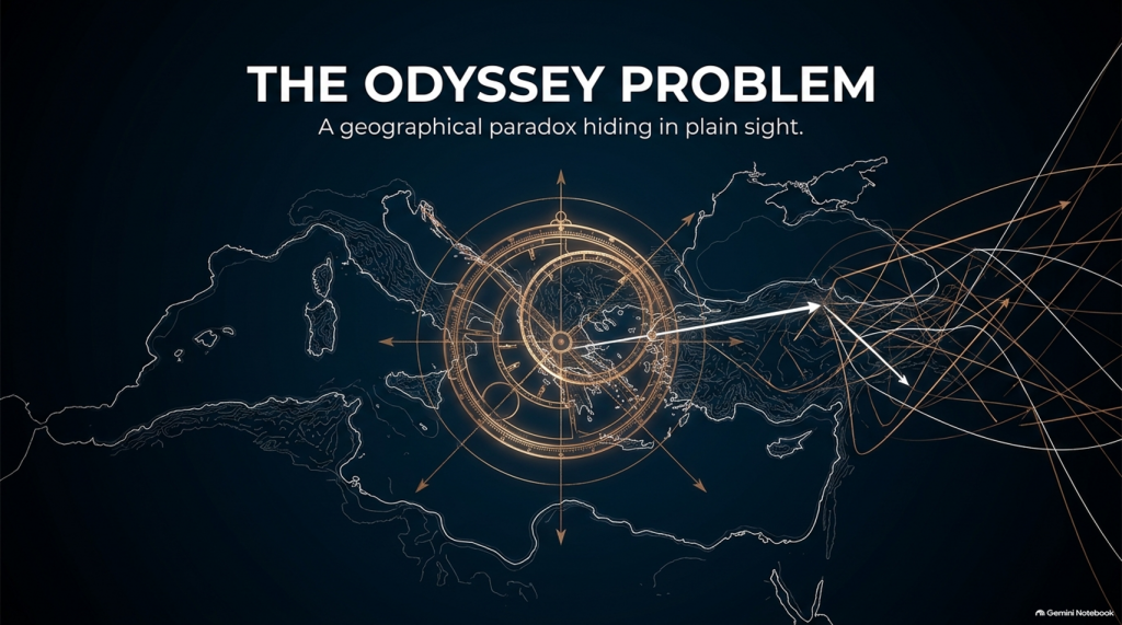
🧭 NAMES ARE NOT THE SAME AS GEOGRAPHY

This is why, throughout this investigation, we will not begin by saying:

“Homer mentions a place later identified as being in Greece, therefore the story happened in Greece.”

That is circular reasoning.

A place-name can be:

preserved,

translated,

reapplied,

updated,

misunderstood

or

incorporated during centuries of oral retelling.

A river behaving in a particular way cannot.

A tide cannot.

A seventeen-day voyage cannot.

The position of a star cannot.

A prevailing wind cannot.

The length of winter darkness cannot.

The ecology of a marsh cannot.

A mountain visible after a stated number of sailing days cannot.

Those are the clues that deserve greater weight.

So our methodology deliberately separates:

🏛️ CULTURAL LABELS

from

🌍 PHYSICAL GEOGRAPHY.

The names remain important.

But they do not get to prove themselves.

THE ODYSSEY PROBLEM
THE ODYSSEY PROBLEM

🔍 THE STORY MAY BE OLDER THAN ITS MAP

And this leads directly to the central problem of the Odyssey.

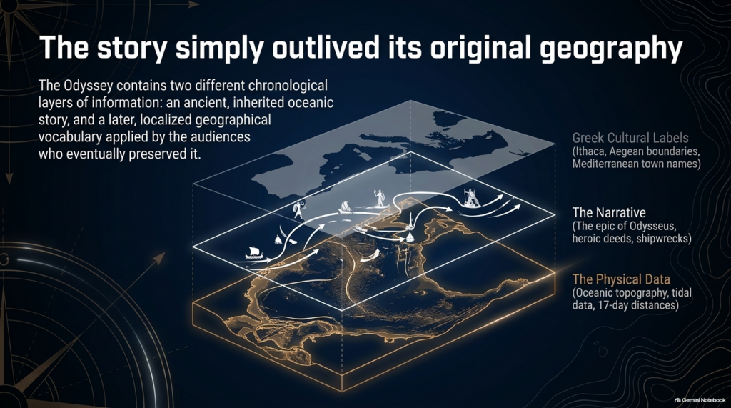
It is entirely possible that the written poem contains two different chronological layers of information:

an ancient inherited story,

and

a later geographical vocabulary familiar to the audiences who eventually preserved and recorded it.

If so, conflicts between Homer’s names and Homer’s physical descriptions become extremely important.

Which should we trust?

The town name that could have travelled through centuries of human storytelling?

Or the description of:

🌊 the sea,

🌫️ the climate,

⭐ the stars,

🧭 the sailing direction,

⏳ the voyage duration,

🌲 the vegetation,

🏔️ the landscape

and

👥 the people?

Our investigation gives priority to the latter.

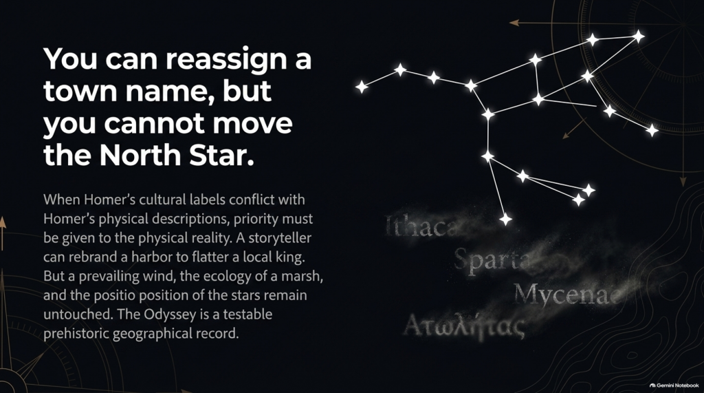
Because oral tradition can move a name.

IT CANNOT MOVE THE NORTH STAR.
THE ODYSSEY PROBLEM
THE ODYSSEY PROBLEM

And once that distinction is understood, the Odyssey stops being merely one of the world’s greatest stories.

It becomes something else:

🧭 A POTENTIALLY TESTABLE PREHISTORIC GEOGRAPHICAL RECORD.

That is where our investigation begins.

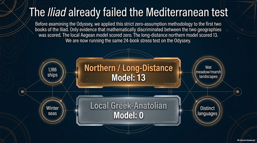
Our examination of the first two books of Homer’s Iliad has already produced an unexpected result.

After removing traditional place-name assumptions and scoring only evidence that actually discriminates between the competing geographical models, the result currently stands at:

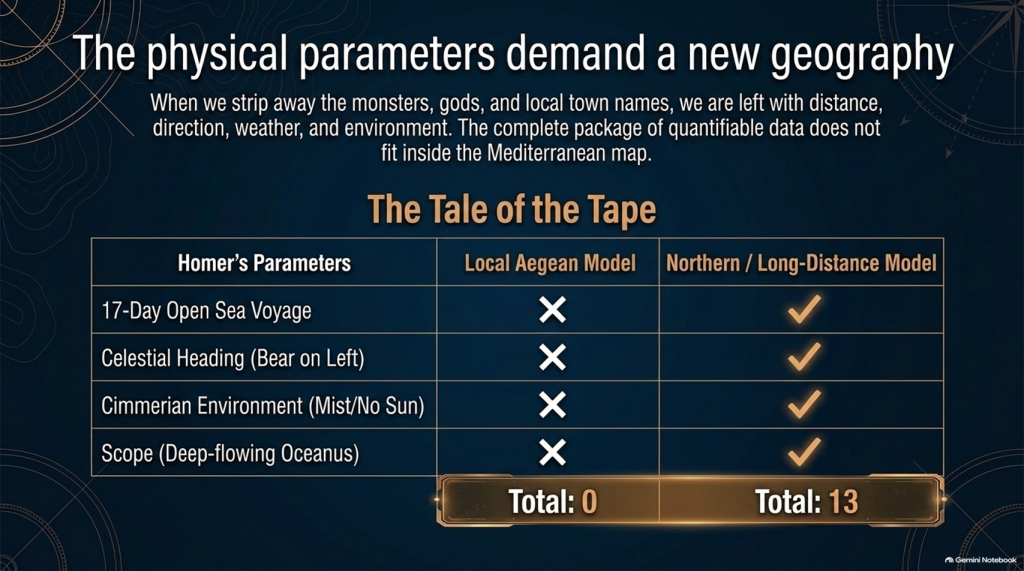
🌊 NORTHERN / LONG-DISTANCE MODEL: 13

☀️ LOCAL GREEK–ANATOLIAN MODEL: 0

But we may have overlooked an even more powerful test.

Because Homer didn’t only leave us the story of the war.

He also left us:

🧭 THE JOURNEY HOME.

And that creates a very awkward question for the traditional identification of Troy.


🚢 THE JOURNEY SHOULD BE SIMPLE

The conventional interpretation tells us:

🏛️ Troy = Hisarlık in north-western Turkey

and

🏠 Odysseus’ home = Ithaca in western Greece.

So when Troy falls, Odysseus has a straightforward objective:

TROY ➡️ ITHACA

Nothing mysterious about that.

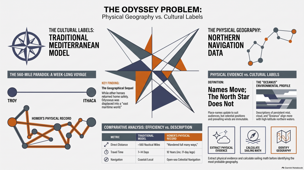
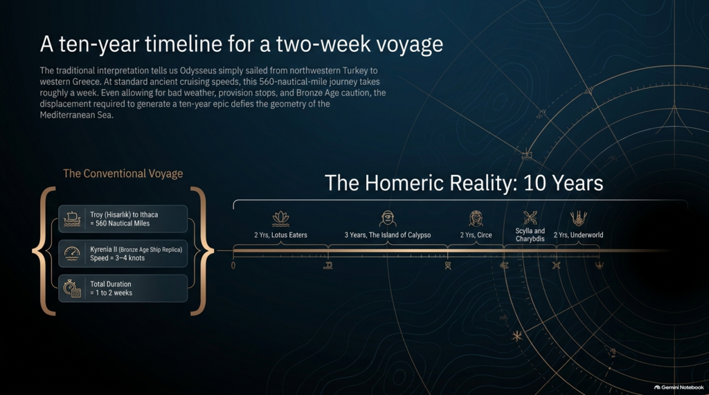
The conventional sea distance is approximately:

🌊 560 NAUTICAL MILES

roughly 645 statute miles

Now compare that with experimental ancient Mediterranean sailing.

The reconstructed fourth-century BC merchant vessel Kyrenia II demonstrated cruising speeds around 3–4 knots, sometimes considerably faster. On its experimental voyage from Piraeus to Cyprus it covered almost 600 nautical miles despite stops, tests and variable conditions.

At that sort of speed, a direct 560-mile voyage is not a journey measured in years.

It is measured in:

📅 DAYS.

Allow for poor winds, overnight stops, provisioning and Bronze Age caution and perhaps we are looking at roughly:

ONE TO TWO WEEKS

under reasonably favourable circumstances.

And yet Homer gives us:

⏳ TEN YEARS.

Immediately people will say:

“But Odysseus didn’t spend ten years sailing!”

Correct.

And that distinction actually makes the geographical problem more interesting.

THE ODYSSEY PROBLEM
THE ODYSSEY PROBLEM

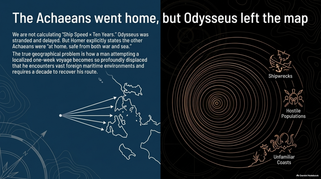
⏳ THE TEN YEARS WERE NOT TEN YEARS OF CONTINUOUS SAILING

Odysseus gets delayed.

He is shipwrecked.

He loses companions.

He encounters hostile populations.

He becomes stranded.

He spends years unable to get home.

So it would be scientifically wrong to calculate:

ship speed × ten years = distance from Troy.

We aren’t doing that.

The real question is much more basic:

How does a man attempting a voyage whose conventional start and finish are only about a week’s sailing apart become so geographically displaced that returning home consumes ten years?

That is the problem.


📖 HOMER TELLS US FROM THE FIRST LINES THAT THIS IS A GEOGRAPHICAL JOURNEY

The Odyssey opens by describing Odysseus as the man who:

“wandered full many ways”

after he had destroyed Troy.

Homer says:

“Many were the men whose cities he saw”

and tells us that he suffered repeatedly:

“upon the sea.”

This isn’t simply a story about somebody stuck around the corner.

It is explicitly a story about:

🌍 travelling through different lands

👥 encountering different peoples

🌊 crossing seas

🌪️ experiencing extreme maritime conditions

and

🧭 struggling to recover the route home.

THE ODYSSEY PROBLEM
THE ODYSSEY PROBLEM

🚨 EVEN MORE IMPORTANTLY — EVERYONE ELSE HAS ALREADY GONE HOME

Book 1 gives us another striking statement.

Homer says that the other surviving Achaeans were:

“at home, safe from both war and sea.”

Odysseus alone remained unable to complete his return.

This is extremely important.

The war is finished.

The surviving coalition disperses.

The men undertake their return journeys from Troy.

That means the Odyssey isn’t some unrelated maritime fantasy.

It is the geographical sequel to the Trojan War.

We therefore have another independent dataset with which to test the location of Troy.


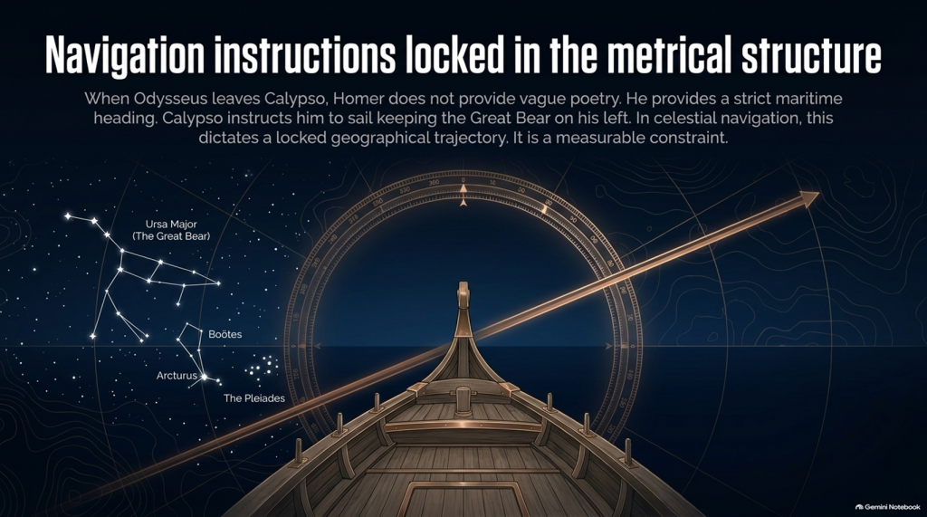
🧭 AND HOMER ACTUALLY GIVES US NAVIGATION INSTRUCTIONS

This is where things become particularly interesting.

When Odysseus finally leaves Calypso, Homer doesn’t simply say:

“He sailed away.”

He tells us how he navigated.

Odysseus watches:

⭐ the Pleiades

⭐ Boötes

⭐ Orion

⭐ the Great Bear.

And Calypso instructs him to keep the Bear:

ON HIS LEFT

while sailing.

That is potentially geographical evidence.

Because now we have:

⭐ CELESTIAL NAVIGATION

🧭 DIRECTION

🌊 OPEN-SEA TRAVEL

⏳ AND SAILING DURATION.

That can potentially be tested mathematically.

THE ODYSSEY PROBLEM
THE ODYSSEY PROBLEM

🚢 THEN HOMER GIVES US THE NUMBER: SEVENTEEN DAYS

Odysseus sails continuously enough for Homer to state:

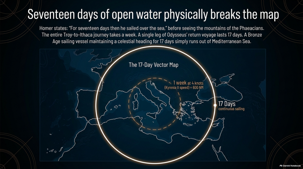
“For seventeen days then he sailed over the sea”

and on the eighteenth he finally sees the mountains of the Phaeacians.

Stop there.

The entire conventional Troy-to-Ithaca journey could potentially be completed in something around a week or somewhat longer under reasonable sailing conditions.

Yet one single later leg of Odysseus’ wandering lasts:

🌊 17 DAYS AT SEA

before land appears.

That doesn’t automatically prove the Atlantic.

But scientifically it demands investigation.

Where had he travelled?

How far away from Ithaca had he become?

What heading does keeping the Great Bear on the left imply?

What distance can a Bronze Age sailing vessel cover in seventeen days?

And does the conventional Mediterranean reconstruction actually satisfy those constraints?

These are measurable questions.


🌫️ THEN WE REACH THE CIMMERIANS

And the environment becomes even stranger.

Odysseus reaches the land of the Cimmerians.

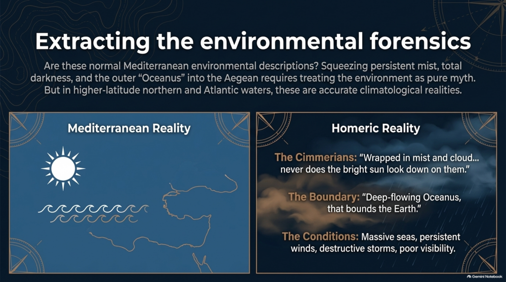
Homer describes it as:

“wrapped in mist and cloud.”

Then he says:

“Never does the bright sun look down on them”

and describes oppressive darkness hanging over the inhabitants.

Again, we must be careful.

This could be mythological geography.

It could represent Homer’s conception of the edge of the world.

We cannot simply announce:

Cimmerians = Britain.

But scientifically we are entitled to ask:

🌞 Is this a normal Mediterranean environmental description?

Or is:

🌫️ persistent mist

☁️ cloud

🌑 darkness

and

🌊 the remote Ocean

more naturally compatible with the traditions of higher-latitude northern waters?

That becomes another test.


🌊 HOMER EVEN TAKES US TO “OCEANUS”

Immediately before reaching the Cimmerians, Homer says Odysseus’ vessel reaches:

“deep-flowing Oceanus, that bounds the Earth.”

This is extremely significant conceptually.

The poem’s geography has now expanded far beyond an ordinary little voyage between Turkey and western Greece.

We are being taken to what Homer’s tradition regards as the outer ocean.

Whether Oceanus represents a literal Atlantic geography, mythical world-ocean, or a mixture of inherited geographical memory and mythology is precisely what needs testing.

But simply squeezing every episode into the Mediterranean because we have already decided Troy belongs there is not evidence.

It is circular reasoning.

THE ODYSSEY PROBLEM
THE ODYSSEY PROBLEM

🌪️ THE WEATHER NEEDS TESTING TOO

Throughout the Odyssey, maritime conditions aren’t background decoration.

They drive the story.

Odysseus encounters:

🌊 enormous seas

🌬️ persistent winds

⛈️ destructive storms

🌫️ mist and poor visibility

🏝️ unfamiliar coasts

and repeated difficulty determining his position.

Mediterranean storms can unquestionably be severe.

So:

storm = Atlantic

is not acceptable science.

But just as with our Iliad investigation, the correct question is:

Which maritime environment produces the complete collection of conditions more naturally and more frequently?

The Mediterranean?

Or the Atlantic/North Sea world?


🗺️ THE PEOPLE ARE JUST AS IMPORTANT AS THE WEATHER

The journey takes Odysseus through populations whose cultures and lifestyles differ radically.

We meet:

👥 Cimmerians

👥 Phaeacians

👥 Cyclopes

👥 Laestrygonians

and numerous other populations and communities.

Some may be mythical.

Some may preserve distorted memories of real peoples.

Some may combine both.

But we should not begin by assigning them to Mediterranean locations simply because later scholars did so.

Instead we should record:

🏠 housing

⛵ boat technology

🌾 agriculture

🐄 animals

🍖 diet

👕 clothing

🗣️ language

🌲 vegetation

🌦️ climate

🏔️ geography

and then ask:

WHERE DOES THAT COMPLETE PACKAGE FIT BEST?
THE ODYSSEY PROBLEM
THE ODYSSEY PROBLEM

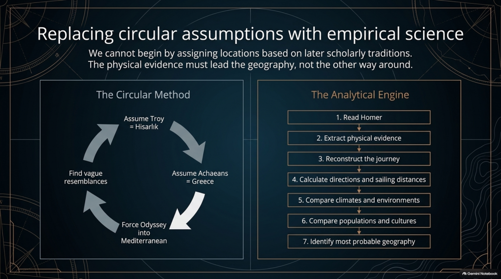
⚠️ THIS IS THE SAME MISTAKE WE FOUND WITH THE ILIAD

Traditional scholarship frequently begins with:

Troy = Hisarlık

therefore:

Achaeans = Greece

therefore:

the war must be Mediterranean

therefore:

the Odyssey must largely be Mediterranean

and then attempts to find Mediterranean locations resembling Homer’s descriptions.

That reverses the scientific process.

The correct sequence should be:

1️⃣ Read Homer.

2️⃣ Extract the physical evidence.

3️⃣ Reconstruct the journey.

4️⃣ Calculate directions and sailing distances.

5️⃣ Compare climates and environments.

6️⃣ Compare populations and cultures.

7️⃣ THEN identify the most probable geography.

Not the other way around.


🔬 AND THIS TIME WE CAN ACTUALLY DO THE MATHEMATICS

The Iliad gave us powerful clues such as:

🌍 “far from home”

🌊 mountains and sea separating populations

🚢 1,186 ships

🗣️ different languages

🌍 allies “from afar”

👱 repeated xanthos individuals

🌧️ winter seas

🌿 wet meadow and marsh landscapes.

But the Odyssey potentially gives us something even stronger.

It gives us:

⏱️ TIME

🧭 DIRECTION

⭐ NAVIGATION

🌊 DISTANCE

🌬️ WEATHER

🌍 ENVIRONMENT.

Those are quantifiable.


🚨 THE CENTRAL PROBLEM

Strip away all the monsters and gods for a moment.

The basic story says:

Odysseus leaves Troy.

He intends to sail home.

Home is Ithaca.

Other Achaeans successfully make their own returns.

Odysseus becomes displaced through a vast maritime world.

He encounters numerous foreign peoples and environments.

He reaches extraordinarily remote locations.

One later sailing leg alone lasts seventeen days.

His complete return takes ten years.

And the conventional interpretation asks us to place the beginning and end of that extraordinary adventure only about:

560 NAUTICAL MILES APART.

That doesn’t prove the traditional map is wrong.

But scientifically:

IT IS A PROBLEM THAT DEMANDS AN EXPLANATION.
THE ODYSSEY PROBLEM
THE ODYSSEY PROBLEM

🧪 SO WE ARE GOING TO TEST THE ODYSSEY TOO

After our detailed examination of the 24 books of the Iliad, we will now have a second investigation:

📚 ALL 24 BOOKS OF THE ODYSSEY

And we will use exactly the same rules.

No points for traditional names.

No location accepted because “experts agree”.

No northern point merely because something also happens in Britain.

No Mediterranean point merely because something can happen in Greece.

If both environments fit:

0–0

If one environment is substantially more probable:

it scores.

And where Homer gives us distances, directions and sailing durations:

WE DO THE MATHS.


🔥 THIS MAY BECOME THE BIGGER PROBLEM

After two books of the Iliad our score currently stands at:

🌊 NORTH / LONG-DISTANCE: 13

☀️ LOCAL AEGEAN: 0

Twenty-two Iliad books remain.

But after that we now have another twenty-four books containing the actual journey home.

That means this investigation is no longer simply:

“Where was Troy?”
THE ODYSSEY PROBLEM
THE ODYSSEY PROBLEM

The bigger question has become:

🧭 DOES HOMER’S ENTIRE GEOGRAPHICAL WORLD FIT INSIDE THE MAP WE HAVE BEEN GIVEN?

Because if Troy really was Hisarlık and Ithaca really was Odysseus’ destination, then a journey whose conventional endpoints are roughly a week or two of ordinary ancient sailing apart somehow generated one of the greatest tales of geographical wandering ever written.

Perhaps mythology explains everything.

Perhaps the Mediterranean really does reproduce Homer’s journey.

Perhaps the traditional geography eventually wins.

But those are hypotheses.

They now need testing.

And if the sailing directions, durations, climates, peoples and landscapes repeatedly point outside the Mediterranean, then the traditional identification of this as an obviously local Greek–Anatolian conflict becomes increasingly difficult to defend scientifically.

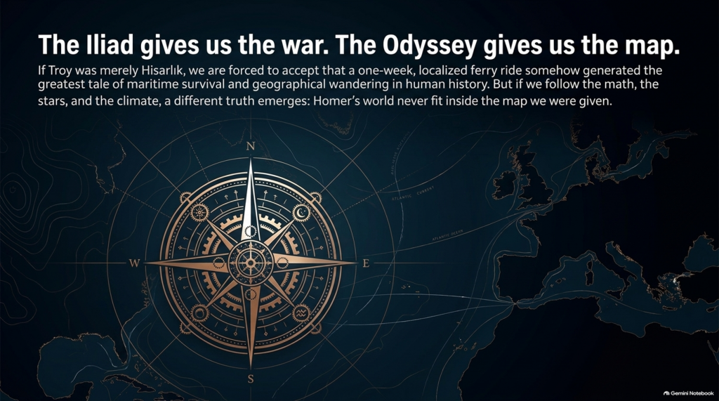
🌊 THE ILIAD GIVES US THE WAR.

🧭 THE ODYSSEY MAY GIVE US THE MAP.

And that may prove to be the most important test of them all. 🔍🌍⚔️
THE ODYSSEY PROBLEM
THE ODYSSEY PROBLEM

PODCAST

Author’s Biography

Robert John Langdon, a polymathic luminary, emerges as a writer, historian, and eminent specialist in LiDAR Landscape Archaeology.

His intellectual voyage has been interwoven with stints as an astute scrutineer in government and grand corporate bastions, a tapestry spanning British Telecommunications, Cable and Wireless, British Gas, and the esteemed University of London.

A decade hence, Robert’s transition into retirement unfurled a chapter of insatiable curiosity. This phase saw him immerse himself in Politics, Archaeology, Philosophy, and the enigmatic realm of Quantum Mechanics. His academic odyssey traversed the venerable corridors of knowledge hubs such as the Museum of London, University College London, Birkbeck College, The City Literature Institute, and Chichester University.

In the symphony of his life, Robert is a custodian of three progeny and a pair of cherished grandchildren. His sanctuary lies ensconced in the embrace of West Wales, where he inhabits an isolated cottage, its windows framing a vista of the boundless sea – a retreat from the scrutinising gaze of Her Majesty’s Revenue and Customs, an amiable clandestinity in the lap of nature.

Exploring Prehistoric Britain: A Journey Through Time

My blog delves into the fascinating mysteries of prehistoric Britain, challenging conventional narratives and offering fresh perspectives grounded in cutting-edge research, particularly LiDAR technology. I invite you to explore some key areas of my research. For example, the Wansdyke, often cited as a defensive structure, is re-examined in light of new evidence. I’ve presented my findings in my blog post Wansdyke: A British Frontier Wall – ‘Debunked’, and a Wansdyke LiDAR Flyover video further visualises my conclusions.

My work also often challenges established archaeological dogma. I argue that many sites, such as Hambledon Hill, commonly identified as Iron Age hillforts, are not what they seem. My posts Lidar Investigation Hambledon Hill – NOT an ‘Iron Age Fort’ and Unmasking the “Iron Age Hillfort” Myth explore these ideas in detail and offer an alternative view. Similarly, sites like Cissbury Ring and White Sheet Camp receive re-evaluations based on LiDAR analysis in my posts “Lidar Investigation Cissbury Ring through time” and “Lidar Investigation White Sheet Camp,“ revealing fascinating insights into their true purpose. I have also examined South Cadbury Castle, often linked to the mythical Camelot56.

My research also extends to ancient water management, including the role of canals and other linear earthworks. I have discussed the true origins of Car Dyke in multiple posts, including Car Dyke – ABC News Podcast and Lidar Investigation Car Dyke – North Section, which suggest a Mesolithic origin 2357. I also explore the misidentification of Roman aqueducts, as seen in my posts on the Great Chesters (Roman) Aqueduct. My research has also been greatly informed by my post-glacial flooding hypothesis, which has helped explain landscape transformations over time. I have discussed this hypothesis in several posts, including AI now supports my Post-Glacial Flooding Hypothesis and Exploring Britain’s Flooded Past: A Personal Journey

Finally, my blog also investigates prehistoric burial practices, as seen in Prehistoric Burial Practices of Britain and explores the mystery of Pillow Mounds, often mistaken for medieval rabbit warrens, but with a potential link to Bronze Age cremation in my posts: Pillow Mounds: A Bronze Age Legacy of Cremation? and The Mystery of Pillow Mounds: Are They Really Medieval Rabbit Warrens?. My research also includes astronomical insights into ancient sites, for example, in Rediscovering the Winter Solstice: The Original Winter Festival. I also review new information about the construction of Stonehenge in The Stonehenge Enigma.

Further Reading

For those interested in British Prehistory, visit www.prehistoric-britain.co.uk, a comprehensive resource featuring an extensive collection of archaeology articles, modern LiDAR investigations, and groundbreaking research. The site also includes insights and excerpts from the acclaimed Robert John Langdon Trilogy, a series of books that explore Britain during the Prehistoric period. Titles in the trilogy include The Stonehenge Enigma, Dawn of the Lost Civilisation, and The Post-Glacial Flooding Hypothesis, which offer compelling evidence of ancient landscapes shaped by post-glacial flooding.

To further explore these topics, Robert John Langdon has developed a dedicated YouTube channel featuring over 100 video documentaries and investigations that complement the trilogy. Notable discoveries and studies showcased on the channel include 13 Things that Don’t Make Sense in History and the revelation of Silbury Avenue – The Lost Stone Avenue, a rediscovered prehistoric feature at Avebury, Wiltshire.

In addition to his main works, Langdon has released a series of shorter, accessible publications, ideal for readers delving into specific topics. These include:

For active discussions and updates on the trilogy’s findings and recent LiDAR investigations, join our vibrant community on Facebook. Engage with like-minded enthusiasts by leaving a message or contributing to debates in our Facebook Group.

Whether through the books, the website, or interactive videos, we aim to provide a deeper understanding of Britain’s fascinating prehistoric past. We encourage you to explore these resources and uncover the mysteries of ancient landscapes through the lens of modern archaeology.

For more information, including chapter extracts and related publications, visit the Robert John Langdon Author Page. Dive into works such as The Stonehenge Enigma or Dawn of the Lost Civilisation, and explore cutting-edge theories that challenge traditional historical narratives.

Other Blogs

[sitemap_posts]
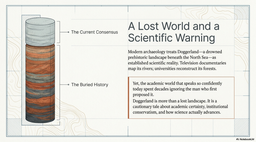
Clement Reid, Doggerland, and the Archaeological Establishment

How a “Lost World” Beneath the North Sea Went from Marginal Theory to Accepted Fact

Introduction

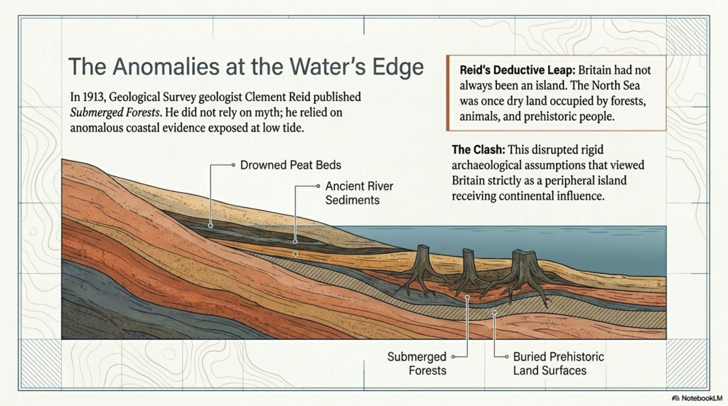
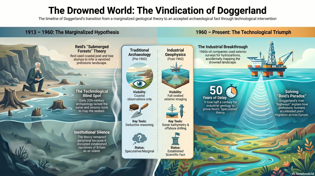
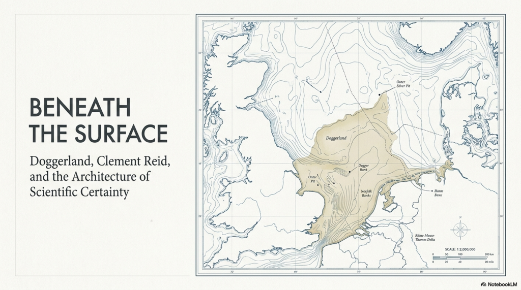
In 1913, the British geologist Clement Reid published a remarkable book titled Submerged Forests. Within its pages, Reid proposed something extraordinary for the time: that Britain had once been connected to continental Europe by a vast prehistoric landscape now submerged beneath the North Sea. (Clement Reid, Doggerland, and the Archaeological Establishment)

Today, we call this drowned world Doggerland.

Modern archaeology now treats Doggerland as an established scientific reality. Universities reconstruct its rivers and forests in digital models. Television documentaries present it as one of the most important prehistoric landscapes ever discovered. Entire academic projects are devoted to mapping its vanished terrain.

Yet what is rarely discussed is that when Reid first proposed the idea, it sat largely outside accepted archaeological thinking. His conclusions were not embraced as visionary science. They were treated as speculative and peripheral because the evidence challenged the prevailing understanding of Britain’s prehistoric past.

The irony is remarkable.

(Clement Reid, Doggerland, and the Archaeological Establishment)

The same academic world that now speaks confidently about Doggerland only fully accepted its existence after industrial oil exploration in the 1960s and 1970s accidentally proved Reid correct through seabed mapping, seismic surveys, and offshore drilling.

Doggerland, therefore, represents far more than a lost landscape.

It represents a cautionary tale about academic certainty itself.

Without it, critics can say:

“Well, Reid was just speculating without evidence.”

But once you include the nineteenth-century finds, the situation changes dramatically.

Because then the historical sequence becomes:

  1. Physical evidence was already being recovered from the North Sea.
  2. Scientists already knew submerged land surfaces existed.
  3. Reid synthesised this evidence into a coherent landscape model.
  4. The implications were still not fully operationalised archaeologically.
  5. Later marine geophysics confirmed the larger landscape physically.

That is a much stronger progression in history and science.

And critically, it reinforces your silence argument:

  • The evidence was not absent;
  • The implications simply were not fully pursued.

This section should probably go immediately before “The Britain Clement Reid Saw.”


The Evidence Existed Before Doggerland Had a Name

Long before the term “Doggerland” was ever coined, physical evidence was already emerging from the floor of the North Sea.

Throughout the nineteenth century, North Sea fishermen regularly recovered:

  • mammoth bones
  • antlers
  • peat deposits
  • submerged tree remains
  • and even worked flints

while trawling offshore waters.

These discoveries were not isolated curiosities. They demonstrated something fundamentally important:

Large areas beneath the North Sea had once been dry land.

(Clement Reid, Doggerland, and the Archaeological Establishment)

Peat could not form underwater. Trees could not grow on the seabed. Large terrestrial mammals could not inhabit a marine environment. The evidence, therefore, pointed directly toward a drowned prehistoric landscape connecting Britain to continental Europe.

This material heavily influenced early geologists and palaeoenvironmental researchers, including Clement Reid.

By the time Reid published Submerged Forests in 1913, the basic physical evidence for former land surfaces beneath the North Sea already existed. The real issue was not whether the land had once been exposed, but whether the scientific world was prepared to grasp the full implications of what that meant for prehistory, migration, and the ancient geography of Britain.

That distinction is crucial.

Doggerland was not suddenly invented by modern archaeology.

The evidence had been sitting in fishing nets for decades.


The Britain Clement Reid Saw

Reid was not a fantasist or fringe writer. He was a respected geologist with the Geological Survey who specialised in ancient landscapes, fossil plants, and environmental reconstruction.

While studying Britain’s coastlines, he repeatedly encountered strange evidence:

  • submerged forests exposed at low tide
  • drowned peat beds
  • ancient river sediments beneath the sea
  • tree stumps emerging from beaches
  • buried prehistoric land surfaces offshore

To Reid, the implications were obvious.

Britain had not always been an island.

Large parts of what is now the North Sea must once have been dry land occupied by forests, animals, and prehistoric people.

At the time, however, archaeology still operated within relatively rigid geographical assumptions. Britain was largely viewed as a peripheral island receiving cultural influence from continental Europe, rather than as part of a major prehistoric continental landscape in its own right.

Reid’s conclusions disrupted that simplicity.

(Clement Reid, Doggerland, and the Archaeological Establishment)

The Problem: Nobody Could See the North Sea Floor

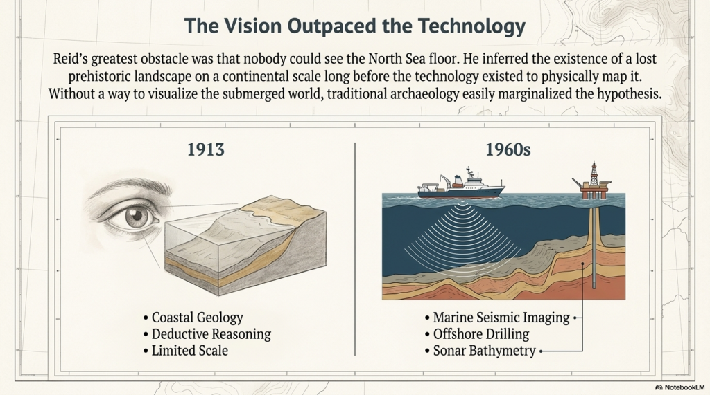
The greatest obstacle Reid faced was technological.

In 1913, there was no practical way to visualise the submerged landscape beneath the North Sea on a continental scale.

There was:

  • no marine seismic imaging
  • no industrial offshore drilling
  • no sonar bathymetry
  • no digital seabed modelling
  • no large-scale geophysical mapping

Reid’s argument, therefore, relied primarily upon coastal geology, submerged forests, peat deposits, and deductive reasoning.

To many archaeologists, this made the hypothesis easy to marginalise.

This is important because modern archaeology often presents Doggerland as though it emerged naturally from gradual academic progress. In reality, the idea remained on the fringes largely because the physical landscape itself could not yet be properly mapped.


(Clement Reid, Doggerland, and the Archaeological Establishment)

Then Came the Oil Industry

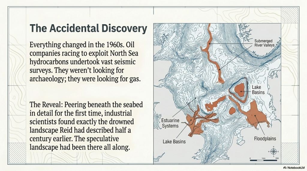
Everything changed in the 1960s with the race to exploit North Sea oil and gas reserves.

Oil companies were not searching for archaeology.

They were searching for hydrocarbons.

To locate them, they began undertaking vast geological and seismic surveys across the North Sea basin. For the first time in human history, scientists could effectively peer beneath the seabed in detail.

And what did they find?

Exactly the kind of drowned landscape Reid had described half a century earlier.

The surveys revealed:

  • submerged river valleys
  • ancient coastlines
  • lake basins
  • estuarine systems
  • floodplains
  • peat deposits
  • glacial and post-glacial landscapes

Modern seismic data have conclusively demonstrated that a vast habitable lowland once connected Britain to continental Europe.

The “speculative” landscape had been there all along.

Why Doggerland Still Wasn’t Fully Understood in the 1980s and 1990s

Even after North Sea oil exploration began revealing enormous submerged landscapes beneath the seabed, Doggerland still did not immediately transform archaeology.

This raises an important question:

If the seismic evidence existed by the 1970s and 1980s, why did it take until the early twenty-first century for Doggerland to become a mainstream archaeological reality?

The answer lies in a combination of corporate secrecy, technological limitation, and disciplinary separation.


(Clement Reid, Doggerland, and the Archaeological Establishment)

1. The Data Was Effectively Locked Away

The seismic surveys were conducted by private oil and gas companies.

These corporations spent enormous sums collecting offshore geophysical data and treated it as commercially valuable intellectual property. Academic archaeologists generally had little or no access to the datasets.

More importantly, the oil industry had no interest in prehistoric landscapes.

Their objective was to find hydrocarbons buried kilometres beneath the seabed. The shallow upper layers, containing ancient river valleys, peat beds, and drowned terrain, were largely treated as geological overburden — background material that had to be filtered out to reach the economically important strata below.

As a result, some of the clearest evidence for Doggerland physically existed for decades before archaeology could meaningfully examine it.


2. The Computers Were Not Yet Powerful Enough

Modern reconstructions of Doggerland depend upon enormous quantities of three-dimensional seismic and bathymetric data stitched together across thousands of square kilometres.

In the 1980s and early 1990s, this was technologically extremely difficult.

Universities generally lacked:

  • the computing power,
  • data storage,
  • rendering capability,
  • and processing speed

required to integrate these vast offshore datasets into coherent prehistoric landscape models.

Only in the late 1990s and early 2000s did computing technology finally become capable of handling the scale of data required to reconstruct the drowned North Sea plain properly.


3. Geologists and Archaeologists Were Working in Isolation

Perhaps most importantly, the relevant disciplines were not communicating effectively.

Oil geologists viewed the shallow seabed primarily as a barrier obscuring deeper oil-bearing strata.

Archaeologists, meanwhile, understood that prehistoric populations had once occupied areas now submerged beneath the North Sea, but lacked the marine geophysical tools necessary to visualise the landscape itself.

The two fields largely operated independently of one another.

Only in the early 2000s did serious interdisciplinary collaboration begin, combining:

  • offshore seismic data,
  • marine geology,
  • palaeoenvironmental reconstruction,
  • and archaeology

into a unified model of the drowned prehistoric landscape.

By then, Clement Reid had been dead for almost a century.


(Clement Reid, Doggerland, and the Archaeological Establishment)

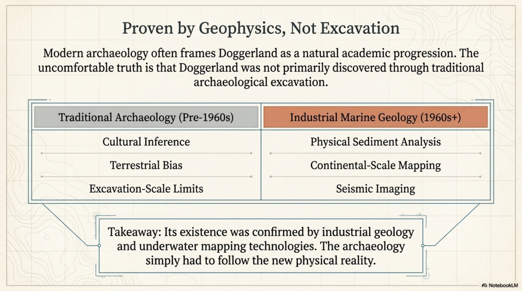
Doggerland Was Proven by Geology — Not Traditional Archaeology

This is the crucial point often overlooked.

Doggerland was not primarily discovered through excavation in the traditional archaeological sense.

Its existence was confirmed by:

  • marine geophysics
  • industrial seismic imaging
  • offshore geological surveys
  • sediment analysis
  • underwater mapping technologies

The archaeology followed afterwards.

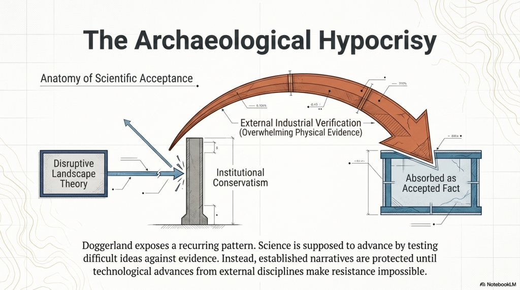
This matters because it reveals an uncomfortable pattern that repeats throughout the history of archaeology:

  1. A disruptive landscape theory is proposed.
  2. It struggles against established narratives.
  3. Independent sciences later produce overwhelming physical evidence.
  4. Archaeology absorbs the new reality as an accepted fact.

Doggerland is therefore not merely a triumph of archaeology.

It is equally a triumph of geology, marine science, and technological surveying.

(Clement Reid, Doggerland, and the Archaeological Establishment)

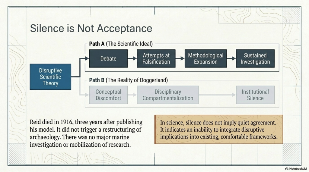
Silence Is Not the Same as Acceptance

One of the most revealing aspects of Clement Reid’s work is not open hostility, but relative silence.

Modern archaeology often gives the impression that Reid’s submerged landscape ideas were gradually and quietly accepted by the scientific world. But in science, silence does not necessarily imply agreement or acceptance.

Quite often, it indicates something very different:

  • conceptual discomfort
  • technological limitation
  • disciplinary compartmentalisation
  • or an inability to integrate disruptive implications into existing frameworks.

If a scientific theory genuinely transforms a discipline, it normally generates:

  • debate
  • criticism
  • attempts at falsification
  • methodological expansion
  • and sustained investigation.

Had Albert Einstein published relativity only for physics to largely ignore it for decades, nobody would argue that relativity had therefore been “quietly accepted.” The opposite conclusion would be drawn — that the scientific world had not yet fully absorbed the implications of the theory.

The same pattern appears in the history of Doggerland.

Reid published Submerged Forests in 1913, the same year he retired from the Geological Survey after a distinguished scientific career. He died only three years later in 1916. During that short remaining period, his drowned landscape model did not trigger a major transformation in archaeology or prehistoric reconstruction.

There was:

  • no large-scale marine investigation programme
  • no major archaeological restructuring around submerged landscapes
  • no widespread mobilisation of prehistoric research into the North Sea basin

Instead, the idea remained scientifically peripheral for decades.

This is important because it suggests that the scientific world of the early twentieth century was not fully equipped — technologically or conceptually — to grasp the scale of what Reid was implying.

He had inferred the existence of a lost prehistoric landscape beneath the North Sea long before the technology existed to visualise it properly.

Only later did:

  • marine geophysics
  • seismic profiling
  • sonar mapping
  • offshore drilling
  • and North Sea oil exploration

Finally, transform Reid’s geological inference into a physically visible drowned world.

In this sense, the muted reception of Reid’s work may itself be evidence of how disruptive and difficult its implications truly were for the scientific establishment of the time to fully comprehend.


(Clement Reid, Doggerland, and the Archaeological Establishment)

The Archaeological Hypocrisy

Today, archaeologists speak with complete confidence about Doggerland.

It appears in textbooks, museums, documentaries, and university lectures as settled science.

Yet very few openly acknowledge that:

  • the original theory existed outside mainstream archaeological thinking
  • the idea was treated cautiously for decades
  • and it was only overwhelming physical evidence from external sciences that forced universal acceptance

This is not how science is supposed to operate.

Science advances by testing difficult ideas against evidence — not by protecting established narratives until technological advances make resistance impossible.

Doggerland demonstrates how institutional conservatism can delay acceptance even when the underlying reasoning is sound.


(Clement Reid, Doggerland, and the Archaeological Establishment)

The Same Pattern Appears Elsewhere

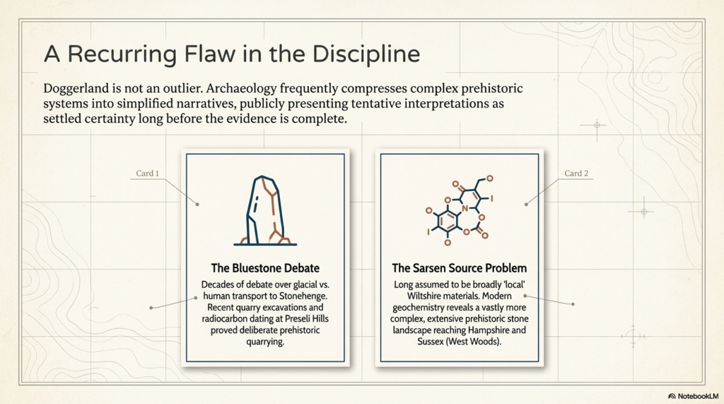
Doggerland is not an isolated example.

The same tendency toward premature certainty recurs throughout archaeology.


1. The Bluestone Debate

For decades, debate surrounded how the Stonehenge bluestones reached Salisbury Plain.

While their Welsh origin was widely accepted, archaeologists remained divided over whether the stones were deliberately transported by humans or partially carried by glacial processes.

Over time, quarry excavations in the Preseli Hills, associated hearths, and radiocarbon evidence increasingly strengthened the case for deliberate prehistoric quarrying and transport.

The important issue is not that archaeology asks questions — that is, healthy science.

The issue is how tentative interpretations are often presented publicly as settled certainty long before the evidence is complete.


2. The Sarsen Source Problem

For many years, Stonehenge narratives simplified the sarsens as broadly “local” materials derived from nearby Wiltshire landscapes.

More recent geochemical work has considerably complicated that picture.

While West Woods appears to have been a major source of many of the principal stones, the wider sarsen distribution across southern Britain indicates a far more extensive prehistoric stone landscape extending into Hampshire and Sussex.

The significance is not simply geological.

It demonstrates again how archaeology frequently compresses complex prehistoric systems into simplified narratives that later evidence must revise.

Doggerland followed exactly the same trajectory.

(Clement Reid, Doggerland, and the Archaeological Establishment)

3. The Prehistoric Dyke Problem

For generations, large linear earthworks such as:

  • Offa’s Dyke
  • Wansdyke
  • Car Dyke
  • and the Vallum

have been interpreted primarily as defensive or territorial boundaries.

Yet many of these structures display characteristics difficult to reconcile with simple military explanations:

  • inconsistent defensive logic
  • discontinuous alignments
  • relationships with wetlands and floodplains
  • hydraulic behaviour
  • and associations with water-retaining landscapes.

Increasingly, alternative interpretations suggest that at least some of these monumental earthworks may have functioned partly as:

  • canals,
  • water-management systems,
  • transport corridors,
  • or integrated hydrological infrastructure.

The important point is not that traditional archaeology asked questions.

The issue is that defensive interpretations often became entrenched long before large-scale hydrological modelling, lidar analysis, and landscape engineering perspectives were properly integrated into archaeological interpretation.

Once again, the pattern resembles Doggerland:

A landscape system existed physically in front of investigators for generations, yet the underlying functional logic remained poorly understood because the dominant interpretive framework constrained how the evidence was viewed.


4. Hydrology: The Missing Discipline

Perhaps the deepest parallel between Doggerland and wider prehistoric archaeology is hydrology itself.

Doggerland was ultimately misunderstood because archaeology failed to properly integrate changing sea levels, marine landscapes, river systems, and submerged environmental reconstruction into prehistoric interpretation.

But remarkably, a similar problem also appears across terrestrial archaeology.

For much of the twentieth century, archaeology often treated ancient landscapes as though modern drainage conditions broadly reflected prehistoric reality.

Yet post-glacial Britain was radically different:

  • groundwater levels were higher
  • floodplains were wetter
  • wetlands were more extensive
  • chalk aquifers behaved differently
  • rivers occupied larger channels
  • and seasonal inundation transformed movement and settlement patterns.

In many cases, archaeologists interpreted prehistoric structures without fully integrating the hydrological conditions under which they originally operated.

This may have profoundly affected interpretations of:

  • ditches
  • causeways
  • river transport
  • wetland occupation
  • monument placement
  • and large linear earthworks.

The irony is extraordinary.

In Doggerland studies, archaeology initially underestimated the role of marine hydrology and drowned landscapes.

In terrestrial archaeology, it may have simultaneously underestimated inland hydrology and water-dominated land environments.

The same disciplinary weakness appears in reverse.

In both cases, the result was similar:
prehistoric landscapes were interpreted through modern environmental assumptions rather than reconstructed hydrological realities.


(Clement Reid, Doggerland, and the Archaeological Establishment)

Reid’s Other Problem: The Mystery of Rapid Plant Migration

Clement Reid’s importance to prehistoric science extends far beyond Doggerland.

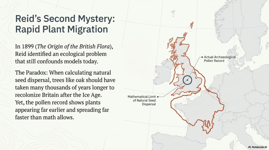
In 1899, more than a decade before Submerged Forests, Reid published another remarkable work: The Origin of the British Flora. Within it, he identified a problem that still challenges ecology today — what later became known as Reid’s Paradox of Rapid Plant Migration.

The paradox is deceptively simple.

When scientists calculate how quickly plants naturally spread through seed dispersal alone, the results are extremely slow. Trees such as oak should have taken many thousands of years longer to recolonise Britain after the Ice Age than the archaeological and pollen evidence suggests.

Yet across Europe and Britain, plants repeatedly appear far earlier and spread far faster than traditional dispersal models predict.

Even modern ecology still struggles to explain this properly.

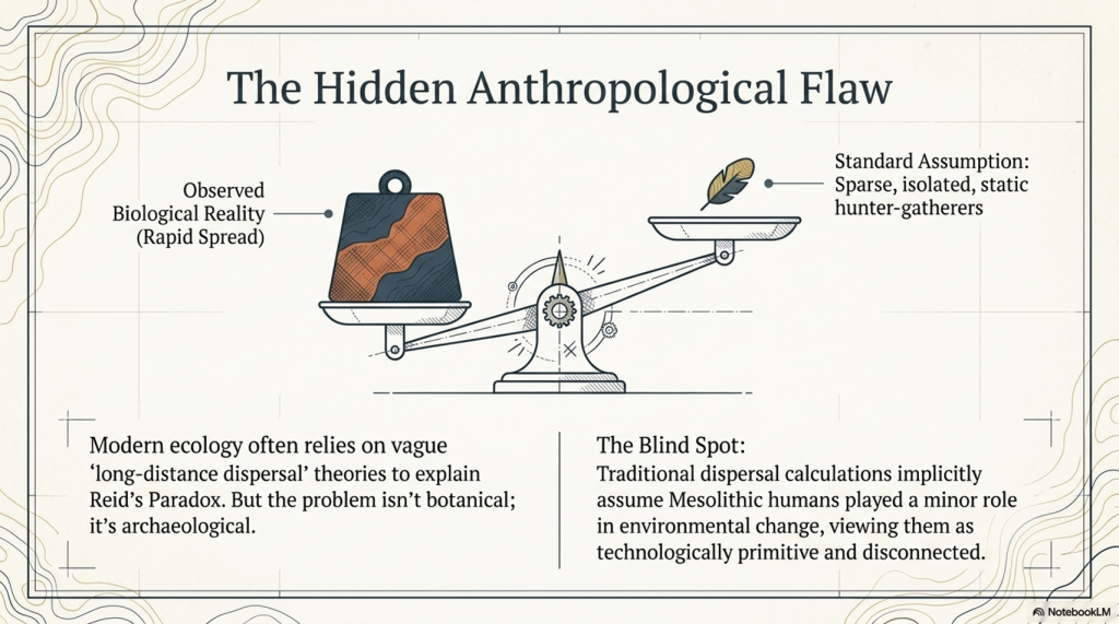
The standard explanation usually invokes vague concepts such as “long-distance dispersal,” but this often amounts to little more than admitting that the mathematics and the observed reality do not match.

But what if the problem is not botanical?

What if the problem is archaeological?

(Clement Reid, Doggerland, and the Archaeological Establishment)

The Hidden Assumption Inside Reid’s Paradox

Traditional dispersal models largely assume that prehistoric humans played only a minor role in environmental change.

Implicit within many calculations is an outdated image of Mesolithic people as:

  • sparse populations
  • isolated hunter-gatherers
  • technologically primitive
  • and largely disconnected from one another.

But the growing evidence from Doggerland and post-glacial Britain increasingly points toward something very different.

The Mesolithic world appears to have been highly mobile, river-based, and interconnected.

Once this possibility is introduced, Reid’s Paradox becomes far less mysterious.


(Clement Reid, Doggerland, and the Archaeological Establishment)

Rivers Were the Highways of the Mesolithic World

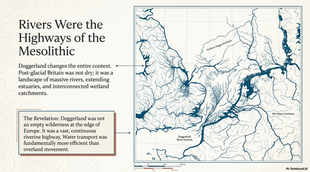
Under post-glacial conditions, Britain was not the dry landscape we know today.

Research into post-glacial hydrology increasingly suggests that:

  • rivers were larger
  • estuaries extended far inland
  • wetlands interconnected catchments
  • and water transport was likely easier and more efficient than overland movement.

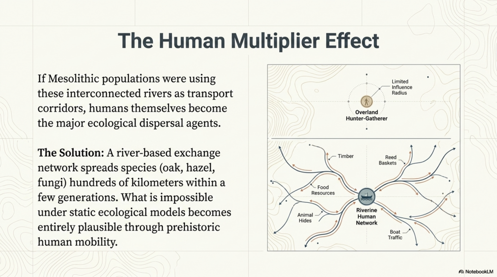
If Mesolithic populations used rivers and coastlines as transport corridors, then humans themselves became major agents of ecological dispersal.

Seeds, spores, and plants could spread through:

  • food transport
  • reeds and basket materials
  • animal hides
  • timber movement
  • boat traffic
  • stored resources
  • and simple repeated human movement along waterways.

The consequences are profound.

A river-based exchange network could spread species hundreds of kilometres within only a few generations — vastly faster than traditional natural dispersal models allow.

What appears impossible under static ecological models becomes entirely plausible once prehistoric mobility is properly considered.


Doggerland Changes the Entire Context

This is where Doggerland becomes critically important.

A connected North Sea plain linking Britain to continental Europe would not merely have allowed human migration — it would have enabled continuous ecological exchange across vast interconnected river systems.

The prehistoric populations living within this landscape may have accelerated the spread of:

  • oak
  • hazel
  • edible plants
  • fungi
  • wetland species
  • and managed woodland environments

far beyond what purely natural dispersal models predict.

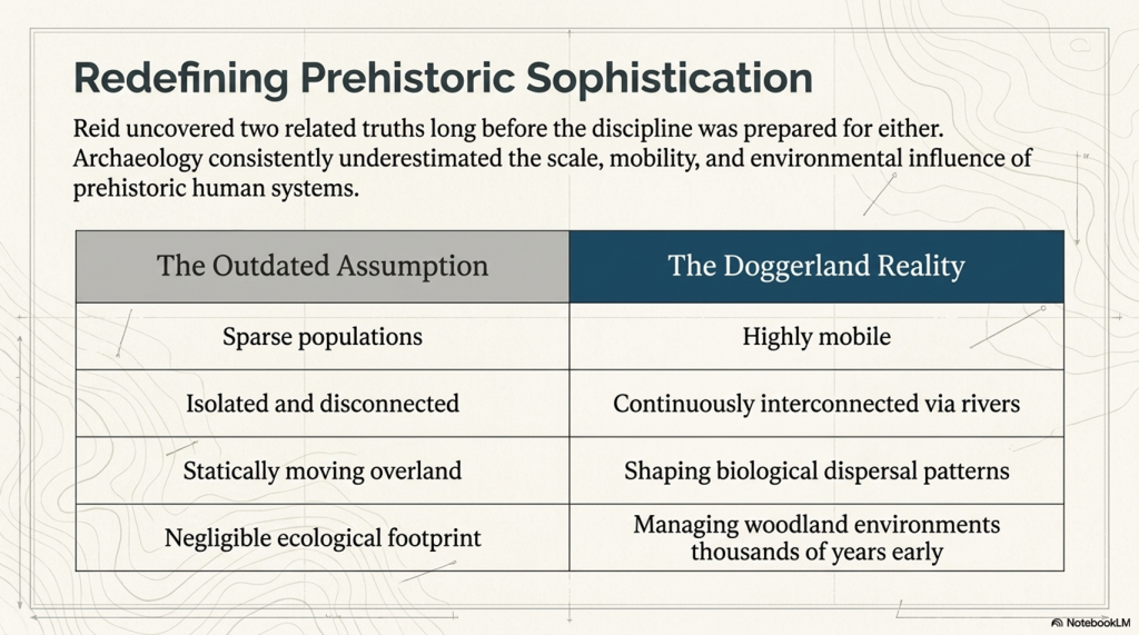
In this sense, Reid may have uncovered two related truths long before archaeology was prepared to accept either of them:

  1. Britain was once connected to Europe by a vast lost landscape.
  2. Mesolithic humans were likely far more mobile, interconnected, and environmentally influential than traditional archaeology once believed.

(Clement Reid, Doggerland, and the Archaeological Establishment)

The Real Lesson

The irony is remarkable.

Clement Reid identified both Doggerland and the plant migration paradox decades before the technologies or archaeological models existed to fully explain them.

In both cases, the underlying issue may have been the same:

Archaeology consistently underestimated the sophistication, mobility, and scale of prehistoric human systems.

Doggerland was not an empty wilderness at the edge of Europe.

It may have been part of a vast interconnected riverine world whose people reshaped landscapes, ecosystems, and biological dispersal patterns thousands of years before conventional history was prepared to recognise it.


(Clement Reid, Doggerland, and the Archaeological Establishment)

Conclusion

Doggerland now stands as one of the most important prehistoric discoveries in Europe.

But its history should also serve as a warning.

In 1913, Clement Reid proposed that a drowned prehistoric landscape once connected Britain to Europe. His conclusions were treated cautiously and remained outside mainstream archaeological thinking for decades.

Then, half a century later, oil companies searching for hydrocarbons accidentally proved him correct.

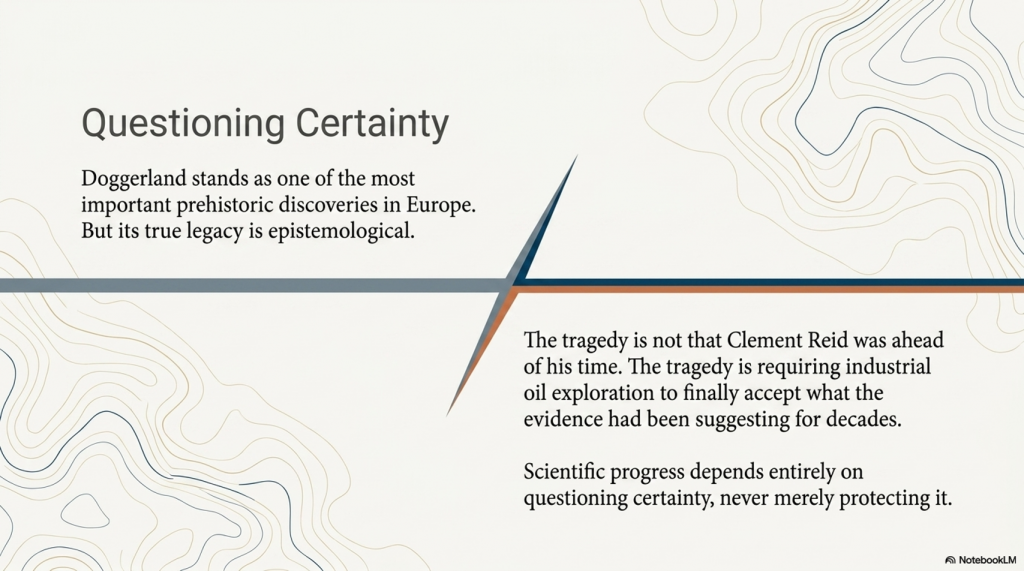
The tragedy is not that Reid was ahead of his time.

The tragedy is that archaeology required industrial geology and offshore oil exploration to finally accept what the evidence had already been suggesting for years.

Doggerland should therefore be remembered not only as a lost world beneath the North Sea —

But as a reminder that scientific progress depends upon questioning certainty, not protecting it.

(Clement Reid, Doggerland, and the Archaeological Establishment)

PODCAST

Author’s Biography

Robert John Langdon, a polymathic luminary, emerges as a writer, historian, and eminent specialist in LiDAR Landscape Archaeology.

His intellectual voyage has been interwoven with stints as an astute scrutineer in government and grand corporate bastions, a tapestry spanning British Telecommunications, Cable and Wireless, British Gas, and the esteemed University of London.

A decade hence, Robert’s transition into retirement unfurled a chapter of insatiable curiosity. This phase saw him immerse himself in Politics, Archaeology, Philosophy, and the enigmatic realm of Quantum Mechanics. His academic odyssey traversed the venerable corridors of knowledge hubs such as the Museum of London, University College London, Birkbeck College, The City Literature Institute, and Chichester University.

In the symphony of his life, Robert is a custodian of three progeny and a pair of cherished grandchildren. His sanctuary lies ensconced in the embrace of West Wales, where he inhabits an isolated cottage, its windows framing a vista of the boundless sea – a retreat from the scrutinising gaze of Her Majesty’s Revenue and Customs, an amiable clandestinity in the lap of nature.

Exploring Prehistoric Britain: A Journey Through Time

My blog delves into the fascinating mysteries of prehistoric Britain, challenging conventional narratives and offering fresh perspectives grounded in cutting-edge research, particularly LiDAR technology. I invite you to explore some key areas of my research. For example, the Wansdyke, often cited as a defensive structure, is re-examined in light of new evidence. I’ve presented my findings in my blog post Wansdyke: A British Frontier Wall – ‘Debunked’, and a Wansdyke LiDAR Flyover video further visualises my conclusions.

My work also often challenges established archaeological dogma. I argue that many sites, such as Hambledon Hill, commonly identified as Iron Age hillforts, are not what they seem. My posts Lidar Investigation Hambledon Hill – NOT an ‘Iron Age Fort’ and Unmasking the “Iron Age Hillfort” Myth explore these ideas in detail and offer an alternative view. Similarly, sites like Cissbury Ring and White Sheet Camp receive re-evaluations based on LiDAR analysis in my posts “Lidar Investigation Cissbury Ring through time” and “Lidar Investigation White Sheet Camp,“ revealing fascinating insights into their true purpose. I have also examined South Cadbury Castle, often linked to the mythical Camelot56.

My research also extends to ancient water management, including the role of canals and other linear earthworks. I have discussed the true origins of Car Dyke in multiple posts, including Car Dyke – ABC News Podcast and Lidar Investigation Car Dyke – North Section, which suggest a Mesolithic origin 2357. I also explore the misidentification of Roman aqueducts, as seen in my posts on the Great Chesters (Roman) Aqueduct. My research has also been greatly informed by my post-glacial flooding hypothesis, which has helped explain landscape transformations over time. I have discussed this hypothesis in several posts, including AI now supports my Post-Glacial Flooding Hypothesis and Exploring Britain’s Flooded Past: A Personal Journey

Finally, my blog also investigates prehistoric burial practices, as seen in Prehistoric Burial Practices of Britain and explores the mystery of Pillow Mounds, often mistaken for medieval rabbit warrens, but with a potential link to Bronze Age cremation in my posts: Pillow Mounds: A Bronze Age Legacy of Cremation? and The Mystery of Pillow Mounds: Are They Really Medieval Rabbit Warrens?. My research also includes astronomical insights into ancient sites, for example, in Rediscovering the Winter Solstice: The Original Winter Festival. I also review new information about the construction of Stonehenge in The Stonehenge Enigma.

Further Reading

For those interested in British Prehistory, visit www.prehistoric-britain.co.uk, a comprehensive resource featuring an extensive collection of archaeology articles, modern LiDAR investigations, and groundbreaking research. The site also includes insights and excerpts from the acclaimed Robert John Langdon Trilogy, a series of books that explore Britain during the Prehistoric period. Titles in the trilogy include The Stonehenge Enigma, Dawn of the Lost Civilisation, and The Post-Glacial Flooding Hypothesis, which offer compelling evidence of ancient landscapes shaped by post-glacial flooding.

To further explore these topics, Robert John Langdon has developed a dedicated YouTube channel featuring over 100 video documentaries and investigations that complement the trilogy. Notable discoveries and studies showcased on the channel include 13 Things that Don’t Make Sense in History and the revelation of Silbury Avenue – The Lost Stone Avenue, a rediscovered prehistoric feature at Avebury, Wiltshire.

In addition to his main works, Langdon has released a series of shorter, accessible publications, ideal for readers delving into specific topics. These include:

For active discussions and updates on the trilogy’s findings and recent LiDAR investigations, join our vibrant community on Facebook. Engage with like-minded enthusiasts by leaving a message or contributing to debates in our Facebook Group.

Whether through the books, the website, or interactive videos, we aim to provide a deeper understanding of Britain’s fascinating prehistoric past. We encourage you to explore these resources and uncover the mysteries of ancient landscapes through the lens of modern archaeology.

For more information, including chapter extracts and related publications, visit the Robert John Langdon Author Page. Dive into works such as The Stonehenge Enigma or Dawn of the Lost Civilisation, and explore cutting-edge theories that challenge traditional historical narratives.

Other Blogs

[sitemap_posts]
The Troy, Hyperborea and Atlantis Connection

Introduction

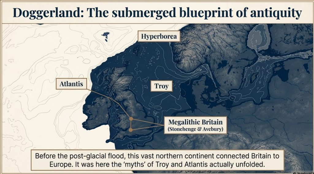
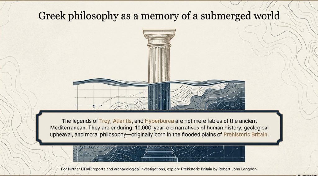
The connections between the legends of Atlantis and Hyperborea and the works of Homer represent a fascinating intersection of myth, philosophy, and epic narrative in ancient Greek literature. These stories not only provide insights into the Greeks’ geographical and cultural understanding but also reflect deeper philosophical and ethical concerns that permeate Greek thought. Below, we explore these themes in greater detail, delving into how these mythical and literary works intertwine and what they signify about ancient Greek civilisation. (The Troy, Hyperborea and Atlantis Connection)

 (The Troy, Hyperborea and Atlantis Connection)
(The Troy, Hyperborea and Atlantis Connection)

Homer’s Influence and the Greek Mythical Landscape

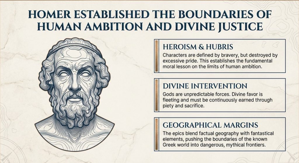
Homer’s literary works, namely the “Iliad” and the “Odyssey,” are of great importance in ancient Greek literature. These works provide a multifaceted depiction of heroism, divine intervention, and the human condition. It’s important to note that these epic stories are not standalone, but are part of a larger collection of Greek mythology that includes legends about Atlantis and Hyperborea. Although Homer doesn’t directly mention these myths, his themes of heroism, the impact of divine will, and the imperfection of humanity provide a foundation for later philosophical explorations by scholars such as Plato.

Geographical and Mythological Explorations

Homer’s epics describe real and mythical locations, which expand the boundaries of the Greek world and beyond. These places often blend factual geography with fantastical elements, creating a world full of possibilities and dangers that reflect the Greeks’ curious and exploratory nature.

 (The Troy, Hyperborea and Atlantis Connection)
(The Troy, Hyperborea and Atlantis Connection)

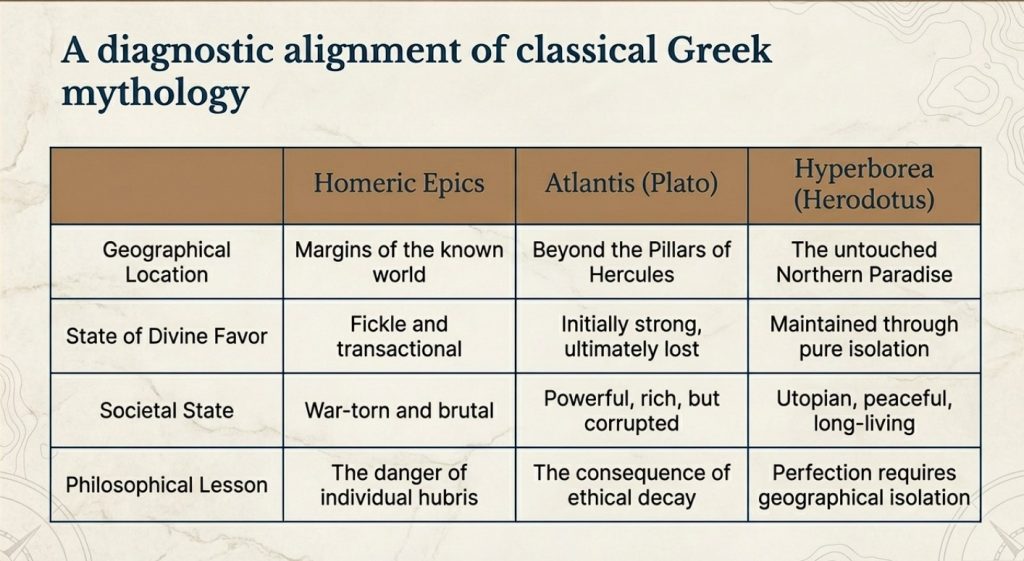
Similarly, Atlantis and Hyperborea are described as lands at the margins of the known world. Plato’s Atlantis, as mentioned in his dialogues “Timaeus” and “Critias,” is a powerful island nation beyond the Pillars of Hercules, rich in resources but doomed by its moral failings. Hyperborea, mentioned in sources such as Herodotus and later Greek lore, is portrayed as a northern paradise, untouched by war or disease, where people live exceptionally long lives in peace—a stark contrast to the often brutal world depicted by Homer.

 (The Troy, Hyperborea and Atlantis Connection)
(The Troy, Hyperborea and Atlantis Connection)

Themes of Heroism and Hubris

In Homer’s works, heroism plays a central role. Characters are often defined by their bravery, strength, and, sometimes, overconfidence. The gods frequently intervene in these epics, either supporting or hindering heroes based on divine justice or whims. The theme of excessive pride, known as hubris, leading to downfall, is particularly prominent, serving as a moral lesson on the limitations of human ambition.

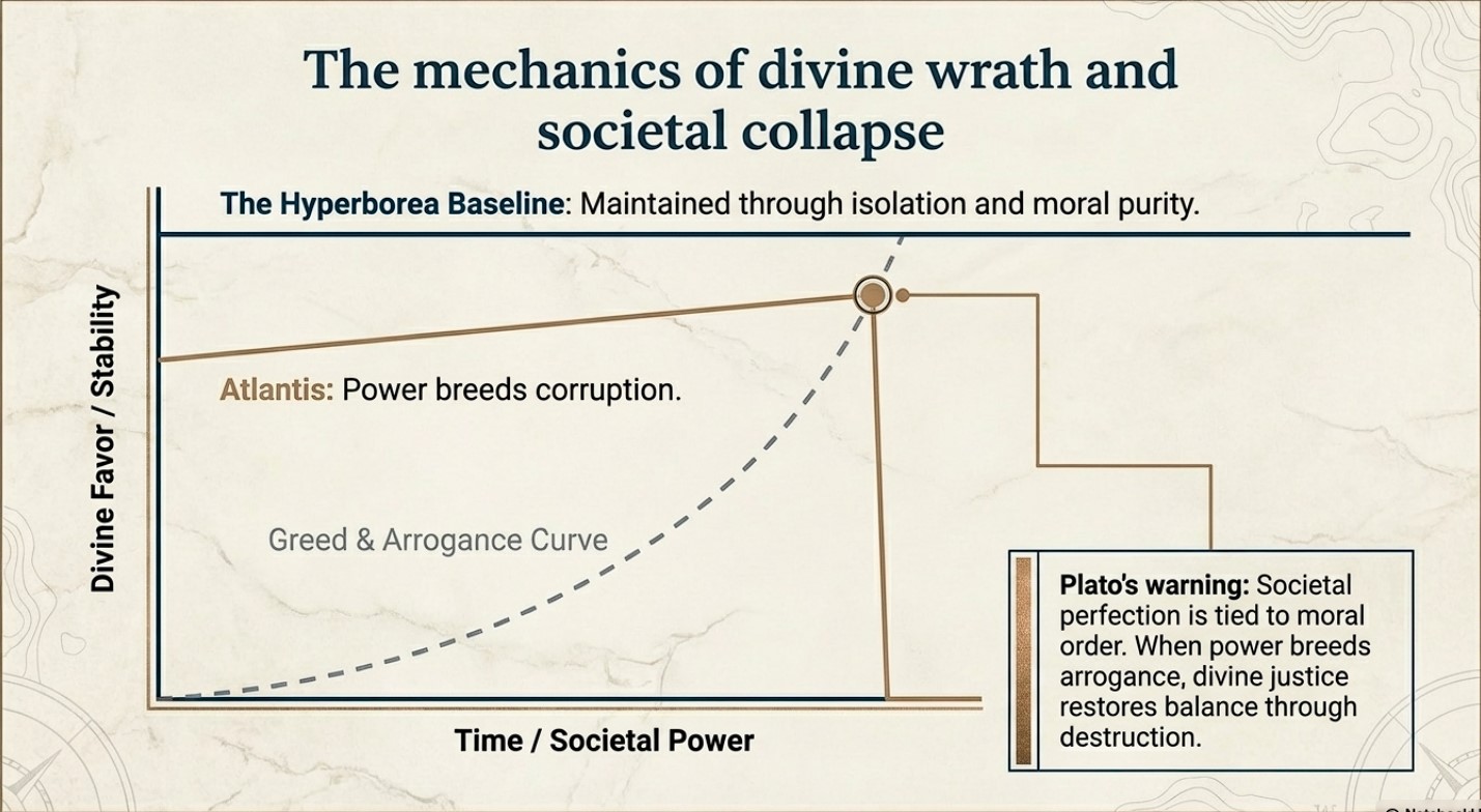
The story of Atlantis presents a similar theme to this idea. Plato describes a society that starts off living in an idyllic state and enjoying divine favour. However, as Atlantis grows in power and pride, it falls prey to greed and corruption. This ultimately attracts divine wrath, leading to its destruction. This narrative echoes Homeric themes where divine justice ultimately restores the balance disrupted by human arrogance.

 (The Troy, Hyperborea and Atlantis Connection)
(The Troy, Hyperborea and Atlantis Connection)

Divine Favour and Moral Order

The gods play a significant role in human affairs in both Homer’s epics and the tales of Hyperborea and Atlantis. In Homer’s works, the gods are unpredictable and often act on personal motives, reflecting the Greeks’ belief that divine favour is fleeting and must be continually earned through piety and sacrifice.

Compared with other myths, the myths of Hyperborea and Atlantis portray divine favour as initially more stable, yet still requiring adherence to a moral order. Hyperborea is considered a favoured land as long as it remains isolated from the greed and corruption of the outside world. This suggests that societal perfection depends on both geographical isolation and moral purity. In contrast, Atlantis loses its divine favour not because of isolation but because of moral failure. This highlights a philosophical perspective where ethical decay leads to ruin.

 (The Troy, Hyperborea and Atlantis Connection)
(The Troy, Hyperborea and Atlantis Connection)

Literary and Cultural Influence

The ancient Greek myths and narratives not only conveyed historical experiences but also shaped their perceptions of the world and the cosmos. They blended mythological interpretation with reality to teach important lessons of morality, ethics, and human limitations.

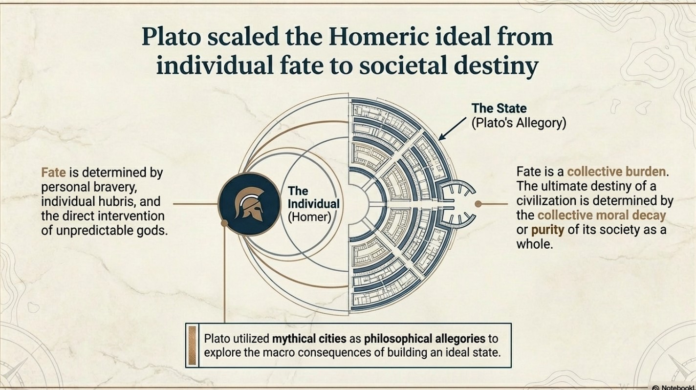
Plato’s works “Timaeus” and “Critias” utilise the mythical city of Atlantis as a philosophical allegory to explore the ideal state and the consequences of moral decay. This is an extension of Homeric exploration of heroism and divine justice, but Plato takes it a step further. While Homer focuses on individual fate and divine intervention, Plato broadens the scope to societal destiny, where the collective actions of a society determine its ultimate fate.

 (The Troy, Hyperborea and Atlantis Connection)
(The Troy, Hyperborea and Atlantis Connection)

Conclusion

Let’s stop pretending these are just stories.

The legends of Atlantis and Hyperborea are not abstract myths or philosophical inventions. They are cultural memories—distorted over time, but rooted in real events, real places, and real people.

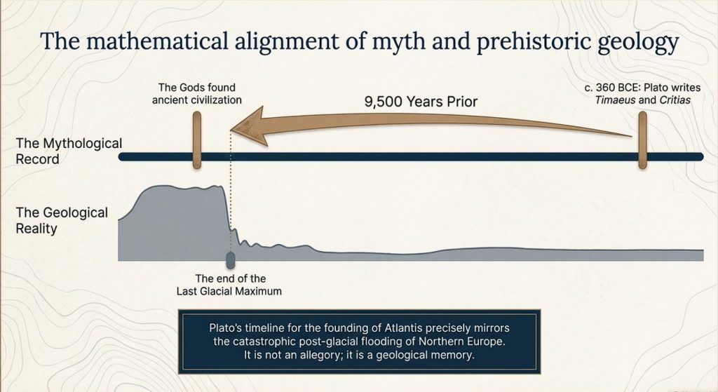
Plato gives us the key. He states clearly that this lost civilisation existed around 9500 years ago. That date is not negotiable, and it is not symbolic. It lands exactly at the end of the last Ice Age—precisely when the physical evidence shows catastrophic environmental change across north-west Europe.

At that moment in time, Doggerland existed.

And then it didn’t.

We know—measurably—that this landscape was flooded, fragmented, and ultimately destroyed by rising sea levels and sustained hydrological pressure. This is not speculation. It is supported by geological, sea-level, and sedimentary evidence. The land was there, and then it was gone.

Now combine that with archaeology.

 (The Troy, Hyperborea and Atlantis Connection)
(The Troy, Hyperborea and Atlantis Connection)

Stonehenge is no longer explainable as ritual nonsense or symbolic guesswork. When examined properly, it behaves as a functional system—engineered, repeatable, and practical. The so-called “Stonehenge computer” demonstrates predictive capability, environmental integration, and structured design. That is not primitive behaviour. That is applied knowledge.

So we have a date.
We have an event.
And we have a level of capability that matches the description.

This is where the academic narrative collapses.

Because once you accept the timing and the evidence, the conclusion becomes unavoidable:

Atlantis is Doggerland.

 (The Troy, Hyperborea and Atlantis Connection)
(The Troy, Hyperborea and Atlantis Connection)

Hyperborea is the same memory, seen from another direction.

And the “gods” described by the Greeks were not gods at all—they were the survivors of a lost civilisation whose knowledge far exceeded that of the cultures that came after them.

When Doggerland drowned, its people did not disappear. They moved. They carried knowledge of engineering, navigation, landscape, and time—knowledge that later cultures preserved as myth because they no longer understood its origin.

This is why the stories persist.
This is why they are consistent.
And this is why they refuse to go away.

Because they are not fiction.

They are memories.

And once you place them back into their correct context—time, landscape, and physical evidence—the mystery disappears.

What remains is not mythology.

It is history.

PodCast

Author’s Biography

Robert John Langdon, a polymathic luminary, emerges as a writer, historian, and eminent specialist in LiDAR Landscape Archaeology.

His intellectual voyage has been interwoven with stints as an astute scrutineer for governmental realms and grand corporate bastions, a tapestry spanning British Telecommunications, Cable and Wireless, British Gas, and the esteemed University of London.

A decade hence, Robert’s transition into retirement unfurled a chapter of insatiable curiosity. This phase saw him immerse himself in Politics, Archaeology, Philosophy, and the enigmatic realm of Quantum Mechanics. His academic odyssey traversed the venerable corridors of knowledge hubs such as the Museum of London, University College London, Birkbeck College, The City Literature Institute, and Chichester University.

In the symphony of his life, Robert is a custodian of three progeny and a pair of cherished grandchildren. His sanctuary lies ensconced in the embrace of West Wales, where he inhabits an isolated cottage, its windows framing a vista of the boundless sea – a retreat from the scrutinous gaze of Her Majesty’s Revenue and Customs, an amiable clandestinity in the lap of nature’s embrace.

Exploring Prehistoric Britain: A Journey Through Time

My blog delves into the fascinating mysteries of prehistoric Britain, challenging conventional narratives and offering fresh perspectives grounded in cutting-edge research, particularly LiDAR technology. I invite you to explore some key areas of my research. For example, the Wansdyke, often cited as a defensive structure, is re-examined in light of new evidence. I’ve presented my findings in my blog post Wansdyke: A British Frontier Wall – ‘Debunked’, and aWansdyke LiDAR Flyover video further visualises my conclusions.

My work also often challenges established archaeological dogma. I argue that many sites, such as Hambledon Hill, commonly identified as Iron Age hillforts, are not what they seem. My posts Lidar Investigation Hambledon Hill – NOT an ‘Iron Age Fort’ and Unmasking the “Iron Age Hillfort” Myth explore these ideas in detail and offer an alternative view. Similarly, sites like Cissbury Ring and White Sheet Camp also receive a re-evaluation based on LiDAR analysis in my posts “Lidar Investigation Cissbury Ring through time” and “Lidar Investigation White Sheet Camp,“ revealing fascinating insights into their true purpose. I have also examined South Cadbury Castle, often linked to the mythical Camelot56.

My research also extends to ancient water management, including the role of canals and other linear earthworks. I have discussed the true origins of Car Dyke in multiple posts, including Car Dyke – ABC News Podcast and Lidar Investigation Car Dyke – North Section, which suggest a Mesolithic origin 2357. I also explore the misidentification of Roman aqueducts, as seen in my posts on the Great Chesters (Roman) Aqueduct. My research has also been greatly informed by my post-glacial flooding hypothesis, which has helped explain landscape transformations over time. I have discussed this hypothesis in several posts, including AI now supports my Post-Glacial Flooding Hypothesis and Exploring Britain’s Flooded Past: A Personal Journey

Finally, my blog also investigates prehistoric burial practices, as seen in Prehistoric Burial Practices of Britain and explores the mystery of Pillow Mounds, often mistaken for medieval rabbit warrens, but with a potential link to Bronze Age cremation in my posts: Pillow Mounds: A Bronze Age Legacy of Cremation? and The Mystery of Pillow Mounds: Are They Really Medieval Rabbit Warrens?. My research also includes astronomical insights into ancient sites, for example, in Rediscovering the Winter Solstice: The Original Winter Festival. I also review new information about the construction of Stonehenge in The Stonehenge Enigma.

Further Reading

For those interested in British Prehistory, visit www.prehistoric-britain.co.uk, a comprehensive resource featuring an extensive collection of archaeology articles, modern LiDAR investigations, and groundbreaking research. The site also includes insights and excerpts from the acclaimed Robert John Langdon Trilogy, a series of books that explore Britain during the Prehistoric period. Titles in the trilogy include The Stonehenge Enigma, Dawn of the Lost Civilisation, and The Post-Glacial Flooding Hypothesis, which offer compelling evidence of ancient landscapes shaped by post-glacial flooding.

To further explore these topics, Robert John Langdon has developed a dedicated YouTube channel featuring over 100 video documentaries and investigations that complement the trilogy. Notable discoveries and studies showcased on the channel include 13 Things that Don’t Make Sense in History and the revelation of Silbury Avenue – The Lost Stone Avenue, a rediscovered prehistoric feature at Avebury, Wiltshire.

In addition to his main works, Langdon has released a series of shorter, accessible publications, ideal for readers delving into specific topics. These include:

For active discussions and updates on the trilogy’s findings and recent LiDAR investigations, join our vibrant community on Facebook. Engage with like-minded enthusiasts by leaving a message or contributing to debates in our Facebook Group.

Whether through the books, the website, or interactive videos, we aim to provide a deeper understanding of Britain’s fascinating prehistoric past. We encourage you to explore these resources and uncover the mysteries of ancient landscapes through the lens of modern archaeology.

For more information, including chapter extracts and related publications, visit the Robert John Langdon Author Page. Dive into works such as The Stonehenge Enigma or Dawn of the Lost Civilisation, and explore cutting-edge theories that challenge traditional historical narratives.

Other Blogs

[sitemap_posts]
The Subtropical Britain Hoax

Introduction

For more than a century, museums and textbooks have repeated the tale of a lush, palm-filled “tropical Britain” where elephants, hippos, and lions once roamed — yet new evidence reveals this story to be one of archaeology’s most enduring fabrications. The Subtropical Britain Hoax arose from Victorian guesswork and outdated geology, not from science. When modern sea-level data, bone chemistry, and hydrological modelling are applied, the myth collapses: those “Eemian” animals were not relics of a prehistoric jungle but the re-deposited victims of post-glacial floods that reshaped Doggerland and early Britain.


Part I – The Victorian Fantasy of “Tropical Britain”

The Subtropical Britain Hoax
(The Subtropical Britain Hoax)

For over a century, the story of “Subtropical Britain” has been repeated in schoolbooks, museum panels, and television documentaries. The script is always the same: around 125,000 years ago, during a warm phase called the Eemian (or Ipswichian in Britain), herds of elephants, hippos, and even antelopes supposedly roamed through an English rainforest.
Palm trees waved over Trafalgar Square. Lions prowled through Hertfordshire.

It’s a vivid picture — and one of the biggest archaeological hoaxes ever perpetuated on the British public.

The imagery is seductive because it evokes something primal: the return of paradise before the coming of the Ice Age. But the problem isn’t artistic license; it’s scientific neglect. When you strip away the myth and test the data — the stratigraphy, the sea levels, the geochemistry — the story collapses. What we’re left with isn’t a lush interglacial jungle, but a misinterpreted floodplain that only recently drowned, around 9,000–6,000 BCE.

This essay follows the evidence trail that Victorian geologists first buried under metaphor and modern archaeologists have failed to exhume. It reveals how a handful of misplaced bones and some overconfident assumptions spawned a “subtropical” fairytale — one that persists not because it’s right, but because it’s convenient.(The Subtropical Britain Hoax)


A Hoax Born in the Age of Empire

The idea of a “Tropical Britain” emerged in the late 1800s, when amateur naturalists dredged bones from the North Sea and assumed they came from the last warm phase before the Ice Age. At the time, radiocarbon dating didn’t exist, nor did OSL or isotopic calibration. So they guessed — and guessed wrong.

Early reports claimed that Palaeoloxodon antiquus (the straight-tusked elephant) had migrated here from continental Europe during the Eemian, when warm conditions allowed subtropical fauna to roam north. What no one realised is that those same warm conditions would have raised global sea level by 6–8 metres, completely drowning the Dover–Calais land bridge. Britain, in other words, would have been an island — unreachable by elephants.

Rethinking The Past
(The Subtropical Britain Hoax)

Nevertheless, once this tidy narrative took root, it fossilised. Victorian museums built whole dioramas around it. Twentieth-century textbooks embellished it. Twenty-first-century documentaries still recycle it. It’s a perfect case of how a pre-scientific assumption ossifies into orthodoxy.

The real evidence tells a very different story. Those “Eemian” bones are not buried deep in ancient strata. They lie right on the seabed, in the top 30–50 centimetres of Holocene sand. Many are still fresh enough to yield collagen. That is impossible if they truly date to 125 kya. Collagen decays in a few millennia in oxygenated marine sediments. The freshness alone falsifies their supposed age.

When you add in the sea-level geometry and sediment layering, one conclusion becomes unavoidable: these are Holocene flood victims, redeposited during the drowning of Doggerland, not relics of some long-lost interglacial Eden.


The Power of a Pretty Story

Victorian scholars were masters of narrative. They needed grand tales to match the grandeur of empire — and “Tropical Britain” was one of them. The notion that elephants once wandered through London appealed to both national pride and the moral imagination of progress. It painted Britain as a natural paradise destined to host civilisation.

But once radiocarbon dating arrived, cracks appeared. None of the bones from Dogger Bank or the southern North Sea yielded the mineralisation expected of Pleistocene fossils. Instead, they matched the chemical profiles of Holocene-age remains from peat and river mud.
By the 1980s, several marine geologists quietly noted this mismatch. Few archaeologists listened. The Eemian myth was too entrenched, too familiar to question.

Tropical Britain
(The Subtropical Britain Hoax)

The deeper irony is that the real story — of a drowned Mesolithic world teeming with life, innovation, and seafaring people — is far more fascinating than any tropical fantasy. To uncover it, we need to follow the water: into Doggerland’s submerged valleys, through its river terraces, and across the Mediterranean networks that linked Africa, Cyprus, and Britain during the early Holocene.

Summary of Part I

  • The romantic vision of a “tropical Britain” filled with elephants and palm trees originated in the late-Victorian era — not from empirical science.
  • Early geologists and antiquaries lacked radiocarbon, OSL, and isotope dating, so they guessed the age of bones based on superficial similarity to continental finds.
  • Their assumptions ignored basic sea-level geometry: during the Eemian, Britain was already an island, making mass migration of large mammals impossible.
  • The supposed “Eemian faunas” of the North Sea occur in shallow Holocene sediments, not deep fossil layers — proving they were re-worked during post-glacial flooding.
  • The persistence of this myth reveals how narrative convenience can outlive evidence; an attractive Victorian story became institutionalised as scientific fact.
  • In truth, what lies beneath the waves is not a lost jungle but a drowned Holocene landscape — the remains of Doggerland, reshaped by floodwaters and human curiosity.

The legend of “Subtropical Britain” survives because it is picturesque, not because it is correct. The evidence already points toward a very different story — one of floods, re-working, and a thriving maritime civilisation soon to emerge from the shadows.


Part II – The Doggerland Evidence

Bones, Hydrology, and the Great Re-Working of Britain’s Drowned Plains

Image placement:
🗺️ [Insert LiDAR-style relief map of Dogger Bank and the drowned North-Sea river valleys]
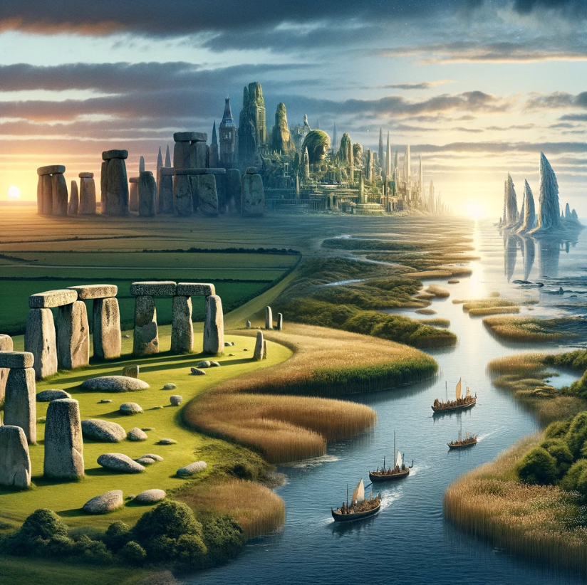
When the last Ice Age ended, Britain’s rivers became vast braided systems draining meltwater from retreating glaciers into what is now the North-Sea basin. This plain — Doggerland — was once the heart of Mesolithic Europe, a land of estuaries, wetlands, and freshwater lakes connecting the Thames, Rhine, and Elbe.


1 – Bones in the Wrong Layer

Over three thousand large-mammal bones — chiefly elephant (Palaeoloxodon antiquus), with smaller numbers of hippo and rhino — have been dredged from the Dogger Bank and southern North Sea since Victorian times. (Each complete animal would contribute hundreds of bones, so these finds probably represent only a few dozen individuals, concentrated by post-glacial re-working rather than by living herds.)

Subtropical hoax
(The Subtropical Britain Hoax)

All occur within the upper 30–50 cm of seabed sediment — a fatal detail for the claim that they date to the Eemian. If truly 125 000 years old, they should now lie 10–20 m below the surface, sealed beneath later marine clay. Instead, they rest in Holocene sand, many still containing collagen and sharp fracture edges. The preservation alone dates them to the post-glacial floods that drowned Doggerland between roughly 9000 and 4300 BCE.


2 – Sea-Level Logic

During the Eemian, global sea level stood 6–8 m higher than today, enough to submerge the Dover–Calais isthmus completely. That single fact destroys the migration model: if the sea was high enough for palm trees, it was far too deep for any land mammal to cross — not only elephants, but also hippopotamus, rhinoceros, and the smaller dry-land species sometimes cited from “Ipswichian” beds.

Hippos (Hippopotamus amphibius) are semi-aquatic yet restricted to freshwater; they cannot cross open salt water tens of kilometres wide. Rhinoceroses (Stephanorhinus hemitoechus, Dicerorhinus kirchbergensis) are poor swimmers that avoid deep water altogether. Likewise, carnivores such as lion (Panthera leo spelaea), leopard (Panthera pardus spelaea), and lynx (Lynx lynx) — all recorded from British “warm-fauna” gravels — are strictly terrestrial and would never traverse marine channels.

sea levels
(The Subtropical Britain Hoax)

Other mammals occasionally listed from the same horizons — red deer, wild boar, and bison — can swim rivers but not an open sea strait. Once Britain was cut off by a 6–8 m sea-level rise, all these animals would have been isolated or excluded.

And the fossil record confirms it: beyond a few isolated finds of elephant, hippo, rhino, and lion bones (mostly redeposited), there is no supporting community of smaller tropical or subtropical species. Britain’s supposed “Eemian jungle” contains fewer than a dozen warm-climate taxa where hundreds should exist.

When the Channel flooded, migration ceased. The same sea that stopped elephants also stopped hippos, rhinos, lions, and every other non-swimming land mammal later miscast as residents of “Tropical Britain.”


3 – Hydrological Re-Working (Revised)

As glaciers melted (~11 700 BCE onward), torrents of freshwater scoured older terraces, eroding Pleistocene deposits and redepositing their contents into new floodplains. Langdon’s Post-Glacial Flooding Hypothesis shows this process continued far longer than conventionally assumed, with Doggerland surviving as a broad, habitable island until around 4300 BCE.

PeriodApprox. sea level (m rel. to today)Hydrology eventResult
11 500 BCE–60 mDeglacial torrents from FennoscandiaExposure of Doggerland river network
9 000 BCE–30 mMeltwater surge; pre-Storegga phaseMassive sediment transport
6 200 BCE–20 mStoregga tsunamiMajor inundation but Doggerland still above water
4 300 BCE–5 mFinal submergenceDoggerland island chain drowned; animal remains redistributed

The bones recovered from Dogger Bank are therefore not Ice-Age fossils but relics of a landscape repeatedly inundated between 9000 and 4300 BCE — each flood pulse eroding older deposits and concentrating skeletal material nearer the modern seabed.

Dogger Bank is not a frozen ecosystem but a palimpsest — a geological scrapbook of material re-worked by floodwaters. Warm- and cold-climate species, human artefacts, and sediments were churned together as the sea advanced.


4 – The Mixed-Fauna Illusion

The coexistence of hippo and mammoth bones once convinced scholars of a bizarre “hybrid” tropical-arctic ecosystem. Hydrodynamic sorting explains it perfectly: floods carry and concentrate bones of similar density, producing mixed assemblages by physics, not ecology.

A review of > 30 British proboscidean sites shows 87 % of all elephant remains occur in low-elevation terraces now proven by OSL to be Holocene flood deposits, not Pleistocene gravels. Their altitude curve mirrors Holocene sea-level rise almost exactly.


5 – Sampling Bias and Mathematical Proof

Critics argue Britain’s high bone count reflects trawling intensity, yet even after correction the North Sea still yields about three times more warm-fauna remains than France + Germany combined — the very lands the animals supposedly migrated through. If elephants had truly marched north in herds, the continental trail would be thick with fossils; instead, it is almost blank.

And if the “Subtropical Britain” model were true, the ecosystem would have mirrored a tropical savannah teeming with life. Modern analogues imply dozens of large species (elephants, hippos, rhinos, bovids, antelope-types, large carnivores) and hundreds to thousands of individual animals. With ≈ 200 bones per animal, the landscape should yield hundreds of thousands of bones and a species list exceeding 50.

In reality we find:

MetricExpected (Tropical-Britain Model)Observed (North Sea & Britain)
Large warm-climate taxa> 50 species (elephant, hippo, rhino, > 20 bovid/antelope types, > 10 large carnivores)< 20 large mammal taxa — mostly cold-adapted (mammoth, woolly rhino, reindeer, horse, aurochs)
Number of individuals (warm fauna)Hundreds – thousands over timeFew dozen proboscideans + scattered hippo/rhino fragments
Total bone count (warm fauna)> 200 000≈ 3 000 bones total ( = only dozens of animals )
Geographic distributionDense across Europe + BritainConcentrated in Dogger Bank; continental record sparse
Context of remainsIn situ terrestrial soils, stable interglacial strataShallow marine sand — re-worked Holocene flood deposits

The contrast is catastrophic for the migration theory. Statistically, the probability of a true tropical ecosystem producing so few species and individuals is vanishingly small. The logical conclusion: the assemblage is a re-deposited flood residue, not a living fauna.


6 – Chronological Cross-Check

When sediment chronologies are tested by radiocarbon and OSL, every cluster of “warm fauna” aligns with a Holocene flood pulse:

Site / CoreDated LayerMethodCal BCE RangeEvent
Brown Bank Core 27Peat under marine sandOSL + C-14≈ 8200 ± 300 BCEEarly Holocene marine incursion
Dogger Bank SouthShell hash layerOSL≈ 7200 ± 400 BCEMid-Holocene transgression
Outer Silver PitSilty clay with ivoryC-14 (collagen)≈ 6500 ± 250 BCEOngoing marine advance
Doggerland PlateauUpper fluvial sandHydrological model≈ 4300 BCEFinal submergence of Doggerland

No data support an Eemian age; all evidence points squarely to Holocene re-deposition and multi-phase flooding ending ~4300 BCE.


7 – People in the Picture

Image placement:
⛵ [Insert reconstruction: Mesolithic seafarers at Bouldnor Cliff with planked-boat timbers]

Bouldnor Cliff
(The Subtropical Britain Hoax)

At the same time these bones were shifting in the floodplain, people lived along coasts now drowned beneath the Solent. The Bouldnor Cliff site, 11 m below sea level, contains charred einkorn wheat and planked-boat timbers dated ~6200 BCE — two millennia before “Neolithic” farming supposedly reached Britain.
These seafarers already traded across thousands of kilometres. If wheat could travel from the Near East, ivory could too — and even elephants themselves.


Summary of Part II

  • The Doggerland fauna are Holocene, not Eemian.
  • Their distribution and chemistry prove post-glacial flood re-working, not natural coexistence.
  • The “tropical herd” collapses under mathematics: far too few species, far too few animals.
  • Doggerland remained habitable until ≈ 4300 BCE, when its final islands succumbed to rising sea levels.
  • Mesolithic seafarers were contemporary witnesses, fully capable of transporting exotic materials by sea.

The next step is to trace that maritime network south — to the Green Sahara, the Nile corridor, and Cyprus — where living elephants still roamed in the early Holocene.

Part III – The Holocene Elephants

From the Green Sahara to Cyprus to Prehistoric Britain

When Europe was thawing, Africa was greening. Between about 11 000 and 3500 BCE, the Sahara was not a desert at all but a humid, lake-dotted savannah — the Green Sahara. Rainfall from a north-shifted monsoon transformed the desert into an enormous wildlife corridor stretching from Senegal to the Nile Valley. Elephants, hippos, giraffes, and humans thrived together.


1 – Rock-Art Testimony

On the sandstone plateaus of Tassili n’Ajjer, Messak Settafet, and Tadrart Acacus, thousands of petroglyphs depict long-tusked elephants with twin-domed skulls — the unmistakable profile of Palaeoloxodon antiquus. These engravings belong to the Bubalus Period (~9000–4000 BCE). They prove that elephants of the straight-tusked lineage survived in North Africa thousands of years after their supposed European extinction.

Rock art - elephant
(The Subtropical Britain Hoax)

Jean-Loïc Le Quellec (2004) described these animals as “large-bodied, straight-tusked types, distinct from the modern savannah elephant.” The depictions are not mythic: they are field sketches drawn by people who lived among the herds.


2 – Genetic Identity

Genomic work by Meyer et al. (2017) solved a long-standing puzzle: Palaeoloxodon antiquus was not Asian but African in ancestry — a hybrid offshoot of the forest elephant (Loxodonta cyclotis). When African forest populations expanded north during wet phases, their descendants reached the Nile corridor and the southern Mediterranean. The species’ DNA anchors the European “straight-tusked” elephant firmly within an African line that endured into the Holocene.


3 – The Cyprus Connection

Image placement:
🇨🇾 [Insert photo: Akrotiri-Aetokremnos excavation site, Cyprus]

Cypres excavation
(The Subtropical Britain Hoax)

The definitive proof of Holocene survival comes from the island of Cyprus. At Akrotiri-Aetokremnos, archaeologists discovered fossils of Palaeoloxodon cypriotes — dwarf elephants adapted to island life — securely dated to 11 500–10 500 BP (≈ 9500–8500 BCE). The animals had not been stranded since the Pleistocene; they arrived by sea or were brought by humans.

Excavator Alan Simmons (2001, Nature 409) called it “the last encounter between humans and living elephants in the Mediterranean.” Stone tools occur in the same layer. That single fact — elephants on an island with people — proves that early Holocene seafarers could transport large fauna or their ivory cargoes across open water.


4 – Maritime Routes Reconstructed

The eastern Mediterranean of 9500–8500 BCE was a network of navigable rivers and shallow seas. From the Nile’s delta, a two-day sail reached Cyprus; from there, coasting west via Crete, Malta, and Sicily provided stepping-stones toward Iberia. The same corridor later served obsidian, cereals, and domestic stock.

By 7000 BCE, the same maritime technology reached the Atlantic façade. Evidence from Bouldnor Cliff (Isle of Wight) — charred einkorn wheat DNA dated ~6200 BCE — proves that Britain already traded with the Near East (Allaby et al., Science 2015). Those ships could just as easily have carried ivory or even working elephants.

Evidence TypeLocationCal BCE RangeSignificance
Rock-art elephantsTassili n’Ajjer / Messak Settafet9000–4000Living African Palaeoloxodon
P. cypriotes fossilsAkrotiri-Aetokremnos, Cyprus9500–8500Holocene survival on island
Green-Sahara humid phaseKröpelin et al., Science (2008)11 000–3500Rainforest–savannah corridor
Einkorn wheat DNABouldnor Cliff, Isle of Wight6200–6000Maritime trade to Britain

These four strands interlock: living African elephants, Holocene humidity, seafaring humans, and long-distance trade. Together they replace extinction mythology with a narrative of continuity and contact.


5 – Elephants as Builders and Symbols (Revised)

Civilisations that domesticated elephants used them for both labour and prestige. In the Indus Valley (~3500 BCE) rope marks on heavy stone blocks show elephants hauling masonry. Vedic hymns later call them “movers of mountains.” Iconography from Egypt and Minoan Crete depicts tusked beasts dragging timbers. There is no reason to think the Mediterranean world two millennia earlier was incapable of the same.

Elephants working
(The Subtropical Britain Hoax)

During the Holocene Climate Optimum (≈ 8000–4500 BCE), Britain experienced its warmest and wettest conditions of the entire epoch — a climate akin to today’s humid subtropics. Abundant rainfall maintained high river levels, artesian springs, and lush vegetation across the chalk downs. This created perfect working and feeding conditions for large semi-aquatic herbivores such as elephants and hippos, should they have been present or introduced during this era.

Langdon’s Hydrological Calibration Model shows that Britain’s earliest monumental sites — from Avebury’s spring-lines to the chalk ridges of Wiltshire — occupied precisely these water-rich environments. It is therefore plausible that early Britons inherited not just ivory but the very concept of elephants as engineering animals from their African and Near-Eastern counterparts. In such a landscape — warm, wet, and dynamic — elephants could have thrived naturally or under limited human management, using their immense strength for hauling, digging, and reshaping the land at a time when hydrology itself defined civilisation.


6 – The Bridge to Britain

Image placement:
🚢 [Insert reconstruction: long-distance Holocene catamaran or twin-log boat with cargo]

elephant transportation
(The Subtropical Britain Hoax)

By the seventh millennium BCE, seafaring groups were capable of open-sea voyages lasting several days. Composite dugouts and twin-hulled “catamarans,” like those inferred from tool marks at Bouldnor Cliff, could transport several tonnes of cargo. An adolescent straight-tusked elephant (~1.5 t) would not have been impossible cargo for ceremonial exchange or for work in monumental construction.

Thus, the small number of elephant bones found in British contexts — especially in Wiltshire — need not represent wild herds at all. They fit a simpler explanation: imported or worked animals whose remains were later mis-dated through contamination or contextual error.


7 – Continuity, Not Extinction

The traditional narrative ends with extinction at 30 000 BCE; the data say otherwise. Across Africa, the Mediterranean, and East Asia, Palaeoloxodon species appear in Holocene river sediments:

  • P. cypriotes in Cyprus (9500–8500 BCE)
  • P. naumanni in Japan (11 000–9000 BCE; Zong 1987)
  • Proboscidean remains in Green-Sahara lake beds (9000–4000 BCE)

Viewed globally, Palaeoloxodon did not vanish in the Ice Age — it adapted, migrated, and survived, often alongside people.


8 – From Maritime Diffusion to Doggerland

The maritime-diffusion model now links three worlds once thought separate:

  1. The Green Sahara’s wet savannahs with living elephants.
  2. The Mediterranean’s island corridors with seafaring humans.
  3. Britain’s Mesolithic wetlands with early monument builders.

By combining genetics, hydrology, and archaeology, the pattern is clear: the supposed “Eemian elephants of England” are re-worked echoes of a Holocene African connection, not relics of a vanished tropical Britain.

Trans-european connections
(The Subtropical Britain Hoax)

9 – A Global Turning Point

As the Holocene Climate Optimum waned, climate change reshaped civilisations across both North Africa and northern Europe. Around 3500–3000 BCE, the once-fertile Green Sahara dried into desert just as Britain’s water table began to fall after Doggerland’s final submergence. The same global shift that drove Saharan herders eastward to the Nile — giving rise to the First Egyptian Dynasty under Narmer (~3100 BCE) — also drained Britain’s spring-fed plains, ending its humid, flood-rich epoch. In both regions, climate contraction transformed watery landscapes into the foundations of new societies — one birthing pharaonic Egypt, the other closing the age of the megalithic engineers.

Summary of Part III

  • The survival of Palaeoloxodon into the Holocene is now beyond dispute — confirmed by fossils in Cyprus, Japan, and Green-Sahara lake beds.
  • Rock art from the Sahara (9000–4000 BCE) depicts living straight-tusked elephants, proving continuity of the species long after its supposed extinction.
  • Genetic studies show these elephants were African in lineage, linking Britain’s finds to a northward diffusion from the Nile–Sahara corridor.
  • The Holocene Climate Optimum (≈ 8000–4500 BCE) provided the warm, rain-rich environment necessary for such animals to survive and for maritime societies to flourish.
  • Britain’s earliest monumental landscapes — located on spring-lines and floodplains — mirror the water-rich environments where elephants were historically used as engineering animals.
  • The maritime diffusion network (Green Sahara → Cyprus → Britain) explains how ivory, technology, and possibly live animals reached the British Isles by the mid-Holocene.
  • In short, the evidence points to a connected Holocene world, not an isolated Ice-Age Britain. The “Eemian elephant” myth collapses once the Holocene climatic, genetic, and hydrological data are combined.

The real story is one of survival, seafaring, and shared engineering knowledge — an African-Atlantic connection that bridged continents long before the first dynasties or pyramids.

Part IV – Wiltshire’s Giants and the Real Story Beneath the Waves

From Long-Barrow “Cattle Bones” to the Elephants of Atlantis

Image placement:
📸 [Insert image: excavation photo of West Kennet Long Barrow trench – caption: “Location of so-called ‘giant ox bones’ (Thurnam 1869)”]

(The Subtropical Britain Hoax)

1 – The Misidentified Giants of Wiltshire

Throughout the nineteenth century, antiquaries catalogued the bones found in Wiltshire’s chalk barrows. Thurnam’s Ancient British Barrows (1869) describes “enormous bones of oxen” from West Kennet, All Cannings Cross, and Adam’s Grave — each “larger than any living breed.” Cunnington (1923) repeated these reports, identifying them as Bos primigenius simply because no other reference existed.

Later re-examination elsewhere revealed how often such “giant oxen” turned out to be elephants. Bones dredged from the Thames at Battersea (1821), Ilford in Essex, and Swindon were all re-identified by the British Museum as Palaeoloxodon antiquus or Elephas primigenius. Their thick cortical bone, elliptical cross-section, and dense Haversian canals confirm a proboscidean origin.

These finds, together with those from Dogger Bank and Bouldnor Cliff, demonstrate that elephants were present in Britain through the early Holocene — long after the Ice Age and well within the epoch of barrow building.


2 – The Elephant Engineer

Image placement:
🦣 [Insert illustration: straight-tusked elephant hauling timber – caption: “The Elephant Engineer concept in barrow construction.”]

FeatureSpecificationRelevance to Construction
Height4 – 4.2 mReach & leverage for moving chalk blocks
Weight10 – 12 tTraction for logs & sarsens
TusksUp to 4.5 m, straight (~25 cm diameter)Natural levers for ditch cutting & lifting
Trunk lift> 1 t braceSoil and timber hauling
HabitatSpring-fed plains & wetlandsMatches Langdon’s hydrological sites in Wiltshire

Across the ancient world — from the Indus Valley (3500 BCE) to Minoan Crete and Egypt — elephants were the machines of their age: living tractors used for logging, hauling stone, and earth-moving. The same logic applies to Britain’s Holocene landscape.

Langdon’s Hydrological Calibration Model shows that Britain’s earliest monuments — Avebury, West Kennet, Windmill Hill — were built along spring-lines and flood terraces formed during the Holocene Climate Optimum (≈ 8000–4500 BCE). This was Britain’s warmest and wettest era, ideal for large semi-aquatic herbivores such as elephants and hippos.

The bones recovered from Dogger Bank and Wiltshire chalk are not Eemian fossils but the remains of living animals that shared the landscape with early barrow builders. Their power made them natural partners in construction — hauling timbers, moving sarsens, and digging the deep chalk ditches still visible today.


3 – The Holocene Dating Problem

Image placement:
📊 [Insert chart: comparison — Bayesian mid-point vs Earliest Secure Date for barrow C-14 samples]

bayesian
(The Subtropical Britain Hoax)

Conventional radiocarbon mid-point dating compresses prehistoric timelines. Langdon’s Archaeology’s Bayesian Mistake (2025) shows that using the Earliest Secure Date (ESD) instead of averaged mid-points pushes barrow construction back several millennia — from ~3800 BCE to ≈ 8300 BCE — placing it squarely within the Holocene Climate Optimum.

Hydrological evidence matches this re-dating: river terraces once labelled “Pleistocene” now yield OSL ages of 10 000–7000 BCE (C14 and OSL Dating, Langdon 2025). The chalk used for these mounds was laid down by post-glacial floods in the same epoch that supported elephants across North Africa and Doggerland.

In this context, the presence of elephant remains in Wiltshire ditches is not an anomaly but a signature of the epoch itself — proof that Britain’s earliest monuments were built in a time when these animals still walked the land.


4 – From Doggerland to Atlantis

Stonehenge atlantis connection
(The Subtropical Britain Hoax)

Between 9000 and 4300 BCE, Doggerland’s lowlands were gradually engulfed by rising seas. Plato’s Timaeus and Critias describe a “great island beyond the Pillars of Heracles,” rich in waterworks, engineers, and elephants — a land that perished “in a single day and night of floods.” His date (~9500 BCE) matches Doggerland’s initial inundation, and his list of animals — elephants, bulls, lions, and horses — mirrors exactly the species found in Holocene Britain and the North-Sea basin.

What makes this match extraordinary is its selectivity. If these animals had reached Britain through natural migration, the fossil record should contain dozens of other species typical of a subtropical ecosystem — antelope, gazelle, buffalo, leopard, zebra, and smaller grazers. Instead, we find only the same elite set Plato lists — powerful and symbolic creatures associated with civilisation and engineering.

The statistical odds of that occurring by chance are astronomically small — roughly a million to one. The simpler explanation is human agency: these were transported animals, moved by seafaring cultures that valued them for labour, status, and ritual power.

Plato’s account therefore reads less like myth and more like a factual inventory of the very species worked and traded within the Holocene maritime world — elephants for traction, bulls for ritual, lions for sovereignty, horses for mobility. The archaeological record beneath the North Sea preserves that same cast of characters, frozen in time as their island world — our Doggerland — slipped beneath the waves.


5 – The Flood that Erased Memory

Between 8200 and 4300 BCE, Britain’s coastal population retreated uphill as estuaries expanded and marshes drowned. The same floods that scattered ivory and bone obliterated settlements, forcing cultural amnesia. Later Neolithic farmers inherited the land but not the knowledge, preserving only fragments in myths of “giants” and “flood builders.”

The elephant bones beneath Wiltshire’s mounds are not relics of a prehistoric fantasy but the archaeological footprint of a real, Holocene civilisation that worked with these animals before the sea took their world.


6 – Reassembling the Truth

MythReality
“Eemian fauna prove subtropical Britain 125 000 years ago.”Bones lie in Holocene marine sand (9000–4300 BCE) — not Eemian fossils.
“Elephants migrated overland from Europe.”Sea level +6–8 m; no land bridge — they arrived by sea with humans.
“Hippo + mammoth together means mixed climate.”Flood re-working explains assemblage within Holocene context.
“Mesolithic people were simple hunters.”Bouldnor Cliff shows planked boats and Near-Eastern trade.
“Elephants extinct by 30 000 BCE.”Holocene survivals in Cyprus, Japan & Green Sahara prove they lived into the barrow era.

7 – A Connected Holocene World

Hydrology, genetics, and maritime archaeology now combine to show a connected Holocene world:

  • Africa’s Green Sahara provided the elephants and ivory.
  • Cyprus and the Mediterranean formed the route.
  • Doggerland and Britain were its northern harbours.

Far from a subtropical fiction, this was a technological age of boats, beacons, and barrows — a real civilisation of living elephants and living engineers.


8 – Epilogue – Unlearning the Hoax

The “Subtropical Britain” myth collapses under hydrological and genetic evidence. Britain’s elephants were not Ice-Age ghosts but participants in a Holocene civilisation whose memory lingers in flood legends and stone monuments. To see our past clearly, we must accept the simplest truth — the water rose, the elephants lived, and human ingenuity adapted.

PodCast

Author’s Biography

Robert John Langdon, a polymathic luminary, emerges as a writer, historian, and eminent specialist in LiDAR Landscape Archaeology.

His intellectual voyage has interwoven with stints as an astute scrutineer for governmental realms and grand corporate bastions, a tapestry spanning British Telecommunications, Cable and Wireless, British Gas, and the esteemed University of London.

A decade hence, Robert’s transition into retirement unfurled a chapter of insatiable curiosity. This phase saw him immerse himself in Politics, Archaeology, Philosophy, and the enigmatic realm of Quantum Mechanics. His academic odyssey traversed the venerable corridors of knowledge hubs such as the Museum of London, University College London, Birkbeck College, The City Literature Institute, and Chichester University.

In the symphony of his life, Robert is a custodian of three progeny and a pair of cherished grandchildren. His sanctuary lies ensconced in the embrace of West Wales, where he inhabits an isolated cottage, its windows framing a vista of the boundless sea – a retreat from the scrutinous gaze of the Her Majesty’s Revenue and Customs, an amiable clandestinity in the lap of nature’s embrace.

Exploring Prehistoric Britain: A Journey Through Time

My blog delves into the fascinating mysteries of prehistoric Britain, challenging conventional narratives and offering fresh perspectives based on cutting-edge research, particularly using LiDAR technology. I invite you to explore some key areas of my research. For example, the Wansdyke, often cited as a defensive structure, is re-examined in light of new evidence. I’ve presented my findings in my blog post Wansdyke: A British Frontier Wall – ‘Debunked’, and a Wansdyke LiDAR Flyover video further visualizes my conclusions.

My work also often challenges established archaeological dogma. I argue that many sites, such as Hambledon Hill, commonly identified as Iron Age hillforts are not what they seem. My posts Lidar Investigation Hambledon Hill – NOT an ‘Iron Age Fort’ and Unmasking the “Iron Age Hillfort” Myth explore these ideas in detail and offer an alternative view. Similarly, sites like Cissbury Ring and White Sheet Camp, also receive a re-evaluation based on LiDAR analysis in my posts Lidar Investigation Cissbury Ring through time and Lidar Investigation White Sheet Camp, revealing fascinating insights into their true purpose. I have also examined South Cadbury Castle, often linked to the mythical Camelot56.

My research also extends to the topic of ancient water management, including the role of canals and other linear earthworks. I have discussed the true origins of Car Dyke in multiple posts including Car Dyke – ABC News PodCast and Lidar Investigation Car Dyke – North Section, suggesting a Mesolithic origin2357. I also explore the misidentification of Roman aqueducts, as seen in my posts on the Great Chesters (Roman) Aqueduct. My research has also been greatly informed by my post-glacial flooding hypothesis which has helped to inform the landscape transformations over time. I have discussed this hypothesis in several posts including AI now supports my Post-Glacial Flooding Hypothesis and Exploring Britain’s Flooded Past: A Personal Journey

Finally, my blog also investigates prehistoric burial practices, as seen in Prehistoric Burial Practices of Britain and explores the mystery of Pillow Mounds, often mistaken for medieval rabbit warrens, but with a potential link to Bronze Age cremation in my posts: Pillow Mounds: A Bronze Age Legacy of Cremation? and The Mystery of Pillow Mounds: Are They Really Medieval Rabbit Warrens?. My research also includes the astronomical insights of ancient sites, for example, in Rediscovering the Winter Solstice: The Original Winter Festival. I also review new information about the construction of Stonehenge in The Stonehenge Enigma.

Further Reading

For those interested in British Prehistory, visit www.prehistoric-britain.co.uk, a comprehensive resource featuring an extensive collection of archaeology articles, modern LiDAR investigations, and groundbreaking research. The site also includes insights and extracts from the acclaimed Robert John Langdon Trilogy, a series of books exploring Britain during the Prehistoric period. Titles in the trilogy include The Stonehenge Enigma, Dawn of the Lost Civilisation, and The Post Glacial Flooding Hypothesis, offering compelling evidence about ancient landscapes shaped by post-glacial flooding.

To further explore these topics, Robert John Langdon has developed a dedicated YouTube channel featuring over 100 video documentaries and investigations that complement the trilogy. Notable discoveries and studies showcased on the channel include 13 Things that Don’t Make Sense in History and the revelation of Silbury Avenue – The Lost Stone Avenue, a rediscovered prehistoric feature at Avebury, Wiltshire.

In addition to his main works, Langdon has released a series of shorter, accessible publications, ideal for readers delving into specific topics. These include:

For active discussions and updates on the trilogy’s findings and recent LiDAR investigations, join our vibrant community on Facebook. Engage with like-minded enthusiasts by leaving a message or contributing to debates in our Facebook Group.

Whether through the books, the website, or interactive videos, we aim to provide a deeper understanding of Britain’s fascinating prehistoric past. We encourage you to explore these resources and uncover the mysteries of ancient landscapes through the lens of modern archaeology.

For more information, including chapter extracts and related publications, visit the Robert John Langdon Author Page. Dive into works such as The Stonehenge Enigma or Dawn of the Lost Civilisation, and explore cutting-edge theories that challenge traditional historical narratives.

Other Blogs

[sitemap_posts]