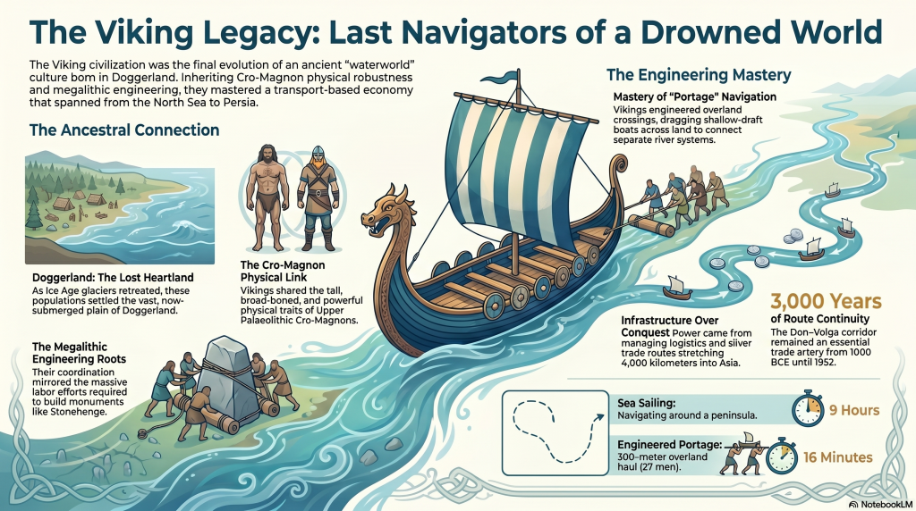
Modern history presents the Vikings as violent northern raiders who suddenly erupted into Europe during the 8th century AD. Popular culture focuses almost entirely on burning monasteries, axe-wielding warriors, and dragon ships attacking England from the sea. Yet this image is deeply misleading because it ignores the true foundation of Viking civilisation. (Vikings, Doggerland, and the Last Survivors of Europe’s Lost Waterworld)
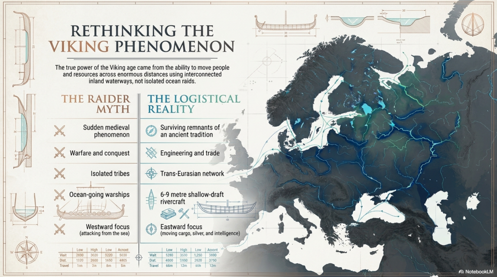
The Viking world was not built primarily on warfare. It was built on transport, logistics, engineering, and trade. The real power of the Vikings came not from isolated raids but from their ability to move people, cargo, weapons, silver, and information across enormous distances via interconnected waterways that stretched deep into Europe and Asia.
(Vikings, Doggerland, and the Last Survivors of Europe’s Lost Waterworld)
When these transport systems are examined carefully, the Vikings begin to look far less like a sudden medieval phenomenon and far more like the surviving remnant of a much older maritime tradition — one whose roots may stretch back thousands of years into the flooded landscapes of Doggerland itself.
The eastern Viking world, in particular, reveals this hidden reality. Here we find a civilisation organised around rivers rather than roads, engineering rather than conquest, and hydrological efficiency rather than territorial borders. This forgotten Viking world may preserve the final memory of Europe’s prehistoric water civilisation long after the megalithic age itself had vanished.
(Vikings, Doggerland, and the Last Survivors of Europe’s Lost Waterworld)
2. Doggerland — The Lost Heart of Northern Europe
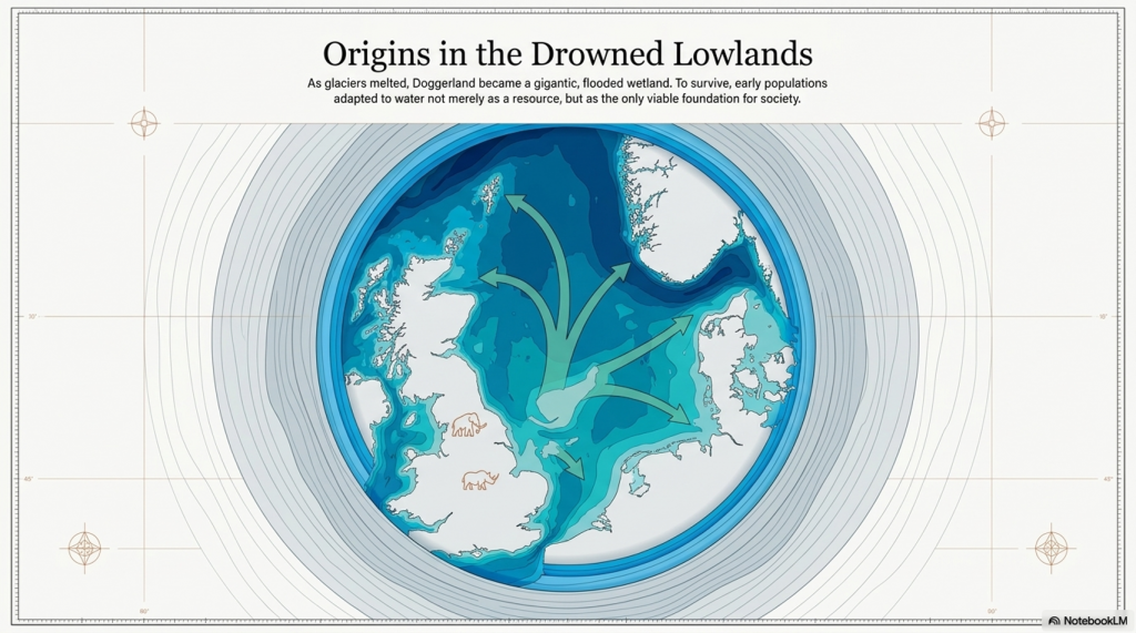
At the end of the last Ice Age, Britain was not an island. Between Britain, Denmark, Holland, and Germany lay a vast lowland plain now buried beneath the North Sea. This lost world — known today as Doggerland — once formed the geographical heart of northern Europe.
Doggerland was not a barren wasteland. Fishing trawlers dredging the North Sea repeatedly recovered evidence showing that this landscape once supported enormous animal populations, including mammoths, woolly rhinoceroses, elk, horses, wolves, walruses, bison, and bears. Human tools and traces of civilisation were also discovered, suggesting that this submerged landscape once supported substantial populations.
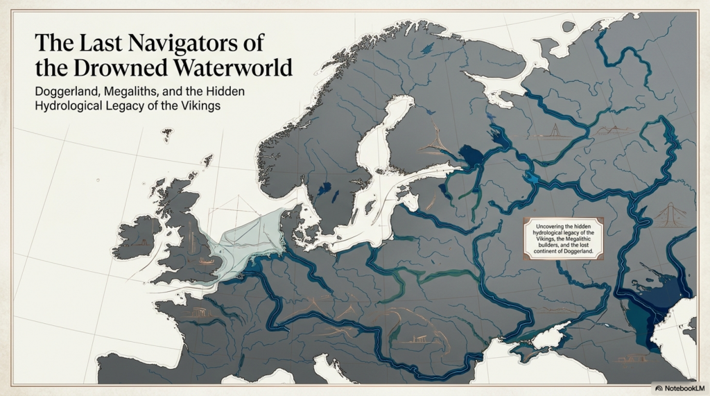
As the glaciers melted, this world did not disappear overnight. Sea levels rose slowly over thousands of years, flooding river valleys, expanding wetlands, and transforming northern Europe into a gigantic interconnected hydrological environment. Vast estuaries formed where modern coastlines now exist, while oversized rivers dominated movement across the continent.
This prolonged flooding fundamentally changed human behaviour. Travel through forests and wetlands became increasingly difficult, while rivers became the easiest and most efficient method of transport. In such an environment, societies adapted to water not merely as a resource, but as the foundation of civilisation itself.
(Vikings, Doggerland, and the Last Survivors of Europe’s Lost Waterworld)
3. Europe Before Roads
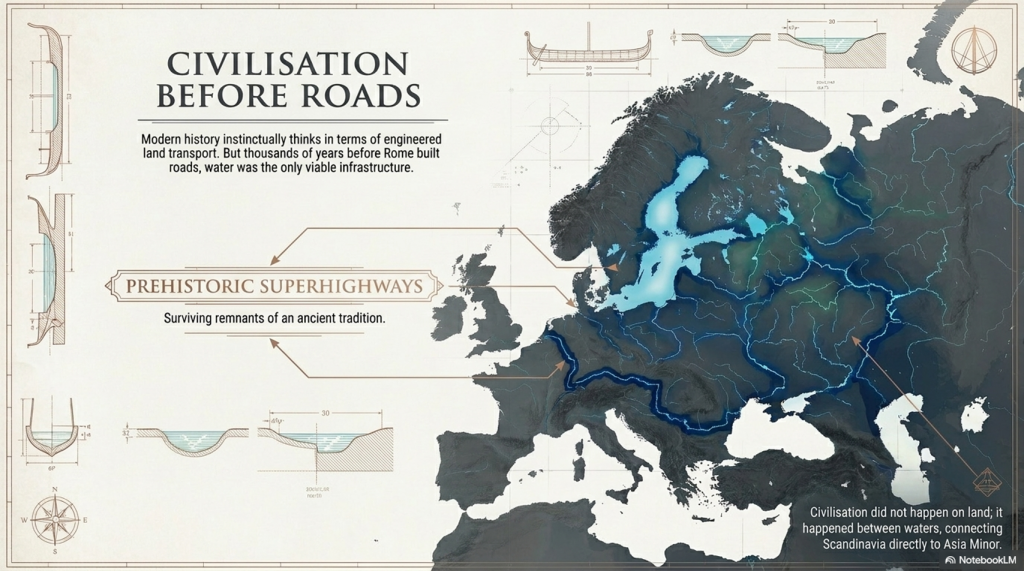
Modern civilisation instinctively thinks in terms of roads, highways, and land transport. But prehistoric Europe functioned very differently. Before engineered road systems existed, rivers served as the primary arteries of movement across the continent.
The great river systems of Europe connected enormous distances:
the Baltic Sea,
the Rhine,
the Danube,
the Black Sea,
and even regions connected to Asia Minor.
These waterways formed prehistoric superhighways across Europe thousands of years before Rome constructed its famous roads.
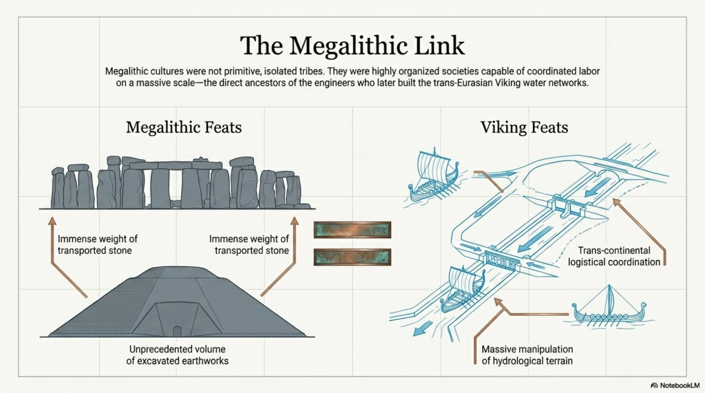
This explains why many prehistoric monuments and settlements repeatedly appear beside rivers, estuaries, wetlands, and drowned landscapes. Megalithic cultures were not isolated inland tribes struggling through forests. They appear to have operated within a maritime and river-based civilisation dependent upon transport corridors created by water itself.
The flooding of Doggerland may therefore have created not merely environmental destruction, but the very conditions necessary for the rise of Europe’s first great maritime trading networks. As coastlines fragmented and wetlands expanded, societies adapted by mastering rivers, estuaries, and shallow seas.
Thousands of years later, traces of this same transport mentality still survived among the Vikings.
(Vikings, Doggerland, and the Last Survivors of Europe’s Lost Waterworld)
4. The Forgotten Eastern Vikings
Popular history remembers the Vikings who sailed westward toward England, Ireland, Iceland, and North America. Yet the eastern Viking world was arguably more sophisticated, more economically important, and more technologically impressive than the western raids that dominate modern imagination.
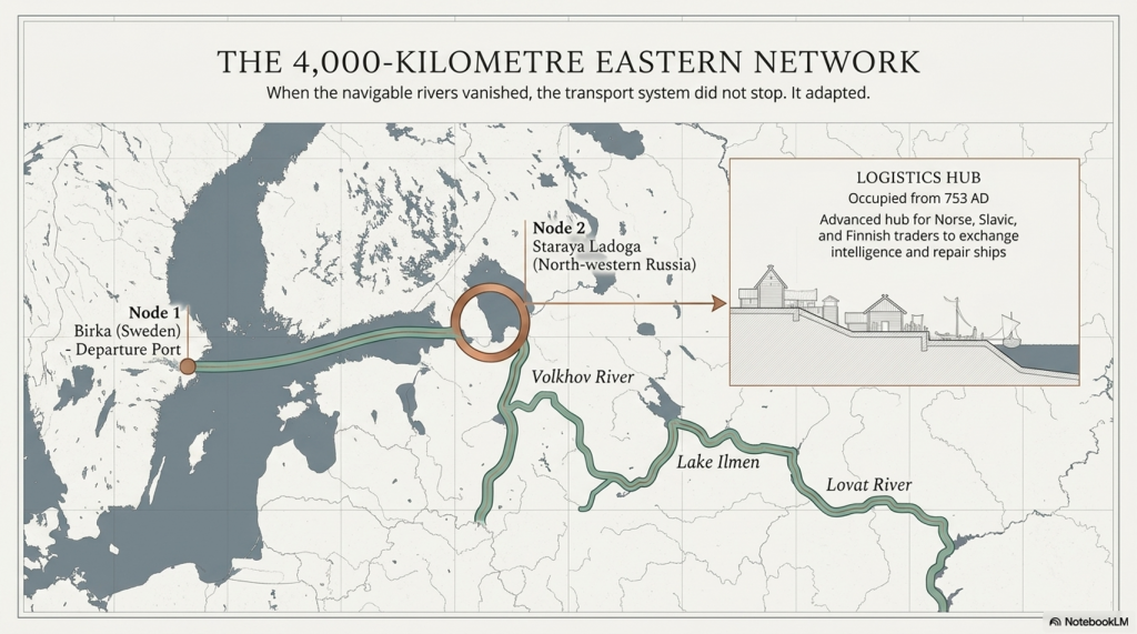
The eastern routes stretched over 4,000 kilometres through:
rivers,
forests,
lakes,
marshes,
and overland crossings connecting Scandinavia to Russia, Byzantium, Persia, and the Islamic world.
The journey began at ports such as Birka in central Sweden. From there, traders crossed the Baltic Sea toward Staraya Ladoga in north-western Russia — a major Scandinavian trading settlement occupied from at least 753 AD.
Ladoga functioned not merely as a settlement but as a logistical hub where Norse, Slavic, and Finnish traders gathered together to repair ships, exchange intelligence, monitor river conditions, organise cargo, and prepare for journeys deeper into Eurasia.
From Ladoga, the traders travelled:
along the Volkhov River,
through Lake Ilmen,
into the Lovat River,
and eventually into regions where navigable water disappeared entirely.
But this did not stop the Viking transport system.
(Vikings, Doggerland, and the Last Survivors of Europe’s Lost Waterworld)
5. Portage — Dragging Ships Across Land
When the rivers ended, the Vikings simply carried the ships across land.
The use of “portage” — engineered overland crossings connecting fragmented river systems. These crossings reveal a civilisation that understood transport efficiency at a remarkably sophisticated level.
(Vikings, Doggerland, and the Last Survivors of Europe’s Lost Waterworld)
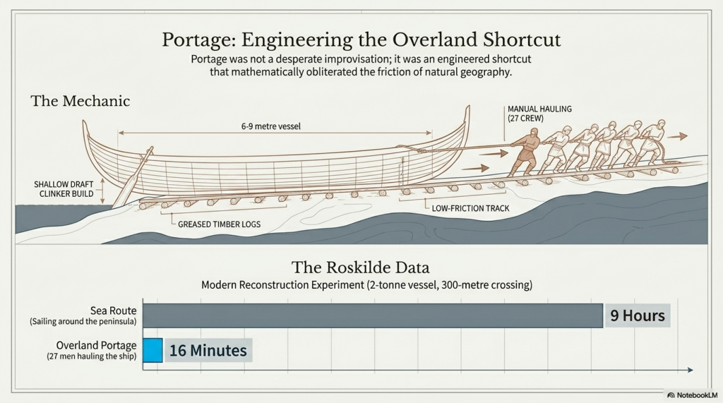
The eastern Viking boats were not gigantic ocean-going warships. Instead, they were smaller clinker-built shallow-draft rivercraft between 6 and 9 metres long, designed specifically for inland navigation and overland hauling.
These boats could be:
dragged over mud,
hauled across greased timber tracks,
or carried between river basins by manpower alone.
One reconstruction experiment carried out by the Viking Ship Museum in Roskilde demonstrated how astonishingly effective this system was. A reconstructed Viking vessel weighing roughly two tonnes was hauled across a 300-metre crossing by 27 men in only 16 minutes.
The alternative route by sea around the peninsula required nine hours of sailing.
The overland crossing took sixteen minutes.
This single experiment fundamentally changes how ancient transport systems should be understood. The Vikings clearly recognised that engineered shortcuts could transform economies far more effectively than blindly following natural coastlines.
(Vikings, Doggerland, and the Last Survivors of Europe’s Lost Waterworld)
6. The Don–Volga Corridor
One Viking portage route dwarfed all others.
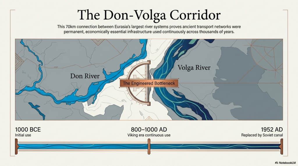
The Don–Volga crossing connected two of Eurasia’s largest river systems through roughly 70 kilometres of relatively flat terrain.
This route remained in continuous use from the first millennium BCE until 1952, when the Soviet Union finally replaced it with a modern canal.
That continuity is extraordinary.
It proves that ancient transport systems were not primitive improvisations but economically essential corridors that operated over thousands of years. Human societies repeatedly recognised the same geographical bottlenecks and repeatedly solved them through engineered hydrological connections.
This also explains why ancient civilisations invested such enormous labour into modifying landscapes. Artificial waterways, canal systems, feeder channels, and engineered crossings become economically obvious once transport efficiency is understood as the driving force behind civilisation itself.
The Vikings did not merely use rivers.
They engineered the spaces between them.
And this same logic may explain many of the mysterious earthworks scattered across prehistoric Europe.
(Vikings, Doggerland, and the Last Survivors of Europe’s Lost Waterworld)
7. Britain’s Dykes and the Logic of Water Transport
Many prehistoric dykes and linear earthworks across Britain continue to puzzle archaeologists. Traditional interpretations describe them as:
defensive walls,
tribal borders,
or symbolic boundaries.
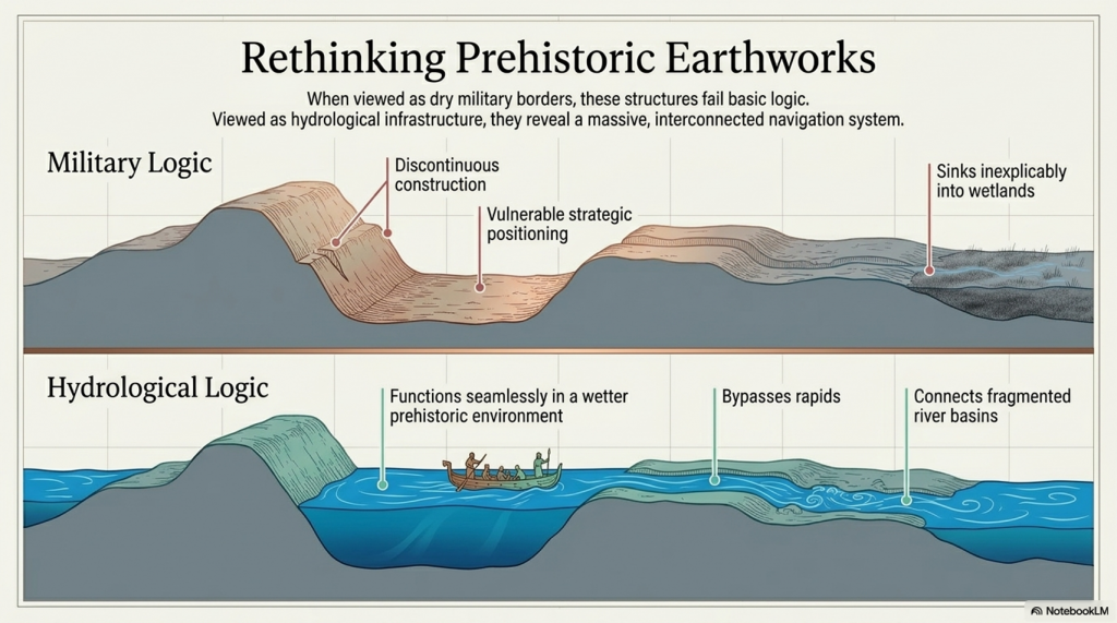
Yet many fail basic military logic. They are often discontinuous, vulnerable, poorly positioned for defence, and closely associated with wetlands and waterlogged terrain.
Viewed as transport infrastructure, however, these systems suddenly make sense.
The Viking evidence demonstrates that ancient societies routinely:
engineered shortcuts,
manipulated waterways,
reduced transport friction,
and physically linked disconnected rivers through artificial crossings.
This suggests that many prehistoric British earthworks may have functioned not as military barriers but as components within larger navigation systems operating during a wetter prehistoric environment.
Artificial canals, seasonal waterways, feeder channels, and engineered portage systems become entirely plausible once Europe is viewed through its hydrological history rather than through the assumptions of modern dry landscapes.
The Viking world, therefore, preserves not only a transport system but the surviving engineering logic of a much older water-based civilisation.
(Vikings, Doggerland, and the Last Survivors of Europe’s Lost Waterworld)
8. The Trade Route to Persia
The eastern Viking routes connected Scandinavia directly to some of the wealthiest civilisations on Earth.
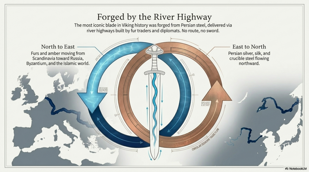
Persian silver flooded into northern Europe. Persian silk appeared in Scandinavian graves. Persian steel travelled northward through the Russian river systems.
One passage from the transcript states:
“The most iconic blade in Viking history was forged from Persian steel carried north along a river highway built by fur traders and diplomats. No route, no sword.”
This reveals the true scale of Viking civilisation.
This was not a primitive warrior culture surviving on theft alone. It was an enormous integrated trade network connecting:
Scandinavia,
Russia,
Byzantium,
the Caspian,
Persia,
and the Islamic world through inland waterways stretching across Eurasia.
Trade routes moved not merely goods, but:
technologies,
ideas,
metallurgy,
engineering methods,
and political influence.
The Vikings were therefore operating inside one of the largest hydrological economies of the medieval world.
(Vikings, Doggerland, and the Last Survivors of Europe’s Lost Waterworld)
9. The Shrinking Rivers of Europe
Perhaps the most important implication of the Viking system is its environmental impact.
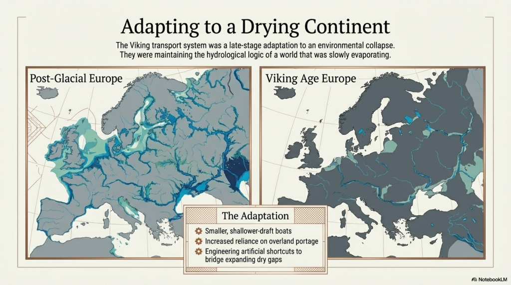
The Vikings were clearly adapting to a Europe where rivers had already shrunk dramatically from their earlier post-glacial scale.
This explains:
the smaller boats,
the fragmented waterways,
the increasing use of portage,
and the growing importance of engineered shortcuts.
Earlier prehistoric Europe was wetter, broader, and far more navigable. During the post-Ice Age flooding phases, rivers and wetlands dominated northern Europe on a scale difficult to imagine today.
The Viking transport system, therefore, appears to represent a late-stage adaptation to the collapse of this older hydrological world.
The transport philosophy survived. The engineering logic survived. The dependence upon waterways survived.
But the environment that created them had fundamentally changed.
The Vikings inherited the memory of a river civilisation long after the great flooded landscapes that gave birth to it had disappeared.
(Vikings, Doggerland, and the Last Survivors of Europe’s Lost Waterworld)
10. The Last Survivors of Europe’s Waterworld
The transcript ends with a haunting observation.
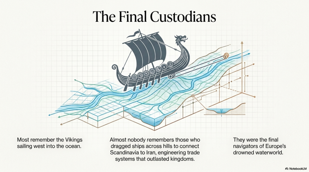
Most people remember the Vikings who sailed westward toward England and the Atlantic.
Almost nobody remembers the Vikings, who:
dragged ships across hills,
connected Scandinavia to Iran,
engineered continental transport corridors,
and created trade systems lasting longer than many kingdoms.
Yet these eastern Vikings may preserve the final surviving echo of Europe’s lost maritime civilisation.
A civilisation born during the flooding of Doggerland. A civilisation organised around rivers rather than roads. A civilisation that survived by engineering waterways and adapting to rising seas.
Doggerland vanished beneath the North Sea. The giant rivers shrank. The megalithic world faded into myth.
But the hydrological logic endured.
And perhaps the Vikings were its final custodians — the last navigators of Europe’s drowned waterworld.
(Vikings, Doggerland, and the Last Survivors of Europe’s Lost Waterworld)
11. Iranian Accounts, Viking Appearance, and the Cro-Magnon Survivors
One of the most important pieces of evidence connecting the Vikings to the older populations of northern Europe comes not from Scandinavia itself, but from the Islamic world.
In 921 AD, Ahmad Ibn Fadlan left Baghdad on a diplomatic mission to the Volga Bulgars and encountered Viking traders operating along the great eastern river routes. What he wrote remains the single most detailed first-hand account of Viking merchants ever recorded.
His description is extraordinary.
He described the Vikings — the Rus — as:
the tallest men he had ever seen,
built “like palm trees,”
fair-skinned,
heavily tattooed,
physically imposing,
and unlike the populations surrounding them.
This matters enormously because these observations were written by an outsider from Persia who had no cultural reason to exaggerate northern Europeans into mythical giants. To Ibn Fadlan, these people genuinely appeared physically different from the populations of the Islamic world.
The same physical pattern repeatedly appears elsewhere in northern European traditions.
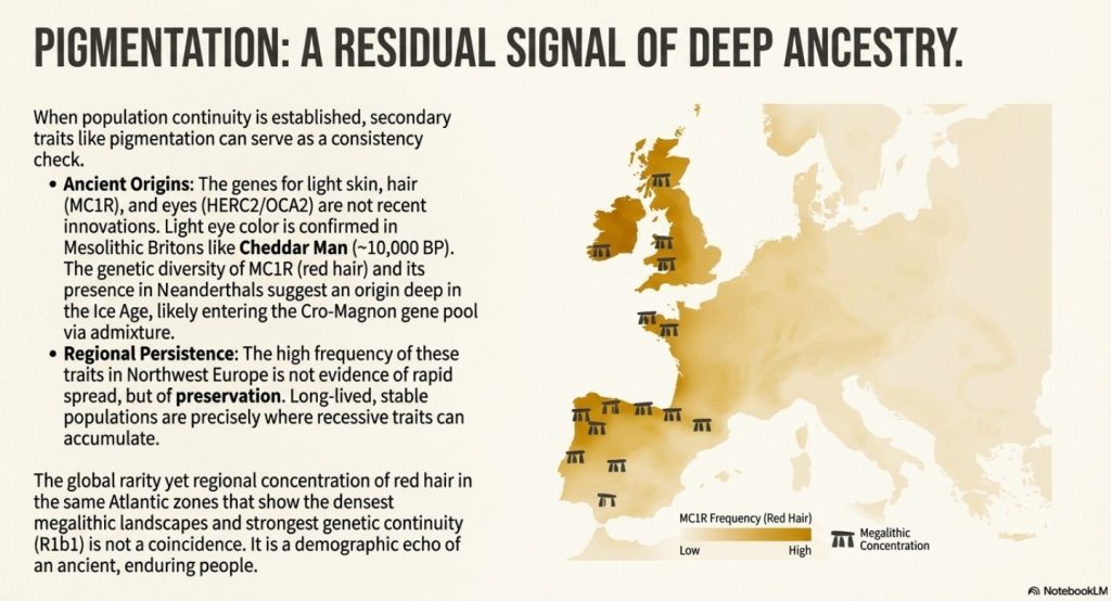
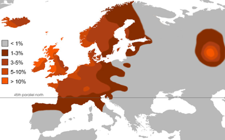
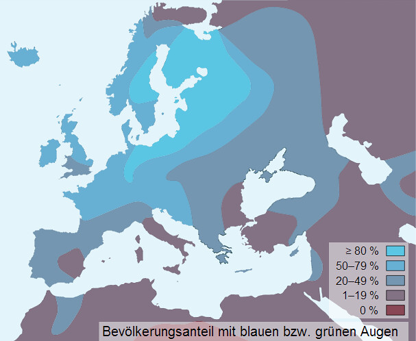
Descriptions associated with the Achaeans, Hyperboreans, and northern heroic populations repeatedly reference:
blond hair,
red hair,
blue eyes,
exceptional stature,
and fair skin.
The Iranian Avesta traditions describing the Golden Age of Yima also preserve memories of a northern civilisation associated with abundance, long life, and a northern homeland connected to Hyperborean traditions.
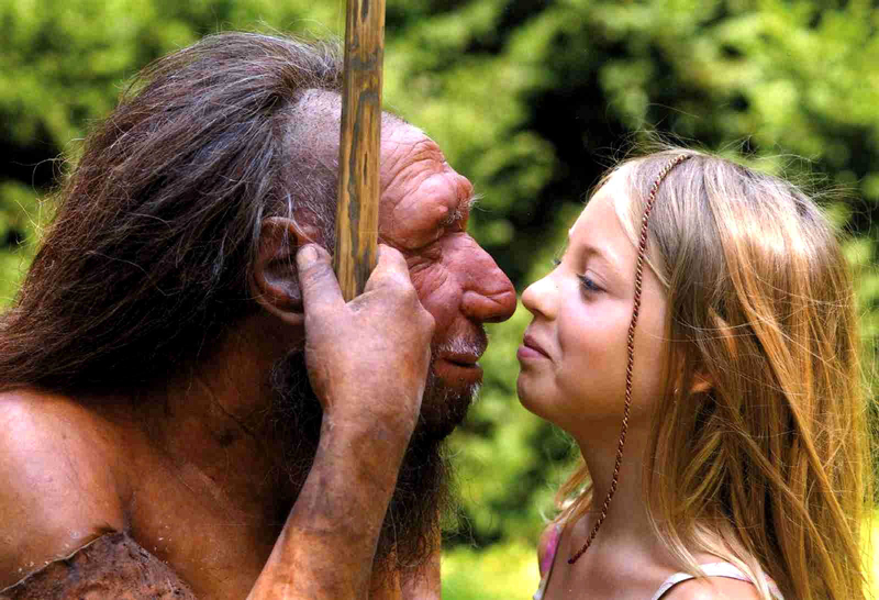
These descriptions become highly relevant when compared to the Cro-Magnon populations associated with Upper Palaeolithic northern Europe.
(Vikings, Doggerland, and the Last Survivors of Europe’s Lost Waterworld)
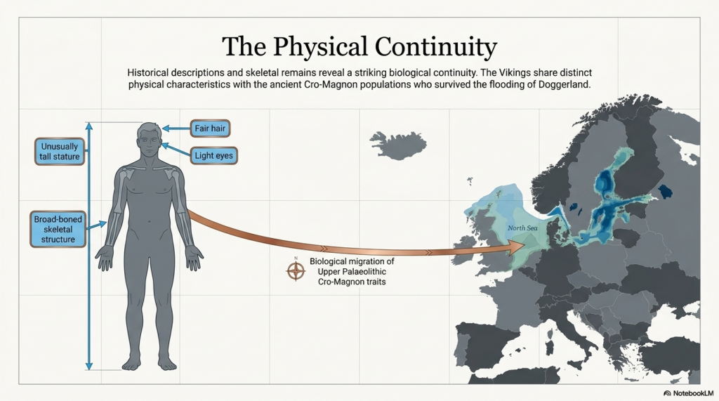
Cro-Magnon skeletal remains are frequently characterised by:
unusual height,
robust bone structure,
broad frames,
and strong physical development.
The same broad physical pattern appears repeatedly among Viking skeletal remains and historical descriptions.
This connection becomes even more significant when placed beside the engineering scale of the megalithic world.
The construction of:
Stonehenge,
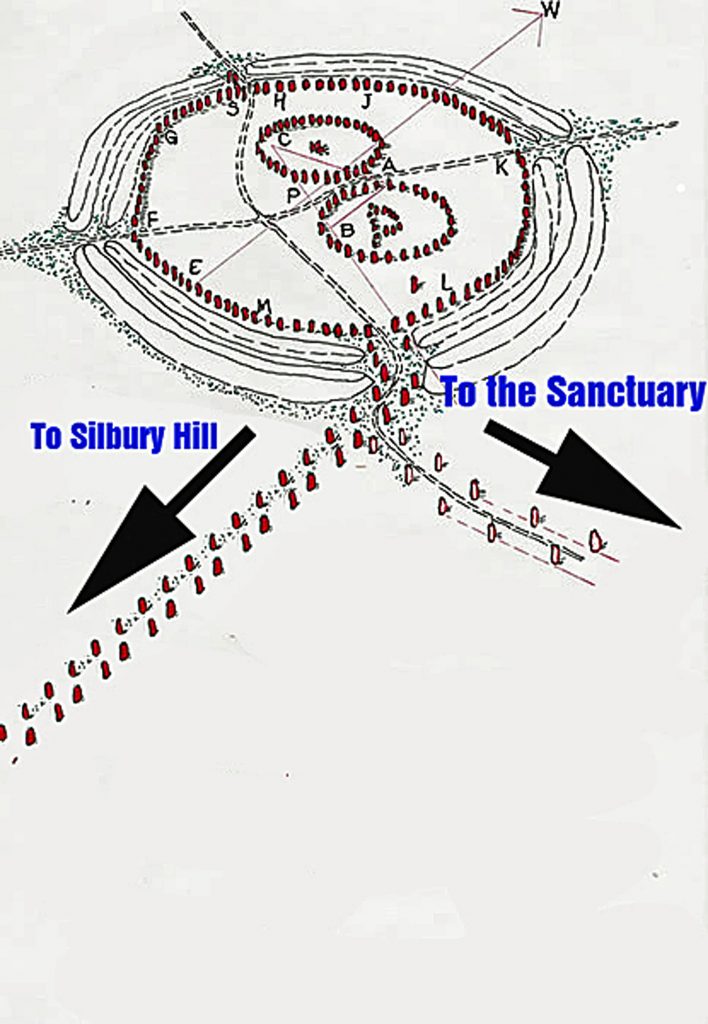
Avebury,
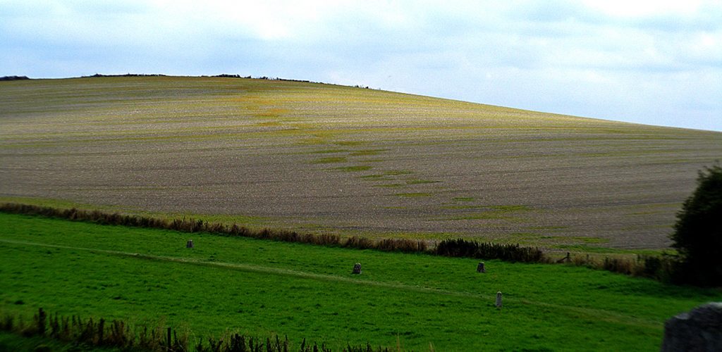
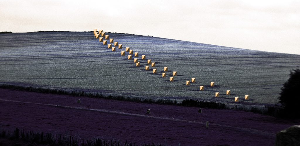
Silbury Hill,
the giant dykes,
canals,
and massive earthworks
(Vikings, Doggerland, and the Last Survivors of Europe’s Lost Waterworld)
required populations capable of sustained heavy labour on an enormous scale. The repeated descriptions of unusually tall, physically powerful northern populations preserved in:
Persian accounts,
Greek traditions,
Viking descriptions,
and Hyperborean mythology
may therefore represent fragmented cultural memories of the same northern maritime peoples who once occupied Doggerland and later dispersed across Europe after the flooding of the North Sea basin.
The Vikings may not simply have inherited the waterways of the prehistoric world.
They may have inherited the people as well.
The descendants of the tall, fair-haired maritime populations who once navigated the flooded rivers and estuaries of Doggerland thousands of years before recorded history — surviving into the medieval world as the Rus traders described by Ibn Fadlan on the banks of the Volga.
(Vikings, Doggerland, and the Last Survivors of Europe’s Lost Waterworld)
EXPLAINER
PODCAST
Author’s Biography
Robert John Langdon, a polymathic luminary, emerges as a writer, historian, and eminent specialist in LiDAR Landscape Archaeology.
His intellectual voyage has been interwoven with stints as an astute scrutineer in government and grand corporate bastions, a tapestry spanning British Telecommunications, Cable and Wireless, British Gas, and the esteemed University of London.
A decade hence, Robert’s transition into retirement unfurled a chapter of insatiable curiosity. This phase saw him immerse himself in Politics, Archaeology, Philosophy, and the enigmatic realm of Quantum Mechanics. His academic odyssey traversed the venerable corridors of knowledge hubs such as the Museum of London, University College London, Birkbeck College, The City Literature Institute, and Chichester University.
In the symphony of his life, Robert is a custodian of three progeny and a pair of cherished grandchildren. His sanctuary lies ensconced in the embrace of West Wales, where he inhabits an isolated cottage, its windows framing a vista of the boundless sea – a retreat from the scrutinising gaze of Her Majesty’s Revenue and Customs, an amiable clandestinity in the lap of nature.
Exploring Prehistoric Britain: A Journey Through Time
My blog delves into the fascinating mysteries of prehistoric Britain, challenging conventional narratives and offering fresh perspectives grounded in cutting-edge research, particularly LiDAR technology. I invite you to explore some key areas of my research. For example, the Wansdyke, often cited as a defensive structure, is re-examined in light of new evidence. I’ve presented my findings in my blog post Wansdyke: A British Frontier Wall – ‘Debunked’, and a Wansdyke LiDAR Flyover video further visualises my conclusions.
My work also often challenges established archaeological dogma. I argue that many sites, such as Hambledon Hill, commonly identified as Iron Age hillforts, are not what they seem. My posts Lidar Investigation Hambledon Hill – NOT an ‘Iron Age Fort’ and Unmasking the “Iron Age Hillfort” Myth explore these ideas in detail and offer an alternative view. Similarly, sites like Cissbury Ring and White Sheet Camp receive re-evaluations based on LiDAR analysis in my posts “Lidar Investigation Cissbury Ring through time”and “Lidar Investigation White Sheet Camp,“ revealing fascinating insights into their true purpose. I have also examined South Cadbury Castle, often linked to the mythical Camelot56.
My research also extends to ancient water management, including the role of canals and other linear earthworks. I have discussed the true origins of Car Dyke in multiple posts, including Car Dyke – ABC News Podcast and Lidar Investigation Car Dyke – North Section, which suggest a Mesolithic origin 2357. I also explore the misidentification of Roman aqueducts, as seen in my posts on the Great Chesters (Roman) Aqueduct. My research has also been greatly informed by my post-glacial flooding hypothesis, which has helped explain landscape transformations over time. I have discussed this hypothesis in several posts, including AI now supports my Post-Glacial Flooding Hypothesis and Exploring Britain’s Flooded Past: A Personal Journey
For those interested in British Prehistory, visit www.prehistoric-britain.co.uk, a comprehensive resource featuring an extensive collection of archaeology articles, modern LiDAR investigations, and groundbreaking research. The site also includes insights and excerpts from the acclaimed Robert John Langdon Trilogy, a series of books that explore Britain during the Prehistoric period. Titles in the trilogy include The Stonehenge Enigma, Dawn of the Lost Civilisation, and The Post-Glacial Flooding Hypothesis, which offer compelling evidence of ancient landscapes shaped by post-glacial flooding.
To further explore these topics, Robert John Langdon has developed a dedicated YouTube channel featuring over 100 video documentaries and investigations that complement the trilogy. Notable discoveries and studies showcased on the channel include 13 Things that Don’t Make Sense in History and the revelation of Silbury Avenue – The Lost Stone Avenue, a rediscovered prehistoric feature at Avebury, Wiltshire.
In addition to his main works, Langdon has released a series of shorter, accessible publications, ideal for readers delving into specific topics. These include:
For active discussions and updates on the trilogy’s findings and recent LiDAR investigations, join our vibrant community on Facebook. Engage with like-minded enthusiasts by leaving a message or contributing to debates in our Facebook Group.
Whether through the books, the website, or interactive videos, we aim to provide a deeper understanding of Britain’s fascinating prehistoric past. We encourage you to explore these resources and uncover the mysteries of ancient landscapes through the lens of modern archaeology.
For more information, including chapter extracts and related publications, visit the Robert John Langdon Author Page. Dive into works such as The Stonehenge Enigma or Dawn of the Lost Civilisation, and explore cutting-edge theories that challenge traditional historical narratives.
Were the Constellations Originally a Navigational System?
A Long-Term Research Project for 2026/7
Introduction
For thousands of years, humanity has looked upward and seen stories written in the stars.
Ancient cultures named constellations after animals, heroes, gods, monsters, hunters and mythical creatures. Archaeologists and historians generally assume these star patterns were primarily symbolic, religious, or mythological in nature. (Sky Maps of Prehistoric Britain)
But there is a major problem.
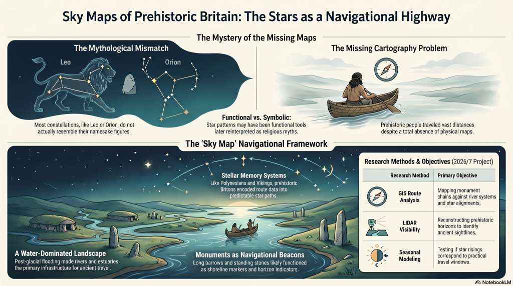
Most constellations do not actually resemble the creatures they supposedly represent.
The Great Bear resembles neither a bear nor a wagon. Orion does not resemble a hunter. Leo looks nothing like a lion. Draco barely resembles a dragon.
In many cases, the supposed shapes appear forced, inconsistent, or entirely dependent on later artistic interpretation.
This raises an important question:
What if the original purpose of many stellar patterns was not mythology at all?
What if they were functional?
More specifically:
What if ancient star systems originally formed part of a navigational framework used by an early maritime civilisation operating across the flooded landscapes of post-glacial Europe?
This article outlines a new long-term research project planned for 2026, investigating whether the stars themselves may once have formed part of an integrated navigational system connected to prehistoric waterways, coastlines, monuments, and seasonal movement.
The purpose of this project is not to make unsupported claims, but to establish whether this idea can be scientifically investigated using measurable evidence.
(Sky Maps of Prehistoric Britain)
The Foundation of the Hypothesis
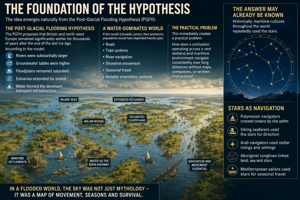
The idea emerges naturally from the Post-Glacial Flooding Hypothesis (PGFH).
The PGFH proposes that Britain and north-west Europe remained significantly wetter for thousands of years after the end of the last Ice Age.
According to the model:
rivers were substantially larger,
groundwater tables were higher,
floodplains remained saturated,
estuaries extended far inland,
and water formed the dominant transport infrastructure.
If this model is broadly correct, then prehistoric populations would have depended heavily upon:
boats,
tidal systems,
river navigation,
shoreline movement,
seasonal travel,
and reliable orientation systems.
This immediately creates a practical problem.
How does a civilisation operating across a vast wetland and maritime environment navigate consistently over long distances without maps, compasses, or written instructions?
The answer may already be known.
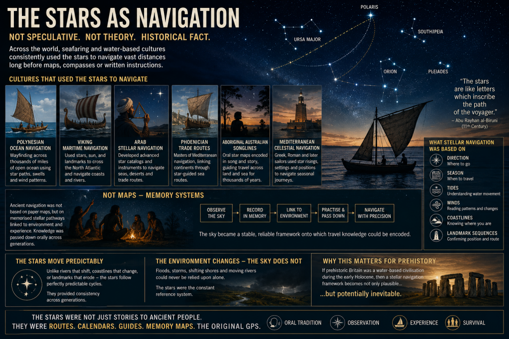
Historically, maritime cultures throughout the world repeatedly used the stars.
(Sky Maps of Prehistoric Britain)
The Stars as Navigation
The use of stars for navigation is not speculative. It is a historical fact.
Examples include:
Polynesian ocean navigation
Viking maritime navigation
Arab stellar navigation
Phoenician trade routes
Aboriginal Australian songlines
Mediterranean celestial navigation
In many cases, navigation was not based on maps in the modern sense, but on memorised stellar pathways tied to:
direction,
season,
tides,
winds,
coastlines,
and landmark sequences.
This is critical.
Ancient navigation often functioned as a memory system.
The sky became a stable framework onto which travel knowledge could be encoded.
Unlike coastlines or rivers, the stars moved predictably. They provided consistency across generations.
If prehistoric Britain operated as a water-based civilisation during the early Holocene, then a stellar navigation framework becomes not only plausible, but potentially inevitable.
(Sky Maps of Prehistoric Britain)
The Missing Maps Problem
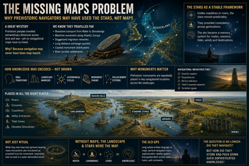
One of the great mysteries of prehistoric maritime movement is the apparent absence of navigational maps.
We know prehistoric populations travelled extraordinary distances.
Examples include:
Bluestone transport from Wales to Stonehenge
Maritime movement along Atlantic Europe
Doggerland migration networks
Long-distance exchange systems
Coastal monument distributions
River corridor settlements
Yet no conventional cartographic systems survive.
This may be because navigation itself was never primarily map-based.
Instead, route knowledge may have been embedded within:
oral traditions,
landscape markers,
astronomical cycles,
monument chains,
and stellar memory systems.
This possibility becomes especially interesting when viewed alongside the repeated placement of prehistoric monuments near:
rivers,
estuaries,
coastlines,
valley entrances,
tidal zones,
and elevated shoreline positions.
Long barrows, standing stones, beacon hills, avenues, dykes, and henges may not simply represent ritual locations.
Some may have functioned as navigational infrastructure.
(Sky Maps of Prehistoric Britain)
Long Barrows and Landscape Markers
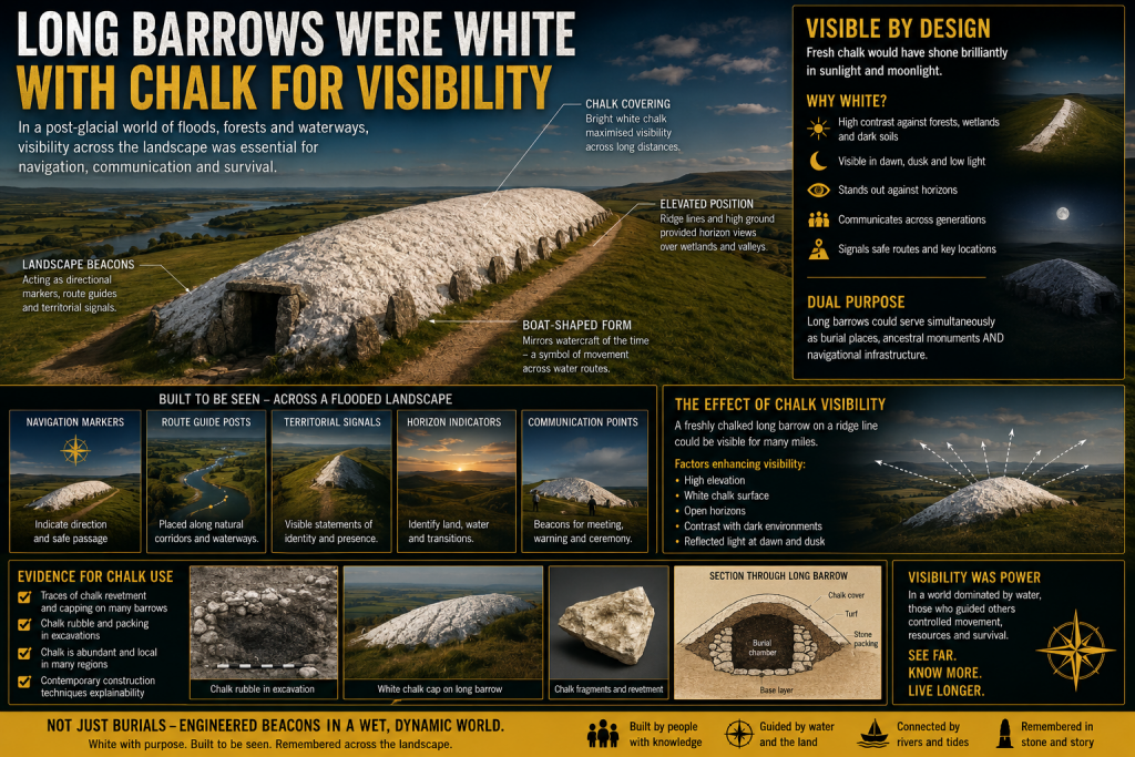
One of the most intriguing aspects of prehistoric Britain is the repeated positioning of monuments along visible movement corridors.
Long barrows in particular often occupy:
ridge lines,
valley edges,
coastal approaches,
elevated viewpoints,
or route intersections.
Traditionally, these sites are interpreted almost exclusively through ritual or funerary frameworks.
But there is another possibility.
In a landscape dominated by wetlands and waterways, elevated monuments would naturally function as:
directional markers,
navigation points,
horizon indicators,
territorial signals,
or route beacons.
This does not exclude symbolic meaning.
The same structure can serve both practical and cultural purposes simultaneously.
Indeed, this dual-function model is common throughout human history.
Church towers, lighthouses, harbour beacons, hill forts, and even modern skyscrapers operate as both symbols and navigational markers.
The same may have applied in prehistory.
(Sky Maps of Prehistoric Britain)
Why the Constellations Matter
The more complex question is whether the constellations themselves formed part of this navigational architecture.
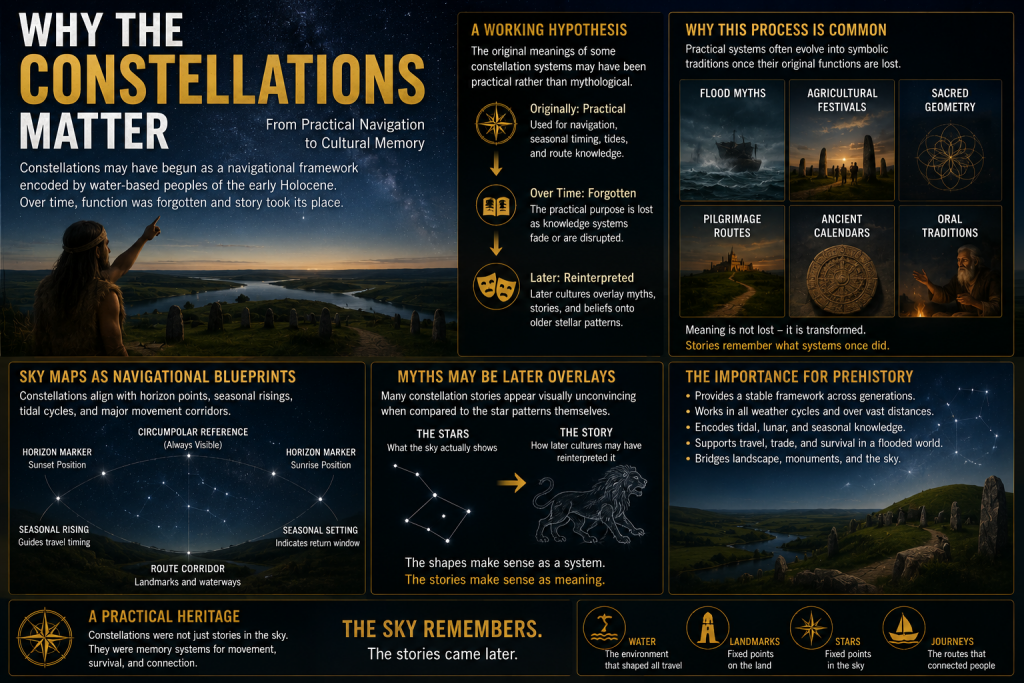
This project proposes a cautious working hypothesis:
The original meanings of some constellation systems may have been practical rather than mythological.
Over time, as the original navigational framework was forgotten, later cultures may have reinterpreted older stellar systems through:
mythology,
religion,
folklore,
and storytelling.
This process is not unusual.
Throughout history, practical systems often evolve into symbolic traditions once their original functions are lost.
Examples include:
flood myths,
agricultural festivals,
sacred geometry,
pilgrimage routes,
and ancient calendrical systems.
The same process may explain why many modern constellation interpretations appear visually unconvincing.
The animals and heroes may represent later narrative overlays applied onto much older orientation frameworks.
(Sky Maps of Prehistoric Britain)
Current Evidence Supporting the Idea
At present, there is no direct proof that constellations encoded prehistoric navigation routes.
However, several independent lines of evidence support the broader possibility.
1. Proven Stellar Navigation in Ancient Cultures
The use of stars for navigation is universally documented.
This establishes that:
stars can encode movement systems,
oral navigation is possible,
and complex route memory can operate without maps.
2. Water-Dominated Early Holocene Landscapes
The PGFH and associated geological evidence suggest:
extensive wetlands,
enlarged river systems,
inland tidal environments,
and maritime dependency.
Such environments strongly favour navigation-based societies.
3. Monument Distribution Along Water Systems
Many prehistoric sites cluster around:
rivers,
floodplains,
estuaries,
coastal corridors,
and elevated shoreline terrain.
This pattern is more consistent with movement infrastructure than isolated ritual placement.
4. Horizon Astronomy in Prehistory
Prehistoric societies demonstrably tracked:
solar cycles,
lunar cycles,
solstices,
equinoxes,
and horizon alignments.
Once astronomical observation is accepted, the application to navigation becomes entirely plausible.
5. Seasonal Movement Systems
Maritime societies depend upon predictable seasonal timing.
Stars naturally provide:
seasonal indicators,
directional consistency,
and long-distance orientation.
6. Ethnographic Parallels
Multiple indigenous cultures linked:
landscape movement,
memory systems,
navigation,
and stars.
This provides real-world functional parallels.
What This Project Will Attempt to Test
The 2026 project will focus on measurable and testable questions rather than speculation.
Key research areas include:
GIS Route Analysis
Testing whether:
monument chains,
river systems,
long barrows,
beacon hills,
and prehistoric movement corridors
show statistically significant astronomical relationships.
Seasonal Navigation Modelling
Investigating whether:
key stars,
heliacal risings,
lunar cycles,
or stellar azimuths
correspond to practical travel windows within prehistoric water systems.
Horizon Visibility Studies
Using LiDAR and digital terrain models to reconstruct:
prehistoric horizons,
sightlines,
beacon visibility,
and navigational marker ranges.
Maritime Route Reconstruction
Reconstructing:
post-glacial coastlines,
flooded valleys,
inland estuaries,
and navigable river systems.
The aim is to determine whether major monuments occupy logical positions within ancient transport networks.
Statistical Testing
This is essential.
Any proposed alignment or pattern must be tested against random distributions.
Without statistical controls, pattern recognition rapidly becomes subjective.
The project, therefore, intends to:
establish falsifiable criteria,
use control datasets,
compare against random models,
and avoid arbitrary alignment selection.
What This Project Is NOT Claiming
This research does not claim:
that every constellation is a map,
that mythology is irrelevant,
or that all prehistoric monuments were navigational.
Nor does it claim direct proof already exists.
Instead, the project asks a more careful scientific question:
Could an aquatic civilisation operating across flooded post-glacial landscapes have encoded navigational knowledge into stable stellar frameworks?
At present, the answer appears plausible.
Whether it is correct remains to be tested.
Why This Matters
If even part of this hypothesis proves correct, the implications would be profound.
It would suggest that:
prehistoric Britain possessed far more advanced navigational systems than traditionally assumed,
monuments may have functioned as infrastructure as well as symbolism,
astronomy was practical rather than purely ceremonial,
and early maritime societies may have operated sophisticated memory-based route systems long before formal cartography.
Most importantly, it would further support the emerging picture of a civilisation shaped not by isolated ritual sites, but by movement, water, navigation, and environmental adaptation.
In short:
The stars may not simply have inspired prehistoric civilisation.
They may have guided it.
Future Research Updates
This article represents the beginning of a long-term research project planned for 2026.
Future work will include:
GIS modelling
Hydrological reconstruction
Stellar simulation analysis
Monument alignment databases
Statistical testing
Maritime route reconstruction
LiDAR visibility studies
Ethnographic comparison
Updates will be published through:
Prehistoric Britain
and associated research publications.
Final Thought
Modern civilisation separates:
astronomy,
geography,
navigation,
religion,
engineering,
and landscape.
Prehistoric societies may not have.
For people living in a flooded world of rivers, marshes, estuaries, tides, and coastlines, the sky itself may have functioned as the oldest navigation system humanity ever created.
And perhaps, hidden within the stars, fragments of those ancient water routes still remain.
PODCAST
Author’s Biography
Robert John Langdon, a polymathic luminary, emerges as a writer, historian, and eminent specialist in LiDAR Landscape Archaeology.
His intellectual voyage has been interwoven with stints as an astute scrutineer in government and grand corporate bastions, a tapestry spanning British Telecommunications, Cable and Wireless, British Gas, and the esteemed University of London.
A decade hence, Robert’s transition into retirement unfurled a chapter of insatiable curiosity. This phase saw him immerse himself in Politics, Archaeology, Philosophy, and the enigmatic realm of Quantum Mechanics. His academic odyssey traversed the venerable corridors of knowledge hubs such as the Museum of London, University College London, Birkbeck College, The City Literature Institute, and Chichester University.
In the symphony of his life, Robert is a custodian of three progeny and a pair of cherished grandchildren. His sanctuary lies ensconced in the embrace of West Wales, where he inhabits an isolated cottage, its windows framing a vista of the boundless sea – a retreat from the scrutinising gaze of Her Majesty’s Revenue and Customs, an amiable clandestinity in the lap of nature.
Exploring Prehistoric Britain: A Journey Through Time
My blog delves into the fascinating mysteries of prehistoric Britain, challenging conventional narratives and offering fresh perspectives grounded in cutting-edge research, particularly LiDAR technology. I invite you to explore some key areas of my research. For example, the Wansdyke, often cited as a defensive structure, is re-examined in light of new evidence. I’ve presented my findings in my blog post Wansdyke: A British Frontier Wall – ‘Debunked’, and a Wansdyke LiDAR Flyover video further visualises my conclusions.
My work also often challenges established archaeological dogma. I argue that many sites, such as Hambledon Hill, commonly identified as Iron Age hillforts, are not what they seem. My posts Lidar Investigation Hambledon Hill – NOT an ‘Iron Age Fort’ and Unmasking the “Iron Age Hillfort” Myth explore these ideas in detail and offer an alternative view. Similarly, sites like Cissbury Ring and White Sheet Camp receive re-evaluations based on LiDAR analysis in my posts “Lidar Investigation Cissbury Ring through time”and “Lidar Investigation White Sheet Camp,“ revealing fascinating insights into their true purpose. I have also examined South Cadbury Castle, often linked to the mythical Camelot56.
My research also extends to ancient water management, including the role of canals and other linear earthworks. I have discussed the true origins of Car Dyke in multiple posts, including Car Dyke – ABC News Podcast and Lidar Investigation Car Dyke – North Section, which suggest a Mesolithic origin 2357. I also explore the misidentification of Roman aqueducts, as seen in my posts on the Great Chesters (Roman) Aqueduct. My research has also been greatly informed by my post-glacial flooding hypothesis, which has helped explain landscape transformations over time. I have discussed this hypothesis in several posts, including AI now supports my Post-Glacial Flooding Hypothesis and Exploring Britain’s Flooded Past: A Personal Journey
For those interested in British Prehistory, visit www.prehistoric-britain.co.uk, a comprehensive resource featuring an extensive collection of archaeology articles, modern LiDAR investigations, and groundbreaking research. The site also includes insights and excerpts from the acclaimed Robert John Langdon Trilogy, a series of books that explore Britain during the Prehistoric period. Titles in the trilogy include The Stonehenge Enigma, Dawn of the Lost Civilisation, and The Post-Glacial Flooding Hypothesis, which offer compelling evidence of ancient landscapes shaped by post-glacial flooding.
To further explore these topics, Robert John Langdon has developed a dedicated YouTube channel featuring over 100 video documentaries and investigations that complement the trilogy. Notable discoveries and studies showcased on the channel include 13 Things that Don’t Make Sense in History and the revelation of Silbury Avenue – The Lost Stone Avenue, a rediscovered prehistoric feature at Avebury, Wiltshire.
In addition to his main works, Langdon has released a series of shorter, accessible publications, ideal for readers delving into specific topics. These include:
For active discussions and updates on the trilogy’s findings and recent LiDAR investigations, join our vibrant community on Facebook. Engage with like-minded enthusiasts by leaving a message or contributing to debates in our Facebook Group.
Whether through the books, the website, or interactive videos, we aim to provide a deeper understanding of Britain’s fascinating prehistoric past. We encourage you to explore these resources and uncover the mysteries of ancient landscapes through the lens of modern archaeology.
For more information, including chapter extracts and related publications, visit the Robert John Langdon Author Page. Dive into works such as The Stonehenge Enigma or Dawn of the Lost Civilisation, and explore cutting-edge theories that challenge traditional historical narratives.
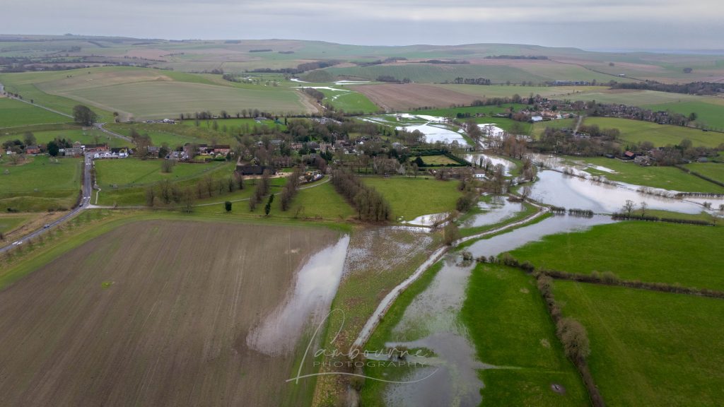
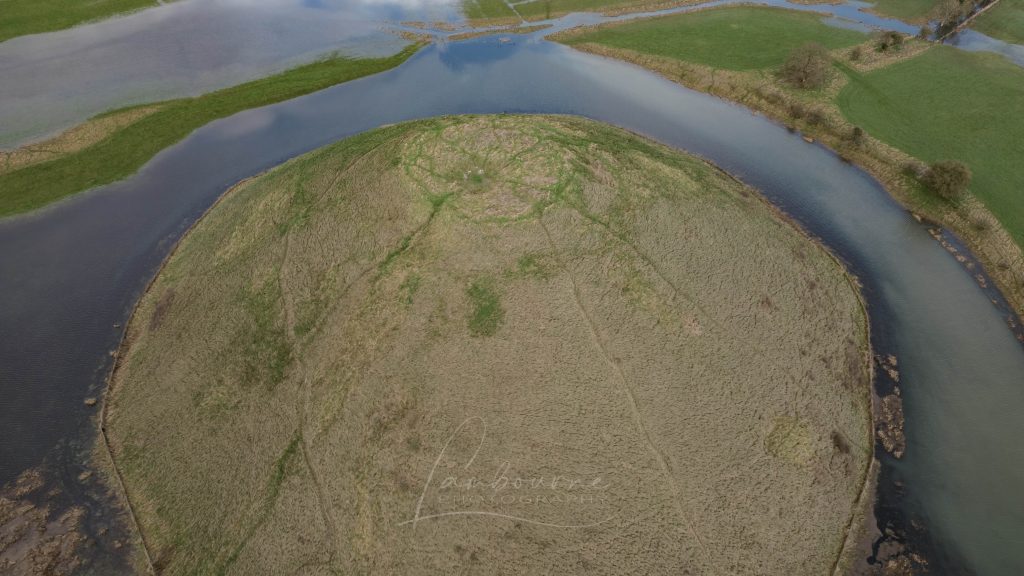
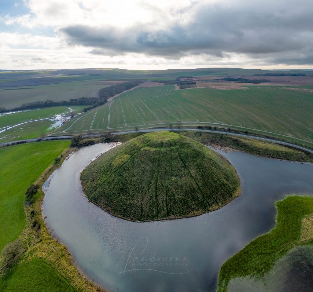
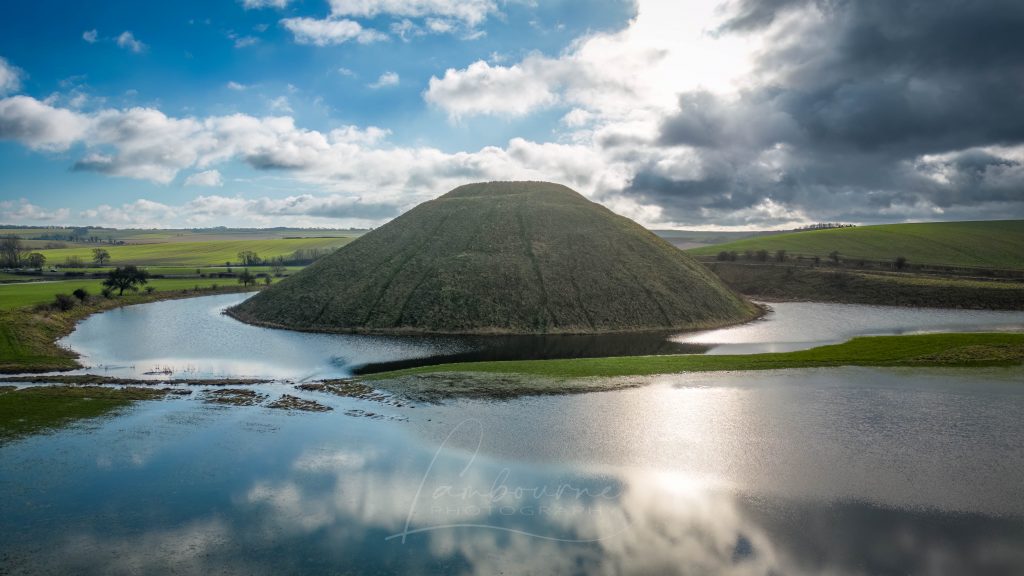
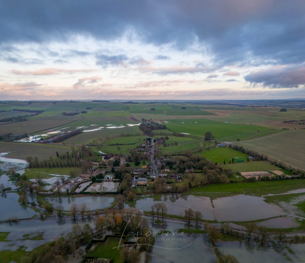
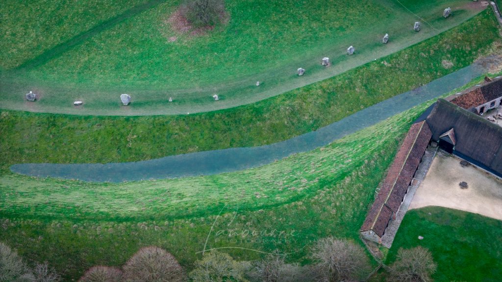
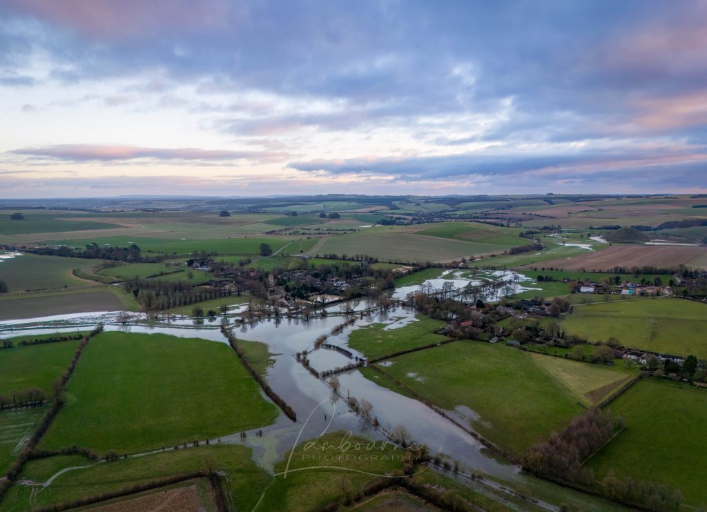
Recently, I received a message from my friend Chris at Lambourne Photography, who shared new winter photos of Avebury. The landscape, experiencing recorded rainfall, has begun to flood, capturing my keen interest. This flooding aligns with the predictions in my prehistoric Avebury maps, considering the post-glacial flooding during the Mesolithic period (10k to 4k BCE) – (Real-World Confirmation of Post-Glacial Flooding)
Copyright – Lambourne Photography (Real-World Confirmation of Post-Glacial Flooding)
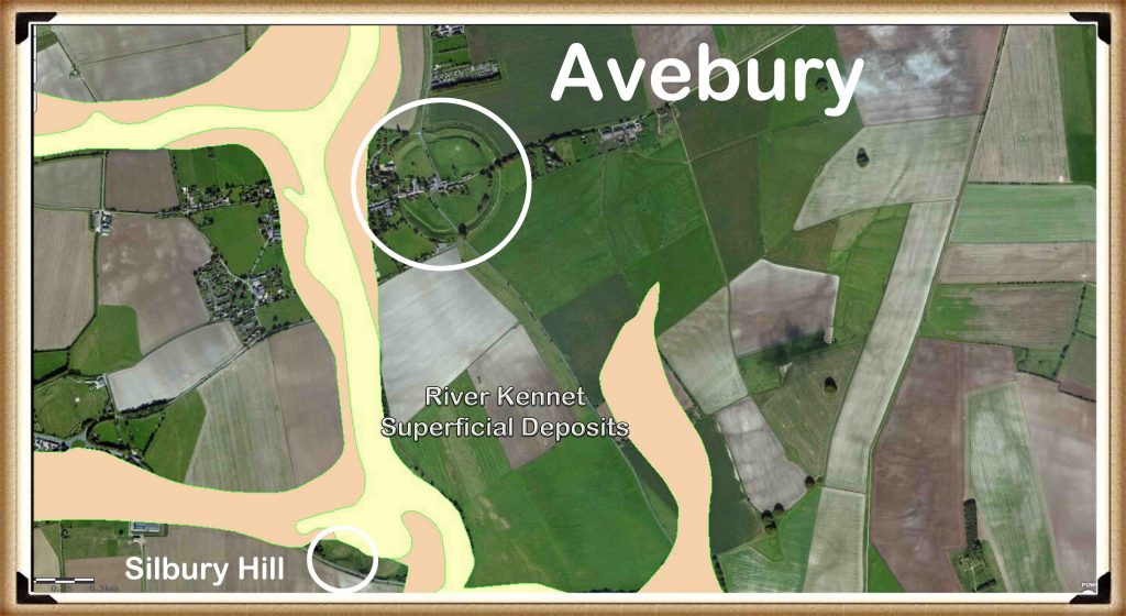
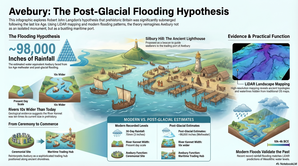
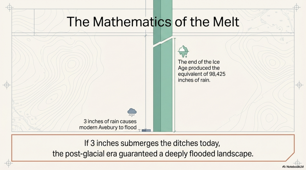
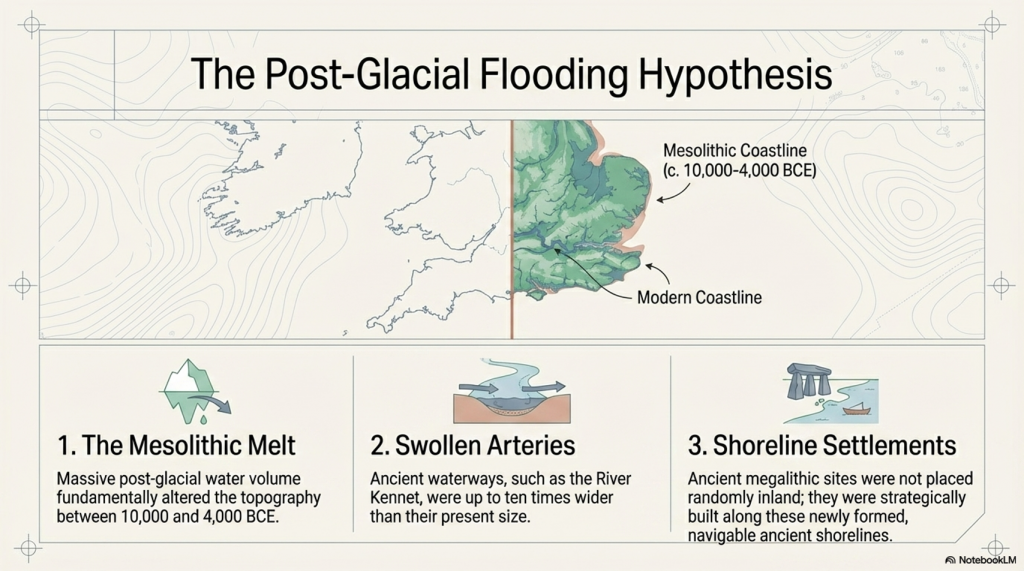
It’s intriguing that Avebury received 70mm (3 inches) of rain over the last 30 days. However, reflecting on the end of the Ice Age and the substantial melt, Avebury would have encountered the equivalent of 98,425 inches of rain. Common sense implies that this area would have experienced significant flooding, corroborated by the British Geological Maps, albeit not entirely accurate, which illustrate the extent of post-glacial flooding, with the Kennet River ten times wider than its present size. (Avebury Post-Glacial Flooding)
Avebury Post-Glacial Flooding
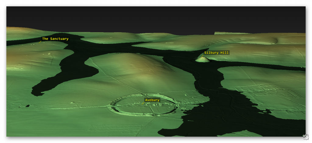
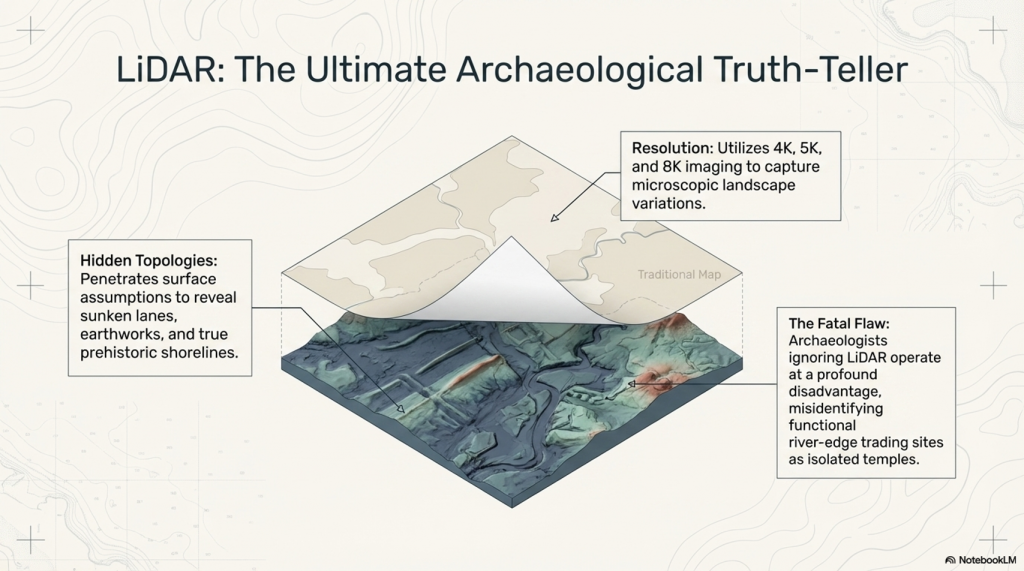
The photographs depict the flooding extending West around the Avebury Stone circle—as indicated on both British Geological Survey (BGS) map but more precisely with the area indicated in my LiDAR maps. This serves as empirical evidence supporting the Post-Glacial Flooding Hypothesis and reinforces my assertion that LiDAR is the paramount landscape-mapping tool, regrettably underutilised by archaeologists to their disadvantage.(Avebury Post-Glacial Flooding)
Avebury Post-Glacial Flooding
The significance of this was underscored in the recent episode of ‘Digging for Britain,’ where a settlement was discovered. The attempt to justify its location and function relied on a modern OS map, leading to an absurd and inaccurate conclusion—namely, that it served a ceremonial purpose rather than a functional trading place at the river’s edge. This further underscores the limitations of traditional mapping methods and the value that LiDAR brings to understanding past topologies. (Avebury Post-Glacial Flooding)
Avebury through time
In the heart of Wiltshire, England, lies the UNESCO World Heritage Site of Avebury, shrouded in mystery and wonder. For years, archaeologists and historians have delved into its enigmatic past, uncovering secrets buried beneath layers of time and earth. Yet, Avebury still held one final, astonishing revelation waiting to be unearthed, and it was the relentless pursuit of author and cartographer Robert John Langdon that would shed light on this long-forgotten secret.
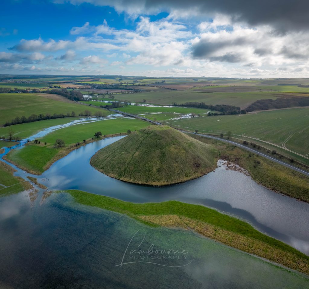
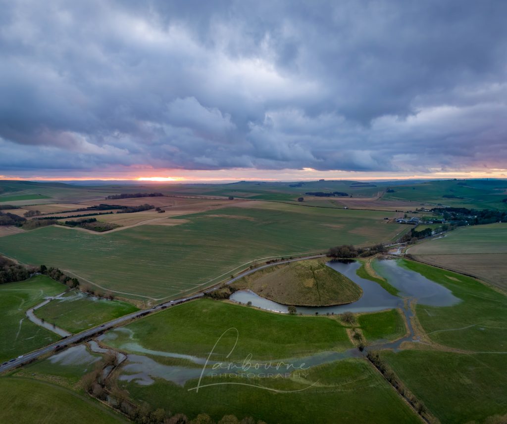
Silbury Hill showing how the Kennet Flooded around the base – Avebury Post-Glacial Flooding copyright Lambourne Photography
Avebury, with its iconic stone circles and ancient monuments, has fascinated explorers and scholars for centuries. Among its well-known features are ‘West Kennet Avenue’ and ‘Beckhampton Avenue,’ both adorned with colossal stones that still stand as silent sentinels of a long-gone age. These avenues have been pivotal in our understanding of Avebury’s past, connecting the spiritual and historical aspects of this sacred site. However, Langdon’s unrelenting quest to unravel Avebury’s mysteries led him down an uncharted path, one that would challenge conventional wisdom and rewrite the history of this remarkable place.
Langdon’s journey was marked by meticulous mapping and years of research, culminating in a hypothesis that would reshape our understanding of prehistoric Britain. He proposed that much of the British Isles had once been submerged in the aftermath of the last ice age, with these ancient sites strategically positioned along the ancient shorelines. His groundbreaking maps offered a fresh perspective, suggesting that Avebury had functioned as a bustling trading hub for our ancient ancestors. This audacious theory challenged the prevailing notion that prehistoric societies were isolated and disconnected, instead highlighting their sophistication in trade and commerce.
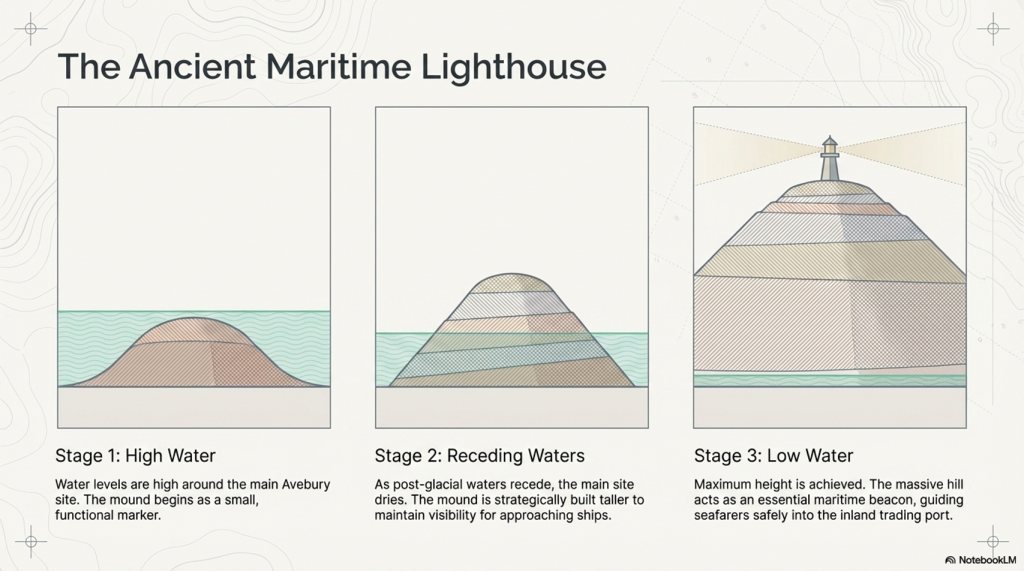
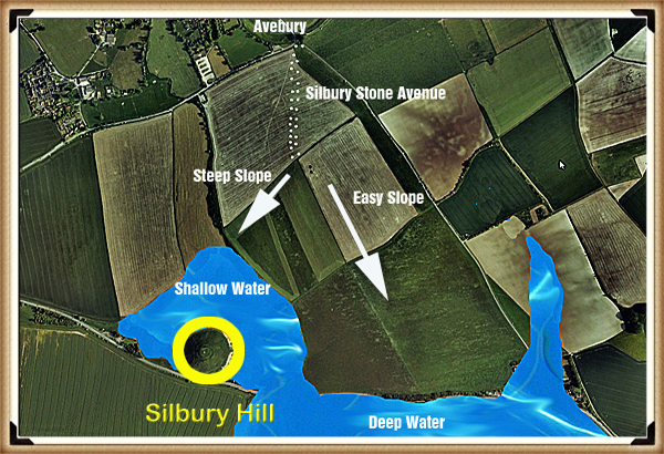
At the heart of this newfound understanding was the colossal enigma of Silbury Hill, the largest man-made monument in prehistoric Europe. Silbury Hill had confounded archaeologists for generations, with theories ranging from religious symbolism to ceremonial significance. Yet, Langdon boldly proclaimed that Silbury Hill had a far more practical and ingenious purpose—an ancient ‘Lighthouse’ that guided seafarers to the trading port of Avebury.
This notion, while revolutionary, was not without evidence. Langdon explained that his research indicated that Silbury Hill had indeed flooded in the distant past, making it logical to assume that it was repurposed as a harbour when the waters receded from the main Avebury site. The construction of Silbury Hill in stages, starting small and gradually growing taller, suggested a pragmatic approach rather than a symbolic one. According to Langdon, the height of the mound would have served as a beacon, attracting ships and boats to the trading centre and making it an essential feature for maritime navigation.
River Kennet to the West of Avebury and Parts of the Stone Circle Ditches Flooding – Avebury Post-Glacial Flooding (copyright Lambourne Photography)
To many, Langdon’s claims may seem audacious, but they align with the findings of dowsers in 2011. At the top of the newly discovered Stone Avenue, these dowsers found a series of stone holes precisely where Langdon’s photographic evidence indicated they were. The convergence of these findings strengthened Langdon’s case, providing compelling support for his audacious theory.
Avebuery Stone Circle ditches flooding first time in 6,000 years? -Avebury Post-Glacial Flooding (copyright Lambourne Photography)
While confirmation through excavation is the next logical step, Langdon’s research has already ignited a vibrant discussion within the archaeological and historical communities. His perspective challenges our preconceived notions of prehistoric Britain, revealing a thriving civilisation that engaged in far-reaching trade and commerce. The idea of Avebury as a bustling trading hub paints a picture of interconnectedness and shared culture, where societies traded not only goods but also ideas, beliefs, and traditions.
River Kennet returning to its prehistoric width – Avebury Post-Glacial Flooding (copyright Lambourne Photography)
In the realm of historical discovery, it is often the audacious thinkers, the mavericks who dare to question established narratives, who propel our understanding forward. Robert John Langdon is undeniably one of these thinkers. With a deep passion for history and an unyielding commitment to his research, he has unearthed a hidden chapter in the story of Avebury—one that transcends time and offers fresh insights into our shared human history.
As Langdon’s trilogy, ‘The Stonehenge Enigma,’ continues to explore these groundbreaking theories, it beckons us to embark on a journey of discovery, to challenge our assumptions, and to embrace the possibility that the past is far more complex and interconnected than we ever imagined. Avebury, with its ancient stones and enigmatic avenues, continues to whisper its secrets to those who dare to listen, inviting us to see history through a new lens—one illuminated by the audacious vision of Robert John Langdon.
(Real-World Confirmation of Post-Glacial Flooding)
The Silbury Lighthouse and the Flooded Stones: 4 Surprising Truths About Prehistoric Avebury
When winter rains recently swept across Avebury, the resulting floods captured by Lambourne Photography did more than just saturate the soil. For those looking closely, the rising waters acted as a real-time simulation of a long-lost era, providing empirical evidence for a landscape we have forgotten. These modern pools align perfectly with prehistoric maps, offering a glimpse into the landscape as it existed during the Mesolithic period between 10,000 and 4,000 BCE.
According to author and cartographer Robert John Langdon, this contemporary flooding is the “ground truth” for his Post-Glacial Flooding Hypothesis. While we see a landscape of dry fields and small streams today, the geological evidence suggests a much more aqueous past. By observing how the water moves now, we can begin to understand why our ancestors chose this specific site for their most massive monuments.
(Real-World Confirmation of Post-Glacial Flooding)
The 98,000-Inch Rain: Reimagining the Post-Glacial Landscape
To understand the scale of the ancient environment, we must look at the sheer volume of water released at the end of the last Ice Age. While Avebury recently made headlines for receiving 3 inches (70mm) of rain in a month, that is a mere drop compared to the post-glacial melt. Langdon calculates that during the ice melt, the region would have encountered the equivalent of 98,425 inches of rain.
This massive influx of water transformed the geography of Wiltshire into something unrecognisable to modern eyes. While British Geological Survey (BGS) maps are not entirely accurate in every respect, they provide vital corroboration of this watery reality.
“Common sense implies that this area would have experienced significant flooding, corroborated by the British Geological Maps, albeit not entirely accurate, illustrating the extent of post-glacial flooding with the Kennet River ten times wider than its present size.”
Traditional archaeological interpretations often lack this “common sense” approach, failing to account for the significant role that higher water levels played in dictating human activity. By ignoring the geological reality of a wider Kennet River, we miss the primary reason why these sites were established. These monuments were not random; they were strategically positioned along the ancient shorelines of a flooded world.
(Real-World Confirmation of Post-Glacial Flooding)
Trading Hub or Temple? The Functional Shift
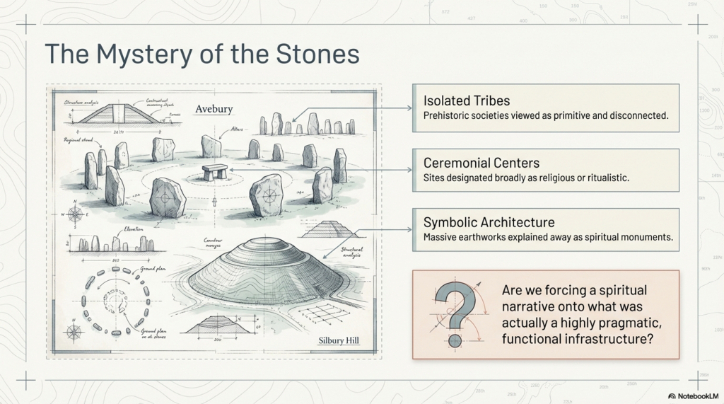
For decades, the “ceremonial” label has been the default explanation for almost every prehistoric site in Britain. However, Langdon argues that this view is an absurdity born from using modern Ordnance Survey maps to define ancient functions. A recent episode of ‘Digging for Britain’ highlighted this disconnect when a settlement found at the river’s edge was labelled ceremonial simply because its location didn’t make sense on a modern map.
When viewed through the lens of higher water levels, Avebury reveals itself not as an isolated temple but as a bustling trading hub. These colossal stones stand as silent sentinels to an age when the site was a centre for commerce and maritime interaction. This reinterpretation suggests a sophisticated, interconnected society that utilised Britain’s waterways for trade, rather than a collection of isolated, ritual-obsessed tribes.
By acknowledging the strategic placement of the shoreline, we see that the builders were master logisticians. They utilised the landscape’s natural hydrology to facilitate movement and exchange. The whispers of the past suggest that Avebury was the heart of a vibrant, seafaring economic network.
(Real-World Confirmation of Post-Glacial Flooding)
The Silbury Lighthouse: A Beacon for Ancient Mariners
Silbury Hill stands as the largest man-made monument in Europe, yet its purpose has remained one of archaeology’s greatest enigmas. While often dismissed as a religious or symbolic mound, the Post-Glacial Flooding Hypothesis provides a far more pragmatic explanation. Langdon suggests that as the waters receded, Silbury Hill was constructed in stages to serve as maritime infrastructure.
Rather than a silent grave or a place of worship, the mound functioned as a guide for those navigating the flooded plains.
“Silbury Hill had a far more practical and ingenious purpose—an ancient ‘Lighthouse’ that guided seafarers to the trading port of Avebury.”
This maritime theory explains why the hill was built in stages, growing taller over time to remain visible as a beacon for incoming ships. Langdon’s research further indicates that as the climate changed, the site was eventually repurposed as a harbour when the waters receded from the main Avebury site. This transformation into a piece of sophisticated nautical infrastructure completely changes our perspective on the engineering capabilities of prehistoric Britons.
(Real-World Confirmation of Post-Glacial Flooding)
LiDAR: The Paramount Tool Archaeologists Are Missing
The key to unlocking these secrets lies in LiDAR (Light Detection and Ranging) technology, which allows researchers to see “past topologies” hidden by modern development. Langdon asserts that LiDAR is the most important landscape mapping tool available, yet it remains tragically underutilised by traditional archaeologists. This technology revealed exactly where the ancient shorelines met the monuments and identified lost features like “Silbury Avenue – the Lost Stone Avenue.”
The accuracy of this mapping was strikingly confirmed in 2011 by dowsing results at the top of this newly discovered avenue. Dowsers located stone holes in the exact positions that Langdon’s LiDAR-based research had predicted. This convergence of high-tech scans and physical evidence is forcing a total rewrite of British history.
By using LiDAR to strip away modern distractions, we can finally see the strategic logic of the Mesolithic builders. The technology proves that the landscape was shaped by water levels we are only now beginning to map correctly. It is no longer a matter of speculation, but a matter of seeing the evidence hidden in the earth itself.
(Real-World Confirmation of Post-Glacial Flooding)
Conclusion: Whispers from the Ancient Shoreline
The “Post-Glacial Flooding Hypothesis” invites us to view the British landscape not as a static collection of fields but as a dynamic environment. Avebury changes from a site of mystery into a monument of human ingenuity and maritime success. Our ancestors were not just building stone circles; they were constructing a society centred on water.
As we uncover more evidence of this interconnected world, we must ask ourselves: are we ready to see history through a new lens? Are we prepared to accept that the past is far more complex and strategically minded than we ever imagined?
(Real-World Confirmation of Post-Glacial Flooding)
PODCAST
Author’s Biography
Robert John Langdon, a polymathic luminary, emerges as a writer, historian, and eminent specialist in LiDAR Landscape Archaeology.
His intellectual voyage has been interwoven with stints as an astute scrutineer in government and grand corporate bastions, a tapestry spanning British Telecommunications, Cable and Wireless, British Gas, and the esteemed University of London.
A decade hence, Robert’s transition into retirement unfurled a chapter of insatiable curiosity. This phase saw him immerse himself in Politics, Archaeology, Philosophy, and the enigmatic realm of Quantum Mechanics. His academic odyssey traversed the venerable corridors of knowledge hubs such as the Museum of London, University College London, Birkbeck College, The City Literature Institute, and Chichester University.
In the symphony of his life, Robert is a custodian of three progeny and a pair of cherished grandchildren. His sanctuary lies ensconced in the embrace of West Wales, where he inhabits an isolated cottage, its windows framing a vista of the boundless sea – a retreat from the scrutinising gaze of Her Majesty’s Revenue and Customs, an amiable clandestinity in the lap of nature.
Exploring Prehistoric Britain: A Journey Through Time
My blog delves into the fascinating mysteries of prehistoric Britain, challenging conventional narratives and offering fresh perspectives grounded in cutting-edge research, particularly LiDAR technology. I invite you to explore some key areas of my research. For example, the Wansdyke, often cited as a defensive structure, is re-examined in light of new evidence. I’ve presented my findings in my blog post Wansdyke: A British Frontier Wall – ‘Debunked’, and a Wansdyke LiDAR Flyover video further visualises my conclusions.
My work also often challenges established archaeological dogma. I argue that many sites, such as Hambledon Hill, commonly identified as Iron Age hillforts, are not what they seem. My posts Lidar Investigation Hambledon Hill – NOT an ‘Iron Age Fort’ and Unmasking the “Iron Age Hillfort” Myth explore these ideas in detail and offer an alternative view. Similarly, sites like Cissbury Ring and White Sheet Camp receive re-evaluations based on LiDAR analysis in my posts “Lidar Investigation Cissbury Ring through time”and “Lidar Investigation White Sheet Camp,“ revealing fascinating insights into their true purpose. I have also examined South Cadbury Castle, often linked to the mythical Camelot56.
My research also extends to ancient water management, including the role of canals and other linear earthworks. I have discussed the true origins of Car Dyke in multiple posts, including Car Dyke – ABC News Podcast and Lidar Investigation Car Dyke – North Section, which suggest a Mesolithic origin 2357. I also explore the misidentification of Roman aqueducts, as seen in my posts on the Great Chesters (Roman) Aqueduct. My research has also been greatly informed by my post-glacial flooding hypothesis, which has helped explain landscape transformations over time. I have discussed this hypothesis in several posts, including AI now supports my Post-Glacial Flooding Hypothesis and Exploring Britain’s Flooded Past: A Personal Journey
For those interested in British Prehistory, visit www.prehistoric-britain.co.uk, a comprehensive resource featuring an extensive collection of archaeology articles, modern LiDAR investigations, and groundbreaking research. The site also includes insights and excerpts from the acclaimed Robert John Langdon Trilogy, a series of books that explore Britain during the Prehistoric period. Titles in the trilogy include The Stonehenge Enigma, Dawn of the Lost Civilisation, and The Post-Glacial Flooding Hypothesis, which offer compelling evidence of ancient landscapes shaped by post-glacial flooding.
To further explore these topics, Robert John Langdon has developed a dedicated YouTube channel featuring over 100 video documentaries and investigations that complement the trilogy. Notable discoveries and studies showcased on the channel include 13 Things that Don’t Make Sense in History and the revelation of Silbury Avenue – The Lost Stone Avenue, a rediscovered prehistoric feature at Avebury, Wiltshire.
In addition to his main works, Langdon has released a series of shorter, accessible publications, ideal for readers delving into specific topics. These include:
For active discussions and updates on the trilogy’s findings and recent LiDAR investigations, join our vibrant community on Facebook. Engage with like-minded enthusiasts by leaving a message or contributing to debates in our Facebook Group.
Whether through the books, the website, or interactive videos, we aim to provide a deeper understanding of Britain’s fascinating prehistoric past. We encourage you to explore these resources and uncover the mysteries of ancient landscapes through the lens of modern archaeology.
For more information, including chapter extracts and related publications, visit the Robert John Langdon Author Page. Dive into works such as The Stonehenge Enigma or Dawn of the Lost Civilisation, and explore cutting-edge theories that challenge traditional historical narratives.
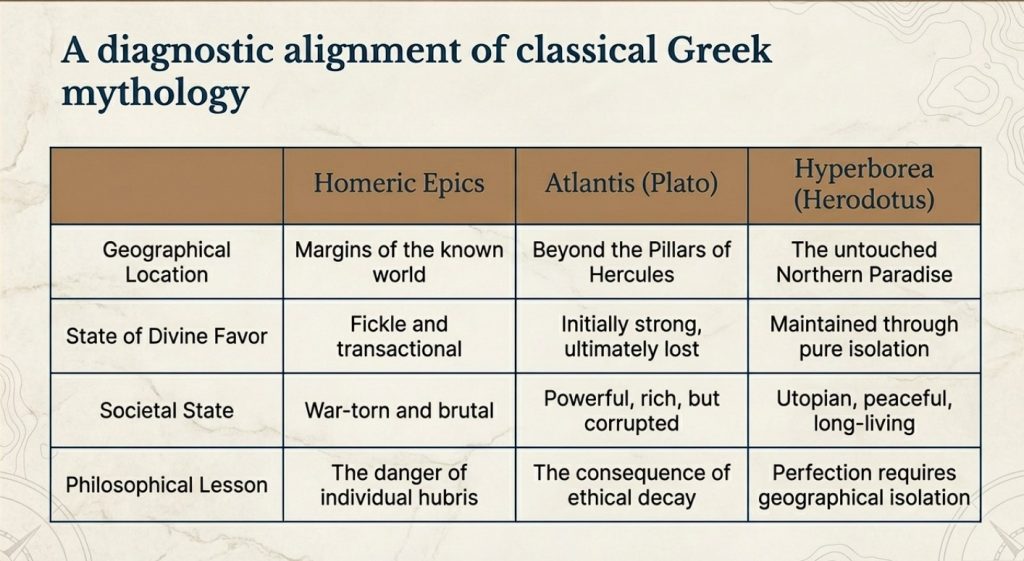
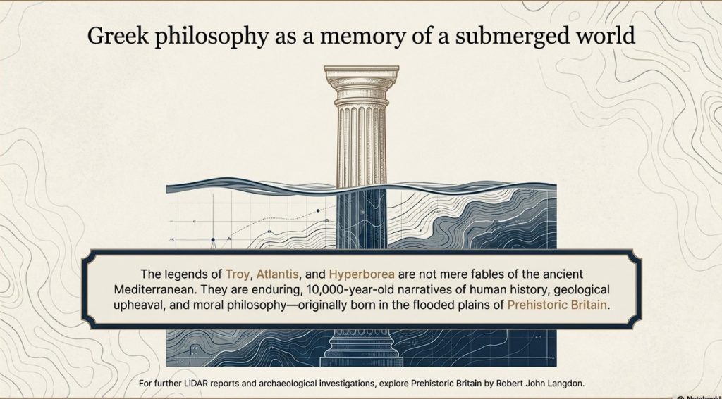
The connections between the legends of Atlantis and Hyperborea and the works of Homer represent a fascinating intersection of myth, philosophy, and epic narrative in ancient Greek literature. These stories not only provide insights into the Greeks’ geographical and cultural understanding but also reflect deeper philosophical and ethical concerns that permeate Greek thought. Below, we explore these themes in greater detail, delving into how these mythical and literary works intertwine and what they signify about ancient Greek civilisation. (The Troy, Hyperborea and Atlantis Connection)
(The Troy, Hyperborea and Atlantis Connection)
Homer’s Influence and the Greek Mythical Landscape
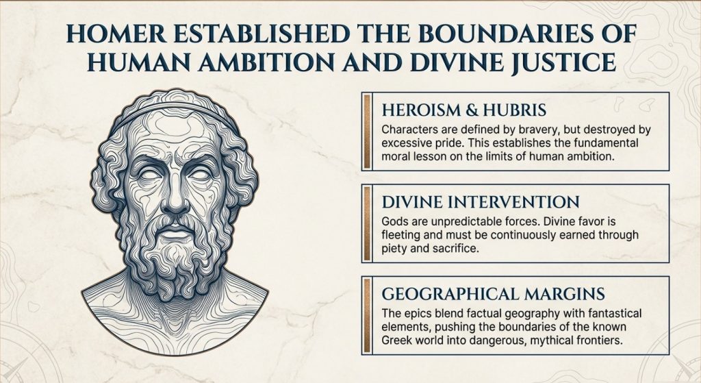
Homer’s literary works, namely the “Iliad” and the “Odyssey,” are of great importance in ancient Greek literature. These works provide a multifaceted depiction of heroism, divine intervention, and the human condition. It’s important to note that these epic stories are not standalone, but are part of a larger collection of Greek mythology that includes legends about Atlantis and Hyperborea. Although Homer doesn’t directly mention these myths, his themes of heroism, the impact of divine will, and the imperfection of humanity provide a foundation for later philosophical explorations by scholars such as Plato.
Geographical and Mythological Explorations
Homer’s epics describe real and mythical locations, which expand the boundaries of the Greek world and beyond. These places often blend factual geography with fantastical elements, creating a world full of possibilities and dangers that reflect the Greeks’ curious and exploratory nature.
(The Troy, Hyperborea and Atlantis Connection)
Similarly, Atlantis and Hyperborea are described as lands at the margins of the known world. Plato’s Atlantis, as mentioned in his dialogues “Timaeus” and “Critias,” is a powerful island nation beyond the Pillars of Hercules, rich in resources but doomed by its moral failings. Hyperborea, mentioned in sources such as Herodotus and later Greek lore, is portrayed as a northern paradise, untouched by war or disease, where people live exceptionally long lives in peace—a stark contrast to the often brutal world depicted by Homer.
(The Troy, Hyperborea and Atlantis Connection)
Themes of Heroism and Hubris
In Homer’s works, heroism plays a central role. Characters are often defined by their bravery, strength, and, sometimes, overconfidence. The gods frequently intervene in these epics, either supporting or hindering heroes based on divine justice or whims. The theme of excessive pride, known as hubris, leading to downfall, is particularly prominent, serving as a moral lesson on the limitations of human ambition.
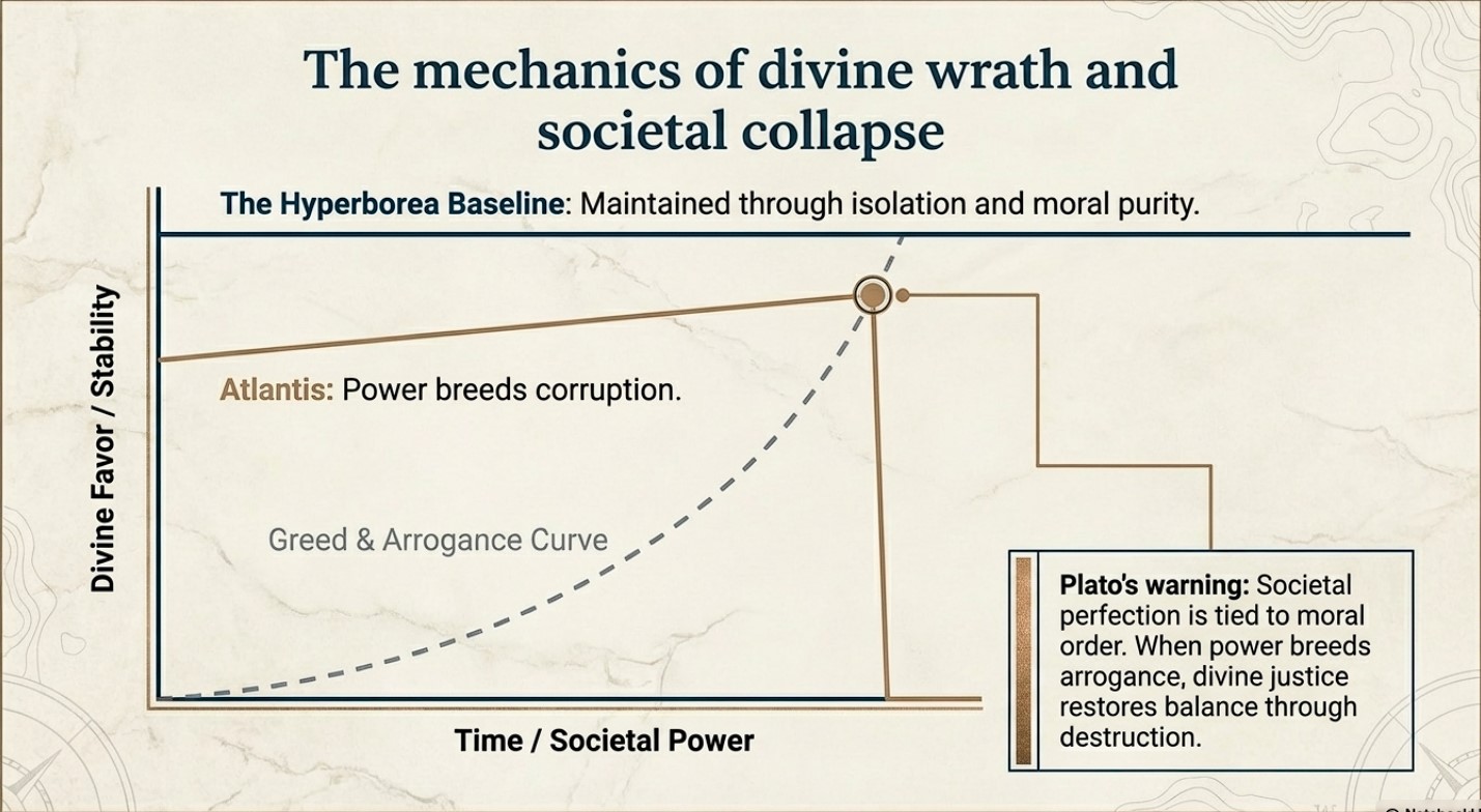
The story of Atlantis presents a similar theme to this idea. Plato describes a society that starts off living in an idyllic state and enjoying divine favour. However, as Atlantis grows in power and pride, it falls prey to greed and corruption. This ultimately attracts divine wrath, leading to its destruction. This narrative echoes Homeric themes where divine justice ultimately restores the balance disrupted by human arrogance.
(The Troy, Hyperborea and Atlantis Connection)
Divine Favour and Moral Order
The gods play a significant role in human affairs in both Homer’s epics and the tales of Hyperborea and Atlantis. In Homer’s works, the gods are unpredictable and often act on personal motives, reflecting the Greeks’ belief that divine favour is fleeting and must be continually earned through piety and sacrifice.
Compared with other myths, the myths of Hyperborea and Atlantis portray divine favour as initially more stable, yet still requiring adherence to a moral order. Hyperborea is considered a favoured land as long as it remains isolated from the greed and corruption of the outside world. This suggests that societal perfection depends on both geographical isolation and moral purity. In contrast, Atlantis loses its divine favour not because of isolation but because of moral failure. This highlights a philosophical perspective where ethical decay leads to ruin.
(The Troy, Hyperborea and Atlantis Connection)
Literary and Cultural Influence
The ancient Greek myths and narratives not only conveyed historical experiences but also shaped their perceptions of the world and the cosmos. They blended mythological interpretation with reality to teach important lessons of morality, ethics, and human limitations.
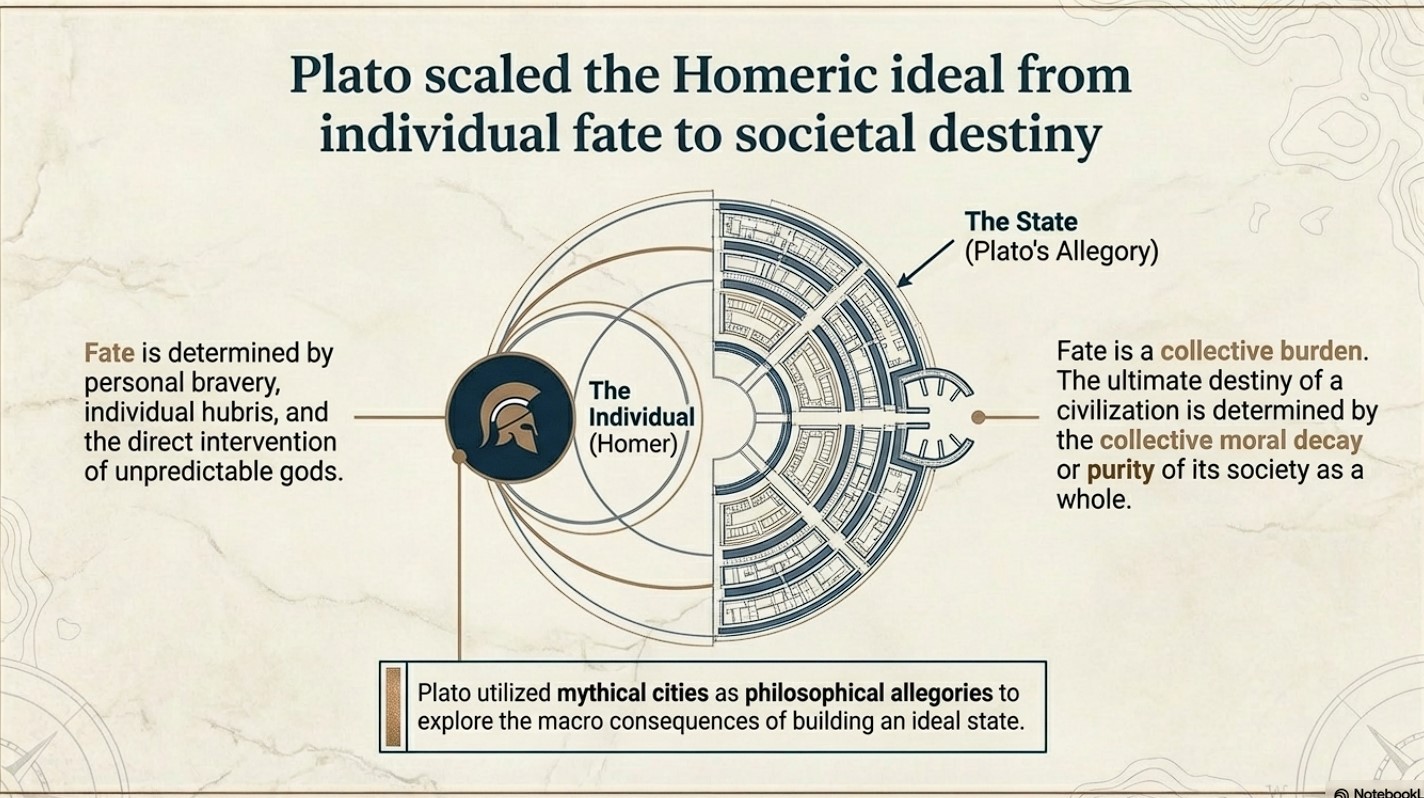
Plato’s works “Timaeus” and “Critias” utilise the mythical city of Atlantis as a philosophical allegory to explore the ideal state and the consequences of moral decay. This is an extension of Homeric exploration of heroism and divine justice, but Plato takes it a step further. While Homer focuses on individual fate and divine intervention, Plato broadens the scope to societal destiny, where the collective actions of a society determine its ultimate fate.
(The Troy, Hyperborea and Atlantis Connection)
Conclusion
Let’s stop pretending these are just stories.
The legends of Atlantis and Hyperborea are not abstract myths or philosophical inventions. They are cultural memories—distorted over time, but rooted in real events, real places, and real people.
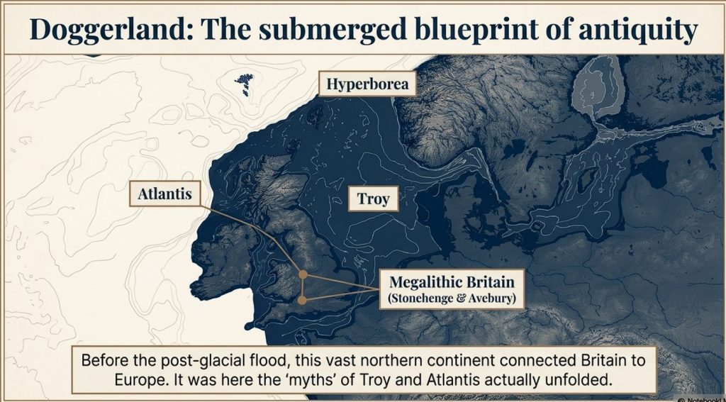
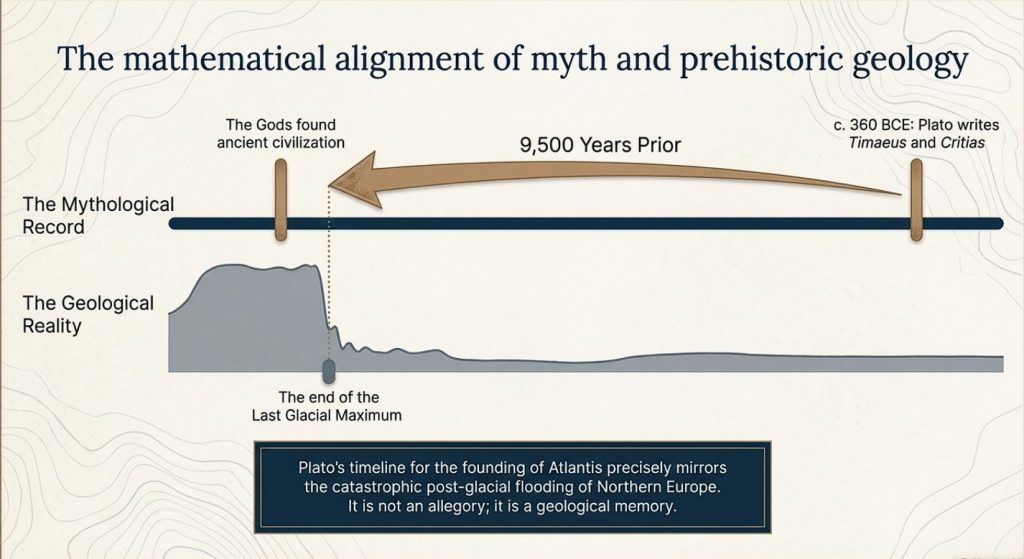
Plato gives us the key. He states clearly that this lost civilisation existed around 9500 years ago. That date is not negotiable, and it is not symbolic. It lands exactly at the end of the last Ice Age—precisely when the physical evidence shows catastrophic environmental change across north-west Europe.
At that moment in time, Doggerland existed.
And then it didn’t.
We know—measurably—that this landscape was flooded, fragmented, and ultimately destroyed by rising sea levels and sustained hydrological pressure. This is not speculation. It is supported by geological, sea-level, and sedimentary evidence. The land was there, and then it was gone.
Now combine that with archaeology.
(The Troy, Hyperborea and Atlantis Connection)
Stonehenge is no longer explainable as ritual nonsense or symbolic guesswork. When examined properly, it behaves as a functional system—engineered, repeatable, and practical. The so-called “Stonehenge computer” demonstrates predictive capability, environmental integration, and structured design. That is not primitive behaviour. That is applied knowledge.
So we have a date. We have an event. And we have a level of capability that matches the description.
This is where the academic narrative collapses.
Because once you accept the timing and the evidence, the conclusion becomes unavoidable:
Atlantis is Doggerland.
(The Troy, Hyperborea and Atlantis Connection)
Hyperborea is the same memory, seen from another direction.
And the “gods” described by the Greeks were not gods at all—they were the survivors of a lost civilisation whose knowledge far exceeded that of the cultures that came after them.
When Doggerland drowned, its people did not disappear. They moved. They carried knowledge of engineering, navigation, landscape, and time—knowledge that later cultures preserved as myth because they no longer understood its origin.
This is why the stories persist. This is why they are consistent. And this is why they refuse to go away.
Because they are not fiction.
They are memories.
And once you place them back into their correct context—time, landscape, and physical evidence—the mystery disappears.
What remains is not mythology.
It is history.
PodCast
Author’s Biography
Robert John Langdon, a polymathic luminary, emerges as a writer, historian, and eminent specialist in LiDAR Landscape Archaeology.
His intellectual voyage has been interwoven with stints as an astute scrutineer for governmental realms and grand corporate bastions, a tapestry spanning British Telecommunications, Cable and Wireless, British Gas, and the esteemed University of London.
A decade hence, Robert’s transition into retirement unfurled a chapter of insatiable curiosity. This phase saw him immerse himself in Politics, Archaeology, Philosophy, and the enigmatic realm of Quantum Mechanics. His academic odyssey traversed the venerable corridors of knowledge hubs such as the Museum of London, University College London, Birkbeck College, The City Literature Institute, and Chichester University.
In the symphony of his life, Robert is a custodian of three progeny and a pair of cherished grandchildren. His sanctuary lies ensconced in the embrace of West Wales, where he inhabits an isolated cottage, its windows framing a vista of the boundless sea – a retreat from the scrutinous gaze of Her Majesty’s Revenue and Customs, an amiable clandestinity in the lap of nature’s embrace.
Exploring Prehistoric Britain: A Journey Through Time
My blog delves into the fascinating mysteries of prehistoric Britain, challenging conventional narratives and offering fresh perspectives grounded in cutting-edge research, particularly LiDAR technology. I invite you to explore some key areas of my research. For example, the Wansdyke, often cited as a defensive structure, is re-examined in light of new evidence. I’ve presented my findings in my blog post Wansdyke: A British Frontier Wall – ‘Debunked’, and aWansdyke LiDAR Flyover video further visualises my conclusions.
My work also often challenges established archaeological dogma. I argue that many sites, such as Hambledon Hill, commonly identified as Iron Age hillforts, are not what they seem. My posts Lidar Investigation Hambledon Hill – NOT an ‘Iron Age Fort’ and Unmasking the “Iron Age Hillfort” Myth explore these ideas in detail and offer an alternative view. Similarly, sites like Cissbury Ring and White Sheet Camp also receive a re-evaluation based on LiDAR analysis in my posts “Lidar Investigation Cissbury Ring through time”and “Lidar Investigation White Sheet Camp,“ revealing fascinating insights into their true purpose. I have also examined South Cadbury Castle, often linked to the mythical Camelot56.
My research also extends to ancient water management, including the role of canals and other linear earthworks. I have discussed the true origins of Car Dyke in multiple posts, including Car Dyke – ABC News Podcast and Lidar Investigation Car Dyke – North Section, which suggest a Mesolithic origin 2357. I also explore the misidentification of Roman aqueducts, as seen in my posts on the Great Chesters (Roman) Aqueduct. My research has also been greatly informed by my post-glacial flooding hypothesis, which has helped explain landscape transformations over time. I have discussed this hypothesis in several posts, including AI now supports my Post-Glacial Flooding Hypothesis and Exploring Britain’s Flooded Past: A Personal Journey
For those interested in British Prehistory, visit www.prehistoric-britain.co.uk, a comprehensive resource featuring an extensive collection of archaeology articles, modern LiDAR investigations, and groundbreaking research. The site also includes insights and excerpts from the acclaimed Robert John Langdon Trilogy, a series of books that explore Britain during the Prehistoric period. Titles in the trilogy include The Stonehenge Enigma, Dawn of the Lost Civilisation, and The Post-Glacial Flooding Hypothesis, which offer compelling evidence of ancient landscapes shaped by post-glacial flooding.
To further explore these topics, Robert John Langdon has developed a dedicated YouTube channel featuring over 100 video documentaries and investigations that complement the trilogy. Notable discoveries and studies showcased on the channel include 13 Things that Don’t Make Sense in History and the revelation of Silbury Avenue – The Lost Stone Avenue, a rediscovered prehistoric feature at Avebury, Wiltshire.
In addition to his main works, Langdon has released a series of shorter, accessible publications, ideal for readers delving into specific topics. These include:
For active discussions and updates on the trilogy’s findings and recent LiDAR investigations, join our vibrant community on Facebook. Engage with like-minded enthusiasts by leaving a message or contributing to debates in our Facebook Group.
Whether through the books, the website, or interactive videos, we aim to provide a deeper understanding of Britain’s fascinating prehistoric past. We encourage you to explore these resources and uncover the mysteries of ancient landscapes through the lens of modern archaeology.
For more information, including chapter extracts and related publications, visit the Robert John Langdon Author Page. Dive into works such as The Stonehenge Enigma or Dawn of the Lost Civilisation, and explore cutting-edge theories that challenge traditional historical narratives.
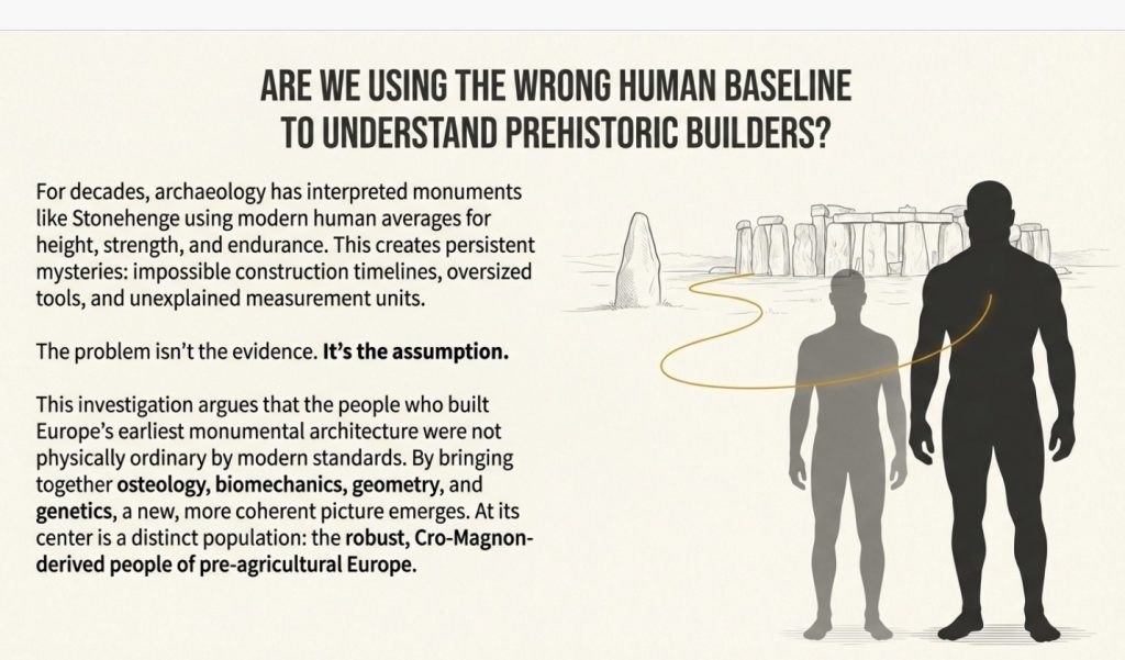
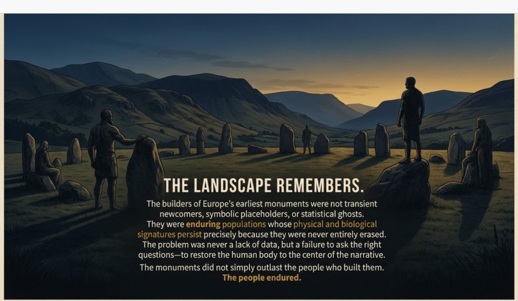
The problem with prehistoric archaeology is not a lack of data. It is a failure to ask the right questions.
For over a century, monuments such as Stonehenge, Avebury, and the great long barrows of Britain have been explained using labels: Neolithic, Beaker, Bronze Age, Western Hunter-Gatherer, Steppe ancestry. These terms sound authoritative, but they often function as placeholders rather than explanations. They tell us when something is assumed to belong — not who built it, how it was built, or whether the proposed builders were physically capable of the task.
This article is not about mythical “giants,” nor is it an exercise in sensationalism. The word itself is misleading and has done more harm than good. The real issue is human scale.
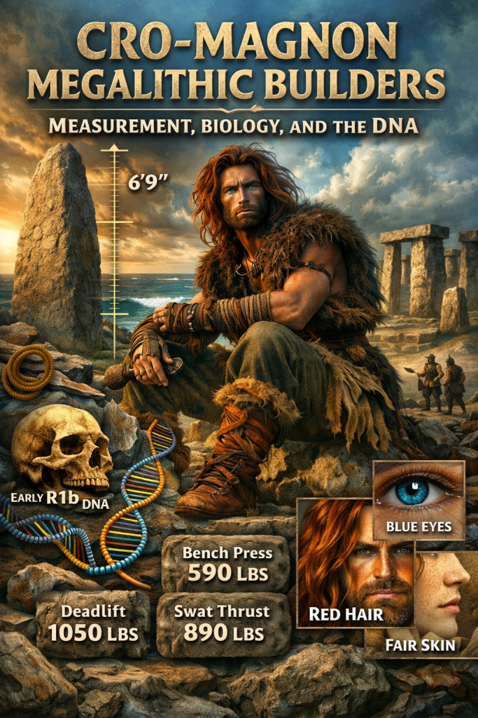
Cro-Magnon Megalithic Builders: Measurement, Biology, and the DNA
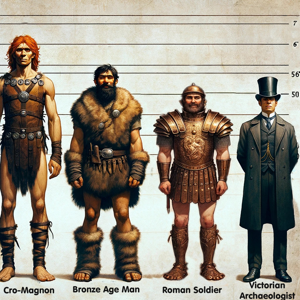
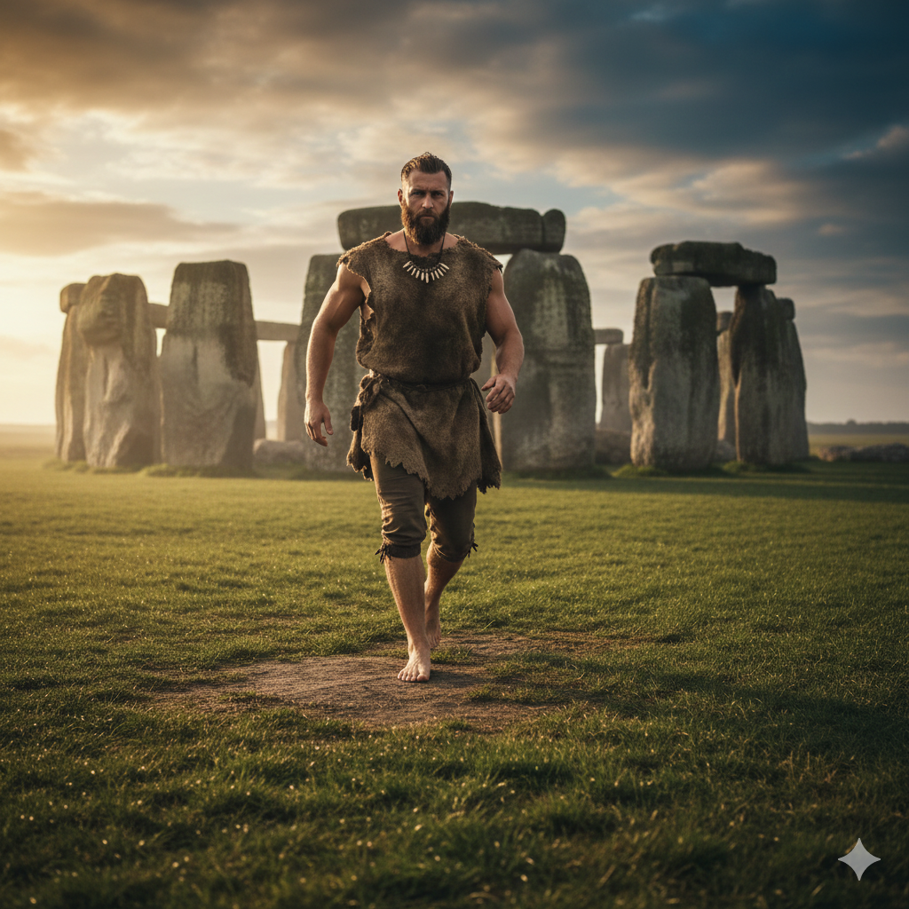
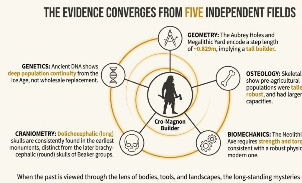
Archaeology routinely interprets prehistoric monuments using modern human averages: modern height, modern strength, modern endurance, modern tools, modern landscapes. Yet the physical evidence increasingly shows that the people who built Europe’s earliest monumental architecture were not physically ordinary by modern standards. They were taller, more robust, stronger, and cognitively adapted to a world very different from our own.
Once that fact is acknowledged, a series of long-standing problems begins to resolve themselves:
why monument construction timelines seem impossibly long
why antler-pick explanations fail repeatedly
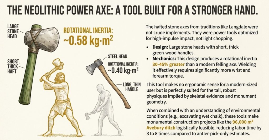
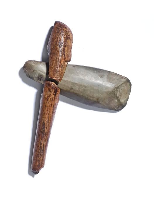
why tool sizes appear “oversized”
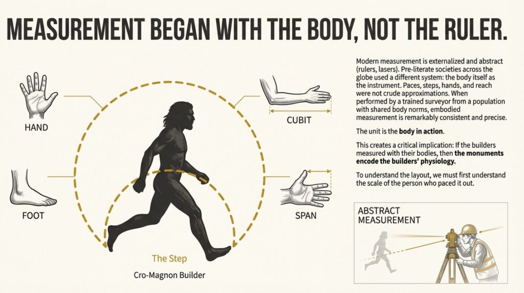
why step-based measurement systems emerge so cleanly
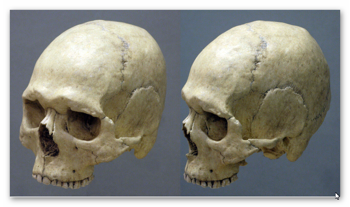
why long barrows contain long-skulled individuals
why later farming populations reuse, rather than originate, these sites
The question, therefore, is not “Were these people giants?” It is:
Are modern humans the wrong baseline for understanding prehistoric builders?
This blog argues that they are.
By bringing together osteology, cranial morphology, tool ergonomics, biomechanics, embodied measurement, hydrology, and palaeogeography, a coherent picture emerges—one that archaeology has partially documented, occasionally acknowledged, but never fully integrated.
At the centre of that picture are Cro-Magnon–derived populations, rooted in the lost landscapes of northern Europe, whose physical characteristics match the monuments they left behind.
What follows is not speculation. It is a reconstruction based on bodies, tools, geometry, and landscapes — the things that do not recalibrate, relabel, or quietly disappear when theories change.
Cro-Magnon Megalithic Builders: Measurement, Biology, and the DNA
2. Cro-Magnon ≠ Modern Human — Why Physiology Matters
One of the most persistent errors in prehistoric interpretation is the quiet assumption that all humans in the past were physically equivalent to us. This assumption is rarely stated outright, but it underpins almost every reconstruction: tool use, labour estimates, monument building rates, and even cognitive expectations.
The physical evidence does not support it.
Upper Palaeolithic and early Mesolithic populations traditionally grouped under the term Cro-Magnon display a suite of anatomical traits that consistently diverge from later agricultural populations and from modern post-industrial humans.
These differences are not marginal.
They include:
Greater average stature, particularly among males
More robust skeletal frames, with thicker cortical bone
Broader shoulders and longer limb proportions
Higher muscle attachment development, indicating sustained heavy loading
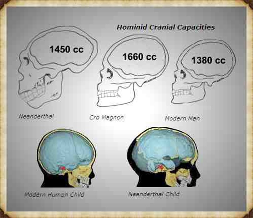
Larger average cranial capacity than modern Homo sapiens sapiens
Taken together, these traits describe a population adapted to high-energy expenditure, long-distance movement, and physically demanding tasks carried out over generations.
This is not surprising. Cro-Magnon populations lived in environments characterised by:
cold or unstable climates
protein-rich diets dominated by hunting, fishing, and aquatic resources
constant mobility across large landscapes
minimal reliance on agriculture or sedentary storage
In evolutionary terms, this favours size, strength, and endurance rather than reduction.
These patterns are well documented in Upper Palaeolithic and early Mesolithic osteological studies (e.g. Ruff 1994; Larsen 1995).
Cro-Magnon Megalithic Builders: Measurement, Biology, and the DNA
Agriculture Changed Bodies — It Did Not Improve Them
A crucial point often glossed over is that the transition to agriculture reduced human size and robustness, rather than enhancing it.
This is well established in bioarchaeology:
average stature declines after the adoption of farming
skeletal stress markers increase
nutritional diversity decreases
cranial capacity trends downward over time
These changes reflect dietary narrowing, increased disease load, and reduced physical demands, not biological advancement.
Later Neolithic and Bronze Age farming populations were not “better” versions of their predecessors — they were adapted to a different, more constrained way of life.
Using their bodies as the baseline for interpreting earlier monuments is, therefore, methodologically unsound.
Why This Matters for Monument Builders
If the builders of megalithic structures were:
taller
stronger
more robust
cognitively adapted to spatial and mechanical tasks
then many features that appear “mysterious” under modern assumptions become entirely reasonable:
oversized tools cease to be anomalous
heavy labour becomes sustainable
short, thick tool handles make ergonomic sense
step-based measurement systems become precise, not crude
construction timelines shrink dramatically
The monuments do not demand mythical strength. They demand pre-agricultural bodies.
The Error of Compression
Modern archaeology tends to compress tens of thousands of years of biological change into a single category: modern humans.
That compression is administratively convenient, but scientifically inaccurate.
Cro-Magnon populations were human, but they were not physically modern in the way we are. Their bodies reflect a different ecological niche, one that vanished as agriculture, sedentism, and later population influxes reshaped Europe.
Understanding who built the megaliths begins with accepting that their bodies were not our bodies.
Everything that follows — tools, measurement, labour, and landscape use — depends on that fact.
Suitable references
Ruff, C. (1994). Morphological adaptation to climate in modern and fossil hominids. Yearbook of Physical Anthropology
Larsen, C. (1995). Biological changes in human populations with agriculture. Annual Review of Anthropology
Cro-Magnon Megalithic Builders: Measurement, Biology, and the DNA
3. The Fatal Modern Assumption: Abstract Measurement
Once prehistoric builders are quietly assumed to be physically identical to modern humans, a second assumption follows almost automatically: that they measured the world in the same abstract way that we do.
This assumption is rarely examined — yet it is foundational to how monuments are interpreted.
Modern societies measure using externalised units: rulers, tapes, rods, laser surveys, and digital grids. These systems are detached from the body. They exist precisely because bodies differ and standards must be imposed from outside.
Prehistoric societies did not work this way.
Across ethnography, archaeology, and early historical records, the same pattern appears repeatedly: measurement begins with the body.
Hands. Feet. Elbows. Paces. Steps. Reach.
These are not crude approximations. They are repeatable, trainable, and internally consistent when used by a stable population with shared body norms.
Cro-Magnon Megalithic Builders: Measurement, Biology, and the DNA
Embodied Measurement Is Not Guesswork
The idea that body-based measurement is imprecise is a modern prejudice.
In reality:
a trained surveyor can reproduce step lengths with remarkable consistency
deliberate pacing differs from casual walking
ritualised or task-based gaits are consciously controlled
repetition over short distances cancels cumulative error
This is why body-based units dominate early engineering traditions worldwide, from megalithic Europe to ancient Egypt and beyond.
The unit is not the body at rest—it is the body in action.
Body-based measurement systems are ethnographically universal in pre-literate societies (e.g. Kula 1966; Rottländer 1989).
Why This Matters for Megalithic Monuments
If prehistoric builders measured using their bodies, then the body becomes the measuring instrument.
That has immediate consequences:
monument dimensions encode the builder’s physiology
spacing reflects gait and reach, not abstraction
regularity implies training, not symbolism
precision implies repetition, not advanced mathematics
Crucially, this also means that modern bodies are the wrong tool for reverse-engineering prehistoric layouts.
A shorter, lighter, post-agricultural population will not reproduce the same results — not because the builders were mystical, but because the baseline has changed.
The Archaeological Blind Spot
Archaeology often acknowledges body-based units in passing, only to abandon them in favour of abstract explanations when patterns emerge that do not fit expectations.
When a monument resolves cleanly into a repeating unit, the assumption is often that:
it must be symbolic
or numerological
or coincidental
Rarely is the most direct explanation tested:
What if the monument is laid out in human steps — but not modern ones?
Once this question is allowed, the focus shifts from abstract numbers to human biomechanics.
That shift is essential because it prepares us to understand one of the most critical pieces of evidence in Britain: the Aubrey Holes.
Suitable references
Rottländer, R. (1989). Maß und Zahl in der Vorgeschichte
Kula, W. (1966). Measures and Men
Cro-Magnon Megalithic Builders: Measurement, Biology, and the DNA
4. The Aubrey Holes — Measurement Frozen in Geometry
At Stonehenge, the earliest formal architectural phase is defined not by standing stones, but by a ring of 56 pits, traditionally known as the Aubrey Holes.
These features have been discussed for over three centuries, yet they remain poorly understood because they are usually treated as markers rather than as measurements.
That distinction matters.
What the Aubrey Holes Actually Are
The Aubrey Holes form a near-perfect circle approximately 87 metres in diameter, laid out with remarkable regularity given the absence of metal tools, written plans, or abstract surveying equipment.
What is often overlooked is this:
the holes are evenly spaced
the spacing is consistent around the full circumference
cumulative error is extremely low
the layout shows clear correction and control
This is not casual digging. It is deliberate, repeated measurement.
Why Random or Symbolic Explanations Fail
If the Aubrey Holes were placed symbolically, ritually, or “by eye,” we would expect:
variable spacing
drift around the circle
local clustering or correction only at the end
Instead, what we see is the opposite: controlled regularity from start to finish.
This immediately rules out:
chance placement
approximate pacing
informal alignment
Something far more disciplined is at work.
Cro-Magnon Megalithic Builders: Measurement, Biology, and the DNA
The Critical Observation: Step-Based Spacing
When the arc distance between adjacent Aubrey Holes is examined, it resolves cleanly into a repeating human-scale interval.
Not a rope length. Not a rod. Not an abstract unit.
A step.
More precisely:
a deliberate, trained step
repeated consistently
over dozens of placements
Once recognised, this pattern becomes difficult to ignore.
Why Modern Replication Fails
Attempts to reproduce the Aubrey Hole spacing using modern average body dimensions consistently struggle to maintain accuracy around the full circle.
The reason is simple:
modern average step length is shorter
modern gait is optimised for comfort, not measurement
modern bodies are post-agricultural and post-industrial
When the wrong body is used, the geometry degrades.
This has led many researchers to conclude — incorrectly — that the precision must be symbolic, mathematical, or coincidental.
The alternative explanation is far simpler:
The builders’ bodies were different.
Cro-Magnon Megalithic Builders: Measurement, Biology, and the DNA
The Aubrey Holes as Physical Evidence
Unlike artefacts that can be moved, redeposited, or reused, the Aubrey Holes are fixed in the ground.
They preserve:
spacing
sequence
intent
correction
They are not affected by:
radiocarbon recalibration
DNA model revision
typological fashion
In that sense, they are among the most reliable pieces of evidence at Stonehenge.
They capture human action directly — frozen into chalk.
Measurements follow the surveyed dimensions published by Atkinson (1956) and Cleal et al. (1995).
Why This Matters
If the Aubrey Holes were laid out using deliberate human steps, then:
the step length becomes measurable
the body size of the surveyor can be inferred
the origin of later “units” can be explained
the monument stops being abstract
This takes us directly to the next problem archaeology has struggled with for decades: The origin of the Megalithic Yard.
Suitable references
Atkinson, R. J. C. (1956). Stonehenge
Cleal, R., Walker, K., & Montague, R. (1995). Stonehenge in its Landscape
Cro-Magnon Megalithic Builders: Measurement, Biology, and the DNA
5. The Megalithic Yard Reframed — Not a “Mystery Unit”
The Megalithic Yard has long been treated as an archaeological curiosity: widely measured, statistically persistent, yet conceptually uncomfortable. Alexander Thom demonstrated that a unit of approximately 2.72 feet (0.829 m) recurs across stone circles, flattened rings, ellipses, and stone rows throughout Britain and Atlantic Europe. That finding has never been seriously overturned. What Thom did not explain was where that unit originated.
The silence around its origin allowed a false assumption to harden: that the Megalithic Yard must have been an abstract standard, something equivalent to a measuring rod or conceptual unit imposed on the landscape. There is, however, no archaeological evidence for such a system. No rods, no standardised artefacts, no calibration objects, and no metrological infrastructure exist for Neolithic or early Mesolithic Britain.
What exists is physical geometry that demands a different explanation.
At Stonehenge Phase 1, the Aubrey Hole circle has a mean diameter of approximately 87.0 metres, giving a circumference of about 273.2 metres. Divided by the 56 Aubrey Holes, this produces a consistent arc spacing of roughly 4.88 metres between adjacent pits. That distance is not arbitrary. It resolves cleanly into six equal human steps, each of approximately 0.81–0.83 metres in length.
This matters because 0.82–0.83 metres is, within biological tolerance, the Megalithic Yard.
Cro-Magnon Megalithic Builders: Measurement, Biology, and the DNA
The correspondence is neither symbolic nor approximate. Six deliberate steps at ~0.82 m produce 4.92 m, six at ~0.813 m produce 4.88 m — exactly the observed spacing. Scaled around the full circle, this gives 56 × 6 = 336 deliberate survey steps, with no remainder and no cumulative drift. That level of closure cannot be produced by casual walking, visual estimation, or symbolic placement. It requires counted, deliberate pacing.
Once this is recognised, the Megalithic Yard stops being an abstract unit and becomes something far simpler: a trained human step.
Alexander Thom’s measurements (Thom 1967; Thom 1978)…
This also explains why Thom’s unit appears so consistently, despite the absence of physical standards. A paced step does not require rods or artefacts. It is self-calibrating within a population that shares similar body proportions and is trained to pace deliberately rather than walk casually. Minor local variation is expected, but large-scale coherence is preserved — exactly what Thom observed.
Biomechanics reinforces this interpretation. Deliberate survey steps are longer and more repeatable than everyday walking gait, typically scaling to about 42–45% of stature. The step length implied by the Aubrey Hole geometry therefore points to individuals in the 1.9–2.0 metre range, consistent with the robust, pre-agricultural bodies already documented osteologically. When modern average bodies are used, the geometry fails; spacing errors accumulate, and the circle degrades. The problem is not intelligence or technique — it is the wrong physiology.
Seen in this light, the Megalithic Yard does not represent lost mathematics or mysterious knowledge. It represents embodied measurement: space laid out by people who measured the land by moving through it, counting steps, correcting by eye, and repeating the process until precision was achieved.
Thom was right about the unit. What was missing was the body.
The Megalithic Yard is not a mystery. It is the footprint of the builders themselves, preserved in stone because it was first preserved in human movement.
Suitable references
Thom, A. (1967). Megalithic Sites in Britain
Thom, A. (1978). Megalithic Remains in Britain and Brittany
Cro-Magnon Megalithic Builders: Measurement, Biology, and the DNA
6. The Dating Mirage — Why C14 and DNA Mislead
The objection most often raised against any physical or geometric reading of prehistoric monuments is familiar and automatic: “but the dates say otherwise.” Radiocarbon determinations, genetic chronologies, and typological phases are treated as fixed constraints, against which all other evidence must yield. The difficulty is that these dates are not fixed in the way geometry is fixed. They are models, and their instability is measurable.
Radiocarbon dating has been recalibrated more than twenty times since its introduction. Each revision alters the relationship between measured radiocarbon decay and calendar age, sometimes shifting archaeological contexts by centuries without any change to the material itself. Sites confidently assigned to specific periods in the mid-twentieth century now sit elsewhere on the timeline, not because the past has moved, but because the calibration curve has. Even within a single calibration, individual determinations commonly carry uncertainty ranges of ±100–300 years at 95 % confidence, and well-known plateaus compress long spans of time into overlapping date ranges. Precision is often implied where it does not exist.
That statistical instability would be manageable if the context were secure. Frequently, it is not.
Cro-Magnon Megalithic Builders: Measurement, Biology, and the DNA
At Stonehenge, William Hawley’s excavations in the 1920s documented an 1801 port bottle found in situ within the monument. Taken at face value and using the same logic often applied to prehistoric artefacts, this would require Stonehenge to be a nineteenth-century monument. Archaeologists correctly rejected that conclusion because they understood the principle involved: association does not equal construction. Objects can intrude into earlier deposits, be redeposited, or relate to later activity rather than the original layout. In situ does not mean foundational.
The same logical error is nevertheless repeated when antler picks, charcoal fragments, or isolated artefacts are used to anchor monument construction thousands of years earlier. Such finds can date an episode of activity, but they do not, by themselves, date the origin of the structure. Context is often assumed rather than demonstrated, and the dates derived inherit that assumption.
DNA chronologies compound the problem. Despite confident narratives of population replacement and cultural succession, fewer than 0.1 % of prehistoric genetic samples derive from skeletons that are both securely dated and securely associated with the monuments they are invoked to explain. The majority of genetic timelines are statistical reconstructions built from sparse, uneven datasets distributed across large geographic areas and long spans of time. These projections can suggest ancestry and relatedness, but they do not encode stature, step length, grip strength, gait, or the physical capacity required to execute the actions preserved in monument geometry.
This is where dating models collide with physical evidence.
Radiocarbon curves recalibrate. Genetic mutation rates are revised. Typological sequences are reorganised. But a circle laid out by repeated deliberate steps remains paced, regardless of how its associated artefacts are re-dated. A tool that demands exceptional grip strength remains demanding, irrespective of the cultural label attached to it. Bodies do not retroactively change scale, and geometry does not migrate over time.
The hierarchy of evidence is therefore physical before chronological. Dating models must operate within the limits imposed by bodies, tools, and landscapes, not override them. When dates conflict with what the physical evidence allows, the appropriate response is to reassess the model, not to dismiss the measurement.
Radiocarbon and DNA are useful analytical tools. They are not immutable facts. Dates are models. Geometry and bodies do not recalibrate.
Cro-Magnon Megalithic Builders: Measurement, Biology, and the DNA
7. Cranial Evidence — Long Heads and Long Barrows
Long before genetics, calibration curves, or cultural labels entered archaeological discourse, prehistoric populations were classified by something far simpler and far harder to dispute: their bones. In particular, cranial morphology provided one of the earliest and most consistent signals that Britain’s earliest monument builders were physically distinct from later populations.
The distinction is not subtle. Human skulls vary measurably in shape, and one of the most robust metrics is the cranial index, the ratio of maximum skull breadth to maximum skull length. Values below roughly 75 define dolichocephalic (long-headed) forms; values above 80 define brachycephalic (round-headed) forms. These are not cultural categories. They are measurements.
Across Britain, a persistent pattern emerges in early excavation reports: dolichocephalic skulls dominate Neolithic chambered tombs and long barrows, while later round barrows and Beaker-associated burials increasingly contain brachycephalic or mesocephalic forms. This association was so consistently observed in the nineteenth and early twentieth centuries that it entered archaeological shorthand: long heads for long barrows; round heads for round barrows.
One of the clearest examples comes from Belas Knap Long Barrow, excavated and published in detail by O. G. S. Crawford and others in the early twentieth century. The skulls recovered from Belas Knap, when viewed from above, show pronounced elongation, narrow breadth, and cranial indices firmly within the dolichocephalic range. These are not borderline cases. They are anatomically distinct from the rounder skull forms characteristic of later Bronze Age contexts.
Cro-Magnon Megalithic Builders: Measurement, Biology, and the DNA
What matters here is not taxonomy, but continuity of observation. These cranial distinctions were repeatedly recorded across multiple sites by different investigators, long before modern political or theoretical pressures entered the field. They were not invented to support a narrative; they were noticed because they were there.
The disappearance of this evidence from mainstream teaching did not occur because it was disproved. It happened because it became inconvenient. As archaeology moved toward models of continuity and cultural replacement without physical differentiation, cranial morphology posed a problem. Bones do not cooperate with tidy narratives. They either differ or they do not.
Crucially, the cranial evidence aligns with everything already established in the previous sections. Dolichocephalic skulls are associated with larger cranial capacities, which in turn correlate with the robust bodies, long limbs, and high-energy lifestyles documented for pre-agricultural populations. They sit comfortably alongside the step lengths implied by the Aubrey Hole geometry, the tool ergonomics requiring high grip strength, and the embodied measurement systems that precede abstraction.
By contrast, later Beaker-associated populations show a shift toward rounder skull forms, reduced robustness, and different burial architectures. This transition does not require invasion myths or replacement fantasies to explain it. It simply reflects population change over time, compounded by agriculture, diet narrowing, and later admixture.
The critical point is this: the people buried in long barrows were not physically identical to the people who later reused or repurposed these landscapes. The barrows preserve not just ritual practice, but the bodies of their builders. Those bodies are long-headed, robust, and consistent with the Cro-Magnon–derived populations already identified through physiology, biomechanics, and monument geometry.
Cranial morphology, therefore, provides an independent line of evidence that converges with the rest of the dataset. It does not stand alone, and it does not need to. It confirms what the measurements already imply: that Britain’s earliest monumental tradition belongs to a population physically distinct from later Bronze Age groups.
Cranial index thresholds follow standard physical anthropology definitions (e.g. Brothwell 1981; Bass 1995).
Bones do not recalibrate. They do not migrate on typological timelines. They remain exactly the shape they were when they were buried.
Suitable references
Brothwell, D. (1981). Digging Up Bones
Bass, W. (1995). Human Osteology
Cro-Magnon Megalithic Builders: Measurement, Biology, and the DNA
8. Cambridge Confirmation — Megalithic Builders ≠ Beaker People
The cranial distinction outlined in the previous section is not a relic of nineteenth-century typology, nor an artefact of early excavation bias. It has been independently confirmed in modern, peer-reviewed research, including work published through University of Cambridge and Cambridge University Press journals. What has shifted over time is not the skeletal evidence itself, but the interpretive framework applied to it.
Cambridge-linked analyses of Neolithic and Early Bronze Age human remains demonstrate a biological discontinuity between populations interred in chambered tombs and long barrows, and those associated with the Beaker complex (Sheridan 2010; Sheridan & Curtis 2004). The distinction is explicitly physical rather than cultural. Dolichocephalic (long-headed) skull forms dominate Neolithic chambered-tomb contexts, while brachycephalic (round-headed) forms are characteristic of Beaker-period burials, a pattern already recognised in early physical anthropology and now reaffirmed in modern synthesis.
This correspondence is not incidental. The association between long barrows and long-headed individuals was documented repeatedly across Britain and Atlantic Europe in the late nineteenth and early twentieth centuries, including classic case studies such as Belas Knap (Crawford 1925; Proceedings of the Society of Antiquaries 1864–1867). What modern Cambridge-published work demonstrates is that these early observations were not mistaken. They were simply unfashionable.
The implication is straightforward. If Beaker-associated populations were responsible for the construction of Britain’s major megalithic monuments, their skeletal signatures would be expected within the primary burial horizons of those monuments. They are not. Instead, Beaker-period remains appear as later insertions, consistent with reuse, adaptation, or occupation of landscapes already monumentalised by earlier populations (Sheridan & Curtis 2004).
Cro-Magnon Megalithic Builders: Measurement, Biology, and the DNA
This conclusion is reinforced when cranial morphology is considered alongside broader European datasets. Quantitative analyses of cranial form across the Neolithic–Bronze Age transition demonstrate measurable morphological shifts over time, rather than continuity, with long-headed forms dominant in earlier Neolithic contexts and rounder forms increasing later (Brace et al. 1993). These shifts align with changes in diet, subsistence, and population structure, not with the initial appearance of monumentality.
Cambridge research also highlights a second, frequently overlooked factor. The spatial distribution of Beaker artefacts across Europe does not match patterns expected from large-scale population replacement. Instead, Beaker material clusters strongly along river systems, estuaries, and coastal corridors, a behaviour consistent with exchange and contact networks rather than demographic swamping (Sheridan 2010). This mirrors the movement of other prestige goods, such as Alpine jade axes, which no serious archaeologist interprets as evidence for mass migration.
In this context, Beaker pottery functions as trade material rather than as a population marker. Objects move rapidly and widely; populations do not. Conflating artefact spread with monument authorship, therefore, introduces a category error.
When this evidence is set alongside monument geometry, step-based measurement, tool ergonomics, foot-scale biomechanics, and cranial form, the conclusion stabilises. Britain’s primary megalithic tradition belongs to a pre-Beaker population, physically distinct from later Bronze Age groups. That population closely corresponds to what has historically been described as Cro-Magnon-derived, without requiring claims of a separate species or speculative ancestry.
The role of Beaker groups is real but secondary. They enter landscapes already shaped, measured, and monumentalised by others. They leave material traces, but they do not originate the monumental system.
This is not a rejection of modern archaeology. It is a correction within it. The Cambridge evidence does not overturn early physical anthropology; it confirms it using modern analytical frameworks. The bones have not changed. Only the narrative has.
References cited in this section
Sheridan, A. (2010). The Neolithisation of Britain and Ireland: the “Big Picture”. Cambridge Archaeological Journal, 20(1), 89–105.
Sheridan, A., & Curtis, N. (2004). The Neolithic–Early Bronze Age transition in Britain. Cambridge Archaeological Journal, 14(1), 1–26.
Brace, C. L., et al. (1993). Clines and clusters versus “race”. Journal of Human Evolution, 24, 1–43.
Crawford, O. G. S. (1925). The Long Barrows of the Cotswolds.
Proceedings of the Society of Antiquaries, 2nd Series, Vol. 3 (1864–1867).
Cro-Magnon Megalithic Builders: Measurement, Biology, and the DNA
9. Trade, Not Invasion — The Beaker Distribution Problem
If the Beaker phenomenon represented a large-scale population replacement responsible for Britain’s megalithic monuments, its archaeological footprint would be broad and continuous. We would expect dense inland penetration, demographic saturation, and physical continuity between builders and Beaker burials. That is not what the evidence shows.
Instead, Beaker artefacts display a highly uneven spatial pattern. Across Britain and continental Europe, Beaker material clusters disproportionately along river systems, estuaries, and coastal corridors, with extensive inland regions showing sparse, episodic, or absent Beaker presence. This pattern has been documented repeatedly in large-scale syntheses of Beaker distribution (e.g. Needham 2005; Vander Linden 2007; Sheridan 2010). It is the spatial signature of exchange networks, not mass migration.
This distinction matters because population movement and object movement leave different archaeological fingerprints. Large-scale migration produces diffuse distributions across all habitable zones. Trade produces linear, network-driven patterns, focused along transport corridors where goods move efficiently. The Beaker record conforms closely to the latter.
A direct comparator is the distribution of Alpine jade axes. These objects originate from a handful of quarry zones in the western Alps yet appear across Atlantic Europe, including Britain and Ireland. Their movement is universally interpreted as trade and exchange rather than population displacement (Pétrequin et al. 2012). Beaker pottery exhibits an almost identical spatial logic: rapid spread, high visibility, and selective concentration along communication routes.
Chronology reinforces this interpretation. Beaker artefacts frequently appear after the construction of major monuments, inserted into landscapes already structured by long barrows, stone circles, and causewayed enclosures (Needham 2005; Sheridan & Curtis 2004). Where Beaker burials occur near earlier monuments, they are typically secondary, intrusive, or peripheral rather than foundational. The monuments are already there.
This undermines the common assumption that Beaker material culture equates to Beaker monument builders. Cultural packages can move far faster than people, particularly when prestige objects are involved. Treating the appearance of Beaker artefacts as evidence of authorship is therefore a category error — it confuses circulation with construction.
When this distributional evidence is set alongside earlier sections, the convergence is difficult to ignore. The bodies implied by monument geometry, step-based measurement, foot scale, tool ergonomics, and cranial morphology do not match later Beaker-associated populations. The monuments pre-exist widespread Beaker material. The artefacts arrive into an already monumentalised landscape.
None of this denies Beaker’s presence or influence. It places it correctly. Beaker groups interacted with existing populations, participated in exchange networks, and left a strong material signal — but they did not originate the megalithic tradition they encountered.
The Beaker distribution problem resolves cleanly once invasion assumptions are removed. What remains is a trade-driven network phenomenon layered onto an older demographic and monumental substrate.
Objects move easily. People move slowly. Monuments remember who was already there.
References cited in this section
Needham, S. (2005). Transforming Beaker culture in north-west Europe: processes of fusion and fission.Proceedings of the Prehistoric Society, 71, 171–217.
Vander Linden, M. (2007). What linked the Bell Beakers in third millennium BC Europe?Antiquity, 81, 343–352.
Sheridan, A. (2010). The Neolithisation of Britain and Ireland: the “Big Picture”.Cambridge Archaeological Journal, 20(1), 89–105.
Sheridan, A., & Curtis, N. (2004). The Neolithic–Early Bronze Age transition in Britain.Cambridge Archaeological Journal, 14(1), 1–26.
Pétrequin, P. et al. (2012). Jade: Objets-signes et interprétations sociales des jades alpins. Besanç
Cro-Magnon Megalithic Builders: Measurement, Biology, and the DNA
10. Brain Size and the “Efficiency” Excuse — When Biology Is Explained Away
As the physical evidence for robust, tall, long-headed early populations has accumulated, a new explanatory reflex has emerged: the claim that larger brains do not matter, because smaller brains are supposedly “more efficient.” This idea now appears routinely in popular summaries and institutional science communication, often presented as settled understanding rather than speculation.
It is not settled. It is a post hoc narrative.
Upper Palaeolithic and early Mesolithic populations, including those traditionally described as Cro-Magnon, consistently show larger average cranial capacities than later agricultural populations. Values in the range of 1,550–1,650 cm³ are common in Upper Palaeolithic samples, compared with Holocene farming populations that average closer to 1,350–1,450 cm³ (Ruff et al. 1997; Henneberg 1988). This is not a marginal difference. It represents a reduction on the order of 10–15% in absolute brain volume.
That reduction correlates temporally with the adoption of agriculture, dietary narrowing, reduced mobility, and skeletal gracilisation. These correlations have been documented repeatedly in osteological studies and are not controversial (Larsen 1995; Ruff 2002). What is controversial is the attempt to reframe this reduction as adaptive “efficiency” without independent evidence.
No direct measure of cognitive efficiency exists in the archaeological record. Claims that smaller brains are “more efficient” are therefore unfalsifiable assertions, not empirical conclusions. They explain an observed reduction after the fact, rather than predicting it. By contrast, the relationship between brain size, body size, and energetic demand is well established. Larger, more active bodies require greater neural capacity for sensorimotor control, spatial navigation, and coordination. As activity levels and dietary diversity decline, neural demands do too.
Cro-Magnon Megalithic Builders: Measurement, Biology, and the DNA
This pattern is not unique to humans. In domesticated animals, including canids, brain size reduction is a consistent correlate of reduced behavioural demands. Wolves possess larger brains relative to body size than domestic dogs, not because wolves are less “efficient,” but because their ecological and behavioural requirements are greater (Kruska 1988; Kruska & Schott 1977). The direction of causation is clear: reduced demand leads to reduced neural investment.
The same logic applies to human populations transitioning from highly mobile, broad-spectrum subsistence to sedentary agriculture. Reduced ranging, simplified toolkits, and narrower diets lessen selective pressure on spatial cognition and sensorimotor integration. Brain size reduction follows. There is no independent evidence that this reduction reflects superior efficiency rather than lower functional demand.
This matters because attempts to downplay brain size differences are often used to neutralise the physical evidence discussed in earlier sections. Larger bodies, longer steps, heavier tools, and higher cranial capacities all point to populations operating at a different physical scale. Rather than addressing that scale directly, the “efficiency” argument seeks to dissolve it conceptually.
But the monuments do not cooperate with that manoeuvre.
The geometry preserved at Stonehenge Phase 1, the labour implied by large-scale ditching, the ergonomics of heavy stone tools, and the cranial forms found in long barrows all point toward populations with high physical and cognitive demand, not reduced ones. These demands are consistent with larger bodies and larger brains, not smaller, supposedly optimised ones.
The crucial point is that nothing in the archaeological record requires us to believe that smaller brains are better. The only thing required is that we accept the empirical sequence: as subsistence, mobility, and physical demands declined, so did average brain size. That is explanation enough.
Invoking “efficiency” does not add evidence. It removes discomfort.
When the physical record shows that earlier populations were larger, stronger, and more robust — cranially as well as skeletally — the responsible response is not to explain the difference away, but to account for it honestly.
Brains, like bodies, scale to demand. When demand falls, so does size. No narrative recalibration changes that.
Cro-Magnon Megalithic Builders: Measurement, Biology, and the DNA
References cited in this section
Ruff, C. B., Trinkaus, E., & Holliday, T. W. (1997). Body mass and encephalisation in Pleistocene Homo.Nature, 387, 173–176.
Henneberg, M. (1988). Decrease of human skull size in the Holocene.Human Biology, 60, 395–405.
Larsen, C. S. (1995). Biological changes in human populations with agriculture.Annual Review of Anthropology, 24, 185–213.
Ruff, C. B. (2002). Variation in human body size and shape.Annual Review of Anthropology, 31, 211–232.
Kruska, D. (1988). Mammalian domestication and its effect on brain structure.Zeitschrift für Zoologie.
Kruska, D., & Schott, A. (1977). Comparative quantitative investigations on brains of wild and domestic animals.Journal of Hirnforschung.
11. The Neolithic Power Axe — Scale, Strength, and Feasibility
One of the most persistent errors in interpretations of early monument construction is the assumption that Neolithic stone axes were crude, inefficient tools. That assumption does not survive contact with fully hafted examples, experimental archaeology, or basic mechanics.
Hafted stone axes from the Langdale Group VI tradition, including complete or near-complete examples from Cumbria and adjacent regions, combine large stone heads, green-wood hafts, and short, thick handles (Bradley & Edmonds 1993; Edmonds 1995). These are not accidental proportions. They produce a tool optimised for power delivery, not light repetitive chopping.
The mechanical consequences are measurable. Control of an axe swing is governed by its rotational inertia, approximated by I ≈ m r², Where m is the total mass of the tool, and r is the distance from the grip to the centre of mass. Modern steel felling axes typically weigh 2.0–2.3 kg, with balance points near 0.43 m, producing inertia values of 0.40 kg·m² (Coles 1979). By contrast, reconstructed Langdale-type hafted axes plausibly weigh 3.2–4.0 kg, with balance points around 0.38–0.40 m, yielding inertia values between 0.51 and 0.58 kg·m²—an increase of roughly 30–45 % in required wrist and forearm torque at the same swing cadence.
Cro-Magnon Megalithic Builders: Measurement, Biology, and the DNA
This is not theoretical. Experimental work on replicated stone axes consistently shows that these tools demand significantly greater grip strength, forearm mass, and wrist stability than modern axes, but deliver correspondingly higher impact energy per strike (Coles 1979; Whittle 1997). The short, thick handle geometry visible on surviving hafts concentrates control into the hand, favouring high-impulse blows rather than long-lever efficiency. That configuration only makes sense in the hands of large, robust users.
This directly intersects with labour feasibility. Earthworks such as the Avebury ditch involve excavation volumes on the order of ~96,000 m³. Traditional estimates based on dry antler-pick excavation alone typically exceed 15 labour-hours per cubic metre, producing implausible construction timelines (Whittle 1997). These estimates are known to be flawed because they exclude both realistic toolkits and environmental conditions.
Southern Britain’s chalk landscapes have high seasonal water tables. Experimental and geoarchaeological studies show that saturated chalk cuts and lifts more easily than dry chalk, and that spoil transport efficiency increases substantially under wet conditions (Allen & Gardiner 2002). When hafted stone axes and wooden spades are combined with seasonal waterlogging, conservative excavation rates drop to ~5 h/m³ even without deliberate hydraulic management. Where water is actively exploited—as ditch morphology and siting suggest—effective rates nearer ~2 h/m³ are entirely realistic.
That represents a three- to eight-fold reduction in labour time compared to antler-only assumptions. Under those conditions, monument construction becomes not exceptional but logistically routine for large, coordinated groups using heavy tools designed for power.
The significance of the power axe is therefore structural. It links body scale, tool design, and construction feasibility in a single physical system. Its mass and geometry cannot be reconciled with post-agricultural body norms, but they fit precisely with the tall, robust physiques implied by monument pacing, foot scale, and cranial morphology discussed earlier.
This is why the axe matters more than typology or dating labels. Its demands are immediate and mechanical. Either the builders had the strength and mass to wield such tools efficiently, or the tools—and the monuments built with them—do not make sense.
The axe removes that ambiguity.
Cro-Magnon Megalithic Builders: Measurement, Biology, and the DNA
References cited in this section
Bradley, R., & Edmonds, M. (1993). Interpreting the Axe Trade. Cambridge University Press.
Edmonds, M. (1995). Stone Tools and Society. Batsford.
Coles, J. (1979). Experimental Archaeology. Academic Press.
Whittle, A. (1997). Sacred Mound, Holy Rings. Oxbow.
Allen, M. J., & Gardiner, J. (2002). A sense of place: Monuments and landscape in the Neolithic of southern Britain.Antiquity, 76, 161–172.
12. The Northern Genetic Continuum — R1b1 and Population Persistence
By this point, the argument has been established solely on physical grounds. Monument geometry implies large bodies and long steps. Tool ergonomics require exceptional grip strength. Cranial morphology identifies long-headed populations associated with early monuments. None of this depends on genetics. The role of DNA here is, therefore, limited and specific: to test population continuity, not to define builders.
When used in that restricted way, the genetic signal aligns with the physical evidence.
Across western and north-western Europe, Y-chromosome haplogroup R1b1 (and its downstream clades) shows deep temporal persistence. While modern distributions are complicated by later admixture, ancient DNA studies indicate that western Europe retained strong local male-line continuity from the late Upper Palaeolithic through the Mesolithic and into the Neolithic, with later inputs layered onto, rather than replacing, that substrate (Haak et al. 2015; Olalde et al. 2018).
Crucially, this continuity can now be anchored directly in the Ice Age. Villabruna 1 (I9030), an Epigravettian hunter-gatherer dated to approximately 14,000 BP, has been securely assigned to Y-chromosome haplogroup R1b1a (R-L754), making him the oldest confirmed R1b individual currently known (Fu et al. 2016; Posth et al. 2016). This establishes the presence of R1b lineages in Europe long before the Beaker or Bronze Age movements and removes the need to invoke a late wholesale replacement to explain its later dominance.
Cro-Magnon Megalithic Builders: Measurement, Biology, and the DNA
This is not a claim that “Cro-Magnons carried R1b1” in a simplistic or exclusive sense. Genetic lineages do not map neatly onto archaeological labels. What matters is that north-western Europe does not show evidence of wholesale male-line replacement at the point when monumental traditions emerge. Instead, the signal is one of persistence followed by admixture.
That distinction matters because it places limits on what later populations—such as Beaker-associated groups—can reasonably be said to have done. Where male-line continuity is strong, incoming cultural packages cannot automatically be equated with incoming builders. Pots can spread without people; people can mix without disappearing.
Crucially, the genetic evidence does not contradict the physical one. Tall stature, skeletal robustness, and long-headed cranial forms are all consistent with long-term hunter-gatherer or broad-spectrum forager populations maintaining continuity into the early Neolithic. The decline in robustness and cranial capacity occurs later, in line with dietary narrowing and agricultural dependence, not at the moment monuments first appear (Larsen 1995; Ruff 2002).
This sequence is visible genetically as well as physically. Early farmer ancestry enters Britain and Atlantic Europe gradually and unevenly, mixing with existing populations rather than replacing them outright (Olalde et al. 2018). The genetic transition mirrors the biological one: attenuation, not extinction.
It is, therefore, a mistake to treat DNA as an override mechanism that nullifies physical anthropology. Genetics does not tell us how tall people were, how far they walked in a day, or whether they could handle heavy stone tools. What it can tell us is whether the same populations remained present long enough for physical traditions to persist. In north-western Europe, the answer is clearly yes.
Seen in this light, R1b1 functions not as an identity marker, but as a continuity tracer. It indicates that the populations responsible for Britain’s earliest monumental traditions were not ephemeral or rapidly replaced. They endured, adapted, and absorbed later influences while retaining a detectable genetic footprint.
This prepares the ground for the next section. If population continuity exists, then secondary traits—such as pigmentation—can legitimately be examined as residual signals rather than as determinative markers. Without this genetic context, pigmentation would indeed feel arbitrary. With it, the sequence holds.
DNA does not explain the monuments. But it confirms that the people who could build them did not vanish when the landscape changed.
Cro-Magnon Megalithic Builders: Measurement, Biology, and the DNA
References cited in this section
Haak, W., et al. (2015). Massive migration from the steppe was a source for Indo-European languages in Europe.Nature, 522, 207–211.
Olalde, I., et al. (2018). The Beaker phenomenon and the genomic transformation of north-west Europe.Nature, 555, 190–196.
Fu, Q., et al. (2016).The genetic history of Ice Age Europe.Nature, 534, 200–205.
Posth, C., et al. (2016).Palaeogenomics of Upper Palaeolithic Europe.Nature Communications, 7, 12727.
Larsen, C. S. (1995). Biological changes in human populations with agriculture.Annual Review of Anthropology, 24, 185–213.
Ruff, C. B. (2002). Variation in human body size and shape.Annual Review of Anthropology, 31, 211–232.
13. Pigmentation as an Inherited Ice-Age Signal
If population continuity can be demonstrated physically and genetically, then pigmentation can be examined not as a causal factor but as a residual biological signal. Hair and skin colour do not explain monument building, but they can reflect the deep history of populations in which monument builders were embedded. When used cautiously, pigmentation serves as a consistency check rather than an independent claim.
Red hair is associated with variants of the MC1R gene on chromosome 16 (Rees 2003; Harding et al. 2000). These variants are autosomal, not Y-linked, and are therefore not caused by any Y-chromosome haplogroup. However, the common presentation of red hair as a late, isolated mutation spreading rapidly through north-west Europe is biologically implausible. MC1R is unusually polymorphic in humans, and European MC1R diversity is far too high to be explained by a single recent origin event (Harding et al. 2000; Rees 2003). The problem, therefore, is not how such traits suddenly arose, but why they survived and intensified in specific regions.
This is where the book’s “practical solution” matters: admixture provides a mechanism that does not require miracles. Neanderthals carried functional variants at MC1R consistent with lighter pigmentation, demonstrating that reduced pigmentation existed in western Eurasia prior to later Holocene population histories (Lalueza-Fox et al. 2007). Cro-Magnon populations interbred with Neanderthals repeatedly during the Upper Palaeolithic, and modern Europeans retain measurable Neanderthal introgression. In that context, pigmentation-related variants could have entered Cro-Magnon-derived populations early and persisted as part of a deeper Ice-Age inheritance rather than appearing late as a sudden innovation (Lalueza-Fox et al. 2007; Rees 2003).
Cro-Magnon Megalithic Builders: Measurement, Biology, and the DNA
Once present, the fate of these variants depended less on “rapid spread” and more on population structure. In much of Europe, later demographic turnover diluted early signals. In contrast, north-west Atlantic Europe shows strong evidence for long-term local persistence with later admixture rather than immediate replacement, which is precisely the demographic environment in which recessive traits can accumulate to unusually high local frequencies (Jobling & Tyler-Smith 2017; Olalde et al. 2018). Under those conditions, red hair and very light skin do not need to be newly created; they need only be preserved and amplified within enduring populations.
The modern distribution reflects this history. Red hair remains globally rare yet regionally concentrated, with its highest frequencies in Ireland, western Britain, and adjacent Atlantic regions. These are the same regions that show the strongest persistence of Y-chromosome haplogroup R1b1 and the densest early megalithic landscapes. The relationship is not causal but demographic: long-lived populations preserve ancient traits, and Y-line continuity functions as a tracer of that persistence (Jobling & Tyler-Smith 2017; Olalde et al. 2018).
Not all red-haired individuals belong to R-lineage populations. A minority occur in regions where R haplogroups are rare, reflecting later diffusion through admixture rather than independent origin. This is entirely expected under the same model. Later prehistoric and early historic movements redistributed pigmentation traits across northern Europe, but redistribution is not the same as origin; secondary spread cannot explain the primary Atlantic centre of gravity.
Pigmentation, taken alone, proves nothing. But when read alongside skeletal morphology, tool ergonomics, monument geography, and genetic continuity, it reinforces the same conclusion reached repeatedly from independent lines of evidence. The people capable of constructing Europe’s earliest monuments did not vanish with the Ice Age. They persisted, adapted, and carried elements of their Ice Age biology into the present.
Cro-Magnon Megalithic Builders: Measurement, Biology, and the DNA
References cited in this section
Harding, R. M. et al. (2000). Evidence for variable selective pressures at MC1R.American Journal of Human Genetics, 66, 1351–1361.
Rees, J. L. (2003). The genetics of sun sensitivity in humans.American Journal of Human Genetics, 75, 739–751.
Lalueza-Fox, C. et al. (2007). A melanocortin 1 receptor allele suggests varying pigmentation among Neanderthals.Science, 318, 1453–1455.
Olalde, I. et al. (2018). The Beaker phenomenon and the genomic transformation of north-west Europe.Nature, 555, 190–196.
Jobling, M. A. & Tyler-Smith, C. (2017). Human Y-chromosome variation and population history.Nature Reviews Genetics, 18, 485–497.
14. Eye Colour and Deep Ancestry in North-West Europe
Eye colour provides an apparent test of the continuity model developed in the preceding sections. Unlike hair pigmentation, which involves multiple interacting variants, light eye colour in Europe is primarily controlled by variation at the HERC2–OCA2 locus on chromosome 15 (Eiberg et al. 2008). This genetic architecture is comparatively narrow, making eye colour less sensitive to environmental plasticity and less prone to repeated independent origin. For that reason, its geographic pattern is especially informative.
As with hair colour, eye colour is inherited in an autosomal manner from both parents. It is not linked to the Y-chromosome and is not caused by any haplogroup. Its value lies instead in persistence: where populations endure, rare traits can survive and intensify; where replacement occurs, they are diluted or lost.
The critical issue is chronology. Claims that blue or green eyes emerged only in the Neolithic or Bronze Age are contradicted by ancient DNA. Mesolithic individuals from north-west Europe already carried the derived HERC2/OCA2 allele associated with light eye colour, demonstrating that the trait predates agriculture and later demographic shifts (Olalde et al. 2014). The most widely cited example is Cheddar Man, dated to approximately 10,000 years BP, whose genome indicates blue or green eyes despite his clear pre-agricultural hunter-gatherer context (Brace et al. 2019).
This evidence places light eye colour firmly within Ice-Age-derived populations of Britain. It was not introduced by early farmers, Beaker-associated groups, or Bronze-Age movements. As with MC1R variants discussed in Section 13, the question is not when eye colour first appeared, but where populations remained stable enough for it to persist.
The modern distribution reflects that same demographic logic. Blue and green eyes reach their highest frequencies in north-west Europe, particularly around the North Sea and Atlantic façade, and decline sharply outside this zone. This pattern mirrors regions of strong population persistence rather than routes of late prehistoric expansion. Later movements redistributed the trait more widely across Europe, but they did not erase its original centre of gravity (Walsh et al. 2017; Jobling & Tyler-Smith 2017).
Importantly, this signal operates independently of Y-DNA lineages. Cheddar Man’s paternal haplogroup differs from those dominant in later Atlantic populations, yet the eye-colour trait persists across that transition. This reinforces the central point developed throughout the book: pigmentation traits predate later haplogroup dominance and are best understood as inherited features preserved by continuity, not markers introduced by population replacement.
Read together with Section 13, eye colour strengthens the same conclusion rather than introducing a new one. Hair, skin, and eye pigmentation all point to an ancient origin combined with regional survival. These traits did not arise suddenly, nor were they imposed by later populations. They endured where populations endured.
Pigmentation, therefore, functions as a residual map of deep ancestry. It does not identify monument builders individually, but it confirms that the populations capable of building monuments were rooted in the same landscapes long before and long after those monuments were raised.
Cro-Magnon Megalithic Builders: Measurement, Biology, and the DNA
References cited in this section
Eiberg, H. et al. (2008). Blue eye color in humans may be caused by a perfectly associated founder mutation in a regulatory element located within the HERC2 gene inhibiting OCA2 expression.Human Genetics, 123, 177–187.
Olalde, I. et al. (2014). Derived immune and ancestral pigmentation alleles in a 7,000-year-old Mesolithic European.Nature, 507, 225–228.
Brace, S. et al. (2019). Ancient genomes indicate population replacement in Early Neolithic Britain.Nature Ecology & Evolution, 3, 765–771.
Walsh, S. et al. (2017). The HIrisPlex system for simultaneous prediction of hair and eye colour from DNA.Forensic Science International: Genetics, 16, 261–268.
Jobling, M. A. & Tyler-Smith, C. (2017). Human Y-chromosome variation and population history.Nature Reviews Genetics, 18, 485–497.
Synthesis: Bodies, Continuity, and the Shape of the Past
Taken together, the evidence assembled here resolves a problem that has long been obscured by disciplinary boundaries rather than a lack of data. Europe’s earliest monumental landscapes did not emerge from abstract cultural phases or statistical populations. They emerged from people—real bodies operating within physical limits, using tools whose scale and mechanics still survive, laying out spaces whose geometry remains fixed in the ground.
The argument begins with constraint. Monument geometry implies deliberate pacing and consistent embodied measurement. Tool ergonomics require grip strength and leverage incompatible with gracile physiques. Ditch volumes demand sustained labour capacity at a scale that cannot be reconciled with populations already showing biological attenuation. These are not interpretations; they are physical facts.
Those constraints narrow the field sharply. Neanderthals are excluded by chronology and stature. Later agricultural populations are excluded by declining robustness, reduced cranial capacity, and biomechanical mismatch. The only populations that fit the required physical envelope are Cro-Magnon–derived Upper Palaeolithic Europeans—tall, long-limbed, mechanically robust humans adapted to demanding environments long before agriculture reshaped biology.
Cro-Magnon Megalithic Builders: Measurement, Biology, and the DNA
Genetics does not overturn this conclusion. When used correctly, it reinforces it. Ancient DNA demonstrates continuity rather than wholesale replacement across north-western Europe from the Late Upper Palaeolithic into the Neolithic, with later admixture layered onto an enduring substrate. The presence of R1b lineages in Ice-Age Europe confirms persistence, not origin, and removes the need to invoke late demographic miracles to explain either monument builders or modern population structure.
Pigmentation then falls into place, not as an explanatory driver, but as a residual signal of that continuity. Hair colour, skin tone, and eye colour do not appear suddenly, nor do they spread implausibly fast. They reflect ancient variation preserved where populations endured and diluted where they did not. Neanderthal admixture provides a biologically natural mechanism for early pigmentation diversity; long-term regional stability explains its modern concentration. Cheddar Man confirms antiquity. Atlantic Europe confirms persistence.
At no point does any single line of evidence carry the argument alone. The strength lies in convergence. Geometry, biomechanics, osteology, genetics, and pigmentation all point in the same direction independently. None requires special pleading. None depends on speculative leaps. Each simply removes implausible alternatives until only one population history remains consistent with the ground beneath our feet.
What emerges is not a radical reimagining of prehistory, but a correction of emphasis. The past has been made strange not by evidence, but by abstraction. When bodies are restored to the centre of the narrative, many long-standing problems dissolve. The builders of Europe’s earliest monuments were not transient newcomers, symbolic placeholders, or statistical ghosts. They were enduring populations whose physical and biological signatures persist precisely because they were never entirely erased.
The monuments did not outlast the people who built them. The people endured—and the landscape still remembers them.
Cro-Magnon Megalithic Builders: Measurement, Biology, and the DNA
Podcast
Author’s Biography
Robert John Langdon, a polymathic luminary, emerges as a writer, historian, and eminent specialist in LiDAR Landscape Archaeology.
His intellectual voyage has interwoven with stints as an astute scrutineer for governmental realms and grand corporate bastions, a tapestry spanning British Telecommunications, Cable and Wireless, British Gas, and the esteemed University of London.
A decade hence, Robert’s transition into retirement unfurled a chapter of insatiable curiosity. This phase saw him immerse himself in Politics, Archaeology, Philosophy, and the enigmatic realm of Quantum Mechanics. His academic odyssey traversed the venerable corridors of knowledge hubs such as the Museum of London, University College London, Birkbeck College, The City Literature Institute, and Chichester University.
In the symphony of his life, Robert is a custodian of three progeny and a pair of cherished grandchildren. His sanctuary lies ensconced in the embrace of West Wales, where he inhabits an isolated cottage, its windows framing a vista of the boundless sea – a retreat from the scrutinous gaze of the Her Majesty’s Revenue and Customs, an amiable clandestinity in the lap of nature’s embrace.
Exploring Prehistoric Britain: A Journey Through Time
My blog delves into the fascinating mysteries of prehistoric Britain, challenging conventional narratives and offering fresh perspectives based on cutting-edge research, particularly using LiDAR technology. I invite you to explore some key areas of my research. For example, the Wansdyke, often cited as a defensive structure, is re-examined in light of new evidence. I’ve presented my findings in my blog post Wansdyke: A British Frontier Wall – ‘Debunked’, and aWansdyke LiDAR Flyover video further visualizes my conclusions.
For those interested in British Prehistory, visit www.prehistoric-britain.co.uk, a comprehensive resource featuring an extensive collection of archaeology articles, modern LiDAR investigations, and groundbreaking research. The site also includes insights and extracts from the acclaimed Robert John Langdon Trilogy, a series of books exploring Britain during the Prehistoric period. Titles in the trilogy include The Stonehenge Enigma, Dawn of the Lost Civilisation, and The Post Glacial Flooding Hypothesis, offering compelling evidence about ancient landscapes shaped by post-glacial flooding.
To further explore these topics, Robert John Langdon has developed a dedicated YouTube channel featuring over 100 video documentaries and investigations that complement the trilogy. Notable discoveries and studies showcased on the channel include 13 Things that Don’t Make Sense in History and the revelation of Silbury Avenue – The Lost Stone Avenue, a rediscovered prehistoric feature at Avebury, Wiltshire.
In addition to his main works, Langdon has released a series of shorter, accessible publications, ideal for readers delving into specific topics. These include:
For active discussions and updates on the trilogy’s findings and recent LiDAR investigations, join our vibrant community on Facebook. Engage with like-minded enthusiasts by leaving a message or contributing to debates in our Facebook Group.
Whether through the books, the website, or interactive videos, we aim to provide a deeper understanding of Britain’s fascinating prehistoric past. We encourage you to explore these resources and uncover the mysteries of ancient landscapes through the lens of modern archaeology.
For more information, including chapter extracts and related publications, visit the Robert John Langdon Author Page. Dive into works such as The Stonehenge Enigma or Dawn of the Lost Civilisation, and explore cutting-edge theories that challenge traditional historical narratives.
In 2014 a third stone‑lined processional way was recognised within the Avebury UNESCO World Heritage landscape. Archaeologists have long known the West Kennet Avenue and the Beckhampton Avenue, because many of their giant sarsen uprights still punctuate the fields. Nobody had imagined a hidden counterpart until a band of subtle turf marks on Waden Hill was spotted in enhanced air‑photos and ground‑truthed on the slope (see Silbury Avenue – Avebury’s First Stone Avenue). I have provisionally christened the new line “Silbury Avenue,” because it climbs the ridge and then would have descended towards Silbury Hill.
Waden Hill showing the patch marks of stone holes under the soil – (Silbury Avenue – Avebury’s First Stone Avenue)
Digital enhancement revealed a ribbon of greener “patches” stretching roughly 470 m up Waden Hill’s north‑west flank; if the sockets continued down to the Kennet flood‑plain the avenue would total about 1.47 km. Counting the colour anomalies indicates at least nineteen stone‑pairs, each ≈ 25 m apart and defining a corridor 15–20 m wide — essentially a match for West Kennet Avenue, whose stones stand 22–24 m apart across a path 15–17 m wide (Stonehenge Stone Transportation Hoax).
Waden Hill in contrast with stone markers added – Silbury Avenue – Avebury’s First Stone Avenue
Back in 1936 Keiller & Piggott excavated the northern arm of West Kennet Avenue and discovered it had been set out as ten ruler‑straight segments, not William Stukeley’s elegant serpent (Keiller & Piggott 1936). Their plan shows the line drifting west of Avebury’s south entrance; later pairs kink back in a pronounced zig‑zag. Explanations have varied: a prehistoric surveying blunder (Burl 2002), a drafting error in Keiller’s plan (Gillings & Pollard 2004), or deliberate symbolic geometry (Sims 2009). Silbury Avenue resolves the puzzle: the earliest stones formed a direct line between Avebury and Silbury Hill; when processional emphasis later shifted south‑east toward The Sanctuary, masons grafted a dog‑leg onto that older axis.
The ‘Zig Zag’ Avenue currently seen is simply explained – Silbury Avenue – Avebury’s First Stone Avenue
A New Three‑Dimensional Landscape
Silbury Avenue does not take the beeline to Silbury Hill; instead it climbs the ridge crest. There, nine Bronze‑Age round barrows flank — yet never interrupt — the stone‑line, proving the avenue is older than the mounds. A 1913 water‑pipe trench near the crest cut an oval pit filled with Windmill Hill sherds, burnt flint and animal bone, hinting at Mesolithic–Neolithic activity long before the barrows rose (Whitehead & Edmunds 2012).
The ridge offered practical advantages: carts or sledges avoided the steepest gradient and travellers gained a sweeping view of the Kennet valley. That stance is exactly where Silbury Hill’s beacon would first appear to a procession leaving Avebury, tying topography to spectacle.
Waden Hill showing the pathway stones and the Round Barrows at the Apex to the left only – Silbury Avenue – Avebury’s First Stone Avenue
Where Silbury Avenue Ends
After cresting Waden Hill the socket‑line does not run straight to Silbury Hill. Instead it veers down the gentle south‑west slope and stops on the flood‑plain at a low, circular mound long nick‑named “Silbaby” (a.k.a. Waden Mound). Early engravings reproduced by Stukeley mark the same bump beside the mediaeval track, and modern LiDAR shows a raised berm about 20 m west of today’s farm lane — almost certainly the original causeway that carried the avenue to the mound (Silbury Avenue – Avebury’s First Stone Avenue).
Modern LiDAR shows a raised berm – Silbury Avenue – Avebury’s First Stone Avenue
Local researcher Pete Glastonbury re‑identified the earthwork in 2011, traced the avenue’s last sockets to it, and commissioned coring. Those cores revealed a chalk‑rich matrix and Neolithic–Early‑Bronze‑Age charcoal, contradicting a later suggestion that the mound was post‑mediaeval spoil (Glastonbury pers. comm.; Mesolithic River Avon Case Study). Because Silbaby sits on an artificial spur that channels Waden Spring into the Kennet, it would have projected into open water for much of the year, giving boats deep enough draught to lie alongside even in flood. LiDAR also shows a hard‑packed apron on the south edge. Taken together, the evidence indicates that Silbaby was intentionally constructed as a riverside loading platform—an embanked spot where sledges coming down Silbury Avenue could transfer stones or other cargo onto boats for onward travel along the Kennet.
Reading the avenue this way clarifies two old puzzles. First, the stones climb the ridge because the south‑west descent offers the shallowest haul to the only reliable harbour. Second, the stone‑pairs stop at Silbaby because onward travel switched from road to river: Silbury Hill itself, surrounded by deep winter pools, was never the quay but the lighthouse marking the approach. Silbaby is therefore the functional full‑stop of Silbury Avenue — the hinge where Avebury’s over‑land processions and its riverine trade converged.
Silbaby or Silbury Mount – Silbury Avenue – Avebury’s First Stone Avenue
Implications for Avebury’s Chronology
Recognising Silbaby as the avenue’s terminus shows that West Kennet Avenue’s zig‑zag is not a prehistoric “mistake” but a later splice grafted on when the harbour at Silbury Hill silted up and traffic shifted east to The Sanctuary. John Aubrey’s seventeenth‑century sketch of a matching dog‑leg at the Sanctuary end confirms that both termini are secondary (Stonehenge Stone Transportation Hoax).
Sequence now reads:
Silbury Avenue and Silbaby/Waden Mound laid out first, linking Avebury directly to its beacon‑harbour.
Round barrows added on the ridge, respecting but not intersecting the avenue.
West Kennet Avenue begun as an extension, later kinked south‑east when the Kennet receded and a new unloading ground was needed at The Sanctuary.
Beckhampton Avenue and other monuments accreted as the valley dried further.
Proves that Silbury Hill was a firebeacon to attract ships and boats to a harbour – Silbury Avenue – Avebury’s First Stone Avenue
Conclusion
Silbury Avenue transforms our mental map of Avebury. What once looked like an eccentric detour now emerges as a freight road engineered for carts, sledges, ceremony — and crucially — for a river harbour that existed only while Kennet levels were higher. Silbaby, the modest mound on the flood‑plain, turns out to be the key: loading platform where land met water, and symbolism merged with logistics.
Future trenching inside Silbaby, coupled with a full socket survey along the south‑west descent, could lock this model in place or overturn it. Either way, recognising the avenue’s true destination forces us to read Avebury’s stones not just as ritual architecture but as part of a dynamic transport system built for a landscape that is now largely lost beneath the plough.
path of Silbury Avenue to the deep water Harbour of Silbury Hill – Avebury’s First Stone Avenue
Key sources
Blog posts: Silbury Avenue – Avebury’s First Stone Avenue; Stonehenge Stone Transportation Hoax; Mesolithic River Avon Case Study; and others listed in the blog index.Introduction
Keiller, A. & Piggott, C. (1936) Excavations at Avebury.
Burl, A. (2002) Prehistoric Avebury.
Gillings, M. & Pollard, J. (2004) Avebury.
Sims, L. (2009) ‘Decoding Avebury’.
Whitehead, P. & Edmunds, M. (2012) ‘Palaeohydrology of the Kennet and the Siting of Silbury Hill’, EH Research Report 12‑2012.
(Silbury Avenue – Avebury’s First Stone Avenue)
Podcast
Author’s Biography
Robert John Langdon, a polymathic luminary, emerges as a writer, historian, and eminent specialist in LiDAR Landscape Archaeology.
His intellectual voyage has interwoven with stints as an astute scrutineer for governmental realms and grand corporate bastions, a tapestry spanning British Telecommunications, Cable and Wireless, British Gas, and the esteemed University of London.
A decade hence, Robert’s transition into retirement unfurled a chapter of insatiable curiosity. This phase saw him immerse himself in Politics, Archaeology, Philosophy, and the enigmatic realm of Quantum Mechanics. His academic odyssey traversed the venerable corridors of knowledge hubs such as the Museum of London, University College London, Birkbeck College, The City Literature Institute, and Chichester University.
In the symphony of his life, Robert is a custodian of three progeny and a pair of cherished grandchildren. His sanctuary lies ensconced in the embrace of West Wales, where he inhabits an isolated cottage, its windows framing a vista of the boundless sea – a retreat from the scrutinous gaze of the Her Majesty’s Revenue and Customs, an amiable clandestinity in the lap of nature’s embrace.
(The Stonehenge Code)
Exploring Prehistoric Britain: A Journey Through Time
My blog delves into the fascinating mysteries of prehistoric Britain, challenging conventional narratives and offering fresh perspectives based on cutting-edge research, particularly using LiDAR technology. I invite you to explore some key areas of my research. For example, the Wansdyke, often cited as a defensive structure, is re-examined in light of new evidence. I’ve presented my findings in my blog post Wansdyke: A British Frontier Wall – ‘Debunked’, and aWansdyke LiDAR Flyover video further visualizes my conclusions.
For those interested in British Prehistory, visit www.prehistoric-britain.co.uk, a comprehensive resource featuring an extensive collection of archaeology articles, modern LiDAR investigations, and groundbreaking research. The site also includes insights and extracts from the acclaimed Robert John Langdon Trilogy, a series of books exploring Britain during the Prehistoric period. Titles in the trilogy include The Stonehenge Enigma, Dawn of the Lost Civilisation, and The Post Glacial Flooding Hypothesis, offering compelling evidence about ancient landscapes shaped by post-glacial flooding.
To further explore these topics, Robert John Langdon has developed a dedicated YouTube channel featuring over 100 video documentaries and investigations that complement the trilogy. Notable discoveries and studies showcased on the channel include 13 Things that Don’t Make Sense in History and the revelation of Silbury Avenue – The Lost Stone Avenue, a rediscovered prehistoric feature at Avebury, Wiltshire.
In addition to his main works, Langdon has released a series of shorter, accessible publications, ideal for readers delving into specific topics. These include:
For active discussions and updates on the trilogy’s findings and recent LiDAR investigations, join our vibrant community on Facebook. Engage with like-minded enthusiasts by leaving a message or contributing to debates in our Facebook Group.
Whether through the books, the website, or interactive videos, we aim to provide a deeper understanding of Britain’s fascinating prehistoric past. We encourage you to explore these resources and uncover the mysteries of ancient landscapes through the lens of modern archaeology.
For more information, including chapter extracts and related publications, visit the Robert John Langdon Author Page. Dive into works such as The Stonehenge Enigma or Dawn of the Lost Civilisation, and explore cutting-edge theories that challenge traditional historical narratives.