How a “Lost World” Beneath the North Sea Went from Marginal Theory to Accepted Fact
Introduction
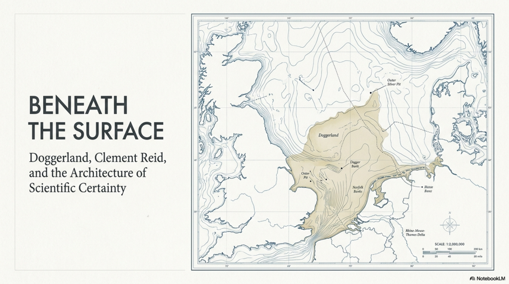
In 1913, the British geologist Clement Reid published a remarkable book titled Submerged Forests. Within its pages, Reid proposed something extraordinary for the time: that Britain had once been connected to continental Europe by a vast prehistoric landscape now submerged beneath the North Sea. (Clement Reid, Doggerland, and the Archaeological Establishment)
Today, we call this drowned world Doggerland.
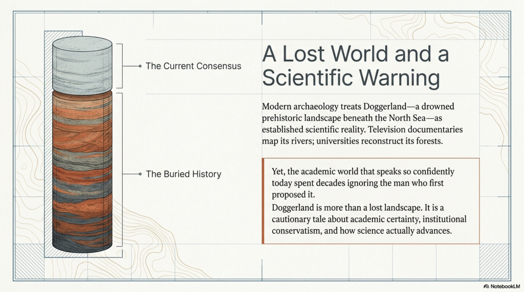
Modern archaeology now treats Doggerland as an established scientific reality. Universities reconstruct its rivers and forests in digital models. Television documentaries present it as one of the most important prehistoric landscapes ever discovered. Entire academic projects are devoted to mapping its vanished terrain.
Yet what is rarely discussed is that when Reid first proposed the idea, it sat largely outside accepted archaeological thinking. His conclusions were not embraced as visionary science. They were treated as speculative and peripheral because the evidence challenged the prevailing understanding of Britain’s prehistoric past.
The irony is remarkable.
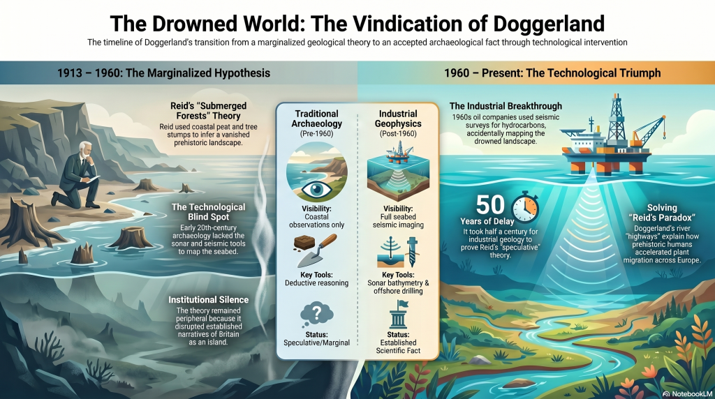
The same academic world that now speaks confidently about Doggerland only fully accepted its existence after industrial oil exploration in the 1960s and 1970s accidentally proved Reid correct through seabed mapping, seismic surveys, and offshore drilling.
Doggerland, therefore, represents far more than a lost landscape.
It represents a cautionary tale about academic certainty itself.
Without it, critics can say:
“Well, Reid was just speculating without evidence.”
But once you include the nineteenth-century finds, the situation changes dramatically.
Because then the historical sequence becomes:
- Physical evidence was already being recovered from the North Sea.
- Scientists already knew submerged land surfaces existed.
- Reid synthesised this evidence into a coherent landscape model.
- The implications were still not fully operationalised archaeologically.
- Later marine geophysics confirmed the larger landscape physically.
That is a much stronger progression in history and science.
And critically, it reinforces your silence argument:
- The evidence was not absent;
- The implications simply were not fully pursued.
This section should probably go immediately before “The Britain Clement Reid Saw.”
The Evidence Existed Before Doggerland Had a Name
Long before the term “Doggerland” was ever coined, physical evidence was already emerging from the floor of the North Sea.
Throughout the nineteenth century, North Sea fishermen regularly recovered:
- mammoth bones
- antlers
- peat deposits
- submerged tree remains
- and even worked flints
while trawling offshore waters.
These discoveries were not isolated curiosities. They demonstrated something fundamentally important:
Large areas beneath the North Sea had once been dry land.
Peat could not form underwater. Trees could not grow on the seabed. Large terrestrial mammals could not inhabit a marine environment. The evidence, therefore, pointed directly toward a drowned prehistoric landscape connecting Britain to continental Europe.
This material heavily influenced early geologists and palaeoenvironmental researchers, including Clement Reid.
By the time Reid published Submerged Forests in 1913, the basic physical evidence for former land surfaces beneath the North Sea already existed. The real issue was not whether the land had once been exposed, but whether the scientific world was prepared to grasp the full implications of what that meant for prehistory, migration, and the ancient geography of Britain.
That distinction is crucial.
Doggerland was not suddenly invented by modern archaeology.
The evidence had been sitting in fishing nets for decades.
The Britain Clement Reid Saw
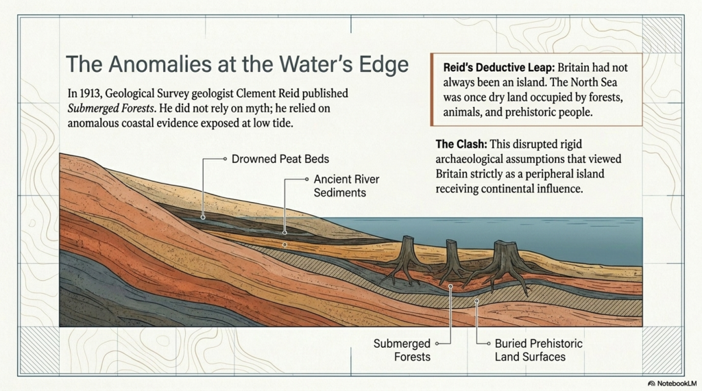
Reid was not a fantasist or fringe writer. He was a respected geologist with the Geological Survey who specialised in ancient landscapes, fossil plants, and environmental reconstruction.
While studying Britain’s coastlines, he repeatedly encountered strange evidence:
- submerged forests exposed at low tide
- drowned peat beds
- ancient river sediments beneath the sea
- tree stumps emerging from beaches
- buried prehistoric land surfaces offshore
To Reid, the implications were obvious.
Britain had not always been an island.
Large parts of what is now the North Sea must once have been dry land occupied by forests, animals, and prehistoric people.
At the time, however, archaeology still operated within relatively rigid geographical assumptions. Britain was largely viewed as a peripheral island receiving cultural influence from continental Europe, rather than as part of a major prehistoric continental landscape in its own right.
Reid’s conclusions disrupted that simplicity.
The Problem: Nobody Could See the North Sea Floor
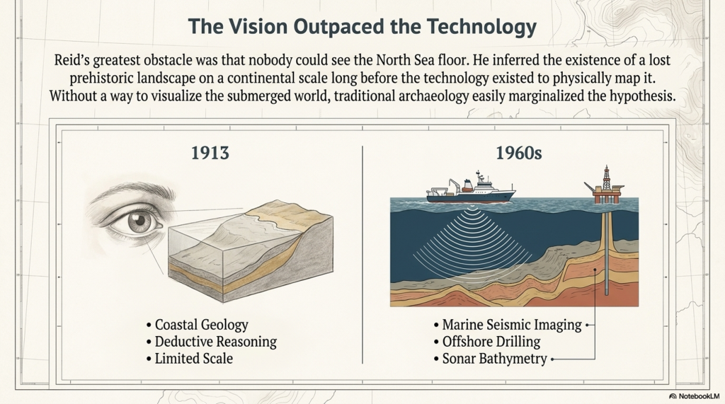
The greatest obstacle Reid faced was technological.
In 1913, there was no practical way to visualise the submerged landscape beneath the North Sea on a continental scale.
There was:
- no marine seismic imaging
- no industrial offshore drilling
- no sonar bathymetry
- no digital seabed modelling
- no large-scale geophysical mapping
Reid’s argument, therefore, relied primarily upon coastal geology, submerged forests, peat deposits, and deductive reasoning.
To many archaeologists, this made the hypothesis easy to marginalise.
This is important because modern archaeology often presents Doggerland as though it emerged naturally from gradual academic progress. In reality, the idea remained on the fringes largely because the physical landscape itself could not yet be properly mapped.
Then Came the Oil Industry
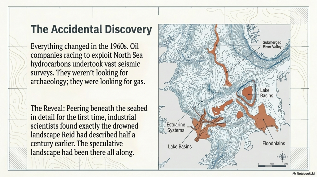
Everything changed in the 1960s with the race to exploit North Sea oil and gas reserves.
Oil companies were not searching for archaeology.
They were searching for hydrocarbons.
To locate them, they began undertaking vast geological and seismic surveys across the North Sea basin. For the first time in human history, scientists could effectively peer beneath the seabed in detail.
And what did they find?
Exactly the kind of drowned landscape Reid had described half a century earlier.
The surveys revealed:
- submerged river valleys
- ancient coastlines
- lake basins
- estuarine systems
- floodplains
- peat deposits
- glacial and post-glacial landscapes
Modern seismic data have conclusively demonstrated that a vast habitable lowland once connected Britain to continental Europe.
The “speculative” landscape had been there all along.
Why Doggerland Still Wasn’t Fully Understood in the 1980s and 1990s
Even after North Sea oil exploration began revealing enormous submerged landscapes beneath the seabed, Doggerland still did not immediately transform archaeology.
This raises an important question:
If the seismic evidence existed by the 1970s and 1980s, why did it take until the early twenty-first century for Doggerland to become a mainstream archaeological reality?
The answer lies in a combination of corporate secrecy, technological limitation, and disciplinary separation.
1. The Data Was Effectively Locked Away
The seismic surveys were conducted by private oil and gas companies.
These corporations spent enormous sums collecting offshore geophysical data and treated it as commercially valuable intellectual property. Academic archaeologists generally had little or no access to the datasets.
More importantly, the oil industry had no interest in prehistoric landscapes.
Their objective was to find hydrocarbons buried kilometres beneath the seabed. The shallow upper layers, containing ancient river valleys, peat beds, and drowned terrain, were largely treated as geological overburden — background material that had to be filtered out to reach the economically important strata below.
As a result, some of the clearest evidence for Doggerland physically existed for decades before archaeology could meaningfully examine it.
2. The Computers Were Not Yet Powerful Enough
Modern reconstructions of Doggerland depend upon enormous quantities of three-dimensional seismic and bathymetric data stitched together across thousands of square kilometres.
In the 1980s and early 1990s, this was technologically extremely difficult.
Universities generally lacked:
- the computing power,
- data storage,
- rendering capability,
- and processing speed
required to integrate these vast offshore datasets into coherent prehistoric landscape models.
Only in the late 1990s and early 2000s did computing technology finally become capable of handling the scale of data required to reconstruct the drowned North Sea plain properly.
3. Geologists and Archaeologists Were Working in Isolation
Perhaps most importantly, the relevant disciplines were not communicating effectively.
Oil geologists viewed the shallow seabed primarily as a barrier obscuring deeper oil-bearing strata.
Archaeologists, meanwhile, understood that prehistoric populations had once occupied areas now submerged beneath the North Sea, but lacked the marine geophysical tools necessary to visualise the landscape itself.
The two fields largely operated independently of one another.
Only in the early 2000s did serious interdisciplinary collaboration begin, combining:
- offshore seismic data,
- marine geology,
- palaeoenvironmental reconstruction,
- and archaeology
into a unified model of the drowned prehistoric landscape.
By then, Clement Reid had been dead for almost a century.
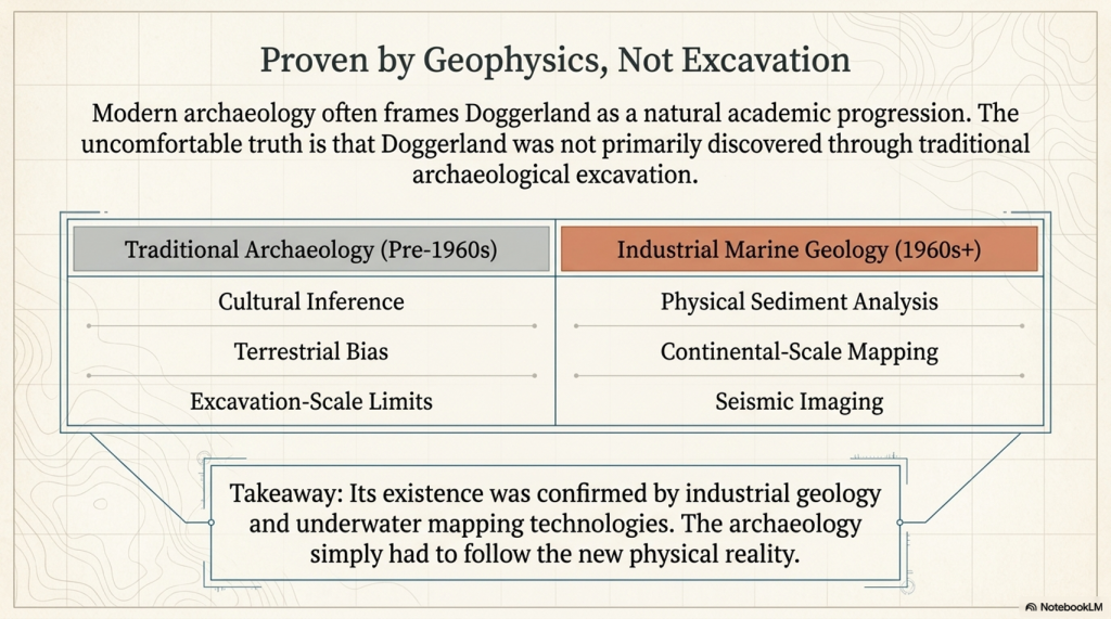
Doggerland Was Proven by Geology — Not Traditional Archaeology
This is the crucial point often overlooked.
Doggerland was not primarily discovered through excavation in the traditional archaeological sense.
Its existence was confirmed by:
- marine geophysics
- industrial seismic imaging
- offshore geological surveys
- sediment analysis
- underwater mapping technologies
The archaeology followed afterwards.
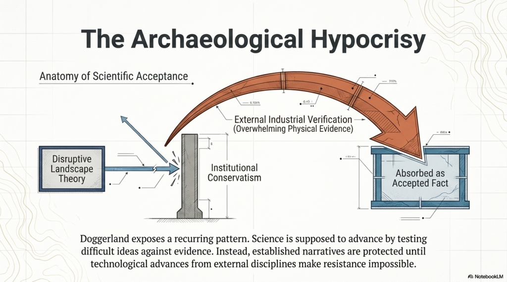
This matters because it reveals an uncomfortable pattern that repeats throughout the history of archaeology:
- A disruptive landscape theory is proposed.
- It struggles against established narratives.
- Independent sciences later produce overwhelming physical evidence.
- Archaeology absorbs the new reality as an accepted fact.
Doggerland is therefore not merely a triumph of archaeology.
It is equally a triumph of geology, marine science, and technological surveying.
Silence Is Not the Same as Acceptance
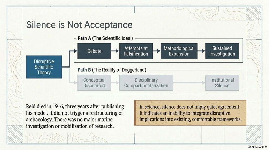
One of the most revealing aspects of Clement Reid’s work is not open hostility, but relative silence.
Modern archaeology often gives the impression that Reid’s submerged landscape ideas were gradually and quietly accepted by the scientific world. But in science, silence does not necessarily imply agreement or acceptance.
Quite often, it indicates something very different:
- conceptual discomfort
- technological limitation
- disciplinary compartmentalisation
- or an inability to integrate disruptive implications into existing frameworks.
If a scientific theory genuinely transforms a discipline, it normally generates:
- debate
- criticism
- attempts at falsification
- methodological expansion
- and sustained investigation.
Had Albert Einstein published relativity only for physics to largely ignore it for decades, nobody would argue that relativity had therefore been “quietly accepted.” The opposite conclusion would be drawn — that the scientific world had not yet fully absorbed the implications of the theory.
The same pattern appears in the history of Doggerland.
Reid published Submerged Forests in 1913, the same year he retired from the Geological Survey after a distinguished scientific career. He died only three years later in 1916. During that short remaining period, his drowned landscape model did not trigger a major transformation in archaeology or prehistoric reconstruction.
There was:
- no large-scale marine investigation programme
- no major archaeological restructuring around submerged landscapes
- no widespread mobilisation of prehistoric research into the North Sea basin
Instead, the idea remained scientifically peripheral for decades.
This is important because it suggests that the scientific world of the early twentieth century was not fully equipped — technologically or conceptually — to grasp the scale of what Reid was implying.
He had inferred the existence of a lost prehistoric landscape beneath the North Sea long before the technology existed to visualise it properly.
Only later did:
- marine geophysics
- seismic profiling
- sonar mapping
- offshore drilling
- and North Sea oil exploration
Finally, transform Reid’s geological inference into a physically visible drowned world.
In this sense, the muted reception of Reid’s work may itself be evidence of how disruptive and difficult its implications truly were for the scientific establishment of the time to fully comprehend.
The Archaeological Hypocrisy
Today, archaeologists speak with complete confidence about Doggerland.
It appears in textbooks, museums, documentaries, and university lectures as settled science.
Yet very few openly acknowledge that:
- the original theory existed outside mainstream archaeological thinking
- the idea was treated cautiously for decades
- and it was only overwhelming physical evidence from external sciences that forced universal acceptance
This is not how science is supposed to operate.
Science advances by testing difficult ideas against evidence — not by protecting established narratives until technological advances make resistance impossible.
Doggerland demonstrates how institutional conservatism can delay acceptance even when the underlying reasoning is sound.
The Same Pattern Appears Elsewhere
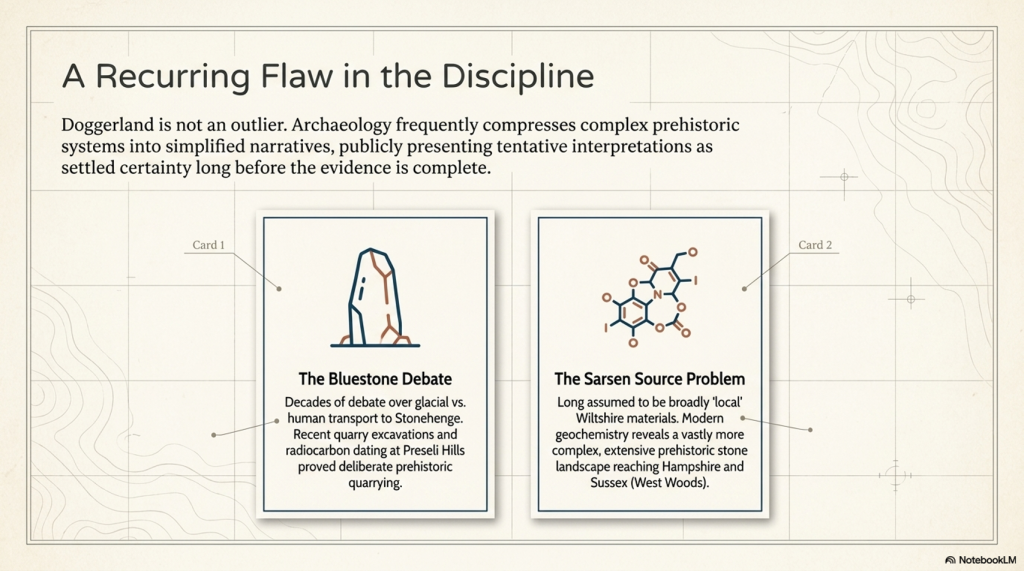
Doggerland is not an isolated example.
The same tendency toward premature certainty recurs throughout archaeology.
1. The Bluestone Debate
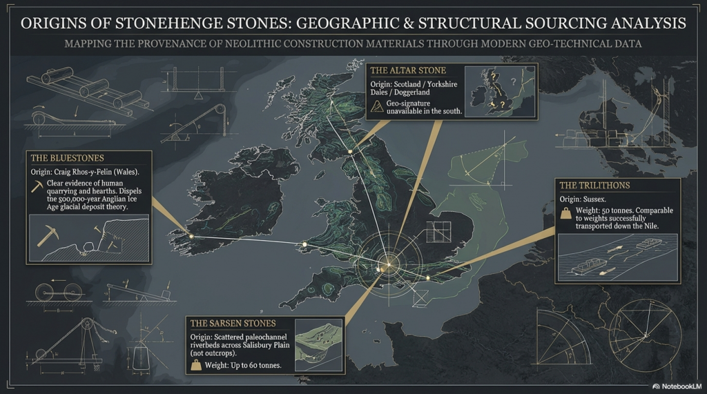
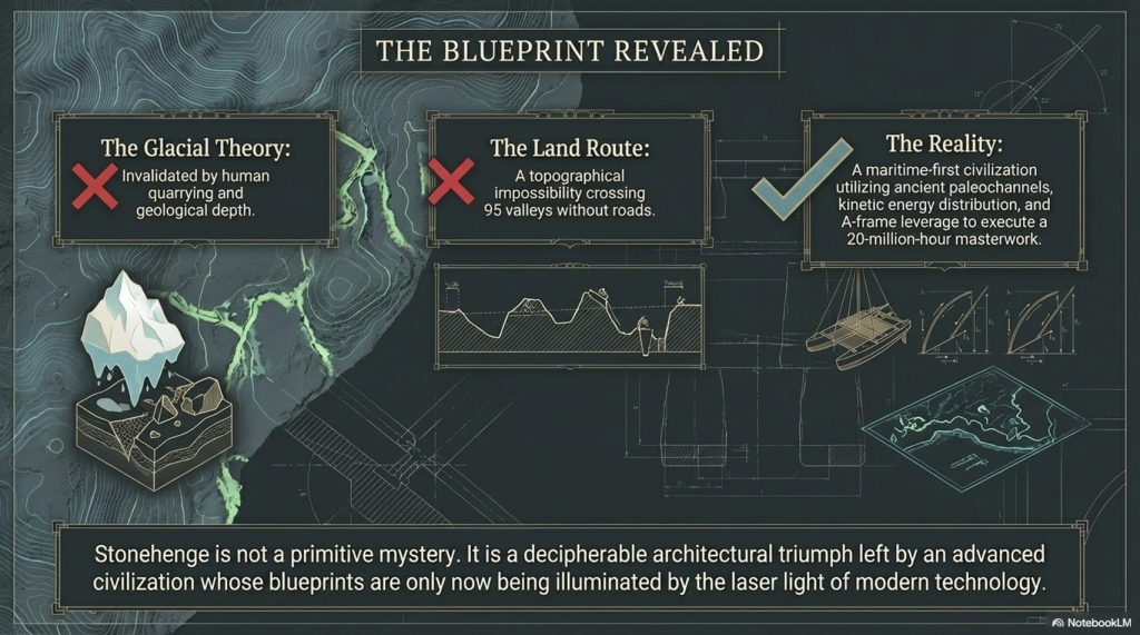
For decades, debate surrounded how the Stonehenge bluestones reached Salisbury Plain.
While their Welsh origin was widely accepted, archaeologists remained divided over whether the stones were deliberately transported by humans or partially carried by glacial processes.
Over time, quarry excavations in the Preseli Hills, associated hearths, and radiocarbon evidence increasingly strengthened the case for deliberate prehistoric quarrying and transport.
The important issue is not that archaeology asks questions — that is, healthy science.
The issue is how tentative interpretations are often presented publicly as settled certainty long before the evidence is complete.
2. The Sarsen Source Problem
For many years, Stonehenge narratives simplified the sarsens as broadly “local” materials derived from nearby Wiltshire landscapes.
More recent geochemical work has considerably complicated that picture.
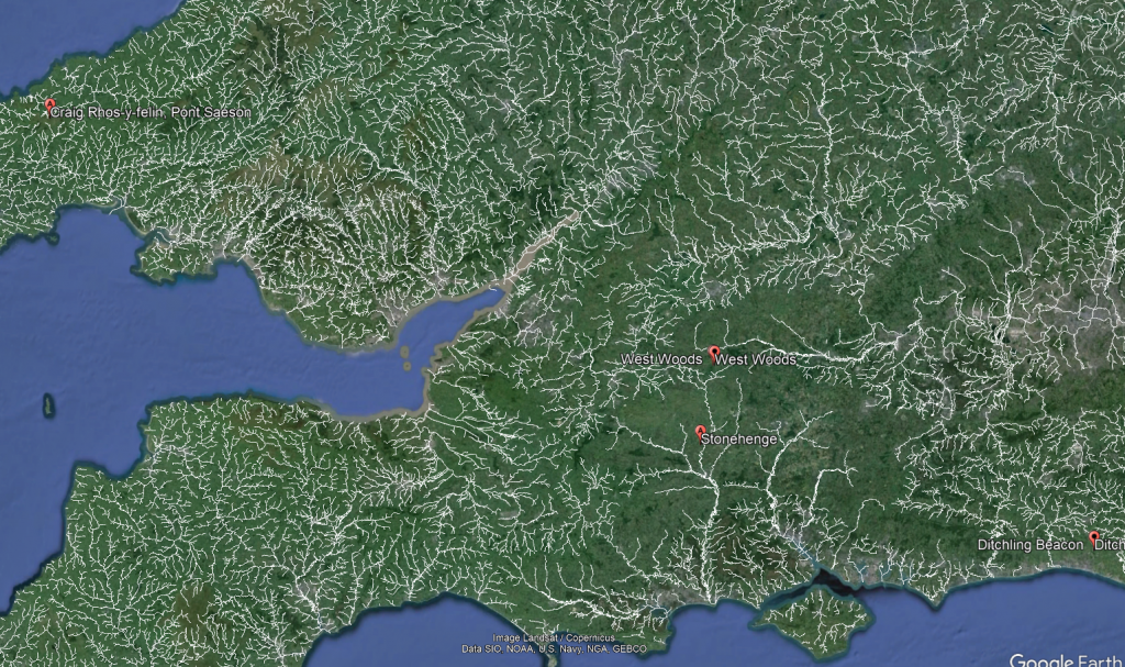
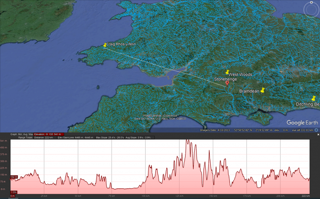
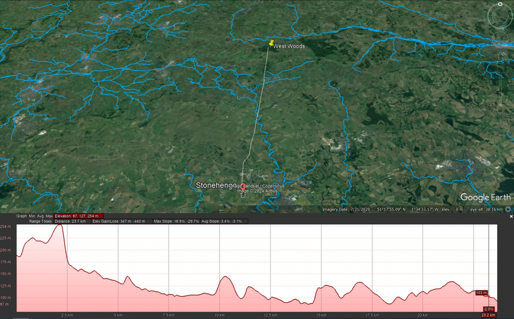
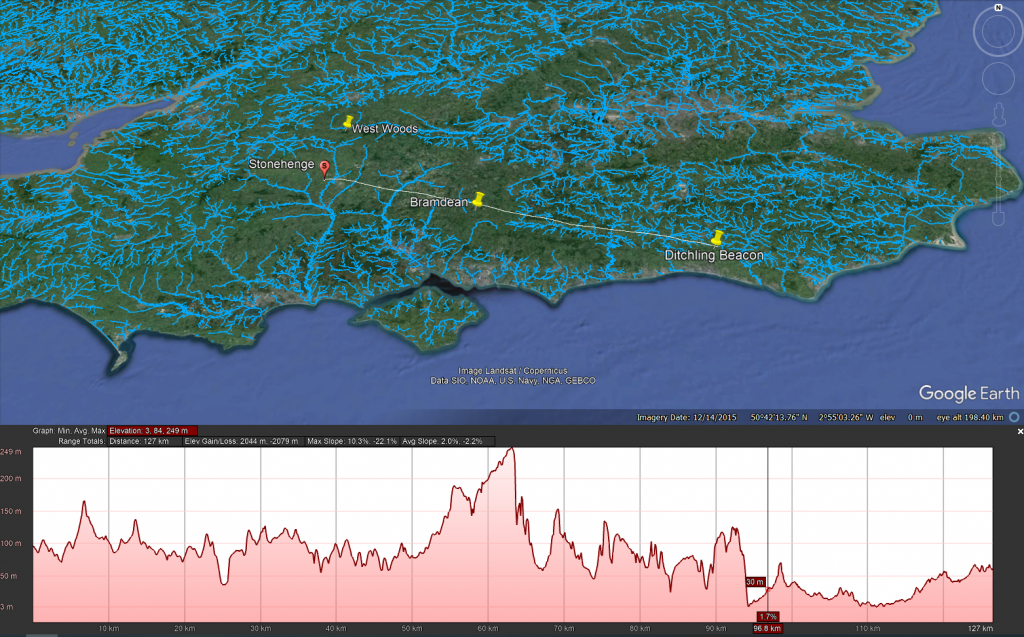
While West Woods appears to have been a major source of many of the principal stones, the wider sarsen distribution across southern Britain indicates a far more extensive prehistoric stone landscape extending into Hampshire and Sussex.
The significance is not simply geological.
It demonstrates again how archaeology frequently compresses complex prehistoric systems into simplified narratives that later evidence must revise.
Doggerland followed exactly the same trajectory.
3. The Prehistoric Dyke Problem
For generations, large linear earthworks such as:
- Offa’s Dyke
- Wansdyke
- Car Dyke
- and the Vallum
have been interpreted primarily as defensive or territorial boundaries.
Yet many of these structures display characteristics difficult to reconcile with simple military explanations:
- inconsistent defensive logic
- discontinuous alignments
- relationships with wetlands and floodplains
- hydraulic behaviour
- and associations with water-retaining landscapes.
Increasingly, alternative interpretations suggest that at least some of these monumental earthworks may have functioned partly as:
- canals,
- water-management systems,
- transport corridors,
- or integrated hydrological infrastructure.
The important point is not that traditional archaeology asked questions.
The issue is that defensive interpretations often became entrenched long before large-scale hydrological modelling, lidar analysis, and landscape engineering perspectives were properly integrated into archaeological interpretation.
Once again, the pattern resembles Doggerland:
A landscape system existed physically in front of investigators for generations, yet the underlying functional logic remained poorly understood because the dominant interpretive framework constrained how the evidence was viewed.
4. Hydrology: The Missing Discipline
Perhaps the deepest parallel between Doggerland and wider prehistoric archaeology is hydrology itself.
Doggerland was ultimately misunderstood because archaeology failed to properly integrate changing sea levels, marine landscapes, river systems, and submerged environmental reconstruction into prehistoric interpretation.
But remarkably, a similar problem also appears across terrestrial archaeology.
For much of the twentieth century, archaeology often treated ancient landscapes as though modern drainage conditions broadly reflected prehistoric reality.
Yet post-glacial Britain was radically different:
- groundwater levels were higher
- floodplains were wetter
- wetlands were more extensive
- chalk aquifers behaved differently
- rivers occupied larger channels
- and seasonal inundation transformed movement and settlement patterns.
In many cases, archaeologists interpreted prehistoric structures without fully integrating the hydrological conditions under which they originally operated.
This may have profoundly affected interpretations of:
- ditches
- causeways
- river transport
- wetland occupation
- monument placement
- and large linear earthworks.
The irony is extraordinary.
In Doggerland studies, archaeology initially underestimated the role of marine hydrology and drowned landscapes.
In terrestrial archaeology, it may have simultaneously underestimated inland hydrology and water-dominated land environments.
The same disciplinary weakness appears in reverse.
In both cases, the result was similar:
prehistoric landscapes were interpreted through modern environmental assumptions rather than reconstructed hydrological realities.
Reid’s Other Problem: The Mystery of Rapid Plant Migration
Clement Reid’s importance to prehistoric science extends far beyond Doggerland.
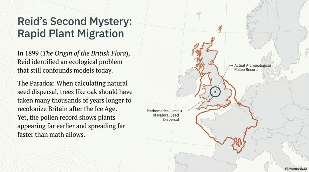
In 1899, more than a decade before Submerged Forests, Reid published another remarkable work: The Origin of the British Flora. Within it, he identified a problem that still challenges ecology today — what later became known as Reid’s Paradox of Rapid Plant Migration.
The paradox is deceptively simple.
When scientists calculate how quickly plants naturally spread through seed dispersal alone, the results are extremely slow. Trees such as oak should have taken many thousands of years longer to recolonise Britain after the Ice Age than the archaeological and pollen evidence suggests.
Yet across Europe and Britain, plants repeatedly appear far earlier and spread far faster than traditional dispersal models predict.
Even modern ecology still struggles to explain this properly.
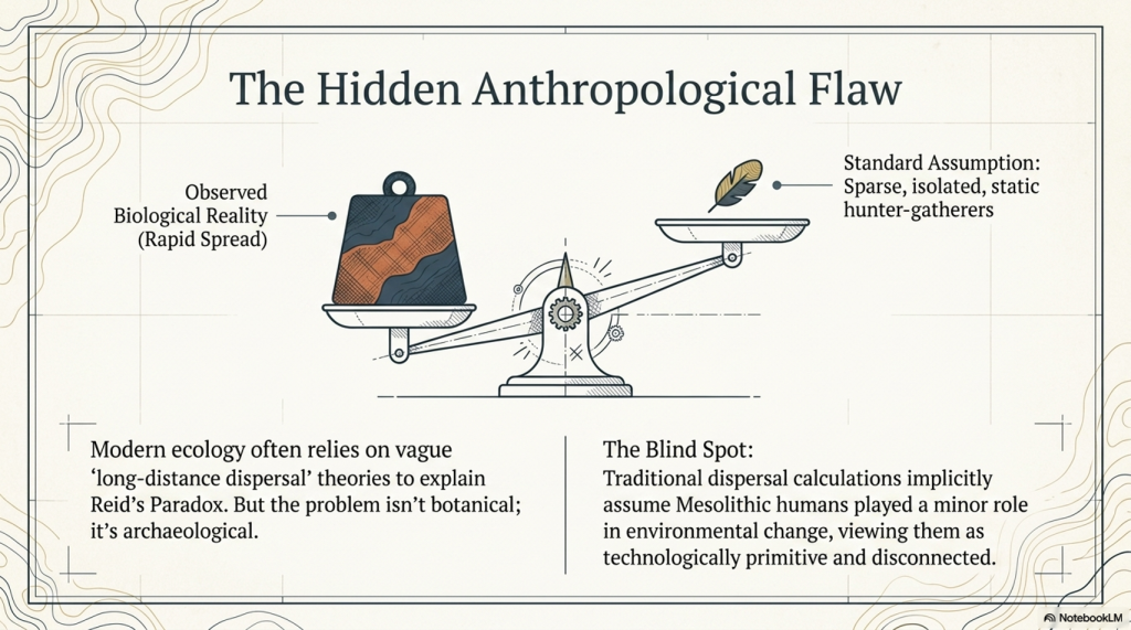
The standard explanation usually invokes vague concepts such as “long-distance dispersal,” but this often amounts to little more than admitting that the mathematics and the observed reality do not match.
But what if the problem is not botanical?
What if the problem is archaeological?
The Hidden Assumption Inside Reid’s Paradox
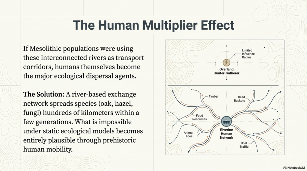
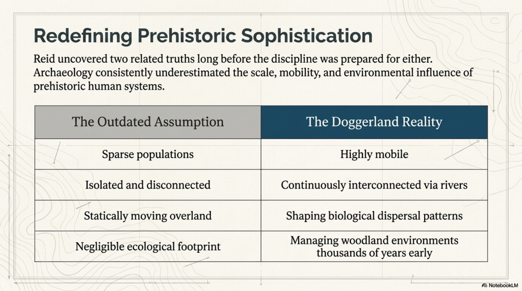
Traditional dispersal models largely assume that prehistoric humans played only a minor role in environmental change.
Implicit within many calculations is an outdated image of Mesolithic people as:
- sparse populations
- isolated hunter-gatherers
- technologically primitive
- and largely disconnected from one another.
But the growing evidence from Doggerland and post-glacial Britain increasingly points toward something very different.
The Mesolithic world appears to have been highly mobile, river-based, and interconnected.
Once this possibility is introduced, Reid’s Paradox becomes far less mysterious.
Rivers Were the Highways of the Mesolithic World
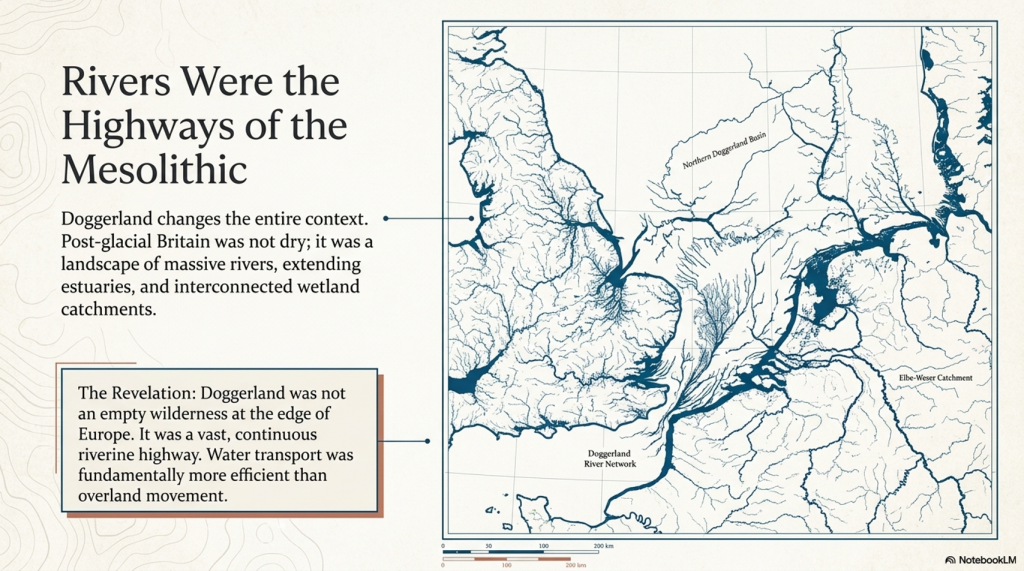
Under post-glacial conditions, Britain was not the dry landscape we know today.
Research into post-glacial hydrology increasingly suggests that:
- rivers were larger
- estuaries extended far inland
- wetlands interconnected catchments
- and water transport was likely easier and more efficient than overland movement.
If Mesolithic populations used rivers and coastlines as transport corridors, then humans themselves became major agents of ecological dispersal.
Seeds, spores, and plants could spread through:
- food transport
- reeds and basket materials
- animal hides
- timber movement
- boat traffic
- stored resources
- and simple repeated human movement along waterways.
The consequences are profound.
A river-based exchange network could spread species hundreds of kilometres within only a few generations — vastly faster than traditional natural dispersal models allow.
What appears impossible under static ecological models becomes entirely plausible once prehistoric mobility is properly considered.
Doggerland Changes the Entire Context
This is where Doggerland becomes critically important.
A connected North Sea plain linking Britain to continental Europe would not merely have allowed human migration — it would have enabled continuous ecological exchange across vast interconnected river systems.
The prehistoric populations living within this landscape may have accelerated the spread of:
- oak
- hazel
- edible plants
- fungi
- wetland species
- and managed woodland environments
far beyond what purely natural dispersal models predict.
In this sense, Reid may have uncovered two related truths long before archaeology was prepared to accept either of them:
- Britain was once connected to Europe by a vast lost landscape.
- Mesolithic humans were likely far more mobile, interconnected, and environmentally influential than traditional archaeology once believed.
The Real Lesson
The irony is remarkable.
Clement Reid identified both Doggerland and the plant migration paradox decades before the technologies or archaeological models existed to fully explain them.
In both cases, the underlying issue may have been the same:
Archaeology consistently underestimated the sophistication, mobility, and scale of prehistoric human systems.
Doggerland was not an empty wilderness at the edge of Europe.
It may have been part of a vast interconnected riverine world whose people reshaped landscapes, ecosystems, and biological dispersal patterns thousands of years before conventional history was prepared to recognise it.
Conclusion
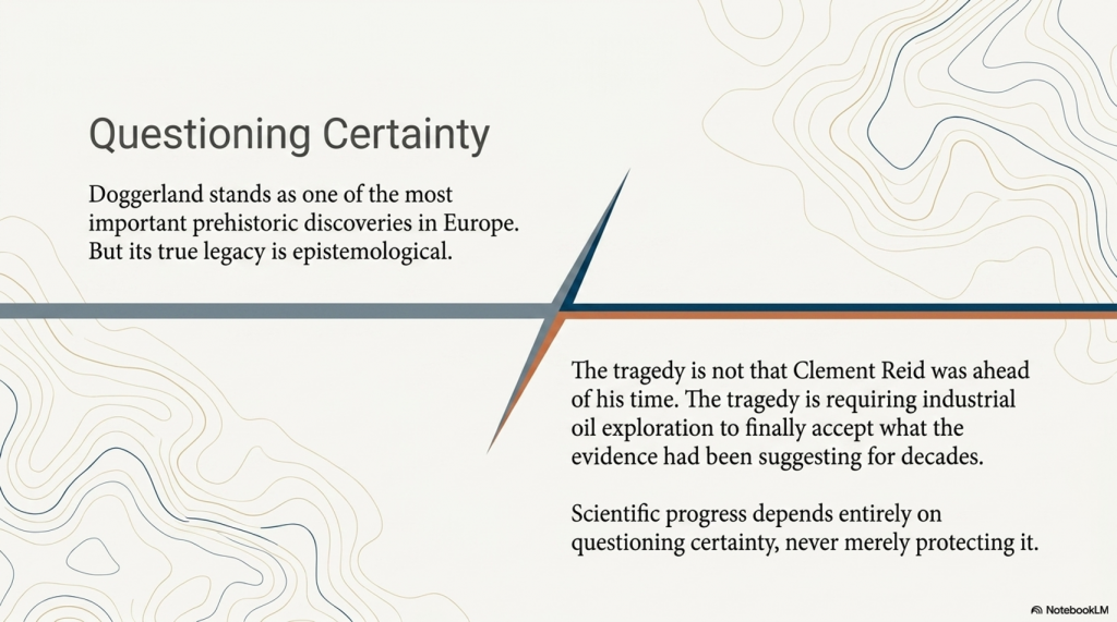
Doggerland now stands as one of the most important prehistoric discoveries in Europe.
But its history should also serve as a warning.
In 1913, Clement Reid proposed that a drowned prehistoric landscape once connected Britain to Europe. His conclusions were treated cautiously and remained outside mainstream archaeological thinking for decades.
Then, half a century later, oil companies searching for hydrocarbons accidentally proved him correct.
The tragedy is not that Reid was ahead of his time.
The tragedy is that archaeology required industrial geology and offshore oil exploration to finally accept what the evidence had already been suggesting for years.
Doggerland should therefore be remembered not only as a lost world beneath the North Sea —
But as a reminder that scientific progress depends upon questioning certainty, not protecting it.
PODCAST

Author’s Biography

Robert John Langdon, a polymathic luminary, emerges as a writer, historian, and eminent specialist in LiDAR Landscape Archaeology.
His intellectual voyage has been interwoven with stints as an astute scrutineer in government and grand corporate bastions, a tapestry spanning British Telecommunications, Cable and Wireless, British Gas, and the esteemed University of London.
A decade hence, Robert’s transition into retirement unfurled a chapter of insatiable curiosity. This phase saw him immerse himself in Politics, Archaeology, Philosophy, and the enigmatic realm of Quantum Mechanics. His academic odyssey traversed the venerable corridors of knowledge hubs such as the Museum of London, University College London, Birkbeck College, The City Literature Institute, and Chichester University.
In the symphony of his life, Robert is a custodian of three progeny and a pair of cherished grandchildren. His sanctuary lies ensconced in the embrace of West Wales, where he inhabits an isolated cottage, its windows framing a vista of the boundless sea – a retreat from the scrutinising gaze of Her Majesty’s Revenue and Customs, an amiable clandestinity in the lap of nature.
Exploring Prehistoric Britain: A Journey Through Time
My blog delves into the fascinating mysteries of prehistoric Britain, challenging conventional narratives and offering fresh perspectives grounded in cutting-edge research, particularly LiDAR technology. I invite you to explore some key areas of my research. For example, the Wansdyke, often cited as a defensive structure, is re-examined in light of new evidence. I’ve presented my findings in my blog post Wansdyke: A British Frontier Wall – ‘Debunked’, and a Wansdyke LiDAR Flyover video further visualises my conclusions.
My work also often challenges established archaeological dogma. I argue that many sites, such as Hambledon Hill, commonly identified as Iron Age hillforts, are not what they seem. My posts Lidar Investigation Hambledon Hill – NOT an ‘Iron Age Fort’ and Unmasking the “Iron Age Hillfort” Myth explore these ideas in detail and offer an alternative view. Similarly, sites like Cissbury Ring and White Sheet Camp receive re-evaluations based on LiDAR analysis in my posts “Lidar Investigation Cissbury Ring through time” and “Lidar Investigation White Sheet Camp,“ revealing fascinating insights into their true purpose. I have also examined South Cadbury Castle, often linked to the mythical Camelot56.
My research also extends to ancient water management, including the role of canals and other linear earthworks. I have discussed the true origins of Car Dyke in multiple posts, including Car Dyke – ABC News Podcast and Lidar Investigation Car Dyke – North Section, which suggest a Mesolithic origin 2357. I also explore the misidentification of Roman aqueducts, as seen in my posts on the Great Chesters (Roman) Aqueduct. My research has also been greatly informed by my post-glacial flooding hypothesis, which has helped explain landscape transformations over time. I have discussed this hypothesis in several posts, including AI now supports my Post-Glacial Flooding Hypothesis and Exploring Britain’s Flooded Past: A Personal Journey
Finally, my blog also investigates prehistoric burial practices, as seen in Prehistoric Burial Practices of Britain and explores the mystery of Pillow Mounds, often mistaken for medieval rabbit warrens, but with a potential link to Bronze Age cremation in my posts: Pillow Mounds: A Bronze Age Legacy of Cremation? and The Mystery of Pillow Mounds: Are They Really Medieval Rabbit Warrens?. My research also includes astronomical insights into ancient sites, for example, in Rediscovering the Winter Solstice: The Original Winter Festival. I also review new information about the construction of Stonehenge in The Stonehenge Enigma.
Further Reading
For those interested in British Prehistory, visit www.prehistoric-britain.co.uk, a comprehensive resource featuring an extensive collection of archaeology articles, modern LiDAR investigations, and groundbreaking research. The site also includes insights and excerpts from the acclaimed Robert John Langdon Trilogy, a series of books that explore Britain during the Prehistoric period. Titles in the trilogy include The Stonehenge Enigma, Dawn of the Lost Civilisation, and The Post-Glacial Flooding Hypothesis, which offer compelling evidence of ancient landscapes shaped by post-glacial flooding.
To further explore these topics, Robert John Langdon has developed a dedicated YouTube channel featuring over 100 video documentaries and investigations that complement the trilogy. Notable discoveries and studies showcased on the channel include 13 Things that Don’t Make Sense in History and the revelation of Silbury Avenue – The Lost Stone Avenue, a rediscovered prehistoric feature at Avebury, Wiltshire.
In addition to his main works, Langdon has released a series of shorter, accessible publications, ideal for readers delving into specific topics. These include:
- The Ancient Mariners
- Stonehenge Built 8300 BCE
- Old Sarum
- Prehistoric Rivers
- Dykes, Ditches, and Earthworks
- Echoes of Atlantis
- Homo Superior
- 13 Things that Don’t Make Sense in History
- Silbury Avenue – The Lost Stone Avenue
- Offa’s Dyke
- The Stonehenge Enigma
- The Post-Glacial Flooding Hypothesis
- The Stonehenge Hoax
- Dawn of the Lost Civilisation
- Darwin’s Children
- Great Chester’s Roman Aqueduct
- Wansdyke
For active discussions and updates on the trilogy’s findings and recent LiDAR investigations, join our vibrant community on Facebook. Engage with like-minded enthusiasts by leaving a message or contributing to debates in our Facebook Group.
Whether through the books, the website, or interactive videos, we aim to provide a deeper understanding of Britain’s fascinating prehistoric past. We encourage you to explore these resources and uncover the mysteries of ancient landscapes through the lens of modern archaeology.
For more information, including chapter extracts and related publications, visit the Robert John Langdon Author Page. Dive into works such as The Stonehenge Enigma or Dawn of the Lost Civilisation, and explore cutting-edge theories that challenge traditional historical narratives.
Other Blogs
1
a
- AI now Supports – Homo Superior
- AI now supports my Post-Glacial Flooding Hypothesis
- Alexander the Great sailed into India – where no rivers exist today
- Ancient Secrets of Althorp – debunked
- Antler Picks built Ancient Monuments – yet there is no real evidence
- Antonine Wall – Prehistoric Canals (Dykes)
- Archaeological ‘pulp fiction’ – has archaeology turned from science?
- Archaeological Pseudoscience
- Archaeology in the Post-Truth Era
- Archaeology: A Bad Science?
- Archaeology: A Harbour for Fantasists?
- Archaeology: Fact or Fiction?
- Archaeology: The Flaws of Peer Review
- Archaeology’s Bayesian Mistake: Stop Averaging the Past
- Are Raised Beaches Archaeological Pseudoscience?
- Atlantis Found: The Mathematical Proof That Plato’s Lost City Was Doggerland
- ATLANTIS: Discovery with Dan Snow Debunked
- Avebury Ditch – Avebury Phase 2
- Avebury through time
- Avebury’s great mystery revealed
- Avebury’s Lost Stone Avenue – FREE Flipbook
b
- Battlesbury Hill – Wiltshire
- Beyond Stone and Bone: Rethinking the Megalithic Architects of Northern Europe
- BGS Prehistoric River Map
- Blackhenge: Debunking the Media misinterpretation of the Stonehenge Builders
- Brain capacity (Cro-Magnon Man)
- Britain’s First Road – Stonehenge Avenue
- Britain’s Giant Prehistoric Waterways
- British Roman Ports miles away from the coast
c
- Caerfai Promontory Fort – Archaeological Nonsense
- Car Dyke – ABC News PodCast
- Car Dyke – North Section
- Car Dyke Atlas – Prehistoric Canals – FREE Flipbook
- CASE STUDY – An Inconvenient TRUTH (Craig Rhos Y Felin)
- Case Study – River Avon
- Case Study – Woodhenge Reconstruction
- Chapter 2 – Craig Rhos-Y-Felin Debunked
- Chapter 2 – Stonehenge Phase I
- Chapter 2 – Variation of the Species
- Chapter 3 – Post Glacial Sea Levels
- Chapter 3 – Stonehenge Phase II
- Chapter 7 – Britain’s Post-Glacial Flooding
- Cissbury Ring through time
- Clement Reid, Doggerland, and the Archaeological Establishment
- Cro-Magnon Brain Capacity
- Cro-Magnon Megalithic Builders: Measurement, Biology, and the DNA
- Cro-Magnons – An Explainer
d
- Darwin’s Children – Flipbook
- Darwin’s Children – The Cro-Magnons
- Dawn of the Lost Civilisation – FREE Flipbook
- Dawn of the Lost Civilisation – Introduction
- Digging for Britain – Cerne Abbas
- Digging for Britain Debunked – Cerne Abbas 2
- Digging Up Britain’s Past – Debunked
- DLC Chapter 1 – The Ascent of Man
- Durrington Walls – Woodhenge through time
- Durrington Walls Revisited: Platforms, Fish Traps, and a Managed Mesolithic Landscape
- Dyke Construction – Hydrology 101
- Dykes Ditches and Earthworks
- DYKES of Britain
e
f
g
h
- Hadrian’s Wall – Military Way Hoax
- Hadrian’s Wall – the Stanegate Hoax
- Hadrian’s Wall LiDAR investigation
- Hambledon Hill – NOT an ‘Iron Age Fort’
- Hayling Island Lidar Maps
- Hidden Sources of Ancient Dykes: Tracing Underground Groundwater Fractals
- Historic River Avon
- Hollingsbury Camp Brighton – A Hillfort… or a Forgotten Harbour?
- Hollows, Sunken Lanes and Palaeochannels
- Homo Superior – Flipbook
- Homo Superior – History’s Giants
- How Lidar will change Archaeology
- Hydrology 101 Simplified: Why Britain’s Dykes Worked Without Rivers
i
l
m
- Maiden Castle through time
- Mathematics Meets Archaeology: Discovering the Mesolithic Origins of Car Dyke
- Mesolithic River Avon
- Mesolithic Stonehenge
- Minerals found in Prehistoric and Roman Quarries
- Mining in the Prehistoric to Roman Period
- Mount Caburn through time
- Mysteries of the Oldest Boatyard Uncovered
- Mythological Dragons – a non-existent animal that is shared by the World.
o
- Offa’s Dyke – FREE Flipbook
- Old Sarum Lidar Map
- Old Sarum Through Time…………….
- On Sunken Lands of the North Sea – Lived the World’s Greatest Civilisation.
- OSL Chronicles: Questioning Time in the Geological Tale of the Avon Valley
- Oswestry LiDAR Survey
- Oswestry through time
- Oysters in Archaeology: Nature’s Ancient Water Filters?
p
- Pillow Mounds: A Bronze Age Legacy of Cremation?
- Pinkery Canal
- Plato Was Right: The Archaeological Evidence the Academics Never Expected
- Post Glacial Flooding – Flipbook
- Prehistoric Burial Practices of Britain
- Prehistoric Canals – Wansdyke
- Prehistoric Canals – Wansdyke
- Prehistoric Canals (Dykes) – Great Chesters Aqueduct (The Vallum Pt. 4)
- Prehistoric Canals (Dykes) – Hadrian’s Wall Vallum (pt 1)
- Prehistoric Canals (Dykes) – Offa’s Dyke (Chepstow)
- Prehistoric Canals (Dykes) – Offa’s Dyke (LiDAR Survey)
- Prehistoric Canals (Dykes) – Offa’s Dyke Survey (End of Section A)
- Prehistoric Canals (Dykes) – Wansdyke (4)
- Prehistoric Canals Wansdyke 2
- Professor Bonkers and the mad, mad World of Archaeology
r
- Real-World Confirmation of Post-Glacial Flooding
- Rebirth in Stone: Decrypting the Winter Solstice Legacy of Stonehenge
- Rediscovering the Winter Solstice: The Original Winter Festival
- Rethinking Ancient Boundaries: The Vallum and Offa’s Dyke”
- Rethinking Ogham: Could Ireland’s Oldest Script Have Begun as a Tally System?
- Rethinking The Past: Mathematical Proof of Langdon’s Post-Glacial Flooding Hypothesis
- Rising Evidence, Falling Rivers: The Real Story of Europe’s First Farmers
- Rivers of the Past Were Higher: A Fresh Perspective on Prehistoric Hydrology
s
- Sea Level Changes
- Section A – NY26SW
- Section B – NY25NE & NY26SE
- Section C – NY35NW
- Section D – NY35NE
- Section E – NY46SW & NY45NW
- Section F – NY46SE & NY45NE
- Section G – NY56SW
- Section H – NY56NE & NY56SE
- Section I – NY66NW
- Section J – NY66NE
- Section K – NY76NW
- Section L – NY76NE
- Section M – NY87SW & NY86NW
- Section N – NY87SE
- Section O – NY97SW & NY96NW
- Section P – NY96NE
- Section Q – NZ06NW
- Section R – NZ06NE
- Section S – NZ16NW
- Section T – NZ16NE
- Section U – NZ26NW & NZ26SW
- Section V – NZ26NE & NZ26SE
- Silbury Avenue – Avebury’s First Stone Avenue
- Silbury Hill
- Silbury Hill / Sanctuary – Avebury Phase 3
- Sky Maps of Prehistoric Britain
- Somerset Plain – Signs of Post-Glacial Flooding
- South Cadbury Castle – Camelot
- Statonbury Camp near Bath – an example of West Wansdyke
- Stone me – the druids are looking the wrong way on Solstice day
- Stone Transportation and Dumb Censorship
- Stonehenge – Monument to the Dead
- Stonehenge Hoax – Dating the Monument
- Stonehenge Hoax – Round Monument?
- Stonehenge Hoax – Summer Solstice
- Stonehenge LiDAR tour
- Stonehenge Phase 1 – 8300 BCE Documentary
- Stonehenge Phase 1 — Britain’s First Monument
- Stonehenge Phase I (The Stonehenge Landscape)
- Stonehenge Solved – Pythagorean maths put to use 4,000 years before he was born
- Stonehenge Through Time
- Stonehenge, Doggerland and Atlantis connection
- Stonehenge: Borehole Evidence of Post-Glacial Flooding
- Stonehenge: Discovery with Dan Snow Debunked
- Stonehenge: The World’s First Computer – FREE Flipbook
- Stonehenge: The Worlds First Computer
- Stonehenge’s The Lost Circle Revealed – DEBUNKED
t
- Ten Reasons Why Car Dyke Blows Britain’s Earthwork Myths Out of the Water
- Ten Things You Didn’t Know About Britain’s Prehistoric Flooded Past
- Ten thousand year old boats found on Northern Europe’s Hillsides
- Ten thousand-year-old boats found on Northern Europe’s Hillsides
- Testing Plato’s Atlantis Against Reality
- The “Hunter-Gatherer” Myth: Why It’s Time to Bury This Outdated Term
- The Ancient Mariners – Flipbook
- The Ancient Mariners – Prehistoric seafarers of the Mesolithic
- The Ascent of Man — From Survival to Systems
- The Beringian Migration Myth: Why the Peopling of the Americas by Foot is Mathematically and Logistically Impossible
- The Bluestone Enigma
- The Bulford Hoax: The “Simpler, Older Stonehenge” That Wasn’t
- The Cheddar Man Hoax
- The Cro-Magnon Cover-Up: How DNA and PR Labels Erased Our Real Ancestry
- The Dolmen and Long Barrow Connection
- The Durrington Mega-Monument Hoax: What Lies Beneath? – Debunked
- The Durrington Walls Hoax – it’s not a henge?
- The Dyke Myth Collapses: Excavation and Dating Prove Britain’s Great Dykes Are Prehistoric Canals
- The First European Smelted Bronzes
- The Fury of the Past: Natural Disasters in Historical and Prehistoric Britain
- The Giant’s Graves of Cumbria
- The Giants of Prehistory: Cro-Magnon and the Ancient Monuments
- The Great Ancient DNA Illusion: How Statistical Models Became Archaeological “Facts”
- The Great Antler Pick Hoax
- The Great Bell Beaker Migration Myth
- The Great Chichester Hoax – A Bridge too far?
- The Great Dorchester Aqueduct Hoax
- The Great Farming Hoax – (Einkorn Wheat)
- The Great Farming Migration Hoax
- The Great Hadrian’s Wall Hoax
- The Great Iron Age Hill Fort Hoax
- The Great Offa’s Dyke Hoax
- The Great Prehistoric Migration Hoax
- The Great Stone Transportation Hoax
- The Great Stonehenge Hoax
- The Great Wansdyke Hoax
- The Henge and River Relationship
- The Logistical Impossibility of Defending Maiden Castle
- The Long Barrow and Dolmen Enigma
- The Long Barrow Mystery
- The Long Barrow Mystery: Unravelling Ancient Connections
- The Lost Island of Avalon – revealed
- The Maiden Way Hoax – A Closer Look at an Ancient Road’s Hidden History
- The Maths – LGM total ice volume
- The Mystery of Pillow Mounds: Are They Really Medieval Rabbit Warrens?
- THE ODYSSEY PROBLEM: WHY DID A WEEK-LONG VOYAGE BECOME A TEN-YEAR EPIC?
- The Old Sarum Hoax
- The Oldest Boat Yard in the World found in Wales
- The Perils of Paradigm Shifts: Why Unconventional Hypotheses Get Branded as Pseudoscience
- The Post-Glacial Flooding Hypothesis – 1/11
- The Post-Glacial Flooding Hypothesis – FREE Flipbook
- The Post-Glacial Flooding Theory
- The Problem with Hadrian’s Vallum
- The Rise of the Cro-Magnon (Homo Superior)
- The Roman Military Way Hoax
- The Silbury Hill Lighthouse?
- The Stone Money – Credit System
- The Stonehenge Avenue
- The Stonehenge Avenue
- The Stonehenge Code: Unveiling its 10,000-Year-Old Secret
- The Stonehenge Crescent: A Monument to a Lost World
- The Stonehenge Enigma – FREE Flipbook
- The Stonehenge Enigma: Part 1/6
- The Stonehenge Hoax – Bluestone Quarry Site
- The Stonehenge Hoax – FREE Flipbook
- The Stonehenge Hoax – FREE Flipbook
- The Stonehenge Hoax – Moving the Bluestones
- The Stonehenge Hoax – Periglacial Stripes
- The Stonehenge Hoax – Station Stones
- The Stonehenge Hoax – Stonehenge’s Location
- The Stonehenge Hoax – The Ditch
- The Stonehenge Hoax – The Slaughter Stone
- The Stonehenge Hoax – The Stonehenge Layer
- The Stonehenge Hoax – Totem Poles
- The Stonehenge Hoax – Woodhenge
- The Stonehenge Hospital
- The Stonehenge Transportation Mystery
- The Subtropical Britain Hoax
- The Troy, Hyperborea and Atlantis Connection
- The Vallum @ Hadrian’s Wall – it’s Prehistoric!
- The Vallum at Hadrian’s Wall Atlas – FREE Flipbook
- The Woodhenge Hoax
- Three Dykes – Kidland Forest
- Thurnam’s 137 Skulls: The Forgotten People Behind Britain’s Megaliths.
- Top Ten Misidentified Fire Beacons in British History
- Troy Debunked – Troy did not exist in Asia Minor, but in fact, the North Sea island of Doggerland
- TSE – DVD Barrows
- TSE DVD – An Inconvenient Truth
- TSE DVD – Antler Picks
- TSE DVD – Avebury
- TSE DVD – Durrington Walls & Woodhenge
- TSE DVD – Dykes
- TSE DVD – Epilogue
- TSE DVD – Stonehenge Phase I
- TSE DVD – Stonehenge Phase II
- TSE DVD – The Post-Glacial Hypothesis
- TSE DVD Introduction
- TSE DVD Old Sarum
- Twigs, Charcoal, and the Death of the Saxon Dyke Myth
w
- Wansdyke – Short Film
- Wansdyke Atlas – FREE Flipbook
- Wansdyke East – Prehistoric Canals
- Wansdyke LiDAR Flyover
- Wansdyke: A British Frontier Wall – ‘Debunked’
- Was Columbus the first European to reach America?
- What Archaeology Missed Beneath Stonehenge
- White Sheet Camp
- Why a Simple Fence Beats a Massive Dyke (and What That Means for History)
- Windmill Hill – Avebury Phase 1
- Winter Solstice – Science, Propaganda and Indoctrination
- Woodhenge – the World’s First Lighthouse?