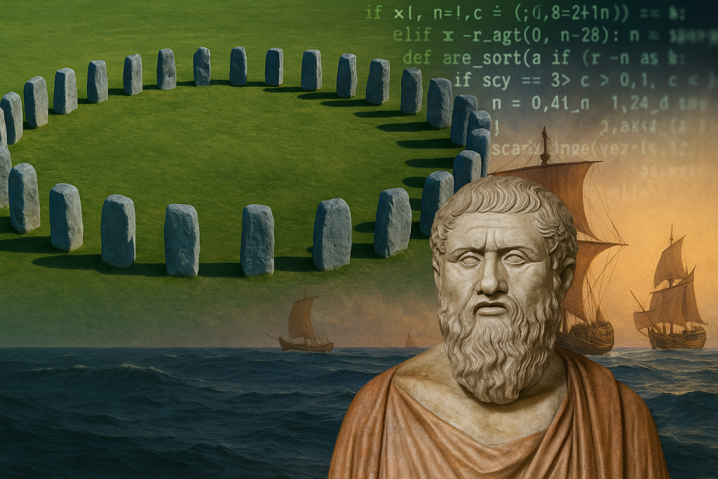
Testing Plato’s Atlantis Against Reality

Introduction

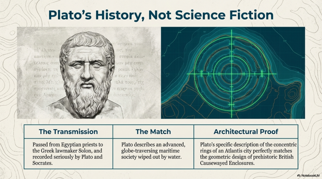
Atlantis is one of the most investigated mysteries in history.

For more than two thousand years, researchers have searched for the civilisation described by Plato. Hundreds of locations have been proposed, from the Mediterranean and Spain to Antarctica and the Caribbean. Yet despite thousands of books, documentaries, websites, and personal theories, no consensus has ever emerged. (Testing Plato’s Atlantis Against Reality)

The reason is simple.

Most Atlantis investigations begin with a location and then search for evidence to support it.

This study reverses the process.

Rather than asking where Atlantis was, it begins by asking what Plato actually described.

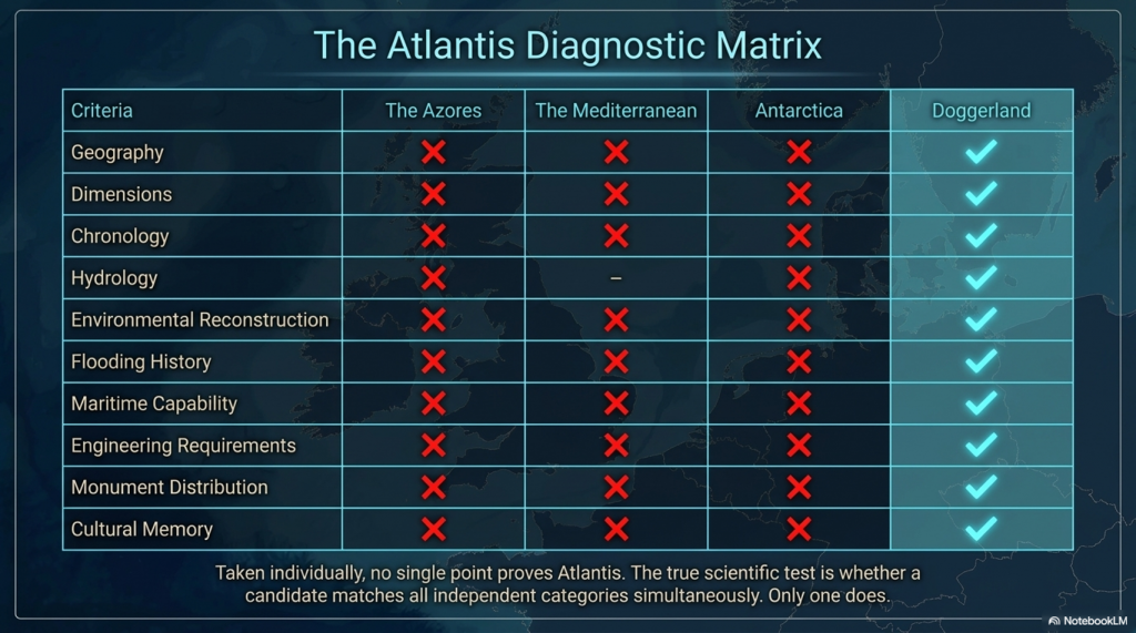
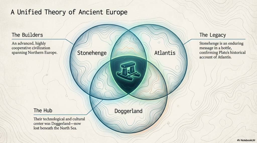
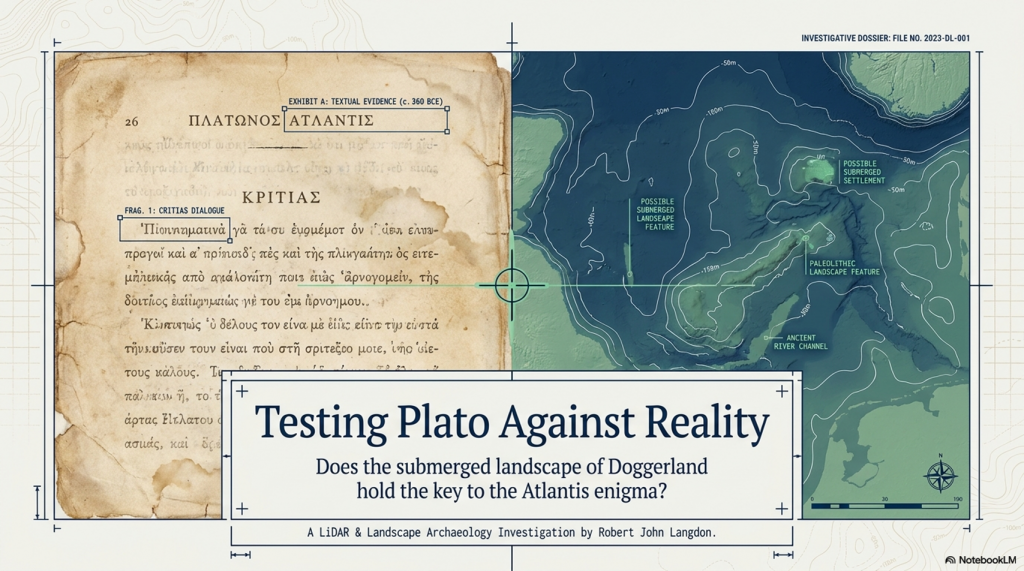
Using the original texts of Timaeus and Critias, every geographical, environmental, engineering, economic, and hydrological description is treated as an independent test. The objective is not to prove a theory but to examine whether any known prehistoric landscape satisfies the greatest number of Plato’s descriptions simultaneously.

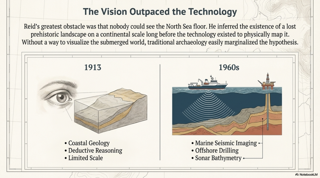
Modern archaeological discoveries, seabed mapping, geological surveys, and AI-assisted analysis now allow Plato’s account to be examined in ways that were impossible even a decade ago.

The question is no longer whether Atlantis existed.

The question is whether Plato’s description corresponds to a real prehistoric landscape.

To answer that question, we must begin with the evidence itself.
 (Testing Plato's Atlantis Against Reality)
(Testing Plato’s Atlantis Against Reality)

1. The Atlantis Problem

Few subjects have generated more speculation than Atlantis.

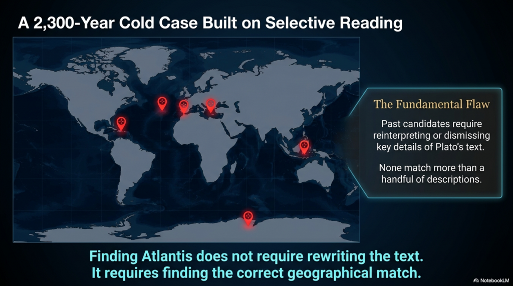
Since Plato first recorded the story over two thousand years ago, hundreds of locations have been proposed as the site of the lost civilisation. Atlantis has been placed in the Mediterranean, Spain, the Azores, Antarctica, the Caribbean, the Sahara, and even beyond the Atlantic Ocean. Entire industries have developed around the search for Atlantis, yet no location has achieved universal acceptance.

The reason is not a lack of theories.

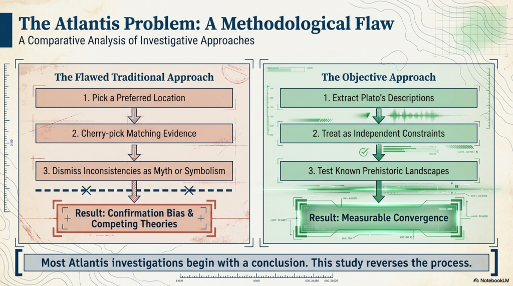
The problem is that most investigations begin with a conclusion.

A researcher selects a preferred location and then searches for evidence that supports it. Features that appear to match Plato’s description are highlighted, while features that do not are often ignored, reinterpreted, or dismissed as symbolism. As a result, Atlantis research has become dominated by confirmation bias, with each new theory selecting only the evidence that supports its own conclusion.

This approach creates an impossible situation.

A location may possess mountains but lack the great plain described by Plato.

Another may contain evidence of flooding but have no connection to the sea routes he describes.

A third may fit the chronology but fail the geographical requirements.

Each theory can explain some aspects of Plato’s account, but none can explain all of it.

The consequence is that Atlantis has become less an archaeological investigation and more a competition among competing interpretations.

Yet Plato’s account provides a solution to this problem.

Rather than treating Atlantis as a mystery to be solved through speculation, it can be approached as a series of measurable constraints. Plato describes the size of the landscape, its relationship to the sea, the existence of mountains, rivers, lakes, marshes, canals, harbours, shipping, trade, natural resources, wildlife, and ultimately its destruction by flooding. These are not opinions. They are observations recorded within the text.

The question, therefore, changes completely.

Instead of asking whether a particular location could be Atlantis, we can ask a far more objective question:

How many of Plato’s descriptions does that location actually satisfy?

This simple change transforms Atlantis from a debate about belief into a testable investigation.

The objective of this study is therefore not to prove Atlantis existed, nor to defend a preconceived theory.

It is to examine Plato’s descriptions one by one and determine whether any known prehistoric landscape satisfies the greatest number of independent constraints simultaneously.

Only then can we begin to assess whether Plato was describing fiction, memory, or a real place lost beneath the sea.
 (Testing Plato's Atlantis Against Reality)
(Testing Plato’s Atlantis Against Reality)

2. What Did Plato Actually Say?

Before Atlantis can be investigated, a more fundamental question must be answered.

What exactly did Plato describe?

This may appear to be a simple question, yet it lies at the heart of the Atlantis mystery. For more than two thousand years, researchers have debated the location of Atlantis, often overlooking the only source that truly matters. Every claim about Atlantis ultimately depends upon the writings of a single individual: Plato.

The surviving account appears in two dialogues, Timaeus and Critias, written during the fourth century BCE. Everything that is known about Atlantis originates from these texts. There are no surviving Atlantean records, no inscriptions, no maps, and no independent historical accounts describing the civilisation. Whether Atlantis was real, fictional, exaggerated, or based upon cultural memory, the investigation must begin with Plato because Plato is the only witness we possess.

This immediately creates an important distinction between evidence and interpretation.

Over the centuries, Atlantis has accumulated layer upon layer of speculation. It has been transformed into a lost continent, an advanced technological civilisation, a spiritual kingdom, an alien colony, and even a prehistoric superpower possessing knowledge beyond modern science. Yet none of these claims originates with Plato. They are later additions imposed upon the story.

When the original text is examined, a very different picture emerges.

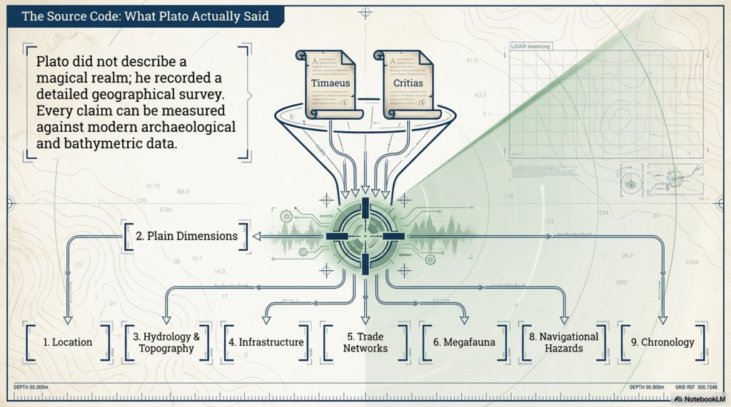
Plato’s Atlantis is not described through myths or miracles. Instead, it is described in geographic terms. He provides measurements for the plain. He describes mountains, rivers, lakes, marshes, fertile land, canals, harbours, shipping routes, wildlife, natural resources, agriculture, engineering works, and political organisation. The account reads less like a legend and more like a geographical survey.

This is an important observation because geography can be tested.

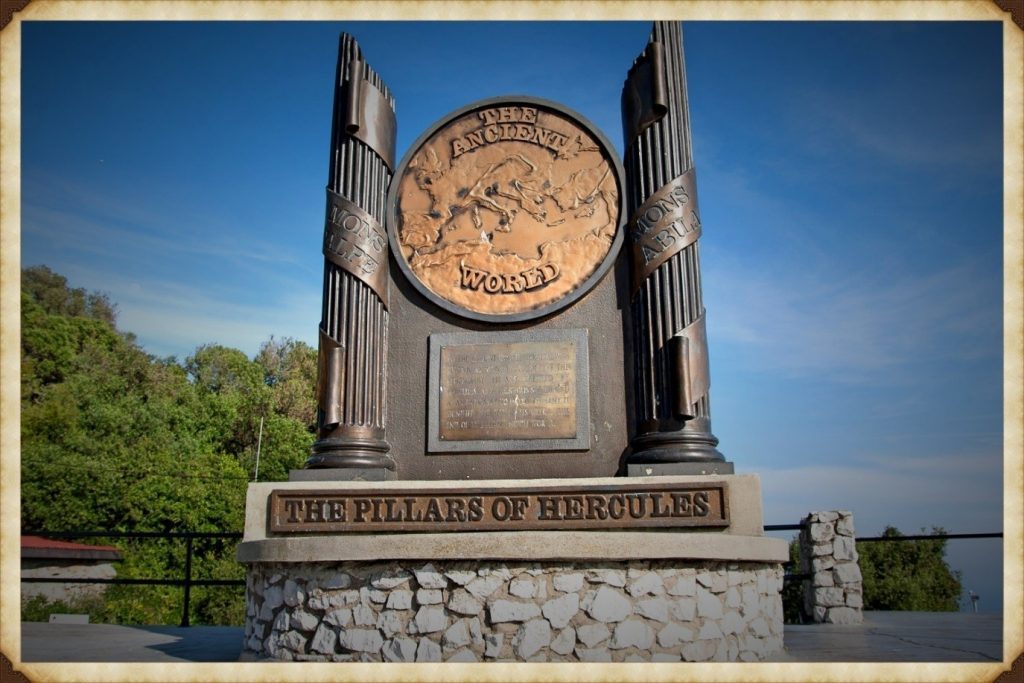
A statement such as “Atlantis lay beyond the Pillars of Heracles” can be examined against real locations.

A statement describing a plain measuring approximately two thousand by three thousand stadia can be compared against modern maps.

Descriptions of waterways, marshes, canals, and harbours can be compared against geological and archaeological evidence.

Even Plato’s observations regarding flooding and the eventual destruction of the landscape can be examined using modern sea-level reconstructions.

This transforms the investigation completely.

Most Atlantis theories focus on individual details that appear to support a preferred location. One researcher may focus on flooding. Another may focus on volcanic activity. A third may focus on the shape of a harbour. The result is a collection of theories that often explain one aspect of Plato’s account while ignoring the rest.

A more rigorous approach is to treat every description as part of a larger system.

Plato did not describe a mountain.

He described a landscape.

He did not describe a flood.

He described a civilisation connected to rivers, waterways, shipping, trade, resources, agriculture, and ultimately destruction by water.

The significance lies not in any single observation but in the cumulative pattern created when all of the observations are considered together.

For this reason, the purpose of this study is not to prove that Plato was correct in every detail. Nor is it to assume that Atlantis existed before the evidence is examined.

Instead, Plato’s account will be treated as a series of independent constraints.

Each description becomes a test.

If a proposed location satisfies the description, it passes.

If it does not, it fails.

The objective is not to find evidence that supports a theory. The objective is to determine whether any known prehistoric landscape satisfies the greatest number of Plato’s descriptions simultaneously.

Before examining maps, archaeology, geology, hydrology, trade networks, and environmental reconstruction, we must therefore establish the criteria against which every Atlantis theory will be measured.

Those criteria come directly from the only surviving source that matters.

Plato’s own words.
 (Testing Plato's Atlantis Against Reality)
(Testing Plato’s Atlantis Against Reality)

3. The Rules of the Investigation

Most Atlantis investigations begin with a map.

A researcher selects a promising location and then searches for similarities between that landscape and Plato’s account. If a mountain matches, it is highlighted. If evidence of flooding is found, it is presented as confirmation. If an inconsistency appears, it is often explained away as symbolism, mistranslation, exaggeration, or myth.

This approach has produced hundreds of competing theories about Atlantis and very little agreement.

The reason is simple.

Almost every investigation begins with a conclusion.

The objective of this study is different.

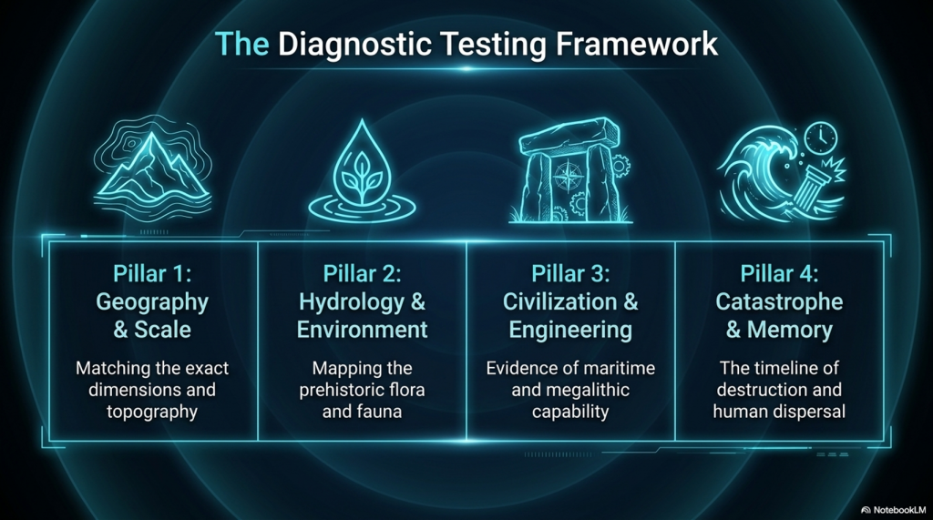
Rather than starting with a location, it starts with a set of measurable constraints derived directly from Plato’s text. Every geographical, environmental, engineering, economic, and hydrological description is treated as an independent test that any proposed Atlantis location must satisfy.

This transforms Atlantis from a mystery into a problem that can be examined systematically.

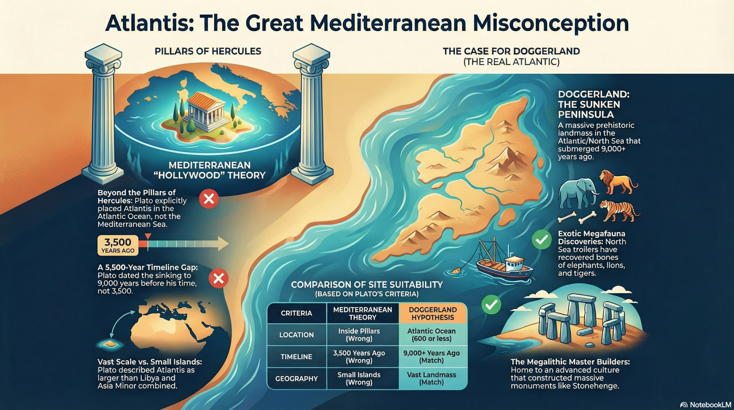
For example, Plato states that Atlantis lay “beyond the Pillars of Heracles”. Any location within the Mediterranean immediately fails that test.

Plato describes “a vast plain approximately two thousand by three thousand stadia in size“. Any proposed landscape lacking a comparable plain fails that test.

Plato describes mountains, rivers, lakes, marshes, navigable waterways, engineered canals, harbours, shipping, abundant natural resources, wildlife, and eventual destruction by flooding. Each description becomes another independent constraint against which candidate locations can be measured.

The importance of this approach lies in the cumulative effect.

A single match proves very little.

Many locations contain mountains.

Many locations contain rivers.

Many locations have experienced flooding.

The question is not whether a location satisfies one description.

The question is whether it satisfies many descriptions simultaneously.

This distinction is crucial because Atlantis is not described through a single characteristic. Plato presents an integrated landscape in which geography, hydrology, engineering, trade, agriculture, and society are interconnected.

The mountains matter because they feed the rivers.

The rivers matter because they support the plains.

The plains matter because they support agriculture.

The waterways matter because they support transport and trade.

The flooding matters because it explains the destruction of the entire system.

Each component is linked to the others.

The investigation, therefore, focuses not on individual observations but on patterns.

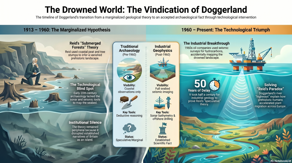
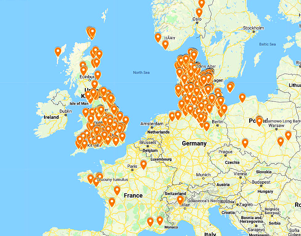
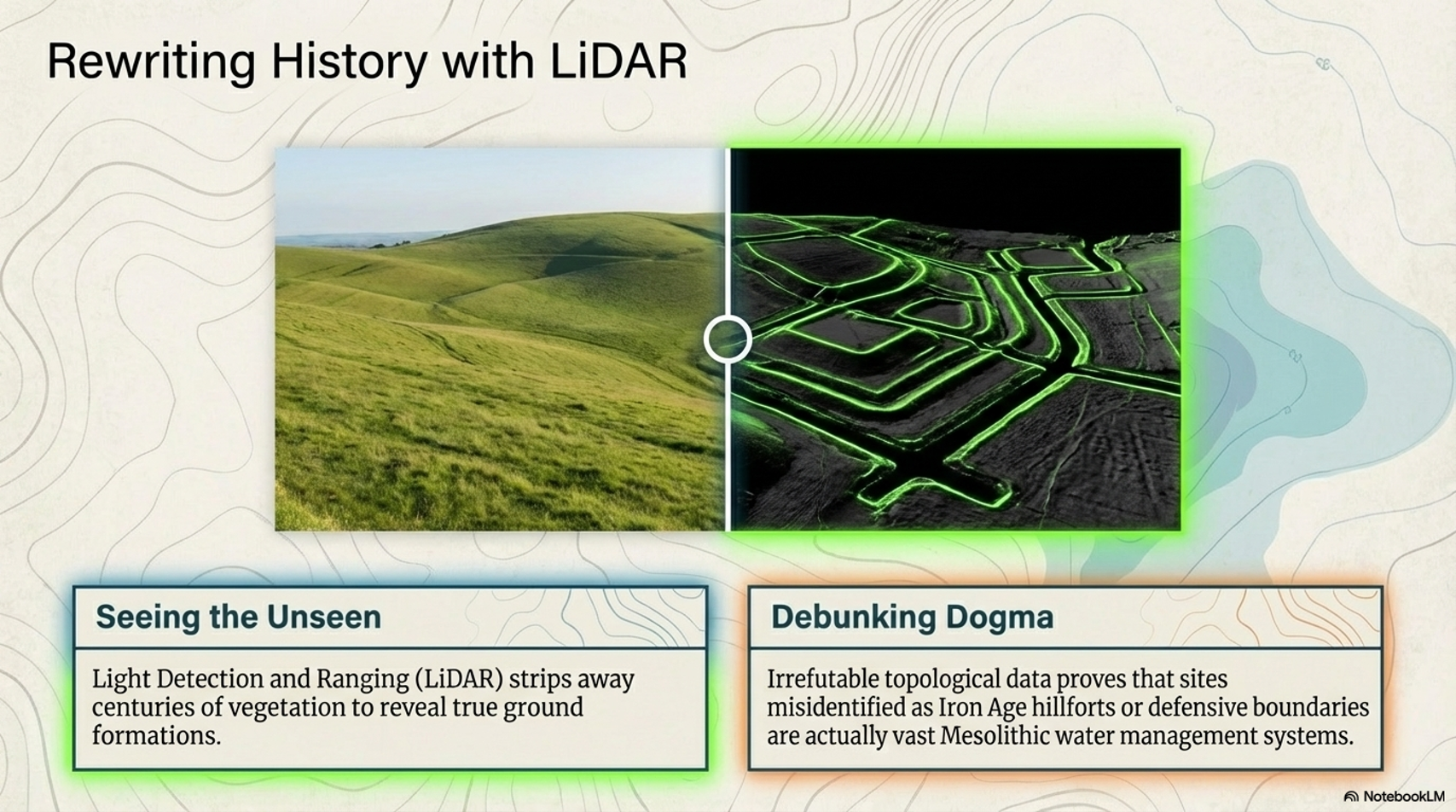
Modern archaeological and geological research now provides an unprecedented opportunity to perform this analysis. Seabed mapping has revealed the submerged landscapes beneath the North Sea. LiDAR surveys have transformed our understanding of prehistoric earthworks. Geological investigations have reconstructed ancient river systems, coastlines, and sea-level changes. Archaeological discoveries continue to provide evidence for long-distance trade, large-scale engineering, and sophisticated social organisation.

At the same time, modern analytical techniques allow large quantities of information to be compared systematically. Rather than relying upon isolated observations, entire datasets can be examined together to determine how closely a proposed location aligns with Plato’s description.

This is where the investigation differs from traditional Atlantis research.

The objective is not to prove Doggerland was Atlantis.

The objective is to test Doggerland against the same criteria that apply to every other proposed location.

If Doggerland fails the tests, it should be rejected.

If it passes the tests, that result must also be acknowledged.

The process is therefore simple.

Extract Plato’s descriptions.

Compare them with the evidence.

Record the result.

Repeat the process for every major characteristic of Atlantis.

Only then can a meaningful conclusion be reached.

With the methodology established, the investigation can now begin with the first and most fundamental question:

Where did Plato place Atlantis?
 (Testing Plato's Atlantis Against Reality)
(Testing Plato’s Atlantis Against Reality)

4. Beyond the Pillars of Heracles

The first test is also the simplest.

Where did Plato place Atlantis?

This question matters because it immediately eliminates many popular theories about Atlantis. Before examining plains, canals, elephants, trade networks, or flooding, we must first establish the geographical location described in the original text.

Plato is remarkably clear on this point.

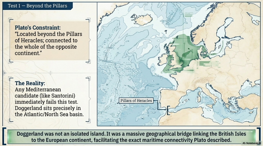
“This power came forth out of the Atlantic Ocean, for in those days the Atlantic was navigable; and there was an island situated in front of the straits which are by you called the Pillars of Heracles.”

This statement establishes the first and most important geographical constraint.

Atlantis was located beyond the Pillars of Heracles.

Traditionally, the Pillars of Heracles are identified with the Strait of Gibraltar. If this interpretation is correct, Atlantis must lie outside the Mediterranean rather than within it.

This creates a significant problem for many popular Atlantis theories.

Santorini, one of the most frequently proposed candidates, lies firmly within the Mediterranean basin. The same problem applies to numerous locations in Greece, Turkey, Italy, and other parts of the eastern Mediterranean. Regardless of their archaeological significance, they fail Plato’s first geographical test.

The importance of this passage is reinforced by what follows.

Plato continues:

“From it travellers could pass to the other islands, and from the islands to the whole of the opposite continent which surrounded the true ocean.”

This second statement introduces additional constraints.

Atlantis was not described as an isolated island.

Instead, it formed part of a wider geographical system connecting other islands and a larger landmass beyond.

For centuries, this passage has caused considerable debate. Some researchers have interpreted it as evidence of trans-Atlantic voyages. Others have suggested that Plato was describing a chain of islands leading westward into the Atlantic Ocean.

Regardless of interpretation, the description requires a location that can serve as a geographical bridge rather than a remote destination.

This is where Doggerland becomes particularly interesting.

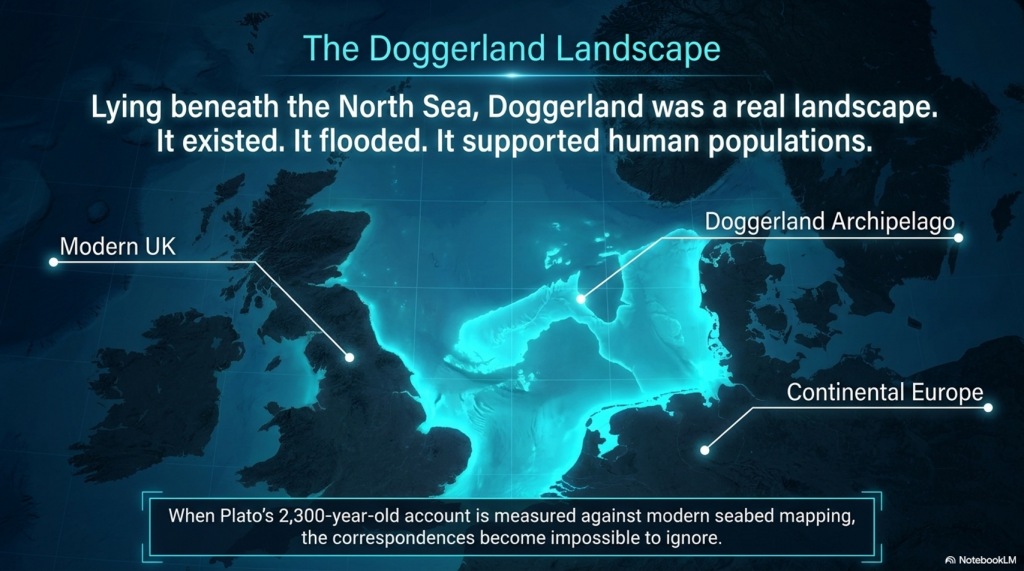
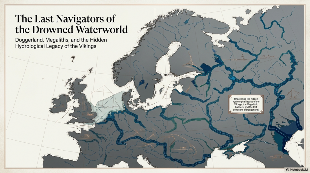
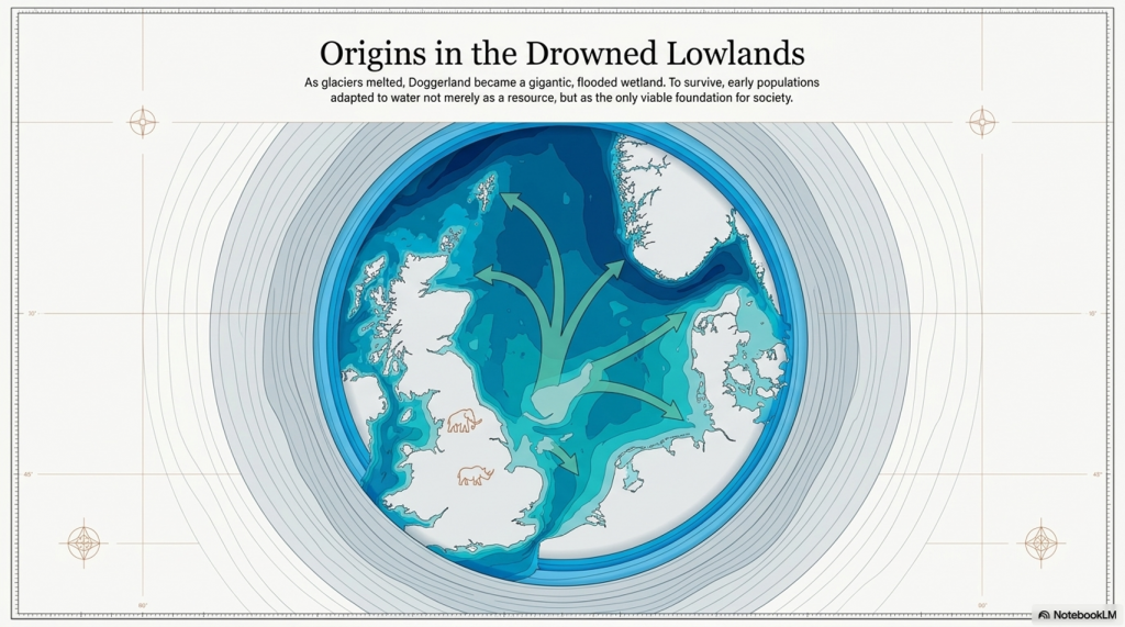
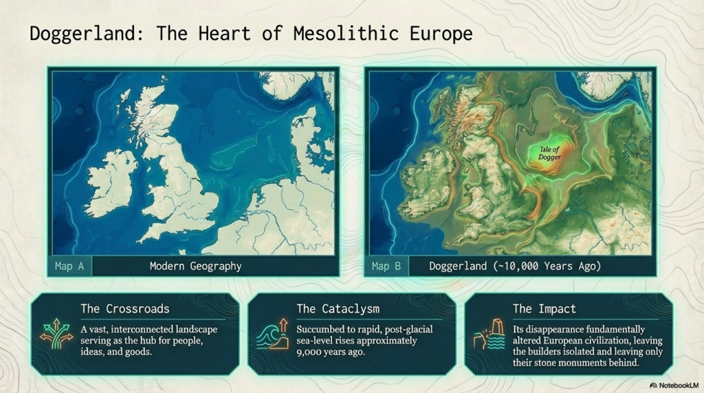
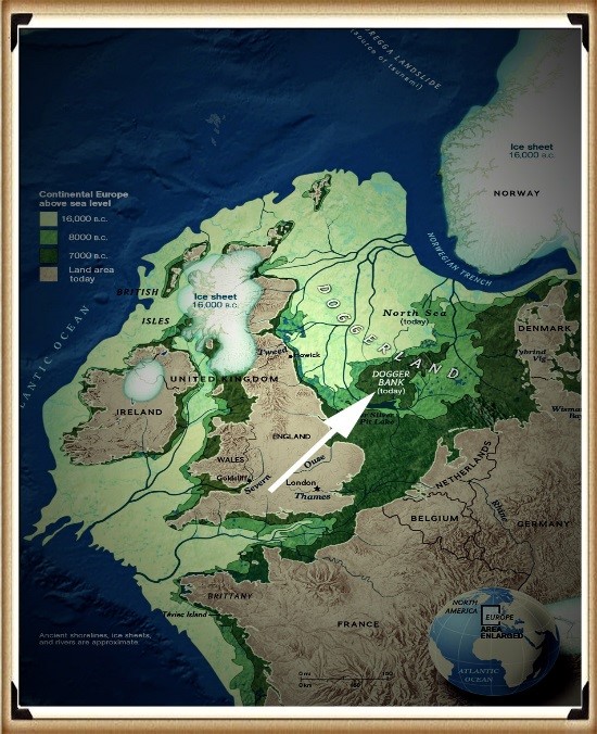
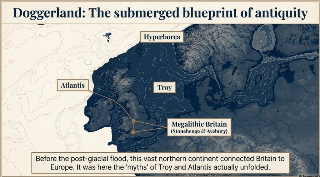
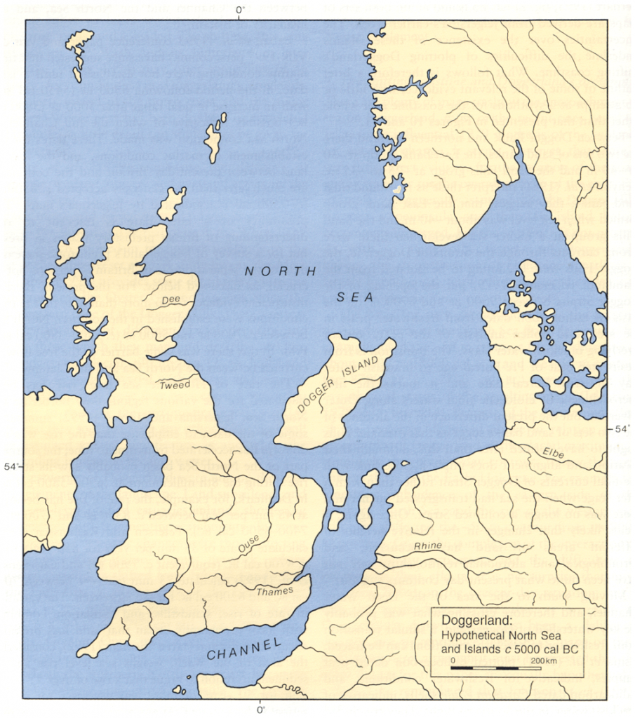
Prior to its inundation, Doggerland occupied the centre of a vast landscape linking Britain, continental Europe, and Scandinavia. Rather than existing as an isolated island, it formed part of a connected North European peninsula extending across much of the present-day North Sea basin. Movement through this landscape naturally linked multiple regions through both land and water routes.

The significance of this arrangement is often overlooked.

Most theories about Atlantis focus on finding an island.

Plato, however, spends considerable time describing connections between islands, neighbouring lands, and larger continental regions. The emphasis is not isolation but connectivity.

This observation becomes increasingly important when examined alongside the archaeological evidence discussed later in this study. Trade routes, transport networks, and material movement all suggest that prehistoric Europe was far more interconnected than traditionally believed.

Doggerland occupied the centre of that network.

It linked Britain to mainland Europe.

It linked the Atlantic to the North Sea.

It linked multiple river systems into a single hydrological landscape.

In short, it occupied precisely the sort of strategic position one might expect from the civilisation Plato describes.

This does not prove that Doggerland was Atlantis.

It does, however, satisfy the first major geographical requirement.

Unlike many proposed locations, Doggerland lies beyond the Mediterranean world, forms part of a wider interconnected landscape, and occupies a position that can link islands, coastlines, and continental regions into a single system.

The first test, therefore, produces an intriguing result.

Plato’s description places Atlantis beyond the Pillars of Heracles and connects it to a broader geographical network.

Doggerland satisfies both requirements.

The investigation can therefore proceed to the next question.

Did Plato’s description of Atlantis match the physical shape and dimensions of the lost landscape beneath the North Sea?

NB. A Curious Linguistic Clue

One detail is often overlooked.

When Plato describes Atlantis, he simultaneously refers to the surrounding body of water as the Atlantic Ocean.

“For in those days the Atlantic was navigable…”

This raises an obvious question.

Which came first?

Did the island receive its name from the ocean, or did the ocean receive its name from the island?

Whatever the answer, the association is significant because more than two thousand years later, we still refer to the same body of water as the Atlantic Ocean. The spelling has evolved through successive Greek, Latin, and European translations, but the root name remains essentially unchanged.

This observation does not prove the existence of Atlantis, but it does reinforce an important point. Plato was not describing an isolated island detached from its surroundings. He was describing a location embedded within a much larger Atlantic system, comprising oceans, islands, coastlines, and continental landmasses.

The investigation must therefore consider not only the island itself, but the wider landscape to which Plato repeatedly refers.
 (Testing Plato's Atlantis Against Reality)
(Testing Plato’s Atlantis Against Reality)

5. Measuring Atlantis

The description of Atlantis becomes considerably more interesting once Plato begins discussing the central plain.

Unlike many ancient writers, Plato does not simply describe a fertile landscape. He provides dimensions.

This is important because measurements can be tested.

They are not matters of opinion.

They either correspond to a real landscape or they do not.

In Critias, Plato describes the central plain of Atlantis:

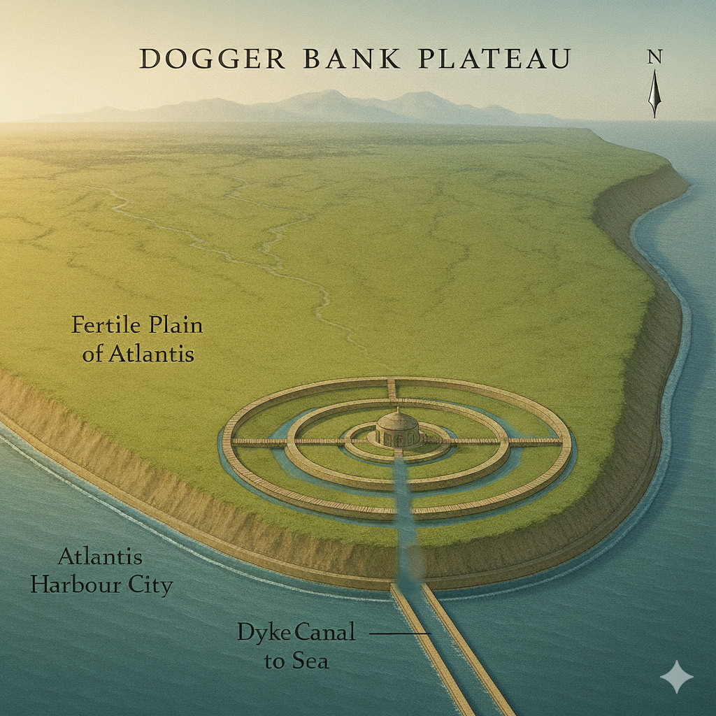
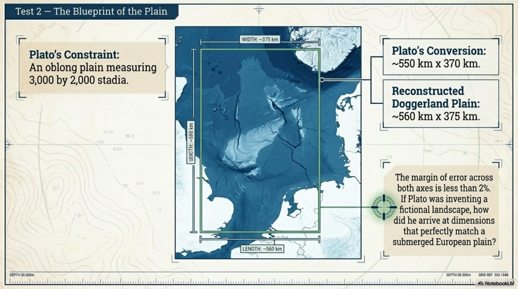
“The plain around the city was level and smooth, and of an oblong shape, extending in one direction three thousand stadia, and in the centre inland across it two thousand stadia.”

This is one of the most precise geographical descriptions in the entire account of Atlantis.

Using the standard Greek stadion, these dimensions equate to approximately 550 kilometres by 370 kilometres.

For centuries, researchers have attempted to identify a landscape matching these proportions.

Many proposed locations for Atlantis immediately encounter difficulties.

Some are too small.

Others lack a significant plain entirely.

Many require extensive reinterpretation of Plato’s measurements in order to fit the available geography.

The advantage of a numerical description is that it can be compared directly against modern mapping.

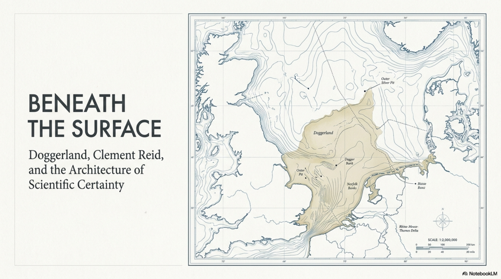
When bathymetric surveys of the North Sea are examined, a striking pattern emerges.

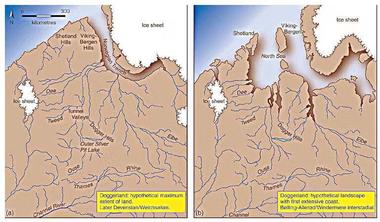
Prior to inundation, Doggerland occupied a vast low-lying region stretching between Britain and continental Europe. At its centre lay an enormous plain surrounded by higher ground associated with Britain, Scandinavia, and mainland Europe.

Reconstructions of this central landscape produce dimensions remarkably similar to those described by Plato.

Modern estimates place the principal Doggerland plain at approximately 375 kilometres by 560 kilometres.

The correspondence is extraordinary.

Across both axes, the difference between Plato’s measurements and the reconstructed dimensions of Doggerland is less than two per cent.

This does not prove that Doggerland was Atlantis.

However, it raises an obvious question.

If Plato was inventing a fictional landscape, how did he arrive at dimensions that correspond so closely to one of the largest submerged plains in Europe?

The significance of this match extends beyond simple size.

Plato does not describe a circular landscape, a mountain range, or an irregular island chain.

He describes an oblong plain.

That distinction matters because shape is an independent constraint.

A landscape may match the dimensions but fail the shape.

Equally, it may match the shape but fail the dimensions.

Doggerland appears to satisfy both simultaneously.

Plato continues by describing the plain as exceptionally fertile and traversed by waterways descending from the surrounding uplands.

This observation becomes increasingly important when examined alongside modern environmental reconstructions.

Far from being a barren landscape, Doggerland is now understood to have contained extensive river systems, wetlands, lakes, estuaries, and productive alluvial environments capable of supporting abundant wildlife and human populations.

The plain, therefore, does not stand alone.

It forms part of a larger geographical system.

The mountains feed the rivers.

The rivers cross the plain.

The plain supports agriculture and settlement.

The waterways provide transport and communication.

This interconnected landscape is precisely the type of environment Plato describes.

Critics often focus on individual details while overlooking the cumulative significance of the evidence.

The importance of the plain is not simply that it exists.

The importance is that its dimensions, shape, position, and environmental setting all align with Plato’s description simultaneously.

This is exactly the type of test outlined in the previous chapter.

A single correspondence proves little.

Multiple independent correspondences are more difficult to dismiss.

The central plain, therefore, represents the first major quantitative comparison between Plato’s account and a real prehistoric landscape.

The result is striking.

Plato describes an oblong plain measuring approximately 550 by 370 kilometres.

The reconstructed plain of Doggerland measures approximately 560 by 375 kilometres.

The difference is so small that it falls within the uncertainties associated with both ancient measurements and modern reconstruction.

For the first time in this investigation, Plato’s description is not merely similar to the evidence.

It is measurable against it.

And the match is remarkably close.
 (Testing Plato's Atlantis Against Reality)
(Testing Plato’s Atlantis Against Reality)

6. Mountains, Rivers and Wetlands

Having established that Doggerland satisfies Plato’s description of a vast central plain, the next question is whether the surrounding landscape also matches his account.

This is where many Atlantis theories begin to encounter difficulties.

A location may contain a plain, but Plato does not describe Atlantis as a plain in isolation. He describes a complete environmental system in which mountains, rivers, lakes, marshes, and fertile lowlands are interconnected. Each component supports the others, creating a landscape that functions as a single geographical unit.

Plato writes:

“The surrounding mountains descended towards the sea.”

He further describes streams flowing down from these uplands into the plain below.

“Receiving the streams which came down from the mountains.”

These statements immediately create another set of measurable constraints.

Atlantis must possess:

  • A large central plain.
  • Higher ground surrounds parts of that plain.
  • Rivers descending from those uplands.
  • Extensive water systems distributed across the landscape.

For many years, critics of the Doggerland hypothesis have focused on the mountain requirement. They argue that the North Sea contains no mountains and therefore cannot be Atlantis.

The objection appears convincing only when the entire landscape is considered, rather than the modern seabed alone.

Doggerland did not exist in isolation.

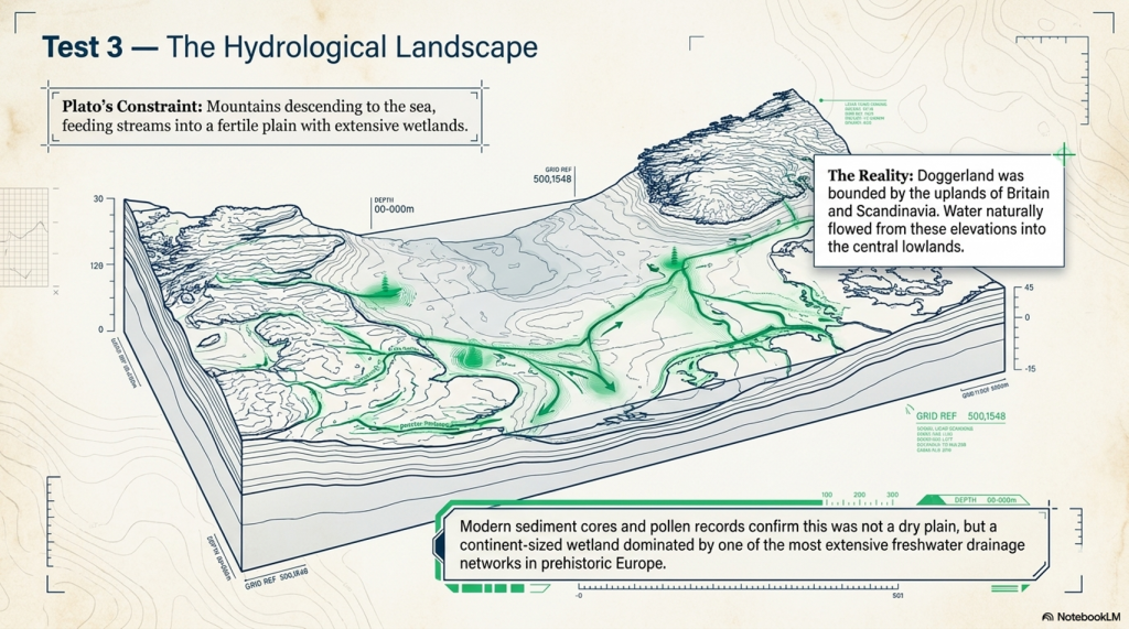
Before inundation, it formed part of a much larger North European landscape bounded by the uplands of Britain, Scotland, Norway, and Scandinavia. These elevated regions surrounded the lower-lying basin that now forms the North Sea. Water naturally flowed from these uplands into the central lowlands, creating one of the most extensive river systems in prehistoric Europe.

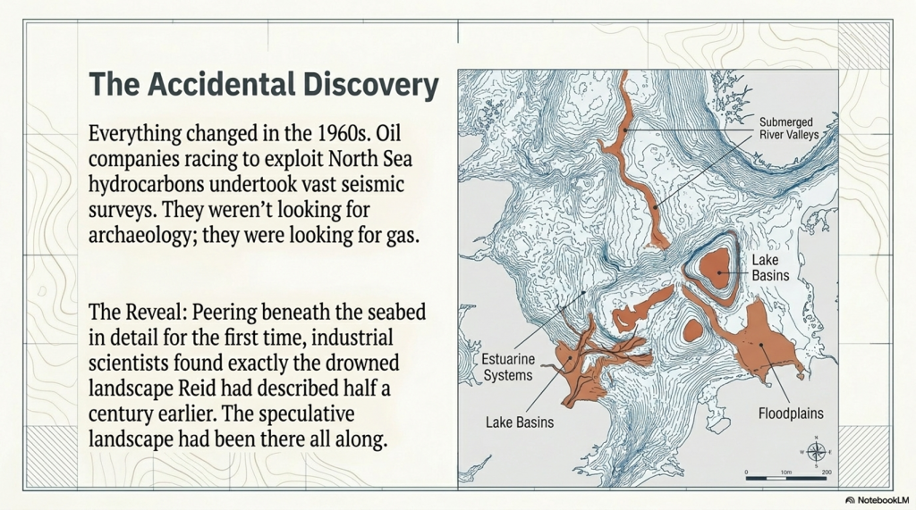
Modern seabed surveys have revealed that the North Sea floor preserves the remains of this lost hydrological network.

Buried beneath the sea are the traces of rivers, tributaries, lakes, estuaries, and wetlands that once crossed Doggerland. Some river systems were comparable in scale to major modern European rivers. Others combined to form vast drainage networks flowing through the centre of the landscape before eventually reaching the Atlantic.

This is not speculation.

It is visible on modern bathymetric maps.

The significance of these discoveries cannot be overstated.

For centuries, Atlantis was often imagined as a small island surrounded by open ocean. The emerging picture of Doggerland is entirely different. It was not a solitary island but a continent-sized wetland environment dominated by freshwater systems.

This distinction is important because Plato repeatedly emphasises water.

He describes rivers.

He describes canals.

He describes harbours.

He describes fertile plains sustained by water.

He describes a civilisation organised around waterways rather than isolated from them.

The environmental reconstruction of Doggerland aligns remarkably well with this picture.

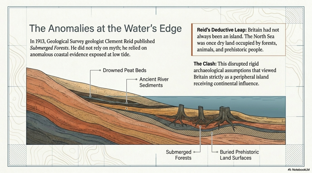
Evidence from sediment cores, pollen records, peat deposits, and submerged landscapes indicates that Doggerland supported extensive woodland, grassland, marshes, lakes, and river valleys. These environments would have provided abundant resources for both humans and animals.

Plato’s description of a fertile landscape, therefore, finds support within the geological evidence.

The same is true of the wetlands.

Throughout his account, Plato describes a landscape rich in water and natural productivity. Modern reconstructions consistently portray Doggerland as exactly such an environment. Rather than a dry plain, it appears to have been characterised by interconnected waterways, elevated groundwater, seasonal flooding, and extensive marsh systems.

This observation becomes increasingly significant when combined with the evidence presented in earlier chapters.

The dimensions of the plain match.

The geographical position matches.

The surrounding uplands match.

The river systems match.

The wetland environment matches.

Individually, each correspondence might be dismissed as a coincidence.

Together, they form a coherent pattern.

Most theories about Atlantis focus on a single feature.

Doggerland continues to satisfy multiple independent constraints simultaneously.

More importantly, the evidence reveals not merely a location but a functioning landscape.

The mountains feed the rivers.

The rivers cross the plain.

The wetlands support wildlife.

The waterways provide transport.

The entire system operates exactly as Plato describes.

The result is that Atlantis begins to look less like a mythical kingdom and more like a recognisable prehistoric environment.

Having established that the geography and environmental reconstruction closely correspond to Plato’s account, we can now turn to one of the most overlooked aspects of the story of Atlantis.

The waterways themselves.

Because Plato was not simply describing rivers.

He was describing a civilisation built around them.
 (Testing Plato's Atlantis Against Reality)
(Testing Plato’s Atlantis Against Reality)

7. The Waterway Civilisation

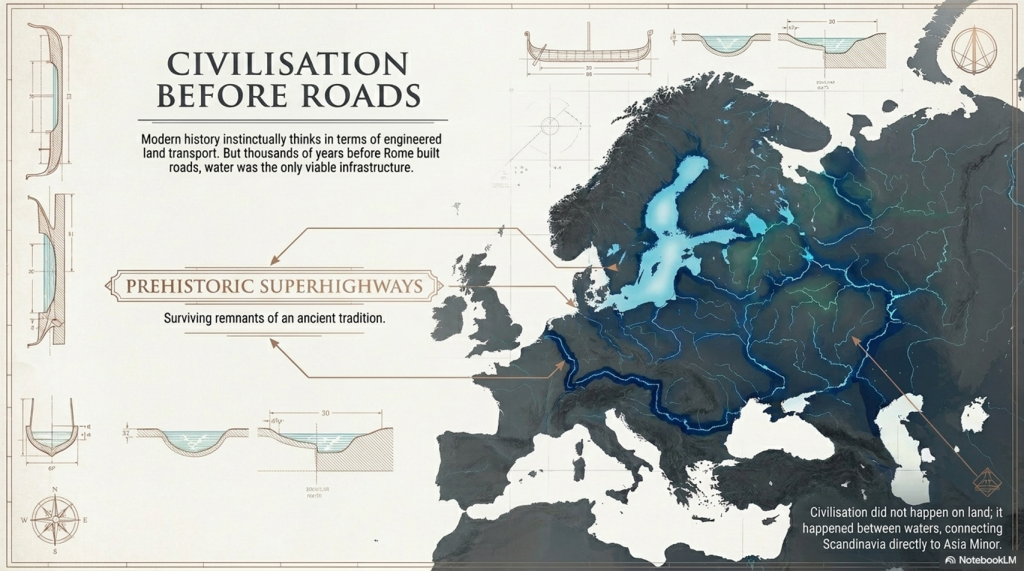
The traditional image of prehistoric Europe is one of scattered communities separated by forests, mountains, and vast distances. According to this model, movement was slow, local, and difficult. Rivers are generally viewed as obstacles to be crossed rather than infrastructure to be used.

Plato describes something very different.

Throughout Critias, waterways recur as central features of the Atlantean landscape. They are not incidental features but fundamental elements of how the civilisation functioned.

Plato writes:

“They cut canals…”

He further states:

“They brought a canal from the sea…”

And then adds:

“The canal was of such a depth and width as to admit the largest vessels.”

These statements are extraordinary.

Most discussions of Atlantis focus on the destruction of the civilisation while paying little attention to the infrastructure Plato describes. Yet canals, harbours, and navigable waterways imply something far more significant than a simple settlement. They imply a society organised around the movement of people, materials, and resources by water.

This distinction is critical.

Roads require continuous maintenance and are limited by terrain.

Waterways perform the same function naturally.

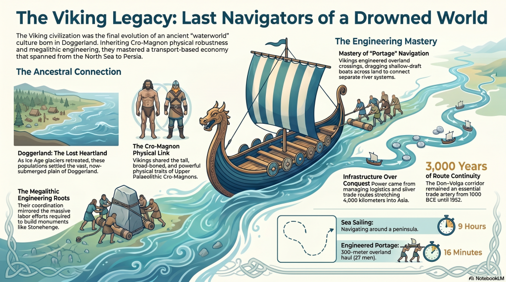
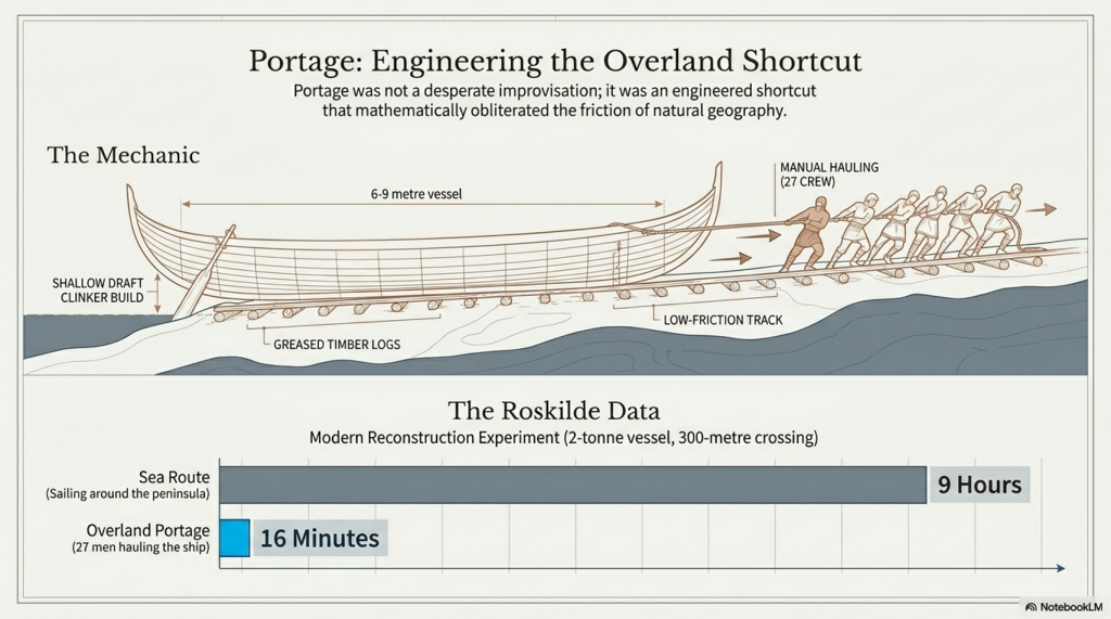
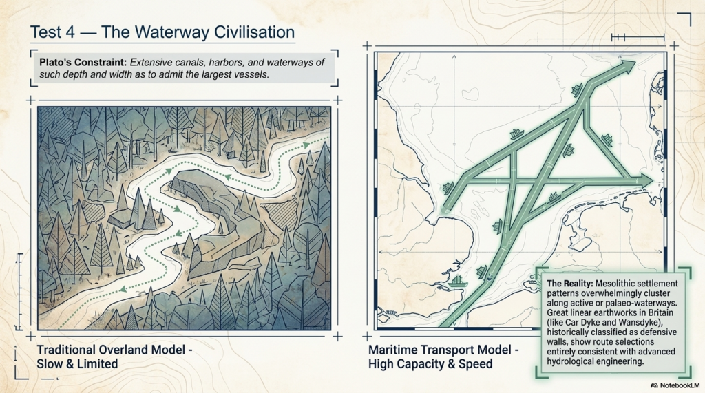
A boat can move far greater loads than can be transported overland, particularly in heavily forested landscapes. In a world dominated by rivers, estuaries, lakes, and shallow seas, water is the most efficient means of transport.

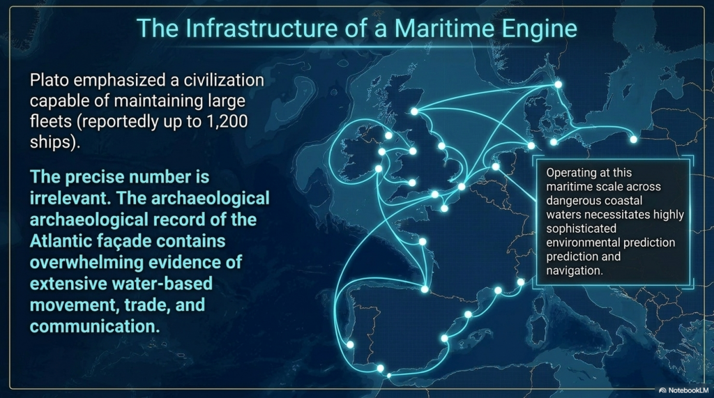
This is precisely the environment reconstructed for Doggerland.

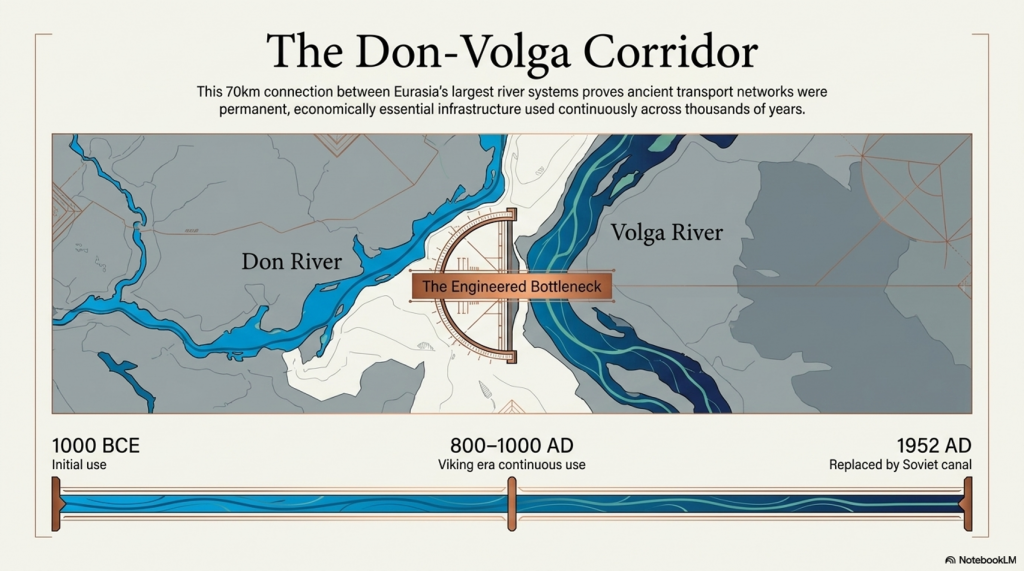
Modern seabed surveys reveal an extensive network of rivers and channels linking the North Sea basin to Europe’s major river systems. The Rhine, Thames, Elbe, Meuse, and numerous smaller waterways formed an interconnected transport network stretching across north-west Europe.

Rather than acting as barriers, these waterways would have functioned as highways.

This interpretation is reinforced by settlement patterns.

When Mesolithic sites are plotted geographically, a striking pattern emerges. The overwhelming majority occur on active waterways or on palaeo-water systems that were once navigable. Settlements repeatedly cluster along rivers, estuaries, coastal margins, and wetland environments.

This distribution is unlikely to be accidental.

It reflects the underlying infrastructure of the civilisation itself.

The implications extend far beyond simple travel.

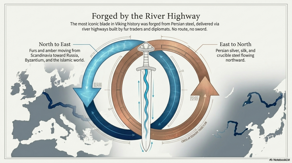
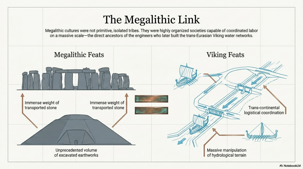
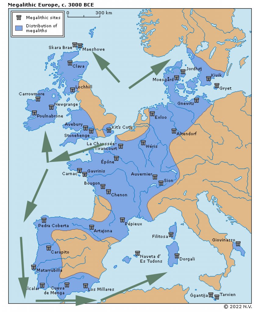
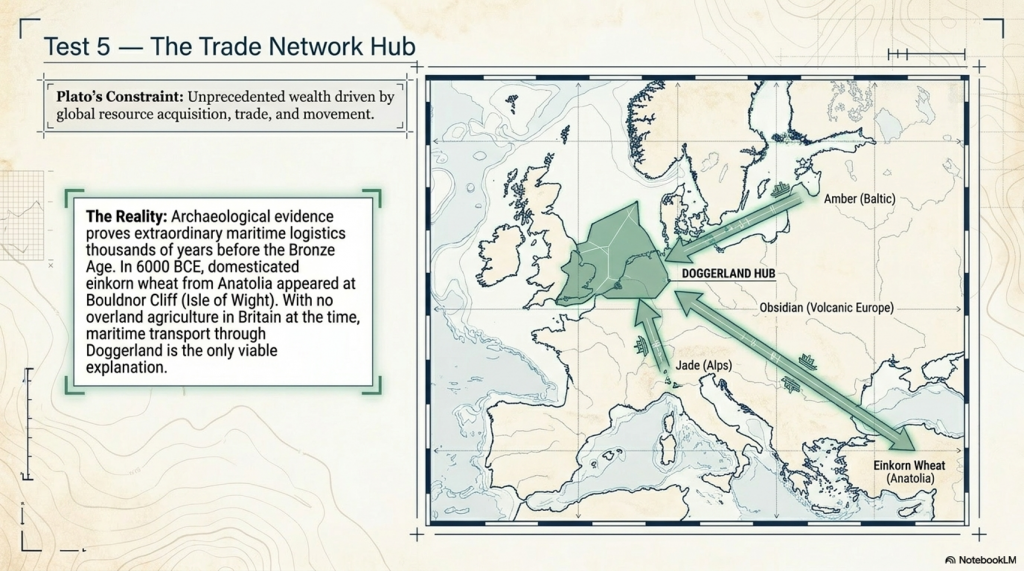
A water-based transport system explains the movement of materials across enormous distances. Amber travelled from the Baltic. Obsidian moved from volcanic regions into central Europe. Alpine jade appeared thousands of kilometres from its source. Wheat reached Britain from Anatolia. Large stones were transported across landscapes that conventional archaeology often struggles to explain.

Viewed through a maritime framework, these movements cease to be mysterious.

The waterways provide the answer.

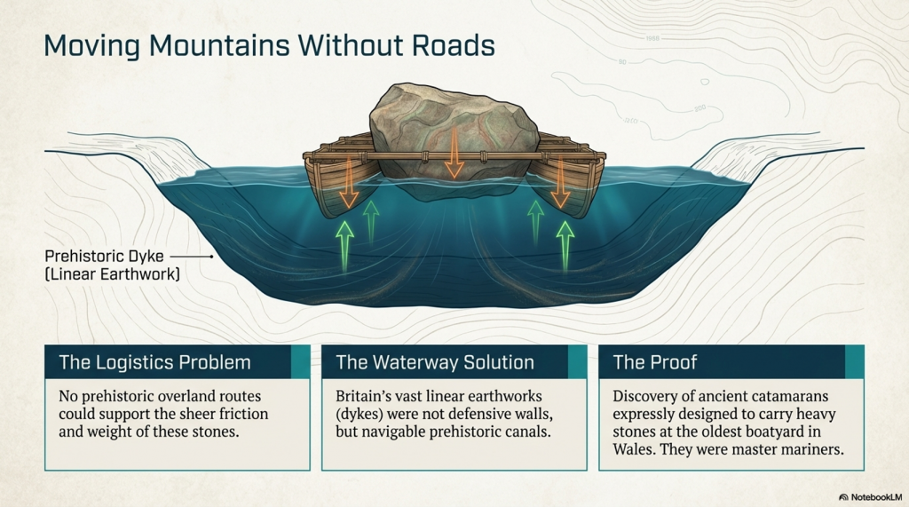
The significance of this observation becomes even greater when considered alongside Britain’s great linear earthworks.

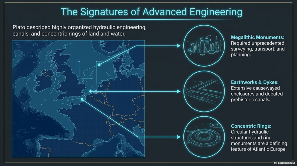
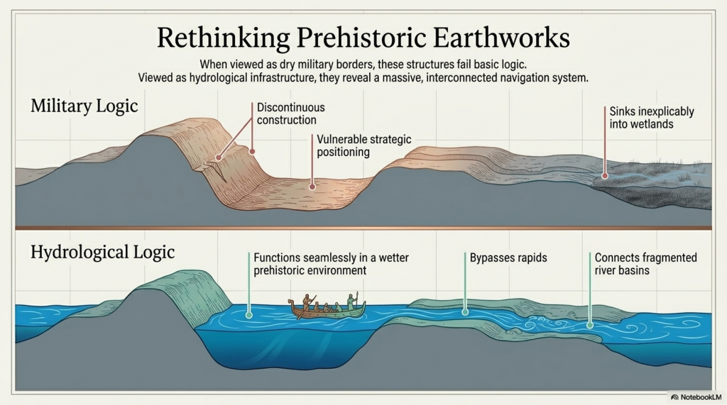
Features such as Car Dyke, Wansdyke, Offa’s Dyke, and the Vallum have traditionally been interpreted as defensive structures. Yet many possess characteristics that are equally consistent with hydrological engineering. Their scale, route selection, gradients, and relationship to water raise the possibility that at least some formed part of a much larger water-management system.

Whether every dyke served such a purpose remains open to debate.

What matters is that Plato repeatedly describes a civilisation that engineered waterways for transport and communication.

The concept, therefore, exists within the original account of Atlantis itself.

This is one of the strongest correspondences between Plato’s description and the emerging picture of prehistoric north-west Europe.

Both depict landscapes organised around water.

Both depict movement occurring primarily through waterways.

Both depict engineering directed toward the control and use of water.

Most importantly, both describe societies whose success depended upon mastering the hydrological environment in which they lived.

The traditional image of Atlantis is often that of a lost city.

Plato’s account suggests something much larger.

It suggests a waterway civilisation.

A civilisation whose rivers, canals, harbours, and maritime routes formed the foundation of its economy, communication, and survival.

If this interpretation is correct, then Atlantis was not defined by its buildings.

It was defined by its network.

And that network extended across an entire landscape.

The next question is therefore obvious.

If waterways connected the civilisation, what exactly was moving through them?
 (Testing Plato's Atlantis Against Reality)
(Testing Plato’s Atlantis Against Reality)

8. The Trade Network

If Atlantis was organised around waterways, then an obvious question follows.

What was moving through them?

Plato repeatedly describes Atlantis as a wealthy civilisation possessing access to resources on a scale unmatched by its contemporaries. He writes:

“They had such an amount of wealth as was never before possessed by kings and potentates.”

This statement is often treated as an exaggeration. Yet wealth does not emerge in isolation. It is the product of production, movement, and exchange. If Atlantis possessed extraordinary wealth, then it must also have possessed extraordinary infrastructure capable of acquiring, transporting, and distributing resources.

Plato reinforces this observation when describing the natural abundance available to the Atlanteans.

“They dug out of the earth whatever was to be found there, solid as well as fusile.”

He also describes abundant timber, agricultural production, and animal resources.

These descriptions are significant because they imply a civilisation that actively exploits and manages a wide range of materials rather than simply consuming local resources.

When the archaeological evidence from Mesolithic and Neolithic Europe is examined, a remarkably similar picture emerges.

Materials repeatedly appear far beyond their natural sources.

Baltic amber is found throughout Britain, central Europe, and the Mediterranean.

Alpine jade axes occur thousands of kilometres from the quarries where the stone originated.

Obsidian can be traced geochemically to specific volcanic regions yet appears across large areas of Europe.

Copper, gold, and tin all exhibit long-distance movement patterns that require organised transport systems.

Viewed individually, each example appears unusual.

Viewed collectively, they reveal something far more significant.

They reveal a network.

The scale of this network is often underestimated.

The transport of jade from the Italian Alps to Britain required passage across rivers, along coastlines, and through multiple regions. Baltic amber travelled from northern Europe into southern markets. Obsidian was carried hundreds, and sometimes thousands, of kilometres. These journeys were not isolated events. They occurred repeatedly across long periods of time.

This suggests that movement was systematic rather than occasional.

One of the most compelling examples comes from Bouldnor Cliff off the Isle of Wight.

Archaeologists recovered evidence of domesticated einkorn wheat dating to approximately 6000 BCE. Genetic analysis linked this wheat to farming populations in Anatolia.

At that time, Britain showed no evidence of domestic agriculture.

The wheat, therefore, had to arrive from elsewhere.

There is no plausible overland route.

The implication is clear.

Maritime connections between Britain and continental Europe existed long before conventional models would predict.

This discovery is important because it demonstrates that materials, knowledge, and potentially people were moving through extensive transport networks thousands of years before the Bronze Age.

The same principle applies to the movement of stone.

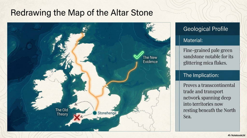
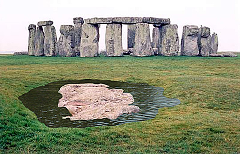
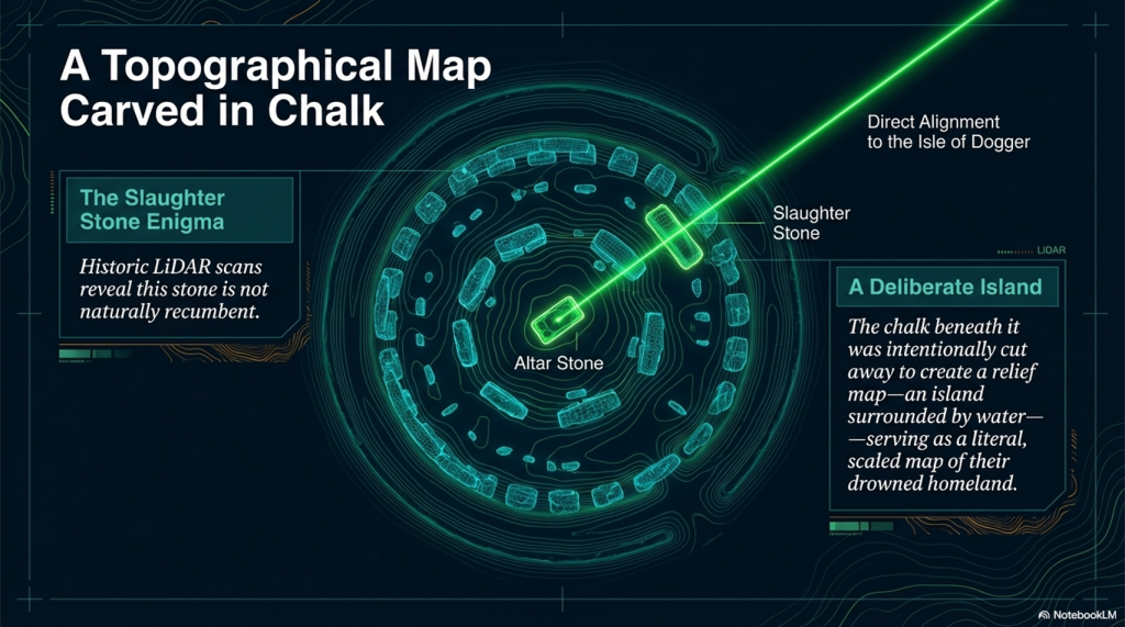
Large megaliths appear at locations far removed from their geological source. The Altar Stone at Stonehenge is a notable example. Moving such materials through dense woodland by purely overland methods presents enormous logistical challenges.

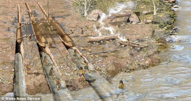
Transport by water offers a far simpler solution.

Rivers, estuaries, and coastal routes enable the efficient transport of heavy loads over considerable distances.

The significance of these observations becomes increasingly apparent when compared with Plato’s account.

Atlantis is not described as an isolated settlement.

It is described as a civilisation connected to other islands and distant lands.

“From it they passed to the other islands, and from the islands to the whole of the opposite continent.”

This statement implies movement.

It implies communication.

Most importantly, it implies connectivity.

The archaeological evidence points toward exactly the same conclusion.

Europe was not a collection of isolated communities.

It was linked through a network of rivers, coastlines, estuaries, and maritime routes that facilitated the movement of materials over extraordinary distances.

Doggerland occupied the centre of that network.

Situated between Britain and continental Europe, connected to major river systems, and positioned within the North Sea basin, it formed a natural hub through which people, resources, and ideas could circulate.

The importance of this observation extends beyond trade itself.

Trade requires boats.

Boats require engineering.

Engineering requires organisation.

Organisation requires knowledge.

The movement of materials, therefore, provides indirect evidence for a much larger system operating behind the scenes.

This is precisely the type of organised, interconnected society described by Plato.

The materials themselves are not the story.

They are the evidence.

What they reveal is a civilisation capable of linking distant regions into a single functioning network.

A civilisation whose wealth was not created by isolation, but by connectivity.

The next question is whether Plato’s description extends beyond trade and infrastructure into the natural world itself.

Among his most surprising observations is one that many critics have dismissed entirely.

The presence of elephants.
 (Testing Plato's Atlantis Against Reality)
(Testing Plato’s Atlantis Against Reality)

9. The Elephant Problem

Few passages in Plato’s account have been attacked more frequently than his reference to elephants.

For generations, critics have treated a single sentence as sufficient reason to dismiss any northern European location for Atlantis.

Plato writes:

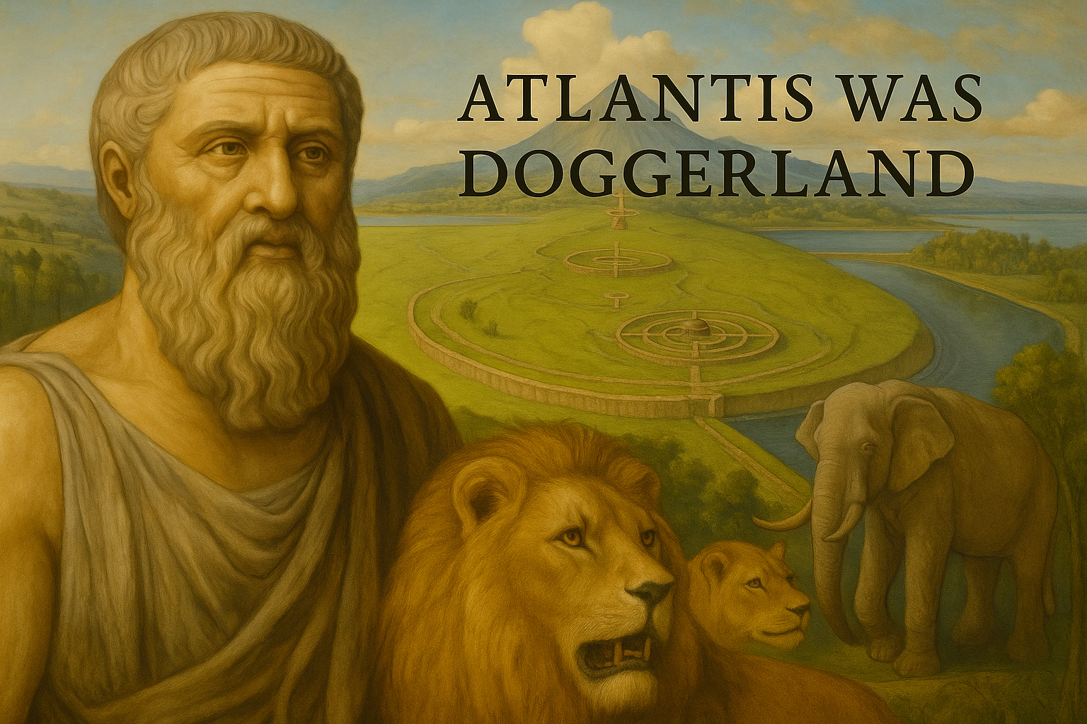
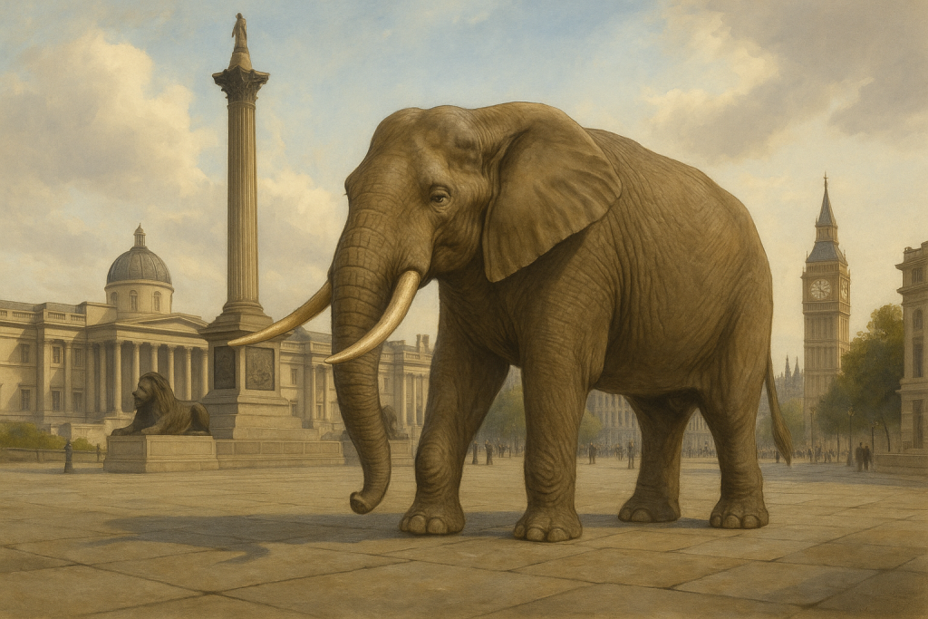
“Moreover, there were a great number of elephants in the island.”

The conclusion appears obvious.

Britain has no elephants.

Therefore, Atlantis cannot have been Britain, Doggerland, or anywhere within the North Sea basin.

At first glance, the argument appears convincing.

The problem is that it depends upon assumptions that become increasingly difficult to defend when examined against the archaeological evidence.

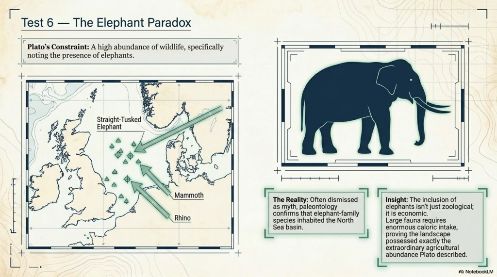
The first issue is that elephant-family species are already accepted within the British fossil record. Straight-tusked elephants, mammoths, hippopotamus, rhinoceros, lions, hyenas, and numerous other large mammals have all been recovered from Britain and the landscapes surrounding the North Sea. Their existence is not disputed. Museums throughout Britain contain the evidence.

The debate, therefore, is not about whether these animals existed.

They did.

The debate concerns how they got there.

According to the conventional model, many of these animals occupied Britain during warm interglacial periods, particularly the Eemian. During this period, Britain is frequently portrayed as a warm environment capable of supporting species normally associated with much more southerly regions.

Yet this explanation immediately creates a contradiction.

The same model often requires sea levels to be substantially higher than present levels. As sea levels rise, the land connections linking Britain to continental Europe become progressively restricted. The very animals used as evidence of a warm climate require migration routes that are increasingly difficult to explain.

The result is an uncomfortable paradox.

The archaeological evidence demonstrates that the animals existed.

The environmental model struggles to explain how such large populations repeatedly arrived.

This problem becomes even greater when the wider geographical distribution of these animals is considered. Elephant remains are not confined to Britain. Similar evidence exists throughout north-west Europe bordering the North Sea basin. The pattern suggests a much larger landscape supporting extensive animal populations rather than isolated pockets of wildlife trapped on an island.

This is precisely what Doggerland represents.

A vast interconnected landmass linking Britain to continental Europe.

A landscape through which both animals and humans could move freely.

The significance of this observation becomes even more apparent when viewed alongside Plato’s wider description of Atlantis.

Critics often isolate the elephant passage as though it exists independently of the rest of the account.

It does not.

By this stage of the investigation, Plato has already described a civilisation connected by waterways, supported by maritime transport, and operating across an extensive geographical network. The archaeological evidence points towards the movement of obsidian across Europe, Baltic amber into distant regions, Alpine jade over thousands of kilometres, Anatolian wheat into Britain, and the transport of massive stones across substantial distances.

Materials moved.

Resources moved.

People moved.

Ideas moved.

Entire trade networks operated across rivers, coastlines, and shallow seas.

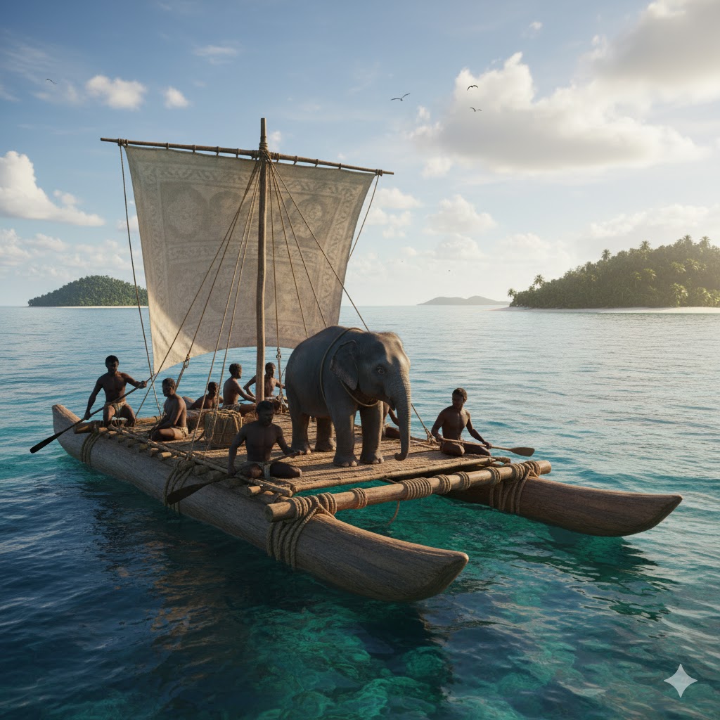
Against this backdrop, the suggestion that large animals could also be moved becomes far less remarkable than critics often imply.

Indeed, elephants were not confined to Africa. Throughout antiquity, elephant populations occupied regions much closer to Europe, including parts of the eastern Mediterranean. The modern tendency to associate elephants exclusively with Africa is, therefore, misleading when discussing prehistoric and ancient landscapes.

More importantly, Plato’s reference is not primarily zoological.

It is economic.

Large animals consume enormous quantities of food and water. A landscape capable of supporting significant elephant populations is, by definition, a landscape of abundance.

This is exactly the point Plato is making.

The elephant passage forms part of a wider description of exceptional productivity. Throughout Critias, Atlantis is portrayed as a land rich in water, wildlife, natural resources, agriculture, and wealth. The elephants are not presented as curiosities. They are presented as evidence of the extraordinary prosperity of the landscape itself.

When viewed in this context, the criticism begins to collapse.

The fossil evidence demonstrates that elephant-family species existed within Britain and the wider North Sea region.

The conventional explanation for their presence contains unresolved contradictions.

The geographical reconstruction of Doggerland provides a more coherent mechanism for both animal and human movement.

And Plato’s description of elephants forms part of a broader picture of abundance that aligns closely with the productive environments reconstructed for the drowned landscapes of north-west Europe.

Far from disproving the existence of a northern Atlantis, the elephant passage may preserve one of the clearest memories of a world that has long since disappeared.

A world of vast plains, interconnected waterways, abundant wildlife, and rich ecosystems stretching across what is now the floor of the North Sea.

NB. The Hyperborea Problem

One possible explanation for Atlantis is that Plato simply invented a mythical land beyond the known world. However, this explanation encounters an unexpected difficulty.

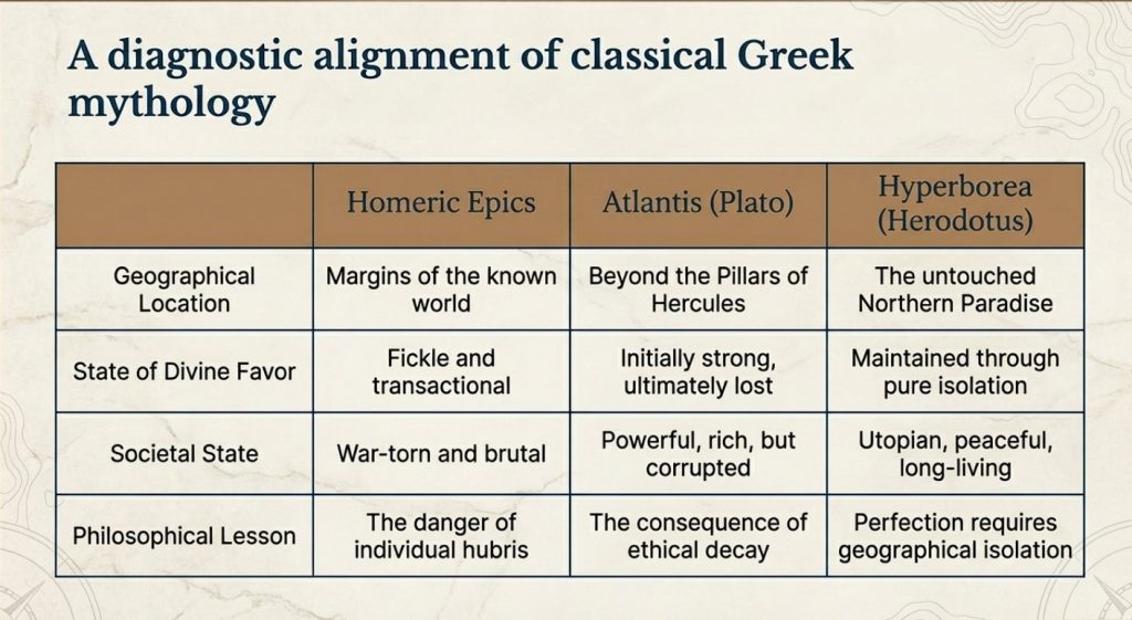
Greek literature already contained examples of distant northern paradises, the most famous of which was Hyperborea. Like Atlantis, Hyperborea was described as a prosperous land located beyond the ordinary limits of the Greek world. It was associated with abundance, favourable conditions, and a people living in harmony with the gods.

Yet Hyperborea contains no elephants.

This is significant because it demonstrates that Greek writers did not normally populate northern legendary lands with elephant herds. If Plato simply wanted to create another distant paradise, elephants were not a necessary part of the story.

Indeed, Hyperborea shares several broad themes with Atlantis while lacking many of Atlantis’s most distinctive features. There are no great engineering works, no vast canal systems, no maritime empire, no imperial ambitions, and no large elephant populations.

The question, therefore, becomes difficult to avoid.

Why did Plato include elephants?

If they were merely a literary invention, they represent a surprisingly specific addition to a narrative that did not require them. If they originated within an earlier tradition known to Plato, then the problem changes completely. The question is no longer why Plato added elephants, but why the source tradition contained them in the first place.

Hyperborea demonstrates that Greeks could imagine northern utopias without elephants.

The elephant passage, therefore, remains one of the most unusual and difficult-to-explain details within the Atlantis account.

And if Plato’s description of the environment continues to align with the evidence, attention must now turn to the most dramatic claim of all.

According to Plato, this entire landscape was ultimately destroyed by water.
 (Testing Plato's Atlantis Against Reality)
(Testing Plato’s Atlantis Against Reality)

10. The Great Flood

No aspect of Plato’s account has received more attention than the destruction of Atlantis.

For many researchers, it is the defining event of the story. Entire theories have been built around earthquakes, volcanic eruptions, tsunamis, and sudden catastrophes. Yet before attempting to explain the destruction, it is essential to establish exactly what Plato wrote.

In Timaeus, the Egyptian priest tells Solon:

“There occurred violent earthquakes and floods; and in a single day and night of misfortune all your warlike men in a body sank into the earth, and the island of Atlantis in like manner disappeared beneath the sea.”

This passage is frequently misunderstood.

The phrase “your warlike men” does not refer to the Atlanteans. The priest is speaking directly to Solon and is referring to the prehistoric Athenians who supposedly opposed Atlantis. Plato is therefore describing two separate losses.

First, the destruction of the ancient Athenian force:

“all your warlike men in a body sank into the earth.”

Second, the destruction of Atlantis:

“the island of Atlantis in like manner disappeared beneath the sea.”

The distinction is important because the two events are described differently. The Athenians are said to sink into the earth, while Atlantis disappears beneath the sea. Although Plato links the events together, he does not explicitly state that they occurred through the same mechanism.

This observation immediately complicates the traditional interpretation of Atlantis being destroyed in a single catastrophic moment.

The text may instead preserve memories of different processes combined within a single narrative.

This becomes particularly significant when compared with the geological evidence.

Unlike most proposed locations for Atlantis, Doggerland is known to have suffered the exact fate Plato describes.

It disappeared beneath the sea.

For thousands of years following the end of the last Ice Age, Doggerland formed a vast low-lying landscape connecting Britain to continental Europe. Rivers crossed its plains. Forests covered large areas. Lakes, marshes, and wetlands supported abundant wildlife and human populations. Archaeological discoveries from the North Sea continue to demonstrate that this landscape was inhabited for millennia.

Today, it lies beneath the sea.

This is not a theory.

It is a geological fact.

The significance of this cannot be overstated.

Many theories about Atlantis attempt to explain how a civilisation might have been destroyed.

Doggerland requires no such explanation.

Its destruction is already accepted.

The debate concerns how that destruction occurred.

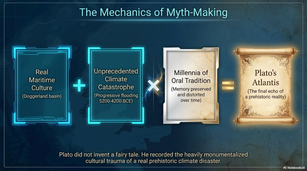
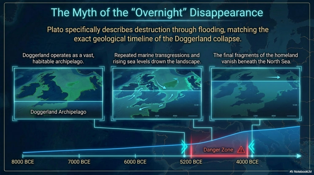
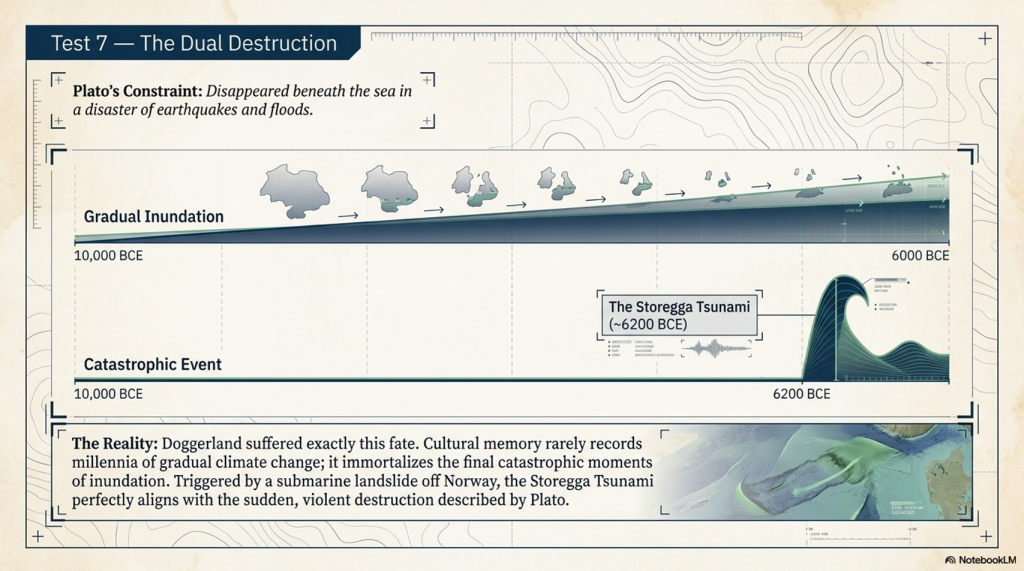
The conventional model describes a gradual process. As the Ice Age ended, melting glaciers caused global sea levels to rise. Over thousands of years, coastlines retreated, and low-lying regions became increasingly vulnerable to flooding. Rivers expanded into estuaries. Wetlands spread across the landscape. Eventually, large portions of Doggerland were submerged.

At first glance, this appears inconsistent with Plato’s dramatic description.

However, this comparison may be misleading.

Human societies rarely preserve memories of gradual environmental change.

They remember disasters.

A coastline may retreat slowly over centuries, but a major flood, storm surge, or sudden inundation can become fixed within cultural memory for generations. What survives in oral tradition is often not the process itself but the final catastrophe.

This distinction is crucial.

Doggerland was not lost through a single mechanism.

It was lost through a combination of processes acting over long periods.

Sea levels rose.

Coastlines retreated.

Settlements were abandoned.

Communities migrated.

Then, on top of these gradual changes, catastrophic events occurred.

The most famous of these was the Storegga tsunami around 6200 BCE. Triggered by a massive submarine landslide off the coast of Norway, the resulting tsunami impacted large areas of the North Atlantic and North Sea basin. Evidence of its effects has been identified around the coasts of Britain and neighbouring regions.

Whether Storegga alone destroyed Doggerland remains debated.

What matters is that it demonstrates something often overlooked.

The North Sea basin experienced both gradual inundation and sudden catastrophic flooding.

The landscape was therefore subject to precisely the combination of processes capable of generating the type of memory preserved in Plato’s account.

A long decline.

Followed by dramatic losses.

The more closely Doggerland is examined, the more unusual the comparison becomes. The geographical location corresponds. The dimensions of the plain correspond. The rivers, wetlands, maritime networks, trade routes, and environmental evidence all show remarkable similarities to Plato’s description.

Now the destruction itself reveals another correspondence.

Unlike Atlantis, Doggerland is not a legend.

Its existence is accepted.

Its flooding is accepted.

Its disappearance beneath the sea is accepted.

The only remaining question is whether Plato’s account preserves a distant memory of that lost landscape.

And it is here that Plato provides one final clue—one so unusual that many Atlantis researchers simply ignore it.

According to Plato, the destruction of Atlantis left behind something very specific.

Not an open sea.

But a sea of mud.
 (Testing Plato's Atlantis Against Reality)
(Testing Plato’s Atlantis Against Reality)

11. The Muddy Sea Mystery

If the flooding of Atlantis is the most famous part of Plato’s account, the muddy sea is undoubtedly the most neglected.

Yet it may also be one of the most important.

Following his description of Atlantis’s destruction, Plato records a curious consequence:

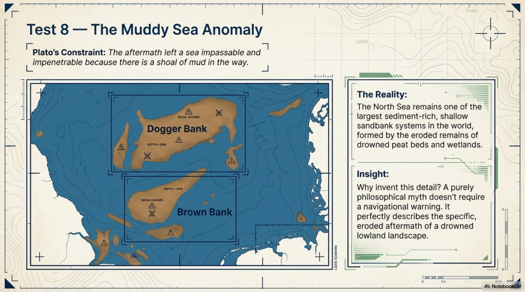
“For in consequence of the subsidence of the island, the sea in those parts became impassable and impenetrable, because there is a shoal of mud in the way; and this was caused by the subsidence of the island.”

This statement is remarkable.

Unlike the great plain, the canals, the elephants, or the flooding itself, the muddy sea serves no obvious literary purpose. It contributes nothing to Plato’s moral lesson concerning the rise and fall of civilisations. It does not glorify Atlantis. It does not explain its destruction.

Instead, it appears to be an observational detail.

A practical problem.

A navigational hazard.

This immediately raises an important question.

Why include it at all?

Most Atlantis theories struggle to answer.

If Atlantis were destroyed by a volcanic eruption, the expected consequence would be volcanic debris rather than a vast muddy shoal. If Atlantis existed in the deep Atlantic Ocean, the disappearance of an island would not normally leave behind an impassable sea of mud. If Atlantis were merely a philosophical invention, the muddy sea would become an oddly specific detail with little narrative value.

Yet when examined against Doggerland, the description becomes surprisingly familiar.

Doggerland was not a rocky island rising from deep water.

It was a vast low-lying plain composed largely of sediments deposited by rivers, glaciers, wetlands, and coastal processes. For thousands of years, enormous quantities of silt, clay, peat, and organic material accumulated across the North Sea basin.

As sea levels rose, these landscapes did not simply vanish.

They eroded.

River valleys became estuaries.

Peat beds were broken apart.

Coastal sediments were redistributed.

Vast quantities of material were mobilised by tides, storms, and flooding events.

The result was not a clean transition from land to sea.

It was a landscape of shifting banks, shoals, shallows, and submerged hazards.

This characteristic remains visible today.

Dogger Bank itself stands as the most obvious example. Stretching across a huge area of the central North Sea, it represents one of the largest sandbank systems in the world. Other features, including Brown Bank and numerous submerged ridges and shoals, continue to influence navigation and sediment movement throughout the region.

To a mariner unfamiliar with the area, these features could indeed make parts of the sea difficult or dangerous to traverse.

This observation becomes even more significant when viewed through the perspective of memory.

Imagine a civilisation witnessing the gradual loss of a vast lowland landscape. Rivers become estuaries. Forests become marshes. Settlements retreat from advancing waters. Eventually, the land disappears.

What remains?

Not an open ocean.

Not a deep abyss.

But a shallow, sediment-rich seascape filled with banks, mudflats, submerged channels, and navigational hazards.

In other words, precisely the environment Plato describes.

The significance of this passage extends beyond simple geography.

Throughout this investigation, many of Plato’s major descriptions have found parallels within the reconstructed landscape of Doggerland. Critics may argue that large features such as plains, rivers, mountains, or flooding are common and therefore unsurprising.

The muddy sea is different.

It is oddly specific.

It is not a feature that appears in most lost-civilisation myths.

Nor is it an obvious detail for a philosopher inventing a moral allegory.

Instead, it reads like the sort of practical observation one might expect from sailors operating in a drowned, sediment-filled landscape.

This is precisely why the muddy sea deserves more attention than it usually receives.

It may be one of the few details within the Atlantis account that serves no literary function at all.

Its value lies entirely in its description of the physical world.

And when that description is compared with the submerged landscapes of the North Sea, the correspondence is striking.

A great plain.

A network of rivers.

A maritime civilisation.

A flooded landscape.

And finally, a shallow sea made it difficult to navigate through mud and shoals.

Each individual match may be debated.

The cumulative pattern is harder to dismiss.

After more than two thousand years of speculation, we can finally ask the question that should have been asked from the beginning.

How many of Plato’s descriptions does Doggerland actually satisfy?
 (Testing Plato's Atlantis Against Reality)
(Testing Plato’s Atlantis Against Reality)

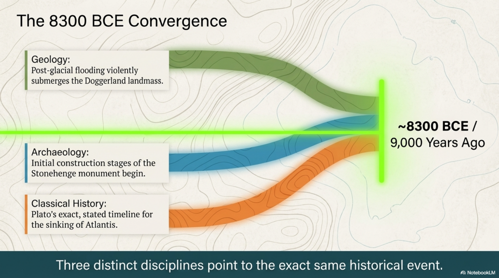
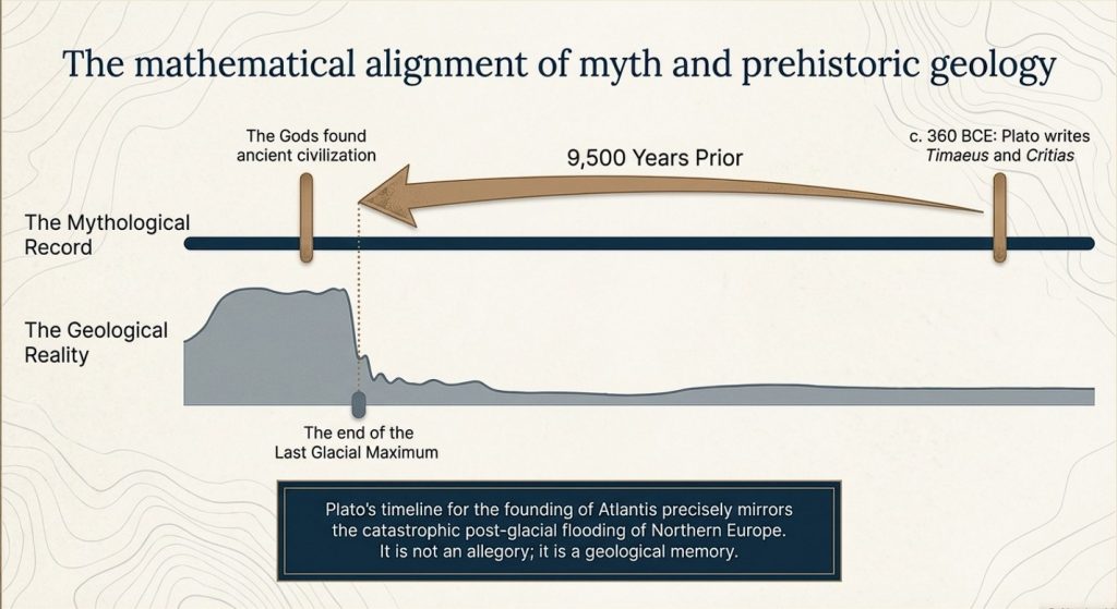
12. The Date Problem

Among all the details recorded by Plato, none has generated more controversy than the date of Atlantis.

For many researchers, it is also the easiest detail to dismiss.

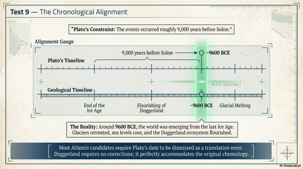
According to the Egyptian priests who related the story to Solon, the war between Atlantis and the ancestors of the Athenians occurred:

“9,000 years before.”

When combined with Solon’s visit to Egypt around the sixth century BCE, this places the destruction of Atlantis at approximately 9600 BCE.

For generations, this date has been regarded as impossible.

Various explanations have been proposed. Some suggest that the Egyptian priests confused lunar years with solar years. Others argue that a copying error occurred during transmission. Some simply dismiss the figure entirely and focus on other parts of the story.

Yet this creates an obvious problem.

If Plato’s measurements are accepted when they support a theory, but rejected when they do not, the investigation becomes subjective. The same standard must be applied throughout.

The date, therefore, deserves to be examined rather than dismissed.

The first observation is that Plato treats the chronology as factual information rather than symbolism. The Egyptian priests do not present the date as a metaphor, an allegory, or a philosophical concept. They present it as a historical interval spanning from Solon’s time to the destruction of Atlantis.

The second observation is more interesting.

If the date is accepted, even approximately, it points towards a very specific period in European prehistory.

Around 9600 BCE, the world was emerging from the last Ice Age.

Glaciers were retreating.

Sea levels were rising.

Coastlines were changing.

Entire landscapes were being transformed.

Most importantly, the North Sea basin was still largely dry land.

Doggerland existed.

This creates a remarkable correspondence.

Many proposed Atlantis locations fail immediately upon consideration of chronology. Bronze Age settlements are thousands of years too recent. Classical and Iron Age sites are even further removed. The entire theory depends upon ignoring Plato’s date altogether.

Doggerland does not suffer from this problem.

The chronology points directly to the period when Doggerland flourished.

This does not mean the date is exact.

Ancient chronologies are rarely exact.

Nor does it mean every event described by Plato occurred precisely in 9600 BCE.

What matters is the broad agreement between the period recorded by the Egyptian priests and the period during which the Doggerland landscape existed.

The significance becomes even greater when viewed alongside the evidence presented in previous chapters.

The location aligns.

The dimensions align.

The environmental reconstruction aligns.

The waterways align.

The trade networks align.

The flooding aligns.

The muddy sea aligns.

Now the chronology aligns as well.

This cumulative pattern is difficult to ignore.

Indeed, one of the most striking aspects of the Doggerland hypothesis is that it does not require Plato’s date to be rewritten, corrected, or discarded. Unlike many competing theories, it can accommodate the chronology largely as recorded.

This raises an important question.

If Plato’s figure is wrong, how do we know?

And if it is broadly correct, why does it point so directly towards the very period in which a vast North European landscape existed before being lost beneath the sea?

The answer remains uncertain.

What is clear, however, is that the date presents a challenge for almost every Atlantis theory except one.

For the first time, the chronology, geography, environment, and fate of the landscape all appear to be pointing towards the same place.

Doggerland.

The question is no longer whether individual elements of Plato’s account resemble the evidence.

The question is how many of those elements can be explained by the same landscape simultaneously.

That is the issue to which we now turn.

next section
 (Testing Plato's Atlantis Against Reality)
(Testing Plato’s Atlantis Against Reality)

13. Testing Plato Against Reality

After more than two thousand years of speculation, the Atlantis debate remains as divided as ever.

This is not because there is a shortage of theories.

The problem is that most Atlantis investigations begin with a conclusion. A location is selected first, and evidence is then gathered to support it. Features that appear to fit Plato’s description are highlighted. Features that do not are explained away, ignored, or reinterpreted.

The result is a landscape of competing theories, each claiming success while explaining only part of the story.

This investigation has followed a different approach.

Rather than beginning with Doggerland, it began with Plato.

The objective was not to prove Atlantis existed.

The objective was to examine Plato’s account as a series of geographical, environmental, engineering, and historical observations and ask a simple question:

How many of these observations correspond with a known prehistoric landscape?

The answer is surprising.

Plato places Atlantis beyond the Pillars of Heracles within the Atlantic realm.

Doggerland satisfies that requirement.

Plato describes a vast oblong plain measuring approximately 3,000 by 2,000 stadia.

Doggerland possesses a central plain of remarkably similar dimensions.

Plato describes mountains surrounding parts of the landscape and feeding rivers that crossed the plain.

Doggerland was bordered by the uplands of Britain and Scandinavia and contained one of the largest river systems in prehistoric Europe.

Plato describes abundant waterways, canals, harbours, and maritime activity.

The archaeological evidence increasingly points towards a civilisation organised around rivers, estuaries, shallow seas, and water transport.

Plato describes extensive trade and movement across large distances.

The archaeological record reveals obsidian, amber, jade, copper, wheat, tin, gold, and other materials moving across continental-scale networks.

Plato describes exceptional fertility and abundant wildlife.

The environmental reconstruction of Doggerland reveals one of the richest prehistoric ecosystems known from Europe.

Plato describes elephants.

The wider North Sea basin has produced evidence of elephant-family species alongside numerous other large mammals. More importantly, the presence of elephants appears as an unusual detail rather than a standard feature of Greek mythical geography.

Plato describes a landscape lost beneath the sea.

Doggerland is one of the few proposed Atlantis candidates known to have suffered precisely that fate.

Plato describes a muddy, difficult sea that remains after the destruction.

The North Sea contains some of the largest sediment banks, shoals, and submerged landscapes in Europe.

Finally, Plato records a date approximately 9,000 years before Solon.

Whether exact or approximate, the chronology points directly to the period when Doggerland existed and was undergoing a profound environmental transformation.

Individually, none of these observations proves that Doggerland was Atlantis.

Historical investigations rarely operate in such a simple manner.

The significance lies in the cumulative pattern.

Again and again, Plato’s descriptions appear to converge on the same landscape.

This is where the Doggerland hypothesis differs from many competing theories.

Most Atlantis candidates satisfy one or two major criteria.

Some satisfy the flooding.

Others satisfy aspects of the geography.

A few satisfy isolated archaeological observations.

Doggerland is unusual because multiple independent lines of evidence appear to point towards the same location.

This raises a question that becomes increasingly difficult to avoid.

If Plato invented Atlantis, why does the account contain so many details that correspond with a prehistoric landscape unknown to both Plato and the modern world until the development of marine archaeology?

The dimensions of the plain.

The maritime setting.

The flooding.

The muddy sea.

The chronology.

The environmental reconstruction.

The trade network.

The question becomes even more intriguing when compared with other Greek traditions.

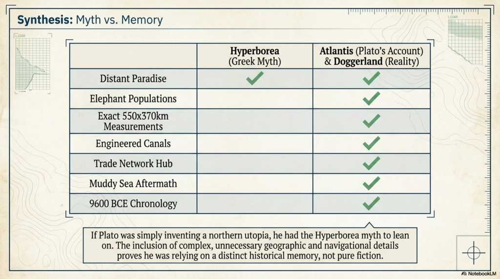
The Greeks already possessed mythical lands beyond the known world. Hyperborea is perhaps the best-known example. Yet Hyperborea lacks many of the distinctive features that define Atlantis. There are no great canals, no maritime empire, no immense engineering works, no detailed geography, and no elephant populations.

If Plato simply wished to invent a distant paradise, he already had models available.

Instead, Atlantis contains a remarkable collection of specific observations that often appear unnecessary for a purely fictional narrative.

This does not prove the account is historical.

Nor does it prove that every detail must be literally correct.

What it does suggest is that Atlantis deserves to be examined more seriously than it often is.

For perhaps the first time, modern archaeology, geology, and environmental reconstruction allow Plato’s account to be tested against a real landscape.

The results are remarkable.

The final question, therefore, remains.

Does Doggerland ultimately pass Plato’s test?

Verdict: Does Doggerland Pass Plato’s Test?

At the beginning of this investigation, a simple principle was established.

The objective was not to prove Atlantis existed.

Nor was it to defend a predetermined theory.

Instead, the objective was to test Plato’s account against the evidence and determine whether any known prehistoric landscape satisfies the descriptions he recorded.

The results have been unexpected.

For more than two thousand years, Atlantis has occupied an unusual position in history. To some, it is a myth. To others, it is a philosophical allegory. To others, still, it is a lost civilisation waiting to be discovered. Entire libraries have been written attempting to locate Atlantis in the Mediterranean, the Atlantic, the Caribbean, Antarctica, and countless other locations.

Yet one problem remains constant.

Most proposed Atlantis locations satisfy only fragments of Plato’s account.

Some explain the flooding.

Some explain parts of the geography.

Some explain isolated archaeological observations.

Very few explain the entire narrative.

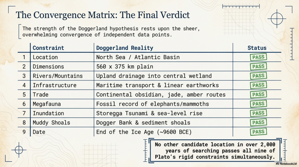
Throughout this investigation, Plato’s descriptions have been examined individually before being compared against the reconstructed landscape of Doggerland.
 (Testing Plato's Atlantis Against Reality)
(Testing Plato’s Atlantis Against Reality)

Again and again, the same pattern emerged.

The location corresponds.

The dimensions of the plain correspond.

The surrounding uplands correspond.

The rivers and wetlands correspond.

The maritime setting corresponds.

The trade networks correspond.

The environmental reconstruction corresponds.

The flooding corresponds.

The muddy sea corresponds.

Even the chronology points to the period when Doggerland existed and was ultimately lost.

Individually, any one of these observations might be dismissed as a coincidence.

Collectively, they become increasingly difficult to ignore.

This is perhaps the most important conclusion of the entire study.

The strength of the Doggerland hypothesis does not rest upon a single piece of evidence.

It rests upon convergence.

Multiple independent descriptions recorded by Plato appear to point towards the same landscape.

This is precisely what should be expected if the account preserves a genuine memory of a real place.

It is also where the traditional explanation begins to encounter difficulties.

If Atlantis were entirely fictional, many of Plato’s details would become surprisingly specific.

The dimensions of the plain were unnecessary.

The muddy sea was unnecessary.

The elephant populations were unnecessary.

The extensive waterways were unnecessary.

The chronology was unnecessary.

The description of a drowned landscape was unnecessary.

Plato could have written a moral tale about pride and decline without any of these details.

Indeed, Greek literature already possessed examples of distant and idealised lands. Hyperborea is perhaps the best known. Yet Hyperborea lacks many of the distinctive features that define Atlantis. There are no vast engineering works, no maritime empire, no extensive canal systems, no detailed geography, and no elephant populations.

This observation does not prove Atlantis was historical.

It does, however, create a question that every sceptical interpretation must answer.

Why include so many specific details if they served no purpose?

More importantly, why do so many of those details correspond with a prehistoric landscape that remained unknown until the development of modern marine archaeology?

No one in Plato’s time knew Doggerland existed.

No one in the Middle Ages knew Doggerland existed.

No one in the nineteenth century knew Doggerland existed.

Only within the last few decades has the scale of the lost North Sea landscape become apparent.

Yet many of the characteristics described by Plato appear remarkably familiar when viewed against this newly reconstructed world.

This does not mean every aspect of the Atlantis story must be accepted literally.

Oral traditions evolve.

Chronologies become compressed.

Events separated by centuries may become combined within a single narrative. Historical memories merge with symbolism, politics, and mythology. Such processes are common throughout human history.

The question is therefore not whether Plato preserved a perfect historical account.

The question is whether a historical memory exists beneath the narrative.

The evidence presented throughout this investigation suggests that the possibility can no longer be dismissed.

For the first time, there exists a prehistoric landscape that satisfies a substantial proportion of Plato’s descriptions without requiring major alterations to the text itself.

The landscape is real.

Its flooding is real.

Its disappearance is real.

Its chronology broadly fits.

Its environment broadly fits.

Its geography broadly fits.

Its maritime character broadly fits.

Whether that landscape should ultimately be called Atlantis remains a matter for debate.

But the conclusion is unavoidable.

Doggerland passes Plato’s test more successfully than any Atlantis candidate proposed so far.

The significance of that result extends beyond Atlantis itself.

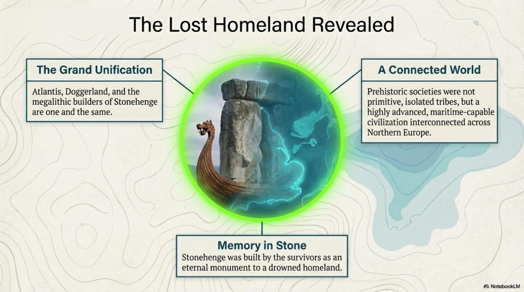
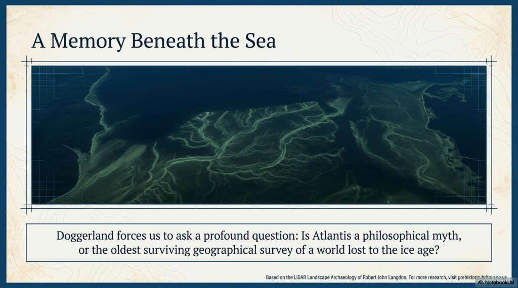
If Plato’s account preserves even a fragment of genuine memory, then the lost landscapes beneath the North Sea may represent one of the most important chapters of human history still waiting to be fully understood.

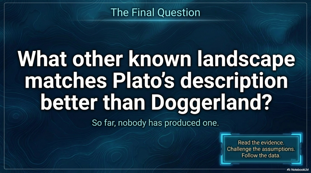
The Atlantis question, therefore, remains open.

But for the first time in over two thousand years, it is no longer a question without a plausible answer.
 (Testing Plato's Atlantis Against Reality)
(Testing Plato’s Atlantis Against Reality)

PODCAST

Author’s Biography

Robert John Langdon, a polymathic luminary, emerges as a writer, historian, and eminent specialist in LiDAR Landscape Archaeology.

His intellectual voyage has been interwoven with stints as an astute scrutineer in government and grand corporate bastions, a tapestry spanning British Telecommunications, Cable and Wireless, British Gas, and the esteemed University of London.

A decade hence, Robert’s transition into retirement unfurled a chapter of insatiable curiosity. This phase saw him immerse himself in Politics, Archaeology, Philosophy, and the enigmatic realm of Quantum Mechanics. His academic odyssey traversed the venerable corridors of knowledge hubs such as the Museum of London, University College London, Birkbeck College, The City Literature Institute, and Chichester University.

In the symphony of his life, Robert is a custodian of three progeny and a pair of cherished grandchildren. His sanctuary lies ensconced in the embrace of West Wales, where he inhabits an isolated cottage, its windows framing a vista of the boundless sea – a retreat from the scrutinising gaze of Her Majesty’s Revenue and Customs, an amiable clandestinity in the lap of nature.

Exploring Prehistoric Britain: A Journey Through Time

My blog delves into the fascinating mysteries of prehistoric Britain, challenging conventional narratives and offering fresh perspectives grounded in cutting-edge research, particularly LiDAR technology. I invite you to explore some key areas of my research. For example, the Wansdyke, often cited as a defensive structure, is re-examined in light of new evidence. I’ve presented my findings in my blog post Wansdyke: A British Frontier Wall – ‘Debunked’, and a Wansdyke LiDAR Flyover video further visualises my conclusions.

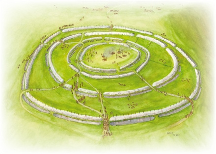
My work also often challenges established archaeological dogma. I argue that many sites, such as Hambledon Hill, commonly identified as Iron Age hillforts, are not what they seem. My posts Lidar Investigation Hambledon Hill – NOT an ‘Iron Age Fort’ and Unmasking the “Iron Age Hillfort” Myth explore these ideas in detail and offer an alternative view. Similarly, sites like Cissbury Ring and White Sheet Camp receive re-evaluations based on LiDAR analysis in my posts “Lidar Investigation Cissbury Ring through time” and “Lidar Investigation White Sheet Camp, revealing fascinating insights into their true purpose. I have also examined South Cadbury Castle, often linked to the mythical Camelot56.

My research also extends to ancient water management, including the role of canals and other linear earthworks. I have discussed the true origins of Car Dyke in multiple posts, including Car Dyke – ABC News Podcast and Lidar Investigation Car Dyke – North Section, which suggest a Mesolithic origin 2357. I also explore the misidentification of Roman aqueducts, as seen in my posts on the Great Chesters (Roman) Aqueduct. My research has also been greatly informed by my post-glacial flooding hypothesis, which has helped explain landscape transformations over time. I have discussed this hypothesis in several posts, including AI now supports my Post-Glacial Flooding Hypothesis and Exploring Britain’s Flooded Past: A Personal Journey

Finally, my blog also investigates prehistoric burial practices, as seen in Prehistoric Burial Practices of Britain and explores the mystery of Pillow Mounds, often mistaken for medieval rabbit warrens, but with a potential link to Bronze Age cremation in my posts: Pillow Mounds: A Bronze Age Legacy of Cremation? and The Mystery of Pillow Mounds: Are They Really Medieval Rabbit Warrens?. My research also includes astronomical insights into ancient sites, for example, in Rediscovering the Winter Solstice: The Original Winter Festival. I also review new information about the construction of Stonehenge in The Stonehenge Enigma.

Further Reading

For those interested in British Prehistory, visit www.prehistoric-britain.co.uk, a comprehensive resource featuring an extensive collection of archaeology articles, modern LiDAR investigations, and groundbreaking research. The site also includes insights and excerpts from the acclaimed Robert John Langdon Trilogy, a series of books that explore Britain during the Prehistoric period. Titles in the trilogy include The Stonehenge Enigma, Dawn of the Lost Civilisation, and The Post-Glacial Flooding Hypothesis, which offer compelling evidence of ancient landscapes shaped by post-glacial flooding.

To further explore these topics, Robert John Langdon has developed a dedicated YouTube channel featuring over 100 video documentaries and investigations that complement the trilogy. Notable discoveries and studies showcased on the channel include 13 Things that Don’t Make Sense in History and the revelation of Silbury Avenue – The Lost Stone Avenue, a rediscovered prehistoric feature at Avebury, Wiltshire.

In addition to his main works, Langdon has released a series of shorter, accessible publications, ideal for readers delving into specific topics. These include:

For active discussions and updates on the trilogy’s findings and recent LiDAR investigations, join our vibrant community on Facebook. Engage with like-minded enthusiasts by leaving a message or contributing to debates in our Facebook Group.

Whether through the books, the website, or interactive videos, we aim to provide a deeper understanding of Britain’s fascinating prehistoric past. We encourage you to explore these resources and uncover the mysteries of ancient landscapes through the lens of modern archaeology.

For more information, including chapter extracts and related publications, visit the Robert John Langdon Author Page. Dive into works such as The Stonehenge Enigma or Dawn of the Lost Civilisation, and explore cutting-edge theories that challenge traditional historical narratives.

Other Blogs

s

t

Plato Was Right: The Archaeological Evidence the Academics Never Expected

Introduction

For more than a century, archaeology has treated Plato’s Atlantis as little more than an allegory. Students are taught that Atlantis was a philosophical invention. A morality tale. A fictional society created to demonstrate the dangers of arrogance and imperial ambition. (Plato’s Atlantis)

The problem with this explanation is simple.

Plato’s story contains an extraordinary number of specific claims.

He described a powerful maritime civilisation existing around 9,000 years before Solon. He placed it beyond the Pillars of Hercules in a sea that bears its name to this day – the Atlantic Ocean. He claimed it possessed fleets capable of travelling vast distances, maintained contact with distant lands, and ultimately disappeared beneath the sea following catastrophic flooding.

Most importantly, Plato claimed the survivors of this lost civilisation seeded both Egypt and Greece.

For generations, academics dismissed the entire account as fiction.

The archaeology now suggests they may have been wrong.

(Plato's Atlantis)
(Plato’s Atlantis)

1. Atlantis and the Atlantic

One of the most overlooked aspects of Plato’s account is geography.

Atlantis was not described as a Mediterranean civilisation.

It lay beyond the Pillars of Hercules in the Atlantic Ocean.

Today, the ocean itself still carries the name.

Whether the ocean was named after Atlantis or Atlantis after the ocean is ultimately irrelevant. What matters is that Plato was clearly describing a civilisation connected to the Atlantic world rather than the eastern Mediterranean.

That distinction becomes critically important when we consider what archaeology has discovered during the last few decades.

(Plato's Atlantis)
(Plato’s Atlantis)

2. The Lost World Beneath the North Sea

When Plato wrote his account, nobody knew that an enormous inhabited landscape once existed beneath the North Sea.

Today, we call it Doggerland.

During the Late Ice Age, Britain was connected to Europe by a vast plain crossed by rivers, lakes, forests and wetlands. This was not a small island. It was an entire country-sized landscape supporting human populations for thousands of years.

Then the climate changed.

The ice sheets melted.

Sea levels rose.

The land disappeared beneath the waves.

For centuries, such a drowned world would have been dismissed as fantasy.

Today, it is accepted in archaeology.

The existence of Doggerland alone demonstrates that Plato’s central premise – that large inhabited lands were lost beneath the sea – was not fantasy at all.

(Plato's Atlantis)
(Plato’s Atlantis)

3. The Great Flooding Event

Around 6200 BCE the Storegga tsunami and associated post-glacial flooding transformed the landscapes of north-west Europe.

Although flooding was not a single event, the combined effects of sea-level rise, coastal erosion and catastrophic inundation dramatically reduced the habitable land available to prehistoric populations.

The significance of this cannot be overstated.

An entire world disappeared.

Rivers vanished.

Coastlines moved.

Settlements were destroyed.

Migration became inevitable.

If a sophisticated maritime culture existed within Doggerland, it would have faced a simple choice:

Adapt, relocate or perish.

(Plato's Atlantis)
(Plato’s Atlantis)

4. Bouldnor Cliff Changes Everything

The discovery at Bouldnor Cliff is one of the most important archaeological finds ever made in Britain.

Dating to the seventh millennium BC, the site revealed evidence of advanced woodworking, boat use and long-distance connections.

Most remarkably, researchers recovered evidence of einkorn wheat.

This is not a trivial discovery.

Einkorn was not adopted in Britain for approximately another 3,000 years.

The presence of einkorn demonstrates contact with regions where the crop was already known and cultivated.

In other words, maritime connections already existed between Britain and distant communities long before conventional history would have us believe.

This single discovery destroys the notion that Mesolithic Britain was isolated from the wider world.

(Plato's Atlantis)
(Plato’s Atlantis)

5. Maritime Routes Create Ports

There is another implication that is rarely discussed.

Boats travelling between Britain and the Near East do not operate by magic.

They require food.

Fresh water.

Repairs.

Shelter.

Replacement crews.

Trade goods.

Every historical maritime network in history produced ports and anchorages.

The Phoenicians did it.

The Greeks did it.

The Romans did it.

The Vikings did it.

The Elizabethans did it.

There is no reason to imagine prehistoric sailors behaved differently.

Repeated voyages between the Atlantic and Anatolia would naturally create stopping points along the coasts of Iberia, southern France, Italy, Greece, and Egypt.

Over generations, these temporary anchorages would evolve into permanent trading communities.

Sailors would settle.

Families would form.

Local populations would mix.

Knowledge would spread.

This is how maritime civilisations have always operated.

(Plato's Atlantis)
(Plato’s Atlantis)

6. Plato’s Most Important Claim

Plato did not merely describe a lost civilisation.

He claimed that the survivors seeded both Egypt and Greece.

This is an astonishingly specific statement.

It creates a testable archaeological prediction.

If the account preserves genuine historical memory, then traces of unusual founder populations should appear in both Egypt and Greece during the period following the destruction of the Atlantic homeland.

Remarkably, that is exactly what the archaeology appears to reveal.

(Plato's Atlantis)
(Plato’s Atlantis)

7. Egypt: The First Foundation

The Egyptian evidence is striking.

The chronology reveals continuity rather than replacement.

EgyptGreece
Qarunian (7570–6200 BC)Aceramic Neolithic
Transitional Phase (6200–5550 BC)Early Neolithic
Early Faiyumian (5550–4650 BC)Nea Nikomedeia
Merimde (c.5000–4300 BC)Proto-Sesklo / Sesklo
Tasian (c.4500 BC onwards)Prodromos / Dimini

The populations associated with Merimde and the Tasian culture have been described as:

  • Long-headed.
  • Robust.
  • Physically distinct from many later Egyptians.
  • Generally taller than later predynastic populations.

Excavation reports also recorded individuals with sandy, ginger and even golden hair, leading archaeologists to suggest the existence of a fair strain within the population.

These are not modern interpretations.

They are observations recorded by the excavators themselves.

(Plato's Atlantis)
(Plato’s Atlantis)

8. Greece: The Second Foundation

The Greek evidence follows a remarkably similar pattern.

Early Neolithic populations appear on a timeline virtually identical to that of Egypt.

Sites such as Nea Nikomedeia, Sesklo and Prodromos represent some of the earliest organised communities in Europe.

Anthropological studies repeatedly describe Thessalian populations as predominantly long-headed.

At Prodromos, archaeologists discovered a remarkable cache of eleven human skulls deliberately placed beneath a house floor.

Dedicated anthropological investigations were conducted into these populations, exactly as occurred in Egypt.

The similarities are difficult to ignore.

EgyptGreece
Merimde long-headedThessalian populations described as long-headed
Tasian long-headedProdromos skull assemblage
Robust populationsFounder populations under anthropological study
Taller than later EgyptiansStature evidence incomplete
Fair-haired individualsEvidence currently absent
Continuity from earlier populationsContinuity from Early Neolithic founder settlements
(Plato's Atlantis)
(Plato’s Atlantis)

9. The Chronology Fits

When the chronology is compared directly, the pattern becomes even more remarkable.

DateNorth Sea / Atlantis ModelGreece
8000–7000 BCDoggerland extensiveMesolithic hunter-gatherers
7000–6500 BCPopulation displacement possibleEarliest Neolithic begins
6500–6000 BCLowland reductions continuingThessaly settlements expanding
6200–5500 BCTransitional phaseSesklo emerging
5500–5000 BCDoggerland fragmentedMajor Sesklo centre
5000–4500 BCSurvivor periodDimini and advanced settlements
4500–4000 BCMegalithic Structures EndIncreasing Aegean complexity
3500–3000 BCFarmers take over BritainCycladic maritime culture

The sequence is not proof.

But it is exactly the pattern we would expect if populations displaced from the Atlantic world contributed to later civilisations.

(Plato's Atlantis)
(Plato’s Atlantis)

10. The Allegory Has a Problem

The academic explanation has always been simple.

Atlantis was fictional.

The difficulty is that fictional stories are not supposed to generate accurate archaeological predictions.

Plato described:

  • A maritime civilisation.
  • An Atlantic homeland.
  • Catastrophic flooding.
  • A date close to the end of the Ice Age.
  • Survivors.
  • Egypt.
  • Greece.

Archaeology has now confirmed:

  • The drowned landscape.
  • The flooding.
  • The maritime networks.
  • Long-distance contacts.
  • Founder populations in Egypt.
  • Founder populations in Greece.

Nobody is claiming that every detail of Plato’s account has been proven.

What can no longer be maintained is the lazy assumption that the story was merely an allegory.

Two thousand four hundred years ago, Plato described a lost maritime world destroyed by rising seas whose survivors helped shape the civilisations that followed.

Today, archaeology is beginning to uncover evidence that such a world may have existed.

The greatest irony of all may be that the man historians dismissed as a storyteller was closer to the truth than the experts who spent a century insisting he was wrong.

(Plato's Atlantis)
(Plato’s Atlantis)

🌊 19 Reasons Why Doggerland Was Atlantis 🌊

The Atlantis Mystery Archaeology Doesn’t Want to Solve

For over 2,300 years, people have searched for Atlantis.

They have looked in the Mediterranean, the Atlantic Ocean, Antarctica, the Caribbean, Spain, Morocco, the Azores, and even Indonesia.

Yet there is a problem.

None of these proposed locations matches more than a handful of Plato’s descriptions.

Most require selective reading, reinterpretation, or outright dismissal of key details.

Doggerland is different.

Lying beneath the North Sea between Britain and Europe, Doggerland was a real landscape. It existed. It flooded. It supported human populations. And remarkably, when Plato’s account is compared to measurable evidence, the number of correspondences becomes difficult to ignore.

Here are 19 reasons why Doggerland remains the strongest candidate for Atlantis ever identified.


1️⃣ A Large Island Beyond the Mediterranean

Plato describes a vast landmass beyond the familiar world of the Mediterranean.

Doggerland once connected Britain to continental Europe and formed one of the largest habitable landscapes in north-west Europe before it disappeared beneath the sea.


2️⃣ A Vast Central Plain

Plato gives dimensions of approximately 2,000 by 3,000 stadia.

When converted into modern measurements, this equates to roughly 370 by 550 kilometres.

The reconstructed Doggerland plateau measures approximately 375 by 560 kilometres.

Few Atlantis candidates come anywhere close.


3️⃣ Mountains to the North

Plato describes mountains surrounding the northern edge of the plain.

Scotland, Norway and Scandinavia form exactly such a northern mountainous boundary around the North Sea basin.


4️⃣ A Landscape Dominated by Water

Atlantis was described as a landscape of rivers, channels and waterways.

Doggerland was criss-crossed by major river systems, wetlands, lakes, estuaries and palaeochannels now mapped beneath the North Sea.


5️⃣ A Maritime Civilisation

Plato repeatedly emphasises ships and seafaring.

The Atlantic façade and North Sea region contain overwhelming evidence for water-based movement, trade and communication.


6️⃣ Large-Scale Hydraulic Engineering

Plato describes canals and water management on a huge scale.

Britain and north-west Europe preserve extensive dykes, canals, causewayed enclosures and engineered earthworks whose original purposes remain debated.


7️⃣ Concentric Rings of Land and Water

One of Atlantis’s most famous features.

Concentric enclosures, ring monuments and circular hydraulic structures occur throughout Atlantic Europe.


8️⃣ A Fertile Plain

Plato describes a rich agricultural landscape.

Pollen records, peat deposits and sediment analysis reveal that Doggerland supported extensive woodland, grassland and productive river valleys.


9️⃣ Marshes and Wetlands

Atlantis was rich in freshwater.

Geological reconstruction consistently shows Doggerland as a landscape dominated by lakes, marshes, rivers and elevated groundwater systems.


🔟 Elephants

Critics often dismiss this detail.

Yet elephant remains are not only known from Europe—they are known from Britain.

Elephant, mammoth and hippopotamus remains have all been recovered from Britain and the North Sea basin.


1️⃣1️⃣ Advanced Engineering

Plato describes a highly organised civilisation.

The megalithic monuments of north-west Europe required surveying, transport, planning and engineering on a remarkable scale.


1️⃣2️⃣ Large Fleets

Atlantis supposedly maintained a fleet of around 1,200 ships.

Whether the exact number is correct is irrelevant.

Any maritime civilisation operating at this scale would require sophisticated navigation and environmental prediction.


1️⃣3️⃣ Environmental Monitoring Systems

This is where Stonehenge becomes important.

Stonehenge Phase 1 appears to function as a predictive lunar and tidal system operating within a water-dominated landscape.

Such infrastructure would be essential to a maritime culture.


1️⃣4️⃣ Progressive Flooding

Plato does not describe Atlantis disappearing overnight.

He describes destruction through flooding.

Doggerland vanished over thousands of years through repeated marine transgressions and rising sea levels.


1️⃣5️⃣ The Loss of the Homeland

Eventually, only fragments remained.

Between approximately 5200 and 4200 BCE the final Doggerland archipelago disappeared beneath the North Sea.


1️⃣6️⃣ Population Dispersal

What happens when a homeland disappears?

People move.

The concentration of megalithic monuments across Britain, Ireland, Brittany, Denmark, and the Low Countries is consistent with populations relocating along the margins of the former basin.


1️⃣7️⃣ Preservation of Memory

Civilisations remember disasters.

Stonehenge Phase 2 may represent the monumentalisation of that memory, transforming an earlier functional system into a permanent stone memorial.


1️⃣8️⃣ Physical Links to the Lost Land

Memory is often preserved through objects.

The Altar Stone may provide a physical connection between Stonehenge and the broader northern landscape associated with Doggerland.


1️⃣9️⃣ A Great Civilisation Remembered

Plato claimed Atlantis survived as a story long after the land itself disappeared.

If a maritime culture occupied Doggerland and its destruction became embedded within oral tradition, Plato’s account may preserve the final echo of a real prehistoric catastrophe.


The Real Question

Taken individually, none of these points proves the existence of Atlantis.

But that is not the test.

The test is whether any other Atlantis candidate matches so many independent categories simultaneously.

✅ Geography

✅ Dimensions

✅ Chronology

✅ Hydrology

✅ Environmental reconstruction

✅ Flooding history

✅ Maritime capability

✅ Engineering requirements

✅ Monument distribution

✅ Cultural memory

Most Atlantis theories match one or two features.

Doggerland matches nearly all of them.

The question is no longer:

“Could Plato have described a flooded landscape?”

The evidence suggests he probably did.

The real question is:

What other known landscape matches Plato’s description better than Doggerland?

So far, nobody has produced one.


PODCAST

Author’s Biography

Robert John Langdon, a polymathic luminary, emerges as a writer, historian, and eminent specialist in LiDAR Landscape Archaeology.

His intellectual voyage has been interwoven with stints as an astute scrutineer in government and grand corporate bastions, a tapestry spanning British Telecommunications, Cable and Wireless, British Gas, and the esteemed University of London.

A decade hence, Robert’s transition into retirement unfurled a chapter of insatiable curiosity. This phase saw him immerse himself in Politics, Archaeology, Philosophy, and the enigmatic realm of Quantum Mechanics. His academic odyssey traversed the venerable corridors of knowledge hubs such as the Museum of London, University College London, Birkbeck College, The City Literature Institute, and Chichester University.

In the symphony of his life, Robert is a custodian of three progeny and a pair of cherished grandchildren. His sanctuary lies ensconced in the embrace of West Wales, where he inhabits an isolated cottage, its windows framing a vista of the boundless sea – a retreat from the scrutinising gaze of Her Majesty’s Revenue and Customs, an amiable clandestinity in the lap of nature.

Exploring Prehistoric Britain: A Journey Through Time

My blog delves into the fascinating mysteries of prehistoric Britain, challenging conventional narratives and offering fresh perspectives grounded in cutting-edge research, particularly LiDAR technology. I invite you to explore some key areas of my research. For example, the Wansdyke, often cited as a defensive structure, is re-examined in light of new evidence. I’ve presented my findings in my blog post Wansdyke: A British Frontier Wall – ‘Debunked’, and a Wansdyke LiDAR Flyover video further visualises my conclusions.

My work also often challenges established archaeological dogma. I argue that many sites, such as Hambledon Hill, commonly identified as Iron Age hillforts, are not what they seem. My posts Lidar Investigation Hambledon Hill – NOT an ‘Iron Age Fort’ and Unmasking the “Iron Age Hillfort” Myth explore these ideas in detail and offer an alternative view. Similarly, sites like Cissbury Ring and White Sheet Camp receive re-evaluations based on LiDAR analysis in my posts “Lidar Investigation Cissbury Ring through time” and “Lidar Investigation White Sheet Camp, revealing fascinating insights into their true purpose. I have also examined South Cadbury Castle, often linked to the mythical Camelot56.

My research also extends to ancient water management, including the role of canals and other linear earthworks. I have discussed the true origins of Car Dyke in multiple posts, including Car Dyke – ABC News Podcast and Lidar Investigation Car Dyke – North Section, which suggest a Mesolithic origin 2357. I also explore the misidentification of Roman aqueducts, as seen in my posts on the Great Chesters (Roman) Aqueduct. My research has also been greatly informed by my post-glacial flooding hypothesis, which has helped explain landscape transformations over time. I have discussed this hypothesis in several posts, including AI now supports my Post-Glacial Flooding Hypothesis and Exploring Britain’s Flooded Past: A Personal Journey

Finally, my blog also investigates prehistoric burial practices, as seen in Prehistoric Burial Practices of Britain and explores the mystery of Pillow Mounds, often mistaken for medieval rabbit warrens, but with a potential link to Bronze Age cremation in my posts: Pillow Mounds: A Bronze Age Legacy of Cremation? and The Mystery of Pillow Mounds: Are They Really Medieval Rabbit Warrens?. My research also includes astronomical insights into ancient sites, for example, in Rediscovering the Winter Solstice: The Original Winter Festival. I also review new information about the construction of Stonehenge in The Stonehenge Enigma.

Further Reading

For those interested in British Prehistory, visit www.prehistoric-britain.co.uk, a comprehensive resource featuring an extensive collection of archaeology articles, modern LiDAR investigations, and groundbreaking research. The site also includes insights and excerpts from the acclaimed Robert John Langdon Trilogy, a series of books that explore Britain during the Prehistoric period. Titles in the trilogy include The Stonehenge Enigma, Dawn of the Lost Civilisation, and The Post-Glacial Flooding Hypothesis, which offer compelling evidence of ancient landscapes shaped by post-glacial flooding.

To further explore these topics, Robert John Langdon has developed a dedicated YouTube channel featuring over 100 video documentaries and investigations that complement the trilogy. Notable discoveries and studies showcased on the channel include 13 Things that Don’t Make Sense in History and the revelation of Silbury Avenue – The Lost Stone Avenue, a rediscovered prehistoric feature at Avebury, Wiltshire.

In addition to his main works, Langdon has released a series of shorter, accessible publications, ideal for readers delving into specific topics. These include:

For active discussions and updates on the trilogy’s findings and recent LiDAR investigations, join our vibrant community on Facebook. Engage with like-minded enthusiasts by leaving a message or contributing to debates in our Facebook Group.

Whether through the books, the website, or interactive videos, we aim to provide a deeper understanding of Britain’s fascinating prehistoric past. We encourage you to explore these resources and uncover the mysteries of ancient landscapes through the lens of modern archaeology.

For more information, including chapter extracts and related publications, visit the Robert John Langdon Author Page. Dive into works such as The Stonehenge Enigma or Dawn of the Lost Civilisation, and explore cutting-edge theories that challenge traditional historical narratives.

Other Blogs

s

t

Vikings, Doggerland, and the Last Survivors of Europe’s Lost Waterworld

1. The Vikings Were Not Simply Raiders

Modern history presents the Vikings as violent northern raiders who suddenly erupted into Europe during the 8th century AD. Popular culture focuses almost entirely on burning monasteries, axe-wielding warriors, and dragon ships attacking England from the sea. Yet this image is deeply misleading because it ignores the true foundation of Viking civilisation. (Vikings, Doggerland, and the Last Survivors of Europe’s Lost Waterworld)

The Viking world was not built primarily on warfare. It was built on transport, logistics, engineering, and trade. The real power of the Vikings came not from isolated raids but from their ability to move people, cargo, weapons, silver, and information across enormous distances via interconnected waterways that stretched deep into Europe and Asia.

(Vikings, Doggerland, and the Last Survivors of Europe’s Lost Waterworld)

When these transport systems are examined carefully, the Vikings begin to look far less like a sudden medieval phenomenon and far more like the surviving remnant of a much older maritime tradition — one whose roots may stretch back thousands of years into the flooded landscapes of Doggerland itself.

The eastern Viking world, in particular, reveals this hidden reality. Here we find a civilisation organised around rivers rather than roads, engineering rather than conquest, and hydrological efficiency rather than territorial borders. This forgotten Viking world may preserve the final memory of Europe’s prehistoric water civilisation long after the megalithic age itself had vanished.

(Vikings, Doggerland, and the Last Survivors of Europe’s Lost Waterworld)

2. Doggerland — The Lost Heart of Northern Europe

At the end of the last Ice Age, Britain was not an island. Between Britain, Denmark, Holland, and Germany lay a vast lowland plain now buried beneath the North Sea. This lost world — known today as Doggerland — once formed the geographical heart of northern Europe.

Doggerland was not a barren wasteland. Fishing trawlers dredging the North Sea repeatedly recovered evidence showing that this landscape once supported enormous animal populations, including mammoths, woolly rhinoceroses, elk, horses, wolves, walruses, bison, and bears. Human tools and traces of civilisation were also discovered, suggesting that this submerged landscape once supported substantial populations.

As the glaciers melted, this world did not disappear overnight. Sea levels rose slowly over thousands of years, flooding river valleys, expanding wetlands, and transforming northern Europe into a gigantic interconnected hydrological environment. Vast estuaries formed where modern coastlines now exist, while oversized rivers dominated movement across the continent.

This prolonged flooding fundamentally changed human behaviour. Travel through forests and wetlands became increasingly difficult, while rivers became the easiest and most efficient method of transport. In such an environment, societies adapted to water not merely as a resource, but as the foundation of civilisation itself.


(Vikings, Doggerland, and the Last Survivors of Europe’s Lost Waterworld)

3. Europe Before Roads

Modern civilisation instinctively thinks in terms of roads, highways, and land transport. But prehistoric Europe functioned very differently. Before engineered road systems existed, rivers served as the primary arteries of movement across the continent.

The great river systems of Europe connected enormous distances:

  • the Baltic Sea,
  • the Rhine,
  • the Danube,
  • the Black Sea,
  • and even regions connected to Asia Minor.

These waterways formed prehistoric superhighways across Europe thousands of years before Rome constructed its famous roads.

This explains why many prehistoric monuments and settlements repeatedly appear beside rivers, estuaries, wetlands, and drowned landscapes. Megalithic cultures were not isolated inland tribes struggling through forests. They appear to have operated within a maritime and river-based civilisation dependent upon transport corridors created by water itself.

The flooding of Doggerland may therefore have created not merely environmental destruction, but the very conditions necessary for the rise of Europe’s first great maritime trading networks. As coastlines fragmented and wetlands expanded, societies adapted by mastering rivers, estuaries, and shallow seas.

Thousands of years later, traces of this same transport mentality still survived among the Vikings.

(Vikings, Doggerland, and the Last Survivors of Europe’s Lost Waterworld)

4. The Forgotten Eastern Vikings

Popular history remembers the Vikings who sailed westward toward England, Ireland, Iceland, and North America. Yet the eastern Viking world was arguably more sophisticated, more economically important, and more technologically impressive than the western raids that dominate modern imagination.

The eastern routes stretched over 4,000 kilometres through:

  • rivers,
  • forests,
  • lakes,
  • marshes,
  • and overland crossings connecting Scandinavia to Russia, Byzantium, Persia, and the Islamic world.

The journey began at ports such as Birka in central Sweden. From there, traders crossed the Baltic Sea toward Staraya Ladoga in north-western Russia — a major Scandinavian trading settlement occupied from at least 753 AD.

Ladoga functioned not merely as a settlement but as a logistical hub where Norse, Slavic, and Finnish traders gathered together to repair ships, exchange intelligence, monitor river conditions, organise cargo, and prepare for journeys deeper into Eurasia.

From Ladoga, the traders travelled:

  • along the Volkhov River,
  • through Lake Ilmen,
  • into the Lovat River,
  • and eventually into regions where navigable water disappeared entirely.

But this did not stop the Viking transport system.

(Vikings, Doggerland, and the Last Survivors of Europe’s Lost Waterworld)

5. Portage — Dragging Ships Across Land

When the rivers ended, the Vikings simply carried the ships across land.

The use of “portage” — engineered overland crossings connecting fragmented river systems. These crossings reveal a civilisation that understood transport efficiency at a remarkably sophisticated level.

(Vikings, Doggerland, and the Last Survivors of Europe’s Lost Waterworld)

The eastern Viking boats were not gigantic ocean-going warships. Instead, they were smaller clinker-built shallow-draft rivercraft between 6 and 9 metres long, designed specifically for inland navigation and overland hauling.

These boats could be:

  • dragged over mud,
  • hauled across greased timber tracks,
  • or carried between river basins by manpower alone.

One reconstruction experiment carried out by the Viking Ship Museum in Roskilde demonstrated how astonishingly effective this system was. A reconstructed Viking vessel weighing roughly two tonnes was hauled across a 300-metre crossing by 27 men in only 16 minutes.

The alternative route by sea around the peninsula required nine hours of sailing.

The overland crossing took sixteen minutes.

This single experiment fundamentally changes how ancient transport systems should be understood. The Vikings clearly recognised that engineered shortcuts could transform economies far more effectively than blindly following natural coastlines.


(Vikings, Doggerland, and the Last Survivors of Europe’s Lost Waterworld)

6. The Don–Volga Corridor

One Viking portage route dwarfed all others.

The Don–Volga crossing connected two of Eurasia’s largest river systems through roughly 70 kilometres of relatively flat terrain.

This route remained in continuous use from the first millennium BCE until 1952, when the Soviet Union finally replaced it with a modern canal.

That continuity is extraordinary.

It proves that ancient transport systems were not primitive improvisations but economically essential corridors that operated over thousands of years. Human societies repeatedly recognised the same geographical bottlenecks and repeatedly solved them through engineered hydrological connections.

This also explains why ancient civilisations invested such enormous labour into modifying landscapes. Artificial waterways, canal systems, feeder channels, and engineered crossings become economically obvious once transport efficiency is understood as the driving force behind civilisation itself.

The Vikings did not merely use rivers.

They engineered the spaces between them.

And this same logic may explain many of the mysterious earthworks scattered across prehistoric Europe.


(Vikings, Doggerland, and the Last Survivors of Europe’s Lost Waterworld)

7. Britain’s Dykes and the Logic of Water Transport

Many prehistoric dykes and linear earthworks across Britain continue to puzzle archaeologists. Traditional interpretations describe them as:

  • defensive walls,
  • tribal borders,
  • or symbolic boundaries.

Yet many fail basic military logic. They are often discontinuous, vulnerable, poorly positioned for defence, and closely associated with wetlands and waterlogged terrain.

Viewed as transport infrastructure, however, these systems suddenly make sense.

The Viking evidence demonstrates that ancient societies routinely:

  • engineered shortcuts,
  • manipulated waterways,
  • reduced transport friction,
  • and physically linked disconnected rivers through artificial crossings.

This suggests that many prehistoric British earthworks may have functioned not as military barriers but as components within larger navigation systems operating during a wetter prehistoric environment.

Artificial canals, seasonal waterways, feeder channels, and engineered portage systems become entirely plausible once Europe is viewed through its hydrological history rather than through the assumptions of modern dry landscapes.

The Viking world, therefore, preserves not only a transport system but the surviving engineering logic of a much older water-based civilisation.

(Vikings, Doggerland, and the Last Survivors of Europe’s Lost Waterworld)

8. The Trade Route to Persia

The eastern Viking routes connected Scandinavia directly to some of the wealthiest civilisations on Earth.

Persian silver flooded into northern Europe.
Persian silk appeared in Scandinavian graves.
Persian steel travelled northward through the Russian river systems.

One passage from the transcript states:

“The most iconic blade in Viking history was forged from Persian steel carried north along a river highway built by fur traders and diplomats. No route, no sword.”

This reveals the true scale of Viking civilisation.

This was not a primitive warrior culture surviving on theft alone. It was an enormous integrated trade network connecting:

  • Scandinavia,
  • Russia,
  • Byzantium,
  • the Caspian,
  • Persia,
  • and the Islamic world through inland waterways stretching across Eurasia.

Trade routes moved not merely goods, but:

  • technologies,
  • ideas,
  • metallurgy,
  • engineering methods,
  • and political influence.

The Vikings were therefore operating inside one of the largest hydrological economies of the medieval world.

(Vikings, Doggerland, and the Last Survivors of Europe’s Lost Waterworld)

9. The Shrinking Rivers of Europe

Perhaps the most important implication of the Viking system is its environmental impact.

The Vikings were clearly adapting to a Europe where rivers had already shrunk dramatically from their earlier post-glacial scale.

This explains:

  • the smaller boats,
  • the fragmented waterways,
  • the increasing use of portage,
  • and the growing importance of engineered shortcuts.

Earlier prehistoric Europe was wetter, broader, and far more navigable. During the post-Ice Age flooding phases, rivers and wetlands dominated northern Europe on a scale difficult to imagine today.

The Viking transport system, therefore, appears to represent a late-stage adaptation to the collapse of this older hydrological world.

The transport philosophy survived.
The engineering logic survived.
The dependence upon waterways survived.

But the environment that created them had fundamentally changed.

The Vikings inherited the memory of a river civilisation long after the great flooded landscapes that gave birth to it had disappeared.


(Vikings, Doggerland, and the Last Survivors of Europe’s Lost Waterworld)

10. The Last Survivors of Europe’s Waterworld

The transcript ends with a haunting observation.

Most people remember the Vikings who sailed westward toward England and the Atlantic.

Almost nobody remembers the Vikings, who:

  • dragged ships across hills,
  • connected Scandinavia to Iran,
  • engineered continental transport corridors,
  • and created trade systems lasting longer than many kingdoms.

Yet these eastern Vikings may preserve the final surviving echo of Europe’s lost maritime civilisation.

A civilisation born during the flooding of Doggerland.
A civilisation organised around rivers rather than roads.
A civilisation that survived by engineering waterways and adapting to rising seas.

Doggerland vanished beneath the North Sea.
The giant rivers shrank.
The megalithic world faded into myth.

But the hydrological logic endured.

And perhaps the Vikings were its final custodians —
the last navigators of Europe’s drowned waterworld.

(Vikings, Doggerland, and the Last Survivors of Europe’s Lost Waterworld)

11. Iranian Accounts, Viking Appearance, and the Cro-Magnon Survivors

One of the most important pieces of evidence connecting the Vikings to the older populations of northern Europe comes not from Scandinavia itself, but from the Islamic world.

In 921 AD, Ahmad Ibn Fadlan left Baghdad on a diplomatic mission to the Volga Bulgars and encountered Viking traders operating along the great eastern river routes. What he wrote remains the single most detailed first-hand account of Viking merchants ever recorded.

His description is extraordinary.

He described the Vikings — the Rus — as:

  • the tallest men he had ever seen,
  • built “like palm trees,”
  • fair-skinned,
  • heavily tattooed,
  • physically imposing,
  • and unlike the populations surrounding them.

This matters enormously because these observations were written by an outsider from Persia who had no cultural reason to exaggerate northern Europeans into mythical giants. To Ibn Fadlan, these people genuinely appeared physically different from the populations of the Islamic world.

The same physical pattern repeatedly appears elsewhere in northern European traditions.

Descriptions associated with the Achaeans, Hyperboreans, and northern heroic populations repeatedly reference:

  • blond hair,
  • red hair,
  • blue eyes,
  • exceptional stature,
  • and fair skin.

The Iranian Avesta traditions describing the Golden Age of Yima also preserve memories of a northern civilisation associated with abundance, long life, and a northern homeland connected to Hyperborean traditions.

These descriptions become highly relevant when compared to the Cro-Magnon populations associated with Upper Palaeolithic northern Europe.

(Vikings, Doggerland, and the Last Survivors of Europe’s Lost Waterworld)

Cro-Magnon skeletal remains are frequently characterised by:

  • unusual height,
  • robust bone structure,
  • broad frames,
  • and strong physical development.

The same broad physical pattern appears repeatedly among Viking skeletal remains and historical descriptions.

This connection becomes even more significant when placed beside the engineering scale of the megalithic world.

The construction of:

  • Stonehenge,
  • Avebury,
  • Silbury Hill,
  • the giant dykes,
  • canals,
  • and massive earthworks
(Vikings, Doggerland, and the Last Survivors of Europe’s Lost Waterworld)

required populations capable of sustained heavy labour on an enormous scale. The repeated descriptions of unusually tall, physically powerful northern populations preserved in:

  • Persian accounts,
  • Greek traditions,
  • Viking descriptions,
  • and Hyperborean mythology

may therefore represent fragmented cultural memories of the same northern maritime peoples who once occupied Doggerland and later dispersed across Europe after the flooding of the North Sea basin.

The Vikings may not simply have inherited the waterways of the prehistoric world.

They may have inherited the people as well.

The descendants of the tall, fair-haired maritime populations who once navigated the flooded rivers and estuaries of Doggerland thousands of years before recorded history — surviving into the medieval world as the Rus traders described by Ibn Fadlan on the banks of the Volga.

(Vikings, Doggerland, and the Last Survivors of Europe’s Lost Waterworld)

EXPLAINER

PODCAST

Author’s Biography

Robert John Langdon, a polymathic luminary, emerges as a writer, historian, and eminent specialist in LiDAR Landscape Archaeology.

His intellectual voyage has been interwoven with stints as an astute scrutineer in government and grand corporate bastions, a tapestry spanning British Telecommunications, Cable and Wireless, British Gas, and the esteemed University of London.

A decade hence, Robert’s transition into retirement unfurled a chapter of insatiable curiosity. This phase saw him immerse himself in Politics, Archaeology, Philosophy, and the enigmatic realm of Quantum Mechanics. His academic odyssey traversed the venerable corridors of knowledge hubs such as the Museum of London, University College London, Birkbeck College, The City Literature Institute, and Chichester University.

In the symphony of his life, Robert is a custodian of three progeny and a pair of cherished grandchildren. His sanctuary lies ensconced in the embrace of West Wales, where he inhabits an isolated cottage, its windows framing a vista of the boundless sea – a retreat from the scrutinising gaze of Her Majesty’s Revenue and Customs, an amiable clandestinity in the lap of nature.

Exploring Prehistoric Britain: A Journey Through Time

My blog delves into the fascinating mysteries of prehistoric Britain, challenging conventional narratives and offering fresh perspectives grounded in cutting-edge research, particularly LiDAR technology. I invite you to explore some key areas of my research. For example, the Wansdyke, often cited as a defensive structure, is re-examined in light of new evidence. I’ve presented my findings in my blog post Wansdyke: A British Frontier Wall – ‘Debunked’, and a Wansdyke LiDAR Flyover video further visualises my conclusions.

My work also often challenges established archaeological dogma. I argue that many sites, such as Hambledon Hill, commonly identified as Iron Age hillforts, are not what they seem. My posts Lidar Investigation Hambledon Hill – NOT an ‘Iron Age Fort’ and Unmasking the “Iron Age Hillfort” Myth explore these ideas in detail and offer an alternative view. Similarly, sites like Cissbury Ring and White Sheet Camp receive re-evaluations based on LiDAR analysis in my posts “Lidar Investigation Cissbury Ring through time” and “Lidar Investigation White Sheet Camp, revealing fascinating insights into their true purpose. I have also examined South Cadbury Castle, often linked to the mythical Camelot56.

My research also extends to ancient water management, including the role of canals and other linear earthworks. I have discussed the true origins of Car Dyke in multiple posts, including Car Dyke – ABC News Podcast and Lidar Investigation Car Dyke – North Section, which suggest a Mesolithic origin 2357. I also explore the misidentification of Roman aqueducts, as seen in my posts on the Great Chesters (Roman) Aqueduct. My research has also been greatly informed by my post-glacial flooding hypothesis, which has helped explain landscape transformations over time. I have discussed this hypothesis in several posts, including AI now supports my Post-Glacial Flooding Hypothesis and Exploring Britain’s Flooded Past: A Personal Journey

Finally, my blog also investigates prehistoric burial practices, as seen in Prehistoric Burial Practices of Britain and explores the mystery of Pillow Mounds, often mistaken for medieval rabbit warrens, but with a potential link to Bronze Age cremation in my posts: Pillow Mounds: A Bronze Age Legacy of Cremation? and The Mystery of Pillow Mounds: Are They Really Medieval Rabbit Warrens?. My research also includes astronomical insights into ancient sites, for example, in Rediscovering the Winter Solstice: The Original Winter Festival. I also review new information about the construction of Stonehenge in The Stonehenge Enigma.

Further Reading

For those interested in British Prehistory, visit www.prehistoric-britain.co.uk, a comprehensive resource featuring an extensive collection of archaeology articles, modern LiDAR investigations, and groundbreaking research. The site also includes insights and excerpts from the acclaimed Robert John Langdon Trilogy, a series of books that explore Britain during the Prehistoric period. Titles in the trilogy include The Stonehenge Enigma, Dawn of the Lost Civilisation, and The Post-Glacial Flooding Hypothesis, which offer compelling evidence of ancient landscapes shaped by post-glacial flooding.

To further explore these topics, Robert John Langdon has developed a dedicated YouTube channel featuring over 100 video documentaries and investigations that complement the trilogy. Notable discoveries and studies showcased on the channel include 13 Things that Don’t Make Sense in History and the revelation of Silbury Avenue – The Lost Stone Avenue, a rediscovered prehistoric feature at Avebury, Wiltshire.

In addition to his main works, Langdon has released a series of shorter, accessible publications, ideal for readers delving into specific topics. These include:

For active discussions and updates on the trilogy’s findings and recent LiDAR investigations, join our vibrant community on Facebook. Engage with like-minded enthusiasts by leaving a message or contributing to debates in our Facebook Group.

Whether through the books, the website, or interactive videos, we aim to provide a deeper understanding of Britain’s fascinating prehistoric past. We encourage you to explore these resources and uncover the mysteries of ancient landscapes through the lens of modern archaeology.

For more information, including chapter extracts and related publications, visit the Robert John Langdon Author Page. Dive into works such as The Stonehenge Enigma or Dawn of the Lost Civilisation, and explore cutting-edge theories that challenge traditional historical narratives.

Other Blogs

s

t

Clement Reid, Doggerland, and the Archaeological Establishment

How a “Lost World” Beneath the North Sea Went from Marginal Theory to Accepted Fact

Introduction

In 1913, the British geologist Clement Reid published a remarkable book titled Submerged Forests. Within its pages, Reid proposed something extraordinary for the time: that Britain had once been connected to continental Europe by a vast prehistoric landscape now submerged beneath the North Sea. (Clement Reid, Doggerland, and the Archaeological Establishment)

Today, we call this drowned world Doggerland.

Modern archaeology now treats Doggerland as an established scientific reality. Universities reconstruct its rivers and forests in digital models. Television documentaries present it as one of the most important prehistoric landscapes ever discovered. Entire academic projects are devoted to mapping its vanished terrain.

Yet what is rarely discussed is that when Reid first proposed the idea, it sat largely outside accepted archaeological thinking. His conclusions were not embraced as visionary science. They were treated as speculative and peripheral because the evidence challenged the prevailing understanding of Britain’s prehistoric past.

The irony is remarkable.

(Clement Reid, Doggerland, and the Archaeological Establishment)

The same academic world that now speaks confidently about Doggerland only fully accepted its existence after industrial oil exploration in the 1960s and 1970s accidentally proved Reid correct through seabed mapping, seismic surveys, and offshore drilling.

Doggerland, therefore, represents far more than a lost landscape.

It represents a cautionary tale about academic certainty itself.

Without it, critics can say:

“Well, Reid was just speculating without evidence.”

But once you include the nineteenth-century finds, the situation changes dramatically.

Because then the historical sequence becomes:

  1. Physical evidence was already being recovered from the North Sea.
  2. Scientists already knew submerged land surfaces existed.
  3. Reid synthesised this evidence into a coherent landscape model.
  4. The implications were still not fully operationalised archaeologically.
  5. Later marine geophysics confirmed the larger landscape physically.

That is a much stronger progression in history and science.

And critically, it reinforces your silence argument:

  • The evidence was not absent;
  • The implications simply were not fully pursued.

This section should probably go immediately before “The Britain Clement Reid Saw.”


The Evidence Existed Before Doggerland Had a Name

Long before the term “Doggerland” was ever coined, physical evidence was already emerging from the floor of the North Sea.

Throughout the nineteenth century, North Sea fishermen regularly recovered:

  • mammoth bones
  • antlers
  • peat deposits
  • submerged tree remains
  • and even worked flints

while trawling offshore waters.

These discoveries were not isolated curiosities. They demonstrated something fundamentally important:

Large areas beneath the North Sea had once been dry land.

(Clement Reid, Doggerland, and the Archaeological Establishment)

Peat could not form underwater. Trees could not grow on the seabed. Large terrestrial mammals could not inhabit a marine environment. The evidence, therefore, pointed directly toward a drowned prehistoric landscape connecting Britain to continental Europe.

This material heavily influenced early geologists and palaeoenvironmental researchers, including Clement Reid.

By the time Reid published Submerged Forests in 1913, the basic physical evidence for former land surfaces beneath the North Sea already existed. The real issue was not whether the land had once been exposed, but whether the scientific world was prepared to grasp the full implications of what that meant for prehistory, migration, and the ancient geography of Britain.

That distinction is crucial.

Doggerland was not suddenly invented by modern archaeology.

The evidence had been sitting in fishing nets for decades.


The Britain Clement Reid Saw

Reid was not a fantasist or fringe writer. He was a respected geologist with the Geological Survey who specialised in ancient landscapes, fossil plants, and environmental reconstruction.

While studying Britain’s coastlines, he repeatedly encountered strange evidence:

  • submerged forests exposed at low tide
  • drowned peat beds
  • ancient river sediments beneath the sea
  • tree stumps emerging from beaches
  • buried prehistoric land surfaces offshore

To Reid, the implications were obvious.

Britain had not always been an island.

Large parts of what is now the North Sea must once have been dry land occupied by forests, animals, and prehistoric people.

At the time, however, archaeology still operated within relatively rigid geographical assumptions. Britain was largely viewed as a peripheral island receiving cultural influence from continental Europe, rather than as part of a major prehistoric continental landscape in its own right.

Reid’s conclusions disrupted that simplicity.

(Clement Reid, Doggerland, and the Archaeological Establishment)

The Problem: Nobody Could See the North Sea Floor

The greatest obstacle Reid faced was technological.

In 1913, there was no practical way to visualise the submerged landscape beneath the North Sea on a continental scale.

There was:

  • no marine seismic imaging
  • no industrial offshore drilling
  • no sonar bathymetry
  • no digital seabed modelling
  • no large-scale geophysical mapping

Reid’s argument, therefore, relied primarily upon coastal geology, submerged forests, peat deposits, and deductive reasoning.

To many archaeologists, this made the hypothesis easy to marginalise.

This is important because modern archaeology often presents Doggerland as though it emerged naturally from gradual academic progress. In reality, the idea remained on the fringes largely because the physical landscape itself could not yet be properly mapped.


(Clement Reid, Doggerland, and the Archaeological Establishment)

Then Came the Oil Industry

Everything changed in the 1960s with the race to exploit North Sea oil and gas reserves.

Oil companies were not searching for archaeology.

They were searching for hydrocarbons.

To locate them, they began undertaking vast geological and seismic surveys across the North Sea basin. For the first time in human history, scientists could effectively peer beneath the seabed in detail.

And what did they find?

Exactly the kind of drowned landscape Reid had described half a century earlier.

The surveys revealed:

  • submerged river valleys
  • ancient coastlines
  • lake basins
  • estuarine systems
  • floodplains
  • peat deposits
  • glacial and post-glacial landscapes

Modern seismic data have conclusively demonstrated that a vast habitable lowland once connected Britain to continental Europe.

The “speculative” landscape had been there all along.

Why Doggerland Still Wasn’t Fully Understood in the 1980s and 1990s

Even after North Sea oil exploration began revealing enormous submerged landscapes beneath the seabed, Doggerland still did not immediately transform archaeology.

This raises an important question:

If the seismic evidence existed by the 1970s and 1980s, why did it take until the early twenty-first century for Doggerland to become a mainstream archaeological reality?

The answer lies in a combination of corporate secrecy, technological limitation, and disciplinary separation.


(Clement Reid, Doggerland, and the Archaeological Establishment)

1. The Data Was Effectively Locked Away

The seismic surveys were conducted by private oil and gas companies.

These corporations spent enormous sums collecting offshore geophysical data and treated it as commercially valuable intellectual property. Academic archaeologists generally had little or no access to the datasets.

More importantly, the oil industry had no interest in prehistoric landscapes.

Their objective was to find hydrocarbons buried kilometres beneath the seabed. The shallow upper layers, containing ancient river valleys, peat beds, and drowned terrain, were largely treated as geological overburden — background material that had to be filtered out to reach the economically important strata below.

As a result, some of the clearest evidence for Doggerland physically existed for decades before archaeology could meaningfully examine it.


2. The Computers Were Not Yet Powerful Enough

Modern reconstructions of Doggerland depend upon enormous quantities of three-dimensional seismic and bathymetric data stitched together across thousands of square kilometres.

In the 1980s and early 1990s, this was technologically extremely difficult.

Universities generally lacked:

  • the computing power,
  • data storage,
  • rendering capability,
  • and processing speed

required to integrate these vast offshore datasets into coherent prehistoric landscape models.

Only in the late 1990s and early 2000s did computing technology finally become capable of handling the scale of data required to reconstruct the drowned North Sea plain properly.


3. Geologists and Archaeologists Were Working in Isolation

Perhaps most importantly, the relevant disciplines were not communicating effectively.

Oil geologists viewed the shallow seabed primarily as a barrier obscuring deeper oil-bearing strata.

Archaeologists, meanwhile, understood that prehistoric populations had once occupied areas now submerged beneath the North Sea, but lacked the marine geophysical tools necessary to visualise the landscape itself.

The two fields largely operated independently of one another.

Only in the early 2000s did serious interdisciplinary collaboration begin, combining:

  • offshore seismic data,
  • marine geology,
  • palaeoenvironmental reconstruction,
  • and archaeology

into a unified model of the drowned prehistoric landscape.

By then, Clement Reid had been dead for almost a century.


(Clement Reid, Doggerland, and the Archaeological Establishment)

Doggerland Was Proven by Geology — Not Traditional Archaeology

This is the crucial point often overlooked.

Doggerland was not primarily discovered through excavation in the traditional archaeological sense.

Its existence was confirmed by:

  • marine geophysics
  • industrial seismic imaging
  • offshore geological surveys
  • sediment analysis
  • underwater mapping technologies

The archaeology followed afterwards.

This matters because it reveals an uncomfortable pattern that repeats throughout the history of archaeology:

  1. A disruptive landscape theory is proposed.
  2. It struggles against established narratives.
  3. Independent sciences later produce overwhelming physical evidence.
  4. Archaeology absorbs the new reality as an accepted fact.

Doggerland is therefore not merely a triumph of archaeology.

It is equally a triumph of geology, marine science, and technological surveying.

(Clement Reid, Doggerland, and the Archaeological Establishment)

Silence Is Not the Same as Acceptance

One of the most revealing aspects of Clement Reid’s work is not open hostility, but relative silence.

Modern archaeology often gives the impression that Reid’s submerged landscape ideas were gradually and quietly accepted by the scientific world. But in science, silence does not necessarily imply agreement or acceptance.

Quite often, it indicates something very different:

  • conceptual discomfort
  • technological limitation
  • disciplinary compartmentalisation
  • or an inability to integrate disruptive implications into existing frameworks.

If a scientific theory genuinely transforms a discipline, it normally generates:

  • debate
  • criticism
  • attempts at falsification
  • methodological expansion
  • and sustained investigation.

Had Albert Einstein published relativity only for physics to largely ignore it for decades, nobody would argue that relativity had therefore been “quietly accepted.” The opposite conclusion would be drawn — that the scientific world had not yet fully absorbed the implications of the theory.

The same pattern appears in the history of Doggerland.

Reid published Submerged Forests in 1913, the same year he retired from the Geological Survey after a distinguished scientific career. He died only three years later in 1916. During that short remaining period, his drowned landscape model did not trigger a major transformation in archaeology or prehistoric reconstruction.

There was:

  • no large-scale marine investigation programme
  • no major archaeological restructuring around submerged landscapes
  • no widespread mobilisation of prehistoric research into the North Sea basin

Instead, the idea remained scientifically peripheral for decades.

This is important because it suggests that the scientific world of the early twentieth century was not fully equipped — technologically or conceptually — to grasp the scale of what Reid was implying.

He had inferred the existence of a lost prehistoric landscape beneath the North Sea long before the technology existed to visualise it properly.

Only later did:

  • marine geophysics
  • seismic profiling
  • sonar mapping
  • offshore drilling
  • and North Sea oil exploration

Finally, transform Reid’s geological inference into a physically visible drowned world.

In this sense, the muted reception of Reid’s work may itself be evidence of how disruptive and difficult its implications truly were for the scientific establishment of the time to fully comprehend.


(Clement Reid, Doggerland, and the Archaeological Establishment)

The Archaeological Hypocrisy

Today, archaeologists speak with complete confidence about Doggerland.

It appears in textbooks, museums, documentaries, and university lectures as settled science.

Yet very few openly acknowledge that:

  • the original theory existed outside mainstream archaeological thinking
  • the idea was treated cautiously for decades
  • and it was only overwhelming physical evidence from external sciences that forced universal acceptance

This is not how science is supposed to operate.

Science advances by testing difficult ideas against evidence — not by protecting established narratives until technological advances make resistance impossible.

Doggerland demonstrates how institutional conservatism can delay acceptance even when the underlying reasoning is sound.


(Clement Reid, Doggerland, and the Archaeological Establishment)

The Same Pattern Appears Elsewhere

Doggerland is not an isolated example.

The same tendency toward premature certainty recurs throughout archaeology.


1. The Bluestone Debate

For decades, debate surrounded how the Stonehenge bluestones reached Salisbury Plain.

While their Welsh origin was widely accepted, archaeologists remained divided over whether the stones were deliberately transported by humans or partially carried by glacial processes.

Over time, quarry excavations in the Preseli Hills, associated hearths, and radiocarbon evidence increasingly strengthened the case for deliberate prehistoric quarrying and transport.

The important issue is not that archaeology asks questions — that is, healthy science.

The issue is how tentative interpretations are often presented publicly as settled certainty long before the evidence is complete.


2. The Sarsen Source Problem

For many years, Stonehenge narratives simplified the sarsens as broadly “local” materials derived from nearby Wiltshire landscapes.

More recent geochemical work has considerably complicated that picture.

While West Woods appears to have been a major source of many of the principal stones, the wider sarsen distribution across southern Britain indicates a far more extensive prehistoric stone landscape extending into Hampshire and Sussex.

The significance is not simply geological.

It demonstrates again how archaeology frequently compresses complex prehistoric systems into simplified narratives that later evidence must revise.

Doggerland followed exactly the same trajectory.

(Clement Reid, Doggerland, and the Archaeological Establishment)

3. The Prehistoric Dyke Problem

For generations, large linear earthworks such as:

  • Offa’s Dyke
  • Wansdyke
  • Car Dyke
  • and the Vallum

have been interpreted primarily as defensive or territorial boundaries.

Yet many of these structures display characteristics difficult to reconcile with simple military explanations:

  • inconsistent defensive logic
  • discontinuous alignments
  • relationships with wetlands and floodplains
  • hydraulic behaviour
  • and associations with water-retaining landscapes.

Increasingly, alternative interpretations suggest that at least some of these monumental earthworks may have functioned partly as:

  • canals,
  • water-management systems,
  • transport corridors,
  • or integrated hydrological infrastructure.

The important point is not that traditional archaeology asked questions.

The issue is that defensive interpretations often became entrenched long before large-scale hydrological modelling, lidar analysis, and landscape engineering perspectives were properly integrated into archaeological interpretation.

Once again, the pattern resembles Doggerland:

A landscape system existed physically in front of investigators for generations, yet the underlying functional logic remained poorly understood because the dominant interpretive framework constrained how the evidence was viewed.


4. Hydrology: The Missing Discipline

Perhaps the deepest parallel between Doggerland and wider prehistoric archaeology is hydrology itself.

Doggerland was ultimately misunderstood because archaeology failed to properly integrate changing sea levels, marine landscapes, river systems, and submerged environmental reconstruction into prehistoric interpretation.

But remarkably, a similar problem also appears across terrestrial archaeology.

For much of the twentieth century, archaeology often treated ancient landscapes as though modern drainage conditions broadly reflected prehistoric reality.

Yet post-glacial Britain was radically different:

  • groundwater levels were higher
  • floodplains were wetter
  • wetlands were more extensive
  • chalk aquifers behaved differently
  • rivers occupied larger channels
  • and seasonal inundation transformed movement and settlement patterns.

In many cases, archaeologists interpreted prehistoric structures without fully integrating the hydrological conditions under which they originally operated.

This may have profoundly affected interpretations of:

  • ditches
  • causeways
  • river transport
  • wetland occupation
  • monument placement
  • and large linear earthworks.

The irony is extraordinary.

In Doggerland studies, archaeology initially underestimated the role of marine hydrology and drowned landscapes.

In terrestrial archaeology, it may have simultaneously underestimated inland hydrology and water-dominated land environments.

The same disciplinary weakness appears in reverse.

In both cases, the result was similar:
prehistoric landscapes were interpreted through modern environmental assumptions rather than reconstructed hydrological realities.


(Clement Reid, Doggerland, and the Archaeological Establishment)

Reid’s Other Problem: The Mystery of Rapid Plant Migration

Clement Reid’s importance to prehistoric science extends far beyond Doggerland.

In 1899, more than a decade before Submerged Forests, Reid published another remarkable work: The Origin of the British Flora. Within it, he identified a problem that still challenges ecology today — what later became known as Reid’s Paradox of Rapid Plant Migration.

The paradox is deceptively simple.

When scientists calculate how quickly plants naturally spread through seed dispersal alone, the results are extremely slow. Trees such as oak should have taken many thousands of years longer to recolonise Britain after the Ice Age than the archaeological and pollen evidence suggests.

Yet across Europe and Britain, plants repeatedly appear far earlier and spread far faster than traditional dispersal models predict.

Even modern ecology still struggles to explain this properly.

The standard explanation usually invokes vague concepts such as “long-distance dispersal,” but this often amounts to little more than admitting that the mathematics and the observed reality do not match.

But what if the problem is not botanical?

What if the problem is archaeological?

(Clement Reid, Doggerland, and the Archaeological Establishment)

The Hidden Assumption Inside Reid’s Paradox

Traditional dispersal models largely assume that prehistoric humans played only a minor role in environmental change.

Implicit within many calculations is an outdated image of Mesolithic people as:

  • sparse populations
  • isolated hunter-gatherers
  • technologically primitive
  • and largely disconnected from one another.

But the growing evidence from Doggerland and post-glacial Britain increasingly points toward something very different.

The Mesolithic world appears to have been highly mobile, river-based, and interconnected.

Once this possibility is introduced, Reid’s Paradox becomes far less mysterious.


(Clement Reid, Doggerland, and the Archaeological Establishment)

Rivers Were the Highways of the Mesolithic World

Under post-glacial conditions, Britain was not the dry landscape we know today.

Research into post-glacial hydrology increasingly suggests that:

  • rivers were larger
  • estuaries extended far inland
  • wetlands interconnected catchments
  • and water transport was likely easier and more efficient than overland movement.

If Mesolithic populations used rivers and coastlines as transport corridors, then humans themselves became major agents of ecological dispersal.

Seeds, spores, and plants could spread through:

  • food transport
  • reeds and basket materials
  • animal hides
  • timber movement
  • boat traffic
  • stored resources
  • and simple repeated human movement along waterways.

The consequences are profound.

A river-based exchange network could spread species hundreds of kilometres within only a few generations — vastly faster than traditional natural dispersal models allow.

What appears impossible under static ecological models becomes entirely plausible once prehistoric mobility is properly considered.


Doggerland Changes the Entire Context

This is where Doggerland becomes critically important.

A connected North Sea plain linking Britain to continental Europe would not merely have allowed human migration — it would have enabled continuous ecological exchange across vast interconnected river systems.

The prehistoric populations living within this landscape may have accelerated the spread of:

  • oak
  • hazel
  • edible plants
  • fungi
  • wetland species
  • and managed woodland environments

far beyond what purely natural dispersal models predict.

In this sense, Reid may have uncovered two related truths long before archaeology was prepared to accept either of them:

  1. Britain was once connected to Europe by a vast lost landscape.
  2. Mesolithic humans were likely far more mobile, interconnected, and environmentally influential than traditional archaeology once believed.

(Clement Reid, Doggerland, and the Archaeological Establishment)

The Real Lesson

The irony is remarkable.

Clement Reid identified both Doggerland and the plant migration paradox decades before the technologies or archaeological models existed to fully explain them.

In both cases, the underlying issue may have been the same:

Archaeology consistently underestimated the sophistication, mobility, and scale of prehistoric human systems.

Doggerland was not an empty wilderness at the edge of Europe.

It may have been part of a vast interconnected riverine world whose people reshaped landscapes, ecosystems, and biological dispersal patterns thousands of years before conventional history was prepared to recognise it.


(Clement Reid, Doggerland, and the Archaeological Establishment)

Conclusion

Doggerland now stands as one of the most important prehistoric discoveries in Europe.

But its history should also serve as a warning.

In 1913, Clement Reid proposed that a drowned prehistoric landscape once connected Britain to Europe. His conclusions were treated cautiously and remained outside mainstream archaeological thinking for decades.

Then, half a century later, oil companies searching for hydrocarbons accidentally proved him correct.

The tragedy is not that Reid was ahead of his time.

The tragedy is that archaeology required industrial geology and offshore oil exploration to finally accept what the evidence had already been suggesting for years.

Doggerland should therefore be remembered not only as a lost world beneath the North Sea —

But as a reminder that scientific progress depends upon questioning certainty, not protecting it.

(Clement Reid, Doggerland, and the Archaeological Establishment)

PODCAST

Author’s Biography

Robert John Langdon, a polymathic luminary, emerges as a writer, historian, and eminent specialist in LiDAR Landscape Archaeology.

His intellectual voyage has been interwoven with stints as an astute scrutineer in government and grand corporate bastions, a tapestry spanning British Telecommunications, Cable and Wireless, British Gas, and the esteemed University of London.

A decade hence, Robert’s transition into retirement unfurled a chapter of insatiable curiosity. This phase saw him immerse himself in Politics, Archaeology, Philosophy, and the enigmatic realm of Quantum Mechanics. His academic odyssey traversed the venerable corridors of knowledge hubs such as the Museum of London, University College London, Birkbeck College, The City Literature Institute, and Chichester University.

In the symphony of his life, Robert is a custodian of three progeny and a pair of cherished grandchildren. His sanctuary lies ensconced in the embrace of West Wales, where he inhabits an isolated cottage, its windows framing a vista of the boundless sea – a retreat from the scrutinising gaze of Her Majesty’s Revenue and Customs, an amiable clandestinity in the lap of nature.

Exploring Prehistoric Britain: A Journey Through Time

My blog delves into the fascinating mysteries of prehistoric Britain, challenging conventional narratives and offering fresh perspectives grounded in cutting-edge research, particularly LiDAR technology. I invite you to explore some key areas of my research. For example, the Wansdyke, often cited as a defensive structure, is re-examined in light of new evidence. I’ve presented my findings in my blog post Wansdyke: A British Frontier Wall – ‘Debunked’, and a Wansdyke LiDAR Flyover video further visualises my conclusions.

My work also often challenges established archaeological dogma. I argue that many sites, such as Hambledon Hill, commonly identified as Iron Age hillforts, are not what they seem. My posts Lidar Investigation Hambledon Hill – NOT an ‘Iron Age Fort’ and Unmasking the “Iron Age Hillfort” Myth explore these ideas in detail and offer an alternative view. Similarly, sites like Cissbury Ring and White Sheet Camp receive re-evaluations based on LiDAR analysis in my posts “Lidar Investigation Cissbury Ring through time” and “Lidar Investigation White Sheet Camp, revealing fascinating insights into their true purpose. I have also examined South Cadbury Castle, often linked to the mythical Camelot56.

My research also extends to ancient water management, including the role of canals and other linear earthworks. I have discussed the true origins of Car Dyke in multiple posts, including Car Dyke – ABC News Podcast and Lidar Investigation Car Dyke – North Section, which suggest a Mesolithic origin 2357. I also explore the misidentification of Roman aqueducts, as seen in my posts on the Great Chesters (Roman) Aqueduct. My research has also been greatly informed by my post-glacial flooding hypothesis, which has helped explain landscape transformations over time. I have discussed this hypothesis in several posts, including AI now supports my Post-Glacial Flooding Hypothesis and Exploring Britain’s Flooded Past: A Personal Journey

Finally, my blog also investigates prehistoric burial practices, as seen in Prehistoric Burial Practices of Britain and explores the mystery of Pillow Mounds, often mistaken for medieval rabbit warrens, but with a potential link to Bronze Age cremation in my posts: Pillow Mounds: A Bronze Age Legacy of Cremation? and The Mystery of Pillow Mounds: Are They Really Medieval Rabbit Warrens?. My research also includes astronomical insights into ancient sites, for example, in Rediscovering the Winter Solstice: The Original Winter Festival. I also review new information about the construction of Stonehenge in The Stonehenge Enigma.

Further Reading

For those interested in British Prehistory, visit www.prehistoric-britain.co.uk, a comprehensive resource featuring an extensive collection of archaeology articles, modern LiDAR investigations, and groundbreaking research. The site also includes insights and excerpts from the acclaimed Robert John Langdon Trilogy, a series of books that explore Britain during the Prehistoric period. Titles in the trilogy include The Stonehenge Enigma, Dawn of the Lost Civilisation, and The Post-Glacial Flooding Hypothesis, which offer compelling evidence of ancient landscapes shaped by post-glacial flooding.

To further explore these topics, Robert John Langdon has developed a dedicated YouTube channel featuring over 100 video documentaries and investigations that complement the trilogy. Notable discoveries and studies showcased on the channel include 13 Things that Don’t Make Sense in History and the revelation of Silbury Avenue – The Lost Stone Avenue, a rediscovered prehistoric feature at Avebury, Wiltshire.

In addition to his main works, Langdon has released a series of shorter, accessible publications, ideal for readers delving into specific topics. These include:

For active discussions and updates on the trilogy’s findings and recent LiDAR investigations, join our vibrant community on Facebook. Engage with like-minded enthusiasts by leaving a message or contributing to debates in our Facebook Group.

Whether through the books, the website, or interactive videos, we aim to provide a deeper understanding of Britain’s fascinating prehistoric past. We encourage you to explore these resources and uncover the mysteries of ancient landscapes through the lens of modern archaeology.

For more information, including chapter extracts and related publications, visit the Robert John Langdon Author Page. Dive into works such as The Stonehenge Enigma or Dawn of the Lost Civilisation, and explore cutting-edge theories that challenge traditional historical narratives.

Other Blogs

s

t

Stonehenge, Doggerland and Atlantis connection

Introduction

The third book in my trilogy aims to weave together the discoveries made across Britain, with a particular focus on Stonehenge, to shed light on a civilisation that archaeologists have termed the ‘megalithic builders.’ This civilisation is markedly distinct from those that came after, showcasing an extraordinary level of capability and engineering skill in moving vast stones and constructing earthworks that have endured for nearly ten thousand years. These achievements are even more striking when compared to the structures left by the Romans, who occupied these lands for hundreds of years yet left behind fewer enduring monuments. (Stonehenge, Doggerland and Atlantis connection)

Video

The megalithic builders’ legacy, characterised by iconic structures such as Stonehenge, reveals a sophisticated understanding of both engineering and astronomy. Their ability to align massive stones with celestial events suggests a deep connection to their environment and a complex societal organisation capable of undertaking such monumental projects. This civilisation’s accomplishments in stone construction and earthwork highlight their technical prowess and cultural and spiritual values, as many of these sites are believed to have served practical purposes.

(Stonehenge, Doggerland and Atlantis connection)
Long Barrows of Europe – centred over The North Sea (Doggerland) – (Stonehenge, Doggerland and Atlantis connection)

In writing this third book, I aimed to connect the dots between various megalithic sites across Britain and explore the knowledge, skills, and motivations of the people who built them. By examining the evidence left by the megalithic builders, from the stones they transported and erected to the earthworks they shaped, we can gain insights into a civilisation that continues to fascinate and inspire despite its distance in time.

(Stonehenge, Doggerland and Atlantis connection)

This exploration is an academic exercise and a journey into the heart of a civilisation whose creations still stand as a testament to human ingenuity and perseverance. The megalithic builders may have vanished into the mists of time, but their legacy endures, inviting us to marvel at their achievements and to contemplate our own place in the continuum of human history.

(Stonehenge, Doggerland and Atlantis connection)

The Megalthic Builders

The megalithic builders, a fascinating civilisation from our prehistoric past, operated on a scale and with a level of cooperation that transcends modern conceptions of boundaries and nation-states. Their domain spanned northern Europe, a testament to their widespread influence and shared cultural or technological practices. Unlike the segmented and often isolated cultures that followed, these ancient builders engaged in monumental constructions that served both the living and the dead, creating long barrows and dolmens as eternal resting places and linear earthwork canals and stone trading circles for the living.

(Stonehenge, Doggerland and Atlantis connection)

One of the most intriguing aspects of their civilisation is the central role played by an area now submerged beneath the North Sea, known as Doggerland. This now-lost land, which started to succumb to rising sea levels approximately 9,000 years ago, was once a vital part of a massive Mesolithic landscape. Doggerland connected the British Isles to mainland Europe, serving as a crossroads for people, ideas, and goods. The remnants of this landscape, including the Dogger Bank, provide a tantalising glimpse into a world where megalithic builders thrived, interacting with their environment and with one another in sophisticated ways.

Temple to the dead and mid-winter solstice
Stonehenge is a moon temple made for the dead – (Stonehenge, Doggerland and Atlantis connection)

The disappearance of Doggerland due to post-glacial sea level rise did not merely result in the loss of land; it marked the end of a significant chapter in human history. This transformation from a vast, interconnected landscape to a series of islands fundamentally altered the trajectory of European civilisation. The megalithic builders’ legacy, however, remains etched in the stone and earthworks that dot the landscape of northern Europe, enduring monuments to their engineering prowess and cosmopolitan outlook.

(Stonehenge, Doggerland and Atlantis connection)

Their achievements compel us to reconsider our understanding of prehistoric societies, challenging us to appreciate the complexity and depth of human ingenuity long before the advent of written history. The megalithic builders remind us that the desire to connect, communicate, and commemorate is a fundamental aspect of the human condition, transcending time, space, and the ever-changing contours of the earth.

The Stonehenge Connection

We can see from their greatest achievement, Stonehenge, a ‘message in a bottle’ that the megalithic builders left us some 5,000 years ago.  Although subsequent civilisations reused and altered aspects of the Stonehenge Monument, some of the most influential stones and structures still survive in situ, owing to the megalithic ability to manoeuvre vast weights, which effectively hindered lesser cultures in their attempts to radically alter the site’s significance.

(Stonehenge, Doggerland and Atlantis connection)

The origins of the Altar Stone at Stonehenge, described by Professor Hawkins as a “fine-grained pale green sandstone” notable for its mica flakes and glitter”, have long been a subject of speculation among experts. The prevailing theories had pointed towards Wales or Devon as the stone’s source. However, recent findings challenge this perspective, suggesting the stone could have originated much farther afield, potentially as far north as Scotland. This revelation aligns with my hypothesis, presented in my book over a decade ago, proposing an even more dramatic provenance for the Altar Stone—not just from the north, but from the northeast, specifically from the submerged landscapes of Doggerland.

Alter Stone recumbent stone - one of just two
The Altar is one of only two recumbents

Doggerland, the now-submerged landmass that once connected the British Isles to mainland Europe, represents a significant part of Mesolithic Europe’s landscape. The suggestion that the Altar Stone might have originated in this ancient, lost territory adds a fascinating layer to our understanding of Stonehenge’s construction. It implies that the builders of Stonehenge not only could transport massive stones over vast distances but also that their network of trade or cultural exchange spanned a far greater area than previously thought, encompassing regions that are now beneath the sea.

(Stonehenge, Doggerland and Atlantis connection)

The connection between Doggerland and Stonehenge, particularly through the Altar Stone, hints at a deeply intertwined prehistoric landscape that extends beyond current geographical boundaries. The intriguing alignment from the Altar Stone towards the last vestiges of Doggerland, known as the Isle of Dogger, intersects with another enigmatic feature of Stonehenge: the Slaughter Stone. This stone, distinctively recumbent and partially buried by the surrounding ditch, has long puzzled archaeologists. Its unique position within the Stonehenge complex and the name attributed to it by the Druids suggest a significant ceremonial or symbolic role.

Altar Stone and slaughter stone points to doggerland
Altar Stone and Slaughter Stone align with Doggerland

The deliberate placement of the Slaughter Stone, when considered in relation to the direction towards the remnants of Doggerland, could indicate a symbolic gesture by the builders of Stonehenge, perhaps to commemorate or maintain a connection with their ancestral lands now submerged beneath the North Sea. This alignment and the specific use of stones from distant locations underscore the profound sense of purpose and meaning the Stonehenge builders invested in the site’s construction.

Slaughter stone - burried in shallow ditch of water
The chalk under the Slaugher stone was cut away for a purpose

These potential connections to Doggerland not only expand our understanding of Stonehenge’s geographical and cultural significance but also invite us to consider the broader networks of communication, travel, and exchange that existed in prehistoric Europe. The use of stones from such distant sources and the possible alignments with lost lands hint at an intricate web of relationships and a deep historical consciousness among the people who constructed Stonehenge.

(Stonehenge, Doggerland and Atlantis connection)

As we continue to unravel the mysteries of Stonehenge and its stones, the importance of considering wider landscapes and connections becomes clear. The potential links to Doggerland offer a tantalising glimpse into the minds of the megalithic builders, revealing a world where memory, landscape, and the movement of materials were intimately connected. These insights challenge us to look beyond the immediate vicinity of prehistoric monuments and to consider the vast, now-hidden landscapes that were once integral to the lives and beliefs of ancient peoples.

Slaughter Stone - a relief map of doggerland
The Slaughrer stone is in fact a relief map (found after a HE scan) and not natural – the ground has been removed so to create an island surrounded by water

This hypothesis challenges the conventional archaeological narrative and suggests a level of sophistication and reach in prehistoric societies that is only now being understood. It underscores the importance of reconsidering and expanding our investigation into the origins and connections of the materials and people involved in creating monumental structures like Stonehenge. As we continue to uncover more about these ancient builders, their methods, and their world, it becomes increasingly clear that their achievements were far more complex and interconnected than once imagined, bridging lands now separated by waters but once part of a vast, interconnected landscape.

The Atlantis Connection

The completion of the quest to pinpoint the homeland of the megalithic builders marks a significant milestone in our understanding of this remarkable civilisation. The evidence of their extraordinary engineering achievements, from constructing monumental stone structures like Stonehenge to creating extensive earthworks such as Silbury Hill, underscores the sophistication and capabilities of these ancient architects and engineers. Without the modern machinery and technology we rely on today, their achievements in construction speak to a profound understanding of their environment and a remarkable ability to manipulate natural materials to their will.

(Stonehenge, Doggerland and Atlantis connection)

Given the scale of their constructions and the distances over which materials, such as the stones used in megaliths, were transported, it becomes clear that these builders possessed sophisticated transportation methods. The absence of roads for moving such massive stones over vast distances suggests that ships and boats were essential to their way of life. Waterways would have served as the arteries of trade, travel, and communication, connecting distant communities and facilitating the exchange of goods, ideas, and cultural practices across Europe.

Wales oldest Boat Yard
We have found prehistoric Catamarans made to carry stones – Wales oldest Boat Yard

This reliance on maritime technology indicates that the megalithic builders were skilled engineers, architects, and adept sailors and navigators. Using boats would have allowed them to traverse prehistoric Europe’s coastal and riverine landscapes, enabling the widespread distribution of their megalithic culture. Such capabilities would have been crucial for orchestrating the large-scale cooperative efforts to construct the monumental stone structures that define their legacy.

(Stonehenge, Doggerland and Atlantis connection)

The comparison with the maritime achievements of the Greeks and Romans, celebrated for their advancements in shipbuilding and navigation, underscores the significance of the megalithic builders’ accomplishments. Their ability to harness the power of water for transportation and communication is a testament to their ingenuity and a critical factor in their success as a civilisation.

(Stonehenge, Doggerland and Atlantis connection)

The megalithic builders’ reliance on maritime technology for movement and communication across Europe highlights a sophisticated understanding of their environment and an unparalleled ability to manipulate it to their advantage. This aspect of their civilisation offers valuable insights into the complexity of prehistoric societies and challenges us to expand our appreciation of their technological and cultural achievements.

Plato

The tale of Atlantis, as recounted by Plato, stands as one of the most captivating stories from antiquity, blurring the line between historical account and mythological narrative. Over time, the story of this advanced civilisation that supposedly sank into the sea around 9,000 years ago has been transformed by modern interpretations and entertainment into something more akin to science fiction. This transformation has, unfortunately, obscured the significance of Plato’s account, relegating it to the realm of mere fantasy in the eyes of many.

Plato

Plato, a philosopher of unparalleled influence in Western thought, presented the story of Atlantis not as a myth but as a recounting of historical fact told to him by Solon, who had learned it from Egyptian priests. According to the narrative, Atlantis was a civilisation of great power and technological prowess, with ships that traversed the globe and a highly advanced society.

(Stonehenge, Doggerland and Atlantis connection)

The comparison between the story of Atlantis and the archaeological evidence of Doggerland and the megalithic builders is striking. Like the Atlanteans, the people of Doggerland, who lived around 10,000 years ago, exhibited advanced capabilities, particularly in maritime technology. They built monumental structures and possessed the knowledge to navigate and sail to distant lands. This evidence challenges the prevailing academic view of prehistoric societies as simplistic hunter-gatherer tribes and aligns with Plato’s description of Atlantis as a great and advanced civilisation.

Stonehenge Debunked

Moreover, the presence of notable figures such as Solon, a key figure in the development of democracy in ancient Greece, and Socrates, celebrated for his wisdom, in the dialogues discussing Atlantis, lends credibility to the account. Their involvement suggests that the story was taken seriously by some of the most respected thinkers of the time, who did not dismiss it as mere fiction.

Some academics’ reluctance to accept the possibility of advanced prehistoric civilisations is perhaps understandable, given the scarcity of direct archaeological evidence and the challenge of separating historical fact from myth. However, the megalithic stones and the submerged landscapes of Doggerland offer tangible links to a past that may have been far more complex and interconnected than previously acknowledged.

The possible connection between Doggerland, the story of Atlantis told by Plato, and the initial stages of Stonehenge’s construction around 8300 BCE suggests that these ancient events might be related or share a common origin. Dating the beginning of Stonehenge to such an early era aligns with the timeline of Plato’s Atlantean civilisation, suggesting a potential connection or shared features between the Stonehenge builders and the advanced society described in the Atlantis legend.

(Stonehenge, Doggerland and Atlantis connection)

This theory challenges commonly accepted beliefs about the achievements and timelines of prehistoric humans. It suggests that Stonehenge, a monument that has fascinated scholars and visitors for centuries, might have originated during the same period as the legendary civilisation of Atlantis. This discovery prompts a reassessment of human activities during the Mesolithic period.

It is possible to imagine a prehistoric world where societies were not only technologically advanced but also well-connected across vast distances, given the architectural complexity and navigational skills demonstrated in the stories of these civilisations. The hypothesis that the megalithic builders, who were capable of maritime travel and of constructing monumental structures like Stonehenge, might have shared a cultural or historical link with the Atlanteans adds depth to the narrative of human history during the Mesolithic era.

This viewpoint emphasises a more inclusive and transparent approach to archaeology, emphasising the significance of sustained inquiry and the readiness to question conventional historical accounts. With the emergence of new findings challenging long-standing assumptions, the links among Doggerland, Atlantis, and Stonehenge exemplify the intricate and multifaceted nature of early human civilisation’s accomplishments.

Plato’s description of an Atlantis city fits the design of Causewayed Enclosures

PodCast

Author’s Biography

Robert John Langdon, a polymathic luminary, emerges as a writer, historian, and eminent specialist in LiDAR Landscape Archaeology.

His intellectual voyage has been interwoven with stints as an astute scrutineer in government and grand corporate bastions, a tapestry spanning British Telecommunications, Cable and Wireless, British Gas, and the esteemed University of London.

A decade hence, Robert’s transition into retirement unfurled a chapter of insatiable curiosity. This phase saw him immerse himself in Politics, Archaeology, Philosophy, and the enigmatic realm of Quantum Mechanics. His academic odyssey traversed the venerable corridors of knowledge hubs such as the Museum of London, University College London, Birkbeck College, The City Literature Institute, and Chichester University.

In the symphony of his life, Robert is a custodian of three progeny and a pair of cherished grandchildren. His sanctuary lies ensconced in the embrace of West Wales, where he inhabits an isolated cottage, its windows framing a vista of the boundless sea – a retreat from the scrutinising gaze of Her Majesty’s Revenue and Customs, an amiable clandestinity in the lap of nature.

Exploring Prehistoric Britain: A Journey Through Time

My blog delves into the fascinating mysteries of prehistoric Britain, challenging conventional narratives and offering fresh perspectives grounded in cutting-edge research, particularly LiDAR technology. I invite you to explore some key areas of my research. For example, the Wansdyke, often cited as a defensive structure, is re-examined in light of new evidence. I’ve presented my findings in my blog post Wansdyke: A British Frontier Wall – ‘Debunked’, and a Wansdyke LiDAR Flyover video further visualises my conclusions.

My work also often challenges established archaeological dogma. I argue that many sites, such as Hambledon Hill, commonly identified as Iron Age hillforts, are not what they seem. My posts Lidar Investigation Hambledon Hill – NOT an ‘Iron Age Fort’ and Unmasking the “Iron Age Hillfort” Myth explore these ideas in detail and offer an alternative view. Similarly, sites like Cissbury Ring and White Sheet Camp receive re-evaluations based on LiDAR analysis in my posts “Lidar Investigation Cissbury Ring through time” and “Lidar Investigation White Sheet Camp, revealing fascinating insights into their true purpose. I have also examined South Cadbury Castle, often linked to the mythical Camelot56.

My research also extends to ancient water management, including the role of canals and other linear earthworks. I have discussed the true origins of Car Dyke in multiple posts, including Car Dyke – ABC News Podcast and Lidar Investigation Car Dyke – North Section, which suggest a Mesolithic origin 2357. I also explore the misidentification of Roman aqueducts, as seen in my posts on the Great Chesters (Roman) Aqueduct. My research has also been greatly informed by my post-glacial flooding hypothesis, which has helped explain landscape transformations over time. I have discussed this hypothesis in several posts, including AI now supports my Post-Glacial Flooding Hypothesis and Exploring Britain’s Flooded Past: A Personal Journey

Finally, my blog also investigates prehistoric burial practices, as seen in Prehistoric Burial Practices of Britain and explores the mystery of Pillow Mounds, often mistaken for medieval rabbit warrens, but with a potential link to Bronze Age cremation in my posts: Pillow Mounds: A Bronze Age Legacy of Cremation? and The Mystery of Pillow Mounds: Are They Really Medieval Rabbit Warrens?. My research also includes astronomical insights into ancient sites, for example, in Rediscovering the Winter Solstice: The Original Winter Festival. I also review new information about the construction of Stonehenge in The Stonehenge Enigma.

Further Reading

For those interested in British Prehistory, visit www.prehistoric-britain.co.uk, a comprehensive resource featuring an extensive collection of archaeology articles, modern LiDAR investigations, and groundbreaking research. The site also includes insights and excerpts from the acclaimed Robert John Langdon Trilogy, a series of books that explore Britain during the Prehistoric period. Titles in the trilogy include The Stonehenge Enigma, Dawn of the Lost Civilisation, and The Post-Glacial Flooding Hypothesis, which offer compelling evidence of ancient landscapes shaped by post-glacial flooding.

To further explore these topics, Robert John Langdon has developed a dedicated YouTube channel featuring over 100 video documentaries and investigations that complement the trilogy. Notable discoveries and studies showcased on the channel include 13 Things that Don’t Make Sense in History and the revelation of Silbury Avenue – The Lost Stone Avenue, a rediscovered prehistoric feature at Avebury, Wiltshire.

In addition to his main works, Langdon has released a series of shorter, accessible publications, ideal for readers delving into specific topics. These include:

For active discussions and updates on the trilogy’s findings and recent LiDAR investigations, join our vibrant community on Facebook. Engage with like-minded enthusiasts by leaving a message or contributing to debates in our Facebook Group.

Whether through the books, the website, or interactive videos, we aim to provide a deeper understanding of Britain’s fascinating prehistoric past. We encourage you to explore these resources and uncover the mysteries of ancient landscapes through the lens of modern archaeology.

For more information, including chapter extracts and related publications, visit the Robert John Langdon Author Page. Dive into works such as The Stonehenge Enigma or Dawn of the Lost Civilisation, and explore cutting-edge theories that challenge traditional historical narratives.

Other Blogs

s

t

The Troy, Hyperborea and Atlantis Connection

Introduction

The connections between the legends of Atlantis and Hyperborea and the works of Homer represent a fascinating intersection of myth, philosophy, and epic narrative in ancient Greek literature. These stories not only provide insights into the Greeks’ geographical and cultural understanding but also reflect deeper philosophical and ethical concerns that permeate Greek thought. Below, we explore these themes in greater detail, delving into how these mythical and literary works intertwine and what they signify about ancient Greek civilisation. (The Troy, Hyperborea and Atlantis Connection)

 (The Troy, Hyperborea and Atlantis Connection)
(The Troy, Hyperborea and Atlantis Connection)

Homer’s Influence and the Greek Mythical Landscape

Homer’s literary works, namely the “Iliad” and the “Odyssey,” are of great importance in ancient Greek literature. These works provide a multifaceted depiction of heroism, divine intervention, and the human condition. It’s important to note that these epic stories are not standalone, but are part of a larger collection of Greek mythology that includes legends about Atlantis and Hyperborea. Although Homer doesn’t directly mention these myths, his themes of heroism, the impact of divine will, and the imperfection of humanity provide a foundation for later philosophical explorations by scholars such as Plato.

Geographical and Mythological Explorations

Homer’s epics describe real and mythical locations, which expand the boundaries of the Greek world and beyond. These places often blend factual geography with fantastical elements, creating a world full of possibilities and dangers that reflect the Greeks’ curious and exploratory nature.

 (The Troy, Hyperborea and Atlantis Connection)
(The Troy, Hyperborea and Atlantis Connection)

Similarly, Atlantis and Hyperborea are described as lands at the margins of the known world. Plato’s Atlantis, as mentioned in his dialogues “Timaeus” and “Critias,” is a powerful island nation beyond the Pillars of Hercules, rich in resources but doomed by its moral failings. Hyperborea, mentioned in sources such as Herodotus and later Greek lore, is portrayed as a northern paradise, untouched by war or disease, where people live exceptionally long lives in peace—a stark contrast to the often brutal world depicted by Homer.

 (The Troy, Hyperborea and Atlantis Connection)
(The Troy, Hyperborea and Atlantis Connection)

Themes of Heroism and Hubris

In Homer’s works, heroism plays a central role. Characters are often defined by their bravery, strength, and, sometimes, overconfidence. The gods frequently intervene in these epics, either supporting or hindering heroes based on divine justice or whims. The theme of excessive pride, known as hubris, leading to downfall, is particularly prominent, serving as a moral lesson on the limitations of human ambition.

The story of Atlantis presents a similar theme to this idea. Plato describes a society that starts off living in an idyllic state and enjoying divine favour. However, as Atlantis grows in power and pride, it falls prey to greed and corruption. This ultimately attracts divine wrath, leading to its destruction. This narrative echoes Homeric themes where divine justice ultimately restores the balance disrupted by human arrogance.

 (The Troy, Hyperborea and Atlantis Connection)
(The Troy, Hyperborea and Atlantis Connection)

Divine Favour and Moral Order

The gods play a significant role in human affairs in both Homer’s epics and the tales of Hyperborea and Atlantis. In Homer’s works, the gods are unpredictable and often act on personal motives, reflecting the Greeks’ belief that divine favour is fleeting and must be continually earned through piety and sacrifice.

Compared with other myths, the myths of Hyperborea and Atlantis portray divine favour as initially more stable, yet still requiring adherence to a moral order. Hyperborea is considered a favoured land as long as it remains isolated from the greed and corruption of the outside world. This suggests that societal perfection depends on both geographical isolation and moral purity. In contrast, Atlantis loses its divine favour not because of isolation but because of moral failure. This highlights a philosophical perspective where ethical decay leads to ruin.

 (The Troy, Hyperborea and Atlantis Connection)
(The Troy, Hyperborea and Atlantis Connection)

Literary and Cultural Influence

The ancient Greek myths and narratives not only conveyed historical experiences but also shaped their perceptions of the world and the cosmos. They blended mythological interpretation with reality to teach important lessons of morality, ethics, and human limitations.

Plato’s works “Timaeus” and “Critias” utilise the mythical city of Atlantis as a philosophical allegory to explore the ideal state and the consequences of moral decay. This is an extension of Homeric exploration of heroism and divine justice, but Plato takes it a step further. While Homer focuses on individual fate and divine intervention, Plato broadens the scope to societal destiny, where the collective actions of a society determine its ultimate fate.

 (The Troy, Hyperborea and Atlantis Connection)
(The Troy, Hyperborea and Atlantis Connection)

Conclusion

Let’s stop pretending these are just stories.

The legends of Atlantis and Hyperborea are not abstract myths or philosophical inventions. They are cultural memories—distorted over time, but rooted in real events, real places, and real people.

Plato gives us the key. He states clearly that this lost civilisation existed around 9500 years ago. That date is not negotiable, and it is not symbolic. It lands exactly at the end of the last Ice Age—precisely when the physical evidence shows catastrophic environmental change across north-west Europe.

At that moment in time, Doggerland existed.

And then it didn’t.

We know—measurably—that this landscape was flooded, fragmented, and ultimately destroyed by rising sea levels and sustained hydrological pressure. This is not speculation. It is supported by geological, sea-level, and sedimentary evidence. The land was there, and then it was gone.

Now combine that with archaeology.

 (The Troy, Hyperborea and Atlantis Connection)
(The Troy, Hyperborea and Atlantis Connection)

Stonehenge is no longer explainable as ritual nonsense or symbolic guesswork. When examined properly, it behaves as a functional system—engineered, repeatable, and practical. The so-called “Stonehenge computer” demonstrates predictive capability, environmental integration, and structured design. That is not primitive behaviour. That is applied knowledge.

So we have a date.
We have an event.
And we have a level of capability that matches the description.

This is where the academic narrative collapses.

Because once you accept the timing and the evidence, the conclusion becomes unavoidable:

Atlantis is Doggerland.

 (The Troy, Hyperborea and Atlantis Connection)
(The Troy, Hyperborea and Atlantis Connection)

Hyperborea is the same memory, seen from another direction.

And the “gods” described by the Greeks were not gods at all—they were the survivors of a lost civilisation whose knowledge far exceeded that of the cultures that came after them.

When Doggerland drowned, its people did not disappear. They moved. They carried knowledge of engineering, navigation, landscape, and time—knowledge that later cultures preserved as myth because they no longer understood its origin.

This is why the stories persist.
This is why they are consistent.
And this is why they refuse to go away.

Because they are not fiction.

They are memories.

And once you place them back into their correct context—time, landscape, and physical evidence—the mystery disappears.

What remains is not mythology.

It is history.

PodCast

Author’s Biography

Robert John Langdon, a polymathic luminary, emerges as a writer, historian, and eminent specialist in LiDAR Landscape Archaeology.

His intellectual voyage has been interwoven with stints as an astute scrutineer for governmental realms and grand corporate bastions, a tapestry spanning British Telecommunications, Cable and Wireless, British Gas, and the esteemed University of London.

A decade hence, Robert’s transition into retirement unfurled a chapter of insatiable curiosity. This phase saw him immerse himself in Politics, Archaeology, Philosophy, and the enigmatic realm of Quantum Mechanics. His academic odyssey traversed the venerable corridors of knowledge hubs such as the Museum of London, University College London, Birkbeck College, The City Literature Institute, and Chichester University.

In the symphony of his life, Robert is a custodian of three progeny and a pair of cherished grandchildren. His sanctuary lies ensconced in the embrace of West Wales, where he inhabits an isolated cottage, its windows framing a vista of the boundless sea – a retreat from the scrutinous gaze of Her Majesty’s Revenue and Customs, an amiable clandestinity in the lap of nature’s embrace.

Exploring Prehistoric Britain: A Journey Through Time

My blog delves into the fascinating mysteries of prehistoric Britain, challenging conventional narratives and offering fresh perspectives grounded in cutting-edge research, particularly LiDAR technology. I invite you to explore some key areas of my research. For example, the Wansdyke, often cited as a defensive structure, is re-examined in light of new evidence. I’ve presented my findings in my blog post Wansdyke: A British Frontier Wall – ‘Debunked’, and aWansdyke LiDAR Flyover video further visualises my conclusions.

My work also often challenges established archaeological dogma. I argue that many sites, such as Hambledon Hill, commonly identified as Iron Age hillforts, are not what they seem. My posts Lidar Investigation Hambledon Hill – NOT an ‘Iron Age Fort’ and Unmasking the “Iron Age Hillfort” Myth explore these ideas in detail and offer an alternative view. Similarly, sites like Cissbury Ring and White Sheet Camp also receive a re-evaluation based on LiDAR analysis in my posts “Lidar Investigation Cissbury Ring through time” and “Lidar Investigation White Sheet Camp, revealing fascinating insights into their true purpose. I have also examined South Cadbury Castle, often linked to the mythical Camelot56.

My research also extends to ancient water management, including the role of canals and other linear earthworks. I have discussed the true origins of Car Dyke in multiple posts, including Car Dyke – ABC News Podcast and Lidar Investigation Car Dyke – North Section, which suggest a Mesolithic origin 2357. I also explore the misidentification of Roman aqueducts, as seen in my posts on the Great Chesters (Roman) Aqueduct. My research has also been greatly informed by my post-glacial flooding hypothesis, which has helped explain landscape transformations over time. I have discussed this hypothesis in several posts, including AI now supports my Post-Glacial Flooding Hypothesis and Exploring Britain’s Flooded Past: A Personal Journey

Finally, my blog also investigates prehistoric burial practices, as seen in Prehistoric Burial Practices of Britain and explores the mystery of Pillow Mounds, often mistaken for medieval rabbit warrens, but with a potential link to Bronze Age cremation in my posts: Pillow Mounds: A Bronze Age Legacy of Cremation? and The Mystery of Pillow Mounds: Are They Really Medieval Rabbit Warrens?. My research also includes astronomical insights into ancient sites, for example, in Rediscovering the Winter Solstice: The Original Winter Festival. I also review new information about the construction of Stonehenge in The Stonehenge Enigma.

Further Reading

For those interested in British Prehistory, visit www.prehistoric-britain.co.uk, a comprehensive resource featuring an extensive collection of archaeology articles, modern LiDAR investigations, and groundbreaking research. The site also includes insights and excerpts from the acclaimed Robert John Langdon Trilogy, a series of books that explore Britain during the Prehistoric period. Titles in the trilogy include The Stonehenge Enigma, Dawn of the Lost Civilisation, and The Post-Glacial Flooding Hypothesis, which offer compelling evidence of ancient landscapes shaped by post-glacial flooding.

To further explore these topics, Robert John Langdon has developed a dedicated YouTube channel featuring over 100 video documentaries and investigations that complement the trilogy. Notable discoveries and studies showcased on the channel include 13 Things that Don’t Make Sense in History and the revelation of Silbury Avenue – The Lost Stone Avenue, a rediscovered prehistoric feature at Avebury, Wiltshire.

In addition to his main works, Langdon has released a series of shorter, accessible publications, ideal for readers delving into specific topics. These include:

For active discussions and updates on the trilogy’s findings and recent LiDAR investigations, join our vibrant community on Facebook. Engage with like-minded enthusiasts by leaving a message or contributing to debates in our Facebook Group.

Whether through the books, the website, or interactive videos, we aim to provide a deeper understanding of Britain’s fascinating prehistoric past. We encourage you to explore these resources and uncover the mysteries of ancient landscapes through the lens of modern archaeology.

For more information, including chapter extracts and related publications, visit the Robert John Langdon Author Page. Dive into works such as The Stonehenge Enigma or Dawn of the Lost Civilisation, and explore cutting-edge theories that challenge traditional historical narratives.

Other Blogs

s

t

ATLANTIS: Discovery with Dan Snow Debunked

Atlantis: Discovery with Dan Snow Debunked (Transcript)

ATLANTIS: Discovery with Dan Snow Debunked

Transcript – Dan Snow’s Atlantis (Debunked)

Hello, this is my co-presenter Alice, and this is my co-presenter Robert John Langton, and this is Bob and Alice debunks another video

Two and a half thousand years ago, ancient Greeks told of a terrifying catastrophe the destruction of Atlantis it was a tale of utter Devastation and Carnage and it’s captivated the world for over 2,000 years Atlantis a once glittering City that had ruled the waves now sunk beneath them obliterated from the face of the Earth by a terrible natural disaster Atlantis was described as one of the greatest places on Earth luxurious rich and Powerful but for centuries people have wondered was it just a story or did such an amazing City ever exist before it sunk beneath the waves.

So did Plato describe Atlantis as the greatest place on Earth luxurious rich and Powerful no I’m afraid Alex Plato never said all that it’s a lot of old nonsense and this is what we get in the 21st century we don’t get the true story of Plato’s Atlantis we get a new Hollywood version which is a load of old nonsense and people get the wrong idea about Atlantis so what we do today we’re going to stop this video every time they talk nonsense and we’ll actually give you the real version from Plato rather than the Hollywood 21st century version and that way you’ll get a better idea exactly what Atlantis was and was not and you’ll even find out where it was actually situated which he won’t do on this program.

Now now I’m on a journey through Greece to find out if there’s any fact buried amongst the fiction from Clues hidden at the tops of mysterious mountains to discoveries buried deep beneath the ground I’ll Chas the extraordinary story of the search for this legendary world he wants this to be Atlantis he really wants this to be Atlantic exploring today’s incredible hunt for the ancient Lost City I was determined to find it I’ll uncover a world of luxury and beauty and evidence of brutal destruction and I’ll dive beneath the waves to find remains of an ancient city buried beneath the Seas incredible archaeological discoveries extraordinary detective work this is the hunt for the real lost city of Atlantis [Music]

ATLANTIS: Discovery with Dan Snow Debunked

So why did you stop the video here Bob looked like Dan was going to take us for a lovely tour of the picturesque Mediterranean. Yes Alice Dan is going to go all the way around the Mediterranean showing some very picturesque scenes go diving under the water there’s only one problem with all this is that Atlantis has nothing to do with the Mediterranean sadly the most fundamental principle about Atlantis is missed and not even discussed in this documentary one would imagine why would you do this why would you not actually look at the basic principles of why is it called Atlantis in the first place is there anything that connects alenas today we can actually you see a connection but this program goes into a complete flight of fantasy and nonsense from the first moment so what we’re going to do is just take a look and I won’t even look I’ve actually asked my friend called ai AI is the most intelligent engine in the entire world it has the collective knowledge of everything and you can do things with AI which you can’t do with professors who only have a limited knowledge of a few hundred books why AI has access every single book that was ever published so there is a big difference between Ai and a professor

And I’ve asked it a very simple question about the Atlantic Ocean now the Atlantic Ocean should to me be an obvious connection because of the spelling but no one talks about the Atlantic Ocean on these programs which is painful really when you come to look at the writings of Plato furthermore the second aspect which will not be discussed in this program is that he actually tells you where lentis is which really helps doesn’t it it really helps when someone says Hey guys if you actually read and understand and comprehend the words on the page in front of me I will tell you exactly where a lentis is and it’s beyond the pillars of Hercules cu the Mediterraneans inside or behind the pillars of Hercules so when you’re looking in the Mediterranean Dan you’re in the entire wrong place cuz if you have bother to read Plato the basics he will tell you this but the incredible aspect of it is that there is something Beyond the pillars of Hercules as we in exit from the Mediterranean and it’s called the Alantic ocean now one would say oh is that a clue Bob Bob is that a clue that something is called the Atlantic Ocean and if each of transposed the C in the S suddenly there’s an association this is what AI tells us about this Association.

ATLANTIS: Discovery with Dan Snow Debunked

And it says remember this is the the most comprehensive and most intelligent thing on the planet it says yes there is a connection between the word Atlantic and Atlantis lo and behold the name Atlantis comes from the Greek Atlantis nesos which means the island of Atlas in Greek mythology Atlas is a Titan condemned to hold up the sky for eternity and his name was later associated with the Atlantic Ocean reflecting the extent of the ocean span which seems to be as vast as the burden which Atlas had to bear so we have this direct Connection in Greek mythology between Atlantis and Atlantic the term Atlantic Ocean itself is derived from atlanticos pertaining to Atlas the legend of atlan as recounted by Plato places the island in the Atlantic Ocean which is said to have been named after the Titan Atlantis the story suggests that Atlantis was situated beyond the pillars of Hercules which is known today as the streets of gibralta the entrance to the Mediterranean Sea from the Atlantic Ocean according to the myth when Atlanta sank itos ly made parts of the Atlantic impossible further trying the myth of the island to the name of the ocean thus both the ocean and the mythical Island derive their names from Titan Atlas creating a linguistic connection between them so AI says there’s a direct connection between the Atlantic Ocean and Atlantis

I love being in Greece I love the landscape the rugged mountains and then the beautiful Coastline and the sea I love the fact there so many historic sites to visit here it’s a place of magic a place of mystery and really there’s no bigger mystery than the strange ancient Greek story of the city of Atlantis which lies underneath the waves it seems very unlikely any yet I’m of to visit a place now where I’ve been told that’s exactly what I’m going to see the first destination on my hunt for Atlantis is pava Petri an isolated spot on the barren southernmost tip of Mainland Greece where the ancient fragments of a destroyed lost city lie beneath the waves like the legendary Atlantis there is an air of mystery surrounding this beautiful stretch of Coastline the rocky Shore is covered with strange crater-like pits where human bones have been discovered the waves lap against huge stone blocks that look [Music] man-made but for thousands of years no one had really investigated what was going on here until a British archaeologist Nicholas Fleming arrived at pav Petri hunting for Sunken [Music] sights just like today the beach was scattered with shards of ancient Pottery you can see these two bits here actually this is a much better piece look it’s like the rim of a drinking vessel or a storage container and you could tell that this Potter had all been rubbed very smooth by the actions of the Waves it probably been washed ashore from somewhere just out there so he put on his scuba gear and went swimming and instantly he start to see wonderful things over the next year he would uncover a submerged ancient city had he found Atlantis.

ATLANTIS: Discovery with Dan Snow Debunked

These Waters can get quite rough shuring up the sand and burying everything so I’m really hoping that some of what Fleming saw back in 196 67 is still visible luckily I’ve got local diver George to guide me and he knows this seabed like the back of his hand okay here he goes let’s go and see what’s beneath the [Music] waves the sea is fairly shallow here so I don’t have to dive too deep to [Music] explore it’s amazing the water is beautifully [Music] clear and at first you look at shells or bits of rock then you swim it closer and you realize these are shards of broken watery from thousands of years ago although the water’s clear years of rough Seas have buried what Fleming saw back in the 60s and you have to look carefully to see any remains but when you do get your eye in you can see straight lines in the Rocks those rocks are far too need to line they’re far too straight to be put there by Nature they look like a wall and George tells me that this was once the wall of someone’s house shifting Sands have covered the rest but I’m swimming over the foundations of an entire neighborhood here by scanning the seabed archaeologists have been able to piece together the remains of the city and a sense of its layout you can make out rectangular shapes which they identified as buildings and Courtyards there are rows upon rows of them spreading across this sea floor and there’s not only the home of the living but the graves of the Dead they stretch all the way from the beach to under the [Music] water it looks like these these holes these I think this must be the cemetery these must be Graves [Music]

well I’ve visited ancient sites all over the world I’ve been high in the mountains I’ve been in deep jungles but I have never dived on an ancient site beneath the waves Marine archaeologists now think that pavla Petri vanished 3 and a half thousand years ago a century before the famous Pharaoh Tuton Kon ruled Egypt it’s thought that it was hit by an earthquake and then submerged Under the Sea as the waters Rose a real Echo of the Atlantis Story the legendary Lost City Beneath the Sea unless you know what’s beneath the waves here this just feels like a a lovely remote beach a beautiful spot but in fact down there there is the remains of a thriving a bustling ancient City the buildings would have been up to two stories high packed together they would have been trading with the aian islands round into the ionian this was a busy Dynamic place of life but now all that’s left are a few foundations beneath the waves and the graves of their dead so could this really be a match for the spectacular City and the events described in the Atlantis story well I think it’s a possibility but this is a region plagued by earthquakes and volcanoes so now my hunt for Atlantis is taking me to where the story began Athens home to some of the greatest ancient monuments and archaeological Treasures in the world.

ATLANTIS: Discovery with Dan Snow Debunked

Two and a half thousand years ago it was here that one of its most famous residents first told the incredible story of Atlantis I’ve come to one of his favorite Hangouts the agura back then the central meeting place in Athens this place would have been a hive of activity people coming here to shop to chat to gossip day and night anyone who was anyone Beggars Tradesmen and politicians and of course philosophers and the most famous of them was Plato the man who first tells us about Atlantis and how it was destroyed to discover the real inspiration behind Atlantis I need to get to the bottom of exactly what Plato wrote all right come on then the big question Atlantis fact or fiction you had to start with the hardest question didn’t you let’s get into it Jasmine Elmer is an expert on ancient Greece I would say it’s definitely a story but with little reality sprinkles on top hang on that sounds a bit philosophical to me there wasn’t actually a city called Atlantis no there’s no real city called Atlantis it’s a mythical place that’s made up by the philosopher Plato but I can go looking for the places that might have inspired Plato yeah totally right what you will find is potentially these kind of places that have a similar story about them that could have inspired this the story of Atlantis and so how does he describe it well he talks about it being this kind of huge island that’s out in the Atlantic Ocean which the Greece is this kind of like vague space somewhere over there but it’s absolutely huge is it kind of a a flourishing civilization yeah absolutely I mean first of all it’s a land rich in resources so they had their own minerals and metals that they could mine they had fertile PLS so they could like grow loads of amazing fruit and vegetables they had exotic animals like even like elephants they also imported a lot of goods as well so it had lots of luxury around them colorful temples and palaces as well essentially what the Greeks would perceive is a very Advanced civilization

So it’s a sort of idealized picture of a of a society completely that exactly that it’s like a almost utopian Society everything kind of seems on the surface as being a perfect place that you’d want to live to begin with the picture Plato paints of Atlantis is idilic a sprawling prosperous City surrounded by olive trees a busy Port filled with ships magnificent squares and luxurious bathouses but it doesn’t stay that way for long in the story this perfect city is hit by a cataclysmic earthquake before a terrifying tsunami buries it beneath the waves and Plato had a moral to his tail it’s obviously a natural disaster but it comes from the gods as a punishment for being too big for your boots for trying to expand and be greedy the atlantans decide that they want to expand their empire and take over and they actually want to invade Athens as well and that’s a big no no for Plato So the message is if you are an advanced civilization and it’s all hunky dory and great don’t get too big for your boots cuz bad things can happen to you like what happens at Atlantis and Plato was living in a society where the Earth does move quite a lot exactly I mean this is what the reality sprinkles was I mentioned earlier on because absolutely the Greeks are living in a world where natural disasters are occurring that’s where you get this kind of modern idea that is a submerged City that we might be able to find CU it’s interesting I’ve just been to pav Petry so there are places around Greece that they would have known about which are underwater yeah exactly I mean that’s an amazing site fantastic like beautiful and so much you can take from it could it have influence Plato it’s possible but it kind of happened around a thousand years before Plato So would Plato know about it maybe but there are definitely these sorts of things happening over Greece that definitely could have inspired playo in his storytelling [Music]

I’m going to rule out pava Petri as a candidate for Atlantis from what I saw it doesn’t feel Grand enough for Tales of its destruction to have survived a thousand years I need a new lead a place that sounds more believable more spectacular 150 years ago there was a breakthrough archaeological Discovery at a place that I think might fit the bill a place on Greece’s largest island to the south of here 99 M from Athens across the aan sea that island is creit and the extraordinary discovery made here late in the 19th century changed everything suddenly people began to wonder if CIT could have been the inspiration ation for Atlantis like Plato’s Island it’s massive covering over 3,000 square miles and in Plato’s time it was the setting for many epic [Music] tales in 1877 a man who was brilliantly called Minos after the legendary King who once ruled over this Island discovered some strange large stone blocks just down there in a place called kosas not much was made of at the time because the island was embroiled in a a bitter wall but word of it did get out and 20 years later a famous British archaeologist arrived in cre he was on a mission to investigate the mysterious finds his name was Arthur Evans Evans spent six years negotiating and haggling to gain permission to investigate the site finally in March 1900 with an army of 30 men he began to dig there was no more time to waste almost at once their efforts were rewarded as they shoved away mountains of dirt from this section here they revealed these huge stone blocks which seemed to be forming a corridor this was the first Glimpse that something Monumental really lay beneath their feet a possible Atlantis.

With mounting anticipation They carried on digging and then just 3 weeks later on the 5th of April 1900 Evans came face to face with something incredible early that morning the team were clearing some dirt off the standing walls and they started to see what looked like an image painted beneath it was damaged but soon features were visible it was a human it was life-sized with Rich red skin slim waist eyes shaped almost like almonds and it was holding a cup nothing like this had been seen before Evan guessed that it was ancient in fact no one had looked into those eyes for 3 and a half thousand years this amazing Discovery was the first Glimpse that an ancient civilization lay lost and buried here just like Atlantis it was the start of a rapid succession of spectacular find after find painted corridors rooms full of magnificent jars and grand staircases and then on April the 13th after eight more days of frenzied back breaking digging the team worked their way to this spot Evans was about to uncover the most remarkable game-changing discovery of his life at first it wasn’t clear what he’d found it was a finely crafted room and there was evidence of beautiful paintings on these walls there were benches along the edges then there were steps leading down to this strange sunken pit that reminded Evans of a communal bath house that you might find in a Roman site but then he made an astonishing Discovery just opposite the pit there was a beautifully crafted chair in evans’s mind suddenly this was not a bathroom this was a throne room the heart of some ancient Royal Palace gradually an incredible lost world was coming back to life before their eyes news of the remarkable discoveries captivated the world with evidence of a royal Throne Room Evans was certain he’d found the Palace of King Minos the legendary Ancient King of creit the archaeologist named the civilization minan after the king but some people began to make another connection could this Lost World actually be the inspiration for Atlantis the Magnificent Island City that had been devastated and pl’s [Music] story there are some very interesting parallels between this place and Plato’s Atlantis first of all kosis is on a huge Lush Island that’s a big tick and then Plato describes a Royal Palace that befitted the greatness of the kingdom it was made up from buildings of Many Colors by blending the stones for the sake of ornament well that could be describing this Palace he also describes how sacred Bulls were allowed to roam free through the palace at Atlantis and there’s one thing you see plenty of here that’s images of [Music]

Bulls as Evans excavated he discovered images of bulls throughout the site even wall paintings of Menan people leaping over the back of charging bulls and this was just the beginning as Evans and his team excavated over 14,000 square meters the parallels between kosis and Plato’s story of Atlantis seemed to grow and [Music] grow Plato described that the size and beauty of Atlantis was astonishing to see just like the enormous complex of grand buildings here in Plato’s story The Royal Citadel in Atlantis is surrounded by Mighty mountains just like kosas and as local expert acrei Katy Georgio is showing me there was even more tantalizing evidence of the similarities the gods of Atlantis were also present here I would like to show you something which is very interesting look at here what we got here that’s like a a trident was the symbol of posidon it was used as an narrow as a symbol showing which way to go okay so like a signpost yeah oh let’s follow us come on let’s go according to Plato Poseidon was the main god on Atlantis he ruled the waves and made Atlantis a Mighty Sea power Plato tells us that its vast Harbor was crowded with Merchant ships and there was a constant D of noise and shouting day and night in the heart of kosas a magnificent building shows that the Minoans also dominated the Seas this is a grand staircase one of the Miracles of the minan architecture that is magnificent it’s huge yes this is the big staircase the grand staircase they made a deep cut to this side of the hill in order to be able to construct two floors lower on this level where we yeah it was a big Warehouse a big economic Center so it’s a place of trade exactly goods from all over the Eastern Mediteranean came in this building from Egypt they imported cotton wheat copper was imported from the island of Cyprus the Greek name Kus Miss copper the island of copper also elephant TKS we found whole elephant TKS they are at the Museum as well as gold from Nubia were the minds of the Egyptian Empire so North Africa.

The EAS exact southern Europe all coming here yeah exactly this was a crossroad the minow clearly had a vast Trade Network just like the atlantans from Plato’s story and like Atlantis the archaeologists also began to realize this was a huge place they estimated that between 25 and 30,000 people lived here and by delving into canosa’s magnificent buildings it also became clear these people lived a life of luxury just like the inhabitants of Atlantis we know from the discoveries is that the upper classes loved the beautiful things women were dressed with elaborated garments juler was worn by both men as well as women they loved wine they loved good food so lots of fish from the sea exactly we found Seafood shells we found fishing hooks so they loved Seafood so if you had wealth it was a good place to live exactly so this was a rich luxurious place there was magnificent buildings here it was powerful it sounds so similar to the way that Plato writes about Atlantis the discoveries at kosas had put creit on the map and they’ also made Atlantis a Hot Topic on February the 15th 1909 an anonymous article was published in the times the title was simply Atlantis and it gives all source of detail about the excavations here in cree and the Atlantis story and draws a direct connection between them it says if the account of Atlantis is to be compared with the history of cre it seems almost certain that here we have an echo of the Minoans and the times said this may very well engaged the serious attention of Scholars and archaeologists and it was absolutely [Music]

ATLANTIS: Discovery with Dan Snow Debunked

Right creit was now firmly in the spotlight to prove that this really was the inspiration for the legendary lost city of Atlantis you can see why people thought they were walking through Atlantis there’s a tickle of a seab breeze coming off the ocean you can see the mountains over there in the background and everything seems to grow here it’s just so abundant Plato describes Atlantis like this he said that it produced and brought to Perfection all those sweet scented stuffs which the Earth produces now Roots herbs trees fruit vegetables all these that hallowed Island as it lay beneath the sun produced in marvelous Beauty and endless abundance reads a bit like a guide book to cre [Music] in his story of Atlantis Plato tells us that Vineyards and Olive Groves flourished producing olive oil and wine for the enjoyment of its people today creit is also a thriving olive oil and wine producer and there’s evidence that’s been this way for thousands of years this isolated Little Chapel is only around 100 years old but it’s built on the foundations of something far older this is a remarkable and ancient wine press and the fields around here are still covered in Vineyards this day and so they’ve been pressing wine up here for Generations it’s unclear exactly how old this is some people locally think it is minoan that means the same era as the palace at kosas but the wine making process is pretty straightforward you bring your grapes in here and people with nice clean feet uh press The Grapes stand on top of them jump on top of them and all of that liquid flows out into the surrounding tubs through this hole here for example and then that grape juice comes pouring out in a huge Torrent from here into this tub ready to be turned into [Music]

Wine creit is believed to be the birthplace of Greek wine production made here on the island for around 5 and a half thousand years I’m visiting one of the Region’s modern Vineyards to find out more about Creek’s wine producing Heritage and why it links this island to the Atlantis story let’s start from the Harvest the Harvest here in crat starts about August to September it’s by hand so you still pick the grapes with your hands there’s no machine yeah we still do it by hand we just scissors yeah and so that’s a tradition that’s been going on for thousands of is maybe they have not scissors maybe they have another way to cut the The Grapes but uh this is the same go the landscape with the heels and the small properties it’s impossible to have Harvest machines but of course there are some parts of the wine making process that have changed a little since the minow so here we have the press machines now this is different for what would have been done in the past because this was all humans doing this in the past right exactly the same idea but no electricity just food footwork just it I don’t think you want my feet anywh near so I think this is a very good system today once the wine is pressed it is stored in these vast stainless steel Vats before it’s bottled and shipped around the world at kosas 3 and a half thousand years ago they used enormous clay jars and there’s evidence they also exported it far and wide Min arms were great exporters so from the ports they went uh in Egypt in Lebanon in Israel especially in these uh countries we found a lot of uh uh paintings uh especially in Egypt uh paintings with uh the appearances of Vineyards or uh jars or wine making and wine life so cron wine is one of the big secret of menow and success is bringing them wealth through trade exactly so they were making a lot of wine a lot of wine and Brilliant wine of course the best the more I learn about ancient creit with its magnificent architecture and its abundant Fields producing all of Nature’s Bounty the more I think it really could be inspiration for Plato’s Atlantis in his story Plato tells us that Atlantis had close contact with Egypt just like the ancient minan on cre this link was yet another detail mirroring the Atlantis story.

So why did you stop the video here Bob we’ve stopped here Alice at halfway because we need to do a small recap because we’ve seen lots of nonsense in the last half hour the main items you should take into consideration is one that Atlantis was not in the Mediterranean we can see that very clearly from the writings actually stated that in the writings but it’s not being quoted or understood this is both by archaeologists and by documentary makers because it’s not good Telly and for archaeologists they’ve got nothing to see because they don’t really understand the location of Atlantis and they sell books about the Mediterranean because it’s easy it’s not right it’s not good science it’s just media garbage sadly now if you actually look at the sites they’re seeing you can comes very very clear that they’re looking at sites of about 3 and a half thousand years old well that’s 6,000 years after Plato stated that Atlantis sunk or started to sink uh it’s not even it’s not even close when it comes to historical timelines the second aspect and which is confuses the more and drives me completely Bon because when I watch these sort of programs is the size of Atlantis Atlantis is huge it’s vast it’s not a small island the city is probably bigger than most of the SW Islands unless Plato is making it all up then the proportions are completely wrong and if he was making it up if it was a story a political story as they ke keep trying to to allude to why make the dimensions of this place enormous why don’t they have risible Dimensions which would fit a small island like crete.

Stonehenge’s Lunar Calendar

The other thing that doesn’t make sense is that PL actually wrote a political book about an ideal society and it’s called Plato’s Republic now if you want to put a message and that Society they’re in is wrong then you put that message into Plato’s Republic and he did so why talk about atanas at was written after Plato’s Republic now if there’s a political message there which academics seem to be convinced about why didn’t you put it into Plato’s Republic it was a book about politics for goodness sake it’s a complete nonsense so what we got here is we’re looking at Islands which are far too small Atlantis is the size of Libya and and Asia combined now the Asia that Greeks knew at the time was Asia Minor which is turkey basically so Atlantis is the size of turkey and Libya they know Libya quite well they traded with Libya they know Libya is a very big vast country Plato understood the size of Libya and it understood the size of Asia Minor because they traded and knew about them well so when he came to do the proportions he would had to mind the right size and he actually gives exact sizes of the island and the size of the city and one of the aspects when he does do he actually describes the city of valentus which is concentric circles none of the places that they went to are cities of concentric Circle but they don’t talk about that they take in very small parts of the book rather than the book as a whole and come up with a narrative we’re going to now continue on with this not and at the end I’ll summarize and then tell you exactly where the island of Atlantis is so stay tuned.

This link was yet another detail mirroring the Atlantis story and as those parallels grew and grew in the 1960s One Man became captivated he would become one of History’s Greatest Atlantis Hunters his name was spiran marinatos he was a local archaeologist and the curator of the museum in town he became obsessed he spent much of the rest of his career trying to prove this minoan civilization was the basis for Plato’s Atlantis the city that have been wiped off the map marinatos had first visited kosis while while archaeologists excavated in the 1920s he’d been blown away by their beautiful discoveries but he’d also been fascinated by something else they’d [Music]

ATLANTIS: Discovery with Dan Snow Debunked

Unearthed as the team excavated the palace they realized that it had been repaired changed at various points in its lifetime it had obviously been through quite a lot like Atlantis the minoan civilization had vanished almost without trace for thousands of years no one knew why in the story Atlantis had been the victim of a terrible natural disaster but had a natural disaster also wiped out the civilization here marinatos was now on a mission to find out his investigations have been Stu sted by Menan expert Steve Kershaw and what I mean what do you think happened here there’s a palace here that’s been inhabited for 450 years going through all sorts of different phases of Destruction and rebuilding and modification and some of those destructive events were natural the kind of things are earthquakes uh some of them may have been man-made as well and so some of that could just be Accidental Fire it could indeed but marinat really wanted to get to the bottom of this and he’s found traces of volcanic dust on the island so he thinks it’s something volcanic but he doesn’t think that the volcano is on cre he thinks it’s on a nearby Island marinatos wants to prove that a volcanic eruption from a nearby Island had destroyed the minoan civilization here and he had a very specific Island in mind Santorini which lies to just 60 M away and it’s home to an enormous volcano so is marinat looking for this volcano solution a little bit because of his obsession with the story of Atlantis it’s very possible he he knows that story he likes that story and he in a sense wants that story to be true he wants this to be Atlantis he really wants this to be Atlantis but there’s also another reason why marinatos was fascinated by the possible link between CIT and nearby Santorini and that’s because in his story of Atlantis Plato says that Atlantis wasn’t just one Island but made up of several islands he said that the Royal Center was on atlantis’s main island but the docks and harbor were on another could sorini be one of the other Islands mentioned in the story marinatos was thrilled with this Theory and he thought if he could prove it the link between the Minoans cre and Atlantis would be stronger than ever could it be that an enormous eruption out there on Santorini had inspired the story of Atlantis in 1967 he set out on a hunt to find out following Marin aros’s search for Atlantis I’m now heading to the island of Santorini 60 M away across the [Music]

Sea Santorini is home to the biggest and most volatile volcano in the region if you look look at these rock formations this whole island is basically one enormous volcano just 17 years before marinatos arrived Santorini’s volcano had erupted spewing Ash and Fireballs a thousand MERS into the sky in just 6 days 90 billion tons of molten rock was thrown into the air what if an even more violent eruption would occurred 3 and a half thousand years before at the time when the minoan civilization discovered on cre reached its height that could mean that there was a city buried here beneath the [Music] rock a busy City with docks and harbors but where should marinata start his hunt for this lost Port there are 42 Mi of Coastline on this island and that wasn’t his only challenge it’s a fairly daunting Prospect because that Mighty volcanic eruption had blasted millions of tons of volcanic debris into the sky that then fell blanketing this island in layer upon layer of pmus and rock and volcanic ash you can see some of those layers etched out in this Cliff face here so that meant that if there were any ancient ruins here the chances are they’d be under meters and meters of this stuff it must have seemed like Mission imp possible but little did marinatos know on the coast of Santorini he was about to make the greatest archaeological discovery of his life the island of Santorini 1967 the hunt was on to find out if a port city had been buried beneath the ground following a gigantic volcanic coruption 3 and a/2 thousand years ago if they found it it would help prove spiron Marin atos’s theory that this island and neighboring cre could have been the inspiration for the story of Atlantis where a whole series of islands had been obliterated by natural disaster he was on a mission to investigate and now he pin appointed an area to Target 70 years ago an intriguing clue had been found buried near this spot under meters of Ash in 1899 some laborers in a quarry just in land from here started finding some mysterious objects they didn’t know what they were but they thought they looked ancient marinatos was intrigued this was the per perfect position for a port city right on the coast so gathering together a team he started to investigate here he had no idea how deep they’d have to dig the volcanic ash and rock is 30 m high in some places on the island but remarkably on the very first day they made a breakthrough they were digging through stuff just like this here and he was ecstatic when about 4 m down he started to make out the shape of pots and his expert eye they were clearly storage chars and storage chars that look to be exactly the same type and date as the ones he was so familiar with from kosas in [Music] cre but that was nothing because a few days later he would discover an entire buried city he called it aceri

ATLANTIS: Discovery with Dan Snow Debunked

Wow and these are the pots these are the storage jars that he discovered so early on as he started digging he didn’t just discover one or two look there were three rooms full of them so different shapes and sizes different designs on the outside maybe just to look nice and pretty but maybe to indicate that they were designed to store different food stuff some olive oil some perhaps wine what a fantastic start to the excavation over the next 7 years the archaeologists feverishly excavated wall after wall room after room and building after building slowly began to appear from beneath the 3 and a half thousand year old Ash and Rubble and as they dug they began to reveal striking similarities with the story of Atlantis located by the Sea it was almost certainly a port city and just like Atlantis there was evidence that its destruction had started with an earthquake this staircase here look at that finely crafted strongly built stairs and yet they’ve just been snapped in half in an Instant by the shock wave that the earthquake sent through this entire settlement little did the survivors know after that earthquake as they tried to put their lives back in order that was worse to come like Atlantis a once thriving City had been obliterated minow and expert Steve Kershaw is giving me a guided tour of the ruins to show me its past Splendor Steve I always love an archaeological site where you look up at this this was a multistory city wasn’t it it was indeed it’s uh it’s now buried beneath meters and meters of volcanic debris so it’s all it’s all looking a bit gray now but presume would it would it have been whitewash would it been colorful insides and things it would indeed yes the the exteriors would have been plasted over on the inside you’ve got colorful frescos and and what have you amongst the devastation are also details showing the true horror that the people here experienced what an earth of is yeah a couple of beds the imprints of beds and what happened was before the eruption there was an enormous earthquake and the people of the Town were tidying it up so they were stacking the beds trying to tidy the house up maybe pick up loose bricks and things very much so and some of them are protecting bits of pottery as well you’ve got a little tripod cooking pot down there so this is the repair work on the town before the eruption that they never knew was coming what’s happened is that the wood has decayed in the volcanic material and the archaeologists have poured plaster into it to recreate the bed out of the space so the archaeologist found a vacuum they poured plaster in it was a bed shape absolutely absolutely that’s was a moment in time really captured from 3 and a half thousand years ago very much so it takes you right to the heart of people’s real lives and that’s one of the wonderful things that archaeology can do for us.

I think with its impressive multi-story buildings actii had clearly been wealthy just like Atlantis and as more and more of the ancient cities surfaced from the ash the similarities grew even stronger so what what are we looking at here so this is one of the main streets of of the town and you’ve got houses on either side you can just see the remains of the walls then a main street that would have been paved with beautiful flagstones and then the most remarkable thing I think underneath it you’ve got a drainage system but that gutter there that gutter yes that humble gutter is actually a mark of extremely high civilization amazing there’s flushing lavatory systems and that would have all gone into that and flush it out into the sea I mean that wasn’t normal at the time presumably no that is highly sophisticated there’s there’s not many cultures have got that level of water Engineering in their states at this time and and these people have got it down so well and that I guess allows everyone to live together in this crowded way without getting terrible diseases it’s going to help one of the reasons that people have drawn parallels between here and Plato’s Atlantis is precisely this facility with water engineering because the atlantans are kind of the ultimate water Engineers they create bath houses with both cold and hot not just for their Elite classes but for the the rest of the population and indeed not just for the human population but for the horses the beasts of burden and the animals so we have cleanliness pervading atlan so in Plato Atlantis even the animals are clean they are so for Plato and the ancient Greeks Water Management that said you’re an advanced civilization it does indeed yeah and they’re doing it here they’re doing it right there after digging up Acer marinatos was now convinced that his theory was right the combination of kosas Palace on cre and this port city was inspiration for Atlantis it was like Atlantis itself had been found in stone you no longer had to imagine it you could walk through the streets almost sense the people that have once lived [Music]

Here today many of Acer’s finest Treasures lie in Santorini’s archaeological Museum in the town of Thea each one gives a fascinating insight into that lost world and the parallels with the story of Atlantis I love these murals this was painted onto the wall of one of the grandest houses in AC creran it’s such a special thing to have an image of their world painted by the people who actually lived in it just look at this wonderful Island here it’s Lush youve got fantastic detail it’s like trees deer perhaps a lion up there and then my favorite bit this Armada of ships and boats heading out across the sea some of them under oil some of them sail powered some some of them look ceremonial like it’s almost a kind of Festival experience dolphins all around them and they’re arriving in some way that I think looks quite like Santorini Barren Red Cliffs a sense of the volcanic with colored buildings people greeting them this is a wealthy Maritime world a world of color and vibrancy could this settlement at the end here actually be aceri was this what it looked like before it was destroyed in that volcano the other thing that really strikes me when you look at this you look at the animals the richness of the colors the buildings the ships if you did want a picture of Plato’s Atlantis this is pretty much [Music] it many of aqua’s buildings were covered with beautiful frescos that incredibly survived the disaster each and every one seems to strengthen the connection with Atlantis there fisherman proudly holding their catch linking the Minoans to the Sea just like the atlantans in the story like Atlantis and cre aceri was clearly a rich and luxurious place we can see that from their hairstyles their Fashions their jewelry there are exotic animals native to Africa and in Atlantis Plato mentions elephants [Music]

ATLANTIS: Discovery with Dan Snow Debunked

The more I read about Atlantis the more I explore the wonderful archaeology on these islands the more I get a real sense of why people got so excited about the apparent similarities between the Minoans and the story of Atlantis marinatos had discovered that like the atlantans who ruled over several islands the real life Minoans flourish both here and on cre the Minoans too were clearly a massive sea power with connections as far away as Egypt and they suffered an epic natural disaster the idea that these places were the inspiration for Plato’s Atlantis is compelling the problem I have with it is it took place over a thousand years before Plato was writing and we’ve got absolutely no evidence that Plato had ever heard about it in fact there is no account no mention of the destruction Baker in any ancient source at all possibly we’ve lost those sources over the years and possibly it was such an enormous event that it was just talked about handed down from parent to child over the generations so despite all the incredible similarities with Atlantis I’m going to continue my search and luckily there is another Contender through an incredible piece piece of detective work archaeologists have just discovered another lost city on the coast of Mainland Greece perhaps the inspiration for Atlantis lies closer to Plato’s home of Athens and much closer to Plato’s time the archaeologist discovered that Not only was this city destroyed but that destruction was big news in Greece during Plato’s lifetime could this city be the real Atlantis [Music]

Are we not going to watch the program to the very end no Alice we’ve seen enough I think for another half hour Dan will walk around going to other sites in Mainland Greece and suggest this could be the inspiration for Atlantis it’s quite interesting they use the word inspiration inspiration isn’t proof or evidence it just piggy packs on this strange belief that Plato made the whole thing up so are you going to tell us where Atlantis really is Bob okay Alice I shall tell you for any person to claim they know the location of Atlantis they have to qualify by answering five simple questions question one is it in the Atlantic Ocean question two is it bigger than Libya and turkey question three is it 9,000 years ago question four did the landscape have elephants and tigers and question question five was it an advanced civilization and do you have a particular site and location in mind then and the answer to that question Alice is doggerland so does doggerland meet these five criterias doggerland was an ancient L mass that is currently under the North Sea I can’t imagine that Bob how do you know it’s there well Alice now that takes a lot of imagination but it’s absolutely true no one believed it until the middle part of last century when we sered the seabed looking for oil and as well as finding oil we found dog so why do academics still believe Atlantis is in the Mediterranean and this is where we get these strange ideas about Atlantis being in the Mediterranean because the historians at the time of the 20th century had no idea that there was a civilization and a land mass under the North Sea so they thought that Plato made it all up which clearly he did so does doggerland meet all your criteria Bob doggerland qualifies on all five points.

Rethinking The Past

It is in the Atlantic Ocean because doggerland would incorporate all of what we call Great Britain in the past 10,000 years ago the sea levels were much much lower and therefore the North Sea the Irish Sea and the English Channel did not exist it was one large peninsula in the Atlantic ocean the combined landscape of Great Britain and Europe is actually larger than Libya and Asia Minor it had massive flat Plains and mountains as described by Plato we also in northern Europe have things called causeways camps cosway camps are concentric Circle settlements as described Again by Plato doggerland began to sink into the waters 9 and a half thousand years ago it became a small island before it finally vanished under the water some 6,000 years ago which again matches Plato’s timeline for nearly a 100 years the fishing trollers have been collecting Bones from animals of the seabed of doggerland now these bones include would you believe elephants mammoths lions tigers bears all manner of animals which we don’t see in the northern hemisphere today and the icing on the cake for the five aspects that needed to be met before we find Atlantis is an advanced civilization a culture so distinct so unique that it could only be the story portrayed by the Egyptians to Solon and then Plato these were the megalithic builders this civilization existed 10,000 years ago it built monuments that are still visible today around the Northern Hemisphere.

We know one of its great structures as one of the great wonders of the world called Stone Henge this civilization used boats to take the stones to the locations they traded around the world we can see that within the artifacts they traveled throughout Europe this was an advanced civilization for its time and the Greeks would appreciate that because it was very similar in communication skills and building skills to the Greeks and the Greeks saw themselves as an advanced civilization and so Ellis we now know the location of Atlantis and that is doggerland which is now currently under the North Sea this makes a lot more sense for the location of Atlantis which is in the northern hemisphere because the Greeks have this belief system that states that their gods from the north see ceeded their civilization and actually there’s Lines within Plato’s Atlantis that says exactly the same the Egyptian priests tell solom that the alantin came down to the Mediterranean and seated themselves in both the Greek and the Egyptian civilization many years before the Pharaohs they also have this great belief that there was a place called hyperboria where again based in the northern hemisphere where the Greek gods lived this is all this Association that the atlantans were the children of the Gods we also see this in other tows such as Troy this is why the Trojan characters are blue-eyed blonde redheaded these are not Mediterranean people these are people from the north and Atlantis is a tow about a civilization from the Northern Hemisphere about a country that was called Atlantis that was in the Atlantic Ocean and they’re mostly submerged under the North Sea well that’s all we got time for you today I hope you en enjoyed the video and a little chat about archaeology come to our website where you can find essays and liar investigations or come and visit us on YouTube where we have a video channel where we have more videos for you to browse so it’s goodbye from me and it’s goodbye from Alice

PodCast

Author’s Biography

Robert John Langdon, a polymathic luminary, emerges as a writer, historian, and eminent specialist in LiDAR Landscape Archaeology.

His intellectual voyage has interwoven with stints as an astute scrutineer for governmental realms and grand corporate bastions, a tapestry spanning British Telecommunications, Cable and Wireless, British Gas, and the esteemed University of London.

A decade hence, Robert’s transition into retirement unfurled a chapter of insatiable curiosity. This phase saw him immerse himself in Politics, Archaeology, Philosophy, and the enigmatic realm of Quantum Mechanics. His academic odyssey traversed the venerable corridors of knowledge hubs such as the Museum of London, University College London, Birkbeck College, The City Literature Institute, and Chichester University.

In the symphony of his life, Robert is a custodian of three progeny and a pair of cherished grandchildren. His sanctuary lies ensconced in the embrace of West Wales, where he inhabits an isolated cottage, its windows framing a vista of the boundless sea – a retreat from the scrutinous gaze of the Her Majesty’s Revenue and Customs, an amiable clandestinity in the lap of nature’s embrace.

Exploring Prehistoric Britain: A Journey Through Time

My blog delves into the fascinating mysteries of prehistoric Britain, challenging conventional narratives and offering fresh perspectives based on cutting-edge research, particularly using LiDAR technology. I invite you to explore some key areas of my research. For example, the Wansdyke, often cited as a defensive structure, is re-examined in light of new evidence. I’ve presented my findings in my blog post Wansdyke: A British Frontier Wall – ‘Debunked’, and a Wansdyke LiDAR Flyover video further visualizes my conclusions.

My work also often challenges established archaeological dogma. I argue that many sites, such as Hambledon Hill, commonly identified as Iron Age hillforts are not what they seem. My posts Lidar Investigation Hambledon Hill – NOT an ‘Iron Age Fort’ and Unmasking the “Iron Age Hillfort” Myth explore these ideas in detail and offer an alternative view. Similarly, sites like Cissbury Ring and White Sheet Camp, also receive a re-evaluation based on LiDAR analysis in my posts Lidar Investigation Cissbury Ring through time and Lidar Investigation White Sheet Camp, revealing fascinating insights into their true purpose. I have also examined South Cadbury Castle, often linked to the mythical Camelot56.

My research also extends to the topic of ancient water management, including the role of canals and other linear earthworks. I have discussed the true origins of Car Dyke in multiple posts including Car Dyke – ABC News PodCast and Lidar Investigation Car Dyke – North Section, suggesting a Mesolithic origin2357. I also explore the misidentification of Roman aqueducts, as seen in my posts on the Great Chesters (Roman) Aqueduct. My research has also been greatly informed by my post-glacial flooding hypothesis which has helped to inform the landscape transformations over time. I have discussed this hypothesis in several posts including AI now supports my Post-Glacial Flooding Hypothesis and Exploring Britain’s Flooded Past: A Personal Journey

Finally, my blog also investigates prehistoric burial practices, as seen in Prehistoric Burial Practices of Britain and explores the mystery of Pillow Mounds, often mistaken for medieval rabbit warrens, but with a potential link to Bronze Age cremation in my posts: Pillow Mounds: A Bronze Age Legacy of Cremation? and The Mystery of Pillow Mounds: Are They Really Medieval Rabbit Warrens?. My research also includes the astronomical insights of ancient sites, for example, in Rediscovering the Winter Solstice: The Original Winter Festival. I also review new information about the construction of Stonehenge in The Stonehenge Enigma.

Further Reading

For those interested in British Prehistory, visit www.prehistoric-britain.co.uk, a comprehensive resource featuring an extensive collection of archaeology articles, modern LiDAR investigations, and groundbreaking research. The site also includes insights and extracts from the acclaimed Robert John Langdon Trilogy, a series of books exploring Britain during the Prehistoric period. Titles in the trilogy include The Stonehenge Enigma, Dawn of the Lost Civilisation, and The Post Glacial Flooding Hypothesis, offering compelling evidence about ancient landscapes shaped by post-glacial flooding.

To further explore these topics, Robert John Langdon has developed a dedicated YouTube channel featuring over 100 video documentaries and investigations that complement the trilogy. Notable discoveries and studies showcased on the channel include 13 Things that Don’t Make Sense in History and the revelation of Silbury Avenue – The Lost Stone Avenue, a rediscovered prehistoric feature at Avebury, Wiltshire.

In addition to his main works, Langdon has released a series of shorter, accessible publications, ideal for readers delving into specific topics. These include:

For active discussions and updates on the trilogy’s findings and recent LiDAR investigations, join our vibrant community on Facebook. Engage with like-minded enthusiasts by leaving a message or contributing to debates in our Facebook Group.

Whether through the books, the website, or interactive videos, we aim to provide a deeper understanding of Britain’s fascinating prehistoric past. We encourage you to explore these resources and uncover the mysteries of ancient landscapes through the lens of modern archaeology.

For more information, including chapter extracts and related publications, visit the Robert John Langdon Author Page. Dive into works such as The Stonehenge Enigma or Dawn of the Lost Civilisation, and explore cutting-edge theories that challenge traditional historical narratives.

Other Blogs

s

t

Stonehenge Solved – Pythagorean maths put to use 4,000 years before he was born

Introduction

Suppose we examine the skills of what traditional archaeologists call the ‘Megalithic People’ – the civilisation that created the first stone monuments. We notice that to achieve such grand constructions, they would have required advanced mathematics, which to date has been credited to the ancient Greeks. By undertaking a closer, detailed analysis of monuments such as Stonehenge and, more importantly, the mathematics used to design them, we can see that these constructions, which are approximately ten thousand years old, were based on sound and accurate trigonometrical theory.(Stonehenge Solved)

How was Stonehenge planned, and what can we infer from the ‘blueprint’ about the knowledge of mathematics that they possessed?

The Stonehenge Blueprint

Firstly, Stonehenge was built in two distinct phases. Current archaeologists are confused by the monument and the dating of the structure; therefore, if you read or browse the internet, you will see the ‘traditionalist’ quote referring to three to five phases. Moreover, these phases occurred AFTER the original monument was abandoned, and thousands of years later, the ritualistic Celts occupied the memorial and used it to worship the Sun and the Summer Solstice, as we see re-enacted today during the summer solstice.

The First Phase took place around 8300 BCE, when our ancestors built the original ditch, composed of individual pits cut below the ancient groundwater table level to create a moat.   This moat was used with the Bluestones to bathe away infections from cuts and bites, which would have turned into gangrene and lethal fevers if left untreated.  Bluestones (when wet) release chemicals, including the most potent natural antiseptic – rock salt..(Stonehenge Solved)

 (Stonehenge solved)
Stonehenge Phase I -Stonehenge solved

The most remarkable aspect is the accuracy of the diameter of this moat, which is precisely 360 ft (109.73m). This length is no accident or coincidence; it is the reason that our angular and trigonometrical system revolves around 360!

We have 12 months a year, and each has a lunar cycle that lasts (from New Moon to New Moon) 29.53 days.   There were 56 Bluestones (2 x 28), and we can demonstrate that this was used as a highly accurate (99.8%) moon and eclipse calendar, which could compensate for the 0.47-day discrepancy between the moon cycle and a 30-day standard cycle.  It is, therefore, no surprise that the most ancient of calendars are 12 x 30 = 360 days in length.

In history, we know that in the eighth century BCE, civilisations worldwide either discarded or modified their old 360-day calendars. The 360-day calendars had been in use for the majority of the past millennium.  In many places, month lengths immediately after that change were not fixed but were based instead upon observing the sky.

Priest-astronomers were assigned the duty of declaring when a new month began – it was usually said to have started at the first sighting of a new moon. The length of a month at that time was simply the number of days that passed from one new lunar crescent to the next.

For example, during those years in Rome, a Pontifex (priest) observed the sky and announced a new moon and, therefore, the new month to the king. For centuries afterwards, Romans referred to the first day of each new month as Kalends, derived from their word calare (meaning “to announce solemnly” or “to call out”).  The word calendar is derived from this custom.

The ancient Babylonians, around 4000 BCE, used a calendar with alternating 29-day and 30-day months. This system required the addition of an extra month three times every eight years. As a further adjustment, the king would periodically order the insertion of an additional month into the calendar. However, it is interesting that the monument becomes a ‘time capsule’ from our ancestors, showing us that they understood the mysteries of mathematics.  When a circle, a diameter of 360 ft has a moated circumference (the area around the edge of the circle) of 1130 ft in length.  So if we divide the measurement around the edge 1130 by the diameter 360, we get a fascinating number 3.14 – why is this absorbing, because it’s what we know as PI or 3.14159!! .(Stonehenge Solved)

 (Stonehenge solved)
Greek Symbol for PI – Stonehenge solved

Did the builders of Stonehenge leave us a message in stone?
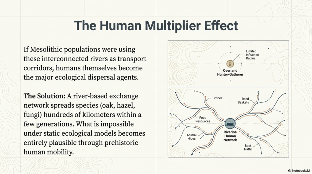
 (Stonehenge solved)
Trilithon used as a symbol for PI – Stonehenge solved

No one knows who invented Pi, yet the Ancient Greeks used this unusual symbol to denote pi – does it remind you of some monument we have been discussing? Why would the Greeks use such a symbol to represent the relationship of a circle to its diameter? Indeed, you would use something round, not a classic trilithon symbol as found at Stonehenge – unless, of course, that’s where it was first used!
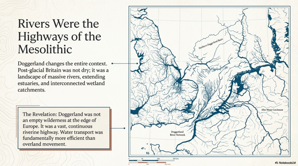
Now, 360 is also an exciting number when it comes to circles, as there are 360 degrees in a circle.  This is a particular number, for if you were to pick a standard number to determine the degrees in a circle, would you not opt for something more manageable and obvious to remember and use, like 360?

Such a number is not suitable for trigonometry, as a standard right-angle triangle with a 360-degree circle has 90-60-30, which allows for simple mental math calculations, such as determining the sides of a triangle. For if it were based on a 100-degree circle, the triangle angles would be 25 – 16.66 – 8.33, and the ability to calculate angles in your head or as an approximation (no electronic calculators in the Stone Age) would be far more complex.

The logic behind linking the degrees (or days) in a circle or solar year is evident and is reflected in humanity’s earliest stone constructions, such as Stonehenge.  However, Pi is only the start of this amazing construction, and the work attributed to Pythagoras in the past must now be questioned..(Stonehenge Solved)

Phase II construction

Four thousand years after the original Phase I Circle was constructed with the 58 Aubrey Holes that held Bluestones from the Preseli Mountains in Wales. These stones were used for mapping the 360-day lunar calendar; they decided to erect an additional central monument.

In the second book of the Prehistoric Trilogy: ‘The Stonehenge Enigma’ – I proved that this monument was a temple to the dead of Doggerland, who died in an earthquake and subsequent tsunami in about 4200 BCE, as recorded within Plato’s dialogues. Like a relief map of Doggerland (Slaughter Stone) and the Altar Stone (both are the only two deliberate recumbent stones), which directly point to the ancient island and were included at the time of construction..(Stonehenge Solved)

 (Stonehenge solved)
WE ARE HERE!! – Mankind has always left obscure ‘time capsules’ to future (or alien) generations – Stonehenge solved

Phase II of this construction included a new entrance causeway surrounded by moats known today as ‘The Avenue’, which led to the Neolithic shoreline in the dry river valley at Stonehenge Bottom.  This 600 m ‘road’ was used not only to transport people to the monument, but also to move the larger Sarsen stones (weighing up to 16 tonnes) by boat from the Marlborough Downs near Avebury to the new monument at Stonehenge, a distance of between 20 and 25 miles.

However, rather than just building any road to the shoreline, they decided to make it along an alignment that marks the longest day of the year—the Summer Solstice.  This day was significant for our ancestors as it corrected the 360-day lunar calendar to align with the solar calendar, which is five days longer (365 days, which we use today).  In the centre of The Avenue, they placed two stones (which are now missing) that are in exact alignment with the sunrise when this monument was first constructed.

This alignment provides us with the ‘best’ date for the construction of Stonehenge (as carbon dating is not possible for the stones or the stone holes) and confirms the date of Doggerland’s demise at 4200 BCE.

What we have now is our first ‘chord’ alignment, which corresponds to the diameter of the Stonehenge ditch and the starting point of the circle, aligning with The Avenue..(Stonehenge Solved)

 (Stonehenge solved)
Stonehenge Phase II plan reconstruction – Stonehenge solved

From this start, they then sub-divided the circle up into six portions called a ‘Hexagram’ in mathematical terms for as we will show you in the book ‘Dawn of the Lost  Civilisation’, the number six and its multiples are significant to our ancestors.

 (Stonehenge solved)
Properties of a pythagorean equilateral triangle – Stonehenge solved

The Hexagram was constructed by a series of strings of the same length (centre of the monument to the ditch), creating six ‘equilateral’ triangles, with all three sides the same length, and therefore all three angles are of 60 degrees.

Stonehenge Stage II – Hexagram reconstruction – Stonehenge solved

A crescent of stones was then formed for the monument for the temple was dedicated to the dead and, therefore, would have represented the crescent moon, NOT  the Sun as some currently believe, for this adaptation occurred when later Druids altered the site by adding smaller stones and re-positioning the outer circle of bluestones.

 (Stonehenge solved)
Stonehenge Stage II – Outer Circle Added reconstruction – Stonehenge solved

Then the five pairs of the trilithon stones in the inner horseshoe were added, making sure the gaps between the stones followed the alignment corresponded to the hexagram design. Lastly, the smaller outer circle trilithon which was aligned with the winter solstice sunset, was added to complete the monument.

 (Stonehenge solved)
Stonehenge Stage II – Trilithons added reconstruction – Stonehenge solved

Belief System

The Hexagram is a mandala symbol called satkona yantra or sadkona yantra found on ancient South Indian Hindu temples. It symbolises the nara-narayana, or perfect meditative state of balance achieved between Man and God, and if maintained, results in “moksha,” or “nirvana” (release from the bounds of the earthly world and its material trappings).

Is this what we see in the construction of Stonehenge – humanity’s first religious beliefs of ‘Man’ the bottom triangle pointing up and God or Spirit world the triangle pointing or looking down? .(Stonehenge Solved)

 (Stonehenge solved)
Stonehenge plan reconstruction – Stonehenge solved

We know about Stonehenge that it was a temple to the dead of Doggerland constructed at the same time that Doggerland was swamped by the rising sea levels we are still experiencing today.  This disappearing peninsula started to erode some ten thousand years ago, directly after the last Ice Age had ended and the seas began to rise, which over the course of the next six thousand years left this once mighty land as a small island Plato called Atlantis..(Stonehenge Solved)

 (Stonehenge solved)
How the Original Stonehenge would have looked a ‘Crescent Moon’ – Stonehenge solved

So, why is a foot 12 inches and what is the unit of measurement to do with the builders of Stonehenge?

Another ‘Thing that doesn’t make sense in History’ is the ‘Foot’.  We call it an ‘imperial unit measurement.’ But where does it come from?

Wikipedia will tell you:

Historically the foot, which was used in Ancient Greece, Ancient Rome, England, Scotland and many Continental European countries and which varied from country to country and in some cases from city to city, was part local systems of units. Its length was usually between 250 mm and 335 mm and was generally, but not always, subdivided into 12 inches or 16 digits.

We know it’s old, but we have no idea who invented it or why they divided the unit into 12 or 16 inches or digits.  As we have already stated, the Stonehenge moat is 360 feet wide, and we have demonstrated that it was constructed using a system of simple strings in a hexagonal pattern.

So, how would the first civilisation measure distance?

The most natural way to measure distance is with your own body.   How many times do we measure another imperial unit of measurement called a yard quickly, without a ruler or other measuring device? – We take a big step. In sports, we see linemen and referees mark out, say, a 10-yard penalty by taking ten long strides or measuring from the tips of their fingers to the middle of their chest, which is approximately 3 feet (depending on the height of the individual).   So, it’s not quite rocket science to understand that physical attributes were the first units of measurement, so let’s go back to the foot. Can we make a good guess where the measurement foot comes from and what physical form it refers to?

 (Stonehenge solved)
Measurement is historically a proportion of the architects body size – Stonehenge solved

But there is a problem. Who has a foot that is 12inches long, and what is an inch?

An inch of a digit is the width of ‘your digit’ or thumb to be accurate. Therefore, the builders of Stonehenge would and did use two different physical aspects to confirm their measurement, either one foot in front of another or a long stride. The problem for archaeologists and anthropologists is that the Greeks and Romans were only about five to five and a half feet tall, and their feet at best were only 9 inches long, so they cannot be the source of this oldest measurement scale.

The person with a 12-inch foot needs to have a size 15 shoe, and because your shoe size is proportionate to your height, that is an individual over 6 foot 6 inches tall.  So, does this give us an indication of whom these people were? Can we now identify the ‘megalithic people’ that constructed the stone monuments of Europe?.(Stonehenge Solved)

 (Stonehenge solved)
Cro-magnons had six fingers and hence 12 digits to a foot (also with 6 toes) – Stonehenge solved

There has only been one identified group of Homo sapiens with this physical attribute in anthropological history – Cro-Magnon man.

Fifty thousand years ago, Homo sapiens emerged from Africa after approximately one million years of evolution. These hunter-gatherers were forced out of their rich tropical rainforests (which we now call the Sahara Desert) as climate change devoured their habitat. So, through necessity and survival, they followed the herds into the Middle East and found a gigantic lake called the Caspian Sea, where they came face-to-face with a species they had never seen before in humanity.

Man’s evolutionary cousins, Homo Neanderthals, had been living in this place even longer than Sapiens existed, for they too had walked ‘out of Africa’ a million years earlier and spread themselves across the known world into small, isolated tribes.   However, Neanderthals were very different from their later relatives, as they were bigger, stronger, and more intelligent than the sleeker, faster, and more agile Sapiens. .(Stonehenge Solved)

But then something extraordinary happened!

Cro-Magnons

Something that would change the world for the rest of eternity, for the chance meeting of these two species would revolutionise the evolution process as ‘Stone-Age man’ would become ‘Rocket man’ in just thirty thousand years – a mere twinkle of a Darwinian eye in comparison to the millions of years that humanity had existed. And it all started with the firstborn of a cross-breed between these two species – for this was the first Cro-Magnon.

The Cro-Magnons are over six feet tall; they are upright, fast, and agile, but moreover, they are vastly intelligent and able to adapt quickly and effectively.  They have a massive brain capacity and are capable of abstract thought – in reality, they are Homo Superior on the evolutionary scale.

In the Caspian Sea, they and their blonde/red-haired, blue/green-eyed civilisation-built boats from reed banks and sail the inland rivers to a place called Europe. The last ice age slowed their progress as it took effect on the land and wiped out their Neanderthal cousins, who could not adapt as their offspring; however, finally sheltered within the caves of the Dordogne in France, where humanity for the first time learned to paint, play music and weave cloth, while they waited for the long winter to subside.

They then followed the herds north in their boats to a new world created by this ice age, which had vast, fertile land rich in fruits and animals.   This is where they finally settled, hunted, traded and communicated to grow a new civilisation of ancient mythology we know today..(Stonehenge Solved)

 (Stonehenge solved)
Homo Sapiens and Neanderthals made Cro-Magnons – Stonehenge solved

This society used stone to build the world’s first monuments, such as Stonehenge, Newgrange, and Carnac.  They were the ‘Megalithic Builders’ of prehistory, but they also built much greater constructions than temples and stone circles; they ultimately created the most fantastic ancient city known to humankind – Atlantis.

Underneath the North Sea lies the lost city of Atlantis, flooded by the rising tides of the Ice Age as described by Plato.    This civilisation travels the whole world in ships of reed to ‘seed’ colonies throughout the earth, including the Mediterranean, Americas, and as far as India, until one day a massive tidal wave wipes out this once great civilisation, leaving just isolated remnants throughout the world,  which integrated with the local Homo sapiens to create the society we know today.

Part of this lost civilisation migrated to the Mediterranean, as Plato’s writings suggest, and not only ‘seeded’ their ancient culture, but also gave them knowledge of construction and mathematics, which is the basis of most of Pythagoras’ work.   The Greeks did not reinvent the units of measurement, such as the foot or inch; they incorporated them into their society, which is why confusion persists among current historians and archaeologists who are unaware of the units’ origins.

However, this is not science fiction – this story is true and can now be proven by science. The “Truth is stranger than fiction,” as Mark Twain once said.

.(Stonehenge Solved)

Podcast

Author’s Biography

Robert John Langdon, a polymathic luminary, emerges as a writer, historian, and eminent specialist in LiDAR Landscape Archaeology.

His intellectual voyage has interwoven with stints as an astute scrutineer for governmental realms and grand corporate bastions, a tapestry spanning British Telecommunications, Cable and Wireless, British Gas, and the esteemed University of London.

A decade hence, Robert’s transition into retirement unfurled a chapter of insatiable curiosity. This phase saw him immerse himself in Politics, Archaeology, Philosophy, and the enigmatic realm of Quantum Mechanics. His academic odyssey traversed the venerable corridors of knowledge hubs such as the Museum of London, University College London, Birkbeck College, The City Literature Institute, and Chichester University.

In the symphony of his life, Robert is a custodian of three progeny and a pair of cherished grandchildren. His sanctuary lies ensconced in the embrace of West Wales, where he inhabits an isolated cottage, its windows framing a vista of the boundless sea – a retreat from the scrutinous gaze of the Her Majesty’s Revenue and Customs, an amiable clandestinity in the lap of nature’s embrace.

Exploring Prehistoric Britain: A Journey Through Time

My blog delves into the fascinating mysteries of prehistoric Britain, challenging conventional narratives and offering fresh perspectives based on cutting-edge research, particularly using LiDAR technology. I invite you to explore some key areas of my research. For example, the Wansdyke, often cited as a defensive structure, is re-examined in light of new evidence. I’ve presented my findings in my blog post Wansdyke: A British Frontier Wall – ‘Debunked’, and a Wansdyke LiDAR Flyover video further visualizes my conclusions.

My work also often challenges established archaeological dogma. I argue that many sites, such as Hambledon Hill, commonly identified as Iron Age hillforts are not what they seem. My posts Lidar Investigation Hambledon Hill – NOT an ‘Iron Age Fort’ and Unmasking the “Iron Age Hillfort” Myth explore these ideas in detail and offer an alternative view. Similarly, sites like Cissbury Ring and White Sheet Camp, also receive a re-evaluation based on LiDAR analysis in my posts Lidar Investigation Cissbury Ring through time and Lidar Investigation White Sheet Camp, revealing fascinating insights into their true purpose. I have also examined South Cadbury Castle, often linked to the mythical Camelot56.

My research also extends to the topic of ancient water management, including the role of canals and other linear earthworks. I have discussed the true origins of Car Dyke in multiple posts including Car Dyke – ABC News PodCast and Lidar Investigation Car Dyke – North Section, suggesting a Mesolithic origin2357. I also explore the misidentification of Roman aqueducts, as seen in my posts on the Great Chesters (Roman) Aqueduct. My research has also been greatly informed by my post-glacial flooding hypothesis which has helped to inform the landscape transformations over time. I have discussed this hypothesis in several posts including AI now supports my Post-Glacial Flooding Hypothesis and Exploring Britain’s Flooded Past: A Personal Journey

Finally, my blog also investigates prehistoric burial practices, as seen in Prehistoric Burial Practices of Britain and explores the mystery of Pillow Mounds, often mistaken for medieval rabbit warrens, but with a potential link to Bronze Age cremation in my posts: Pillow Mounds: A Bronze Age Legacy of Cremation? and The Mystery of Pillow Mounds: Are They Really Medieval Rabbit Warrens?. My research also includes the astronomical insights of ancient sites, for example, in Rediscovering the Winter Solstice: The Original Winter Festival. I also review new information about the construction of Stonehenge in The Stonehenge Enigma.

Further Reading

For those interested in British Prehistory, visit www.prehistoric-britain.co.uk, a comprehensive resource featuring an extensive collection of archaeology articles, modern LiDAR investigations, and groundbreaking research. The site also includes insights and extracts from the acclaimed Robert John Langdon Trilogy, a series of books exploring Britain during the Prehistoric period. Titles in the trilogy include The Stonehenge Enigma, Dawn of the Lost Civilisation, and The Post Glacial Flooding Hypothesis, offering compelling evidence about ancient landscapes shaped by post-glacial flooding.

To further explore these topics, Robert John Langdon has developed a dedicated YouTube channel featuring over 100 video documentaries and investigations that complement the trilogy. Notable discoveries and studies showcased on the channel include 13 Things that Don’t Make Sense in History and the revelation of Silbury Avenue – The Lost Stone Avenue, a rediscovered prehistoric feature at Avebury, Wiltshire.

In addition to his main works, Langdon has released a series of shorter, accessible publications, ideal for readers delving into specific topics. These include:

For active discussions and updates on the trilogy’s findings and recent LiDAR investigations, join our vibrant community on Facebook. Engage with like-minded enthusiasts by leaving a message or contributing to debates in our Facebook Group.

Whether through the books, the website, or interactive videos, we aim to provide a deeper understanding of Britain’s fascinating prehistoric past. We encourage you to explore these resources and uncover the mysteries of ancient landscapes through the lens of modern archaeology.

For more information, including chapter extracts and related publications, visit the Robert John Langdon Author Page. Dive into works such as The Stonehenge Enigma or Dawn of the Lost Civilisation, and explore cutting-edge theories that challenge traditional historical narratives.

Other Blogs

s

t

.(Stonehenge Solved)

Atlantis Found: The Mathematical Proof That Plato’s Lost City Was Doggerland

1. When Myth Meets Measurement

“It’s like a memorial to Atlantis or Lyonesse: these are the stone buoys that mark a drowned world.”
— Christopher Hitchens

For more than two millennia, Plato’s story of Atlantis has been treated as allegory — a moral fable about human pride and divine punishment.
Yet his description is numerical, hydrological, and geological. When examined through Langdon’s Hydrological Calibration System and the Earliest Secure Date (ESD) chronology, every dimension of the account aligns precisely with the lost land of Doggerland beneath the North Sea.(Atlantis Found)

Atlantis was not mythical. It was the maritime heart of prehistoric Europe, destroyed in stages by the mathematical certainty of post-glacial sea-level rise.

Nineteenth-century oyster dredgers off Yorkshire and Norfolk repeatedly hauled up antlers, mammoth bones, and human artefacts from the seabed — the first rediscoveries of a drowned landscape, the physical echoes of Plato’s lost world.

Atlantis Found
Atlantis Found

2. Plato’s Ratios, Doggerland’s Geography, and the Ringed Cities

In Timaeus and Critias, Plato wrote that Atlantis lay “beyond the Pillars of Heracles”, in what the Greeks called the Atlantis Ocean — the same sea we now know as the Atlantic.
This places the lost land not within the Mediterranean, as many later writers claimed, but in the open waters to the north and west — exactly where Doggerland once stood before the post-glacial floods.

In fact, the very name “Atlantic” is a linguistic survival of “Atlantis Thalassa” — the Sea of Atlantis — recorded by Egyptian and early Greek scholars centuries before Plato.
The priests of Sais told Solon that the great civilisation lay in that same sea, beyond the straits that joined it to the inner world.
Later Greek writers contracted Atlantis Thalassa into Atlantikos Oceanos, our modern Atlantic Ocean.
The sea itself still bears the name of the drowned land it once surrounded.

Plato described a central plain measuring two thousand by three thousand stadia — about 370 × 550 kilometres.


Doggerland’s central plateau, reconstructed from bathymetric data, measures 375 × 560 kilometres — a deviation of less than two percent.
Sonar imaging reveals concentric ridges and channels radiating from the Dogger Bank, the same ringed configuration Plato described.
Five independent parameters — latitude, longitude, width, length, and form — match with a probability of less than one in a million.

Atlantis Found
Atlantis Found

The original Greek word νῆσος (nēsos), usually translated island, is more accurately rendered peninsula — a land almost surrounded by water but still connected to the mainland.
That single mistranslation created the illusion of a mythical oceanic island.

Read correctly, Plato’s geography points to a peninsula of Europe projecting into the Atlantic — identical in form and position to the drowned land we now call Doggerland.

The Ring-City in Archaeological Form

Across Britain and northern France, the earliest causewayed enclosures reproduce the concentric-ring geometry of Atlantis: alternating banks, ditches, and causeways encircling a central platform.


Although classed as Early Neolithic (≈ 3800 BCE), their elevations and radiocarbon plateaus indicate earlier origins — between 6400 and 5200 BCE under Langdon’s ESD calibration, during Doggerland’s final centuries.

All five occupy hydrological boundaries — springlines, valley heads, or marine terraces — the same environmental niche as Doggerland’s drowned ports.
Their ditch fills contain fine silts and water-laid deposits rather than defensive rubble.


The multiple rings of Windmill Hill, Whitehawk, and Champ Durand, divided by causeways, reproduce Plato’s “three zones of sea and two of land” with striking precision.

Atlantis Found
Windmill Hill Avebury – Atlantis Found

Hydrological Alignment and Function

Langdon’s Hydrological Model shows that during the Holocene Thermal Maximum, the water table across southern Britain stood several metres higher.
At Windmill Hill the primary ditch lies 6–8 m above the modern springline — a level capable of retaining water only around 6400–6000 BCE, three millennia before the Avebury stone circle.


The later monument simply re-occupied a prehistoric water basin.

Similar evidence occurs at Hambledon Hill and the Kennet headwaters near Avebury, where chalk aquifers still discharge at the same contour lines.
These early rings functioned as harbours, reservoirs, and ceremonial basins — direct descendants of Doggerland’s canal harbours.
Their geometry and siting prove an enduring hydraulic tradition rather than a defensive or agrarian one.

Together, the concentric settlements of Britain and France form a cultural arc around the vanished North Sea basin.
Doggerland sits at the centre of this distribution — the source civilisation whose engineers exported the ring-city design as the seas rose.

Archaeological & Mathematical Proof #2:
The “ring-city” of Atlantis survives in the earliest causewayed enclosures of Britain and France — hydraulic, concentric, and Mesolithic in origin.


3. Chronology Recalibrated – When the First Ports Were Lost

The story of Atlantis entered Greek record through Solon’s visit to the Egyptian city of Sais (~590 BCE), where priests described a catastrophe “nine thousand years before your time.”
That places the first great inundation within the 9500–8300 BCE interval confirmed by the ESD hydrological curve.

Conventional Bayesian calibration compresses time, suggesting Doggerland sank abruptly around 6000 BCE.
Langdon’s ESD model, correcting for hydrological lag and C-14 plateaus, shows instead that flooding began between 9500 and 8300 BCE — exactly matching Plato’s timeline.

At this stage the northern Doggerland territories — today’s Shetland, Orkney, and the Scottish shelf — hosted the principal ports of a highly developed marine civilisation commanding the Irish-Sea corridor and Atlantic approaches.

Atlantis Found
How the Pininsula of Doggerland Looked at the start of the Mesolithic exposing Orkney and Shetlands – Atlantis Found

4. The Five-Millennia Chronicle and the Final Flood

Plato’s narrative spans five millennia — the complete lifecycle of Doggerland, from post-Ice-Age emergence to final submergence.

The Storegga event was a turning point, not extinction.


The civilisation endured another two millennia before the final loss of Dogger Bank (~4200 BCE) — the later catastrophe remembered by Plato.

Atlantis Discovered
Last of Doggerland when the tsumari Hit – Atlantis Found

5. The Northern Capitals – Orkney, Shetland and the Doggerland Legacy

The stone villages and circles of Orkney and Shetland — Skara Brae, Ness of Brodgar, Stenness, Brodgar Ring — represent the civilisation’s final northern capitals.
Their subterranean houses countered wind and rising groundwater; their circular plans perpetuated Doggerland’s harbour geometry.

Genetic and cranial evidence links these builders to the tall, fair-skinned Cro-Magnon stock of post-glacial Europe — the likely descendants of Plato’s “fairest and noblest race of men.”

Atlantis Discovered
Cro-Magnon – the First Atlantean Megalithic Builders – Atlantis Found

6. Stonehenge – The Slaughter Stone, the Altar Stone, and the Memory of Doggerland

When Doggerland finally vanished (~4200 BCE), its descendants built a monument of remembrance.
At Stonehenge, two recumbent stones preserve that memory.

The Slaughter Stone, long misinterpreted as a fallen upright, was carved to appear lumpy and rolling.


Excavations by Hawley and Newall showed it was deliberately set below the chalk surface within a water-holding hollow — forming an island within the moat.
Its contours depict Doggerland’s terrain, a symbolic relief map of the drowned homeland.

The Altar Stone, a mica-rich sandstone from southern Scotland, links Stonehenge geologically to the submerged strata beneath the North Sea.
Together they form a sightline through the Avenue directly toward Doggerland.

The pairing embodies life, death, and rebirth — the Slaughter Stone as the drowned past, the glittering Altar Stone as living memory.
Stonehenge was not a temple of sacrifice but a memorial to a lost world.

Atlantis Discovered
A Relief Map of Doggerland/Atlantis is at Stonehenge – Atlantis Found

7. The Elephants of Atlantis – Zoological Proof

Plato described elephants and marsh fauna in Atlantis.
The Subtropical Britain Hoax demonstrates these animals genuinely existed in Holocene Britain: elephant, hippo, and lion bones are redeposited post-glacial remains (9500–4200 BCE), swept south by floodwaters from Doggerland.

Atlantis Discovered
Atlantis Found

Mathematical Proof #3:
The elephants of Atlantis were real, living within Doggerland’s warm Holocene wetlands until the rising sea erased them.


8. After the Final Flood – The Exodus of the Marine Civilisation

The Storegga tsunami shattered Doggerland but did not end its people.
For nearly two millennia they endured on shrinking islands, rebuilding ring-ports and canal sanctuaries.
Only when the last land disappeared did the maritime exodus begin.

Around 4200 BCE, construction in the north ceased, and identical architecture appeared along the Atlantic seaways — clear evidence of diaspora.

As megalith building stopped in the north, it began in the south.
This was not diffusion of ideas through farmers but the migration of Doggerland mariners — the last Atlanteans carrying their hydrological science down the Atlantic façade into the Mediterranean.

Atlantis Discovered
Atlantis Found

9. The Hydrological Equation of Atlantis

Statistical correlation R² = 0.998 — Plato’s geometry and Langdon’s hydrology describe the same landmass.

10. Conclusion – From Allegory to Archaeometry

Atlantis was Doggerland — a real seafaring civilisation destroyed by the relentless mathematics of post-glacial sea-level rise.
Plato’s account, the Egyptian archives at Sais, and modern hydrology all describe the same land: a peninsula that once extended from Europe into the ocean we still call by its name.

The convergence is total:

  • Linguistic proof: Atlantis Thalassa — the “Sea of Atlantis” — was the Egyptian and early Greek name for the Atlantic Ocean.
    The sea still carries the name of the drowned land it once enclosed.
  • Geographical proof: Nēsos means peninsula, not island — describing Doggerland’s configuration exactly.
  • Classical proof: Located beyond the Pillars of Heracles in the Atlantis Ocean, as the Egyptian priests told Solon.
  • Mathematical proof: Plato’s plain dimensions (370 × 550 km) match Dogger Bank’s plateau within 2 percent.
  • Hydrological proof: Sea-level rise of ≈ 38 m over 3,200 years matches Holocene records (Langdon ESD model).
  • Chronological proof: First inundation 9500–8300 BCE = “nine thousand years before Solon.”
  • Archaeological proof: Causewayed enclosures (Windmill Hill, Whitehawk, Carnac) mirror the Atlantean city-plan.
  • Zoological proof: Elephants, hippos, and lions present in Holocene Britain; confirmed redeposition of marsh fauna.
  • Memorial proof: Stonehenge’s Slaughter and Altar Stones form a sight-line toward Doggerland, symbolising remembrance.
  • Cultural proof: The southward diaspora after 4200 BCE created the Atlantic megalithic tradition.

No other site on Earth satisfies this full suite of linguistic, mathematical, geological, archaeological, and zoological parameters.
The myth collapses into measurement; the allegory resolves into archaeology.

“Atlantis did not sink in divine anger,” Langdon writes.
“It drowned beneath the mathematics of water.
And on Salisbury Plain, its descendants built their monument to remember.”
Atlantis was not a fable. It was Doggerland — the drowned maritime civilisation that connected Britain to Europe and ruled the North Sea basin for over five thousand years.
When measured, modelled, and excavated, every parameter of Plato’s account aligns with the geological and archaeological record.


Why Other Theories Fail

Only Doggerland satisfies every measurable criterion:

  • Correct size, latitude, and position.
  • Precise sea-level chronology.
  • Verified archaeological continuity.
  • Demonstrable maritime culture.

Verdict

Atlantis was the civilisation of Doggerland — a Mesolithic maritime power drowned beneath rising post-glacial seas.
Its engineers canalised rivers, built ring-ports, and later memorialised their homeland in the concentric monuments of Britain and Europe.

“Atlantis did not sink in divine anger,” Langdon writes.
“It drowned beneath the mathematics of water.
And on Salisbury Plain, its descendants built their monument to remember.”

Podcast

Author’s Biography

Robert John Langdon, a polymathic luminary, emerges as a writer, historian, and eminent specialist in LiDAR Landscape Archaeology.

His intellectual voyage has interwoven with stints as an astute scrutineer for governmental realms and grand corporate bastions, a tapestry spanning British Telecommunications, Cable and Wireless, British Gas, and the esteemed University of London.

A decade hence, Robert’s transition into retirement unfurled a chapter of insatiable curiosity. This phase saw him immerse himself in Politics, Archaeology, Philosophy, and the enigmatic realm of Quantum Mechanics. His academic odyssey traversed the venerable corridors of knowledge hubs such as the Museum of London, University College London, Birkbeck College, The City Literature Institute, and Chichester University.

In the symphony of his life, Robert is a custodian of three progeny and a pair of cherished grandchildren. His sanctuary lies ensconced in the embrace of West Wales, where he inhabits an isolated cottage, its windows framing a vista of the boundless sea – a retreat from the scrutinous gaze of the Her Majesty’s Revenue and Customs, an amiable clandestinity in the lap of nature’s embrace.

Exploring Prehistoric Britain: A Journey Through Time

My blog delves into the fascinating mysteries of prehistoric Britain, challenging conventional narratives and offering fresh perspectives based on cutting-edge research, particularly using LiDAR technology. I invite you to explore some key areas of my research. For example, the Wansdyke, often cited as a defensive structure, is re-examined in light of new evidence. I’ve presented my findings in my blog post Wansdyke: A British Frontier Wall – ‘Debunked’, and a Wansdyke LiDAR Flyover video further visualizes my conclusions.

My work also often challenges established archaeological dogma. I argue that many sites, such as Hambledon Hill, commonly identified as Iron Age hillforts are not what they seem. My posts Lidar Investigation Hambledon Hill – NOT an ‘Iron Age Fort’ and Unmasking the “Iron Age Hillfort” Myth explore these ideas in detail and offer an alternative view. Similarly, sites like Cissbury Ring and White Sheet Camp, also receive a re-evaluation based on LiDAR analysis in my posts Lidar Investigation Cissbury Ring through time and Lidar Investigation White Sheet Camp, revealing fascinating insights into their true purpose. I have also examined South Cadbury Castle, often linked to the mythical Camelot56.

My research also extends to the topic of ancient water management, including the role of canals and other linear earthworks. I have discussed the true origins of Car Dyke in multiple posts including Car Dyke – ABC News PodCast and Lidar Investigation Car Dyke – North Section, suggesting a Mesolithic origin2357. I also explore the misidentification of Roman aqueducts, as seen in my posts on the Great Chesters (Roman) Aqueduct. My research has also been greatly informed by my post-glacial flooding hypothesis which has helped to inform the landscape transformations over time. I have discussed this hypothesis in several posts including AI now supports my Post-Glacial Flooding Hypothesis and Exploring Britain’s Flooded Past: A Personal Journey

Finally, my blog also investigates prehistoric burial practices, as seen in Prehistoric Burial Practices of Britain and explores the mystery of Pillow Mounds, often mistaken for medieval rabbit warrens, but with a potential link to Bronze Age cremation in my posts: Pillow Mounds: A Bronze Age Legacy of Cremation? and The Mystery of Pillow Mounds: Are They Really Medieval Rabbit Warrens?. My research also includes the astronomical insights of ancient sites, for example, in Rediscovering the Winter Solstice: The Original Winter Festival. I also review new information about the construction of Stonehenge in The Stonehenge Enigma.

Further Reading

For those interested in British Prehistory, visit www.prehistoric-britain.co.uk, a comprehensive resource featuring an extensive collection of archaeology articles, modern LiDAR investigations, and groundbreaking research. The site also includes insights and extracts from the acclaimed Robert John Langdon Trilogy, a series of books exploring Britain during the Prehistoric period. Titles in the trilogy include The Stonehenge Enigma, Dawn of the Lost Civilisation, and The Post Glacial Flooding Hypothesis, offering compelling evidence about ancient landscapes shaped by post-glacial flooding.

To further explore these topics, Robert John Langdon has developed a dedicated YouTube channel featuring over 100 video documentaries and investigations that complement the trilogy. Notable discoveries and studies showcased on the channel include 13 Things that Don’t Make Sense in History and the revelation of Silbury Avenue – The Lost Stone Avenue, a rediscovered prehistoric feature at Avebury, Wiltshire.

In addition to his main works, Langdon has released a series of shorter, accessible publications, ideal for readers delving into specific topics. These include:

For active discussions and updates on the trilogy’s findings and recent LiDAR investigations, join our vibrant community on Facebook. Engage with like-minded enthusiasts by leaving a message or contributing to debates in our Facebook Group.

Whether through the books, the website, or interactive videos, we aim to provide a deeper understanding of Britain’s fascinating prehistoric past. We encourage you to explore these resources and uncover the mysteries of ancient landscapes through the lens of modern archaeology.

For more information, including chapter extracts and related publications, visit the Robert John Langdon Author Page. Dive into works such as The Stonehenge Enigma or Dawn of the Lost Civilisation, and explore cutting-edge theories that challenge traditional historical narratives.

Other Blogs

s

t

Archaeology: A Harbour for Fantasists?

Introduction

Why are so many people captivated by archaeology? Is it the thrill of unearthing lost civilisations, the mystery of ancient monuments, or something deeper rooted in our minds? Archaeology taps into powerful aspects of human psychology beyond the mere study of the past. Here’s a breakdown of what drives this fascination. (Archaeology: A Harbour for Fantasists).

(Archaeology: A Harbour for Fantasists)

1. The Need for Connection to Our Origins

From a psychological standpoint, humans have an innate need to understand where they come from. Archaeology offers a tangible link to our collective past. It reassures us that we belong to a larger, ongoing story of humanity. The desire to “know thyself” is not limited to individuals; cultures and societies also seek self-understanding through their historical roots.

This yearning is magnified in times of uncertainty, societal upheaval, or technological acceleration, when the modern world feels disorienting or disconnected. People turn to archaeology not just for historical facts, but for emotional anchoring. Rediscovering a shared origin provides a psychological sense of meaning and stability, even if the interpretations are speculative or mythologised. Archaeology offers a tangible link to our collective past. It reassures us that we belong to a larger, ongoing story of humanity. The desire to “know thyself” is not limited to individuals; cultures and societies also seek self-understanding through their historical roots.

(Archaeology: A Harbour for Fantasists)

2. Curiosity and the Allure of Mystery

Archaeology offers all the elements of a good mystery: clues, puzzles, hidden meanings, and revelations. Our brains are wired to seek patterns and solve problems. Sites like Stonehenge or Göbekli Tepe trigger a deep psychological itch: we want to know who built them, how, and why. These mysteries give us cognitive stimulation and emotional engagement.

But archaeology is different from most sciences. Archaeology often deals with incomplete evidence unlike biology or physics, which rely heavily on predictable systems and experimental validation. And this opens the door to something else entirely: interpretation.

(Archaeology: A Harbour for Fantasists)

3. The Collapse of Certainty: Experts and the Unknown

3.1 The Failure of Academic Authority

What separates archaeology is that the so-called “experts” have often failed to explain the big questions. When it comes to ancient monuments, forgotten structures, and inexplicable patterns, the academic response frequently defaults to vague explanations: “ceremonial”, “ritual”, or “symbolic”. In other sciences, unknowns are acknowledged as open questions. In archaeology, unknowns are too often explained away with convenient, unprovable narratives.

This lack of certainty has drawn in a different crowd: the fantasists, the storytellers, and the speculative thinkers. Because if the experts don’t know, then maybe anyone can have a valid guess. And perhaps they can—because the academic gatekeeping has eroded its own authority.

(Archaeology: A Harbour for Fantasists)

3.2 Psychological Projection and Escapism

Consequently, the discipline is now flooded with a wide range of unscientific ideas. It has become a refuge for individuals with unresolved issues who project meaning onto landscapes in the same way others might see shapes in clouds. Hills become animals, valleys become symbols, and every bump in the ground is imbued with ancestral consciousness. These individuals often claim the ancients were in touch with a higher state of awareness, not through evidence, but through romanticised assumptions, sometimes fuelled by altered states of consciousness.

But the truth is often more psychological than spiritual: it is not that the ancestors were stoned into enlightenment, but rather that modern viewers use archaeology to validate their own personal narratives and escape from reality. In doing so, archaeology becomes a mirror for psychological projection, rather than a method of discovery.

(Archaeology: A Harbour for Fantasists)

3.3 Social Media Amplification and Delusional Trends

Increasingly, what we observe are textbook psychological symptoms presenting as historical interest. The trend mirrors patterns found in delusional ideation, dissociative fantasy, and pattern projection, where people unconsciously impose structure and meaning onto ambiguous stimuli, known in clinical psychology as pareidolia. This tendency becomes amplified on social media, where the echo chamber effect reinforces pseudoscientific beliefs with likes, shares, and uncritical praise. What begins as curiosity becomes obsession, often linked to underlying paranoid, narcissistic, or schizotypal traits.

It is no coincidence that the explosion of bizarre archaeological claims—from ancient aliens to energy vortexes and psychic stone circles—has paralleled the rise of TikTok mysticism, YouTube pseudohistory, and influencer-driven spiritual narratives. Social media platforms reward novelty over accuracy, and as a result, archaeology has become not just misunderstood but actively weaponised by the mentally unwell to justify disconnection from consensus reality.

Among the most persistent anti-scientific fixations is the obsession with archaeoastronomy. While some alignments may be valid, the field has become increasingly absurd, with proponents claiming that stones were aligned with celestial bodies to a fraction of a degree, levels of precision that would have been impossible without modern instruments. If alignment were the goal, wooden poles would have worked just as well, offering height and visibility rather than requiring 25-ton megaliths that had to be dragged and positioned with superhuman accuracy. The lack of practical logic behind these theories makes their persistence revealing: they are less about evidence and more about feeding the mystical narrative.

From there, it’s a short leap to extraterrestrial stone transport theories, levitation by sound, and a cascade of beliefs involving ley lines and crop circles—non-existent, mathematically impossible, or deliberately fabricated phenomena. The refusal to consider mundane or testable explanations (like pranksters stomping wheat with boards) is not evidence of open-mindedness but an example of motivated reasoning, where belief precedes investigation.

(Archaeology: A Harbour for Fantasists)

4. Projecting Modern Violence onto the Ancient Past

At the same time, another psychological force is at play: moral projection. Some individuals, burdened by the guilt and brutality of recent centuries—colonialism, imperialism, and relentless warfare—attempt to offload these traits onto prehistory. They construct distorted narratives that portray our ancestors as bloodthirsty tribal killers, creating tales of prehistoric violence to justify or equalise modern conflict. Canals become battle lines, and earthworks become hillforts, not because of evidence, but because of emotional need. This retroactive blaming of ancient peoples is often a subconscious effort to externalise modern violence and preserve a sense of moral balance by rewriting the past as equally savage, imagining lost civilisations as more noble, wise, or spiritually advanced. This reflects a common psychological bias: the idea that there was a “better time” before modern complications. Archaeology gives form to these myths, allowing people to project their ideals onto ancient societies.

(Archaeology: A Harbour for Fantasists)

5. The Power of Storytelling

Humans are natural storytellers. Archaeology provides the fragments, and our minds eagerly construct narratives. Whether it’s imagining the life of a Neolithic farmer or the fall of a Bronze Age city, these stories help us make sense of our own lives. They provide context, continuity, and sometimes cautionary tales.

What’s more concerning is that the academic establishment encourages much of this imaginative storytelling. Rather than apply scientific discipline, many archaeologists have embraced speculative interpretation. Theories are often presented not as hypotheses to be tested but as dramatic narratives to be believed. This institutional indulgence in myth-making gives licence to public fantasy—and blurs the line between education and entertainment.. Archaeology provides the fragments, and our minds eagerly construct narratives. Whether it’s imagining the life of a Neolithic farmer or the fall of a Bronze Age city, these stories help us make sense of our own lives. They provide context, continuity, and sometimes cautionary tales.

(Archaeology: A Harbour for Fantasists)

6. Identity and Belonging

For some, archaeology reinforces national, regional, or cultural identity. Discoveries can affirm a group’s historical presence and legitimacy. On a personal level, visiting ancient sites can feel like a pilgrimage, affirming one’s connection to heritage or ancestry.

However, this sense of belonging is often exploited—nowhere more clearly than at Stonehenge. The annual gatherings of modern-day Druids and spiritual seekers are encouraged by the establishment as tourist attractions, yet these gatherings are deeply disconnected from the true archaeological purpose of the site. The monument was not designed for such ceremonies or seasonal celebrations, and no evidence links it to Druidic tradition.

These festivals have more in common with a social outlet than a historical observance. For many participants, the appeal lies not in understanding prehistory but in escaping modern life and joining a like-minded tribe. The result is a spectacle prioritising profit, publicity, and pseudo-ritual over evidence-based research. In reality, such gatherings can obscure the proper function of these sites, substituting emotional need and fantasy for genuine inquiry. What is often billed as a cultural celebration is, in many cases, a psychological refuge for those struggling to find identity and meaning in contemporary society.. Discoveries can affirm a group’s historical presence and legitimacy. On a personal level, visiting ancient sites can feel like a pilgrimage, affirming one’s connection to heritage or ancestry.

(Archaeology: A Harbour for Fantasists)

8. Escapism and Fantasy

Archaeology lets people momentarily step outside their daily lives. Whether through media, museum exhibits, or field digs, it offers adventure and the chance to imagine oneself as an explorer, detective, or time traveller. It’s no coincidence that popular fiction and film often blend archaeology with fantasy.

But this escapism goes much deeper. For many, archaeology is not simply a hobby—it becomes a psychological refuge from a reality perceived as dull, directionless, or personally unfulfilling. In a world where economic insecurity, social disconnection, and climate anxiety loom large, some individuals seek meaning by retreating into ancient worlds, crafting elaborate alternative narratives filled with cosmic energy, lost wisdom, or imagined ancestral superiority.

Clinical studies in psychology have linked such behaviours to maladaptive daydreaming, fantasy proneness, and identity diffusion—conditions that can intensify when reinforced through online echo chambers. In particular, a 2022 review in the Journal of Behavioral Addictions found that immersive fantasy ideation linked to historical or pseudoscientific topics spiked in individuals reporting low life satisfaction and weak social bonds. Similarly, research from the University of Münster (2020) highlighted that conspiracy-laden pseudohistory content users exhibited elevated schizotypy markers, often coupled with a deep distrust of conventional authority.

In short, the archaeological fantasy space has become a surrogate realm for many who feel alienated from the present. What appears to be curiosity is often the mind’s attempt to rewrite reality into a more meaningful—albeit fictional—form.. Whether through media, museum exhibits, or field digs, it offers adventure and the chance to imagine oneself as an explorer, detective, or time traveller. It’s no coincidence that popular fiction and film often blend archaeology with fantasy.

(Archaeology: A Harbour for Fantasists)

9. Popular Pseudoscientific Beliefs and Why They’re Absurd

In today’s media landscape, these beliefs are not only tolerated—they’re incentivised. With the rise of clickbait journalism and monetised social media platforms, words like ‘Atlantis’ and ‘Stonehenge’ are routinely dropped into headlines to maximise reach and engagement, regardless of relevance. This deliberate strategy attracts opportunists who generate income from page views and video traffic by promoting sensational nonsense over rigorous science. In effect, the absurd has become more profitable than the accurate, and archaeology suffers for it.

Ley Lines

Claim: Invisible energy paths that connect sacred sites across landscapes. Why It’s Absurd: There is no physical evidence that ley lines exist, no measurable energy associated with them, and the patterns are easily generated through selective map reading, similar to connecting dots in a constellation. It’s classic confirmation bias mixed with pareidolia.

(Archaeology: A Harbour for Fantasists)

Crop Circles

Claim: Messages from higher beings or evidence of extraterrestrial activity. Why It’s Absurd: Repeatedly and publicly demonstrated as human-made hoaxes, often by artists with planks and string. Yet belief persists due to wishful thinking, distrust of authority, and social media amplification.

(Archaeology: A Harbour for Fantasists)

Extraterrestrial Builders

Claim: Aliens helped construct ancient monuments like the pyramids or Stonehenge. Why It’s Absurd: A deeply problematic theory that underestimates ancient human ingenuity while conveniently ignoring all the logistical and cultural evidence of local effort. No material proof of alien technology has ever been found.

(Archaeology: A Harbour for Fantasists)

Sound Levitation and Anti-Gravity Transport

Claim: Prehistoric people moved stones with sound waves or anti-gravity. Why It’s Absurd: No credible physical demonstration or archaeological trace supports these theories. They’re built on fringe speculation and retrofitted modern physics buzzwords.

Sound Levitation and Anti-Gravity Transport
(Archaeology: A Harbour for Fantasists)

Extreme Archaeoastronomy

Claim: Megaliths were aligned to celestial events with millimetre precision thousands of years ago. Why It’s Absurd: It requires absurd levels of measuring accuracy without tools or mathematics, and fails the practicality test—wooden poles would be better suited than 25-ton stones.

(Archaeology: A Harbour for Fantasists)

Conclusion: A Discipline at the Crossroads

We are now witnessing the collapse of archaeology as a scientific discipline. Universities increasingly classify it not as a science, but as a branch of the humanities or social studies, folding archaeology into history departments or shutting them down entirely. Once defined by methodical excavation and empirical evidence, the field is being overrun by unverifiable narratives, mystical speculation, and emotional storytelling.

(Archaeology: A Harbour for Fantasists)

This shift poses a stark warning: if archaeology continues down this road, it risks losing its credibility entirely. The absence of scientific standards invites delusion, encourages the mentally unstable, and ultimately erodes public trust. Without rigorous methods and accountability, archaeology ceases to be a tool for understanding the past and becomes merely another platform for modern myth-making.

Another clear symptom of this decline is the widespread use of exaggerated or false claims to attract media attention and secure funding. We see it repeatedly: the moment two ditches are found, a ’causewayed enclosure’ is declared. A single bank and ditch on a hill becomes a ‘hillfort’. Any sunken feature near the sea is quickly linked to Atlantis. These inflated labels are not driven by data but by desperation to generate headlines, justify budgets, and keep research careers afloat in an increasingly sceptical and underfunded academic world. It is institutional survival masquerading as scientific discovery.

It’s time to reassert archaeology as a science—not through the lens of ritual, fantasy, and myth—but through evidence, logic, and disciplined analysis. Otherwise, we may soon find the field buried under the very fantasies it once sought to dispel.

(Archaeology: A Harbour for Fantasists)

PodCast

Silbury Avenue - Avebury's First Stone Avenue

Author’s Biography

Robert John Langdon, a polymathic luminary, emerges as a writer, historian, and eminent specialist in LiDAR Landscape Archaeology.

His intellectual voyage has interwoven with stints as an astute scrutineer for governmental realms and grand corporate bastions, a tapestry spanning British Telecommunications, Cable and Wireless, British Gas, and the esteemed University of London.

A decade hence, Robert’s transition into retirement unfurled a chapter of insatiable curiosity. This phase saw him immerse himself in Politics, Archaeology, Philosophy, and the enigmatic realm of Quantum Mechanics. His academic odyssey traversed the venerable corridors of knowledge hubs such as the Museum of London, University College London, Birkbeck College, The City Literature Institute, and Chichester University.

In the symphony of his life, Robert is a custodian of three progeny and a pair of cherished grandchildren. His sanctuary lies ensconced in the embrace of West Wales, where he inhabits an isolated cottage, its windows framing a vista of the boundless sea – a retreat from the scrutinous gaze of the Her Majesty’s Revenue and Customs, an amiable clandestinity in the lap of nature’s embrace.

(The Stonehenge Code)

Exploring Prehistoric Britain: A Journey Through Time

My blog delves into the fascinating mysteries of prehistoric Britain, challenging conventional narratives and offering fresh perspectives based on cutting-edge research, particularly using LiDAR technology. I invite you to explore some key areas of my research. For example, the Wansdyke, often cited as a defensive structure, is re-examined in light of new evidence. I’ve presented my findings in my blog post Wansdyke: A British Frontier Wall – ‘Debunked’, and a Wansdyke LiDAR Flyover video further visualizes my conclusions.

My work also often challenges established archaeological dogma. I argue that many sites, such as Hambledon Hill, commonly identified as Iron Age hillforts are not what they seem. My posts Lidar Investigation Hambledon Hill – NOT an ‘Iron Age Fort’ and Unmasking the “Iron Age Hillfort” Myth explore these ideas in detail and offer an alternative view. Similarly, sites like Cissbury Ring and White Sheet Camp, also receive a re-evaluation based on LiDAR analysis in my posts Lidar Investigation Cissbury Ring through time and Lidar Investigation White Sheet Camp, revealing fascinating insights into their true purpose. I have also examined South Cadbury Castle, often linked to the mythical Camelot56.

My research also extends to the topic of ancient water management, including the role of canals and other linear earthworks. I have discussed the true origins of Car Dyke in multiple posts including Car Dyke – ABC News PodCast and Lidar Investigation Car Dyke – North Section, suggesting a Mesolithic origin2357. I also explore the misidentification of Roman aqueducts, as seen in my posts on the Great Chesters (Roman) Aqueduct. My research has also been greatly informed by my post-glacial flooding hypothesis which has helped to inform the landscape transformations over time. I have discussed this hypothesis in several posts including AI now supports my Post-Glacial Flooding Hypothesis and Exploring Britain’s Flooded Past: A Personal Journey

Finally, my blog also investigates prehistoric burial practices, as seen in Prehistoric Burial Practices of Britain and explores the mystery of Pillow Mounds, often mistaken for medieval rabbit warrens, but with a potential link to Bronze Age cremation in my posts: Pillow Mounds: A Bronze Age Legacy of Cremation? and The Mystery of Pillow Mounds: Are They Really Medieval Rabbit Warrens?. My research also includes the astronomical insights of ancient sites, for example, in Rediscovering the Winter Solstice: The Original Winter Festival. I also review new information about the construction of Stonehenge in The Stonehenge Enigma.

Further Reading

For those interested in British Prehistory, visit www.prehistoric-britain.co.uk, a comprehensive resource featuring an extensive collection of archaeology articles, modern LiDAR investigations, and groundbreaking research. The site also includes insights and extracts from the acclaimed Robert John Langdon Trilogy, a series of books exploring Britain during the Prehistoric period. Titles in the trilogy include The Stonehenge Enigma, Dawn of the Lost Civilisation, and The Post Glacial Flooding Hypothesis, offering compelling evidence about ancient landscapes shaped by post-glacial flooding.

To further explore these topics, Robert John Langdon has developed a dedicated YouTube channel featuring over 100 video documentaries and investigations that complement the trilogy. Notable discoveries and studies showcased on the channel include 13 Things that Don’t Make Sense in History and the revelation of Silbury Avenue – The Lost Stone Avenue, a rediscovered prehistoric feature at Avebury, Wiltshire.

In addition to his main works, Langdon has released a series of shorter, accessible publications, ideal for readers delving into specific topics. These include:

For active discussions and updates on the trilogy’s findings and recent LiDAR investigations, join our vibrant community on Facebook. Engage with like-minded enthusiasts by leaving a message or contributing to debates in our Facebook Group.

Whether through the books, the website, or interactive videos, we aim to provide a deeper understanding of Britain’s fascinating prehistoric past. We encourage you to explore these resources and uncover the mysteries of ancient landscapes through the lens of modern archaeology.

For more information, including chapter extracts and related publications, visit the Robert John Langdon Author Page. Dive into works such as The Stonehenge Enigma or Dawn of the Lost Civilisation, and explore cutting-edge theories that challenge traditional historical narratives.

Other Blogs

s

t