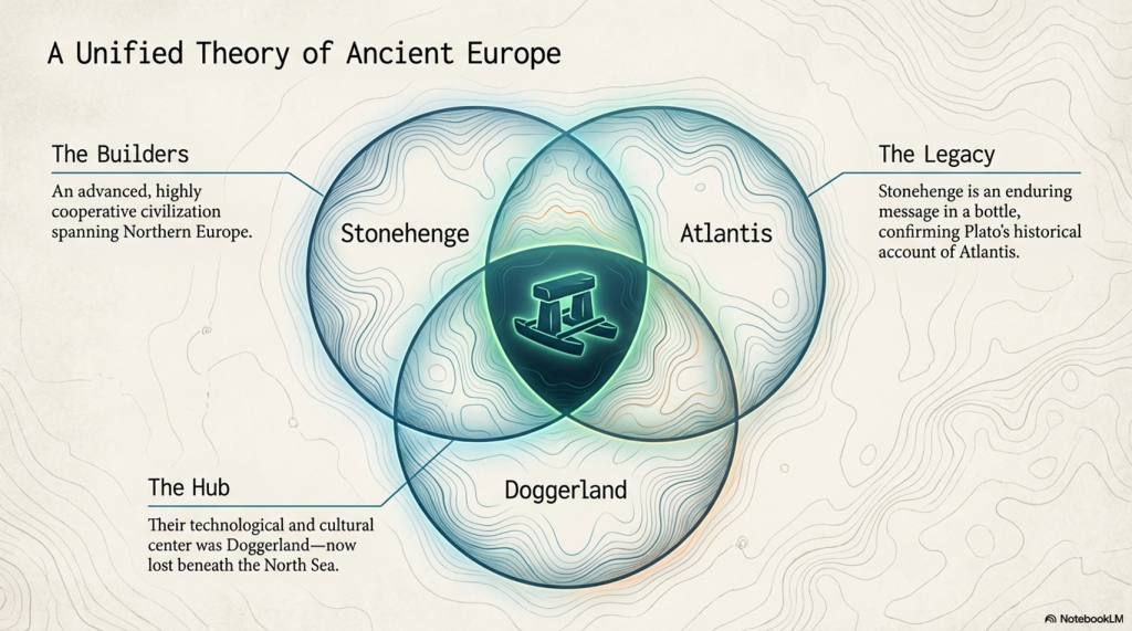
Testing Plato’s Atlantis Against Reality

Introduction

Atlantis is one of the most investigated mysteries in history.

For more than two thousand years, researchers have searched for the civilisation described by Plato. Hundreds of locations have been proposed, from the Mediterranean and Spain to Antarctica and the Caribbean. Yet despite thousands of books, documentaries, websites, and personal theories, no consensus has ever emerged. (Testing Plato’s Atlantis Against Reality)

The reason is simple.

Most Atlantis investigations begin with a location and then search for evidence to support it.

This study reverses the process.

Rather than asking where Atlantis was, it begins by asking what Plato actually described.

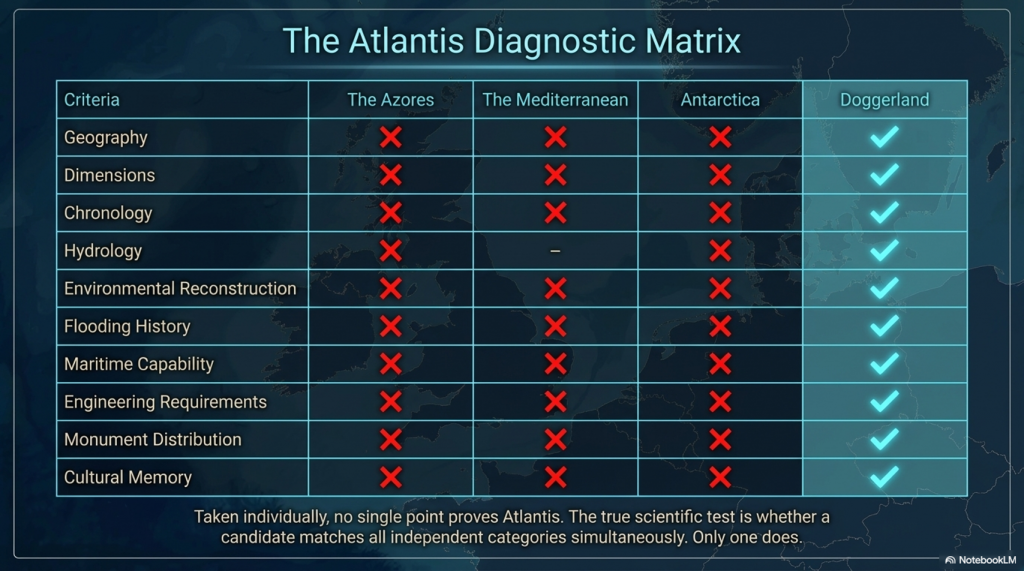
Using the original texts of Timaeus and Critias, every geographical, environmental, engineering, economic, and hydrological description is treated as an independent test. The objective is not to prove a theory but to examine whether any known prehistoric landscape satisfies the greatest number of Plato’s descriptions simultaneously.

Modern archaeological discoveries, seabed mapping, geological surveys, and AI-assisted analysis now allow Plato’s account to be examined in ways that were impossible even a decade ago.

The question is no longer whether Atlantis existed.

The question is whether Plato’s description corresponds to a real prehistoric landscape.

To answer that question, we must begin with the evidence itself.
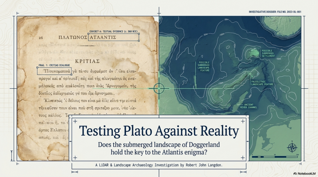
 (Testing Plato's Atlantis Against Reality)
(Testing Plato’s Atlantis Against Reality)

1. The Atlantis Problem

Few subjects have generated more speculation than Atlantis.

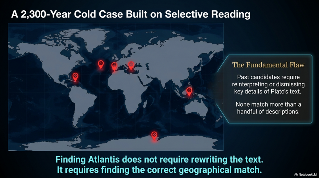
Since Plato first recorded the story over two thousand years ago, hundreds of locations have been proposed as the site of the lost civilisation. Atlantis has been placed in the Mediterranean, Spain, the Azores, Antarctica, the Caribbean, the Sahara, and even beyond the Atlantic Ocean. Entire industries have developed around the search for Atlantis, yet no location has achieved universal acceptance.

The reason is not a lack of theories.

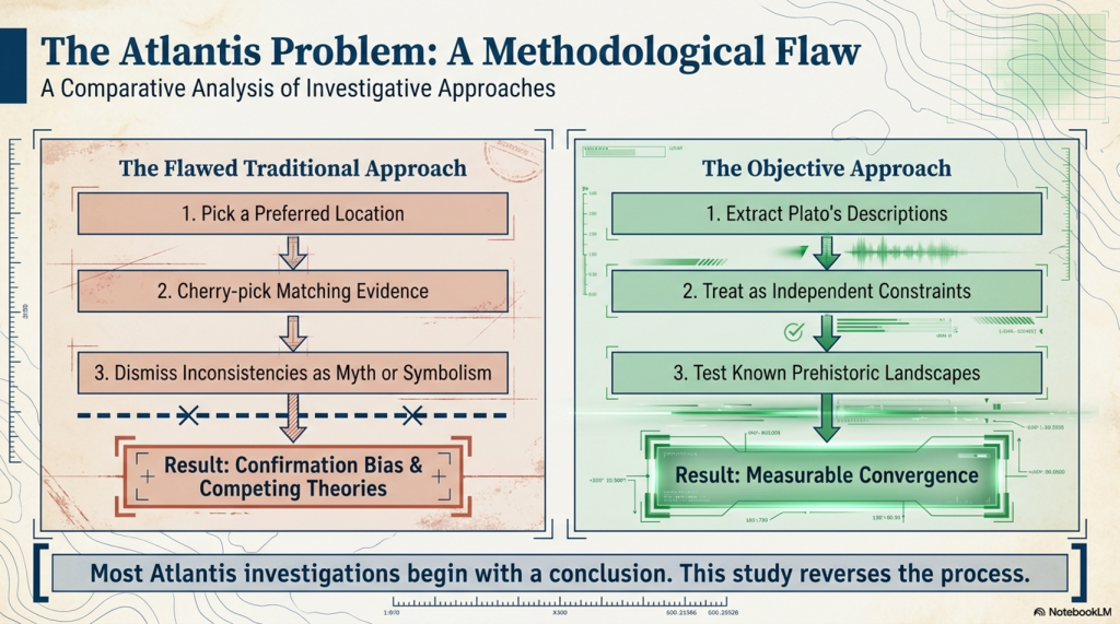
The problem is that most investigations begin with a conclusion.

A researcher selects a preferred location and then searches for evidence that supports it. Features that appear to match Plato’s description are highlighted, while features that do not are often ignored, reinterpreted, or dismissed as symbolism. As a result, Atlantis research has become dominated by confirmation bias, with each new theory selecting only the evidence that supports its own conclusion.

This approach creates an impossible situation.

A location may possess mountains but lack the great plain described by Plato.

Another may contain evidence of flooding but have no connection to the sea routes he describes.

A third may fit the chronology but fail the geographical requirements.

Each theory can explain some aspects of Plato’s account, but none can explain all of it.

The consequence is that Atlantis has become less an archaeological investigation and more a competition among competing interpretations.

Yet Plato’s account provides a solution to this problem.

Rather than treating Atlantis as a mystery to be solved through speculation, it can be approached as a series of measurable constraints. Plato describes the size of the landscape, its relationship to the sea, the existence of mountains, rivers, lakes, marshes, canals, harbours, shipping, trade, natural resources, wildlife, and ultimately its destruction by flooding. These are not opinions. They are observations recorded within the text.

The question, therefore, changes completely.

Instead of asking whether a particular location could be Atlantis, we can ask a far more objective question:

How many of Plato’s descriptions does that location actually satisfy?

This simple change transforms Atlantis from a debate about belief into a testable investigation.

The objective of this study is therefore not to prove Atlantis existed, nor to defend a preconceived theory.

It is to examine Plato’s descriptions one by one and determine whether any known prehistoric landscape satisfies the greatest number of independent constraints simultaneously.

Only then can we begin to assess whether Plato was describing fiction, memory, or a real place lost beneath the sea.
 (Testing Plato's Atlantis Against Reality)
(Testing Plato’s Atlantis Against Reality)

2. What Did Plato Actually Say?

Before Atlantis can be investigated, a more fundamental question must be answered.

What exactly did Plato describe?

This may appear to be a simple question, yet it lies at the heart of the Atlantis mystery. For more than two thousand years, researchers have debated the location of Atlantis, often overlooking the only source that truly matters. Every claim about Atlantis ultimately depends upon the writings of a single individual: Plato.

The surviving account appears in two dialogues, Timaeus and Critias, written during the fourth century BCE. Everything that is known about Atlantis originates from these texts. There are no surviving Atlantean records, no inscriptions, no maps, and no independent historical accounts describing the civilisation. Whether Atlantis was real, fictional, exaggerated, or based upon cultural memory, the investigation must begin with Plato because Plato is the only witness we possess.

This immediately creates an important distinction between evidence and interpretation.

Over the centuries, Atlantis has accumulated layer upon layer of speculation. It has been transformed into a lost continent, an advanced technological civilisation, a spiritual kingdom, an alien colony, and even a prehistoric superpower possessing knowledge beyond modern science. Yet none of these claims originates with Plato. They are later additions imposed upon the story.

When the original text is examined, a very different picture emerges.

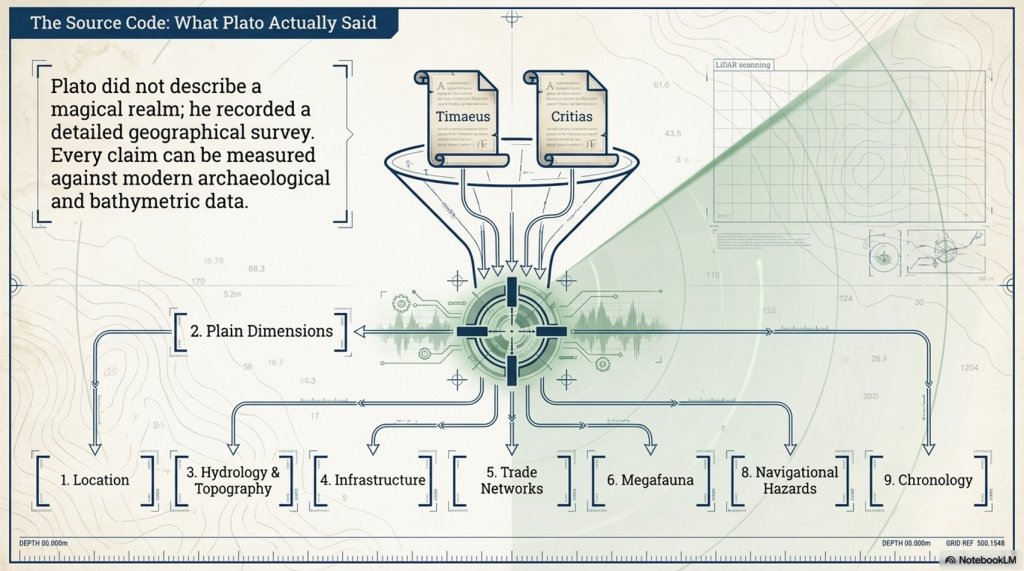
Plato’s Atlantis is not described through myths or miracles. Instead, it is described in geographic terms. He provides measurements for the plain. He describes mountains, rivers, lakes, marshes, fertile land, canals, harbours, shipping routes, wildlife, natural resources, agriculture, engineering works, and political organisation. The account reads less like a legend and more like a geographical survey.

This is an important observation because geography can be tested.

A statement such as “Atlantis lay beyond the Pillars of Heracles” can be examined against real locations.

A statement describing a plain measuring approximately two thousand by three thousand stadia can be compared against modern maps.

Descriptions of waterways, marshes, canals, and harbours can be compared against geological and archaeological evidence.

Even Plato’s observations regarding flooding and the eventual destruction of the landscape can be examined using modern sea-level reconstructions.

This transforms the investigation completely.

Most Atlantis theories focus on individual details that appear to support a preferred location. One researcher may focus on flooding. Another may focus on volcanic activity. A third may focus on the shape of a harbour. The result is a collection of theories that often explain one aspect of Plato’s account while ignoring the rest.

A more rigorous approach is to treat every description as part of a larger system.

Plato did not describe a mountain.

He described a landscape.

He did not describe a flood.

He described a civilisation connected to rivers, waterways, shipping, trade, resources, agriculture, and ultimately destruction by water.

The significance lies not in any single observation but in the cumulative pattern created when all of the observations are considered together.

For this reason, the purpose of this study is not to prove that Plato was correct in every detail. Nor is it to assume that Atlantis existed before the evidence is examined.

Instead, Plato’s account will be treated as a series of independent constraints.

Each description becomes a test.

If a proposed location satisfies the description, it passes.

If it does not, it fails.

The objective is not to find evidence that supports a theory. The objective is to determine whether any known prehistoric landscape satisfies the greatest number of Plato’s descriptions simultaneously.

Before examining maps, archaeology, geology, hydrology, trade networks, and environmental reconstruction, we must therefore establish the criteria against which every Atlantis theory will be measured.

Those criteria come directly from the only surviving source that matters.

Plato’s own words.
 (Testing Plato's Atlantis Against Reality)
(Testing Plato’s Atlantis Against Reality)

3. The Rules of the Investigation

Most Atlantis investigations begin with a map.

A researcher selects a promising location and then searches for similarities between that landscape and Plato’s account. If a mountain matches, it is highlighted. If evidence of flooding is found, it is presented as confirmation. If an inconsistency appears, it is often explained away as symbolism, mistranslation, exaggeration, or myth.

This approach has produced hundreds of competing theories about Atlantis and very little agreement.

The reason is simple.

Almost every investigation begins with a conclusion.

The objective of this study is different.

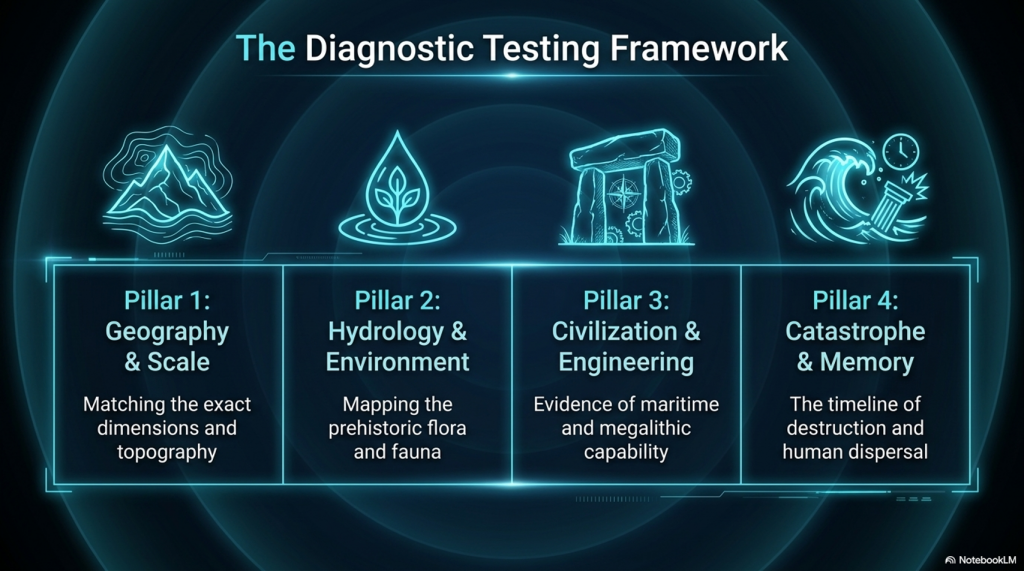
Rather than starting with a location, it starts with a set of measurable constraints derived directly from Plato’s text. Every geographical, environmental, engineering, economic, and hydrological description is treated as an independent test that any proposed Atlantis location must satisfy.

This transforms Atlantis from a mystery into a problem that can be examined systematically.

For example, Plato states that Atlantis lay “beyond the Pillars of Heracles”. Any location within the Mediterranean immediately fails that test.

Plato describes “a vast plain approximately two thousand by three thousand stadia in size“. Any proposed landscape lacking a comparable plain fails that test.

Plato describes mountains, rivers, lakes, marshes, navigable waterways, engineered canals, harbours, shipping, abundant natural resources, wildlife, and eventual destruction by flooding. Each description becomes another independent constraint against which candidate locations can be measured.

The importance of this approach lies in the cumulative effect.

A single match proves very little.

Many locations contain mountains.

Many locations contain rivers.

Many locations have experienced flooding.

The question is not whether a location satisfies one description.

The question is whether it satisfies many descriptions simultaneously.

This distinction is crucial because Atlantis is not described through a single characteristic. Plato presents an integrated landscape in which geography, hydrology, engineering, trade, agriculture, and society are interconnected.

The mountains matter because they feed the rivers.

The rivers matter because they support the plains.

The plains matter because they support agriculture.

The waterways matter because they support transport and trade.

The flooding matters because it explains the destruction of the entire system.

Each component is linked to the others.

The investigation, therefore, focuses not on individual observations but on patterns.

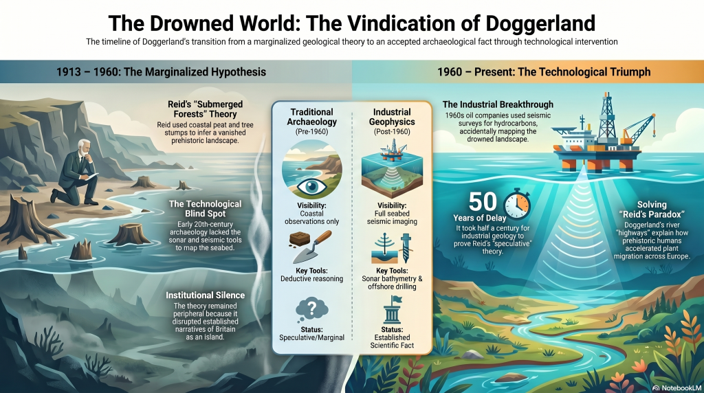
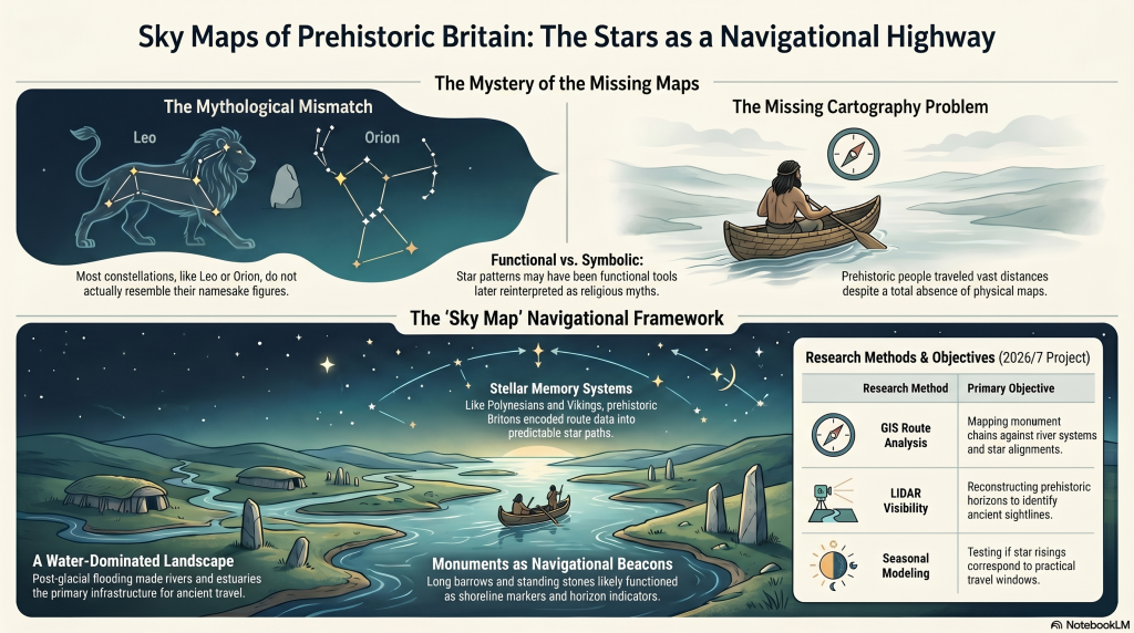
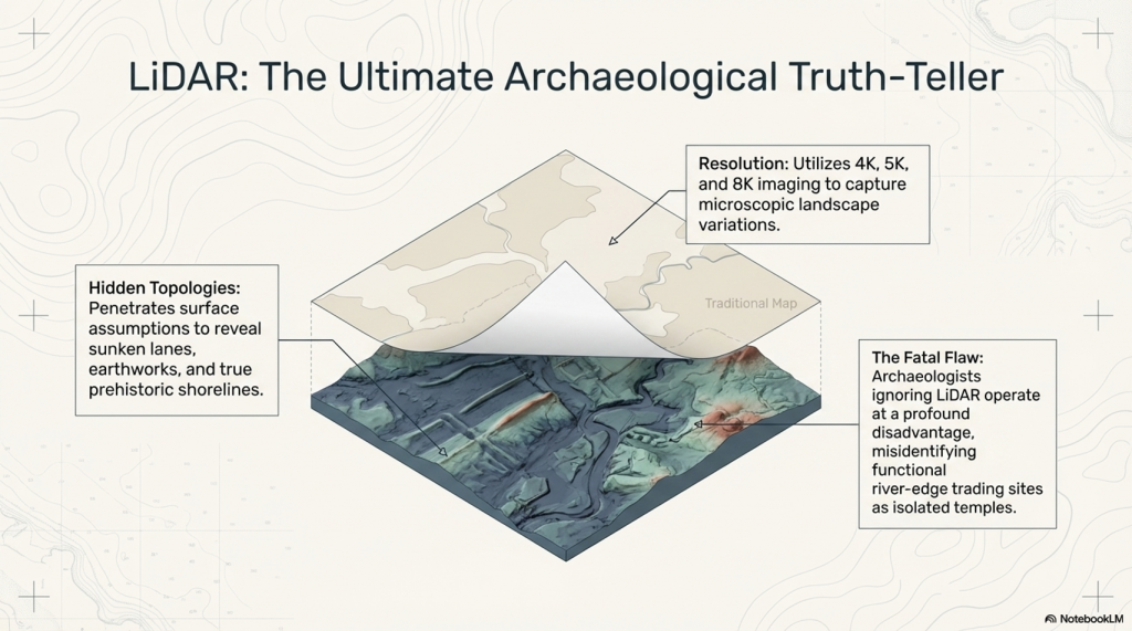
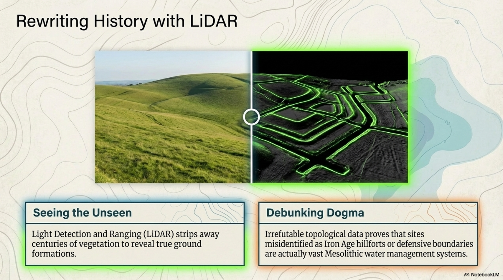
Modern archaeological and geological research now provides an unprecedented opportunity to perform this analysis. Seabed mapping has revealed the submerged landscapes beneath the North Sea. LiDAR surveys have transformed our understanding of prehistoric earthworks. Geological investigations have reconstructed ancient river systems, coastlines, and sea-level changes. Archaeological discoveries continue to provide evidence for long-distance trade, large-scale engineering, and sophisticated social organisation.

At the same time, modern analytical techniques allow large quantities of information to be compared systematically. Rather than relying upon isolated observations, entire datasets can be examined together to determine how closely a proposed location aligns with Plato’s description.

This is where the investigation differs from traditional Atlantis research.

The objective is not to prove Doggerland was Atlantis.

The objective is to test Doggerland against the same criteria that apply to every other proposed location.

If Doggerland fails the tests, it should be rejected.

If it passes the tests, that result must also be acknowledged.

The process is therefore simple.

Extract Plato’s descriptions.

Compare them with the evidence.

Record the result.

Repeat the process for every major characteristic of Atlantis.

Only then can a meaningful conclusion be reached.

With the methodology established, the investigation can now begin with the first and most fundamental question:

Where did Plato place Atlantis?
 (Testing Plato's Atlantis Against Reality)
(Testing Plato’s Atlantis Against Reality)

4. Beyond the Pillars of Heracles

The first test is also the simplest.

Where did Plato place Atlantis?

This question matters because it immediately eliminates many popular theories about Atlantis. Before examining plains, canals, elephants, trade networks, or flooding, we must first establish the geographical location described in the original text.

Plato is remarkably clear on this point.

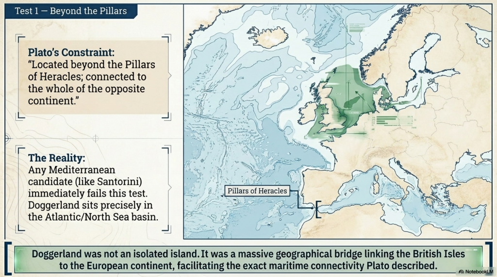
“This power came forth out of the Atlantic Ocean, for in those days the Atlantic was navigable; and there was an island situated in front of the straits which are by you called the Pillars of Heracles.”

This statement establishes the first and most important geographical constraint.

Atlantis was located beyond the Pillars of Heracles.

Traditionally, the Pillars of Heracles are identified with the Strait of Gibraltar. If this interpretation is correct, Atlantis must lie outside the Mediterranean rather than within it.

This creates a significant problem for many popular Atlantis theories.

Santorini, one of the most frequently proposed candidates, lies firmly within the Mediterranean basin. The same problem applies to numerous locations in Greece, Turkey, Italy, and other parts of the eastern Mediterranean. Regardless of their archaeological significance, they fail Plato’s first geographical test.

The importance of this passage is reinforced by what follows.

Plato continues:

“From it travellers could pass to the other islands, and from the islands to the whole of the opposite continent which surrounded the true ocean.”

This second statement introduces additional constraints.

Atlantis was not described as an isolated island.

Instead, it formed part of a wider geographical system connecting other islands and a larger landmass beyond.

For centuries, this passage has caused considerable debate. Some researchers have interpreted it as evidence of trans-Atlantic voyages. Others have suggested that Plato was describing a chain of islands leading westward into the Atlantic Ocean.

Regardless of interpretation, the description requires a location that can serve as a geographical bridge rather than a remote destination.

This is where Doggerland becomes particularly interesting.

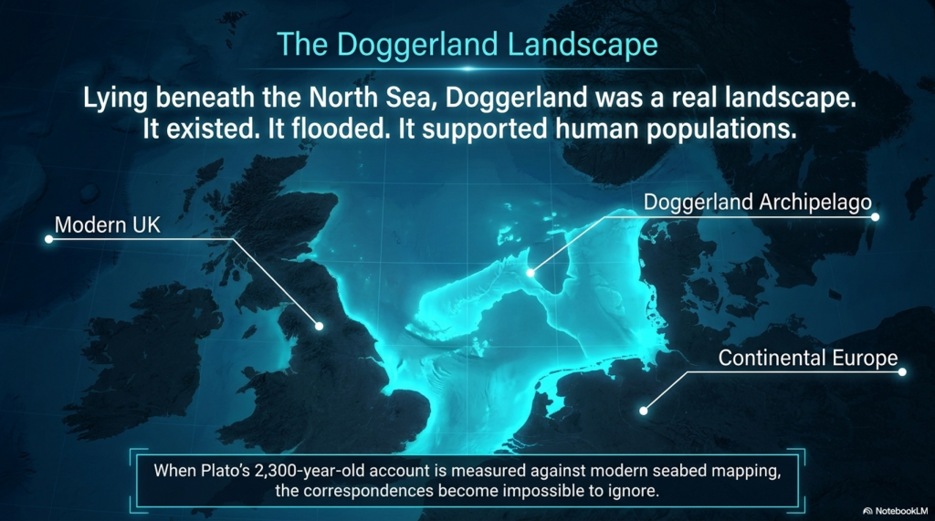
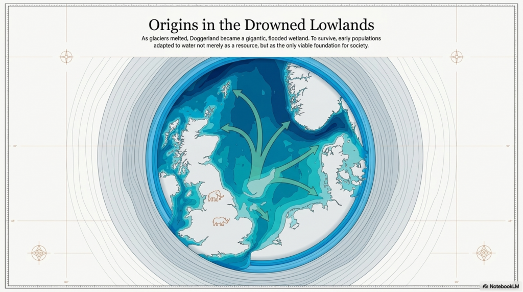
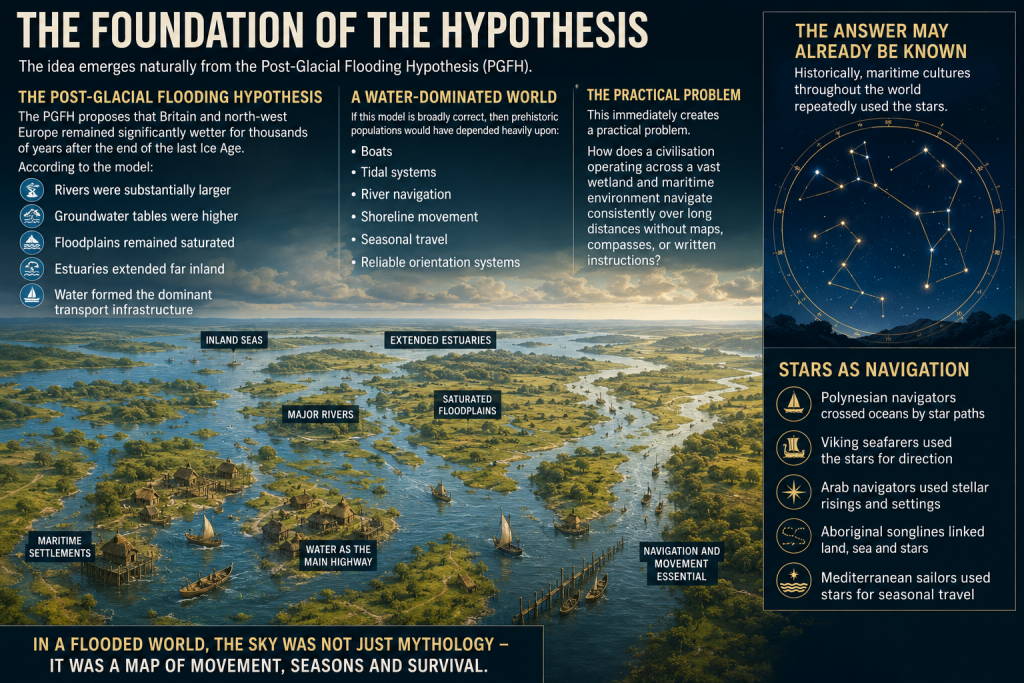
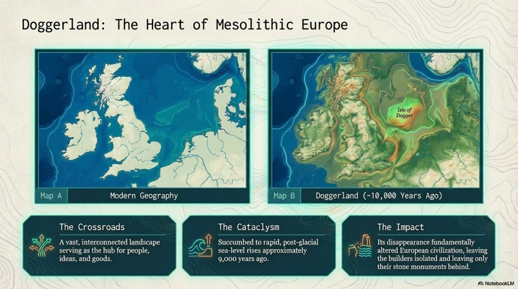
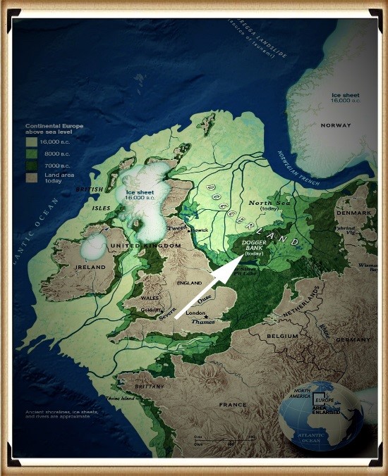
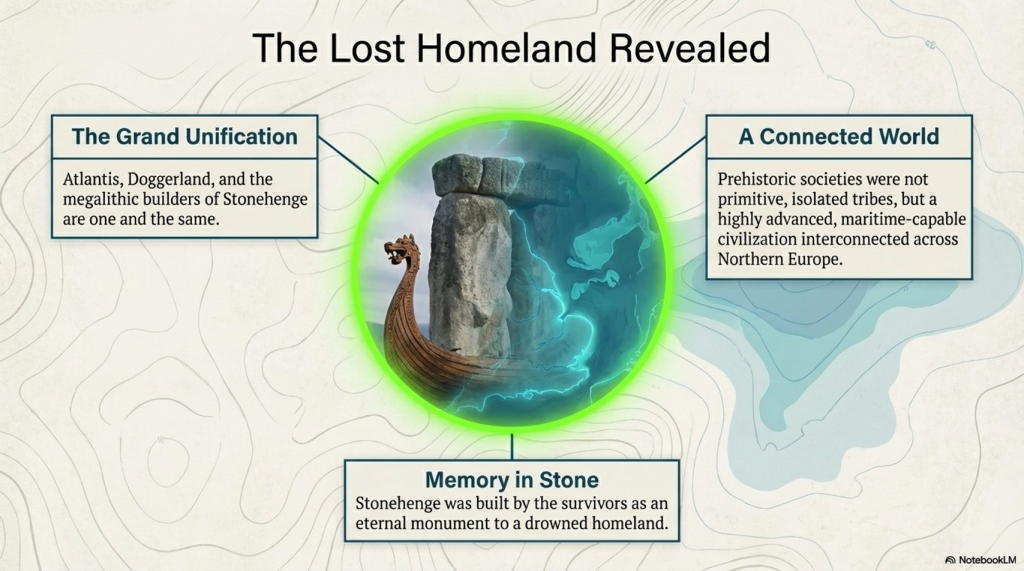
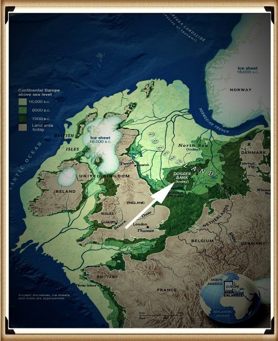
Prior to its inundation, Doggerland occupied the centre of a vast landscape linking Britain, continental Europe, and Scandinavia. Rather than existing as an isolated island, it formed part of a connected North European peninsula extending across much of the present-day North Sea basin. Movement through this landscape naturally linked multiple regions through both land and water routes.

The significance of this arrangement is often overlooked.

Most theories about Atlantis focus on finding an island.

Plato, however, spends considerable time describing connections between islands, neighbouring lands, and larger continental regions. The emphasis is not isolation but connectivity.

This observation becomes increasingly important when examined alongside the archaeological evidence discussed later in this study. Trade routes, transport networks, and material movement all suggest that prehistoric Europe was far more interconnected than traditionally believed.

Doggerland occupied the centre of that network.

It linked Britain to mainland Europe.

It linked the Atlantic to the North Sea.

It linked multiple river systems into a single hydrological landscape.

In short, it occupied precisely the sort of strategic position one might expect from the civilisation Plato describes.

This does not prove that Doggerland was Atlantis.

It does, however, satisfy the first major geographical requirement.

Unlike many proposed locations, Doggerland lies beyond the Mediterranean world, forms part of a wider interconnected landscape, and occupies a position that can link islands, coastlines, and continental regions into a single system.

The first test, therefore, produces an intriguing result.

Plato’s description places Atlantis beyond the Pillars of Heracles and connects it to a broader geographical network.

Doggerland satisfies both requirements.

The investigation can therefore proceed to the next question.

Did Plato’s description of Atlantis match the physical shape and dimensions of the lost landscape beneath the North Sea?

NB. A Curious Linguistic Clue

One detail is often overlooked.

When Plato describes Atlantis, he simultaneously refers to the surrounding body of water as the Atlantic Ocean.

“For in those days the Atlantic was navigable…”

This raises an obvious question.

Which came first?

Did the island receive its name from the ocean, or did the ocean receive its name from the island?

Whatever the answer, the association is significant because more than two thousand years later, we still refer to the same body of water as the Atlantic Ocean. The spelling has evolved through successive Greek, Latin, and European translations, but the root name remains essentially unchanged.

This observation does not prove the existence of Atlantis, but it does reinforce an important point. Plato was not describing an isolated island detached from its surroundings. He was describing a location embedded within a much larger Atlantic system, comprising oceans, islands, coastlines, and continental landmasses.

The investigation must therefore consider not only the island itself, but the wider landscape to which Plato repeatedly refers.
 (Testing Plato's Atlantis Against Reality)
(Testing Plato’s Atlantis Against Reality)

5. Measuring Atlantis

The description of Atlantis becomes considerably more interesting once Plato begins discussing the central plain.

Unlike many ancient writers, Plato does not simply describe a fertile landscape. He provides dimensions.

This is important because measurements can be tested.

They are not matters of opinion.

They either correspond to a real landscape or they do not.

In Critias, Plato describes the central plain of Atlantis:

“The plain around the city was level and smooth, and of an oblong shape, extending in one direction three thousand stadia, and in the centre inland across it two thousand stadia.”

This is one of the most precise geographical descriptions in the entire account of Atlantis.

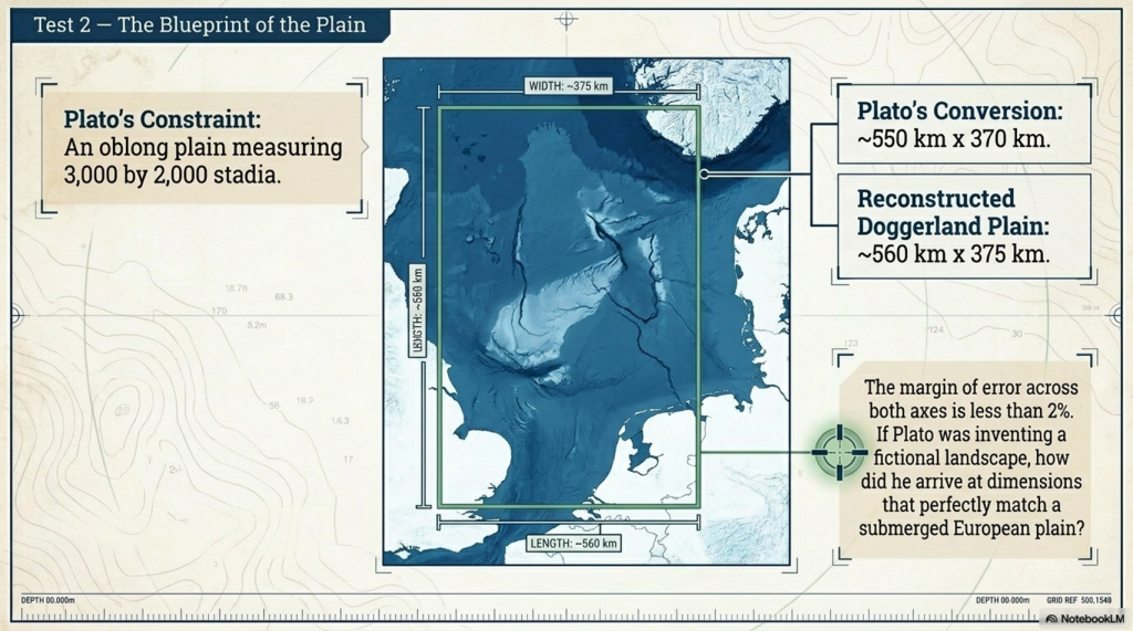
Using the standard Greek stadion, these dimensions equate to approximately 550 kilometres by 370 kilometres.

For centuries, researchers have attempted to identify a landscape matching these proportions.

Many proposed locations for Atlantis immediately encounter difficulties.

Some are too small.

Others lack a significant plain entirely.

Many require extensive reinterpretation of Plato’s measurements in order to fit the available geography.

The advantage of a numerical description is that it can be compared directly against modern mapping.

When bathymetric surveys of the North Sea are examined, a striking pattern emerges.

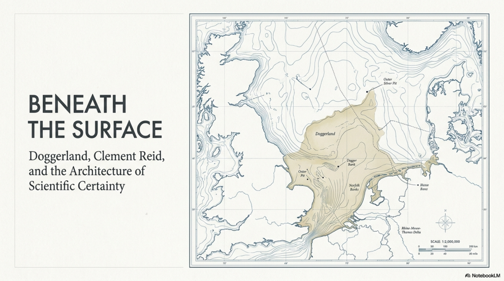
Prior to inundation, Doggerland occupied a vast low-lying region stretching between Britain and continental Europe. At its centre lay an enormous plain surrounded by higher ground associated with Britain, Scandinavia, and mainland Europe.

Reconstructions of this central landscape produce dimensions remarkably similar to those described by Plato.

Modern estimates place the principal Doggerland plain at approximately 375 kilometres by 560 kilometres.

The correspondence is extraordinary.

Across both axes, the difference between Plato’s measurements and the reconstructed dimensions of Doggerland is less than two per cent.

This does not prove that Doggerland was Atlantis.

However, it raises an obvious question.

If Plato was inventing a fictional landscape, how did he arrive at dimensions that correspond so closely to one of the largest submerged plains in Europe?

The significance of this match extends beyond simple size.

Plato does not describe a circular landscape, a mountain range, or an irregular island chain.

He describes an oblong plain.

That distinction matters because shape is an independent constraint.

A landscape may match the dimensions but fail the shape.

Equally, it may match the shape but fail the dimensions.

Doggerland appears to satisfy both simultaneously.

Plato continues by describing the plain as exceptionally fertile and traversed by waterways descending from the surrounding uplands.

This observation becomes increasingly important when examined alongside modern environmental reconstructions.

Far from being a barren landscape, Doggerland is now understood to have contained extensive river systems, wetlands, lakes, estuaries, and productive alluvial environments capable of supporting abundant wildlife and human populations.

The plain, therefore, does not stand alone.

It forms part of a larger geographical system.

The mountains feed the rivers.

The rivers cross the plain.

The plain supports agriculture and settlement.

The waterways provide transport and communication.

This interconnected landscape is precisely the type of environment Plato describes.

Critics often focus on individual details while overlooking the cumulative significance of the evidence.

The importance of the plain is not simply that it exists.

The importance is that its dimensions, shape, position, and environmental setting all align with Plato’s description simultaneously.

This is exactly the type of test outlined in the previous chapter.

A single correspondence proves little.

Multiple independent correspondences are more difficult to dismiss.

The central plain, therefore, represents the first major quantitative comparison between Plato’s account and a real prehistoric landscape.

The result is striking.

Plato describes an oblong plain measuring approximately 550 by 370 kilometres.

The reconstructed plain of Doggerland measures approximately 560 by 375 kilometres.

The difference is so small that it falls within the uncertainties associated with both ancient measurements and modern reconstruction.

For the first time in this investigation, Plato’s description is not merely similar to the evidence.

It is measurable against it.

And the match is remarkably close.
 (Testing Plato's Atlantis Against Reality)
(Testing Plato’s Atlantis Against Reality)

6. Mountains, Rivers and Wetlands

Having established that Doggerland satisfies Plato’s description of a vast central plain, the next question is whether the surrounding landscape also matches his account.

This is where many Atlantis theories begin to encounter difficulties.

A location may contain a plain, but Plato does not describe Atlantis as a plain in isolation. He describes a complete environmental system in which mountains, rivers, lakes, marshes, and fertile lowlands are interconnected. Each component supports the others, creating a landscape that functions as a single geographical unit.

Plato writes:

“The surrounding mountains descended towards the sea.”

He further describes streams flowing down from these uplands into the plain below.

“Receiving the streams which came down from the mountains.”

These statements immediately create another set of measurable constraints.

Atlantis must possess:

  • A large central plain.
  • Higher ground surrounds parts of that plain.
  • Rivers descending from those uplands.
  • Extensive water systems distributed across the landscape.

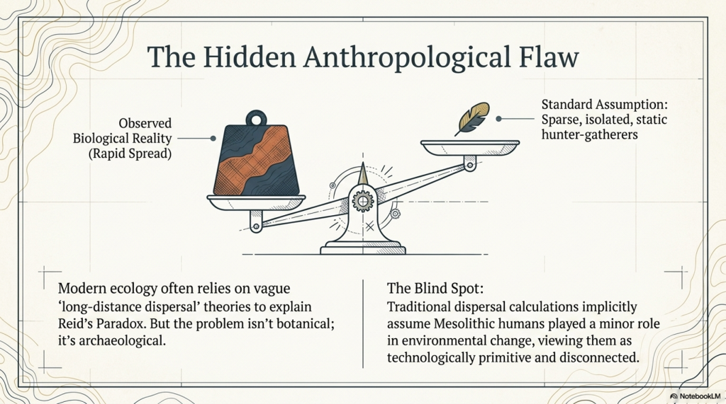
For many years, critics of the Doggerland hypothesis have focused on the mountain requirement. They argue that the North Sea contains no mountains and therefore cannot be Atlantis.

The objection appears convincing only when the entire landscape is considered, rather than the modern seabed alone.

Doggerland did not exist in isolation.

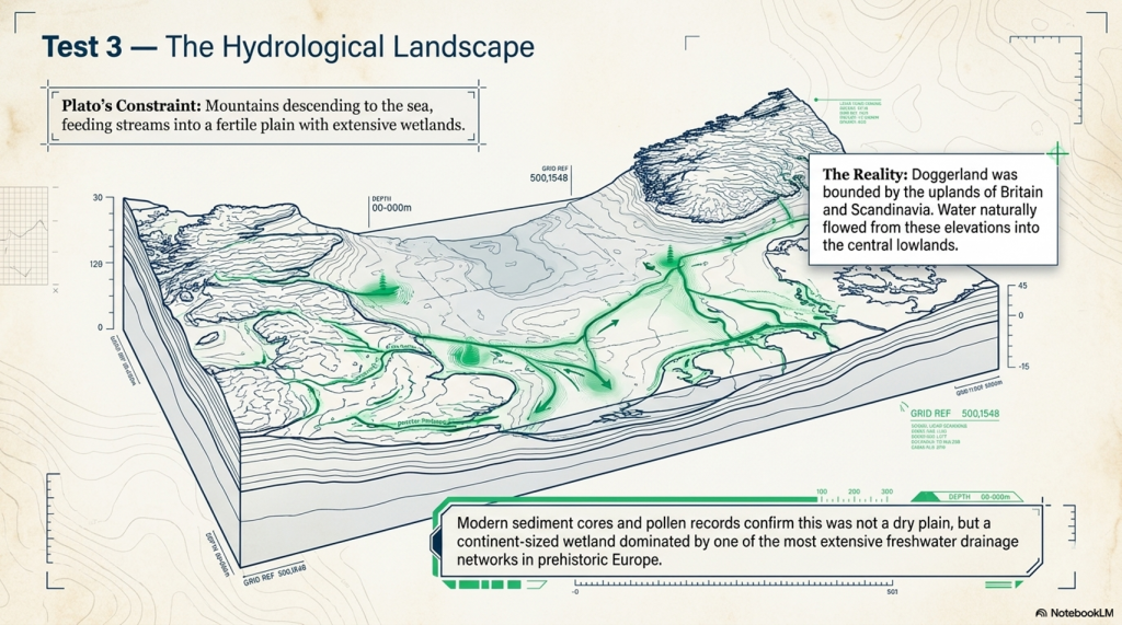
Before inundation, it formed part of a much larger North European landscape bounded by the uplands of Britain, Scotland, Norway, and Scandinavia. These elevated regions surrounded the lower-lying basin that now forms the North Sea. Water naturally flowed from these uplands into the central lowlands, creating one of the most extensive river systems in prehistoric Europe.

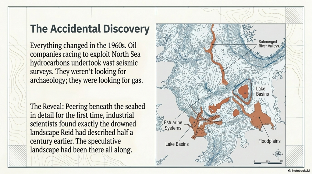
Modern seabed surveys have revealed that the North Sea floor preserves the remains of this lost hydrological network.

Buried beneath the sea are the traces of rivers, tributaries, lakes, estuaries, and wetlands that once crossed Doggerland. Some river systems were comparable in scale to major modern European rivers. Others combined to form vast drainage networks flowing through the centre of the landscape before eventually reaching the Atlantic.

This is not speculation.

It is visible on modern bathymetric maps.

The significance of these discoveries cannot be overstated.

For centuries, Atlantis was often imagined as a small island surrounded by open ocean. The emerging picture of Doggerland is entirely different. It was not a solitary island but a continent-sized wetland environment dominated by freshwater systems.

This distinction is important because Plato repeatedly emphasises water.

He describes rivers.

He describes canals.

He describes harbours.

He describes fertile plains sustained by water.

He describes a civilisation organised around waterways rather than isolated from them.

The environmental reconstruction of Doggerland aligns remarkably well with this picture.

Evidence from sediment cores, pollen records, peat deposits, and submerged landscapes indicates that Doggerland supported extensive woodland, grassland, marshes, lakes, and river valleys. These environments would have provided abundant resources for both humans and animals.

Plato’s description of a fertile landscape, therefore, finds support within the geological evidence.

The same is true of the wetlands.

Throughout his account, Plato describes a landscape rich in water and natural productivity. Modern reconstructions consistently portray Doggerland as exactly such an environment. Rather than a dry plain, it appears to have been characterised by interconnected waterways, elevated groundwater, seasonal flooding, and extensive marsh systems.

This observation becomes increasingly significant when combined with the evidence presented in earlier chapters.

The dimensions of the plain match.

The geographical position matches.

The surrounding uplands match.

The river systems match.

The wetland environment matches.

Individually, each correspondence might be dismissed as a coincidence.

Together, they form a coherent pattern.

Most theories about Atlantis focus on a single feature.

Doggerland continues to satisfy multiple independent constraints simultaneously.

More importantly, the evidence reveals not merely a location but a functioning landscape.

The mountains feed the rivers.

The rivers cross the plain.

The wetlands support wildlife.

The waterways provide transport.

The entire system operates exactly as Plato describes.

The result is that Atlantis begins to look less like a mythical kingdom and more like a recognisable prehistoric environment.

Having established that the geography and environmental reconstruction closely correspond to Plato’s account, we can now turn to one of the most overlooked aspects of the story of Atlantis.

The waterways themselves.

Because Plato was not simply describing rivers.

He was describing a civilisation built around them.
 (Testing Plato's Atlantis Against Reality)
(Testing Plato’s Atlantis Against Reality)

7. The Waterway Civilisation

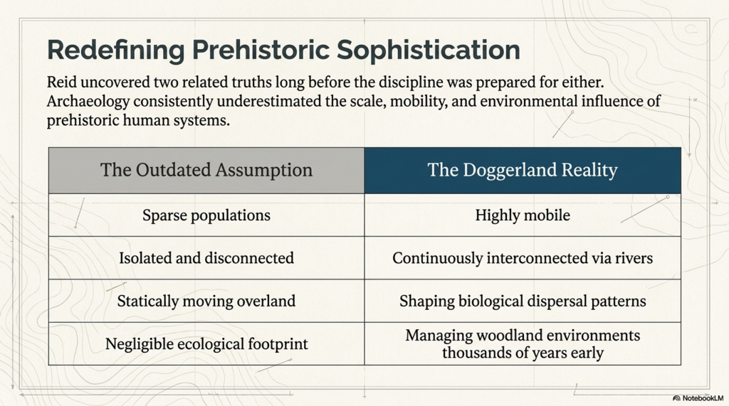
The traditional image of prehistoric Europe is one of scattered communities separated by forests, mountains, and vast distances. According to this model, movement was slow, local, and difficult. Rivers are generally viewed as obstacles to be crossed rather than infrastructure to be used.

Plato describes something very different.

Throughout Critias, waterways recur as central features of the Atlantean landscape. They are not incidental features but fundamental elements of how the civilisation functioned.

Plato writes:

“They cut canals…”

He further states:

“They brought a canal from the sea…”

And then adds:

“The canal was of such a depth and width as to admit the largest vessels.”

These statements are extraordinary.

Most discussions of Atlantis focus on the destruction of the civilisation while paying little attention to the infrastructure Plato describes. Yet canals, harbours, and navigable waterways imply something far more significant than a simple settlement. They imply a society organised around the movement of people, materials, and resources by water.

This distinction is critical.

Roads require continuous maintenance and are limited by terrain.

Waterways perform the same function naturally.

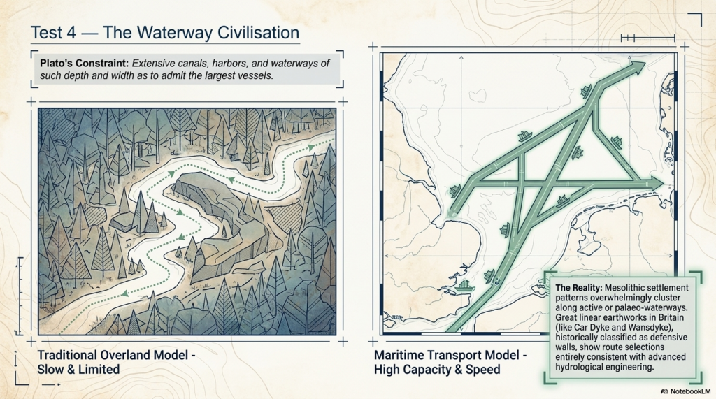
A boat can move far greater loads than can be transported overland, particularly in heavily forested landscapes. In a world dominated by rivers, estuaries, lakes, and shallow seas, water is the most efficient means of transport.

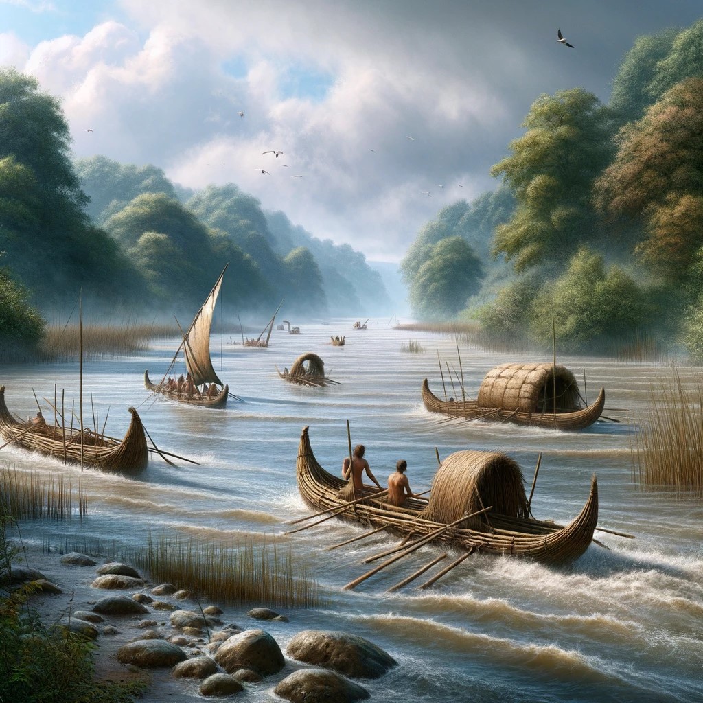
This is precisely the environment reconstructed for Doggerland.

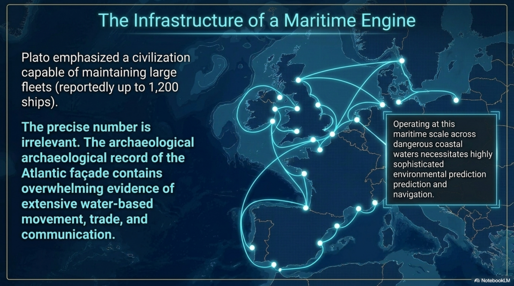
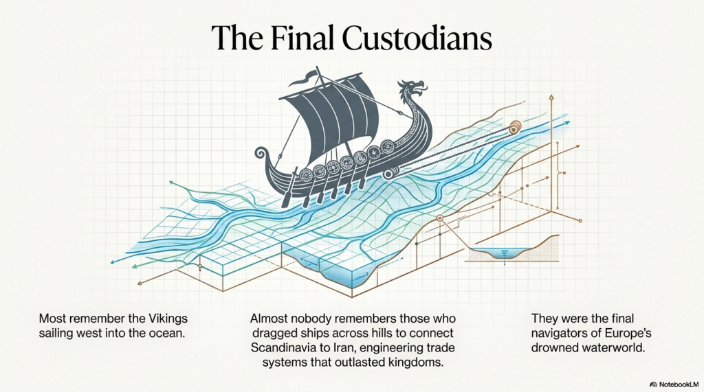
Modern seabed surveys reveal an extensive network of rivers and channels linking the North Sea basin to Europe’s major river systems. The Rhine, Thames, Elbe, Meuse, and numerous smaller waterways formed an interconnected transport network stretching across north-west Europe.

Rather than acting as barriers, these waterways would have functioned as highways.

This interpretation is reinforced by settlement patterns.

When Mesolithic sites are plotted geographically, a striking pattern emerges. The overwhelming majority occur on active waterways or on palaeo-water systems that were once navigable. Settlements repeatedly cluster along rivers, estuaries, coastal margins, and wetland environments.

This distribution is unlikely to be accidental.

It reflects the underlying infrastructure of the civilisation itself.

The implications extend far beyond simple travel.

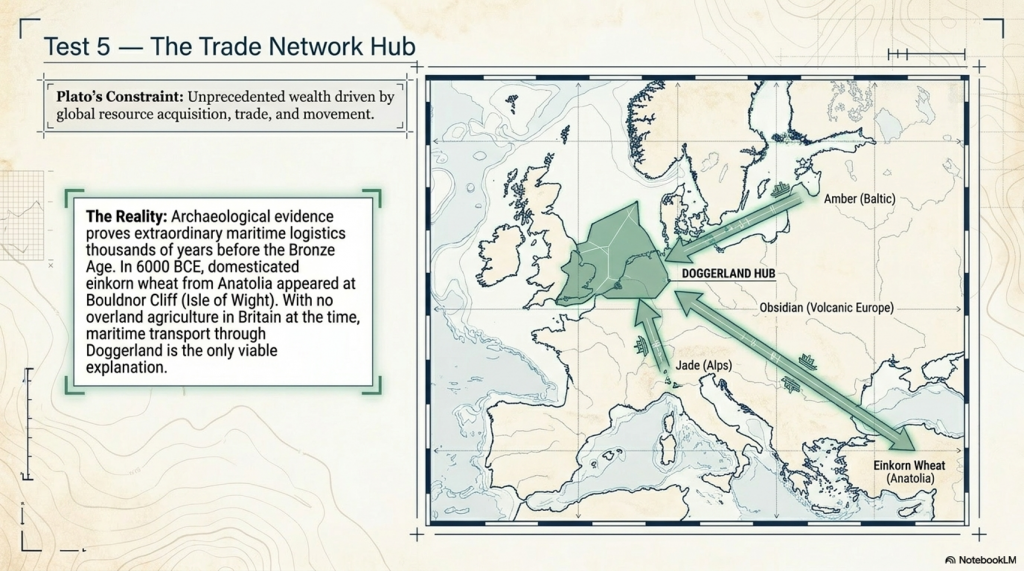
A water-based transport system explains the movement of materials across enormous distances. Amber travelled from the Baltic. Obsidian moved from volcanic regions into central Europe. Alpine jade appeared thousands of kilometres from its source. Wheat reached Britain from Anatolia. Large stones were transported across landscapes that conventional archaeology often struggles to explain.

Viewed through a maritime framework, these movements cease to be mysterious.

The waterways provide the answer.

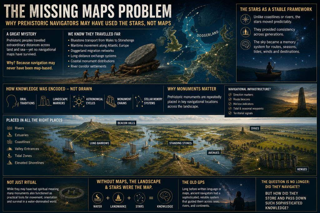
The significance of this observation becomes even greater when considered alongside Britain’s great linear earthworks.

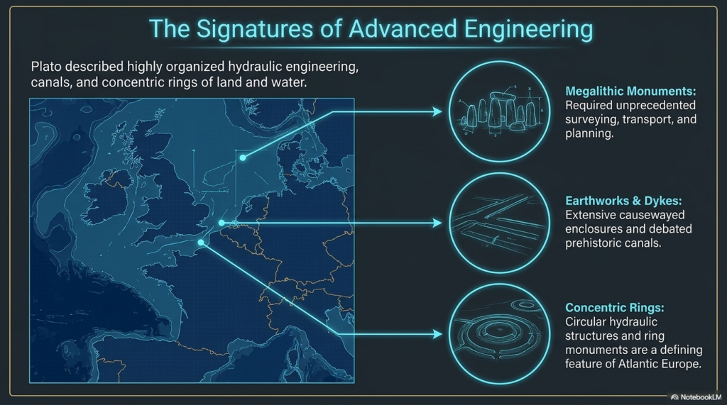
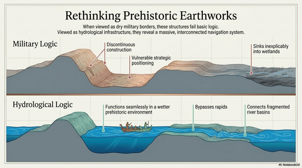
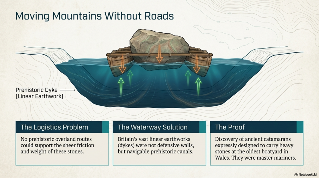
Features such as Car Dyke, Wansdyke, Offa’s Dyke, and the Vallum have traditionally been interpreted as defensive structures. Yet many possess characteristics that are equally consistent with hydrological engineering. Their scale, route selection, gradients, and relationship to water raise the possibility that at least some formed part of a much larger water-management system.

Whether every dyke served such a purpose remains open to debate.

What matters is that Plato repeatedly describes a civilisation that engineered waterways for transport and communication.

The concept, therefore, exists within the original account of Atlantis itself.

This is one of the strongest correspondences between Plato’s description and the emerging picture of prehistoric north-west Europe.

Both depict landscapes organised around water.

Both depict movement occurring primarily through waterways.

Both depict engineering directed toward the control and use of water.

Most importantly, both describe societies whose success depended upon mastering the hydrological environment in which they lived.

The traditional image of Atlantis is often that of a lost city.

Plato’s account suggests something much larger.

It suggests a waterway civilisation.

A civilisation whose rivers, canals, harbours, and maritime routes formed the foundation of its economy, communication, and survival.

If this interpretation is correct, then Atlantis was not defined by its buildings.

It was defined by its network.

And that network extended across an entire landscape.

The next question is therefore obvious.

If waterways connected the civilisation, what exactly was moving through them?
 (Testing Plato's Atlantis Against Reality)
(Testing Plato’s Atlantis Against Reality)

8. The Trade Network

If Atlantis was organised around waterways, then an obvious question follows.

What was moving through them?

Plato repeatedly describes Atlantis as a wealthy civilisation possessing access to resources on a scale unmatched by its contemporaries. He writes:

“They had such an amount of wealth as was never before possessed by kings and potentates.”

This statement is often treated as an exaggeration. Yet wealth does not emerge in isolation. It is the product of production, movement, and exchange. If Atlantis possessed extraordinary wealth, then it must also have possessed extraordinary infrastructure capable of acquiring, transporting, and distributing resources.

Plato reinforces this observation when describing the natural abundance available to the Atlanteans.

“They dug out of the earth whatever was to be found there, solid as well as fusile.”

He also describes abundant timber, agricultural production, and animal resources.

These descriptions are significant because they imply a civilisation that actively exploits and manages a wide range of materials rather than simply consuming local resources.

When the archaeological evidence from Mesolithic and Neolithic Europe is examined, a remarkably similar picture emerges.

Materials repeatedly appear far beyond their natural sources.

Baltic amber is found throughout Britain, central Europe, and the Mediterranean.

Alpine jade axes occur thousands of kilometres from the quarries where the stone originated.

Obsidian can be traced geochemically to specific volcanic regions yet appears across large areas of Europe.

Copper, gold, and tin all exhibit long-distance movement patterns that require organised transport systems.

Viewed individually, each example appears unusual.

Viewed collectively, they reveal something far more significant.

They reveal a network.

The scale of this network is often underestimated.

The transport of jade from the Italian Alps to Britain required passage across rivers, along coastlines, and through multiple regions. Baltic amber travelled from northern Europe into southern markets. Obsidian was carried hundreds, and sometimes thousands, of kilometres. These journeys were not isolated events. They occurred repeatedly across long periods of time.

This suggests that movement was systematic rather than occasional.

One of the most compelling examples comes from Bouldnor Cliff off the Isle of Wight.

Archaeologists recovered evidence of domesticated einkorn wheat dating to approximately 6000 BCE. Genetic analysis linked this wheat to farming populations in Anatolia.

At that time, Britain showed no evidence of domestic agriculture.

The wheat, therefore, had to arrive from elsewhere.

There is no plausible overland route.

The implication is clear.

Maritime connections between Britain and continental Europe existed long before conventional models would predict.

This discovery is important because it demonstrates that materials, knowledge, and potentially people were moving through extensive transport networks thousands of years before the Bronze Age.

The same principle applies to the movement of stone.

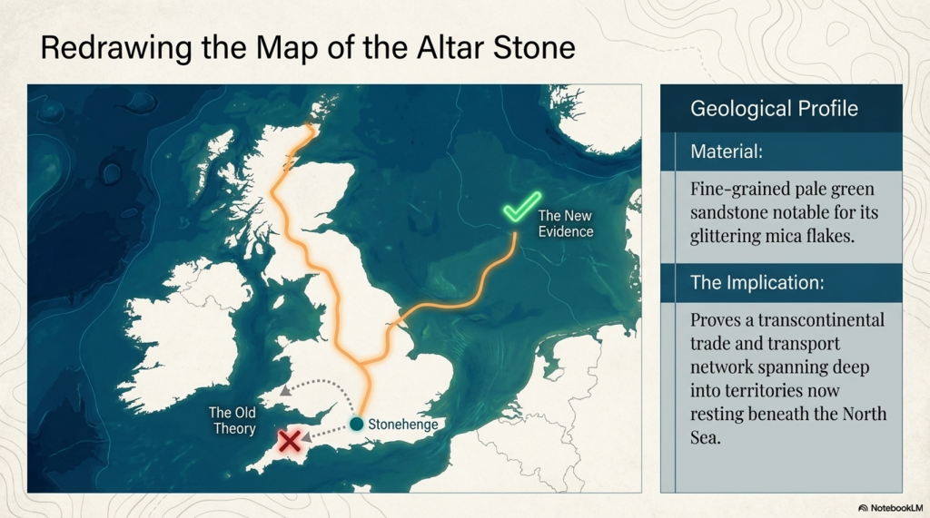
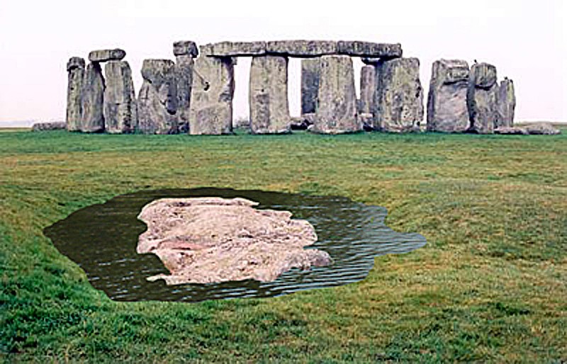
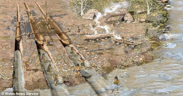
Large megaliths appear at locations far removed from their geological source. The Altar Stone at Stonehenge is a notable example. Moving such materials through dense woodland by purely overland methods presents enormous logistical challenges.

Transport by water offers a far simpler solution.

Rivers, estuaries, and coastal routes enable the efficient transport of heavy loads over considerable distances.

The significance of these observations becomes increasingly apparent when compared with Plato’s account.

Atlantis is not described as an isolated settlement.

It is described as a civilisation connected to other islands and distant lands.

“From it they passed to the other islands, and from the islands to the whole of the opposite continent.”

This statement implies movement.

It implies communication.

Most importantly, it implies connectivity.

The archaeological evidence points toward exactly the same conclusion.

Europe was not a collection of isolated communities.

It was linked through a network of rivers, coastlines, estuaries, and maritime routes that facilitated the movement of materials over extraordinary distances.

Doggerland occupied the centre of that network.

Situated between Britain and continental Europe, connected to major river systems, and positioned within the North Sea basin, it formed a natural hub through which people, resources, and ideas could circulate.

The importance of this observation extends beyond trade itself.

Trade requires boats.

Boats require engineering.

Engineering requires organisation.

Organisation requires knowledge.

The movement of materials, therefore, provides indirect evidence for a much larger system operating behind the scenes.

This is precisely the type of organised, interconnected society described by Plato.

The materials themselves are not the story.

They are the evidence.

What they reveal is a civilisation capable of linking distant regions into a single functioning network.

A civilisation whose wealth was not created by isolation, but by connectivity.

The next question is whether Plato’s description extends beyond trade and infrastructure into the natural world itself.

Among his most surprising observations is one that many critics have dismissed entirely.

The presence of elephants.
 (Testing Plato's Atlantis Against Reality)
(Testing Plato’s Atlantis Against Reality)

9. The Elephant Problem

Few passages in Plato’s account have been attacked more frequently than his reference to elephants.

For generations, critics have treated a single sentence as sufficient reason to dismiss any northern European location for Atlantis.

Plato writes:

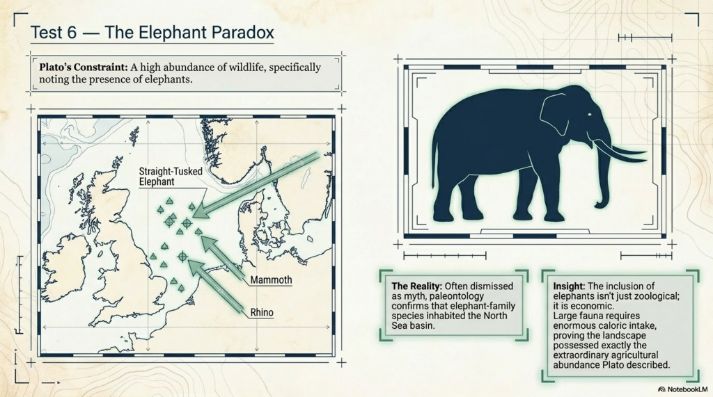
“Moreover, there were a great number of elephants in the island.”

The conclusion appears obvious.

Britain has no elephants.

Therefore, Atlantis cannot have been Britain, Doggerland, or anywhere within the North Sea basin.

At first glance, the argument appears convincing.

The problem is that it depends upon assumptions that become increasingly difficult to defend when examined against the archaeological evidence.

The first issue is that elephant-family species are already accepted within the British fossil record. Straight-tusked elephants, mammoths, hippopotamus, rhinoceros, lions, hyenas, and numerous other large mammals have all been recovered from Britain and the landscapes surrounding the North Sea. Their existence is not disputed. Museums throughout Britain contain the evidence.

The debate, therefore, is not about whether these animals existed.

They did.

The debate concerns how they got there.

According to the conventional model, many of these animals occupied Britain during warm interglacial periods, particularly the Eemian. During this period, Britain is frequently portrayed as a warm environment capable of supporting species normally associated with much more southerly regions.

Yet this explanation immediately creates a contradiction.

The same model often requires sea levels to be substantially higher than present levels. As sea levels rise, the land connections linking Britain to continental Europe become progressively restricted. The very animals used as evidence of a warm climate require migration routes that are increasingly difficult to explain.

The result is an uncomfortable paradox.

The archaeological evidence demonstrates that the animals existed.

The environmental model struggles to explain how such large populations repeatedly arrived.

This problem becomes even greater when the wider geographical distribution of these animals is considered. Elephant remains are not confined to Britain. Similar evidence exists throughout north-west Europe bordering the North Sea basin. The pattern suggests a much larger landscape supporting extensive animal populations rather than isolated pockets of wildlife trapped on an island.

This is precisely what Doggerland represents.

A vast interconnected landmass linking Britain to continental Europe.

A landscape through which both animals and humans could move freely.

The significance of this observation becomes even more apparent when viewed alongside Plato’s wider description of Atlantis.

Critics often isolate the elephant passage as though it exists independently of the rest of the account.

It does not.

By this stage of the investigation, Plato has already described a civilisation connected by waterways, supported by maritime transport, and operating across an extensive geographical network. The archaeological evidence points towards the movement of obsidian across Europe, Baltic amber into distant regions, Alpine jade over thousands of kilometres, Anatolian wheat into Britain, and the transport of massive stones across substantial distances.

Materials moved.

Resources moved.

People moved.

Ideas moved.

Entire trade networks operated across rivers, coastlines, and shallow seas.

Against this backdrop, the suggestion that large animals could also be moved becomes far less remarkable than critics often imply.

Indeed, elephants were not confined to Africa. Throughout antiquity, elephant populations occupied regions much closer to Europe, including parts of the eastern Mediterranean. The modern tendency to associate elephants exclusively with Africa is, therefore, misleading when discussing prehistoric and ancient landscapes.

More importantly, Plato’s reference is not primarily zoological.

It is economic.

Large animals consume enormous quantities of food and water. A landscape capable of supporting significant elephant populations is, by definition, a landscape of abundance.

This is exactly the point Plato is making.

The elephant passage forms part of a wider description of exceptional productivity. Throughout Critias, Atlantis is portrayed as a land rich in water, wildlife, natural resources, agriculture, and wealth. The elephants are not presented as curiosities. They are presented as evidence of the extraordinary prosperity of the landscape itself.

When viewed in this context, the criticism begins to collapse.

The fossil evidence demonstrates that elephant-family species existed within Britain and the wider North Sea region.

The conventional explanation for their presence contains unresolved contradictions.

The geographical reconstruction of Doggerland provides a more coherent mechanism for both animal and human movement.

And Plato’s description of elephants forms part of a broader picture of abundance that aligns closely with the productive environments reconstructed for the drowned landscapes of north-west Europe.

Far from disproving the existence of a northern Atlantis, the elephant passage may preserve one of the clearest memories of a world that has long since disappeared.

A world of vast plains, interconnected waterways, abundant wildlife, and rich ecosystems stretching across what is now the floor of the North Sea.

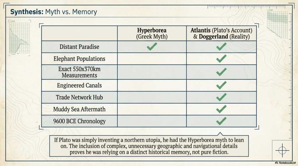
NB. The Hyperborea Problem

One possible explanation for Atlantis is that Plato simply invented a mythical land beyond the known world. However, this explanation encounters an unexpected difficulty.

Greek literature already contained examples of distant northern paradises, the most famous of which was Hyperborea. Like Atlantis, Hyperborea was described as a prosperous land located beyond the ordinary limits of the Greek world. It was associated with abundance, favourable conditions, and a people living in harmony with the gods.

Yet Hyperborea contains no elephants.

This is significant because it demonstrates that Greek writers did not normally populate northern legendary lands with elephant herds. If Plato simply wanted to create another distant paradise, elephants were not a necessary part of the story.

Indeed, Hyperborea shares several broad themes with Atlantis while lacking many of Atlantis’s most distinctive features. There are no great engineering works, no vast canal systems, no maritime empire, no imperial ambitions, and no large elephant populations.

The question, therefore, becomes difficult to avoid.

Why did Plato include elephants?

If they were merely a literary invention, they represent a surprisingly specific addition to a narrative that did not require them. If they originated within an earlier tradition known to Plato, then the problem changes completely. The question is no longer why Plato added elephants, but why the source tradition contained them in the first place.

Hyperborea demonstrates that Greeks could imagine northern utopias without elephants.

The elephant passage, therefore, remains one of the most unusual and difficult-to-explain details within the Atlantis account.

And if Plato’s description of the environment continues to align with the evidence, attention must now turn to the most dramatic claim of all.

According to Plato, this entire landscape was ultimately destroyed by water.
 (Testing Plato's Atlantis Against Reality)
(Testing Plato’s Atlantis Against Reality)

10. The Great Flood

No aspect of Plato’s account has received more attention than the destruction of Atlantis.

For many researchers, it is the defining event of the story. Entire theories have been built around earthquakes, volcanic eruptions, tsunamis, and sudden catastrophes. Yet before attempting to explain the destruction, it is essential to establish exactly what Plato wrote.

In Timaeus, the Egyptian priest tells Solon:

“There occurred violent earthquakes and floods; and in a single day and night of misfortune all your warlike men in a body sank into the earth, and the island of Atlantis in like manner disappeared beneath the sea.”

This passage is frequently misunderstood.

The phrase “your warlike men” does not refer to the Atlanteans. The priest is speaking directly to Solon and is referring to the prehistoric Athenians who supposedly opposed Atlantis. Plato is therefore describing two separate losses.

First, the destruction of the ancient Athenian force:

“all your warlike men in a body sank into the earth.”

Second, the destruction of Atlantis:

“the island of Atlantis in like manner disappeared beneath the sea.”

The distinction is important because the two events are described differently. The Athenians are said to sink into the earth, while Atlantis disappears beneath the sea. Although Plato links the events together, he does not explicitly state that they occurred through the same mechanism.

This observation immediately complicates the traditional interpretation of Atlantis being destroyed in a single catastrophic moment.

The text may instead preserve memories of different processes combined within a single narrative.

This becomes particularly significant when compared with the geological evidence.

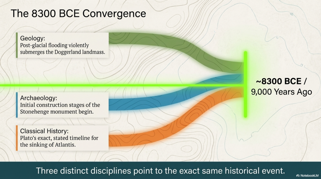
Unlike most proposed locations for Atlantis, Doggerland is known to have suffered the exact fate Plato describes.

It disappeared beneath the sea.

For thousands of years following the end of the last Ice Age, Doggerland formed a vast low-lying landscape connecting Britain to continental Europe. Rivers crossed its plains. Forests covered large areas. Lakes, marshes, and wetlands supported abundant wildlife and human populations. Archaeological discoveries from the North Sea continue to demonstrate that this landscape was inhabited for millennia.

Today, it lies beneath the sea.

This is not a theory.

It is a geological fact.

The significance of this cannot be overstated.

Many theories about Atlantis attempt to explain how a civilisation might have been destroyed.

Doggerland requires no such explanation.

Its destruction is already accepted.

The debate concerns how that destruction occurred.

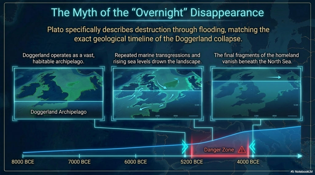
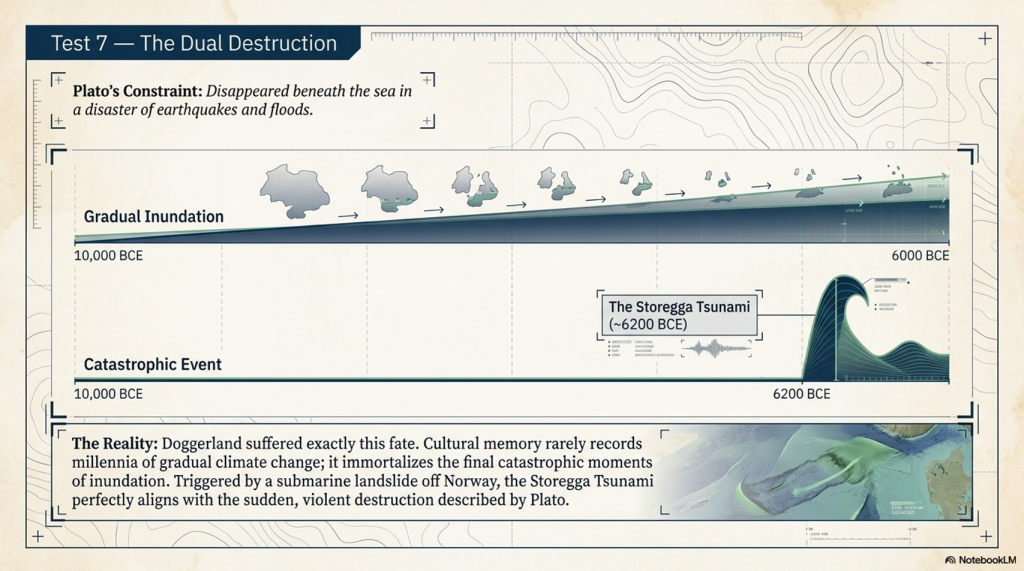
The conventional model describes a gradual process. As the Ice Age ended, melting glaciers caused global sea levels to rise. Over thousands of years, coastlines retreated, and low-lying regions became increasingly vulnerable to flooding. Rivers expanded into estuaries. Wetlands spread across the landscape. Eventually, large portions of Doggerland were submerged.

At first glance, this appears inconsistent with Plato’s dramatic description.

However, this comparison may be misleading.

Human societies rarely preserve memories of gradual environmental change.

They remember disasters.

A coastline may retreat slowly over centuries, but a major flood, storm surge, or sudden inundation can become fixed within cultural memory for generations. What survives in oral tradition is often not the process itself but the final catastrophe.

This distinction is crucial.

Doggerland was not lost through a single mechanism.

It was lost through a combination of processes acting over long periods.

Sea levels rose.

Coastlines retreated.

Settlements were abandoned.

Communities migrated.

Then, on top of these gradual changes, catastrophic events occurred.

The most famous of these was the Storegga tsunami around 6200 BCE. Triggered by a massive submarine landslide off the coast of Norway, the resulting tsunami impacted large areas of the North Atlantic and North Sea basin. Evidence of its effects has been identified around the coasts of Britain and neighbouring regions.

Whether Storegga alone destroyed Doggerland remains debated.

What matters is that it demonstrates something often overlooked.

The North Sea basin experienced both gradual inundation and sudden catastrophic flooding.

The landscape was therefore subject to precisely the combination of processes capable of generating the type of memory preserved in Plato’s account.

A long decline.

Followed by dramatic losses.

The more closely Doggerland is examined, the more unusual the comparison becomes. The geographical location corresponds. The dimensions of the plain correspond. The rivers, wetlands, maritime networks, trade routes, and environmental evidence all show remarkable similarities to Plato’s description.

Now the destruction itself reveals another correspondence.

Unlike Atlantis, Doggerland is not a legend.

Its existence is accepted.

Its flooding is accepted.

Its disappearance beneath the sea is accepted.

The only remaining question is whether Plato’s account preserves a distant memory of that lost landscape.

And it is here that Plato provides one final clue—one so unusual that many Atlantis researchers simply ignore it.

According to Plato, the destruction of Atlantis left behind something very specific.

Not an open sea.

But a sea of mud.
 (Testing Plato's Atlantis Against Reality)
(Testing Plato’s Atlantis Against Reality)

11. The Muddy Sea Mystery

If the flooding of Atlantis is the most famous part of Plato’s account, the muddy sea is undoubtedly the most neglected.

Yet it may also be one of the most important.

Following his description of Atlantis’s destruction, Plato records a curious consequence:

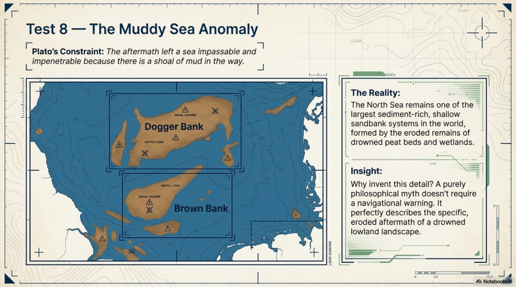
“For in consequence of the subsidence of the island, the sea in those parts became impassable and impenetrable, because there is a shoal of mud in the way; and this was caused by the subsidence of the island.”

This statement is remarkable.

Unlike the great plain, the canals, the elephants, or the flooding itself, the muddy sea serves no obvious literary purpose. It contributes nothing to Plato’s moral lesson concerning the rise and fall of civilisations. It does not glorify Atlantis. It does not explain its destruction.

Instead, it appears to be an observational detail.

A practical problem.

A navigational hazard.

This immediately raises an important question.

Why include it at all?

Most Atlantis theories struggle to answer.

If Atlantis were destroyed by a volcanic eruption, the expected consequence would be volcanic debris rather than a vast muddy shoal. If Atlantis existed in the deep Atlantic Ocean, the disappearance of an island would not normally leave behind an impassable sea of mud. If Atlantis were merely a philosophical invention, the muddy sea would become an oddly specific detail with little narrative value.

Yet when examined against Doggerland, the description becomes surprisingly familiar.

Doggerland was not a rocky island rising from deep water.

It was a vast low-lying plain composed largely of sediments deposited by rivers, glaciers, wetlands, and coastal processes. For thousands of years, enormous quantities of silt, clay, peat, and organic material accumulated across the North Sea basin.

As sea levels rose, these landscapes did not simply vanish.

They eroded.

River valleys became estuaries.

Peat beds were broken apart.

Coastal sediments were redistributed.

Vast quantities of material were mobilised by tides, storms, and flooding events.

The result was not a clean transition from land to sea.

It was a landscape of shifting banks, shoals, shallows, and submerged hazards.

This characteristic remains visible today.

Dogger Bank itself stands as the most obvious example. Stretching across a huge area of the central North Sea, it represents one of the largest sandbank systems in the world. Other features, including Brown Bank and numerous submerged ridges and shoals, continue to influence navigation and sediment movement throughout the region.

To a mariner unfamiliar with the area, these features could indeed make parts of the sea difficult or dangerous to traverse.

This observation becomes even more significant when viewed through the perspective of memory.

Imagine a civilisation witnessing the gradual loss of a vast lowland landscape. Rivers become estuaries. Forests become marshes. Settlements retreat from advancing waters. Eventually, the land disappears.

What remains?

Not an open ocean.

Not a deep abyss.

But a shallow, sediment-rich seascape filled with banks, mudflats, submerged channels, and navigational hazards.

In other words, precisely the environment Plato describes.

The significance of this passage extends beyond simple geography.

Throughout this investigation, many of Plato’s major descriptions have found parallels within the reconstructed landscape of Doggerland. Critics may argue that large features such as plains, rivers, mountains, or flooding are common and therefore unsurprising.

The muddy sea is different.

It is oddly specific.

It is not a feature that appears in most lost-civilisation myths.

Nor is it an obvious detail for a philosopher inventing a moral allegory.

Instead, it reads like the sort of practical observation one might expect from sailors operating in a drowned, sediment-filled landscape.

This is precisely why the muddy sea deserves more attention than it usually receives.

It may be one of the few details within the Atlantis account that serves no literary function at all.

Its value lies entirely in its description of the physical world.

And when that description is compared with the submerged landscapes of the North Sea, the correspondence is striking.

A great plain.

A network of rivers.

A maritime civilisation.

A flooded landscape.

And finally, a shallow sea made it difficult to navigate through mud and shoals.

Each individual match may be debated.

The cumulative pattern is harder to dismiss.

After more than two thousand years of speculation, we can finally ask the question that should have been asked from the beginning.

How many of Plato’s descriptions does Doggerland actually satisfy?
 (Testing Plato's Atlantis Against Reality)
(Testing Plato’s Atlantis Against Reality)

12. The Date Problem

Among all the details recorded by Plato, none has generated more controversy than the date of Atlantis.

For many researchers, it is also the easiest detail to dismiss.

According to the Egyptian priests who related the story to Solon, the war between Atlantis and the ancestors of the Athenians occurred:

“9,000 years before.”

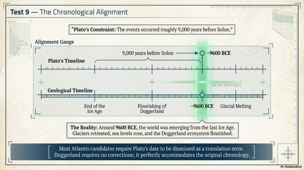
When combined with Solon’s visit to Egypt around the sixth century BCE, this places the destruction of Atlantis at approximately 9600 BCE.

For generations, this date has been regarded as impossible.

Various explanations have been proposed. Some suggest that the Egyptian priests confused lunar years with solar years. Others argue that a copying error occurred during transmission. Some simply dismiss the figure entirely and focus on other parts of the story.

Yet this creates an obvious problem.

If Plato’s measurements are accepted when they support a theory, but rejected when they do not, the investigation becomes subjective. The same standard must be applied throughout.

The date, therefore, deserves to be examined rather than dismissed.

The first observation is that Plato treats the chronology as factual information rather than symbolism. The Egyptian priests do not present the date as a metaphor, an allegory, or a philosophical concept. They present it as a historical interval spanning from Solon’s time to the destruction of Atlantis.

The second observation is more interesting.

If the date is accepted, even approximately, it points towards a very specific period in European prehistory.

Around 9600 BCE, the world was emerging from the last Ice Age.

Glaciers were retreating.

Sea levels were rising.

Coastlines were changing.

Entire landscapes were being transformed.

Most importantly, the North Sea basin was still largely dry land.

Doggerland existed.

This creates a remarkable correspondence.

Many proposed Atlantis locations fail immediately upon consideration of chronology. Bronze Age settlements are thousands of years too recent. Classical and Iron Age sites are even further removed. The entire theory depends upon ignoring Plato’s date altogether.

Doggerland does not suffer from this problem.

The chronology points directly to the period when Doggerland flourished.

This does not mean the date is exact.

Ancient chronologies are rarely exact.

Nor does it mean every event described by Plato occurred precisely in 9600 BCE.

What matters is the broad agreement between the period recorded by the Egyptian priests and the period during which the Doggerland landscape existed.

The significance becomes even greater when viewed alongside the evidence presented in previous chapters.

The location aligns.

The dimensions align.

The environmental reconstruction aligns.

The waterways align.

The trade networks align.

The flooding aligns.

The muddy sea aligns.

Now the chronology aligns as well.

This cumulative pattern is difficult to ignore.

Indeed, one of the most striking aspects of the Doggerland hypothesis is that it does not require Plato’s date to be rewritten, corrected, or discarded. Unlike many competing theories, it can accommodate the chronology largely as recorded.

This raises an important question.

If Plato’s figure is wrong, how do we know?

And if it is broadly correct, why does it point so directly towards the very period in which a vast North European landscape existed before being lost beneath the sea?

The answer remains uncertain.

What is clear, however, is that the date presents a challenge for almost every Atlantis theory except one.

For the first time, the chronology, geography, environment, and fate of the landscape all appear to be pointing towards the same place.

Doggerland.

The question is no longer whether individual elements of Plato’s account resemble the evidence.

The question is how many of those elements can be explained by the same landscape simultaneously.

That is the issue to which we now turn.

next section
 (Testing Plato's Atlantis Against Reality)
(Testing Plato’s Atlantis Against Reality)

13. Testing Plato Against Reality

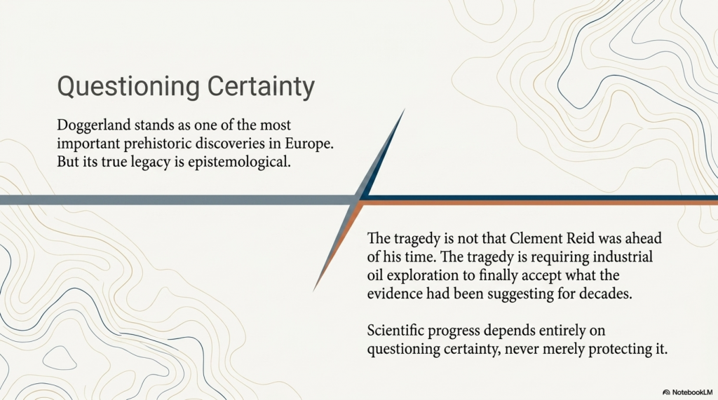
After more than two thousand years of speculation, the Atlantis debate remains as divided as ever.

This is not because there is a shortage of theories.

The problem is that most Atlantis investigations begin with a conclusion. A location is selected first, and evidence is then gathered to support it. Features that appear to fit Plato’s description are highlighted. Features that do not are explained away, ignored, or reinterpreted.

The result is a landscape of competing theories, each claiming success while explaining only part of the story.

This investigation has followed a different approach.

Rather than beginning with Doggerland, it began with Plato.

The objective was not to prove Atlantis existed.

The objective was to examine Plato’s account as a series of geographical, environmental, engineering, and historical observations and ask a simple question:

How many of these observations correspond with a known prehistoric landscape?

The answer is surprising.

Plato places Atlantis beyond the Pillars of Heracles within the Atlantic realm.

Doggerland satisfies that requirement.

Plato describes a vast oblong plain measuring approximately 3,000 by 2,000 stadia.

Doggerland possesses a central plain of remarkably similar dimensions.

Plato describes mountains surrounding parts of the landscape and feeding rivers that crossed the plain.

Doggerland was bordered by the uplands of Britain and Scandinavia and contained one of the largest river systems in prehistoric Europe.

Plato describes abundant waterways, canals, harbours, and maritime activity.

The archaeological evidence increasingly points towards a civilisation organised around rivers, estuaries, shallow seas, and water transport.

Plato describes extensive trade and movement across large distances.

The archaeological record reveals obsidian, amber, jade, copper, wheat, tin, gold, and other materials moving across continental-scale networks.

Plato describes exceptional fertility and abundant wildlife.

The environmental reconstruction of Doggerland reveals one of the richest prehistoric ecosystems known from Europe.

Plato describes elephants.

The wider North Sea basin has produced evidence of elephant-family species alongside numerous other large mammals. More importantly, the presence of elephants appears as an unusual detail rather than a standard feature of Greek mythical geography.

Plato describes a landscape lost beneath the sea.

Doggerland is one of the few proposed Atlantis candidates known to have suffered precisely that fate.

Plato describes a muddy, difficult sea that remains after the destruction.

The North Sea contains some of the largest sediment banks, shoals, and submerged landscapes in Europe.

Finally, Plato records a date approximately 9,000 years before Solon.

Whether exact or approximate, the chronology points directly to the period when Doggerland existed and was undergoing a profound environmental transformation.

Individually, none of these observations proves that Doggerland was Atlantis.

Historical investigations rarely operate in such a simple manner.

The significance lies in the cumulative pattern.

Again and again, Plato’s descriptions appear to converge on the same landscape.

This is where the Doggerland hypothesis differs from many competing theories.

Most Atlantis candidates satisfy one or two major criteria.

Some satisfy the flooding.

Others satisfy aspects of the geography.

A few satisfy isolated archaeological observations.

Doggerland is unusual because multiple independent lines of evidence appear to point towards the same location.

This raises a question that becomes increasingly difficult to avoid.

If Plato invented Atlantis, why does the account contain so many details that correspond with a prehistoric landscape unknown to both Plato and the modern world until the development of marine archaeology?

The dimensions of the plain.

The maritime setting.

The flooding.

The muddy sea.

The chronology.

The environmental reconstruction.

The trade network.

The question becomes even more intriguing when compared with other Greek traditions.

The Greeks already possessed mythical lands beyond the known world. Hyperborea is perhaps the best-known example. Yet Hyperborea lacks many of the distinctive features that define Atlantis. There are no great canals, no maritime empire, no immense engineering works, no detailed geography, and no elephant populations.

If Plato simply wished to invent a distant paradise, he already had models available.

Instead, Atlantis contains a remarkable collection of specific observations that often appear unnecessary for a purely fictional narrative.

This does not prove the account is historical.

Nor does it prove that every detail must be literally correct.

What it does suggest is that Atlantis deserves to be examined more seriously than it often is.

For perhaps the first time, modern archaeology, geology, and environmental reconstruction allow Plato’s account to be tested against a real landscape.

The results are remarkable.

The final question, therefore, remains.

Does Doggerland ultimately pass Plato’s test?

Verdict: Does Doggerland Pass Plato’s Test?

At the beginning of this investigation, a simple principle was established.

The objective was not to prove Atlantis existed.

Nor was it to defend a predetermined theory.

Instead, the objective was to test Plato’s account against the evidence and determine whether any known prehistoric landscape satisfies the descriptions he recorded.

The results have been unexpected.

For more than two thousand years, Atlantis has occupied an unusual position in history. To some, it is a myth. To others, it is a philosophical allegory. To others, still, it is a lost civilisation waiting to be discovered. Entire libraries have been written attempting to locate Atlantis in the Mediterranean, the Atlantic, the Caribbean, Antarctica, and countless other locations.

Yet one problem remains constant.

Most proposed Atlantis locations satisfy only fragments of Plato’s account.

Some explain the flooding.

Some explain parts of the geography.

Some explain isolated archaeological observations.

Very few explain the entire narrative.

Throughout this investigation, Plato’s descriptions have been examined individually before being compared against the reconstructed landscape of Doggerland.
 (Testing Plato's Atlantis Against Reality)
(Testing Plato’s Atlantis Against Reality)

Again and again, the same pattern emerged.

The location corresponds.

The dimensions of the plain correspond.

The surrounding uplands correspond.

The rivers and wetlands correspond.

The maritime setting corresponds.

The trade networks correspond.

The environmental reconstruction corresponds.

The flooding corresponds.

The muddy sea corresponds.

Even the chronology points to the period when Doggerland existed and was ultimately lost.

Individually, any one of these observations might be dismissed as a coincidence.

Collectively, they become increasingly difficult to ignore.

This is perhaps the most important conclusion of the entire study.

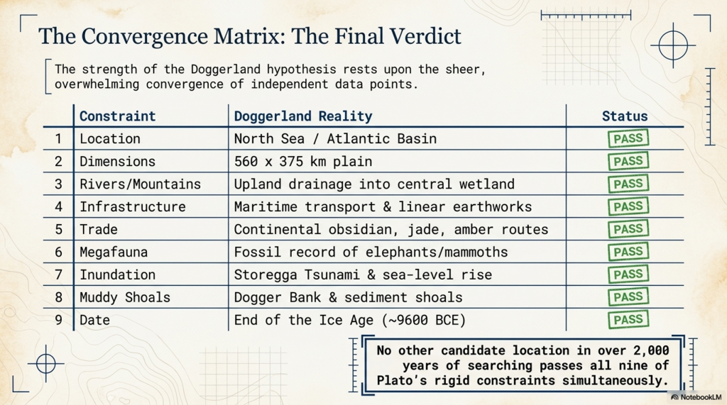
The strength of the Doggerland hypothesis does not rest upon a single piece of evidence.

It rests upon convergence.

Multiple independent descriptions recorded by Plato appear to point towards the same landscape.

This is precisely what should be expected if the account preserves a genuine memory of a real place.

It is also where the traditional explanation begins to encounter difficulties.

If Atlantis were entirely fictional, many of Plato’s details would become surprisingly specific.

The dimensions of the plain were unnecessary.

The muddy sea was unnecessary.

The elephant populations were unnecessary.

The extensive waterways were unnecessary.

The chronology was unnecessary.

The description of a drowned landscape was unnecessary.

Plato could have written a moral tale about pride and decline without any of these details.

Indeed, Greek literature already possessed examples of distant and idealised lands. Hyperborea is perhaps the best known. Yet Hyperborea lacks many of the distinctive features that define Atlantis. There are no vast engineering works, no maritime empire, no extensive canal systems, no detailed geography, and no elephant populations.

This observation does not prove Atlantis was historical.

It does, however, create a question that every sceptical interpretation must answer.

Why include so many specific details if they served no purpose?

More importantly, why do so many of those details correspond with a prehistoric landscape that remained unknown until the development of modern marine archaeology?

No one in Plato’s time knew Doggerland existed.

No one in the Middle Ages knew Doggerland existed.

No one in the nineteenth century knew Doggerland existed.

Only within the last few decades has the scale of the lost North Sea landscape become apparent.

Yet many of the characteristics described by Plato appear remarkably familiar when viewed against this newly reconstructed world.

This does not mean every aspect of the Atlantis story must be accepted literally.

Oral traditions evolve.

Chronologies become compressed.

Events separated by centuries may become combined within a single narrative. Historical memories merge with symbolism, politics, and mythology. Such processes are common throughout human history.

The question is therefore not whether Plato preserved a perfect historical account.

The question is whether a historical memory exists beneath the narrative.

The evidence presented throughout this investigation suggests that the possibility can no longer be dismissed.

For the first time, there exists a prehistoric landscape that satisfies a substantial proportion of Plato’s descriptions without requiring major alterations to the text itself.

The landscape is real.

Its flooding is real.

Its disappearance is real.

Its chronology broadly fits.

Its environment broadly fits.

Its geography broadly fits.

Its maritime character broadly fits.

Whether that landscape should ultimately be called Atlantis remains a matter for debate.

But the conclusion is unavoidable.

Doggerland passes Plato’s test more successfully than any Atlantis candidate proposed so far.

The significance of that result extends beyond Atlantis itself.

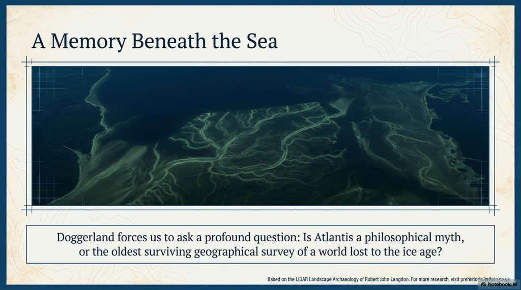
If Plato’s account preserves even a fragment of genuine memory, then the lost landscapes beneath the North Sea may represent one of the most important chapters of human history still waiting to be fully understood.

The Atlantis question, therefore, remains open.

But for the first time in over two thousand years, it is no longer a question without a plausible answer.
 (Testing Plato's Atlantis Against Reality)
(Testing Plato’s Atlantis Against Reality)

PODCAST

Author’s Biography

Robert John Langdon, a polymathic luminary, emerges as a writer, historian, and eminent specialist in LiDAR Landscape Archaeology.

His intellectual voyage has been interwoven with stints as an astute scrutineer in government and grand corporate bastions, a tapestry spanning British Telecommunications, Cable and Wireless, British Gas, and the esteemed University of London.

A decade hence, Robert’s transition into retirement unfurled a chapter of insatiable curiosity. This phase saw him immerse himself in Politics, Archaeology, Philosophy, and the enigmatic realm of Quantum Mechanics. His academic odyssey traversed the venerable corridors of knowledge hubs such as the Museum of London, University College London, Birkbeck College, The City Literature Institute, and Chichester University.

In the symphony of his life, Robert is a custodian of three progeny and a pair of cherished grandchildren. His sanctuary lies ensconced in the embrace of West Wales, where he inhabits an isolated cottage, its windows framing a vista of the boundless sea – a retreat from the scrutinising gaze of Her Majesty’s Revenue and Customs, an amiable clandestinity in the lap of nature.

Exploring Prehistoric Britain: A Journey Through Time

My blog delves into the fascinating mysteries of prehistoric Britain, challenging conventional narratives and offering fresh perspectives grounded in cutting-edge research, particularly LiDAR technology. I invite you to explore some key areas of my research. For example, the Wansdyke, often cited as a defensive structure, is re-examined in light of new evidence. I’ve presented my findings in my blog post Wansdyke: A British Frontier Wall – ‘Debunked’, and a Wansdyke LiDAR Flyover video further visualises my conclusions.

My work also often challenges established archaeological dogma. I argue that many sites, such as Hambledon Hill, commonly identified as Iron Age hillforts, are not what they seem. My posts Lidar Investigation Hambledon Hill – NOT an ‘Iron Age Fort’ and Unmasking the “Iron Age Hillfort” Myth explore these ideas in detail and offer an alternative view. Similarly, sites like Cissbury Ring and White Sheet Camp receive re-evaluations based on LiDAR analysis in my posts “Lidar Investigation Cissbury Ring through time” and “Lidar Investigation White Sheet Camp, revealing fascinating insights into their true purpose. I have also examined South Cadbury Castle, often linked to the mythical Camelot56.

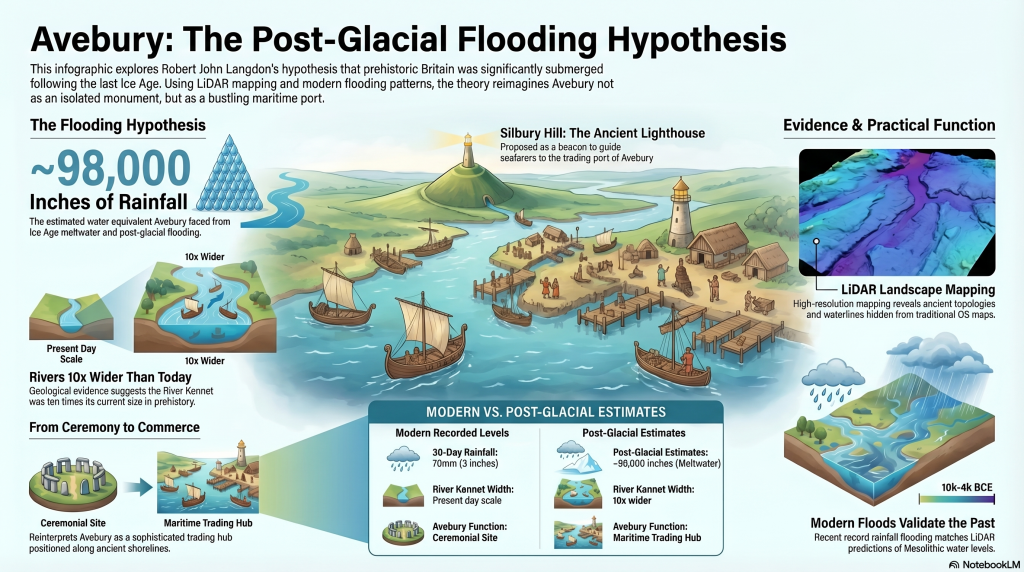
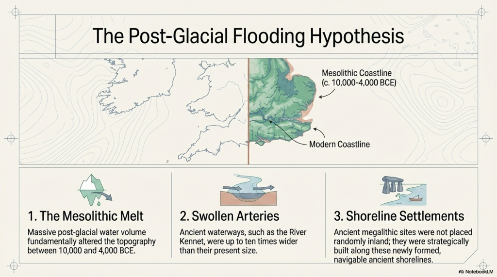
My research also extends to ancient water management, including the role of canals and other linear earthworks. I have discussed the true origins of Car Dyke in multiple posts, including Car Dyke – ABC News Podcast and Lidar Investigation Car Dyke – North Section, which suggest a Mesolithic origin 2357. I also explore the misidentification of Roman aqueducts, as seen in my posts on the Great Chesters (Roman) Aqueduct. My research has also been greatly informed by my post-glacial flooding hypothesis, which has helped explain landscape transformations over time. I have discussed this hypothesis in several posts, including AI now supports my Post-Glacial Flooding Hypothesis and Exploring Britain’s Flooded Past: A Personal Journey

Finally, my blog also investigates prehistoric burial practices, as seen in Prehistoric Burial Practices of Britain and explores the mystery of Pillow Mounds, often mistaken for medieval rabbit warrens, but with a potential link to Bronze Age cremation in my posts: Pillow Mounds: A Bronze Age Legacy of Cremation? and The Mystery of Pillow Mounds: Are They Really Medieval Rabbit Warrens?. My research also includes astronomical insights into ancient sites, for example, in Rediscovering the Winter Solstice: The Original Winter Festival. I also review new information about the construction of Stonehenge in The Stonehenge Enigma.

Further Reading

For those interested in British Prehistory, visit www.prehistoric-britain.co.uk, a comprehensive resource featuring an extensive collection of archaeology articles, modern LiDAR investigations, and groundbreaking research. The site also includes insights and excerpts from the acclaimed Robert John Langdon Trilogy, a series of books that explore Britain during the Prehistoric period. Titles in the trilogy include The Stonehenge Enigma, Dawn of the Lost Civilisation, and The Post-Glacial Flooding Hypothesis, which offer compelling evidence of ancient landscapes shaped by post-glacial flooding.

To further explore these topics, Robert John Langdon has developed a dedicated YouTube channel featuring over 100 video documentaries and investigations that complement the trilogy. Notable discoveries and studies showcased on the channel include 13 Things that Don’t Make Sense in History and the revelation of Silbury Avenue – The Lost Stone Avenue, a rediscovered prehistoric feature at Avebury, Wiltshire.

In addition to his main works, Langdon has released a series of shorter, accessible publications, ideal for readers delving into specific topics. These include:

For active discussions and updates on the trilogy’s findings and recent LiDAR investigations, join our vibrant community on Facebook. Engage with like-minded enthusiasts by leaving a message or contributing to debates in our Facebook Group.

Whether through the books, the website, or interactive videos, we aim to provide a deeper understanding of Britain’s fascinating prehistoric past. We encourage you to explore these resources and uncover the mysteries of ancient landscapes through the lens of modern archaeology.

For more information, including chapter extracts and related publications, visit the Robert John Langdon Author Page. Dive into works such as The Stonehenge Enigma or Dawn of the Lost Civilisation, and explore cutting-edge theories that challenge traditional historical narratives.

Other Blogs

s

t

Plato Was Right: The Archaeological Evidence the Academics Never Expected

Introduction

For more than a century, archaeology has treated Plato’s Atlantis as little more than an allegory. Students are taught that Atlantis was a philosophical invention. A morality tale. A fictional society created to demonstrate the dangers of arrogance and imperial ambition. (Plato’s Atlantis)

The problem with this explanation is simple.

Plato’s story contains an extraordinary number of specific claims.

He described a powerful maritime civilisation existing around 9,000 years before Solon. He placed it beyond the Pillars of Hercules in a sea that bears its name to this day – the Atlantic Ocean. He claimed it possessed fleets capable of travelling vast distances, maintained contact with distant lands, and ultimately disappeared beneath the sea following catastrophic flooding.

Most importantly, Plato claimed the survivors of this lost civilisation seeded both Egypt and Greece.

For generations, academics dismissed the entire account as fiction.

The archaeology now suggests they may have been wrong.

(Plato's Atlantis)
(Plato’s Atlantis)

1. Atlantis and the Atlantic

One of the most overlooked aspects of Plato’s account is geography.

Atlantis was not described as a Mediterranean civilisation.

It lay beyond the Pillars of Hercules in the Atlantic Ocean.

Today, the ocean itself still carries the name.

Whether the ocean was named after Atlantis or Atlantis after the ocean is ultimately irrelevant. What matters is that Plato was clearly describing a civilisation connected to the Atlantic world rather than the eastern Mediterranean.

That distinction becomes critically important when we consider what archaeology has discovered during the last few decades.

(Plato's Atlantis)
(Plato’s Atlantis)

2. The Lost World Beneath the North Sea

When Plato wrote his account, nobody knew that an enormous inhabited landscape once existed beneath the North Sea.

Today, we call it Doggerland.

During the Late Ice Age, Britain was connected to Europe by a vast plain crossed by rivers, lakes, forests and wetlands. This was not a small island. It was an entire country-sized landscape supporting human populations for thousands of years.

Then the climate changed.

The ice sheets melted.

Sea levels rose.

The land disappeared beneath the waves.

For centuries, such a drowned world would have been dismissed as fantasy.

Today, it is accepted in archaeology.

The existence of Doggerland alone demonstrates that Plato’s central premise – that large inhabited lands were lost beneath the sea – was not fantasy at all.

(Plato's Atlantis)
(Plato’s Atlantis)

3. The Great Flooding Event

Around 6200 BCE the Storegga tsunami and associated post-glacial flooding transformed the landscapes of north-west Europe.

Although flooding was not a single event, the combined effects of sea-level rise, coastal erosion and catastrophic inundation dramatically reduced the habitable land available to prehistoric populations.

The significance of this cannot be overstated.

An entire world disappeared.

Rivers vanished.

Coastlines moved.

Settlements were destroyed.

Migration became inevitable.

If a sophisticated maritime culture existed within Doggerland, it would have faced a simple choice:

Adapt, relocate or perish.

(Plato's Atlantis)
(Plato’s Atlantis)

4. Bouldnor Cliff Changes Everything

The discovery at Bouldnor Cliff is one of the most important archaeological finds ever made in Britain.

Dating to the seventh millennium BC, the site revealed evidence of advanced woodworking, boat use and long-distance connections.

Most remarkably, researchers recovered evidence of einkorn wheat.

This is not a trivial discovery.

Einkorn was not adopted in Britain for approximately another 3,000 years.

The presence of einkorn demonstrates contact with regions where the crop was already known and cultivated.

In other words, maritime connections already existed between Britain and distant communities long before conventional history would have us believe.

This single discovery destroys the notion that Mesolithic Britain was isolated from the wider world.

(Plato's Atlantis)
(Plato’s Atlantis)

5. Maritime Routes Create Ports

There is another implication that is rarely discussed.

Boats travelling between Britain and the Near East do not operate by magic.

They require food.

Fresh water.

Repairs.

Shelter.

Replacement crews.

Trade goods.

Every historical maritime network in history produced ports and anchorages.

The Phoenicians did it.

The Greeks did it.

The Romans did it.

The Vikings did it.

The Elizabethans did it.

There is no reason to imagine prehistoric sailors behaved differently.

Repeated voyages between the Atlantic and Anatolia would naturally create stopping points along the coasts of Iberia, southern France, Italy, Greece, and Egypt.

Over generations, these temporary anchorages would evolve into permanent trading communities.

Sailors would settle.

Families would form.

Local populations would mix.

Knowledge would spread.

This is how maritime civilisations have always operated.

(Plato's Atlantis)
(Plato’s Atlantis)

6. Plato’s Most Important Claim

Plato did not merely describe a lost civilisation.

He claimed that the survivors seeded both Egypt and Greece.

This is an astonishingly specific statement.

It creates a testable archaeological prediction.

If the account preserves genuine historical memory, then traces of unusual founder populations should appear in both Egypt and Greece during the period following the destruction of the Atlantic homeland.

Remarkably, that is exactly what the archaeology appears to reveal.

(Plato's Atlantis)
(Plato’s Atlantis)

7. Egypt: The First Foundation

The Egyptian evidence is striking.

The chronology reveals continuity rather than replacement.

EgyptGreece
Qarunian (7570–6200 BC)Aceramic Neolithic
Transitional Phase (6200–5550 BC)Early Neolithic
Early Faiyumian (5550–4650 BC)Nea Nikomedeia
Merimde (c.5000–4300 BC)Proto-Sesklo / Sesklo
Tasian (c.4500 BC onwards)Prodromos / Dimini

The populations associated with Merimde and the Tasian culture have been described as:

  • Long-headed.
  • Robust.
  • Physically distinct from many later Egyptians.
  • Generally taller than later predynastic populations.

Excavation reports also recorded individuals with sandy, ginger and even golden hair, leading archaeologists to suggest the existence of a fair strain within the population.

These are not modern interpretations.

They are observations recorded by the excavators themselves.

(Plato's Atlantis)
(Plato’s Atlantis)

8. Greece: The Second Foundation

The Greek evidence follows a remarkably similar pattern.

Early Neolithic populations appear on a timeline virtually identical to that of Egypt.

Sites such as Nea Nikomedeia, Sesklo and Prodromos represent some of the earliest organised communities in Europe.

Anthropological studies repeatedly describe Thessalian populations as predominantly long-headed.

At Prodromos, archaeologists discovered a remarkable cache of eleven human skulls deliberately placed beneath a house floor.

Dedicated anthropological investigations were conducted into these populations, exactly as occurred in Egypt.

The similarities are difficult to ignore.

EgyptGreece
Merimde long-headedThessalian populations described as long-headed
Tasian long-headedProdromos skull assemblage
Robust populationsFounder populations under anthropological study
Taller than later EgyptiansStature evidence incomplete
Fair-haired individualsEvidence currently absent
Continuity from earlier populationsContinuity from Early Neolithic founder settlements
(Plato's Atlantis)
(Plato’s Atlantis)

9. The Chronology Fits

When the chronology is compared directly, the pattern becomes even more remarkable.

DateNorth Sea / Atlantis ModelGreece
8000–7000 BCDoggerland extensiveMesolithic hunter-gatherers
7000–6500 BCPopulation displacement possibleEarliest Neolithic begins
6500–6000 BCLowland reductions continuingThessaly settlements expanding
6200–5500 BCTransitional phaseSesklo emerging
5500–5000 BCDoggerland fragmentedMajor Sesklo centre
5000–4500 BCSurvivor periodDimini and advanced settlements
4500–4000 BCMegalithic Structures EndIncreasing Aegean complexity
3500–3000 BCFarmers take over BritainCycladic maritime culture

The sequence is not proof.

But it is exactly the pattern we would expect if populations displaced from the Atlantic world contributed to later civilisations.

(Plato's Atlantis)
(Plato’s Atlantis)

10. The Allegory Has a Problem

The academic explanation has always been simple.

Atlantis was fictional.

The difficulty is that fictional stories are not supposed to generate accurate archaeological predictions.

Plato described:

  • A maritime civilisation.
  • An Atlantic homeland.
  • Catastrophic flooding.
  • A date close to the end of the Ice Age.
  • Survivors.
  • Egypt.
  • Greece.

Archaeology has now confirmed:

  • The drowned landscape.
  • The flooding.
  • The maritime networks.
  • Long-distance contacts.
  • Founder populations in Egypt.
  • Founder populations in Greece.

Nobody is claiming that every detail of Plato’s account has been proven.

What can no longer be maintained is the lazy assumption that the story was merely an allegory.

Two thousand four hundred years ago, Plato described a lost maritime world destroyed by rising seas whose survivors helped shape the civilisations that followed.

Today, archaeology is beginning to uncover evidence that such a world may have existed.

The greatest irony of all may be that the man historians dismissed as a storyteller was closer to the truth than the experts who spent a century insisting he was wrong.

(Plato's Atlantis)
(Plato’s Atlantis)

🌊 19 Reasons Why Doggerland Was Atlantis 🌊

The Atlantis Mystery Archaeology Doesn’t Want to Solve

For over 2,300 years, people have searched for Atlantis.

They have looked in the Mediterranean, the Atlantic Ocean, Antarctica, the Caribbean, Spain, Morocco, the Azores, and even Indonesia.

Yet there is a problem.

None of these proposed locations matches more than a handful of Plato’s descriptions.

Most require selective reading, reinterpretation, or outright dismissal of key details.

Doggerland is different.

Lying beneath the North Sea between Britain and Europe, Doggerland was a real landscape. It existed. It flooded. It supported human populations. And remarkably, when Plato’s account is compared to measurable evidence, the number of correspondences becomes difficult to ignore.

Here are 19 reasons why Doggerland remains the strongest candidate for Atlantis ever identified.


1️⃣ A Large Island Beyond the Mediterranean

Plato describes a vast landmass beyond the familiar world of the Mediterranean.

Doggerland once connected Britain to continental Europe and formed one of the largest habitable landscapes in north-west Europe before it disappeared beneath the sea.


2️⃣ A Vast Central Plain

Plato gives dimensions of approximately 2,000 by 3,000 stadia.

When converted into modern measurements, this equates to roughly 370 by 550 kilometres.

The reconstructed Doggerland plateau measures approximately 375 by 560 kilometres.

Few Atlantis candidates come anywhere close.


3️⃣ Mountains to the North

Plato describes mountains surrounding the northern edge of the plain.

Scotland, Norway and Scandinavia form exactly such a northern mountainous boundary around the North Sea basin.


4️⃣ A Landscape Dominated by Water

Atlantis was described as a landscape of rivers, channels and waterways.

Doggerland was criss-crossed by major river systems, wetlands, lakes, estuaries and palaeochannels now mapped beneath the North Sea.


5️⃣ A Maritime Civilisation

Plato repeatedly emphasises ships and seafaring.

The Atlantic façade and North Sea region contain overwhelming evidence for water-based movement, trade and communication.


6️⃣ Large-Scale Hydraulic Engineering

Plato describes canals and water management on a huge scale.

Britain and north-west Europe preserve extensive dykes, canals, causewayed enclosures and engineered earthworks whose original purposes remain debated.


7️⃣ Concentric Rings of Land and Water

One of Atlantis’s most famous features.

Concentric enclosures, ring monuments and circular hydraulic structures occur throughout Atlantic Europe.


8️⃣ A Fertile Plain

Plato describes a rich agricultural landscape.

Pollen records, peat deposits and sediment analysis reveal that Doggerland supported extensive woodland, grassland and productive river valleys.


9️⃣ Marshes and Wetlands

Atlantis was rich in freshwater.

Geological reconstruction consistently shows Doggerland as a landscape dominated by lakes, marshes, rivers and elevated groundwater systems.


🔟 Elephants

Critics often dismiss this detail.

Yet elephant remains are not only known from Europe—they are known from Britain.

Elephant, mammoth and hippopotamus remains have all been recovered from Britain and the North Sea basin.


1️⃣1️⃣ Advanced Engineering

Plato describes a highly organised civilisation.

The megalithic monuments of north-west Europe required surveying, transport, planning and engineering on a remarkable scale.


1️⃣2️⃣ Large Fleets

Atlantis supposedly maintained a fleet of around 1,200 ships.

Whether the exact number is correct is irrelevant.

Any maritime civilisation operating at this scale would require sophisticated navigation and environmental prediction.


1️⃣3️⃣ Environmental Monitoring Systems

This is where Stonehenge becomes important.

Stonehenge Phase 1 appears to function as a predictive lunar and tidal system operating within a water-dominated landscape.

Such infrastructure would be essential to a maritime culture.


1️⃣4️⃣ Progressive Flooding

Plato does not describe Atlantis disappearing overnight.

He describes destruction through flooding.

Doggerland vanished over thousands of years through repeated marine transgressions and rising sea levels.


1️⃣5️⃣ The Loss of the Homeland

Eventually, only fragments remained.

Between approximately 5200 and 4200 BCE the final Doggerland archipelago disappeared beneath the North Sea.


1️⃣6️⃣ Population Dispersal

What happens when a homeland disappears?

People move.

The concentration of megalithic monuments across Britain, Ireland, Brittany, Denmark, and the Low Countries is consistent with populations relocating along the margins of the former basin.


1️⃣7️⃣ Preservation of Memory

Civilisations remember disasters.

Stonehenge Phase 2 may represent the monumentalisation of that memory, transforming an earlier functional system into a permanent stone memorial.


1️⃣8️⃣ Physical Links to the Lost Land

Memory is often preserved through objects.

The Altar Stone may provide a physical connection between Stonehenge and the broader northern landscape associated with Doggerland.


1️⃣9️⃣ A Great Civilisation Remembered

Plato claimed Atlantis survived as a story long after the land itself disappeared.

If a maritime culture occupied Doggerland and its destruction became embedded within oral tradition, Plato’s account may preserve the final echo of a real prehistoric catastrophe.


The Real Question

Taken individually, none of these points proves the existence of Atlantis.

But that is not the test.

The test is whether any other Atlantis candidate matches so many independent categories simultaneously.

✅ Geography

✅ Dimensions

✅ Chronology

✅ Hydrology

✅ Environmental reconstruction

✅ Flooding history

✅ Maritime capability

✅ Engineering requirements

✅ Monument distribution

✅ Cultural memory

Most Atlantis theories match one or two features.

Doggerland matches nearly all of them.

The question is no longer:

“Could Plato have described a flooded landscape?”

The evidence suggests he probably did.

The real question is:

What other known landscape matches Plato’s description better than Doggerland?

So far, nobody has produced one.


PODCAST

Author’s Biography

Robert John Langdon, a polymathic luminary, emerges as a writer, historian, and eminent specialist in LiDAR Landscape Archaeology.

His intellectual voyage has been interwoven with stints as an astute scrutineer in government and grand corporate bastions, a tapestry spanning British Telecommunications, Cable and Wireless, British Gas, and the esteemed University of London.

A decade hence, Robert’s transition into retirement unfurled a chapter of insatiable curiosity. This phase saw him immerse himself in Politics, Archaeology, Philosophy, and the enigmatic realm of Quantum Mechanics. His academic odyssey traversed the venerable corridors of knowledge hubs such as the Museum of London, University College London, Birkbeck College, The City Literature Institute, and Chichester University.

In the symphony of his life, Robert is a custodian of three progeny and a pair of cherished grandchildren. His sanctuary lies ensconced in the embrace of West Wales, where he inhabits an isolated cottage, its windows framing a vista of the boundless sea – a retreat from the scrutinising gaze of Her Majesty’s Revenue and Customs, an amiable clandestinity in the lap of nature.

Exploring Prehistoric Britain: A Journey Through Time

My blog delves into the fascinating mysteries of prehistoric Britain, challenging conventional narratives and offering fresh perspectives grounded in cutting-edge research, particularly LiDAR technology. I invite you to explore some key areas of my research. For example, the Wansdyke, often cited as a defensive structure, is re-examined in light of new evidence. I’ve presented my findings in my blog post Wansdyke: A British Frontier Wall – ‘Debunked’, and a Wansdyke LiDAR Flyover video further visualises my conclusions.

My work also often challenges established archaeological dogma. I argue that many sites, such as Hambledon Hill, commonly identified as Iron Age hillforts, are not what they seem. My posts Lidar Investigation Hambledon Hill – NOT an ‘Iron Age Fort’ and Unmasking the “Iron Age Hillfort” Myth explore these ideas in detail and offer an alternative view. Similarly, sites like Cissbury Ring and White Sheet Camp receive re-evaluations based on LiDAR analysis in my posts “Lidar Investigation Cissbury Ring through time” and “Lidar Investigation White Sheet Camp, revealing fascinating insights into their true purpose. I have also examined South Cadbury Castle, often linked to the mythical Camelot56.

My research also extends to ancient water management, including the role of canals and other linear earthworks. I have discussed the true origins of Car Dyke in multiple posts, including Car Dyke – ABC News Podcast and Lidar Investigation Car Dyke – North Section, which suggest a Mesolithic origin 2357. I also explore the misidentification of Roman aqueducts, as seen in my posts on the Great Chesters (Roman) Aqueduct. My research has also been greatly informed by my post-glacial flooding hypothesis, which has helped explain landscape transformations over time. I have discussed this hypothesis in several posts, including AI now supports my Post-Glacial Flooding Hypothesis and Exploring Britain’s Flooded Past: A Personal Journey

Finally, my blog also investigates prehistoric burial practices, as seen in Prehistoric Burial Practices of Britain and explores the mystery of Pillow Mounds, often mistaken for medieval rabbit warrens, but with a potential link to Bronze Age cremation in my posts: Pillow Mounds: A Bronze Age Legacy of Cremation? and The Mystery of Pillow Mounds: Are They Really Medieval Rabbit Warrens?. My research also includes astronomical insights into ancient sites, for example, in Rediscovering the Winter Solstice: The Original Winter Festival. I also review new information about the construction of Stonehenge in The Stonehenge Enigma.

Further Reading

For those interested in British Prehistory, visit www.prehistoric-britain.co.uk, a comprehensive resource featuring an extensive collection of archaeology articles, modern LiDAR investigations, and groundbreaking research. The site also includes insights and excerpts from the acclaimed Robert John Langdon Trilogy, a series of books that explore Britain during the Prehistoric period. Titles in the trilogy include The Stonehenge Enigma, Dawn of the Lost Civilisation, and The Post-Glacial Flooding Hypothesis, which offer compelling evidence of ancient landscapes shaped by post-glacial flooding.

To further explore these topics, Robert John Langdon has developed a dedicated YouTube channel featuring over 100 video documentaries and investigations that complement the trilogy. Notable discoveries and studies showcased on the channel include 13 Things that Don’t Make Sense in History and the revelation of Silbury Avenue – The Lost Stone Avenue, a rediscovered prehistoric feature at Avebury, Wiltshire.

In addition to his main works, Langdon has released a series of shorter, accessible publications, ideal for readers delving into specific topics. These include:

For active discussions and updates on the trilogy’s findings and recent LiDAR investigations, join our vibrant community on Facebook. Engage with like-minded enthusiasts by leaving a message or contributing to debates in our Facebook Group.

Whether through the books, the website, or interactive videos, we aim to provide a deeper understanding of Britain’s fascinating prehistoric past. We encourage you to explore these resources and uncover the mysteries of ancient landscapes through the lens of modern archaeology.

For more information, including chapter extracts and related publications, visit the Robert John Langdon Author Page. Dive into works such as The Stonehenge Enigma or Dawn of the Lost Civilisation, and explore cutting-edge theories that challenge traditional historical narratives.

Other Blogs

s

t

Vikings, Doggerland, and the Last Survivors of Europe’s Lost Waterworld

1. The Vikings Were Not Simply Raiders

Modern history presents the Vikings as violent northern raiders who suddenly erupted into Europe during the 8th century AD. Popular culture focuses almost entirely on burning monasteries, axe-wielding warriors, and dragon ships attacking England from the sea. Yet this image is deeply misleading because it ignores the true foundation of Viking civilisation. (Vikings, Doggerland, and the Last Survivors of Europe’s Lost Waterworld)

The Viking world was not built primarily on warfare. It was built on transport, logistics, engineering, and trade. The real power of the Vikings came not from isolated raids but from their ability to move people, cargo, weapons, silver, and information across enormous distances via interconnected waterways that stretched deep into Europe and Asia.

(Vikings, Doggerland, and the Last Survivors of Europe’s Lost Waterworld)

When these transport systems are examined carefully, the Vikings begin to look far less like a sudden medieval phenomenon and far more like the surviving remnant of a much older maritime tradition — one whose roots may stretch back thousands of years into the flooded landscapes of Doggerland itself.

The eastern Viking world, in particular, reveals this hidden reality. Here we find a civilisation organised around rivers rather than roads, engineering rather than conquest, and hydrological efficiency rather than territorial borders. This forgotten Viking world may preserve the final memory of Europe’s prehistoric water civilisation long after the megalithic age itself had vanished.

(Vikings, Doggerland, and the Last Survivors of Europe’s Lost Waterworld)

2. Doggerland — The Lost Heart of Northern Europe

At the end of the last Ice Age, Britain was not an island. Between Britain, Denmark, Holland, and Germany lay a vast lowland plain now buried beneath the North Sea. This lost world — known today as Doggerland — once formed the geographical heart of northern Europe.

Doggerland was not a barren wasteland. Fishing trawlers dredging the North Sea repeatedly recovered evidence showing that this landscape once supported enormous animal populations, including mammoths, woolly rhinoceroses, elk, horses, wolves, walruses, bison, and bears. Human tools and traces of civilisation were also discovered, suggesting that this submerged landscape once supported substantial populations.

As the glaciers melted, this world did not disappear overnight. Sea levels rose slowly over thousands of years, flooding river valleys, expanding wetlands, and transforming northern Europe into a gigantic interconnected hydrological environment. Vast estuaries formed where modern coastlines now exist, while oversized rivers dominated movement across the continent.

This prolonged flooding fundamentally changed human behaviour. Travel through forests and wetlands became increasingly difficult, while rivers became the easiest and most efficient method of transport. In such an environment, societies adapted to water not merely as a resource, but as the foundation of civilisation itself.


(Vikings, Doggerland, and the Last Survivors of Europe’s Lost Waterworld)

3. Europe Before Roads

Modern civilisation instinctively thinks in terms of roads, highways, and land transport. But prehistoric Europe functioned very differently. Before engineered road systems existed, rivers served as the primary arteries of movement across the continent.

The great river systems of Europe connected enormous distances:

  • the Baltic Sea,
  • the Rhine,
  • the Danube,
  • the Black Sea,
  • and even regions connected to Asia Minor.

These waterways formed prehistoric superhighways across Europe thousands of years before Rome constructed its famous roads.

This explains why many prehistoric monuments and settlements repeatedly appear beside rivers, estuaries, wetlands, and drowned landscapes. Megalithic cultures were not isolated inland tribes struggling through forests. They appear to have operated within a maritime and river-based civilisation dependent upon transport corridors created by water itself.

The flooding of Doggerland may therefore have created not merely environmental destruction, but the very conditions necessary for the rise of Europe’s first great maritime trading networks. As coastlines fragmented and wetlands expanded, societies adapted by mastering rivers, estuaries, and shallow seas.

Thousands of years later, traces of this same transport mentality still survived among the Vikings.

(Vikings, Doggerland, and the Last Survivors of Europe’s Lost Waterworld)

4. The Forgotten Eastern Vikings

Popular history remembers the Vikings who sailed westward toward England, Ireland, Iceland, and North America. Yet the eastern Viking world was arguably more sophisticated, more economically important, and more technologically impressive than the western raids that dominate modern imagination.

The eastern routes stretched over 4,000 kilometres through:

  • rivers,
  • forests,
  • lakes,
  • marshes,
  • and overland crossings connecting Scandinavia to Russia, Byzantium, Persia, and the Islamic world.

The journey began at ports such as Birka in central Sweden. From there, traders crossed the Baltic Sea toward Staraya Ladoga in north-western Russia — a major Scandinavian trading settlement occupied from at least 753 AD.

Ladoga functioned not merely as a settlement but as a logistical hub where Norse, Slavic, and Finnish traders gathered together to repair ships, exchange intelligence, monitor river conditions, organise cargo, and prepare for journeys deeper into Eurasia.

From Ladoga, the traders travelled:

  • along the Volkhov River,
  • through Lake Ilmen,
  • into the Lovat River,
  • and eventually into regions where navigable water disappeared entirely.

But this did not stop the Viking transport system.

(Vikings, Doggerland, and the Last Survivors of Europe’s Lost Waterworld)

5. Portage — Dragging Ships Across Land

When the rivers ended, the Vikings simply carried the ships across land.

The use of “portage” — engineered overland crossings connecting fragmented river systems. These crossings reveal a civilisation that understood transport efficiency at a remarkably sophisticated level.

(Vikings, Doggerland, and the Last Survivors of Europe’s Lost Waterworld)

The eastern Viking boats were not gigantic ocean-going warships. Instead, they were smaller clinker-built shallow-draft rivercraft between 6 and 9 metres long, designed specifically for inland navigation and overland hauling.

These boats could be:

  • dragged over mud,
  • hauled across greased timber tracks,
  • or carried between river basins by manpower alone.

One reconstruction experiment carried out by the Viking Ship Museum in Roskilde demonstrated how astonishingly effective this system was. A reconstructed Viking vessel weighing roughly two tonnes was hauled across a 300-metre crossing by 27 men in only 16 minutes.

The alternative route by sea around the peninsula required nine hours of sailing.

The overland crossing took sixteen minutes.

This single experiment fundamentally changes how ancient transport systems should be understood. The Vikings clearly recognised that engineered shortcuts could transform economies far more effectively than blindly following natural coastlines.


(Vikings, Doggerland, and the Last Survivors of Europe’s Lost Waterworld)

6. The Don–Volga Corridor

One Viking portage route dwarfed all others.

The Don–Volga crossing connected two of Eurasia’s largest river systems through roughly 70 kilometres of relatively flat terrain.

This route remained in continuous use from the first millennium BCE until 1952, when the Soviet Union finally replaced it with a modern canal.

That continuity is extraordinary.

It proves that ancient transport systems were not primitive improvisations but economically essential corridors that operated over thousands of years. Human societies repeatedly recognised the same geographical bottlenecks and repeatedly solved them through engineered hydrological connections.

This also explains why ancient civilisations invested such enormous labour into modifying landscapes. Artificial waterways, canal systems, feeder channels, and engineered crossings become economically obvious once transport efficiency is understood as the driving force behind civilisation itself.

The Vikings did not merely use rivers.

They engineered the spaces between them.

And this same logic may explain many of the mysterious earthworks scattered across prehistoric Europe.


(Vikings, Doggerland, and the Last Survivors of Europe’s Lost Waterworld)

7. Britain’s Dykes and the Logic of Water Transport

Many prehistoric dykes and linear earthworks across Britain continue to puzzle archaeologists. Traditional interpretations describe them as:

  • defensive walls,
  • tribal borders,
  • or symbolic boundaries.

Yet many fail basic military logic. They are often discontinuous, vulnerable, poorly positioned for defence, and closely associated with wetlands and waterlogged terrain.

Viewed as transport infrastructure, however, these systems suddenly make sense.

The Viking evidence demonstrates that ancient societies routinely:

  • engineered shortcuts,
  • manipulated waterways,
  • reduced transport friction,
  • and physically linked disconnected rivers through artificial crossings.

This suggests that many prehistoric British earthworks may have functioned not as military barriers but as components within larger navigation systems operating during a wetter prehistoric environment.

Artificial canals, seasonal waterways, feeder channels, and engineered portage systems become entirely plausible once Europe is viewed through its hydrological history rather than through the assumptions of modern dry landscapes.

The Viking world, therefore, preserves not only a transport system but the surviving engineering logic of a much older water-based civilisation.

(Vikings, Doggerland, and the Last Survivors of Europe’s Lost Waterworld)

8. The Trade Route to Persia

The eastern Viking routes connected Scandinavia directly to some of the wealthiest civilisations on Earth.

Persian silver flooded into northern Europe.
Persian silk appeared in Scandinavian graves.
Persian steel travelled northward through the Russian river systems.

One passage from the transcript states:

“The most iconic blade in Viking history was forged from Persian steel carried north along a river highway built by fur traders and diplomats. No route, no sword.”

This reveals the true scale of Viking civilisation.

This was not a primitive warrior culture surviving on theft alone. It was an enormous integrated trade network connecting:

  • Scandinavia,
  • Russia,
  • Byzantium,
  • the Caspian,
  • Persia,
  • and the Islamic world through inland waterways stretching across Eurasia.

Trade routes moved not merely goods, but:

  • technologies,
  • ideas,
  • metallurgy,
  • engineering methods,
  • and political influence.

The Vikings were therefore operating inside one of the largest hydrological economies of the medieval world.

(Vikings, Doggerland, and the Last Survivors of Europe’s Lost Waterworld)

9. The Shrinking Rivers of Europe

Perhaps the most important implication of the Viking system is its environmental impact.

The Vikings were clearly adapting to a Europe where rivers had already shrunk dramatically from their earlier post-glacial scale.

This explains:

  • the smaller boats,
  • the fragmented waterways,
  • the increasing use of portage,
  • and the growing importance of engineered shortcuts.

Earlier prehistoric Europe was wetter, broader, and far more navigable. During the post-Ice Age flooding phases, rivers and wetlands dominated northern Europe on a scale difficult to imagine today.

The Viking transport system, therefore, appears to represent a late-stage adaptation to the collapse of this older hydrological world.

The transport philosophy survived.
The engineering logic survived.
The dependence upon waterways survived.

But the environment that created them had fundamentally changed.

The Vikings inherited the memory of a river civilisation long after the great flooded landscapes that gave birth to it had disappeared.


(Vikings, Doggerland, and the Last Survivors of Europe’s Lost Waterworld)

10. The Last Survivors of Europe’s Waterworld

The transcript ends with a haunting observation.

Most people remember the Vikings who sailed westward toward England and the Atlantic.

Almost nobody remembers the Vikings, who:

  • dragged ships across hills,
  • connected Scandinavia to Iran,
  • engineered continental transport corridors,
  • and created trade systems lasting longer than many kingdoms.

Yet these eastern Vikings may preserve the final surviving echo of Europe’s lost maritime civilisation.

A civilisation born during the flooding of Doggerland.
A civilisation organised around rivers rather than roads.
A civilisation that survived by engineering waterways and adapting to rising seas.

Doggerland vanished beneath the North Sea.
The giant rivers shrank.
The megalithic world faded into myth.

But the hydrological logic endured.

And perhaps the Vikings were its final custodians —
the last navigators of Europe’s drowned waterworld.

(Vikings, Doggerland, and the Last Survivors of Europe’s Lost Waterworld)

11. Iranian Accounts, Viking Appearance, and the Cro-Magnon Survivors

One of the most important pieces of evidence connecting the Vikings to the older populations of northern Europe comes not from Scandinavia itself, but from the Islamic world.

In 921 AD, Ahmad Ibn Fadlan left Baghdad on a diplomatic mission to the Volga Bulgars and encountered Viking traders operating along the great eastern river routes. What he wrote remains the single most detailed first-hand account of Viking merchants ever recorded.

His description is extraordinary.

He described the Vikings — the Rus — as:

  • the tallest men he had ever seen,
  • built “like palm trees,”
  • fair-skinned,
  • heavily tattooed,
  • physically imposing,
  • and unlike the populations surrounding them.

This matters enormously because these observations were written by an outsider from Persia who had no cultural reason to exaggerate northern Europeans into mythical giants. To Ibn Fadlan, these people genuinely appeared physically different from the populations of the Islamic world.

The same physical pattern repeatedly appears elsewhere in northern European traditions.

Descriptions associated with the Achaeans, Hyperboreans, and northern heroic populations repeatedly reference:

  • blond hair,
  • red hair,
  • blue eyes,
  • exceptional stature,
  • and fair skin.

The Iranian Avesta traditions describing the Golden Age of Yima also preserve memories of a northern civilisation associated with abundance, long life, and a northern homeland connected to Hyperborean traditions.

These descriptions become highly relevant when compared to the Cro-Magnon populations associated with Upper Palaeolithic northern Europe.

(Vikings, Doggerland, and the Last Survivors of Europe’s Lost Waterworld)

Cro-Magnon skeletal remains are frequently characterised by:

  • unusual height,
  • robust bone structure,
  • broad frames,
  • and strong physical development.

The same broad physical pattern appears repeatedly among Viking skeletal remains and historical descriptions.

This connection becomes even more significant when placed beside the engineering scale of the megalithic world.

The construction of:

  • Stonehenge,
  • Avebury,
  • Silbury Hill,
  • the giant dykes,
  • canals,
  • and massive earthworks
(Vikings, Doggerland, and the Last Survivors of Europe’s Lost Waterworld)

required populations capable of sustained heavy labour on an enormous scale. The repeated descriptions of unusually tall, physically powerful northern populations preserved in:

  • Persian accounts,
  • Greek traditions,
  • Viking descriptions,
  • and Hyperborean mythology

may therefore represent fragmented cultural memories of the same northern maritime peoples who once occupied Doggerland and later dispersed across Europe after the flooding of the North Sea basin.

The Vikings may not simply have inherited the waterways of the prehistoric world.

They may have inherited the people as well.

The descendants of the tall, fair-haired maritime populations who once navigated the flooded rivers and estuaries of Doggerland thousands of years before recorded history — surviving into the medieval world as the Rus traders described by Ibn Fadlan on the banks of the Volga.

(Vikings, Doggerland, and the Last Survivors of Europe’s Lost Waterworld)

EXPLAINER

PODCAST

Author’s Biography

Robert John Langdon, a polymathic luminary, emerges as a writer, historian, and eminent specialist in LiDAR Landscape Archaeology.

His intellectual voyage has been interwoven with stints as an astute scrutineer in government and grand corporate bastions, a tapestry spanning British Telecommunications, Cable and Wireless, British Gas, and the esteemed University of London.

A decade hence, Robert’s transition into retirement unfurled a chapter of insatiable curiosity. This phase saw him immerse himself in Politics, Archaeology, Philosophy, and the enigmatic realm of Quantum Mechanics. His academic odyssey traversed the venerable corridors of knowledge hubs such as the Museum of London, University College London, Birkbeck College, The City Literature Institute, and Chichester University.

In the symphony of his life, Robert is a custodian of three progeny and a pair of cherished grandchildren. His sanctuary lies ensconced in the embrace of West Wales, where he inhabits an isolated cottage, its windows framing a vista of the boundless sea – a retreat from the scrutinising gaze of Her Majesty’s Revenue and Customs, an amiable clandestinity in the lap of nature.

Exploring Prehistoric Britain: A Journey Through Time

My blog delves into the fascinating mysteries of prehistoric Britain, challenging conventional narratives and offering fresh perspectives grounded in cutting-edge research, particularly LiDAR technology. I invite you to explore some key areas of my research. For example, the Wansdyke, often cited as a defensive structure, is re-examined in light of new evidence. I’ve presented my findings in my blog post Wansdyke: A British Frontier Wall – ‘Debunked’, and a Wansdyke LiDAR Flyover video further visualises my conclusions.

My work also often challenges established archaeological dogma. I argue that many sites, such as Hambledon Hill, commonly identified as Iron Age hillforts, are not what they seem. My posts Lidar Investigation Hambledon Hill – NOT an ‘Iron Age Fort’ and Unmasking the “Iron Age Hillfort” Myth explore these ideas in detail and offer an alternative view. Similarly, sites like Cissbury Ring and White Sheet Camp receive re-evaluations based on LiDAR analysis in my posts “Lidar Investigation Cissbury Ring through time” and “Lidar Investigation White Sheet Camp, revealing fascinating insights into their true purpose. I have also examined South Cadbury Castle, often linked to the mythical Camelot56.

My research also extends to ancient water management, including the role of canals and other linear earthworks. I have discussed the true origins of Car Dyke in multiple posts, including Car Dyke – ABC News Podcast and Lidar Investigation Car Dyke – North Section, which suggest a Mesolithic origin 2357. I also explore the misidentification of Roman aqueducts, as seen in my posts on the Great Chesters (Roman) Aqueduct. My research has also been greatly informed by my post-glacial flooding hypothesis, which has helped explain landscape transformations over time. I have discussed this hypothesis in several posts, including AI now supports my Post-Glacial Flooding Hypothesis and Exploring Britain’s Flooded Past: A Personal Journey

Finally, my blog also investigates prehistoric burial practices, as seen in Prehistoric Burial Practices of Britain and explores the mystery of Pillow Mounds, often mistaken for medieval rabbit warrens, but with a potential link to Bronze Age cremation in my posts: Pillow Mounds: A Bronze Age Legacy of Cremation? and The Mystery of Pillow Mounds: Are They Really Medieval Rabbit Warrens?. My research also includes astronomical insights into ancient sites, for example, in Rediscovering the Winter Solstice: The Original Winter Festival. I also review new information about the construction of Stonehenge in The Stonehenge Enigma.

Further Reading

For those interested in British Prehistory, visit www.prehistoric-britain.co.uk, a comprehensive resource featuring an extensive collection of archaeology articles, modern LiDAR investigations, and groundbreaking research. The site also includes insights and excerpts from the acclaimed Robert John Langdon Trilogy, a series of books that explore Britain during the Prehistoric period. Titles in the trilogy include The Stonehenge Enigma, Dawn of the Lost Civilisation, and The Post-Glacial Flooding Hypothesis, which offer compelling evidence of ancient landscapes shaped by post-glacial flooding.

To further explore these topics, Robert John Langdon has developed a dedicated YouTube channel featuring over 100 video documentaries and investigations that complement the trilogy. Notable discoveries and studies showcased on the channel include 13 Things that Don’t Make Sense in History and the revelation of Silbury Avenue – The Lost Stone Avenue, a rediscovered prehistoric feature at Avebury, Wiltshire.

In addition to his main works, Langdon has released a series of shorter, accessible publications, ideal for readers delving into specific topics. These include:

For active discussions and updates on the trilogy’s findings and recent LiDAR investigations, join our vibrant community on Facebook. Engage with like-minded enthusiasts by leaving a message or contributing to debates in our Facebook Group.

Whether through the books, the website, or interactive videos, we aim to provide a deeper understanding of Britain’s fascinating prehistoric past. We encourage you to explore these resources and uncover the mysteries of ancient landscapes through the lens of modern archaeology.

For more information, including chapter extracts and related publications, visit the Robert John Langdon Author Page. Dive into works such as The Stonehenge Enigma or Dawn of the Lost Civilisation, and explore cutting-edge theories that challenge traditional historical narratives.

Other Blogs

s

t

Clement Reid, Doggerland, and the Archaeological Establishment

How a “Lost World” Beneath the North Sea Went from Marginal Theory to Accepted Fact

Introduction

In 1913, the British geologist Clement Reid published a remarkable book titled Submerged Forests. Within its pages, Reid proposed something extraordinary for the time: that Britain had once been connected to continental Europe by a vast prehistoric landscape now submerged beneath the North Sea. (Clement Reid, Doggerland, and the Archaeological Establishment)

Today, we call this drowned world Doggerland.

Modern archaeology now treats Doggerland as an established scientific reality. Universities reconstruct its rivers and forests in digital models. Television documentaries present it as one of the most important prehistoric landscapes ever discovered. Entire academic projects are devoted to mapping its vanished terrain.

Yet what is rarely discussed is that when Reid first proposed the idea, it sat largely outside accepted archaeological thinking. His conclusions were not embraced as visionary science. They were treated as speculative and peripheral because the evidence challenged the prevailing understanding of Britain’s prehistoric past.

The irony is remarkable.

(Clement Reid, Doggerland, and the Archaeological Establishment)

The same academic world that now speaks confidently about Doggerland only fully accepted its existence after industrial oil exploration in the 1960s and 1970s accidentally proved Reid correct through seabed mapping, seismic surveys, and offshore drilling.

Doggerland, therefore, represents far more than a lost landscape.

It represents a cautionary tale about academic certainty itself.

Without it, critics can say:

“Well, Reid was just speculating without evidence.”

But once you include the nineteenth-century finds, the situation changes dramatically.

Because then the historical sequence becomes:

  1. Physical evidence was already being recovered from the North Sea.
  2. Scientists already knew submerged land surfaces existed.
  3. Reid synthesised this evidence into a coherent landscape model.
  4. The implications were still not fully operationalised archaeologically.
  5. Later marine geophysics confirmed the larger landscape physically.

That is a much stronger progression in history and science.

And critically, it reinforces your silence argument:

  • The evidence was not absent;
  • The implications simply were not fully pursued.

This section should probably go immediately before “The Britain Clement Reid Saw.”


The Evidence Existed Before Doggerland Had a Name

Long before the term “Doggerland” was ever coined, physical evidence was already emerging from the floor of the North Sea.

Throughout the nineteenth century, North Sea fishermen regularly recovered:

  • mammoth bones
  • antlers
  • peat deposits
  • submerged tree remains
  • and even worked flints

while trawling offshore waters.

These discoveries were not isolated curiosities. They demonstrated something fundamentally important:

Large areas beneath the North Sea had once been dry land.

(Clement Reid, Doggerland, and the Archaeological Establishment)

Peat could not form underwater. Trees could not grow on the seabed. Large terrestrial mammals could not inhabit a marine environment. The evidence, therefore, pointed directly toward a drowned prehistoric landscape connecting Britain to continental Europe.

This material heavily influenced early geologists and palaeoenvironmental researchers, including Clement Reid.

By the time Reid published Submerged Forests in 1913, the basic physical evidence for former land surfaces beneath the North Sea already existed. The real issue was not whether the land had once been exposed, but whether the scientific world was prepared to grasp the full implications of what that meant for prehistory, migration, and the ancient geography of Britain.

That distinction is crucial.

Doggerland was not suddenly invented by modern archaeology.

The evidence had been sitting in fishing nets for decades.


The Britain Clement Reid Saw

Reid was not a fantasist or fringe writer. He was a respected geologist with the Geological Survey who specialised in ancient landscapes, fossil plants, and environmental reconstruction.

While studying Britain’s coastlines, he repeatedly encountered strange evidence:

  • submerged forests exposed at low tide
  • drowned peat beds
  • ancient river sediments beneath the sea
  • tree stumps emerging from beaches
  • buried prehistoric land surfaces offshore

To Reid, the implications were obvious.

Britain had not always been an island.

Large parts of what is now the North Sea must once have been dry land occupied by forests, animals, and prehistoric people.

At the time, however, archaeology still operated within relatively rigid geographical assumptions. Britain was largely viewed as a peripheral island receiving cultural influence from continental Europe, rather than as part of a major prehistoric continental landscape in its own right.

Reid’s conclusions disrupted that simplicity.

(Clement Reid, Doggerland, and the Archaeological Establishment)

The Problem: Nobody Could See the North Sea Floor

The greatest obstacle Reid faced was technological.

In 1913, there was no practical way to visualise the submerged landscape beneath the North Sea on a continental scale.

There was:

  • no marine seismic imaging
  • no industrial offshore drilling
  • no sonar bathymetry
  • no digital seabed modelling
  • no large-scale geophysical mapping

Reid’s argument, therefore, relied primarily upon coastal geology, submerged forests, peat deposits, and deductive reasoning.

To many archaeologists, this made the hypothesis easy to marginalise.

This is important because modern archaeology often presents Doggerland as though it emerged naturally from gradual academic progress. In reality, the idea remained on the fringes largely because the physical landscape itself could not yet be properly mapped.


(Clement Reid, Doggerland, and the Archaeological Establishment)

Then Came the Oil Industry

Everything changed in the 1960s with the race to exploit North Sea oil and gas reserves.

Oil companies were not searching for archaeology.

They were searching for hydrocarbons.

To locate them, they began undertaking vast geological and seismic surveys across the North Sea basin. For the first time in human history, scientists could effectively peer beneath the seabed in detail.

And what did they find?

Exactly the kind of drowned landscape Reid had described half a century earlier.

The surveys revealed:

  • submerged river valleys
  • ancient coastlines
  • lake basins
  • estuarine systems
  • floodplains
  • peat deposits
  • glacial and post-glacial landscapes

Modern seismic data have conclusively demonstrated that a vast habitable lowland once connected Britain to continental Europe.

The “speculative” landscape had been there all along.

Why Doggerland Still Wasn’t Fully Understood in the 1980s and 1990s

Even after North Sea oil exploration began revealing enormous submerged landscapes beneath the seabed, Doggerland still did not immediately transform archaeology.

This raises an important question:

If the seismic evidence existed by the 1970s and 1980s, why did it take until the early twenty-first century for Doggerland to become a mainstream archaeological reality?

The answer lies in a combination of corporate secrecy, technological limitation, and disciplinary separation.


(Clement Reid, Doggerland, and the Archaeological Establishment)

1. The Data Was Effectively Locked Away

The seismic surveys were conducted by private oil and gas companies.

These corporations spent enormous sums collecting offshore geophysical data and treated it as commercially valuable intellectual property. Academic archaeologists generally had little or no access to the datasets.

More importantly, the oil industry had no interest in prehistoric landscapes.

Their objective was to find hydrocarbons buried kilometres beneath the seabed. The shallow upper layers, containing ancient river valleys, peat beds, and drowned terrain, were largely treated as geological overburden — background material that had to be filtered out to reach the economically important strata below.

As a result, some of the clearest evidence for Doggerland physically existed for decades before archaeology could meaningfully examine it.


2. The Computers Were Not Yet Powerful Enough

Modern reconstructions of Doggerland depend upon enormous quantities of three-dimensional seismic and bathymetric data stitched together across thousands of square kilometres.

In the 1980s and early 1990s, this was technologically extremely difficult.

Universities generally lacked:

  • the computing power,
  • data storage,
  • rendering capability,
  • and processing speed

required to integrate these vast offshore datasets into coherent prehistoric landscape models.

Only in the late 1990s and early 2000s did computing technology finally become capable of handling the scale of data required to reconstruct the drowned North Sea plain properly.


3. Geologists and Archaeologists Were Working in Isolation

Perhaps most importantly, the relevant disciplines were not communicating effectively.

Oil geologists viewed the shallow seabed primarily as a barrier obscuring deeper oil-bearing strata.

Archaeologists, meanwhile, understood that prehistoric populations had once occupied areas now submerged beneath the North Sea, but lacked the marine geophysical tools necessary to visualise the landscape itself.

The two fields largely operated independently of one another.

Only in the early 2000s did serious interdisciplinary collaboration begin, combining:

  • offshore seismic data,
  • marine geology,
  • palaeoenvironmental reconstruction,
  • and archaeology

into a unified model of the drowned prehistoric landscape.

By then, Clement Reid had been dead for almost a century.


(Clement Reid, Doggerland, and the Archaeological Establishment)

Doggerland Was Proven by Geology — Not Traditional Archaeology

This is the crucial point often overlooked.

Doggerland was not primarily discovered through excavation in the traditional archaeological sense.

Its existence was confirmed by:

  • marine geophysics
  • industrial seismic imaging
  • offshore geological surveys
  • sediment analysis
  • underwater mapping technologies

The archaeology followed afterwards.

This matters because it reveals an uncomfortable pattern that repeats throughout the history of archaeology:

  1. A disruptive landscape theory is proposed.
  2. It struggles against established narratives.
  3. Independent sciences later produce overwhelming physical evidence.
  4. Archaeology absorbs the new reality as an accepted fact.

Doggerland is therefore not merely a triumph of archaeology.

It is equally a triumph of geology, marine science, and technological surveying.

(Clement Reid, Doggerland, and the Archaeological Establishment)

Silence Is Not the Same as Acceptance

One of the most revealing aspects of Clement Reid’s work is not open hostility, but relative silence.

Modern archaeology often gives the impression that Reid’s submerged landscape ideas were gradually and quietly accepted by the scientific world. But in science, silence does not necessarily imply agreement or acceptance.

Quite often, it indicates something very different:

  • conceptual discomfort
  • technological limitation
  • disciplinary compartmentalisation
  • or an inability to integrate disruptive implications into existing frameworks.

If a scientific theory genuinely transforms a discipline, it normally generates:

  • debate
  • criticism
  • attempts at falsification
  • methodological expansion
  • and sustained investigation.

Had Albert Einstein published relativity only for physics to largely ignore it for decades, nobody would argue that relativity had therefore been “quietly accepted.” The opposite conclusion would be drawn — that the scientific world had not yet fully absorbed the implications of the theory.

The same pattern appears in the history of Doggerland.

Reid published Submerged Forests in 1913, the same year he retired from the Geological Survey after a distinguished scientific career. He died only three years later in 1916. During that short remaining period, his drowned landscape model did not trigger a major transformation in archaeology or prehistoric reconstruction.

There was:

  • no large-scale marine investigation programme
  • no major archaeological restructuring around submerged landscapes
  • no widespread mobilisation of prehistoric research into the North Sea basin

Instead, the idea remained scientifically peripheral for decades.

This is important because it suggests that the scientific world of the early twentieth century was not fully equipped — technologically or conceptually — to grasp the scale of what Reid was implying.

He had inferred the existence of a lost prehistoric landscape beneath the North Sea long before the technology existed to visualise it properly.

Only later did:

  • marine geophysics
  • seismic profiling
  • sonar mapping
  • offshore drilling
  • and North Sea oil exploration

Finally, transform Reid’s geological inference into a physically visible drowned world.

In this sense, the muted reception of Reid’s work may itself be evidence of how disruptive and difficult its implications truly were for the scientific establishment of the time to fully comprehend.


(Clement Reid, Doggerland, and the Archaeological Establishment)

The Archaeological Hypocrisy

Today, archaeologists speak with complete confidence about Doggerland.

It appears in textbooks, museums, documentaries, and university lectures as settled science.

Yet very few openly acknowledge that:

  • the original theory existed outside mainstream archaeological thinking
  • the idea was treated cautiously for decades
  • and it was only overwhelming physical evidence from external sciences that forced universal acceptance

This is not how science is supposed to operate.

Science advances by testing difficult ideas against evidence — not by protecting established narratives until technological advances make resistance impossible.

Doggerland demonstrates how institutional conservatism can delay acceptance even when the underlying reasoning is sound.


(Clement Reid, Doggerland, and the Archaeological Establishment)

The Same Pattern Appears Elsewhere

Doggerland is not an isolated example.

The same tendency toward premature certainty recurs throughout archaeology.


1. The Bluestone Debate

For decades, debate surrounded how the Stonehenge bluestones reached Salisbury Plain.

While their Welsh origin was widely accepted, archaeologists remained divided over whether the stones were deliberately transported by humans or partially carried by glacial processes.

Over time, quarry excavations in the Preseli Hills, associated hearths, and radiocarbon evidence increasingly strengthened the case for deliberate prehistoric quarrying and transport.

The important issue is not that archaeology asks questions — that is, healthy science.

The issue is how tentative interpretations are often presented publicly as settled certainty long before the evidence is complete.


2. The Sarsen Source Problem

For many years, Stonehenge narratives simplified the sarsens as broadly “local” materials derived from nearby Wiltshire landscapes.

More recent geochemical work has considerably complicated that picture.

While West Woods appears to have been a major source of many of the principal stones, the wider sarsen distribution across southern Britain indicates a far more extensive prehistoric stone landscape extending into Hampshire and Sussex.

The significance is not simply geological.

It demonstrates again how archaeology frequently compresses complex prehistoric systems into simplified narratives that later evidence must revise.

Doggerland followed exactly the same trajectory.

(Clement Reid, Doggerland, and the Archaeological Establishment)

3. The Prehistoric Dyke Problem

For generations, large linear earthworks such as:

  • Offa’s Dyke
  • Wansdyke
  • Car Dyke
  • and the Vallum

have been interpreted primarily as defensive or territorial boundaries.

Yet many of these structures display characteristics difficult to reconcile with simple military explanations:

  • inconsistent defensive logic
  • discontinuous alignments
  • relationships with wetlands and floodplains
  • hydraulic behaviour
  • and associations with water-retaining landscapes.

Increasingly, alternative interpretations suggest that at least some of these monumental earthworks may have functioned partly as:

  • canals,
  • water-management systems,
  • transport corridors,
  • or integrated hydrological infrastructure.

The important point is not that traditional archaeology asked questions.

The issue is that defensive interpretations often became entrenched long before large-scale hydrological modelling, lidar analysis, and landscape engineering perspectives were properly integrated into archaeological interpretation.

Once again, the pattern resembles Doggerland:

A landscape system existed physically in front of investigators for generations, yet the underlying functional logic remained poorly understood because the dominant interpretive framework constrained how the evidence was viewed.


4. Hydrology: The Missing Discipline

Perhaps the deepest parallel between Doggerland and wider prehistoric archaeology is hydrology itself.

Doggerland was ultimately misunderstood because archaeology failed to properly integrate changing sea levels, marine landscapes, river systems, and submerged environmental reconstruction into prehistoric interpretation.

But remarkably, a similar problem also appears across terrestrial archaeology.

For much of the twentieth century, archaeology often treated ancient landscapes as though modern drainage conditions broadly reflected prehistoric reality.

Yet post-glacial Britain was radically different:

  • groundwater levels were higher
  • floodplains were wetter
  • wetlands were more extensive
  • chalk aquifers behaved differently
  • rivers occupied larger channels
  • and seasonal inundation transformed movement and settlement patterns.

In many cases, archaeologists interpreted prehistoric structures without fully integrating the hydrological conditions under which they originally operated.

This may have profoundly affected interpretations of:

  • ditches
  • causeways
  • river transport
  • wetland occupation
  • monument placement
  • and large linear earthworks.

The irony is extraordinary.

In Doggerland studies, archaeology initially underestimated the role of marine hydrology and drowned landscapes.

In terrestrial archaeology, it may have simultaneously underestimated inland hydrology and water-dominated land environments.

The same disciplinary weakness appears in reverse.

In both cases, the result was similar:
prehistoric landscapes were interpreted through modern environmental assumptions rather than reconstructed hydrological realities.


(Clement Reid, Doggerland, and the Archaeological Establishment)

Reid’s Other Problem: The Mystery of Rapid Plant Migration

Clement Reid’s importance to prehistoric science extends far beyond Doggerland.

In 1899, more than a decade before Submerged Forests, Reid published another remarkable work: The Origin of the British Flora. Within it, he identified a problem that still challenges ecology today — what later became known as Reid’s Paradox of Rapid Plant Migration.

The paradox is deceptively simple.

When scientists calculate how quickly plants naturally spread through seed dispersal alone, the results are extremely slow. Trees such as oak should have taken many thousands of years longer to recolonise Britain after the Ice Age than the archaeological and pollen evidence suggests.

Yet across Europe and Britain, plants repeatedly appear far earlier and spread far faster than traditional dispersal models predict.

Even modern ecology still struggles to explain this properly.

The standard explanation usually invokes vague concepts such as “long-distance dispersal,” but this often amounts to little more than admitting that the mathematics and the observed reality do not match.

But what if the problem is not botanical?

What if the problem is archaeological?

(Clement Reid, Doggerland, and the Archaeological Establishment)

The Hidden Assumption Inside Reid’s Paradox

Traditional dispersal models largely assume that prehistoric humans played only a minor role in environmental change.

Implicit within many calculations is an outdated image of Mesolithic people as:

  • sparse populations
  • isolated hunter-gatherers
  • technologically primitive
  • and largely disconnected from one another.

But the growing evidence from Doggerland and post-glacial Britain increasingly points toward something very different.

The Mesolithic world appears to have been highly mobile, river-based, and interconnected.

Once this possibility is introduced, Reid’s Paradox becomes far less mysterious.


(Clement Reid, Doggerland, and the Archaeological Establishment)

Rivers Were the Highways of the Mesolithic World

Under post-glacial conditions, Britain was not the dry landscape we know today.

Research into post-glacial hydrology increasingly suggests that:

  • rivers were larger
  • estuaries extended far inland
  • wetlands interconnected catchments
  • and water transport was likely easier and more efficient than overland movement.

If Mesolithic populations used rivers and coastlines as transport corridors, then humans themselves became major agents of ecological dispersal.

Seeds, spores, and plants could spread through:

  • food transport
  • reeds and basket materials
  • animal hides
  • timber movement
  • boat traffic
  • stored resources
  • and simple repeated human movement along waterways.

The consequences are profound.

A river-based exchange network could spread species hundreds of kilometres within only a few generations — vastly faster than traditional natural dispersal models allow.

What appears impossible under static ecological models becomes entirely plausible once prehistoric mobility is properly considered.


Doggerland Changes the Entire Context

This is where Doggerland becomes critically important.

A connected North Sea plain linking Britain to continental Europe would not merely have allowed human migration — it would have enabled continuous ecological exchange across vast interconnected river systems.

The prehistoric populations living within this landscape may have accelerated the spread of:

  • oak
  • hazel
  • edible plants
  • fungi
  • wetland species
  • and managed woodland environments

far beyond what purely natural dispersal models predict.

In this sense, Reid may have uncovered two related truths long before archaeology was prepared to accept either of them:

  1. Britain was once connected to Europe by a vast lost landscape.
  2. Mesolithic humans were likely far more mobile, interconnected, and environmentally influential than traditional archaeology once believed.

(Clement Reid, Doggerland, and the Archaeological Establishment)

The Real Lesson

The irony is remarkable.

Clement Reid identified both Doggerland and the plant migration paradox decades before the technologies or archaeological models existed to fully explain them.

In both cases, the underlying issue may have been the same:

Archaeology consistently underestimated the sophistication, mobility, and scale of prehistoric human systems.

Doggerland was not an empty wilderness at the edge of Europe.

It may have been part of a vast interconnected riverine world whose people reshaped landscapes, ecosystems, and biological dispersal patterns thousands of years before conventional history was prepared to recognise it.


(Clement Reid, Doggerland, and the Archaeological Establishment)

Conclusion

Doggerland now stands as one of the most important prehistoric discoveries in Europe.

But its history should also serve as a warning.

In 1913, Clement Reid proposed that a drowned prehistoric landscape once connected Britain to Europe. His conclusions were treated cautiously and remained outside mainstream archaeological thinking for decades.

Then, half a century later, oil companies searching for hydrocarbons accidentally proved him correct.

The tragedy is not that Reid was ahead of his time.

The tragedy is that archaeology required industrial geology and offshore oil exploration to finally accept what the evidence had already been suggesting for years.

Doggerland should therefore be remembered not only as a lost world beneath the North Sea —

But as a reminder that scientific progress depends upon questioning certainty, not protecting it.

(Clement Reid, Doggerland, and the Archaeological Establishment)

PODCAST

Author’s Biography

Robert John Langdon, a polymathic luminary, emerges as a writer, historian, and eminent specialist in LiDAR Landscape Archaeology.

His intellectual voyage has been interwoven with stints as an astute scrutineer in government and grand corporate bastions, a tapestry spanning British Telecommunications, Cable and Wireless, British Gas, and the esteemed University of London.

A decade hence, Robert’s transition into retirement unfurled a chapter of insatiable curiosity. This phase saw him immerse himself in Politics, Archaeology, Philosophy, and the enigmatic realm of Quantum Mechanics. His academic odyssey traversed the venerable corridors of knowledge hubs such as the Museum of London, University College London, Birkbeck College, The City Literature Institute, and Chichester University.

In the symphony of his life, Robert is a custodian of three progeny and a pair of cherished grandchildren. His sanctuary lies ensconced in the embrace of West Wales, where he inhabits an isolated cottage, its windows framing a vista of the boundless sea – a retreat from the scrutinising gaze of Her Majesty’s Revenue and Customs, an amiable clandestinity in the lap of nature.

Exploring Prehistoric Britain: A Journey Through Time

My blog delves into the fascinating mysteries of prehistoric Britain, challenging conventional narratives and offering fresh perspectives grounded in cutting-edge research, particularly LiDAR technology. I invite you to explore some key areas of my research. For example, the Wansdyke, often cited as a defensive structure, is re-examined in light of new evidence. I’ve presented my findings in my blog post Wansdyke: A British Frontier Wall – ‘Debunked’, and a Wansdyke LiDAR Flyover video further visualises my conclusions.

My work also often challenges established archaeological dogma. I argue that many sites, such as Hambledon Hill, commonly identified as Iron Age hillforts, are not what they seem. My posts Lidar Investigation Hambledon Hill – NOT an ‘Iron Age Fort’ and Unmasking the “Iron Age Hillfort” Myth explore these ideas in detail and offer an alternative view. Similarly, sites like Cissbury Ring and White Sheet Camp receive re-evaluations based on LiDAR analysis in my posts “Lidar Investigation Cissbury Ring through time” and “Lidar Investigation White Sheet Camp, revealing fascinating insights into their true purpose. I have also examined South Cadbury Castle, often linked to the mythical Camelot56.

My research also extends to ancient water management, including the role of canals and other linear earthworks. I have discussed the true origins of Car Dyke in multiple posts, including Car Dyke – ABC News Podcast and Lidar Investigation Car Dyke – North Section, which suggest a Mesolithic origin 2357. I also explore the misidentification of Roman aqueducts, as seen in my posts on the Great Chesters (Roman) Aqueduct. My research has also been greatly informed by my post-glacial flooding hypothesis, which has helped explain landscape transformations over time. I have discussed this hypothesis in several posts, including AI now supports my Post-Glacial Flooding Hypothesis and Exploring Britain’s Flooded Past: A Personal Journey

Finally, my blog also investigates prehistoric burial practices, as seen in Prehistoric Burial Practices of Britain and explores the mystery of Pillow Mounds, often mistaken for medieval rabbit warrens, but with a potential link to Bronze Age cremation in my posts: Pillow Mounds: A Bronze Age Legacy of Cremation? and The Mystery of Pillow Mounds: Are They Really Medieval Rabbit Warrens?. My research also includes astronomical insights into ancient sites, for example, in Rediscovering the Winter Solstice: The Original Winter Festival. I also review new information about the construction of Stonehenge in The Stonehenge Enigma.

Further Reading

For those interested in British Prehistory, visit www.prehistoric-britain.co.uk, a comprehensive resource featuring an extensive collection of archaeology articles, modern LiDAR investigations, and groundbreaking research. The site also includes insights and excerpts from the acclaimed Robert John Langdon Trilogy, a series of books that explore Britain during the Prehistoric period. Titles in the trilogy include The Stonehenge Enigma, Dawn of the Lost Civilisation, and The Post-Glacial Flooding Hypothesis, which offer compelling evidence of ancient landscapes shaped by post-glacial flooding.

To further explore these topics, Robert John Langdon has developed a dedicated YouTube channel featuring over 100 video documentaries and investigations that complement the trilogy. Notable discoveries and studies showcased on the channel include 13 Things that Don’t Make Sense in History and the revelation of Silbury Avenue – The Lost Stone Avenue, a rediscovered prehistoric feature at Avebury, Wiltshire.

In addition to his main works, Langdon has released a series of shorter, accessible publications, ideal for readers delving into specific topics. These include:

For active discussions and updates on the trilogy’s findings and recent LiDAR investigations, join our vibrant community on Facebook. Engage with like-minded enthusiasts by leaving a message or contributing to debates in our Facebook Group.

Whether through the books, the website, or interactive videos, we aim to provide a deeper understanding of Britain’s fascinating prehistoric past. We encourage you to explore these resources and uncover the mysteries of ancient landscapes through the lens of modern archaeology.

For more information, including chapter extracts and related publications, visit the Robert John Langdon Author Page. Dive into works such as The Stonehenge Enigma or Dawn of the Lost Civilisation, and explore cutting-edge theories that challenge traditional historical narratives.

Other Blogs

s

t

Sky Maps of Prehistoric Britain

Were the Constellations Originally a Navigational System?

A Long-Term Research Project for 2026/7


Introduction

For thousands of years, humanity has looked upward and seen stories written in the stars.

Ancient cultures named constellations after animals, heroes, gods, monsters, hunters and mythical creatures. Archaeologists and historians generally assume these star patterns were primarily symbolic, religious, or mythological in nature. (Sky Maps of Prehistoric Britain)

But there is a major problem.

Most constellations do not actually resemble the creatures they supposedly represent.

The Great Bear resembles neither a bear nor a wagon.
Orion does not resemble a hunter.
Leo looks nothing like a lion.
Draco barely resembles a dragon.

In many cases, the supposed shapes appear forced, inconsistent, or entirely dependent on later artistic interpretation.

This raises an important question:

What if the original purpose of many stellar patterns was not mythology at all?

What if they were functional?

More specifically:

What if ancient star systems originally formed part of a navigational framework used by an early maritime civilisation operating across the flooded landscapes of post-glacial Europe?
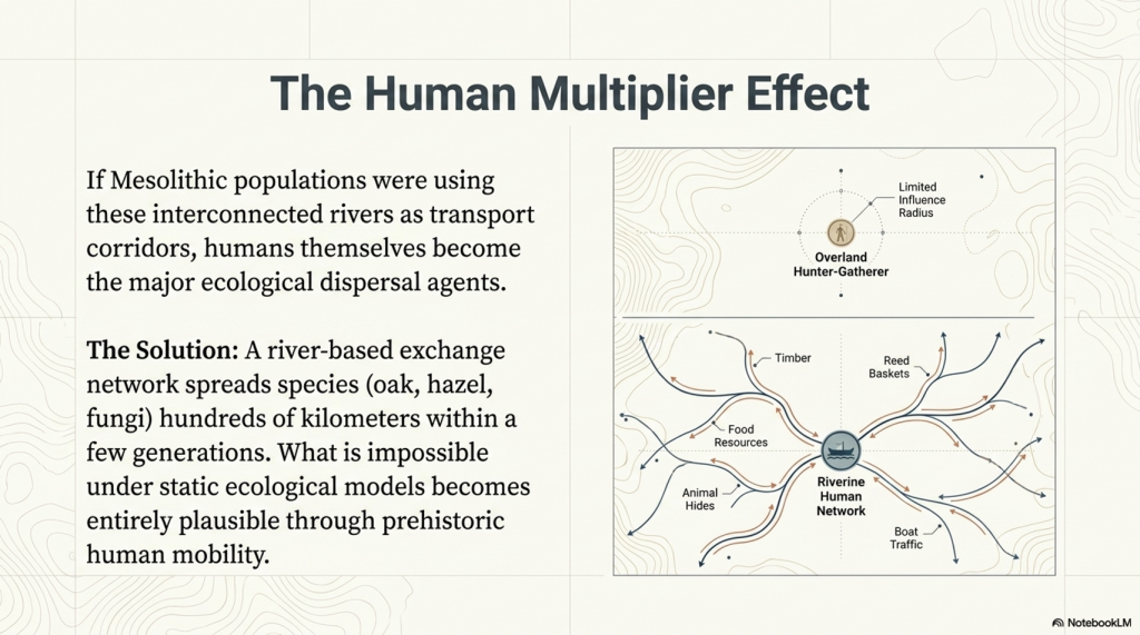
This article outlines a new long-term research project planned for 2026, investigating whether the stars themselves may once have formed part of an integrated navigational system connected to prehistoric waterways, coastlines, monuments, and seasonal movement.

The purpose of this project is not to make unsupported claims, but to establish whether this idea can be scientifically investigated using measurable evidence.

(Sky Maps of Prehistoric Britain)

The Foundation of the Hypothesis

The idea emerges naturally from the Post-Glacial Flooding Hypothesis (PGFH).

The PGFH proposes that Britain and north-west Europe remained significantly wetter for thousands of years after the end of the last Ice Age.

According to the model:

  • rivers were substantially larger,
  • groundwater tables were higher,
  • floodplains remained saturated,
  • estuaries extended far inland,
  • and water formed the dominant transport infrastructure.

If this model is broadly correct, then prehistoric populations would have depended heavily upon:

  • boats,
  • tidal systems,
  • river navigation,
  • shoreline movement,
  • seasonal travel,
  • and reliable orientation systems.

This immediately creates a practical problem.

How does a civilisation operating across a vast wetland and maritime environment navigate consistently over long distances without maps, compasses, or written instructions?
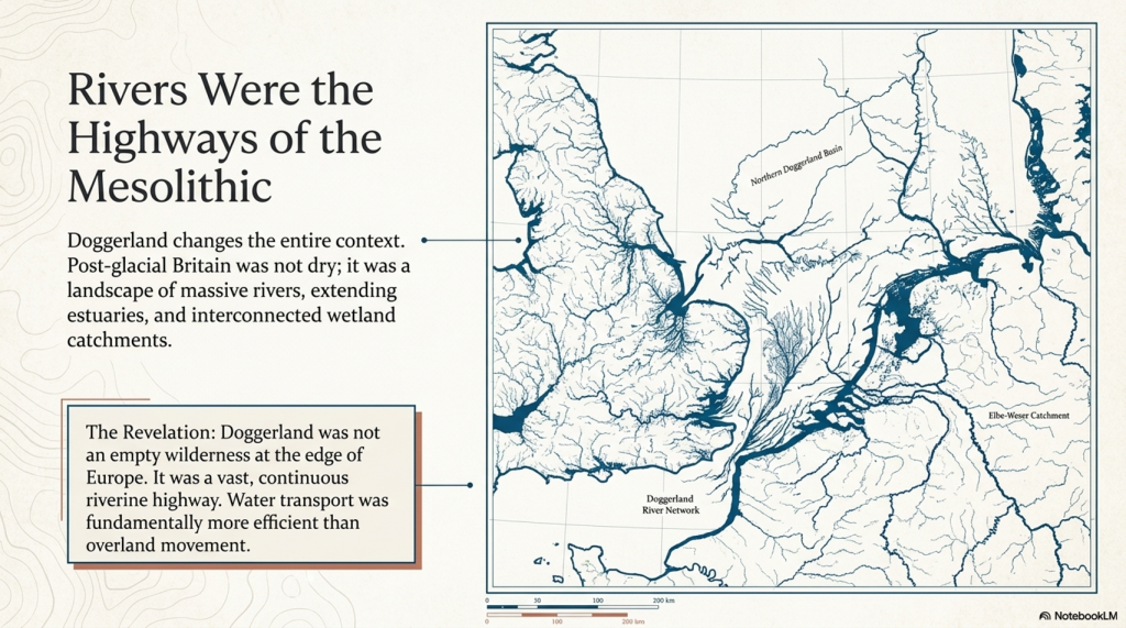
The answer may already be known.

Historically, maritime cultures throughout the world repeatedly used the stars.


 (Sky Maps of Prehistoric Britain)
(Sky Maps of Prehistoric Britain)

The Stars as Navigation

The use of stars for navigation is not speculative.
It is a historical fact.

Examples include:

  • Polynesian ocean navigation
  • Viking maritime navigation
  • Arab stellar navigation
  • Phoenician trade routes
  • Aboriginal Australian songlines
  • Mediterranean celestial navigation

In many cases, navigation was not based on maps in the modern sense, but on memorised stellar pathways tied to:

  • direction,
  • season,
  • tides,
  • winds,
  • coastlines,
  • and landmark sequences.

This is critical.

Ancient navigation often functioned as a memory system.

The sky became a stable framework onto which travel knowledge could be encoded.

Unlike coastlines or rivers, the stars moved predictably.
They provided consistency across generations.

If prehistoric Britain operated as a water-based civilisation during the early Holocene, then a stellar navigation framework becomes not only plausible, but potentially inevitable.


 (Sky Maps of Prehistoric Britain)
(Sky Maps of Prehistoric Britain)

The Missing Maps Problem

One of the great mysteries of prehistoric maritime movement is the apparent absence of navigational maps.

We know prehistoric populations travelled extraordinary distances.

Examples include:

  • Bluestone transport from Wales to Stonehenge
  • Maritime movement along Atlantic Europe
  • Doggerland migration networks
  • Long-distance exchange systems
  • Coastal monument distributions
  • River corridor settlements

Yet no conventional cartographic systems survive.

This may be because navigation itself was never primarily map-based.

Instead, route knowledge may have been embedded within:

  • oral traditions,
  • landscape markers,
  • astronomical cycles,
  • monument chains,
  • and stellar memory systems.

This possibility becomes especially interesting when viewed alongside the repeated placement of prehistoric monuments near:

  • rivers,
  • estuaries,
  • coastlines,
  • valley entrances,
  • tidal zones,
  • and elevated shoreline positions.

Long barrows, standing stones, beacon hills, avenues, dykes, and henges may not simply represent ritual locations.

Some may have functioned as navigational infrastructure.

 (Sky Maps of Prehistoric Britain)
(Sky Maps of Prehistoric Britain)

Long Barrows and Landscape Markers

One of the most intriguing aspects of prehistoric Britain is the repeated positioning of monuments along visible movement corridors.

Long barrows in particular often occupy:

  • ridge lines,
  • valley edges,
  • coastal approaches,
  • elevated viewpoints,
  • or route intersections.

Traditionally, these sites are interpreted almost exclusively through ritual or funerary frameworks.

But there is another possibility.

In a landscape dominated by wetlands and waterways, elevated monuments would naturally function as:

  • directional markers,
  • navigation points,
  • horizon indicators,
  • territorial signals,
  • or route beacons.

This does not exclude symbolic meaning.

The same structure can serve both practical and cultural purposes simultaneously.

Indeed, this dual-function model is common throughout human history.

Church towers, lighthouses, harbour beacons, hill forts, and even modern skyscrapers operate as both symbols and navigational markers.

The same may have applied in prehistory.


 (Sky Maps of Prehistoric Britain)
(Sky Maps of Prehistoric Britain)

Why the Constellations Matter

The more complex question is whether the constellations themselves formed part of this navigational architecture.

This project proposes a cautious working hypothesis:

The original meanings of some constellation systems may have been practical rather than mythological.

Over time, as the original navigational framework was forgotten, later cultures may have reinterpreted older stellar systems through:

  • mythology,
  • religion,
  • folklore,
  • and storytelling.

This process is not unusual.

Throughout history, practical systems often evolve into symbolic traditions once their original functions are lost.

Examples include:

  • flood myths,
  • agricultural festivals,
  • sacred geometry,
  • pilgrimage routes,
  • and ancient calendrical systems.

The same process may explain why many modern constellation interpretations appear visually unconvincing.

The animals and heroes may represent later narrative overlays applied onto much older orientation frameworks.

 (Sky Maps of Prehistoric Britain)
(Sky Maps of Prehistoric Britain)

Current Evidence Supporting the Idea

At present, there is no direct proof that constellations encoded prehistoric navigation routes.

However, several independent lines of evidence support the broader possibility.

1. Proven Stellar Navigation in Ancient Cultures

The use of stars for navigation is universally documented.

This establishes that:

  • stars can encode movement systems,
  • oral navigation is possible,
  • and complex route memory can operate without maps.

2. Water-Dominated Early Holocene Landscapes

The PGFH and associated geological evidence suggest:

  • extensive wetlands,
  • enlarged river systems,
  • inland tidal environments,
  • and maritime dependency.

Such environments strongly favour navigation-based societies.


3. Monument Distribution Along Water Systems

Many prehistoric sites cluster around:

  • rivers,
  • floodplains,
  • estuaries,
  • coastal corridors,
  • and elevated shoreline terrain.

This pattern is more consistent with movement infrastructure than isolated ritual placement.


4. Horizon Astronomy in Prehistory

Prehistoric societies demonstrably tracked:

  • solar cycles,
  • lunar cycles,
  • solstices,
  • equinoxes,
  • and horizon alignments.

Once astronomical observation is accepted, the application to navigation becomes entirely plausible.


5. Seasonal Movement Systems

Maritime societies depend upon predictable seasonal timing.

Stars naturally provide:

  • seasonal indicators,
  • directional consistency,
  • and long-distance orientation.

6. Ethnographic Parallels

Multiple indigenous cultures linked:

  • landscape movement,
  • memory systems,
  • navigation,
  • and stars.

This provides real-world functional parallels.


What This Project Will Attempt to Test

The 2026 project will focus on measurable and testable questions rather than speculation.

Key research areas include:

GIS Route Analysis

Testing whether:

  • monument chains,
  • river systems,
  • long barrows,
  • beacon hills,
  • and prehistoric movement corridors

show statistically significant astronomical relationships.


Seasonal Navigation Modelling

Investigating whether:

  • key stars,
  • heliacal risings,
  • lunar cycles,
  • or stellar azimuths

correspond to practical travel windows within prehistoric water systems.


Horizon Visibility Studies

Using LiDAR and digital terrain models to reconstruct:

  • prehistoric horizons,
  • sightlines,
  • beacon visibility,
  • and navigational marker ranges.

Maritime Route Reconstruction

Reconstructing:

  • post-glacial coastlines,
  • flooded valleys,
  • inland estuaries,
  • and navigable river systems.

The aim is to determine whether major monuments occupy logical positions within ancient transport networks.


Statistical Testing

This is essential.

Any proposed alignment or pattern must be tested against random distributions.

Without statistical controls, pattern recognition rapidly becomes subjective.

The project, therefore, intends to:

  • establish falsifiable criteria,
  • use control datasets,
  • compare against random models,
  • and avoid arbitrary alignment selection.

What This Project Is NOT Claiming

This research does not claim:

  • that every constellation is a map,
  • that mythology is irrelevant,
  • or that all prehistoric monuments were navigational.

Nor does it claim direct proof already exists.

Instead, the project asks a more careful scientific question:

Could an aquatic civilisation operating across flooded post-glacial landscapes have encoded navigational knowledge into stable stellar frameworks?

At present, the answer appears plausible.

Whether it is correct remains to be tested.


Why This Matters

If even part of this hypothesis proves correct, the implications would be profound.

It would suggest that:

  • prehistoric Britain possessed far more advanced navigational systems than traditionally assumed,
  • monuments may have functioned as infrastructure as well as symbolism,
  • astronomy was practical rather than purely ceremonial,
  • and early maritime societies may have operated sophisticated memory-based route systems long before formal cartography.

Most importantly, it would further support the emerging picture of a civilisation shaped not by isolated ritual sites, but by movement, water, navigation, and environmental adaptation.

In short:

The stars may not simply have inspired prehistoric civilisation.

They may have guided it.


Future Research Updates

This article represents the beginning of a long-term research project planned for 2026.

Future work will include:

  • GIS modelling
  • Hydrological reconstruction
  • Stellar simulation analysis
  • Monument alignment databases
  • Statistical testing
  • Maritime route reconstruction
  • LiDAR visibility studies
  • Ethnographic comparison

Updates will be published through:

Prehistoric Britain

and associated research publications.


Final Thought

Modern civilisation separates:

  • astronomy,
  • geography,
  • navigation,
  • religion,
  • engineering,
  • and landscape.

Prehistoric societies may not have.

For people living in a flooded world of rivers, marshes, estuaries, tides, and coastlines, the sky itself may have functioned as the oldest navigation system humanity ever created.

And perhaps, hidden within the stars, fragments of those ancient water routes still remain.

PODCAST

Author’s Biography

Robert John Langdon, a polymathic luminary, emerges as a writer, historian, and eminent specialist in LiDAR Landscape Archaeology.

His intellectual voyage has been interwoven with stints as an astute scrutineer in government and grand corporate bastions, a tapestry spanning British Telecommunications, Cable and Wireless, British Gas, and the esteemed University of London.

A decade hence, Robert’s transition into retirement unfurled a chapter of insatiable curiosity. This phase saw him immerse himself in Politics, Archaeology, Philosophy, and the enigmatic realm of Quantum Mechanics. His academic odyssey traversed the venerable corridors of knowledge hubs such as the Museum of London, University College London, Birkbeck College, The City Literature Institute, and Chichester University.

In the symphony of his life, Robert is a custodian of three progeny and a pair of cherished grandchildren. His sanctuary lies ensconced in the embrace of West Wales, where he inhabits an isolated cottage, its windows framing a vista of the boundless sea – a retreat from the scrutinising gaze of Her Majesty’s Revenue and Customs, an amiable clandestinity in the lap of nature.

Exploring Prehistoric Britain: A Journey Through Time

My blog delves into the fascinating mysteries of prehistoric Britain, challenging conventional narratives and offering fresh perspectives grounded in cutting-edge research, particularly LiDAR technology. I invite you to explore some key areas of my research. For example, the Wansdyke, often cited as a defensive structure, is re-examined in light of new evidence. I’ve presented my findings in my blog post Wansdyke: A British Frontier Wall – ‘Debunked’, and a Wansdyke LiDAR Flyover video further visualises my conclusions.

My work also often challenges established archaeological dogma. I argue that many sites, such as Hambledon Hill, commonly identified as Iron Age hillforts, are not what they seem. My posts Lidar Investigation Hambledon Hill – NOT an ‘Iron Age Fort’ and Unmasking the “Iron Age Hillfort” Myth explore these ideas in detail and offer an alternative view. Similarly, sites like Cissbury Ring and White Sheet Camp receive re-evaluations based on LiDAR analysis in my posts “Lidar Investigation Cissbury Ring through time” and “Lidar Investigation White Sheet Camp, revealing fascinating insights into their true purpose. I have also examined South Cadbury Castle, often linked to the mythical Camelot56.

My research also extends to ancient water management, including the role of canals and other linear earthworks. I have discussed the true origins of Car Dyke in multiple posts, including Car Dyke – ABC News Podcast and Lidar Investigation Car Dyke – North Section, which suggest a Mesolithic origin 2357. I also explore the misidentification of Roman aqueducts, as seen in my posts on the Great Chesters (Roman) Aqueduct. My research has also been greatly informed by my post-glacial flooding hypothesis, which has helped explain landscape transformations over time. I have discussed this hypothesis in several posts, including AI now supports my Post-Glacial Flooding Hypothesis and Exploring Britain’s Flooded Past: A Personal Journey

Finally, my blog also investigates prehistoric burial practices, as seen in Prehistoric Burial Practices of Britain and explores the mystery of Pillow Mounds, often mistaken for medieval rabbit warrens, but with a potential link to Bronze Age cremation in my posts: Pillow Mounds: A Bronze Age Legacy of Cremation? and The Mystery of Pillow Mounds: Are They Really Medieval Rabbit Warrens?. My research also includes astronomical insights into ancient sites, for example, in Rediscovering the Winter Solstice: The Original Winter Festival. I also review new information about the construction of Stonehenge in The Stonehenge Enigma.

Further Reading

For those interested in British Prehistory, visit www.prehistoric-britain.co.uk, a comprehensive resource featuring an extensive collection of archaeology articles, modern LiDAR investigations, and groundbreaking research. The site also includes insights and excerpts from the acclaimed Robert John Langdon Trilogy, a series of books that explore Britain during the Prehistoric period. Titles in the trilogy include The Stonehenge Enigma, Dawn of the Lost Civilisation, and The Post-Glacial Flooding Hypothesis, which offer compelling evidence of ancient landscapes shaped by post-glacial flooding.

To further explore these topics, Robert John Langdon has developed a dedicated YouTube channel featuring over 100 video documentaries and investigations that complement the trilogy. Notable discoveries and studies showcased on the channel include 13 Things that Don’t Make Sense in History and the revelation of Silbury Avenue – The Lost Stone Avenue, a rediscovered prehistoric feature at Avebury, Wiltshire.

In addition to his main works, Langdon has released a series of shorter, accessible publications, ideal for readers delving into specific topics. These include:

For active discussions and updates on the trilogy’s findings and recent LiDAR investigations, join our vibrant community on Facebook. Engage with like-minded enthusiasts by leaving a message or contributing to debates in our Facebook Group.

Whether through the books, the website, or interactive videos, we aim to provide a deeper understanding of Britain’s fascinating prehistoric past. We encourage you to explore these resources and uncover the mysteries of ancient landscapes through the lens of modern archaeology.

For more information, including chapter extracts and related publications, visit the Robert John Langdon Author Page. Dive into works such as The Stonehenge Enigma or Dawn of the Lost Civilisation, and explore cutting-edge theories that challenge traditional historical narratives.

Other Blogs

s

t

Real-World Confirmation of Post-Glacial Flooding

Introduction

Recently, I received a message from my friend Chris at Lambourne Photography, who shared new winter photos of Avebury. The landscape, experiencing recorded rainfall, has begun to flood, capturing my keen interest. This flooding aligns with the predictions in my prehistoric Avebury maps, considering the post-glacial flooding during the Mesolithic period (10k to 4k BCE) – (Real-World Confirmation of Post-Glacial Flooding)

(Real-World Confirmation of Post-Glacial Flooding)
Copyright – Lambourne Photography (Real-World Confirmation of Post-Glacial Flooding)

It’s intriguing that Avebury received 70mm (3 inches) of rain over the last 30 days. However, reflecting on the end of the Ice Age and the substantial melt, Avebury would have encountered the equivalent of 98,425 inches of rain. Common sense implies that this area would have experienced significant flooding, corroborated by the British Geological Maps, albeit not entirely accurate, which illustrate the extent of post-glacial flooding, with the Kennet River ten times wider than its present size. (Avebury Post-Glacial Flooding)

Avebury Post-Glacial Flooding

The photographs depict the flooding extending West around the Avebury Stone circle—as indicated on both British Geological Survey (BGS) map but more precisely with the area indicated in my LiDAR maps. This serves as empirical evidence supporting the Post-Glacial Flooding Hypothesis and reinforces my assertion that LiDAR is the paramount landscape-mapping tool, regrettably underutilised by archaeologists to their disadvantage.(Avebury Post-Glacial Flooding)

Avebury Post-Glacial Flooding

The significance of this was underscored in the recent episode of ‘Digging for Britain,’ where a settlement was discovered. The attempt to justify its location and function relied on a modern OS map, leading to an absurd and inaccurate conclusion—namely, that it served a ceremonial purpose rather than a functional trading place at the river’s edge. This further underscores the limitations of traditional mapping methods and the value that LiDAR brings to understanding past topologies. (Avebury Post-Glacial Flooding)

Avebury through time

In the heart of Wiltshire, England, lies the UNESCO World Heritage Site of Avebury, shrouded in mystery and wonder. For years, archaeologists and historians have delved into its enigmatic past, uncovering secrets buried beneath layers of time and earth. Yet, Avebury still held one final, astonishing revelation waiting to be unearthed, and it was the relentless pursuit of author and cartographer Robert John Langdon that would shed light on this long-forgotten secret.

Avebury Post-Glacial Flooding (copyright Lambourne Photography)
Silbury Hill showing how the Kennet Flooded around the base – Avebury Post-Glacial Flooding copyright Lambourne Photography

Avebury, with its iconic stone circles and ancient monuments, has fascinated explorers and scholars for centuries. Among its well-known features are ‘West Kennet Avenue’ and ‘Beckhampton Avenue,’ both adorned with colossal stones that still stand as silent sentinels of a long-gone age. These avenues have been pivotal in our understanding of Avebury’s past, connecting the spiritual and historical aspects of this sacred site. However, Langdon’s unrelenting quest to unravel Avebury’s mysteries led him down an uncharted path, one that would challenge conventional wisdom and rewrite the history of this remarkable place.

Avebury Post-Glacial Flooding (copyright Lambourne Photography)

Langdon’s journey was marked by meticulous mapping and years of research, culminating in a hypothesis that would reshape our understanding of prehistoric Britain. He proposed that much of the British Isles had once been submerged in the aftermath of the last ice age, with these ancient sites strategically positioned along the ancient shorelines. His groundbreaking maps offered a fresh perspective, suggesting that Avebury had functioned as a bustling trading hub for our ancient ancestors. This audacious theory challenged the prevailing notion that prehistoric societies were isolated and disconnected, instead highlighting their sophistication in trade and commerce.

Avebury Post-Glacial Flooding (copyright Lambourne Photography)

At the heart of this newfound understanding was the colossal enigma of Silbury Hill, the largest man-made monument in prehistoric Europe. Silbury Hill had confounded archaeologists for generations, with theories ranging from religious symbolism to ceremonial significance. Yet, Langdon boldly proclaimed that Silbury Hill had a far more practical and ingenious purpose—an ancient ‘Lighthouse’ that guided seafarers to the trading port of Avebury.

Avebury Post-Glacial Flooding (copyright Lambourne Photography)

This notion, while revolutionary, was not without evidence. Langdon explained that his research indicated that Silbury Hill had indeed flooded in the distant past, making it logical to assume that it was repurposed as a harbour when the waters receded from the main Avebury site. The construction of Silbury Hill in stages, starting small and gradually growing taller, suggested a pragmatic approach rather than a symbolic one. According to Langdon, the height of the mound would have served as a beacon, attracting ships and boats to the trading centre and making it an essential feature for maritime navigation.

Avebury Post-Glacial Flooding (copyright Lambourne Photography)
River Kennet to the West of Avebury and Parts of the Stone Circle Ditches Flooding – Avebury Post-Glacial Flooding (copyright Lambourne Photography)

To many, Langdon’s claims may seem audacious, but they align with the findings of dowsers in 2011. At the top of the newly discovered Stone Avenue, these dowsers found a series of stone holes precisely where Langdon’s photographic evidence indicated they were. The convergence of these findings strengthened Langdon’s case, providing compelling support for his audacious theory.

Avebury Post-Glacial Flooding (copyright Lambourne Photography)
Avebuery Stone Circle ditches flooding first time in 6,000 years? -Avebury Post-Glacial Flooding (copyright Lambourne Photography)

While confirmation through excavation is the next logical step, Langdon’s research has already ignited a vibrant discussion within the archaeological and historical communities. His perspective challenges our preconceived notions of prehistoric Britain, revealing a thriving civilisation that engaged in far-reaching trade and commerce. The idea of Avebury as a bustling trading hub paints a picture of interconnectedness and shared culture, where societies traded not only goods but also ideas, beliefs, and traditions.

Avebury Post-Glacial Flooding (copyright Lambourne Photography)
River Kennet returning to its prehistoric width – Avebury Post-Glacial Flooding (copyright Lambourne Photography)

In the realm of historical discovery, it is often the audacious thinkers, the mavericks who dare to question established narratives, who propel our understanding forward. Robert John Langdon is undeniably one of these thinkers. With a deep passion for history and an unyielding commitment to his research, he has unearthed a hidden chapter in the story of Avebury—one that transcends time and offers fresh insights into our shared human history.

Avebury Post-Glacial Flooding (copyright Lambourne Photography)

As Langdon’s trilogy, ‘The Stonehenge Enigma,’ continues to explore these groundbreaking theories, it beckons us to embark on a journey of discovery, to challenge our assumptions, and to embrace the possibility that the past is far more complex and interconnected than we ever imagined. Avebury, with its ancient stones and enigmatic avenues, continues to whisper its secrets to those who dare to listen, inviting us to see history through a new lens—one illuminated by the audacious vision of Robert John Langdon.

(Real-World Confirmation of Post-Glacial Flooding)

The Silbury Lighthouse and the Flooded Stones: 4 Surprising Truths About Prehistoric Avebury

When winter rains recently swept across Avebury, the resulting floods captured by Lambourne Photography did more than just saturate the soil. For those looking closely, the rising waters acted as a real-time simulation of a long-lost era, providing empirical evidence for a landscape we have forgotten. These modern pools align perfectly with prehistoric maps, offering a glimpse into the landscape as it existed during the Mesolithic period between 10,000 and 4,000 BCE.

According to author and cartographer Robert John Langdon, this contemporary flooding is the “ground truth” for his Post-Glacial Flooding Hypothesis. While we see a landscape of dry fields and small streams today, the geological evidence suggests a much more aqueous past. By observing how the water moves now, we can begin to understand why our ancestors chose this specific site for their most massive monuments.

(Real-World Confirmation of Post-Glacial Flooding)

The 98,000-Inch Rain: Reimagining the Post-Glacial Landscape

To understand the scale of the ancient environment, we must look at the sheer volume of water released at the end of the last Ice Age. While Avebury recently made headlines for receiving 3 inches (70mm) of rain in a month, that is a mere drop compared to the post-glacial melt. Langdon calculates that during the ice melt, the region would have encountered the equivalent of 98,425 inches of rain.

This massive influx of water transformed the geography of Wiltshire into something unrecognisable to modern eyes. While British Geological Survey (BGS) maps are not entirely accurate in every respect, they provide vital corroboration of this watery reality.

“Common sense implies that this area would have experienced significant flooding, corroborated by the British Geological Maps, albeit not entirely accurate, illustrating the extent of post-glacial flooding with the Kennet River ten times wider than its present size.”

Traditional archaeological interpretations often lack this “common sense” approach, failing to account for the significant role that higher water levels played in dictating human activity. By ignoring the geological reality of a wider Kennet River, we miss the primary reason why these sites were established. These monuments were not random; they were strategically positioned along the ancient shorelines of a flooded world.

(Real-World Confirmation of Post-Glacial Flooding)

Trading Hub or Temple? The Functional Shift
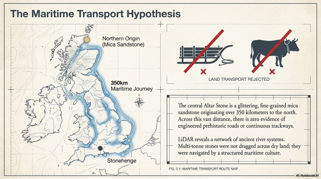
For decades, the “ceremonial” label has been the default explanation for almost every prehistoric site in Britain. However, Langdon argues that this view is an absurdity born from using modern Ordnance Survey maps to define ancient functions. A recent episode of ‘Digging for Britain’ highlighted this disconnect when a settlement found at the river’s edge was labelled ceremonial simply because its location didn’t make sense on a modern map.

When viewed through the lens of higher water levels, Avebury reveals itself not as an isolated temple but as a bustling trading hub. These colossal stones stand as silent sentinels to an age when the site was a centre for commerce and maritime interaction. This reinterpretation suggests a sophisticated, interconnected society that utilised Britain’s waterways for trade, rather than a collection of isolated, ritual-obsessed tribes.

By acknowledging the strategic placement of the shoreline, we see that the builders were master logisticians. They utilised the landscape’s natural hydrology to facilitate movement and exchange. The whispers of the past suggest that Avebury was the heart of a vibrant, seafaring economic network.

(Real-World Confirmation of Post-Glacial Flooding)

The Silbury Lighthouse: A Beacon for Ancient Mariners

Silbury Hill stands as the largest man-made monument in Europe, yet its purpose has remained one of archaeology’s greatest enigmas. While often dismissed as a religious or symbolic mound, the Post-Glacial Flooding Hypothesis provides a far more pragmatic explanation. Langdon suggests that as the waters receded, Silbury Hill was constructed in stages to serve as maritime infrastructure.

Rather than a silent grave or a place of worship, the mound functioned as a guide for those navigating the flooded plains.

“Silbury Hill had a far more practical and ingenious purpose—an ancient ‘Lighthouse’ that guided seafarers to the trading port of Avebury.”

This maritime theory explains why the hill was built in stages, growing taller over time to remain visible as a beacon for incoming ships. Langdon’s research further indicates that as the climate changed, the site was eventually repurposed as a harbour when the waters receded from the main Avebury site. This transformation into a piece of sophisticated nautical infrastructure completely changes our perspective on the engineering capabilities of prehistoric Britons.

(Real-World Confirmation of Post-Glacial Flooding)

LiDAR: The Paramount Tool Archaeologists Are Missing

The key to unlocking these secrets lies in LiDAR (Light Detection and Ranging) technology, which allows researchers to see “past topologies” hidden by modern development. Langdon asserts that LiDAR is the most important landscape mapping tool available, yet it remains tragically underutilised by traditional archaeologists. This technology revealed exactly where the ancient shorelines met the monuments and identified lost features like “Silbury Avenue – the Lost Stone Avenue.”

The accuracy of this mapping was strikingly confirmed in 2011 by dowsing results at the top of this newly discovered avenue. Dowsers located stone holes in the exact positions that Langdon’s LiDAR-based research had predicted. This convergence of high-tech scans and physical evidence is forcing a total rewrite of British history.

By using LiDAR to strip away modern distractions, we can finally see the strategic logic of the Mesolithic builders. The technology proves that the landscape was shaped by water levels we are only now beginning to map correctly. It is no longer a matter of speculation, but a matter of seeing the evidence hidden in the earth itself.

(Real-World Confirmation of Post-Glacial Flooding)

Conclusion: Whispers from the Ancient Shoreline

The “Post-Glacial Flooding Hypothesis” invites us to view the British landscape not as a static collection of fields but as a dynamic environment. Avebury changes from a site of mystery into a monument of human ingenuity and maritime success. Our ancestors were not just building stone circles; they were constructing a society centred on water.

As we uncover more evidence of this interconnected world, we must ask ourselves: are we ready to see history through a new lens? Are we prepared to accept that the past is far more complex and strategically minded than we ever imagined?
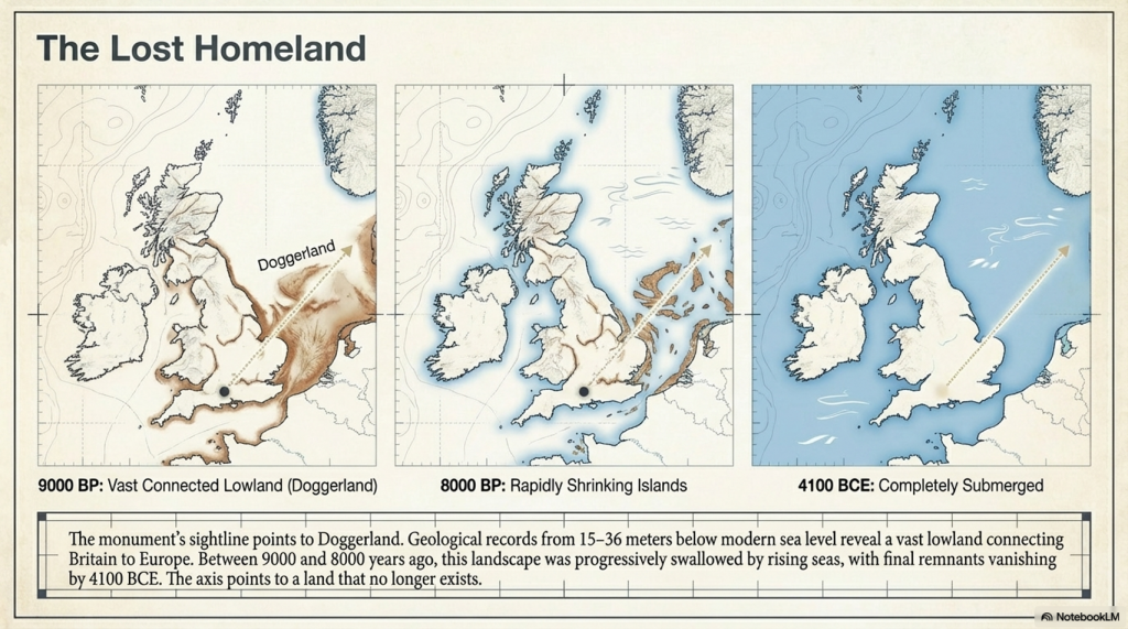
(Real-World Confirmation of Post-Glacial Flooding)

PODCAST

Author’s Biography

Robert John Langdon, a polymathic luminary, emerges as a writer, historian, and eminent specialist in LiDAR Landscape Archaeology.

His intellectual voyage has been interwoven with stints as an astute scrutineer in government and grand corporate bastions, a tapestry spanning British Telecommunications, Cable and Wireless, British Gas, and the esteemed University of London.

A decade hence, Robert’s transition into retirement unfurled a chapter of insatiable curiosity. This phase saw him immerse himself in Politics, Archaeology, Philosophy, and the enigmatic realm of Quantum Mechanics. His academic odyssey traversed the venerable corridors of knowledge hubs such as the Museum of London, University College London, Birkbeck College, The City Literature Institute, and Chichester University.

In the symphony of his life, Robert is a custodian of three progeny and a pair of cherished grandchildren. His sanctuary lies ensconced in the embrace of West Wales, where he inhabits an isolated cottage, its windows framing a vista of the boundless sea – a retreat from the scrutinising gaze of Her Majesty’s Revenue and Customs, an amiable clandestinity in the lap of nature.

Exploring Prehistoric Britain: A Journey Through Time

My blog delves into the fascinating mysteries of prehistoric Britain, challenging conventional narratives and offering fresh perspectives grounded in cutting-edge research, particularly LiDAR technology. I invite you to explore some key areas of my research. For example, the Wansdyke, often cited as a defensive structure, is re-examined in light of new evidence. I’ve presented my findings in my blog post Wansdyke: A British Frontier Wall – ‘Debunked’, and a Wansdyke LiDAR Flyover video further visualises my conclusions.

My work also often challenges established archaeological dogma. I argue that many sites, such as Hambledon Hill, commonly identified as Iron Age hillforts, are not what they seem. My posts Lidar Investigation Hambledon Hill – NOT an ‘Iron Age Fort’ and Unmasking the “Iron Age Hillfort” Myth explore these ideas in detail and offer an alternative view. Similarly, sites like Cissbury Ring and White Sheet Camp receive re-evaluations based on LiDAR analysis in my posts “Lidar Investigation Cissbury Ring through time” and “Lidar Investigation White Sheet Camp, revealing fascinating insights into their true purpose. I have also examined South Cadbury Castle, often linked to the mythical Camelot56.

My research also extends to ancient water management, including the role of canals and other linear earthworks. I have discussed the true origins of Car Dyke in multiple posts, including Car Dyke – ABC News Podcast and Lidar Investigation Car Dyke – North Section, which suggest a Mesolithic origin 2357. I also explore the misidentification of Roman aqueducts, as seen in my posts on the Great Chesters (Roman) Aqueduct. My research has also been greatly informed by my post-glacial flooding hypothesis, which has helped explain landscape transformations over time. I have discussed this hypothesis in several posts, including AI now supports my Post-Glacial Flooding Hypothesis and Exploring Britain’s Flooded Past: A Personal Journey

Finally, my blog also investigates prehistoric burial practices, as seen in Prehistoric Burial Practices of Britain and explores the mystery of Pillow Mounds, often mistaken for medieval rabbit warrens, but with a potential link to Bronze Age cremation in my posts: Pillow Mounds: A Bronze Age Legacy of Cremation? and The Mystery of Pillow Mounds: Are They Really Medieval Rabbit Warrens?. My research also includes astronomical insights into ancient sites, for example, in Rediscovering the Winter Solstice: The Original Winter Festival. I also review new information about the construction of Stonehenge in The Stonehenge Enigma.

Further Reading

For those interested in British Prehistory, visit www.prehistoric-britain.co.uk, a comprehensive resource featuring an extensive collection of archaeology articles, modern LiDAR investigations, and groundbreaking research. The site also includes insights and excerpts from the acclaimed Robert John Langdon Trilogy, a series of books that explore Britain during the Prehistoric period. Titles in the trilogy include The Stonehenge Enigma, Dawn of the Lost Civilisation, and The Post-Glacial Flooding Hypothesis, which offer compelling evidence of ancient landscapes shaped by post-glacial flooding.

To further explore these topics, Robert John Langdon has developed a dedicated YouTube channel featuring over 100 video documentaries and investigations that complement the trilogy. Notable discoveries and studies showcased on the channel include 13 Things that Don’t Make Sense in History and the revelation of Silbury Avenue – The Lost Stone Avenue, a rediscovered prehistoric feature at Avebury, Wiltshire.

In addition to his main works, Langdon has released a series of shorter, accessible publications, ideal for readers delving into specific topics. These include:

For active discussions and updates on the trilogy’s findings and recent LiDAR investigations, join our vibrant community on Facebook. Engage with like-minded enthusiasts by leaving a message or contributing to debates in our Facebook Group.

Whether through the books, the website, or interactive videos, we aim to provide a deeper understanding of Britain’s fascinating prehistoric past. We encourage you to explore these resources and uncover the mysteries of ancient landscapes through the lens of modern archaeology.

For more information, including chapter extracts and related publications, visit the Robert John Langdon Author Page. Dive into works such as The Stonehenge Enigma or Dawn of the Lost Civilisation, and explore cutting-edge theories that challenge traditional historical narratives.

Other Blogs

s

t

Stonehenge, Doggerland and Atlantis connection

Introduction

The third book in my trilogy aims to weave together the discoveries made across Britain, with a particular focus on Stonehenge, to shed light on a civilisation that archaeologists have termed the ‘megalithic builders.’ This civilisation is markedly distinct from those that came after, showcasing an extraordinary level of capability and engineering skill in moving vast stones and constructing earthworks that have endured for nearly ten thousand years. These achievements are even more striking when compared to the structures left by the Romans, who occupied these lands for hundreds of years yet left behind fewer enduring monuments. (Stonehenge, Doggerland and Atlantis connection)

Video

The megalithic builders’ legacy, characterised by iconic structures such as Stonehenge, reveals a sophisticated understanding of both engineering and astronomy. Their ability to align massive stones with celestial events suggests a deep connection to their environment and a complex societal organisation capable of undertaking such monumental projects. This civilisation’s accomplishments in stone construction and earthwork highlight their technical prowess and cultural and spiritual values, as many of these sites are believed to have served practical purposes.

(Stonehenge, Doggerland and Atlantis connection)
Long Barrows of Europe – centred over The North Sea (Doggerland) – (Stonehenge, Doggerland and Atlantis connection)

In writing this third book, I aimed to connect the dots between various megalithic sites across Britain and explore the knowledge, skills, and motivations of the people who built them. By examining the evidence left by the megalithic builders, from the stones they transported and erected to the earthworks they shaped, we can gain insights into a civilisation that continues to fascinate and inspire despite its distance in time.

(Stonehenge, Doggerland and Atlantis connection)

This exploration is an academic exercise and a journey into the heart of a civilisation whose creations still stand as a testament to human ingenuity and perseverance. The megalithic builders may have vanished into the mists of time, but their legacy endures, inviting us to marvel at their achievements and to contemplate our own place in the continuum of human history.

(Stonehenge, Doggerland and Atlantis connection)

The Megalthic Builders

The megalithic builders, a fascinating civilisation from our prehistoric past, operated on a scale and with a level of cooperation that transcends modern conceptions of boundaries and nation-states. Their domain spanned northern Europe, a testament to their widespread influence and shared cultural or technological practices. Unlike the segmented and often isolated cultures that followed, these ancient builders engaged in monumental constructions that served both the living and the dead, creating long barrows and dolmens as eternal resting places and linear earthwork canals and stone trading circles for the living.

(Stonehenge, Doggerland and Atlantis connection)

One of the most intriguing aspects of their civilisation is the central role played by an area now submerged beneath the North Sea, known as Doggerland. This now-lost land, which started to succumb to rising sea levels approximately 9,000 years ago, was once a vital part of a massive Mesolithic landscape. Doggerland connected the British Isles to mainland Europe, serving as a crossroads for people, ideas, and goods. The remnants of this landscape, including the Dogger Bank, provide a tantalising glimpse into a world where megalithic builders thrived, interacting with their environment and with one another in sophisticated ways.

Temple to the dead and mid-winter solstice
Stonehenge is a moon temple made for the dead – (Stonehenge, Doggerland and Atlantis connection)

The disappearance of Doggerland due to post-glacial sea level rise did not merely result in the loss of land; it marked the end of a significant chapter in human history. This transformation from a vast, interconnected landscape to a series of islands fundamentally altered the trajectory of European civilisation. The megalithic builders’ legacy, however, remains etched in the stone and earthworks that dot the landscape of northern Europe, enduring monuments to their engineering prowess and cosmopolitan outlook.

(Stonehenge, Doggerland and Atlantis connection)

Their achievements compel us to reconsider our understanding of prehistoric societies, challenging us to appreciate the complexity and depth of human ingenuity long before the advent of written history. The megalithic builders remind us that the desire to connect, communicate, and commemorate is a fundamental aspect of the human condition, transcending time, space, and the ever-changing contours of the earth.

The Stonehenge Connection

We can see from their greatest achievement, Stonehenge, a ‘message in a bottle’ that the megalithic builders left us some 5,000 years ago.  Although subsequent civilisations reused and altered aspects of the Stonehenge Monument, some of the most influential stones and structures still survive in situ, owing to the megalithic ability to manoeuvre vast weights, which effectively hindered lesser cultures in their attempts to radically alter the site’s significance.

(Stonehenge, Doggerland and Atlantis connection)

The origins of the Altar Stone at Stonehenge, described by Professor Hawkins as a “fine-grained pale green sandstone” notable for its mica flakes and glitter”, have long been a subject of speculation among experts. The prevailing theories had pointed towards Wales or Devon as the stone’s source. However, recent findings challenge this perspective, suggesting the stone could have originated much farther afield, potentially as far north as Scotland. This revelation aligns with my hypothesis, presented in my book over a decade ago, proposing an even more dramatic provenance for the Altar Stone—not just from the north, but from the northeast, specifically from the submerged landscapes of Doggerland.

Alter Stone recumbent stone - one of just two
The Altar is one of only two recumbents

Doggerland, the now-submerged landmass that once connected the British Isles to mainland Europe, represents a significant part of Mesolithic Europe’s landscape. The suggestion that the Altar Stone might have originated in this ancient, lost territory adds a fascinating layer to our understanding of Stonehenge’s construction. It implies that the builders of Stonehenge not only could transport massive stones over vast distances but also that their network of trade or cultural exchange spanned a far greater area than previously thought, encompassing regions that are now beneath the sea.

(Stonehenge, Doggerland and Atlantis connection)

The connection between Doggerland and Stonehenge, particularly through the Altar Stone, hints at a deeply intertwined prehistoric landscape that extends beyond current geographical boundaries. The intriguing alignment from the Altar Stone towards the last vestiges of Doggerland, known as the Isle of Dogger, intersects with another enigmatic feature of Stonehenge: the Slaughter Stone. This stone, distinctively recumbent and partially buried by the surrounding ditch, has long puzzled archaeologists. Its unique position within the Stonehenge complex and the name attributed to it by the Druids suggest a significant ceremonial or symbolic role.

Altar Stone and slaughter stone points to doggerland
Altar Stone and Slaughter Stone align with Doggerland

The deliberate placement of the Slaughter Stone, when considered in relation to the direction towards the remnants of Doggerland, could indicate a symbolic gesture by the builders of Stonehenge, perhaps to commemorate or maintain a connection with their ancestral lands now submerged beneath the North Sea. This alignment and the specific use of stones from distant locations underscore the profound sense of purpose and meaning the Stonehenge builders invested in the site’s construction.

Slaughter stone - burried in shallow ditch of water
The chalk under the Slaugher stone was cut away for a purpose

These potential connections to Doggerland not only expand our understanding of Stonehenge’s geographical and cultural significance but also invite us to consider the broader networks of communication, travel, and exchange that existed in prehistoric Europe. The use of stones from such distant sources and the possible alignments with lost lands hint at an intricate web of relationships and a deep historical consciousness among the people who constructed Stonehenge.

(Stonehenge, Doggerland and Atlantis connection)

As we continue to unravel the mysteries of Stonehenge and its stones, the importance of considering wider landscapes and connections becomes clear. The potential links to Doggerland offer a tantalising glimpse into the minds of the megalithic builders, revealing a world where memory, landscape, and the movement of materials were intimately connected. These insights challenge us to look beyond the immediate vicinity of prehistoric monuments and to consider the vast, now-hidden landscapes that were once integral to the lives and beliefs of ancient peoples.

Slaughter Stone - a relief map of doggerland
The Slaughrer stone is in fact a relief map (found after a HE scan) and not natural – the ground has been removed so to create an island surrounded by water

This hypothesis challenges the conventional archaeological narrative and suggests a level of sophistication and reach in prehistoric societies that is only now being understood. It underscores the importance of reconsidering and expanding our investigation into the origins and connections of the materials and people involved in creating monumental structures like Stonehenge. As we continue to uncover more about these ancient builders, their methods, and their world, it becomes increasingly clear that their achievements were far more complex and interconnected than once imagined, bridging lands now separated by waters but once part of a vast, interconnected landscape.

The Atlantis Connection

The completion of the quest to pinpoint the homeland of the megalithic builders marks a significant milestone in our understanding of this remarkable civilisation. The evidence of their extraordinary engineering achievements, from constructing monumental stone structures like Stonehenge to creating extensive earthworks such as Silbury Hill, underscores the sophistication and capabilities of these ancient architects and engineers. Without the modern machinery and technology we rely on today, their achievements in construction speak to a profound understanding of their environment and a remarkable ability to manipulate natural materials to their will.

(Stonehenge, Doggerland and Atlantis connection)

Given the scale of their constructions and the distances over which materials, such as the stones used in megaliths, were transported, it becomes clear that these builders possessed sophisticated transportation methods. The absence of roads for moving such massive stones over vast distances suggests that ships and boats were essential to their way of life. Waterways would have served as the arteries of trade, travel, and communication, connecting distant communities and facilitating the exchange of goods, ideas, and cultural practices across Europe.

Wales oldest Boat Yard
We have found prehistoric Catamarans made to carry stones – Wales oldest Boat Yard

This reliance on maritime technology indicates that the megalithic builders were skilled engineers, architects, and adept sailors and navigators. Using boats would have allowed them to traverse prehistoric Europe’s coastal and riverine landscapes, enabling the widespread distribution of their megalithic culture. Such capabilities would have been crucial for orchestrating the large-scale cooperative efforts to construct the monumental stone structures that define their legacy.

(Stonehenge, Doggerland and Atlantis connection)

The comparison with the maritime achievements of the Greeks and Romans, celebrated for their advancements in shipbuilding and navigation, underscores the significance of the megalithic builders’ accomplishments. Their ability to harness the power of water for transportation and communication is a testament to their ingenuity and a critical factor in their success as a civilisation.

(Stonehenge, Doggerland and Atlantis connection)

The megalithic builders’ reliance on maritime technology for movement and communication across Europe highlights a sophisticated understanding of their environment and an unparalleled ability to manipulate it to their advantage. This aspect of their civilisation offers valuable insights into the complexity of prehistoric societies and challenges us to expand our appreciation of their technological and cultural achievements.

Plato

The tale of Atlantis, as recounted by Plato, stands as one of the most captivating stories from antiquity, blurring the line between historical account and mythological narrative. Over time, the story of this advanced civilisation that supposedly sank into the sea around 9,000 years ago has been transformed by modern interpretations and entertainment into something more akin to science fiction. This transformation has, unfortunately, obscured the significance of Plato’s account, relegating it to the realm of mere fantasy in the eyes of many.

Plato

Plato, a philosopher of unparalleled influence in Western thought, presented the story of Atlantis not as a myth but as a recounting of historical fact told to him by Solon, who had learned it from Egyptian priests. According to the narrative, Atlantis was a civilisation of great power and technological prowess, with ships that traversed the globe and a highly advanced society.

(Stonehenge, Doggerland and Atlantis connection)

The comparison between the story of Atlantis and the archaeological evidence of Doggerland and the megalithic builders is striking. Like the Atlanteans, the people of Doggerland, who lived around 10,000 years ago, exhibited advanced capabilities, particularly in maritime technology. They built monumental structures and possessed the knowledge to navigate and sail to distant lands. This evidence challenges the prevailing academic view of prehistoric societies as simplistic hunter-gatherer tribes and aligns with Plato’s description of Atlantis as a great and advanced civilisation.

Stonehenge Debunked

Moreover, the presence of notable figures such as Solon, a key figure in the development of democracy in ancient Greece, and Socrates, celebrated for his wisdom, in the dialogues discussing Atlantis, lends credibility to the account. Their involvement suggests that the story was taken seriously by some of the most respected thinkers of the time, who did not dismiss it as mere fiction.

Some academics’ reluctance to accept the possibility of advanced prehistoric civilisations is perhaps understandable, given the scarcity of direct archaeological evidence and the challenge of separating historical fact from myth. However, the megalithic stones and the submerged landscapes of Doggerland offer tangible links to a past that may have been far more complex and interconnected than previously acknowledged.

The possible connection between Doggerland, the story of Atlantis told by Plato, and the initial stages of Stonehenge’s construction around 8300 BCE suggests that these ancient events might be related or share a common origin. Dating the beginning of Stonehenge to such an early era aligns with the timeline of Plato’s Atlantean civilisation, suggesting a potential connection or shared features between the Stonehenge builders and the advanced society described in the Atlantis legend.

(Stonehenge, Doggerland and Atlantis connection)

This theory challenges commonly accepted beliefs about the achievements and timelines of prehistoric humans. It suggests that Stonehenge, a monument that has fascinated scholars and visitors for centuries, might have originated during the same period as the legendary civilisation of Atlantis. This discovery prompts a reassessment of human activities during the Mesolithic period.

It is possible to imagine a prehistoric world where societies were not only technologically advanced but also well-connected across vast distances, given the architectural complexity and navigational skills demonstrated in the stories of these civilisations. The hypothesis that the megalithic builders, who were capable of maritime travel and of constructing monumental structures like Stonehenge, might have shared a cultural or historical link with the Atlanteans adds depth to the narrative of human history during the Mesolithic era.

This viewpoint emphasises a more inclusive and transparent approach to archaeology, emphasising the significance of sustained inquiry and the readiness to question conventional historical accounts. With the emergence of new findings challenging long-standing assumptions, the links among Doggerland, Atlantis, and Stonehenge exemplify the intricate and multifaceted nature of early human civilisation’s accomplishments.

Plato’s description of an Atlantis city fits the design of Causewayed Enclosures

PodCast

Author’s Biography

Robert John Langdon, a polymathic luminary, emerges as a writer, historian, and eminent specialist in LiDAR Landscape Archaeology.

His intellectual voyage has been interwoven with stints as an astute scrutineer in government and grand corporate bastions, a tapestry spanning British Telecommunications, Cable and Wireless, British Gas, and the esteemed University of London.

A decade hence, Robert’s transition into retirement unfurled a chapter of insatiable curiosity. This phase saw him immerse himself in Politics, Archaeology, Philosophy, and the enigmatic realm of Quantum Mechanics. His academic odyssey traversed the venerable corridors of knowledge hubs such as the Museum of London, University College London, Birkbeck College, The City Literature Institute, and Chichester University.

In the symphony of his life, Robert is a custodian of three progeny and a pair of cherished grandchildren. His sanctuary lies ensconced in the embrace of West Wales, where he inhabits an isolated cottage, its windows framing a vista of the boundless sea – a retreat from the scrutinising gaze of Her Majesty’s Revenue and Customs, an amiable clandestinity in the lap of nature.

Exploring Prehistoric Britain: A Journey Through Time

My blog delves into the fascinating mysteries of prehistoric Britain, challenging conventional narratives and offering fresh perspectives grounded in cutting-edge research, particularly LiDAR technology. I invite you to explore some key areas of my research. For example, the Wansdyke, often cited as a defensive structure, is re-examined in light of new evidence. I’ve presented my findings in my blog post Wansdyke: A British Frontier Wall – ‘Debunked’, and a Wansdyke LiDAR Flyover video further visualises my conclusions.

My work also often challenges established archaeological dogma. I argue that many sites, such as Hambledon Hill, commonly identified as Iron Age hillforts, are not what they seem. My posts Lidar Investigation Hambledon Hill – NOT an ‘Iron Age Fort’ and Unmasking the “Iron Age Hillfort” Myth explore these ideas in detail and offer an alternative view. Similarly, sites like Cissbury Ring and White Sheet Camp receive re-evaluations based on LiDAR analysis in my posts “Lidar Investigation Cissbury Ring through time” and “Lidar Investigation White Sheet Camp, revealing fascinating insights into their true purpose. I have also examined South Cadbury Castle, often linked to the mythical Camelot56.

My research also extends to ancient water management, including the role of canals and other linear earthworks. I have discussed the true origins of Car Dyke in multiple posts, including Car Dyke – ABC News Podcast and Lidar Investigation Car Dyke – North Section, which suggest a Mesolithic origin 2357. I also explore the misidentification of Roman aqueducts, as seen in my posts on the Great Chesters (Roman) Aqueduct. My research has also been greatly informed by my post-glacial flooding hypothesis, which has helped explain landscape transformations over time. I have discussed this hypothesis in several posts, including AI now supports my Post-Glacial Flooding Hypothesis and Exploring Britain’s Flooded Past: A Personal Journey

Finally, my blog also investigates prehistoric burial practices, as seen in Prehistoric Burial Practices of Britain and explores the mystery of Pillow Mounds, often mistaken for medieval rabbit warrens, but with a potential link to Bronze Age cremation in my posts: Pillow Mounds: A Bronze Age Legacy of Cremation? and The Mystery of Pillow Mounds: Are They Really Medieval Rabbit Warrens?. My research also includes astronomical insights into ancient sites, for example, in Rediscovering the Winter Solstice: The Original Winter Festival. I also review new information about the construction of Stonehenge in The Stonehenge Enigma.

Further Reading

For those interested in British Prehistory, visit www.prehistoric-britain.co.uk, a comprehensive resource featuring an extensive collection of archaeology articles, modern LiDAR investigations, and groundbreaking research. The site also includes insights and excerpts from the acclaimed Robert John Langdon Trilogy, a series of books that explore Britain during the Prehistoric period. Titles in the trilogy include The Stonehenge Enigma, Dawn of the Lost Civilisation, and The Post-Glacial Flooding Hypothesis, which offer compelling evidence of ancient landscapes shaped by post-glacial flooding.

To further explore these topics, Robert John Langdon has developed a dedicated YouTube channel featuring over 100 video documentaries and investigations that complement the trilogy. Notable discoveries and studies showcased on the channel include 13 Things that Don’t Make Sense in History and the revelation of Silbury Avenue – The Lost Stone Avenue, a rediscovered prehistoric feature at Avebury, Wiltshire.

In addition to his main works, Langdon has released a series of shorter, accessible publications, ideal for readers delving into specific topics. These include:

For active discussions and updates on the trilogy’s findings and recent LiDAR investigations, join our vibrant community on Facebook. Engage with like-minded enthusiasts by leaving a message or contributing to debates in our Facebook Group.

Whether through the books, the website, or interactive videos, we aim to provide a deeper understanding of Britain’s fascinating prehistoric past. We encourage you to explore these resources and uncover the mysteries of ancient landscapes through the lens of modern archaeology.

For more information, including chapter extracts and related publications, visit the Robert John Langdon Author Page. Dive into works such as The Stonehenge Enigma or Dawn of the Lost Civilisation, and explore cutting-edge theories that challenge traditional historical narratives.

Other Blogs

s

t

The Stonehenge Crescent: A Monument to a Lost World

A Monument to the Dead — Not the Sun

One of the most recognisable images in archaeology is that of a perfect circular Stonehenge — a continuous ring of upright stones capped with lintels. (The Stonehenge Crescent: A Monument to a Lost World)

You’ve seen it everywhere:

  • Textbooks
  • Reconstructions
  • Documentaries

It has become the accepted version of the monument.

There is just one problem.

Stonehenge was never built that way.

(The Stonehenge Crescent: A Monument to a Lost World)

The Myth of the Perfect Circle

The circular Stonehenge exists more in illustration than in reality.

When we examine the monument itself, the physical evidence tells a very different story:

  • Several stones required to complete the circle are missing
  • Others are too small to support lintels
  • Some are incorrectly positioned for a continuous ring
  • Stone holes reveal uprights that do not conform to a circular design

This creates a fundamental contradiction.

If Stonehenge was intended to be a perfect solar temple, then:

  1. It was never completed
  2. Or it was deliberately dismantled

Both explanations are unsatisfactory.

There is a far simpler solution.

It was never meant to be a complete circle.

(The Stonehenge Crescent: A Monument to a Lost World)

Structural Proof: Stone 11 Breaks the Model

This conclusion is not just interpretive — it is structural.

One stone alone exposes the flaw in the circular theory.

Stone 11.

This stone is:

  • Smaller than its neighbours
  • Structurally inadequate
  • Incapable of supporting a lintel

This is critical.

A continuous lintel ring requires every upright to meet a basic engineering condition:

It must support load.

Stone 11 cannot.

This is not a minor anomaly. It is a mechanical failure within the supposed design.

There are only two possible explanations:

  • The builders made a fundamental structural mistake
  • The circle was never intended to be continuous

Given the precision elsewhere in the monument, the first option is highly unlikely.

Which leaves only one conclusion:

Stone 11 is not an error — it is evidence.

It proves that the monument was never designed as a complete ring.

(The Stonehenge Crescent: A Monument to a Lost World)

A Different Shape Emerges

When we examine all surviving stones and stone holes together, a new pattern appears.

Not a circle.

A crescent.

The Sarsen arrangement — particularly the inner trilithon horseshoe — reinforces this, forming a crescent within a crescent.

This is deliberate.

And its orientation matters.

(The Stonehenge Crescent: A Monument to a Lost World)

Death, Not the Sun

Across ancient cultures:

  • The sun represents life and continuity
  • The circle reflects that — endless and complete

But death is different.

Death is transition.

And that transition is often symbolised by the crescent moon — a passage between darkness and renewal.

Stonehenge aligns with this symbolism precisely.

The structure faces the Winter Solstice sunset:

  • The lowest point of the sun
  • The moment of greatest darkness
  • The turning point before light returns

This is not a monument to life.

It is a monument to transition.

(The Stonehenge Crescent: A Monument to a Lost World)

The Missing Stones Tell the Story

The pattern of missing stones strengthens this interpretation.

If stones had been removed later, we would expect:

  • Random distribution
  • Removal from accessible locations

But instead:

  • The majority of missing stones occur in the south-western quadrant
  • This is the least accessible area

This is not random.

It is intentional.

The monument was designed to be open in this direction — forming a crescent aligned with the Winter Solstice sunset.

(The Stonehenge Crescent: A Monument to a Lost World)

The Altar Stone and the Slaughter Stone

At the centre of the monument lies the Altar Stone:

  • Fine-grained sandstone
  • Rich in mica
  • Distinct from all other stones

It is also placed flat.

This is unusual — but not unique.

Near the entrance lies the Slaughter Stone, also recumbent.

Excavations in the 1920s showed:

  • The chalk beneath it was deliberately levelled
  • It was always intended to lie flat

Even more importantly:

  • It sits in a shallow depression
  • Connected to the ditch system
  • Likely water-filled under higher groundwater conditions

This would have made the stone appear as a small island in water.

(The Stonehenge Crescent: A Monument to a Lost World)

A Monument Built in Water

This aligns directly with the hydrological model of early Holocene Britain.

Evidence shows that:

  • Water tables were significantly higher
  • River systems were larger
  • Floodplains dominated the landscape

Stonehenge was not a dry site.

It existed within a water-controlled environment

(The Stonehenge Crescent: A Monument to a Lost World)

The Altar Stone: A Geological Clue

The Altar Stone introduces another layer of evidence.

It is widely accepted that:

  • It originates from outside the local region
  • It travelled over long distances

Traditional explanations suggest land transport.

But there is a problem.

Across hundreds of kilometres:

  • No prehistoric roads
  • No engineered trackways
  • No infrastructure for overland movement

What we do find is:

  • Extensive river systems
  • Floodplains
  • Palaeochannels

The conclusion is straightforward:

The stones were transported by water.

(The Stonehenge Crescent: A Monument to a Lost World)

The Doggerland Origin Hypothesis

There is an additional, often overlooked possibility.

The geological composition of the Altar Stone matches:

  • Bedrock found in northern Britain
  • And bedrock mapped beneath the North Sea

This is critical.

Because during the early Holocene:

  • The North Sea was not fully submerged
  • It was a vast landmass

Doggerland.

If the Altar Stone originated from this region, then:

  • It was not just transported across distance
  • It was brought from a landscape that no longer exists
(The Stonehenge Crescent: A Monument to a Lost World)

A Lost Source Beneath the Sea

Geological evidence shows that Doggerland:

  • Contained exposed bedrock
  • Shared lithological characteristics with the Altar Stone
  • Was progressively flooded between ~9000 and 8000 years ago

This reframes the stone completely.

It is no longer just imported material.

It becomes:

a fragment of a lost homeland.

(The Stonehenge Crescent: A Monument to a Lost World)

A Deliberate Sightline

The Altar Stone and Slaughter Stone form a direct alignment:

  • From the centre
  • Through the entrance
  • Along the Avenue
  • Toward the ancient river system

When extended beyond the monument, this line points toward:

Doggerland.

This is not coincidence.

Ancient monuments frequently connect:

  • Structure
  • Landscape
  • Memory

Stonehenge does all three.

(The Stonehenge Crescent: A Monument to a Lost World)

A Monument Built from Memory

When combined:

  • Crescent design
  • Solstice alignment
  • Directional sightline
  • Geological connection

The interpretation becomes clear.

Stonehenge is not simply pointing toward a lost world.

It may contain material from it.

(The Stonehenge Crescent: A Monument to a Lost World)

The Hidden Interior: Stonehenge as a Painted Space

There is another overlooked feature.

The inner faces of the Sarsen stones are flattened.

This required:

  • Significant labour
  • Controlled shaping
  • Time investment across multiple stones

This was not done casually.

It was done for a reason.

(The Stonehenge Crescent: A Monument to a Lost World)

The Effort Behind the Surfaces

Flattening stone with prehistoric tools would have taken:

  • Weeks per stone
  • Possibly months across the structure

Prehistoric societies do not waste effort.

Every action has purpose.

These surfaces were prepared for something important.

(The Stonehenge Crescent: A Monument to a Lost World)

A Cultural Memory Lost

Before the Ice Age, the ancestors of these builders created:

  • Complex cave art
  • Symbolic imagery
  • Advanced visual culture

After this period, the art seems to disappear.

But it didn’t.

The medium changed

(The Stonehenge Crescent: A Monument to a Lost World)

The Missing Medium

We know:

  • Pigments were used
  • Bodies were painted
  • Symbolism was central

But open-air artwork does not survive:

  • Rain erodes it
  • Sunlight fades it
  • Time destroys it

Over 10,000 years, it vanishes.

(The Stonehenge Crescent: A Monument to a Lost World)

Stonehenge as an Art Space

Now reconsider the monument:

  • Flattened inner stone surfaces
  • Enclosed space
  • Controlled environment

These are perfect conditions for:

painting

(The Stonehenge Crescent: A Monument to a Lost World)

A Prehistoric Gallery

Instead of bare stone, imagine:

  • Painted surfaces
  • Symbolic imagery
  • Cultural storytelling
  • Ancestral representation

Stonehenge becomes:

a sacred visual environment


From Cold Stone to Living Culture

What we see today:

  • Weathered stone
  • Empty surfaces
  • Structural remains

What once existed:

  • Colour
  • Meaning
  • Cultural expression

Not a ruin.

But a gallery of memory and identity.

(The Stonehenge Crescent: A Monument to a Lost World)

A Memorial to a Lost World

When all evidence is combined:

  • The crescent form reflects death
  • The solstice alignment marks transition
  • The sightline points toward Doggerland
  • The Altar Stone may originate from that drowned land
  • The interior may have been painted with cultural memory

The meaning becomes clear.

Stonehenge is not a solar temple.

It is a memorial.

(The Stonehenge Crescent: A Monument to a Lost World)

Final Conclusion

Stonehenge was not built to mark the movement of the sun.

It was built to remember.

To record a moment in human history when:

  • A landscape was lost
  • A homeland disappeared
  • A civilisation adapted

The stones do not just stand.

They point.

They align.

They remember.

And once you remove the myth of the circle, the monument finally makes sense.

Stonehenge was never a circle.
It was a message.

(The Stonehenge Crescent: A Monument to a Lost World)

PodCast

Author’s Biography

Robert John Langdon, a polymathic luminary, emerges as a writer, historian, and eminent specialist in LiDAR Landscape Archaeology.

His intellectual voyage has been interwoven with stints as an astute scrutineer in government and grand corporate bastions, a tapestry spanning British Telecommunications, Cable and Wireless, British Gas, and the esteemed University of London.

A decade hence, Robert’s transition into retirement unfurled a chapter of insatiable curiosity. This phase saw him immerse himself in Politics, Archaeology, Philosophy, and the enigmatic realm of Quantum Mechanics. His academic odyssey traversed the venerable corridors of knowledge hubs such as the Museum of London, University College London, Birkbeck College, The City Literature Institute, and Chichester University.

In the symphony of his life, Robert is a custodian of three progeny and a pair of cherished grandchildren. His sanctuary lies ensconced in the embrace of West Wales, where he inhabits an isolated cottage, its windows framing a vista of the boundless sea – a retreat from the scrutinising gaze of Her Majesty’s Revenue and Customs, an amiable clandestinity in the lap of nature.

Exploring Prehistoric Britain: A Journey Through Time

My blog delves into the fascinating mysteries of prehistoric Britain, challenging conventional narratives and offering fresh perspectives grounded in cutting-edge research, particularly LiDAR technology. I invite you to explore some key areas of my research. For example, the Wansdyke, often cited as a defensive structure, is re-examined in light of new evidence. I’ve presented my findings in my blog post Wansdyke: A British Frontier Wall – ‘Debunked’, and a Wansdyke LiDAR Flyover video further visualises my conclusions.

My work also often challenges established archaeological dogma. I argue that many sites, such as Hambledon Hill, commonly identified as Iron Age hillforts, are not what they seem. My posts Lidar Investigation Hambledon Hill – NOT an ‘Iron Age Fort’ and Unmasking the “Iron Age Hillfort” Myth explore these ideas in detail and offer an alternative view. Similarly, sites like Cissbury Ring and White Sheet Camp receive re-evaluations based on LiDAR analysis in my posts “Lidar Investigation Cissbury Ring through time” and “Lidar Investigation White Sheet Camp, revealing fascinating insights into their true purpose. I have also examined South Cadbury Castle, often linked to the mythical Camelot56.

My research also extends to ancient water management, including the role of canals and other linear earthworks. I have discussed the true origins of Car Dyke in multiple posts, including Car Dyke – ABC News Podcast and Lidar Investigation Car Dyke – North Section, which suggest a Mesolithic origin 2357. I also explore the misidentification of Roman aqueducts, as seen in my posts on the Great Chesters (Roman) Aqueduct. My research has also been greatly informed by my post-glacial flooding hypothesis, which has helped explain landscape transformations over time. I have discussed this hypothesis in several posts, including AI now supports my Post-Glacial Flooding Hypothesis and Exploring Britain’s Flooded Past: A Personal Journey

Finally, my blog also investigates prehistoric burial practices, as seen in Prehistoric Burial Practices of Britain and explores the mystery of Pillow Mounds, often mistaken for medieval rabbit warrens, but with a potential link to Bronze Age cremation in my posts: Pillow Mounds: A Bronze Age Legacy of Cremation? and The Mystery of Pillow Mounds: Are They Really Medieval Rabbit Warrens?. My research also includes astronomical insights into ancient sites, for example, in Rediscovering the Winter Solstice: The Original Winter Festival. I also review new information about the construction of Stonehenge in The Stonehenge Enigma.

Further Reading

For those interested in British Prehistory, visit www.prehistoric-britain.co.uk, a comprehensive resource featuring an extensive collection of archaeology articles, modern LiDAR investigations, and groundbreaking research. The site also includes insights and excerpts from the acclaimed Robert John Langdon Trilogy, a series of books that explore Britain during the Prehistoric period. Titles in the trilogy include The Stonehenge Enigma, Dawn of the Lost Civilisation, and The Post-Glacial Flooding Hypothesis, which offer compelling evidence of ancient landscapes shaped by post-glacial flooding.

To further explore these topics, Robert John Langdon has developed a dedicated YouTube channel featuring over 100 video documentaries and investigations that complement the trilogy. Notable discoveries and studies showcased on the channel include 13 Things that Don’t Make Sense in History and the revelation of Silbury Avenue – The Lost Stone Avenue, a rediscovered prehistoric feature at Avebury, Wiltshire.

In addition to his main works, Langdon has released a series of shorter, accessible publications, ideal for readers delving into specific topics. These include:

For active discussions and updates on the trilogy’s findings and recent LiDAR investigations, join our vibrant community on Facebook. Engage with like-minded enthusiasts by leaving a message or contributing to debates in our Facebook Group.

Whether through the books, the website, or interactive videos, we aim to provide a deeper understanding of Britain’s fascinating prehistoric past. We encourage you to explore these resources and uncover the mysteries of ancient landscapes through the lens of modern archaeology.

For more information, including chapter extracts and related publications, visit the Robert John Langdon Author Page. Dive into works such as The Stonehenge Enigma or Dawn of the Lost Civilisation, and explore cutting-edge theories that challenge traditional historical narratives.

Other Blogs

s

t

Mesolithic River Avon

Rivers were higher in the past – Now UPDATED here: https://prehistoric-britain.co.uk/case-study-river-avon

At the outset, the clay-with-flints, a vestige of ancient weathering and erosion, stands as a testament to the relentless forces of nature that sculpted the landscape. Born from the remnants of Palaeogene sediments and the dissolution of chalk, these deposits serve as silent witnesses to the Pleistocene’s cold embrace. Their presence on the hilltop flats signifies a chronological anchor, predating the rhythmic succession of river terraces that stitch the valley’s quilt. (The Mesolithic River Avon)

Rivers were higher in the past (The Mesolithic River Avon)

As one descends the slopes, a mosaic of older head deposits unfolds, their genesis tied to the ancient processes of solifluction and solution. These sediments, bound to the clay-with-flint, narrate a tale of gradual descent and transformation, shaping the valley’s upper reaches with a subtle, yet profound, hand.

Further down the valley, the narrative evolves with the introduction of head gravel, gravelly head, and head deposits. These characters in the valley’s story are borne of fluvial transport, hill wash, hill creep, and solifluction—agents of change that have, over millennia, contributed to the valley’s sculptural form. The river terraces, numbering fourteen, ascend like steps from the valley floor, each a plateau from which to view the passage of time. The highest terraces, perched up to 100 meters above the valley, offer a broad vista extending 12 kilometers across, while the lower terraces, more intimate in their proximity to the present-day river, mark the recent chapters of geological history.

The consistency of thickness across these terraces speaks to a dynamic equilibrium of erosion and deposition, influenced by sediment overloading and tributary contributions. This interplay suggests a complex narrative of landscape evolution, one not solely dictated by the simplistic rhythm of Marine Isotope Stage cycles but enriched by a multifaceted process of lateral erosion and sediment redeposition.

Amidst this discussion of terraces and quaternary deposits, the narrative briefly diverges to contemplate the pre-Quaternary geology, where terraces from the River Avon linger in the Hampshire basin, their ages enshrouded in mystery. The challenges of dating these terraces, and by extension, understanding the full scope of the valley’s geological history, are underscored by recent findings that question traditional dating methods. Such inquiries not only deepen the mystery but also invite a reevaluation of our understanding of the Earth’s past.

Thus, we are reminded that the study of the Avon valley’s quaternary deposits is not merely an academic exercise but a profound exploration of the human quest for knowledge and understanding. It is a journey that connects us to the very essence of the natural world, revealing the intricate interplay of forces that have shaped not only the valley but also the broader tapestry of Earth’s geological history. (The Mesolithic River Avon)

Figure 5 - OSL Results Avon River (The Mesolithic River Avon)
Figure 5 – OSL Results Avon River
(The Mesolithic River Avon)

The intriguing findings presented in the diagrams regarding Optically Stimulated Luminescence (OSL) dating within the Avon valley unearth a complex narrative of sediment deposition and geological processes that challenges traditional understandings. The OSL results, as depicted in Figure 5, illuminate the temporal relationship between terrace formations and Marine Isotope Stages (MIS), while Figure 6, based on a three-dimensional model constructed from borehole data, offers a visual cross-section of the valley’s superficial geology.

The OSL ages for terraces T10 through T7, indicating deposition during or before MIS10/9, including the Last Glacial Maximum (LGM), suggest a timeline that not only aligns with but also refines previously established chronological frameworks. This refinement has significant implications for interpreting the archaeological record associated with Terrace T7 and recalibrating regional uplift and incision rates, which are crucial for understanding landscape evolution over geological timescales.

However, the apparent inconsistencies in the OSL dating results, particularly the dating of Terrace T7 before Terrace T10 and the identification of a Loess Terrace laid during the LGM, introduce a paradox into the sedimentary record. These anomalies challenge the linear progression implied by the terrace hypothesis that has guided interpretations of the valley’s geological history.

The highest terrace, T10, positioned at 102 meters above ordnance datum (OD) as illustrated in Figure 6, spans an unexpectedly broad temporal range of over 200,000 years, according to OSL dating. This finding disrupts the presumed chronological order, especially when juxtaposed with the dating of Terrace T7 at 58 meters OD, which, perplexingly, predates T10. Additionally, the Loess Terrace, situated at 77 meters OD and undifferentiated in the terrace sequence, laid down during the LGM, along with Terrace T4, which harbors the youngest dates, further complicates the scenario.

These results hint at a more intricate story of terrace formation and sediment deposition than previously thought. The seeming randomness and inconsistencies in the dating challenge the traditional terrace hypothesis and suggest that other factors, perhaps related to climatic variations, tectonic activities, or both, played significant roles in shaping the valley’s geomorphology.

The evidence points to a dynamic and possibly non-linear process of terrace formation, where episodes of sediment deposition were influenced by a combination of environmental conditions, rather than a simple chronological succession. This complexity underscores the need for a reassessment of the methods and models used to date and interpret terrace formations, advocating for a more nuanced understanding of the interplay between geological processes and climate change over the Pleistocene.

Thus, while the OSL dating provides valuable insights into the timing of terrace deposition, it also raises critical questions about the reliability of traditional chronological frameworks and the factors driving landscape evolution in the Avon valley. These findings invite further investigation and a reevaluation of existing hypotheses, highlighting the ongoing dialogue between past and present in the quest to decipher Earth’s geological history.

Figure 6- Avon River Terrace Levels - Avon River
Figure 6- Avon River Terrace LevelsAvon River
(The Mesolithic River Avon)

The authors’ observations highlight significant discrepancies and anomalies in the OSL dates that raise questions about the method’s reliability in certain contexts, particularly when compared to other dating methods like radiocarbon dating. These discrepancies are not merely academic curiosities; they fundamentally challenge our understanding of the temporal and environmental context in which these sediment layers were deposited.

The attempt to explain the notable discrepancy in the age estimates of Terrace T4 across different locations within the Avon valley suggests that sediment reworking due to recent fluvial processes or the presence of compound terraces exhibiting different depositional behaviors might be responsible. This acknowledgment of variability within the depositional environment underscores the dynamic nature of fluvial landscapes and the complexity of accurately dating such contexts.

The variability in OSL dates for samples taken at the same soil level (e.g., GL14039, GL14041, GL14038, GL14040) further complicates the narrative. The presence of nearly contemporaneous dates within error limits, juxtaposed with the significantly different sedimentation rates observed just below the topsoil, suggests that the depositional history of the Avon valley is more nuanced than previously understood. These findings indicate that relying solely on visual stratigraphy for dating purposes can lead to inaccuracies, reinforcing the need for a multi-methodological approach to construct a reliable chronological framework.

The comparison between OSL and radiocarbon dating, as discussed in the Gaigalas (2000) study, exemplifies the potential for significant age discrepancies between different dating methods. The observation that OSL dates can be substantially older than their radiocarbon counterparts highlights the need for caution and cross-validation when interpreting chronological data, especially in contexts where sediment exposure and reworking may have occurred.

The discussion of Holocene river flooding and its impact on the dating of river terraces introduces an additional layer of complexity. Flooding events can lead to the deposition of silt and other materials that obscure the original depositional sequence, potentially leading to out-of-sequence terrace dates. This phenomenon complicates attempts to use uplift modeling or the Palaeolithic record as reliable chronological markers, as evidenced by the discrepancies in age estimates for Terrace T7.

The passage concludes by emphasizing the potential of terrace deposits to provide a valuable chronological framework, albeit one that must be approached with caution. By integrating chronometric age control with detailed modeling of deposit height and thickness, researchers can gain a more nuanced understanding of the Avon valley’s landscape evolution. This approach not only enhances our interpretations of past hominin landscape use but also improves the predictive modeling of Palaeolithic sites. The challenges and discrepancies encountered in OSL dating underscore the importance of adopting a holistic and critically engaged approach to understanding the geological past, one that acknowledges the inherent complexities and uncertainties of dating dynamic fluvial landscapes.

Finally, archaeologists and geologists resist the fact that the river Avon was in Stonehenge Bottom during the Mesolithic and Neolithic period.  They insist that there is no evidence in the form of Alluvium or Colluvium in sufficient quantities to support my hypothesis.  This objection has a simple solution as Julian Richard’s suggested in his book ‘The Stonehenge Environs Project’: “colluvium sediments may have been removed or thinned by the action of seasonal streams or higher water tables in the past”. 

Macklin, as we have now seen in this section has identified over one hundred Holocene river floods, twelve of which lasted hundreds of years, that would have contributed to this lack of alluvium or colluvium at Stonehenge Bottom.  Moreover, the sources of the rivers that lay this sediment over the centuries of water flow, rely on massive precipitation entering the rivers, cutting through rocks and valleys making them flow at extreme levels which create this erosion and consequential sediment. However, the source of Palaeochannel water are natural springs found locally underground and therefore would not contain the same alluvium levels as active flowing rivers – resolving this dilemma.

Model of the number of flooded rivers in Britain - River Avon
Model of the number of flooded rivers in Britain – River Avon

UPDATE

More Empirical Evidence of Post-Glacial Flooding and a Flooded Stonehenge

River Avon River Terraces

 Prehistoric Levels and Widths for the River Avon

Take a close look at this illustration. It is not speculation, it is empirical science — mapped and measured river terraces from the Avon Valley, published in Egberts (2016), Pleistocene terrace formation and the Quaternary evolution of the Hampshire Basin, Bournemouth University.

What are we looking at?

  • These are the terrace steps cut by the River Avon over multiple glacial–interglacial cycles.
  • Each “T-level” marks a former stable floodplain where the river held its height for centuries, often millennia.
  • The heights are measured in metres OD (Ordnance Datum) and tied to known quarry and pit sites (e.g. Hatchet Gate Farm, Woodgreen, Somerley, Ashley).

💧 How much bigger was the Avon?

  • Today, the river meanders with a width of just ~50 m near Salisbury.
  • At its maximum (T11), the Avon floodplain stretched ~12 km across.
  • That is ~240 times wider than the river today.

🌊 What does this mean for Stonehenge?

  • Phase 1 of Stonehenge (Car Park Postholes) sits on T9 (~90 m OD).
  • Phase 2 (ditch, Aubrey Holes, bluestones) cuts into T8 (~75 m OD).
  • The terraces show that the palaeochannel not only flooded up to the old car park, but at times overtopped the entire Stonehenge site.

📐 Why this matters:

  • Terraces are not theory — they are empirical geomorphological evidence.
  • They prove that the Avon has flooded to multiple levels, sometimes far higher than the monument itself.
  • This is not about “if” water could reach those heights — the terraces prove it already has, repeatedly, over many Ice Age cycles.

So when critics dismiss the role of high water tables or argue “the site couldn’t have been wet,” they are ignoring the most basic geological record in front of us. The terraces are the diary of the river — written in gravel, chalk, and silt — showing that water rose and fell, over and over again.

👉 The real question is not if Stonehenge was surrounded by water. It is when, and how many times it happened during its long prehistory.

More information on the River Avon can be found at: https://youtu.be/j5LJ2sGcKOA

Further Reading

For information about British Prehistory, visit www.prehistoric-britain.co.uk for the most extensive archaeology blogs and investigations collection, including modern LiDAR reports.  This site also includes extracts and articles from the Robert John Langdon Trilogy about Britain in the Prehistoric period, including titles such as The Stonehenge Enigma, Dawn of the Lost Civilisation and the ultimate proof of Post Glacial Flooding and the landscape we see today.

Robert John Langdon has also created a YouTube web channel with over 100 investigations and video documentaries to support his classic trilogy (Prehistoric Britain). He has also released a collection of strange coincidences that he calls ‘13 Things that Don’t Make Sense in History’ and his recent discovery of a lost Stone Avenue at Avebury in Wiltshire called ‘Silbury Avenue – the Lost Stone Avenue’.

Langdon has also produced a series of ‘shorts’, which are extracts from his main body of books:

The Ancient Mariners

Stonehenge Built 8300 BCE

Old Sarum

Prehistoric Rivers

Dykes ditches and Earthworks

Echoes of Atlantis

Homo Superior

For active discussions on the findings of the TRILOGY and recent LiDAR investigations that are published on our WEBSITE, you can join our and leave a message or join the debate on our Facebook Group.

Other Blogs

s

t