Clement Reid, Doggerland, and the Archaeological Establishment

How a “Lost World” Beneath the North Sea Went from Marginal Theory to Accepted Fact

Introduction

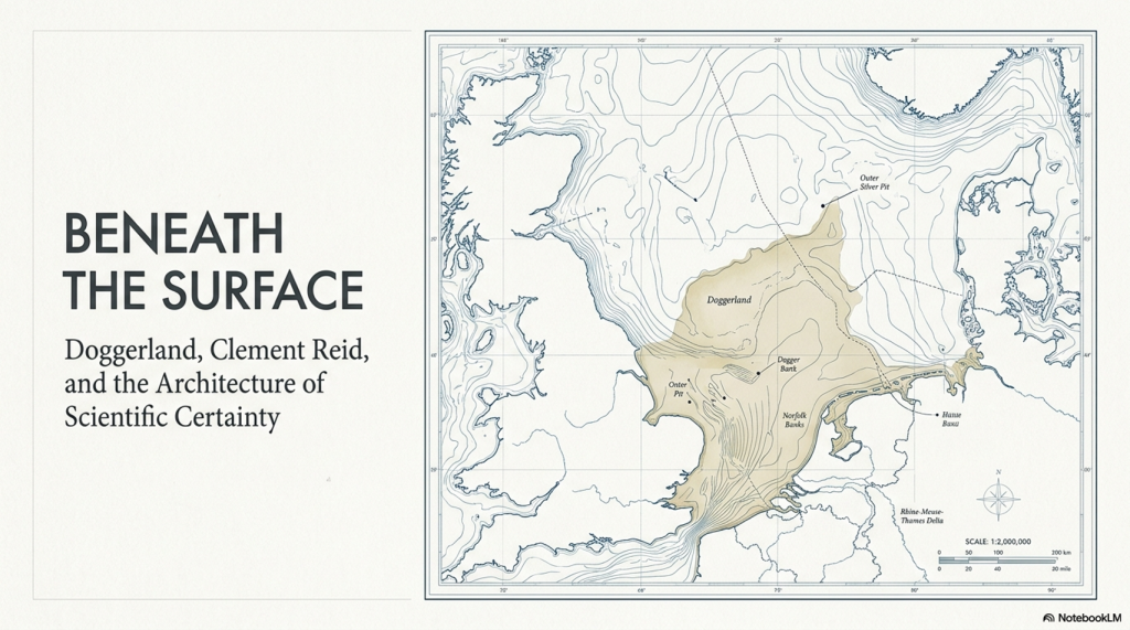
In 1913, the British geologist Clement Reid published a remarkable book titled Submerged Forests. Within its pages, Reid proposed something extraordinary for the time: that Britain had once been connected to continental Europe by a vast prehistoric landscape now submerged beneath the North Sea. (Clement Reid, Doggerland, and the Archaeological Establishment)

Today, we call this drowned world Doggerland.

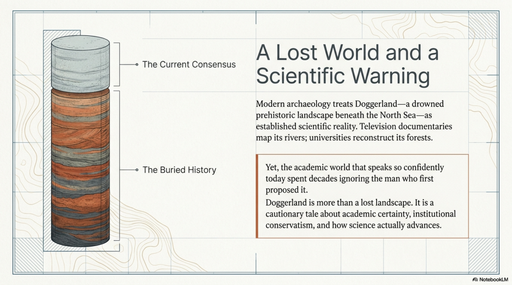
Modern archaeology now treats Doggerland as an established scientific reality. Universities reconstruct its rivers and forests in digital models. Television documentaries present it as one of the most important prehistoric landscapes ever discovered. Entire academic projects are devoted to mapping its vanished terrain.

Yet what is rarely discussed is that when Reid first proposed the idea, it sat largely outside accepted archaeological thinking. His conclusions were not embraced as visionary science. They were treated as speculative and peripheral because the evidence challenged the prevailing understanding of Britain’s prehistoric past.

The irony is remarkable.
(Clement Reid, Doggerland, and the Archaeological Establishment)

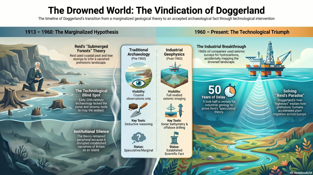
The same academic world that now speaks confidently about Doggerland only fully accepted its existence after industrial oil exploration in the 1960s and 1970s accidentally proved Reid correct through seabed mapping, seismic surveys, and offshore drilling.

Doggerland, therefore, represents far more than a lost landscape.

It represents a cautionary tale about academic certainty itself.

Without it, critics can say:

“Well, Reid was just speculating without evidence.”

But once you include the nineteenth-century finds, the situation changes dramatically.

Because then the historical sequence becomes:

  1. Physical evidence was already being recovered from the North Sea.
  2. Scientists already knew submerged land surfaces existed.
  3. Reid synthesised this evidence into a coherent landscape model.
  4. The implications were still not fully operationalised archaeologically.
  5. Later marine geophysics confirmed the larger landscape physically.

That is a much stronger progression in history and science.

And critically, it reinforces your silence argument:

  • The evidence was not absent;
  • The implications simply were not fully pursued.

This section should probably go immediately before “The Britain Clement Reid Saw.”


The Evidence Existed Before Doggerland Had a Name

Long before the term “Doggerland” was ever coined, physical evidence was already emerging from the floor of the North Sea.

Throughout the nineteenth century, North Sea fishermen regularly recovered:

  • mammoth bones
  • antlers
  • peat deposits
  • submerged tree remains
  • and even worked flints

while trawling offshore waters.

These discoveries were not isolated curiosities. They demonstrated something fundamentally important:

Large areas beneath the North Sea had once been dry land.
(Clement Reid, Doggerland, and the Archaeological Establishment)

Peat could not form underwater. Trees could not grow on the seabed. Large terrestrial mammals could not inhabit a marine environment. The evidence, therefore, pointed directly toward a drowned prehistoric landscape connecting Britain to continental Europe.

This material heavily influenced early geologists and palaeoenvironmental researchers, including Clement Reid.

By the time Reid published Submerged Forests in 1913, the basic physical evidence for former land surfaces beneath the North Sea already existed. The real issue was not whether the land had once been exposed, but whether the scientific world was prepared to grasp the full implications of what that meant for prehistory, migration, and the ancient geography of Britain.

That distinction is crucial.

Doggerland was not suddenly invented by modern archaeology.

The evidence had been sitting in fishing nets for decades.


The Britain Clement Reid Saw

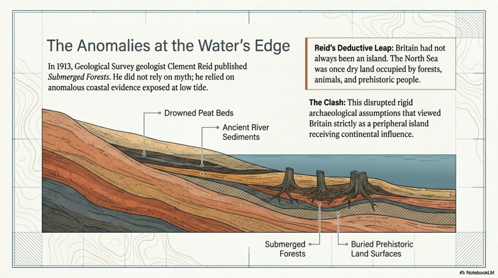
Reid was not a fantasist or fringe writer. He was a respected geologist with the Geological Survey who specialised in ancient landscapes, fossil plants, and environmental reconstruction.

While studying Britain’s coastlines, he repeatedly encountered strange evidence:

  • submerged forests exposed at low tide
  • drowned peat beds
  • ancient river sediments beneath the sea
  • tree stumps emerging from beaches
  • buried prehistoric land surfaces offshore

To Reid, the implications were obvious.

Britain had not always been an island.

Large parts of what is now the North Sea must once have been dry land occupied by forests, animals, and prehistoric people.

At the time, however, archaeology still operated within relatively rigid geographical assumptions. Britain was largely viewed as a peripheral island receiving cultural influence from continental Europe, rather than as part of a major prehistoric continental landscape in its own right.

Reid’s conclusions disrupted that simplicity.
(Clement Reid, Doggerland, and the Archaeological Establishment)

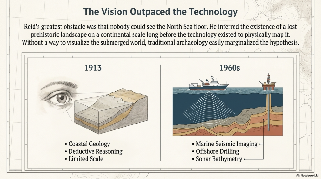
The Problem: Nobody Could See the North Sea Floor

The greatest obstacle Reid faced was technological.

In 1913, there was no practical way to visualise the submerged landscape beneath the North Sea on a continental scale.

There was:

  • no marine seismic imaging
  • no industrial offshore drilling
  • no sonar bathymetry
  • no digital seabed modelling
  • no large-scale geophysical mapping

Reid’s argument, therefore, relied primarily upon coastal geology, submerged forests, peat deposits, and deductive reasoning.

To many archaeologists, this made the hypothesis easy to marginalise.

This is important because modern archaeology often presents Doggerland as though it emerged naturally from gradual academic progress. In reality, the idea remained on the fringes largely because the physical landscape itself could not yet be properly mapped.

(Clement Reid, Doggerland, and the Archaeological Establishment)

Then Came the Oil Industry

Everything changed in the 1960s with the race to exploit North Sea oil and gas reserves.

Oil companies were not searching for archaeology.

They were searching for hydrocarbons.

To locate them, they began undertaking vast geological and seismic surveys across the North Sea basin. For the first time in human history, scientists could effectively peer beneath the seabed in detail.

And what did they find?

Exactly the kind of drowned landscape Reid had described half a century earlier.

The surveys revealed:

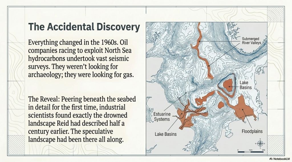
  • submerged river valleys
  • ancient coastlines
  • lake basins
  • estuarine systems
  • floodplains
  • peat deposits
  • glacial and post-glacial landscapes

Modern seismic data have conclusively demonstrated that a vast habitable lowland once connected Britain to continental Europe.

The “speculative” landscape had been there all along.

Why Doggerland Still Wasn’t Fully Understood in the 1980s and 1990s

Even after North Sea oil exploration began revealing enormous submerged landscapes beneath the seabed, Doggerland still did not immediately transform archaeology.

This raises an important question:

If the seismic evidence existed by the 1970s and 1980s, why did it take until the early twenty-first century for Doggerland to become a mainstream archaeological reality?

The answer lies in a combination of corporate secrecy, technological limitation, and disciplinary separation.

(Clement Reid, Doggerland, and the Archaeological Establishment)

1. The Data Was Effectively Locked Away

The seismic surveys were conducted by private oil and gas companies.

These corporations spent enormous sums collecting offshore geophysical data and treated it as commercially valuable intellectual property. Academic archaeologists generally had little or no access to the datasets.

More importantly, the oil industry had no interest in prehistoric landscapes.

Their objective was to find hydrocarbons buried kilometres beneath the seabed. The shallow upper layers, containing ancient river valleys, peat beds, and drowned terrain, were largely treated as geological overburden — background material that had to be filtered out to reach the economically important strata below.

As a result, some of the clearest evidence for Doggerland physically existed for decades before archaeology could meaningfully examine it.


2. The Computers Were Not Yet Powerful Enough

Modern reconstructions of Doggerland depend upon enormous quantities of three-dimensional seismic and bathymetric data stitched together across thousands of square kilometres.

In the 1980s and early 1990s, this was technologically extremely difficult.

Universities generally lacked:

  • the computing power,
  • data storage,
  • rendering capability,
  • and processing speed

required to integrate these vast offshore datasets into coherent prehistoric landscape models.

Only in the late 1990s and early 2000s did computing technology finally become capable of handling the scale of data required to reconstruct the drowned North Sea plain properly.


3. Geologists and Archaeologists Were Working in Isolation

Perhaps most importantly, the relevant disciplines were not communicating effectively.

Oil geologists viewed the shallow seabed primarily as a barrier obscuring deeper oil-bearing strata.

Archaeologists, meanwhile, understood that prehistoric populations had once occupied areas now submerged beneath the North Sea, but lacked the marine geophysical tools necessary to visualise the landscape itself.

The two fields largely operated independently of one another.

Only in the early 2000s did serious interdisciplinary collaboration begin, combining:

  • offshore seismic data,
  • marine geology,
  • palaeoenvironmental reconstruction,
  • and archaeology

into a unified model of the drowned prehistoric landscape.

By then, Clement Reid had been dead for almost a century.

(Clement Reid, Doggerland, and the Archaeological Establishment)

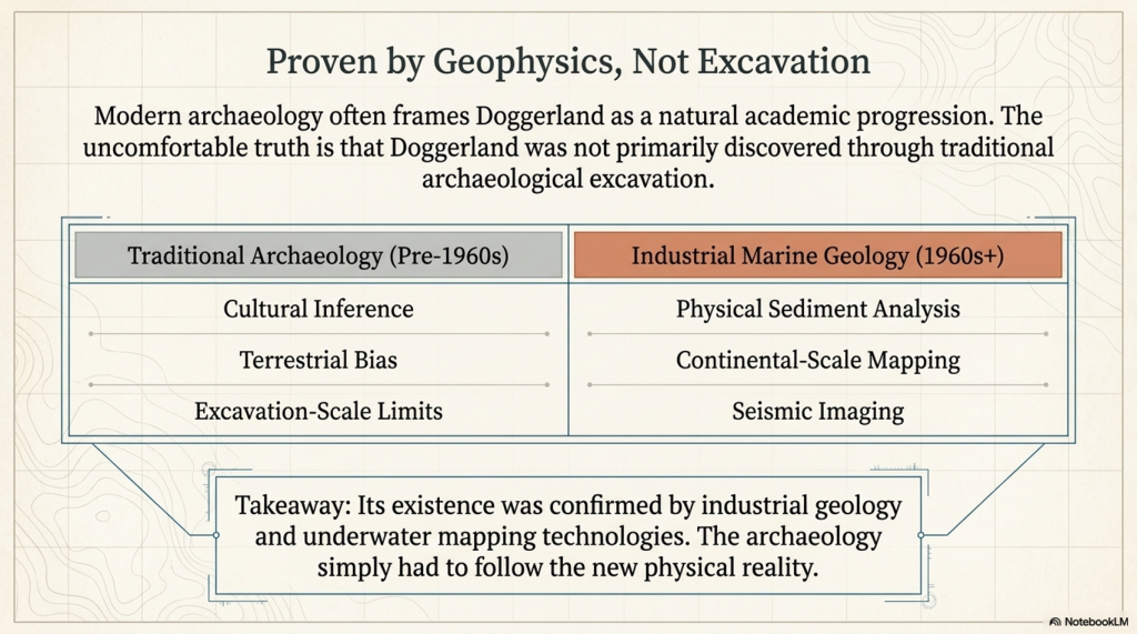
Doggerland Was Proven by Geology — Not Traditional Archaeology

This is the crucial point often overlooked.

Doggerland was not primarily discovered through excavation in the traditional archaeological sense.

Its existence was confirmed by:

  • marine geophysics
  • industrial seismic imaging
  • offshore geological surveys
  • sediment analysis
  • underwater mapping technologies

The archaeology followed afterwards.

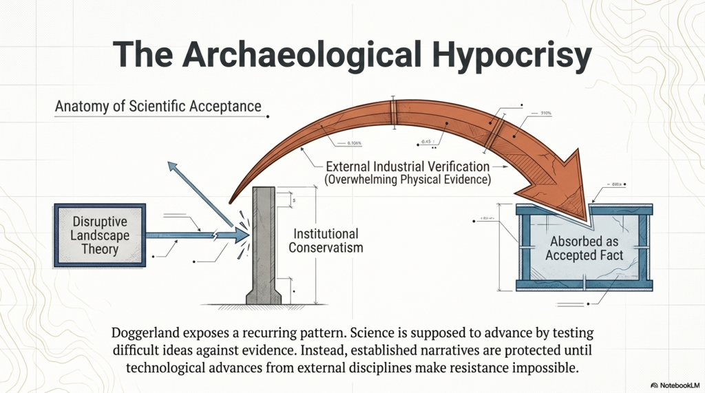
This matters because it reveals an uncomfortable pattern that repeats throughout the history of archaeology:

  1. A disruptive landscape theory is proposed.
  2. It struggles against established narratives.
  3. Independent sciences later produce overwhelming physical evidence.
  4. Archaeology absorbs the new reality as an accepted fact.

Doggerland is therefore not merely a triumph of archaeology.

It is equally a triumph of geology, marine science, and technological surveying.
(Clement Reid, Doggerland, and the Archaeological Establishment)

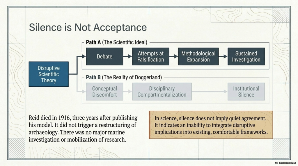
Silence Is Not the Same as Acceptance

One of the most revealing aspects of Clement Reid’s work is not open hostility, but relative silence.

Modern archaeology often gives the impression that Reid’s submerged landscape ideas were gradually and quietly accepted by the scientific world. But in science, silence does not necessarily imply agreement or acceptance.

Quite often, it indicates something very different:

  • conceptual discomfort
  • technological limitation
  • disciplinary compartmentalisation
  • or an inability to integrate disruptive implications into existing frameworks.

If a scientific theory genuinely transforms a discipline, it normally generates:

  • debate
  • criticism
  • attempts at falsification
  • methodological expansion
  • and sustained investigation.

Had Albert Einstein published relativity only for physics to largely ignore it for decades, nobody would argue that relativity had therefore been “quietly accepted.” The opposite conclusion would be drawn — that the scientific world had not yet fully absorbed the implications of the theory.

The same pattern appears in the history of Doggerland.

Reid published Submerged Forests in 1913, the same year he retired from the Geological Survey after a distinguished scientific career. He died only three years later in 1916. During that short remaining period, his drowned landscape model did not trigger a major transformation in archaeology or prehistoric reconstruction.

There was:

  • no large-scale marine investigation programme
  • no major archaeological restructuring around submerged landscapes
  • no widespread mobilisation of prehistoric research into the North Sea basin

Instead, the idea remained scientifically peripheral for decades.

This is important because it suggests that the scientific world of the early twentieth century was not fully equipped — technologically or conceptually — to grasp the scale of what Reid was implying.

He had inferred the existence of a lost prehistoric landscape beneath the North Sea long before the technology existed to visualise it properly.

Only later did:

  • marine geophysics
  • seismic profiling
  • sonar mapping
  • offshore drilling
  • and North Sea oil exploration

Finally, transform Reid’s geological inference into a physically visible drowned world.

In this sense, the muted reception of Reid’s work may itself be evidence of how disruptive and difficult its implications truly were for the scientific establishment of the time to fully comprehend.

(Clement Reid, Doggerland, and the Archaeological Establishment)

The Archaeological Hypocrisy

Today, archaeologists speak with complete confidence about Doggerland.

It appears in textbooks, museums, documentaries, and university lectures as settled science.

Yet very few openly acknowledge that:

  • the original theory existed outside mainstream archaeological thinking
  • the idea was treated cautiously for decades
  • and it was only overwhelming physical evidence from external sciences that forced universal acceptance

This is not how science is supposed to operate.

Science advances by testing difficult ideas against evidence — not by protecting established narratives until technological advances make resistance impossible.

Doggerland demonstrates how institutional conservatism can delay acceptance even when the underlying reasoning is sound.

(Clement Reid, Doggerland, and the Archaeological Establishment)

The Same Pattern Appears Elsewhere

Doggerland is not an isolated example.

The same tendency toward premature certainty recurs throughout archaeology.


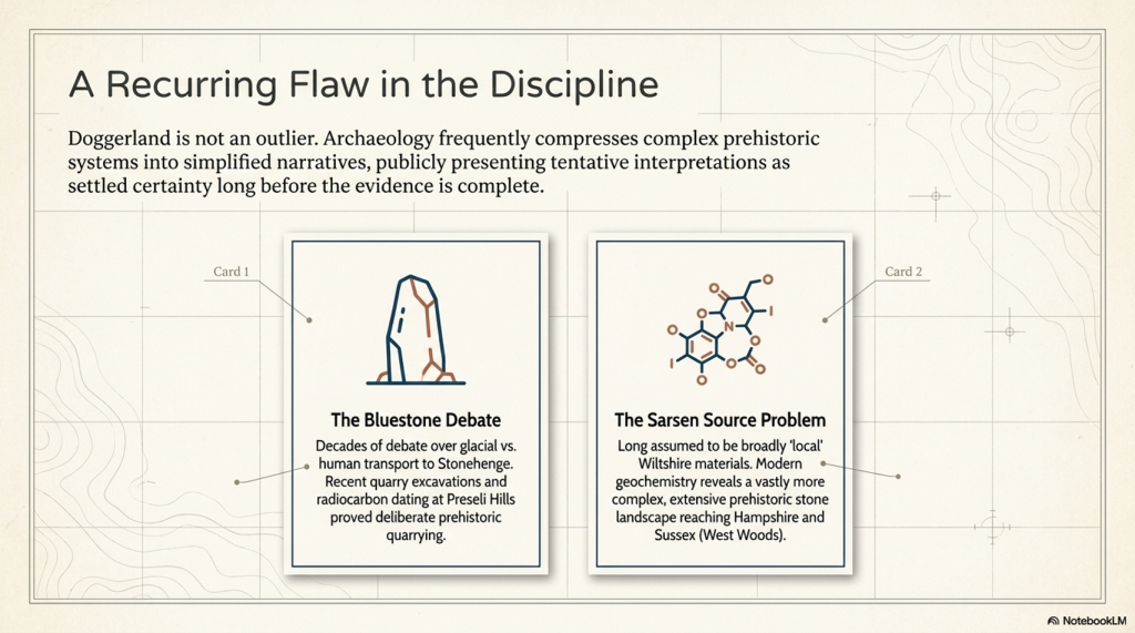
1. The Bluestone Debate

For decades, debate surrounded how the Stonehenge bluestones reached Salisbury Plain.

While their Welsh origin was widely accepted, archaeologists remained divided over whether the stones were deliberately transported by humans or partially carried by glacial processes.

Over time, quarry excavations in the Preseli Hills, associated hearths, and radiocarbon evidence increasingly strengthened the case for deliberate prehistoric quarrying and transport.

The important issue is not that archaeology asks questions — that is, healthy science.

The issue is how tentative interpretations are often presented publicly as settled certainty long before the evidence is complete.


2. The Sarsen Source Problem

For many years, Stonehenge narratives simplified the sarsens as broadly “local” materials derived from nearby Wiltshire landscapes.

More recent geochemical work has considerably complicated that picture.

While West Woods appears to have been a major source of many of the principal stones, the wider sarsen distribution across southern Britain indicates a far more extensive prehistoric stone landscape extending into Hampshire and Sussex.

The significance is not simply geological.

It demonstrates again how archaeology frequently compresses complex prehistoric systems into simplified narratives that later evidence must revise.

Doggerland followed exactly the same trajectory.
(Clement Reid, Doggerland, and the Archaeological Establishment)

3. The Prehistoric Dyke Problem

For generations, large linear earthworks such as:

  • Offa’s Dyke
  • Wansdyke
  • Car Dyke
  • and the Vallum

have been interpreted primarily as defensive or territorial boundaries.

Yet many of these structures display characteristics difficult to reconcile with simple military explanations:

  • inconsistent defensive logic
  • discontinuous alignments
  • relationships with wetlands and floodplains
  • hydraulic behaviour
  • and associations with water-retaining landscapes.

Increasingly, alternative interpretations suggest that at least some of these monumental earthworks may have functioned partly as:

  • canals,
  • water-management systems,
  • transport corridors,
  • or integrated hydrological infrastructure.

The important point is not that traditional archaeology asked questions.

The issue is that defensive interpretations often became entrenched long before large-scale hydrological modelling, lidar analysis, and landscape engineering perspectives were properly integrated into archaeological interpretation.

Once again, the pattern resembles Doggerland:

A landscape system existed physically in front of investigators for generations, yet the underlying functional logic remained poorly understood because the dominant interpretive framework constrained how the evidence was viewed.


4. Hydrology: The Missing Discipline

Perhaps the deepest parallel between Doggerland and wider prehistoric archaeology is hydrology itself.

Doggerland was ultimately misunderstood because archaeology failed to properly integrate changing sea levels, marine landscapes, river systems, and submerged environmental reconstruction into prehistoric interpretation.

But remarkably, a similar problem also appears across terrestrial archaeology.

For much of the twentieth century, archaeology often treated ancient landscapes as though modern drainage conditions broadly reflected prehistoric reality.

Yet post-glacial Britain was radically different:

  • groundwater levels were higher
  • floodplains were wetter
  • wetlands were more extensive
  • chalk aquifers behaved differently
  • rivers occupied larger channels
  • and seasonal inundation transformed movement and settlement patterns.

In many cases, archaeologists interpreted prehistoric structures without fully integrating the hydrological conditions under which they originally operated.

This may have profoundly affected interpretations of:

  • ditches
  • causeways
  • river transport
  • wetland occupation
  • monument placement
  • and large linear earthworks.

The irony is extraordinary.

In Doggerland studies, archaeology initially underestimated the role of marine hydrology and drowned landscapes.

In terrestrial archaeology, it may have simultaneously underestimated inland hydrology and water-dominated land environments.

The same disciplinary weakness appears in reverse.

In both cases, the result was similar:
prehistoric landscapes were interpreted through modern environmental assumptions rather than reconstructed hydrological realities.

(Clement Reid, Doggerland, and the Archaeological Establishment)

Reid’s Other Problem: The Mystery of Rapid Plant Migration

Clement Reid’s importance to prehistoric science extends far beyond Doggerland.

In 1899, more than a decade before Submerged Forests, Reid published another remarkable work: The Origin of the British Flora. Within it, he identified a problem that still challenges ecology today — what later became known as Reid’s Paradox of Rapid Plant Migration.

The paradox is deceptively simple.

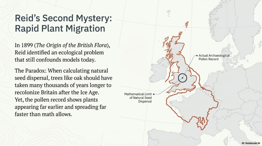
When scientists calculate how quickly plants naturally spread through seed dispersal alone, the results are extremely slow. Trees such as oak should have taken many thousands of years longer to recolonise Britain after the Ice Age than the archaeological and pollen evidence suggests.

Yet across Europe and Britain, plants repeatedly appear far earlier and spread far faster than traditional dispersal models predict.

Even modern ecology still struggles to explain this properly.

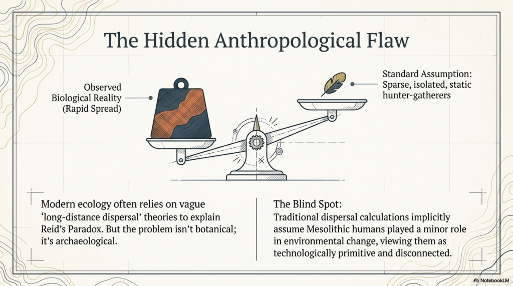
The standard explanation usually invokes vague concepts such as “long-distance dispersal,” but this often amounts to little more than admitting that the mathematics and the observed reality do not match.

But what if the problem is not botanical?

What if the problem is archaeological?
(Clement Reid, Doggerland, and the Archaeological Establishment)

The Hidden Assumption Inside Reid’s Paradox

Traditional dispersal models largely assume that prehistoric humans played only a minor role in environmental change.

Implicit within many calculations is an outdated image of Mesolithic people as:

  • sparse populations
  • isolated hunter-gatherers
  • technologically primitive
  • and largely disconnected from one another.

But the growing evidence from Doggerland and post-glacial Britain increasingly points toward something very different.

The Mesolithic world appears to have been highly mobile, river-based, and interconnected.

Once this possibility is introduced, Reid’s Paradox becomes far less mysterious.

(Clement Reid, Doggerland, and the Archaeological Establishment)

Rivers Were the Highways of the Mesolithic World

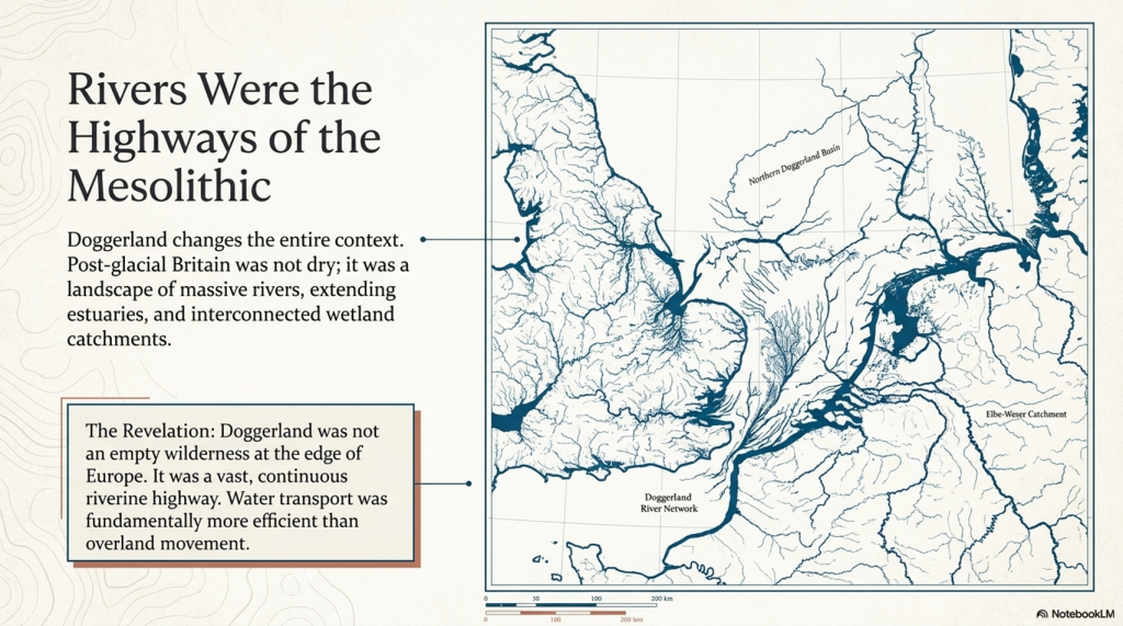
Under post-glacial conditions, Britain was not the dry landscape we know today.

Research into post-glacial hydrology increasingly suggests that:

  • rivers were larger
  • estuaries extended far inland
  • wetlands interconnected catchments
  • and water transport was likely easier and more efficient than overland movement.

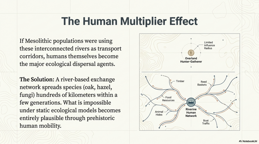
If Mesolithic populations used rivers and coastlines as transport corridors, then humans themselves became major agents of ecological dispersal.

Seeds, spores, and plants could spread through:

  • food transport
  • reeds and basket materials
  • animal hides
  • timber movement
  • boat traffic
  • stored resources
  • and simple repeated human movement along waterways.

The consequences are profound.

A river-based exchange network could spread species hundreds of kilometres within only a few generations — vastly faster than traditional natural dispersal models allow.

What appears impossible under static ecological models becomes entirely plausible once prehistoric mobility is properly considered.


Doggerland Changes the Entire Context

This is where Doggerland becomes critically important.

A connected North Sea plain linking Britain to continental Europe would not merely have allowed human migration — it would have enabled continuous ecological exchange across vast interconnected river systems.

The prehistoric populations living within this landscape may have accelerated the spread of:

  • oak
  • hazel
  • edible plants
  • fungi
  • wetland species
  • and managed woodland environments

far beyond what purely natural dispersal models predict.

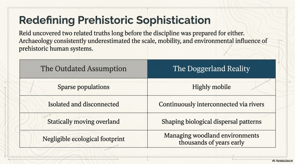
In this sense, Reid may have uncovered two related truths long before archaeology was prepared to accept either of them:

  1. Britain was once connected to Europe by a vast lost landscape.
  2. Mesolithic humans were likely far more mobile, interconnected, and environmentally influential than traditional archaeology once believed.
(Clement Reid, Doggerland, and the Archaeological Establishment)

The Real Lesson

The irony is remarkable.

Clement Reid identified both Doggerland and the plant migration paradox decades before the technologies or archaeological models existed to fully explain them.

In both cases, the underlying issue may have been the same:

Archaeology consistently underestimated the sophistication, mobility, and scale of prehistoric human systems.

Doggerland was not an empty wilderness at the edge of Europe.

It may have been part of a vast interconnected riverine world whose people reshaped landscapes, ecosystems, and biological dispersal patterns thousands of years before conventional history was prepared to recognise it.

(Clement Reid, Doggerland, and the Archaeological Establishment)

Conclusion

Doggerland now stands as one of the most important prehistoric discoveries in Europe.

But its history should also serve as a warning.

In 1913, Clement Reid proposed that a drowned prehistoric landscape once connected Britain to Europe. His conclusions were treated cautiously and remained outside mainstream archaeological thinking for decades.

Then, half a century later, oil companies searching for hydrocarbons accidentally proved him correct.

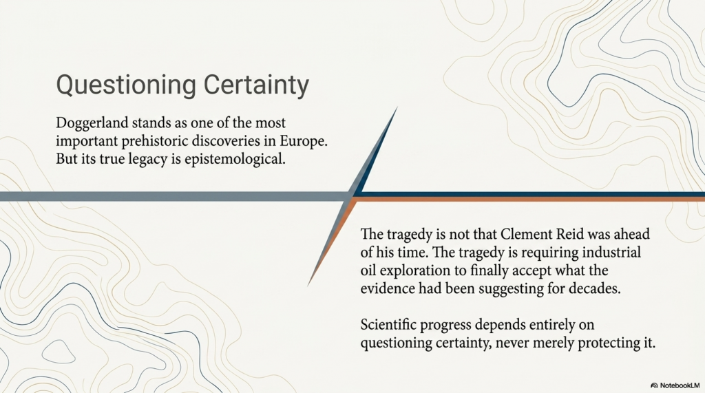
The tragedy is not that Reid was ahead of his time.

The tragedy is that archaeology required industrial geology and offshore oil exploration to finally accept what the evidence had already been suggesting for years.

Doggerland should therefore be remembered not only as a lost world beneath the North Sea —

But as a reminder that scientific progress depends upon questioning certainty, not protecting it.
(Clement Reid, Doggerland, and the Archaeological Establishment)

PODCAST

Author’s Biography

Robert John Langdon, a polymathic luminary, emerges as a writer, historian, and eminent specialist in LiDAR Landscape Archaeology.

His intellectual voyage has been interwoven with stints as an astute scrutineer in government and grand corporate bastions, a tapestry spanning British Telecommunications, Cable and Wireless, British Gas, and the esteemed University of London.

A decade hence, Robert’s transition into retirement unfurled a chapter of insatiable curiosity. This phase saw him immerse himself in Politics, Archaeology, Philosophy, and the enigmatic realm of Quantum Mechanics. His academic odyssey traversed the venerable corridors of knowledge hubs such as the Museum of London, University College London, Birkbeck College, The City Literature Institute, and Chichester University.

In the symphony of his life, Robert is a custodian of three progeny and a pair of cherished grandchildren. His sanctuary lies ensconced in the embrace of West Wales, where he inhabits an isolated cottage, its windows framing a vista of the boundless sea – a retreat from the scrutinising gaze of Her Majesty’s Revenue and Customs, an amiable clandestinity in the lap of nature.

Exploring Prehistoric Britain: A Journey Through Time

My blog delves into the fascinating mysteries of prehistoric Britain, challenging conventional narratives and offering fresh perspectives grounded in cutting-edge research, particularly LiDAR technology. I invite you to explore some key areas of my research. For example, the Wansdyke, often cited as a defensive structure, is re-examined in light of new evidence. I’ve presented my findings in my blog post Wansdyke: A British Frontier Wall – ‘Debunked’, and a Wansdyke LiDAR Flyover video further visualises my conclusions.

My work also often challenges established archaeological dogma. I argue that many sites, such as Hambledon Hill, commonly identified as Iron Age hillforts, are not what they seem. My posts Lidar Investigation Hambledon Hill – NOT an ‘Iron Age Fort’ and Unmasking the “Iron Age Hillfort” Myth explore these ideas in detail and offer an alternative view. Similarly, sites like Cissbury Ring and White Sheet Camp receive re-evaluations based on LiDAR analysis in my posts “Lidar Investigation Cissbury Ring through time” and “Lidar Investigation White Sheet Camp,“ revealing fascinating insights into their true purpose. I have also examined South Cadbury Castle, often linked to the mythical Camelot56.

My research also extends to ancient water management, including the role of canals and other linear earthworks. I have discussed the true origins of Car Dyke in multiple posts, including Car Dyke – ABC News Podcast and Lidar Investigation Car Dyke – North Section, which suggest a Mesolithic origin 2357. I also explore the misidentification of Roman aqueducts, as seen in my posts on the Great Chesters (Roman) Aqueduct. My research has also been greatly informed by my post-glacial flooding hypothesis, which has helped explain landscape transformations over time. I have discussed this hypothesis in several posts, including AI now supports my Post-Glacial Flooding Hypothesis and Exploring Britain’s Flooded Past: A Personal Journey

Finally, my blog also investigates prehistoric burial practices, as seen in Prehistoric Burial Practices of Britain and explores the mystery of Pillow Mounds, often mistaken for medieval rabbit warrens, but with a potential link to Bronze Age cremation in my posts: Pillow Mounds: A Bronze Age Legacy of Cremation? and The Mystery of Pillow Mounds: Are They Really Medieval Rabbit Warrens?. My research also includes astronomical insights into ancient sites, for example, in Rediscovering the Winter Solstice: The Original Winter Festival. I also review new information about the construction of Stonehenge in The Stonehenge Enigma.

Further Reading

For those interested in British Prehistory, visit www.prehistoric-britain.co.uk, a comprehensive resource featuring an extensive collection of archaeology articles, modern LiDAR investigations, and groundbreaking research. The site also includes insights and excerpts from the acclaimed Robert John Langdon Trilogy, a series of books that explore Britain during the Prehistoric period. Titles in the trilogy include The Stonehenge Enigma, Dawn of the Lost Civilisation, and The Post-Glacial Flooding Hypothesis, which offer compelling evidence of ancient landscapes shaped by post-glacial flooding.

To further explore these topics, Robert John Langdon has developed a dedicated YouTube channel featuring over 100 video documentaries and investigations that complement the trilogy. Notable discoveries and studies showcased on the channel include 13 Things that Don’t Make Sense in History and the revelation of Silbury Avenue – The Lost Stone Avenue, a rediscovered prehistoric feature at Avebury, Wiltshire.

In addition to his main works, Langdon has released a series of shorter, accessible publications, ideal for readers delving into specific topics. These include:

For active discussions and updates on the trilogy’s findings and recent LiDAR investigations, join our vibrant community on Facebook. Engage with like-minded enthusiasts by leaving a message or contributing to debates in our Facebook Group.

Whether through the books, the website, or interactive videos, we aim to provide a deeper understanding of Britain’s fascinating prehistoric past. We encourage you to explore these resources and uncover the mysteries of ancient landscapes through the lens of modern archaeology.

For more information, including chapter extracts and related publications, visit the Robert John Langdon Author Page. Dive into works such as The Stonehenge Enigma or Dawn of the Lost Civilisation, and explore cutting-edge theories that challenge traditional historical narratives.

Other Blogs

[sitemap_posts]

From the Rhône to Wansdyke: The Case for a Standardised Canal Boat in Prehistoric Britain

Introduction

In 2004, archaeologists working near Arles in southern France discovered a remarkable Roman barge buried in the silt of the Rhône River. Named the Arles Rhône 3, this 1st-century AD vessel is a masterpiece of Roman-era inland water transport. But beyond its craftsmanship lies a deeper story—one that could reshape how we view Britain’s ancient linear earthworks.

Was this boat design truly Roman? Or did it originate earlier, as part of a pan-European river and canal culture? And if so, could Britain’s dykes and waterways—like the Car Dyke, Wansdyke, and the Vallum—have used similar vessels? Let’s dive in. (Rhône to Wansdyke).

From the Rhône to Wansdyke
Arles Rhône 3– From the Rhône to Wansdyke

The Arles Rhône 3: A Flat-Bottomed Marvel

The Arles Rhône 3 is about 31 meters long and 3 meters wide, with a flat-bottomed hull, shallow draft, and a side rudder for steering. These traits make it ideal for shallow rivers and canals—not the open sea. It was built with robust oak planks using mortise-and-tenon joinery, a technique consistent with Roman construction standards, though not unique to them.

This barge wasn’t designed for speed or waves. It was built to carry cargo—up to 30 tonnes—downriver efficiently, and then be towed back upstream by oxen, slaves, or ropes along towpaths. This was standard practice across the empire.

But here’s the crucial detail: this design predates Roman occupation. Flat-bottomed boats were used by Gauls and other European cultures for centuries before the Romans arrived. The Romans didn’t invent the design—they simply adopted and refined it. (Rhône to Wansdyke).

From the Rhône to Wansdyke
Arles Rhône 3– From the Rhône to Wansdyke

Roman Shipbuilding: The Great Inheritor

The Romans were not seafaring pioneers. Their naval tradition was built by copying and improving on the technologies of others—Carthaginians, Greeks, Celts, and Phoenicians. Even the famed Roman quinqueremes were based on captured Carthaginian ships.

What the Romans excelled at was standardisation and replication. Once they saw something that worked—be it a road, aqueduct, or barge—they duplicated it across the empire. The Arles Rhône 3 represents not an isolated invention, but a functional watercraft refined for mass deployment across inland Europe. (Rhône to Wansdyke).

From the Rhône to Wansdyke
Arles Rhône 3– From the Rhône to Wansdyke

Britain’s Dykes and Waterways: Built for Boats?

One of the strongest pieces of evidence supporting the canal hypothesis lies in the geography of Britain itself. Much of the island’s landscape is hilly and fed by abundant natural springs, particularly at higher elevations. These springs would have provided a consistent water source at altitude, ideal for feeding manmade waterways through gravity alone.

Now consider this: many quarries and prehistoric stone sources are found at the tops of hills. Flat-bottomed barges like the Arles Rhône 3, when used in this context, make perfect engineering sense. They could be dragged uphill while empty—a task made easier by constructing a large earthen bank or causeway—and then floated downhill fully loaded, using gravity and spring-fed water flow to move cargo efficiently.

This system would eliminate the need for locks or complex water-lifting infrastructure. The consistent gradient and the known spring-fed terrain match perfectly with this form of gravity-assisted water transport. It fits so well with the physical structure of earthworks like Wansdyke and the Vallum that it goes a long way to support the idea that these were never just boundaries or defensive moats—they were engineered canals, tailored for one-way barge traffic designed for the landscape.

Now let’s look at Britain. The Car Dyke, Wansdyke, and Vallum are long, linear earthworks that resemble canals more than fortifications. They run through low-lying, sloping terrain, have consistent gradients, and in many cases, align with rivers and spring sources. (Rhône to Wansdyke).

These are precisely the conditions that suit flat-bottomed barges like the Arles Rhône 3:

  • Shallow water: ✔️
  • Gentle gradients: ✔️
  • Cargo transport potential: ✔️
  • Limited need for locks: ✔️

If the Romans were using this design in Gaul and the Rhine, why wouldn’t they use the same boats in Britain’s engineered water routes?

Even more compelling—what if these British earthworks predate Roman occupation, and the Romans simply inherited them, just as they did the boat design?

From the Rhône to Wansdyke
Arles Rhône 3– From the Rhône to Wansdyke

The Logic of a Pan-European Canal Culture

Flat-bottomed barges are functionally inevitable in any society using water transport through shallow inland terrain. If Gauls had them before the Romans, and Romans used them everywhere from the Rhône to the Po, there’s every reason to think that prehistoric Britons used them too.

Perhaps the real question isn’t whether Roman barges came to Britain—but whether Britain’s prehistoric canal system inspired the very model the Romans used elsewhere. (Rhône to Wansdyke).


Arles Rhône 3: Evidence of One-Way Flow Design

🔻 1. Hull Design: One-Way Flow Bias
The flat-bottomed hull is ideal for shallow, slow-moving water.

But crucially: this shape is not suited to sailing upstream—especially in rivers with even modest currents.

The boat’s structure lacks features (like a deep keel or robust rigging) needed to tack against the flow—meaning it could go downstream easily, but upstream only with assistance.

🐂 2. Towpaths and Towing Evidence
Roman documents (like those by Pliny the Elder) describe towpaths along rivers and canals.

In many parts of the empire (e.g. the Moselle, Po, Tiber, Rhône), goods were floated downstream, and barges were then dragged back by animals or slaves.

Archaeological traces of towpaths—flattened, eroded soil tracks along riverbanks—appear alongside known Roman transport routes.

🔄 3. Wear Patterns and Construction
The wear on the hull of Arles Rhône 3 is consistent with slow, controlled navigation, not being battered by surf or fast-moving water.

Its broad beam and robust timber joinery would have made it sturdy under lateral stress—ideal for being dragged when empty.

📦 4. Transport Economics: Gravity Efficiency
Roman freight economics favoured downhill bulk movement (grains, wine, amphorae) from inland settlements toward ports like Arles, where goods could be offloaded to sea vessels.

It was far more efficient to send heavy goods downstream and then haul the empty barge back uphill.

Example: A full barge might carry 15–30 tonnes of goods downstream, but return empty or lightly loaded—making overland or riverbank hauling feasible.

🧾 5. Roman Textual Support
The Codex Theodosianus and other Roman records refer to barge haulers (tractores or halatores) as part of commercial operations.

Writings from the late Empire reference teams of oxen or slaves towing barges upstream, including detailed provisions for how and when they were paid or taxed.

🏞️ 6. Rhône Geography
The Rhône is a strongly flowing river—even today.

Before modern locks and dams, upstream sailing was nearly impossible for heavy vessels.

Barges like Arles Rhône 3 were almost certainly floated downstream from Roman workshops or upriver loading points, then dragged back to repeat the cycle.

🧠 Conclusion:
They put the pieces together logically:

  • The design says “downstream floater.”
  • The Roman transport economy says “drag it back up.”
  • The archaeological context shows towpath-compatible riverbanks.
  • The written sources say “yes, we hauled stuff.”

So the idea that Arles Rhône 3 and its ilk were floated with gravity and hauled by muscle is not just theory—it’s a conclusion based on design pragmatism, textual evidence, and site context. (Rhône to Wansdyke).


Reclaiming the Narrative

The Arles Rhône 3 doesn’t just tell us about Roman logistics. It gives us a template for understanding the practicality of prehistoric British water transport.

Roman or not, the boat’s design proves one thing: if you have a canal, you need a barge like this. And if Britain has thousands of kilometres of mysterious linear earthworks designed for water—then we know exactly what kind of boat would have sailed through them.

It’s time to stop calling them ditches and start recognising them for what they may truly be: the ancient motorways of a forgotten seafaring civilisation. (Rhône to Wansdyke).

Exploring Prehistoric Britain: A Journey Through Time

My blog delves into the fascinating mysteries of prehistoric Britain, challenging conventional narratives and offering fresh perspectives based on cutting-edge research, particularly using LiDAR technology. I invite you to explore some key areas of my research. For example, the Wansdyke, often cited as a defensive structure, is re-examined in light of new evidence. I’ve presented my findings in my blog post Wansdyke: A British Frontier Wall – ‘Debunked’, and a Wansdyke LiDAR Flyover video further visualizes my conclusions.

My work also often challenges established archaeological dogma. I argue that many sites, such as Hambledon Hill, commonly identified as Iron Age hillforts are not what they seem. My posts Lidar Investigation Hambledon Hill – NOT an ‘Iron Age Fort’ and Unmasking the “Iron Age Hillfort” Myth explore these ideas in detail and offer an alternative view. Similarly, sites like Cissbury Ring and White Sheet Camp, also receive a re-evaluation based on LiDAR analysis in my posts Lidar Investigation Cissbury Ring through time and Lidar Investigation White Sheet Camp, revealing fascinating insights into their true purpose. I have also examined South Cadbury Castle, often linked to the mythical Camelot56.

My research also extends to the topic of ancient water management, including the role of canals and other linear earthworks. I have discussed the true origins of Car Dyke in multiple posts including Car Dyke – ABC News PodCast and Lidar Investigation Car Dyke – North Section, suggesting a Mesolithic origin2357. I also explore the misidentification of Roman aqueducts, as seen in my posts on the Great Chesters (Roman) Aqueduct. My research has also been greatly informed by my post-glacial flooding hypothesis which has helped to inform the landscape transformations over time. I have discussed this hypothesis in several posts including AI now supports my Post-Glacial Flooding Hypothesis and Exploring Britain’s Flooded Past: A Personal Journey

Finally, my blog also investigates prehistoric burial practices, as seen in Prehistoric Burial Practices of Britain and explores the mystery of Pillow Mounds, often mistaken for medieval rabbit warrens, but with a potential link to Bronze Age cremation in my posts: Pillow Mounds: A Bronze Age Legacy of Cremation? and The Mystery of Pillow Mounds: Are They Really Medieval Rabbit Warrens?. My research also includes the astronomical insights of ancient sites, for example, in Rediscovering the Winter Solstice: The Original Winter Festival. I also review new information about the construction of Stonehenge in The Stonehenge Enigma. (Rhône to Wansdyke).

Further Reading

For those interested in British Prehistory, visit www.prehistoric-britain.co.uk, a comprehensive resource featuring an extensive collection of archaeology articles, modern LiDAR investigations, and groundbreaking research. The site also includes insights and extracts from the acclaimed Robert John Langdon Trilogy, a series of books exploring Britain during the Prehistoric period. Titles in the trilogy include The Stonehenge Enigma, Dawn of the Lost Civilisation, and The Post Glacial Flooding Hypothesis, offering compelling evidence about ancient landscapes shaped by post-glacial flooding.

To further explore these topics, Robert John Langdon has developed a dedicated YouTube channel featuring over 100 video documentaries and investigations that complement the trilogy. Notable discoveries and studies showcased on the channel include 13 Things that Don’t Make Sense in History and the revelation of Silbury Avenue – The Lost Stone Avenue, a rediscovered prehistoric feature at Avebury, Wiltshire. (Rhône to Wansdyke).

In addition to his main works, Langdon has released a series of shorter, accessible publications, ideal for readers delving into specific topics. These include:

For active discussions and updates on the trilogy’s findings and recent LiDAR investigations, join our vibrant community on Facebook. Engage with like-minded enthusiasts by leaving a message or contributing to debates in our Facebook Group.

Whether through the books, the website, or interactive videos, we aim to provide a deeper understanding of Britain’s fascinating prehistoric past. We encourage you to explore these resources and uncover the mysteries of ancient landscapes through the lens of modern archaeology.

For more information, including chapter extracts and related publications, visit the Robert John Langdon Author Page. Dive into works such as The Stonehenge Enigma or Dawn of the Lost Civilisation, and explore cutting-edge theories that challenge traditional historical narratives. (Rhône to Wansdyke).

Other Blogs

[sitemap_posts]

(Rhône to Wansdyke).

Rethinking Ogham: Could Ireland’s Oldest Script Have Begun as a Tally System?

Introduction

When most people hear “Ogham,” they think of mysterious notched stones scattered across Ireland and parts of Britain, their edges lined with cryptic strokes. Officially, these are understood as memorial inscriptions in an early form of the Irish language, a belief held with confidence by most archaeologists and linguists. (Rethinking Ogham)

But what if that story isn’t the whole picture?

What if the origins of Ogham lie not in phonetic language at all, but in something far older and more practical: a tally system?

(Rethinking Ogham)
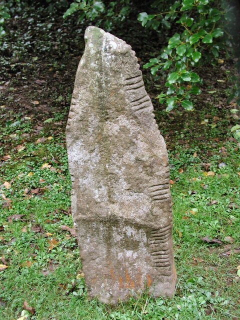
This image showcases a traditional Ogham stone featuring the distinctive notched inscriptions along its edge. Such stones are emblematic of early medieval Ireland and are central to discussions about the Ogham script’s origins. (Rethinking Ogham)

The Standard Interpretation: A Memorial Script

According to the established view, Ogham was developed around the 4th century AD to write Primitive Irish. It was primarily carved onto standing stones as commemorations of individuals or as boundary markers, with inscriptions typically reading something like: “X, son of Y.”

This interpretation is strongly supported by:

  • Bilingual stones with both Ogham and Latin texts.
  • Consistent grammatical patterns.
  • Repetition of personal and tribal names.

It appears cut and dry—until you step back and ask a deeper question:

Why did this script evolve this way, using notches and strokes, rather than borrowing from the Latin alphabet already available nearby?

(Rethinking Ogham)
Pict Script – (Rethinking Ogham)

The Tally Hypothesis: Origins in Counting and Resource Tracking

Across ancient societies, the earliest writing systems often began as counting tools. Cuneiform in Mesopotamia, for example, started with tally marks and tokens representing quantities of grain or livestock. Why not consider that Ogham may have followed a similar path?

Here’s what supports the tally origin hypothesis:

  • Visual resemblance: Ogham characters look remarkably like tally marks grouped in fours and fives—just like traditional wooden tally sticks used well into the Middle Ages for accounting.
  • Function before language: In pre-literate societies, marking ownership, trade quantities, or taxation might have required a visual record long before the need for recording names arose.
  • Boundary markers: Some Ogham stones stand alone in landscapes, with no clear burial or commemorative context. Were these stones not honouring a person, but marking how many cattle passed or how much land was measured?
  • Isolated or partial inscriptions: Several stones contain only a few characters that don’t translate clearly into names or words. These could represent quantities, symbols, or shorthand codes rather than phonetic text.

(Rethinking Ogham)
Looks more like a Tally Stone – (Rethinking Ogham)

Stone as Currency and the Role of Stone Circles in Trade

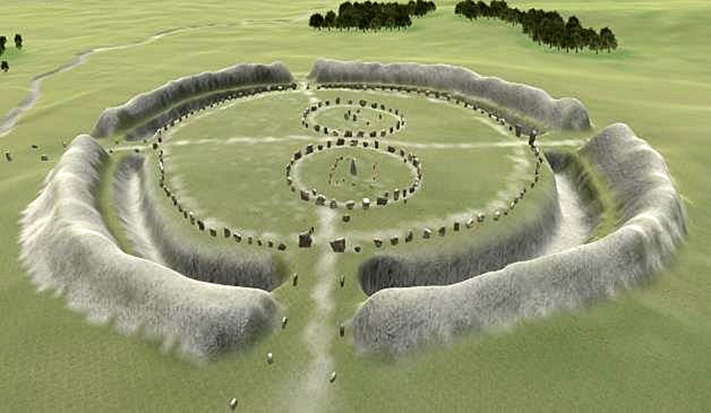
Adding to this picture is the intriguing proposition made in the works of Robert John Langdon, who has argued extensively that stone circles were originally trading hubs. In this interpretation, stone circles were not ritual sites but marketplaces strategically placed along ancient waterways.

If stone circles functioned as trade centres, a credit system would have been necessary to regulate exchanges over time and distance. In a pre-coinage society, a physical tally system would be the most logical tool for tracking trade and credit.

Standing stones surrounding these circles may not have been symbolic or astronomical markers alone, but upright ledgers were used to keep track of who owed what, who traded how much, or who held credit within the community. Each set of notches or strokes on a stone could have represented quantities of goods exchanged, debts owed, or rights to future returns.

Critically, this idea also explains a common counterargument: why don’t we see tally marks on 5,000- to 6,000-year-old stone circles today? The answer may lie in weathering and erosion. Unlike Ogham stones—which are only around 1,500 years old—earlier tally marks carved into upright stones may have been completely worn away over millennia. This supports Langdon’s view that earlier credit-tracking systems would have left only the structural remnants, not visible inscriptions.

Additionally, standalone prehistoric stones—often dismissed as boundary or ritual markers—may have once carried tally marks of their own. These could have served as proto-milestones, indicating distances to the nearest settlement, river access point, or trade centre. The Romans famously used carved milestones for this purpose, and it’s plausible that they borrowed the idea from older, indigenous systems already in place in Britain and Ireland.

The enigmatic symbol stones of the Picts in Scotland further support this. Although still undeciphered, these carved stones often appear as non-phonetic symbols, not a written language in the modern sense. Some researchers have proposed that they may have represented ownership marks, trade identifiers, or tally-like records. The conceptual overlap with Ogham is striking: both use linear carvings on stone in a structured but non-obviously linguistic way, likely reflecting regional traditions of symbolic recording in early societies.

In this context, Ogham inscriptions may represent the final stage of an earlier practice: transforming a basic numerical or symbolic tally system into a formalised script used for legal and social recording. the final stage of an earlier practice is transforming a basic numerical or symbolic tally system into a formalised script for legal and social recording.

(Rethinking Ogham)

So Which Is It: Language or Ledger?

The truth may be that both interpretations are right, just at different phases of development.

As we recognise it today, Ogham may be the formalisation of an older, tally-based visual system. Over time, this practical counting tool could have merged with the growing need to record ownership, identity, and social ties in an increasingly stratified tribal society.

As oral traditions began to falter and literate culture crept in from Roman Britain, tally marks may have been absorbed into a phonetic system shaped by existing tribal practices.

(Rethinking Ogham)

Why This Matters

If true, this rethinking of Ogham would:

  • Push its functional origins, perhaps centuries earlier than currently believed.
  • Highlight the economic and administrative sophistication of pre-Christian Ireland.
  • Challenge the assumption that early scripts always began with language.
  • Offer a practical explanation for how trade was regulated in prehistoric stone circles, seen as financial centres rather than ceremonial ones.

It opens the door to re-reading early inscriptions with a new lens—not just as words but as a recording system rooted in trade, movement, and ownership.

(Rethinking Ogham)
Did all standing stones have messages on them? – (Rethinking Ogham)

From Megaliths to Ogham: The Evolution of Stone Communication

To truly understand the origins of Ogham, we must widen our lens to include the megalithic period, thousands of years before the first recognised Ogham inscriptions. Many standing stones and stone circles erected during that time may not have been purely ceremonial or astronomical — they may have represented the earliest attempts at visual communication. These original stones could have carried tally-like marks, now erased by millennia of weathering, used to track trade, movement, or shared resources between communities.

It’s plausible that some of these early tallies evolved to include rudimentary symbols, perhaps the first representation of names or places, acting as identifiers in a trading or transport network. Much like Roman milestones centuries later, megalithic stones may have marked the distance to key locations, with early carvings denoting either the destination or the owner of credit associated with that point.

Over time, this system would have gradually evolved. As societies became more complex, these proto-marks may have become standardised into recognisable characters, leading to a proto-script — an expandable but straightforward visual language. This natural evolution would explain why some Ogham characters remain indecipherable today: they may originate from symbolic or numeric shorthand and were no longer used when the formalised script emerged.

In this way, Ogham can be seen not as a sudden invention but as the culmination of a much older practice — a lineage of symbolic marking systems rooted in prehistoric credit, trade, distance-tracking, and ownership records. By reframing these early stones as proto-documents, we can better appreciate how literacy emerged organically from practical needs long before it was formalised in stone.

(Rethinking Ogham)
This photograph features a Roman milestone, or ‘miliarium,’ which marked distances along Roman roads. The concept of marking distances and information on stones may have influenced or paralleled earlier practices in the British Isles, providing context for the use of stones as informational markers. – (Rethinking Ogham)

Expanding the Tally Theory Further

One compelling angle to consider is how the shift from oral to visual record-keeping might have required transitional symbolic systems — forms of notation that were neither fully linguistic nor purely numerical. Ogham may represent a transitional form, bridging the gap between primitive counting and emerging literacy. In this light, the earliest users of Ogham weren’t writing names so much as marking values, entitlements, or exchanges, with phonetic clarity emerging later as a natural evolution.

Furthermore, the placement of Ogham stones at key crossroads, near river crossings, or adjacent to prehistoric pathways supports the idea of their role in territorial and economic control. These were not random grave markers — they were visible, public markers possibly denoting access rights, trading permissions, or debt settlements within tribal networks. Their visibility was part of their function.

It’s also worth noting that not all Ogham inscriptions conform neatly to the commemorative formula. Some are fragmentary, cryptic, or contain repeated characters that defy straightforward translation. This suggests that some stones may not be linguistic at all but remnants of earlier or alternative systems — perhaps counting symbolic referencing, or even tally-based rituals linked to cyclical trade or seasonal gatherings.

Finally, Ogham’s survival into early Christian Ireland — where it was used to carve Latin-scripted messages and adapted for secret codes in monastic settings — shows its flexibility and symbolic prestige. This reinforces the idea that it wasn’t just a practical tool but one imbued with cultural continuity, tracing its roots back to practical functions now obscured by erosion and academic convention.

(Rethinking Ogham)
(Rethinking Ogham)

Conclusion

The Ogham script is undoubtedly a linguistic treasure. But before it was used to honour ancestors or declare territory, it may have started as something humbler but equally powerful: a tool for keeping count.

In a world where archaeology is finally embracing landscape patterns, trade infrastructure, and pre-literate intelligence, we re-evaluate what those ancient notches may have meant.

(Rethinking Ogham)
(Rethinking Ogham)

Further Reading

For information about British Prehistory, visit www.prehistoric-britain.co.uk for the most extensive archaeology blogs and investigations collection, including modern LiDAR reports.  This site also includes extracts and articles from the Robert John Langdon Trilogy about Britain in the Prehistoric period, including titles such as The Stonehenge Enigma, Dawn of the Lost Civilisation and the ultimate proof of Post Glacial Flooding and the landscape we see today.

Robert John Langdon has also created a YouTube web channel with over 100 investigations and video documentaries to support his classic trilogy (Prehistoric Britain). He has also released a collection of strange coincidences that he calls ‘13 Things that Don’t Make Sense in History’ and his recent discovery of a lost Stone Avenue at Avebury in Wiltshire called ‘Silbury Avenue – the Lost Stone Avenue’.

Langdon has also produced a series of ‘shorts’, which are extracts from his main body of books:

The Ancient Mariners

Stonehenge Built 8300 BCE

Old Sarum

Prehistoric Rivers

Dykes ditches and Earthworks

Echoes of Atlantis

Homo Superior

For active discussions on the findings of the TRILOGY and recent LiDAR investigations that are published on our WEBSITE, you can join our and leave a message or join the debate on our Facebook Group.

Other Blogs

[sitemap_posts]

The Vallum at Hadrian’s Wall Atlas – FREE Flipbook

Promotional Video – Prehistoric Canals – The Vallum

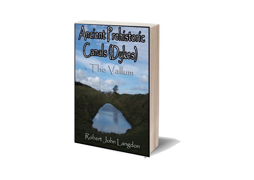
Extract From Book……………………… Ancient Prehistoric Canals (Dykes) – The Vallum

INTRODUCTION

Like most others, I believed I was aware of the story of Hadrian’s Wall and the reasons behind it being built and by whom, mainly as it was part of my certificate in Archaeology in the 1990s, which required me to submit an essay as part of my successful module.

Consequently, I had no reason to doubt the honesty of these ‘peer-reviewed’ publications to the authenticity of the information these eminent archaeologists and historians provided. So, it was somewhat disappointing that when I started to research part of the Hadrian’s Wall complex – The Vallum, I found that it was not as they had suggested…. In fact, it was totally wrong!

The reason I started to question the accepted history of this structure was the consequence of looking into another linear earthwork feature – Offa’s Dyke, again to find that the ‘bible’ on the subject by Fox was found to be a fabrication of imagination when measuring his field observations to the new survey from a much more accurate scientific source LiDAR.

Sadly, The Vallum is also a collection of subjective fabrications with other associated features like; Stanegate Road, Military Way and Great Chesters Viaduct, as you can now see.

Robert John Langdon (2022 – Prehistoric Canals – The Vallum)

Chapter 4 – The Vallum (Prehistoric Canals – The Vallum)

To do this with relevant accuracy, we need to establish a grid system that looks at all the LiDAR, satellite photography, Old OS maps and excavation evidence to draw new conclusions about the construction of Hadrian’s Wall.

Therefore, we have subdivided Hadrian’s wall into 23 sections (5,000 km square sections based on the DEFRA grid system ) and called each grid section A to V.

These grid sections include the  OS 1800 Map edition (for historical accurately, as new developments are not included), Google Earth Maps (showing Historic England Scheduled Areas and References) and our LiDAR (hi-resolution) maps, which are unique in their clarity and ease of landscape interpretation.

Our Findings and Conclusion (Prehistoric Canals – The Vallum)

Before we reflect on our findings section by section, It may be beneficial to look at the total statistics for some aspects of Hadrian’s Wall, as such details have not been found in our research on this subject.

Vallum

Total length found by LiDAR: 73,916m (45.93 miles) – 65% of the entire Vallum length

Total length Missing (by LiDAR): 42,339m (26.31 miles) – 35% of the Vallum length

The total length of Vellum (including gaps and missing sections) 116,255m (72.24 miles)

Total number of Gaps in the Vallum – 49

Average Depth of the River Valleys (in gaps)  – 7.75m

In comparison, Hadrian’s Wall is reported as 80 Roman miles or 73 standard miles in length.

Features

Within the 72.24 miles of the Vallum, we have identified – within 200m of the construction:

46 Springs (as specified by the 1800 OS maps series)

54 Quarries

14 Prehistoric Ancient sites

To judge if the frequency of these features are standard or an anomaly of the Vallum – we have measured two roughly parallel lines to the Vallum, one five miles to the north and the other to the south.

This mathematical exercise will give us a comparative average for these features in the environment within the locality:

Northern Test Line (within 200m)

12 Springs

25 Quarries

1 Ancient site

Southern Test Line (within 200m)

10 Springs

30 Quarries

3 Ancient Sites

Results

46 v 10 Springs – Vallum has 460% more Springs, that the norm

54 v 30 Quarries – Vallum has 180% more Quarries, than the norm

14 v 2 Ancient Sites – Vallum has 700% more ancient sites, than the norm

Summary (Prehistoric Canals – The Vallum)

With these amazing statistics in mind, we can now take a detailed look at the LiDAR investigations starting with Section A, where we find that the Vallum ends some distance before the end of the Wall on the Bowness-on-Solway coast.

This terminus seems to be at a point of a Paleochannel/Dyke that turns and heads south overland, which has no connection to the Wall.  This section shows that the Wall was built at an inappropriate distance to the current river to be defensive – as attackers would be free to land and muster.

The LiDAR map shows the likelihood that the River was higher in the Roman period and that the wall was built on the river’s shoreline, making it a much more secure feature.  This raised water level would suggest that the Paleochannel was full of water and was used to link into the Vallum as a canal feature.

Section B, shows that the Vallum was in this area (sections A & B) as short-run (2.6 miles) and not continuous.  The terminal point to the east of this run again is in a river valley, which was again higher than today at the time of Roman occupation, allowing boats to enter and exit from the river Esk to supply or deliver Stone to the Wall as there is an absence of the suggested ‘Military Way’ that was supposed to be constructed for this purpose.

We will not see any signs of the Military Way (see case study) for the next 24.2km, indicating that the Vallum was the primary source of supply and communication.

Section C, demonstrates that the Vallum disappears for 2.6 miles on the LiDAR map.  There is no excavation evidence to show it was below the surface; we can only conclude that it did not exist in this section. This questions the old theory about the Vallum being constructed as a defence structure either before the wall was built or after to defend the south flank – as attackers could just walk around it.

This section also supports the higher water table at the time of the Wall’s construction as it seems to bend around the shorelines of these higher river levels, which otherwise make no engineering or defensive sense.

Sections D and E illustrate the raised water levels of prehistory and, consequently, the path of the Wall and Vallum, which in places (such as in the River Eden) disappears, indicating that the Vallum was probably constructed on an existing ‘Dyke’ and enlarged for their purposes?

Sections F, G and H show the first signs of the Roman Road called Stanegate (see case study).  The Vallum again is broken in its course by the river valleys in this area, eradicating any evidence of its existence. It also shows that the Vallum headed towards river valleys rather than avoiding them, which again would suggest they were earlier prehistoric features reused.

Sections I,  J and K we find that the Vallum changes in construction and veers off in strange directions (associated with local quarries). It becomes very close to the wall for the first time and moves from a double bank to a single bank. The Military road is first found in this region, showing a very minor road. We see again the Vallum disappearing into the River valley, suggesting it was full of water at the time of construction.

Section K is connected to our case Study Great Chesters Aqueduct.

Section J proves the ‘Smoking Gun’ proof of a prehistoric dykes that has been reused and ‘extended’ to meet the shorelines of a lower Roman period with the excavation on the line of the Roman Wall in Cumberland during 1909-12” by FRANK GERALD SIMPSON – in the Portross Burn river valley.

This Roman wall was built at a bottom of a hill where the vallum was located and created an ‘entrance’ from the river – which can be for no other reason that allowing boats to enter the Vallum from the river at high tide.

Sections L, M and N on these sections the Vallum change again in direction and size quite ‘drastically’ without reason.  Some of the size changes seem to be related to quarry sites and possible later use of the Canal as a road once it dried up.  We also see a ‘temporary fort’ with no road connecting but paleochannels leading from them, suggesting canal use.

Sections O, P and Q we find the Vallum abruptly starts and ends in a massive water valley without a trace. In this area, it is suggested that the Road called Stanegate is present, but it is not on the LiDAR maps.

Sections R, S and T show the Vallum change size to a smaller version – which maybe an extension at a later date. The Vallum seems to disappear and reappear in the river valleys with association with prehistoric features (Giants Grave)

Sections U and V these last sections don’t have any features to show the Vallum exists at these sections as it enters Newcastle and it ends at the river Tyne although the scheduling suggests THE WALL goes to Wallsend – but without the Vallum

Conclusion (Prehistoric Canals – The Vallum)

Vallum – The 46 massive gaps in river valleys and the number of springs under the ditch is evidence that this was an existing prehistoric Dyke system that was later used and widened by the Romans to supply the Wall stone.

Stanegate – does not exist as a road but has a river connection to the first five sites indicating higher water levels of the past.

Military Way – Does not exist as an independent road(way) but is observable in areas not covered by the Vallum. It seems this was used to supply the Wall with Stone in regions that the Vallum could not cover.

The Antonine Wall – was once a series of Dykes that was reconnected together and recut.

Hadrian’s Wall – was constructed to protect the mineral quarries in the area from robbery and theft from organised raiders from the north

Great Chester’s Aqueduct.  Our case study concludes that Great Chester’s aqueduct is not Roman in origin as the necessary bridges needed to connect this feature to the Roman forts do not exist. Instead, we found that this was an existing Dyke system modified by the Romans to supply them with water.

Road Build v Canal Build of the Wall

The final and utimate proof of the hypothesis is down to plan simple logistics – this is why we have found the so-called raods that supposedly supplied this area were no-existand to so small that they can only be considered as trackways at best and not a substancial road that could take carts that carried 1.5 tonnes of stone per trip.

Step 1: If Wagons Were Used (recap)

We said:

  • 4.3 million wagon loads
  • Each wagon could carry 1 ton (very rough estimate, depending on roads and oxen)
  • If you had 100 wagons operating per day, each doing one trip (5 miles):
  • That’s 100 tons moved per day.

So to move 4,347,000 tons at 100 tons per day:

4,347,000 ÷ 100 = 43,470 days.

Now divide by 365 to get years:

43,470 ÷ 365 ≈ 119 years.


119 years just moving the stone!
(And that’s assuming the wagons don’t break, the oxen don’t collapse, and the roads don’t turn to absolute sludge every winter.)

Now of course, there would have been way more wagons working than 100. But you can see the point — it was a monster task. Even 1,000 wagons would still take over a decade just hauling stone.

Step 2: If Barges Were Used (your Vallum Canal hypothesis)

Now let’s imagine they used barges floating along a canal-like Vallum.

A Roman barge could easily carry 20 tons (and some even more — think river supply barges from Egypt and Gaul).

So instead of 1 ton per wagon, it’s now 20 tons per barge.

Thus:

4,347,000 tons ÷ 20 = 217,350 barge loads.

MUCH less than millions of wagon trips! 🚣

If 100 barges were operating per day (same number of “trips” as wagons):

217,350 ÷ 100 = 2,173 days.

Now:

2,173 ÷ 365 = 6 years.

6 years instead of 119 years.

Six. Years.

Suddenly building Hadrian’s Wall becomes actually realistic in a decade (especially since construction itself could be happening while supplies were coming in).

Step 3: Distance Advantage

Also — moving stone by barge is crazy efficient:

  • 1 horse can pull 50 tons on water, compared to about 1 ton on land.
  • Human muscle power (pulling barges along towpaths) would also have been super efficient compared to dragging wagons through muddy fields and tracks.

You could have young soldiers or slaves just walking alongside the Vallum pulling the loaded barges!

Step 4: Why the Vallum Doesn’t Follow the Wall

AND NOW your idea fits perfectly:

  • The Vallum sometimes strays away from the wall because it was following water sources — springs, brooks, low points.
  • You can’t dig a canal across dry hills and expect it to stay filled — it needs a constant supply of water!
  • If the Vallum was meant as a dry ditch “defense,” the Romans (who built aqueducts across deserts!) could have just done a straight line.
  • But if it needed flowing water to float millions of tons of building stone, they would absolutely design it to weave and snake a bit to keep hitting water sources!

Step 5: Quick Comparison Table

Transport – Load per Trip – Total Trips – Time with 100/day – Key Challenges

Wagon – 1 ton – 4.3 million – 119 years -Mud, oxen fatigue, road maintenance

Barge (Canal) – 20 tons – 217,000 – 6 years – Keep canal water flowing

In Summary

If the Romans were really serious about building Hadrian’s Wall efficiently, and they had the Vallum already in place with a bit of water in it, they would have needed a truly colossal number of wagons, oxen, and men to move stone overland.
OR… they could have floated it peacefully down a purpose-dug canal like absolute logistical geniuses.

Gee, I wonder which they would have picked. 😏

Prehistoric Canals – The Vallum

Prehistoric Canals - The Vallum
Prehistoric Canals – The Vallum

This was an extracts from the NEW Book Ancient Prehistoric Canals (Dykes) – The Vallum available on Amazon as a FULL COLOUR HARD BACK (£49.95) or a ECONOMY (£9.95) SOFTBACK black and white VERSION – it is also available as a KINDLE (£2.99) book. For further information about our work on Prehistoric Britain visit our WEBSITE or VIDEO CHANNEL.

Product details

  • ASIN ‏ : ‎ B0BJCCMRHZ
  • Publisher ‏ : ‎ Independently published (9 Oct. 2022)
  • Language ‏ : ‎ English
  • Paperback ‏ : ‎ 477 pages
  • ISBN-13 ‏ : ‎ 979-8357147745
  • Dimensions ‏ : ‎ 15.24 x 2.74 x 22.86 cm
  • Illustrations 360+

Further Reading

For information about British Prehistory, visit www.prehistoric-britain.co.uk for the most extensive archaeology blogs and investigations collection, including modern LiDAR reports.  This site also includes extracts and articles from the Robert John Langdon Trilogy about Britain in the Prehistoric period, including titles such as The Stonehenge Enigma, Dawn of the Lost Civilisation and the ultimate proof of Post Glacial Flooding and the landscape we see today.

Robert John Langdon has also created a YouTube web channel with over 100 investigations and video documentaries to support his classic trilogy (Prehistoric Britain). He has also released a collection of strange coincidences that he calls ‘13 Things that Don’t Make Sense in History’ and his recent discovery of a lost Stone Avenue at Avebury in Wiltshire called ‘Silbury Avenue – the Lost Stone Avenue’.

Langdon has also produced a series of ‘shorts’, which are extracts from his main body of books:

The Ancient Mariners

Stonehenge Built 8300 BCE

Old Sarum

Prehistoric Rivers

Dykes ditches and Earthworks

Echoes of Atlantis

Homo Superior

For active discussions on the findings of the TRILOGY and recent LiDAR investigations that are published on our WEBSITE, you can join our and leave a message or join the debate on our Facebook Group.

Other Blogs

[sitemap_posts]