Hollows, Sunken Lanes and Palaeochannels

Hollows, Sunken Lanes and Palaeochannels – these landscape features have been the product of mythology throughout history.

Introduction

Standing on the worn, weathered path of a holloway, enveloped by the towering earthen walls on either side, I often contemplate the origins of these enigmatic features. As a wanderer drawn to these ancient pathways, I’ve always been fascinated by the layers of history and mystery that seem to permeate the very soil beneath my feet. Holloways, these sunken roads carved into the landscape, carry with them the aura of countless stories, but their formation captivates my curiosity the most. (Hollows, Sunken Lanes and Palaeochannels)
Hollows, Sunken Lanes and Palaeochannels
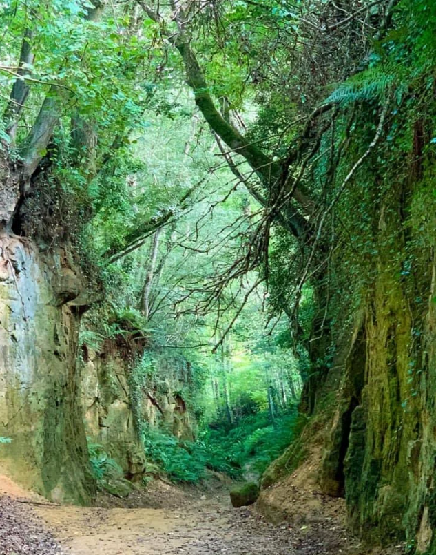
Far too high to be foot treaded by traffic or carts – probably quarrying
Hollows

Holloways are found primarily in the rural landscapes of Europe, with many prominent examples in the UK. These paths are often etched into the bedrock, composed of resilient materials like sandstone and chalk. Commonly held beliefs suggest that these sunken roads were formed by the relentless tread of human and animal traffic over centuries. The romantic notion is appealing, conjuring images of medieval pilgrims, bustling traders, and local villagers using these routes daily, gradually wearing down the earth. However, as I walk these secluded paths, far from any major urban centre, the narrative begins to feel a bit disjointed.

The solitude of these holloways contradicts the idea of heavy, consistent traffic. Many of these paths lie hidden, nestled away from the bustling life of cities and even small towns. They weave through the countryside, often known only to locals and to those few who seek them out for their historic and aesthetic appeal. This observation leads me to question: Could human activity alone have really caused such significant erosion in such durable geological materials?
 (Hollows, Sunken Lanes and Palaeochannels)
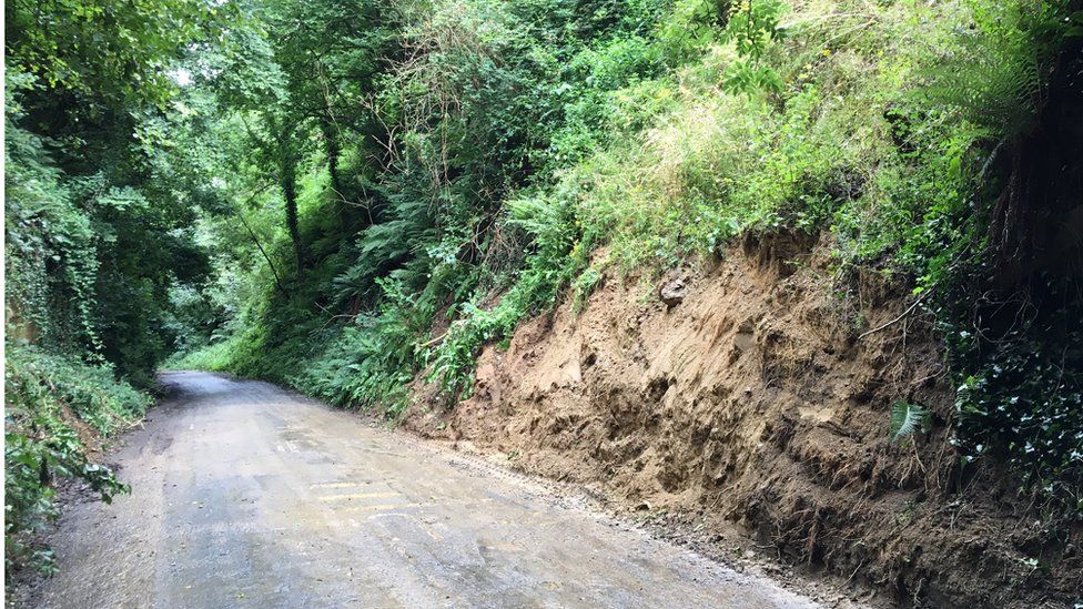
Chinnock Hollow – Yeovil

Case Study – Chinnock Hollow

My scepticism grows as I consider the geological and environmental factors at play. It seems more plausible that these paths are not solely the product of human endeavour but also, and perhaps more so, of natural processes. Indeed, some of the holloways show signs of being man-made, likely the result of historical quarrying activities. These paths are narrower, carved with a precision that suggests deliberate human intervention, perhaps as part of resource extraction practices in ancient times. The straight, purposeful lines contrast with the more organic shapes of other holloways. (Hollows, Sunken Lanes and Palaeochannels)

More intriguing to me are the holloways with rounded, sinuous forms, which suggest the sculpting hand of natural forces. The hypothesis that resonates with me involves the actions of water—powerful, persistent water. During the last ice age, melting glaciers could have dramatically altered the landscape, with meltwater raising water tables and creating new streams and rivers. Over millennia, these waterways could have carved out the initial shapes of what would become holloways, with subsequent water flow deepening and defining their courses. As the climate warmed and the ice retreated, these temporary torrents may have dried up, leaving behind the hollowed-out paths we see today.
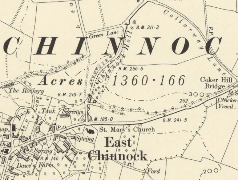
Chinnock Hollow Map
On the old OS map, it looks like it might be associated with town footfall?

This theory aligns with my observations of the Holloways’ locations and forms. Those shaped by water exhibit a rounded, undulating profile that mirrors the natural flow of streams and rivers, a stark contrast to the angular, deliberate cuts of man-made paths. Moreover, the presence of dried-up springs and altered watercourses in the vicinity of many holloways supports this idea, suggesting a historical environmental context far different from today’s. (Hollows, Sunken Lanes and Palaeochannels)

Yet, despite these insights, the allure of the mystical and the mythical still clings to these ancient roads. There is a certain romanticism in imagining the holloways as arteries of the old world, teeming with life and stories. But as much as I appreciate the charm of these tales, my quest for understanding leans on science. The true story of the Holloways, I believe, lies at the intersection of human history and natural history—a narrative crafted not just by the footsteps of our ancestors but by the powerful, sculpting hands of the earth itself.
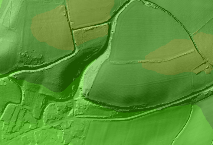
Hollows, Sunken Lanes and Palaeochannels - Lidar Channock Hollow
Chinnock Hollow on LiDAR clearly shows it is a natural Palaeochannel and not man-made

It’s clear that more comprehensive geological and historical research is needed to fully unravel the origins of these fascinating features. Geologists and historians together could shed light on how these paths were formed and evolved over time, providing a clearer picture that marries the mythical with the empirical. Such investigations could not only satisfy the curiosity of those like myself but also enhance our appreciation of how deeply intertwined our history is with the natural world. As I continue to explore these paths, the desire for knowledge only grows, driving me to advocate for deeper studies that might finally illuminate the full story of these hollowed roads, etched so indelibly into the landscape. (Hollows, Sunken Lanes and Palaeochannels)
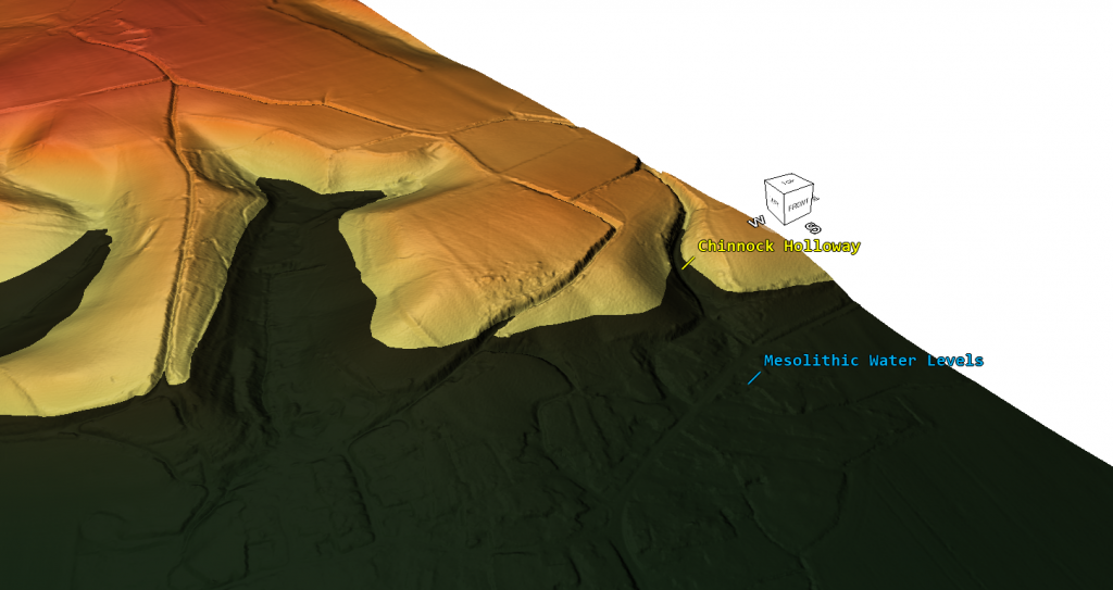
(Hollows, Sunken Lanes and Palaeochannels)
Chinnock Holloway with Mesolithic Water Heights – (Hollows, Sunken Lanes and Palaeochannels)

Site Investigation Protocol: Advanced LiDAR Interpretation for Prehistoric Landscape Features

1. Protocol Scope and Strategic Objective

This protocol mandates an immediate strategic departure from the “military-defensive” fantasies that have dominated British archaeology for over a century. We are moving toward a rigorous “hydrological-prehistoric” framework. Traditional interpretations—often little more than “archaeological pulp fiction”—reflexively categorise every ditch as a defensive frontier and every hollow as a product of medieval foot traffic. Such narratives ignore the fundamental geomorphology of the post-glacial British landscape. Accurate classification of dykes, holloways, and earthworks is not a matter of historical debate; it is a matter of geospatial science.

The core objective of this protocol is to deploy high-resolution LiDAR as the primary diagnostic instrument to identify prehistoric canals and palaeochannels. By stripping away the interference of modern agricultural scarring and Holocene vegetation, we expose the “ground truth” of the prehistoric surface. This protocol utilises the “Post-Glacial Flooding Hypothesis” to reclassify features previously shrouded in myth, providing a technical roadmap for identifying a sophisticated maritime infrastructure that once connected Britain to the European continent.

2. Theoretical Framework: The Post-Glacial Hydrological Paradigm

The “Post-Glacial Flooding Hypothesis” is the analytical lens through which all features must be viewed. This paradigm recognises that the primary architects of the British landscape were not Iron Age warriors or Saxon labourers, but the catastrophic volumes of meltwater and significantly raised water tables following the last glacial maximum. Traditional “Ivory Tower” archaeology suffers from a fundamental failure to account for these hydrological forces, leading to the systemic misidentification of natural watercourses as “man-made” sunken roads.

Environmental Drivers of Landscape Formation

Investigators must account for the following drivers in every site assessment:

  • Meltwater Torrents: Persistent, high-energy flows from receding glaciers capable of carving deep, sinuous paths into resilient bedrock like sandstone and chalk.
  • Elevated Water Tables: A historical environment where prehistoric river levels were significantly higher, sustaining active waterways in areas currently classified as “dry.”
  • Palaeochannel Transition: The natural evolution of active Mesolithic waterways into contemporary “dry” hollows as climate stabilisation lowered the regional water table.

Accepting these natural drivers effectively exposes the “Archaeological Pseudoscience” of the “traffic-erosion” theory. If a feature exists in deep solitude, far from historical urban centres, the human-erosion narrative is mathematically invalidated. Furthermore, the “military-frontier” theory for dykes collapses when the features are analysed through “Hydrology 101,” revealing them to be functional maritime canals.

3. Technical Standards for LiDAR Data Acquisition

Traditional surveys are rendered obsolete by surface noise. High-resolution LiDAR (4K, 5K, and 8K) is mandatory to bypass modern infrastructure and reveal the underlying quaternary geology. Analysis must be conducted within 3D viewing software and flyover simulations to replicate a professional remote sensing workflow.

Technical Requirements for Feature Validation

Resolution TierDiagnostic CapabilityPrimary Application
4K QualityBasic relief mapping; identification of modern agricultural scarring.Initial site spotting and large-scale regional overviews.
5K QualityMorphological differentiation; identifies rounded profiles and sinuous paths.Distinguishing between natural erosion and deliberate human quarrying.
8K PrecisionHigh-fidelity texture analysis; sub-meter contouring; underground groundwater fractals.25 sq. km tiles for 3D flyover analysis of landscape-scale canal systems.

The application of 8K precision is the pivot point for site reclassification. It allows for the identification of “rounded, sinuous forms” indicative of natural water flow, as opposed to the “angular, man-made cuts” associated with historical resource extraction. This precision is the only defence against “The Great Antler Pick Hoax,” which posits that primitive tools were responsible for massive landscape engineering.

4. Morphological Analysis: Differentiating Natural Flow from Human Intervention

Morphological rigour is the primary directive. The geometry of a feature dictates its classification, regardless of its proximity to known archaeological sites or established myths.

Diagnostic Signatures: Natural vs. Anthropogenic

  • Water-Sculpted (Natural / Palaeochannel):
    • Profile: Rounded, undulating profiles reflecting fluid dynamics.
    • Path: Sinuous, organic routes that respect topographical contours and connect to groundwater fractals.
    • Location: Often found in “deep solitude”—a diagnostic negative indicator for human erosion theories.
  • Human-Sculpted (Anthropogenic / Resource Extraction):
    • Profile: Angular, precise cuts with sharp transitions characteristic of quarrying.
    • Path: Straight, purposeful lines that override natural topographical flow.

This morphological rigor proves that Chinnock Hollow (Yeovil) is an empirical palaeochannel. LiDAR imaging reveals a sinuous form etched into resilient sandstone and chalk bedrock—a feat impossible for human footfall or cart traffic, which “Ivory Tower” narratives conveniently ignore.

5. Categorical Investigation Procedures: Dykes, Holloways, and Canals

This protocol demands a recursive re-evaluation of Britain’s “Great Dykes” and “Sunken Lanes,” dismantling the hoaxes of “Saxon Dykes” or “Iron Age Forts.”

Mandatory Investigative Directives

  1. Holloways: Conduct a recursive search for dried-up springs and historical environmental contexts. If the feature is etched into resilient bedrock (sandstone/chalk) and exhibits a sinuous profile, it must be classified as a meltwater-carved palaeochannel. The “traffic thread” narrative must be discarded if the feature is located in deep solitude.
  2. Dykes (Prehistoric Canals): Reclassify features like the Wansdyke and Car Dyke as standardised canal systems. The Car Dyke is specifically a Mesolithic canal. These features must be analysed as maritime infrastructure designed for “From the Rhône to Wansdyke” trans-European connectivity, utilised by standardised prehistoric canal boats.
  3. Earthworks and Hillforts: Treat “military way” and “defensive fort” labels as hoaxes. Specifically, the “Military Way” and “Stanegate” at Hadrian’s Wall are historical misidentifications. Investigators must use LiDAR to identify hydrological connections. For example, Durrington Walls must be reclassified from a “henge” to a managed Mesolithic landscape featuring platforms and fish traps integrated into a ditch-and-waterway system.

6. Protocol Synthesis and Forensic Reporting

This protocol marks the final transition from “archaeological pulp fiction” to empirical, LiDAR-based forensic science. The “Ivory Tower Collapse” is inevitable as geospatial data replaces romanticised hearsay. Site investigators are required to produce reports that prioritise empirical signatures over established narratives.

Critical Takeaways for Site Investigators

  1. Priority of Hydrological Context: Mandatory Directive: Always evaluate features as potential watercourses (palaeochannels or canals) before considering human-centric myths.
  2. Resolution-Driven Validation: Only 5K-8K LiDAR tiles provide the precision necessary to validate groundwater fractals and the organic signatures of post-glacial flow.
  3. Rejection of Defensive Assumptions: Question all “defensive” labels. If a feature aligns with the Post-Glacial Flooding Hypothesis or functional maritime engineering, the military interpretation is a documented hoax.

This protocol ensures the “mythical” is finally replaced by the “empirical,” utilising advanced remote sensing to reveal the true prehistoric landscape of Britain.

PodCast

Author’s Biography

Robert John Langdon, a polymathic luminary, emerges as a writer, historian, and eminent specialist in LiDAR Landscape Archaeology.

His intellectual voyage has interwoven with stints as an astute scrutineer for governmental realms and grand corporate bastions, a tapestry spanning British Telecommunications, Cable and Wireless, British Gas, and the esteemed University of London.

A decade hence, Robert’s transition into retirement unfurled a chapter of insatiable curiosity. This phase saw him immerse himself in Politics, Archaeology, Philosophy, and the enigmatic realm of Quantum Mechanics. His academic odyssey traversed the venerable corridors of knowledge hubs such as the Museum of London, University College London, Birkbeck College, The City Literature Institute, and Chichester University.

In the symphony of his life, Robert is a custodian of three progeny and a pair of cherished grandchildren. His sanctuary lies ensconced in the embrace of West Wales, where he inhabits an isolated cottage, its windows framing a vista of the boundless sea – a retreat from the scrutinous gaze of the Her Majesty’s Revenue and Customs, an amiable clandestinity in the lap of nature’s embrace.

Exploring Prehistoric Britain: A Journey Through Time

My blog delves into the fascinating mysteries of prehistoric Britain, challenging conventional narratives and offering fresh perspectives based on cutting-edge research, particularly using LiDAR technology. I invite you to explore some key areas of my research. For example, the Wansdyke, often cited as a defensive structure, is re-examined in light of new evidence. I’ve presented my findings in my blog post Wansdyke: A British Frontier Wall – ‘Debunked’, and a Wansdyke LiDAR Flyover video further visualizes my conclusions.

My work also often challenges established archaeological dogma. I argue that many sites, such as Hambledon Hill, commonly identified as Iron Age hillforts are not what they seem. My posts Lidar Investigation Hambledon Hill – NOT an ‘Iron Age Fort’ and Unmasking the “Iron Age Hillfort” Myth explore these ideas in detail and offer an alternative view. Similarly, sites like Cissbury Ring and White Sheet Camp, also receive a re-evaluation based on LiDAR analysis in my posts Lidar Investigation Cissbury Ring through time and Lidar Investigation White Sheet Camp, revealing fascinating insights into their true purpose. I have also examined South Cadbury Castle, often linked to the mythical Camelot56.

My research also extends to the topic of ancient water management, including the role of canals and other linear earthworks. I have discussed the true origins of Car Dyke in multiple posts including Car Dyke – ABC News PodCast and Lidar Investigation Car Dyke – North Section, suggesting a Mesolithic origin2357. I also explore the misidentification of Roman aqueducts, as seen in my posts on the Great Chesters (Roman) Aqueduct. My research has also been greatly informed by my post-glacial flooding hypothesis which has helped to inform the landscape transformations over time. I have discussed this hypothesis in several posts including AI now supports my Post-Glacial Flooding Hypothesis and Exploring Britain’s Flooded Past: A Personal Journey

Finally, my blog also investigates prehistoric burial practices, as seen in Prehistoric Burial Practices of Britain and explores the mystery of Pillow Mounds, often mistaken for medieval rabbit warrens, but with a potential link to Bronze Age cremation in my posts: Pillow Mounds: A Bronze Age Legacy of Cremation? and The Mystery of Pillow Mounds: Are They Really Medieval Rabbit Warrens?. My research also includes the astronomical insights of ancient sites, for example, in Rediscovering the Winter Solstice: The Original Winter Festival. I also review new information about the construction of Stonehenge in The Stonehenge Enigma.

Further Reading

For those interested in British Prehistory, visit www.prehistoric-britain.co.uk, a comprehensive resource featuring an extensive collection of archaeology articles, modern LiDAR investigations, and groundbreaking research. The site also includes insights and extracts from the acclaimed Robert John Langdon Trilogy, a series of books exploring Britain during the Prehistoric period. Titles in the trilogy include The Stonehenge Enigma, Dawn of the Lost Civilisation, and The Post Glacial Flooding Hypothesis, offering compelling evidence about ancient landscapes shaped by post-glacial flooding.

To further explore these topics, Robert John Langdon has developed a dedicated YouTube channel featuring over 100 video documentaries and investigations that complement the trilogy. Notable discoveries and studies showcased on the channel include 13 Things that Don’t Make Sense in History and the revelation of Silbury Avenue – The Lost Stone Avenue, a rediscovered prehistoric feature at Avebury, Wiltshire.

In addition to his main works, Langdon has released a series of shorter, accessible publications, ideal for readers delving into specific topics. These include:

For active discussions and updates on the trilogy’s findings and recent LiDAR investigations, join our vibrant community on Facebook. Engage with like-minded enthusiasts by leaving a message or contributing to debates in our Facebook Group.

Whether through the books, the website, or interactive videos, we aim to provide a deeper understanding of Britain’s fascinating prehistoric past. We encourage you to explore these resources and uncover the mysteries of ancient landscapes through the lens of modern archaeology.

For more information, including chapter extracts and related publications, visit the Robert John Langdon Author Page. Dive into works such as The Stonehenge Enigma or Dawn of the Lost Civilisation, and explore cutting-edge theories that challenge traditional historical narratives.

Other Blogs

[sitemap_posts]
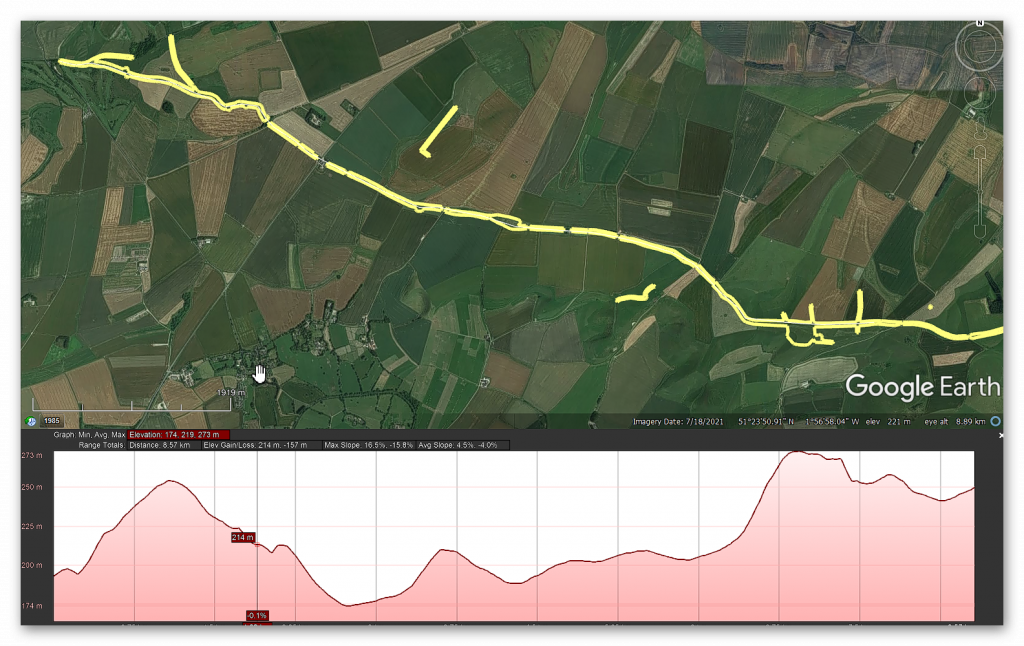
Prehistoric Canals (Dykes) – Wansdyke (4)

Introduction

Promotional Video – Ancient Prehistoric Canals (Dykes) – Wansdyke Part VI

Extract From Book……………………… Ancient Prehistoric Canals (Dykes) – Wansdyke

The enigmatic Wansdyke, standing prominently in the Wiltshire landscape, has forever captivated the public’s collective imagination.  Its proximity to the famed ancient site of Avebury, with both bearing massive ditches, has led some to surmise a direct connection between them.

Curiously, past and present archaeologists have failed to grasp this apparent link, striving instead to find a simplistic explanation for this enigmatic “linear structure.” Thus, the prevailing belief took root – that it was a bulwark raised to repel the belligerent tides of yore.  Consequently, the term “Saxon” was affixed to these earthworks, as historians of old supposed these “tribes” possessed the martial might needed to accomplish such grand engineering feats to defend their realm.

Yet, in recent decades, this “fact” has faced reexamination, and a novel theory emerged regarding these earthworks as “Boundary Markers” etched upon the landscape.  This alternative proposition, while reassuring, still leaves us grappling with perplexing truths.  Foremost among them is the Dykes’ lack of continuity – both Wansdyke and Offa’s Dyke exhibit sizeable lacunae in their stretches.  Their beginnings and endings emerge with an almost magical quality, unexplained and confounding to the beholder.

Moreover, if indeed these were markers of territorial ownership, then why do certain Dykes, like Offa’s, follow paths that traverse vast separations, such as major rivers?  Surely, a more conspicuous landmark than a mere 4-meter ditch would have served as an apt boundary in such instances.

Alas, the erudite scholars of archaeology have turned a blind eye to the existence of over 1500+ scheduled Dykes scattered throughout Britain and Ireland.  Such a multitude challenges the notion of a uniform purpose, as many of these “boundary markers” also graced uninhabited islands far and wide, enveloping the entire circumference of Britain.

In the spirit of Jacob Bronowski’s method, we must confront these enigmas with a relentless curiosity, unearthing each fragment of evidence and subjecting our suppositions to rigorous scrutiny.  The mysteries of these ancient earthworks shall only yield their secrets to those intrepid minds that dare to question and challenge the established norms of interpretation.  And as history unfolds its layers, we may find ourselves ever closer to unlocking the profound meaning behind these age-old constructs that once shaped the course of human existence upon this storied land.

Robert John Langdon (2023)

Section 4 – HE:1017288

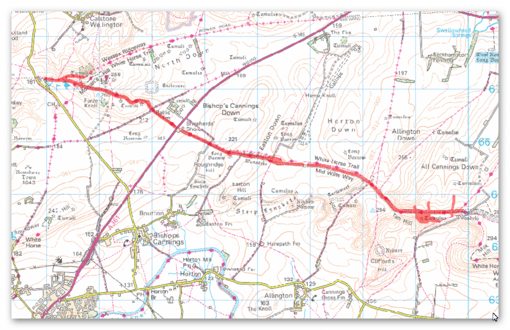
Section of Wansdyke and associated monuments from east of The Firs to the eastern side of Tan Hill, 3,460 metres (11,533 working days – 20 men, 1.58 years)

HE:1017288 GE
HE:1017288 GE

OS Map

HE:1017288 OS
HE:1017288 OS

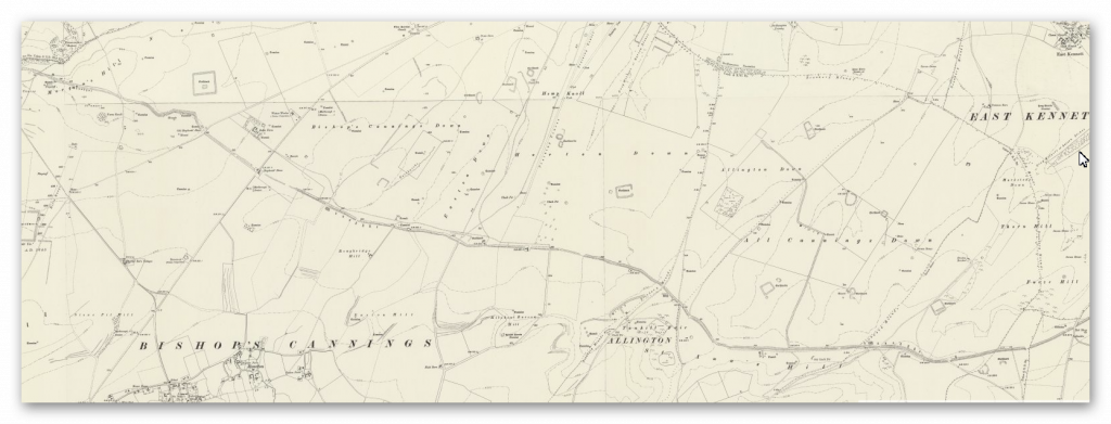
1800 Map

HE:1017288 1800
HE:1017288 1800

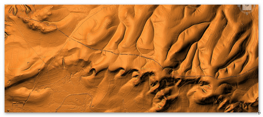
LiDAR Map

HE:1017288 Lidar
HE:1017288 Lidar

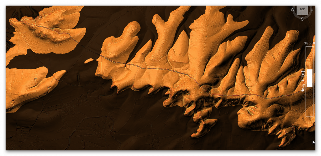
LiDAR Map (with Mesolithic water levels)

HE:1017288 - With prehistoric water levels
HE:1017288 – Mineral Extraction- With prehistoric water levels

HE schedule suggests that:

The monument, which falls into 12 areas of protection, includes part of Wansdyke running from east of The Firs to the eastern side of Tan Hill,(a kite-shaped enclosure situated on the northern side of Wansdyke on Easton Down), a section of Roman road on Morgan’s Hill, a Neolithic long barrow, five other linear earthwork sections crossed by or abutting the Dyke and 11 Bronze Age bowl barrows adjoining Wansdyke or partially overlain by it.

From the west, Wansdyke runs for roughly 72km ending just outside Marlborough at its east end.  The approximately 8.5km long section from east of The Firs to the eastern side of Tan Hill runs across the Downs south west of Avebury and includes the best-preserved continuous length of Wansdyke.

The Dyke includes a substantial earthwork bank which measures up to 30m wide and stands from 1m to 3m high.  For the majority of its length the bank lies south and west of a substantial open ditch.  This also varies in width but measures up to 36m wide and remains open to a depth of 2m in places.

 The majority of the bank and ditch sections in this area together measure from 30m to 40m across.  A further, slighter, bank beyond the ditch to the north is also visible on several sections.  The Dyke was built in sections of varying length, with breaks which would have allowed controlled traffic to pass from east to west and for the movement of military patrols beyond the defences.  The Dyke is later in date than the Roman road but was already built by the mid-ninth century, when it is mentioned in a Charter.

It is generally believed to be a military frontier work between Wessex and Mercia.  It is designed to hold the edge of the high ground on the Downs and to protect the lower lying plains to the south west.  The name derives from Woden’s Dyke, after Woden, an important Anglo-Saxon god whose name survives in the word `Wednesday’.

The earlier Roman road includes a 800m long section of the route from Cunetio (Mildenhall) to Verlucio (Sandy Lane).  It runs east to west along the north slope of Morgan’s Hill and includes a rare engineered bend at the head of a dry valley after which point the later Dyke meets it and runs along its line.  The road measures between 8m and 10m wide and its outer (north) edge comprises a well-constructed embankment which stands up to 2m high.

The road is terraced into the slope at this point and the Dyke follows the line of the road for a distance of over 300m.  South east of the wireless station on Morgan’s Hill, a 50m long, slightly curved section of linear earthwork runs north from beneath Wansdyke to end in a terminal.  It is part of a longer feature, the remainder of which starts about 20m north, runs to the edge of Horsecombe and is the subject of a separate scheduling (SM 21900).

The south end of this feature is not known for certain but it appears to run beneath the Wansdyke for some distance to the east.  Immediately south of the Dyke on Roughridge Hill is a Neolithic long barrow.  The barrow mound measures about 75m long and up to 32m wide.  It stands up to about 1m high.  Flanking the mound, but no longer visible at ground level due to the spreading of the mound caused by ploughing, are two quarry ditches which will survive as buried features.

 Although the only example in the scheduling, the barrow is one of a line of more than four Neolithic long barrows which are strung out east to west along the ridge of the Downs, all spaced roughly 1km from their nearest neighbour in either direction.

The excavations showed that the southern boundary of the enclosure lies below the line of the later Wansdyke, which appears to change course slightly at this point.  The excavations also produced Romano-British pottery sherds from the interior of the monument, indicating that it was a settlement during that period.

The section of Wansdyke on Tan Hill crosses a series of four earlier linear boundary ditches which form part of an earlier prehistoric land division. Three of these run from north to south and the last runs east to west and is abutted by at least one of the others.  These boundaries survive as buried features clearly visible on aerial photographs and, despite being levelled in places, remain visible at several points above ground.  The ditches vary in width from 3m to 8m across and several have adjacent banks about 0.75m wide and up to 0.3m high.

Together they form three sides of a rectilinear field within which is located a small Bronze Age barrow cemetery containing five bowl barrows.  Two of these are partially overlain by the Wansdyke.  The barrow mounds measure from 12m to 20m in diameter and stand between 0.2m and 1m high.

All but one of these are surrounded by quarry ditches which vary from 1m to 2m in width and survive buried below the present ground level.  There are six further bowl barrows along the length of Wansdyke from east of The Firs to the eastern side of Tan Hill which are partially overlain by the Dyke.  Some of these are outliers of groups of barrows or cemeteries, the remainder of which, where appropriate, are the subject of separate scheduling’s.  These barrows vary from 10m to 20m in diameter and stand up to 3m high.  Their surrounding quarry ditches measure from between 1m to 2m wide.

Several barrows near to Old Shepherds’ Shore were partially excavated in the 1850s and finds included burnt animal and human bone and fragments of Bronze Age pottery.

Paleochannel to dyke
Figure 34 – Paleochannel from the Raised Water Levels of the Mesolithic meet the Dyke
Ditch cutting through Dyke at 90 degrees
Figure 35 – Ditch cutting through the Dyke at 90-degrees

In the scrolls of history, the unveiling of Fig.35 beckons us to peer beyond the veil of conjecture.  Perhaps the compass that navigates us through the labyrinth of whispered questions through the corridors of time lies here.  Once an enigma shrouded in uncertainty, the Dyke unfurls its narrative in North and South, a juncture marked by division and unity.

Yet, as we stand at this crossroads, the questions persist.  What grand design does this divide mark?  Is it a sentinel of boundaries or a symphony of defence?  Why does the Dyke, an embodiment of strength, pause just a breath away from spanning both directions?  What landscapes, what treasures, do these truncated extensions seek to shield?

The visage of paleochannels, ancient waterways etched in the very fabric of the land, presents itself as a canvas of revelations.  LiDAR’s eye, attuned to the wavelengths of discovery, showcases the embrace of Wansdyke’s ditches with these prehistoric conduits.  In their intersection, a portrait emerges—a depiction of a junction, a crossroads where not just land but waterways merged.

The resonance of this image is profound.  A Dyke, often considered an embodiment of solidity, now intersects with the fluidity of these forgotten watercourses.  This confluence hints at more than coexistence—it suggests a portal, a point of ingress and egress, a thoroughfare not merely for terrestrial travellers but also for vessels that rode the liquid highways.

Such a revelation prompts us to reconsider the dike’s identity.  Could this monumental construction, both a bastion of earth and a harbour of history, be conceived not solely for defence but as a connection conduit?  An edifice that channelled both earthly aspirations and the currents of culture, bridging the realm of humans and the dominion of water?

Ditches to reach Paleochannel
Ditches to reach Paleochannel (GE)
Figure 36 – GE Map shows deep ditches which are now paths going across the Wansdyke

The southern reaches unfurl a tale of depth and mystery—a narrative that extends beyond the bounds of Wansdyke’s familiar embrace.  Here, etched upon the land like whispers of the past, are deep cuts that time has adorned with the patina of ages.  Now trodden as footpaths, these cuts reveal themselves as gateways to antiquity, as portals through which we traverse history’s corridors.

Yet, the panorama holds another surprise—a forgotten ditch, an enigmatic excavation that defies the confines of historical schedules.  This ditch, absent from Historic England’s scrolls, surrenders itself to the embrace of an old Paleochannel river, like an echo reverberating through time.  Fig. 36 becomes a tableau of continuity, a link between the tapestries of yesteryears and the present.

Lidar of Ditches reaching the Dyke
Figure 37 – Paleochannels connecting to Wansdke

In this interplay of cuts, ditches, and ancient rivers, a question arises—what hands sculpted these channels, and what intentions propelled them into existence?  Were these marks of human endeavour borne from a need to navigate the landscape, to forge paths that transcended the eras?  Or are they the product of a deeper design, etched by nature herself and embellished by the curious hands of humans?

As we meander through the corridors of speculation, let us remember the canvas of history is not confined to the visible, the documented.  It expands, much like the very rivers and footpaths that traverse it, into the realm of the unseen and the uncharted.  In the echoes of these cuts, in the absence of recognised schedules, we find a reminder that history is a symphony of the known and the unknown, a dance that transcends temporal confines.

In the mosaic of history, Fig.37 casts a spotlight upon a revelation that bridges epochs and echoes with the very essence of the land.  Here, amidst the tapestry of ancient landscapes, emerges the presence of monumental sarsen stones, sentinels of time, scattered as relics of the ages in the embrace of the Paleochannels.

Figure 38 - Paleochannels everywhere some showing sarsen stones in the dry river valley indicating the size and strength of these old rivers – first edition OS.
Figure 38 – Paleochannels everywhere some showing sarsen stones in the dry river valley indicating the size and strength of these old rivers – first edition OS.

These stones, witnesses to the drama of ice and thaw, lay scattered as if nature herself crafted an intricate mosaic.  The legacy of the last Ice Age is etched upon them, a testament to the forces that shaped this realm long before the footfalls of humankind.  As the old OS maps bear witness, these stones, abundant in the embrace of the Paleochannels, evoke a tale of glacial might and the enduring memory etched upon the land.

Figure 39 - The 'Unknown'ditch heads north and then kinks
Figure 39 – The ‘Unknown’ditch heads north and then kinks

A profound realisation emerges in this dance of discovery—a symphony of logistics and ingenuity unfurls.  If these sarsen sentinels were to be harnessed and woven into the fabric of human endeavour, the waterways would have served as a celestial highway, a course of least resistance.  And in this tableau, Wansdyke emerges not only as a Dyke, not merely a demarcation or defence, but as a lifeline that harnessed the power of water to serve human ambition.

In the intricate mosaic of historical discovery, the enigmatic ditch takes centre stage once more—a whispered riddle etched into the landscape. It meanders through the pages of time, seemingly wandering aimlessly, a question mark in the grand narrative. Yet, as we sift through the fragments of history, a revelation shimmers into view that bind the ditch and the very fabric of prehistory.

Figure 40 - The 'unknown' Dyke links to the Kennet River that goes to both Avebury and Silbury Hill
Figure 40 – The ‘unknown’ Dyke links to the Kennet River that goes to both Avebury and Silbury Hill

As modern OS maps render this ditch a ghost upon the terrestrial canvas, the marriage of technology and imagination unveils the hidden treasure. LiDAR’s touch, a modern conjurer’s wand, weaves the paleochannels and prehistoric shorelines into the mosaic. In this dance of data emerges a connection that defies the constraints of eras—a direct link between the ditch and the hallowed grounds of Avebury and Silbury Hill.

This revelation echoes through time, whispering that these ancient sites, Avebury and Silbury Hill, are not merely isolated islands but interwoven threads of a grand tapestry. The ditch, a seemingly solitary enigma, reveals itself as a connective vein—a corridor of history that flows not to obscurity but to monumental sites that have stood sentinel through the epochs.

This conjured connection, a bridge between Wansdyke and Avebury, paints a canvas where history transcends the confines of linear progression. It offers a vision of prehistory as a symphony of parallel stories, where Wansdyke and Avebury, once disparate entities, become harmonious notes that resound across the landscape. The notion that they were born simultaneously, intertwined in a narrative of ambition, culture, and design, is a testament to the shared aspirations of humanity across time.

Roman Water Management

Figure 41 - Small right-angled addition to the Dyke - but for what practical reason
Figure 41 – Small right-angled addition to the Dyke – but for what practical reason
Cross Regulator - water management system
Figure 42 – Cross Regulator – water management system

In the annals of historical inquiry, the tiny Dyke that extends from Wansdyke assumes a posture of intrigue—a whispered question mark punctuating the landscape.  In its modest form, it beckons us to decipher its purpose, to unearth the intentions woven into its design.  As we traverse the realm of speculation, two threads of possibility unfurl, each offering a glimpse into the minds of those who shaped it.

One narrative paints the Dyke as a haven, a berth upon the liquid highway—a stop for boats, a safe harbour for those who navigated the waters the dike embraced.  In this vision, the Dyke transforms into a passage not solely for people and stones but for the vessels that threaded waterways laden with cargo, hopes, and history.  The “parking feature” becomes a tableau of respite—a moment of pause in the voyage of time.

In this incarnation, the Dyke assumes a role akin to a conductor’s baton—a water regulator orchestrating the flow of springs that may have danced through the landscape.  A “Cross Head Regulator” from the annals of modern canals whispers through time, suggesting a parallel with the water management systems of the Romans, as glimpsed in the scrolls of history at Hadrian’s Wall.

The contemplation of Roman engineering and its influence upon the Dyke reflects the epochs’ interconnectedness.  The Romans, architects of both empire and innovation, are known to have left their indelible mark upon the landscapes they traversed.  Could this diminutive Dyke be a remnant of their water management techniques, a testament to their mastery over the elements as seen in other corners of the realm?

Rybury Camp and Tanhill Fair

Figure 43 - Tanhill Fair - complex earthworks showing Rybury Camp on the peninsula
Figure 43 – Tanhill Fair – complex earthworks showing Rybury Camp on the peninsula

The woven tapestry of history, the complex series of ditches extending from Wansdyke casts a net of intrigue and speculation. Their intricate dance, flowing down into the Dry River Valley, unveils a terminal that might have been a hub of significance—a nexus where the threads of trade and human interaction converged. This vista hints at a site not solely dedicated to defense or marking, but a junction that pulses with the rhythm of exchange.

Through the corridors of time, the echoes of Tanhill Fair reverberate. As if in a symphony, the words of Aubrey from the 17th century whisper of a fair held within an “old camp,” summoning images of bustling marketplaces and vibrant commerce. This isn’t a mere snapshot in history; it’s a snapshot of continuity—a legacy of trade that spans from Medieval times to the annals of antiquity.

Figure 44 - Tanhill Fair showing a supplementary ditch that connects to Wansdyke in two places and goes down into the river valley
Figure 44 – Tanhill Fair showing a supplementary ditch that connects to Wansdyke in two places and goes down into the river valley (GE)
Figure 45 - The Dyke seems to vist two quaaries before getting to Wansdyke
Figure 45 – The Dyke seems to vist two quaaries before getting to Wansdyke
Figure 46 - OS map shows the remains of the ditches went from the Paleochannel (in the Valley) to Wansdyke
Figure 46 – OS map shows the remains of the ditches went from the Paleochannel (in the Valley) to Wansdyke

Pic 45, like a palimpsest, unfurls before us—a visual odyssey that belies the limits of schedules and registers. The ditch works at Tanhill Fair reach far beyond their documented bounds, stretching both directions and connecting in two places to Wansdyke. This revelation is a testament to the fluidity of history, a reminder that the boundaries we impose upon the past are but a sliver of the stories that await our exploration.

In the theatre of interpretation, a bold hypothesis emerges—the possibility that these ditches, these conduits carved into the earth, were not mere markers or barriers but lifelines of trade. A canal, a passage through which boats might have threaded their way, carrying treasures, aspirations, and cultures from distant corners of the known world. This vision unites Wansdyke and Tanhill Fair not as separate entities but as partners in the choreography of history.

Figure 47 - Tan Hill and Rybury Camp as a Peninsula in the Mesolithic
Figure 47 – Tan Hill and Rybury Camp as a Peninsula in the Mesolithic

Roman Road joining two Dykes

Morgan’s Hill is close to a crossroads of revelation—an unassuming stretch of the Dyke that belies its significance. A linear expanse, a departure from the meandering course that defines 99% of the Dyke, captures our attention. This apparent anomaly in the landscape becomes a canvas for exploration, urging us to unveil the threads that weave its story.

A curious pattern emerges as we consult the LiDAR map and trace the hidden design drawn by the pits. Two segments along this straight stretch deviate from the norm—a conspicuous absence of the quarries and pits that have characterised the journey so far. The landscape whispers a puzzle, inviting us to decode its enigma.

Figure 48 - The Roman Road joins two Prehistoric Dykes
Figure 48 – The Roman Road joins two Prehistoric Dykes

Enter the Mesolithic shoreline, a harbinger of revelation. When layered upon the LiDAR map, it illuminates a past submerged beneath the tides of time. Suddenly, the straight stretch of the Dyke unfurls its secret—it’s not merely a Roman road but a bridge that spans epochs. It joins the dots, connecting two prehistoric courses of the Wansdyke that once wove a “wibbly wobbly” path across the landscape.

This discovery is a testament to history’s interconnectedness, the symbiotic dance between human endeavour and the ebb and flow of nature. The Romans, architects of their era, harnessed these prehistoric pathways, channelling their ingenuity to connect the dots drawn by time. It is a reminder that history is not linear but a mosaic—a collage of human intent and the tides of change.

The Morgan Hill Kink

Figure 49 - Morgan Hill East 'kink'
Figure 49 – Morgan Hill East ‘kink’


Figure 50 - Morgan Hill Kink’s barrows
Figure 50 – Morgan Hill Kink’s barrows

To the East of Morgan Hill is found a bizarre Kink in Wansdyke. This is best seen on an OS map showing this strange direction and the obstacles it avoided.

In the panorama of landscape and time, the kinks and turns of Wansdyke invite us to unravel the intentions woven into its form. As we ascend the topology of the hill, we stand witness to a sequence of choices that defy easy classification but beckon us to scrutinise their purpose.

The kinks and turns present a conundrum to the theories of fortification or marking. Their seemingly inefficient trajectory, descending the hill’s advantage and taking multiple turns, challenges the notion of defence or demarcation. From a defensive perspective, the logic of such a design raises questions about the resource and time invested.

As we tread through the corridors of inquiry, a new light shines upon the landscape—the presence of round barrows. Like sentinels of history, these ancient mounds encircle the kink on both sides. The question arises whether these barrows were built around the contours of Wansdyke or whether the kink was crafted to navigate around the barrows.

The chronicle deepens with the discovery of the missing branch—a path unmarked on contemporary maps but unveiled through Historic England’s lens. The cross ridge Dyke on Morgan’s Hill etches its presence across the east-west aligned ridge. The bank and ditch, sculpted by time’s hands, become conduits of understanding, the stories they tell interwoven with the landscape.

Branch off Wansdyke

The monument includes a 560m long section of a Cross ridge Dyke situated on Morgan’s Hill. The Dyke runs from NNW to SSE across the east-west aligned ridge, dividing Morgan’s Hill into two parts. The Dyke has a bank c.8m wide and up to 1.5m high. To the East of the bank lies an 8m wide ditch which provided material for its construction and enhanced the effectiveness of the boundary.

This has been partly infilled by cultivation but is open to a depth of 0.3m in places, and is visible on aerial photographs. The bank and ditch are interrupted by a number of openings through which animals and people could pass. It is not clear how many of these are original.

 A further section of the Dyke, situated to the south is crossed by the Wansdyke, which is later in date. This additional section is the subject of a separate scheduling. Excluded from the scheduling are the post and wire fences which cross it and run along its length, although the ground beneath is included. – English Hertitage

Figure 51 - Branch off Wansdyke
Figure 51 – Branch off Wansdyke

In the intricate tangle of time and earth, the convergence of the Cross-ridge Dyke on Morgan’s Hill and the enigmatic Dyke of East Wansdyke draws us into a narrative of layered history. Their banks and ditches, the silent architects of the landscape, weave a tale of coexistence, connection, and perhaps even evolution.

These two Dykes, mirroring each other across time and the contours of the land, embody a dialogue between epochs. Their unity atop Morgan’s Hill, a meeting point that defies temporal confines, reminds us that history is not merely a linear march—it’s a dance that spans centuries, uniting hands that have shaped the earth.

The paleochannel’s passage through the Dyke carries echoes of ancient currents—a testament to a time long before the Dyke’s construction. This fragment, missing as if eroded by the tides of prehistory, whispers that the roots of this land stretch further than the architects who shaped it. This gap in the Dyke is a tapestry of continuity, a reminder that even the most monumental structures stand atop layers of untold stories.

Figure 52 - Morgan's Hill West with another Branch
Figure 52 – Morgan’s Hill West with another Branch

The saga of East Wansdyke’s creation offers a riddle unto itself. The builders, crafting their work across chalk, kept the earth they excavated to one side. This pragmatic choice of preserving the turf for stability and camouflage echoes a nuanced purpose. It becomes evident that these Dykes are not mere boundary markers or defensive structures. They are more—a marriage of utility and adaptation, a testament to human ingenuity and the intersection of practicality and aesthetics.

ure 53 - Junctions heading north off Wansdyke past a group of Round barrows
Figure 53 – Junctions heading north off Wansdyke past a group of Round barrows

The view northward, captured in Fig. 53, extends the tableau of discovery. Like a palimpsest, the landscape bears the imprints of Wansdyke’s journey. It dances alongside the Roman Road, a chorus of human footsteps interweaving through time. The round barrows and raised river shorelines, silent witnesses to centuries past, reaffirm the interplay of cultures, constructions, and course changes that define human endeavour across epochs.

Figure 54 - How Morgan Hill used to look in the Mesolithic – with the roman road towards the bottom turning left (North)
Figure 54 – How Morgan Hill used to look in the Mesolithic – with the roman road towards the bottom turning left (North)


Chronology (Smoking Gun)

In the ongoing dialogue with history, a revelation emerges—wrought from the very contours of the land, an ancient pathway unveils its secrets. The Roman road, a trail of human ambition etched across the landscape, weaves its course atop the pages of Wansdyke’s story. This intersection, where road and Dyke converge, is a testament to the interplay of cultures, epochs, and purpose.

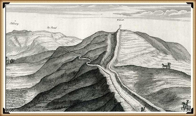
Stukeley’s drawing on Page 6, Fig.24, long questioned by the annals of archaeology, finds newfound validation through the lens of LiDAR—a digital conjurer that unveils hidden truths. Once doubted as an exaggeration, the cut through the bank now emerges as a footprint in time. LiDAR’s gaze, untethered by perception’s limits, reveals that this cut bends in harmony with the Roman deviation, a harmony of intent that speaks of chronology.

Figure 55 - Roman Road cuts through Wansdyke making it older!
Figure 55 – Roman Road cuts through Wansdyke making it older!
A different angle
A different angle

The alignment of the Roman road, cleaving through the very heart of Wansdyke’s bank, resonates with the echoes of purpose. This road, a conduit for the aspirations of the Roman era, tells a tale of connection and coexistence—an acknowledgement that the landscape’s past holds layers that intertwine like the fabric of time itself.

The chronicle of Wansdyke, interwoven with the path of the Roman road, unveils a narrative that spans millennia. This intersection becomes a bridge that invites us to traverse the epochs and honour the efforts of hands laboured to craft earthwork and thoroughfare. It becomes a gateway that prompts us to unravel the threads of intention, the dance between cultures, and the pulse of human progress.

The application of LiDAR technology has decisively resolved the inquiry. LiDAR data reveals a cross-sectional embankment profile mirroring the Roman roads deviation’s curvature, indicating the roadway’s construction postdates the Wansdyke earthwork.

This LiDAR evidence serves as a compelling confirmation of prehistoric Dyke dating, akin to a “smoking gun.” LiDAR employs laser reflection and time-of-flight measurements to gather precise topographic data by emitting and measuring laser pulses. This technology’s congruence with historical context validates its role in archaeology, exemplifying how modern tools can illuminate ancient landscapes.

Figure 78 - Roman Road cuts through Wansdyke making it older!
Figure 78 – Roman Road cuts through Wansdyke making it older!


The Book

Blank bookcover with clipping path

This was an extracts from the NEW Book Ancient Prehistoric Canals (Dykes) – Wansdyke available on Amazon as a FULL COLOUR HARD BACK (£19.95) or a ECONOMY (£4.99) SOFTBACK black and white VERSION – it is also available as a KINDLE (£1.99) book. For further information about our work on Prehistoric Britain visit our WEBSITE or VIDEO CHANNEL.

Product details

  • ASIN ‏ : ‎ B0BF31GQKC
  • Publisher ‏ : ‎ Independently published (18 Sept. 2022)
  • Language ‏ : ‎ English
  • Hardcover ‏ : ‎ 134 pages
  • ISBN-13 ‏ : ‎ 979-8353488897
  • Dimensions ‏ : ‎ 15.24 x 1.3 x 22.86 cm
  • Illustrations: 85
  • Customer reviews: 5.0 out of 5 stars    1 rating

Further Reading

For those interested in British Prehistory, visit www.prehistoric-britain.co.uk, a comprehensive resource featuring an extensive collection of archaeology articles, modern LiDAR investigations, and groundbreaking research. The site also includes insights and extracts from the acclaimed Robert John Langdon Trilogy, a series of books exploring Britain during the Prehistoric period. Titles in the trilogy include The Stonehenge Enigma, Dawn of the Lost Civilisation, and The Post Glacial Flooding Hypothesis, offering compelling evidence about ancient landscapes shaped by post-glacial flooding.

To further explore these topics, Robert John Langdon has developed a dedicated YouTube channel featuring over 100 video documentaries and investigations that complement the trilogy. Notable discoveries and studies showcased on the channel include 13 Things that Don’t Make Sense in History and the revelation of Silbury Avenue – The Lost Stone Avenue, a rediscovered prehistoric feature at Avebury, Wiltshire.

In addition to his main works, Langdon has released a series of shorter, accessible publications, ideal for readers delving into specific topics. These include:

For active discussions and updates on the trilogy’s findings and recent LiDAR investigations, join our vibrant community on Facebook. Engage with like-minded enthusiasts by leaving a message or contributing to debates in our Facebook Group.

Whether through the books, the website, or interactive videos, we aim to provide a deeper understanding of Britain’s fascinating prehistoric past. We encourage you to explore these resources and uncover the mysteries of ancient landscapes through the lens of modern archaeology.

For more information, including chapter extracts and related publications, visit the Robert John Langdon Author Page. Dive into works such as The Stonehenge Enigma or Dawn of the Lost Civilisation, and explore cutting-edge theories that challenge traditional historical narratives.


Other Blogs

[sitemap_posts]