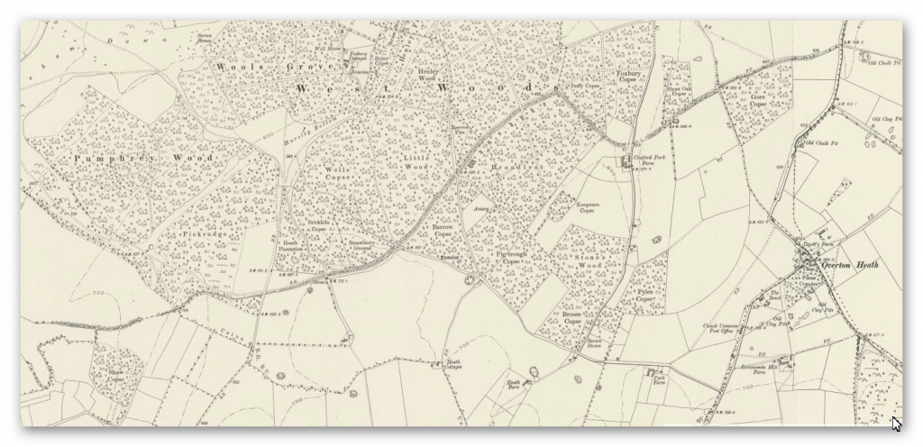
Pinkery Canal

The Victorian Engineering Project That Challenges Everything We Thought We Knew About Britain’s Ancient Dykes


Introduction

For years, one of the most common objections to Britain’s great prehistoric dykes has been remarkably simple. (Pinkery Canal: The Victorian Engineering Project)

“They’re too high.”

“There wouldn’t have been enough water.”

“They couldn’t have been used for transport.”

Pinkery Canal on Exmoor changes that debate forever.

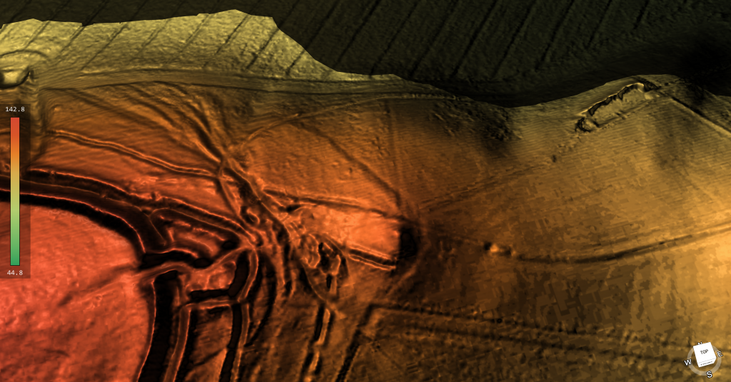
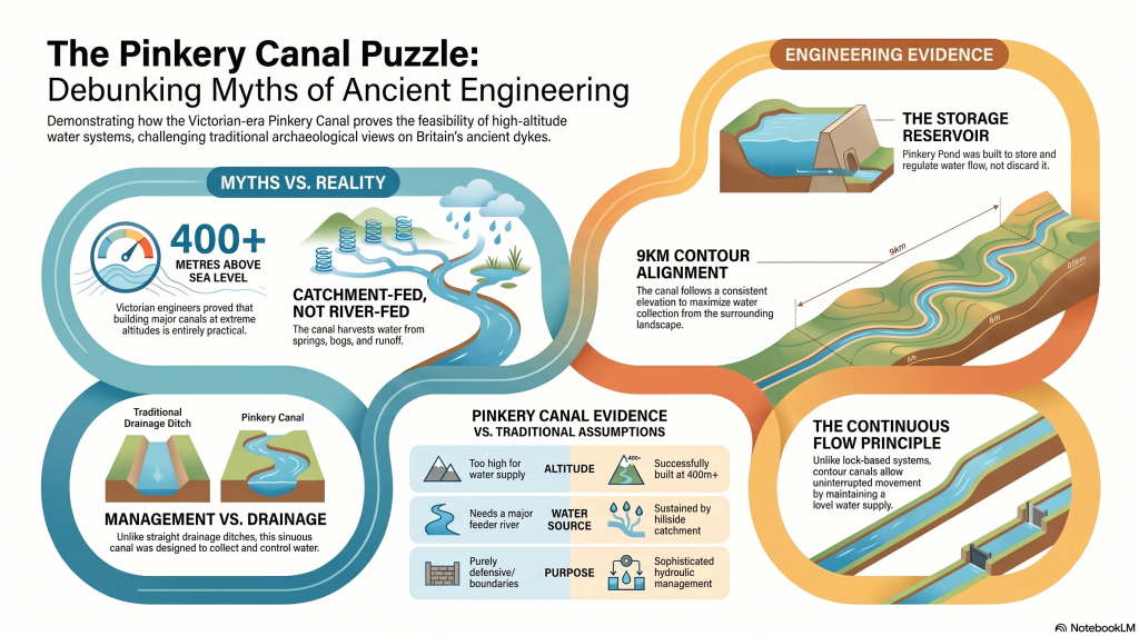
Built around 1820, this remarkable engineering project carried water across one of the highest stretches of land in southern Britain. Its purpose remains debated, but the engineering itself is undeniable. Victorian engineers considered it entirely practical to construct a canal more than 400 metres above sea level, collecting water from reservoirs, springs, bogs and hillside runoff as it crossed the moor.

That single fact removes one of archaeology’s favourite objections.

More interesting still is why it was built.

Several interpretations suggest the canal formed part of a wider system intended to move or support the movement of minerals and other resources across difficult terrain, linking extraction sites with the estate’s developing transport network. Whether for transport, water power, or land improvement, the principle is the same: using water engineering to connect remote upland resources with places where they can be processed, distributed, or exported.
 (Pinkery Canal: The Victorian Engineering Project)
(Pinkery Canal: The Victorian Engineering Project)

That concept should sound familiar.

Across Britain, more than 1,500 ancient linear dykes cross the landscape. They are usually described as defensive boundaries, yet many display engineering characteristics that are difficult to reconcile with purely military functions. Could at least some have formed part of much earlier transport and water-management systems, linking quarries, rivers and settlements in much the same way that Victorian engineers attempted on Exmoor?

This article isn’t about proving Pinkery Canal is prehistoric, yet it should be noted that there are aspects of this canal that predate the Victorian construction date and maybe where the engineers obtained the original idea?

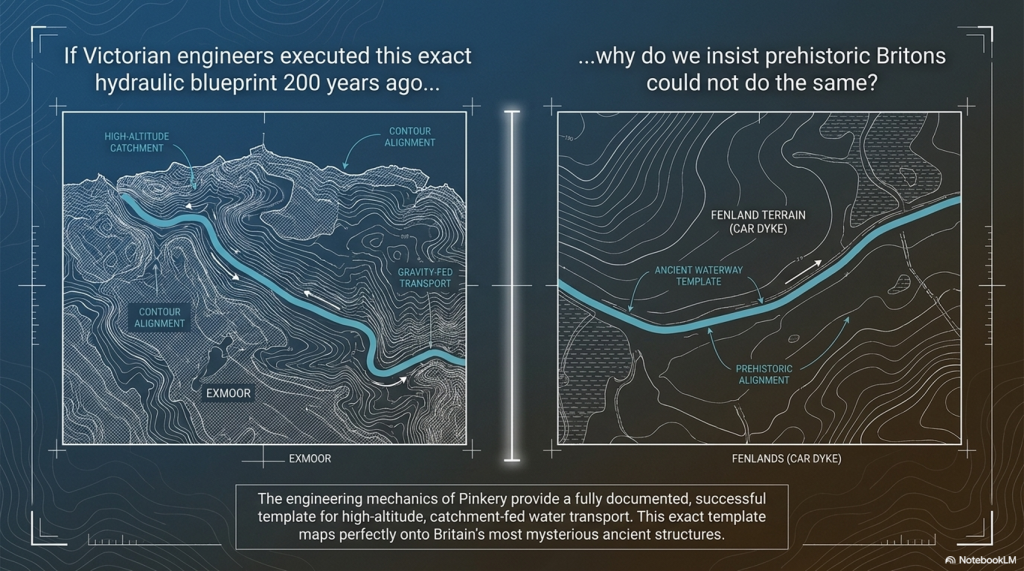
It’s about recognising that a documented nineteenth-century engineering project demonstrates something archaeologists have often dismissed—that high-altitude canals are entirely feasible, that they can be supplied by catchment water rather than a single river, and that long-distance water engineering for moving resources across the landscape is not only possible, but historically documented.

Perhaps it’s time to stop asking whether such systems could have existed…

...and start asking where else we should be looking.

 (Pinkery Canal: The Victorian Engineering Project)
(Pinkery Canal: The Victorian Engineering Project)

1. The Myth

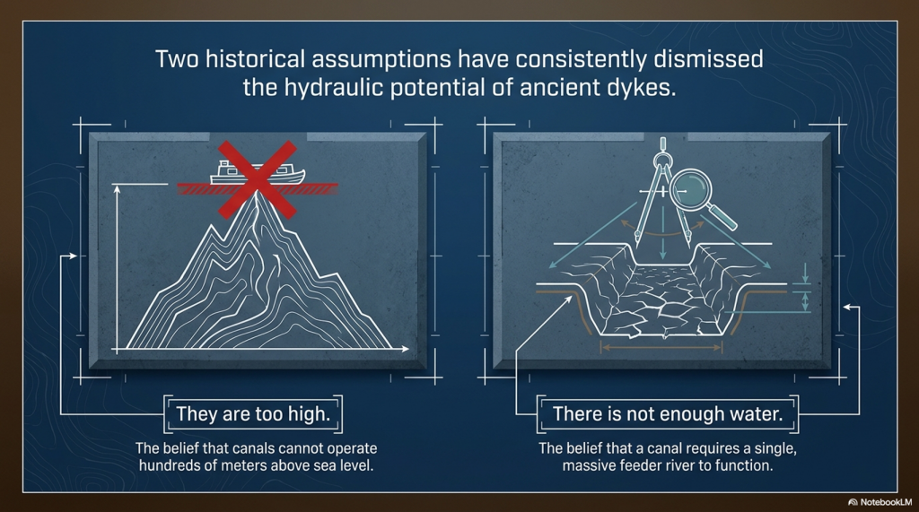
For years, critics of Britain’s prehistoric dykes have repeated the same two objections.

“Nobody would build a canal hundreds of metres above sea level.”

“There wouldn’t be enough water to keep it supplied.”

Pinkery Canal on Exmoor demolishes both arguments.

Not because it became a great commercial success.

Not because every detail of its purpose is understood.

But because Victorian engineers actually designed and constructed it.

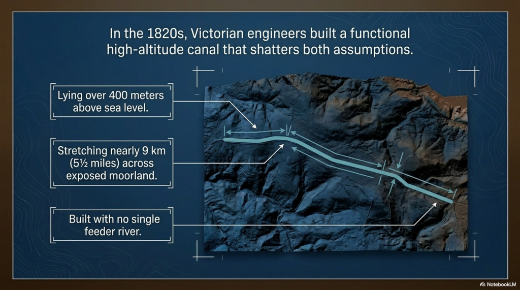
Nearly 9 km (5½ miles) long and lying over 400 metres above sea level, Pinkery Canal is undeniable proof that engineers considered high-altitude water engineering both practical and achievable.

That fact alone changes the debate.

Whether the canal ultimately fulfilled its intended purpose is almost irrelevant. Its existence proves that altitude was not considered an insurmountable obstacle, and that upland landscapes could provide sufficient water through reservoirs, bogs, springs, and intercepted surface runoff to justify the construction of a major canal.

In other words, two of the most frequently repeated objections to prehistoric canals are no longer objections at all.

The question is no longer:

“Could people build canals at high altitude?”

Pinkery Canal answers that with a resounding yes.

The real question is:

If the Victorians considered this perfectly feasible less than 200 years ago, why do archaeologists still insist prehistoric engineers could not have done the same?
 (Pinkery Canal: The Victorian Engineering Project)
(Pinkery Canal: The Victorian Engineering Project)

2. The Engineering

Forget the archive for a moment.

Forget the arguments over dates.

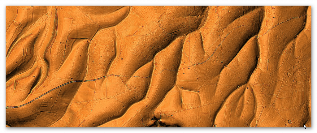
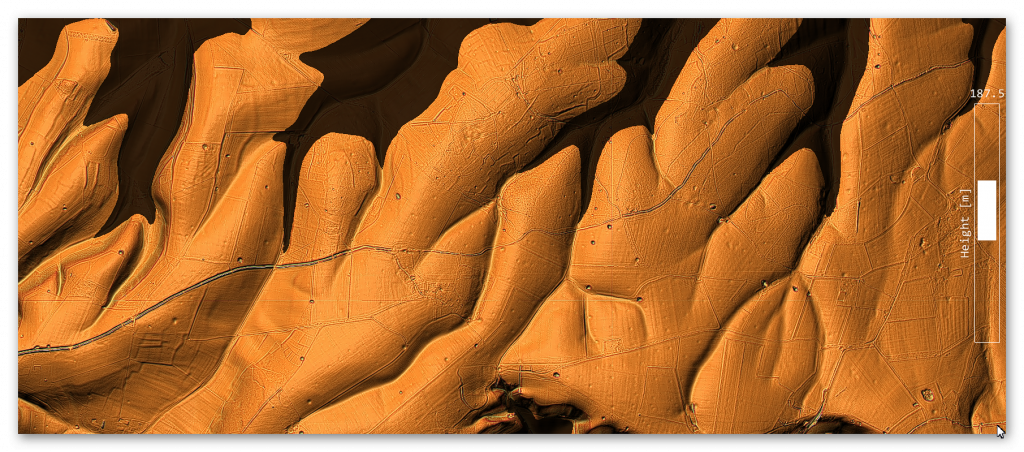
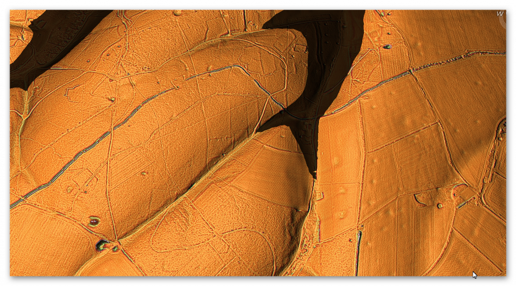
Imagine Pinkery Canal had just been discovered using modern LiDAR, with no nineteenth-century documents to guide us. How would an engineer interpret the monument purely from its design?

The first impression is its sheer ambition.

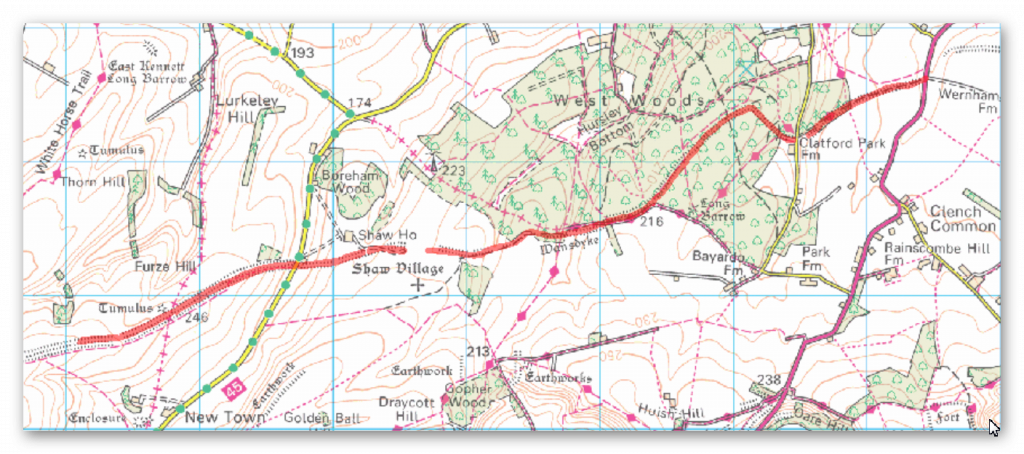
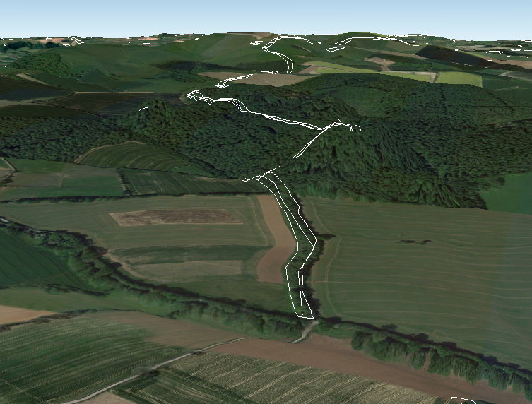
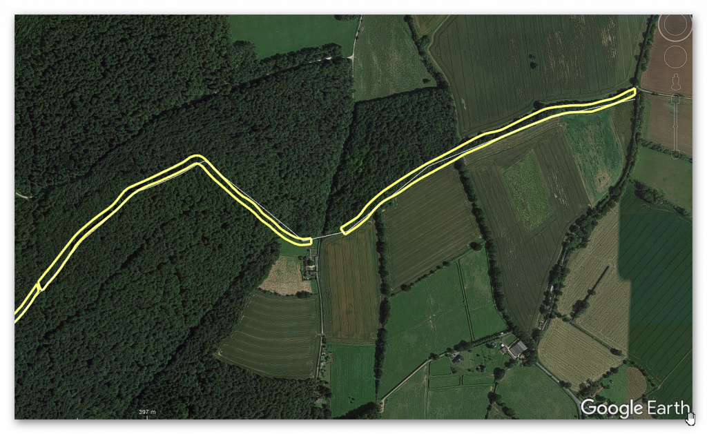
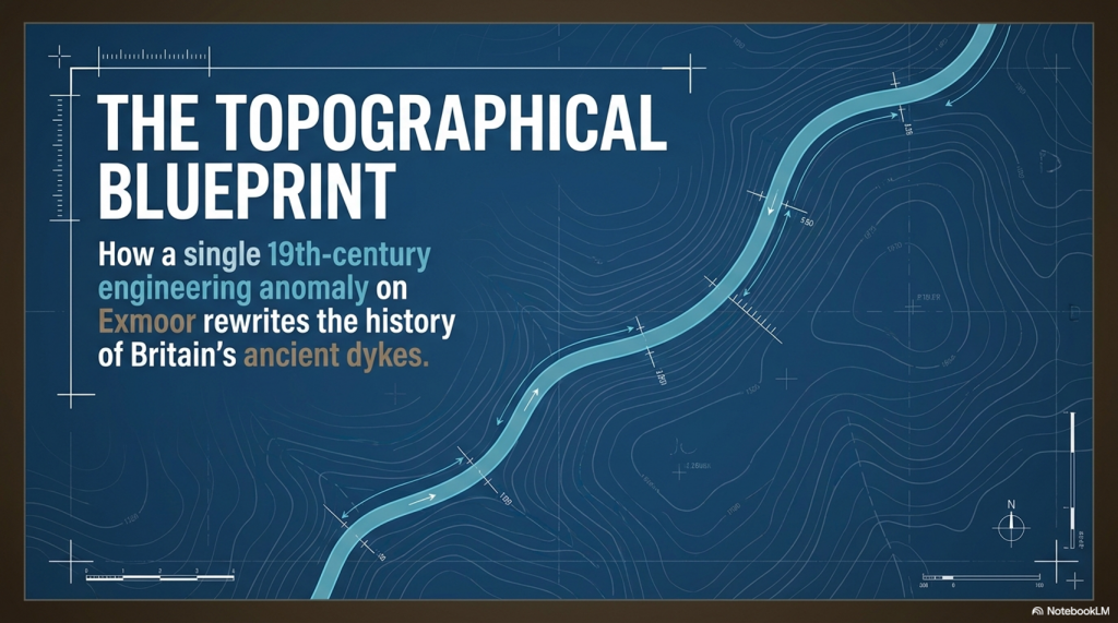
Stretching for almost 9 km (5½ miles) across the southern slopes of Exmoor at more than 400 metres above sea level, Pinkery Canal is one of the most remarkable examples of upland hydraulic engineering ever attempted in Britain. It crosses exposed moorland, deep peat, boggy ground and numerous valley heads. This was not a casual drainage ditch dug by local farmers. It required planning, surveying, labour, and a clear engineering objective.

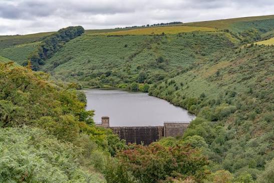
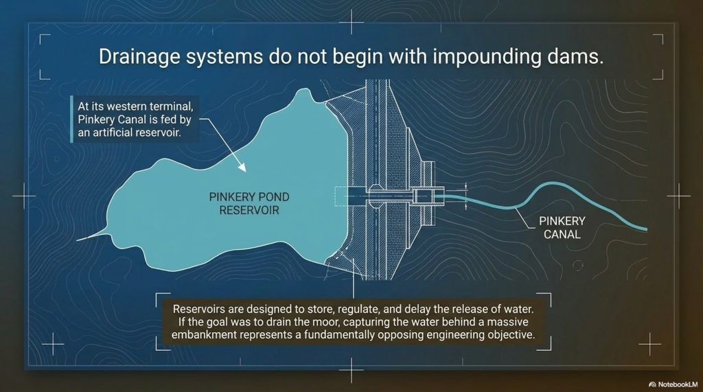
The canal begins at its western end with an artificial reservoir created behind a substantial embankment or dam. That single feature immediately challenges one of the proposed interpretations.
 (Pinkery Canal: The Victorian Engineering Project)
The reservoir – (Pinkery Canal: The Victorian Engineering Project)

Drainage systems are designed to remove water.

Reservoirs are designed to store it.

Those are fundamentally different engineering objectives.

If the intention had simply been to drain the moor, why begin by constructing a dam capable of impounding water? The reservoir suggests that water itself was regarded as a valuable resource requiring collection, regulation and controlled distribution rather than something to be discarded.

The route itself is equally revealing.

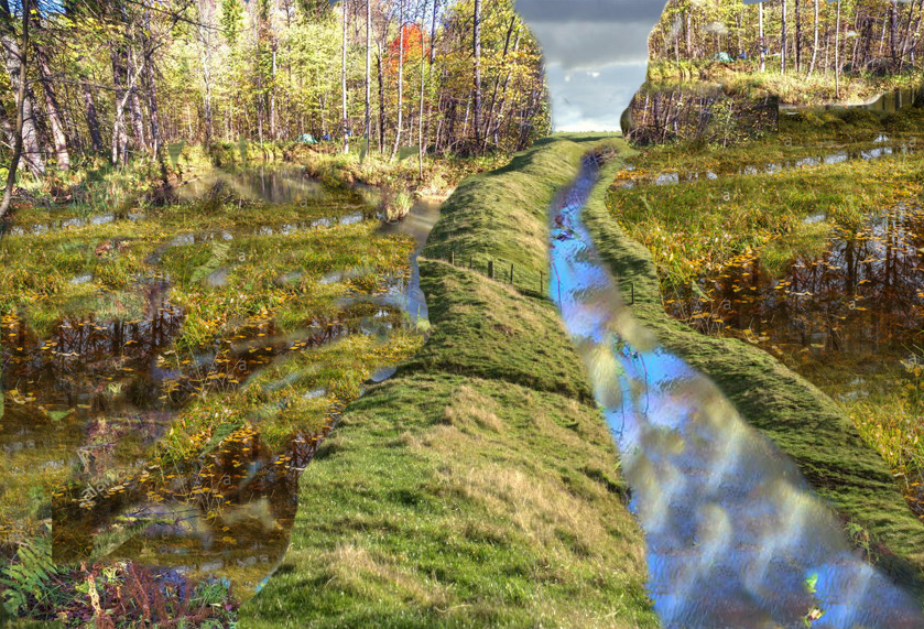
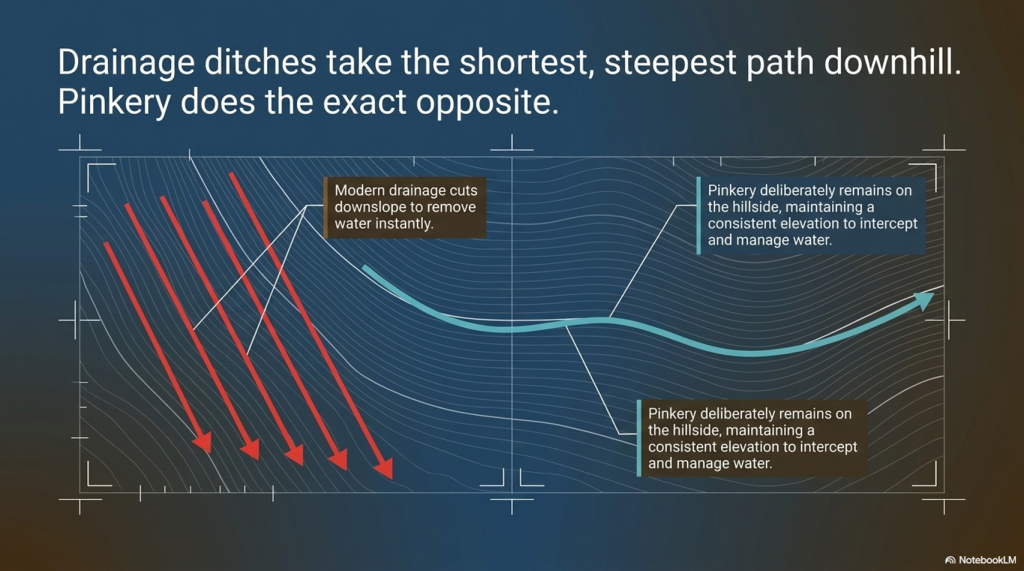
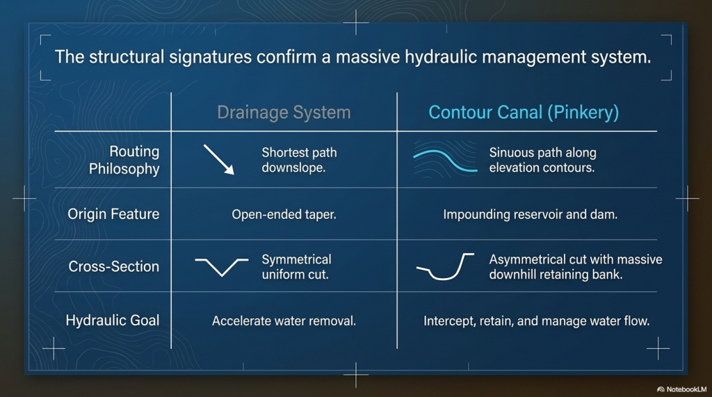
Rather than taking the shortest downhill path, as every modern drainage ditch on Exmoor does today, Pinkery Canal follows a long, sweeping contour across the hillside. Modern drainage channels cut almost directly downslope because their purpose is obvious: to remove water from the land as quickly and efficiently as possible.
 (Pinkery Canal: The Victorian Engineering Project)
(Pinkery Canal: The Victorian Engineering Project)

Pinkery does the exact opposite.

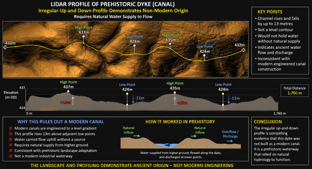
It deliberately remains on the hillside, maintaining a remarkably consistent elevation over many kilometres while gently curving around the contours. Every bend represents additional surveying, excavation and labour. Engineers do not introduce unnecessary curves into a project of this scale. Every deviation must therefore have served a purpose.

That purpose may lie in the hydrology itself.

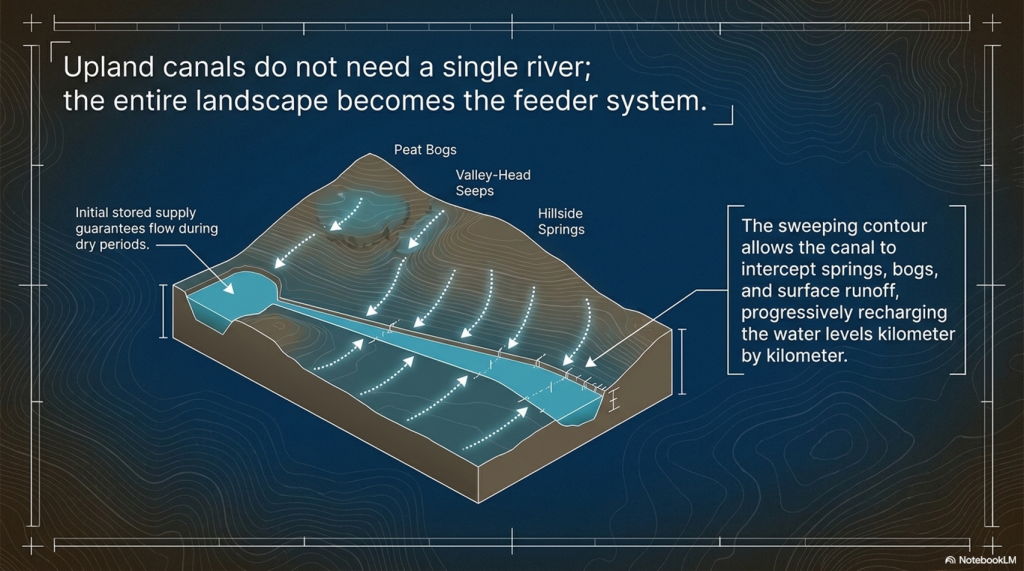
Unlike a river-fed canal supplied by a single large watercourse, a contour canal can collect water progressively along its entire length. Every spring, emerging from the hillside, every bog, every valley-head seep, every small stream, and every episode of surface runoff flowing down the slope contribute additional water. Rather than relying on a single source, the canal effectively harvests water from its entire catchment.

This is one of Pinkery’s most important engineering lessons.

For years, critics have argued that high-altitude canals would never have possessed sufficient water. Pinkery demonstrates another solution entirely. In a wet upland landscape, rainfall, springs, peat bogs, and intercepted runoff constitute the water supply. The canal itself becomes a collector, gradually increasing its flow as it crosses the hillside.

The LiDAR evidence also reveals that the canal is far more sophisticated than the phrase “contour leat” suggests.

Detailed examination shows changing widths, varying bank forms and an undulating longitudinal profile rather than a perfectly level line. The route repeatedly approaches the heads of valleys and drainage features. Modern maps also show later north-south drainage channels cutting across the canal, demonstrating that subsequent engineers adopted a completely different solution to reclaim the moor. Their drains are short, straight and steep. Pinkery is long, sinuous and almost level.

These are two entirely different engineering philosophies.

The terminal arrangements are equally intriguing.

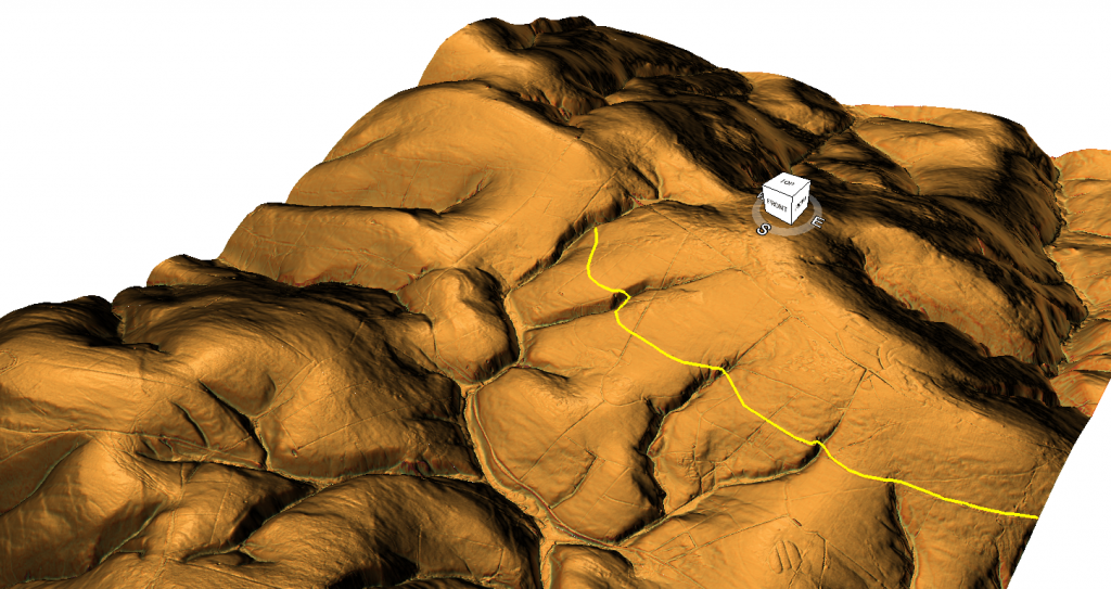
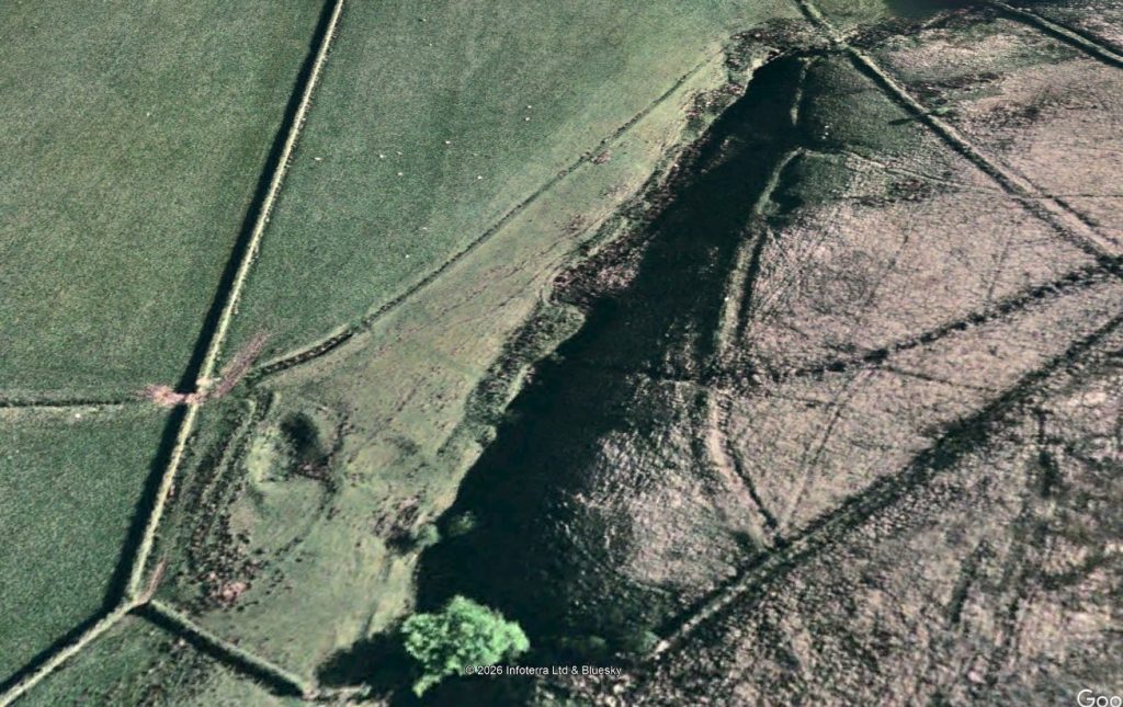
At both ends, the canal appears closely associated with quarry workings or extraction areas. At least one location has a defined track linking the quarry directly to the canal. At another, the canal appears to terminate in a carefully engineered widening adjacent to a palaeochannel rather than simply continuing into the valley below. If drainage had been the objective, extending the ditch a short distance downhill would have been the simplest solution. Instead, the engineering appears far more elaborate than a straightforward drainage outlet.
 (Pinkery Canal: The Victorian Engineering Project)
(Pinkery Canal: The Victorian Engineering Project)

Whether these features relate to transport, water management, construction, or another purpose remains uncertain, but they deserve far greater attention than they have received.

Perhaps the most striking conclusion is that, despite detailed archaeological surveys, no single interpretation successfully explains every aspect of the monument.

Transport explains some features but not others.

Drainage explains some features but struggles with the reservoir and the geometry.

Water power requires hydraulic calculations that have yet to be convincingly demonstrated.

Irrigation raises unanswered questions about distribution.

Each hypothesis explains part of the engineering.

No one yet explains the complete system.

That is precisely why Pinkery Canal remains so fascinating.

It is not simply an archaeological site.

It is a large-scale engineering puzzle.

And whatever its ultimate purpose, one conclusion is beyond dispute. Victorian engineers considered it entirely practical to build and supply a major contour canal more than 400 metres above sea level. In doing so, they demolished two of archaeology’s favourite objections in a single project: that high-altitude canals could not be built, and that there would never have been sufficient water to sustain them.

The real challenge now is no longer asking whether such engineering was possible.

Pinkery has already answered that question.

The challenge is understanding why it was designed exactly as it was.

 (Pinkery Canal: The Victorian Engineering Project)
(Pinkery Canal: The Victorian Engineering Project)

3. Pinkery and Car Dyke – More Similar Than You Might Think

At first glance, Pinkery Canal and Car Dyke appear to have nothing in common.

One crosses the high moorland of Exmoor.

The other traverses the low-lying Fenlands of eastern England.

One is traditionally regarded as Victorian.

The other has long been attributed to Roman engineers.

Yet when viewed as engineering projects rather than archaeological labels, the similarities become surprisingly difficult to ignore.

Both were constructed to move water across the landscape rather than simply allowing it to flow naturally downhill.

(Car Dyke - North Section)
Car Dyke reused in a similar fashion as Pinkery Canal – (Pinkery Canal: The Victorian Engineering Project)

Both follow carefully selected routes designed to exploit the surrounding topography rather than take the shortest possible course.

Both have uncertain purposes despite decades of archaeological investigation.

And both have been linked to the movement of heavy materials from extraction areas towards wider transport networks.

That last point is particularly interesting.

Several interpretations of Pinkery Canal suggest it formed part of a system for moving lime, minerals, or other resources across Exmoor. Whether by boat, a water-powered incline, or another engineering solution, the underlying objective appears to have been the same: to overcome difficult terrain and connect remote resources to the estate’s developing transport network.

That is remarkably similar to the engineering questions surrounding Car Dyke.

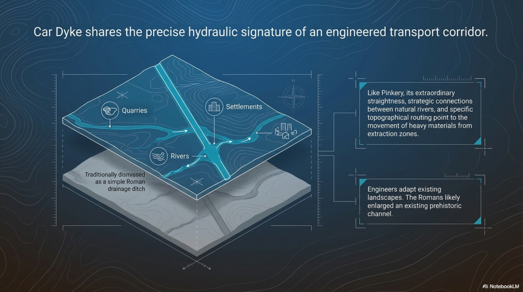
For generations, archaeologists have regarded Car Dyke simply as a Roman drainage canal.

Yet its extraordinary scale, remarkable straightness and strategic connections between rivers have always hinted at a far more ambitious purpose. Our own investigation concluded that Car Dyke makes far more sense as a transport corridor linking quarries, settlements, rivers and distribution centres across the Fenlands. Rather than creating an entirely new waterway, the Romans may have enlarged and engineered an existing prehistoric channel, transforming it into Britain’s largest canal-like transport route.

(Britain's Giant Prehistoric Waterways)

Pinkery demonstrates that this approach is neither unusual nor implausible.

Throughout history, engineers have repeatedly adapted existing landscapes rather than starting with a blank slate. Rivers have been canalised. Ancient roads have become Roman roads. Medieval tracks became turnpikes. Victorian railways often followed much older routeways.

Why should canals be any different?

Pinkery therefore provides something that has been missing from the debate over Britain’s prehistoric dykes.

It offers a documented example of engineers modifying a landscape, harvesting water from multiple natural sources and constructing a substantial canal in terrain that many archaeologists would previously have dismissed as impossible.

Pinkery demonstrate that the engineering principles behind our Car Dyke hypothesis are entirely realistic.

Instead of asking whether prehistoric engineers could have built such systems, perhaps archaeology should begin asking whether later engineers simply inherited, enlarged, and improved landscapes whose origins stretch much further back than the surviving documents.
 (Pinkery Canal: The Victorian Engineering Project)
(Pinkery Canal: The Victorian Engineering Project)

4. The Second Myth Falls – Where Did the Water Come From?

Perhaps the most common criticism of prehistoric canals is not their height, but their supposed lack of water.

The argument is usually presented as though every canal requires a single obvious source—a large river, a lake, or a permanent reservoir.

Without one, the idea is dismissed.

Pinkery Canal demonstrates that this assumption is far too simplistic.

When viewed from the ground, Exmoor appears to be little more than open moorland.

Viewed using modern LiDAR and historical mapping, however, an entirely different landscape emerges.

Pinkery crosses one of the wettest upland environments in southern Britain.

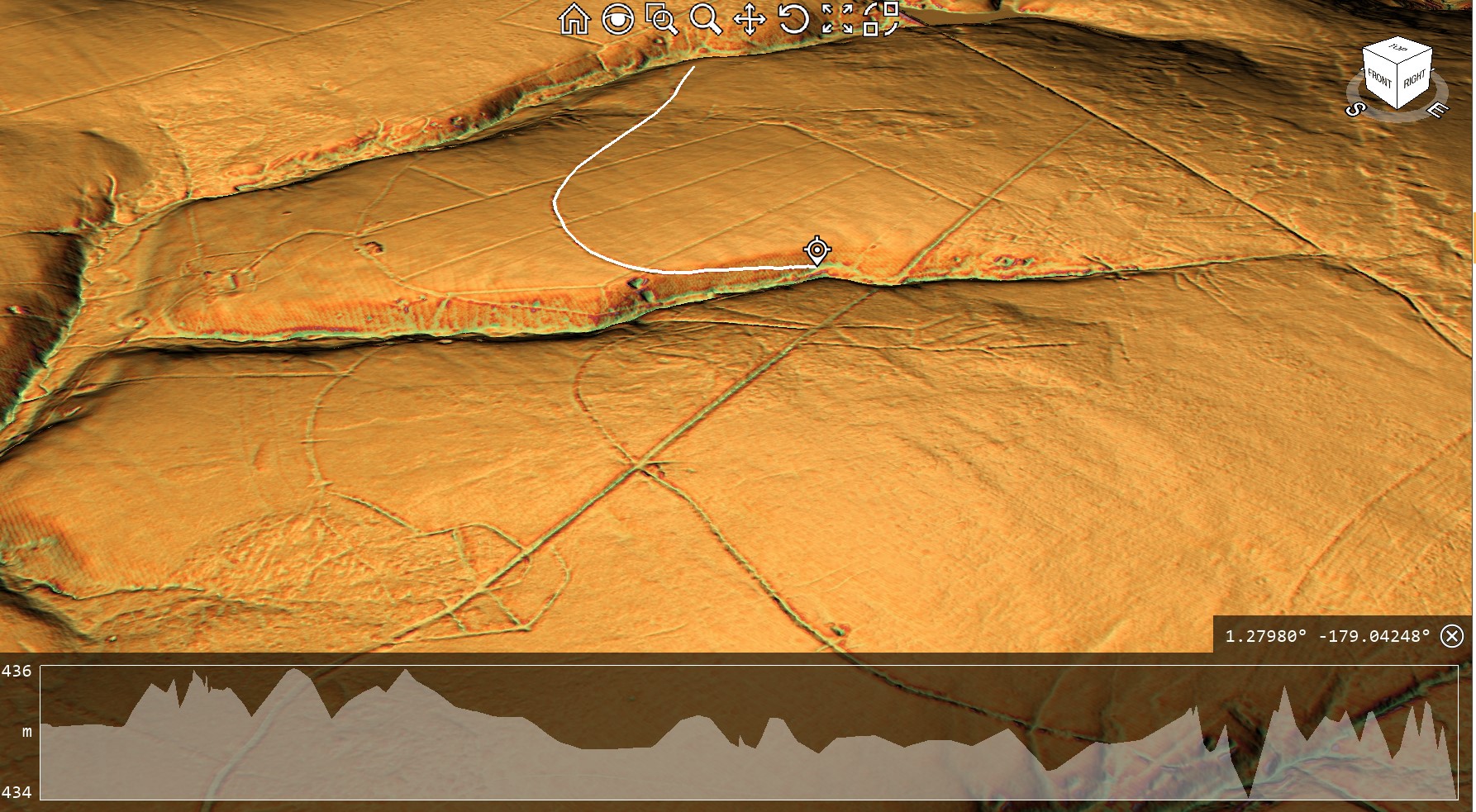
Its route intersects extensive peat deposits, blanket bog, spring lines, valley-head seepages, small streams and countless natural drainage pathways. Historical maps also show large areas of marshy ground surrounding parts of the canal, while later land reclamation introduced numerous straight drainage ditches to drain the landscape.
 (Pinkery Canal: The Victorian Engineering Project)
First Section By the Reservoir – (Pinkery Canal: The Victorian Engineering Project)

In other words, this was never a dry hillside.

It was a giant natural catchment.

That distinction is crucial.

Rather than relying on a single river to supply it, Pinkery appears to have been designed to collect water progressively as it crossed the landscape. Every period of rainfall generated surface runoff from the higher ground above. Every spring emerging from the peat contributed additional flow. Every valley head intercepted by the canal became another source of water.

The canal itself became the collector.

This is a completely different hydraulic principle from the one usually imagined by archaeologists.

Instead of asking:

“Where is the river feeding the canal?”

Perhaps the better question is:

“How much water does the entire catchment above the canal produce?”

Once viewed in that way, the engineering begins to make far more sense.

The long, curving alignment is no longer simply following a contour.

It is harvesting water from an entire hillside.

Every bend allows the canal to intercept another small drainage system. Every kilometre increases the contributing catchment. Rather than relying on a single large source, the available water gradually accumulates along the route.
 (Pinkery Canal: The Victorian Engineering Project)

This also explains why the western reservoir becomes so important.

The dam provided an initial stored supply, ensuring water was available even during drier periods, while the remainder of the canal progressively collected additional inflows from springs, bogs and hillside runoff.

Together they formed a single hydraulic system.

Ironically, the modern drainage network demonstrates the exact opposite of the engineering philosophy.

Today’s straight north-south drainage ditches were constructed to remove water from the moor as quickly as possible. They cut directly downslope, rapidly carrying water away from the peat and into the valleys below.

Pinkery does the reverse.

Instead of losing water, it captures it.

Instead of accelerating drainage, it intercepts it.

Instead of taking the shortest route downhill, it deliberately remains on the contour, collecting water from every natural drainage feature it encounters.

This distinction is fundamental.

The canal was not simply crossing a wet landscape.

It appears to have been designed around it.

For students of Britain’s prehistoric dykes, this observation is particularly significant.

One of the most common objections to their interpretation as waterways has always been the supposed absence of a large feeder river. Pinkery demonstrates another engineering solution entirely. A canal does not necessarily require a single major water source. Given the right landscape, it can harvest countless smaller sources distributed across an entire catchment.

Whether Victorian engineers consciously calculated this in modern hydrological terms is almost irrelevant.

Their design shows they understood the principle.

And if nineteenth-century engineers recognised that an upland landscape of springs, bogs and runoff could sustain a canal, perhaps archaeologists should think more carefully before dismissing similar possibilities elsewhere in Britain.

 (Pinkery Canal: The Victorian Engineering Project)
(Pinkery Canal: The Victorian Engineering Project)

5. If It Was Simply Drainage, Why Doesn’t It Behave Like a Drain?

One of the most revealing aspects of the Pinkery Canal is not where it begins or ends.

It is the shape of the engineering itself.

For nearly two centuries, the canal has frequently been described as a contour leat, with drainage often forming part of the explanation. Yet when the surrounding landscape is examined using modern LiDAR, an obvious question emerges.

If the objective was simply to drain the moor, why wasn’t it designed like every other drainage system on Exmoor?

The answer is surprisingly simple.

Because it wasn’t.
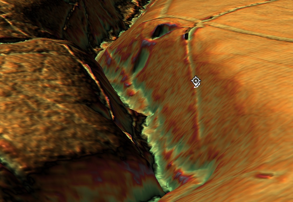
 (Pinkery Canal: The Victorian Engineering Project)
The end of Section One goes into a quarry past two other quarries – (Pinkery Canal: The Victorian Engineering Project)

Modern drainage ditches are easy to recognise. They follow the most efficient engineering solution possible. They are generally straight or only gently curved, taking the shortest practical route downhill. Their purpose is to quickly remove water from the land, reducing waterlogging and reclaiming boggy ground for agriculture.

The later drainage channels that cross the Pinkery Canal demonstrate exactly this principle.

Cutting almost directly north-to-south, they ignore the contours and descend rapidly into the valleys below. They waste no effort. They take the shortest available route because every unnecessary metre represents additional excavation and cost.

That is exactly what engineers designing a drainage system would be expected to do.

Pinkery Canal is completely different.

Instead of descending the hillside, it clings to it.

Instead of taking the shortest route, it extends for almost 9 kilometres in a broad sweeping curve.

Instead of accelerating water downhill, it appears to intercept it, retaining a remarkably consistent elevation across the landscape.

From an engineering perspective, those are not small differences.

They are fundamental.

Every bend required additional surveying.

Every curve required additional excavation.

Every extra metre increased both labour and construction costs.

Engineers simply do not introduce that level of complexity unless it serves a practical purpose.
 (Pinkery Canal: The Victorian Engineering Project)
(Pinkery Canal: The Victorian Engineering Project)

The obvious question, therefore, becomes:

What was the canal trying to achieve that a series of straight drainage ditches could not?

This is where the modern drainage network becomes unexpectedly useful.

Far from supporting the drainage interpretation, it provides a direct comparison between two completely different engineering philosophies.

The modern drains remove water.

Pinkery appears to manage it.

The modern drains cut across the landscape.

Pinkery works with it.

The modern drains dispose of water as quickly as possible.

Pinkery appears designed to collect water progressively from the surrounding catchment while preventing its immediate loss downslope.

These are not variations of the same design.

They are solutions to different engineering problems.

This distinction also helps explain why the canal repeatedly approaches the heads of valleys and natural drainage features. Rather than avoiding them, the alignment appears to exploit them. Every small stream, spring, or area of surface runoff that the canal intercepts becomes another potential source of water entering the system.

That behaviour makes perfect sense for a contour channel intended to harvest water.

It makes far less sense for a ditch whose sole purpose was drainage.

Perhaps the most telling observation is that Victorian engineers later constructed entirely different drainage works across the same landscape. If a simple drainage ditch had been the original objective, why wasn’t Pinkery built in the same way as the later drains?

The answer appears to be that it was never solving the same problem.

Pinkery Canal may ultimately have failed to achieve its intended purpose, but its geometry reveals something important.

It was not engineered as the quickest way to drain Exmoor.

It was engineered to control water.

Understanding that distinction is the key to understanding the monument itself—and perhaps to understanding many of Britain’s much older linear earthworks as well.

 (Pinkery Canal: The Victorian Engineering Project)
(Pinkery Canal: The Victorian Engineering Project)

6. The Reservoir – Storing Water or Removing It?

Perhaps the single most overlooked feature of the entire Pinkery Canal system lies at its western end.

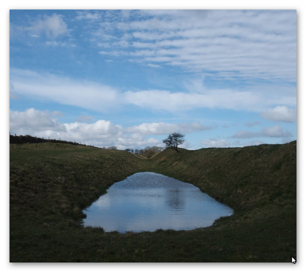
Before the canal even began, the Victorian engineers constructed a substantial embankment, creating what is now known as Pinkery Pond. This artificial reservoir formed the head of the entire system, storing water before it entered the canal.

At first glance, this may appear entirely unremarkable.

In reality, it may be one of the most important engineering clues on the site.

Think about the logic.

If your primary objective is to drain a wet upland landscape, why begin by constructing a dam?

Drainage and reservoirs represent two fundamentally different engineering philosophies.

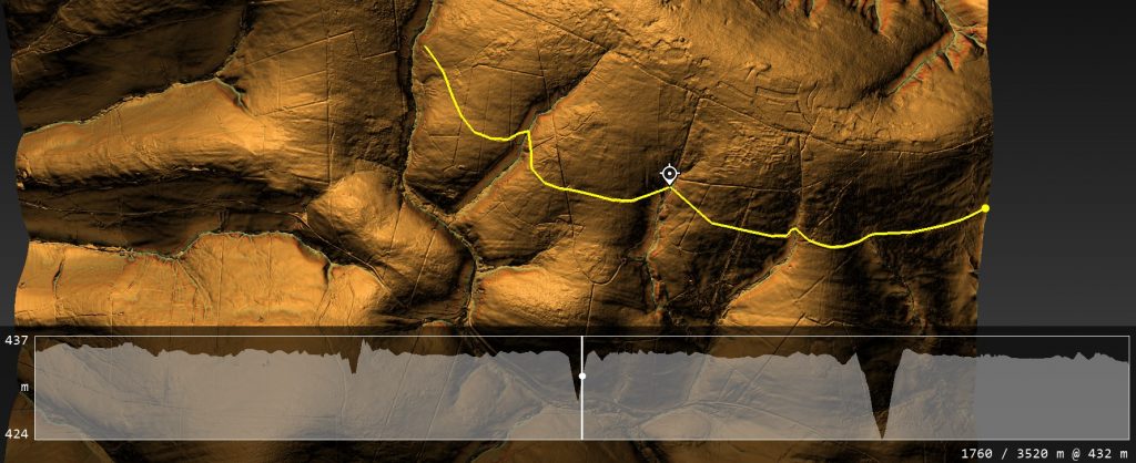
A drainage system is designed to remove water from the landscape as efficiently as possible. Every engineering decision seeks to accelerate the movement of water downhill, reducing flooding, drying peat and reclaiming land for agriculture.
 (Pinkery Canal: The Victorian Engineering Project)
The Canal can not operate as a single entity without the paleochannel being full of water – (Pinkery Canal: The Victorian Engineering Project)

A reservoir does exactly the opposite.

It captures water.

It stores water.

It regulates water.

It delays its release.

Those are not minor differences.

They are completely different engineering objectives.

This immediately raises an obvious question.

Was Pinkery Canal ever intended to function as a simple drainage ditch?

The reservoir suggests otherwise.
 (Pinkery Canal: The Victorian Engineering Project)
(Pinkery Canal: The Victorian Engineering Project)

Instead of treating water as a nuisance, the engineer appears to regard it as a valuable resource that requires careful management. Water could be impounded during wetter periods, creating a reserve that could maintain flow through the canal even when natural runoff declined.

That interpretation fits remarkably well with the canal’s overall design.

As discussed previously, the canal follows a long contour across one of the wettest landscapes in southern Britain. Rather than rapidly discharging water into the nearest valley, it intercepts springs, bogs, valley-head seepages and surface runoff along its entire route. The reservoir therefore appears to provide the initial supply, while the surrounding catchment progressively replenishes the system as it continues eastwards.

Viewed together, the dam and canal form a single hydraulic network rather than two unrelated engineering works.

This also explains why the reservoir should not be dismissed as merely a convenient pond.

It was an integral part of the design.

Without stored water at the head of the system, the canal would have been entirely dependent upon seasonal rainfall. By constructing a reservoir first, Victorian engineers introduced a degree of hydraulic control, allowing water levels to be managed instead of simply reacting to whatever nature provided.

Once again, this differs fundamentally from the later drainage ditches that now cross the moor. Those channels require no reservoirs because their purpose is simply to remove water from the landscape. Gravity performs all the work.

Pinkery required something far more sophisticated.

It required water to be available when needed.
 (Pinkery Canal: The Victorian Engineering Project)
End of section one shows a quarry and a road to the Canal (Pinkery Canal: The Victorian Engineering Project)

That simple observation creates difficulties for several of the traditional interpretations. If the canal existed only to drain land, the reservoir appears unnecessary. If it existed to transport water, power machinery, or support navigation, however, regulating and storing water would be much easier to understand.

The reservoir, therefore, becomes much more than an isolated feature at the western end of the canal.

It becomes the first component in a carefully engineered hydraulic system.

Whether that system ultimately succeeded is almost secondary.

Its design demonstrates that the engineers were not simply trying to get rid of water.

They were trying to control it.

And that distinction may prove to be one of the most important lessons Pinkery Canal has to offer—not only for understanding this remarkable Victorian project, but also for reconsidering how similar large-scale water engineering systems elsewhere in Britain have been interpreted.

You’re right. I was too generic. If we’re referring to the report, we should discuss the profiles by number and what each demonstrates, rather than making broad statements.

Here’s a much stronger version.
 (Pinkery Canal: The Victorian Engineering Project)
(Pinkery Canal: The Victorian Engineering Project)

7. The Engineering Puzzle: What the Profiles Actually Reveal

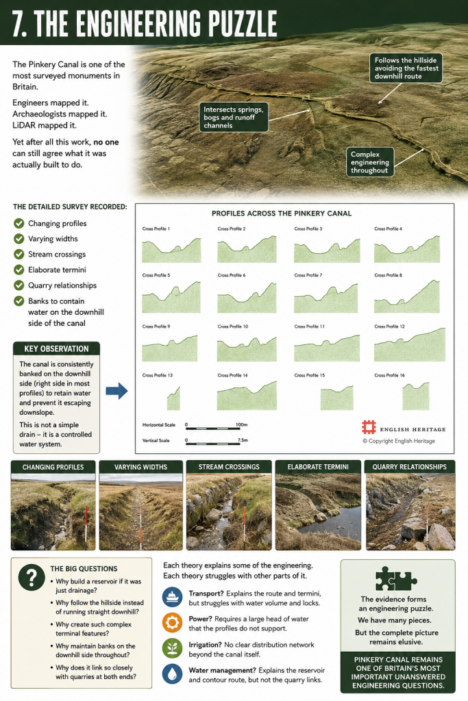
One of the strengths of the Historic England survey is that it did not simply record the canal’s position. It excavated and measured cross-sections along its entire length, producing sixteen profile drawings that reveal something far more interesting than the accompanying interpretation acknowledges.

Far from being a uniform ditch, the Pinkery Canal constantly changes its form.
 (Pinkery Canal: The Victorian Engineering Project)

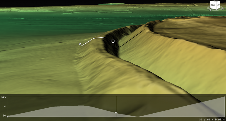
Profiles 1–5 show a relatively consistent engineered channel cut into the hillside, but even here the uphill and downhill banks vary considerably in both height and width. This immediately suggests the builders were responding to local ground conditions rather than applying a single standard design.

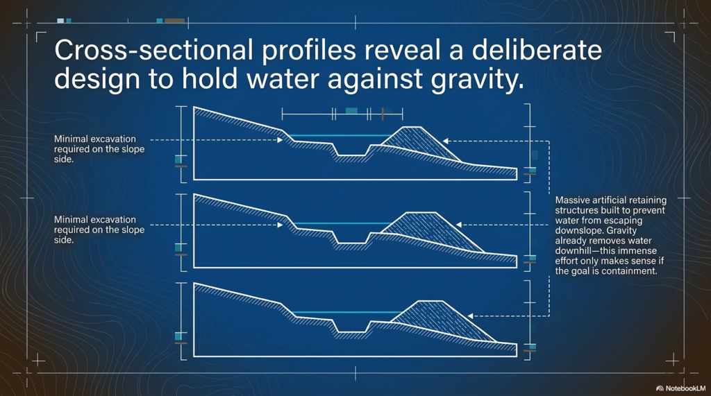
Profiles 6–11 become even more revealing. Here, the downslope bank becomes substantially larger in places, while the uphill side often appears much less pronounced. If the feature was merely intended as a drainage ditch, this extra effort seems unnecessary. Gravity already removes water downhill. There would be little reason to build and maintain substantial retaining banks on the downhill side.

Instead, these profiles make far more engineering sense if the objective is to retain water within the channel while preventing it from escaping downslope.

Profiles 12 and 15 are particularly interesting because the canal becomes much deeper on one side, reflecting the increasing side slope of the hillside. Rather than abandoning the contour, the builders modified the earthworks to maintain the channel despite increasingly difficult terrain. That is a considerable investment in engineering effort.

By contrast, Profile 16 shows a much more symmetrical section, suggesting that local topography again dictated the amount of excavation and banking required. The canal was clearly being adapted to changing ground conditions rather than simply being cut to a single standard template.

Perhaps the most important observation is what none of the profiles shows.

None resembles a simple modern drainage ditch.

Modern drainage systems generally seek the quickest route downhill using relatively uniform cuts. Pinkery repeatedly does the opposite. Its profiles demonstrate deliberate construction to maintain a contour route while containing water against the land’s natural fall.

The retaining banks become key evidence.

On a hillside, any water entering the canal naturally wants to escape over the lower edge. The substantial downhill embankments shown in many of the profiles would have acted as retaining structures, keeping water within the channel while intercepting runoff from bogs, springs, and small streams higher on the slope.

Ironically, the report illustrates all of this beautifully but never fully explores its engineering implications. The profiles are presented as descriptive archaeology rather than as evidence of hydraulic design.

Yet these drawings may contain one of the most important clues to understanding the Pinkery Canal.

They show that the builders were not simply digging a ditch.

They were designing a hydraulic system whose cross-section changed repeatedly in response to the landscape.

That is engineering.

The real mystery is not whether the builders understood hydraulics.

The profiles prove they did.

The mystery is what hydraulic problem they were actually trying to solve.

I think this is a good conclusion, but I’d make one important change. I would avoid saying “this is why canals failed in Britain.” Historically, Britain’s canal network was hugely successful for decades before railways largely displaced it. A stronger and more accurate point is that lock canals trade speed for flexibility. Every lock introduces a delay, whereas a contour canal with continuous water offers uninterrupted movement.

Here’s how I’d write the conclusion.
 (Pinkery Canal: The Victorian Engineering Project)
(Pinkery Canal: The Victorian Engineering Project)

8. What Pinkery Canal Really Teaches Us

Pinkery Canal remains one of Britain’s most fascinating engineering puzzles.

Almost two centuries after its construction, archaeologists still cannot agree upon its purpose. Was it built for transport? Water power? Irrigation? Land improvement? Water management? Every interpretation explains part of the evidence, yet none successfully accounts for the monument as a complete engineering system.

Perhaps the problem is not the evidence.

Perhaps it is the questions being asked.

Throughout this investigation, we have deliberately set the archive aside and examined the monument as engineers would.

In doing so, several important conclusions emerge.

First, Pinkery Canal proves beyond doubt that high-altitude canals are entirely feasible. Victorian engineers had no hesitation in constructing a major contour canal more than 400 metres above sea level. The argument that upland canals are somehow impossible can therefore be dismissed.

Second, Pinkery demonstrates that canals do not necessarily require a major river to function. By combining a reservoir with intercepted springs, bogs, valley-head seepages and surface runoff, the canal could potentially harvest water from its entire catchment. The landscape itself became the feeder system.

Third, the monument’s geometry differs fundamentally from a drainage ditch. Instead of removing water as quickly as possible, it appears to be designed to intercept, retain, and regulate it. The substantial banks recorded in the cross-sectional profiles reinforce this interpretation, showing engineering adapted to controlling water rather than simply disposing of it.

Finally, Pinkery reminds us that ancient and historic engineers were often far more inventive than we give them credit for.
 (Pinkery Canal: The Victorian Engineering Project)
(Pinkery Canal: The Victorian Engineering Project)

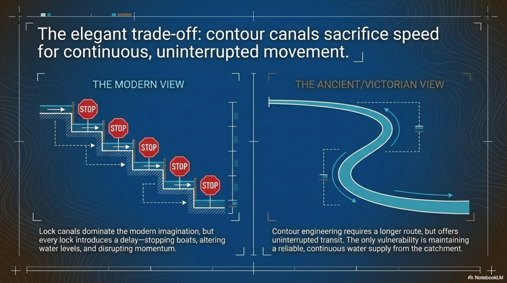
Today, when we think of canals, we instinctively picture straight channels linked together by locks.

That is understandable because lock canals dominated Britain’s Industrial Revolution.

But lock systems come at a cost.

Every lock interrupts the journey.

Boats must stop, water levels must be altered, gates opened and closed, and only then can the journey continue. Over a long route, those delays accumulate significantly.

A contour canal operates on a completely different principle.

Once water is established within the channel, a boat can continue along the contour without repeatedly stopping to negotiate locks. The route may be longer, but movement is continuous.

That is an elegant engineering solution.

Its weakness, however, is equally obvious.

Everything depends upon maintaining a reliable water supply.

If the reservoir feeding Pinkery Canal could not provide sufficient water during prolonged dry periods, the entire system would struggle to operate effectively. Whether this ultimately contributed to its limited success remains an intriguing possibility, although the surviving evidence cannot yet answer that question with certainty.

This comparison also helps explain why Britain’s prehistoric dykes deserve far more serious investigation.

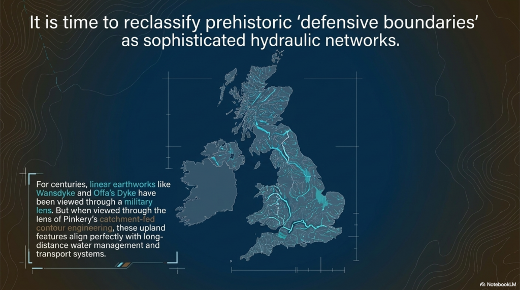
Features such as the Car Dyke, the Wansdyke, and Offa’s Dyke have often been viewed through the lens of defence or territorial boundaries. Yet if naturally fed springs, groundwater and higher prehistoric water levels provided a more dependable year-round supply than an artificial upland reservoir, then the hydraulic possibilities become considerably more interesting.

Pinkery does not prove that Britain’s prehistoric dykes were canals.

What it does prove is something equally important.

Many of the engineering objections used to dismiss that possibility are no longer sustainable.

High-altitude canals are possible.

Catchment-fed canals are possible.

Long-distance contour engineering is possible.

Victorian engineers demonstrated every one of those principles.

Perhaps the greatest lesson from Pinkery is not about Victorian engineering at all.

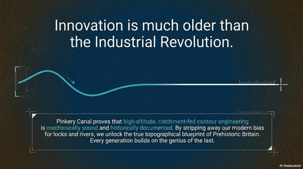
It is a reminder that we should never underestimate the ingenuity of earlier societies simply because their achievements do not fit our modern expectations. Every generation builds upon the knowledge of those who came before it. If nineteenth-century engineers recognised the advantages of contour water engineering, it is entirely reasonable to ask whether they were rediscovering principles that had been understood long before the Industrial Revolution.

That is why sites like Pinkery Canal deserve to be studied—not simply as isolated archaeological curiosities, but as windows into the long history of engineering innovation that shaped Britain’s landscape.
 (Pinkery Canal: The Victorian Engineering Project)
(Pinkery Canal: The Victorian Engineering Project)

PODCAST

Author’s Biography

Robert John Langdon, a polymathic luminary, emerges as a writer, historian, and eminent specialist in LiDAR Landscape Archaeology.

His intellectual voyage has been interwoven with stints as an astute scrutineer in government and grand corporate bastions, a tapestry spanning British Telecommunications, Cable and Wireless, British Gas, and the esteemed University of London.

A decade hence, Robert’s transition into retirement unfurled a chapter of insatiable curiosity. This phase saw him immerse himself in Politics, Archaeology, Philosophy, and the enigmatic realm of Quantum Mechanics. His academic odyssey traversed the venerable corridors of knowledge hubs such as the Museum of London, University College London, Birkbeck College, The City Literature Institute, and Chichester University.

In the symphony of his life, Robert is a custodian of three progeny and a pair of cherished grandchildren. His sanctuary lies ensconced in the embrace of West Wales, where he inhabits an isolated cottage, its windows framing a vista of the boundless sea – a retreat from the scrutinising gaze of Her Majesty’s Revenue and Customs, an amiable clandestinity in the lap of nature.

Exploring Prehistoric Britain: A Journey Through Time

My blog delves into the fascinating mysteries of prehistoric Britain, challenging conventional narratives and offering fresh perspectives grounded in cutting-edge research, particularly LiDAR technology. I invite you to explore some key areas of my research. For example, the Wansdyke, often cited as a defensive structure, is re-examined in light of new evidence. I’ve presented my findings in my blog post Wansdyke: A British Frontier Wall – ‘Debunked’, and a Wansdyke LiDAR Flyover video further visualises my conclusions.

My work also often challenges established archaeological dogma. I argue that many sites, such as Hambledon Hill, commonly identified as Iron Age hillforts, are not what they seem. My posts Lidar Investigation Hambledon Hill – NOT an ‘Iron Age Fort’ and Unmasking the “Iron Age Hillfort” Myth explore these ideas in detail and offer an alternative view. Similarly, sites like Cissbury Ring and White Sheet Camp receive re-evaluations based on LiDAR analysis in my posts “Lidar Investigation Cissbury Ring through time” and “Lidar Investigation White Sheet Camp,“ revealing fascinating insights into their true purpose. I have also examined South Cadbury Castle, often linked to the mythical Camelot56.

My research also extends to ancient water management, including the role of canals and other linear earthworks. I have discussed the true origins of Car Dyke in multiple posts, including Car Dyke – ABC News Podcast and Lidar Investigation Car Dyke – North Section, which suggest a Mesolithic origin 2357. I also explore the misidentification of Roman aqueducts, as seen in my posts on the Great Chesters (Roman) Aqueduct. My research has also been greatly informed by my post-glacial flooding hypothesis, which has helped explain landscape transformations over time. I have discussed this hypothesis in several posts, including AI now supports my Post-Glacial Flooding Hypothesis and Exploring Britain’s Flooded Past: A Personal Journey

Finally, my blog also investigates prehistoric burial practices, as seen in Prehistoric Burial Practices of Britain and explores the mystery of Pillow Mounds, often mistaken for medieval rabbit warrens, but with a potential link to Bronze Age cremation in my posts: Pillow Mounds: A Bronze Age Legacy of Cremation? and The Mystery of Pillow Mounds: Are They Really Medieval Rabbit Warrens?. My research also includes astronomical insights into ancient sites, for example, in Rediscovering the Winter Solstice: The Original Winter Festival. I also review new information about the construction of Stonehenge in The Stonehenge Enigma.

Further Reading

For those interested in British Prehistory, visit www.prehistoric-britain.co.uk, a comprehensive resource featuring an extensive collection of archaeology articles, modern LiDAR investigations, and groundbreaking research. The site also includes insights and excerpts from the acclaimed Robert John Langdon Trilogy, a series of books that explore Britain during the Prehistoric period. Titles in the trilogy include The Stonehenge Enigma, Dawn of the Lost Civilisation, and The Post-Glacial Flooding Hypothesis, which offer compelling evidence of ancient landscapes shaped by post-glacial flooding.

To further explore these topics, Robert John Langdon has developed a dedicated YouTube channel featuring over 100 video documentaries and investigations that complement the trilogy. Notable discoveries and studies showcased on the channel include 13 Things that Don’t Make Sense in History and the revelation of Silbury Avenue – The Lost Stone Avenue, a rediscovered prehistoric feature at Avebury, Wiltshire.

In addition to his main works, Langdon has released a series of shorter, accessible publications, ideal for readers delving into specific topics. These include:

For active discussions and updates on the trilogy’s findings and recent LiDAR investigations, join our vibrant community on Facebook. Engage with like-minded enthusiasts by leaving a message or contributing to debates in our Facebook Group.

Whether through the books, the website, or interactive videos, we aim to provide a deeper understanding of Britain’s fascinating prehistoric past. We encourage you to explore these resources and uncover the mysteries of ancient landscapes through the lens of modern archaeology.

For more information, including chapter extracts and related publications, visit the Robert John Langdon Author Page. Dive into works such as The Stonehenge Enigma or Dawn of the Lost Civilisation, and explore cutting-edge theories that challenge traditional historical narratives.

Other Blogs

[sitemap_posts]

Archaeology: The Flaws of Peer Review

Introduction

The peer-review system in archaeology is often regarded as a safeguard for academic integrity and quality control.  However, it has become a gatekeeping mechanism that suppresses alternative interpretations and enforces conformity to prevailing theories.  Michael Gordin, a historian of science, has noted that peer review is often mistaken for a flawless vetting system when, in reality, it is prone to bias and conservatism.  He argues that the process tends to favour established paradigms, making it difficult for groundbreaking ideas to gain traction.

Archaeologist E. Thomas Lawson has pointed out that the peer-review system is highly susceptible to institutional biases.  In a study published in Science and Technology Studies, Lawson demonstrated that reviewers often reject submissions that challenge dominant models, not necessarily because they lack weak evidence, but because they disrupt the consensus.  This issue is particularly acute in archaeology, where entrenched narratives about cultural evolution, settlement patterns, and technological development dominate scholarly discourse.  Those who propose alternative chronologies or challenge the attribution of artefacts often find their work dismissed outright, regardless of its empirical rigour.(Archaeology: The Flaws of Peer Review)

Archaeology: The Flaws of Peer Review
Most Peer-reviewed papers are ‘Pulp-fiction’ constructed for publicity and funding – (Archaeology: The Flaws of Peer Review)

A stark example of this suppression can be seen at the Cerutti Mastodon site in California.  When Steven Holen and his team published their findings in Nature in 2017, suggesting that humans may have been in North America over 130,000 years ago, the backlash was immediate.  Critics did not merely question the dating methods; they dismissed the research as implausible, despite the use of multiple independent dating techniques.  This reaction illustrates how peer review often functions not as an objective filter but as a reinforcement of accepted timelines and theories, even when the evidence demands reconsideration.

Further, the peer-review system is primarily controlled by a small number of academic gatekeepers.  A 2020 analysis by J. Scott Turner in The Journal of Scholarly Publishing revealed that many archaeological journals rely on a narrow pool of reviewers, many of whom share institutional affiliations and research backgrounds.  This concentration of influence creates an echo chamber where dissenting voices struggle to be heard.  Turner’s study found that papers proposing unconventional interpretations had a rejection rate nearly three times that of papers aligned with mainstream archaeological views.

(Archaeology: The Flaws of Peer Review)

This lack of openness is compounded by the anonymous nature of peer review, which allows reviewers to dismiss or delay controversial findings without accountability.  In some cases, reviewers have been found to recommend rejection of papers that later, when published through alternative means, proved to be groundbreaking.  For instance, the discovery of pre-Clovis human presence in the Americas faced decades of dismissal until mounting evidence from sites like Monte Verde forced a reassessment of long-held beliefs.  The delay in accepting such evidence highlights how peer review can be a brake on scientific progress rather than a facilitator of truth.

Another fundamental flaw of the peer-review system is its failure to recognise the evolving nature of scientific inquiry.  History has shown that many discoveries initially rejected by the academic establishment later became widely accepted.  The heliocentric model, continental drift, and the role of bacteria in ulcers were all dismissed before overwhelming evidence overturned the consensus.  In archaeology, similar patterns emerge, where findings that contradict prevailing models are routinely discarded until the weight of evidence makes resistance untenable.

(Archaeology: The Flaws of Peer Review)

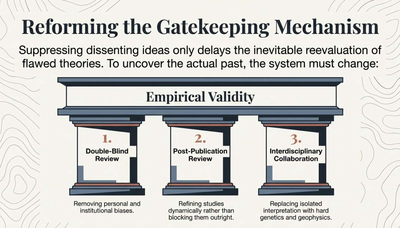
Archaeology must embrace a more open and transparent review process to foster true scientific progress.  Double-blind peer review, in which authors and reviewers remain anonymous, could help mitigate personal and institutional biases.  Additionally, encouraging post-publication peer review—where studies are critiqued and refined after publication rather than being blocked from dissemination—would enable a more dynamic and evidence-driven discourse.  Greater interdisciplinary collaboration, incorporating fields such as genetics, geophysics, and AI-assisted analysis, could also help challenge entrenched assumptions and promote a more balanced evaluation of new findings.

If archaeology aims to uncover the truth about the past, then the discipline must acknowledge and address the limitations of its review system.  Suppressing dissenting ideas only delays the inevitable reevaluation of flawed theories.  By reforming the peer-review process to prioritise empirical validity over academic orthodoxy, archaeology can become a more dynamic and self-correcting field that genuinely pursues knowledge rather than merely defending existing paradigms.

(Archaeology: The Flaws of Peer Review)

Preconceived notions

The peer-review process stands as a cornerstone of modern scientific inquiry, intended to filter research, uphold quality, and ensure the validity of published findings.  It is a system whereby experts in a particular field critically evaluate a submitted manuscript before it is accepted for publication, ideally identifying flaws, inconsistencies, and errors.  While the intention behind peer review is laudable, the assumption that all peer-reviewed papers are inherently accurate and error-free is a dangerous oversimplification.  Particularly within archaeology, where interpretation plays a significant role and definitive proof can be elusive, placing unwavering faith in the peer-review stamp can hinder progress and perpetuate flawed narratives.  The provided sources offer compelling insights into the limitations of peer review in archaeology, highlighting instances where the process has failed to prevent the dissemination of questionable findings, often due to the inherent subjectivity of the field and a tendency to prioritise the reporter’s preconceived notions over objective facts.

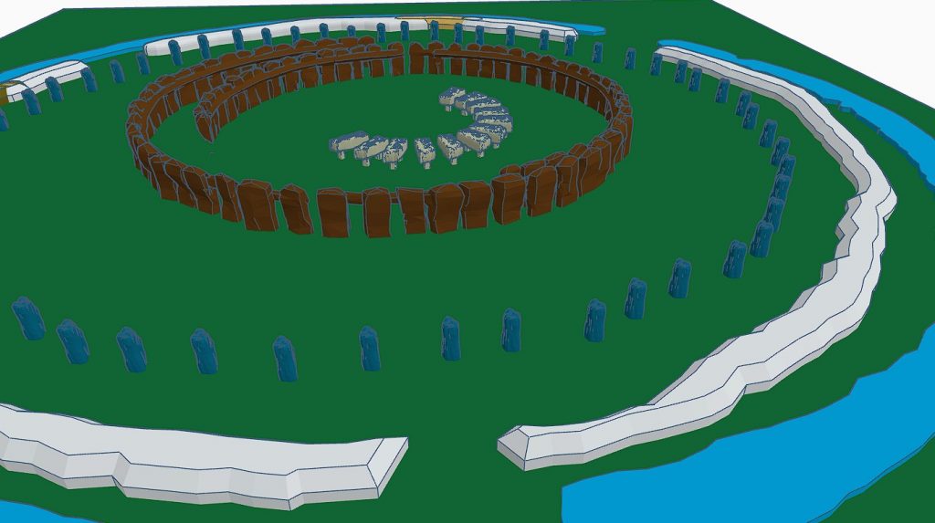
The investigations surrounding the dating and origins of Stonehenge, particularly the peer-reviewed publications stemming from Mike Parker-Pearson’s (MPP) work on Bluehenge, the bluestone quarries and Waun Mawn, serve as stark examples of how the peer-review system can be flawed and how its weight of evidence can be unduly influenced by the author’s reputation and desired outcomes.  The case of Bluestonehenge further highlights how prior assumptions can drive research conclusions, even when contradictory data exists.  These cases illustrate a broader issue within archaeology: a tendency to align findings with prevailing theories rather than rigorously testing hypotheses against all available evidence.

The Lost Stone Circle – many made up for good TV

The Subjectivity

Unlike the hard sciences that rely on quantifiable data and reproducible experiments, archaeology frequently deals with fragmented evidence requiring interpretation.  Archaeological findings are often unique to specific sites and cannot be replicated.  This reliance on interpretation opens the door to interpretive bias, in which an archaeologist’s perspective, cultural background, or theoretical framework can influence the narrative constructed from the available evidence.  Consequently, the peer reviewers, who are also subject to their own biases, may inadvertently endorse interpretations that align with prevailing theories or the author’s established viewpoint rather than rigorously scrutinising the factual basis of the claims.

This can lead to “possibilities are often presented as certainties, creating a misleading view of the past.” The “establishment’s over-reliance on ‘peer review’ as a conformity standard of credibility” has been criticised, with Richard Horton, editor of The Lancet, suggesting that peer review is merely a “crude means of discovering the acceptability—not the validity—of a new finding.” This crucial distinction underscores that peer review may often reinforce existing paradigms within the archaeological community, potentially hindering the acceptance of genuinely novel or contradictory evidence.

Ricahrd Horton of the Lancet

The Case of Bluestonehenge: A Shift in Narrative Due to Contradictory Evidence

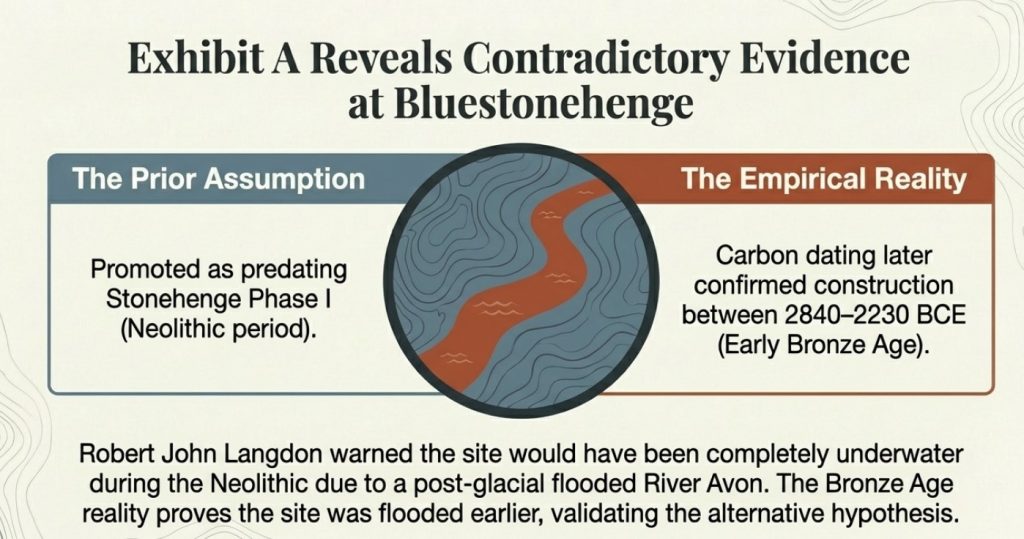
The first site to consider, Bluestonehenge, was under excavation in 2009.  At that time, MPP was preparing to announce it as his bluestone site and believed it predated Stonehenge Phase I.  However, during their meeting, the author of The Stonehenge Enigma (2013) raised concerns about this dating.  Based on his research into the 50 sites surrounding Stonehenge and his post-glacial-flooded-environment hypothesis, they concluded that Bluestonehenge would have been below water during the Neolithic period because the River Avon remained flooded.

MPP dismissed this research and published, but later carbon dating confirmed this point and supported the author’s hypothesis, as it is now accepted that Bluestonehenge was constructed between 2840–2230 BCE, which falls into the Early Bronze Age rather than the Neolithic period as initially proposed by MPP.  This raises significant concerns about the reliability of peer-reviewed interpretations, as the initial dating—endorsed by peer review—was later found to be incorrect.

MPP’s first attempt to justify his dates

The Craig Rhos-y-Felin Quarry: Cherry-Picking Evidence to Fit a Hypothesis

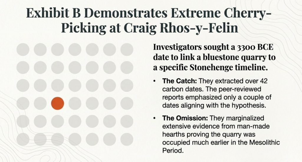
The investigations led by MPP into the origins of Stonehenge’s bluestones provide a compelling case study of how the peer-review process can be intertwined with pursuing a specific hypothesis, potentially overlooking contradictory evidence and leading to flawed conclusions.  The initial breakthrough of finding the bluestone quarry at Craig Rhos-y-Felin was significant.  However, the subsequent attempts to date the quarry and link it definitively to a specific construction date for Stonehenge, particularly around 3300 BCE, demonstrate a tendency to “attempt to find a date that would vindicate their Stonehenge dating methods.”

(Archaeology: The Flaws of Peer Review)

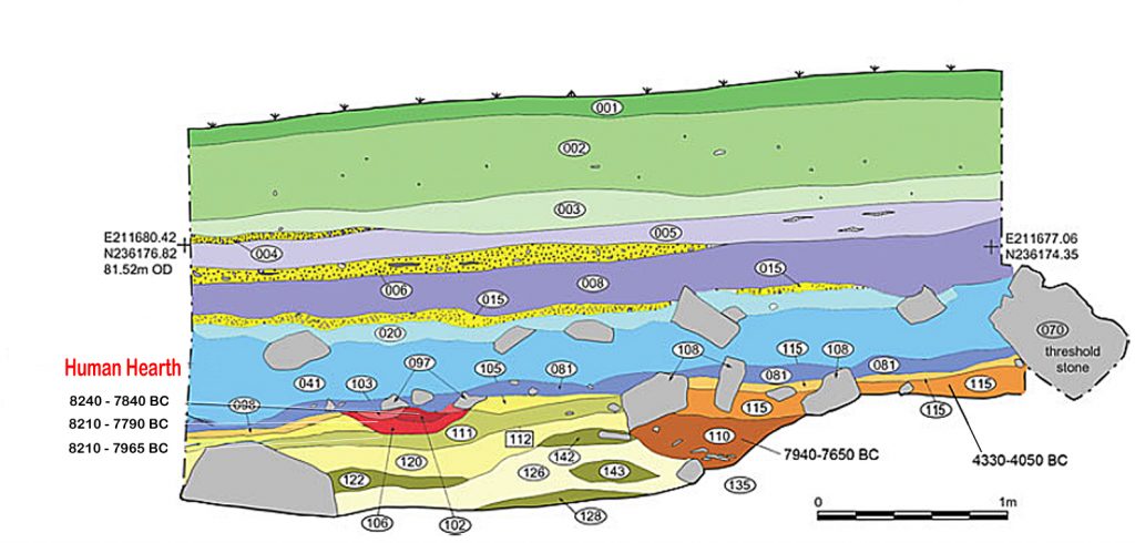
At Craig Rhos-y-Felin, over 42 carbon dates were obtained.  However, the peer-reviewed reports emanating from this investigation were criticised for emphasising only a couple of Neolithic dates that appeared to support the 3300 BCE hypothesis while mainly overlooking the “extensive evidence found in the site’s man-made hearths, which showed that the quarry was first occupied in the Mesolithic Period.” These Mesolithic hearths, dating significantly earlier than the desired Neolithic timeframe, posed a challenge to the pre-existing narrative but were seemingly marginalised in pursuit of a specific conclusion.  This selective presentation of data, which the sources label as “clear ‘cherry-picking’ of the archaeological evidence,” suggests that the weight of the reported evidence was skewed by the author’s desire to validate a prior claim and that the peer-review process in this instance did not sufficiently challenge this biased interpretation.

(Archaeology: The Flaws of Peer Review)
Only accept one of the forty-two carbon dates that were closest to his hypothesis

Waun Mawn: The Search for a Lost Circle and the Limits of Peer Review

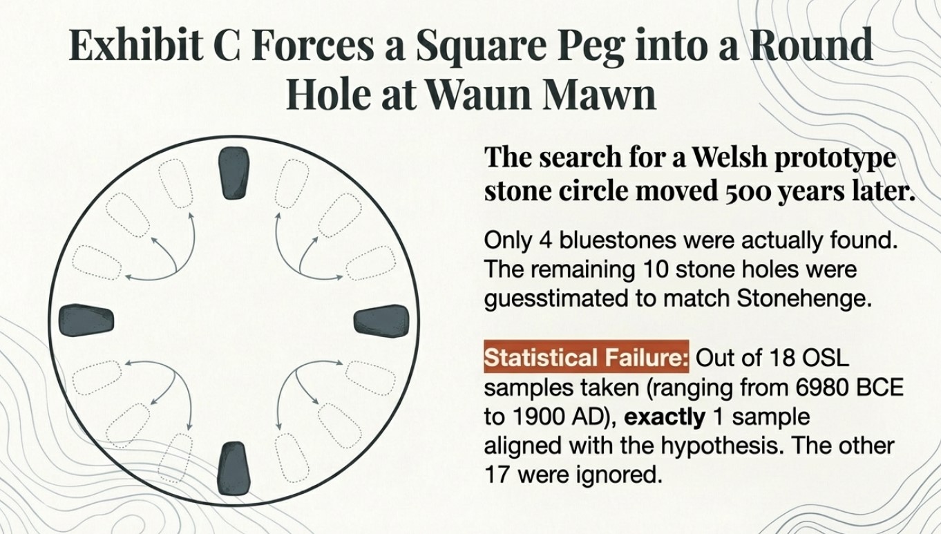
The discrepancy between the desired 3300 BCE date and the slightly earlier dates obtained at the quarry site fueled the hypothesis of a “Welsh prototype stone circle which was moved 500 years later.” This second claim by MPP and subsequent peer-reviewed papers and TV programmes “claimed to find this ‘mysterious site,’ later to discover that it was nonsense raises serious questions about the rigour of the research and the extent to which the peer-review process scrutinised these evolving and ultimately unsubstantiated claims.

At Waun Mawn, only four bluestones were found, leading to a “sad attempt to fit a square peg into a round hole” by identifying ten further stone holes and guesstimating the existence of the remaining stones needed to match Stonehenge.  Furthermore, the dating evidence from Waun Mawn is heavily criticised.  While the program highlighted a single OSL date that appeared to align with the desired timeframe, the sources reveal that “there was not one OSL sample taken but 18, which gave results in the range of 6980+/- 2120 BCE to AD 1900 +/- 20.” The fact that “17 dating samples did not verify MPP’s Hypothesis, ONLY a single one,” strongly suggests a selective emphasis on a single data point to support a pre-existing claim.

(Archaeology: The Flaws of Peer Review)
The dates he found corresponded to other carbon dates at Stonehenge but were ignored

Conclusion: Moving Beyond the Illusion of Infallibility

While the peer-review process remains a vital component of archaeological scholarship, it is crucial to recognise its inherent limitations and avoid believing that all peer-reviewed papers are accurate and error-free.  The case studies surrounding Mike Parker-Pearson’s investigations into the origins of Stonehenge highlight how the subjectivity of archaeological interpretation, the pursuit of pre-existing hypotheses, and the potential influence of the reporter’s authority can lead to flawed findings being published.  The selective use of data, the downplaying of contradictory evidence, and the development of speculative theories underscore the need for a more critical engagement with peer-reviewed publications, prioritising rigorous examination of the factual evidence and methodologies employed rather than relying on perceived authority.

(Archaeology: The Flaws of Peer Review)

Prologue

Archaeological research, while often considered a rigorous discipline, faces challenges concerning the reach and reliability of its published work. Studies have shown that a significant portion of academic papers receive minimal attention post-publication. Approximately 44% of all published manuscripts are never cited, indicating that nearly half of these works remain largely unread or unreferenced within the scholarly community.

lucbeaulieu.com

Furthermore, citation analyses reveal that the average number of citations per paper is below ten. Achieving 10 or more citations places a manuscript in the top 24% of the most-cited works worldwide, underscoring the limited engagement many papers receive.

lucbeaulieu.com

Regarding the accuracy of scientific publications, the rate of retractions has seen a notable increase. Although retracted papers still constitute a small fraction—under 0.1%—of the more than 25 million papers indexed in PubMed since the 1940s, this uptick highlights ongoing concerns about the reliability of published research.

en.wikipedia.org

In archaeology, the prevalence of flawed studies is difficult to quantify precisely due to the field’s interpretive nature and the scarcity of replication studies. However, documented cases, such as the Himalayan fossil hoax involving Vishwa Jit Gupta, illustrate that significant errors and even fraudulent activities can persist undetected for extended periods, thereby influencing subsequent research.

en.wikipedia.org

These insights emphasise the necessity for heightened scrutiny and critical engagement within archaeological scholarship to ensure the integrity and impact of its contributions.

PodCast

Author’s Biography

Robert John Langdon, a polymathic luminary, emerges as a writer, historian, and eminent specialist in LiDAR Landscape Archaeology.

His intellectual voyage has interwoven with stints as an astute scrutineer for governmental realms and grand corporate bastions, a tapestry spanning British Telecommunications, Cable and Wireless, British Gas, and the esteemed University of London.

A decade hence, Robert’s transition into retirement unfurled a chapter of insatiable curiosity. This phase saw him immerse himself in Politics, Archaeology, Philosophy, and the enigmatic realm of Quantum Mechanics. His academic odyssey traversed the venerable corridors of knowledge hubs such as the Museum of London, University College London, Birkbeck College, The City Literature Institute, and Chichester University.

In the symphony of his life, Robert is a custodian of three progeny and a pair of cherished grandchildren. His sanctuary lies ensconced in the embrace of West Wales, where he inhabits an isolated cottage, its windows framing a vista of the boundless sea – a retreat from the scrutinous gaze of the Her Majesty’s Revenue and Customs, an amiable clandestinity in the lap of nature’s embrace.

Exploring Prehistoric Britain: A Journey Through Time

My blog delves into the fascinating mysteries of prehistoric Britain, challenging conventional narratives and offering fresh perspectives based on cutting-edge research, particularly using LiDAR technology. I invite you to explore some key areas of my research. For example, the Wansdyke, often cited as a defensive structure, is re-examined in light of new evidence. I’ve presented my findings in my blog post Wansdyke: A British Frontier Wall – ‘Debunked’, and a Wansdyke LiDAR Flyover video further visualizes my conclusions.

My work also often challenges established archaeological dogma. I argue that many sites, such as Hambledon Hill, commonly identified as Iron Age hillforts are not what they seem. My posts Lidar Investigation Hambledon Hill – NOT an ‘Iron Age Fort’ and Unmasking the “Iron Age Hillfort” Myth explore these ideas in detail and offer an alternative view. Similarly, sites like Cissbury Ring and White Sheet Camp, also receive a re-evaluation based on LiDAR analysis in my posts Lidar Investigation Cissbury Ring through time and Lidar Investigation White Sheet Camp, revealing fascinating insights into their true purpose. I have also examined South Cadbury Castle, often linked to the mythical Camelot56.

My research also extends to the topic of ancient water management, including the role of canals and other linear earthworks. I have discussed the true origins of Car Dyke in multiple posts including Car Dyke – ABC News PodCast and Lidar Investigation Car Dyke – North Section, suggesting a Mesolithic origin2357. I also explore the misidentification of Roman aqueducts, as seen in my posts on the Great Chesters (Roman) Aqueduct. My research has also been greatly informed by my post-glacial flooding hypothesis which has helped to inform the landscape transformations over time. I have discussed this hypothesis in several posts including AI now supports my Post-Glacial Flooding Hypothesis and Exploring Britain’s Flooded Past: A Personal Journey

Finally, my blog also investigates prehistoric burial practices, as seen in Prehistoric Burial Practices of Britain and explores the mystery of Pillow Mounds, often mistaken for medieval rabbit warrens, but with a potential link to Bronze Age cremation in my posts: Pillow Mounds: A Bronze Age Legacy of Cremation? and The Mystery of Pillow Mounds: Are They Really Medieval Rabbit Warrens?. My research also includes the astronomical insights of ancient sites, for example, in Rediscovering the Winter Solstice: The Original Winter Festival. I also review new information about the construction of Stonehenge in The Stonehenge Enigma.

Further Reading

For those interested in British Prehistory, visit www.prehistoric-britain.co.uk, a comprehensive resource featuring an extensive collection of archaeology articles, modern LiDAR investigations, and groundbreaking research. The site also includes insights and extracts from the acclaimed Robert John Langdon Trilogy, a series of books exploring Britain during the Prehistoric period. Titles in the trilogy include The Stonehenge Enigma, Dawn of the Lost Civilisation, and The Post Glacial Flooding Hypothesis, offering compelling evidence about ancient landscapes shaped by post-glacial flooding.

To further explore these topics, Robert John Langdon has developed a dedicated YouTube channel featuring over 100 video documentaries and investigations that complement the trilogy. Notable discoveries and studies showcased on the channel include 13 Things that Don’t Make Sense in History and the revelation of Silbury Avenue – The Lost Stone Avenue, a rediscovered prehistoric feature at Avebury, Wiltshire.

In addition to his main works, Langdon has released a series of shorter, accessible publications, ideal for readers delving into specific topics. These include:

For active discussions and updates on the trilogy’s findings and recent LiDAR investigations, join our vibrant community on Facebook. Engage with like-minded enthusiasts by leaving a message or contributing to debates in our Facebook Group.

Whether through the books, the website, or interactive videos, we aim to provide a deeper understanding of Britain’s fascinating prehistoric past. We encourage you to explore these resources and uncover the mysteries of ancient landscapes through the lens of modern archaeology.

For more information, including chapter extracts and related publications, visit the Robert John Langdon Author Page. Dive into works such as The Stonehenge Enigma or Dawn of the Lost Civilisation, and explore cutting-edge theories that challenge traditional historical narratives.

Other Blogs

[sitemap_posts]
Wansdyke East – Prehistoric Canals

Promotional Video – Ancient Prehistoric Canals (Dykes) – Wansdyke

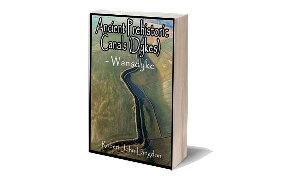
Extract From Book……………………… Ancient Prehistoric Canals (Dykes) – Wansdyke (Wansdyke East – Prehistoric Canals)

The INTRODUCTION

Wansdyke has always captured the imagination of the general public as it is a substantial prominent structure in the Wiltshire landscape relatively close to another famous ancient site Avebury, which also has massive ditches like Wansdyke and therefore, one might suggest there is a direct relationship between the two.

This apparent connection has not occurred to past or present archaeologists who sought to find a simple meaning for this unique ‘linear structure’ and hence the conclusion that it was built to defend warlike invaders of the past and hence a ‘Saxon’ name was adopted as historians of the past believed that these ‘tribes’ had large armed forces that could cope with such grand engineering undertakings as it was to defend their land.

Over the last few decades, this ‘fact’ (which was also shared by an even more immense ‘Dyke’ also named after a Saxon ‘Offa’) has been revisited and found that this continuous defence ditch is far less continuous than previously believed and a new theory developed for these earthworks as ‘Boarder Markers’ in the landscape – as they have never been a single body found with battle wounds in all 22 miles of Wansdyke or the 177 mile Offa’s Dyke which would support the defence hypothesis.

Sadly, even with this new ‘reassuring’ suggestion for these extensive sites, archaeologists have failed to address the facts that Dykes are incomplete and not continuous (Offa has 40% missing and Wansdyke has 20% missing) and there beginning and end points just ‘appear’ without reason in the landscape ‘like magic’ with no one able to tell you why.

Moreover, if these ‘Boundary Markers’ taking years if not decades to build were demarcation points for land ownership, then why do some Dykes (like Offa) track much larger separation points like major rivers that would have been a far more apparent marker than a 4m ditch and a known and well used territorial boundary marker still used today.

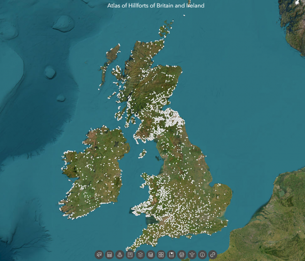
Furthermore, archaeologists have ignored that there are over 1500+ scheduled Dykes in Britain (including Ireland), of which 90% could not be used for this function as some of these ‘boundary markers’ are found on uninhabited islands dotted around the entire circumference of Britain.

Robert John Langdon (2022)

Section 2 – HE:1004719  Wansdyke: Section from S of Furze Hill to Marlborough-Pewsey Road 4.3km (4,300m = 12,900 working days – 20 men taking 649 days (1.78 years).

No, Historic Details or Excavations Registered

S of Furze Hill to Marlborough - Pewsey Roads (GE) - Wansdyke East - Prehistoric Canals
S of Furze Hill to Marlborough – Pewsey Roads (GE) – Prehistoric Canals (Dykes) – Wansdyke (2)

 OS Map

S of Furze Hill to Marlborough - Pewsey Roads (OS -Wansdyke East - Prehistoric Canals
S of Furze Hill to Marlborough – Pewsey Roads (OS) – Prehistoric Canals (Dykes) – Wansdyke (2)

1800 OS Map

S of Furze Hill to Marlborough - Pewsey Roads (1800s Map) - Wansdyke East - Prehistoric Canals
S of Furze Hill to Marlborough – Pewsey Roads (1800s Map) -Wansdyke East – Prehistoric Canals

LiDAR Map

S of Furze Hill to Marlborough - Pewsey Roads (LiDAR) - Wansdyke East - Prehistoric Canals
S of Furze Hill to Marlborough – Pewsey Roads (LiDAR) – Wansdyke East – Prehistoric Canals

LiDAR (with Mesolithic water levels)

S of Furze Hill to Marlborough - Pewsey Roads (with Meso Water Levels) - Wansdyke East - Prehistoric Canals
S of Furze Hill to Marlborough – Pewsey Roads (with Meso Water Levels) -Wansdyke East – Prehistoric Canals

Canal working hours

 We use an estimated rate of 0.3m per day for calculating sections; on this single section, of the Dyke; we have a total length of 4.3km (4,325m).

 At a rate of 0.3m per day over 8 hours – this gives us 12,975 working days.  Using 20 person in a work team (with 200 people supporting the workers – to suppy food, water shelter, repair tools and clear the ground in advance of trees and scrubs.  This gives us a total of 649 days (1.78 years).   The estimate is based on one man cutting 0.3m per day (Ditch down to 2m deep within a chalk bedrock and the piling of the bank).

P.J.Fowler (2001) used 0.1423 metres per hour and claimed 1,000 men built the ENTIRE East Dyke in 30 days working 10-hours a day six days a week??

This ridiculous claim even with modern tools, it would be too demanding, and the logistics of feeding, mending tools and housing 1,000 men were not taken into account. 

If we take the East Wansdyke into account – which is a total of 25,408 – we then get a calculation of 84,693 days. That is 11.6 years for the same 200 man tean (20 digging) – which indicates that this Dyke was built in small sections and then joined at a later date?

Twisty Route

What is clear from the route of this section of Wansdyke is that it is not straight at all; it works against the topology to bend at 90 degrees in some places and dip down unnecessarily into a valley rather than taking the high ground. 

The line of Wansdyke is not remotely straight - Wansdyke East - Prehistoric Canals
The line of Wansdyke is not remotely straight – Wansdyke East – Prehistoric Canals

But these wild undulations into valleys also cause problems for my hypothesis as a canal. For example, how could a canal move up and down significant gradients without locks?

Well, the answer is that they can’t – but the solution to this problem is in detail, for if you look again at this part of Wansdyke going into an old dry river valley, you see something archaeologists miss – it stops!!

We also saw this from the transition from Section 1 to Section 2 of Wansdyke.  The second was a gap, which looked like a piece filled in by farming; there were two other gaps; the first was a later road cutting through and then a railway doing the same.

Gap number Two in Wansdyke - Wansdyke East - Prehistoric Canals
Gap number Two in Wansdyke – Wansdyke East – Prehistoric Canals
Mesolithic Water Levels again fills the gap - Wansdyke East - Prehistoric Canals
Mesolithic Water Levels again fills the gap – Wansdyke East – Prehistoric Canals

The Dry River Valley aspect of this part of the canal comes with a massive gradient – if it went to the valley’s bottom, it would make moving a boat very difficult.  But we see on LiDAR evidence of the Dyke stopping before reaching the bottom.  This is because, at some point in the past, this dry river valley in prehistoric times would not be ‘dry’ but full of water, as shown in the illustration (Fig.49)

This would make sense to the termination on the right as it would initially end at the river’s shoreline. If this was the case, the simple answer to the problem is that at that point, you took the boat across the river, so the gradients of the Dyke in the Mesolithic were small.

But why is there a continuation (bank) of the Dyke down the valley?

This can best be answered by understanding what happened to this earthwork once the waters started to fall in the Neolithic Period.

Logically, as the waters fell, the ditch would have been extended to meet the lower water level until the slope was too extreme to continue and was abandoned.  Later once the river had completely dried up (and consequently the rest of the Dyke as the water table would have universally fallen), the natural road (the bank of the Dyke) would be used as a road.

Excavations of similar aspects of Dykes have shown that the bank reduced in height and became flattered like a road and hence more comprehensive.  To use this road permanently, the builders adapted the dry river valley element (which would still be boggy for many centuries after the river disappeared) by adding to the bank by removing soil from the ground – but on both sides, making the ditch element smaller and more shallow than the rest of the Dyke and to both sides.

The result of this work looks like a loss of the deep ditch but is more likely a change in its structure – which is seen clearly on parts excavated in other Dykes but impossible to see here without excavation.

Long Barrow

An interesting associated feature can be found just 200m south of Wansdyke Section 2 – A Long Barrow.

“The monument includes a long barrow set above the floor of a dry valley in an area of gently undulating chalk downland. The barrow mound is ovate and orientated east-west. It is 40m long, 27m wide and stands to a maximum height of 3.5m. Flanking the barrow mound to the north and south are ditches from which the material used to form the mound was quarried during the construction of the monument. These survive as earthworks 8m wide and 1m deep” – Historic England

What should be noted is it’s ON THE SHORELINE of the ‘Dry River Valley’ as shown from the suggested water level in our illustration.  This is reflected by the ‘track’ (dyke) that connects the shoreline to the main Wansdyke Canal. So are we seeing the Dyke being used at a later date to take the  bones of the dead from a reincarnation site to the Long Barrow?

This confirms the river levels at the time of construction and the previously speculated gap in Wansdyke by the river valley top.

Flint Pits

Again, as shown in the previous section (1), another interesting feature near the Dyke is the ‘Old Flint Pits’ as a feature on the 1886 edition of the OS map but not recorded by the Historic Monuments Dept.

90-degree bend

Another strange and bewildering feature in this section is the 90-degree bend on the Dyke.

This ‘kink’  confirms that Wansdyke was never built as either a Defensive wall or Boundary marker.  As if it was a defensive feature, it would not have a ‘gently rounded ditch – it would be square like a castle.  If it were just a marker, it would cut across the flat landscape – as it is more work to create such a turning for no reason.

The only logical reason for such an engineering feature is that it was added later when the Water Levels dropped in the Neolithic to follow the landscape topology.

Epilogue

Unveiling the True Purpose of Britain’s Largest Linear Earthworks

The recent publication of three Lidar investigations into Offa’s Dyke, Wansdyke, and The Vallum at Hadrian’s Wall has revealed that these structures were built in areas affluent in quarrying and mineral extraction.  Archaeologists have overlooked mainly this critical aspect until now.

The likelihood that these earthworks were used to transport materials to rivers for trading is compelling.  Moreover, the possibility that they were initially constructed as transport routes for boats during the Mesolithic period, with quarries developing around this infrastructure later, is an intriguing hypothesis that deserves attention.

As we continue to study these ancient linear earthworks with advanced landscape tools like Lidar, we can expect this timeline to become more apparent.  What is undeniable is that the old myths of these structures being solely fortifications or boundary markers are complete fiction.  While they may have been used as such after their original construction, their primary purpose was much more complex and integral to early trade and transportation networks.

This new understanding challenges long-held beliefs and opens exciting avenues for future research into these remarkable earthworks’ true history and function.

Results from the LiDAR investigations

Wansdyke

With meticulous precision, our investigations have set out to unravel the intricacies enshrouding Wansdyke, delving boldly into the heart of its historical narrative.  In so doing, it dares to challenge the archaic views, which have rendered Wansdyke a mere defensive ditch or a boundary marker of the Saxon age.  However, a discerning eye reveals that these notions lack the bedrock of objective evidence, for they rely merely on a handful of carbon dates, a commonplace in the annals of sites from that period.

Unveiling the True Purpose of Britain’s Largest Linear Earthworks

Yet, the gaps within this enigmatic earthwork beckon us to embark on an exploratory journey that hints at the presence of something else entirely – the possibility of water coursing through these river valleys.  We dare to propose that these ditches were not mere boundaries but ingeniously designed moated canals, where boats once plied as a means of transport, an ideal mode of travel within a water-rich landscape.

Though our current knowledge may fall short of unearthing all the answers, the profound excavations led by Pitt Rivers present a tantalising glimpse, revealing that water once flowed through these ditches.  And the Romans themselves, much later, saw fit to repurpose these canals, affirming their practicality and utility in the annals of history.

The advent of LiDAR has unfurled before us an unprecedented vista, affording a sweeping survey of over 1500 Scheduled Dykes throughout Britain.  In the luminous wake of this technology, a compelling story unfolds, hinting at Wansdyke’s Mesolithic origins, challenging established beliefs, and unveiling its construction during a period of abundant river levels, a time far more distant than previously perceived.

With their customary flair for adaptation, the Romans likely reworked sections of Wansdyke, leaving behind a more cohesive structure than its counterparts.  The Vallum by Hadrian’s Wall and Offa’s Dyke bear the indelible marks of their prehistoric origins, standing as testaments to the Romans’ quarrying and stone-delivery endeavours.

Yet, we venture further into the mists of history, exploring prehistoric mining, the significance of quarried materials, and their vital role in facilitating trade – not just within Britain’s borders but beyond, crisscrossing the conflation of Europe.  This revelation dispels earlier scepticism and shines a light on the sophisticated network of international trade that flowed with the currents of time, enriching Wansdyke’s profound legacy as a conduit of a vibrant and interconnected ancient civilisation.

The veil of uncertainty still shrouds the origins of West Wansdyke in a cloak of ambiguity.  While the passage of time has not yet delivered a definitive date, the prevailing narrative, tethered to a carbon dating of 1500 BCE, finds itself juxtaposed against emerging evidence.  This evidence, born of meticulous inquiry, casts shadows of doubt upon the established chronology and beckons us to reevaluate our understanding.

In the chronicles of academia, where scepticism is both a guardian of rigour and a hurdle to innovation, the seeds of inquiry were sown some fifteen years ago.  The publication that dared to challenge convention and present a different perspective on West Wansdyke stirred a tempest within the academic community.  Accusations of ‘pseudoscience’ echoed like distant thunder, casting a shadow over the revelations that dared to dissent.

Yet, the march of progress is often fueled by the fervour of inquiry and the evolution of knowledge.  Archaeologists, driven by a relentless pursuit of truth, have not shied away from the fray.  In an embrace of scientific discovery, new dating evidence has emerged—a beacon of revelation that punctures the shroud of scepticism that once enshrouded the discourse.

Carbon dating, that time-traveller’s tool that peers into the past through the lens of isotopes, has yielded results that lend credence to the suspicions germinating in the fertile soil of curiosity.  LiDAR, with its laser-guided gaze, has unveiled hidden landscapes and confirmed the prehistoric existence of canals—ancient pathways etched into the earth by the hands of civilisations long past.

As we stand at this juncture, it is not merely the story of West Wansdyke that unfolds before us; it is a testament to the evolution of thought and the malleability of understanding.  The ‘pseudoscience’ that once raised eyebrows now stands vindicated—a reminder that the boundaries of knowledge are ever-shifting, ever-expanding, yielding to the tenacity of those who dare to question.

In the grand theatre of history, where narratives are woven from threads of evidence and conjecture, the tale of West Wansdyke takes centre stage.  It serves as a reminder that even the most firmly established edifices of understanding can be reshaped by the currents of new insight.  The academic stir that was ignited by dissenting revelations has matured into a symphony of acceptance—a harmonious acknowledgement that the pursuit of knowledge, however tumultuous, is the essence of scholarly endeavour.

As we navigate the twists and turns of this historical journey, we honour the legacy of those who dared to defy convention, the archaeologists who continued to dig beneath the surface, and the spirit of inquiry that animates the quest for truth.  In this narrative, West Wansdyke emerges not just as a physical structure of the past, but as a symbol of the human spirit’s unyielding march toward comprehension—a testament that even in the face of scepticism, the pursuit of understanding remains an unwavering beacon of progress.

Consequently, in the HE publication ‘Prehistoric Linear Boundary Earthworks: Introductions to Heritage Assets.  Swindon.  Historic England 2018’.

The archaeologists confess that “Some of the earliest (Dykes) seem to date to the later Neolithic period: on Ebberston Common, the latest sequence of at least six pit alignments appears to predate the construction of a round barrow which would typically date to the earlier Bronze Age, around 2000 BC. “(see Page Fig.87. Page 151 for full quotation).

And as a consequence of their endeavours now are happy to plush a timeline of Dyke construction, vindicating my original work and allowing us to date West Wansdyke from my research on water levels in the prehistoric from the middle Mesolithic to the Bronze Age.

Hadrian’s Wall – The Vallum

Unveiling the True Purpose of Britain’s Largest Linear Earthworks

Our Findings

Before we reflect on our findings Section by Section, It may be beneficial to look at the total statistics for some aspects of Hadrian’s Wall, as such details have not been found in our research on this subject.

Vallum

Total length found: 73,812m (45.86 miles) – 62% of the entire wall length

Total length missing: 40,075m (24.90 miles) – 35% of the Vallum length

The total length of Vellum 113,887m (70.77 miles)

In comparison, Hadrian’s Wall is reported as 80 Roman miles or 73 standard miles in length.

Within the 70.77 miles of the Vallum, we have identified – within 200m of the construction:

46 Springs (as specified by the 1800 OS maps series)

54 Quarries

14 Prehistoric Ancient sites

To judge if the frequency of these objects are standard or an anomaly of the Vallum – we have measured two roughly parallel lines to the Vallum, one 5 miles to the north and the other to the south, so still conforming to a similar environment and then counted the frequency of these objects that are also within 200m of the experimental map lines:

Northern Test line

12 Springs

25 Quarries

1 Ancient site

Southern Test Line

10 Springs

30 Quarries

3 Ancient Sites

Consequently, we can now judge the Vallum path against our map test lines:

10 v 46 Springs – Vallum has 460% more Springs

30 v 54 Quarries – Vallum has 180% more Quarries

14 v 2 Ancient Sites – Vallum has 700% more sites

With these fantastic statistics in mind, we can now take a detailed look at the LiDAR investigations, starting with Section A, where we find that the Vallum ends some distance before the end of the Wall on the Bowness-on-Solway coast.

This terminus seems to be at a point of a Paleochannel/Dyke that turns and heads south overland, which has no connection to the Wall.  This Section shows that the Wall was built at an inappropriate distance from the current river to be defensive – as attackers would be free to land and muster.

The LiDAR map shows the likelihood that the river was higher in the Roman period and that the Wall was built on its shoreline, making it a much more secure feature.  This raised water level would suggest that the Paleochannel was full of water and was used to link into the Vallum as a canal feature.

Section B, shows that the Vallum was in this area (sections A & B) as short-run (2.6 miles) and not continuous.  The terminal point to the east of this run again is in a river valley, which was again higher than today at the time of Roman occupation, allowing boats to enter and exit from the river Esk to supply or deliver Stone to the Wall as there is an absence of the suggested ‘Military Way’ that was supposed to be constructed for this purpose.

We will not see any signs of the Military Way (see case study) for the next 24.2km, indicating that the Vallum was the primary source of supply and communication.

Section C, demonstrates that the Vallum disappears for 2.6 miles on the LiDAR map.  No excavation evidence shows it was below the surface; we can only conclude that it did not exist in this Section.  This questions the old theory about the Vallum being constructed as a defence structure either before the Wall was built or after to defend the south flank – as attackers could just walk around it?

This Section also offers further support to the higher water table at the time of the Wall’s construction as it seems to bend around the shorelines of these higher river levels, which otherwise make no engineering or defensive sense?

Sections D and E, illustrate the raised water levels of prehistory and, consequently, the path of the Wall and Vallum, which in places (such as in the River Eden) disappears, indicating that the Vallum was probably constructed on an existing ‘Dyke’ and enlarged for their purposes?

Sections F, G and H show the first signs of the Roman Road called Stanegate (see case study).  The Vallum again is broken in its course by the river valleys in this area, eradicating any evidence of its existence.  It also shows that the Vallum headed towards river valleys rather than avoiding them, which again would suggest these were earlier prehistoric features that were reused.

Vallum – was once a series of prehistoric dykes which were recut and extended to deliver supplies and stone to the Wall.

Stanegate – does not exist as a road but has a river connection to the first five sites.

Military Way – Does not exist as an independent road(way) but is observable in areas not covered by the Vallum.

The Antonine Wall – was once a series of Dykes that was reconnect together and recut.

Unveiling the True Purpose of Britain’s Largest Linear Earthworks

Offa’s Dyke

The Total length of Offa’s Dyke (including gaps and missing sections) 279,745m (173.8 miles)

Total length Found (by LiDAR): 95,044m (59.2 miles) – 34% of the entire length

Total length Missing (by LiDAR): 185,476m (114.6 miles) – 66% of the entire length

Total number of Gaps in the Offa’s Dyke – 70

Total number of Scheduled Monuments in Listing: 237

Features

Within the 59.2 miles of Offa’s Dyke, we have identified – within 200m of the construction:

118 (33 Natural Springs)/Wells/Ponds (as specified by the 1800 OS maps series – Wells and Ponds included to show high water table)

303 Quarries/Bell Pits (Bell Pits Ancient Quarry Holes) ave of 5 Quarries per mile of Dyke

12 Prehistoric Ancient Sites

4 Barrows

7 Roman Sites

52% of Sections are linked to each other

20% of Sections are connected to existing rivers

28% of Sections join Paleochannels

Summary

Section A – Total 20,201m. 14 Gaps – 6,758m missing (34%)

Section B – Total 110,545m. 10 Gaps – 106,768 missing (97%)

Section C – Total 55,905m.  17 Gaps – 7,990 missing (14%)

Section D – Total 56,369m. 22 Gaps – 29,848 missing (53%)

Section E – Total 36,725m. 7 Gaps – 33,101 missing (90%)

                Our findings concluded that these landscape features are much more exciting and complex than the archaeologists currently imagine, as each Section has its interest that finally gives us a solution to the construction and functionality of the Dyke.

Section A – Runs around the hills surrounding Chepstow and the River Wye.  This Dyke is no boundary or marker as the river would be a better solution to both causes.  But what it does show is the connection to Quarries and Roman Roads that would have probably linked to the canal system it inherited from the ancient Dyke builders.  These ‘linear earthworks’ were created to assist in trade during both prehistory and later Roman era until the canals dried up when the roads built upon the banks of these Dykes replaced the method of transport.

Section B – Shows why the Dyke is not interconnected, as 97% of it is missing, and there is not functionality or design that links together the small portions of Dyke that is in this Section.

Section C – Has the least missing sections, yet it still has 14% missing with 17 gaps, indicating that these Dykes are a series of individual trading canals and not a single entity.  This trading can be seen in the extensive quarries in this area, which have been mined for their mineral wealth for thousands of years.

Each hill has a different design from the last regarding width and Depth of the Ditch.  What we are seeing is a degree of uniformity in access to quarries and water sources, and natural springs along the Dyke.

Section D – This is a 50/50 series of Dyke to gap ratio, again showing that it is connected to Quarries and Mining, particularly Coal Mining, which the Romans widely used.  These are some of the largest coal mines in Britain.  The Dyke does not just come close – it in some cases the alignment goes through the middle of these quarries, with on average four quarries per Section which makes any suggestion that these Dykes were not used in conjunction with the minerals being extracted (as we see also in The Vallum at Hadrian’s Wall) and were constructed for another purpose as completely absurd.

Section E – Even archaeologists (including Fox) now admit that this is a different series of Dykes (Whitford Dyke) and not part of Offa’s Dyke as it’s too dysfunctional.

So, our conclusion about Offa’s Dyke is that we are looking at a series of working Dykes – initially built in prehistoric times and then utilised (as again we found in The Vallum) by the Romans to service the same Quarries for trading purposes.

In particular, we see this Roman influence in Section D as these are Coal minerals, which we know they used to heat the hypocaust underfloor furnaces of their Bath and home houses, which to date, archaeologists have failed to investigate the sources of this coal and how it was transported.

The Book - Prehistoric Canals (Dykes) - Wansdyke (2)
– Wansdyke East – Prehistoric Canals

This was an extracts from the NEW Book Ancient Prehistoric Canals (Dykes) – Wansdyke available on Amazon as a FULL COLOUR HARD BACK (£19.95) or a ECONOMY (£4.99) SOFTBACK black and white VERSION – it is also available as a KINDLE (£1.99) book. For further information about our work on Prehistoric Britain visit our WEBSITE or VIDEO CHANNEL.

Book details

  • ASIN ‏ : ‎ B0BF31GQKC
  • Publisher ‏ : ‎ Independently published (18 Sept. 2022)
  • Language ‏ : ‎ English
  • Hardcover ‏ : ‎ 134 pages
  • ISBN-13 ‏ : ‎ 979-8353488897
  • Dimensions ‏ : ‎ 15.24 x 1.3 x 22.86 cm
  • Illustrations: 85
  • Customer reviews: 5.0 out of 5 stars    1 rating

PodCast

Author’s Biography

Robert John Langdon, a polymathic luminary, emerges as a writer, historian, and eminent specialist in LiDAR Landscape Archaeology.

His intellectual voyage has interwoven with stints as an astute scrutineer for governmental realms and grand corporate bastions, a tapestry spanning British Telecommunications, Cable and Wireless, British Gas, and the esteemed University of London.

A decade hence, Robert’s transition into retirement unfurled a chapter of insatiable curiosity. This phase saw him immerse himself in Politics, Archaeology, Philosophy, and the enigmatic realm of Quantum Mechanics. His academic odyssey traversed the venerable corridors of knowledge hubs such as the Museum of London, University College London, Birkbeck College, The City Literature Institute, and Chichester University.

In the symphony of his life, Robert is a custodian of three progeny and a pair of cherished grandchildren. His sanctuary lies ensconced in the embrace of West Wales, where he inhabits an isolated cottage, its windows framing a vista of the boundless sea – a retreat from the scrutinous gaze of the Her Majesty’s Revenue and Customs, an amiable clandestinity in the lap of nature’s embrace.

Exploring Prehistoric Britain: A Journey Through Time

My blog delves into the fascinating mysteries of prehistoric Britain, challenging conventional narratives and offering fresh perspectives based on cutting-edge research, particularly using LiDAR technology. I invite you to explore some key areas of my research. For example, the Wansdyke, often cited as a defensive structure, is re-examined in light of new evidence. I’ve presented my findings in my blog post Wansdyke: A British Frontier Wall – ‘Debunked’, and a Wansdyke LiDAR Flyover video further visualizes my conclusions.

My work also often challenges established archaeological dogma. I argue that many sites, such as Hambledon Hill, commonly identified as Iron Age hillforts are not what they seem. My posts Lidar Investigation Hambledon Hill – NOT an ‘Iron Age Fort’ and Unmasking the “Iron Age Hillfort” Myth explore these ideas in detail and offer an alternative view. Similarly, sites like Cissbury Ring and White Sheet Camp, also receive a re-evaluation based on LiDAR analysis in my posts Lidar Investigation Cissbury Ring through time and Lidar Investigation White Sheet Camp, revealing fascinating insights into their true purpose. I have also examined South Cadbury Castle, often linked to the mythical Camelot56.

My research also extends to the topic of ancient water management, including the role of canals and other linear earthworks. I have discussed the true origins of Car Dyke in multiple posts including Car Dyke – ABC News PodCast and Lidar Investigation Car Dyke – North Section, suggesting a Mesolithic origin2357. I also explore the misidentification of Roman aqueducts, as seen in my posts on the Great Chesters (Roman) Aqueduct. My research has also been greatly informed by my post-glacial flooding hypothesis which has helped to inform the landscape transformations over time. I have discussed this hypothesis in several posts including AI now supports my Post-Glacial Flooding Hypothesis and Exploring Britain’s Flooded Past: A Personal Journey

Finally, my blog also investigates prehistoric burial practices, as seen in Prehistoric Burial Practices of Britain and explores the mystery of Pillow Mounds, often mistaken for medieval rabbit warrens, but with a potential link to Bronze Age cremation in my posts: Pillow Mounds: A Bronze Age Legacy of Cremation? and The Mystery of Pillow Mounds: Are They Really Medieval Rabbit Warrens?. My research also includes the astronomical insights of ancient sites, for example, in Rediscovering the Winter Solstice: The Original Winter Festival. I also review new information about the construction of Stonehenge in The Stonehenge Enigma.

Further Reading

For those interested in British Prehistory, visit www.prehistoric-britain.co.uk, a comprehensive resource featuring an extensive collection of archaeology articles, modern LiDAR investigations, and groundbreaking research. The site also includes insights and extracts from the acclaimed Robert John Langdon Trilogy, a series of books exploring Britain during the Prehistoric period. Titles in the trilogy include The Stonehenge Enigma, Dawn of the Lost Civilisation, and The Post Glacial Flooding Hypothesis, offering compelling evidence about ancient landscapes shaped by post-glacial flooding.

To further explore these topics, Robert John Langdon has developed a dedicated YouTube channel featuring over 100 video documentaries and investigations that complement the trilogy. Notable discoveries and studies showcased on the channel include 13 Things that Don’t Make Sense in History and the revelation of Silbury Avenue – The Lost Stone Avenue, a rediscovered prehistoric feature at Avebury, Wiltshire.

In addition to his main works, Langdon has released a series of shorter, accessible publications, ideal for readers delving into specific topics. These include:

For active discussions and updates on the trilogy’s findings and recent LiDAR investigations, join our vibrant community on Facebook. Engage with like-minded enthusiasts by leaving a message or contributing to debates in our Facebook Group.

Whether through the books, the website, or interactive videos, we aim to provide a deeper understanding of Britain’s fascinating prehistoric past. We encourage you to explore these resources and uncover the mysteries of ancient landscapes through the lens of modern archaeology.

For more information, including chapter extracts and related publications, visit the Robert John Langdon Author Page. Dive into works such as The Stonehenge Enigma or Dawn of the Lost Civilisation, and explore cutting-edge theories that challenge traditional historical narratives.

Other Blogs

[sitemap_posts]
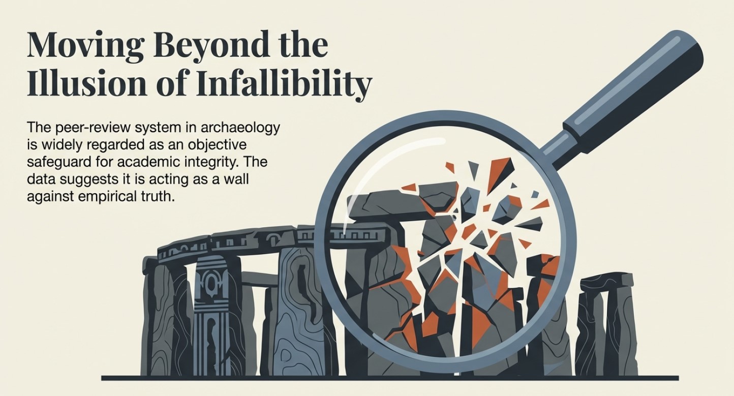
Archaeological ‘pulp fiction’ – has archaeology turned from science?

Introduction

After 40 years of studying archaeological features and reports, I have sadly concluded that archaeologists no longer follow accepted scientific methods and now revert to the simplistic traditional model or political correctness, mixed with the occasional sensationalism, not to progress the discipline but moreover, to find funding and maintain their status in the archaeological community.  This new social media marketing technique has also spread to both the geological and anthropological disciplines closely related to this archaeological ‘pulp fiction’. (Archaeological ‘pulp fiction’ – has archaeology turned from science?)

Science is about questioning what is known, as it is understood from History that current knowledge is not a ‘SCIENTIFIC FACT’ but just a supposition which over time will change and become more accurate through questioning the details of these ideas over time and the inevitable future scientific discoveries – but this is not the case in archaeology. (Archaeological ‘pulp fiction’ – has archaeology turned from science?)

Bronowski - Archaeological 'pulp fiction' - has archaeology turned from science?
Bronowski – Archaeological ‘pulp fiction’ – has archaeology turned from science?

In recent years, the discovery of the Bluestone quarry at Craig Rhos-Y-Felin should have brought a new perspective to the construction date and nature of the civilisation that built Stonehenge – Britain’s most famous prehistoric site.  Instead, the findings and data were manipulated to prove an existing hypothesis while excluding more interesting and revolutionary results.

This dogmatic approach to archaeology is compounded by new theories and even findings being ignored and, in some instances, actively crushed by the archaeological establishment and their disciples in favour of this dated ‘historical narrative’ in this new post-truth era of social media – rather than following the past practices of a scientific methodology of examining the potential and feasibility of these new ideas. 

This censorship is also practised in scientific journals and websites either by blanket failure to publish contrary evidence or by claiming a liberal attitude and then demanding excessive peer-reviewed endorsements before consideration.  In some instances, they encourage the simplistic labelling of these ideas as ‘pseudoscience’ in social media and academic punishment at university for any student that dares suggest such ideas in their assignments. (Archaeological ‘pulp fiction’ – has archaeology turned from science?)

Karl Popper quote - Archaeological 'pulp fiction' - has archaeology turned from science?
Popper -(Archaeological ‘pulp fiction’ – has archaeology turned from science?)

Moreover, these education establishments have failed to teach their students basic scientific principles of ‘critical analysis’ and ‘deductive logic’ when examining primary sources, demanding their students rely on secondary sources (opinions) of an accepted highly vetted reading list – which therefore favours the current simplistic traditional theories.  Consequently, this allows them to concentrate their energies on the establishment’s main concern for ‘bums on seats’ to secure funding for future financial security, rather than the higher principle of progressive education – questioning the validity of the certificates and qualifications awarded.

The establishments over-reliance on ‘peer-review’ as a conformity standard of credibility has not only been recognised by myself within my recent Honours degree in History but by moreover Richard Horton, editor of the British medical journal The Lancet, who said that:

“The mistake, of course, is to have thought that peer review was any more than a crude means of discovering the acceptability—not the validity—of a new finding. Editors and scientists alike insist on the pivotal importance of peer review. We portray peer review to the public as a quasi-sacred process that helps to make science our most objective truth teller.

But we know that the system of peer review is biased, unjust, unaccountable, incomplete, easily fixed, often insulting, usually ignorant, occasionally foolish, and frequently wrong.” (Archaeological ‘pulp fiction’ – has archaeology turned from science?)

peer review is biased, unjust, unaccountable, incomplete, easily fixed, often insulting, usually ignorant, occasionally foolish, and frequently wrong." Archaeological 'pulp fiction' - has archaeology turned from science?
Richard Horton – “unjust, unaccountable, incomplete, easily fixed, often insulting, usually ignorant, occasionally foolish, and frequently wrong.” – archaeological ‘pulp fiction’

So, in what areas do we see this flawed blanket censorship and what are the other possibilities archaeologists have failed to comprehend?

Cheddar Man

A recent discovery in Britain was made by analysing the mtDNA (mitochondrial DNA) from the skeleton of a Mesolithic man, discovered in the Cheddar Gorge, Somerset, England. According to the announcement, what researchers found in their analysis was that this ancient person (dated approximately 9000 years ago) likely had a dark (brown-black) skin colour, dark brown hair, blue eyes, and phenotypical features resemble western Europeans. That’s all well and good, but what’s the problem with that? (Archaeological ‘pulp fiction’ – has archaeology turned from science?)

Without going into too much detail about the genomic research conducted, the issue is with the findings compiled with data collected over twenty years prior when the mtDNA collection first began in 1996. The 1996 study (interestingly was not subjected to any peer-review) it has been stated by subsequent reports referencing these findings, suggested that there was modern DNA contamination at some point in the process of collection. (Archaeological ‘pulp fiction’ – has archaeology turned from science?)

Cheddar Man -Archaeological 'pulp fiction' - has archaeology turned from science?
Cheddar Man -(Archaeological ‘pulp fiction’ – has archaeology turned from science?)

The more recent study was made after a fragment of the skull was analysed in 2018. It was found that Cheddar Man’s remains belonged to the same ancestral family as other Mesolithic European populations. This information does not seem too profound, but what appears to be an issue for some, including myself, is simply the lack of efforts to peer-review the work first conducted to ensure that all the findings are legitimate and then knowing its questionable origins to go on to publish the chromosome details of hair colour, eye colour and skin colour via a model to gain maximum publicity. (Archaeological ‘pulp fiction’ – has archaeology turned from science?)

Even if the DNA was not contaminated initially, the chromosomes required to estimate (as this science is still not proven, just a working hypothesis) were missing.  Of the six types of chromosome needed for the estimation of skin tone, 60% of them were absent, and consequently, at BEST, the assessment had a 60% chance of being incorrect.  Science dictates that unless the probability rate is greater than 50%, then the result should not be even attempted as the likelihood (statistically) is wrong!!

Yet, this announcement has now created ‘scientifically based’ documentaries showing that black Rastafarian men (with dreadlocks), discovered and populated Ireland ten thousand years ago, all based on ‘Bad Science’ that gave the establishment political ‘brownie points’ on social media. Previous studies (Genomic structure in Europeans dating back at least 36,200 years, Science DOI: 10.1126/science.aaa0114) have shown that the first Europeans were Scandinavians, and hence cheddar man’s’ blue eyes’. (Archaeological ‘pulp fiction’ – has archaeology turned from science?)

Craig Rhos-Y-Felin (Stonehenge’s Bluestone Quarry)

The Craig Rhos-y-Felin report (by Mike Parker-Pearson) is full of inconsistencies and logical inaccuracies as the layout of the site were never taken into consideration.  Firstly is the river that runs next to the quarry – this shows that this river was still at the edge of the site as long ago as 5620 – 5460 BCE and possibly up to 1030 – 910 BCE. (Archaeological ‘pulp fiction’ – has archaeology turned from science?)

Craig Rhos-Y-Felin - Archaeological 'pulp fiction' - has archaeology turned from science?
Craig Rhos-Y-Felin – (Archaeological ‘pulp fiction’ – has archaeology turned from science?)

“Most of the site was then covered by a layer of yellow colluvium (035), dated by oak charcoal to 1030–910 cal BC (combine SUERC-46199; 2799±30 BP and SUERC-46203; 2841±28 BP). This deposit is contemporary with the uppermost fill of a palaeochannel of the Brynberian stream that flowed past the northern tip of the outcrop. Charcoal of Corylus and Tilia from the basal fill of this palaeochannel dates to 5800–5640 cal BC (OxA- 32021; 6833±40 BP) and 5620–5460 cal BC (OxA-32022; 6543±37 BP), both at 95.4% probability.”

Consequently, what the report is trying to tell us, is that an enlarged stream that feeds into the River Nevern was flowing during the Mesolithic Period up to the quarry outcrop rocks, and it remained there just a few metres away, even up to 1000 BCE.  Therefore, the apparent transport system for these large newly quarried stones to their final destination at Stonehenge, as we have seen in other countries with their stone constructions like Egypt – was via a boat. (Archaeological ‘pulp fiction’ – has archaeology turned from science?)

Moreover, the site layout also gives a clear indication of when the stone was genuinely quarried. There is a single monolith ready for transportation by the river on the east side of the site, and the hearths, which are human-made, are a few metres south of this monolith – where you would expect them.  The problem for archaeologists is that these are Mesolithic hearths, and they’re not just one but three hearths dating from 8550 – 8330 BCE; 8220 – 7790 and BCE 7490 – 7190B CE and yet the report quite clearly states:

Rhos-Y-Felin Mesolithic hearths - Archaeological 'pulp fiction' - Archaeological 'pulp fiction' - has archaeology turned from science?
Rhos-Y-Felin Mesolithic hearths – archaeological ‘pulp fiction’

“There is no evidence of any Mesolithic Quarrying or working of Rhyolite from this crop”.

This is an astonishing unscientific claim – for how they would know what tool marks are either Mesolithic or Neolithic (would they not be using the same tools?) And secondly, what do they think they were doing there at the quarry during these 1300 years?

What the establishment would like you to believe is that just TWO of the 42 carbon dates obtained from the site are of importance and the other 40 are irrelevant.  This is ‘bad science’ in pursuit of maintaining the ‘tradition model’ at the expense of real science.

More information can be found about Craig Rhos-Y-Felin can be found on this website and on this video channel. (Archaeological ‘pulp fiction’ – has archaeology turned from science?)

Woodhenge

Sadly, Woodhenge’s traditional reconstruction shows us yet another illustration of flawed science in archaeology.  Even with a ‘second rate’ excavation report from the 1920s, the conclusion of modern archaeologists is that this structure was a single-story house – a slightly grander feature to the traditional ‘iron age’ house or an ‘artistic forest’ of tree stumps is simply nonsense. If we look closely at the evidence presented here, we obtain a totally different and more accurate conclusion to the nature of this structure.

Firstly, if we look at the layout of the site (which lacks much detail), we can see from these original excavation plans the scale of this understatement, as the existing ‘concrete’ posts on the site are far too small.  The most recent photo was from the excavation by Pollard in 2007 indicates that the original post holes are at least five times larger than the current representations. (Archaeological ‘pulp fiction’ – has archaeology turned from science?)

Woodhenge misinterpretation – archaeological ‘pulp fiction’

The following fact that goes unanswered is the reason for the large ramps by the post holes. You don’t take time to put 32 ramps into the soil unless it is essential, as you just added at least another month to the building work for the site and 500 working hours.  What archaeologists have missed (or failed to mention) is in which direction these ramps were cut – as it tells us more than the entire excavation report by Cunnington.

The massive 4 – 5 ft pine posts of the 16 postholes (known as the C Ring) would weigh 214kg per foot of length.  Therefore, several sizeable healthy adults could pick up a single story pole and place it in a hole without assistance or a need for a large ramp.

Moreover, the site plan does also give us another clue to the length of these poles.  If to look carefully at the angle of the ramps into the giant postholes, you will notice that they are not all facing the same direction.  The only logical reason for that to happen is if you erect the pine poles in a set order not to hit or interfere with each other when attempting to erect the posts.  This would prove that the poles at Woodhenge were over 100 ft high (if not taller). (Archaeological ‘pulp fiction’ – has archaeology turned from science?)

Archaeological 'pulp fiction' - has archaeology turned from science?
Giant Posts of Woodhenge – archaeological pulp fiction.

As for the dating of Woodhenge reconstruction (and Durrington Walls), like Stonehenge, unrelated antler and bone fragments have dated it to about 2400 BCE, which is very convenient.  The problem is that most of the post hole samples at Woodhenge were either lost or have been stored away and not tested since the excavations between 1926 to 29, for reasons known best to the experts. (Archaeological ‘pulp fiction’ – has archaeology turned from science?)

Moreover, like the samples taken from the old car park in 1966, pine charcoal was reported to be found “similar to the charcoal found at Woodhenge” was the quote from the labs at the time, who failed to carbon date the samples as the experts had declared them Neolithic, supporting the antler pick dates.  Although now, once this gross error was exposed, we know these pine charcoal wood dates to be in fact Mesolithic 8100 BCE – which ‘begs-the-question’ so are the pine charcoal dates found at Woodhenge also Mesolithic, and why were they not also carbon-dated when the mistake was discovered? – more ‘bad science’ supporting the traditional model.

More information can be found about Woodhenge can be found on this website and on this video channel. (Archaeological ‘pulp fiction’ – has archaeology turned from science?)

Dykes

If you study archaeology at university or even on an ordinance survey map at length, you will notice strange earthworks on the sides of hills of Britain, with no rational explanation as to why they are where they are. At university, these features are mostly ignored, or an excuse is made for their construction. The reality is that these features do not make any sense unless there is another factor in operation.

The first thing to notice is that the word ‘Dyke’ is associated with water. It does seem strange you would call an earthwork on top of a hill a Dyke, unless there was some history passed down through the years to its actual use. If we look at the most famous Dyke in Britain: Offa’s Dyke (that tracks the border between England and Wales).

Wansdyke - Archaeological 'pulp fiction' - has archaeology turned from science?
Wansdyke – (Archaeological ‘pulp fiction’ – has archaeology turned from science?)

“Offa’s Dyke (Welsh: Clawdd Offa) is a massive linear earthwork, roughly followed by some of the current borders between England and Wales. In places, it is up to 65 feet (19.8 m) wide (including its flanking ditch) and 8 feet (2.4 m) high. In the 8th century, it formed some delineation between the Anglia kingdom of Mercia and the Welsh kingdom of Powys.” (Archaeological ‘pulp fiction’ – has archaeology turned from science?)

Stukeley's Drawing showing the Roman road ON TOP of the Dyke showing it was pre-Roman - Archaeological 'pulp fiction' - has archaeology turned from science?
Stukeley’s Drawing showing the Roman road ON TOP of the Dyke showing it was pre-Roman – (Archaeological ‘pulp fiction’ – has archaeology turned from science?)

At face value, this seems to answer all the questions about dykes – except the water connection.

The current ‘traditional model’ for these features is split into two very unconvincing and easily disproven theories:

Defensive Feature – According to English Heritage, “Sometime during the 780s, Offa decided on the construction of a great earth wall and ditch, or dyke, running from ‘sea to sea’.  The work required thousands of men, and each section seems to have been built by people from a different district. The fact that this mammoth undertaking was achieved illustrates the cohesion of the kingdom at this time. The dyke was never garrisoned but would have been manned by relatively small local forces. Offa died in 796 in a battle against the Welsh. It is believed that he was trying to establish a final link in the dyke to the Irish Sea in the north.“

The ditch only appears in the north of Wales (with two parallel ditches – not explained by any ‘experts’) and in the South.  There is a massive 30-mile gap in the middle which is denoted by the River Wye.  Consequently. If it was defensive, it had an enormous 30-mile flaw?

Boundary Marker – experts knowing the original ‘defensive identification’ have now fallen  back to support a ‘boundary marker’ theory of the same date – but why build a massive ditch just a few metres from the rest of the river Wye – especially, when you are using over 30% of the same river as the accepted boarder marker?? – it’s completely flawed logic, again to support the irrational traditional model and dating system, especially, when there is a much more rational and simple explanation (a canal)?

More information can be found about Dykes (canals) can be found on this website and on this video channel. (Archaeological ‘pulp fiction’ – has archaeology turned from science?)

The Lost Stone Circle

Following on from the ‘Bad Science’ at Craig Rhos-Y-Felin, Mike Parker-Pearson then went ‘public’ and announced that they found the site of bluestones that supported his hypothesis on Stonehenge being built in 2800 BCE – but there was a problem even with this only two carbon ‘nut case’ date. It was still 500 years too early, and so MPP came up with a ‘credible theory’ about the date differences – A Welsh prototype stone circle that was moved 500 years later.

Consequently, the search started for this mysterious ‘lost’ stone circle in Wales from 2013 (onward) to justify the 500-year gap in his dates. MPP has on several occasions, and he claimed to find this ‘mysterious site’, later to discover that it was nonsense (as he could not find his 3300 BCE date), and then they moved on to find another site.  Needless to say, this is again ‘Bad Science’ as you have prejudiced your methodology, as these other sites may have actually had a more significant impact on the knowledge of Prehistoric Britain and the Stonehenge builders if they were fully excavated and reported upon – rather than just ‘backfilled’ for a later or another excavator in the future, as you are more focused on proving yourself right. (Archaeological ‘pulp fiction’ – has archaeology turned from science?)

Archaeological 'pulp fiction' - has archaeology turned from science?
Waun Mawn – (Archaeological ‘pulp fiction’ – has archaeology turned from science?)

Therefore, the last hope of MPP’s reputation and his’ 10-year search’ fell upon Waun Mawn, culminating in the BBC documentary: “Stonehenge: The Lost Circle Revealed”, show on the 12th February 2021.  Once again of the 43 carbon dates obtained from this new discovery, only three random samples supports his theory and none of the human-made hearths which are Mesolithic (like Craig Rhos-Y-Felin) or late Neolithic. (Archaeological ‘pulp fiction’ – has archaeology turned from science?)

When they eventually found their target site Waun Mawn (after many claims that other sites were “the one we have been looking for” to eventually find that the carbon dating on these sites did not match the required date), they found just four bluestones, and so went on a stone hunt and found ten further stone HOLES! – This is clearly a sad attempt to fit a square peg into a round hole. The excavation was flawed as it only identified 14 possible stone locations and the remainder of the estimated 15 – 25 stones was a ‘guesstimation’ based on the known 14 holes – two of which had non-bluestone stones in situ.

Sadly, and not reported in the TV program, but within the Waun Mawn excavation report, there were not one OSL samples taken but 18, which gave results in the range of 6980+/- 2120 BCE to AD 1900 +/- 20. So, 17 dating sample did not verify MPP’s Hypothesis ONLY a single one which was dated 3530 +/- 330 (with that date range, the probability its 3300 BCE is slim!!). In fact, the OSL data in the review document suggested “removal of the stones” 2120 +/-520 BCE, long after Stonehenge phase I. (Archaeological ‘pulp fiction’ – has archaeology turned from science?)

The program never went in to any detail of the OTHER carbon dates found at Waun Mawn, which would allow a balanced scientific program enabling the viewer to decide whether MPP’s hypothesis was feasible? It dictated speculation as fact justified by a number of site workers and the presenter agreeing on MPP’s ideas, without question or qualification – this is commonly known as ‘propaganda’ and not scientific methodology.  Moreover, the REAL evidence CAN be found in the report and shows that the carbon dating evidence at Waun Mawn (the OSL data was excluded from the report except a small paragraph without all data!) shows that of the 43 samples taken:

1 – sample were of 9th Millennium BCE

3 – samples were of the 8th Millennium BCE

8 – samples were of the 7th Millennium BCE

4 – samples were of the 6th Millennium BCE

10 – samples were of the 5th Millennium BCE

6 – samples were of the 4th Millennium BCE

11- samples after 4th Millennium BCE up to 17 AD.

It seems that the BBC has produced a nice piece of archaeological propaganda that supports the current false ‘archaeological narrative’ of mythology and speculation, rather than tested and qualified scientific fact. This lack of ‘critical analysis’ is a clear indication of why the ‘science’ of archaeology has not progressed much over the last 50 years, even with modern technology, which it has incorporated to minimal success.

More information can be found about Waun Mawn can be found on this website and on this video channel. (Archaeological ‘pulp fiction’ – has archaeology turned from science?)

Conclusion

We have sadly seen this kind of censorship and banal attitude to knowledge and education before in pre-enlightenment Europe, with the dominance of the Christian church as a fundamental feature of the establishment

It is also a reminder of a world, just 350 years ago, that used ‘suppression’ to control the thoughts of the mass population against any kind of ‘original thought’ or ideas.  Galileo Galilei; (15 February 1564 – 8 January 1642), was an Italian physicist, mathematician, astronomer, and philosopher who played a major role in the Scientific Revolution. His achievements include improvements to the telescope and consequent astronomical observations and support for Copernicanism. Galileo has been called the “father of modern observational astronomy”, the “father of modern physics”, the “father of science”, and “the Father of Modern Science”. (Archaeological ‘pulp fiction’ – has archaeology turned from science?)

Galileo on Trial - Archaeological 'pulp fiction' - has archaeology turned from science?
Galileo on Trial – archaeological ‘pulp fiction’

Three hundred and fifty years ago, he was not a father to anything, and he was a ‘heretic’ as he believed that the earth went around the sun, contrary to the bible (a peer-reviewed book).  Galileo did not have the internet to promote his hypothesis, and the church had a complete monopoly over ideas and the print industry at that time.  Moreover, even after verification of his evidence and the acceptance of his theories, it still took another fifty years for the ‘Inquisition’s ban’ on printing Galileo’s works to be lifted in 1718 – when permission was finally granted to publish an edition of his works (it had to exclude the ‘condemned’ Dialogue’s) – the church finally lifted this partial ban in 1835, just 178 years ago and 193 years after his premature death.

This kind of institutional censorship still survives today but in a different form.  The print industry in the last century, through books, used to (and in some instances still do) publish ideas through ‘accredited’ authors only (Professors and some PhD’s, within the subject matter).  But this is not the censorship of ideology, and it is censorship through publishing editorial ignorance!

I was at a journalist workshop the other day at the Guardian Newspaper (one would imagine a safe liberal-minded audience); the science writer confessed that most of the new books and articles under review were written in such convoluted scientific language that most people, including the editors of scientific journals, had no idea if the content was true of false, so they had to rely on ‘peer review’ for its accuracy.  The problem with this system is that is fraught with significant concerns, as your peer may be either your competitor or rival.  The long-term effect of this ignorance is the stagnation and dismissal of new ideas (even if there is overwhelming evidence), just like we have seen with Galileo’s life. Not because he was wrong, but because if he is right – his (so-called) peers would be shown to be wrong and their credibility questioned. (Archaeological ‘pulp fiction’ – has archaeology turned from science?)

Archaeological 'pulp fiction' - has archaeology turned from science?
Academic Censorship in the 21st century – (Archaeological ‘pulp fiction’ – has archaeology turned from science?)

The church was brought down by science in what is termed the ‘enlightenment period’ where truth overcome ignorance.  Sadly, what we have seen since is the replacement of the church with academia, who use the same propaganda and discrediting tactics to maintain their cultural dominance. 

Science was revolutionary as it questioned authority and demanded qualified answers (speak truth to power) – but that methodology and philosophy is missing from academia today.  Universities do not teach knowledge to their students they instead teach conformity and censorship using exclusion as a weapon of choice. For if you dare questioning the so-called facts at University, you will fail to obtain the grades as punishment and consequently, the chances of any financially successful career in the future, forcing you to live a life of poverty and suppression. (Archaeological ‘pulp fiction’ – has archaeology turned from science?)

PodCast

Author’s Biography

Robert John Langdon, a polymathic luminary, emerges as a writer, historian, and eminent specialist in LiDAR Landscape Archaeology.

His intellectual voyage has interwoven with stints as an astute scrutineer for governmental realms and grand corporate bastions, a tapestry spanning British Telecommunications, Cable and Wireless, British Gas, and the esteemed University of London.

A decade hence, Robert’s transition into retirement unfurled a chapter of insatiable curiosity. This phase saw him immerse himself in Politics, Archaeology, Philosophy, and the enigmatic realm of Quantum Mechanics. His academic odyssey traversed the venerable corridors of knowledge hubs such as the Museum of London, University College London, Birkbeck College, The City Literature Institute, and Chichester University.

In the symphony of his life, Robert is a custodian of three progeny and a pair of cherished grandchildren. His sanctuary lies ensconced in the embrace of West Wales, where he inhabits an isolated cottage, its windows framing a vista of the boundless sea – a retreat from the scrutinous gaze of the Her Majesty’s Revenue and Customs, an amiable clandestinity in the lap of nature’s embrace.

Exploring Prehistoric Britain: A Journey Through Time

My blog delves into the fascinating mysteries of prehistoric Britain, challenging conventional narratives and offering fresh perspectives based on cutting-edge research, particularly using LiDAR technology. I invite you to explore some key areas of my research. For example, the Wansdyke, often cited as a defensive structure, is re-examined in light of new evidence. I’ve presented my findings in my blog post Wansdyke: A British Frontier Wall – ‘Debunked’, and a Wansdyke LiDAR Flyover video further visualizes my conclusions.

My work also often challenges established archaeological dogma. I argue that many sites, such as Hambledon Hill, commonly identified as Iron Age hillforts are not what they seem. My posts Lidar Investigation Hambledon Hill – NOT an ‘Iron Age Fort’ and Unmasking the “Iron Age Hillfort” Myth explore these ideas in detail and offer an alternative view. Similarly, sites like Cissbury Ring and White Sheet Camp, also receive a re-evaluation based on LiDAR analysis in my posts Lidar Investigation Cissbury Ring through time and Lidar Investigation White Sheet Camp, revealing fascinating insights into their true purpose. I have also examined South Cadbury Castle, often linked to the mythical Camelot56.

My research also extends to the topic of ancient water management, including the role of canals and other linear earthworks. I have discussed the true origins of Car Dyke in multiple posts including Car Dyke – ABC News PodCast and Lidar Investigation Car Dyke – North Section, suggesting a Mesolithic origin2357. I also explore the misidentification of Roman aqueducts, as seen in my posts on the Great Chesters (Roman) Aqueduct. My research has also been greatly informed by my post-glacial flooding hypothesis which has helped to inform the landscape transformations over time. I have discussed this hypothesis in several posts including AI now supports my Post-Glacial Flooding Hypothesis and Exploring Britain’s Flooded Past: A Personal Journey

Finally, my blog also investigates prehistoric burial practices, as seen in Prehistoric Burial Practices of Britain and explores the mystery of Pillow Mounds, often mistaken for medieval rabbit warrens, but with a potential link to Bronze Age cremation in my posts: Pillow Mounds: A Bronze Age Legacy of Cremation? and The Mystery of Pillow Mounds: Are They Really Medieval Rabbit Warrens?. My research also includes the astronomical insights of ancient sites, for example, in Rediscovering the Winter Solstice: The Original Winter Festival. I also review new information about the construction of Stonehenge in The Stonehenge Enigma.

Further Reading

For those interested in British Prehistory, visit www.prehistoric-britain.co.uk, a comprehensive resource featuring an extensive collection of archaeology articles, modern LiDAR investigations, and groundbreaking research. The site also includes insights and extracts from the acclaimed Robert John Langdon Trilogy, a series of books exploring Britain during the Prehistoric period. Titles in the trilogy include The Stonehenge Enigma, Dawn of the Lost Civilisation, and The Post Glacial Flooding Hypothesis, offering compelling evidence about ancient landscapes shaped by post-glacial flooding.

To further explore these topics, Robert John Langdon has developed a dedicated YouTube channel featuring over 100 video documentaries and investigations that complement the trilogy. Notable discoveries and studies showcased on the channel include 13 Things that Don’t Make Sense in History and the revelation of Silbury Avenue – The Lost Stone Avenue, a rediscovered prehistoric feature at Avebury, Wiltshire.

In addition to his main works, Langdon has released a series of shorter, accessible publications, ideal for readers delving into specific topics. These include:

For active discussions and updates on the trilogy’s findings and recent LiDAR investigations, join our vibrant community on Facebook. Engage with like-minded enthusiasts by leaving a message or contributing to debates in our Facebook Group.

Whether through the books, the website, or interactive videos, we aim to provide a deeper understanding of Britain’s fascinating prehistoric past. We encourage you to explore these resources and uncover the mysteries of ancient landscapes through the lens of modern archaeology.

For more information, including chapter extracts and related publications, visit the Robert John Langdon Author Page. Dive into works such as The Stonehenge Enigma or Dawn of the Lost Civilisation, and explore cutting-edge theories that challenge traditional historical narratives.

Other Blogs

[sitemap_posts]
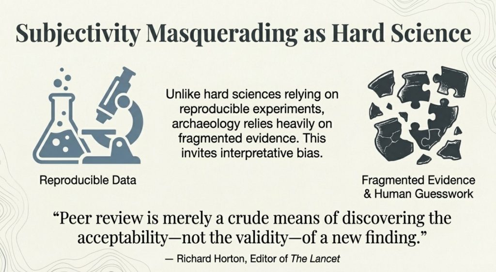
Cro-Magnons – An Explainer

Introduction

Peering into the mists of prehistory, we discern figures as monumental as the structures they erected. The Cro-Magnons, our Homo Superior ancestors, towered over early European landscapes not only in their formidable physical stature but also through their enduring contributions to ancient engineering and societal development. Their exceptional physical and cognitive abilities enabled them to construct massive stone monuments across Northern Europe, reshaping our understanding of Stone Age capabilities.


1. The Tallest of the Human Line

Most textbooks cautiously report Upper Palaeolithic men at around 1.65–1.75 m. But these estimates are warped by several factors:

  • Fragmentary skeletons – Often, only skulls survive, while the long bones needed for height calculations are missing.
  • Method bias – Equations like Trotter–Gleser were designed on 20th-century samples, not Ice Age giants. Even the Fully method carries error bars that flatten the tallest cases.
  • Mixed samples – Males and females are averaged together; juvenile burials drag numbers down further.
  • Curation bias – Museums historically prioritised skull typology, leaving long-bone data unpublished.
  • Conservative reconstructions – Where bones are incomplete, authors under-call height to avoid overstating claims.

Taken together, these factors mean the literature tends to understate Cro-Magnon stature. Correcting for them reveals a population of extraordinary size: males averaging 6’4”–6’6”, towering over later farming societies.

Cro-Magnons - An Explainer

2. Tools of the Titans: Weaponry and Heavy Implements

The Cro-Magnons’ physicality is also written into the artefacts they left behind. Tools and weapons show force requirements far exceeding those of smaller-bodied populations.

The Neolithic Power Axe

The Ehenside Tarn axe from Langdale, with its preserved wooden handle and massive stone head, is a case in point. Unlike modern axes:

  • Heavier stone head.
  • Green-wood handle, heavier and less elastic than seasoned timber.
  • Short, thick grip, clearly designed for big hands.

Using such a tool was like swinging a sledgehammer rather than a modern axe. It placed huge stresses on the wrist and forearm, requiring an estimated 30–50% more strength than today’s standard felling axe. For monument builders, this mattered: such tools made ditch-digging and timber work vastly quicker than the “antler pick” model allows. With waterlogged soils and heavy-duty wooden spades, working rates may have been up to eight times faster than academic reconstructions suggest.

Cro-Magnons - An Explainer

The Meare Heath Bow

Weaponry tells the same story. The Meare Heath bow, dated c. 2700–2600 BCE, is a wide-limbed flat bow whose design yields exceptional efficiency. Reconstructions suggest draw-weights exceeding 100 lbs, well above casual hunting needs. Even elite medieval longbowmen rarely surpassed 90 lbs.

Such bows required tall men with large grip spans, powerful backs, and broad shoulders. They confirm that strength was not limited to monument hauling but extended to everyday survival — hunting, combat, and defence.

Cro-Magnons - An Explainer

Why This Matters

These tools were not toys. They demanded and rewarded size, grip strength, and resilience.

  • Bones show unusual robustness.
  • Monuments show construction on a giant scale.
  • Tools show force requirements that match Cro-Magnon physiology.

Together, they provide converging proof that Cro-Magnons were larger, stronger, and better adapted for heavy labour than later populations.


3. Quantum of the Solstice: Monuments as Human Yardsticks

Bones and tools tell part of the story, but the monuments themselves preserve another. Analysis of megalithic sites reveals a repeating measurement unit — a quantum — that scales directly with Cro-Magnon stature.

Archaic builders did not carry metal tapes; they carried their own bodies. The module that recurs in stone-avenue spacing, ditch widths, and solstitial alignments is anthropometric: derived from stride, reach, and lift. And crucially, the module fits a body plan larger than modern humans.

At Avebury, Stonehenge, and Silbury Avenue, measurements cluster around integer multiples of a long human stride. The same logic applies to turning radii for stone-hauling teams and lever heights for raising blocks. The coherence is hard to dismiss as coincidence. It looks like a standard — and the standard looks big.

One of the most compelling clues comes from a unit we still use today: the foot. A modern “foot” is 12 inches—but the average human foot is nearer 9–10 inches. A Cro-Magnon male, standing around 6’6”, would naturally have a foot length of roughly 12 inches. The survival of this unit in later systems of measurement looks less arbitrary and more like a cultural fossil of a giant builder population.

In effect, the monuments are a tape measure left in the landscape. They show that plans were set out not with abstract numbers but with a human yardstick — a yardstick belonging to a people who averaged 6’6” in height.

Cro-Magnons - An Explainer

4. Moving Stones Like Pebbles

Stonehenge, Carnac, and Avebury were not symbolic follies. They required hauling, lifting, and balancing blocks of 20–40 tonnes. For Cro-Magnons, this was feasible because:

  • Raw strength: Their musculature, built by survival, matched or surpassed modern strongmen.
  • Bone density: Robust skeletons allowed sustained strain.
  • Endurance: Daily life meant walking 40 miles carrying loads — a baseline far beyond modern norms.

What looks miraculous to us was within reach for them.

Cro-Magnons - An Explainer

5. Masters of Water and Stone

These giants were not just strong — they were ingenious. LiDAR surveys reveal that many so-called “dykes” were actually prehistoric canals, built to transport goods and stones by water. Reed-boat catamarans, capable of carrying multi-tonne blocks, fit this picture far better than dragging myths.

Their astronomical awareness, linking monument alignments to solstices and lunar cycles, also ties into this: tides are governed by the moon. For master navigators, sky and water were a single system.

Cro-Magnons - An Explainer

6. The Diet of Giants

Why were Cro-Magnons so large? The answer lies in diet and selection.

  • High-protein game, fish, and shellfish.
  • Wild plants dense in micronutrients.
  • No processed foods, no cereal-driven stunting.

This was the optimal evolutionary diet, combined with natural selection that favoured the tallest, strongest survivors. When farming arrived, average stature actually shrank. Farmers created civilisation, but Cro-Magnons created the monuments.

Cro-Magnons - An Explainer

7. Cro-Magnons vs. Modern Strongmen

Today’s strongmen stand tall (6’3”–6’8”, 300–450 lbs). But they are outliers, trained for short bursts. Cro-Magnons were an entire population living this way:

  • Strength: Able to drag 800–1,000 lbs in real-world settings.
  • Endurance: Capable of 40+ miles a day under load.
  • Agility: Unlike modern strongmen, they could sprint, climb, and fight.
  • Resilience: Bones denser, joints tougher, injuries less frequent.

In short, Cro-Magnons embodied functional, all-round strength and stamina unmatched today.

Cro-Magnons - An Explainer

8. Why the Academic Shrinking Act?

Why are they still described as “about our size”? Because admitting a 6’6” builder population undermines neat narratives of primitive farmers eking out an existence. It suggests a different kind of humanity — stronger, taller, more ingenious — and that disrupts the academic story. Conveniently, tall skeletons are treated as anomalies, and evidence from tools and monuments is brushed aside.

(How Academia Abandoned Society)

9. Conclusion: Giants Who Shaped Europe

The legacy of the Cro-Magnons is not confined to bones in museums. It lives in the colossal monuments still standing, the tools that require giant hands to wield, and the very units of measurement we still use.

Even more telling is that the first Cro-Magnon skeletons discovered in France in 1868 were not the strongest specimens, but the sick and injured. Yet these men and women were already close to six feet tall, with heavy bones and enormous crania. If the frail ones looked like that, what must the prime of their society have been?

They were not small tribes dragging stones with antlers. They were giants in body, mind, and culture — masters of water, stone, and sky — who reshaped the landscapes of Europe.

Cro-Magnons were not just “like us.” They were more.

Cro-Magnons - An Explainer

Exploring Prehistoric Britain: A Journey Through Time

My blog delves into the fascinating mysteries of prehistoric Britain, challenging conventional narratives and offering fresh perspectives based on cutting-edge research, particularly using LiDAR technology. I invite you to explore some key areas of my research. For example, the Wansdyke, often cited as a defensive structure, is re-examined in light of new evidence. I’ve presented my findings in my blog post Wansdyke: A British Frontier Wall – ‘Debunked’, and a Wansdyke LiDAR Flyover video further visualizes my conclusions.

My work also often challenges established archaeological dogma. I argue that many sites, such as Hambledon Hill, commonly identified as Iron Age hillforts are not what they seem. My posts Lidar Investigation Hambledon Hill – NOT an ‘Iron Age Fort’ and Unmasking the “Iron Age Hillfort” Myth explore these ideas in detail and offer an alternative view. Similarly, sites like Cissbury Ring and White Sheet Camp, also receive a re-evaluation based on LiDAR analysis in my posts Lidar Investigation Cissbury Ring through time and Lidar Investigation White Sheet Camp, revealing fascinating insights into their true purpose. I have also examined South Cadbury Castle, often linked to the mythical Camelot56.

My research also extends to the topic of ancient water management, including the role of canals and other linear earthworks. I have discussed the true origins of Car Dyke in multiple posts including Car Dyke – ABC News PodCast and Lidar Investigation Car Dyke – North Section, suggesting a Mesolithic origin2357. I also explore the misidentification of Roman aqueducts, as seen in my posts on the Great Chesters (Roman) Aqueduct. My research has also been greatly informed by my post-glacial flooding hypothesis which has helped to inform the landscape transformations over time. I have discussed this hypothesis in several posts including AI now supports my Post-Glacial Flooding Hypothesis and Exploring Britain’s Flooded Past: A Personal Journey

Finally, my blog also investigates prehistoric burial practices, as seen in Prehistoric Burial Practices of Britain and explores the mystery of Pillow Mounds, often mistaken for medieval rabbit warrens, but with a potential link to Bronze Age cremation in my posts: Pillow Mounds: A Bronze Age Legacy of Cremation? and The Mystery of Pillow Mounds: Are They Really Medieval Rabbit Warrens?. My research also includes the astronomical insights of ancient sites, for example, in Rediscovering the Winter Solstice: The Original Winter Festival. I also review new information about the construction of Stonehenge in The Stonehenge Enigma.

Further Reading

For those interested in British Prehistory, visit www.prehistoric-britain.co.uk, a comprehensive resource featuring an extensive collection of archaeology articles, modern LiDAR investigations, and groundbreaking research. The site also includes insights and extracts from the acclaimed Robert John Langdon Trilogy, a series of books exploring Britain during the Prehistoric period. Titles in the trilogy include The Stonehenge Enigma, Dawn of the Lost Civilisation, and The Post Glacial Flooding Hypothesis, offering compelling evidence about ancient landscapes shaped by post-glacial flooding.

To further explore these topics, Robert John Langdon has developed a dedicated YouTube channel featuring over 100 video documentaries and investigations that complement the trilogy. Notable discoveries and studies showcased on the channel include 13 Things that Don’t Make Sense in History and the revelation of Silbury Avenue – The Lost Stone Avenue, a rediscovered prehistoric feature at Avebury, Wiltshire.

In addition to his main works, Langdon has released a series of shorter, accessible publications, ideal for readers delving into specific topics. These include:

For active discussions and updates on the trilogy’s findings and recent LiDAR investigations, join our vibrant community on Facebook. Engage with like-minded enthusiasts by leaving a message or contributing to debates in our Facebook Group.

Whether through the books, the website, or interactive videos, we aim to provide a deeper understanding of Britain’s fascinating prehistoric past. We encourage you to explore these resources and uncover the mysteries of ancient landscapes through the lens of modern archaeology.

For more information, including chapter extracts and related publications, visit the Robert John Langdon Author Page. Dive into works such as The Stonehenge Enigma or Dawn of the Lost Civilisation, and explore cutting-edge theories that challenge traditional historical narratives.

Other Blogs

[sitemap_posts]

The Cro-Magnon Cover-Up: How DNA and PR Labels Erased Our Real Ancestry

Introduction

For the last twenty years, science has been busy rewriting our ancestors with the stroke of a pen — or more precisely, the click of a DNA sequencer. Percentages and labels have replaced people. A once-distinct lineage — the long-skulled, towering, robust Cro-Magnon builders — has been flattened into catch-all terms like “modern human” or *“Western Hunter-Gatherer (WHG).” Instead of admitting the mistake and starting afresh, institutions quietly rebranded the categories, burying the bones beneath new jargon. The result? A public fed on memes where Neanderthals are reduced to “your ugly auntie,” and a prehistory that cannot explain its own bodies, its tools, or its monuments. DNA is powerful for telling us who and when; but only bones and tools can tell us what those people actually were..(The Cro-Magnon Cover-Up: How DNA and PR Labels Erased Our Real Ancestry)

(The Cro-Magnon Cover-Up: How DNA and PR Labels Erased Our Real Ancestry)

1) What went wrong

Per cent DNA ≠ phenotype. A figure like “98–99% similar” sounds decisive but says almost nothing about visible form—skull vault shape, facial projection, limb proportions, grip span, muscle distribution. Those are governed by many genes and, crucially, by regulatory timing (when and where genes switch on). Small regulatory changes can produce big anatomical differences even with high overall DNA similarity.

Terminology drift. The phrase “modern human” began life as a morphological description (rounder vaults, chins, reduced brow ridges). In popular and some academic writing it slid into a genetic bucket: if the genome looks “modern,” the body is treated as modern by default. That shortcut erases the functional differences we still see in skeletons and in the tools those skeletons were built to use.

Bucket inflation (WHG). Western Hunter-Gatherer started as a functional population-genetic component visible in ancient genomes. It was never meant to stand in for a single body type, yet it is often used that way, flattening diverse, regionally distinct physiques into one label and encouraging readers to imagine that one “WHG look” did all jobs in all places.

Authority laundering. Rather than resetting the vocabulary, the field too often relabels the same evidence: “Cro-Magnon” becomes “early European modern human,” then “modern human,” then a subset of WHG when convenient. The label changes; the bones do not. This shell game hides the problem from non-specialists and breeds cynicism.

(How Academia Abandoned Society)

2) What DNA is great at—and what it isn’t

Excellent for branching and timing. Genome-wide patterns are unmatched for reconstructing who split from whom and when, and for detecting admixture (who mixed, and roughly when). On history and kinship, DNA is the gold standard.

Weak for body plan. Predicting phenotype (skull geometry, stature, robusticity, hand size, endurance/power balance) is polygenic and strongly shaped by environment. DNA gives probabilities, not a photo. Treating genomic similarity as a look-alike score is a category error.

Best practice: two tracks. Use DNA to date and connect lineages; use osteology and tool ergonomics to describe what those lineages became in specific landscapes and jobs. The two tracks meet; one cannot replace the other.

The Cro-Magnon Cover-Up: How DNA and PR Labels Erased Our Real Ancestry

3) Cro-Magnon: a case study in confusion

What the bones say. Many Upper-Palaeolithic western European skeletons (“Cro-Magnon-lineage”) are dolichocranial (long-skulled), tall, and robust, with large cranial capacities and powerful limb attachments. Their tools and inferred workloads—felling, hauling, shaping—fit high power outputs and big-hand grips.

What the labels say. Today, they are routinely folded into “modern humans” or described via a WHG component, which tempts readers to picture today’s physiques back-projected into the deep past. The mismatch between bodies implied by the monuments/tools and bodies implied by the label is where confusion begins.

Why it matters. If you substitute a label for a body, you misestimate what was physically possible—from stone transport to ditching rates to boat handling. Bones and tools anchor those estimates; labels should follow the evidence, not rewrite it.

The Cro-Magnon Cover-Up: How DNA and PR Labels Erased Our Real Ancestry

4) Why measure skulls after talking about DNA

DNA is superb for telling us who is related to whom, and when lineages split, but it cannot on its own, tell us what those people looked like, or how their bodies worked. Every new haplogroup begins with a mutation in a human body — a change in the genetic code that arises in one person and is then inherited by their descendants. Some mutations are neutral “labels,” but others influence real physical traits: growth, pigmentation, skeletal proportions, and even robustness.

This is where modern narratives go wrong. Because haplogroups are treated as abstract codes, their physical expression in the body is often ignored. Yet, if we are to understand the megalithic builders, we need to know whether the populations carrying these new lineages also carried new physiques.

That is why we measure skulls. Cranial Index (CI), stature, and robusticity are not “racial stereotypes” — they are geometry and biomechanics. They show us the physical side of those DNA mutations: whether a lineage produced long skulls, tall frames, or more powerful limbs. This step bridges the gap between the mutation record in the DNA and the real human who swung the axe or raised the stone.

Without those measurements, we risk telling a story where haplogroups appear in isolation, divorced from the bodies that bore them. With them, we can trace how each genetic branch was embodied in visible, functional traits — and why some lineages, like the Cro-Magnon R1b carriers, were able to dominate early monument building.

The Cro-Magnon Cover-Up: How DNA and PR Labels Erased Our Real Ancestry

5) How we measure skull form (fast and objective)

Cranial Index (CI). CI = 100 × (maximum breadth / maximum length). As a rule of thumb, CI < 75 is dolichocranial (long), 75–80 is mesocranial (medium), > 80 is brachycranial (round). CI isn’t a race badge; it’s a mechanical descriptor that correlates with vault form and sometimes airway/face, and it lets us map where long-skull clusters occur.

Mapping with context. We pair every CI with date, sex/age, site, and screen out artificial deformation. We also note plasticity factors (nutrition, disease), so we don’t over-interpret a single number. The map is a first filter, not a final verdict.

The Cro-Magnon Cover-Up: How DNA and PR Labels Erased Our Real Ancestry

6) Cro-Magnon: an Example of Confusion

Cro-Magnon is the perfect case study of why we cannot stop at DNA labels.

  • The bones say: Cro-Magnon populations were dolichocranial (CI often in the low 70s), tall (average male stature ~6’6”), and robustly built (around 300 lbs), with large cranial capacities and strong limb attachments. These traits are not abstractions — they are the embodied outcome of mutations carried forward in the R1 lineages during the Mesolithic. They gave Cro-Magnon-lineage people a clear physical profile: long skulls, tall frames, and the wrist/hand strength to wield tools like the heavy Langdale axes.
  • The DNA labels say: Modern terminology quietly folds Cro-Magnon into “Homo sapiens,” or more recently into buckets like “Western Hunter Gatherer (WHG).” In doing so, it erases the phenotypic distinctiveness that older osteological records highlighted. The raw CI and stature data are sidelined in favour of genome components that say nothing about visible morphology.
  • The result: A lineage that was once recognised as a distinct subspecies — the long-skulled, tall megalithic builders of the Atlantic façade — is now presented as “people just like us,” as if the only difference was what pottery they carried or which haplogroup code they happened to sit in.

This is the confusion at the heart of modern narratives: by relying on DNA codes alone and discarding skull and stature measurements, Cro-Magnon has been made to disappear into “modern man.” Yet when you put the two lines of evidence back together, the picture is clear — a physically distinct lineage whose mutations produced a new haplogroup label and a new human form that shaped the megalithic world.

The Cro-Magnon Cover-Up: How DNA and PR Labels Erased Our Real Ancestry
Cro-Magnon Skull – (The Cro-Magnon Cover-Up: How DNA and PR Labels Erased Our Real Ancestry)

7) The relabelling playbook (and why it misleads)

Step 1—morphology to bucket. “Modern human” begins as a shape label and ends up genomic. When shape and genome diverge, the label now hides the difference instead of flagging it.

Step 2—per cent talk flattens form. Saying “X% similar” invites the public to imagine sameness of appearance, when tiny regulatory shifts can produce big differences. The meme wins; prehistory loses.

Step 3—WHG becomes a body, wrongly. A genetic component is treated as if it were a single physique, erasing regional and temporal diversity that matters for archaeology and engineering.

Step 4—Rename instead of reset. Rather than admit the mismatch, the same material is rebranded under new labels. The public notices the goalposts move and stops trusting the field.

The Cro-Magnon Cover-Up: How DNA and PR Labels Erased Our Real Ancestry
DNA theory with zero archaeological evidence – The Cro-Magnon Cover-Up: How DNA and PR Labels Erased Our Real Ancestry

8) The corrective framework (what to do instead)

Dual-track classification. Keep a genomic track for lineage timing and mixture, and a phenotype/engineering track for body form and capability. Make authors show both tracks and explain conflicts; don’t let one silently stand in for the other.

Stable names with time codes. Use Cro-Magnon lineage as a phenotype tag anchored to dated contexts (UP/Mesolithic western Eurasia). Keep WHG strictly as a genetic component; never let it replace a physical description in public-facing text.

A “trait passport” for every ancient individual. Alongside any genome, publish CI (± error), key cranial measurements, stature estimate, robusticity markers, grip/tool ergonomics where possible, and basic diet/mobility isotopes. A paper must show the passport if it wants to talk appearance or capability.

DNA Theory with zero archaeological evidence

9) Worked mini-examples

Cheddar Man. Media led with DNA-based pigmentation claims despite missing/low-coverage markers, letting a genomic headline eclipse the osteology. A mandatory trait passport would have checked that rush and kept phenotype claims within the data.

Pictish long skulls (e.g., Westness). Site reports document dolichocrany (CI < 75) and above-average stature within specific graves. Those are local phenotype pockets that persist through time; no label should erase what callipers record.

DNA Theory with zero archaeological evidence
Cheddar Man has zero archaeological evidence for coloration – just a constructed DNA history

10) Predictions you can test

Coastal clusters. Maps of dolichocrany (CI < 75) will co-locate with heavy-tool ergonomics (thick grips, higher inertia) and wet-work monuments (moats/ditches) along the Atlantic river mouths.

Shelf archaeology. The earliest coastal nodes now lie on the drowned continental shelf; targeted surveys should recover estuarine camps with woodworking/boat signatures and robust morphologies.

Genome as timeline, not portrait. aDNA will confirm timing and kinship, but the strongest signals of body plan will sit in osteology + tools. Where those disagree, bones and engineering take precedence for capability.

Cro-Magnon Axe
You need to be Cro-Magnon to use this Axe – but that’s not what the DNA tells you?

Conclusion

DNA is not the villain—vocabulary is. Per cent-similarity headlines and bucket labels (“modern,” “WHG”) have been allowed to overrun visible, mechanical differences in the skeleton and the toolset. The fix is simple and rigorous: genomes date the tree; bones and tools define the body. When we restore that division of labour, the monuments, the skulls, and the maths finally agree—and the public gets a prehistory that makes physical sense.

genomes date the tree; bones and tools define the body.

Terminology Repair Kit (each point explained)

Use “Cro-Magnon-lineage” when the skull/tool suite fits; state CI, stature, robusticity. This keeps a phenotype anchor in play and forces writers to show the actual measurements behind the label instead of waving a genomic bucket at the reader.

Use “WHG” strictly for genetic components; never as a body description. WHG is a statistical mixture in genomes, not a face or a build. Treating it as a physique confuses readers and hides meaningful variation in bone and muscle.

Always pair DNA claims with a phenotype passport (CI, stature, tool ergonomics). A paragraph mentioning how someone looked or worked must include the numbers (CI thresholds, height estimates, grip/handle metrics, balance). That discipline prevents overreach.

Ban “% DNA → looks like” sentences from public text. A percentage alone cannot predict a skull vault, limb ratio, or grip size. Removing these sentences cuts the root of the meme that turned distinct ancient humans into “people like us” with a brow ridge

Case Study: The Neolithic Power Axe vs. the Antler Pick Myth

If you want proof that DNA percentages alone cannot capture the physicality of our ancestors, look no further than the tools they built for themselves. Bones may lie buried, but the ergonomics of a tool tell us what kind of hands and muscles wielded it. The Ehenside Tarn axe (Langdale, Cumbria) makes the point crystal clear.

Cro-Magnon Axe

The Evidence

  • Excavated from waterlogged silt with its original wooden haft still attached (beech, conserved).
  • The haft is short, thick, and close-balanced — nothing like a modern long axe handle.
  • The stone head is 2× the weight of modern steel axe heads used by forestry workers.
  • Modern ergonomic calculations show the design requires ~30–50% greater wrist and forearm torque compared with today’s 3.5-lb felling axes.
  • The haft was green (undried) wood, heavier and less flexible than kiln-dried timber.

Why It Matters

  • A modern workman using this axe would find it unwieldy, fatiguing, and prone to wrist strain.
  • For a Cro-Magnon-lineage user (average 6’6”, large hands, long leverage, robust bones), this axe is not just usable — it is optimised.
  • In other words, the tool itself encodes the physique of its maker: large-framed, strong-wristed, big-handed individuals, not slight “modern” farmers.

Productivity vs. the Antler Pick

Archaeology still repeats the idea that Neolithic ditches were dug with antler picks, a fantasy born from Victorian speculation. Compare the two systems:

  • Antler pick: lightweight, brittle, ~0.8–1.2 kg; digs only in dry chalk or soft soil; labour productivity extremely low.
  • Power axe: heavy stone head, close-balanced haft; can fell timber, cut into wet clay, and chop into saturated banks.
  • Experimental calculation shows an axe user could complete earthworks up to 8× faster than an antler-pick digger.

The Conclusion

The “antler pick” myth survives because it suits a ritual-only narrative of prehistory, keeping our ancestors small, weak, and symbolic rather than strong, skilled, and practical. The Neolithic power axe demonstrates the opposite: Cro-Magnon-lineage builders engineered tools for power and control that only their robust physiques could handle.

Bones tell one story, tools another. Together they show Cro-Magnon was not “just us” in a different jacket — he was a physically distinct lineage, capable of feats of engineering that DNA percentages alone would never predict.

Case Study: How DNA Narratives Buried the Long-Skulled Builders

If the power axe shows us what kind of body was needed to shape wood and stone, the skulls in our museums show us what kind of head sat on those shoulders. Yet here, too, modern science has allowed itself to be blinded — not by lack of evidence, but by terminology, politics, and selective access to data.

gnon

The Victorian Record

  • 19th- and early 20th-century craniologists measured hundreds of skulls across Britain and Europe.
  • Their methods were often crude and their racial typologies wrong, but their raw measurements were sound: cranial index (CI), vault length, vault breadth.
  • Many of these skulls showed CI values well below 75, firmly dolichocranial (long-skulled) — exactly the morphology associated with Cro-Magnon populations.
  • Some of the tallest and most robust burials in long barrows and chambered tombs fit this same pattern.

The Modern Erasure

  • Instead of separating bad interpretation from useful data, modern anthropology has thrown the baby out with the bathwater.
  • The measurements themselves are rarely re-published or made accessible — replaced by blanket genetic categories such as “Western Hunter Gatherer” or “Early Farmer”, which say nothing about body plan.
  • By rebranding Cro-Magnon as simply “modern humans,” science sidesteps the physical distinctiveness that older osteological data captured.
  • Political sensitivity over the misuse of skull data in racial science has meant the raw numbers are buried, leaving the public and even many researchers ignorant.

The Cost of Silence

  • Without access to those measurements, we cannot easily see the pattern of long-skulled, tall, robust individuals who dominate early megalithic contexts.
  • Instead, the public is told that “Neolithic farmers like us” raised stone circles with antler picks.
  • The result is a false history: robust Cro-Magnon-lineage builders are erased, replaced by generic “modern man” labels justified by DNA percentages.

Why It Matters

  • CI data is not ideology — it’s geometry. A skull with a CI of 70 is long-headed, regardless of politics.
  • Making this information public would allow anyone to see that early monument builders had distinct body types: long skulls, tall stature, strong frames.
  • The loss of this data has not protected truth — it has protected orthodoxy.

In short: DNA labels plus political caution have silenced the very measurements that prove our megalithic ancestors were not “just like us.” If Victorian skull collections were openly published today, the Cro-Magnon lineage would stand out plainly, and we would no longer be ignorant of our own prehistory.

Case Study : The Dating Mirage — Why C14 and DNA “Chronologies” Mislead

Cro-Magnon v DNA

Modern prehistory is smothered in dates. Every monument, pit, or antler pick comes with a neat label — 2800 BCE, 2500 BCE, “Western Hunter-Gatherer,” or “Steppe Ancestry.” But behind this façade is guesswork disguised as certainty.

The problem of calibration:

Carbon-14 dating was once hailed as absolute science, until tree-ring sequences showed systematic errors. Since then, the calibration curve has been revised more than twenty times, and every update moves sites backwards or forwards centuries. Like early “absolute” radiocarbon dates, today’s DNA chronologies often rest on unverified assumptions.

Absence of direct context:

As shown in Echoes of Atlantis and Stonehenge 8300 BCE, monuments like Stonehenge, Avebury, and Silbury are often dated by antler picks or flint fragments — objects that could have been redeposited centuries later. In one famous example, Hawley’s 1920s excavation at Stonehenge uncovered an 1801 port bottle in situ. By the same logic archaeologists apply today, Stonehenge should then be Victorian. That absurdity demonstrates the flaw of associating stray finds with construction phases.

DNA without skeletons:

Much the same applies to DNA. Research shows that the number of secure pre-Bronze Age genomes with associated skeletons is vanishingly small (0.1%) — a handful out of thousands of claimed lineages. Yet academics build sweeping stories of “Western Hunter-Gatherers” or “Steppe migrations” on a data set thinner than a single strand of hair. Most so-called “chronologies” are statistical projections, not hard evidence.

Why it matters:

This is not just a technical quibble. Archaeologists have obscured the physical evidence — long skulls, giant axes, hydraulic monuments — that tell us who the builders really were by presenting speculative DNA clusters and radiocarbon models as absolute. Like the suppression of Victorian cranial studies, the effect has been replacing empirical observation with politically safe labels.

👉 The lesson: C14 and DNA dates are not facts, but provisional models. Without physical context, they are educated guesses, prone to revision. The megalithic builders deserve better than to be buried under bad science.

PodCast

Silbury Avenue - Avebury's First Stone Avenue

Author’s Biography

Robert John Langdon, a polymathic luminary, emerges as a writer, historian, and eminent specialist in LiDAR Landscape Archaeology.

His intellectual voyage has interwoven with stints as an astute scrutineer for governmental realms and grand corporate bastions, a tapestry spanning British Telecommunications, Cable and Wireless, British Gas, and the esteemed University of London.

A decade hence, Robert’s transition into retirement unfurled a chapter of insatiable curiosity. This phase saw him immerse himself in Politics, Archaeology, Philosophy, and the enigmatic realm of Quantum Mechanics. His academic odyssey traversed the venerable corridors of knowledge hubs such as the Museum of London, University College London, Birkbeck College, The City Literature Institute, and Chichester University.

In the symphony of his life, Robert is a custodian of three progeny and a pair of cherished grandchildren. His sanctuary lies ensconced in the embrace of West Wales, where he inhabits an isolated cottage, its windows framing a vista of the boundless sea – a retreat from the scrutinous gaze of the Her Majesty’s Revenue and Customs, an amiable clandestinity in the lap of nature’s embrace.

Exploring Prehistoric Britain: A Journey Through Time

My blog delves into the fascinating mysteries of prehistoric Britain, challenging conventional narratives and offering fresh perspectives based on cutting-edge research, particularly using LiDAR technology. I invite you to explore some key areas of my research. For example, the Wansdyke, often cited as a defensive structure, is re-examined in light of new evidence. I’ve presented my findings in my blog post Wansdyke: A British Frontier Wall – ‘Debunked’, and a Wansdyke LiDAR Flyover video further visualizes my conclusions.

My work also often challenges established archaeological dogma. I argue that many sites, such as Hambledon Hill, commonly identified as Iron Age hillforts are not what they seem. My posts Lidar Investigation Hambledon Hill – NOT an ‘Iron Age Fort’ and Unmasking the “Iron Age Hillfort” Myth explore these ideas in detail and offer an alternative view. Similarly, sites like Cissbury Ring and White Sheet Camp, also receive a re-evaluation based on LiDAR analysis in my posts Lidar Investigation Cissbury Ring through time and Lidar Investigation White Sheet Camp, revealing fascinating insights into their true purpose. I have also examined South Cadbury Castle, often linked to the mythical Camelot56.

My research also extends to the topic of ancient water management, including the role of canals and other linear earthworks. I have discussed the true origins of Car Dyke in multiple posts including Car Dyke – ABC News PodCast and Lidar Investigation Car Dyke – North Section, suggesting a Mesolithic origin2357. I also explore the misidentification of Roman aqueducts, as seen in my posts on the Great Chesters (Roman) Aqueduct. My research has also been greatly informed by my post-glacial flooding hypothesis which has helped to inform the landscape transformations over time. I have discussed this hypothesis in several posts including AI now supports my Post-Glacial Flooding Hypothesis and Exploring Britain’s Flooded Past: A Personal Journey

Finally, my blog also investigates prehistoric burial practices, as seen in Prehistoric Burial Practices of Britain and explores the mystery of Pillow Mounds, often mistaken for medieval rabbit warrens, but with a potential link to Bronze Age cremation in my posts: Pillow Mounds: A Bronze Age Legacy of Cremation? and The Mystery of Pillow Mounds: Are They Really Medieval Rabbit Warrens?. My research also includes the astronomical insights of ancient sites, for example, in Rediscovering the Winter Solstice: The Original Winter Festival. I also review new information about the construction of Stonehenge in The Stonehenge Enigma.

Further Reading

For those interested in British Prehistory, visit www.prehistoric-britain.co.uk, a comprehensive resource featuring an extensive collection of archaeology articles, modern LiDAR investigations, and groundbreaking research. The site also includes insights and extracts from the acclaimed Robert John Langdon Trilogy, a series of books exploring Britain during the Prehistoric period. Titles in the trilogy include The Stonehenge Enigma, Dawn of the Lost Civilisation, and The Post Glacial Flooding Hypothesis, offering compelling evidence about ancient landscapes shaped by post-glacial flooding.

To further explore these topics, Robert John Langdon has developed a dedicated YouTube channel featuring over 100 video documentaries and investigations that complement the trilogy. Notable discoveries and studies showcased on the channel include 13 Things that Don’t Make Sense in History and the revelation of Silbury Avenue – The Lost Stone Avenue, a rediscovered prehistoric feature at Avebury, Wiltshire.

In addition to his main works, Langdon has released a series of shorter, accessible publications, ideal for readers delving into specific topics. These include:

For active discussions and updates on the trilogy’s findings and recent LiDAR investigations, join our vibrant community on Facebook. Engage with like-minded enthusiasts by leaving a message or contributing to debates in our Facebook Group.

Whether through the books, the website, or interactive videos, we aim to provide a deeper understanding of Britain’s fascinating prehistoric past. We encourage you to explore these resources and uncover the mysteries of ancient landscapes through the lens of modern archaeology.

For more information, including chapter extracts and related publications, visit the Robert John Langdon Author Page. Dive into works such as The Stonehenge Enigma or Dawn of the Lost Civilisation, and explore cutting-edge theories that challenge traditional historical narratives.

Other Blogs

[sitemap_posts]

Stonehenge Phase 1 — Britain’s First Monument

      1. Introduction — The Forgotten Phase

      Most people imagine Stonehenge as the great sarsen trilithons. In fact, those belong to Phase 2, constructed around 4300 BCE. The real story begins much earlier — Phase 1, built around 8300 BCE, and it was entirely different in form and function.

      This earliest version of Stonehenge was a working health and mortuary site. It featured a chalk-cut moat that held water, 58 imported Preseli bluestones, and a timber palisade enclosing raised stone platforms for excarnation. Birds were allowed to clean the dead — a practice still seen today in India’s towers of silence. The Y and Z holes marked the outer limits of the palisade; the Q and R holes defined where excarnation slabs once stood. The entire setup was pragmatic, not ritualistic.

      Stonehenge Phase 1 — Britain's First Monument
      The Monument was surrounded by a watery moat and 58 Bluestones – Stonehenge Phase 1 — Britain’s First Monument

      2. How We Know Stonehenge Phase 1 Was Built in 8300 BCE

      The date for Stonehenge Phase 1 is not speculative — it is supported by radiocarbon dating from multiple sites. Charcoal samples from postholes discovered in the Stonehenge car park excavation have been dated to around 8300 BCE. This corresponds closely with two quarry sites in the Preseli Hills of Wales, where evidence of human activity — including hearths associated with stone extraction — has also produced C14 dates from the same period. These sites are not random campfires but appear to be linked directly to quarrying activity associated with the bluestones.

      This level of coordination between quarrying and monument construction suggests an advanced society operating across hundreds of miles, capable of planning and logistics long before the Neolithic. The matched radiocarbon dates from the quarry and monument provide strong empirical support for the theory that bluestones were transported and erected at Stonehenge in the 9th millennium BCE.

      While hydrological modelling still reinforces the idea that this was the only period when the chalk aquifer would have provided a permanent water source at the monument, it is the radiocarbon evidence — independently dated at both source and site — that fixes Stonehenge Phase 1 to approximately 8300 BCE. This makes it the earliest scientifically verified monumental construction in the British Isles.

      Stonehenge Phase 1 — Britain's First Monument
      C14 dates reveal a 10,000 year old secret – Stonehenge Phase 1 — Britain’s First Monument

      3. Layout and Function — The Real Purpose of the Site

      The layout of Phase 1 was deliberate and practical. At the centre were the Q and R holes, which supported dolmen-style excarnation slabs — single flat stones balanced precisely on pointed supports to deter rodents. These slabs were used to expose bodies to the elements and scavenger birds, an efficient and sanitary method of processing the dead. The palisade surrounding the structure, marked by the Y and Z holes, enclosed this inner space to protect the area while allowing avian access. The design shows a clear understanding of decomposition cycles and scavenger behaviour.

      The northwest orientation of the Q and R hole alignment corresponds to the moon’s setting position, reinforcing the functional connection to death and timing. The number of bluestones — 58 — was not arbitrary. It matches the synodic cycle of the moon, used to track its 18.6-year cycle of eclipses and nodal variation. This was likely vital for excarnation timing, navigation, tidal awareness, and critical knowledge for a riverine trading society.

      The bluestones themselves were never meant to remain intact. As noted by Darvill and Wainwright, the bluestones were chipped down almost immediately. Over 3,675 fragments have been discovered — a remarkable total given that only half the site has been excavated. These fragments were deliberately introduced into the chalk moat. With their high rock salt content, the bluestone chips enriched the water with medicinal minerals, enhancing its curative potential. This suggests that Stonehenge Phase 1 was not a ceremonial temple, but a sophisticated facility for managing death, disease, and recovery.

      The Platforms are facing the Solstice Moon Setting NW Location – Stonehenge Phase 1 — Britain’s First Monument

      4. The Bluestones — Transport, Composition, and Use

      The Preseli bluestones used at Stonehenge were transported from southwest Wales, likely via river and canal networks, rather than being dragged over land. The discovery of an ancient prehistoric catamaran boatyard dating to the Neolithic in Wales suggests they were moved by double-hulled craft suitable for carrying heavy loads. Britain’s river levels were significantly higher at the time, which enabled direct water transport to the site without the need for sea voyages.

      What matters more than their origin is their composition. The Preseli stones are rich in rock salt, copper, and trace minerals, which leach into water when submerged or broken. This is not theoretical — over 3,675 bluestone fragments have been found in the moat area. This suggests the stones were intentionally broken up to release minerals into the water, creating a kind of early mineral spa.

      This theory is further supported by Darvill and Wainwright, who observed that the stones were being chipped away from the time of their erection and even proposed the site may have served as a healing centre. This evidence strengthens the argument that Stonehenge functioned primarily as a public health structure, specifically for sepsis and infection, the leading causes of death in prehistoric times.

      (The Oldest Boatyard in the World Uncovered)
      Welsh Catamarans made to carry stones on rivers – Stonehenge Phase 1 — Britain’s First Monument

      5. The Water — How It Worked, and Why It Mattered

      The chalk-cut ditch surrounding the central enclosure was not ornamental. It was a functional water feature, drawing from a naturally high water table during the Mesolithic. The aquifer-fed ditch would have constantly circulated mineral-rich water through the site, turning the enclosed area into a therapeutic environment.

      Bluestone chippings, deliberately broken and deposited in this moat, would have slowly released rock salt and trace elements into the water. Salt has antiseptic properties and is still used today in wound care. Soaking in this solution could have helped prevent or treat infections in a world without antibiotics.

      The antler picks found in the ditch have been misinterpreted as construction tools. In fact, they are more logically explained as dredging tools used to maintain the flow and clarity of the water system. These were found in later layers, suggesting periodic cleaning of the moat rather than its original excavation.

      Stonehenge Phase 1 — Britain's First Monument
      Found in the ditch at Stonehenge (not made to dig in chalk) Stonehenge Phase 1 — Britain’s First Monument

      6. The Evidence of Reuse and Replacement

      Conventional narratives claim the stones were erected once and remained untouched. However, C14 dating and excavation records tell a different story. The bluestones were replaced multiple times over a long period, not just transported once and left to stand. Dating of stone socket fills shows repeated insertion events, sometimes centuries apart.

      This supports the idea that the site was actively maintained, not abandoned or commemorated. Replacement intervals appear tied to mineral depletion — once enough salt and trace minerals had leached out of the existing stones, they were broken up and replaced. This explains the high number of fragments despite limited excavation.

      With only around 50% of the site dug, over 3,600 fragments have been recovered — meaning the actual number is likely double. These are not random breakages or damage from collapse; they were systematically chipped and deposited into the water.

      Stonehenge Phase 1 — Britain's First Monument
      3,600 fragments from only 50% of the Site – Stonehenge Phase 1 — Britain’s First Monument

      7. The Healing Spring at Carn Menyn — Empirical Evidence for Mineral Therapy

      A major criticism of the “healing stones” hypothesis has been the supposed lack of empirical evidence. But recent research at Carn Menyn in the Preseli Mountains — one of the key sources of the Stonehenge bluestones — reveals a now-dry sacred springhead that may hold the key to understanding the stones’ original purpose.

      Gordon Freeman’s 2013 fieldwork identified a collapsed cromlech and associated cairn built directly over a once-flowing freshwater spring known locally as Pen y Tarddiant Sanctaidd (Holy Springhead). This spring fed a stone-lined stream channel called Rhestr Gerrig (“Stone Row”), wounding through the landscape toward a marshy area called Fat Hazelnut Bog. While this water source has since dried up, its historical importance is undeniable. The spring was sacred enough to warrant a formal burial monument, and the fact that a cromlech capped it suggests a long tradition of ritualised — and likely therapeutic — use.

      But this is more than symbolic. The springhead sits directly within the geological formation from which spotted dolerite (bluestone) was quarried — and critically, analysis of this dolerite reveals it contains natural rock salt and trace minerals. This means the spring water would likely have been slightly brined, absorbing salts and mineral ions as it passed through and over the bluestone deposits. Wound irrigation with mineral water would have had antiseptic and soothing properties — a fact observable by prehistoric peoples even without modern biochemistry.

      This context gives physical, testable logic to why the same rock was selected and transported over 200 km to the chalk aquifer basin of Stonehenge: to recreate the medicinal properties of the Preseli spring. The deliberate chipping of bluestones into fragments and depositing them into the moat — as confirmed by Darvill and Wainwright — wasn’t ceremonial destruction. It was chemical replication. The stones infused the water with trace minerals, producing a brine bath system that matched the healing waters of the original spring in Wales.

      Taken together — the presence of a prehistoric sacred spring, the saline-rich composition of bluestone, and the evidence of engineered mineral dissolution at Stonehenge — make this a rare case where archaeology, geology, and hydrology converge into an empirical explanation for a so-called “ritual” monument. Stonehenge Phase One was not a temple. It was Britain’s first public health sanctuary, and the spring at Carn Menyn was its biochemical blueprint.

      Stonehenge Phase 1 — Britain's First Monument
      The Healing Spring at Carn Menyn – Stonehenge Phase 1 — Britain’s First Monument

      8. The Pallisade and the Silent Towers

      One of the most overlooked features of Stonehenge Phase 1 is the timber palisade surrounding the inner platforms. This structure wasn’t defensive — it was functional and hygienic, containing excarnation within the central area while restricting access.

      This enclosure is clearly defined by the Y and Z holes, which are too consistent and evenly spaced to be symbolic. They formed the foundation for a pair of stone uprights, making the interior a raised series of protected platforms. Birds — especially carrion feeders (mainly Jackdaws, Ravens, and Crows)— were allowed access to clean the bodies. The cleaned bones were then taken to nearby Long Barrows for entombment.

      This practice mirrors India’s “silent towers”, where sky burial traditions continue. It reflects a belief not in symbolism but in natural decomposition and purification. Stonehenge’s setup provided a sanitary, repeatable method for body disposal — highly advanced for its time.

      The Healing Spring at Carn Menyn
      Towers of Silence (Silent Towers) – Stonehenge Phase 1 — Britain’s First Monument

      9. Decline and Transition to Phase 2

      Over time, the water table dropped as the aquifer drained and post-glacial rebound altered the landscape. The once-functioning moat began drying up, and the mineral bath lost efficacy. This environmental shift marks the end of Phase 1 and the beginning of a new chapter in the site’s life.

      The bluestones were gradually replaced by larger sarsen stones, marking a transition from a practical medical site to something more monumental. These sarsens were installed around 4300 BCE, beginning what most people today incorrectly consider the start of Stonehenge.

      This change is visible in the construction of The Avenue, a wide processional route that leads away from the original riverfront location to the new shoreline further northeast. This redirection reflects both cosmic alignments and the simple reality of hydrological change.

      The Avon shrank to just Stonehenge Bottom were they connected a road for Phase 2 -Stonehenge Phase 1 — Britain’s First Monument

      10. Conclusion — A Monument Built on Function, Not Fantasy

      The first phase of Stonehenge was not a mystical temple, a ceremonial gathering place, or a stone calendar. It was a public health structure, grounded in the harsh realities of Mesolithic life — infection, injury, and death. Its foundation wasn’t spiritual conjecture, but practical science: built on a prehistoric shoreline, maintained by a saturated aquifer, and enriched by mineral-laden bluestone chips dissolved into the water. It was a place of triage, treatment, and transformation.

      Thanks to a new mathematical dating model — one grounded in radiocarbon evidence from quarry hearths, site postholes, and hydrological mapping — we now know Phase 1 began around 8300 BCE. This places Stonehenge among the oldest monumental structures in Europe, second only to Carnac in France, and dismantles the false timeline held by mainstream archaeology. It was not a late Neolithic curiosity but a pioneering Mesolithic achievement. And this was a rational, functional innovation centuries ahead, unlike the speculative calendars or solar temples peddled by tradition.

      Archaeologists have consistently failed to interpret key features of the site. Once thought irrelevant, the postholes forming the central crescent pattern align exactly with where excarnation slabs would have stood. Their curious shape and placement remain unacknowledged in academic literature. Even the surrounding palisade, indicated by the Y and Z holes, has gone largely ignored, despite its obvious protective function. Traditionally described as ceremonial, the ditch is no ditch at all — it is a ring of pits, designed to house seating platforms below water level for therapeutic bathing. This unique design, found nowhere else in Britain, is left undiscussed because it breaks too many taboos about what Stonehenge might truly have been.

      The fog is lifting with advances in LiDAR, mineral analysis, hydrology, and radiocarbon calibration. Stonehenge Phase 1 must now be recognised as Britain’s first scientific structure — a masterpiece of Mesolithic engineering, biology, and community medicine — misunderstood for thousands of years by a profession still reluctant to let go of fantasy.

      Stonehenge Phase 1 — Britain's First Monument
      Bathing at health spas are prehistoric in origin – Stonehenge Phase 1 — Britain’s First Monument

      PodCast

      Silbury Avenue - Avebury's First Stone Avenue

      Author’s Biography

      Robert John Langdon, a polymathic luminary, emerges as a writer, historian, and eminent specialist in LiDAR Landscape Archaeology.

      His intellectual voyage has interwoven with stints as an astute scrutineer for governmental realms and grand corporate bastions, a tapestry spanning British Telecommunications, Cable and Wireless, British Gas, and the esteemed University of London.

      A decade hence, Robert’s transition into retirement unfurled a chapter of insatiable curiosity. This phase saw him immerse himself in Politics, Archaeology, Philosophy, and the enigmatic realm of Quantum Mechanics. His academic odyssey traversed the venerable corridors of knowledge hubs such as the Museum of London, University College London, Birkbeck College, The City Literature Institute, and Chichester University.

      In the symphony of his life, Robert is a custodian of three progeny and a pair of cherished grandchildren. His sanctuary lies ensconced in the embrace of West Wales, where he inhabits an isolated cottage, its windows framing a vista of the boundless sea – a retreat from the scrutinous gaze of the Her Majesty’s Revenue and Customs, an amiable clandestinity in the lap of nature’s embrace.

      Exploring Prehistoric Britain: A Journey Through Time

      My blog delves into the fascinating mysteries of prehistoric Britain, challenging conventional narratives and offering fresh perspectives based on cutting-edge research, particularly using LiDAR technology. I invite you to explore some key areas of my research. For example, the Wansdyke, often cited as a defensive structure, is re-examined in light of new evidence. I’ve presented my findings in my blog post Wansdyke: A British Frontier Wall – ‘Debunked’, and a Wansdyke LiDAR Flyover video further visualizes my conclusions.

      My work also often challenges established archaeological dogma. I argue that many sites, such as Hambledon Hill, commonly identified as Iron Age hillforts are not what they seem. My posts Lidar Investigation Hambledon Hill – NOT an ‘Iron Age Fort’ and Unmasking the “Iron Age Hillfort” Myth explore these ideas in detail and offer an alternative view. Similarly, sites like Cissbury Ring and White Sheet Camp, also receive a re-evaluation based on LiDAR analysis in my posts Lidar Investigation Cissbury Ring through time and Lidar Investigation White Sheet Camp, revealing fascinating insights into their true purpose. I have also examined South Cadbury Castle, often linked to the mythical Camelot56.

      My research also extends to the topic of ancient water management, including the role of canals and other linear earthworks. I have discussed the true origins of Car Dyke in multiple posts including Car Dyke – ABC News PodCast and Lidar Investigation Car Dyke – North Section, suggesting a Mesolithic origin2357. I also explore the misidentification of Roman aqueducts, as seen in my posts on the Great Chesters (Roman) Aqueduct. My research has also been greatly informed by my post-glacial flooding hypothesis which has helped to inform the landscape transformations over time. I have discussed this hypothesis in several posts including AI now supports my Post-Glacial Flooding Hypothesis and Exploring Britain’s Flooded Past: A Personal Journey

      Finally, my blog also investigates prehistoric burial practices, as seen in Prehistoric Burial Practices of Britain and explores the mystery of Pillow Mounds, often mistaken for medieval rabbit warrens, but with a potential link to Bronze Age cremation in my posts: Pillow Mounds: A Bronze Age Legacy of Cremation? and The Mystery of Pillow Mounds: Are They Really Medieval Rabbit Warrens?. My research also includes the astronomical insights of ancient sites, for example, in Rediscovering the Winter Solstice: The Original Winter Festival. I also review new information about the construction of Stonehenge in The Stonehenge Enigma.

      Further Reading

      For those interested in British Prehistory, visit www.prehistoric-britain.co.uk, a comprehensive resource featuring an extensive collection of archaeology articles, modern LiDAR investigations, and groundbreaking research. The site also includes insights and extracts from the acclaimed Robert John Langdon Trilogy, a series of books exploring Britain during the Prehistoric period. Titles in the trilogy include The Stonehenge Enigma, Dawn of the Lost Civilisation, and The Post Glacial Flooding Hypothesis, offering compelling evidence about ancient landscapes shaped by post-glacial flooding.

      To further explore these topics, Robert John Langdon has developed a dedicated YouTube channel featuring over 100 video documentaries and investigations that complement the trilogy. Notable discoveries and studies showcased on the channel include 13 Things that Don’t Make Sense in History and the revelation of Silbury Avenue – The Lost Stone Avenue, a rediscovered prehistoric feature at Avebury, Wiltshire.

      In addition to his main works, Langdon has released a series of shorter, accessible publications, ideal for readers delving into specific topics. These include:

      For active discussions and updates on the trilogy’s findings and recent LiDAR investigations, join our vibrant community on Facebook. Engage with like-minded enthusiasts by leaving a message or contributing to debates in our Facebook Group.

      Whether through the books, the website, or interactive videos, we aim to provide a deeper understanding of Britain’s fascinating prehistoric past. We encourage you to explore these resources and uncover the mysteries of ancient landscapes through the lens of modern archaeology.

      For more information, including chapter extracts and related publications, visit the Robert John Langdon Author Page. Dive into works such as The Stonehenge Enigma or Dawn of the Lost Civilisation, and explore cutting-edge theories that challenge traditional historical narratives.

      Other Blogs

      [sitemap_posts]
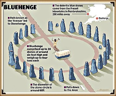
      Ten Things You Didn’t Know About Britain’s Prehistoric Flooded Past


      Introduction — The Britain You Know Is a Fake

      (Ten Things You Didn’t Know About Britain’s Prehistoric Flooded Past)

      We look at our hills, rivers, and coasts… and think they’ve always been there.
      Stable. Permanent.

      But that picture… is a lie.
      At the end of the last Ice Age, Britain was a land in chaos.
      Seas surged sixty metres higher. Rivers swelled beyond imagination. Entire countries… disappeared beneath the waves.

      Archaeology often ignores this truth. Too many theories are drawn on a modern map — a map our ancestors would barely recognise.
      After two decades of fieldwork and over two hundred and sixty research blogs, I can tell you: to understand prehistoric Britain… you must redraw it.
      Here are ten things you probably didn’t know about the drowned, shifting, waterlogged world our ancestors truly lived in.

      (Ten Things You Didn’t Know About Britain’s Prehistoric Flooded Past)
      A Landscape full of enlarged rivers – (Ten Things You Didn’t Know About Britain’s Prehistoric Flooded Past)

      1 — The Britain You Know Is Only 8,000 Years Old

      When the Holocene began, Britain wasn’t an island.
      A land bridge linked us to Europe — until rising seas finally severed it around six thousand BCE.
      The change wasn’t gentle.
      Meltwater pulses sent the tide racing inland, flooding valleys in years… not centuries.

      Sea levels rose faster than our worst climate forecasts for 2100.
      Every coastline shifted. The mouth of the Thames moved inland. Estuaries formed where farmland now lies.
      Your hometown… could have been seabed

      If you stood there then, your mental map of Britain would be unrecognisable.
      The “island nation” idea? A very recent reality.
      For most of prehistory… Britain was part of a wider European landscape.

      (Ten Things You Didn’t Know About Britain’s Prehistoric Flooded Past)
      Doggerland was once jus one enlarged continent (Ten Things You Didn’t Know About Britain’s Prehistoric Flooded Past)

      2 — Stonehenge’s Bluestones Couldn’t Have Rolled Here

      The romantic image is familiar: teams of men with ropes and ox-carts dragging stones two hundred kilometres from Preseli to Salisbury Plain.
      But around eight thousand BCE, ninety percent of that “route” was deep wildwood.
      Valleys in between? Bog-soaked mires.
      Wheels would have sunk without a trace.

      The real transport network wasn’t overland — it was water.
      Seasonal floods. Frost-hardened winter ground. And above all… rivers.
      LiDAR mapping shows prehistoric waterways were the true highways.

      This single fact changes the Stonehenge story entirely.
      It wasn’t a land-locked haul of brute force — it was a calculated, water-based operation using the landscape to its advantage.

      (Ten Things You Didn’t Know About Britain’s Prehistoric Flooded Past)
      The idea of dragging Stones of 20 – 30 tonnes is pure folly – (Ten Things You Didn’t Know About Britain’s Prehistoric Flooded Past)

      3 — Britain Once Had a Country Twice the Size of Wales — and Lost It Overnight

      Doggerland was no myth. It was a vast lowland stretching from East Anglia to the Netherlands.
      Its marshes, rivers, and lakes supported thousands of people. For centuries, it was a bridge between Britain and Europe.

      Then it drowned. Whether through steady sea rise, sudden flooding, or both — the result was the same.
      Communities found themselves separated by water where there had once been solid ground.

      That shock forced a new reality.
      Boats were no longer optional… they were survival.
      In my Maritime Diffusion Model, this moment explains why megalithic architecture suddenly spread so quickly along Atlantic coasts — the sea became the new road.

      (Ten Things You Didn’t Know About Britain’s Prehistoric Flooded Past)
      The drowning of Doggerland was a major catastrophic event in History of the World – (Ten Things You Didn’t Know About Britain’s Prehistoric Flooded Past)

      4 — Raised Beaches… Or the Fingerprints of a Flooded Britain?

      On Britain’s south coast, geologists point to “raised beaches” — sand and gravel layers perched far above today’s tide line.
      The standard explanation is a mix of ancient shorelines and “isostatic rebound.” But the data… doesn’t match the story.

      My research shows these aren’t fossil beaches at all. They’re concave, river-shaped deposits.
      They sit under layers of unstructured chalk — exactly what you’d expect if catastrophic meltwater floods carved paleochannels down to the sea.
      British Geological Survey maps confirm the pattern: huge branching flows, not static coastlines.

      Once you see it, you can’t unsee it.
      These are not tranquil remnants of a higher tide… they are scars of a country in flood</emphasis>.
      And they tell a far more dynamic, violent story than the textbooks admit.

      (Ten Things You Didn’t Know About Britain’s Prehistoric Flooded Past)
      If geologists used Lidar such misidentification would be avoided – (Ten Things You Didn’t Know About Britain’s Prehistoric Flooded Past)

      5 — The Thames Was Once Seven Kilometres Wide

      Beneath London, boreholes reveal up to ten metres of early-Holocene silt.
      This was not the neat, channelled Thames we know — it was a vast, braided tidal delta up to seven kilometres across.

      Such a river wasn’t just wider… it was a different creature entirely.
      Settlements clung to the high ground like islands. Boats connected them. Trade and travel followed water channels, not overland tracks.
      This wasn’t an obstacle — it was a superhighway.

      And here’s the myth-buster: London’s lack of prehistoric sites isn’t due to modern building wiping them out.
      LiDAR shows that much of the Thames Valley floor was too wide and flood-prone to build on.
      Only a few habitable high points existed — the places we now call the “Home Counties.”

      London (The Thames) through time
      The Thames was not swollen it was swamped in the Mesolithic – (Ten Things You Didn’t Know About Britain’s Prehistoric Flooded Past)

      6 — The Isle of Wight Was Cut Off by a Flooded River Valley

      The Solent started as a river.
      Then, around seven thousand five hundred years ago, rising seas burst through the valley, flooding it completely.
      A short walk became an open-water crossing — and life on both sides changed overnight.

      Suddenly, trade required boats. Communities reorganised. Control of crossing points likely meant influence and power.
      Archaeology along the submerged Solent shows drowned forests, hearths, and even worked timbers… frozen in place beneath the waves.

      Most extraordinary of all is Bouldnor Cliff.
      Here, eleven metres underwater, lies the world’s first known boat-building site — a sixth-millennium BCE harbour that imported Einkorn wheat from mainland Europe.
      This was no primitive backwater… it was a maritime hub centuries ahead of its time.

      Bouldnor Cliff - Einkorn wheat
      Bouldnor Cliff – Einkorn wheat – (Ten Things You Didn’t Know About Britain’s Prehistoric Flooded Past)

      7 — Somerset’s Levels Were a Salt-Water Swamp

      Between 5600 and 4450 BCE, the Somerset Levels were not the patchwork of fields we know today.
      They were alder-carr woodland slowly drowning under advancing salt marsh.

      Peat cores show the shift layer by layer — from fresh water to brackish tidal intrusion.
      To prehistoric people, this meant constant adaptation: moving camps, changing food sources, finding safe ground.

      Centuries later, societies would turn this swamp into a managed landscape of canals and raised trackways.
      But in its early days, it was a shifting, dangerous maze of water… a place that could swallow your settlement in a season.

      (Ten Things You Didn’t Know About Britain’s Prehistoric Flooded Past)
      It started as freshwater swamp then turned into salt water swamp – (Ten Things You Didn’t Know About Britain’s Prehistoric Flooded Past)

      8 — Stonehenge Stood on a Peninsula Fed by a Healing Spring

      Stonehenge didn’t stand beside a ceremonial pool or a “ritual lagoon.”
      It was built on a peninsula jutting into the River Avon, fed by a natural spring at Stonehenge Bottom.
      This fresh, flowing water made the site an ideal meeting place and a reliable refuge.

      The bluestones, brought from Preseli, were more than decorative.
      They contain minerals with natural antibacterial properties.
      In a world where sepsis from a cut could be fatal, those stones were medicine.

      Water from the spring flowing past them created a setting believed to aid recovery from infections and wounds.
      Forget the star-gazing theories — Stonehenge was a healing centre, built with purpose and grounded in survival.

      (Ten Things You Didn’t Know About Britain’s Prehistoric Flooded Past)
      The Bluestones were broken up like bath salts when they arrived at Stonehenge – (Ten Things You Didn’t Know About Britain’s Prehistoric Flooded Past)

      9 — Our “Iron Age Hillforts” May Be Older — and Wetter — Than We Think

      From the air, hillforts look like defensive enclosures.
      But LiDAR tells a different story — many sit in wet, low-lying areas with evidence of ditches that once held water.

      These weren’t forts braced for battle… they were moated settlements designed for trade and control of water routes.
      In a wetter prehistoric Britain, that was often more important than any wall.

      Re-examining these sites with hydrology in mind reveals a network of connected hubs — places where goods, people, and ideas moved not along ridge-tops, but through waterways.
      It’s a complete rethink of “forts” as we know them.

      (Ten Things You Didn’t Know About Britain’s Prehistoric Flooded Past)
      Old Sarum is in the middle of a River – although its called an ‘Iron Age Fort’? – (Ten Things You Didn’t Know About Britain’s Prehistoric Flooded Past)

      10 — The Map in Your Head Is a Mirage

      When we think of Britain, we picture a static shape — familiar coastlines, steady rivers.
      But in prehistory, those lines were always on the move.

      Rivers cut new paths. Valleys flooded. Islands appeared and vanished.
      The Britain of twelve thousand years ago was nothing like the Britain of eight thousand years ago — and both were strangers to the Britain we know now.

      The Post-Glacial Flooding Hypothesis forces us to redraw that mental map.
      Once you do, everything changes — from how Stonehenge was built, to why Doggerland mattered, to the true nature of “hillforts.”
      It’s not just a new map… it’s a new past.

      (Ten Things You Didn’t Know About Britain’s Prehistoric Flooded Past)
      Boats were the only way to travel and trade in the Mesolithic Period – (Ten Things You Didn’t Know About Britain’s Prehistoric Flooded Past)

      Conclusion — Redraw the Map. Rethink the Past.

      Prehistoric Britain was not a gentle green land.
      It was a place of rapid change, flooded valleys, and disappearing coasts.
      Ignore that… and you get bad archaeology.

      Factor it in — and new explanations open up for the monuments, settlements, and journeys of our ancestors.
      The evidence is there. The map is wrong.
      <emphasis level=”moderate”>It’s time to set it right</emphasis>.

      (Ten Things You Didn’t Know About Britain’s Prehistoric Flooded Past)
      (Ten Things You Didn’t Know About Britain’s Prehistoric Flooded Past)

      Update

      Where to see Britain’s post-glacial high water table

      The caves are the evidence. Karst systems preserve the height of former water tables:

      Mendip Hills (Cheddar Gorge / Wookey Hole): Relic phreatic levels high above modern flow routes show earlier pressurised groundwater; silted tubes and scallops mark sustained high head after deglaciation.

      Yorkshire Dales (Malham–Ingleborough): Abandoned risings and perched conduits around Malham Cove & Gaping Gill record higher Holocene heads; modern springs sit lower as the aquifer discharged over millennia.

      Peak District (Castleton): Upper fossil passages in Peak Cavern/Speedwell are stranded above active streams—classic regression from a post-glacial high stand.

      Chalk Winterbournes (Downs/Chilterns): The Misbourne, Chess, Kennet headwaters and Dorset winterbournes switch on when the head rises—same physics, small timescale. Early Holocene = the “on” position for much longer.

      Chalk dew-ponds: Longevity on permeable chalk relies on self-sealing skins—the same lining behavior that helps Phase-1 Stonehenge’s moat retain water under high head.

      Why this matters for Stonehenge Phase 1

      Mechanism: High head + chalk colmation = standing water in the ditch.

      Analogue: Cave high-stands are the geological logbook of that head.

      Fit: The moat enables the mineralised bluestone baths and excarnation workflow documented in the Phase-1 model.

      Quick Evidence: Britain’s Aquifers, Made Visible

      Karst plumbing on show. In chalk/limestone belts, groundwater carved conduits, phreatic tubes, risings, and sinkholes—the aquifer made visible in places like the Mendips, Yorkshire Dales, and the Peak District.

      High-stand markers. Abandoned phreatic passages perched high on cave walls, scalloped ceilings (pressurised flow), and silt beds record past water-table positions—higher than today during the early Holocene.

      Seasonal analogue. Modern winterbournes (dry valleys that flow only when the head rises) prove the mechanism: when the potentiometric surface sits above cut level, water holds—exactly what Phase 1 required.

      Self-sealing ditches. Fresh chalk cuts develop clay/carbonate skins (colmation), reducing leakage. With high head + recharge, a “ditch” becomes a moat.


      PodCast

      Silbury Avenue - Avebury's First Stone Avenue

      Author’s Biography

      Robert John Langdon, a polymathic luminary, emerges as a writer, historian, and eminent specialist in LiDAR Landscape Archaeology.

      His intellectual voyage has interwoven with stints as an astute scrutineer for governmental realms and grand corporate bastions, a tapestry spanning British Telecommunications, Cable and Wireless, British Gas, and the esteemed University of London.

      A decade hence, Robert’s transition into retirement unfurled a chapter of insatiable curiosity. This phase saw him immerse himself in Politics, Archaeology, Philosophy, and the enigmatic realm of Quantum Mechanics. His academic odyssey traversed the venerable corridors of knowledge hubs such as the Museum of London, University College London, Birkbeck College, The City Literature Institute, and Chichester University.

      In the symphony of his life, Robert is a custodian of three progeny and a pair of cherished grandchildren. His sanctuary lies ensconced in the embrace of West Wales, where he inhabits an isolated cottage, its windows framing a vista of the boundless sea – a retreat from the scrutinous gaze of the Her Majesty’s Revenue and Customs, an amiable clandestinity in the lap of nature’s embrace.

      (The Stonehenge Code)

      Exploring Prehistoric Britain: A Journey Through Time

      My blog delves into the fascinating mysteries of prehistoric Britain, challenging conventional narratives and offering fresh perspectives based on cutting-edge research, particularly using LiDAR technology. I invite you to explore some key areas of my research. For example, the Wansdyke, often cited as a defensive structure, is re-examined in light of new evidence. I’ve presented my findings in my blog post Wansdyke: A British Frontier Wall – ‘Debunked’, and a Wansdyke LiDAR Flyover video further visualizes my conclusions.

      My work also often challenges established archaeological dogma. I argue that many sites, such as Hambledon Hill, commonly identified as Iron Age hillforts are not what they seem. My posts Lidar Investigation Hambledon Hill – NOT an ‘Iron Age Fort’ and Unmasking the “Iron Age Hillfort” Myth explore these ideas in detail and offer an alternative view. Similarly, sites like Cissbury Ring and White Sheet Camp, also receive a re-evaluation based on LiDAR analysis in my posts Lidar Investigation Cissbury Ring through time and Lidar Investigation White Sheet Camp, revealing fascinating insights into their true purpose. I have also examined South Cadbury Castle, often linked to the mythical Camelot56.

      My research also extends to the topic of ancient water management, including the role of canals and other linear earthworks. I have discussed the true origins of Car Dyke in multiple posts including Car Dyke – ABC News PodCast and Lidar Investigation Car Dyke – North Section, suggesting a Mesolithic origin2357. I also explore the misidentification of Roman aqueducts, as seen in my posts on the Great Chesters (Roman) Aqueduct. My research has also been greatly informed by my post-glacial flooding hypothesis which has helped to inform the landscape transformations over time. I have discussed this hypothesis in several posts including AI now supports my Post-Glacial Flooding Hypothesis and Exploring Britain’s Flooded Past: A Personal Journey

      Finally, my blog also investigates prehistoric burial practices, as seen in Prehistoric Burial Practices of Britain and explores the mystery of Pillow Mounds, often mistaken for medieval rabbit warrens, but with a potential link to Bronze Age cremation in my posts: Pillow Mounds: A Bronze Age Legacy of Cremation? and The Mystery of Pillow Mounds: Are They Really Medieval Rabbit Warrens?. My research also includes the astronomical insights of ancient sites, for example, in Rediscovering the Winter Solstice: The Original Winter Festival. I also review new information about the construction of Stonehenge in The Stonehenge Enigma.

      (The Stonehenge Code)

      Further Reading

      For those interested in British Prehistory, visit www.prehistoric-britain.co.uk, a comprehensive resource featuring an extensive collection of archaeology articles, modern LiDAR investigations, and groundbreaking research. The site also includes insights and extracts from the acclaimed Robert John Langdon Trilogy, a series of books exploring Britain during the Prehistoric period. Titles in the trilogy include The Stonehenge Enigma, Dawn of the Lost Civilisation, and The Post Glacial Flooding Hypothesis, offering compelling evidence about ancient landscapes shaped by post-glacial flooding.

      To further explore these topics, Robert John Langdon has developed a dedicated YouTube channel featuring over 100 video documentaries and investigations that complement the trilogy. Notable discoveries and studies showcased on the channel include 13 Things that Don’t Make Sense in History and the revelation of Silbury Avenue – The Lost Stone Avenue, a rediscovered prehistoric feature at Avebury, Wiltshire.

      In addition to his main works, Langdon has released a series of shorter, accessible publications, ideal for readers delving into specific topics. These include:

      For active discussions and updates on the trilogy’s findings and recent LiDAR investigations, join our vibrant community on Facebook. Engage with like-minded enthusiasts by leaving a message or contributing to debates in our Facebook Group.

      Whether through the books, the website, or interactive videos, we aim to provide a deeper understanding of Britain’s fascinating prehistoric past. We encourage you to explore these resources and uncover the mysteries of ancient landscapes through the lens of modern archaeology.

      For more information, including chapter extracts and related publications, visit the Robert John Langdon Author Page. Dive into works such as The Stonehenge Enigma or Dawn of the Lost Civilisation, and explore cutting-edge theories that challenge traditional historical narratives.

      (The Stonehenge Code)

      Other Blogs

      [sitemap_posts]

      Twigs, Charcoal, and the Death of the Saxon Dyke Myth


      Introduction

      For over a century, British archaeology has repeated the same tale: Offa’s Dyke and Wat’s Dyke were built by Saxon kings to define borders and display royal power. But each time we peel back another layer—literally and figuratively—the data tells a radically different story. This is no longer about interpretation or fringe theory. The scientific evidence, especially from radiocarbon dating, blows the Saxon myth apart.(Twigs, Charcoal, and the Death of the Saxon Dyke Myth)


      1. The Mesolithic Nuts Beneath the Bank

      At Gobowen, Shropshire, archaeologists uncovered pits beneath Wat’s Dyke filled with charred hazelnut shells and twigs. Radiocarbon dating placed these at 5210–4840 BC—deep into the Mesolithic. This is not “background noise.” It proves the site was in use—and likely managed—thousands of years before any so-called Saxon activity. (Twigs, Charcoal, and the Death of the Saxon Dyke Myth)

      (Twigs, Charcoal, and the Death of the Saxon Dyke Myth)
      Gobowen Side where they found the Mesolithic Hearths – (Twigs, Charcoal, and the Death of the Saxon Dyke Myth)

      2. The “Twigs” and the Bronze Age Pattern

      Here’s where things get explosive. Two different digs—at Gobowen and Maes-y-Clawdd—each pulled a charred twig from the primary fill of the dyke’s ditch. Both were sent to modern AMS labs for dating. These were sent to independent AMS labs for testing:

      • Gobowen: 2825 ± 40 BP, calibrated to 1120–890 BC
      • Maes-y-Clawdd: 2855 ± 40 BP, calibrated to 1120–890 BC

      Different labs, different sites, nearly identical dates: Late Bronze Age.
      Some might claim “residuality” or accident, but when the same date keeps showing up in primary contexts at different sites, the odds of pure coincidence plummet.(Twigs, Charcoal, and the Death of the Saxon Dyke Myth)

      (Twigs, Charcoal, and the Death of the Saxon Dyke Myth)
      Maes-Y-Clawdd site (Twigs, Charcoal, and the Death of the Saxon Dyke Myth)

      3. Erddig and Chirk: More Prehistoric Dates

      The new gold standard in the debate is the peer-reviewed Archaeologia Cambrensis study (Malim et al. 2021), which returned:

      • Erddig: Alder charcoal under the bank, 1414–1258 BC (Bronze Age)
      • Chirk: Charcoal at base of bank, 776–543 BC (Iron Age)

      These aren’t rogue samples. They are part of a systematic pattern. (Twigs, Charcoal, and the Death of the Saxon Dyke Myth)

      (Twigs, Charcoal, and the Death of the Saxon Dyke Myth)
      Wats Dyke Excavation – (Twigs, Charcoal, and the Death of the Saxon Dyke Myth)

      4. The Car Dyke and Wansdyke Parallels

      Our recent research on Car Dyke—summarised in my book, Car Dyke: The Lost Waterways of Prehistoric Britain—shows exactly the same pattern. LiDAR analysis, gradient modeling, and dated artefacts reveal this “Roman” canal sits atop a much older, prehistoric water-management system, later adapted by the Romans. The same sequence—prehistoric construction, Roman enhancement, and later reuse—emerges at other great linear earthworks.

      Wansdyke: More than Just a Saxon Bank and Ditch

      • Roman Water System at the Summit:
        Topographic and archaeological evidence shows that a Roman water-management system, likely an aqueduct or channel, was constructed along sections of Wansdyke near Cliffe Pypard and Cherhill. The Roman works appear to incorporate the line and gradient of the existing dyke, indicating that the dyke was already present and subsequently adapted for Roman infrastructure needs. This reuse implies that the dyke is pre-Roman in origin, forming part of an older, possibly prehistoric, water-management landscape. Rather than constructing a new route, the Romans modified what was already there—strong evidence that Wansdyke was not their creation, but an earlier engineering feature they found valuable enough to repurpose.
      • Roman Road Laid On the Dyke:
        To the north of Morgan’s Hill, a documented Roman road is physically laid on top of the Wansdyke bank. The logical sequence? The dyke had to exist before the road. (For detail and field evidence, see: prehistoric-britain.co.uk/prehistoric-canals-dykes-wansdyke4)
      • The Implication:
        These features make it impossible to honestly claim that Wansdyke is purely a Saxon or sub-Roman structure. Instead, we’re seeing a prehistoric engineering work—possibly a canal or water-management feature—repurposed by the Romans, and then again in later centuries.

      (Twigs, Charcoal, and the Death of the Saxon Dyke Myth)

      (Twigs, Charcoal, and the Death of the Saxon Dyke Myth)
      Car Dyke Parrellels – (Twigs, Charcoal, and the Death of the Saxon Dyke Myth)
      A Consistent Prehistoric Pattern

      The parallels between Car Dyke, Wansdyke, Offa’s Dyke, and Wat’s Dyke are now undeniable:

      • All show prehistoric (Mesolithic, Bronze Age, or Iron Age) dates or structural evidence in primary contexts.
      • All were reused, enlarged, or recut by later societies—be it the Romans, Saxons, or Medievals.
      • All have been misunderstood because traditional narratives refuse to follow the evidence.

      (Twigs, Charcoal, and the Death of the Saxon Dyke Myth)
      Roman Canal Boat as found at Car Dyke – (Twigs, Charcoal, and the Death of the Saxon Dyke Myth)

      (Twigs, Charcoal, and the Death of the Saxon Dyke Myth)

      5. Why the Saxon Narrative No Longer Holds

      Traditional archaeology claims these dykes were built in the Dark Ages because it’s “what’s always been said” and because a handful of OSL dates cluster in the early medieval period. But with so many radiocarbon dates from secure, primary contexts returning Bronze Age and Iron Age results, the only scientific response is to question the narrative—not the data.

      This shift isn’t limited to a few isolated studies. In 2019, Historic England (formerly English Heritage) published a national overview of linear earthworks, concluding that most of the dykes they had investigated dated to the prehistoric period, not the early medieval one. Their guidance document, Prehistoric Linear Boundary Earthworks, situates these features firmly in the Late Neolithic through to the Iron Age, aligning with the growing body of radiocarbon evidence and undermining the traditional Dark Age attribution.

      Rather than reinforcing the Saxon story, modern research now supports a much older, more complex landscape—one that was later reused and reinterpreted by the Romans and Saxons alike.

      (Twigs, Charcoal, and the Death of the Saxon Dyke Myth)
      From the Book by HE – (Twigs, Charcoal, and the Death of the Saxon Dyke Myth)

      (Twigs, Charcoal, and the Death of the Saxon Dyke Myth)


      6. AI and Modern Method: The Death of Peer-Reviewed Dogma

      For years, peer review has failed to challenge inherited assumptions. “Authority” was all that mattered—a single, dramatic radiocarbon date (like the infamous 6.25 kg of charcoal at Maes-y-Clawdd) could define an entire monument’s chronology, regardless of context or contradictory data from other sites.

      But now? AI is revolutionising how we check and interpret archaeological evidence.

      Take our recent FB post, where we used AI to reassess the Maes-y-Clawdd excavation:

      • Myth: The excavation report’s headline date (c. 400 AD) from the charcoal was endlessly repeated as proof of a “Roman” or “sub-Roman” dyke.
      • AI’s Role:
        • Pulled together site photos, original reports, ditch profiles, and stratigraphy from multiple digs.
        • Flagged the ditch’s V-shape (classic recut) and the heavy truncation of the bank (over half missing)—which undermined the idea that the charcoal was securely “sealed” and contemporary with construction.
        • Cross-referenced other sites (Gobowen, Erddig, Chirk), showing that Bronze Age and Iron Age dates in similar primary contexts kept reappearing—not as random “residuals,” but as a systematic pattern.
      • Outcome:
        • Instead of blindly accepting published “facts,” AI let us validate or reject past interpretations using all the available primary evidence.
        • The “Roman” story now stands exposed as an artefact of interpretation, not of data.

      This is not “pseudoscience”—it’s the very definition of the scientific method:

      • Gather all the evidence.
      • Challenge every conclusion.
      • Rebuild the narrative when the facts demand it.

      Just as AI is transforming genetics, climate science, and engineering, it’s now arming archaeology with the ability to see through myths, correct errors, and put our past on a solid, evidence-based footing. If you want real history, let the data—and AI—lead the way. (Twigs, Charcoal, and the Death of the Saxon Dyke Myth)

       (Twigs, Charcoal, and the Death of the Saxon Dyke Myth)
      Twigs, Charcoal, and the Death of the Saxon Dyke Myth

      Conclusion: Follow the Data, Not the Doctrine

      The parallels between Offa’s Dyke, Wat’s Dyke, Car Dyke, and Wansdyke are now undeniable:

      • All show prehistoric (Mesolithic, Bronze Age, or Iron Age) evidence in primary contexts
      • All were reused, recut, or adapted by Romans, Saxons, and Medieval societies
      • All have been misunderstood because inherited narratives resisted revision

      The story we’ve been told—that Saxon kings built these monuments as borders—is no longer sustainable.

      The data demands a paradigm shift. (Twigs, Charcoal, and the Death of the Saxon Dyke Myth)


      References

      • Hannaford, H.R. (1997), SCCAS Report no. 111, An Interim Report on Archaeological Excavations on Wat’s Dyke at Maes-y-Clawdd, Oswestry.
      • Malim, T. & Hayes, L. (2008), The Date and Nature of Wat’s Dyke: a reassessment in the light of recent investigations at Gobowen, Shropshire, ASSAH 15.
      • Malim, T., Hoggard, C., et al. (2021). “Offa’s Dyke and Wat’s Dyke: Scientific Dating at Chirk and Erddig, North Wales.” Archaeologia Cambrensis, 170, pp. 93–117.
      • Langdon, R.J. (2024), Car Dyke: The Lost Waterways of Prehistoric Britain.
      • For Wansdyke Roman features and road evidence: prehistoric-britain.co.uk/prehistoric-canals-dykes-wansdyke4

      Twigs, Charcoal, and the Death of the Saxon Dyke Myth

      Annex: The “Twig” Radiocarbon Dates—Technical Details

      For those who want the technical data, here are the exact C14 results from the two most cited Bronze Age “twig” samples:

      SiteSample TypeLab CodeRadiocarbon Age (BP)ErrorCalibrated Range (2σ)Context
      GobowenCharred twigGU-148662825±401120–890 BCPrimary ditch fill
      Maes-y-ClawddCharred twig(various)2855±401120–890 BCLower ditch fill
      • Both dates are from independent, high-quality AMS labs, and ±40 years is standard error for these samples.
      • The calibration uses the most up-to-date IntCal curve.
      • Their remarkable similarity is not a flaw, but evidence for a real prehistoric episode.

      Further Reading

      For information about British Prehistory, visit www.prehistoric-britain.co.uk for the most extensive archaeology blogs and investigations collection, including modern LiDAR reports.  This site also includes extracts and articles from the Robert John Langdon Trilogy about Britain in the Prehistoric period, including titles such as The Stonehenge Enigma, Dawn of the Lost Civilisation and the ultimate proof of Post Glacial Flooding and the landscape we see today.

      Robert John Langdon has also created a YouTube web channel with over 100 investigations and video documentaries to support his classic trilogy (Prehistoric Britain). He has also released a collection of strange coincidences that he calls ‘13 Things that Don’t Make Sense in History’ and his recent discovery of a lost Stone Avenue at Avebury in Wiltshire called ‘Silbury Avenue – the Lost Stone Avenue’.

      (Maritime Diffusion Model for Megaliths in Europe)

      Langdon has also produced a series of ‘shorts’, which are extracts from his main body of books:

      The Ancient Mariners

      Stonehenge Built 8300 BCE

      Old Sarum

      Prehistoric Rivers

      Dykes ditches and Earthworks

      Echoes of Atlantis

      Homo Superior

      (Maritime Diffusion Model for Megaliths in Europe)

      Other Blogs

      [sitemap_posts]
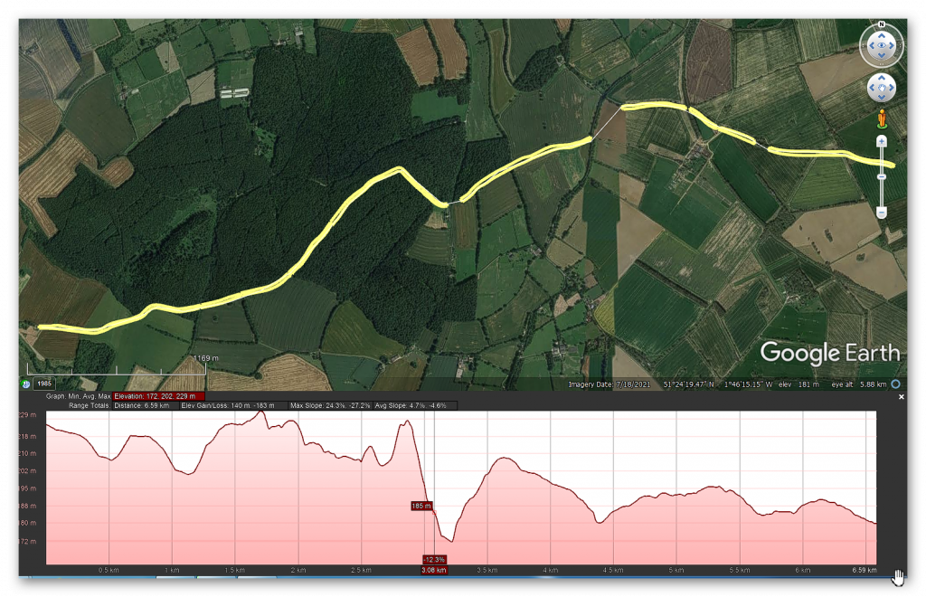
      (Twigs, Charcoal, and the Death of the Saxon Dyke Myth)

      13 Things You Didn’t Know About Hillforts — The Real Story Behind Britain’s Ancient Earthworks

      Introduction

      Hillforts have long been cast as the mighty defensive bastions of prehistoric Britain, iconic symbols of Iron Age tribal warfare and territorial defence. But if you peel back the layers of archaeological evidence, a very different, far more complex picture emerges. While some hillforts were adapted for military use during later periods—particularly during Roman expansion—the majority were multifunctional hubs serving economic, ceremonial, territorial, and social roles rather than purely defensive purposes.

      Below, we unravel 13 surprising facts that challenge the traditional fortress narrative, shedding light on the true nature of hillforts across Britain and Ireland. Prepare to rethink what you thought you knew.

      13 Things You Didn’t Know About Hillforts
      Hillforts have long been cast as the mighty defensive bastions of prehistoric Britain, iconic symbols of Iron Age tribal warfare and territorial defence

      1. Hillfort Classifications Are Outdated and Over-Simplified

      For nearly a century, archaeologists have tried to neatly categorize hillforts based on size, location, rampart construction, and age. Early scholars like Sir Mortimer Wheeler and later Barry Cunliffe developed classification schemes grouping hillforts into types such as early hilltop enclosures over 10 hectares, smaller settlements of 1–3 hectares, early univallate forts, and more complex multivallate sites. These categories aimed to make sense of the diversity by assigning function and status, often equating larger or more complex sites with defensive importance.

      However, these classifications are increasingly questioned because they lean heavily on limited physical evidence and overlook the social and economic functions of these sites. For example, a large enclosure doesn’t necessarily mean a military fortress; it could be a ceremonial gathering place or a centre for trade. Likewise, a simple earthwork might have deep ritual significance rather than being a mere settlement defence. This simplified framework risks distorting the true roles these structures played in prehistoric societies.

      By focusing too much on size and fortification features, scholars have missed the multifunctional nature of hillforts. Archaeological evidence now points to a more nuanced understanding: these sites often combined social, economic, political, and ritual functions alongside occasional defensive adaptations. We must therefore treat traditional categories with caution and embrace complexity.

      13 Things You Didn’t Know About Hillforts
      Maiden Castle – Largest ‘Iron Age Fort’ in Britain?

      2. The “Fortress” Definition Has Stuck For Too Long

      The classical definition of a hillfort, as “a fortified refuge or defended habitation on elevated ground,” still dominates textbooks and popular understanding. Wikipedia and many reference works place hillforts squarely in the Bronze or Iron Age and depict them as military installations designed to control territory and repel attackers. Their defining features are steep earthworks, ramparts, palisades, and ditches, strategically placed to take advantage of high ground.

      While this definition neatly fits some later hillforts, it oversimplifies a wide array of prehistoric enclosures that often lack convincing military architecture or evidence of warfare. Moreover, it ignores that many of these sites have much older origins, with some showing continuity of use stretching back thousands of years before the Iron Age, into the Neolithic or even Mesolithic periods. The persistence of this fortress-centric view obscures the diverse social realities of prehistoric communities.

      Holding on to this entrenched definition restricts archaeological interpretation and public perception. It encourages viewing hillforts as relics of constant warfare rather than appreciating their complex social, ceremonial, and economic dimensions. The reality, as recent research shows, is far richer and more varied.

      13 Things You Didn’t Know About Hillforts
      Traditional view as “a fortified refuge or defended habitation on elevated ground”

      3. Hillforts Were Around Before the Iron Age

      Many people associate hillforts exclusively with the Iron Age, roughly 800 BC to AD 43 in Britain. However, extensive excavations reveal that numerous hillforts have earlier origins, dating back to the Late Bronze Age and even Neolithic times. Cultures such as the Urnfield (1300–750 BC), Hallstatt (1200–500 BC), and La Tène (600 BC–50 AD) saw the proliferation of hillforts, but the groundwork was laid much earlier.

      For instance, archaeological layers in famous sites like Maiden Castle and Danebury contain flint tools and pottery shards from the Neolithic and Mesolithic eras. This pushes back their initial construction or use by several millennia before the traditionally accepted Iron Age period.

      This deep time depth challenges the fortress narrative by suggesting many hillforts began as community or ritual centres long before any significant tribal warfare. Their repeated reuse over thousands of years indicates multifunctional importance beyond defence and highlights the continuity and adaptation of prehistoric societies.

      13 Things You Didn’t Know About Hillforts
      Maiden Castle constructed over several millennia of time

      4. Population Growth Doesn’t Match the Fortress Theory

      Prehistoric Britain’s population dynamics don’t quite fit with the idea of a landscape littered with defensive forts. Estimates suggest that during the Neolithic (circa 5000 BC), Europe’s population hovered between 2 and 5 million. By the Late Iron Age, it had swelled to roughly 15 to 30 million. But except for dense pockets like Greece and Italy, most settlements in Britain were small, often supporting fewer than 50 people.

      Hillforts stand out as exceptions, accommodating communities as large as 1,000, but such numbers were rare. The later appearance of oppida—urban centers housing up to 10,000—reflects increasing societal complexity. However, the distribution and density of hillforts do not correlate with an equally dense, heavily militarized population needing constant defense.

      The logistical challenge of defending thousands of these hillforts, each requiring a substantial population of warriors and support staff, becomes apparent when population estimates are compared to fort numbers. There simply weren’t enough people to maintain standing armies or garrisons in every hillfort, undermining the fortress theory.

      13 Things You Didn’t Know About Hillforts
      There are 3,300 Hill Forts in Britain according to the ‘Experts’ – the distribution makes no sense?

      5. Hillforts Were NOT Evenly Distributed — Which Defies Pure Defence Logic

      If hillforts were purely defensive, you’d expect them to be evenly spaced, strategically located to guard borders or resources. But the reality is messier. Over 3,300 hillforts are clustered unevenly across the British Isles. Take the Isle of Man—a tiny island of 572 square kilometres—with an astounding 32 hillforts. That’s roughly one hillfort every 5 to 6 square kilometres, far too dense to be defensible or necessary purely for military protection.

      Additionally, about 30% of hillforts hug coastlines, with another 50% near prehistoric river systems. This heavy concentration around water suggests that control of waterways, trade, and communication routes were important considerations. Another 70% are near quarrying or resource extraction zones, linking hillforts to economic activity rather than just defense.

      Such distribution patterns are inconsistent with a landscape dominated by warring tribes guarding fixed territories. Instead, they imply hillforts functioned as hubs for trade, social interaction, resource management, and ritual gatherings tied closely to natural and economic landscapes.

      13 Things You Didn’t Know About Hillforts
      Isle of Man – the most violent place in the prehistoric world with 32 hillforts?

      6. Little Evidence of Warfare or Prolonged Occupation

      If hillforts were military bastions, we would expect abundant archaeological evidence of sustained occupation, such as permanent housing, weapon caches, and clear defensive structures like palisades or gatehouses. We would also expect to find mass graves or layers of debris from sieges.

      Yet, surprisingly, few hillforts show such evidence. Many have signs of only episodic or seasonal occupation. Archaeologists rarely find weapons stockpiles or large-scale battle remains inside hillforts. Defensive architectural features are often minimal or absent, and many ditches have shapes inconsistent with fortification—flat-bottomed, not steep and V-shaped.

      This absence of clear martial evidence points to alternative interpretations: hillforts served multiple roles, perhaps acting as gathering places for trade, ritual ceremonies, or political meetings, with defense being a secondary or occasional function.

      13 Things You Didn’t Know About Hillforts
      Wrong type of Ditch as you could get inside and walk around hidden from the defenders

      7. Danebury Hillfort Is Probably Older and Less “Fortress” Than Thought

      Danebury in Hampshire is often cited as a classic Iron Age hillfort, extensively excavated by Barry Cunliffe in the 1970s. While traditionally dated to the 6th century BC and used for about 500 years, recent carbon dating and flint finds suggest it began as a Late Bronze Age stock enclosure 3,000 years ago. Some evidence even points to Neolithic or Mesolithic origins.

      Excavations uncovered thousands of flints spanning multiple prehistoric periods, alongside Beaker pottery, challenging the notion that Danebury was a purely Iron Age military installation. Furthermore, LiDAR technology revealed a linear earthwork or dyke connected to the fort’s outer ditch—possibly a prehistoric waterway—hinting that Danebury might have been linked by boat transport rather than isolated on a hilltop.

      Its ditches have soil deposited mostly on the outside rather than the inside, contradicting standard defensive designs. Together, these facts point towards Danebury functioning as a multifunctional site, involved in trade and social activities, rather than solely as a fortress.

      Danbury Showing the Ditches were connected to dykes from the paleochannel below

      8. Maiden Castle’s Massive Size Was Logistically Impossible to Defend

      Maiden Castle in Dorset is Britain’s largest hillfort, sprawling over 47 hectares. This sheer size would require an enormous number of defenders—estimates suggest 155 soldiers per shift, totaling around 465 to cover 24-hour protection. That’s not counting support personnel, families, and provisions.

      Feeding and supplying such a large garrison would be a monumental task. Monthly food needs would include vast amounts of grain and meat, requiring extensive storage, pastureland for livestock (around 516 animals per month), and water—at least 15 deep wells, supplying almost 750,000 litres monthly. Yet, archaeological digs and LiDAR surveys reveal only a handful of residential structures and no evidence of such water management infrastructure.

      Additionally, no workshops or industrial sites capable of producing weapons and armour at scale have been found. This logistical void casts serious doubt on the idea that Maiden Castle was a continuously manned military fortress rather than a large social or ritual centre.

      13 Things You Didn’t Know About Hillforts
      Your looking at 5,000 men to defend the perimeter of this Earthwork – which had no water

      9. Maiden Castle’s “Massacre” Is Much Less Clear-Cut Than Popular Tales

      Popular accounts sometimes describe Maiden Castle as the site of a Roman siege massacre. However, excavations found only a handful of burials near entrances, with no mass graves or battlefield debris layers typical of large-scale violence.

      Among the burials were an adult male with a debated projectile wound, a young woman with trauma signs, and several children—not typical combatants. Most bodies showed no direct evidence of violent death.

      Over 20,000 slingstones discovered near entrances might suggest defensive stockpiles, but their purpose could also be ritualistic or related to hunting. After the supposed Roman attack, the site was largely abandoned, implying that its defensive role, if any, was limited and temporary.

      13 Things You Didn’t Know About Hillforts
      Once thought to be the ONLY evidence of conflict has been disproven by Bournemouth University

      10. Old Sarum Is Misunderstood as a Hillfort

      Old Sarum, located in Wiltshire, is often labeled an Iron Age hillfort established around 400 BC. It later became a Roman fort and then a medieval castle site. However, its position on a floodplain island, not a prominent hill, challenges the traditional fortress narrative.

      Claims of Roman roads converging there have been questioned by LiDAR and satellite data, which show no clear road leading to Bath or elsewhere. The earthworks around Old Sarum appear more consistent with water management or moated enclosures than defensive ditches. Soil spoil was found mostly outside ditches, suggesting construction to hold water rather than repel enemies.

      The ditch spoil is placed on the outside of the site to create a moat not inside to create a defensive bank

      11. Many Hillforts May Have Been Waterborne Trade Hubs, Not Forts

      Some hillfort ditches and earthworks may have functioned as prehistoric moats or canals, filled naturally due to higher ancient water tables or artificially to facilitate boat traffic. This suggests hillforts could have been accessible by water, acting as trading hubs connected through river networks.

      LiDAR scans reveal links between earthworks and ancient waterways, highlighting a landscape adapted for waterborne movement rather than isolated hilltop defense. This theory fits with the frequent coastal and riverine siting of hillforts and their association with quarry and resource sites.

      Old Sarum is in the middle of an ancient flood plain surrounded by giant rivers

      12. Economic Evidence Contradicts Military Function

      True military sites like Roman forts show dense economic footprints: lost coins, markets, bathhouses, workshops, and dense habitation. Hillforts lack this. Coins are extremely rare even after coinage was common. There are no permanent markets or large public buildings supporting garrisoned troops.

      Instead, hillforts yield evidence of seasonal occupation: animal enclosures, storage pits, and sparse artefacts, reflecting episodic use for trade, social gatherings, or ritual. This economic silence is a strong indicator that hillforts were not permanent military bases but multifunctional social centres

      13 Things You Didn’t Know About Hillforts
      Roman Coins are found in ALL military sites – no Iron Age Coins are found in Hillforts

      .


      13. Hillforts Were Multifunctional Community Centres

      All evidence points toward hillforts as dynamic, multifunctional hubs where prehistoric communities gathered seasonally for trade, political negotiation, rituals, and resource management. Defense may have been a later addition or an occasional function but was rarely the primary purpose.

      Their diverse roles challenge the simplistic “fortress” label and invite us to rethink prehistoric Britain as a complex network of interconnected social landscapes, not a battlefield scattered with defensive works.

      13 Things You Didn’t Know About Hillforts
      Hill tops with beacons are natural trading places were people would gather

      Conclusion

      With new dating methods, LiDAR technology, and detailed excavations, the “hillfort as fortress” idea no longer holds water. We need to embrace a broader, richer understanding of these sites as centers of ancient community life, economy, and ritual.

      What Archaeology Must Prove To Call Hillforts “Forts”.

      To keep the “fort” label credible, archaeologists must find:.

      Large permanent residences and housing clusters.

      Reliable water supplies (wells, cisterns).

      Dense loss of coins and trade items.

      Associated civilian settlements outside gates.

      Evidence of workshops making weapons and armor.

      Defensible gatehouses and ramparts designed for battle.

      Layers showing repeated conflict or siege trauma.

      So far? – Those lines of evidence are mostly absent.

      Final Thought.

      Hillforts aren’t just relics of ancient warfare — they’re dynamic social landscapes, hubs of economy, ritual, and community. It’s time to move beyond outdated militaristic views and embrace their true complexity.

      As the saying goes:

      “Extraordinary claims require extraordinary evidence — and calling hillforts ‘forts’ without it is no longer credible archaeology.”

      Exploring Prehistoric Britain: A Journey Through Time

      My blog delves into the fascinating mysteries of prehistoric Britain, challenging conventional narratives and offering fresh perspectives based on cutting-edge research, particularly using LiDAR technology. I invite you to explore some key areas of my research. For example, the Wansdyke, often cited as a defensive structure, is re-examined in light of new evidence. I’ve presented my findings in my blog post Wansdyke: A British Frontier Wall – ‘Debunked’, and a Wansdyke LiDAR Flyover video further visualizes my conclusions.

      My work also often challenges established archaeological dogma. I argue that many sites, such as Hambledon Hill, commonly identified as Iron Age hillforts are not what they seem. My posts Lidar Investigation Hambledon Hill – NOT an ‘Iron Age Fort’ and Unmasking the “Iron Age Hillfort” Myth explore these ideas in detail and offer an alternative view. Similarly, sites like Cissbury Ring and White Sheet Camp, also receive a re-evaluation based on LiDAR analysis in my posts Lidar Investigation Cissbury Ring through time and Lidar Investigation White Sheet Camp, revealing fascinating insights into their true purpose. I have also examined South Cadbury Castle, often linked to the mythical Camelot56.

      My research also extends to the topic of ancient water management, including the role of canals and other linear earthworks. I have discussed the true origins of Car Dyke in multiple posts including Car Dyke – ABC News PodCast and Lidar Investigation Car Dyke – North Section, suggesting a Mesolithic origin2357. I also explore the misidentification of Roman aqueducts, as seen in my posts on the Great Chesters (Roman) Aqueduct. My research has also been greatly informed by my post-glacial flooding hypothesis which has helped to inform the landscape transformations over time. I have discussed this hypothesis in several posts including AI now supports my Post-Glacial Flooding Hypothesis and Exploring Britain’s Flooded Past: A Personal Journey

      Finally, my blog also investigates prehistoric burial practices, as seen in Prehistoric Burial Practices of Britain and explores the mystery of Pillow Mounds, often mistaken for medieval rabbit warrens, but with a potential link to Bronze Age cremation in my posts: Pillow Mounds: A Bronze Age Legacy of Cremation? and The Mystery of Pillow Mounds: Are They Really Medieval Rabbit Warrens?. My research also includes the astronomical insights of ancient sites, for example, in Rediscovering the Winter Solstice: The Original Winter Festival. I also review new information about the construction of Stonehenge in The Stonehenge Enigma.

      Further Reading

      For those interested in British Prehistory, visit www.prehistoric-britain.co.uk, a comprehensive resource featuring an extensive collection of archaeology articles, modern LiDAR investigations, and groundbreaking research. The site also includes insights and extracts from the acclaimed Robert John Langdon Trilogy, a series of books exploring Britain during the Prehistoric period. Titles in the trilogy include The Stonehenge Enigma, Dawn of the Lost Civilisation, and The Post Glacial Flooding Hypothesis, offering compelling evidence about ancient landscapes shaped by post-glacial flooding.

      To further explore these topics, Robert John Langdon has developed a dedicated YouTube channel featuring over 100 video documentaries and investigations that complement the trilogy. Notable discoveries and studies showcased on the channel include 13 Things that Don’t Make Sense in History and the revelation of Silbury Avenue – The Lost Stone Avenue, a rediscovered prehistoric feature at Avebury, Wiltshire.

      In addition to his main works, Langdon has released a series of shorter, accessible publications, ideal for readers delving into specific topics. These include:

      For active discussions and updates on the trilogy’s findings and recent LiDAR investigations, join our vibrant community on Facebook. Engage with like-minded enthusiasts by leaving a message or contributing to debates in our Facebook Group.

      Whether through the books, the website, or interactive videos, we aim to provide a deeper understanding of Britain’s fascinating prehistoric past. We encourage you to explore these resources and uncover the mysteries of ancient landscapes through the lens of modern archaeology.

      For more information, including chapter extracts and related publications, visit the Robert John Langdon Author Page. Dive into works such as The Stonehenge Enigma or Dawn of the Lost Civilisation, and explore cutting-edge theories that challenge traditional historical narratives.

      Other Blogs

      [sitemap_posts]