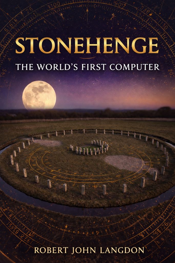
Stonehenge: The World’s First Computer – FREE Flipbook

Free online access to the complete evidence-based reconstruction of Stonehenge’s original function

This page provides free access to the full book
The Stonehenge Computer,
which sets out a technical, testable model demonstrating that Stonehenge was originally constructed as a functional astronomical and hydrological calculation device, not a ceremonial monument.

The model presented here treats Stonehenge as:

  • a working system
  • built to track lunar cycles
  • linked directly to tides, groundwater, and seasonal prediction
  • embedded in a post-glacial flooded landscape

🛒 Available Formats
B/W softback Book

 Stonehenge: The World's First Computer
Hardback full COLOUR book

Amazon KINDLE Version – Stonehenge: The World’s First Computer

What This Book Examines

Stonehenge has been described for centuries, but rarely analysed as a machine.

This book asks a simpler question:

What does Stonehenge actually do?

By examining geometry, spacing, repetition, and landscape position, the book demonstrates that the earliest phase of Stonehenge functions as a computational device capable of tracking:

  • the 56-year lunar cycle
  • nodal extremes of the Moon
  • predictable tidal amplification
  • seasonal water-table behaviour

These are not symbolic alignments.
They are operational relationships.
(Stonehenge: The Worlds First Computer)
How the Computer Worked – (Stonehenge: The World’s First Computer)

The Core Components of the Stonehenge Computer

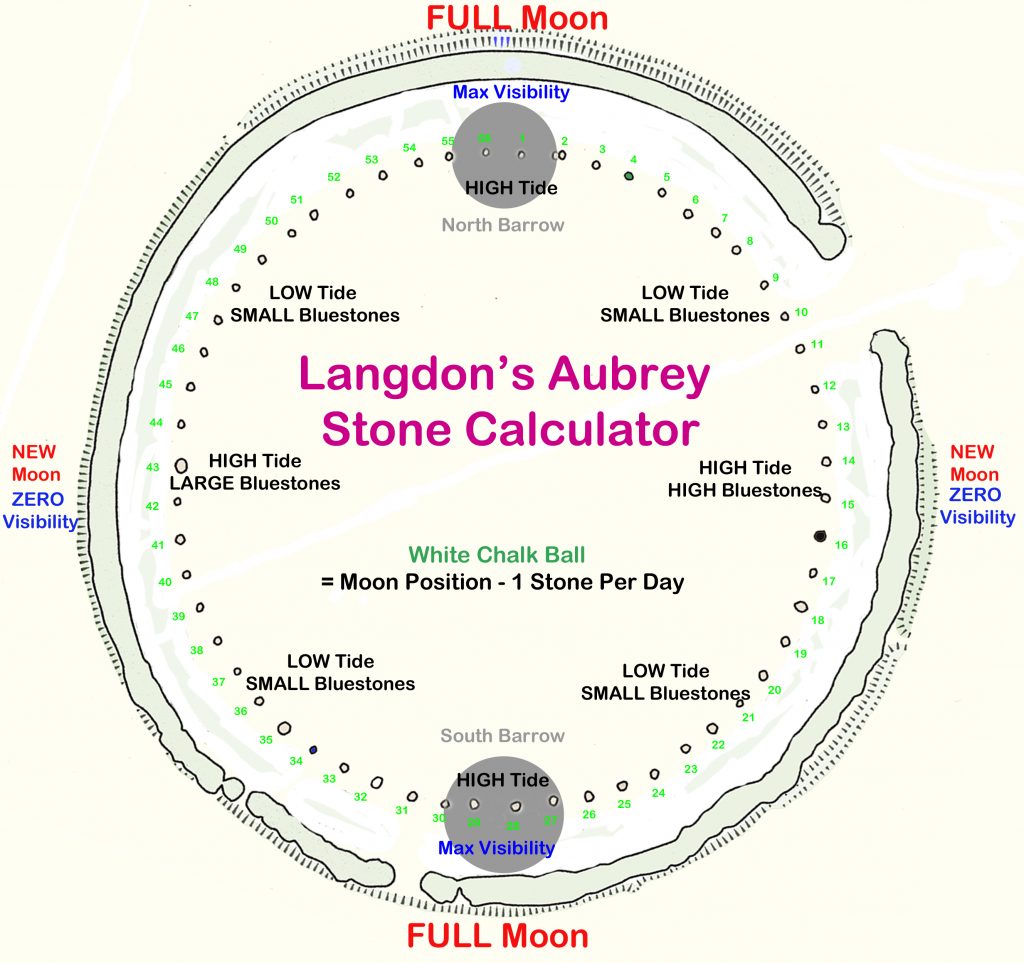
1. The Aubrey Hole System

The 56 Aubrey Holes are treated not as burial pits, but as a cyclic counting array, consistent with known lunar periodicities.

Their number, spacing, and enclosure geometry allow:

  • long-term tracking of the Moon
  • correction for drift
  • repeatable prediction over generations

2. The Ditch and Moat

The ditch is analysed as a deliberately water-holding structure, not a defensive feature.

Its construction method, internal form, and sediment sequence are consistent with:

  • retained water
  • controlled seepage
  • interaction with the groundwater table

Water is not incidental — it is integral to function.

3. Bluestones as Active Elements

Rather than passive symbols, bluestones are examined as:

  • interactive components
  • mineral interfaces
  • elements within a hydrological system

Their fragmentation and distribution are consistent with use, not decoration.

4. Astronomical Geometry

The geometry of the enclosure, entrances, and station points is shown to encode:

  • solar extremes
  • lunar standstills
  • repeatable observational baselines

No single alignment explains Stonehenge.
The system does.


Why the “Computer” Interpretation Matters

Treating Stonehenge as a ritual monument creates contradictions:

  • unnecessary complexity
  • excessive precision
  • redundant features

Treating it as a calculation device resolves them.

A society living in a water-dominated post-glacial landscape would need:

  • tidal prediction
  • seasonal forecasting
  • long-term calendrical stability

Stonehenge provides exactly that.


Method and Constraints

This book deliberately avoids:

  • mythological interpretation
  • symbolic speculation
  • retrofitted ritual narratives

Instead, it applies:

  • measurable geometry
  • repeatable cycles
  • landscape hydrology
  • empirical constraints

If a feature has no functional role, it is treated as unresolved — not explained away.


Relationship to the Wider Research

The Stonehenge Computer builds directly upon the hydrological framework established in:

  • Post-Glacial Flooding in Britain

That earlier volume defines the environmental conditions under which Stonehenge was constructed.

This book shows how those conditions were:

  • measured
  • monitored
  • and engineered into stone

Who This Book Is For

  • Readers dissatisfied with ritual explanations
  • Researchers interested in early science and engineering
  • Archaeologists working with astronomical or landscape data
  • Anyone asking how rather than why


This book forms part of a wider evidence-led sequence:

  • Post-Glacial Flooding in Britain
  • The Stonehenge Computer
  • Dawn of the Lost Civilisation

All are available via the online bookcase.

Podcast

The Videos

More Book information

Contents

Foreword                                                                                                     
Robert John Langdon

Prologue — Why This Book Exists                                                           

Chapter 1 – Introduction: A New Breakthrough at Stonehenge           


  • Why existing explanations fail
  • The problem Stonehenge presents                                         
  • What does “computer” mean in a prehistoric context           
  • Function versus symbolism                                                    
  • Rules of evidence used in this book                                      
  • What will be proven, and how                                               

Chapter 2 – Stonehenge Phase 1: 8300 BCE                                          

  • Separating Phase One from Later Reuse                               
  • Why Later Monuments Must Not Shape Early Dating
  • Dating Conflicts and Why They Exist
  • What Phase One Was — and Why the Date Matters
  • What Was Built — and What Was Not
  • Why Phase One Must Be Understood First

Chapter 3 – Water, Flooding, and Why Prediction Mattered              

  • Post-glacial flooding as a measurable inland process
  • Terrace geometry and Stonehenge’s elevation
  • Floodplain width and water persistence
  • Raised groundwater in chalk landscapes
  • Stonehenge within the saturated floodplain system
  • Risk, timing, and the cost of error
  • Why does prediction follow inevitably
  • The moat, the water table, and the need for tidal prediction
  • Model of tidal behaviour
  • Bluestones and mineralised water
  • Phase 1 hydrology reconstructed

Chapter 4 – Construction, Sequence, and Operation of the Phase 1   

  • Phase 1 as a coordinated engineering project
  • Bluestone arrival and functional integration
  • Bluestones as information carriers and spatial memory encoding
  • The Aubrey circuit is a fixed computational structure
  • The single-marker operating principle
  • How the one-marker system worked (step-by-step)
  • Bluestone lifecycle: use, exhaustion, and replacement
  • From construction to computation

Chapter 5 -The Aubrey Holes: Step, Scale, and the Bodies                  

  • Human-scale construction as the controlling method
  • Ten steps as a functional constraint
  • One hundred steps across the circle
  • Step length, biomechanics, and surveyor stature
  • Numerical structure of Phase 1
  • The Aubrey Holes as fixed records of human action

Chapter 6 – Stonehenge Phase 1 as a Predictive Subsistence System  

  • Integrated tide and moon modelling
  • Stone height equals tide height
  • The one-marker predictive system
  • Why earlier astronomical models fail archaeologically

Chapter 7 – How the Model Works: Examples                                      

  • The Aubrey Hole Calculator
  • Daily operation scenarios
  • Tide and luminosity walkthroughs

Chapter 8 – Stonehenge Phase 2                                                              

  • Hydrological decline and loss of mooring
  • The engineering origin of the Avenue
  • Ditch engineering and groundwater failure
  • Clay lining and artificial water retention
  • From water engineering to stone engineering

Chapter 9Why the Monument Changed                                                  

  • Doggerland, cultural rupture, and monumentalisation
  • Phase II orientation and the Doggerland axis
  • The Slaughter Stone is an island map
  • Why do humans build with stone
  • Phase II as a cenotaph and memory architecture

Chapter 10 How Phase II Was Set Out                                                        

  • Setting out the monument
  • Solstice alignment and dating
  • The hexagram construction
  • The role of equilateral triangles
  • Crescent form and trilithon placement
  • The hexagram encountered, not invented
  • Belief System (Reframed): Why Six Matters

Chapter 11Number, Measure, and Construction                                       

  • The mind of the builders
  • Embodied geometry
  • The body was fixed in the ground
  • Phase II geometry and scale continuity                                 

Chapter 12Number, Division, and the Emergence of Twelve                  

  • Measurement produces counting
  • Six as a geometric outcome
  • Sixty as a working number
  • Twelve as a practical subdivision
  • Anatomical origins of duodecimal systems

Chapter 13Dispersal of the Duodecimal Tradition                                    

  • Where duodecimal systems persist
  • Mesopotamia
  • Egypt
  • Indus Valley
  • Mediterranean survivals
  • Why decimal eventually dominates

Chapter 14 – What Stonehenge Preserves

  • What has been demonstrated
  • What Stonehenge is — and is not
  • Why Stonehenge matters
  • The broader implication

References                                                         

Authors’ Biography & Other Books                                   

Social Media Contributions and Links                              

Technical Analysis of Stonehenge Phase 1 as a Prehistoric Analogue Computer for Tidal Prediction

1.0 Introduction: A Functional Reassessment of Stonehenge

For centuries, Stonehenge has been perceived primarily as a symbolic or ritualistic monument. This paper reframes that perspective, presenting a functional model of Stonehenge Phase 1 as a piece of precision-engineered infrastructure: a working analogue computer. Through a systems analysis of its physical components, operational logic, and environmental context, we will demonstrate that the monument’s earliest form was a sophisticated tool designed to solve a critical survival problem for its builders. This analysis presents a methodological challenge to conventional archaeology, prioritising systems engineering and functional necessity over narrative symbolism.

The prevailing archaeological models—which alternately cast Stonehenge as a temple, an astronomical observatory, or a cemetery—ultimately fail because they cannot account for all of the site’s primary features simultaneously without contradiction. A temple does not require a precision counting system with built-in error correction; an observatory does not depend on variable stone heights or a permanent water feature; and a cemetery does not actively process and remove the dead. These models are mechanically incoherent because they prioritise presumed meaning over demonstrable function.

This analysis defines the term “computer” within its appropriate prehistoric, analogue context. It describes a system that uses repeatable physical operations to transform known inputs into useful predictions. Information is not stored abstractly but is encoded physically in the height of a stone, the depth of a hole, or the position of a marker. Operations are carried out not through calculation but through disciplined, sequential movement.

To accurately assess this system, it is methodologically essential to separate the original construction of Phase 1 from its later reuse and modification, a date established by a powerful statistical convergence of radiocarbon evidence to c. 8300 BCE. The historical practice of blending different construction phases has created a composite, confusing narrative that obscures the monument’s original purpose. By isolating Phase 1, its coherent internal logic becomes clear. This paper will show that the design of the Stonehenge computer was a direct and intelligent response to the specific environmental and operational needs of its time.

2.0 System Requirements: The Post-Glacial Hydrological Problem

To understand the design of the Stonehenge computer, one must first understand the strategic environmental context of Britain around 8300 BCE. The system’s architecture was not arbitrary; it was a direct response to the profound survival challenges posed by a post-glacial, water-dominated landscape. This environment created the specific “problem” that the Stonehenge system was engineered to solve.

During the early Holocene, the chalk landscape of southern Britain was characterised by extremely high groundwater levels. An analysis of the River Avon’s terrace geometry reveals a floodplain that was dramatically wider than today, extending up to 10-12 kilometres across the valley floor. The elevation of Stonehenge, at 102-103 meters Ordnance Datum (OD), places it directly within the vertical envelope of this sustained floodplain activity. This was not a landscape with a river running through it; it was a saturated, hydraulically active, and fundamentally unstable environment.

In such a world, the ability to predict tidal cycles was a critical survival requirement. Navigating the expanded river systems, accessing coastal and estuarine resources, and safely traversing the landscape depended entirely on anticipating changes in water levels. A miscalculation could mean being cut off, losing access to food sources, or being caught in dangerous currents. The primary operational requirement, therefore, was a reliable method for tidal prediction.

The Phase 1 ditch was a direct answer to this environmental context. Excavated deep enough to intersect the chalk aquifer, it was not a symbolic boundary but a self-regulating moat designed to hold permanent water. It transformed a volatile external feature—water—into a controlled internal component of the system. However, it is crucial to distinguish between the co-located systems at the site. The predictive computer, comprised of the Aubrey Holes and bluestones, does not require a body of water to operate. The moat, instead, reflects a parallel exploitation of the hydrological conditions for other purposes, such as healing and resource management. This understanding of distinct yet integrated functions provides the necessary context for analysing the predictive tool’s physical architecture.

3.0 System Architecture: Physical Components and Information Encoding

The Stonehenge Phase 1 computer was constructed from a set of carefully engineered physical components, each serving a distinct role in the system’s computational function. This section deconstructs the system’s “hardware,” detailing how each element—from the precisely arranged holes in the ground to the imported stones and earthen barrows—contributed to its ability to model and predict environmental cycles.

3.1 The Aubrey Hole Circuit: The Data Structure

The core data structure of the computer is the ring of 56 pits known as the Aubrey Holes. The selection of 56 positions is functional, not symbolic. It provides a perfect register for modeling two complete 28-day spring-neap tidal cycles, allowing for a planning horizon of nearly two months without fractional drift.

Physical analysis of the holes reveals that their dimensions are not uniform. The size and depth of the holes vary systematically around the circuit, embedding a permanent tidal amplitude curve directly into the ground. Larger, deeper holes, which would be required to support taller, heavier stones, correspond to positions of peak tidal amplitude (spring tides). Conversely, shallower holes are found at positions corresponding to the weakest tidal periods (neap tides). The circuit is therefore not merely a set of counters but a fixed, analogue memory that stores the fundamental pattern of tidal behaviour.

3.2 The Bluestones: Physical Information Encoding

The bluestones served a dual function as both information carriers and material resources. Their primary computational role was to encode the expected tidal amplitude for a given day. The variable heights of the bluestones placed in the Aubrey Holes provided a direct, visual read-out of the system’s prediction: a taller stone represented a stronger tide, while a shorter stone indicated a weaker one. This method of analogue encoding translated an abstract variable (tidal strength) into a tangible physical attribute that could be understood without calculation or literacy.

Secondly, the mineral-rich bluestones were used to condition the water held in the surrounding ditch. Positioned in a direct hydraulic relationship with the moat, the stones would gradually leach trace elements into the water, creating a stable, mineralised body of water likely used for healing or ritual purposes. The archaeological evidence of bluestone fragmentation, reuse, and replacement points to a systematic lifecycle of resource management, where stones were used, became chemically exhausted, and were subsequently processed and replaced. This view of the monument as a dynamic system with consumable parts reinforces the infrastructure-and-machine analogy, moving it away from the conception of a static, unchanging monument.

3.3 The Moon Barrows: Signal Amplification

The North and South “Moon Barrows“—earthen mounds integrated directly into the Aubrey circuit—functioned as a physical amplification mechanism. Because portions of the Aubrey Hole ring pass over these raised barrows, stones of identical height would appear visually taller when placed on them. This differential elevation was used to represent periods of heightened operational significance related to lunar illumination. By physically amplifying the height of the stones at key points in the cycle, the system could visually flag conditions where both tidal forces and night-time light levels were at their most extreme, providing crucial information for fishing and navigation.

This combination of components created a static architecture capable of storing and displaying complex environmental data. The next section explains how this system was operated dynamically to produce daily predictions.

4.0 Operational Protocol: The Single-Marker Algorithm

Despite its architectural complexity, the Stonehenge Phase 1 computer was operated using a simple, robust single-marker algorithm. The system’s design prioritised operational clarity and minimised the potential for human error, making it suitable for a non-literate society where procedural knowledge had to be transmitted across generations. This section provides a step-by-step analysis of the computer’s daily operation.

The system’s single movable component, or “pointer,” was a flat-based chalk ball. Examples of these artefacts have been recovered from the site. The design was entirely functional: chalk was a locally available and easily replaceable material, while the flattened base prevented the marker from rolling, ensuring unambiguous placement at a specific position.

The daily operational procedure was straightforward and required no specialised calculation:

  1. Initialisation: The cycle begins on the day after the full moon. The operator places the chalk ball at the designated starting position, LH1 (Lunar Hole 1), located on the North Moon Barrow.
  2. Daily Iteration: At each subsequent sunrise, the operator moves the marker forward by one stone/position along the Aubrey Hole circuit.
  3. Data Read-Out: The predicted tidal amplitude for that day is read directly from the height of the stone at the marker’s current position. A taller stone signals a stronger tide, providing actionable information for that day’s activities.
  4. Looping: The marker proceeds sequentially through all 56 positions, modelling two complete 28-day tidal cycles before returning to the start to be reset at the next full moon.

The efficiency of this one-marker system stands in stark contrast to the fragile multi-marker models proposed by researchers like Hawkins and Hoyle to explain Stonehenge as an eclipse predictor. The tidal model succeeds where eclipse models fail because it accounts for the physical evidence of variable stone and hole sizes, a key feature that purely abstract eclipse models cannot explain. The single-marker design of the tidal computer is operationally resilient, minimises the cognitive load on the operator, and simplifies the process of knowledge transmission. From this simple, repeatable operation, we turn to the system’s methods for handling errors and ensuring its long-term reliability.

5.0 System Robustness and Error Correction

For any piece of functional infrastructure, reliability and fault tolerance are critical design features. This is especially true in a prehistoric context, where the survival of a community could depend on the accuracy of its predictive tools. The Stonehenge Phase 1 computer was engineered with an inherent and exceptionally robust error-correction mechanism that ensured its long-term operational integrity.

The system’s primary reset mechanism was tied to a visually unmistakable astronomical event: the full moon. If the operator ever lost count, was interrupted, or made a mistake while moving the marker, any accumulated error or drift could be corrected immediately and completely. The operator simply had to wait for the next full moon and, on the following morning, reset the chalk ball marker to the designated starting position at LH1.

This method of error correction is exceptionally robust for several key reasons. First, it prevents errors from accumulating beyond a single lunar cycle. Unlike more complex computational systems where a small error can compound over time, this design ensures that the system is reset to a known correct state at least once per month. Second, it requires no specialist knowledge of the system’s underlying astronomical or mathematical principles. Any user could perform the reset, ensuring that the computer could be maintained across generations and withstand interruptions in its use without losing accuracy. This simple yet powerful reset protocol highlights a design philosophy focused on practical, long-term functionality.

6.0 Construction and Implementation: Human-Scale Engineering

The construction of Stonehenge Phase 1 was an act of precision engineering. However, this precision was not achieved through the use of abstract standard units or advanced mathematics. Instead, it was the product of a disciplined, repeatable process based on human-scale measurement, with the monument’s key dimensions resolving into whole-number multiples of a long human step.

Analysis of the monument’s layout reveals a coherent construction logic based on a step length of approximately 0.83–0.86 meters. The builders appear to have used their own bodies as measuring instruments, achieving accuracy through counted repetition and careful closure correction. The core geometric relationships of Phase 1 can be expressed in these human-scale terms:

Geometric ElementDimension in Human Steps
Ditch Inner Edge to Aubrey Ring10 steps
Aubrey Ring Diameter100 steps
Aubrey Ring Radius50 steps
Total Working Radius (Center to Ditch)60 steps
Average Aubrey Hole Spacing6 steps

The 10-step dimension separating the Aubrey Ring from the ditch is not arbitrary but a functional optimum. It represents the ideal distance for mineral-rich water from the bluestone bases to leach laterally through the chalk aquifer and condition the water in the moat, a process dictated by hydrology and bluestone chemistry. This step-based methodology is further supported by a single, approximately 5-step interval between two of the Aubrey Holes. This feature acts as a closure correction, where a small cumulative error from pacing out the circle is absorbed in the final section. This is a definitive signature of construction by pacing, rather than by the abstract geometric subdivision of a circle.

Furthermore, the implied step length provides insight into the surveyor’s physical stature. Based on modern gait studies, a step of this length corresponds to a tall population, with individuals standing approximately 1.85–2.02 meters (6’0″ to 6’8″) in height. The monument’s precision is therefore a direct and legible record of disciplined human action, providing the final piece of evidence for this comprehensive functional model.

7.0 Conclusion: The Functional Specification of a Prehistoric Computer

This analysis systematically deconstructs Stonehenge Phase 1, presenting a coherent model that accounts for its environmental context, physical architecture, operational protocols, and construction methodology. The evidence demonstrates that the monument, in its earliest form, is best understood not as a place of ambiguous ritual, but as a functional analogue computer designed to solve a critical environmental problem for its Mesolithic builders. It was precision infrastructure, engineered for reliability and built to endure.

The core specifications of this prehistoric computational system can be summarised as follows:

  • Purpose: Predictive modelling of lunar-tidal cycles for subsistence and navigation.
  • Data Structure: A 56-position circular register (the Aubrey Holes).
  • Information Encoding: Analogue representation of tidal amplitude via variable stone heights.
  • Operational Method: A single-marker, daily-iteration algorithm.
  • Error Correction: An inherent, visually-cued full moon reset protocol.

By prioritising function over symbolism, this model resolves long-standing archaeological paradoxes—such as the requirement for precision without writing, the functional purpose of variably sized holes, and the systematic processing of bluestones—that narrative and ritual models leave unanswered. Stonehenge Phase 1 ceases to be a mystical enigma and should be recognised as one of the earliest surviving examples of applied systems engineering—a testament to the sophisticated cognitive and technical capabilities of prehistoric societies in solving complex, real-world problems.

Author’s Biography

Robert John Langdon, a polymathic luminary, emerges as a writer, historian, and eminent specialist in LiDAR Landscape Archaeology.

His intellectual voyage has interwoven with stints as an astute scrutineer for governmental realms and grand corporate bastions, a tapestry spanning British Telecommunications, Cable and Wireless, British Gas, and the esteemed University of London.

A decade hence, Robert’s transition into retirement unfurled a chapter of insatiable curiosity. This phase saw him immerse himself in Politics, Archaeology, Philosophy, and the enigmatic realm of Quantum Mechanics. His academic odyssey traversed the venerable corridors of knowledge hubs such as the Museum of London, University College London, Birkbeck College, The City Literature Institute, and Chichester University.

In the symphony of his life, Robert is a custodian of three progeny and a pair of cherished grandchildren. His sanctuary lies ensconced in the embrace of West Wales, where he inhabits an isolated cottage, its windows framing a vista of the boundless sea – a retreat from the scrutinous gaze of the Her Majesty’s Revenue and Customs, an amiable clandestinity in the lap of nature’s embrace.

Exploring Prehistoric Britain: A Journey Through Time

My blog delves into the fascinating mysteries of prehistoric Britain, challenging conventional narratives and offering fresh perspectives based on cutting-edge research, particularly using LiDAR technology. I invite you to explore some key areas of my research. For example, the Wansdyke, often cited as a defensive structure, is re-examined in light of new evidence. I’ve presented my findings in my blog post Wansdyke: A British Frontier Wall – ‘Debunked’, and a Wansdyke LiDAR Flyover video further visualizes my conclusions.

My work also often challenges established archaeological dogma. I argue that many sites, such as Hambledon Hill, commonly identified as Iron Age hillforts are not what they seem. My posts Lidar Investigation Hambledon Hill – NOT an ‘Iron Age Fort’ and Unmasking the “Iron Age Hillfort” Myth explore these ideas in detail and offer an alternative view. Similarly, sites like Cissbury Ring and White Sheet Camp, also receive a re-evaluation based on LiDAR analysis in my posts Lidar Investigation Cissbury Ring through time and Lidar Investigation White Sheet Camp, revealing fascinating insights into their true purpose. I have also examined South Cadbury Castle, often linked to the mythical Camelot56.

My research also extends to the topic of ancient water management, including the role of canals and other linear earthworks. I have discussed the true origins of Car Dyke in multiple posts including Car Dyke – ABC News PodCast and Lidar Investigation Car Dyke – North Section, suggesting a Mesolithic origin2357. I also explore the misidentification of Roman aqueducts, as seen in my posts on the Great Chesters (Roman) Aqueduct. My research has also been greatly informed by my post-glacial flooding hypothesis which has helped to inform the landscape transformations over time. I have discussed this hypothesis in several posts including AI now supports my Post-Glacial Flooding Hypothesis and Exploring Britain’s Flooded Past: A Personal Journey

Finally, my blog also investigates prehistoric burial practices, as seen in Prehistoric Burial Practices of Britain and explores the mystery of Pillow Mounds, often mistaken for medieval rabbit warrens, but with a potential link to Bronze Age cremation in my posts: Pillow Mounds: A Bronze Age Legacy of Cremation? and The Mystery of Pillow Mounds: Are They Really Medieval Rabbit Warrens?. My research also includes the astronomical insights of ancient sites, for example, in Rediscovering the Winter Solstice: The Original Winter Festival. I also review new information about the construction of Stonehenge in The Stonehenge Enigma.

Further Reading

For those interested in British Prehistory, visit www.prehistoric-britain.co.uk, a comprehensive resource featuring an extensive collection of archaeology articles, modern LiDAR investigations, and groundbreaking research. The site also includes insights and extracts from the acclaimed Robert John Langdon Trilogy, a series of books exploring Britain during the Prehistoric period. Titles in the trilogy include The Stonehenge Enigma, Dawn of the Lost Civilisation, and The Post Glacial Flooding Hypothesis, offering compelling evidence about ancient landscapes shaped by post-glacial flooding.

To further explore these topics, Robert John Langdon has developed a dedicated YouTube channel featuring over 100 video documentaries and investigations that complement the trilogy. Notable discoveries and studies showcased on the channel include 13 Things that Don’t Make Sense in History and the revelation of Silbury Avenue – The Lost Stone Avenue, a rediscovered prehistoric feature at Avebury, Wiltshire.

In addition to his main works, Langdon has released a series of shorter, accessible publications, ideal for readers delving into specific topics. These include:

For active discussions and updates on the trilogy’s findings and recent LiDAR investigations, join our vibrant community on Facebook. Engage with like-minded enthusiasts by leaving a message or contributing to debates in our Facebook Group.

Whether through the books, the website, or interactive videos, we aim to provide a deeper understanding of Britain’s fascinating prehistoric past. We encourage you to explore these resources and uncover the mysteries of ancient landscapes through the lens of modern archaeology.

For more information, including chapter extracts and related publications, visit the Robert John Langdon Author Page. Dive into works such as The Stonehenge Enigma or Dawn of the Lost Civilisation, and explore cutting-edge theories that challenge traditional historical narratives.

Other Blogs

s

t

Cro-Magnons – An Explainer

Introduction

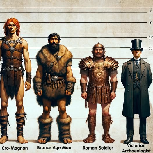
Peering into the mists of prehistory, we discern figures as monumental as the structures they erected. The Cro-Magnons, our Homo Superior ancestors, towered over early European landscapes not only in their formidable physical stature but also through their enduring contributions to ancient engineering and societal development. Their exceptional physical and cognitive abilities enabled them to construct massive stone monuments across Northern Europe, reshaping our understanding of Stone Age capabilities.


1. The Tallest of the Human Line

Most textbooks cautiously report Upper Palaeolithic men at around 1.65–1.75 m. But these estimates are warped by several factors:

  • Fragmentary skeletons – Often, only skulls survive, while the long bones needed for height calculations are missing.
  • Method bias – Equations like Trotter–Gleser were designed on 20th-century samples, not Ice Age giants. Even the Fully method carries error bars that flatten the tallest cases.
  • Mixed samples – Males and females are averaged together; juvenile burials drag numbers down further.
  • Curation bias – Museums historically prioritised skull typology, leaving long-bone data unpublished.
  • Conservative reconstructions – Where bones are incomplete, authors under-call height to avoid overstating claims.

Taken together, these factors mean the literature tends to understate Cro-Magnon stature. Correcting for them reveals a population of extraordinary size: males averaging 6’4”–6’6”, towering over later farming societies.

Cro-Magnons - An Explainer

2. Tools of the Titans: Weaponry and Heavy Implements

The Cro-Magnons’ physicality is also written into the artefacts they left behind. Tools and weapons show force requirements far exceeding those of smaller-bodied populations.

The Neolithic Power Axe

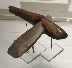
The Ehenside Tarn axe from Langdale, with its preserved wooden handle and massive stone head, is a case in point. Unlike modern axes:

  • Heavier stone head.
  • Green-wood handle, heavier and less elastic than seasoned timber.
  • Short, thick grip, clearly designed for big hands.

Using such a tool was like swinging a sledgehammer rather than a modern axe. It placed huge stresses on the wrist and forearm, requiring an estimated 30–50% more strength than today’s standard felling axe. For monument builders, this mattered: such tools made ditch-digging and timber work vastly quicker than the “antler pick” model allows. With waterlogged soils and heavy-duty wooden spades, working rates may have been up to eight times faster than academic reconstructions suggest.

Cro-Magnons - An Explainer

The Meare Heath Bow

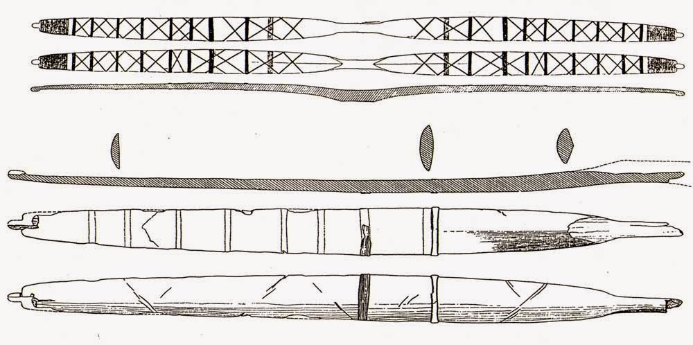
Weaponry tells the same story. The Meare Heath bow, dated c. 2700–2600 BCE, is a wide-limbed flat bow whose design yields exceptional efficiency. Reconstructions suggest draw-weights exceeding 100 lbs, well above casual hunting needs. Even elite medieval longbowmen rarely surpassed 90 lbs.

Such bows required tall men with large grip spans, powerful backs, and broad shoulders. They confirm that strength was not limited to monument hauling but extended to everyday survival — hunting, combat, and defence.

Cro-Magnons - An Explainer

Why This Matters

These tools were not toys. They demanded and rewarded size, grip strength, and resilience.

  • Bones show unusual robustness.
  • Monuments show construction on a giant scale.
  • Tools show force requirements that match Cro-Magnon physiology.

Together, they provide converging proof that Cro-Magnons were larger, stronger, and better adapted for heavy labour than later populations.


3. Quantum of the Solstice: Monuments as Human Yardsticks

Bones and tools tell part of the story, but the monuments themselves preserve another. Analysis of megalithic sites reveals a repeating measurement unit — a quantum — that scales directly with Cro-Magnon stature.

Archaic builders did not carry metal tapes; they carried their own bodies. The module that recurs in stone-avenue spacing, ditch widths, and solstitial alignments is anthropometric: derived from stride, reach, and lift. And crucially, the module fits a body plan larger than modern humans.

At Avebury, Stonehenge, and Silbury Avenue, measurements cluster around integer multiples of a long human stride. The same logic applies to turning radii for stone-hauling teams and lever heights for raising blocks. The coherence is hard to dismiss as coincidence. It looks like a standard — and the standard looks big.

One of the most compelling clues comes from a unit we still use today: the foot. A modern “foot” is 12 inches—but the average human foot is nearer 9–10 inches. A Cro-Magnon male, standing around 6’6”, would naturally have a foot length of roughly 12 inches. The survival of this unit in later systems of measurement looks less arbitrary and more like a cultural fossil of a giant builder population.

In effect, the monuments are a tape measure left in the landscape. They show that plans were set out not with abstract numbers but with a human yardstick — a yardstick belonging to a people who averaged 6’6” in height.

Cro-Magnons - An Explainer

4. Moving Stones Like Pebbles

Stonehenge, Carnac, and Avebury were not symbolic follies. They required hauling, lifting, and balancing blocks of 20–40 tonnes. For Cro-Magnons, this was feasible because:

  • Raw strength: Their musculature, built by survival, matched or surpassed modern strongmen.
  • Bone density: Robust skeletons allowed sustained strain.
  • Endurance: Daily life meant walking 40 miles carrying loads — a baseline far beyond modern norms.

What looks miraculous to us was within reach for them.

Cro-Magnons - An Explainer

5. Masters of Water and Stone

These giants were not just strong — they were ingenious. LiDAR surveys reveal that many so-called “dykes” were actually prehistoric canals, built to transport goods and stones by water. Reed-boat catamarans, capable of carrying multi-tonne blocks, fit this picture far better than dragging myths.

Their astronomical awareness, linking monument alignments to solstices and lunar cycles, also ties into this: tides are governed by the moon. For master navigators, sky and water were a single system.

Cro-Magnons - An Explainer

6. The Diet of Giants

Why were Cro-Magnons so large? The answer lies in diet and selection.
  • High-protein game, fish, and shellfish.
  • Wild plants dense in micronutrients.
  • No processed foods, no cereal-driven stunting.

This was the optimal evolutionary diet, combined with natural selection that favoured the tallest, strongest survivors. When farming arrived, average stature actually shrank. Farmers created civilisation, but Cro-Magnons created the monuments.

Cro-Magnons - An Explainer

7. Cro-Magnons vs. Modern Strongmen

Today’s strongmen stand tall (6’3”–6’8”, 300–450 lbs). But they are outliers, trained for short bursts. Cro-Magnons were an entire population living this way:

  • Strength: Able to drag 800–1,000 lbs in real-world settings.
  • Endurance: Capable of 40+ miles a day under load.
  • Agility: Unlike modern strongmen, they could sprint, climb, and fight.
  • Resilience: Bones denser, joints tougher, injuries less frequent.

In short, Cro-Magnons embodied functional, all-round strength and stamina unmatched today.

Cro-Magnons - An Explainer

8. Why the Academic Shrinking Act?
Why are they still described as “about our size”? Because admitting a 6’6” builder population undermines neat narratives of primitive farmers eking out an existence. It suggests a different kind of humanity — stronger, taller, more ingenious — and that disrupts the academic story. Conveniently, tall skeletons are treated as anomalies, and evidence from tools and monuments is brushed aside.

(How Academia Abandoned Society)

9. Conclusion: Giants Who Shaped Europe

The legacy of the Cro-Magnons is not confined to bones in museums. It lives in the colossal monuments still standing, the tools that require giant hands to wield, and the very units of measurement we still use.

Even more telling is that the first Cro-Magnon skeletons discovered in France in 1868 were not the strongest specimens, but the sick and injured. Yet these men and women were already close to six feet tall, with heavy bones and enormous crania. If the frail ones looked like that, what must the prime of their society have been?

They were not small tribes dragging stones with antlers. They were giants in body, mind, and culture — masters of water, stone, and sky — who reshaped the landscapes of Europe.

Cro-Magnons were not just “like us.” They were more.

Cro-Magnons - An Explainer

Exploring Prehistoric Britain: A Journey Through Time

My blog delves into the fascinating mysteries of prehistoric Britain, challenging conventional narratives and offering fresh perspectives based on cutting-edge research, particularly using LiDAR technology. I invite you to explore some key areas of my research. For example, the Wansdyke, often cited as a defensive structure, is re-examined in light of new evidence. I’ve presented my findings in my blog post Wansdyke: A British Frontier Wall – ‘Debunked’, and a Wansdyke LiDAR Flyover video further visualizes my conclusions.

My work also often challenges established archaeological dogma. I argue that many sites, such as Hambledon Hill, commonly identified as Iron Age hillforts are not what they seem. My posts Lidar Investigation Hambledon Hill – NOT an ‘Iron Age Fort’ and Unmasking the “Iron Age Hillfort” Myth explore these ideas in detail and offer an alternative view. Similarly, sites like Cissbury Ring and White Sheet Camp, also receive a re-evaluation based on LiDAR analysis in my posts Lidar Investigation Cissbury Ring through time and Lidar Investigation White Sheet Camp, revealing fascinating insights into their true purpose. I have also examined South Cadbury Castle, often linked to the mythical Camelot56.

My research also extends to the topic of ancient water management, including the role of canals and other linear earthworks. I have discussed the true origins of Car Dyke in multiple posts including Car Dyke – ABC News PodCast and Lidar Investigation Car Dyke – North Section, suggesting a Mesolithic origin2357. I also explore the misidentification of Roman aqueducts, as seen in my posts on the Great Chesters (Roman) Aqueduct. My research has also been greatly informed by my post-glacial flooding hypothesis which has helped to inform the landscape transformations over time. I have discussed this hypothesis in several posts including AI now supports my Post-Glacial Flooding Hypothesis and Exploring Britain’s Flooded Past: A Personal Journey

Finally, my blog also investigates prehistoric burial practices, as seen in Prehistoric Burial Practices of Britain and explores the mystery of Pillow Mounds, often mistaken for medieval rabbit warrens, but with a potential link to Bronze Age cremation in my posts: Pillow Mounds: A Bronze Age Legacy of Cremation? and The Mystery of Pillow Mounds: Are They Really Medieval Rabbit Warrens?. My research also includes the astronomical insights of ancient sites, for example, in Rediscovering the Winter Solstice: The Original Winter Festival. I also review new information about the construction of Stonehenge in The Stonehenge Enigma.

Further Reading

For those interested in British Prehistory, visit www.prehistoric-britain.co.uk, a comprehensive resource featuring an extensive collection of archaeology articles, modern LiDAR investigations, and groundbreaking research. The site also includes insights and extracts from the acclaimed Robert John Langdon Trilogy, a series of books exploring Britain during the Prehistoric period. Titles in the trilogy include The Stonehenge Enigma, Dawn of the Lost Civilisation, and The Post Glacial Flooding Hypothesis, offering compelling evidence about ancient landscapes shaped by post-glacial flooding.

To further explore these topics, Robert John Langdon has developed a dedicated YouTube channel featuring over 100 video documentaries and investigations that complement the trilogy. Notable discoveries and studies showcased on the channel include 13 Things that Don’t Make Sense in History and the revelation of Silbury Avenue – The Lost Stone Avenue, a rediscovered prehistoric feature at Avebury, Wiltshire.

In addition to his main works, Langdon has released a series of shorter, accessible publications, ideal for readers delving into specific topics. These include:

For active discussions and updates on the trilogy’s findings and recent LiDAR investigations, join our vibrant community on Facebook. Engage with like-minded enthusiasts by leaving a message or contributing to debates in our Facebook Group.

Whether through the books, the website, or interactive videos, we aim to provide a deeper understanding of Britain’s fascinating prehistoric past. We encourage you to explore these resources and uncover the mysteries of ancient landscapes through the lens of modern archaeology.

For more information, including chapter extracts and related publications, visit the Robert John Langdon Author Page. Dive into works such as The Stonehenge Enigma or Dawn of the Lost Civilisation, and explore cutting-edge theories that challenge traditional historical narratives.

Other Blogs

s

t

LiDAR Tile Reference Map

You can use this LiDAR tile Reference Map to SEARCH and find out the official Block Number of the TILE you need to order (go to layers and click on the 5km grid checkbox) – or just play for fun at a 2D level with the most detailed map available on the internet today!!

LiDAR Mapping Service

We can now offer a LiDAR Mapping Service by supplying 25 sq. km data tiles for a new low cost from £9.95 to £19.95 – depending on functionality.

These tiles are from the Government DEFRA survey data – but have been formatted to allow instant viewing (without the need for formatting) and are supplied with a FREE software package, which allows you to change and manipulate the data as shown in our website and video channel on YouTube.

LiDAR Mapping Service
Sample of how the software looks on the PC – LiDAR Mapping Services

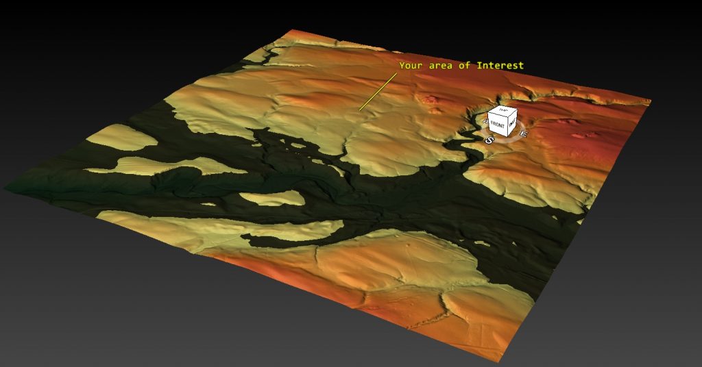
The software allows you ADD and alter the LiDAR data to show you features such as prehistoric water levels.

25km tile size with water
Data with added water – LiDAR Mapping Services

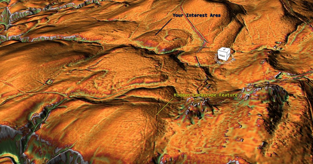
You can also fly around your interest area and record the images.

You can even track a path across the terrain and fly over and record the flight.

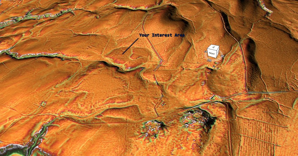
The software package also offers you to increase the contrast of the data allow you yo enhance any surface features.

High Contrast Filters
High Contrast Filter – LiDAR Mapping Services

And the scale of the terrain can also be exaggerated to discover HIDDEN FEATURES below the surface.

High Contrast and Scale Enhancement Filters
High scale and Contrast Filters – LiDAR Mapping Services

We offer you this FREE software which comes with full manuals and online tutorials fully working for 30 days – plus preformatted tiles (priced at £19.95 each) that are fully functional even after after the trial period is completed. Our LiDAR Mapping Service comes with a 30-day money back guarantee of COMPLETE satisfaction as our product is second to none.

You need to either send us details of the site you require by looking up the place name or post code on the DEFRA site and Quoting the TILE NUMBER Required. The Link to the site is HERE

LiDAR Mapping Services

More examples of these maps are available on the home page of our website or on our video channel – CONTACT US at : sales@prehistoric-britain.co.uk for more details or place an order.

And for those on a budget or want less functionality we can supply a simple HTML version for just £9.95 per tile.

Other Blogs

s

t

The Stonehenge Hoax – Totem Poles

Introduction

Lots of cowboys (archaeologists) but no Indians (scientists) – Extract from the book Conundrum 4

The Problem

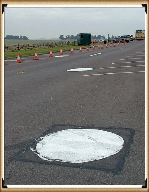
Four post holes were found in the old visitor’s car park at Stonehenge in 1966; these holes were excavated, and the pine charcoal found was dated (by observation) to be Neolithic, and the same date as the carbon-dated Antler picks found on the site some 50m away.   The problem arose when someone pointed out that Pine trees didn’t exist in the Stonehenge area in the Neolithic and that the post holes were filled in with ‘silt’ (from a river).  So they carbon-dated the pine to find out it was Meslithic some 5,000 before Stonehenge was supposedly built – so they came up with a story of ‘Totem Poles’ placed at random from a hunter-gather tribe, which had nothing to do with Stonehenge.

The Solution

The most compelling evidence for the rise in water tables during the prehistoric period can be found in the old car park of Stonehenge.  Ignored by visitors who used to casually park their cars near the stones, three giant circles (similar to mini-roundabouts) were painted on the floor.

These painted circles showed where post holes were discovered when the car park was first constructed, measuring at least 1 metre in diameter.  Interestingly, and somewhat ironically, the original car park was built at this location because archaeologists believed that this area had no historical relevance – which was far from the truth.  During these excavations, three pits were discovered, which contained pieces of bone and fragments of charcoal – as the pits had held large wooden posts.  When this pine charcoal was eventually carbon-dated, it was found to be some 10,000 years old, over twice the age of any other part of Stonehenge.

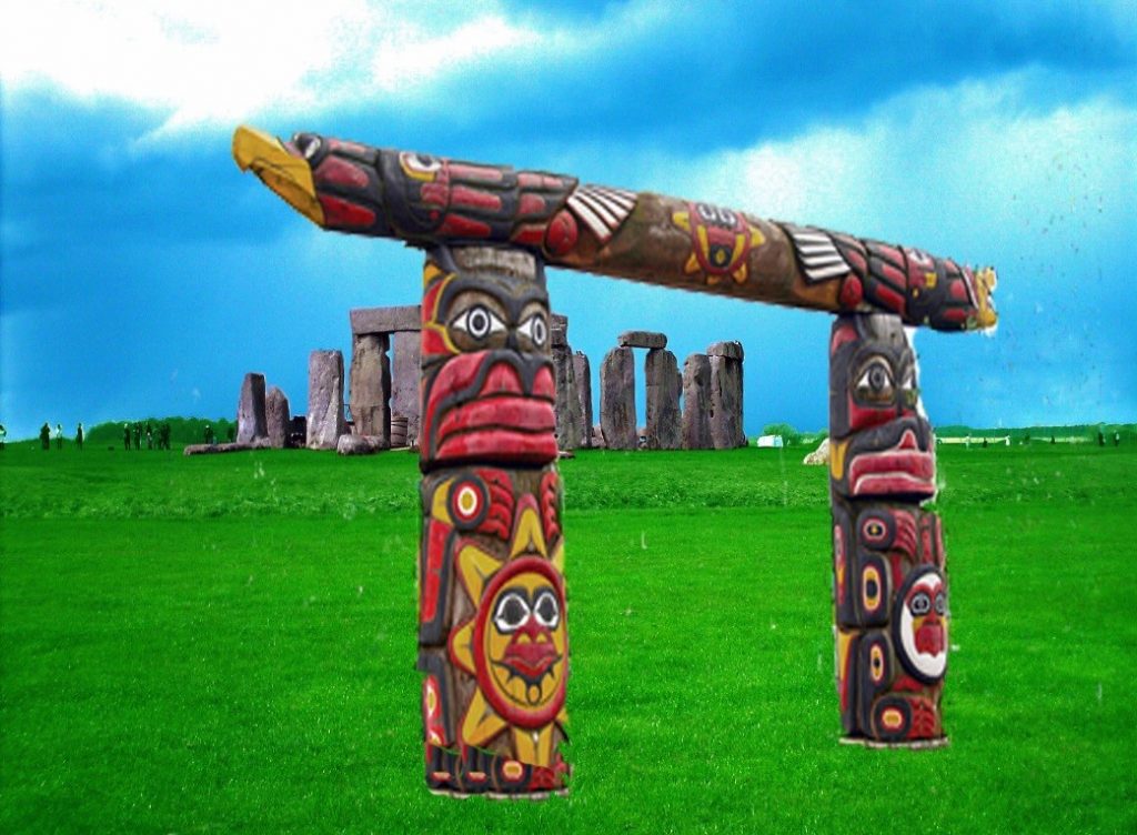
Traditional archaeology describes these posts that would have been placed in these post holes as ‘totem poles’.  However, if this were true, why would the Mesolithic people need to struggle with using giant trees over 1 metre wide (which would be 150 to 200 ft tall) to erect a ‘ritual’ totem pole?  Our ancestors only possessed flint axes and fire, it would seem more plausible that smaller trees would have been utilised (as seen in North America) to create these ‘totem poles’ rather than the giant metre-wide variety?

The Stonehenge Hoax - Totem Poles
Stonehenge Old Car Park One Metre Post Holes – The Stonehenge Hoax – Totem Poles

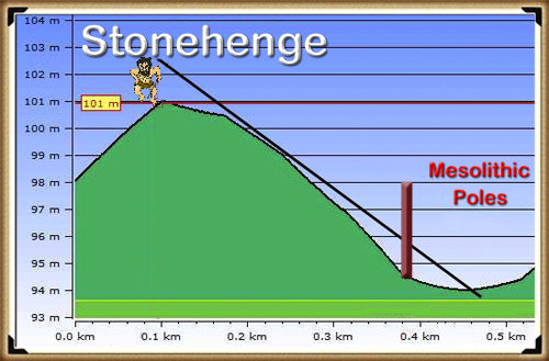
The old car park is 10m lower than the Stonehenge site, and recent radiocarbon dating (by Darvill and Wainwright’s excavations in 2008) has confirmed from charcoal remains (inside the Sarsen Circle) that the area on which the Stonehenge monument is situated was also in use by 7200 BCE and this was confirmed a couple of years later by a team from the Open University, who found an OX tooth, from ‘feasting’ in a nearby site called ‘Blick Mead’ that was also dated during the 7th millennium BCE at 6250 BCE, emphasising that this area of Stonehenge was for other purposes, rather than an isolated site with marker posts.

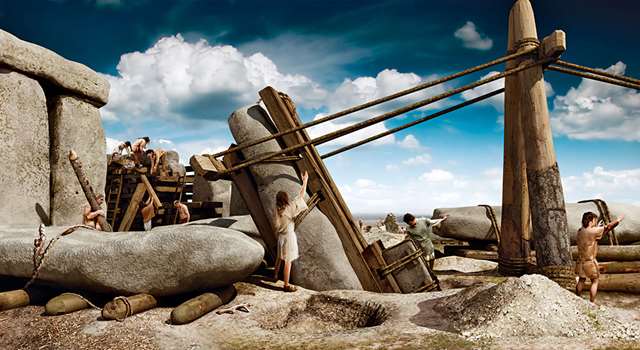
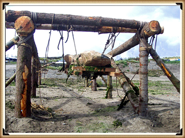
If my hypothesis is correct, these post holes housed posts which were functional mooring posts for boats.   They were utilised for unloading their stone cargo, and as it was on a tidal river – the post’s cross-beams could be used as simple lifting devices.  These cross beams were placed on two of these 1 metre wide posts, secured with a simple mortise and tenon joint, as used on the Stonehenge lintels.

This lifting device could have been used to raise stones from boats during high tide by merely tying the stones to the cross beams.  Then, as the tide receded, the vessel holding the stone would naturally lower in the water, lifting the stone ‘like magic’ into the air.  This is the first example of a hydraulic lift, which shows the level of sophistication in our ancestor’s thinking.  The stone could then be lowered to either a sledge or rollers placed under the cross beam for the 50m journey to the top of the hill.

‘lifting device’ that could raise Bluestones out of the boats on to sledges -The Stonehenge Hoax - Totem Poles
A ‘lifting device’ that could raise Bluestones out of the boats on to sledges -The Stonehenge Hoax – Totem Poles

Archaeologists have always calculated that to transport the Bluestones, our ancestors had taken a very long and dangerous boat trip around the coast of South West Britain to an outlet on the South coast that allowed boats to travel up the River Avon or to the banks of Somerset in the North, and had then to dragged the stones some 50 miles South, to their resting place in Salisbury Plain.  Or some have even imagined dragging these 4-tonne stones on sledges over 200 miles through woods, forests, and rivers.

'Totem Poles' - place at the bottom of the Dry River Valley out of sight make no sense - ‘lifting device’ that could raise Bluestones out of the boats on to sledges -The Stonehenge Hoax - Totem Poles
‘Totem Poles’ – place at the bottom of the Dry River Valley out of sight make no sense‘lifting device’ that could raise Bluestones out of the boats on to sledges -The Stonehenge Hoax – Totem Poles

My ‘Post-Glacial Flooding Hypothesis’ now enables us to understand how they could have easily travelled on a direct water route between South Wales through Somerset to the Rivers Kennet and Avon to bring these stones to Stonehenge and how easy it was to use tidal hydraulics to place these stones carefully on to boats for the journey.

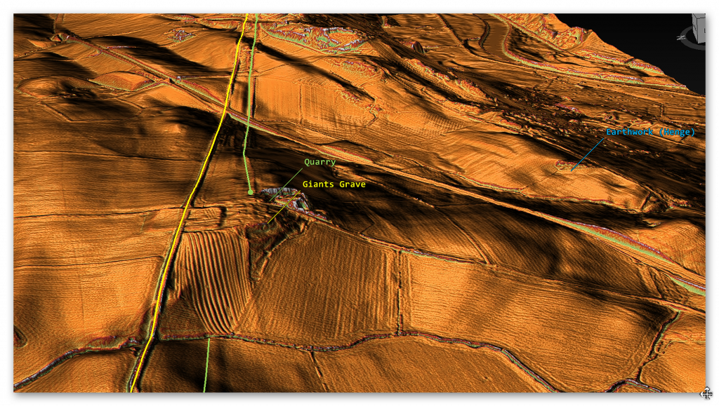
The Validation of my theory was found came with the discovery of the Stonehenge Quarry (Craig Rhos_Y-Felin), which has a series of Mesolithic Hearths that match the carbon dates of the four Old Car Park post holes.

Why did they place mooring posts towards the North-West Entrance?

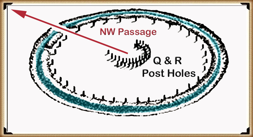
Based on my hypothesis, there should be some evidence of a ‘lost’ processional walkway on the North West side of the monument, towards the original ancient shoreline and mooring station, which would have acted as a natural entry route to the site.  In addition, archaeologists have discovered a series of holes (known as Q & R holes) in a semi-circular shape at the centre of Stonehenge, which predates the current Sarsen Stones.  The most interesting aspect of this semi-circle is its alignment in a North-Western direction.

In astronomical terms, this is very important as it faces the midsummer moonset’s general direction- highlighting the moon’s relationship to the site, as opposed to the Sun, as many ‘druids’ would have us believe.  This connection is reinforced as the construction of the mooring posts was based on the tidal waters, which depend on the moon’s position and time of day.

One of the most significant archaeological mysteries of the Mesolithic and Neolithic periods is the lack of human remains.

We know that the population would have been relatively small during these periods in history, but the lack of graves has forced archaeologists to investigate non-burial alternatives.  One of the favoured alternative methods to burial is known as ‘excarnation’.  Native American Indian tribes commonly practised this process, which involves the corpse being left open to the elements to decompose – a symbolic method of returning the body to mother earth.

The larger bones would then be collected together and buried with other members of the tribe or family in vaults or tombs.  We know that such groups of bones have been found in the Long Barrows surrounding Stonehenge, but to date, no dedicated excarnation sites have been found, until now.

Q & R Dolman holes and Bluestones - -The Stonehenge Hoax - Totem Poles
Q & R Dolman holes and Bluestones – -The Stonehenge Hoax – Totem Poles

Looking at these Q & R post holes, these form a pre-Sarsen semi-circle at Stonehenge.  If you look closely, they consist of two parallel sets.  Moreover, they emulate not a ‘horseshoe’ as the archaeologists typically refer to such objects, but a ‘crescent moon’ for an apparent reason, in preparation for the journey to the land of the dead.  Another point of interest is the distance between each stone in each individual set, which is approximately 2 metres.  The 2 metres (6-foot) spacing of these stone holes should seem familiar as it’s the same length as an average coffin or gravel pit.  As this was a monument to the dead, it would seem appropriate that it would be designed in such a way as to allow bodies to be positioned at its centre, aligned with the setting moon.

The platforms upon which the dead were laid were likely either wooden or stone slabs – as we see from other prehistoric monuments known as ‘Dolmens’ which archaeologists have still to identify their purpose. 

Moreover, a resistance survey was taken in May 1994 clearly shows a path leading from the centre of the monument to the car park post holes, past the expected location of Aubrey Hole 40 – the lack of evidence for this post hole may also indicate that there once existed a pathway that passed to the North West on the original plan of the site. 

Seriously?? They are made from 1m wide 150ft trees and were sporadically replaced over a period of 1,000 years - Q & R Dolman holes and Bluestones -The Stonehenge Hoax - Totem Poles
Seriously?? They are made from 1m wide 150ft trees and were sporadically replaced over a period of 1,000 years – Q & R Dolman holes and Bluestones -The Stonehenge Hoax – Totem Poles

Unearth the Astonishing Secrets of Stonehenge (The Stonehenge Hoax)

Introduction

Video

Synopsys

Stonehenge, a timeless enigma etched in stone and earth, has stood as a formidable puzzle challenging the intellects of archaeologists and historians alike. Despite the myriad attempts, including books, TV programs, and academic conferences, the secrets of these ancient stones and their encircling ditches have proven elusive. Against this backdrop, we scrutinise the existing thirteen hypotheses, each presenting its narrative but collectively lacking a coherent thread.

In adopting the deductive reasoning akin to Sherlock Holmes, we endeavour to weave these disparate threads into a unified tapestry that not only unravels the mystery of Stonehenge but also shakes the foundations of established academic narratives. This intellectual journey may induce some discomfort as we challenge conventional perceptions and invite a reevaluation of our understanding of the past. Apologies are extended in advance for any cognitive dissonance, but the pursuit of truth and reason mandates an unfiltered presentation of the facts.

So, fasten your seatbelts for an expedition into the archaeological unknown.

As we navigate this intellectual rollercoaster, be prepared for a revelation that might reshape our understanding of Stonehenge and question the foundations of our historical narratives. The dawn of a new archaeological era awaits promising insights that could leave even the most curious minds astonished. As we delve into this intellectual rabbit hole, be ready for a revelation that could make Alice astonished.

Robert John Langdon (2023) – (The Stonehenge Hoax)

The Journey

Langdon’s journey was marked by meticulous mapping and years of research, culminating in a hypothesis that would reshape our understanding of prehistoric Britain. He proposed that much of the British Isles had once been submerged in the aftermath of the last ice age, with these ancient sites strategically positioned along the ancient shorelines. His groundbreaking maps offered a fresh perspective, suggesting that Avebury had functioned as a bustling trading hub for our ancient ancestors. This audacious theory challenged the prevailing notion that prehistoric societies were isolated and disconnected, instead highlighting their sophistication in trade and commerce.

In the realm of historical discovery, the audacious thinkers, the mavericks who dare to question established narratives, propel our understanding forward. Robert John Langdon is undeniably one of these thinkers. With a deep passion for history and an unyielding commitment to his research, he has unearthed a hidden chapter in the story of Avebury that transcends the boundaries of time and offers fresh insights into our shared human history.

As Langdon’s trilogy, ‘The Stonehenge Enigma,’ continues to explore these groundbreaking theories, it beckons us to embark on a journey of discovery, to challenge our assumptions, and to embrace the possibility that the past is far more complex and interconnected than we ever imagined. With its ancient stones and enigmatic avenues, Avebury continues to whisper its secrets to those who dare to listen, inviting us to see history through a new lens—one illuminated by the audacious vision of Robert John Langdon.

The Book

The Stonehenge Hoax
The Great Stonehenge Hoax

Further Reading

For information about British Prehistory, visit www.prehistoric-britain.co.uk for the most extensive archaeology blogs and investigations collection, including modern LiDAR reports.  This site also includes extracts and articles from the Robert John Langdon Trilogy about Britain in the Prehistoric period, including titles such as The Stonehenge Enigma, Dawn of the Lost Civilisation and the ultimate proof of Post Glacial Flooding and the landscape we see today.

Robert John Langdon has also created a YouTube web channel with over 100 investigations and video documentaries to support his classic trilogy (Prehistoric Britain). He has also released a collection of strange coincidences that he calls ‘13 Things that Don’t Make Sense in History’ and his recent discovery of a lost Stone Avenue at Avebury in Wiltshire called ‘Silbury Avenue – the Lost Stone Avenue’.

Langdon has also produced a series of ‘shorts’, which are extracts from his main body of books:

The Ancient Mariners

Stonehenge Built 8300 BCE

Old Sarum

Prehistoric Rivers

Dykes ditches and Earthworks

Echoes of Atlantis

Homo Superior

Other Blogs

s

t

Section V – NZ26NE & NZ26SE

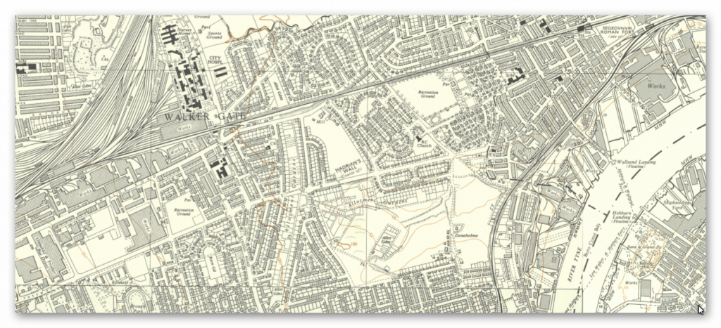
Section V – NZ26NE & NZ26SE – this is a section of Hadrian’s Wall showing the LiDAR, Google Earth and 1800 Maps of the Area covered by Historic England

Historic England Sections:

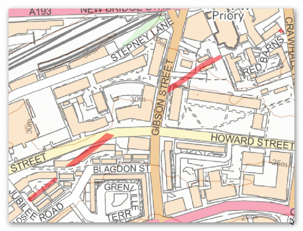
Name: Name: Hadrian’s Wall in wall mile 0, Wallsend Roman fort, Segedunum to wall mile 4, sections of wall between Crawhall Road and Jubilee Road

List UID: 1003512, 1003508, 1003511, 1003510, 1003507, 1005914

Name: Hadrian’s Wall in
Designation Type: Scheduling
Grade: Not Applicable to this List Entry
List UID: 1003512

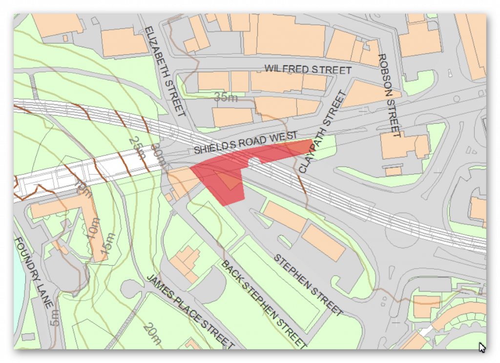
Name: Hadrian’s Wall in wall mile 2, Byker section of Hadrian’s Wall and presumed site of milecastle 3 at Shields Road West
Designation Type: Scheduling
Grade: Not Applicable to this List Entry
List UID: 1003508

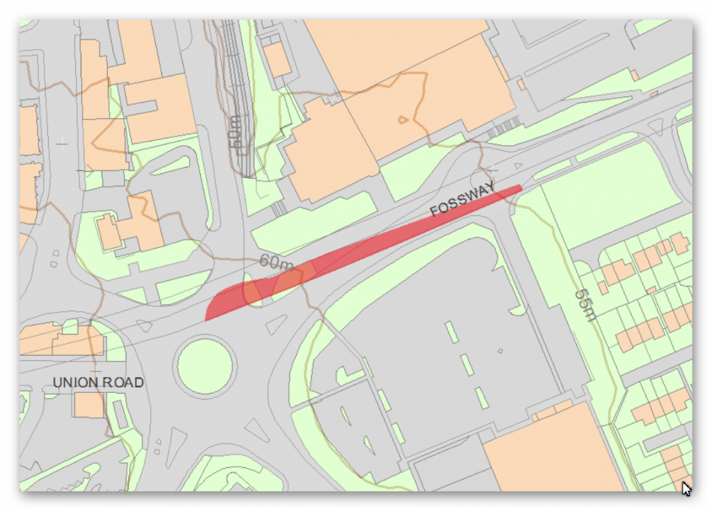
Name: Hadrian’s Wall in wall mile 2, Walker section of Hadrian’s Wall near the junction of Fossway and Shields Road
Designation Type: Scheduling
Grade: Not Applicable to this List Entry
List UID: 1003511

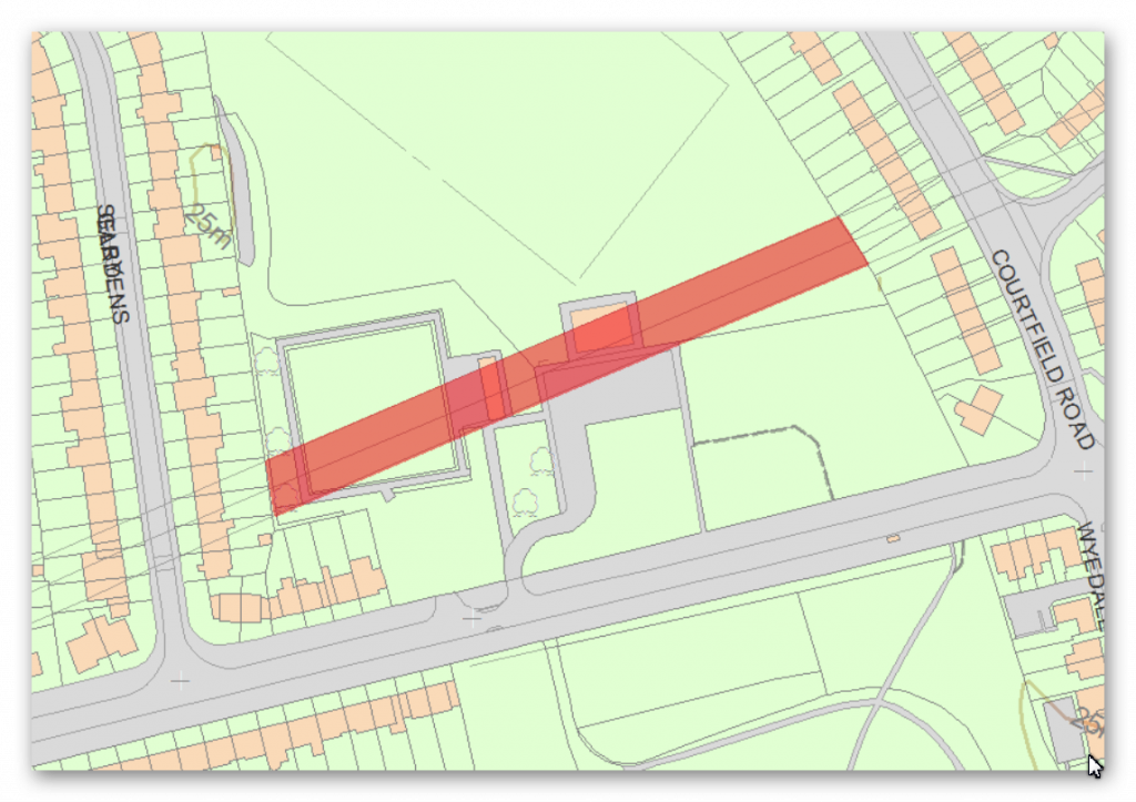
Name: Hadrian’s Wall in wall mile 2, Walker section of Hadrian’s Wall 171m long across Millers Dene playing field
Designation Type: Scheduling
Grade: Not Applicable to this List Entry
List UID: 1003510

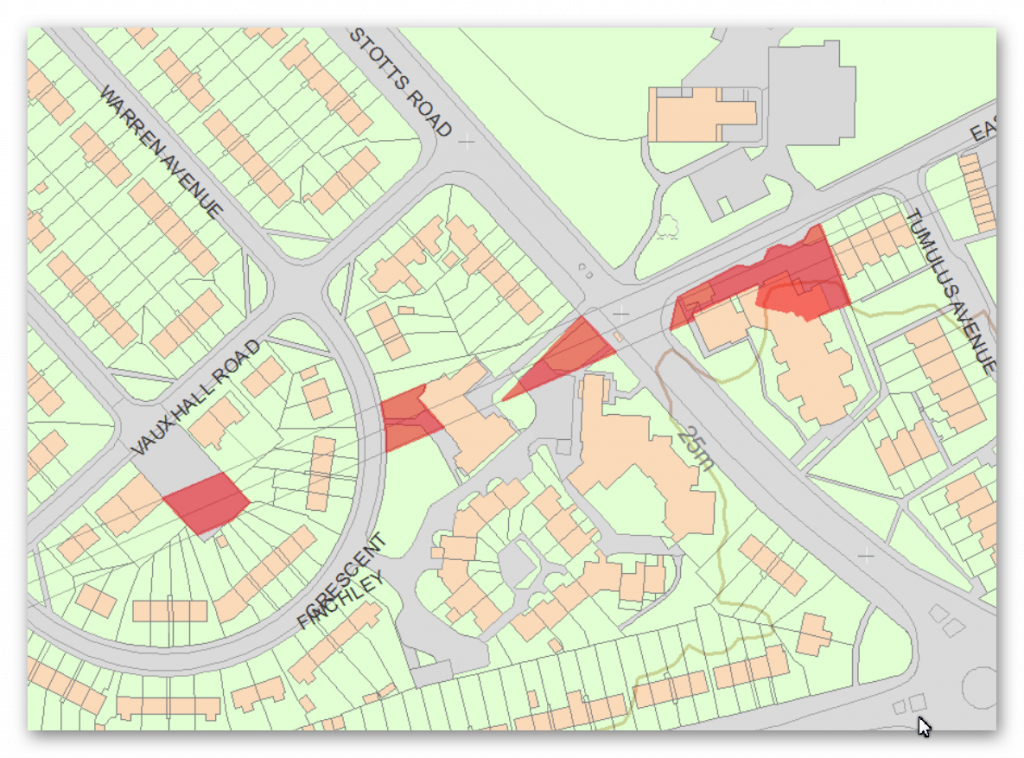
Name: Hadrian’s Wall in wall mile 1, three sections between Stotts Road and Vauxhall Road
Designation Type: Scheduling
Grade: Not Applicable to this List Entry
List UID: 1003507

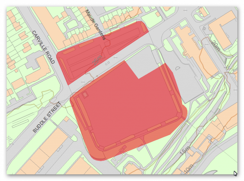
Name: Hadrian’s Wall in wall mile 0, Wallsend Roman fort, Segedunum
Designation Type: Scheduling
Grade: Not Applicable to this List Entry
List UID: 1005914

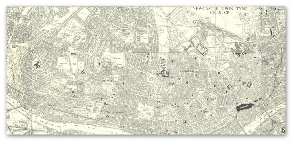
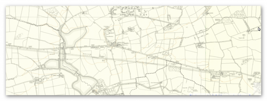
Old OS Map

Section V - NZ26NE & NZ26SE - OS Map
Section V – NZ26NE & NZ26SE – OS Map

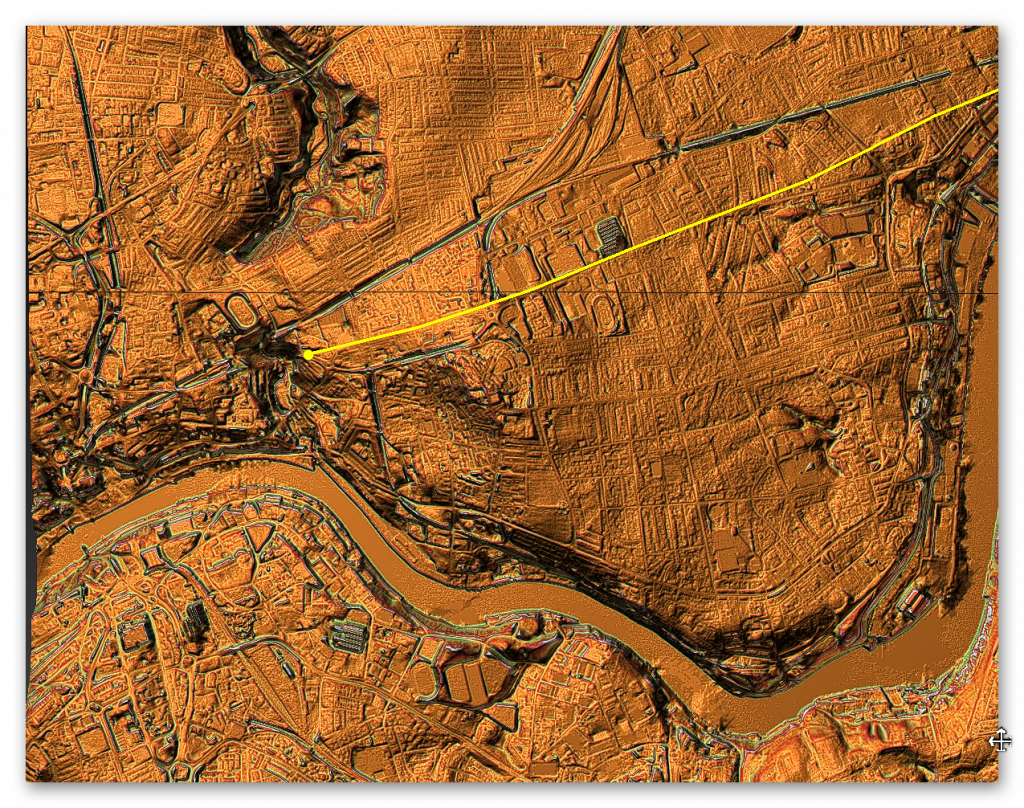
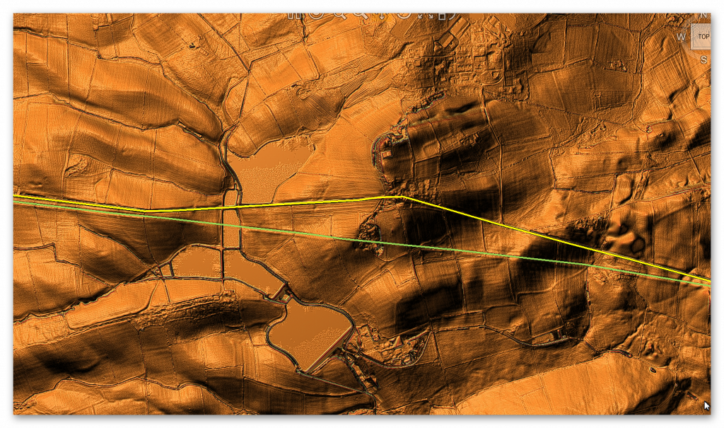
LiDAR Map

Section V - NZ26NE & NZ26SE - OS Map -  Wall in Yellow - Vallum is not in this area
Section V – NZ26NE & NZ26SE – OS Map – Wall in Yellow – Vallum is not in this area

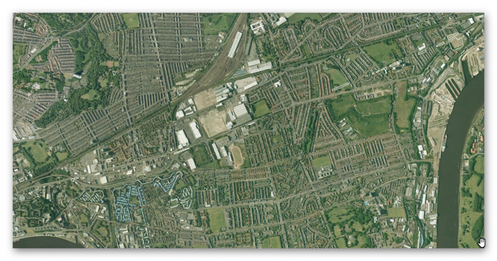
Google Earth Map

Section V - NZ26NE & NZ26SE - GE Map
Section V – NZ26NE & NZ26SE – GE Map

Historic England Scheduled Monuments within Section V

Name: Hadrian’s Wall in wall mile 4, sections of wall between Crawhall Road and Jubilee Road
Designation Type: Scheduling
Grade: Not Applicable to this List Entry
List UID: 1003512

Name: Hadrian’s Wall in wall mile 2, Byker section of Hadrian’s Wall and presumed site of milecastle 3 at Shields Road West
Designation Type: Scheduling
Grade: Not Applicable to this List Entry
List UID: 1003508

Name: Hadrian’s Wall in wall mile 2, Walker section of Hadrian’s Wall near the junction of Fossway and Shields Road
Designation Type: Scheduling
Grade: Not Applicable to this List Entry
List UID: 1003511

Name: Hadrian’s Wall in wall mile 2, Walker section of Hadrian’s Wall 171m long across Millers Dene playing field
Designation Type: Scheduling
Grade: Not Applicable to this List Entry
List UID: 1003510

Name: Hadrian’s Wall in wall mile 1, three sections between Stotts Road and Vauxhall Road
Designation Type: Scheduling
Grade: Not Applicable to this List Entry
List UID: 1003507

Name: Hadrian’s Wall in wall mile 0, Wallsend Roman fort, Segedunum
Designation Type: Scheduling
Grade: Not Applicable to this List Entry
List UID: 1005914

1003512
1003512 – NZ26NE & NZ26SE

There is no HE entry for this section.

1003508
1003508 – NZ26NE & NZ26SE

There is no HE entry for this section.

1003511
1003511 – NZ26NE & NZ26SE

There is no HE entry for this section.

1003510
1003510 – NZ26NE & NZ26SE

There is no HE entry for this section.

1003512
1003512 – NZ26NE & NZ26SE

There is no HE entry for this section.

1005914
1005914 – NZ26NE & NZ26SE

There is no HE entry for this section.

Investigation

The Vallum does not exist in this section.

Further Reading

For information about British Prehistory, visit www.prehistoric-britain.co.uk for the most extensive archaeology blogs and investigations collection, including modern LiDAR reports.  This site also includes extracts and articles from the Robert John Langdon Trilogy about Britain in the Prehistoric period, including titles such as The Stonehenge Enigma, Dawn of the Lost Civilisation and the ultimate proof of Post Glacial Flooding and the landscape we see today.

Robert John Langdon has also created a YouTube web channel with over 100 investigations and video documentaries to support his classic trilogy (Prehistoric Britain). He has also released a collection of strange coincidences that he calls ‘13 Things that Don’t Make Sense in History’ and his recent discovery of a lost Stone Avenue at Avebury in Wiltshire called ‘Silbury Avenue – the Lost Stone Avenue’.

Langdon has also produced a series of ‘shorts’, which are extracts from his main body of books:

The Ancient Mariners

Stonehenge Built 8300 BCE

Old Sarum

Prehistoric Rivers

Dykes ditches and Earthworks

Echoes of Atlantis

Homo Superior

For active discussions on the findings of the TRILOGY and recent LiDAR investigations that are published on our WEBSITE, you can join our and leave a message or join the debate on our Facebook Group.

Section U – NZ26NW & NZ26SW

Section U – NZ26NW & NZ26SW – this is a section of Hadrian’s Wall showing the LiDAR, Google Earth and 1800 Maps of the Area covered by Historic England

Historic England Sections:

Name: Name: Hadrian’s Wall in wall mile 6, Condercum Roman fort, Benwell to wall mile 7, Scotswood section of vallum 75m long at Denton Dene

List UID: 1003504, 100500, 1003498, 10003499

Old OS Map

Section U - NZ26NW & NZ26SW - 1800 map
Section U – NZ26NW & NZ26SW – 1800 map

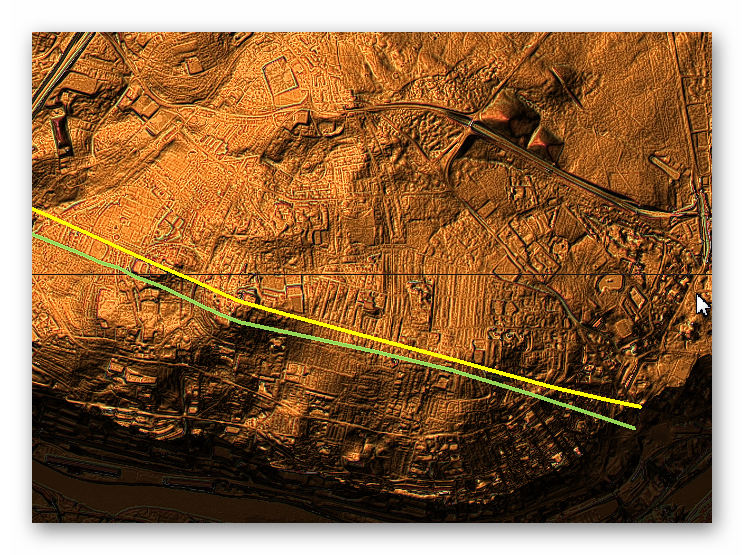
LiDAR Map

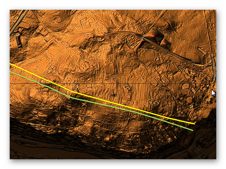
Section U - NZ26NW & NZ26SW -  Wall in Yellow -Vallum in Green
Section U – NZ26NW & NZ26SW – Wall in Yellow -Vallum in Green

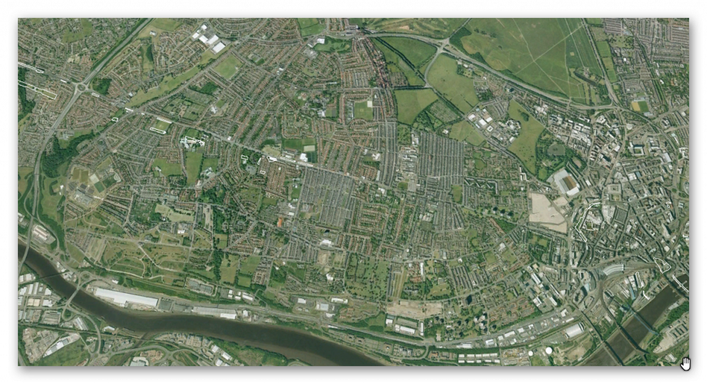
Google Earth Map

Section U - NZ26NW & NZ26SW -  GE
Section U – NZ26NW & NZ26SW – GE

Historic England Scheduled Monuments within Section U

Name: Hadrian’s Wall and vallum in wall mile 7, Scotswood section of vallum 75m long at Denton Dene
Designation Type: Scheduling
Grade: Not Applicable to this List Entry
List UID: 1003504

Name: Hadrian’s Wall in wall mile 7, Benwell length of vallum of Hadrian’s Wall in the grounds of Benwell Hill Cricket Club
Designation Type: Scheduling
Grade: Not Applicable to this List Entry
List UID: 1003500

Name: Hadrian’s Wall vallum in wall mile 6, Benwell length of vallum of Hadrian’s Wall in grounds of St Cuthbert’s School
Designation Type: Scheduling
Grade: Not Applicable to this List Entry
List UID: 1003498

Name: Hadrian’s Wall in wall mile 6, Condercum Roman fort, Benwell
Designation Type: Scheduling
Grade: Not Applicable to this List Entry
List UID: 1003499

1003504
1003504

There is no HE entry for this section.

100500

There is no HE entry for this section.

100499
100499

There is no HE entry for this section.

100498
100498

There is no HE entry for this section.

Investigation

The Vallum does not exist in this section enough to investigate – but the River Tyne is shown to be much larger in the past as both the wall and vallum is lost on its shorelines.

River Tyne - much larger in the past
River Tyne – much larger in the past

Further Reading

For information about British Prehistory, visit www.prehistoric-britain.co.uk for the most extensive archaeology blogs and investigations collection, including modern LiDAR reports.  This site also includes extracts and articles from the Robert John Langdon Trilogy about Britain in the Prehistoric period, including titles such as The Stonehenge Enigma, Dawn of the Lost Civilisation and the ultimate proof of Post Glacial Flooding and the landscape we see today.

Robert John Langdon has also created a YouTube web channel with over 100 investigations and video documentaries to support his classic trilogy (Prehistoric Britain). He has also released a collection of strange coincidences that he calls ‘13 Things that Don’t Make Sense in History’ and his recent discovery of a lost Stone Avenue at Avebury in Wiltshire called ‘Silbury Avenue – the Lost Stone Avenue’.

Langdon has also produced a series of ‘shorts’, which are extracts from his main body of books:

The Ancient Mariners

Stonehenge Built 8300 BCE

Old Sarum

Prehistoric Rivers

Dykes ditches and Earthworks

Echoes of Atlantis

Homo Superior

For active discussions on the findings of the TRILOGY and recent LiDAR investigations that are published on our WEBSITE, you can join our and leave a message or join the debate on our Facebook Group.

Unlocking the Mysteries of British Prehistory

Delve into the depths of time as we embark on a captivating voyage into the enigmatic world of British prehistory.  www.prehistoric-britain.co.uk is your portal to a treasure trove of archaeological wonders, modern LiDAR reports, and fascinating insights from the Robert John Langdon Trilogy.  This immersive digital hub is your key to unlocking the secrets of Britain’s ancient past.

A Glimpse into the Robert John Langdon Trilogy

Step into the shoes of Robert John Langdon, a dedicated explorer of Britain’s prehistoric mysteries.  His trilogy, comprising “The Stonehenge Enigma,” “Dawn of the Lost Civilization,” and “The Post-Glacial Flooding Hypothesis,” is a literary marvel that unravels the untold tales of our ancestors.  These books take you on an exhilarating journey through time, meticulously researched and backed by over 125 references from esteemed scientists, archaeological experts, and geological researchers.

Dive into the World of LiDAR

At www.prehistoric-britain.co.uk, we harness the power of LiDAR technology to unearth hidden landscapes and archaeological marvels.  Our LiDAR reports offer a modern lens through which you can peer into ancient history.  Explore the effects of flooding on the British environment after the great ice age melt, a phenomenon that has shaped the landscape we see today.  Join us in decoding the mysteries of our past using cutting-edge technology.

A Multimedia Experience

Our commitment to storytelling extends beyond the written word.  Robert John Langdon has curated a rich multimedia experience, including a YouTube web channel featuring over 100 investigations and video documentaries.  These visual journeys complement his classic trilogy, providing a multi-dimensional understanding of prehistoric Britain.  From Stonehenge’s construction in 8300 BCE to the lost Stone Avenue at Avebury in Wiltshire known as ‘Silbury Avenue,’ these documentaries offer an immersive experience that brings history to life.

Explore the ’13 Things that Don’t Make Sense in History’

History is replete with anomalies and enigmas that defy explanation.  Robert John Langdon has curated a collection of such historical curiosities in ’13 Things that Don’t Make Sense in History.’ These peculiar occurrences and unanswered questions will leave you pondering the mysteries of the past, inviting you to join the debate on their possible interpretations.

A Journey through Short Extracts

For those seeking concise insights, Langdon’s ‘shorts’ provide a glimpse into key topics such as ‘The Ancient Mariners,’ ‘Stonehenge Built 8300 BCE,’ ‘Old Sarum,’ ‘Prehistoric Rivers,’ ‘Dikes, Ditches, and Earthworks,’ ‘Echoes of Atlantis,’ and ‘Homo Superior.’ These bite-sized excerpts from his main body of work offer a quick yet informative overview of fascinating subjects in British prehistory.

Join the Discussion

The quest for knowledge is a communal endeavor.  At www.prehistoric-britain.co.uk, we encourage active participation and discussion.  Engage with like-minded enthusiasts and scholars to share your thoughts, insights, and questions.  Our platform fosters a vibrant community of individuals passionate about uncovering the mysteries of British prehistory.  Join the debate, leave a message, and be part of an ongoing exploration into our ancient past.

In conclusion, www.prehistoric-britain.co.uk is your gateway to a world of prehistoric wonders.  From the pages of Robert John Langdon’s Trilogy to the visual splendour of LiDAR reports and video documentaries, our platform offers a holistic approach to understanding British prehistory.  Explore, engage, and embark on a journey through time like never before.  Join us in unravelling the mysteries that shroud our ancient heritage.  Visit our website today and join the ongoing adventure into British prehistory.

Section T – NZ16NE

Section T – NZ16NE – this is a section of Hadrian’s Wall showing the LiDAR, Google Earth and 1800 Maps of the Area covered by Historic England

Historic England Sections:

Name: Name: Hadrian’s Wall and vallum in wall mile 7, Denton section of Hadrian’s Wall, Denton Turret and East Town House, Heddon-on-the-Wall in wall mile 11
List UID: 1010616, 1003796, 1003790, 1003789, 1003503

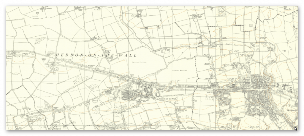
Old OS Map

Section T - NZ16NE - 1800 Map
Section T – NZ16NE – 1800 Map

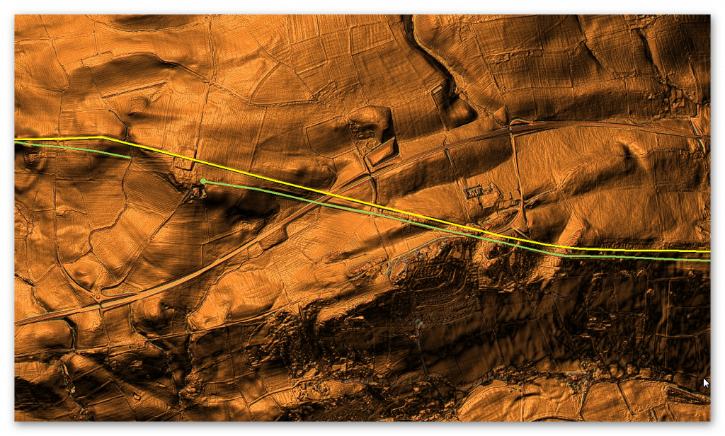
LiDAR Map

Section T - NZ16NE -  Wall in Yellow -Vallum in Green
Section T – NZ16NE – Wall in Yellow -Vallum in Green

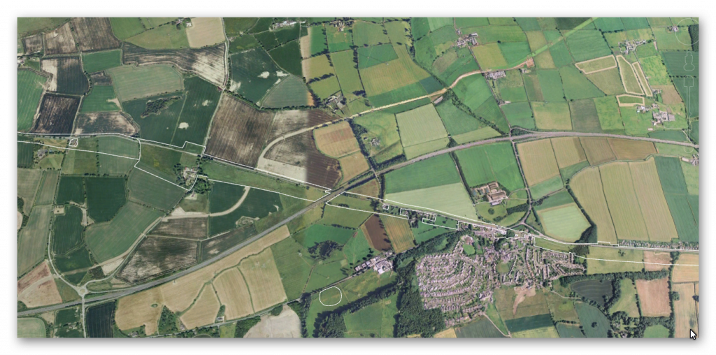
Google Earth Map

Section T - NZ16NE -  GE
Section T – NZ16NE – GE

Historic England Scheduled Monuments within Section T

Name: Hadrian’s Wall and vallum from Throckley to East Town House, Heddon-on-the-Wall in wall mile 11
Designation Type: Scheduling
Grade: Not Applicable to this List Entry
List UID: 1010616

Name: Hadrian’s Wall and vallum in wall mile 10 from Dene House to Throckley Bank Top
Designation Type: Scheduling
Grade: Not Applicable to this List Entry
List UID: 1003796

Name: Hadrian’s Wall and vallum in wall mile 9, Blucher to Dene House
Designation Type: Scheduling
Grade: Not Applicable to this List Entry
List UID: 1003790

Name: Hadrian’s Wall and vallum in wall mile 8 from Denton to Blucher
Designation Type: Scheduling
Grade: Not Applicable to this List Entry
List UID: 1003789

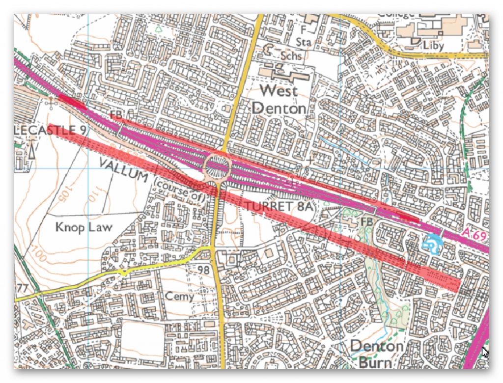
Name: Hadrian’s Wall and vallum in wall mile 7, Denton section of Hadrian’s Wall, Denton Turret and Hadrian’s Wall at West Denton
Designation Type: Scheduling
Grade: Not Applicable to this List Entry
List UID: 1003503

1010616
1010616

The monument includes a section of Hadrian’s Wall, its outer ditch and the vallum between Throckley and East Town House, Heddon-on-the-Wall. From various places in this section of the Wall corridor there are wide views northwards towards the Scottish Border and south west along Tynedale to the North Pennines.

At the east end of this section, the Wall survives as a buried feature below the course of the modern road, the B6528. Its line was recorded during roadworks in November 1926 and it was found to be of broad wall type. In the west end of this section there is a 255m stretch of upstanding consolidated wall between 2.8m and 3m in width, reaching a maximum height of 1.7m. The core was originally set in puddled clay, but is now reset in mortar to preserve the work. The upstanding section of the Wall is in the care of the Secretary of State. Turret 11b was located by excavation in 1919. It survives as a buried feature below the B6528. The location of Turret 11a has not yet been confirmed though it probably lies along the line of the wall somewhere opposite the Royal French Arms public house. During 1879 a hoard of over 5000 silver Roman coins was found just to the south of the Wall below the main road somewhere to the east of this turret site. The wall ditch is thought to survive as a buried feature underlying the gardens of the houses to the north of the Hexham Road (B6528), which are not included in the scheduling. However, west of the houses the ditch survives as an earthwork with a maximum depth of 1.9m and there is some rubble strewn over its scarps. In the west end of this section, opposite the consolidated stretch of wall, is a section of ditch, also in the care of the Secretary of State, which reaches a maximum depth of 1.4m.

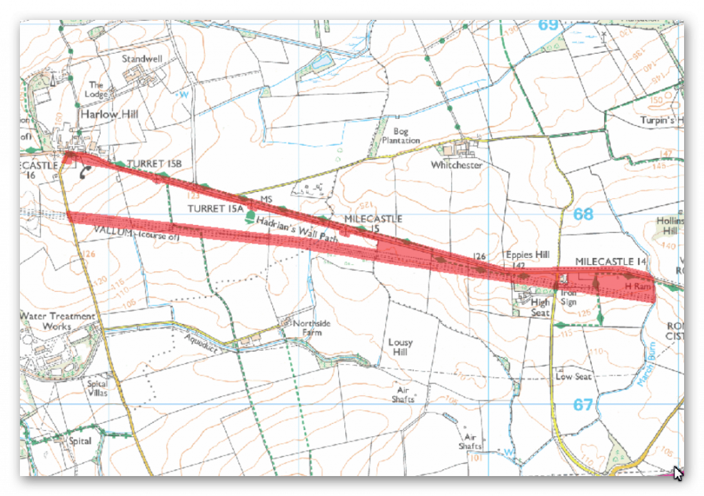
The vallum survives as an earthwork in the field south of the B6528. It lies about 50m south of the wall line along this stretch of the corridor. In the east end of this section the vallum mounds have been reduced by ploughing, although the vallum ditch is still visible, reaching a depth of up to 1m. It is most evident in the east end in the small stand of trees at the entrance of the drive to Heddon Hall. On the summit of Great Hill, however, the works of the vallum are very well marked. The ditch is cut through the freestone rock and the south scarp shows Roman tool marks.

The course of the Roman road known as the Military Way, which ran along the corridor between the Wall and the vallum linking the turrets, milecastles and forts, is not yet confirmed in this section of the corridor.

1013796
1013796

There is no HE entry for this section.

1013790
1013790

There is no HE entry for this section.

1013789
1013789

There is no HE entry for this section.

1013503
1013503

There is no HE entry for this section.

Investigation

The Vallum is very shallow in this area – but it does again seem to start at the Walbottle Dene and heads (rather than avoids) Denton Dene – which the wall avoids.

The River Tyne would have been more substantial in the past

Further Reading

For information about British Prehistory, visit www.prehistoric-britain.co.uk for the most extensive archaeology blogs and investigations collection, including modern LiDAR reports.  This site also includes extracts and articles from the Robert John Langdon Trilogy about Britain in the Prehistoric period, including titles such as The Stonehenge Enigma, Dawn of the Lost Civilisation and the ultimate proof of Post Glacial Flooding and the landscape we see today.

Robert John Langdon has also created a YouTube web channel with over 100 investigations and video documentaries to support his classic trilogy (Prehistoric Britain).  He has also released a collection of strange coincidences that he calls ‘13 Things that Don’t Make Sense in History’ and his recent discovery of a lost Stone Avenue at Avebury in Wiltshire called ‘Silbury Avenue – the Lost Stone Avenue’.

Langdon has also produced a series of ‘shorts’, which are extracts from his main body of books:

The Ancient Mariners

Stonehenge Built 8300 BCE

Old Sarum

Prehistoric Rivers

Dykes ditches and Earthworks

Echoes of Atlantis

Homo Superior

For active discussions on the findings of the TRILOGY and recent LiDAR investigations that are published on our WEBSITE, you can join us and leave a message or join the debate on our Facebook Group.

Section S – NZ16NW

Section S – NZ16NW – this is a section of Hadrian’s Wall showing the LiDAR, Google Earth and 1800 Maps of the Area covered by Historic England

Historic England Sections:

Name: Name: Hadrian’s Wall and vallum from Throckley to Oatens Bank, Harlow Hill in wall mile 11, 12, 13, 14 and 15
List UID: 1010618, 1017533, 1010617, 1010616

Old OS Map

Section S – NZ16NW
Section S – NZ16NW – 1800 Map

LiDAR Map

NZ16NW Section S -  Wall in Yellow -Vallum in Green
NZ16NW Section S – Wall in Yellow -Vallum in Green

Google Earth Map

NZ16NW - Section S - GE
NZ16NW – Section S – GE

Historic England Scheduled Monuments within Section S

Name: Hadrian’s Wall and vallum between the March Burn and Oatens Bank, Harlow Hill in wall miles 13,14 and 15
Designation Type: Scheduling
Grade: Not Applicable to this List Entry
List UID: 1010618

Name: Rudchester Roman fort, associated civil settlement and a section of Hadrian’s Wall and vallum from the A69 to the March Burn in wall mile 13
Designation Type: Scheduling
Grade: Not Applicable to this List Entry
List UID: 1017533

Name: Hadrian’s Wall and vallum from East Town House, Heddon-on-the-Wall to the A69 trunk road in wall mile 12
Designation Type: Scheduling
Grade: Not Applicable to this List Entry
List UID: 1010617

Name: Hadrian’s Wall and vallum from Throckley to East Town House, Heddon-on-the-Wall in wall mile 11
Designation Type: Scheduling
Grade: Not Applicable to this List Entry
List UID: 1010616

1010618
1010618

The monument includes Hadrian’s Wall and vallum and associated features between the March Burn in the east and the west side of Oatens Bank, Harlow Hill the west.

This section of the Wall runs gently downhill from the March Burn to milecastle 15 before running up a steep gradient to the summit of Harlow Hill. The Wall commands wide views to the north and south along this section, but the undulating terrain to the east and west means that views are restricted in these directions. Hadrian’s Wall aims for the high points throughout this section which includes the summits of Eppies Hill and Harlow Hill, unlike the vallum which takes a lower course skirting to the south of Harlow Hill. The Wall survives beneath the B6318 road throughout the whole length of this section. East of Harlow Hill antiquarians including Horsley, Brand and Skinner, recorded the width of the wall as being 7 feet and 4 inches, indicating that the Wall was of narrow type. The Wall ditch survives intermittently as an earthwork.

It survives best to the west of Eppies Hill to depths of between 2m and 3m. Elsewhere the ditch is silted up and survives only as a buried feature. Milecastle 14 is situated on the crest of a slight knoll to the west of the March Burn. It survives as a low, turf-covered platform 0.4m high. It has been heavily ploughed, which has resulted in the platform being spread. The site was partly excavated in 1946. Milecastle 15 is situated east of a stream on a gentle east-west slope with a restricted view to the north east. It survives as a turf-covered platform approximately 1m high over most of its area. There are robber trenches around the crest of the platform on the east, south and west sides. Milecastle 16 is situated on the crest of Harlow Hill with wide views in all directions. It survives as a buried feature in the field to the south of the road. The only upstanding feature is the scarp on the east side of the reduced platform.

The milecastle was excavated by Hepple and Richmond in the 1950s. The exact site of turret 14a is unknown. However, Horsley recorded that he saw the remains on top of the knoll known as Eppies Hill to the west of Iron Sign House. This would be a logical position for a turret as it would have commanded the best vantage between Rudchester and Harlow Hill. Similarly the exact site of turret 14b also remains unknown. Its presumed site is an area equidistant between the summit of Eppies Hill and milecastle 15. There are no visible remains of turret 15a which is located 115m east of the junction between the B6318 and the minor road to Whitchester. It was located during 1931 by Hepple, although little was found. Its remains lie partly below the surface of the B6318 road. There are no visible remains of turret 15b which is located 200m to the west of the minor road to the disused airfield at Ouston. As with turret 15a it was located during 1931 by Hepple. Its remains lie partly beneath the surface of the B6318 road.

The vallum runs in a straight line for most of this section. West of Eppies Hill, where the Wall and vallum are within about 30m of each other, the vallum diverges from the course of the Wall and takes a lower and straighter line to the south of Harlow Hill. It survives intermittently as an upstanding earthwork. The south mound is between 0.3m and 0.4m high where extant while the north mound is between 0.4m and 0.5m. Where extant the vallum ditch varies between 1m and 1.6m deep. Elsewhere it survives as a series of silted ditches buried below the turf.

The course of the Roman road known as the Military Way, which runs along the corridor between the Wall and the vallum linking the turrets, milecastles and forts, is not yet confirmed in this section of the corridor.

1017533
1017533

The monument includes the wall fort at Rudchester, the associated civil settlement and the stretch of Hadrian’s Wall and vallum between the A69 in the east and the March Burn in the west.

This section of wall corridor runs up the west side of the valley of the Rudchester Burn to the slight rise occupied by the fort before descending the slight depression to the March Burn. Throughout this section there are limited views to the north where the ground slopes gently away. In contrast there are wide views to the south over the Tyne Valley, while to the east and west the views are more restricted. In this section the Wall survives as a buried feature, lying below the course of the B6318 road. Excavations of milecastle 13 in 1930 demonstrated that the Wall was of broad type throughout this section. The wall ditch has entirely silted up throughout this section except for a slight scarp on the east bank of the March Burn. Milecastle 13, east of the Rudchester Burn, survives as a low mound 0.2m to 0.4m high. This milecastle measures 16.5m north to south by about 19m east to west. A large hoard of gold and silver coins was found here in 1776, the latest coins dating to AD 168. This milecastle was partly excavated in 1930 by Simpson. Turret 13a, east of Rudchester fort, survives as a buried feature beneath the B6318 road. Part excavation by Simpson in 1930 revealed the turret walls which were built to a thickness of about 1.25m. Turret 13b, which lies about 75m to the west of Rudchester fort, also survives as a buried feature beneath the B6318. The vallum survives as an upstanding earthwork throughout this section. However, to the west of the fort there are no upstanding remains of the vallum, although it survives as a series of buried features, which were located in 1987 during a seismic survey. It was revealed that the vallum makes a dog-leg to avoid the western and southern sides of the fort.

On the east side the north and south mounds of the vallum reach a maximum height of 1m, while the vallum ditch has a maximum depth of 1.4m. The course of the Roman road known as the Military Way, which ran along the corridor between the Wall and the vallum linking the turrets, milecastles and forts, is not yet confirmed in this section of the corridor.

The Roman fort at Rudchester, known to the Romans as `Vindovala’, survives as a turf-covered platform, up to 1.6m high, to the north of Rudchester Farm. It covers an area of 1.8ha and would have accommodated a part mounted cohort, 500 strong. The site was very well preserved until the 18th century when it was reduced by stone robbing. This was followed by ploughing and cultivation of the area, which accounts for the ridge and furrow overlying the southern part of the fort. It has been partly excavated on several occasions since 1897. Buildings identified as the Commanding Officer’s house, the Headquarters Building and a granary, were located. Finds from the site include a life-size statue of Hercules, five altars dedicated to Mithras and pottery. The east and west gateways were positioned to the north of where Hadrian’s Wall adjoined the fort. The outlying civil settlement, or `vicus’, is located to the south and south west of the fort partly below the Rudchester Farm buildings. Post-medieval quarrying to the south east of the fort has probably destroyed some of the remains. The terraces which stretch to the west of Rudchester Farm are identified as evidence of the attached Roman civil settlement. They include some probable building platforms. Although mostly between 0.3m and 1.5m high, these terraces reach a maximum height of 3.2m in places and contain considerable quantities of stone.

A rock-cut cistern known as the `Giants Grave’ measures 3.9m by 1.5m internally and is at least 0.5m deep. It is located in the area of woodland to the west of Rudchester Farm and probably supplied part of the vicus with water, as indicated by the presence of a drainage hole in its north west corner.

A Roman temple dedicated to the Persian god Mithras is located to the south west of the fort in the vicus area. It has been partly overlain by a lynchet and bank. The temple is almost rectangular in shape with a small apse at the north west end and an entrance hall at the south east end. The maximum internal dimensions of the building are approximately 7.3m by 16.4m. The surviving lower courses of the walls are made of stone. The building was excavated in 1953 by Gillam and MacIvor who were able to determine the plan of the temple, except for its south west corner which had been lost in a land slip. All road surfaces, road signs, field boundaries, buildings and overhead power line poles are excluded from the scheduling, but the ground beneath all these features is included.

1010617
1010617

The monument includes a section of Hadrian’s Wall, its external ditch and the vallum from Heddon-on-the-Wall in the east to the A69 trunk road in the west.

This section of the Wall corridor has wide views overlooking the Tyne valley to the south and east, whereas to the north and west the ground rises gently giving a less extensive view. The Wall survives as a buried feature for the whole of this section of its course. It lies beneath the B6318 road except at the west end of this section where it continues in a field up to the A69 trunk road. The wall ditch survives as an earthwork for much of this section, to a maximum depth of 1.5m. The upcast counterscarp, usually known as the `glacis’, also survives up to 0.3m high in the area from north of the Three Tuns Inn to the north of North Lodge. Turret 12a survives as a buried feature below the B6318 road. The location of the turret is known from part excavation by Simpson in 1930. Turret 12b also survives as a buried feature below the B6318 road, probably extending south into the area of woodland to the west of North Lodge. As with turret 12a, part excavation by Simpson in 1930 located the site of this turret. The exact location of milecastle 12 has not yet been confirmed. In relation to the known sites of turret 12a and turret 11b, the site of milecastle 12 is expected to lie in the vicinity of Keeper’s Cottage at Heddon-on-the-Wall.

The vallum survives intermittently as an upstanding earthwork throughout this section. The mounds have been reduced by ploughing and the central ditch has silted up for most of its length. The south mound in this section reaches a maximum height of 1.5m, while the ditch has a maximum depth of 0.6m.

The course of the Roman road known as the Military Way, which ran along the corridor between the Wall and the vallum linking the turrets, milecastles and forts, has not yet been confirmed in this section of the corridor.

1010616
1010616

The monument includes a section of Hadrian’s Wall, its outer ditch and the vallum between Throckley and East Town House, Heddon-on-the-Wall. From various places in this section of the Wall corridor there are wide views northwards towards the Scottish Border and south west along Tynedale to the North Pennines.

At the east end of this section, the Wall survives as a buried feature below the course of the modern road, the B6528. Its line was recorded during roadworks in November 1926 and it was found to be of broad wall type. In the west end of this section there is a 255m stretch of upstanding consolidated wall between 2.8m and 3m in width, reaching a maximum height of 1.7m. The core was originally set in puddled clay, but is now reset in mortar to preserve the work. The upstanding section of the Wall is in the care of the Secretary of State. Turret 11b was located by excavation in 1919. It survives as a buried feature below the B6528. The location of Turret 11a has not yet been confirmed though it probably lies along the line of the wall somewhere opposite the Royal French Arms public house. During 1879 a hoard of over 5000 silver Roman coins was found just to the south of the Wall below the main road somewhere to the east of this turret site. The wall ditch is thought to survive as a buried feature underlying the gardens of the houses to the north of the Hexham Road (B6528), which are not included in the scheduling. However, west of the houses the ditch survives as an earthwork with a maximum depth of 1.9m and there is some rubble strewn over its scarps. In the west end of this section, opposite the consolidated stretch of wall, is a section of ditch, also in the care of the Secretary of State, which reaches a maximum depth of 1.4m.

The vallum survives as an earthwork in the field south of the B6528. It lies about 50m south of the wall line along this stretch of the corridor. In the east end of this section the vallum mounds have been reduced by ploughing, although the vallum ditch is still visible, reaching a depth of up to 1m. It is most evident in the east end in the small stand of trees at the entrance of the drive to Heddon Hall. On the summit of Great Hill, however, the works of the vallum are very well marked. The ditch is cut through the freestone rock and the south scarp shows Roman tool marks.

The course of the Roman road known as the Military Way, which ran along the corridor between the Wall and the vallum linking the turrets, milecastles and forts, is not yet confirmed in this section of the corridor.

Investigation

The Vallum in this section disappears in the west of the section into a river valley and seems to reappear as comes out of the river valley.

Vallum disappearing in river valley

The line of the Vallum is different coming out of the river valley than when it enters. It is possible that the vallum over lapped at one point – but what must be kept in mind is that the construction is very different to what we have seen in previous sections and this maybe a consequence of the quarry the is at the start of the vallum leaving the River Valley. Not for the first time have we seen the vallum start at a quarry for obvious reasons and it would explain the strange course correction, as the Vallum is not straight. It is also possible that these shallow Vallum ditches were added at another date (when the river valley was dry?).

The quarry may have been why the Vallum started on the top of the hill?

There is another feature the Vallum seems to meet on the edge of this river valley:

Some 90 yds south of the SW angle of the Fort (Vindovala) is a cistern, 12ft long, 5ft wide and 2ft deep, carved from rock, and known as the “Giant’s Grave”. It is generally regarded as Roman and, apart from the Mithraeum, is the only surviving structure of the vicus.

The “Giant’s Grave” (NZ 11183 67404) was discovered in the late eighteenth century. It is a unique survival in the northern frontier zone; a rock-cut cistern, it measures 3.9m by 1.5m internally and is at least 0.5m deep. It has a drainage hole in the NW corner. (3-4).

To be far the dating of this feature is unknown (current guess is done just by association) – but again this does associate the bedrock the Vallum is cut as being flooded. But the fact it is called the giants grave is of interest as most prehistoric features are generally named and associated by either the Devil or Giants.

Giant's Grave - could be from any date in the past?
Giant’s Grave – could be from any date in the past?

This prehistoric connection continues in this area as there is another strange feature called ‘Broomy Hill Earthwork just 800m SE of these features. It is classified as an ‘Iron Age Fort’ which is incorrect as it is almost on the floor of the river valley – so it more of a henge that is connected and surrounded by Dykes, again not identified by archaeologists.

Further Reading

For information about British Prehistory, visit www.prehistoric-britain.co.uk for the most extensive archaeology blogs and investigations collection, including modern LiDAR reports.  This site also includes extracts and articles from the Robert John Langdon Trilogy about Britain in the Prehistoric period, including titles such as The Stonehenge Enigma, Dawn of the Lost Civilisation and the ultimate proof of Post Glacial Flooding and the landscape we see today.

Robert John Langdon has also created a YouTube web channel with over 100 investigations and video documentaries to support his classic trilogy (Prehistoric Britain). He has also released a collection of strange coincidences that he calls ‘13 Things that Don’t Make Sense in History’ and his recent discovery of a lost Stone Avenue at Avebury in Wiltshire called ‘Silbury Avenue – the Lost Stone Avenue’.

Langdon has also produced a series of ‘shorts’, which are extracts from his main body of books:

The Ancient Mariners

Stonehenge Built 8300 BCE

Old Sarum

Prehistoric Rivers

Dykes ditches and Earthworks

Echoes of Atlantis

Homo Superior

For active discussions on the findings of the TRILOGY and recent LiDAR investigations that are published on our WEBSITE, you can join our and leave a message or join the debate on our Facebook Group.

Section R – NZ06NE

Section R – NZ06NE – this is a section of Hadrian’s Wall showing the LiDAR, Google Earth and 1800 Maps of the Area covered by Historic England

Historic England Sections:

Name: Name:  Hadrian’s Wall and vallum between the March Burn and the B6309 in wall miles 13,14,15,16,17 and 18.
List UID: 11010618, 010622, 1010621, 010620,

Old OS Map

Section R - NZ06NE
Section R – NZ06NE

LiDAR Map

Section R - NZ06NE
Section R – NZ06NE- Wall in Yellow -Vallum in Green

Google Earth Map

Section R – NZ06NE

Historic England Scheduled Monuments within Section R

Name: Hadrian’s Wall and vallum between the B6309 and the B6321 in wall miles 16, 17 and 18
Designation Type: Scheduling
Grade: Not Applicable to this List Entry
List UID: 1010622

Name: Hadrian’s Wall from Oatens Bank, Harlow Hill, to Whittle Dene Watercourse in wall mile 16
Designation Type: Scheduling
Grade: Not Applicable to this List Entry
List UID: 1010620

Name: The vallum between Oatens Bank, Harlow Hill, and Whittle Dene Watercourse in wall mile 16
Designation Type: Scheduling
Grade: Not Applicable to this List Entry
List UID: 1010621

Name: Hadrian’s Wall and vallum between the March Burn and Oatens Bank, Harlow Hill in wall miles 13,14 and 15
Designation Type: Scheduling
Grade: Not Applicable to this List Entry
List UID: 1010618

1010622
1010622

The monument includes the section of Hadrian’s Wall, vallum and associated features between the B6309 in the east and the B6321 in the west. The ground slopes gently upwards towards the west throughout this section of the monument.

There are wide views to the north, east and south. However, the rising ground to the west restricts the outlook in this direction. Hadrian’s Wall survives as buried remains below the road surface of the B6318 road throughout the length of this section. The wall ditch survives as an earthwork to the north of the road for most of the length of this section. It averages about 1.4m deep throughout, though it reaches a maximum of 3m in places. Milecastle 17 is positioned on sloping ground to the west of the Northern Reservoir. It survives as a low platform with a scarp to the east and a slight stone scatter. It was partly excavated in 1931 and its walls were shown to be about 2.5m thick. Milecastle 18 occupies a position on a gentle west facing slope on the south side of the B6318 road at East Wallhouses. There are no visible remains above ground; however, its site is known as it was partly excavated in 1931 when its walls were found to be almost 2.5m thick. Turret 17a survives as a buried feature located 310m to the east of the track which runs south to Welton from the B6318 road, on a ridge of level ground.

It was excavated in 1931 and was shown to have a door in the south west corner and a ladder platform in the south east corner. Turret 17b is located 320m east of the Robin Hood Inn, surviving as a buried feature beneath the B6318 road. The ground slopes upwards to the west while to the east the ground is fairly level. This turret was also partly excavated in 1931 and like turret 17a it was shown to have a door in the south west corner and a ladder platform in the south east corner. Turret 18a is located at the junction of the minor road to West Moorhouses off the B6318 on an east facing slope. There are no visible remains apart from a rise in the hedgeline. Part excavation in 1931 showed that the surviving buried remains are very well preserved. Its ladder platform stood to its full height with six stone steps. Turret 18b is located 50m to the east of Welton Burn on an east facing slope. There are no visible remains. It was partly excavated in 1959 when animal bones and pottery were found.

The course of the Roman road, known as the Military Way, linking turrets, milecastles and forts, which ran along the corridor between the Wall and the vallum, is not yet confirmed in this section. It is known to exist here as Horsley noted in the 1730s that it ran along the north mound of the vallum for a short distance where the Wall and vallum are very close and then, `A little after it has passed by the Wall houses, it runs almost parallel both to the Wall and the north agger’. Its remains now survive as buried features.

The vallum continues on the same straight alignment as its neighbouring sections throughout its course. It is visible as an upstanding earthwork except for the first kilometre west of the Northern Reservoir where it has been reduced by cultivation and its ditches silted up. The north mound averages about 0.25m in height whereas the south mound averages about 0.6m high. The vallum ditch averages about 0.8m in depth, though it reaches a depth of 1.4m in places.

1010620
1010620

The monument includes the section of Hadrian’s Wall and its associated features between Oatens Bank, Harlow Hill, in the east and Whittle Dene Watercourse in the west.

This section of Wall runs downslope towards the west from Harlow Hill. There is gently rising ground to the north, whereas to the south the ground slopes away. The Wall survives as a buried feature beneath the B6318 road throughout this section. The external ditch on the north side of the Wall is silted up for most of this section although traces of its north scarp are still visible about 200m west of Harlow Hill. The exact location of turrets 16a and 16b has not yet been confirmed.

The course of the Roman road known as the Military Way, linking turrets, milecastles and forts, which ran along the corridor between the Wall and the vallum, is not yet confirmed in this section of the corridor. However, during the 1730s Horsley noted its existence a little west of Harlow Hill describing it as `about thirteen foot’ in width.

1010621
1010621

The monument includes the vallum and its associated features between Oatens Bank, Harlow Hill, in the east and Whittle Dene Watercourse (part of the Northern Reservoir) in the west.

It follows a straight course along the south side of Harlow Hill and survives as a series of buried features. Its course can be determined by the slight undulations in the arable land which denote the banks and ditches. The banks have been ploughed flat.

1010618
1010618

The monument includes Hadrian’s Wall and vallum and associated features between the March Burn in the east and the west side of Oatens Bank, Harlow Hill the west.

This section of the Wall runs gently downhill from the March Burn to milecastle 15 before running up a steep gradient to the summit of Harlow Hill. The Wall commands wide views to the north and south along this section, but the undulating terrain to the east and west means that views are restricted in these directions. Hadrian’s Wall aims for the high points throughout this section which includes the summits of Eppies Hill and Harlow Hill, unlike the vallum which takes a lower course skirting to the south of Harlow Hill. The Wall survives beneath the B6318 road throughout the whole length of this section. East of Harlow Hill antiquarians including Horsley, Brand and Skinner, recorded the width of the wall as being 7 feet and 4 inches, indicating that the Wall was of narrow type. The Wall ditch survives intermittently as an earthwork.

It survives best to the west of Eppies Hill to depths of between 2m and 3m. Elsewhere the ditch is silted up and survives only as a buried feature. Milecastle 14 is situated on the crest of a slight knoll to the west of the March Burn. It survives as a low, turf-covered platform 0.4m high. It has been heavily ploughed, which has resulted in the platform being spread. The site was partly excavated in 1946. Milecastle 15 is situated east of a stream on a gentle east-west slope with a restricted view to the north east. It survives as a turf-covered platform approximately 1m high over most of its area. There are robber trenches around the crest of the platform on the east, south and west sides. Milecastle 16 is situated on the crest of Harlow Hill with wide views in all directions. It survives as a buried feature in the field to the south of the road. The only upstanding feature is the scarp on the east side of the reduced platform.

The milecastle was excavated by Hepple and Richmond in the 1950s. The exact site of turret 14a is unknown. However, Horsley recorded that he saw the remains on top of the knoll known as Eppies Hill to the west of Iron Sign House. This would be a logical position for a turret as it would have commanded the best vantage between Rudchester and Harlow Hill. Similarly the exact site of turret 14b also remains unknown. Its presumed site is an area equidistant between the summit of Eppies Hill and milecastle 15. There are no visible remains of turret 15a which is located 115m east of the junction between the B6318 and the minor road to Whitchester. It was located during 1931 by Hepple, although little was found. Its remains lie partly below the surface of the B6318 road. There are no visible remains of turret 15b which is located 200m to the west of the minor road to the disused airfield at Ouston. As with turret 15a it was located during 1931 by Hepple. Its remains lie partly beneath the surface of the B6318 road.

The vallum runs in a straight line for most of this section. West of Eppies Hill, where the Wall and vallum are within about 30m of each other, the vallum diverges from the course of the Wall and takes a lower and straighter line to the south of Harlow Hill. It survives intermittently as an upstanding earthwork. The south mound is between 0.3m and 0.4m high where extant while the north mound is between 0.4m and 0.5m. Where extant the vallum ditch varies between 1m and 1.6m deep. Elsewhere it survives as a series of silted ditches buried below the turf.

The course of the Roman road known as the Military Way, which runs along the corridor between the Wall and the vallum linking the turrets, milecastles and forts, is not yet confirmed in this section of the corridor.

Investigation

The Vallum in this section is shown as a smaller canal than previous section – the vallum goes through a modern Reservoir at one point and there is no archaeological evidence to it during construction in the 19th century which would suggest that it did not exist through the river valley the lidar map shows when the prehistoric waters are added.

Vallum and Whittle Dene Reservoir

Further Reading

For information about British Prehistory, visit www.prehistoric-britain.co.uk for the most extensive archaeology blogs and investigations collection, including modern LiDAR reports.  This site also includes extracts and articles from the Robert John Langdon Trilogy about Britain in the Prehistoric period, including titles such as The Stonehenge Enigma, Dawn of the Lost Civilisation and the ultimate proof of Post Glacial Flooding and the landscape we see today.

Robert John Langdon has also created a YouTube web channel with over 100 investigations and video documentaries to support his classic trilogy (Prehistoric Britain). He has also released a collection of strange coincidences that he calls ‘13 Things that Don’t Make Sense in History’ and his recent discovery of a lost Stone Avenue at Avebury in Wiltshire called ‘Silbury Avenue – the Lost Stone Avenue’.

Langdon has also produced a series of ‘shorts’, which are extracts from his main body of books:

The Ancient Mariners

Stonehenge Built 8300 BCE

Old Sarum

Prehistoric Rivers

Dykes ditches and Earthworks

Echoes of Atlantis

Homo Superior

For active discussions on the findings of the TRILOGY and recent LiDAR investigations that are published on our WEBSITE, you can join our and leave a message or join the debate on our Facebook Group.

Section Q – NZ06NW

Section Q – NZ06NW – this is a section of Hadrian’s Wall showing the LiDAR, Google Earth and 1800 Maps of the Area covered by Historic England

Historic England Sections:

Name: Name: Hadrian’s Wall and vallum between the B6309 and Sunnybrae at Halton Shields in wall miles 16, 17, 18, 19, 20 and 21
List UID: 1010623, 1017534, 1010622

Old OS Map

Section Q - NZ06NW
Section Q – NZ06NW

LiDAR Map

Section Q - NZ06NW
Section Q – NZ06NW- Wall in Yellow -Vallum in Green

Google Earth Map

Section Q - NZ06NW
Section Q – NZ06NW

Historic England Scheduled Monuments within Section Q

Name: Hadrian’s Wall and vallum between Sunnybrae at Halton Shields and Halton Chesters Roman fort in wall miles 20 and 21
Designation Type: Scheduling
Grade: Not Applicable to this List Entry
List UID: 1010623

Name: Hadrian’s Wall and vallum between the B6321 and Sunnybrae at Halton Shields, in wall miles 18 and 19
Designation Type: Scheduling
Grade: Not Applicable to this List Entry
List UID: 1017534

Name: Hadrian’s Wall and vallum between the B6309 and the B6321 in wall miles 16, 17 and 18
Designation Type: Scheduling
Grade: Not Applicable to this List Entry
List UID: 1010622

1010623
1010623

The monument includes the section of Hadrian’s Wall, vallum and associated features between Sunnybrae at Halton Shields in the east and the field boundary to the immediate east of Haltonchesters Roman fort in the west.

This section of the corridor follows an east-west ridge with slopes down to the north and south. Hadrian’s Wall survives as a buried feature beneath the B6318 road throughout most of this section. At Halton Shields the alignment of the Wall suggests that it runs below the houses and gardens, however, as there are no upstanding remains there, this area is not included in the scheduling. At Down Hill the Wall survives as a discontinuous bank of rubble, 3m wide and 0.4m high, within dense woodland. Quarrying has mutilated much of the east end of this bank. As with the Wall the wall ditch is in part overlain by the B6318, but in Down Hill Wood it is visible intermittently in the dense woodland up to a maximum of 3m deep. However, it too has been destroyed by quarrying in places. Elsewhere the ditch is traceable as an earthwork in the fields to the north of the B6318. Milecastle 20 is situated immediately north of Sunnybrae at Halton Shields. It was located and partly examined in 1935 and was found to have `type III’ gateways, which is a construction style usually associated with the work of the twentieth legion. During 1992 a 5.5m length of the south wall was exposed which measured 2.6m across, showing that the remains are well preserved under the existing house and garden.

Milecastle 21 has not yet been located, however on the basis of the usual spacing it would be expected to lie in the vicinity of Halton Red House. Turret 20a has also yet to be located, but also on the basis of the usual spacing it would be expected to lie about 70m east of the properties at Carr Hill. Turret 20b was located in 1935 by Hepple about 130m east of Down Hill Wood. The turret survives as a buried feature below the B6318 road. Turret 21a was also located by Hepple in 1935, 75m east of Haltonchesters fort. As with turret 20b it survives as a buried feature below the B6318 road.

The course of the Roman road known as the Military Way, which ran along the corridor between the Wall and vallum linking the turrets, milecastles and forts, survives intermittently throughout this section of the corridor. An excavation undertaken in 1893 revealed that it occupies the north berm of the vallum until the vallum swings south to the east of Down Hill where it resumes a course between the Wall and vallum. There are no upstanding remains west of Down Hill in this section.

The vallum runs parallel with the Wall to Down Hill where it takes a dog-leg to avoid the bedrock close to the surface. It is visible intermittently throughout this section of the corridor. It is best preserved to the south of Down Hill where the vallum ditch has a maximum depth of 2.7m and the north and south mounds reach a height of 1.5m and 1m respectively. Clear traces of crossings survive which are best preserved in the north mound.

1017534
1017534

The monument includes the section of Hadrian’s Wall, vallum and their associated features between the B6321 in the east and Sunnybrae at Halton Shields in the west.

This section of the corridor occupies an east facing slope for most of its length with views to the north and east, but more restricted outlooks to the south and west. The Wall survives as a buried feature below the surface of the B6318 road. The wall ditch survives as an extant earthwork to the north of the road throughout this section except where it is overlain by access crossings. The average depth of the ditch is about 1.5m; however it reaches a maximum depth of 3m in places. For most of its length the ditch has a width of 12m. An open drain runs along the base of the ditch eastwards from East Wallhouses for 500m. Milecastle 19 is located 150m east of Matfen Piers on an east facing slope. It survives as a turf covered platform 0.15m high and measuring 27.8m east-west by 17m north-south.

Excavation of the milecastle took place in 1931 and uncovered an altar dedicated to `..the Mothers..’. Turret 19a is located 270m west of Matfen Piers below the B6318 road at the crest of an east facing slope. There are no upstanding remains apart from a 5m stretch of rough walling, 0.8m high contained within a hedge. Turret 19a was excavated in 1932 when it was found to be well preserved with its door located in its south west corner. The excavation also revealed that it had been dismantled early in the third century AD. Turret 19b survives as a buried feature located 170m east of the minor road which links Clarewood with the B6318. An excavation in 1932 produced many finds including a small altar. Unusually, the turret was bonded mainly with clay rather than mortar. The door was again located in the south west corner. This turret was found to have been abandoned at the turn of the second century AD.

The course of the Roman road known as the Military Way, which ran along the corridor between the Wall and the vallum linking the turrets, milecastles and forts, is not yet confirmed in this section of the corridor.

The vallum runs straight throughout this section on the same alignment as its neighbouring sections. It survives as an upstanding earthwork in varying states of preservation throughout the length of this section. The north and south mounds reach a maximum height of 0.8m while the ditch has a maximum depth of 0.6m.

1010622
1010622

The monument includes the section of Hadrian’s Wall, vallum and associated features between the B6309 in the east and the B6321 in the west. The ground slopes gently upwards towards the west throughout this section of the monument.

There are wide views to the north, east and south. However, the rising ground to the west restricts the outlook in this direction. Hadrian’s Wall survives as buried remains below the road surface of the B6318 road throughout the length of this section. The wall ditch survives as an earthwork to the north of the road for most of the length of this section. It averages about 1.4m deep throughout, though it reaches a maximum of 3m in places. Milecastle 17 is positioned on sloping ground to the west of the Northern Reservoir. It survives as a low platform with a scarp to the east and a slight stone scatter. It was partly excavated in 1931 and its walls were shown to be about 2.5m thick. Milecastle 18 occupies a position on a gentle west facing slope on the south side of the B6318 road at East Wallhouses. There are no visible remains above ground; however, its site is known as it was partly excavated in 1931 when its walls were found to be almost 2.5m thick. Turret 17a survives as a buried feature located 310m to the east of the track which runs south to Welton from the B6318 road, on a ridge of level ground.

It was excavated in 1931 and was shown to have a door in the south west corner and a ladder platform in the south east corner. Turret 17b is located 320m east of the Robin Hood Inn, surviving as a buried feature beneath the B6318 road. The ground slopes upwards to the west while to the east the ground is fairly level. This turret was also partly excavated in 1931 and like turret 17a it was shown to have a door in the south west corner and a ladder platform in the south east corner. Turret 18a is located at the junction of the minor road to West Moorhouses off the B6318 on an east facing slope. There are no visible remains apart from a rise in the hedgeline. Part excavation in 1931 showed that the surviving buried remains are very well preserved. Its ladder platform stood to its full height with six stone steps. Turret 18b is located 50m to the east of Welton Burn on an east facing slope. There are no visible remains. It was partly excavated in 1959 when animal bones and pottery were found.

The course of the Roman road, known as the Military Way, linking turrets, milecastles and forts, which ran along the corridor between the Wall and the vallum, is not yet confirmed in this section. It is known to exist here as Horsley noted in the 1730s that it ran along the north mound of the vallum for a short distance where the Wall and vallum are very close and then, `A little after it has passed by the Wall houses, it runs almost parallel both to the Wall and the north agger’. Its remains now survive as buried features.

The vallum continues on the same straight alignment as its neighbouring sections throughout its course. It is visible as an upstanding earthwork except for the first kilometre west of the Northern Reservoir where it has been reduced by cultivation and its ditches silted up. The north mound averages about 0.25m in height whereas the south mound averages about 0.6m high. The vallum ditch averages about 0.8m in depth, though it reaches a depth of 1.4m in places.

Investigation

The Vallum in this section is non-existent in the East until it reaches Down Hill where both the wall and Vallum runs over. Prior to that start of the Vallum there is a quarry that is cut into were the Vallum would have existed – except there is no sign of the Vallum before the quarry, so it looks that the Vallum is terminated (start) by the quarry.

Vallum and Wall over Down Hill

The only sense the path of the Vallum makes can only be seen if the raised waters of the prehistoric is added to the landscape and then we see that the quarry and Vallum start on the edge of the river shoreline.

Vallum and Wall over Down Hill showing prehistoric water levels

Further Reading

For information about British Prehistory, visit www.prehistoric-britain.co.uk for the most extensive archaeology blogs and investigations collection, including modern LiDAR reports.  This site also includes extracts and articles from the Robert John Langdon Trilogy about Britain in the Prehistoric period, including titles such as The Stonehenge Enigma, Dawn of the Lost Civilisation and the ultimate proof of Post Glacial Flooding and the landscape we see today.

Robert John Langdon has also created a YouTube web channel with over 100 investigations and video documentaries to support his classic trilogy (Prehistoric Britain). He has also released a collection of strange coincidences that he calls ‘13 Things that Don’t Make Sense in History’ and his recent discovery of a lost Stone Avenue at Avebury in Wiltshire called ‘Silbury Avenue – the Lost Stone Avenue’.

Langdon has also produced a series of ‘shorts’, which are extracts from his main body of books:

The Ancient Mariners

Stonehenge Built 8300 BCE

Old Sarum

Prehistoric Rivers

Dykes ditches and Earthworks

Echoes of Atlantis

Homo Superior

For active discussions on the findings of the TRILOGY and recent LiDAR investigations that are published on our WEBSITE, you can join our and leave a message or join the debate on our Facebook Group.