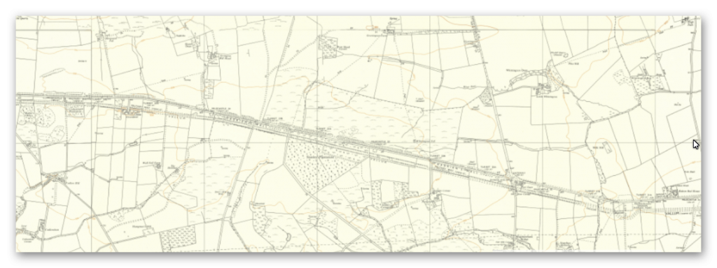
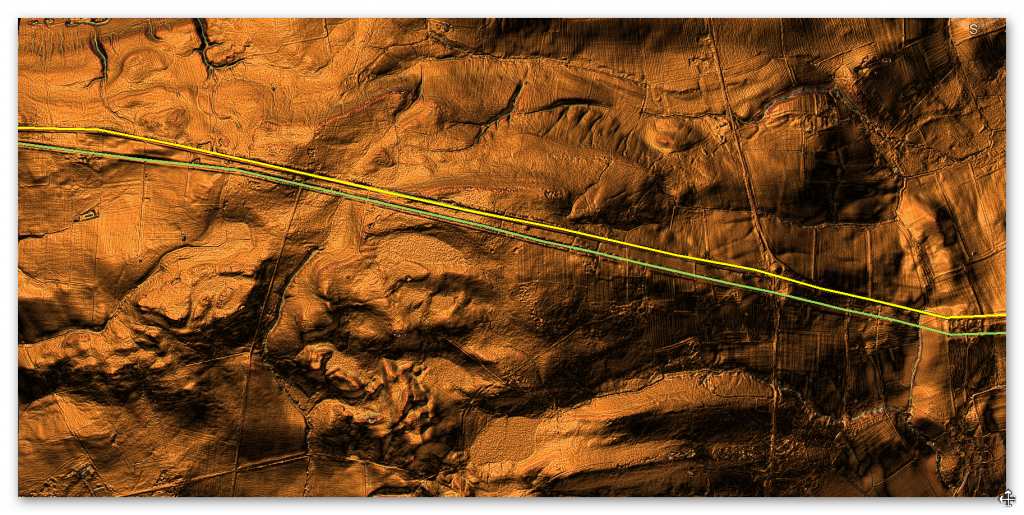
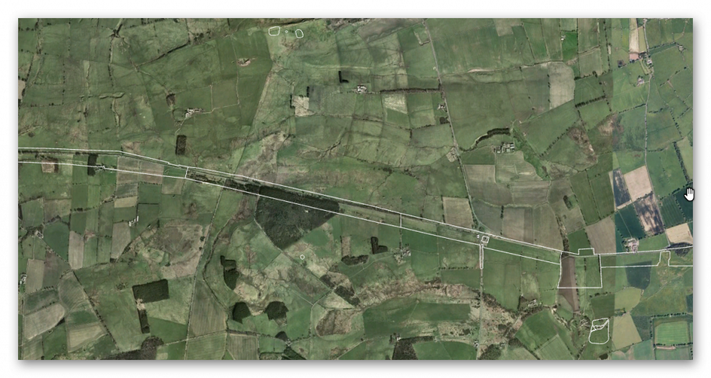
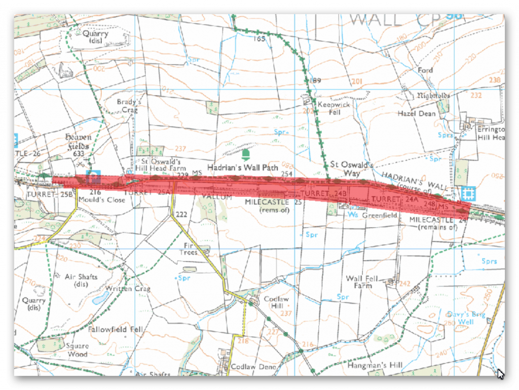
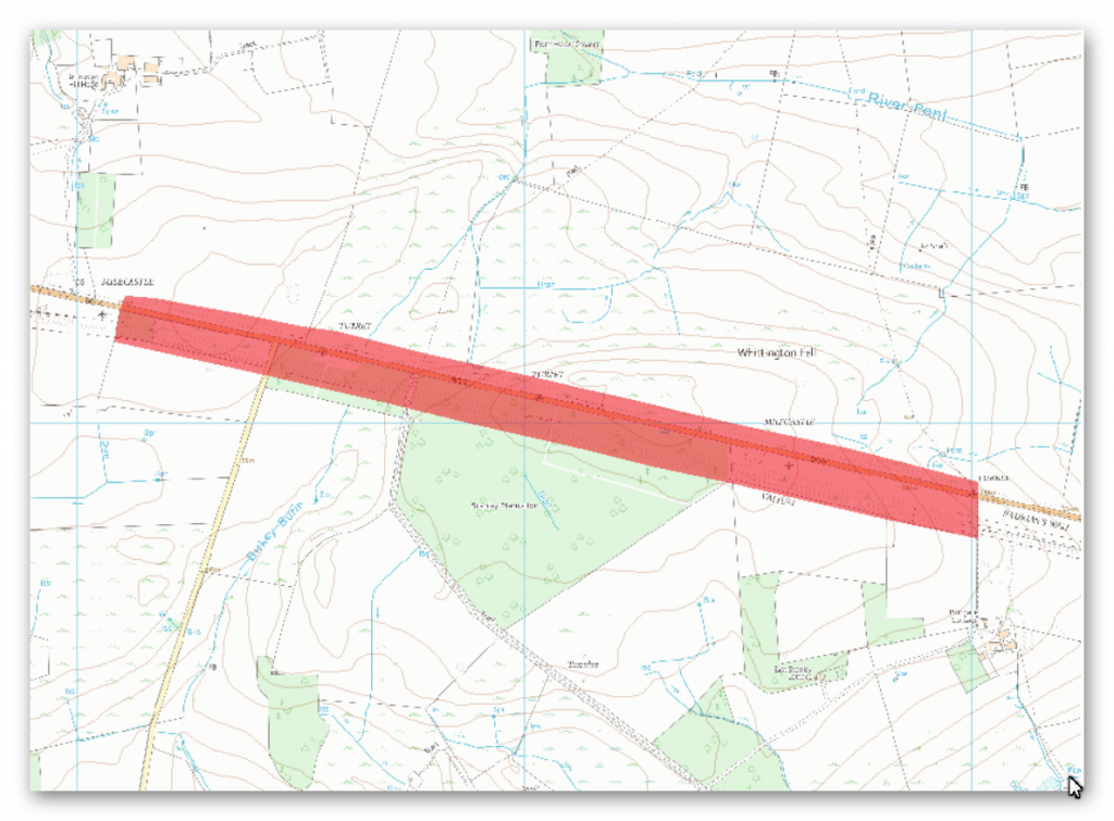
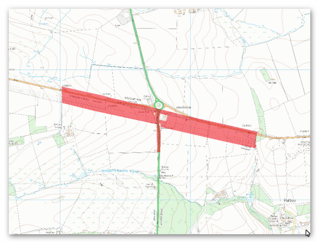
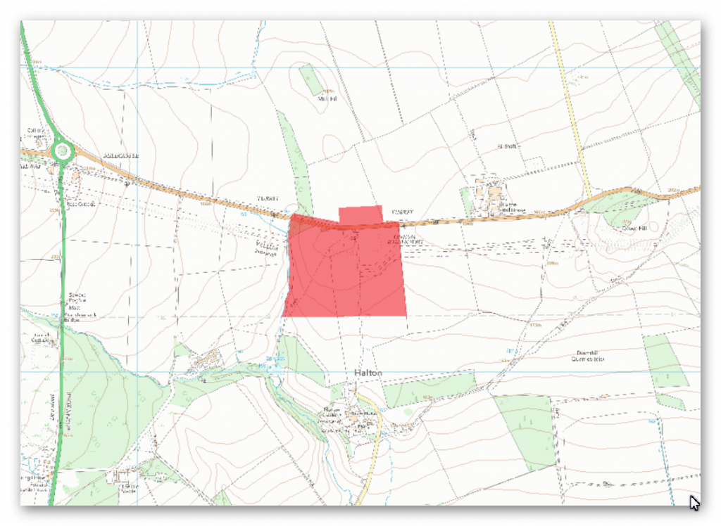
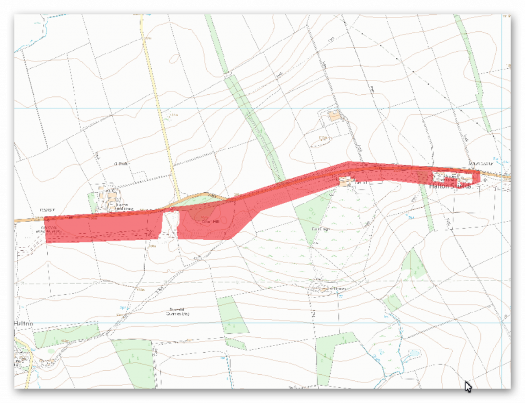
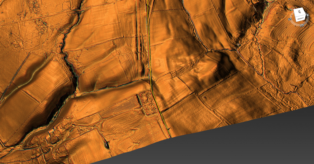
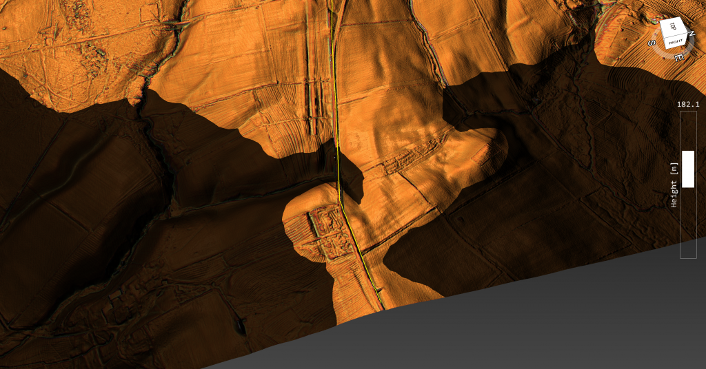
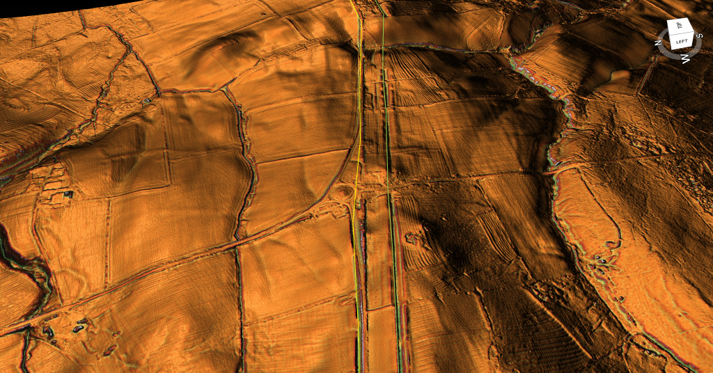
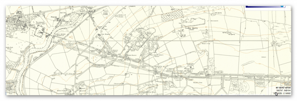
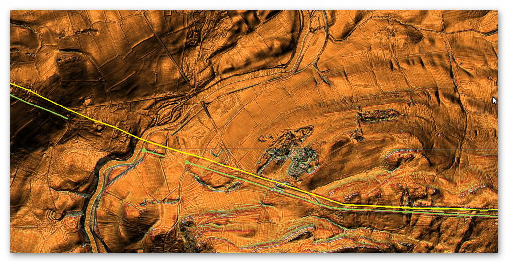
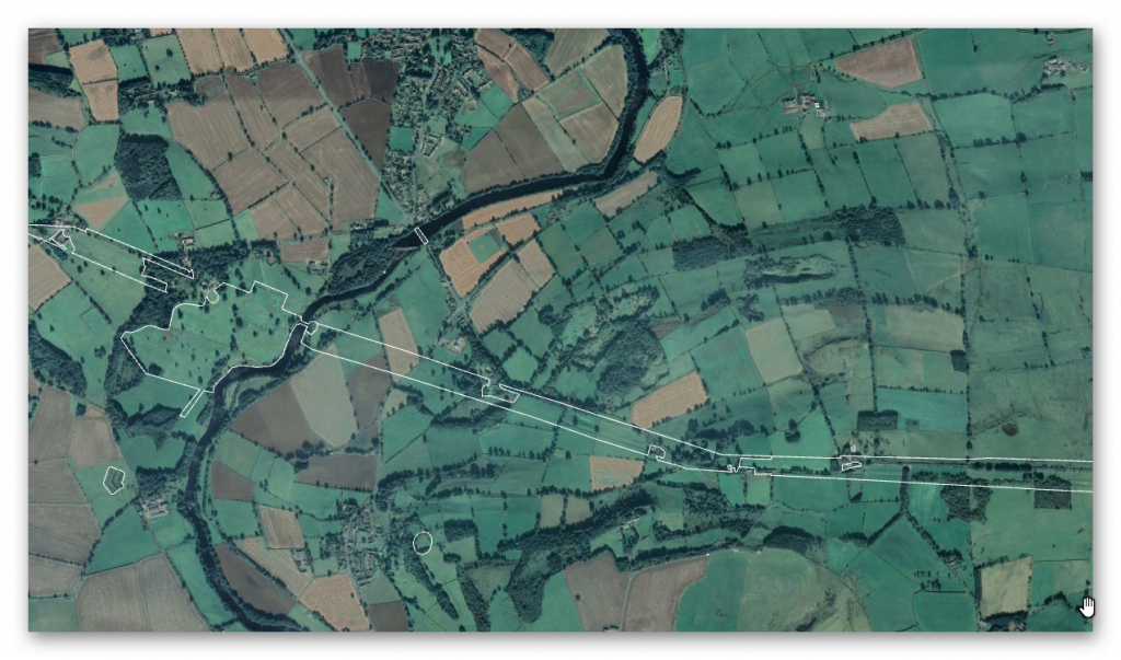
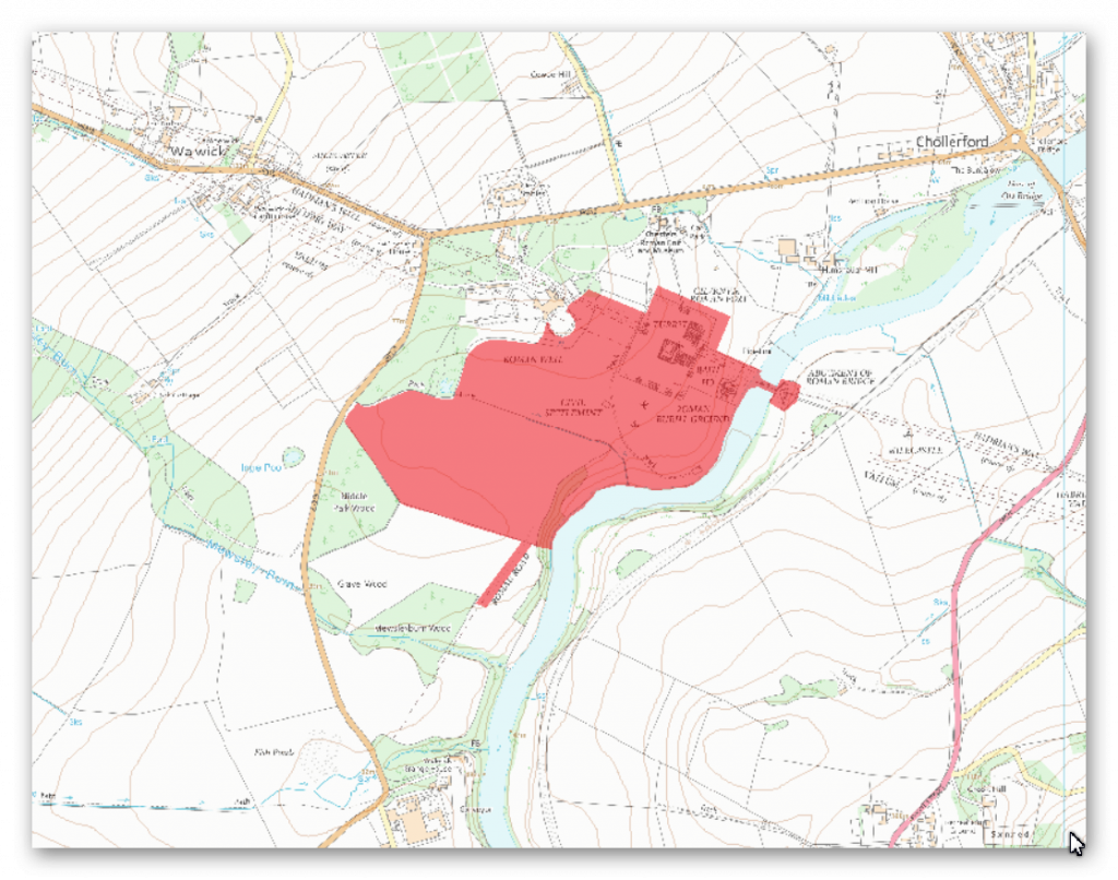
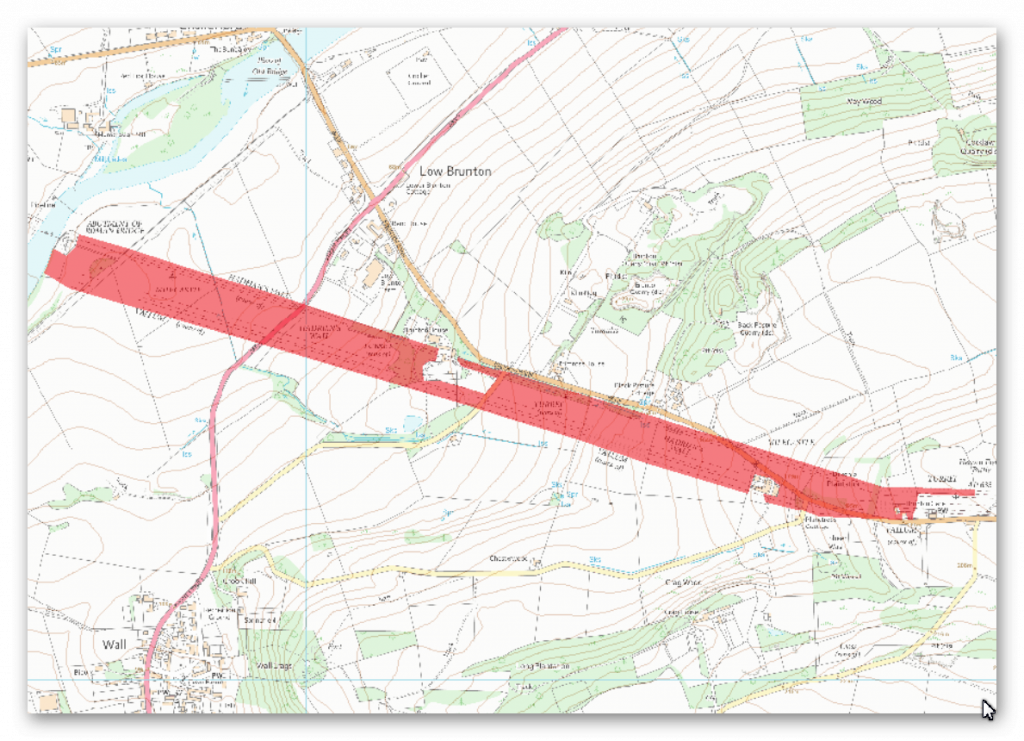
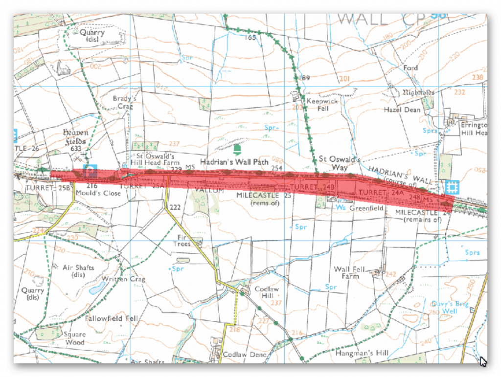
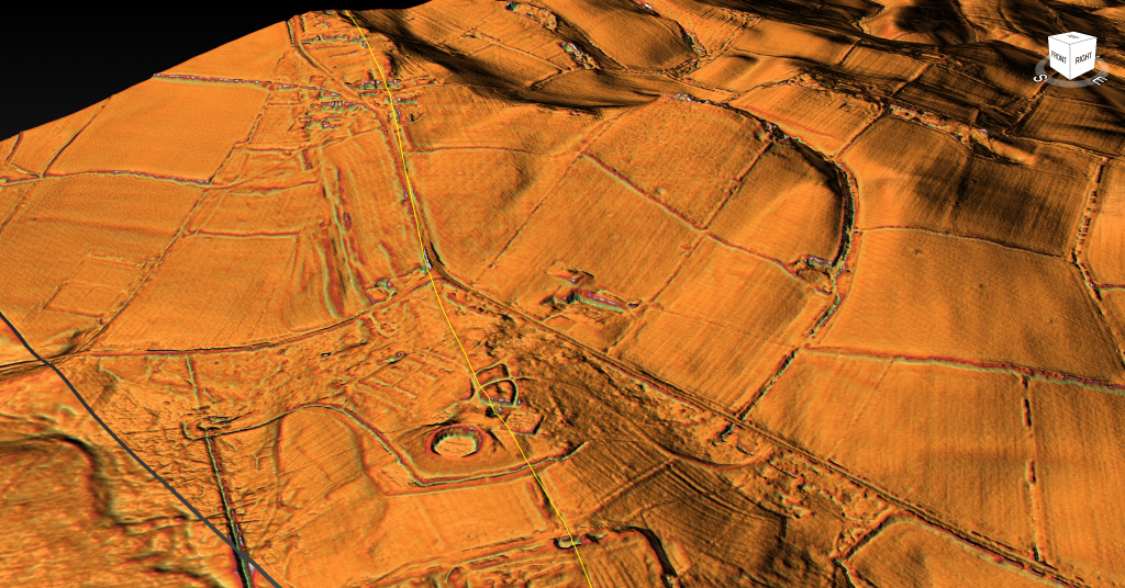
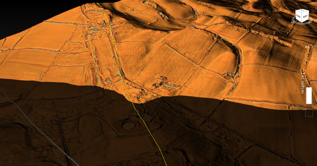
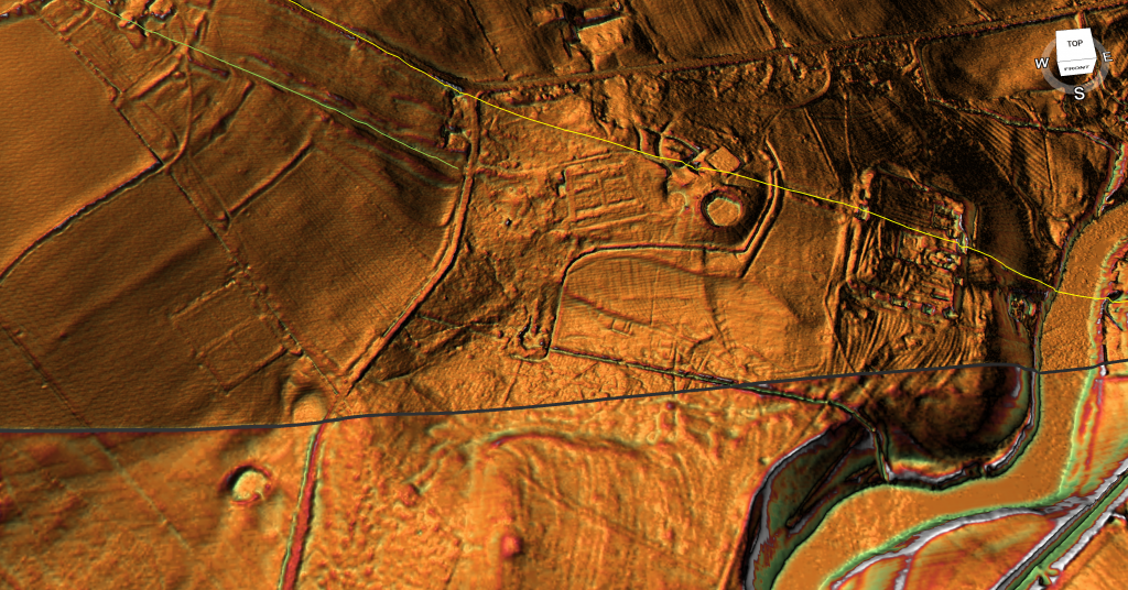
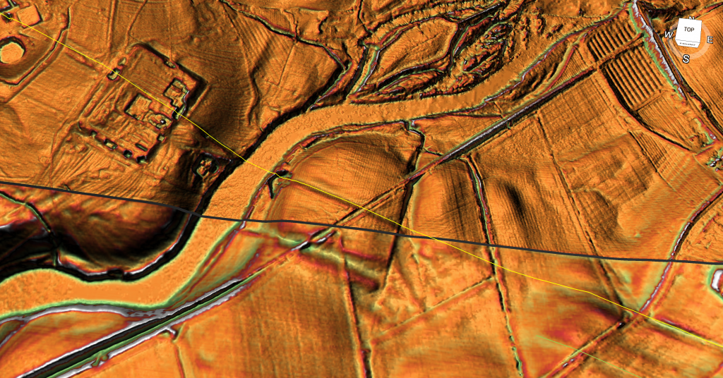
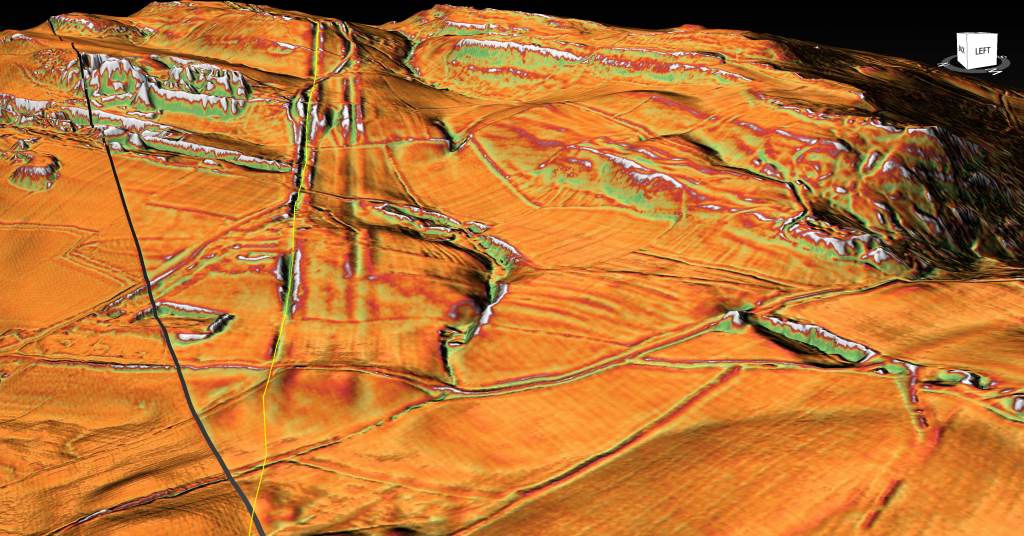
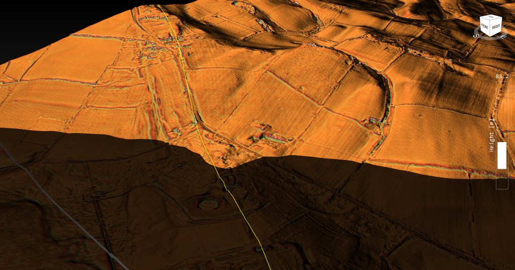
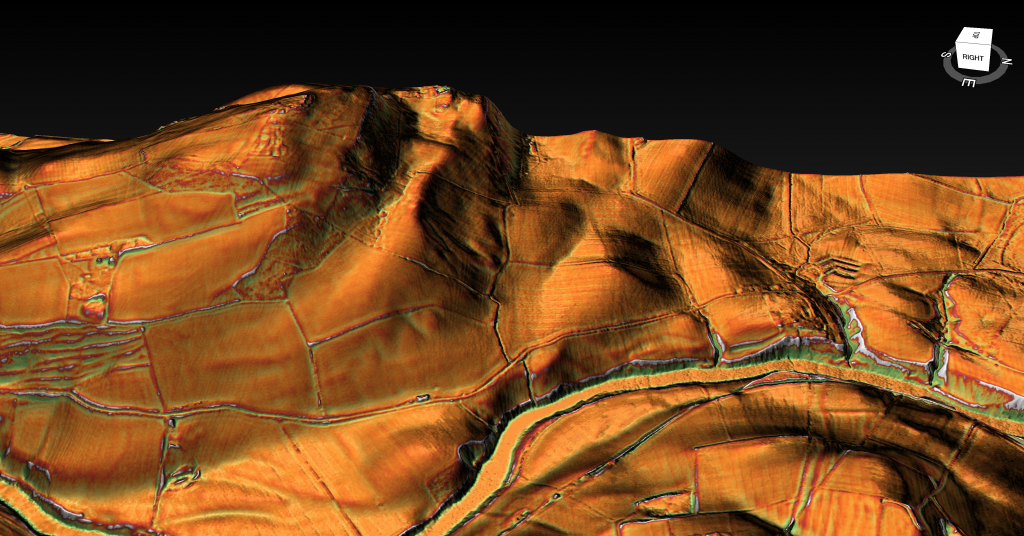
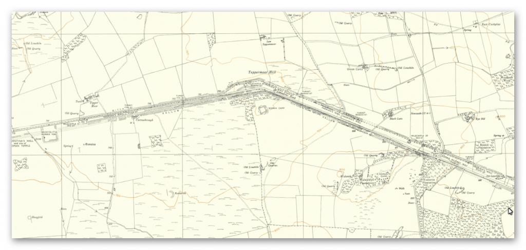
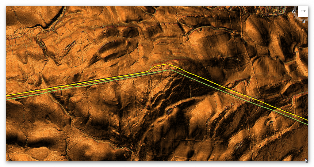
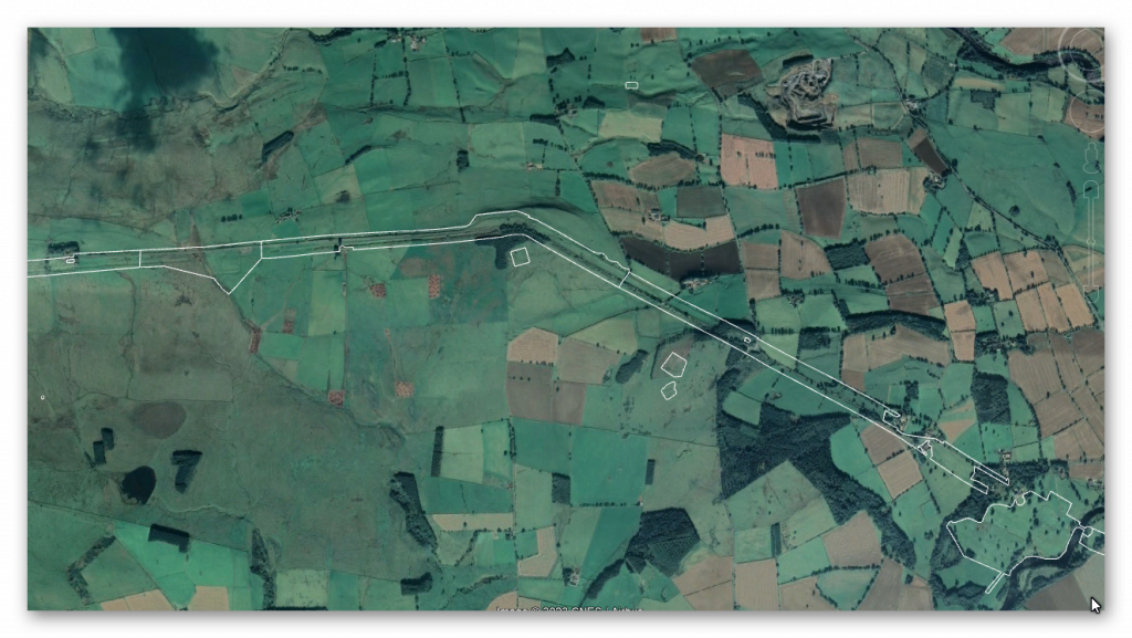
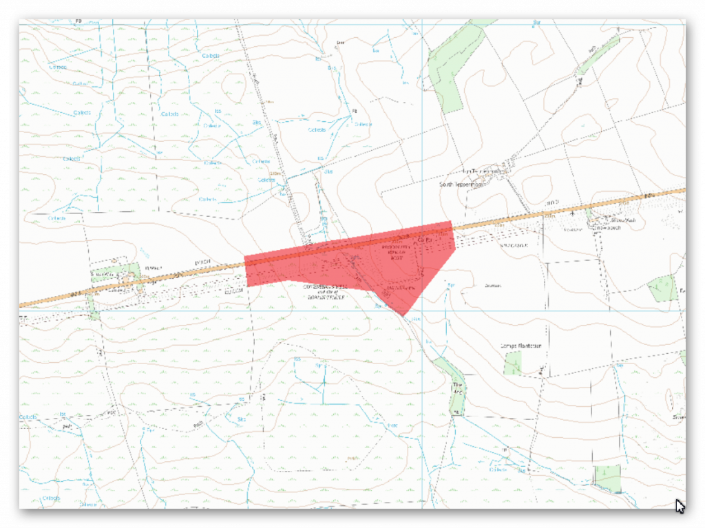
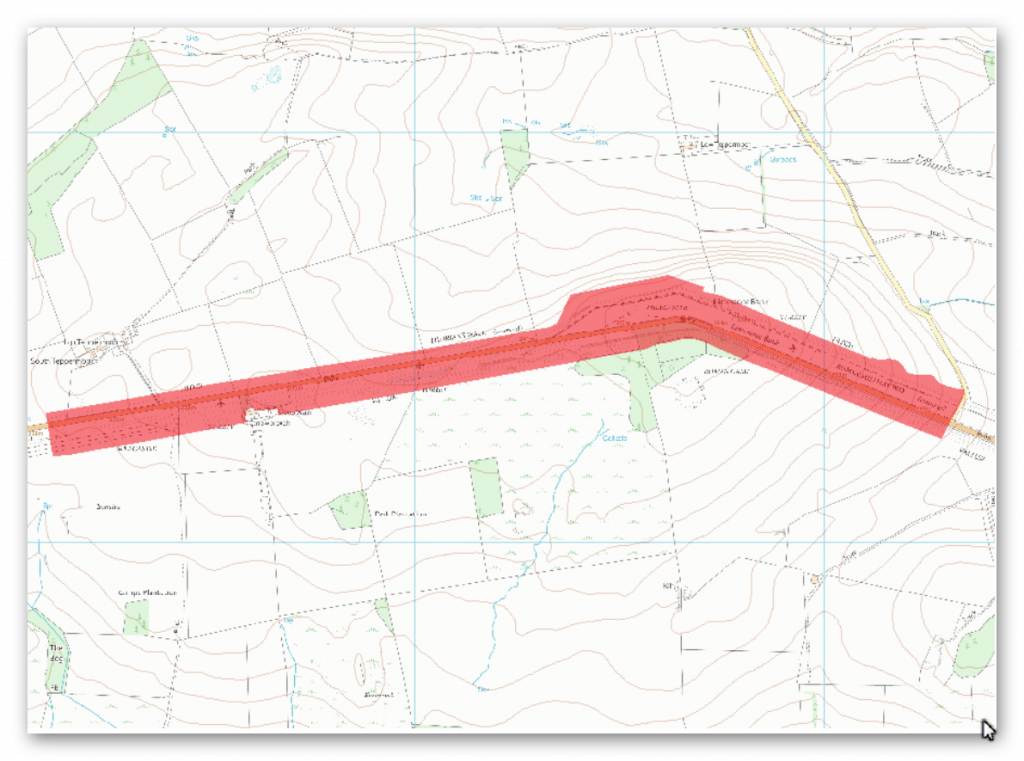
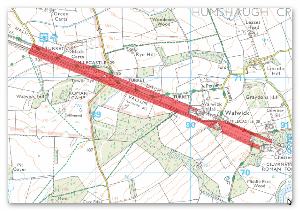
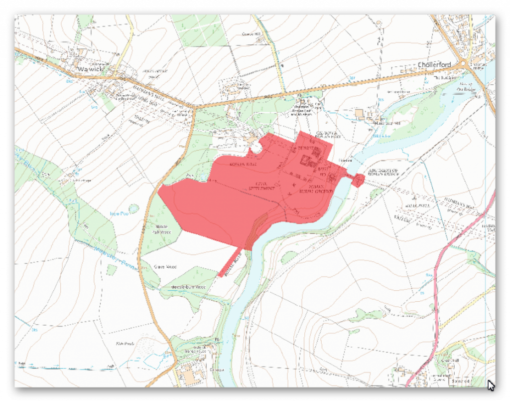
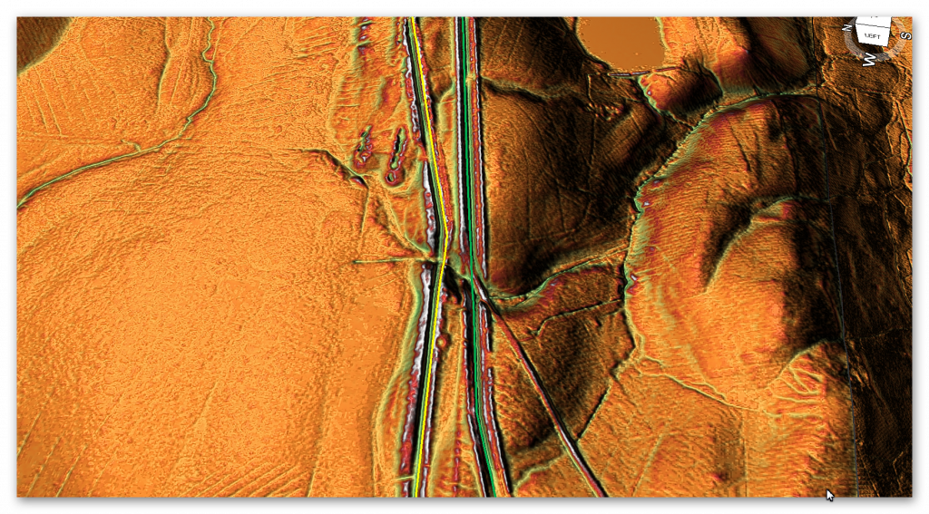
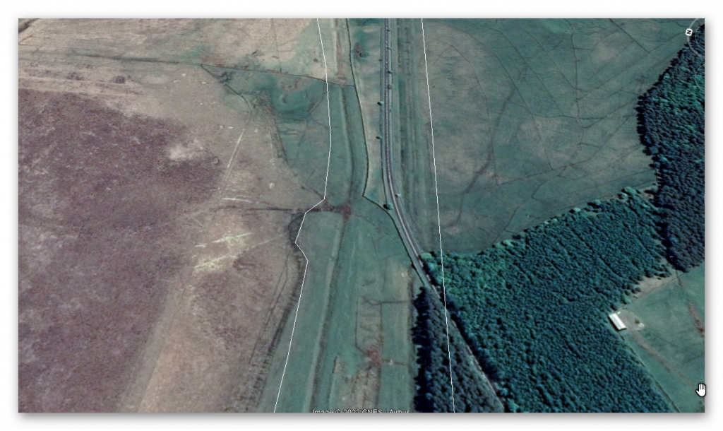
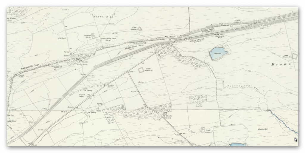
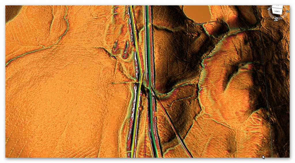
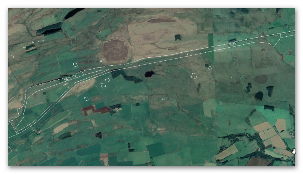
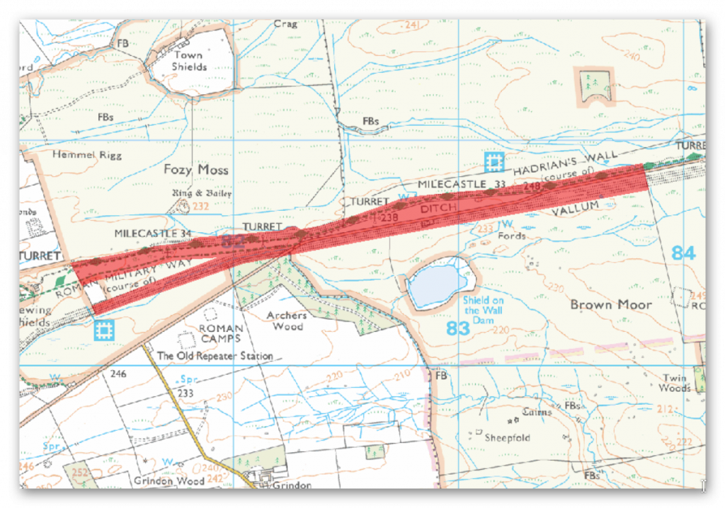
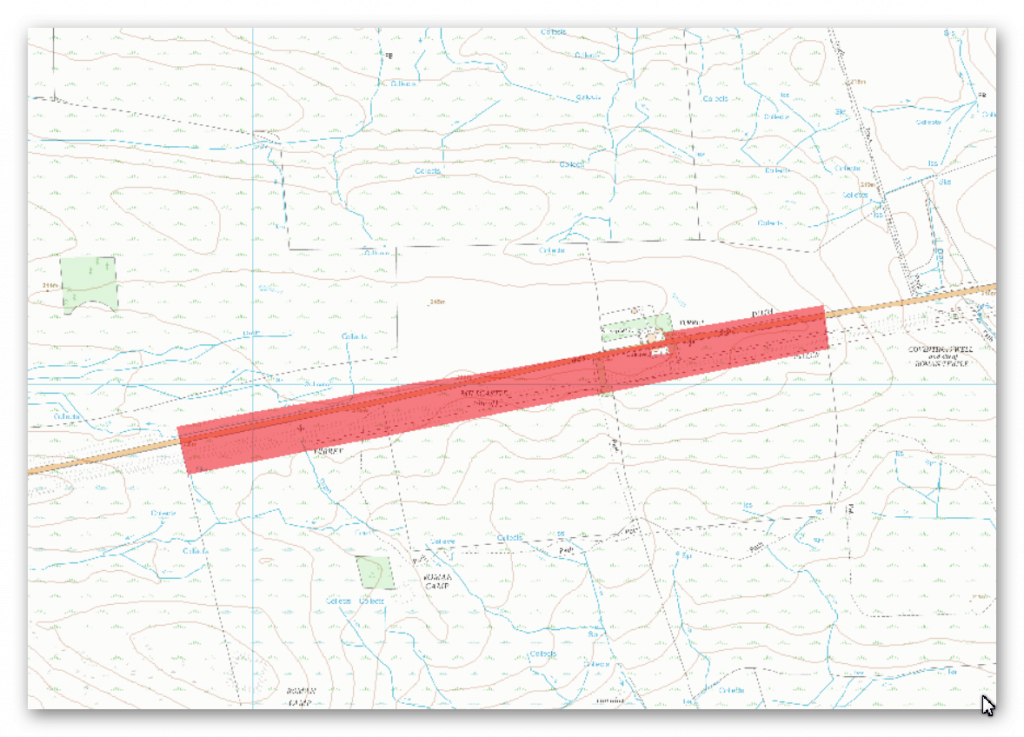
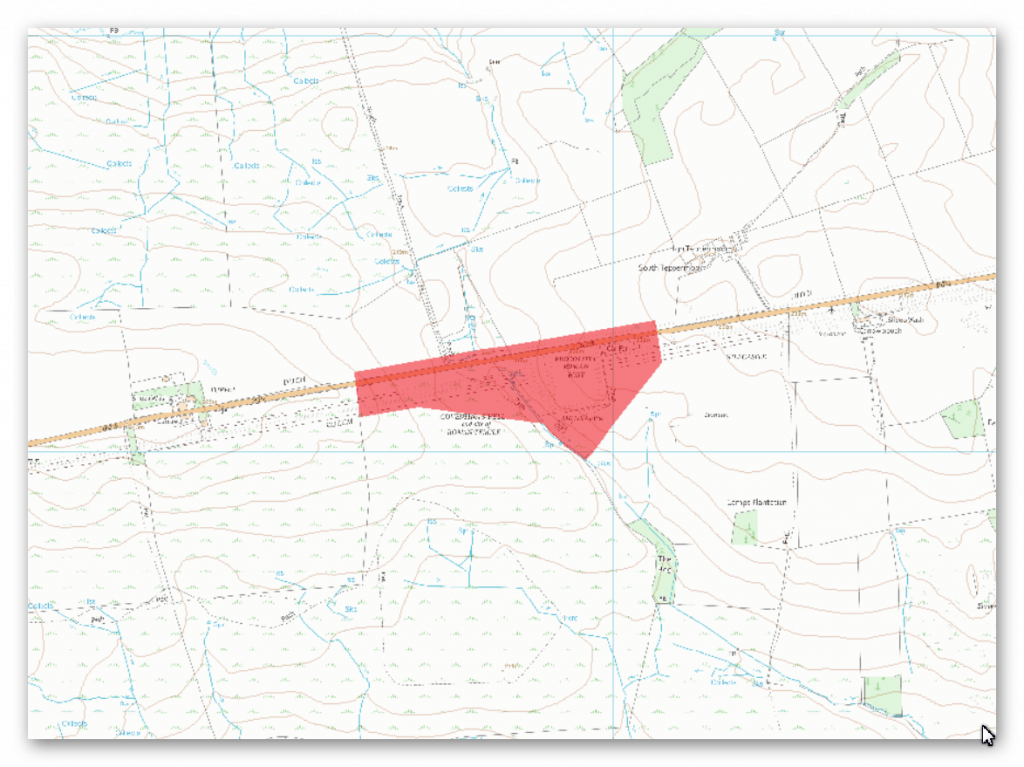
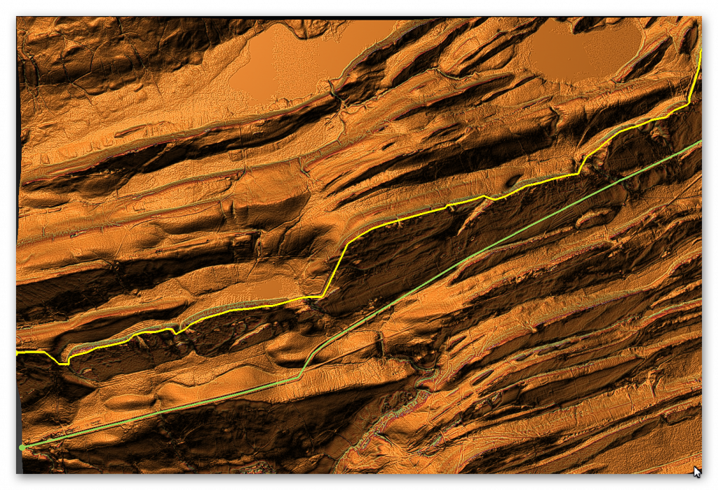
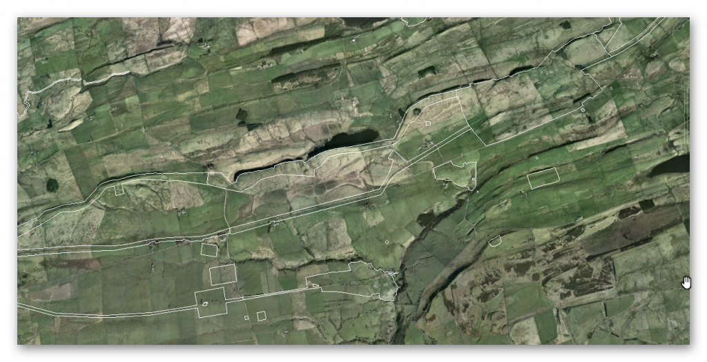
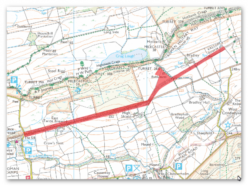
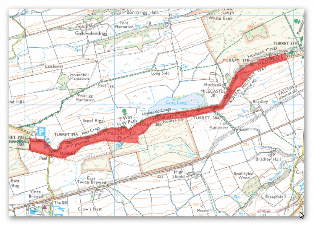
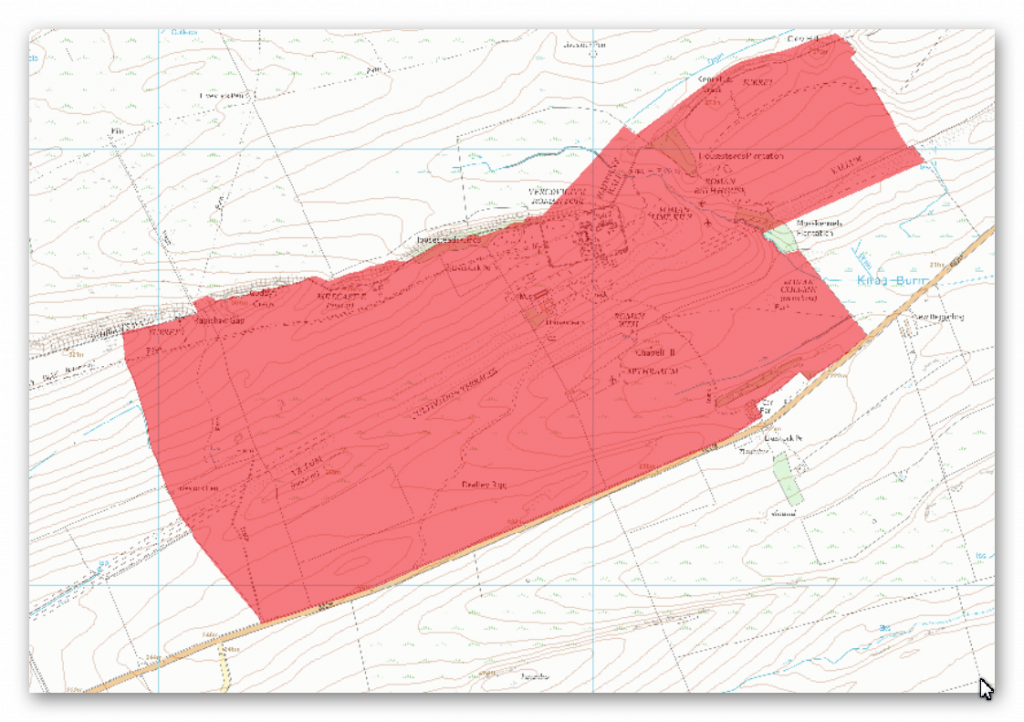
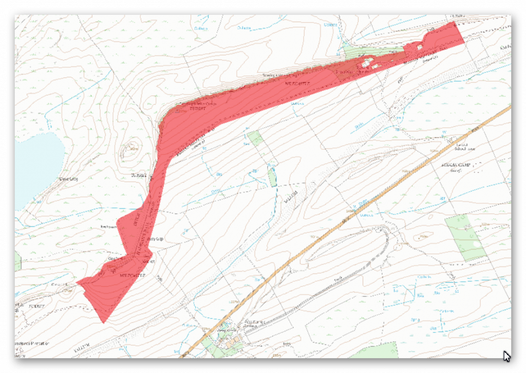
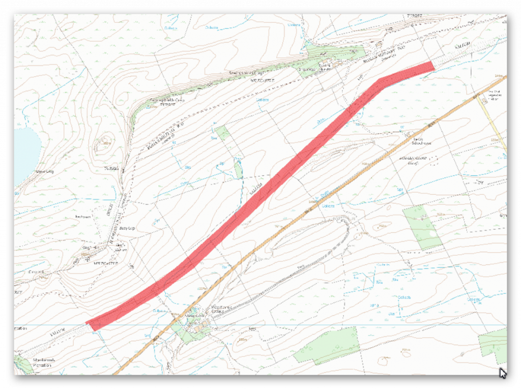
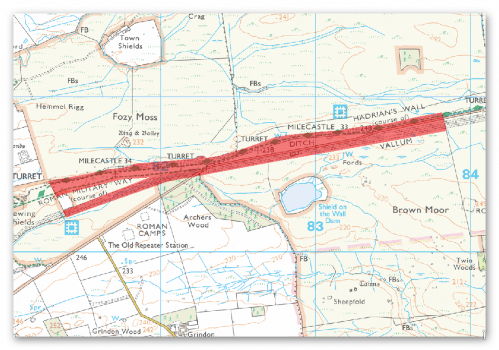
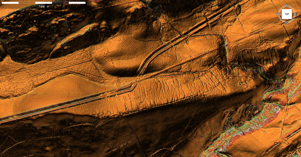
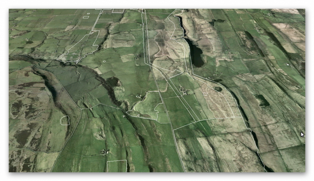
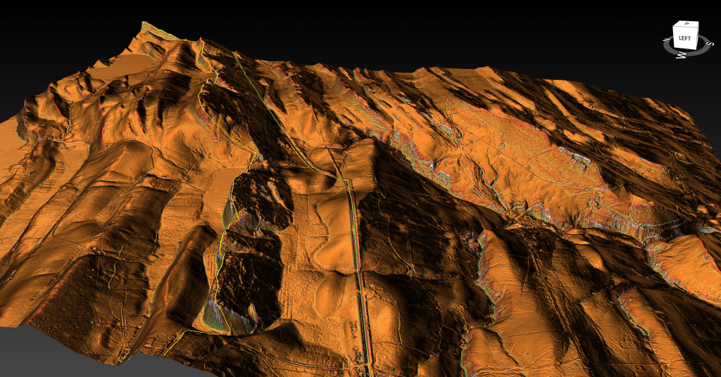
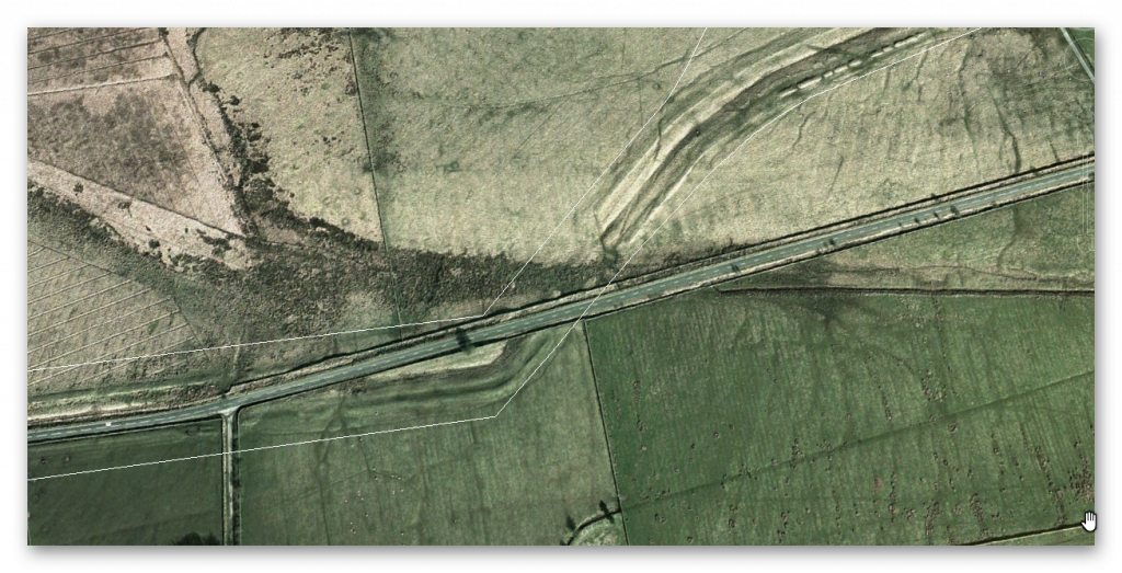
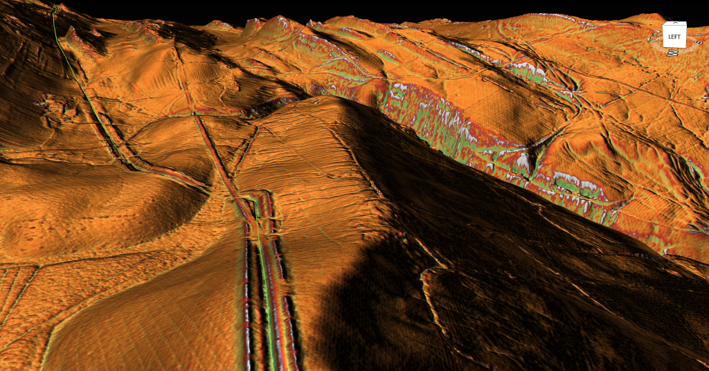
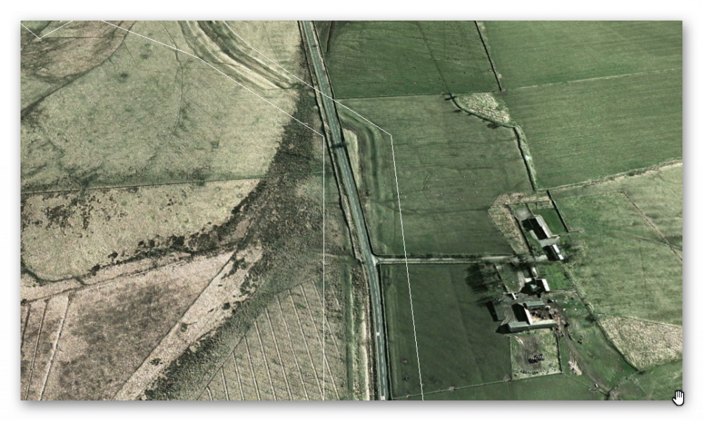
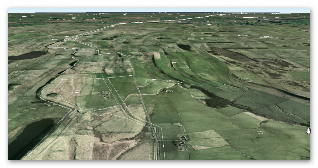
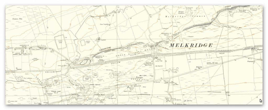
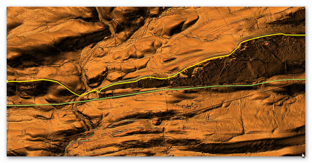
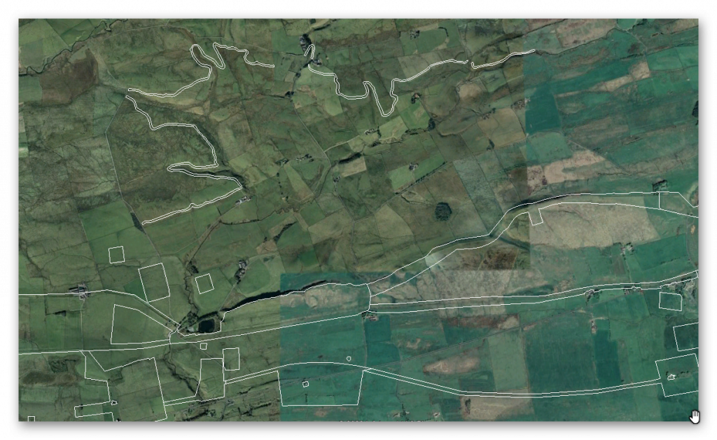
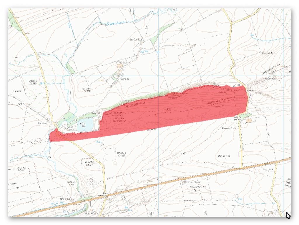
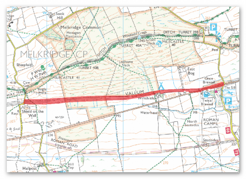
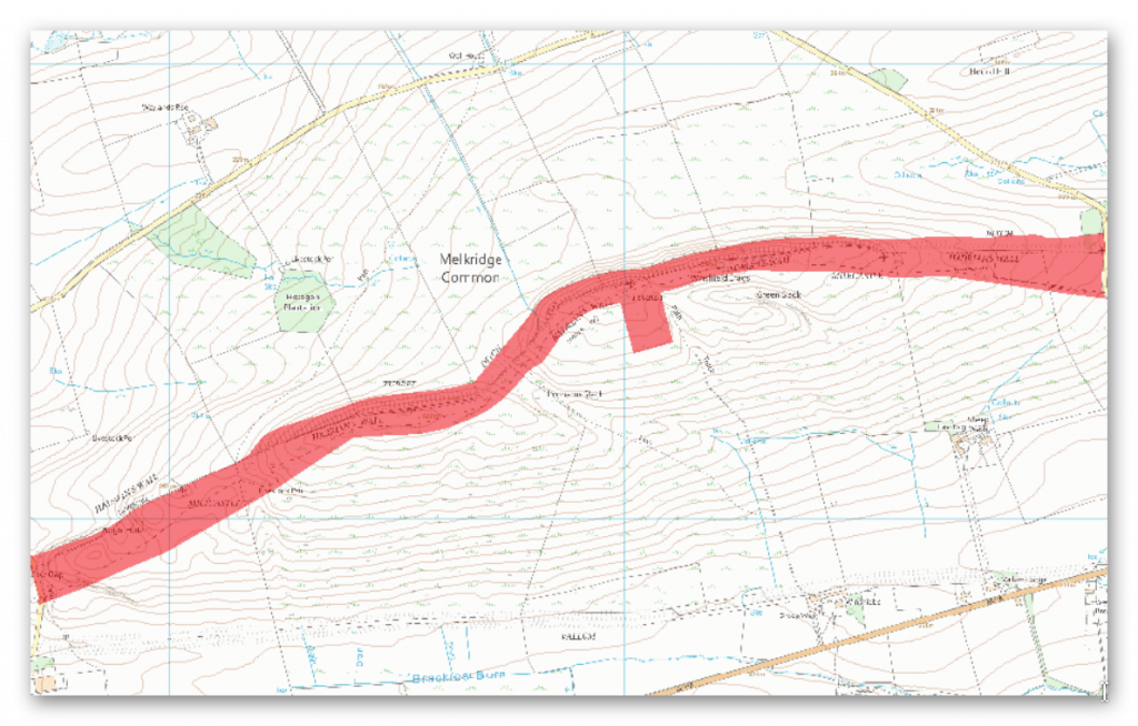
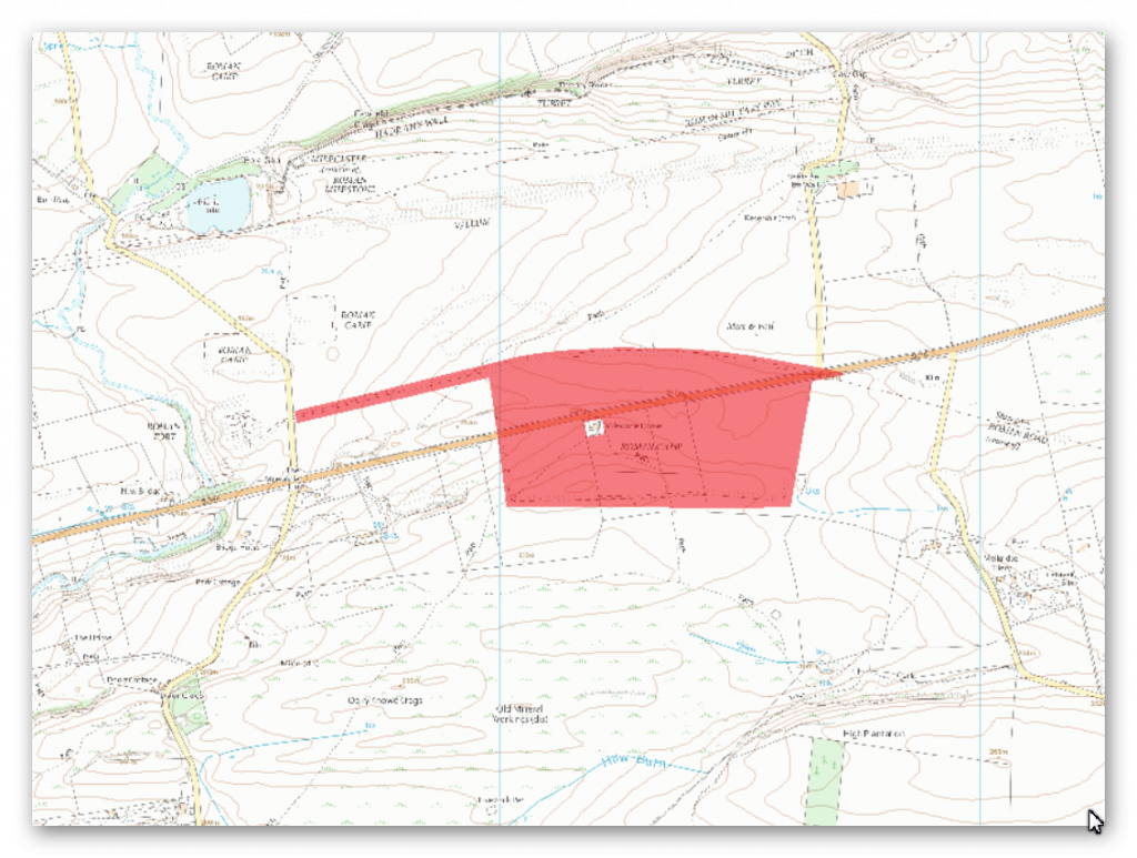
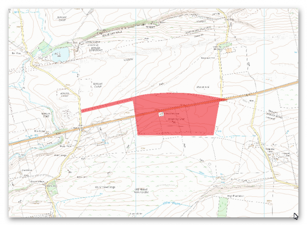
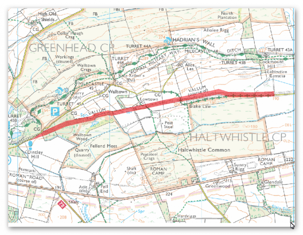
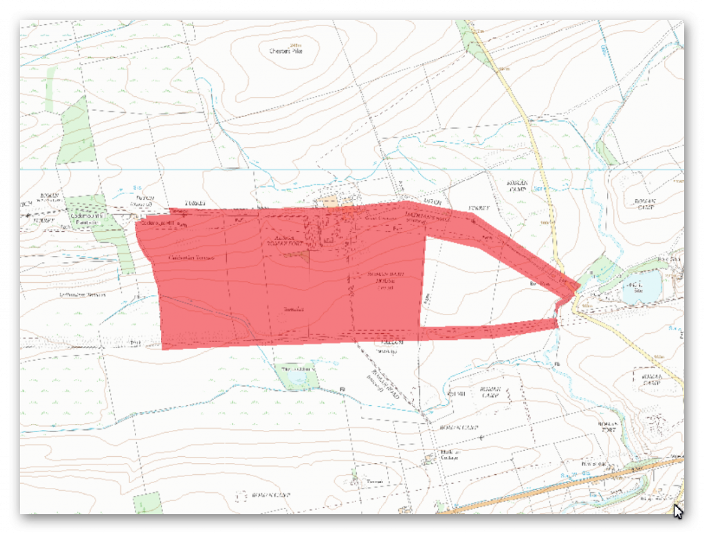
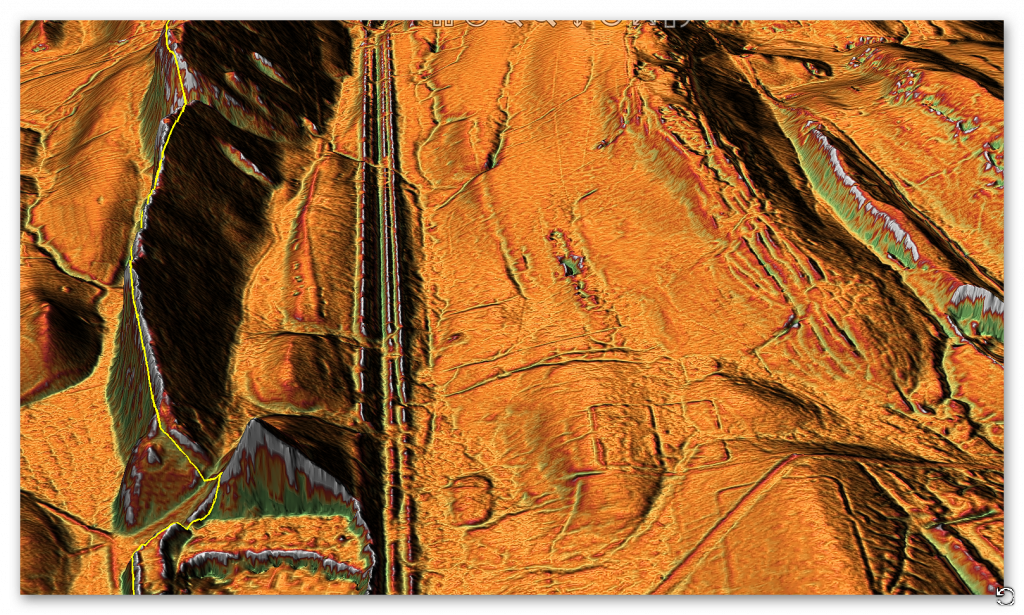
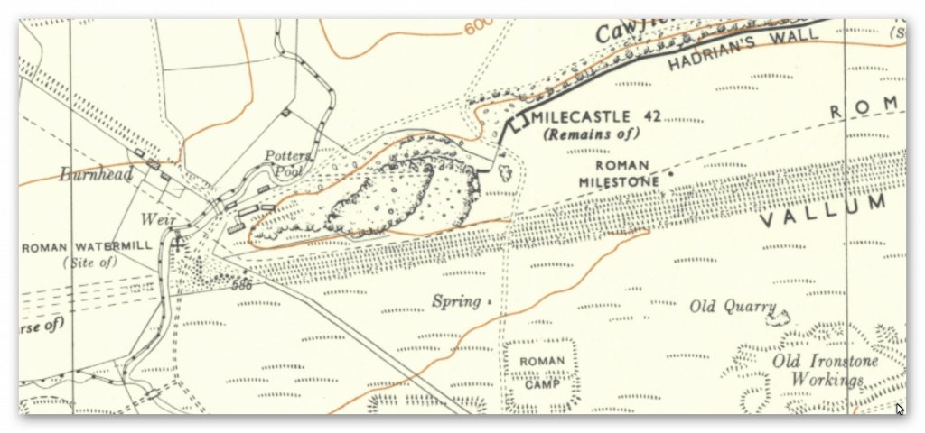
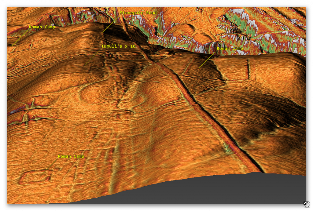
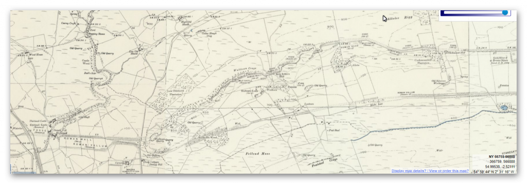
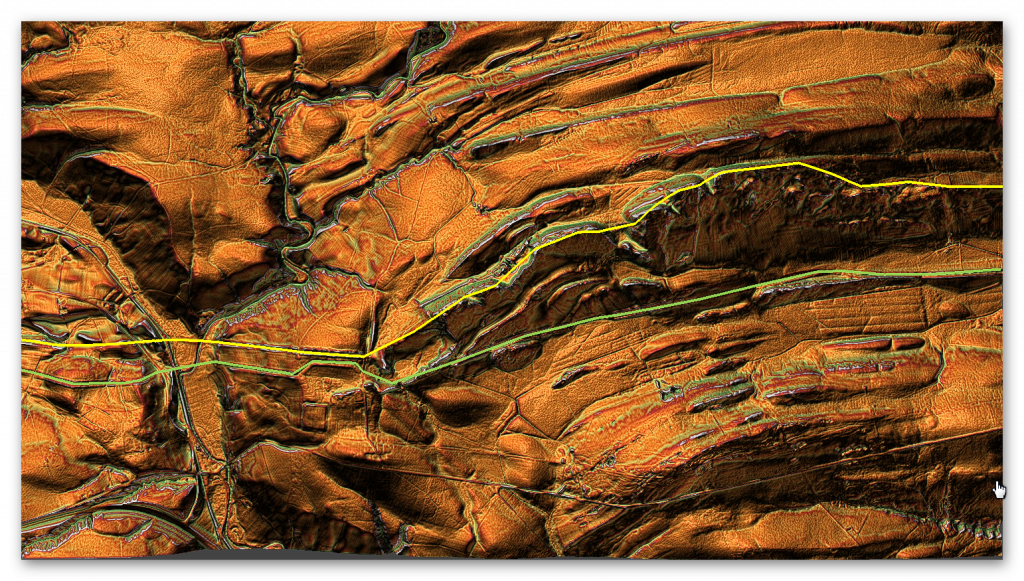
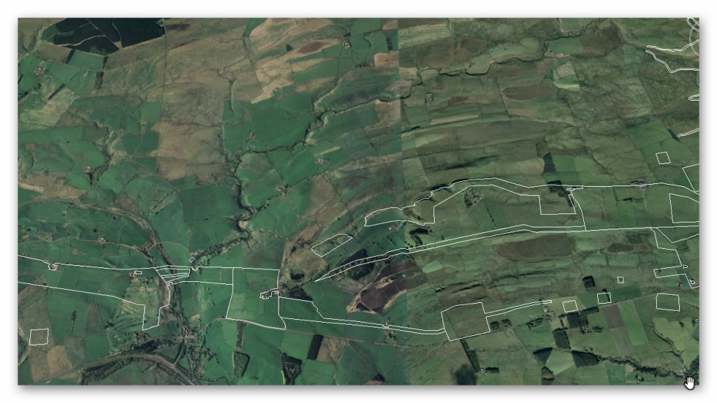
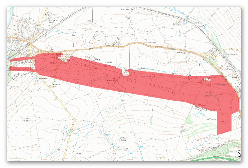
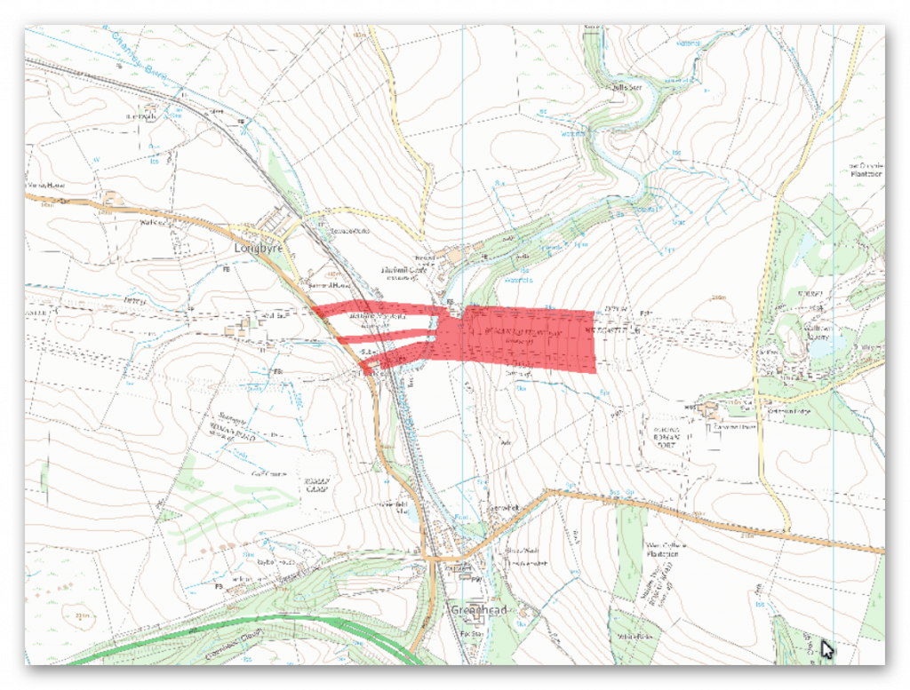
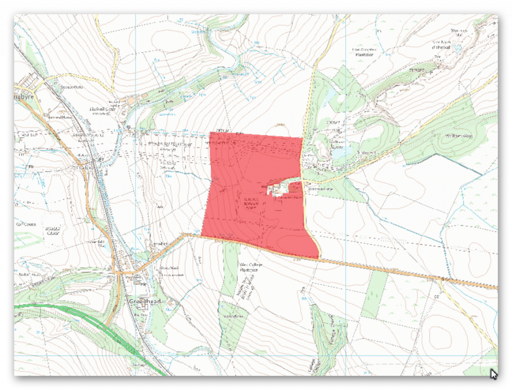
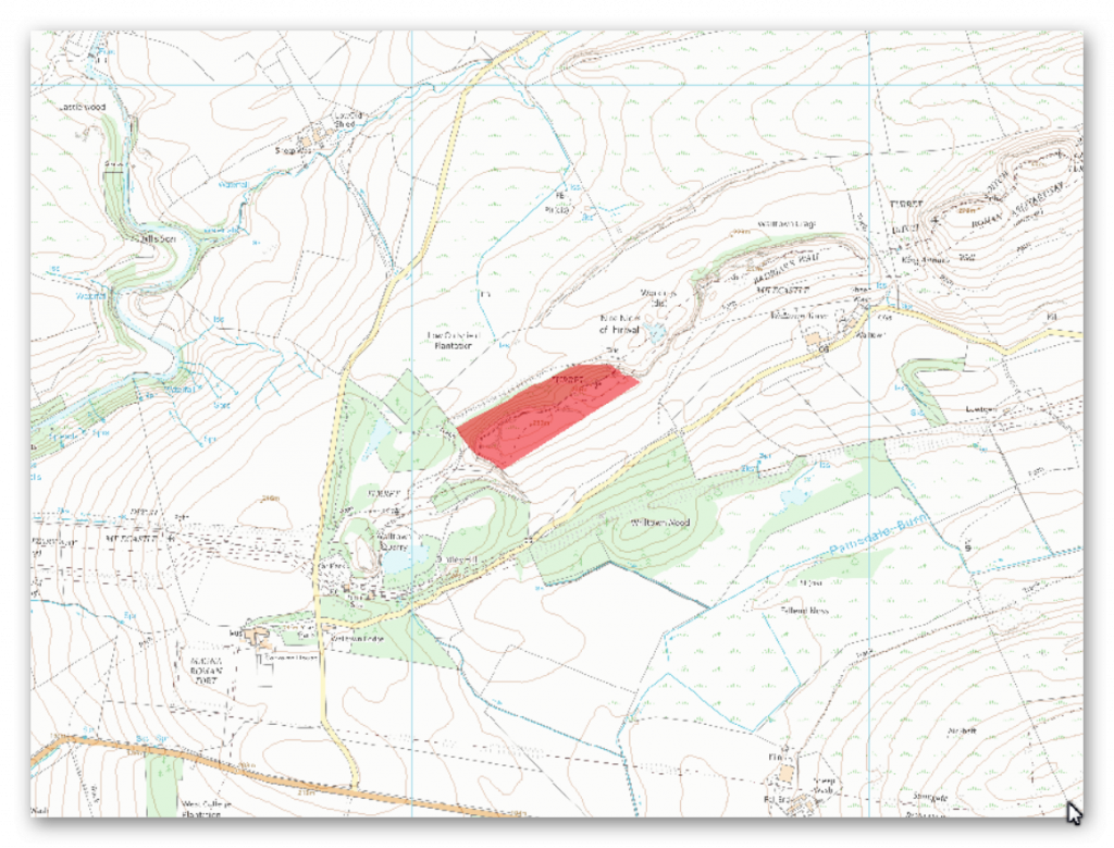
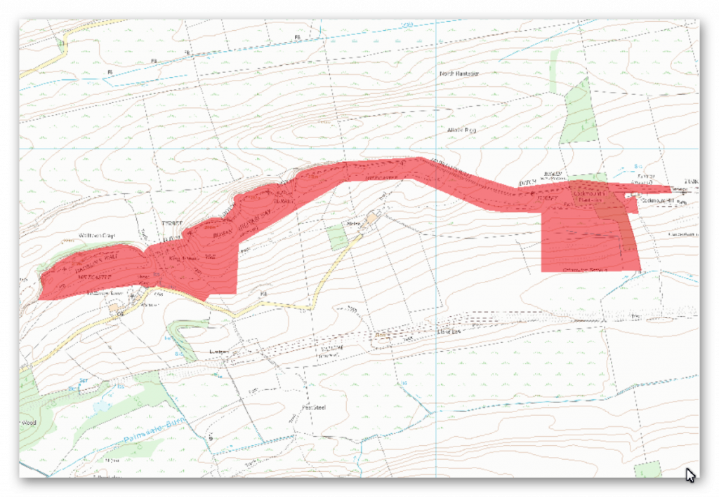
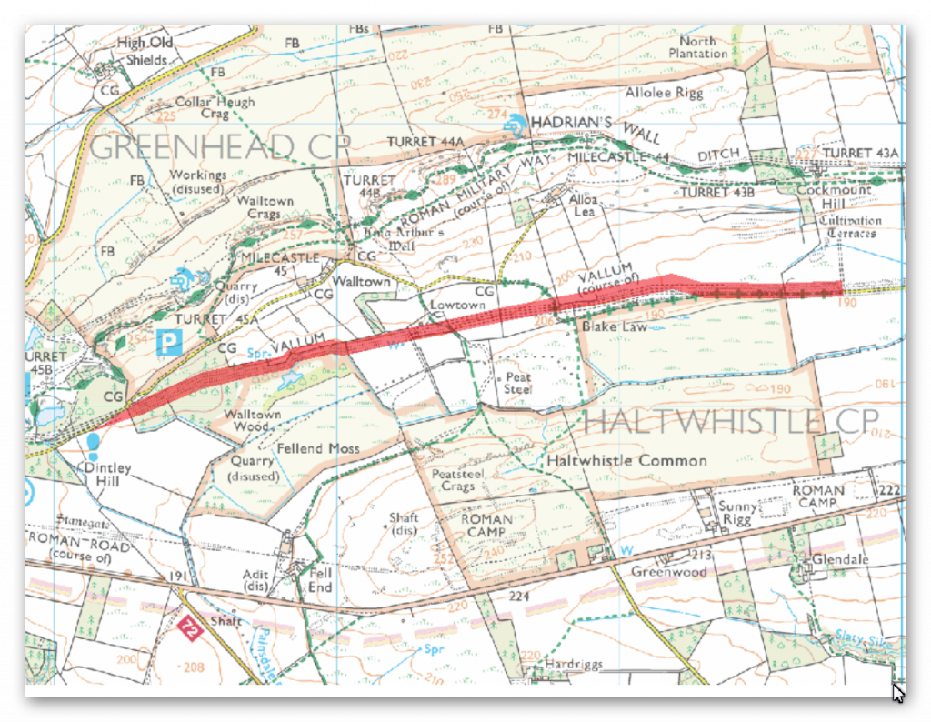
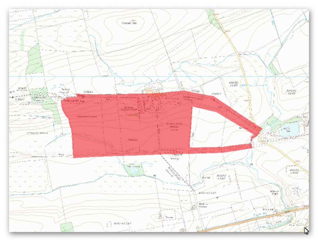
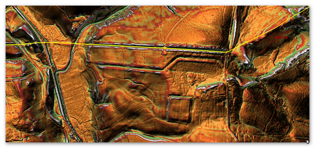
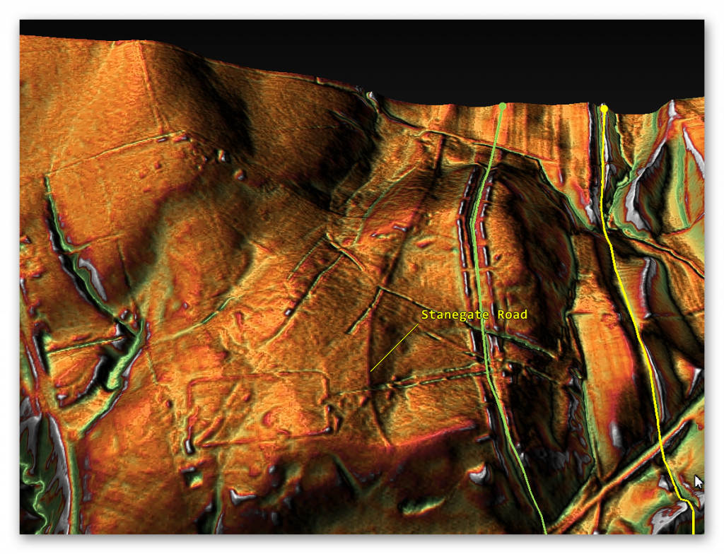
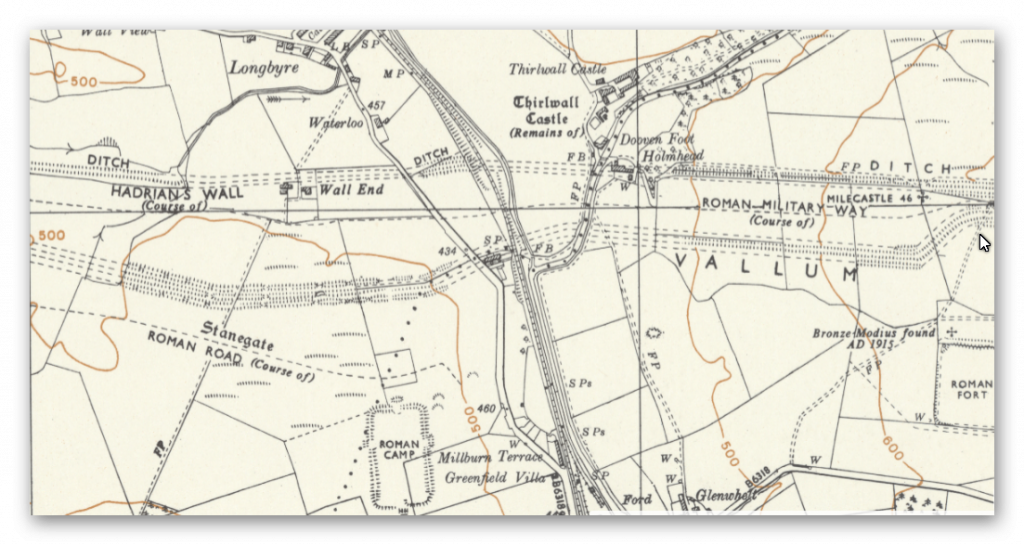
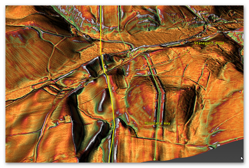
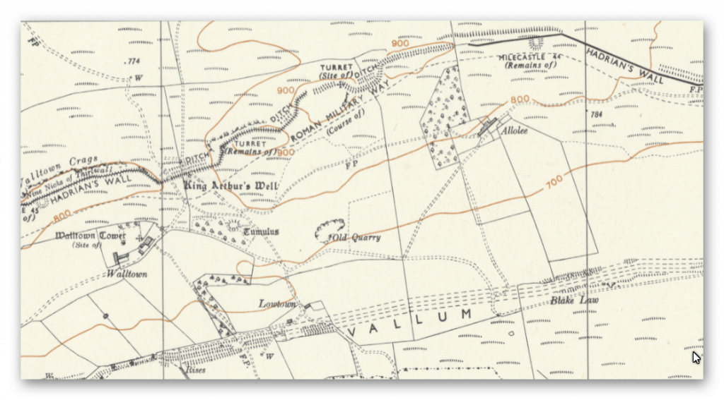
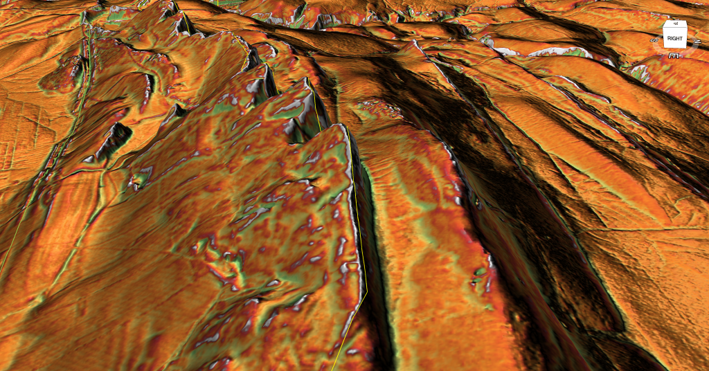
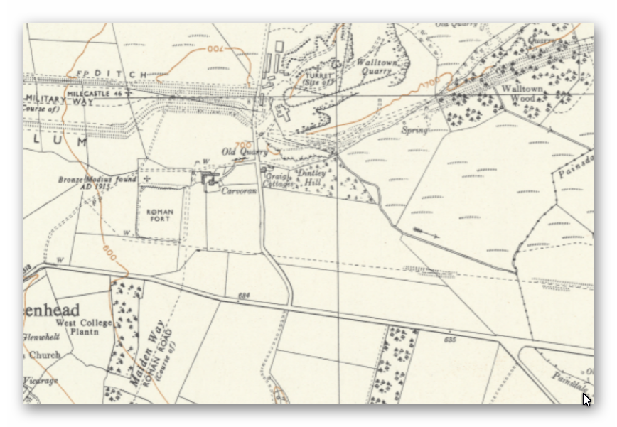
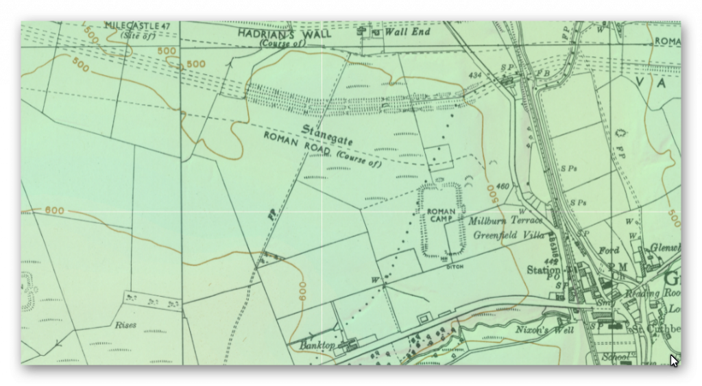
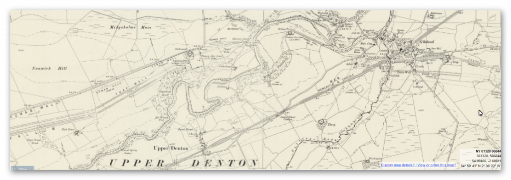
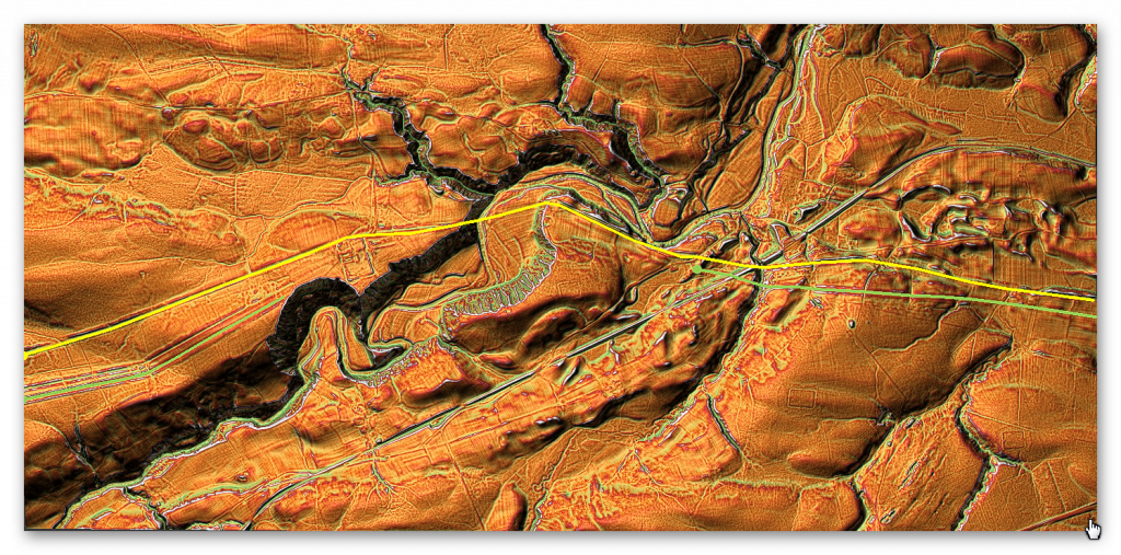
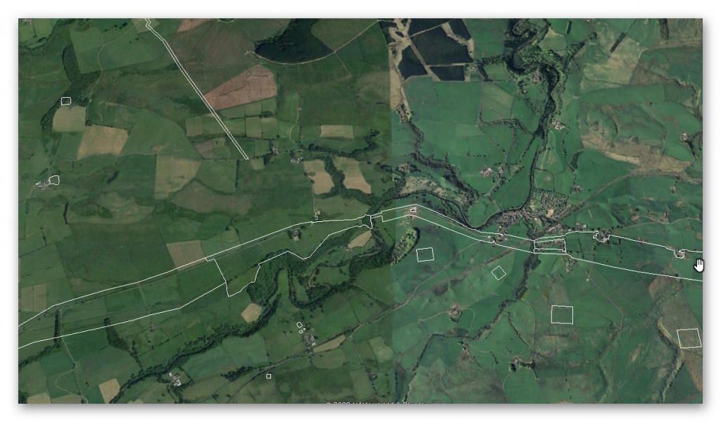
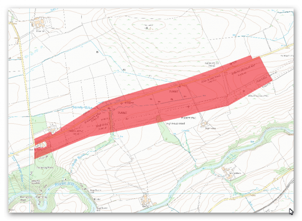
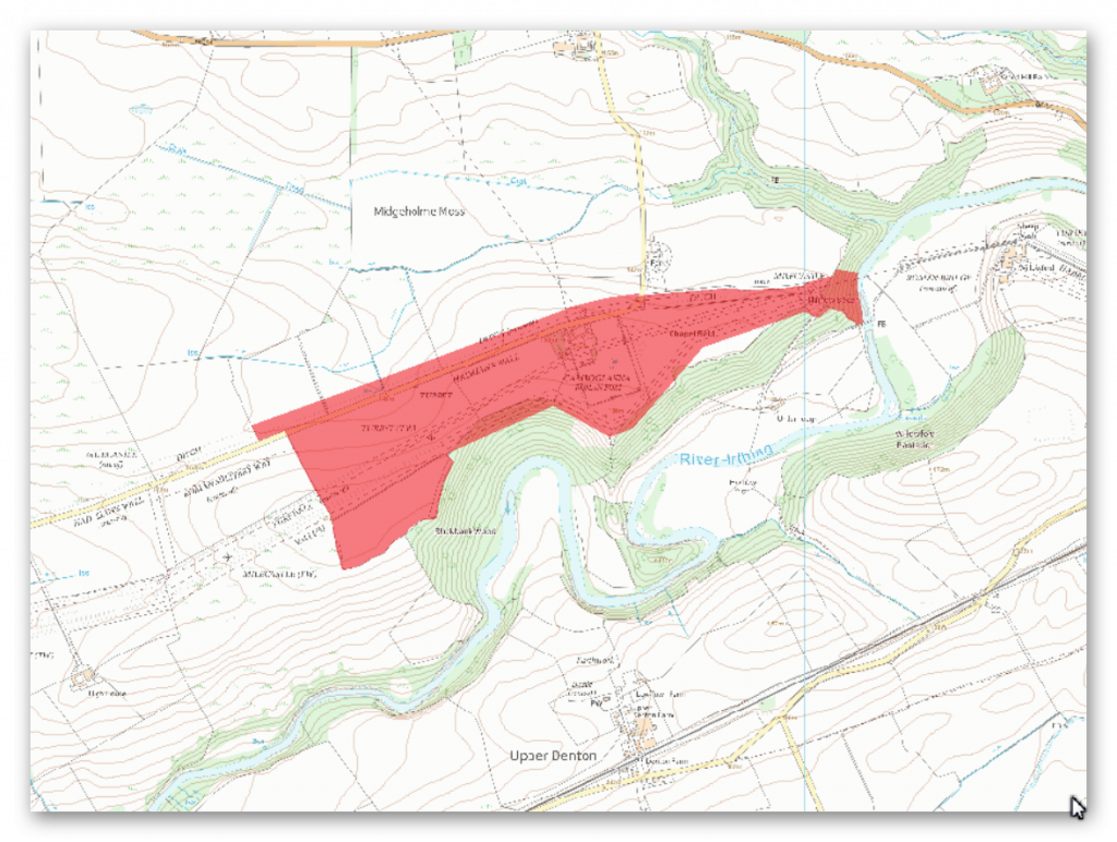
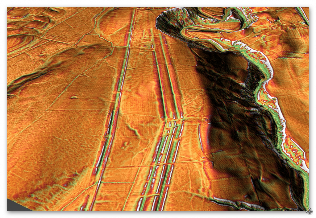
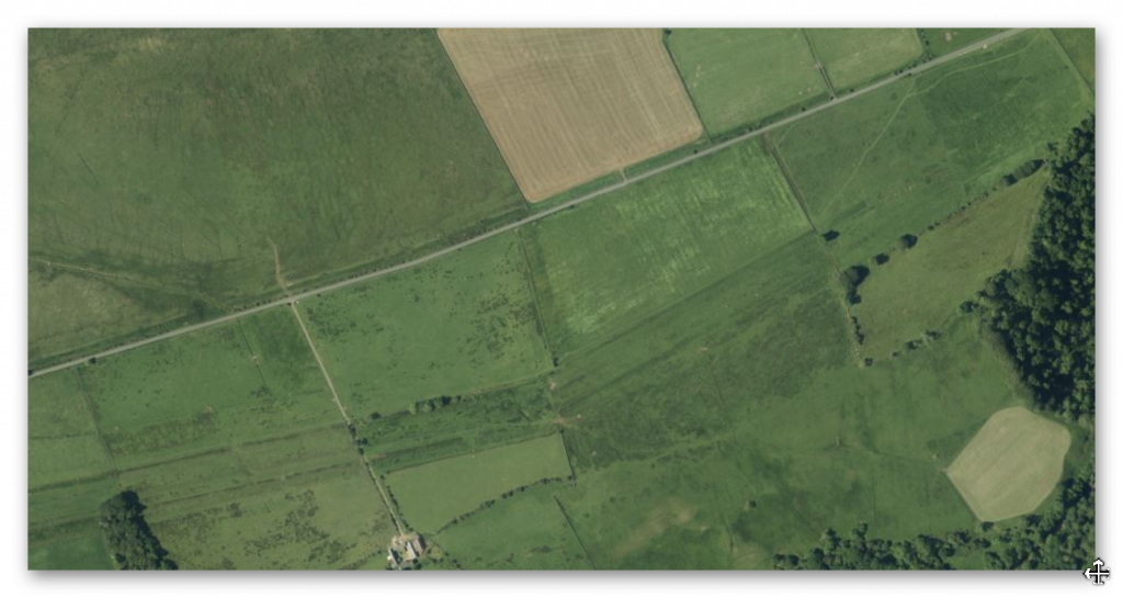
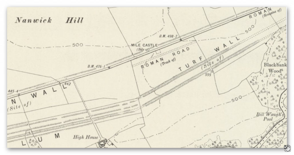
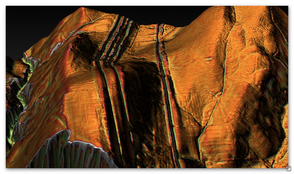
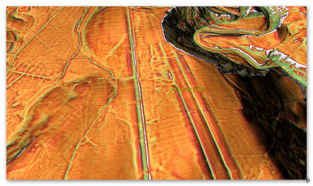
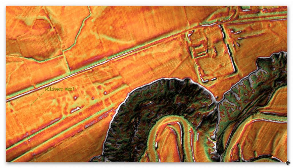
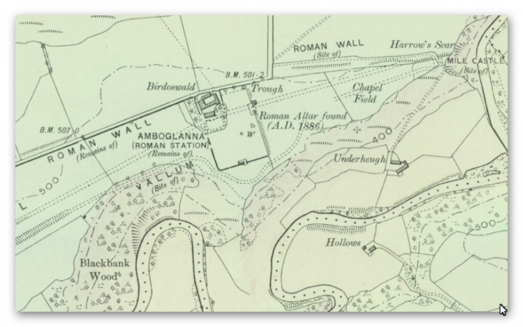
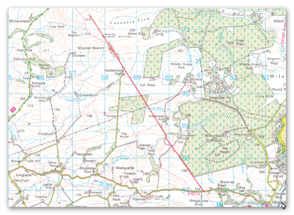
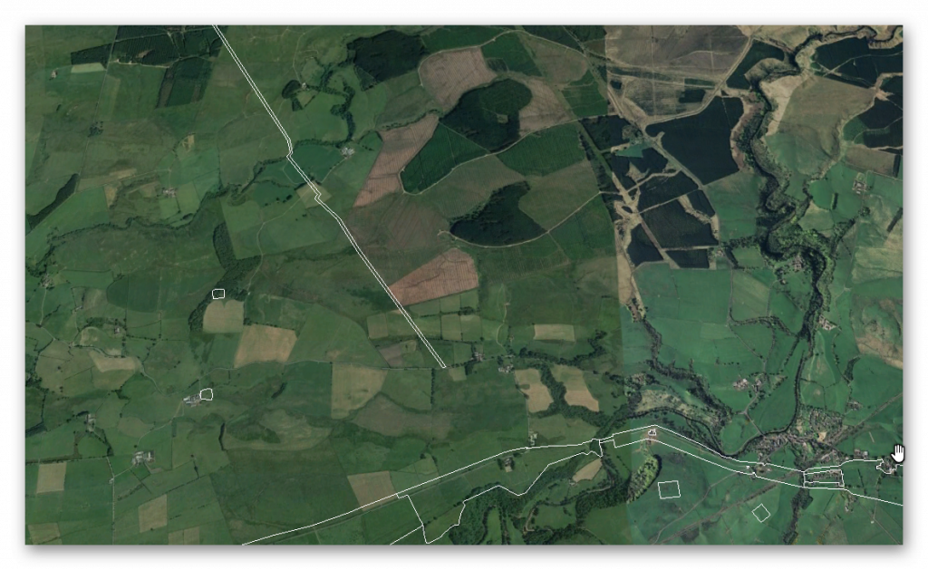
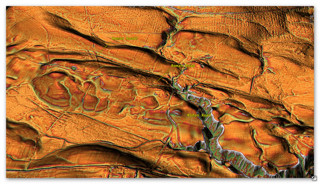
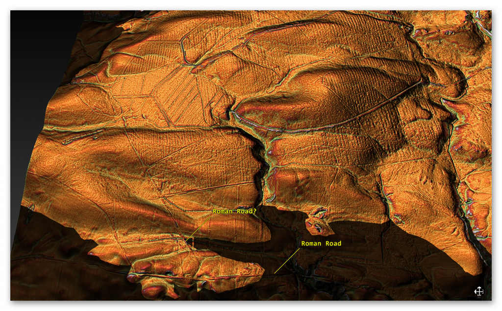
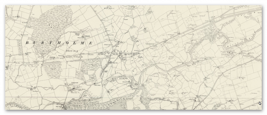
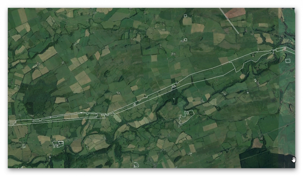
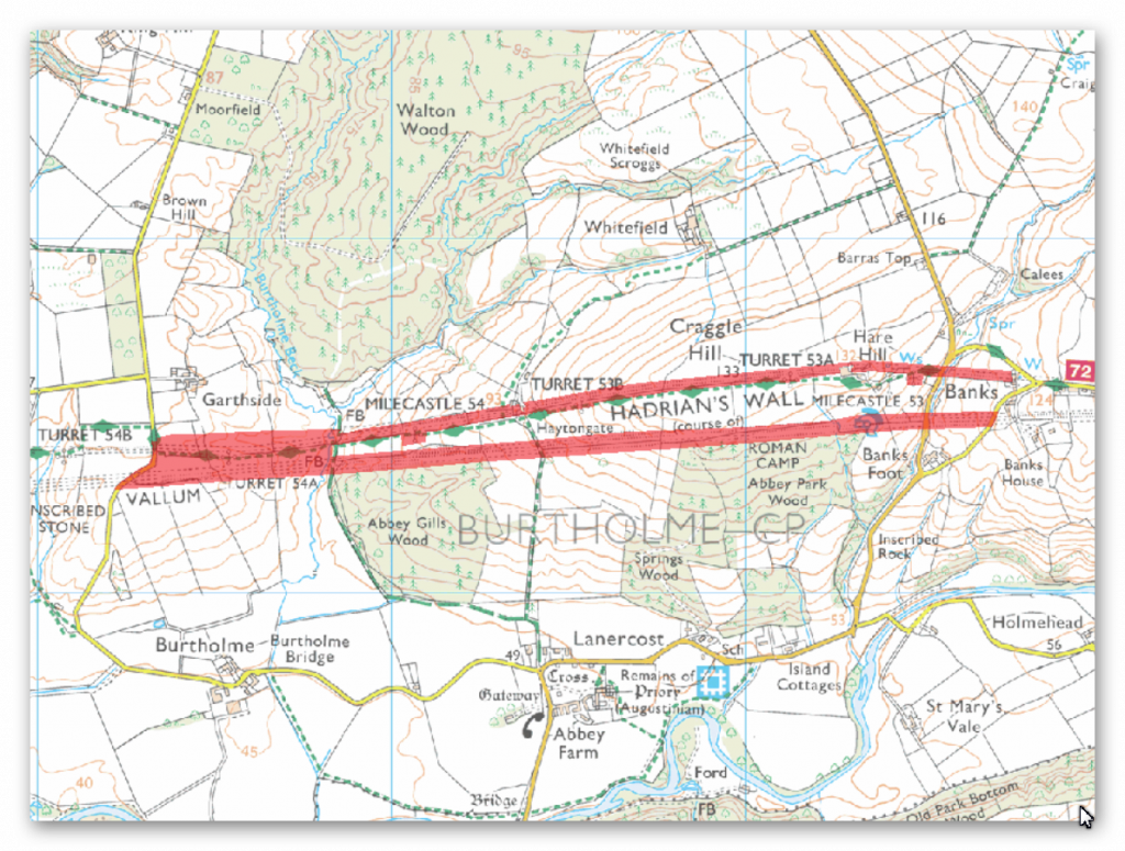
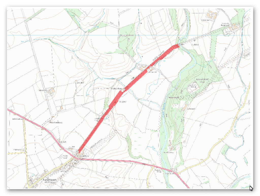
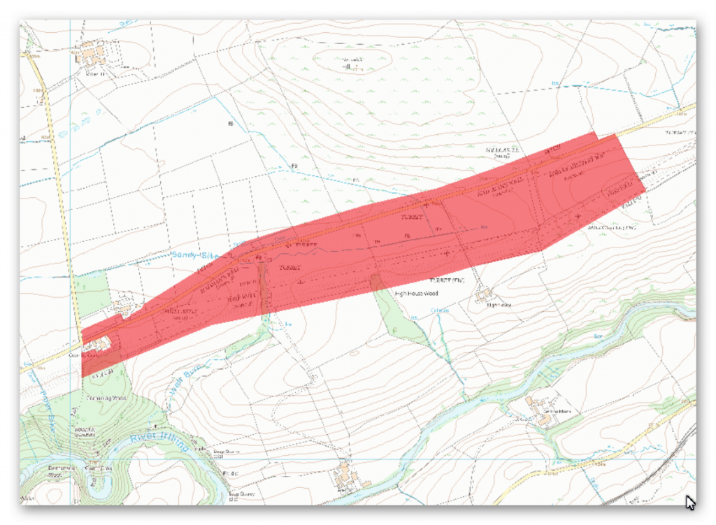
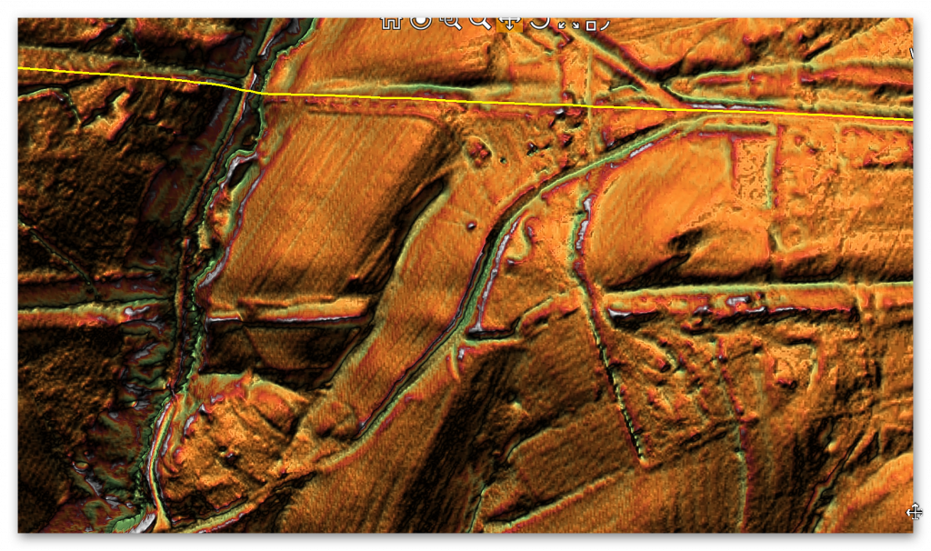
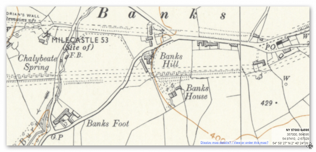
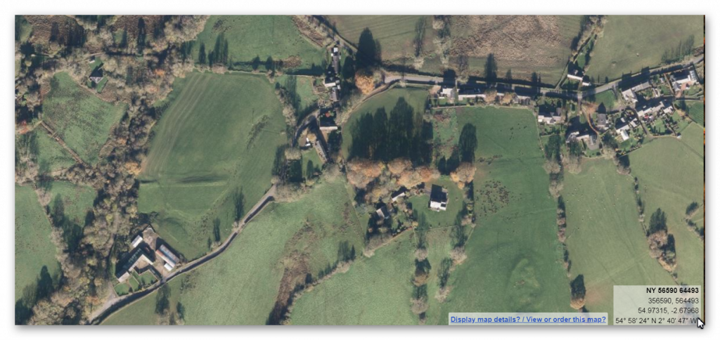
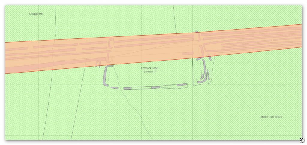
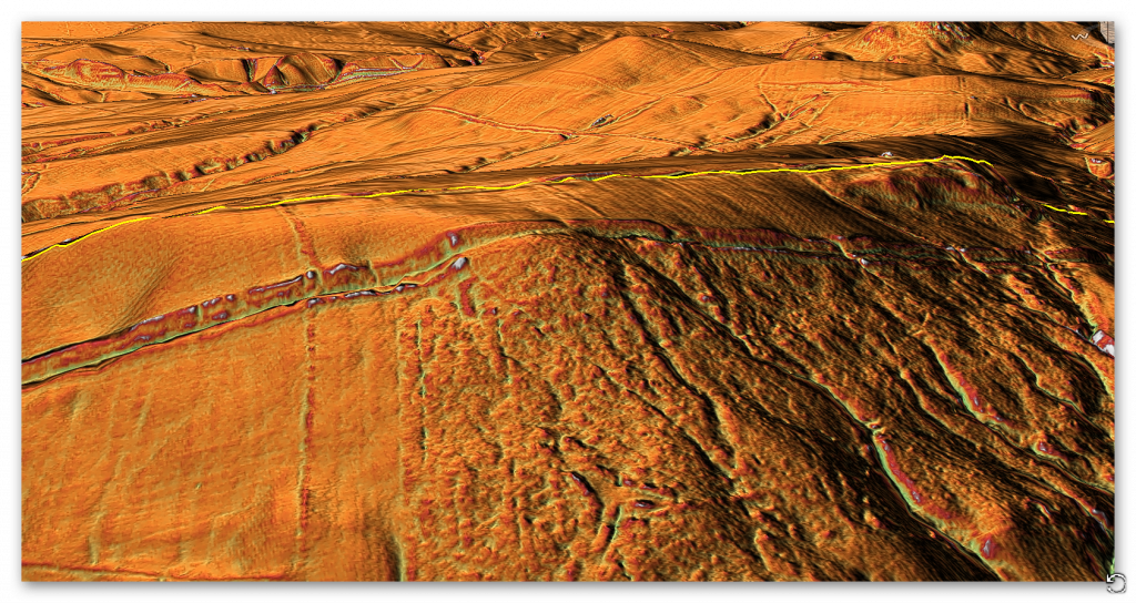
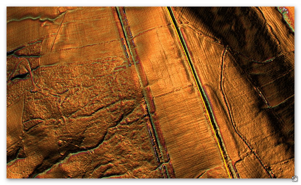
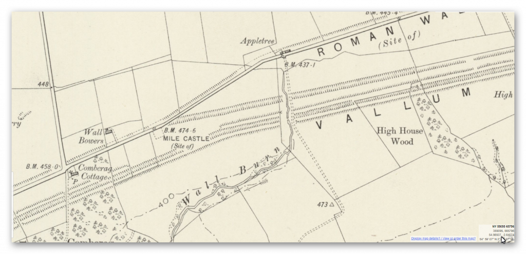
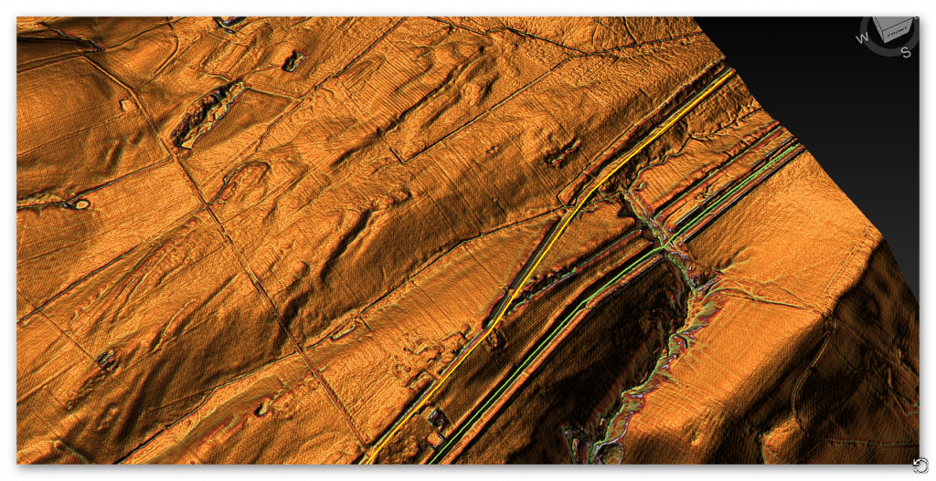
Section P – NY96NE – this is a section of Hadrian’s Wall showing the LiDAR, Google Earth and 1800 Maps of the Area covered by Historic England
Historic England Sections:
Name:Name: Hadrian’s Wall and vallum between Sunnybrae at Halton Shields and field boundary east of milecastle 24; wall miles 20, 21, 22 23, and 24 List UID: 1010958, 1010626, 1010625, 1010624, 1010623
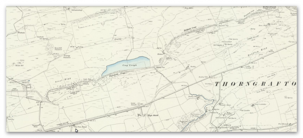
Old OS Map
Section P – NY96NE
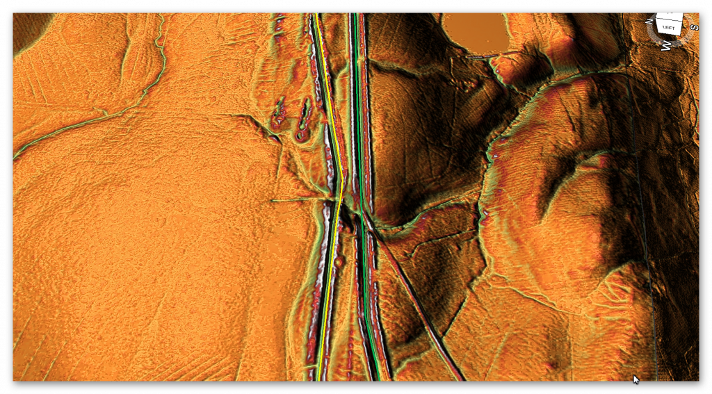
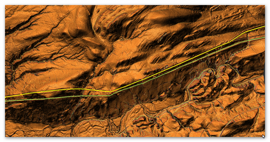
LiDAR Map
Section P – NY96NE – Wall in Yellow -Vallum in Green
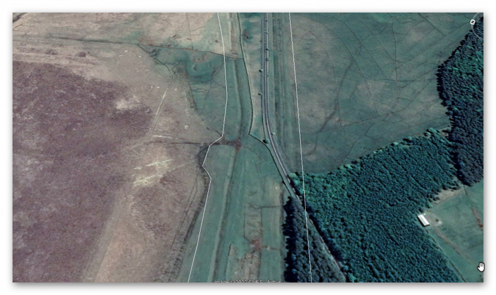
Google Earth Map
Section P – NY96NE
Historic England Scheduled Monuments within Section P
Name: Hadrian’s Wall and vallum between field boundary east of milecastle 24 and field boundary west of the site of turret 25b in wall miles 24 to 25 Designation Type: Scheduling Grade: Not Applicable to this List Entry List UID: 1010958
Name: Hadrian’s Wall and vallum between the track to Portgate Cottage and the field boundary east of milecastle 24 in wall miles 22 and 23 Designation Type: Scheduling Grade: Not Applicable to this List Entry List UID: 1010626
Name: Hadrian’s Wall and vallum between the Fence Burn and the track to Portgate Cottage in wall miles 21 and 22 Designation Type: Scheduling Grade: Not Applicable to this List Entry List UID: 1010625
Name: Haltonchesters Roman fort, settlement and Hadrian’s Wall and vallum between the field boundary east of Haltonchesters fort and the Fence Burn in wall mile 21 Designation Type: Scheduling Grade: Not Applicable to this List Entry List UID: 1010624
Name: Hadrian’s Wall and vallum between Sunnybrae at Halton Shields and Haltonchesters Roman fort in wall miles 20 and 21 Designation Type: Scheduling Grade: Not Applicable to this List Entry List UID: 1010623
1010958
The monument includes the section of Hadrian’s Wall and its associated features between the field boundary east of milecastle 24 and the field boundary west of the site of turret 25b east of Brunton Gate. Throughout most of this section there are wide views to the north and south with undulating ground to the east and west restricting the outlook.
The Wall survives as a series of buried remains below the course of the B6318 road throughout most of this section. Where the B6318 road changes direction east of St Oswald’s Hill Head Farm the line of the Wall runs below St Oswald’s Hill Head Farm itself. Beyond the farm it survives as a turf covered mound 0.5m high, spread by ridge and furrow cultivation. The wall ditch survives well as an earthwork visible on the ground for most of this section. It averages about 2.5m deep throughout, though it reaches a maximum of 3.6m deep in places. The upcast mound from the ditch, known as the glacis, is visible intermittently, usually in places where it has survived ploughing. Where extant it is generally irregular, sometimes containing much stony material, and averaging about 1m in height. Milecastle 24 is situated just below the crest of a west facing slope with views to the north and south. It was partly excavated in 1930 by Hepple and was shown to be just over 15m across with walls 3m thick. It survives as a turf covered mound with the remains of the excavation trenches and spoil heap still visible. Milecastle 25 is also situated on a west facing slope with views to the north and south. It survives as a turf covered platform about 1m high. A slight hollow on the south side may indicate an outer ditch.
This milecastle was also partly excavated during 1930 by Hepple. Turret 24a occupies a slight hollow which restricts views to the east and west. It survives as a buried feature below the B6318 road. It was located and partly excavated during 1930 by Hepple. Turret 24b is situated just below the crest of an east facing slope with wide views to the north and south. It survives as a buried feature below the surface of the B6318 road. As with turret 24a this turret was located and partly excavated by Hepple during 1930. Turret 25a is situated on a west facing slope in the short stretch of ground between the B6318 and St Oswald’s Hill Head Farm. It was located by Hepple during 1930, however there are no upstanding remains. Turret 25b is situated on a west facing slope to the south west of St Oswald’s Church. There are no upstanding remains but it will survive as a buried feature, below the line of the east-west field boundary to the west of St Oswald’s Church. It too was located and part excavated during 1930 by Hepple. The turret was again partly excavated during 1959 and there was no pottery recovered later than the second century AD.
The course of the Roman road known as the Military Way, which ran along the corridor between the Wall and the vallum linking turrets, milecastles and forts, is known for most of this section. It uses the north mound of the vallum as its base, certainly up to milecastle 25, along which it could be seen by Horsley who recorded it in his 1732 publication. A recent survey by the Royal Commission on the Historical Monuments of England shows that the Military Way probably continued along the north mound of the vallum beyond milecastle 25 where Horsley could no longer trace it.
The vallum survives as an upstanding earthwork for much of this section where it mirrors closely the line of the Wall. The north mound averages about 1m where extant with a maximum height of 1.6m in places. The south mound also averages about 1m, but has a maximum height of 4m in places. The ditch is generally between 1.5m and 2m in depth where extant. Elsewhere it survives as a buried feature that has silted up.
1010626
The monument includes the section of Hadrian’s Wall, vallum and associated features between the track to Portgate Cottage in the east and the field boundary to the east of milecastle 24 in the west.
This section follows a straight alignment throughout its length and links the crests of the high ground along this length. Hadrian’s Wall runs beneath the B6318 road for the entire length of this section. The wall ditch and upcast mound to the north survive well as upstanding earthworks for most of the length of this section. The ditch averages 2m deep throughout, though it reaches a maximum of 2.8m in places. The upcast mound from the ditch, usually known as the `glacis’, survives up to a maximum of 1m in height to the north of the ditch. Milecastle 23 is situated about 50m east of the Stanley Plantation on the south side of the B6318 road on an east facing slope. It survives as a turf covered platform about 1m high with traces of a ditch around it. It was partly excavated in 1930 and it was shown to have an internal width of 15m and walls 2.9m thick. Turret 22b is located about 10m west of the track to Portgate House and Cottage off the B6318 road. It survives as a buried feature beneath the B6318 road. It was partly excavated during 1930. Turret 23a is expected to be located about 260m east of the west edge of the Stanley Plantation on the basis of the normal spacing. Turret 23b is expected to be located about 100m east of the road to Oakwood on the basis of the normal spacing.
The Roman road known as the Military Way, which ran along the corridor between the Wall and the vallum linking turrets, milecastles and forts, occupies the north mound of the vallum throughout the whole length of this section. It survives well and is visible as an upstanding earthwork.
The vallum runs parallel to the Wall throughout this section. It survives very well for most of this section and is clearly visible as an upstanding earthwork. The north and south mounds reach a height of 1.8m, while the vallum ditch reaches a depth of 3m in places. There was limited excavation of the vallum during 1952 near milecastle 23 when it was shown that the north mound was broken by a gap giving access to the milecastle.
A causeway across the vallum ditch would also have been required at this point. The ditch, however, appeared to have been recut, indicating that the access route to the milecastle changed through the main period of use of the Wall.
1010625
The monument includes the section of Hadrian’s Wall between the Fence Burn in the east and the west side of the track to Portgate Cottage in the west. This section of the Wall occupies an east facing slope with limited views in all directions.
The Wall survives as a buried feature below the B6318 road for most of this section. The stretch of Wall 220m east to 320m west of the course of the A68, where the B6318 swings north to a roundabout, lies below the 18th century metalled road which is now disused. The wall ditch survives as a buried feature for most of this section; however, towards the west end of the section it survives as a visible earthwork. The maximum height of its south scarp is 4m and the maximum height of its north scarp is 2m. There are slight traces of the upcast mound, known as the `glacis’, to the north of the ditch. Milecastle 22 is located about 220m east of the junction of the B6318 and the A68 on an east facing slope. It survives as a square turf covered platform, 0.5m high on its east side. The milecastle was partly excavated in 1930, when its internal width was shown to be about 17.5m, while the walls were 2.45m thick.
The north gateway had been blocked early on, probably because the gateway carrying Dere Street Roman road through the line of the Wall was near enough to serve all purposes for which a milecastle gateway could be used. Turret 21b occupies a prominent point 230m west of the Roman fort at Haltonchesters. There are no visible remains above ground, but it is expected to survive as a buried feature. Turret 22a is situated about 200m west of the Port Gate roundabout on an east facing slope. It was located and partly excavated in 1930. There are no upstanding remains.
The course of the Roman road known as the Military Way, which ran along the corridor between the Wall and the vallum linking the turrets, milecastles and forts, survives intermittently throughout this section.
East of milecastle 22 there is a 170m stretch of the road which survives as an upstanding ridge, in a field which also has extensive ridge and furrow earthworks. The road here survives to a maximum height of 0.3m. Further west its remains were traced as parchmarks in the soil during dry conditions. Elsewhere in this section its course has not yet been confirmed.
The vallum survives intermittently as an upstanding earthwork throughout this section. Where it is best preserved, between the Fence Burn and the A68, the ditch reaches a maximum depth of 0.9m, the north mound a height of 0.7m and the south mound a height of 0.3m. Elsewhere the mounds have been damaged and spread by ridge and furrow cultivation and the ditch has silted up to varying degrees.
The Roman road known as Dere Street which ran from York into Scotland crossed the line of the Wall in this section. The course of the A68 road follows that of Dere Street along this part of its course. Immediately south of the vallum, for 150m, there is an overgrown mound beside the west verge of the A68, representing part of the Roman road which was not built directly over. An excavation in 1966 revealed that where Dere Street crossed the Wall, a gatehouse, formed of massive masonry blocks which projected northwards from the Wall by 3.6m had been constructed. The site of the gateway lies within the protected area.
1010624
The monument includes the Roman fort at Haltonchesters, an associated settlement and an adjacent section of Hadrian’s Wall and vallum and its associated features between the field boundary to the east of Haltonchesters Roman fort in the east and the Fence Burn in the west.
The fort, known to the Romans as `Onnum’, occupies the crest on the east bank of the Fence Burn astride the line of Hadrian’s Wall. From the fort there are extensive views to the north where the ground rises gently, and southwards to the Tyne valley. To the west there are views along the course of the wall for 2km, whereas to the east the visibility is restricted by Down Hill 800m away. The fort survives as a turf covered platform up to 1.1m high in places. A number of surveys and excavations of the fort have been undertaken, the most recent being the survey by the Royal Commission on the Historical Monuments of England during 1989. All the surviving remains of the fort are buried below ground level. A unique feature of the fort is the western extension in the south half of the fort, which has been dated to the Severan period (third century AD).
An excavation in 1959 revealed that the west wall of the original Hadrianic fort was demolished to the south of Hadrian’s Wall when the fort was extended to the west. The fort enclosed an area of about 1.75ha in its early phase; increasing to 2ha after its extension. Excavations have shown that the fort was probably defended by two outer ditches in its Hadrianic phase and that these were replaced by a single more massive ditch in the later Severan phase. Aerial photographs and parchmarks show the location of a number of internal buildings and roads, as well as parts of the fort walls. The fort was probably initially garrisoned by a cohort of 500 men, part mounted, however in the Severan period it held an ala or cavalry wing of 500 men. The civil settlement outside the fort, known as the vicus, was located in the field to the south and south east of the fort. There are the remains of two buildings visible above ground, located in the only part of the field devoid of later ridge and furrow. The building to the east is 4.5m wide and at least 12m long. The less well preserved building to the west was also about 4.5m wide, but of indeterminate length. To the SSE of these buildings is a circular stone-lined well, 1.6m in diameter.
The course of the Roman road known as the Military Way, which ran along the length of the corridor between the Wall and the vallum linking turrets, milecastles and forts, survives as a buried feature. It was identified by the presence of parchmarks 300m west of the fort aligned with the postulated gateway to the Severan extension to the fort. To the east the road was also identified by parchmarks within 20m of the fort, aligned with the west gateway.
The course of the Wall on both the east and west sides of the fort lies beneath the B6318 road. Excavation on the west side showed that the junction of the Wall with the fort was on the south side of the west gateway. Excavation in the fort interior located the wall ditch, thus demonstrating that the Wall was built before the erection of Haltonchesters fort.
The vallum survives as a buried feature. Aerial photographs show the ditch of the vallum as a cropmark to the west of the fort, ascending the hill from Fence Burn and fading about 20m from the south west angle of the Severan extension. The vallum ditch on the east side of the fort is visible as a depression in the line of the field boundary 50m to the east of the fort. Its course south of the fort has not yet been confirmed.
Remains of surface quarrying are evident on the hill to the east of the fort. Here sandstone lies close to the surface and outcrops in places providing a ready source of building stone. These quarries survive as hollows and fissures in the area of Carr Crags and on Down Hill. These quarries probably have Roman origins but are likely to have been reworked in the 18th century.
1010623
The monument includes the section of Hadrian’s Wall, vallum and associated features between Sunnybrae at Halton Shields in the east and the field boundary to the immediate east of Haltonchesters Roman fort in the west.
This section of the corridor follows an east-west ridge with slopes down to the north and south. Hadrian’s Wall survives as a buried feature beneath the B6318 road throughout most of this section. At Halton Shields the alignment of the Wall suggests that it runs below the houses and gardens, however, as there are no upstanding remains there, this area is not included in the scheduling. At Down Hill the Wall survives as a discontinuous bank of rubble, 3m wide and 0.4m high, within dense woodland. Quarrying has mutilated much of the east end of this bank. As with the Wall the wall ditch is in part overlain by the B6318, but in Down Hill Wood it is visible intermittently in the dense woodland up to a maximum of 3m deep. However, it too has been destroyed by quarrying in places. Elsewhere the ditch is traceable as an earthwork in the fields to the north of the B6318. Milecastle 20 is situated immediately north of Sunnybrae at Halton Shields. It was located and partly examined in 1935 and was found to have `type III’ gateways, which is a construction style usually associated with the work of the twentieth legion. During 1992 a 5.5m length of the south wall was exposed which measured 2.6m across, showing that the remains are well preserved under the existing house and garden.
Milecastle 21 has not yet been located, however on the basis of the usual spacing it would be expected to lie in the vicinity of Halton Red House. Turret 20a has also yet to be located, but also on the basis of the usual spacing it would be expected to lie about 70m east of the properties at Carr Hill. Turret 20b was located in 1935 by Hepple about 130m east of Down Hill Wood. The turret survives as a buried feature below the B6318 road. Turret 21a was also located by Hepple in 1935, 75m east of Haltonchesters fort. As with turret 20b it survives as a buried feature below the B6318 road.
The course of the Roman road known as the Military Way, which ran along the corridor between the Wall and vallum linking the turrets, milecastles and forts, survives intermittently throughout this section of the corridor. An excavation undertaken in 1893 revealed that it occupies the north berm of the vallum until the vallum swings south to the east of Down Hill where it resumes a course between the Wall and vallum. There are no upstanding remains west of Down Hill in this section.
The vallum runs parallel with the Wall to Down Hill where it takes a dog-leg to avoid the bedrock close to the surface. It is visible intermittently throughout this section of the corridor. It is best preserved to the south of Down Hill where the vallum ditch has a maximum depth of 2.7m and the north and south mounds reach a height of 1.5m and 1m respectively. Clear traces of crossings survive which are best preserved in the north mound.
Investigation
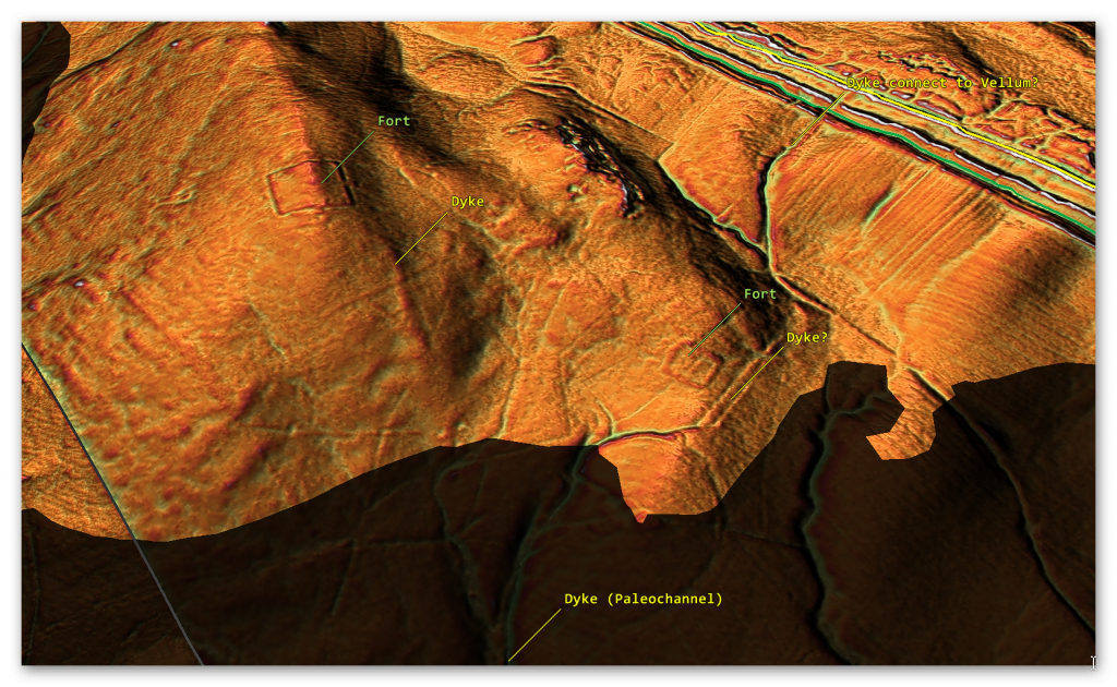
The Vallum in this section is quite stable and close to the Wall. At the east side of this section it disappears gain into a river valley and then reappears on the other side at a different angle suggesting they were cut at different stages or were independent from the main Vallum?
Vallum ending as it enters the River Valley and coming out at a different angel?Prehistoric shoreline making more sense of the loss of Vallum
Military way is seen in small burst and very shallow in comparison to the Vallum – hence archaeologists suggesting its on the north bank of the vallum when they can’t find it?
Military Way – between the Vallum and Wall is a minor road
For active discussions on the findings of the TRILOGY and recent LiDAR investigations that are published on our WEBSITE, you can join our and leave a message or join the debate on our Facebook Group.
Section O – NY97SW & NY96NW – this is a section of Hadrian’s Wall showing the LiDAR, Google Earth and 1800 Maps of the Area covered by Historic England
Historic England Sections:
Name:Name: Hadrian’s Wall and vallum between field boundary east of milecastle 24 and the Roman fort, vicus, bridge abutments and associated remains in wall miles 24, 25, 26 and 27 List UID: 1010958, 1010959, 1018581
Old OS Map
Section O – NY97SW & NY96NW
LiDAR Map
NY97SW Section O – Wall in Yellow -Vallum in Green
Google Earth Map
NY97SW – Section O
Historic England Scheduled Monuments within Section O
Name: The Roman fort, vicus, bridge abutments and associated remains of Hadrian’s Wall at Chesters in wall mile 27 Designation Type: Scheduling Grade: Not Applicable to this List Entry List UID: 1010959
Name: Hadrian’s Wall and vallum between St Oswald’s Cottages, east of Brunton Gate and the North Tyne in wall miles 25, 26 and 27 Designation Type: Scheduling Grade: Not Applicable to this List Entry List UID: 1018581
Name: Hadrian’s Wall and vallum between field boundary east of milecastle 24 and field boundary west of the site of turret 25b in wall miles 24 to 25 Designation Type: Scheduling Grade: Not Applicable to this List Entry List UID: 1010958
1010959
The monument includes the section of Hadrian’s Wall and associated features from the bridge abutment on the east bank of the River North Tyne in the east to the woodland on the east side of the Chesters property in the west.
This section of frontier, which includes Chesters fort (known to the Romans as Cilurnum) occupies a broad stretch of river terrace on the west bank of the North Tyne. The Wall is visible intermittently as an upstanding feature in this section. Short sections of Wall are upstanding at the junctions with the fort on the south sides of the east and west gateways. There is a 6.7m length of consolidated Wall to the east of the fort which is in the care of the Secretary of State. West of the fort the Wall line is denoted by an amorphous, discontinuous mound up to 0.4m in height. There are no visible upstanding remains west of the ha-ha (sunken wall), which forms an element of the landscape gardens of Chester House. The wall ditch is discernible to the east of the fort as a ploughed down upcast scarp. For the most part it survives as a silted up feature below the surface.
To the west of the fort the ditch survives as a discontinuous depression, 0.3m deep. Turret 27a which occupied part of the site before the fort was built was discovered by excavation during 1945. It was found to lie about 42m west of the inner face of the east gateway. The bridge abutments and piers which carried the Wall and Military Way over the River North Tyne survive well as upstanding monuments.
There is also a section of consolidated Wall and tower base adjoining the east bridge abutment on its west side. Excavations of the abutments by Bidwell and Holbrook during 1990 have shown that there were two clear phases to the bridge; the early Hadrianic structure and the larger and more imposing one of third century AD. The precise location of the vallum around Chesters has not yet been confirmed. Aerial photographs show the possible start of it from near the west bank of the North Tyne, but around the fort the course is conjectural.
The course of the Roman road known as the Military Way, which ran along the corridor between the Wall and the vallum linking turrets, milecastles and forts, survives well in the section between the North Tyne and the fort. The line of the road is clearly defined on the ground leaving the fort by the east gateway and heading towards the Roman bridge. Initially it is a depression and then becomes a causeway with a maximum height of 0.8m with a kerb to the south visible for 1.3m. There are no upstanding remains of the road to the west of the fort. However, the antiquarian Horsley considered that the Military Way exited Chesters and then converged gradually with the north mound of the vallum where they continued united for a considerable distance.
The Roman fort at Chesters, which is in the care of the Secretary of State, was built to guard the North Tyne crossing of the Wall. Excavation has demonstrated that the fort was constructed after, and overlies, the Wall. It encloses an area of 2.1ha. The fort wall is exposed in a number of places round the circuit. Elsewhere the outline of the fort is shown by a scarp which survives to a maximum height of about 2m. The upstanding masonry is best preserved in the south east corner where it survives to a height of 1.9m. Well preserved visible remains in the interior include the consolidated remains of the headquarters building, commanding officer’s house and some barrack blocks.
Buried remains will survive below the ridge and furrow cultivation inside the fort. The site has been excavated at various times from 1796 up to the most recent investigations during 1990-91. Extensive amorphous earthworks within the fort probably show the position of the backfilled trenches and spoil heaps, resulting from the various excavations. An extensive civil settlement, or vicus, is located outside the fort on the south side. It occupies an area of level ground bordered to the east by the steep cliff down to the river’s edge. Its buildings and roads are known largely from the evidence of aerial photographs. The settlement is orientated around the road leading south from the fort and a road which bisects it at right angles. A well, believed to be Roman, survives as an upstanding feature immediately outside the garden of Chesters house. The well preserved remains of a bath house are visible to the east of the fort about 30m uphill from the present course of the river. It had a paved floor, hypocaust and an outflow drain, as well as various hot and cold rooms.
An interesting and unique feature of this bath house is that when it was discovered in the 1880s the remains of 33 human skeletons, two horses and a dog were found. There is a however some doubt as to exactly where around the bath house they were found. A quantity of monumental masonry has been found by the river at the point where the ha-ha wall joins its bank, suggesting that this was the location of the cemetery. More recently an altar has been found in the river bank closer to the fort together with a fragment of architectural masonry. A road runs from the south gateway of the fort to the Stanegate Roman road which lies further south. Aerial photography has shown that this road runs along the crest of the river bank south of the ha-ha wall.
1018581
The monument includes the stretch of Hadrian’s Wall, vallum and associated features between St Oswald’s Cottages, east of Brunton Gate in the east and the River North Tyne in the west. This section occupies the west-facing side of the North Tyne valley.
Hadrian’s Wall bends slightly northwards at Dixon’s Plantation and then follows a straight alignment all the way down to the crossing of the North Tyne. The B6318 road runs to the north of the Wall line for most of this section. The Wall is visible as an upstanding monument only in parts of this section. There is a 35m stretch of consolidated wall showing the junction between broad wall and narrow wall, at Planetrees, which is in the care of the Secretary of State. A second stretch of consolidated wall, 69m long and including turret 26b, is visible west of Brunton House. This is also in the care of the Secretary of State. Finally a further section of the Wall about 100m long, from the disused railway to the bridge abutment is in the care of the Secretary of State.
Elsewhere throughout this section the Wall survives as a buried feature beneath grassland and dense woodland. The outer ditch is visible intermittently as a well-preserved earthwork. It is best preserved in the areas of woodland where it reaches depths of 3.5m. Milecastle 26, or `Planetrees’ survives as a buried feature, partly beneath the B6318 and the areas to the north and south of it opposite Planetrees Farm. Milecastle 26 was partly excavated during 1930 by Hepple. Milecastle 27, or `Low Brunton’ is situated on level ground on the east bank of the North Tyne. It is visible as a low, almost square, platform with a maximum height of 0.4m. The milecastle was partly excavated in 1952, and was shown to have a clay bonded wall core. The site of turret 26a was located opposite High Brunton House during 1930 by Hepple. It is situated on a steep east-facing slope. It survives as a buried feature below the dense woodland on the south side of the B6318. It was partly excavated during 1959 when it was shown to have had two levels of occupation, with no finds later than the second century AD. Turret 26b is a well-preserved upstanding example of a turret, up to 2.8m high. It is situated on a stretch of consolidated wall; both the Wall and turret are in the care of the Secretary of State. On the east side of the turret the broad wall wing of the turret is joined by a section of narrow wall, indicating that the turrets were built first and the Wall was then built up to them. This turret was first excavated by Clayton during 1873 and later by Hepple in 1930.
The course of the Roman road known as the Military Way, which ran along the corridor between the Wall and the vallum linking turrets, milecastles and forts, is considered to be on the line of the north mound of the vallum in this section. Throughout this section the north mound of the vallum has been largely levelled by ploughing and so it is doubtful whether the Military Way survives intact here. The exception to this is where the angle of descent down to the North Tyne is particularly steep opposite Black Pasture Cottage, and here a turf-covered trackway leaves the line of the north mound to run down the side of a dry valley to rejoin it some 180m further on. This diversion effectively eases the gradient. Where the valley opens out this track is visible as a raised causeway 7m wide and 0.2m high.
The vallum has been disturbed by ploughing in this section and for most of its length the mounds have been ploughed flat and the ditch only survives as a buried feature, now silted up. Intermittent sections of upstanding earthworks occur, the best preserved being to the west of Brunton Gate where the north mound survives up to 1.6m high and the ditch up to 1.7m deep.
A cemetery, probably associated with the Roman fort at Chesters, exists alongside the probable course of the Military Way as it approaches the river crossing of the North Tyne on its east side. Excavation works for the building of the now disused North Tyne railway in 1857 uncovered human bone, a burial urn and fragments of samian ware Roman pottery. Layers of burnt material were found underneath the line of the vallum mounds. This positive relationship between Roman cemeteries and approach roads to forts is becoming increasingly apparent, being evidenced elsewhere along the Wall at Great Chesters, Carvoran and Carrawburgh.
1010958
The monument includes the section of Hadrian’s Wall and its associated features between the field boundary east of milecastle 24 and the field boundary west of the site of turret 25b east of Brunton Gate. Throughout most of this section there are wide views to the north and south with undulating ground to the east and west restricting the outlook.
The Wall survives as a series of buried remains below the course of the B6318 road throughout most of this section. Where the B6318 road changes direction east of St Oswald’s Hill Head Farm the line of the Wall runs below St Oswald’s Hill Head Farm itself. Beyond the farm it survives as a turf covered mound 0.5m high, spread by ridge and furrow cultivation. The wall ditch survives well as an earthwork visible on the ground for most of this section. It averages about 2.5m deep throughout, though it reaches a maximum of 3.6m deep in places. The upcast mound from the ditch, known as the glacis, is visible intermittently, usually in places where it has survived ploughing. Where extant it is generally irregular, sometimes containing much stony material, and averaging about 1m in height. Milecastle 24 is situated just below the crest of a west facing slope with views to the north and south. It was partly excavated in 1930 by Hepple and was shown to be just over 15m across with walls 3m thick. It survives as a turf covered mound with the remains of the excavation trenches and spoil heap still visible. Milecastle 25 is also situated on a west facing slope with views to the north and south. It survives as a turf covered platform about 1m high. A slight hollow on the south side may indicate an outer ditch.
This milecastle was also partly excavated during 1930 by Hepple. Turret 24a occupies a slight hollow which restricts views to the east and west. It survives as a buried feature below the B6318 road. It was located and partly excavated during 1930 by Hepple. Turret 24b is situated just below the crest of an east facing slope with wide views to the north and south. It survives as a buried feature below the surface of the B6318 road. As with turret 24a this turret was located and partly excavated by Hepple during 1930. Turret 25a is situated on a west facing slope in the short stretch of ground between the B6318 and St Oswald’s Hill Head Farm. It was located by Hepple during 1930, however there are no upstanding remains. Turret 25b is situated on a west facing slope to the south west of St Oswald’s Church. There are no upstanding remains but it will survive as a buried feature, below the line of the east-west field boundary to the west of St Oswald’s Church. It too was located and part excavated during 1930 by Hepple. The turret was again partly excavated during 1959 and there was no pottery recovered later than the second century AD.
The course of the Roman road known as the Military Way, which ran along the corridor between the Wall and the vallum linking turrets, milecastles and forts, is known for most of this section. It uses the north mound of the vallum as its base, certainly up to milecastle 25, along which it could be seen by Horsley who recorded it in his 1732 publication. A recent survey by the Royal Commission on the Historical Monuments of England shows that the Military Way probably continued along the north mound of the vallum beyond milecastle 25 where Horsley could no longer trace it.
The vallum survives as an upstanding earthwork for much of this section where it mirrors closely the line of the Wall. The north mound averages about 1m where extant with a maximum height of 1.6m in places. The south mound also averages about 1m, but has a maximum height of 4m in places. The ditch is generally between 1.5m and 2m in depth where extant. Elsewhere it survives as a buried feature that has silted up.
Investigation
The Vallum in this section is seen in three sections. The first section seems to end quite abruptly when it’s halfway down a hill towards the river North Tyne. This only makes sense when we add the prehistoric shorelines for this river.
Vallum ends abruptly in the first section (wall in Yellow)Vallum with the prehistoric Shorelines – making sense of the end section
Another interesting feature is the location of the large round feature that would have been on the line of the Vallum if it continued on its course. This feature is currently a sunken garden feature of Chester House. A similar feature is found 600m South West to the ‘sunken garden’ and is identified on the 1800 OS map as a ‘Ingle Pond’. This would suggest that Chester House had a similar pond, probably constructed in the 18th century when the house was first constructed – this is another indication of the high water level at this period in this area as the sunken garden is currently dry.
Two large round ‘Ponds’ within the Prehistoric River Shoreline
The second section of the Vallum that is exposed in this section, seems to start immediately at the start of the current river shoreline but ends another ditch at 90 degrees, heading north. This looks like a presently unidentified defensive section of the Roman fort that is protecting the land bridge accross the River North Tyne. This section is unlikely to have been part of the vallum.
Although this section is attributed to the Vallum – its likely a bridge defense?
The last part of the Vallum that is in this section seems to start from the prehistoric shoreline that section one disappear into? As for Military Way, there is no indication of a separate road in this section and we can only speculate that it was part the Vallum banks – there is no indication that it crossed the North Tyne bridge.
Section Three of the Vallum in this section starts (ends) again halfway up a hillOnly when the Prehistoric shoreline of the river is added does the Vallum make sense?
Finally there is a suggestion that Stanegate can be found in the south of this section upto the River as shown on the Early OS maps – we can catagorily show that this is just not correct as their is no signs of the road over the hills.
Stonegate is shown as cutting through the valley – but no signs can be found!
For active discussions on the findings of the TRILOGY and recent LiDAR investigations that are published on our WEBSITE, you can join our and leave a message or join the debate on our Facebook Group.
Section N – NY87SE – this is a section of Hadrian’s Wall showing the LiDAR, Google Earth and 1800 Maps of the Area covered by Historic England
Historic England Sections:
Name:Name: Hadrian’s Wall at Chesters and the field boundary west of Coventina’s Well in wall mile 27, 28, 29, 30 and 31 List UID: 1015914, 1010961, 1010960, 1010959
Old OS Map
NY87SE – Section N
LiDAR Map
NY87SE Section N – Wall in Yellow -Vallum in Green
Google Earth Map
NY87SE – Section N
Historic England Scheduled Monuments within Section N
Name: Carrawburgh Roman fort and Hadrian’s Wall and vallum between the field boundary east of the fort and the field boundary west of Coventina’s Well in wall mile 31 Designation Type: Scheduling Grade: Not Applicable to this List Entry List UID: 1015914
Name: Hadrian’s Wall and vallum between the road to Simonburn and the field boundary east of Carrawburgh car park in wall miles 29, 30 and 31 Designation Type: Scheduling Grade: Not Applicable to this List Entry List UID: 1010961
Name: Hadrian’s Wall and vallum between Chesters and the road to Simonburn in wall miles 27, 28 and 29 Designation Type: Scheduling Grade: Not Applicable to this List Entry List UID: 1010960
Name: The Roman fort, vicus, bridge abutments and associated remains of Hadrian’s Wall at Chesters in wall mile 27 Designation Type: Scheduling Grade: Not Applicable to this List Entry List UID: 1010959
1015914
The monument includes the Roman fort at Carrawburgh and the section of Hadrian’s Wall between the field boundary east of Carrawburgh car park in the east and the field boundary west of Coventina’s Well in the west.
The upstanding remains of Hadrian’s Wall from the field boundary east of the fort to the road junction west of Coventina’s Well are Listed Grade I. This section of Wall is situated in the shallow dip occupied by Meggie’s Dene Burn. The Wall survives below the course of the B6318 road throughout this section. The wall ditch survives well as a visible earthwork on the north side of the road. It averages about 1m deep, though it attains a maximum depth of 3m in places. The upcast from the ditch, otherwise known as the glacis, survives well in this section as a broad low mound to the north of the ditch. The precise location of turret 31a has not yet been confirmed as there are no upstanding remains visible above ground. However, on the basis of the usual spacing it is expected to be located about 270m west of Carrawburgh fort, beneath the surface of the B6318 road.
The course of the Roman road known as the Military Way, which ran along the corridor between the Wall and vallum linking the turrets, milecastles and forts, is known for part of this section. It is visible as a low turf covered causeway immediately south of the car park heading directly for the east gate of the fort, though it fades before it reaches the fort. On the west side of the fort it re-emerges heading from the west gateway to the north mound of the vallum which was used to carry the road in this section. The road is visible as a low linear mound, 0.2m high, along the summit of the north mound of the vallum. The vallum survives as an intermittent earthwork throughout this section.
The vallum predates the fort at Carrawburgh as it was levelled to make way for the fort leaving no surface trace of the vallum in this area. To the west of the fort the vallum survives as a series of earthworks which have been reduced by later cultivation. The ditch averages 0.8m in depth, while the north mound of the vallum is visible as a low mound.
The fort at Carrawburgh, known to the Romans as Brocolitia, occupies a slight terrace on an otherwise gentle east facing slope, 650m west of the modern farm of Carrawbrough. The fields to the south and east of the fort are in the care of the Secretary of State. The fort is well preserved below the turf cover and its walls are believed to stand to around 1.5m in height. It measures 139.5m north-south by 109m east-west and encloses an area of 1.4ha. The defences consisted of a wall, 1.7m thick, backed by an earthen rampart with at least two external ditches in its earlier phases. Excavation of the headquarters building showed that the vallum had been levelled and its ditch filled in and the fort placed on top, demonstrating that the fort was added to the frontier system after the Wall and vallum had been constructed.
The fort was built for a cohort 500 strong, possibly part mounted. The civil settlement, or vicus, is located outside the fort to the south and west. It survives well as a series of earthworks and buried features. On the west side of the fort six terraces with scarps up to 2.1m high have been cut into the slope, parallel with the wall of the fort. Like the interior buildings of the fort, the stone buildings in the vicus have suffered from stone robbing. A bath house was discovered outside the fort and was excavated by Tailford on behalf of John Clayton during the 1870s. It had a layout similar to the Chesters bath house, though it was smaller in size. The excavation report indicates that it was radically reconstructed, probably during the fourth century AD. The location of the baths was not recorded in detail and so now its position is not known with certainty.
However, a platform to the south of the fort has been scooped out of a terrace close to the water level of the burn. The measurements of the bath house as excavated by Tailford would fit exactly into these earthworks. A paved road, 3.5m wide, was located in 1977 leading up to this platform from the burn. A shrine to a water-goddess known as Coventina was located and excavated by Tailford in the late 1870s. It was situated to the west of the fort at the source of a spring. The spring was encased in a rectangular stone basin about 2.6m by 2.4m. This basin was located at the centre of a walled enclosure, or temple, measuring 12.2m north-south by 11.6m east-west. A well, 2.1m deep and lined with masonry, is situated in the shrine. When excavated its contents included at least 13,487 coins, ten altars, a relief of three water-nymphs, the head of a male statue, two dedication slabs to the goddess Coventina, two clay incense burners and a wide range of votive offerings. Coventina’s Well can be seen enclosed by a fence to the west of the field wall on the west side of the fort. A temple to the god Mithras, more commonly known as a Mithraeum, was discovered during the dry summer of 1949. It was excavated in the following year by Richmond and Gillam. It has since been consolidated and is now displayed in its fourth century AD form, using cement replicas of the altars and statuettes and representations of interwoven timber wattle. It survives well as an upstanding stone structure, and is in the care of the Secretary of State.
The original altars and statuettes form part of a full size reconstruction of the temple located in the Museum of Antiquities at Newcastle Upon Tyne. When the Mithraeum was excavated Roman timbers were discovered in- situ due to the waterlogged conditions. Five phases of construction were able to be identified in the well preserved remains. Immediately outside the door of the Mithraeum was a small shrine now known as the `Temple of the Nymphs’. This feature was excavated during 1960 by Smith. Its remains included an altar, a spring/well, a paved area and an apsidal structure with a bench and short wing walls. This small temple was open to the sky. There are no upstanding remains visible on the surface except for the top of the north slab of the well-head. A cemetery is known to be situated on the east side of the fort. Lingard noted in 1807 that bones had been found between the fort and milecastle 31. Ten years later Hodgson learnt that urned cremations had been found during the quarrying to the east of the fort. Five tombstones have been recovered from Carrawburgh though their original positions are unknown. Excavations during 1964, in advance of the construction of the car park, revealed fragmentary remains of two buildings, one of which was identified as a small temple or funerary monument.
1010961
The monument includes the section of Hadrian’s Wall and associated features between the minor road to Simonburn in the east and the field boundary to the east of Carrawburgh car park in the west.
This section of the Wall follows an alignment straight from the North Tyne to the high point at Limestone Corner where it changes to a more westerly direction and occupies the gentle west facing slope all the way to Carrawburgh. There are good views to the north and south all along this section, and in particular from Limestone Corner. All the upstanding remains of Hadrian’s Wall, the milecastles and turrets in this scheduling are Listed Grade I.
The Wall survives as a buried feature for most of this section, except for the two well preserved sections west of the minor road to Simonburn. The two upstanding sections of Wall are consolidated and in the care of the Secretary of State. The east section is about 122m long and reaches a maximum height of 1.8m. The west section is about 48m in length and slightly lower. Elsewhere the Wall is visible as a low stony bank with a maximum height of 1m, or as a trench with spoil heaps either side of it. These trenches are the result of excavation in 1951 to either side of milecastle 30, when it was shown that the Wall in this section was narrow wall on a broad wall foundation. Beyond Limestone Corner the line of the Wall is overlain by the B6318 road and there are no upstanding remains visible. The outer ditch survives well throughout this section and averages over 2m deep.
The ditch is most impressive at Limestone Corner where it has been cut through the bedrock to a maximum depth of 2.8m. To the east of Limestone Corner the rock-cut ditch was left unfinished. The upcast mound from the ditch, known as the glacis, survives intermittently throughout this section. It is best preserved west of Limestone Corner where it attains a height of 2.7m. Milecastle 30 is situated on the high ground of Limestone Corner with commanding views in all directions. It survives as a turf covered platform up to 0.8m high. Excavation by Simpson during 1927 showed that it measured 20.2m from north to south. Part of the east wall is upstanding, measuring 3.1m long and 0.6m high.
The Military Way survives as a turf covered causeway leading up to the south gateway of the milecastle. Milecastle 31 is situated immediately to the east of Carrawburgh car park with wide views to the north and south, but with a restricted outlook to the east and west. It survives as a low turf covered platform 0.25m high. The remains of north wall of the milecastle lies beneath the B6318 road. Traces of the road connecting the milecastle to the Military Way survive as a causeway 0.15m high. Turret 29b survives as a turf covered mound with parts of the north, west and east walls surviving up to two courses. The road connecting the turret to the Military Way is discernible as a slight linear mound.
It was excavated during 1912 by Newbold who found the doorway in the east end of the south side and a ladder platform in the south west corner. Heavily burnt masonry and rubbish indicated that the turret had been destroyed by fire and was then left in ruins. Turret 30a is situated about 400m east of Carrawbrough Farm below the B6318 road. It was located during 1912, though there are no surface remains visible now. Turret 30b is located about 50m west of the drive to Carrawbrough Farm partly below the B6318 road. The south side of the turret is visible in the field to the south of the road as a turf covered scarp, 0.5m high.
The course of the Roman road known as the Military Way, which ran along the corridor between the Wall and the vallum linking turrets, milecastles and forts, is not known with certainty for most of this section. However, according to the observations of Horsley made in the 1730s and trial excavations by Newbold in the early 1900s, it is generally considered that the Military Way overlay the north mound of the vallum for most of this section. Further excavations in 1911 confirmed this interpretation. For this reason it is believed that the B6318 road overlies it between Chesters and Limestone Corner. At Limestone Corner the Military Way is visible as a low causeway, 0.6m high, leading to the south gateway of milecastle 30. Beyond the milecastle it rejoins the north mound of the well preserved vallum. Excavations during 1911 confirmed this to be the case.
The vallum is very well preserved throughout this section. It survives as a series of upstanding earthworks and an impressive rock cut ditch around Limestone Corner. The north mound averages 1.2m for most of its length where it is not overlain by the B6318. The south mound averages about 1m in height with crossings identifiable about every 42m. The ditch is mainly rock cut in the east half of this section with sheer sides and depths of up to 3.5m. In the west half of this section the ditch also survives well and averages 1.9m in depth.
1010960
The monument includes the section of Hadrian’s Wall and associated features between Chesters in the east and the minor road to Simonburn in the west. This section of the corridor occupies the steep valley side on the west bank of the North Tyne.
Hadrian’s Wall survives as a buried feature below grassland for most of this section. However, it is visible intermittently as an upstanding feature in two places. In the grounds of Chesters house a short section of Wall, 13.5m long and up to 1.1m high, is exposed. Further west near Black Carts there is a section of consolidated Wall about 140m long. The south face averages 1.2m in height and the north face 1.9m. Turret 29a is located along this section of Wall. The length of Wall near Black Carts and the turret are in the care of the Secretary of State.
The wall ditch survives intermittently as a well preserved feature throughout this section. There is little trace of it above ground through the gardens of Chesters house, however it will survive as a buried feature. At Walwick, houses and gardens have been built over the line of the Wall. Beyond Walwick the ditch is visible on the ground as a depression partly overgrown by scrub and small trees. It averages about 1.7m in depth, though it reaches a maximum of 3.1m in places.The upcast mound from the ditch, known as the glacis, has been mostly ploughed out. However, it does survive well east of milecastle 29 where it reaches a height of 3.5m. The exact location of milecastle 28 is not yet confirmed.
The scarp cited as being part of the milecastle platform by the Ordnance Survey is too far south of the line of the Wall and looks to be early modern in date. The predicted location, based on the usual spacing, would be where the B6318 changes direction as it enters Walwick from the east. Milecastle 29, or Tower Tye, survives as a series of clearly defined robber trenches on all sides. According to Hodgson, who investigated the milecastle during 1840, the dimensions were found to be 50.4m north-south by 46.4m east-west. As at milecastle 25 there are traces of an external ditch. The remains of the milecastle are buried below grassland. The precise location of turret 27b has not yet been confirmed. However, its predicted location, on the basis of the usual spacing, is in the grounds of Chesters house. It may survive as a buried feature.
Similarly the precise location of turret 28a has not yet been confirmed. However, its predicted location, on the basis of the usual spacing, is about 250m west of Archway Cottage near Walwick Hall. It is considered to survive as a buried feature below the grassland. Again the precise location of turret 28b has not yet been confirmed, though it is expected to be positioned about 225m east of the road which runs north to join the B6320. This turret is also considered to survive as a buried feature below the grassland. Turret 29a, or Black Carts, survives well as an upstanding feature. It is located about 100m east of the minor road to Simonburn with wide views to the north, east and south. It was excavated in 1873 and again in 1971 before it was consolidated. Internally the turret measures 3.45m by 3.4m and is of a type thought to have been built by the twentieth legion. The turret is in the care of the Secretary of State along with the section of narrow wall which abuts the broad wall wings of the turret on both sides.
The course of the Roman road known as the Military Way, which ran along the corridor between the Wall and the vallum linking turrets, milecastles and forts, is not yet known with certainty. It does not survive as a feature visible on the ground.
However, according to Horsley writing in 1732, the Military Way in this section followed the line of the north mound of the vallum except for where it veered towards milecastles. The present B6318 road overlies the north mound of the vallum, and therefore remains of the Military Way may survive below the modern surface.
The vallum is visible as an upstanding earthwork throughout much of this section, though in the stretch between Chesters and Towertie Plantation it has been largely ploughed out. Beyond Walwick the north mound of the vallum is overlain by the B6318 road. Here the vallum ditch averages between 1.5m and 2m in depth while the south mound averages about 2m in height except for where it has been reduced by ploughing.
1010959
The monument includes the section of Hadrian’s Wall and associated features from the bridge abutment on the east bank of the River North Tyne in the east to the woodland on the east side of the Chesters property in the west.
This section of frontier, which includes Chesters fort (known to the Romans as Cilurnum) occupies a broad stretch of river terrace on the west bank of the North Tyne. The Wall is visible intermittently as an upstanding feature in this section. Short sections of Wall are upstanding at the junctions with the fort on the south sides of the east and west gateways. There is a 6.7m length of consolidated Wall to the east of the fort which is in the care of the Secretary of State. West of the fort the Wall line is denoted by an amorphous, discontinuous mound up to 0.4m in height. There are no visible upstanding remains west of the ha-ha (sunken wall), which forms an element of the landscape gardens of Chester House. The wall ditch is discernible to the east of the fort as a ploughed down upcast scarp. For the most part it survives as a silted up feature below the surface.
To the west of the fort the ditch survives as a discontinuous depression, 0.3m deep. Turret 27a which occupied part of the site before the fort was built was discovered by excavation during 1945. It was found to lie about 42m west of the inner face of the east gateway. The bridge abutments and piers which carried the Wall and Military Way over the River North Tyne survive well as upstanding monuments.
There is also a section of consolidated Wall and tower base adjoining the east bridge abutment on its west side. Excavations of the abutments by Bidwell and Holbrook during 1990 have shown that there were two clear phases to the bridge; the early Hadrianic structure and the larger and more imposing one of third century AD. The precise location of the vallum around Chesters has not yet been confirmed. Aerial photographs show the possible start of it from near the west bank of the North Tyne, but around the fort the course is conjectural.
The course of the Roman road known as the Military Way, which ran along the corridor between the Wall and the vallum linking turrets, milecastles and forts, survives well in the section between the North Tyne and the fort. The line of the road is clearly defined on the ground leaving the fort by the east gateway and heading towards the Roman bridge. Initially it is a depression and then becomes a causeway with a maximum height of 0.8m with a kerb to the south visible for 1.3m. There are no upstanding remains of the road to the west of the fort. However, the antiquarian Horsley considered that the Military Way exited Chesters and then converged gradually with the north mound of the vallum where they continued united for a considerable distance.
The Roman fort at Chesters, which is in the care of the Secretary of State, was built to guard the North Tyne crossing of the Wall. Excavation has demonstrated that the fort was constructed after, and overlies, the Wall. It encloses an area of 2.1ha. The fort wall is exposed in a number of places round the circuit. Elsewhere the outline of the fort is shown by a scarp which survives to a maximum height of about 2m. The upstanding masonry is best preserved in the south east corner where it survives to a height of 1.9m. Well preserved visible remains in the interior include the consolidated remains of the headquarters building, commanding officer’s house and some barrack blocks.
Buried remains will survive below the ridge and furrow cultivation inside the fort. The site has been excavated at various times from 1796 up to the most recent investigations during 1990-91. Extensive amorphous earthworks within the fort probably show the position of the backfilled trenches and spoil heaps, resulting from the various excavations. An extensive civil settlement, or vicus, is located outside the fort on the south side. It occupies an area of level ground bordered to the east by the steep cliff down to the river’s edge. Its buildings and roads are known largely from the evidence of aerial photographs. The settlement is orientated around the road leading south from the fort and a road which bisects it at right angles. A well, believed to be Roman, survives as an upstanding feature immediately outside the garden of Chesters house. The well preserved remains of a bath house are visible to the east of the fort about 30m uphill from the present course of the river. It had a paved floor, hypocaust and an outflow drain, as well as various hot and cold rooms.
An interesting and unique feature of this bath house is that when it was discovered in the 1880s the remains of 33 human skeletons, two horses and a dog were found. There is a however some doubt as to exactly where around the bath house they were found. A quantity of monumental masonry has been found by the river at the point where the ha-ha wall joins its bank, suggesting that this was the location of the cemetery. More recently an altar has been found in the river bank closer to the fort together with a fragment of architectural masonry. A road runs from the south gateway of the fort to the Stanegate Roman road which lies further south. Aerial photography has shown that this road runs along the crest of the river bank south of the ha-ha wall.
Investigation
The Vallum in this section changes course to follow the Wall alignment (or vice-versa?) The road that was constructed on the bank of the Vallum in the previous section – now branches out over the countryside separate to the vallum and then on this section again reconnects and the road is the one of the Vallum banks. Military way is seen to also connect to the same bank as the road suggesting that (the road) was also originally roman constructed after both the Vallum and Military Way?.
Vallum (in Green) is connected to Military Way (southern bottom red line) and the modern Road (Bottom NW red line)Vallum and Modern road sharing the same bank
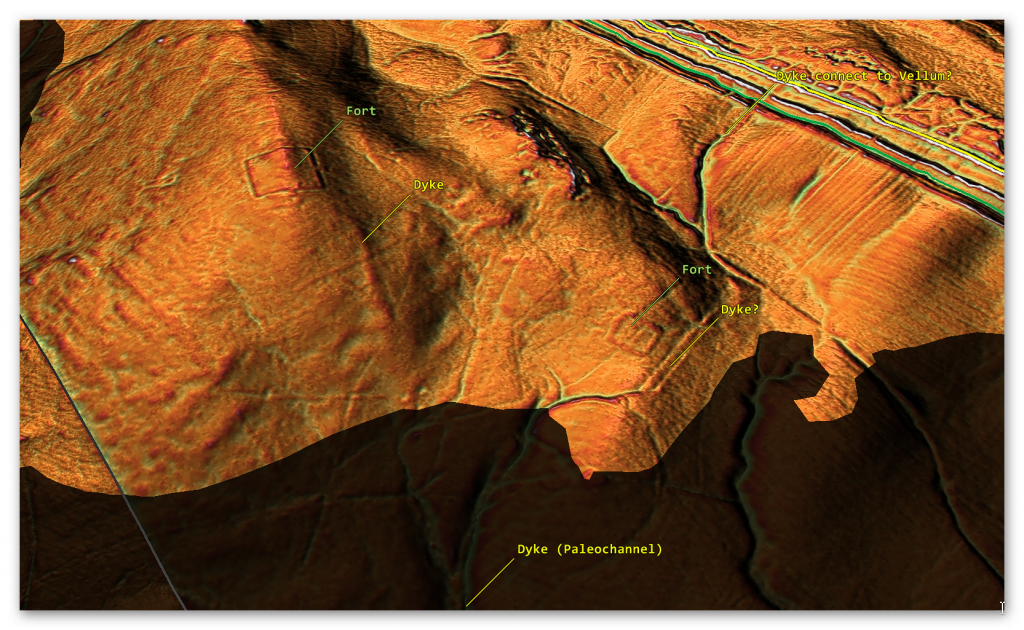
Another interesting feature is the location of the two ‘Roman temporary forts’ – these are not connected to any road system although they are close to the Wall and Vallum – but a paleochannel seems to connect both ‘forts’ but also runs from the Vallum. The larger camp is called ‘Brown Dikes’ – no doubt because it was on Brown’s moor and is connected to each other by a ‘dike’?
Roman forts connected to ‘dykes’?
To understand the problem with Hadrian’s Walls history read our article HERE.
For active discussions on the findings of the TRILOGY and recent LiDAR investigations that are published on our WEBSITE, you can join our and leave a message or join the debate on our Facebook Group.
Section M – NY87SW & NY86NW – this is a section of Hadrian’s Wall showing the LiDAR, Google Earth and 1800 Maps of the Area covered by Historic England
Historic England Sections:
Name:Name: Hadrian’s Wall and vallum between the field boundary at Brown Dikes and Coventina’s Well in wall miles 29, 30, 31, 32, 33 and 34
List UID: 1010963, 1010962, 1015914, 1010961
Old OS Map
Section M – NY87SW & NY86NW
LiDAR Map
NY87SW Section M – Wall in Yellow -Vallum in Green
Google Earth Map
NY87SW – Section M
Historic England Scheduled Monuments within Section M
Name: Hadrian’s Wall and vallum between the field boundary at Brown Dikes and the field boundary east of turret 34a in wall miles 32, 33 and 34 Designation Type: Scheduling Grade: Not Applicable to this List Entry List UID: 1010963
Name: Hadrian’s Wall and vallum between the field boundary west of Coventina’s Well and the field boundary at Brown Dikes in wall miles 31 and 32 Designation Type: Scheduling Grade: Not Applicable to this List Entry List UID: 1010962
Name: Carrawburgh Roman fort and Hadrian’s Wall and vallum between the field boundary east of the fort and the field boundary west of Coventina’s Well in wall mile 31 Designation Type: Scheduling Grade: Not Applicable to this List Entry List UID: 1015914
Name: Hadrian’s Wall and vallum between the road to Simonburn and the field boundary east of Carrawburgh car park in wall miles 29, 30 and 31 Designation Type: Scheduling Grade: Not Applicable to this List Entry List UID: 1010961
1010963
The monument includes the section of Hadrian’s Wall, vallum and their associated features between the field boundary at Brown Dikes in the east and the field boundary east of turret 34a in the west.
This section occupies a predominantly level stretch of ground, except at the west end where the Wall occupies the escarpment of the Whin Sill. The upstanding remains of Hadrian’s Wall, the milecastle and the turrets from the drain west of turret 33a to the field boundary east of turret 34a are Listed Grade I. Hadrian’s Wall survives as a series of upstanding and buried features throughout this section. It survives as a buried feature beneath the B6318 road at the east end of this section. Immediately east of milecastle 33 and beyond to the west end of this section the Wall survives either as a low turf covered bank, averaging 0.4m high, or as a series of robber trenches up to 0.4m deep. The north Wall-face west of the gateway of milecastle 33 is exposed for 16.7m. This unconsolidated stretch of upstanding wall reaches a maximum height of 1.5m. Either side of turret 33b the Wall is exposed and consolidated for a total length of 15.1m. Here the Wall measures 1.95m wide and has a maximum height of 1m.
The wall ditch and its associated upcast mound, known as the glacis, survive well in this section as a series of earthworks. In the east part of this section the ditch survives to an average depth of 3m while the glacis attains a maximum height of 2.7m in places. Beyond turret 33b the ditch is cut partly into the bedrock. It measures up to 13m in width and 2.2m in depth. The glacis here is seen intermittently as an irregular spread over the craggy scarp. Milecastle 33 at Shield on the Wall survives mostly as a turf covered platform visible on the ground. The north gateway and parts of the north wall are exposed as upstanding masonry up to 1.2m in height. Fragments of the south gateway are also exposed. It was partly excavated during 1884 by Clayton. Milecastle 34 is located within a small walled plantation about 430m east of turret 34a. It survives as a buried feature beneath the walls of the plantation and the wooded interior. It was noted by the antiquarian Horsley in this location during the 1730s. Milecastle 34 is in the care of the Secretary of State together with the length of wall, wall ditch and vallum to the east, as far as the point where the B6318 road crosses the vallum ditch. To the west of the milecastle the Wall alone is in the care of the Secretary of State to the end of this monument. The precise location of turret 32b has not yet been confirmed. However, on the basis of the usual spacing, it is expected to lie about 450m east of milecastle 33. As with turret 32b the precise location of turret 33a has not yet been identified. On the basis of the usual spacing it is expected to lie about 450m west of milecastle 33. Turret 33b survives well as an upstanding feature. It is consolidated and in the care of the Secretary of State. It was first located by Simpson in 1913. It measures 3.95m east-west by 3.9m north-south. The walls are 0.9m thick and have a maximum height of 1.1m. The entrance was at the east end of the south wall, but this was subsequently blocked. The turret was excavated during 1968 and 1970 when it was found that its occupation had ceased before the end of the second century AD. The Wall had then been rebuilt across the turret recess.
The course of the Roman road known as the Military Way, which ran along the corridor between the Wall and the vallum linking the turrets, milecastles and forts, was carried on the north mound of the vallum in the east half of this section. Its buried remains survive below grassland east of milecastle 33, until the B6318 road coincides with the north mound of the vallum where it lies below the modern road surface.
South of turret 33b the Military Way leaves the north mound of the vallum and follows a course parallel to that of the Wall. Here it survives as a distinct linear mound up to 6m wide and up to 0.3m high. The vallum survives well as an upstanding earthwork visible on the ground throughout this section. It runs roughly parallel with the line of the Wall until south of turret 33b where it turns to the south west and follows the tail of the escarpment. In the east half of this section the vallum ditch averages 3.5m in depth, while the north and south mounds average 1.5m in height.
A number of crossings are still extant here at 42m intervals. West of milecastle 33 the ditch averages 2m in depth and the north and south mounds 1.2m in height. West of turret 33b the ditch is partly rock cut and reaches a maximum depth of 2.5m.
1010962
The monument includes the section of Hadrian’s Wall, vallum and their associated features between the field boundary west of Coventina’s Well in the east and the field boundary at Brown Dikes in the west.
This section occupies a gentle east facing slope with wide views to the north and south. Hadrian’s Wall survives as a buried feature throughout this section. East of Carraw Farm it is overlain by the modern field wall which defines the south side of the B6318 road. Here its line is visible as a disturbed grassy bank, 0.4m high, at the base of the modern wall. West of Carraw Farm its line is visible as a well defined robber trench, about 2m wide, beyond which it reappears as a slight scarp below the field wall which defines the south side of the road. West of here the Wall is overlain by the modern B6318 road. At Carraw Farm the survival of the remains of the Wall and wall ditch have not been confirmed. To the east and west of Carraw Farm the wall ditch is partly encroached on by the B6318 road.
However, it is visible to an average depth of 1.5m. The wall ditch is best preserved at the west end of this section where it reaches a depth of 3m. The upcast from the ditch, known as the glacis, survives intermittently as a mound to the north of the ditch. It is also best preserved at the west end of this section where it averages 1.4m in height. Milecastle 32 survives as a turf covered platform with robber trenches, 0.3m deep, defining the line of its east and west walls. The south wall is defined by a terrace, while the north wall is overlain by the field wall on the south side of the B6318 road. Limited excavation during 1971 recovered pottery which suggested occupation of the milecastle continued into the fourth century AD. Turret 31b is visible as a slight mound about 80m to the east of Carraw Farm. Its doorway was in the east side. Its remains are buried below the turf cover slightly to the south of the B6318 road.The precise location of turret 32a has not yet been confirmed. However, on the basis of the usual spacing, it is expected to be situated about 500m west of milecastle 32 under the surface of the B6318 road.
The course of the Roman road known as the Military Way, which ran along the corridor linking turrets, milecastles and forts is not yet known with certainty in this section. However, there is a slight rise alongside the field wall on the south side of the wooded area to the south of Carraw Farm which could be the remains of the `agger’, or raised spine, of the road. The antiquarian Horsley, writing in the 1730s, stated that the Military Way was carried on the north mound of the vallum in this general area.
The vallum is visible intermittently as an upstanding earthwork throughout this section. It is least well preserved at the east end where only the ditch is visible, having an average depth of 2m. West of milecastle 32 the earthworks are better preserved. The north mound is in good condition, reaching 1.5m in height, while the south mound at best reaches 0.9m. Here the ditch is waterlogged and silted, though it averages a depth of 1m.
1015914
The monument includes the Roman fort at Carrawburgh and the section of Hadrian’s Wall between the field boundary east of Carrawburgh car park in the east and the field boundary west of Coventina’s Well in the west.
The upstanding remains of Hadrian’s Wall from the field boundary east of the fort to the road junction west of Coventina’s Well are Listed Grade I. This section of Wall is situated in the shallow dip occupied by Meggie’s Dene Burn. The Wall survives below the course of the B6318 road throughout this section. The wall ditch survives well as a visible earthwork on the north side of the road. It averages about 1m deep, though it attains a maximum depth of 3m in places. The upcast from the ditch, otherwise known as the glacis, survives well in this section as a broad low mound to the north of the ditch. The precise location of turret 31a has not yet been confirmed as there are no upstanding remains visible above ground. However, on the basis of the usual spacing it is expected to be located about 270m west of Carrawburgh fort, beneath the surface of the B6318 road.
The course of the Roman road known as the Military Way, which ran along the corridor between the Wall and vallum linking the turrets, milecastles and forts, is known for part of this section. It is visible as a low turf covered causeway immediately south of the car park heading directly for the east gate of the fort, though it fades before it reaches the fort. On the west side of the fort it re-emerges heading from the west gateway to the north mound of the vallum which was used to carry the road in this section. The road is visible as a low linear mound, 0.2m high, along the summit of the north mound of the vallum. The vallum survives as an intermittent earthwork throughout this section.
The vallum predates the fort at Carrawburgh as it was levelled to make way for the fort leaving no surface trace of the vallum in this area. To the west of the fort the vallum survives as a series of earthworks which have been reduced by later cultivation. The ditch averages 0.8m in depth, while the north mound of the vallum is visible as a low mound.
The fort at Carrawburgh, known to the Romans as Brocolitia, occupies a slight terrace on an otherwise gentle east facing slope, 650m west of the modern farm of Carrawbrough. The fields to the south and east of the fort are in the care of the Secretary of State. The fort is well preserved below the turf cover and its walls are believed to stand to around 1.5m in height. It measures 139.5m north-south by 109m east-west and encloses an area of 1.4ha. The defences consisted of a wall, 1.7m thick, backed by an earthen rampart with at least two external ditches in its earlier phases. Excavation of the headquarters building showed that the vallum had been levelled and its ditch filled in and the fort placed on top, demonstrating that the fort was added to the frontier system after the Wall and vallum had been constructed.
The fort was built for a cohort 500 strong, possibly part mounted. The civil settlement, or vicus, is located outside the fort to the south and west. It survives well as a series of earthworks and buried features. On the west side of the fort six terraces with scarps up to 2.1m high have been cut into the slope, parallel with the wall of the fort. Like the interior buildings of the fort, the stone buildings in the vicus have suffered from stone robbing. A bath house was discovered outside the fort and was excavated by Tailford on behalf of John Clayton during the 1870s. It had a layout similar to the Chesters bath house, though it was smaller in size. The excavation report indicates that it was radically reconstructed, probably during the fourth century AD. The location of the baths was not recorded in detail and so now its position is not known with certainty.
However, a platform to the south of the fort has been scooped out of a terrace close to the water level of the burn. The measurements of the bath house as excavated by Tailford would fit exactly into these earthworks. A paved road, 3.5m wide, was located in 1977 leading up to this platform from the burn. A shrine to a water-goddess known as Coventina was located and excavated by Tailford in the late 1870s. It was situated to the west of the fort at the source of a spring. The spring was encased in a rectangular stone basin about 2.6m by 2.4m. This basin was located at the centre of a walled enclosure, or temple, measuring 12.2m north-south by 11.6m east-west. A well, 2.1m deep and lined with masonry, is situated in the shrine. When excavated its contents included at least 13,487 coins, ten altars, a relief of three water-nymphs, the head of a male statue, two dedication slabs to the goddess Coventina, two clay incense burners and a wide range of votive offerings. Coventina’s Well can be seen enclosed by a fence to the west of the field wall on the west side of the fort. A temple to the god Mithras, more commonly known as a Mithraeum, was discovered during the dry summer of 1949. It was excavated in the following year by Richmond and Gillam. It has since been consolidated and is now displayed in its fourth century AD form, using cement replicas of the altars and statuettes and representations of interwoven timber wattle. It survives well as an upstanding stone structure, and is in the care of the Secretary of State.
The original altars and statuettes form part of a full size reconstruction of the temple located in the Museum of Antiquities at Newcastle Upon Tyne. When the Mithraeum was excavated Roman timbers were discovered in- situ due to the waterlogged conditions. Five phases of construction were able to be identified in the well preserved remains. Immediately outside the door of the Mithraeum was a small shrine now known as the `Temple of the Nymphs’. This feature was excavated during 1960 by Smith. Its remains included an altar, a spring/well, a paved area and an apsidal structure with a bench and short wing walls. This small temple was open to the sky. There are no upstanding remains visible on the surface except for the top of the north slab of the well-head. A cemetery is known to be situated on the east side of the fort. Lingard noted in 1807 that bones had been found between the fort and milecastle 31. Ten years later Hodgson learnt that urned cremations had been found during the quarrying to the east of the fort. Five tombstones have been recovered from Carrawburgh though their original positions are unknown. Excavations during 1964, in advance of the construction of the car park, revealed fragmentary remains of two buildings, one of which was identified as a small temple or funerary monument.
Investigation
The Vallum in this section changes course to follow the Wall alignment (or vice-versa?) The road that was constructed on the bank of the Vallum in the previous section – now branches out over the countryside separate to the vallum and then on this section again reconnects and the road is the one of the Vallum banks. Military way is seen to also connect to the same bank as the road suggesting that (the road) was also originally roman constructed after both the Vallum and Military Way?.
Vallum (in Green) is connected to Military Way (southern bottom red line) and the modern Road (Bottom NW red line)Vallum and Modern road sharing the same bank
Another interesting feature is the location of the two ‘Roman temporary forts’ – these are not connected to any road system although they are close to the Wall and Vallum – but a paleochannel seems to connect both ‘forts’ but also runs from the Vallum. The larger camp is called ‘Brown Dikes’ – no doubt because it was on Brown’s moor and is connected to each other by a ‘dike’?
Roman forts connected to ‘dikes’?
To understand the problem with Hadrian’s Walls history read our article HERE.
For active discussions on the findings of the TRILOGY and recent LiDAR investigations that are published on our WEBSITE, you can join our and leave a message or join the debate on our Facebook Group.
Section L – NY76NE – this is a section of Hadrian’s Wall showing the LiDAR, Google Earth and 1800 Maps of the Area covered by Historic England
Historic England Sections:
Name: Hadrian’s Wall and associated features between vallum between the field boundary at Brown Dikes to Steel Rigg car park in wall miles 32, 33, 34, 35, 36, 37, 38 and 39 List UID:1010972, 1010966, 1018585, 1010964, 1010965, 1010963
Old OS Map
NY76NE – Section L
LiDAR Map
NY76NE Section L – Wall in Yellow -Vallum in Green
Google Earth Map
NY76NE – Section L
Historic England Scheduled Monuments within Section L
Name: The vallum and a British settlement between the field boundary west of turret 37a and the road to Steel Rigg car park, in wall miles 37, 38 and 39 Designation Type: Scheduling Grade: Not Applicable to this List Entry List UID: 1010972
Name: Hadrian’s Wall and associated features between the field boundary west of turret 37a and the road to Steel Rigg car park in wall miles 37, 38 and 39 Designation Type: Scheduling Grade: Not Applicable to this List Entry List UID: 1010966
Name: Housesteads fort, section of Wall and vallum between the field boundary west of milecastle 36 and the field boundary west of turret 37a in wall miles 36 and 37 Designation Type: Scheduling Grade: Not Applicable to this List Entry List UID: 1018585
Name: Hadrian’s Wall and associated features between the boundary east of turret 34a and the field boundary west of milecastle 36 in wall miles 34, 35 and 36 Designation Type: Scheduling Grade: Not Applicable to this List Entry List UID: 1010964
Name: The vallum and early Roman road between the field boundary east of turret 34a and the field boundary west of milecastle 36 in wall miles 34, 35 and 36 Designation Type: Scheduling Grade: Not Applicable to this List Entry List UID: 1010965
Name: Hadrian’s Wall and vallum between the field boundary at Brown Dikes and the field boundary east of turret 34a in wall miles 32, 33 and 34 Designation Type: Scheduling Grade: Not Applicable to this List Entry List UID: 1010963
1010972
The monument includes the section of vallum and the Milking Gap native British settlement between the field boundary west of turret 37a in the east and the road to Steel Rigg car park in the west.
The vallum survives well as an upstanding earthwork throughout most of this section. Where extant the north mound averages 1.7m high, the south mound 1m high and the ditch 1.2m deep. Between High Shield and Twice Brewed the B6318 road overlies parts of the vallum. However, where it runs along the line of the vallum the road lies on the south berm, which has resulted in some disturbance to the monument. To the south of Hotbank Crags the remains of the vallum have been reduced and the ditch silted up, though its course can still be traced.
A native British settlement is situated on the west side of Milking Gap between Hadrian’s Wall and the vallum. It is located in a dip on the springline at the base of the slope to the south of Hotbank Crags. It survives as a series of upstanding stone remains and buried features. The settlement itself includes a rectilinear enclosure which has been subdivided around a central stone hut which has an entrance in its east side. The enclosure walls are made with double faced boulders and average 2m wide and 0.8m high. The central hut has a diameter of 7m and has internally faced walls 1.3m wide and 0.4m high. The remains of other huts survive to the south and east of the central hut with walls less than 1m wide and 0.25m high. Excavation in 1937 by Kilbride-Jones discovered pottery which showed that the settlement was occupied during the second century AD. Around the settlement are a number of low mounds and cairns which may be contemporary or earlier. These average between 0.2m and 0.5m high. Fragmentary remains of walls around the site are probably the remains of an associated field system. These walls are made from boulders and average 1.2m wide and 0.4m high.
1010966
The monument includes the section of Hadrian’s Wall and its associated features between the field boundary west of turret 37a in the east and the west side of the road to Steel Rigg car park in the west. Hadrian’s Wall follows the crest of the Whin Sill throughout this section, which includes the steep rock outcrops of Hotbank Crags, Highshield Crags and Peel Crags. There are extensive views to north and south all along this section. The upstanding remains of Hadrian’s Wall, the milecastles and turrets are Listed Grade I, from Milking Gap to the road to Steel Rigg car park.
Hadrian’s Wall survives well as an exposed and consolidated wall for the larger part this section averaging 2m wide and 1.4m high. It reaches a maximum height of 2.75m at Sycamore Gap where there are 11 courses extant. Here there are also traces of original mortar and whitewash along the north face and in the wall core. Above Sycamore Gap on its west side is a section of bypassed broad wall foundations which measure 2.75m wide and two courses high on the east side and a single course high on the west side and is now consolidated and on display. Above Peel Crags the Wall is in poor condition though it stands up to 2.7m on its north side and up to 1.7m on the south side. Elsewhere in this section the Wall survives as a turf-covered mound averaging 2m wide and 1m high. Modern field walls overlie these turf-covered stretches of Wall. The wall ditch was only constructed in the gaps between the crags, as the steep craggy scarps render a ditch superfluous here. Where it was constructed the ditch survives as a visible feature. At Milking Gap the ditch averages 10m wide and 1m deep. Excavations by Crow in 1986 to the west of the Roman tower at Peel Gap showed the ditch to be 9m wide and 2.3m deep with a level berm 9.5m across. At Peel Gap the ditch is less well preserved as a surface feature, though it averages 1m in depth. The ditch upcast mound, usually known as the `glacis’, is here visible only as a slight counterscarp.
The glacis is better preserved at Milking Gap where it averages 6m wide. Milecastle 38 is situated on a west facing slope with views to the north and south. It is visible as a series of turf-covered mounds and it measures 18m north east to south west by 17.4m across. The turf-covered remains of the north east wall are 2.6m wide and 1.2m high. On the south and east sides robber trenches mark where the walls were located. These measure 3.6m wide and up to 1.4m deep. There are traces of a rectangular building in the south west corner. The milecastle was partly excavated during 1935 by Simpson. Pottery found indicated occupation continued into the fourth century AD. Milecastle 39, known as Castle Nick, is positioned in a steep sided gap between Highshield Crags and Peel Crags with views to the north and south. It survives well as an upstanding stone feature and is now consolidated. It measures 19m long and about 15.5m across, though its overall width varies slightly at each end. The walls stand up to 1.75m high. The milecastle was partly excavated by Clayton and later by Simpson. However, excavations by Crow between 1985 and 1987 produced a detailed understanding of the milecastle and its internal structures and their development over time. Early barrack blocks were later replaced by individual small buildings with curved porches, probably designed as wind breaks. The pottery sequence showed that the occupation of the milecastle was continuous and ended probably sometime in the fourth century AD. An 18th century milking parlour was later constructed in the north west part of the milecastle.
The milecastle excavation produced many small finds including pottery, coins, and metalwork which included short swords and lances, together with gaming boards and pieces. Turret 37b is located on the crest of Hotbank Crags with very extensive views in all directions. It survives as a turf-covered platform. The platform measures 6.3m north to south and 10m across and is up to 1.4m high. There is a small enclosure on the east side of the platform which appears to abut both the south side of the Wall and the east side of the turret wall. It could therefore be contemporary with the Wall and may have served as a small stable. It was located in 1911 by Simpson. Turret 38a is located on the west side of Milking Gap on an east facing slope. It commands extensive views to the south and directly overlooks Crag Lough to the north. It survives as a buried feature below the turf. It was located in 1911 by Simpson. Turret 38b is located on Highshield Crags and also has extensive views in all directions. It survives as a turf-covered platform. The platform measures 6.8m north to south and 13.4m across. There is an internal scarp up to 0.3m high. This turret was also located by Simpson in 1911.
Turret 39a is located on the crest of Peel Crags and commands wide views in all directions. It is visible as a slight rectangular hollow about 0.2m deep. The turret was located in 1909 and excavated in 1911 by Simpson. Its walls were of narrow gauge and were found to have been demolished and the Wall built over its entrance indicating that it fell out of use during the Roman period. A platform, probably for a ladder, was positioned in the south west corner. The remains of a man and a woman were found buried in the north west corner. Burial in such a place was against Roman law and as such these could be the remains of an unlawful event. A Roman tower is positioned in Peel Gap on Hadrian’s Wall with limited views to the north and south. Unusually it is located between the two turrets 39a and 39b. It survives as consolidated stone foundations. It was discovered by Crow during investigation and clearance of the Wall in this section in 1986. This additional tower was later than the Hadrianic narrow wall. Finds from inside and outside the tower showed that it had a similar structural history and use to the neighbouring turrets. Hearths and a ladder platform were found in the interior. Wall mile 39 is a particularly long one as the distance between turrets 39a and 39b exceeds by over 200m the normal spacing of 494m from turret to turret.
The Peel Gap tower lies exactly midway between these turrets implying that spacing was the most important factor determining its location. As an observation post it is in a very poor position. A medieval tower is located in Peel Gap abutting Hadrian’s Wall. It was probably part of the original pele tower which gave its name to the modern farmhouse and adjacent crag. It survives as a slight platform with excavation trenches and spoil heaps, up to 0.4m high. It was excavated by Simpson in 1911 who recovered medieval green glazed pottery from the interior. The course of the Roman road known as the Military Way, which ran along the corridor between the Wall and the vallum linking turrets, milecastles and forts, survives well as a linear causeway throughout this section. Some stone is visible on the south scarp where it has been built up to make a level surface. This scarp appears to have had a stone revetment. The south scarp averages 0.4m in height, although it reaches up to 1.2m high in places. West of Peel Farm the Military Way is overlain by the road to Steel Rigg car park.
To the south of Sycamore Gap are the remains of a prehistoric field boundary running roughly from north to south, probably dating to the Bronze Age. The Roman Military Way overlies this boundary which indicates that it is certainly pre-Roman in date. The peat bog, which has grown over remains of this boundary further to the south, is of Bronze Age origin. A second boundary is located running transversely to the Sycamore Gap boundary, to the west of it, south of the Military Way. Their assumed junction is masked by the peat bog which has built up to the south. These boundaries survive as sinuous linear features of low stone banks, averaging 1.2m wide and 0.5m high. A small irregular field system is situated to the south of milecastle 39. It takes the form of two roughly rectangular paddocks linked by an axial boundary. The boundaries survive as upstanding features. They are constructed from roughly coursed boulders standing up to 1m wide and 0.45m high. They are of a form usually considered to be medieval.
The axial boundary runs up to the south east corner of the milecastle showing that it is later than the milecastle in date. There are ten shielings located within this section of the Wall. Shielings are small shepherds’ huts which were used on a seasonal basis usually during upland grazing in the summer months. They are characteristic of the medieval period in this area. There are five free standing shielings located between Castle Nick and Sycamore Gap. Their dry stone walls average 1m in width and 0.4m high. A group of three shielings with multiple phases are located 50m east of milecastle 39 abutting the south face of Hadrian’s Wall. These were discovered during excavations between 1985 and 1987 by Crow. Their walls average 0.6m wide and 0.4m high. They are now consolidated and are visible as stone features. Two further shielings are situated 120m east of turret 38a. They survive as low stone structures and are situated to the immediate south of Hadrian’s Wall. The largest and easternmost of the two measures 9m by 3m with traces of an entrance in its south wall. The walls of both shielings stand up to 0.3m high. On either side of the last pair of shielings is an irregular enclosure abutting the south face of Hadrian’s Wall. They survive as upstanding stone features.
The larger and westernmost of the two enclosures measures 28m east to west by 5m wide. Its walls are constructed from roughly coursed boulders which stand up to 0.4m high. The much smaller enclosure to the east also has walls made from roughly coursed boulders up to 1.5m wide and 0.4m high. Both of these features are probably shielings or animal byres, although their irregular form is unusual. All field boundaries, except those constructed directly on the line of Hadrian’s Wall, sign posts, stiles and road/trackways are excluded from the scheduling, but the ground beneath all these features is included.
1018585
The monument includes Housesteads Roman fort and the section of Hadrian’s Wall and vallum and their associated features between the field boundary west of milecastle 36 in the east and the field boundary west of turret 37a in the west. This section occupies the crest and down slope of the escarpment, defined to the north by Housesteads Crags and Cuddy’s Crags and to the south by the B6318 road.
Throughout most of this section Hadrian’s Wall survives as an upstanding feature. To the east of the fort a 320m section of the Wall is consolidated and in the care of the Secretary of State. Within this stretch of consolidated Wall there is a gateway, 3.7m wide, at the low point of the Knag Burn. Possibly used by civil rather than military traffic, it consists of a single passage flanked by guard chambers on either side. Pivot holes at back and front show that there were two sets of doors. Between milecastle 36 and the stretch of consolidated Wall, the Wall survives as a turf-covered mound overlain on its north face by a modern field wall made from reused Roman masonry. West of Housesteads to Rapishaw Gap the well-preserved remains of the Wall have been consolidated. At Rapishaw Gap itself the Wall has been mostly robbed out and a modern field wall overlies its south face. Beyond Rapishaw Gap the Wall again survives as a consolidated upstanding feature.
The wall ditch was only constructed in the short gaps between the steep crags. On Clew Hill the 35m section of ditch is up to 13m wide and 2m deep with tumbled Roman masonry from the Wall in its base. Between Housesteads Crags and Cuddy’s Crags the ditch is visible though it is prone to silting and water-logging. Possible remains of the ditch upcast, known as the `glacis’, survives to the north of the ditch as an amorphous spread of material covered by turf. At Rapishaw Gap the ditch is heavily silted and overgrown with rushes, though it is still visible to a depth of 1.3m. A modern trackway truncates the west end of this ditch. To the north east of Housesteads fort, and at the foot of the crags on which the Wall is located, a number of medieval shielings have been identified. These were used seasonally by shepherds controlling summer grazing on open lands to the north.
Additionally a linear earthwork, identified as a prehistoric field boundary has been identified as well as Roman quarries.Two circular earthworks, one known as the Fairy Stones, may be of prehistoric or medieval date, although their function is not yet fully understood.
Milecastle 37 is situated on the crest of Housesteads Crags with extensive views to the north and south. It is visible as an upstanding structure which has been partly reconstructed and consolidated. The walls have a maximum height of 2.2m internally and the single barrack block in the east half survives to 1m in height. The milecastle was partly excavated between 1988 and 1989 by Crow when it was shown that the north gateway of this milecastle had been deliberately blocked and then later partly demolished. Turret 36a, located in 1911, occupies the crest of Kennel Crags. It is visible as an irregular turf-covered platform measuring 17m north east by 6m south west, and up to 1.1m high. No internal features are visible and it is partly overlain by stone which has tumbled onto it from the adjacent Wall. Excavations during 1946 showed that the turret had narrow walls and a door in the east side.
Turret 36b was built before Housesteads fort, occupying part of the crest of Housesteads Crags later overlain by the fort. The foundation courses of the turret have been exposed by excavations within Housesteads fort. It survives as an upstanding structure which has been consolidated and is in the care of the Secretary of State as part of the fort. Turret 37a was located on the crest of the scarp on the west side of Rapishaw Gap. It survives as a buried feature beneath a turf cover. The turret was deliberately demolished in an early phase and the Wall was rebuilt across the site.
The Roman road known as the Military Way, which ran along the corridor between the Wall and the vallum linking the turrets, milecastles and forts, survives as a turf-covered linear mound throughout most of this section. West of Housesteads Plantation the mound is well-preserved, up to 6.6m wide in places. East of Housesteads Plantation the mound is 4m wide and 0.8m high on its south side. The Military Way crosses the Knag Burn by a double dog-leg and enters the east gate of the fort between the buildings of the extra mural settlement. West of the fort the Military Way is visible as a linear mound with an often indistinct north side. It averages between 3.3m and 6m in width.
The south side is revetted by a line of boulders up to 0.6m high. The road is turf- covered with some cobbling visible in places. The approach to the west gate of the fort is blocked by two or three banks which seem to be late defences of the fourth century AD. Branch roads leading from the Military Way proper to turret 36a, milecastle 37 and turret 37a are visible in places as slight level mounds. Elsewhere their course is indicated by differing vegetation marks seen in grass colour. This differentiation in vegetation cover reflects differing growing conditions on the compacted road surface. An earlier Roman road runs from the north side of the vallum south of King’s Hill westwards towards Housesteads where it is overlain by the Military Way at NY7925 6997. It survives as a turf-covered linear mound up to 6.5m wide and 0.9m high. Some metalling is visible through the turf. East of the fort the vallum survives as an upstanding earthwork. The north and south mounds have been reduced and spread by agriculture, though the ditch is up to 1.5m deep. West of the Knag Burn there is little surface trace of the vallum as it was levelled when the settlement outside the fort developed and was built over it. To the west of the fort the remains of the vallum are not obvious. However, parallel cultivation terraces and occasional banks up to 1m high denote its course. The ditch is completely silted up in this stretch.
The Roman fort at Housesteads, known to the Romans as Vercovicium, occupies the prominent crest of the Whin Sill escarpment to the west of the Knag Burn. It commands wide views to the north and south, being one of the most dramatic and best preserved Roman sites in Britain. It is unusual among the Wall forts for having an east-west orientation rather than a north-south one. This is due to the constraints imposed by the topography.
The fort covers an area of approximately 2ha and accommodated a cohort between 800 and 1,000 strong, being later reinforced by a cavalry unit. Its remains survive well as upstanding masonry and earthworks and buried features. The walls and gateways of the fort are exposed and consolidated. A number of the interior buildings are also exposed and consolidated including the headquarters building, the commanding officer’s house, a hospital, granaries, barracks, workshops and a latrine. The fort is in the care of the Secretary of State. The fort was added to the Wall after the broad wall foundations and turret 36b were built, but before the narrow wall (which was eventually constructed on the broad wall foundations) was constructed up to the fort. The earliest activity on the site is evidenced by a Bronze Age pot found beneath one of the barracks, which had probably come from a ridge top burial cairn. Post-Roman activity on the fort site is evidenced by a bastle house which was built partly over the west tower of the south gateway.
There has been a history of excavations on the fort from 1822 up to 1988. The civil settlement outside the fort, usually referred to as a vicus, is very extensive stretching for at least 200m south of the fort. It also clustered around the east and west sides of the fort. In its initial phase the vicus was situated to the south of the vallum. However, by the third century AD at the latest the vallum was levelled and the vicus was moved up the hill and constructed immediately adjacent to the fort. To the south of the fort over 20 buildings were excavated during the 1930s, although only six remain on view as upstanding buildings with consolidated stone walls. They are believed to be the foundations of a group of shops and/or taverns. Outside the fort’s east gate small robber trenches demarcate the ground plans of some of the vicus buildings. On the west side of the fort, north of the Military Way, there is a series of mounds, up to 0.8m high, forming small rectangular paddocks. These may have accommodated the horses associated with the cavalry unit known to have been stationed at the fort in its later phases. Aerial photographs show that the remains of the vicus around Housesteads covered an area at least as large as that of the fort itself. Excavation has shown that the settlement dates, in its most developed form, to the third and fourth centuries AD. An inscription indicates that this vicus had its own local government.
Beyond the vicus to the south and west there is a series of cultivation terraces running along the contours in a roughly east-west direction. They survive as upstanding earthworks and can be seen to directly overlie the vallum. These terraces are themselves overlain in parts by strip fields and early ridge and furrow cultivation. On the basis of these relationships the terraces are considered to be of Roman date and are probably associated with the vicus settlement. The Housesteads bath house was positioned to the east of the fort on a rock shelf on the slope on the east side of the Knag Burn. Its disturbed remains survive as turf-covered undulations. Investigations have shown that it was heated by hypocausts, soot being found in the flues. Nearer the Wall is a spring cased in Roman masonry, which probably supplied the baths with water. The location of two cemeteries at Housesteads fort and vicus are known, surviving as buried features below the turf cover. There is one cemetery situated to the west of the fort, south of the Military Way. Another is known to lie either side of Chapel Hill. To the south of Chapel Hill a number of tombstones have been found including one commemorating a medical officer named Anicius Ingenuus. In the low ground to the east of Chapel Hill human remains have been found during drainage works. These finds suggest the cemetery around Chapel Hill was extensive.
The remains of a temple to the Persian god Mithras is located beyond the west end of Chapel Hill, close to where a spring flows. This half underground temple was located in 1822. It survives as a series of turf-covered features, some of which are visible as slight earthworks. Excavations in 1898 revealed a long nave, flanked on either side by benches for the accommodation of worshippers. Beyond this was the sanctuary which contained an elaborate relief carving of Mithras surrounded by the zodiac, together with several altars and statues to two lesser deities. The remains of a temple to the Germanic god `Mars Thincsus’ is located to the north of Chapel Hill. A well found during excavation has been consolidated and can be seen on the ground. The other remains survive as buried features. Excavations during 1961 revealed the foundations of a circular shrine, 4m in diameter. Pottery recovered from the interior dated the structure to the third century AD. Other finds included an elaborately carved arched door head and inscribed stones dedicated to `Mars Thincsus’. The shrine was found to overlie part of the vicus settlement when it was situated to the south of the vallum. A series of temples are known from building inscriptions to have been located on Chapel Hill itself. Their remains survive as buried features. Several altars have been found here dedicated to Jupiter and the Spirit of the Deified Emperors, indicating that the official state cult was practised here.
A Roman lime kiln is located on the west side of the Knag Burn near to the bath house. It was located and excavated during 1909 by Simpson. Its remains survive as buried features. Pottery from the interior dated the structure from the late third to the mid-fourth century AD. A bastle house was built over the remains of the east side of the south gateway of the fort in the 16th century. It survives as an upstanding stone feature, rebuilt with Roman masonry and projects out to the south of the fort. Bastle houses are defended farmhouses, usually with an upstairs doorway and no windows in the lower storey. The upper stories were lived in while the lower one was used as an animal byre. Bastle houses often occur in small groups and are characteristic of the 16th and early 17th century, being a response to the cattle raiding exploits of the border reivers.
1010964
The monument includes the section of Hadrian’s Wall and its associated features between the field boundary east of turret 34a in the east and the field boundary west of milecastle 36 in the west. This section of the Wall occupies the crest and slopes along Sewingshields Crags.
The upstanding remains of Hadrian’s Wall, the milecastle and turrets are Listed Grade I, from turret 34a to turret 35a. The Wall survives intermittently as an upstanding feature throughout this section. West of milecastle 35 the Wall survives as an irregular turf-covered mound, averaging 2.5m wide and 0.6m high. Either side of milecastle 35 the remains of the Wall are upstanding and have been consolidated. At 2.3m wide it is of narrow wall type, though it has been set on a broad wall foundation, 3m wide. It stands to a maximum height of 1.5m. Along the crest of Sewingshields Crags the upstanding sections of consolidated Wall are divided by sections of the Wall which survive as turf-covered mounds, averaging 2.5m wide and 1m high.
Where the Wall changes direction to a north-south alignment it survives as a buried feature beneath a modern field wall made from reused Roman masonry. This field wall overlies the north face of the Wall. The nearly 3km of Wall around Sewing Shields farm is in the care of the Secretary of State. For most of this section there is no outer ditch, as the Wall occupies the crest of the steep outcropping bedrock of Sewingshields Crags and a rock cut ditch would have been superfluous. At Busy Gap a section of ditch was cut which survives as a feature, 12m wide and up to 1.2m deep. West of milecastle 36 another shorter section of ditch was cut, now measuring 2.1m in depth and 10m in width. To the north of the Wall, at the foot of Kings Hill crags is a narrow linear earthwork, up to 7m wide which has been identified as a prehistoric field boundary. Milecastle 35 is located on the east facing slope of Sewingshields Crags. It survives as an upstanding masonry feature which has been consolidated and is now in the care of the Secretary of State. It measures 18.3m north-south by 15.2m east-west. The walls are up to 3.2m in width. Within the milecastle several phases of buildings are preserved in the ground plan.
Milecastle 36 occupies the summit of Kings Hill. It survives as a turf-covered feature. The east and west walls are indicated by robber trenches up to 0.5m deep. The featureless interior of the milecastle is overlain by stone which has tumbled onto it from the adjacent Wall. The milecastle was excavated during 1946 and was found to have narrow walls. The north gate had been reconstructed in a post-Hadrianic period, probably around AD 180. The south gate had been destroyed. The well preserved remains of turret 34a, which are in the care of the Secretary of State, are located on an east facing slope. It was located in 1912 by Simpson and was partly excavated during 1947 and 1958. The site was again excavated during 1971 for the Department of the Environment and was shown to measure 3.55m north-south by 3.9m east-west. It had a door in the east side and a possible ladder platform in the south west corner. It has narrow walls measuring 0.95m wide. Most of the pottery recovered from the turret is of second century AD date. In the medieval period the turret walls were partly reduced and the south face of Hadrian’s Wall was continued across the turret to make a continuous rampart walk. Medieval pottery sherds, were also found which suggests that the rampart walk was possibly in use at the same time as Sewingshields Castle, which lies about 150m to the north west. The exact location of turret 34b is not known with certainty as there are no surviving upstanding remains.
On the basis of the usual spacing, the turret would be expected to be located beneath the Sewing Shields farm complex. Turret 35a is located on the summit of Sewingshields Crags. It survives as an upstanding feature. The masonry has been consolidated and it is in the care of the Secretary of State. The turret was located in 1913. Excavations took place during 1947 and 1958 when it was found to have narrow walls, 1m wide, and a door in the east side, 0.95m wide. The turret was shown to have been abandoned during the Roman period, though it is not certain when. Its internal measurements are 3.7m east-west by 2.4m north-south; the walls are up to 0.75m high. Turret 35b is located to the north of Busy Gap on the west facing slope of Sewingshields Crags. It survives as a slight turf-covered platform measuring 5.5m from north west to south east by 5.5m north east to south west. Its interior is partly overlain by stone which has tumbled onto it from the adjacent Wall. The turret was located during 1913. Part excavation during 1946 showed that the turret had narrow walls and a door in the east side.
The course of the Roman road known as the Military Way, which ran along the corridor between the Wall and the vallum linking turrets, milecastles and forts survives as a turf-covered linear mound throughout most of this section. It is visible as a disturbed causeway averaging 5m wide with traces of a stone revetment on the south side. It was partly excavated between 1978 and 1980 when it was shown to have a damaged metalled surface 4m wide, a stone revetment on the south scarp, and to have been overlain by later roadways. Branch roads survive linking the Military Way with the south gates of both milecastles 35 and 36. At milecastle 35 the low, uneven turf-covered mound of the causeway is up to 5.5m wide and 0.2m high.
At milecastle 36 the turf- covered causeway is up to 4m wide and 0.3m high. About 20m west of turret 34a a small rectangular enclosure, visible as an upstanding earthwork, abuts the south side of the wall mound. Its internal measurements are 22m east-west by 6.5m north-south. Its walls survive up to 0.4m high and 2.5m wide with the east end apparently being open. No internal features are visible. This structure is probably the remains of a medieval shieling. Shielings were small enclosures used as seasonal stock compounds during upland grazing in the summer months. On the north west side of Busy Gap there are the remains of a triangular shaped enclosure, known as the King’s Wicket. It survives as a series of earthworks which include a turf-covered inner mound and traces of an external silted ditch. The enclosure is known to be a later feature which used the Wall line as its east side. It is considered to be early medieval in date and it has been interpreted as a drovers’ stock compound, possibly as a gathering point for sheltering stock when they were being driven off the common land and down to the lower pastures.
1010964
The monument includes the section of vallum, its associated features and an early Roman road between the field boundary east of turret 34a in the east and the field boundary west of milecastle 36 in the west. The vallum survives as a series of upstanding earthworks throughout this section. The north mound of the vallum has been reduced by pasture improvement, though it still averages 1m in height.
A number of low points in the mound throughout its course denote crossings over the vallum. The south mound averages about 1.2m in height, but in places it is overlain and partly obliterated by a modern field wall. The vallum ditch is well preserved, averaging 2m in depth. The causeway of an early Roman road is located running parallel to the vallum on its north side opposite Moss Kennels. It is visible as a turf-covered mound, averaging 8m wide and 0.4m high for approximately 400m throughout the western part of this monument.
Further east it has been reduced by ploughing and is no longer visible as an upstanding earthwork, although buried remains will survive beneath the present ground surface. It has a level surface with some of the metalling exposed.
1010963
The monument includes the section of Hadrian’s Wall, vallum and their associated features between the field boundary at Brown Dikes in the east and the field boundary east of turret 34a in the west.
This section occupies a predominantly level stretch of ground, except at the west end where the Wall occupies the escarpment of the Whin Sill. The upstanding remains of Hadrian’s Wall, the milecastle and the turrets from the drain west of turret 33a to the field boundary east of turret 34a are Listed Grade I. Hadrian’s Wall survives as a series of upstanding and buried features throughout this section. It survives as a buried feature beneath the B6318 road at the east end of this section. Immediately east of milecastle 33 and beyond to the west end of this section the Wall survives either as a low turf covered bank, averaging 0.4m high, or as a series of robber trenches up to 0.4m deep. The north Wall-face west of the gateway of milecastle 33 is exposed for 16.7m. This unconsolidated stretch of upstanding wall reaches a maximum height of 1.5m. Either side of turret 33b the Wall is exposed and consolidated for a total length of 15.1m. Here the Wall measures 1.95m wide and has a maximum height of 1m.
The wall ditch and its associated upcast mound, known as the glacis, survive well in this section as a series of earthworks. In the east part of this section the ditch survives to an average depth of 3m while the glacis attains a maximum height of 2.7m in places. Beyond turret 33b the ditch is cut partly into the bedrock. It measures up to 13m in width and 2.2m in depth. The glacis here is seen intermittently as an irregular spread over the craggy scarp. Milecastle 33 at Shield on the Wall survives mostly as a turf covered platform visible on the ground. The north gateway and parts of the north wall are exposed as upstanding masonry up to 1.2m in height. Fragments of the south gateway are also exposed. It was partly excavated during 1884 by Clayton. Milecastle 34 is located within a small walled plantation about 430m east of turret 34a. It survives as a buried feature beneath the walls of the plantation and the wooded interior. It was noted by the antiquarian Horsley in this location during the 1730s. Milecastle 34 is in the care of the Secretary of State together with the length of wall, wall ditch and vallum to the east, as far as the point where the B6318 road crosses the vallum ditch. To the west of the milecastle the Wall alone is in the care of the Secretary of State to the end of this monument. The precise location of turret 32b has not yet been confirmed. However, on the basis of the usual spacing, it is expected to lie about 450m east of milecastle 33. As with turret 32b the precise location of turret 33a has not yet been identified. On the basis of the usual spacing it is expected to lie about 450m west of milecastle 33. Turret 33b survives well as an upstanding feature. It is consolidated and in the care of the Secretary of State. It was first located by Simpson in 1913. It measures 3.95m east-west by 3.9m north-south. The walls are 0.9m thick and have a maximum height of 1.1m. The entrance was at the east end of the south wall, but this was subsequently blocked. The turret was excavated during 1968 and 1970 when it was found that its occupation had ceased before the end of the second century AD. The Wall had then been rebuilt across the turret recess.
The course of the Roman road known as the Military Way, which ran along the corridor between the Wall and the vallum linking the turrets, milecastles and forts, was carried on the north mound of the vallum in the east half of this section. Its buried remains survive below grassland east of milecastle 33, until the B6318 road coincides with the north mound of the vallum where it lies below the modern road surface.
South of turret 33b the Military Way leaves the north mound of the vallum and follows a course parallel to that of the Wall. Here it survives as a distinct linear mound up to 6m wide and up to 0.3m high. The vallum survives well as an upstanding earthwork visible on the ground throughout this section. It runs roughly parallel with the line of the Wall until south of turret 33b where it turns to the south west and follows the tail of the escarpment. In the east half of this section the vallum ditch averages 3.5m in depth, while the north and south mounds average 1.5m in height.
A number of crossings are still extant here at 42m intervals. West of milecastle 33 the ditch averages 2m in depth and the north and south mounds 1.2m in height. West of turret 33b the ditch is partly rock cut and reaches a maximum depth of 2.5m.
Investigation
The Vallum in this section changes corse quite drastically which is not been pick-up by archaeologists as they is no obvious reason for the course change.
Vallum turns by 45 degrees – but why?
The original course of the Vallum looks like it went into the river valley – which strange also looks like the course of the other Roman feature Stanegate?
Both Roman constructions (Vallum and Stanegate) seem to originally terminate at the river valley?Vallum Heading for river valley – then turning into another river valley – while modern road takes dry land?Strange 45 degree turn – was this a later change?The turn and the modern road that seems to use the central bank as a baseSatellite view clearly showing the road is the central bank of the VallumIf the Vallum continued – it would have meet up again some couple of miles on?
This section clear continues with the two bank alignment of the Vallum and the satelitte photo give us a good prospective of the size of the Vallum construction. We can only speculate to why the vallum become two laned after the previous sections quarry? The only logical conclusion is that the vallum had to be two way in traffic and the most effecytive way (rather the usual boats passing on the same strip) would be a lane system which would qualify the amount of material taken from this quarry in the past.
The other observation here is how modern roads have used the Vallum for transportatuion. Again it would seem logical to suggest when the Vallum finally dried up the banks were used as roads as during the centuries of canal use the ytraders would get using the routes for transporting and if a boat was no longer available then a crat would be better than nothing?
To understand the problem with Hadrian’s Walls history read our article HERE.
For active discussions on the findings of the TRILOGY and recent LiDAR investigations that are published on our WEBSITE, you can join our and leave a message or join the debate on our Facebook Group.
Section K – NY76NW – this is a section of Hadrian’s Wall showing the LiDAR, Google Earth and 1800 Maps of the Area covered by Historic England
Historic England Sections:
Name: Hadrian’s Wall and vallum between field boundary west of turret 37a and the Caw Burn in wall miles 37, 38, 39, 40, 41 and 42 List UID: 1010975, 1010974, 1010973, 1010932, 1010940, 1010966
Old OS Map
NY66NW – Section K
LiDAR Map
NY76NW Section K – Wall in Yellow -Vallum in Green
Google Earth Map
NY76NW – Section K
Historic England Scheduled Monuments within Section K
Name: Hadrian’s Wall and vallum between the road to Caw Gap and the Caw Burn in wall miles 41 and 42 Designation Type: Scheduling Grade: Not Applicable to this List Entry List UID: 1010975
Name: The vallum between the road to Steel Rigg car park and the road in Caw Gap in wall miles 39, 40 and 41 Designation Type: Scheduling Grade: Not Applicable to this List Entry List UID: 1010974
Name: Hadrian’s Wall, associated features and a Romano-British settlement between the road to Steel Rigg car park and the road through Caw Gap in wall miles 39 to 41 Designation Type: Scheduling Grade: Not Applicable to this List Entry List UID: 1010973
Name: Milestone House Roman temporary camp and section of the Stanegate Roman road Designation Type: Scheduling Grade: Not Applicable to this List Entry List UID: 1010932
Name: Seatsides 1 Roman temporary camp and section of the Stanegate Roman road from the west side of the road from Once Brewed to the south side of the B6318 Designation Type: Scheduling Grade: Not Applicable to this List Entry List UID: 1010940
Name: Hadrian’s Wall and associated features between the field boundary west of turret 37a and the road to Steel Rigg car park in wall miles 37, 38 and 39 Designation Type: Scheduling Grade: Not Applicable to this List Entry List UID: 1010966
1010975
The monument includes the section of Hadrian’s Wall and vallum and their associated features between the road to Caw Gap in the east and the Caw Burn in the west. All the upstanding remains of Hadrian’s Wall, the milecastle and turrets in this scheduling are Listed Grade I.
Hadrian’s Wall runs along the crest of Cawfields Crags in this section and commands wide views to the north, south and west. The Wall survives well as an upstanding feature throughout the whole of this section, except for where it has been destroyed by Cawfields Quarry in the west. A number of changes in the thickness of the Wall are evidenced as offsets along this section. These may be the product of separate work gangs building up to each other. The Wall is consolidated for 1240m and averages 1.8m to 2.3m in width and 1.2m to 1.6m in height. It reaches a maximum height of 2.8m near Thorny Doors where it is 12 courses high. Both the north and south face are almost complete with only occasional gaps in the outer face. The Wall in this section is in the care of the Secretary of State. The wall ditch was only constructed in the areas between the crags which otherwise make a ditch superfluous.
Where extant the ditch survives on the ground as an earthwork measuring between 1.1m and 2.8m in depth. The ditch upcast mound, usually referred to as the `glacis’, also survives to the north of the ditch averaging 10.5m in width. Milecastle 42, or Cawfields, is situated on the crest of Cawfields Crags at the west end and commands wide views in all directions. It survives well as an upstanding stone feature which has been consolidated and is in the care of the Secretary of State. The milecastle straddles a steep south facing slope, 8m to 10m south of the steep north facing crags, and overlooks Hole Gap to the west. The internal dimensions of this milecastle are 17.8m east to west by 14.4m north to south. The walls are 2.8m thick and average 1.4m high. Both gateways of the milecastle are built in massive masonry. Excavations by Clayton in 1848 produced amongst other finds two inscribed stones, one an inscription dedicated to Hadrian and the other a reused tombstone.
Further excavations by Simpson took place in 1936. Turret 41a is located on the west side of Caw Gap with views to the north and south. It survives as an upstanding stone feature which has been consolidated and is in the care of the Secretary of State. Excavation by Simpson in 1912 located the doorway in the east side of the south wall. It had been dismantled and the Wall built across it during the reign of the Roman emperor Severus. Charlesworth’s excavations in 1967 confirmed the deliberate dismantling of the turret and the rebuilding of the Wall across its recess. Turret 41b is situated on Cawfield Crags west of Thorny Doors. It survives as a buried feature. It was located and excavated in 1912 by Simpson. The turret is included as part of the Wall in the care of the Secretary of State. Turret 42a was located at the west end of Cawfields Crags near to the Caw Burn. However, the large quarry has destroyed the section of Wall, including turret 42a, between Hole Gap and the Caw Burn. The former course of the Wall and position of the turret in this area is however known from the first edition Ordnance Survey map.
The course of the Roman road known as the Military Way, which ran along the corridor between the Wall and the vallum linking the turrets, milecastles and forts is known throughout this section except around Cawfields Quarry where its precise course has not yet been confirmed. It survives as a linear causeway which is most prominent at the east end of this section. Here it measures between 3.5m and 5.2m wide with a revetment containing large stones on the south side and with evidence of a stone kerb. Further west the causeway, where extant, averages about 0.1m in height and 7m in width.
Where there is no trace of the causeway the line of the road has been identified by changes in vegetation growth with grass growing less well above the former road surface. Around Cawfields Quarry the remains of the Military Way may have been destroyed by the quarry, however it is possible that here the Military Way was built on the line of the vallum, as it was further to the east at the crossing site of the Caw Burn and thus survives. About 200m east of milecastle 42 and 10m to the south of the Military Way is a fallen Roman milestone. It measures 1.38m high by 0.4m by 0.3m. It is oblong in shape and crudely rounded at the corners. This uninscribed milestone now lies in long grass. Two other milestones from this vicinity have been removed and are now in Chesters museum.
The vallum survives very well in this section as an upstanding turf-covered earthwork. It follows a straight course all through this section. The ditch averages 3m deep with a maximum depth of 3.8m in places. The north and south mounds average 2m in height with a maximum of 2.8m in places. They still follow a very straight course and can be seen to include large boulders in their make up. This is one of the best preserved continuous stretches of vallum.
The remains of a Roman watermill are situated on the east bank of the Caw Burn to the south of the Military Way. It is now covered by the Cawfields Quarry spoil heap and as a result there are no visible remains. Excavation by Simpson in 1907-8 showed that an artificial wood-lined channel had been cut across a bend in the stream and a weir constructed to direct water into it. A rectangular stone building measuring 7m by 4.8m was situated above the channel with its north west wall forming one side of the widened channel. Millstones and pottery were recovered during the excavation which allowed this undershot water mill to be dated to the third century AD. The millstones are now in Chesters museum. The whole complex was surrounded on three sides by a rampart and ditch. It was probably associated with the fort 750m to the west at Great Chesters.
1010974
The monument includes the section of vallum between the west side of the road to Steel Rigg car park in the east and the west side of the road to Caw Gap in the west.
The vallum follows an almost level course throughout this section in the low ground south of Windshields Crags and north of the ridge which carries the Stanegate Roman road. The vallum survives well and is visible as an upstanding earthwork. The ditch averages 1m in depth, while the north and south mounds, which have been substantially reduced, average 0.3m in height.
Near Shield on the Wall the ditch has a maximum depth of 2m and the north and south mounds are 1m high. At Twice Brewed the B6318 overlies the vallum, running between the ditch and the southern mound. Parts of the north mound and ditch here have been destroyed by quarrying. About 1km west of Winshields farm a building platform is recesed into the vallum. It measures 22m long by 4m wide. The date and function of this building platform is not yet fully understood.
At Winshields farm the south mound and ditch have been destroyed by the farm buildings which overlie them. For this reason Winshields farmhouse and farm buildings are not included in the scheduling. All field boundaries, road surfaces and road signs are excluded from the scheduling, but the ground beneath them is included.monument includes the Roman fort at Carvoran and Hadrian’s Wall and vallum and their associated features between the road to Old Shield in the east and the field boundary west of Carvoran fort in the west.
1010973
The monument includes the section of Hadrian’s Wall and its associated features between the west side of the road to Steel Rigg car park in the east and the west side of the road in Caw Gap to the west.
This section of Wall runs along the crest of the Whin Sill and commands extensive views to the north and south. All the upstanding remains of Hadrian’s Wall, the milecastles and the turrets in this scheduling are Listed Grade I. In this section Hadrian’s Wall survives intermittently as an upstanding stone wall. It has an average width of 2.2m and the wall face averages 1m high. Sections of wall core still stand up to 1.7m high. A 335m section of upstanding Wall 124m of which has been consolidated on Windshields Crags, including the turf-covered site of milecastle 40, is in the care of the Secretary of State. Elsewhere the Wall survives as a low stony mound with a field wall overlying its course. The steep crags render a defensive ditch superfluous and so the wall ditch was only constructed in the gaps between the crags. East of Winshields Crags the ditch is visible, surviving between 1.3m and 2.7m deep. The upcast mound from the ditch, usually known as the glacis, measures between 0.3m and 1m high here. In Lodhams Slack the ditch has a maximum depth of 1.8m. The glacis here is visible, but it has been heavily eroded. Milecastle 40 is situated to the east of Windshields Crags with wide views to the north, south and east. It survives as an upstanding feature with walls surviving as rubble and turf-covered banks, up to 1m high.
The milecastle measures 18.5m north to south by 15m across. Excavations by Simpson in 1908 found the south wall to be standing ten courses high. The excavations also demonstrated that the milecastle had undergone a number of rebuilding episodes. Traces of internal buildings were found in the west half together with an oven discovered in the south east angle. Milecastle 41 is situated to the east of Caw Gap on a west facing slope with wide views to the north and south. It survives as a turf-covered feature. The turf banks covering the walls are 0.5m high internally with an external scarp of up to 1.2m. The remains of robber trenches are marked by depressions. A post-medieval cottage was built on the site of milecastle 41. The remains of an enclosure associated with this cottage and visible as an upstanding feature still abut the east side of the milecastle. Its walls are 1m wide and 0.2m high. Two further platforms to the east may be the remains of buildings. A sub rectangular enclosure is located to the east of the milecastle and also survives as an upstanding feature. The enclosure measures 8.5m by 6m with walls 1m wide and 0.2m high. Earth and stone banks, up to 0.3m high, overlie the Military Way to the south east of the milecastle. All these features are probably part of the same settlement.
Turret 39b is located on the west side of the road to Steel Rigg car park at the foot of an east facing slope. It commands views across the hollow to the north and to the line of the Stanegate Roman road to the south. The turret survives as a buried feature. Excavation in 1912 by Simpson showed that it measured 5.75m north to south by 5m across. The turret was built with broad wing walls attaching it to the main Wall line. These wing walls were shown to have been built over with narrow wall. At some point the north wall of the turret was demolished and Hadrian’s Wall rebuilt across it to its full width. Turret 40a, which survives as a buried feature, is situated on almost the highest point along Hadrian’s Wall. It commands panoramic views in all directions. It was located in 1912 by Simpson. Excavation in 1946 by Stevens showed that it had been deliberately destroyed during the Roman period. It had narrow walls and a doorway in its east side. Turret 40b is situated on the summit of the hill to the west of Lodhams Slack. This site commands wide views in all directions. It too survives only as a buried feature. It was located in 1912 by Simpson. Excavation in 1946 by Stevens showed that the turret had narrow walls and that it was unusually wide, being 5.85m across internally.
The course of the Roman road known as the Military Way,which ran along the corridor linking turrets, milecastles and forts, is known throughout the length of this section even though for the most part there are few visible remains. Its course is marked usually by a slight causeway, up to 0.2m high, or by differing vegetation marks seen in grass colour. This differentiation in vegetation cover reflects differing growing conditions on the compacted road surface. It is best preserved where it crosses a gully running into Green Slack. Here it survives as a built up causeway, 1.7m high and 2m wide. South of milecastle 41 the causeway survives up to 0.7m high with kerb stones on its south side.
A shieling survives as an upstanding feature about 140m east of turret 40b. The walls of this triple-celled shieling exist as stony banks averaging 0.2m high. Its south side was built directly over the south kerb of the Military Way. Shielings are small huts used by shepherds on a seasonal basis usually during upland grazing in the summer months. They are characteristic of the medieval period in this area. An important group of shielings is known around Bogle Hole. They survive as rectangular structures averaging 4m across and of variable length. The stone walls survive as turf-covered mounds, 0.2m high. The remains of at least three probable Romano-British huts and associated features survive on the south side of Windshields Crags to the west of Green Slack. They were first noted by MacLauchlan in the 1850s. These rectangular buildings measure 5m by 2m internally with boulder walls between 0.5m and 1m wide and 0.5m high. All field boundaries, except those constructed directly on the line of Hadrian’s Wall, and road surfaces are excluded from the scheduling, but the ground beneath is included.
1010940
The The monument includes the Milestone House Roman temporary camp and a stretch of the Stanegate Roman road. They survive as upstanding earthworks. The road lies 340m south of Hadrian’s Wall vallum at its nearest point.
The camp occupies a low point between a succession of north facing limestone escarpments, and it is these which account for its irregular layout. The defences enclose an area of 7ha and are best preserved on the west side and the west end of the south side where the ramparts reach a maximum height of 1.2m above the bottom of the external ditch, which is 0.3m deep. There is no rampart visible on the north side, which is delimited by the edge of a natural crag, making a rampart superfluous. There are gateways in the central points of the south and west ramparts, each with external defence banks.
A gateway on the north east side is indicated by the presence of an external defence bank, though there is now no visible trace left of the adjacent rampart in this section. A later rectangular enclosure was constructed in the south east corner; its origin and purpose are not yet fully understood. Its internal dimensions are 37m from north to south by 75m east to west. A number of small, circular earthworks occur inside and outside the camp, ranging in diameter from 4m to 10m and about 0.3m high. These structures are probably the remains of simple limekilns, known locally as `sow’ kilns, used as recently as the beginning of the 20th century to produce lime for fertilizer.
To the immediate north of the camp lie the remains of a stretch of the main Roman east-west road, the Stanegate. Although disturbed by later hollow ways and stone robbing, its course is clear on the ground. The road runs along the high ground in the east, and then runs just to the south of the crest of the gentle ridge occupied by the Mare and Foal standing stones (the subject of a separate scheduling) and then along the ridge itself as it runs west towards Haltwhistle Burn. The road measures on average about 8m across throughout its course. Buried ditches flank the road on either side.
1010966
The monument includes the section of Hadrian’s Wall and its associated features between the field boundary west of turret 37a in the east and the west side of the road to Steel Rigg car park in the west. Hadrian’s Wall follows the crest of the Whin Sill throughout this section, which includes the steep rock outcrops of Hotbank Crags, Highshield Crags and Peel Crags. There are extensive views to north and south all along this section. The upstanding remains of Hadrian’s Wall, the milecastles and turrets are Listed Grade I, from Milking Gap to the road to Steel Rigg car park.
Hadrian’s Wall survives well as an exposed and consolidated wall for the larger part this section averaging 2m wide and 1.4m high. It reaches a maximum height of 2.75m at Sycamore Gap where there are 11 courses extant. Here there are also traces of original mortar and whitewash along the north face and in the wall core. Above Sycamore Gap on its west side is a section of bypassed broad wall foundations which measure 2.75m wide and two courses high on the east side and a single course high on the west side and is now consolidated and on display. Above Peel Crags the Wall is in poor condition though it stands up to 2.7m on its north side and up to 1.7m on the south side. Elsewhere in this section the Wall survives as a turf-covered mound averaging 2m wide and 1m high. Modern field walls overlie these turf-covered stretches of Wall.
The wall ditch was only constructed in the gaps between the crags, as the steep craggy scarps render a ditch superfluous here. Where it was constructed the ditch survives as a visible feature. At Milking Gap the ditch averages 10m wide and 1m deep. Excavations by Crow in 1986 to the west of the Roman tower at Peel Gap showed the ditch to be 9m wide and 2.3m deep with a level berm 9.5m across. At Peel Gap the ditch is less well preserved as a surface feature, though it averages 1m in depth. The ditch upcast mound, usually known as the `glacis’, is here visible only as a slight counterscarp. The glacis is better preserved at Milking Gap where it averages 6m wide. Milecastle 38 is situated on a west facing slope with views to the north and south. It is visible as a series of turf-covered mounds and it measures 18m north east to south west by 17.4m across. The turf-covered remains of the north east wall are 2.6m wide and 1.2m high. On the south and east sides robber trenches mark where the walls were located. These measure 3.6m wide and up to 1.4m deep.
There are traces of a rectangular building in the south west corner. The milecastle was partly excavated during 1935 by Simpson. Pottery found indicated occupation continued into the fourth century AD. Milecastle 39, known as Castle Nick, is positioned in a steep sided gap between Highshield Crags and Peel Crags with views to the north and south. It survives well as an upstanding stone feature and is now consolidated. It measures 19m long and about 15.5m across, though its overall width varies slightly at each end. The walls stand up to 1.75m high. The milecastle was partly excavated by Clayton and later by Simpson. However, excavations by Crow between 1985 and 1987 produced a detailed understanding of the milecastle and its internal structures and their development over time. Early barrack blocks were later replaced by individual small buildings with curved porches, probably designed as wind breaks. The pottery sequence showed that the occupation of the milecastle was continuous and ended probably sometime in the fourth century AD. An 18th century milking parlour was later constructed in the north west part of the milecastle.
The milecastle excavation produced many small finds including pottery, coins, and metalwork which included short swords and lances, together with gaming boards and pieces. Turret 37b is located on the crest of Hotbank Crags with very extensive views in all directions. It survives as a turf-covered platform. The platform measures 6.3m north to south and 10m across and is up to 1.4m high. There is a small enclosure on the east side of the platform which appears to abut both the south side of the Wall and the east side of the turret wall. It could therefore be contemporary with the Wall and may have served as a small stable. It was located in 1911 by Simpson. Turret 38a is located on the west side of Milking Gap on an east facing slope. It commands extensive views to the south and directly overlooks Crag Lough to the north. It survives as a buried feature below the turf. It was located in 1911 by Simpson. Turret 38b is located on Highshield Crags and also has extensive views in all directions. It survives as a turf-covered platform. The platform measures 6.8m north to south and 13.4m across. There is an internal scarp up to 0.3m high. This turret was also located by Simpson in 1911.
Turret 39a is located on the crest of Peel Crags and commands wide views in all directions. It is visible as a slight rectangular hollow about 0.2m deep. The turret was located in 1909 and excavated in 1911 by Simpson. Its walls were of narrow gauge and were found to have been demolished and the Wall built over its entrance indicating that it fell out of use during the Roman period. A platform, probably for a ladder, was positioned in the south west corner. The remains of a man and a woman were found buried in the north west corner. Burial in such a place was against Roman law and as such these could be the remains of an unlawful event. A Roman tower is positioned in Peel Gap on Hadrian’s Wall with limited views to the north and south. Unusually it is located between the two turrets 39a and 39b. It survives as consolidated stone foundations. It was discovered by Crow during investigation and clearance of the Wall in this section in 1986. This additional tower was later than the Hadrianic narrow wall. Finds from inside and outside the tower showed that it had a similar structural history and use to the neighbouring turrets. Hearths and a ladder platform were found in the interior. Wall mile 39 is a particularly long one as the distance between turrets 39a and 39b exceeds by over 200m the normal spacing of 494m from turret to turret.
The Peel Gap tower lies exactly midway between these turrets implying that spacing was the most important factor determining its location. As an observation post it is in a very poor position. A medieval tower is located in Peel Gap abutting Hadrian’s Wall. It was probably part of the original pele tower which gave its name to the modern farmhouse and adjacent crag. It survives as a slight platform with excavation trenches and spoil heaps, up to 0.4m high. It was excavated by Simpson in 1911 who recovered medieval green glazed pottery from the interior.
The course of the Roman road known as the Military Way, which ran along the corridor between the Wall and the vallum linking turrets, milecastles and forts, survives well as a linear causeway throughout this section. Some stone is visible on the south scarp where it has been built up to make a level surface. This scarp appears to have had a stone revetment. The south scarp averages 0.4m in height, although it reaches up to 1.2m high in places. West of Peel Farm the Military Way is overlain by the road to Steel Rigg car park. To the south of Sycamore Gap are the remains of a prehistoric field boundary running roughly from north to south, probably dating to the Bronze Age.
The Roman Military Way overlies this boundary which indicates that it is certainly pre-Roman in date. The peat bog, which has grown over remains of this boundary further to the south, is of Bronze Age origin. A second boundary is located running transversely to the Sycamore Gap boundary, to the west of it, south of the Military Way. Their assumed junction is masked by the peat bog which has built up to the south.
These boundaries survive as sinuous linear features of low stone banks, averaging 1.2m wide and 0.5m high. A small irregular field system is situated to the south of milecastle 39. It takes the form of two roughly rectangular paddocks linked by an axial boundary. The boundaries survive as upstanding features. They are constructed from roughly coursed boulders standing up to 1m wide and 0.45m high. They are of a form usually considered to be medieval.
The axial boundary runs up to the south east corner of the milecastle showing that it is later than the milecastle in date. There are ten shielings located within this section of the Wall. Shielings are small shepherds’ huts which were used on a seasonal basis usually during upland grazing in the summer months. They are characteristic of the medieval period in this area. There are five free standing shielings located between Castle Nick and Sycamore Gap. Their dry stone walls average 1m in width and 0.4m high. A group of three shielings with multiple phases are located 50m east of milecastle 39 abutting the south face of Hadrian’s Wall. These were discovered during excavations between 1985 and 1987 by Crow. Their walls average 0.6m wide and 0.4m high. They are now consolidated and are visible as stone features. Two further shielings are situated 120m east of turret 38a. They survive as low stone structures and are situated to the immediate south of Hadrian’s Wall. The largest and easternmost of the two measures 9m by 3m with traces of an entrance in its south wall. The walls of both shielings stand up to 0.3m high. On either side of the last pair of shielings is an irregular enclosure abutting the south face of Hadrian’s Wall. They survive as upstanding stone features. The larger and westernmost of the two enclosures measures 28m east to west by 5m wide. Its walls are constructed from roughly coursed boulders which stand up to 0.4m high.
The much smaller enclosure to the east also has walls made from roughly coursed boulders up to 1.5m wide and 0.4m high monument includes the Milestone House Roman temporary camp and a stretch of the Stanegate Roman road. They survive as upstanding earthworks. The road lies 340m south of Hadrian’s Wall vallum at its nearest point. The camp occupies a low point between a succession of north facing limestone escarpments, and it is these which account for its irregular layout. The defences enclose an area of 7ha and are best preserved on the west side and the west end of the south side where the ramparts reach a maximum height of 1.2m above the bottom of the external ditch, which is 0.3m deep. There is no rampart visible on the north side, which is delimited by the edge of a natural crag, making a rampart superfluous.
1010978
The monument includes the section of vallum between Cockmount Hill in the east and the west side of Walltown Wood in the west. For most of its length the vallum survives as an upstanding earthwork.
However, south of Allolee where its remains are not generally visible above ground, traces have recently been identified by the Royal Commision on the Historical Monuments of England. The presumed course as shown on Ordnance Survey maps is thus now known to be incorrect.
The scheduling respects the new known alignment here. Where it survives as an earthwork the vallum ditch averages 1m deep with a maximum depth of 2.7m in places. The north mound averages 0.8m high and the south mound 0.4m. Good examples of crossing points positioned at 37m intervals are visible throughout this section.
Where the ditch was cleaned out during the Roman period a marginal mound, formed of the removed ditch silts, was built up in places. It survives intermittently in this section, averaging 1m high. South of Allolee Farm ploughing has reduced the vallum earthworks to slight undulations. The ditch here is completely silted up.
An excavation trench was cut across the vallum in 1939 by Simpson and Richmond at Cockmount Hill, but the precise location of this trench is not known. This work indicated that a causeway across the vallum was revetted with turves, and that the sides of the ditch had already weathered back prior to the building of the causeway, indicating that the building of the causeway was later. The area of vallum within Walltown Woods is situated on a spring line with drainage channels cut across the banks. Otherwise it survives well in the woodland.
1010976
The monument includes the section of Hadrian’s Wall and vallum and the Roman fort at Great Chesters and their associated features between the Caw Burn in the east and the track to Cockmount Hill farm in the west. All the upstanding remains of Hadrian’s Wall, the milecastle and turrets are Listed Grade I.
Hadrian’s Wall survives as a low stony mound throughout much of this section. It is visible as a turf-covered scarp 0.2m high with a modern field wall overlying its course. The farm buildings at Great Chesters east of milecastle 43 partly overlie the Wall in this area. West of Great Chesters fort the course of the narrow wall survives as an amorphous rubble strewn mound 3m to 4.8m wide and 1.1m high. In addition the line of the broad wall here survives as a separate north facing scarp. Excavations here in 1925 revealed that the narrow wall runs south of the broad wall foundation from Great Chesters as far as turret 43a where they converge. Beyond turret 43a they run parallel again as far as Cockmount Hill Wood where their courses again converge. To the west of Burnhead camp a section of unconsolidated exposed Wall, 38m long and 1.8m wide, stands between two to six courses high being up to 1.5m high on the inner face.
The wall ditch survives a visible earthwork throughout most of this section. It averages between 0.8m and 2m in depth with near vertical sides in places. Large boulders protrude from the scarps intermittently along its length. The ditch at Great Chesters is overlain by farm buildings which are excluded from the scheduling, although the ground beneath them is included. The ditch is not visible either side of turret 43a, suggesting that it has silted up leaving no trace on the surface. The ditch upcast mound, usually referred to as the `glacis’, survives to the west of Great Chesters fort as a broad low mound, 0.3m high and 8m wide, on the north side of the wall ditch. Milecastle 43 is situated on a ridge later occupied by the fort of Great Chesters which commands views to Chesters Pike in the north, the Stanegate Roman road to the south and the Caw Burn to the east. The milecastle survives as a buried feature below the turf cover. It was located during excavation at Great Chesters in 1939 by Simpson and Richmond. Turret 42b is situated on a gentle east facing slope to the west of the Caw Burn. It survives as an uneven turf-covered platform, up to 0.6m high. The surface remains show evidence of digging and stone robbing. The turret was first located in 1912 by Simpson. Turret 43a is thought to be situated about 150m east of Cockmount Hill farm. There are quantities of wall debris strewn over the grass-covered bank of the Wall at this location which may obscure any slight surface remains of the turret.
The site of the turret was first suggested in 1912 by Simpson, but its position has not yet been verified. The course of the Roman road known as the Military Way, which ran along the corridor between the Wall and the vallum linking the turrets, milecastles and forts, survives intermittently as an upstanding feature throughout this section. Its course from the Caw Burn is known where it survives as a low turf-covered mound, 6m to 8m wide and 0.2m to 0.5m high. Occasional sections of this low turf-covered causeway reappear on the line up to the east gateway of Great Chesters fort. Beyond the field boundary west of the fort the Military Way is visible again as a discontinuous terrace with a slightly sinuous course which avoids the rock outcrops. Field gates are positioned on its course at the east and west end of this stretch. A road linking the Military Way and the Stanegate Roman road to the south via Great Chesters fort is overlain by the modern trackway to Great Chesters Farm which enters the fort through the south gateway.
The vallum survives as an upstanding earthwork in the west half of this section, but in the east half it is only recognisable as an intermittent mound and ditch and by occasional discolourations in the vegetation. In the west half of the section the north mound averages 0.8m high, the ditch 0.5m to 0.9m deep and the south mound 1.2m high. Here crossings of the vallum are still to be seen at approximately 37m intervals. An excavation trench was cut across the vallum in 1939 by Simpson and Richmond at Cockmount Hill, but the precise location of this trench is not known. It was revealed that a causeway across the vallum was revetted with turves, and that the sides of the ditch had already weathered back prior to the building of the causeway, indicating that the causeway was later.
Between Great Chesters fort and turret 43a are the remains of three separate shielings abutting the south side of the narrow wall, which survives here as a turf-covered mound. The shielings are visible as turf-covered dry stone foundations. Their walls measure between 0.6m and 2.1m wide and up to 0.3m high. Shielings are small shepherds’ huts usually associated with upland grazing during the summer months. They are characteristic of the medieval period in this area. Great Chesters Roman fort, known to the Romans as Aesica, is situated on a low ridge overlooking the Caw Burn to the west. It measures 129m by 109m across its ramparts and encloses an area of 1.36ha. It was one of the last forts to be built, being attached to the rear of the Wall, like Carrawburgh, and was completed between AD 128 and AD 138. It is visible as a series of upstanding turf-covered remains.
The most obvious features are the turf- covered ramparts and the defence ditches, there being no less than four on the most vulnerable west side. The buildings of Great Chesters farm overlie the north east corner of the fort. There have been a number of excavations of the fort, all of which have now been backfilled leaving amorphous mounds and depressions on the ground surface. These excavations have recorded the remains of the headquarters building, commanding officer’s house, barrack blocks and lean-to structures against the inside of the fort walls. A vaulted chamber was discovered in the headquarters building which is on display in the centre of the fort. The west tower of the south gate has yielded an important hoard of jewellery which includes an enamelled brooch shaped as a hare and a gilded bronze brooch considered to be a masterpiece of Celtic art. A number of stone ballista balls were found beside the north west angle-tower when first excavated in 1894. A number of building inscriptions have also been discovered.
Traces of the civil settlement outside the fort, usually referred to as the vicus, have been identified to the south andeast of the fort. Horsley, writing in 1732, mentioned that, `the outbuildings are most considerable to the south side….there are vast ruins of buildings in this field’. There is a series of building platforms terraced into the slope to the south east of the fort either side of a long scarp running from the south east corner of the fort to the bath house. The most prominent platform contains a section of upstanding exposed walling. The field to the south of the fort has been ploughed for many years and there are no upstanding features visible except for a slight platform close to the field wall south of the fort. However, bearing in mind the examples of the better known vicus sites at Housesteads and Vindolanda it is expected that the vicus remains at Great Chesters will survive as buried features in the field to the south of the fort and possibly more extensively. The remains of a bath house 110m due south of the south east angle of the fort were visible until the end of 1987 when they were back filled to the surrounding ground level by English Heritage to avoid further deterioration. The bath house was excavated in 1897 by Gibson and again in 1908 by Simpson and Gibson. The excavations showed that it conformed to the usual design of military bath houses with the various hot, cold and intermediate rooms, together with furnaces, flues and a hypocaust system. It survives as a buried feature.
The exact location and extent of the cemeteries directly associated with this fort are not yet confirmed with certainty. There are two cemeteries to the south of the vallum; one at Wall Mill and one at Four Laws, both of which are the subject of separate schedulings. However, a burial mound is located approximately 240m south west of the fort. This round burial mound is similar in form to burial mounds found near Housesteads and Vindolanda. Together with a number of inscribed tombstones found during excavation of the fort interior it seems that there was a cemetery associated with Great Chesters to the south of the vicus and north of the vallum in addition to the known cemeteries at Wall Mill and Four Laws.
There is a series of cultivation terraces running parallel with the contours approximately 350m west of the fort. There are at least six terraces identifiable in this group all of which survive as upstanding turf-covered earthworks. They are directly comparable to the examples at Housesteads which have been confirmed as Roman in date, which like these are also situated on a south facing slope. Some of these cultivation terraces are overlain by post- medieval narrow ridge and furrow indicating a succession of land use in this area over time.
Investigation
The Vallum in this section changes from a simple ditch with two banks into a double ditch with three banks then back again into a single double banked structure totally unnoticed it seems by archaeologists?
Vallum turns into a three bank construction
The arguments for this third bank are limited – it could be a defensive barrier initially before the construction of the Wall that is in entirely a different altitude and location. But the location is bad as it is at the bottom of a hill giving it a week defensive position. The alternative is that two ditches were required due, which suggest a more practical aspect of the Vallum as a transport structure from the massive quarry which lies just at the start of the enlarged Vallum which may have been a canal before one of its banks was converted to a roadway at a later date, which the discovery of milestones on the line of the Vallum my support.
Vallum double in size (previous OS indication is false) after Quarry
The mystery around Military Way ends in this section as it for once becomes evident from Great Chesters to the extreme. While Stanegate confuse on this section as it seems to miss all the Roman Camps and is positioned 1/3 down the high ground rather than in top of the hills?
The Roman Road missing all three stations?
Stanegate also gets very close to the multiple barrows of ‘Four Laws’:
Summary : The earthwork remains of a probable Roman barrow cemetery of 13 barrows, in various states of preservation, part of a much larger cemetery. Centred NY 7042 6595 – remains of 8 tumuli, varying in diameter from 3.0 to 8.0m., and in height from 0.2 to 0.8m. All have a surrounding ditch, or shows traces of a ditch. All have an outer bank 1.0 to 2.0 m wide, and 0.1 to 0.5m in height. Many bear evidence of having been dug into from the side. All are turf covered. None show retaining circles of stone. At least two, probably all, are constructed of earth and small stones. Five tumuli centred at NY 7047 6595 have been ploughed out, and no trace remains.
They could also have been prehistoric barrows from their location and the fact they are so far away from the Wall and Vallum where Roman Barrows have been found (next to Military Way) which would seem more archaeological sound? If these are Prehistoric Barrows then it can be assumed that Stanegate is a prehistoric Dyke that was reused by later societies like the Romans by utilising its bank as a road.
What we find from the LiDAR maps is that there is absolutely no real evidence of Military Way – which is reflected in the fact that it doesn’t exist in the original large scale OS maps and was added in the 1920’s as a theory with real archaeological support as we now see – this is the same in both East and West of this 5km section of the wall.
As for Stanegate Road – after it missed the Fort and went into the River Valley (although OS maps have continuing to the next Fort in the area – LiDAR catches it coming out of the River Valley AFTER the Fort and then going off East.
We have also investigated the scheduled Roman Aqueducts that is report to feed water into the Geat Chester fort on this stretch of the wall:
For active discussions on the findings of the TRILOGY and recent LiDAR investigations that are published on our WEBSITE, you can join our and leave a message or join the debate on our Facebook Group.
Book Extract……………………………..The Stonehenge Enigma (Craig Rhos-Y-Felin -Debunked)
The Stonehenge Quarry – an inconvenient truth
A recent paper by the University of London, Southampton, and Manchester; about the discovery of the quarry that provided the ‘bluestones’ for Stonehenge at Craig Rhos-y-Felin (Mike Parker-Pearson et al., 2015) caught the eye of the world by archaeologists announcing Stonehenge was initially built in Wales and was then transferred to Salisbury Plain 500 years later.
The ‘Craig Rhos-y-Felin: a Welsh bluestone megalith quarry for Stonehenge’ was a report published in December’s Edition of Antiquity Magazine 2016, it stated that a series of radiocarbon dates were found on the site next to a 4m long monolith (ready for transportation) made of a rock which was microscopically identified as the same bluestone as the rocks that surround the existing Stonehenge site. Moreover, the report’s authors had decided that just two random sample dates (the two closest to their own well-publicised hypothesis on Stonehenge’s construction date) would be headlined and advertised to the mass media.
In spite of these ‘limited’ published radiocarbon dates, the archaeologists still had an obvious problem, as the dates were still 500 years older than the proof, they were hoping to find. So, they had to invent a new ‘story’ to compensate for this ‘poor science’ and so stated the speculation, in their report, that the monument was initially built in Wales then moved at a later date. This will no doubt be followed by another story in a few years’ time (archaeologists love to do the lucrative lecture tours on limited ‘titbits’ of information) finding remains of a few small bluestones within a short distance from the quarry site and claiming them as evidence of the original Stonehenge – this would probably be followed by an even more lucrative lecture tour.
Nevertheless, if we take an unbiased and more analytical view of the report, we find something very different from the media claims and much more scientifically interesting.
What was contained in detail within the report but overlooked, was the fact that a considerable number of Mesolithic carbon dates (fourteen compared to just two Neolithic dates the report headlined) were obtained from actual human-made hearths which were much, much earlier in history compared to two random nutshells found in an ‘occupation area’ – which could have been scattered by animals or even the weather?
These earlier and more frequent dates are from hearths rather than just random nutshells and were entirely overlooked by the team, as it was ‘perceived’ to be too early to have a connection to Stonehenge. Nevertheless, this connection was well established some fifty years ago and was reported in a press release I released in August 2011 – entitled ‘The Stonehenge Enigma; an inconvenient truth’:
The article shows that English Heritage did their utmost to conceal the truth about the real ‘probable’ date of Stonehenge being 5,000 years earlier than their current position. This scientific evidence was based on radiocarbon dating of the three giant post holes found in the visitor’s car park during its construction in 1966.
At the time the wooden charcoal remains of the posts (found at the bottom of the post holes) were labelled Neolithic in origin to support the accepted antler pick dating hypothesis and was placed on a shelf probably for eternity.
The report from the 1966 excavation reads: “It is unfortunate that no dating evidence was obtainable from the three holes in the form of pottery. Certainly, the holes themselves would appear to be Neolithic in character, very similar to others excavated of this period….. comparable traces of posts have been found in a Neolithic context… such as King Barrow Wood” Lance and Faith Vatcher. 3
Moreover, the charcoal deposits were sent to their laboratory, and the results were: “It is surprising, in the view of the chalkland environment, that most of the charcoal should be pine. Pine has, however, been found at other sites where it would not be expected, notably Woodhenge” – but even so, these samples were not requested to be carbon dated.
Fortunately, some years later an inquisitive PhD student writing a thesis on the Stonehenge environment found these samples and concluded that they could not be Neolithic, as claimed by the archaeological community, as they were from pine trees which pollen analysis had concluded were ‘extinct’ in this area at this time of Stonehenge’s supposed construction.
The officials (of the Historic Buildings and Monuments Commission, which was later renamed English Heritage) were dismayed when they found out that their ‘experts’ were wrong, and the student was absolutely correct (yet sadly, never gave her a deserved job!!) in her assumption as the carbon dating placed them at the start of the Mesolithic of 8860 to 6590 BCE just after the last ice age. Furthermore, what happened to the pine Woodhenge samples as indicated in the lab report of 1966 – which to date have not been carbon dated, are they also Mesolithic and not Neolithic as their original unscientific estimation, if so, what is the real age of Woodhenge?
Consequently, rather than then admitting their fundamental error and re-opening the site to look for more holes and dates to get to the bottom of this unique mystery (which would have been the case for most credible scientific disciplines) they came up with a remarkable and unproven story that these were random ‘totem poles’ placed by wandering ‘hunter-gatherers’ which did not relate to the Stonehenge site just 50m away. But was a sheer coincidence, which should be totally ignored.
If the missed carbon dating of these Mesolithic posts didn’t spark an enquiry into the dating of Stonehenge, then another similar discovery three years later in 1988-89 should have done, as Wessex Archaeology, were employed to undertake an investigation of the area next to the Old Car Park and the construction of the Visitors Centre, opposite Stonehenge. They reported a series of stripes under the surface (they thought was periglacial) and a single pit WA9580 which was on the line of the other posts found in 1966, in the area of the old ticket office.
Within the pit they found (no doubt to the dismay of EH) yet another Mesolithic post hole that match the dates of the 1966 findings. Moreover, what they also found should have transformed the current dating of the Stonehenge site. 40cm below the top of the pit they found ‘a single piece of rhyolite (62g) within context layer 9581 at the same stratification level of 9585 carbon dated at 7737 – 7454 BCE.
Again EH attempted to supress this finding by suggesting that ‘this layer was not earlier than, and was probably contemporary with, the dressing of the Bluestone’ – which might be so if the bluestone was not BELOW context layer 9582 which was dated 7595 – 7178 BCE.
Figure 26– WA 9580 excavated in 1988 which found a Bluestone in the soil 5,000 years before the current EH published date.
Craig Rhos-Y-Felin (Debunked)
Archaeologists have also found charcoal (OxA-18655) from fires in the centre of the Stonehenge monument, found in the Hole socket of Stone 10 dated 7330 – 7060 BCE (same as the Mesolithic post holes) but again the news was suppressed from the mass media. Then less than a mile away at the top of the hill that overlooks Stonehenge a site called ‘blick mead’ was excavated by the Open University, they found evidence that people were living and feasting at this same earlier Mesolithic period yet this ‘totem pole’ myth is still firmly entrenched in EH’s view of our prehistoric history through their exhibitions and many costly guidebooks.
Moreover, recently the Stonehenge site has had a significant transformation as it has closed the B-road that went past the stones and gave access to the old visitor’s car park – which was now moved a mile up the road to the new multi-million-pound visitors centre. Consequently, the old tarmac was removed and was replaced by grass to make it look more like it did at the time of Stonehenge’s construction.
Figure 27– Tim Daw’s unpublished photo of another post in the Old Visitor’s Car Park – 600mm to 700mm wide.
Craig Rhos-Y-Felin (Debunked)
Now one might imagine that if you were going to remove the tarmac from the old visitor’s car park (knowing you have found something quite extraordinary underneath in the past), you would take this ‘once in a lifetime opportunity’ to excavate the car park fully to see if you can find any more evidence about the Mesolithic Period of Stonehenge’s history?
Tim Daw was a warden at Stonehenge, and he has always been active in taking pictures on the site as he worked on a day-to-day basis at Stonehenge and published them on his blog site. Last year, he found patch marks by the centre upright stones that were identified as the possible missing circle stones of the Inner Circle; therefore, his contribution to the investigation of Stonehenge has been immense.
Tim also took some shots of trenches dug during the reinstatement of the grass over the old visitor’s car park and found something quite remarkable – but he was not allowed to publish (his pictures of the trenches) as EH had warned him that his unauthorized blog activities had to stop or else…. three guesses why this happened? Now Tim is a man of principal resisted and resigned so continuing his blog work, and as a consequence, these new ‘unofficial’ pictures have been made available, showing, even more, post holes are under the car park.
Tim’s newly discovered post hole is on the line of four other known 1966 post holes. Moreover, it supports my hypothesis, that they are all on the shoreline of the River Avon at about 8000 BCE. Furthermore, the fact that rivers in Britain were much larger in the past than today effected on not only the River Avon – but the River Nevern, at Craig Rhos-y-Felin which the current ‘Brynberian Stream, (which feeds the Nevern) is only 20m away, from the newly identified quarry site.
During the Mesolithic period, the newly quarried stones could be placed in boats on the shoreline of the quarry in Wales and could be sailed almost directly to Stonehenge, via just two or three enlarged rivers. And not over the longer sea route, some archaeologists have considered.
This report also goes into great depth in the analysing of the Stone structure of the bluestones from other Preseli sites such as Carn Goedog, Cerrigmarchogion and Craig Talfynyydd, Carn Breseb, Carn Gyfrwy and finally Carn Alw areas. All of which have streams and rivers connecting them with the River Nevern – unfortunately, the archaeologists only can conceive this connection is of a ‘religious’ order rather than something quite functional. Yet, archaeologists do seem able to consider the existence of a hypothetical road system which Mike Parker-Pearson’s calls his ‘ox-cart’ route, that follows the current tarmac covered A40, but sadly doesn’t take into account the woods, swamps and even forests of that period, which would make road passing almost impossible.
Nevertheless, this should be no surprise to readers of the Craig Rhos-y-Felin report as it is full of inconsistencies and logical inaccuracies as the layout of the site were never taken into consideration. My analysis of the area shows that the ‘Brynberian Stream’ by the rocky outcrop was much larger in the past – such as in the period directly after the last ice age. The flooding of this area is well known to geologists as they have found sandy deposits are in the excavation sub-soil. Sadly, the team seems to have created a false assumption that these floodwaters are from ‘ice melt’ which rapidly disappeared after the ice age into the sea.
Figure 29– Craig Rhos-Y-Felin as it would have looked in the Mesolithic period
Craig Rhos-Y-Felin (Debunked)
We have shown in the first book of the trilogy ‘The post-glacial flooding hypothesis’ that this is a false assumption. If this was true, the sea levels would have risen rapidly to a couple of meters short of today’s sea level then plateaued for thousands of years – but this is not the case as the scientific ocean evidence shows that the ‘seepage’ into the seas took many thousands of years to occur and hence Doggerland off the East coast of Britain, took almost ten thousand years to disappear under the North Sea.
We obtain this confirmation within the report that an old river ran around this quarry as long ago as 5620 – 5460 BCE and possibly up to 1030 – 910 BCE.
“Most of the site was then covered by a layer of yellow colluvium (035), dated by oak charcoal to 1030–910 cal BC (combine SUERC-46199; 2799±30 BP and SUERC-46203; 2841±28 BP). This deposit is contemporary with the uppermost fill of a palaeochannel of the Brynberian stream that flowed past the northern tip of the outcrop. Charcoal of Corylus and Tilia from the basal fill of this palaeochannel dates to 5800–5640 cal BC (OxA- 32021; 6833±40 BP) and 5620–5460 cal BC (OxA-32022; 6543±37 BP), both at 95.4% probability.”
Figure 30– Craig Rhos-Y-Felin Excavation showing Mesolithic human hearths in RED
Craig Rhos-Y-Felin (Debunked)
Consequently, what the report is trying to tell us, is that an enlarged stream that feeds into the River Nevern was flowing at during the Mesolithic Period up to the quarry outcrop rocks, and it remained there just a few metres away even up to 1000 BCE. Therefore, the apparent system of transport for these large newly quarried stones to their final destination at Stonehenge, as we have seen in other countries with their stone constructions like Egypt – was via a boat.
Moreover, the site layout also gives a clear indication of when the stone was genuinely quarried. There is a single monolith ready for transportation by the river on the east side of the site and the hearths which are human-made are a few metres south of this monolith – where you would expect them. The problem for archaeologists is that these are Mesolithic hearths, and they’re not just one but three hearths dating from 8550 – 8330 BCE; 8220 – 7790 and BCE 7490 – 7190B CE and yet the report quite clearly states:
“There is no evidence of any Mesolithic Quarrying or working of Rhyolite from this crop”.
This is an astonishing unscientific claim – for how they would know what tool marks are either Mesolithic or Neolithic (would they not be using the same tools?) And secondly, what do they think they were doing there at the quarry during these 1300 years?
Moreover, we can now see the massive connection between the quarry site and Stonehenge with over twenty C16 dates and correlations to my hypothesis – compared to just two samples the ‘experts’ are currently claiming (which are 300 – 500 years older than current estimations).
Consequently, we can narrow down the exact date for the construction of Phase I of Stonehenge (bluestone placements in the Aubrey holes) by looking at the overlapping dates and using the latest carbon dating curve (intCal20) to obtain most accurate date variation, and calculating the mean average probable dates.
This calculation shows that work started at the Quarry: 8300 BCE and its main use and activity was 8000 BCE, with continuous use (replacing the exhausted Bluestones at Stonehenge) ongoing for at least 1000 years.
English Heritage has invested millions in its new ‘money spinner’ the Stonehenge Visitors Centre. Within it, you will see many claims and models about the origin and possible function of Stonehenge – this exhibition has cost hundreds of thousands of pounds to design and build. BUT what would happen financially, if their assumptions are proven wrong?
Moreover, the money within archaeology is sparse, and there are many ‘schools’ of thought who compete against each other for funding. These schools are the University professors who compete for ‘airtime’ and media attention to promote their views, which the public perceive as ‘expertise’. But science evolves, through new ideas and concepts, yet these ‘experts’ are firmly cemented in the past with old ideas, publications and credibility – as nobody dares to be found wrong when so much hangs in the balance.
For active discussions on the findings of the TRILOGY and recent LiDAR investigations that are published on our WEBSITE, you can join our and leave a message or join the debate on our Facebook Group.
Section J – NY66NE – this is a section of Hadrian’s Wall showing the LiDAR, Google Earth and 1800 Maps of the Area covered by Historic England
Historic England Sections:
Name: Hadrian’s Wall, vallum, section of the Stanegate Roman road and a Roman temporary camp between the B6318 road and Cockmount Hill farm in wall miles 42, 43, 44, 45, 46 and 47 List UID: 1010993, 1010992, 1010991, 1010977,1017535, 1010978
Old OS Map
Section J – NY66NE
LiDAR Map
Section J – NY66NE – Wall in Yellow -Vallum in Green
Google Earth Map
Section J – NY66NE – GE
Historic England Scheduled Monuments within Section J
Name: Hadrian’s Wall, vallum, section of the Stanegate Roman road and a Roman temporary camp between the B6318 road and Poltross Burn in wall miles 46 and 47 Designation Type: Scheduling Grade: Not Applicable to this List Entry List UID: 1010993
Name: Hadrian’s Wall and vallum between the field boundary west of Carvoran Roman fort and the west side of the B6318 road in wall mile 46 Designation Type: Scheduling Grade: Not Applicable to this List Entry List UID: 1010992
Name: Carvoran Roman fort and Hadrian’s Wall and vallum between the unclassified road to Old Shield and the field boundary west of the fort in wall miles 45 and 46 Designation Type: Scheduling Grade: Not Applicable to this List Entry List UID: 1010991
Name: Hadrian’s Wall between Walltown Quarry East and Walltown Quarry West in wall mile 45 Designation Type: Scheduling Grade: Not Applicable to this List Entry List UID: 1010977
Name: Hadrian’s Wall between the track to Cockmount Hill and Walltown Quarry East in wall miles 43, 44 and 45 Designation Type: Scheduling Grade: Not Applicable to this List Entry List UID: 1017535
Name: The vallum between Cockmount Hill and Walltown Quarry West in wall miles 43, 44 and 45 Designation Type: Scheduling Grade: Not Applicable to this List Entry List UID: 1010978
Name: Great Chesters Roman fort and Hadrian’s Wall between the Caw Burn and the track to Cockmount Hill farm in wall miles 42 and 43 Designation Type: Scheduling Grade: Not Applicable to this List Entry List UID: 1010976
1010993
The monument includes the section of Hadrian’s Wall and vallum and their associated features between the B6318 road in the east and the Poltross Burn in the west. All the upstanding remains of Hadrian’ Wall and the milecastle in this scheduling are Listed Grade I. Hadrian’s Wall survives as a buried feature throughout this section except for a short section of Wall less than 10m long which was excavated in 1957 ahead of road widening.
The Wall here is consolidated and of broad wall foundation, 3.3m wide and up to 0.5m high. Between this section and milecastle 47 the Wall can be traced as a turf covered scarp measuring 3.5m wide and 0.4m high. A modern wall partly overlies this scarp. West of turret 47b the remains of the Wall are again visible as a turf covered scarp, 0.4m high, with a field wall occupying the centre line of the Wall. In the woodland above the east bank of Poltross Burn the Wall survives as a bank of tumbled stone which has a maximum height of 0.5m. Elsewhere the Wall survives as a buried feature with no remains visible above ground, being overlain by a field wall for most of its course. At Chapel House, farm buildings overlie the course of the Wall. As archaeological remains have not been confirmed to survive here this area is not included in the scheduling. The wall ditch survives intermittently as a feature visible on the ground. Where extant it averages 2m deep, but elsewhere it is silted to varying degrees and in some sections there are no surface traces.
The upcast mound from the ditch, usually referred to as the glacis, survives as a ploughed down feature to the north of the ditch in parts of this section. Milecastle 47 is situated about 250m east of Chapel House. It survives as a slight turf covered ploughed down platform. Dressed stones from the gate lie to the north on a modern causeway across the wall ditch. Excavations in 1935 uncovered large barrack blocks either side of the central space within the milecastle. An oven was found in the north west corner. This milecastle measures internally 21.2m north to south by 18.5m across. The exact location of turret 46b has not yet been confirmed. On the basis of the usual spacing its remains would be expected to lie under one of the outbuildings of Wall End farm. No upstanding remains are visible above ground. As archaeological remains have not been confirmed to survive here, Wall End farm is totally excluded from the scheduling. The exact location of turret 47a has not yet been confirmed. On the basis of the usual spacing it is expected to lie about 220m west of Chapel House. The exact location of turret 47b has not yet been confirmed. On the basis of the usual spacing it is expected to be located beneath the house and garden of `Meadow View’.As archaeological remains have not been confirmed to survive here, The Gap, including `Meadow View’, is not included in the scheduling.
The exact course of the Roman road known as the Military Way, which ran along the corridor between the Wall and Vallum linking turrets, milecastles and forts, is not known with certainty throughout the whole of this section. The only visible remains survive as a terrace in a north facing slope to the south and west of Wall End farm. Elsewhere it survives as a buried feature beneath the turf cover with few traces visible above ground.
The vallum survives as an intermittent earthwork visible on the ground in parts of this section. Elsewhere it has been ploughed down and its remains survive as buried features masked by the turf cover. In the area of Greenhead Golf Course the extant ditch survives up to 1.8m deep and the north and south mounds up to 0.8m high. Either side of the Poltross Burn the vallum ditch is visible on the rim of the gorge where it measures 0.6m deep.
The east-west Roman road known as the Stanegate, which was a pre-Hadrianic construction dating to the early 80s AD, survives intermittently in this section as a feature visible on the ground. Where visible it survives as a linear turf covered mound, 0.4m high. Elsewhere its remains survive as buried features.
A Roman temporary camp, known as Glenwhelt Leazes, is situated on Greenhead Golf Course. It is situated on the east end of a spur overlooking the gap in the Whin Sill escarpment cut by the Tipalt Burn. It survives as a series of earthworks visible on the ground. The defences are best preserved to the east of the north gateway where the rampart is up to 4m wide and 0.7m high and the outer ditch is 3m wide and 0.5m deep. This north facing rectangular camp measures 150m north to south by 80m across and encloses an area of 1.2ha. The four gateways are particularly significant in that each has both an internal and external defence bank and ditch visible on the ground. The interior has been ploughed and drained creating a levelled area.
1010992
The monument includes Hadrian’s Wall and vallum and their associated features between the field boundary west of Carvoran Roman fort in the east and the west side of the B6318 road in the west. All the upstanding remains of Hadrian’ Wall in this scheduling are Listed Grade I.
Hadrian’s Wall survives as a buried feature throughout most of this section with few remains visible above ground. Traces of it are visible at the east end of this section where it survives as a low spread mound with a maximum height of 0.3m. At the west end of the section between the railway line and the B6318 its course is marked by a robber trench. Elsewhere its remains are masked by the sediments of the floodplain.
The ditch survives well in this section as an earthwork visible on the ground except for the section across the flood plain where a low ploughed down mound occupies the line of the silted ditch. Where extant the ditch measures up to 3.5m deep at the east end and 1.6m deep at the west end. The upcast mound from the ditch, known as the glacis, survives well at the east end of this section as a broad, low turf covered mound to the north of the ditch. Elsewhere its remains are not visible.
The exact location of turret 46a has not yet been confirmed. However, on the basis of the usual spacing it is expected to be situated in the garden to the south west of Holmhead on the east bank of the Tipalt Burn. The turret remains will survive as buried features below the garden and are included in the scheduling.
The exact course of the Roman road known as the Military Way, which ran along the corridor between the Wall and vallum linking turrets, milecastles and forts, has not yet been confirmed in this section. Its predicted course is shown on the current Ordnance Survey map.
The vallum survives as an earthwork visible on the ground at the east end of this section. The ditch has a maximum depth of 2.5m, but due to silting is on average 1m deep. The north and south mounds have been ploughed down and now average 0.3m high. Mound crossings are visible along this length. Elsewhere there is no trace above ground of the vallum on the steep ascent from the Tipalt Valley or across the flood plain. A slight depression marks the line of the vallum ditch between the railway and the B6318 road north of the Thirlwall View terrace of houses.
1010991
The monument includes the Roman fort at Carvoran and Hadrian’s Wall and vallum and their associated features between the road to Old Shield in the east and the field boundary west of Carvoran fort in the west. All the upstanding remains of Hadrian’s Wall and the milecastle in this scheduling are Listed Grade I.
Hadrian’s Wall survives as a buried feature throughout this short section. It is traced on the ground as a robber trench, seen as a depression in the turf cover, 2m wide. West of milecastle 46 the Wall remains survive as a low turf-covered stony mound, 0.3m high. The wall ditch survives very well as a turf-covered earthwork visible on the ground. It averages over 3m in depth throughout its length in this section. The ditch upcast mound, known as the glacis, to the north of the ditch also survives well in this section. It is visible on the ground as a substantial low mound, up to 10m wide in places. Milecastle 46 is situated just below the crest of a west facing slope overlooking the gap in the Tipalt valley. It was first discovered in 1807 by Lingard and rediscovered in 1910 by Gibson and Simpson. It survives as a faintly visible turf-covered platform, 0.3m high.
The course of the Roman road known as the Military Way, which ran along the corridor between the Wall and vallum linking turrets, milecastles and forts, is known with a fair degree of certainty. Its remains survive below the turf cover. Although there is no surface trace, the space between the Wall and vallum is so confined that its course can be fairly accurately determined. The presence of crossings on the vallum north mound and the absence of breaks at critical points on the mound suggest that the Military Way was not on the north mound or the berm in this section.
The vallum survives as an earthwork visible on the ground throughout this section. To the north of Carvoran fort the vallum veers to the north to approximately 10m from the Wall before reverting to its previous alignment near Tipalt Burn, the deviation coinciding with the length of the larger earlier fort. The south mound has been largely reduced or destroyed by ridge and furrow cultivation. The ditch is mostly silted up in this section though it can be seen 0.4m deep in places. The north mound survives to the north of the modern wall to a height of 0.7m. There are five crossings visible in the north mound, though no traces of ditch causeways survive.
The Stanegate Roman road, which predates the Hadrianic frontier, ran east to west between Corbridge and Kirkbride respectively. It survives largely as a buried feature in this section, visible intermittently as a low ploughed down causeway. For most of its course however there is no surface trace. Its course is known from the first edition Ordnance Survey maps which depict it as a visible feature running parallel and to the immediate south of Carvoran fort.
The Maiden Way is a Roman road which ran north to south probably from the Stanegate outside Carvoran to at least as far as Kirkby Thore to the south. Its remains survive as buried features below the turf cover in this section. However, its course is known as it was marked on the first edition Ordnance Survey map as an upstanding feature. According to this map the junction of the Maiden Way and the Stanegate was to the south east of the south east corner of the fort. Carvoran Roman fort, known to the Romans as Magna, is situated near the crest of the steep west facing slope overlooking the gap in the Tipalt valley. It guards both this important gap and river crossing and also the junction of the Stanegate and Maiden Way.
The fort probably originates from the same period as the Stanegate, around AD 80, and was later included in the Hadrianic frontier, started in AD 122. It is not actually attached to Hadrian’s Wall, but lies about 220m to the south of the Wall and 160m south of the vallum. The stone fort is visible as a turf covered platform with some exposed masonry at the north west angle tower. This fort measures 135m by 111m over the ramparts, enclosing an area just under 1.5ha. Antiquaries who visited the site from 1599 onwards all record the presence of substantial buildings and streets within the stone wall of the fort. A bath house with plastered walls was observed within the south wall near the south west angle. Aerial photography has revealed the south west corner of a larger predecessor to the visible stone fort between the south west corner of the stone fort and the B6318 road.A faint crop mark running north-south observed south east of Carvoran House may also be associated with this large fort.
The Roman name, Magna, is not appropriate for the relatively small stone fort and suggests that it replaced an earlier larger fort. Further Roman ditches were located in 1985 east of Carvoran House which may belong to a third fort. The pre- Hadrianic history of Carvoran is clearly complex, with the possibility that, like Vindolanda, it consisted initially of a smallish fort which was replaced by one or more larger forts before the construction of the visible small stone fort. As there has been no organised excavation at this site most of what is known comes from chance finds across the site and aerial photography. A number of altars and inscriptions testify to the various detachments which were stationed at the fort at one time or other. These included Hamian archers from Syria and the first cohort of Batavians. Probably the most interesting find to date is the inscription on a stone tablet of a metrical hymn dedicated to the Virgin of the Zodiac, now in the Museum of Antiquities at Newcastle. A well within the fort yielded a set of stag’s antlers and an iron javelin head, both in very good condition. The civil settlement outside the fort, usually referred to as a `vicus’, was very extensive according to the accounts of the antiquaries who visited the remains.
Horsley, writing in 1732, states clearly that the remains of the vicus were located to the south and west of the fort. No visible remains of the vicus to be seen above ground today, but its remains survive as buried features. The vicus is also testified to, by the numerous dedications to the god Vitiris. A bronze measuring container, or `modius’, weighing 26 pounds was discovered in 1915 just north of the north east corner of the fort. It is inscribed and names the emperor Domitian under whom it was made. Domitian died in 96 AD, implying that the Roman occupation at Carvoran probably predated the Wall. The cemetery associated with the fort and vicus was located to the east of the fort around the Stanegate on its approach to the installation.
1010977
The monument includes the section of Hadrian’s Wall and its associated features between the two quarries at Walltown in wall mile 45. All the upstanding remains of Hadrian’s Wall and the turrets in this scheduling are Listed Grade I.
Hadrian’s Wall follows the crest of Walltown Crags in this section with commanding views in all directions. It survives well as an upstanding feature, a 410m section being consolidated and in the care of the Secretary of State. It stands to a maximum height of 2.2m. A number of inscribed stones, indicating which section of the Roman army built this stretch, were found fallen from the south face of the Wall during conservation work in 1960. The short stretch of Wall not exposed east of turret 45a survives as a low amorphous stony bank, 0.3m high.
The course of the Roman road known as the Military Way, which ran along the corridor between the Wall and the vallum linking the turrets, milecastles and forts, is known throughout this section. It is visible as a low causeway, 0.2m high, or as a terrace, 5m wide, winding between rock outcrops to the south of the Wall. Turret 45a is situated on a high point on Walltown Crags with extensive views in all directions. It survives as an upstanding exposed feature, which is consolidated and in the care of the Secretary of State.
The interior of the turret was investigated in 1883 and partly excavated in 1913. Further excavations in 1959 by Woodfield showed that it had originally been built as a free standing tower and was then later incorporated into the Wall line as a turret. It has a doorway in the south east side. Turret 45b was situated further west along the Nine Nicks of Thirlwall, but it has been completely destroyed by Walltown Quarry West which has removed the line of the crags in this area. Consequently this area is not included in the scheduling as no archaeological remains survive here. Excavations in 1883 prior to the destruction of the turret showed that it measured 3.95m north to south by 4.25m across internally. The walls were 1m thick and between 1m and 2m high.
1017535
The monument includes the section of Hadrian’s Wall and its associated features between the track to Cockmount Hill in the east and Walltown Quarry East in the west. All upstanding remains of Hadrian’s Wall, the milecastles and turrets in this scheduling are Listed Grade I.
Hadrian’s Wall survives mostly as a low stony rubble and turf covered mound throughout this section averaging 5m wide and 1m high, except for a few stretches of exposed upstanding masonry. At Cockmount Hill buildings overlie the line of the Wall. Between Cockmount Hill and milecastle 44 a modern field wall overlies the north face of the Wall where Hadrian’s Wall survives up to a maximum height of 1.7m. Here the south face is hidden below wall debris and is up to 1.3m high. West of Cockmount Hill a 50m stretch of unconsolidated Wall is exposed, up to 1.1m in height. West of milecastle 44 there are two sections of exposed Wall, 2.25m wide and standing 0.8m high. A short section of unconsolidated exposed Wall in a state of collapse is situated to the west of milecastle 45.
The Wall ditch seems to have been only partly completed west of Cockmount Hill before its full construction was abandoned. It is best preserved west of turret 43b where it has a depth of 2.2m with traces of the upcast mound, usually referred to as the glacis, on its north side. Along Walltown Crags the building of a ditch was unnecessary, except in the `nicks’ or gaps which break up the crags. The section north of `King Arthur’s Well’ survives up to 2m deep with the glacis 0.7m high to the north. Two shallower sections of ditch are visible in the two nicks to the east. Milecastle 44 is situated near the crest of an east facing slope with wide views to the north and south. Its walls survive as turf covered banks, 3.5m wide and 0.9m high.
A few facing stones are visible in the banks. The milecastle measures 20.3m north to south by 17m across. Excavation around the inner face of the milecastle walls is evidenced by the remains of robber trenches but it is not known when or by whom this was done. The road which connected the milecastle to the Military Way survives as a causeway 3.5m wide and 0.2m high. Milecastle 45 is situated on the crest of Walltown Crags with commanding views to the north and south. This milecastle survives as a turf covered feature. The walls are indicated by the remains of robber trenches flanked by spoil heaps. Large dressed stones from the gateway have been built into the low wall to the rear of the cattle trough east of Walltown farm. Turret 43b is thought to be situated on an east facing slope to the west of Cockmount Hill. Its exact location is yet to be confirmed.
Turret 44a is situated on the east end of a crag overlooking a nick to the east about 500m west of milecastle 44.It survives as a square turf-covered mound, 0.3m high. It was first located in 1912 by Birley. Turret 44b is situated at the east end of a crag overlooking the nick in which `King Arthur’s Well’ is located. It survives as an exposed stone feature. The inner face of the turret stands to a maximum height of 1.9m. Excavations at the turret were carried out in 1892 by Gibson who found a coin from the reign of Valens.
The course of the Roman road known as the Military Way, which ran along the corridor between the Wall and the vallum linking the turrets, milecastles and forts, is known throughout the length of this section. It survives as a low turf covered causeway 5.5m wide and up to 0.5m high, or as a terrace in the hillside with a minimum width of 3m. It is straight for most of its course except where it deviates around rock outcrops.
West of the Cockmount Hill Plantation the foundations of two large regularly laid out rectangular buildings overlie the Military Way, using it as a hard standing. Their form suggests they are post-medieval or later in date. South east of King Arthur’s Well a spur road branched off the Military Way, the remains of which can be seen as a turf covered causeway leading south east towards Lowtown.
An uninscribed Roman milestone is located along the line of the Wall west of Cockmount Hill. It forms the west post of the field gate at the west end of Cockmount Hill Wood. There is a series of five cultivation terraces on the slope to the south of Cockmount Hill Wood. They survive as turf covered earthworks. These cultivation remains run parallel with the contours on a south facing slope like the cultivation terraces at Housesteads which have been confirmed to be Roman. Later narrow ridge and furrow, on average 2.5m apart, overlies some of these earlier terraces.
1010978
The monument includes the section of vallum between Cockmount Hill in the east and the west side of Walltown Wood in the west. For most of its length the vallum survives as an upstanding earthwork.
However, south of Allolee where its remains are not generally visible above ground, traces have recently been identified by the Royal Commision on the Historical Monuments of England. The presumed course as shown on Ordnance Survey maps is thus now known to be incorrect.
The scheduling respects the new known alignment here. Where it survives as an earthwork the vallum ditch averages 1m deep with a maximum depth of 2.7m in places. The north mound averages 0.8m high and the south mound 0.4m. Good examples of crossing points positioned at 37m intervals are visible throughout this section.
Where the ditch was cleaned out during the Roman period a marginal mound, formed of the removed ditch silts, was built up in places. It survives intermittently in this section, averaging 1m high. South of Allolee Farm ploughing has reduced the vallum earthworks to slight undulations. The ditch here is completely silted up.
An excavation trench was cut across the vallum in 1939 by Simpson and Richmond at Cockmount Hill, but the precise location of this trench is not known. This work indicated that a causeway across the vallum was revetted with turves, and that the sides of the ditch had already weathered back prior to the building of the causeway, indicating that the building of the causeway was later. The area of vallum within Walltown Woods is situated on a spring line with drainage channels cut across the banks. Otherwise it survives well in the woodland.
1010976
The monument includes the section of Hadrian’s Wall and vallum and the Roman fort at Great Chesters and their associated features between the Caw Burn in the east and the track to Cockmount Hill farm in the west. All the upstanding remains of Hadrian’s Wall, the milecastle and turrets are Listed Grade I.
Hadrian’s Wall survives as a low stony mound throughout much of this section. It is visible as a turf-covered scarp 0.2m high with a modern field wall overlying its course. The farm buildings at Great Chesters east of milecastle 43 partly overlie the Wall in this area. West of Great Chesters fort the course of the narrow wall survives as an amorphous rubble strewn mound 3m to 4.8m wide and 1.1m high. In addition the line of the broad wall here survives as a separate north facing scarp. Excavations here in 1925 revealed that the narrow wall runs south of the broad wall foundation from Great Chesters as far as turret 43a where they converge. Beyond turret 43a they run parallel again as far as Cockmount Hill Wood where their courses again converge. To the west of Burnhead camp a section of unconsolidated exposed Wall, 38m long and 1.8m wide, stands between two to six courses high being up to 1.5m high on the inner face.
The wall ditch survives a visible earthwork throughout most of this section. It averages between 0.8m and 2m in depth with near vertical sides in places. Large boulders protrude from the scarps intermittently along its length. The ditch at Great Chesters is overlain by farm buildings which are excluded from the scheduling, although the ground beneath them is included. The ditch is not visible either side of turret 43a, suggesting that it has silted up leaving no trace on the surface. The ditch upcast mound, usually referred to as the `glacis’, survives to the west of Great Chesters fort as a broad low mound, 0.3m high and 8m wide, on the north side of the wall ditch. Milecastle 43 is situated on a ridge later occupied by the fort of Great Chesters which commands views to Chesters Pike in the north, the Stanegate Roman road to the south and the Caw Burn to the east. The milecastle survives as a buried feature below the turf cover. It was located during excavation at Great Chesters in 1939 by Simpson and Richmond. Turret 42b is situated on a gentle east facing slope to the west of the Caw Burn. It survives as an uneven turf-covered platform, up to 0.6m high. The surface remains show evidence of digging and stone robbing. The turret was first located in 1912 by Simpson. Turret 43a is thought to be situated about 150m east of Cockmount Hill farm. There are quantities of wall debris strewn over the grass-covered bank of the Wall at this location which may obscure any slight surface remains of the turret.
The site of the turret was first suggested in 1912 by Simpson, but its position has not yet been verified. The course of the Roman road known as the Military Way, which ran along the corridor between the Wall and the vallum linking the turrets, milecastles and forts, survives intermittently as an upstanding feature throughout this section. Its course from the Caw Burn is known where it survives as a low turf-covered mound, 6m to 8m wide and 0.2m to 0.5m high. Occasional sections of this low turf-covered causeway reappear on the line up to the east gateway of Great Chesters fort. Beyond the field boundary west of the fort the Military Way is visible again as a discontinuous terrace with a slightly sinuous course which avoids the rock outcrops. Field gates are positioned on its course at the east and west end of this stretch. A road linking the Military Way and the Stanegate Roman road to the south via Great Chesters fort is overlain by the modern trackway to Great Chesters Farm which enters the fort through the south gateway.
The vallum survives as an upstanding earthwork in the west half of this section, but in the east half it is only recognisable as an intermittent mound and ditch and by occasional discolourations in the vegetation. In the west half of the section the north mound averages 0.8m high, the ditch 0.5m to 0.9m deep and the south mound 1.2m high. Here crossings of the vallum are still to be seen at approximately 37m intervals. An excavation trench was cut across the vallum in 1939 by Simpson and Richmond at Cockmount Hill, but the precise location of this trench is not known. It was revealed that a causeway across the vallum was revetted with turves, and that the sides of the ditch had already weathered back prior to the building of the causeway, indicating that the causeway was later.
Between Great Chesters fort and turret 43a are the remains of three separate shielings abutting the south side of the narrow wall, which survives here as a turf-covered mound. The shielings are visible as turf-covered dry stone foundations. Their walls measure between 0.6m and 2.1m wide and up to 0.3m high. Shielings are small shepherds’ huts usually associated with upland grazing during the summer months. They are characteristic of the medieval period in this area. Great Chesters Roman fort, known to the Romans as Aesica, is situated on a low ridge overlooking the Caw Burn to the west. It measures 129m by 109m across its ramparts and encloses an area of 1.36ha. It was one of the last forts to be built, being attached to the rear of the Wall, like Carrawburgh, and was completed between AD 128 and AD 138. It is visible as a series of upstanding turf-covered remains.
The most obvious features are the turf- covered ramparts and the defence ditches, there being no less than four on the most vulnerable west side. The buildings of Great Chesters farm overlie the north east corner of the fort. There have been a number of excavations of the fort, all of which have now been backfilled leaving amorphous mounds and depressions on the ground surface. These excavations have recorded the remains of the headquarters building, commanding officer’s house, barrack blocks and lean-to structures against the inside of the fort walls. A vaulted chamber was discovered in the headquarters building which is on display in the centre of the fort. The west tower of the south gate has yielded an important hoard of jewellery which includes an enamelled brooch shaped as a hare and a gilded bronze brooch considered to be a masterpiece of Celtic art. A number of stone ballista balls were found beside the north west angle-tower when first excavated in 1894. A number of building inscriptions have also been discovered.
Traces of the civil settlement outside the fort, usually referred to as the vicus, have been identified to the south andeast of the fort. Horsley, writing in 1732, mentioned that, `the outbuildings are most considerable to the south side….there are vast ruins of buildings in this field’. There is a series of building platforms terraced into the slope to the south east of the fort either side of a long scarp running from the south east corner of the fort to the bath house. The most prominent platform contains a section of upstanding exposed walling. The field to the south of the fort has been ploughed for many years and there are no upstanding features visible except for a slight platform close to the field wall south of the fort. However, bearing in mind the examples of the better known vicus sites at Housesteads and Vindolanda it is expected that the vicus remains at Great Chesters will survive as buried features in the field to the south of the fort and possibly more extensively. The remains of a bath house 110m due south of the south east angle of the fort were visible until the end of 1987 when they were back filled to the surrounding ground level by English Heritage to avoid further deterioration. The bath house was excavated in 1897 by Gibson and again in 1908 by Simpson and Gibson. The excavations showed that it conformed to the usual design of military bath houses with the various hot, cold and intermediate rooms, together with furnaces, flues and a hypocaust system. It survives as a buried feature.
The exact location and extent of the cemeteries directly associated with this fort are not yet confirmed with certainty. There are two cemeteries to the south of the vallum; one at Wall Mill and one at Four Laws, both of which are the subject of separate schedulings. However, a burial mound is located approximately 240m south west of the fort. This round burial mound is similar in form to burial mounds found near Housesteads and Vindolanda. Together with a number of inscribed tombstones found during excavation of the fort interior it seems that there was a cemetery associated with Great Chesters to the south of the vicus and north of the vallum in addition to the known cemeteries at Wall Mill and Four Laws.
There is a series of cultivation terraces running parallel with the contours approximately 350m west of the fort. There are at least six terraces identifiable in this group all of which survive as upstanding turf-covered earthworks. They are directly comparable to the examples at Housesteads which have been confirmed as Roman in date, which like these are also situated on a south facing slope. Some of these cultivation terraces are overlain by post- medieval narrow ridge and furrow indicating a succession of land use in this area over time.
Investigation
There are many strange aspects to the Vallum in this section. The most obvious problem is the strange ‘Kink’ that looks like a recut of the original pathway into a mining quarry. From the east it disappears into the river valley as seen on previous sections to reappear out of the river valley and turn NE, go straight again (West) the turn SE to disappear into a massive quarry. Is this a indication to the Vallums purpose?
Vallum unusual kink into a quarry
The Vallum in this section is associated with the lower land and river valley for most of its course, so much so, that to the west the Vallum is at a base of a hill that would make it incredibly vulnerable to attack from either the north or south.
The other anomalies that are claimed are the Military Way and Stanegate Roads. The Lidar shows them to not be quite what would be expected.
Stanegate Road Roman stright between stations?The Roman Road missed the Station?
Stanegate on the Western Section of this sector comes out of a river valley then heads towards the Roman Camp but at the last minute heads away down to another river valley disappearing again?
Little to no evidence of Military Way ever existed but on OS maps (looking East)?
What we find from the LiDAR maps is that there is absolutely no real evidence of Military Way – which is reflected in the fact that it doesn’t exist in the original large scale OS maps and was added in the 1920’s as a theory with real archaeological support as we now see – this is the same in both East and West of this 5km section of the wall.
Roman Military Way clearly shown on OS mapsBut are non-existent on LiDAR maps=?
As for Stanegate Road – after it missed the Fort and went into the River Valley (although OS maps have continuing to the next Fort in the area – LiDAR catches it coming out of the River Valley AFTER the Fort and then going off East.
Stanegate appearing from nowhere going past the FortThe reality is that the Road comes out of a paleochannel from the river valley
To understand the problem with Hadrian’s Walls history read our article HERE.
For active discussions on the findings of the TRILOGY and recent LiDAR investigations that are published on our WEBSITE, you can join our and leave a message or join the debate on our Facebook Group.
Section I – NY66NW – this is a section of Hadrian’s Wall showing the LiDAR, Google Earth and 1800 Maps of the Area covered by Historic England
Historic England Sections:
Hadrian’s Wall – between Stanegate Roman road and the boundary west of Coombe Crag in wall miles 46,47, 48, 49, 50 and 51 List UID: 1015923, 1010993, 1010994, 1010995, 1018242
Old OS Map
NY66NW – Section I
LiDAR Map
NY66NW Section I – Wall in Yellow -Vallum in Green
Google Earth Map
NY66NW – Section I
Historic England Scheduled Monuments within Section I
Name: Hadrian’s Wall and vallum between the field boundaries east of milecastle 50 and the boundary west of Coombe Crag in wall miles 50 and 51 Designation Type: Scheduling Grade: Not Applicable to this List Entry List UID: 1010995
Name: Birdoswald Roman fort and the section of Hadrian’s Wall and vallum between the River Irthing and the field boundaries east of milecastle 50 Designation Type: Scheduling Grade: Not Applicable to this List Entry List UID: 1010994
Name: Hadrian’s Wall and vallum and their associated features between Poltross Burn and the River Irthing in wall mile 48 Designation Type: Scheduling Grade: Not Applicable to this List Entry List UID: 1015923
Name: Hadrian’s Wall, vallum, section of the Stanegate Roman road and a Roman temporary camp between the B6318 road and Poltross Burn in wall miles 46 and 47 Designation Type: Scheduling Grade: Not Applicable to this List Entry List UID: 1010993
1010995
The monument includes the section of Turf and Stone Walls and vallum between the field boundaries east of milecastle 50 in the east and the field boundary west of Coombe Crag in the west.
The Turf Wall survives as a buried feature below grassland throughout this section. At the west end of this section its course is defined by a low broad mound, with a maximum height of 0.4m. Elsewhere there are no visible remains above ground. The Turf Wall ditch survives as an earthwork visible on the ground. It averages between 1.1m and 2m deep throughout this section. The ditch upcast mound, usually referred to as the glacis, also survives as a low mound to the north of the ditch. It measures up to 1.6m high in places. Milecastle 50 on the Turf Wall is situated on a gentle west facing slope with the steep gorge of the Irthing to the south. The south part of the milecastle is marked out in the turf, but otherwise there are no remains visible on the ground. Its remains however survive as buried features below the turf cover.
Excavations were carried out by Simpson in 1934 which identified a causeway across the Turf Wall ditch to the north. Turret 50a on the Turf Wall survives as a buried feature below the turf cover with no remains visible above ground. It is situated about 180m north west of High House. It was located in 1934 by Simpson. Turret 50b on the Turf Wall also survives as a buried feature below the turf cover with no remains visible above ground. It is situated about 120m east of the Wall Burn. It was located and partly excavated by Simpson and Richmond in 1928. The Stone Wall in this section survives as a buried feature below the ground immediately south of the modern road at the east end of this section and below the road surface itself throughout the rest of the section. The ditch survives well as an earthwork visible on the ground immediately north of the modern road. It is well preserved measuring between 1.7m and 2.5m deep. The ditch upcast mound, or glacis, is visible to the north of the ditch. It survives as a low sinuous mound averaging 1m in height. Milecastle 50 on the Stone Wall is situated about 170m north of milecastle 50 on the earlier Turf Wall. It survives as a ploughed down turf covered platform bounded on the east and the west sides by a spread scarp with a maximum height of 0.2m. Two distinct rises in the roadside wall define the position of the east and west walls. Excavations by Simpson took place in 1911. It measured 23.4m internally north to south by 18.5m across.
Its walls were of narrow type measuring 2.3m across. The original internal buildings appear to have been timber structures. These were later replaced by stone buildings. Fragments of three legionary inscriptions were also found; two referring to the sixth legion and one to the second legion. Milecastle 51 is situated 150m east of Wall Bowers and survives as a series of turf covered remains mostly on the south side of the modern road. The east and west walls survive as animal trampled robber trenches, 3m wide and with a maximum depth of 0.15m. The north wall is buried below the modern road. An outer ditch is discernible on the east side, curving around to the south side before fading. It survives up to 4.5m wide and 0.3m deep. It is at this milecastle that the Turf Wall and Stone Wall converge before continuing west on the same alignment. Excavations of the milecastle by Simpson in 1927 revealed the gateway and two stone barracks, one either side of the central space. Turret 50a on the Stone Wall is situated about 50m west of the track to High House. There are no remains visible above ground.
The north half survives below the road surface whereas the south half is recognisable as an amorphous swelling at the edge of the adjoining field. It was partly excavated by Simpson in 1911 who recovered two inscriptions to the sixth legion, who it seems were responsible for rebuilding the first five miles of the Turf Wall in stone. Turret 50b on the Stone Wall is situated to the east of Appletree. It survives as a buried feature partly below the modern road and partly below the adjoining field to the south. The turret was located and partly excavated by Simpson in 1911. It was shown to have remained in use after the second century, and fragments of window glass imply that the turret’s windows were glazed.
The course of the Roman road known as the Military Way, which ran along the corridor between the Wall and vallum linking turrets, milecastles and forts, is known throughout this section. It survives as a vague but detectable intermittent terrace or mound visible on the ground. It is best preserved to the west of Wall Burn where it survives as a linear causeway, 0.4m high.
The Vallum survives well as an upstanding earthwork in all but the easternmost part of this section where it survives as a shallow ditch and ploughed down earthwork. Elsewhere the ditch averages 1.5m deep, the north mound 2m high and the south mound 0.9m high. West of Turf Wall milecastle 50 the north mound reappears again abutting the west wall of the milecastle.
Excavations at the milecastle in 1936 have shown that there is no north mound between milecastle 50 and Birdoswald fort, but rather a south mound twice the usual size. Outside Turf Wall milecastle 50 the south mound and ditch bend around the milecastle with a paved access road opposite the south gateway and a paved track along the south berm.
1010994
The monument includes the Roman fort at Birdoswald and the section of Hadrian’s Wall and vallum and their associated features between the River Irthing in the east and the field boundaries east of milecastle 50 in the west.
In the original construction of Hadrian’s Wall, the Wall west of the River Irthing was built as a turf rampart, probably due to a lack of building stone in the immediate vicinity. East of the Irthing the Wall was built from stone. However, by the end of the second century AD, the Turf Wall section was rebuilt in stone.
The Turf Wall ran from the milecastle at Harrow’s Scar to the south side of the east gate of Birdoswald fort, continuing on the west side from the west gate. However, excavations in 1894 by the Cumberland Excavation Committee and in 1945 by Simpson and Richmond showed that the Turf Wall and its ditch were overlain by the fort. Its course has been confirmed by recent geophysical survey. The remains of the Wall survive as buried features with the only feature visible on the ground being the Turf Wall ditch west of the fort where it appears as a broad shallow depression occupied by a buried land drain.
The Stone Wall survives very well in this section, being visible as an upstanding stone monument for most of this length. It averages 2.2m wide on a broad foundation 3m wide and averages over 1m high. There is an 874m stretch of the Wall which is consolidated and in the care of the Secretary of State in this section.
In the section east of Birdoswald fort there are eight Roman inscribed stones in the south face of the Wall. The Wall where it coincided with the north wall of the fort has been largely levelled by the farm complex. Buried remains will survive below the farm area and road. At the west end of this section the remains of the Wall are buried below ground to the south of the modern road. The wall ditch is visible in this section immediately to the north of the modern road which occupies the berm between the Wall and ditch. Here it averages 2m in depth. Towards the fort the ditch fades out due to silting; east of the fort the ditch is silted and marshy.
Remains of the ditch upcast mound, usually referred to as the glacis, survive to the west of the fort as a low amorphous mound to the north of the wall ditch. Milecastle 49 is situated on the west side of the Irthing gorge on the cliff known as Harrow’s Scar. It survives as an upstanding stone feature. It is consolidated and in the care of the Secretary of State. It measures 23m north to south by 20m east to west. Excavations by Richmond took place in 1953 which revealed a gateway and the remains of the earlier phase turf milecastle below it which measured about 16.6m north to south by 15.4m east to west.
The construction of a cottage, which probably dates to the 18th century, has destroyed much of the internal remains. Turret 49a was situated on the line of the Turf Wall before Birdoswald fort was built, although it was itself made of stone, as were all the turrets. It was located by Simpson and Richmond during excavation in 1945.It was situated in the centre of Birdoswald fort below the Commandant’s House. Its remains consisted of foundations only which survive buried below the fort remains. Turret 49b was situated on the line of the Turf Wall 350m west of the west gate of the fort at Birdoswald. It was located by Simpson, Richmond and St. Joseph during excavation in 1934, and was constructed in stone as were all the turrets. The excavators examined only the side walls in order to identify the position of the turret. The walls had been laid in a construction trench, and only the foundations remained. It is likely that the turret was demolished when the replacement Stone Wall was built to the north, and the stone from the Turf Wall turret used in its construction. The turret survives as a buried feature below the turf cover with no remains visible above ground. Turret 49b, built for the Stone Wall, also survives as an upstanding stone feature and its walls have also been consolidated; it is in the care of the Secretary of State.
Excavations in 1911 by Simpson showed there to be two early floor levels as well as late pottery demonstrating that the turret had continued in use, unlike many other turrets. The course of the Roman road known as the Military Way, which ran along the corridor between the Wall and the vallum linking turrets, milecastles and forts, is known throughout this section. West of the fort it survives as an intermittent low linear mound, 0.1m in maximum height. East of the fort a geophysical survey in 1986 by Walker confirmed the existence of the Military Way below the turf cover.
The vallum survives as a buried feature for most of its course in this section. The only remains visible on the ground are to the south and west of turret 49b where the ditch is up to 2m deep, enhanced by a mole drain along its base. The ditch is also discernible as a depression, 0.4m deep, at the edge of the Irthing gorge.
Excavation by Richmond from 1928 onwards showed that the vallum skirted the fort to the south. Richmond discovered a causeway across the vallum ditch which had vertical sides faced with ashlar and gaps showing where heavy masonry supporting an arched gateway over its centre had been before the structure was dismantled. The vallum seems to have been levelled here at the end of the Hadrianic period and wooden structures erected over its course.
The fort at Birdoswald, known to the Romans as Banna, is situated on the gentle north facing slope of a ridge with a steep scarp to the south. It was located here to guard the bridging point of the Irthing 500m to the east. The walls of the fort are in the care of the Secretary of State. The fort measures 178.5m north to south by 123m east to west, enclosing an area of 2.2ha. It survives as a well preserved fort with walls and gateways standing as exposed features. Farm buildings occupy the north west corner of the fort and the farm yards and the modern road have levelled the north curtain of the fort, which was also the main frontier Wall at this point. There has been a complex history of archaeological work on this site from the early 19th century through until the late 1980s. Buildings identified in the interior include the Commandant’s House excavated in 1945 by Simpson and Richmond, the Commandant’s Bath House excavated in 1850 by Potter, barrack blocks excavated by Richmond in 1928 and granaries, part of the west curtain and gate, together with the triple defence ditches by Wilmott in the late 1980s.
The stone revetted causeway across the ditch outside the west gateway is exposed as an upstanding feature. A unique feature of this fort is the remains of an ashlar structure made of very finely dressed stone on a chamfered plinth abutted by the west wall of the fort, adjacent to the west gate. A large Roman basilica was constructed in the north sector of the fort and was interpreted by Wilmott as a parade or drill hall. Wilmott also discovered an early medieval hall and associated structures constructed inside the fort over the earlier Roman remains, demonstrating continued use of the site in the post-Roman period. The area excavated by Wilmott to the south of the house has been consolidated by English Heritage.
To the south of the fort Richmond located and excavated a pair of parallel ditches which contained Housesteads Ware pottery and leather from a tented camp which predates the fort which was, truncated by the ditch of the vallum.
The excavations in 1930 revealed a building 20ft square with three walls standing 13 courses high, identical in plan to a Turf Wall turret or a signal tower. The depth to which it was buried suggests that it may have been buried within the north mound of the vallum. The fort was originally occupied by the first cohort of Dacians, 1000 strong, and probably early in the third century by the part- mounted first cohort of Thracians. Finds from the fort have included small hoards of denarii as well as altars, statuary and inscriptions. The conversion from the Turf Wall to the Stone Wall in this section involved a new line for the Stone Wall, which was brought up to the north angles of the fort. This created a larger space around the fort to the east and west. This space to the east of the fort may have contained the parade ground for the fort garrison. The parade ground at Birdoswald is attested by an impressive group of official parade ground dedications including over 20 to `Jupiter Best and Greatest’, however its exact position on the ground has not yet been confirmed. In 1859 a delivery tank from an aqueduct was discovered near the centre of the fort together with an underground channel which was still delivering water from a point 277m west of the fort. A civil settlement outside the fort, usually known as a vicus, appears to have been located on the east side of the fort. Trenching in 1898 by Haverfield and in 1930 by Richmond to the east of the east gate of the fort showed evidence of some structures. Remains of buried features are visible on the ground as a series of scarps and stony banks up to 1m high.
The concentration of stone in this area also implies the existence of buildings here. A number of tombstones have been found reused in the fort testifying to an associated cemetery near the fort. The main cemetery may have been located to the west of the fort as the vicus was positioned on the east side and to the south is the steep scarp down to the Irthing. A number of Roman cremations in cinerary urns were discovered during deep ploughing in 1959 in New Field, north of Blackbank Wood. A childs’ sarcophagus was also found but reburied. Furthermore a tombstone was found in this area to the west of the fort in 1961. All field boundaries, English Heritage fixtures and fittings, road and track surfaces and the farmhouse and farm buildings at Birdoswald (elements of which are Listed Grade II) are excluded from the scheduling, but the ground beneath them is included.
Investigation
The first problem with the Vallum is the massive change in its construction in the East of this section linked to a 30 degree change of direction for no apparent reason.
Vallum change in direction and construction?
The Vallum in this section has the ‘old wall’ and Vallum in close proximity. The Wall and Vallum banks are quite pronounced until they reach this 30 degree turn were they become very flat and the centre strip seems to become very connected like one sing bank rather than the original two banks.
Change in Direction – change in construction?
This strange anomaly may be due to either the two sections being built at a separate time period or the section was used for something different to it original design or even something simpler as two work sections poorly connecting after a course correction?
No historic or landscape reason for the anomaly
If we exaggerate the landscape by a factor of five using the AI engine within LiDAR maps we can see the extent of the difference between the two sections. We can also see that the east side of the Vallum may have stopped in the small paleochannel and that the where the change occurred – maybe to have another section added at a later date to link, with just the ditch (not the bank) being a main reason for the connection. This would question if the Wall section had been moved (see section H for details) or the Vallum was always meant to have a double ditch in this section?
By using the AI power of LiDAR you can see the vast difference in construction techniques
This section is also of interest as it is the first section to claim that it had a road incorporated into the design – “The course of the Roman road known as the Military Way, which ran along the corridor between the Wall and the vallum linking turrets, milecastles and forts, is known throughout this section.” – HE: 1010944.
Military Way?
There is a linear feature on the LiDAR map which is claimed to be a Roman Road (Military Way) on OS maps. But when looking at the scale of construction compared the the substantial banks of the Vallum it questionable to its use? If you wanted to have a road to patrol the Wall would you not use one of the two raised banks of the vallum as they already exist? The evidence suggest not only was this construction very minor but leading nowhere in particular and at best joining on to the bank of the Vallum near the Roman Station?
The next incorrect assumption is found in HE section 101010994: “Excavation by Richmond from 1928 onwards showed that the vallum skirted the fort to the south.” – the LiDAR map clearly shows that the Vallum (South)ends by the edge of the River Valley and the northern Ditch was reduced even further to maybe entre the Station or the Station was built over the Vallum – it certainly does not go south as shown on the OS maps and the ditches found were part of the Station construction.
Looks like the Station was built after the VallumVallum path around the Station made no sense and no real evidence to the claim
The flyover of this section (I) shows that the Vallum disappears each time it enters the Valley indicating that at the time of construction it was full of water – this supports my Post _Glacial Flooding Hypothesis and possible prehistoric dating of aspects of the Vallum which the Roman reused. This reusing of prehistoric features is not only limited to the Vallum in this section. To the north of the Wall there is a claimed Roman Road (Maiden Way) which seems to be a prehistoric Dyke that has been reused as a road later in Roman history.
Name: Maiden Way Roman road from B6318 to 450m SW of High House, Gillalees Beacon signal station and Beacon Pasture early post-medieval dispersed settlement Designation Type: Scheduling Grade: Not Applicable to this List Entry List UID: 1018242
1018242
The monument includes the earthworks and buried remains of a 6.58km length of the Maiden Way Roman road together with the earthwork remains of Gillalees Beacon Roman signal station, also known as Robin Hood’s Butt, and Beacon Pasture early post-medieval dispersed settlement.
The Maiden Way connected the Hadrian’s Wall fort at Birdoswald with the fort at Bewcastle 9.6km to the north. After leaving Birdoswald the road climbs gradually over Waterhead Common and Ash Moss to its highest point on the moorland of Gillalees Beacon where, a short distance south of the summit, remains of the Roman signal station stand. Beacon Pasture settlement overlies the Roman road and lies on the moorland a short distance south of the signal station. Construction of Birdoswald and Bewcastle forts commenced during the early 120s AD and the road connecting the two forts must also have been built at this time.
Where the road survives as an earthwork it can be seen either as a raised bank known as an agger upon the top of which the road surface was built, or as a hollow way where erosion of the road surface may have occurred or where the Roman engineers have taken the road through a cutting.
It is also visible as a terrace running diagonally down the steepest hillslope in order to ease the gradient. Flanking ditches for drainage purposes ran either side of the road; where not infilled by natural processes these ditches survive as earthworks. Where they are infilled their location can frequently be identified by changes in the vegetation cover where the deeper, damper soil has encouraged a lusher growth. The finest surviving stretch of agger and flanking ditch lies a short distance north of the B6318. Here a length of agger approximately 200m long measures 10m wide at the base and 5m wide at the top and survives up to 0.8m high. The western ditch at this point measures 2m wide by 0.2m deep. Limited excavations of the road further north have shown it to be formed of two courses of large stones laid flat over which a layer of small stones was laid to form the road’s metalled surface. The road was found to be well cambered and has large kerbstones.
These excavations also found that the width of the road surface was not constant and varied between 3.7m and 4.6m. In places, particularly on the higher moorland, the road and its ditches lie buried beneath vegetation cover and no surface remains are visible. Here the course of the road can still be followed quite clearly where modern drainage channels have been cut through it exposing the road’s stone foundations.
Gillalees Beacon signal station lies immediately west of the Roman road. It survives as a rectangular earth and stone mound up to 2.5m high surrounded by a shallow ditch with a causeway on the east side which gave access directly from the road. Antiquarian investigation found the stone-built structure to measure approximately 6m by 5.5m externally with walls standing ten courses high. The signal station is positioned to be in full view of Birdoswald fort 6.5km to the south and its function would have been to rapidly convey information to the fort garrison if an enemy was approaching from the north. Beacon Pasture early post-medieval settlement consists of three rectangular enclosures, one north of and two south of the Roman road. The house was originally built of stone and is now visible as a turf-covered platform of stone tumble measuring 13.5m by 6.7m. It lies alongside the road overlapping the edge of the northern enclosure and its position adjacent to the road indicates that this part of the Maiden Way remained in use during the early post-medieval period.
The southern enclosure measures 44m by 29m and contains ridge and furrow, indicating that arable cultivation took place here, while the smaller northern enclosure contains lazy-beds (raised earthen mounds) about 1.5m wide on which crops were grown, and thus also attests to arable cultivation. The central enclosure measures 34m by 32m and is interpreted as a stockpen. The settlement had been abandoned by 1854. Between NY60286811 – NY59886877 the protection follows the actual line of the road and not that suggested by the Ordnance Survey. The road is visible as an earthwork between NY60286811 – NY60136831 and between NY59906865 – NY59886877. Between NY60136831 and Slittery Ford at NY59896862 the road is interpreted as surviving as a buried feature.
Roman Road – not quite Straight?
If we look at this suspected Roman Road we see that like the Vallum is disappears into the river valley or that it is actually diverted as it comes in contact with the river valley.
The Roman Road seems to turn East then South
The Roman Road seems to come to the river valley edge and then turns East, which is now a road (no doubt built on top of the Roman Road) it then turns South onto a wibbly, wobbly road to the Station Fort. There is absolutely no evidence that the Roman Road goes straight to the Fort across the River Valley indicating that Water was still present in Roman Period at the time of construction.
Prehistoric Dyke going from River Valley to River Valley
It is clear from the description of the Roman Road this is something built on top of a existing prehistoric feature “Where the road survives as an earthwork it can be seen either as a raised bank known as an agger upon the top of which the road surface was built, or as a hollow way where erosion of the road surface may have occurred or where the Roman engineers have taken the road through a cutting.” and “These excavations also found that the width of the road surface was not constant and varied between 3.7m and 4.6m. ” – Like the Vallum and the suggested Military Way, what we are seeing is a prehistoric feature that the Romans have adapted.
To understand the problem with Hadrian’s Walls history read our article HERE.
For active discussions on the findings of the TRILOGY and recent LiDAR investigations that are published on our WEBSITE, you can join our and leave a message or join the debate on our Facebook Group.
Section H – NY56NE & NY56SE – this is a section of Hadrian’s Wall showing the LiDAR, Google Earth and 1800 Maps of the Area covered by Historic England
Historic England Sections:
Hadrian’s Wall – Between Banks Green Cottage and the road to Lanercost at Banks and the road to boundary west of Coombe Crag in wall miles 50, 51, 52, 53 and 54 List UID: 1010995, 1010996, 1010997
Old OS Map
NY56SE – Section H
LiDAR Map
NY56NE Section H – Wall in Yellow -Vallum in Green
Google Earth Map
NY56SE – Section H
Historic England Scheduled Monuments within Section H
Name: Hadrian’s Wall and vallum between Banks Green Cottage and the road to Lanercost at Banks and the road to Garthside in wall miles 52, 53 and 54 Designation Type: Scheduling Grade: Not Applicable to this List Entry List UID: 1010997
Name: Hadrian’s Wall and vallum between the field boundary west of Coombe Crag and Banks Green Cottage and the road to Lanercost at Banks in wall miles 51 and 52 Designation Type: Scheduling Grade: Not Applicable to this List Entry List UID: 1010996
Name: Hadrian’s Wall and vallum between the field boundaries east of milecastle 50 and the boundary west of Coombe Crag in wall miles 50 and 51 Designation Type: Scheduling Grade: Not Applicable to this List Entry List UID: 1010995
HE 1010997
The monument includes the section of Hadrian’s Wall and vallum and their associated features between Banks Green Cottage and the road to Lanercost at Banks in the east and the minor road to Garthside in the west. Hadrian’s Wall survives as a buried feature throughout most of this section overlain in parts by the modern road, fields given to pasture, gardens and field walls.A few remains are visible above ground including the well preserved section of Wall at Hare Hill. Here the core of the Wall is original but part of the face has been reconstructed. It stands to a maximum height of 3.6m and is 2.3m wide. It is consolidated and in the care of the Secretary of State. West of Burtholme Beck there is a length of mortared wall core which stands 1.7m high.
Further west there is a shorter stretch of wall core on the same hedge line, 1.3m high. To the east of turret 54a the Wall survives as a substantial turf covered bank at the base of a mature hedge. The wall ditch survives intermittently as an earthwork in this section. It is best preserved between Hare Hill and Haytongate where it averages 2m deep throughout. It has a maximum depth of 3.2m in parts. Elsewhere the ditch averages 1.8m where extant, but otherwise lies buried below the turf cover or is visible as a slight depression. The ditch upcast mound, usually referred to as the glacis, survives in places to the north of the ditch as an amorphous low mound. Milecastle 53 is situated at the base of an east facing slope on the west bank of the Banks Burn. It survives as a buried feature partly beneath and surrounding the house known as Banks Burn with no remains visible above ground. Excavation by Simpson in 1932 found that the milecastle had been much robbed of its masonry and the original floor had been removed so that no internal buildings remained. The north wall abutted Hadrian’s Wall and some turf work of the earlier turf milecastle remained in the north east corner. It measured 23.5m north to south by 22.2m. Milecastle 54 is situated on a west facing slope overlooking the Burtholme Beck 230m to the west. It survives as a slight turf covered platform with its remains buried below the surface.
Excavations in 1933-4 by Simpson and Richmond showed that the milecastle measured 23.8m north to south by 19.85m across. The western barrack block comprised two rooms, one fitted with stone benches, a hearth and millstone. Below the stone milecastle were found remains of the earlier turf milecastle built in beaten clay. Turret 53a is situated almost on the crest of Craggle Hill with wide views in all directions. It survives as a slight platform, 0.15m high, at the edge of the field. Its remains are buried below the turf cover with nothing visible above ground. First located in 1854-5, it was later partly excavated by Simpson in 1932. It measures 4.46m in length internally being rectilinear in plan. Unusually this turret projects 1m north of the Wall. On excavation the interior was found to be full of ashes. Turret 53b is situated on a west facing slope about 200m east of Haytongate. It survives as a slight turf covered platform on the Wall line, 0.1m high. It was located and excavated in 1932 by Simpson who found it was built from red sandstone. Turret 54a is situated on an east facing slope overlooking Burtholme Beck to the east. It survives as a buried feature below the turf cover with no remains visible above ground. It was located and excavated in 1933 by Simpson who found that there were two independent turrets one behind the other.
The excavations showed that the earlier Turf Wall turret had partly collapsed into the wall ditch, and so the decision had been taken to construct a new free- standing turret, also of Turf Wall type, immediately to the south. The Turf Wall and its ditch were reconstructed slightly to the north of the former line. Later, when the Turf Wall was replaced in stone, the new Stone Wall was connected to the second turret, thus leaving a short length where the lines of the Turf and Stone walls diverge.
The exact course of the Roman road known as the Military Way, which ran along the corridor between the Wall and vallum linking turrets, milecastles and forts, is not yet confirmed in this section. The only traces visible on the ground are two stretches of a low slight swelling, one west of milecastle 54 and the other about 200m east of turret 53b. Elsewhere it survives as a buried feature with no remains visible above ground.
The vallum survives as an earthwork visible on the ground throughout most of this section. The ditch averages between 1.6m and 2m deep where extant. Elsewhere it is silted up and is overlain by the turf cover. The north mound averages between 0.3m and 0.9m high and the south mound 0.3m and 1.3m high. The vallum was trenched in two places on Hare Hill, first in 1894 and again in 1903 by Haverfield. The north and south mounds were found together with the marginal mounds.
The supposed Roman camp shown to the immediate south of the vallum in Abbey Park Wood is no longer identified as Roman. Only its northern section where it overlies the vallum is included in the scheduling.
HE 1010996
The monument includes the section of Hadrian’s Wall and vallum and their associated features between the field boundary west of Coombe Crag in the east and Banks Green Cottage and the road to Lanercost at Banks in the west. Hadrian’s Wall survives mostly as a buried feature throughout this section except for short lengths of exposed Wall either side of the turrets and Pike Hill Tower. Where exposed the Wall measures 2.35m wide and up to 1.25m high. Elsewhere the Wall survives as a buried feature below the surface of the modern road or as a turf covered discontinuous robber trench east of turret 51a. Between turrets 51a and 51b the course of the Wall is overlain by the roadside wall. The wall ditch survives as a well preserved earthwork visible on the ground throughout most of this section. However, it is overlain by the modern road around Banks Post Office and by Leahill farmyard west of turret 51b. Elsewhere the ditch averages between 1.3m and 2.5m in depth. The ditch was trenched in two places opposite Pike Hill Tower by Richmond and Simpson in the 1930s.
It was established that the ditch made a double turn around this tower, which is positioned 45 degrees away from the Wall line, indicating that the tower is earlier than the ditch. The ditch upcast mound, usually referred to as the glacis, which lies to the north of the wall ditch has been reduced by ploughing throughout this section. A small stretch of the Wall line to the west of Pike Hill is in the care of the Secretary of State. Milecastle 52 is overlain by Bankshead House, there being no remains visible above the ground surface. It was partly excavated by Simpson and Richmond in 1933-4. This milecastle is exceptionally large, measuring 23.6m north to south by 27.8m east to west internally. The south gate was remodelled in the fourth century AD by the insertion of large stone jambs and the north gate was modified four times. A hypocaust pillar found at the south gate of the milecastle suggests this milecastle could have been more elaborate than usual.
It is thought that the larger size of this milecastle is accounted for by the presence of the Pike Hill Tower in this section which meant it was necessary to have a garrison 1.5 times the normal strength because there are three towers in this section rather than the normal two. Two altars were discovered here in 1808, dedicated to the local deity Cocidius, both of which are now at Lanercost Priory. Turret 51a is situated 20m east of the stream known as Piper Sike. It survives as an upstanding stone feature visible on the ground. Its walls stand to a maximum height of 0.8m.
Excavations were carried out in 1970 by Charlesworth who discovered the doorway in the east wall and a substantial platform against the north wall. Cooking hearths and rubbish were spread over the rest of the turret. Occupation did not continue later than the second century AD. Turret 51b is situated 120m east of Leahill farm immediately to the north of the modern road. It survives as an upstanding stone feature. Its walls stand to a maximum height of 1.1m. Excavations in 1958 by Woodfield found that the turret measured 4.2m north to south by 4.5m across internally. The turret had been robbed though it still stood nine courses high. A platform was found in the centre of the north side and the doorway was in the east wall. Pike Hill Tower is situated on the highest point along the ridge occupied by the Wall with extensive views in all directions. The turret survives as an exposed stone feature. It is positioned at 45 degrees to the Wall line which zig-zags to accommodate it. Its exceptionally deep foundations suggest that it was higher than the average turret. Consequently this tower is believed to be a signal tower built before the Wall system and later incorporated into it.
The tower was partly destroyed in 1870 when the road was drastically lowered. Excavation in 1931 by Simpson revealed the one remaining corner and a ground floor door together with Roman pottery of various dates. Turret 52a, known as Banks East Turret, is situated 170m west of Pike Hill Tower. It survives as an upstanding stone feature. Its walls stand up to 14 courses giving a maximum height of 1.75m. Excavations in 1933 by Simpson and Richmond found remains of the demolished Turf Wall abutting its east wall. It was used continuously until at least the end of the third century AD. The exact location of turret 52b has not yet been confirmed. There are no upstanding remains visible above ground. On the basis of the usual spacing it is expected to survive about 15m east of Glen View below the surface of the modern road.
The exact course of the Roman road known as the Military Way, which ran along the corridor between the Wall and the vallum linking the turrets, milecastles and forts, is known intermittently throughout this section where it survives as an earthwork feature. Opposite the disused quarry west of Bankshead Farm the Military Way survives as a terrace, 3m-5m wide, on the north side of an old hedge line. Occasional rises in hedgelines denote traces of its course.
The vallum survives intermittently as an upstanding earthwork visible on the ground throughout this section. It is best preserved at the east end of this section where the ditch averages 2.5m deep to the north, and the north and south mounds are nowhere more than 0.6m high. Elsewhere the vallum survives either as a ploughed down scarp up to 0.9m high and the ditch 0.8m deep, or there are no surface traces at all. Excavations in the vicinity of Pike Hill Tower in 1932 by Simpson found the ditch to be rock cut for at least 46m and crossings were noted at 41.5m intervals in the south mound. Excavations in advance of construction work at Banks in 1977 by Austen identified the north edge of the vallum ditch.
1010995
The monument includes the section of Turf and Stone Walls and vallum between the field boundaries east of milecastle 50 in the east and the field boundary west of Coombe Crag in the west.
The Turf Wall survives as a buried feature below grassland throughout this section. At the west end of this section its course is defined by a low broad mound, with a maximum height of 0.4m. Elsewhere there are no visible remains above ground. The Turf Wall ditch survives as an earthwork visible on the ground. It averages between 1.1m and 2m deep throughout this section. The ditch upcast mound, usually referred to as the glacis, also survives as a low mound to the north of the ditch. It measures up to 1.6m high in places. Milecastle 50 on the Turf Wall is situated on a gentle west facing slope with the steep gorge of the Irthing to the south. The south part of the milecastle is marked out in the turf, but otherwise there are no remains visible on the ground. Its remains however survive as buried features below the turf cover.
Excavations were carried out by Simpson in 1934 which identified a causeway across the Turf Wall ditch to the north. Turret 50a on the Turf Wall survives as a buried feature below the turf cover with no remains visible above ground. It is situated about 180m north west of High House. It was located in 1934 by Simpson. Turret 50b on the Turf Wall also survives as a buried feature below the turf cover with no remains visible above ground. It is situated about 120m east of the Wall Burn. It was located and partly excavated by Simpson and Richmond in 1928. The Stone Wall in this section survives as a buried feature below the ground immediately south of the modern road at the east end of this section and below the road surface itself throughout the rest of the section. The ditch survives well as an earthwork visible on the ground immediately north of the modern road. It is well preserved measuring between 1.7m and 2.5m deep. The ditch upcast mound, or glacis, is visible to the north of the ditch. It survives as a low sinuous mound averaging 1m in height. Milecastle 50 on the Stone Wall is situated about 170m north of milecastle 50 on the earlier Turf Wall. It survives as a ploughed down turf covered platform bounded on the east and the west sides by a spread scarp with a maximum height of 0.2m. Two distinct rises in the roadside wall define the position of the east and west walls. Excavations by Simpson took place in 1911. It measured 23.4m internally north to south by 18.5m across.
Its walls were of narrow type measuring 2.3m across. The original internal buildings appear to have been timber structures. These were later replaced by stone buildings. Fragments of three legionary inscriptions were also found; two referring to the sixth legion and one to the second legion. Milecastle 51 is situated 150m east of Wall Bowers and survives as a series of turf covered remains mostly on the south side of the modern road. The east and west walls survive as animal trampled robber trenches, 3m wide and with a maximum depth of 0.15m. The north wall is buried below the modern road. An outer ditch is discernible on the east side, curving around to the south side before fading. It survives up to 4.5m wide and 0.3m deep. It is at this milecastle that the Turf Wall and Stone Wall converge before continuing west on the same alignment. Excavations of the milecastle by Simpson in 1927 revealed the gateway and two stone barracks, one either side of the central space. Turret 50a on the Stone Wall is situated about 50m west of the track to High House. There are no remains visible above ground.
The north half survives below the road surface whereas the south half is recognisable as an amorphous swelling at the edge of the adjoining field. It was partly excavated by Simpson in 1911 who recovered two inscriptions to the sixth legion, who it seems were responsible for rebuilding the first five miles of the Turf Wall in stone. Turret 50b on the Stone Wall is situated to the east of Appletree. It survives as a buried feature partly below the modern road and partly below the adjoining field to the south. The turret was located and partly excavated by Simpson in 1911. It was shown to have remained in use after the second century, and fragments of window glass imply that the turret’s windows were glazed.
The course of the Roman road known as the Military Way, which ran along the corridor between the Wall and vallum linking turrets, milecastles and forts, is known throughout this section. It survives as a vague but detectable intermittent terrace or mound visible on the ground. It is best preserved to the west of Wall Burn where it survives as a linear causeway, 0.4m high.
The Vallum survives well as an upstanding earthwork in all but the easternmost part of this section where it survives as a shallow ditch and ploughed down earthwork. Elsewhere the ditch averages 1.5m deep, the north mound 2m high and the south mound 0.9m high. West of Turf Wall milecastle 50 the north mound reappears again abutting the west wall of the milecastle.
Excavations at the milecastle in 1936 have shown that there is no north mound between milecastle 50 and Birdoswald fort, but rather a south mound twice the usual size. Outside Turf Wall milecastle 50 the south mound and ditch bend around the milecastle with a paved access road opposite the south gateway and a paved track along the south berm.
Investigation
The Vallum in this section fades in and out especially coming out of the Valley floor – The area is full of quarries of unknown date with sparadic Vallum ditch cut in some areas and singe litch aspect to the Vallum until the eastern side were it returns.
The Vallum turns into a single bank featureVallum missing the valleys – turns into a single bank featureThe Vallum turns into a single bank feature coming out of the paleochannel – for no landscape reason
The above three maps and satellite images show that there is no obvious reason for the change in structure when coming out of the Paleochannel (river valley) unless it was full of water during the construction of the Vallum. There is also another feature which could help date the Vallum as it intersects a suspected Roman Fort.
The Vallum on HE section 1010997 (Wall miles 52, 53 and 54The mound is a rectangular (or possibly round) feature size of 150 metres by 90 metres
The Vallum cuts through the feature, but so does a double Paleochannel, which seems to extend beyond the Vallum towards the Wall ditch and down the side to another River Valley. I would suggest it was prehistoric cross dyke passing through a prehistoric site as no roman findings have been discovered to date.
Site predates the Vallum and it looks like a Cross Dyke was associated with the site
To the East side of Section H was see the wall ditch split away from the Vallum going north for reasons to date unexplained!!
OS map of Mile Castle 51 with two wall ditchesMile Castle 51 from SatelliteLiDAR Map of the Wall split
The only logical conclusion to this anomaly is that the paleochannel was still running at the construction date of the Wall and caused problems as the remake avoids the river valley.
To understand the problem with Hadrian’s Walls history read our article HERE.
For active discussions on the findings of the TRILOGY and recent LiDAR investigations that are published on our WEBSITE, you can join our and leave a message or join the debate on our Facebook Group.