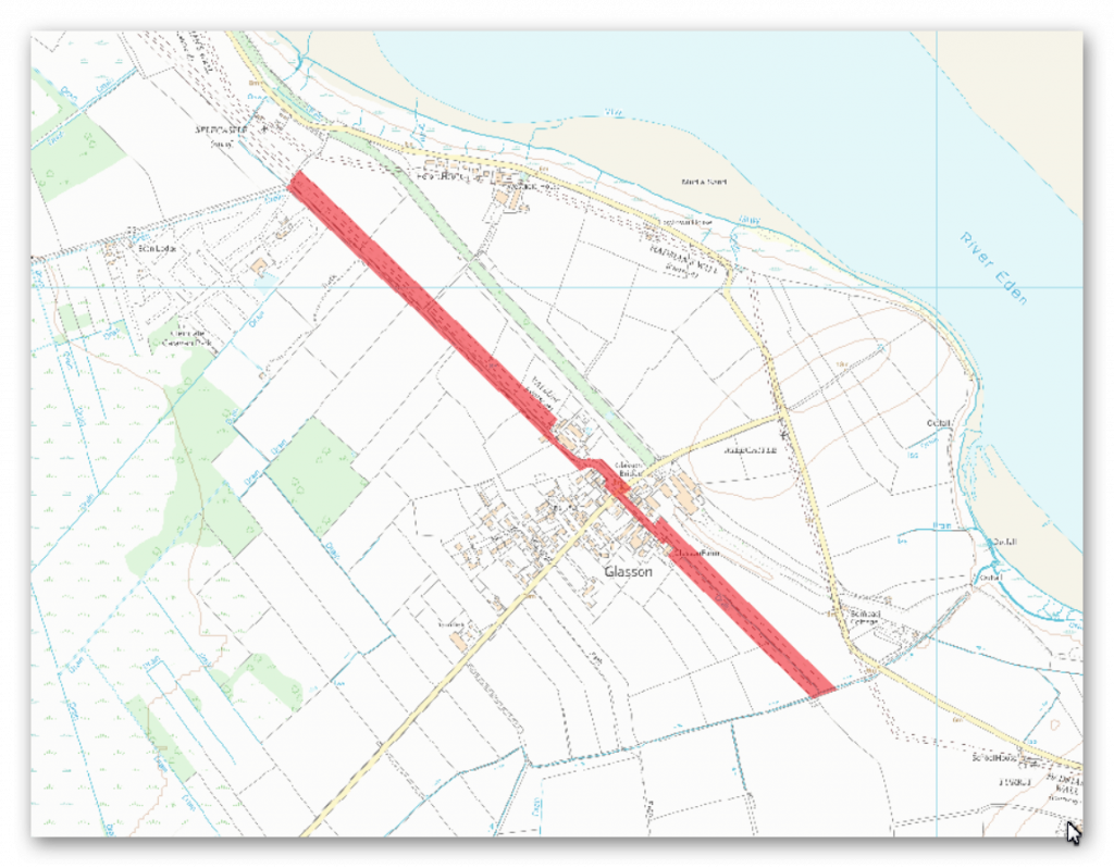
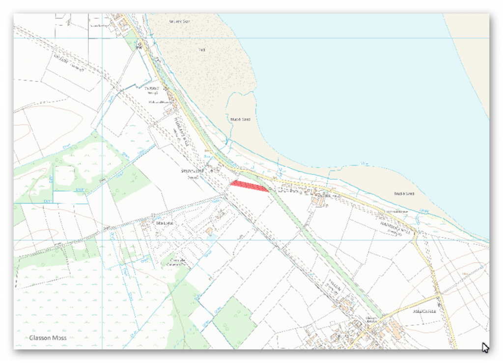
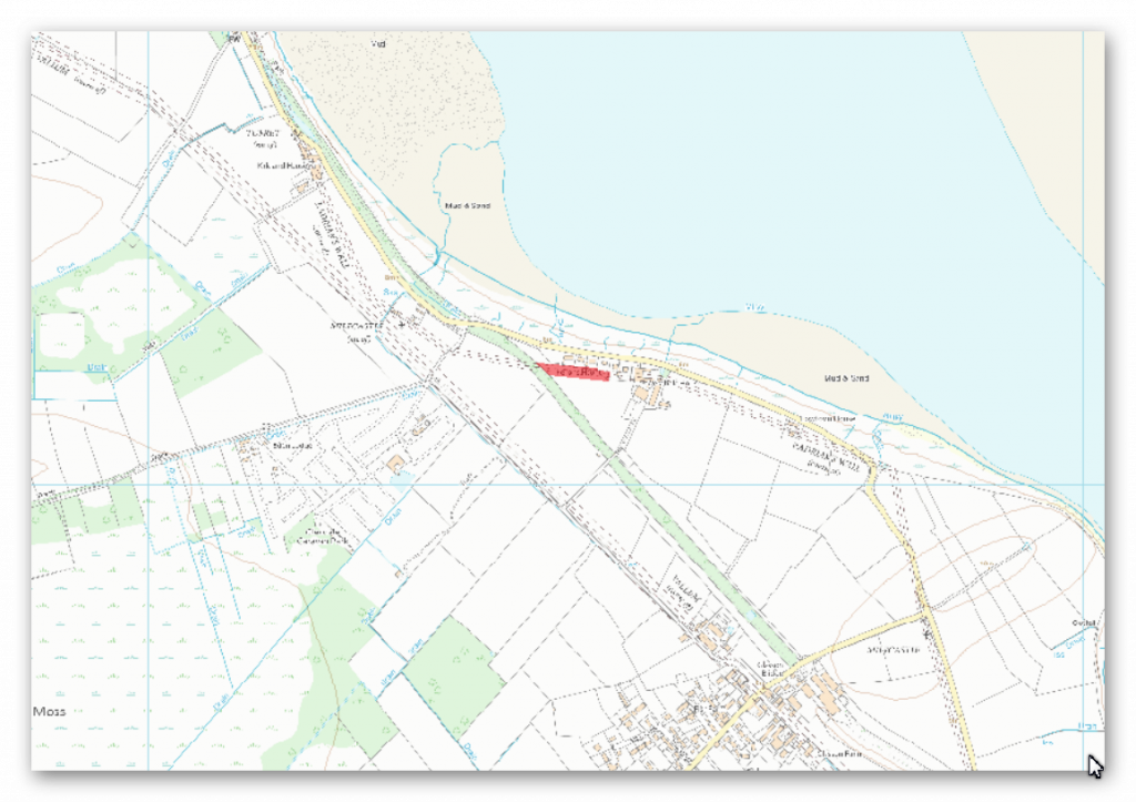
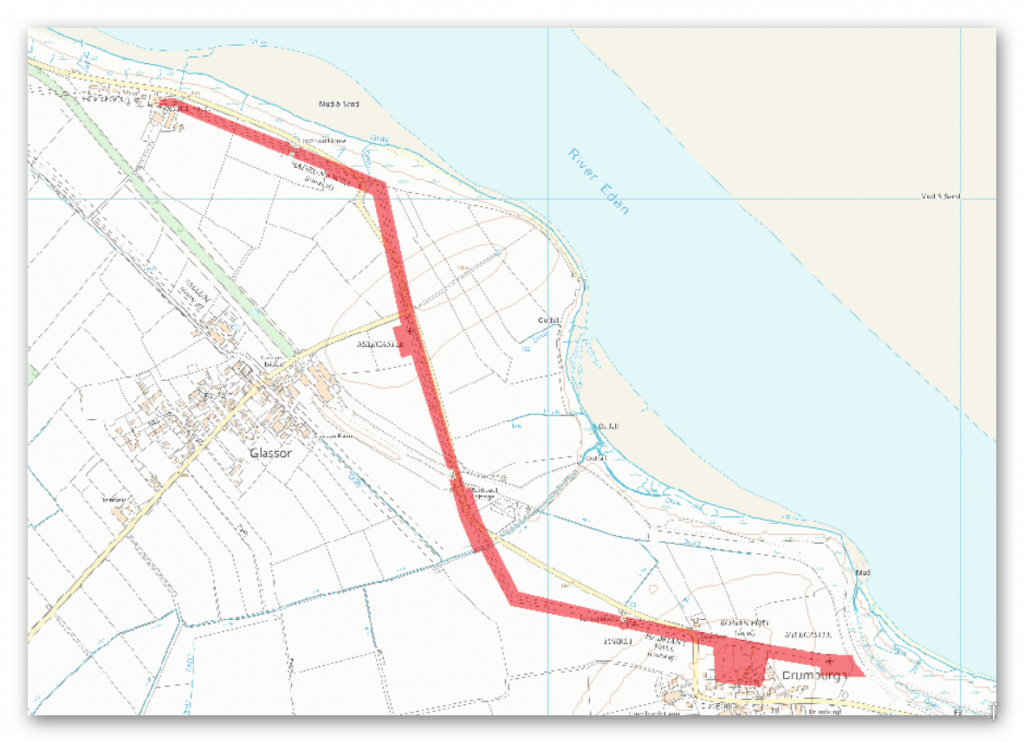
Section G – NY56SW

Section D – NY35NE – this is a section of Hadrian’s Wall showing the LiDAR, Google Earth and 1800 Maps of the Area covered by Historic England

Historic England Sections:

Hadrian’s Wall – west of Coombe Crag and Oldwall in wall miles 54, 55, 56 and 57
List UID: 1010986, 1010987, 1010985, 1010983, 1010982

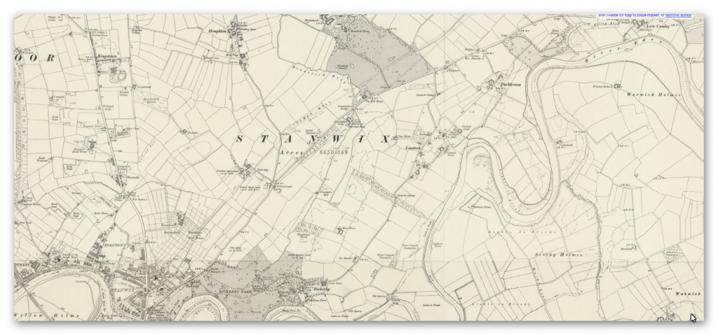
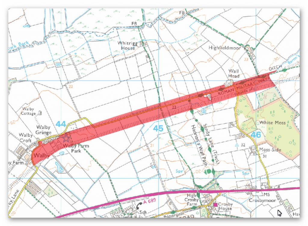
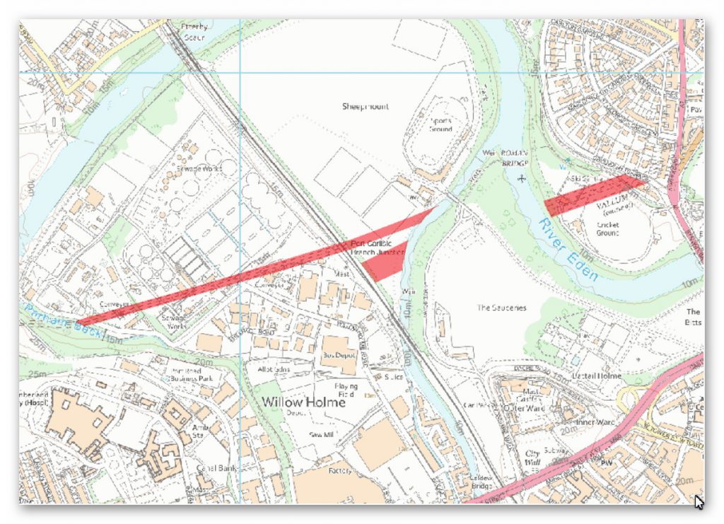
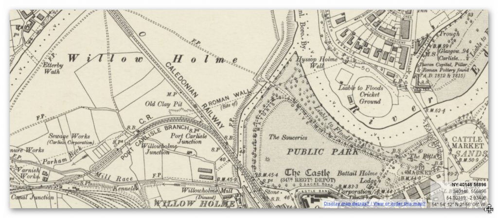
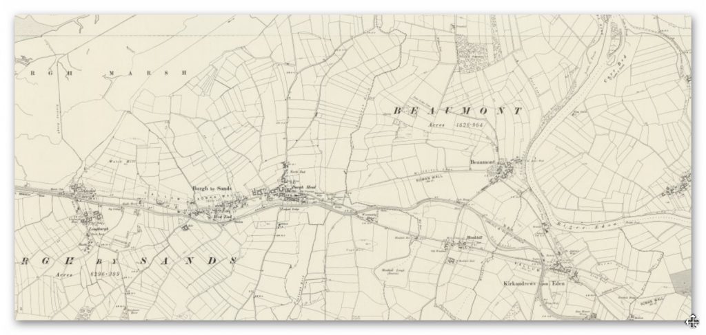
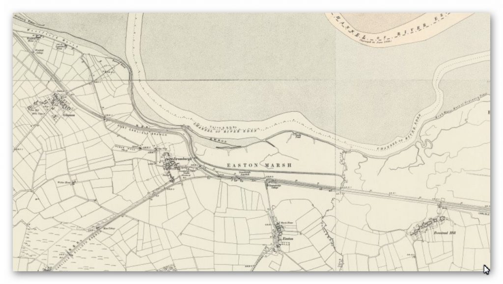
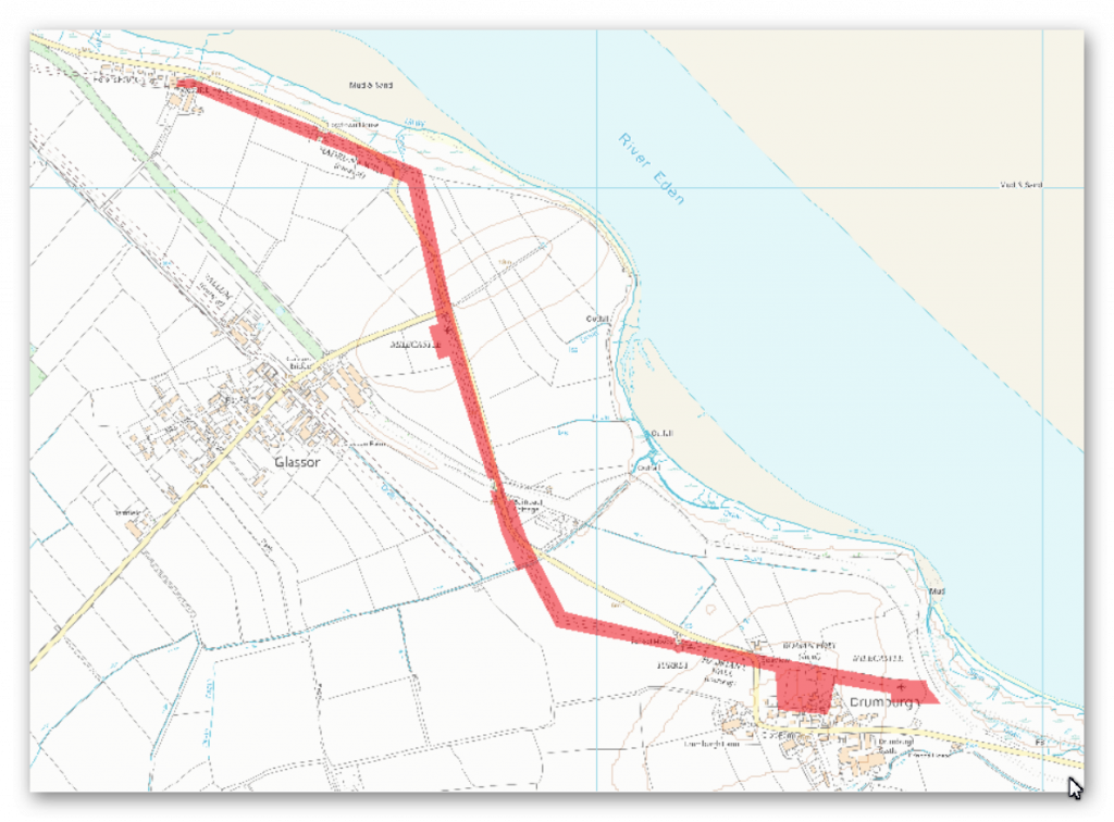
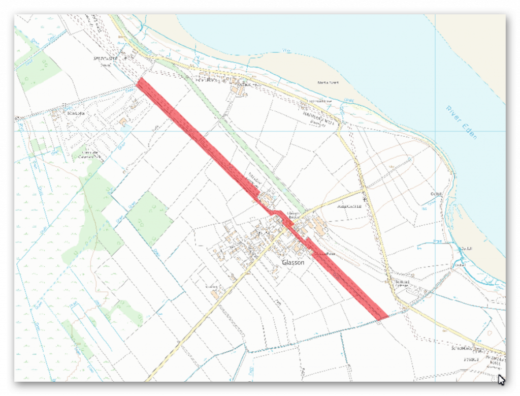
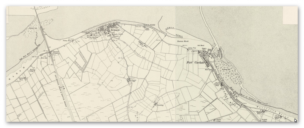
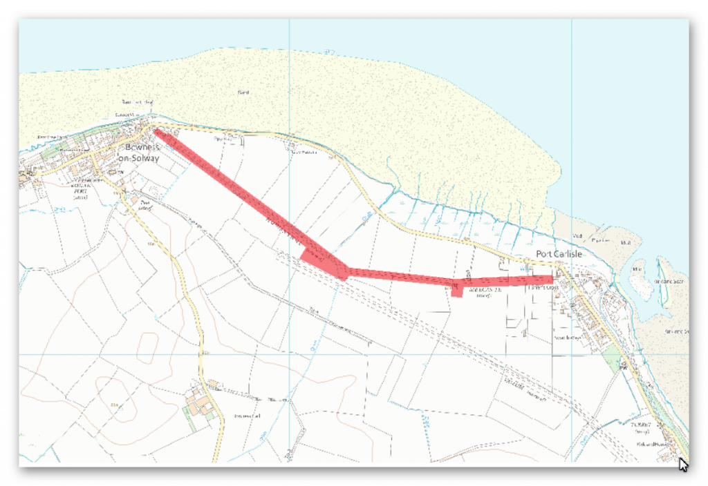
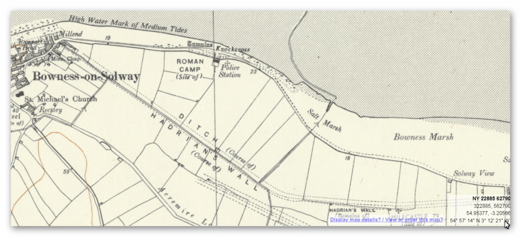
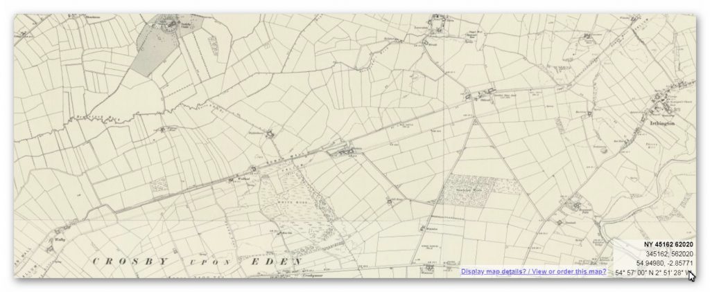
Old OS Map
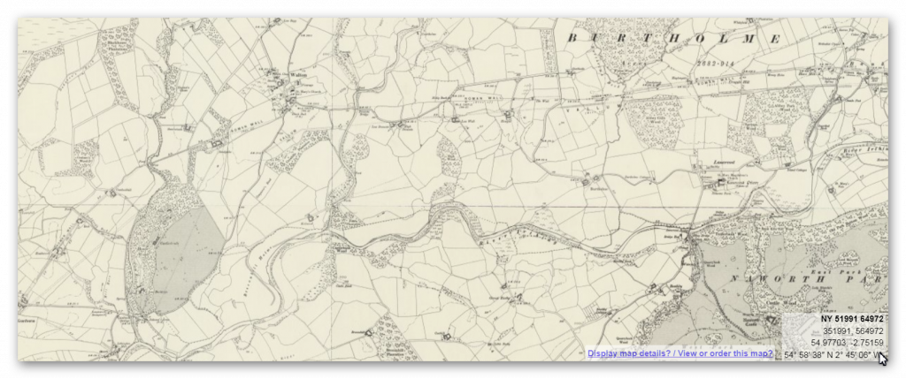
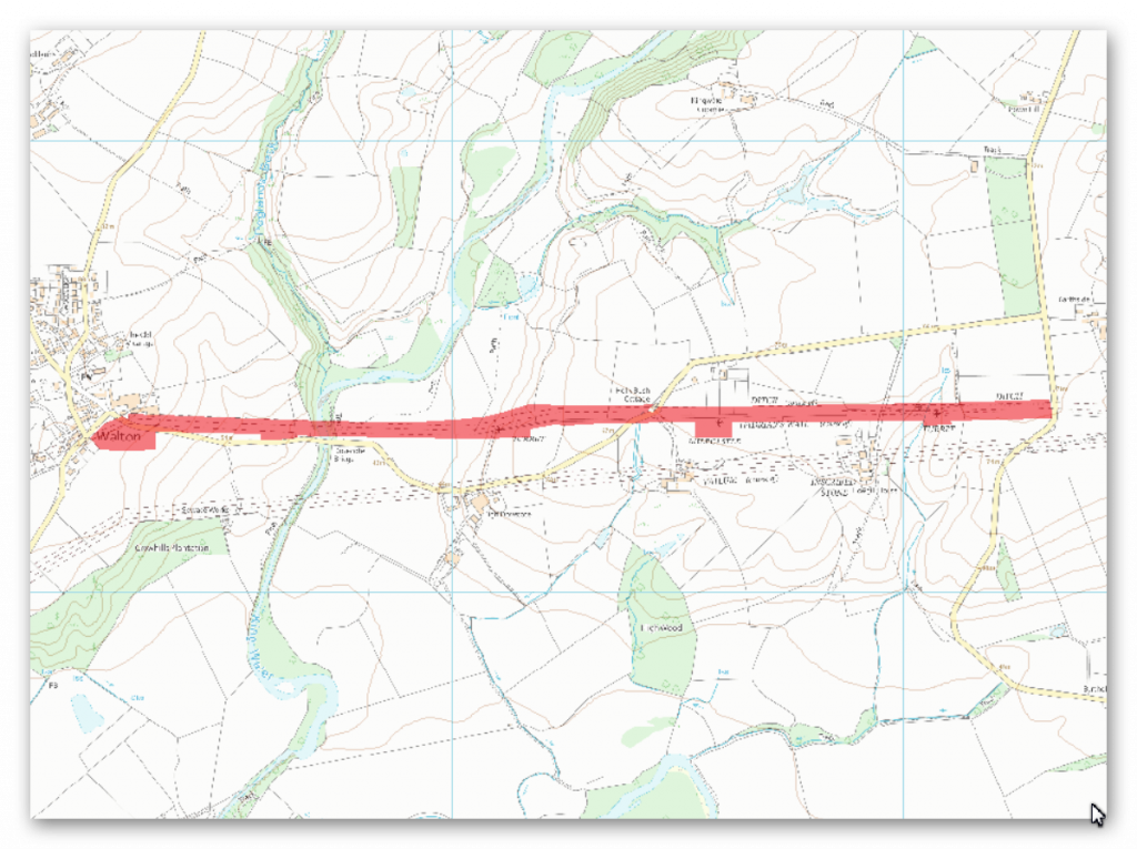
NY56SW - Section G
NY56SW – Section G

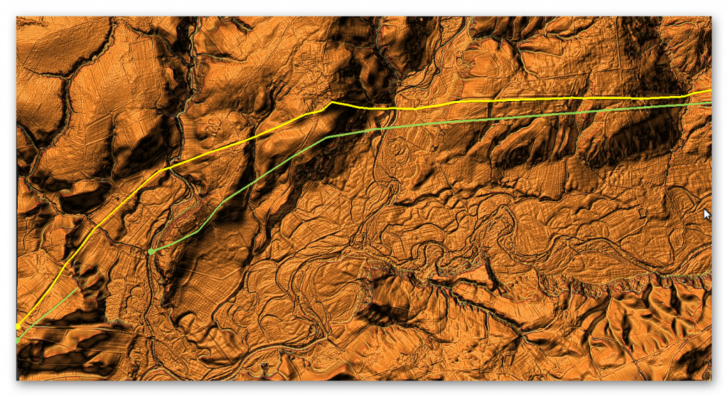
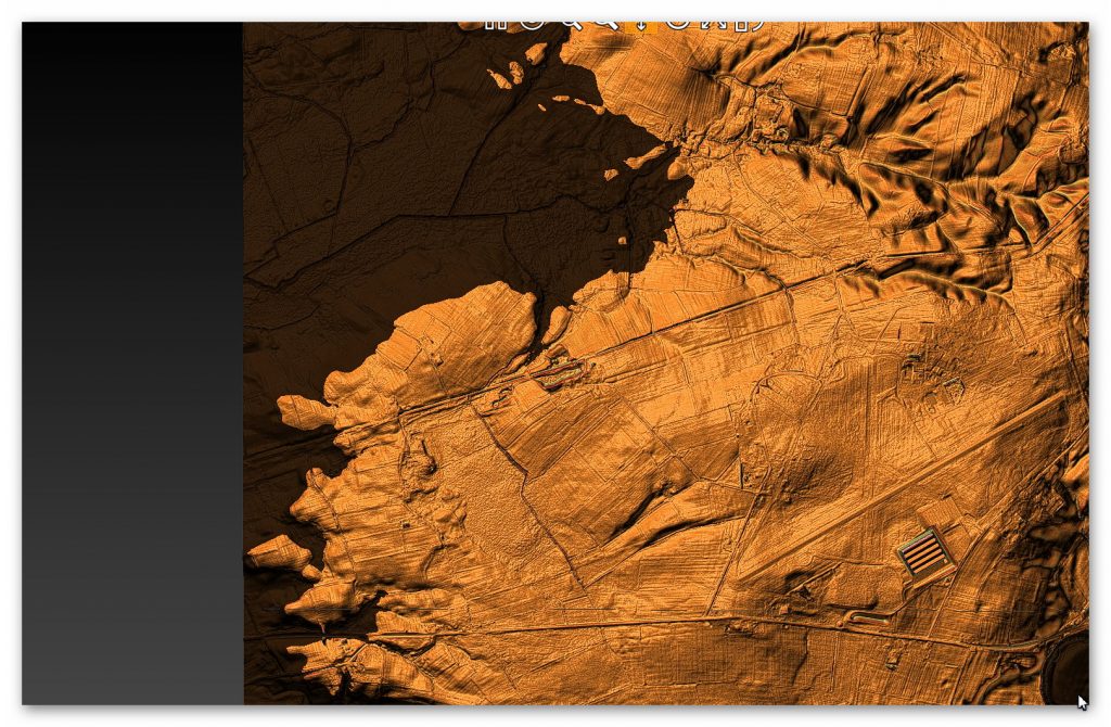
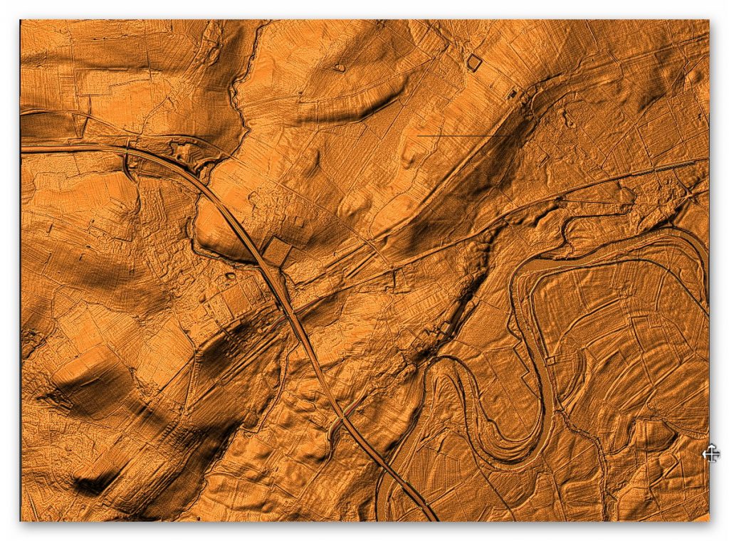
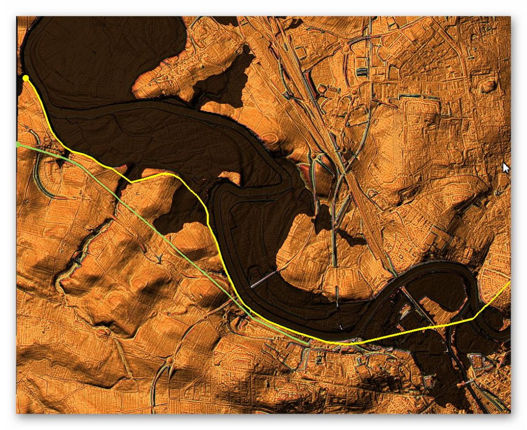
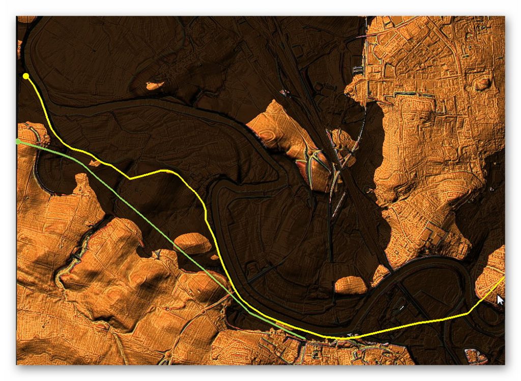
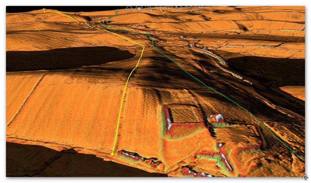
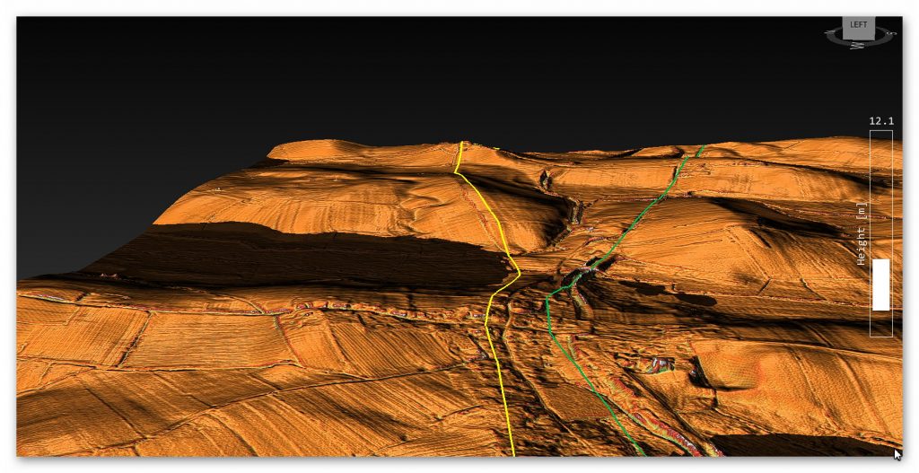
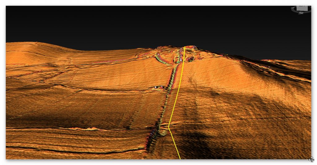
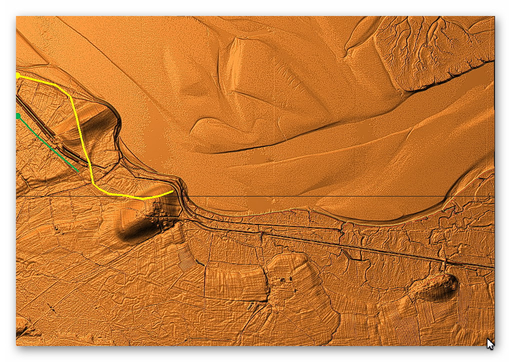
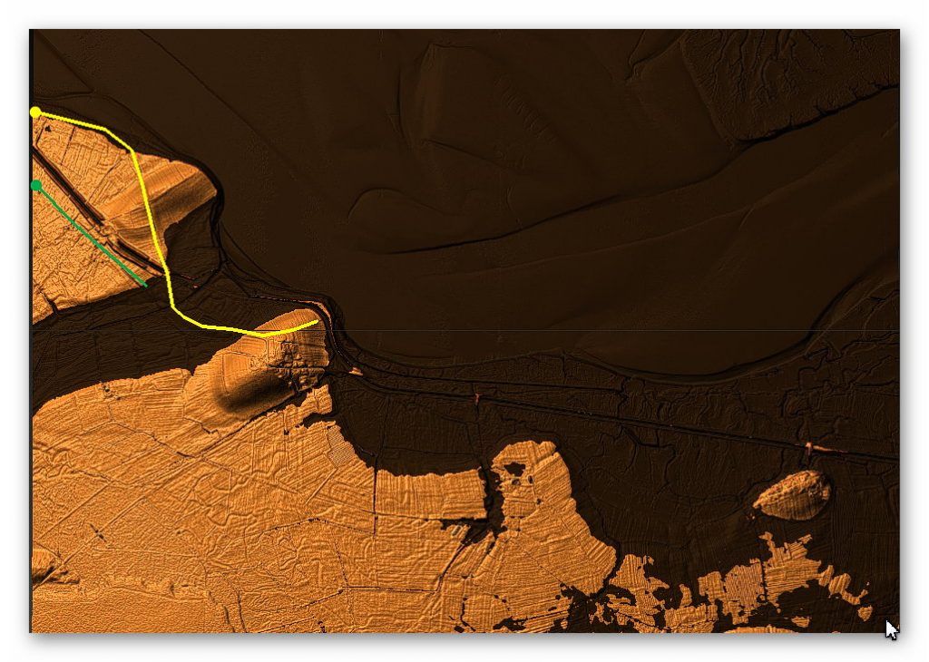
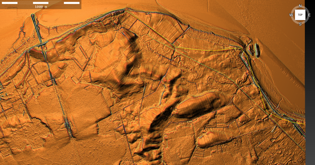
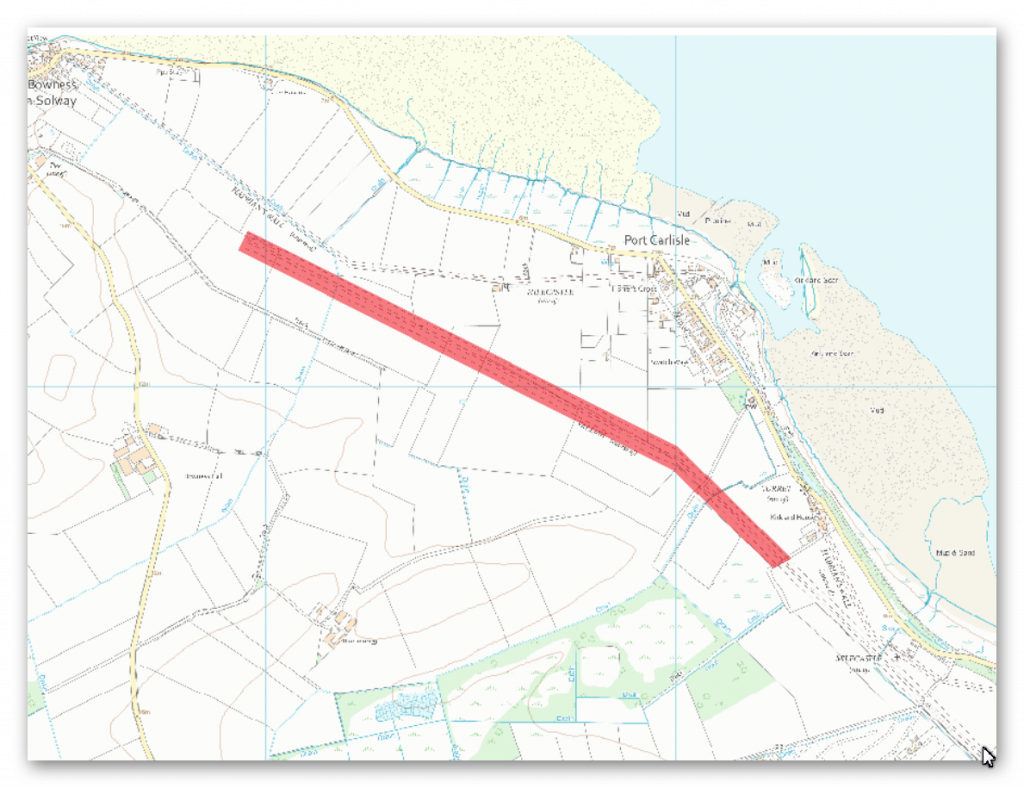
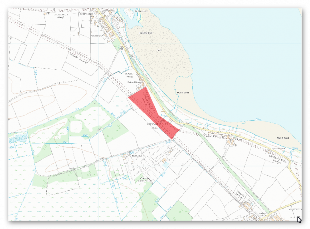
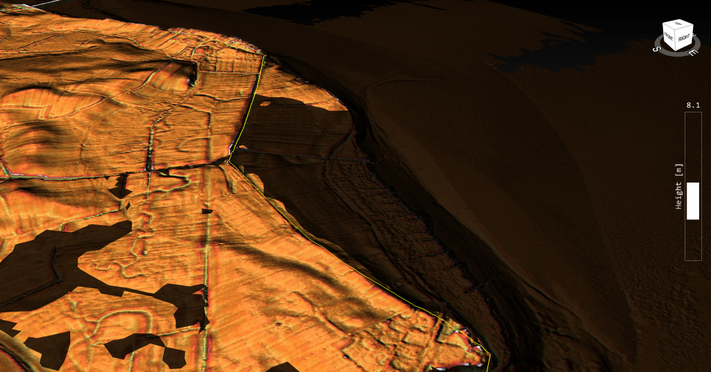
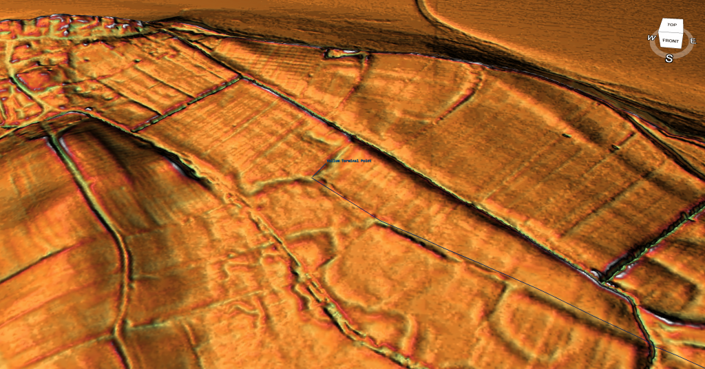
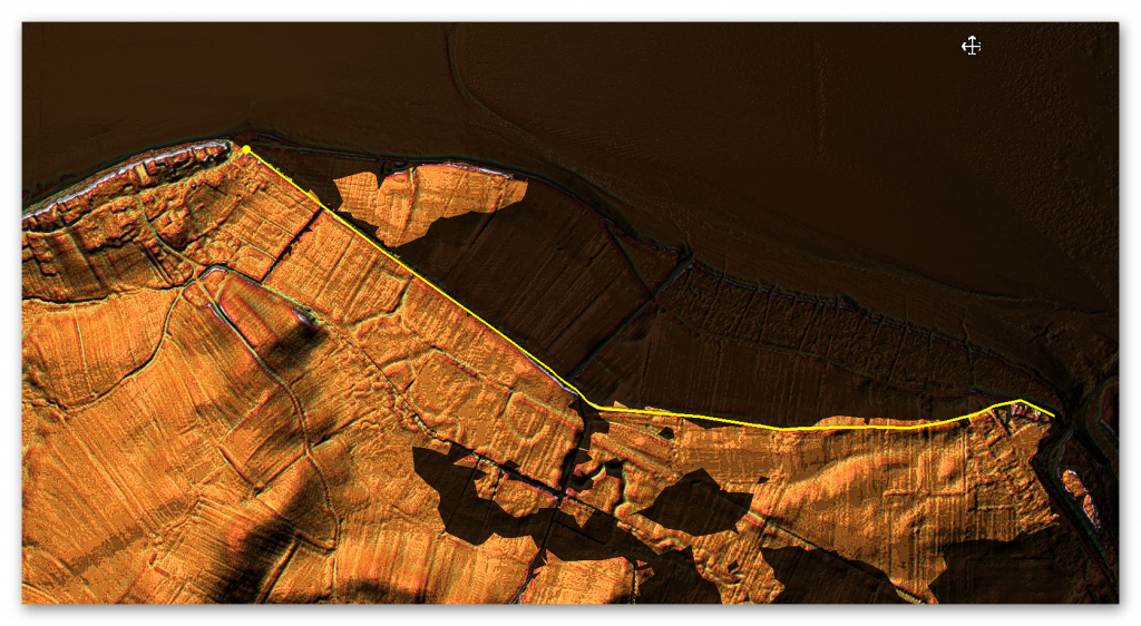
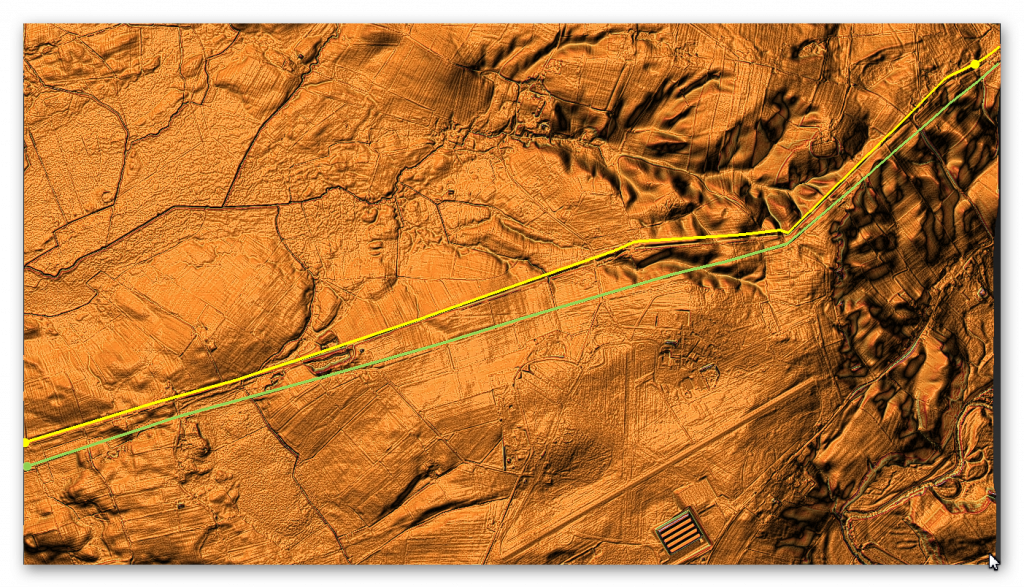
LiDAR Map

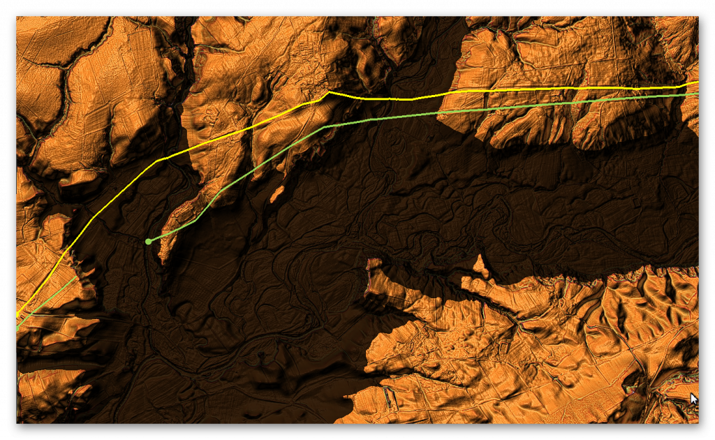
NY56SW Section G -  Wall in Yellow -Vallum in Green
NY56SW Section G – Wall in Yellow -Vallum in Green

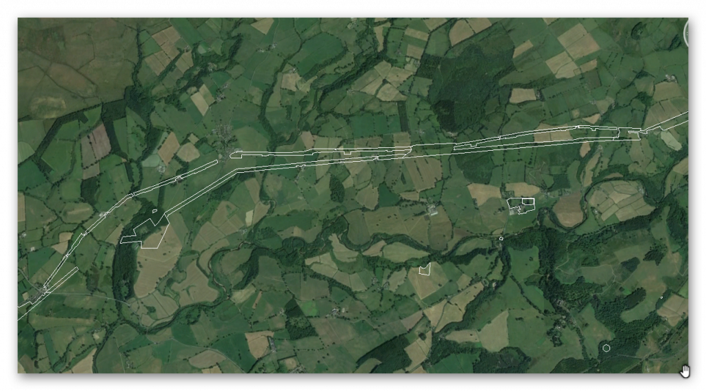
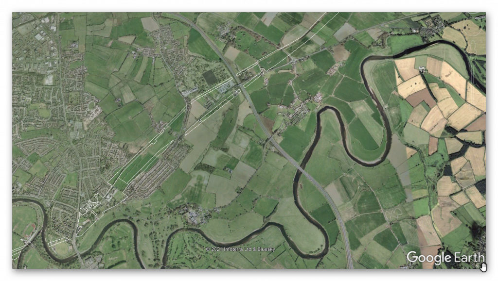
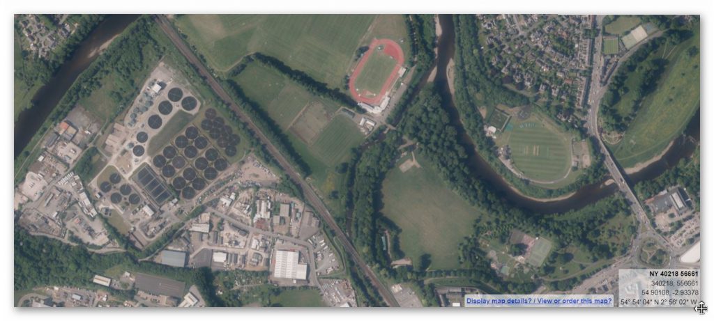
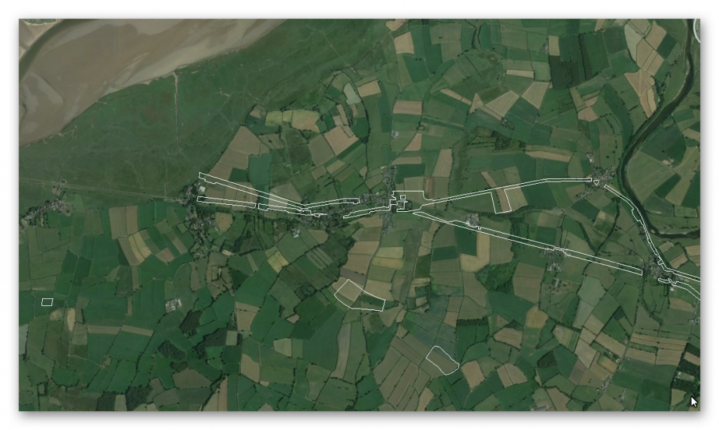
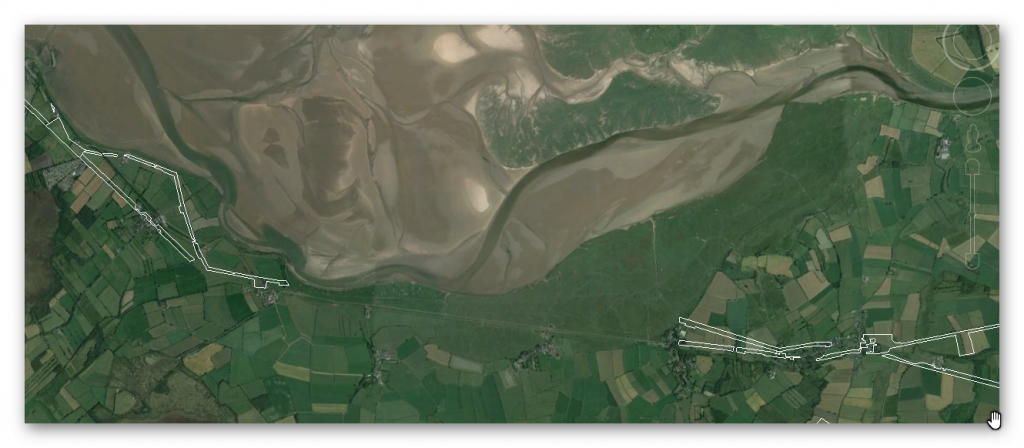
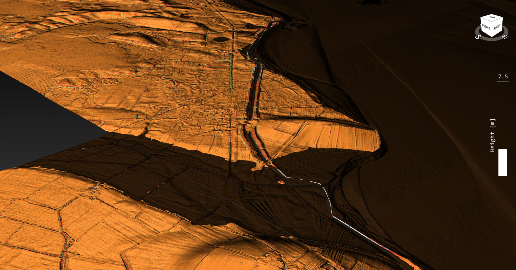
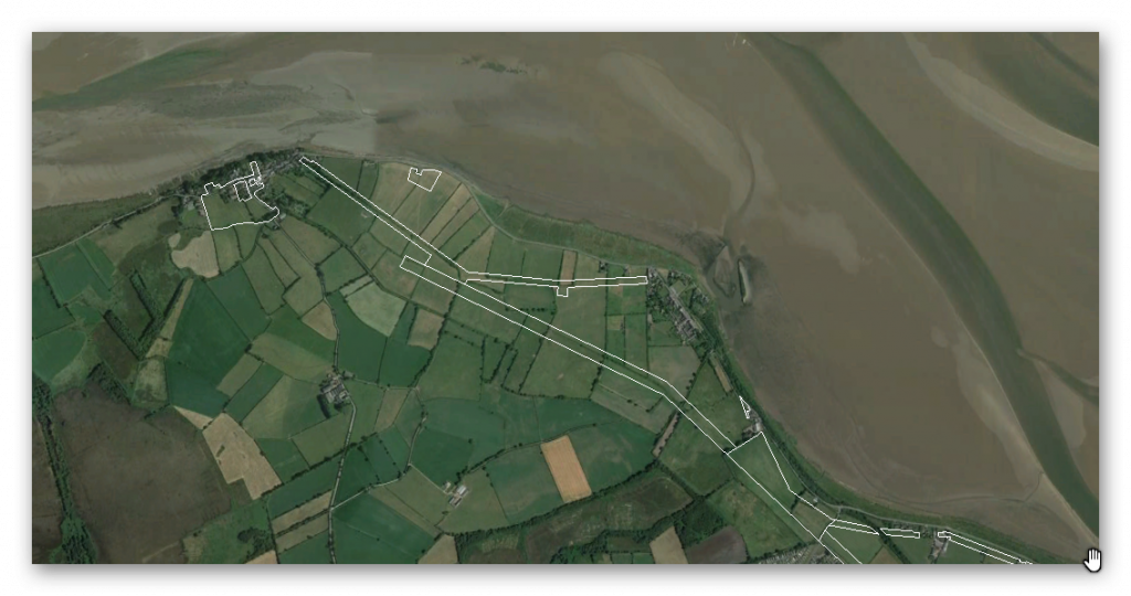
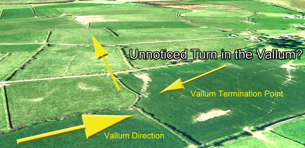
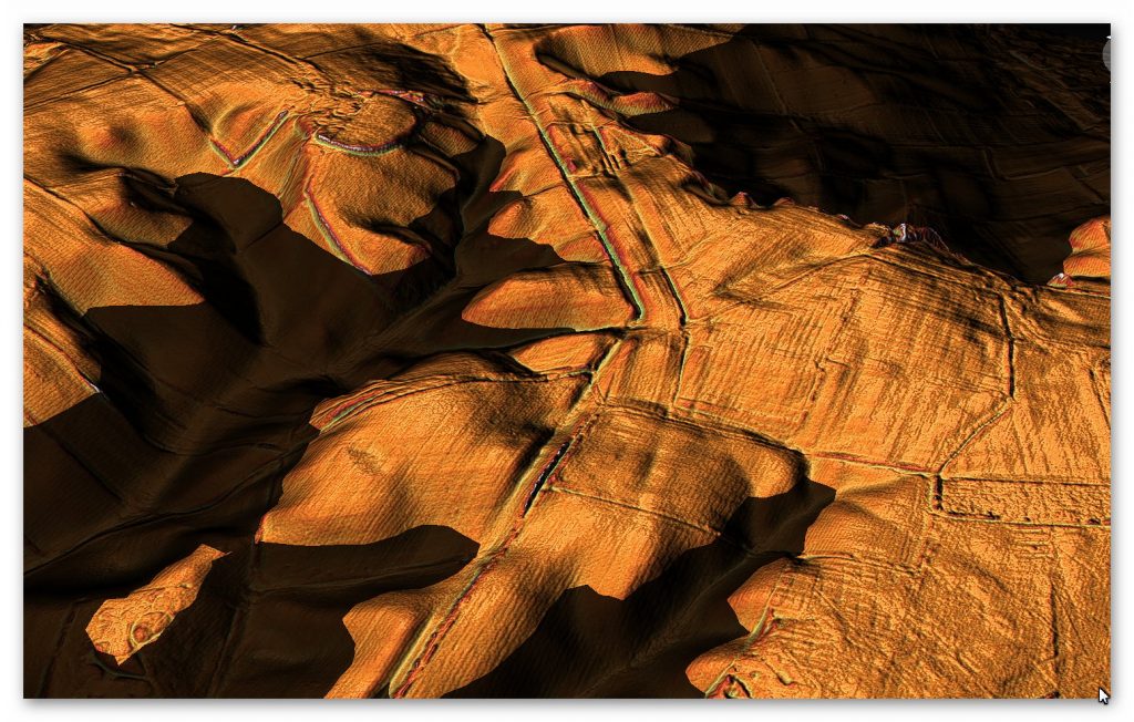
Google Earth Map

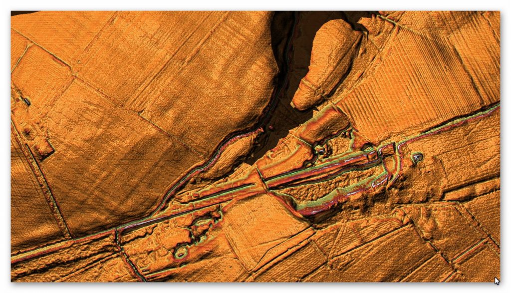
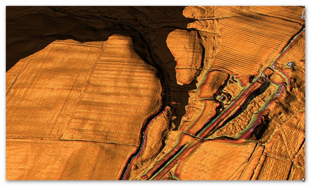
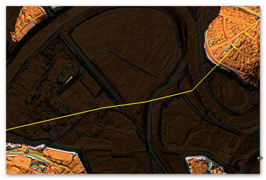
Vallum heading for and over the Paleochannel

Historic England Scheduled Monuments within Section G

Name: Hadrian’s Wall between the Cam Beck and Newtown Farm in wall miles 56 and 57
Designation Type: Scheduling
Grade: Not Applicable to this List Entry
List UID: 1010986

Name: The vallum between the field boundary south east of Heads Wood and the A6071 road in wall mile 57
Designation Type: Scheduling
Grade: Not Applicable to this List Entry
List UID: 1010987

Name: Castlesteads Roman fort and the vallum between the track to the east of Castlesteads fort and the Cam Beck in the west
Designation Type: Scheduling
Grade: Not Applicable to this List Entry
List UID: 1010985

Name: The vallum between the road to Garthside and the track east of Castlesteads in wall miles 54, 55 and 56
Designation Type: Scheduling
Grade: Not Applicable to this List Entry
List UID: 1010983

Name: Hadrian’s Wall between the road to Garthside and The Centurion Inn, Walton, in wall miles 54 and 55
Designation Type: Scheduling
Grade: Not Applicable to this List Entry
List UID: 1010982
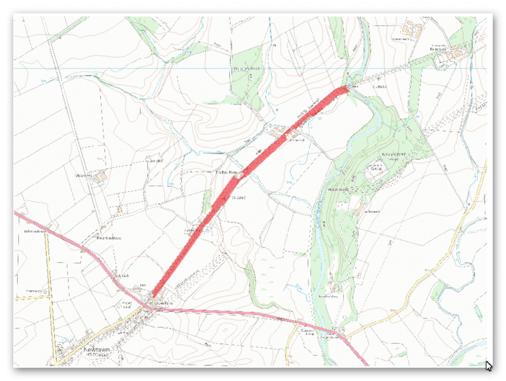
HE: 1010986
HE: 1010986

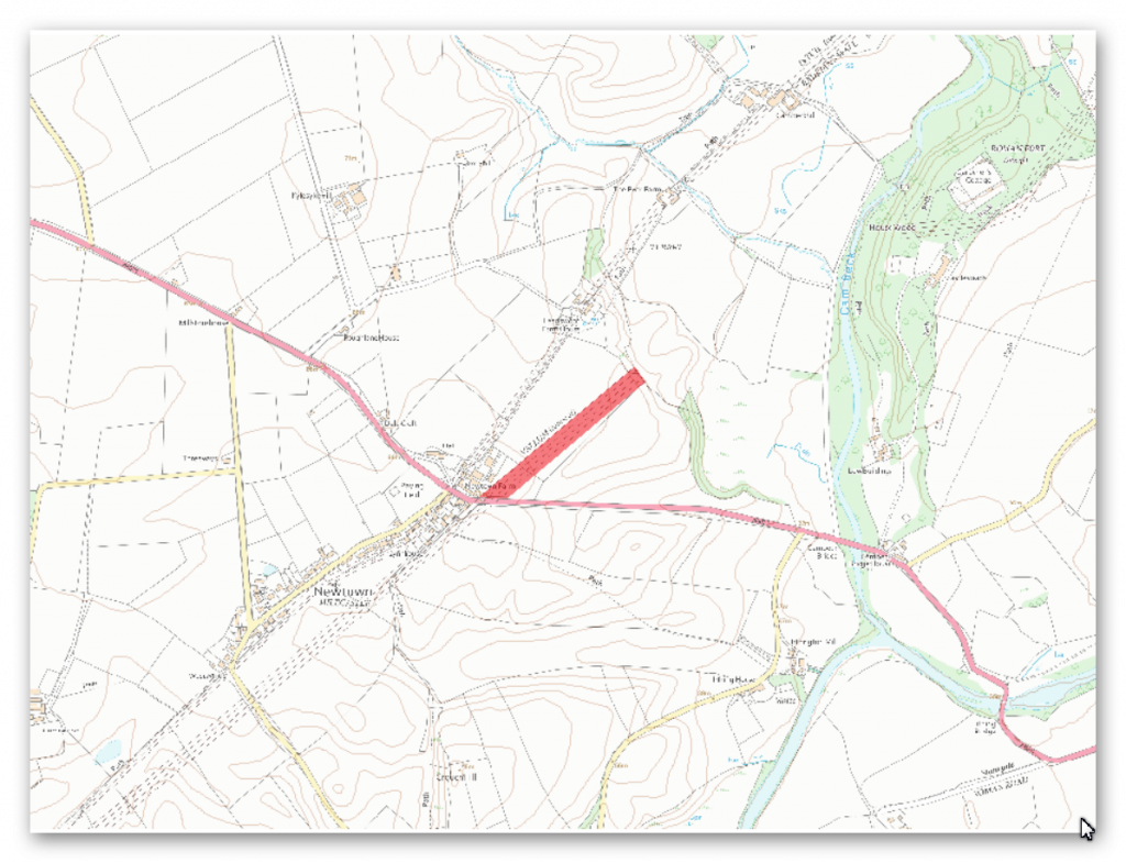
The monument includes the section of Hadrian’s Wall and its associated features between the Cam Beck in the east and Newtown Farm in the west. Hadrian’s Wall survives as a buried feature throughout this section with no remains visible above ground. Its course is indicated in this section by a broad swelling in the field to the south west of Cambeckhill farm and as occasional rises in hedgelines which cross its course.

There is no surface trace at The Beck Farm or Heads Wood house. The wall ditch survives as an intermittent earthwork visible on the ground. Where extant it averages 2m deep in the east half of the section and 1m deep in the west half. The ditch upcast mound, usually referred to as the glacis, has been ploughed out in this section and only survives faintly visible in the field south west of The Beck Farm.

The exact location of milecastle 57 has not yet been confirmed as there are no upstanding remains surviving above ground. However, on the basis of the usual spacing it is expected to be located below the farm at Cambeckhill. These buildings and the ground below them are not included in the scheduling as the survival of archaeological remains there has not been confirmed. Turret 57a is situated about 180m south west of Dodgson’s Beck. It was located in 1933 by Simpson who confirmed it as one from the Turf Wall series. It survives as a buried feature with a slight swelling visible above ground, 0.15m high, in the turf cover. The exact location of turret 57b has not yet been confirmed. However, on the basis of the usual spacing it is expected to be situated about 110m north east of Newtown Farm.

The exact course of the Roman road known as the Military Way, which ran along the corridor between the Wall and vallum linking turrets, milecastles and forts, has not been confirmed in this section. It is probably positioned parallel to the Wall about 20m-30m south of it throughout the section as there are no topographical constraints.
HE: 1010987
HE: 1010987

The monument includes the section of vallum between the field boundary to the south east of Heads Wood in the east and the A6071 road in the west. The vallum survives as a buried feature throughout this short section with no upstanding remains visible above ground. However, vague traces of the silted ditch are marked by slight depressions in the hedgelines which cross its course.
HE:1010985
HE:1010985

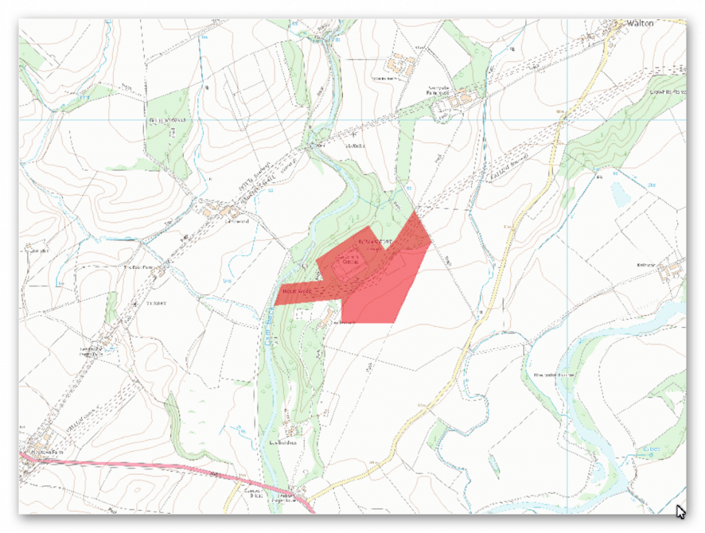
The monument includes the Roman fort and its associated remains at Castlesteads and the section of vallum between the track to the east of Castlesteads and the Cam Beck in the west. Castlesteads fort, known to the Romans as `Camboglanna’, is detached from the Wall line, being located 350m to the south of the Wall. This is accounted for by the strength of the position the fort occupies and also the need for the Wall line to take a more gentle descent of the gorge to cross the Cam Beck. The fort is situated on a high bluff and was built here to command the Cam Beck valley.

The fort survives as a low platform with most of its remains surviving as buried features. The surface remains of the fort were damaged by landscaping for Castlesteads house in 1791. The fort is now overlain by ornamental gardens. The stone fort measures about 114m square internally and encloses an area of at least 1.3ha. The north west side of the fort has been eroded by the Cam Beck so that the east and west gateways was now lie just 15m from the lip of the gorge. Limited excavations were carried out by Richmond and Hodgson in 1934 who were able to locate the ramparts and east and west gateways and establish the existence of a berm, 3m wide, and an outer ditch 4.8m wide. Trenching at the south east angle revealed the remains of a turf rampart, at least 3m wide, resting on flagging and stones set in clay to the rear of the Stone Wall. This rampart base is probably the remains of an earlier turf and timber fort which occupied the site. An east facing scarp, 0.4m high, parallel to the east rampart was discovered during a survey by the Royal Commission on the Historical Monuments of England in 1991.

This scarp may be the remains of the edge of the platform of this earlier and therefore larger fort, especially as a right-angled return to the south west can be traced for 10m before fading. A section of ditch thought to be associated with an annexe was also discovered during Richmond and Hodgson’s excavations. Inscriptions from the site show that the fort was garrisoned by the fourth cohort of Gauls in the second century AD and by the mounted second cohort of Tungrians in the third century AD. Large quantities of inscribed and sculptured stones have been found during the landscaping and stone robbing, many of which are housed in the summer house at the west side of the rose garden. These sculptured stones which are not included in the scheduling, include three altars dedicated to the Persian god Mithras and ten dedicated to the worship of official state gods. The bath house associated with the fort lies to the north east of the fort platform in dense woodland. It is the subject of a separate scheduling (SM 26081).

The remains of the civil settlement, or vicus, which is usually associated with Roman forts, are not visible as upstanding features at Castlesteads. However, a letter from a certain Richard Goodman writing to Gale in 1727 mentions traces of an extensive settlement on the slope at the south east front of the fort. He noted the existence of foundations of walls and streets which were being removed to construct new buildings and to allow the land to be ploughed. The remains of the vicus will survive as buried features below the ploughed field to the south and east of Castlesteads. However, a letter from a certain Richard Goodman writing to Gale in 1727 mentions traces of an extensive settlement on the slope at the south east front of the fort. He noted the existence of foundations of walls and streets which were being removed to construct new buildings and to allow the land to be ploughed. The remains of the vicus will survive as buried features below the ploughed field to the south and east of Castlesteads.

The vallum survives as a buried feature throughout this section with no remains visible above ground. Its course has been confirmed by Haverfield who cut trenches in 1898, 1901 and 1902 to determine its course. It was found to make a sweeping diversion to the south to encompass the fort at Castlesteads within the Wall-vallum zone. However, it makes the turn well before the stone fort implying that it was constructed to respect the earlier and larger turf and timber fort.
HE:1010984
HE:1010984

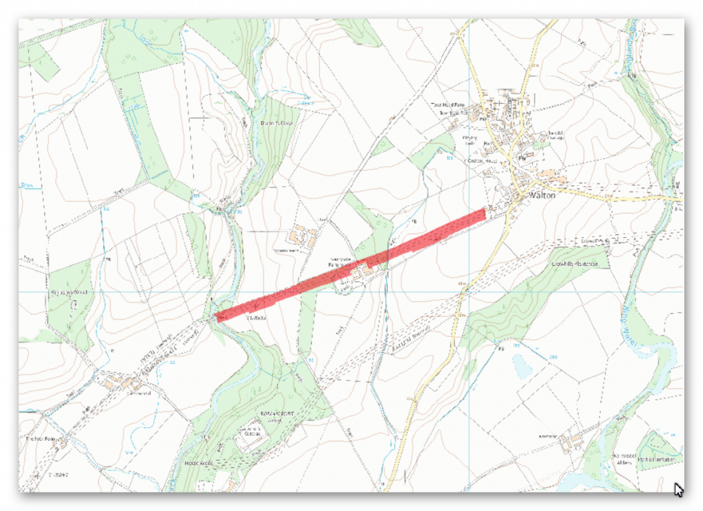
The monument includes the section of Hadrian’s Wall and its associated features between Eden Vale house at Walton in the east and the Cam Beck in the west. Hadrian’s Wall survives as a buried feature in the east half of this section with few traces visible above ground. In the woodland on the east and west sides of Sandysike the Wall is visible as an earth covered bank, 5.6m wide and 0.3m-0.5m high, with trees growing out of it.

Richmond noted deep masonry foundations of the Wall near the stream at Sandysike in 1933. Either side of the Cam Beck there are no upstanding remains of the Wall. However, its course is known because there is an account of the part destruction of the Wall here in 1791 where it is stated to have been 2.5m thick. The wall ditch survives as an intermittent earthwork visible on the ground throughout this section. East of Sandysike Wood the ditch is silted up leaving no surface traces. In the wood the ditch survives as a visible feature, averaging between 1.4m and 1.7m deep, with a drain occupying its base. West of the wood the ditch is partly overlain by a hedgeline before fading as it approaches the Cam Beck in boggy ground.

The ditch upcast mound, usually referred to as the glacis, which lies to the north of the ditch has been ploughed out throughout most of this section. The exact location of turret 56a has not been confirmed as there are no upstanding remains visible above ground. However, on the basis of the usual spacing it is expected to be located just to the east of Sandysike. Although not included in the scheduling, there is a Roman altar built into an outbuilding of Sandysike farm, 0.7m above ground level. It is made from red sandstone and measures 0.34m by 0.14m. Turret 56b is situated about 140m east of the Cam Beck on a river terrace. It was located in 1933 by Simpson who ascribed it to the Turf Wall series. The turret survives as a buried feature with no remains visible above ground.

The exact course of the Roman road known as the Military Way, which ran along the corridor between the Wall and vallum linking turrets, milecastles and forts, has not been confirmed in this section. It is expected to be located parallel to the Wall, 20m-30m to the south of it. The track from Sandysike farm to Walton, which lies parallel to the Wall, may overlie the course of the Military Way.
HE 1010983
HE 1010983

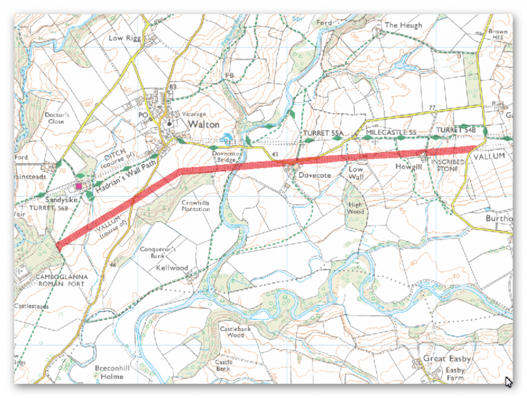
The monument includes the section of vallum and its associated features between the road to Garthside in the east and the track to the east of Castlesteads in the west. The vallum survives as buried feature throughout most of this section. It is best preserved to the west of Low Wall where the ditch is visible as a slight depression which deepens as it descends to the stream. Otherwise the only surface traces are slight rises and dips in hedgelines where they cross the ploughed down mounds and ditch of the vallum. Elsewhere the vallum mounds have been reduced by ploughing leaving no trace above ground. Similarly the vallum ditch has been entirely silted up leaving no obvious remains on the surface.

Where there are no surface traces the course of the vallum is known from excavations by Haverfield during 1900-1901. His trenches revealed the course of the vallum west of Howgill farm and to the south of Walton. About 30m east of the track to the east of Castlesteads, Haverfield’s excavation in 1901 showed that there was a major realignment in the course of the vallum here. This sharp southward turn was made to encompass the Roman fort at Castlesteads within the military corridor between the Wall and vallum.
HE 1010982
HE 1010982

The monument includes the section of Hadrian’s Wall and its associated features between the west side of the road to Garthside in the east and the Centurion Inn at Walton in the west. Hadrian’s Wall survives as a buried feature throughout this section with few traces visible on the ground. Between Howgill and turret 55a the Wall survives as a substantial turf covered bank, up to 1.4m high, which is surmounted by a fence and hedge. West of Dovecote Bridge a section of Wall 20m long stands to an average height of 1m. It is now covered by a protective mound of earth, and it is in the care of the Secretary of State.

Between this section of Wall and Walton the Wall was trenched in 13 places by Haverfield in 1902. The Wall was found to be substantially robbed along its course. Its line here is visible on the ground as an intermittent slight rise in grassland. Elsewhere in this section the Wall survives as a buried feature with no remains visible above ground except for the occasional rise seen in a hedgeline. The wall ditch survives as a feature visible on the ground as a slight depression, averaging 0.5m deep, throughout most of this section. It is best preserved to the east of turret 55a where it is 2.4m deep. The ditch upcast mound, usually referred to as the glacis, which lies to the north of the ditch has been ploughed out in this section. The only visible remains of this feature are to the east of turret 55a where it survives as a slight mound. Milecastle 55 survives as a low turf covered platform visible as a slight rise in the hedgeline. It measures 22m east to west but its north-south length is indeterminate because its extent to the south is unclear.

The milecastle was located and partly excavated by Haverfield in 1900 who recovered late fourth century AD pottery. Milecastle 56 is located to the north east of the Centurion Inn at Walton. It survives as a buried feature with no traces visible above ground. MacLauchlan noted slight traces of the milecastle here in 1858 during his survey of the Wall. Turret 54b is situated about 150m north east of Howgill House. It survives as a buried feature with no remains visible above ground. It was located by Simpson in 1933 who considered it to be of the original Turf Wall series. Turret 55a is situated about 170m to the north of High Dovecote. It survives as a buried feature with no remains visible above ground. This turret was also located by Simpson in 1933 who considered it to be of the original Turf Wall series. Turret 55b is situated about 40m west of Dovecote Bridge. Its exact location has not yet been confirmed as it survives as a buried feature with no remains visible above ground. The turret was located by Miss Kate Hodgson in 1959 but it has not been located since.

The exact course of the Roman road known as the Military Way, which ran along the corridor between the Wall and the vallum linking turrets, milecastles and forts, has not been confirmed in this section. However, it is expected to be situated parallel to the Wall about 20m-30m south of it.

Investigation

The Vallum in this section fades in and out depending on the location of the Valley floor – The OS maps give up in the west and attempts to discover the past in the East, although no evidence can be found in the central River Valley.
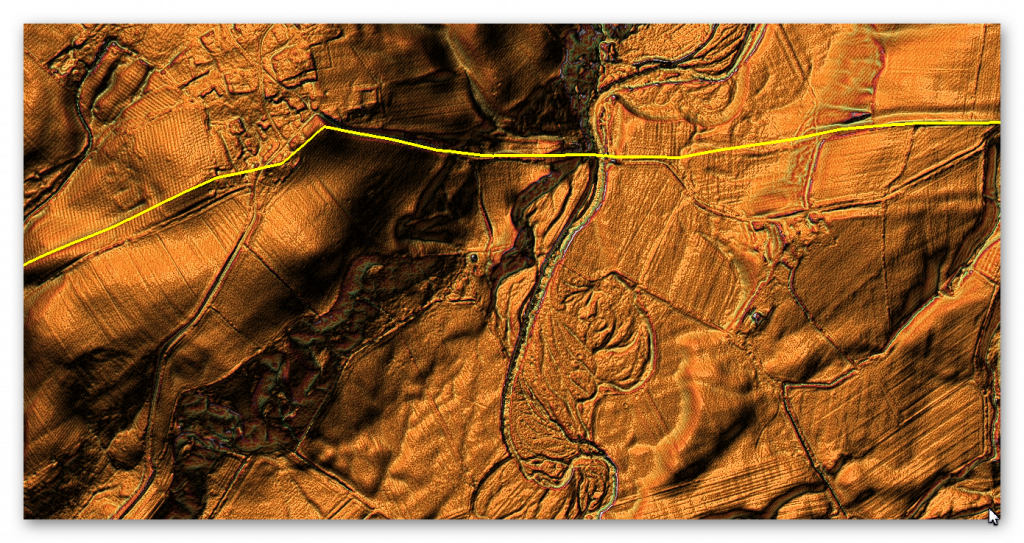
The Wall ditch looks so much newer than the fading Vallum ditch
Vallum missing the valleys - although the path could have avoided or minimised the watery valleys, by going north
Vallum missing the valleys – although the path could have avoided or minimised the watery valleys, by going north

Another unexplained position is of a Roman Fort built to the South of the Wall for no reason, unless it was associated with the Vallum. The map seems to suggest that the Vallum came to the Fort (east side) rather than go around the base of the Camp in a strange bendy movement?
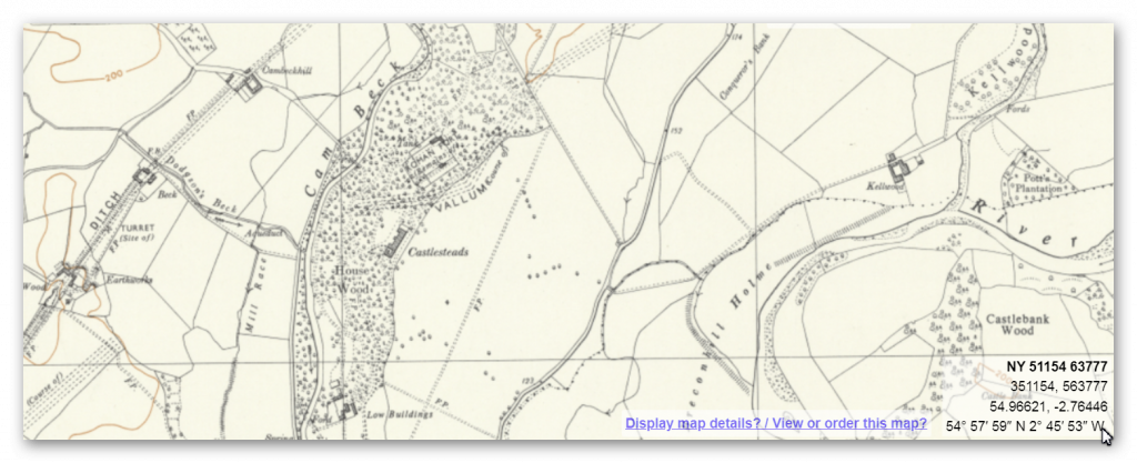
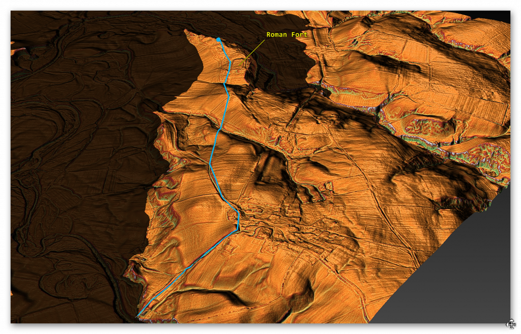
The Vallum disappears into the River Valley then comes out to go around a Roman Fort for no reason
The Vallum disappears into the River Valley then comes out to go around a Roman Fort for no reason?
The peninsula in Prehistoric Times seems to have had a DYKE that the Roman used for both the Vallum and later Wall

The Roman fort clearly predates the Wall as it would have no strategic significance as it is too far South. Therefore are we seeing the Early dates of the Building of the Vallum when the Romans used the existing prehistoric Dyke to Connect the Fort to the Englanged River and then adapted it to be part of the Vallum and The Wall ditch – although HE suggest that the Dyke is older than the Roman Building.

Vallum in Section G without water

Vallum with Prehistoric Water

To understand the problem with Hadrian’s Walls history read our article HERE.

Further Reading

For information about British Prehistory, visit www.prehistoric-britain.co.uk for the most extensive archaeology blogs and investigations collection, including modern LiDAR reports.  This site also includes extracts and articles from the Robert John Langdon Trilogy about Britain in the Prehistoric period, including titles such as The Stonehenge Enigma, Dawn of the Lost Civilisation and the ultimate proof of Post Glacial Flooding and the landscape we see today.

Robert John Langdon has also created a YouTube web channel with over 100 investigations and video documentaries to support his classic trilogy (Prehistoric Britain). He has also released a collection of strange coincidences that he calls ‘13 Things that Don’t Make Sense in History’ and his recent discovery of a lost Stone Avenue at Avebury in Wiltshire called ‘Silbury Avenue – the Lost Stone Avenue’.

Langdon has also produced a series of ‘shorts’, which are extracts from his main body of books:

The Ancient Mariners

Stonehenge Built 8300 BCE

Old Sarum

Prehistoric Rivers

Dykes ditches and Earthworks

Echoes of Atlantis

Homo Superior

For active discussions on the findings of the TRILOGY and recent LiDAR investigations that are published on our WEBSITE, you can join our and leave a message or join the debate on our Facebook Group.
Section F – NY46SE & NY45NE

Section F – NY46SE & NY45NE- this is a section of Hadrian’s Wall showing the LiDAR, Google Earth and 1800 Maps of the Area covered by Historic England

Historic England Sections:

Hadrian’s Wall – Laversdale to Oldwall and the Cottage 57, 58, 59 and 60
List UID:  1017989, 101990, 1010988

Old OS Map

NY46SE & NY45NE - Section F
NY46SE & NY45NE – Section F

LiDAR Map

NY46SW & NY45NW Section E -  Wall in Yellow -Vallum in Green
NY46SW & NY45NW Section E – Wall in Yellow -Vallum in Green

Google Earth Map

Vallum heading for and over the Paleochannel

Historic England Scheduled Monuments within Section F

Name: Hadrian’s Wall between the road to Laversdale at Oldwall and Baron’s Dike in wall miles 59 and 60
Designation Type: Scheduling
Grade: Not Applicable to this List Entry
List UID: 1010989

Name: The vallum between the road to Laversdale at Oldwall and Baron’s Dike in wall miles 59 and 60
Designation Type: Scheduling
Grade: Not Applicable to this List Entry
List UID: 1010990

Name: Hadrian’s Wall and vallum from A6071 to The Cottage in the case of the Wall, and to the road to Oldwall, for the vallum, in wall miles 57, 58 and 59
Designation Type: Scheduling
Grade: Not Applicable to this List Entry
List UID: 1010988

Analysis of the GE map and English Heritage scheduled monuments confirms the termination point of the Vallum.  Their report of these monuments suggests that:

HE: 1010989
HE: 1010989

The monument includes the section of Hadrian’s Wall and its associated features between the road to Laversdale at Oldwall in the east and Baron’s Dike in the west. The Wall survives as a buried feature throughout this section with no upstanding remains visible above ground, apart from a low scarp 0.2m high in the area to the north of Bleatarn. Its course has been confirmed in places by excavation by Haverfield in 1894.

North of Bleatarn an excavation across the Wall line uncovered the core of the Wall and much red sandstone debris from it. The wall ditch survives as an earthwork visible on the ground throughout this section, between 1m and 1.6m deep with a modern drain occupying its base for most of its course. The ditch upcast mound, usually referred to as the glacis, does not survive as a feature visible on the ground in this section.

The exact location of milecastle 60 has not yet been confirmed. There are no features visible above ground. On the basis of the usual spacing it is expected to be located about 450m north east of Bleatarn Farm on the line of the Wall. The exact locations of turrets 59b, 60a and 60b have not yet been confirmed. There are no upstanding remains visible above ground.

The course of the Roman road known as the Military Way, which ran along the corridor between the Wall and vallum linking turrets, milecastles and forts, has not been confirmed in this section.

HE: 1010990
HE: 1010990

The monument includes the section of vallum and its associated features between the road to Laversdale at Oldwall in the east and the west side of Baron’s Dike in the west. The vallum survives as a buried feature throughout most of this section. Its course is recognisable on the ground as slight depressions in fields and as distinct depressions in hedgelines which cross its course in the eastern half of this section.

East of Baron’s Dike the vallum survives as a slight earthwork visible as four parallel flat topped mounds, 0.7m high. Excavations at Bleatarn by Haverfield in 1894-5 recovered remains of the vallum. This area is now partly built over. Archaeological remains have not been confirmed to survive below the modern buildings. Consequently the ground beneath the buildings is not included in the scheduling. Elsewhere there are no surface traces of the vallum. The excavations at Bleatarn suggested the existence of quarries here, possibly of Roman date, but the confusing nature of the reports questions the reliability of such an assertion

There is no information about any evidence found in this area on the Scheduled Monument site – from another site was have:

Milecastle 67 (Stainton) is a conjectured – Milecastle of the Roman Hadrian’s Wall. The location of the mile fort was determined by measuring the distance from neighboring mile forts. In 1861, some Roman coins were recovered from this point at the southern end of the railway viaduct over the Eden. However, upon follow-up, no remains or other evidence of its existence could be found.

This clearly supports our hypothesis.

HE: 1010988
HE: 1010988

The monument includes the section of Hadrian’s Wall and vallum and their associated features between the A6071 road in the east to The Cottage at Oldwall in the case of the Wall and to the road to Laversdale at Oldwall in the case of the vallum, the road to Laversdale at Oldwall in the west. Hadrian’s Wall survives as a buried feature throughout this section with no upstanding remains. Occasional rises in hedge lines and field walls are the only traces left on the surface. Excavations by Haverfield in 1902 located the course of the Wall to the south west of Newtown where it runs parallel to a modern field boundary. A geophysical survey in 1981 indicated that masonry still survives in situ on the line of the Wall to the immediate south west of Newtown. It also suggested that there may be traces of the earlier Turf Wall on a slightly different alignment to the Stone Wall.

A centurial stone was discovered in this section of the Wall to the south of Cumrenton. Another centurial stone is known to be incorporated into the wall of Cumrenton farmhouse (not included in the scheduling). Between Chapel Field and Oldwall the course of the Wall is overlain by a hedge on top of an earth and stone bank, almost 2.5m wide. The wall ditch survives as an intermittent earthwork visible on the ground throughout this section. In the north east half of this section the ditch survives as a slight depression traceable on the surface. Further to the south west the ditch survives in better condition, averaging 1.6m-1.8m deep. A modern drain runs along the base of the ditch here and a hedge runs along the north edge. The ditch upcast mound, usually referred to as the glacis, does not survive as a feature visible above ground in this section. Milecastle 58 is situated about 180m south west of Newtown on the north side of a hedge which has traces of a platform below it and contains a large quantity of masonry. The milecastle’s remains survive as buried features below the turf cover. Milecastle 59 is situated about 450m east of Oldwall on almost level ground. It survives as a buried feature with no remains visible above ground. Excavations in 1894 by Haverfield yielded stone foundations and a pottery assemblage.

A geophysical survey in 1981 indicated that remains of the south wall still survive in situ, but that this milecastle is slightly to the east of the position depicted by the Ordnance Survey. The exact position of turret 58a has not yet been confirmed as there are no upstanding features visible above ground. However, on the basis of the usual spacing it is expected to be located about 300m east of Cumrenton. The exact position of turret 58b has not been confirmed in recent times. It was apparently located in 1894 by the Society of Antiquities of Newcastle but its precise location was not recorded. On the basis of the usual spacing it is expected to be situated in the field immediately north east of Chapel Field. The exact position of turret 59a has not yet been confirmed as there are no upstanding features visible above ground. On the basis of the usual spacing it is expected to be located immediately east of Oldwall.

The exact course of the Roman road known as the Military Way, which ran along the corridor between the Wall and the vallum linking turrets, milecastles and forts, has not been confirmed in this section. It probably lies parallel to the Wall line, but 20m-30m to the south. Where the Wall line changes course near Chapel Field the Wall and vallum run close together and it is likely that the Military Way occupies the north mound of the vallum.

The vallum survives as a buried feature for most of its course in this section with few remains visible on the ground. The ditch is visible as a depression enhanced by a modern drain to the north east of Chapel Field. Around Chapel Field the ditch is visible as a slight depression, averaging 0.5m deep. Elsewhere its remains survive as buried features below the turf cover, with the only visible traces being slight depressions and rises in the hedgelines which cross its course. Excavations in 1902 by Haverfield located the course of the vallum west of Newtown and a section across the vallum ditch was recorded during widening of the road 500m east of Cumrenton farmhouse around 1970.

Investigation

Analysis of this section shows that the Wall and Vallum in close proximity (unlike many areas) with the Wall avoiding the valley areas in the East of this section and the Vallum heading into them.

The Vallum in this section fades against in comparison with the Wall ditch which seems to indicate that it was built sometime before the Wall or even the Roman occupancy? This can best be seen where the Vallum goes into and exits from Paleochannels and river valleys.

The Wall ditch looks so much newer than the fading Vallum ditch
Wall missing the valleys but the Vallum seems to be aiming for these watery features

Within part of this section of The Wall and Vallum we find a very interesting and little noticed feature. A large mound can be seen on Both the OS and LiDAR maps.

The mound can be seen to the North West of Bleatarn and the Spring under the Vallum at Wallhead
The Mound would be in the middle of a natural Mesolithic Harbour when we raise the water table

The mound (which most archaeologists normally refer to as a motte) is 12m in diameter even today. It has been suggest that this area was used to quarry stone for the Wall – but our water layer clearly shows the disruption to the surface was through Mesolithic waters long before the wall was built and only the section that connected to the Wall may have been quarried. This is confirmed in the Scheduled monument details of this section.

The Landscape around the Mound showing a perfect Natural Harbour

Vallum in Section F showing that it was made long before the Wall

To understand the problem with Hadrian’s Walls history read our article HERE.

Further Reading

For information about British Prehistory, visit www.prehistoric-britain.co.uk for the most extensive archaeology blogs and investigations collection, including modern LiDAR reports.  This site also includes extracts and articles from the Robert John Langdon Trilogy about Britain in the Prehistoric period, including titles such as The Stonehenge Enigma, Dawn of the Lost Civilisation and the ultimate proof of Post Glacial Flooding and the landscape we see today.

Robert John Langdon has also created a YouTube web channel with over 100 investigations and video documentaries to support his classic trilogy (Prehistoric Britain). He has also released a collection of strange coincidences that he calls ‘13 Things that Don’t Make Sense in History’ and his recent discovery of a lost Stone Avenue at Avebury in Wiltshire called ‘Silbury Avenue – the Lost Stone Avenue’.

Langdon has also produced a series of ‘shorts’, which are extracts from his main body of books:

The Ancient Mariners

Stonehenge Built 8300 BCE

Old Sarum

Prehistoric Rivers

Dykes ditches and Earthworks

Echoes of Atlantis

Homo Superior

For active discussions on the findings of the TRILOGY and recent LiDAR investigations that are published on our WEBSITE, you can join our and leave a message or join the debate on our Facebook Group.
Section E – NY46SW & NY45NW

Section E – NY46SW & NY45NW – this is a section of Hadrian’s Wall showing the LiDAR, Google Earth and 1800 Maps of the Area covered by Historic England

Historic England Sections:

Hadrian’s Wall – between the east end of Davidson’s Banks and road to Grinsdale and vallum between Davidson’s Banks and dismantled railway in wall miles 60, 61, 62, 63, 64, 65, 66, 67 and 68
List UID:  1017942, 1017948, 1017946, 1017947, 1017945, 1017944, 1010980, 1010979,

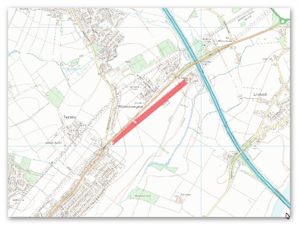
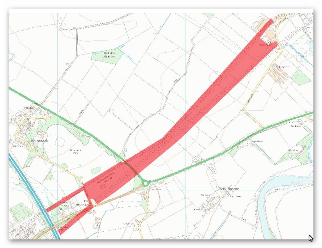
Old OS Map

NY46SW & NY45NW - Section E
NY46SW & NY45NW – Section E

LiDAR Map

NY46SW & NY45NW Section E -  Wall in Yellow -Vallum in Green
NY46SW & NY45NW Section E – Wall in Yellow -Vallum in Green

Google Earth Map

GE view showing the path of the Wall compared to the Vallum

Historic England Scheduled Monuments within Section E

Name: Hadrian’s Wall and vallum between the field boundary west of Wall Knowe and Scotland Road including the Roman fort at Stanwix in wall mile 65
Designation Type: Scheduling
Grade: Not Applicable to this List Entry
List UID: 1017948

Name: Hadrian’s Wall between Tarraby and Beech Grove, Knowefield in wall miles 64 and 65
Designation Type: Scheduling
Grade: Not Applicable to this List Entry
List UID: 1017946

Name: Hadrian’s Wall between Houghton Road and Tarraby in wall mile 64
Designation Type: Scheduling
Grade: Not Applicable to this List Entry
List UID: 1017945

Name: Hadrian’s Wall between the M6 motorway and the property boundaries to the east of Houghton Road in wall mile 64
Designation Type: Scheduling
Grade: Not Applicable to this List Entry
List UID: 1017942

Name: Hadrian’s Wall vallum between the boundaries north of the properties on Whiteclosegate and the field boundary west of Wall Knowe in wall miles 64 and 65
Designation Type: Scheduling
Grade: Not Applicable to this List Entry
List UID: 1017947

Name: Hadrian’s Wall vallum between Drawdykes Castle and Whiteclosegate in wall mile 64
Designation Type: Scheduling
Grade: Not Applicable to this List Entry
List UID: 1017944

Name: Hadrian’s Wall and vallum between Birky Lane at Walby and the east side of the M6 in wall miles 62 and 63
Designation Type: Scheduling
Grade: Not Applicable to this List Entry
List UID: 1010980

Name: Hadrian’s Wall and vallum between Baron’s Dike and Birky Lane at Walby, in wall miles 60, 61 and 62.
Designation Type: Scheduling
Grade: Not Applicable to this List Entry
List UID: 1010979

Analysis of the GE map and English Heritage scheduled monuments confirms the termination point of the Vallum.  Their report of these monuments suggests that:

HE: 1017948
HE: 1017948

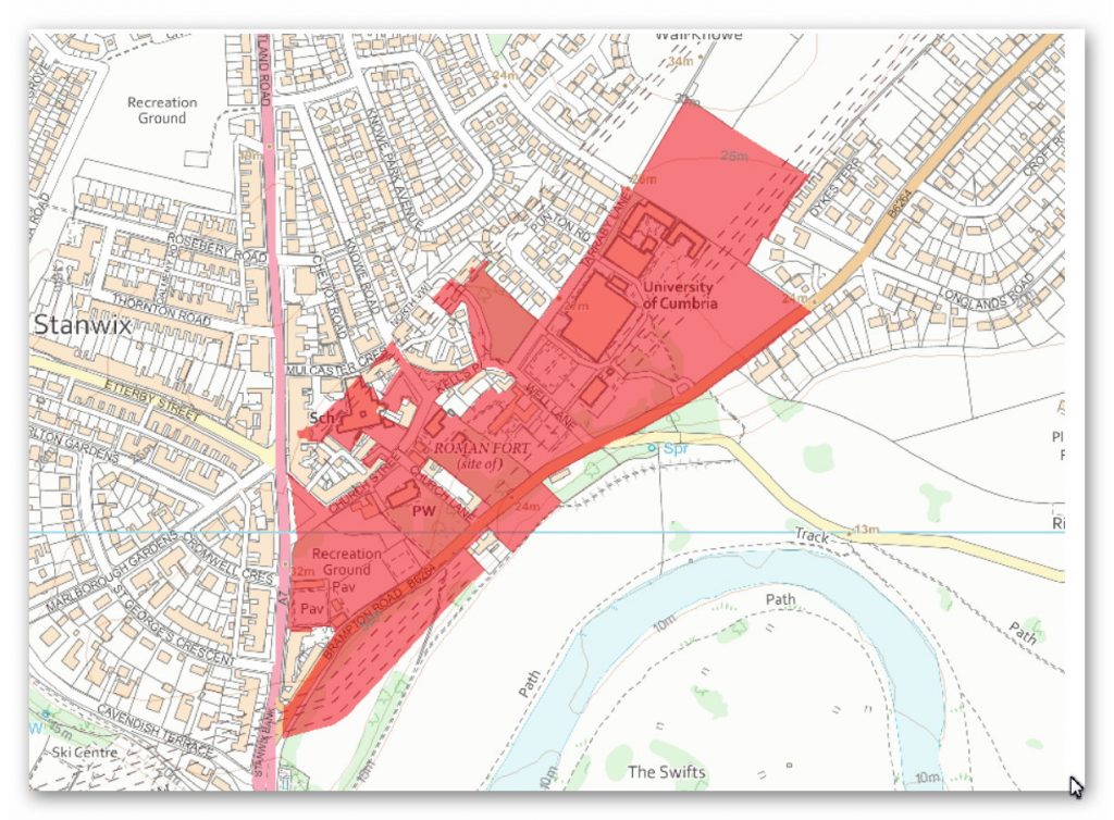
The monument includes the section of Hadrian’s Wall and associated features including a significant area of the site of the Roman fort at Stanwix, and the vallum between the field boundary west of Wall Knowe in the east and the east side of Scotland Road in the west. The Wall, vallum and the fort at Stanwix are situated on the crest of a ridge on the north side of the River Eden, with extensive views to the south across the city of Carlisle towards the northern Pennines, the Eden valley, and the Lake District fells, and also with views to the north for up to 5km.

Hadrian’s Wall survives as a buried feature throughout this section with no indications of the Wall or the wall ditch visible on the ground. The Wall in this section was initially built in turf, and later converted into a stone wall, possibly in the second half of the second century AD. A length of the stone-built Wall was found in excavations by Simpson in 1932 within the playground of Stanwix Primary School. An evaluation by Carlisle Archaeological Unit in 1997, also within the school playground, found a turf feature 7m to the rear of the Stone Wall, possibly remains of the primary Turf Wall.

Much of the course of the Wall adjacent to the fort is covered by housing and gardens, and these areas are not included in the scheduling as the extent of survival of the remains here has not been confirmed. The precise location of turret 65b has not yet been confirmed but on the grounds of the usual spacing it is likely to have been replaced by the fort at Stanwix when the latter was constructed. It would have been constructed at the same time as the Turf Wall and would have been identical in form to other Turf Wall turrets as a square tower the same width (6m) as the Turf Wall. It has not yet been confirmed whether turret 65b was replaced by the fort before or after the replacement of the Turf Wall by the Stone Wall.

The Roman fort on the Wall at Stanwix is known from excavations which have established the extent of its defences. It is thought the fort faced east, with its long axis parallel to Hadrian’s Wall. Its measurements until recently were considered to be 176m north-south by 213m east-west, arising from the evidence of the excavations by Simpson in 1932. The stone wall found was thought to have formed the north wall of the fort. Further excavations in 1940 by Simpson and Richmond on the other sides confirmed the position of the other three sides of the fort, including two parallel western ditches, the south west corner, a short length of the south wall and two fort ditches.

Part of an interval tower belonging to the south defences was found in the grounds of Stanwix House, and the east wall and a fort ditch was found where Romanby Close now runs. A linear earthwork at the southern end of the churchyard appears to reflect the line of the southern defences. Excavations in 1984 by Carlisle Archaeological Unit in the former gardens of Nos 24-28, Scotland Road, now the car park of the Cumbria Park Hotel, discovered a previously unknown north fort wall and interval tower 18m north of the wall found by Simpson, which suggests that the fort was at some time enlarged northwards, giving an overall north-south dimension of 194m. This would have made it the largest fort on Hadrian’s Wall extending over an area of 3.96ha.

The garrison is known from epigraphic evidence to have been the ala Petriana, which was the only thousand-strong auxiliary cavalry unit in Britain. The Roman name of the fort was traditionally thought to be Petriana, but recent research has suggested that this name arose from a scribal error in Roman times which confused the fort’s name and the occupying unit. Its true name was probably Uxelodunum, which means `high place’ and suits the fort’s topographically commanding position. Details of the internal layout are only partly known. The excavations in 1932 by Simpson revealed buildings parallel to the fort’s north wall although their function is unknown, and the excavations in 1940 by Simpson and Richmond in the southern part of the school yard of Stanwix Primary School revealed part of a granary and a further unknown building.

The walls of the granary are currently marked in red concrete in the school playground surface. An evaluation by Carlisle Archaeological Unit in 1997 confirmed several of the features identified by Simpson, and established that the buried remains survive well up to 1.5m in depth between 0.2m and 0.4m below the playground surface. All the remains of the fort survive only as buried features with no remains visible on the ground surface. A clay feature, interpreted as the parade ground attached to the fort, has been identified in excavations by Carlisle Archaeological Unit in 1991 and 1992 in the dip in the land east of the fort in the grounds of Cumbria College of Art. It consisted of a dump of clay up to 0.6m deep with a metalled surface which had been laid over a buried land surface containing traces of pre-Wall cultivation. This in turn had been cut by a Roman military ditch pre-dating the parade ground.

The full extent of the parade ground has not yet been defined but it does not extend as far eastwards as the field boundary which marks the eastern limit of the monument and is confined by the line of Hadrian’s Wall to the north and the fort to the west. The parade ground is not visible on the ground surface and survives wholly as a buried feature. The full extent of the civil settlement, known as a vicus, belonging to the fort at Stanwix has not yet been confirmed, but it is known from excavations to have extended both to the east and west of the fort. There are no remains visible above ground and it survives entirely as buried remains.

A series of ditches associated with second century AD pottery is known from excavations by Smith in 1976 on the site of Vallum Close adjacent to Brampton Road. As the remains here were totally excavated, this area is not included in the scheduling, although the area immediately to the west, south of the vallum, is included. Observations of development on the site of the former Miles McInnes Hall by Caruana in 1986 also found traces of buildings and occupation belonging to the civil settlement on the west side of the fort, dated to the second half of the the second century AD. As the remains here were totally destroyed by development, this area is also not included in the scheduling. It is possible that the civil settlement may have extended further towards Carlisle although this has not yet been confirmed. It is unlikely that the area south of the fort below the steep river cliff was occupied because of the flood plain of the river.

The cemetery belonging to the fort lay east of the fort and is known from the chance discovery of cremation urns in Croft Road in 1872 and again from the construction of houses in Croft Road in 1936. The full extent of the cemetery has not yet been confirmed and the area of these discoveries has not been included in the scheduling as the survival of remains in the built-up area has not been confirmed. There is a strong possibility that the western part of the cemetery may lie within the area of protection. Two tombstones originating from the cemetery at Stanwix have been recovered, one of Marcus Troianus Augustus and the other of a cavalryman, but both have been moved, one to Drawdykes Castle and the other to the Senhouse Museum, Maryport.

The course of the road, known as the Military Way, that ran the length of Hadrian’s Wall connecting forts, milecastles and turrets has not been confirmed in this section. However a metalled road up to to 10m wide was identified in the excavations by Smith in 1976, in the adjoining scheduling to the east. This road ran south of and close to the Wall and was in use in the medieval period but it may have followed the line of the Military Way, the line being spread with continued use.

The deviation of Tarraby Lane from the line of the Wall west of Wall Knowe to run straight towards the probable position of the east gate of the fort would suggest that it follows the line of the Military Way. The line of the road on the west side of the fort has not yet been identified. Military Way is not visible on the ground and it survives as a buried feature.

The course of the vallum is known at either end of the monument from excavations. The vallum was located by excavation 100m east of Dykes Terrace by Simpson in 1932, and again immediately west of Dykes Terrace in excavations by the English Heritage Central Excavation Unit under Smith in 1976. Excavation in Rickerby Park by Simpson in 1934 has confirmed the course of the vallum west of the fort, including the turn of the ditch towards Hadrian’s Wall before it descends Stanwix Bank towards the river.

The course of the vallum was unsuccessfully sought south of the fort in excavations by Simpson in 1933 and 1934, when a ditch that was found and initially thought to be the vallum ditch turned out to be the south ditch of the fort. The course of the vallum south of the fort has not yet been confirmed although it is possible that erosion of the steep cliff above the river flood plain may have resulted in loss of some of the vallum south of the fort.

HE: 1017946
HE: 1017946

Milecastle 67 (Stainton) is a conjectured – Milecastle of the Roman Hadrian’s Wall. The location of the mile fort was determined by measuring the distance from neighboring mile forts. In 1861, some Roman coins were recovered from this point at the southern end of the railway viaduct over the Eden. However, upon follow-up, no remains or other evidence of its existence could be found.

HE: 1017942
HE: 1017942

Hadrian’s Wall survives as a buried feature throughout this section with no remains visible above ground. The course of the Wall has been confirmed by observations by Simpson in 1941 during the construction of Hadrian’s Camp, when the flag footings and the first course of masonry of the stone wall was found to survive. At the same time the ditch north of the Wall was exposed and excavated, its depth being recorded as 3.96m. Subsequent excavations in 1961 by Colonel Fane Gladwin found that the building of the World War II army camp had not affected the remains of the Wall which lay approximately 0.25m below the surface of the modern turf cover. Hadrian’s Wall in this section was initially built of turf before it was rebuilt in stone in the second half of the second century AD, and the 1961 excavations recorded remains of the turf surviving below the remains of the stone wall.

Milecastle 64 was located in 1962 during excavations by Fane Gladwin, 104m west of Brunstock Beck. It was of short axis type, being wider east-west than north-south, and measured internally 17.83m across east-west and 14.63m north- south. Its walls were found to have been extensively robbed but part of the north wall survived as far as the first course of facing stones. The north gateway, which was 3m wide, had been blocked at some stage. A cobbled road 5m wide ran through the centre of the milecastle, and outside the west wall was a cobbled area. The remains of Milecastle 64 survive below the turf cover as buried remains.

The precise location of turret 64a has not yet been confirmed but its remains are expected, on the basis of the usual spacing, to survive approximately 150m west of Centurion’s Walk, where the Wall changes direction.

The course of the Roman road, known as the Military Way, which ran along the corridor between the Wall and vallum linking forts, milecastles and turrets, has not yet been confirmed in this section. However a cobbled road at least 9m wide was found in the excavations of 1961 by Fane Gladwin to the rear of the Wall which was thought to be medieval in date, but which may have been utilising the line of the Military Way. The remains of the Military Way are expected to survive below the turf cover as buried remains.

HE: 1017947
HE: 1017947

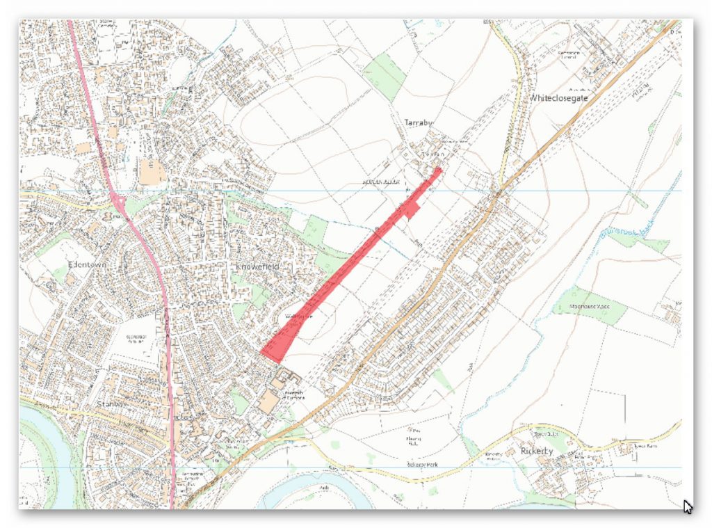
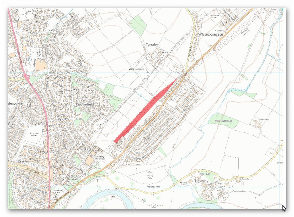
The monument includes the section of the vallum between the boundaries north of the properties on Whiteclosegate in the east and the field boundary west of Wall Knowe in the west. The vallum in this length runs through open fields on the south side of Wall Knowe, approximately 160m south of Hadrian’s Wall. The line of the vallum ditch is visible in the eastern part of this section as a broad depression 10m wide and 0.5m deep. The vallum’s banks have been reduced and dispersed by cultivation in the past and survive as buried remains.

HE: 1017944
HE: 1017944

The monument includes the section of Hadrian’s Wall vallum between Drawdykes Castle in the east and Whiteclosegate in the west.

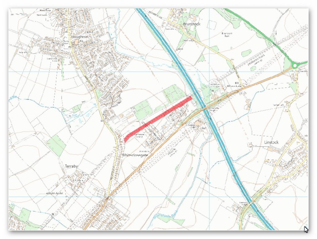
The vallum is visible as an earthwork throughout this section, although the profile of the vallum has been reduced by cultivation in the past especially towards the western end. The ditch is visible as a broad linear depression up to 9m wide and 1m deep. The vallum banks have been reduced and dispersed by past ploughing and are faintly visible above ground as broad swellings either side of the vallum ditch. The mounds survive mainly as buried features.

HE:1010980
HE:1010980

The monument includes the section of Hadrian’s Wall and vallum and their associated features between the west side of Birky Lane at Walby in the east and the east side of the M6 motorway in the west. Hadrian’s Wall survives as a buried feature throughout this section with no remains visible above ground except for a low amorphous turf covered mound at Brunstock Park.

However, a geophysical survey in 1981 and trial excavations by the Cumbria and Lancashire Archaeological Unit in 1989 have confirmed the course of the Wall at various points along this section. The wall ditch survives intermittently as an upstanding earthwork in this section. At Brunstock Park the ditch is 8m-9m wide and 1.2m deep. It is cut in the east by a tractor crossing. Excavations were carried out here by Haverfield in 1894. Approximately 120m west of Walby Hall excavations by Goodburn in advance of the laying of a gas pipeline in 1975 encountered the ditch which measured 10.5m wide and 3.7m deep. Elsewhere the ditch is silted up but can be traced as a very faint depression in the fields, 0.15m deep.

A geophysical survey in 1981 has shown that the wall ditch runs fractionally north west of its mapped line in two transects east of the electricity pylon line. Milecastle 63 probably survives as a buried feature. A geophysical survey in 1981 produced strong indications that it was located at a position WNW of the ninety degree bend in Birky Lane south of the poultry houses. The site has not been excavated so this location has not yet been confirmed to be that of milecastle 63. The exact locations of turrets 62a, 62b, 63a and 63b have not yet been confirmed. They are expected to be located at the usual spacings between the milecastles, approximately 500m apart.

The position of the Roman road known as the Military Way, which ran along the corridor between the Wall and the vallum linking turrets, milecastles and forts, has not yet been confirmed throughout this section. The only part of it which is known is a short section found during excavation by Haverfield in 1894 approximately 80m west of the minor road between Houghton Hall and the B6264 road, 40m south of the extant wall ditch. The excavation revealed a denuded road, 6.5m wide, flanked by small side ditches. Elsewhere its remains survive as buried features.

The vallum survives as slight earthwork visible on the ground in Brunstock Park. The broad line of the ditch averages 0.4m deep and the ploughed down north and south mounds stand 0.2m high. Excavation of part of the vallum was carried out here by Haverfield in 1894. Elsewhere in this section its remains survive as buried features with no remains visible above ground. However, its course has been confirmed through geophysical survey in 1981 and in 1991.

The various transects show that between Walby and the `pinch’ where the Wall and vallum are closest, the actual course of the vallum lies slightly to the north of where the course is depicted on Ordnance Survey maps. Excavations by Goodburn in 1975 in advance of the laying of a gas pipeline south west of Walby Hall located the vallum ditch 36m to the north of the line shown on the Ordnance Survey maps.

HE:1010979
HE:1010979

The monument includes the section of Hadrian’s Wall and vallum and their associated features between Baron’s Dike in the east and the west side of Birky Lane at Walby in the west.

Hadrian’s Wall survives as a buried feature throughout this section. Its course is depicted on MacLauchlan’s survey of the 1850s, but this course has not been confirmed in modern times. The Wall and its ditch were located during an excavation in advance of pipe laying east of Walby. The wall ditch survives as an intermittent earthwork visible on the ground in the east half of this section, which also serves as a reliable guide to the course of the Wall here. Where visible the partly silted ditch averages 0.3m-0.8m deep with a modern drain cut into its base. Elsewhere the ditch is visible as a broad and shallow depression in the fields averaging 0.2m deep, also with a drain cut into its base. Its course has been confirmed in places through geophysical survey in 1981. In this section the ditch upcast mound, usually referred to as the glacis, survives as a feature faintly visible on the ground; elsewhere it survives as a buried feature.

The exact location of milecastle 61 has not yet been confirmed. On the basis of the usual spacing it is expected to be located near Wallhead. A geophysical survey in 1981 located the probable remains of the milecastle. The locations of milecastle 62 and turrets 61a and 61b have not yet been confirmed. On the basis of the usual spacing milecastle 62 is expected to be situated approximately 300m east of Walby Grange. Turrets 61a and 61b are expected to be situated at the usual distances between milecastles 61 and 62.

The course of the Roman road known as the Military Way, which ran along the corridor linking turrets, milecastles and forts, has been identified for a short distance to the east of Wallhead. There are no remains visible on the surface except for a short section of a turf covered mound, 4m-5m wide and up to 0.4m high. Its course was confirmed during excavation in 1894 by Haverfield. The road consisted of a gravel layer laid over larger stones with a stone kerb and central spine. Its survival here was confirmed by geophysical survey in 1981. However, the unusual survival of this section suggests the possibility that it was reused in the medieval period serving as access to Bleatarn Quarry.

South east of Wallhead the vallum survives as a slight earthwork visible on the ground as four parallel mounds, the most prominent ones being up to 1.2m high. Excavations by Hodgson took place here in 1894-5. Elsewhere the vallum survives as a buried feature with no remains visible on the ground except for a slight depression over the vallum ditch in a field 600m east of Walby Grange. However, the course shown on the Ordnance Survey map has been confirmed throughout this section by geophysical survey carried out in 1981. With the exception of the area to the east and south of Walby where three geophysical transects south of Walby Grange and Walby Croft showed the line of the vallum running about 40m north of the position given on Ordnance Survey maps. An excavation cut about 750m east of Walby Grange at the same time as the survey confirmed that the features picked up on the geophysical survey were those of the vallum.

Analysis of this section shows that the Wall follows the high ground and the Vallum seems to dip into the higher water levels of the River Eden. If the builders wished to miss the water/marshland for the Vallum – they could have easily built both the Vallum and Wall a few hundred metres to the north and comidate both – but they didn’t for the only obvious reason of flooding the Vallum ditch with water.

Investigation

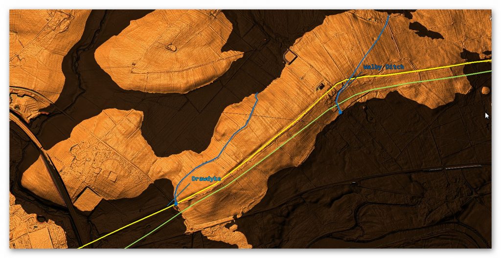
The Vallum in this section seems to appear some distance from the river Eden to the West Side – but this could be due to building work in recent years. The course of the Vallum stays on or very close to the raised height of the River Eden which we suspect is feeding the Vallum ditch with water. We have noticed in the LiDAR map a probable prehistoric Dyke feeding into and past the Vallum and Wall terminating in the raise water levels of what is now known as Brunstock Beck to the North. The strange ‘KINK’ (which is now a road) suggests that this was a Dyke that was at a later date altered to be the current road with unusually large impression on the landscape – this is proven as the Wall takes a straight line at this point where the road heads in a totally different direction then corrects itself for no apparent reason. This close connection to Dykes can also be found in placenames were the Vallum passes such as Drawdykes Castle and Baron’s Dike.

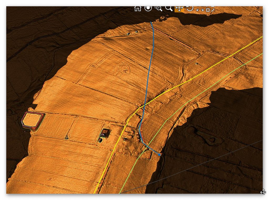
The Prehistoric Dyke in blue cutting and joining to the Vallum in Green
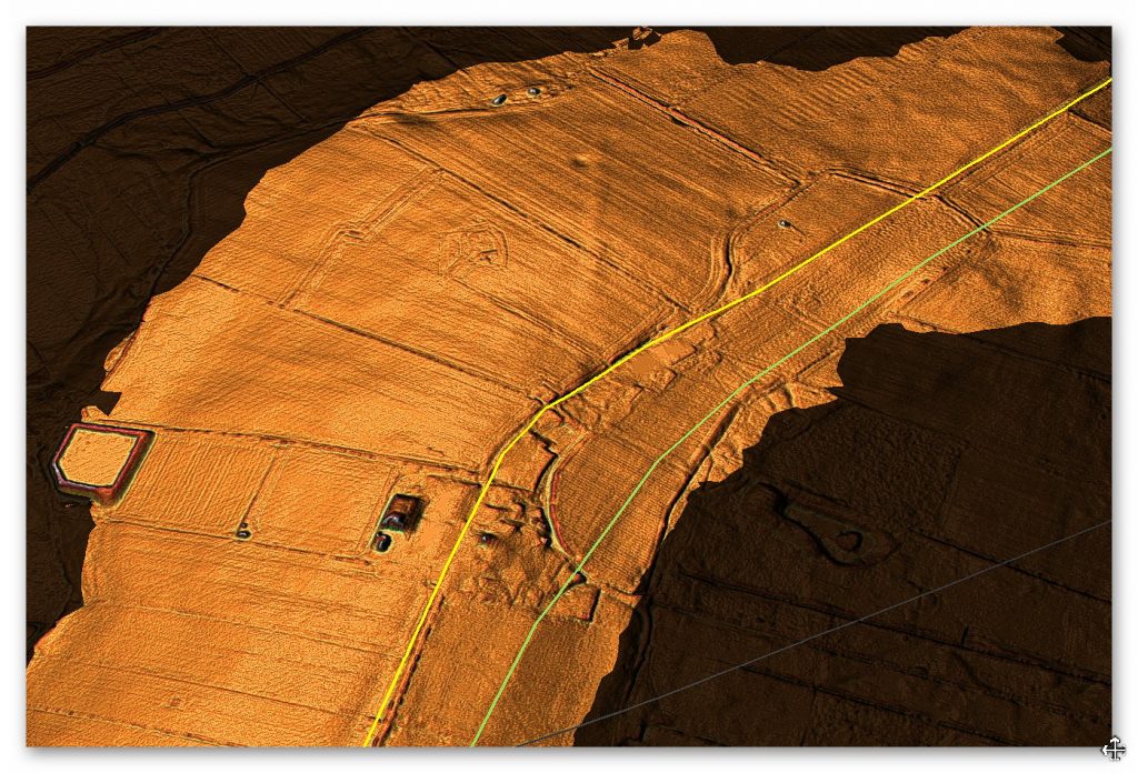
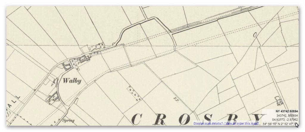
The unusual deep ditch known as Walby and the raised linear bank in alignment
Walby (part of the Dyke) is feed by a natural spring with an unnatural kink which should have followed the Wall line
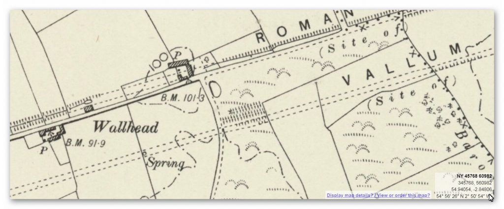
Another Natural Spring is in the base of the Vallum at Wallhead - this would have flooded the Vallum
Another Natural Spring is in the base of the Vallum at Wallhead – this would have flooded the Vallum

Not only do we see the Wallum dip into Paleochannels – we can see that some are deliberately built over springs which would have flooded the Vallum. But this is not the only prehistoric Dyke to intersect with the Vallum – This is either bad engineering or a deliberate attempt to flood the Vallum with water to make it a canal. Moreover, the dyke/Water connection is found at Drawsdyke where there is a bridge and Castle named after it. Both Prehistoric Dykes connect with the same two water sources – Eden River to the South and Brunstock Beck in the North.

Wallhead with higher water levels

To understand the problem with Hadrian’s Walls history read our article HERE.

Further Reading

For information about British Prehistory, visit www.prehistoric-britain.co.uk for the most extensive archaeology blogs and investigations collection, including modern LiDAR reports.  This site also includes extracts and articles from the Robert John Langdon Trilogy about Britain in the Prehistoric period, including titles such as The Stonehenge Enigma, Dawn of the Lost Civilisation and the ultimate proof of Post Glacial Flooding and the landscape we see today.

Robert John Langdon has also created a YouTube web channel with over 100 investigations and video documentaries to support his classic trilogy (Prehistoric Britain). He has also released a collection of strange coincidences that he calls ‘13 Things that Don’t Make Sense in History’ and his recent discovery of a lost Stone Avenue at Avebury in Wiltshire called ‘Silbury Avenue – the Lost Stone Avenue’.

Langdon has also produced a series of ‘shorts’, which are extracts from his main body of books:

The Ancient Mariners

Stonehenge Built 8300 BCE

Old Sarum

Prehistoric Rivers

Dykes ditches and Earthworks

Echoes of Atlantis

Homo Superior

For active discussions on the findings of the TRILOGY and recent LiDAR investigations that are published on our WEBSITE, you can join our and leave a message or join the debate on our Facebook Group.
Section D – NY35NE

Section D – NY35NE – this is a section of Hadrian’s Wall showing the LiDAR, Google Earth and 1800 Maps of the Area covered by Historic England

Historic England Sections:

Hadrian’s Wall – between the east end of Davidson’s Banks and road to Grinsdale and vallum between Davidson’s Banks and dismantled railway in wall miles 66, 67 and 68
List UID: 1018309, 1007248

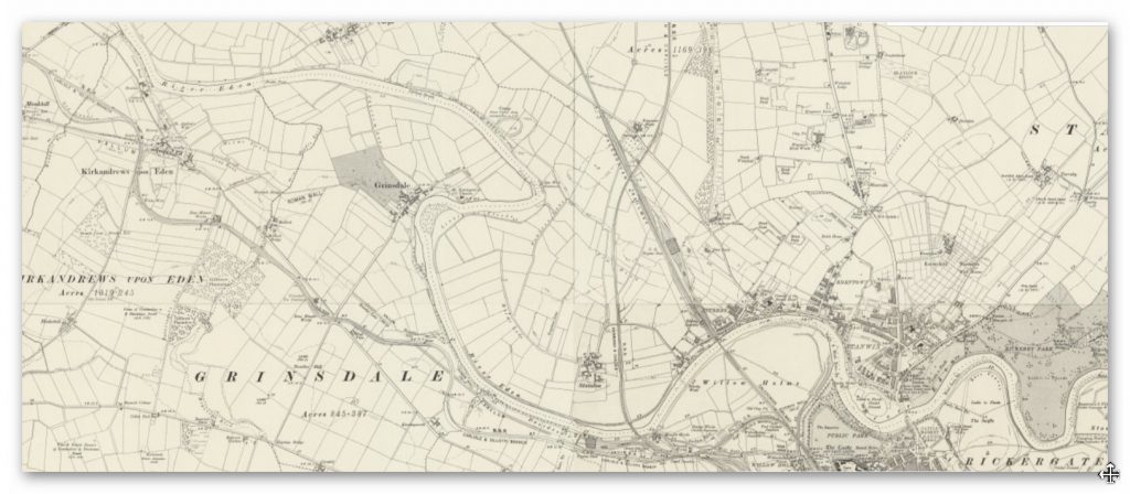
Old OS Map

Section D – NY35NE
NY35NE

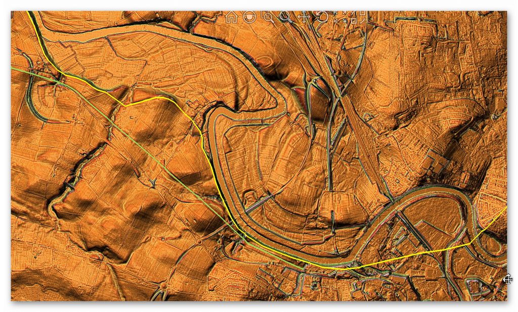
LiDAR Map

Section D – NY35NE
NY35NE Sector C – Wall in Yellow -Vallum in Green

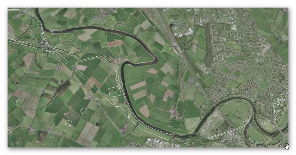
Google Earth Map

Section D – NY35NE
GE view showing the strange path of the Wall compared to the Vallum

Historic England Scheduled Monuments within Section D

Name: Hadrian’s Wall between the east end of Davidson’s Banks and road to Grinsdale and vallum between Davidson’s Banks and dismantled railway in wall miles 67 and 68
Designation Type: Scheduling
Grade: Not Applicable to this List Entry
List UID: 1018309

Name: Hadrian’s Wall and vallum in wall mile 66, Stanwix Bank to Stainton
Designation Type: Scheduling
Grade: Not Applicable to this List Entry
List UID: 1007248

Analysis of the GE map and English Heritage scheduled monuments confirms the termination point of the Vallum.  Their report of these monuments suggests that:

1018309
1018309

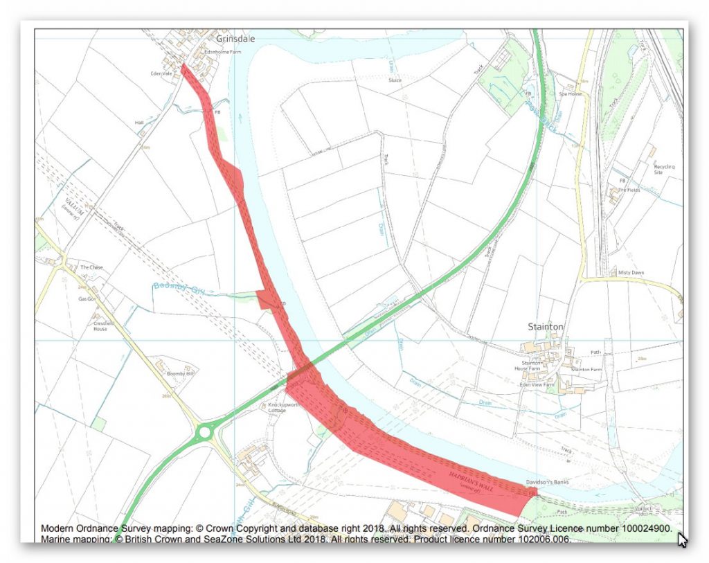
The monument includes the section of Hadrian’s Wall and it’s associated features between the eastern end of Davidson’s Banks in the east and the road to Grinsdale in the west and the vallum and it’s associated features between Davidson’s Banks in the east and the dismantled railway, north of Knockupworth Cottage in the west.

Hadrian’s Wall survives as a buried feature throughout the whole of this section with no remains visible above ground. Its course as depicted on Ordnance Survey maps is based on MacLauchlan’s 1857 survey. The course follows the crest of the river cliff overlooking the River Eden to the north. There was probably no wall ditch along this section as the steep river cliff, which is now being eroded back by the river, would have rendered a ditch here superfluous.

The exact location of milecastle 68 has not yet been confirmed. However, on the basis of the usual spacing, it is expected to be located in the wood to the north of Boomby Gill. Surface remains of robber trenches were noted here in 1972 but these have not been confirmed since.

The exact locations of turrets 67a, 67b and 68a have also not yet been confirmed. On the basis of the usual spacing they are anticipated to lie on the line of the wall about 100m west of the path at the east end of Davidson’s Banks, below the electricity transmission lines which cross Davidson’s Banks and 240m ESE of the Recreation Hall on the road to Grinsdale respectively.

The course of the vallum is known throughout most of this section. It survives as a slight intermittent earthwork visible on the ground as a low depression averaging 30m wide. The north mound survives up to 0.5m high at the east end of this section with crossings still evident.

The course of the Roman road known as the Military Way, which ran along the corridor between the Wall and the vallum linking turrets, milecastles and forts, has not yet been confirmed in this section.

1017248
1017248

Milecastle 67 (Stainton) is a conjectured – Milecastle of the Roman Hadrian’s Wall. The location of the mile fort was determined by measuring the distance from neighboring mile forts. In 1861, some Roman coins were recovered from this point at the southern end of the railway viaduct over the Eden. However, upon follow-up, no remains or other evidence of its existence could be found.

Investigation

NY35NE - The Wall follows the line of the Enlarged River Eden
NY35NE – The Wall follows the line of the Enlarged River Eden

Analysis of this section shows that the Wall follows the shoreline of the enlarged River Eden, as shown in section A, B and C. As supported by the lack of any entry details in the Scheduled Monuments description – to the East of the section, the raised waters of the past reveal no evidence of any wall or the expected Mile 66 station post.

Track of Wall in West Section when River Eden was Higher
GE shows no signs of a Wall in this area
OS Shows where they believed the Wall was constructed

The path of The Wall in this section and the dissapearance of the Wall in the West is a clear indication that ‘Post-Glacial Flooding’ occured diirectly after the last ice age and kept rivers high even during the Roman period only 2,000 years ago.

The Roman Shoreline of the River Eden

Vallum

The Vallum in this section seems to dissapear long before the current River Eden. As we have already shown the River Eden was larger than today during the building of the Wall as it follows the path of the heightened river. This is not the case for the Vallum, as we can see from the large distances between the Wall and the Vallum. This can only be explained by the Vallum being built some time before the Wall and on a shoreline more flooded.

Vallum Showing it terminated at the end of the Eden

The above LiDAR map shows the Vallum not only terminating at the edge of the River Eden but going through the shorelines of the heightened river. This again is a clear indication that the Vallum was a canal that required frequent ‘topping up’ by rivers and stream feeding directly into the ditch.

To understand the problem with Hadrian’s Walls history read our article HERE.

Further Reading

For information about British Prehistory, visit www.prehistoric-britain.co.uk for the most extensive archaeology blogs and investigations collection, including modern LiDAR reports.  This site also includes extracts and articles from the Robert John Langdon Trilogy about Britain in the Prehistoric period, including titles such as The Stonehenge Enigma, Dawn of the Lost Civilisation and the ultimate proof of Post Glacial Flooding and the landscape we see today.

Robert John Langdon has also created a YouTube web channel with over 100 investigations and video documentaries to support his classic trilogy (Prehistoric Britain). He has also released a collection of strange coincidences that he calls ‘13 Things that Don’t Make Sense in History’ and his recent discovery of a lost Stone Avenue at Avebury in Wiltshire called ‘Silbury Avenue – the Lost Stone Avenue’.

Langdon has also produced a series of ‘shorts’, which are extracts from his main body of books:

The Ancient Mariners

Stonehenge Built 8300 BCE

Old Sarum

Prehistoric Rivers

Dykes ditches and Earthworks

Echoes of Atlantis

Homo Superior

For active discussions on the findings of the TRILOGY and recent LiDAR investigations that are published on our WEBSITE, you can join our and leave a message or join the debate on our Facebook Group.
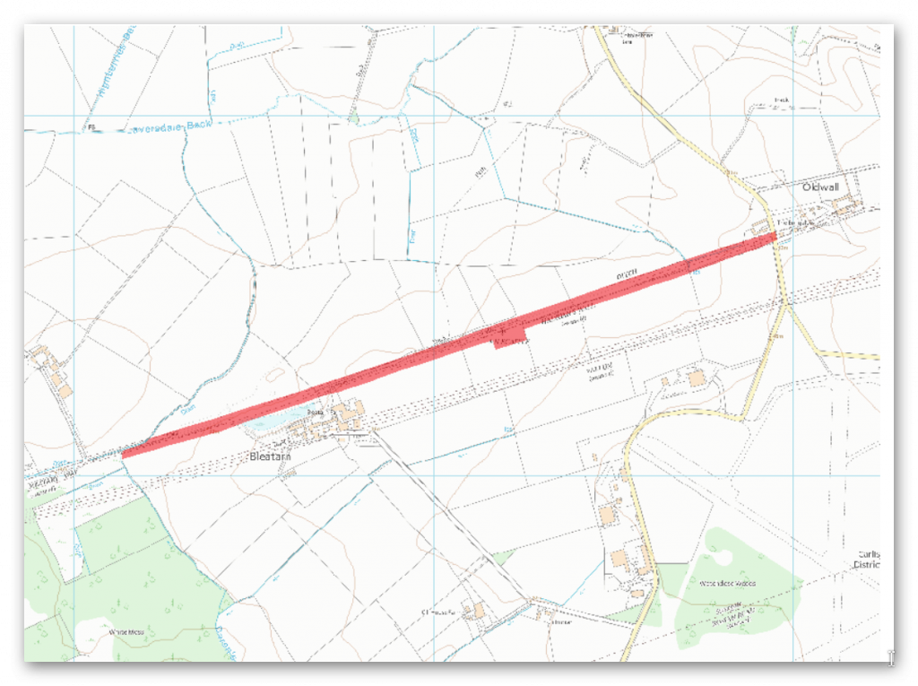
Section C – NY35NW

Section C – NY35NW – this is a section of Hadrian’s Wall showing the LiDAR, Google Earth and 1800 Maps of the Area covered by Historic England

Historic England Sections:

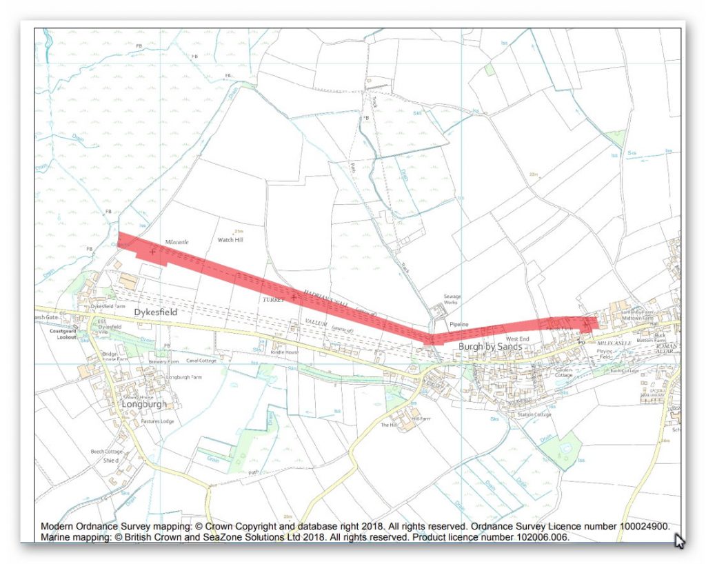
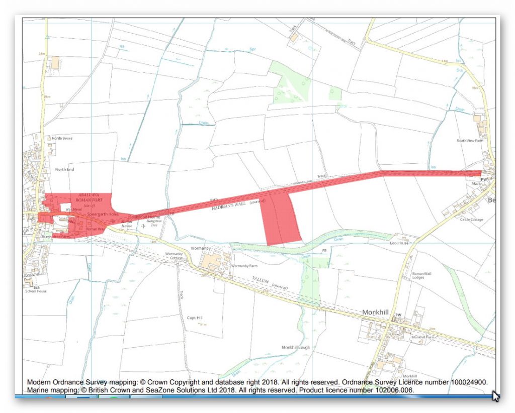
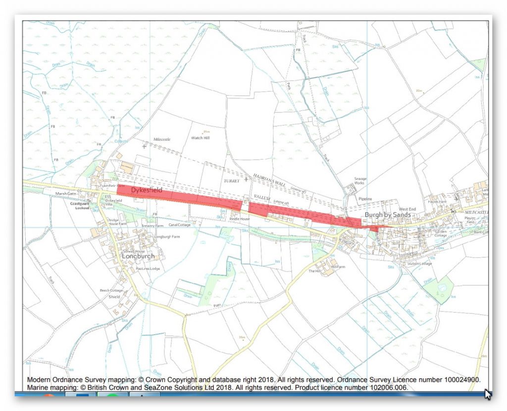
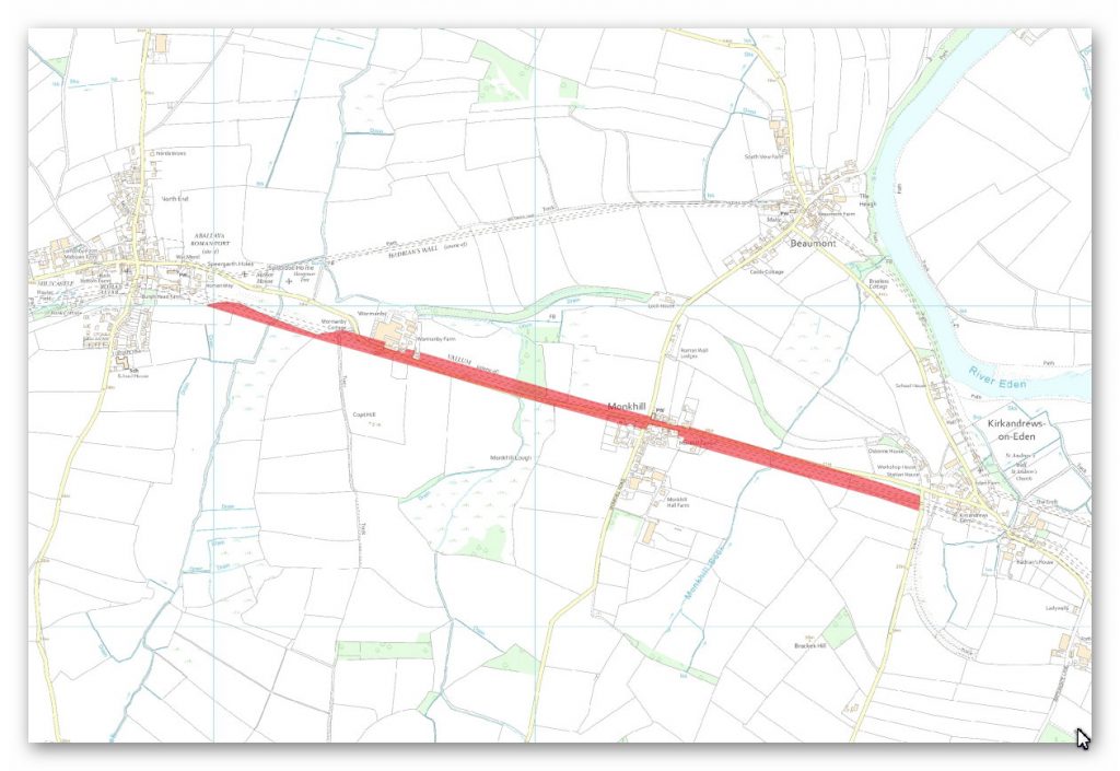
Hadrian’s Wall – between Fulwood House, Burgh by Sands, Dykesfield and Monkhill in wall miles 70, 71,72 and 73
List UID: 1014698, 1018308, 1018457, 1014697

Old OS Map

Section C – NY35NW
NY35NW – 1800 OS

LiDAR Map

NY35NW Sector C -  Wall in Yellow -Vallum in Green
NY35NW Sector C – Wall in Yellow -Vallum in Green

Google Earth Map

GE view showing the strange path of the Wall compared to the Vallum - NY35NW Sector C
GE view showing the strange path of the Wall compared to the Vallum – NY35NW Sector C

Historic England Scheduled Monuments within Section C

Name: Hadrian’s Wall between Fulwood House at Burgh by Sands and Burgh Marsh in wall miles 72 and 73
Designation Type: Scheduling
Grade: Not Applicable to this List Entry
List UID: 1014698

Name: Hadrian’s Wall Vallum between West End, Burgh by Sands and the eastern boundary of Dykesfield
Designation Type: Scheduling
Grade: Not Applicable to this List Entry
List UID: 1018308

Name: Burgh by Sands Roman fort, Beaumont camp, Burgh Castle and Hadrian’s Wall from boundary west of churchyard, Beaumont to Burgh Head in wall miles 70 and 71
Designation Type: Scheduling
Grade: Not Applicable to this List Entry
List UID: 1018457

Name: Hadrian’s Wall vallum between the dismantled railway west of Kirkandrews Farm and the dismantled railway south east of Burgh by Sands in wall miles 70 and 71
Designation Type: Scheduling
Grade: Not Applicable to this List Entry
List UID: 1014697

1014698
1014698

The monument includes the section of Hadrian’s Wall and its associated features between Fulwood House at Burgh by Sands in the east and Burgh Marsh in the west. Hadrian’s Wall survives as a buried feature throughout the whole length of this section with no features visible above ground.

Excavations by Austen at West End in 1986 and subsequent geophysical survey in 1991, north of Rindle House demonstrated that the wall ditch ran approximately 11m north of the wall, a wider distance than is usual. The excavation across the ditch found the expected V-shaped profile, 10m wide at the top and 2.5m deep in the centre. The Wall was initially built of turf in the whole of this sector. The 1986 excavations and further excavations in 1989 by Austen at the site of milecastle 72 found that in the eastern part of the monument, from a point 50m east of the lane crossing the Wall at West End, the turf wall was built on a raft of cobbles 6.1m wide, a previously unrecorded method of construction on Hadrian’s Wall, whereas the rest of the Turf Wall in this section was found in the same excavations by Austen and at the site of turret 72b in 1948 by Simpson to have been constructed by the better known method of stacking turves directly on the soil.

When the Turf Wall was rebuilt in stone at the east end of this monument, the turf superstructure was entirely removed down to the cobble base, which was used as a foundation for the Stone Wall, whereas elsewhere a small amount of the base material of the Turf Wall remained sealed below the Stone Wall. In the vicinity of turret 72a and at turret 72b, the Stone Wall was placed 1.2m from the front of the Turf Wall, presumably to align with the side doors of the turrets to give access onto the wall-top, whereas at milecastle 72 the north face of the Stone Wall coincided with the northern edge of the base of the Turf Wall. The course of the Wall between Fulwood House and West End is now known as a result of these excavations to run a little to the north of the line depicted by the Ordnance Survey, with a slight change in direction southwards indicated 150m west of Fulwood House.

There is no evidence to suggest that Hadrian’s Wall was carried across Burgh Marsh west of Dykefield. No remains have been identified here and hence this area is not included in the scheduling. Milecastle 72 was initially located in 1960 by Bartle and its position was confirmed during excavations by Austen in 1989, its north wall (and the line of Hadrian’s Wall) being found 13m north of the line depicted by the Ordnance Survey. The east wall of the milecastle was found below the farm access track immediately to the west of Fulwood House.

The milecastle was originally built with turf walls, like the adjoining lengths of Hadrian’s Wall on a base of cobbles 6.2m wide. The internal buildings and gateways have not been examined but would have been timber structures. The entire milecastle was replaced in stone, probably in the second half of the second century at the same time as the replacement of the Turf Wall by a stone wall. The north, east and west stone walls of the milecastle were found in the 1989 excavations to survive as buried features and were constructed using a mixture of red and white sandstones. The walls were built 2.2m wide on flag footings, and the east and west walls were placed exactly in the centre of the former turf walls, whereas the north wall of the stone milecastle ran on the northern edge of the former turf north wall. The stone milecastle measured 24.3m across its overall width, with an internal width between the walls of 19m.

The south side of the milecastle has not been identified, but its length was at least 13m. Milecastle 73 was located and partly excavated by Simpson and others in 1948. It measured 18.7m wide and 19.2m long internally. However, the locational information from the excavation is not precise and the exact position of the milecastle has not been confirmed since. Its remains survive as buried features. The exact location of turret 72a has not yet been confirmed. On the basis of the usual spacing it is expected to be located approximately 50m east of West End Cottage. Roman pottery has been found in this area which appears to confirm the location.

The turret probably lies at the junction between the length of Turf Wall constructed on a cobble base and the length built with turves stacked directly on the subsoil. Its remains are expected to survive as buried features. Turret 72b was located by Simpson in 1948 in the north east corner of the field to the north of Rindle House. It was found to be from the original Turf Wall series and it projected 1.2m north of the line of the later Stone Wall. Its remains survive as buried features. The course of the Roman road known as the Military Way, which ran along the corridor between the Wall and vallum linking turrets, milecastles and forts, has not yet been confirmed in this section. It is expected to be located parallel to the course of the Wall a short distance south of it. All field boundaries, buildings and road surfaces are excluded from the scheduling, but the ground beneath them is included.

1018308
1018308

The monument includes Hadrian’s Wall and its associated features between the field boundary at the west side of the churchyard belonging to St Mary’s Church at Beaumont in the east and Burgh Head in Burgh by Sands in the west, as well as Burgh by Sands Roman fort, Beaumont temporary camp south of Hadrian’s Wall and the site of a medieval earthwork castle known as Burgh Castle.

Hadrian’s Wall survives as a buried feature throughout the whole of this section. Its course in the area of Burgh Castle, south east of Speergarth Holes, has been confirmed by excavation by Hogg in 1950. The wall ditch was also confirmed to survive as a buried feature north of the Wall in the 1950 excavation. In addition a further length of the Wall line was confirmed west of Burgh Castle by geophysical survey in 1991. The results of this survey indicate that there are two lines taken by the Wall, the southern one representing the primary Turf Wall running close to the modern road, while the second line heads north west from Burgh Castle and meets the north east corner of the fort, also identified in the geophysical survey.

This more northern line is thought to represent a realignment of the Wall when the fort was built so that the fort lay wholly to the rear of the Wall and did not partly project north of it. This realignment may have been carried out as late as the third century AD. Milecastle 71 survives as a buried feature. Its position was located in 1960 by Bartle although this has not been confirmed since.

According to Bartle it is situated south east of the western end of Milldikes Lane. The precise locations of turrets 70b, 71a and 71b have not yet been confirmed. On the basis of the usual spacing, turret 70b is expected to be located about 540m west of St Mary’s Church to the south of Milldikes Lane, turret 71a near to the footbridge over Greathill Beck, and turret 71b is probably under the site of Burgh fort in the area of the modern graveyard which is totally excluded from the scheduling.

The course of the Roman road known as the Military Way, which ran along the corridor between the Wall and vallum linking turrets, milecastles and forts, has not yet been confirmed in this section. A length of road, 8m wide, is known approximately 60m east of the fort from excavations in 1980 by Jones, but it is uncertain if this was the Military Way or another street within the extra-mural civil settlement.

A Roman temporary camp has been identified 80m to the south of the west end of Milldikes Lane 40m south of the course of Hadrian’s Wall on the gently sloping south facing side of a spur overlooking the Powburgh Beck. Although only the eastern segment of the camp was recorded from crop marks visible on aerial photographs, sufficient remains were identified to allow the full extent of the site to be postulated. The only complete side identified is the east side. The site of the camp is overlain by narrow ridge and furrow, the product of medieval or later cultivation on the site.

The Wall fort at Burgh, known to the Romans as Aballava, lies astride the southern of the two lines of Hadrian’s Wall. Excavation in 1922 by Collingwood confirmed the position of the east wall and gateway as well as observing the stone footings of barrack blocks. Geophysical survey in 1991 provided further confirmation of the north and east sides of the fort as well as indicating that Hadrian’s Wall was realigned to meet the north east corner of the fort. Excavations in 1993 by Flynn confirmed the primary line of the wall ditch at Demesne Farm, 6m wide and 2.2m deep, which was later infilled and buildings associated with the fort constructed on clay and cobble foundations. A Roman altar found at Beaumont in 1934 shows that in the third century the fort was garrisoned by Aurelian Moors.

The full extent of the fort is unknown as the west and south sides of its defences have not been confirmed. The remains of an extra-mural settlement, usually known as a vicus, were discovered beyond the east side of the fort during in 1980 and 1982 by Jones in the garden of the former vicarage. The remains included the foundations of buildings fronting onto a road running east-west. The recovery of large quantities of slag and charcoal indicate that metalworking was taking place. Further indications of vicus buildings were revealed by the geophysical survey in 1991 east of the fort, north of the modern road in the area between the primary wall ditch and the realignment of the Wall to meet the north east corner of the fort. It is likely that the vicus was extensive and extended round both the southern and eastern sides of the fort. As the full extent of the vicus is not yet fully understood, only those remains which have been confirmed to survive are included in the scheduling.

The course of the vallum in this section is known both from observations in the adjacent sections of Hadrian’s Wall to the east and west. A substantial ditch to the south of the former vicarage was discovered in excavations in 1980 by Jones, and, although its full extent was not examined, it is likely to have been the ditch of the vallum. If this is so, the vallum in this section of the monument runs slightly to the north of the line depicted by the Ordnance Survey.

There are no indications of the earthwork visible on the ground and it survives entirely as buried remains. The site of the medieval Burgh Castle was investigated in 1950 and was shown to retain evidence of four phases of activity during the medieval period. A first earthwork motte and bailey was built during the Norman period. Later this evolved into a medieval grange site which in turn was replaced in the late 12th century by a stone-built castle. In the 13th century a hall-building was constructed. This was destroyed c.1339.

1018457
1018457

In 1994 and 2007 small excavations within the village of Burgh by Sands revealed the presence of the central broad ditch of the Vallum, thus confirming its location at the eastern end of this scheduled section. During the course of a geophysical survey in 2002, the very slight earthwork of a broad ditch was noted to the south of the currently scheduled area; this lay immediately north of and parallel to the modern road in fields between Vallum House and Dykesfield.

An excavation at Dykesfield Farm in 2015 confirmed the location of the Vallum on the same alignment as the geophysical signals noted in 2002 and revealed the levelled top of the Vallum ditch to be at least 7.5m wide. It was therefore apparent that the Vallum’s course westward from Burgh by Sands took a different alignment to the line that had been mapped by the Ordnance Survey and subsequently scheduled. Further confirmation of this came with a second archaeological evaluation within the scheduled line of the Vallum in 2015, which demonstrated that there were no relevant archaeological remains in that location. This was further confirmed by a watching brief in 2016, in a different part of the scheduled line of the Vallum, that concluded the area was ‘archaeologically sterile’. Subsequently, the Environment Agency’s Light Detection and Ranging (LiDAR) data, a remote sensing method that uses light in the form of a pulsed laser to measure ranges (variable distances) to the Earth, was released in 2016; it clearly depicts the ditch of the Vallum on this new alignment and confirms that west of Burgh by Sands the Vallum lies about 40m south of the currently scheduled line.

For much of its length in this section, the Vallum survives as a buried feature about 40m across. Its course and survival has been confirmed by small-scale excavation and a series of LiDAR images, the latter clearly showing the central ditch as an infilled, buried feature about 6m across; an archaeological evaluation in 2015 revealed the central ditch to be about 7.5m across. At two locations very slight surface remains are visible: to the west of West End a slight fold in the ground is considered to represent the Vallum ditch, and in woodland immediately to the east of Dykesfield surface traces of the north mound and the extremely slight indications of the Vallum ditch have been noted.

1014697
1014697

The monument includes the section of Hadrian’s Wall vallum between the dismantled railway west of Kirkandrews Farm in the east and the dismantled railway to the south east of Burgh by Sands in the west. The vallum survives intermittently as a feature visible on the ground. However, its surface remains are generally slight and most of the remains survive as buried features. Where visible, the ditch is generally a slight depression averaging 15m wide. However to the west of Greathill Beck it survives up to 2.5m deep. All field boundaries, buildings and road surfaces are excluded from the scheduling, but the ground beneath them is included.

Investigation

NY35NW - start of Wall and Vallum on West side by the old river shoreline
NY35NW – start of Wall and Vallum on West side by the old river shoreline

Analysis of this section shows that the Wall and Vallum disappear for a 2.6 mile stretch without explanation in section B until we add the probably river shorelines as we did with section A. Once these shorelines are added at 8m above todays Esk river height we find a simple explanation for the lost of both the Wall and Vallum – the area is flooded.

This change in the landscape would explain this reappearance of the Wall and Vallum on the raised hillside of NY35NW Section C. Moreover, this raised shoreline would also explain why the wall has not built straight and seems to bend (in two places) with the contours of the landscape as either the valley was waterlogged or extremely marshy and would not support a heavy wall.

A second kink in the Wall mimics the shoreline of the landscape

Again as shown in section A and B the Vallum seems very independent of the wall and only mimics its alignment in a few places. This would indicate that it predates the wall and may have been used to bring the stone to the Wall as there is no evidence of any Roman roads being present in this section.

The flyover shows that the predicted path of the Wall is probably incorrect as shown in both the Scheduled Monument and OS Maps as more obvious locations for the defensive ditch are close by. One of these ditches at the end of Section C is known as Milldikes Lane, which is clearly from the name and depth of the ditch was once a prehistoric Dyke, which would have been a natural ditch for the Wall?

Milldikes Lane is clearly a Prehistoric Dyke and the most probable Wall ditch
Vallum

The Vallum is equally poorly defined in OS and the Scheduled Monuments register which can again be seen in the LiDAR maps. The railway confuses this process as it reused an old Canal – which may have been the original. The Excavations in this area suggest the WALL was made of Turf before stone was introduced – but you have already have a ‘turf’ barrier in the form of the Vallum? So are we looking at the Wall being built in the alignment of a prehistoric Dyke linear ditch and Bank?? This alignment seems to be confirmed at the Western point of the Vallum as it starts at a town called ‘Dykesfield’.

To understand the problem with Hadrian’s Walls history read our article HERE.

Further Reading

For information about British Prehistory, visit www.prehistoric-britain.co.uk for the most extensive archaeology blogs and investigations collection, including modern LiDAR reports.  This site also includes extracts and articles from the Robert John Langdon Trilogy about Britain in the Prehistoric period, including titles such as The Stonehenge Enigma, Dawn of the Lost Civilisation and the ultimate proof of Post Glacial Flooding and the landscape we see today.

Robert John Langdon has also created a YouTube web channel with over 100 investigations and video documentaries to support his classic trilogy (Prehistoric Britain). He has also released a collection of strange coincidences that he calls ‘13 Things that Don’t Make Sense in History’ and his recent discovery of a lost Stone Avenue at Avebury in Wiltshire called ‘Silbury Avenue – the Lost Stone Avenue’.

Langdon has also produced a series of ‘shorts’, which are extracts from his main body of books:

The Ancient Mariners

Stonehenge Built 8300 BCE

Old Sarum

Prehistoric Rivers

Dykes ditches and Earthworks

Echoes of Atlantis

Homo Superior

For active discussions on the findings of the TRILOGY and recent LiDAR investigations that are published on our WEBSITE, you can join our and leave a message or join the debate on our Facebook Group.
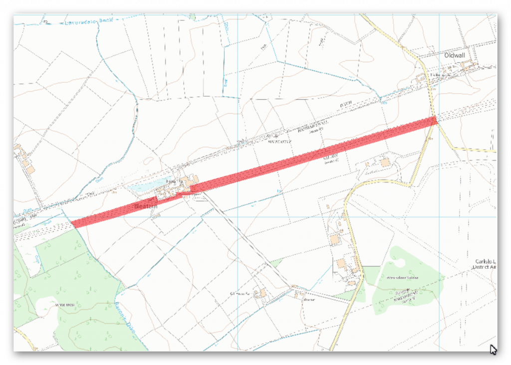
Section B – NY25NE & NY26SE

Section B – NY25NE & NY26SE – this is a section of Hadrian’s Wall showing the LiDAR, Google Earth and 1800 Maps of the Area covered by Historic England

Historic England Sections: Hadrian’s Wall  – Drumburgh Roman fort between Burgh Marsh and Westfield House in wall miles 76 and 77 and vallum between the watercourse 400m south east of Glasson and the access road to Glendale caravan park in wall miles 76 and 77
List UID: 1014699, 1014700

Old OS Map

Section B – NY25NE & NY26SE
Section B – NY25NE & NY26SE – 1800 os

LiDAR Map

NY25NE & NY26SE Sector B -  Wall in Yellow -Vallum in Green
NY25NE & NY26SE Sector B – Wall in Yellow -Vallum in Green

Google Earth Map

GE view showing the 2.6 mile gap in the Historic England scheduled monuments
GE view showing the 2.6 mile gap in the Historic England scheduled monuments – NY25NE & NY26SE Sector B

Historic England Scheduled Monuments within Section B

Name: Drumburgh Roman fort and Hadrian’s Wall between Burgh Marsh and Westfield House in wall miles 76 and 77
Designation Type: Scheduling
Grade: Not Applicable to this List Entry
List UID: 1014699

Name: Hadrian’s Wall vallum between the watercourse 400m south east of Glasson and the access road to Glendale caravan park in wall miles 76 and 77
Designation Type: Scheduling
Grade: Not Applicable to this List Entry
List UID: 1014700

1014699 - NY25NE & NY26SE Sector B
1014699 – NY25NE & NY26SE Sector B

The monument includes Drumburgh Roman fort and the section of Hadrian’s Wall and its associated features between Burgh Marsh in the east and Westfield House in the west.

Hadrian’s Wall survives as a buried feature throughout the whole of this section. Excavations by Haverfield in 1899 located the Wall between Burgh Marsh and Drumburgh fort. The Wall measured 2.95m wide and the wall ditch was 8.9m wide and lay 8m north of the wall. Excavations by Charlesworth in 1973 confirmed the course of the Wall north of Glasson. Geophysical survey has also located the line of the Wall or wall ditch to the north east of Glasson.

The exact location of milecastle 76 has not yet been confirmed. A faint irregular platform 200m east of Drumburgh Roman fort amongst ridge and furrow could possibly be the remains of the milecastle platform, however this is not certain and its position still needs confirmation.

The exact location of milecastle 77 has not yet been confirmed. Excavations by Charlesworth in 1973 proved inconclusive in determining its position. On the basis of the usual spacing it is expected to be situated about 50m south of the junction of the Glasson road with the Bowness-Carlisle road.

Turret 76a was located in 1948 just east of Drumburgh schoolhouse by Simpson, Hodgson and Richmond. Its remains survive as buried features with no traces visible above ground.

The exact locations of turrets 76b, 77a and 77b have not yet been confirmed. On the basis of the usual spacing turret 76b is expected to be located about 90m south of where the dismantled railway crosses Hadrian’s Wall east of Glasson and turret 77a approximately 140m south east of Lowtown House. Turret 77b is believed to be beneath Westfield House or its yard, but it is not included in the scheduling.

The course of the Roman road known as the Military Way, which ran along the corridor between the Wall and vallum linking turrets, milecastles and forts, has not been confirmed in this section. It is expected to run parallel to the course of the Wall set back a few metres to the south.

Drumburgh Roman fort, known to the Romans as Congavata, commanded an outlook to the north and east over the Inner Solway. There has been very little archaeological work carried out on this fort, and it remains one of the least well known Wall forts. Small scale excavations were carried out in 1899 by Haverfield who located the remains of a small stone fort. A subsequent excavation in 1947 by Simpson and Richmond showed that the stone fort lay within an earlier and larger turf and timber fort with ramparts made from the readily available alluvial clay. Pottery finds attested an occupation continuing into the late Roman period. The remains of the fort survive as buried features. The right angled ditch west of Drumburgh House is was at one time thought to be the ditch of the Roman fort. The excavations in 1899 however discovered it to be a medieval ditch, although its association has not been confirmed.

Evidence suggests that Hadrian’s Wall did originally pass through the Burgh Marsh to the east. No remains however have been identified here and hence this area is not included in the scheduling.

101700 - NY25NE & NY26SE Sector B
101700 – NY25NE & NY26SE Sector B

The monument includes the section of Hadrian’s Wall vallum between the watercourse 400m south east of Glasson in the east and the east side of the access road to Glendale caravan park in the west. The vallum survives as a feature visible on the ground throughout most of this section.

At the eastern end of the monument the vallum ditch is utilised by a modern drainage ditch 5.7m wide and 2m deep. The course of the vallum between the watercourse 400m south east of Glasson and Burgh Marsh has not yet been confirmed and is therefore not included in the scheduling. West of Glasson the line of the vallum ditch is visible as a faint shallow depression but at the west end of the monument it survives in the field immediately east of the access track to Glendale caravan park as a more obvious earthwork up to 0.8m in depth.

Investigation

Video – showing the River Esk during the Roman Period
River Esk at a higher Level than today (8m) - NY25NE & NY26SE Sector B
River Esk at a higher Level than today (8m) – NY25NE & NY26SE Sector B

Analysis of this section shows that the Wall and Vallum disappear for a 2.6 mile stretch without explanation until we add the probably river shorelines as we did with section A. Once these shorelines are added at 8m above todays Esk river height we find a simple explanation for the lost of both the Wall and Vallum – the area is flooded.

This gives us real data to the size of the Esk river during the Roman period and the possible size at an earlier dates such as in the Bronze Age, Neolithic and Mesolithic periods.

It should also be noted that the Vallum would be connected directly into the Esk River by this encroachment into the mainland – indicating that it could have been used as a canal (Dyke) which could be used to transport the Stone to the Wall because of the absence of any Roman road. There is also a possibility that the Vallum was built before the Wall or that the Wall was extended once the water levels fell and consequently would show as a different specification (width) as noted in other areas of the Wall.

Vallum Terminal Point into the river Esk River Esk at a higher Level than today (8m) - NY25NE & NY26SE Sector B
Vallum Terminal Point into the river Esk River Esk at a higher Level than today (8m) – NY25NE & NY26SE Sector B

To understand the problem with Hadrian’s Walls history read our article HERE.

Further Reading

For information about British Prehistory, visit www.prehistoric-britain.co.uk for the most extensive archaeology blogs and investigations collection, including modern LiDAR reports.  This site also includes extracts and articles from the Robert John Langdon Trilogy about Britain in the Prehistoric period, including titles such as The Stonehenge Enigma, Dawn of the Lost Civilisation and the ultimate proof of Post Glacial Flooding and the landscape we see today.

Robert John Langdon has also created a YouTube web channel with over 100 investigations and video documentaries to support his classic trilogy (Prehistoric Britain). He has also released a collection of strange coincidences that he calls ‘13 Things that Don’t Make Sense in History’ and his recent discovery of a lost Stone Avenue at Avebury in Wiltshire called ‘Silbury Avenue – the Lost Stone Avenue’.

Langdon has also produced a series of ‘shorts’, which are extracts from his main body of books:

The Ancient Mariners

Stonehenge Built 8300 BCE

Old Sarum

Prehistoric Rivers

Dykes ditches and Earthworks

Echoes of Atlantis

Homo Superior

For active discussions on the findings of the TRILOGY and recent LiDAR investigations that are published on our WEBSITE, you can join our and leave a message or join the debate on our Facebook Group.
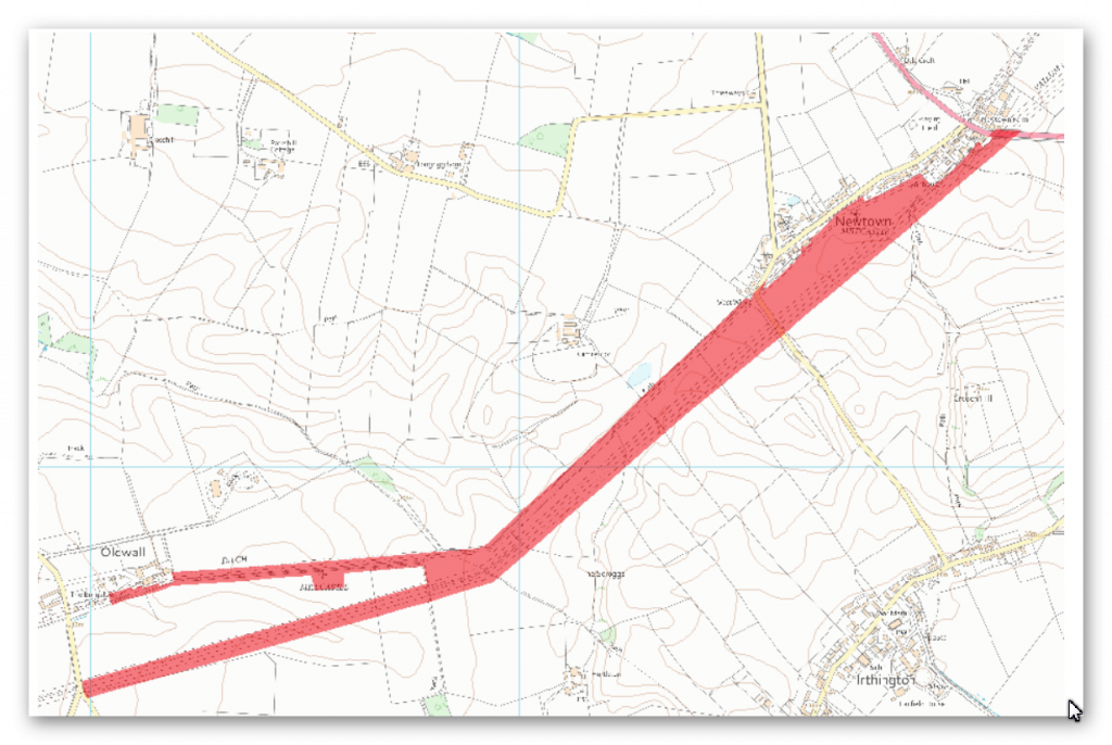
Section A – NY26SW

Section A – NY26SW – this is a section of Hadrian’s Wall showing the LiDAR, Google Earth and 1800 Maps of the Area covered by Historic England

Historic England Sections: Hadrian’s Wall between Westfield to Bowness-on-Solway in wall miles 76, 77, 78 and 79
List UID: 1015951, 1016021, 1014701, 1014700, 1014699, 1015904, 101503

Old OS Map

NY26SW
NY26SW – Section A – NY26SW

LiDAR Map

NY26SW sector - Wall in Yellow Vallum in Green
NY26SW sector – Wall in Yellow Vallum in Green – Section A – NY26SW

Google Earth Map

GE view showing Historic England scheduled monuments - Hadrian's Wall Section A
GE view showing Historic England scheduled monuments – Section A – NY26SW
Historic England Scheduled Monuments within Section A

Name: Hadrian’s Wall between Port Carlisle and Bowness-on-Solway in wall miles 78 and 79
Designation Type: Scheduling
Grade: Not Applicable to this List Entry
List UID: 1015951

Name: Hadrian’s Wall vallum between the track south of Kirkland House and Bowness-on-Solway in wall miles 78 and 79
Designation Type: Scheduling
Grade: Not Applicable to this List Entry
List UID: 1016021

Name: Hadrian’s Wall and vallum between the access road to Glendale caravan park and the track south of Kirkland House in wall miles 77 and 78
Designation Type: Scheduling
Grade: Not Applicable to this List Entry
List UID: 1014701

Name: Hadrian’s Wall vallum between the watercourse 400m south east of Glasson and the access road to Glendale caravan park in wall miles 76 and 77
Designation Type: Scheduling
Grade: Not Applicable to this List Entry
List UID: 1014700

Name: Hadrian’s Wall between the dismantled railway and the access road to Glendale caravan park in wall mile 77
Designation Type: Scheduling
Grade: Not Applicable to this List Entry
List UID: 1015904

Name: Hadrian’s Wall between Apple Garth, Westfield, and the dismantled railway in wall mile 77
Designation Type: Scheduling
Grade: Not Applicable to this List Entry
List UID: 1015903

Name: Drumburgh Roman fort and Hadrian’s Wall between Burgh Marsh and Westfield House in wall miles 76 and 77
Designation Type: Scheduling
Grade: Not Applicable to this List Entry
List UID: 1014699

English Heritage scheduled reports of this monument suggests that:

1015951
1015951 – Section A – NY26SW

This monument includes the section of Hadrian’s Wall between Field View Lane, Port Carlisle, in the west and Bowness-on-Solway in the east, in wall miles 78 and 79.

Hadrian’s Wall runs westwards along the crest of a raised beach from Port Carlisle for 700m and then turns north west to run towards Bowness-on-Solway. West of the site of milecastle 79, for a distance of 200m, the remains of the Wall lie beneath a field boundary visible as a bank 1m high surmounted by a hedge. The indications are that the Wall survives as upstanding remains of the core and probably also the faces several courses high with undisturbed tumble on either side beneath the earth bank. At the west end of this length the Wall is exposed either side of a modern field gate, standing up to four courses high with the footing flags exposed across the gateway. However, around the site of milecastle 79 and west of the north westerly turn in direction the Wall survives as a buried feature with no visible indications on the ground. The Wall in this sector was initially constructed in turf, which was replaced on the same line in the second half of the second century AD by the Stone Wall. It has not yet been determined whether the Wall was fronted by a ditch in this section. The proximity of the coast would have made a ditch superfluous and a ditch of the normal wall ditch proportions would have been liable to tidal flooding.

Milecastle 79 is situated 350m west of Field View Lane. Excavations of the milecastle were undertaken in 1949 by Richmond and Gillam. Like all milecastles in the western part of Hadrian’s Wall, it was originally constructed with turf ramparts and timber gateways and internal buildings. It measured 14.9m east to west and 12.5m north to south internally. This was replaced at some time in the second half of the second century by a stone built milecastle which measured 17.7m internally. The gates of the stone milecastle were found to have been reduced in size after the initial construction. A timber framed building is also known to have stood in the eastern half of the stone milecastle.

The exact position of Turret 79a has not yet been confirmed. On the basis of the usual spacing it is expected to be located approximately 400m west of milecastle 79 where the Wall changes direction. Turret 79a is expected to survive as buried remains.

Turret 79b is situated approximately 250m south east of the houses at the east end of Bowness-on-Solway in the field known as Jeffrey Croft. Its site is indicated by a very slight platform, visible on the ground. It was partly excavated in 1934 by Simpson, Richmond and MacIntyre to confirm whether the Turf Wall extended westwards as far as the west end of Hadrian’s Wall at Bowness. The south wall was found to be 1.12m wide and the west wall, 0.96m wide, was traced for 4.64m from the south west corner. It was constructed on a foundation of two layers of cobbles sandwiched in red clay, with three courses of masonry surviving above. The difference in thickness of the south and west walls and the evidence that it was originally built as a free-standing tower abutted by the Turf Wall demonstrated it to be the type of turret characteristic of the Turf Wall, and the most westerly turret known on Hadrian’s Wall. When the Wall was rebuilt in stone, the Turf Wall turrets, which were originally built in stone themselves, were retained with the new wall.

The course of the Roman road known as the Military Way, which ran along the corridor between the Wall and vallum linking turrets, milecastles and forts, has not been confirmed in this section. It is expected to run parallel to the Wall a few metres from its south face.

HE 1016021
HE 1016021 – Section A – NY26SW

The monument includes the section of Hadrian’s Wall vallum between the track south of Kirkland House in the east and Bowness-on-Solway in the west.

The course of the vallum is known in this section with intermittent surface traces visible. The vallum ditch survives as a faint shallow depression and a short section of the south mound is visible as an earthwork averaging 0.5m high to the south west of milecastle 79. Elsewhere the vallum mounds are not visible on the ground and survive as buried remains.

The course of the vallum westwards is not known from a point 150m west of the measured site of turret 79a, and its western terminus has not yet been discovered. The vallum is therefore not included within the scheduling west of this point.

1014701
1014701 – Section A – NY26SW

The monument consists of the section of Hadrian’s Wall and the vallum between the access road to Glendale caravan park in the east and the track south of Kirkland House in the west.

Hadrian’s Wall survives throughout this section as a buried feature. West of milecastle 78 the Wall turns northwards to follow the Solway coast in contrast to the vallum which runs straight in this section. It is not certain whether the ditch to the north of the Wall was provided in this section, as a ditch would have been superfluous so close to the shore and liable to tidal flooding. There is no evidence for the ditch on its depicted line. The Wall in this sector was initially constructed in turf, which was replaced in the second half of the second century by the stone wall.

Milecastle 78 was located and partly excavated in 1934 by Simpson, Richmond and MacIntyre. It is situated 110m north west of the access road to Glendale caravan park. Only the west wall was examined in the excavations and was found to be 2.8m wide. One course of masonry survived of the inner face above the footings, but the outer face had been robbed. The overall dimensions of the milecastle are not yet known. Like all milecastles in the western part of Hadrian’s Wall, it was originally built with turf ramparts and timber gateways and buildings, but was replaced in stone in the second half of the second century. The remains of the stone milecastle survive as buried remains. The excavators did not record whether remains of the primary turf and timber phase of the milecastle survive, but they are likely to survive beneath and alongside the remains of the stone milecastle also as buried remains.

The course of the Roman road known as the Military Way, which ran along the corridor between the Wall and the vallum linking turrets, milecastles and forts, has not been confirmed in this section.

The course of the vallum is known in this section. The vallum ditch can be traced as a depression up to 0.8m deep. The vallum mounds are not visible in this section and have been reduced and levelled by ploughing. They survive as buried features.

1014700
1014700 – Section A – NY26SW

The monument includes the section of Hadrian’s Wall vallum between the watercourse 400m south east of Glasson in the east and the east side of the access road to Glendale caravan park in the west. The vallum survives as a feature visible on the ground throughout most of this section. At the eastern end of the monument the vallum ditch is utilised by a modern drainage ditch 5.7m wide and 2m deep.

The course of the vallum between the watercourse 400m south east of Glasson and Burgh Marsh has not yet been confirmed and is therefore not included in the scheduling. West of Glasson the line of the vallum ditch is visible as a faint shallow depression but at the west end of the monument it survives in the field immediately east of the access track to Glendale caravan park as a more obvious earthwork up to 0.8m in depth.

1015904 – Section A – NY26SW

The monument includes the section of Hadrian’s Wall between the dismantled railway 200m west of Westfield House in the east and the access road to Glendale caravan park in the west.

Hadrian’s Wall survives throughout this section as a buried feature. It is not known whether the ditch to the north of the Wall was provided here as the wall runs parallel to and close to the Solway shore in this section of the monument.

1015903
1015903 – Section A – NY26SW

The monument includes the section of Hadrian’s Wall between the western boundary of the garden belonging to Apple Garth, Westfield, in the east and the dismantled railway 200m west of Westfield House in the west.

Hadrian’s Wall survives throughout this section as a buried feature. There is no evidence for the ditch to the north of the Wall, and it is likely that in this section parallel to and close to the Solway shore the ditch was not provided.

1014699
1014699 – Section A – NY26SW

The monument includes Drumburgh Roman fort and the section of Hadrian’s Wall and its associated features between Burgh Marsh in the east and Westfield House in the west.

Hadrian’s Wall survives as a buried feature throughout the whole of this section. Excavations by Haverfield in 1899 located the Wall between Burgh Marsh and Drumburgh fort. The Wall measured 2.95m wide and the wall ditch was 8.9m wide and lay 8m north of the wall. Excavations by Charlesworth in 1973 confirmed the course of the Wall north of Glasson. Geophysical survey has also located the line of the Wall or wall ditch to the north east of Glasson.

The exact location of milecastle 76 has not yet been confirmed. A faint irregular platform 200m east of Drumburgh Roman fort amongst ridge and furrow could possibly be the remains of the milecastle platform, however this is not certain and its position still needs confirmation.

The exact location of milecastle 77 has not yet been confirmed. Excavations by Charlesworth in 1973 proved inconclusive in determining its position. On the basis of the usual spacing it is expected to be situated about 50m south of the junction of the Glasson road with the Bowness-Carlisle road.

Turret 76a was located in 1948 just east of Drumburgh schoolhouse by Simpson, Hodgson and Richmond. Its remains survive as buried features with no traces visible above ground.

The exact locations of turrets 76b, 77a and 77b have not yet been confirmed. On the basis of the usual spacing turret 76b is expected to be located about 90m south of where the dismantled railway crosses Hadrian’s Wall east of Glasson and turret 77a approximately 140m south east of Lowtown House. Turret 77b is believed to be beneath Westfield House or its yard, but it is not included in the scheduling.

The course of the Roman road known as the Military Way, which ran along the corridor between the Wall and vallum linking turrets, milecastles and forts, has not been confirmed in this section. It is expected to run parallel to the course of the Wall set back a few metres to the south.

Drumburgh Roman fort, known to the Romans as Congavata, commanded an outlook to the north and east over the Inner Solway. There has been very little archaeological work carried out on this fort, and it remains one of the least well known Wall forts. Small scale excavations were carried out in 1899 by Haverfield who located the remains of a small stone fort. A subsequent excavation in 1947 by Simpson and Richmond showed that the stone fort lay within an earlier and larger turf and timber fort with ramparts made from the readily available alluvial clay. Pottery finds attested an occupation continuing into the late Roman period. The remains of the fort survive as buried features. The right angled ditch west of Drumburgh House is was at one time thought to be the ditch of the Roman fort. The excavations in 1899 however discovered it to be a medieval ditch, although its association has not been confirmed.

Evidence suggests that Hadrian’s Wall did originally pass through the Burgh Marsh to the east. No remains however have been identified here and hence this area is not included in the scheduling.

Investigation

Did the Vallum just end or did it turn west as indicated by LiDAR?

Video

Vallum ends in the middle of nowhere
Vallum ends in the middle of nowhere – Section A – NY26SW
Crop marks at the End of the Vallum
Crop marks at the End of the Vallum – Section A – NY26SW

If we look at the crop marks from a satellite shot of the termination point in 1985, we see this west turn continuation found in the ground and by a line of field boundaries which lead to another Paleochannel.  This turn would not offer any military advantage, but the size and direction of this channel would suggest that it was a prehistoric Linear feature that was the start of the Vallum at Hadrian’s Wall.

River Esk at a higher Level than today (8m)
River Esk at a higher Level than today (8m) – Section A – NY26SW

Analysis of the Wall alignment compared to the Vallum is strange and can be only explained by changes to the River level during the Roman period.  If we raise the water level of the River Esk then we see the wall aligns with a higher Water table (8m) at this period of Construction.

It should also be noted that the Vallum did not at any stage run to the end of the landscape like the Wall.  This could be because it terminated by a Paleochannel some 3000m before the river.  This would suggest that the water levels were even higher (than when the wall was constructed) and consequently it was built much earlier than the wall.

Vallum Terminal Point into a Paleochannel - Hadrian's Wall Section A
Vallum Terminal Point into a Paleochannel – Section A – NY26SW
Was the Wall built to the edge of the Roman River Shoreline?

The line of Hadrian’s wall to the North of this section shows that there is substantial land after the current shoreline of the River Erk. This makes no strategic sense as it would allow invaders to land and gather to attack the wall. It would make more sense to build the wall on the shoreline of the river. The only logical solution can be seen if the River was higher in the past as suggested by my ‘Post-Glacial Flooding’ hypothesis, which shows that rivers were much larger in the past and took many thousands of years to reduce to the levels we witness today.

Hadrian's Wall - built along the Shoreline of the Higher Roman Erk River
Hadrian’s Wall – built along the Shoreline of the Higher Roman Erk River – Section A – NY26SW

To understand the problem with Hadrian’s Walls history read our article HERE.

Further Reading

For information about British Prehistory, visit www.prehistoric-britain.co.uk for the most extensive archaeology blogs and investigations collection, including modern LiDAR reports.  This site also includes extracts and articles from the Robert John Langdon Trilogy about Britain in the Prehistoric period, including titles such as The Stonehenge Enigma, Dawn of the Lost Civilisation and the ultimate proof of Post Glacial Flooding and the landscape we see today.

Robert John Langdon has also created a YouTube web channel with over 100 investigations and video documentaries to support his classic trilogy (Prehistoric Britain). He has also released a collection of strange coincidences that he calls ‘13 Things that Don’t Make Sense in History’ and his recent discovery of a lost Stone Avenue at Avebury in Wiltshire called ‘Silbury Avenue – the Lost Stone Avenue’.

Langdon has also produced a series of ‘shorts’, which are extracts from his main body of books:

The Ancient Mariners

Stonehenge Built 8300 BCE

Old Sarum

Prehistoric Rivers

Dykes ditches and Earthworks

Echoes of Atlantis

Homo Superior

For active discussions on the findings of the TRILOGY and recent LiDAR investigations that are published on our WEBSITE, you can join our and leave a message or join the debate on our Facebook Group.
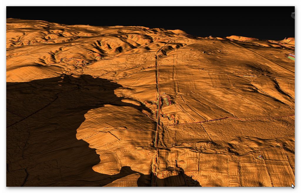
BGS Prehistoric River Map

According to the Superficial Soils left after the last ice age – here is the map of Prehistoric Rivers (Palaeochannels) created after the last ice age. The question that has been unanswered is HOW LONG did these Prehistoric Rivers (see Prehistoric River Map) exist in History?

Please Note – this is the MINIMAL extent of the flooding as the size of the deposits are an ESTIMATION based on bore hole evidence. (BGS Prehistoric River Map)

Twelve thousand years ago, according to our written history, the glaciers from the last Ice Age finally melted away, revealing the Britain we know today. For over 100,000 years (at the end of the Pleistocene Epoch) Britain had been underneath two miles of ice, compressing the ground by its sheer weight, so much so, that the land surface was then some 2,000 feet below its original level. Which has consequently risen back slowly, to become the landscape we know and are familiar with nowadays.

Geologists have assumed that these glaciers melted due to warming in climatic conditions creating a series of ‘meltwater pulses’ over a short period of time, but they have failed to date to produce a realistic model that fits the total meltwater discharge which eventually created not only the North and Irish Seas but the hundreds of feet of sea-level rises that we are still experiencing today.

If you study any British Geological Society (BGS) map of Britain, you will notice it shows a series of bedrock, sedimentary and superficial deposits. Below these deposits, is a labyrinth of material that look like canals and gigantic waterways which lay under the surface on top of the bedrock, which is the remains of Palaeochannels from the last ice age. This evidence is a testament to how the landscape would have looked when the rivers were at their highest and when they were discharging at their maximum levels.

These superficial deposits that resemble ancient rivers can be seen on the surface and are known to archaeologists, geologists and the general public as ‘Dry River Valleys’ – because the river valleys today are currently dry.  These great waterways can be readily seen in profile in the cliffs and valleys of the South Downs, where they show their curved river nature by the remains of the superficial subsoil consisting of sand, silt and clay. 

Past geologists have failed to identify these huge concave broken chalk sections of the cliffs accurately, or to date the river terraces deposited from the remains of the meltwater of the last glaciation maximum (LGM), as they have historically only identified the gravels and bedrock within geological periods.  Their arguments are compounded as they fail to explain why they are relatively short distances from the sandy silt to today’s topsoil or why silt and sand are at elevations above supposed earlier river terracing, so they suggest these deposits are ‘windblown Loess’ – blown into position rather than deposits laid down by rivers of the past.

This book uses existing scientific evidence from peer-reviewed publications and modern mathematical models to give you an understanding of how the landscape looked in the Holocene period, giving archaeologists the tools to reveal fresh discoveries and a better understanding of our history. (BGS Prehistoric River Map)

Figure 1 – Cliffs of the South Downs, showing the size and scale of the ‘Superficial Deposits’ – Prehistoric River Map

Figure 2 – Close inspection shows that the chalk is broken and has been re-laid with extra sand and silt in-between the ‘tossed chalk’ – Geologists find this impossible to date accurately – Prehistoric River Map

Further information can be found HERE or on our our VIDEO CHANNEL (BGS Prehistoric River Map)

Further Reading

For information about British Prehistory, visit www.prehistoric-britain.co.uk for the most extensive archaeology blogs and investigations collection, including modern LiDAR reports.  This site also includes extracts and articles from the Robert John Langdon Trilogy about Britain in the Prehistoric period, including titles such as The Stonehenge Enigma, Dawn of the Lost Civilisation and the ultimate proof of Post Glacial Flooding and the landscape we see today.

Robert John Langdon has also created a YouTube web channel with over 100 investigations and video documentaries to support his classic trilogy (Prehistoric Britain). He has also released a collection of strange coincidences that he calls ‘13 Things that Don’t Make Sense in History’ and his recent discovery of a lost Stone Avenue at Avebury in Wiltshire called ‘Silbury Avenue – the Lost Stone Avenue’.

Langdon has also produced a series of ‘shorts’, which are extracts from his main body of books:

The Ancient Mariners

Stonehenge Built 8300 BCE

Old Sarum

Prehistoric Rivers

Dykes ditches and Earthworks

Echoes of Atlantis

Homo Superior

For active discussions on the findings of the TRILOGY and recent LiDAR investigations that are published on our WEBSITE, you can join our and leave a message or join the debate on our Facebook Group.
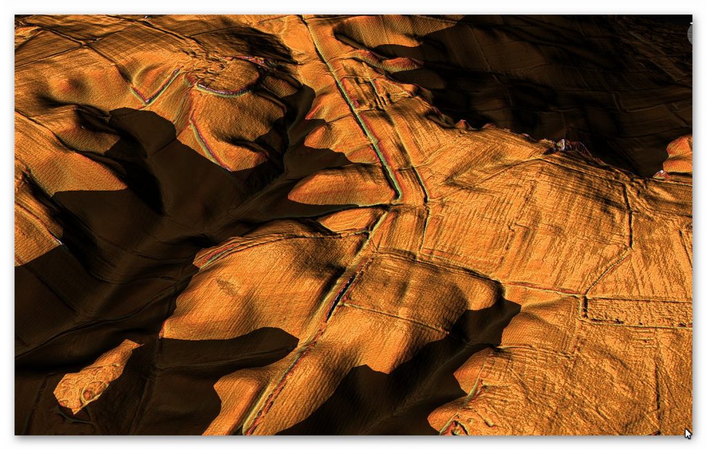
Case Study – Woodhenge Reconstruction

Extract from the book: The Stonehenge Enigma

Woodhenge has a series of ‘massive’ wooden post holes – at this point, I need to explain that archaeologists don’t seem to understand the difference between a ‘Post Hole’ and a ‘Stake Hole’.  You use stake holes for posts such as fences as they can be easily buried in the ground as they have a sharp point – this point naturally compresses the surroundings (due to the shape and hammering from above) so they don’t move or wobble – this is key to understand the Woodhenge reconstruction.

A ‘Post Hole’ is totally different as it has a flat bottom and needs rubble to stop it rocking from side to side.  Stake holes are easy as they are ‘self-burying’ while post holes are more work as you need to dig a hole for it. The only reason you would do all the extra work of digging a flat bottomed hole (especially in chalk) is if the wooden pole is to take some kind of weight from above, for a stake hole is useless for this type of structure as it would sink (overtime) under the weight pushing down on the point and probably fall over.

Therefore, if you have a round wooden single-storey building with a simple roof as current archaeologists suggested for some of these post hole structures, why use these massive posts as it is ‘over-engineering’ and time consuming – especially with simple tools?

Cunnington excavations at Woodhenge in 1929, suggested that some posts are up to 60 inches in diameter:

“clear evidence was obtained in excavation that the six centric rings of holes once held posts or tree trunks varying from 1ft to 3ft in diameter according to the size of the hole…… the size and depth and distance varies in each circle…. In the outer circle holes are 6ft apart from centre to centre, from 1 1/2 ft to 2ft in depth and from 2ft to 3ft in diameter. In the second circle the holes are larger and further apart, averaging about 4ft in depth and 3 ½ to 4ft in diameter. The largest of all were those were those of the third circle, being about 6ft deep with a diameter at the top from 4ft to 5ft “ (Cunnington. M.E., ‘Prehistoric Timer Circles’, Antiquity A Quarterly Review Of Archaeology Vol.1, 1927).

Woodhenge Reconstruction
Figure 59– Cunnington Excavation plan 1929
Woodhenge Reconstruction

Sadly, Woodhenge reconstruction shows us yet another illustration of flawed science in archaeology.  Even with a ‘second rate’ excavation report from the 1920’s the conclusion of modern archaeologists is that this structure was a single-story house – a slightly grander feature to the traditional ‘iron age’ house.  This is simply nonsense. If we look closely at the evidence presented here, we obtain a totally different and more accurate conclusion to the nature of this structure.

Firstly, if we look at the layout of the site (which lacks much detail), we can see from these original excavation plans the scale of this understatement, as the existing ‘concrete’ posts, on the site, are far too small.  The most recent photo was from the excavation by Pollard in 2007, indicates that these posts are at least five times larger than the current representations.

The next fact that goes unanswered is the reason for the large ramps by the post holes. You don’t take time to put 32 ramps into the soil unless it is essential as you just added at least another month to the building work for the site and 500 working-hours.  What archaeologists have missed (or failed to mention) is in which direction these ramps were cut – as it tells us more than the entire excavation report by Cunnington.

The massive 4 – 5 ft pine posts of the 16 postholes (known as the C Ring) would weigh 214kg per foot of length.  Therefore, a sizeable healthy person (we will go into detail who these megalithic people are and where they came from in the next book of the series – ‘Dawn of the Lost Civilisation’) could pick up one foot of pine and place it in a hole without assistance or a need for a ramp. 

Woodhenge Reconstruction
Figure 60 – Woodhenge reconstruction – post holes much larger than the concrete posts on the site!
Woodhenge Reconstruction

Consequently, an eight-foot pine tree trunk could easily be placed on the shoulders of 8 people and put straight into the hole, which is the current estimations by archaeologists for a single storey structure. Therefore, the empirical evidence suggests they are wrong, and the pole was much more significant.

What we have seen at Stonehenge is similar ramps not by the 4-tonne bluestones but by the Sarsen stones that weighed an average of 25-tonnes (the trilithons are 35-tonnes) but half the size of these ramps.

A 25-tonne, pine post of width between 4 – 5 ft would be 39m long or 128ft, and a 35-tonne pine tree is some 177ft long.  But do Pine trees grow that tall?  Just down the road from Durrington Walls is Longleat Forest, within this forest there are pine trees like the Douglas fir that grow to nearly 200ft tall.

Moreover, the site plan does also give us another clue to the length of these poles.  If to look carefully at the angle of the ramps into the giant postholes, you will notice that they are not all facing the same direction.  The only logical reason for that to happen is if you erect the pine poles in a set order so that they would not hit or interfere with each other when attempting to erect the posts.

This allows us to come to some remarkable conclusions about the construction and the process of how it was built:

  1. Holes were filled in an anti-clockwise direction starting at hole 1 (at four o’clock to the site)
  2. Poles must have been more than 100’ long as otherwise, you could erect them in any order and direction.
  3. The ditch that is current at the site was added at a later date, as you would need to bring the poles through the ditch and in some cases be in the ditch to erect it.
  4. The 4 to 5ft diameter posts all entered the site from the south, as it has the minimal distance to travel – as these poles were either rolled or dragged on a sledge and therefore probably the direction of where the pine trees have initially been growing or unloaded, after being floated down the river.

Now the slopes for ‘Ring C’ (the largest posts) are 5 to 8ft long, which are even longer than the Stone ramps (3 to 4ft) at Stonehenge (Fig.58).  This probably shows the large (Sarsens are only 13ft tall) leverage factor required to be pulled upright with an A-frame, which then allows the posts to slide into position and then into the hole.

Ring B – the 3.5 to 4ft diameter trees, also have ramps, but much smaller (3 to 4ft), indicating less leverage and therefore half the weight/height?  Moreover, they were placed into position after the C Ring, as their ramps point away from the centre with no common direction.

Woodhenge Reconstruction
Figure 61– Broch which was a later version of Woodhenge – made of Stone
Woodhenge Reconstruction

The last row of postholes (A), 1 to 3ft in diameter, do not have ramps and are sporadic in nature and size – which leads me to believe they have no structural significance and was probably more like a palisade covering, to either enclose the structure or allow mud or reed covering (wattle & daub) and protection from the elements.

The internal posts (D to F) are superficial and probably were there to support the first-floor structure, as we see in their successors in British history the ‘broch’ – a stone version-built thousands of years later for the same purpose.

But my money would be on the tower being of a lower ratio of 1 to 1, with the base, making it 135ft high and the same height as Silbury Hill, a little further up the river Avon and its design I would suggest, would have been the same ‘layer cake’ design as we will see in the chapter on Avebury.

Therefore, what would you build next to a harbour to attract and direct boats – obvious isn’t it, a fire beacon (with a stone base) as we know from written history and the Pharos of Alexandria (280 – 247 BCE).

Woodhenge Reconstruction
Figure 62- Woodhenge reconstruction – probably looked like during phase I of its construction, with a spiral staircase.  
Woodhenge Reconstruction

Furthermore, this link with the harbour is illustrated by the construction of the Moat, Bank and then a Dyke. As we have suggested, the Woodhenge ditch would not have existed at the original time (Phase I) of the construction of the C and then the B rings.  It seems that it was added at the end of Phase I when the structure was complete and before Ring A was established, as it points to the shoreline of the Neolithic Avon River. This alignment disproves the current ‘expert’ theory about being an astronomical alignment with the Solstice Sunrise. 

Evidence for the construction of the postholes (with gaps in the circle which were later filled with smaller posts) indicate that the ditch had filled from age, or by design. The main opening (in the A circle) to the northeast is not in line with the gap in the ditch, and the two other spaces in the circle, would track across the ditch in the southeast and northwest.


As for the dating of Woodhenge reconstruction (and Durrington Walls), like Stonehenge, unrelated antler and bone fragments have dated it to about 2400 BCE, which is very convenient.  The problem is that most of the post hole samples at Woodhenge were either lost or have been stored away and not tested since the excavations between 1926 to 29, for reasons known best to the experts.

Moreover, like the samples taken from the old car park in 1966, pine charcoal were reported to be found “similar to the charcoal found at Woodhenge” was the quote from the labs at the time, who failed to carbon date the samples as the experts had declared them Neolithic, supporting the antler pick dates.  Although now, once this gross error was exposed, we know these pine charcoal wood dates to be in fact Mesolithic 8100 BCE – which ‘begs-the-question’ so are the pine charcoal dates found at Woodhenge also Mesolithic?

Less than a mile down the river is ‘Blick mead’, (Vespasian’s Camp),which has also been found dates ranging from 7900 BCE, (remember our bluestone estimation for Stonehenge is 8000 BCE), to 4050 BCE, with multiple RC dates from the 8th to the 5th BCE.  Sadly, until someone finds these samples and carbon tests them, to get an accurate date for Woodhenge and Durrington Walls, this unscientific archaeological ad hoc dating methodology will continue.

Woodhenge Reconstruction
Figure 63- Woodhenge Reconstruction – Unique building technique for towers – still used today
Woodhenge Reconstruction

Furthermore, the engineering structure created by this civilisation – like the design at Stonehenge, has been overlooked by archaeologists looking for a more simplistic ‘hunter gatherer’ solution for this superstructure, which has ended up with a single storey roof, that is clearly well over engineered for that purpose.  What we can see at Woodhenge (and also at The Sanctuary at Avebury) is the ‘triangulation’ of wood joints using the mortice and tenon techniques we have seen on the Sarsen stones at Stonehenge – this structural technique (which are incorporated in modern towers today) allows to construction of extremely high wooden towers, which is what we see through the Woodhenge reconstruction.

The video on Woodhenge reconstruction is available from: https://youtu.be/piow4yDUs3U

Further Reading

For information about British Prehistory, visit www.prehistoric-britain.co.uk for the most extensive archaeology blogs and investigations collection, including modern LiDAR reports.  This site also includes extracts and articles from the Robert John Langdon Trilogy about Britain in the Prehistoric period, including titles such as The Stonehenge Enigma, Dawn of the Lost Civilisation and the ultimate proof of Post Glacial Flooding and the landscape we see today.

Robert John Langdon has also created a YouTube web channel with over 100 investigations and video documentaries to support his classic trilogy (Prehistoric Britain). He has also released a collection of strange coincidences that he calls ‘13 Things that Don’t Make Sense in History’ and his recent discovery of a lost Stone Avenue at Avebury in Wiltshire called ‘Silbury Avenue – the Lost Stone Avenue’.

Langdon has also produced a series of ‘shorts’, which are extracts from his main body of books:

The Ancient Mariners

Stonehenge Built 8300 BCE

Old Sarum

Prehistoric Rivers

Dykes ditches and Earthworks

Echoes of Atlantis

Homo Superior

For active discussions on the findings of the TRILOGY and recent LiDAR investigations that are published on our WEBSITE, you can join our and leave a message or join the debate on our Facebook Group.
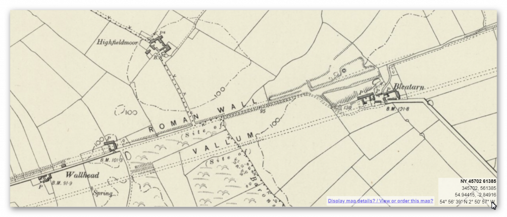
Stonehenge – Monument to the Dead

Extract from the book: The Stonehenge Enigma (Stonehenge – Monument to the Dead)

The most popular view of Stonehenge is false facts for it was not a completely round monument with lintel stones completing the circle – but there is a massive problem with this idea, for not all the stones or the stone holes are present. Some people have suggested that the monument is incomplete, but those individuals do not understand its significance and the reason behind the construction.
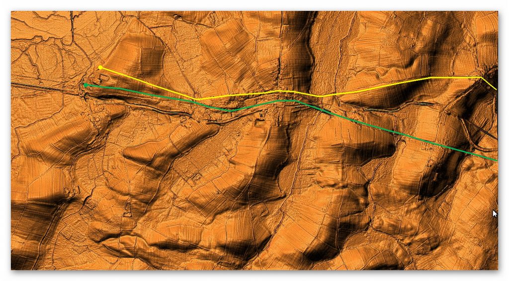
A monument to the dead as we have previously illustrated, would not face the Summer Solstice Sunrise, it would either face the moon’s furthest setting in the night’s sky (the northwest and the lost Mesolithic pathway) or it would face Winter Solstice Sunset to mark the shortest day – when light finally overcomes the darkness the symbolism of rebirth (life after death).

Another reason to ignore the reference to a solar temple, is that the Sun is usually represented as life and a circular symbol as we see in many ancient civilisations in the Middle East and South and Central America – where monuments to the dead are represented by the moon and particularly, a crescent moon.

(Stonehenge - Monument to the Dead)
Figure 36– Stonehenge was ‘crescent’ shaped not round
(Stonehenge – Monument to the Dead)

Stonehenge was designed to be crescent-shaped, with an alignment to the Winter Solstice Sunset and hence the construction and alignment with a trilithon (two standing stones with a third suspended on top of the two uprights) in the south-west quadrant.  Which only one survives and is still upright, which is not surprising as the druids in the Iron Age altered the monuments symbology by pulling the Heel stone to an awkward angle to meet the sunrise of the Summer Solstice, and no doubt pulled down the trilithon in the south-west quadrant.

The ‘crescent within the crescent’ (the larger horseshoe trilithon standing stones) that faces the Summer solstice sunrise; this is very symbolic as it represents rebirth or reincarnation, it’s a poignant message through the ages to us (the descendants of this civilisation), that their homeland may be dead, but the survivors still live on, to begin again.

This can be proven in various ways.  In archaeological terms, the fact that the stones are missing is a problem for archaeologists, unless the monument was incomplete.

(Stonehenge - Monument to the Dead)
Figure 37 – Stonehenge hexagonal design
(Stonehenge – Monument to the Dead)

All the so-called missing stones of the monument are in the SW quadrant; this area is the furthest away from any roads – if you are going to cart away stones would you not start at a point nearest a road, rather than the stones furthest away.  The second problem with the Solar temple is that some of the existing stones that have not been moved or chipped away are not large enough to take a horizontal lintel stone – such as stone 11. Consequently, the only type of monument that the site could have been designed for is the crescent moon facing the Winters Solstice Sunset.

This is confirmed if you consider how the structure was designed.  It would have been based using strings to the centre and the moat forming a Hexagram (the reason this form was used is further discussed in the last book of the trilogy: ‘Dawn of the Lost Civilisation’).

Do you want more Stonehenge Facts?

More information (and Stonehenge facts) are contained in our documentary: https://youtu.be/OWMso5UgUWU

Further Reading

For information about British Prehistory, visit www.prehistoric-britain.co.uk for the most extensive archaeology blogs and investigations collection, including modern LiDAR reports.  This site also includes extracts and articles from the Robert John Langdon Trilogy about Britain in the Prehistoric period, including titles such as The Stonehenge Enigma, Dawn of the Lost Civilisation and the ultimate proof of Post Glacial Flooding and the landscape we see today.

Robert John Langdon has also created a YouTube web channel with over 100 investigations and video documentaries to support his classic trilogy (Prehistoric Britain). He has also released a collection of strange coincidences that he calls ‘13 Things that Don’t Make Sense in History’ and his recent discovery of a lost Stone Avenue at Avebury in Wiltshire called ‘Silbury Avenue – the Lost Stone Avenue’.

Langdon has also produced a series of ‘shorts’, which are extracts from his main body of books:

The Ancient Mariners

Stonehenge Built 8300 BCE

Old Sarum

Prehistoric Rivers

Dykes ditches and Earthworks

Echoes of Atlantis

Homo Superior

For active discussions on the findings of the TRILOGY and recent LiDAR investigations that are published on our WEBSITE, you can join our and leave a message or join the debate on our Facebook Group.