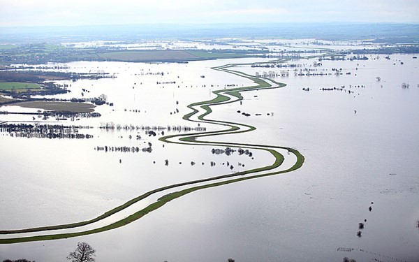
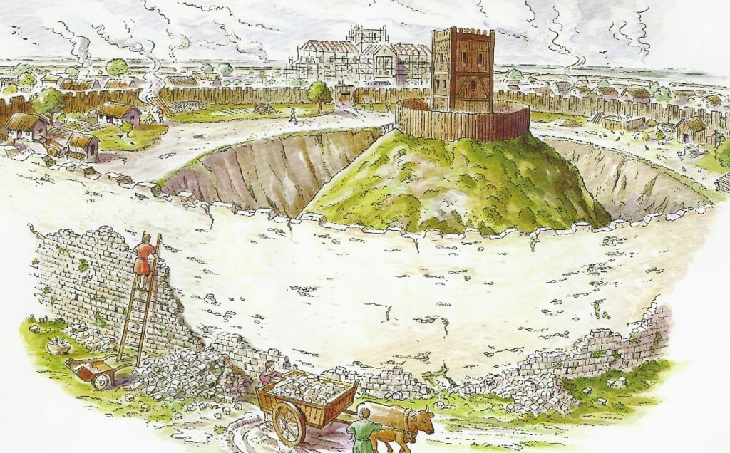
For centuries, Car Dyke was regarded as a relic of Roman engineering—a mere canal or drainage system that facilitated military logistics and agricultural management. However, our first-ever comprehensive LiDAR investigation has completely rewritten that narrative. By employing state-of-the-art laser scanning, we have penetrated the dense vegetation and hidden soil layers to reveal a much more complex story. The data, bolstered by advanced mathematical dating methods and AI-assisted analysis, demonstrate that Car Dyke is not Roman but prehistoric in origin, with roots dating to the Mesolithic and Neolithic periods.
Inside the Investigation
LiDAR Mapping: Our high-resolution scans provide unprecedented detail, capturing the full 103-mile span of Car Dyke. The imagery reveals intricate construction details and natural variations that traditional methods have overlooked.
Mathematical Dating: Utilising a novel approach that integrates archaeological finds with advanced algorithms, our team has applied mathematical theorems to establish a definitive timeline. This breakthrough challenges centuries of conventional wisdom and suggests a multi-phased construction history long before the Roman era.
Archaeological Integration: The Atlas includes comprehensive data from archaeological excavations—pottery shards, tools, and other artefacts—that further support the prehistoric origin of the Dyke.
LiDAR mapping reveals Car Dyke’s hidden prehistoric layers, challenging the Roman narrative
The Car Dyke Atlas: A Deep Dive into History
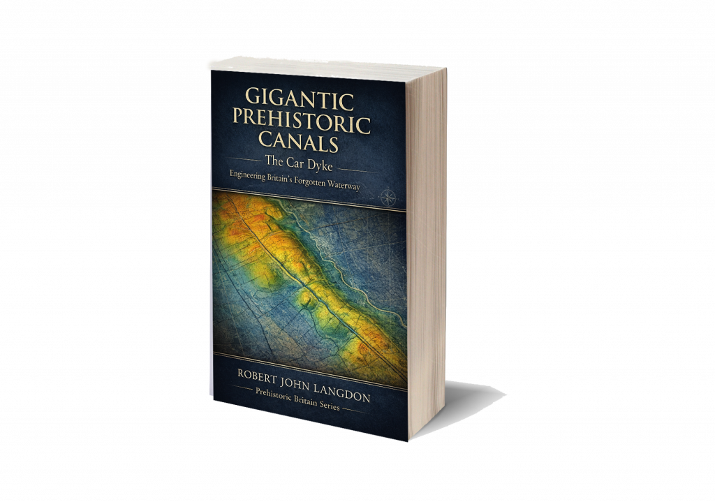
Car Dyke Atlas is not merely a book—it is a complete digital and print repository of our groundbreaking research. With over 140 meticulously crafted illustrations, 58 audio files, 22 360° interactive maps, and 120 flyover video clips, the Atlas offers a multidimensional view of this ancient earthwork.
Key Sections of the Atlas
Preamble & Introduction: Sets the stage by summarising decades of archaeological debate and introducing our revolutionary LiDAR findings.
Methodology: Explains the innovative techniques, including advanced AI and mathematical models, that enabled us to accurately map and date Car Dyke.
Detailed Mapping & Analysis: Interactive maps and flyover videos allow readers to explore Car Dyke in minute detail—from its northern, central, and southern sections to the subtle variations in its elevation and course.
Comparative Archaeology: Chapters that juxtapose traditional interpretations with our new findings, offering a compelling case for re-evaluating Britain’s ancient landscape.
Multimedia Content: Beyond static images, the Atlas integrates audio narrations, expert discussions, and interactive elements that provide context and bring the research to life.
The Car Dyke Atlas offers a panoramic view of history—where detailed maps meet immersive multimedia.
FusionBook 360: A New Paradigm in Storytelling
In today’s fast-paced digital age, traditional books are evolving. FusionBook 360 represents the future of reading—a concept that reimagines the boundaries between print and digital media. This revolutionary format brings historical scholarship into the 21st century by seamlessly integrating interactive and multimedia elements into the reading experience.
What Makes FusionBook 360 Unique?
Dual Format Availability: Choose between a digital edition loaded with interactive features and a beautifully designed printed edition enhanced with QR codes that unlock a wealth of supplementary content.
Realistic Page-Turning Effects: Experience the nostalgic feel of flipping pages, complete with authentic sound effects, yet enjoy the benefits of digital enhancements.
Embedded Interactive Content: Access video introductions, expert panels, detailed audio narrations, and 360° maps—all within the book’s pages. Each chapter invites readers to engage more deeply with the content.
Cloud-Based Updates: Stay current with ongoing research. As new discoveries emerge, the book updates automatically, ensuring that your copy remains at the cutting edge of historical scholarship.
Smart Chatbot Integration: Have a question while reading? Our integrated chatbot provides instant answers and additional context, making your exploration seamless and interactive.
FusionBook 360 transforms your reading experience, merging the tactile pleasure of print with the limitless possibilities of digital interactivity.”
Bridging the Past and Future: The Impact of Our Research
The implications of our findings extend far beyond Car Dyke itself. By challenging the long-held view of Car Dyke as a Roman construct, we open up new avenues of research into prehistoric engineering and land management. Our work sets a new standard for historical inquiry, combining rigorous scientific analysis with the creative potential of modern multimedia technology.
Why This Matters
Rewriting History: Our research forces historians, archaeologists, and the public to reconsider the origins of Car Dyke and, by extension, the broader narrative of Britain’s ancient past.
Innovative Methodologies: The integration of LiDAR technology, AI, and mathematical analysis provides a blueprint for future studies in archaeology.
Enhanced Engagement: FusionBook 360 invites a wider audience—from academic experts to curious enthusiasts—to engage with history in a more dynamic, interactive way.
Where ancient mysteries meet modern innovation—redefining our understanding of the past.
Join Us on This Journey
Be part of a transformative moment in historical research and digital publishing. Whether you are a scholar, a technology enthusiast, or simply passionate about uncovering the secrets of our past, the Car Dyke Atlas and FusionBook 360 offer an unparalleled journey into history.
By merging rigorous scientific inquiry with immersive multimedia technology, we’re not just telling history—we’re experiencing it. Step into a world where every page turns into a window to the past, and where the future of historical research is unfolding right before your eyes.
For more exclusive content, behind-the-scenes insights, and regular updates, visit our website and follow us on social media.
Car Dyke – ABC News Podcast
Summary
The book ‘The Car Dyke LiDAR Atlas’ presents a thorough investigation of the Car Dyke, a large ancient waterway in Britain. Using LiDAR technology, the author argues that the Dyke is much older than previously thought, dating back to the Mesolithic/Neolithic periods, and was likely used for transportation and water management rather than simply as a Roman drainage channel or defensive barrier. The book features detailed maps and analysis of the Dyke’s construction and course, including insights into the surrounding landscape and archaeological finds, to support the author’s conclusions.
Car Dyke Audio Book
Britain’s first-ever LiDAR investigation and mapping project of Car Dyke.
Unveiling the Truth: The Real History of Britain’s Dykes
For over a century, conventional archaeology has promoted the idea that Britain’s great Dykes—such as Offa’s Dyke and Wansdyke—were built by the Saxons as defensive barriers. These theories, based on limited fieldwalking evidence and subjective interpretation, have gone largely unchallenged. But what if this widely accepted narrative is completely wrong?
Car Dyke: The Key to a Forgotten Past
Car Dyke has long stood apart, defying the traditional explanations of Saxon territorial defence. When a boat laden with goods was discovered at the bottom of Car Dyke—dating back hundreds of years before the Saxons arrived in Britain—it should have rewritten history. Yet, mainstream archaeology dismissed this evidence, continuing to support outdated theories.
Revolutionary New Findings with LiDAR Technology
Using cutting-edge LiDAR mapping, our research has uncovered undeniable proof that Car Dyke and similar Dykes are not Saxon or even Roman constructions. Instead, they are intricately linked to ancient paleochannels, suggesting an advanced transportation and water management system that predates recorded history. Our new maps have corrected the estimated length of Car Dyke from 85 miles to 103 miles, aligning with the theories proposed by William Stukeley nearly 300 years ago. His claim that the Dyke supported the Roman occupation of Lincolnshire by facilitating troop and resource movements has now been scientifically validated.
Redefining Britain’s Longest Dyke
This research now positions Car Dyke as Britain’s longest Dyke, surpassing Offa’s Dyke, previously believed to be 177 miles long. Our survey reveals that Offa’s Dyke is, in fact, a series of smaller Dykes, totalling just 59.2 miles. Like Car Dyke, these ancient waterways were repurposed by the Romans for transportation and resource extraction, fundamentally shifting our understanding of Britain’s infrastructure.
A Groundbreaking Discovery: The Mesolithic and Neolithic Origins of the Dykes
Our mathematical analysis reveals that Car Dyke, Offa’s Dyke, and Wansdyke predate both the Romans and Saxons, tracing their origins back to the Mesolithic and Neolithic periods. This breakthrough challenges the established archaeological timeline and presents a compelling case for an advanced prehistoric civilisation. Could these ancient canals have been used to transport the massive stones of Britain’s megalithic structures? Our findings suggest they very well could have.
Rewriting the History of Britain’s Past. This book uncovers the real purpose and origins of Britain’s enigmatic Dykes, using cutting-edge technology and rigorous analysis to challenge centuries of academic assumptions. If you’re ready to explore the truth behind Britain’s forgotten past, this book will change everything you thought you knew about history.
Softback B/W Edition for Amazon – with QR codes to the interactive website links
The Car Dyke Atlas
Softback Colour Edition for Amazon – with QR codes to the interactive website links
The Car Dyke Atlas
Further Reading
For those interested in British Prehistory, visit www.prehistoric-britain.co.uk, a comprehensive resource featuring an extensive collection of archaeology articles, modern LiDAR investigations, and groundbreaking research. The site also includes insights and extracts from the acclaimed Robert John Langdon Trilogy, a series of books exploring Britain during the Prehistoric period. Titles in the trilogy include The Stonehenge Enigma, Dawn of the Lost Civilisation, and The Post Glacial Flooding Hypothesis, offering compelling evidence about ancient landscapes shaped by post-glacial flooding.
To further explore these topics, Robert John Langdon has developed a dedicated YouTube channel featuring over 100 video documentaries and investigations that complement the trilogy. Notable discoveries and studies showcased on the channel include 13 Things that Don’t Make Sense in History and the revelation of Silbury Avenue – The Lost Stone Avenue, a rediscovered prehistoric feature at Avebury, Wiltshire. (The Great Farming Hoax – Einkorn Wheat)
In addition to his main works, Langdon has released a series of shorter, accessible publications, ideal for readers delving into specific topics. These include:
For active discussions and updates on the trilogy’s findings and recent LiDAR investigations, join our vibrant community on Facebook. Engage with like-minded enthusiasts by leaving a message or contributing to debates in our Facebook Group.
Whether through the books, the website, or interactive videos, we aim to provide a deeper understanding of Britain’s fascinating prehistoric past. We encourage you to explore these resources and uncover the mysteries of ancient landscapes through the lens of modern archaeology.
For more information, including chapter extracts and related publications, visit the Robert John Langdon Author Page. Dive into works such as The Stonehenge Enigma or Dawn of the Lost Civilisation, and explore cutting-edge theories that challenge traditional historical narratives. (The Great Farming Hoax – Einkorn Wheat)
The pursuit of knowledge is often portrayed as a straight line—one discovery neatly building upon another, all validated by peer-reviewed research. But the real history of science tells a more chaotic story. Many of the most transformative discoveries didn’t come from within academia, but from individuals who dared to question what everyone else accepted as truth. Their reward? Accusations of pseudoscience, conspiracy thinking, or outright nonsense.(The Perils of Paradigm Shifts)
Science is often imagined as a straight path of progress—but reality is far messier.. (The Perils of Paradigm Shifts)
Academic Gatekeeping and Intellectual Inertia
At the heart of this resistance lies the structure of academia itself. Scholars are trained within narrow theoretical frameworks, and the peer-review system—meant to filter out weak or unsupported work—often ends up protecting the status quo instead. New ideas that don’t fit the accepted narrative aren’t just inconvenient—they’re seen as dangerous to careers, reputations, and long-standing institutions.
It’s easier to ignore a challenging idea than to risk overturning an entire body of accepted knowledge. And when the person presenting that idea isn’t part of the academic club? Their work is often dismissed without real engagement.
Academic structures are designed to uphold standards—but can also guard against change(The Perils of Paradigm Shifts)
History Repeats Itself: From Galileo to Wegener
This isn’t a new phenomenon. Galileo was forced to recant his heliocentric model under pressure from the Church and his scientific peers. Alfred Wegener’s theory of continental drift was mocked for decades until it was finally recognised as the foundation of plate tectonics. These examples reveal a persistent flaw in how we handle innovation: we often attack the idea before we understand it, simply because it makes us uncomfortable.
Wegener’s once-dismissed theory is now geology 101. (The Perils of Paradigm Shifts)
Archaeology: A Discipline Bound by Tradition
Nowhere is this resistance more pronounced than in archaeology. The field often deals with incomplete data, open interpretation, and entrenched cultural narratives. Yet despite the uncertainties, mainstream archaeology can be surprisingly inflexible.
When alternative thinkers propose that ancient structures like Stonehenge served different purposes or that dykes might have been prehistoric canals instead of military boundaries, they’re frequently labelled pseudoscientists—regardless of how carefully they present their evidence.
Archaeological theory is often slow to evolve—especially when challenged from the outside..(The Perils of Paradigm Shifts)
Clement Reid and the Lost Land of Doggerland
Consider Clement Reid. In 1913, the same year he retired from the Geological Survey, he published Submerged Forests, a book proposing that a vast prehistoric landscape—what we now call Doggerland—once connected Britain to continental Europe. His hypothesis was quietly ignored by the academic community. The book wasn’t peer-reviewed, and his ideas didn’t fit the prevailing archaeological framework.
But decades later, sonar mapping confirmed the existence of submerged river valleys and coastlines beneath the North Sea—exactly the kind of landscape Reid had described. He had been right all along. His work wasn’t pseudoscience; it was simply science ahead of its time.
Clement Reid proposed Doggerland long before science could prove it..(The Perils of Paradigm Shifts)
Science Should Be About Testing, Not Silencing
The core principle of science is to test ideas against evidence. But when new hypotheses are dismissed outright—especially by virtue of who proposes them—we lose sight of that principle. Dismissing unconventional thinkers, especially when they back up their claims with data and logical reasoning, contradicts everything science is supposed to stand for.
The scientific method demands all ideas be tested—regardless of origin..(The Perils of Paradigm Shifts)
The Role of Imagination and Intellectual Courage
Many of the greatest scientific leaps have come from those willing to imagine realities no one else could yet see. Einstein, Bohr, Planck—all of them thought beyond the limits of their time. The real barrier to progress often isn’t the lack of evidence—it’s the lack of imagination. And the courage to entertain uncomfortable possibilities.
Many revolutionary thinkers succeeded by imagining what others couldn’t.(The Perils of Paradigm Shifts)
Moving Forward: Embrace the Margins
Robert John Langdon, among others, has repeatedly shown that alternative hypotheses deserve fair consideration. Whether it’s the reimagining of Stonehenge’s purpose, or the reinterpretation of earthworks using modern technologies like LiDAR, these ideas challenge stale narratives and encourage fresh inquiry. Yet they’re often dismissed, not because they lack merit, but because they don’t come from within the academic mainstream.
That’s a problem.
(The Perils of Paradigm Shifts)
Conclusion: Rethinking Scientific Rigidity
The tendency to label new ideas as pseudoscience reflects a deeper flaw in how we protect consensus over curiosity. In archaeology especially, where evidence is open to interpretation, the scientific community must do better. The true spirit of science demands open-mindedness, critical thinking, and the willingness to follow the evidence—wherever it leads, and whoever it comes from.
Because history shows us that real breakthroughs often come from the edges—not the centre.
(The Perils of Paradigm Shifts)
Audio Blog Post
Further Reading
For those interested in British Prehistory, visit www.prehistoric-britain.co.uk, a comprehensive resource featuring an extensive collection of archaeology articles, modern LiDAR investigations, and groundbreaking research. The site also includes insights and extracts from the acclaimed Robert John Langdon Trilogy, a series of books exploring Britain during the Prehistoric period. Titles in the trilogy include The Stonehenge Enigma, Dawn of the Lost Civilisation, and The Post Glacial Flooding Hypothesis, offering compelling evidence about ancient landscapes shaped by post-glacial flooding.
To further explore these topics, Robert John Langdon has developed a dedicated YouTube channel featuring over 100 video documentaries and investigations that complement the trilogy. Notable discoveries and studies showcased on the channel include 13 Things that Don’t Make Sense in History and the revelation of Silbury Avenue – The Lost Stone Avenue, a rediscovered prehistoric feature at Avebury, Wiltshire.
In addition to his main works, Langdon has released a series of shorter, accessible publications, ideal for readers delving into specific topics. These include:
For active discussions and updates on the trilogy’s findings and recent LiDAR investigations, join our vibrant community on Facebook. Engage with like-minded enthusiasts by leaving a message or contributing to debates in our Facebook Group.
Whether through the books, the website, or interactive videos, we aim to provide a deeper understanding of Britain’s fascinating prehistoric past. We encourage you to explore these resources and uncover the mysteries of ancient landscapes through the lens of modern archaeology.
For more information, including chapter extracts and related publications, visit the Robert John Langdon Author Page. Dive into works such as The Stonehenge Enigma or Dawn of the Lost Civilisation, and explore cutting-edge theories that challenge traditional historical narratives.
Welcome to the Cutting Edge of Archaeological Discovery
Explore the groundbreaking world of Robert John Langdon’s blogs, a site dedicated to challenging conventional archaeological narratives and unveiling the hidden truths of prehistoric Britain. This blog is not just a collection of articles; it’s a journey into the past, fueled by innovative technology like LiDAR and a passion for uncovering the real stories behind ancient sites. The blog also questions many traditional views of well-known sites. Here, you’ll find a wealth of information, from investigations into the true purpose of ancient structures to challenges to accepted interpretations of historical events.(2024 Prehistoric Britain Blog Review)
Revolutionary Discoveries in 2024
In 2024, this blog has been at the forefront of archaeological discovery, achieving a level of insight that rivals, if not surpasses, many university departments. The posts utilize LiDAR technology to investigate sites with unprecedented detail. This has allowed the blog to re-evaluate many accepted theories, and this year, the focus has been on key sites such as Hambledon Hill, Cissbury Ring, White Sheet Camp, and South Cadbury Castle, which have all been investigated using LiDAR.
Challenging the Status Quo
The blog’s impact is evident in the topics covered, from the “Great Dorchester Aqueduct Hoax” to the idea that “Pillow Mounds” might be Bronze Age cremation sites rather than medieval rabbit warrens. It also reinterprets structures such as Wansdyke and Offa’s Dyke, questioning their traditional purpose. The blog has also embraced new ideas, using mathematics to uncover the Mesolithic origins of Car Dyke. The blog has also looked at the Post Glacial Flooding Hypothesis and how this may have affected the landscapes we see today. These posts don’t just present findings but challenge the very foundations of archaeological understanding.
Unlocking the Secrets of the Past
The blog offers an immersive experience with high-quality HD, FHD, 5K, and 8K LiDAR maps, captivating flyovers and videos. This commitment to scientific rigour and engaging presentation makes this blog a vital resource for anyone seeking to understand Britain’s rich and complex prehistory. The posts here aim to go beyond traditional interpretations and uncover evidence that has been previously overlooked. Join us as we continue to explore the fascinating mysteries of the past and reshape how we understand our history.
This year has seen a variety of fascinating and thought-provoking blog posts. Here’s a list of the posts published, with a brief description of each:
The feature long attributed to the Dorchester Roman aqueduct presents a fascinating but contentious case within archaeology. Its winding route, peculiar design, and unsubstantiated functional claims challenge conventional interpretations of Roman engineering in Britain. In this blog, we delve into key aspects of the feature, including its gradient, design, and capacity to deliver water, to uncover whether it truly served as an aqueduct or had a different purpose entirely. By critically examining the evidence and incorporating modern methodologies like LiDAR, we aim to provide a fresh perspective on this enigmatic structure.
The winter solstice, occurring around December 21st in the Northern Hemisphere, marks the shortest day and longest night of the year. This celestial event has been celebrated for millennia, symbolizing the rebirth of the sun and the promise of longer days ahead. Long before Christianity shaped the holiday calendar, ancient cultures observed the solstice with rituals and festivities that laid the groundwork for many modern winter traditions. .
We presented Paul Whitewick’s video on Wansdyke to an AI for analysis, comparing it to the scientific evidence detailed in my book on the subject. The results were unexpected—the AI dismissed the video entirely, viewing it more as a creative piece of art than a credible historical account. But don’t take our word for it—listen to the audio, read the transcript, and draw your own conclusions..
We compiled all the latest available knowledge about Neanderthals, Homo sapiens, and their potential interbreeding and fed it into an AI engine. We aimed to explore how a species like the Cro-Magnon might have developed as a hybrid between these two groups. Specifically, we asked the AI to analyze the likely physical appearance and attributes of such a species if they inherited traits from both Neanderthals and Homo sapiens. The key parameters we provided included their robust hybrid genetics, their reliance on a non-agricultural diet of high-protein foods like reindeer meat, fish, and fruit, and their tendency to interbreed primarily within their own hybrid group rather than with other Homo sapiens populations.
The study by, Schulz Paulsson, (Bettina. (2019). Radiocarbon dates and Bayesian modeling support maritime diffusion model for megaliths in Europe. Proceedings of the National Academy of Sciences. 116. 201813268. 10.1073/pnas.1813268116.) which uses Radiocarbon dates and Bayesian modelling, supports the maritime diffusion model for megaliths in Europe and offers a transformative perspective on the origins and spread of megalithic structures across Europe. This research challenges traditional narratives through cutting-edge radiocarbon dating and Bayesian statistical modelling and provides compelling evidence that maritime routes played a pivotal role in disseminating megalithic culture.
Over a decade ago, I proposed a groundbreaking idea that challenged conventional archaeology and geology. Drawing on 30 years of experience in landscape archaeology and cartography, I argued that rivers during the post-glacial period were significantly higher than they are today. Contrary to long-held geological assumptions that the meltwater from the last Ice Age vanished without a trace, I suggested that much of it remained, creating elevated waterways. These raised rivers, I posited, were pivotal to prehistoric life, providing essential routes for the construction of megalithic sites along their edges using advanced boat technology—astonishingly, over 5,000 years before archaeologists had traditionally believed such maritime innovations existed.
This post presents findings from a LiDAR investigation of Hambledon Hill, arguing it is not an Iron Age fort. Hambledon Hill’s significance as a prehistoric site continues to reshape our understanding of early Britain. Far from a simple Iron Age hillfort, the site reveals a complex history with roots in the Mesolithic period, dating back around 8,000 years. Recent findings challenge the earlier classification of a causewayed enclosure, instead uncovering a landscape marked by multiple pits and quarries, which suggests a hub for trade and social activity rather than a defensive stronghold.
I’m challenging the long-held belief that many sites across Britain, traditionally labeled as “Iron Age Hillforts,” were built primarily for defence. Instead, I argue these sites, rather than being fortresses meant for warfare, were vibrant centres of trade and commerce, with unique features that connect them to waterborne transport and economic activity. By meticulously examining archaeological findings and employing the latest LiDAR technology, I aim to deconstruct the conventional narrative surrounding these sites, focusing on three prominent examples: Danebury, Maiden Castle, and Old Sarum.
This post describes a personal journey into understanding Britain’s flooded past. My recent exploration into Britain’s prehistoric landscape has opened my eyes to a fascinating and often overlooked aspect of our history: the impact of post-glacial flooding. The sheer magnitude of meltwater released at the end of the last ice age dramatically reshaped the environment, creating vast waterways that are notably more significant than the rivers we see now. This realisation has sparked my curiosity to understand how these ancient waterways influenced the lives of our ancestors and shaped the landscape we know today.
This blog post examines the Cissbury Ring over time using LiDAR technology. This is a journey through time looking at the prehistoric site of CISSBURY RING and its surrounding Landscape based on the new third (2020) edition book of the best seller – that contains conclusive and extended evidence of Robert John Langdon’s hypothesis, that rivers of the past were higher than today – which changes the history of not only Britain, but the world. In his first book of the trilogy ‘The Post-Glacial Hypothesis’, Langdon discovered that Britain was flooded directly after the last Ice Age, which remained waterlogged in to the Holocene period through raised river levels, not only in Britain, but worldwide.
This post refers to a podcast about Car Dyke on ABC News. The book ‘The Car Dyke LiDAR Atlas’ presents a thorough investigation of the Car Dyke, a large ancient waterway in Britain. Using LiDAR technology, the author argues that the Dyke is much older than previously thought, dating back to the Mesolithic/Neolithic periods, and was likely used for transportation and water management rather than simply as a Roman drainage channel or defensive barrier. The book features detailed maps and analysis of the Dyke’s construction and course, including insights into the surrounding landscape and archaeological finds, to support the author’s conclusions.
Pillow mounds have traditionally been interpreted as medieval rabbit warrens, but recent archaeological discoveries suggest a far older and more significant role tied to Bronze Age cremation rituals. Evidence uncovered in recent excavations, combined with historical parallels from other sites, points to these mounds being used for cremation or as places for the burial of ashes, later repurposed during the medieval period for rabbit farming. Below, we explore the evidence from recent excavation reports that supports this hypothesis, showing how discolored soil, charcoal remains, and burial practices align with Bronze Age funerary rituals.
Pillow mounds have long been identified by archaeologists as rabbit warrens—structures built during the medieval and post-medieval periods to manage rabbit populations for fur and meat. These long, low earthworks, often equipped with drainage ditches, were thought to provide ideal conditions for rabbits to burrow and breed. The case of Trowlesworthy Warren on Dartmoor is a well-known example, where there are now believed to be 64 pillow mounds spread across a 5 km area. However, recent archaeological findings and a closer look at the logistics of large-scale rabbit farming in this landscape challenge the established interpretation.
The video (not mine!!) provides a valuable visual of the landscape around White Sheet Camp, illustrating how much detail is obscured when viewed from ground level. This highlights why traditional methods of landscape surveying, which relied heavily on ground-based observation, often missed key features. Unsurprisingly, many peer-reviewed books contain inaccuracies, as walking the terrain without modern tools like LiDAR leads to an incomplete understanding of these ancient sites. The video helps to demonstrate the importance of using advanced technologies in revealing the full complexity of these historical landscapes, rather than subjective observations. Note that the Neolithic Causeway is the Cross-Dyke and the Barrow is probably a fire beacon for the boats to follow to the trading site.
This post discusses whether archaeology is a reliable science. Archaeology, often hailed as the key to understanding our past, stands at a contentious crossroads between the humanities and the sciences. Archaeology is largely interpretative and subjective, unlike pure sciences, which rely heavily on quantitative data and mathematical models to test hypotheses. The field depends on analysing artefacts, structures, and cultural remains, often incomplete or degraded. This reliance on fragmentary evidence means that much archaeological interpretation is speculative, making it difficult to draw definitive conclusions. The subjective nature of archaeology raises questions about its scientific rigour, as interpretations can vary significantly depending on the archaeologist’s perspective, cultural background, or theoretical framework.
This blog explores the use of mathematics to reveal the Mesolithic origins of Car Dyke. In archaeology, theories about ancient structures and sites have traditionally been shaped by subjective interpretations, often constrained by the limited evidence. The lack of precise data, historical bias, and conflicting narratives have left the field somewhat speculative. However, recent advancements in mathematical modelling have introduced new ways to derive data-driven conclusions. We can dig deeper into the ancient past by applying Bayesian and Spatial Analysis, extracting valuable insights with greater certainty. One particularly compelling case study is the re-evaluation of Car Dyke, a linear earthwork historically associated with Roman engineering. Through these combined mathematical approaches, we have uncovered evidence that suggests Car Dyke may have been constructed much earlier than previously thought, potentially dating back to the Mesolithic period.
This post presents findings from a LiDAR investigation of the northern section of Car Dyke. Car Dyke is one of the most enigmatic and intriguing remnants of Roman engineering in Britain. Stretching across the Fens of Eastern England, this ancient waterway has puzzled historians, archaeologists, and enthusiasts for centuries. Theories about its purpose and origin are as varied as they are compelling, reflecting the complexities of interpreting ancient structures without definitive historical records. This introduction aims to present a comprehensive overview of Car Dyke, encompassing both past and current theories regarding its use and origin.
This post reconsiders the traditional understanding of the Vallum and Offa’s Dyke as ancient boundaries. History brims with unsung heroes, those outsiders whose contributions leap from the shadows, not through the traditional channels of academic rigour but via the sheer force of innovative thought. These individuals, often sidelined by mainstream science for lacking formal credentials, have propelled progress with their unorthodox insights. In his eloquent reflections on science and humanity, Jacob Bronowski would have appreciated these figures ‘courage to challenge established disciplines’ dogmas and orthodoxy. Through their unconventional viewpoints, they invite us to step out of the “propaganda box” of discipline norms and reconsider the broader knowledge landscape with fresh eyes
This post is about a character named Professor Bonkers, and their perspective on the world of archaeology. We have examined the efforts of Professor Ray in his endeavour to prove that transporting bluestones by land to Stonehenge using sledges and dragging is feasible. He believes the journey is relatively flat with gentle gradients, based on his walk on modern roads engineered for gradual steepness over the last thousand years. However, he failed to consider the reality of the steep drops and river valleys the original journey would have encountered.
This post presents the findings of a LiDAR investigation of South Cadbury Castle, also known as Camelot. The hillfort is formed by a 7.28 hectares (18.0 acres) plateau surrounded by ramparts on the surrounding slopes of the limestone Cadbury Hill. The site has been excavated in the late 19th and early 20th century by James Bennett and Harold St George Gray. More recent examination of the site was conducted in the 1960s by Leslie Alcock and since 1992 by the South Cadbury Environs Project. These have revealed artifacts from human occupation and use from the Neolithic through the Bronze and Iron Ages. The site was reused by the Roman forces and again from c. 470 until some time after 580. In the 11th century, it temporarily housed a Saxon mint. Evidence of various buildings at the site has been unearthed, including a “Great Hall”, round and rectangular house foundations, metalworking, and a possible sequence of small rectangular temples or shrines.
This post seems to discuss the theory that Stonehenge was used as a hospital. Timothy Darvill, a distinguished figure in Archaeology at Bournemouth University, has put forward a groundbreaking theory. His proposition that Stonehenge was a healing sanctuary, as detailed in his book ‘Stonehenge: The Biography of a Landscape ‘, is supported by compelling evidence from human remains found in burial mounds near the site. These remains, Darvill argues, belonged to individuals who were ailing before their demise, suggesting a unique purpose for the monument.
This blog post explores prehistoric burial practices in Britain. Prehistoric Britain saw complex and evolving burial practices, starting with the excarnation of bodies. Dolmens, characterised by their capstones balanced on upright stones, were used as platforms to expose bodies to birds, and wooden palisades encircled the platform, preventing terrestrial animals and rodents from scavenging
This blog post addresses the question of whether archaeology is becoming obsolete. There are many challenges archaeology faces as a discipline. The historical misconceptions and the evolving understanding of our past are significant aspects of archaeological study
This post explores the top ten misidentified fire beacons in British history, using LiDAR. Misidentification of objects by archaeologists is an unfortunately frequent occurrence, particularly evident in the study of prehistoric fire beacons. This phenomenon can often be attributed to the curricula of archaeological academic programs, which may not always foster a rigorous scientific attitude. This issue is compounded by the perception that these programs are less demanding than disciplines like physics, chemistry, and biology, which typically require a more robust foundation in logic and mathematics for professional success.
This post examines the Great Chichester Hoax, possibly concerning a misidentified bridge, using LiDAR. It seems I’ve once again stirred up some controversy among the old archaeology club members of Chichester. A few years back, there was quite a buzz in Chichester when they unearthed a Roman Villa complete with a bathhouse. Eager to contribute, I headed to the site with my drone, hoping to capture aerial shots. However, my offer was turned down, perhaps due to the slew of questions I posed to the lead archaeologist. I was particularly intrigued by the water sourcing and drainage for the bathhouse, especially given the presence of the prehistoric dyke that ran through the park. Yet, they seemed to disregard the sizable bank at the edge of the cricket ground.
Maiden Castle, Britain’s largest Iron Age hill fort, has always been a subject of fascination and mystery. Its impressive size and strategic location suggest it was once a significant military stronghold. However, recent advancements in archaeological technology, specifically Light Detection and Ranging (LiDAR), have sparked debates about the actual feasibility of defending such a vast fortification by examining the logistical requirements necessary to sustain a large garrison here, juxtaposed with the lack of physical evidence for such activity, a new narrative emerges, challenging traditional interpretations of Maiden Castle’s historical significance
Archaeology often presents the megalithic structures of Northern Europe as enigmatic remnants of the past, but traditional interpretations of their purposes—defensive or territorial—are increasingly challenged by new research. These ancient monuments, including Stonehenge and Silbury Hill, required a level of logistical and communal organisation akin to modern engineering feats like the Channel Tunnel, suggesting sophisticated, large-scale cooperation among prehistoric societies. This blog post explores how regular trading and the use of established transportation networks likely supported such monumental projects. It argues that the labour force involved was large and part of a highly structured society, possibly operating under an early compensation system for their colossal efforts. As we delve deeper into these ancient marvels, we uncover a society that may have been as advanced and cooperative as any known civilisation, revealing a new appreciation for the capabilities and ingenuity of our ancestors.
Peering into the mists of prehistory, we discern figures as monumental as the structures they erected. The Cro-Magnons, our Homo Superior ancestors, tower over early European landscapes not only in their formidable physical stature but also through their enduring contributions to ancient engineering and societal development. This essay delves into how their exceptional physical and cognitive abilities enabled them to construct massive stone monuments across Northern Europe, reshaping our understanding of Stone Age capabilities.
Recent carbon dating from the Bluestone quarry sites offers compelling and irrefutable mathematical evidence that Stonehenge’s construction dates back to the Mesolithic era. This new data suggests Stonehenge is 5000 years older than experts had previously believed, challenging established views on its origins and adding new depth to our understanding of this ancient monument.
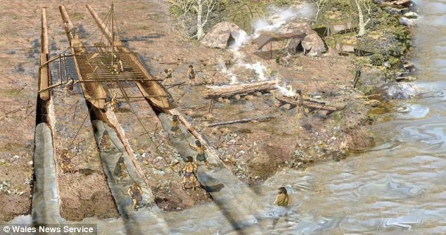
I’ve always been fascinated by how archaeological discoveries can unravel threads of history. Still, they can also become entangled in webs of misinterpretation and incorrect dating, leading to significant findings being dismissed or misunderstood. A case in point occurred in a Welsh housing estate where ancient slipways were initially mistaken for longhouses. This confusion sparked a question: why would such elaborate structures be necessary for something as simple as a lightweight dugout canoe?
The connections between the legends of Atlantis and Hyperborea, and the works of Homer represent a fascinating intersection of myth, philosophy, and epic narrative within ancient Greek literature. These stories not only provide insights into the geographical and cultural understandings of the Greeks but also reflect deeper philosophical and ethical concerns that permeate Greek thought. Below, we explore these themes in greater detail, delving into how these mythical and literary works intertwine and what they signify about ancient Greek civilisation.
Standing on the worn, weathered path of a holloway, enveloped by the towering earthen walls on either side, I often contemplate the origins of these enigmatic features. As a wanderer drawn to these ancient pathways, I’ve always been fascinated by the layers of history and mystery that seem to permeate the very soil beneath my feet. Holloways, these sunken roads carved into the landscape, carry with them the aura of countless stories, but their formation captivates my curiosity the most.
The third book in my trilogy aims to weave together the discoveries made across Britain, with a particular focus on Stonehenge, to shed light on a civilisation that archaeologists have termed the ‘megalithic builders.’ This civilisation is markedly distinct from those that came after, showcasing an extraordinary level of capability and engineering skill in moving vast stones and constructing earthworks that have endured for nearly ten thousand years. These achievements are even more striking when compared to the structures left by the Romans, who occupied these lands for hundreds of years yet left behind fewer enduring monuments.
The papers published by researchers from the University of London, Southampton, and Manchester, including Mike Parker-Pearson and his team, regarding the discovery of the quarries at Craig Rhos-y-Felinand the bluestone megaliths at Carn Goedog have been a significant contribution to our understanding of Stonehenge’s origins. This research brought to light the fascinating theory that Stonehenge was initially constructed in Wales and then transported to Salisbury Plain around 500 years later.
Here is the perfect resaerch resource for any bidding arcaheologist – 3D LiDAR Maps – there are free and can be downloaded by clicking the Right Site of the Mouse and saving it to your hard Drive for closer inspection, with you PC/Mobile reader software. (FREE Stonehenge LiDAR Maps)
If you study archaeology at university or even on an ordinance survey map at length, you will notice strange earthworks on the sides of hills of Britain, with no rational explanation as to why they are there and for what reason. These features are mostly ignored at university, or an excuse is made for their construction. The reality is that these features do not make any sense unless there are other factors in operation which have been ignored.
The first thing to notice is that the word ‘Dyke’ is associated with water. It does seem strange you would call an earthwork on top of a hill a Dyke, unless there was some history passed down through the years to its actual use. If we look at the most famous Dyke in Britain, ‘Offa’, we notice that it is attributed to a Saxon King and, therefore, could not be prehistoric. Or is this a clear indication of how archaeologists find excuses for these features rather than factual, empirical evidence?
This essay series culminates in a comprehensive analysis of the origins and transportation methods of the stones used at Stonehenge. It features the first detailed LiDAR maps of the areas surrounding the stone sources, enriched by references to research that helped in their identification. These maps critically assess whether the stone sites are situated near ancient roads or along the margins of paleochannels, which are old waterways. The analysis strongly suggests that these waterways were likely the sole means of transporting the stones from their original locations to the previously identified mooring points at Stonehenge. Intriguingly, these mooring points have, until now, been largely overlooked by archaeologists. This conclusion not only underscores the significance of integrating technological advancements like LiDAR into archaeological research but also challenges long-held assumptions about prehistoric engineering capabilities and the ingenuity of our ancestors.
Exploring the origins and transportation of the stones used to construct Stonehenge continues to be a fascinating subject, ripe with theories and controversies. The viral interest generated by my blog post this week, which highlighted a map showing three known sites of the stones’ origins, barely scratches the surface of this complex logistical puzzle. Indeed, there are stones from even greater distances, opening a myriad of questions about how these megaliths were transported to their final resting place at Stonehenge. This essay aims to delve deeper into these logistics, providing a comprehensive overview based on the latest research and theories.
In the past ten years, I have faced significant challenges in establishing the validity of my claim that Linear Earthworks are prehistoric canals. Many people have dismissed my theory, but I have not let that stop me. I undertook a comprehensive survey of 1500 Historic England’s Scheduled Linear Earthworks, and the findings culminated in the first book of a quadrilogy series detailing the East Wansdyke area. This publication is a significant personal milestone and an unprecedented achievement in the field of archaeology that no university or research team has matched.
Over the recent span of years, there has been a marked tendency to present images of climatic upheaval—storms that rend the fabric of local communities and touch the lives of individuals with their tempestuous hands. In the discourse on flooding, an almost theatrical emphasis is placed upon the metrics of catastrophe: the voluminous descent of rain and the gales’ ferocious velocity. Amidst these narratives, a phrase of gravitas, ‘since records began,’ is often delicately woven, lending weight to the tales of unprecedented climatic fury that segment our years into records of seasonal extremities.
At the outset, the clay-with-flints, a vestige of ancient weathering and erosion, stands as a testament to the relentless forces of nature that sculpted the landscape. Born from the remnants of Palaeogene sediments and the dissolution of chalk, these deposits serve as silent witnesses to the Pleistocene’s cold embrace. Their presence on the hilltop flats signifies a chronological anchor, predating the rhythmic succession of river terraces that stitch the valley’s quilt.
Fifteen years have elapsed since I introduced what some might label a ‘revolutionary’ concept, a brainchild born from my earlier explorations in archaeology. My investigations, particularly the graphical representation of 50 sites encompassing Stonehenge and its surrounding barrows, revealed a striking pattern: all these locations consistently occupied the upper 30 percentile, perched halfway up a hill or higher for the uninitiated.
In the profound tapestry of human history, the emergence of Lidar archaeology technology stands as a beacon, illuminating hidden chapters and rewriting the narrative of our past. As we traverse the landscapes of antiquity, a remarkable revelation comes to light through the lens of Lidar – the Linear Earthworks that crisscross our ancient terrains. Driven by laser precision, this technological marvel exposes a new dimension in historical understanding that challenges conventional wisdom and prompts us to reconsider the nature of these enigmatic earthworks.
In the latest installment of Digging for Britain’s Season 11, the spotlight turns to the intriguing Caerfai Promontory Fort, also known as Penpleidiau, perched on the edge of Wales. Nestled approximately 1.3km southeast of St David’s, this archaeological site, with its formidable features, compels a reevaluation of traditional interpretations and invites us to question the prevailing coastal ‘Hill Fort’ narrative.
In the first part of our exploration, we delved into the televised program ‘Digging for Britain’ and scrutinised the methodology employed by the purported experts, questioning the reliability of their conclusions regarding the dating of Cerne Abbas. Our investigation highlighted flaws in the sampling process, particularly the oversight of soil creep, which significantly impacts the interpretation of the site’s history.
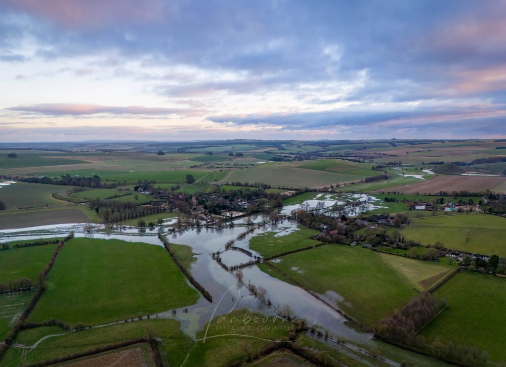
Recently, I received a message from my friend Chris at Lambourne Photography who shared new winter photos of Avebury. The landscape, experiencing recorded rainfall, has begun to flood, capturing my keen interest. This flooding aligns with the predictions in my prehistoric Avebury maps, considering the post-glacial flooding during the Mesolithic period (10k to 4k BCE).
In a recent instalment of ‘Digging for Britain,’ Alice Roberts stirred the archaeological pot by asserting that the Dorset Chalk Giant (Cerne Abbas) had Saxon origins rather than the presumed prehistoric roots. The revelation added a layer of intrigue, especially for someone like me, deeply entrenched in Landscape Archaeology. At first glance, the giant’s features seemed to echo a Neolithic connection, reminiscent of the Uffingham White horse. Both figures boasted natural harbours in the hillside, suggesting potential prehistoric maritime use.
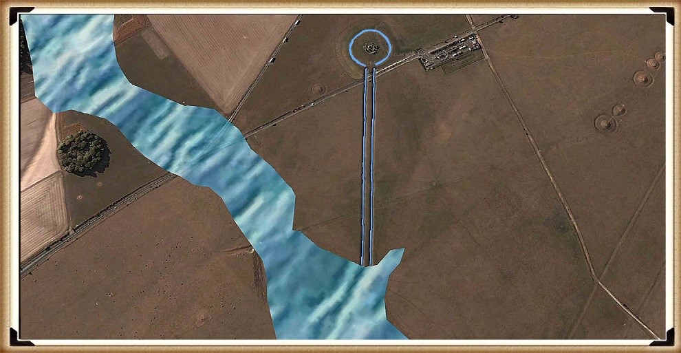
As the waters began to recede, the architects of Stonehenge found themselves confronted with a formidable engineering challenge: how to contend with the diminishing groundwater table while ensuring the Stonehenge moat remained adequately filled. In the preceding discussion, we established the application of a clay waterproofing layer to transform the Stonehenge moat into a reservoir akin to a dew pond. In this chapter, I delve into the intricacies of their solution—a newly constructed earthwork known as ‘The Avenue,’ complete with its own moat designed to bring the waters closer to the monumental bathing moat.
Robert John Langdon has also created a YouTube web channel with over 100 investigations and video documentaries to support his classic trilogy (Prehistoric Britain). He has also released a collection of strange coincidences that he calls ‘13 Things that Don’t Make Sense in History’ and his recent discovery of a lost Stone Avenue at Avebury in Wiltshire called ‘Silbury Avenue – the Lost Stone Avenue’.(2024 Prehistoric Britain Blog Review)
Langdon has also produced a series of ‘shorts’, which are extracts from his main body of books:
For active discussions on the findings of the TRILOGY and recent LiDAR investigations that are published on our WEBSITE, you can join our and leave a message or join the debate on our Facebook Group.
For in-depth information about British Prehistory, we invite you to explore www.prehistoric-britain.co.uk, an extensive resource featuring archaeology blogs and investigations. This collection includes modern LiDAR reports that shed light on ancient landscapes. Additionally, you will find extracts and articles from the Robert John Langdon Trilogy, offering fascinating insights into Britain during the Prehistoric period. Some notable titles from the trilogy include “The Stonehenge Enigma,” “Dawn of the Lost Civilisation,” and groundbreaking evidence of Post Glacial Flooding and its impact on the landscape we see today.(Free Stonehenge LiDAR Maps) Robert John Langdon has further enriched the exploration of Prehistoric Britain through his YouTube web channel, boasting over 100 investigations and video documentaries that complement his classic trilogy. In addition to his extensive work, Langdon has unveiled a compilation of intriguing coincidences titled “13 Things that Don’t Make Sense in History.” He has also brought to light his recent discovery of a forgotten Stone Avenue in Avebury, Wiltshire, aptly named ‘Silbury Avenue – the Lost Stone Avenue.’ (2024 Prehistoric Britain Blog Review)
For those who wish to actively engage in discussions about the findings from the TRILOGY and recent LiDAR investigations, we invite you to join our community. You can participate by leaving messages and joining our dedicated Facebook Group debates. We encourage open dialogue and exchanging ideas to foster a deeper understanding of Prehistoric Britain and its fascinating mysteries.(2024 Prehistoric Britain Blog Review)
As you embark on your journey through British Prehistory, we hope these resources provide valuable insights and inspire further exploration of this captivating field of study.
The book ‘The Car Dyke LiDAR Atlas’ presents a thorough investigation of the Car Dyke, a large ancient waterway in Britain. Using LiDAR technology, the author argues that the Dyke is much older than previously thought, dating back to the Mesolithic/Neolithic periods, and was likely used for transportation and water management rather than simply as a Roman drainage channel or defensive barrier. The book features detailed maps and analysis of the Dyke’s construction and course, including insights into the surrounding landscape and archaeological finds, to support the author’s conclusions.
Car Dyke Transcript
Welcome in deep divers ready to get our hands dirty.
Always up for a challenge, especially if it involves rewriting history.
Today we’re diving headfirst into the heart of eastern England.
Sounds intriguing. What’s on the agenda? Roman ruins, hidden treasure.
Even better, we’re tackling a seemingly unassuming ditch known as Car Dyke
A ditch. You’ve piqued my curiosity. There’s got to be more to it than meets the eye.
Oh, absolutely. This isn’t just any ditch car. Dyke has been hiding in plain sight for centuries, mislabeled as just another Roman canal.
I’m sensing a butt coming,
But thanks to some seriously cool tech. Lidar, our car dyke secrets are finally coming to light
Lidar for our listeners who aren’t familiar, it’s like giving archaeologist X-ray vision, right? Seeing beneath the surface without even lifting a shovel.
You got it. And that’s where Robert John Langdon’s work comes in his Car Dyke Atlas uses lidar to paint a whole new picture of this ancient waterway.
Okay. I’m hooked. We’ve got cutting edge technology and a fresh perspective on what we thought we knew. Let’s dive in.
Let’s start with the biggest bombshell car Dyke’s actual length. We used to think it was around 85 miles long. Not too shabby, right?
Impressive for sure.
Hold on to your hats, because LiDAR revealed it’s actually a whopping 103 miles long.
Well, that’s longer than any other known dyke in Britain. Talk about a game changer.
Yeah,
Suddenly we’re not talking about a local project. This suggests a level of planning and coordination that makes you rethink everything.
And that’s just the beginning. Remember those assumptions about car dyke being Roman? Well, LiDAR revealed something interesting. Instead of those ruler straight lines. The Romans loved some sections. Let’s just say they get a little. Wiggly. Not exactly the precision engineering we associate with Rome.
So not just longer, but potentially much older. This is where things get really interesting.
These wiggly sections, what makes them so special?
They often line up perfectly with ancient shorelines and natural springs. Features you wouldn’t know about without Lidar’s ability to see underground. It suggests construction happened when the Fens were a much wetter, wilder place.
So instead of battling the landscape like the Romans might have, these early builders worked with nature using their knowledge of water flow and natural springs to their advantage. Talk about ingenuity. It really highlights their adaptability and deep understanding of the environment.
It’s like comparing two completely different engineering philosophies, reflecting not just changing needs, but how technology evolved over thousands of years.
Absolutely. And that contrast is crystal clear when you look at Langdon’s maps, the early sections hugging the high ground, ensuring that natural flow from the springs,
And then the later Roman sections just slicing straight through.
It’s like they said, we’re the Romans, we build in straight lines.
But what’s amazing is how those early sections might have worked, just like modern canals, but without using locks, they relied on those natural gradients and carefully chosen routes to manage the flow of water.
Now that’s some clever engineering. Speaking of which, how did LiDAR help uncover these subtle differences in construction?
Imagine looking at an aerial photo of a dense forest. You see trees, right? But not what’s below. LiDAR strips away that canopy. It revealed subtle changes in elevation and vegetation that hinted at these different construction phases.
So it’s like they left us a hidden message written in the very landscape itself, and we finally have the tools to decipher it.
We’ve got this massive waterway, potentially pre-Roman, showing a deep understanding of water management. This can’t just be about irrigation, right? What was its purpose?
That’s the million dollar question. And it forces us to rethink our assumptions about life in prehistoric Britain. If these early sections of Car Dyke really do predate the Romans,
Which the lidar suggests they do.
Exactly. Then we’re talking about a society far more advanced and interconnected than we ever imagined.
This wasn’t just a weekend project. It was a mammoth undertaking requiring incredible coordination and collaboration, and that just wasn’t thought possible for people of that era.
It really flips the script on how we view them, doesn’t it? They weren’t just surviving, they were thriving. And Car Dyke, that just might be the key to understanding how.
We’re back. Deep divers. Did you catch your breath yet? After that last revelation?
Honestly, I’m still wrapping my head around it. It really makes you wonder what else we’ve missed when it comes to our ancient ancestors.
Right? And get this, the plot thickens. It turns out Car Dyke might challenge one of our biggest assumptions about ancient dykes in general.
Okay. I’m listening. What assumption are we shattering today?
Well, we usually think of these huge ditches as, you know, defensive barriers. Like drawing a line in the sand. You stay over there. We’ll stay over here.
Yeah, like a giant keep out sign. But Car Dyke doesn’t quite fit that mould, does it?
Not one bit. This network, especially with those older sections connecting to lost shorelines. And get this paleo channels, they’re basically ancient dried up riverbeds. Points to something way more interesting.
So instead of walls, we’re talking about prehistoric highways. Like a way to actually connect with other settlements.
Bingo. Think about it. Moving goods, sharing ideas, all made possible by an intricate network of waterways. Long before the Romans ever marched in with their straight roads, the Britons were cruising along these waterways. And speaking of moving things,
You’re thinking about Stonehenge, aren’t you?
Busted. But seriously, those massive stones, Avebury, all of that moving them has always been a logistical head scratcher. Could Car Dyke hold the answer?
It’s a mind blowing thought, isn’t it? Imagine, instead of back breakingly dragging those stones over land, they were floating them along this intricate waterway system. So much more efficient and less disruptive. Picture a flotilla of prehistoric boats navigating these channels, those iconic stones on board not just cargo, but symbols of shared beliefs, maybe even religious ideas. It’s a completely different picture of prehistoric Britain, isn’t it?
Completely. It makes you realise how much we may have underestimated them. But okay, before we get too carried away, let’s bring it back to the data. Langdon doesn’t just stop it, at Lidar. He goes full on detective, analysing the objects found along car dyke. What he find.
This is where the statistical analysis comes in. Langdon looked at how likely it was to find such a large cluster of artefacts from specific eras. The Mesolithic, Neolithic and Bronze Age all along the Dyke.
Don’t keep us in suspense.
Let’s just say the results were, statistically speaking, through the roof. Way too many artifacts to be some happy coincidence.
So not just a few random things people dropped, but evidence of something much bigger going on.
Precisely. It strongly indicates that stretches of car dyke were hives of activity long before the Romans showed up.
Okay, so now we have this picture. A huge ancient network of waterways possibly used for trade transportation. Who knows what else. Then enter the Romans, Masters of engineering and straight lines. What did they make of this already existing infrastructure?
That’s the fascinating part. As ingenious as the Romans were, they were also incredibly practical. They saw the brilliance in those wiggly, meandering waterways, how they follow the natural lay of the land. And they rolled with it.
So a bit of where the Romans, we do things our way, but also a touch of, hmm, these prehistoric folks were on to something.
Exactly. They incorporated the preexisting knowledge into their own plans. You can actually see this in Car Dyke today. Some sections are those laser street Roman roads bear hair waterways, while others wiggle and wind following those ancient, more organic roots.
Talk about a fusion of styles. It speaks to Roman ingenuity, but also a respect for the people who came before. But this begs the question why were the Romans so drawn to Car Dyke in the first place? Was it just strategic, or was there more to it? Langdon suggests this waterway may have been a key factor in the economy back then. Could we go as far as to call it a prehistoric economic engine?
So we’re back. Last we left off, we were trying to wrap our heads around car dyke being this, well, prehistoric economic powerhouse, a bit of a bold statement that you think maybe, but think about it. What are the key ingredients for a thriving economy? You need resources, sure, but also the means to move them around, to connect, to exchange. Not just goods, but ideas. And that’s where car dyke comes in.
So it wasn’t just about moving stuff from point A to point B, but actually creating a system for growth and innovation.
Exactly. Car Dyke wasn’t just a ditch. It was an artery, a network of waterways breathing life into these settlements that might have otherwise been isolated. Imagine the possibilities. Suddenly you have specialized skills. Trade routes, a breeding ground for new ideas. All thanks to this intricate water system.
Okay, I’m starting to see the bigger picture, but what evidence did Langdon find that really supports this prehistoric Silicon Valley theory?
Well, he points to the clusters of specific artifacts found along car dyke tools, pottery, remnants of early metalworking, all concentrated in ways that suggest something beyond just your average everyday life.
More like specialized workshops, right? Taking advantage of the waterway, both to get their raw materials and then ship out whatever they created.
Precisely. And it makes you look at those wiggly sections, those seemingly less efficient paths in a whole new light.
They weren’t just following the terrain, they were strategically connecting these hubs of activity.
Exactly. Plus, we can’t forget the sheer scale of this thing. Building and maintaining 103 mile waterway, even with prehistoric tools, would have taken massive coordination and organization.
We’re talking next level project management, leadership, planning, resource allocation. It boggles the mind, not to mention the exchange of knowledge that must have happened along the way.
Right? Think about all those different groups coming together, each with their own skills and knowledge. That kind of collaboration, that cross-pollination of ideas, it’s the perfect recipe for innovation.
So not just an economic engine, but a melting pot of ideas and innovation. It’s amazing to think that this simple ditch might hold the key to understanding how complex societies developed in prehistoric Britain.
It really makes you wonder what else is still out there, hidden just beneath the surface, waiting for us to uncover it,
And to think all it took was a fresh perspective, a healthy dose of curiosity, and of course, the magic of Lidar.
Who knows what other mysteries are waiting to be revealed
To all you deep divers tuning in. If this exploration of Car Dyke has taught us anything, it’s that history is full of surprises. So keep questioning, keep exploring. And who knows, maybe you’ll make the next big discovery. Until next time, happy digging.
This is a primary report of the first LiDAR mapping of Car Dyke in Lincolnshire
Introduction
Car Dyke is one of the most enigmatic and intriguing remnants of Roman engineering in Britain. Stretching across the Fens of Eastern England, this ancient waterway has puzzled historians, archaeologists, and enthusiasts for centuries. Theories about its purpose and origin are as varied as they are compelling, reflecting the complexities of interpreting ancient structures without definitive historical records. This introduction aims to present a comprehensive overview of Car Dyke, encompassing both past and current theories regarding its use and origin.
Car Dyke: A Brief Description
Car Dyke runs for approximately 85 miles (137 kilometres) from Waterbeach in Cambridgeshire to the River Witham near Lincoln. Its construction is attributed to the Roman period, specifically around the 1st or 2nd century AD. The Dyke consists of a broad, shallow ditch with accompanying banks, a typical feature of Roman civil engineering, yet its exact function remains a matter of debate.
Early Theories: Navigational and Defensive Purposes
The earliest theories about Car Dyke’s purpose centred around its potential use as a navigational canal. Some scholars suggested that the Romans constructed it to facilitate the movement of goods and troops across the Fenlands, which were notoriously difficult to traverse due to their marshy nature. This theory aligns with the Romans’ known prowess in building canals and other hydraulic structures throughout their empire.
Another prevalent early theory posited that Car Dyke served a defensive purpose. Given the strategic importance of controlling the Fenlands, it was speculated that the Dyke might have been part of a broader military defence network. The presence of Roman forts and settlements along its route lends some credence to this idea, suggesting that the Dyke could have been a boundary or a means to control movement through the region.
Our Research
We have now sucessfully mapped the northern section of Car Dyke and located all the findings from periods from Mesolithic Period to modern times. Our objective is to discover or confirm the construction date of the Dyke and its function.
Fens
The first aspect of the maps show that Car Dyke ‘hugs’ the raised shorelines of the Fen Area. This is in contrast to the modern and some Roman drainage ditches.
Car Dyke – Profile
Locks and Water Management
One of the most striking anomalies observed in the Car Dyke is the varying elevation profile along its course. Contrary to what might be expected from a Roman engineering project, the dyke does not maintain a flat or consistent gradient. In fact, in some sections, the elevation fluctuates by as much as 4 meters (14 feet) without the apparent use of locks to regulate water flow.
This irregularity raises intriguing questions about the design and function of the Car Dyke. Historically, Greek engineers were pioneers in using canal locks, employing them to manage water levels in the Ancient Suez Canal as early as the 3rd century BC. Similarly, under Emperor Trajan, the Romans utilised sluice gates to control water flow at the entrance to the Red Sea, extending the canal south to what is now Cairo to improve water inflow.
The possibility that the Romans might have used ancient pound locks to manage height differences in canals has been proposed by several scholars. These locks would have allowed for regulating water levels and bridging elevation gaps, much like modern lock systems. However, the absence of clear archaeological evidence for such structures in the Car Dyke—or elsewhere in Roman Britain—leaves this hypothesis unresolved.
Given the significant elevation changes along the Car Dyke, the lack of any visible lock mechanisms suggests alternative explanations must be considered. It’s possible that natural springs or other water sources were strategically utilised to maintain water levels or that the dyke served a different purpose altogether, one that did not require precise water level management.
The question of whether ancient pound locks were used in the Car Dyke remains one of the many mysteries surrounding this ancient structure. Without concrete archaeological evidence, the debate is likely to continue. However, the abnormal elevation profile is a critical factor that must be addressed in any comprehensive analysis of the Car Dyke’s construction and function. As we delve deeper into the investigation, understanding how these variations in height were managed will be crucial to unravelling the true nature of this enigmatic alleged Roman legacy.
Wibbly-Wobbly pathway is not of Roman design
Dyke Design
In examining the northern section of the Car Dyke, we observe two markedly different design patterns, each suggesting a distinct approach to engineering. The first pattern, characterised by a “wibbly-wobbly” alignment, closely follows the contours of higher land formations and hugs the shoreline. In contrast, the second design, which traverses the low-lying marshlands (indicated in blue), features the straight, linear precision typically associated with Roman engineering.
This stark contrast in design raises the possibility of looking at two different techniques, potentially indicative of two separate historical periods and civilisations at work. The “wibbly-wobbly” design, with its organic, meandering course, suggests a construction that prioritised the natural landscape, possibly indicating a pre-Roman origin. This approach aligns with a more ancient engineering practice, where the path of the dyke would have been dictated by the topography and the need to follow natural water sources or higher ground to avoid flooding.
The more uniform and linear sections of the dyke, on the other hand, are characteristic of Roman engineering. The Romans emphasised straight lines and efficient, purposeful design, often cutting across landscapes with little regard for natural obstacles. This technique is evident in their roads, aqueducts, and canals, where functionality and directness were paramount.
Given these observations, it is logical to hypothesise that the Car Dyke in its “wibbly-wobbly” form may have been an earlier construction, later adapted or reused by the Romans. This scenario suggests a continuum of engineering efforts, where the Romans recognised the utility of an existing structure and modified or extended it according to their own methods and needs.
Car Dyke and Roman Roads that are Straight
This theory of two distinct periods of construction is supported by the duality in the dyke’s design: the original, meandering path possibly built by an earlier civilisation and the later, more systematic Roman modifications. The reuse of earlier infrastructure by the Romans was not uncommon; they often incorporated and improved upon existing works, blending local traditions with their engineering principles.
While this hypothesis offers a compelling narrative, it remains speculative without further archaeological evidence. The precise dating of the different sections and the identification of specific construction techniques and materials will be crucial in confirming whether the “wibbly-wobbly” sections indeed predate the Roman modifications.
If this interpretation holds, it would provide valuable insights into the history of the region, illustrating a timeline where the Car Dyke evolved from a local engineering solution to a component of the expansive Roman infrastructure network. This layered history would highlight the Romans’ pragmatic approach to utilising existing resources and underscore the continuity and adaptation of engineering practices across different civilisations in Britain.
In conclusion, the northern section of the Car Dyke, with its dual design characteristics, likely reflects two distinct historical phases. The “wibbly-wobbly” sections suggest an earlier, possibly pre-Roman origin, later integrated into the Roman landscape through their characteristic straight-line construction. This scenario offers a fascinating glimpse into the interaction between different cultures and the evolution of engineering practices over time. Further research and excavation will be essential to validate this theory and fully understand the complex history of the Car Dyke.
The Maths and Proof of Concept
End of The Northern Section
This is the end of the Northern section and the Lincolnshire database. It allows us to examine the number of artefacts found and the probability that they were in use during this period. This probability is calculated by understanding the frequency of finds on Average over the entire county. Consequently, this is the collective number of artefacts found in Lincolnshire:
To calculate the prior probabilities for each period based on the total number of finds in Lincoln, we first calculate the total number of finds across all periods:
Neolithic/Mesolithic: The higher frequency of finds in this period significantly increases its posterior probability to approximately 30.69%, which is quite substantial.
Roman: Despite having fewer finds in this area, the Roman period still has a high posterior probability due to its higher prior, but it is now only about 60.74%.
Bronze Age: The probability for the Bronze Age period remains lower at approximately 8.55%.
Conclusion:
The calculated probabilities show a more balanced view, with the Roman period still favoured but with a much stronger case for the Mesolithic/Neolithic period. This suggests that while Roman use of the Dyke is still likely, the Mesolithic/Neolithic period also holds significant importance, potentially indicating earlier use or occupation before the Romans.
Langdon Mathematics
While Bayesian theory often yields definitive results, its accuracy can be compromised due to its dependence on subjective prior assumptions, which may only sometimes reflect reality. If these priors are not well-chosen or are based on incomplete or biased information, the resulting analysis might be misleading.
Therefore, relying solely on Bayesian methods without considering the variability and complexity of archaeological data could lead to conclusions that only partially capture the nuances of the actual distribution of artefacts. My method, which focuses on spatial analysis and empirical data, addresses these limitations.
My approach to calculating finds would differ significantly. First, I would define the area where artefacts could be discovered—using Lincolnshire as a reference due to its comprehensive archaeological data. By doing so, we can estimate the expected number of artefacts per square meter of Lincolnshire land, offering a more objective and spatially grounded method for understanding artefact distribution.
As IA reports:
To calculate the percentage likelihood of finding an artefact from each period in a single square meter of Lincolnshire, we can follow these steps:
Step 1: Determine the Area of Lincolnshire
Area of Lincolnshire: Approximately 6,959 square kilometres (6,959,000,000 square meters).
Step 2: Calculate the Find Density
For each period, calculate the density of finds per square meter by dividing the total number of finds by the area of Lincolnshire.
Step 3: Calculate the Likelihood for Each Period
Roman:
Likelihood: 0.000156%
Neolithic:
Likelihood: 0.000011%
Mesolithic:
Likelihood: 0.000004%
Bronze Age:
Likelihood: 0.000003%
Summary of Likelihoods in order of expectation:
Roman: 0.000156%
Medieval: 0.000129%
Post Medieval: 0.000081%
Early Medieval: 0.000024%
Iron Age: 0.000021%
Neolithic: 0.000011%
Mesolithic: 0.000004%
Bronze Age: 0.000003%
These percentages represent the likelihood of finding an artefact from each period in a square meter of Lincolnshire. Given the extensive activity during that time, the highest is for the Roman period, just marginally ahead of the Medieval period.
We now need to look at the search area (63 miles of the Northern End of Car Dyke) as listing on the LiDAR maps in the previous section of the book. We must first calculate the total search area in square metres, count the number of finding within this area, and then compare against the expected number.
Summary of Expected Finds:
Roman: 15.83 artefacts
Medieval: 13.07 artefacts
Post Medieval: 8.19 artefacts
Early Medieval: 2.44 artefacts
Iron Age: 2.17 artefacts
Neolithic: 1.07 artefacts
Unknown: 0.59 artefacts
Modern: 0.50 artefacts
Mesolithic: 0.36 artefacts
Bronze Age: 0.34 artefacts
Summary of Items Found:
Mesolithic/Neolithic: 61 finds
Bronze Age: 47 finds
Roman: 24 finds
Calculate the Odds of This Kind of Find
For each period, the odds ratio of finding this many artefacts compared to the expected finds:
Step 4: Interpret the Results
Mesolithic/Neolithic: A massive 5589.72% increase and an odds ratio of 57.01 suggest significant activity during this period, far beyond what was expected.
Bronze Age: An even higher increase of 13723.53% and an odds ratio of 138.24 indicate the area was very important during the Bronze Age.
Roman: A modest 51.60% increase with an odds ratio of 1.52 suggests Roman activity, but not as dominant as the earlier periods.
Conclusion
The very high percentage increases and odds ratios for the Mesolithic/Neolithic and Bronze Age periods strongly suggest that the Car Dyke area was occupied and actively used during these times, with significant archaeological activity that exceeds what would be expected based on general Lincolnshire data. While still represented, the Roman period is less prominent in this area compared to the earlier periods.
This confirms other Dyke surveys such as Offa’s and Wansdyke that also show design (wibbly-wobbly) in construction attributed to the builders seeking natural springs rather than a direct line of route to maintain water levels which were achieved at a later date in history by locks.