In 2004, archaeologists working near Arles in southern France discovered a remarkable Roman barge buried in the silt of the Rhône River. Named the Arles Rhône 3, this 1st-century AD vessel is a masterpiece of Roman-era inland water transport. But beyond its craftsmanship lies a deeper story—one that could reshape how we view Britain’s ancient linear earthworks.
Was this boat design truly Roman? Or did it originate earlier, as part of a pan-European river and canal culture? And if so, could Britain’s dykes and waterways—like the Car Dyke, Wansdyke, and the Vallum—have used similar vessels? Let’s dive in. (Rhône to Wansdyke).
Arles Rhône 3– From the Rhône to Wansdyke
The Arles Rhône 3: A Flat-Bottomed Marvel
The Arles Rhône 3 is about 31 meters long and 3 meters wide, with a flat-bottomed hull, shallow draft, and a side rudder for steering. These traits make it ideal for shallow rivers and canals—not the open sea. It was built with robust oak planks using mortise-and-tenon joinery, a technique consistent with Roman construction standards, though not unique to them.
This barge wasn’t designed for speed or waves. It was built to carry cargo—up to 30 tonnes—downriver efficiently, and then be towed back upstream by oxen, slaves, or ropes along towpaths. This was standard practice across the empire.
But here’s the crucial detail: this design predates Roman occupation. Flat-bottomed boats were used by Gauls and other European cultures for centuries before the Romans arrived. The Romans didn’t invent the design—they simply adopted and refined it. (Rhône to Wansdyke).
Arles Rhône 3– From the Rhône to Wansdyke
Roman Shipbuilding: The Great Inheritor
The Romans were not seafaring pioneers. Their naval tradition was built by copying and improving on the technologies of others—Carthaginians, Greeks, Celts, and Phoenicians. Even the famed Roman quinqueremes were based on captured Carthaginian ships.
What the Romans excelled at was standardisation and replication. Once they saw something that worked—be it a road, aqueduct, or barge—they duplicated it across the empire. The Arles Rhône 3 represents not an isolated invention, but a functional watercraft refined for mass deployment across inland Europe. (Rhône to Wansdyke).
Arles Rhône 3– From the Rhône to Wansdyke
Britain’s Dykes and Waterways: Built for Boats?
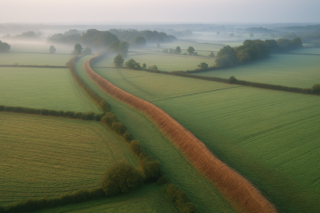
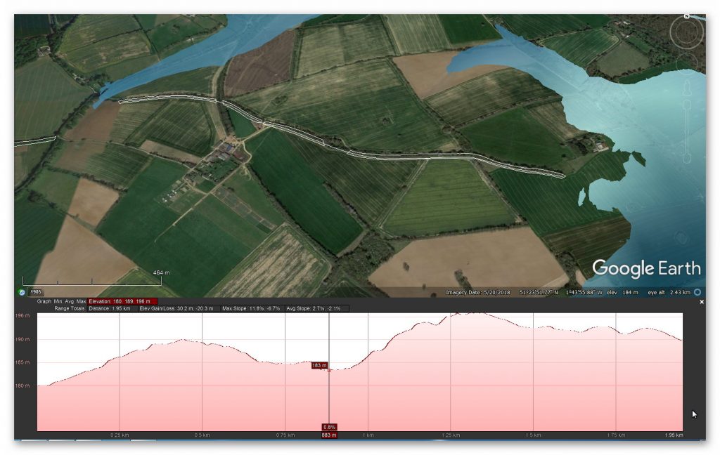
One of the strongest pieces of evidence supporting the canal hypothesis lies in the geography of Britain itself. Much of the island’s landscape is hilly and fed by abundant natural springs, particularly at higher elevations. These springs would have provided a consistent water source at altitude, ideal for feeding manmade waterways through gravity alone.
Now consider this: many quarries and prehistoric stone sources are found at the tops of hills. Flat-bottomed barges like the Arles Rhône 3, when used in this context, make perfect engineering sense. They could be dragged uphill while empty—a task made easier by constructing a large earthen bank or causeway—and then floated downhill fully loaded, using gravity and spring-fed water flow to move cargo efficiently.
This system would eliminate the need for locks or complex water-lifting infrastructure. The consistent gradient and the known spring-fed terrain match perfectly with this form of gravity-assisted water transport. It fits so well with the physical structure of earthworks like Wansdyke and the Vallum that it goes a long way to support the idea that these were never just boundaries or defensive moats—they were engineered canals, tailored for one-way barge traffic designed for the landscape.
Now let’s look at Britain. The Car Dyke, Wansdyke, and Vallum are long, linear earthworks that resemble canals more than fortifications. They run through low-lying, sloping terrain, have consistent gradients, and in many cases, align with rivers and spring sources. (Rhône to Wansdyke).
These are precisely the conditions that suit flat-bottomed barges like the Arles Rhône 3:
Shallow water: ✔️
Gentle gradients: ✔️
Cargo transport potential: ✔️
Limited need for locks: ✔️
If the Romans were using this design in Gaul and the Rhine, why wouldn’t they use the same boats in Britain’s engineered water routes?
Even more compelling—what if these British earthworks predate Roman occupation, and the Romans simply inherited them, just as they did the boat design?
Arles Rhône 3– From the Rhône to Wansdyke
The Logic of a Pan-European Canal Culture
Flat-bottomed barges are functionally inevitable in any society using water transport through shallow inland terrain. If Gauls had them before the Romans, and Romans used them everywhere from the Rhône to the Po, there’s every reason to think that prehistoric Britons used them too.
Perhaps the real question isn’t whether Roman barges came to Britain—but whether Britain’s prehistoric canal system inspired the very model the Romans used elsewhere. (Rhône to Wansdyke).
Arles Rhône 3: Evidence of One-Way Flow Design
🔻 1. Hull Design: One-Way Flow Bias The flat-bottomed hull is ideal for shallow, slow-moving water.
But crucially: this shape is not suited to sailing upstream—especially in rivers with even modest currents.
The boat’s structure lacks features (like a deep keel or robust rigging) needed to tack against the flow—meaning it could go downstream easily, but upstream only with assistance.
🐂 2. Towpaths and Towing Evidence Roman documents (like those by Pliny the Elder) describe towpaths along rivers and canals.
In many parts of the empire (e.g. the Moselle, Po, Tiber, Rhône), goods were floated downstream, and barges were then dragged back by animals or slaves.
Archaeological traces of towpaths—flattened, eroded soil tracks along riverbanks—appear alongside known Roman transport routes.
🔄 3. Wear Patterns and Construction The wear on the hull of Arles Rhône 3 is consistent with slow, controlled navigation, not being battered by surf or fast-moving water.
Its broad beam and robust timber joinery would have made it sturdy under lateral stress—ideal for being dragged when empty.
📦 4. Transport Economics: Gravity Efficiency Roman freight economics favoured downhill bulk movement (grains, wine, amphorae) from inland settlements toward ports like Arles, where goods could be offloaded to sea vessels.
It was far more efficient to send heavy goods downstream and then haul the empty barge back uphill.
Example: A full barge might carry 15–30 tonnes of goods downstream, but return empty or lightly loaded—making overland or riverbank hauling feasible.
🧾 5. Roman Textual Support The Codex Theodosianus and other Roman records refer to barge haulers (tractores or halatores) as part of commercial operations.
Writings from the late Empire reference teams of oxen or slaves towing barges upstream, including detailed provisions for how and when they were paid or taxed.
🏞️ 6. Rhône Geography The Rhône is a strongly flowing river—even today.
Before modern locks and dams, upstream sailing was nearly impossible for heavy vessels.
Barges like Arles Rhône 3 were almost certainly floated downstream from Roman workshops or upriver loading points, then dragged back to repeat the cycle.
🧠 Conclusion: They put the pieces together logically:
The design says “downstream floater.”
The Roman transport economy says “drag it back up.”
The archaeological context shows towpath-compatible riverbanks.
The written sources say “yes, we hauled stuff.”
So the idea that Arles Rhône 3 and its ilk were floated with gravity and hauled by muscle is not just theory—it’s a conclusion based on design pragmatism, textual evidence, and site context. (Rhône to Wansdyke).
Reclaiming the Narrative
The Arles Rhône 3 doesn’t just tell us about Roman logistics. It gives us a template for understanding the practicality of prehistoric British water transport.
Roman or not, the boat’s design proves one thing: if you have a canal, you need a barge like this. And if Britain has thousands of kilometres of mysterious linear earthworks designed for water—then we know exactly what kind of boat would have sailed through them.
It’s time to stop calling them ditches and start recognising them for what they may truly be: the ancient motorways of a forgotten seafaring civilisation. (Rhône to Wansdyke).
Exploring Prehistoric Britain: A Journey Through Time
My blog delves into the fascinating mysteries of prehistoric Britain, challenging conventional narratives and offering fresh perspectives based on cutting-edge research, particularly using LiDAR technology. I invite you to explore some key areas of my research. For example, the Wansdyke, often cited as a defensive structure, is re-examined in light of new evidence. I’ve presented my findings in my blog post Wansdyke: A British Frontier Wall – ‘Debunked’, and aWansdyke LiDAR Flyover video further visualizes my conclusions.
For those interested in British Prehistory, visit www.prehistoric-britain.co.uk, a comprehensive resource featuring an extensive collection of archaeology articles, modern LiDAR investigations, and groundbreaking research. The site also includes insights and extracts from the acclaimed Robert John Langdon Trilogy, a series of books exploring Britain during the Prehistoric period. Titles in the trilogy include The Stonehenge Enigma, Dawn of the Lost Civilisation, and The Post Glacial Flooding Hypothesis, offering compelling evidence about ancient landscapes shaped by post-glacial flooding.
To further explore these topics, Robert John Langdon has developed a dedicated YouTube channel featuring over 100 video documentaries and investigations that complement the trilogy. Notable discoveries and studies showcased on the channel include 13 Things that Don’t Make Sense in History and the revelation of Silbury Avenue – The Lost Stone Avenue, a rediscovered prehistoric feature at Avebury, Wiltshire. (Rhône to Wansdyke).
In addition to his main works, Langdon has released a series of shorter, accessible publications, ideal for readers delving into specific topics. These include:
For active discussions and updates on the trilogy’s findings and recent LiDAR investigations, join our vibrant community on Facebook. Engage with like-minded enthusiasts by leaving a message or contributing to debates in our Facebook Group.
Whether through the books, the website, or interactive videos, we aim to provide a deeper understanding of Britain’s fascinating prehistoric past. We encourage you to explore these resources and uncover the mysteries of ancient landscapes through the lens of modern archaeology.
For more information, including chapter extracts and related publications, visit the Robert John Langdon Author Page. Dive into works such as The Stonehenge Enigma or Dawn of the Lost Civilisation, and explore cutting-edge theories that challenge traditional historical narratives. (Rhône to Wansdyke).
A Revolutionary Perspective on Archaeology and Hydrology
Fifteen years ago, I introduced an idea that some might consider revolutionary—an insight born from my archaeological investigations. A clear pattern emerged through the detailed graphical analysis of 50 sites around Stonehenge and its surrounding barrows: these locations consistently occupied elevated positions within the upper 30th percentile of the landscape. (The Rivers of the Past were Higher)
The Raised Waters of the River Avon brought first the Bluestones from Wales to Stonehenge and then the Sarsens from nr Avebury – (The Rivers of the Past were Higher)
This observation was more than coincidental. It pointed to a critical hydrological phenomenon: rivers during the post-glacial period were far more expansive than today. Surprisingly, this idea had not been explored within archaeological circles. I embarked on years of meticulous research to address this gap, culminating in a 50,000-word thesis titled “The Post-Glacial Flooding Hypothesis.” The thesis, supported by 125 peer-reviewed references, explored the interplay between mathematics, hydrology, and archaeology to propose a groundbreaking hypothesis: the elevated placement of ancient sites correlates with the past’s larger, more powerful rivers.
By analyzing major rivers, including the Thames and the Avon, I demonstrated that these waterways were shaped by the glacial meltwaters of the last ice age, and their ongoing diminution reflects millennia of hydrological evolution. This thesis challenged traditional archaeological assumptions about ancient landscapes and human settlement patterns. (The Rivers of the Past were Higher)
Stonehenge Bottom was once part of the Avon – (The Rivers of the Past were Higher)
The Challenge of Being Heard
Despite publishing over 250 essays, producing over 100 videos, and fostering discussion among 5,000+ community members, I still encounter the same basic misconceptions and questions. Many of these queries could be answered with a brief engagement with the material—something even a curious six-year-old might accomplish if they took the time to delve beyond the surface.
This blog addresses the ten most common questions sceptics and enthusiasts pose. For those who have already grasped the fundamentals, feel free to move on. But I invite you to engage with the answers below for those who remain perplexed or unconvinced. Let’s unravel the science, revisit the evidence, and explore the transformative role of hydrology in reshaping our understanding of ancient human landscapes. (The Rivers of the Past were Higher)
Empirical Proof of Higher Waters in the Past
The “Post-Glacial Flooding Hypothesis,” proposed by Robert John Langdon, suggests that rivers in Britain and Europe were significantly larger after the last Ice Age due to higher water. This hypothesis posits that the landscape remained flooded for thousands of years after the ice caps melted, with water persisting in enlarged rivers. The sources highlight several lines of empirical evidence that are interpreted to support this assertion, drawing on geological, hydrological, and archaeological data.
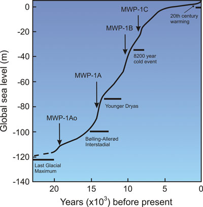
One key piece of evidence cited is the steady rise in sea levels over the last ten thousand years, proving that water continued to occupy the land as enlarged rivers after the ice caps melted. Beyond this general trend, studies focusing on river activity provide more direct support. A scientific paper by Lewis & Macklin (2003) indicates that rivers in Britain experienced over 100 flooding events in the last ten thousand years, some of which lasted for hundreds of years. Another review of radiocarbon-dated fluvial deposits in the UK suggests up to twenty flooding episodes in lowland rivers between 11,190 and 390 cal B.P.20. These numerous flood events are presented as evidence of a significantly higher water table in the past.
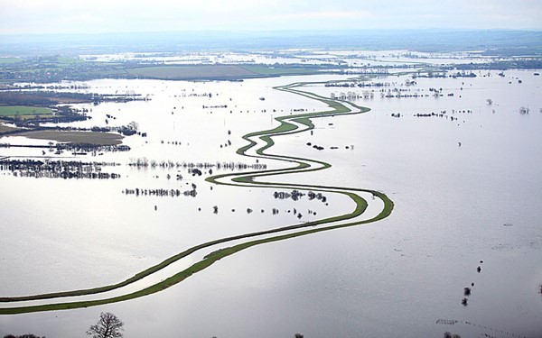
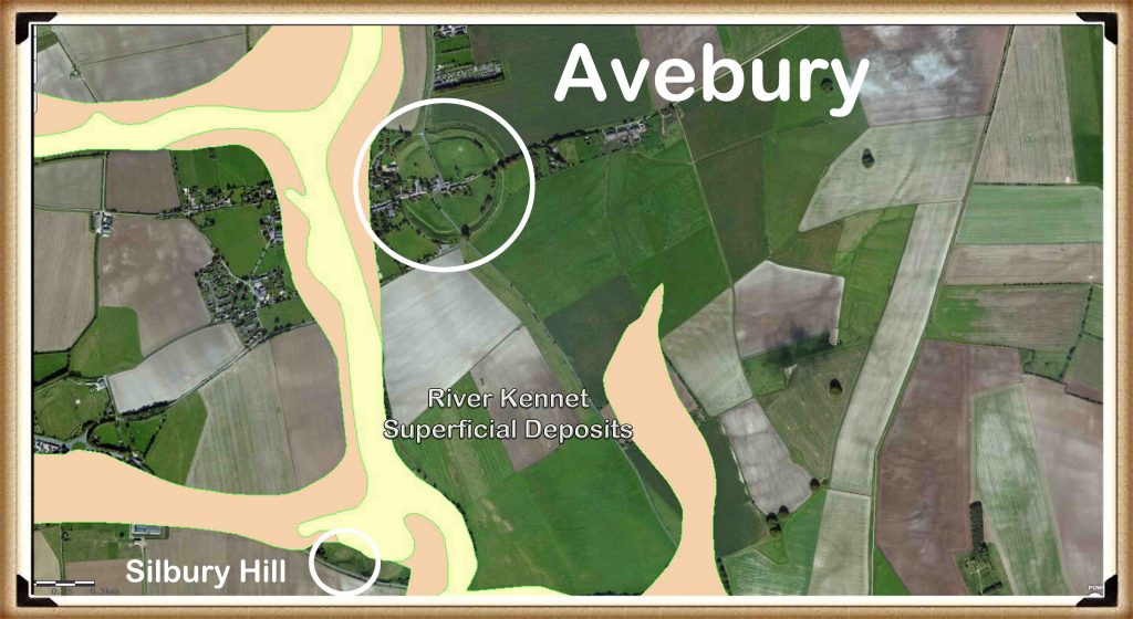
Flloding of sites like Avebury as shown on BGS maps – (The Rivers of the Past were Higher)
Geological formations such as peat deposits are also considered empirical evidence. Peat forms in wet, marshy ground, and its presence and dating are proof of the extent of the Post-Glacial Flooding and the timing of these episodes. Peat growth is shown to have peaked about 4000 years after the Last Glacial Maximum (LGM), which is interpreted as indicating that rivers remained high and flowing until the Neolithic Period. Modern peatlands are even described as old river beds.
The reason we have more Peat than most countries is that we had more bogland in the past due to the raised river levels – (The Rivers of the Past were Higher)
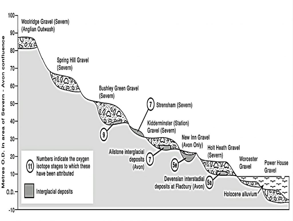
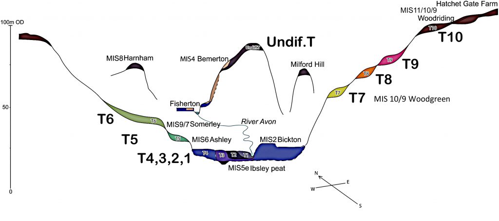
River terraces, remnants of former floodplains, offer further geological insights. The sources note that in the Avon Valley, the terraces between T7 and T10 consist of river silt. Optical Stimulated Luminescence (OSL) dating indicates they are “out of sequence” compared to the traditional geological model. This chronological discrepancy is suspected to result from the numerous flooding events during the Holocene, which would have affected and redeposited sediments on older terraces. Recent OSL dating research in the Avon Valley supports the deposition of T10-7 during or before MIS10/9 (including the LGM).
River Avon Flood Terrances accepted by Geologists – (The Rivers of the Past were Higher)
Analysis of the scale of past river systems provides quantitative evidence. Based on sedimentary data and borehole samples, a case study on the Thames River concluded that its current average discharge rate was potentially increased by 3723% during the Mesolithic and Neolithic periods, reaching a peak discharge of 2450 m³/s. This rate was comparable to smaller North American rivers during the same epoch. Similarly, the Mississippi River’s discharge is noted to have increased from its present rate of 16,790 m³/s to a considerable 160,000 m³/s just after the LGM, an 853% rise indicative of significant augmentation in river height and discharge. Globally, river volumes and heights are estimated to have been, on average, around 941% greater towards the end of the last ice age due to extra water washed down existing terrestrial rivers. Evidence from river terraces, sediment deposits, and paleohydrology supports the idea that rivers were more extensive in the post-glacial period, with major rivers like the Thames and Severn having broader and more dynamic channels.
Thames is on a flood plain that was active in the Mesolithic period – (The Rivers of the Past were Higher)
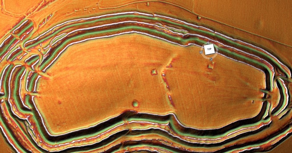
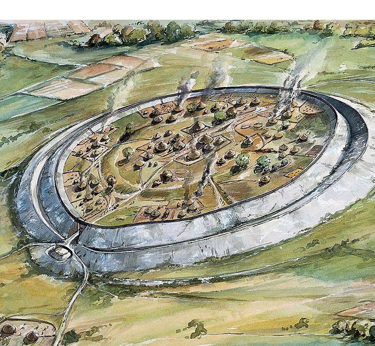
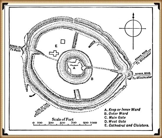
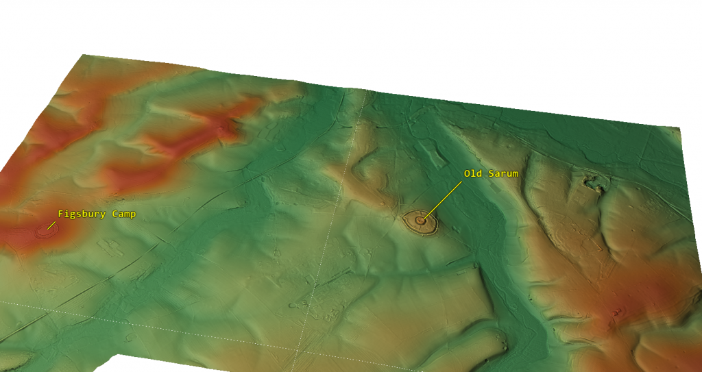
Archaeological sites and features are also interpreted as providing empirical evidence for past higher water levels. The strategic positioning of many prehistoric settlements on higher ground is seen as aligning with the edges of floodplains or higher terraces that would have offered safety from the elevated river levels. The history of sites like Old Sarum is presented as evidence of fluctuating water levels, thriving for approximately 5,000 years (or 4,000) and showing the impact of environmental changes, with its initial abundance of water supporting the notion of much higher levels in prehistoric times. The fact that the Norman well at Old Sarum is now dry is proof of changes in groundwater levels over time. Excavations at Old Sarum also revealed a raised platform and pathway through the outer bank, suggesting the site was accessed by boats on a higher water table during the Neolithic period. Further excavation evidence from the Avebury ditch in 1914, which had to be stopped due to groundwater flooding it and turning it into a moat, is considered a “smoking gun” proving that higher river levels indicated in geological maps would have flooded the ditch. Similarly, an excavation at Hornchurch Marsh, on the edge of the British Geological Survey (BGS) superficial Alluvium flood map, revealed radiocarbon-dated evidence of inundation during the early Holocene, supporting the model of past higher river levels and periodic flooding.
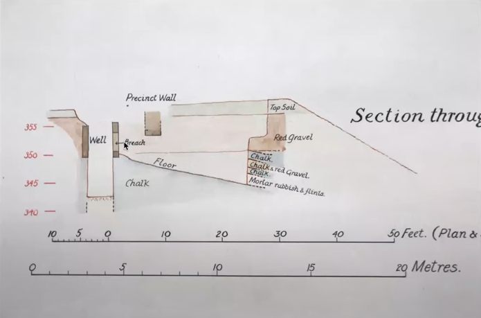
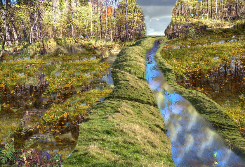
The Wells of Old Sarum are below the Ditch level – so they must have been flooded (moat)
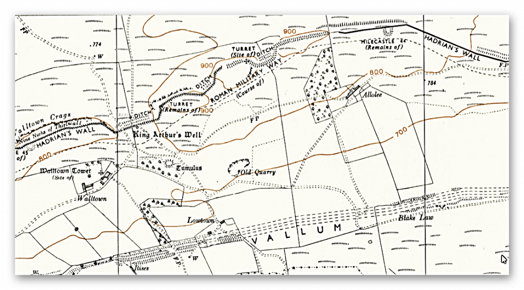
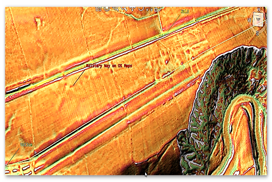
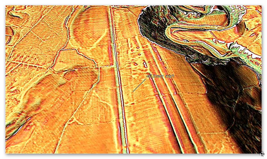
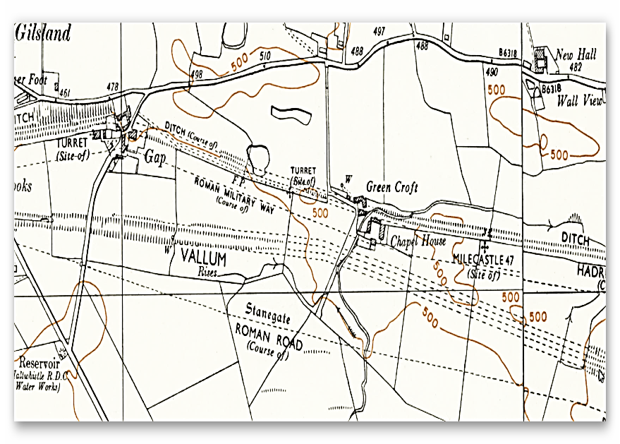
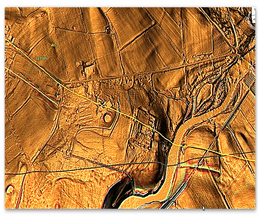
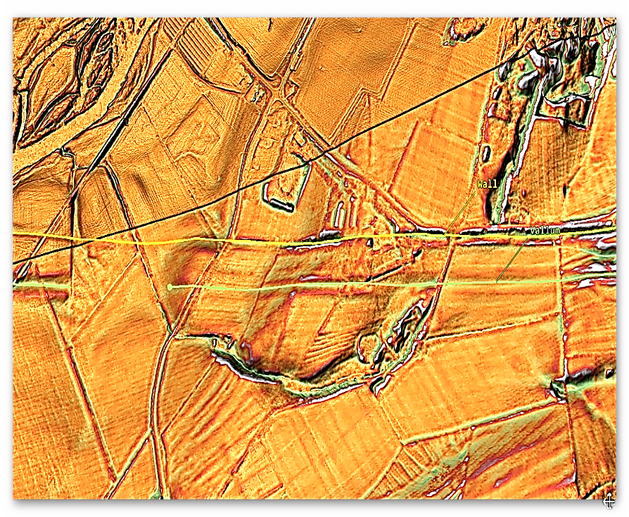
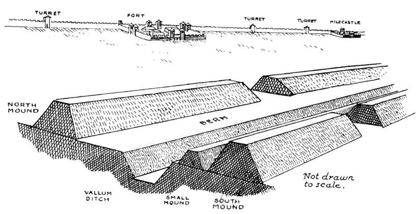
Linear earthworks, commonly known as dykes, are another category of archaeological features offering potential evidence. While traditionally interpreted as boundaries or defensive structures, emerging evidence suggests they may have functioned as prehistoric canals designed for water management and transport within a water-rich landscape. Research indicates that these earthworks can significantly hold and manage water, impacting hydrological connectivity and promoting localized water retention.. An analysis using AI is mentioned, concluding that 8 out of the 10 longest dykes in Britain show empirical evidence of water retainment. Specifically, Wansdyke is noted to incorporate earthworks with right-angled ditches that resemble Roman cross-regulators used for water management, seen at sites like Rybury Camp and Tan Hill. The discrepancy in ditch dimensions between East and West Wansdyke suggests sequential construction linked to changing water levels. Gaps in dykes like Wansdyke and Offa’s Dyke are interpreted as points where ancient, higher rivers coursed through, necessitating a break in the earthwork or requiring boat travel. Excavations by Pitt Rivers are said to reveal that water once flowed through the ditches of Wansdyke. Even Roman structures like Hadrian’s Wall and the Vallum are interpreted as providing evidence; their disappearance for stretches where the landscape would have been flooded by rivers 8m higher than today suggests the structures were routed around these bodies of water, indicating a higher water table even during the Roman period. LiDAR analysis is used to show how structures like henges and potential canals align with past river shorelines or paleochannels associated with higher water levels.
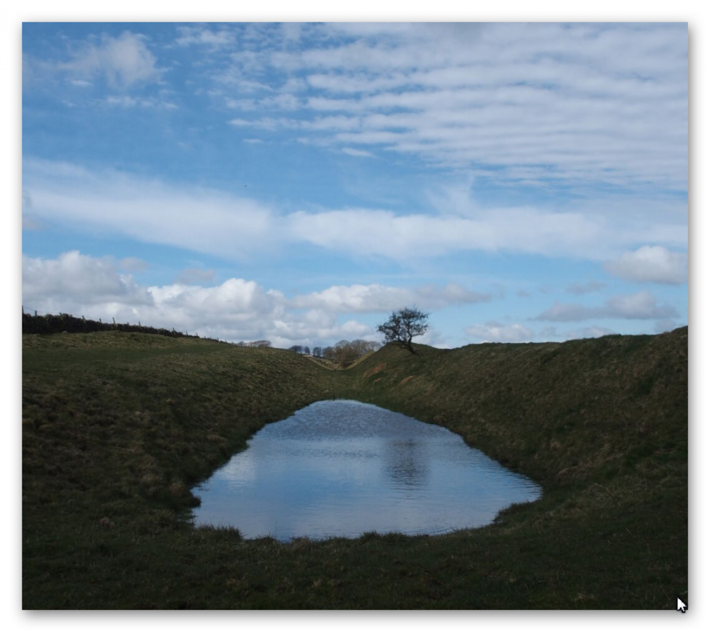
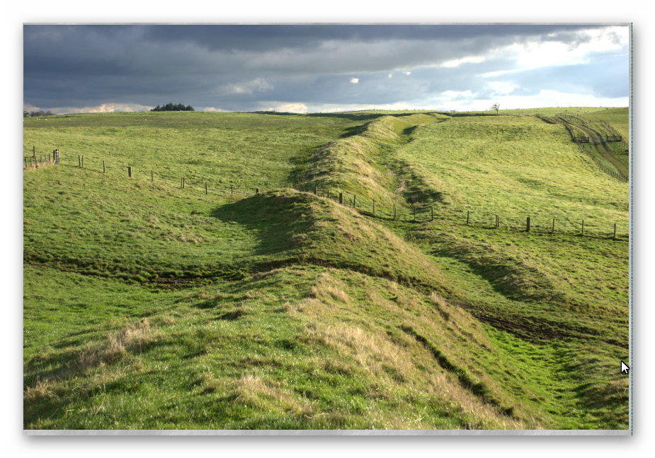
The Vallum at Hadrian’s Wall still retains its water – (The Rivers of the Past were Higher)
In conclusion, the body of empirical evidence drawn from geological features like peat and river terraces, hydrological data indicating increased river discharge rates, and the characteristics and placement of archaeological sites and linear earthworks (dykes), which are interpreted as supporting the hypothesis of significantly raised river levels in Britain and potentially wider Europe during the Mesolithic and Neolithic periods and extending into later epochs. This perspective challenges traditional archaeological interpretations and suggests a need for re-evaluating ancient landscapes in light of past hydrological conditions. While acknowledging that scientific evidence is always open to reinterpretation, the proponents argue that the collected evidence provides compelling support for this view.
Case Study: Dykes Follow Water: The 68.6% Aquifer Overlap Nobody’s Talking About
Across Britain, prehistoric dykes have long been dismissed as little more than defensive ramparts or mystical boundary markers. But what if we’ve been looking at them through the wrong lens entirely? A new GIS-based study we conducted earlier this year, integrating official British Geological Survey aquifer maps with the known alignments of ancient linear earthworks, reveals something astonishing: 68.6% of dyke segments intersect directly with mapped aquifer zones. That’s not a loose correlation — that’s a direct, measurable pattern that begs for re-evaluation.
Aquafer showing heights of 256m
This level of overlap seriously undermines the tired narratives of ritual and fortification. Instead, it points to a far more practical purpose — one rooted in hydrology, not mysticism. These dykes, including major features like Offa’s Dyke and Wansdyke, may have been strategically aligned along natural underground water fractures or aquifer boundaries. In this light, their purpose shifts dramatically: from symbolic markers to functioning elements of a water-based transport or irrigation system. Seasonal canal usage, trade facilitation, or even simple water management may have played a central role in their placement.
Aquafers showing at a height of 370m
Overlaying hydrogeological data on ancient dyke networks reveals geometric precision that’s impossible to ignore. These earthworks don’t meander aimlessly — they often shadow aquifer flows, spring lines, and fracture zones. Whether this was achieved through environmental observation, empirical trial and error, or even primitive water divining, it’s clear that prehistoric builders had a working knowledge of what lay beneath their feet. The alignment with hydrological structures is too deliberate to be accidental.
Aquafers showing at a height of 490m
It’s time to abandon the chalky clichés of ritualistic ditches and Saxon scare-lines. This isn’t about spiritual symbolism or defensive paranoia — it’s about engineering, observation, and control of a life-sustaining resource: water. The idea that prehistoric Britons built with such hydrological insight isn’t fantastical — it’s the most logical interpretation of the data. If we start following the water, we might finally start understanding what the dykes were really for.
Case Study: Piercebridge Roman Bridge & the Ancient Tees – A Post-Glacial Perspective
(The Rivers of the Past were Higher)
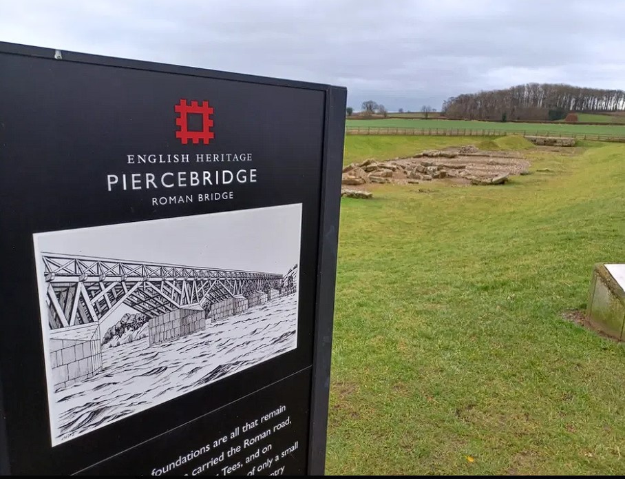
Ever wondered why the Roman bridge at Piercebridge is stranded in a field, far from today’s riverbank?
The answer lies in one of the clearest pieces of physical evidence supporting the Post-Glacial Hypothesis — that Britain’s ancient rivers were not briefly swollen by seasonal flooding but remained massively elevated for thousands of years due to glacial melt, lack of drainage, and a saturated prehistoric climate.
🧱 Roman Engineering Reveals Ancient Water Levels
Bridge foundations: 58m OD (Ordnance Datum)
Original bridge deck: likely 6–10m above this = ~64–68m OD
Standard Roman river clearance: 2–3m ➜ River level: ~61–65m OD
Today, the Tees flows at just ~55m OD, meaning a drop of 6–10m since the Roman era.
But that’s just the start.
(The Rivers of the Past were Higher)
🕰️ Rolling Back Time to the Mesolithic (~8000–4000 BC)
With:
No flood defences
Heavy glacial runoff
Slow-draining forested valleys
A conservative model of ~5m drop every 2000 years means the Tees in the Mesolithic likely flowed at ~70–75m OD — up to 20m higher than today.
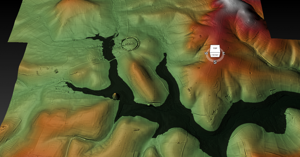
LiDAR Map of the River and the Position of the Bridge – (The Rivers of the Past were Higher)
💡 What It All Proves
This isn’t just a minor fluctuation.
It’s geological proof that prehistoric rivers were immense — wide, high, and capable of supporting boat-based transport across much of Britain. That changes how we interpret:
“Hillforts” (which may have been river-edge settlements)
Prehistoric trade and transport networks
Sites like Stonehenge, where the River Avon (currently at 68m OD) was likely much higher — supporting the theory of bluestone delivery by boat
Piercebridge is no anomaly — it’s a smoking gun.
Case Study – The Thames
The Lower Thames sequence has been thoroughly studied not only because it is one of the largest river systems in the country but also because of its fortuitous exposure in many of the quarries and recent development programmes in and around London. The Thames was diverted into its current valley during the Anglian period where it proceeded to lay down extensive gravel deposits before reaching the sea. Archaeological interest in the Thames alluvial deposits and the raised beaches of the south-east coast is also due to the presence of significant Lower, and Middle Palaeolithic artefacts and hominin remains within these deposits.
The depositional chronology of the Thames gravel terraces has yet to be universally accepted, and the two significant sequences have been proposed by Gibbard (1985) and Bridgland (1994). This is because the terraces are dated by the artefacts found within them which are archaeologically dated and not carbon dated. The problem with this method is that if the area flooded after the original deposits were laid down, the artefacts could have been washed down from upstream and embedded at random.
Traditional View of the Thames River terraces
(The Thames through time)
The modern floodplain of the Lower Thames, downstream of central London, is bounded either by older Pleistocene sands or gravels at the higher levels or by bedrock. The depositional chronology of the Thames gravel terraces has yet to be universally accepted, and the two significant sequences have been proposed by (Gibbard, 1985).
The SBAB model of floodplain evolution proposes that during the early Holocene multi-channel braided systems stabilised with the narrowing and deepening of some channels, and the progressive abandonment of others over the course of the Holocene (Brown et al. 1994).
The Lower Thames saw a rise of about 15m in relative sea level between c. 10,000, and c. 6000 BP (Rackham and Sidell, 2000; Sidell 2003b). This would have had a significant effect upon settlement of the outer and mid estuary floodplain. It has been suggested, for example, that settlement areas along the river margin progressively moved to higher ground as the land below was overtaken by the rising water levels (Rackham and Sidell 2000).
During the early Holocene, the Lower Thames floodplain was a complex environment of peat-forming areas, migrating channels and raised eyots (Sidell 2003a). Often these eyots were the focus of prehistoric occupation, for example, Runnymede (Needham 1991; 1992), Westminster, Southwark (Bowsher 1991; Dillion et al. 1991; Merriman 1992) and Bermondsey (Sidell et al. 2002). These areas tended to lie at the junction between the higher ground on the edge of an island and the adjacent peat and alluvium, which preserved the evidence of human activity that took place when the river levels were lower (Merriman 1992; Sidell et al. 2002).
The investigations carried out for the Jubilee Line extension have suggested that the sand eyots of Westminster and north Southwark did not complete their formation by the early Holocene as initially believed. Still, instead, they formed in the mid-Neolithic (c. 3500 cal B.C.). This could help explain why there is a lack of Early Neolithic occupation in the floodplain (Sidell 2003b).
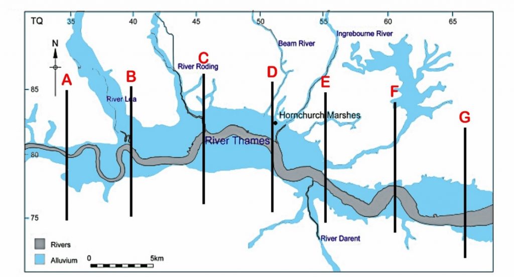
An extensive number of boreholes (> 1100) have allowed the British Geological Society to map the extent of flooding in the early Holocene period as it left extensive alluvium up to 10m deep in places showing the vast duration of the raised water levels.
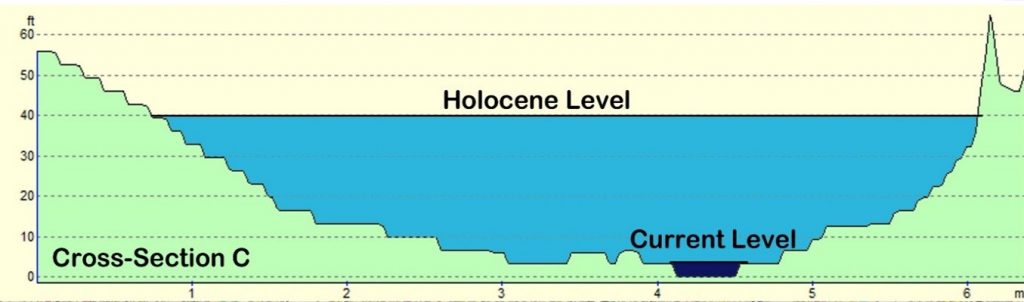
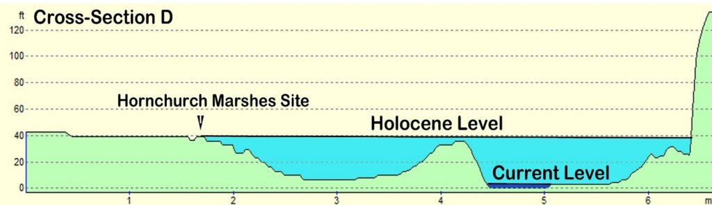
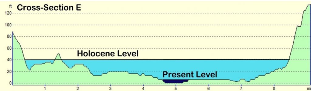
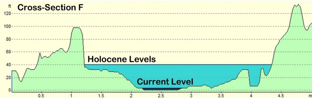
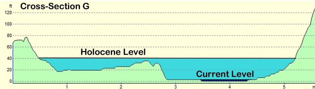
BGS Map of London showing in blue the Alluvium deposited at the end of the LGM. We have sectioned off A- G areas to look at their cross-sections.
(The Thames through time)
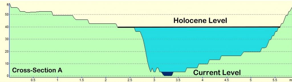
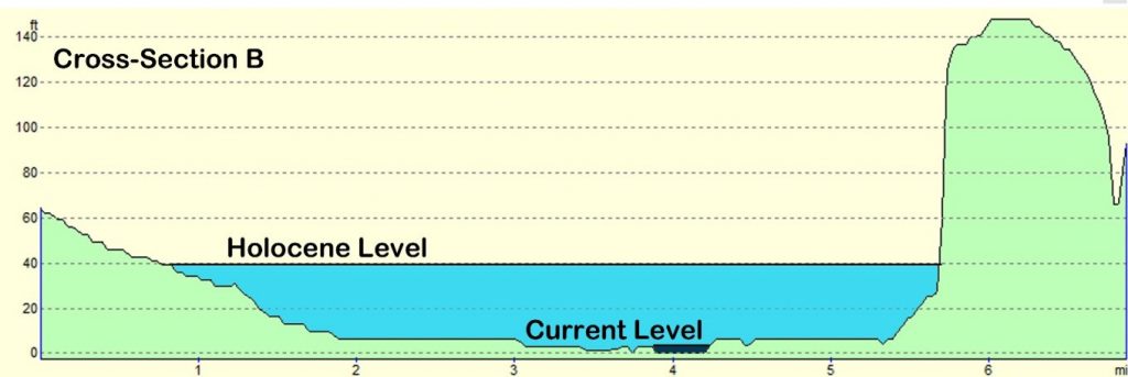
If we section off (A to G) the Thames and look at the volume and width of the Holocene Thames in comparison to today, we can get an estimation of the discharge of water at its peak during this period.
The current average discharge is 65.8 m³/s and therefore with a 3723% increase in the watershed area we can estimate that at its peak the Thames River discharged 2450 m3/s (0.0025 Gt /s or 1314 Gt per annum).
About the same rate of one of the smaller rivers ‘Susquehanna/Chesapeake River’ (Table 5) in North America – which is minor, in comparison to the eight North American river discharge ratios, which begs the question as the Thames is the largest river in the country, would it not be affected mostly by the meltwater at the end of the last ice age – so, have the scientists got the extent of the alluvium flooding correct?
To investigate further, we need to look at a detailed excavation undertaken at the edge of the BGS superficial Alluvium flood map to get some real evidence of dates and clues about what sediments are present in comparison to the ages suggested in the past publications.
‘Holocene environmental changes in the Lower Thames Valley’ (Branch et al.,2012) excavated parts of Hornchurch marsh at the edge of the BSG alluvium deposit (Cross-Section D).
The paper suggests that “Palaeoenvironmental data (publicly or in the form of commercial archaeological reports) on these near-surface sediments indicate that following the end of the last glaciation, the lower reaches of the Thames Valley and its tributaries were inundated by the sea, and marine and estuarine sediments accumulated. Since that time, the evidence suggests that sea level continued to rise at a much slower rate as a response to either glacio-eustatic or sedimentary processes”. But the idea of any recent “inundation by the sea” can now be easily rebuked.
The reason for this incorrect interpretation of sediments was that past Geologists believed that the LGM was much smaller than previous ice ages – this has now been disproved by new research at sea level data from the Mediterranean (Rohling et al., 2017) as they could only measure by observation the extent of the ice sheets on the surface of the landmass and took for granted the greater the area, the larger the ice mass by estimation.
The conclusion of this study is to show that the last Ice Age was far more significant than previously maximum (PCM) as illustrated below in table 6 and Fig. 30)
Ten Frequently Asked Questions
1. If the sea level was so high, wouldn’t people in the past have drowned?
This question reflects a misunderstanding of hydrology. The elevation of a river is not directly linked to sea level. Rivers flow primarily from aquifers—water reservoirs embedded within bedrock—not from just rainfall as commonly taught in schools. These aquifers dictate water flow through natural springs, independent of sea level.
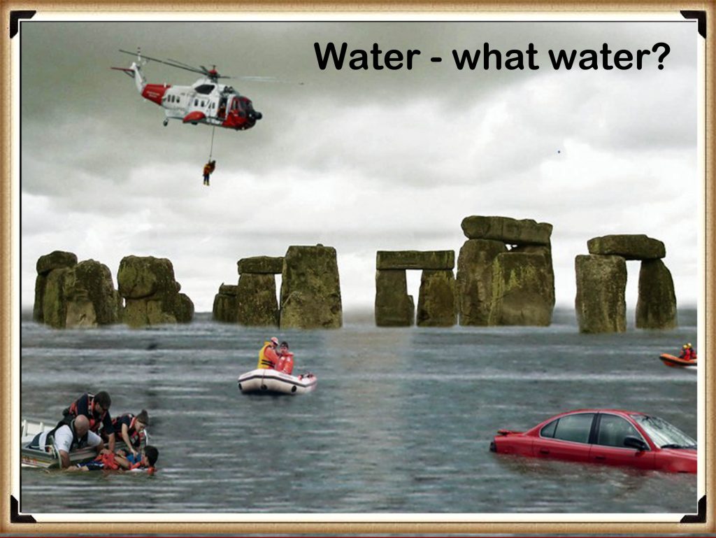
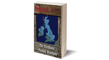
Unfortunately, even prominent figures in archaeology have misunderstood this principle. For instance, one well-known archaeologist dismissed my findings by dubbing the book the “Stonehenge on Sea” hypothesis – based solely on the book’s cover. This misinterpretation highlights the importance of engaging with the underlying science rather than relying on superficial impressions. (The Rivers of the Past were Higher)
Fifteen years on and still people refuse to read the literature and ask foolish questions as a consequence -(The Rivers of the Past were Higher)
2. If sea levels in the past were lower, how could rivers be higher?
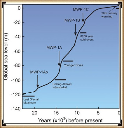
During the last ice age, sea levels were approximately 65 meters lower than today. However, the colder climate meant precipitation fell as snow, forming massive glaciers. These glaciers trapped vast amounts of water, preventing it from flowing into rivers.
When the glaciers began to melt, the water released caused rivers to swell dramatically. This wasn’t a quick process. Recent models show that sea levels rose over 7,000 years after the initial melt, transforming landscapes like Doggerland—a land bridge connecting Britain to Europe—into the North Sea. This extended period of flooding explains how rivers could have been significantly larger in the past, despite lower sea levels.
People don’t understand the difference between sea level and river levels – (The Rivers of the Past were Higher)
3. Why aren’t all rivers and tributaries the same height in this area?
The simplistic notion that water “always seeks a common level” misrepresents the complexities of hydrology. Multiple aquifers at varying elevations feed rivers, and their flow mirrors the contours of the landscape. This intricate system ensures that rivers don’t conform to a uniform height.
For instance, rivers like the Thames have multiple sources that contribute to their flow. Even when rainfall is scarce, aquifers release water at different elevations, sustaining the river. This dynamic interplay explains why rivers don’t follow a universal level and why one river may sit higher than another in the same region.
It took 15 thousand years for the ice water to melt – where did you think it was before it entered the sea? – (The Rivers of the Past were Higher)
4. Is this hypothesis based on fact or just speculation?
The hypothesis is firmly grounded in decades of research and fieldwork. It builds on three decades of academic study and exploration, culminating in an academic thesis supported by 125 peer-reviewed references.
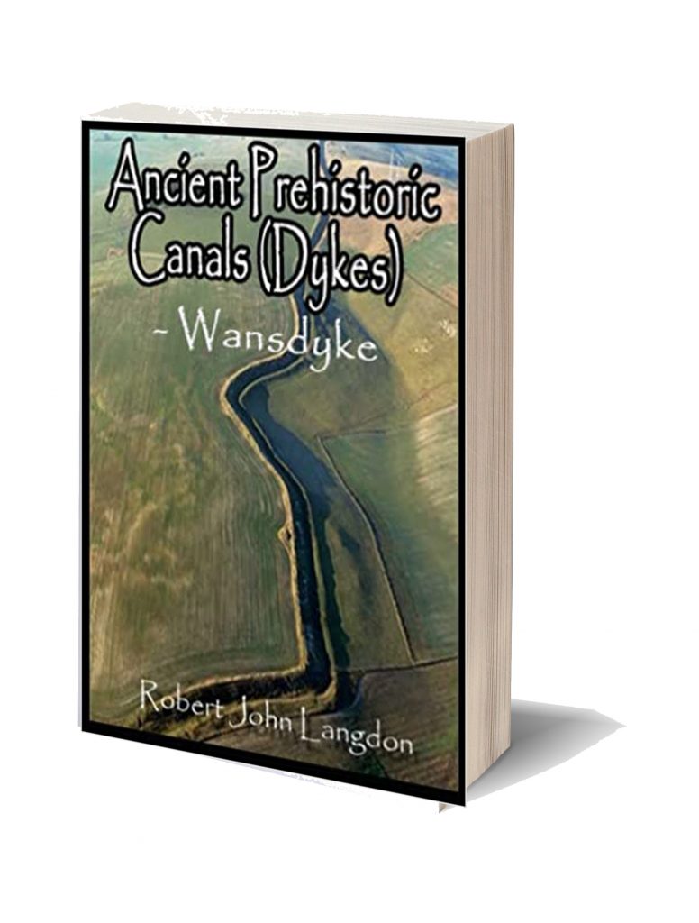
The Book – (The Rivers of the Past were Higher)
5. I’ve walked these routes and found no water. How do you explain that?
Landscapes are dynamic, not static. Ten thousand years ago, the Sahara was a lush rainforest filled with elephants and lions. Similarly, Britain’s east coast was once a verdant plain connecting it to Europe. Over millennia, these landscapes changed dramatically due to shifting climates and sea levels.
Rivers that once flowed abundantly have since diminished as aquifers dried up. For example, the North Sea, Irish Sea, and English Channel gradually drained the rivers that fed them, lowering water tables and drying out springs in elevated areas. Today, you see a shadow of the ancient hydrological systems that once defined these regions.
When it overly rains only the old rivers of the past overflow – guess what happened when the ice melted 10k years ago – (The Rivers of the Past were Higher)
6. Why would people push boats to the top of a hillfort?
The idea that ancient people moved boats uphill reflects a misunderstanding of how rivers once shaped the landscape. According to the hypothesis, ancient rivers like the Thames were vastly larger—potentially 3,000 times their current size. What we perceive as hills today would have appeared as islands within these expansive waterways.
Earthworks along these rivers likely defined the edges of these elevated landforms, making them accessible by boat. This perspective challenges modern assumptions about the topography of the past and highlights the transformative role of ancient hydrological systems.
Dykes connecting to Hillforts – (The Rivers of the Past were Higher)
7. Where is the evidence for larger rivers in the past?
British Geological Survey maps provide compelling evidence of ancient, larger rivers. These maps detail the extent of superficial deposits that mark the waterways’ historical boundaries. Features like river terraces further support this evidence.
For instance, the River Avon has ten terraces, indicating its past size and elevation. At one time, this river spanned tens of kilometres in width and was over 100 meters above current sea level. These geological features attest to the dynamic nature of rivers throughout history. (The Rivers of the Past were Higher)
These BGS Maps grossly under estimated deposits as they are based on bore holes that are few and far between – (The Rivers of the Past were Higher)
8. I have a PhD in archaeology—why wasn’t I taught this?
Archaeological education has traditionally focused on specific methodologies while neglecting interdisciplinary approaches. In the 21st century, good archaeology requires integrating hydrology, dating methods, and advanced mapping techniques like LiDAR.
LiDAR, for instance, allows us to reconstruct ancient landscapes with remarkable precision. Yet, many archaeologists lack the training to interpret raw LiDAR data or understand its full potential. The absence of such knowledge limits their ability to engage with complex hypotheses like the one presented here. Archaeology must evolve into a more scientifically robust discipline to address this gap. (The Rivers of the Past were Higher)
Empirical evidence shows that once the rivers were much higher in the past – the only question is when? – (The Rivers of the Past were Higher)
9. Water can’t flow uphill, for the gradients are too high
This question reflects a common misconception about the nature and purpose of prehistoric linear earthworks, or “dykes,” in a flooded prehistoric landscape. Many people mistakenly interpret these structures through the lens of Victorian canals, imagining them as continuous waterways designed to transport goods over long distances in a single, uninterrupted flow. This comparison oversimplifies the engineering principles and functional realities of prehistoric dykes. (The Rivers of the Past were Higher)
Today we have the lowest water table in history – hence the dry landsacpe on hills – (The Rivers of the Past were Higher) But in prehistory the water table was much higher so flooded often – (The Rivers of the Past were Higher)
In prehistory, river levels were significantly higher than today, which meant that the distances goods needed to travel over land were much shorter. Prehistoric dykes were not designed as continuous waterways; instead, they were engineered to serve as efficient connections between rivers or to transport raw materials from quarries to waterways. These materials could then be transported by boat to trading sites or processing locations.
A key feature of these dykes is their adaptability to the landscape. Unlike Victorian canals, which relied on a continuous channel of water and locks to maintain flow, prehistoric dykes often utilized natural springs at the tops of hills. These springs could provide water that flowed down both sides of a hill, enabling transport without the need to “go over” the hill itself. This ingenious use of natural water sources allowed for movement between points A and B most efficiently, considering the terrain and hydrology of the time. (The Rivers of the Past were Higher)
10. How can you connect to other rivers as you need to go over the hill?
Prehistoric ‘cross-dykes’ were used to drag boats from once water source to another – (The Rivers of the Past were Higher)
In cases where goods or people needed to traverse a hill with water flowing down both sides, the solution was remarkably straightforward and practical. A boat or barge, naturally floating in the water and much lighter to manage than carrying goods or loads overland, could be dragged uphill using workforce or, more efficiently, animal power. Oxen, for example, would have been ideal for towing boats up gradients along the dyke.
Once the summit was reached, the natural downhill flow of water could take over, allowing the boat to continue its journey easily. Using animal power to drag boats uphill echoes practices seen in early Victorian canal systems. During this period, weirs were often constructed to slow water flow in downhill rivers, facilitating the towing of barges and boats uphill. The principle was straightforward: use animal power for uphill transport and natural flow for downhill movement, ensuring efficiency and minimizing the physical burden on workers.
This method would have effectively transported goods or people over varied terrain in a prehistoric context, leveraging both natural hydrology and available resources like animal labour. The adaptability of this system highlights the innovative and pragmatic approaches of ancient societies to overcome challenges posed by their environment.
By viewing prehistoric dykes through this lens, we can better appreciate their functionality and the ingenuity of those who designed them. Modern assumptions of continuous waterways did not limit these structures but reflected a deep understanding of the landscape and the tools available to navigate it. (The Rivers of the Past were Higher)
Conclusion
The Post-Glacial Flooding Hypothesis challenges conventional wisdom about ancient landscapes and hydrology. It invites us to reconsider the evidence and embrace a more interdisciplinary approach to archaeology. While the journey to broader acceptance has been fraught with resistance and misunderstanding, the evidence speaks for itself.
For those willing to engage deeply, the hypothesis offers a transformative lens to understand the past—a perspective rooted in science, shaped by rigorous research, and open to thoughtful debate.
Scientific progress begins with hypotheses. I welcome questions and challenges, but they must be substantiated with evidence. The burden of proof lies with those who disagree, requiring more than opinion; it demands well-referenced counterarguments. This process of scrutiny and debate is the essence of scientific advancement.
The landscape has changed — but the clues are still there, in stone, in soil, and in elevation maps. It’s time archaeology stopped ignoring the water and started reimagining the prehistoric world from the riverbed up. (The Rivers of the Past were Higher)
The Hypothesis of 50K words with 125 peer-reviewed references – three times larger that a PhD thesis -(The Rivers of the Past were Higher)
(The Rivers of the Past were Higher)
Exploring Prehistoric Britain: A Journey Through Time
My blog delves into the fascinating mysteries of prehistoric Britain, challenging conventional narratives and offering fresh perspectives based on cutting-edge research, particularly using LiDAR technology. I invite you to explore some key areas of my research. For example, the Wansdyke, often cited as a defensive structure, is re-examined in light of new evidence. I’ve presented my findings in my blog post Wansdyke: A British Frontier Wall – ‘Debunked’, and aWansdyke LiDAR Flyover video further visualizes my conclusions.
For those interested in British Prehistory, visit www.prehistoric-britain.co.uk, a comprehensive resource featuring an extensive collection of archaeology articles, modern LiDAR investigations, and groundbreaking research. The site also includes insights and extracts from the acclaimed Robert John Langdon Trilogy, a series of books exploring Britain during the Prehistoric period. Titles in the trilogy include The Stonehenge Enigma, Dawn of the Lost Civilisation, and The Post Glacial Flooding Hypothesis, offering compelling evidence about ancient landscapes shaped by post-glacial flooding.
To further explore these topics, Robert John Langdon has developed a dedicated YouTube channel featuring over 100 video documentaries and investigations that complement the trilogy. Notable discoveries and studies showcased on the channel include 13 Things that Don’t Make Sense in History and the revelation of Silbury Avenue – The Lost Stone Avenue, a rediscovered prehistoric feature at Avebury, Wiltshire.
In addition to his main works, Langdon has released a series of shorter, accessible publications, ideal for readers delving into specific topics. These include:
For active discussions and updates on the trilogy’s findings and recent LiDAR investigations, join our vibrant community on Facebook. Engage with like-minded enthusiasts by leaving a message or contributing to debates in our Facebook Group.
Whether through the books, the website, or interactive videos, we aim to provide a deeper understanding of Britain’s fascinating prehistoric past. We encourage you to explore these resources and uncover the mysteries of ancient landscapes through the lens of modern archaeology.
For more information, including chapter extracts and related publications, visit the Robert John Langdon Author Page. Dive into works such as The Stonehenge Enigma or Dawn of the Lost Civilisation, and explore cutting-edge theories that challenge traditional historical narratives.
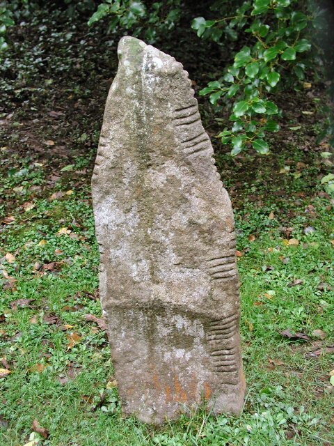
When most people hear “Ogham,” they think of mysterious notched stones scattered across Ireland and parts of Britain, their edges lined with cryptic strokes. Officially, these are understood as memorial inscriptions in an early form of the Irish language, a belief held with confidence by most archaeologists and linguists. (Rethinking Ogham)
But what if that story isn’t the whole picture?
What if the origins of Ogham lie not in phonetic language at all, but in something far older and more practical: a tally system?
This image showcases a traditional Ogham stone featuring the distinctive notched inscriptions along its edge. Such stones are emblematic of early medieval Ireland and are central to discussions about the Ogham script’s origins. (Rethinking Ogham)
The Standard Interpretation: A Memorial Script
According to the established view, Ogham was developed around the 4th century AD to write Primitive Irish. It was primarily carved onto standing stones as commemorations of individuals or as boundary markers, with inscriptions typically reading something like: “X, son of Y.”
This interpretation is strongly supported by:
Bilingual stones with both Ogham and Latin texts.
Consistent grammatical patterns.
Repetition of personal and tribal names.
It appears cut and dry—until you step back and ask a deeper question:
Why did this script evolve this way, using notches and strokes, rather than borrowing from the Latin alphabet already available nearby?
Pict Script – (Rethinking Ogham)
The Tally Hypothesis: Origins in Counting and Resource Tracking
Across ancient societies, the earliest writing systems often began as counting tools. Cuneiform in Mesopotamia, for example, started with tally marks and tokens representing quantities of grain or livestock. Why not consider that Ogham may have followed a similar path?
Here’s what supports the tally origin hypothesis:
Visual resemblance: Ogham characters look remarkably like tally marks grouped in fours and fives—just like traditional wooden tally sticks used well into the Middle Ages for accounting.
Function before language: In pre-literate societies, marking ownership, trade quantities, or taxation might have required a visual record long before the need for recording names arose.
Boundary markers: Some Ogham stones stand alone in landscapes, with no clear burial or commemorative context. Were these stones not honouring a person, but marking how many cattle passed or how much land was measured?
Isolated or partial inscriptions: Several stones contain only a few characters that don’t translate clearly into names or words. These could represent quantities, symbols, or shorthand codes rather than phonetic text.
Looks more like a Tally Stone – (Rethinking Ogham)
Stone as Currency and the Role of Stone Circles in Trade
Adding to this picture is the intriguing proposition made in the works of Robert John Langdon, who has argued extensively that stone circles were originally trading hubs. In this interpretation, stone circles were not ritual sites but marketplaces strategically placed along ancient waterways.
If stone circles functioned as trade centres, a credit system would have been necessary to regulate exchanges over time and distance. In a pre-coinage society, a physical tally system would be the most logical tool for tracking trade and credit.
Standing stones surrounding these circles may not have been symbolic or astronomical markers alone, but upright ledgers were used to keep track of who owed what, who traded how much, or who held credit within the community. Each set of notches or strokes on a stone could have represented quantities of goods exchanged, debts owed, or rights to future returns.
Critically, this idea also explains a common counterargument: why don’t we see tally marks on 5,000- to 6,000-year-old stone circles today? The answer may lie in weathering and erosion. Unlike Ogham stones—which are only around 1,500 years old—earlier tally marks carved into upright stones may have been completely worn away over millennia. This supports Langdon’s view that earlier credit-tracking systems would have left only the structural remnants, not visible inscriptions.
Additionally, standalone prehistoric stones—often dismissed as boundary or ritual markers—may have once carried tally marks of their own. These could have served as proto-milestones, indicating distances to the nearest settlement, river access point, or trade centre. The Romans famously used carved milestones for this purpose, and it’s plausible that they borrowed the idea from older, indigenous systems already in place in Britain and Ireland.
The enigmatic symbol stones of the Picts in Scotland further support this. Although still undeciphered, these carved stones often appear as non-phonetic symbols, not a written language in the modern sense. Some researchers have proposed that they may have represented ownership marks, trade identifiers, or tally-like records. The conceptual overlap with Ogham is striking: both use linear carvings on stone in a structured but non-obviously linguistic way, likely reflecting regional traditions of symbolic recording in early societies.
In this context, Ogham inscriptions may represent the final stage of an earlier practice: transforming a basic numerical or symbolic tally system into a formalised script used for legal and social recording. the final stage of an earlier practice is transforming a basic numerical or symbolic tally system into a formalised script for legal and social recording.
So Which Is It: Language or Ledger?
The truth may be that both interpretations are right, just at different phases of development.
As we recognise it today, Ogham may be the formalisation of an older, tally-based visual system. Over time, this practical counting tool could have merged with the growing need to record ownership, identity, and social ties in an increasingly stratified tribal society.
As oral traditions began to falter and literate culture crept in from Roman Britain, tally marks may have been absorbed into a phonetic system shaped by existing tribal practices.
Why This Matters
If true, this rethinking of Ogham would:
Push its functional origins, perhaps centuries earlier than currently believed.
Highlight the economic and administrative sophistication of pre-Christian Ireland.
Challenge the assumption that early scripts always began with language.
Offer a practical explanation for how trade was regulated in prehistoric stone circles, seen as financial centres rather than ceremonial ones.
It opens the door to re-reading early inscriptions with a new lens—not just as words but as a recording system rooted in trade, movement, and ownership.
Did all standing stones have messages on them? – (Rethinking Ogham)
From Megaliths to Ogham: The Evolution of Stone Communication
To truly understand the origins of Ogham, we must widen our lens to include the megalithic period, thousands of years before the first recognised Ogham inscriptions. Many standing stones and stone circles erected during that time may not have been purely ceremonial or astronomical — they may have represented the earliest attempts at visual communication. These original stones could have carried tally-like marks, now erased by millennia of weathering, used to track trade, movement, or shared resources between communities.
It’s plausible that some of these early tallies evolved to include rudimentary symbols, perhaps the first representation of names or places, acting as identifiers in a trading or transport network. Much like Roman milestones centuries later, megalithic stones may have marked the distance to key locations, with early carvings denoting either the destination or the owner of credit associated with that point.
Over time, this system would have gradually evolved. As societies became more complex, these proto-marks may have become standardised into recognisable characters, leading to a proto-script — an expandable but straightforward visual language. This natural evolution would explain why some Ogham characters remain indecipherable today: they may originate from symbolic or numeric shorthand and were no longer used when the formalised script emerged.
In this way, Ogham can be seen not as a sudden invention but as the culmination of a much older practice — a lineage of symbolic marking systems rooted in prehistoric credit, trade, distance-tracking, and ownership records. By reframing these early stones as proto-documents, we can better appreciate how literacy emerged organically from practical needs long before it was formalised in stone.
This photograph features a Roman milestone, or ‘miliarium,’ which marked distances along Roman roads. The concept of marking distances and information on stones may have influenced or paralleled earlier practices in the British Isles, providing context for the use of stones as informational markers. – (Rethinking Ogham)
Expanding the Tally Theory Further
One compelling angle to consider is how the shift from oral to visual record-keeping might have required transitional symbolic systems — forms of notation that were neither fully linguistic nor purely numerical. Ogham may represent a transitional form, bridging the gap between primitive counting and emerging literacy. In this light, the earliest users of Ogham weren’t writing names so much as marking values, entitlements, or exchanges, with phonetic clarity emerging later as a natural evolution.
Furthermore, the placement of Ogham stones at key crossroads, near river crossings, or adjacent to prehistoric pathways supports the idea of their role in territorial and economic control. These were not random grave markers — they were visible, public markers possibly denoting access rights, trading permissions, or debt settlements within tribal networks. Their visibility was part of their function.
It’s also worth noting that not all Ogham inscriptions conform neatly to the commemorative formula. Some are fragmentary, cryptic, or contain repeated characters that defy straightforward translation. This suggests that some stones may not be linguistic at all but remnants of earlier or alternative systems — perhaps counting symbolic referencing, or even tally-based rituals linked to cyclical trade or seasonal gatherings.
Finally, Ogham’s survival into early Christian Ireland — where it was used to carve Latin-scripted messages and adapted for secret codes in monastic settings — shows its flexibility and symbolic prestige. This reinforces the idea that it wasn’t just a practical tool but one imbued with cultural continuity, tracing its roots back to practical functions now obscured by erosion and academic convention.
(Rethinking Ogham)
Conclusion
The Ogham script is undoubtedly a linguistic treasure. But before it was used to honour ancestors or declare territory, it may have started as something humbler but equally powerful: a tool for keeping count.
In a world where archaeology is finally embracing landscape patterns, trade infrastructure, and pre-literate intelligence, we re-evaluate what those ancient notches may have meant.
For active discussions on the findings of the TRILOGY and recent LiDAR investigations that are published on our WEBSITE, you can join our and leave a message or join the debate on our Facebook Group.
While some hillforts may have been adapted for defence during later periods — particularly during Roman expansion — the majority were not originally constructed as military installations. Instead, they served multifunctional roles in prehistoric societies: economic, ceremonial, territorial, and social.
In the wake of Hawkes’ renowned treatise ‘Hillforts’ (Hawkes 1931), scholars of archaeology undertook the arduous task of categorising hillforts, drawing upon the limited evidence at their disposal. Primarily, these divisions hinged on considerations of size, location, the construction of ramparts, and chronological context. In a relatively recent endeavour the author Cunliffe, put forth a scheme tailored to the Wessex region (Cunliffe 1984b), which delineated certain overarching classifications for these forts (The Great Iron Age Hill Fort Hoax):
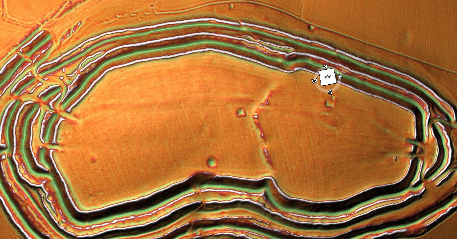
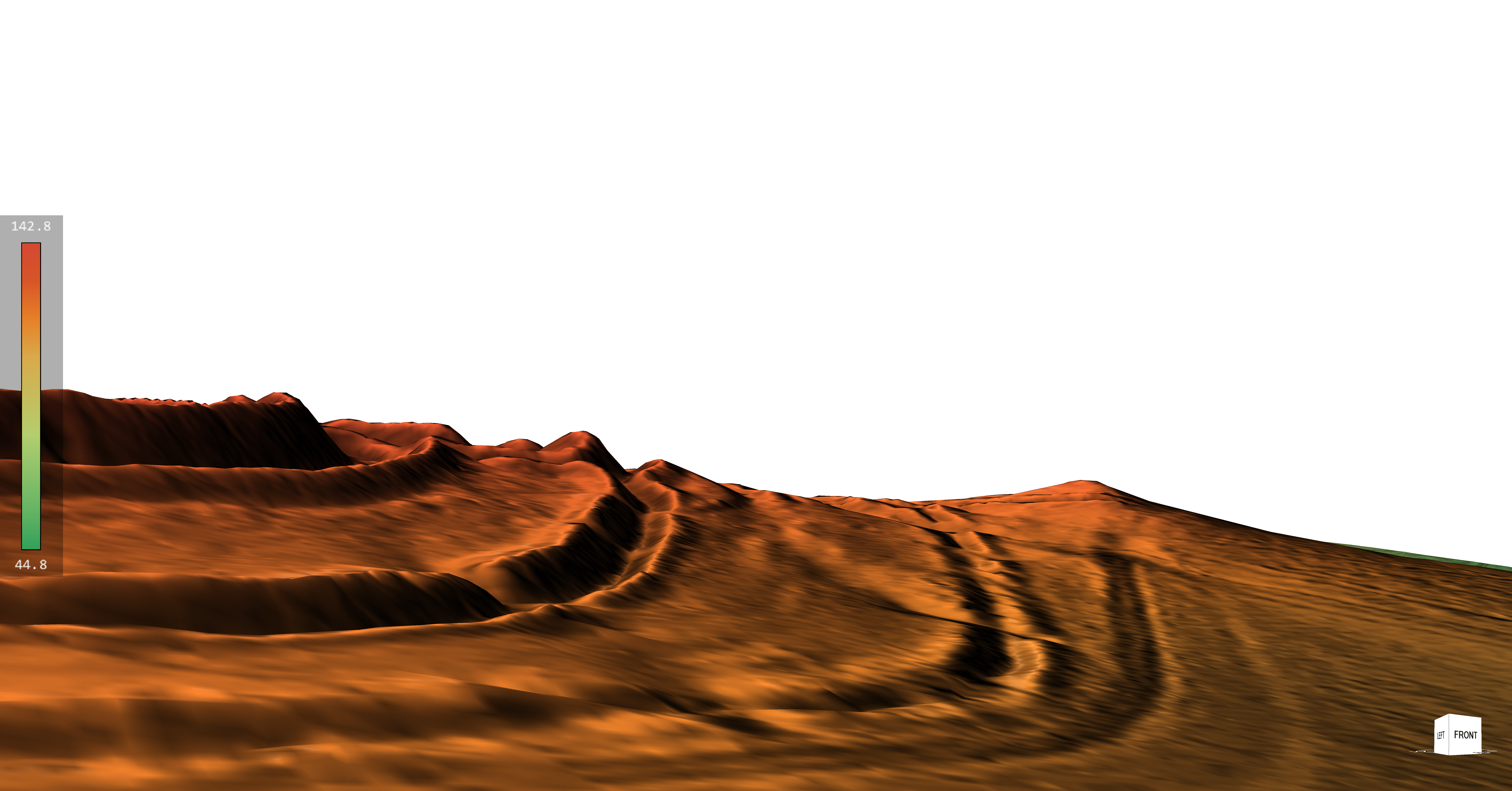
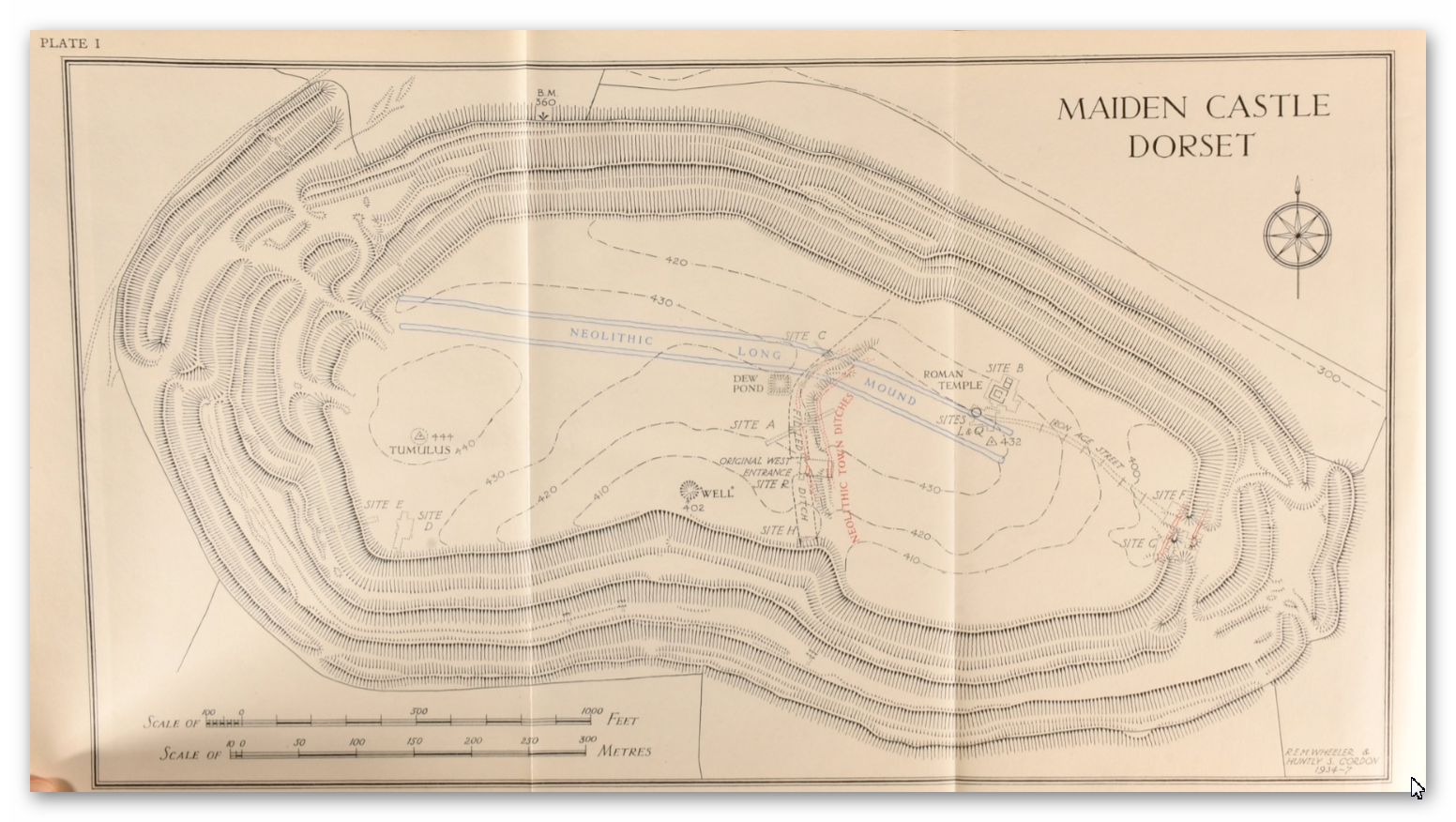
Maiden Castle showing something strange (a neolithic Dyke) in the centre -The Great Iron Age Hill Fort Hoax
Early hilltop enclosures, typically encompassing over 10 hectares of terrain.
Small, strategically fortified settlements, perched prominently, often occupying areas ranging from 1 to 3 hectares.
Early hillforts, characterised by univallate contour works, typically spanning 3 to 7 hectares.
Developed hillforts, generally falling within the 3 to the 7-hectare range but frequently boasting multivallate defences.
The quintessential definition for this prehistoric phenomenon reads as follows: A hillfort constitutes a form of earthwork employed as a fortified sanctuary or defended habitation, strategically positioned to exploit elevated terrain for defensive advantage.
This classification endured unchallenged for more than seven decades – they are now, according to the repository of knowledge that is Wikipedia, primarily of European origin, belonging to either the Bronze Age or Iron Age, with some even extending into the post-Roman era. The fortifications typically trace the natural contours of a hill, comprising one or more tiers of earthworks, fortified by stockades or defensive walls and flanked by external ditches.
Celtic hill forts came into their own during the Late Bronze Age and Early Iron Age, aligning roughly with the inception of the first millennium BC. They continued to proliferate across various Celtic regions of central and western Europe until the advent of the Roman conquest. Their prevalence was most pronounced during the later epochs, including the Urnfield culture and Atlantic Bronze Age (circa 1300 BC – 750 BC), the Hallstatt culture (circa 1200 BC – 500 BC), and the La Tène culture (circa 600 BC – 50 AD).
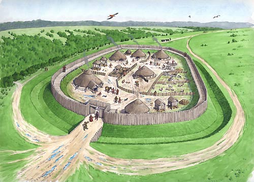
Typical View of a Iron Age Hill Fort – The Great Iron Age Hill Fort Hoax
This transformation in our comprehension of hillforts owes a substantial debt to the extensive work undertaken by Barry Cunliffe at Danebury during the 1970s.
Prehistoric Europe witnessed a burgeoning population. Estimates suggest that around 5000 BC, during the Neolithic era, the population of Europe fluctuated between 2 million and 5 million. In the Late Iron Age, this number swelled to an estimated 15 to 30 million. With the exception of Greece and Italy, which were more densely populated, the overwhelming majority of settlements during the Iron Age were relatively diminutive, housing no more than 50 inhabitants. Hillforts, however, stood as an exception, accommodating as many as 1,000 individuals.
With the advent of oppida in the Late Iron Age, settlements expanded to house populations as substantial as 10,000. As the populace swelled, so too did the intricacy of prehistoric societies. Around 1100 BC, hillforts emerged and over the ensuing centuries proliferated throughout Europe. They served a diverse array of functions, functioning variously as tribal hubs, fortified bastions, focal points of ritualistic activities, and centres of production.
The Logistical Impossibility of Fortress Hillforts
A closer examination of hillfort distribution across Britain and Ireland raises serious doubts about the traditional interpretation of these sites as purely defensive structures.
There are over 3,300 hillforts spread across the British Isles.
Distribution is heavily clustered, not evenly spaced — with extreme examples like the Isle of Man, where 32 enclosures exist in just 572 square kilometres (one hillfort every 5–6 km²).
30% of all known hillforts are located on the coastline, and an estimated 50% more are situated along prehistoric river systems — meaning up to 80% had direct waterborne access.
Around 70% of hillforts are associated with quarrying, mining, or resource extraction zones.
If each hillfort was purely a refuge or defensive fort:
There would need to be thousands of separate, fortified populations,
Thousands of armies ready to defend them,
And consistent evidence of sustained regional warfare.
Yet the archaeology shows otherwise:
Few hillforts have evidence of prolonged occupation.
Evidence of mass conflict is rare and localised.
Many sites lack obvious military architecture (such as palisade trenches or true gatehouses).
The only logical explanation is that hillforts were primarily multifunctional hubs — sites of seasonal gathering, trade, ceremony, and political negotiation, with defensive adaptations made only when necessary.
Isle of Man – the most violent place in Britain or a Trading hub?
So, what shall we make of this revelation?
Is it indeed, apt to continue branding them as exclusively Iron Age enclaves? Of course, there are vestiges from the Iron Age to be found within these enclosures, but they also harbour traces of the Middle Ages, Roman artefacts, and, most tellingly, flint relics dating back to the Neolithic/Mesolithic era.
To delve into the heart of this matter, let us focus our attention on the paramount example of an Iron Age fort in Britain – Danebury in Hampshire, and its peer, the grandiose Maiden Castle in Dorset. Together, we shall sift through their findings, unearthing the curious conundrum of archaeological classifications.
Danebury – Case Study
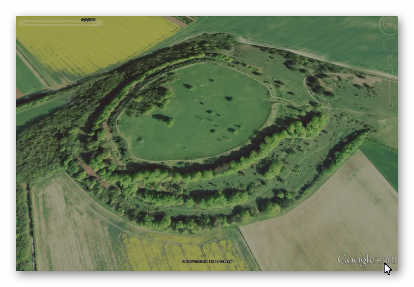
Danebury Hill Fort
According to Wikipedia:Danebury is an Iron Age hillfort in Hampshire, England, about 19 kilometres (12 mi) north-west of Winchester (grid reference SU323376). The site, covering 5 hectares (12 acres), was excavated by Barry Cunliffe in the 1970s. Danebury is considered a type-site for hill forts, and was important in developing the understanding of hillforts, as very few others have been so intensively excavated.
Built in the 6th century BC, the fort was used for almost 500 years, during a period when the number of hill forts in Wessex greatly increased. Danebury was remodelled several times, making it more complex and resulting in it becoming a “developed” hill fort. It is a Scheduled Monument and a Local Nature Reserve called Danebury Hillfort. The Scheduled Monument is surrounded by a Site of Special Scientific Interest, designated as Danebury Hill.
Looks pretty straightforward and comprehensive – so what is wrong?
In the annals of Iron Age Britain, a conspicuous absence of historical records compels us to rely solely on the tools of archaeology to reconstruct the rich tapestry of events at sites like Danebury and other ancient forts. Crafting a comprehensive and authoritative historical narrative from a single site becomes a feat of no small magnitude. Typically, in the realm of science, hypotheses are formulated and subjected to rigorous testing and fine-tuning by fellow scientists. But in this case, a unique anomaly emerges.
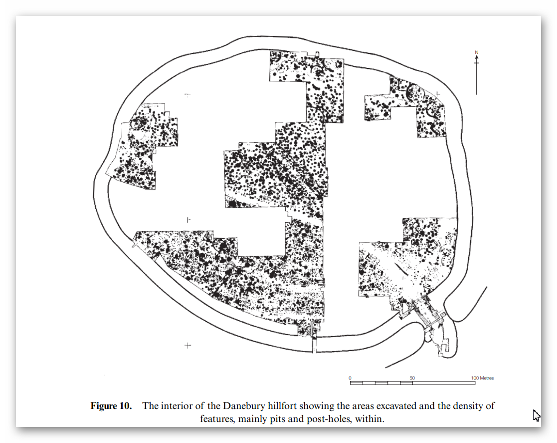
It is worth noting that the established dates pertain solely to the interior pits of the site. These dates offer insight into the latest period of habitation, for obvious reasons, or at best, the principal period of occupancy, but they do not unveil the secrets of the site’s birth – its construction date.
A cursory search reveals that Hampshire archaeology has, intriguingly, reclassified Danebury as a Bronze Age relic. According to this new classification, “Evidence suggests that Danebury Iron Age Hill Fort was built 3000 years ago. It started life as a Late Bronze Age stock enclosure, while the main defences that are now visible were constructed around 2500 years ago. The fort continued to be in use until around 100 BC, a century and a half before the Roman invasion of AD 43.”
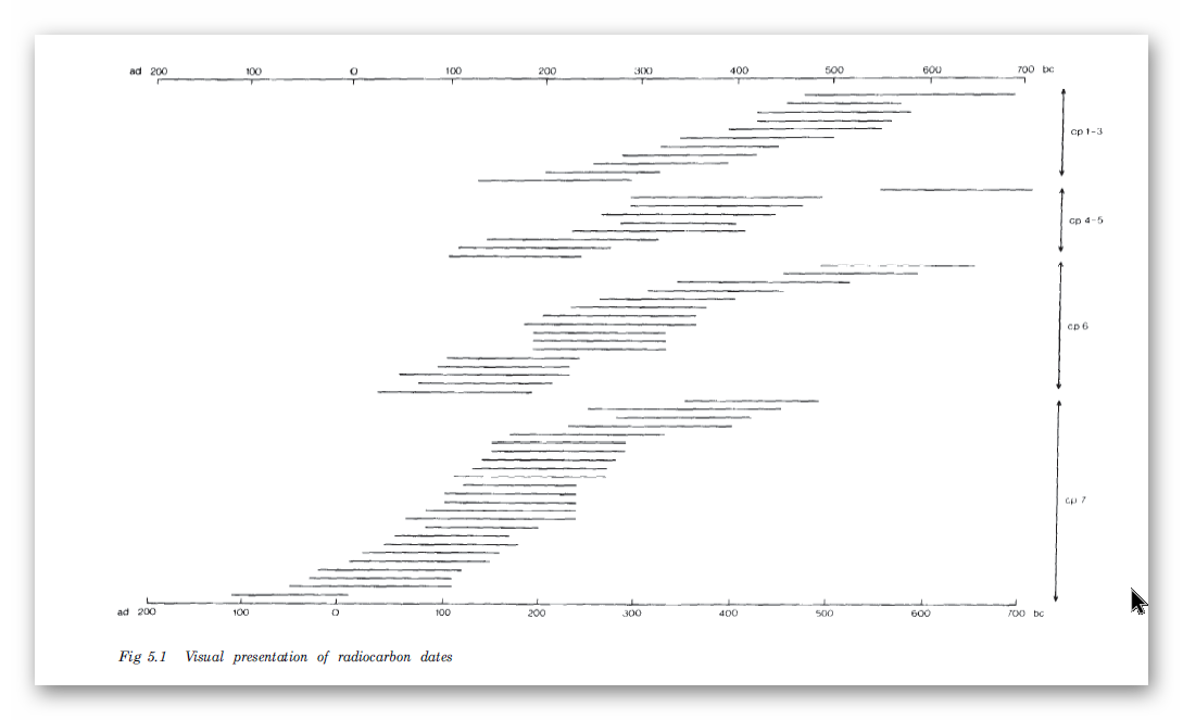
The basis for this shift in classification can be traced to carbon dating, which exposed samples reaching as far back as 700 BCE, leading to the realisation that the site was never truly of the Iron Age.
Radio Carbon Dates of Danebury – the interior dates back to 700 BCE
In fact, during the extensive excavation conducted between 1969 and 1978, which included a rare examination of the ditches outside the fort, a treasure trove of flints spanning from the late Neolithic to the early Bronze Age was unearthed, along with a smattering of Beaker period pottery. Consequently, we find ourselves teetering on the precipice of a profound reevaluation, one that suggests that Danebury might not be Iron Age, nor Bronze Age, but quite possibly a relic from the Neolithic era. The ability to definitively differentiate Neolithic flints from their Mesolithic counterparts is a matter that deserves thorough exploration, even if it may lead us to reject some preconceived notions.
Moreover, the excavations carried out at Danebury between 1979 and 1988 yielded an impressive assemblage of flints, totalling 2,896 items. It is of paramount importance to note that these archaeological endeavours unveiled a linear earthwork. The contours of this earthwork had been accentuated by a worn hollow trackway (F295), reaching a depth of approximately 0.3 meters behind the ditch on the northern side. Regrettably, the age of this feature remains elusive, but it’s conceivable that this trackway might constitute one of the original routes leading to the fort’s entrance.
A striking observation made possible by LiDAR technology, although unmentioned in the report, is the linkage between this ‘Dyke’ and the outer ditch of the site. This intriguing connection hints at the possibility of a nautical route to the site, presumably navigable during higher river levels in prehistoric times.
Danebury showing prehistoric water levels and connecting Dyke to the hill site
So it’s Prehistoric and not Iron Age – therefore is it a hillfort at least?
In our quest to ascertain whether this site was initially conceived as a ‘fortification,’ we must examine two critical aspects: its original design and the practical function it served in the past. It is crucial to consider that, like many ancient structures, this site could have been adapted for a new function in later historical periods.
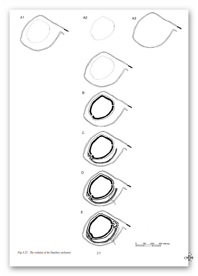
Official schematics detailing the phases of Danebury’s evolution shed light on its original design. Notably, the previously recognised ‘Linear Earthwork’ (Dyke) played a pivotal role in its construction, linking to another ‘defensive’ ditch, designated as A1. However, an intriguing twist emerges.
Danebury Construction periods – traditional model
Regrettably, LiDAR technology uncovers a discrepancy in Barry Cunliffe’s illustrative depictions of the site. It appears that some creative liberties were taken in these drawings. The FULL linear feature was not only omitted from the diagrams but a somewhat exaggerated kink was added to the south of the Dyke, creating the impression of a deliberately planned entrance. In reality, this feature formed a complete circle and did not resemble the ‘banjo entrance’ that Cunliffe sought to convey. The reality is that the straight linear earthwork preceded the outer circle.
The outer Danbury circle and the Linear Dyke is linked – the banjo entrance ‘extra’ is a later feature
Additionally, it’s worth noting that the original ditch A1 appears to have had more earthwork material deposited on its outer section than on the inner portion. This particular characteristic, where more soil is added to the outer side, raises questions about its viability as a purely ‘defensive’ element.
So, Danebury is probably Neolithic/Mesolithic in date (shown by flint numbers on site) and not defensive as the original ditch was made probably to link a Linear Earthwork to the river system.
The ditches show the excavation spoil is evenly distributed on both side – not defensively designed
Let’s look at Maiden Castle to see if the ‘traditionalists’ have better luck with their hypothesis.
Maiden Castle – Case Study
According to Wikipedia – Maiden Castle is an Iron Age hillfort 1.6 mi (2.6 km) southwest of Dorchester, in the English county of Dorset. Hill forts were fortified hilltop settlements constructed across Britain during the Iron Age.
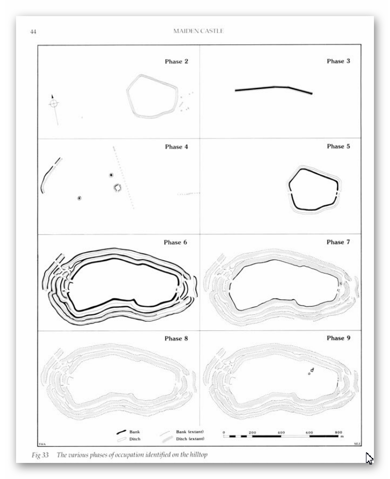
The earliest archaeological evidence of human activity on the site consists of a Neolithic causewayed enclosure and bank barrow. In about 1800 BC, during the Bronze Age, the site was used for growing crops before being abandoned. Maiden Castle itself was built in about 600 BC; the early phase was a simple and unremarkable site, similar to many other hill forts in Britain and covering 6.4 ha (16 acres).
Around 450 BC it was greatly expanded and the enclosed area nearly tripled in size to 19 ha (47 acres), making it the largest hill fort in Britain and, by some definitions, the largest in Europe. At the same time, Maiden Castle’s defences were made more complex with the addition of further ramparts and ditches. Around 100 BC, habitation at the hill fort went into decline and became concentrated at the eastern end of the site. It was occupied until at least the Roman period, by which time it was in the territory of the Durotriges, a Celtic tribe.
After the Roman conquest of Britain in the 1st century AD, Maiden Castle appears to have been abandoned, although the Romans may have had a military presence on the site. In the late 4th century AD, a temple and ancillary buildings were constructed. In the 6th century AD, the hilltop was entirely abandoned and was used only for agriculture during the medieval period.
The study of hill forts was popularised in the 19th century by archaeologist Augustus Pitt Rivers. In the 1930s, archaeologists Mortimer Wheeler and Tessa Verney Wheeler undertook the first archaeological excavations at Maiden Castle, raising its profile among the public.
Allow me to elucidate our quandary further. Recent excavations in the year 1985 revealed artefacts hailing not only from the Neolithic era but also from a substratum that likely originates in the Mesolithic epoch. Therefore, the label ‘Iron Age’ begins to appear somewhat askew.
The question arises: could this subsequent ‘addition’ truly be classified as a fortification?
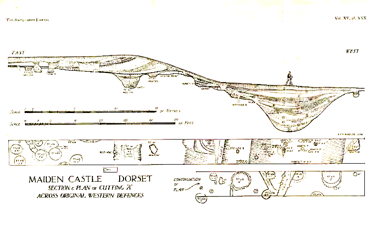
Our scrutiny of the construction once more casts doubt on this notion. The ditches, ostensibly designed for defence, present a conundrum. The sole cross-sectional glimpse into these ‘defensive’ trenches reveals an uncanny resemblance to the flat-bottomed counterparts witnessed in other prehistoric sites like Avebury, Stonehenge, and Old Sarum.
Cross-section of Ditch showing it too flat, deep and wide to be defensive
Maiden Castle and the Myth of the Massacre
Although Maiden Castle is often cited as evidence of Iron Age warfare, the archaeology paints a much more cautious picture.
Only a small number of burials were found near the entrances — not mass graves.
Among these:
One adult male had a projectile wound in his spine (originally thought to be a Roman ballista bolt, now debated).
One young woman showed signs of trauma.
Several children were also buried — not typical combatants.
Most bodies show no direct evidence of violent death. There is no layer of battlefield debris, no mass trauma event consistent with a large-scale siege.
Moreover:
Over 20,000 slingstones were found stored near the entrances, but their exact purpose remains uncertain. They could represent defensive stockpiles, but also hunting tools, ritual offerings, or symbols of authority.
After the supposed Roman assault, Maiden Castle was largely abandoned — suggesting it was not a viable military stronghold, but rather a symbolic centre caught up in a violent moment of change.
In short:
One tragic encounter at the end of Maiden Castle’s life does not prove it was built or primarily used as a fortress.
The evidence supports a more complex reality: Maiden Castle was a trading or community meeting site, possibly adapted hastily for defence when Roman forces arrived — but defence was not its primary, original function.
The Logistical Impossibility of Defending Maiden Castle
Introduction
Maiden Castle, Britain’s largest Iron Age hill fort, has always been a subject of fascination and mystery. Its impressive size and strategic location suggest it was once a significant military stronghold. However, recent advancements in archaeological technology, specifically Light Detection and Ranging (LiDAR), have sparked debates about the actual feasibility of defending such a vast fortification by examining the logistical requirements necessary to sustain a large garrison here, juxtaposed with the lack of physical evidence for such activity, a new narrative emerges, challenging traditional interpretations of Maiden Castle’s historical significance.
The Scale of Maiden Castle
Maiden Castle sprawls across approximately 47 acres, making it one of Europe’s most extensive hill forts. Historically, it’s been portrayed as the last stand of the Britons against the Romans, implying it once hosted a substantial military force. The sheer size of the fortification would require significant human resources to defend and maintain, not to mention the extensive support system needed to sustain such a force over prolonged periods.
Estimating Defence Manpower
Based on the fort’s perimeter, an estimated 155 soldiers per shift would be necessary to effectively guard it, assuming a strategic placement of one soldier every 10 meters. This calculation triples to 465 soldiers when considering three shifts to cover 24-hour defense, without considering the rotation of these soldiers. In comparison, the Roman town of Londinium had 1,000 soldiers to protect it and a supporting population of 30,000 people.
Logistical Support Requirements
Supporting a garrison of this size is no minor feat. Each soldier would require at least 3,000 calories daily, amounting to over 171 million monthly calories for the entire personnel. This would necessitate large-scale food provisions, including grains and meat, which would require extensive storage and preservation facilities.
Water Supply Challenges
One of the most critical logistical requirements is water. For Maiden Castle’s estimated population of 1910 individuals (including soldiers, support staff, and their families), about 745,950 litres of water would be needed monthly – this equates to at least 15 large deep wells. Historical accounts and archaeological evidence must show substantial water sources, such as wells or water management systems, to support this figure.
The Missing Wells
However, LiDAR scans, which are highly effective at identifying even minute changes in landscape and topography, have not revealed evidence of the necessary 15 wells. The absence of such crucial infrastructure raises significant doubts about the sustained military use of Maiden Castle at the scale often depicted in historical narratives.
Livestock and Food Production
The logistics of feeding a large garrison would also involve livestock management. Approximately 516 animals would be required monthly for the meat supply alone, necessitating extensive grazing areas, enclosures, and management systems, none of which have been identified in the LiDAR data.
Manufacturing Weapons and Armour
A garrison’s effectiveness also depends on its ability to arm itself. Producing weapons and armour would require workshops, forges, and considerable quantities of raw materials, along with skilled craftsmen. The fort’s defence would necessitate a continuous supply of spears, arrows, and protective gear. Yet, there is no archaeological evidence of such industrial activity on a scale that the theoretical number of defenders would demand.
Lack of Residential Structures
Moreover, the housing needs (min. 250 structures) for a population this large would be substantial. If Maiden Castle were as populated and active as theorised, we would expect to find numerous residential structures. Yet, archaeological digs and surveys, including LiDAR imaging, have only identified a handful of houses to date, casting further doubt on the historical narratives of a densely populated fort.
The Problem of Evidence
The discrepancy between the logistical requirements for sustaining a significant military presence at Maiden Castle and the lack of physical evidence supporting such activities presents a profound challenge to traditional interpretations. The absence of infrastructure necessary for water, food, and weapon production suggests that either Maiden Castle was not primarily a military fort at the scale often imagined or our understanding of its historical role needs significant revision.
Alternative Theories
It’s possible that Maiden Castle served a different function, perhaps more to do with trading and hence the massive ditches that would have been moated in the past rather than a continuously manned military fortress. This would align more closely with the archaeological evidence, or lack thereof, and help explain the absence of extensive military infrastructure.
Conclusion
The enigma of Maiden Castle reflects the complexities of archaeological interpretation and the importance of integrating new technologies like LiDAR with traditional archaeological methods. The emerging picture is that the logistical viability of Maiden Castle as a large-scale military fortress is not supported by the physical evidence currently available. This case serves as a reminder of archaeological research’s dynamic and evolving nature, where new tools can significantly alter our understanding of the past.
Final Thoughts
As we uncover more about ancient sites like Maiden Castle, it is crucial to remain open to new interpretations and theories that might differ significantly from traditional views. The absence of evidence is not evidence of absence. Still, it does require us to question and reassess historical assumptions, ensuring our understanding of the past is as accurate as possible.
Old Sarum – Case Study
According to English Hertitage who own the site: Old Sarum is an ‘Iron Age hillfort’ may have been established here about 400 BC. It was then occupied shortly after the Roman conquest of Britain (AD 43), when it became known as Sorviodunum.
EH: A reconstruction showing how the Iron Age hillfort at Old Sarum may have appeared in about 100 BC
Three Roman roads from the north and east converged outside the east gate of the hillfort, and two sizeable Romano-British settlements were also established outside the ramparts. Little is known of this period, though it has been suggested that in the early Roman period a military fort was set up within the earthworks, with a civilian settlement outside. The civilian settlement formed the nucleus of one, or both, of the extra-mural Roman settlements. As the need for a fort dwindled, meanwhile, the area within the ramparts was converted to become the precinct for a Romano-British temple.
We have no evidence of the fate of Sorviodunum at the end of the Roman period, and the Anglo-Saxon period as a whole is poorly recorded. In 1003, however, a mint was sited within the old hillfort; and archaeological finds suggest there was late Anglo-Saxon settlement outside the ramparts. So there is evidence of life in and around Old Sarum before the Conquest.
Old Sarum with supposed Roman roads
In my view, oversimplified interpretations of the past, lacking excavation work to substantiate theories, pose significant challenges. Close examination often reveals fundamental flaws, such as the assumption of Roman roads converging and passing through a particular site. This type of desk-based archaeology, relying solely on OS maps and rulers, can lead to subjective conclusions.
The reality, as demonstrated by my own LiDAR investigation, contradicts these assumptions. The supposed road leading through the site to Bath is absent from both LiDAR maps and satellite photographs. Furthermore, considering the topography, it would be implausible for such a road to exist unless it were the largest land bridge in British Roman history.
It’s crucial to approach archaeological interpretations with a critical eye and to rely on comprehensive research methods to uncover the true complexities of the past. My LiDAR investigation highlights the importance of utilising advanced technologies and conducting thorough fieldwork to refine our understanding of historical landscapes.
Is it a defensive structure?
In archaeology, I believe honesty is paramount. Categorising sites under broad labels like “Iron Age Forts” oversimplifies their complexities. Take Old Sarum, for instance—it’s situated in a floodplain on an island, not on a hill as commonly assumed. This challenges our traditional understanding of fortifications and prompts us to reconsider our interpretations.
Hills are in Red flood plain is in green – Old Sarum is a island in a floodplan on a hillock
The proximity of these supposed defensive forts raises another intriguing question. Why would communities invest considerable time and effort in building multiple forts close to each other? Considering the logistical challenges and the likely limited population of prehistoric Britain, it’s logical to question the necessity of such clustering.
Assuming that manpower was an unlimited and cost-free resource in ancient times is overly simplistic. It overlooks the practical considerations that would have influenced decision-making. By challenging these assumptions, we can gain a deeper understanding of prehistoric society. I believe it’s essential to critically examine these aspects of the past rather than accepting naive interpretations. Let’s strive for a more nuanced understanding that acknowledges the complexities of ancient societies and avoids oversimplification.
Outer Moat constructed to keep in water as a moat?
When we examine the site’s profile using lidar, two major findings become apparent. Firstly, the spoil from the ditch was placed on the outside rather than the inside (as expected if it was defensive), and the base of the spoil was not part of the natural rise of the floodplain, indicating that the outer part of the ditch is actually a bank.
The Ditch Spoil is on the outside not inside as a defensive structure would expectThe profile shows that the base is not part of the natural hillock and is in fact a false bank
Water Table
Based on the site’s historical records, we understand that one motive for relocating the church was its water shortage, leading it to tap into the deep well owned by the garrison. This knowledge allows us to assess the state of the moats and comprehend why the inner moat was excavated to a depth of 7 meters. By examining the well discovered during excavation, we ascertain that it was abandoned at a depth of 104m to 105m meters (OD), suggesting that any ditch below this level would have become waterlogged.
The sites feature with there height over OD specified
The initial depth of the inner ditch was 110 meters (OD), but today it measures 103 meters (OD), which is below the bottom of the Church well. Based on this data, we can scientifically hypothesize that during Norman times, the inner ditch was dug deeper to reach the water table level. It’s also possible that as the water supply for the moat decreased over the church’s lifetime, the moat was excavated unusually deep to access the diminishing water levels.
Church well going form 108M (OD) to 104m (OD)
This new understanding of the water table also opens up the possibility that the outer ditch was also moated up to the Norman conquest and moreover, during the Roman period – this is something that needs urgent explaination and further study.
The Isle of Man Problem: 32 Hillforts, No War
The Isle of Man presents a striking case study.
Despite its small size (572 km²) and relatively low prehistoric population (likely no more than a few thousand people), the island hosts over 32 known hilltop enclosures.
That’s one hillfort for every 5–6 square kilometres.
Far more than necessary for true defensive refuges.
Far too many for the small, scattered prehistoric communities to man, defend, or maintain.
Furthermore:
There is no evidence of widespread conflict, siege layers, or mass trauma on the Isle of Man.
The enclosures are clustered near coastlines, rivers, and quarry sites, suggesting trade, ritual, and social functions rather than fortress building.
In reality, these hillforts reflect:
Regional gatherings,
Resource management hubs,
Territorial presence displays,
And seasonal ritual activities.
They are part of a complex, multi-layered social system — not remnants of an island bristling with fortresses.
Isle of Sky – the most Violent Island in Britain according to the hillfort hypothesis?
Economic Footprints: What Hillforts Left Behind
If hillforts had been functioning military garrisons, we would expect them to leave behind the kind of economic footprints we see at true military installations. Roman forts along Hadrian’s Wall, for example, show dense concentrations of:
Lost coins (due to pay, gambling, markets),
Trade goods,
Personal items,
Infrastructure like bathhouses, workshops, taverns.
Hillforts, however, show none of these patterns:
Coin finds are extremely rare — even after coinage became widespread.
No dense trade debris typical of garrison towns.
No large, permanent marketplaces found inside or immediately outside the earthworks.
No taverns, bathhouses, or public structures that would support a standing military population.
Instead, what we do find:
Sporadic evidence of seasonal gatherings,
Traces of animal enclosures and storage pits,
Rare, isolated finds suggesting episodic use, not permanent occupation.
This economic silence reinforces the view that hillforts were not permanent defensive strongholds. They were seasonal gathering places, trading hubs, and symbols of regional power — adapted when necessary, but not built for war.
Lost of Roman Coins at Hadrian’s Wall shows it was militarised
Comparison Chart
This is designed to hammer the point home very clearly:
In light of radiocarbon re-dating, landscape logistics, environmental context, and the absence of widespread conflict archaeology, it is clear that the traditional interpretation of hillforts as purely defensive structures does not hold up.
Instead, hillforts were dynamic, multifunctional community centres:
Places of trade,
Seasonal gathering,
Political negotiation,
Social rituals,
Resource management,
And yes, occasional refuge during times of crisis.
The “hillfort hoax” is not merely a minor academic error — it represents a fundamental misunderstanding of the economic sophistication, social complexity, and territorial organization of prehistoric Britain and Ireland.
We must move beyond outdated, militaristic assumptions and embrace the true richness of these ancient landscapes.Curiously, signs of later defensive ditches emerge, and they bear a different, smaller, and V-shaped profile. Their purpose, it seems, was to ensnare any marauding adversaries. The round and conspicuously capacious ditches we encounter here bear a striking resemblance to a singular category of defensive structure in history – Norman Castles. The Normans, however, chose moats, not ditches, as their preferred defensive fortifications. An enigma indeed.
Might we be gazing upon prehistoric moats, which, in the bygone era of elevated water tables, would have readily filled to assume the characteristics of a moat? Could these have served as a defence, or might a more plausible function be inferred – a conduit for waterborne trade, facilitating the ingress of boats?
Finally, let us contemplate a pivotal factor, one I have thus far refrained from disclosing, for I deem it the most crucial piece of evidence, the ‘smoking gun,’ as it were, in our argument against the notion that these sites were constructed for defensive purposes. Not a solitary remains of a life extinguished in conflict has ever been unearthed within the confines of the ditches encircling any of the two thousand so-called ‘Iron Age Forts’ that punctuate history.
And just as importantly, the economic footprint — or lack of it — tells the same story. Where real garrisons stand, coins, goods, and markets follow. In hillforts, we find quiet, temporary use: more in keeping with seasonal trade, ritual, and social gathering than the steady rhythms of a standing army.
What Archaeology Must Prove to Justify “Fort” Classifications
Given the overwhelming evidence presented here — logistical, economic, landscape, and archaeological — any continued classification of hillforts as primarily defensive must now meet clear evidential standards.
Specifically, archaeologists would need to demonstrate:
Consistent presence of large residential structures (for permanent defenders),
Multiple reliable and sustainable water sources (wells, cisterns) on site,
Dense loss patterns of economic goods (coins, tools, trade items) indicating long-term garrison use,
Workshop remains for armour and weapon manufacturing,
Defensible entrances with clear defensive layering (rather than just “complex” layouts),
Widespread trauma or siege layers showing repeated military conflict,
Evidence that original ditch and bank constructions were designed for defence (e.g., V-shaped ditches, inward-facing ramparts).
Without these elements — and so far, they are largely absent — the default assumption should shift away from “fortifications” toward “multifunctional ceremonial, trade, and seasonal gathering sites. You might want a final quick punchy line like:
It is an assertion that prompts us to reconsider their true nature, to entertain the possibility that these were not fortifications but, rather, bustling hubs of trade and commerce.
“Extraordinary claims require extraordinary evidence — and calling hillforts ‘forts’ today without extraordinary evidence is no longer credible archaeology.”
For active discussions on the findings of the TRILOGY and recent LiDAR investigations that are published on our WEBSITE, you can join our and leave a message or join the debate on our Facebook Group.
This blog post challenges traditional interpretations of the Vallum and associated Roman infrastructure near Hadrian’s Wall. It posits that the Vallum may have originated as a prehistoric canal system, later repurposed by the Romans. The article critiques the conventional view of the Military Way as a continuous Roman road, highlighting its fragmented nature and inconsistent construction. Additionally, it questions the existence and connectivity of the Stanegate road, suggesting that many forts lack direct road links and may have relied on river transport instead. The piece advocates for a reevaluation of these structures, considering them as part of a complex, multi-period landscape rather than solely Roman military installations.(The Roman Military Way Hoax)
Traditional archaeologists and archaeological establishments like English Heritage suggest that:
The Vallum is a massive earthwork constructed shortly after Hadrian’s Wall itself and lying just south of it. Many visitors confuse the Vallum with Hadrian’s Wall itself because it’s such an obvious and impressive feature in the landscape.
In fact, the Vallum is made up of several different elements – a ditch around 6 metres wide and 3 metres deep; two mounds either side of the ditch about 6 metres wide and 2 metres high and set back from the ditch by around 9 metres; and often a third mound on the southern edge of the ditch. The whole complex is around 36 metres across. Usually, the Vallum runs close behind the Wall but in the rocky and hilly central section the Vallum lies up to 700 metres from the Wall.
The Vallum –Roman Military Way
Crossing points seem to have been located south of each of the forts along Hadrian’s Wall and near several of the milecastles. Evidence from the excavated Vallum crossing at Benwell in Newcastle shows these crossing points had impressive monumental gateways.
The Vallum’s purpose is unclear. Many archaeologists think it marks the southern boundary of a military zone with the Wall itself forming the northern boundary. This would have helped protect the rear of the Wall and its associated military installations, with civilian access being closely controlled. The gateway at Benwell supports this idea. The numerous gateways along the Wall at forts and milecastles suggest that the frontier was intended as much to control movement as to provide a defensive line. Traders would have moved goods across the frontier but their movements would have been controlled and their goods taxed.
Relatively soon after it was constructed, some 20 to 30 years perhaps, the Vallum seems to have lost its function – the mounds were cut through and the ditch filled in at fairly regular intervals. It was out of use by the time the forts along the Wall were re-commissioned in the late second century AD following the return of the garrison from the Antonine Wall.
The Vallum –Roman Military Way
Sadly, these ideas that have been constructed over the last 200 years are somewhat questionable. Within the book we look at associated aspects of this area like Military Way which was supposed to be constructed to patrol the so-called ‘Military Zone’ – to find that:
That over 50% of Military Way does not exist as a separate road, as described by archaeologists. Instead, the perceived road is fragmented and only becomes ‘alive’ as an independent road when the Vallum separates from the wall at any distance.
This might give us a clue to the function of this rough and wonky road, as the stone for the wall would have needed to be delivered by cart if the Vallum canal was not available.
Stanegate as portrayed by archaeologists –Roman Military Way
As for the Stanegate that was supposed to connect to the main forts in the area as a ‘defensive shield’ we actual found that it is very little to no evidence of the ‘Stanegate Roman Road’, which (according to the current theory proposed by English Heritage) ‘consolidated as a frontier’ during the late first and early second century AD and helped crystallise Roman tactics and military expectations in the area.
This evidence is compounded when you release that of the 80mile border from coast to coast – Stonegate, at best, covers just 38.1 miles (47%) of the ‘defensive gap’, and hence suggestions of extension over and above the existing line existed (even without support from OS maps). Moreover, the research has shown the ‘raw’ Stanegate road without the ‘hidden’ parts below the B-roads – we are only looking at 20% of the declared road being visible on LiDAR maps.
Stanegate Road (when not part of an existing B-road system) is inconsistent in width and structure -moving from bank track to road with two ditches on each side to a ditch with two banks far from straight and usually starts and ends in ravens.
Most Forts and the Stanegate are not found to connect (with intersecting sub-roads) on only two occasions, and the rest show no connection. Moreover, later ‘temporary’ camps also did not connect with the road – which questions whether (a defence line) was its purpose.
Moreover, this would then question the ‘myth’ of using the Stanegate as a ‘boundary’ for withdrawing troops from Scotland in the first century AD is correct. And whether the River Tyne (which most of these Forts sit upon) was used as a more practical and effective boundary/defence.
This ‘myth buster’ will not surprise many in academia as it has been ‘hinted’ at for some time (but not acted upon it by updating the literature), as we see from Symonds et al.
“The question of whether a road even existed when the fortlets were founded is by default an existential one for the notion that they provided highway protection. But even if the metalled road does post-date the fortlets, a reasonably robust thoroughfare of some form must have existed from at least the mid AD 80s to service Vindolanda. The question is not whether there was a road, but whether it was metalled when the fortlets were founded.” Symonds, M. (2017). Hadrian’s Wall. In Protecting the Roman Empire: Fortlets, Frontiers, and the Quest for Post-Conquest Security (pp. 95-132)
Moreover, even if Stanegate was not built as suggested, it exists in parts, and it looks prehistoric (by design) as it relies heavily on ravens that start and end sections of the Stanegate sections; its sunken structure in parts is unfamiliar to traditional Roman Road design.
As for other famous ‘Roman Features Such as the Great Chesters Aqueduct, again we find not only is the origin questionable but as it located supposedly fully in ‘hostile territory – they its usefulness win conflict would be limited.
It is clear from the LiDAR research that the suspected Roman Aqueduct is not as it seems. This is not the first examination to spread doubt about the scale and origin of this feature in the landscape – MacKay, D. A. (1990). The Great Chesters Aqueduct: A New Survey. Britannia, 21, 285–289. Also shows an incomplete map of this aqueduct.
Great Chesters by Mackey –Roman Military Way
Mackey failed to find in their survey that the Aqueduct changed size, and the path suggested had no identifiable remains of the bridges required to make this Aqueduct work.
Our more detailed findings indicate that the topology of the aqueduct suggests that it would need to go uphill at several points without any powered assistance (like a siphon) and so is mechanically unsound. Our finding has found that the use of ‘Dykes’ in this area and some connecting to this Aqueduct feature is new. We have also shown that closer to the Fort it was supposed to supply, there were closed water sources which could be used and that the Fosse by the Wall was also a water supply.
We conclude that we found a prehistoric watercourse linked to their sophisticated ‘Dyke’ system. I would be bold to suggest that this was used for either agricultural purposes or maybe industrial, seeing the multiple sites of quarries associated and in the region of this feature.
Case Study – The Roman Military Way
Many, new to the famous Whin Sill section of the Roman Wall frontier, confuse the Military Road (B6318) with the Roman Military Way. They have nothing in common either in time or purpose; in fact, the Military Road was only constructed after the Jacobite Rising of 1745, mainly upon the ruin of the wall!
The Romans created the Military Way (according to Historic England) to relay goods speedily along the line of the Wall. It was used to support the running of the frontier wall during the Roman period.
When Hadrian’s first grand plan was executed, The Stanegate (another Case Study in this book) was created as an east/west military road. But when Hadrian’s successor, Antonius Pius, pushed the frontier north through the isthmus between the Forth and Clyde, creating the Antonine Wall (yet another case study in this book), the supply road was installed integral to the turf-banked frontier linking the forts and milecastles.
Figure 83- Section H (HE:1010996)
When the frontier retreated to consolidate upon the original Hadrianic line over time, it was essential to have the same flexibility close to Hadrian’s Wall.
But does it exist, and what was it for in reality?
If we look at the first instance of this ‘alleged’ road, we need to go to Section E – schedule Monuments section 1010979, although this is some 24.2 km from the western flank of Hadrian’s Wall – which must ask the question – what was used for that 20% of the wall that is missing?
Yet another mystery occurs when we find this ‘road’ – there is nothing on LiDAR! Further investigation into why HE included it in its report shows that – it probably never existed in the first place.
“The course of the Roman road known as the Military Way, which ran along the corridor linking turrets, milecastles and forts, has been identified for a short distance to the east of Wallhead.
No remains are visible on the surface except for a short section of a turf-covered mound, 4m-5m wide and up to 0.4m high.
Its course was confirmed during excavation in 1894 by Haverfield. The road consisted of a gravel layer laid over larger stones with a stone kerb and central spine. Its survival here was confirmed by a geophysical survey in 1981. However, the unusual survival of this section suggests the possibility that it was reused in the medieval period serving as access to Bleatarn Quarry”
It was misidentified over a hundred years ago and was found to be a better quarry road – so the search continues….. So, we now move to Section H (HE 1010996), some 33.5 km from the Western start of the Wall (27.5%) – so what do we have here?
“The exact course of the Roman road known as the Military Way, which ran along the corridor between the Wall and the Vallum linking the turrets, milecastles and forts, is known intermittently throughout this section where it survives as an earthwork feature.
Opposite the disused quarry west of Bankshead Farm the Military Way survives as a terrace, 3m-5m wide, on the north side of an old hedge line. Occasional rises in hedgelines denote traces of its course”
Again, it does not appear on the OS (1800) map, and what we find on the LiDAR maps seems to indicate it is linked to the Old Quarry rather than ‘connecting turrets and milecastles’.
Figure 84 – Military Way on OS Maps
Moreover, the Vallum has disappeared from this section and what we might be seeing is a shallow bank of the Vallum of a replacement.
In Section HE: 1010994 (Section I), it is reported that:
Excavations in 1911 by Simpson showed there to be two early floor levels and late pottery, demonstrating that the turret had continued in use, unlike many other turrets. The course of the Roman road known as the Military Way, which ran along the corridor between the Wall and the Vallum linking turrets, milecastles and forts, is known throughout this section. West of the fort, it survives as an intermittent low linear mound, 0.1m in maximum height. East of the fort a geophysical survey in 1986 by Walker confirmed the existence of the Military Way below the turf cover.”
Figure 85 – Little to no evidence of Military Way
There looks like a partial road in between the Wall and The Vallum. Which may join the Station (Amboglanna) to the Milecastle in that region – but it’s not a connecting road that continues past this isolated point (less than 1000m in length)?
Figure 86 – Military Way? If so, it seems to connect the Mile Castle to the Vallum and then the Station (Fort)
The road disappears for another 7km and then reappears again in Section I on the OS maps.
Figure 87 Military Way clearly shown on OS maps
Then it is report in Section J as:
“The course of the Roman road known as the Military Way, which ran along the corridor between the Wall and the Vallum linking the turrets, milecastles and forts, is known throughout this section. It is visible as a low causeway, 0.2m high, or as a terrace, 5m wide, winding between rock outcrops to the south of the Wall. Turret 45a is situated on a high point on Walltown Crags with extensive views in all directions. It survives as an upstanding exposed feature, which is consolidated and in the care of the Secretary of State”
Flimsy evidence on LiDARFigure 89 – Military Way on OS Maps
“The road which connected the milecastle to the Military Way survives as a causeway 3.5m wide and 0.2m high. Milecastle 45 is situated on the crest of Walltown Crags with commanding views to the north and south.”
“It survives as a low turf covered causeway 5.5m wide and up to 0.5m high, or as a terrace in the hillside with a minimum width of 3m. It is straight for most of its course except where it deviates around rock outcrops.”
“West of the Cockmount Hill Plantation the foundations of two large regularly laid out rectangular buildings overlie the Military Way, using it as a hard standing. Their form suggests they are post-medieval or later in date. South east of King Arthur’s Well a spur road branched off the Military Way, the remains of which can be seen as a turf covered causeway leading south east towards Lowtown.
“Its course from the Caw Burn is known where it survives as a low turf-covered mound, 6m to 8m wide and 0.2m to 0.5m high. Occasional sections of this low turf-covered causeway reappear on the line up to the east gateway of Great Chesters fort. Beyond the field boundary west of the fort the Military Way is visible again as a discontinuous terrace with a slightly sinuous course which avoids the rock outcrops. Field gates are positioned on its course at the east and west end of this stretch. A road linking the Military Way and the Stanegate Roman road to the south via Great Chesters fort is overlain by the modern trackway to Great Chesters Farm which enters the fort through the south gateway.”
From these strong descriptions, we imagine that the course and evidence for the road will show strongly on LiDAR – but it’s invisible for a small 260m section.
Figure 92- Military Way – showing just 260m of roadFigure 91 – OS map showing how the road is ‘supposedly’ layout
In Section K we find in Schedule HE: 1010975:
“The course of the Roman road known as the Military Way, which ran along the corridor between the Wall and the Vallum linking the turrets, milecastles and forts is known throughout this section except around Cawfields Quarry where its precise course has not yet been confirmed. It survives as a linear causeway which is most prominent at the east end of this section. Here it measures between 3.5m and 5.2m wide with a revetment containing large stones on the south side and with evidence of a stone kerb. Further west the causeway, where extant, averages about 0.1m in height and 7m in width.
Where there is no trace of the causeway the line of the road has been identified by changes in vegetation growth with grass growing less well above the former road surface. Around Cawfields Quarry the remains of the Military Way may have been destroyed by the quarry, however it is possible that here the Military Way was built on the line of the Vallum, as it was further to the east at the crossing site of the Caw Burn and thus survives. About 200m east of milecastle 42 and 10m to the south of the Military Way is a fallen Roman milestone. It measures 1.38m high by 0.4m by 0.3m. It is oblong in shape and crudely rounded at the corners. This uninscribed milestone now lies in long grass. Two other milestones from this vicinity have been removed and are now in Chesters museum.”
Figure 94 – Observable Military Way on the LiDARFigure 93 – Military Way from Chesters Fort
The LiDAR map shows that the road did not go to the Quarry but terminated in the River Valley (Like the Vallum) – was there a bridge across (no foundations) shown on the LiDAR map?
Figure 95 – No Military Road to the Quarry – but one coming out of the Vallum
Section HE: 1010973 suggest that:
“Its course is marked usually by a slight causeway, up to 0.2m high, or by differing vegetation marks seen in grass colour. This differentiation in vegetation cover reflects differing growing conditions on the compacted road surface. It is best preserved where it crosses a gully running into Green Slack. Here it survives as a built up causeway, 1.7m high and 2m wide. South of milecastle 41 the causeway survives up to 0.7m high with kerb stones on its south side.”
Figure 96 – Clear evidence of a Roman road – Military Way
“The course of the Roman road known as the Military Way, which ran along the corridor between the Wall and the Vallum linking turrets, milecastles and forts, survives well as a linear causeway throughout this section. Some stone is visible on the south scarp where it has been built up to make a level surface. This scarp appears to have had a stone revetment. The south scarp averages 0.4m in height, although it reaches up to 1.2m high in places. West of Peel Farm the Military Way is overlain by the road to Steel Rigg car park. To the south of Sycamore Gap are the remains of a prehistoric field boundary running roughly from north to south, probably dating to the Bronze Age.
The Roman Military Way overlies this boundary, indicating that it is certainly pre-Roman in date. The peat bog, which has grown over remains of this boundary further to the south, is of Bronze Age origin. A second boundary is located running transversely to the Sycamore Gap boundary, to the west of it, south of the Military Way. Their assumed junction is masked by the peat bog which has built up to the south.”
Section L – Schedule HE:1010964:
“The course of the Roman road known as the Military Way, which ran along the corridor between the Wall and the Vallum linking turrets, milecastles and forts survives as a turf-covered linear mound throughout most of this section. It is visible as a disturbed causeway averaging 5m wide with traces of a stone revetment on the south side. It was partly excavated between 1978 and 1980 when it was shown to have a damaged metalled surface 4m wide, a stone revetment on the south scarp, and to have been overlain by later roadways. Branch roads link the Military Way with the south gates of milecastles 35 and 36. At milecastle 35 the low, uneven turf-covered mound of the causeway is up to 5.5m wide and 0.2m high.”
Section M – Schedule: HE:1010963:
“The course of the Roman road known as the Military Way, which ran along the corridor between the Wall and the Vallum linking the turrets, milecastles and forts, was carried on the north mound of the Vallum in the east half of this section. Its buried remains survive below grassland east of milecastle 33, until the B6318 road coincides with the north mound of the Vallum where it lies below the modern road surface.
South of turret 33b the Military Way leaves the north mound of the Vallum and follows a course parallel to that of the Wall. Here it survives as a distinct linear mound up to 6m wide and up to 0.3m high. The Vallum survives well as an upstanding earthwork visible on the ground throughout this section. It runs roughly parallel with the line of the Wall until south of turret 33b where it turns to the south west and follows the tail of the escarpment. In the east half of this section the Vallum ditch averages 3.5m in depth, while the north and south mounds average 1.5m in height.
The course of the Roman road known as the Military Way, which ran along the corridor linking turrets, milecastles and forts is not yet known with certainty in this section. However, there is a slight rise alongside the field wall on the south side of the wooded area to the south of Carraw Farm which could be the remains of the `agger’, or raised spine, of the road. The antiquarian Horsley, writing in the 1730s, stated that the Military Way was carried on the north mound of the Vallum in this general area.”
Section N – Schedule HE:1010959
“It is visible as a low turf covered causeway immediately south of the car park heading directly for the east gate of the fort, though it fades before it reaches the fort. On the west side of the fort it re-emerges heading from the west gateway to the north mound of the Vallum which was used to carry the road in this section. The road is visible as a low linear mound, 0.2m high, along the summit of the north mound of the Vallum. The Vallum survives as an intermittent earthwork throughout this section.
The Military Way survives as a turf-covered causeway leading up to the south gateway of the milecastle. Milecastle 31 is situated immediately to the east of Carrawburgh car park with wide views to the north and south but a restricted outlook to the east and west. It survives as a low turf covered platform 0.25m high. The remains of north wall of the milecastle lies beneath the B6318 road. Traces of the road connecting the milecastle to the Military Way survive as a causeway 0.15m high. Turret 29b survives as a turf-covered mound with parts of the north, west and east walls surviving up to two courses. The road connecting the turret to the Military Way is discernible as a slight linear mound.
It was excavated during 1912 by Newbold who found the doorway in the east end of the south side and a ladder platform in the south west corner. Heavily burnt masonry and rubbish indicated that the turret had been destroyed by fire and was then left in ruins. Turret 30a is situated about 400m east of Carrawbrough Farm below the B6318 road. It was located during 1912, though there are no surface remains visible now. Turret 30b is located about 50m west of the drive to Carrawbrough Farm partly below the B6318 road. The south side of the turret is visible in the field to the south of the road as a turf covered scarp, 0.5m high.
At Limestone Corner the Military Way is visible as a low causeway, 0.6m high, leading to the south gateway of milecastle 30. Beyond the milecastle it rejoins the north mound of the well preserved vallum. Excavations during 1911 confirmed this to be the case.
Figure 97 – Military Way added to the Vallum to meet Milecastle 30
There are no upstanding remains of the road to the west of the fort. However, the antiquarian Horsley considered that the Military Way exited Chesters and then converged gradually with the Vallum’s north mound where they continued to unite for a considerable distance.”
Figure 98- Military Way on OS MapsFigure 99 – No sign of Military Way on LiDAR Maps by Milecastle 29
Section O – Schedule HE:1010959
The course of the Roman road known as the Military Way, which ran along the corridor between the Wall and the Vallum linking turrets, milecastles and forts, survives well in the section between the North Tyne and the fort.
The road line is clearly defined on the ground leaving the fort by the east gateway and heading towards the Roman bridge. Initially, it is a depression and then becomes a causeway with a maximum height of 0.8m with a kerb to the south visible for 1.3m.
Figure 99 – Military Way, west of the fort on OS MapsFigure 100 – Military Way does not exist!!
There are no upstanding remains of the road to the west of the fort. However, the antiquarian Horsley considered that the Military Way exited Chesters and then converged gradually with the north mound of the Vallum, where they continued united for a considerable distance
Schedule: HE:1018581
The course of the Roman road known as the Military Way, which ran along the corridor between the Wall and the Vallum linking turrets, milecastles and forts, is considered to be on the line of the north mound of the Vallum in this section. Throughout this section the north mound of the Vallum has been largely levelled by ploughing and so it is doubtful whether the Military Way survives intact here. The exception to this is where the angle of descent down to the North Tyne is particularly steep opposite Black Pasture Cottage, and here a turf-covered trackway leaves the line of the north mound to run down the side of a dry valley to rejoin it some 180m further on. This diversion effectively eases the gradient. Where the valley opens, this track is visible as a raised causeway 7m wide and 0.2m high.
Figure 101 – Still no sign of any Military Road
The course of the Roman road known as the Military Way, which ran along the corridor between the Wall and the Vallum linking turrets, milecastles and forts, is known for most of this section. It uses the north mound of the Vallum as its base, certainly up to milecastle 25, along which it could be seen by Horsley who recorded it in his 1732 publication. A recent survey by the Royal Commission on the Historical Monuments of England shows that the Military Way probably continued along the north mound of the Vallum beyond milecastle 25, where Horsley could no longer trace it.
Section O shows us that there is no Military Way as an independent road and only as an assumption of the Northern Bank of the Vallum – which was not continuous in this section due to the River Tyne.
Sections P to W have the same excuse for the loss of the Military Way, a total of 35km (28%) of the wall length.
The course of the Roman road known as the Military Way, which ran along the corridor between the Wall and the Vallum linking turrets, milecastles and forts, is known for most of this section. It uses the north mound of the Vallum as its base.
Conclusion
Our investigation has found that over 50% of Military Way does not exist as a separate road, as described by archaeologists. Instead, the perceived road is fragmented and only becomes ‘alive’ as an independent road when the Vallum separates from the wall at any distance.
This might give us a clue to the function of this rough and wonky road, as the stone for the wall would have needed to be delivered by cart if the Vallum canal was not available.
This was an extracts from the NEW Book Ancient Prehistoric Canals (Dykes) – Wansdyke available on Amazon as a FULL COLOUR HARD BACK (£49.95) or a ECONOMY (£9.99) SOFTBACK black and white VERSION– it is also available as aKINDLE (£2.99) book. For further information about our work on Prehistoric Britain visit our WEBSITE or VIDEO CHANNEL.
Product details
ASIN : B0BN7PD6BS
Publisher : Independently published (24 Nov. 2022)
In this deep-dive case study, we explore the so-called Maiden Way—a Roman road stretching 6.58 km from the B6318 to the moorlands near High House, featuring not just a road but also a Roman signal station and a post-medieval settlement. Officially recognized as monument HE:1018242, this route is traditionally believed to have linked the Hadrian’s Wall fort at Birdoswald to the more remote outpost of Bewcastle.
The road winds over Waterhead Common and Gillalees Beacon, where a signal station known as Robin Hood’s Butt perches with a clear line of sight to Birdoswald, hinting at a rapid communication system used in the Roman period. But the picture gets muddier as we examine the path’s quirks and oddities—such as its abrupt changes in direction, inconsistencies in width, and curious detours around natural features like river valleys.
What’s especially compelling is the suggestion that the Maiden Way might not be entirely Roman at all. Archaeological evidence describes the road being built on top of earlier earthworks—raised banks known as aggers, hollow ways, and terraced slopes. Such features are commonly associated with prehistoric dykes, raising the tantalizing possibility that Roman engineers simply repurposed a much older network.
The signal station and adjacent Beacon Pasture settlement reveal layered usage through time. From turf-covered stone platforms to lazy-bed agriculture, we see a landscape that evolved, was reused, and finally abandoned by the mid-19th century. Yet the road’s twisty turn—particularly its eastward and then southward veer near the river valley—suggests Roman pragmatism encountering ancient geography and adapting rather than conquering.
So, was the Maiden Way a Roman masterpiece of engineering… or just a makeover of a prehistoric thoroughfare?
As with other “Roman” features like the Vallum and Military Way, the truth might be a lot more ancient—and a lot more complicated—than it first appears.
Hadrians Wall
Traditional archaeologists and archaeological establishments like English Heritage suggest that:
The Vallum is a massive earthwork constructed shortly after Hadrian’s Wall itself and lying just south of it. Many visitors confuse the Vallum with Hadrian’s Wall itself because it’s such an obvious and impressive feature in the landscape.
In fact, the Vallum is made up of several different elements – a ditch around 6 metres wide and 3 metres deep; two mounds either side of the ditch about 6 metres wide and 2 metres high and set back from the ditch by around 9 metres; and often a third mound on the southern edge of the ditch. The whole complex is around 36 metres across. Usually, the Vallum runs close behind the Wall but in the rocky and hilly central section the Vallum lies up to 700 metres from the Wall. ( Maiden Way)
The Vallum
Crossing points seem to have been located south of each of the forts along Hadrian’s Wall and near several of the milecastles. Evidence from the excavated Vallum crossing at Benwell in Newcastle shows these crossing points had impressive monumental gateways.
The Vallum’s purpose is unclear. Many archaeologists think it marks the southern boundary of a military zone with the Wall itself forming the northern boundary. This would have helped protect the rear of the Wall and its associated military installations, with civilian access being closely controlled. The gateway at Benwell supports this idea. The numerous gateways along the Wall at forts and milecastles suggest that the frontier was intended as much to control movement as to provide a defensive line. Traders would have moved goods across the frontier but their movements would have been controlled and their goods taxed.
Relatively soon after it was constructed, some 20 to 30 years perhaps, the Vallum seems to have lost its function – the mounds were cut through and the ditch filled in at fairly regular intervals. It was out of use by the time the forts along the Wall were re-commissioned in the late second century AD following the return of the garrison from the Antonine Wall.
Ancient Prehistoric Canals (dykes) – The Vallum
Sadly, these ideas that have been constructed over the last 200 years are somewhat questionable. Within the book we look at associated aspects of this area like Military Way which was supposed to be constructed to patrol the so-called ‘Military Zone’ – to find that:
That over 50% of Military Way does not exist as a separate road, as described by archaeologists. Instead, the perceived road is fragmented and only becomes ‘alive’ as an independent road when the Vallum separates from the wall at any distance.
This might give us a clue to the function of this rough and wonky road, as the stone for the wall would have needed to be delivered by cart if the Vallum canal was not available.
Stanegate as portrayed by archaeologists –The Antonine Wall
As for the Stanegate that was supposed to connect to the main forts in the area as a ‘defensive shield’ we actual found that it is very little to no evidence of the ‘Stanegate Roman Road’, which (according to the current theory proposed by English Heritage) ‘consolidated as a frontier’ during the late first and early second century AD and helped crystallise Roman tactics and military expectations in the area.
This evidence is compounded when you release that of the 80mile border from coast to coast – Stonegate, at best, covers just 38.1 miles (47%) of the ‘defensive gap’, and hence suggestions of extension over and above the existing line existed (even without support from OS maps). Moreover, the research has shown the ‘raw’ Stanegate road without the ‘hidden’ parts below the B-roads – we are only looking at 20% of the declared road being visible on LiDAR maps.
Stanegate Road (when not part of an existing B-road system) is inconsistent in width and structure -moving from bank track to road with two ditches on each side to a ditch with two banks far from straight and usually starts and ends in ravens.
Most Forts and the Stanegate are not found to connect (with intersecting sub-roads) on only two occasions, and the rest show no connection. Moreover, later ‘temporary’ camps also did not connect with the road – which questions whether (a defence line) was its purpose.
Moreover, this would then question the ‘myth’ of using the Stanegate as a ‘boundary’ for withdrawing troops from Scotland in the first century AD is correct. And whether the River Tyne (which most of these Forts sit upon) was used as a more practical and effective boundary/defence.
This ‘myth buster’ will not surprise many in academia as it has been ‘hinted’ at for some time (but not acted upon it by updating the literature), as we see from Symonds et al.
“The question of whether a road even existed when the fortlets were founded is by default an existential one for the notion that they provided highway protection. But even if the metalled road does post-date the fortlets, a reasonably robust thoroughfare of some form must have existed from at least the mid AD 80s to service Vindolanda. The question is not whether there was a road, but whether it was metalled when the fortlets were founded.” Symonds, M. (2017). Hadrian’s Wall. In Protecting the Roman Empire: Fortlets, Frontiers, and the Quest for Post-Conquest Security (pp. 95-132)
Moreover, even if Stanegate was not built as suggested, it exists in parts, and it looks prehistoric (by design) as it relies heavily on ravens that start and end sections of the Stanegate sections; its sunken structure in parts is unfamiliar to traditional Roman Road design.
As for other famous ‘Roman Features Such as the Great Chesters Aqueduct, again we find not only is the origin questionable but as it located supposedly fully in ‘hostile territory – they its usefulness win conflict would be limited.
It is clear from the LiDAR research that the suspected Roman Aqueduct is not as it seems. This is not the first examination to spread doubt about the scale and origin of this feature in the landscape – MacKay, D. A. (1990). The Great Chesters Aqueduct: A New Survey. Britannia, 21, 285–289. Also shows an incomplete map of this aqueduct.
Great Chesters by Mackey
Mackey failed to find in their survey that the Aqueduct changed size, and the path suggested had no identifiable remains of the bridges required to make this Aqueduct work.
Our more detailed findings indicate that the topology of the aqueduct suggests that it would need to go uphill at several points without any powered assistance (like a siphon) and so is mechanically unsound. Our finding has found that the use of ‘Dykes’ in this area and some connecting to this Aqueduct feature is new. We have also shown that closer to the Fort it was supposed to supply, there were closed water sources which could be used and that the Fosse by the Wall was also a water supply.
We conclude that we found a prehistoric watercourse linked to their sophisticated ‘Dyke’ system. I would be bold to suggest that this was used for either agricultural purposes or maybe industrial, seeing the multiple sites of quarries associated and in the region of this feature.
Case Study – Maiden Way
Name: Maiden Way Roman road from B6318 to 450m SW of High House, Gillalees Beacon signal station and Beacon Pasture early post-medieval dispersed settlement List UID: 1018242
Figure 236 – HE:1018242
The monument includes the earthworks and buried remains of a 6.58km length of the Maiden Way Roman road together with the earthwork remains of Gillalees Beacon Roman signal station, also known as Robin Hood’s Butt, and Beacon Pasture early post-medieval dispersed settlement.
The Maiden Way connected the Hadrian’s Wall fort at Birdoswald with the fort at Bewcastle 9.6km to the north.
After leaving Birdoswald the road climbs gradually over Waterhead Common and Ash Moss to its highest point on the moorland of Gillalees Beacon where, a short distance south of the summit, remains of the Roman signal station stand. Beacon Pasture settlement overlies the Roman road and lies on the moorland a short distance south of the signal station.
Construction of Birdoswald and Bewcastle forts commenced during the early 120s AD and the road connecting the two forts must also have been built at this time.
Where the road survives as an earthwork it can be seen either as a raised bank known as an agger upon the top of which the road surface was built, or as a hollow way where erosion of the road surface may have occurred or where the Roman engineers have taken the road through a cutting.
It is also visible as a terrace running diagonally down the steepest hillslope in order to ease the gradient. Flanking ditches for drainage purposes ran either side of the road; where not infilled by natural processes these ditches survive as earthworks.
Where they are infilled their location can frequently be identified by changes in the vegetation cover where the deeper, damper soil has encouraged a lusher growth. The finest surviving stretch of agger and flanking ditch lies a short distance north of the B6318. Here a length of agger approximately 200m long measures 10m wide at the base and 5m wide at the top and survives up to 0.8m high.
The western ditch at this point measures 2m wide by 0.2m deep. Limited excavations of the road further north have shown it to be formed of two courses of large stones laid flat over which a layer of small stones was laid to form the road’s metalled surface. The road was found to be well cambered and has large kerbstones.
These excavations also found that the width of the road surface was not constant and varied between 3.7m and 4.6m. In places, particularly on the higher moorland, the road and its ditches lie buried beneath vegetation cover and no surface remains are visible. Here the course of the road can still be followed quite clearly where modern drainage channels have been cut through it exposing the road’s stone foundations.
Gillalees Beacon signal station lies immediately west of the Roman road. It survives as a rectangular earth and stone mound up to 2.5m high surrounded by a shallow ditch with a causeway on the east side which gave access directly from the road. Antiquarian investigation found the stone-built structure to measure approximately 6m by 5.5m externally with walls standing ten courses high.
The signal station is positioned to be in full view of Birdoswald fort 6.5km to the south and its function would have been to rapidly convey information to the fort garrison if an enemy was approaching from the north. Beacon Pasture early post-medieval settlement consists of three rectangular enclosures, one north of and two south of the Roman road. The house was originally built of stone and is now visible as a turf-covered platform of stone tumble measuring 13.5m by 6.7m. It lies alongside the road overlapping the edge of the northern enclosure and its position adjacent to the road indicates that this part of the Maiden Way remained in use during the early post-medieval period.
The southern enclosure measures 44m by 29m and contains ridge and furrow, indicating that arable cultivation took place here, while the smaller northern enclosure contains lazy-beds (raised earthen mounds) about 1.5m wide on which crops were grown, and thus also attests to arable cultivation.
The central enclosure measures 34m by 32m and is interpreted as a stockpen. The settlement had been abandoned by 1854.
Between NY60286811 – NY59886877 the protection follows the actual line of the road and not that suggested by the Ordnance Survey.
The road is visible as an earthwork between NY60286811 – NY60136831 and between NY59906865 – NY59886877.
Between NY60136831 and Slittery Ford at NY59896862 the road is interpreted as surviving as a buried feature.
Figure 237 – Maiden Way a crooked Roman Road?Figure 238 – The Roman road seems to turn East then South
If we look at this suspected Roman Road, we see that like the Vallum disappears into the river valley or that it is actually diverted as it comes in contact with the river valley.
Figure 239 – Prehistoric Dyke going from the River valley to another River Valley
The Roman Road seems to come to the river valley edge and then turns East, which is now a road (no doubt built on top of the Roman Road) it then turns South onto a wibbly, wobbly road to the Station Fort.
There is no evidence that the Roman Road goes straight to the Fort across the River Valley, indicating that Water was still present in the Roman Period at the time of construction.
It is clear from the description of the Roman Road; this is something built on top of an existing prehistoric feature:
“Where the road survives as an earthwork it can be seen either as a raised bank known as an agger upon the top of which the road surface was built, or as a hollow way where erosion of the road surface may have occurred or where the Roman engineers have taken the road through a cutting.” and “These excavations also found that the width of the road surface was not constant and varied between 3.7m and 4.6m. ”
Like the Vallum and the suggested Military Way, we see a prehistoric feature that the Romans have adapted.
This was an extracts from the NEW Book Ancient Prehistoric Canals (Dykes) – Wansdyke available on Amazon as a FULL COLOUR HARD BACK (£49.95) or a ECONOMY (£9.99) SOFTBACK black and white VERSION– it is also available as aKINDLE (£2.99) book. For further information about our work on Prehistoric Britain visit our WEBSITE or VIDEO CHANNEL.
Product details
ASIN : B0BN7PD6BS
Publisher : Independently published (24 Nov. 2022)
When archaeologists uncover oyster shells at ancient sites, the conclusion is almost always the same: oysters were eaten. They are filed under food waste, shell middens, or ritual feasting. But what if that assumption is too simplistic? What if oysters—and their freshwater cousins—played a far more important and overlooked role in early human settlements—not as delicacies, but as water purifiers? (Oysters in Archaeology)
(Oysters in Archaeology)
Water is life. We can survive weeks without food, but only a few days without water. For ancient peoples, clean drinking water was not just desirable—it was essential to survival. Sickness from contaminated water could spread rapidly and wipe out entire communities. Today, we rely on chemical filtration and engineered infrastructure, but in prehistory, people would have had to rely on natural solutions. Could bivalves have been part of that solution?
(Oysters in Archaeology)
Here’s where the idea really gains ground: it’s not just marine oysters that filter water. Freshwater mussels—often overlooked in archaeology—are powerful natural purifiers too. Found in rivers, lakes, and streams across Europe, Asia, and North America, these bivalves can filter up to 50 liters of water a day. Just like marine oysters, they use cilia to trap algae, bacteria, and sediment as water flows through their gills.
(Oysters in Archaeology)
This is a key distinction, because seawater isn’t drinkable—but river water is. If freshwater mussels were found in riverside or lakeside settlements, and if their shells are discovered in archaeological layers near human activity, it opens up the possibility that ancient people observed and harnessed their natural water-cleansing properties. These shell accumulations may not simply reflect meals, but an unrecognized form of environmental management.
(Oysters in Archaeology)
The biological process is fascinating. Whether marine or freshwater, bivalves pump water through their gills, trapping particles. Edible material is digested; non-food particles like heavy metals, sediments, and toxins are expelled or stored. The result is cleaner, clearer water. In modern ecosystems, this leads to healthier aquatic environments—but in ancient times, it may have directly protected human health.
(Oysters in Archaeology)
This shifts the paradigm from bivalves as ‘food source’ to bivalves as ‘public health tool’. In a world without filtration systems, any natural means to reduce waterborne illness would have been invaluable. People likely noticed clearer water near shell beds. Through observation and experience, they may have encouraged these organisms near their settlements—not for harvest, but for their ongoing service.
(Oysters in Archaeology)
Modern projects mirror this logic, whether consciously or not. In New York Harbor, the Billion Oyster Project has reintroduced oysters to filter pollutants and restore ecosystems. In Europe, native freshwater mussel populations are being protected as indicators of river health. In both cases, these species are recognized not for their edibility, but for their ecological function—something ancient humans may have also understood in practice, if not in theory.
(Oysters in Archaeology)
Yet archaeology is still slow to catch up. Shell middens are interpreted almost exclusively as food waste. Even freshwater sites with large mussel deposits are rarely studied through the lens of environmental purification. Water infrastructure and management in prehistoric societies is under-examined, even though water is central to survival.
(Oysters in Archaeology)
There’s also biochemical sophistication at play. Bivalves can tolerate and process toxins to an extent that we don’t yet fully understand. They compartmentalize heavy metals, neutralize bacteria, and manage complex waste processing without external energy. That kind of elegant, low-tech water purification deserves more attention—from archaeologists, scientists, and engineers alike.
(Oysters in Archaeology)
Could ancient people have engineered their environments by concentrating shellfish in critical water sources? Could mussel beds near settlements represent natural filtration strategies instead of food caches? These are the kinds of questions that remain unasked when we follow standard assumptions. Shell middens may be more than rubbish heaps—they could be environmental installations.
(Oysters in Archaeology)
This reframing opens up powerful new ideas. Instead of seeing nature as something early humans simply exploited, we can start to see collaboration—natural systems being shaped, respected, and possibly even maintained to improve health and survival. The presence of freshwater mussels in archaeological sites may be a forgotten clue to early biomimicry.
(Oysters in Archaeology)
Water Reeds: Silent Partners in Nature’s Purification Toolkit: Reeds may have also played a vital role in ancient water purification systems. Plants like Phragmites and cattails, which grow abundantly along rivers and wetlands, are now known to filter water through their dense root systems. As water flows through reed beds, particles are trapped, nutrients are absorbed, and beneficial microbes break down toxins. These natural systems, still used in modern eco-sewage projects, may have been part of prehistoric settlements too—either growing wild or deliberately preserved. If ancient people noticed cleaner water in reed-filled zones, they may have understood—perhaps intuitively—that these plants protected their water supply.
(Oysters in Archaeology)
Biomimicry and the Forgotten Clues in the Archaeological Record: This reframing opens up powerful new ideas. Instead of seeing nature as something early humans simply exploited, we can start to see collaboration—natural systems being shaped, respected, and possibly even maintained to improve health and survival. Shell beds and reed zones in archaeological sites may be forgotten clues to a kind of eco-engineering or water management we’ve failed to recognize.
(Oysters in Archaeology)
Oysters, mussels, and reeds are more than passive elements of the landscape—they are technologies. Silent, self-sustaining, and brilliant. It’s time we started reading the archaeological record with fresh eyes, asking different questions, and recognizing the subtle genius of ancient people who may have practiced environmental engineering long before we gave it a name.
This blog re-examines Britain’s ancient linear earthworks, such as Offa’s Dyke and Wansdyke, through the lens of hydrology and groundwater science, proposing that these structures were not ritual boundaries or defensive embankments, but part of a sophisticated, prehistoric mining and transport network. By tracing their unusual paths and comparing them with aquifer data, the post makes a compelling case: these dykes were built to move minerals via water—not soldiers.(Hidden Purpose of Ancient Dykes)
Contrary to the long-held belief that these features served military or symbolic functions, their actual design raises major questions. Many dykes are non-continuous, curve unpredictably, and pass through remote, uninhabited areas, far from any strategic stronghold or settlement. Instead of defending anything, they seem to follow the landscape’s natural water flow—especially the edges of aquifers and groundwater discharge zones.
Wansdyke is on the edge of one of Britains largest Aquifers – Hidden Sources of Ancient Dykes – Source BGS
By overlaying dyke locations onto hydrogeological maps, a pattern emerges: nearly every major dyke in Britain correlates with aquifer systems or zones of high groundwater productivity. This includes saturated mineral-bearing soils, limestone and chalk formations, and ancient springs—features critical not for spiritual rituals, but for extracting and transporting resources. These dykes, the blog suggests, were likely built to channel groundwater seasonally or year-round, enabling flat-bottomed boats to move ore, stone, and other extracted materials from inland mining zones to major river systems for wider distribution.
The wibbly-wobbly routes of these earthworks make far more sense when viewed through this lens. Rather than being arbitrarily drawn or spiritually significant, they seem to trace fractally distributed groundwater flow patterns—the same paths water would naturally take through porous rock and sediment. By tapping into these natural routes, prehistoric engineers could move heavy materials across considerable distances without the need for roads or pack animals.
The Vallum at Hadrian’s Wall is on a major Aquifer – Hidden Sources of Ancient Dykes – Source BGS
Sites along these dykes often yield clues of quarrying, digging pits, or early metallurgy, further suggesting an industrial—not ritualistic—function. Combined with LiDAR mapping and terrain modelling, many of these ancient dykes also show characteristics of canal-like trenching, including embankments, towpaths, and level gradients consistent with water management rather than warfare.
Importantly, the blog challenges modern archaeology’s tendency to label such constructions as “ritual” simply because their purpose is not immediately understood. By reframing these dykes as functional infrastructure, it positions prehistoric Britons not as superstitious monument builders, but as skilled engineers, capable of manipulating water to serve economic and industrial goals—centuries, perhaps millennia, before similar systems appeared in written history.
Offa’s Dyke is on the edge of THREE major Aquifers – Hidden Sources of Ancient Dykes – Source BGSHidden Sources of Ancient Dykes – Source BGSHidden Sources of Ancient Dykes – Source BGS
In conclusion, the blog argues that Britain’s ancient dykes were part of a hydrological logistics network designed for resource movement and mining operations, aligning deliberately with groundwater systems and aquifer boundaries. These were routes of commerce and industry, not symbols or borders. It’s time to stop viewing them as mysterious relics—and start seeing them as evidence of a forgotten era of practical innovation and environmental mastery.
Dykes Follow Water: The 68.6% Aquifer Overlap Nobody’s Talking About
In a GIS-based analysis of prehistoric dyke placements across Britain, using official aquifer mapping from the British Geological Survey, we found that over two-thirds (68.6%) of dyke segments intersect directly with known aquifer zones.
This finding severely undermines the long-standing assumption that dykes were purely ritual or defensive. Instead, it supports a far more practical theory: these features may have followed underground water fractures or aquifer boundaries — possibly to aid water transport, trade, or seasonal canal usage.
When linear earthworks like Offa’s Dyke and Wansdyke are mapped alongside hydrogeological data, patterns emerge that are too precise to be coincidental. Whether through environmental observation or water dowsing, the builders clearly knew something about the ground beneath their feet.
Forget chalk and ritual. This is water engineering.
AI’s Take
1. Introduction: Revisiting the Landscape Through Water
Across Britain, a network of ancient linear earthworks—often labelled dykes—traverse the landscape in puzzling patterns. Traditionally interpreted as defensive structures, many of these dykes do not conform to military logic. They often wind across hills, valleys, and open terrain in apparently arbitrary routes. However, by examining these features through the lens of hydrology, particularly groundwater distribution and fractal flow paths, an alternative explanation emerges: these ancient monuments may have been constructed in response to the hidden patterns of water beneath our feet.
Ancient dykes like Offa’s Dyke snake across the landscape with no obvious military logic.- Hidden Purpose of Ancient Dykes
2. The Science of Groundwater Flow
Groundwater moves beneath the Earth’s surface through porous materials like gravel, sand, and fractured rock. Governed by the laws of hydrogeology—most notably Darcy’s Law—its movement follows gradients in pressure and elevation. Contrary to the perception of random underground seepage, groundwater flow is directional, structured, and often forms recognizable spatial patterns when viewed over time.
Hidden Purpose of Ancient Dykes
3. Hydrological Predictability and Fractal Geometry
Groundwater doesn’t spread uniformly. Instead, it forms branching, tree-like pathways that closely resemble fractal geometry—irregular yet mathematically structured patterns found in nature. These fractal patterns can be seen in river systems, lightning strikes, and even blood vessels. When mapped in detail, groundwater follows similar structures: splitting, rejoining, and fanning out with a logic dictated by rock permeability and hydraulic gradients.
Groundwater often follows fractal patterns, mirroring trees, veins, and rivers. – Hidden Purpose of Ancient Dykes
4. The Role of Aquifers
An aquifer is a body of rock or sediment that holds usable groundwater. Britain’s principal aquifers—such as the Chalk Aquifer of southeast England or the Triassic sandstones in Wales and the Midlands—are well-documented by the British Geological Survey. These aquifers are not just water sources; they shape ecosystems, influence agriculture, and determine human settlement patterns over millennia.
Britain’s major aquifers form the nation’s underground reservoirs. – Hidden Purpose of Ancient Dykes
5. Linear Earthworks: Not So Linear in Purpose
Earthworks like Offa’s Dyke, Wansdyke, and Grim’s Ditch often deviate from straight lines, curving and looping across the countryside. Many historians and archaeologists have noted this “wibbly-wobbly” quality and chalked it up to terrain negotiation. But what if these bends follow not just topography, but subterranean water flows?
Dykes appear “linear” in name only—many follow winding, unpredictable paths.- Hidden Purpose of Ancient Dykes
6. Evidence of Groundwater-Aware Design
Recent overlays of dyke paths on hydrogeological maps reveal compelling alignments. Dykes often trace the edges of aquifers, follow groundwater discharge zones (where springs emerge), or align with the boundaries between permeable and impermeable strata. These alignments are unlikely to be accidental, particularly when they persist across multiple sites.
Car Dyke aligns with underground water flow zones and aquifer edges which are still flowing..- Hidden Purpose of Ancient Dykes
7. Mapping the Invisible: Fractals in the Field
Using LiDAR data, some researchers have started mapping the subtle undulations in landscape that coincide with earthworks. When these are overlaid with known groundwater discharge points and aquifer margins, a fractal pattern begins to emerge. The ancient builders, whether consciously or through long experience, appear to have traced these subtle cues in the environment—potentially to access, mark, or manage water resources.
LiDAR data reveals invisible patterns matching ancient earthworks and water flows..- Hidden Purpose of Ancient Dykes
8. Offa’s Dyke and the Welsh Aquifers
One of the most prominent linear monuments in Britain, Offa’s Dyke, cuts through a landscape rich in aquifers. From the carboniferous limestone of the Brecon Beacons to the sandstones of the Cheshire Basin, the dyke’s route seems to skim or run adjacent to many known water-bearing formations. While once considered a boundary between Anglo-Saxon and Welsh territories, it now appears the dyke might also be a hydrological boundary marker.
Hidden Purpose of Ancient Dykes
9. Wansdyke and Water Corridors
Wansdyke in southern England similarly defies defensive logic. Its route is discontinuous and loops across high ridges with no clear military advantage. However, much of it aligns with chalk geology—a major aquifer type in the UK. The chalk aquifer not only stores groundwater but releases it gradually into the landscape through springs, many of which lie near or along Wansdyke’s path.
Hidden Purpose of Ancient Dykes
10. Dyke Placement and the Absence of Settlements
Another clue lies in what’s not present. Many dykes pass through areas far from settlements, agriculture, or known defensive frontiers. These otherwise “inconvenient” locations begin to make sense when viewed hydrologically: they traverse zones of high groundwater potential, or cross landscape features connected to seasonal flooding and spring emergence.
Most Dykes are in the middle of nowhere and small – Hidden Purpose of Ancient Dykes
11. Ancient Hydroengineering?
Alternatively, these dykes may represent early attempts at hydrological management—channeling water, controlling flood plains, or marking safe grazing zones. If water was seasonally abundant or scarce, understanding its patterns would have been vital. Building linear earthworks along aquifer boundaries could have allowed communities to delineate water-rich areas from drier zones without modern instrumentation.
Durrington Walls kept the water but adding a Dyke when the River water levels fell – Hidden Purpose of Ancient Dykes
12. Mathematical Validation of Dyke Placement
Using fractal analysis and mathematical modelling tools (like GIS or QGIS), modern researchers can now test the statistical probability of dyke placement aligning with hydrological features. Preliminary data suggests a non-random correlation—that is, dykes are significantly more likely to intersect aquifer boundaries or discharge zones than random lines across the same landscape would.
Fractal flow modeling suggests non-random alignment of dykes and water.- Hidden Purpose of Ancient Dykes
13. A Landscape Language We’re Only Starting to Understand
Our ancestors may not have used scientific terminology, but they read the land through observation, oral tradition, and environmental memory. Dykes may have formed part of this unspoken language of the landscape—an early cartography of water, built in earth and stone. Rediscovering this language could reshape not only our understanding of earthworks, but of ancient Britain itself.
Dykes may be part of an ancient “language” that mapped water underground.- Hidden Purpose of Ancient Dykes
14. Conclusion: From Defensive Lines to Water Lines
What appears as haphazard or defensive may, in fact, be ecological and intentional. Groundwater distribution patterns—fractal, functional, and factual—offer a powerful lens through which to reinterpret the placement and purpose of Britain’s linear earthworks. These dykes might not be walls at all—but lines drawn in reverence to the veins of the Earth, acknowledging the life-giving force of water hidden just beneath the surface.
The Wansdyke, a significant linear earthwork in southwestern England, has long intrigued historians and archaeologists. Traditionally interpreted as an early medieval defensive structure, recent analyses suggest it may have served a different purpose. The blog “Prehistoric Canals – Wansdyke” explores the theory that Wansdyke functioned as a prehistoric canal system, challenging conventional understandings of its role in ancient Britain.
This perspective is rooted in the observation that Wansdyke’s design resembles that of ancient canals. The earthwork features a substantial ditch accompanied by an embankment, a configuration commonly associated with water management systems. Moreover, the alignment of Wansdyke with natural watercourses and its proximity to prehistoric sites suggest it may have facilitated transportation and trade, rather than solely serving as a military fortification.
Further supporting this hypothesis is the presence of flint pits and barrows along Wansdyke’s route. These archaeological features indicate areas of significant prehistoric activity, implying that the earthwork played a role in the economic and social practices of the time. Additionally, the strategic placement of Wansdyke in relation to the ancient landscape suggests it was designed to harness natural waterways, enhancing connectivity between settlements and resource sites.
Reevaluating Wansdyke as a prehistoric canal system offers a fresh perspective on the engineering capabilities of ancient societies in Britain. It underscores the complexity of their infrastructure and their adeptness at manipulating the environment to support transportation and trade. This interpretation invites a broader reconsideration of similar earthworks and their functions, highlighting the need for ongoing research and open-mindedness in archaeological discourse.
Start of Wansdyke East -Prehistoric Canals – Wansdyke 2
The modern word dike or Dyke most likely derives from the Dutch word “dijk”, with the construction of dikes in the Netherlands well attested as early as the 12th century. The 126 kilometres (78 mi) long Westfriese Omringdijk was completed by 1250 and was formed by connecting existing older dikes. The Roman chronicler Tacitus even mentions that the rebellious Batavi pierced dikes to flood their land and protect their retreat (AD 70). The word dijk initially indicated both the trench and the bank.– Wikipedia
If you study archaeology at university or even on an ordinance survey map at length, you will notice strange earthworks on the sides of hills of Britain, with no rational explanation as to why they are there and for what reason. These features are mostly ignored at university, or an excuse is made for their construction. The reality is that these features do not make any sense unless there are other factors in operation which have been ignored.
The first thing to notice is that the word ‘Dyke’ is associated with water. It does seem strange you would call an earthwork on top of a hill a Dyke, unless there was some history passed down through the years to its actual use. If we look at the most famous Dyke in Britain, ‘Offa’, we notice that it is attributed to a Saxon King and, therefore, could not be prehistoric. Or is this a clear indication of how archaeologists find excuses for these features rather than factual, empirical evidence?
“Offa’s Dyke (Welsh: Clawdd Offa) is a massive linear earthwork, roughly followed by some of the current borders between England and Wales. In places, it is up to 65 feet (19.8 m) wide (including its flanking ditch) and 8 feet (2.4 m) in height. In the 8th century, it formed some kind of delineation between the Anglian kingdom of Mercia and the Welsh kingdom of Powys.” – Wikipedia
At face value, this explanation seems to answer all the questions about Dykes (except the water connection). But suppose you delve further down to look at the evidence, such as findings from the Dyke and any written history. In that case, you get a different version for the Roman historian Eutropius in his book, Historiae Romanae Breviarium, written around 369 AD, mentions the Wall of Severus, a structure built by Septimius Severus who was Roman Emperor between 193 AD and 211 AD:
“He had his most recent war in Britain, and to fortify the conquered provinces with all security; he built a wall for 133 miles from sea to sea. He died at York, a reasonably old man, in the sixteenth year and third month of his reign.” – Eutropius (369 AD)
This ‘wall’ need not be made of stone as we know from their Scottish endeavours that the first structure as a defence was usually a bank and a ditch – just like a Dyke!!
The problem with this account is that none of the known Roman defences are 133 miles long – Harridan’s Wall is only 70 miles, so are they talking about Offa’s Dyke, which is much longer?
Chapter 2 – The Post-Glacial Flooding Hypothesis
Rise of Sea Levels – Prehistoric Canals – Wansdyke 2
Before we show you what these ‘Linear Earthworks‘ were used for in prehistoric times. We need to give you an idea of how the environment was at the time of construction and why it is so different today.
In ‘The Post-Glacial Flooding Hypothesis,’ we looked at the new mathematical models that allowed us to calculate the amount of water released during and after the Last Glacial Maximum just over ten thousand years ago.
If the Dykes of Britain are canals (and not markers or defensive ditches), we must prove that the water table was higher in the past than today (otherwise, they would still be flooded).
The models contained in the PGFH showed us that a minimum of 8.42 quadrillion tonnes of water was released on the UK at the end of the last ice age. This is equivalent to 98425.2 inches of rain falling on every square inch of Britain’s landmass or the same as – One Inch of rain steadily falling every day for the next 270 years
The worst known flooding in British history occurred in 1947 when just six inches of rain (149mm) fell on up to 12″ of snow (so a maximum of 15″ of rain if melted) over three months. The flooding, which inundated nearly all the main rivers in the South, Midlands, and the Northeast of England, was notable for its origins, geographical extent, and duration.
It impacted thirty out of the forty English counties over two weeks, when around 700,000 acres of land flooded. As a result, tens of thousands of people were temporarily displaced from their homes, and thousands of acres of crops were lost; and this was just 15 of the estimated equivalent of 98,425 inches of water that was shed on the British landscape after the last Ice Age.
Raised Water Table
According to William Donn (Donn et al., 1962). The Fennoscandian and Great Britain ice sheet covered 4.7 106 km2, which is equivalent to:
• 8.42 106 Gigatonnes of water / 4.7 106 km2, which gives us 1.79 Gt per km2
• 1.79 Gt of water at a penetration rate of 43%, give us 0.77 Gt of water per km2
• 0.77 Gigatonnes of water by UK landmass 242,495 km² give us 186,804 Gt of groundwater
This water will be released at a rate of 1 – 12mm per annum and possibly at a depth of 75km. Therefore, to release groundwater at a depth of 75km at an average rate of 6mm per annum would take 12,500 years – not the 1,200 years previously believed, which is just the surface water from the last stages of the meltwater ice.
This is why rivers (like the Thames) still flow even after months of drought, as the groundwater is constantly leaking into the river, which was at its highest rate at the start of the Mesolithic, just after the great meltwater floods.
Sea-Level Changes
If this model is correct, we should be able to get verification via other empirical evidence, as shown in sea level water rises, to see if it has been constant over the last 12,500 years.
Most geologists and paleoclimatologists, when talking about the end of the last ice age, refer people to the phenomenon called the ‘Meltwater Pulse’ – which is the rapid rise in sea level (20m) between 13,500 and 14,700 years before present, over a 400 – 500 year period. Although it is a tremendous value, it should be recognised that this ‘pulse’ as only 16% of the total sea rise since the end of the last ice age.
When it comes to the use of ‘linear earthworks’ (we call ‘Dykes’), there is massive confusion amongst both professionals and amateur archaeologists about how such structures could function when they are dry today?
The incorrect perception of these ‘Dykes’ is either they are ‘rivers’ (like the Thames) that flow uphill or Victorian Canals with locks and wooden gates regulating the flow of the water – which are equally nonsensical as a prehistoric structures. Basic Hydrology that most people (should be but not necessarily ALL) learnt at school is that water is under the ground – not just a little water but 30% of all the fresh water on the planet.
This abundance of ‘groundwater’ is evident as it is the source of ALL rivers and supplies the Wells that have been dug since the beginning of time when rivers were absent. Even today, if you go into your garden and dig a hole, it will eventually fill with groundwater, whether in a valley or on top of a hill or mountain.
How and why water is on hills is very challenging for individuals as most people have a simplistic view of water being flat and sitting at ground level – but the earth is a far more complicated structure as this is the reason that it took centuries for people to recognise that we lived on a sphere and not a ‘flat-earth’ as such complex concepts such as gravity are hard to comprehend.
The reality is that ‘streams’ of water are encapsulated within the bedrock allowing ‘springs’ to start rivers at a great height as the groundwater is under pressure and erupts to the surface from BELOW and does not flow up or down the hill internally – but can flow downhill AFTER it escapes from the soil, because at the point of escape gravity then becomes the greater force overcoming the water pressure when within the bedrock – which stops it flowing down the landscape and can push it up to the top of hills and mountains.
Consequently, wells work even on hills as the groundwater is encapsulated in the bedrock and soil. The above illustration shows that if wells are dug halfway up a hill where there is a groundwater pocket, they will fill – if we join up these wells, the entire ditch will also fill with water – sourced from the ground.
The central aspect that must be remembered when considering the reasons behind the construction and maintenance of these earthworks (Dykes) is that the environment was so much different in the Mesolithic Period, which changed rapidly when entering the Neolithic and then even more changes in the Bronze and Iron Ages.
Once the ice sheets had melted and the climate began to warm, the landscape gradually changed from open tundra to dense woodland. By around 8000 BC, pine and birch dominated the woodland cover. These were slowly replaced by lime, elm and oak with some hazel. By 6500 BC, pine and birch woodland would only have been found on the thinner limestone soils of the uplands.
Case Study Wansdyke – Morgan’s Hill West
The steepest aspect of Wansdyke is the rise over Morgan’s Hill, which is an incline from 182m OD to 252m OD.
Figure 34 – Morgan Hill West (Wansdyke) – Prehistoric Canals – Wansdyke 2
If we are correct with our assumption, we need to show that you can transverse this massive incline using natural springs and basic wooden weirs. If we split the gradient into four parts, we can see better the profile and problems our ancestors faced.
Figure 35 Morgan’s Hill West in Sections – Prehistoric Canals – Wansdyke 2
Section A – 0 to 300 downhill
Length is 300m, and the inclination lowers from 251m OD to 242m OD at a ratio of 3% or 1:33 – If we accept that within this section, we had four cat A ‘springs’ that would release 11.2 cu. metres of water PER SECOND (11,200 litres per second) would fill a 10m ditch that is 1.5 deep by one-metre width of the Dyke’s ditch every SECOND.
According to the mathematical formula (v = k * C * R0.63 * S0.54 ), water at the end of section A would be travelling at 5 MPH – the speed of the Thames at Henley (so quite navigable) and, therefore, no need for any Weirs to reduce the water flow.
Section B – 300 to 800m downhill
This section would receive water at one metre per second from Section A, travelling at 5 MPH – The length of this section is 500m in length, and the inclination lowers from 242m OD to 200m at a ratio of 8% or 1:12 this would accelerate the water to 15 mph which is too fast the navigate uphill. Therefore, a series of weirs would have been placed either under the water or, as the early Victorians achieved, by a paddle weir or both.
An underwater weir (blocking 50% of the water but allowing boats to move over the top without hindrance) would reduce the flow by 50% – so if placed at the End of Section A (at 5 MPH) would reduce the water flow to 2.5 MPH and down to 12.5 MPH at the End of Section B. Consequently, if we place one of these 50% reduction weirs at 100m intervals the water flow would not go over the 5-mph mark and would probably be in the region of 3 – 5 MPH which again is easily navigable.
Chapter 4 – Wansdyke
Wansdyke v Avon and Kennet Canal – Prehistoric Canals – Wansdyke 2
According to Wikipedia, “Wansdyke consists of two sections of 14 and 19 kilometres (9 and 12 mi) long with some gaps in between. East Wansdyke is an impressive linear earthwork, consisting of a ditch and bank running approximately east-west, between Savernake Forest and Morgan’s Hill. West Wansdyke is also a linear earthwork, running from Monkton Combe south of Bath to Maes Knoll south of Bristol, but less impressive than its eastern counterpart. The middle section, 22 kilometres (14 mi) long, is sometimes referred to as ‘Mid Wansdyke’ but is formed by the remains of the London to Bath Roman road. It used to be thought that these sections were all part of one continuous undertaking, especially during the Middle Ages when the pagan name Wansdyke was applied to all three parts.
East Wansdyke in Wiltshire, on the south of the Marlborough Downs, has been less disturbed by later agriculture and building and remains more clearly traceable on the ground than the western part. Here the bank is up to 4 m (13 ft) high with a ditch up to 2.5 m (8.2 ft) deep. Wansdyke’s origins are unclear, but archaeological data shows that the eastern part was probably built during the 5th or 6th century. That is after the withdrawal of the Romans and before the takeover by Anglo-Saxons. The ditch is on the north side, so presumably it was used by the British as a defence against West Saxons encroaching from the upper Thames Valley westward into what is now the West Country.
West Wansdyke, although the antiquarians like John Collinson considered West Wansdyke to stretch from south East of Bath to the west of Maes Knoll, a review in 1960 considered that there was no evidence of its existence to the west of Maes Knoll. Keith Gardner refuted this with newly discovered documentary evidence. In 2007 a series of sections were dug across the earthwork which showed that it had existed where there are no longer visible surface remains.
It was shown that the earthwork had a consistent design, with stone or timber revetment. There was little dating evidence, but it was consistent with either a late Roman or post-Roman date. A paper in “The Last of the Britons” conference in 2007 suggests that the West Wansdyke continues from Maes Knoll to the hill forts above the Avon Gorge and controls the crossings of the river at Saltford and Bristol as well as at Bath.
As there is little archaeological evidence to date the western Wansdyke, it may have marked a division between British Celtic kingdoms or have been a boundary with the Saxons. The evidence for its western extension is earthworks along the north side of Dundry Hill, its mention in a charter and a road name.
Book Sections
Sections covered in the Book – Prehistoric Canals – Wansdyke 2
Section 1
HE:1003784 Wansdyke: section 610yds (560m) NW of Wernham Farm to 250yds (230m) SW of New Buildings (560m = 1680 working days – 20 men taking 84 days to complete)
Figure 44 Wansdyke NW of Wernham (with added water levels) – Prehistoric Canals – Wansdyke 2
No, HE Historic Details or Excavations Registered
OS Map
Prehistoric Canals – Wansdyke 2
1800 OS Map
Prehistoric Canals – Wansdyke 2
LiDAR Map
Prehistoric Canals – Wansdyke 2
LiDAR (with Mesolithic water levels)
Prehistoric Canals – Wansdyke 2
A feature called ‘firs’ is a gap on the OS Map – there is a strange quarry pit (no relevant substances under the surface to quarry?) – this pit is two metres deep and probably built later to the original ditch.
Are we looking for a hole to find the groundwater to keep the canal working with fresh water? As we will discover, this is not the first pit cut deep on the line of Wansdyke.
The Mesolithic water levels certainly explain the strange start of Wansdyke and the unexplained gaps (if it’s not a canal) in the Dyke.
Notice on the LiDAR maps the extensive ‘pits’ surrounding the Dyke, which are not below the Mesolithic river shoreline and are 14m in diameter.
Figure 45 – Quarry pits found in Paleochannels – Prehistoric Canals – Wansdyke 2
These features seem to be connected to even larger quarry holes (some under the Mesolithic shoreline), indicating that minerals have been extracted here for thousands of years and may be the reason for the Dykes construction to take minerals away – as have also found these pits in other mineral-rich areas of Britain such as Hadrian’s Wall.
Durrington Walls
The pits are about 20m in diameter and up to 5m deep, as revealed by further geophysical surveys using ground-penetrating radar and mechanical coring around Durrington Walls. Small quantities of struck flint, shell, and animal bone have been recovered from them, with the bone providing radiocarbon dates from about 2500 BC to 1200 BC.
Prehistoric Canals – Wansdyke 2
What we see is that this type of quarrying was commonplace in the past and has confused archaeologists – but as this was a trading nation, the solution is evident and straightforward.
Gap in the Dyke route
At the end of Section 1, we find the first gap (if you exclude the massive gap at the start of the Dyke) – this gap appears as the Dyke dips into a paleochannel. The obvious conclusion for the break in Wansdyke is that it must have been full of water at the construction time.
Prehistoric Canals – Wansdyke 2Figure 46 – Mesolithic Water levels show gap disappears – Prehistoric Canals – Wansdyke 2Ancient Prehistoric Canals – Wansdyke (The Book) – Prehistoric Canals – Wansdyke 2
This was an extracts from the NEW Book Ancient Prehistoric Canals (Dykes) – Wansdyke available on Amazon as a FULL COLOUR HARD BACK (£19.95) or a ECONOMY (£4.99) SOFTBACK black and white VERSION – it is also available as a KINDLE (£1.99) book. For further information about our work on Prehistoric Britain visit our WEBSITE or VIDEO CHANNEL.
Product details
ASIN : B0BF31GQKC
Publisher : Independently published (18 Sept. 2022)
The pursuit of knowledge is often portrayed as a straight line—one discovery neatly building upon another, all validated by peer-reviewed research. But the real history of science tells a more chaotic story. Many of the most transformative discoveries didn’t come from within academia, but from individuals who dared to question what everyone else accepted as truth. Their reward? Accusations of pseudoscience, conspiracy thinking, or outright nonsense.(The Perils of Paradigm Shifts)
Science is often imagined as a straight path of progress—but reality is far messier.. (The Perils of Paradigm Shifts)
Academic Gatekeeping and Intellectual Inertia
At the heart of this resistance lies the structure of academia itself. Scholars are trained within narrow theoretical frameworks, and the peer-review system—meant to filter out weak or unsupported work—often ends up protecting the status quo instead. New ideas that don’t fit the accepted narrative aren’t just inconvenient—they’re seen as dangerous to careers, reputations, and long-standing institutions.
It’s easier to ignore a challenging idea than to risk overturning an entire body of accepted knowledge. And when the person presenting that idea isn’t part of the academic club? Their work is often dismissed without real engagement.
Academic structures are designed to uphold standards—but can also guard against change(The Perils of Paradigm Shifts)
History Repeats Itself: From Galileo to Wegener
This isn’t a new phenomenon. Galileo was forced to recant his heliocentric model under pressure from the Church and his scientific peers. Alfred Wegener’s theory of continental drift was mocked for decades until it was finally recognised as the foundation of plate tectonics. These examples reveal a persistent flaw in how we handle innovation: we often attack the idea before we understand it, simply because it makes us uncomfortable.
Wegener’s once-dismissed theory is now geology 101. (The Perils of Paradigm Shifts)
Archaeology: A Discipline Bound by Tradition
Nowhere is this resistance more pronounced than in archaeology. The field often deals with incomplete data, open interpretation, and entrenched cultural narratives. Yet despite the uncertainties, mainstream archaeology can be surprisingly inflexible.
When alternative thinkers propose that ancient structures like Stonehenge served different purposes or that dykes might have been prehistoric canals instead of military boundaries, they’re frequently labelled pseudoscientists—regardless of how carefully they present their evidence.
Archaeological theory is often slow to evolve—especially when challenged from the outside..(The Perils of Paradigm Shifts)
Clement Reid and the Lost Land of Doggerland
Consider Clement Reid. In 1913, the same year he retired from the Geological Survey, he published Submerged Forests, a book proposing that a vast prehistoric landscape—what we now call Doggerland—once connected Britain to continental Europe. His hypothesis was quietly ignored by the academic community. The book wasn’t peer-reviewed, and his ideas didn’t fit the prevailing archaeological framework.
But decades later, sonar mapping confirmed the existence of submerged river valleys and coastlines beneath the North Sea—exactly the kind of landscape Reid had described. He had been right all along. His work wasn’t pseudoscience; it was simply science ahead of its time.
Clement Reid proposed Doggerland long before science could prove it..(The Perils of Paradigm Shifts)
Science Should Be About Testing, Not Silencing
The core principle of science is to test ideas against evidence. But when new hypotheses are dismissed outright—especially by virtue of who proposes them—we lose sight of that principle. Dismissing unconventional thinkers, especially when they back up their claims with data and logical reasoning, contradicts everything science is supposed to stand for.
The scientific method demands all ideas be tested—regardless of origin..(The Perils of Paradigm Shifts)
The Role of Imagination and Intellectual Courage
Many of the greatest scientific leaps have come from those willing to imagine realities no one else could yet see. Einstein, Bohr, Planck—all of them thought beyond the limits of their time. The real barrier to progress often isn’t the lack of evidence—it’s the lack of imagination. And the courage to entertain uncomfortable possibilities.
Many revolutionary thinkers succeeded by imagining what others couldn’t.(The Perils of Paradigm Shifts)
Moving Forward: Embrace the Margins
Robert John Langdon, among others, has repeatedly shown that alternative hypotheses deserve fair consideration. Whether it’s the reimagining of Stonehenge’s purpose, or the reinterpretation of earthworks using modern technologies like LiDAR, these ideas challenge stale narratives and encourage fresh inquiry. Yet they’re often dismissed, not because they lack merit, but because they don’t come from within the academic mainstream.
That’s a problem.
(The Perils of Paradigm Shifts)
Conclusion: Rethinking Scientific Rigidity
The tendency to label new ideas as pseudoscience reflects a deeper flaw in how we protect consensus over curiosity. In archaeology especially, where evidence is open to interpretation, the scientific community must do better. The true spirit of science demands open-mindedness, critical thinking, and the willingness to follow the evidence—wherever it leads, and whoever it comes from.
Because history shows us that real breakthroughs often come from the edges—not the centre.
(The Perils of Paradigm Shifts)
Audio Blog Post
Further Reading
For those interested in British Prehistory, visit www.prehistoric-britain.co.uk, a comprehensive resource featuring an extensive collection of archaeology articles, modern LiDAR investigations, and groundbreaking research. The site also includes insights and extracts from the acclaimed Robert John Langdon Trilogy, a series of books exploring Britain during the Prehistoric period. Titles in the trilogy include The Stonehenge Enigma, Dawn of the Lost Civilisation, and The Post Glacial Flooding Hypothesis, offering compelling evidence about ancient landscapes shaped by post-glacial flooding.
To further explore these topics, Robert John Langdon has developed a dedicated YouTube channel featuring over 100 video documentaries and investigations that complement the trilogy. Notable discoveries and studies showcased on the channel include 13 Things that Don’t Make Sense in History and the revelation of Silbury Avenue – The Lost Stone Avenue, a rediscovered prehistoric feature at Avebury, Wiltshire.
In addition to his main works, Langdon has released a series of shorter, accessible publications, ideal for readers delving into specific topics. These include:
For active discussions and updates on the trilogy’s findings and recent LiDAR investigations, join our vibrant community on Facebook. Engage with like-minded enthusiasts by leaving a message or contributing to debates in our Facebook Group.
Whether through the books, the website, or interactive videos, we aim to provide a deeper understanding of Britain’s fascinating prehistoric past. We encourage you to explore these resources and uncover the mysteries of ancient landscapes through the lens of modern archaeology.
For more information, including chapter extracts and related publications, visit the Robert John Langdon Author Page. Dive into works such as The Stonehenge Enigma or Dawn of the Lost Civilisation, and explore cutting-edge theories that challenge traditional historical narratives.