Introduction
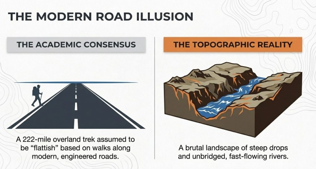
We have examined Professor Ray’s efforts to prove that transporting bluestones by land to Stonehenge using sledges and dragging is feasible. He believes the journey is relatively flat, with gentle gradients, based on his walk along modern roads engineered over the last thousand years to maintain gradual steepness. However, he failed to consider the reality of the steep drops and river valleys the original journey would have encountered. (Professor Bonkers and the mad, mad World of Archaeology)
Even if his assumptions about the terrain were correct, the logistics of such an endeavour were not considered. He is not alone in this oversight, as other established professors have maintained over the years that the ‘ox cart’ route was feasible.
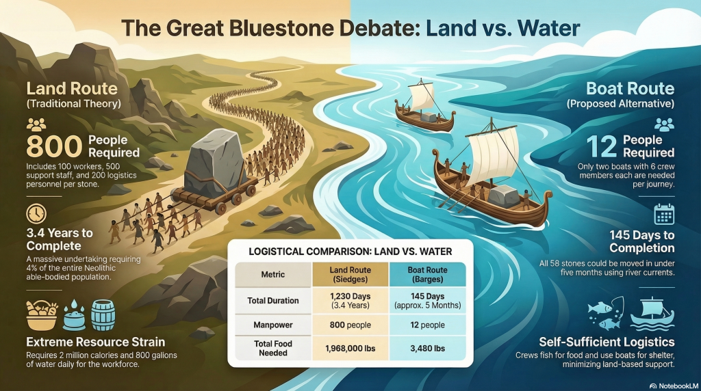
We employed AI to calculate the logistics of this project. It revealed that such a task would have required recruiting 4% of the able-bodied men of the Neolithic period and taking 3.4 years to complete. This calculation does not include the carbon-dating evidence, suggesting that additional stones were taken to replenish the old stock that had lasted a millennium.
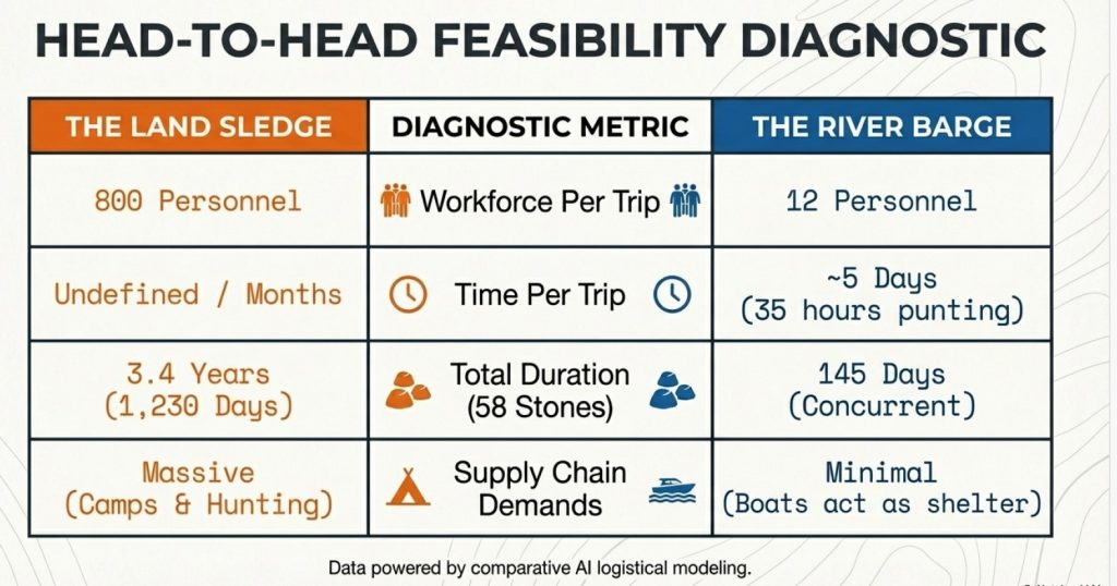
In stark contrast, we asked AI to calculate the logistics and feasibility of using a boat from the quarry to Stonehenge. The results showed that the journey could be completed in just 5 days with a team of 12 people per trip—6 people per boat (a total of 145 days). This approach seems far more feasible, as the river provides a fixed direction with minimal need for navigation markers, unlike the land route.
Professor Bonkers
I was recently asked to share my thoughts on Professor Keith Ray’s ambitious 222-mile journey from the quarries of the Preseli Mountains to Stonehenge. He undertook this trek to gather information and generate publicity for his upcoming book. Initially, I thought he was quite mad; anyone reasonable would recognise that modern roads didn’t exist during the original bluestone journey, making his trek rather pointless. Moreover, I doubt he would wade through rivers, especially the Severn, to demonstrate how “easy” the journey was, particularly given his age.

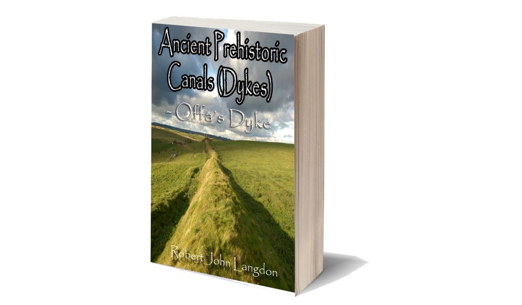
What I didn’t know was that Professor Ray had previously completed a similar journey along Offa’s Dyke. His forthcoming book, “Offa’s Dyke: Encounters and Explanations,” caught my interest, primarily since I had recently published my book on Offa’s Dyke. I was curious if he had incorporated any findings from the first-ever LiDAR survey of the Dyke. Unfortunately, it seems his research missed crucial aspects. His press release claimed that the Dyke was built in the eighth century, a notion the LiDAR survey conclusively disproves. (Professor Bonkers and the mad, mad World of Archaeology)
Even more puzzling is his reliance on outdated information from Sir Cyril Fox’s earlier work on the Dyke. In my book, I showed that Fox’s observations were misinterpreted, such as the “defensive banks” being on the wrong side of the Dyke and the “non-existent” evidence buried underground, which LiDAR proved never existed.
Professor Ray also suggested that the boundary doesn’t align with the modern one because it has shifted over time, yet he provided no evidence. A glance at the conclusions in my book, freely available to anyone doing basic research, would reveal that 60% of the Dyke no longer exists, with much of it now being rivers. Why not the rest if rivers account for 60% of the boundary? The fact that the river and the Dyke run parallel in some parts, with less than 50 meters separating them, makes the idea of a boundary completely illogical. This brings us back to his Stonehenge walk—another exercise in futility, in my opinion.
The conclusion of Professor Ray’s press release certainly raised my eyebrows, particularly regarding his qualifications and position as an Honorary Professor of Archaeology in the School of History, Archaeology, and Religion at Cardiff University. This is new to me, but it might explain the recent trend among archaeologists to excessively refer to ceremonies, religious sites, offerings, and beliefs, which have no place in scientific discourse. Cardiff seems to regard archaeology as a social science rather than a hard science, as evidenced by Ray’s subjective observations of Offa’s Dyke.
Regarding his 222-mile hike to Stonehenge, he has yet to reveal the exact route, likely keeping it a secret for his future £30 book. However, the problems with this endeavour are manifold, demonstrating how impractical and impossible the journey would have been. This is the same professor who walked 209 miles without realising that 60% of the Dyke is not visible, relying instead on Fox’s outdated observations, which LiDAR has since proven false.
Ray’s qualifications include a PhD in the archaeology of Igbo Ukwu, eastern Nigeria, from Cambridge, which some might consider a mark of infallibility. However, this background does little to validate his flawed conclusions. Previous peer-reviewed works have perpetuated the same mistakes, making them socially acceptable in archaeology. (Professor Bonkers and the mad, mad World of Archaeology)
His Stonehenge trek raises fundamental questions. If one is leaving the Preseli mountains, which way is Stonehenge? The notion that a group of men picked up stones and followed a straightforward path to Stonehenge is illogical. The people of Stonehenge must have come to the quarry first, perhaps leaving breadcrumbs to find their way back. Maybe Professor Ray has stumbled upon a theory involving a long string to guide their return, reminiscent of a prehistoric paper chase.
Had the renowned professor consulted my recent LiDAR map of the quarry (though it’s unclear which quarry he started from), he would have seen that, in ancient times, starting from the primary quarry required crossing a much larger river. However, photos of him setting off show him on an excellent, flat road. There are only two roads from the site: one leading the wrong way to the coast and the other heading northeast, while Stonehenge is southeast. Thus, he begins his journey in the wrong direction unless he plans to invent a non-existent pathway (untraceable by LiDAR) or start incorrectly to return home quickly via modern roads that go around the country the wrong way…. But they are flattish!
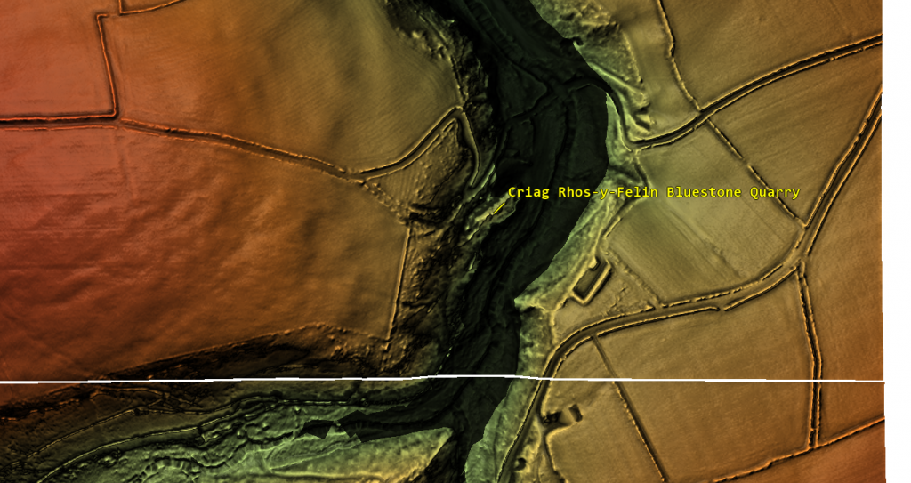
Overall, his hike to Stonehenge appears to be another exercise in pure folly, much like his observations of Offa’s Dyke, an exercise to sell books rather than discover the true history of Britain. (Professor Bonkers and the mad, mad World of Archaeology)
The logistics
Even if it was feasible, the professor may have overlooked the logistics of such an endeavour:
Grand Plan for Transporting Stones from Craig Rhos-y-Felin to Stonehenge
Preparation:
Reconnaissance:
Visit Stonehenge: Key planners visit Stonehenge to understand its location and surroundings.
Route Planning: Identify the best route using natural landmarks, rivers, and terrain features.
Navigation Techniques:
Sun and Stars: Use the sun for daytime navigation and stars at night.
Landmarks: Identify and memorise prominent natural landmarks.
Oral Tradition: Rely on oral tradition to maintain route guidance.
Surveying Techniques: Use basic surveying to align the route with known points.
Execution:
Quarrying:
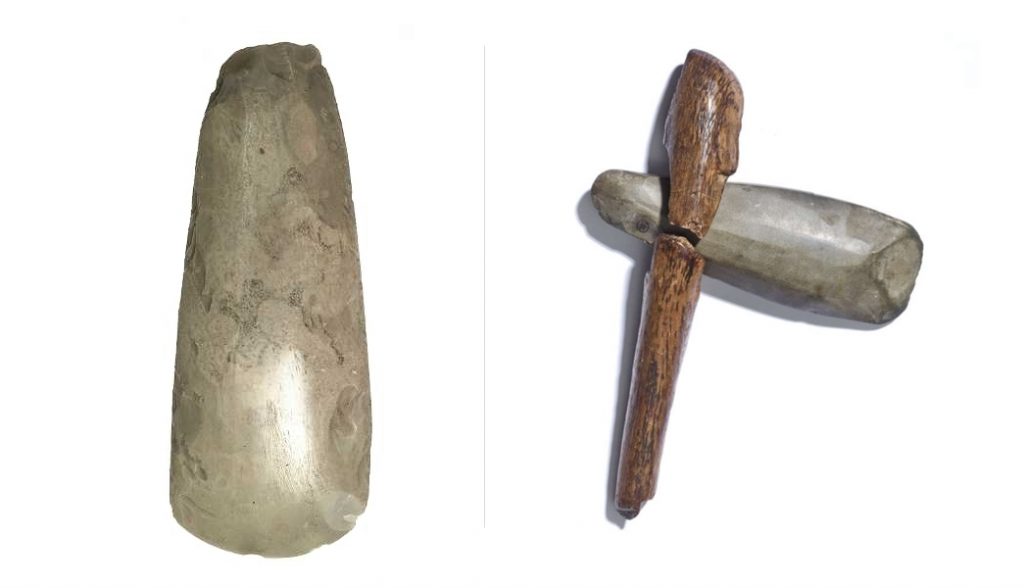
Extract Stones: Quarry the 4-tonne bluestones using available tools and techniques.
Transportation:
Initial Movement: Use wooden sledges and rollers to move stones from the quarry to the nearest waterway.
Water Transport: Construct rafts to float the stones along rivers, utilising the natural flow.
Land Transport: Use sledges and manpower to move stones overland to Stonehenge.
Logistics:
Food and Shelter:
Temporary Camps: Establish camps along the route.
Food Supplies: Organise a supply chain with regular intervals for food and water.
Shelter: Construct temporary shelters using materials from the surrounding environment.
Manpower:
Workers and Support Staff: 100 workers for moving stones and 500 support staff per 100 workers, totalling 600 people per stone.
Additional Manpower for Supply Chain: Assuming a further 200 people dedicated to supply logistics.
Support Personnel:
Ratio: 5 support people per worker.
Total Support Workers: For 100 workers, 500 support workers are required.
Total Workforce: 800 people (100 workers + 500 support workers + 200 logistics personnel).
River Crossings:
Rivers Along the Route:
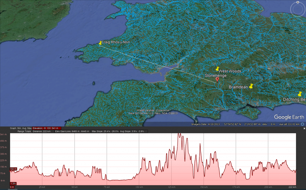
Key Rivers: Transporting the stones from Craig Rhos-y-Felin to Stonehenge would likely involve crossing several major rivers, including the River Teifi, River Wye, River Severn, and River Avon.
Tree Felling for Rafts:
Number and Size of Trees: Constructing a raft to float a 4-tonne stone requires several large trees.
Felling Time: Cutting down trees with stone axes is a time-consuming process. Each tree may take several days to cut down and shape.
Crossing Procedure:

Arrival at River:
Disassemble Sledges: Temporarily dismantle sledges for transport.
Build Rafts: Construct sturdy rafts using timber and other materials.
Loading Stones:
Lift Stones: Use manpower and leverage techniques to carefully load stones onto rafts.
Secure Stones: Ensure stones are securely fastened to prevent shifting during transport.
Crossing the River:
Navigate Rafts: Use poles and paddles to guide rafts across the river.
Monitor Weather: Choose optimal weather conditions for safe crossing.
Disembarkation:
Unload Stones: Carefully unload stones on the opposite bank.
Reassemble Sledges: Reconstruct sledges for continued overland transport.
Supply Chain Logistics:
Food Consumption:
Daily Requirements: Assuming an average consumption of 2,500 calories per person per day.
Food: 2,500 calories/person/day x 800 people = 2,000,000 calories/day.
Weight: Approximately 2 pounds of food per person per day.
Total Weight: 2 pounds/person/day x 800 people = 1,600 pounds of food/day.
Water Consumption:
Daily Requirements: Assuming an average consumption of 1 gallon of water per person daily.
Water: 1 gallon/person/day x 800 people = 800 gallons/day.
Clothing and Shelter:
Clothing: Seasonal clothing would be required for the workforce, likely made from wool, leather, and woven plant fibres.
Shelter: Temporary shelters made from local materials like wood, thatch, and animal hides.
Feasibility Based on Population:
Neolithic Population Estimates:
The population of Southern Britain during the Neolithic period is estimated to be around 100,000 people.
Assuming that approximately 20% of the population were able-bodied adults fit enough for this kind of labour, that gives us about 20,000 potential workers.
Workforce Requirement:
Direct Workforce: 600 people (including 100 workers and 500 support staff) are required for the transport operation.
Additional Manpower for Supply Chain: Assuming an additional 200 people dedicated to supply logistics, the total workforce needed would be 800 people.
Percentage of Population Involved:
Total Population Fit for Work: 20,000 able-bodied adults.
Total Workforce Needed: 800 people.
Percentage of Population: (800 / 20,000) * 100 = 4%
Timeframe Adjustments:
Total Duration: Around 3.4 years (1,230 days) to complete the mission, including increased logistical requirements.
Food Consumption Over Time:
Daily: 1,600 pounds of food/day (including additional logistics personnel).
Total: 1,600 pounds/day x 1,230 days = 1,968,000 pounds (984 tons) of food.
Water Consumption Over Time:
Daily: 800 gallons/day.
Total: 800 gallons/day x 1,230 days = 984,000 gallons of water.
Summary:
Manpower: 800 people (including additional logistics personnel).
Total Duration: 3.4 years to account for increased logistical requirements.
Logistics: Establish temporary camps, maintain supply chains, and ensure efficient coordination for continuous progress.
Feasibility: Engaging 4% of the able-bodied adult population in Southern Britain over 3.4 years is feasible but unlikely due to other commitments.
Grand Plan for Transporting Stones from Craig Rhos-y-Felin to Stonehenge via Boat
Preparation:
Reconnaissance:
Visit Stonehenge: Key planners visit Stonehenge to understand its location and surroundings.
Route Planning: Identify the best waterway route using natural landmarks, rivers, and paleochannels.
Navigation Techniques:
River Navigation: Use natural flow of the river and markers on the shoreline to maintain direction.
Landmarks: Identify and memorise prominent natural landmarks along the river route.
Oral Tradition: Rely on oral tradition for additional guidance.
Execution:
Quarrying:
Extract Stones: Quarry the 4-tonne bluestones using available tools and techniques.
Transportation:
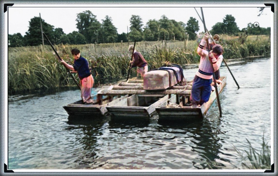
Water Transport: Construct sturdy boats/barges to float the stones along rivers and paleochannels.
Logistics:
Food and Shelter:
Temporary Camps: Establish camps at key points along the route for rest and resupply.
Food Supplies: Crew can fish from the river to sustain part of their food supply, reducing the need for transported food.
Shelter: Use boats for shelter during the journey, reducing the need for land-based temporary shelters.
Manpower:
Crew for Boats: Each boat requires a crew of 6 people (4 punting and 2 resting).
Total Crew: Two boats per journey, totalling 12 people per journey.
River and Boat Transport Logistics:
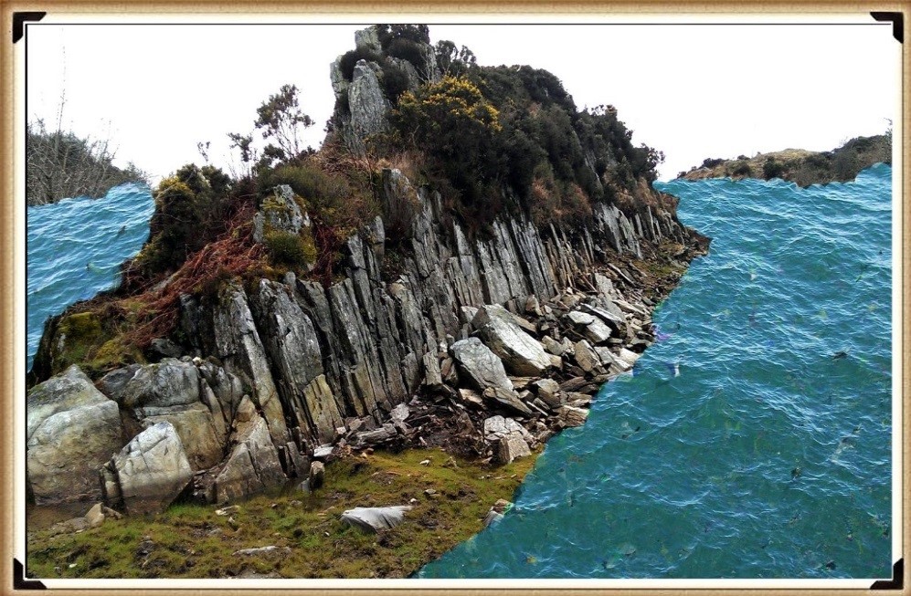
Boat Construction:
Materials: Use large logs and timbers for constructing sturdy boats/barges capable of carrying 4-tonne stones.
Felling Time: Cutting down trees with stone axes is time-consuming. Each tree may take several days to cut down and shape.
Boat Capacity:
Craft Size: Each boat must be able to carry one 4-tonne stone.
Punting Crew: Each boat requires 4 people to punt and 2 people resting.
Speed:
Average Speed: Boats can travel at a rate of 4 miles per hour.
Distance and Time Calculation:
Total Distance: Approximately 140 miles from Craig Rhos-y-Felin to Stonehenge.
Travel Time: At 4 miles per hour and 16 hours of travel per day, the journey would take approximately 35 hours of punting time. This totals approximately 2.2 days of travel.
Additional Time for Setup and Rest: Allow an additional 3 days for loading, unloading, and unforeseen delays.
Total Journey Time: Approximately 5 days per trip for two stones.
Supply Chain Logistics:
Food Consumption:
Fishing: The crew can fish to sustain part of their food supply, reducing the need for transported food.
Daily Requirements: Assuming an average consumption of 2,500 calories per person per day.
Food: 2,500 calories/person/day x 12 people = 30,000 calories/day.
Weight: Approximately 2 pounds of food per person per day.
Total Weight: 2 pounds/person/day x 12 people = 24 pounds of food/day per journey.
Water Consumption:
Daily Requirements: Assuming an average consumption of 1 gallon of water per person per day.
Water: 1 gallon/person/day x 12 people = 12 gallons/day per journey.
Clothing and Shelter:
Clothing: Seasonal clothing would be required for the entire workforce, likely made from wool, leather, and woven plant fibers.
Shelter: Use boats for shelter during the journey.
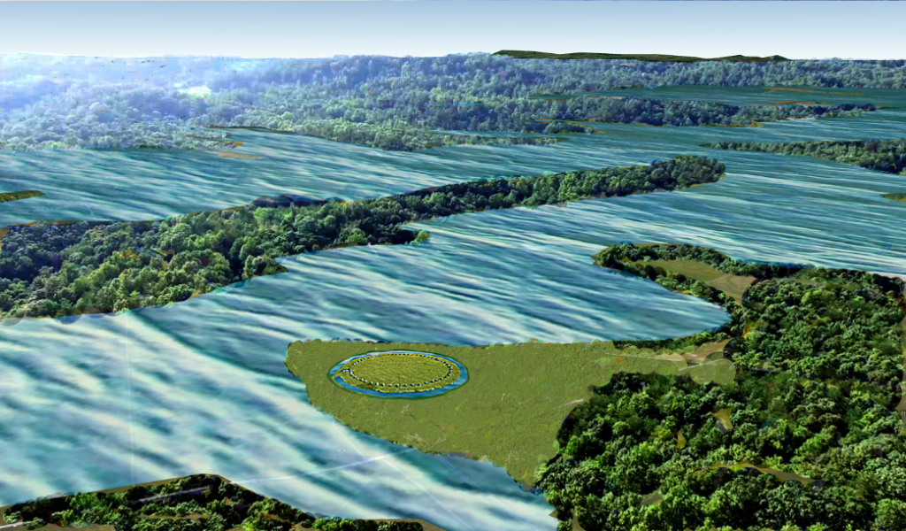
Feasibility Based on Population:
Neolithic Population Estimates:
The population of Southern Britain during the Neolithic period is estimated to be around 100,000 people.
Assuming that approximately 20% of the population were able-bodied adults fit enough for this kind of labor, that gives us about 20,000 potential workers.
Workforce Requirement:
Direct Workforce: 12 people for punting and logistics per journey.
Support Personnel: Minimal additional support needed due to self-sufficiency (fishing for food and using boats for shelter).
Percentage of Population Involved:
Total Population Fit for Work: 20,000 able-bodied adults.
Total Workforce Needed: 12 people per journey.
Timeframe and Numbers:
Total Duration: Approximately 5 days per trip for two stones.
Total Stones: 58 stones to be transported.
Concurrent Transport: Assuming two stones per journey.
Total time Required: (58 stones / 2 stones per trip) * 5 days = 145 days.
Total Consumption Over Time:
Food:
Daily: 24 pounds of food/day x 12 people = 288 pounds of food/day.
Total: 24 pounds/day x 145 days = 3,480 pounds of food (1.74 tons).
Water:
Daily: 12 gallons of water/day x 12 people = 144 gallons of water/day.
Total: 12 gallons/day x 145 days = 1,740 gallons of water.
Summary:
Manpower: 12 people per journey.
Total Duration: Approximately 145 days (around 5 months) to account for increased logistical requirements and concurrent transport of two stones at a time.
Logistics: Minimal need for additional logistics due to self-sufficiency (fishing for food and using boats for shelter).
Feasibility: Engaging a very small percentage of the able-bodied adult population in Southern Britain is highly feasible.
(Professor Bonkers and the mad, mad World of Archaeology)
PodCast

Author’s Biography
Robert John Langdon, a polymathic luminary, emerges as a writer, historian, and eminent specialist in LiDAR Landscape Archaeology.
His intellectual voyage has been interwoven with stints as an astute scrutineer for governmental realms and grand corporate bastions, a tapestry spanning British Telecommunications, Cable and Wireless, British Gas, and the esteemed University of London.
A decade hence, Robert’s transition into retirement unfurled a chapter of insatiable curiosity. This phase saw him immerse himself in Politics, Archaeology, Philosophy, and the enigmatic realm of Quantum Mechanics. His academic odyssey traversed the venerable corridors of knowledge hubs such as the Museum of London, University College London, Birkbeck College, The City Literature Institute, and Chichester University.
In the symphony of his life, Robert is a custodian of three progeny and a pair of cherished grandchildren. His sanctuary lies ensconced in the embrace of West Wales, where he inhabits an isolated cottage, its windows framing a vista of the boundless sea – a retreat from the scrutinous gaze of Her Majesty’s Revenue and Customs, an amiable clandestinity in the lap of nature’s embrace.
Exploring Prehistoric Britain: A Journey Through Time
My blog delves into the fascinating mysteries of prehistoric Britain, challenging conventional narratives and offering fresh perspectives grounded in cutting-edge research, particularly LiDAR technology. I invite you to explore some key areas of my research. For example, the Wansdyke, often cited as a defensive structure, is re-examined in light of new evidence. I’ve presented my findings in my blog post Wansdyke: A British Frontier Wall – ‘Debunked’, and aWansdyke LiDAR Flyover video further visualises my conclusions.
My work also often challenges established archaeological dogma. I argue that many sites, such as Hambledon Hill, commonly identified as Iron Age hillforts, are not what they seem. My posts Lidar Investigation Hambledon Hill – NOT an ‘Iron Age Fort’ and Unmasking the “Iron Age Hillfort” Myth explore these ideas in detail and offer an alternative view. Similarly, sites like Cissbury Ring and White Sheet Camp also receive a re-evaluation based on LiDAR analysis in my posts “Lidar Investigation Cissbury Ring through time” and “Lidar Investigation White Sheet Camp,“ revealing fascinating insights into their true purpose. I have also examined South Cadbury Castle, often linked to the mythical Camelot56.
My research also extends to ancient water management, including the role of canals and other linear earthworks. I have discussed the true origins of Car Dyke in multiple posts, including Car Dyke – ABC News Podcast and Lidar Investigation Car Dyke – North Section, which suggest a Mesolithic origin 2357. I also explore the misidentification of Roman aqueducts, as seen in my posts on the Great Chesters (Roman) Aqueduct. My research has also been greatly informed by my post-glacial flooding hypothesis, which has helped explain landscape transformations over time. I have discussed this hypothesis in several posts, including AI now supports my Post-Glacial Flooding Hypothesis and Exploring Britain’s Flooded Past: A Personal Journey
Finally, my blog also investigates prehistoric burial practices, as seen in Prehistoric Burial Practices of Britain and explores the mystery of Pillow Mounds, often mistaken for medieval rabbit warrens, but with a potential link to Bronze Age cremation in my posts: Pillow Mounds: A Bronze Age Legacy of Cremation? and The Mystery of Pillow Mounds: Are They Really Medieval Rabbit Warrens?. My research also includes astronomical insights into ancient sites, for example, in Rediscovering the Winter Solstice: The Original Winter Festival. I also review new information about the construction of Stonehenge in The Stonehenge Enigma.
Further Reading
For those interested in British Prehistory, visit www.prehistoric-britain.co.uk, a comprehensive resource featuring an extensive collection of archaeology articles, modern LiDAR investigations, and groundbreaking research. The site also includes insights and excerpts from the acclaimed Robert John Langdon Trilogy, a series of books that explore Britain during the Prehistoric period. Titles in the trilogy include The Stonehenge Enigma, Dawn of the Lost Civilisation, and The Post-Glacial Flooding Hypothesis, which offer compelling evidence of ancient landscapes shaped by post-glacial flooding.
To further explore these topics, Robert John Langdon has developed a dedicated YouTube channel featuring over 100 video documentaries and investigations that complement the trilogy. Notable discoveries and studies showcased on the channel include 13 Things that Don’t Make Sense in History and the revelation of Silbury Avenue – The Lost Stone Avenue, a rediscovered prehistoric feature at Avebury, Wiltshire.
In addition to his main works, Langdon has released a series of shorter, accessible publications, ideal for readers delving into specific topics. These include:
- The Ancient Mariners
- Stonehenge Built 8300 BCE
- Old Sarum
- Prehistoric Rivers
- Dykes, Ditches, and Earthworks
- Echoes of Atlantis
- Homo Superior
- 13 Things that Don’t Make Sense in History
- Silbury Avenue – The Lost Stone Avenue
- Offa’s Dyke
- The Stonehenge Enigma
- The Post-Glacial Flooding Hypothesis
- The Stonehenge Hoax
- Dawn of the Lost Civilisation
- Darwin’s Children
- Great Chester’s Roman Aqueduct
- Wansdyke
For active discussions and updates on the trilogy’s findings and recent LiDAR investigations, join our vibrant community on Facebook. Engage with like-minded enthusiasts by leaving a message or contributing to debates in our Facebook Group.
Whether through the books, the website, or interactive videos, we aim to provide a deeper understanding of Britain’s fascinating prehistoric past. We encourage you to explore these resources and uncover the mysteries of ancient landscapes through the lens of modern archaeology.
For more information, including chapter extracts and related publications, visit the Robert John Langdon Author Page. Dive into works such as The Stonehenge Enigma or Dawn of the Lost Civilisation, and explore cutting-edge theories that challenge traditional historical narratives.
Other Blogs
1
a
- AI now Supports – Homo Superior
- AI now supports my Post-Glacial Flooding Hypothesis
- Alexander the Great sailed into India – where no rivers exist today
- Ancient Secrets of Althorp – debunked
- Antler Picks built Ancient Monuments – yet there is no real evidence
- Antonine Wall – Prehistoric Canals (Dykes)
- Archaeological ‘pulp fiction’ – has archaeology turned from science?
- Archaeological Pseudoscience
- Archaeology in the Post-Truth Era
- Archaeology: A Bad Science?
- Archaeology: A Harbour for Fantasists?
- Archaeology: Fact or Fiction?
- Archaeology: The Flaws of Peer Review
- Archaeology’s Bayesian Mistake: Stop Averaging the Past
- Are Raised Beaches Archaeological Pseudoscience?
- Atlantis Found: The Mathematical Proof That Plato’s Lost City Was Doggerland
- ATLANTIS: Discovery with Dan Snow Debunked
- Avebury Ditch – Avebury Phase 2
- Avebury through time
- Avebury’s great mystery revealed
- Avebury’s Lost Stone Avenue – FREE Flipbook
b
- Battlesbury Hill – Wiltshire
- Beyond Stone and Bone: Rethinking the Megalithic Architects of Northern Europe
- BGS Prehistoric River Map
- Blackhenge: Debunking the Media misinterpretation of the Stonehenge Builders
- Brain capacity (Cro-Magnon Man)
- Britain’s First Road – Stonehenge Avenue
- Britain’s Giant Prehistoric Waterways
- British Roman Ports miles away from the coast
c
- Caerfai Promontory Fort – Archaeological Nonsense
- Car Dyke – ABC News PodCast
- Car Dyke – North Section
- Car Dyke Atlas – Prehistoric Canals – FREE Flipbook
- CASE STUDY – An Inconvenient TRUTH (Craig Rhos Y Felin)
- Case Study – River Avon
- Case Study – Woodhenge Reconstruction
- Chapter 2 – Craig Rhos-Y-Felin Debunked
- Chapter 2 – Stonehenge Phase I
- Chapter 2 – Variation of the Species
- Chapter 3 – Post Glacial Sea Levels
- Chapter 3 – Stonehenge Phase II
- Chapter 7 – Britain’s Post-Glacial Flooding
- Cissbury Ring through time
- Clement Reid, Doggerland, and the Archaeological Establishment
- Cro-Magnon Brain Capacity
- Cro-Magnon Megalithic Builders: Measurement, Biology, and the DNA
- Cro-Magnons – An Explainer
d
- Darwin’s Children – Flipbook
- Darwin’s Children – The Cro-Magnons
- Dawn of the Lost Civilisation – FREE Flipbook
- Dawn of the Lost Civilisation – Introduction
- Digging for Britain – Cerne Abbas
- Digging for Britain Debunked – Cerne Abbas 2
- Digging Up Britain’s Past – Debunked
- DLC Chapter 1 – The Ascent of Man
- Durrington Walls – Woodhenge through time
- Durrington Walls Revisited: Platforms, Fish Traps, and a Managed Mesolithic Landscape
- Dyke Construction – Hydrology 101
- Dykes Ditches and Earthworks
- DYKES of Britain
e
f
g
h
- Hadrian’s Wall – Military Way Hoax
- Hadrian’s Wall – the Stanegate Hoax
- Hadrian’s Wall LiDAR investigation
- Hambledon Hill – NOT an ‘Iron Age Fort’
- Hayling Island Lidar Maps
- Hidden Sources of Ancient Dykes: Tracing Underground Groundwater Fractals
- Historic River Avon
- Hollingsbury Camp Brighton – A Hillfort… or a Forgotten Harbour?
- Hollows, Sunken Lanes and Palaeochannels
- Homo Superior – Flipbook
- Homo Superior – History’s Giants
- How Lidar will change Archaeology
- Hydrology 101 Simplified: Why Britain’s Dykes Worked Without Rivers
i
l
m
- Maiden Castle through time
- Mathematics Meets Archaeology: Discovering the Mesolithic Origins of Car Dyke
- Mesolithic River Avon
- Mesolithic Stonehenge
- Minerals found in Prehistoric and Roman Quarries
- Mining in the Prehistoric to Roman Period
- Mount Caburn through time
- Mysteries of the Oldest Boatyard Uncovered
- Mythological Dragons – a non-existent animal that is shared by the World.
o
- Offa’s Dyke – FREE Flipbook
- Old Sarum Lidar Map
- Old Sarum Through Time…………….
- On Sunken Lands of the North Sea – Lived the World’s Greatest Civilisation.
- OSL Chronicles: Questioning Time in the Geological Tale of the Avon Valley
- Oswestry LiDAR Survey
- Oswestry through time
- Oysters in Archaeology: Nature’s Ancient Water Filters?
p
- Pillow Mounds: A Bronze Age Legacy of Cremation?
- Pinkery Canal
- Plato Was Right: The Archaeological Evidence the Academics Never Expected
- Post Glacial Flooding – Flipbook
- Prehistoric Burial Practices of Britain
- Prehistoric Canals – Wansdyke
- Prehistoric Canals – Wansdyke
- Prehistoric Canals (Dykes) – Great Chesters Aqueduct (The Vallum Pt. 4)
- Prehistoric Canals (Dykes) – Hadrian’s Wall Vallum (pt 1)
- Prehistoric Canals (Dykes) – Offa’s Dyke (Chepstow)
- Prehistoric Canals (Dykes) – Offa’s Dyke (LiDAR Survey)
- Prehistoric Canals (Dykes) – Offa’s Dyke Survey (End of Section A)
- Prehistoric Canals (Dykes) – Wansdyke (4)
- Prehistoric Canals Wansdyke 2
- Professor Bonkers and the mad, mad World of Archaeology
r
- Real-World Confirmation of Post-Glacial Flooding
- Rebirth in Stone: Decrypting the Winter Solstice Legacy of Stonehenge
- Rediscovering the Winter Solstice: The Original Winter Festival
- Rethinking Ancient Boundaries: The Vallum and Offa’s Dyke”
- Rethinking Ogham: Could Ireland’s Oldest Script Have Begun as a Tally System?
- Rethinking The Past: Mathematical Proof of Langdon’s Post-Glacial Flooding Hypothesis
- Rising Evidence, Falling Rivers: The Real Story of Europe’s First Farmers
- Rivers of the Past Were Higher: A Fresh Perspective on Prehistoric Hydrology
s
- Sea Level Changes
- Section A – NY26SW
- Section B – NY25NE & NY26SE
- Section C – NY35NW
- Section D – NY35NE
- Section E – NY46SW & NY45NW
- Section F – NY46SE & NY45NE
- Section G – NY56SW
- Section H – NY56NE & NY56SE
- Section I – NY66NW
- Section J – NY66NE
- Section K – NY76NW
- Section L – NY76NE
- Section M – NY87SW & NY86NW
- Section N – NY87SE
- Section O – NY97SW & NY96NW
- Section P – NY96NE
- Section Q – NZ06NW
- Section R – NZ06NE
- Section S – NZ16NW
- Section T – NZ16NE
- Section U – NZ26NW & NZ26SW
- Section V – NZ26NE & NZ26SE
- Silbury Avenue – Avebury’s First Stone Avenue
- Silbury Hill
- Silbury Hill / Sanctuary – Avebury Phase 3
- Sky Maps of Prehistoric Britain
- Somerset Plain – Signs of Post-Glacial Flooding
- South Cadbury Castle – Camelot
- Statonbury Camp near Bath – an example of West Wansdyke
- Stone me – the druids are looking the wrong way on Solstice day
- Stone Transportation and Dumb Censorship
- Stonehenge – Monument to the Dead
- Stonehenge Hoax – Dating the Monument
- Stonehenge Hoax – Round Monument?
- Stonehenge Hoax – Summer Solstice
- Stonehenge LiDAR tour
- Stonehenge Phase 1 – 8300 BCE Documentary
- Stonehenge Phase 1 — Britain’s First Monument
- Stonehenge Phase I (The Stonehenge Landscape)
- Stonehenge Solved – Pythagorean maths put to use 4,000 years before he was born
- Stonehenge Through Time
- Stonehenge, Doggerland and Atlantis connection
- Stonehenge: Borehole Evidence of Post-Glacial Flooding
- Stonehenge: Discovery with Dan Snow Debunked
- Stonehenge: The World’s First Computer – FREE Flipbook
- Stonehenge: The Worlds First Computer
- Stonehenge’s The Lost Circle Revealed – DEBUNKED
t
- Ten Reasons Why Car Dyke Blows Britain’s Earthwork Myths Out of the Water
- Ten Things You Didn’t Know About Britain’s Prehistoric Flooded Past
- Ten thousand year old boats found on Northern Europe’s Hillsides
- Ten thousand-year-old boats found on Northern Europe’s Hillsides
- Testing Plato’s Atlantis Against Reality
- The “Hunter-Gatherer” Myth: Why It’s Time to Bury This Outdated Term
- The Ancient Mariners – Flipbook
- The Ancient Mariners – Prehistoric seafarers of the Mesolithic
- The Ascent of Man — From Survival to Systems
- The Beringian Migration Myth: Why the Peopling of the Americas by Foot is Mathematically and Logistically Impossible
- The Bluestone Enigma
- The Bulford Hoax: The “Simpler, Older Stonehenge” That Wasn’t
- The Cheddar Man Hoax
- The Cro-Magnon Cover-Up: How DNA and PR Labels Erased Our Real Ancestry
- The Dolmen and Long Barrow Connection
- The Durrington Mega-Monument Hoax: What Lies Beneath? – Debunked
- The Durrington Walls Hoax – it’s not a henge?
- The Dyke Myth Collapses: Excavation and Dating Prove Britain’s Great Dykes Are Prehistoric Canals
- The First European Smelted Bronzes
- The Fury of the Past: Natural Disasters in Historical and Prehistoric Britain
- The Giant’s Graves of Cumbria
- The Giants of Prehistory: Cro-Magnon and the Ancient Monuments
- The Great Ancient DNA Illusion: How Statistical Models Became Archaeological “Facts”
- The Great Antler Pick Hoax
- The Great Bell Beaker Migration Myth
- The Great Chichester Hoax – A Bridge too far?
- The Great Dorchester Aqueduct Hoax
- The Great Farming Hoax – (Einkorn Wheat)
- The Great Farming Migration Hoax
- The Great Hadrian’s Wall Hoax
- The Great Iron Age Hill Fort Hoax
- The Great Offa’s Dyke Hoax
- The Great Prehistoric Migration Hoax
- The Great Stone Transportation Hoax
- The Great Stonehenge Hoax
- The Great Wansdyke Hoax
- The Henge and River Relationship
- The Logistical Impossibility of Defending Maiden Castle
- The Long Barrow and Dolmen Enigma
- The Long Barrow Mystery
- The Long Barrow Mystery: Unravelling Ancient Connections
- The Lost Island of Avalon – revealed
- The Maiden Way Hoax – A Closer Look at an Ancient Road’s Hidden History
- The Maths – LGM total ice volume
- The Mystery of Pillow Mounds: Are They Really Medieval Rabbit Warrens?
- THE ODYSSEY PROBLEM: WHY DID A WEEK-LONG VOYAGE BECOME A TEN-YEAR EPIC?
- The Old Sarum Hoax
- The Oldest Boat Yard in the World found in Wales
- The Perils of Paradigm Shifts: Why Unconventional Hypotheses Get Branded as Pseudoscience
- The Post-Glacial Flooding Hypothesis – 1/11
- The Post-Glacial Flooding Hypothesis – FREE Flipbook
- The Post-Glacial Flooding Theory
- The Problem with Hadrian’s Vallum
- The Rise of the Cro-Magnon (Homo Superior)
- The Roman Military Way Hoax
- The Silbury Hill Lighthouse?
- The Stone Money – Credit System
- The Stonehenge Avenue
- The Stonehenge Avenue
- The Stonehenge Code: Unveiling its 10,000-Year-Old Secret
- The Stonehenge Crescent: A Monument to a Lost World
- The Stonehenge Enigma – FREE Flipbook
- The Stonehenge Enigma: Part 1/6
- The Stonehenge Hoax – Bluestone Quarry Site
- The Stonehenge Hoax – FREE Flipbook
- The Stonehenge Hoax – FREE Flipbook
- The Stonehenge Hoax – Moving the Bluestones
- The Stonehenge Hoax – Periglacial Stripes
- The Stonehenge Hoax – Station Stones
- The Stonehenge Hoax – Stonehenge’s Location
- The Stonehenge Hoax – The Ditch
- The Stonehenge Hoax – The Slaughter Stone
- The Stonehenge Hoax – The Stonehenge Layer
- The Stonehenge Hoax – Totem Poles
- The Stonehenge Hoax – Woodhenge
- The Stonehenge Hospital
- The Stonehenge Transportation Mystery
- The Subtropical Britain Hoax
- The Troy, Hyperborea and Atlantis Connection
- The Vallum @ Hadrian’s Wall – it’s Prehistoric!
- The Vallum at Hadrian’s Wall Atlas – FREE Flipbook
- The Woodhenge Hoax
- Three Dykes – Kidland Forest
- Thurnam’s 137 Skulls: The Forgotten People Behind Britain’s Megaliths.
- Top Ten Misidentified Fire Beacons in British History
- Troy Debunked – Troy did not exist in Asia Minor, but in fact, the North Sea island of Doggerland
- TSE – DVD Barrows
- TSE DVD – An Inconvenient Truth
- TSE DVD – Antler Picks
- TSE DVD – Avebury
- TSE DVD – Durrington Walls & Woodhenge
- TSE DVD – Dykes
- TSE DVD – Epilogue
- TSE DVD – Stonehenge Phase I
- TSE DVD – Stonehenge Phase II
- TSE DVD – The Post-Glacial Hypothesis
- TSE DVD Introduction
- TSE DVD Old Sarum
- Twigs, Charcoal, and the Death of the Saxon Dyke Myth
w
- Wansdyke – Short Film
- Wansdyke Atlas – FREE Flipbook
- Wansdyke East – Prehistoric Canals
- Wansdyke LiDAR Flyover
- Wansdyke: A British Frontier Wall – ‘Debunked’
- Was Columbus the first European to reach America?
- What Archaeology Missed Beneath Stonehenge
- White Sheet Camp
- Why a Simple Fence Beats a Massive Dyke (and What That Means for History)
- Windmill Hill – Avebury Phase 1
- Winter Solstice – Science, Propaganda and Indoctrination
- Woodhenge – the World’s First Lighthouse?