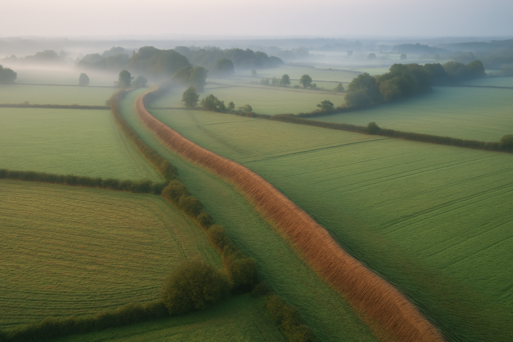
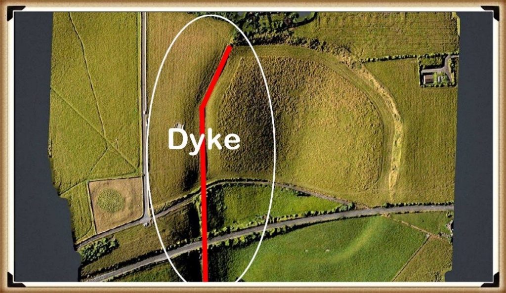
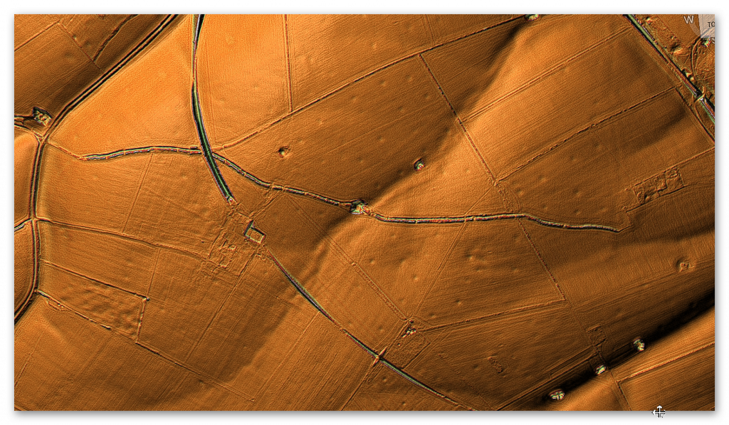
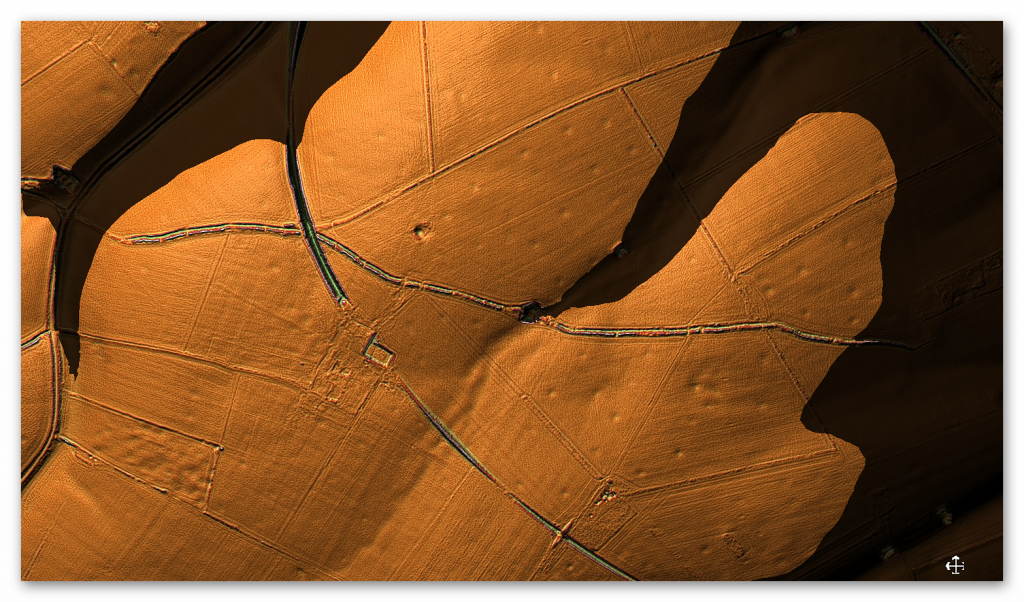
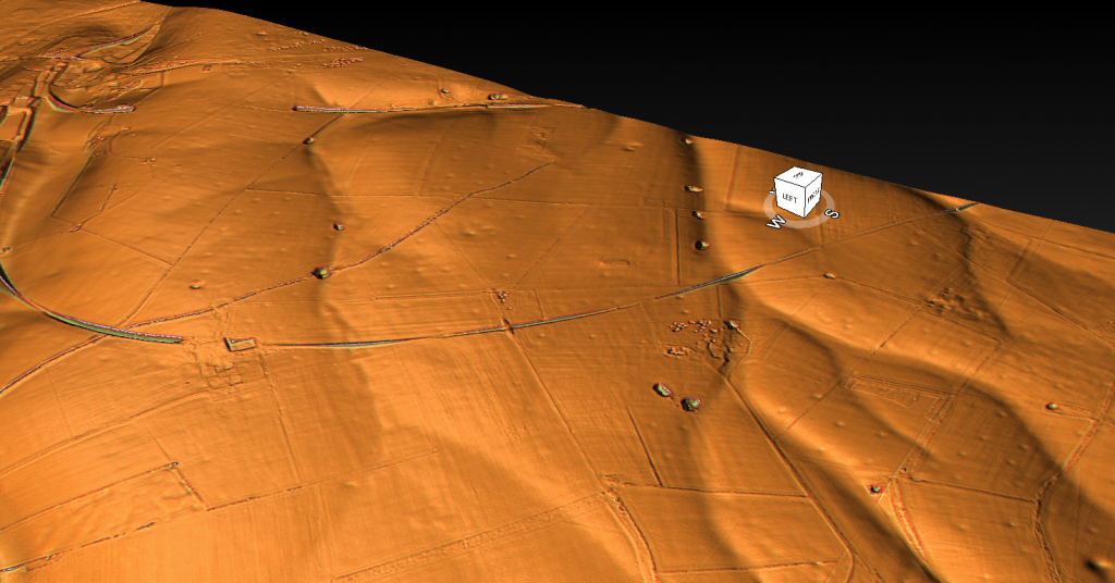
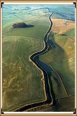
This blog re-examines Britain’s ancient linear earthworks, such as Offa’s Dyke and Wansdyke, through the lens of hydrology and groundwater science, proposing that these structures were not ritual boundaries or defensive embankments, but part of a sophisticated, prehistoric mining and transport network. By tracing their unusual paths and comparing them with aquifer data, the post makes a compelling case: these dykes were built to move minerals via water—not soldiers.(Hidden Purpose of Ancient Dykes)
Contrary to the long-held belief that these features served military or symbolic functions, their actual design raises major questions. Many dykes are non-continuous, curve unpredictably, and pass through remote, uninhabited areas, far from any strategic stronghold or settlement. Instead of defending anything, they seem to follow the landscape’s natural water flow—especially the edges of aquifers and groundwater discharge zones.
Wansdyke is on the edge of one of Britains largest Aquifers – Hidden Sources of Ancient Dykes – Source BGS
By overlaying dyke locations onto hydrogeological maps, a pattern emerges: nearly every major dyke in Britain correlates with aquifer systems or zones of high groundwater productivity. This includes saturated mineral-bearing soils, limestone and chalk formations, and ancient springs—features critical not for spiritual rituals, but for extracting and transporting resources. These dykes, the blog suggests, were likely built to channel groundwater seasonally or year-round, enabling flat-bottomed boats to move ore, stone, and other extracted materials from inland mining zones to major river systems for wider distribution.
The wibbly-wobbly routes of these earthworks make far more sense when viewed through this lens. Rather than being arbitrarily drawn or spiritually significant, they seem to trace fractally distributed groundwater flow patterns—the same paths water would naturally take through porous rock and sediment. By tapping into these natural routes, prehistoric engineers could move heavy materials across considerable distances without the need for roads or pack animals.
The Vallum at Hadrian’s Wall is on a major Aquifer – Hidden Sources of Ancient Dykes – Source BGS
Sites along these dykes often yield clues of quarrying, digging pits, or early metallurgy, further suggesting an industrial—not ritualistic—function. Combined with LiDAR mapping and terrain modelling, many of these ancient dykes also show characteristics of canal-like trenching, including embankments, towpaths, and level gradients consistent with water management rather than warfare.
Importantly, the blog challenges modern archaeology’s tendency to label such constructions as “ritual” simply because their purpose is not immediately understood. By reframing these dykes as functional infrastructure, it positions prehistoric Britons not as superstitious monument builders, but as skilled engineers, capable of manipulating water to serve economic and industrial goals—centuries, perhaps millennia, before similar systems appeared in written history.
Offa’s Dyke is on the edge of THREE major Aquifers – Hidden Sources of Ancient Dykes – Source BGSHidden Sources of Ancient Dykes – Source BGSHidden Sources of Ancient Dykes – Source BGS
In conclusion, the blog argues that Britain’s ancient dykes were part of a hydrological logistics network designed for resource movement and mining operations, aligning deliberately with groundwater systems and aquifer boundaries. These were routes of commerce and industry, not symbols or borders. It’s time to stop viewing them as mysterious relics—and start seeing them as evidence of a forgotten era of practical innovation and environmental mastery.
Dykes Follow Water: The 68.6% Aquifer Overlap Nobody’s Talking About
In a GIS-based analysis of prehistoric dyke placements across Britain, using official aquifer mapping from the British Geological Survey, we found that over two-thirds (68.6%) of dyke segments intersect directly with known aquifer zones.
This finding severely undermines the long-standing assumption that dykes were purely ritual or defensive. Instead, it supports a far more practical theory: these features may have followed underground water fractures or aquifer boundaries — possibly to aid water transport, trade, or seasonal canal usage.
When linear earthworks like Offa’s Dyke and Wansdyke are mapped alongside hydrogeological data, patterns emerge that are too precise to be coincidental. Whether through environmental observation or water dowsing, the builders clearly knew something about the ground beneath their feet.
Forget chalk and ritual. This is water engineering.
AI’s Take
1. Introduction: Revisiting the Landscape Through Water
Across Britain, a network of ancient linear earthworks—often labelled dykes—traverse the landscape in puzzling patterns. Traditionally interpreted as defensive structures, many of these dykes do not conform to military logic. They often wind across hills, valleys, and open terrain in apparently arbitrary routes. However, by examining these features through the lens of hydrology, particularly groundwater distribution and fractal flow paths, an alternative explanation emerges: these ancient monuments may have been constructed in response to the hidden patterns of water beneath our feet.
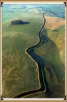
Ancient dykes like Offa’s Dyke snake across the landscape with no obvious military logic.- Hidden Purpose of Ancient Dykes
2. The Science of Groundwater Flow
Groundwater moves beneath the Earth’s surface through porous materials like gravel, sand, and fractured rock. Governed by the laws of hydrogeology—most notably Darcy’s Law—its movement follows gradients in pressure and elevation. Contrary to the perception of random underground seepage, groundwater flow is directional, structured, and often forms recognizable spatial patterns when viewed over time.
Hidden Purpose of Ancient Dykes
3. Hydrological Predictability and Fractal Geometry
Groundwater doesn’t spread uniformly. Instead, it forms branching, tree-like pathways that closely resemble fractal geometry—irregular yet mathematically structured patterns found in nature. These fractal patterns can be seen in river systems, lightning strikes, and even blood vessels. When mapped in detail, groundwater follows similar structures: splitting, rejoining, and fanning out with a logic dictated by rock permeability and hydraulic gradients.
Groundwater often follows fractal patterns, mirroring trees, veins, and rivers. – Hidden Purpose of Ancient Dykes
4. The Role of Aquifers
An aquifer is a body of rock or sediment that holds usable groundwater. Britain’s principal aquifers—such as the Chalk Aquifer of southeast England or the Triassic sandstones in Wales and the Midlands—are well-documented by the British Geological Survey. These aquifers are not just water sources; they shape ecosystems, influence agriculture, and determine human settlement patterns over millennia.
Britain’s major aquifers form the nation’s underground reservoirs. – Hidden Purpose of Ancient Dykes
5. Linear Earthworks: Not So Linear in Purpose
Earthworks like Offa’s Dyke, Wansdyke, and Grim’s Ditch often deviate from straight lines, curving and looping across the countryside. Many historians and archaeologists have noted this “wibbly-wobbly” quality and chalked it up to terrain negotiation. But what if these bends follow not just topography, but subterranean water flows?
Dykes appear “linear” in name only—many follow winding, unpredictable paths.- Hidden Purpose of Ancient Dykes
6. Evidence of Groundwater-Aware Design
Recent overlays of dyke paths on hydrogeological maps reveal compelling alignments. Dykes often trace the edges of aquifers, follow groundwater discharge zones (where springs emerge), or align with the boundaries between permeable and impermeable strata. These alignments are unlikely to be accidental, particularly when they persist across multiple sites.
Car Dyke aligns with underground water flow zones and aquifer edges which are still flowing..- Hidden Purpose of Ancient Dykes
7. Mapping the Invisible: Fractals in the Field
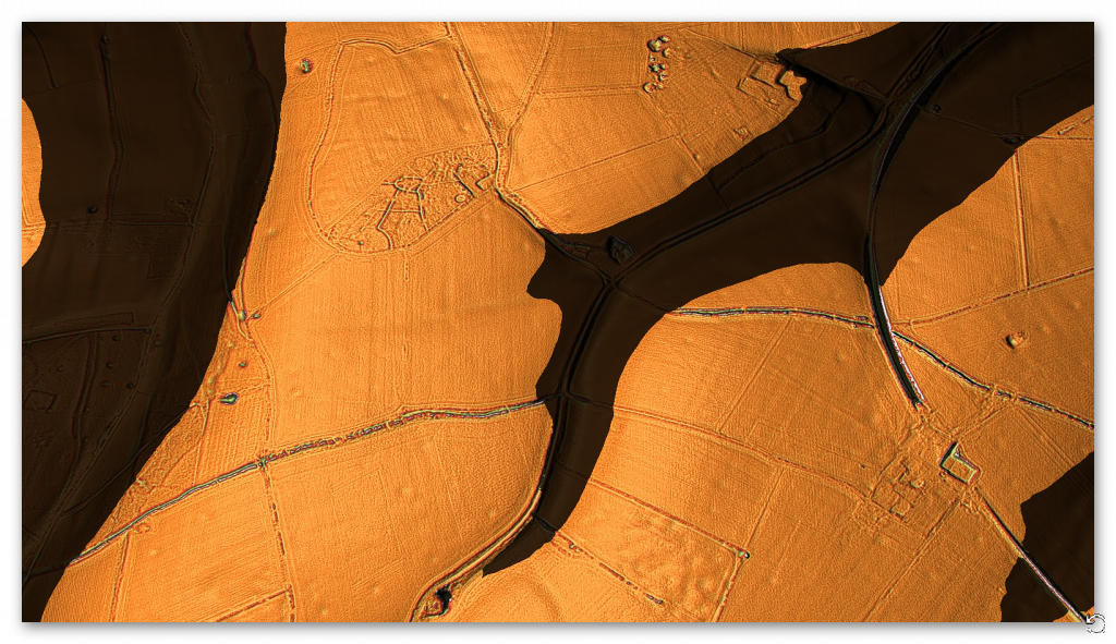
Using LiDAR data, some researchers have started mapping the subtle undulations in landscape that coincide with earthworks. When these are overlaid with known groundwater discharge points and aquifer margins, a fractal pattern begins to emerge. The ancient builders, whether consciously or through long experience, appear to have traced these subtle cues in the environment—potentially to access, mark, or manage water resources.
LiDAR data reveals invisible patterns matching ancient earthworks and water flows..- Hidden Purpose of Ancient Dykes
8. Offa’s Dyke and the Welsh Aquifers
One of the most prominent linear monuments in Britain, Offa’s Dyke, cuts through a landscape rich in aquifers. From the carboniferous limestone of the Brecon Beacons to the sandstones of the Cheshire Basin, the dyke’s route seems to skim or run adjacent to many known water-bearing formations. While once considered a boundary between Anglo-Saxon and Welsh territories, it now appears the dyke might also be a hydrological boundary marker.
Hidden Purpose of Ancient Dykes
9. Wansdyke and Water Corridors
Wansdyke in southern England similarly defies defensive logic. Its route is discontinuous and loops across high ridges with no clear military advantage. However, much of it aligns with chalk geology—a major aquifer type in the UK. The chalk aquifer not only stores groundwater but releases it gradually into the landscape through springs, many of which lie near or along Wansdyke’s path.
Hidden Purpose of Ancient Dykes
10. Dyke Placement and the Absence of Settlements
Another clue lies in what’s not present. Many dykes pass through areas far from settlements, agriculture, or known defensive frontiers. These otherwise “inconvenient” locations begin to make sense when viewed hydrologically: they traverse zones of high groundwater potential, or cross landscape features connected to seasonal flooding and spring emergence.
Most Dykes are in the middle of nowhere and small – Hidden Purpose of Ancient Dykes
11. Ancient Hydroengineering?
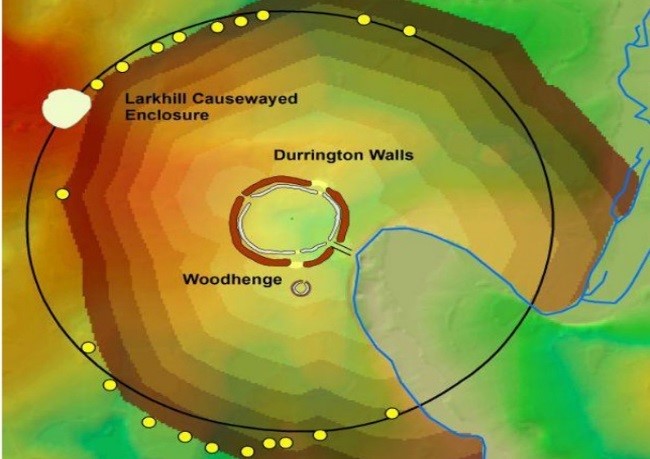
Alternatively, these dykes may represent early attempts at hydrological management—channeling water, controlling flood plains, or marking safe grazing zones. If water was seasonally abundant or scarce, understanding its patterns would have been vital. Building linear earthworks along aquifer boundaries could have allowed communities to delineate water-rich areas from drier zones without modern instrumentation.
Durrington Walls kept the water but adding a Dyke when the River water levels fell – Hidden Purpose of Ancient Dykes
12. Mathematical Validation of Dyke Placement
Using fractal analysis and mathematical modelling tools (like GIS or QGIS), modern researchers can now test the statistical probability of dyke placement aligning with hydrological features. Preliminary data suggests a non-random correlation—that is, dykes are significantly more likely to intersect aquifer boundaries or discharge zones than random lines across the same landscape would.
Fractal flow modeling suggests non-random alignment of dykes and water.- Hidden Purpose of Ancient Dykes
13. A Landscape Language We’re Only Starting to Understand
Our ancestors may not have used scientific terminology, but they read the land through observation, oral tradition, and environmental memory. Dykes may have formed part of this unspoken language of the landscape—an early cartography of water, built in earth and stone. Rediscovering this language could reshape not only our understanding of earthworks, but of ancient Britain itself.
Dykes may be part of an ancient “language” that mapped water underground.- Hidden Purpose of Ancient Dykes
14. Conclusion: From Defensive Lines to Water Lines
What appears as haphazard or defensive may, in fact, be ecological and intentional. Groundwater distribution patterns—fractal, functional, and factual—offer a powerful lens through which to reinterpret the placement and purpose of Britain’s linear earthworks. These dykes might not be walls at all—but lines drawn in reverence to the veins of the Earth, acknowledging the life-giving force of water hidden just beneath the surface.
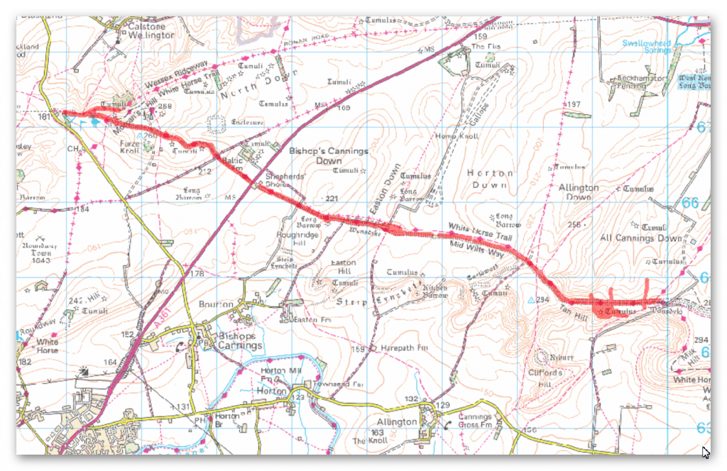
The Wansdyke, a significant linear earthwork in southwestern England, has long intrigued historians and archaeologists. Traditionally interpreted as an early medieval defensive structure, recent analyses suggest it may have served a different purpose. The blog “Prehistoric Canals – Wansdyke” explores the theory that Wansdyke functioned as a prehistoric canal system, challenging conventional understandings of its role in ancient Britain.
This perspective is rooted in the observation that Wansdyke’s design resembles that of ancient canals. The earthwork features a substantial ditch accompanied by an embankment, a configuration commonly associated with water management systems. Moreover, the alignment of Wansdyke with natural watercourses and its proximity to prehistoric sites suggest it may have facilitated transportation and trade, rather than solely serving as a military fortification.
Further supporting this hypothesis is the presence of flint pits and barrows along Wansdyke’s route. These archaeological features indicate areas of significant prehistoric activity, implying that the earthwork played a role in the economic and social practices of the time. Additionally, the strategic placement of Wansdyke in relation to the ancient landscape suggests it was designed to harness natural waterways, enhancing connectivity between settlements and resource sites.
Reevaluating Wansdyke as a prehistoric canal system offers a fresh perspective on the engineering capabilities of ancient societies in Britain. It underscores the complexity of their infrastructure and their adeptness at manipulating the environment to support transportation and trade. This interpretation invites a broader reconsideration of similar earthworks and their functions, highlighting the need for ongoing research and open-mindedness in archaeological discourse.
Start of Wansdyke East -Prehistoric Canals – Wansdyke 2
The modern word dike or Dyke most likely derives from the Dutch word “dijk”, with the construction of dikes in the Netherlands well attested as early as the 12th century. The 126 kilometres (78 mi) long Westfriese Omringdijk was completed by 1250 and was formed by connecting existing older dikes. The Roman chronicler Tacitus even mentions that the rebellious Batavi pierced dikes to flood their land and protect their retreat (AD 70). The word dijk initially indicated both the trench and the bank.– Wikipedia
If you study archaeology at university or even on an ordinance survey map at length, you will notice strange earthworks on the sides of hills of Britain, with no rational explanation as to why they are there and for what reason. These features are mostly ignored at university, or an excuse is made for their construction. The reality is that these features do not make any sense unless there are other factors in operation which have been ignored.
The first thing to notice is that the word ‘Dyke’ is associated with water. It does seem strange you would call an earthwork on top of a hill a Dyke, unless there was some history passed down through the years to its actual use. If we look at the most famous Dyke in Britain, ‘Offa’, we notice that it is attributed to a Saxon King and, therefore, could not be prehistoric. Or is this a clear indication of how archaeologists find excuses for these features rather than factual, empirical evidence?
“Offa’s Dyke (Welsh: Clawdd Offa) is a massive linear earthwork, roughly followed by some of the current borders between England and Wales. In places, it is up to 65 feet (19.8 m) wide (including its flanking ditch) and 8 feet (2.4 m) in height. In the 8th century, it formed some kind of delineation between the Anglian kingdom of Mercia and the Welsh kingdom of Powys.” – Wikipedia
At face value, this explanation seems to answer all the questions about Dykes (except the water connection). But suppose you delve further down to look at the evidence, such as findings from the Dyke and any written history. In that case, you get a different version for the Roman historian Eutropius in his book, Historiae Romanae Breviarium, written around 369 AD, mentions the Wall of Severus, a structure built by Septimius Severus who was Roman Emperor between 193 AD and 211 AD:
“He had his most recent war in Britain, and to fortify the conquered provinces with all security; he built a wall for 133 miles from sea to sea. He died at York, a reasonably old man, in the sixteenth year and third month of his reign.” – Eutropius (369 AD)
This ‘wall’ need not be made of stone as we know from their Scottish endeavours that the first structure as a defence was usually a bank and a ditch – just like a Dyke!!
The problem with this account is that none of the known Roman defences are 133 miles long – Harridan’s Wall is only 70 miles, so are they talking about Offa’s Dyke, which is much longer?
Chapter 2 – The Post-Glacial Flooding Hypothesis
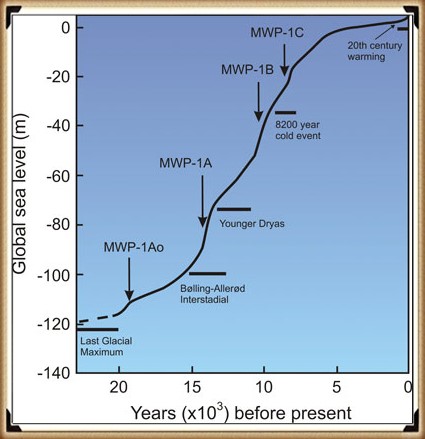
Rise of Sea Levels – Prehistoric Canals – Wansdyke 2
Before we show you what these ‘Linear Earthworks‘ were used for in prehistoric times. We need to give you an idea of how the environment was at the time of construction and why it is so different today.
In ‘The Post-Glacial Flooding Hypothesis,’ we looked at the new mathematical models that allowed us to calculate the amount of water released during and after the Last Glacial Maximum just over ten thousand years ago.
If the Dykes of Britain are canals (and not markers or defensive ditches), we must prove that the water table was higher in the past than today (otherwise, they would still be flooded).
The models contained in the PGFH showed us that a minimum of 8.42 quadrillion tonnes of water was released on the UK at the end of the last ice age. This is equivalent to 98425.2 inches of rain falling on every square inch of Britain’s landmass or the same as – One Inch of rain steadily falling every day for the next 270 years
The worst known flooding in British history occurred in 1947 when just six inches of rain (149mm) fell on up to 12″ of snow (so a maximum of 15″ of rain if melted) over three months. The flooding, which inundated nearly all the main rivers in the South, Midlands, and the Northeast of England, was notable for its origins, geographical extent, and duration.
It impacted thirty out of the forty English counties over two weeks, when around 700,000 acres of land flooded. As a result, tens of thousands of people were temporarily displaced from their homes, and thousands of acres of crops were lost; and this was just 15 of the estimated equivalent of 98,425 inches of water that was shed on the British landscape after the last Ice Age.
Raised Water Table
According to William Donn (Donn et al., 1962). The Fennoscandian and Great Britain ice sheet covered 4.7 106 km2, which is equivalent to:
• 8.42 106 Gigatonnes of water / 4.7 106 km2, which gives us 1.79 Gt per km2
• 1.79 Gt of water at a penetration rate of 43%, give us 0.77 Gt of water per km2
• 0.77 Gigatonnes of water by UK landmass 242,495 km² give us 186,804 Gt of groundwater
This water will be released at a rate of 1 – 12mm per annum and possibly at a depth of 75km. Therefore, to release groundwater at a depth of 75km at an average rate of 6mm per annum would take 12,500 years – not the 1,200 years previously believed, which is just the surface water from the last stages of the meltwater ice.
This is why rivers (like the Thames) still flow even after months of drought, as the groundwater is constantly leaking into the river, which was at its highest rate at the start of the Mesolithic, just after the great meltwater floods.
Sea-Level Changes
If this model is correct, we should be able to get verification via other empirical evidence, as shown in sea level water rises, to see if it has been constant over the last 12,500 years.
Most geologists and paleoclimatologists, when talking about the end of the last ice age, refer people to the phenomenon called the ‘Meltwater Pulse’ – which is the rapid rise in sea level (20m) between 13,500 and 14,700 years before present, over a 400 – 500 year period. Although it is a tremendous value, it should be recognised that this ‘pulse’ as only 16% of the total sea rise since the end of the last ice age.
When it comes to the use of ‘linear earthworks’ (we call ‘Dykes’), there is massive confusion amongst both professionals and amateur archaeologists about how such structures could function when they are dry today?
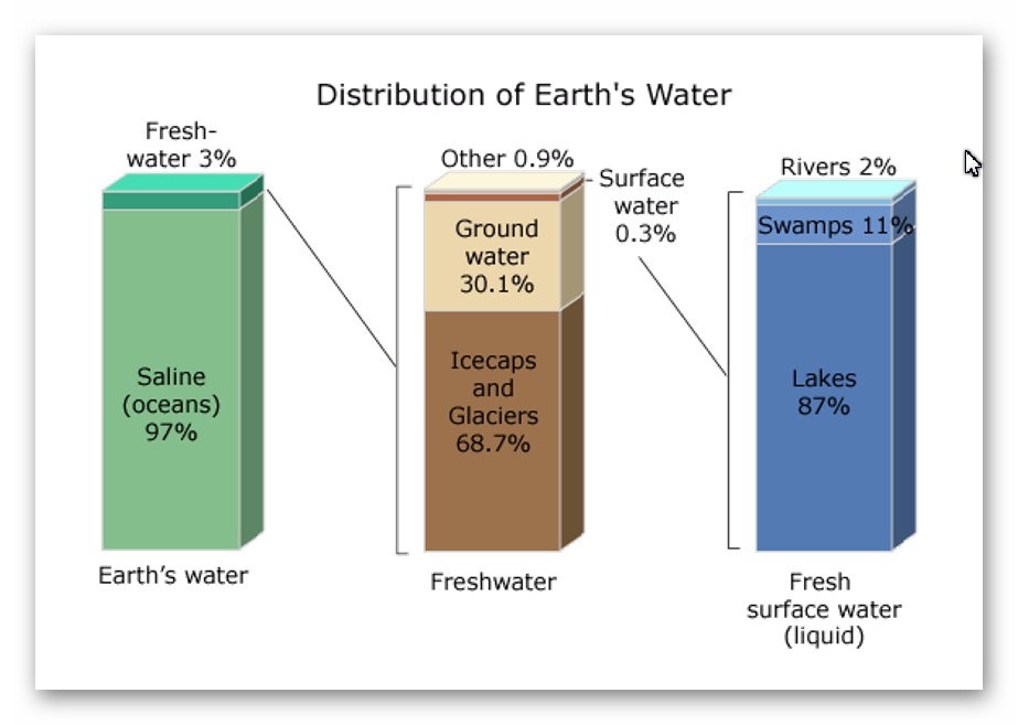
The incorrect perception of these ‘Dykes’ is either they are ‘rivers’ (like the Thames) that flow uphill or Victorian Canals with locks and wooden gates regulating the flow of the water – which are equally nonsensical as a prehistoric structures. Basic Hydrology that most people (should be but not necessarily ALL) learnt at school is that water is under the ground – not just a little water but 30% of all the fresh water on the planet.
This abundance of ‘groundwater’ is evident as it is the source of ALL rivers and supplies the Wells that have been dug since the beginning of time when rivers were absent. Even today, if you go into your garden and dig a hole, it will eventually fill with groundwater, whether in a valley or on top of a hill or mountain.
How and why water is on hills is very challenging for individuals as most people have a simplistic view of water being flat and sitting at ground level – but the earth is a far more complicated structure as this is the reason that it took centuries for people to recognise that we lived on a sphere and not a ‘flat-earth’ as such complex concepts such as gravity are hard to comprehend.
The reality is that ‘streams’ of water are encapsulated within the bedrock allowing ‘springs’ to start rivers at a great height as the groundwater is under pressure and erupts to the surface from BELOW and does not flow up or down the hill internally – but can flow downhill AFTER it escapes from the soil, because at the point of escape gravity then becomes the greater force overcoming the water pressure when within the bedrock – which stops it flowing down the landscape and can push it up to the top of hills and mountains.
Consequently, wells work even on hills as the groundwater is encapsulated in the bedrock and soil. The above illustration shows that if wells are dug halfway up a hill where there is a groundwater pocket, they will fill – if we join up these wells, the entire ditch will also fill with water – sourced from the ground.
The central aspect that must be remembered when considering the reasons behind the construction and maintenance of these earthworks (Dykes) is that the environment was so much different in the Mesolithic Period, which changed rapidly when entering the Neolithic and then even more changes in the Bronze and Iron Ages.
Once the ice sheets had melted and the climate began to warm, the landscape gradually changed from open tundra to dense woodland. By around 8000 BC, pine and birch dominated the woodland cover. These were slowly replaced by lime, elm and oak with some hazel. By 6500 BC, pine and birch woodland would only have been found on the thinner limestone soils of the uplands.
Case Study Wansdyke – Morgan’s Hill West
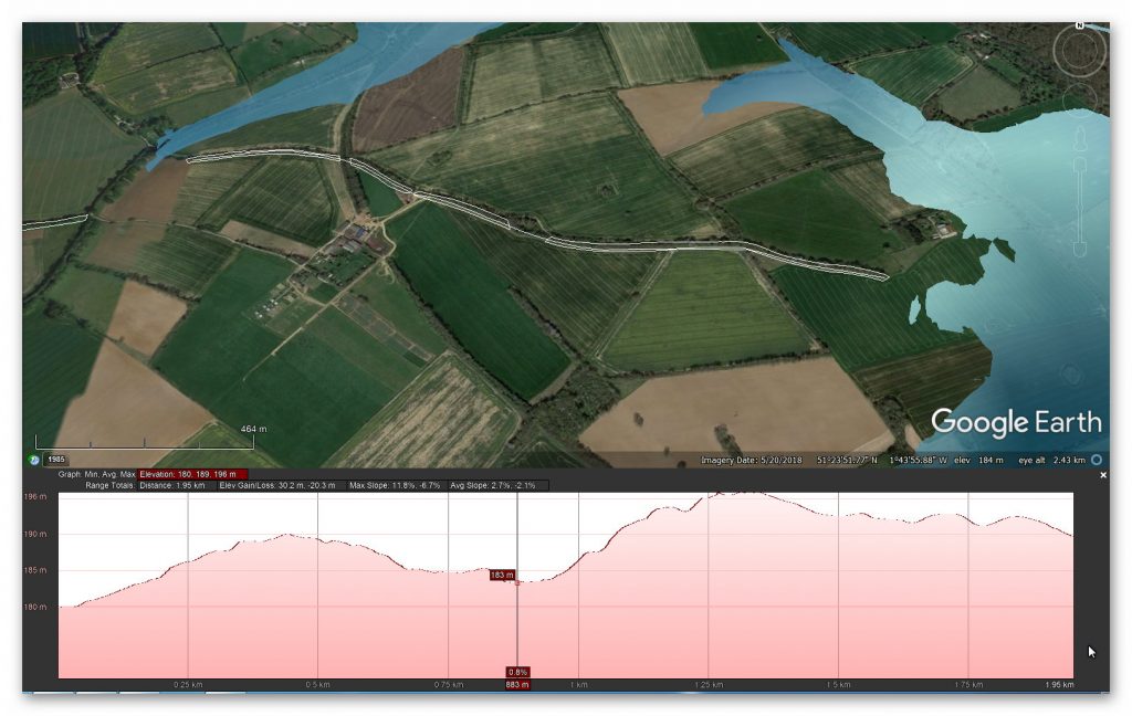
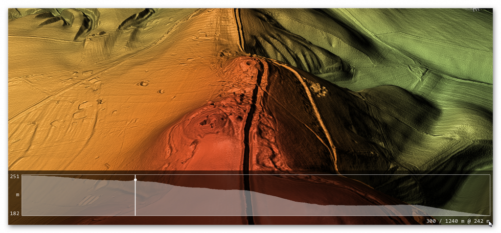
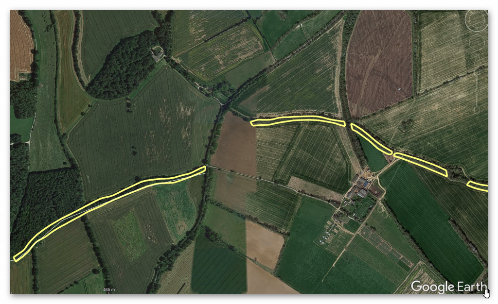
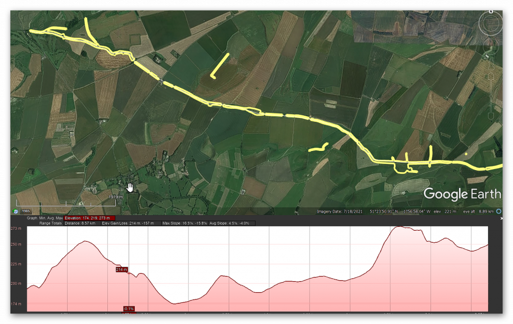
The steepest aspect of Wansdyke is the rise over Morgan’s Hill, which is an incline from 182m OD to 252m OD.
Figure 34 – Morgan Hill West (Wansdyke) – Prehistoric Canals – Wansdyke 2
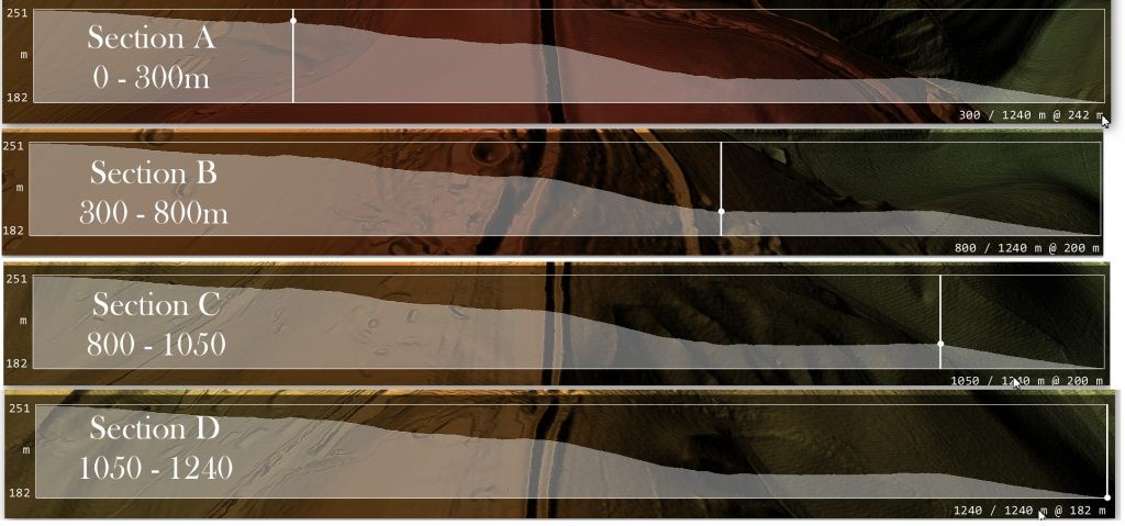
If we are correct with our assumption, we need to show that you can transverse this massive incline using natural springs and basic wooden weirs. If we split the gradient into four parts, we can see better the profile and problems our ancestors faced.
Figure 35 Morgan’s Hill West in Sections – Prehistoric Canals – Wansdyke 2
Section A – 0 to 300 downhill
Length is 300m, and the inclination lowers from 251m OD to 242m OD at a ratio of 3% or 1:33 – If we accept that within this section, we had four cat A ‘springs’ that would release 11.2 cu. metres of water PER SECOND (11,200 litres per second) would fill a 10m ditch that is 1.5 deep by one-metre width of the Dyke’s ditch every SECOND.
According to the mathematical formula (v = k * C * R0.63 * S0.54 ), water at the end of section A would be travelling at 5 MPH – the speed of the Thames at Henley (so quite navigable) and, therefore, no need for any Weirs to reduce the water flow.
Section B – 300 to 800m downhill
This section would receive water at one metre per second from Section A, travelling at 5 MPH – The length of this section is 500m in length, and the inclination lowers from 242m OD to 200m at a ratio of 8% or 1:12 this would accelerate the water to 15 mph which is too fast the navigate uphill. Therefore, a series of weirs would have been placed either under the water or, as the early Victorians achieved, by a paddle weir or both.
An underwater weir (blocking 50% of the water but allowing boats to move over the top without hindrance) would reduce the flow by 50% – so if placed at the End of Section A (at 5 MPH) would reduce the water flow to 2.5 MPH and down to 12.5 MPH at the End of Section B. Consequently, if we place one of these 50% reduction weirs at 100m intervals the water flow would not go over the 5-mph mark and would probably be in the region of 3 – 5 MPH which again is easily navigable.
Chapter 4 – Wansdyke
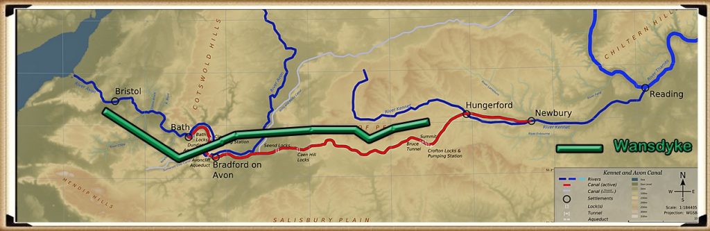
Wansdyke v Avon and Kennet Canal – Prehistoric Canals – Wansdyke 2
According to Wikipedia, “Wansdyke consists of two sections of 14 and 19 kilometres (9 and 12 mi) long with some gaps in between. East Wansdyke is an impressive linear earthwork, consisting of a ditch and bank running approximately east-west, between Savernake Forest and Morgan’s Hill. West Wansdyke is also a linear earthwork, running from Monkton Combe south of Bath to Maes Knoll south of Bristol, but less impressive than its eastern counterpart. The middle section, 22 kilometres (14 mi) long, is sometimes referred to as ‘Mid Wansdyke’ but is formed by the remains of the London to Bath Roman road. It used to be thought that these sections were all part of one continuous undertaking, especially during the Middle Ages when the pagan name Wansdyke was applied to all three parts.
East Wansdyke in Wiltshire, on the south of the Marlborough Downs, has been less disturbed by later agriculture and building and remains more clearly traceable on the ground than the western part. Here the bank is up to 4 m (13 ft) high with a ditch up to 2.5 m (8.2 ft) deep. Wansdyke’s origins are unclear, but archaeological data shows that the eastern part was probably built during the 5th or 6th century. That is after the withdrawal of the Romans and before the takeover by Anglo-Saxons. The ditch is on the north side, so presumably it was used by the British as a defence against West Saxons encroaching from the upper Thames Valley westward into what is now the West Country.
West Wansdyke, although the antiquarians like John Collinson considered West Wansdyke to stretch from south East of Bath to the west of Maes Knoll, a review in 1960 considered that there was no evidence of its existence to the west of Maes Knoll. Keith Gardner refuted this with newly discovered documentary evidence. In 2007 a series of sections were dug across the earthwork which showed that it had existed where there are no longer visible surface remains.
It was shown that the earthwork had a consistent design, with stone or timber revetment. There was little dating evidence, but it was consistent with either a late Roman or post-Roman date. A paper in “The Last of the Britons” conference in 2007 suggests that the West Wansdyke continues from Maes Knoll to the hill forts above the Avon Gorge and controls the crossings of the river at Saltford and Bristol as well as at Bath.
As there is little archaeological evidence to date the western Wansdyke, it may have marked a division between British Celtic kingdoms or have been a boundary with the Saxons. The evidence for its western extension is earthworks along the north side of Dundry Hill, its mention in a charter and a road name.
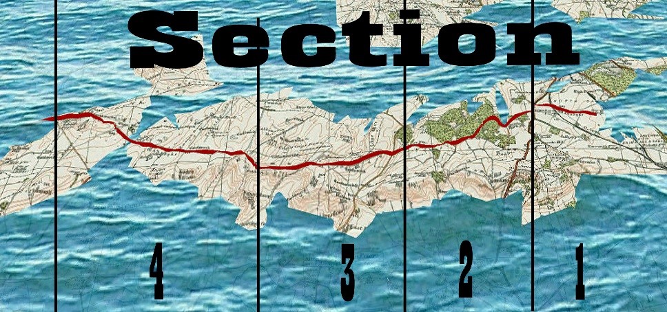
Book Sections
Sections covered in the Book – Prehistoric Canals – Wansdyke 2
Section 1
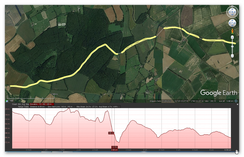
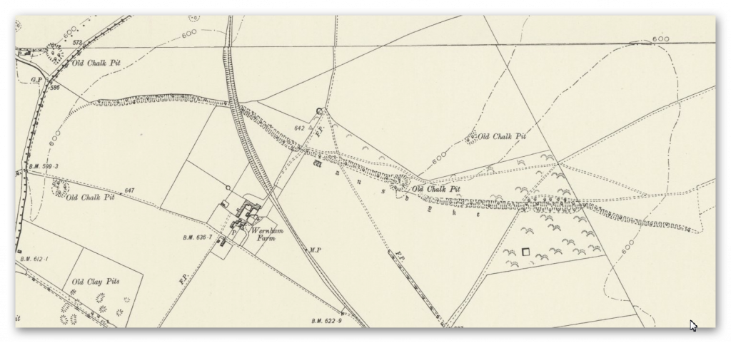
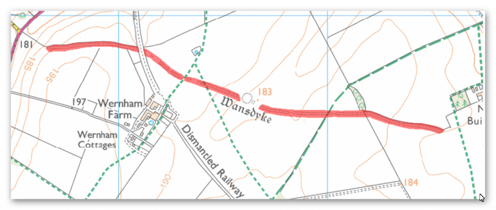
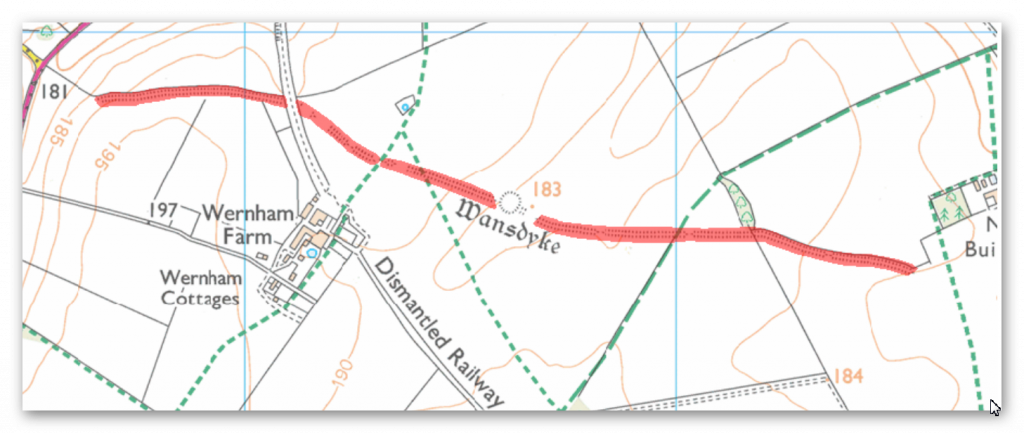
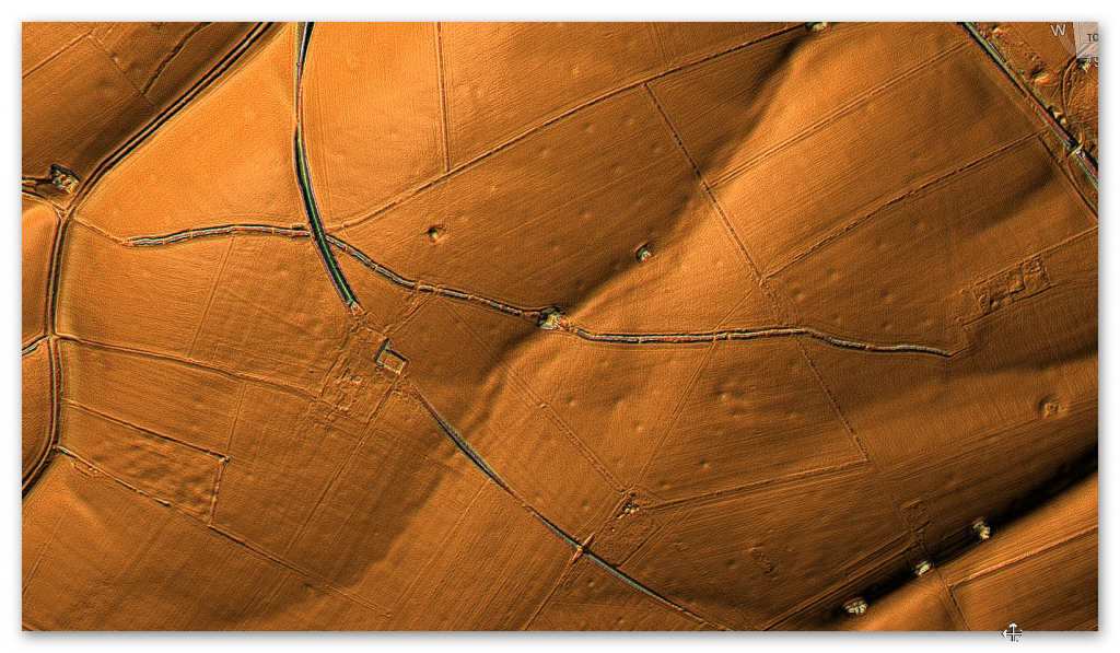
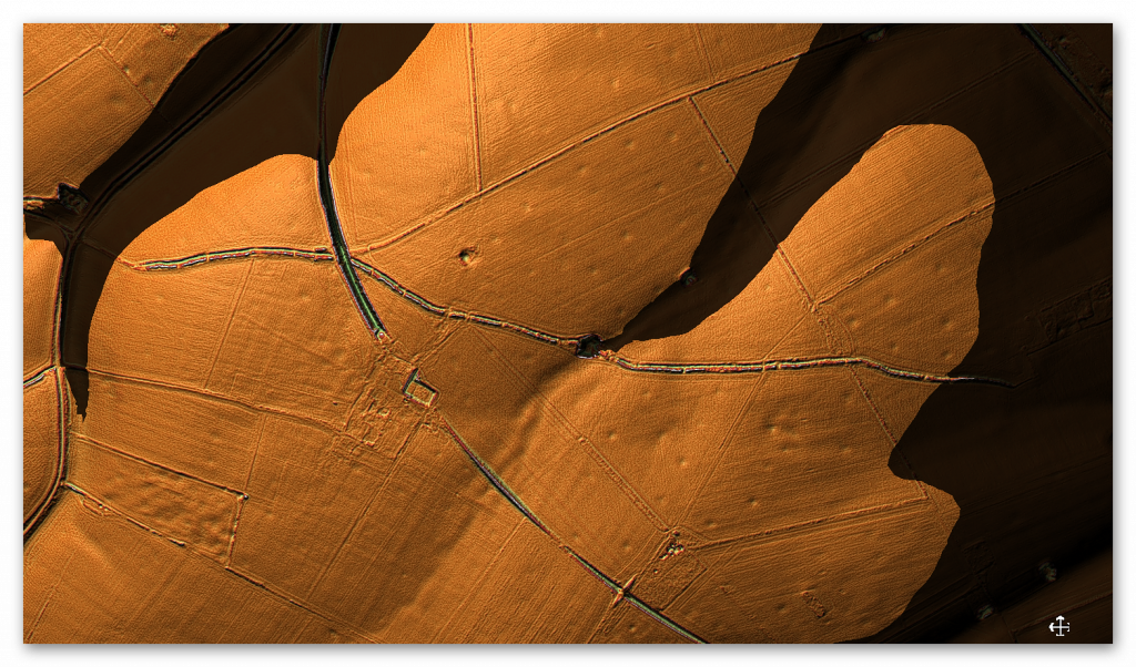
HE:1003784 Wansdyke: section 610yds (560m) NW of Wernham Farm to 250yds (230m) SW of New Buildings (560m = 1680 working days – 20 men taking 84 days to complete)
Figure 44 Wansdyke NW of Wernham (with added water levels) – Prehistoric Canals – Wansdyke 2
No, HE Historic Details or Excavations Registered
OS Map
Prehistoric Canals – Wansdyke 2
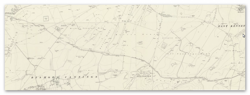
1800 OS Map
Prehistoric Canals – Wansdyke 2
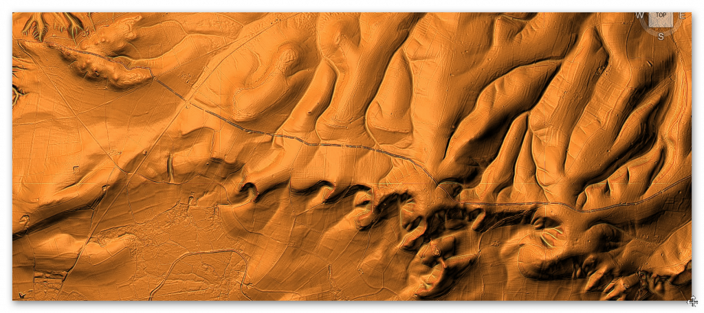
LiDAR Map
Prehistoric Canals – Wansdyke 2
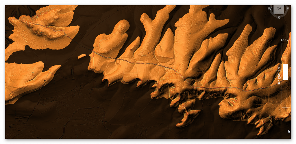
LiDAR (with Mesolithic water levels)
Prehistoric Canals – Wansdyke 2
A feature called ‘firs’ is a gap on the OS Map – there is a strange quarry pit (no relevant substances under the surface to quarry?) – this pit is two metres deep and probably built later to the original ditch.
Are we looking for a hole to find the groundwater to keep the canal working with fresh water? As we will discover, this is not the first pit cut deep on the line of Wansdyke.
The Mesolithic water levels certainly explain the strange start of Wansdyke and the unexplained gaps (if it’s not a canal) in the Dyke.
Notice on the LiDAR maps the extensive ‘pits’ surrounding the Dyke, which are not below the Mesolithic river shoreline and are 14m in diameter.
Figure 45 – Quarry pits found in Paleochannels – Prehistoric Canals – Wansdyke 2
These features seem to be connected to even larger quarry holes (some under the Mesolithic shoreline), indicating that minerals have been extracted here for thousands of years and may be the reason for the Dykes construction to take minerals away – as have also found these pits in other mineral-rich areas of Britain such as Hadrian’s Wall.
Durrington Walls
The pits are about 20m in diameter and up to 5m deep, as revealed by further geophysical surveys using ground-penetrating radar and mechanical coring around Durrington Walls. Small quantities of struck flint, shell, and animal bone have been recovered from them, with the bone providing radiocarbon dates from about 2500 BC to 1200 BC.
Prehistoric Canals – Wansdyke 2
What we see is that this type of quarrying was commonplace in the past and has confused archaeologists – but as this was a trading nation, the solution is evident and straightforward.
Gap in the Dyke route
At the end of Section 1, we find the first gap (if you exclude the massive gap at the start of the Dyke) – this gap appears as the Dyke dips into a paleochannel. The obvious conclusion for the break in Wansdyke is that it must have been full of water at the construction time.
Prehistoric Canals – Wansdyke 2Figure 46 – Mesolithic Water levels show gap disappears – Prehistoric Canals – Wansdyke 2Ancient Prehistoric Canals – Wansdyke (The Book) – Prehistoric Canals – Wansdyke 2
This was an extracts from the NEW Book Ancient Prehistoric Canals (Dykes) – Wansdyke available on Amazon as a FULL COLOUR HARD BACK (£19.95) or a ECONOMY (£4.99) SOFTBACK black and white VERSION – it is also available as a KINDLE (£1.99) book. For further information about our work on Prehistoric Britain visit our WEBSITE or VIDEO CHANNEL.
Product details
ASIN : B0BF31GQKC
Publisher : Independently published (18 Sept. 2022)
The enigmatic Wansdyke, standing prominently in the Wiltshire landscape, has forever captivated the public’s collective imagination. Its proximity to the famed ancient site of Avebury, with both bearing massive ditches, has led some to surmise a direct connection between them.
Curiously, past and present archaeologists have failed to grasp this apparent link, striving instead to find a simplistic explanation for this enigmatic “linear structure.” Thus, the prevailing belief took root – that it was a bulwark raised to repel the belligerent tides of yore. Consequently, the term “Saxon” was affixed to these earthworks, as historians of old supposed these “tribes” possessed the martial might needed to accomplish such grand engineering feats to defend their realm.
Yet, in recent decades, this “fact” has faced reexamination, and a novel theory emerged regarding these earthworks as “Boundary Markers” etched upon the landscape. This alternative proposition, while reassuring, still leaves us grappling with perplexing truths. Foremost among them is the Dykes’ lack of continuity – both Wansdyke and Offa’s Dyke exhibit sizeable lacunae in their stretches. Their beginnings and endings emerge with an almost magical quality, unexplained and confounding to the beholder.
Moreover, if indeed these were markers of territorial ownership, then why do certain Dykes, like Offa’s, follow paths that traverse vast separations, such as major rivers? Surely, a more conspicuous landmark than a mere 4-meter ditch would have served as an apt boundary in such instances.
Alas, the erudite scholars of archaeology have turned a blind eye to the existence of over 1500+ scheduled Dykes scattered throughout Britain and Ireland. Such a multitude challenges the notion of a uniform purpose, as many of these “boundary markers” also graced uninhabited islands far and wide, enveloping the entire circumference of Britain.
In the spirit of Jacob Bronowski’s method, we must confront these enigmas with a relentless curiosity, unearthing each fragment of evidence and subjecting our suppositions to rigorous scrutiny. The mysteries of these ancient earthworks shall only yield their secrets to those intrepid minds that dare to question and challenge the established norms of interpretation. And as history unfolds its layers, we may find ourselves ever closer to unlocking the profound meaning behind these age-old constructs that once shaped the course of human existence upon this storied land.
Robert John Langdon (2023)
Section 4 – HE:1017288
Section of Wansdyke and associated monuments from east of The Firs to the eastern side of Tan Hill, 3,460 metres (11,533 working days – 20 men, 1.58 years)
HE:1017288 GE
OS Map
HE:1017288 OS
1800 Map
HE:1017288 1800
LiDAR Map
HE:1017288 Lidar
LiDAR Map (with Mesolithic water levels)
HE:1017288 – Mineral Extraction- With prehistoric water levels
HE schedule suggests that:
The monument, which falls into 12 areas of protection, includes part of Wansdyke running from east of The Firs to the eastern side of Tan Hill,(a kite-shaped enclosure situated on the northern side of Wansdyke on Easton Down), a section of Roman road on Morgan’s Hill, a Neolithic long barrow, five other linear earthwork sections crossed by or abutting the Dyke and 11 Bronze Age bowl barrows adjoining Wansdyke or partially overlain by it.
From the west, Wansdyke runs for roughly 72km ending just outside Marlborough at its east end. The approximately 8.5km long section from east of The Firs to the eastern side of Tan Hill runs across the Downs south west of Avebury and includes the best-preserved continuous length of Wansdyke.
The Dyke includes a substantial earthwork bank which measures up to 30m wide and stands from 1m to 3m high. For the majority of its length the bank lies south and west of a substantial open ditch. This also varies in width but measures up to 36m wide and remains open to a depth of 2m in places.
The majority of the bank and ditch sections in this area together measure from 30m to 40m across. A further, slighter, bank beyond the ditch to the north is also visible on several sections. The Dyke was built in sections of varying length, with breaks which would have allowed controlled traffic to pass from east to west and for the movement of military patrols beyond the defences. The Dyke is later in date than the Roman road but was already built by the mid-ninth century, when it is mentioned in a Charter.
It is generally believed to be a military frontier work between Wessex and Mercia. It is designed to hold the edge of the high ground on the Downs and to protect the lower lying plains to the south west. The name derives from Woden’s Dyke, after Woden, an important Anglo-Saxon god whose name survives in the word `Wednesday’.
The earlier Roman road includes a 800m long section of the route from Cunetio (Mildenhall) to Verlucio (Sandy Lane). It runs east to west along the north slope of Morgan’s Hill and includes a rare engineered bend at the head of a dry valley after which point the later Dyke meets it and runs along its line. The road measures between 8m and 10m wide and its outer (north) edge comprises a well-constructed embankment which stands up to 2m high.
The road is terraced into the slope at this point and the Dyke follows the line of the road for a distance of over 300m. South east of the wireless station on Morgan’s Hill, a 50m long, slightly curved section of linear earthwork runs north from beneath Wansdyke to end in a terminal. It is part of a longer feature, the remainder of which starts about 20m north, runs to the edge of Horsecombe and is the subject of a separate scheduling (SM 21900).
The south end of this feature is not known for certain but it appears to run beneath the Wansdyke for some distance to the east. Immediately south of the Dyke on Roughridge Hill is a Neolithic long barrow. The barrow mound measures about 75m long and up to 32m wide. It stands up to about 1m high. Flanking the mound, but no longer visible at ground level due to the spreading of the mound caused by ploughing, are two quarry ditches which will survive as buried features.
Although the only example in the scheduling, the barrow is one of a line of more than four Neolithic long barrows which are strung out east to west along the ridge of the Downs, all spaced roughly 1km from their nearest neighbour in either direction.
The excavations showed that the southern boundary of the enclosure lies below the line of the later Wansdyke, which appears to change course slightly at this point. The excavations also produced Romano-British pottery sherds from the interior of the monument, indicating that it was a settlement during that period.
The section of Wansdyke on Tan Hill crosses a series of four earlier linear boundary ditches which form part of an earlier prehistoric land division. Three of these run from north to south and the last runs east to west and is abutted by at least one of the others. These boundaries survive as buried features clearly visible on aerial photographs and, despite being levelled in places, remain visible at several points above ground. The ditches vary in width from 3m to 8m across and several have adjacent banks about 0.75m wide and up to 0.3m high.
Together they form three sides of a rectilinear field within which is located a small Bronze Age barrow cemetery containing five bowl barrows. Two of these are partially overlain by the Wansdyke. The barrow mounds measure from 12m to 20m in diameter and stand between 0.2m and 1m high.
All but one of these are surrounded by quarry ditches which vary from 1m to 2m in width and survive buried below the present ground level. There are six further bowl barrows along the length of Wansdyke from east of The Firs to the eastern side of Tan Hill which are partially overlain by the Dyke. Some of these are outliers of groups of barrows or cemeteries, the remainder of which, where appropriate, are the subject of separate scheduling’s. These barrows vary from 10m to 20m in diameter and stand up to 3m high. Their surrounding quarry ditches measure from between 1m to 2m wide.
Several barrows near to Old Shepherds’ Shore were partially excavated in the 1850s and finds included burnt animal and human bone and fragments of Bronze Age pottery.
Figure 34 – Paleochannel from the Raised Water Levels of the Mesolithic meet the Dyke
Figure 35 – Ditch cutting through the Dyke at 90-degrees
In the scrolls of history, the unveiling of Fig.35 beckons us to peer beyond the veil of conjecture. Perhaps the compass that navigates us through the labyrinth of whispered questions through the corridors of time lies here. Once an enigma shrouded in uncertainty, the Dyke unfurls its narrative in North and South, a juncture marked by division and unity.
Yet, as we stand at this crossroads, the questions persist. What grand design does this divide mark? Is it a sentinel of boundaries or a symphony of defence? Why does the Dyke, an embodiment of strength, pause just a breath away from spanning both directions? What landscapes, what treasures, do these truncated extensions seek to shield?
The visage of paleochannels, ancient waterways etched in the very fabric of the land, presents itself as a canvas of revelations. LiDAR’s eye, attuned to the wavelengths of discovery, showcases the embrace of Wansdyke’s ditches with these prehistoric conduits. In their intersection, a portrait emerges—a depiction of a junction, a crossroads where not just land but waterways merged.
The resonance of this image is profound. A Dyke, often considered an embodiment of solidity, now intersects with the fluidity of these forgotten watercourses. This confluence hints at more than coexistence—it suggests a portal, a point of ingress and egress, a thoroughfare not merely for terrestrial travellers but also for vessels that rode the liquid highways.
Such a revelation prompts us to reconsider the dike’s identity. Could this monumental construction, both a bastion of earth and a harbour of history, be conceived not solely for defence but as a connection conduit? An edifice that channelled both earthly aspirations and the currents of culture, bridging the realm of humans and the dominion of water?
Ditches to reach Paleochannel (GE)
Figure 36 – GE Map shows deep ditches which are now paths going across the Wansdyke
The southern reaches unfurl a tale of depth and mystery—a narrative that extends beyond the bounds of Wansdyke’s familiar embrace. Here, etched upon the land like whispers of the past, are deep cuts that time has adorned with the patina of ages. Now trodden as footpaths, these cuts reveal themselves as gateways to antiquity, as portals through which we traverse history’s corridors.
Yet, the panorama holds another surprise—a forgotten ditch, an enigmatic excavation that defies the confines of historical schedules. This ditch, absent from Historic England’s scrolls, surrenders itself to the embrace of an old Paleochannel river, like an echo reverberating through time. Fig. 36 becomes a tableau of continuity, a link between the tapestries of yesteryears and the present.
Figure 37 – Paleochannels connecting to Wansdke
In this interplay of cuts, ditches, and ancient rivers, a question arises—what hands sculpted these channels, and what intentions propelled them into existence? Were these marks of human endeavour borne from a need to navigate the landscape, to forge paths that transcended the eras? Or are they the product of a deeper design, etched by nature herself and embellished by the curious hands of humans?
As we meander through the corridors of speculation, let us remember the canvas of history is not confined to the visible, the documented. It expands, much like the very rivers and footpaths that traverse it, into the realm of the unseen and the uncharted. In the echoes of these cuts, in the absence of recognised schedules, we find a reminder that history is a symphony of the known and the unknown, a dance that transcends temporal confines.
In the mosaic of history, Fig.37 casts a spotlight upon a revelation that bridges epochs and echoes with the very essence of the land. Here, amidst the tapestry of ancient landscapes, emerges the presence of monumental sarsen stones, sentinels of time, scattered as relics of the ages in the embrace of the Paleochannels.
Figure 38 – Paleochannels everywhere some showing sarsen stones in the dry river valley indicating the size and strength of these old rivers – first edition OS.
These stones, witnesses to the drama of ice and thaw, lay scattered as if nature herself crafted an intricate mosaic. The legacy of the last Ice Age is etched upon them, a testament to the forces that shaped this realm long before the footfalls of humankind. As the old OS maps bear witness, these stones, abundant in the embrace of the Paleochannels, evoke a tale of glacial might and the enduring memory etched upon the land.
Figure 39 – The ‘Unknown’ditch heads north and then kinks
A profound realisation emerges in this dance of discovery—a symphony of logistics and ingenuity unfurls. If these sarsen sentinels were to be harnessed and woven into the fabric of human endeavour, the waterways would have served as a celestial highway, a course of least resistance. And in this tableau, Wansdyke emerges not only as a Dyke, not merely a demarcation or defence, but as a lifeline that harnessed the power of water to serve human ambition.
In the intricate mosaic of historical discovery, the enigmatic ditch takes centre stage once more—a whispered riddle etched into the landscape. It meanders through the pages of time, seemingly wandering aimlessly, a question mark in the grand narrative. Yet, as we sift through the fragments of history, a revelation shimmers into view that bind the ditch and the very fabric of prehistory.
Figure 40 – The ‘unknown’ Dyke links to the Kennet River that goes to both Avebury and Silbury Hill
As modern OS maps render this ditch a ghost upon the terrestrial canvas, the marriage of technology and imagination unveils the hidden treasure. LiDAR’s touch, a modern conjurer’s wand, weaves the paleochannels and prehistoric shorelines into the mosaic. In this dance of data emerges a connection that defies the constraints of eras—a direct link between the ditch and the hallowed grounds of Avebury and Silbury Hill.
This revelation echoes through time, whispering that these ancient sites, Avebury and Silbury Hill, are not merely isolated islands but interwoven threads of a grand tapestry. The ditch, a seemingly solitary enigma, reveals itself as a connective vein—a corridor of history that flows not to obscurity but to monumental sites that have stood sentinel through the epochs.
This conjured connection, a bridge between Wansdyke and Avebury, paints a canvas where history transcends the confines of linear progression. It offers a vision of prehistory as a symphony of parallel stories, where Wansdyke and Avebury, once disparate entities, become harmonious notes that resound across the landscape. The notion that they were born simultaneously, intertwined in a narrative of ambition, culture, and design, is a testament to the shared aspirations of humanity across time.
Roman Water Management
Figure 41 – Small right-angled addition to the Dyke – but for what practical reason
Figure 42 – Cross Regulator – water management system
In the annals of historical inquiry, the tiny Dyke that extends from Wansdyke assumes a posture of intrigue—a whispered question mark punctuating the landscape. In its modest form, it beckons us to decipher its purpose, to unearth the intentions woven into its design. As we traverse the realm of speculation, two threads of possibility unfurl, each offering a glimpse into the minds of those who shaped it.
One narrative paints the Dyke as a haven, a berth upon the liquid highway—a stop for boats, a safe harbour for those who navigated the waters the dike embraced. In this vision, the Dyke transforms into a passage not solely for people and stones but for the vessels that threaded waterways laden with cargo, hopes, and history. The “parking feature” becomes a tableau of respite—a moment of pause in the voyage of time.
In this incarnation, the Dyke assumes a role akin to a conductor’s baton—a water regulator orchestrating the flow of springs that may have danced through the landscape. A “Cross Head Regulator” from the annals of modern canals whispers through time, suggesting a parallel with the water management systems of the Romans, as glimpsed in the scrolls of history at Hadrian’s Wall.
The contemplation of Roman engineering and its influence upon the Dyke reflects the epochs’ interconnectedness. The Romans, architects of both empire and innovation, are known to have left their indelible mark upon the landscapes they traversed. Could this diminutive Dyke be a remnant of their water management techniques, a testament to their mastery over the elements as seen in other corners of the realm?
Rybury Camp and Tanhill Fair
Figure 43 – Tanhill Fair – complex earthworks showing Rybury Camp on the peninsula
The woven tapestry of history, the complex series of ditches extending from Wansdyke casts a net of intrigue and speculation. Their intricate dance, flowing down into the Dry River Valley, unveils a terminal that might have been a hub of significance—a nexus where the threads of trade and human interaction converged. This vista hints at a site not solely dedicated to defense or marking, but a junction that pulses with the rhythm of exchange.
Through the corridors of time, the echoes of Tanhill Fair reverberate. As if in a symphony, the words of Aubrey from the 17th century whisper of a fair held within an “old camp,” summoning images of bustling marketplaces and vibrant commerce. This isn’t a mere snapshot in history; it’s a snapshot of continuity—a legacy of trade that spans from Medieval times to the annals of antiquity.
Figure 44 – Tanhill Fair showing a supplementary ditch that connects to Wansdyke in two places and goes down into the river valley (GE)
Figure 45 – The Dyke seems to vist two quaaries before getting to Wansdyke
Figure 46 – OS map shows the remains of the ditches went from the Paleochannel (in the Valley) to Wansdyke
Pic 45, like a palimpsest, unfurls before us—a visual odyssey that belies the limits of schedules and registers. The ditch works at Tanhill Fair reach far beyond their documented bounds, stretching both directions and connecting in two places to Wansdyke. This revelation is a testament to the fluidity of history, a reminder that the boundaries we impose upon the past are but a sliver of the stories that await our exploration.
In the theatre of interpretation, a bold hypothesis emerges—the possibility that these ditches, these conduits carved into the earth, were not mere markers or barriers but lifelines of trade. A canal, a passage through which boats might have threaded their way, carrying treasures, aspirations, and cultures from distant corners of the known world. This vision unites Wansdyke and Tanhill Fair not as separate entities but as partners in the choreography of history.
Figure 47 – Tan Hill and Rybury Camp as a Peninsula in the Mesolithic
Roman Road joining two Dykes
Morgan’s Hill is close to a crossroads of revelation—an unassuming stretch of the Dyke that belies its significance. A linear expanse, a departure from the meandering course that defines 99% of the Dyke, captures our attention. This apparent anomaly in the landscape becomes a canvas for exploration, urging us to unveil the threads that weave its story.
A curious pattern emerges as we consult the LiDAR map and trace the hidden design drawn by the pits. Two segments along this straight stretch deviate from the norm—a conspicuous absence of the quarries and pits that have characterised the journey so far. The landscape whispers a puzzle, inviting us to decode its enigma.
Figure 48 – The Roman Road joins two Prehistoric Dykes
Enter the Mesolithic shoreline, a harbinger of revelation. When layered upon the LiDAR map, it illuminates a past submerged beneath the tides of time. Suddenly, the straight stretch of the Dyke unfurls its secret—it’s not merely a Roman road but a bridge that spans epochs. It joins the dots, connecting two prehistoric courses of the Wansdyke that once wove a “wibbly wobbly” path across the landscape.
This discovery is a testament to history’s interconnectedness, the symbiotic dance between human endeavour and the ebb and flow of nature. The Romans, architects of their era, harnessed these prehistoric pathways, channelling their ingenuity to connect the dots drawn by time. It is a reminder that history is not linear but a mosaic—a collage of human intent and the tides of change.
The Morgan Hill Kink
Figure 49 – Morgan Hill East ‘kink’
Figure 50 – Morgan Hill Kink’s barrows
To the East of Morgan Hill is found a bizarre Kink in Wansdyke. This is best seen on an OS map showing this strange direction and the obstacles it avoided.
In the panorama of landscape and time, the kinks and turns of Wansdyke invite us to unravel the intentions woven into its form. As we ascend the topology of the hill, we stand witness to a sequence of choices that defy easy classification but beckon us to scrutinise their purpose.
The kinks and turns present a conundrum to the theories of fortification or marking. Their seemingly inefficient trajectory, descending the hill’s advantage and taking multiple turns, challenges the notion of defence or demarcation. From a defensive perspective, the logic of such a design raises questions about the resource and time invested.
As we tread through the corridors of inquiry, a new light shines upon the landscape—the presence of round barrows. Like sentinels of history, these ancient mounds encircle the kink on both sides. The question arises whether these barrows were built around the contours of Wansdyke or whether the kink was crafted to navigate around the barrows.
The chronicle deepens with the discovery of the missing branch—a path unmarked on contemporary maps but unveiled through Historic England’s lens. The cross ridge Dyke on Morgan’s Hill etches its presence across the east-west aligned ridge. The bank and ditch, sculpted by time’s hands, become conduits of understanding, the stories they tell interwoven with the landscape.
Branch off Wansdyke
The monument includes a 560m long section of a Cross ridge Dyke situated on Morgan’s Hill. The Dyke runs from NNW to SSE across the east-west aligned ridge, dividing Morgan’s Hill into two parts. The Dyke has a bank c.8m wide and up to 1.5m high. To the East of the bank lies an 8m wide ditch which provided material for its construction and enhanced the effectiveness of the boundary.
This has been partly infilled by cultivation but is open to a depth of 0.3m in places, and is visible on aerial photographs. The bank and ditch are interrupted by a number of openings through which animals and people could pass. It is not clear how many of these are original.
A further section of the Dyke, situated to the south is crossed by the Wansdyke, which is later in date. This additional section is the subject of a separate scheduling. Excluded from the scheduling are the post and wire fences which cross it and run along its length, although the ground beneath is included. – English Hertitage
Figure 51 – Branch off Wansdyke
In the intricate tangle of time and earth, the convergence of the Cross-ridge Dyke on Morgan’s Hill and the enigmatic Dyke of East Wansdyke draws us into a narrative of layered history. Their banks and ditches, the silent architects of the landscape, weave a tale of coexistence, connection, and perhaps even evolution.
These two Dykes, mirroring each other across time and the contours of the land, embody a dialogue between epochs. Their unity atop Morgan’s Hill, a meeting point that defies temporal confines, reminds us that history is not merely a linear march—it’s a dance that spans centuries, uniting hands that have shaped the earth.
The paleochannel’s passage through the Dyke carries echoes of ancient currents—a testament to a time long before the Dyke’s construction. This fragment, missing as if eroded by the tides of prehistory, whispers that the roots of this land stretch further than the architects who shaped it. This gap in the Dyke is a tapestry of continuity, a reminder that even the most monumental structures stand atop layers of untold stories.
Figure 52 – Morgan’s Hill West with another Branch
The saga of East Wansdyke’s creation offers a riddle unto itself. The builders, crafting their work across chalk, kept the earth they excavated to one side. This pragmatic choice of preserving the turf for stability and camouflage echoes a nuanced purpose. It becomes evident that these Dykes are not mere boundary markers or defensive structures. They are more—a marriage of utility and adaptation, a testament to human ingenuity and the intersection of practicality and aesthetics.
Figure 53 – Junctions heading north off Wansdyke past a group of Round barrows
The view northward, captured in Fig. 53, extends the tableau of discovery. Like a palimpsest, the landscape bears the imprints of Wansdyke’s journey. It dances alongside the Roman Road, a chorus of human footsteps interweaving through time. The round barrows and raised river shorelines, silent witnesses to centuries past, reaffirm the interplay of cultures, constructions, and course changes that define human endeavour across epochs.
Figure 54 – How Morgan Hill used to look in the Mesolithic – with the roman road towards the bottom turning left (North)
Chronology (Smoking Gun)
In the ongoing dialogue with history, a revelation emerges—wrought from the very contours of the land, an ancient pathway unveils its secrets. The Roman road, a trail of human ambition etched across the landscape, weaves its course atop the pages of Wansdyke’s story. This intersection, where road and Dyke converge, is a testament to the interplay of cultures, epochs, and purpose.
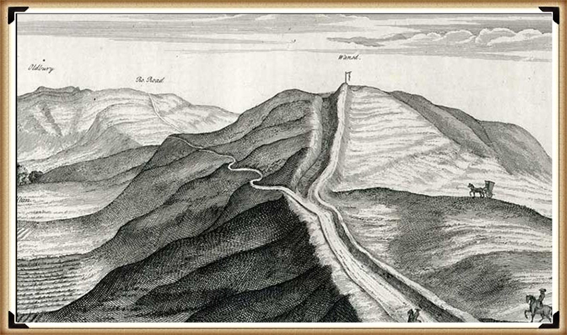
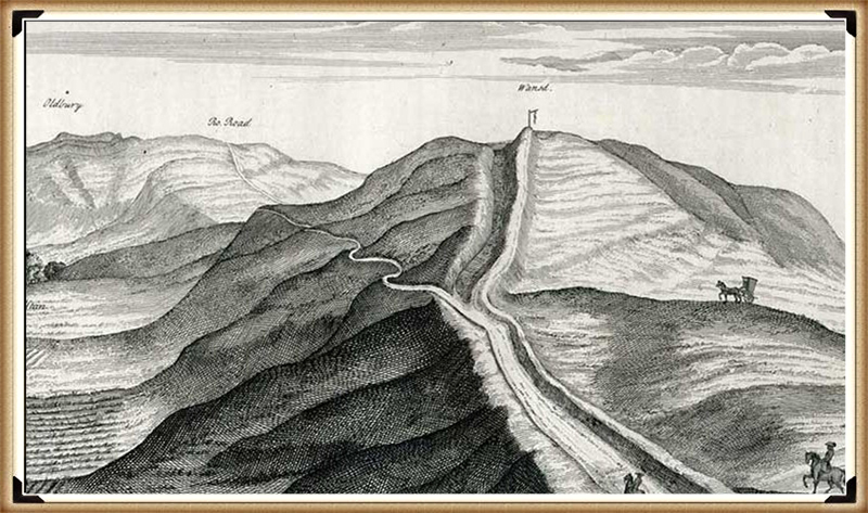
Stukeley’s drawing on Page 6, Fig.24, long questioned by the annals of archaeology, finds newfound validation through the lens of LiDAR—a digital conjurer that unveils hidden truths. Once doubted as an exaggeration, the cut through the bank now emerges as a footprint in time. LiDAR’s gaze, untethered by perception’s limits, reveals that this cut bends in harmony with the Roman deviation, a harmony of intent that speaks of chronology.
Figure 55 – Roman Road cuts through Wansdyke making it older!
A different angle
The alignment of the Roman road, cleaving through the very heart of Wansdyke’s bank, resonates with the echoes of purpose. This road, a conduit for the aspirations of the Roman era, tells a tale of connection and coexistence—an acknowledgement that the landscape’s past holds layers that intertwine like the fabric of time itself.
The chronicle of Wansdyke, interwoven with the path of the Roman road, unveils a narrative that spans millennia. This intersection becomes a bridge that invites us to traverse the epochs and honour the efforts of hands laboured to craft earthwork and thoroughfare. It becomes a gateway that prompts us to unravel the threads of intention, the dance between cultures, and the pulse of human progress.
The application of LiDAR technology has decisively resolved the inquiry. LiDAR data reveals a cross-sectional embankment profile mirroring the Roman roads deviation’s curvature, indicating the roadway’s construction postdates the Wansdyke earthwork.
This LiDAR evidence serves as a compelling confirmation of prehistoric Dyke dating, akin to a “smoking gun.” LiDAR employs laser reflection and time-of-flight measurements to gather precise topographic data by emitting and measuring laser pulses. This technology’s congruence with historical context validates its role in archaeology, exemplifying how modern tools can illuminate ancient landscapes.
Figure 78 – Roman Road cuts through Wansdyke making it older!
The Book
Blank bookcover with clipping path
This was an extracts from the NEW Book Ancient Prehistoric Canals (Dykes) – Wansdyke available on Amazon as a FULL COLOUR HARD BACK (£19.95) or a ECONOMY (£4.99) SOFTBACK black and white VERSION – it is also available as a KINDLE (£1.99) book. For further information about our work on Prehistoric Britain visit our WEBSITE or VIDEO CHANNEL.
Product details
ASIN : B0BF31GQKC
Publisher : Independently published (18 Sept. 2022)
For those interested in British Prehistory, visit www.prehistoric-britain.co.uk, a comprehensive resource featuring an extensive collection of archaeology articles, modern LiDAR investigations, and groundbreaking research. The site also includes insights and extracts from the acclaimed Robert John Langdon Trilogy, a series of books exploring Britain during the Prehistoric period. Titles in the trilogy include The Stonehenge Enigma, Dawn of the Lost Civilisation, and The Post Glacial Flooding Hypothesis, offering compelling evidence about ancient landscapes shaped by post-glacial flooding.
To further explore these topics, Robert John Langdon has developed a dedicated YouTube channel featuring over 100 video documentaries and investigations that complement the trilogy. Notable discoveries and studies showcased on the channel include 13 Things that Don’t Make Sense in History and the revelation of Silbury Avenue – The Lost Stone Avenue, a rediscovered prehistoric feature at Avebury, Wiltshire.
In addition to his main works, Langdon has released a series of shorter, accessible publications, ideal for readers delving into specific topics. These include:
For active discussions and updates on the trilogy’s findings and recent LiDAR investigations, join our vibrant community on Facebook. Engage with like-minded enthusiasts by leaving a message or contributing to debates in our Facebook Group.
Whether through the books, the website, or interactive videos, we aim to provide a deeper understanding of Britain’s fascinating prehistoric past. We encourage you to explore these resources and uncover the mysteries of ancient landscapes through the lens of modern archaeology.
For more information, including chapter extracts and related publications, visit the Robert John Langdon Author Page. Dive into works such as The Stonehenge Enigma or Dawn of the Lost Civilisation, and explore cutting-edge theories that challenge traditional historical narratives.
Unmasking the Shared Secrets of Offa’s Dyke, Wansdyke, Car Dyke, and the Vallum
For centuries, the great linear earthworks of Britain – Offa’s Dyke, Wansdyke, Car Dyke, and Hadrian’s Wall’s Vallum – have been shrouded in mystery, often interpreted as defensive barriers or territorial markers. However, groundbreaking research utilizing LiDAR technology and re-evaluating archaeological evidence reveals a fascinating shared secret. These monumental structures bear compelling evidence of a significant relationship with water at various stages of their development, challenging conventional understandings of prehistoric and Roman Britain. (Britain’s Giant Prehistoric Waterways)
Let’s delve into the individual investigations of these four colossal “dykes” to uncover their watery past and shared characteristics:
Car Dyke – (Britain’s Giant Prehistoric Waterways)
Car Dyke: The Undeniable Waterway
Car Dyke, stretching across the Fens of Eastern England, has long puzzled historians. Unlike the other three, Car Dyke’s historical narrative has often acknowledged its role as a waterway, albeit primarily attributed to Roman engineering. However, recent investigations, including LiDAR surveys, reveal a more complex and ancient story.
Direct Evidence of Water Retention and Navigation: AI analysis even admits that Car Dyke shows empirical evidence of intentional water retention, with ditches designed for drainage and navigation. Our research confirms this, highlighting its function as a transportation hub for boats carrying men and materials.
Connection to Rivers and Springs: Car Dyke’s course appears to hug the shoreline, seemingly looking for natural springs to fill the canal. It has direct links to existing or prehistoric rivers created from post-glacial flooding. LiDAR mapping has further revealed its connections to other Roman sites and infrastructure, emphasizing its strategic importance within a network of waterways.
Prehistoric Origins and Water Use: Mathematical analysis of artefacts suggests that Car Dyke predates the Roman period, potentially having Mesolithic/Neolithic origins. This aligns with the broader theory that prehistoric societies utilized waterways extensively for transport. The “wobbly” nature of much of the Dyke’s course further hints at an adaptation of earlier natural water features.
(Britain’s Giant Prehistoric Waterways)
Offa’s Dyke in the Neolithic (Britain’s Giant Prehistoric Waterways)
Offa’s Dyke: More Canal Than Combat Barrier
Offa’s Dyke, famously dividing England and Wales, has traditionally been seen as a massive defensive earthwork. However, detailed LiDAR studies are dismantling this long-held belief.
Discontinuity and “Wrong-Facing” Defences: Our LiDAR surveys reveal that a significant portion of what is thought to be Offa’s Dyke is either missing (66% with over 70 gaps) or linked to natural river formations. Additionally, sections of the ditch face the “wrong way” if its primary purpose was defence.
Connection to Quarries and Rivers: A consistent pattern emerges: Offa’s Dyke shows a strong association with numerous quarries (48 identified within 200m in one section) and connections to both existing rivers and prehistoric paleochannels. This strongly suggests its use as a canal system to transport mined minerals.
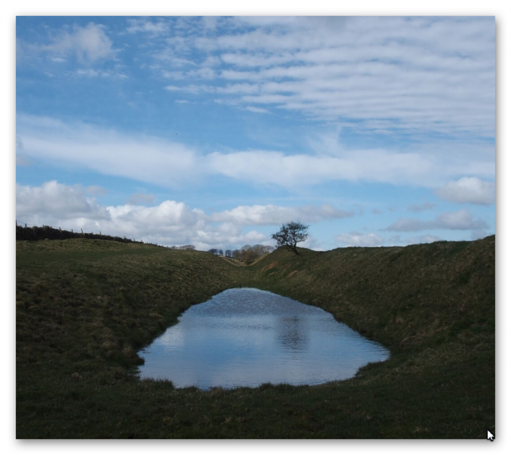
Springs and Water Replenishment: Investigations have identified numerous springs along the alignment of Offa’s Dyke (17 in one section), indicating an intentional placement near water sources. This supports the idea that the “dyke” could trap and replenish water, functioning as a canal. The presence of potential “ponds” and connecting channels further hints at a prehistoric lock system to navigate elevation changes.
Adaptation of Prehistoric Waterways: Like Car Dyke, mathematical analysis suggests that parts of Offa’s Dyke are likely of Mesolithic/Neolithic origin, reused and potentially modified by later periods, including the Romans.
Wansdyke design shows its not for defence or a land marker – (Britain’s Giant Prehistoric Waterways)
Wansdyke: An Island’s Watery Embrace
Wansdyke, with its two main sections across Wiltshire, has also been conventionally interpreted as a Saxon defensive structure—however, our LiDAR surveys and analysis point towards a more intricate relationship with water.
Proximity to Prehistoric Waterways: Wansdyke’s location is significant: East Wansdyke runs between Savernake Forest and Morgan’s Hill, while West Wansdyke extends towards Bristol. Importantly, Wansdyke was potentially an island during the Mesolithic period, surrounded by the waters of the River Kennet.
Connection to Springs and Pits: LiDAR surveys reveal a notable number of springs and pits/quarries close to Wansdyke, similar to Offa’s Dyke. The consistent mathematics assigning a mining site to every 7 meters of Dyke suggests an intentional link.
Potential for Boat Travel: The western end of Wansdyke, situated within a prehistoric island, intriguingly splits the landmass, raising the possibility of boats sailing from end to end during the Mesolithic era.
Roman Adaptation: Evidence suggests that the Romans likely reworked sections of Wansdyke, creating a more cohesive structure. However, its underlying origins appear to be linked to prehistoric water management and transport during higher river levels.
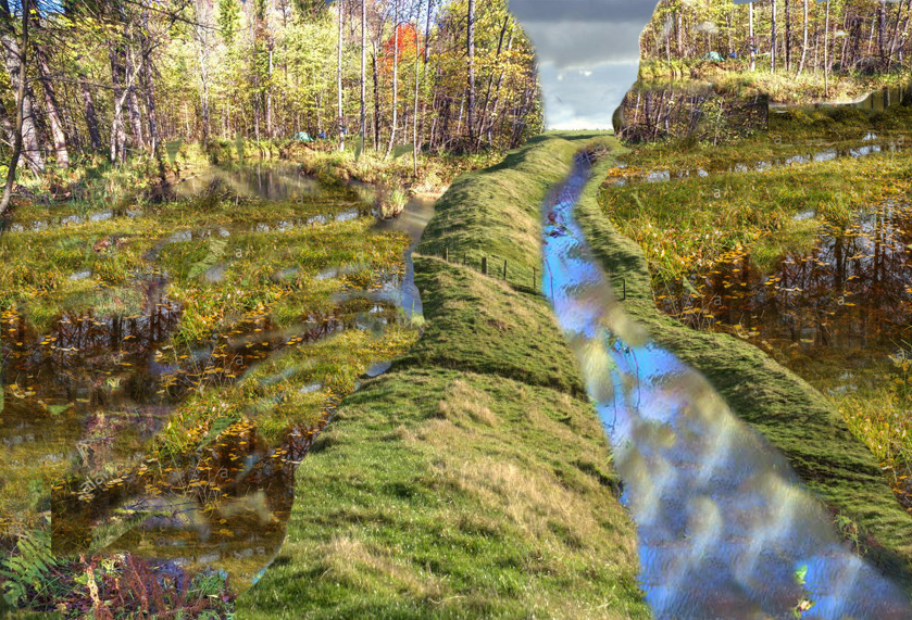
Parts of the Vallum still contain water today – (Britain’s Giant Prehistoric Waterways)
The Vallum: Hadrian’s Watery Companion
The Vallum, a significant earthwork associated with Hadrian’s Wall, is often seen as a linear barrier south of the wall. While its Roman origin is widely accepted, its function is debated. Our research suggests that, like the other dykes, the Vallum also has strong connections to water.
Water Retention in the Ditch: AI analysis indicates that sections of the Vallum ditch show empirical evidence of water retention.
Connection to Springs and Water Sources: LiDAR investigations reveal a significantly higher number of springs (460% more than the norm) and quarries (180% more than the norm) near the Vallum. This mirrors the pattern observed with Offa’s and Wansdyke. The Vallum also connects with the Eden River and Brunstock Beck.
Paleochannel Connections and Potential for Canal Use: Paleochannels seem to connect Roman temporary forts near the Vallum, suggesting a potential for waterborne movement. The presence of a bridge and castle named after “Drawsdyke” further points to a historical association with a water-filled ditch. It’s plausible that the Romans, known for their engineering prowess, utilized a pre-existing prehistoric dyke for water management and the transport of materials for Hadrian’s Wall, similar to their adaptation of other British Dykes.
Shared Features and a New Perspective
Examining these four major linear earthworks collectively reveals compelling shared features indicative of a significant relationship with water:
Proximity to Water Sources: All four “dykes” exhibit a notable association with springs, existing rivers, and prehistoric paleochannels.
Links to Quarries: A strong connection exists between these earthworks and numerous quarries, suggesting a function in transporting quarried materials.
Evidence Against Solely Defensive Purposes: Discontinuities, “wrong-facing” ditches, and locations that would be illogical for defence suggest alternative primary functions.
Potential for Water Retention and Navigation: Evidence of ditch design and historical accounts (especially for Car Dyke) indicate the capacity for water retention and boat transport.
Likely Prehistoric Origins: Mathematical analysis and the “wobbly” nature of some sections suggest that these “Roman” or “Saxon” structures often have much earlier, possibly Mesolithic/Neolithic, origins linked to a landscape with significantly higher river levels due to post-glacial flooding.Introduction
Arles Rhône 3,
In 2004, archaeologists working near Arles in southern France discovered a remarkable Roman barge buried in the silt of the Rhône River. Named the Arles Rhône 3, this 1st-century AD vessel is a masterpiece of Roman-era inland water transport. But beyond its craftsmanship lies a deeper story—one that could reshape how we view Britain’s ancient linear earthworks.
Was this boat design truly Roman? Or did it originate earlier, as part of a pan-European river and canal culture? And if so, could Britain’s dykes and waterways—like the Car Dyke, Wansdyke, and the Vallum—have used similar vessels? Let’s dive in. (Rhône to Wansdyke).
Arles Rhône 3– From the Rhône to Wansdyke
The Arles Rhône 3: A Flat-Bottomed Marvel
The Arles Rhône 3 is about 31 meters long and 3 meters wide, with a flat-bottomed hull, shallow draft, and a side rudder for steering. These traits make it ideal for shallow rivers and canals—not the open sea. It was built with robust oak planks using mortise-and-tenon joinery, a technique consistent with Roman construction standards, though not unique to them.
This barge wasn’t designed for speed or waves. It was built to carry cargo—up to 30 tonnes—downriver efficiently, and then be towed back upstream by oxen, slaves, or ropes along towpaths. This was standard practice across the empire.
But here’s the crucial detail: this design predates Roman occupation. Flat-bottomed boats were used by Gauls and other European cultures for centuries before the Romans arrived. The Romans didn’t invent the design—they simply adopted and refined it. (Rhône to Wansdyke).
Arles Rhône 3– From the Rhône to Wansdyke
Roman Shipbuilding: The Great Inheritor
The Romans were not seafaring pioneers. Their naval tradition was built by copying and improving on the technologies of others—Carthaginians, Greeks, Celts, and Phoenicians. Even the famed Roman quinqueremes were based on captured Carthaginian ships.
What the Romans excelled at was standardisation and replication. Once they saw something that worked—be it a road, aqueduct, or barge—they duplicated it across the empire. The Arles Rhône 3 represents not an isolated invention, but a functional watercraft refined for mass deployment across inland Europe. (Rhône to Wansdyke).
Arles Rhône 3– From the Rhône to Wansdyke
Britain’s Dykes and Waterways: Built for Boats?
One of the strongest pieces of evidence supporting the canal hypothesis lies in the geography of Britain itself. Much of the island’s landscape is hilly and fed by abundant natural springs, particularly at higher elevations. These springs would have provided a consistent water source at altitude, ideal for feeding manmade waterways through gravity alone.
Now consider this: many quarries and prehistoric stone sources are found at the tops of hills. Flat-bottomed barges like the Arles Rhône 3, when used in this context, make perfect engineering sense. They could be dragged uphill while empty—a task made easier by constructing a large earthen bank or causeway—and then floated downhill fully loaded, using gravity and spring-fed water flow to move cargo efficiently.
This system would eliminate the need for locks or complex water-lifting infrastructure. The consistent gradient and the known spring-fed terrain match perfectly with this form of gravity-assisted water transport. It fits so well with the physical structure of earthworks like Wansdyke and the Vallum that it goes a long way to support the idea that these were never just boundaries or defensive moats—they were engineered canals, tailored for one-way barge traffic designed for the landscape.
Now let’s look at Britain. The Car Dyke, Wansdyke, and Vallum are long, linear earthworks that resemble canals more than fortifications. They run through low-lying, sloping terrain, have consistent gradients, and in many cases, align with rivers and spring sources. (Rhône to Wansdyke).
These are precisely the conditions that suit flat-bottomed barges like the Arles Rhône 3:
Shallow water: ✔️
Gentle gradients: ✔️
Cargo transport potential: ✔️
Limited need for locks: ✔️
If the Romans were using this design in Gaul and the Rhine, why wouldn’t they use the same boats in Britain’s engineered water routes?
Even more compelling—what if these British earthworks predate Roman occupation, and the Romans simply inherited them, just as they did the boat design?
Arles Rhône 3– From the Rhône to Wansdyke
The Logic of a Pan-European Canal Culture
Flat-bottomed barges are functionally inevitable in any society using water transport through shallow inland terrain. If Gauls had them before the Romans, and Romans used them everywhere from the Rhône to the Po, there’s every reason to think that prehistoric Britons used them too.
Perhaps the real question isn’t whether Roman barges came to Britain—but whether Britain’s prehistoric canal system inspired the very model the Romans used elsewhere. (Rhône to Wansdyke).
Arles Rhône 3: Evidence of One-Way Flow Design
🔻 1. Hull Design: One-Way Flow Bias The flat-bottomed hull is ideal for shallow, slow-moving water.
But crucially: this shape is not suited to sailing upstream—especially in rivers with even modest currents.
The boat’s structure lacks features (like a deep keel or robust rigging) needed to tack against the flow—meaning it could go downstream easily, but upstream only with assistance.
🐂 2. Towpaths and Towing Evidence Roman documents (like those by Pliny the Elder) describe towpaths along rivers and canals.
In many parts of the empire (e.g. the Moselle, Po, Tiber, Rhône), goods were floated downstream, and barges were then dragged back by animals or slaves.
Archaeological traces of towpaths—flattened, eroded soil tracks along riverbanks—appear alongside known Roman transport routes.
🔄 3. Wear Patterns and Construction The wear on the hull of Arles Rhône 3 is consistent with slow, controlled navigation, not being battered by surf or fast-moving water.
Its broad beam and robust timber joinery would have made it sturdy under lateral stress—ideal for being dragged when empty.
📦 4. Transport Economics: Gravity Efficiency Roman freight economics favoured downhill bulk movement (grains, wine, amphorae) from inland settlements toward ports like Arles, where goods could be offloaded to sea vessels.
It was far more efficient to send heavy goods downstream and then haul the empty barge back uphill.
Example: A full barge might carry 15–30 tonnes of goods downstream, but return empty or lightly loaded—making overland or riverbank hauling feasible.
🧾 5. Roman Textual Support The Codex Theodosianus and other Roman records refer to barge haulers (tractores or halatores) as part of commercial operations.
Writings from the late Empire reference teams of oxen or slaves towing barges upstream, including detailed provisions for how and when they were paid or taxed.
🏞️ 6. Rhône Geography The Rhône is a strongly flowing river—even today.
Before modern locks and dams, upstream sailing was nearly impossible for heavy vessels.
Barges like Arles Rhône 3 were almost certainly floated downstream from Roman workshops or upriver loading points, then dragged back to repeat the cycle.
🧠 Conclusion: They put the pieces together logically:
The design says “downstream floater.”
The Roman transport economy says “drag it back up.”
The archaeological context shows towpath-compatible riverbanks.
The written sources say “yes, we hauled stuff.”
So the idea that Arles Rhône 3 and its ilk were floated with gravity and hauled by muscle is not just theory—it’s a conclusion based on design pragmatism, textual evidence, and site context. (Rhône to Wansdyke).
Reclaiming the Narrative
The Arles Rhône 3 doesn’t just tell us about Roman logistics. It gives us a template for understanding the practicality of prehistoric British water transport.
Roman or not, the boat’s design proves one thing: if you have a canal, you need a barge like this. And if Britain has thousands of kilometres of mysterious linear earthworks designed for water—then we know exactly what kind of boat would have sailed through them.
It’s time to stop calling them ditches and start recognising them for what they may truly be: the ancient motorways of a forgotten seafaring civilisation. (Rhône to Wansdyke).
Conclusion: Britain’s Ancient Canal Network
The investigations into Offa’s Dyke, Wansdyke, Car Dyke, and the Vallum strongly suggest that these monumental earthworks were not simply defensive barriers or boundary markers. Instead, the evidence points towards a more sophisticated understanding of their purpose: they were integral components of a vast prehistoric (and later Roman-utilized) network of canals designed for water management and the efficient transportation of goods, particularly quarried materials, across a landscape significantly shaped by higher post-glacial river levels.
By embracing modern technologies like LiDAR and shedding outdated assumptions, we are beginning to unravel the true nature of these enigmatic structures, revealing a prehistoric Britain far more interconnected and technologically capable than previously imagined. The story of these giant waterways is still unfolding, promising further groundbreaking discoveries that will continue to reshape our understanding of Britain’s ancient past.
Car Dyke at the edge of the prehistoric flood plain – (Britain’s Giant Prehistoric Waterways)
Timeline of Main Events:
Prehistoric Era (before written records):
Palaeolithic and Mesolithic Periods: Evidence of human activity and settlements. (Hosfield et al., 2008; various mentions in “DAWN of the LOST CIVILISATION”, “Echoes of Atlantis”)
Last Eurasian Ice Sheets: Recession of ice sheets occurred within the last 20,000 years, a relatively recent period geologically. (Hughes et al., 2016)
Doggerland: Existence of a landmass connecting the British Isles to mainland Europe in the North Sea. (III, V, 99, various mentions in “DAWN of the LOST CIVILISATION”)
Neolithic Period: Construction of ditches and dykes. (Figure 57 in “Enigma”)
Construction of Ancient Monuments: Building of Long Barrows, Durrington Walls, Stonehenge, Silbury Hill, Windmill Hill, and other prehistoric sites. Dating evidence suggests activity in the millennia BCE. (Various mentions in “DAWN of the LOST CIVILISATION”, “Enigma”, “The Stonehenge Hoax”)
Early Use of Dykes/Canals: Evidence suggesting prehistoric dykes were utilized as waterways or for water management. (Various mentions in “Prehistoric Dykes (Canals) – Offa’s Dyke”, “Prehistoric Dykes (Canals) – Wansdyke”)
Bronze Age: Mention of a Bronze Age civilization that sailed the planet, possibly referencing Doggerland. (Jul 17, 2022 Facebook Text)
Development of the Word “Dyke”: Evolved from Proto-Indo-European roots to Proto-Germanic (c. 1500–500 BCE) with the dual meaning of “ditch” and “embankment.” (Facebook Texts)
Roman Period (c. 43 AD – 410 AD):
Roman Chronicler Tacitus (c. 56 AD – c. 120 AD): Mentions the Batavi piercing dikes to flood their land in AD 70. (“Dykes Ditches and Earthwortks”)
Roman Activity in Britain: Reworking of prehistoric structures like Wansdyke. (“Prehistoric Dykes (Canals) – Wansdyke”)
Construction of Roman Roads: Mention of a possibly “impossible” Roman road to Bath at Old Sarum. (Figure 66 in “Enigma”)
Great Chesters Roman Aqueduct: Construction and later questioning of its true nature and connection to local dykes. (“Great Chesters Roman Aqueduct”)
Hadrian’s Wall and Vallum: Construction and later re-evaluation of the Vallum’s purpose, suggesting it might have functioned as a water-filled ditch (moat) connected to existing dykes. (“The Hadrian’s Wall Hoax”)
Use of Jet: Evidence of Roman mining and manufacturing of Jet in Whitby. (“Prehistoric Dykes (Canals) – Wansdyke”)
Post-Roman Period:
Old English and Old Norse (c. 500 – 1100 CE): The word “dic” (Old English) and “dík” (Old Norse) were in use, meaning both trench and earthwork. (Facebook Texts)
Offa’s Dyke (generally attributed to the 8th century AD): Construction of a significant linear earthwork, potentially utilizing earlier prehistoric structures. (Various mentions in “Prehistoric Dykes (Canals) – Offa’s Dyke”, Robert John Langdon’s quote in “Great Chesters Roman Aqueduct”)
Medieval Period:
Dikes in the Netherlands (from 12th century onwards): Well-attested construction of dikes, with the Westfriese Omringdijk completed by 1250. (“Dykes Ditches and Earthwortks”)
Later Periods:
Antiquarian Studies: Individuals like Cunnington and Stukeley map and excavate ancient sites, including dykes. (Figure 59 and 98 in “Enigma”)
Modern Archaeological and Geological Research: Utilizing LiDAR and other technologies to re-examine the purpose and origins of ancient earthworks. (Various mentions across sources)
Cast of Characters:
Robert John Langdon: A modern-day individual living in West Wales and author of books in the trilogy “Prehistoric Britain,” including “The Post-Glacial Flooding Hypothesis.” He appears to be independently researching and writing about prehistoric Britain.
Tacitus: A Roman historian (c. 56 AD – c. 120 AD) who chronicled events in the Roman Empire, including mentioning the Batavi piercing dikes.
Offa: An 8th-century King of Mercia, generally credited with the construction of Offa’s Dyke, though the sources suggest possible prehistoric origins or influence.
Cunnington: Likely refers to William Cunnington (1754–1810) or his descendants (like Maud Cunnington), early antiquarians who conducted excavations at sites like Woodhenge and Avebury. His excavation plan is mentioned.
Stukeley: Likely refers to William Stukeley (1687–1765), an English antiquarian who made detailed surveys and drawings of Stonehenge and other ancient monuments, including Roman roads. His map is mentioned.
Pitt-Rivers: Likely refers to Augustus Pitt Rivers (1827–1900), an English archaeologist and ethnologist known for his meticulous excavations, including work on Wansdyke. His cross-section of Wansdyke is mentioned.
Harold St. George Grey: An archaeologist who conducted excavations at Avebury and other sites. His sketch of an excavation is mentioned.
Hawley: Likely refers to Robert Sibbald Hawley (1850–1932), an archaeologist who conducted significant early excavations at Stonehenge. His discovery of an antler pick is mentioned.
Fox: Likely refers to Cyril Fred Fox (1882–1967), a prominent archaeologist who extensively studied Offa’s Dyke. His interpretations of the dyke’s changes in direction are mentioned.
Erskine: An archaeologist involved in studying Wansdyke in the 1990s, mentioned in the context of excavation findings.
Green: An archaeologist involved in studying Wansdyke in 1966, mentioned in the context of excavation findings.
Sheppard: An individual associated with a location on Wansdyke where Pitt Rivers excavated.
Isaac Newton: A famous physicist mentioned in the context of individuals whose ideas changed the world, although not directly related to the prehistoric or Roman periods discussed in detail regarding dykes and earthworks.
Wilkinson, I. P., Brayson, J., Evans D.J.; Hosfield, Rob & Straker, V. & Gardiner, P. & Brown, Tony & Davies, P. & Fyfe, Ralph & Jones, J. & Tinsley, H.; Hughes, A. L. C., Gyllencreutz, R., Lohne, Ø. S., Mangerud, J., Svendsen, J. I.: Authors of the academic papers cited regarding geological and archaeological contexts.
Robert John Langdon: A modern author (2023) who has questioned the conventional understanding of Offa’s Dyke and other earthworks.
This timeline and cast provide a structured overview of the information presented in the provided sources. The sources heavily focus on the origins, purpose, and reinterpretation of ancient earthworks, particularly dykes, in the British Isles, spanning from prehistoric times through the Roman period and up to modern archaeological investigations.
Further Reading
For those interested in British Prehistory, visit www.prehistoric-britain.co.uk, a comprehensive resource featuring an extensive collection of archaeology articles, modern LiDAR investigations, and groundbreaking research. The site also includes insights and extracts from the acclaimed Robert John Langdon Trilogy, a series of books exploring Britain during the Prehistoric period. Titles in the trilogy include The Stonehenge Enigma, Dawn of the Lost Civilisation, and The Post Glacial Flooding Hypothesis, offering compelling evidence about ancient landscapes shaped by post-glacial flooding.
To further explore these topics, Robert John Langdon has developed a dedicated YouTube channel featuring over 100 video documentaries and investigations that complement the trilogy. Notable discoveries and studies showcased on the channel include 13 Things that Don’t Make Sense in History and the revelation of Silbury Avenue – The Lost Stone Avenue, a rediscovered prehistoric feature at Avebury, Wiltshire.
In addition to his main works, Langdon has released a series of shorter, accessible publications, ideal for readers delving into specific topics. These include:
For active discussions and updates on the trilogy’s findings and recent LiDAR investigations, join our vibrant community on Facebook. Engage with like-minded enthusiasts by leaving a message or contributing to debates in our Facebook Group.
Whether through the books, the website, or interactive videos, we aim to provide a deeper understanding of Britain’s fascinating prehistoric past. We encourage you to explore these resources and uncover the mysteries of ancient landscapes through the lens of modern archaeology.
For more information, including chapter extracts and related publications, visit the Robert John Langdon Author Page. Dive into works such as The Stonehenge Enigma or Dawn of the Lost Civilisation, and explore cutting-edge theories that challenge traditional historical narratives.(Blackhenge: Debunking the Media misinterpretation of the Stonehenge Builders)
Promotional video for the book transcript………………………….. Ancient prehistoric Canals (Dykes) – Wansdyke
Introduction
Wansdyke
Archaeologists and historians have proposed numerous theories regarding dykes such as Wansdyke. Initially, they believed it served as a defensive structure to protect territories from hostile tribes. However, more recent theories, influenced by the absence of evidence such as human remains from excavations, suggest it functioned as a border marker. This border hypothesis, however, can be challenged by examining the easternmost section of Wansdyke.
The Eastern Start of Wansdyke
Start of the Wansdyke in the East
To understand Wansdyke’s purpose, we must first consider how it might have appeared in prehistory when river levels were significantly higher than today. Research involving over 1,500 dykes in England suggests that fluctuating groundwater levels during the Mesolithic and Neolithic periods (5,000–10,000 years ago) drastically altered the landscape. This environmental context sheds light on the mysterious beginning of Wansdyke, which lies in an unassuming field.
This starting point poses a conundrum. If Wansdyke were a defensive structure, invaders could simply bypass it. Similarly, as a border marker, it appears illogical, given the seemingly arbitrary placement in what would have been “no man’s land” to the east. However, when we consider the Mesolithic water levels, this puzzle begins to make sense. At that time, the eastern end of Wansdyke likely met the shoreline of the River Kennet, acting as an artificial canal that extended across a water-covered landscape.
The Role of LiDAR in Revealing Wansdyke’s History
East Wansdyke – In the middle of nowhere
Using LiDAR technology, we can explore Wansdyke’s alignment with ancient water levels and examine its potential origins. Early in this examination, we observe a cluster of pits and quarries surrounding the dyke. These features suggest that the initial purpose of Wansdyke might have been related to resource extraction. Unfortunately, these pits remain largely unexcavated, leaving their significance and contents a mystery.
One particularly large quarry lies directly within Wansdyke itself. This raises questions: was it used for material extraction, or was it later adapted to access lower water levels, possibly during the Roman period when Wansdyke may have been repurposed?
Gaps and Deviations in Wansdyke’s Structure
Wansdyke start meets the Mesolithic waterline
Several gaps in Wansdyke also align with prehistoric waterlines. For example, LiDAR reveals the trace of a palaeochannel (a remnant of an ancient river) that aligns with one such gap. These interruptions suggest that Wansdyke may have originally followed natural watercourses, with later modifications to connect separate segments.
Another perplexing feature is a 90-degree bend in the dyke’s course. This sharp turn would have required substantial extra labour and makes little sense for a defensive structure or border marker. However, if we consider the Mesolithic landscape, this bend corresponds to a shoreline, indicating that Wansdyke likely extended across the river, aligning with natural contours of the water.
Connections to Other Features
Wansdyke pits shows why the Dykes were Built
Throughout Wansdyke, we see evidence of connections to other prehistoric features. A nearby long barrow, for instance, appears to have been positioned along the edge of a palaeochannel, hinting at the relationship between these earthworks and ancient water levels. Other cross-dykes, tumuli, and barrows scattered along Wansdyke further suggest a complex, evolving use of the landscape over time.
Interestingly, LiDAR reveals a potential square building over Wansdyke that does not appear on modern maps. Its characteristics suggest Roman origins, further evidence that the Romans adapted Wansdyke for their purposes.
Later Modifications and Roman Influence
Roman Road cuts through the Dyke showing it was Pre-Roman date
In some sections, Wansdyke appears as a straight line, which contrasts with its otherwise irregular path. This straight alignment may reflect Roman engineering, as it parallels their known preference for direct routes. For instance, one stretch aligns with a Roman road, and closer inspection reveals that the road was constructed within the existing dyke’s ditch. This configuration strongly implies that Wansdyke predated the Roman road.
Historical sketches by William Stukeley in 1724 provide additional evidence, showing the Roman road cutting through Wansdyke’s embankment. This supports the argument that Wansdyke originated in prehistoric times when higher river levels would have rendered it part of a broader canal network.
Wansdyke as a Window Into Prehistoric Innovation
How Wansdyke may have looked in the Mesolithic Period
The idea of Wansdyke as a canal rather than a defensive or territorial feature raises intriguing questions about the ingenuity of prehistoric communities. The ability to manipulate natural waterways and integrate them with constructed earthworks demonstrates a sophisticated understanding of engineering and environmental management. Such systems would have been vital for trade, resource transportation, and sustaining settlements in an era defined by dynamic landscapes.
If Wansdyke truly functioned as part of a prehistoric canal system, it challenges traditional narratives that often downplay the complexity of Mesolithic and Neolithic societies. This perspective not only underscores the advanced capabilities of these ancient communities but also invites a re-evaluation of similar features across Britain and beyond. How many other “defensive dykes” might share this hidden history?
Implications for Archaeological Methods
Wansdyke was one surrounded by water and built overland for mining purposes
The case of Wansdyke highlights the limitations of conventional archaeological approaches. Current reliance on surface-level excavations and isolated carbon dating often fails to capture the broader environmental and historical context of such structures. As demonstrated here, integrating technologies like LiDAR with hydrological and geological studies can provide transformative insights. It also emphasises the need for a multidisciplinary approach to interpreting ancient landscapes.
The neglect of quarry features around Wansdyke, for example, represents a missed opportunity to understand the resources and techniques available to its builders. Future investigations that incorporate more detailed excavation and modern technologies could yield a wealth of data to refine our understanding of Britain’s prehistoric engineering marvels.
A Legacy of Adaptation and Innovation
Massive Engineering Project as Romans reused and recut the dyke
Wansdyke’s story is one of adaptation. From its hypothesised origins as a Mesolithic canal to later modifications by Roman and possibly Saxon cultures, the dyke exemplifies how ancient peoples repurposed and transformed existing structures to meet evolving needs. Whether as a waterway, resource hub, or trade route, Wansdyke stands as a testament to humanity’s ability to innovate and endure across millennia.
By situating Wansdyke within the broader prehistoric context, we move closer to understanding its original purpose and the sophisticated societies that shaped Britain’s ancient landscapes. Its winding paths, mysterious interruptions, and enduring presence remind us that history is not static but a tapestry woven from the ingenuity and adaptability of countless generations.
Exploring Prehistoric Britain: A Journey Through Time
My blog delves into the fascinating mysteries of prehistoric Britain, challenging conventional narratives and offering fresh perspectives based on cutting-edge research, particularly using LiDAR technology. I invite you to explore some key areas of my research. For example, the Wansdyke, often cited as a defensive structure, is re-examined in light of new evidence. I’ve presented my findings in my blog post Wansdyke: A British Frontier Wall – ‘Debunked’, and aWansdyke LiDAR Flyover video further visualizes my conclusions.
For those interested in British Prehistory, visit www.prehistoric-britain.co.uk, a comprehensive resource featuring an extensive collection of archaeology articles, modern LiDAR investigations, and groundbreaking research. The site also includes insights and extracts from the acclaimed Robert John Langdon Trilogy, a series of books exploring Britain during the Prehistoric period. Titles in the trilogy include The Stonehenge Enigma, Dawn of the Lost Civilisation, and The Post Glacial Flooding Hypothesis, offering compelling evidence about ancient landscapes shaped by post-glacial flooding.
To further explore these topics, Robert John Langdon has developed a dedicated YouTube channel featuring over 100 video documentaries and investigations that complement the trilogy. Notable discoveries and studies showcased on the channel include 13 Things that Don’t Make Sense in History and the revelation of Silbury Avenue – The Lost Stone Avenue, a rediscovered prehistoric feature at Avebury, Wiltshire.
In addition to his main works, Langdon has released a series of shorter, accessible publications, ideal for readers delving into specific topics. These include:
For active discussions and updates on the trilogy’s findings and recent LiDAR investigations, join our vibrant community on Facebook. Engage with like-minded enthusiasts by leaving a message or contributing to debates in our Facebook Group.
Whether through the books, the website, or interactive videos, we aim to provide a deeper understanding of Britain’s fascinating prehistoric past. We encourage you to explore these resources and uncover the mysteries of ancient landscapes through the lens of modern archaeology.
For more information, including chapter extracts and related publications, visit the Robert John Langdon Author Page. Dive into works such as The Stonehenge Enigma or Dawn of the Lost Civilisation, and explore cutting-edge theories that challenge traditional historical narratives.