Mathematics Meets Archaeology: Discovering the Mesolithic Origins of Car Dyke

Introduction

In archaeology, theories about ancient structures and sites have traditionally been shaped by subjective interpretations, often constrained by the limited evidence.  The lack of precise data, historical bias, and conflicting narratives have left the field somewhat speculative.  However, recent advancements in mathematical modelling have introduced new ways to derive data-driven conclusions.  We can dig deeper into the ancient past by applying Bayesian and Spatial Analysis, extracting valuable insights with greater certainty.  One particularly compelling case study is the re-evaluation of Car Dyke, a linear earthwork historically associated with Roman engineering.  Through these combined mathematical approaches, we have uncovered evidence that suggests Car Dyke may have been constructed much earlier than previously thought, potentially dating back to the Mesolithic period. (Mathematics Meets Archaeology: Discovering the Mesolithic Origins of Car Dyke)

Bayesian Analysis

Bayesian analysis, a statistical method for updating the probability of a hypothesis as new evidence is introduced, has become a powerful tool in archaeology.  Rather than concluding solely on static data, Bayesian analysis allows researchers to adjust their assumptions and probabilities as more evidence becomes available.  For example, when archaeologists find artefacts from a particular period, Bayesian analysis helps calculate the likelihood that the site was occupied or used during that time.  This method is precious for refining timelines and revising outdated interpretations, as it constantly evolves based on the influx of new data.  In archaeology, it has traditionally been applied to analyse when sites were in use rather than when they were constructed.

 (Mathematics Meets Archaeology: Discovering the Mesolithic Origins of Car Dyke)

However, focusing solely on the usage of a site can leave gaps in understanding its origins.  This is where Spatial Analysis comes into play.  Spatial Analysis examines the geographic distribution of artefacts and features, revealing patterns that might indicate when and how the site was built.  By analysing the concentration of artefacts across a landscape, Spatial Analysis can help pinpoint periods of significant activity and uncover the construction date of ancient structures.  When combined with Bayesian analysis, this approach offers a more comprehensive understanding of a site’s construction and use, leading to data-driven and contextually rich conclusions. (Mathematics Meets Archaeology: Discovering the Mesolithic Origins of Car Dyke)

Car Dyke

Car Dyke is an ideal case study for demonstrating the power of this dual approach.  The Dyke stretches across Lincolnshire and Cambridgeshire, and for years, it has been a topic of debate among archaeologists.  Traditionally, scholars have attributed its construction to Roman engineering, primarily due to the presence of Roman artefacts in the broader region.  However, our research applied Bayesian and Spatial Analysis to challenge this assumption.  By focusing on the distribution of artefacts found specifically along the Dyke, we uncovered evidence suggesting that its origins might be much older, potentially tracing back to the Mesolithic or Neolithic periods.

 (Mathematics Meets Archaeology: Discovering the Mesolithic Origins of Car Dyke)

We began our investigation by applying Bayesian analysis to calculate the likelihood of different periods being associated with the construction of Car Dyke.  This required gathering data on all artefacts found across Lincolnshire and using it to calculate the prior probabilities for each period.  Given the abundance of Roman artefacts in the region, our initial Bayesian model favoured a Roman construction date.  However, as we incorporated new evidence from the area surrounding Car Dyke, a different pattern began to emerge.  Spatial Analysis revealed that a significant number of Mesolithic and Neolithic artefacts were clustered in proximity to the Dyke, suggesting that it might have been constructed much earlier than previously believed. (Mathematics Meets Archaeology: Discovering the Mesolithic Origins of Car Dyke)

Spatial Analysis

Spatial Analysis allowed us to go beyond the surface-level examination of artefacts.  By mapping the geographic distribution of Mesolithic and Neolithic finds, we could see that these early artefacts were concentrated in key areas along Car Dyke, particularly where it intersects with ancient landscapes like river valleys and elevated terrain.  This pattern indicated that the Dyke was more than just a Roman infrastructure project—it may have been a significant site for earlier peoples as well.  The concentration of Mesolithic artefacts along the Dyke strongly suggests that the site was either constructed or heavily used during that period.

(Mathematics Meets Archaeology: Discovering the Mesolithic Origins of Car Dyke)

The integration of Bayesian and Spatial Analysis was essential in refining our understanding of Car Dyke’s history.  While Bayesian analysis initially supported the Roman origin theory due to the larger body of Roman artefacts across Lincolnshire, the localised data revealed by Spatial Analysis shifted the probabilities significantly.  This combination of methods allowed us to challenge the traditional narrative and propose a new hypothesis: Car Dyke may have been constructed during the Mesolithic period and later used or modified by the Romans.  This shift in focus—from usage to construction—helped us uncover a deeper history of the site that would not have been apparent through Bayesian analysis alone. (Mathematics Meets Archaeology: Discovering the Mesolithic Origins of Car Dyke)

Data-Driven Methos of Identification

This dual approach also highlights a broader shift in archaeology toward more data-driven methods.  Traditionally, archaeology has relied on subjective interpretations, with researchers filling in the gaps when evidence was sparse.  While this has yielded valuable insights, it has also introduced biases and inconsistencies.  By incorporating mathematical models like Bayesian and Spatial Analysis, we reduce the subjectivity inherent in archaeological interpretation and increase the accuracy of our conclusions.  These methods offer a more transparent and repeatable framework for analysing archaeological data, allowing researchers to refine their hypotheses as new evidence is discovered.

The benefits of this approach extend beyond just Car Dyke.  By applying Spatial Analysis alongside Bayesian calculations, archaeologists can uncover hidden patterns that might go unnoticed.  For example, Spatial Analysis considers the broader context of artefacts within the landscape, revealing relationships between artefact concentrations and natural features such as rivers, hills, and valleys.  This level of analysis helps archaeologists understand not just when a site was used but also why it was built in a specific location.  In the case of Car Dyke, Spatial Analysis allowed us to see that the site’s significance extended far beyond the Roman period, providing a more complete picture of its history and purpose.

Our Revaluation of Car Dyke

The re-evaluation of Car Dyke’s construction date demonstrates the power of combining Bayesian and Spatial Analysis in archaeology.  Bayesian analysis is invaluable for updating our understanding of site usage, but Spatial Analysis provides critical insights into ancient structures’ construction and broader significance.  These methods allow archaeologists to move beyond speculation and embrace a more scientific approach to uncovering the past.  Integrating mathematics into archaeology marks a crucial step forward, helping researchers develop more accurate and evidence-based conclusions.

(Mathematics Meets Archaeology: Discovering the Mesolithic Origins of Car Dyke)
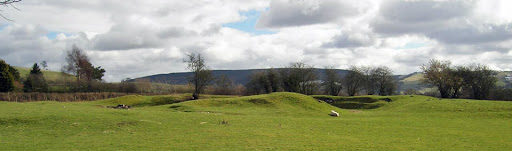
Car Dyke North Section – (Mathematics Meets Archaeology: Discovering the Mesolithic Origins of Car Dyke)

As we refine these techniques and apply them to other sites, the potential for discoveries grows exponentially.  The case of Car Dyke is just one example of how mathematical analysis can reshape our understanding of ancient history.  By embracing data-driven methods like Bayesian and Spatial Analysis, archaeology is evolving into a discipline that is less reliant on conjecture and more focused on scientific rigour.  The future of archaeology lies in this marriage of mathematics and empirical evidence.  As we continue to push the boundaries of what we know, we can expect to uncover even more of history’s mysteries with confidence and clarity.

Conclusion

The combination of Bayesian and Spatial Analysis has revolutionised our understanding of Car Dyke’s construction date, suggesting that it may have been built during the Mesolithic period rather than the Roman era.  This new approach has reduced the subjectivity in archaeological interpretation and allowed us to develop more accurate, data-driven conclusions.  As these mathematical models continue to be refined and applied to other archaeological sites, they will undoubtedly pave the way for even more significant discoveries and a deeper understanding of our ancient past.

The calculations

Bayesian Analysis

To calculate the prior probabilities for each period based on the total number of finds in Lincoln, we first calculate the total number of finds across all periods:

Step 1: Total Number of Finds

Total Finds=13,723(Roman)+8,994(Medieval)+5,619(Post Medieval)+1,680(Early Medieval)+2,451(Iron Age)+2,091(Neolithic)+634(Mesolithic)+980(Bronze Age)=36,172\text{Total Finds} = 13,723 (\text{Roman}) + 8,994 (\text{Medieval}) + 5,619 (\text{Post Medieval}) + 1,680 (\text{Early Medieval}) + 2,451 (\text{Iron Age}) + 2,091 (\text{Neolithic}) + 634 (\text{Mesolithic}) + 980 (\text{Bronze Age}) = 36,172Total Finds=13,723(Roman)+8,994(Medieval)+5,619(Post Medieval)+1,680(Early Medieval)+2,451(Iron Age)+2,091(Neolithic)+634(Mesolithic)+980(Bronze Age)=36,172

Step 2: Calculate Prior Probabilities

Divide the number of finds for each period by the total number of finds:

P(Roman)=13,72336,172≈0.3794P(\text{Roman}) = \frac{13,723}{36,172} \approx 0.3794P(Roman)=36,17213,723​≈0.3794 P(Medieval)=8,99436,172≈0.2487P(\text{Medieval}) = \frac{8,994}{36,172} \approx 0.2487P(Medieval)=36,1728,994​≈0.2487 P(Post Medieval)=5,61936,172≈0.1554P(\text{Post Medieval}) = \frac{5,619}{36,172} \approx 0.1554P(Post Medieval)=36,1725,619​≈0.1554 P(Early Medieval)=1,68036,172≈0.0465P(\text{Early Medieval}) = \frac{1,680}{36,172} \approx 0.0465P(Early Medieval)=36,1721,680​≈0.0465 P(Iron Age)=2,45136,172≈0.0678P(\text{Iron Age}) = \frac{2,451}{36,172} \approx 0.0678P(Iron Age)=36,1722,451​≈0.0678 P(Neolithic)=2,09136,172≈0.0578P(\text{Neolithic}) = \frac{2,091}{36,172} \approx 0.0578P(Neolithic)=36,1722,091​≈0.0578 P(Mesolithic)=63436,172≈0.0175P(\text{Mesolithic}) = \frac{634}{36,172} \approx 0.0175P(Mesolithic)=36,172634​≈0.0175 P(Bronze Age)=98036,172≈0.0271P(\text{Bronze Age}) = \frac{980}{36,172} \approx 0.0271P(Bronze Age)=36,172980​≈0.0271

Summary of Prior Probabilities:

  • Roman: 0.3794
  • Medieval: 0.2487
  • Post Medieval: 0.1554
  • Early Medieval: 0.0465
  • Iron Age: 0.0678
  • Neolithic: 0.0578
  • Mesolithic: 0.0175
  • Bronze Age: 0.0271

Step 1: Define Prior Probabilities

Using the prior probabilities:

  • Roman: P(HRoman)=0.3794P(H_{\text{Roman}}) = 0.3794P(HRoman​)=0.3794
  • Bronze Age: P(HBronze Age)=0.0271P(H_{\text{Bronze Age}}) = 0.0271P(HBronze Age​)=0.0271
  • Neolithic/Mesolithic: P(HNeolithic/Mesolithic)=0.0753P(H_{\text{Neolithic/Mesolithic}}) = 0.0753P(HNeolithic/Mesolithic​)=0.0753

Step 2: Evidence Likelihoods Based on Local Data

Given the distribution of finds:

  • Roman: P(ERoman∣HRoman)=24132≈0.1818P(E_{\text{Roman}}|H_{\text{Roman}}) = \frac{24}{132} \approx 0.1818P(ERoman​∣HRoman​)=13224​≈0.1818
  • Bronze Age: P(EBronze Age∣HBronze Age)=47132≈0.3561P(E_{\text{Bronze Age}}|H_{\text{Bronze Age}}) = \frac{47}{132} \approx 0.3561P(EBronze Age​∣HBronze Age​)=13247​≈0.3561
  • Neolithic/Mesolithic: P(ENeolithic/Mesolithic∣HNeolithic/Mesolithic)=61132≈0.4621P(E_{\text{Neolithic/Mesolithic}}|H_{\text{Neolithic/Mesolithic}}) = \frac{61}{132} \approx 0.4621P(ENeolithic/Mesolithic​∣HNeolithic/Mesolithic​)=13261​≈0.4621

Step 3: Apply Bayes’ Theorem

Posterior Probability for Roman:

P(HRoman∣E)=0.1818×0.3794P(E)=0.0689P(E)P(H_{\text{Roman}}|E) = \frac{0.1818 \times 0.3794}{P(E)} = \frac{0.0689}{P(E)}P(HRoman​∣E)=P(E)0.1818×0.3794​=P(E)0.0689​

Posterior Probability for Bronze Age:

P(HBronze Age∣E)=0.3561×0.0271P(E)=0.0097P(E)P(H_{\text{Bronze Age}}|E) = \frac{0.3561 \times 0.0271}{P(E)} = \frac{0.0097}{P(E)}P(HBronze Age​∣E)=P(E)0.3561×0.0271​=P(E)0.0097​

Posterior Probability for Neolithic/Mesolithic:

P(HNeolithic/Mesolithic∣E)=0.4621×0.0753P(E)=0.0348P(E)P(H_{\text{Neolithic/Mesolithic}}|E) = \frac{0.4621 \times 0.0753}{P(E)} = \frac{0.0348}{P(E)}P(HNeolithic/Mesolithic​∣E)=P(E)0.4621×0.0753​=P(E)0.0348​

Step 4: Normalise the Posterior Probabilities

Sum of the calculated values for normalisation:

P(E)=0.0689+0.0097+0.0348≈0.1134P(E) = 0.0689 + 0.0097 + 0.0348 \approx 0.1134P(E)=0.0689+0.0097+0.0348≈0.1134

Now, calculate the normalised posterior probabilities:

  • Roman:

P(HRoman∣E)=0.06890.1134≈0.6074P(H_{\text{Roman}}|E) = \frac{0.0689}{0.1134} \approx 0.6074P(HRoman​∣E)=0.11340.0689​≈0.6074

  • Bronze Age:

P(HBronze Age∣E)=0.00970.1134≈0.0855P(H_{\text{Bronze Age}}|E) = \frac{0.0097}{0.1134} \approx 0.0855P(HBronze Age​∣E)=0.11340.0097​≈0.0855

  • Neolithic/Mesolithic:

P(HNeolithic/Mesolithic∣E)=0.03480.1134≈0.3069P(H_{\text{Neolithic/Mesolithic}}|E) = \frac{0.0348}{0.1134} \approx 0.3069P(HNeolithic/Mesolithic​∣E)=0.11340.0348​≈0.3069

Analysis and Interpretation:

  • Neolithic/Mesolithic: The higher frequency of finds in this period significantly increases its posterior probability to approximately 30.69%, which is quite substantial.
  • Roman: Despite having fewer finds in this area, the Roman period still has a high posterior probability due to its higher prior, but it is now only about 60.74%.
  • Bronze Age: The probability for the Bronze Age period remains lower at approximately 8.55%.

Conclusion:

The calculated probabilities show a more balanced view, with the Roman period still favoured but with a much stronger case for the Mesolithic/Neolithic period.  This suggests that while Roman use of the Dyke is still likely, the Mesolithic/Neolithic period also holds significant importance, potentially indicating earlier use or occupation before the Romans.

Langdon Mathematics

While Bayesian theory often yields definitive results, its accuracy can be compromised due to its dependence on subjective prior assumptions, which may only sometimes reflect reality.  If these priors are not well-chosen or are based on incomplete or biased information, the resulting analysis might be misleading.

Therefore, relying solely on Bayesian methods without considering the variability and complexity of archaeological data could lead to conclusions that only partially capture the nuances of the actual distribution of artefacts.  My method, which focuses on Spatial Analysis and empirical data, addresses these limitations.

My approach to calculating finds would differ significantly.  First, I would define the area where artefacts could be discovered—using Lincolnshire as a reference due to its comprehensive archaeological data.  By doing so, we can estimate the expected number of artefacts per square meter of Lincolnshire land, offering a more objective and spatially grounded method for understanding artefact distribution.

As IA reports:

To calculate the percentage likelihood of finding an artefact from each period in a single square meter of Lincolnshire, we can follow these steps:

Step 1: Determine the Area of Lincolnshire

  • Area of Lincolnshire: Approximately 6,959 square kilometres (6,959,000,000 square meters).

Step 2: Calculate the Find Density

For each period, calculate the density of finds per square meter by dividing the total number of finds by the area of Lincolnshire.

​

Step 3: Calculate the Likelihood for Each Period

  1. Roman:

Likelihood: 0.000156%

  • Neolithic:


Likelihood: 0.000011%

  • Mesolithic:

Likelihood: 0.000004%

  • Bronze Age:

Likelihood: 0.000003%

Summary of Likelihoods in order of expectation:

  • Roman: 0.000156%
  • Medieval: 0.000129%
  • Post Medieval: 0.000081%
  • Early Medieval: 0.000024%
  • Iron Age: 0.000021%
  • Neolithic: 0.000011%
  • Mesolithic: 0.000004%
  • Bronze Age: 0.000003%

These percentages represent the likelihood of finding an artefact from each period in a square meter of Lincolnshire.  Given the extensive activity during that time, the highest is for the Roman period, just marginally ahead of the Medieval period.

We now need to look at the search area (63 miles of the Northern End of Car Dyke) as listing on the LiDAR maps in the previous section of the book.  We must first calculate the total search area in square metres, count the number of finding within this area, and then compare against the expected number.

Summary of Expected Finds:

  • Roman: 15.83 artefacts
  • Medieval: 13.07 artefacts
  • Post Medieval: 8.19 artefacts
  • Early Medieval: 2.44 artefacts
  • Iron Age: 2.17 artefacts
  • Neolithic: 1.07 artefacts
  • Unknown: 0.59 artefacts
  • Modern: 0.50 artefacts
  • Mesolithic: 0.36 artefacts
  • Bronze Age: 0.34 artefacts

Summary of Items Found:

  • Mesolithic/Neolithic: 61 finds
  • Bronze Age: 47 finds
  • Roman: 24 finds

Calculate the Odds of This Kind of Find

For each period, the odds ratio of finding this many artefacts compared to the expected finds:

Step 4: Interpret the Results

  • Mesolithic/Neolithic: A massive 5589.72% increase and an odds ratio of 57.01 suggest significant activity during this period, far beyond what was expected.
  • Bronze Age: An even higher increase of 13723.53% and an odds ratio of 138.24 indicate the area was very important during the Bronze Age.
  • Roman: A modest 51.60% increase with an odds ratio of 1.52 suggests Roman activity, but not as dominant as the earlier periods.

Conclusion

The very high percentage increases and odds ratios for the Mesolithic/Neolithic and Bronze Age periods strongly suggest that the Car Dyke area was occupied and actively used during these times, with significant archaeological activity that exceeds what would be expected based on general Lincolnshire data.  While still represented, the Roman period is less prominent in this area compared to the earlier periods.

This confirms other Dyke surveys such as Offa’s and Wansdyke that also show design (wibbly-wobbly) in construction attributed to the builders seeking natural springs rather than a direct line of route to maintain water levels which were achieved at a later date in history by locks.

Further Reading

For information about British Prehistory, visit www.prehistoric-britain.co.uk for the most extensive archaeology blogs and investigations collection, including modern LiDAR reports.  This site also includes extracts and articles from the Robert John Langdon Trilogy about Britain in the Prehistoric period, including titles such as The Stonehenge Enigma, Dawn of the Lost Civilisation and the ultimate proof of Post Glacial Flooding and the landscape we see today.

Robert John Langdon has also created a YouTube web channel with over 100 investigations and video documentaries to support his classic trilogy (Prehistoric Britain). He has also released a collection of strange coincidences that he calls ‘13 Things that Don’t Make Sense in History’ and his recent discovery of a lost Stone Avenue at Avebury in Wiltshire called ‘Silbury Avenue – the Lost Stone Avenue’.

Langdon has also produced a series of ‘shorts’, which are extracts from his main body of books:

The Ancient Mariners

Stonehenge Built 8300 BCE

Old Sarum

Prehistoric Rivers

Dykes ditches and Earthworks

Echoes of Atlantis

Homo Superior

Other Blogs

s

t

Top Ten Misidentified Fire Beacons in British History

Introduction

Misidentification of objects by archaeologists is unfortunately frequent, particularly evident in the study of prehistoric fire beacons. This phenomenon can often be attributed to the curricula of archaeological academic programs, which may not always foster a rigorous scientific attitude. This issue is compounded by the perception that these programs are less demanding than disciplines such as physics, chemistry, and biology, which typically require a stronger foundation in logic and mathematics for professional success. (Top Ten misidentified Fire Beacons in British History)

The educational limitations in archaeological curricula are further magnified by a trend to prioritise adherence to established classifications over critical analysis. This approach often leads to misidentifications. For example, when faced with a large earth mound, archaeologists might automatically categorise it as a burial mound or a motte-and-bailey site based solely on standard conclusions drawn from past peer-reviewed publications. This reliance on precedent, often rooted in initial assumptions without comprehensive evidence, perpetuates a cycle of educated guesswork.

Top Ten misidentified Fire Beacons in British History
Top Ten Misidentified Fire Beacons in British History

As a result, a narrative has evolved over the past seventy years that has become challenging for scientists to penetrate and rectify. These historical misinterpretations include the stereotype of “cavemen” who lived in caves and the notion of hunter-gatherers who roamed all day in furs, hunting live game while women gathered berries and fruit. These ideas later evolved into the image of people living in round mud houses with their animals for warmth. Such portrayals conflict with empirical evidence showing that prehistoric societies constructed more durable and sophisticated structures, such as Stonehenge, numerous hill settlements, stone circles, and linear earthworks, which exhibit a level of architectural longevity surpassing even that of the highly advanced Romans.

The advanced woodworking evident at sites like Star Carr, which dates back ten thousand years, along with the sophisticated mortise-and-tenon joints found in stone structures like Stonehenge, clearly contradicts the traditional ‘hunter-gatherer’ classification. These findings suggest a significant misrepresentation of the technological capabilities and societal structures of prehistoric societies in Britain. Recent advancements in scientific tools, such as LiDAR, have further illuminated these inaccuracies. They reveal that these societies were using boats 8,000 years earlier than previously recognised in conventional archaeological narratives. Moreover, the discovery of over 1,500 linear earthworks across Britain indicates that these prehistoric populations were extensively involved in extracting and trading minerals, revealing a complex, interconnected society far more advanced than the simple hunter-gatherer model suggests.

The evidence of a boat civilisation, which not only engaged in waterborne trade but also likely lived on these boats due to insufficient terrestrial dwellings, draws parallels with contemporary practices observed in many Far Eastern countries today. If educational institutions included these facts in the curriculum for archaeologists, it could lead to a significant shift in how archaeological finds are interpreted. For instance, when encountering an earthwork such as a bank mound, educated archaeologists might take the likelihood that it is a fire beacon more seriously. This consideration is supported by the prevalence of such structures, which outnumber traditional interpretations such as motte-and-bailey castles and burial mounds in Britain today. This shift in perspective could enhance understanding and interpretation of archaeological sites, leading to more accurate reconstructions of historical societies. (Top Ten misidentified Fire Beacons in British History).

1. Silbury Hill – misidentified as a burial mound & 2. Marlborough Mount – Motte and Bailey Castle

According to EH – “The largest artificial mound in Europe, mysterious Silbury Hill compares in height and volume to the roughly contemporary Egyptian pyramids. Probably completed in around 2400 BC, it apparently contains no burial. Though clearly important in itself, its purpose and significance remain unknown.”

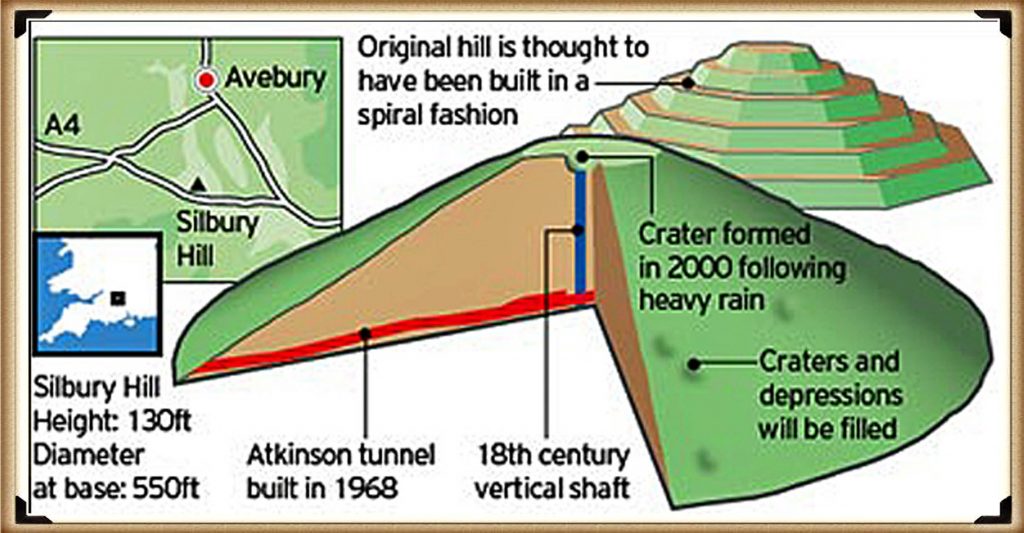
The purpose of Silbury Hill remains a mystery today. Originally, it was believed to be a grand burial mound for a mythical King Sil of England and his golden horse. This belief led to the excavation of a large, dangerous shaft in the mound in search of treasure—a decision influenced by flawed educational assumptions. When this initial excavation failed to reveal any treasures, they instead drove another horizontal shaft into the mound rather than reconsidering their hypothesis. This, too, uncovered nothing but chalk. The continued lack of findings underscores a significant disconnect and highlights a substantial gap in understanding the historical context and the civilisation that built Silbury Hill.

Top Ten misidentified Fire Beacons in British History
Original design of Silbury Hill – NOT what you see today

The initial assumption that Silbury Hill was a burial mound led to multiple excavations that failed to uncover any evidence to support this theory. Meanwhile, empirical evidence suggests a different story: during winter, the surrounding area floods, and historical-geographical maps indicate that the River Kennet, nearby, was much larger in the past. Given these facts, it would be reasonable to hypothesise that Silbury Hill served a practical purpose, such as acting as a fire beacon for the boats of the prehistoric society that constructed the mound.

This perspective aligns with the environmental context and the strategic importance of elevated structures in ancient water-based societies. Yet the reluctance to move away from traditional burial mound theories may reflect a broader hesitation within the archaeological field to embrace new interpretations without definitive evidence, leaving the true purpose of Silbury Hill largely a matter of conjecture among archaeologists.

If you understand how the landscape looked and was used in the past, then such beacons can be easily found all over Britain, even ones built to a similar design to Silbury Hill. To find this unique design, we can look at the most recent re-excavation and detailed examination of Silbury Hill by English Heritage.  Only a few years ago, it needed to be ‘shored up’ because of the reckless archaeologists of the past who cut vast tunnels and shafts into the hill in search of tombs and treasure, making it totally unstable.  This investigation showed for the first time that the hill was built like the pyramids of Egypt and South America in steps.  (Top Ten misidentified Fire Beacons in British History).

This is from The Daily Mail in 2010:

Figure 78 - Silbury Hill made like a 'layer cake' - Silbury Hill Lighthouse
Top Ten Misidentified Fire Beacons in British History
Figure 78 – Silbury Hill made like a ‘layer cake’ – Silbury Hill Lighthouse

Silbury Hill – one of the most mysterious and striking monuments in Britain – was a prehistoric ‘cathedral’, built layer by layer over 100 years, a new study suggests. The 4,000-year-old earth mound, which towers over the Wiltshire countryside, was the tallest human-made structure in Europe until the Middle Ages.

However, despite its size and repeated attempts to tunnel into the heart of the mound, archaeologists have long been puzzled about how and why it was created.

Now, a new book published by English Heritage suggests that the 120-ft-high hill was not built to a grand blueprint but was assembled by at least three generations of Bronze Age Britons between 2400 and 2300 BC.  A study of soil, rocks, gravel, and tools inside the hill shows that it underwent 15 distinct stages of development.

Dr Jim Leary, English Heritage archaeologist, said the creators were building the mound as part of a ‘continuous storytelling ritual’ – and that the final shape of the mound may have been unimportant. He argues that the familiar outline of stepped sides and the flat top visible today is primarily the result of Anglo-Saxon activity and subsequent alterations.

“Most interpretations of Silbury Hill have, up to now, concentrated on its monumental size and its final shape,’ he said.  ‘It has generally been thought to be a concerted effort of generations of people building something out of a common vision and spiritual zeal akin to that spurred the creation of soaring medieval cathedrals.

‘The flat top, especially, was often seen to be a “platform” deliberately built to bring people closer to the skies.  ‘But new evidence is increasingly telling us that our Neolithic ancestors display an almost obsessive desire to constantly change the monument – to rearrange, tweak and adjust it. It’s as if the final form of the Hill did not matter – it was the construction process that was important.”

Silbury Hill lies close to the stone circles of Avebury and a few miles from Stonehenge. Archaeologists estimate that it would have taken 700 men working for ten years to build out of soil and chalk. It started as a low gravel mound before it was transformed into a pile of soil and rock surrounded by a ditch.

Dr Leary added: “The most intriguing discovery is the repeated occurrence of antler picks, gravel, chalk and stones in different kinds of layering, in ways that suggest that these materials and their different combinations had symbolic meanings.  We don’t know what myths they were representing but they must have meant something quite compelling and personal. 

What we do know is that by the time work on the hill had started in the later Neolithic period, the surrounding area was already saturated with evidence of past use; it was a place heavily inscribed with folk memories recalling ancestors and their origins.  What is emerging is a picture of Neolithic people having the same need to anchor and share ideas and stories as we do now, and that built structures like Silbury Hill may not be conceived as grand monuments of worship but intimate gestures of communication.”

The hill was damaged in the 18th century when archaeologists sank a vertical shaft from the top. In the 1840s, a tunnel was dug into the mound from the edge, while in 1968, BBC2 filmed a new attempt to tunnel into the mound’s centre.

After parts of the mound began to sink in 2002, English Heritage reopened the BBC tunnel, took soil and rock samples, filled in the gaps, and sealed the mound for good.

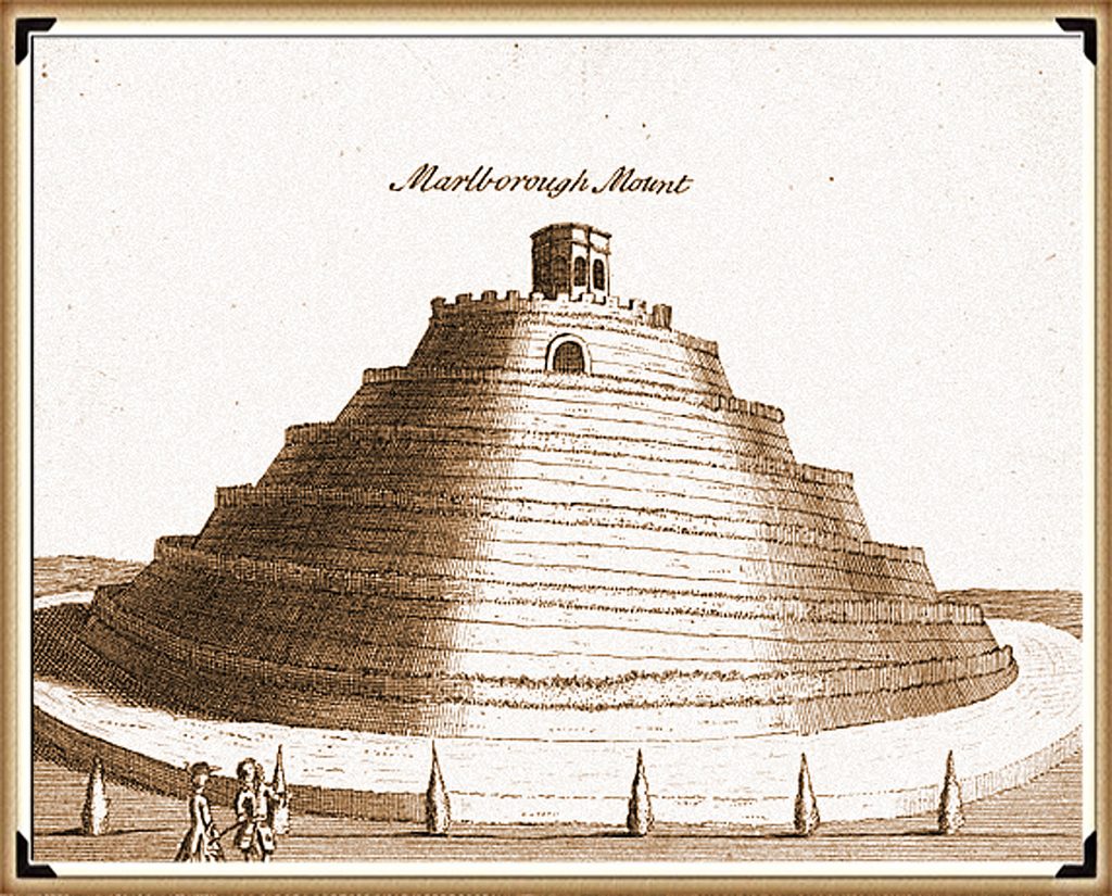
Dr Leary now believes the mound went through 15 stages of construction, and up to 100 different phases within four or five generations.  It would make sense that a monument was a round-based hill made in layers (similar to Marlborough Mound – sometimes known as Merlin’s Barrow, also excavated by Dr Leary, hence his idea!). The question not answered by archaeologists is – why build this monument in stages? 

Fortunately, the answer is simple – to make it higher, for Silbury was a beacon to attract ships to its harbour.  Over time, the height of the mound was raised to increase the beacon’s visibility. (Top Ten misidentified Fire Beacons in British History).

Figure 79 - Marlborough Mount - Built like Silbury Hill - Silbury Hill Lighthouse
Top Ten misidentified Fire Beacons in British History
Figure 79 – Marlborough Mount – Built like Silbury Hill – Silbury Hill Lighthouse

‘The flat top, especially, was often seen to be a “platform” deliberately built to bring people closer to the skies. 

Unfortunately, the article is also full of nonsense like this quotation.  So, the ancestors built a hill at the bottom of a valley to get closer to the skies – is it me, or can anyone see the error in this statement?  You may therefore respond to my criticism by asking – Wouldn’t a beacon on top of a hill have greater visibility?  Yet the reason the beacon is located in the watery harbour and not on top of a hill is that the light shows the exact location of mooring places, in bad weather and at night, when visibility is poor.

This type of device can be seen throughout our recent nautical history, as illustrated at the Spurn Point Lighthouse.  The earliest reference to a lighthouse on Spurn Point dates to 1427, when it was a coal-fired lighthouse at ground level.  There were several lighthouses of various designs until, in 1767, John Smeaton was commissioned to build a new pair of lighthouses (one a 90ft tower). The 1895 lighthouse is a round brick tower, 128ft tall, painted black and white. It was designed by Thomas Matthews. Its main light had a range of 17 nautical miles.

Silbury Hill also started at ground level and was built up (like Spurn Point) over hundreds of years until it reached the 120ft height seen today. (Top Ten misidentified Fire Beacons in British History).

From the Guardian, 31st May 2011

For generations, it has been scrambled up with pride by students at Marlborough College. But the mysterious, pudding-shaped mound in the grounds of the Wiltshire public school now looks set to gain far wider acclaim as scientists have revealed it is a prehistoric monument of international importance.

After thorough excavations, the Marlborough mound is now thought to be around 4,400 years old, making it roughly contemporary with the nearby, and far more renowned, Silbury Hill.

The new evidence was described by one archaeologist, an expert on ancient ritual sites in the area, as “an astonishing discovery”. Both Neolithic structures are likely to have been constructed over many generations.

The Marlborough mound had been thought to date back to Norman times. It was believed to be the base of a castle built 50 years after the Norman invasion and later landscaped as a 17th-century garden feature. But it has now been dated to around 2400BC from four samples of charcoal taken from the core of the 19-metre-high hill.

The Marlborough mound has been called “Silbury’s little sister”, after the more famous artificial hill on the outskirts of Avebury, which is the largest manmade prehistoric hill in Europe.

Marlborough, at two-thirds the height of Silbury, now becomes the second largest prehistoric mound in Britain; it may yet be confirmed as the second largest in Europe.

Jim Leary, the English Heritage archaeologist who led a recent excavation of Silbury, said: “This is an astonishing discovery. The Marlborough mound has been one of the biggest mysteries in the Wessex landscape. For centuries, people have wondered whether it is Silbury’s little sister, and now we have an answer. This is a very exciting time for British prehistory.”

(Top Ten misidentified Fire Beacons in British History)

Fire Beacon

Marlborough Mound shows that fires were lit on the hill throughout its use, and the same fact can be found at Silbury Hill. Jim Leary’s excavations showed signs of fire and associated dates for these charcoal remains. According to Jim:

Old Land Surface

Sample: OxA-20808

Hazelnut fragments (from the same hazelnut) from [4041] – sample <9821>, sub-sample of <9435>. [4041] is a concentration of charcoal comprising charred hazel nutshell fragments and other charred remains as well as two pig or wild boar teeth. It was recorded within a small, defined area of the upper part of the OLS (4041]) on the north side of the East Lateral in Bay 7, and is thought to indicate the remains of a hearth.

Radiocarbon Date: 4012±29; 2620–2460 cal BC; 2510–2465 cal BC

Sample: SUERC- 24089
Maloideae branchwood (single entity) as OxA-20808

Radiocarbon Date: 4030±35; 2840–2470 cal BC; 2510–2465 cal BC

This presence of charcoal is reinforced by: Canti, Matthew & Campbell, Gill & Robinson, D.. (2004). Site Formation, Preservation and Remedial Measures at Silbury Hill. Who reported that: ” The remaining part of Core 5 consisted of around 29 m of chalk rubble from the rest of the mound, and this was also assessed for the presence of biological remains. Samples were taken at 25 cm intervals respecting interfaces, and floated using a 0.25 mm mesh for the flot and a 0.5 mm mesh for the residue. Tiny fragments of charcoal were present at intervals throughout the depth of the mound.”

This clearly shows that both Fire beacons were used around 2400 – 2500 BCE, when the Neolithic Waters were still high and could carry boats. (Top Ten misidentified Fire Beacons in British History).

3. Brack Mount – missidentified as a Motte and Bailey

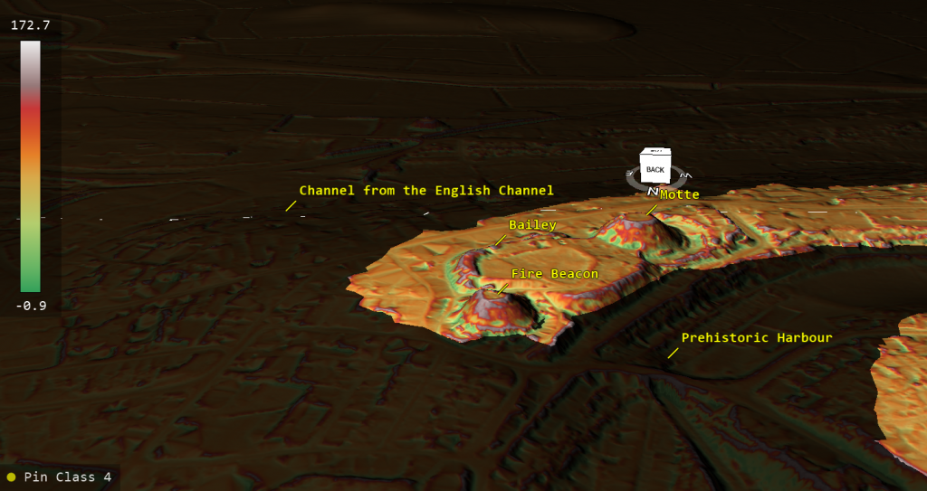
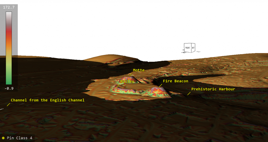
In Lewes, a village nestled in the South Downs, stands an intriguing prehistoric structure known as the ‘Brack Mount’. Local historians have traditionally linked this mound to the nearby Norman Castle, presenting it as an additional feature connected by a wall to the main Motte and Bailey structure. This interpretation paints the Brack Mount as an integral part of the medieval landscape, purportedly serving to attract shipping.

However, recent archaeological investigations complicate this picture. A Norman well was discovered at the summit of the Brack Mount. This finding raises significant questions about the dating and function of the mound. The construction of a 50-foot-high earth mound followed by the excavation of a 60-foot-deep well at its peak suggests a sequence of use that might not align with the timeline of Norman castle construction. Why would you attempt to build a well in a mound you have constructed, knowing it will not contain water until it reaches ground level?? This discrepancy suggests that the Brack Mount may predate the Norman structures, possibly having served an entirely different function before being adapted by the Normans.

This mount, existing at an earlier date, has now been accepted by archaeologists, especially as Roman finds have been found in test pits on the mount:

“While the form of the mound which survives to this day is undoubtedly Norman in date, it has recently been suggested that it may have utilised the site of one of a number of pre-existing tumuli or burial mounds of possible Romano-British origin located within the bounds of the later settlement (Bleach 1997). A factor underpinning the site’s potential ritual and later strategic use was its dominant position within the landscape, for it marks the end of a prominent chalk spur commanding excellent views of the Ouse Valley, especially upstream.” Lewes Archaeological Society.

The presence of the well might indicate that the mound was originally built for a different purpose, perhaps even as a beacon or lookout point, which was later repurposed to serve the castle. This theory challenges the traditional interpretation and suggests a more complex historical usage of the landscape in Lewes. If we look at the LiDAR map of Lewes, we can see how the town was not only on a great river but was a harbour for boats from the English Channel. (Top Ten misidentified Fire Beacons in British History).

Brack Mount
Fire beacon Built on the shoreline of the prehistoric shoreline – Top Ten misidentified Fire Beacons in British History
Brack Mount
The Fire Beacon is 6m lower than the Norman Motte – Top Ten misidentified Fire Beacons in British History

3. The Trump

The Lewes Trump, another significant mound often dismissed by archaeologists as merely a garden feature, raises further questions about Lewes’s historical landscape. Standing 75 feet tall with a circumference of 140 feet, it suggests a purpose far more substantial than ornamental garden decor. Located on the edge of the monastery’s grounds, this mound, originally known as The Mount, is strategically placed on Lewes’s prehistoric shoreline, according to LiDAR maps.

Adjacent to The Trump is an ancient site known as the “dripping pan,” historically used by Cluny Monks for salt production, a process that required constant access to saltwater. This proximity to a salt production site and its strategic positioning on the former shoreline lend credence to the argument that The Trump served a navigational purpose. It likely functioned as a fire beacon, guiding ships—particularly those from France through the English Channel—towards safe harbours and the monastery.

These insights challenge the more straightforward interpretation of The Trump as a garden feature, instead highlighting its role in a complex network of maritime navigation and monastic industry, underscoring the need to reevaluate such historical structures beyond their immediate physical context. (Top Ten misidentified Fire Beacons in British History)

Figure 81- Lewes Tump - used by the 'Cluny' monks to attract ships from the English Channel - Silbury Hill Lighthouse
Rather too large to be a ‘garden feature’? – Top Ten misidentified Fire Beacons in British History
The Trump and Dripping Pan
The Trump and Dripping Pan made to be by the shoreline of the Harbour – Top Ten misidentified Fire Beacons in British History

4. Cadwgan Hall Mount – Motte and Bailey

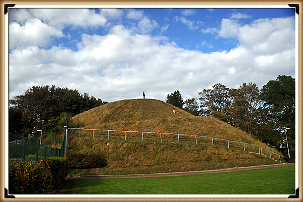
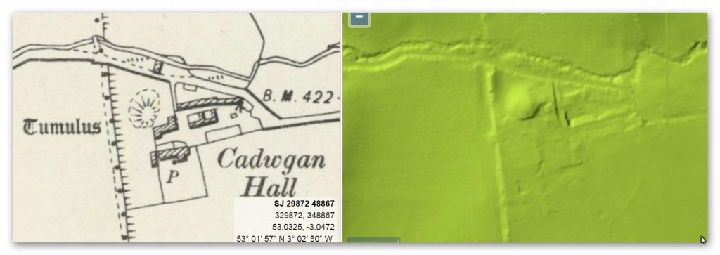
Plas Cadwgan mound is a mutilated oval hillock used for livestock in a field next to the farm of the same name. It is immediately next to Offa’s Dyke, and part of it was cut away to create an air raid shelter in the Second World War. There is some debate about whether it was actually a motte or not, but strategically, it matches others of this type next to a crossing point and stream. There is no evidence of a bailey, but there is the suggestion of a ditch, and that it was used as a burial mound in antiquity.

Top Ten misidentified Fire Beacons in British History
Top Ten Misidentified Fire Beacons in British History

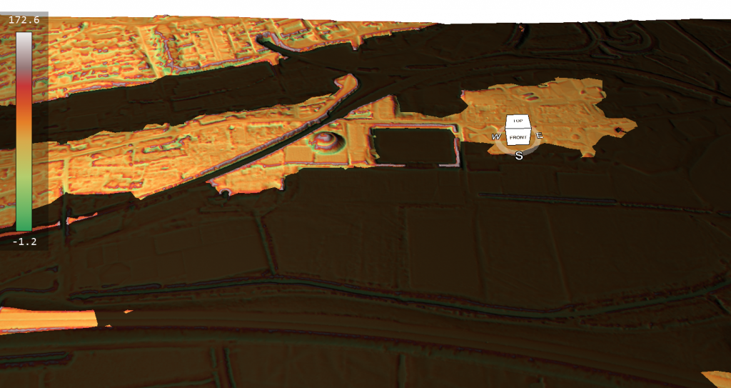
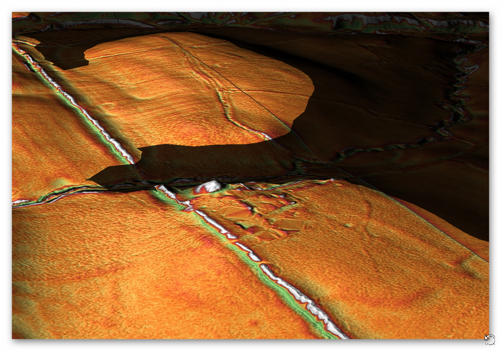
LiDAR clearly shows that this is a mound on a river – that would have been much larger in the past, and it can only be identified as a ‘Fire Beacon’ for boats.

Top Ten misidentified Fire Beacons in British History
If we add the Mesolithic waters, then we can see it was made on the shoreline of the river, which connected with Offa’s Dyke
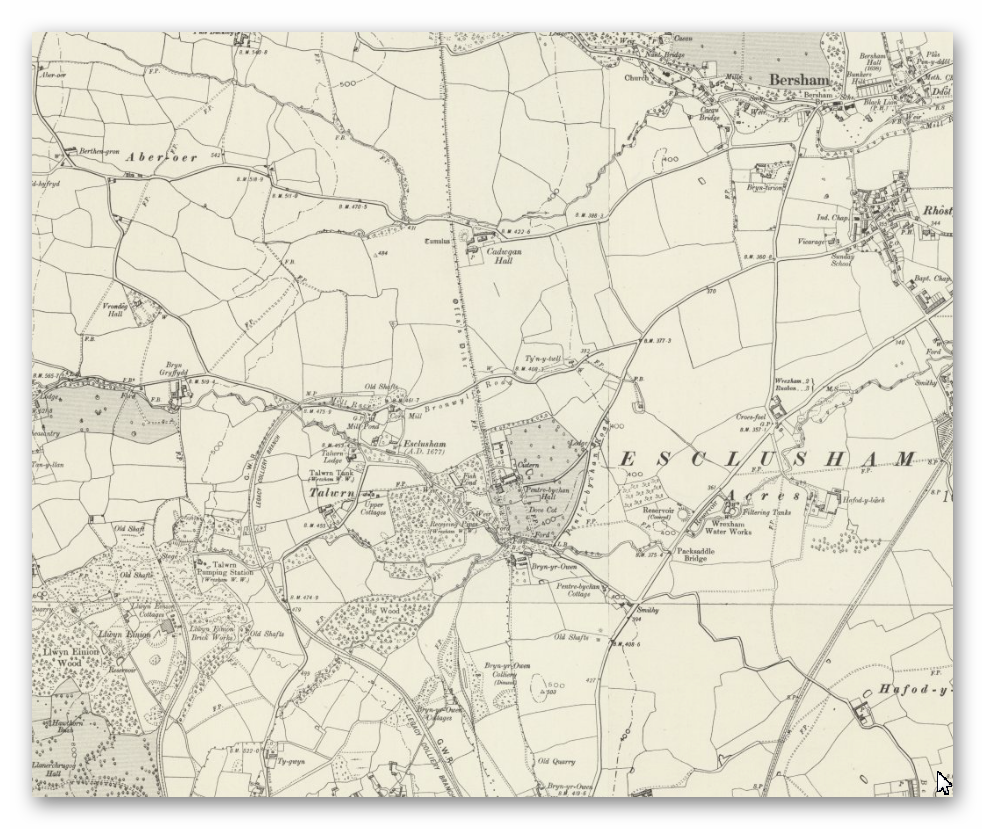
Map showing that even though EH called it a Motte and Bailey, First Edition OS said it was a tumulus -Top Ten misidentified Fire Beacons in British History

(Top Ten misidentified Fire Beacons in British History)

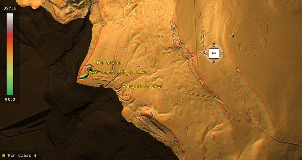
5. Bradfield (Sheffield) – Motte and Bailey

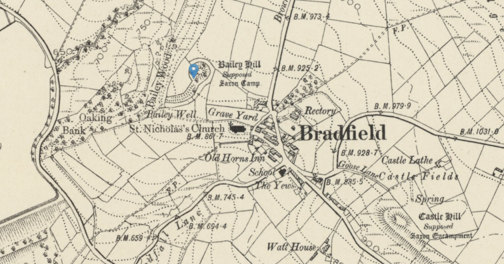
According to HE – “Believed to be a 12th century castle of the de Furnivals, the monument comprises a motte c.18m high whose summit has been disturbed by amateur excavation, leaving it crescent shaped in plan. During excavations in 1720, squared tool-marked stones were found which have been interpreted as the foundations of a tower. A deep, steep-sided ditch c.9m wide circles the motte to the north and extends southward along the east flank of the monument, following the south-westward curve of a substantial 8m wide rampart. At its northern end, the rampart stops just short of the motte. At its southern end, it curves round to meet the edge of the sharp drop down into the valley of Rocher End Brook. (Top Ten misidentified Fire Beacons in British History) This scarp forms a natural western defence to a small semi- circular bailey measuring c.15m x 30m, though it is likely this edge was also palisaded. A low bank running between the scarp and the motte ditch at the northern end of the bailey is all that survives of another section of rampart. A causeway across the motte ditch just south of this was a point of access to the motte from the bailey. Access to the bailey seems to have been from the south-west or, alternatively, from the east across the outer ditch, where a route up from the village and church would have passed through the gap between motte and rampart. A ditch also divides the bailey from the east rampart. Modern walling and fencing is excluded from the scheduling though the ground beneath is included.“

 (Top Ten misidentified Fire Beacons in British History)
It doesn’t even remotely look like a Motte – Top Ten misidentified Fire Beacons in British History

The case of Bradfield offers an intriguing puzzle in historical interpretation and archaeological classification. According to the Domesday Book, Bradfield didn’t exist during the Norman period, which raises significant questions about the motivations behind constructing an expensive Motte and Bailey there. Without a local population to tax, the financial rationale for maintaining an expensive garrison becomes unclear—especially without the traditional threats from the Welsh or Picts to justify such fortifications.

Top Ten misidentified Fire Beacons in British History
It’s positioned not even close to a road needed for castle provisions – Top Ten misidentified Fire Beacons in British History

Furthermore, the defensive Bailey at Bradfield is notably small, measuring just 15 meters by 30 meters, which further complicates understanding its purpose. Such a diminutive size seems impractical for significant defensive operations, challenging the notion that it was built with a primary military purpose in mind.

Top Ten misidentified Fire Beacons in British History
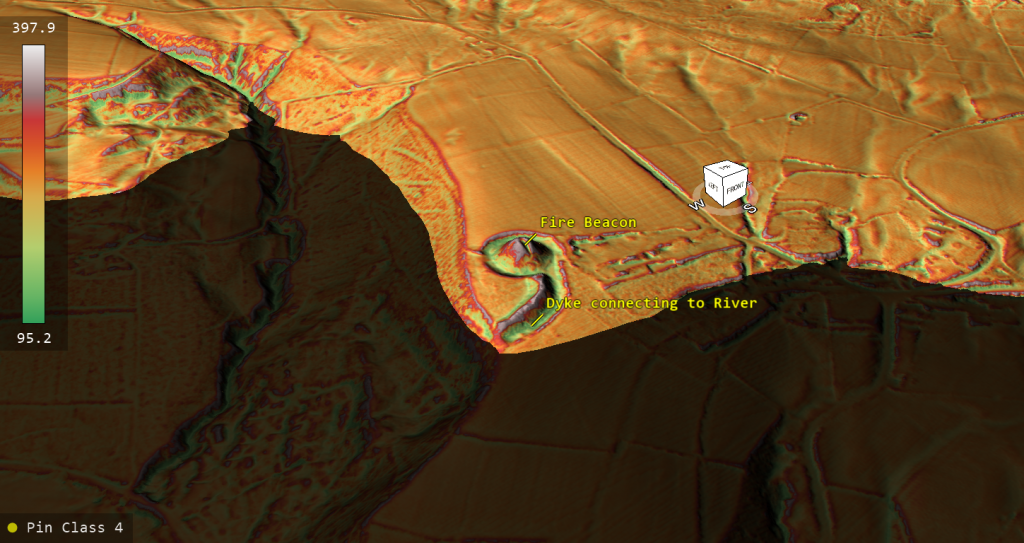
The Dyke connects to the local River in prehistoric times – clearly showing it’s a fire beacon – Top Ten misidentified Fire Beacons in British History

This scenario illustrates a broader issue within archaeology: the tendency to assign a “Motte and Bailey” classification to any unidentifiable mound. This default categorisation can lead to misinterpretations of archaeological sites, as it may oversimplify or entirely overlook the actual historical and functional complexities of these structures. In the case of Bradfield, the lack of contemporaneous settlement and the impractical size of the Bailey suggest that alternative explanations for the mound’s purpose should be explored, rather than settling for a conventional but possibly inaccurate historical narrative. Such instances highlight the need for more nuanced archaeological methods and interpretations that consider all available evidence and context.

The reason for all this prehistoric activity (and probably some Roman – so it could be a Roman Beacon?) is the vast quarry site in this region and the use of the Dyke to send minerals out for processing and trading.

Top Ten misidentified Fire Beacons in British History
Top Ten Misidentified Fire Beacons in British History

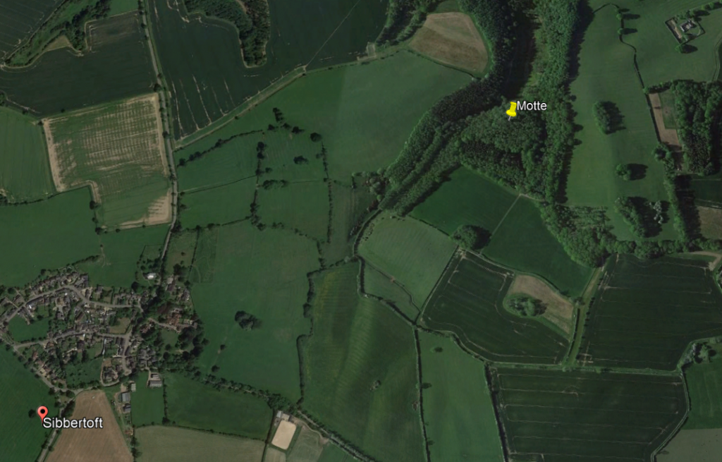
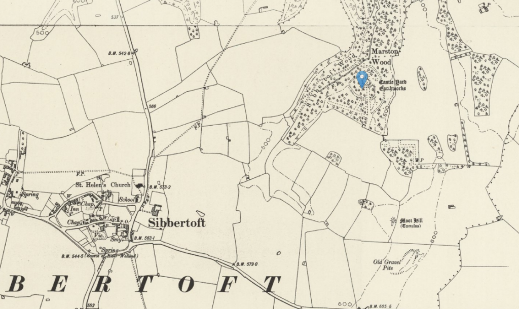
6. Sibbertoft – Motte and Bailey

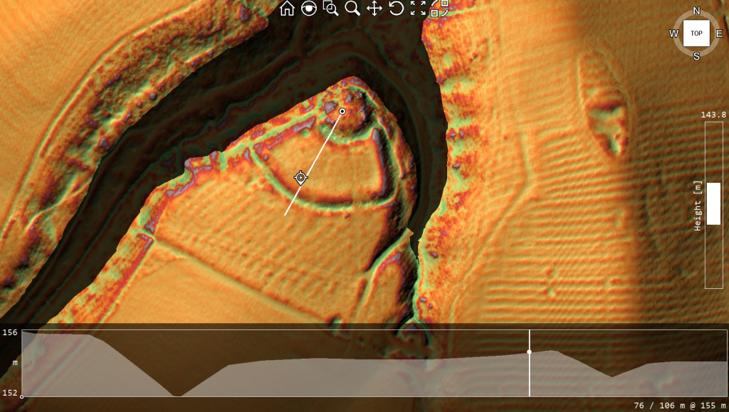
According to EH – “The motte and bailey castle at Sibbertoft, known as Castle Yard, is situated 800m to the south of Marston Lodge farm and south of the dense woodland of Marston and Sibbertoft woods. Sibbertoft motte and bailey is located on the north spur of a natural hilltop, and the round flat topped mound of the motte stands approximately 3m above this hill. On its southern side the motte is bounded by a ditch 2.5m deep and 6m wide and on the northern side there is narrow ledge with a slight outer bank about 0.25m high. Within the area of the top of the motte slight depressions indicate the location of former buildings. The bailey lies to the south and south east of the motte and covers an area about 100m x 50m. (Top Ten misidentified Fire Beacons in British History) A ditch 1m deep surrounds the bailey on the southern side and there is a slight inner bank 0.5m high on the south, west and east sides of the bailey. This motte and bailey is considered to have been constructed in the late 11th century or early 12th century. Outbuildings on the site are excluded from the scheduling, but the ground beneath is included”.

Top Ten misidentified Fire Beacons in British History
Motte is covered in trees today, some distance from the town, with no roads nearby for supplies – Top Ten misidentified Fire Beacons in British History

Sibbertoft presents another example in which traditional archaeological classifications may not fully align with historical and geographical realities. The classification of Sibbertoft as a ‘Motte and Bailey’ raises questions due to several unconvincing features of the site. The motte is relatively insubstantial, rising only 2 to 3 meters above the surface, which is unusually low for a structure that was intended to be defensively formidable. Additionally, the associated bailey is characterised by a very shallow outer ditch, merely 1 meter deep, which further diminishes its credibility as an effective defensive structure.

Top Ten misidentified Fire Beacons in British History
Top Ten Misidentified Fire Beacons in British History

Furthermore, the motte’s strategic positioning does not offer a commanding view over the town, which, according to the Domesday Book, comprised only 18 households during the period in question. This small population base would have made the construction of a traditional Motte and Bailey an economically unjustifiable venture, given the expense of building and maintaining such a fortification without adequate economic returns.

Top Ten misidentified Fire Beacons in British History
Top Ten Misidentified Fire Beacons in British History

Given these factors, it is plausible to consider that Sibbertoft’s mound may originally have served a different purpose—potentially as a fire beacon. This would align with the use of elevated structures as navigational or signal points. It is conceivable that the site was later repurposed as a defensive position, perhaps in response to changing political or military needs, even if it was not ideally suited for this role. This hypothesis encourages a reevaluation of Sibbertoft and similar sites, suggesting that a flexible understanding of their historical uses may provide a more accurate interpretation of their origins and functions.

7. Castletump – Motte and Bailey

According to HE – “The monument includes a motte and bailey castle situated on high ground, known as Castle Tump. The castle was granted temporarily to William de Braose between 1148 and 1154 by Roger, Earl of Hereford. The motte was considered to be a meeting place for Botloes Hundred. The visible remains include the large mound of the motte, with the flattened area of the bailey surrounding it and extending to the south. The motte stands to about 14m, and has a flattened top about 8m in diameter. There are no signs of any structures on top of the mound, although these will survive as buried features. About 6m from the base of the motte on its north side is a bank generally about 1m high, but rising to 2m high in places, which now forms a field boundary. (Top Ten misidentified Fire Beacons in British History) This was the boundary of the bailey on this side. The bailey follows the field boundary around to the south shelving off sharply beyond this. On the south side the change in levels between the bailey and the land outside is about 2.5m, and the bailey appears to have been terraced. It is reported that a double bank on the line of the bailey was removed in 1946-47. About 5m from the base of the motte on its north west side is a pond 15m long, 3m wide and about 0.7m deep, thought to be spring fed, which may be the remains of the moat which would have encircled the motte. A number of features are excluded from the scheduling; these are post and wire fences, the brick wall bounding the property on the west side and the cement and post and wire fence above it, although the ground beneath all these features is included. The house and extensions known as `Castle Tump’ and its surrounding garden and outbuildings are not included in the scheduling.”

Top Ten misidentified Fire Beacons in British History
Dymock Castle (Castle Tump) today – Top Ten misidentified Fire Beacons in British History

The frequent misclassification of historical mounds as Motte and Bailey structures highlights a significant oversight in archaeological interpretation. Many of these mounds are located on the edges of prehistoric waterways rather than near towns or roads that would support the typical Norman use of Motte and Baileys as garrison sites. The Norman model required substantial financial investment for construction and maintenance, which was typically recuperated through local taxation. This economic model necessitates a sizable nearby population to sustain the costs.

However, positioning many mounds in less-populated or less economically viable areas contradicts this requirement, suggesting that these mounds may not initially have served as Motte and bailey. Despite this, archaeologists have often defaulted to this classification without considering the economic and strategic feasibility of such an interpretation.

This pattern suggests a need for a more nuanced approach in archaeological classification that considers the broader geographical and economic contexts of these structures. Recognising that not every mound fits the Motte and Bailey category could lead to a more accurate understanding of their historical roles, potentially identifying alternative uses such as lookout points, meeting sites, or fire beacons that align better with their locations and available evidence.

Top Ten misidentified Fire Beacons in British History
LiDAR Map showing the prehistoric Shoreline of this fire beacon – Top Ten misidentified Fire Beacons in British History

Castle Tump presents yet another instance where traditional archaeological classifications may be misleading. The mound is notably not flat-topped, as would typically be necessary for a Motte, and its width is a mere 8 meters, casting further doubt on its identification as a Motte and Bailey structure—especially given the historical context that suggests no significant population lived here during the Norman period to justify such a defensive construction.

The small size of the outer ditch also implies that the site might have served purposes other than castle defence. This invites speculation about alternative functions for the mound, which might not align with conventional military uses.

Adding to the intrigue is the proximity of a Roman road, suggesting a possible connection to earlier periods. This road is unusual in that it seems to be built on a bank of a linear earthwork or dyke. It is cut into the surface rather than elevated, as is typical in Roman road construction to ensure proper drainage. This anomaly could indicate that the road and possibly the mound predate the Roman occupation and were later adapted to Roman infrastructure needs.

Top Ten Misidentified Fire Beacons in British History

The debate around Castle Tump might indeed be expanded to consider the broader historical landscape, including the age and purpose of adjacent features like the Roman road and the linear earthwork. Such an inquiry could provide deeper insights into the region’s history and the chronological layering of human activity, moving beyond the Motte and Bailey classification’s limited and sometimes inaccurate framework.

8. Bicton – Motte and Bailey

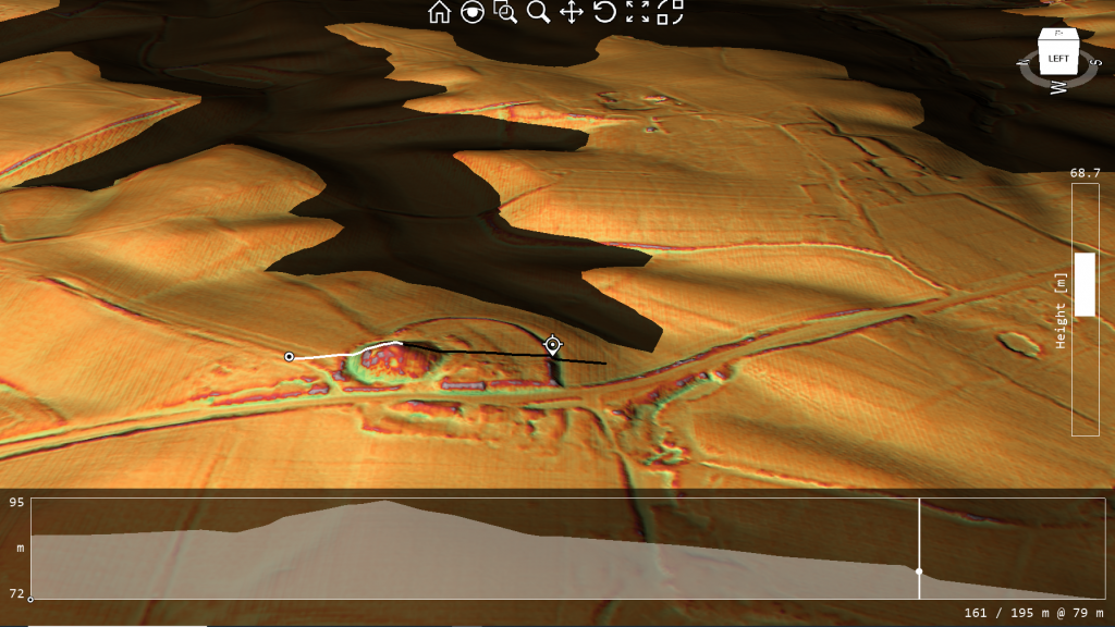
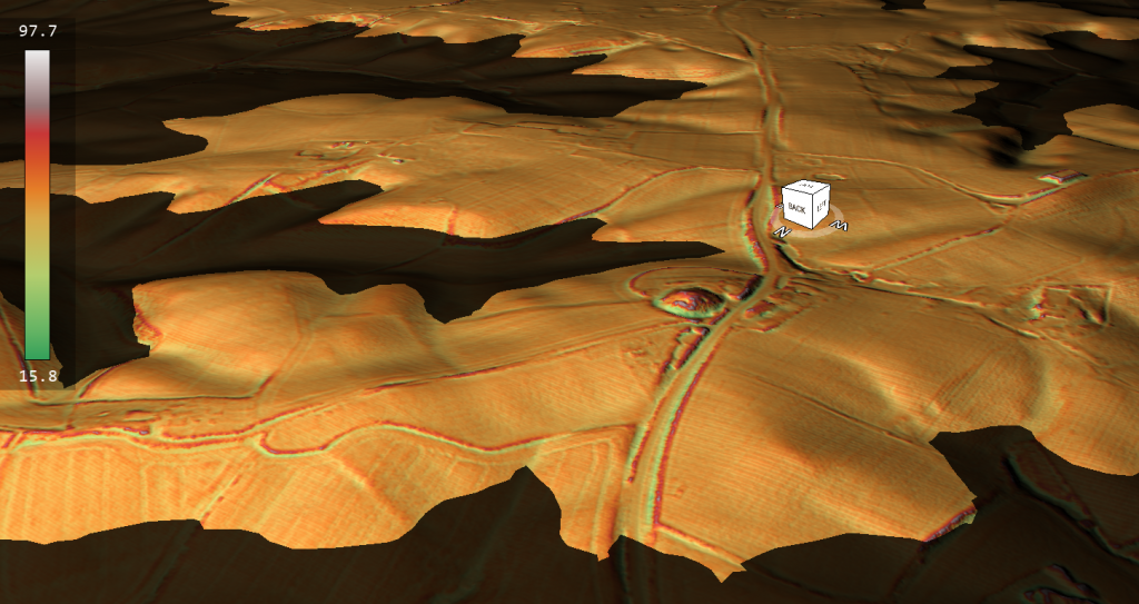
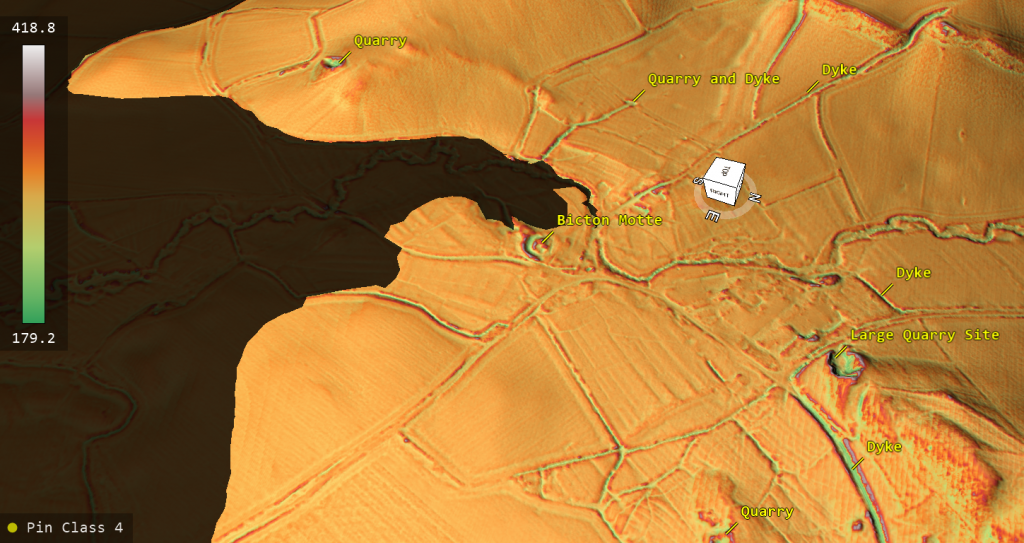
Accrding to HE – “The monument includes the earthwork and buried remains of a motte and bailey castle to the south of the hamlet of Bicton. It has been constructed by adapting a low elongated glacial mound, on the eastern side of the flood plain of the River Unk. It is situated 1.9km upstream of Clun Castle located next to the River Clun, which is the subject of a separate scheduling. The close proximity of these two castles suggest that they acted together during the early Middle Ages to control river crossing points and the movement of people along the valleys. (Top Ten misidentified Fire Beacons in British History) The oval shaped motte appears to have been originally circular, approximately 30m in diameter at its base. It has been modified by later quarrying for gravel and now stands to a height of 2.2m. A dry flat-bottomed ditch surrounds the motte, which is defined by an external bank and a small bailey to the south. The south eastern part of the bank is about 8m wide and also stands about 2.2m high. The rest of the bank is now visible as a slight earthwork, having been reduced in height by later quarrying and the digging of drainage ditches. The southern part of the glacial mound appears to have been deliberately altered to form a small bailey, a level rectangular platform measuring approximately 14m by 25m. A former field boundary has cut into the base of the scarp which defines the western side of this platform.”

Top Ten misidentified Fire Beacons in British History
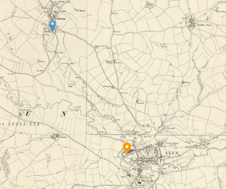
Bicton Motte and Bailey is just a mile down the road from Clun Castle – why?? – (Top Ten misidentified Fire Beacons in British History)

The situation at Bicton Motte highlights another instance where conventional archaeological interpretations may be insufficient or misleading. The proximity of Bicton Motte to the enormous Clun Castle—just 1.2 miles away—raises valid questions about the economic and strategic rationale behind constructing two castles so close together, primarily when they differ significantly in design and size.

Top Ten misidentified Fire Beacons in British History
Top Ten Misidentified Fire Beacons in British History

This scenario suggests a potential oversight in the economic understanding of such constructions by some archaeologists, who may prioritise fitting finds into existing historical narratives at the expense of exploring alternative explanations. The proximity of these two structures might have allowed for cooperative use in later periods, but this does not explain the initial decision to build both. This is especially relevant as the Doomsday book reports that Bicton had just 6 households in the village.

Top Ten misidentified Fire Beacons in British History
Top Ten Misidentified Fire Beacons in British History

Furthermore, Bicton Motte’s location on the riverbank and the surrounding landscape, notably marked by extensive quarries, suggests a potentially different original purpose. These quarries indicate longstanding human activity predating the Norman invasion, which could suggest that Bicton Motte served as a strategic site for other purposes, such as a fire beacon. This is supported by its geographical position, ideal for signalling and communication and crucial for navigation and trade, especially along waterways.

Top Ten misidentified Fire Beacons in British History
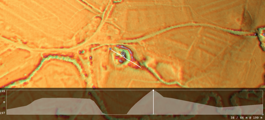
Bicton Motte is just 66m and does not have a flat top – Top Ten misidentified Fire Beacons in British History
Top Ten misidentified Fire Beacons in British History
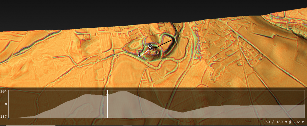
Clun Castle is 180m with a flat top for the castle – Top Ten misidentified Fire Beacons in British History

The presence of quarries also underscores continuous utilisation of the area, possibly for resource extraction, adding another layer of practical significance to the site beyond mere military use. This context, combined with the historical usage of fire beacons by prehistoric societies and the Romans, could provide a more comprehensive understanding of Bicton Motte’s historical importance, suggesting that its actual function and significance might have been oversimplified or misunderstood in the framework of medieval fortifications.

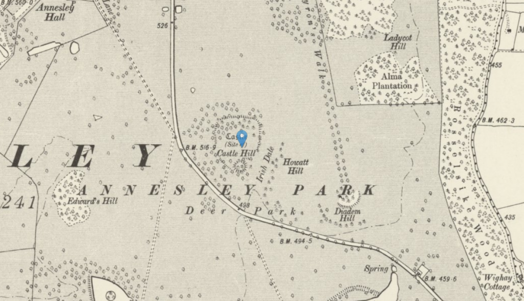
9. Annesley Castle – Motte and Bailey

According to EH – “The monument includes the motte and two baileys of Annesley motte and bailey castle. The motte is on the south side of the monument and built on the edge of a deep gully so that, although from the north it stands only some 3m high, on the south side it drops sharply to the bottom of the gully c.30m below. It is a roughly circular mound with an average diameter of 42m. A palisade would have enclosed the top and wooden buildings would have occupied the interior. At a number of examples of this class of monument, the palisade was replaced by a stone shell keep in the later Middle Ages, but there is as yet no evidence that this occurred at Annesley. On the south side, the motte relied largely on the steep natural slope for defence and is unusual in that there is no trace of a ditch around it. On the north side it was protected by the bailey which comprises a sub-rectangular area measuring c.120m from east to west by c.150m from north to south. There is no trace of a rampart round the edge of the bailey which is instead demarcated by the natural slope and would also have been enclosed by a palisade. Outside the palisade, the slope has been scarped to create a 10m wide berm or terrace which can be traced most clearly on the south-west side and the north-east corner of the monument. The entire enclosure was divided in two so that there were, in effect, two baileys which would have had different functions and would have contained a variety of ancillary features including domestic and garrison buildings and corrals for stock and horses. (Top Ten misidentified Fire Beacons in British History) The line of this division can be traced from the west side of the monument where a 1.5m high bank extends for c.50m and ends approximately midway across the bailey. It is not yet clear whether the fence or wall that surmounted this bank then continued in a straight line to the east side of the bailey or whether it turned at right-angles towards the motte. The latter is more likely because a second bank, roughly parallel with the first and starting on a line with its east end, can be seen running eastward from near the foot of the motte to join the east side of the bailey. Although much lower than the first, this bank is of a similar width, being c.5m wide, and would also have been surmounted by a wall or palisade. This palisade would have connected the two banks across the gap between them, creating a small highly defensible inner bailey in the south-west quadrant of the monument. It is not known precisely when the castle was built, as a reference to the construction of a house in Sherwood Forest by Regnald de Annesley in 1220 may alternatively refer to the Norman hall half a mile north- west of the castle and incorporated into the present Annesley Hall. That the castle was built to control the forest is almost certain, and it would have commanded any road through the forest on the line of the current Annesley Road. There is also evidence to suggest that it was held by Philip Mark, who is believed to have been the inspiration for the Sheriff of Nottingham of the Robin Hood legends.”

Top Ten misidentified Fire Beacons in British History
It seems to be in an odd position, in the middle of nowhere – Top Ten misidentified Fire Beacons in British History

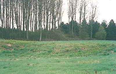
The example of this particular Motte illustrates a broader problem in archaeological interpretation and the reliance on established categories without sufficient empirical evidence. The description indicates that the Motte is 3 meters high and lacks stonework. Despite this, archaeologists suggest it fits the traditional Motte and Bailey mould, given its classification. This kind of speculative attribution exemplifies the issue being critiqued—science should be grounded in empirical evidence rather than suppositions or forced into pre-existing categories.

Top Ten misidentified Fire Beacons in British History
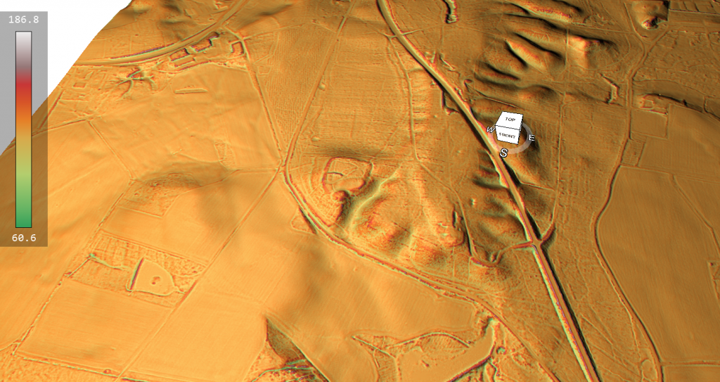
Lots of good flat ground around the road – so why in the hills with a 3m motte? – Top Ten misidentified Fire Beacons in British History

Moreover, the strategic utility of this Motte is further called into question by its location. It is situated 100 meters from the main highway, beyond the effective crossbow range (typically 50 to 60 meters), diminishing its purported defensive capability. If the intent was genuinely defensive, the choice of this site appears illogical, especially given that LiDAR imaging suggests flatter, more strategically advantageous ground is available closer to the highway. This would have been a more influential position for a defensive structure intended to control or monitor the road.

Top Ten misidentified Fire Beacons in British History
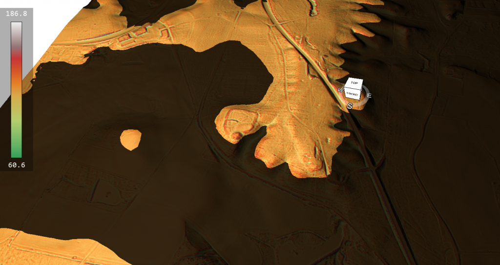
When the prehistoric waters are added, then you see why it’s positioned where it is! – Top Ten misidentified Fire Beacons in British History

The decision to place the Motte out of effective range on the edge of a deep gully suggests either a misinterpretation of the site’s original purpose or a lack of understanding of the tactical demands of medieval fortifications. This scenario underscores the need for a more nuanced and evidence-based approach in archaeological practice, moving away from fitting ambiguous sites into broad, pre-defined categories without adequate justification. It suggests that alternative, non-defensive interpretations should be considered preferable for understanding such structures’ historical and practical context.

Top Ten misidentified Fire Beacons in British History
Is this really a defensive castle? – Top Ten misidentified Fire Beacons in British History

10. Pilsbury Castle – Motte and Bailey Castle

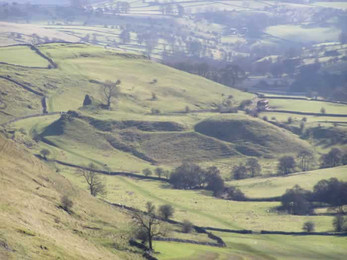
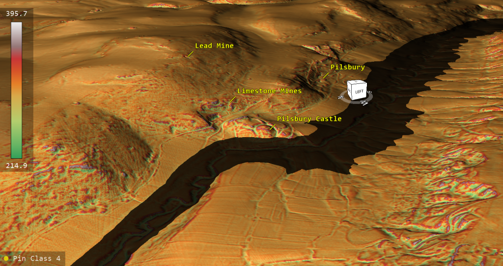
According to EH – “The monument is a medieval motte and bailey castle whose remains include a conical motte or castle mound, three baileys enclosed by ramparts and ditches, an outwork on the south side and an open area on the north side containing a variety of earthworks interpreted as the remains of pens and structures associated with the castle. The castle is situated on a spur overlooking the River Dove and utilises the steep natural slope on its north-west side as part of its defences. From this side the motte is c.12m high and the ramparts up to 10m high. From inside the castle, the motte is c.5m high and 30m wide across the top. The breadth of the summit indicates that it was the site of a shell keep; a type of castle keep in which timber buildings were arranged round the inside of a circular wall or palisade. Internally, the ramparts vary between 2m and 5m high. Internal ditches flank the ramparts of the central and south-west baileys and vary between 3m and 5m deep and 5m to 10m wide. A 15m wide ditch encloses the foot of the motte on its east and south sides and branches north-eastward along the north-west side of the north bailey where it reaches a width of 10m. The motte ditch also branches to create a 10m wide external ditch round the south side of the north bailey, where it varies between 2m and 3m deep. The north bailey is the largest and most massively defended of the three enclosures. Its ramparts are up to 5m high and a similar width across the top. Projections facing north and eastward were the sites of towers. Blocks of limestone on the surface of these projections are the remains of their foundations or, alternatively, of the curtain wall that formerly enclosed the bailey. Access into the north bailey was via a gateway through the defences on the south-east side. (Top Ten misidentified Fire Beacons in British History) A gate tower would have guarded this entrance and a curving ramp leads down into the interior of the bailey which is roughly square and has an area of 0.25 hectares. The strength of the north bailey indicates that it was the location of the main living accommodation of the lords of Pilsbury Castle, and would have included the lord’s hall and its various service buildings. The smaller central and south-west baileys, with areas of 0.15 hectares and 0.09 hectares respectively, would have contained a variety of workshops, stabling and ancillary buildings, and were most likely enclosed by timber palisades. They are separated from the north bailey by a wide ditch. A drawbridge would have existed to connect the two areas and is believed to have been located at the south-west corner of the north bailey where there is a corresponding earthwork on the opposite side of the ditch. In this way, the highly defensible motte and north bailey could be isolated in the event of attack. The main approach to the castle was via a sunken track that leads from the deserted village of Pilsbury to the south and from Crowdecote to the north. This track passes the entrance into the north bailey and is overlooked by the outwork on the south side of the castle and by the projecting towers in the curtain wall. Traffic wishing to enter the service areas of the castle – that is, the central and south-west baileys – would have circled the castle to the north and approached via a second entrance which lay to the west of the motte. Here a ramp leads from the occupation area north of the castle to a gateway into the south-west bailey. This gate is overlooked by two earthwork mounds interpreted as the sites of towers. The central bailey was then entered by turning east through another gate located at the head of the rampart dividing the two baileys. This rampart would also have carried a palisade. The precise history of the castle is uncertain but, in addition to commanding the Dove Valley between two crossing points, it may, in the last quarter of the thirteenth century, have been the centre of the Hartington estates of Edmund, Earl of Lancaster. No excavation of the site has been carried out but, in c.1880, a number of medieval artefacts were found in a cave below the castle. All modern boundary walls and fencing are excluded from the scheduling though the ground underneath is included.”

Top Ten misidentified Fire Beacons in British History
Top Ten Misidentified Fire Beacons in British History

Characterising a remote site traditionally labelled as a defensive fortification, particularly one distanced from any substantial population centre, raises significant logistical questions. As noted in the Domesday Book, the nearest town was essentially unpopulated, consisting only of agricultural land and meadows, which raises the question: what exactly was this fortification defending?

A deeper examination of the site’s geography and resources provides a more plausible explanation. The area, known for its limestone reef, is mineral-rich and marked by numerous caves and pits that were historically used for mining. The discovery of a single Norman tile in one of these caves, which helped date the site, may be less indicative of a defensive structure and more of an occasional Norman presence or activity.

Top Ten misidentified Fire Beacons in British History
Top Ten Misidentified Fire Beacons in British History

Furthermore, the LiDAR mapping of the area reveals the absence of any significant roads leading to or from the so-called castle, suggesting alternative means of access and utility. A once-significant river channel nearby supports the hypothesis that this site was more likely used as a trading post. Boats could have utilised the river for transport, making the site an ideal location for trading activities associated with the mining operations. Rather than serving as a defensive feature, the area designated as a bailey might have functioned as storage for the mined materials awaiting transportation via the river.

This interpretation shifts the narrative from a traditional defensive stronghold to a commercial and industrial hub, highlighting the importance of considering all environmental and archaeological clues when assessing historical sites. Such a perspective aligns better with the geographical and economic realities and enriches our understanding of the diverse functions historical structures could serve.

(Top Ten misidentified Fire Beacons in British History)

Further Reading

For information about British Prehistory, visit www.prehistoric-britain.co.uk for the most extensive archaeology blogs and investigations collection, including modern LiDAR reports.  This site also includes extracts and articles from the Robert John Langdon Trilogy about Britain in the Prehistoric period, including titles such as The Stonehenge Enigma, Dawn of the Lost Civilisation and the ultimate proof of Post Glacial Flooding and the landscape we see today.

Robert John Langdon has also created a YouTube web channel with over 100 investigations and video documentaries to support his classic trilogy (Prehistoric Britain). He has also released a collection of strange coincidences that he calls ‘13 Things that Don’t Make Sense in History’ and his recent discovery of a lost Stone Avenue at Avebury in Wiltshire called ‘Silbury Avenue – the Lost Stone Avenue’.

Langdon has also produced a series of ‘shorts’, which are extracts from his main body of books:

The Ancient Mariners

Stonehenge Built 8300 BCE

Old Sarum

Prehistoric Rivers

Dykes ditches and Earthworks

Echoes of Atlantis

Homo Superior

(Top Ten misidentified Fire Beacons in British History)

Other Blogs

s

t

The Logistical Impossibility of Defending Maiden Castle

[TOC]

Introduction

Maiden Castle, Britain’s largest Iron Age hill fort, has always been a subject of fascination and mystery. Its impressive size and strategic location suggest it was once a significant military stronghold. However, recent advancements in archaeological technology, specifically Light Detection and Ranging (LiDAR), have sparked debates about the actual feasibility of defending such a vast fortification by examining the logistical requirements necessary to sustain a large garrison here, juxtaposed with the lack of physical evidence for such activity, a new narrative emerges, challenging traditional interpretations of Maiden Castle’s historical significance. (The Logistical Impossibility of Defending Maiden Castle)

The Scale of Maiden Castle

Maiden Castle sprawls across approximately 47 acres, making it one of Europe’s most extensive hill forts. Historically, it’s been portrayed as the last stand of the Britons against the Romans, implying it once hosted a substantial military force. The sheer size of the fortification would require significant human resources to defend and maintain, not to mention the extensive support system needed to sustain such a force over prolonged periods.

Estimating Defence Manpower

Based on the fort’s perimeter, an estimated 155 soldiers per shift would be necessary to effectively guard it, assuming a strategic placement of one soldier every 10 meters. This calculation triples to 465 soldiers when considering three shifts to cover 24-hour defense, without considering the rotation of these soldiers. In comparison, the Roman town of Londinium had 1,000 soldiers to protect it and a supporting population of 30,000 people.

Logistical Support Requirements

Supporting a garrison of this size is no minor feat. Each soldier would require at least 3,000 calories daily, amounting to over 171 million monthly calories for the entire personnel. This would necessitate large-scale food provisions, including grains and meat, which would require extensive storage and preservation facilities.

The Logistical Impossibility of Defending Maiden Castle
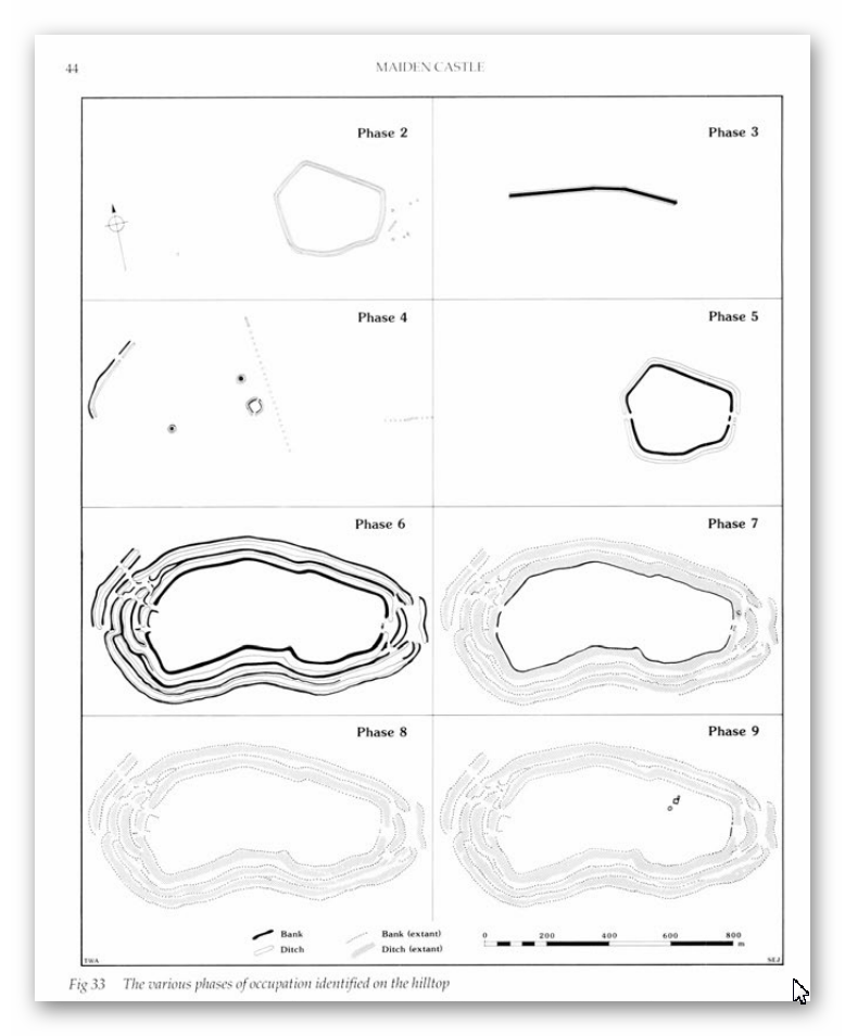
Phases of Maiden Castle – The Logistical Impossibility of Defending Maiden Castle

Water Supply Challenges

One of the most critical logistical requirements is water. For Maiden Castle’s estimated population of 1910 individuals (including soldiers, support staff, and their families), about 745,950 litres of water would be needed monthly – this equates to at least 15 large deep wells. Historical accounts and archaeological evidence must show substantial water sources, such as wells or water management systems, to support this figure.

The Missing Wells

However, LiDAR scans, which are highly effective at identifying even minute changes in landscape and topography, have not revealed evidence of the necessary 15 wells. The absence of such crucial infrastructure raises significant doubts about the sustained military use of Maiden Castle at the scale often depicted in historical narratives.

Livestock and Food Production

The logistics of feeding a large garrison would also involve livestock management. Approximately 516 animals (2 -3 acres) would be required monthly for the meat supply alone, necessitating extensive grazing areas, enclosures, and management systems, none of which have been identified in the LiDAR data.

Manufacturing Weapons and Armour

A garrison’s effectiveness also depends on its ability to arm itself. Producing weapons and armour would require workshops, forges, and considerable quantities of raw materials, along with skilled craftsmen. The fort’s defence would necessitate a continuous supply of spears, arrows, and protective gear. Yet, there is no archaeological evidence of such industrial activity on a scale that the theoretical number of defenders would demand.

The Logistical Impossibility of Defending Maiden Castle
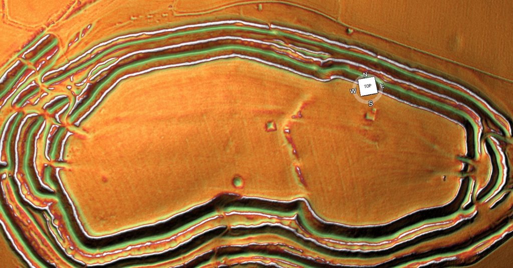
Maiden Castle LiDAR Image -The Logistical Impossibility of Defending Maiden Castle

Lack of Residential Structures

Moreover, the housing needs (min. 250 structures) for a population this large would be substantial. If Maiden Castle were as populated and active as theorised, we would expect to find numerous residential structures. Yet, archaeological digs and surveys, including LiDAR imaging, have only identified a handful of houses to date, casting further doubt on the historical narratives of a densely populated fort.

The Problem of Evidence

The discrepancy between the logistical requirements for sustaining a significant military presence at Maiden Castle and the lack of physical evidence supporting such activities presents a profound challenge to traditional interpretations. The absence of infrastructure necessary for water, food, and weapon production suggests that either Maiden Castle was not primarily a military fort at the scale often imagined or our understanding of its historical role needs significant revision.

Alternative Theories

It’s possible that Maiden Castle served a different function, perhaps more to do with trading and hence the massive ditches that would have been moated in the past rather than a continuously manned military fortress. This would align more closely with the archaeological evidence, or lack thereof, and help explain the absence of extensive military infrastructure.

Conclusion

The enigma of Maiden Castle reflects the complexities of archaeological interpretation and the importance of integrating new technologies like LiDAR with traditional archaeological methods. The emerging picture is that the logistical viability of Maiden Castle as a large-scale military fortress is not supported by the physical evidence currently available. This case serves as a reminder of archaeological research’s dynamic and evolving nature, where new tools can significantly alter our understanding of the past.

Final Thoughts

As we uncover more about ancient sites like Maiden Castle, it is crucial to remain open to new interpretations and theories that might differ significantly from traditional views. The absence of evidence is not evidence of absence. Still, it does require us to question and reassess historical assumptions, ensuring our understanding of the past is as accurate as possible.

Further Reading

For information about British Prehistory, visit www.prehistoric-britain.co.uk for the most extensive archaeology blogs and investigations collection, including modern LiDAR reports.  This site also includes extracts and articles from the Robert John Langdon Trilogy about Britain in the Prehistoric period, including titles such as The Stonehenge Enigma, Dawn of the Lost Civilisation and the ultimate proof of Post Glacial Flooding and the landscape we see today.

Robert John Langdon has also created a YouTube web channel with over 100 investigations and video documentaries to support his classic trilogy (Prehistoric Britain). He has also released a collection of strange coincidences that he calls ‘13 Things that Don’t Make Sense in History’ and his recent discovery of a lost Stone Avenue at Avebury in Wiltshire called ‘Silbury Avenue – the Lost Stone Avenue’.

Langdon has also produced a series of ‘shorts’, which are extracts from his main body of books:

The Ancient Mariners

Stonehenge Built 8300 BCE

Old Sarum

Prehistoric Rivers

Dykes ditches and Earthworks

Echoes of Atlantis

Homo Superior

(The Logistical Impossibility of Defending Maiden Castle)

Other blogs

s

t

Beyond Stone and Bone: Rethinking the Megalithic Architects of Northern Europe

Beyond Stone and Bone – Archaeology often presents the megalithic structures of Northern Europe as enigmatic remnants of the past, but traditional interpretations of their purposes—defensive or territorial—are increasingly challenged by new research. These ancient monuments, including Stonehenge and Silbury Hill, required a level of logistical and communal organisation akin to modern engineering feats like the Channel Tunnel, suggesting sophisticated, large-scale cooperation among prehistoric societies. This blog post explores how regular trading and the use of established transportation networks likely supported such monumental projects. It argues that the labour force involved was large and part of a highly structured society, possibly operating under an early compensation system for their colossal efforts. As we delve deeper into these ancient marvels, we uncover a society that may have been as advanced and cooperative as any known civilisation, revealing a new appreciation for the capabilities and ingenuity of our ancestors – Beyond Stone and Bone: Rethinking the Megalithic Architects of Northern Europe

Beyond Stone and Bone: Rethinking the Megalithic Architects of Northern Europe

Archaeologists and enthusiasts are deeply familiar with the fact that Northern Europe is scattered with megalithic structures whose origins and purposes often evade complete understanding. This reality leaves us grappling with many theories and concepts, which together form what we commonly refer to as archaeology—a field deemed a social science due to its reliance on less concrete evidence. It attempts to elucidate these enigmatic monuments to the public, although not always convincingly.

This method of discovery and exchange of information frequently falls short of adding credibility to archaeology. It often seems that these ancient monuments’ true essence and purpose are either overlooked due to a lack of knowledge or deliberately obscured, perhaps to deepen the mystery and intrigue that archaeologists have long struggled to resolve.

Beyond Stone and Bone: Rethinking the Megalithic Architects of Northern Europe

It is broadly recognised that constructing mammoth monuments like Stonehenge, Avebury, and the world’s largest prehistoric artificial hill, Silbury Hill, would have required millions of person-hours. This acknowledgement points to the involvement of a substantial labour force. What often goes unmentioned, however, is the intricate logistics such an undertaking entails. This level of organised labour is akin to contemporary projects like the construction of the Channel Tunnel, which demanded a consensus across an entire nation and significant economic contributions through taxes to sustain a workforce over years of construction.

Moreover, this construction process could only have been achieved through regular trading with the region’s inhabitants. Crucially, when additional human resources were required for massive projects, the same trading routes and boats that facilitated commerce were used to transport workers to these far-off construction sites.

Another significant oversight in mainstream archaeological discourse is the discussion of the logistics behind constructing these structures. The prevailing narrative might suggest that a mere handful of individuals could erect a stone circle or a burial mound using stones that cumulatively weigh hundreds of tonnes—a feat far beyond the capacity of even several strong individuals.

Long Barrows - Europe
Long Barrows – Europe

The tens of thousands of these monuments and earthworks point to an effort comparable in scale and cultural significance to our own Industrial Revolution. It must have been a collective endeavour spanned vast areas of Northern Europe, akin to a joint cooperative behaviour seen in societies united for a common good. This required extensive transportation networks to move stones over hundreds of miles, along with sophisticated communication methods.

Such a monumental task could only have been possible with a communal reward system, where individuals were compensated for their efforts—perhaps a precursor to modern monetary systems that allowed them to obtain luxury items in return for their labour. This system underscores these ancient societies’ cooperative and organised nature, which is often understated or overlooked in traditional archaeological narratives.

The uniqueness of the megalithic culture in history is profound and unparalleled until the advent of the Industrial Revolution. While the Romans may have produced more sophisticated statues and buildings, their constructions were much smaller. This suggests that, in some ways, the prehistoric culture of Northern Europe was as significant, if not more so, than the Roman Empire, especially when considering the breadth of territories they influenced.

To truly understand the scope of this ancient culture, we must step back and apply our analytical skills and logic. This involves identifying who these people were, where they went in our historical timeline and the true extent of their cultural influence. Only by doing so can we begin to uncover the natural history of these lands, rather than settling for half-baked ideas that gloss over the transformative impact and scale of this culture that still resonates five thousand years after they vanished.

By questioning the simplistic explanations currently accepted, we might discover that these ancient builders were part of a highly sophisticated society, operating with an efficiency and scale of cooperation that rivals even the most advanced civilisations of classical antiquity.

Further Reading

For information about British Prehistory, visit www.prehistoric-britain.co.uk for the most extensive archaeology blogs and investigations collection, including modern LiDAR reports.  This site also includes extracts and articles from the Robert John Langdon Trilogy about Britain in the Prehistoric period, including titles such as The Stonehenge Enigma, Dawn of the Lost Civilisation and the ultimate proof of Post Glacial Flooding and the landscape we see today.

Robert John Langdon has also created a YouTube web channel with over 100 investigations and video documentaries to support his classic trilogy (Prehistoric Britain). He has also released a collection of strange coincidences that he calls ‘13 Things that Don’t Make Sense in History’ and his recent discovery of a lost Stone Avenue at Avebury in Wiltshire called ‘Silbury Avenue – the Lost Stone Avenue’.

Langdon has also produced a series of ‘shorts’, which are extracts from his main body of books:

The Ancient Mariners

Stonehenge Built 8300 BCE

Old Sarum

Prehistoric Rivers

Dykes ditches and Earthworks

Echoes of Atlantis

Homo Superior

Other Blogs

s

t

Mesolithic River Avon

Rivers were higher in the past – Now UPDATED here: https://prehistoric-britain.co.uk/case-study-river-avon

At the outset, the clay-with-flints, a vestige of ancient weathering and erosion, stands as a testament to the relentless forces of nature that sculpted the landscape. Born from the remnants of Palaeogene sediments and the dissolution of chalk, these deposits serve as silent witnesses to the Pleistocene’s cold embrace. Their presence on the hilltop flats signifies a chronological anchor, predating the rhythmic succession of river terraces that stitch the valley’s quilt. (The Mesolithic River Avon)

Rivers were higher in the past (The Mesolithic River Avon)

As one descends the slopes, a mosaic of older head deposits unfolds, their genesis tied to the ancient processes of solifluction and solution. These sediments, bound to the clay-with-flint, narrate a tale of gradual descent and transformation, shaping the valley’s upper reaches with a subtle, yet profound, hand.

Further down the valley, the narrative evolves with the introduction of head gravel, gravelly head, and head deposits. These characters in the valley’s story are borne of fluvial transport, hill wash, hill creep, and solifluction—agents of change that have, over millennia, contributed to the valley’s sculptural form. The river terraces, numbering fourteen, ascend like steps from the valley floor, each a plateau from which to view the passage of time. The highest terraces, perched up to 100 meters above the valley, offer a broad vista extending 12 kilometers across, while the lower terraces, more intimate in their proximity to the present-day river, mark the recent chapters of geological history.

The consistency of thickness across these terraces speaks to a dynamic equilibrium of erosion and deposition, influenced by sediment overloading and tributary contributions. This interplay suggests a complex narrative of landscape evolution, one not solely dictated by the simplistic rhythm of Marine Isotope Stage cycles but enriched by a multifaceted process of lateral erosion and sediment redeposition.

Amidst this discussion of terraces and quaternary deposits, the narrative briefly diverges to contemplate the pre-Quaternary geology, where terraces from the River Avon linger in the Hampshire basin, their ages enshrouded in mystery. The challenges of dating these terraces, and by extension, understanding the full scope of the valley’s geological history, are underscored by recent findings that question traditional dating methods. Such inquiries not only deepen the mystery but also invite a reevaluation of our understanding of the Earth’s past.

Thus, we are reminded that the study of the Avon valley’s quaternary deposits is not merely an academic exercise but a profound exploration of the human quest for knowledge and understanding. It is a journey that connects us to the very essence of the natural world, revealing the intricate interplay of forces that have shaped not only the valley but also the broader tapestry of Earth’s geological history. (The Mesolithic River Avon)

Figure 5 - OSL Results Avon River (The Mesolithic River Avon)
Figure 5 – OSL Results Avon River
(The Mesolithic River Avon)

The intriguing findings presented in the diagrams regarding Optically Stimulated Luminescence (OSL) dating within the Avon valley unearth a complex narrative of sediment deposition and geological processes that challenges traditional understandings. The OSL results, as depicted in Figure 5, illuminate the temporal relationship between terrace formations and Marine Isotope Stages (MIS), while Figure 6, based on a three-dimensional model constructed from borehole data, offers a visual cross-section of the valley’s superficial geology.

The OSL ages for terraces T10 through T7, indicating deposition during or before MIS10/9, including the Last Glacial Maximum (LGM), suggest a timeline that not only aligns with but also refines previously established chronological frameworks. This refinement has significant implications for interpreting the archaeological record associated with Terrace T7 and recalibrating regional uplift and incision rates, which are crucial for understanding landscape evolution over geological timescales.

However, the apparent inconsistencies in the OSL dating results, particularly the dating of Terrace T7 before Terrace T10 and the identification of a Loess Terrace laid during the LGM, introduce a paradox into the sedimentary record. These anomalies challenge the linear progression implied by the terrace hypothesis that has guided interpretations of the valley’s geological history.

The highest terrace, T10, positioned at 102 meters above ordnance datum (OD) as illustrated in Figure 6, spans an unexpectedly broad temporal range of over 200,000 years, according to OSL dating. This finding disrupts the presumed chronological order, especially when juxtaposed with the dating of Terrace T7 at 58 meters OD, which, perplexingly, predates T10. Additionally, the Loess Terrace, situated at 77 meters OD and undifferentiated in the terrace sequence, laid down during the LGM, along with Terrace T4, which harbors the youngest dates, further complicates the scenario.

These results hint at a more intricate story of terrace formation and sediment deposition than previously thought. The seeming randomness and inconsistencies in the dating challenge the traditional terrace hypothesis and suggest that other factors, perhaps related to climatic variations, tectonic activities, or both, played significant roles in shaping the valley’s geomorphology.

The evidence points to a dynamic and possibly non-linear process of terrace formation, where episodes of sediment deposition were influenced by a combination of environmental conditions, rather than a simple chronological succession. This complexity underscores the need for a reassessment of the methods and models used to date and interpret terrace formations, advocating for a more nuanced understanding of the interplay between geological processes and climate change over the Pleistocene.

Thus, while the OSL dating provides valuable insights into the timing of terrace deposition, it also raises critical questions about the reliability of traditional chronological frameworks and the factors driving landscape evolution in the Avon valley. These findings invite further investigation and a reevaluation of existing hypotheses, highlighting the ongoing dialogue between past and present in the quest to decipher Earth’s geological history.

Figure 6- Avon River Terrace Levels - Avon River
Figure 6- Avon River Terrace Levels – Avon River
(The Mesolithic River Avon)

The authors’ observations highlight significant discrepancies and anomalies in the OSL dates that raise questions about the method’s reliability in certain contexts, particularly when compared to other dating methods like radiocarbon dating. These discrepancies are not merely academic curiosities; they fundamentally challenge our understanding of the temporal and environmental context in which these sediment layers were deposited.

The attempt to explain the notable discrepancy in the age estimates of Terrace T4 across different locations within the Avon valley suggests that sediment reworking due to recent fluvial processes or the presence of compound terraces exhibiting different depositional behaviors might be responsible. This acknowledgment of variability within the depositional environment underscores the dynamic nature of fluvial landscapes and the complexity of accurately dating such contexts.

The variability in OSL dates for samples taken at the same soil level (e.g., GL14039, GL14041, GL14038, GL14040) further complicates the narrative. The presence of nearly contemporaneous dates within error limits, juxtaposed with the significantly different sedimentation rates observed just below the topsoil, suggests that the depositional history of the Avon valley is more nuanced than previously understood. These findings indicate that relying solely on visual stratigraphy for dating purposes can lead to inaccuracies, reinforcing the need for a multi-methodological approach to construct a reliable chronological framework.

The comparison between OSL and radiocarbon dating, as discussed in the Gaigalas (2000) study, exemplifies the potential for significant age discrepancies between different dating methods. The observation that OSL dates can be substantially older than their radiocarbon counterparts highlights the need for caution and cross-validation when interpreting chronological data, especially in contexts where sediment exposure and reworking may have occurred.

The discussion of Holocene river flooding and its impact on the dating of river terraces introduces an additional layer of complexity. Flooding events can lead to the deposition of silt and other materials that obscure the original depositional sequence, potentially leading to out-of-sequence terrace dates. This phenomenon complicates attempts to use uplift modeling or the Palaeolithic record as reliable chronological markers, as evidenced by the discrepancies in age estimates for Terrace T7.

The passage concludes by emphasizing the potential of terrace deposits to provide a valuable chronological framework, albeit one that must be approached with caution. By integrating chronometric age control with detailed modeling of deposit height and thickness, researchers can gain a more nuanced understanding of the Avon valley’s landscape evolution. This approach not only enhances our interpretations of past hominin landscape use but also improves the predictive modeling of Palaeolithic sites. The challenges and discrepancies encountered in OSL dating underscore the importance of adopting a holistic and critically engaged approach to understanding the geological past, one that acknowledges the inherent complexities and uncertainties of dating dynamic fluvial landscapes.

Finally, archaeologists and geologists resist the fact that the river Avon was in Stonehenge Bottom during the Mesolithic and Neolithic period.  They insist that there is no evidence in the form of Alluvium or Colluvium in sufficient quantities to support my hypothesis.  This objection has a simple solution as Julian Richard’s suggested in his book ‘The Stonehenge Environs Project’: “colluvium sediments may have been removed or thinned by the action of seasonal streams or higher water tables in the past”. 

Macklin, as we have now seen in this section has identified over one hundred Holocene river floods, twelve of which lasted hundreds of years, that would have contributed to this lack of alluvium or colluvium at Stonehenge Bottom.  Moreover, the sources of the rivers that lay this sediment over the centuries of water flow, rely on massive precipitation entering the rivers, cutting through rocks and valleys making them flow at extreme levels which create this erosion and consequential sediment. However, the source of Palaeochannel water are natural springs found locally underground and therefore would not contain the same alluvium levels as active flowing rivers – resolving this dilemma.

Model of the number of flooded rivers in Britain - River Avon
Model of the number of flooded rivers in Britain – River Avon

UPDATE

More Empirical Evidence of Post-Glacial Flooding and a Flooded Stonehenge

River Avon River Terraces

 Prehistoric Levels and Widths for the River Avon

Take a close look at this illustration. It is not speculation, it is empirical science — mapped and measured river terraces from the Avon Valley, published in Egberts (2016), Pleistocene terrace formation and the Quaternary evolution of the Hampshire Basin, Bournemouth University.

What are we looking at?

  • These are the terrace steps cut by the River Avon over multiple glacial–interglacial cycles.
  • Each “T-level” marks a former stable floodplain where the river held its height for centuries, often millennia.
  • The heights are measured in metres OD (Ordnance Datum) and tied to known quarry and pit sites (e.g. Hatchet Gate Farm, Woodgreen, Somerley, Ashley).

💧 How much bigger was the Avon?

  • Today, the river meanders with a width of just ~50 m near Salisbury.
  • At its maximum (T11), the Avon floodplain stretched ~12 km across.
  • That is ~240 times wider than the river today.

🌊 What does this mean for Stonehenge?

  • Phase 1 of Stonehenge (Car Park Postholes) sits on T9 (~90 m OD).
  • Phase 2 (ditch, Aubrey Holes, bluestones) cuts into T8 (~75 m OD).
  • The terraces show that the palaeochannel not only flooded up to the old car park, but at times overtopped the entire Stonehenge site.

📐 Why this matters:

  • Terraces are not theory — they are empirical geomorphological evidence.
  • They prove that the Avon has flooded to multiple levels, sometimes far higher than the monument itself.
  • This is not about “if” water could reach those heights — the terraces prove it already has, repeatedly, over many Ice Age cycles.

So when critics dismiss the role of high water tables or argue “the site couldn’t have been wet,” they are ignoring the most basic geological record in front of us. The terraces are the diary of the river — written in gravel, chalk, and silt — showing that water rose and fell, over and over again.

👉 The real question is not if Stonehenge was surrounded by water. It is when, and how many times it happened during its long prehistory.

More information on the River Avon can be found at: https://youtu.be/j5LJ2sGcKOA

Further Reading

For information about British Prehistory, visit www.prehistoric-britain.co.uk for the most extensive archaeology blogs and investigations collection, including modern LiDAR reports.  This site also includes extracts and articles from the Robert John Langdon Trilogy about Britain in the Prehistoric period, including titles such as The Stonehenge Enigma, Dawn of the Lost Civilisation and the ultimate proof of Post Glacial Flooding and the landscape we see today.

Robert John Langdon has also created a YouTube web channel with over 100 investigations and video documentaries to support his classic trilogy (Prehistoric Britain). He has also released a collection of strange coincidences that he calls ‘13 Things that Don’t Make Sense in History’ and his recent discovery of a lost Stone Avenue at Avebury in Wiltshire called ‘Silbury Avenue – the Lost Stone Avenue’.

Langdon has also produced a series of ‘shorts’, which are extracts from his main body of books:

The Ancient Mariners

Stonehenge Built 8300 BCE

Old Sarum

Prehistoric Rivers

Dykes ditches and Earthworks

Echoes of Atlantis

Homo Superior

For active discussions on the findings of the TRILOGY and recent LiDAR investigations that are published on our WEBSITE, you can join our and leave a message or join the debate on our Facebook Group.

Other Blogs

s

t