The book ‘The Car Dyke LiDAR Atlas’ presents a thorough investigation of the Car Dyke, a large ancient waterway in Britain. Using LiDAR technology, the author argues that the Dyke is much older than previously thought, dating back to the Mesolithic/Neolithic periods, and was likely used for transportation and water management rather than simply as a Roman drainage channel or defensive barrier. The book features detailed maps and analysis of the Dyke’s construction and course, including insights into the surrounding landscape and archaeological finds, to support the author’s conclusions.
Car Dyke Transcript
Welcome in deep divers ready to get our hands dirty.
Always up for a challenge, especially if it involves rewriting history.
Today we’re diving headfirst into the heart of eastern England.
Sounds intriguing. What’s on the agenda? Roman ruins, hidden treasure.
Even better, we’re tackling a seemingly unassuming ditch known as Car Dyke
A ditch. You’ve piqued my curiosity. There’s got to be more to it than meets the eye.
Oh, absolutely. This isn’t just any ditch car. Dyke has been hiding in plain sight for centuries, mislabeled as just another Roman canal.
I’m sensing a butt coming,
But thanks to some seriously cool tech. Lidar, our car dyke secrets are finally coming to light
Lidar for our listeners who aren’t familiar, it’s like giving archaeologist X-ray vision, right? Seeing beneath the surface without even lifting a shovel.
You got it. And that’s where Robert John Langdon’s work comes in his Car Dyke Atlas uses lidar to paint a whole new picture of this ancient waterway.
Okay. I’m hooked. We’ve got cutting edge technology and a fresh perspective on what we thought we knew. Let’s dive in.
Let’s start with the biggest bombshell car Dyke’s actual length. We used to think it was around 85 miles long. Not too shabby, right?
Impressive for sure.
Hold on to your hats, because LiDAR revealed it’s actually a whopping 103 miles long.
Well, that’s longer than any other known dyke in Britain. Talk about a game changer.
Yeah,
Suddenly we’re not talking about a local project. This suggests a level of planning and coordination that makes you rethink everything.
And that’s just the beginning. Remember those assumptions about car dyke being Roman? Well, LiDAR revealed something interesting. Instead of those ruler straight lines. The Romans loved some sections. Let’s just say they get a little. Wiggly. Not exactly the precision engineering we associate with Rome.
So not just longer, but potentially much older. This is where things get really interesting.
These wiggly sections, what makes them so special?
They often line up perfectly with ancient shorelines and natural springs. Features you wouldn’t know about without Lidar’s ability to see underground. It suggests construction happened when the Fens were a much wetter, wilder place.
So instead of battling the landscape like the Romans might have, these early builders worked with nature using their knowledge of water flow and natural springs to their advantage. Talk about ingenuity. It really highlights their adaptability and deep understanding of the environment.
It’s like comparing two completely different engineering philosophies, reflecting not just changing needs, but how technology evolved over thousands of years.
Absolutely. And that contrast is crystal clear when you look at Langdon’s maps, the early sections hugging the high ground, ensuring that natural flow from the springs,
And then the later Roman sections just slicing straight through.
It’s like they said, we’re the Romans, we build in straight lines.
But what’s amazing is how those early sections might have worked, just like modern canals, but without using locks, they relied on those natural gradients and carefully chosen routes to manage the flow of water.
Now that’s some clever engineering. Speaking of which, how did LiDAR help uncover these subtle differences in construction?
Imagine looking at an aerial photo of a dense forest. You see trees, right? But not what’s below. LiDAR strips away that canopy. It revealed subtle changes in elevation and vegetation that hinted at these different construction phases.
So it’s like they left us a hidden message written in the very landscape itself, and we finally have the tools to decipher it.
We’ve got this massive waterway, potentially pre-Roman, showing a deep understanding of water management. This can’t just be about irrigation, right? What was its purpose?
That’s the million dollar question. And it forces us to rethink our assumptions about life in prehistoric Britain. If these early sections of Car Dyke really do predate the Romans,
Which the lidar suggests they do.
Exactly. Then we’re talking about a society far more advanced and interconnected than we ever imagined.
This wasn’t just a weekend project. It was a mammoth undertaking requiring incredible coordination and collaboration, and that just wasn’t thought possible for people of that era.
It really flips the script on how we view them, doesn’t it? They weren’t just surviving, they were thriving. And Car Dyke, that just might be the key to understanding how.
We’re back. Deep divers. Did you catch your breath yet? After that last revelation?
Honestly, I’m still wrapping my head around it. It really makes you wonder what else we’ve missed when it comes to our ancient ancestors.
Right? And get this, the plot thickens. It turns out Car Dyke might challenge one of our biggest assumptions about ancient dykes in general.
Okay. I’m listening. What assumption are we shattering today?
Well, we usually think of these huge ditches as, you know, defensive barriers. Like drawing a line in the sand. You stay over there. We’ll stay over here.
Yeah, like a giant keep out sign. But Car Dyke doesn’t quite fit that mould, does it?
Not one bit. This network, especially with those older sections connecting to lost shorelines. And get this paleo channels, they’re basically ancient dried up riverbeds. Points to something way more interesting.
So instead of walls, we’re talking about prehistoric highways. Like a way to actually connect with other settlements.
Bingo. Think about it. Moving goods, sharing ideas, all made possible by an intricate network of waterways. Long before the Romans ever marched in with their straight roads, the Britons were cruising along these waterways. And speaking of moving things,
You’re thinking about Stonehenge, aren’t you?
Busted. But seriously, those massive stones, Avebury, all of that moving them has always been a logistical head scratcher. Could Car Dyke hold the answer?
It’s a mind blowing thought, isn’t it? Imagine, instead of back breakingly dragging those stones over land, they were floating them along this intricate waterway system. So much more efficient and less disruptive. Picture a flotilla of prehistoric boats navigating these channels, those iconic stones on board not just cargo, but symbols of shared beliefs, maybe even religious ideas. It’s a completely different picture of prehistoric Britain, isn’t it?
Completely. It makes you realise how much we may have underestimated them. But okay, before we get too carried away, let’s bring it back to the data. Langdon doesn’t just stop it, at Lidar. He goes full on detective, analysing the objects found along car dyke. What he find.
This is where the statistical analysis comes in. Langdon looked at how likely it was to find such a large cluster of artefacts from specific eras. The Mesolithic, Neolithic and Bronze Age all along the Dyke.
Don’t keep us in suspense.
Let’s just say the results were, statistically speaking, through the roof. Way too many artifacts to be some happy coincidence.
So not just a few random things people dropped, but evidence of something much bigger going on.
Precisely. It strongly indicates that stretches of car dyke were hives of activity long before the Romans showed up.
Okay, so now we have this picture. A huge ancient network of waterways possibly used for trade transportation. Who knows what else. Then enter the Romans, Masters of engineering and straight lines. What did they make of this already existing infrastructure?
That’s the fascinating part. As ingenious as the Romans were, they were also incredibly practical. They saw the brilliance in those wiggly, meandering waterways, how they follow the natural lay of the land. And they rolled with it.
So a bit of where the Romans, we do things our way, but also a touch of, hmm, these prehistoric folks were on to something.
Exactly. They incorporated the preexisting knowledge into their own plans. You can actually see this in Car Dyke today. Some sections are those laser street Roman roads bear hair waterways, while others wiggle and wind following those ancient, more organic roots.
Talk about a fusion of styles. It speaks to Roman ingenuity, but also a respect for the people who came before. But this begs the question why were the Romans so drawn to Car Dyke in the first place? Was it just strategic, or was there more to it? Langdon suggests this waterway may have been a key factor in the economy back then. Could we go as far as to call it a prehistoric economic engine?
So we’re back. Last we left off, we were trying to wrap our heads around car dyke being this, well, prehistoric economic powerhouse, a bit of a bold statement that you think maybe, but think about it. What are the key ingredients for a thriving economy? You need resources, sure, but also the means to move them around, to connect, to exchange. Not just goods, but ideas. And that’s where car dyke comes in.
So it wasn’t just about moving stuff from point A to point B, but actually creating a system for growth and innovation.
Exactly. Car Dyke wasn’t just a ditch. It was an artery, a network of waterways breathing life into these settlements that might have otherwise been isolated. Imagine the possibilities. Suddenly you have specialized skills. Trade routes, a breeding ground for new ideas. All thanks to this intricate water system.
Okay, I’m starting to see the bigger picture, but what evidence did Langdon find that really supports this prehistoric Silicon Valley theory?
Well, he points to the clusters of specific artifacts found along car dyke tools, pottery, remnants of early metalworking, all concentrated in ways that suggest something beyond just your average everyday life.
More like specialized workshops, right? Taking advantage of the waterway, both to get their raw materials and then ship out whatever they created.
Precisely. And it makes you look at those wiggly sections, those seemingly less efficient paths in a whole new light.
They weren’t just following the terrain, they were strategically connecting these hubs of activity.
Exactly. Plus, we can’t forget the sheer scale of this thing. Building and maintaining 103 mile waterway, even with prehistoric tools, would have taken massive coordination and organization.
We’re talking next level project management, leadership, planning, resource allocation. It boggles the mind, not to mention the exchange of knowledge that must have happened along the way.
Right? Think about all those different groups coming together, each with their own skills and knowledge. That kind of collaboration, that cross-pollination of ideas, it’s the perfect recipe for innovation.
So not just an economic engine, but a melting pot of ideas and innovation. It’s amazing to think that this simple ditch might hold the key to understanding how complex societies developed in prehistoric Britain.
It really makes you wonder what else is still out there, hidden just beneath the surface, waiting for us to uncover it,
And to think all it took was a fresh perspective, a healthy dose of curiosity, and of course, the magic of Lidar.
Who knows what other mysteries are waiting to be revealed
To all you deep divers tuning in. If this exploration of Car Dyke has taught us anything, it’s that history is full of surprises. So keep questioning, keep exploring. And who knows, maybe you’ll make the next big discovery. Until next time, happy digging.
Pillow mounds have traditionally been interpreted as medieval rabbit warrens, but recent archaeological discoveries suggest a far older and more significant role tied to Bronze Age cremation rituals. Evidence uncovered in recent excavations, combined with historical parallels from other sites, points to these mounds being used for cremation or as places for the burial of ashes, later repurposed during the medieval period for rabbit farming. Below, we explore the evidence from recent excavation reports that supports this hypothesis, showing how discolored soil, charcoal remains, and burial practices align with Bronze Age funerary rituals.
Excavation Reports Supporting the Cremation Hypothesis
1. Linga Fiold, Orkney (Bronze Age Cremation Evidence)
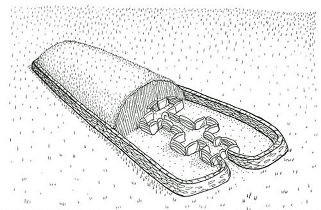
Excavations at Linga Fiold on Orkney provide a compelling comparison to the pillow mounds found at Dartmoor. At Linga Fiold, archaeologists uncovered cremation pyres beneath mounds, with clear evidence of burnt earth and charcoal, alongside cremated human remains. These pyres were constructed directly on the ground with minimal superstructures, similar to the earthworks observed in Dartmoor’s pillow mounds.
The soil beneath the mounds at Linga Fiold showed clear signs of discoloration, indicating that it had been exposed to high temperatures from intense fires. Charcoal deposits and ash layers found in the soil provide direct evidence of burning. These features closely resemble those found in some pillow mounds on Dartmoor, where discolored soils and charcoal layers have been interpreted as remnants of funeral pyres.
In the Linga Fiold excavation, the mound structure and the associated cremated remains suggest a ritualistic function tied to Bronze Age funerary practices, supporting the idea that these mounds were not just for rabbit warrens, but rather cremation sites. The discolored soil and layers of burnt material found at Dartmoor reflect this same ritual use of fire, hinting at a broader cultural practice.
2. Trowlesworthy Warren, Dartmoor (Burnt Layers and Soil Discoloration)
Trowlesworthy Warren is a massive Prehistoric Site with no barrows – Pillow Mounds: A Bronze Age Legacy of Cremation?
The Trowlesworthy Warren site on Dartmoor is home to over 64 pillow mounds. Excavations of these mounds have revealed significant evidence of soil discoloration, similar to what has been found at recognized Bronze Age burial sites. The soil under some of these mounds has distinct layers of charcoal and burnt earth, suggestive of cremation pyres.
During the excavation of one mound, archaeologists discovered a layer of charcoal that radiocarbon dating placed in the Bronze Age, well before the introduction of rabbits to Britain. The charcoal remains were associated with human activity, indicating that fires had been deliberately set. The burnt soil beneath the mound is consistent with the intense heat required for cremation. The placement of these mounds near paleochannels further supports the theory of ritualistic use, as water often played a key role in Bronze Age funerary rites.
3. Bryn Cysegrfan, Wales (Evidence of Cremation Under Mounds)
At Bryn Cysegrfan in Wales, excavations revealed mounds that were initially thought to be medieval earthworks but were later confirmed to be prehistoric. These mounds contained burnt soil, layers of charcoal, and evidence of human cremation. The discovery of cremated human bones beneath the mounds helped redefine their purpose as Bronze Age funerary structures, challenging their original classification as medieval agricultural features.
The burnt material in these mounds mirrored the findings at Dartmoor, where charcoal and burnt soil were found in layers under the mounds. At Bryn Cysegrfan, the cremated remains were intentionally buried beneath a memorial mound, built in much the same way as pillow mounds. This reinforces the idea that the Dartmoor pillow mounds could have similarly been constructed as memorials to cremated individuals.
4. Bronze Age Orkney (Burnt Soils and Ritual Use of Fire)
Further support for the cremation hypothesis comes from Bronze Age sites in Orkney, where archaeologists have found extensive use of fire in burial practices. Excavations at Mousa Broch revealed cremation sites beneath mounds, where the soil had been heavily discolored by intense heat. Layers of charcoal and burnt earth are common across these sites, suggesting a widespread ritual use of fire in burial practices.
The charcoal layers and burnt soil found at Trowlesworthy Warren bear a striking resemblance to the cremation pyres of Orkney. The burning of bodies and subsequent burial of ashes within or beneath the mounds are consistent with the Bronze Age tradition of constructing mounds as funerary memorials.
5. Radiocarbon Dating Evidence of Bronze Age Activity
At several of these sites, including Trowlesworthy and Bryn Cysegrfan, radiocarbon dating has provided clear evidence that the burnt material and soil discoloration found beneath the mounds dates back to the Bronze Age. This further suggests that these structures were originally built as funerary mounds or cremation sites, long before they were repurposed as rabbit warrens in the medieval period.
The layers of burnt material and charcoal deposits found beneath some of the Dartmoor mounds have been dated to 2000-1500 BCE, well within the Bronze Age. These findings, alongside the discolored soils, indicate that the mounds were used for funerary practices long before their presumed medieval use.
Comparing to the Pillow Mounds
Multiple Pillow Mounds are located next to Prehistoric Site (Bronze Age) and 30 – 40 miles away from any medieval town
The evidence from Bryn Cysegrfan, Orkney, and other Bronze Age cremation sites shows a clear pattern of burnt soil, charcoal remains, and cremated bones beneath mounds that were later misinterpreted as agricultural features. This is exactly the scenario unfolding with pillow mounds at sites like Trowlesworthy Warren. The combination of burnt layers, discolored soil, and radiocarbon dating suggests that these mounds served as cremation sites or memorial mounds long before their possible repurposing in the medieval period.
The Cultural Significance of Cremation Mounds
In the Bronze Age, cremation was a common funerary practice across Britain. The dead were often burned on funeral pyres, and the ashes were either scattered or buried under mounds. These mounds served as memorials, marking the resting place of the deceased in a highly visible way. The use of fire in these rituals was symbolic, representing the passage of the soul into the afterlife.
The presence of pillow mounds in landscapes associated with prehistoric activity, particularly near paleochannels and other natural features, suggests that they were part of a larger ritual landscape. The burnt material and discolored soil found beneath many of these mounds are consistent with the Bronze Age practice of constructing cremation mounds, rather than the later rabbit farming explanation.
Conclusion: Reinterpreting Pillow Mounds as Bronze Age Cremation Sites
The growing body of archaeological evidence, including excavation reports from sites like Bryn Cysegrfan, Linga Fiold, and Trowlesworthy Warren, increasingly supports the hypothesis that pillow mounds are not merely medieval rabbit warrens but may have originally been used for Bronze Age cremation practices. The presence of burnt soil, charcoal remains, and cremated bones beneath these mounds, combined with radiocarbon dating to the Bronze Age, suggests that these structures served as cremation pyres or burial mounds long before their potential repurposing in later periods.
This reinterpretation not only challenges the traditional understanding of pillow mounds but also opens up new perspectives on the ritual use of fire and burial practices in Bronze Age Britain. Further excavation and study of these mounds could provide even more evidence to support their role as funerary monuments, adding to the rich tapestry of prehistoric ritual landscapes across the British Isles.Pillow mounds have long been identified by archaeologists as rabbit warrens—structures built during the medieval and post-medieval periods to manage rabbit populations for fur and meat. These long, low earthworks, often equipped with drainage ditches, were thought to provide ideal conditions for rabbits to burrow and breed. The case of Trowlesworthy Warren on Dartmoor is a well-known example, where there are now believed to be 64 pillow mounds spread across a 5 km area. However, recent archaeological findings and a closer look at the logistics of large-scale rabbit farming in this landscape challenge the established interpretation.
This blog will explore the traditional reasons archaeologists classify pillow mounds as rabbit warrens while presenting new evidence—including the scale of the site, environmental challenges, and the discovery of radiocarbon-dated materials—that casts doubt on this interpretation.
Previous Blog
1. Traditional Interpretation: Rabbit Warrens
The identification of pillow mounds as rabbit warrens originates from medieval records describing the practice of rabbit farming, introduced to Britain by the Normans after the 11th century. Rabbits were a valuable resource for both their meat and fur, and the creation of controlled environments for breeding—called warrens—became widespread. Pillow mounds, typically rectangular and accompanied by drainage ditches, resemble natural rabbit burrows and were strategically placed in areas unsuitable for crop farming, such as Dartmoor.
At Trowlesworthy Warren, the extensive number of mounds spread across a large area appeared to reflect the large-scale management of rabbit populations, supporting this traditional view.
2. Characteristics of Pillow Mounds
Pillow Mounds: A Bronze Age Legacy of Cremation?
The pillow mounds at Trowlesworthy Warren follow a typical form—long, narrow mounds constructed of earth, often measuring 20 to 50 meters in length and 5 to 10 meters in width. These mounds are often associated with shallow ditches designed to prevent waterlogging, which is essential for rabbits to thrive. Some mounds even feature stone-lined burrows or tunnels, leading archaeologists to interpret them as deliberately constructed habitats to encourage rabbit breeding.
3. Estimating Rabbit Populations Based on Mound Size
Historically, archaeologists estimated that each average-sized mound could support up to 100 rabbits. However, given the presence of larger mounds at Trowlesworthy, some as long as 50 meters and 10 meters wide, this estimate needs adjustment. Larger mounds could potentially support around 400 rabbits each.
Given that Historic England now recognizes 64 pillow mounds at the site, with an average of 400 rabbits per larger mound, the total rabbit population at Trowlesworthy Warren could have been as high as 25,600 rabbits. This indicates a massive scale of rabbit farming, far beyond the scope of a single small operation. Such an immense population would have required a complex system of management, including trapping, breeding control, and predator management.
4. Logistical Challenges of Large-Scale Rabbit Farming
While the estimated capacity of 25,600 rabbits suggests that Trowlesworthy Warren could have been an industrial-scale rabbit farm, several key logistical challenges make this interpretation difficult to support. Chief among these is the lack of infrastructure. Large-scale rabbit farming would have required roads or well-maintained tracks to transport rabbits from the remote Dartmoor landscape to nearby markets or towns. However, there is no visible evidence of roads or transportation infrastructure around the site.
Additionally, a warren of this size would have required a significant labor force, yet there are no substantial remains of warreners’ lodges or other structures to house workers. In smaller warrens, the warrener often lived on-site to manage the rabbits and prevent predators from attacking them, but the sheer size of Trowlesworthy Warren implies that a single person could not have managed such an extensive operation.
Map of major Pillow Mounds in Britain (none exist in Europe)!!
5. Environmental Unsuitability for Rabbit Warrens
An even more significant issue is the unsuitability of the landscape for rabbit warrening. Many of the pillow mounds at Trowlesworthy Warren are located near paleochannels—ancient riverbeds that are prone to seasonal flooding. Rabbits require dry conditions for burrowing and breeding, and any prolonged exposure to waterlogged soil would be detrimental to their health. The positioning of many mounds near these paleochannels makes them highly vulnerable to flooding during the wet season, raising serious questions about whether these mounds were truly designed for rabbits.
The drainage ditches around the mounds, often cited as evidence of their use as rabbit warrens, are not connected to nearby streams or natural watercourses, meaning they would likely become waterlogged themselves, further exacerbating the problem.
6. Alternative Interpretation: Ritual or Funerary Landscape
Given the unsuitability of the land for rabbit farming, it is worth considering an alternative interpretation. The location of many pillow mounds near paleochannels suggests that these mounds could have served a ritual or funerary purpose. In prehistoric and early historic Britain, water was often associated with rituals and funerary practices, and waterways were seen as symbolic gateways to the afterlife.
The elongated shape of the pillow mounds could be interpreted as excarnation platforms—places where bodies were laid out to decompose naturally before their bones were collected and buried. The proximity to water in the form of paleochannels could have added a spiritual or ceremonial dimension to these activities. In this context, the pillow mounds may have served as burial markers or cremation platforms.
7. Radiocarbon Dating of Earlier Activity
Recent excavations at Trowlesworthy Warren have uncovered evidence that challenges the medieval rabbit warren theory even further. Beneath one of the pillow mounds, archaeologists discovered a hearth containing charcoal that was radiocarbon dated to the Iron Age—long before the introduction of rabbits to Britain. This finding suggests that the site was in use for other purposes well before the construction of the pillow mounds.
The Iron Age activity at the site may indicate that the pillow mounds were built on top of a much older ritual landscape, possibly repurposing prehistoric structures for medieval uses. This layered history raises the possibility that the mounds were originally constructed for ritual purposes and were later either adapted for rabbit farming or remained purely ceremonial.
Trowlesworthy Warren has a massive Prehistoric History and earthworks – but these ‘extras’ are Medieval?
8. Misinterpretation of Structural Features
The structural features of the mounds themselves—particularly the drainage ditches—may have been misinterpreted. While these ditches are often cited as evidence that the mounds were designed for rabbit warrening, they may have served other purposes, such as controlling water flow in a ritual landscape. In prehistoric cultures, the management of water was a significant aspect of both ceremonial and agricultural activities, and the presence of drainage ditches does not necessarily indicate medieval rabbit farming.
9. No Direct Evidence of Rabbits
Although pillow mounds are typically associated with rabbit warrening, not all excavated mounds have produced direct evidence of rabbits, such as bones, droppings, or other remains. The absence of such evidence at some of the mounds at Trowlesworthy Warren raises the possibility that not all of the mounds were used for rabbit farming. Some may have had different, possibly ritual or funerary functions, particularly those located near paleochannels.
10. Reconsidering the Scale and Purpose of the Site
While the traditional interpretation of pillow mounds as rabbit warrens remains plausible for many sites, the scale, layout, and environmental challenges of Trowlesworthy Warren suggest a more complex history. The lack of infrastructure, the unsuitability of the landscape for rabbits, and the discovery of Iron Age activity all indicate that these mounds may have been part of a ritual landscape long before the medieval period.
11. Alternative Use: Cremation or Excarnation Sites
The proximity to paleochannels and the radiocarbon dating of pre-medieval activity beneath some mounds point to the possibility that Trowlesworthy Warren was used for cremation or excarnation practices. The mounds could have served as funerary platforms, where bodies were laid out to decompose or be cremated before being deposited in burial sites. The location and shape of the mounds fit this hypothesis, as does their association with ancient watercourses, which often played a significant role in prehistoric ritual practices.
12. Conclusion: A Complex Legacy of Land Use
While pillow mounds are traditionally identified as rabbit warrens, the case of Trowlesworthy Warren demonstrates that these structures likely have a more complex history. The large scale of the site, the lack of infrastructure, and the unsuitability of the land for rabbit farming suggest that the mounds may have originally been constructed for ritual purposes in the prehistoric period, only later being adapted for or interpreted as medieval warrens. As more evidence emerges, including radiocarbon dating and further excavations, the true purpose of these enigmatic structures continues to evolve, offering a glimpse into the multilayered history of Dartmoor’s landscape.
Pillow mounds have long been identified by archaeologists as rabbit warrens—structures built during the medieval and post-medieval periods to manage rabbit populations for fur and meat. These long, low earthworks, often equipped with drainage ditches, were thought to provide ideal conditions for rabbits to burrow and breed. The case of Trowlesworthy Warren on Dartmoor is a well-known example, where there are now believed to be 64 pillow mounds spread across a 5 km area. However, recent archaeological findings and a closer look at the logistics of large-scale rabbit farming in this landscape challenge the established interpretation.
This blog will explore the traditional reasons archaeologists classify pillow mounds as rabbit warrens while presenting new evidence—including the scale of the site, environmental challenges, and the discovery of radiocarbon-dated materials—that casts doubt on this interpretation.
Trowlesworthy Warren is a massive Prehistoric Site with no barrows – The Mystery of Pillow Mounds
1. Traditional Interpretation: Rabbit Warrens
The identification of pillow mounds as rabbit warrens originates from medieval records describing the practice of rabbit farming, introduced to Britain by the Normans after the 11th century. Rabbits were a valuable resource for both their meat and fur, and the creation of controlled environments for breeding—called warrens—became widespread. Pillow mounds, typically rectangular and accompanied by drainage ditches, resemble natural rabbit burrows and were strategically placed in areas unsuitable for crop farming, such as Dartmoor.
At Trowlesworthy Warren, the extensive number of mounds spread across a large area appeared to reflect the large-scale management of rabbit populations, supporting this traditional view.
2. Characteristics of Pillow Mounds
The pillow mounds at Trowlesworthy Warren follow a typical form—long, narrow mounds constructed of earth, often measuring 20 to 50 meters in length and 5 to 10 meters in width. These mounds are often associated with shallow ditches designed to prevent waterlogging, which is essential for rabbits to thrive. Some mounds even feature stone-lined burrows or tunnels, leading archaeologists to interpret them as deliberately constructed habitats to encourage rabbit breeding.
Multiple Pillow Mounds are located next to Prehistoric Site (Bronze Age) and 30 – 40 miles away from any medieval town
3. Estimating Rabbit Populations Based on Mound Size
Historically, archaeologists estimated that each average-sized mound could support up to 100 rabbits. However, given the presence of larger mounds at Trowlesworthy, some as long as 50 meters and 10 meters wide, this estimate needs adjustment. Larger mounds could potentially support around 400 rabbits each.
Given that Historic England now recognizes 64 pillow mounds at the site, with an average of 400 rabbits per larger mound, the total rabbit population at Trowlesworthy Warren could have been as high as 25,600 rabbits. This indicates a massive scale of rabbit farming, far beyond the scope of a single small operation. Such an immense population would have required a complex system of management, including trapping, breeding control, and predator management.
4. Logistical Challenges of Large-Scale Rabbit Farming
While the estimated capacity of 25,600 rabbits suggests that Trowlesworthy Warren could have been an industrial-scale rabbit farm, several key logistical challenges make this interpretation difficult to support. Chief among these is the lack of infrastructure. Large-scale rabbit farming would have required roads or well-maintained tracks to transport rabbits from the remote Dartmoor landscape to nearby markets or towns. However, there is no visible evidence of roads or transportation infrastructure around the site.
Additionally, a warren of this size would have required a significant labor force, yet there are no substantial remains of warreners’ lodges or other structures to house workers. In smaller warrens, the warrener often lived on-site to manage the rabbits and prevent predators from attacking them, but the sheer size of Trowlesworthy Warren implies that a single person could not have managed such an extensive operation.
Map of major Pillow Mounds in Britain (none exist in Europe)!!
5. Environmental Unsuitability for Rabbit Warrens
An even more significant issue is the unsuitability of the landscape for rabbit warrening. Many of the pillow mounds at Trowlesworthy Warren are located near paleochannels—ancient riverbeds that are prone to seasonal flooding. Rabbits require dry conditions for burrowing and breeding, and any prolonged exposure to waterlogged soil would be detrimental to their health. The positioning of many mounds near these paleochannels makes them highly vulnerable to flooding during the wet season, raising serious questions about whether these mounds were truly designed for rabbits.
The drainage ditches around the mounds, often cited as evidence of their use as rabbit warrens, are not connected to nearby streams or natural watercourses, meaning they would likely become waterlogged themselves, further exacerbating the problem.
6. Alternative Interpretation: Ritual or Funerary Landscape
Given the unsuitability of the land for rabbit farming, it is worth considering an alternative interpretation. The location of many pillow mounds near paleochannels suggests that these mounds could have served a ritual or funerary purpose. In prehistoric and early historic Britain, water was often associated with rituals and funerary practices, and waterways were seen as symbolic gateways to the afterlife.
The elongated shape of the pillow mounds could be interpreted as excarnation platforms—places where bodies were laid out to decompose naturally before their bones were collected and buried. The proximity to water in the form of paleochannels could have added a spiritual or ceremonial dimension to these activities. In this context, the pillow mounds may have served as burial markers or cremation platforms.
7. Radiocarbon Dating of Earlier Activity
Recent excavations at Trowlesworthy Warren have uncovered evidence that challenges the medieval rabbit warren theory even further. Beneath one of the pillow mounds, archaeologists discovered a hearth containing charcoal that was radiocarbon dated to the Iron Age—long before the introduction of rabbits to Britain. This finding suggests that the site was in use for other purposes well before the construction of the pillow mounds.
The Iron Age activity at the site may indicate that the pillow mounds were built on top of a much older ritual landscape, possibly repurposing prehistoric structures for medieval uses. This layered history raises the possibility that the mounds were originally constructed for ritual purposes and were later either adapted for rabbit farming or remained purely ceremonial.
Trowlesworthy Warren has a massive Prehistoric History and earthworks – but these ‘extras’ are Medieval?
8. Misinterpretation of Structural Features
The structural features of the mounds themselves—particularly the drainage ditches—may have been misinterpreted. While these ditches are often cited as evidence that the mounds were designed for rabbit warrening, they may have served other purposes, such as controlling water flow in a ritual landscape. In prehistoric cultures, the management of water was a significant aspect of both ceremonial and agricultural activities, and the presence of drainage ditches does not necessarily indicate medieval rabbit farming.
9. No Direct Evidence of Rabbits
Although pillow mounds are typically associated with rabbit warrening, not all excavated mounds have produced direct evidence of rabbits, such as bones, droppings, or other remains. The absence of such evidence at some of the mounds at Trowlesworthy Warren raises the possibility that not all of the mounds were used for rabbit farming. Some may have had different, possibly ritual or funerary functions, particularly those located near paleochannels.
10. Reconsidering the Scale and Purpose of the Site
While the traditional interpretation of pillow mounds as rabbit warrens remains plausible for many sites, the scale, layout, and environmental challenges of Trowlesworthy Warren suggest a more complex history. The lack of infrastructure, the unsuitability of the landscape for rabbits, and the discovery of Iron Age activity all indicate that these mounds may have been part of a ritual landscape long before the medieval period.
11. Alternative Use: Cremation or Excarnation Sites
The proximity to paleochannels and the radiocarbon dating of pre-medieval activity beneath some mounds point to the possibility that Trowlesworthy Warren was used for cremation or excarnation practices. The mounds could have served as funerary platforms, where bodies were laid out to decompose or be cremated before being deposited in burial sites. The location and shape of the mounds fit this hypothesis, as does their association with ancient watercourses, which often played a significant role in prehistoric ritual practices.
12. Conclusion: A Complex Legacy of Land Use
While pillow mounds are traditionally identified as rabbit warrens, the case of Trowlesworthy Warren demonstrates that these structures likely have a more complex history. The large scale of the site, the lack of infrastructure, and the unsuitability of the land for rabbit farming suggest that the mounds may have originally been constructed for ritual purposes in the prehistoric period, only later being adapted for or interpreted as medieval warrens. As more evidence emerges, including radiocarbon dating and further excavations, the true purpose of these enigmatic structures continues to evolve, offering a glimpse into the multilayered history of Dartmoor’s landscape.
The video (not mine!!) provides a valuable visual of the landscape around White Sheet Camp, illustrating how much detail is obscured when viewed from ground level. This highlights why traditional methods of landscape surveying, which relied heavily on ground-based observation, often missed key features. Unsurprisingly, many peer-reviewed books contain inaccuracies, as walking the terrain without modern tools like LiDAR leads to an incomplete understanding of these ancient sites. The video helps to demonstrate the importance of using advanced technologies in revealing the full complexity of these historical landscapes, rather than subjective observations. Note that the Neolithic Causeway is the Cross-Dyke and the Barrow is probably a fire beacon for the boats to follow to the trading site.
According to Wikipedia
White Sheet Hill, also known as Whitesheet Hill, is a hill in the English county of Wiltshire. As one of the most westerly areas of downland in Britain the area is noted for its chalky farmland which contains a rich variety of rare and protected fauna and flora. The hill is also the site of a neolithiccauseway camp and barrows; and an Iron Agehill fort. The Roman road which runs along the hill was at one time the main route through the Selwood Forest. The hill is part of the Stourhead estate and has been in the ownership of the National Trust since 1946.
Immediately on ascending the hill called Whitesheet, we find ourselves surrounded by British antiquities. The road intersects an ancient earthen work, of a circular form, and which, from the slightness of its vallum, appears to have been of high antiquity. Adjoining it is a large barrow, which we opened in October 1807, and found it had contained a skeleton, and had been investigated before.
On a point of land near this barrow are three others, all of which, by the defaced appearance of their summits, seemed to have attracted the notice of former antiquaries. No 1, the nearest to the edge of the hill, had certainly been opened, and appears to have contained a double interment. The primary one was an interment of burned bones deposited within a shallow cist, in an urn rudely formed, and badly baked. Above it was a skeleton with its head laid towards the south, and which from its position and perfect preservation appears not to have been disturbed. Its mouth was wide open, and it “grinn’d horribly a ghastly smile,” a singularity we have never before met with.
Location
White Sheet Hill is divided between the civil parishes of Kilmington, Mere , and Stourton, along with Gasper. It is situated within the Cranborne Chase and West Wiltshire Downs Area of Outstanding Natural Beauty and has extensive views over Somerset, Dorset and Wiltshire. It is home to White Sheet Radio Flying Club, which uses it as a slope-soaring site for fun and competition flying.
Excavations/History
This monument includes a large multivallate hillfort with two bowl barrows and a beacon situated on the summit of a prominent south facing spur of White Sheet Hill at the top of a very steep scarp slope overlooking a dry valley. The hillfort survives as roughly oval enclosure defined by three widely spaced ramparts with ditches to the north and east and by a single ditch and slight rampart to the west and south where the steep natural scarps are augmented. The inner enclosure is approximately 2ha, the medial enclosed area 0.6ha and the outer 0.9ha and all three areas contain large quantities of circular platforms measuring up to 12m in diameter which indicate a proliferation of dense settlement throughout the entire interior.
The hillfort is thought to be multi-phased, to have started as a single univallate enclosure and to have expanded and become more complex through time. There is a complex entrance which has double portals. The ramparts appear to have been constructed as a series of shorter lengths of bank and ditch which were eventually amalgamated. There is also strong evidence of internal quarry scoops surrounding the interior side of the defences. To the south west two bowl barrows were incorporated into the defences and these survive as circular mounds of 10m and 12.5m in diameter, standing from 0.8m up to 1m high, surrounded by visible quarry ditches from which the construction material was derived of up to 3.5m wide and 0.6m deep.
One barrow mound has a central hollow. Almost central to the inner enclosure is a circular feature that survives as a ring bank measuring 15m in diameter, 4m wide, and 0.5m high, surrounded by an outer ditch of 2m wide and 0.4m deep. These surround a slightly dished interior with a small central mound of 6m in diameter and 0.2m high with a central hollow. A beacon is shown at this position on Saxton’s map of 1576. Although this feature has been interpreted as a disc barrow, possible pond barrow, tree ring or a beacon’s exact date and function is unknown. Still, the beacon appears very likely, given the prominent location and early map depiction. Other features investigated by Colt Hoare as potential barrows were found not to be sepulchral but formed part of the hillfort defences. Iron Age pottery and animal bone have also been recovered within the hillfort as stray surface finds.
Maps
1800s OS Map
White Sheet Camp – click on map for larger version
GE Satellite Map
White Sheet Camp – GE Map
LiDAR Map
South Cadbury Castle – LiDAR Map
Investigation
Site Flyaround
White Sheet Camp Look around
Site Flyover
Flyover showing that it was once a landing site for boats as the surrounding area was flooded in Prehistory (Blue)
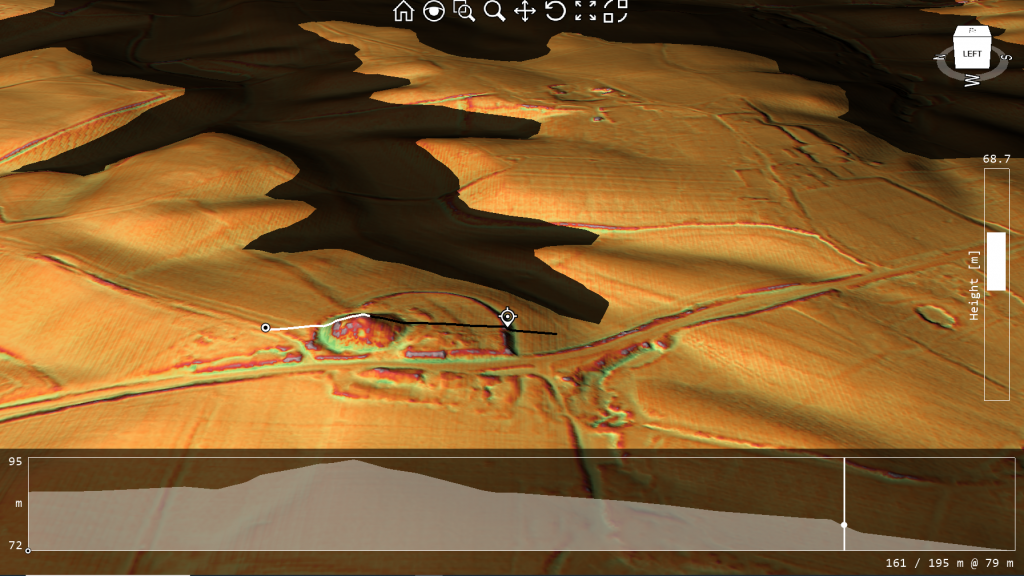
The SE section of White Sheet Camp shows that a cut was made in the bank so that boats could be placed inside the camp in the moats for loading. Notice also the shape of the moat – is u-shaped and a shallow 3m deep and 18m wide, again no remotely the the classic V-shaped 2m deep 2m wide Roman ankle breaker defense.
The Closed Dyke that goes NE to SW has no defensive bank (clearly with the spoil on both sides of the Ditch, which is 1m deep and 11m wide – allowing boats to be dragged across the hill from one paleochannel to the other.
The NE side of this same Dyke shows (unlike on OS Maps) that the ditch goes all the way down to the bottom of the Paleochannel (natural harbour), suggesting that the boats were hauled up using the bank (with men or animals) as a ‘towpath’ as we see in later Victorian Canals.
White Sheet Camp – So-Called Neolithic Causewayed Camp
Causewayed Enclosure
Historic England Summary
An Early Neolithic causewayed enclosure on Whitesheet Hill. It lies on the western edge of the Wessex downland overlooking the Vale of Wardour. The Neolithic enclosure has one probable entrance, and consists of a single ovoid circuit enclosing 2.3 hectares. It may form part of a larger complex of Neolithic earthworks, comparable to that on Hambledon Hill, although they may also relate to an Iron Age hillfort 350 metres to the south. These include traces of what may be an earlier ditch circuit beneath the hillfort itself and a univallate ovoid enclosure 300 metres to the north-east. Beyond this is an undated cross-ridge dyke which cuts off another spur. Leslie Grinsell identified the site as a causewayed enclosure and Stuart Piggott later carried out limited excavations in 1951. Earthwork survey further excavation took place in 1989-90. Artefacts included pottery, animal bone, and struck flint. Recent research into the dating of causewayed enclosures has indicated that the enclosure was probably built in 3595-3550 cal BC. The circuit seems to have been used for a relatively brief period, probably for up to 55 years. The main phase of activity may have only lasted for a few generations or less.
Commentfrom RJL
It is truly astonishing that archaeologists continue to label Dykes as Saxon boundary markers, giving them names like Offa’s Dyke and Wansdyke. This stance persists despite evidence that Cross-Dykes are prehistoric. If Dykes were constructed over 4,000 years before the Saxons, it raises the question: was this an engineering skill lost and then reinvented, or is the dating simply incorrect?
My research on Offa’s Dyke and Wansdyke (detailed in my books and blogs) suggests they were built during the Mesolithic/Neolithic periods and later reused by the Romans. This theory is now substantiated by my latest investigation into Car Dyke, which, through Bayesian and spatial (Monte Carlo) mathematics, has been confirmed as the longest dyke in Britain and dates back to the Mesolithic/Bronze Age. Despite this, some archaeologists still label Car Dyke as Roman due to the discovery of a boat laden with goods at its bottom, indicating later usage rather than original construction.
Car Dyke looking similar with high river levels to the East – dated as Mesolithic
The approach to White Sheet Camp by some archaeologists shows a surprising lack of connected thinking. Classified as a “causewayed enclosure,” which usually involves more than one ring and features causeways between the rings, White Sheet Camp only has a single ring. LiDAR analysis and excavation reports reveal that this ring consists of pits joined together, a construction method similar to Stonehenge Phase I, which our mathematical dating places at 8300 BCE. This aligns with the high river levels of that period, suggesting that the ditches could have been viable for boat use.
More information : (ST 802352) Camp (GT).- From Historic England
Whitesheet Hill: Neolithic causeway camp. Identified by Grinsell in 1950. Trial trenches by Stuart Piggott in 1951 revealed Windmill Hill potsherds and an ox-skull in the ditch silting. A probably EBA barrow (ST 83 NW 49) overlies bank and ditch on the SE. See illustration card. Finds in Devizes Museum, Acc No 10/52/39-54. (2-3)
ST 80173519. A well defined ‘egg shaped’ causewayed camp measuring approximately 200 x 140 metres. The bank, ditch and causeways are clearly visible. Surveyed at 1:2500. (4)Visible on air photographs. (7-8). This Neolithic causewayed camp lies on the edge of a plateau on Whitesheet Hill, at 235m above OD above steep chalk scarps to the south and west and approached by level ridges from the north east and south east. The irregularly interrupted ditch measures 5.0m wide, and 0.4m deep, and has causeways approximately 4m wide. The inner bank is 6.0m wide; it stands up to 1.5m above the ditch bottom and is 0.4m above the interior. The level interior measures 185m north east to south west by 140m transversely, enclosing approximately 2.0 ha. A hollow-way, and a modern road have cut through the camp, but it is otherwise in good condition.
Whitesheet Hill causewayed enclosure has been surveyed by staff of RCHME Salisbury as part of a project focussing on the earthworks of South Wiltshire. The following is abstracted from the archive report:
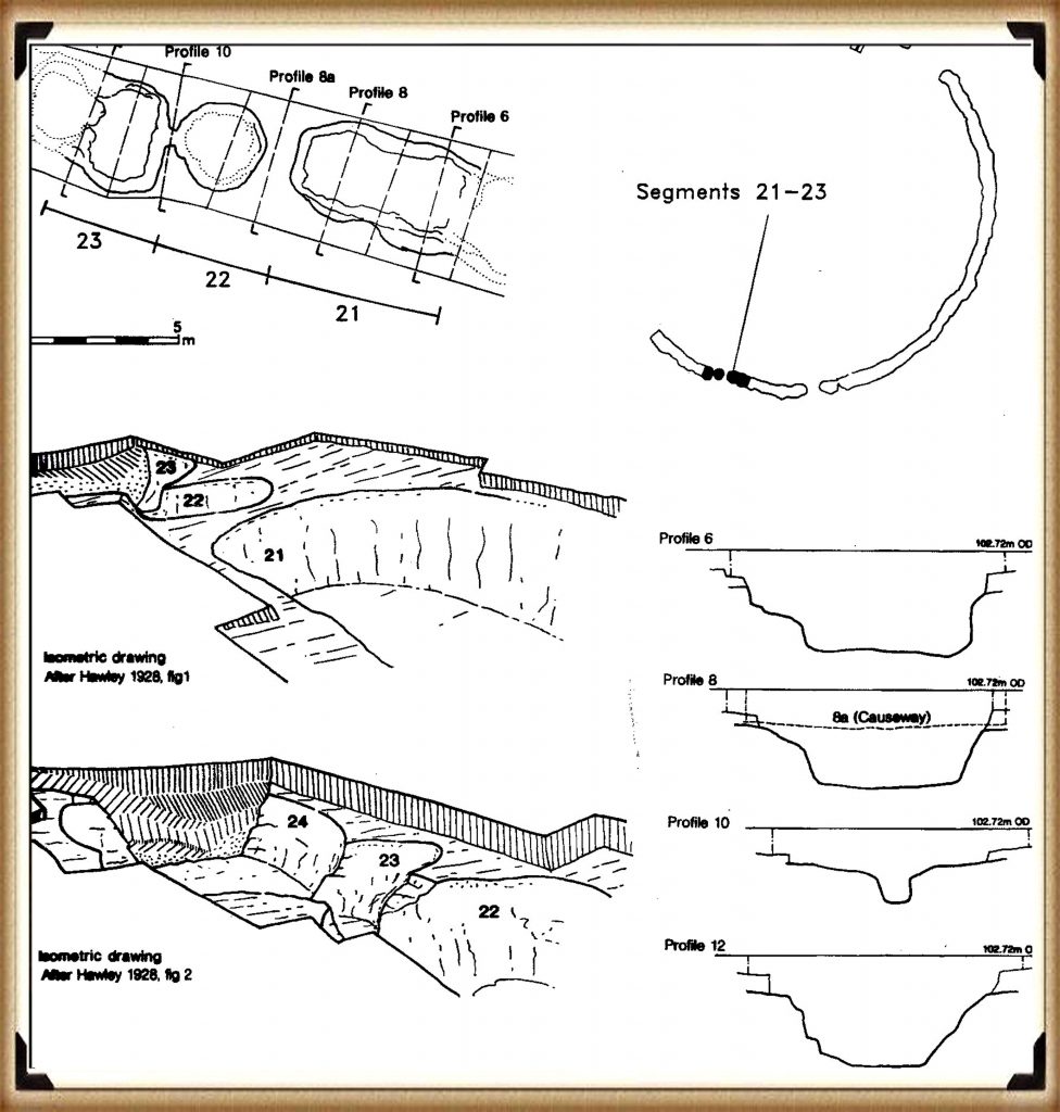
White Sheet Camp – Causewayed Enclosure is showing long trenches and not a circular ditch.
This oval enclosure is defined by an internal bank and external ditch. Both circuits are interrupted and there are in excess of 23 individual segments of ditch. The enclosure is best defined to the NE of the existing trackway which crosses the site. Here the ditch is identifiable as a series of elongated hollows up to 0.5m in depth, max 0.4m wide and 4-5m long. Within some ditch segments are smaller ’causeways’. The internal bank is correspondingly well-preserved in this area, surviving to a height of c0.7m above the ground surface. It is generally continuous, although there are occasional isolated segments. Although not all discontinuities in the line of the rampart are mirrored in the ditch, these dumps of material relate directly to the excavated ditch sections. Slightly off-set alignments between ditch and rampart causeways are also evident. The enclosure SW of the modern track is less substantial, damage reducing the bank to a series of mound-like dumps. These too tend to occur opposite ditch segments, which in this area are noticeably more irregular and slighter constructions.
Recent quarrying has damaged the NW quadrant of the enclosure. Here, a stone extraction pit c60m in length, 10m wide and 2-4m deep, running parallel to the enclosure has encroached upon c40m of the latter’s ditch.
Roman Road placed on top of the Dyke Ditch
One potential entrance was located 35m to the W of the round barrow (ST 83 NW 49) which impinges upon the enclosure. The approach to the entrance itself is defined by a double lynchet trackway c10m wide, traceable to the SE for c45m. The entrance itself consisted of a simple gap in the defences c10m wide. Two noticeable misalignments occur in the course of the enclosure boundary. The first of these consists of a misclosure 8m in length between two sections of bank and ditch. The second is a staggered gap of 2-5m. This apparent misplacement of c170m of enclosure circuit (one-third of the entire circuit) suggests non-contemporaneity with the remaining two-thirds.
Comment from RJL
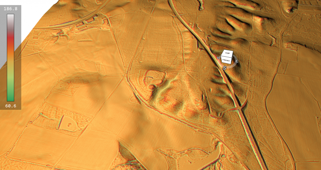
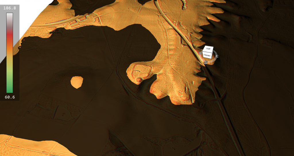
First of all, the ‘hollow way’ is a Dyke that connects to the road and goes down to the bottom of the Paleochannel – the Dyke was replaced by the road when the water table fell, and the shoreline fell down the hill until it reached the present ground level – Probably in the Bronze Age. This means that the Romans also quarried here, as we can see when they cut a path to the Roman Road that replaced the Dyke going down from the site to the paleochannel shoreline.
Is It a Fire Beacon or a Round Barrow
The so-called Causewayed Enclosure is of great interest as it is near to three other barrows (to the top Right) but is much bigger (the video has the chap climbing it to find a flat top and a crater) – is it a Fire Beacon to attract ships to the Cross-Dyke – there seems to be a part in that direction that stops. The beacon seems to have a moat surrounding it, built on the direct line of one of these 10m long ditches. The other three barrows (HE:1005674) have never been excavated, so dates are speculative, but it doesn’t seem logical to build three round barrows of a size and the one seven times larger unless it had a different purpose.
This would suggest that the ditches were part of the manufacturing process for the site and the likelihood it was to obtain groundwater as the ditches are very narrow and shallow (The irregularly interrupted ditch measures 5.0m wide and 0.4m deep, and has causeways approximately 4m wide) and this water level and alignment would have filled the ditch of the fire beacon also.
If it is similar to the Stonehenge ditch/individual pits, then it could be for the same function—bathing pools. Were the minerals from the quarries (like the bluestones) extracted for health reasons? Archaeologists and geologists alike have never looked at the minerals ancient quarries extracted, and so, sadly, we have a massive hole in our history due to dumb, subjective guesswork and bad science.
Neolithic Camp
No information is available on the Neolithic Camp at any of the official archaeology sites (Earthworks on White Sheet Downs 800yds S of Coombe Barn—1003006), as no excavations have been undertaken, and so the classification is just a guesstimate from the past.
Neolithic camp? – White Sheet CampEven under extreme enhancement it shows very little – White Sheet Camp
It offer very little in detail in comparison to the other ‘Causedwayed Enclosure’ and so looks like an earlier site abandoned when the waters of the prehistory fell – as the enhancement shows the natural harbour and possibly some path lines to the camp – excavation is required to furrther our understanding of the site (but don’t hold your breath!).
Dykes
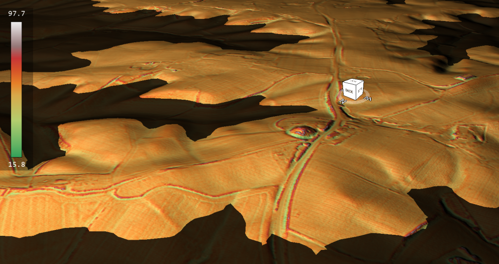
The entire site is surrounded by Dykes (as seen on the LiDAR Maps by depressions that are green in colour and red/white banks).
Dykes – White Sheet Camp
The two main Dykes are NE and NW of the main site (White Sheet Camp). These are classified as ‘Cross-Dykes’ by archaeologists, who now accept that they are Bronze Age in origin (still not correct – but better than the Saxon boundaries of 50 years ago). As we have already shown above, the Dyke to the NW (in green at the start of the blog) dips down into the valley that is dry today but was a river in the Mesolithic period. This LiDAR map below shows how all of the Dykes would have connected to the shorelines of the Mesolithic and hence the reason for their construction.
Dykes connecting to the Paleochannel of the Mesolithic – White Sheet CampDyke to the NE of the Camp – White Sheet Camp
LiDAR analysis of these Dykes quickly dispels the notion that they were either defensive or markers at any time, as they are only 1m deep. The ditch spill is evenly distributed with slightly more to the right-hand bank (the wrong one if it’s defensive!!) but perfect if you are dragging across a boat full of goods as you have a towpath for yourself or animals to pull the boats across from the natural harbour to the open river.
White Sheet Camp
Accodring to English Hertitage
This monument includes a large multivallate hillfort with two bowl barrowsand a beacon situated on the summit of a prominent south facing spur of White Sheet Hill at the top of a very steep scarp slope overlooking a dry valley.
The hillfort survives as roughly oval enclosure defined by three widely spaced ramparts with ditches to the north and east and by a single ditch and slight rampart to the west and south where the steep natural scarps are augmented. The inner enclosure is approximately 2ha, the medial enclosed area 0.6ha and the outer 0.9ha and all three areas contain large quantities of circular platforms measuring up to 12m in diameter which indicate a proliferation of dense settlement throughout the entire interior.
The hillfort is thought to be multi-phased, to have started as a single univallate enclosure and to have expanded and become more complex through time. There is a complex entrance which has double portals. The ramparts appear to have been constructed as a series of shorter lengths of bank and ditch which were eventually amalgamated. There is also strong evidence of internal quarry scoops surrounding the interior side of the defences.
White Sheet Camp showing the Ditch Layout
To the south west two bowl barrows were incorporated into the defences and these survive as circular mounds of 10m and 12.5m in diameter, standing from 0.8m up to 1m high, surrounded by visible quarry ditches from which the construction material was derived of up to 3.5m wide and 0.6m deep. One barrow mound has a central hollow.
Almost central to the inner enclosure is a circular feature which survives as a ring bank measuring 15m in diameter, 4m wide and 0.5m high surrounded by an outer ditchof 2m wide and 0.4m deep these surround a slightly dished interior with a small central mound of 6m in diameter and 0.2m high which has a central hollow.
A beacon is shown at this position on Saxton’s map of 1576. Although this feature has been interpreted as a disc barrow, possible pond barrow, tree ring or a beacon its exact date and function is not known but the beacon appears very likely given the prominent location and early map depiction. Other features investigated by Colt Hoare as potential barrows were found not to be sepulchral but formed part of the hillfort defences. Iron Age pottery and animal bone have also been recovered within the hillfort as stray surface finds.
Comment from RJL
The central ‘circular feature with moat is the exact same size as the one found to the NW of the Site at the edge of the so-called ‘Causewayed Enclosure’ except it is not as high – probably as it was reused as a beacon later in history and hence it’s been hollowed out. But the function did not cahnge in over 5,000 years as it was a fire beacon to attact boats to the new harbour to the SE of the site and hence the enhanced Dyke features.
There is no evidence that it was occupied, and the likelihood is that it was a trading centre and processing site for the raw minerals excavated by the causewayed enclosure. The LiDAR map confirms that this was made in stages, with the middle ditch first and complete, then the Inner Ditch NW side – with the rest added in patches at a later date again. The outer bank is of great interest (and missed by archaeologists, as it does not have an associated ditch and the spoil has come from both sides of the bank – this looks like a Roman Feature and no doubt will be revealed if an excavation is done as I suspect a palisade will be found on top of the bank.
Natural Harbour to the SE of the Camp with lots of Dykes – some scheduled, some unidentified until nowWhite Sheet Camp third bank – Roman with palisade?White Sheet Camp – Prehistoric Bank and Ditch of 3m deep
Lastly, let’s look at this area in the Mesolithic before the natural harbours were formed in the Late Mesolithic/early Neolithic. We see that this was an isolated island in the landscape. Moreover, we find within this island a Dyke going through the centre and, on the Eastern side, hundreds of small 4m – 8m quarry pits as we have seen with all our investigations of Dykes in Prehistory – this Dyke cuts through both ‘Cross-Dykes’ and terminates at the ‘Causewayed Enclosure. It should be noted that all the Dykes have associated prehistoric Barrows by the side of the cuttings, which confirms the early Neolithic Dates of these features.
Mesolithic Landscape showing an island with Dykes cutting accross the paleochannels (and later Dykes as waters dropped to maintain the sites use
Defence Strategy 101
Roman Defense System
Roman defences (of the same period as the ‘Iron Age’ ), we notice the ditches were relatively small and narrow. These ditches were called ‘Ankle Breaker’ as the purpose was for the assailant to fall into the ditch (usually containing pointed wooden stakes to either injure or kill the assailant) or to at least break their ankle from the fall, making them immobile. These ditches would be 3 to 4 m wide and about 2m deep and could be dug quickly.
Roman Ankle Breaker
The spoil from the ditch would be placed on the defended side of the ditch to give the defendants higher ground and be able to look and fight down against their assailants. Finally, as standing on higher ground without any other defence would make you a clear target, they constructed a fortification of either wood stakes or, later on, if the defence was to be more permanent and substantial of stone so that you could hide looking down above the conflict giving you the needed cover from spears, arrows or stones. This is a basic 1-1 defence that has not changed in thousands of early years as we saw a thousand years onwards with the Normans who had Castles with moats who wanted to slow down assailants so they could use their cross-bows if they attempted to sail across the wide moats as it was too deep to wade across.
Classic Roman Fort With Ditch and Palisade
Lidar Maps Showing No Defences – South Cadbury Castle Illustration
Ditches
Ditch is banked on the wrong side
The LiDAR Maps also show that the ditch of the ditches indicate that they were built for water, as shown by the blue on these images – this then allows us to look at the design of the earthwork in detail, which shows that the banks have been cut by not roads but other ditches. These ditches that cut across the circumference moats cut into them that, suggest that if water had been contained in these ditches, then the vertical dykes could have been used to gaol boats up from the bottom of the dyke ditch to one of these upper moat levels. These same LiDAR maps also show how the soil was distributed to the outside of the moats to enhance and make the feature deeper.
Water Table
This hypothesis of using these ditches can only be proven if we find the natural springs that could have fed these earthworks in the past. We know from our work in studying Rivers such as The Thames and Avon that they were both much higher and of greater volume in the past and at their highest directly after the last ice age and continued to be much higher than today for ten thousand years. This greater height in Rivers is reflected and caused by a higher water table. Within these water tables, natural springs are formed, and water leaks into the land, creating rivers and streams. Although we do not have geological information that allows us to trace past springs, we do find existing springs in this location (still active today at a time of Britain’s lowest water levels ), which suggests our hypothesis is correct.
South Cadbury Castle showing Springs still in existence
Dykes
As we have already suggested, other undocumented features show that this is far from being defensive and used as a trading site. We have noticed that this trading was achieved by creating other earthworks called Linear Earthworks (also known as Dykes). Dykes were introduced when the waters of the Prehistoric fell, and they wanted to continue to use the trading sites, and also they used the Dykes to transport minerals extracted from the many quarries that uncommonly surround these Dykes. Here in South Cadbury Castle, we see not only Dykes feeding the local quarry sites but also placed on the side of the Trading side to allow boats to be parked/moored on the moats of the site ready for unloading/loading.
Slipway built to feed the moats in the upper levels with trading boatsTwo Possible Slipways – one connecting directly to a Dyke
The second old earthwork identified via LiDAR technology is a secondary slipway, distinguishable from the initial structure by its lack of connection to a dyke or river. This slipway appears to traverse from the lowest moat up to the top of the site. While photographs may provide a visual reference, the full extent and significance of this feature are best understood through LiDAR models, which enhance the landscape to reveal these historical elements with greater clarity.
The Dykes seen on the LiDAR map are concentrated on the quarry in the East of the Site
Archaeology, often hailed as the key to understanding our past, stands at a contentious crossroads between the humanities and the sciences. Archaeology is largely interpretative and subjective, unlike pure sciences, which rely heavily on quantitative data and mathematical models to test hypotheses. The field depends on analysing artefacts, structures, and cultural remains, often incomplete or degraded. This reliance on fragmentary evidence means that much archaeological interpretation is speculative, making it difficult to draw definitive conclusions. The subjective nature of archaeology raises questions about its scientific rigour, as interpretations can vary significantly depending on the archaeologist’s perspective, cultural background, or theoretical framework.
In contrast, pure sciences like physics, chemistry, and biology adhere to strict methodologies that prioritise empirical data and mathematical precision. These disciplines employ controlled experiments, reproducible results, and quantitative analysis to validate theories and build on existing knowledge. Hypotheses in pure sciences are rigorously tested, often through repeated experiments, to prove or disprove them. The mathematical models in these fields are designed to predict outcomes with high accuracy, leaving little room for personal bias or interpretive flexibility. This reliance on complex data and reproducibility sets pure sciences apart from more interpretative disciplines like archaeology, where conclusions are often inferred from indirect evidence and subject to ongoing debate.
Archaeology: A Bad Science?
While archaeology provides invaluable insights into human history and culture, its status as a “science” is frequently challenged due to its inherent subjectivity. The field’s heavy dependence on interpretation rather than objective data can lead to multiple, often conflicting, narratives about the past. Archaeology usually deals with probabilities and possibilities rather than certainties, unlike pure sciences, where theories can be definitively proven or disproven. This makes archaeology a unique and valuable discipline. Still, one that straddles the line between science and the humanities, leading some to argue that it is more of a social science than an actual, data-driven science. As a result, the conclusions drawn in archaeology should be viewed critically, understanding that they are often shaped as much by the archaeologist’s perspective as by the evidence itself.
In the competitive world of academia, the struggle for funding is fierce, particularly in fields like archaeology, where financial resources are often scarce. Universities and research institutions face significant pressure to secure grants and sponsorships, which are essential for conducting fieldwork, preserving artefacts, and supporting academic staff. Given the limited budget allocated to archaeology, institutions are often forced to prioritise projects that promise high visibility and public interest, sometimes at the expense of rigorous scientific inquiry. This competition can lead to a climate where sensationalism takes precedence over careful, evidence-based research, with archaeologists making bold claims to capture the media’s and potential funders’ attention.
Archaeology: A Bad Science?
The egos of leading professors and researchers further complicate this landscape. In their quest for prestige and recognition, some academics may undermine their peers to secure funding and enhance their credibility. This can create a toxic environment where collaboration and peer review are replaced by rivalry and one-upmanship. The need to stand out and secure funding can lead to premature announcements of discoveries or theories that have yet to be fully vetted or substantiated. These announcements often make headlines and capture the public imagination. Still, they also contribute to a growing perception that archaeology is a field rife with contentious guesses rather than solid, verifiable knowledge.
As a result, the discipline of archaeology risks becoming a series of unproven hypotheses, each vying for attention but needing more robust evidence to withstand critical scrutiny. This trend diminishes the field’s credibility as the public becomes increasingly sceptical of claims that are later debunked or revised. The focus on media appeal and public interest, driven by the need for funding, can overshadow the meticulous and often slow scientific validation process essential to any credible discipline. In the long run, this erodes trust in archaeology and undermines its potential to contribute meaningful insights into our understanding of the past.
The misinterpretations surrounding Stonehenge, Iron Age hill forts, and linear earthworks like dykes stem from a failure to fully integrate emerging technologies and scientific methods into archaeological research. For instance, Stonehenge is often dated to the Neolithic period, around 3000 to 2000 BCE. However, as discussed in the blog “The Stonehenge Code”, significant evidence, including Mesolithic carbon dates from quarry sites associated with Stonehenge, was largely ignored. The Mesolithic carbon dates suggest activity at these quarries—and potentially the beginnings of Stonehenge itself—could have occurred much earlier, possibly as far back as 8500 BCE.
Archaeology: A Bad Science?
This oversight exemplifies how the subjective nature of archaeology can lead to selective interpretation of data. Suppose a more scientific approach incorporating probability and statistical analysis had been employed. In that case, it might have revealed that the likelihood of these earlier dates being relevant to Stonehenge’s construction was much higher. Instead of discarding the Mesolithic evidence, a rigorous application of mathematical models could have provided a more nuanced understanding of the site’s history, possibly redefining the origins of one of Britain’s most iconic monuments. This tendency to favour prevailing theories over emerging evidence highlights the risk of allowing unproven hypotheses to dominate the discourse.
Similarly, classifying over 3,300 sites across Britain as “Iron Age hill forts” reveals another instance of entrenched archaeological assumptions. As discussed in the blog on Iron Age hill forts, many of these earthworks have no concrete evidence that they were constructed during the Iron Age or served as fortifications. The absence of mass graves or signs of warfare at these sites challenges the accuracy of their classification as “forts.” This misclassification has stifled further research, as archaeologists may need to pay more attention to evidence suggesting alternative uses or periods.
The issue extends to linear earthworks or dykes, traditionally attributed to the Saxon period due to their names. However, LiDAR technology has revealed these structures to be much older and likely filled with water, suggesting they served as transport hubs rather than defensive boundaries. Discoveries such as the Roman barge at Car Dyke indicate that these features predate the Saxon era, further supported by recent scientific analyses pointing to a Mesolithic origin. This evidence fundamentally changes our understanding of these dykes, emphasising the need to integrate new findings into the archaeological narrative.
The failures to interpret these sites accurately often stem from a broader oversight in archaeological analysis: the post-glacial flooding that reshaped Britain’s landscape. According to research on post-glacial flooding, large portions of Britain were submerged underwater for thousands of years after the last Ice Age. This created waterways essential for transportation, trade, and monumental construction, allowing a megalithic civilisation to thrive. Many archaeologists, lacking training in hydrology, have not fully grasped the significance of this waterlogged environment, leading to misinterpretations about the origins and functions of these prehistoric sites.
This dysfunction has contributed to a discipline of arguably 70% suggestive fiction and only 30% scientific fact, where speculative interpretations often overshadow hard evidence. By failing to consider the dynamic nature of ancient landscapes and the significance of waterways, archaeology risks misrepresenting the true complexity of Britain’s prehistoric past. A more interdisciplinary approach, incorporating hydrology, geology, and climate science, is crucial to reconstructing these environments accurately and moving beyond preconceived notions.
In conclusion, while archaeology employs various scientific techniques, it is not immune to human biases and the influence of external pressures. The reliance on subjective interpretation over empirical data, the competition for funding, and a tendency to favour popular narratives have contributed to a discipline that often straddles the line between science and speculative storytelling. By embracing a more evidence-based, interdisciplinary approach, archaeology can enhance its credibility and offer a more accurate exploration of our past, reducing the current imbalance between fiction and fact in the field.
This is a primary report of the first LiDAR mapping of Car Dyke in Lincolnshire
Introduction
Car Dyke is one of the most enigmatic and intriguing remnants of Roman engineering in Britain. Stretching across the Fens of Eastern England, this ancient waterway has puzzled historians, archaeologists, and enthusiasts for centuries. Theories about its purpose and origin are as varied as they are compelling, reflecting the complexities of interpreting ancient structures without definitive historical records. This introduction aims to present a comprehensive overview of Car Dyke, encompassing both past and current theories regarding its use and origin.
Car Dyke: A Brief Description
Car Dyke runs for approximately 85 miles (137 kilometres) from Waterbeach in Cambridgeshire to the River Witham near Lincoln. Its construction is attributed to the Roman period, specifically around the 1st or 2nd century AD. The Dyke consists of a broad, shallow ditch with accompanying banks, a typical feature of Roman civil engineering, yet its exact function remains a matter of debate.
Early Theories: Navigational and Defensive Purposes
The earliest theories about Car Dyke’s purpose centred around its potential use as a navigational canal. Some scholars suggested that the Romans constructed it to facilitate the movement of goods and troops across the Fenlands, which were notoriously difficult to traverse due to their marshy nature. This theory aligns with the Romans’ known prowess in building canals and other hydraulic structures throughout their empire.
Another prevalent early theory posited that Car Dyke served a defensive purpose. Given the strategic importance of controlling the Fenlands, it was speculated that the Dyke might have been part of a broader military defence network. The presence of Roman forts and settlements along its route lends some credence to this idea, suggesting that the Dyke could have been a boundary or a means to control movement through the region.
Our Research
We have now sucessfully mapped the northern section of Car Dyke and located all the findings from periods from Mesolithic Period to modern times. Our objective is to discover or confirm the construction date of the Dyke and its function.
Fens
The first aspect of the maps show that Car Dyke ‘hugs’ the raised shorelines of the Fen Area. This is in contrast to the modern and some Roman drainage ditches.
Car Dyke – Profile
Locks and Water Management
One of the most striking anomalies observed in the Car Dyke is the varying elevation profile along its course. Contrary to what might be expected from a Roman engineering project, the dyke does not maintain a flat or consistent gradient. In fact, in some sections, the elevation fluctuates by as much as 4 meters (14 feet) without the apparent use of locks to regulate water flow.
This irregularity raises intriguing questions about the design and function of the Car Dyke. Historically, Greek engineers were pioneers in using canal locks, employing them to manage water levels in the Ancient Suez Canal as early as the 3rd century BC. Similarly, under Emperor Trajan, the Romans utilised sluice gates to control water flow at the entrance to the Red Sea, extending the canal south to what is now Cairo to improve water inflow.
The possibility that the Romans might have used ancient pound locks to manage height differences in canals has been proposed by several scholars. These locks would have allowed for regulating water levels and bridging elevation gaps, much like modern lock systems. However, the absence of clear archaeological evidence for such structures in the Car Dyke—or elsewhere in Roman Britain—leaves this hypothesis unresolved.
Given the significant elevation changes along the Car Dyke, the lack of any visible lock mechanisms suggests alternative explanations must be considered. It’s possible that natural springs or other water sources were strategically utilised to maintain water levels or that the dyke served a different purpose altogether, one that did not require precise water level management.
The question of whether ancient pound locks were used in the Car Dyke remains one of the many mysteries surrounding this ancient structure. Without concrete archaeological evidence, the debate is likely to continue. However, the abnormal elevation profile is a critical factor that must be addressed in any comprehensive analysis of the Car Dyke’s construction and function. As we delve deeper into the investigation, understanding how these variations in height were managed will be crucial to unravelling the true nature of this enigmatic alleged Roman legacy.
Wibbly-Wobbly pathway is not of Roman design
Dyke Design
In examining the northern section of the Car Dyke, we observe two markedly different design patterns, each suggesting a distinct approach to engineering. The first pattern, characterised by a “wibbly-wobbly” alignment, closely follows the contours of higher land formations and hugs the shoreline. In contrast, the second design, which traverses the low-lying marshlands (indicated in blue), features the straight, linear precision typically associated with Roman engineering.
This stark contrast in design raises the possibility of looking at two different techniques, potentially indicative of two separate historical periods and civilisations at work. The “wibbly-wobbly” design, with its organic, meandering course, suggests a construction that prioritised the natural landscape, possibly indicating a pre-Roman origin. This approach aligns with a more ancient engineering practice, where the path of the dyke would have been dictated by the topography and the need to follow natural water sources or higher ground to avoid flooding.
The more uniform and linear sections of the dyke, on the other hand, are characteristic of Roman engineering. The Romans emphasised straight lines and efficient, purposeful design, often cutting across landscapes with little regard for natural obstacles. This technique is evident in their roads, aqueducts, and canals, where functionality and directness were paramount.
Given these observations, it is logical to hypothesise that the Car Dyke in its “wibbly-wobbly” form may have been an earlier construction, later adapted or reused by the Romans. This scenario suggests a continuum of engineering efforts, where the Romans recognised the utility of an existing structure and modified or extended it according to their own methods and needs.
Car Dyke and Roman Roads that are Straight
This theory of two distinct periods of construction is supported by the duality in the dyke’s design: the original, meandering path possibly built by an earlier civilisation and the later, more systematic Roman modifications. The reuse of earlier infrastructure by the Romans was not uncommon; they often incorporated and improved upon existing works, blending local traditions with their engineering principles.
While this hypothesis offers a compelling narrative, it remains speculative without further archaeological evidence. The precise dating of the different sections and the identification of specific construction techniques and materials will be crucial in confirming whether the “wibbly-wobbly” sections indeed predate the Roman modifications.
If this interpretation holds, it would provide valuable insights into the history of the region, illustrating a timeline where the Car Dyke evolved from a local engineering solution to a component of the expansive Roman infrastructure network. This layered history would highlight the Romans’ pragmatic approach to utilising existing resources and underscore the continuity and adaptation of engineering practices across different civilisations in Britain.
In conclusion, the northern section of the Car Dyke, with its dual design characteristics, likely reflects two distinct historical phases. The “wibbly-wobbly” sections suggest an earlier, possibly pre-Roman origin, later integrated into the Roman landscape through their characteristic straight-line construction. This scenario offers a fascinating glimpse into the interaction between different cultures and the evolution of engineering practices over time. Further research and excavation will be essential to validate this theory and fully understand the complex history of the Car Dyke.
The Maths and Proof of Concept
End of The Northern Section
This is the end of the Northern section and the Lincolnshire database. It allows us to examine the number of artefacts found and the probability that they were in use during this period. This probability is calculated by understanding the frequency of finds on Average over the entire county. Consequently, this is the collective number of artefacts found in Lincolnshire:
To calculate the prior probabilities for each period based on the total number of finds in Lincoln, we first calculate the total number of finds across all periods:
Neolithic/Mesolithic: The higher frequency of finds in this period significantly increases its posterior probability to approximately 30.69%, which is quite substantial.
Roman: Despite having fewer finds in this area, the Roman period still has a high posterior probability due to its higher prior, but it is now only about 60.74%.
Bronze Age: The probability for the Bronze Age period remains lower at approximately 8.55%.
Conclusion:
The calculated probabilities show a more balanced view, with the Roman period still favoured but with a much stronger case for the Mesolithic/Neolithic period. This suggests that while Roman use of the Dyke is still likely, the Mesolithic/Neolithic period also holds significant importance, potentially indicating earlier use or occupation before the Romans.
Langdon Mathematics
While Bayesian theory often yields definitive results, its accuracy can be compromised due to its dependence on subjective prior assumptions, which may only sometimes reflect reality. If these priors are not well-chosen or are based on incomplete or biased information, the resulting analysis might be misleading.
Therefore, relying solely on Bayesian methods without considering the variability and complexity of archaeological data could lead to conclusions that only partially capture the nuances of the actual distribution of artefacts. My method, which focuses on spatial analysis and empirical data, addresses these limitations.
My approach to calculating finds would differ significantly. First, I would define the area where artefacts could be discovered—using Lincolnshire as a reference due to its comprehensive archaeological data. By doing so, we can estimate the expected number of artefacts per square meter of Lincolnshire land, offering a more objective and spatially grounded method for understanding artefact distribution.
As IA reports:
To calculate the percentage likelihood of finding an artefact from each period in a single square meter of Lincolnshire, we can follow these steps:
Step 1: Determine the Area of Lincolnshire
Area of Lincolnshire: Approximately 6,959 square kilometres (6,959,000,000 square meters).
Step 2: Calculate the Find Density
For each period, calculate the density of finds per square meter by dividing the total number of finds by the area of Lincolnshire.
Step 3: Calculate the Likelihood for Each Period
Roman:
Likelihood: 0.000156%
Neolithic:
Likelihood: 0.000011%
Mesolithic:
Likelihood: 0.000004%
Bronze Age:
Likelihood: 0.000003%
Summary of Likelihoods in order of expectation:
Roman: 0.000156%
Medieval: 0.000129%
Post Medieval: 0.000081%
Early Medieval: 0.000024%
Iron Age: 0.000021%
Neolithic: 0.000011%
Mesolithic: 0.000004%
Bronze Age: 0.000003%
These percentages represent the likelihood of finding an artefact from each period in a square meter of Lincolnshire. Given the extensive activity during that time, the highest is for the Roman period, just marginally ahead of the Medieval period.
We now need to look at the search area (63 miles of the Northern End of Car Dyke) as listing on the LiDAR maps in the previous section of the book. We must first calculate the total search area in square metres, count the number of finding within this area, and then compare against the expected number.
Summary of Expected Finds:
Roman: 15.83 artefacts
Medieval: 13.07 artefacts
Post Medieval: 8.19 artefacts
Early Medieval: 2.44 artefacts
Iron Age: 2.17 artefacts
Neolithic: 1.07 artefacts
Unknown: 0.59 artefacts
Modern: 0.50 artefacts
Mesolithic: 0.36 artefacts
Bronze Age: 0.34 artefacts
Summary of Items Found:
Mesolithic/Neolithic: 61 finds
Bronze Age: 47 finds
Roman: 24 finds
Calculate the Odds of This Kind of Find
For each period, the odds ratio of finding this many artefacts compared to the expected finds:
Step 4: Interpret the Results
Mesolithic/Neolithic: A massive 5589.72% increase and an odds ratio of 57.01 suggest significant activity during this period, far beyond what was expected.
Bronze Age: An even higher increase of 13723.53% and an odds ratio of 138.24 indicate the area was very important during the Bronze Age.
Roman: A modest 51.60% increase with an odds ratio of 1.52 suggests Roman activity, but not as dominant as the earlier periods.
Conclusion
The very high percentage increases and odds ratios for the Mesolithic/Neolithic and Bronze Age periods strongly suggest that the Car Dyke area was occupied and actively used during these times, with significant archaeological activity that exceeds what would be expected based on general Lincolnshire data. While still represented, the Roman period is less prominent in this area compared to the earlier periods.
This confirms other Dyke surveys such as Offa’s and Wansdyke that also show design (wibbly-wobbly) in construction attributed to the builders seeking natural springs rather than a direct line of route to maintain water levels which were achieved at a later date in history by locks.
The Prehistoric Health Spa – A Perspective by Timothy Darvill and Robert John Langdon (The Stonehenge Hospital)
Traditional Roman Spa
Introduction
Timothy Darvill, a distinguished figure in Archaeology at Bournemouth University, has put forward a groundbreaking theory. His proposition that Stonehenge was a healing sanctuary, as detailed in his book ‘Stonehenge: The Biography of a Landscape ‘, is supported by compelling evidence from human remains found in burial mounds near the site. These remains, Darvill argues, belonged to individuals who were ailing before their demise, suggesting a unique purpose for the monument.
Darvill’s theory also carries an international dimension. He suggests that the remains found near Stonehenge, including those of the Amesbury Archer from what is now Switzerland, point to a diverse population that visited the site. He further proposes that Stonehenge’s primary function was during the winter solstice, a time when it was believed to be under the influence of Apollo, the Greek and Roman god of healing. (The Stonehenge Hospital)
Amesbury Archer with bad leg from the Alps
Adding to Darvill’s hypothesis, Robert John Langdon’s revelations in his book, The Stonehenge Enigma, suggest that the ditch surrounding Stonehenge was not merely a ditch but a series of post holes and chalk seats. These were likely used for people to sit and bathe in the waters of the moat. British Geological Survey (BGS) superficial deposits and carbon-dated excavations in the old Stonehenge car park indicate that these water-filled ditches were active during the Mesolithic period. This suggests a higher water table at that time, allowing the Stonehenge ditch to fill with water.
Langdon emphasises that the old car park, now recognised for its historical significance, reveals evidence of three giant circles (similar to mini roundabouts) where post holes were discovered during its construction. These post holes, each at least 1 meter in diameter, contained pieces of bone and charcoal dated to be 10,000 years old, over twice the age of any other structure at Stonehenge. Traditional archaeology describes these posts as ‘totem poles,’ but Langdon argues that they were more likely functional mooring posts for boats. These posts could have supported a lifting device using simple mortise and tenon joints, allowing stones to be raised from boats during high tide and transported to Stonehenge. (The Stonehenge Hospital)
The Ditch is really a series of pits with seats and stone holes – (The Stonehenge Hospital)
Langdon’s theory aligns with the idea that Bluestone chippings were used as ‘bath salts.’ When placed in the water-filled moat, these chippings would enhance the healing properties of the baths. Although unremarkable igneous rocks like Dolerite and Rhyolite take on a bluish hue when wet and have been attributed with mystical properties over centuries.
The 13th-century British poet Layamon, inspired by Geoffrey of Monmouth’s folklore, wrote:
The stones are great
And magic power they have
Men who are sick
Fare to that stone
And they wash that stone
And with that water bathe away their sickness
This poem indicates that the sick would bathe away their ailments using water that had encountered the stones. Surprisingly, Darvill did not link this poem to his hypothesis. However, recent findings by Professor Mike Parker Pearson of Sheffield University reveal a smaller version of Stonehenge, aptly named ‘Bluehenge,’ made of 27 Welsh stones and linked to the River Avon, reinforcing the connection between Bluestones and water. (The Stonehenge Hospital)
Excavations have uncovered numerous stone holes at the bottom of the moat surrounding Stonehenge, suggesting they once housed Bluestones. These stones, smaller than the more prominent Sarsen Stones, have been overlooked by archaeologists but played a crucial role in the site’s healing practices. Archaeologists have found 3,600 Bluestone chippings scattered around Stonehenge, suggesting they were deliberately broken up to enhance their healing properties when placed in water. (The Stonehenge Hospital)
Stonehenge was an excarnation site – (The Stonehenge Hospital)
Contrary to the belief that these chippings were merely remnants of reshaping efforts, the high number of Bluestone fragments compared to the fewer Sarsen Stone pieces found suggests a deliberate practice. The discrepancy indicates that the Bluestones were intentionally fragmented for use in healing rituals, possibly to be placed in the moat where people bathed.
Tim Darvill and Geoffrey Wainwright’s excavations in 2008 support this theory, revealing that Bluestones began to be chipped away almost immediately after being set up in successive arrangements. The notion of prehistoric man using water to heal may seem far-fetched, but such practices have deep roots in human history, evidenced by the widespread use of spas in Roman Britain. (The Stonehenge Hospital)
The Ditches were used as a spa to bathe away illness – (The Stonehenge Hospital)
Langdon’s theory also posits that Stonehenge had a ‘lost’ processional walkway on the northwest side of the monument, leading towards the ancient shoreline and mooring station. This area, aligned with the midsummer moonset, highlights the site’s connection to the moon rather than the sun. The lack of human remains from the Mesolithic and Neolithic periods has led to theories of ‘excarnation,’ where bodies were left to decompose naturally. The Q and R holes at Stonehenge, arranged in a crescent moon shape, suggest a space designed for laying out the dead, aligned with the setting moon.
Further supporting Langdon’s hypothesis is the Palisade Ditch, a lesser-known feature running in a southwest-to-northeast direction between Stonehenge and the visitor’s car park. This ditch likely served as a barrier or entrance, creating a secluded sacred space. The Palisade would have kept the monument hidden from outsiders and protected the corpses laid out on slabs from wild animals.
As the Bronze Age progressed and the moat at Stonehenge dried up, these smaller Bluestones were abandoned and scattered throughout the site. Larger Bluestones where moved to the inner stone circle, accounting for today’s varied bluestone shapes and sizes. This perspective reimagines Stonehenge as a prehistoric health spa and highlights the enduring human quest for healing and wellness through natural elements. (The Stonehenge Hospital)
Prehistoric Britain saw complex and evolving burial practices, starting with the excarnation of bodies. Dolmens, characterised by their capstones balanced on upright stones, were used as platforms to expose bodies to birds, and wooden palisades encircled the platform, preventing terrestrial animals and rodents from scavenging. (Prehistoric Burial Practices of Britain)
Dolmen – excarnation platform
Once cleaned, the bones were collected and stored in long barrow chambers. These megalithic structures were deliberately shaped like boats, symbolising the voyage to the afterlife. The practice dates back to the seventh millennium BCE in France and highlights the cultural significance of these monuments. The misdating of British sites often results from the continuous use of these burial grounds. Older bones were naturally replaced by newer ones, similar to modern graveyards. This ongoing usage has led to confusion, especially when interpreting the age of these sites.
Boat Shaped Long Barrow
Cremation was another ancient practice, but it began many thousands of years after the first excarnations, indicating a change of culture; this adds further complexity to prehistoric burials. Archaeologists sometimes misinterpret cremated remains at sites like Stonehenge, assuming they date back to the monument’s original use. However, these remains often belong to later periods when ancient sites were reused for other purposes. At Stonehenge, cremated bones have been used to date the site, not recognising that the stones were possibly moved or their sockets were repurposed as burial sites. This misunderstanding challenges the interpretation of the site’s original function.
Hole made by a Bluestone – later used as a cremation pit
Round barrows present another puzzle. Often, cremated bones are found on the edges, not in the centre, indicating they were not initially constructed for burials but were later utilised for this purpose. This secondary use complicates the understanding of their primary function.
Cremations and Burials are ofter added to the sides of Barrows (none in the centre)
In areas of Britain like Wales and Ireland, misconceptions about the original function of megalithic sites and their reuse over time have led to confusion among archaeologists. These regions have developed unique site names not found elsewhere, and the designs often reflect changes from excarnation practices to later cremation uses. This has further complicated the understanding of these sites’ function. The intricate design and usage of these megalithic structures underscore the sophisticated burial practices of prehistoric communities. They revered their ancestors and treated death as a significant transition, deserving elaborate and respectful processes.
Long Barrows can also be used as hill markers – hence their white chalky colour
These burial practices reflect a deep connection with the environment. The boat-shaped long barrows built halfway down the tops of hills symbolised the journey to the afterlife. They were also used as markers for boats on rivers, illustrating the importance of water and travel in their cosmology. Modern archaeological techniques continue to unravel these complexities, revealing a dynamic and continuous use of sacred sites over millennia. Each discovery adds a piece to the puzzle of our ancestors’ beliefs and practices.
Classic Cairn – but misinterpreted by archaeologists as a barrow?
In addition to dolmens and long barrows, other megalithic structures played a role in prehistoric burial customs. Cairns and burial chambers, often constructed on hilltops, provided another method for interring the dead. The fact that they have whole bodies and not disarticulated bones indicates that this may have been a halfway house between excarnation and cremation. The community aspect of these burial practices is also notable. The construction of large megalithic structures required coordinated effort, indicating a strong social organisation and shared cultural or religious beliefs. This collective effort would have strengthened communal bonds and reinforced social cohesion.
Rituals associated with burial likely included ceremonies to honour the dead, invoking protection or favour from deities or ancestors. These rituals would have comforted the living, offering a sense of continuity and connection with the past. In some burial sites, grave goods, such as pottery, tools, and ornaments, indicate beliefs in an afterlife where such items would be needed. These offerings reflect the values and daily life of the communities, providing archaeologists with insights into their material culture.
Amesbury Archer – burial and hence the date (not of megalithic origin)
In conclusion, the burial practices of prehistoric Britain were multifaceted and evolved. They reflect a deep connection with the environment, intricate rituals, and a continuous respect for the ancestors, providing a fascinating glimpse into the past. The combination of excarnation, long barrow interment, cremation, and communal effort in constructing megalithic structures illustrates a rich and complex cultural heritage. As modern archaeology continues to explore these ancient sites, our understanding of prehistoric beliefs and practices will continue to grow, revealing how these early societies interacted with their world.
search more accessible and to engage directly with the public can help bridge the gap between current archaeological research and public understanding.
There are many challenges archaeology faces as a discipline. The historical misconceptions and the evolving understanding of our past are significant aspects of archaeological study. (Is Archaeology a dying discipline?)
Here are a few reasons why archaeology can sometimes lag behind other sciences in terms of updating its theories and practices:
Funding Limitations: Archaeology often has limited funding compared to more ‘practical’ sciences like engineering or medicine. Because the immediate applications of archaeological findings aren’t always as straightforward as those in fields that can drive technological innovation or medical advancements, it might receive less investment from both the public and private sectors.
The complexity of Evidence: Archaeological evidence is often incomplete and open to interpretation. Different cultures, times, and environmental conditions can significantly alter the archaeological record, making it difficult to draw definitive conclusions. This complexity means that updating misconceptions requires much new evidence and reinterpretation, which can be slow.
Interdisciplinary Challenges: Archaeology sits at the intersection of the humanities and sciences. It relies on methods and theories from fields as diverse as anthropology, geology, chemistry, and even physics (for dating techniques). This interdisciplinary nature can make integrating new findings and methods difficult, as each contributing discipline may have its own advancements or shifts in understanding.
Public and Academic Interest: The extent to which archaeology can draw public interest often depends on spectacular finds or the promise of uncovering “lost” civilisations, which can skew perceptions of what the field is genuinely about. Academic interest can similarly focus on certain popular or well-funded areas, leaving other equally essential areas under-explored.
Heritage and Cultural Sensitivity: Archaeological work is also closely tied to heritage and cultural sensitivity issues. Respecting present-day cultures and legal frameworks surrounding archaeological sites can slow excavations and studies. Furthermore, the involvement of communities and stakeholders can complicate how sites are investigated and how findings are interpreted and shared.
Despite these challenges, archaeology has made enormous strides in recent decades, particularly with the incorporation of technological advances such as GIS (Geographic Information Systems), LIDAR (Light Detection and Ranging), stable isotope analysis, and OSL (Optically Stimulated Luminescence). OSL is particularly transformative as it allows archaeologists to date the last time sediment was exposed to light, providing critical information on site use and artefact burial timing. These tools have revolutionised our understanding of ancient environments and human interactions, helping to refine our interpretations of the archaeological record. However, revising historical narratives can still be slow and contentious.
The critical issues in archaeology, such as the slow pace at which the discipline updates and corrects its understanding of historical and archaeological findings, are significant obstacles to knowledge. This can create a gap between current and public knowledge, contributing to ongoing misconceptions. Here’s a breakdown of some of the factors contributing to this issue:
Peer-Review Process: While crucial for maintaining scientific rigour, the peer-review system can be slow. This can delay the dissemination of new ideas and corrections to established theories. The process is designed to ensure accuracy and credibility, but it can also inhibit rapid progress, especially in a field like archaeology, where new findings can challenge long-held beliefs.
Publication and Communication: The language used in academic journals can be dense and inaccessible to non-specialists. This often means that even when new research is published, it may not be readily understandable to the general public or enthusiasts without a deep background in the field. This can lead to a lag in the public’s understanding of new developments.
Conservatism in Academia: Academic institutions can be conservative in embracing new theories and approaches, particularly when they challenge the foundational understandings of the discipline. Scholars who have built careers on specific interpretations may be reluctant to accept new evidence contradicting their views.
Educational Outreach: There is often a lack of effective communication between archaeologists and the public. This can be due to a lack of resources dedicated to public engagement or focusing on academic publishing over public education. Without active efforts to translate new findings into accessible formats, misunderstandings and outdated perceptions persist.
Integration of New Technologies and Methods: Although new technologies like OSL and GIS have transformed archaeological methods, integrating these into traditional studies and ensuring they are part of the standard curricula across universities can be slow. This delay affects how quickly new findings influenced by these technologies become part of the mainstream archaeological discourse.
Addressing these issues requires a concerted effort to improve the speed and accessibility of the peer-review process, enhance public engagement and education, and encourage a more dynamic acceptance of new technologies and methodologies within the academic community. Efforts to make research more accessible and to engage directly with the public can help bridge the gap between current archaeological research and public understanding.
Practical Examples
Wansdyke
Consequently, one would imagine that the information contained within the publication would have created a ‘talking workshop’ in which questions would be asked and thoroughly discussed in minute detail as it is new to the world and previous undiscovered – but at best, all it received as a ‘Conspiracy Theory’ label even though it was based on research using the most up to date 21st Century software through LIDAR (Light Detection and Ranging) data collected by the government through is Defra (Department for Environment, Food & Rural Affairs) website, which has yet to be embraced by the archaeological profession, who still rely more upon dated Satellite technology and crop marks for information.
So, the professionals were reticent, and the only noise from social media was the usual archaeological ‘Jihads’ who refused to accept that the books and courses they attended and read in the last century are no longer relevant or correct as they were then ‘peer reviewed’ and therefore (in their mind) absolute in accuracy, for the rest of time no doubt?
This kind of ‘blind obedience’ is sadly commonplace and can be seen by religious fundamentalists, who take the words from a book and turn them into a test of faith rather than knowledge. ‘Intelligent design’ is a classic response to scientific proof of evolution, and the tactics used by these people are similar to what I see in my work – attempting to disprove a substantial theory by seeking a show that all aspects of evolution have been fully explained (although subjective in nature) and there cancels the hypothesis by default.
Fundamentalist
One of these ‘diehards ‘ came back at me in the hope that if he could show doubt in just one site – then the whole hypothesis would come tumbling down, even though a book covering every single metre of East Wansdyke has proven beyond any reasonable doubt that Wansdyke was neither a defensive wall nor a boundary marker. He’s claim was that Wansdyke was built on a ‘late iron age’ fortification and therefore must be Saxon.
So to prove his point, he named a site not actually covered within East Wansdyke book but in an area called West Wansdyke, which I questioned its relevance within the book as I concluded it was connected at a later date to the original prehistoric canal system (probably by the Roman’s) as it was incomplete, sporadic and of a different specification to East Wansdyke.
Cheddar Man
A recent discovery in Britain involving the analysis of mtDNA (mitochondrial DNA) from the skeleton of a Mesolithic man found in the Cheddar Gorge, Somerset, England, has sparked considerable debate. According to researchers, this ancient individual, who lived around 9,000 years ago, likely had dark (brown-black) skin, dark brown hair, blue eyes, and phenotypical features resembling those of Western Europeans. But what’s the issue with these findings?
Without delving too deeply into the genomic research, the problem lies in the comparison with data collected over two decades ago when mtDNA collection began in 1996. This earlier study, which was notably not peer-reviewed, has been flagged in subsequent reports for potential modern DNA contamination during the collection process.
The 2018 Analysis and Its Controversy
The more recent study, which analyzed a skull fragment in 2018, found that Cheddar Man’s remains were linked to the same ancestral family as other Mesolithic European populations. This conclusion itself isn’t particularly surprising. However, the lack of peer-review for the initial study raises concerns about the legitimacy of these findings. The publication of detailed chromosomal data related to hair, eye, and skin color—especially given its potentially questionable origins—seems to have been aimed more at garnering publicity than advancing scientific understanding.
Even if the initial DNA was uncontaminated, the science behind estimating physical traits such as skin tone is not fully proven and remains a working hypothesis. Notably, 60% of the necessary chromosomes for accurately estimating skin tone were missing. Consequently, at best, there was only a 60% chance of the assessment being correct. Scientific standards dictate that results with a probability rate of less than 50% should not be considered reliable, as they are statistically likely to be incorrect.
The Media Hype and Its Consequences
Despite these uncertainties, the announcement led to the creation of ‘scientifically based’ documentaries suggesting that dark-skinned men with dreadlocks, akin to black Rastafarians, populated Ireland 10,000 years ago. This narrative, built on what many consider ‘bad science,’ has provided the establishment with political ‘brownie points’ on social media. Previous studies, such as “Genomic structure in Europeans dating back at least 36,200 years” (Science DOI: 10.1126/science.aaa0114), have shown…
The rush to publish sensationalized interpretations without thorough peer review undermines the integrity of archaeological and genetic research, leading to public misinformation and unfounded historical reconstructions.
Craig Rhos-Y-Felin
The Craig Rhos-y-Felin report by Mike Parker-Pearson is riddled with inconsistencies and logical inaccuracies, largely because the layout of the site was not thoroughly considered. One significant detail is the river that runs adjacent to the quarry, which was present as far back as 5620–5460 BCE and possibly up to 1030–910 BCE.
The River and Quarry Relationship
According to the report, “Most of the site was then covered by a layer of yellow colluvium (035), dated by oak charcoal to 1030–910 cal BC (combine SUERC-46199; 2799±30 BP and SUERC-46203; 2841±28 BP). This deposit is contemporary with the uppermost fill of a palaeochannel of the Brynberian stream that flowed past the northern tip of the outcrop. Charcoal of Corylus and Tilia from the basal fill of this palaeochannel dates to 5800–5640 cal BC (OxA-32021; 6833±40 BP) and 5620–5460 cal BC (OxA-32022; 6543±37 BP), both at 95.4% probability.”
This suggests that the stream feeding into the River Nevern flowed during the Mesolithic period, reaching the quarry outcrop rocks and remaining close by until around 1000 BCE. Consequently, the transportation of newly quarried stones to Stonehenge likely involved boats, similar to stone transportation methods used in other ancient civilizations like Egypt.
Evidence of Quarrying and Hearths
The site layout also indicates the period when the stones were genuinely quarried. A single monolith ready for transportation lies on the east side of the site, with human-made hearths a few meters south of it—exactly where one would expect them. These hearths, however, are from the Mesolithic period, with three dating back to 8550–8330 BCE, 8220–7790 BCE, and 7490–7190 BCE. Yet, the report asserts:
“There is no evidence of any Mesolithic Quarrying or working of Rhyolite from this crop.”
This claim is scientifically dubious. How can one distinguish Mesolithic from Neolithic tool marks when the same tools might have been used? And what activities do archaeologists believe took place at the quarry over those 1,300 years if not quarrying?
Questioning the Scientific Approach
The establishment seems intent on highlighting only two of the 42 carbon dates obtained from the site, disregarding the other 40 as irrelevant. This approach is considered ‘bad science,’ aiming to preserve the traditional model at the expense of genuine scientific inquiry.
Woodhenge
The traditional reconstruction of Woodhenge presents yet another example of flawed science in archaeology. Despite the ‘second rate’ excavation report from the 1920s, modern archaeologists have concluded that this structure was a single-story house or an ‘artistic forest’ of tree stumps. However, a closer examination of the evidence leads to a different and more accurate understanding of this structure.
Site Layout and Post Holes
The site’s layout, though lacking in detail, reveals significant understatements in its reconstruction. The original excavation plans show that the existing ‘concrete’ posts are far too small. A more recent excavation by Pollard in 2007 indicates that the original post holes are at least five times larger than the current representations.
Misinterpretation of Ramps
A crucial unanswered question is the purpose of the large ramps by the post holes. These ramps would have added at least another month to the construction time and 500 working hours, suggesting their necessity. The direction in which these ramps were cut, a detail overlooked or ignored by archaeologists, provides important clues. The massive 4-5 ft pine posts in the 16 postholes (known as the C Ring) would weigh 214 kg per foot of length. Several healthy adults could easily handle a single-story pole without the need for a large ramp, indicating that the poles were significantly taller.
Clues from the Site Plan
The site plan also hints at the poles’ length. The angles of the ramps into the giant postholes are not uniform, suggesting a specific order of erection to avoid interference between the poles. This indicates that the poles at Woodhenge were likely over 100 ft high, if not taller.
Dating and Sample Issues
The dating of Woodhenge (and Durrington Walls) to around 2400 BCE is based on unrelated antler and bone fragments, which is convenient but problematic. Most of the post hole samples from the 1926 to 1929 excavations were either lost or stored away and have not been tested since. Similar issues were found with pine charcoal samples taken from the old car park in 1966, which were initially not carbon-dated and declared Neolithic. However, it was later discovered that these samples were actually Mesolithic, dating to around 8100 BCE. This raises questions about the pine charcoal dates found at Woodhenge, which were also not carbon-dated, supporting the traditional model without proper verification.
Misidentification of objects by archaeologists is unfortunately frequent, particularly evident in the study of prehistoric fire beacons. This phenomenon can often be attributed to the curricula of archaeological academic programs, which may not always foster a rigorous scientific attitude. This issue is compounded by the perception that these programs are less demanding than disciplines such as physics, chemistry, and biology, which typically require a stronger foundation in logic and mathematics for professional success. (Top Ten misidentified Fire Beacons in British History)
The educational limitations in archaeological curricula are further magnified by a trend to prioritise adherence to established classifications over critical analysis. This approach often leads to misidentifications. For example, when faced with a large earth mound, archaeologists might automatically categorise it as a burial mound or a motte-and-bailey site based solely on standard conclusions drawn from past peer-reviewed publications. This reliance on precedent, often rooted in initial assumptions without comprehensive evidence, perpetuates a cycle of educated guesswork.
Top Ten Misidentified Fire Beacons in British History
As a result, a narrative has evolved over the past seventy years that has become challenging for scientists to penetrate and rectify. These historical misinterpretations include the stereotype of “cavemen” who lived in caves and the notion of hunter-gatherers who roamed all day in furs, hunting live game while women gathered berries and fruit. These ideas later evolved into the image of people living in round mud houses with their animals for warmth. Such portrayals conflict with empirical evidence showing that prehistoric societies constructed more durable and sophisticated structures, such as Stonehenge, numerous hill settlements, stone circles, and linear earthworks, which exhibit a level of architectural longevity surpassing even that of the highly advanced Romans.
The advanced woodworking evident at sites like Star Carr, which dates back ten thousand years, along with the sophisticated mortise-and-tenon joints found in stone structures like Stonehenge, clearly contradicts the traditional ‘hunter-gatherer’ classification. These findings suggest a significant misrepresentation of the technological capabilities and societal structures of prehistoric societies in Britain. Recent advancements in scientific tools, such as LiDAR, have further illuminated these inaccuracies. They reveal that these societies were using boats 8,000 years earlier than previously recognised in conventional archaeological narratives. Moreover, the discovery of over 1,500 linear earthworks across Britain indicates that these prehistoric populations were extensively involved in extracting and trading minerals, revealing a complex, interconnected society far more advanced than the simple hunter-gatherer model suggests.
The evidence of a boat civilisation, which not only engaged in waterborne trade but also likely lived on these boats due to insufficient terrestrial dwellings, draws parallels with contemporary practices observed in many Far Eastern countries today. If educational institutions included these facts in the curriculum for archaeologists, it could lead to a significant shift in how archaeological finds are interpreted. For instance, when encountering an earthwork such as a bank mound, educated archaeologists might take the likelihood that it is a fire beacon more seriously. This consideration is supported by the prevalence of such structures, which outnumber traditional interpretations such as motte-and-bailey castles and burial mounds in Britain today. This shift in perspective could enhance understanding and interpretation of archaeological sites, leading to more accurate reconstructions of historical societies. (Top Ten misidentified Fire Beacons in British History).
1. Silbury Hill– misidentified as a burial mound & 2.Marlborough Mount – Motte and Bailey Castle
According to EH – “The largest artificial mound in Europe, mysterious Silbury Hill compares in height and volume to the roughly contemporary Egyptian pyramids. Probably completed in around 2400 BC, it apparently contains no burial. Though clearly important in itself, its purpose and significance remain unknown.”
The purpose of Silbury Hill remains a mystery today. Originally, it was believed to be a grand burial mound for a mythical King Sil of England and his golden horse. This belief led to the excavation of a large, dangerous shaft in the mound in search of treasure—a decision influenced by flawed educational assumptions. When this initial excavation failed to reveal any treasures, they instead drove another horizontal shaft into the mound rather than reconsidering their hypothesis. This, too, uncovered nothing but chalk. The continued lack of findings underscores a significant disconnect and highlights a substantial gap in understanding the historical context and the civilisation that built Silbury Hill.
Original design of Silbury Hill – NOT what you see today
The initial assumption that Silbury Hill was a burial mound led to multiple excavations that failed to uncover any evidence to support this theory. Meanwhile, empirical evidence suggests a different story: during winter, the surrounding area floods, and historical-geographical maps indicate that the River Kennet, nearby, was much larger in the past. Given these facts, it would be reasonable to hypothesise that Silbury Hill served a practical purpose, such as acting as a fire beacon for the boats of the prehistoric society that constructed the mound.
This perspective aligns with the environmental context and the strategic importance of elevated structures in ancient water-based societies. Yet the reluctance to move away from traditional burial mound theories may reflect a broader hesitation within the archaeological field to embrace new interpretations without definitive evidence, leaving the true purpose of Silbury Hill largely a matter of conjecture among archaeologists.
If you understand how the landscape looked and was used in the past, then such beacons can be easily found all over Britain, even ones built to a similar design to Silbury Hill. To find this unique design, we can look at the most recent re-excavation and detailed examination of Silbury Hill by English Heritage. Only a few years ago, it needed to be ‘shored up’ because of the reckless archaeologists of the past who cut vast tunnels and shafts into the hill in search of tombs and treasure, making it totally unstable. This investigation showed for the first time that the hill was built like the pyramids of Egypt and South America in steps. (Top Ten misidentified Fire Beacons in British History).
This is from The Daily Mail in 2010:
Top Ten Misidentified Fire Beacons in British History
Figure 78 – Silbury Hill made like a ‘layer cake’ – Silbury Hill Lighthouse
Silbury Hill – one of the most mysterious and striking monuments in Britain – was a prehistoric ‘cathedral’, built layer by layer over 100 years, a new study suggests. The 4,000-year-old earth mound, which towers over the Wiltshire countryside, was the tallest human-made structure in Europe until the Middle Ages.
However, despite its size and repeated attempts to tunnel into the heart of the mound, archaeologists have long been puzzled about how and why it was created.
Now, a new book published by English Heritage suggests that the 120-ft-high hill was not built to a grand blueprint but was assembled by at least three generations of Bronze Age Britons between 2400 and 2300 BC. A study of soil, rocks, gravel, and tools inside the hill shows that it underwent 15 distinct stages of development.
Dr Jim Leary, English Heritage archaeologist, said the creators were building the mound as part of a ‘continuous storytelling ritual’ – and that the final shape of the mound may have been unimportant. He argues that the familiar outline of stepped sides and the flat top visible today is primarily the result of Anglo-Saxon activity and subsequent alterations.
“Most interpretations of Silbury Hill have, up to now, concentrated on its monumental size and its final shape,’ he said. ‘It has generally been thought to be a concerted effort of generations of people building something out of a common vision and spiritual zeal akin to that spurred the creation of soaring medieval cathedrals.
‘The flat top, especially, was often seen to be a “platform” deliberately built to bring people closer to the skies. ‘But new evidence is increasingly telling us that our Neolithic ancestors display an almost obsessive desire to constantly change the monument – to rearrange, tweak and adjust it. It’s as if the final form of the Hill did not matter – it was the construction process that was important.”
Silbury Hill lies close to the stone circles of Avebury and a few miles from Stonehenge. Archaeologists estimate that it would have taken 700 men working for ten years to build out of soil and chalk. It started as a low gravel mound before it was transformed into a pile of soil and rock surrounded by a ditch.
Dr Leary added: “The most intriguing discovery is the repeated occurrence of antler picks, gravel, chalk and stones in different kinds of layering, in ways that suggest that these materials and their different combinations had symbolic meanings. We don’t know what myths they were representing but they must have meant something quite compelling and personal.
What we do know is that by the time work on the hill had started in the later Neolithic period, the surrounding area was already saturated with evidence of past use; it was a place heavily inscribed with folk memories recalling ancestors and their origins. What is emerging is a picture of Neolithic people having the same need to anchor and share ideas and stories as we do now, and that built structures like Silbury Hill may not be conceived as grand monuments of worship but intimate gestures of communication.”
The hill was damaged in the 18th century when archaeologists sank a vertical shaft from the top. In the 1840s, a tunnel was dug into the mound from the edge, while in 1968, BBC2 filmed a new attempt to tunnel into the mound’s centre.
After parts of the mound began to sink in 2002, English Heritage reopened the BBC tunnel, took soil and rock samples, filled in the gaps, and sealed the mound for good.
Dr Leary now believes the mound went through 15 stages of construction, and up to 100 different phases within four or five generations. It would make sense that a monument was a round-based hill made in layers (similar to Marlborough Mound – sometimes known as Merlin’s Barrow, also excavated by Dr Leary, hence his idea!). The question not answered by archaeologists is – why build this monument in stages?
Fortunately, the answer is simple – to make it higher, for Silbury was a beacon to attract ships to its harbour. Over time, the height of the mound was raised to increase the beacon’s visibility. (Top Ten misidentified Fire Beacons in British History).
Top Ten misidentified Fire Beacons in British History
Figure 79 – Marlborough Mount – Built like Silbury Hill – Silbury Hill Lighthouse
‘The flat top, especially, was often seen to be a “platform” deliberately built to bring people closer to the skies.
Unfortunately, the article is also full of nonsense like this quotation. So, the ancestors built a hill at the bottom of a valley to get closer to the skies – is it me, or can anyone see the error in this statement? You may therefore respond to my criticism by asking – Wouldn’t a beacon on top of a hill have greater visibility? Yet the reason the beacon is located in the watery harbour and not on top of a hill is that the light shows the exact location of mooring places, in bad weather and at night, when visibility is poor.
This type of device can be seen throughout our recent nautical history, as illustrated at the Spurn Point Lighthouse. The earliest reference to a lighthouse on Spurn Point dates to 1427, when it was a coal-fired lighthouse at ground level. There were several lighthouses of various designs until, in 1767, John Smeaton was commissioned to build a new pair of lighthouses (one a 90ft tower). The 1895 lighthouse is a round brick tower, 128ft tall, painted black and white. It was designed by Thomas Matthews. Its main light had a range of 17 nautical miles.
Silbury Hill also started at ground level and was built up (like Spurn Point) over hundreds of years until it reached the 120ft height seen today. (Top Ten misidentified Fire Beacons in British History).
From the Guardian, 31st May 2011
For generations, it has been scrambled up with pride by students at Marlborough College. But the mysterious, pudding-shaped mound in the grounds of the Wiltshire public school now looks set to gain far wider acclaim as scientists have revealed it is a prehistoric monument of international importance.
After thorough excavations, the Marlborough mound is now thought to be around 4,400 years old, making it roughly contemporary with the nearby, and far more renowned, Silbury Hill.
The new evidence was described by one archaeologist, an expert on ancient ritual sites in the area, as “an astonishing discovery”. Both Neolithic structures are likely to have been constructed over many generations.
The Marlborough mound had been thought to date back to Norman times. It was believed to be the base of a castle built 50 years after the Norman invasion and later landscaped as a 17th-century garden feature. But it has now been dated to around 2400BC from four samples of charcoal taken from the core of the 19-metre-high hill.
The Marlborough mound has been called “Silbury’s little sister”, after the more famous artificial hill on the outskirts of Avebury, which is the largest manmade prehistoric hill in Europe.
Marlborough, at two-thirds the height of Silbury, now becomes the second largest prehistoric mound in Britain; it may yet be confirmed as the second largest in Europe.
Jim Leary, the English Heritage archaeologist who led a recent excavation of Silbury, said: “This is an astonishing discovery. The Marlborough mound has been one of the biggest mysteries in the Wessex landscape. For centuries, people have wondered whether it is Silbury’s little sister, and now we have an answer. This is a very exciting time for British prehistory.”
(Top Ten misidentified Fire Beacons in British History)
Fire Beacon
Marlborough Mound shows that fires were lit on the hill throughout its use, and the same fact can be found at Silbury Hill. Jim Leary’s excavations showed signs of fire and associated dates for these charcoal remains. According to Jim:
Old Land Surface
Sample: OxA-20808
Hazelnut fragments (from the same hazelnut) from [4041] – sample <9821>, sub-sample of <9435>. [4041] is a concentration of charcoal comprising charred hazel nutshell fragments and other charred remains as well as two pig or wild boar teeth. It was recorded within a small, defined area of the upper part of the OLS (4041]) on the north side of the East Lateral in Bay 7, and is thought to indicate the remains of a hearth.
Radiocarbon Date: 4012±29; 2620–2460 cal BC; 2510–2465 cal BC
Sample: SUERC- 24089 Maloideae branchwood (single entity) as OxA-20808
Radiocarbon Date: 4030±35; 2840–2470 cal BC; 2510–2465 cal BC
This presence of charcoal is reinforced by: Canti, Matthew & Campbell, Gill & Robinson, D.. (2004). Site Formation, Preservation and Remedial Measures at Silbury Hill. Who reported that: ” The remaining part of Core 5 consisted of around 29 m of chalk rubble from the rest of the mound, and this was also assessed for the presence of biological remains. Samples were taken at 25 cm intervals respecting interfaces, and floated using a 0.25 mm mesh for the flot and a 0.5 mm mesh for the residue. Tiny fragments of charcoal were present at intervals throughout the depth of the mound.”
This clearly shows that both Fire beacons were used around 2400 – 2500 BCE, when the Neolithic Waters were still high and could carry boats. (Top Ten misidentified Fire Beacons in British History).
3. Brack Mount – missidentified as a Motte and Bailey
In Lewes, a village nestled in the South Downs, stands an intriguing prehistoric structure known as the ‘Brack Mount’. Local historians have traditionally linked this mound to the nearby Norman Castle, presenting it as an additional feature connected by a wall to the main Motte and Bailey structure. This interpretation paints the Brack Mount as an integral part of the medieval landscape, purportedly serving to attract shipping.
However, recent archaeological investigations complicate this picture. A Norman well was discovered at the summit of the Brack Mount. This finding raises significant questions about the dating and function of the mound. The construction of a 50-foot-high earth mound followed by the excavation of a 60-foot-deep well at its peak suggests a sequence of use that might not align with the timeline of Norman castle construction. Why would you attempt to build a well in a mound you have constructed, knowing it will not contain water until it reaches ground level?? This discrepancy suggests that the Brack Mount may predate the Norman structures, possibly having served an entirely different function before being adapted by the Normans.
This mount, existing at an earlier date, has now been accepted by archaeologists, especially as Roman finds have been found in test pits on the mount:
“While the form of the mound which survives to this day is undoubtedly Norman in date, it has recently been suggested that it may have utilised the site of one of a number of pre-existing tumuli or burial mounds of possible Romano-British origin located within the bounds of the later settlement (Bleach 1997). A factor underpinning the site’s potential ritual and later strategic use was its dominant position within the landscape, for it marks the end of a prominent chalk spur commanding excellent views of the Ouse Valley, especially upstream.” Lewes Archaeological Society.
The presence of the well might indicate that the mound was originally built for a different purpose, perhaps even as a beacon or lookout point, which was later repurposed to serve the castle. This theory challenges the traditional interpretation and suggests a more complex historical usage of the landscape in Lewes. If we look at the LiDAR map of Lewes, we can see how the town was not only on a great river but was a harbour for boats from the English Channel. (Top Ten misidentified Fire Beacons in British History).
Fire beacon Built on the shoreline of the prehistoric shoreline – Top Ten misidentified Fire Beacons in British HistoryThe Fire Beacon is 6m lower than the Norman Motte – Top Ten misidentified Fire Beacons in British History
3. The Trump
The Lewes Trump, another significant mound often dismissed by archaeologists as merely a garden feature, raises further questions about Lewes’s historical landscape. Standing 75 feet tall with a circumference of 140 feet, it suggests a purpose far more substantial than ornamental garden decor. Located on the edge of the monastery’s grounds, this mound, originally known as The Mount, is strategically placed on Lewes’s prehistoric shoreline, according to LiDAR maps.
Adjacent to The Trump is an ancient site known as the “dripping pan,” historically used by Cluny Monks for salt production, a process that required constant access to saltwater. This proximity to a salt production site and its strategic positioning on the former shoreline lend credence to the argument that The Trump served a navigational purpose. It likely functioned as a fire beacon, guiding ships—particularly those from France through the English Channel—towards safe harbours and the monastery.
These insights challenge the more straightforward interpretation of The Trump as a garden feature, instead highlighting its role in a complex network of maritime navigation and monastic industry, underscoring the need to reevaluate such historical structures beyond their immediate physical context. (Top Ten misidentified Fire Beacons in British History)
Rather too large to be a ‘garden feature’? – Top Ten misidentified Fire Beacons in British HistoryThe Trump and Dripping Pan made to be by the shoreline of the Harbour – Top Ten misidentified Fire Beacons in British History
4. Cadwgan Hall Mount – Motte and Bailey
Plas Cadwgan mound is a mutilated oval hillock used for livestock in a field next to the farm of the same name. It is immediately next to Offa’s Dyke, and part of it was cut away to create an air raid shelter in the Second World War. There is some debate about whether it was actually a motte or not, but strategically, it matches others of this type next to a crossing point and stream. There is no evidence of a bailey, but there is the suggestion of a ditch, and that it was used as a burial mound in antiquity.
Top Ten Misidentified Fire Beacons in British History
LiDAR clearly shows that this is a mound on a river – that would have been much larger in the past, and it can only be identified as a ‘Fire Beacon’ for boats.
If we add the Mesolithic waters, then we can see it was made on the shoreline of the river, which connected with Offa’s DykeMap showing that even though EH called it a Motte and Bailey, First Edition OS said it was a tumulus -Top Ten misidentified Fire Beacons in British History
(Top Ten misidentified Fire Beacons in British History)
5. Bradfield (Sheffield) – Motte and Bailey
According to HE – “Believed to be a 12th century castle of the de Furnivals, the monument comprises a motte c.18m high whose summit has been disturbed by amateur excavation, leaving it crescent shaped in plan. During excavations in 1720, squared tool-marked stones were found which have been interpreted as the foundations of a tower. A deep, steep-sided ditch c.9m wide circles the motte to the north and extends southward along the east flank of the monument, following the south-westward curve of a substantial 8m wide rampart. At its northern end, the rampart stops just short of the motte. At its southern end, it curves round to meet the edge of the sharp drop down into the valley of Rocher End Brook. (Top Ten misidentified Fire Beacons in British History)This scarp forms a natural western defence to a small semi- circular bailey measuring c.15m x 30m, though it is likely this edge was also palisaded. A low bank running between the scarp and the motte ditch at the northern end of the bailey is all that survives of another section of rampart. A causeway across the motte ditch just south of this was a point of access to the motte from the bailey. Access to the bailey seems to have been from the south-west or, alternatively, from the east across the outer ditch, where a route up from the village and church would have passed through the gap between motte and rampart. A ditch also divides the bailey from the east rampart. Modern walling and fencing is excluded from the scheduling though the ground beneath is included.“
It doesn’t even remotely look like a Motte – Top Ten misidentified Fire Beacons in British History
The case of Bradfield offers an intriguing puzzle in historical interpretation and archaeological classification. According to the Domesday Book, Bradfield didn’t exist during the Norman period, which raises significant questions about the motivations behind constructing an expensive Motte and Bailey there. Without a local population to tax, the financial rationale for maintaining an expensive garrison becomes unclear—especially without the traditional threats from the Welsh or Picts to justify such fortifications.
It’s positioned not even close to a road needed for castle provisions – Top Ten misidentified Fire Beacons in British History
Furthermore, the defensive Bailey at Bradfield is notably small, measuring just 15 meters by 30 meters, which further complicates understanding its purpose. Such a diminutive size seems impractical for significant defensive operations, challenging the notion that it was built with a primary military purpose in mind.
The Dyke connects to the local River in prehistoric times – clearly showing it’s a fire beacon – Top Ten misidentified Fire Beacons in British History
This scenario illustrates a broader issue within archaeology: the tendency to assign a “Motte and Bailey” classification to any unidentifiable mound. This default categorisation can lead to misinterpretations of archaeological sites, as it may oversimplify or entirely overlook the actual historical and functional complexities of these structures. In the case of Bradfield, the lack of contemporaneous settlement and the impractical size of the Bailey suggest that alternative explanations for the mound’s purpose should be explored, rather than settling for a conventional but possibly inaccurate historical narrative. Such instances highlight the need for more nuanced archaeological methods and interpretations that consider all available evidence and context.
The reason for all this prehistoric activity (and probably some Roman – so it could be a Roman Beacon?) is the vast quarry site in this region and the use of the Dyke to send minerals out for processing and trading.
Top Ten Misidentified Fire Beacons in British History
6. Sibbertoft – Motte and Bailey
According to EH – “The motte and bailey castle at Sibbertoft, known as Castle Yard, is situated 800m to the south of Marston Lodge farm and south of the dense woodland of Marston and Sibbertoft woods. Sibbertoft motte and bailey is located on the north spur of a natural hilltop, and the round flat topped mound of the motte stands approximately 3m above this hill. On its southern side the motte is bounded by a ditch 2.5m deep and 6m wide and on the northern side there is narrow ledge with a slight outer bank about 0.25m high. Within the area of the top of the motte slight depressions indicate the location of former buildings. The bailey lies to the south and south east of the motte and covers an area about 100m x 50m. (Top Ten misidentified Fire Beacons in British History) A ditch 1m deep surrounds the bailey on the southern side and there is a slight inner bank 0.5m high on the south, west and east sides of the bailey. This motte and bailey is considered to have been constructed in the late 11th century or early 12th century. Outbuildings on the site are excluded from the scheduling, but the ground beneath is included”.
Motte is covered in trees today, some distance from the town, with no roads nearby for supplies – Top Ten misidentified Fire Beacons in British History
Sibbertoft presents another example in which traditional archaeological classifications may not fully align with historical and geographical realities. The classification of Sibbertoft as a ‘Motte and Bailey’ raises questions due to several unconvincing features of the site. The motte is relatively insubstantial, rising only 2 to 3 meters above the surface, which is unusually low for a structure that was intended to be defensively formidable. Additionally, the associated bailey is characterised by a very shallow outer ditch, merely 1 meter deep, which further diminishes its credibility as an effective defensive structure.
Top Ten Misidentified Fire Beacons in British History
Furthermore, the motte’s strategic positioning does not offer a commanding view over the town, which, according to the Domesday Book, comprised only 18 households during the period in question. This small population base would have made the construction of a traditional Motte and Bailey an economically unjustifiable venture, given the expense of building and maintaining such a fortification without adequate economic returns.
Top Ten Misidentified Fire Beacons in British History
Given these factors, it is plausible to consider that Sibbertoft’s mound may originally have served a different purpose—potentially as a fire beacon. This would align with the use of elevated structures as navigational or signal points. It is conceivable that the site was later repurposed as a defensive position, perhaps in response to changing political or military needs, even if it was not ideally suited for this role. This hypothesis encourages a reevaluation of Sibbertoft and similar sites, suggesting that a flexible understanding of their historical uses may provide a more accurate interpretation of their origins and functions.
7. Castletump– Motte and Bailey
According to HE – “The monument includes a motte and bailey castle situated on high ground, known as Castle Tump. The castle was granted temporarily to William de Braose between 1148 and 1154 by Roger, Earl of Hereford. The motte was considered to be a meeting place for Botloes Hundred. The visible remains include the large mound of the motte, with the flattened area of the bailey surrounding it and extending to the south. The motte stands to about 14m, and has a flattened top about 8m in diameter. There are no signs of any structures on top of the mound, although these will survive as buried features. About 6m from the base of the motte on its north side is a bank generally about 1m high, but rising to 2m high in places, which now forms a field boundary. (Top Ten misidentified Fire Beacons in British History)This was the boundary of the bailey on this side. The bailey follows the field boundary around to the south shelving off sharply beyond this. On the south side the change in levels between the bailey and the land outside is about 2.5m, and the bailey appears to have been terraced. It is reported that a double bank on the line of the bailey was removed in 1946-47. About 5m from the base of the motte on its north west side is a pond 15m long, 3m wide and about 0.7m deep, thought to be spring fed, which may be the remains of the moat which would have encircled the motte. A number of features are excluded from the scheduling; these are post and wire fences, the brick wall bounding the property on the west side and the cement and post and wire fence above it, although the ground beneath all these features is included. The house and extensions known as `Castle Tump’ and its surrounding garden and outbuildings are not included in the scheduling.”
Dymock Castle (Castle Tump) today – Top Ten misidentified Fire Beacons in British History
The frequent misclassification of historical mounds as Motte and Bailey structures highlights a significant oversight in archaeological interpretation. Many of these mounds are located on the edges of prehistoric waterways rather than near towns or roads that would support the typical Norman use of Motte and Baileys as garrison sites. The Norman model required substantial financial investment for construction and maintenance, which was typically recuperated through local taxation. This economic model necessitates a sizable nearby population to sustain the costs.
However, positioning many mounds in less-populated or less economically viable areas contradicts this requirement, suggesting that these mounds may not initially have served as Motte and bailey. Despite this, archaeologists have often defaulted to this classification without considering the economic and strategic feasibility of such an interpretation.
This pattern suggests a need for a more nuanced approach in archaeological classification that considers the broader geographical and economic contexts of these structures. Recognising that not every mound fits the Motte and Bailey category could lead to a more accurate understanding of their historical roles, potentially identifying alternative uses such as lookout points, meeting sites, or fire beacons that align better with their locations and available evidence.
LiDAR Map showing the prehistoric Shoreline of this fire beacon – Top Ten misidentified Fire Beacons in British History
Castle Tump presents yet another instance where traditional archaeological classifications may be misleading. The mound is notably not flat-topped, as would typically be necessary for a Motte, and its width is a mere 8 meters, casting further doubt on its identification as a Motte and Bailey structure—especially given the historical context that suggests no significant population lived here during the Norman period to justify such a defensive construction.
The small size of the outer ditch also implies that the site might have served purposes other than castle defence. This invites speculation about alternative functions for the mound, which might not align with conventional military uses.
Adding to the intrigue is the proximity of a Roman road, suggesting a possible connection to earlier periods. This road is unusual in that it seems to be built on a bank of a linear earthwork or dyke. It is cut into the surface rather than elevated, as is typical in Roman road construction to ensure proper drainage. This anomaly could indicate that the road and possibly the mound predate the Roman occupation and were later adapted to Roman infrastructure needs.
Top Ten Misidentified Fire Beacons in British History
The debate around Castle Tump might indeed be expanded to consider the broader historical landscape, including the age and purpose of adjacent features like the Roman road and the linear earthwork. Such an inquiry could provide deeper insights into the region’s history and the chronological layering of human activity, moving beyond the Motte and Bailey classification’s limited and sometimes inaccurate framework.
8. Bicton – Motte and Bailey
Accrding to HE – “The monument includes the earthwork and buried remains of a motte and bailey castle to the south of the hamlet of Bicton. It has been constructed by adapting a low elongated glacial mound, on the eastern side of the flood plain of the River Unk. It is situated 1.9km upstream of Clun Castle located next to the River Clun, which is the subject of a separate scheduling. The close proximity of these two castles suggest that they acted together during the early Middle Ages to control river crossing points and the movement of people along the valleys. (Top Ten misidentified Fire Beacons in British History)The oval shaped motte appears to have been originally circular, approximately 30m in diameter at its base. It has been modified by later quarrying for gravel and now stands to a height of 2.2m. A dry flat-bottomed ditch surrounds the motte, which is defined by an external bank and a small bailey to the south. The south eastern part of the bank is about 8m wide and also stands about 2.2m high. The rest of the bank is now visible as a slight earthwork, having been reduced in height by later quarrying and the digging of drainage ditches. The southern part of the glacial mound appears to have been deliberately altered to form a small bailey, a level rectangular platform measuring approximately 14m by 25m. A former field boundary has cut into the base of the scarp which defines the western side of this platform.”
Bicton Motte and Bailey is just a mile down the road from Clun Castle – why?? – (Top Ten misidentified Fire Beacons in British History)
The situation at Bicton Motte highlights another instance where conventional archaeological interpretations may be insufficient or misleading. The proximity of Bicton Motte to the enormous Clun Castle—just 1.2 miles away—raises valid questions about the economic and strategic rationale behind constructing two castles so close together, primarily when they differ significantly in design and size.
Top Ten Misidentified Fire Beacons in British History
This scenario suggests a potential oversight in the economic understanding of such constructions by some archaeologists, who may prioritise fitting finds into existing historical narratives at the expense of exploring alternative explanations. The proximity of these two structures might have allowed for cooperative use in later periods, but this does not explain the initial decision to build both. This is especially relevant as the Doomsday book reports that Bicton had just 6 households in the village.
Top Ten Misidentified Fire Beacons in British History
Furthermore, Bicton Motte’s location on the riverbank and the surrounding landscape, notably marked by extensive quarries, suggests a potentially different original purpose. These quarries indicate longstanding human activity predating the Norman invasion, which could suggest that Bicton Motte served as a strategic site for other purposes, such as a fire beacon. This is supported by its geographical position, ideal for signalling and communication and crucial for navigation and trade, especially along waterways.
Bicton Motte is just 66m and does not have a flat top – Top Ten misidentified Fire Beacons in British HistoryClun Castle is 180m with a flat top for the castle – Top Ten misidentified Fire Beacons in British History
The presence of quarries also underscores continuous utilisation of the area, possibly for resource extraction, adding another layer of practical significance to the site beyond mere military use. This context, combined with the historical usage of fire beacons by prehistoric societies and the Romans, could provide a more comprehensive understanding of Bicton Motte’s historical importance, suggesting that its actual function and significance might have been oversimplified or misunderstood in the framework of medieval fortifications.
9. Annesley Castle – Motte and Bailey
According to EH – “The monument includes the motte and two baileys of Annesley motte and bailey castle. The motte is on the south side of the monument and built on the edge of a deep gully so that, although from the north it stands only some 3m high, on the south side it drops sharply to the bottom of the gully c.30m below. It is a roughly circular mound with an average diameter of 42m. A palisade would have enclosed the top and wooden buildings would have occupied the interior. At a number of examples of this class of monument, the palisade was replaced by a stone shell keep in the later Middle Ages, but there is as yet no evidence that this occurred at Annesley. On the south side, the motte relied largely on the steep natural slope for defence and is unusual in that there is no trace of a ditch around it. On the north side it was protected by the bailey which comprises a sub-rectangular area measuring c.120m from east to west by c.150m from north to south. There is no trace of a rampart round the edge of the bailey which is instead demarcated by the natural slope and would also have been enclosed by a palisade. Outside the palisade, the slope has been scarped to create a 10m wide berm or terrace which can be traced most clearly on the south-west side and the north-east corner of the monument. The entire enclosure was divided in two so that there were, in effect, two baileys which would have had different functions and would have contained a variety of ancillary features including domestic and garrison buildings and corrals for stock and horses. (Top Ten misidentified Fire Beacons in British History)The line of this division can be traced from the west side of the monument where a 1.5m high bank extends for c.50m and ends approximately midway across the bailey. It is not yet clear whether the fence or wall that surmounted this bank then continued in a straight line to the east side of the bailey or whether it turned at right-angles towards the motte. The latter is more likely because a second bank, roughly parallel with the first and starting on a line with its east end, can be seen running eastward from near the foot of the motte to join the east side of the bailey. Although much lower than the first, this bank is of a similar width, being c.5m wide, and would also have been surmounted by a wall or palisade. This palisade would have connected the two banks across the gap between them, creating a small highly defensible inner bailey in the south-west quadrant of the monument. It is not known precisely when the castle was built, as a reference to the construction of a house in Sherwood Forest by Regnald de Annesley in 1220 may alternatively refer to the Norman hall half a mile north- west of the castle and incorporated into the present Annesley Hall. That the castle was built to control the forest is almost certain, and it would have commanded any road through the forest on the line of the current Annesley Road. There is also evidence to suggest that it was held by Philip Mark, who is believed to have been the inspiration for the Sheriff of Nottingham of the Robin Hood legends.”
It seems to be in an odd position, in the middle of nowhere – Top Ten misidentified Fire Beacons in British History
The example of this particular Motte illustrates a broader problem in archaeological interpretation and the reliance on established categories without sufficient empirical evidence. The description indicates that the Motte is 3 meters high and lacks stonework. Despite this, archaeologists suggest it fits the traditional Motte and Bailey mould, given its classification. This kind of speculative attribution exemplifies the issue being critiqued—science should be grounded in empirical evidence rather than suppositions or forced into pre-existing categories.
Lots of good flat ground around the road – so why in the hills with a 3m motte? – Top Ten misidentified Fire Beacons in British History
Moreover, the strategic utility of this Motte is further called into question by its location. It is situated 100 meters from the main highway, beyond the effective crossbow range (typically 50 to 60 meters), diminishing its purported defensive capability. If the intent was genuinely defensive, the choice of this site appears illogical, especially given that LiDAR imaging suggests flatter, more strategically advantageous ground is available closer to the highway. This would have been a more influential position for a defensive structure intended to control or monitor the road.
When the prehistoric waters are added, then you see why it’s positioned where it is! – Top Ten misidentified Fire Beacons in British History
The decision to place the Motte out of effective range on the edge of a deep gully suggests either a misinterpretation of the site’s original purpose or a lack of understanding of the tactical demands of medieval fortifications. This scenario underscores the need for a more nuanced and evidence-based approach in archaeological practice, moving away from fitting ambiguous sites into broad, pre-defined categories without adequate justification. It suggests that alternative, non-defensive interpretations should be considered preferable for understanding such structures’ historical and practical context.
Is this really a defensive castle? – Top Ten misidentified Fire Beacons in British History
10. Pilsbury Castle – Motte and Bailey Castle
According to EH – “The monument is a medieval motte and bailey castle whose remains include a conical motte or castle mound, three baileys enclosed by ramparts and ditches, an outwork on the south side and an open area on the north side containing a variety of earthworks interpreted as the remains of pens and structures associated with the castle. The castle is situated on a spur overlooking the River Dove and utilises the steep natural slope on its north-west side as part of its defences. From this side the motte is c.12m high and the ramparts up to 10m high. From inside the castle, the motte is c.5m high and 30m wide across the top. The breadth of the summit indicates that it was the site of a shell keep; a type of castle keep in which timber buildings were arranged round the inside of a circular wall or palisade. Internally, the ramparts vary between 2m and 5m high. Internal ditches flank the ramparts of the central and south-west baileys and vary between 3m and 5m deep and 5m to 10m wide. A 15m wide ditch encloses the foot of the motte on its east and south sides and branches north-eastward along the north-west side of the north bailey where it reaches a width of 10m. The motte ditch also branches to create a 10m wide external ditch round the south side of the north bailey, where it varies between 2m and 3m deep. The north bailey is the largest and most massively defended of the three enclosures. Its ramparts are up to 5m high and a similar width across the top. Projections facing north and eastward were the sites of towers. Blocks of limestone on the surface of these projections are the remains of their foundations or, alternatively, of the curtain wall that formerly enclosed the bailey. Access into the north bailey was via a gateway through the defences on the south-east side. (Top Ten misidentified Fire Beacons in British History)A gate tower would have guarded this entrance and a curving ramp leads down into the interior of the bailey which is roughly square and has an area of 0.25 hectares. The strength of the north bailey indicates that it was the location of the main living accommodation of the lords of Pilsbury Castle, and would have included the lord’s hall and its various service buildings. The smaller central and south-west baileys, with areas of 0.15 hectares and 0.09 hectares respectively, would have contained a variety of workshops, stabling and ancillary buildings, and were most likely enclosed by timber palisades. They are separated from the north bailey by a wide ditch. A drawbridge would have existed to connect the two areas and is believed to have been located at the south-west corner of the north bailey where there is a corresponding earthwork on the opposite side of the ditch. In this way, the highly defensible motte and north bailey could be isolated in the event of attack. The main approach to the castle was via a sunken track that leads from the deserted village of Pilsbury to the south and from Crowdecote to the north. This track passes the entrance into the north bailey and is overlooked by the outwork on the south side of the castle and by the projecting towers in the curtain wall. Traffic wishing to enter the service areas of the castle – that is, the central and south-west baileys – would have circled the castle to the north and approached via a second entrance which lay to the west of the motte. Here a ramp leads from the occupation area north of the castle to a gateway into the south-west bailey. This gate is overlooked by two earthwork mounds interpreted as the sites of towers. The central bailey was then entered by turning east through another gate located at the head of the rampart dividing the two baileys. This rampart would also have carried a palisade. The precise history of the castle is uncertain but, in addition to commanding the Dove Valley between two crossing points, it may, in the last quarter of the thirteenth century, have been the centre of the Hartington estates of Edmund, Earl of Lancaster. No excavation of the site has been carried out but, in c.1880, a number of medieval artefacts were found in a cave below the castle. All modern boundary walls and fencing are excluded from the scheduling though the ground underneath is included.”
Top Ten Misidentified Fire Beacons in British History
Characterising a remote site traditionally labelled as a defensive fortification, particularly one distanced from any substantial population centre, raises significant logistical questions. As noted in the Domesday Book, the nearest town was essentially unpopulated, consisting only of agricultural land and meadows, which raises the question: what exactly was this fortification defending?
A deeper examination of the site’s geography and resources provides a more plausible explanation. The area, known for its limestone reef, is mineral-rich and marked by numerous caves and pits that were historically used for mining. The discovery of a single Norman tile in one of these caves, which helped date the site, may be less indicative of a defensive structure and more of an occasional Norman presence or activity.
Top Ten Misidentified Fire Beacons in British History
Furthermore, the LiDAR mapping of the area reveals the absence of any significant roads leading to or from the so-called castle, suggesting alternative means of access and utility. A once-significant river channel nearby supports the hypothesis that this site was more likely used as a trading post. Boats could have utilised the river for transport, making the site an ideal location for trading activities associated with the mining operations. Rather than serving as a defensive feature, the area designated as a bailey might have functioned as storage for the mined materials awaiting transportation via the river.
This interpretation shifts the narrative from a traditional defensive stronghold to a commercial and industrial hub, highlighting the importance of considering all environmental and archaeological clues when assessing historical sites. Such a perspective aligns better with the geographical and economic realities and enriches our understanding of the diverse functions historical structures could serve.
(Top Ten misidentified Fire Beacons in British History)