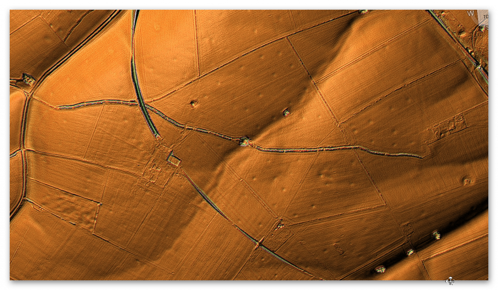
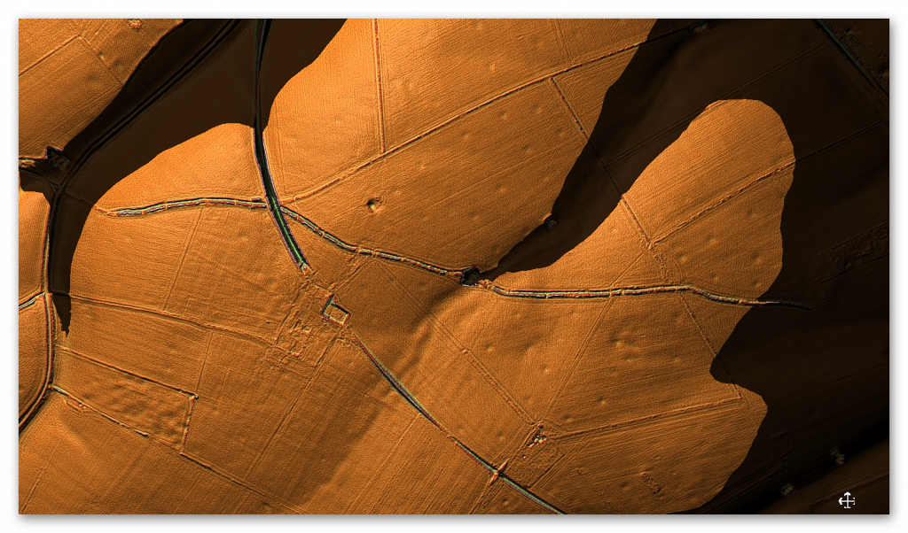
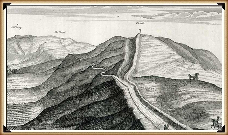
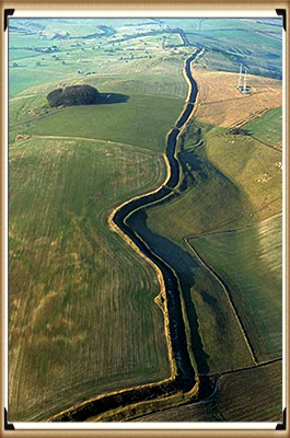
Why a Simple Fence Beats a Massive Dyke (and What That Means for History)

Preamble

I’ve published numerous blogs about prehistoric canals, emphasizing how traditional academia has repeatedly overlooked and misunderstood these remarkable features. Because I’m both a scientist and a technology enthusiast, I rely on AI as an invaluable tool to streamline my reasoning and present it in a way that readers from different backgrounds can appreciate. In this particular blog, I’m using AI to illustrate that conventional explanations for earthworks are likely flawed and need a thorough reexamination. Finally, I’m including a reference to my earlier work so readers can see how my new insights build on past research. (Why a Simple Fence Beats a Massive Dyke)

1. Introduction

Linear earthworks have mesmerized observers and archaeologists for generations. From Offa’s Dyke to Wansdyke, these elongated banks and ditches are typically explained as either military fortifications or boundary markers. Yet modern LiDAR surveys, fresh archaeological insights, and comparisons to simpler and more visible boundary methods raise serious doubts about those interpretations. Rather than straightforward defensive lines or frontiers, these earthworks display inconsistencies—missing sections, reversed ditches, and puzzling alignments—that challenge everything we thought we knew. (Why a Simple Fence Beats a Massive Dyke)

2. The Traditional Theories

For much of the 20th century, scholars argued that linear earthworks served one of two main functions: to repel invaders or to mark out political or tribal boundaries. Cyril Fox famously claimed Offa’s Dyke was built by King Offa of Mercia to keep the Welsh at bay, supposedly placing the ditch on the Welsh-facing side. Others suggested that massive earthworks like Wansdyke indicated territory lines, visually announcing where one kingdom ended and another began. In these narratives, the structures were well-defined, continuous, and purposeful. (Why a Simple Fence Beats a Massive Dyke)

3. Where Theory and Reality Diverge

Recent research has, however, underscored irreconcilable contradictions between theory and reality. Surveys indicate that many linear earthworks fail to maintain consistent ditches facing the purported enemy, contradicting the defensive premise. If these ditches were indeed built to ward off a threat, the alignment should be uniform. Meanwhile, if they were intended as boundary markers, gaps and missing stretches would logically undermine their entire purpose. Such discrepancies point to deeper complexities or altogether different functions. (Why a Simple Fence Beats a Massive Dyke)

4. The Enigma of Offa’s Dyke

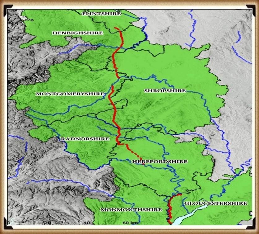
Offa’s Dyke is often touted as Britain’s largest linear earthwork, running roughly along the England–Wales border. Yet LiDAR surveys by researchers like Robert John Langdon reveal that nearly 60% of the structure is missing—lost to erosion, re-landscaping, or never built at all. Wide breaks exist for miles, making it hard to envision it as a single unbroken defensive or boundary line. Moreover, some ditches face in contradictory directions or do not match the typical expectation for a militaristic barrier, casting doubt on Fox’s original claim. (Why a Simple Fence Beats a Massive Dyke)

5. Misreported Defensive Features

Part of the confusion lies in Cyril Fox’s early 20th-century reporting. He described consistent ditch placements, but modern scrutiny shows that some are misaligned. Whether unintentional errors or confirmation bias, Fox’s descriptions have dominated academic discourse for decades. Only with modern technologies—like LiDAR and detailed aerial photography—have we begun to see how many segments contradict his drawings. These findings force us to question the once authoritative notion that Offa’s Dyke was unambiguously a martial structure. (Why a Simple Fence Beats a Massive Dyke)

6. Gaps and Their Implications

Wansdyke, second only to Offa’s Dyke in fame, also features significant gaps and disjointed sections. If linear earthworks were built at massive expense of time and labor to keep out invaders or mark territory, it is odd to see such discontinuity. A truly effective boundary marker, for instance, would leave no question of ownership or alignment. The existence of large “holes” in both Offa’s Dyke and Wansdyke conflicts with the fundamental idea that these were continuous frontier systems. (Why a Simple Fence Beats a Massive Dyke)

7. Simpler Methods: The Humble Fence

Historically, many societies addressed boundary needs in more efficient ways. For instance, fences—wooden posts and rails—are cost-effective, require minimal labor, and can be erected swiftly. These have been used around the world for farmland demarcation and livestock control. Compared to the colossal task of digging a deep ditch and piling an earthen bank, a simple fence stands out as both quicker and cheaper. So if Saxons or Britons needed a practical boundary, why opt for massive earthworks instead of lower-effort alternatives? (Why a Simple Fence Beats a Massive Dyke)

8. Living Hedges as Boundaries

In much of Medieval and Early Modern England, living hedges—often composed of hawthorn or blackthorn—provided robust, natural fences. They had the advantage of growing denser over time, deterring both trespassers and stray animals. The ecological benefits were a bonus. Unlike ditches, which can become silted and invisible, a carefully maintained hedge remains an obvious and impenetrable barrier. Again, this begs the question: if clarity and cost-effectiveness were paramount, why dig a ditch that’s prone to erosion and difficult to maintain? (Why a Simple Fence Beats a Massive Dyke)

9. The Great Hedge of India

The British-led Great Hedge of India in the 19th century offers an extreme example: a massive thorny barrier stretching hundreds of miles to enforce salt taxes. Though not precisely a “fence,” it underscores how a dense thicket can effectively channel or block human movement, often more reliably than an earthen ditch. Historical records of this hedge’s success in preventing smuggling illuminate that highly visible, well-maintained barriers are more functional than large-scale but patchy earthworks. (Why a Simple Fence Beats a Massive Dyke)

10. Walls and Fortified Edges

Other cultures have opted for monumental walls—be it Hadrian’s Wall in northern England or segments of the Great Wall of China. In both cases, the walls remain unmistakable even centuries later. They combine visibility, tangible presence, and durability. A ditch, by contrast, can be reabsorbed into the landscape relatively quickly, leaving only subtle impressions. If the goal was an unmistakable boundary or strong defense, these stone or brick structures seem more suitable than a meandering earthen rampart with frequent gaps. (Why a Simple Fence Beats a Massive Dyke)

11. Roman Frontier Systems

The Romans perfected the art of boundary lines with the Limes Germanicus—a system of watchtowers, palisades, forts, and sometimes ditches. Here, the ditches were auxiliary; the main statement of control came from a visible wall or wooden fence line, reinforced by active garrisons. If Offa’s Dyke or Wansdyke were truly boundary lines in the Roman or later medieval sense, we might expect corresponding watchtowers or regular station points. The absence of such features in many linear earthworks adds another layer of skepticism about their supposed frontier function. (Why a Simple Fence Beats a Massive Dyke)

12. Enclosure and Boundary in Early Modern Britain

Between the 15th and 19th centuries, Britain saw waves of enclosure, where open fields were divided by hedges or stone walls. This was cheaper and clearer for indicating ownership than earthworks. Visible markers helped landowners enforce property rights and control livestock. While these enclosures left an indelible mark on the British countryside, they did not involve monumental ditches. Thus, practicality and economic sense consistently drove fence- and hedge-building, implying that earthen dykes might have served a different, more specialized purpose. (Why a Simple Fence Beats a Massive Dyke)

13. Unusual Alignments and Topography

Returning to the dykes themselves, one finds confusing topographical alignments. Sections may run halfway down a hill rather than atop its crest, or snake around in near-circles (like Grim’s Ditch in Oxfordshire), defying the notion of a straightforward boundary or a defensive rampart commanding high ground. If these were serious military structures, they would naturally seek topographical advantage; if they were boundary markers, they would favor maximum visibility. Neither condition is consistently met. (Why a Simple Fence Beats a Massive Dyke)

14. Reimagining Their Purpose

Given these problems, many modern researchers—Robert John Langdon among them—propose that some linear earthworks are significantly older than the Roman or Saxon periods. They might have served ritual, symbolic, or even water-management functions in a prehistoric context. Comparisons to simpler boundary methods (fences, hedges, walls) worldwide suggest that if a society truly needed a cost-effective, permanent barrier, they would not opt for a massive, discontinuous ditch with questionable defensive or boundary value. (Why a Simple Fence Beats a Massive Dyke)

15. Toward a Deeper Understanding

Taken together, the modern LiDAR evidence, the glaring gaps, the odd alignments, and the juxtaposition with simpler global boundary practices demand a complete reassessment of Britain’s linear earthworks. Rather than dismiss them as straightforward Saxon lines or Roman leftover ditches, we should explore the possibility that they are part of a vast, prehistoric tapestry, repurposed or misconstrued by later cultures. Only by moving beyond the flawed “defense or boundary” paradigm can we hope to uncover their true origins and functions. Written by AI.

(Why a Simple Fence Beats a Massive Dyke)

Dykes Ditches and Earthworks

Introduction

Indeed, the modern term “dyke” or “dijk” can be traced back to its Dutch origins.  As early as the 12th century, the construction of Dykes in the Netherlands was a well-established practice.  One remarkable example of their ingenuity is the Westfriese Omringdijk, stretching an impressive 126 kilometres (78 miles), completed by 1250.  This Dyke was formed by connecting existing older ‘dykes’, showcasing the Dutch mastery in managing their aquatic landscape. (Dykes Ditches and Earthworks)

The Roman chronicler Tacitus even provides an intriguing historical account of the Batavi, a rebellious people who employed a unique defence strategy during the year AD 70.  They punctured the Dykes daringly, deliberately flooding their land to thwart their enemies and secure their retreat.  This historical incident highlights the vital role Dykes played in the region’s warfare and water management.

Originally, the word “dijk” encompassed both the trench and the bank, signifying a comprehensive understanding of the Dyke’s dual nature – as both a protective barrier and a channel for water control.  This multifaceted concept reflects the profound connection between the Dutch people and their battle against the ever-shifting waters that sought to reclaim their land.

The term “dyke” evolved as time passed, and its usage spread beyond the Dutch borders.  Today, it represents not only a symbol of the Netherlands’ engineering prowess but also a universal symbol of human determination in the face of the relentless forces of nature.  The legacy of these ancient Dykes lives on, a testament to the resilience and innovation of those who shaped the landscape to withstand the unyielding currents of time.

Upon studying archaeology, whether at university or examining detailed ordinance survey maps, one cannot help but encounter peculiar earthworks scattered across the British hillsides.  Astonishingly, these enigmatic features often lack a rational explanation for their presence and purpose.  Strangely enough, these features are frequently disregarded in academic circles, brushed aside, or provided with flimsy excuses for their existence.  The truth is, these earthworks defy comprehension unless we consider overlooked factors at play.

One curious observation revolves around the term “Dyke,” inherently linked to water.  It seems rather peculiar to apply such a word to an earthwork atop a hill unless an ancestral history has imparted its actual function through the ages.  Let us consider the celebrated “Offa’s Dyke,” renowned for its massive linear structure, meandering along some of the present boundaries between England and Wales.  This impressive feat stands as a testament to the past, seemingly demarcating the realms of the Anglian kingdom of Mercia and the Welsh kingdom of Powys during the 8th century.

However, delving further into the evidence and historical accounts challenges this seemingly straightforward explanation.  Roman historian Eutropius, in his work “Historiae Romanae Breviarium”, penned around 369 AD, mentions a grand undertaking by Septimius Severus, the Roman Emperor, from 193 AD to 211 AD.  In his pursuit of fortifying the conquered British provinces, Severus constructed a formidable wall stretching 133 miles from coast to coast.

Yet, intriguingly, none of the known Roman defences match this precise length.  Hadrian’s Wall, renowned for its defensive prowess, spans a mere 70 miles.  Could Eutropius have referred to Offa’s Dyke, which bears remarkable similarity to the Roman practice of initially erecting banks and ditches for defence?
Why a Simple Fence Beats a Massive Dyke
Figure 1- Offa’s Dyke (Red) – note that it is only complete if you connect the existing rivers to the ditches – (Why a Simple Fence Beats a Massive Dyke)

The enigma persists, leaving us to ponder whether Offa’s Dyke, with its impressive extent, holds an ancient Roman legacy or represents a separate and awe-inspiring creation.  As we navigate the depths of history, it becomes increasingly apparent that these earthworks hold hidden stories waiting to be revealed, revealing the multifaceted montage of Britain’s past and the extraordinary engineering feats that have shaped its landscape through the ages.

Indeed, history is a complex tapestry woven with a multitude of threads, and the interpretation of archaeological evidence often shapes our understanding of the past.  Throughout history, conquerors and civilisations have repurposed existing features, such as ditches, augmenting them with defensive banks and walls to suit their strategic needs.  The Romans and the Normans, among others, have demonstrated this practice.

In the case of Offa’s Dyke, the enigma deepens if we consider the possibility that the Romans were the architects behind its creation.  Such a scenario challenges the conventional attribution of the Dyke to King Offa and raises questions about the true origins and purpose of this massive linear earthwork.  Archaeological realities, or perhaps misinterpretations, can indeed hold the key to unveiling hidden facets of our history.

It is essential to approach historical accounts and archaeological evidence with a critical eye and an openness to multiple interpretations.  The past often leaves tantalising clues that may require careful examination and reevaluation.  By embracing the complexities and uncertainties of history, we can better appreciate the intricacies of human civilisation and the varied influences that have shaped it over the ages.

In pursuing truth, historians and archaeologists must remain receptive to new insights, allowing the evidence to guide their conclusions, even if it means challenging established narratives.  By unravelling these historical puzzles, we can better understand our collective heritage, appreciating the rich combination of human experiences and the myriad forces that have moulded history. (Why a Simple Fence Beats a Massive Dyke)

Cross-Dykes

The peculiar earthworks etched upon the British landscape have not eluded the discerning eyes of archaeologists and cartographers alike.  These enigmatic features, often defying conventional explanations, have intrigued the curious minds of scholars and historians.  A new designation, “Cross-Dykes,” has partially acknowledged their distinctiveness and unusual placement.
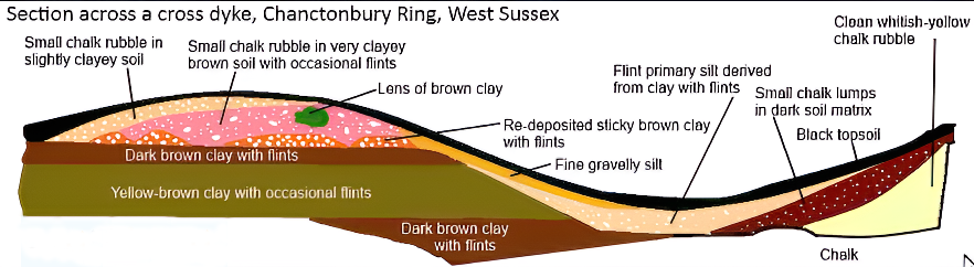
Cross-Dyke (Dykes Ditches and Earthworks)
(Why a Simple Fence Beats a Massive Dyke)

Cross-Dykes, substantial linear earthworks, grace the upland terrain, their lengths varying between 0.2km and 1km.  Besides one or more banks, they bear ditches, running parallel in an enigmatic dance upon ridges and spurs.  Historical excavations and analogies with related monuments paint a broader picture, extending back to the millennia of the Middle Bronze Age.  Their purpose, though elusive, leans towards territorial boundaries, delineating parcels of land within ancient communities.  But beyond such boundaries, they may have served as tracks or routes for cattle or even as defensive structures.

A pivotal element to grasp lies in the acknowledgement that Cross-Dykes have, at their core, a prehistoric origin.  No longer shackled to erroneous notions of Saxon or medieval connections, these ancient features warrant a fresh lens to illuminate their true significance.  The names of notable earthworks, like Wansdyke and Offa’s Dyke, may well bear a more profound revision in light of this newfound understanding.

Yet, we must not overlook the Historic England claim that only “very few” of these earthworks remain.  The broader landscape contradicts this assertion, teeming with over 1500 scheduled ‘Linear Earthworks,’ showcasing the scope and magnitude of these intriguing remnants.  Moreover, advancements in the art of surveying, as heralded by LiDAR, have revealed hidden troves of earthworks, once lost to the unyielding grasp of time and misinterpretation.

To critique archaeological theories with acuity, one must first comprehend their tenets.  The evolving narrative seeks to unravel the enigma shrouding these linear earthworks, breathing life into ancient histories etched in the soil.  Embracing a spirit of inquiry and remaining receptive to novel discoveries, we embark on a quest of unravelling the untold stories lingering within the terrain.  With each revelation, the layers of history peel back, revealing a canvas of human ingenuity, perseverance, and the grandeur of the past, etched forever in the folds of Britain’s landscape.  Archaeologists have (partially) recognised that these many earthworks are placed in strange areas for conventional explanations.  Consequently, they have attempted to split a section away from the global term earthworks and called them ‘Cross-Dykes’. (Why a Simple Fence Beats a Massive Dyke)

Boundary Markers

With their reliance on earthworks as territorial markers, the historical hypothesis surrounding land boundaries emerges as a thought-provoking inquiry.  Yet, as we delve deeper into the evidence, a poignant need for more compelling proof becomes evident.  Throughout history, societies have indeed relied on markers to delineate their domains, be they natural features like rivers or human-made constructs like hedgerows.  The practicality and economy of such choices are undeniable, especially when contrasted with the labour-intensive and costly endeavour of constructing extensive ditches and banks.

In the case of the renowned Offa’s Dyke, a perplexing puzzle emerges.  The border, at times, gracefully follows the course of a river, a logical and sensible demarcation.  However, the sudden shift to an earthwork set behind the same river defies easy explanation.  Such inconsistency leaves us questioning the premise of these earthworks as unequivocal markers.  The presence of inexplicable gaps in the land border only deepens the enigma, raising further doubt about the validity of the hypothesis.

We must seek coherence and reason within any historical proposition.  The current hypothesis falls short in offering a convincing rationale for this transition from river to earthwork, and it fails to address the glaring accessibility of the river as a natural and readily available boundary marker. (Why a Simple Fence Beats a Massive Dyke)
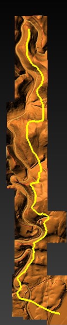
Path of Offa's Dyke - showing its not remotely straight
(Why a Simple Fence Beats a Massive Dyke)
Figure 2 – Path of Offa’s Dyke – showing its not remotely straight

As we navigate the terrain of ancient earthworks, a commitment to rigorous scrutiny is paramount.  Only by subjecting our hypotheses to relentless examination can we hope to uncover the authentic truths that lie obscured beneath the layers of time.  In embracing a spirit of inquiry and humility, we may yet unlock the profound secrets of these age-old earthworks, shedding light on the intricate relationships between humanity and the landscapes they once inhabited.  The pursuit of understanding is a journey marked by discovery and wonder, and in this voyage, we honour the legacy of those who once shaped the contours of history upon British soil. (Why a Simple Fence Beats a Massive Dyke)

Defensive Features

According to the pronouncements of esteemed Historical England, discerning the precise function of ancient boundaries proves to be an intricate endeavour.  Whether they were intended for defence, stock-herding, or carrying symbolic significance remains elusive.  In truth, most boundaries likely fulfilled a mosaic of roles, their purpose evolving and adapting over time.  To presume that significant boundaries were solely for defence and smaller ones merely for livestock control would be an oversimplification of the intricate tapestry of history.

These artificial boundaries’ form, extent, and very existence offer vital clues, providing glimpses into their intended purposes.  Additionally, their construction’s social and political context can provide insightful context.  Yet, as we probe deeper into the historical narrative, it is evident that the written accounts primarily speak of Roman and Norman defence systems.  With their ingenuity, the Romans devised the “ankle breaker” ditch – a V-shaped trench with a heightened counterscape masterfully designed to ensnare attackers or thwart mounted assailants.

These ingenious Roman ditches, predominantly surface near Roman sites, are conspicuously absent from 90% of excavations across Linear Earthworks.  This absence challenges the prevailing hypothesis and prompts a reevaluation of past assumptions.  In particular, investigations into Dykes such as Offa’s have uncovered an unsettling revelation – the defensive banks, in over 10% of the alignment, face the “wrong way.” This finding raises questions about the potential bias that may have influenced the support for this theory in the past.

As the archaeological landscape evolves, a shift is subtly underway, with many archaeologists quietly distancing themselves from this 20th-century hypothesis.  The quest for truth demands unyielding inquiry, and as more mysteries come to light, the intricacies of ancient earthworks unfurl before our eyes.  In the spirit of intellectual progress, we must approach each enigma with an open mind, ever eager to grasp the trutyh over mythology. (Why a Simple Fence Beats a Massive Dyke)

(Why a Simple Fence Beats a Massive Dyke)

2025 Update

Historic England Confirms the Prehistoric Origins of Britain’s Linear Earthworks

Why Offa’s and Wansdyke Are Not Saxon Ditches

By The Prehistoric AI Team 
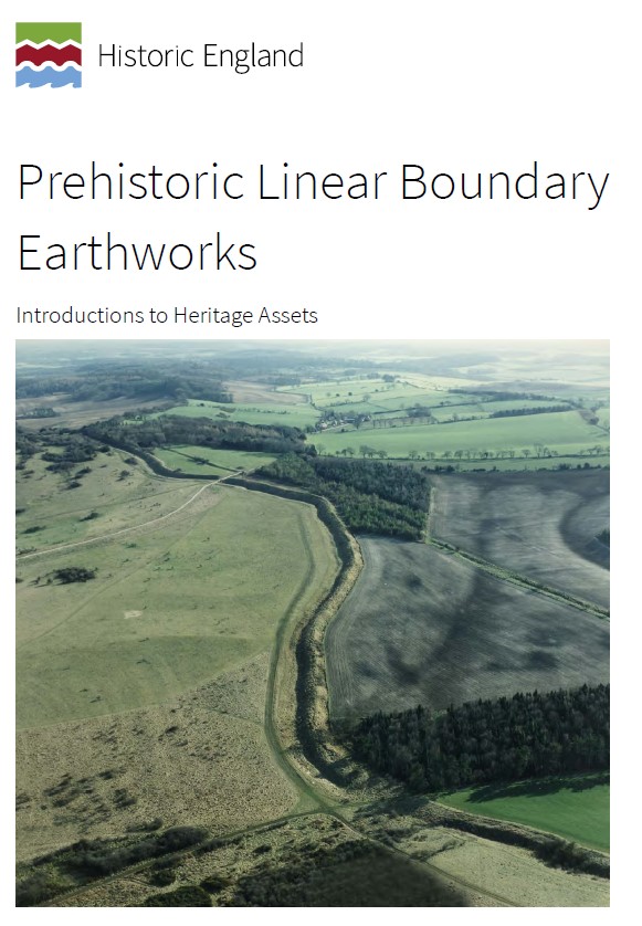
Prehistoric Liear Boundary Hoax

For over a century, archaeologists have confidently told the public that Britain’s great linear earthworks—Offa’s Dyke, Wansdyke, and their lesser-known cousins—were “Saxon defensive boundaries.” Yet even the government’s own heritage body now quietly admits otherwise.

In its official publication HEAG 219: Prehistoric Linear Boundary Earthworks (Historic England, 2018), the evidence is laid out in black and white: these monumental ditches and banks are not the product of medieval kingdoms but of prehistoric engineering, reaching back thousands of years before Offa or Rome.

1. Historic England’s Own Words

“From the Neolithic period onwards in the British Isles, natural boundaries such as watercourses and escarpments have been supplemented by artificial boundaries, often formed by a ditch and bank.”
(HEAG 219, p.2)

That sentence alone demolishes the Saxon myth. These “artificial boundaries” appear from around 3600 BCE, the same period as Britain’s causewayed enclosures and early field systems.

“The earliest conventional linear earthwork so far confirmed, dating to around 3600 BC, follows the crest of the western escarpment of Hambleton Hill, Dorset, for perhaps as much as 3 km.”
(HEAG 219, p.7)

In other words, the engineering tradition behind Offa’s and Wansdyke was already flourishing five thousand years earlier than the supposed Saxon period.

2. Confusion by Reuse

“Some of these early boundaries… continued to structure the social and economic landscape through the Iron Age and into the Roman period. Indeed, some have seen continuous use, or repeated re-use, from prehistory to the present day.”
(HEAG 219, p.7)

This statement is key.
What later archaeologists labelled as “Roman” or “Saxon” were often prehistoric earthworks re-used by later peoples. Defensive adaptations may have been made, but the physical structures already existed—centuries or millennia earlier.

Langdon’s LiDAR analysis of Wansdyke and Offa’s Dyke shows this perfectly: continuous, water-connected segments, truncated by rivers and palaeochannels, betray origins in a hydrological engineering system, not a medieval frontier.

3. Historic England Admits Mis-Dating Risks

“Prehistoric examples can be confused with medieval or later ones… Their form is not often diagnostic.”
(HEAG 219, p.7)

This rare confession from within Historic England supports Langdon’s long-standing criticism of archaeological dating methods. When earthworks lack carbonised deposits, dating often depends on surface finds—antler picks, pottery sherds, or even stray Roman coins—leading to circular logic.

As Prehistoric Dykes (Canals) argued, this flawed reasoning has turned prehistoric infrastructure into “Saxon defences” by default.

4. Functional Variety, Not Fortification

“It is often difficult to determine whether a particular boundary was used for defence, for stock-herding, or purely as a symbol; in truth, most boundaries probably served all of these functions to varying degrees.”
(HEAG 219, p.2)

The report concedes that no single explanation fits. The traditional defensive model collapses under scrutiny: there are no battle remains, no arrowheads, and no consistent rampart orientations.

This aligns with Langdon’s hydrological interpretation—seeing these earthworks as water management and navigation canals formed when Britain’s post-glacial landscape still retained a higher water table. Their engineering precision makes sense when viewed as prehistoric canalisation, not Saxon militarism.

5. The Official Timeline

Historic England’s own chart places linear boundaries firmly in the Neolithic and Bronze Age, with only reuse continuing into later eras:

Linear Boundaries Timeline (HEAG 219, p.
4000 BC – Neolithic beginnings
1500 BC – Bronze Age expansion
0 AD – Roman reuse

The Saxon period doesn’t even feature.

6. What This Means

The implications are profound. Historic England has, perhaps unintentionally, validated the central premise of the Prehistoric Dyke Hypothesis:


Britain’s linear earthworks are prehistoric hydraulic and boundary systems, later adopted but not created by historical kingdoms.

The narrative of “Saxon kings digging 100-mile ditches by hand” finally collapses under the weight of its own impossibility—and the evidence from both LiDAR and the nation’s own heritage authority.

7. A New Understanding

The HEAG 219 publication is cautious in tone, but its data speaks volumes. The earliest linear boundaries coincide with the rise of complex water management systems, just as Langdon’s LiDAR work shows canal-like forms and river terminations.

It is time to update the textbooks:
Wansdyke, Offa’s Dyke, Car Dyke and their lesser cousins are prehistoric canals—part of a sophisticated hydrological network that once crisscrossed a flooded Britain.

Conclusion

Even Historic England now concedes that Britain’s linear earthworks belong to prehistory, not the Dark Ages.


By accepting this evidence, we move beyond folklore and into a genuinely scientific framework—one where landscape engineering, water management, and maritime trade define our ancestors’ genius.

Sources:

  • Historic England (2018) Prehistoric Linear Boundary Earthworks: Introductions to Heritage Assets (HEAG 219).
  • Langdon, R.J. (2022) Prehistoric Dykes (Canals) – Wansdyke v1.2.
  • Langdon, R.J. (2024) Twigs, Charcoal, and the Death of the Saxon Dyke Myth.

Exploring Prehistoric Britain: A Journey Through Time

My blog delves into the fascinating mysteries of prehistoric Britain, challenging conventional narratives and offering fresh perspectives based on cutting-edge research, particularly using LiDAR technology. I invite you to explore some key areas of my research. For example, the Wansdyke, often cited as a defensive structure, is re-examined in light of new evidence. I’ve presented my findings in my blog post Wansdyke: A British Frontier Wall – ‘Debunked’, and a Wansdyke LiDAR Flyover video further visualizes my conclusions.

My work also often challenges established archaeological dogma. I argue that many sites, such as Hambledon Hill, commonly identified as Iron Age hillforts are not what they seem. My posts Lidar Investigation Hambledon Hill – NOT an ‘Iron Age Fort’ and Unmasking the “Iron Age Hillfort” Myth explore these ideas in detail and offer an alternative view. Similarly, sites like Cissbury Ring and White Sheet Camp, also receive a re-evaluation based on LiDAR analysis in my posts Lidar Investigation Cissbury Ring through time and Lidar Investigation White Sheet Camp, revealing fascinating insights into their true purpose. I have also examined South Cadbury Castle, often linked to the mythical Camelot56.

My research also extends to the topic of ancient water management, including the role of canals and other linear earthworks. I have discussed the true origins of Car Dyke in multiple posts including Car Dyke – ABC News PodCast and Lidar Investigation Car Dyke – North Section, suggesting a Mesolithic origin2357. I also explore the misidentification of Roman aqueducts, as seen in my posts on the Great Chesters (Roman) Aqueduct. My research has also been greatly informed by my post-glacial flooding hypothesis which has helped to inform the landscape transformations over time. I have discussed this hypothesis in several posts including AI now supports my Post-Glacial Flooding Hypothesis and Exploring Britain’s Flooded Past: A Personal Journey

Finally, my blog also investigates prehistoric burial practices, as seen in Prehistoric Burial Practices of Britain and explores the mystery of Pillow Mounds, often mistaken for medieval rabbit warrens, but with a potential link to Bronze Age cremation in my posts: Pillow Mounds: A Bronze Age Legacy of Cremation? and The Mystery of Pillow Mounds: Are They Really Medieval Rabbit Warrens?. My research also includes the astronomical insights of ancient sites, for example, in Rediscovering the Winter Solstice: The Original Winter Festival. I also review new information about the construction of Stonehenge in The Stonehenge Enigma.

(Why a Simple Fence Beats a Massive Dyke)
Further Reading

For those interested in British Prehistory, visit www.prehistoric-britain.co.uk, a comprehensive resource featuring an extensive collection of archaeology articles, modern LiDAR investigations, and groundbreaking research. The site also includes insights and extracts from the acclaimed Robert John Langdon Trilogy, a series of books exploring Britain during the Prehistoric period. Titles in the trilogy include The Stonehenge Enigma, Dawn of the Lost Civilisation, and The Post Glacial Flooding Hypothesis, offering compelling evidence about ancient landscapes shaped by post-glacial flooding.

To further explore these topics, Robert John Langdon has developed a dedicated YouTube channel featuring over 100 video documentaries and investigations that complement the trilogy. Notable discoveries and studies showcased on the channel include 13 Things that Don’t Make Sense in History and the revelation of Silbury Avenue – The Lost Stone Avenue, a rediscovered prehistoric feature at Avebury, Wiltshire.

In addition to his main works, Langdon has released a series of shorter, accessible publications, ideal for readers delving into specific topics. These include:

For active discussions and updates on the trilogy’s findings and recent LiDAR investigations, join our vibrant community on Facebook. Engage with like-minded enthusiasts by leaving a message or contributing to debates in our Facebook Group.

Whether through the books, the website, or interactive videos, we aim to provide a deeper understanding of Britain’s fascinating prehistoric past. We encourage you to explore these resources and uncover the mysteries of ancient landscapes through the lens of modern archaeology.

For more information, including chapter extracts and related publications, visit the Robert John Langdon Author Page. Dive into works such as The Stonehenge Enigma or Dawn of the Lost Civilisation, and explore cutting-edge theories that challenge traditional historical narratives.

(Why a Simple Fence Beats a Massive Dyke)
Other Blogs

s

t

(Why a Simple Fence Beats a Massive Dyke)
Mesolithic Stonehenge

Introduction

Mesolithic Stonehenge

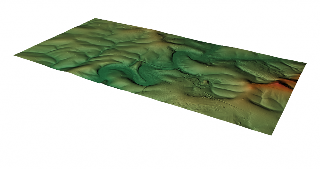
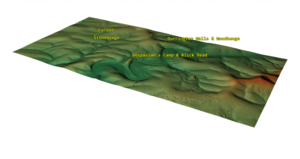
Using LiDAR to examine Stonehenge reveals a surprising detail: the monument isn’t situated at the highest point in the landscape. Instead, it lies midway down a slope, despite nearby elevated sites like Vespasian Camp, near Blick Mead, where the Open University uncovered Mesolithic fire pits with evidence of cooked meat. This raises an intriguing question: why was Stonehenge built in this seemingly less advantageous location?

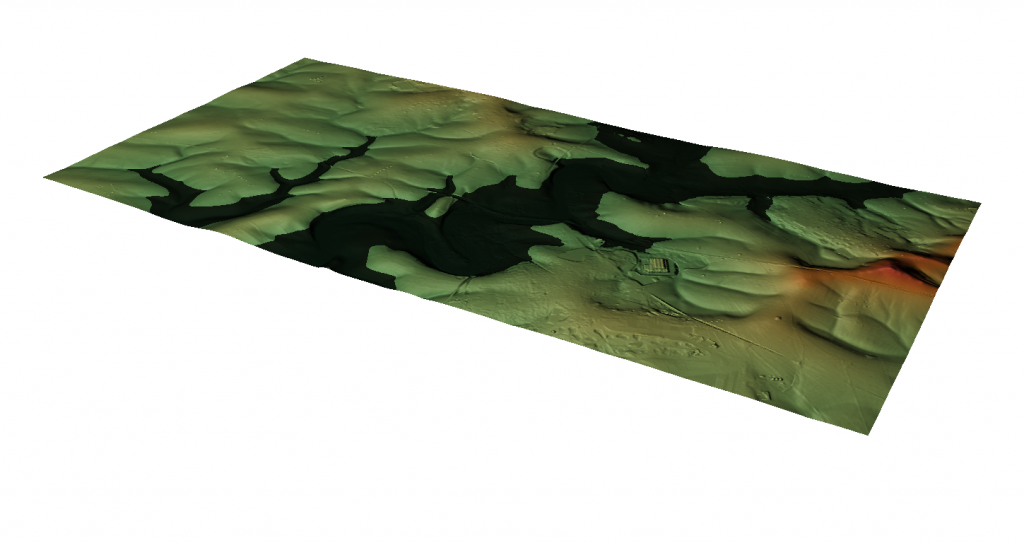
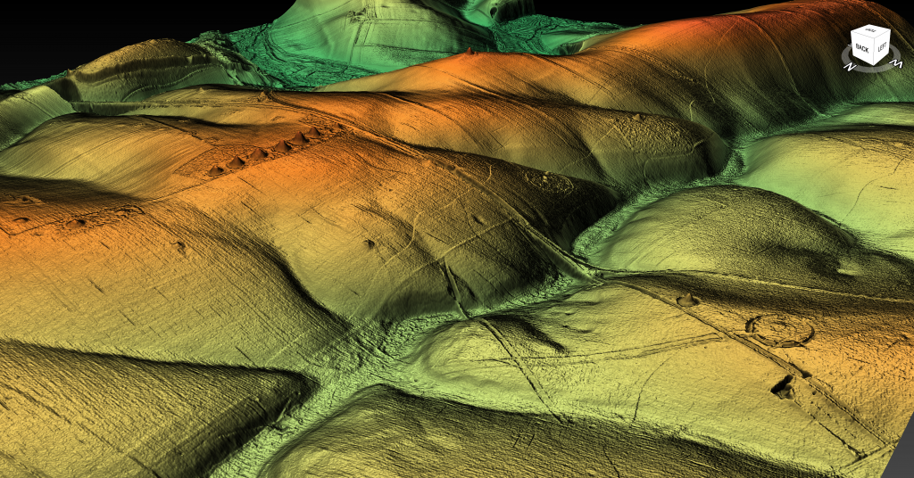
LiDAR technology offers a compelling way to answer this. By creating a detailed 3D landscape model, LiDAR highlights terrain features far more effectively than traditional OS maps or on-site surveys, where important details can easily be overlooked. From a virtual vantage point approximately 100 feet above the ground, facing south, it becomes clear that Stonehenge is perched on the edge of what is now a dry valley. However, during the Mesolithic period, this valley was far from dry; it was an active waterway fed by natural springs, which flowed southward into the River Avon. (Mesolithic Stonehenge)
Blick Mead - Mesolithic Stonehenge
Blick Mead – Mesolithic Stonehenge

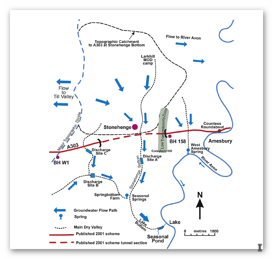
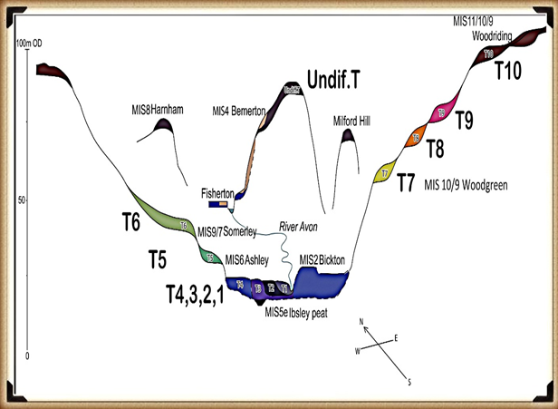
These springs were fueled by a high groundwater table, a feature characteristic of post-Ice Age conditions when meltwater replenished underground aquifers. Springs are categorized by their flow rate, with the most productive reaching up to 2,800 litres per second. Evidence suggests that during the Mesolithic, the “Stonehenge Bottom” valley was home to multiple springs, collectively discharging a significant volume of water into the River Avon. Modern core samples taken while surveying the proposed Stonehenge tunnel have confirmed this. The core data revealed that the water table in this area was significantly higher than previously estimated, forcing the tunnel design to be revised and deepened—at a cost of millions. This finding directly challenges the long-held views of archaeologists who have advised on Stonehenge’s historical groundwater levels, casting doubt on their previous peer-reviewed conclusions. (Mesolithic Stonehenge)
Stonehenge Bottom - Mesolithic Stonehenge
Stonehenge Bottom – Mesolithic Stonehenge

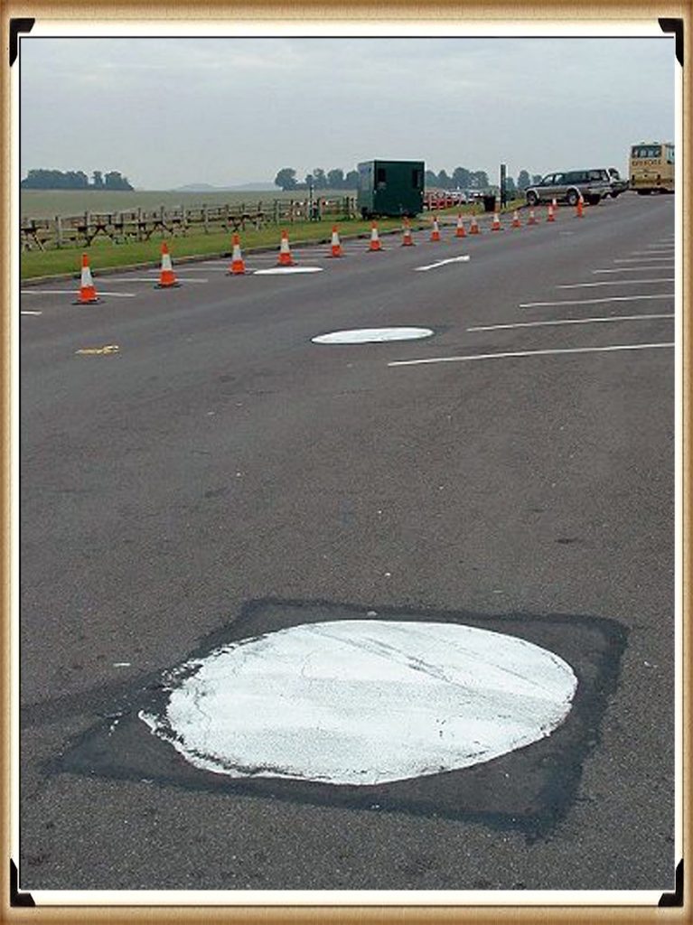
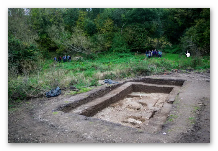
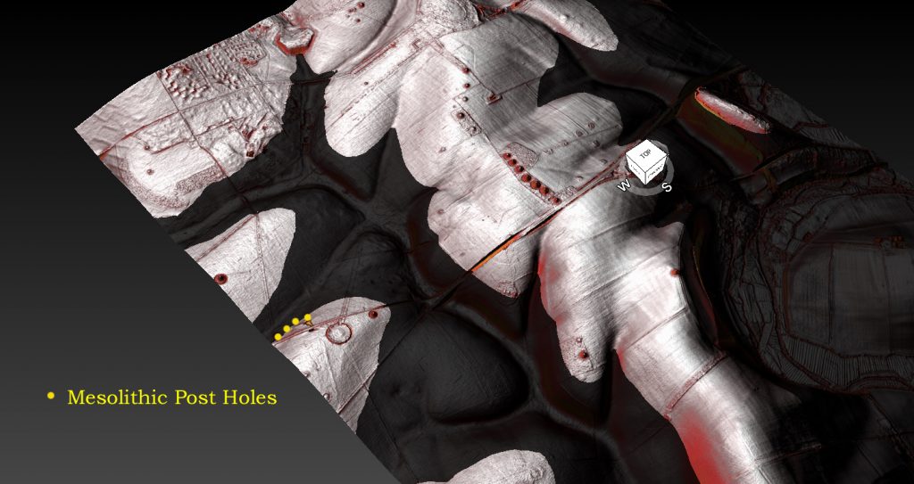
Using LiDAR simulations, we can reconstruct how this water would have shaped the landscape. Archaeological evidence indicates that the water table—and thus the river’s shoreline—was approximately 30 meters higher than today, flooding the valley up to the old Stonehenge car park at 97 meters above sea level. This hypothesis is supported by discoveries made during the construction of the old car park in 1966, where three large post holes were uncovered. These holes cut into the chalk bedrock around 9,000–10,000 years ago and contained silt and sand indicative of a shoreline environment. (Mesolithic Stonehenge)

Stonehenge Bottom in the Mesolithic - Mesolithic Stonehenge
Stonehenge Bottom in the Mesolithic – Mesolithic Stonehenge

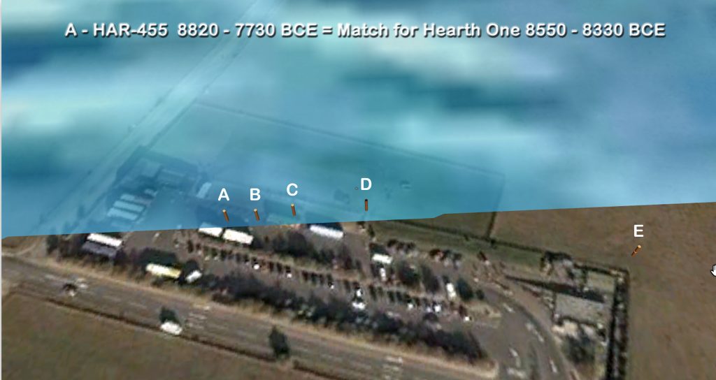
Radiocarbon dating of pine charcoal from the base of these post holes dates their use to approximately 8,300 BCE. Additionally, more post holes have been discovered in the same area, forming a peculiar alignment. Five such holes have been identified, all dating to the same early Mesolithic period. Intriguingly, these dates align with hearths found at Craig Rhos-y-Felin, the quarry believed to be the source of Stonehenge’s Bluestones. Further supporting this connection is the discovery of hearths at another Bluestone quarry, Carn Goedog, also carbon-dated to approximately 8,400 BCE. These findings strengthen the case for a sophisticated network of activity linking Stonehenge to its quarry sites in Wales. (Mesolithic Stonehenge)

Stonehenge Old Car Park - Mesolithic Stonehenge
Stonehenge Old Car Park – Mesolithic Stonehenge

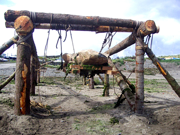
The old car park is located 10 meters lower than Stonehenge, and further dating evidence from charcoal within the Sarsen circle (confirmed by Darvill and Wainwright in 2008) suggests the site was in use as early as 7,200 BCE. This strongly connects the Mesolithic post holes, possibly used as mooring points for boats, to the later development of Stonehenge. The post holes may have supported cross-beams, functioning as primitive yet effective lifting mechanisms. Boats tied to these beams could utilize the natural rise and fall of the river’s tides to lift heavy stones effortlessly. This would mark an early use of hydraulic lifting principles, demonstrating the ingenuity of Mesolithic communities. (Mesolithic Stonehenge)

Post Hole A Matches Quarry Hearth Date - Mesolithic Stonehenge
Post Hole A Matches Quarry Hearth Date – Mesolithic Stonehenge

Despite this compelling evidence, mainstream archaeologists often dismiss the idea of a higher River Avon during the Mesolithic. Instead, they suggest these post holes housed “ceremonial totem poles” erected by random hunter-gatherers. However, this explanation is riddled with logical flaws. The post holes are over a meter wide, implying the use of enormous pine trees, which would have required significant effort to fell with stone tools—an unlikely endeavour for mere ceremonial markers. Furthermore, the poles were periodically replaced over more than a thousand years, suggesting a practical rather than symbolic, purpose. (Mesolithic Stonehenge)

Bluestone lifting device - Mesolithic Stonehenge
Bluestone lifting device – Mesolithic Stonehenge

The discovery of modern core samples in the Stonehenge Bottom Valley only adds to the scepticism regarding traditional archaeological interpretations. For decades, experts advising on Mesolithic groundwater levels have underestimated the height of the water table in the region. The recent core sample findings confirm my hypothesis of a higher water table and highlight the limitations of earlier studies. These experts, whose opinions were once considered definitive, now find their conclusions undermined by hard data—data that has already necessitated expensive revisions to modern engineering projects. (Mesolithic Stonehenge)

Modern Core Samples show Ground Water in the Area – Mesolithic Stonehenge

LiDAR and archaeological evidence together paint a picture of Stonehenge as part of a peninsula surrounded by water in its early days. This watery context may hold the key to understanding why this iconic monument was built where it stands today. The valley would have provided a natural harbour, making it an ideal location for landing heavy stones transported by boat. The site’s proximity to abundant water resources also suggests that it may have held significant practical and symbolic value for the people who built it.

It’s time to reconsider long-held assumptions about Stonehenge. The combination of LiDAR, modern core samples, and radiocarbon dating has provided a richer, more nuanced understanding of its landscape and early history. These findings challenge traditional narratives and open the door to exciting new interpretations about how and why this monumental site was created. (Mesolithic Stonehenge)

The Stonehenge Book

Video

(Mesolithic Stonehenge)

Synopsys

Stonehenge, a timeless enigma etched in stone and earth, has stood as a formidable puzzle challenging the intellects of archaeologists and historians alike. Despite the myriad attempts, including books, TV programs, and academic conferences, the secrets of these ancient stones and their encircling ditches have proven elusive. Against this backdrop, we scrutinise the existing thirteen hypotheses, each presenting its narrative but collectively lacking a coherent thread.

In adopting the deductive reasoning akin to Sherlock Holmes, we endeavour to weave these disparate threads into a unified tapestry that not only unravels the mystery of Stonehenge but also shakes the foundations of established academic narratives. This intellectual journey may induce some discomfort as we challenge conventional perceptions and invite a reevaluation of our understanding of the past. Apologies are extended in advance for any cognitive dissonance, but the pursuit of truth and reason mandates an unfiltered presentation of the facts.So, fasten your seatbelts for an expedition into the archaeological unknown.

As we navigate this intellectual rollercoaster, be prepared for a revelation that might reshape our understanding of Stonehenge and question the foundations of our historical narratives. The dawn of a new archaeological era awaits promising insights that could leave even the most curious minds astonished. As we delve into this intellectual rabbit hole, be ready for a revelation that could make Alice astonished.(Mesolithic Stonehenge)

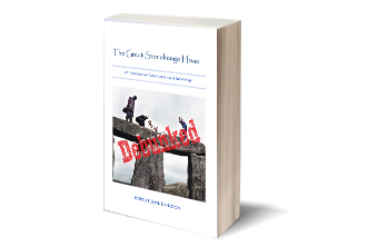
Robert John Langdon (2023) – (The Stonehenge Hoax)

The Stonehenge Hoax
The Great Stonehenge Hoax

FREE LiDAR Maps

Here is the perfect resaerch resource for any bidding arcaheologist – 3D LiDAR Maps – there are free and can be downloaded by clicking the Right Site of the Mouse and saving it to your hard Drive for closer inspection, with you PC/Mobile reader software. (Mesolithic Stonehenge)

FREE Stonehenge LiDAR 8K Map

FREE Stonehenge LiDAR Maps

FREE Stonehenge LiDAR water Map

FREE Stonehenge LiDAR Maps

FREE Stonehenge LiDAR 3D Map

(FREE Stonehenge LiDAR Maps)

Exploring Prehistoric Britain: A Journey Through Time

My blog delves into the fascinating mysteries of prehistoric Britain, challenging conventional narratives and offering fresh perspectives based on cutting-edge research, particularly using LiDAR technology. I invite you to explore some key areas of my research. For example, the Wansdyke, often cited as a defensive structure, is re-examined in light of new evidence. I’ve presented my findings in my blog post Wansdyke: A British Frontier Wall – ‘Debunked’, and a Wansdyke LiDAR Flyover video further visualizes my conclusions.

My work also often challenges established archaeological dogma. I argue that many sites, such as Hambledon Hill, commonly identified as Iron Age hillforts are not what they seem. My posts Lidar Investigation Hambledon Hill – NOT an ‘Iron Age Fort’ and Unmasking the “Iron Age Hillfort” Myth explore these ideas in detail and offer an alternative view. Similarly, sites like Cissbury Ring and White Sheet Camp, also receive a re-evaluation based on LiDAR analysis in my posts Lidar Investigation Cissbury Ring through time and Lidar Investigation White Sheet Camp, revealing fascinating insights into their true purpose. I have also examined South Cadbury Castle, often linked to the mythical Camelot56.

My research also extends to the topic of ancient water management, including the role of canals and other linear earthworks. I have discussed the true origins of Car Dyke in multiple posts including Car Dyke – ABC News PodCast and Lidar Investigation Car Dyke – North Section, suggesting a Mesolithic origin2357. I also explore the misidentification of Roman aqueducts, as seen in my posts on the Great Chesters (Roman) Aqueduct. My research has also been greatly informed by my post-glacial flooding hypothesis which has helped to inform the landscape transformations over time. I have discussed this hypothesis in several posts including AI now supports my Post-Glacial Flooding Hypothesis and Exploring Britain’s Flooded Past: A Personal Journey

Finally, my blog also investigates prehistoric burial practices, as seen in Prehistoric Burial Practices of Britain and explores the mystery of Pillow Mounds, often mistaken for medieval rabbit warrens, but with a potential link to Bronze Age cremation in my posts: Pillow Mounds: A Bronze Age Legacy of Cremation? and The Mystery of Pillow Mounds: Are They Really Medieval Rabbit Warrens?. My research also includes the astronomical insights of ancient sites, for example, in Rediscovering the Winter Solstice: The Original Winter Festival. I also review new information about the construction of Stonehenge in The Stonehenge Enigma.

(Mesolithic Stonehenge)

Further Reading

For those interested in British Prehistory, visit www.prehistoric-britain.co.uk, a comprehensive resource featuring an extensive collection of archaeology articles, modern LiDAR investigations, and groundbreaking research. The site also includes insights and extracts from the acclaimed Robert John Langdon Trilogy, a series of books exploring Britain during the Prehistoric period. Titles in the trilogy include The Stonehenge Enigma, Dawn of the Lost Civilisation, and The Post Glacial Flooding Hypothesis, offering compelling evidence about ancient landscapes shaped by post-glacial flooding.

To further explore these topics, Robert John Langdon has developed a dedicated YouTube channel featuring over 100 video documentaries and investigations that complement the trilogy. Notable discoveries and studies showcased on the channel include 13 Things that Don’t Make Sense in History and the revelation of Silbury Avenue – The Lost Stone Avenue, a rediscovered prehistoric feature at Avebury, Wiltshire.

In addition to his main works, Langdon has released a series of shorter, accessible publications, ideal for readers delving into specific topics. These include:

For active discussions and updates on the trilogy’s findings and recent LiDAR investigations, join our vibrant community on Facebook. Engage with like-minded enthusiasts by leaving a message or contributing to debates in our Facebook Group.

Whether through the books, the website, or interactive videos, we aim to provide a deeper understanding of Britain’s fascinating prehistoric past. We encourage you to explore these resources and uncover the mysteries of ancient landscapes through the lens of modern archaeology.

For more information, including chapter extracts and related publications, visit the Robert John Langdon Author Page. Dive into works such as The Stonehenge Enigma or Dawn of the Lost Civilisation, and explore cutting-edge theories that challenge traditional historical narratives.

(Mesolithic Stonehenge)

Other Blogs

s

t

(Mesolithic Stonehenge)

Antonine Wall – Prehistoric Canals (Dykes)

Introduction

Antonine Wall
Antonine Wall

Linear earthworks such as dykes, Hadrian’s Wall (including the Vallum), and the Antonine Wall have long been interpreted as defensive structures or boundary markers by archaeologists. However, emerging evidence challenges these traditional views, suggesting these features may have functioned as prehistoric canals. By examining construction techniques, alignments, and environmental contexts, this groundbreaking research presents a compelling argument that these structures were engineered for water management and transport, reflecting sophisticated societal planning in ancient Britain.


A key focus is the East Wansdyke, which has been traditionally described as a defensive dyke. Comprehensive surveys reveal that its engineering—such as level gradients, excavation methods, and proximity to water sources—aligns more closely with canal systems than with military purposes. Using features like natural valleys and watercourses further strengthens the hypothesis that this and similar earthworks served as functional waterways, enabling efficient transport and trade across regions.

Antonine Wall
Antonine Wall


This re-evaluation extends to iconic features like Hadrian’s Wall and its associated Vallum. Traditionally misinterpreted as solely defensive, the Vallum is revealed through this research as a singular, cohesive structure, potentially integral to a water-based transport network rather than a mere boundary marker. Considering these features’ environmental context and engineering specifics, the research provides a unified interpretation of their original purpose, suggesting a sophisticated system for managing resources and enabling connectivity across ancient Britain.


The implications of this research are profound, not only for redefining the purpose of linear earthworks but also for understanding the societal and technological capabilities of ancient Britons. This work invites further debate and investigation by proposing a cohesive and evidence-backed theory, aiming to bridge gaps between traditional archaeology and scientific methodologies. It also highlights the need for a fresh approach to interpreting Britain’s prehistoric landscape—one grounded in innovation and a willingness to question long-held assumptions

Case Study – The Antonine Wall

It would be amiss if we did not look at the ‘other’ Roman wall in some detail as it is part of the great ‘enigma’. (Antonine Wall)

Antonine Wall
Antonine Wall

Wikipedia

The Antonine Wall, known to the Romans as Vallum Antonini, was a turf fortification on stone foundations built by the Romans across what is now the Central Belt of Scotland, between the Firth of Forth and the Firth of Clyde. Built some twenty years after Hadrian’s Wall to the south and intended to supersede it, while it was garrisoned, it was the northernmost frontier barrier of the Roman Empire. It spanned approximately 63 kilometres (39 miles) and was about 3 metres (10 feet) high and 5 metres (16 feet) wide. Lidar scans have been carried out to establish the length of the wall and the Roman distance units used.

 Security was bolstered by a deep ditch on the northern side. It is thought that there was a wooden palisade on top of the turf. The barrier was the second of two “great walls” created by the Romans in Great Britain in the second century AD. Its ruins are less evident than those of the better-known and longer Hadrian’s Wall to the south, primarily because the turf and wood wall has largely weathered away, unlike its stone-built southern predecessor.

Construction began in 142 AD at the order of Roman Emperor Antoninus Pius, and took about 12 years to complete. Antoninus Pius never visited Britain, whereas his predecessor Hadrian had done so. Pressure from the Caledonians may have led Antoninus to send the empire’s troops further north. The Antonine Wall was protected by 16 forts with small fortlets between them; troop movement was facilitated by a road linking all the sites known as the Military Way.

The soldiers who built the wall commemorated the construction and their struggles with the Caledonians with decorative slabs, twenty of which survive. The wall was abandoned only eight years after completion, and the garrisons relocated rearward to Hadrian’s Wall. Most of the wall and its associated fortifications have been destroyed over time, but some remains are visible. Many of these have come under the care of Historic Environment Scotland and the UNESCO World Heritage Committee.

Grim’s Dyke

Wikipedia

In medieval histories, such as the chronicles of John of Fordun, the wall is called Gryme’s dyke. Fordun says that the name came from the grandfather of the imaginary king Eugenius son of Farquahar. This evolved over time into Graham’s dyke – a name still found in Bo’ness at the wall’s eastern end – and then linked with Clan Graham. Of note is that Graeme in some parts of Scotland is a nickname for the devil, and Gryme’s Dyke would thus be the Devil’s Dyke, mirroring the name of the Roman limes in Southern Germany often called ‘Teufelsmauer’. Grímr and Grim are bynames for Odin or Wodan, who might be credited with the wish to build earthworks in unreasonably short periods of time. This name is the same one found as Grim’s Ditch several times in England in connection with early ramparts: for example, near Wallingford, Oxfordshire or between Berkhamsted (Herts) and Bradenham (Bucks). Other names used by antiquarians include the Wall of Pius and the Antonine Vallum, after Antoninus Pius.

Grimes Dyke – Antonine Wall

Our Research and LiDAR Investigation

The reality is that the exact dates and the reason for its construction are just as confused as Hadrian’s Wall, although (as shown) various theories offer explanations for the construction.

For the purpose of this book, we are only concerned with the construction process behind the Antonine Wall to see if it gives us clues to the structure of the Vallum, which seems to be of similar size and design, but looks as if it has been ‘reused’ in a lesser form and therefore giving us clues to how the original Vallum may have looked before it massively revamped?

We could (and might at a later date) look at the entire length of the Antoine Wall to obtain a more comprehensive analysis of the construction, but for this Case Study exercise, we will look at just one section, including a fortification.

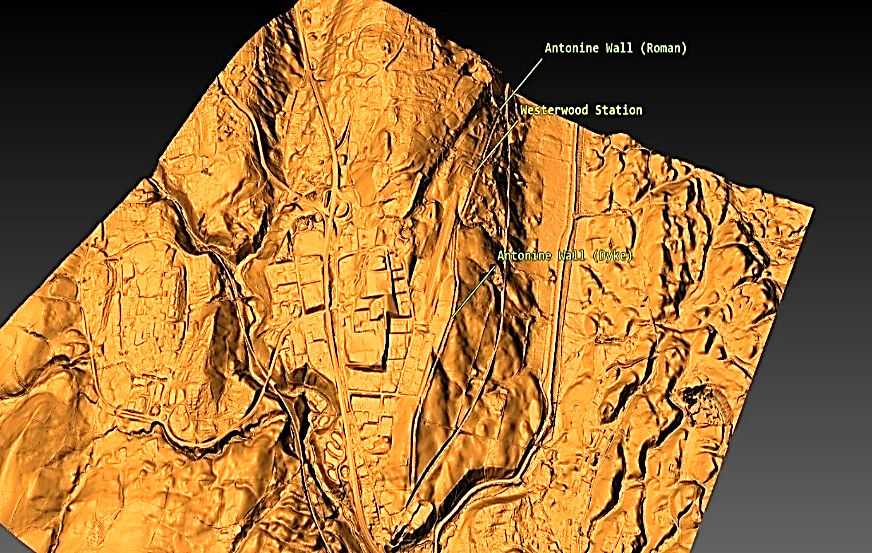
Castlecary Fort Section (Antonine Wall)

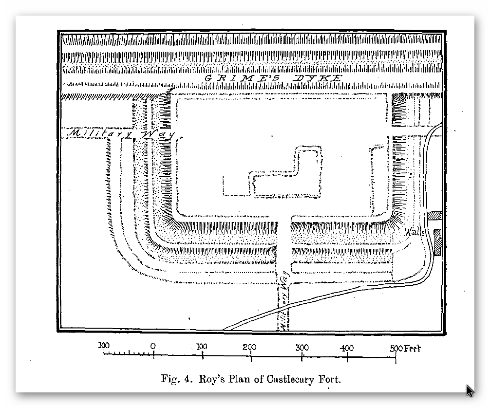
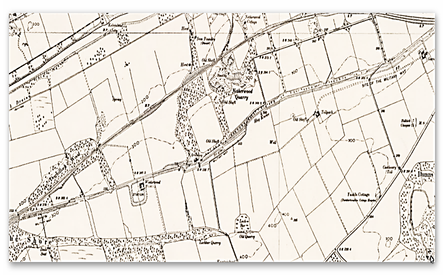
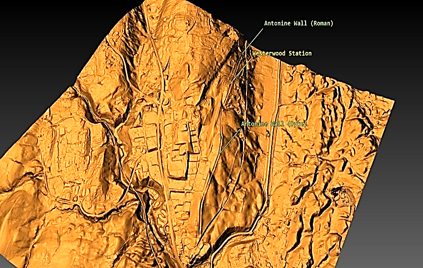
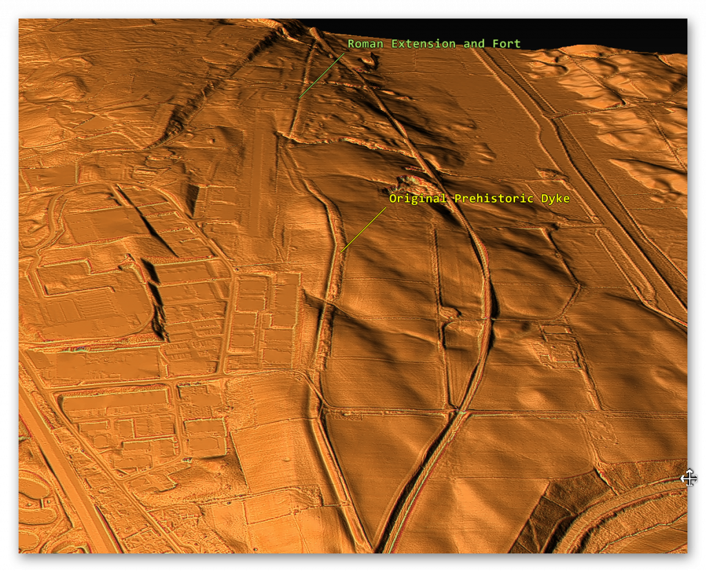
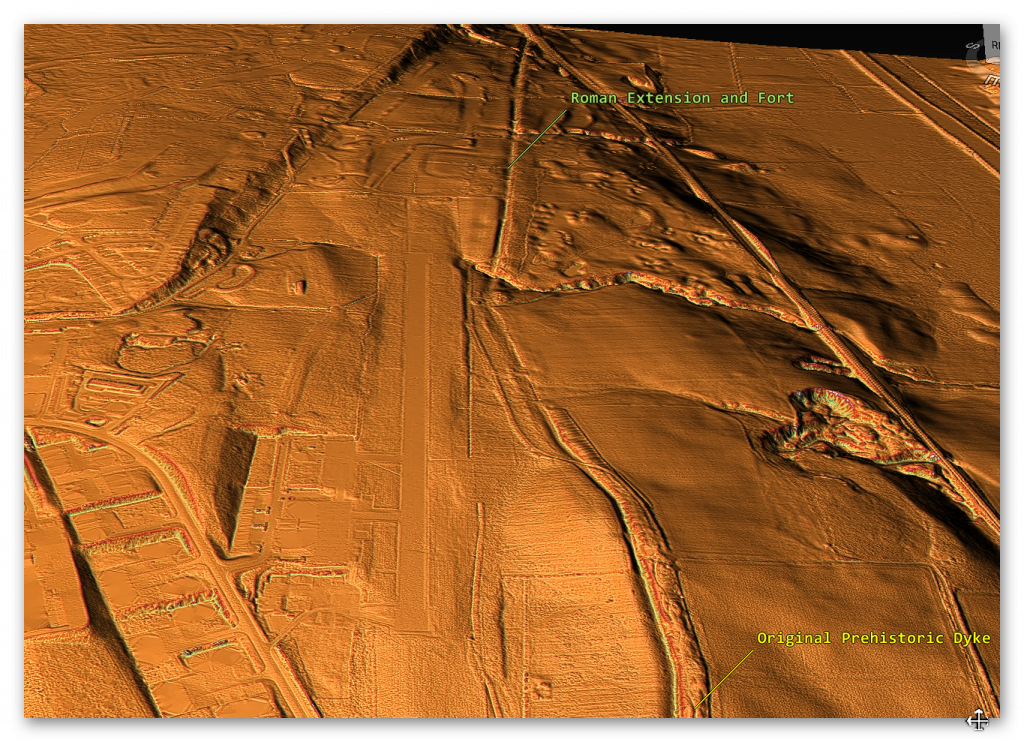
The first thing to notice is that the ‘original’ prehistoric Dyke was there BEFORE the Roman ‘extension’ and connection with the fort.  We know it was a prehistoric Dyke as its path is far from ‘Straight’, unlike the Roman extension.

Castlecary Fort - Antonine Wall
Castlecary Fort – Antonine Wall
Castlecary Fort (LiDAR) - Antonine Wall
Castlecary Fort (LiDAR) – Antonine Wall
Antonine Wall
Figure 102 – Prehistoric Dyke (Antonine Wall)
Antonine Wall
Figure 103 – Roman Extension to Old Dyke (Antonine Wall)


This connection between the Antonine Wall and prehistoric Dykes is connected not only by the LiDAR maps but also by the historical names used for the Wall within the entire length of the Antonine Wall.

Antonine Wall
Castlecary (Antonine Wall)

(Antonine Wall)

Conclusion

The reinterpretation of linear earthworks, such as Hadrian’s Wall and its Vallum, alongside structures like the East Wansdyke, challenges traditional archaeological assumptions and offers a fresh perspective on prehistoric Britain. By viewing these features as potential prehistoric canals rather than purely defensive structures or boundary markers, this research highlights the advanced engineering capabilities and societal organisation of ancient Britons. These findings not only reshape our understanding of these iconic monuments but also call for a broader application of scientific methodologies in archaeology to uncover the true purpose of such structures.

For those interested in exploring this groundbreaking research further, more dykes and linear earthworks are investigated on my website, where detailed surveys and analyses continue to challenge outdated narratives. See below for links to additional blogs that delve into the engineering, societal context, and potential functionality of these fascinating prehistoric features. Together, let’s rethink the history of Britain’s landscape through evidence-based investigation and open dialogue.

Promotional Video – Ancient Prehistoric Canals (Dykes) – The Vallum (The Antonine Wall)

Antonine Wall
Castlecary Fort – Antonine Wall

The Book

Antonine Wall
Ancient Prehistoric Canals (Dykes) Book – Antonine Wall

This was an extracts from the NEW Book Ancient Prehistoric Canals (Dykes) – Wansdyke available on Amazon as a FULL COLOUR HARD BACK (£49.95) or a ECONOMY (£9.99) SOFTBACK black and white VERSION – it is also available as a KINDLE (£2.99) book. For further information about our work on Prehistoric Britain visit our WEBSITE or VIDEO CHANNEL.

Product details

  • ASIN ‏ : ‎ B0BN7PD6BS
  • Publisher ‏ : ‎ Independently published (24 Nov. 2022)
  • Language ‏ : ‎ English
  • Hardcover ‏ : ‎ 477 pages
  • ISBN-13 ‏ : ‎ 979-8358524187
  • Dimensions ‏ : ‎ 15.24 x 3.33 x 22.86 cm
  • Illustrations: 350+

Exploring Prehistoric Britain: A Journey Through Time

My blog delves into the fascinating mysteries of prehistoric Britain, challenging conventional narratives and offering fresh perspectives based on cutting-edge research, particularly using LiDAR technology. I invite you to explore some key areas of my research. For example, the Wansdyke, often cited as a defensive structure, is re-examined in light of new evidence. I’ve presented my findings in my blog post Wansdyke: A British Frontier Wall – ‘Debunked’, and a Wansdyke LiDAR Flyover video further visualizes my conclusions.

My work also often challenges established archaeological dogma. I argue that many sites, such as Hambledon Hill, commonly identified as Iron Age hillforts are not what they seem. My posts Lidar Investigation Hambledon Hill – NOT an ‘Iron Age Fort’ and Unmasking the “Iron Age Hillfort” Myth explore these ideas in detail and offer an alternative view. Similarly, sites like Cissbury Ring and White Sheet Camp, also receive a re-evaluation based on LiDAR analysis in my posts Lidar Investigation Cissbury Ring through time and Lidar Investigation White Sheet Camp, revealing fascinating insights into their true purpose. I have also examined South Cadbury Castle, often linked to the mythical Camelot56.

My research also extends to the topic of ancient water management, including the role of canals and other linear earthworks. I have discussed the true origins of Car Dyke in multiple posts including Car Dyke – ABC News PodCast and Lidar Investigation Car Dyke – North Section, suggesting a Mesolithic origin2357. I also explore the misidentification of Roman aqueducts, as seen in my posts on the Great Chesters (Roman) Aqueduct. My research has also been greatly informed by my post-glacial flooding hypothesis which has helped to inform the landscape transformations over time. I have discussed this hypothesis in several posts including AI now supports my Post-Glacial Flooding Hypothesis and Exploring Britain’s Flooded Past: A Personal Journey

Finally, my blog also investigates prehistoric burial practices, as seen in Prehistoric Burial Practices of Britain and explores the mystery of Pillow Mounds, often mistaken for medieval rabbit warrens, but with a potential link to Bronze Age cremation in my posts: Pillow Mounds: A Bronze Age Legacy of Cremation? and The Mystery of Pillow Mounds: Are They Really Medieval Rabbit Warrens?. My research also includes the astronomical insights of ancient sites, for example, in Rediscovering the Winter Solstice: The Original Winter Festival. I also review new information about the construction of Stonehenge in The Stonehenge Enigma

Further Reading

For those interested in British Prehistory, visit www.prehistoric-britain.co.uk, a comprehensive resource featuring an extensive collection of archaeology articles, modern LiDAR investigations, and groundbreaking research. The site also includes insights and extracts from the acclaimed Robert John Langdon Trilogy, a series of books exploring Britain during the Prehistoric period. Titles in the trilogy include The Stonehenge Enigma, Dawn of the Lost Civilisation, and The Post Glacial Flooding Hypothesis, offering compelling evidence about ancient landscapes shaped by post-glacial flooding.

To further explore these topics, Robert John Langdon has developed a dedicated YouTube channel featuring over 100 video documentaries and investigations that complement the trilogy. Notable discoveries and studies showcased on the channel include 13 Things that Don’t Make Sense in History and the revelation of Silbury Avenue – The Lost Stone Avenue, a rediscovered prehistoric feature at Avebury, Wiltshire.

In addition to his main works, Langdon has released a series of shorter, accessible publications, ideal for readers delving into specific topics. These include:

For active discussions and updates on the trilogy’s findings and recent LiDAR investigations, join our vibrant community on Facebook. Engage with like-minded enthusiasts by leaving a message or contributing to debates in our Facebook Group.

Whether through the books, the website, or interactive videos, we aim to provide a deeper understanding of Britain’s fascinating prehistoric past. We encourage you to explore these resources and uncover the mysteries of ancient landscapes through the lens of modern archaeology.

For more information, including chapter extracts and related publications, visit the Robert John Langdon Author Page. Dive into works such as The Stonehenge Enigma or Dawn of the Lost Civilisation, and explore cutting-edge theories that challenge traditional historical narratives.

Other Blogs

s

t

Statonbury Camp near Bath – an example of West Wansdyke

Challenging Conventional Views: Linear Earthworks as Prehistoric Canals – Statonbury Camp near Bath

Over the past decade, I have faced significant opposition to my theory that Linear Earthworks were originally prehistoric canals. In response, I conducted comprehensive surveys of all 1,500 Historic England Scheduled Linear Earthworks, widely recognised by archaeologists. This extensive research culminated in the publication of the first volume in a quadrilogy, focusing on a section of dykes known as the East Wansdyke. This book supports my theory within the context of a Post-Truth Era.

This publication represents a groundbreaking achievement in archaeology—the first to meticulously survey and document the entire East Wansdyke in unprecedented detail. To date, no university or research team has matched this accomplishment. Furthermore, the book provides robust scientific evidence to demonstrate that prevailing archaeological theories about Wansdyke and Linear Earthworks are fundamentally flawed. (Statonbury Camp near Bath).

(Statonbury Camp near Bath).

The Post-Truth Challenge

One might expect that such a significant contribution, introducing previously undiscovered insights, would spark widespread discussions and rigorous debate. Instead, the book has been dismissed by some as a “conspiracy theory,” despite being grounded in cutting-edge research. The analysis leverages 21st-century LIDAR (Light Detection and Ranging) data sourced from the UK government’s DEFRA (Department for Environment, Food & Rural Affairs), an innovation still underutilised in archaeology, which often relies on outdated satellite imagery and crop mark analysis.

The professional response has been hesitant at best. Meanwhile, criticism on social media often manifests as dogmatic resistance from individuals unwilling to reconsider entrenched beliefs. Many cling to outdated theories simply because they were “peer-reviewed” in the past, treating them as infallible truths rather than hypotheses open to challenge and revision.(Statonbury Camp near Bath).

Resistance and Fundamentalism

(Statonbury Camp near Bath).
Fundamentalist – (Statonbury Camp near Bath).

This unyielding adherence to outdated ideas mirrors the mentality of religious fundamentalists, who interpret texts as immutable doctrine. In my experience, this mindset is evident in attempts to invalidate substantial theories by nitpicking minor details—a tactic reminiscent of the “intelligent design” argument against evolution, where opponents demand exhaustive explanations for every aspect before acknowledging scientific evidence.

For instance, one detractor attempted to undermine my hypothesis by highlighting a site outside the East Wansdyke, claiming it to be a “late Iron Age” fortification, thereby suggesting a Saxon origin. This site, however, pertains to the West Wansdyke, an area I addressed separately in my book. My research concluded that the West Wansdyke likely represents a later addition to the prehistoric canal system, potentially constructed by the Romans. Its sporadic, incomplete nature and distinct specifications set it apart from the East Wansdyke.(Statonbury Camp near Bath).

Conclusions and Moving Forward

I have clearly explained in my book why the West Wansdyke is irrelevant to my analysis of the East Wansdyke. The evidence I present in the book, which surveys every metre of the East Wansdyke, overwhelmingly refutes traditional interpretations of these earthworks as defensive walls or boundary markers. However, challenging deeply ingrained beliefs often meets resistance, even when the evidence is incontrovertible.(Statonbury Camp near Bath).

The reason I have dismissed West Wansdyke


West Wansdyke


We have a problem with West Wansdyke – it’s not part of East Wansdyke. This has always been a historical debate over the last 100 years. If we look at the limited archaeological evidence, we find that although it may have been a much later Canal/Dyke it is not contemporary with the East Wansdyke canal and was not built at the same time.

Excavations conclusively show that the Ditches on the East side of Wansdyke are much more profound and twice as broad. In contrast, the Banks on the East Side are much wider. We see that East Dyke was built first, as our River height model shows that most of West Wansdyke would have been flooded or marshland at the time of use.

LocationWansdyke
BankDitchExcavator notes
MaterialsWidthHeightBermWidthDepthCounterscarp 
EAST        
Red ShoreClay/Flints9.52N103.9YGreen 1966
Sheppard’s shore 102.3N103.9YPitt Rivers 1888
Brown’s Barn 92.3N103.9YPitt Rivers 1891
WEST        
Binces Lane WestStoney12.5????3.51.7YErskine 1990s
Binces Lane EastStoney?5?N62.4?Erskine 1990s
Compton GreenClay marl130.8Y5.82.8YErskine 1990s
Blackrock LaneSilty Clay12.51.7Y4.82.7?Erskine 1990s
Park farmStones100.4Y5.52.4YErskine 1990s
Fairy Hill 13?Y6.5? Erskine 1990s
West Wansdyke Excavation

When the waters receded (possibly Early Iron Age period), it is possible that the Dyke was extended, or the more probable event of East Wansdyke after it dried up was turned into a roadway and what we see in West Wansdyke is the extension of the road, and hence it is wider than in the East.

Archaeology in the Post-Truth Era
East Wansdyke – Earlier Canal System -(Statonbury Camp near Bath).

We also see more shallow ditches as they were not used for water but to obtain soil for the walkway and become drainage ditches.

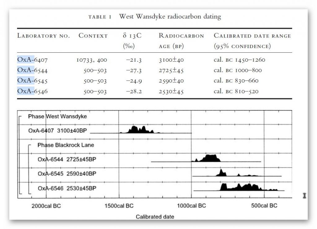
Indeed, we know the Romans used this as a road and always had drainage ditches, usually on both sides. This is supported by carbon dating at Erskine’s excavation at Blackrock Lane, where the section appeared to have been sealed by the primary bank material. One of these layers contained significant concentrations of woody oak charcoal.

Samples of this material were submitted to the Ancient Monuments Laboratory for radiocarbon dating to provide a possible construction of the bank. Unfortunately, as shown in the table below – sadly, as standard when scientific evidence disproves the current archaeological narrative – it is ignored and classified as an error.

(Statonbury Camp near Bath)

Table 1. Erskine, Jonathan. (2007). The West Wansdyke: an appraisal of the dating, dimensions and construction techniques in the light of excavated evidence. Archaeological Journal. 164. 80-108.


The other missing aspect shown in East Wansdyke and not West Wansdyke was the massive connection to Barrows and Flint Pits. Again, this connection is not seen on West Wansdyke, which may help date this monument as the barrows were of the Bronze Age or earlier and as we have seen from the carbon dating evidence at Blackrock Lane much earlier than its 1500 BCE date.(Statonbury Camp near Bath)

Statonbury Camp near Bath – an example of West Wansdyke

If we look at the Scheduled parts of the Wansdyke – we see that the East is very much intact, but the West is sporadic at best, and it’s hard to find a logical link to all the Dykes that seem to only appear over hills and not in the valley’s – which in my view would have been flooded in the Mesolithic and hence the west sections addition after East Wansdyke’s construction – probably by the roman’s who may have utilised the Dyke system for their own transportation reasons.

But for the sake of scientific curiosity, let’s take a detailed look at Stantonbury Hill site, which is classified as an Iron Age Camp, with Wansdyke making up one of the defensive banks – but before we delve deeper into the field archaeology of the site – I feel I must clarify the use of the classification of ‘Iron Age Fort’ by archaeologists.

All sites that sit on top of hills and have ditches are called Iron Age Forts – sadly I have yet to find a single location that is either ‘Iron Age’ or a ‘Fortification’ as not a single dead body from slaying has ever been found and all the so called defensive ditches EVER!! Yet the archaeology world continues to use this misleading classification that confuses the public as if it has been qualified and proven. So, back to Statonbury camp.


The only investigation of this site was made by Fox and Fox in 1956 as part of their survey of Wansdyke in the publication ‘Wansdyke reconsidered.’ It should be noted that Historic England does not have an account with their scheduling as no excavation work has ever been undertaken, and so only field walking has been undertaken, and so the results are subjective to the field walker.


In Fox’s publication they also question this linkage of East and West Wansdyke through other even older publications and field surveys that resulted in questioning the logic of dating this linear earthwork.


That great antiquary, Sir Richard Colt Hoare, had his doubts about the identification, which he endeavoured to suppress in his account of the earthwork in Ancient Wiltshire,


‘ Hitherto we have been enabled to trace the course of Wansdyke with certainty and success through Somersetshire, but on approaching the neighbouring county of Wiltshire we enter upon a new and doubtful field of inquiry respecting the direction as well as the formation of this celebrated rampart.’


His own observations in the field had shown him that in this central sector ‘ it bears the decided appearance of a Roman causeway, not of a Belgic or Saxon boundary and yet he felt obliged to support the current view that road and dyke were identical because he was convinced that the Wansdyke was continuous and he could find no alternative course for it in the area.

Sir R. C. Hoare also observes, the camps appear to have been added to the Dyke, not the Dyke formed to connect the camps ; which may be noticed especially at Stantonbury Camp, the second on the line of the course of Wansdyke through Somersetshire.(Statonbury Camp near Bath)


They continue


General Pitt-Rivers, also had misgivings,


‘ the Dyke he comments, in the Heddington region,’ is of very low relief everywhere on this line and it has often been questioned whether it is a dyke or a road’, and his suspicions were again aroused at a point west of Morgan’s Hill and on Bowden Hill near Lacock’.

Stanton Camp - Not Defensive
Stanton Camp – Not Defensive -(Statonbury Camp near Bath)


On Statonbury Camp there are not very helpful and report that:


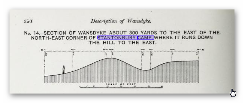
Stantonbury is a univallate Iron Age hill-fort enclosing some 30 acres on the crest of the hill : until very recently it was waste ground going back to thorn scrub and islanded in dense woodland, as can be seen on the air-photo (Pl. VIIIB). The hill top (580 ft.) commands a wide view : from here the whole of the countryside traversed by West Wansdyke can be seen, Maes Knoll to the west. Odd Down to the east, as well as an uninterrupted stretch northwards to the Avon valley and the Cotswolds beyond. From here, the major alignment was probably planned (fig. 19 and p. 37).


In 1956-7 the hill top has been ploughed again, and the much reduced Iron Age defences are visible on the edge of the cultivation. It appears to us that Wansdyke was not constructed along the north-facing hill slope, and that as at Old Oswestry hill-fort, on Wat’s Dyke in Montgomery, the Iron Age defences were deemed sufficient. There is, however, as General Pitt-River’s level section shows, a steep scarp below the traces of the ploughed-in Iron Age ditch, which may be artificial and post-date the hill-fort, but this is uncertain.


East of the fort, in field 20, which is now occupied by a plantation and a pheasantry, the Dyke continues as a scarp for as far as we were able to trace it through the nettles and undergrowth. Below the 500 ft. contour, the large bank and ditch reappear in the dense woodland, and emerge beside the lane leading to the road to Stanton Prior, where the earthwork measures 75 ft. overall.


So according to Fox and Fox Wansdyke stops short and accepts the North Face is the Iron Age Site – therefore if the Wansdyke had been cut to the north of the site – the Iron Age fort replaced it – which is not as the Jihad had claimed?


So where did he get this ‘ground-breaking’ revelation? For this we must go not a peer reviewed book but a web site ‘wansdyke21.org.uk’ by Robert Vermaat


He suggests that:


It has been suggested by Fox & Fox that Wansdyke did not actually use Stantonbury Camp, the ditch stopping short of the Iron Age defences by several metres. However, Burrow showed in 1982 that this was incorrect.


Although the western slope is much disturbed by quarrying and the lower slopes by cultivation, Wansdyke can still be traced quite well at several points on the hill.
As with Maes Knoll, the northern defences are more prominent than those on the south side.


As Wansdyke joins the defences here, it can be argued that, as was the case at Maes Knoll, the northern defences were refurbished when Wansdyke was constructed, neglecting the south side which was without use for the builders of Wansdyke.


If only we had £64 to see this so called evidence from Field walking by burrows (as we know it was not excavated and LiDAR was not in use)!!


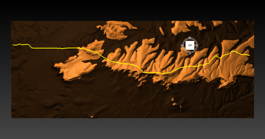
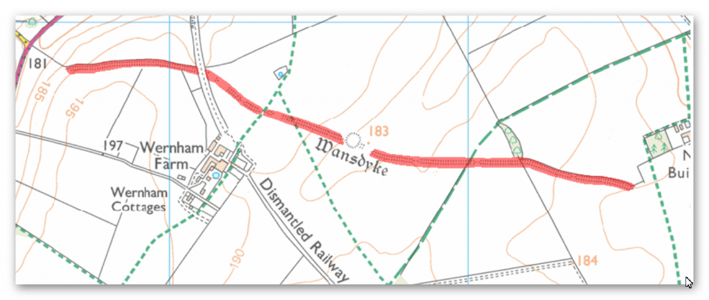
Fortunately, we have now obtained high resolution LiDAR images of Statonbury Camp and we can see that Wansdyke goes over the hill in a strange ‘wibbly wobbly’ way rather than a straight line – which we see either side of the hill from much shallower ditches. This suggests that this area was not built completely at the same time and the Hill Dyke is older than the flat ground levels that surround the hill.

My estimation from the evidence found in the smaller ditches is that they are Roman (and hence straight) in origin that connected to the earlier prehistoric Dyke over Statonbury Hill the archaeologists call West Wansdyke (part of). The path over the hill indicates that the builders were attempting to locate natural springs as they built the Dyke to supply it with water and hence the strange pathway.

Closer inspection of the Dyke as it approaches the ‘Iron Age Site’ suggest that it splits and moves the bank from north facing to south facing which Fox had seen as a terminus of the Dyke for it reached the Fort. LiDAR clearly shows that the ditch moves to the south side of the bank and continues to create the East side of the fort finally terminating in the South.

Also the shape of the fort is not consistent as it has rounded edges in the SE and SW regions but flat T-Junctions in the NE and NW where it meets Wansdyke – indicating it was added to the existing Wansdyke canal either at the time of construction or a later date.

Exploring Prehistoric Britain: A Journey Through Time

My blog delves into the fascinating mysteries of prehistoric Britain, challenging conventional narratives and offering fresh perspectives based on cutting-edge research, particularly using LiDAR technology. I invite you to explore some key areas of my research. For example, the Wansdyke, often cited as a defensive structure, is re-examined in light of new evidence. I’ve presented my findings in my blog post Wansdyke: A British Frontier Wall – ‘Debunked’, and a Wansdyke LiDAR Flyover video further visualizes my conclusions.

My work also often challenges established archaeological dogma. I argue that many sites, such as Hambledon Hill, commonly identified as Iron Age hillforts are not what they seem. My posts Lidar Investigation Hambledon Hill – NOT an ‘Iron Age Fort’ and Unmasking the “Iron Age Hillfort” Myth explore these ideas in detail and offer an alternative view. Similarly, sites like Cissbury Ring and White Sheet Camp, also receive a re-evaluation based on LiDAR analysis in my posts Lidar Investigation Cissbury Ring through time and Lidar Investigation White Sheet Camp, revealing fascinating insights into their true purpose. I have also examined South Cadbury Castle, often linked to the mythical Camelot56.

My research also extends to the topic of ancient water management, including the role of canals and other linear earthworks. I have discussed the true origins of Car Dyke in multiple posts including Car Dyke – ABC News PodCast and Lidar Investigation Car Dyke – North Section, suggesting a Mesolithic origin2357. I also explore the misidentification of Roman aqueducts, as seen in my posts on the Great Chesters (Roman) Aqueduct. My research has also been greatly informed by my post-glacial flooding hypothesis which has helped to inform the landscape transformations over time. I have discussed this hypothesis in several posts including AI now supports my Post-Glacial Flooding Hypothesis and Exploring Britain’s Flooded Past: A Personal Journey

Finally, my blog also investigates prehistoric burial practices, as seen in Prehistoric Burial Practices of Britain and explores the mystery of Pillow Mounds, often mistaken for medieval rabbit warrens, but with a potential link to Bronze Age cremation in my posts: Pillow Mounds: A Bronze Age Legacy of Cremation? and The Mystery of Pillow Mounds: Are They Really Medieval Rabbit Warrens?. My research also includes the astronomical insights of ancient sites, for example, in Rediscovering the Winter Solstice: The Original Winter Festival. I also review new information about the construction of Stonehenge in The Stonehenge Enigma

Further Reading

For those interested in British Prehistory, visit www.prehistoric-britain.co.uk, a comprehensive resource featuring an extensive collection of archaeology articles, modern LiDAR investigations, and groundbreaking research. The site also includes insights and extracts from the acclaimed Robert John Langdon Trilogy, a series of books exploring Britain during the Prehistoric period. Titles in the trilogy include The Stonehenge Enigma, Dawn of the Lost Civilisation, and The Post Glacial Flooding Hypothesis, offering compelling evidence about ancient landscapes shaped by post-glacial flooding.

To further explore these topics, Robert John Langdon has developed a dedicated YouTube channel featuring over 100 video documentaries and investigations that complement the trilogy. Notable discoveries and studies showcased on the channel include 13 Things that Don’t Make Sense in History and the revelation of Silbury Avenue – The Lost Stone Avenue, a rediscovered prehistoric feature at Avebury, Wiltshire.

In addition to his main works, Langdon has released a series of shorter, accessible publications, ideal for readers delving into specific topics. These include:

For active discussions and updates on the trilogy’s findings and recent LiDAR investigations, join our vibrant community on Facebook. Engage with like-minded enthusiasts by leaving a message or contributing to debates in our Facebook Group.

Whether through the books, the website, or interactive videos, we aim to provide a deeper understanding of Britain’s fascinating prehistoric past. We encourage you to explore these resources and uncover the mysteries of ancient landscapes through the lens of modern archaeology.

For more information, including chapter extracts and related publications, visit the Robert John Langdon Author Page. Dive into works such as The Stonehenge Enigma or Dawn of the Lost Civilisation, and explore cutting-edge theories that challenge traditional historical narratives.

Other Blogs

s

t

Wansdyke LiDAR Flyover

Promotional video for the book transcript………………………….. Ancient prehistoric Canals (Dykes) – Wansdyke

Introduction

Wansdyke

Archaeologists and historians have proposed numerous theories regarding dykes such as Wansdyke. Initially, they believed it served as a defensive structure to protect territories from hostile tribes. However, more recent theories, influenced by the absence of evidence such as human remains from excavations, suggest it functioned as a border marker. This border hypothesis, however, can be challenged by examining the easternmost section of Wansdyke.

The Eastern Start of Wansdyke

Start of the Wansdyke in the East

To understand Wansdyke’s purpose, we must first consider how it might have appeared in prehistory when river levels were significantly higher than today. Research involving over 1,500 dykes in England suggests that fluctuating groundwater levels during the Mesolithic and Neolithic periods (5,000–10,000 years ago) drastically altered the landscape. This environmental context sheds light on the mysterious beginning of Wansdyke, which lies in an unassuming field.

This starting point poses a conundrum. If Wansdyke were a defensive structure, invaders could simply bypass it. Similarly, as a border marker, it appears illogical, given the seemingly arbitrary placement in what would have been “no man’s land” to the east. However, when we consider the Mesolithic water levels, this puzzle begins to make sense. At that time, the eastern end of Wansdyke likely met the shoreline of the River Kennet, acting as an artificial canal that extended across a water-covered landscape.

The Role of LiDAR in Revealing Wansdyke’s History

East Wansdyke - In the middle of nowhere
East Wansdyke – In the middle of nowhere

Using LiDAR technology, we can explore Wansdyke’s alignment with ancient water levels and examine its potential origins. Early in this examination, we observe a cluster of pits and quarries surrounding the dyke. These features suggest that the initial purpose of Wansdyke might have been related to resource extraction. Unfortunately, these pits remain largely unexcavated, leaving their significance and contents a mystery.

One particularly large quarry lies directly within Wansdyke itself. This raises questions: was it used for material extraction, or was it later adapted to access lower water levels, possibly during the Roman period when Wansdyke may have been repurposed?

Gaps and Deviations in Wansdyke’s Structure

Wansdyke start meets the Mesolithic waterline

Several gaps in Wansdyke also align with prehistoric waterlines. For example, LiDAR reveals the trace of a palaeochannel (a remnant of an ancient river) that aligns with one such gap. These interruptions suggest that Wansdyke may have originally followed natural watercourses, with later modifications to connect separate segments.

Another perplexing feature is a 90-degree bend in the dyke’s course. This sharp turn would have required substantial extra labour and makes little sense for a defensive structure or border marker. However, if we consider the Mesolithic landscape, this bend corresponds to a shoreline, indicating that Wansdyke likely extended across the river, aligning with natural contours of the water.

Connections to Other Features

Wansdyke Pits
Wansdyke pits shows why the Dykes were Built

Throughout Wansdyke, we see evidence of connections to other prehistoric features. A nearby long barrow, for instance, appears to have been positioned along the edge of a palaeochannel, hinting at the relationship between these earthworks and ancient water levels. Other cross-dykes, tumuli, and barrows scattered along Wansdyke further suggest a complex, evolving use of the landscape over time.

Interestingly, LiDAR reveals a potential square building over Wansdyke that does not appear on modern maps. Its characteristics suggest Roman origins, further evidence that the Romans adapted Wansdyke for their purposes.

Later Modifications and Roman Influence

Roman Road cuts through the Dyke showing it was Pre-Roamn
Roman Road cuts through the Dyke showing it was Pre-Roman date

In some sections, Wansdyke appears as a straight line, which contrasts with its otherwise irregular path. This straight alignment may reflect Roman engineering, as it parallels their known preference for direct routes. For instance, one stretch aligns with a Roman road, and closer inspection reveals that the road was constructed within the existing dyke’s ditch. This configuration strongly implies that Wansdyke predated the Roman road.

Historical sketches by William Stukeley in 1724 provide additional evidence, showing the Roman road cutting through Wansdyke’s embankment. This supports the argument that Wansdyke originated in prehistoric times when higher river levels would have rendered it part of a broader canal network.

Wansdyke as a Window Into Prehistoric Innovation

How Wansdyke may have looked in the Mesolithic Period

The idea of Wansdyke as a canal rather than a defensive or territorial feature raises intriguing questions about the ingenuity of prehistoric communities. The ability to manipulate natural waterways and integrate them with constructed earthworks demonstrates a sophisticated understanding of engineering and environmental management. Such systems would have been vital for trade, resource transportation, and sustaining settlements in an era defined by dynamic landscapes.

If Wansdyke truly functioned as part of a prehistoric canal system, it challenges traditional narratives that often downplay the complexity of Mesolithic and Neolithic societies. This perspective not only underscores the advanced capabilities of these ancient communities but also invites a re-evaluation of similar features across Britain and beyond. How many other “defensive dykes” might share this hidden history?

Implications for Archaeological Methods

Wansdyke was one surrounded by water and built overland for mining purposes

The case of Wansdyke highlights the limitations of conventional archaeological approaches. Current reliance on surface-level excavations and isolated carbon dating often fails to capture the broader environmental and historical context of such structures. As demonstrated here, integrating technologies like LiDAR with hydrological and geological studies can provide transformative insights. It also emphasises the need for a multidisciplinary approach to interpreting ancient landscapes.

The neglect of quarry features around Wansdyke, for example, represents a missed opportunity to understand the resources and techniques available to its builders. Future investigations that incorporate more detailed excavation and modern technologies could yield a wealth of data to refine our understanding of Britain’s prehistoric engineering marvels.

A Legacy of Adaptation and Innovation

Romans reused and recut the dyke
Massive Engineering Project as Romans reused and recut the dyke

Wansdyke’s story is one of adaptation. From its hypothesised origins as a Mesolithic canal to later modifications by Roman and possibly Saxon cultures, the dyke exemplifies how ancient peoples repurposed and transformed existing structures to meet evolving needs. Whether as a waterway, resource hub, or trade route, Wansdyke stands as a testament to humanity’s ability to innovate and endure across millennia.

By situating Wansdyke within the broader prehistoric context, we move closer to understanding its original purpose and the sophisticated societies that shaped Britain’s ancient landscapes. Its winding paths, mysterious interruptions, and enduring presence remind us that history is not static but a tapestry woven from the ingenuity and adaptability of countless generations.

Exploring Prehistoric Britain: A Journey Through Time

My blog delves into the fascinating mysteries of prehistoric Britain, challenging conventional narratives and offering fresh perspectives based on cutting-edge research, particularly using LiDAR technology. I invite you to explore some key areas of my research. For example, the Wansdyke, often cited as a defensive structure, is re-examined in light of new evidence. I’ve presented my findings in my blog post Wansdyke: A British Frontier Wall – ‘Debunked’, and a Wansdyke LiDAR Flyover video further visualizes my conclusions.

My work also often challenges established archaeological dogma. I argue that many sites, such as Hambledon Hill, commonly identified as Iron Age hillforts are not what they seem. My posts Lidar Investigation Hambledon Hill – NOT an ‘Iron Age Fort’ and Unmasking the “Iron Age Hillfort” Myth explore these ideas in detail and offer an alternative view. Similarly, sites like Cissbury Ring and White Sheet Camp, also receive a re-evaluation based on LiDAR analysis in my posts Lidar Investigation Cissbury Ring through time and Lidar Investigation White Sheet Camp, revealing fascinating insights into their true purpose. I have also examined South Cadbury Castle, often linked to the mythical Camelot56.

My research also extends to the topic of ancient water management, including the role of canals and other linear earthworks. I have discussed the true origins of Car Dyke in multiple posts including Car Dyke – ABC News PodCast and Lidar Investigation Car Dyke – North Section, suggesting a Mesolithic origin2357. I also explore the misidentification of Roman aqueducts, as seen in my posts on the Great Chesters (Roman) Aqueduct. My research has also been greatly informed by my post-glacial flooding hypothesis which has helped to inform the landscape transformations over time. I have discussed this hypothesis in several posts including AI now supports my Post-Glacial Flooding Hypothesis and Exploring Britain’s Flooded Past: A Personal Journey

Finally, my blog also investigates prehistoric burial practices, as seen in Prehistoric Burial Practices of Britain and explores the mystery of Pillow Mounds, often mistaken for medieval rabbit warrens, but with a potential link to Bronze Age cremation in my posts: Pillow Mounds: A Bronze Age Legacy of Cremation? and The Mystery of Pillow Mounds: Are They Really Medieval Rabbit Warrens?. My research also includes the astronomical insights of ancient sites, for example, in Rediscovering the Winter Solstice: The Original Winter Festival. I also review new information about the construction of Stonehenge in The Stonehenge Enigma

Further Reading

For those interested in British Prehistory, visit www.prehistoric-britain.co.uk, a comprehensive resource featuring an extensive collection of archaeology articles, modern LiDAR investigations, and groundbreaking research. The site also includes insights and extracts from the acclaimed Robert John Langdon Trilogy, a series of books exploring Britain during the Prehistoric period. Titles in the trilogy include The Stonehenge Enigma, Dawn of the Lost Civilisation, and The Post Glacial Flooding Hypothesis, offering compelling evidence about ancient landscapes shaped by post-glacial flooding.

To further explore these topics, Robert John Langdon has developed a dedicated YouTube channel featuring over 100 video documentaries and investigations that complement the trilogy. Notable discoveries and studies showcased on the channel include 13 Things that Don’t Make Sense in History and the revelation of Silbury Avenue – The Lost Stone Avenue, a rediscovered prehistoric feature at Avebury, Wiltshire.

In addition to his main works, Langdon has released a series of shorter, accessible publications, ideal for readers delving into specific topics. These include:

For active discussions and updates on the trilogy’s findings and recent LiDAR investigations, join our vibrant community on Facebook. Engage with like-minded enthusiasts by leaving a message or contributing to debates in our Facebook Group.

Whether through the books, the website, or interactive videos, we aim to provide a deeper understanding of Britain’s fascinating prehistoric past. We encourage you to explore these resources and uncover the mysteries of ancient landscapes through the lens of modern archaeology.

For more information, including chapter extracts and related publications, visit the Robert John Langdon Author Page. Dive into works such as The Stonehenge Enigma or Dawn of the Lost Civilisation, and explore cutting-edge theories that challenge traditional historical narratives.

Other Blogs

s

t

Mesolithic River Avon

Rivers were higher in the past – Now UPDATED here: https://prehistoric-britain.co.uk/case-study-river-avon

At the outset, the clay-with-flints, a vestige of ancient weathering and erosion, stands as a testament to the relentless forces of nature that sculpted the landscape. Born from the remnants of Palaeogene sediments and the dissolution of chalk, these deposits serve as silent witnesses to the Pleistocene’s cold embrace. Their presence on the hilltop flats signifies a chronological anchor, predating the rhythmic succession of river terraces that stitch the valley’s quilt. (The Mesolithic River Avon)

Rivers were higher in the past (The Mesolithic River Avon)

As one descends the slopes, a mosaic of older head deposits unfolds, their genesis tied to the ancient processes of solifluction and solution. These sediments, bound to the clay-with-flint, narrate a tale of gradual descent and transformation, shaping the valley’s upper reaches with a subtle, yet profound, hand.

Further down the valley, the narrative evolves with the introduction of head gravel, gravelly head, and head deposits. These characters in the valley’s story are borne of fluvial transport, hill wash, hill creep, and solifluction—agents of change that have, over millennia, contributed to the valley’s sculptural form. The river terraces, numbering fourteen, ascend like steps from the valley floor, each a plateau from which to view the passage of time. The highest terraces, perched up to 100 meters above the valley, offer a broad vista extending 12 kilometers across, while the lower terraces, more intimate in their proximity to the present-day river, mark the recent chapters of geological history.

The consistency of thickness across these terraces speaks to a dynamic equilibrium of erosion and deposition, influenced by sediment overloading and tributary contributions. This interplay suggests a complex narrative of landscape evolution, one not solely dictated by the simplistic rhythm of Marine Isotope Stage cycles but enriched by a multifaceted process of lateral erosion and sediment redeposition.

Amidst this discussion of terraces and quaternary deposits, the narrative briefly diverges to contemplate the pre-Quaternary geology, where terraces from the River Avon linger in the Hampshire basin, their ages enshrouded in mystery. The challenges of dating these terraces, and by extension, understanding the full scope of the valley’s geological history, are underscored by recent findings that question traditional dating methods. Such inquiries not only deepen the mystery but also invite a reevaluation of our understanding of the Earth’s past.

Thus, we are reminded that the study of the Avon valley’s quaternary deposits is not merely an academic exercise but a profound exploration of the human quest for knowledge and understanding. It is a journey that connects us to the very essence of the natural world, revealing the intricate interplay of forces that have shaped not only the valley but also the broader tapestry of Earth’s geological history. (The Mesolithic River Avon)

Figure 5 - OSL Results Avon River (The Mesolithic River Avon)
Figure 5 – OSL Results Avon River
(The Mesolithic River Avon)

The intriguing findings presented in the diagrams regarding Optically Stimulated Luminescence (OSL) dating within the Avon valley unearth a complex narrative of sediment deposition and geological processes that challenges traditional understandings. The OSL results, as depicted in Figure 5, illuminate the temporal relationship between terrace formations and Marine Isotope Stages (MIS), while Figure 6, based on a three-dimensional model constructed from borehole data, offers a visual cross-section of the valley’s superficial geology.

The OSL ages for terraces T10 through T7, indicating deposition during or before MIS10/9, including the Last Glacial Maximum (LGM), suggest a timeline that not only aligns with but also refines previously established chronological frameworks. This refinement has significant implications for interpreting the archaeological record associated with Terrace T7 and recalibrating regional uplift and incision rates, which are crucial for understanding landscape evolution over geological timescales.

However, the apparent inconsistencies in the OSL dating results, particularly the dating of Terrace T7 before Terrace T10 and the identification of a Loess Terrace laid during the LGM, introduce a paradox into the sedimentary record. These anomalies challenge the linear progression implied by the terrace hypothesis that has guided interpretations of the valley’s geological history.

The highest terrace, T10, positioned at 102 meters above ordnance datum (OD) as illustrated in Figure 6, spans an unexpectedly broad temporal range of over 200,000 years, according to OSL dating. This finding disrupts the presumed chronological order, especially when juxtaposed with the dating of Terrace T7 at 58 meters OD, which, perplexingly, predates T10. Additionally, the Loess Terrace, situated at 77 meters OD and undifferentiated in the terrace sequence, laid down during the LGM, along with Terrace T4, which harbors the youngest dates, further complicates the scenario.

These results hint at a more intricate story of terrace formation and sediment deposition than previously thought. The seeming randomness and inconsistencies in the dating challenge the traditional terrace hypothesis and suggest that other factors, perhaps related to climatic variations, tectonic activities, or both, played significant roles in shaping the valley’s geomorphology.

The evidence points to a dynamic and possibly non-linear process of terrace formation, where episodes of sediment deposition were influenced by a combination of environmental conditions, rather than a simple chronological succession. This complexity underscores the need for a reassessment of the methods and models used to date and interpret terrace formations, advocating for a more nuanced understanding of the interplay between geological processes and climate change over the Pleistocene.

Thus, while the OSL dating provides valuable insights into the timing of terrace deposition, it also raises critical questions about the reliability of traditional chronological frameworks and the factors driving landscape evolution in the Avon valley. These findings invite further investigation and a reevaluation of existing hypotheses, highlighting the ongoing dialogue between past and present in the quest to decipher Earth’s geological history.

Figure 6- Avon River Terrace Levels - Avon River
Figure 6- Avon River Terrace Levels – Avon River
(The Mesolithic River Avon)

The authors’ observations highlight significant discrepancies and anomalies in the OSL dates that raise questions about the method’s reliability in certain contexts, particularly when compared to other dating methods like radiocarbon dating. These discrepancies are not merely academic curiosities; they fundamentally challenge our understanding of the temporal and environmental context in which these sediment layers were deposited.

The attempt to explain the notable discrepancy in the age estimates of Terrace T4 across different locations within the Avon valley suggests that sediment reworking due to recent fluvial processes or the presence of compound terraces exhibiting different depositional behaviors might be responsible. This acknowledgment of variability within the depositional environment underscores the dynamic nature of fluvial landscapes and the complexity of accurately dating such contexts.

The variability in OSL dates for samples taken at the same soil level (e.g., GL14039, GL14041, GL14038, GL14040) further complicates the narrative. The presence of nearly contemporaneous dates within error limits, juxtaposed with the significantly different sedimentation rates observed just below the topsoil, suggests that the depositional history of the Avon valley is more nuanced than previously understood. These findings indicate that relying solely on visual stratigraphy for dating purposes can lead to inaccuracies, reinforcing the need for a multi-methodological approach to construct a reliable chronological framework.

The comparison between OSL and radiocarbon dating, as discussed in the Gaigalas (2000) study, exemplifies the potential for significant age discrepancies between different dating methods. The observation that OSL dates can be substantially older than their radiocarbon counterparts highlights the need for caution and cross-validation when interpreting chronological data, especially in contexts where sediment exposure and reworking may have occurred.

The discussion of Holocene river flooding and its impact on the dating of river terraces introduces an additional layer of complexity. Flooding events can lead to the deposition of silt and other materials that obscure the original depositional sequence, potentially leading to out-of-sequence terrace dates. This phenomenon complicates attempts to use uplift modeling or the Palaeolithic record as reliable chronological markers, as evidenced by the discrepancies in age estimates for Terrace T7.

The passage concludes by emphasizing the potential of terrace deposits to provide a valuable chronological framework, albeit one that must be approached with caution. By integrating chronometric age control with detailed modeling of deposit height and thickness, researchers can gain a more nuanced understanding of the Avon valley’s landscape evolution. This approach not only enhances our interpretations of past hominin landscape use but also improves the predictive modeling of Palaeolithic sites. The challenges and discrepancies encountered in OSL dating underscore the importance of adopting a holistic and critically engaged approach to understanding the geological past, one that acknowledges the inherent complexities and uncertainties of dating dynamic fluvial landscapes.

Finally, archaeologists and geologists resist the fact that the river Avon was in Stonehenge Bottom during the Mesolithic and Neolithic period.  They insist that there is no evidence in the form of Alluvium or Colluvium in sufficient quantities to support my hypothesis.  This objection has a simple solution as Julian Richard’s suggested in his book ‘The Stonehenge Environs Project’: “colluvium sediments may have been removed or thinned by the action of seasonal streams or higher water tables in the past”. 

Macklin, as we have now seen in this section has identified over one hundred Holocene river floods, twelve of which lasted hundreds of years, that would have contributed to this lack of alluvium or colluvium at Stonehenge Bottom.  Moreover, the sources of the rivers that lay this sediment over the centuries of water flow, rely on massive precipitation entering the rivers, cutting through rocks and valleys making them flow at extreme levels which create this erosion and consequential sediment. However, the source of Palaeochannel water are natural springs found locally underground and therefore would not contain the same alluvium levels as active flowing rivers – resolving this dilemma.

Model of the number of flooded rivers in Britain - River Avon
Model of the number of flooded rivers in Britain – River Avon

UPDATE

More Empirical Evidence of Post-Glacial Flooding and a Flooded Stonehenge

River Avon River Terraces

 Prehistoric Levels and Widths for the River Avon

Take a close look at this illustration. It is not speculation, it is empirical science — mapped and measured river terraces from the Avon Valley, published in Egberts (2016), Pleistocene terrace formation and the Quaternary evolution of the Hampshire Basin, Bournemouth University.

What are we looking at?

  • These are the terrace steps cut by the River Avon over multiple glacial–interglacial cycles.
  • Each “T-level” marks a former stable floodplain where the river held its height for centuries, often millennia.
  • The heights are measured in metres OD (Ordnance Datum) and tied to known quarry and pit sites (e.g. Hatchet Gate Farm, Woodgreen, Somerley, Ashley).

💧 How much bigger was the Avon?

  • Today, the river meanders with a width of just ~50 m near Salisbury.
  • At its maximum (T11), the Avon floodplain stretched ~12 km across.
  • That is ~240 times wider than the river today.

🌊 What does this mean for Stonehenge?

  • Phase 1 of Stonehenge (Car Park Postholes) sits on T9 (~90 m OD).
  • Phase 2 (ditch, Aubrey Holes, bluestones) cuts into T8 (~75 m OD).
  • The terraces show that the palaeochannel not only flooded up to the old car park, but at times overtopped the entire Stonehenge site.

📐 Why this matters:

  • Terraces are not theory — they are empirical geomorphological evidence.
  • They prove that the Avon has flooded to multiple levels, sometimes far higher than the monument itself.
  • This is not about “if” water could reach those heights — the terraces prove it already has, repeatedly, over many Ice Age cycles.

So when critics dismiss the role of high water tables or argue “the site couldn’t have been wet,” they are ignoring the most basic geological record in front of us. The terraces are the diary of the river — written in gravel, chalk, and silt — showing that water rose and fell, over and over again.

👉 The real question is not if Stonehenge was surrounded by water. It is when, and how many times it happened during its long prehistory.
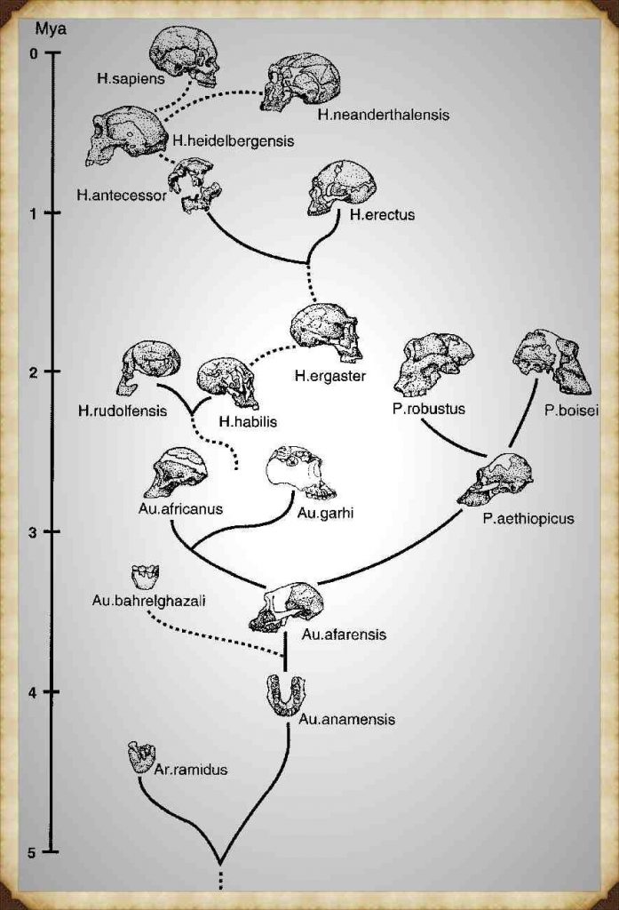
More information on the River Avon can be found at: https://youtu.be/j5LJ2sGcKOA

Further Reading

For information about British Prehistory, visit www.prehistoric-britain.co.uk for the most extensive archaeology blogs and investigations collection, including modern LiDAR reports.  This site also includes extracts and articles from the Robert John Langdon Trilogy about Britain in the Prehistoric period, including titles such as The Stonehenge Enigma, Dawn of the Lost Civilisation and the ultimate proof of Post Glacial Flooding and the landscape we see today.

Robert John Langdon has also created a YouTube web channel with over 100 investigations and video documentaries to support his classic trilogy (Prehistoric Britain). He has also released a collection of strange coincidences that he calls ‘13 Things that Don’t Make Sense in History’ and his recent discovery of a lost Stone Avenue at Avebury in Wiltshire called ‘Silbury Avenue – the Lost Stone Avenue’.

Langdon has also produced a series of ‘shorts’, which are extracts from his main body of books:

The Ancient Mariners

Stonehenge Built 8300 BCE

Old Sarum

Prehistoric Rivers

Dykes ditches and Earthworks

Echoes of Atlantis

Homo Superior

For active discussions on the findings of the TRILOGY and recent LiDAR investigations that are published on our WEBSITE, you can join our and leave a message or join the debate on our Facebook Group.

Other Blogs

s

t

Brain capacity (Cro-Magnon Man)

Neanderthals

Past genetic studies have set out to verify whether interbreeding between Sapiens and Neanderthals took place. These findings showed that the genetic makeup of ‘Modern Humans’ (Homo Sapien Sapiens) is 4% inherited from this Neanderthal interbreeding, with just one exception – the Sub-Saharan African population, who because of many complex reasons did not travel ‘out of Africa’ with their relations some 50,000 years ago. Their genetic makeup varies from between 0 to just 1% of Neanderthal DNA (probably due to recent intermigration) – Brain capacity (Cro-Magnon Man).

However, the above studies are in conflict with recent findings reported in Nature Magazine in 2015. These findings appear to indicate an even greater percentage of our genes belong to our Neanderthal cousins. Qiaomei Fu, a palaeogenomicist at Harvard Medical School in Boston, Massachusetts, told meeting members how she and her colleagues had sequenced DNA from a 40,000-year-old jawbone that represents some of the earliest modern-human remains in Europe. They estimate that 5 –11 percent of the bone’s genome is Neanderthal. Interestingly, the Neanderthal elements of the genome structure contained large chunks of several chromosomes. Further genetic analysis showed that the individual was a man. Using the theory that lengths of DNA inherited from any one ancestor shorten with each generation; the team estimated that the man had a Neanderthal ancestor in the previous four to six generations.

Sapien v Neanderthal - Brain capacity (Cro-Magnon Man)
Sapien v Neanderthal – Brain capacity (Cro-Magnon Man)

The interbreeding between Sapiens and Neanderthals probably led to descendants carrying a ‘Mitochondrial DNA’ (mtDNA) inherited exclusively from the mother. Therefore (in theory) we should be able to find in the population today this Neanderthal (mtDNA) group. Sadly, this (mtDNA) group, to date, has never been found. Consequently, the natural conclusion to this lack of evidence is to suggest that the hybrids must only have come from Sapien Mothers with Neanderthal fathers. However, this theory is not without complications. If this is the case it seems to contradict the existing perceived history of the two species meeting and only the Sapiens surviving as they could ‘out think’ their Neanderthal cousins, to obtain sufficient limited food supplies (due to the ice age) for survival.

If the Neanderthal males were taking Homo Sapien women by creating relationships (or gang raping against their will, as some suggest) this would lead us to conclude that the Neanderthals were more assertive and dominating that their Sapien counterparts – they clearly were physically larger (nearly twice as large) so if they were aggressive enough to take Sapien women, could they not also take their food? – The harsh reality is that the Neanderthals died out and Sapiens and moreover, their interbred off-spring the Homo Superior (Cro-Magnons) survived. 

So is there another explanation or is this perception of history completely unbalanced?

If we look at the probabilities and how (mtDNA) lines can disappear, we find that it’s not only because of ‘natural selection’ or that the people carrying the (mtDNA) lines don’t reproduce – but because of a random statistical effect. If a Neanderthal female and a Sapien male mate, she could, in time, have fifty living descendants, all carrying a fraction of her DNA. However, her (mtDNA) can disappear completely as it carries through the female line. Consider this example. If a Neanderthal female who carries the (mtDNA) line has five sons and two daughters, but those two daughters have only sons and no daughters this would result in the end of the (mtDNA) line. In a stable population, one where each reproducing female leaves exactly two reproducing children, 90% of the original (mtDNA) lines will be broken in just 34 generations, as some of these families will have just boys, and that’s in less than 1,000 years. So if you start with 1,000 female Neanderthals in a mixed population, less than 100 Neanderthal (mtDNA) lines will survive after 1.000 years – after another 1.000 years, less than 10 – after yet another 1.000 years… gone forever. This is then further influenced by the belief that ancient civilisations will favour the male species and commit infanticide in order to reduce the female heirs when community resources are limited and hunting is a matter of survival.

DNA Human Tree - Brain capacity (Cro-Magnon Man)
DNA Human Tree – Brain capacity (Cro-Magnon Man)

Moreover, you can do the same type of calculation regarding Neanderthal Y chromosome lines. If Neanderthals were a small minority of our common ancestors, it is extremely unlikely that any two Neanderthal genes would survive after 30,000 years. In effect, (mtDNA) and the Y chromosome are inherited as just one gene, since they’re inherited in one piece, therefore, we don’t have to construct intricate theories of marriage customs or patterns of reproduction in order to explain the lack of Neanderthal (mtDNA) or Neanderthal Y chromosomes today; we only have to do some reasonable maths and realise that single sex children in families break the linkage.

However, it is far more probable that ‘Modern Humans’ are the product of the Homo Superior hybrids, as we all have our origin in an individual female hybrid. Their descendants were so exceptionably endowed that they managed to eliminate not only the Neanderthal population, but also the other ‘Out of Africa’ Sapiens, by assimilating all those in the Europe, leaving only the ‘pure’ Sapiens still simply living in sub-Saharan Africa. This hypothesis gives us an opportunity to compare the rise of Homo Superior to native African Sapiens, and will give us an understanding of how close we are to our Homo cousins, so we need to compare the ‘genome’ of both Neanderthals and Homo Superior.

The comparison

At roughly 3.2 billion base pairs, the Neanderthal genome is about the size of the modern human genome. According to preliminary sequences, 99.84% of the base pairs of the modern human and Neanderthal genomes are identical, compared to humans sharing around 94% of base pairs with the chimpanzee. The researchers recovered ancient DNA of Neanderthals by extracting the DNA from the femur bones of three 38,000-year-old female Neanderthal specimens from Vindija Cave, Croatia, and other bones found in Spain, Russia, and Germany. The project faced many difficulties, including the contamination of the samples by the bacteria that had colonised the Neanderthal’s body, the humans who handled the bones at the excavation site and also at the laboratory.  So, we must be realistic in the outcomes given and acknowledge that future samples may vary in regards to investigations into cro-magnon man’s ancestors.

Another comparison is in the cranial capacities of this species. Within the human population, studies have been conducted to determine whether there is a relationship between brain size and a number of cognitive measures. Early anthropologists and psychometricians found these correlations and even modern studies (which began with Van Valen 1974) also suggested a similar correlation with Jensen & Johnson 1994, in ‘Race and Sex differences in Head Size and IQ’.  They wrote

“In all of the 25 independent studies we have found in the literature, nonzero positive correlations between head measurements and intelligence measurements to be found, all but five with correlations significant beyond the 0.5 confidence level. The average correlation between various external head size and IQ is close to 0.15.  But external head size is rather weak proxy for brain size. Two recent studies have measured brain size per se by means of magnetic resonance imaging (MRI) and found correlations with IQ in the 0.3 to 0.4 range (Andreasen et al.,1993 Willerman, Schulz, Rutledge, & Bigler, 1991).”

Therefore, just how intelligent was Homo Superior in comparison to us and other groups in prehistory?

Cro-magnon man's brain capacity - Brain capacity (Cro-Magnon Man)
Cro-magnon man’s brain capacity – Brain capacity (Cro-Magnon Man)

Today’s human Brain (Modern Man) is on average 1380cm3, while the Homo Superior’s brain averaged 1660cm3, so they are (on average) 20% more intelligent than us. On the IQ scale that would mean that ‘Modern Man’ has an IQ of between 90 and 110 points (Stanford–Binet Intelligence Scale). While Homo Superior, would have an IQ between 108 and 132 (classified as High Average to Superior held by the top 7% of the present population) – hence my new Homo Superior (cro-magnon man) classification.

We can see the same correlation in other animals such as the size of Wolfs and Dogs – the dog’s brain is a deterioration of the animal it used to be in the wild. It does not mean that they are stupid, or their lives are poor; in fact, one would suggest (if you were a dog) that their lives today are much more progressive than the life they once lived. But if man was wiped out by disease tomorrow, how many dogs would survive in the long term – It would not be beyond thinking that dogs would become extinct without man to look after them?

Can we not use this same analogy on Modern Man in comparison to Homo Superior (cro-magnon man)? 

The Ascent of Mankind - Brain capacity (Cro-Magnon Man)
The Ascent of Mankind – Brain capacity (Cro-Magnon Man)

For if the sun’s electromagnetic radiation increased through our Van Allen magnetic belt that surrounds the earth, our power stations would go into ‘melt-down’ and would work no longer, leaving the world without electricity – how many ‘modern day’ advanced, sophisticated and cultured people would survive, long term, without electricity, gas and petrol?

Dogs need man to help to survive their ‘luxury’ lifestyles and man needs technology for the same reason.  Wolves and Homo Superiors (cro-magnon man) are naturally ‘wild’ animals of superior intelligence that allow them to adapt to ‘any’ environment and not to simply survive but moreover, grow and thrive within the environment, without fear of extinction. The other interesting comparison with brain capacity and IQ can be found in the fact that the further north you travel, the higher the IQ of a species. This includes both man and wolf. If we take this fact, we have to think about the reasons for this occurrence. Is this growth a product of the environment and weather, or does the higher intelligence allows a species to travel further, as its adaptability can overcome the environment better than someone with a lesser capacity?

In our last chapter, we theorised that the last Homo migration ‘Out of Africa’ by Sapiens 50,000 years ago, led to an  exodus from southern Asia about 30,000 years ago to Europe as a consequence of multiple mutations. This interbreeding brought an unknown kind of humanoid – Homo Superior. With a new kind of thinking as they had much larger brains with immense IQ, thus allowing them to move to fresh and greener pastures, following the ample food supply through their natural migration patterns. This increase in food allowed for an increased brain capacity, and the growth of imagination led them to develop and create brand new forms of transportation allowing them and their families to travel faster and for longer than before, through dangerous forests full of deadly animals. 

Village happily living on Water even today - Brain capacity (Cro-Magnon Man)
Village happily living on Water even today – Brain capacity (Cro-Magnon Man)

For a species that had a natural ability to both swim and walk on land, with the vast waterways that became Palaeolithic Europe spreading out for thousands of miles in all directions (let alone the sea routes within shoreline visibility), the boat would have been the method of choice. The environment was full of marsh lands, lakes and forests from the last ice age and water reeds would have grown with abundance. The simplest way to make a boat is to gather dried reeds into bundles and then tie them together. Almost instantly and without extensive effort, you have a floating reed boat. Over the space of a day you the tied and twisted fell bundles would produce a large boat that can travel many thousands of miles and allow you to fish in safety in the middle of a landscape full of lions, tigers, wolves and bears.

Further information on Cro-Magnon man can be found: https://youtu.be/V825KgfDDeM

Further Reading

For information about British Prehistory, visit www.prehistoric-britain.co.uk for the most extensive archaeology blogs and investigations collection, including modern LiDAR reports.  This site also includes extracts and articles from the Robert John Langdon Trilogy about Britain in the Prehistoric period, including titles such as The Stonehenge Enigma, Dawn of the Lost Civilisation and the ultimate proof of Post Glacial Flooding and the landscape we see today.

Robert John Langdon has also created a YouTube web channel with over 100 investigations and video documentaries to support his classic trilogy (Prehistoric Britain). He has also released a collection of strange coincidences that he calls ‘13 Things that Don’t Make Sense in History’ and his recent discovery of a lost Stone Avenue at Avebury in Wiltshire called ‘Silbury Avenue – the Lost Stone Avenue’.

Langdon has also produced a series of ‘shorts’, which are extracts from his main body of books:

The Ancient Mariners

Stonehenge Built 8300 BCE

Old Sarum

Prehistoric Rivers

Dykes ditches and Earthworks

Echoes of Atlantis

Homo Superior

For active discussions on the findings of the TRILOGY and recent LiDAR investigations that are published on our WEBSITE, you can join our and leave a message or join the debate on our Facebook Group.

The Rise of the Cro-Magnon (Homo Superior)

Cro-Magnon is the name of a rock shelter in the Dordogne region of France. Here three prehistoric skeletons were found in 1868; these humanoid remains are about 28,000 years old. These remains showed the same forehead, upright posture and slender skeletons as modern humans. Necklaces were found buried with their bodies, suggesting the first forms of humanoid burial rights. These bodies showed signs of illness and injury; some had fused vertebrae in their necks, and others had skull fractures and signs of healing, indicating that they had been cared for and lived beyond their injuries.

To place an exact date on when this interbreeding began or when the first Cro-Magnon were born is impossible to suggest, but another cave discovery of a Cro-Magnon skeleton near the Iron Gates in Romania may be a closer indication of the first interbreeding. It is situated in the Danubian corridor, which may be the entry point of the Cro-Magnons into Europe from their Asian base. ‘Pestera cu Oase’ (cave with bones) ‘Oase 1’ has a thick jawbone similar to a Neanderthal together with other minor Sapien features; he has been dated 35,000 years ago

Cro-Magnon Haplogroup showing there spread in History

Why are Cro-Magnons not seen as a separate species anymore?

Before we try to answer this question, we attempt to understand why archaeologists in the first instance believed this discovery in the Dordogne area was a sub-species of humanity and hence the introduction of the anthropological name ‘Homo Cro-Magnon’ giving to the remains rather than Homo Sapien or ‘modern man’ as we would describe it today.

Cro-Magnon’s skulls are longheaded; the forehead is straight, the brow ridges only slightly projecting; the cranial vault is noticeably flattened and the occipital bone (at the back of the head) projects backwards. The cranial capacity (brain) is large, about 1600cc. Although the skull is relatively long and narrow, the face appears quite short and wide. The forward projection of the upper jaw is also distinctive; the eye sockets are low-set and somewhat square, and the nasal aperture of the skull is narrow and powerfully projecting.

Did Cro-Magnons reach America in prehistory long before the Vikings?

 The mandible is robust, with massive ascending ramus (the upward projection of the jaw, where it attaches to the skull), has strongly developed points of muscular attachment and quite a prominent chin. The stature of Cro-Magnon is lofty, on average over six feet tall. Although in some places even taller and their longevity was exceptional for a prehistoric society as some skeletons are found to be over 50 years old, which may not sound very old today, but this should be viewed in the context to other prehistoric groups – such as Neolithic farmers whose average age was just 25 and even a Roman citizen who was lucky to survive until 35 – although some pampered Senators occasionally reach their 50’s.

Therefore, as you can see the Victorians with an average height of 5’ 2” and an average age of death at 34 (44 for the academic classes and 25 the working class) saw the Cro-Magnon as a sub-species as far apart from themselves as the Neanderthal – as they were taller, faster, stronger, more intelligent and lived longer than the average Victorian.

Cro-magnon is the largest of the Homo Species

An interesting fact is that there are notable differences between eastern and western types of Cro-Magnons. As we have shown, humanoids genetically mutated to create M173 and M343 haplogroups, some moved east the others moved west. Archaeologists have given these individual groups to the east, titles to show this variation such as Brunn Man, Predmost or Combe Capelle; these groups are generally shorter, more gracile (thinner) and smaller brained than our western variations of Cro-Magnons, which in my mind shows them to be a separate mutated species – as a Corgi is clearly different in size, shape and attitude to an Irish wolfhound, yet they are both technically canines.

Moreover, M173, M207 and M343 come from the parent Haplogroup R1 – so we now know the genetic signature of the Cro-Magnons, which will allow us to trace them in future chapters, even with these slight genetic deviations.

However, current anthropologists now place them all under the same banner of ‘modern man’ (Homo Sapien Sapien), which can confuse the issue and lead to false generalisations that Cro-Magnon was not as tall or larger brained as first reported. This satisfies the need to be ‘politically correct’ with human evolution to not upset either the ‘creationists’ or racial lobbies, particularly in the Americas, where most genetic research funding is found.

As an example, the Combe Capelle Man is only 5’ 4” rather than the six-foot-three statue of the Cro-Magnon found in western Europe, and hence some reference books classify ‘incorrectly’ Cro-Magnons had an average height of as 5’ 6” – 5’ 7” – successfully reducing their uniqueness and so avoiding obvious awkward questions on the differences between Western, African and Far East cultures, statute and colouration.

The second example of the difference between east and west Cro-Magnons is the tool kit; the eastern tools are just a slight extension of the Neanderthal toolkit from the past 80,000 years, whereas the western toolkit shows signs of high craftsmanship. Nevertheless, the most evident sign of the difference between the east and west Cro-Magnons and all other members of the human tree is that Cro-Magnons brought art and music to our civilisation. The paintings found ‘throughout’ the Pyrenees and Cantabrian mountains in France, which have become famous throughout the world, show these artists’ high degree of skill and coordination, which is missing from all these eastern groups.

Sapien v Neanderthal

Anthropologists generally agree that the eastern Cro-Magnons were nomads whose numbers are fragile and scattered in occupational sites. While the western Cro-Magnon numbers are usually thick (meaning a long and settled occupation in a single place) and are clustered towards the rivers of the European continent, which could explain the sources of their food and the differences in their physical appearance consequently, their intelligence. These occupational sites also contain the first evidence of houses proving that this society was not the stereotypical ‘cave men’ or ‘hunter-gatherers’ archaeologists still use to describe prehistoric Europeans. 

The rise of Homo Superior

I fundamentally believe that Cro-Magnons (Homo Superior) resulted from interbreeding between migrating Sapiens and Neanderthals, and this kind of cross-breeding took place on many occasions and locations before their travels into Europe from Asia. However, this was not the only ‘interbreeding’ that led to human mutations in our history, for weird variations of humanoids are being found in fossil records all over the world, some of which are quite peculiar and short-lived, such as the ‘hobbit’ in the far east (Homo Floresiensis). These are remains of an individual who would have stood about 3.5 feet (1.1 m) in height and were discovered in 2003 on the island of Flores in Indonesia.

These mutations could be from Erectus and Neanderthals or Erectus and Sapiens or even Erectus and Homo Superior. The combinations of these matting patterns are almost endless variations of the original Wolf, now run around our houses in various coats and sizes – which show no clear comparison to the original. So it is not surprising that humans also have such vast physical and aspheric differences. 

Cross-breeding with Neanderthals

The development of Homo Superior and how its family structure was managed is significant if we are to understand the kind of interbreeding that was going on and why it was so successful, mainly as most other humanoid mutations failed to succeed the test of time and are just fossil records now, unlike Homo Superior. It is more likely that the Neanderthal females mated with Sapien males for their communities were ‘matriarchic’ (female based) in structure, which is reflected in their burial practices. The evidence shows that the Neanderthals buried their dead with possessions and flowers thousands of years before similar Sapiens burial customs were established. 

It should be remembered that matriarchy is a social, organisational form in which the mother or oldest female heads the family. Descent and relationships are determined through the female line and governed or ruled by a woman or women.

Most anthropologists believe that there are no known societies that are unambiguously matriarchal today, but some authors believe exceptions are possible. Nevertheless, the loss of such communities gives us a valuable clue to what customs and practices are ‘prehistoric’ and even ‘Homo Superior’ by nature when we look at our ancient history. 

       It should also be recognised that notwithstanding in today’s societies, in the third world, infanticide would be commonplace as strong independent boys are desired as they can work more hours and support the family better than girls who can be classed as liabilities. African hunter-gather Sapien groups would need to travel long distances foraging for food, so men would be preferred within the social group which lived on a ‘survival of the fittest’ ideology.

Consequently, society would be male-dominated. These groups would leave the dying, weak and sick (including children and girls) behind on their treks across the open Savannah or over hills and mountains. However, because of this limitation, they could only be successful in mild and plentiful climates.

Interbreeding

On the other hand, a matriarchy society like the Neanderthals utilised had successfully survived outside of Africa for over 100,000 years within a fluctuating climate without extinction – but then disappeared almost overnight without reason or archaeological evidence. The causation of this extinction could be relatively simple – the female to male ratio being too great/small or quite possibly reintroducing a Sapien disease, which was deadly to the Neanderthals. This effect has been seen throughout time, for example, in the smallpox plagues that infested Central America after the arrival of the Spanish.  To gain some scale level, the Aztec war killed little compared to the Smallpox that spread North and South. Smallpox killed a total of 90% of the population, who had no immunity. During the harsh winters of the last ice age, such a disease would undoubtedly end the Neanderthal species and is further evidence of interbreeding between Sapiens and Neanderthals.

So why was there interbreeding?

There are two main possibilities for interbreeding. Firstly, males of any species tend to mate at random to seek self-fulfilment, often without emotional or familial connection. In the case of a male Sapien mating with a female Neanderthal, the pairing would leave a

Neanderthal single mother, as the male would leave due to lack of emotional connection, and a Homo Superior child who shared the positive aspects of both species.  This mating occurrence could be caused by the female’s desire to mate with the alternative species. Alternatively, if the Neanderthal species was disappearing due to the lack of males or a selective disease, Neanderthals may have had no other option but to pair with Sapiens purely for survival.

What are the positive attributes of this cross-breeding of the Species?

Darwin's Children
Darwin’s Children

Neanderthals used simple stones for tools. They constructed and made essentially the same stone tools over and over again for perhaps 200,000 years, all serving a single purpose, until around 35,000 years ago, with slight variation or consideration of alternatives. This suggests that they greatly lacked creativity, initiative or imagination. 

As neatly summed up by an ardent defender of Neanderthal cognitive capabilities (Hayden, 1993, p. 139) 
“as a rule, there is no evidence of private ownership or food storage, no evidence for the use of economic resources for status or political competition, no elaborate burials, no ornaments or other status display items, no skin garments requiring intensive labour to produce, no tools requiring high-energy investments, no intensive regional exchange for rare items like sea shells or Amber, no competition for labour to produce economic surpluses and no corporate art or labour intensive rituals in deep cave recesses to impress onlookers and help attract labour.” 

Neanderthals tended to live in the ‘here and now,’ with limited ability to think about or consider the distant future, with one notable exception – the forthcoming life after death. This noteworthy exception is a function of the differential evolution of the frontal versus the temporal lobes. The frontal lobes are the ‘organisational and management’ centres of the brain and are responsible for the initiative, goal formation, long-term planning, generating multiple alternatives, and considering multiple alternative consequences. The frontal lobes are the source of creativity and imagination, whereas the temporal lobes are the brain’s ‘speech and vision’ centre. The temporal lobes were majorly developed in Neanderthals, whereas the frontal lobe would increase in size by a third in the transition from Sapiens to Homo Superior.

The Ascent of Cro-Magnon Mankind

Based on a gross analysis of the skull and casts made of the inner surface of the skull, it is apparent that Neanderthal men and women possessed a well-developed inferior temporal lobe, whereas the frontal lobe is sloped and stunted. The temporal lobes and the limbic structures buried within are directly implicated in the generation of personal, emotional, and religious experience, including the ability to form long term emotional attachments and feel intense love. This fierce love plays an essential role in the nurturing power of the less mobile Neanderthal groups and makes it less probable for them to abandon their ‘interbred’ babies in comparison to the more mobile ‘nomad’ Sapien groups.

Neanderthals provided loving care for friends and family who had been injured or maimed, enabling them to prolong their lives despite their grievous injuries. For example, the skeleton of one Neanderthal male, approximately aged 45 when he died, had been cared for over several years following profoundly crippling injuries. His right arm had wasted away through disease or injury, and his lower arm and hand had been ripped or bitten off. His left eye socket, right shoulder, collarbone, and both legs were also severely injured. Despite these injuries, findings suggested that someone loved and tenderly cared for this man. He was no doubt a father, a husband, a brother, and a son, and someone in his family not only provided long term loving care to make him comfortable in this life but prepared him for the next life as well.

Further information on Homo Superior and his work can be found: https://youtu.be/B0lWziOvgTk

Articles: http://prehistoric-britain.co.uk/

Facebook Group: https://www.facebook.com/groups/prehistoricbritain

#prehistoricbritain

#stonehenge

#woodhenge

#oldsarum

#avebury

#durringtonwalls&woodhenge

#thethames

New Home Land – for Homo Superior

Extract from the book: Dawn of the Lost Civilisation (New Home Land – for Homo Superior)

When Homo Superior travelled north at the end of the last Ice Age, they did so in reed boats which grew in abundance in the boggy soils of Northern Europe. Archaeologists have identified this culture as the ‘Maglemose’ civilisation. 

Which Wikipedia reports as:

“Maglemosian (c. 9000 BC – 6000 BC) is the name given to a culture of the early Mesolithic period in North Europe. In Scandinavia, the culture was succeeded by the Kongemose culture.

New Home Land - for Homo Superior

The actual name originates from the Danish archaeological site Maglemose, situated near Gørlev and Høng on western Zealand, southwest of lake Tissø. Here the first settlement of the culture was excavated in 1900, by George Sarauw.  During the following century a long series of similar settlements were excavated from England to Poland and from Skåne in Sweden to northern France.

The Maglemosian people lived in forest and wetland environments, using fishing and hunting tools made from wood, bone, and flint microliths. It appears that they had domesticated the dog.  Some may have lived settled lives, but most were nomadic.

Huts made of bark have been preserved, and the tools were made of flint, bone, and horn. A characteristic of the culture are the sharply edged microliths of flintstone, used for spear and arrow heads.  Another notable feature is the “leister”, a characteristic type of fishing spear, used for gigging.

When the Magesmosian culture reigned, sea levels were much lower than now and Europe and Scandinavia were landlocked with Britain. The cultural period overlaps the end of the last ice age, when the ice retreated and the glaciers melted. It was a long process and sea levels in Northern Europe, did not reach current levels until almost 6000 BC, by which time they had inundated large territories previously inhabited by Maglemosian people. Therefore, there is hope that the emerging discipline of underwater archaeology may reveal interesting finds related to the Maglemosian culture in the future.”

There is a lack of artefacts from this period, as most of this civilisation lay under the existing North Sea, which used to be known as Doggerland. This includes essential boating evidence, due to the rapid deterioration of these natural fibres, or the confusion in finding peat like substances at ancient sites and being unable to understand the significance of these fragile remains. This lack of understanding of past history has led archaeologists to overlook the most influential piece of technology in our history – The Boat. Wooden boats survive the savages of time much better than reed boats or leather (coracle) tub boats although we have seen other cultures of the world use these materials with relative ease.

Fortunately, history has left other associated evidence showing the nautical nature of this society, such as harpoons – a long spear-like instrument used in fishing to catch not only fish, but also large mammals such as whales. Harpoons are only effective over short distances and so a boat is essential. Consequently, if you find harpoons, you find boats and seafaring civilisations. Spear fishing with barbed poles (harpoons) was widespread in Palaeolithic times when Homo Superior entered Europe. Cosquer cave in Southern France contains cave art over 16,000 years old; including drawings of men harpooning seals. What is more interesting is the fact that Seals are not native to France – today you will need to travel North to Britain or Norway to find seals – suggesting that the men harpooning seals on these cave drawings must have sailed hundreds of miles to achieve this feat!

The other indicator of the existence of boats are the occupation of islands; we are now aware that Neanderthals and Erectus did not sail because they probably could not swim – so the only fossil remains of these Homo cousins are just found on the mainland or islands that were connected during the low tides of the ice age periods. Therefore, the population of remote islands such as; Ireland, Isle of Man, Scilly, Shetland, Orkney and the Faroe Islands prove that the early inhabitants had to possess boats to colonise these places. Not only does the archaeological evidence of these islands show occupation during the Mesolithic period, which supports my hypothesis, but as a consequence the DNA also found in these locations has a high percentage of the genetic R1a1 bloodline still in the resident population – confirming that Homo Superior was the first civilisation who colonised these islands with prehistoric boats.

Nevertheless, human genetic DNA is not the only evidence of colonisation in the past. Looking closely at the wildlife of these islands and the diversity of the animals, we will get a better idea of when these lands were first occupied. As an example, bones of a particular breed of vole on the Orkney Isles, which does not exist on mainland Britain, have been found. This creature does exist – in Germany – a clear indication of extensive trading over very long distances throughout Europe. These bones were found with ‘tell-tale’ Palaeolithic ‘microliths’, which are the most sophisticated, misunderstood and incorrectly dated artefacts in archaeological history. Moreover, we are now certain that the islands were first occupied, at the very least, in the Mesolithic Period and the animals found coming from outside the region (such as the voles) were accidents of transportation – we can therefore confidently assume that these boats were not just small boats but, in fact, ships of great size. For if these were just small dugout canoes (as some archaeologists would suggest) they would have easily been spotted and removed.

New Home Land - for Homo Superior
New Home Land – for Homo Superior

Addendum – In recent years, the ‘politically correct’ lobby has sought to quash humanity’s real history for a more politically correct version that stops the internet from giving the far-right suppressive groups literature and information that supports their delusional ideology. Although I believe that the incorrect use of such material is morally wrong – the censorship and corruption of history, I find it even more unacceptable as it ‘dumbs down’ our society by replacing history with propaganda.

This ridiculous attempt suggests that humankind was just from a single cultural entity. Therefore, one big happy family is sadly nonsense, as anyone who has eyes and intelligence could recognise that the world is made of very different biological cultures. This obvious observation is in line with Darwin’s theory of Evolution, which quite clearly (but sadly is misrepresented by the scientific community) shows that humanity has evolved by a series of ‘mutations’ each one giving us a new biological identity demonstrated by the changes in blood type (Haplogroup) of which there are many.

An example of this attempt to twist history for the political benefit we saw in the reconstruction of ‘Cheddar Man’ showed a Blue-eyed Black male dated about 7k BCE and Britain’s first inhabitant. This has been derided and disproven by the knowledgeable DNA scientists who quite rightly pointed out that skin colour can not be judged by DNA analysis (although eye colour can) – but not before the media circus had widely publicised this picture ‘dumbing down’ society as a consequence in this false perception.

Another false claim that has caught media attention is the Evolution of Blue Eyes and Pale skin – it has been suggested that it evolves not through mutation but by living in cold conditions with less intense sun. This again is complete bunkum and has been developed from a reported change in blue eye colour gene (probably the change from blue eyes to green), which happened just 6000 years ago – that has been linked with the incorrectly perceived movement of the first farmers moving from Asia minor to Northern Europe – which this book has thoroughly disproven through both DNA and Archaeological evidence.

The real source of Blue Eyes can be found in the R1 mutation (Cro-Magnon off-spring of Neanderthals and African Homo Sapiens) as shown in this link that goes back 28K years, not 6K. “The genes for blond hair are more strongly correlated with the distribution of haplogroup R1a, but those for red hair have not been found in Europe before the Bronze Age, and appear to have been spread primarily by R1b people. (New Home Land – for Homo Superior) “https://www.eupedia.com/europe/Haplogroup_R1b_Y-DNA.shtml

Further information on Homo Superior and documentary on their work can be found at: https://youtu.be/V825KgfDDeM

Further Reading

For information about British Prehistory, visit www.prehistoric-britain.co.uk for the most extensive archaeology blogs and investigations collection, including modern LiDAR reports.  This site also includes extracts and articles from the Robert John Langdon Trilogy about Britain in the Prehistoric period, including titles such as The Stonehenge Enigma, Dawn of the Lost Civilisation and the ultimate proof of Post Glacial Flooding and the landscape we see today.

Robert John Langdon has also created a YouTube web channel with over 100 investigations and video documentaries to support his classic trilogy (Prehistoric Britain). He has also released a collection of strange coincidences that he calls ‘13 Things that Don’t Make Sense in History’ and his recent discovery of a lost Stone Avenue at Avebury in Wiltshire called ‘Silbury Avenue – the Lost Stone Avenue’.

Langdon has also produced a series of ‘shorts’, which are extracts from his main body of books:

The Ancient Mariners

Stonehenge Built 8300 BCE

Old Sarum

Prehistoric Rivers

Dykes ditches and Earthworks

Echoes of Atlantis

Homo Superior

For active discussions on the findings of the TRILOGY and recent LiDAR investigations that are published on our WEBSITE, you can join our and leave a message or join the debate on our Facebook Group.

Cro-Magnon Brain Capacity

Extract of the book: Dawn of the Lost Civilisation (Brain capacity (Cro-Magnon Man))

At roughly 3.2 billion base pairs, the Neanderthal genome is about the size of the modern human genome. According to preliminary sequence data, 99.84% of base pairs in the modern human and Neanderthal genomes are identical, compared with humans sharing around 94% of base pairs with chimpanzees. The researchers recovered ancient Neanderthal DNA by extracting it from the femurs of three 38,000-year-old female Neanderthal specimens from Vindija Cave, Croatia, and from other bones found in Spain, Russia, and Germany. The project faced many difficulties, including contamination of the samples by bacteria that had colonised the Neanderthal’s body, and by humans who handled the bones at the excavation site and in the laboratory.  So, we must be realistic about the outcomes and acknowledge that future samples may vary in investigations into Cro-Magnon man’s ancestors.

Another comparison is in the cranial capacities of this species. Within the human population, studies have examined whether brain size is related to various cognitive measures. Early anthropologists and psychometricians found these correlations, and even modern studies (which began with Van Valen 1974) have suggested similar correlations, including Jensen & Johnson 1994 in ‘Race and Sex differences in Head Size and IQ’.  They wrote

“In all of the 25 independent studies we have found in the literature, nonzero positive correlations between head measurements and intelligence measurements to be found, all but five with correlations significant beyond the 0.5 confidence level. The average correlation between various external head size and IQ is close to 0.15.  But external head size is rather weak proxy for brain size. Two recent studies have measured brain size per se by means of magnetic resonance imaging (MRI) and found correlations with IQ in the 0.3 to 0.4 range (Andreasen et al.,1993 Willerman, Schulz, Rutledge, & Bigler, 1991).”

Therefore, just how intelligent was Homo Superior in comparison to other groups and us in prehistory?

Brain capacity (Cro-Magnon Man)
Cro-Magnon man’s brain capacity – Brain capacity (Cro-Magnon Man)

Today’s human Brain (Modern Man) is on average 1380cm3, while Homo sapiens’ brain averaged 1660cm3, so they are (on average) 20% more intelligent than us. On the IQ scale, that would mean that ‘Modern Man’ has an IQ of between 90 and 110 points (Stanford–Binet Intelligence Scale). While Homo Superior would have an IQ between 108 and 132 (classified as High Average to Superior, held by the top 7% of the present population) – hence my new Homo Superior (Cro-Magnon man) classification.

We can see the same correlation in other animals, such as the size of Wolfs and Dogs – the dog’s brain is a deterioration of the animal it used to be in the wild. It does not mean that they are stupid, or their lives are poor; in fact, one would suggest (if you were a dog) that their lives today are much more progressive than the life they once lived. But if man were wiped out by disease tomorrow, how many dogs would survive in the long term? It would not be beyond thinking that dogs would become extinct without humans to look after them?

Can we not use the same analogy for Modern Man compared to Homo sapiens (Cro-Magnon man)? 

For if the sun’s electromagnetic radiation increased through our Van Allen magnetic belt that surrounds the earth, our power stations would go into ‘meltdown’ and would work no longer, leaving the world without electricity – how many ‘modern day’ advanced, sophisticated and cultured people would survive, long term, without electricity, gas and petrol?

Dogs need humans to help them survive their ‘luxury’ lifestyles, and humans need technology for the same reason.  Wolves and Homo Superiors (Cro-Magnon man) are naturally ‘wild’ animals of superior intelligence that allow them to adapt to ‘any’ environment and not to simply survive but, moreover, grow and thrive within the environment, without fear of extinction. Another interesting comparison between brain capacity and IQ is that the further north you travel, the higher a species’ IQ. This includes both man and wolf. Given this fact, we have to consider the reasons for this occurrence. Is this growth a product of the environment and weather, or does the higher intelligence allow a species to travel further, as its adaptability can overcome the environment better than someone with a lesser capacity?

In our last chapter, we theorised that the last Homo migration ‘Out of Africa’ by Sapiens 50,000 years ago, led to an exodus from southern Asia about 30,000 years ago to Europe as a consequence of multiple mutations. This interbreeding brought an unknown kind of humanoid – Homo Superior. With a new kind of thinking as they had much larger brains with immense IQ, thus allowing them to move to fresh and greener pastures, following the ample food supply through their natural migration patterns. This increase in food allowed for an increased brain capacity, and the growth of imagination led them to develop and create brand new forms of transportation, allowing them and their families to travel faster and for longer than before, through dangerous forests full of deadly animals. 

For a species that had a natural ability to both swim and walk on land, with the vast waterways that spread across Palaeolithic Europe for thousands of miles in all directions (let alone the sea routes within sight of the shoreline), the boat would have been the method of choice. The environment was full of marshlands, lakes and forests from the last ice age, and water reeds would have grown in abundance. The simplest way to make a boat is to gather dried reeds into bundles and then tie them together. Almost instantly and without extensive effort, you have a floating reed boat. Over the space of a day, the tied and twisted bundles would produce a large boat that can travel many thousands of miles and allow you to fish in safety in the middle of a landscape full of lions, tigers, wolves and bears.

Further information on Cro-Magnon man can be found: https://youtu.be/V825KgfDDeM

Further Reading

For information about British Prehistory, visit www.prehistoric-britain.co.uk for the most extensive archaeology blogs and investigations collection, including modern LiDAR reports.  This site also includes extracts and articles from the Robert John Langdon Trilogy about Britain in the Prehistoric period, including titles such as The Stonehenge Enigma, Dawn of the Lost Civilisation and the ultimate proof of Post Glacial Flooding and the landscape we see today.

Robert John Langdon has also created a YouTube web channel with over 100 investigations and video documentaries to support his classic trilogy (Prehistoric Britain).  He has also released a collection of strange coincidences that he calls ‘13 Things that Don’t Make Sense in History’ and his recent discovery of a lost Stone Avenue at Avebury in Wiltshire called ‘Silbury Avenue – the Lost Stone Avenue’.

Langdon has also produced a series of ‘shorts’, which are extracts from his main body of books:

The Ancient Mariners

Stonehenge Built 8300 BCE

Old Sarum

Prehistoric Rivers

Dykes ditches and Earthworks

Echoes of Atlantis

Homo Superior

For active discussions on the findings of the TRILOGY and recent LiDAR investigations that are published on our WEBSITE, you can join us and leave a message or join the debate on our Facebook Group.