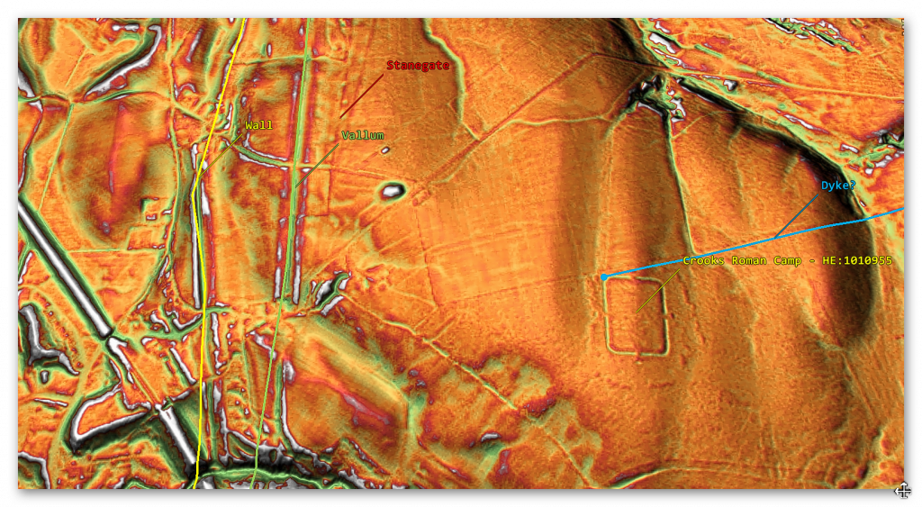
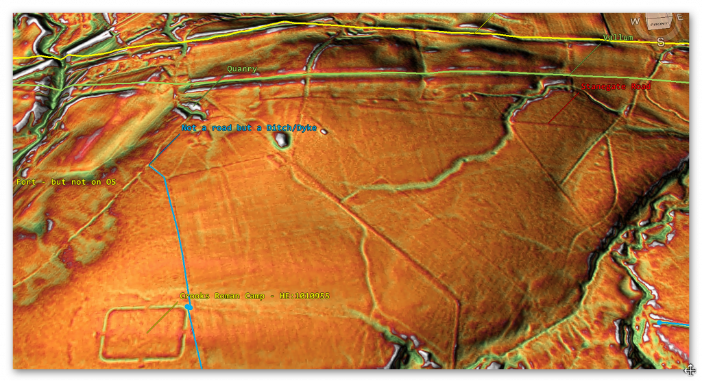
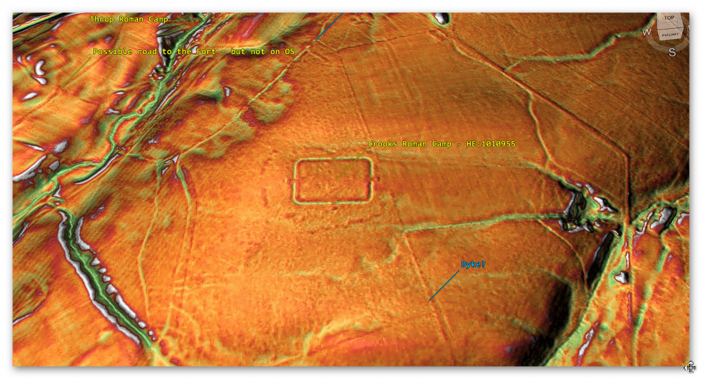
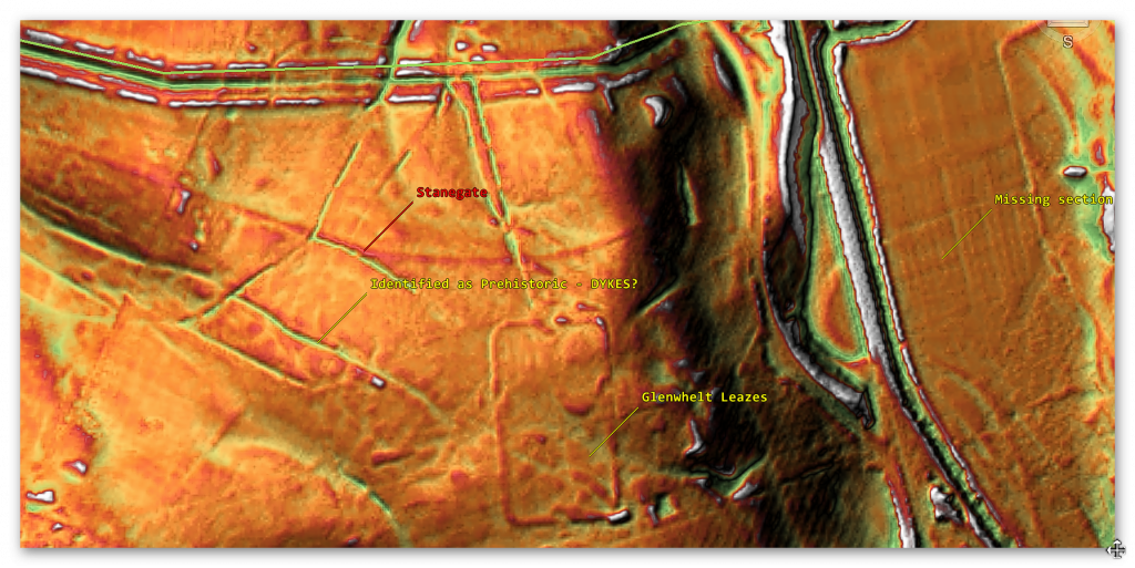
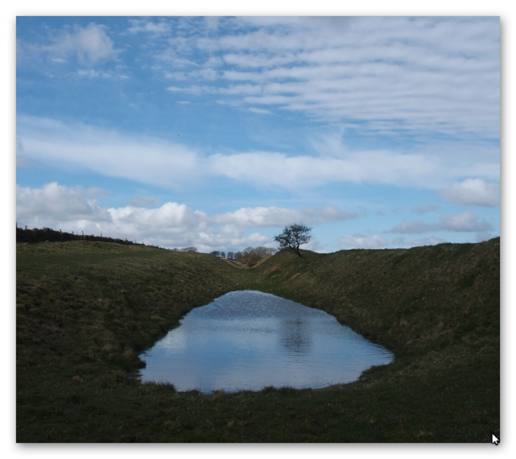
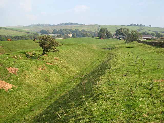
Mining in the Prehistoric to Roman Period

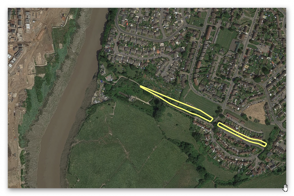
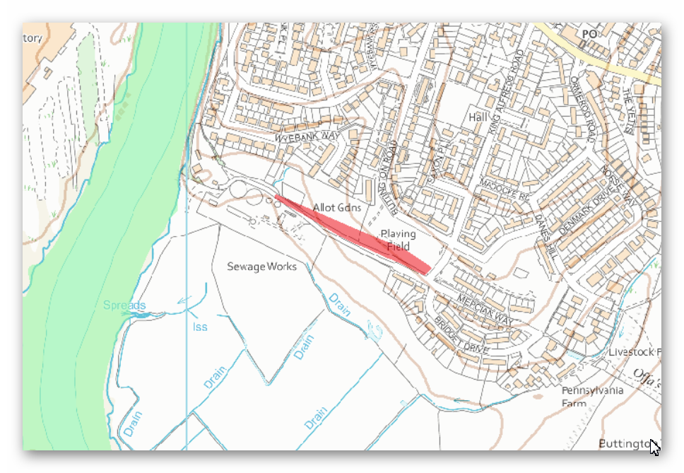
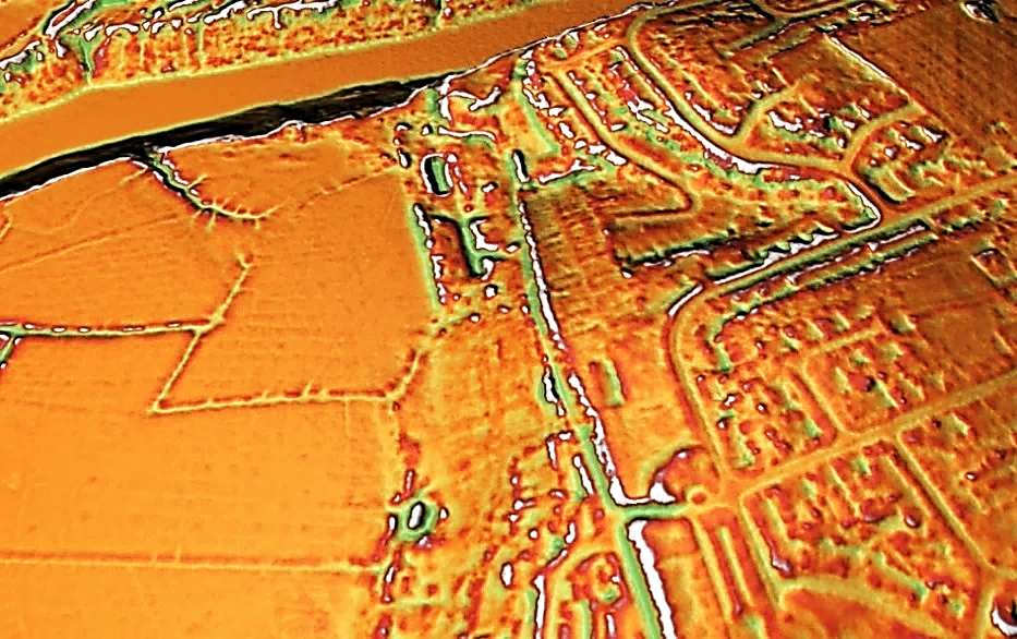
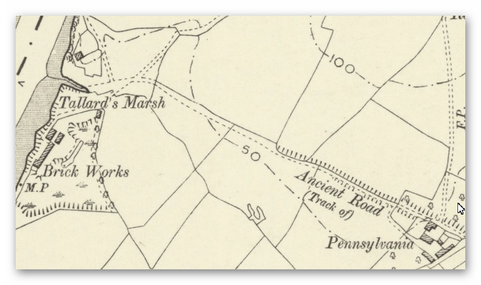
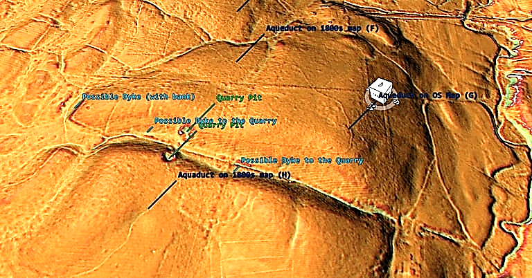
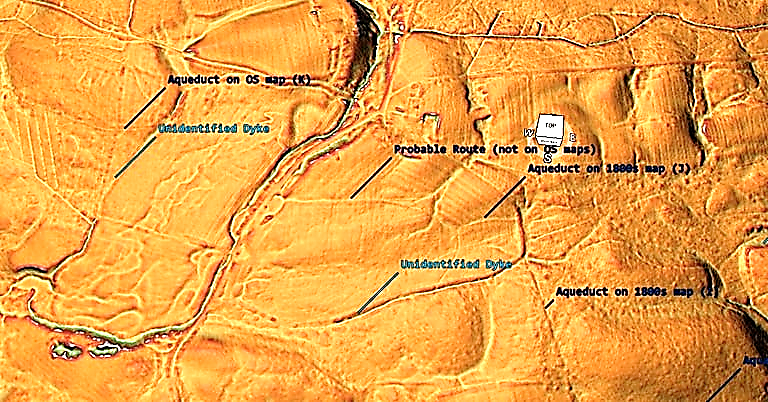
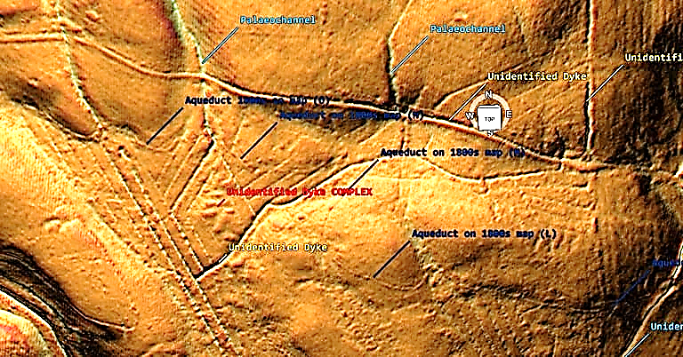
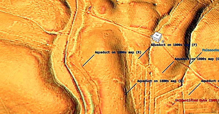
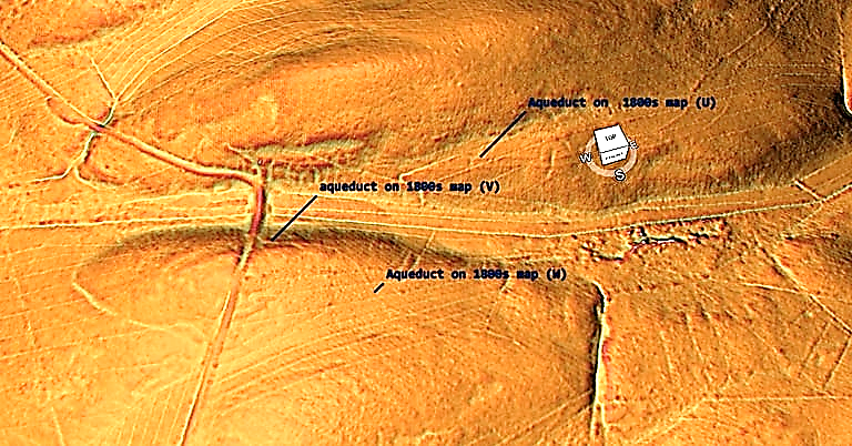
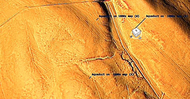
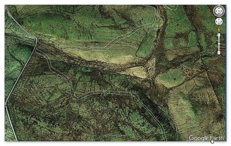
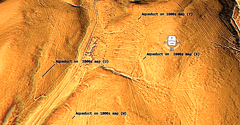
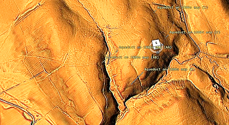
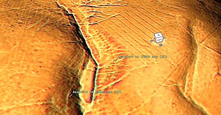
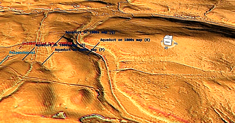
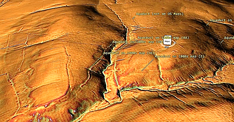
This is a good ‘peer reviewed’ report that details all the mineral that can be found in the ‘open cast’ mining pits we are now finding with our Lidar survey (Mining in the Prehistoric to Roman Period)

This survey and discoveries of the frequency of these quarries and the methods used to transport them (Dykes) will revolutionise the way we interpret History in Britain (if archaeologists actually read and study the reports and surveys on my website – rather than bury their heads in the sand?)

Text by Simon Timberlake with contributions from John Barnatt, Lee Bray, David Cranstone, John ickin and Phil Newman


2.1 Non-ferrous Metals

2.1.1 Prehistory

Context
Since the late 1980s there has been an abundance of archaeological research based around field
discoveries and small to larger scale excavations at prehistoric copper mines in Britain. Twelve sites
have now been dated to the Early Bronze Age and over 30 publications have appeared (including
Dutton & Fasham 1994; Jenkins 1995; Timberlake 1990a & b, 2002a & b, 2003, 2009a & b; Timberlake
& Prag 2005). Also unpublished material including by Lewis (1990 & 1996). All but two of the sites
investigated so far (Alderley Edge and Ecton) are in Wales, where the greatest concentration of mines is
to be found (some 8 excavated and dated sites: Copa Hill, Cwmystwyth, Nantyreira, Nantyrarian, Tyn y
fron, Twll y mwyn, Erglodd, Llancynfelin and Ogof Wyddon), particularly within the mid-Wales
orefield. Most significant amongst these is Copa Hill (Timberlake 2003), but two other important mines
on the North Wales coast are Great Orme, Llandudno (Lewis 1996 unpubl) and Parys Mountain on
Anglesey (Timberlake 1990a & Jenkins 1995)1.


Mixtures of oxidised sulphidic ores including chalcopyrite, malachite and others – sometimes intimately
mixed with galena within the surface oxidised, supergene zones of these vein deposits – were being
worked to depths of about 10m within opencasts and up to 30m underground (within the limestone of
the Great Orme). Evidence of working methods includes firesetting and/or the use of bone or antler
picks and an assemblage of hafted and hand-held stone tools. These consist of a preferential selection of
beach cobles brought sometimes up to 25km from the coast (at Copa Hill) and recycled on site.


It is likely that the exploitation of the copper resources of the British Isles began in SW Ireland at the
Beaker-period mine of Ross Island, Killarney (O’Brien 2005) in c.2400 BC. Following the depletion and
flooding of these workings in c.1800 BC, the search for new resources of copper moved to the red bed
cupriferous deposits of the Old Red Sandstone at Mount Gabriel and other sites in south-west Cork
where prospection and small-scale mining is evident (Jackson 1968; O’Brien 1994). Then to the Isle of
Man at the copper deposits of Bradda Head and Langness, where stone mining hammers have been
found (see Doonan & Hunt 1999). On the west coast of Britain the copper and lead vein deposits within
the Lower Palaeozoic rocks of the mid-Wales uplands, along with the gossans of the massive sulphide
deposit on Parys Mountain and the Carboniferous Limestone (a Mississippi Valley type copper deposit)
began to be prospected and worked regionally c.1900-1800 BC. However, some of the mid-Wales sites
have provided earlier dates including Erglodd, c.2200 BC; Tyn y fron, 2100 BC and the earliest
exploitation of the lode outcrop on Copa Hill of between c.2100 – 2000BC.

These earlier dates deserve further examination in the context of the study of the earliest mining in Britain but what is clear is that
almost all of these mines had been abandoned and the widespread phase of prospection was over by
1600-1500 BC. This phenomenon can in part be explained by the exhaustion of easily-won oxidised ores
and the increasing depth of workings creating rising water (drainage) problems. The latter may be
linked to climate deterioration and increased precipitation, particularly within the uplands where many
of these sites were located. This inundation has been demonstrated archaeologically at Copa Hill
(Timberlake 2003). However, this is probably only part of the answer at a time when new sources of
copper, such as from the Alps were coming on stream, and political and economic allegiances were
playing important roles in this change. Future research will need to address these issues.


Just as interesting, though perhaps less surprising given the naturally well-drained limestone (perhaps
with karstic openings) of this headland, is the continuation of mining of unknown scale at the Great
Orme into the Middle Bronze Age (c.1500-1400 BC), and even into the Late Bronze Age and Iron Age.
The latter is based on the limited number of later radiocarbon dates, some of which were obtained from
the deeper parts of the mine. This Middle Bronze Age extraction may well equate with the production of
the Acton Park bronze metalwork in North Wales (Timberlake 2009a; Tylecote 1986). Northover (in
Savory 1980) also suggests that the impurity-free Type C copper of the Early Bronze Age may originate
from the Great Orme, with the low nickel and arsenic metal types B1, B3 and B4 originating from mid
and North Wales. Rohl & Needham’s (1998) work on the lead-isotope analysis of British ore deposits
suggest a correlation between the IMP-LI 6 type metal and some of the mid-Wales ores (such as from
Copa Hill) on the England & Wales Lead Isotope Outline (EWLIO) plot.


Most significant to the list of future research questions to address is the absence of evidence for
smelting sites associated with these Early Bronze Age- Middle Bronze Age mines. Archaeological
fieldwork has failed to find traces of this within the vicinity of the mines, whilst palaeo-environmental
investigations of peat basins nearby these sites have identified (copper and lead) palaeo-pollution peaks
within the peat associated with mining activity. However, it has not been possible to distinguish
whether or not these relate to smelting flume or to wind-blown dust emanating from the prehistoric
mines (Timberlake 2003; Mighall & Chambers 1993, Mighall et al 2000). Apart from roasting pits and a
number of possible but enigmatic smelting features identified by O’Brien (2005) at the Beaker mining
camp on Ross Island, Killarney, the only site from the UK which could be copper smelting, and Bronze
Age, is the largely destroyed hearth and Early Bronze Age pit containing a few grams of crushed slag
and copper prills found at Pen Trwyn on the northern cliffs of the Great Orme headland (Chapman
1997; Jones 1999).


Given the importance of what has been found in Wales, the more recent and current work in
investigating the origins of copper mining in England take on added importance, in particular as
regards what other, as yet undiscovered, sites remain and how much (or how little) of the copper from
these sites was entering the body of metalwork of the British Bronze Age. The subject of production
figures of copper from these mines, and the amount of re-cycling and import of metal, is addressed in
Copper Mining and Metal Production at the beginning of the British Bronze Age (Timberlake 2009a).


Apart from salt-working and iron production sites, and of course the incidental but significant
investigation of gravel, chalk and stone quarrying as part of what are usually seen as much broader
archaeological landscape projects, the investigation of Bronze Age copper mining over the last 20 years
has probably been the main archaeological excavation project(s) in the UK to explore mineral extraction
in the prehistoric to Roman period.

2.2 Mineral Pigments

2.2.1 Prehistoric

Alderley Edge
The possibility of prehistoric extraction of mineral pigments (chiefly malachite and azurite, but also
manganese wad, iron oxide and pyromorphite) from the Trias Bunter and Keuper sandstones of
Alderley Edge in Cheshire, has been hypothesised by Timberlake (2005a & 2009a). It may have
occurred during the Mesolithic to Early Bronze Age though so far no clear archaeological evidence has
been found. The suggested locations for this activity are the soft Bunter (Upper Mottled Sandstone) at
Pillar Mine and the interbedded mudstone horizons (containing azurite nodules) at the base of the
Engine Vein Conglomerate at Devil’s Grave and Engine Vein. The circumstantial evidence for this
includes sites of Mesolithic occupation indicated by flint scatters on the Edge. These were first described
by Roeder (1901) and recently confirmed in a survey (Timberlake & Prag 2005). They occur (perhaps
coincidentally) alongside mineral outcrops. None of these sites, including the significant one surviving
at Castle Rock (Cowell 2005) have been excavated, yet the investigation of this possible mineral and
resource connection with these Mesolithic seasonal camp sites is just one of the research questions
which should be addressed.


Forest of Dean
There may be early evidence for iron ochre pigment extraction in the Forest of Dean, Gloucestershire, in
the form of rare small hand-held cobble stone implements used as crushing stones, presumably for
hematite, some of which have been found within old ironstone mines with medieval (and probably premedieval origins) such as the Clearwell Caves (inf. Ian Standing). More recently, a small selection of
hammerstones have been recovered from the surface of old scowles within a quarry at Drybrook on the
east side of the Severn. Though fashioned from the same type of rock, at least one of these hammers
shows distinct evidence of grooving for hafting, whilst another appears to be a small crushing stone.
Small cup-marked hollows in bed rock near by (similar ones have been recorded from other sites in the
Forest) have also been interpreted as anvils/mortars for crushing hematite (Strassburger 2000 unpub).
No date has been ascribed to these workings, but it is has been suggested by Strassburger that they are
Bronze Age – [Drybrook – Gloucester SMR 20829]


Exmoor
At Roman Lode near Simonsbath on Exmoor evidence of Early Bronze Age activity has been excavated,
in the form of a large hearth and a deposit containing anthropogenically smashed quartz. It is
associated with the surface outcrop of a hematite lode exploited in historical times for iron (Juleff &
Bray 2007). Though the excavators considered that this might have been a prospect for copper, another
possible explanation for this (if indeed it was metallic mineral extraction) would be as an exploration for
hematite ochre pigment.


Cumbria
Pickin (1990) mentions the discovery in the 1870s of ‘two polished stone celts of the usual sort’ found in
old hematite workings at Stainton, Barrow-in-Furness, Cumbria (Kendall 1893; Tweddell 1876). He
then questions whether this might refer to a ritual/burial deposit in a natural cavern or whether this is
evidence for associated mining, presumably for pigment. Little can be made of such a find now, yet
prehistoric interest in such a resource is what one might expect.


2.2.2 Roman

Alderley Edge
It is possible that the Roman mine of Pot Shaft at Engine Vein (Timberlake & Kidd 2005) was worked
for a blue pigment made from azurite nodules extracted from a mudstone horizon within the Engine
Vein Conglomerate, as well as malachite and azurite disseminated within the softer underlying Bunter
sandstones. Pot Shaft is described in greater detail within the sections below on Roman copper and lead
mining, yet probably the closest comparison with this working appears to be the Roman mine excavated
by the Bochum Mining Museum at Wallerfangen-Saar in Germany (Korlin 2010; Strassburger pers
comm). This mine was worked for azurite pigment (Egyptian Blue) sometime during 2nd-4th centuries
AD. The azurite here was extracted from a fairly similar geological horizon using much the same type of
shaft and level construction.

2.3 Copper

2.3.1 Bronze Age

South-West of England
Fieldwork carried out over the last 20 years (Sharpe 1997) has revealed nothing in the way of
conclusive evidence for prehistoric hard-rock metal mining or copper extraction within the important
South-West (Cornubian) orefield of Cornwall and Devon. Some circumstantial evidence for the use of
stone mining tools can be found in collections such as those of the Zennor Wayside Museum (Craddock
& Craddock 1996), yet the only example of mortar stones plus several unconvincing cobble stone tools
came from an undated tin/copper openwork surveyed at Wheal Coates Mine, St.Agnes (Budd & Gale
1994). With any of these finds it has not really been possible to distinguish these tools from those used
later for the crushing of tin ore. Penhallurick (1986) describes the find of a Middle Bronze Age palstave
within an old work at Godolphin Mine, yet the best evidence he provides of hard-rock mining seems to
be a mineral specimen of botryoidal goethite, probably dug from a lode, discovered with Middle Bronze
Age pottery at Tredarvah.


Attempts to provenance metal artefacts may have provided some firmer evidence for extraction (Budd et
al 2000). This work analyzed the lead isotopes and trace metal composition of a group of five Early
Bronze Age copper artefacts, the result it was claimed indicate unambiguously a source within an ore
body associated with the Cornubian granite batholith and perhaps, more specifically, the St. Austell
intrusion. Although the number of artefacts analyzed was limited, this data could be important if it
provides confirmation that copper was exploited in the South West at a date at the very beginning of
the Bronze Age. There are certainly traces of copper metallurgy in the form of local copper-alloy
metalworking surviving at Middle Bronze Age settlements such as Trethellan Farm, Newquay
(Nowakowski 1991), yet there is no evidence, here or anywhere, of primary smelting. Three copper
ingots of Late Bronze Age date from St. Michael’s Mount (Herring 2000) and Kenidjack (Tylecote 1967)
might imply local production. But just as interesting perhaps is the evidence for Late Bronze Age –
Early Iron Age copper, bronze and lead-silver metallurgy at Gussage All Saints and Hengistbury Head
in Dorset (Tylecote 1986). The source of the copper used at the latter site is likely to be somewhere in
the South-West.


Isle of Man
The Isle of Man, an island rich in Beaker and Early Bronze Age remains and one of the principal
stopping-off points for the earliest seafarers between Ireland and Britain, was also on the route along
which some of the first metallurgists travelled. We can see this in the evidence (though still undated)
for prehistoric prospection around the southern tip of the island, such as on the Langness peninsula,
where hammer stones associated with an area of copper mineralisation were found during fieldwalking
in 1999 (Doonan & Eley 2000),whilst to the west of here, similar tools made of basalt beach cobbles
were recovered from North Bradda Head in 1998 (Doonan & Hunt 1999) and from South Bradda Head
in 1987 (Pickin & Worthington 1989). Adjacent to the natural harbour of Port Erin, South Bradda forms
a prominent headland which faces west and looks out across the Irish Sea, the visibly copper-stained
cliffs here being associated with a rich lode containing chalcopyrite, secondary minerals and quartz.
This natural feature was described by Lamplugh in 1903 as being ‘amongst the most spectacular
displays of quartz veining in Europe’. The presence of the mineral here can still be seen far out to sea,
much as it would have been in antiquity as the Neolithic and Bronze Age peoples crossed in their plank
boats or curraghs from Ireland. The existence of this ‘metal route’ seems all the clearer when we
examine the Copper Age/Early Bronze Age metalwork from the island which shows affinities with both
Irish and early Welsh and Scottish (Migdale) axes, along with the mixing (or recycling) of Ross Island
metal with copper from other sources (Timberlake 2009a).


Alderley Edge, Cheshire
In 1874 what was then suggested to be a prehistoric mining landscape (now believed to be of Early
Bronze Age date) was uncovered during the course of modern mining activity at Brynlow (Brynlow Field
Opencast within 100m of SJ 855773). This was first recognized by Boyd-Dawkins (1875 & 1876) who
inspected the site on numerous occasions in the company of other leading archaeologists of the period.
The stone tools from here (now in the collections of the Manchester Museum) were later described by
Roeder (1901) and Roeder & Graves (1905). An oak shovel, witnessed by Sainter (1878) as having come
from one of these early mine pits, and subsequently re-discovered by Alan Garner, was radiocarbon
dated in 1994: OxA-4050: 3470 ±90 yrs BP or 1888-1677 yrs cal BC (Garner, Housley & Prag 1994).
Today the site of this discovery is filled and grassed-over but still identifiable.


Elsewhere on the Edge, mining sites of a similar type were examined by Roeder (1901) and Roeder &
Graves (1905), and then subsequently by Oliver Davies (1935), Carlon (1979), Warrington (1965; 1981)
and others. These included in particular the Engine Vein, but also a site at Dickens Wood and the nowinfilled opencast of The Hagg in Windmill Wood, where three slagged sherds of a crucible – illustrated in the Roeder mss – were found. Also, Mottram St.Andrew, approx 1km to the east, where Roeder &
Graves’ 1905 map indicates the approximate position of the hearth and the hammer stones find. Other
sites thought to be prehistoric in origin include Devil’s Grave at Stormy Point and near to West Mine,
where workings originally believed to be ‘Roman’ were found in 1858. More recently those surviving and
still recognizable sites, such as Pillar Mine (Dickens Wood) – with its three now seriously eroded
bisected pit workings, large cave-like entrance and eroding Bronze Age mine spoil – and the Engine
Vein opencast to the south – with prehistoric pit workings and the remains of an incipient prehistoric
opencut – were re-examined by Pickin (1990; and in Blick 1991), Gale (1989; 1993 & 1995), and finally
by Timberlake (Timberlake & Prag 2005).

Following the survey work carried out by the Alderley Edge Landscape Project in 1997, an archaeological excavation was undertaken of a previously undetected pitworking close to the south-west end of Engine Vein. This working, which seems only to have been a
prospection undertaken within the mineralised sandstone prior to the main pitting and opencasting on
the vein itself, can now be ascribed with some certainty to the period c.100-150 years just before or after
1900 BC (Timberlake & King in Timberlake & Prag 2005). Four Early Bronze Age radiocarbon dates
were obtained from these excavations, including the charcoal associated with the firesetting and mining
of this pit (Beta-115606 3550 ±70 yrs BP or 2035 – 1690 cal BC) and a date for its abandonment, which
seems to be consecutive with continued working on the vein. Within the last few years archaeological
evaluation work carried out at Stormy Point by the University of Manchester Archaeological Unit has
revealed further evidence for Early Bronze Age and perhaps also later prehistoric mining in the form of
at least two prospection pits, one of which was dated to 1690 – 1510 BC (Mottershead & Wright 2008).


However, the absence of open-area excavation here has made it difficult to interpret this site further.
The production of copper (and perhaps also small amounts of lead) during this 100-200 year period of
mining during the Early Bronze Age may not have exceeded 20 tons of hand-picked and cobbed (crushed
and dressed) ore. Given this relatively small amount it seems possible therefore that the copper was
smelted locally up on the Edge. Although the evidence for this has yet to be found, in 1901 Roeder does
refer to hearths at Engine Vein which may have been roasting beds. Reconstructions of a primitive
smelting operation involving the construction of small ephemeral bowl furnaces fired with
charcoal/wood were undertaken at Alderley Edge during September 1997 and July 1998 (Timberlake
2005c).


Ecton Copper Mine
Stone tools ‘used by the aboriginal miners’ and found within in the Duke of Devonshire’s copper mines
at Ecton near Leek in Staffordshire in the1850s were displayed in the Derbyshire antiquary Thomas
Bateman’s collection (now at Sheffield Museum). Hammerstones were also found redeposited on old tips
at Dutchman by Graham Guilbert in the 1990s. Following underground exploration in 1997, the end of
a primitive red deer antler pick was recovered from amongst rock collapsed in from surface workings
some 20-30m underground near the top of Dutchman or Stone Quarry Mine. This provided an Early
Bronze Age radiocarbon date (1880–1630 cal BC at 95% probability) suggesting the existence of a
second locality for Bronze Age copper mining in England (Barnatt &Thomas 1998; Pickin 1999; Guilbert
1994a; 1994b). The ore deposits here consisted of veins and pipe workings formed from a combination of
tight anticlinal folds and faults within Carboniferous Limestone containing chalcopyrite completely
oxidised to malachite at surface.


In 2008 the Early Mines Research Group undertook surface excavations at the site of an old opencast
and later shafts at Stone Quarry Mine (as part of a Peak District National Park project funded by
English Heritage). These revealed evidence for 17th-century AD mining and the backfill of an earlier
opencast but amongst the later mine spoil emptied out from below were some stone hammers and bone
tools, some of which were subsequently dated to the period 1800 – 1600 BC. At The Lumb, a few
hundred metres away close to the summit of Ecton Hill, a series of shallow horizontal cave-like
workings were investigated in 2009. The excavation of a hollow in front of one of these revealed a small
outcrop working on a bed of cupriferous dolomitic limestone. This horizon appeared to have been mined
in prehistory with bone and stone hammers, before being re-worked in the post-medieval period. Some
preserved lenses of early mine spoil containing in situ flakes of bone and antler were encountered
amongst this; this included the tip of a worked antler tool, which gave the following date: OxA-21507
3445 ± 28 1880–1680 cal BC (at 95% confidence). Since that time twelve bone tools (points and scrapers)
from The Lumb and Stone Quarry mines have been dated and the results of these dates have been
Bayesian modelled in an attempt to establish the period and sequence of working (Tables 1 and 2). It
seems probable from this that Stone Quarry was mined first (and perhaps for longer) in the Early
Bronze Age, followed by The Lumb, the latter perhaps as a prospection (this included one Middle
Bronze Age dated bone tool). The bone tools were mostly made from split cattle tibia (rather similar to
the tools found on the Great Orme, Llandudno), whilst the majority of the hammerstones were handheld, un-modified river cobbles collected from the bed of the River Manifold at the base of Ecton Hill. No traces of an accompanying mining camp, or for that matter, nearby traces of processing or smelting
were found.


2.3.2 Iron Age
Currently there is little site-based evidence for Iron Age copper mining in the British Isles. One very
likely site, but one for which we have no dating evidence from the mine itself, is Llanymynech Ogof (SJ
265 222). This Carboniferous Limestone hill straddles the border between England (Shropshire) and
Wales.


Reputed in the 19th century to have been a Roman mine on account of the find(s) of Roman coins and a
coin hoard buried within mining deads underground, this small, and now well surveyed and explored,
labyrinthine system of mine passages seems much more likely to be Iron Age or earlier in date. Antler
pick tools have been found underground (Adams 1970) and also a single round hammerstone within the
entrance passage (Timberlake 1996). Most important of all was the result of a palaeo-environmental
study; the coring of a peat basin within the Iron Age hillfort (which also encloses the site of the mine)
has revealed evidence for mining or smelting-related copper pollution, which corresponds in date with
the occupation of this site (Moore 1992). In 1981 excavation of a pipe trench through the hillfort
rampart revealed two metalworking (bowl) hearths and a pit associated with the crude working of
copper dating to the period 275 – 10 BC (Thorburn 1988), and further hearths were discovered in the
early 1990s (Musson et al 1993). More recently, an excavation at Downgay Lane, Four Crosses (within a
few kilometres of Llanymynech) uncovered a Middle Iron Age copper smelting site with 13 furnaces
with some of the earliest examples for the use of tuyeres in the UK (this is as yet unpublished). The
lead and zinc-rich copper from here provides a reasonable match with the malachite ore from or of
Llanymynech Ogof (Tim Young pers comm).


2.3.3 Roman


Alderley Edge: Pot Shaft
In March 1995 an early 4th-century AD coin hoard, consisting of 256 bronze coins contained within a
pot, was found in the top of an infilled and previously unknown shaft on Engine Vein (Nevell 1996).
Following this discovery the full excavation of this shaft was undertaken by the Derbyshire Caving
Club in conjunction with the Alderley Edge Landscape Project (Manchester Museum) in October 1997
(Timberlake & Kidd 2005). This work revealed a 12m-deep abandoned Roman shaft and cross-cut level
which connected to the open stope of Engine Vein (see Prag & Timberlake). The 2m x 2m square shaft is
large by Roman standards, yet the method of sinking this and of driving the 7m long level from its base
shows clear similarities with Roman workings recorded in Spain and elsewhere. Although the discovery
of a Roman shaft dating from the first half of the 1st century AD is unique to Britain, the style of coarse
pick-work upon the walls is reminiscent of that witnessed in the Roman Penlanwen Adit(s) at the
Dolaucothi gold mine in South Wales (Manning 1968).


At Engine Vein it is believed that the shaft was used as a means of laddered access into a slightly larger
series of underground workings excavated upon the vein itself. Another similar shaft, of which only two
corners and an edge remain, is to be found some 20m away from Pot Shaft on the southern side of the
main Engine Vein opencut at SJ 86057748. The latter appears to be associated with an inclined walkway cut through the rock, as well as with slots cut into the side of a rock ledge some metres back from
the shaft, for the purposes of fixing what could have been a primitive wooden windlass or capstan;
suggesting that this may have been a haulage shaft. Another 20-30m to the east of here, and preserved
within the north wall of the opencut are traces of what may be another shaft and a gallery, the latter
truncating the bisected hollows (pits) associated with the earlier Bronze Age workings.
Unfortunately, there is as yet no conclusive evidence that any of these other features described are
actually Roman in date. Nor is there any evidence for an adit level associated with the above workings,
nor of surface spreads of Roman mine spoil, nor any archaeological evidence for the foundations of
buildings or processing areas which one might presume to find associated. It seems possible therefore
that the Roman activity at Engine Vein never amounted to much; perhaps a small mine or trial dug to
properly sample this vein for copper (or for lead and silver), the tactic being to test the unexploited vein
lying beneath the earlier Bronze Age workings.


The range of radiocarbon dates obtained from the in situ timbers found within the base of Pot Shaft do
not preclude a pre-Conquest (Late Pre-Roman Iron Age ) date for the working, yet based upon the style
of mining, an early date seems less likely. In fact the date for the use of this wood could easily be Early
Roman (mid-1st century AD) if one assumes that the radiocarbon dated sample of the basal sawn oak
timber included the heartwood (Beta 115611: 2120 ±60 yrs BP [360-280 Cal BC or 250 – 12 Cal BC/AD]).
Unfortunately dendro-chronological dating undertaken on this wood proved unsuccessful, and no
Roman pottery or other artefacts were recovered from this working. Mining could have been carried out
here under military control, perhaps even by the XX Legion from their base at Chester (Timberlake &
Kidd 2005, 94), but in any event was probably only a short-lived affair, lasting little more than 20 years.
This shaft and level make up the most complete archaeologically excavated Roman mining (feature) in
England.

2.4 Tin

2.4.1 Bronze Age

Although it seems highly probable that alluvial tin (as pebbles-sand consisting of cassiterite) was being
exploited during the Bronze Age from the tin-rich areas of Cornwall and Devon, the only convincing
evidence that we have of local extraction in the Early Bronze Age is of 7 fragments of tin slag associated
with a dagger within the basal layer of turves of the Caerloggas I barrow at St.Austell – an inefficient
smelting of local tin carried out in the 16th century BC (Miles 1975; Salter 1997); and the excavated find
of cassiterite pebbles at the Bronze Age settlement of Trevisker. The latter seems quite typical of the
cassiterite of Goss Moor from which the alluvial tin found in the Lanherne Valley (which could be
extracted in prehistory) seems to be derived (Penhallurick 1997). Penhallurick (1986) mentions over 40
prehistoric artefacts recovered from later tin streaming activities, some of which he considers could be
objects left by Bronze Age tinners, since the very same tin gravels are more than likely to have been
worked again. He lists a number if tin streams around the margins (of the source) granites that he
considers may have been worked in prehistory. Foremost are those around St.Austell, in particular the
Pentewan Valley, St.Erth and Marazion, and Treloy in St.Columb Minor. A Late Bronze Age hut on
Dean Moor, Devon had hematite within its walls which had been separated out from tin ore collected for
smelting. More recently, slags have been retrieved from domestic sites at Goldherring and Killigrew (see
Tin Assessment) and the early results of yet to be published geo-chemical sampling have indicated
strong elevations of tin deposition in Dartmoor peat in the prehistoric period (Meharg 2011, 1-11).


2.4.2 Iron Age


It has been assumed from classical sources (reference to the Cassiterides (islands) and to Ictis by
Diodorus (Penhallurick 1986)) that tin was exploited in the South-West and traded with the Continent
by at least the Late Iron Age (Todd 1987) and it is likely that such activity dates from even earlier,
especially when the early presence of trading sites around the coast by at least the Late Bronze Age is
considered (places suggested for the site of Ictis include St.Michael’s Mount (4th-1st century AD) and Mt.
Batten, Plymouth (from c.500 BC). Excavations at Chun Castle showed that tin smelting was being
carried out here in the pre-Roman Iron Age (3rd-2nd century BC); probably an indication of local
exploitation of tin (Tylecote 1986). Other similar sites include Trevelgue and the Iron Age settlement of
St.Eval.

2.4.3 Roman

Tin exploitation from placer deposits certainly continued during the Roman period as suggested by the
assemblage of ingots recovered from Cornish sites such as that of Late Roman date from Trethurgy
(Quinnell, 2004) stamped with helmeted heads (Todd 1987). A group of plano-convex tin ingots found in
1991-2 from Bigbury Bay, South Devon (thought to be Late Roman (4th –5th century AD) in date on the
basis of accompanying amphorae) may relate to contemporary trade and a link with an early Dartmoor
tin industry (Fox 1996). The tin streaming at Pentewan, St Austell has likewise turned up Roman
artifacts, as has Treloy in St. Columb Minor, where a Roman tin bowl was discovered in 1826. However,
given the sheer focused intensity of placer tin exploitation in recent centuries, it is generally accepted as
unlikely that physical remains of prehistoric or Roman workings of this type survive. Recent
examination of Devon’s river sediments, away from the moorland, has provided radiocarbon dates
suggesting that wastes from tinworking processes on Dartmoor were being deposited in the rivers in
both the Roman and post-Roman periods (Thorndycraft et al 2004).

2.5 Gold (Cornwall)

2.5.1 Bronze Age

Penhallurick (1986) emphasizes the regular recovery by tinners (during the historic period) of small
amounts of gold from tin ground at Treloy and within the Carnon Valley. Whilst there seems to be
strong circumstantial evidence for prehistoric tin working in these valleys, this by itself would not be
sufficient evidence to suggest these sites as an English Bronze Age gold source. More interesting is the t that 90% of British Bronze Age goldwork contains small quantities of tin in parts per million; yet
samples of Irish, Welsh and Scottish native gold are either devoid or very low in tin (Taylor 1980).
Cornish gold has been shown by Penhallurick (1986) to contain between 25-50ppm tin, whilst analysis
of the two Early Bronze Age gold lunulae from Harlyn Bay, Padstow revealed concentrations of 50ppm
and 950ppm tin, and that from St.Juliot 650ppm tin. It seems possible therefore that gold was produced
as a byproduct of alluvial tinning from the Bronze Age onwards, perhaps in the Carnon Valley.
Some work is currently being undertaken on trace element composition of native gold and Bronze Age
gold artifacts in Ireland, with a view to identifying sources (Warner et al 2010), but very little is being
attempted in England or the rest of the UK. Because of the purity of alluvial gold (93% Au) trace
element studies as well as studies of stable isotope ratios may prove quite effective in provenancing.

2.6 Lead and Silver

2.6.1 Bronze Age

South-west England
Burgess and Northover (Tylecote 1986, 27, 30) suggest that lead was being intentionally added to tin
bronze during the Acton Park (Middle Bronze Age 1400-1300 BC) and Wilburton (Late Bronze Age
1000-900 BC) metalwork periods, presumably from British sources, though it was not until the advent
of systematic stable lead isotope analysis of bronze artifacts and ores (Rohl & Needham 1998) that a
possible match could be suggested between Wilburton metalwork and a lead source in the Mendips,
Somerset. Although this cannot be verified, or a specific site identified, this level of provenancing is at
least useful in establishing the origins of lead extraction.

Peak District
The discovery of a Late Bronze Age socketed axe made of lead at Mam Tor (Guilbert 1996) might
represent the very earliest exploitation of this metal in the Peak. A lead ‘torc-end’, as yet not fully
published, was found in a pit at the centre of a large round house, both with Early Iron Age C14 dates.
This was at Gardom’s Edge above Baslow on the Peak’s eastern gritstone moors, during extensive
excavations undertaken by the Peak District National Park Authority and Sheffield University in 1995-
2000 (Barnatt et al 2002; J Barnatt pers comm) Late Bronze Age axes from Britain containing up to 15-
21% lead are all thought to have an indigenous source (Northover 1980).

Shropshire
Bronze Age mining, including for lead, has also been argued for Llanymynech on the Welsh-Shropshire
border (CPAT SMR PRN 23399).

2.6.2 Iron Age

Mendips
Todd (1996; 2007) has suggested pre-Roman (Iron Age) mining of lead at Charterhouse-on-Mendip on
the basis of finds of a 3rd-century BC Greek coin, a denarius of Julius Caesar, plus Iron Age pottery from
excavation trenches sampling ‘Roman’ mining rakes (opencuts) on the edge of the Charterhouse Roman
fortlet undertaken in between 1993-5.

2.6.3 Roman

Lead was used to produce plumbing and water management systems, coffins, lead glass and spindle
weights. It was alloyed with tin to produce pewter, and lead compounds were a common adulterant in
wine and cosmetics. Numerous Roman pigs of lead have been found on routes leading from the orefields
towards ports from where lead was exported to other parts of the empire and a Roman shipwreck at
Ploumanac’h in Brittany yielded a cargo of British lead pigs from the 2nd to 4th century AD (L’Hour
1987).

Mendips
Roman mining can be confirmed at Charterhouse-on-Mendip following excavations by Todd (1996;
2007), whilst mining elsewhere in Mendip is suggested by finds of Roman lead smelting slag within a
Roman enclosure just east of Priddy, at Green Ore where a 4 ha area is covered by slag, lead fragments
and Roman pottery (Todd ibid), and most probably the large 100m long and c.10m deep opencut mining
rakes on Ubley Warren near Charterhouse. Evidence so far obtained suggests that the latter area,
though not archaeologically investigated, produced most of the Roman lead ingot finds in the Mendip.
Excavations from 1993 close to the Roman fortlet revealed evidence for mining during the period AD 50-
80, based on pottery finds (Todd 2007, 68).

The only excavations undertaken on the Mendips (by Todd at Charterhouse) suggest the possible
survival of in situ mining features and likely smelting hearths dating from the early Roman period.
Also, possible pre-Roman remains dating from the 1st millennium BC. Potentially one of the most
important early Roman lead mining areas within Britain, this area is worthy of detailed survey, soil
augering, geophysics and a better planned and larger scale excavation. Given the silver content of these
ores, the Mendip is also an area to look for evidence of silver-extraction (cupellation) from these ores
(see Ashworth 1970, 15).

Combe Martin
Combe Martin is known to have been a source of lead and silver from at least the medieval period, but
recently this location has yielded finds of Roman pottery and a stylus from beneath a considerable
depth of deposits at least partially derived from mining (T Dunkerly pers comm). Such evidence, slim
though it is, may be indicative of Roman working.

Calstock
Excavation of the recently discovered Roman fort at Calstock (a medieval silver mining/ smelting
centre) revealed a layer of mineral vein spoil within the Roman ditch and a Roman furnace which it was
suggested may be associated with smelting. Analyses are awaited.

Alderley Edge
It is distinctly possible that the substantial, but somewhat sandy or silicic, lead vein at Engine Vein
was the goal of the Roman miners when sinking Pot Shaft (Timberlake & Kidd 2005). There would have
been a significant demand for lead as pans for use in the Roman salt industry, centred around
Nantwich and Middlewich (Cheshire).

Peak District
No direct evidence of Roman mining is forthcoming, though numerous finds of lead pigs (cf
LUTUDARUM) would seem to suggest some local production, presumably by private concessionaires
rather than under military control. The Matlock area has been suggested as a location for this activity
(Tyler 1982); possibly mining was organized here by the mid-late 1st century AD (Boon 1971). A trench
dug to investigate a 2nd-century AD field wall at Roystone Grange located a small buried ‘scrin’ or
opencast (Barnatt & Rieuwerts 1998), though a more recent reevaluation of this has brought the Roman
dating of this boundary into question (Barnatt 1999). No Roman bole smelting hearths have been
identified within the mining areas, though a lead smelting hearth associated with a Late Roman villa
has been identified at Scarcliffe Park near Duffield on the Nottinghamshire-Derbyshire border (Willies
1982; Craddock 1995).

Excavation and dating of some of the numerous lead bole sites in the Peaks may be an easier way to
help identify the probable locations of Roman and Early medieval mining and could reveal how closely
these are related.


Shropshire
During working of the Roman Gravels Mine (Shelve district) in the 19th century, Roman coins, tools
(wooden shovels) and considerable traces of stepped opencast workings linked to underground galleries
and shafts were found and described (Wright 1862; Tyler 1982). The ‘find’ of a pig recorded at Roman
Gravels is unlikely to be genuine; it occurred about the same time as the ‘Roman’ was added to the
mine’s name and has the hallmark of a way of creating interest in shares in the mine. At least three
Roman lead pigs have been found in Shropshire which are accepted as being of local lead and there
have been other pigs found out of the county which could have been produced in Shropshire. Openworks
are still accessible at Roman Gravels, if overgrown, and as yet they are undated (Shaw 2009, 13).
Roman and earlier mining in Shropshire has also been researched by White (2000). The cupellation of
silver was practiced on the Shropshire / Welsh border at Pentrehyling (Bayley & Eckstein 1998).


County Durham
The only field evidence for Roman period lead mining in County Durham is circumstantial, in the form
of artefact finds from Slitt Mine, Westgate. A hoard of nine silver denarii of Vespasian, Antoninus Pius,
Hadrian, Faustina I, Marcus Aurelius, Lucilla and Trajan (date range AD 98-141) were apparently
found on edge of open work on the Slitt Vein (described as ‘near the quarry workings’). The description
of the find spot is open to interpretation (hoard deposited in abandoned working, mine contemporary
with hoard or hoard in secondary context and displaced by later mining?) and would benefit from reexamination. A hoard with a similar date range was discovered in the same general area at High Westgate in the 1870s. Slitt Vein is the longest and one of the strongest lead veins in Weardale and
outcrops at surface along much of its length. At Slitt Mine the vein is cut and exposed by the valley of
the Middlehope burn, so a good location for early prospection/mining (Archaeologia Aeliana 1925, 24;
Burnett et al 1986)

The Roman economy of the South Pennines has been thoroughly explored by Dearne, who focussed in
particular on the lead industry (Dearne, 1990).

Alston, Cumbria
Mining here, it is claimed, was carried out by the second cohort of Nervians during the 3rd century AD
(Webster 1952). Whatever the nature of this evidence, the recent excavation of a lead smelting furnace
within the industrial zone adjacent to Carlisle Roman Fort is probably linked, in some way, to lead from
the Alston orefield (Murphy & Zant forthcoming).

2.7 Zinc

2.7.1 Roman

Mendips
No evidence of this survives in the UK, but given the mining of lead from these veins, it seems possible
that the abundant near-surface calamine (smithsonite or zinc carbonate) ores were exploited by the
Romans for the purposes of making brass using the cementation method (deposits at East Harptree
etc).

2.8 Iron


2.8.1 Iron Age

In the archaeological record the evidence for iron extraction is chiefly to be found in the remains of
smelting hearths, the original sources of ore being identified on the basis of ore samples found with the
hearths. Here we see a development in Britain from the bowl furnace to shaft furnace to slag pit furnace
(Tylecote 1986). The occurrence of iron smelting at sites away from known sources of iron ore (e.g.
Mucking in Essex, Hevingham in Norfolk) attests either to the movement of ore or else to the once fairly
universal occurrence of bog iron. Geological sources of iron ore are also fairly widespread: from vein
hematite and goethite (Furness in Cumbria; Brendon Hills, Somerset; Forest of Dean), to blackband
(siderite) ironstones ubiquitous within the coalfield areas of Britain, Wealden ironstones (siderite) from
Sussex, Hampshire and Surrey, and the Cretaceous Greensand (Carstone of Bedfordshire etc and Upper
Greensand ores of Devon).


Dorset
At Hengistbury Head locally collected iron ore was extracted from outcrops in the cliffs and smelted
between 400BC and AD 50 (Bushe-Foxe 1915). Similar evidence for locally sourced iron ore and
smelting comes from Gussage All Saints (Wainwright et al 1979).
Wiltshire Iron ore was smelted at All Cannings Cross, Wiltshire. between 400-250 BC using ore from the local
Lower Greensand , probably from Seend (Cunnington 1923)


Somerset
A second short rake (opencut) at Charterhouse-on-Mendip examined by Todd in 1996 proved to be for
hematite, rather than for lead, and from which a denarii of Julius Caesar (48 BC) plus some Iron Age
pottery was recovered. Elsewhere, other potential Iron Age mineworkings are poorly explored and often
undated; these include potential sites at Kitnor Heath on Exmoor and Colton Pits in the Brendon Hills
(L Bray pers comm)


Devon
An Early Iron Age smelting site at Kestor near Chagford in Devon can be dated to just after 400 BC.
The bellows-blown hearth may well have been reducing a local bog iron ore (Tylecote 1986). [PN note:-
Peter Crew has now got a C14 date from charcoal embedded in the iron slag at Kestor, and this is
broadly 6th century AD. Peter also says that the slag at Kestor is typical of trial working of ores that
didn’t quite work out, not part of a regular if small scale production process – not sure if this is the
main Kestor site (above) or the more recent hut circle excavated by Sandy Gerrard. Perhaps Peter has
more details OK]

Cornwall
One of the earliest iron extraction sites in this county is at the promontory fort of Trevelgue Head
where, within the Mid and Late Iron Age, between 1.5 and 2.3 tonnes of iron were produced. This is
likely to have been extracted from a narrow lode running through the headland on which the site is
located (see Dungworth in Nowakowski 2011). The low level of iron production is notable on this site,
which amounts to between 10 and 20 kg of iron, or 2 to 3 smelts each year. This suggests that the scale
of Iron Age extraction was limited and that we are unlikely to identify sites of this type unless they
were exploited for significant periods.


Surrey
The site of Brooklands near Weybridge produced up to 44kg of slag as part of the waste from slagtapping furnace(s) operated between the Early – Late Iron Age (from the 5th century BC to 1st century AD), the source of the ore used probably being high-quality sideritic ironstone outcropping at the nearby
St.George’s Hill (Hanworth & Tomalin 1977). At Purberry Shot near Ewell, furnace bases and a bloom
dating from 200 BC – AD 150 represent a small industry using local iron ores from the Wadhurst Clay
(Lowther 1946).


Sussex
Pre-Roman iron smelting (190-80 BC) in shaft furnaces with slag-tapping pits has been identified at
Broadfield near Crawley in Sussex (Gibson-Hill 1980), the latter using local Wealden iron ores
(siderite). As well as smelting, local Wealden Iron Age bloomery sites have been investigated, such as at
Crowhurst Park, Bardown and Chitcomb (Tylecote 1986).


East Anglia
Iron smelting as well as ironworking has been encountered at recently excavated fenland edge Iron Age
settlements such as at Bradley Fen, Cambridgeshire (Gibson & Knight forthcoming), the latter possibly
exploiting local bog iron ores, or else Northamptonshire ironstone, which may have been sourced from
the southern part of the East Midlands orefield (Fincham 2004).


Northamptonshire
Associated with the settlement at Hunsbury (Fell 1936) were pits containing a significant amount of
iron slag suggesting smelting operations using the local Northamptonshire ironstone. Other Iron Age
furnaces have been found at Wakerley (Tylecote 1986).


Perhaps one of the most interesting case studies relates to excavations in 2006 by Archaeological
Project Services of some seven slag-tapping furnaces found during investigations adjacent to a Roman
villa at Priors Hall, Corby (British Archaeology Feb. 2008). Later Iron Age pottery (100 BC – AD 43) and
tuyere fragments were recovered – perhaps the best preserved examples of furnaces complete with
tapping arches and pits and the furnace superstructure from this Late Iron Age period. The local
Northamptonshire ironstone is likely to have been smelted, most probably from outcrops within the
area of Rockingham Forest.


East Yorkshire
The spectacular Middle Iron Age ‘Arras Culture’ linked to important chariot burials and the excavation
of the Hasholme log boat was home to one of Britain’s largest prehistoric iron industries dating from
around 300 BC. The iron industry appears to be based on large deposits of bog iron ore within the
coastal Foulness Valley south of Holme, Humberside4 Furnaces and large quantities of iron slag from
the smelting of these sandy bog iron ores have been excavated at Whelham Bridge, Yorkshire (Halkon
& Millet 1999).


Northern England
Early Iron Age (7th-6th century BC) furnaces have been found at West Brandon in Durham (Jobey 1962),
and at Roxby in Cleveland (Spratt & Inman 1986), the latter exploiting the local Cleveland iron ore.


2.8.2 Roman

Cornwall
Restormel Roman Fort is located close to an important iron vein (Restormel iron lode).

Blackdown Hills, Devon

A landscape of early iron extraction pits can be seen within areas of the Blackdown Hills.6 Most of this
extraction is undated, but trial archaeological excavations associated with a large-scale survey of the
deposits identified smelting sites dating to the Saxon period but also to the Roman period, the latter at
Hemyock near Upottery on the River Otter north of Honiton. Pottery from these layers produced a date
in the second half of the 1st century AD (AD 50-70), a date which suggests Roman military control or an
overview of exploitation centered perhaps on the legionary fortress at Exeter (Griffith & Weddell 1996).
Iron ore, geologically similar to that from the Blackdowns, was recovered during excavation of the
Roman fort at Bolham, Devon (Maxfield, 1991).


Exmoor
Iron production grew from the beginning of the 2nd century AD reaching substantial levels on sites on
the southern fringes of Exmoor such as Sherracombe Ford and Brayford. More recently a Late Roman
smelting site has been identified at Blacklake Wood as part of the Exmoor Iron Project (ExFe) under the
leadership of Gill Juleff at the University of Exeter. Sites have been identified through geophysics
(magnetometer and magnetic susceptibility), geochemical (PXRF) survey (Carey 2005), and then
archaeologically excavated and dated (Bray 2002). A number of complementary scientific approaches
have also been tried in this area (Dean 2003; Brown et al 2009; Fyfe 2003; 2009; Karloukovski, &
Hounslow 2006). The suggested source of much of the Roman iron smelting seen in this area is ‘Roman
Lode’ at Burcombe near Simonsbath. The anciently worked lode (goethite) is over 600m long and is
opencasted to a depth of over 5m. (Fletcher et al 1997). Excavations at this site have been carried out
by Bray (2002; 2006).


Somerset
At Treborough and Luxborough there is evidence of Roman extraction of iron ore at outcrop (Yates
1858). Roman exploitation of the hematite ores of the Brendon Hills has been suggested at Colton Pits,
though there is no datable evidence (L Bray pers comm) and at Clatworthy Reservoir, samian pottery
scatters have been found in the vicinity of bloomery slag heaps.


Gloucestershire
At Lydney (Wheeler 1932) a small underground working of iron ore (goethite) was located, the latter
working a band of ferruginous marl, and later sealed by a 3rd century AD hut (see also Scott-Garrett
1959).


Forest of Dean
Ancient opencast workings known as scowles are relatively commonplace in the Forest. These represent
surface worked-out portions of iron veins and also solution-filled (iron ore) cavities within the limestone.
In some cases these can be traced for several kilometers and represent massive iron ore extractions.
Almost all are undated, but given the examples of pottery and coins unearthed (as at ancient iron
smelting sites near Whitchurch and mining and smelting sites at Tidenham, Coppet Wood Hill, Perry
Grove and Crabtree Hill) and the nearby Roman iron-smelting settlement of Ariconium, it is more than
likely that some of these at least are Romano-British in origin (Nicholls 1866). Finds from some of the
other sites suggest Early Medieval working (Nicholls ibid.). The classic scowle workings at Puzzle Wood
near Coleford are thought likely to be Romano-British (Blick 1991). A general summary of the topic has
been attempted by Wildgoose (1993).


From the 3rd century a reduction in the size of iron production sites is apparent in Britain and the a
concomitant decrease in the scale of extraction can be expected although no workings are currently
known from this date. The exception to this is the Forest of Dean where iron production increased
during Later Roman period.

Northamptonshire
The fact that large numbers of smithing furnaces were found at Corstopitum (Roman Corbridge),
though little evidence of smelting in the form of slag, might suggest that the Roman military did not
bother to smelt iron themselves, but instead relied on British smelters (Tylecote 1986). However, there
is evidence of domestic smelting of iron within this iron-producing region of the Midlands, particularly
in 2nd –3rd century villas such as Great Weldon (British Archaeology Feb 2008). The Northamptonshire
ironstone was worked from shallow surface outcrops by means of opencasts. Smelting furnaces at Kings
Cliff near Bulwick lie close to possible workings (Jackson 1979, 31-7). Traces of these workings within
the Northamptonshire orefield have been found at Oundle and Laxton (Taylor and Collingwood 1926).


Lincolnshire
Roman iron smelting remains have been found at Pickworth, Bagmoor, Costerworth and Thealby, and
at Claxby these smelting locations lie within the area of iron mining and outcrops of the Northants
ironstone (Cooper Key 1896).


Norfolk
At Ashwicken nodular iron ore was obtained by extraction pits over a horizon within the Lower
Greensand (carstone) some 3m – 13m deep (Tylecote 1967). These minepit workings cut through
Boulder Clay down to the Lower Greensand, the clay being used in the construction of tree-trunk patten
moulded furnaces for immediately local smelting. The latter formed some of the best shaft smelting
furnaces seen in Roman Britain (date 2nd century AD). Large slag cakes found at Hevingham, North
Norfolk also suggest local smelting.


Sussex
Wealden iron ore (nodular siderite and occasionally limonite) was extracted by means of pits. These
were noted at Minepit Wood in Sussex associated with smelting furnaces (possibly a bowl furnace type)
dating from the 1st-2nd century AD (Money 1974). The furnaces were charged with a mixture of siderite
and oak charcoal – the siderite came from the Wadhurst Clay exposed within the immediate vicinity.
Other Wealden Roman furnaces have been found within the same area at Cow Park and Pippingford,
Hartfield, and also at Holbeanwood and Broadfield near Crawley (Cleere 1970 and Tebbut and Cleere
1973). RB iron production in the Weald has been reviewed by Hodgkinson (1999).


Recent archaeological excavations and also reconstructions of Roman iron smelting furnaces have been
undertaken and recorded by the Wealden Iron Research Group (WIRG) founded by Cleere and Crossley
in 1968.


Northern England

Both ore and slag are associated with smelting remains at the Roman fort of Templebrough near
Rotherham, Yorkshire, whilst the fort of Galava at Ambleside produced evidence of the smelting of local
bog iron ores (Tylecote 1986).


2.9 Fossil fuels

2.9.1 Coal

Iron Age
Evidence for the very early (7th-6th century BC) use of coal as fuel in iron smithing operation comes from
the palisaded site of Huckhoe in Northumberland (Smith 1905). Associated with a large quantity of coal
within the hearth was a piece of part-welded iron. It is not known from where the coal came, though
local surface outcrops abound nearby. This example seems to be unique for prehistoric Britain.


Roman
There is evidence for the use of coal in a military context for domestic heating and perhaps also iron
smithing, within the northern forts on the Antonine and Hadrian’s wall (with possible sources as
outcrop workings in the Northumbrian and Midlothian coalfields). In particular, the use of coal is
reported in the archaeological literature at Housesteads and Corbridge fort(s), as well as at Chester and
Manchester (Preece & Ellis 1981). Contemporary documentary record also suggests the use of coal to
maintain the perpetual fire at the Temple of Minerva in Bath (Aquae Sulis). It would seem that there
was one cluster of coal use in Roman Britain within the Flint-Chester area (perhaps with a source in
the North Wales coalfield), and another in the area of the Bristol Channel area and then south east as
far as Silbury Hill (source in the South Wales and Bristol and Somerset coalfields). The final cluster is
to be found in East Anglia between Cambridge and the Wash.

These sites lie 200 miles by sea and 40 miles by land from the nearest coalfield sources. The distribution of sites might relate to their proximity
to the Roman Car Dyke from The Wash to near Cambridge. Coal may have been brought by sea from
Yorkshire or Northumberland, much as in the same way sea coal was extracted and then brought by
sea and canal to Cambridge and the other East Anglian towns (Preece & Ellis 1981, 17). Small
quantities of coal were found at Roman Wroxeter and Meole Brace, both in Shropshire, though whether
the coal was from what was to become the Shrewsbury coalfields or from the Coalbrookdale area cannot
be established, but in each case coal was later mined in the vicinity(Ellis 2000; Evans 1999).
In the most recent study of Roman coal, Travis has provided a persuasive argument for coal mining to
have taken place in many areas of Britain in the Romano-British period based on secondary finds and
coal residues retrieved from a number of non-mining sites, confirming extensive coal usage. He was also
able to provenance some samples of coal taken from Roman contexts to specific seams. However, the
work was unsuccessful in identifying the site of a single Roman coal mine, such is the elusiveness of the
evidence (Travis 2008).


The only putative Roman coal extraction site listed in the EH Coal Industry MPP Assessment (Gould &
Cranstone 1993) is Stratton Common near Stratton on the Fosse, Ashwick (Avon). Apparently anciently
worked coal outcrops here provide the nearest source of coal to Roman Bath on the Roman road network
(the worked area straddles the main road to Bath). Documented mining began here in 1300 AD, but it
seems likely that the mine had much earlier origins (Down & Warrington 1971, 224-6).

2.9.2 Oil Shale

There is evidence for this (Kimmeridge Shale) being used as a fuel in Iron Age salt production (boiling
and evaporation of brine in briquetage pans) at Kimmeridge in Dorset (D Cranstone pers comm)


2.9.3 Peat

Roman salterns (salt working sites) within Essex, Cambridgeshire, Norfolk and Lincolnshire may have
used peat as a fuel for boiling and evaporating brine within briquetage pans (Lane & Morris 2001).

2.9.4 Jet


In effect almost all true jet used in Britain from the Bronze Age to the Roman Period originated in the
Whitby coastline of North Yorkshire. Much of this jet may originally have been sea-washed pieces
eroded out of the Upper Lias (Lower Jurassic) shales (specifically the thin Upper and Lower Jet Beds)
which make up part of the strata of these cliffs. Bead production could have been assisted by mining the
thinnest laminae of jet fresh from the shales themselves. Extractive sites of this period have not yet
been identified.


Prehistoric
Jet is an important grave good (as jet buttons or necklaces of small beads and spacers) accompanying
inhumation burials within Early Bronze Age barrows. X-Ray Fluorescence analysis of all 117 pieces of
the Kill y Kiaran necklace found with this barrow burial in Scotland suggest that all but 24 of these
beads were made of Whitby jet.


It seems possible that the remaining ones could have been of cannel coal – a similarly indurated form of
mineral coal which does nevertheless have an inferior lustre. Cannel coal was sometimes used for
making bracelets and beads. Sources for this includes the Lias of the Dorset coast.
Roman


Jet was used in a similar fashion to prehistoric burials; in this case female individuals were
accompanied by jet jewellery in the case of inhumation and sometimes coffined burials of rich
individuals. The products of the industry have been researched and provenance of some Roman finds
assigned to the Whitby area, with a possible specialist centre at South Sheilds (Allason Jones & Jones
1994; Allason Jones 2002). Extractive sites of this period are yet to be identified.


2.9.5 Amber

Prehistoric and Roman
Sources of amber used in prehistory as jewellery (within Early Bronze Age burials) are almost certainly
from beach collection along the east coast of Britain; East Anglia (Suffolk) being amongst the most
common. The original source for this is likely to be the Baltic – the fossil resin being washed out,
floating across the North Sea.


2.10 Flint

The use of flint for tools and other artefacts, (excluding gunflint) is largely restricted to the prehistoric
period. Burnt flint is associated with burnt flint mounds, and is used as a temper in pottery, yet its
main specific use is as worked flint tools, either as flakes (blades and scrapers) or else as core tools such
as axes. Within the Neolithic these axes were traded, either as rough-outs or else as polished examples.
Opportunistic surface collection in the Mesolithic gave way to the shaft-mining from
unweathered/unflawed floorstone flint within the Upper Chalk during the Neolithic. In the latter
period, mined flint accounted for a small proportion of the total consumption of the material; the
majority was retrieved from natural surface deposits or from chalk cliffs. Some academics now believe
tools fabricated from the best mined flint may have had a ceremonial function beyond any practical
purpose (Barber et al 1999).


Prehistoric flint mining has received a good deal of attention from early researchers including Clark
(1911) but more recently general studies have been published by Holgate (1995) and Russell (2001a). A
national survey of the landscape evidence for flint mining sites in England by the RCHME, entitled
‘Industry and Enclosure in the Neolithic’ culminated in a monograph (Barber et al 1999).


2.10.1 Prehistoric

Salisbury Plain
The South West did not see intensive flint extraction in the form of mining, except in Wiltshire where at
Easton Down a complex of more than 200 shafts dating to Neolithic has been recorded, though with
associated Beaker settlement (Wiltshire HER No. SU 23NW 101). It was probably an outlier from
mining further east. Other sites within 10 miles of this include Durrington and Martin’s Clump, the
latter site in Hampshire. Martin’s Clump seems to have been an earlier site (4200 – 3700 BC) whilst
Easton Down has dates from around the end of this period to around 2700 BC (Barber et al 1999). Chert
resources were also exploited, but both flint and chert appear to have been exploited in a more
opportunistic, less organized, way than further east (inf L Bray).


South Downs
The largest and perhaps earliest group of Neolithic flint mines is to be found within the Upper Chalk
landscape of the South Downs in West Sussex. This forms a line of sites along the downland ridge from
Nore Down in the west to Cissbury in the east (Nore Down, Stoke Down, Long Down, Harrow Hill,
Blackpatch, Church Hill/ Tolmere Pond, and Cissbury). This area was the subject of aerial
reconnaissance in the 1990s (Barber & Dyer 2005). Probably the earliest mines (forming a landscape of
single shafts and upcast loosely following the contours of the hills) are those of Church Hill and Harrow
Hill spanning just over a millennium of the Early Neolithic from 4500 to 3400 BC, contemporary with
the construction of the causewayed enclosures.

These mines were first excavated by the Curwens in the 1920s (Curwen, E & E C 1926) and more recently by McNab (1996). The site was re-surveyed by the
RCHME in 1998 (Oswald 1998; Barber 1999). The important site of Cissbury (near Worthing) appears
later, commencing around 4000 BC and ending around 2900 BC, the latter date just contemporary with
the beginnings of Stonehenge and the earliest Beakers. Cissbury, which is disturbed by later hillfort
construction (Field 1994, 22-5), was first excavated by Colonel Lane Fox in 1875, whilst Cissbury,
Blackpatch, Church Hill and Harrow Hill were later investigated underground (between 1922 and
1955) by John Pull, whose work has been summarised recently by Russell (2001b). At Cissbury, flint
workings included small circular or sub-circular pits, large single shafts and large paired shafts linked
by a common spoil tip. Traces of ladder, antler picks, hand held hammerstones, pottery and pictograms
on the walls of the galleries were noted. Surface quarries first exploited the outcropping flint seams,
which was then followed upslope by increasingly deeper shafts – the lower workings becoming buried
beneath the spoil of the later shafts. The product of these mines were generally rough-outs of flint axes,
many of which it appears (from the evidence of knapping debitage) were knocked up on site.


Norfolk
Two other underground Neolithic flint mines, Buckenham Toft and Grime’s Graves, form a small group
(the Breckland Group) within the Brandon area of Norfolk. Canon Greenwell first worked at Grime’s
Graves between 1868 and 1870. It was this work excavating the shafts and galleries which prompted
excavations at similar sites in Sussex. The method of Neolithic mining here was to excavate galleries
above the preferred floorstone layer, after first excavating down through the other seams, the large flint
nodules being prised up from the floor with antler picks. Early 20th-century excavations at this site were
published by Clarke (1914), Armstrong in the 1920-30s, and by Mercer and Sieveking in the 1970s
(British Museum). It seems likely that this largest group of Neolithic flint mines (of more than a
hundred shafts) is a later phenomenon, only just overlapping with the mining at Cissbury (3000 BC)
and finishing after 2000 BC, thus spanning the period of Stonehenge. A range of workings from
prospection pits to opencast workings, to pits, to single to double (paired) shafts can be identified. The
product, at this late date, does not appear to be (polished) flint axes, but possibly quality flint for
smaller tools (Craddock et al 1983). Grime’s Graves is an English Heritage protected guardianship site
and has been the focus for much recent archaeological research including excavations published by
Mercer (1981) and Longworth (1986) plus a large number of specialist fascicules associated with these
works (see also Section 11.3).


Hampshire
A flint mine at Over Wallop was first reported by Stone (1933, 177-80) but much later Ride (1989, 213-
5) suggested that the excavation from a single shaft here has parallels with the Easton Down Mines
Surrey


Two flint mine shafts about 12ft deep, one Neolithic, the other medieval were excavated at East Horsley
in 1949. Two working floors were found associated with the Neolithic mine with finds including a
Campigny type axe, 80 implements, 715 wasters, pot boilers, chalk balls and Neolithic ‘A’ pottery. A
Thames pick was also found (inf. Surrey HER 2040; 2643. See also Todd 1950; Wood 1951).


Essex
A flint mine near Grimsditch Wood was listed by Morris in the 1920s, but no further information is
available (Morris 1923, 63-4).


Other flint

Surface extraction of flint in the Neolithic and Bronze Age for artefact production is much more
widespread – extraction sites are common on the edges of the chalk outcrop on the North and South
Downs, the Chilterns, and the chalk of Cambridgeshire, Suffolk and Norfolk – often associated with
Clay with Flints deposits and with flint-filled solution hollows and periglacial features.
The earliest Lower Palaeolithic flint tools (and thus extraction/collection of flint) has recently been
identified and dated (to 800 000 years BP) within interglacial deposits at Happisburgh on the North
Norfolk coast (Parfitt 2006). At Boxgrove near Chichester, at a hunting and butchering site associated
with a raised beach, flint (core) tools dating to 500 000 years BP have been found (Parfitt ibid).


2.11 Polished stone axes

South West England – Cornwall
One of the most significant uses of stone in prehistory was for the production of polished stone axes in
the early Neolithic. These have a widespread distribution within Britain and can be divided, based on
their lithology, into groups, a number of which originate within the South West Peninsula. Mercer
(1986), for example identified nine outcrops in Cornwall that were the sources for the majority of the
polished axe assemblage from southern England. The suggestion is that rock types from the South
West, especially Cornwall, had cultural significance. The Neolithic settlement of Carn Brea, Camborne
produced 18 polished axes made of Group XVI rock (an epidiorite or greenstone), the source for which
has been identified nearby at Camborne (as yet no actual extraction sites have been identified). Other
Cornish axe sources include the greenstones represented by Groups I (a uralitized gabbro from Mount’s
Bay area, Penzance), IV (an altered picrite from near Callington), and XVII (an epidiorite from
St.Austell) (Davis et al in McK Clough & Cummins 1988).


Lake District and Northern England
Perhaps the best known of stone axe quarry site(s) in Britain are the prolific factories to be found in the
Great Langdale and Scafell areas of the central Lake District (Cumbria). These have been well studied
since the mid-20th century, including work by Plint (1962;1978), Claris et al (1989), Houlder (1979) and
Edmonds (2004). The sought-after rock is an epidotized intermediate tuff of the Borrowdale Volcanic
Series : Group VI of the British stone implement petrology groups (Keiller, Piggott & Wallis 1941). This
stone was quarried at outcrop throughout the Later Neolithic, using hammerstones and occasionally
fire; the debris from the quarrying and initial shaping of axe blanks littering the slopes below these
outcrops, for example the scree below Stickle Pike. Early investigations of this site were undertaken by
Bunch and Fell (1949), but more recently work has been undertaken by Oxford Archaeology North
(Anon 2000). The resulting polished axes from this production account for over 20% of all published
stone implement identifications, their distribution being very widespread across Britain, with some
spread of artefacts into Europe.


Other polished stone implements from Cumbria include the axe-hammers and other perforated
implements fabricated from micaceous sub-greywackes (Group XV), the latter rock originating within
the Southern Lakes, but perhaps not at quarry sites. Perforated implements of quartz dolerite have also
been identified from the Whin Sill of Northern England (Group XVIII), whilst locally distributed axes of
a sedimentary rock consisting of carbonate mudstone (Group XXVI) can be linked to the Lias of North
Yorkshire.


Midlands
Axes and perforated stone implements made of an epidotized ashy grit (Group XX) can be linked to
Precambrian rock outcrops at Charnwood Forest in Leicestershire, as was the distinctive igneous rock
camptonite (Group XIV) outcropping near Nuneaton in Warwickshire.


2.12 Building Stone (see also Section 3)

Quarry site information has been obtained from the MPP Quarrying Industry Step 3 Report produced
by the Lancaster University Archaeological Group (1999). Other information has come from
archaeological grey reports; sometimes there is information on well-known geologically and
geographically localised stone for which no known (contemporary) quarry site(s) are known.

2.12.1 Prehistoric

South-East England
Stone (Binstead Stone) from Iron Age sites in Southern England has been petrologically sourced to
quarries at Binstead on the Isle of Wight.


2.12.2 Roman

South-East England
Barnack Limestone (oolite)was quarried for faced building stone at Barnack Holes and Hills in North
Cambridgeshire. Other building material used in Roman buildings in East Anglia, Lincolnshire and the
Midlands includes Ketton Stone and Collyweston Slate (as a roofing slate or floor tile); quarried in
Ketton and Collyweston in Southern Lincolnshire. Clunch (Totternhoe or Burwell Stone) from the
Lower Chalk may also have been quarried as early as the Roman period at Reach or Burwell in
Cambridgeshire.


South-West England
South West England contains a wealth of different types of building stone, from the limestones of the
east to the granites and slates of the west. However, the use of stone for construction is predominantly a
Roman period phenomenon and even then is generally associated with a significant degree of Roman
cultural influence. For the most part local stone was used for construction; the cost of transporting
stone over any distance mitigating against long distance shipping in most cases. Consequently, many
quarries of this date are of small size and perhaps not exploited for long periods after the immediate
demand for stone was over.

However, occasionally the characteristics of specific types of stone made them particularly suitable for some uses and quarries might be exploited for longer periods. An example is Beacon Hill near Shepton Mallet (Somerset HER UID 15485), a source of Devonian sandstones where
extensive remains of quarrying in the form of bell-shaped pits and vertical rock faces have been
identified. The demand for such types of stone could overcome the economic constraints on transport.
This was the case with the slates of South Devon which were exploited in the later Roman period to
supply roofing material for Exeter (Holbrook & Bidwell 1991). In this case the stone could be
transported by sea, the volume of such traffic being sufficiently great that it appears to have provided
the infrastructure to enable production and distribution of local pottery to expand significantly.
Similarly, the exploitation of the limestones of the region appears to have been important. These
included Bath stone, the oolitic limestone of the Cotswolds, and Purbeck stone, the latter being
transported significant distances for use in inscriptions. Although the products of such activity are
widespread (see Blagg (2002) for example) and its economic significance must have been high, little is
known about the archaeology of the extraction of building stone in this period in the South West.
In Avon at Dundry Down there are Roman stone quarries. Limestone (Beer Limestone Quarries)
showing evidence of Roman working (in the form of an early adit) survive near Beer on the South-East
Devon coast. Meanwhile, at Lady Down, Tisbury in Wiltshire it is believed that there exists a Roman
bell-pit working as a stone quarry. At Ham Hill near Stoke-sub-Hamdon in Somerset (Ham Hill
Quarries) Ham Hill Stone (an oolitic limestone) was quarried for use as a Roman building stone (MPP
Step 3 1999).


Midlands & Central England
The Precambrian Switherland Slate was quarried as roofing slate within Roman quarries near
Switherland, Leicestershire. Stonesfield Slate is first quarried during the Roman Period at Stonesfield
in Oxfordshire; these are used as roofing slates during the construction of the Cotswold villas. At
Hanbridge in Cheshire a Roman altar survives within a contemporary (Triassic) sandstone quarry.
Northern England
[ * = quarries with identifiable inscriptions on quarry faces]


One of the most reliable identifications of Roman quarrying is based on the proven or purported
existence of Roman inscriptions on quarried faces. Some six sites were assessed (five in Cumbria and
one in Northumberland). These included quarries of dolerite on the Whin Sill.


Cumbria: Crowdundle Roman Quarry, Gerrard House Roman Quarry, Wetherall Quarry, Coombcrag
Roman Quarry, Pigeon Crag Roman Quarry, and River Gelt Roman Quarry; in the latter have been found traces of pick and wedge marks on the rock faces. Northumbria: Barcoomb Down Roman Quarry, and Queen’s Crag Roman Quarry; within the latter
were found traces of the plug and feather working, by which means the stone blocks were split.


2.13 Ornamental stone

2.13.1 South-West England

Prehistoric
Other stone was exploited for ornamental purposes. The best example is Kimmeridge shale from
Purbeck (Upper Jurassic) which was extracted for the manufacture of personal ornaments in the Iron
Age. A group of shale cups has been retrieved from Early Bronze Age Barrows across Devon, Dorset and
Wiltshire (Soper 1989). As the only source of shale suitable for such uses in Britain, the distribution of
objects made from it is very wide reaching far outside the region.


Roman
Production of stone (limestone) from Purbeck expanded in the Roman period, both in volume and
variety with tableware and furniture parts added to the repertoire of the workers (Sunter and
Woodward, 1987). A further example is provided by the greisen and elvan (quartz porphyry) bowls of
Cornwall which seem to have developed as distinctive, perhaps culturally significant artifacts among
the Roman period inhabitants (Quinnel, 2004). However, production was on a very minor local scale and
extraction is likely to have left little trace


South-East England

Purbeck Marble (an Upper Jurassic limestone with gastropod fossils) was extracted in the Sussex
Weald for use as a decorative stone.


2.14 Lime (limestone)

The Romans used lime in building work and documented the process of lime burning (Johnson 2010, 11-
12; Dix 1979). Cato in 150 BC describes the construction and operation of a flare kiln. Roman concrete
mix was based on lime and crushed pot and tile – this formed a major building material in Britain.
Examples of flare kilns and associated limestone extraction have been reported from Helpston near
Peterborough, from Wellingborough and Weekly in Northants (Jackson et al 1973), from Cardington,
Beds (White 1997), Piercebridge (Richardson 1962) and from Housesteads on Hadrian’s Wall. The kiln
at Weekly matches Cato’s description. Another sort of kiln, the clamp kiln, was excavated at
Richborough and at Cranbourne Chase (excavated by Pitt-Rivers). More recently a Roman dated
limekiln has been excavated at Womersley in Yorkshire (Tomson & McIlWaine 1993)


2.15 Quernstone and worked stone

From the Neolithic – Early-Mid Iron Age, querns for grinding grain were stationary saddlequern blocks
used for milling on their upper faces with rubbing stones. It is possible that glacial erratic boulders
were used for this purpose. In the South-East of England and East Anglia sarsen stones were often use,
but granite or hard crystalline rocks were sometimes preferentially selected where these were available.

2.15.1 Prehistoric

South-East England
Rotating hand mills (or rotary querns) were produced as a product and distributed from the quarry
source. These began to appear in Britain in the Late Iron Age, and from their form are known by the
terms such as the Hunsbury, Sussex, Wessex and Yorkshire types. As regards the stone sources, some
of the Sussex beehive querns can be linked to quarries within the Lower Greensand outcrop at
Lodsworth in Sussex (Peacock 1987). Querns from this source were traded as far afield as Hampshire,
Dorset, Gloucestershire, Bedfordshire and Hertfordshire (see Section 3.10, Case Study).

The rough-outs, rejects and piles of flaked stone can be found at these quarries. Another quernstone production site on
the Greensand can be found in a quarry at East Wear Bay, Folkestone in Kent (Keller 1988) which
flourished in the 1st century BC. By the Later Iron Age and Conquest Period beehive rotary querns were
being made from a difficult to work but very tough pebble conglomerate rock (Hertfordshire
Puddingstone) which outcropped at the base of the Eocene, and which was quarried extensively at sites
such as Abbington Piggotts in Hertfordshire (Peacock 1980 ). However, by the end of the 1st century AD
the use of these querns was declining in the face of competition by imported lava querns from the
Rhineland, and from Northern England, the production of gritstone handmill querns. Excavations at
Boxfield Farm, Stevenage, which is local to the puddingstone source, revealed that few of the
quernstone fragments were from this source and most were imported from elsewhere, including
Niedermendig lava and millstone grit (Williams 1991). In a study by Ingle (1987), Cumbrian sources for
beehive querns were considered from millstone grit, Penrith sandstone and granite erratics, together
with a discussion on the possibility of production centres.


Central and Northern England
Rotary querns made of (Upper Carboniferous) Millstone Grit were being produced at quern quarry sites
such as Wharnecliffe, where over 2000 querns were identified in a survey following a heath fire
(Pearson 2000), and Rivelin on the outskirts of Sheffield (South Yorkshire) by the end of the 1st century
AD. The use of these querns quickly spread across Roman Britain.


2.15.2 Roman

South-West England
The Devonian Old Red Sandstone is known to have been used to manufacture querns in both the
prehistoric and Roman periods (Shaffrey, 2006). In the latter these were rotary quern hand mills.
Indeed, finds of from Iron Age contexts in Somerset suggest the aforementioned quarrying of ORS at
Beacon Hill near Shepton Mallet may have begun in the prehistoric period in order to supply
quernstone manufacture. Other local sources of suitable stone probably existed, one possible example
being represented by a quernstone from recent excavations at Cullompton in Devon which appears to
have originated from the Upper Greensand of the Blackdown Hills; a rock type that was also exploited
during the Medieval period for honestone manufacture, (B. Morris pers comm) known as sythestones or
‘batts’ (Taylor 2-11). It is likely that local extraction for this purpose was small-scale.


2.16 Clay

2.16.1 Prehistoric

The gabbroic clays of the Lizard in west Cornwall were identified by Peacock (1969) as the source of an
important neolithic ceramic fabric. The distribution of pottery in this fabric was regional extending as
far as Windmill Hill and Maiden Castle. However, archaeological evidence of extraction would be
extremely difficult to identify for this period.

2.16.2 Roman

The sources of clay used in Roman pottery and tile manufacture are too numerous to mention. These
relate to local kiln sites but also reflect some sort of continuity between Iron Age and Romano-British
pottery production . The production of roof, floor and hypocaust tiles from the 1st-2nd century AD
onwards grew in importance as the number of rural villas increased. The production of these was often
local to the villa sites, using whatever clay sources were available.


South-East England
In Cambridgeshire some important local kiln sites developed on clay outcrops: at Horningsea the
pottery kilns were established on an outcrop of Gault Clay, whilst at Earith these were established on
the Jurassic Ampthill Clay.


South-West England
In the Roman period around 95% of all pottery in Cornwall used gabbroic clays (Quinnell 1986, 129).
Exploitation over such a long period of time may have left significant evidence for the nature of its
extraction although none have yet been identified. Other places where significant pottery production
may have left traces of clay extraction include South Devon; pottery using a granitic clay was produced
here, its distribution extending across Devon and beyond in the Late Roman period. Additionally,
various greywares were produced in western and southern Somerset and east Devon in the Roman
period (Holbrook & Bidwell, 1991). These wares are little studied but seem to have been manufactured
in large volumes again suggesting some intensity of extraction.


2.17 Salt

Apart from the extraction of rock salt (principally in this country from the Trias Keuper (Mercia
Mudstone) evaporite horizons), or else the boiling of natural brines formed from the solution of this
mineral, most prehistoric and Roman alt extraction is coastal and linked to the evaporation of sea
water. Three main processes were used:


• Solar – evaporation from seawater through to salt with no separate concentration;
• Direct boiling – boiling from seawater through to salt with no prior concentration; and
• Pre-concentration – removal of water or addition of salt to convert seawater to a concentrated
brine before boiling.

2.17.1 Prehistoric and Roman

Inland
Cheshire and Worcestershire
The only mineral salt (as opposed to sea salt) extraction known to have taken place within Britain
during the Iron Age was that undertaken at Droitwich in Worcestershire; specifically the tapping of
natural brine springs, and the boiling of brine in pans, the evidence for which is recorded from the
archaeological remains uncovered at Droitwich (Woodiwiss 1992) and Upwich (Hurst 1997) .
Cheshire was an important centre for salt production in Roman times and a recent volume of papers
entitled: Brine in Britannia: recent archaeological work on the Roman salt industry in Cheshire (Nevell
& Fielding 2005) is available covering aspects of Cheshire’s salt archaeology. In Roman times Salt was
extracted from brine springs at Middlewich (King Street, Middlewich: Williams & Reid 2008) and boiled
in lead pans, the production of which was probably also carried out locally.


Cambridge
Palmer (in Lane & Coles 2002) refers to his work in the Fenland of Cambridge identifying Roman
turbaries (peat cuttings) either side of the Fen Causeway linked to fuel requirements for large-scale
Roman salt extraction (sleeching) operations of the estuarine saline silts the evidence for which can be
found in the northern part of the fens at Upwell etc. The existence of a Roman salt making site and
associated settlement at March was established during excavations by Atkins (2003).


Coastal
These sites have been identified mostly on the basis of their briquetage type, any accompanying pottery,
and sometimes palaeoenvironmental data. Morris (Lane & Morris 2001) has provided some
chronological resolution to this; the earliest identified sites appearing to be Bronze Age in date.


Lincolnshire
General accounts of saltmaking in the Lincolnshire fens have been provided by Lane & Morris (2001)
and Thomas & Fletcher (2001). A fairly intact Late Bronze Age salt extraction site was excavated at
Tetney near Cleethorpes in 1993. A fire pit with briquetage containers (including pan supports)
adjacent to the site of a large saltwater pool was excavated by Colin Palmer-Brown of Lindsey
Archaeological Services in 1993 (Palmer-Brown 1993).


One of the earliest coastal sites examined was that at Ingoldmells Beach (A Crosby pers comm) where
well-preserved briquetage containers were found of Middle Iron Age date. Along the same coast an
earlier Iron Age saltern has been excavated and fully studied at Cow Bit Wash, and inland at Outgang
Road, Langtoft and Market Deeping (Lane 2001), Deeping St. James and the Bourne-Morton Canal
(Trimble 2001), the Lindsey Coast and Marshland (Kirkham 2001), and at Gold Dike Bank, Wrangle
(Darling & Precious 2001). This important salt-producing area has produced some of the earliest Roman
salt extraction sites such as that at Moreton Fen (Trimble 2001). Others have been identified on the
Lindsey coast (Kirkham 2001) and Market Deeping.


Norfolk
One of the more thoroughly examined coastal Roman salt extraction sites discussed in Lane & Morris
2001 is the one at Middleton (Crowson 2001). Other moderately well-studied sites include those at
London Lode Farm, Nordelph and Straw Hall Farm at Downham West (Crowson 2001). Some of the
large saltern (mound) sites near King’s Lynn may also be Romano-British in date (see Hamburg Way,
King’s Lynn grey report (Timberlake 2007).


Dorset
Iron Age / Roman briquetage and salt extraction sites have been identified within the area of Poole
Harbour and Kimmeridge (inf. D Cranstone); at the latter site the Kimmeridge oil shale was used as a
fuel for the briquetage pans. Hengistbury Head (an Iron Age settlement) was also a salt producing site.
The briquetage from here suggests generically this belongs to the Solent group of salt extraction sites
(Hampshire coast) which includes Portsmouth and Langstone harbours (inf. D Crantone).


Hampshire
Iron Age / Romano-British sites have been identified on the basis of their briquetage within the area of
Portsmouth/ Langstone/ Chichester harbours. It is possible that many of the sites originally identified
by Bradley in the 1960s have since eroded away (inf. D Cranstone)


Kent
Many Iron Age / Romano-British coastal salt production sites are listed in the NMR and local SMR (inf.
D Cranstone) and a site was investigated at Scotney in the 1990s (Barber 1998).


Essex
Earlier Bronze Age salterns have been identified at Mucking and at Fenn Creek (Middle Bronze Age).
Some of the earliest of the Roman Red Hills (sleeching and burning sites) such as at West Mersea
appear to have had Iron Age origins (Sealey 1995). Sheepen Road, Colchester is Prehistoric – RB (Orr
2006, 7). Several general papers on saltmaking in this county have been published (Gurney 1978; Fawn
et al 1990; Sealey 1995). Romano-British salt extraction sites are to be found at a number of the
estuarine coastal locations, typically as ‘red hills’. Examples of these can be found at Maldon and on the
Blackwater Estuary. Cranstone identified a boundary zone between the North Essex and Thames
Estuary group and the North Kent Group around the Dengie Peninsula.


West Sussex
Evidence of Roman salt production was retrieved during a rescue excavation at Chichester harbour
(Bradley 1992) and Beckett’s Barn near Selsey Bill is a possible prehistoric saltern site associated with
burnt stone (inf. D Cranstone).


In practice these types divide into five separate methods:

Total solar – evaporation from shallow lagoonal ponds

Partial solar – evaporation in the same way but then the resultant concentrated brine boiled dry
in pans

Sleeching – the removal of the removal of the salt-encrusted surface of saltmarsh silts, the salt
leached out and then boiled

The panhouse process – saltwater boiled directly within bricketage or else within iron or lead
pans

Salt refining – impure salt re-dissolved upin sea water or brine and then evaporated to salt
crystals).


Prehistoric (Bronze Age and Iron Age) salt extraction in Britain was largely of the pan evaporation
type, using briquetage pans for boiling, whilst Roman (Romano- British) production involved both
sleeching and also pan type processes.


Iron Age and Roman saltmaking sites are common along parts of the South Coast, Essex and the Fens
of Cambridgeshire and Lincolnshire, identified by finds of fired-clay ‘briquetage’ – kiln furniture, boiling
pans, and porous salt-moulds or very coarse pottery (VCP), athough only the kiln furniture and pan
fragments are definite production debris. Small quantities of VCP are more likely to represent salt
transport or consumption. The process is generally assumed to have been direct boiling of seawater.
There is experimental evidence that one particular variant using hemi-cylindrical boiling vessels on a
large rectangular oven works well with direct boiling, but it seems very likley that most briquetage sites
used some form of pre-concentration to keep their fuel consumption down. The most useful and widely
used reference work on this topic is Lane & Morris (2001) A Millennium of Saltmaking: Prehistoric and
Romano-British Salt Production in the Fenland.


Inland salt production during the Prehistoric – Romano-British period is limited to the area of the salt
towns of Cheshire (Middlewich and Nantwich) and Droitwich and Upwich in Worcestershire, this all
being from natural brine springs.


Minor salt-making sites have also been recorded in Cornwall (Peacock 1969), Isle of Wight (inf. D
Cranstone), Hampshire and Kent. Iron Age/ Romano-British coastal salt extraction has also been
identified close to the Trent/ Ouse confluence in East Yorkshire (inf. D Cranstone).

Internet References

www.earlyminesresearchgroup.org

www.earlyminesresearchgroup.org.uk

www.humanities.exeter.ac.uk/archaeology/research/projects; www.archaeology.co.uk/articles
34

www.ironmasters.hull.ac.uk.

www.archaeology.co.uk/articles

www.projects.exeter.ac.uk/devonclp/blackdown_hills

www.wealdeniron.org.uk/

www.whitbyjet.net/history .


BIBLIOGRAPHY
(For all abbreviations click here)
Adams, D R 1970 The Mines of Llanymynech Hill, Account No.14 Shropshire Caving and Mining Club (edited and
updated by A J Preece 1992
Allason-Jones, L and Jones, J M 1994 ‘Jet and other materials in Roman artefact studies’ Archaeologia Aeliana 5th
series, 22, 265-72.
Allason-Jones, L 2002 ‘The jet industry and allied trades in Roman Yorkshire’ P.Wilson and J. Price. Aspects of
Industry in Roman Yorkshire and the North. Oxford
Anon 2000 Stickle Tarn, Great Langdale, Cumbria, Archaeological Survey Report. OAN (unpub report)
Atkins, R 2003 An Early Salt Making Site and Settlement at Longhill Road, March, Cambridgeshire: An
Archaeological Evaluation. CCCAFU Report A226
Barber, L 1998 ‘An Early Romano-British salt-working site at Scotney Castle’ Archaeol Cantiana 118, 327-353
Barber, M, Field, D & Topping, P 1999 The Neolithic Flint Mines of England. Swindon: English Heritage
Barber, M and Dyer, C 2005 ‘Scouting for shafts: aerial reconnaissance and the Neolithic flint mine at Stoke Down,
West Sussex’ In P Topping & M Lynott (Eds) The Cultural Landscape of Prehistoric Mines. Oxford : Oxbow
Books
Barnatt, J 1999 ‘Prehistoric and Roman Mining in the Peak District: present knowledge and future research’
Mining History 14.2, 19-30
Barnatt, J. & Rieuwerts, J. 1998 The Upper Nestus Pipes: An Ancient Lead Mine in the Peak District of
Derbyshire, Mining History 13.5, 51-64
Barnatt, J & Thomas, G 1998 ‘Prehistoric mining at Ecton, Staffordshire: a dated antler tool and its context’
Mining History 13.5, 72-78
Barnatt, J, Bevan, B and Edmonds, M 2002 ‘Gardom’s Edge: a landscape through time’ Antiquity 76, 50-6.
Blick, C R 1991 Early Metallurgical Sites in Great Britain. London: The Institute of Metals
Boon, G C 1971 ‘Concerning the production of non-ferrous metals in Roman Britain’ Apulum 9, 453-500
Boyd-Dawkins, W 1875 ‘On the stone mining tools from Alderley Edge’ Proc Lit Phil Soc Manchester 14, 74-9
Boyd-Dawkins, W 1876 ‘On the stone mining tools from Alderley Edge’ Jour Anthropological Inst Gt Brit & Ireland
5, 2-5
Bradley, R 1992 ‘Roman Salt Production in Chichester Harbour: Rescue excavation at Chidham’ Britannia 23
Bray, L 2002 Roman Lode Excavation. (unpub report)
Bray, L S 2006 The Archaeology of Iron Production: Romano-British Evidence from the Exmoor Region. Exeter:
EUP
Hall, R 2008 ‘Putting the Iron into the Iron Age’ British Archaeology 98, 44-7
Budd, P and Gale, D 1994 ‘Archaeological survey of an early mineworking at Wheal Coates near St Agnes,
Cornwall’ Cornish Archaeol 33, 14–21
Budd, P and Gale, D (Eds) 1997 Prehistoric Extractive Metallurgy in Cornwall. Truro: CCC
Bunch, B and Fell, C I 1949 ‘A Stone-axe Factory at Pike of Stickle, Great Langdale, Westmorland’ Proc Prehistoric
Soc 15, 1-20
Brown, A, Bennett, J & Rhodes, E 2009 ‘Roman Mining on Exmoor: A Geomorphological Approach at Anstey’s
Combe, Dulverton’ Environmental Archaeology 14
Budd, P, Hagerty, R, Ixer, R A, Scaife, B and Thomas, R . 2000 Copper deposits in South-West England identified
as a source of Copper Age Metalwork. (website)
35
Burnett, A M and Bland, R F 1986 Coin Hoards from Roman Britain Vol VI. Brit Mus Occ Paper 58, 9
Bushe-Fox, J P 1915 Excavations at Hengistbury Head, Hampshire in 1911-1912. Report 3. London: Society of
Antiquaries
Carlon, C 1979 The Alderley Edge Mines. Altrincham: Sherratt
Carey, C 2005 Geochemical Survey and Metal Working on Archaeological Sites. Exeter: EUP
Chapman, D 1997 ‘Great Orme smelting site, Llandudno’ Archaeology in Wales 37, 56–57
Clarke, W G 1915 Report on the excavations at Grime’s Graves, Weeting, Norfolk, March-May 1914. Prehistoric
Societ
Claris, P, Quatermaine, J and Wooley, A R 1989 ‘The Neolithic Quarries and Axe Factory Sites of Great Langdale
and Scafell Pike: A New Field Survey’ Proc Prehistoric Soc 55, 1-25
Cleere, H 1970 The Romano-British industrial town at Bardown, Wadhurst. Sussex Arch Soc Occ Paper 1
Cooper Key, A 6-Jun-1896 Mining Journal, 734
Cowell, R W 2005 ‘Prehistoric Hunter-Gatherers on Alderley Edge’ in Timberlake & Prag 2005
Craddock, P T 1995 Early Metal Mining and Production. Edinburgh: Edinburgh University Press
Craddock, B and Craddock, P 1996 ‘The Beginnings of Metallurgy in South-West Britain: Hypotheses and
Evidence’ Mining History 13.2, 52–63
Craddock, P T, Cowell, M R, Leese, N & Hughes, M J 1983 ‘The trace element composition of polished flint axes as
an indicator of source’ Archaeometry 25, 135-163
Crew, P and Crew, S (Eds) 1990 Early Mining in the British Isles: Proceedings of the Early Mining Workshop at
Plas Tan y Bwlch, Snowdonia National Park Study Centre, 17–19 November 1989. Plas Tan y Bwlch
Occasional Paper 1
Crosby, A 2001 ‘Briquetage containers from Ingoldmells Beach, Lincolnshire’ in Lane & Morris (Eds) 2001
Crowson, A 2001 ‘Excavations at Middleton, Norfolk’ in Lane & Morris (Eds) 2001
Cunnington, M E 1923 The Early Iron Age site at All Cannings Cross, Wiltshire. Devizes
Curwen, E & Curwen, E C 1926 ‘Harrow Hill Flint-Mine Excavation 1924-1925’ Sussex Archaeol Collects 67
Darling, M & Precious, B 2001 ‘A saltern at Gold Dyke Bank, Wrangle, Lincolnshire’ in Lane and Morris (Eds) 2001
Davies, O 1935 Roman Mines in Europe. Oxford: Clarendon Pres
Dean, R 2003 A Gradiometer Survey at Roman Lode, Burcombe, Exmoor, Somerset. (unpub report)
Dix, B 1979 ‘Roman Lime Burning’ Britannia 10, 261-2
Doonan, R and Eley, T 2000 ’The Langness Ancient Mining Survey’, in T Darvill, (Ed), Billown Neolithic Landscape
Project, Isle of Man: 5th Report 1999. Bournemouth Univ School of Conservation Sciences Research Rep 7,
45-53. Bournemouth and Douglas: Manx Natural Heritage
Doonan, R and Hunt, A 1999 ‘Assessing the research potential for prehistoric mining and metallurgy on the Isle of
Man’ in T Darvill, (Ed) 1999, Billown Neolithic Landscape Project, Isle of Man: 5th Report 1999.
Bournemouth Univ School of Conservation Sciences Research Rep 7, 64-9. Bournemouth and Douglas:
Manx Natural Heritage
Down & Warrington , C G and A J 1971 The History of the Somerset Coalfield. Newton Abbot: David & Charles
Dungworth, D (forthcoming) Examination of the metalworking debris from the 1939 excavations at Trevelgue Head,
Cornwall. EH Research Report (Fort Cumberland)
Dutton, L and Fasham, P 1994 ‘Prehistoric Copper Mining on the Great Orme, Llandudno, Gwynnedd’ Proc
Prehistoric Soc 60, 245–86
Edmonds, M 2004 The Langdales – Landscape and Prehistory in a Lakeland Valley. Stroud: Tempus
Ellis, P (ed) 2000 The Roman Macellum at Wroxeter. Swindon: English Heritage
Evans, C J et al, 1999 ‘Roman Pottery Kilns at Meole Brace (Pulley) Shropshire’, Trans Shropshire Archaeol & Hist
Soc, 74, 1-27
Fawn, A J, Evans, K A, McMaster, I and Davies, G M R (eds) 1990 The Red Hills of Essex: saltmaking in antiquity.
Colchester: CAG
Fell, C I 1936 (?)ARTICLE TITLE Archaeological Journal 93, 57-10
Field, D 1994 ‘The Neolithic Industrial Landscape at Cissbury, Sussex’ Bull PDMHS 12.3, 22-5
Fincham, G 2004 Durobrivae: A Roman town between Fen and upland. Stroud: Tempus
36
Fletcher, M, Probert, S and Newman, P 1997 Roman Lode, Burcombe, Simonsbath, Exmoor. RCHME AI report
Fox, A 1973 South West England. Newton Abbot: David & Charles
Fyfe, R 2003 Sherracombe Ford and North Twitchen Springs, Exmoor: Analysis of Pollen and Microscopic Charcoal
from Mires Associated with Sherracombe Ford. (unpub report)
Fyfe, R 2009 Roman Lode, Burcombe, Exmoor, North Devon: Pollen Analysis of Blanket Peat Deposits. (unpub
report)
Gale, D 1989 ‘Evidence of ancient copper mining at Engine Vein, Alderley Edge’ Bull PDMHS 10.5, 266-73
Gale, D 1993 ‘Prehistoric Mining at Alderley Edge’ Cheshire Past, 6-7
Gale, D 1995 Stone tools employed in prehistoric metal mining. Unpub PhD: Univ Bradford
Garner, A, Housley, R & Prag, J 1994 ‘The Alderley Edge Shovel: an Epic in Three Acts’ Current Archaeology 137,
172-5
Gibson, D & Knight, M forthcoming Bradley Fen, Cambridgeshire.
Gibson-Hill, J 1980 ‘Cylindrical shaft furnaces of the early Wealden Iron Industry: circa 100 BC to AD300’
Historical Metallurgy 14.1, 21-7
Gould, S and Cranstone, D 1993 Monuments Protection programme: The Coal Industry Step One Report. CC for EH
Griffith, F & Weddell, P 1996 ‘Ironworking in the Blackdown Hills: results of recent survey’ Mining History 13.2
27-34
Guilbert, G 1996 ‘The oldest artefact of lead in the Peak: new evidence from Mam Tor’ Mining History 13.1, 12-18
Guilbert, G 1994a ‘Hammer stones from the Ecton copper mine’ Bull PDMHS 12.3, 26-7.
Guilbert, G 1994b More on the Ecton hammer stones. Bull PDMHS 12.4, 14.Gurney, D A 1978 Iron Age and
Romano-British Salt Production on the Essex coast. (Unpub BA diss, Univ of Durham)
Halkon, P & Millet, M 1999 Rural Settlement and Industry: Studies in the Iron Age and Roman Archaeology of
Lowland East Yorkshire. Leeds: Yorkshire Archaeological Society
Hanworth, R & Tomalin, D J 1977 Brooklands, Weybridge. The excavations of an Iron Age and Medieval site, 1964-
65, 1970-71. Surrey Archaeol Soc. Reserve Vol 4
Hatcher, J 1993 The History of the British Coal Industry Vol I. Before 1700s – Towards the Age of Coal. Oxford:
Clarendon Press
Herring, P 2000 St, Micael’s Mount Cornwall: Reports on Archaeological Works, 1995-1998. Truro: Cornwall County
Council.
Hodgkinson, J S 1999 ‘Romano-British iron production in the Sussex and Kent Weald: a review of current data’
Historical Metallurgy 33.2, 68-72
Holbrook, N and Bidwell, P 1991 Roman Finds from Exeter. Exeter Archaeological Report 5. University of Exeter
Press
Houlder, C 1979 The ‘Langdale and Scafell Pike axe factory sites: a field survey’ in McClough, T H and Cummins,
W A (eds) Stone axe studies Vol 1: archaeological, petrological, experimental and ethnographic. CBA
Research Report 23
Holgate, R 1995 ‘Neolithic Flint Mining in Britain’ Archaeologia Polona 33
Hurst, J D (Ed) 1997 A multi-period salt production site at Droitwich – excavations at Upwich. CBA Research
Report 107
Ingle, C J 1987 ‘The production and distribution of beehive querns in Cumbria -some initial considerations’ Trans
Cumberland Westmorland Antiq Archaeol Soc 87, 11-17
Jackson, J S 1968 ‘Bronze Age Copper Mines on Mt.Gabriel, West Co.Cork, Ireland’ Archaeologia Austriaca 43, 92-
114
Jackson, D A 1979 ‘Roman iron working at Bulwick and Gretton’ Northamptonshire Archaeol 14, 31-7
Jackson, D A, Biek, L and Dix, B F 1973 ‘A Roman lime kiln at Weekley, Northants’ Britannia 4, 128-40
Jenkins, D 1995 ‘Mynydd Parys Copper Mines’ Archaeology in Wales 35, 35–37
Jobey, G 1962 ‘An Iron Age homestead at West Brandon, Durham’ Archaeologia Aelana 4.40, 1-34
Johnson, D 2006 Limestone Industries of the Yorkshire Dales. Stroud: Tempus (2nd Ed)
Jones, S 1999 ‘Great Orme Bronze-Age Smelting Site, Llandudno’ Archaeology in Wales 39, 79
37
Juleff, G and Bray, L 2007 ‘Minerals, metal, colours and landscape: Exmoor’s Roman Lode in the Early Bronze Age’
Cambridge Arch J 17, 285-96
Karloukovski, V & Hounslow, M W 2006 Report on the Archaeomagnetic Dating of an Iron Smelting Furnace,
Sherracombe Ford, Exmoor. (unpub report
Keller, P T 1988 ‘The evidence for ancient quern production at Folkestone: an interim note’ Kent Archaeol Rev 93,
59-68
Kendall, J D 1893 Iron Ores of Great Britain and Ireland. London
Kieller, A, Piggott, S. & Wallis, F S 1941 ‘First report of the Sub-Committee..on the petrological identification of
stone axes’ Proc Prehistoric Soc 7, 50-72
Kirkham, B 2001 ‘Iron Age and Roman saltmaking on the Lindsey Coast and Marshland’ in Lane & Morris (Eds)
2001
Korlin, G 2010 ‘Luxusgut Blau – Romischer Azuritbergbau in Wallerfangen/Saar’ Der Anschnitt 62, 174-88
Lane, T 2001 ‘An Iron Age saltern at Cowbit Wash, Lincolnshire’ in Lane & Morris (Eds) 2001
Lane, T 2002 ‘Wet and Dry’ – Essays in Honour of David Hall’ Lincolnshire Heritage and Archaeol Rep Ser 5
Lane, T & Morris, E L (Eds) 2001 A Millennium of Saltmaking – Prehistoric and Roman salt production in the Fens
Lincolnshire Heritage and Archaeol Rep Ser 4
Lewis, A 1990 ‘Underground exploration of the Great Orme Copper Mines’ in P Crew and S Crew (Eds) 1990, 5–10
Lewis, A 1996 Prehistoric Mining at the Great Orme: Criteria for the identification of early mining. Unpub MPhil
Thesis: University of Wales, Bangor
Longworth, I H 1996 Excavations at Grimes Graves, Norfolk, 1972-1976 – Fasc.5: Mining in the deeper mines.
London : British Museum Press
Lowther, A W G 1946- ‘Early Medieval Iron Key from Leatherhead’ Surrey Archaeological Collections 50, 9-46
Manning, W H 1968 The Dolaucothi Gold Mines, Antiquity 42, 299-303
Maxfield, V 1991 ‘Tiverton Roman fort (Bolham)’ Proc Devon Archaeol Socy 49, 25-97
McK Clough, T H & Cummins, W A 1988 The petrology of prehistoric stone implements from the British Isles: Stone
Axe Studies Volume 2, CBA Research Report 67
McNabb, J 1996 ‘An Archive Report on Recent Excavations at Harrow Hill’ Sussex Archaeol Collects 134
Mercer, R 1981 Grimes Graves Excavations 1971-72 Vol 1. HMSO
Mercer, 1986 ‘The Neolithic in Cornwall’ Cornish Archaeol 25, 35-80
Mighall, T and Chambers, F 1993a ‘The environmental impact of prehistoric mining at Copa Hill, Cwmystwyth,
Wales’ The Holocene 3, 260–4
Mighall, T, Timberlake, S, Grattan, J, and Forsyth, S 2000 ‘Bronze Age Lead Mining at Copa Hill, Cwmystwyth –
fact or fantasy?’ Historical Metallurgy 34.1, 1–12
Miles, H 1975 ‘Barrows on the St. Austell granite Cornish Archaeol 14, 5-81
Money, J H 1974 ‘Iron Age and Romano-British iron working site in Minepit Wood, Rotherfield, Sussex’ Historical
Metallurgy 8.1, 1-19
Moore, J 1992 Llanymynech hillfort – a palynological and geochemical investigation of ancient mining in the Welsh
Borders. Unpub MSc diss: Univ of Sheffield
Morris, G 1923 ‘Some Neolithic Sites in the Upper Valley of the Essex Cam’ Essex Naturalist 20, 63-64
Mottershead, G & Wright, J 2008 Stormy Point, Alderley Edge, Cheshire, An archaeological evaluation. (UMAU
unpub report)
Murphy, S & Zant, J forthcoming ‘A Roman lead-smelter and workshop at Botchergate, Carlisle’ Historical
Metallurgy
Musson, C R & Northover, J P 1989 ‘Llanymynech hillfort, Powys and Shropshire: observations on construction
work 1981’ Montgomeryshire Collections 77, 15-26
Nevell, M 1996 The ‘Pot Shaft’ Hoard, Alderley Edge, Cheshire. Coins in Context: the controlled micro-excavation of
a fourth-century Roman coin hoard. (UMAU unpub report)
Nevell, M & Fielding, A P (Eds) 2003 Brine in Brittannia: recent archaeological work on the Roman Salt Industry.
Archaeology North-West 17
Nicholls, Rev H G 1866 Iron Making in the Forest of Dean. Facsimile edn 1981
38
Nowakowski, J A 1991 ‘Trethellan Farm, Newquay: the excavation of lowland Bronze Age settlement and Irin Age
cemetery’ Cornish Archaeol 30, 5-242
Nowakowski, J A and Quinnell, H 2011 Trevelgue Head, Cornwall: the importance of CK Croft Andrew’s 1939
excavations for prehistoric and Roman Cornwall. EH & CCC
O’Brien, W 1994 Mount Gabriel – Bronze Age Mining in Ireland. Galway University Press
O’Brien, W 2005 Ross Island – Mining, Metal and Society in Early Ireland. Bronze Age Studies 6, Galway: National
University of Ireland
Orr, K 2006 An archaeological excavation of a foundation trench at the drama block, St Helena School, Sheepen
Road, Colchester, Essex. CAT Report 384
Oswald, A 1994 Harrow Hill, West Sussex. RCHME Survey Rep
Palmer, R 2002 ‘Homes for Peat Diggers? In Lane, T (ed) 2002
Palmer-Brown, C 1993 ‘ Bronze Age Salt’ Current Archaeology 136
Parfitt, S 2006 ‘First Britons: Pakefield – a weekend to remember’ British Archaeology 86
Peacock, D P S 1969 ‘Neolithic pottery production in Cornwall’ Antiquity 43, 145-9.
Peacock, D P S 1980 ‘The Roman Millstone Trade: a petrological sketch’ World Archaeology 12, 43-53
Peacock, D P S 1987 ‘Iron Age and Roman quern production at Lodsworth, Sussex’ Antiquaries Journal 67, 61-85
Pearson, T 2000 Quern Manufacturing at Wharncliffe Rocks, Sheffield, South Yorkshire. EH Research Report
AI/20/2000
Penhallurick, R 1986 Tin in Antiquity, London: Institute of Metals
Penhallurick, R 1997 ‘The evidence for prehistoric mining in Cornwall’, in P Budd and D Gale (Eds), Prehistoric
Extractive Metallurgy in Cornwall. Truro: CCC
Petch, J A 1925 ‘Roman Durham’ Archaeologia Aeliana 4.1, 1-35
Pickin, J 1990 ‘Stone Tools and Early Metal Mining in England and Wales’, in P Crew and S Crew (Eds) 19900, 39–
42
Pickin, J 1991 ‘Site No.8 Alderley Edge’ in C R Blick (Ed) Early Metallurgical Sites in Great Britain, 66-71. London:
The Institute of Metals
Pickin, J 1999 ‘Stone hammers from the Ecton Mines in the Bateman Collection, Sheffield’ Mining History 14.2, 15-
18.
Pickin, J and Worthington, T 1989 ‘Prehistoric mining hammers from Bradda Head, Isle of Man’ Bull PDMHS
10.5, 274–5
Plint, R G 1962 ‘Stone axe factory sites in the Cumbrian Fells’ Trans Cumberland and Westmorland Antiq Archaeol
Soc 62, 1-26
Plint, R G 1978 ‘More Stone Axe Factory Sites in the Cumbrian Fells’ Trans Cumberland and Westmorland Antiq
Archaeol Soc 78, 81-15
Preece & Ellis 1981 DETAILS NEEDED p.17
Quinnell, H 1986 ‘Cornwall during the Roman period’ Cornish Archaeol 25, 111-34.
Quinnel, H 2004 Trethurgy: Excavations at Trethurgy Round, St. Austell: Community and Status in Roman and
Post-Roman Cornwall. Truro: CCC
Richardson, G H 1962 ‘Recent Roman Discoveries At Piercebridge’ DNAAS Trans 11.3-4
Ride, D J 1989 ‘An account of an excavation of a prehistoric flint mine at Martins Clump, Over Wallop, Hampshire,
1954-5’ Proc Hampshire Field Club and Archaeol Soc 45, 213-5
Roeder, C 1901 ‘Prehistoric and subsequent mining at Alderley Edge, with a sketch of the archaeological features in
the neighbourhood’ Trans Lancs Cheshire Antiquarian Soc 19, 77-118
Roeder, C & Graves, F S 1905 ‘Recent archaeological discoveries at Alderley Edge’ Trans Lancs Cheshire
Antiquarian Soc 23, 17-29 .
Rohl, B and Needham, S 1998 The circulation of metal in the British Bronze Age: the application of lead isotope
analysis. London: British Museum Occasional Paper 102
Russell, M 2001a Flint Mines in Neolithic Britain. Gloucester: Tempus
Russell, M (Ed) 2001b Rough Quarries Rocks and Hills: John Pull and the Neolithic Flint Mines of Sussex. Oxford:
Oxbow
39
Sainter, J D 1878 The jottings of some geological, archaeological, botanical, ornithological and zoological rambles
around Macclesfield. Macclesfield: Swinnerton & Brown
Salter, C J 1997 ‘A note on the tin slags from Caerloggas Down, Cornwall and the Upper Merrivale blowing house,
Devon’ in Budd & Gale (Eds) 1997
Savory, H 1980 Guide Catalogue of the Bronze Age Collections. Cardiff: National Museum of Wales
Scott-Garrett, C 1959 ‘Roman Iron Mine in Lydney Park’ Trans Bristol and Glouc Arch Soc 78, 86-91.
Sealey, P R 1995 ‘New light on the salt industry and Red Hills of Prehistoric and Roman Essex’ Essex Arch & Hist
26, 65-85
Shaffrey, R 2006 Grinding and Milling – A study of Romano-British rotary querns and millstones made from Old
Red Sandstone. BAR British Series 409
Sharpe, A 1997 ‘Smoke but no fire, or the mysterious case of the missing miner’ in Budd and Gale (Eds) 1997
Shaw, M 2009 Lead, Barytes and Copper Mines of Shropshire. Herefordshire: Logaston Press
Soper, D 19189 ‘The Experimental Production of a Replica Shale Cup from Farway Devon’ Proc Devon Archaeol Soc
47, 113-6
Smith, R A 1905 (?)ARTICLE TITLE Proc. Soc. Antiq. Lond. (2nd series) 27, 69-76
Spratt, D A and Inman, R 1986 Site No.38 (Hayes) Roxby Moor, Report Teeside Arch. Soc. (unpubl)
Stone, J F S 1933 ‘A flint mine at Martin’s Clump, Over Wallop’ Proc Hampshire Fld Clb Archaeol Soc 12, 177-80
Strassburger, M Early Ochre-Mining in the Royal Forest of Dean, Gloucestershire. (unpubl Mss)
Sunter, N and Woodward, P J 1987 Romano-British Industries in Purbeck: Excavations at Norden, Ower and Rope
Lake Hole. Dorset Natur His & Archaeol Soc Monograph 6. Dorchester: DNHAS
Taylor, J. 1980 Bronze Age goldwork of the British Isles, Cambridge University Press, Cambridge
Taylor, M V & Collingwood, R G 1926 (?) ARTICLE TITLE Journ. Rom. Studies 16, 223
Tebbutt, C F & Cleere, H 1973 (?)ARTICLE TITLE Sussex Arch. Colln. 111, 27-40
Thomas, G and Fletcher, W 2001 ‘Prehistoric and Roman salt-making in the Lincolnshire Marsh’ The wetland
heritage of the Lincolnshire marsh. 215–30,
Thorburn, J A 1988 ‘Early Metallurgy in the Welsh Borders, 146-150’ in J Ellis Jones (Ed) Aspects of Ancient
Mining and Metallurgy: Acta of a British School at Athens Centenary Conference at Bangor.
Thorndycraft, V R, Pirrie, D and Brown, A G 2004 ‘Alluvial Records of Medieval and Prehistoric Tin Mining on
Dartmoor, Southwest England’ Geoarchaeology 13.3, 219-36
Timberlake, S 1990a ‘Excavations at Parys Mountain and Nantyreira’ in Crew & Crew (Eds) 1990, 15–21
Timberlake, S 1996 ‘Ogof Llanymynech’ Archaeology in Wales 36
Timberlake, S 2002a ‘Mining and prospection for metals in Early Bronze Age Britain making claims within the
archaeological landscape’ in J Brück (Ed), Bronze Age Landscapes: Tradition and Transformation, 179–92.
Timberlake, S 2002b ‘Ancient prospection for metals and modern prospection for ancient mines – the evidence for
Bronze Age mining within the British Isles’, in M Bartelheim, E Pernicka and R Krause (Eds) The
Beginnings of Metallurgy in the Old World. Forschungen zur Archaeometrie und Altertumswissenschaft 1,
Rahden, Westfalia: Institut fur Archaometrie, Freiberg, Verlag Marie Leidorf Gmbh, 327–358.
Timberlake, S 2003 Excavations on Copa Hill, Cwmystwyth (1986–1999): An Early Bronze Age copper mine within
the uplands of Central Wales. BAR(British Series) 348. Oxford: Archaeopress
Timberlake, S 2005a ‘The archaeology of Alderley Edge and the North-East Cheshire hinterland’ in Timberlake and
Prag (Eds).
Timberlake, S 2005b ‘Stone Mining Tools from Alderley Edge’ in Timberlake and Prag (Eds).
Timberlake, S 2005c ‘The experimental smelting of copper ores from Engine Vein’ in Timberlake and Prag (Eds).
Timberlake, S 2009a ‘Copper mining and metal production at the beginning of the British Bronze Age’ in P Clark
(Ed) Bronze Age Connections, 956-122. Oxford: Oxbow
Timberlake, S 2009b ‘The origins of metal mining in Britain: The exploration and archaeological excavations of the
Early Mines Research Group in Central Wales’ Welsh Mines Society J, 1
Timberlake, S & Kidd, D 2005 ‘The archaeological excavation of a Roman mine shaft and gallery (‘Pot Shaft’) at
Engine Vein, Alderley Edge’ in Timberlake & Prag (Eds).
40
Timberlake, S & King, C 2005 ‘Archaeological excavations at Engine Vein, Alderley Edge, 1997’ in Timberlake and
Prag (Eds).
Timberlake, S and Prag, A (Eds) 2005 The Archaeology of Alderley Edge – Survey, Excavation and Experiment in an
Ancient Mining Landscape. BAR (British Series) 396. Oxford: Archaeopress
Timberlake, S 2007 An archaeological evaluation at Hamburg Way, King’s Lynn. CaAU (unpub report)
Todd, K R U 1950 ‘A Neolithic Flint Mine, East Horsley, Surrey’ Archaeol News 2.9, 144
Todd, M 1987 The South-West to AD1000. London: Longman
Todd, M 1996 ‘Ancient Mining on Mendip, Somerset: a Preliminary Report on Recent Work’ Mining History 13.2,
47-51
Todd, M 2007 Roman Mining in Somerset. Excavations at Charterhouse on Mendip, 1993-1995. Exeter: Mint
Tomson, S J N and McIlwaine, J J 1993 ‘A Roman Limekiln in Wormersley, North Yorkshire’ Bull Yorkshire
Archaeol Soc
Topping, P & Lynott, M (Eds.) 2005 The Cultural Landscape of Prehistoric Mines. Oxford: Oxbow
Trimble, D 2001 Excavations at an Early Roman saltern in Moreton Fen, Lincolnshire IN Lane & Morris
Tylecote, R F 1967 (?)ARTICLE TITLE Norfolk Archaeology 34, 187-214
Tylecote, R F 1986 The Prehistory of Metallurgy in the British Isles. The Institute of Metals
Tyler, A W 1982 Prehistoric and Roman Mining for Metals in England and Wales. Unpub PhD thesis, University of
Wales, Cardiff
Tweddell, C M 1876 Furness past and present: its history and antiquities. Barrow-in-Furness: Richardson
Wainwright, G J and Bowen, H C 1979 Gussage All Saints; A Dark Age settlement in Dorset. D of E Archaeol Rep

London: HMSO
Warner et al 2010 missing
Webster, G 1952 ‘The Lead-Mining Industry in North Wales in Roman Times’ Flintshire Historical Society
Publications 13, 5-33
Wheeler, R E M & Wheeler, T V 1932 The Lydney Excavations. Oxford
White, R F 1977 ‘A Roman lime kiln near Cardington Mill, Bedford’ Bedfordshire Archaeol 12, 23-6
Wildgoose, P 1993 The Forest of Dean as a Major Centre of the iron industry from Roman to medieval times. (Unpub
thesis)
Williams, D F 1991 Quernstones and honestones from the Romano-British site at Boxfield Farm, Stevenage,
Hertfordshire. Ancient Mons Lab Rep 29.91
Williams, M & Reid, M 2008 Salt: Life and Industry: Excavations at King Street, Middlewich, Cheshire. BAR
(British Series) 456
Willies, L 1982 Lead and Leadmining. Aylesbury: Shire
Wood, E S 1951 ‘Neolithic Sites in West Surrey (with a note on a medieval flint mine at East Horsley)’
Surrey Archaeol Collects 52, 11-28
Woodiwiss, S (Ed) 1992 Iron Age and Roman salt production and the Medieval town of Droitwich. CBA Research
Report 81
Wright, T 1862 (May) ‘Roman Mining Operations on the Borders of Wales’ Intellectual Observer, 295-309
Yates, J 1858 (?)ARTICLE TITLE Somerset Archaeol and Natur Hist 8, 1-34
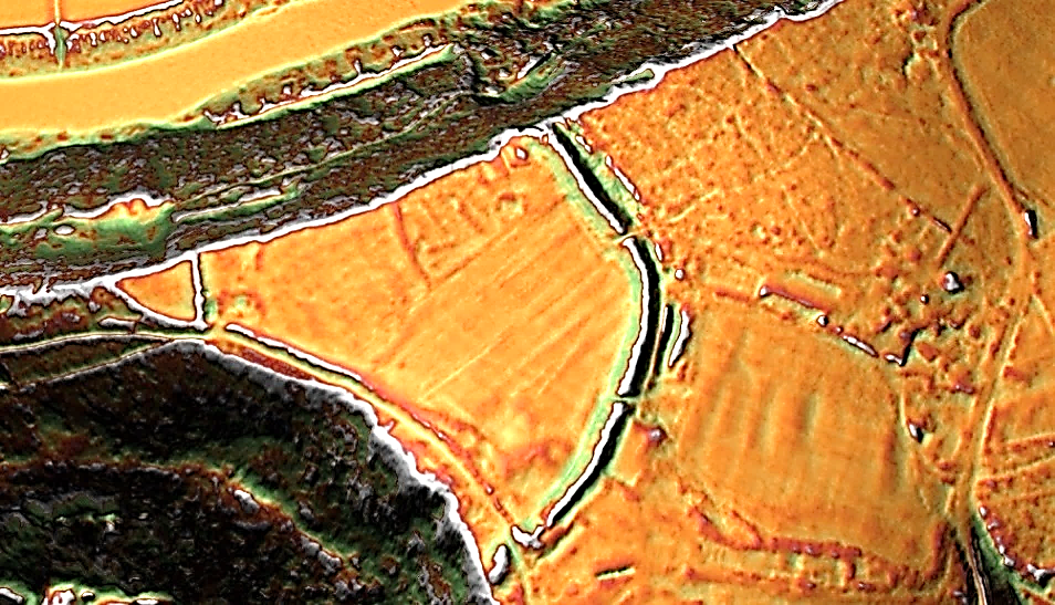
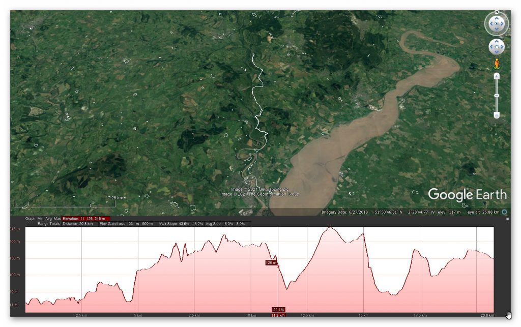
Prehistoric Canals (Dykes) – Offa’s Dyke (LiDAR Survey)

Promotional Video – Ancient Prehistoric Canals (Dykes) – Offa’s Dyke ( Offa’s Dyke LiDAR Survey)

Extract From Book……………………… Ancient Prehistoric Canals (Dykes) – Offa’s Dyke

The Introduction

Offa’s Dyke is seen as one of the two significant Linear Earthworks (of Britain) as it is supposed to be over 200 miles from Coast to coast dividing England from Wales and, consequently, was once one of the greatest battle grounds in history with this massive defence required to tame the barbaric hordes (like the Picts in Scotland) from the home of civilisation.

The problem with this flight of fancy is its complete nonsense, which this book can now testify.  Sir Cyril Fox, in the 1950s, was most famous for producing his classic book ‘Offa’s Dyke – A field survey of the Western-Works of Mercia in the Seventh and Eight Centuries A.D.”, which detailed his field walking and observations on this most historic of Earth Battlements, which we have now seen from more scientific evidence available from LiDAR was nothing more than misinterpretations of the landscape to justify hypotheses that ‘didn’t hold water’ – but sadly for him, it did!

The harsh reality is that this ‘swiss cheese’ hypothesis was, as suggested, full of holes – over 200 of them, to be more exact, covering nearly 60% of this supposed Mercia defensive barrier with gaps large enough for people to walk through with ease.

Later archaeologists have attempted to remedy this false claim, yet it still is quoted by the likes of English Heritage, Historic Britain and CADW to fill the void of ignorance and lack of study. Consequently, this FIRST LiDAR study of Offa’s Dyke in detail has revealed many new truths which should progress our understanding of the past.

History

According to Historic England – Offa’s Dyke is the longest linear earthwork in Britain, approximately 220km, running from Treuddyn, near Mold, to Sedbury on the Severn estuary.

It was constructed towards the end of the eighth century AD by the Mercian king Offa, and is believed to have formed a long-lived territorial, and possibly defensive, boundary between the Saxon kingdom of Mercia and the Welsh kingdoms. The Dyke is not continuous and consists of a number of discrete lengths separated by gaps of up to 23km.

It is clear from the nature of certain sections that differences in the scale and character of adjoining portions were the result of separate gangs being employed on different lengths. Where possible, natural topographic features such as slopes or rivers were utilised, and the form of Offa’s Dyke is therefore clearly related to the topography. Along most of its length it consists of a bank with a ditch to the west.

Excavation has indicated that at least some lengths of the bank had a vertical outer face of either laid stonework or turf revetment. The ditch generally seems to have been used to provide most of the bank material, although there is also evidence in some locations of shallow quarries. In places, a berm divides the bank and ditch, and a counterscarp bank may be present on the lip of the ditch. Offa’s Dyke now survives in various states of preservation in the form of earthworks and, where sections have been levelled and infilled, as buried features.

Although some sections of the frontier system no longer survive visibly, sufficient evidence does exist for its position to be accurately identified throughout most of its length. In view of its contribution towards the study of early medieval territorial patterns, all sections of Offa’s Dyke exhibiting significant archaeological remains are considered worthy of protection.

The reality is that Offa’s Dyke is a complete mystery to archaeologists and historians as it is incomplete and varies from section to section. This is the first LiDAR survey of this ‘Earthwork’ undertaken for its entire length and every metre that’s supposedly marked in the Landscape.

The consequences of this survey changes the nature and understanding of this ‘Dyke’ to such an extent that it re-invents the history of this Scheduled Monument, which will have repercussions for decades to come.

But first, we must lay the ground to allow readers to understand what we are seeing in Offa’s Dyke, and so the following three chapters have been written to give the reader this background of understanding.

Chapter 4 – Offa’s Dyke

            To survey this Offa’s Dyke successfully, we need to link to other historic providers’ information and maps. To do this with relevant accuracy, we need to establish a grid system that looks at all the LiDAR, Satellite photography, Old OS maps and excavation evidence to draw new conclusions about the construction of Offa’s Dyke.

Therefore, we have subdivided Offa’s Dyke into five sections and named them A to E – each Section is not equally divided but edited by the breaks within the Dyke. We have named these sections from South to North, which is a bit different from the norm, but in archaeology, information is the best way to approach Offa’s Dyke as you will find when you get to Section E.

These grid sections include the  OS 1800 Map edition (for historical accurately, as new developments are not included), Google Earth Maps (showing Historic England Scheduled Areas and References) and our LiDAR (hi-resolution) maps, which are unique in their clarity and ease of landscape interpretation.

            We will also give you a complete overview of the Dyke by section before the detailed analysis within the appendices.  This will provide you with an understanding of the Dykes construction phases and function, allowing you to understand better how we came to our conclusions about Offa’s Dyke and when it was constructed.

Offa’s Dyke – Sections

Offa's Dyke Lidar Survey Sections - Offa's Dyke (Survey)
Offa’s Dyke Lidar Survey Sections – Offa’s Dyke (Survey)

Our Findings and Conclusion

Before we reflect on our findings section by section, it may be beneficial to look at the total statistics for some aspects of Offa’s Dyke, as such details have not been found in our research on this subject.

To illustrate the confusion over Offa’s Dyke and its interpretation, the length of the Dyke is now open to speculation as it has so many gaps. However, English Heritage has it as 82 miles (132 km) from Prestatyn in the north to Sedbury in the South and The Offa’s Footpath Trust – the charity set-up to promote the Dykes footpath suggests 176 miles (283 km) – slightly longer than Scheduled listing route.

While Historic England sits firmly in the middle with 137 miles (220 km) – We will look at Offa’s Dyke as it is commonly portrayed as a coast-to-coasts landscape feature covering 283 km (176 miles) from Sedbury Cliffs nr Chepstow to Prestatyn.

Sedbury Cliffs to Monmouth              – 17.5 miles (28 Km)

Monmouth to Pandy                           – 16.75 miles (27 Km)

Pandy to Hay-on-Wye                        – 17.5 miles (28.2 Km)

Hay to Kington                                     – 14.75 miles (23.3 Km)

Kington to Knighton                             – 13.5 miles (21.7 Km)

Knighton to Brompton Crossroads      – 15 miles (24 Km)

Brompton Cross to Buttington Bridge – 12.3 miles (20 Km)

Buttington Bridge to Llanymynech      – 10.5 miles (17 Km)

Llanymynech to Chirk Mill                   – 14 miles (22.5 Km)

Chirk Mill to Llandegla                         – 15.5 miles (25.7 Km)

Llandegla to Bodfari                             – 17.5 miles (28 Km)

Bodfari – Prestatyn                              – 12 miles (19 Km)

Offa’s Dyke

The Total length of Offa’s Dyke (including gaps and missing sections) 279,745m (173.8 miles)

Total length Found (by LiDAR): 95,044m (59.2 miles) – 34% of the entire length

Total length Missing (by LiDAR): 185,476m (114.6 miles) – 66% of the entire length

Total number of Gaps in the Offa’s Dyke – 70

Total number of Scheduled Monuments in Listing: 237

Features

Within the 59.2 miles of Offa’s Dyke, we have identified – within 200m of the construction:

118 (33 Natural Springs)/Wells/Ponds (as specified by the 1800 OS maps series – Wells and Ponds included to show high water table)

303 Quarries/Bell Pits (Bell Pits Ancient Quarry Holes) ave of 5 Quarries per mile of Dyke

12 Prehistoric Ancient Sites

4 Barrows

7 Roman Sites

52% of Sections are linked to each other

20% of Sections are connected to existing rivers

28% of Sections join Paleochannels

Summary

Section A – Total 20,201m. 14 Gaps – 6,758m missing (34%)

Section B – Total 110,545m. 10 Gaps – 106,768 missing (97%)

Section C – Total 55,905m.  17 Gaps – 7,990 missing (14%)

Section D – Total 56,369m. 22 Gaps – 29,848 missing (53%)

Section E –Total 36,725m. 7 Gaps – 33,101 missing (90%)

            Our findings concluded that these landscape features are much more interesting and complex than the archaeologists currently imagine, as each Section has its individual interest that finally gives us a solution to the construction and functionality of the Dyke.

Section A – Runs around the hills surrounding Chepstow and the River Wye.  This Dyke is no boundary or marker as the river would be a better solution to both causes. But what it does show is the connection to Quarries and Roman Roads that would have probably linked to the canal system it inherited from the ancient Dyke builders. These ‘linear earthworks’ were created to assist in trade during both prehistory and later Roman era until the canals dried up when the roads built upon the banks of these Dykes replaced the method of transport.

Section B – Shows why the Dyke is not interconnected, as 97% of it is missing, and there is not functionality or design that links together the small portions of Dyke that is in this section.

Section C – Has the least missing sections, yet it still has 14% missing with 17 gaps, indicating that these Dykes are a series of individual trading canals and not a single entity. This trading can be seen in the extensive quarries in this area which have been mined for their mineral wealth for thousands of years.

Each hill has a different design form the last when it comes to width and Depth of the Ditch. What we are seeing is a degree of uniformity in access to quarries and water sources and natural springs along the Dyke.

Section D – This is a 50/50 series of Dyke to gap ratio, again showing that it is connected to Quarries and Mining, particularly Coal Mining, which was widely used by the Romans.  These are some of the largest coal mines in Britain and the Dyke does not just come close – it in some cases the alignment goes through the middle of these quarries, with on average four quarries per section which makes any suggestion that these Dykes were not used in conjunction with the minerals being extracted (as we see also in The Vallum at Hadrian’s Wall) and were constructed for another purpose as completely absurd.

Section E – Even archaeologists (including Fox) now admit that this is a different series of Dykes (Whitford Dyke) and not part of Offa’s Dyke as its too dysfunctional.

So, our conclusion about Offa’s Dyke is that we are looking at a series of working Dykes – originally, built in prehistoric times and then utilised (as again we found in The Vallum) by the Romans to service the same Quarries for trading purposes.

In particular we see this Roman influence in Section D as these are Coal minerals which we know they used to heat the hypocaust underfloor furnaces of their Bath and home houses, which to date archaeologist have failed to investigate the sources of this coal and how it was transported.

Appendices

Section A – Bristol Channel (River Seven) to Redbrook, 20,658 metres (68,860 working days – 100 men, 1.9 years)

Figure 38 - Profile Offa's Dyke Section A - Offa's Dyke (Survey)
Figure 38 – Profile Offa’s Dyke Section A – Offa’s Dyke (Survey)


According to Historic England –

“Offa’s Dyke is the longest linear earthwork in Britain, approximately 220km, running from Treuddyn, near Mold, to Sedbury on the Severn estuary. It was constructed towards the end of the eighth century AD by the Mercian king Offa, and is believed to have formed a long-lived territorial, and possibly defensive, boundary between the Saxon kingdom of Mercia and the Welsh kingdoms.

The Dyke is not continuous and consists of a number of discrete lengths separated by gaps of up to 23km. It is clear from the nature of certain sections that differences in the scale and character of adjoining portions were the result of separate gangs being employed on different lengths. Where possible, natural topographic features such as slopes or rivers were utilised, and the form of Offa’s Dyke is therefore clearly related to the topography.

Along most of its length it consists of a bank with a ditch to the west. Excavation has indicated that at least some lengths of the bank had a vertical outer face of either laid stonework or turf revetment. The ditch generally seems to have been used to provide most of the bank material, although there is also evidence in some locations of shallow quarries. In places, a berm divides the bank and ditch, and a counterscarp bank may be present on the lip of the ditch. Offa’s Dyke now survives in various states of preservation in the form of earthworks and, where sections have been levelled and infilled, as buried features.

 Although some sections of the frontier system no longer survive visibly, sufficient evidence does exist for its position to be accurately identified throughout most of its length. In view of its contribution towards the study of early medieval territorial patterns, all sections of Offa’s Dyke exhibiting significant archaeological remains are considered worthy of protection.”

The following table will show you each of the Dykes’ sections in Detail, indicating its Length, Depth and Directing – it wall also indicate if it is ‘Proceeded’ by a gap or contains Gaps in its length were the Dyke is not present.  There is also an indication of the Number of Natural springs and Quarries within 200m of its vicinity.

Name (Section)(Name of Section according to English Heritage or CADW) (Axx)
HE: xxxxxxxWidth(m)Hght/Dth(m)Length(m)
BankWidthMax – MinLength
Ditch (facing)WidthMax – MinFacing
Gap/Spring/QuarryNumberNumberNumber

Section A1 to A4 - Offa's Dyke (Survey)
Section A1 to A4 – Offa’s Dyke (Survey)
Name (Section)240m north east of Buttington Farm (A01)
HE:1020643Width(m)Hght/Dth(m)Length(m)
Bank172.8 – 5.0476
Ditch (facing)90.8 – 2.85SW & NE
Gap/Spring/Quarry103

GE Map

1020643 - GE
1020643 – GE

OS Map

1020643 - OS
1020643 – OS

LiDAR Map

1020643 - Lidar
1020643 – Lidar

1800s Map

1020643 - 1800s
1020643 – 1800s

“In this section, the Dyke turns from its usual alignment to run north west-south east. It is visible as a bank with a ditch to the south and quarry pits to the north.

At the western end of the section the bank is about 10m wide and stands to a height of 2m on its southern face and 0.6m on its northern face. At the eastern extent of the section, the scale of the construction becomes increasingly monumental, with the bank measuring up to 17m wide at the base and standing to between 2.8m and 5m high on its southern face and 1.5m to 2m high on its northern face.

The ditch to the south is up to 9m wide and increases in depth from 0.8m at the western end of the section to 2.85m at the east. The quarries lie to the north of the bank and range in size from 2m to 3m wide in the west to 0.3m to 1.5m deep in the east. This section forms the termination of Offa’s Dyke in Gloucestershire, which ends at Sedbury Cliffs.” – Historic England

Figure 41 - Section A1 - proves it's not a defensive feature - Offa's Dyke (Survey)
Figure 41 – Section A1 – proves it’s not a defensive feature – Offa’s Dyke (Survey)

Conclusion

The dry river valley shows us that the idea that this was a defensive feature is sadly pure nonsense. 

Not only could an attacker simply walk around the edge of the Dyke, but they could also attack the smaller ditch and bank in the centre of the valley, which has shrunk from 2.85m deep to just 0.8m, with the bank moving from 2m high to just 0.6m high.

Moreover, a better and more obvious landscape feature (the edge of the dry river valley) could have easily been chosen and would have secured the defensive position. 

Furthermore, Sections A01 to A04 cut across a peninsula where the River Wye meets the Bristol Channel (River Seven) makes no sense as either boundary marker or defensive ditch as the best defensive structure (and Landscape marker) would have been along the river’s shoreline?

Figure 42 - Offa's Dyke section A1 (Fox) - with ditch on the 'wrong side'?  - Offa's Dyke (Survey)
Figure 42 – Offa’s Dyke section A1 (Fox) – with ditch on the ‘wrong side’? – Offa’s Dyke (Survey)
Figure 43 - Section A01 LiDAR showing ditch on BOTH sides - Offa's Dyke (Survey)
Figure 43 – Section A01 LiDAR showing ditch on BOTH sides – Offa’s Dyke (Survey)
Figure 44 - Offa's Dyke (bold line) compared to the more efficient (dotted line) if it was either Defensive or a Land Marker - Offa's Dyke (Survey)
Figure 44 – Offa’s Dyke (bold line) compared to the more efficient (dotted line) if it was either Defensive or a Land Marker – Offa’s Dyke (Survey)
Name (Section)Buttington Tump, 100m west of Buttington Lodge  (A02)
HE:1020642Width(m)Hght/Dth(m)Length(m)
Bank103161
Ditch (facing)72.6SSW
Gap/Spring/Quarry000

GE Map

1020642 - GE
1020642 – GE

OS Map

1020642 - os
1020642 – OS

LiDAR Map

1020642 – lidar

1800s Map

1020642 - 1800
1020642 – 1800s

“In this section the Dyke turns from its usual alignment to run for 161m from north west to south east. It is visible as a ditch with a short section of bank, known as Buttington Tump, at the eastern extent of the section.

The ditch survives to a maximum depth of 2.6m and is approximately 7m wide. The eastern end of the ditch is no longer visible as it has become infilled over time, but will survive as a buried feature. Buttington Tump is a fragment of the bank of Offa’s Dyke surviving to 24m long, 10m wide and a maximum of 3m high.

The road immediately to the east is believed to mark an original access point through the Dyke leading down to a crossing over the Severn at Beachley. The crossing is thought to have been used for a considerable period, because the narrowing of the river at this point makes it the shortest route across the Severn for about 16km.

The excavation revealed an infilled ditch to the south of the monument, and the steep angle of the tip lines revealed within the bank suggest that the face of the bank may have originally been revetted. The turf below the monument also appeared to have been stripped away at this point, suggesting that the revetting may have been of turf.” – Historic England

Conclusion

Why would you take the turf and place it on the bank if it was a border marker – it simply does not make any sense and why is there a bigger ditch than Offa’s Dyke coming and going from the North – is this two Dykes interconnecting?

Name (Section)130m north west of Pennsylvania Farm (A03)
HE:1020641Width(m)Hght/Dth(m)Length(m)
Bank101 – 3170
Ditch (facing)??SSW
Gap/Spring/Quarry100

GE Map

1020641 - GE
1020641 – GE

OS Map

1020641 - os
1020641 – OS

LiDAR Map

1020641 - lidar
1020641 – Lidar

1800s Map

1020641 – 1800s

“This 170m long section of the Dyke is visible as a terrace, standing to a maximum height of 3m at its western extent and 1m at its eastern extent, falling over a distance of about 10m. The face of the terrace is very regular and has been subject to landscaping, except at its eastern end where some dumping appears to have taken place on the face of the monument.

In 1842 Ormerod noted that the bank could be clearly traced along this length, and that the land to the north was regularly cultivated. In 1996 a series of watching briefs were undertaken during the cutting of a service trench through the terrace, during the course of which a clay deposit was revealed which was interpreted as a surviving portion of the continuation of Offa’s Dyke which is visible to the east of this section.

Behind the clay bank a colluvial deposit was observed which is likely to relate to the cultivation of the fields on which the houses of Mercian Way were constructed.”  – Historic England.

Conclusion

Note that excavations found a clay deposit was found.  In my trilogy ‘the Stonehenge Enigma’ I identified the same clay deposit within Stonehenge’s ditches and linked then to ‘dew ponds’ that have this layer for water preservation.

This type of clay lining is also found in the Vallum and Wansdyke ditches, which suggests that it was added later to improve the ditch’s water retention as a canal.

Name (Section)253m north east of Sedbury sewage works (A04)
HE:1020640Width(m)Hght/Dth(m)Length(m)
Bank82256
Ditch (facing)72.6SSW
Gap/Spring/Quarry200

GE Map

1020640 - GE
1020640 – GE

OS Map

1020640 - os
1020640 – OS

LiDAR Map

1020640 - lidar
1020640 – Lidar

1800s Map

1020640 - 1800
1020640 – 1800s

“This 256m long section of the Dyke is visible as a terrace standing to a height of 2m, falling over a distance of about 8m.

 In 1996, the Manchester University Centre for Anglo-Saxon studies excavated a section through the terrace, revealing what they have interpreted as the remains of Offa’s Dyke. All fence and gate posts are excluded from the scheduling, although the ground beneath these features is included.” – Historic England

“A single trench was excavated across the Nico Ditch, a SAM which crossed the site. The monument was an undated linear earthwork comprising a U-shaped ditch with a bank on its northern side, which ran broadly from east to west, to the south of the City of Manchester. It was presumed to have been of pre-Conquest origin, and was particularly well-preserved where it crossed the proposal site. The evaluation revealed six phases of activity, beginning with a broad ditch which had gradually silted to become a shallow earthwork. No trace of a bank contemporary with this earliest feature was found. “

Conclusion

We find within this section that the ditch was a U-Shaped feature.  This shape is not used for defensive features (as shown by the Romans with their V-Shaped ‘ankle breaker’ defensive ditches).

            We have also noted gaps in the ditch and bank, particularly in the river valleys. So the only reasonable explanation for this change in structure is if something was in the valley to stop the standard design of the Dyke.

.

Figure 45 - Raised water levels of the Mesolithic would explain the variations in Offa's Dyke structure - Offa's Dyke (Survey)
Figure 45 – Raised water levels of the Mesolithic would explain the variations in Offa’s Dyke structure – Offa’s Dyke (Survey)

The raised water table of the past (Mesolithic?) shows that the only logical reason for the gaps in the Dyke would also explain the narrowing of the bank and ditch in places in the dry river valleys, which were once paleochannels full of water.

We imagine that once the waters had receded in more recent periods (including the Roman period), attempts were made to reconnect either through shallower ditches (as the water table would be lower) or the continuation of the bank. This bank would be eventually used when the ditches dried up as a natural earthwork for flat wide prehistoric trackways – which we see on OS maps associated with Roman Roads.

Figure 46 - Offa's Dyke - Section A1 showing that eventually it was adapted to be used as an ancient trackway - Offa's Dyke (Survey)
Figure 46 – Offa’s Dyke – Section A1 showing that eventually it was adapted to be used as an ancient trackway – Offa’s Dyke (Survey)
Figure 48 - Two possible routes for Offa's Dyke at Chepstow - Offa's Dyke (Survey)
Figure 48 – Two possible routes for Offa’s Dyke at Chepstow – Offa’s Dyke (Survey)

At the western point of Section A04, Offa’s Dyke disappears for over 2,000 metres.  Some archaeologists have suggested that it hugs the coastline (A) – But I find Chepstow’s town walls interesting as it seems to follow the line of the Dyke?

This ‘suspicion’ is confirmed by the construction of the Port Wall, which has a mysterious Ditch of Offa’s proportions outside of the wall.

The Port Wall

“The medieval town of Chepstow was protected on the north and east by the Wye and the town or Port Wall, which was built in the late 13th Century to afford protection on the landward sides.

In total the Port Wall was over 1,200 yards (1,100 metres) long, 6 feet (2 metres) thick and 15 feet (4.6 metres) high.  Originally at least a dozen towers about 27 feet (8.2 metres) in diameter were built along the wall and around the outside there was a dry moat about 18 feet (5.5 metres) wide and 5 feet (1.5 metres) deep.” – Chepstow Council Website

Figure 49 - Offa's Dyke seems to link up with Chepstow's Port Wall with Moat - Offa's Dyke (Survey)
Figure 49 – Offa’s Dyke seems to link up with Chepstow’s Port Wall with Moat – Offa’s Dyke (Survey)
Figure 50 - Section A05 -A06 as seen in the landscape - Offa's Dyke (Survey)
Figure 50 – Section A05 -A06 as seen in the landscape – Offa’s Dyke (Survey)

Blank bookcover with clipping path

This was an extracts from the NEW Book Ancient Prehistoric Canals (Dykes) – Wansdyke available on Amazon as a FULL COLOUR HARD BACK (£49.95) or a ECONOMY (£9.99) SOFTBACK black and white VERSION – it is also available as a KINDLE (£2.99) book. For further information about our work on Prehistoric Britain visit our WEBSITE or VIDEO CHANNEL.

Product details

  • ASIN ‏ : ‎ B0BQG7G6CJ
  • Publisher ‏ : ‎ Independently published (24 Nov. 2022)
  • Language ‏ : ‎ English
  • Hardcover ‏ : ‎ 443 pages
  • ISBN-13 ‏ : ‎ 979-8370198236
  • Dimensions ‏ : ‎ 15.24 x 3.33 x 22.86 cm
  • Illustrations: 350+

For more information about British Prehistory and other articles/books, go to our BLOG WEBSITE for daily updates or our VIDEO CHANNEL for interactive media and documentaries. The TRILOGY of books that ‘changed history’ can be found with chapter extracts at DAWN OF THE LOST CIVILISATION, THE STONEHENGE ENIGMA and THE POST-GLACIAL FLOODING HYPOTHESIS. Other associated books are also available such as 13 THINGS THAT DON’T MAKE SENSE IN HISTORY and other ‘short’ budget priced books can be found on our AUTHOR SITE or on our PRESS RELEASE PAGE. For active discussion on the findings of the TRILOGY and recent LiDAR investigations that is published on our WEBSITE you can join our FACEBOOK GROUP.

Somerset Plain – Signs of Post-Glacial Flooding

CASE STUDY – Somerset Plain and the annual flooding

Extract from the book ‘The Post-Glacial Flooding Hypothesis”

The Somerset Levels encompass a sprawling expanse spanning approximately 160,000 acres (equivalent to 650 square kilometres), crisscrossed by the imposing Polden Hills. These lowlands are divided into distinct sections by this geological feature, with the southern regions drained by the meandering River Parrett, while the flowing waters of the rivers Axe and Brue nourish the northern areas. Serving as a natural demarcation, the majestic Mendip Hills stand as a formidable barrier between the Somerset Levels and their counterpart, the North Somerset Levels.

Within the intricate tapestry of the Somerset Levels, a captivating contrast emerges. The coastal fringes are characterised by marine clay “levels,” seamlessly transitioning into the heart of the landscape, where peat-based “moors” dominate the terrain. This intricate duality defines the very essence of this geographical marvel.

Regarding land utilisation, the Somerset Levels paint a vivid mosaic of agricultural diversity. A significant proportion, around 70 per cent, is meticulously fashioned into lush grasslands, providing a thriving foundation for livestock and cultivation. This verdant expanse stands as a testament to the symbiotic relationship between the land and those who work it.

The remaining portion, etched with thoughtful precision into the fabric of the landscape, serves as a canvas for arable endeavours. Here, the spirit of cultivation finds its voice, yielding many crops that sustain the land and its inhabitants. It’s within these carefully curated plots that the dance of growth and sustenance unfolds, a testament to the skilful mastery of those who tend to the earth’s bounties.

Yet, the Somerset Levels harbour more than just agricultural vitality. They are a realm where nature and commerce intertwine, revealing a unique blend of purpose. Within this tableau, willow and teazel flourish under the sun’s embrace, nurtured not only by nature’s hand but also by the aspirations of commerce. Cultivated with intent, these crops serve as a reminder of humanity’s capacity to harness the land’s resources while respecting its innate rhythms.

Moreover, the Somerset Levels hold hidden treasures beneath their surface. Peat, formed over millennia through the slow decomposition of organic matter, is carefully extracted from this land. Beyond its agricultural role, peat emerges as a valuable resource, providing a glimpse into the earth’s history and contributing to many industrial applications.

In summary, the Somerset Levels are a landscape of complexity and harmony, a symphony composed by the forces of nature and human endeavour. From the captivating dichotomy of “levels” and “moors” to the dance of grasslands and arable fields, this land embodies a mosaic of purpose and beauty. As the rhythms of growth and cultivation intertwine with the pragmatic pursuits of commerce, the Somerset Levels stand as a testament to the remarkable synergy between nature’s bounty and human ingenuity.

Rates of relative sea level rise in Bridgwater Bay (Long et al. 2001)

PhaseCal. BCMSL rise (m)Ave. Rate mm yr-1
17500 – 5500-25 to -107.5mm
25500 – 4000-10 to -53.3
34000- 0 AD/BC-5 to -20.6

If Long et al., rates are correct, then we are looking at potential discharge rates from rivers 1250% greater in early Mesolithic to the Iron Age, which is comparable to the discharge rates of the Thames during the early Holocene.  During these periods of maximum flow (as we saw with the Thames case study) the flood plain is covered with water.  Reeds and other plant life cannot grow until the discharge rate reduces narrowing the river creating a ‘braided’ or bend in the river so that sediment builds up to become marshland growth.  Once this has been established with the annual death and renewal, the area by the river becomes peatland and bog over the centuries.

We can see this evolution in the sediment analysis, as clay and silt foundations, followed by peat and if flooded again, by another layer of silt and reintroduction of peat. As we can radiocarbon-date the peat, we can use this to date the sequences of the river over time.

Porlock Bay

Extensive coring on Porlock Marsh in 1995 revealed up to 10 metres of sediments (silts, sands and peats), dating from c.6700 cal BC when mean sea levels may have been around 8m lower than the present day

The main peat layer at Porlock formed is between c.4500 cal BC and c.3540 cal BC after which it was overlain by deposits of sand, grit, silt and clay (Jennings et al. 1998). This indicates that rivers were active since the LGM and continued until 4500 BC when the river discharge reduced, allowing peat to form at its edges and previous flood plain.

Minehead Bay

Three periods of peat deposition were identified on the present foreshore at Minehead (Jones et al. 2005). The earliest deposits were created in marginal marsh conditions around 5,000 cal BC and an alder carr peat sometime between 5,400 and 5,000 cal BC. There was then another gap of several hundred years until peats were laid down in a mixture of upper saltmarsh, freshwater reed swamp and alder carr environments created sometime between c.4800-4500 cal BC

Parrett Valley

Very little dating and analysis have been carried out in this area. Around the mouth of the Parrett between Stolford and the Poldens Heyworth. Kidson (1976) recorded the Middle Somerset Levels Formation, as intercalated peat and clay along the coast and as a thick peat layer further inland – which deposition beginning around 4,000 cal BC. The Middle Somerset Levels Formation exists as a thick peat layer in the central Parrett valley, which has been briefly characterised by Alderton (1983) and has been dated on its base at Sutton Hams to c.3900 cal BC (Coles and Dobson 1989).

Further inland near Langport, recent evidence has dated the base of the Formation to 4840-4520 cal BC (Wilkinson, 2006). This limited evidence suggests that the organic deposits of the Formation, developed seawards over several hundred years in the 5th-millennium cal BC.

Shapwick

Wilkinson (1998a) published stratigraphic work between Shapwick Burtle and the edge of the Polden Hills. A 7m core (borehole A) has provided a date of 5710–5530 BC (OxA11230) for the base of the lower peat. Borehole A is the first long Holocene pollen sequence to be dated for Shapwick Heath (Tinsley 2002), though it does not extend as far back as those for Minehead and Porlock on the west Somerset coast.

Glastonbury

Sometime around 4600–4200 cal BC, a change from estuarine silts to mostly freshwater peat (the upper peat) took place due to reduced marine influence (negative sea-level tendency). The age range given above is based on a variety of radiocarbon dates for the peat/clay junction, at several places in the central Brue valley.

Table 6 – Peat C14 dating samples for Somerset

InterpretationAge Cal. BCRC Years BPLab. CodeSite Reference
Base Peat 15670 – 53806600 +/- 70WK-5311Minehead (Jones et al.,2005)
Base Peat 25640 – 53706570 +/- 70WK-5310
Top Peat 15620 – 53106490 +/- 80WK-5309
Base Peat 35540 – 52906440 +/- 70WK-5308
Base Alder Peat5630 – 53806560 +/- 60WK-5302
Base Alder Peat4830 – 44905810 +/- 80WK-5304
Top Alder Peat4830 – 45205820 +/- 60WK-5303
Base Site 454780 – 44605770 +/- 70WK-5305
Base Site 464710 – 43605700 +/- 70WK-5306
Base Peat4720 – 42505620 +/- 100HAR-8546Brean Down (Bell, 1990)
Base 4th Peat4235 – 38005210 +/- 80Beta-142355Brean-Wedmore (Haslett et al., 2001)
Forest Bed6609 – 64257730 +/- 50Beta-81655Porlock Bay (Jennings et al.,1998)
Peat6380 – 59707280 +/- 90OxA – 6570
Top 2nd Peat5941 – 55406870 +/- 90Beta-61544
Top 2nd Peat5987 – 57776707 +/- 50Beta- 86775
Base 4th Peat4340 – 39705290 +/- 75OxA – 6572
Base 4th Peat4460 – 40405450 +/- 70OxA – 6569
Base 4th Peat4500 – 42405515 +/- 65OxA – 6571
Base 4th Peat4458 – 38825250 +/- 180Beta- 61542
Top 4th Peat3940 – 35404925 +/- 60OxA – 6402
Top 4th Peat4040 – 37905120 +/- 55OxA – 6399
Top 4th Peat4240 – 37005160 +/- 100OxA – 6401
Top 4th Peat4225 – 37055140 +/- 100Beta-61543
Base of Middle – Somerset Levels Formation Peat3625 – 31954640 +/- 60Beta-142361Brean-Wedmore (Haslett et al., 2001)
4335 – 40505370 +/- 50Beta-142353
4235 – 38005210 +/- 80Beta-112355
Bulk Sample (c)5440 – 50806340 +/- 70WK – 5298Burnham-on-Sea (Druca, 1998)
Base of Peat (b)4660 – 43405590 +/- 90WK – 5297
Base of Peat (a)4360 – 40005299 +/- 70WK – 5299
Top of Peat (a)3780 – 33704790 +/- 70WK – 5300
Base Peat3603 – 30944670 +/- 60WK – 9019Walpole (Hollinrake, 2001)
Top Peat4672 – 42455580 +/- 160WK – 9020
Lowest Peat5990 – 57906994 +/- 30WK – 25711
Base Peat 34330 – 40405345 +/- 37WK – 27346
Base Peat4781 – 43705750 +/- 80WK – 9021
Base Peat below peat layer4770 -44605745 +/- 45OxA – 11233Shapwick Burtle (Wilkinson, 1999)
Base Peat – Sutton Hams3970 – 36605020 +/- 80HAR – 5354Central Brue Valley (Coles & Dobson, 1989)      
Base Peat Shapwick Heath4611 – 40465510 +/- 120Q- 423
Base Peat Eclipse Track4448 – 40555440 +/- 70HAR – 4865
Base Peat Meane Village East4315 – 39645270 +/- 70HAR – 7064
Base Peat  Walton Heath4680 – 43505650 +/- 70Har – 1831
Figure 42. – Shapwick boreholers showing water environment followed by sand then more river then peat in the Holocene

Somerset Levels and Moors

The earliest (lowest) fills were studied from boreholes in the coastal area. The earliest dated deposits are from wood fen peat in deep channels (to c.20m below OD) at Highbridge. These peats formed between about 7000 and 7900 cal BC (Heyworth and Kidson 1982). Younger peat beds dating from around 4–5000 cal BC, can be seen at low tide at Burnham-on-Sea (Druce 1998), Stolford (Heyworth 1985) and Brean Down (Bell 1990).

As shown from previous examples, the marshes and bogs do not exist for the first 2000 to 4000 years after the meltwater is released as the rivers are high and fast-moving.  But after this period, as the rivers shrank due to discharge volumes dropping, leaving the flood plains that are ideal for the growth of plants and reeds. Consequently, creating over time the formation of marshes and peat bogs. These bogs were suitable for farmers to grow crops and raise animals, in later Bronze and Iron Ages, as they were rich in nitrogen.

Figure 41. Somerset Flats including Shapwick, Queen’s Sedgemoor and King’s Segemoor.

The River Siger – (Brown et al., 2014)

If our hypothesis is correct, then the Somerset Flats would have needed a substantial river running through the area that took the meltwater to the sea and flooded the levels on occasions rather than having the sea inundate the area as current theories suggest.

The relative sea-level history of the Bristol Channel and the inherited topography of the Parrett, Brue and Axe river valleys has produced a 10-15 m deep belt of transgressive estuarine silts and clays interleaving inland with regressive high intertidal terrestrial peats (Allen, 2000).

The processes of transgressive and regressive marine inundation are not fully understood, and as a result, palaeogeography has to be generalised. This is particularly true of the Early Holocene (lower clay) and the Late Holocene inundations of the Somerset Levels broadly resulting from relative sea-level rise coupled with secondary mechanisms including changes in storminess, tidal amplitude and sediment compaction.

Figure 43. – Lidar map of the Somerset flats showing the ancient Holocene river

The LiDAR survey clearly shows the composite nature of the network. The elements are Edithmead meander (Fig. 43, A) which has a width of 40-60 m and a meander radius of 3.13 km which would give an approximate length of 6 km, two major tributary systems (Fig.43, B and C) and one minor tributary system (Fig. 43, D).

From the dating of the deepest borehole and its basal depth (below -10 m O.D. and probably c. -17-30 m O.D.), the formation of the Siger channel is likely to be Early Holocene c. 10,000-8,000 BP initially with river flow from the Brue Valley  being one of the conduits for net landward sediment influx over the last 9,000 years, supporting our hypotheses that the Somerset Levels flooded as a consequence of meltwater and river activity rather than any form of marine inundation.


Figure 44. – River Siger

For more information about British Prehistory and other articles/books, go to our BLOG WEBSITE for daily updates or our VIDEO CHANNEL for interactive media and documentaries. The TRILOGY of books that ‘changed history’ can be found with chapter extracts at DAWN OF THE LOST CIVILISATION, THE STONEHENGE ENIGMA and THE POST-GLACIAL FLOODING HYPOTHESIS. Other associated books are also available such as 13 THINGS THAT DON’T MAKE SENSE IN HISTORY and other ‘short’ budget priced books can be found on our AUTHOR SITE. For active discussion on the findings of the TRILOGY and recent LiDAR investigations that is published on our WEBSITE you can join our FACEBOOK GROUP.

Prehistoric Canals (Dykes) – Great Chesters Aqueduct (The Vallum Pt. 4)

Promotional Video – Ancient Prehistoric Canals (Dykes) – The Vallum (Great Chesters Aqueduct)

Extract From Book……………………… Ancient Prehistoric Canals (Dykes) – The Vallum

Traditional archaeologists and archaeological establishments like English Heritage suggest that:

The Vallum is a massive earthwork constructed shortly after Hadrian’s Wall itself and lying just south of it. Many visitors confuse the Vallum with Hadrian’s Wall itself because it’s such an obvious and impressive feature in the landscape. 

In fact, the Vallum is made up of several different elements – a ditch around 6 metres wide and 3 metres deep; two mounds either side of the ditch about 6 metres wide and 2 metres high and set back from the ditch by around 9 metres; and often a third mound on the southern edge of the ditch. The whole complex is around 36 metres across. Usually, the Vallum runs close behind the Wall but in the rocky and hilly central section the Vallum lies up to 700 metres from the Wall.

The Vallum

Crossing points seem to have been located south of each of the forts along Hadrian’s Wall and near several of the milecastles. Evidence from the excavated Vallum crossing at Benwell in Newcastle shows these crossing points had impressive monumental gateways.

The Vallum’s purpose is unclear. Many archaeologists think it marks the southern boundary of a military zone with the Wall itself forming the northern boundary. This would have helped protect the rear of the Wall and its associated military installations, with civilian access being closely controlled. The gateway at Benwell supports this idea. The numerous gateways along the Wall at forts and milecastles suggest that the frontier was intended as much to control movement as to provide a defensive line. Traders would have moved goods across the frontier but their movements would have been controlled and their goods taxed.

Relatively soon after it was constructed, some 20 to 30 years perhaps, the Vallum seems to have lost its function – the mounds were cut through and the ditch filled in at fairly regular intervals. It was out of use by the time the forts along the Wall were re-commissioned in the late second century AD following the return of the garrison from the Antonine Wall.

New Book
New Book

Sadly, these ideas that have been constructed over the last 200 years are somewhat questionable. Within the book we look at associated aspects of this area like Military Way which was supposed to be constructed to patrol the so-called ‘Military Zone’ – to find that:

That over 50% of Military Way does not exist as a separate road, as described by archaeologists. Instead, the perceived road is fragmented and only becomes ‘alive’ as an independent road when the Vallum separates from the wall at any distance. 

This might give us a clue to the function of this rough and wonky road, as the stone for the wall would have needed to be delivered by cart if the Vallum canal was not available.

Stanegate as portrayed by archaeologists

As for the Stanegate that was supposed to connect to the main forts in the area as a ‘defensive shield’ we actual found that it is very little to no evidence of the ‘Stanegate Roman Road’, which (according to the current theory proposed by English Heritage) ‘consolidated as a frontier’ during the late first and early second century AD and helped crystallise Roman tactics and military expectations in the area.

This evidence is compounded when you release that of the 80mile border from coast to coast – Stonegate, at best, covers just 38.1 miles (47%) of the ‘defensive gap’, and hence suggestions of extension over and above the existing line existed (even without support from OS maps). Moreover, the research has shown the ‘raw’ Stanegate road without the ‘hidden’ parts below the B-roads – we are only looking at 20% of the declared road being visible on LiDAR maps.

Stanegate Road (when not part of an existing B-road system) is inconsistent in width and structure -moving from bank track to road with two ditches on each side to a ditch with two banks far from straight and usually starts and ends in ravens.

Most Forts and the Stanegate are not found to connect (with intersecting sub-roads) on only two occasions, and the rest show no connection.  Moreover, later ‘temporary’ camps also did not connect with the road – which questions whether (a defence line) was its purpose.  

Moreover, this would then question the ‘myth’ of using the Stanegate as a ‘boundary’ for withdrawing troops from Scotland in the first century AD is correct. And whether the River Tyne (which most of these Forts sit upon) was used as a more practical and effective boundary/defence.

This ‘myth buster’ will not surprise many in academia as it has been ‘hinted’ at for some time (but not acted upon it by updating the literature), as we see from Symonds et al.

“The question of whether a road even existed when the fortlets were founded is by default an existential one for the notion that they provided highway protection. But even if the metalled road does post-date the fortlets, a reasonably robust thoroughfare of some form must have existed from at least the mid AD 80s to service Vindolanda. The question is not whether there was a road, but whether it was metalled when the fortlets were founded.” Symonds, M. (2017). Hadrian’s Wall. In Protecting the Roman Empire: Fortlets, Frontiers, and the Quest for Post-Conquest Security (pp. 95-132)

Moreover, even if Stanegate was not built as suggested, it exists in parts, and it looks prehistoric (by design) as it relies heavily on ravens that start and end sections of the Stanegate sections; its sunken structure in parts is unfamiliar to traditional Roman Road design.

As for other famous ‘Roman Features Such as the Great Chesters Aqueduct, again we find not only is the origin questionable but as it located supposedly fully in ‘hostile territory – they its usefulness win conflict would be limited.

It is clear from the LiDAR research that the suspected Roman Aqueduct is not as it seems. This is not the first examination to spread doubt about the scale and origin of this feature in the landscape – MacKay, D. A. (1990). The Great Chesters Aqueduct: A New Survey. Britannia, 21, 285–289. Also shows an incomplete map of this aqueduct.

Great Chesters by Mackey

Mackey failed to find in their survey that the Aqueduct changed size, and the path suggested had no identifiable remains of the bridges required to make this Aqueduct work.

Our more detailed findings indicate that the topology of the aqueduct suggests that it would need to go uphill at several points without any powered assistance (like a siphon) and so is mechanically unsound. Our finding has found that the use of ‘Dykes’ in this area and some connecting to this Aqueduct feature is new. We have also shown that closer to the Fort it was supposed to supply, there were closed water sources which could be used and that the Fosse by the Wall was also a water supply.

We conclude that we found a prehistoric watercourse linked to their sophisticated ‘Dyke’ system. I would be bold to suggest that this was used for either agricultural purposes or maybe industrial, seeing the multiple sites of quarries associated and in the region of this feature.

Case Study – The Great Chesters Aqueduct

According to Historic Britain’s scheduling details: “The monument includes the remains of an aqueduct of Roman date, which carried water from Caw Burn westwards to Great Chesters Roman fort. The aqueduct adopts a circuitous route closely following the topography of the landscape. The protected portions of the monument are contained within five separate areas of protection, which stretch over approximately 8.68km of the aqueduct’s length. The aqueduct is preserved as a partial earthwork and in other locations as a cropmark.” – doesn’t tell us much really?

Sadly, It’s all very loose with no excavations, just a few field walkers to verify the aqueduct – if it is an aqueduct, that is.

Great Chesters Roman Aqueduct (NY741688 to NY703668) – according to the book NORTH-EAST HISTORY TOUR

“One of the neatest feats of Roman engineering in the region is one of the least known. It is the 9.5km line of the Roman aqueduct leading into the old fort of Great Chesters from the NE, a little to the north of Haltwhistle.

Only very faint traces of it remain today, but the logistics of the little water supply project are impressive. Basically, when Great Chesters fort was built on the Wall it didn’t have a nearby water supply, so it had to be piped in from the Caw Burn, about 4km to the NE (more specifically, Saughy Rigg Washpool near Fond Tom’s Pool). However, as the engineers had to rely purely on gravity, the path of the aqueduct took a long and curling route through a 9km+ course to pick up every tiny inch of downhill along the way.

The result was a remarkable bendy, twisting affair taking the channel on a constantly downward trajectory at the almost unbelievably gentle gradient of about 1m drop for every 1,000m travelled. And, once more, the flow of water was eased along a simple, unlined water-course about ½ m wide by ¼ m deep, with the occasional small wooden bridge inserted to take it over minor valleys and streams.

The course of the aqueduct is clearly shown on modern-day OS maps (there’s a decent representation here – and scroll down a bit), though it is not so easy to pick out on the ground. Partial earthworks survive, and in other places crop marks provide the circumstantial evidence.“

Sadly, this perception of History is typical due to the misunderstanding of the Landscape in the past and the misconception of ‘Linear History’ – technology growth and sophistication from one century to the next – which strangely, the Roman empire disproves (ask anyone in the Dark Ages who needed to live in Mud Huts with contaminated food and water supplies?

If we now look at modern methods to look at this feature, we see the problem with the assumption that this is a Roman Aqueduct.

The profile of the alleged aqueduct is not this ” gentle gradient of about 1m drops for every 1,000m travelled ” but a haphazard path which would need the aqueduct to defy the laws of gravity in many areas.

Figure 104 - GE trace of the 'Aqueduct' using the Historic England Scheduled monuments sections
Figure 104 – GE trace of the ‘Aqueduct’ using the Historic England Scheduled monuments sections

Within this path there are no less than six connections to river valleys. It has been suggested that ‘wooden’ (as no stone has ever been found was used to bridge the gaps!! What has not been explained is the last leg of this epic journey, where the aqueduct goes uphill by 10m in the last 800m of the journey.

Moreover, the Fort has a much closer source of water – in fact, several sources of water, which makes such an aqueduct irrelevant.

If we ‘reverse engineer’ the water sources of fort Aesica we can reveal something quite misunderstood.

Aesica – Wikipedia

Aesica (with the modern name of Great Chesters) was a Roman fort, one and a half miles north of the small town of Haltwhistle in Northumberland, England. It was the ninth fort on Hadrian’s Wall,

Between Vercovicium (Housesteads) to the east and Magnis (Carvoran) to the west. Its purpose was to guard the Caw Gap, where the Haltwhistle Burn crosses the Wall.

It is believed that the fort was completed in the year 128 AD. Unlike other wall forts that project beyond the Wall, all of Aesica is south of the Wall. The Wall at this point is narrow gauge, but stands next to foundations that were prepared for the broad wall. There was speculation as to why the foundations for the broad wall had not been used to support the wall at this point. In 1939 it was found that Milecastle 43 had already been built in preparation for the broad wall, and it is thought that it was the presence of this milecastle that prevented the north wall of the fort being built on the original foundations. It appears that the milecastle was demolished once the fort had been completed. The east gate and east wall cannot now be traced.

The fort was an oblong, measuring 355 feet (108 m) north to south by 419 feet (128 m) east to west, occupying a comparatively small area of 3 acres (12,000 m2). The north-east corner of the fort is now occupied by farm buildings, built over the route of the Wall.

The fort had only three main gates; south, east and west, with double portals with towers. At some time the west gate was completely blocked up. There were towers at each corner of the fort. The Military Way entered by the east gate and left by the west gate. A branch road from the Stanegate entered by the south gate.

The Vallum passed some short distance south of the fort, and was crossed by a road leading from the south gate to the Stanegate. A vicus lay to the south and east of the fort, and several tombstones have been found there.

The fort was supplied by water from an aqueduct, which wound six miles (10 km) from the head of the Haltwhistle Burn, north of the Wall.

The Great Chesters Aqueduct fed the fort and the Bath House as it was the only water source in the area.


1800s OS map

Great Chesters Aqueduct OS map

This 1800s map shows the Great Chesters Fort (Aesica) and the bath house south of the Fort – it also indicates a path for an Aqueduct going south to the Vallum and then to the river. This shows the water travelling downhill from 208m high at the Fort to 180m at the river – this is the OUTLET of the water.

Figure 105- The outlet goes to the Vallum - but only a small (overflow?) ditch goes to the river
Figure 105- The outlet goes to the Vallum – but only a small (overflow?) ditch goes to the river

The Lidar map shows this much better but moreover, it also indicates that the outlet is NOT the river but the Vallum.

So, is the Great Chesters Aqueduct (all 9km) connected to this point in the Fort?

Figure 106 - The Roman Wall is connected to a local river and a paleochannel (was still running in Roman times?)
Figure 106 – The Roman Wall is connected to a local river and a paleochannel (was still running in Roman times?)


The Great Chesters Aqueduct is too far from the fort to connect, and there is no sign of anything on Lidar. LiDAR suggests that a Dyke connects the local river to the Wall Ditch and that the Wall ditch is so deep it is below the water table, making it a moat.

Looking at the other side of this ditch/moat, we see a break in the wall that may have allowed water to feed the moat/ditch via another ancient dyke?

Figure 107 - Why such an exaggerated ditch at this point not generally seen on the Fosse?
Figure 107 – Why such an exaggerated ditch at this point not generally seen on the Fosse?

This connection seems to agree with excavations of Aesica, which show the ‘aqueduct’ going through the centre of the fort.

Great Chesters Aqueduct

If the Great Chesters Aqueduct is not a 9km Roman piece of engineering – what do we see in the Landscape?

LiDAR Investigation starting North East of the Fort – Section One

We will look at each section, in turn, to see if it existed and whether it would flow as expected or has another more feasible explanation. The start of the Aqueduct, which we will call section 1, is by the River Caw Burn (which flows from Right to Left) and flows the river for a while (Fig. 1 – top right corner) without reason or any ditch found on LiDAR.

Figure 108 – Section One

Connecting to the river before (C) in the suggested route would not make much sense as the river runs alongside, and it would need to fight against gravity (section C is two metres higher than A). However, it could connect up better to section (A) via the stream running past section (A) to the right much more effectively (unless it was dry during this period).

What is more interesting and missed by the archaeologists is the artificial Dyke that cuts North-South between Sections B and C connecting the stream to the river with banks on both sides – the southern half is now dry and used as a footpath, but LiDAR clearly shows at one time it went directly from the prehistoric stream.

Figure 109 - Section Two
Figure 109 – Section Two

Section two shows that the Aqueduct goes from 4m wide in (C) to 1m wide in (D) over a minimal length. Moreover, again LiDAR suggests that at (C), this 4m ditch connects to another Paleochannel (that would have held water in prehistory) and then seems to head South of (D) to get another paleochannel keeping the 4m width.

Section 3 goes on a ‘merry dance’ around the landscape without good evidence or reason. The OS map suggests that the route south then north is not required as you could just continue on the same line, confirmed on the LiDAR map.

Figure 110 - Section Three - The Merry Dance?
Figure 110 – Section Three – The Merry Dance?
Figure 111- Section Three LiDAR map shows that this 'strange' route terminates in an ancient quarry
Figure 111- Section Three LiDAR map shows that this ‘strange’ route terminates in an ancient quarry

Closure inspection would suggest that (E) terminates in the Paleochannel and (F) is a linear feature that continues past the paleochannel and does not connect to the suggested aqueduct.

Figure 112- Section Three facing East

Section 4 shows that the aqueduct stops at the quarry and starts again on the quarry opposite and does not go around or through the valley as suggested on the OS maps – but what it does open up is the possibility that a stone bridge once connected the aqueduct which has been robbed out?? as it is 50m wide and of the same altitude with a slight slope right to left.

Figure 113- Bridge foundations over Section Four?
Figure 114- Section Four

If the quarry pits are not the foundations of a stone bridge – then these quarry pits do seem to have Dykes connecting them to the paleochannel. What there is not is a continuation of the Aqueduct north of each pit. The ditch on section (H) is again quite pronounced at 2m in width – which is more than adequate for ample water is somewhat overkill as some regions are only 1m wide and so is wasted over-engineering.

Figure 115 - Section Five
Figure 115 – Section Five

The aqueduct in the area (J) seems to connect to another unidentified Dyke of much larger specification (8m wide with Bank) before turning West and, on the OS map moving north to the settlement of Edges Green and crossing the river (via a bridge??), but LiDAR sees no evidence of this suggested route. However, we do see (but missed by archaeologists) that the course goes west to the paleochannel, only to reappear out of another Paleochannel to the West (K).

Moreover, the LiDAR map shows two more possible Dykes – the one on the East side, 8m in width with a 4m ditch and bank and the one on the East, 10m wide with a 5m bank and ditch.

Figure 116 – Section Six

In section 6, the aqueduct can be better seen but of limited size in width (one metre) – what we do see in Section 6 shows a water complex of unknown date but links into other linear earthworks (Dykes) not recognised or scheduled currently. This ‘diamond complex may be the first sign of agriculture in the area using the existing Dyke canals as a water source for farming crops. Each of these sections are 11m (33ft) wide and would have access to water 365 days a year.

We are now left with two tantalising possibilities as these complex cuts through the aqueduct. First, if the aqueduct is ROMAN, then the complex is later in history (selion is a medieval open strip of land or a small field used for growing crops, usually owned by or rented to peasants.

A selion of land was typically one furlong (660 ft) long and one chain (66 ft) wide, so one acre in the area?) – which means that water levels (as the paleochannels needed to be full of water to work) were much higher in the past (Roman Period) than currently accepted.

OR is the aqueduct much older than the experts suggest by thousands of years?

Figure 117 - Section Seven (SE view)
Figure 117 – Section Seven (SE view)
Figure 118 - Section Seven - NW View
Figure 118 – Section Seven – NW View

The aqueduct in section seven (for a second time) takes a detour South, then north around a shallow mound. The NW view shows that this path could have been halved by going around the north section of the mound – so why the extra work?

Moreover, although the OS maps (and Historic England Scheduled Maps) show that the aqueduct crosses the river (authors suggesting a wooden bridge at this point), unlike the previous bridge section showing two pits on either side of the river, LiDAR shows no structure and no continuation on the opposite bank – so was this the end?

Figure 119 – Section Six & Seven HE path of the Aqueduct

This missing section and bridge is compounded when you look at the GE satellite map as you wonder if you wanted to cross the river, why go so far north when you could have crossed in the south, saving time and labour?

Figure 120 - Section Eight
Figure 120 – Section Eight

Section 8 shows that the aqueduct seems to come out of a possible Dyke – if the OS maps are correct and the dyke is part of the aqueduct, how does a 4m wide ditch reduce to a metre. Moreover, why does the Dyke continue and connects to a paleochannel later downstream whilst the aqueduct turns (as if it draws water from the Dyke) and continues in a very different direction?

It should also be noted that the paleochannels in this section (right) seem to have banks which would suggest they were used as Dykes?

Figure 121 – Section Nine (Two Aqueducts?)

Section 9 is fascinating as it turns from one Aqueduct into two (again, which has not been recognised by the archaeologists.

The question is “why two”?

Was there so much water that one channel could not cope – if so, why not just widen the ditch as we have seen in other sections? Did one of the ditches dry up, and so another was dug – if so, then the experts underestimated the groundwater more than the water flow. Indeed, both ditches enter a depression in the landscape (quarry?) by ‘Benks Bridge’, and there is no sign of it crossing the bridge.

Figure 122 – Section Ten

Section 10 shows a much shallower ditch than seen in the north heading from the bridge (W) towards a paleochannel, which turns south then north to avoid the gradient (X).

Figure 123 - Section Eleven
Figure 123 – Section Eleven
Figure 124 - Sections Seven to Eleven on GE
Figure 124 – Sections Seven to Eleven on GE
Figure 125 - Section Twelve
Figure 125 – Section Twelve
Figure 126 - Section Thirteen
Figure 126 – Section Thirteen

The ditch now moves east and becomes more obvious (Y).

The Aqueduct (Z) to (AA) now follows the contours of the landscape around a dry river valley (Paleochannel) before coming back on itself again, where archaeologists suspect it crosses the valley via an unidentified bridge.

The LiDAR map suggests it disappears into the river valley, and the opposite route of the Aqueduct originates at a different location.

Figure 127 - Section Thirteen – Showing Aqueduct starting and ending at different points?
Figure 127 – Section Thirteen – Showing Aqueduct starting and ending at different points?
Figure 128 – Section Fourteen – shows the Aqueduct goes past the Paleochannel – which is missed on the OS maps

Moreover, on the southern side of the Paleochannel the size of the Aqueduct increases significantly. On the northern side, it is 1 – 2m in width, and on the Southern side, it is now 12m with a 6m ditch and bank.

Figure 129 - Section Fifteen - the Aqueduct has no relation in size to the previous section
Figure 129 – Section Fifteen – the Aqueduct has no relation in size to the previous section

What we care about seeing is an independent Dyke which goes from Paleochannel to Paleochannel and has been misidentified by archaeologists attempting to rationalise this strange ditch/aqueduct.

Figure 130 - Section Sixteen - the Aqueduct returns to a very shallow 1m ditch
Figure 130 – Section Sixteen – the Aqueduct returns to a very shallow 1m ditch

The last leg of this Aqueduct returns again to a shallow 1m width channel that joins the more extensive 12m ditch system on the bend of the landscape – which we have found no clear evidence for such an assumption. At this point, the Scheduling for the monument ends, entering another Paleochannel.

Figure 131 - Section Seventeen - The Aqueduct returns to a very shallow 1m ditch
Figure 131 – Section Seventeen – The Aqueduct returns to a very shallow 1m ditch

The last leg of the Aqueduct (according to the 1800s OS maps) takes the aqueduct to the Great Chesters Fort (Aesica) – but the LiDAR map shows that the ditch falls short (300m) and disappears in a river north of the fort.

Conclusion

It is clear from the LiDAR research that the suspected Roman Aqueduct is not as it seems. This is not the first examination to spread doubt about the scale and origin of this feature in the landscape – MacKay, D. A. (1990). The Great Chesters Aqueduct: A New Survey. Britannia, 21, 285–289. Also shows an incomplete map of this aqueduct.

Figure 132 – Mackay 1990 – Great Chesters Aqueduct

Mackey failed to find in their survey that the Aqueduct changed size, and the path suggested had no identifiable remains of the bridges required to make this Aqueduct work.

Our more detailed findings indicate that the topology of the aqueduct (Fig.1) suggests that it would need to go uphill at several points without any powered assistance (like a siphon) and so is mechanically unsound. Our finding has found that the use of ‘Dykes’ in this area and some connecting to this Aqueduct feature is new. We have also shown that closer to the Fort it was supposed to supply, there were closed water sources which could be used and that the Fosse by the Wall was also a water supply. Moreover, the most straightforward collection of available water that historians and Archaeologists have wholly ignored is a WELL!! Wells were used all over Roman Britain, and it is clear from the Paleochannels in this area that a well of just 30 – 40 would have tapped sufficient water for both the Fort and baths.

We conclude that we found a prehistoric watercourse linked to their sophisticated ‘Dyke’ system. I would be bold to suggest that this was used for either agricultural purposes or maybe industrial, seeing the multiple sites of quarries associated and in the region of this feature.

Blank bookcover with clipping path

This was an extracts from the NEW Book Ancient Prehistoric Canals (Dykes) – Wansdyke available on Amazon as a FULL COLOUR HARD BACK (£49.95) or a ECONOMY (£9.99) SOFTBACK black and white VERSION – it is also available as a KINDLE (£2.99) book. For further information about our work on Prehistoric Britain visit our WEBSITE or VIDEO CHANNEL.

Product details

  • ASIN ‏ : ‎ B0BN7PD6BS
  • Publisher ‏ : ‎ Independently published (24 Nov. 2022)
  • Language ‏ : ‎ English
  • Hardcover ‏ : ‎ 477 pages
  • ISBN-13 ‏ : ‎ 979-8358524187
  • Dimensions ‏ : ‎ 15.24 x 3.33 x 22.86 cm
  • Illustrations: 350+

For more information about British Prehistory and other articles/books, go to our BLOG WEBSITE for daily updates or our VIDEO CHANNEL for interactive media and documentaries. The TRILOGY of books that ‘changed history’ can be found with chapter extracts at DAWN OF THE LOST CIVILISATION, THE STONEHENGE ENIGMA and THE POST-GLACIAL FLOODING HYPOTHESIS. Other associated books are also available such as 13 THINGS THAT DON’T MAKE SENSE IN HISTORY and other ‘short’ budget priced books can be found on our AUTHOR SITE or on our PRESS RELEASE PAGE. For active discussion on the findings of the TRILOGY and recent LiDAR investigations that is published on our WEBSITE you can join our FACEBOOK GROUP.

The Great Offa’s Dyke Hoax

The Great Offa’s Dyke Hoax is the story of misinterpretation and over imaginative archaeological minds of the past.

Introduction

Ladies and gentlemen, seekers of truth and explorers of the human story, I invite you to accompany me on a voyage of intellectual discovery that will peel back the layers of historical perception. In the realm of “The Great Offa’s Dyke Hoax,” we shall transcend mere interpretation and confront the profound implications of misread landscapes.

Our narrative unfurls amidst the whispers of history, where Offa’s Dyke once stood as an emblem of division, a bulwark against the wild tides of the past. But let us pause to question this narrative as we stand at the crossroads of knowledge. The relics of Sir Cyril Fox’s magnum opus, “Offa’s Dyke – A Field Survey of the Western-Works of Mercia in the Seventh and Eight Centuries A.D.,” crumble before the scrutiny of LiDAR, an oracle of precision, revealing a landscape adorned with gaps, chasms of forgotten interpretations.

The spectacle that unfurls before our eyes is a symphony of satellites and lasers, revealing Offa’s Dyke as a palimpsest of history, a record of assumptions etched upon the earth’s canvas. As we soar above the dyke, propelled by modern technology, anomalies emerge like constellations in the night sky, challenging our perception of time and narrative. A chorus of questions echoes through the valleys, reverberating against the walls of ignorance that have stood for too long.

Behold, over two hundred apertures puncture the armour of tradition, casting doubt on the notion of an impregnable barrier. Once carved in stone, our conclusions now crumble like sandcastles before the tide of truth. The dyke, once hailed as an impenetrable defence against the tides of history, now whispers tales of openness, of movement, of a landscape shaped by myriad forces beyond the grasp of our historical imagination.

Yet, fear not, for this revelation is not one of despair but of enlightenment. The echoes of past misinterpretations beckon us to usher in a new epoch of understanding. The structure that once stood as a division symbol now binds us in a shared quest for knowledge. Once dismissed as blemishes, the gaps become portals to explore, challenge, and comprehend. Let us embrace this moment, not with disillusionment, but with the fervour of intellectual vigour, for this is the essence of true discovery.

In this realm of “The Great Offa’s Dyke Hoax,” we stand on the precipice of a new dawn, poised to transcend the confines of the past and journey into the uncharted landscapes of the human story. Let curiosity guide our steps, and let the truth be our beacon as we navigate this wondrous terrain of history and imagination.

Part One

Part Two

Part Three

Part Four

Part Five & Conclusion

History

According to Historic England – Offa’s Dyke is the longest linear earthwork in Britain, approximately 220km, running from Treuddyn, near Mold, to Sedbury on the Severn estuary.

Offa's Dyke Hoax - The Great Offa's Dyke Hoax
Offa’s Dyke Hoax

According to Historic England – It was constructed towards the end of the eighth century AD by the Mercian king Offa, and is believed to have formed a long-lived territorial, and possibly defensive, boundary between the Saxon kingdom of Mercia and the Welsh kingdoms. The Dyke is not continuous and consists of a number of discrete lengths separated by gaps of up to 23km.

It is clear from the nature of certain sections that differences in the scale and character of adjoining portions were the result of separate gangs being employed on different lengths. Where possible, natural topographic features such as slopes or rivers were utilised, and the form of Offa’s Dyke is therefore clearly related to the topography. Along most of its length it consists of a bank with a ditch to the west.

Excavation has indicated that at least some lengths of the bank had a vertical outer face of either laid stonework or turf revetment. The ditch generally seems to have been used to provide most of the bank material, although there is also evidence in some locations of shallow quarries. In places, a berm divides the bank and ditch, and a counterscarp bank may be present on the lip of the ditch. Offa’s Dyke now survives in various states of preservation in the form of earthworks and, where sections have been levelled and infilled, as buried features.

Although some sections of the frontier system no longer survive visibly, sufficient evidence does exist for its position to be accurately identified throughout most of its length. In view of its contribution towards the study of early medieval territorial patterns, all sections of Offa’s Dyke exhibiting significant archaeological remains are considered worthy of protection.

Offa's Dyke Hoax
Offa’s Dyke Hoax

In the intricate tapestry of history, Offa’s Dyke stands as a perplexing enigma, confounding the intellects of archaeologists and historians. Its fragmented form, varying irregularly across its length, eludes our grasp, leaving us to grapple with its secrets. Today, we embark on a pioneering endeavour – the first comprehensive LiDAR survey of this ancient earthwork, etching each meter of its existence onto the canvas of the landscape.

The consequences of this endeavour ripple through time, altering the essence of our understanding. A monument once veiled in uncertainty now stands on the precipice of transformation, poised to rewrite the pages of history. These ramifications, far-reaching and profound, echo into the decades that stretch ahead.

Yet, to embark upon this journey of revelation, a foundation of comprehension must first be laid. Our expedition commences with a deliberate laying of groundwork – a trilogy of chapters designed to elucidate the intricacies of Offa’s Dyke, to offer insight into the vista ahead.

“The Survey”

To chart this expedition successfully, we must weave the threads of history into a coherent narrative. Linking arms with the insights of past custodians, we seek an orchestration that harmonizes LiDAR’s revelations, the eye from the sky, the sketches of antiquated OS maps, and the whispers of excavations. This harmonious synthesis necessitates the creation of a grid – a web of precision – that unveils the complexities of Offa’s Dyke’s genesis.

In this pursuit, we aren’t merely scrutinizing the artefact but unravelling the fabric of time itself. The past and the present converge in a dance of enlightenment, inviting us to redraw the boundaries of comprehension. Embark with us on this intellectual odyssey, where the very essence of history is transformed, and the corridors of inquiry are illuminated with new fervour.

Split in Sections
Split in Section – Offa’s Dyke Hoax

Henceforth, our approach to Offa’s Dyke assumes a structure that mirrors the very essence of the monument itself – a fluid journey that embraces the intricacies rather than conforms to traditional molds. The dyke, once perceived as an indivisible entity, now stands divided into five sections, aptly christened from A to E. In this departure from convention, we honor the pursuit of knowledge, acknowledging that unconventional paths often lead to profound discoveries.

South to North, these sections traverse the landscape, not adhering to uniformity but shaped by the organic junctures of the dyke. This paradigm shift in naming is a testament to our commitment to the pursuit of truth – a choice rooted in archaeology’s essence, where information reigns supreme, unbounded by preconceived notions.

Within these sections, we weave a tapestry of context that spans epochs. The fabric of understanding is enriched with the threads of history, meticulously gathered from various sources. The cartography of discovery finds expression in threefold – the timeless OS 1800 Map edition, the spatial insights of Google Earth Maps adorned with the imprints of Historic England Scheduled Areas and References, and the hallmark of our expedition, the LiDAR maps of unparalleled resolution and interpretive clarity.

Venture with us, dear reader, beyond the physical divisions, and embark upon a mental odyssey that captures the essence of Offa’s Dyke in its entirety. A comprehensive overview, a narrative panorama, awaits within these pages. Here, we dissect the phases of its construction, decipher its purpose, and pave the path to our conclusions. Embrace this expedition, for within its folds lies the transformation of knowledge, the reimagining of history, and the untangling of the mysteries that have lain dormant for centuries.

Offa’s Dyke – Sections

In this First LiDAR survey to be undertaken in Britain, we have found the prevalence of an environment dominated by prehistoric water levels (15 of 39m).

Survey Sections
Survey Sections – Offa’s Dyke Hoax

Our Findings and Conclusion

Before we reflect on our findings section by section, it may be beneficial to look at the total statistics for some aspects of Offa’s Dyke, as such details have not been found in our research on this subject.

To illustrate the confusion over Offa’s Dyke and its interpretation, the length of the Dyke is now open to speculation as it has so many gaps. However, English Heritage has it as 82 miles (132 km) from Prestatyn in the north to Sedbury in the South and The Offa’s Footpath Trust – the charity set-up to promote the Dykes footpath suggests 176 miles (283 km) – slightly longer than Scheduled listing route.

While Historic England sits firmly in the middle with 137 miles (220 km) – We will look at Offa’s Dyke as it is commonly portrayed as a coast-to-coasts landscape feature covering 283 km (176 miles) from Sedbury Cliffs nr Chepstow to Prestatyn.

Sedbury Cliffs to Monmouth              – 17.5 miles (28 Km)

Monmouth to Pandy                           – 16.75 miles (27 Km)

Pandy to Hay-on-Wye                        – 17.5 miles (28.2 Km)

Hay to Kington                                     – 14.75 miles (23.3 Km)

Kington to Knighton                             – 13.5 miles (21.7 Km)

Knighton to Brompton Crossroads      – 15 miles (24 Km)

Brompton Cross to Buttington Bridge – 12.3 miles (20 Km)

Buttington Bridge to Llanymynech      – 10.5 miles (17 Km)

Llanymynech to Chirk Mill                   – 14 miles (22.5 Km)

Chirk Mill to Llandegla                         – 15.5 miles (25.7 Km)

Llandegla to Bodfari                             – 17.5 miles (28 Km)

Bodfari – Prestatyn                              – 12 miles (19 Km)

Devil’s Hole – Offa’s Dyke Hoax

Offa’s Dyke

The Total length of Offa’s Dyke (including gaps and missing sections) 279,745m (173.8 miles)

Total length Found (by LiDAR): 95,044m (59.2 miles) – 34% of the entire length

Total length Missing (by LiDAR): 185,476m (114.6 miles) – 66% of the entire length

Total number of Gaps in the Offa’s Dyke – 70

Total number of Scheduled Monuments in Listing: 237

Features (updated 01/01/23)

Within the 59.2 miles of Offa’s Dyke, we have identified – within 200m of the construction:

118 Springs (33 Natural) /Wells/Ponds as specified by the 1800 OS maps series – with Wells and Ponds showing a higher water table in the area of Construction.

303 Quarries / Bell Pits (with mainly Coal extraction in section D of the Survey) including Flint, Lead, Iron and Limestone (Average of 5 Quarries per section)

4 Barrows

12 Prehistoric Ancient sites

7 Roman Sites

20% Listed Sections of the Dyke connected to the River Directly

28% Listed Sections of the Dyke Starting or Ending in Paleochannels

Summary

Section A – Total 20,201m. 14 Gaps – 6,758m missing (34%)

Section B – Total 110,545m. 10 Gaps – 106,768 missing (97%)

Section C – Total 55,905m.  17 Gaps – 7,990 missing (14%)

Section D – Total 56,369m. 22 Gaps – 29,848 missing (53%)

Section E –Total 36,725m. 7 Gaps – 33,101 missing (90%)

Our findings concluded that these landscape features are much more interesting and complex than the archaeologists currently imagine, as each Section has its individual interest that finally gives us a solution to the construction and functionality of the Dyke.

Section A – Runs around the hills surrounding Chepstow and the River Wye.  This Dyke is no boundary or marker as the river would be a better solution to both causes. But what it does show is the connection to Quarries and Roman Roads that would have probably linked to the canal system it inherited from the ancient Dyke builders. These ‘linear earthworks’ were created to assist in trade during both prehistory and later Roman era until the canals dried up when the roads built upon the banks of these Dykes replaced the method of transport

Section B – Shows why the Dyke is not interconnected, as 97% of it is missing, and there is not functionality or design that links together the small portions of Dyke that is in this section.

Section C – Has the least missing sections, yet it still has 14% missing with 17 gaps, indicating that these Dykes are a series of individual trading canals and not a single entity.

Section D – This is a 50/50 series of Dyke to gap ratio, again showing that it is connected to Quarries and Mining, particularly Coal Mining, which was widely used by the Romans.

Section E – Even archaeologists (including Fox) now admit that this is a different series of Dykes (Whitford Dyke) and not part of Offa’s Dyke as its too dysfunctional.

So, we are looking at a series of Dykes built in prehistoric times and then utilised (as we found in the Vallum) by the Romans to service Quarries for Trading purposes.

Blank bookcover with clipping path

Product details

  • ASIN ‏ : ‎ B0BQ9GG5FC
  • Publisher ‏ : ‎ Independently published (17 Dec. 2022)
  • Language ‏ : ‎ English
  • Paperback ‏ : ‎ 447 pages
  • ISBN-13 ‏ : ‎ 979-8370198236
  • Dimensions ‏ : ‎ 15.24 x 2.57 x 22.86 cm

2025 Update

Historic England Confirms the Prehistoric Origins of Britain’s Linear Earthworks

Why Offa’s and Wansdyke Are Not Saxon Ditches

By The Prehistoric AI Team 

Prehistoric Linear Earthworks Hoax

For over a century, archaeologists have confidently told the public that Britain’s great linear earthworks—Offa’s Dyke, Wansdyke, and their lesser-known cousins—were “Saxon defensive boundaries.” Yet even the government’s own heritage body now quietly admits otherwise.

In its official publication HEAG 219: Prehistoric Linear Boundary Earthworks (Historic England, 2018), the evidence is laid out in black and white: these monumental ditches and banks are not the product of medieval kingdoms but of prehistoric engineering, reaching back thousands of years before Offa or Rome.

1. Historic England’s Own Words

“From the Neolithic period onwards in the British Isles, natural boundaries such as watercourses and escarpments have been supplemented by artificial boundaries, often formed by a ditch and bank.”
(HEAG 219, p.2)

That sentence alone demolishes the Saxon myth. These “artificial boundaries” appear from around 3600 BCE, the same period as Britain’s causewayed enclosures and early field systems.

“The earliest conventional linear earthwork so far confirmed, dating to around 3600 BC, follows the crest of the western escarpment of Hambleton Hill, Dorset, for perhaps as much as 3 km.”
(HEAG 219, p.7)

In other words, the engineering tradition behind Offa’s and Wansdyke was already flourishing five thousand years earlier than the supposed Saxon period.

2. Confusion by Reuse

“Some of these early boundaries… continued to structure the social and economic landscape through the Iron Age and into the Roman period. Indeed, some have seen continuous use, or repeated re-use, from prehistory to the present day.”
(HEAG 219, p.7)

This statement is key.
What later archaeologists labelled as “Roman” or “Saxon” were often prehistoric earthworks re-used by later peoples. Defensive adaptations may have been made, but the physical structures already existed—centuries or millennia earlier.

Langdon’s LiDAR analysis of Wansdyke and Offa’s Dyke shows this perfectly: continuous, water-connected segments, truncated by rivers and palaeochannels, betray origins in a hydrological engineering system, not a medieval frontier.

3. Historic England Admits Mis-Dating Risks

“Prehistoric examples can be confused with medieval or later ones… Their form is not often diagnostic.”
(HEAG 219, p.7)

This rare confession from within Historic England supports Langdon’s long-standing criticism of archaeological dating methods. When earthworks lack carbonised deposits, dating often depends on surface finds—antler picks, pottery sherds, or even stray Roman coins—leading to circular logic.

As Prehistoric Dykes (Canals) argued, this flawed reasoning has turned prehistoric infrastructure into “Saxon defences” by default.

4. Functional Variety, Not Fortification

“It is often difficult to determine whether a particular boundary was used for defence, for stock-herding, or purely as a symbol; in truth, most boundaries probably served all of these functions to varying degrees.”
(HEAG 219, p.2)

The report concedes that no single explanation fits. The traditional defensive model collapses under scrutiny: there are no battle remains, no arrowheads, and no consistent rampart orientations.

This aligns with Langdon’s hydrological interpretation—seeing these earthworks as water management and navigation canals formed when Britain’s post-glacial landscape still retained a higher water table. Their engineering precision makes sense when viewed as prehistoric canalisation, not Saxon militarism.

5. The Official Timeline

Historic England’s own chart places linear boundaries firmly in the Neolithic and Bronze Age, with only reuse continuing into later eras:

Prehistoric Linear Earthwork Hoax

Linear Boundaries Timeline (HEAG 219, p.
4000 BC – Neolithic beginnings
1500 BC – Bronze Age expansion
0 AD – Roman reuse

The Saxon period doesn’t even feature.

6. What This Means

The implications are profound. Historic England has, perhaps unintentionally, validated the central premise of the Prehistoric Dyke Hypothesis:


Britain’s linear earthworks are prehistoric hydraulic and boundary systems, later adopted but not created by historical kingdoms.

The narrative of “Saxon kings digging 100-mile ditches by hand” finally collapses under the weight of its own impossibility—and the evidence from both LiDAR and the nation’s own heritage authority.

7. A New Understanding

The HEAG 219 publication is cautious in tone, but its data speaks volumes. The earliest linear boundaries coincide with the rise of complex water management systems, just as Langdon’s LiDAR work shows canal-like forms and river terminations.

It is time to update the textbooks:
Wansdyke, Offa’s Dyke, Car Dyke and their lesser cousins are prehistoric canals—part of a sophisticated hydrological network that once crisscrossed a flooded Britain.

Conclusion

Even Historic England now concedes that Britain’s linear earthworks belong to prehistory, not the Dark Ages.


By accepting this evidence, we move beyond folklore and into a genuinely scientific framework—one where landscape engineering, water management, and maritime trade define our ancestors’ genius.

Sources:

  • Historic England (2018) Prehistoric Linear Boundary Earthworks: Introductions to Heritage Assets (HEAG 219).
  • Langdon, R.J. (2022) Prehistoric Dykes (Canals) – Wansdyke v1.2.
  • Langdon, R.J. (2024) Twigs, Charcoal, and the Death of the Saxon Dyke Myth.

Author’s Biography

Robert John Langdon, a polymathic luminary, emerges as a writer, historian, and eminent specialist in LiDAR Landscape Archaeology.

His intellectual voyage has interwoven with stints as an astute scrutineer for governmental realms and grand corporate bastions, a tapestry spanning British Telecommunications, Cable and Wireless, British Gas, and the esteemed University of London.

A decade hence, Robert’s transition into retirement unfurled a chapter of insatiable curiosity. This phase saw him immerse himself in Politics, Archaeology, Philosophy, and the enigmatic realm of Quantum Mechanics. His academic odyssey traversed the venerable corridors of knowledge hubs such as the Museum of London, University College London, Birkbeck College, The City Literature Institute, and Chichester University.

In the symphony of his life, Robert is a custodian of three progeny and a pair of cherished grandchildren. His sanctuary lies ensconced in the embrace of West Wales, where he inhabits an isolated cottage, its windows framing a vista of the boundless sea – a retreat from the scrutinous gaze of the Her Majesty’s Revenue and Customs, an amiable clandestinity in the lap of nature’s embrace.

Exploring Prehistoric Britain: A Journey Through Time

My blog delves into the fascinating mysteries of prehistoric Britain, challenging conventional narratives and offering fresh perspectives based on cutting-edge research, particularly using LiDAR technology. I invite you to explore some key areas of my research. For example, the Wansdyke, often cited as a defensive structure, is re-examined in light of new evidence. I’ve presented my findings in my blog post Wansdyke: A British Frontier Wall – ‘Debunked’, and a Wansdyke LiDAR Flyover video further visualizes my conclusions.

My work also often challenges established archaeological dogma. I argue that many sites, such as Hambledon Hill, commonly identified as Iron Age hillforts are not what they seem. My posts Lidar Investigation Hambledon Hill – NOT an ‘Iron Age Fort’ and Unmasking the “Iron Age Hillfort” Myth explore these ideas in detail and offer an alternative view. Similarly, sites like Cissbury Ring and White Sheet Camp, also receive a re-evaluation based on LiDAR analysis in my posts Lidar Investigation Cissbury Ring through time and Lidar Investigation White Sheet Camp, revealing fascinating insights into their true purpose. I have also examined South Cadbury Castle, often linked to the mythical Camelot56.

My research also extends to the topic of ancient water management, including the role of canals and other linear earthworks. I have discussed the true origins of Car Dyke in multiple posts including Car Dyke – ABC News PodCast and Lidar Investigation Car Dyke – North Section, suggesting a Mesolithic origin2357. I also explore the misidentification of Roman aqueducts, as seen in my posts on the Great Chesters (Roman) Aqueduct. My research has also been greatly informed by my post-glacial flooding hypothesis which has helped to inform the landscape transformations over time. I have discussed this hypothesis in several posts including AI now supports my Post-Glacial Flooding Hypothesis and Exploring Britain’s Flooded Past: A Personal Journey

Finally, my blog also investigates prehistoric burial practices, as seen in Prehistoric Burial Practices of Britain and explores the mystery of Pillow Mounds, often mistaken for medieval rabbit warrens, but with a potential link to Bronze Age cremation in my posts: Pillow Mounds: A Bronze Age Legacy of Cremation? and The Mystery of Pillow Mounds: Are They Really Medieval Rabbit Warrens?. My research also includes the astronomical insights of ancient sites, for example, in Rediscovering the Winter Solstice: The Original Winter Festival. I also review new information about the construction of Stonehenge in The Stonehenge Enigma.

Further Reading

For those interested in British Prehistory, visit www.prehistoric-britain.co.uk, a comprehensive resource featuring an extensive collection of archaeology articles, modern LiDAR investigations, and groundbreaking research. The site also includes insights and extracts from the acclaimed Robert John Langdon Trilogy, a series of books exploring Britain during the Prehistoric period. Titles in the trilogy include The Stonehenge Enigma, Dawn of the Lost Civilisation, and The Post Glacial Flooding Hypothesis, offering compelling evidence about ancient landscapes shaped by post-glacial flooding.

To further explore these topics, Robert John Langdon has developed a dedicated YouTube channel featuring over 100 video documentaries and investigations that complement the trilogy. Notable discoveries and studies showcased on the channel include 13 Things that Don’t Make Sense in History and the revelation of Silbury Avenue – The Lost Stone Avenue, a rediscovered prehistoric feature at Avebury, Wiltshire.

In addition to his main works, Langdon has released a series of shorter, accessible publications, ideal for readers delving into specific topics. These include:

For active discussions and updates on the trilogy’s findings and recent LiDAR investigations, join our vibrant community on Facebook. Engage with like-minded enthusiasts by leaving a message or contributing to debates in our Facebook Group.

Whether through the books, the website, or interactive videos, we aim to provide a deeper understanding of Britain’s fascinating prehistoric past. We encourage you to explore these resources and uncover the mysteries of ancient landscapes through the lens of modern archaeology.

For more information, including chapter extracts and related publications, visit the Robert John Langdon Author Page. Dive into works such as The Stonehenge Enigma or Dawn of the Lost Civilisation, and explore cutting-edge theories that challenge traditional historical narratives.

Other Blogs

[sitemap_posts]

Winter Solstice – Science, Propaganda and Indoctrination

As we reflect on the threshold of was is the Winter Solstice, a contemplative moment reveals the irony of how a seemingly natural occurrence in the cyclical calendar of the Earth has been artfully distorted by the Christian church. This distortion, stemming from a repulsion of perceived ‘pagan’ elements, is a source of both amusement and disdain.

It remains an indisputable truth, grounded in astronomical reality, that the astronomical ‘new year’ aligns itself with the day succeeding the Winter Solstice. Yet, one is prompted to question the number within the Anglo-Saxon Christian populace that pays homage to this alignment. The overwhelming majority, duly indoctrinated, instead embraces a day etched within the Gregorian calendar, forged half a millennium ago, a week to ten days after this celestial milestone.

This phenomenon, a manifestation of the power wielded by propaganda over the realms of science, is a phenomenon that reverberates through our society. This societal mechanism, which prioritizes pursuits like sport, gambling, and self-indulgence over rational thought, starkly contrasts with the logical examination of such seemingly trivial matters.

Historically, the Winter Solstice carried immense significance, transcending its cosmic context. It marked the juncture where ‘darkness’, symbolic of death and decay, surrendered to ‘light’, heralding the renewal and vivacity of life after a harsh winter. Such observance stretched well beyond the brief historical period of the Christian interpretation, a testament attested by Stonehenge, a prehistoric marvel dating back over six millennia, built to celebrate this event.

Thus, let the thoughts of deluded Druids serve as a reminder, for even in their misinterpretation of Stonehenge’s purpose, they inadvertently rekindle the essence of the past. As the solstice unfolds, let us embrace both the astronomical majesty and the echoes of traditions and stand resilient in the face of distortions that challenge the authenticity of our collective history.

Censorship -Winter Solstice - Science, Propaganda and Indoctrination
Censorship – Winter Solstice – Science, Propaganda and Indoctrination

Contrary to the prevailing belief, Stonehenge was conceived not as an observatory for the midsummer solstice sunrise but as a homage to a more profound phenomenon – the midwinter sunset, six months distant and in an opposing direction. The conventional image of Stonehenge, with its perfect circularity and encompassing lintel stones, is not without complications. However, this monument’s inherent purpose and construction technique elucidate its true character.

In seeking the heart of Stonehenge’s intention, one must diverge from the notion that it was a solar temple. The alignment towards the Summer Solstice Sunrise holds little resonance for a commemorative structure dedicated to the departed. Instead, a monument honouring those who journeyed beyond life’s horizon would find its poignancy in facing the moon’s farthest descent, the nocturnal northwest, or in greeting the Winter Solstice Sunset – an embodiment of the eternal cycle where light ultimately vanquishes darkness, symbolising rebirth.

Moreover, in this voyage of interpretation, the archetype of the Sun as life and vitality emerge. The ancient civilisations of the Middle East and the realms of South and Central America substantiate this imagery – wherein monuments to the departed are associated with the crescent moon, a symbol of continuity over time.

Stonehenge’s design was carefully hewn to mirror a crescent, entwined with the Winter Solstice Sunset’s axis, most eloquently presented by a standing trilithon in the southwest quadrant. A lone sentinel of this archetype endures, standing upright as a testament to its purpose. The annals of history, however, unveil the druids’ intervention during the Iron Age, reshaping the monument’s symbolism. The Heel Stone’s displacement altered the alignment, tethering it to the Summer Solstice sunrise, while the southwest quadrant’s trilithon met a more inglorious fate.

The ‘crescent within the crescent’, the more extensive horseshoe trilithon array, a harbinger of the Summer Solstice sunrise, bears an emblem of significance – a message across epochs. This symbolism encapsulates the notion of renewal, rebirth, and reincarnation, a testament to the lineage that survived despite the demise of their homeland, echoing across time the resilience of a civilisation’s descendants, prepared to embark anew on the journey of existence.

Stonehenge a 'Crescent Moon' Monument - Solstice day
Stonehenge a ‘Crescent Moon’ Monument – Solstice day

Archaeological evidence lends weight to the hypothesis, unveiling intriguing facets that challenge conventional perceptions. The absence of stones, seemingly ‘missing’ from Stonehenge’s architectural scheme, emerges as a conundrum, a puzzle of significance. The prevailing quandary dissipates if one entertains the notion of an incomplete monument. The curious fact where these ‘missing’ stones cluster within the southwest quadrant offers another layer of intrigue – a testament to their deliberate placement.

A question naturally emerges: if stones were to be transported away, wouldn’t logic dictate that those nearest a road should be the first to go? Yet, the stones of the southwest quadrant, far from the roads, stand as sentinels of purpose, embodying a silent narrative that resonates across the ages.

The argument against Stonehenge’s role as a solar temple deepens by examining the stones themselves. Unaltered by time’s passage, some of these stones stand as witnesses to the challenges faced by a solar temple interpretation. These stones, too small to support the weight of horizontal lintels, cast doubt on this hypothesis. Stone 11, with its inherent dimensions, paints a vivid picture, and in this enigma, the crescent moon’s symbolism gains resonance.

Indeed, the design’s logic unveils a captivating portrait. Strings converging on the centre, the moat manifesting a hexagram – a geometric form replete with significance that resonates through the tapestry of history. As explored in the trilogy’s final tome, ‘Dawn of the Lost Civilisation,’ this geometry speaks to a sophisticated intention that transcends mere architectural endeavour.

In this realm of interpretation, the enigma of Stonehenge takes on dimensions that extend beyond the physical. The stones that stand and those that seemingly ‘disappear’ weave a narrative that goes beyond the mundane, entwining with the geometry of the universe itself. Such is the allure of history – a canvas where stones and geometry converge, inviting us to decipher their secrets, the language of a civilization long past.

Stonehenge plan reconstruction

The Avenue

Phase II’s transformative currents within Stonehenge find a tangible trace in the development of the Avenue, a ceremonial artery that sustains the profound link between the monument and the flowing river system. Our ancestors commenced this journey with a strategic act – backfilling the northeastern site’s ditch. In Hawley and Atkinson’s astute observations, this secondary filling’s non-natural character revealed itself. An excavation delved into this layer and unveiled a tableau of artefacts – a mosaic revealing secrets of profound import.

This backfill, delving to a meter’s depth, emerges as a temporal cypher, marked by pottery shards and fragments of bluestones. Their chronology, etched into their essence, predated the arrival of the enigmatic bluestones, casting a spotlight on the events that unfolded.

In contemplating the inception of the Avenue, one discerns a dual purpose that unfurls in the winds of time. This pathway, a threshold for processions of the departed, resonates with deeper intent. As a multifaceted construct, it bore the weight of the ceremonial and served as a custodian of the earth’s vitality. In this role, it played a vital role in stabilizing groundwater levels. The transition in river levels had repercussions, leading to the dwindling of the moat, once a thriving conduit, to a mere trickle.

The archaeological tapestry of our hypothesis weaves together these threads of history. A moat liner, unearthed by Hawley, emerges as a significant clue. This liner was superfluous in the moat’s inception, as the generous groundwater tables maintained its waters. However, as the rhythmic tide of groundwater receded, necessitating the moat’s replenishment, the liner assumed its role – ensuring its vitality through various means. These means, whether drawn from the waters of the receding rivers or collected through precipitation like dew ponds, bespeak a society attuned to the ebb and flow of their environment.

Thus, the Avenue’s evolution and the moat’s liner unveil a narrative of adaptation, of humanity’s ingenuity in maintaining a spiritual and ecological equilibrium. Our ancestors left imprints that span the chasm of ages in their quest, inviting us to delve beyond the surface and decipher the symphony of their aspirations and insights.

The Avenue terminating at Stonehenge Bottom – Solstice day

The Avenue, a processional path etched into the Stonehenge landscape, unfolds a tale of profound import, revealing a physical conduit and a symbolic journey. A trench, unfurling over a meter deep on either side, marks its presence, its significance beckoning us to explore the interplay of practicality and symbolism.

This trench, seemingly superfluous in its function, finds its raison d’être in an alternative narrative – a narrative that transcends the mundane and ventures into realms of practicality and allegory. The trench, though not directly connected to the existing moat, unveils a secret within chalk’s porous nature. A conduit for water, it ushers this vital element along the Avenue’s length, sustaining a journey even without direct physical linkage.

The Sarsen Stones

The enigma of the Sarsen stones adds layers to the story. Transported before the river’s transformation from ‘Stonehenge Bottom’ into the River Avon we know today, these colossal stones, distinct from the original Welsh bluestones, marked a shift. This departure from tradition wasn’t purely practical but a testament to a particular purpose. The engineering marvel of these stones, the very choice of material, and the method of their transportation bespeak an understanding of their significance. In the heart of these stones, carved mortise and tenon joints speak of an engineering ambition that transcended the ordinary.

The exact chronicle of this transformation remains a tapestry woven with threads of inquiry and speculation. Clues, though partial, emerge from the landscape’s very fabric. An approximate date can be discerned by the river’s presence at the Avenue’s terminus – a prerequisite for the stone unloading process. This timeframe narrows, grounded between the recession of groundwater from the northwestern shoreline and its arrival at the ‘elbow’.

The narrative, as told through the arrangement of Sarsen stones, is a testament to our limited understanding. Commonly accepted dating methods falter when weighed against the complexities of Stonehenge’s evolution. Pottery and antler picks paint a portrait that isn’t static, upending the assumption of unchanged context.

In its orientation, The Avenue hints at a deeper layer of intent. It beckons us to question the monumental shifts across millennia. A deliberate alignment toward the midwinter moonset, the realm of the departed and afterlife, speaks volumes. Could this symbolism have transformed over 4,000 years? Could the once-healed waters now celebrate life’s renewal and rebirth through the Sun?

The alignment toward the summer sunrise, encapsulated by the Avenue’s orientation, offers a third clue, further muddling traditional dating. The Heel Stone, skewed in its current form, deviates from its original intention. Stones moved and adjusted through the ages to paint a mutable portrait.

The Avenue, the Trench, and the Sarsen stones are chapters of a narrative, an ever-evolving saga that unfurls through time. Its secrets, partially concealed within the earth and the heavens, invite us to ponder, reassess, and dig deeper, hoping that one day, the enigma of Stonehenge will be illuminated, even as its shadows dance across the meadows of history.

The most sensible alignment is straight down the middle of the Avenue. This is apparent alignment has only been partially investigated and, as a result, questions the ‘traditional’ dating of the site

The Avenue showing the TRUE Summer Solstice Sunrise alignment - Solstice day
The Avenue showing the TRUE Summer Solstice Sunrise alignment – Solstice day

The celestial dance of the Sun, a ballet that graces our horizons, is a choreography marked by the passage of time. Yet, the script of this dance, as inscribed upon the canvas of the sky, is not one of permanence. Instead, it is a tale of intricate movements, a narrative intertwined with the Earth’s journey.

This narrative springs from the Earth’s “procession,” an elegant waltz of our planet upon its axis. While delving into the intricacies of this phenomenon may require more than a mere glance, a fundamental understanding suffices. It is a gentle “wobble,” an undulation akin to a cosmic heartbeat, a rhythm that resonates across ages.

The consequence of this terrestrial waltz is profound. Once carved in the stone of consistency, the Sun’s and moon’s rise and set now waltz through the heavens in a different choreography. This dance spread across an expanse of 43,000 years, unfurls a tapestry of shifting horizons. It is a spectacle that reshapes our perspective, altering the vantage point from which we gaze upon the celestial bodies.

In contemplating the Sun’s journey, we are reminded of the ever-evolving nature of the universe itself. The heavens, far from stagnant, embrace a rhythm that spans aeons. As we stand upon the shores of time, we are humbled by the fluidity of the cosmos, a reminder that even the most immutable of fixtures is, in reality, part of a grand procession – an eternal ballet that embraces both our understanding and our limitations.

Solstice sunrise over the Heelstone by past dates - Solstice day
Solstice sunrise over the Heelstone by past dates – Solstice day

In the realm of celestial mechanics, we find another tool – a method of “reverse engineering” that weaves a date into the fabric of Stonehenge’s story. Yet, even in this approach, the cosmos maintains an air of enigma, its beauty veiled in the interplay of trees and horizon, the dance of the Heel Stone and the Sun’s golden rays.

To unlock this temporal secret, we turn to the Summer solstice sunrise, a moment marked by the heavens and the interplay between Stonehenge’s stones and the first glimmer of light. As the Heel Stone meets the Sun’s embrace, a ritual engrained over millennia, a reading of 50.81 degrees on the celestial compass beckons.

Yet, like any earthly endeavour, this measurement bears a shade of subjectivity. The treeline, a shroud that guards the horizon, obscures the precise instant when light pierces the darkness. The accepted point, where sun and stone meet, is the Heel Stone’s upper tip, as it emerges above the landscape.

With this baseline established, we journey down the Avenue, a path trodden by countless generations, now traced with virtual precision on the canvas of Google Earth. The compass whispers a reading of 49.57 degrees, a difference of 1.24 degrees from when the Avenue first graced the Earth’s surface.

In the dance of time, where the Sun’s annual shift equals 0.0002 degrees, we uncover a date that threads the past into the present. The Sun’s dalliance with the Avenue’s centre, an alignment etched over the aeons, bestows upon us a time frame – a construction date that reaches 6200 years or 4180 BCE.

This conclusion finds itself bolstered by more than mere numbers. The tale unfolds further with an antler bone, an unexpected harbinger of history. Beneath the weight of a 12-ton Sarsen stone, this bone lay undisturbed, guarded by the monumental sentinel above. Its positioning defies the shifting sands of time, casting doubt upon the conventional dating that weaves its narrative around other artefacts.

In this delicate dance of science and speculation, of shadow and light, we glimpse a history that transcends the stones. The Avenue, in its orientation, the Heel Stone in its embrace of sunrise, and the antler bone beneath the Sarsen’s weight, they together inscribe a story – a narrative that compels us to delve deeper, to question, and to unravel the enigma of Stonehenge’s origins.

Antler bone found in Stone 27 filling dated 4191 BCE - Solstice day
Antler bone found in Stone 27 filling dated 4191 BCE – Solstice day

Within the annals of Stonehenge’s mysteries lies a bone, an antler bone nestled in the embrace of Sarsen Stone 27. This seemingly humble relic, cradled within the “packing,” speaks a language of time – a language that we, seekers of understanding, strive to decipher.

At this moment, we turn to the realm of carbon dating, a technique that unfurls the tapestry of antiquity. The result is a range that stretches across the ages – 4342 to 4039, as intoned by IntCal20. Within this range, we find a date, a heartbeat of time, pulsating at 4191 BCE. Yet, this date, though significant in itself, offers another revelation that intertwines with the tale woven by the Avenue’s celestial compass.

As we examine the numbers, the alignment is uncanny, an echo reverberating through history’s corridors. The Avenue’s orientation, etched by the dance of Sun and stone, hints at a moment frozen in time – a moment when Stonehenge’s Phase II embarked upon its journey. The echoes of the carbon-dated bone resonate with the celestial compass, a duet of insight that harmonizes within a window of history.

Thus, with the convergence of methods and evidence, I stand before you with a conclusion that has emerged from the intricate interplay of science and narrative. Stonehenge’s Phase II, a chapter steeped in mystery, unfurled its tapestry around the year 4185 BCE. Within this realm, we glimpse celestial intent and earthly endeavors, a nexus connecting our understanding to the pulse of antiquity.

As the shadows of time cast their dance upon the stones, we stand on the precipice of knowledge, humbled by the stories etched into the fabric of Stonehenge’s stones. In this revelation, we not only uncover history’s secrets but also honour the relentless quest to comprehend our place within the tapestry of existence.

For more information about British Prehistory and other articles/books, go to our BLOG WEBSITE for daily updates or our VIDEO CHANNEL for interactive media and documentaries. The TRILOGY of books that ‘changed history’ can be found with chapter extracts at DAWN OF THE LOST CIVILISATION, THE STONEHENGE ENIGMA and THE POST-GLACIAL FLOODING HYPOTHESIS. Other associated books are also available such as 13 THINGS THAT DON’T MAKE SENSE IN HISTORY and other ‘short’ budget priced books can be found on our AUTHOR SITE or on our PRESS RELEASE PAGE. For active discussion on the findings of the TRILOGY and recent LiDAR investigations that is published on our WEBSITE you can join our FACEBOOK GROUP.

Prehistoric Canals (Dykes) – Hadrian’s Wall Vallum (pt 1)

Promotional Video – Ancient Prehistoric Canals (Dykes) – The Vallum ( Hadrian’s Wall Vallum)

Extract From Book……………………… Ancient Prehistoric Canals (Dykes) – The Vallum

Traditional archaeologists and archaeological establishments like English Heritage suggest that:

The Vallum is a massive earthwork constructed shortly after Hadrian’s Wall itself and lying just south of it. Many visitors confuse the Vallum with Hadrian’s Wall itself because it’s such an obvious and impressive feature in the landscape. 

In fact, the Vallum is made up of several different elements – a ditch around 6 metres wide and 3 metres deep; two mounds either side of the ditch about 6 metres wide and 2 metres high and set back from the ditch by around 9 metres; and often a third mound on the southern edge of the ditch. The whole complex is around 36 metres across. Usually, the Vallum runs close behind the Wall but in the rocky and hilly central section the Vallum lies up to 700 metres from the Wall.

The Vallum  - Hadrian's Wall Vallum
The Vallum – Hadrian’s Wall Vallum

Crossing points seem to have been located south of each of the forts along Hadrian’s Wall and near several of the milecastles. Evidence from the excavated Vallum crossing at Benwell in Newcastle shows these crossing points had impressive monumental gateways.

The Vallum’s purpose is unclear. Many archaeologists think it marks the southern boundary of a military zone with the Wall itself forming the northern boundary. This would have helped protect the rear of the Wall and its associated military installations, with civilian access being closely controlled. The gateway at Benwell supports this idea. The numerous gateways along the Wall at forts and milecastles suggest that the frontier was intended as much to control movement as to provide a defensive line. Traders would have moved goods across the frontier but their movements would have been controlled and their goods taxed.

Relatively soon after it was constructed, some 20 to 30 years perhaps, the Vallum seems to have lost its function – the mounds were cut through and the ditch filled in at fairly regular intervals. It was out of use by the time the forts along the Wall were re-commissioned in the late second century AD following the return of the garrison from the Antonine Wall.

New book and LiDAR survey

Sadly, these ideas that have been constructed over the last 200 years are somewhat questionable. Within the book we look at associated aspects of this area like Military Way which was supposed to be constructed to patrol the so-called ‘Military Zone’ – to find that:

That over 50% of Military Way does not exist as a separate road, as described by archaeologists. Instead, the perceived road is fragmented and only becomes ‘alive’ as an independent road when the Vallum separates from the wall at any distance. 

This might give us a clue to the function of this rough and wonky road, as the stone for the wall would have needed to be delivered by cart if the Vallum canal was not available.

Stanegate as portrayed by archaeologists  - Hadrian's Wall Vallum
Stanegate as portrayed by archaeologists – Hadrian’s Wall Vallum

As for the Stanegate that was supposed to connect to the main forts in the area as a ‘defensive shield’ we actual found that it is very little to no evidence of the ‘Stanegate Roman Road’, which (according to the current theory proposed by English Heritage) ‘consolidated as a frontier’ during the late first and early second century AD and helped crystallise Roman tactics and military expectations in the area.

This evidence is compounded when you release that of the 80mile border from coast to coast – Stonegate, at best, covers just 38.1 miles (47%) of the ‘defensive gap’, and hence suggestions of extension over and above the existing line existed (even without support from OS maps). Moreover, the research has shown the ‘raw’ Stanegate road without the ‘hidden’ parts below the B-roads – we are only looking at 20% of the declared road being visible on LiDAR maps.

Stanegate Road (when not part of an existing B-road system) is inconsistent in width and structure -moving from bank track to road with two ditches on each side to a ditch with two banks far from straight and usually starts and ends in ravens.

Most Forts and the Stanegate are not found to connect (with intersecting sub-roads) on only two occasions, and the rest show no connection.  Moreover, later ‘temporary’ camps also did not connect with the road – which questions whether (a defence line) was its purpose.  

Moreover, this would then question the ‘myth’ of using the Stanegate as a ‘boundary’ for withdrawing troops from Scotland in the first century AD is correct. And whether the River Tyne (which most of these Forts sit upon) was used as a more practical and effective boundary/defence.

This ‘myth buster’ will not surprise many in academia as it has been ‘hinted’ at for some time (but not acted upon it by updating the literature), as we see from Symonds et al.

“The question of whether a road even existed when the fortlets were founded is by default an existential one for the notion that they provided highway protection. But even if the metalled road does post-date the fortlets, a reasonably robust thoroughfare of some form must have existed from at least the mid AD 80s to service Vindolanda. The question is not whether there was a road, but whether it was metalled when the fortlets were founded.” Symonds, M. (2017). Hadrian’s Wall. In Protecting the Roman Empire: Fortlets, Frontiers, and the Quest for Post-Conquest Security (pp. 95-132)

Moreover, even if Stanegate was not built as suggested, it exists in parts, and it looks prehistoric (by design) as it relies heavily on ravens that start and end sections of the Stanegate sections; its sunken structure in parts is unfamiliar to traditional Roman Road design.

As for other famous ‘Roman Features Such as the Great Chesters Aqueduct, again we find not only is the origin questionable but as it located supposedly fully in ‘hostile territory – they its usefulness win conflict would be limited.

It is clear from the LiDAR research that the suspected Roman Aqueduct is not as it seems. This is not the first examination to spread doubt about the scale and origin of this feature in the landscape – MacKay, D. A. (1990). The Great Chesters Aqueduct: A New Survey. Britannia, 21, 285–289. Also shows an incomplete map of this aqueduct.

Great Chesters by Mackey  - Hadrian's Wall Vallum
Great Chesters by Mackey – Hadrian’s Wall Vallum

Mackey failed to find in their survey that the Aqueduct changed size, and the path suggested had no identifiable remains of the bridges required to make this Aqueduct work.

Our more detailed findings indicate that the topology of the aqueduct suggests that it would need to go uphill at several points without any powered assistance (like a siphon) and so is mechanically unsound. Our finding has found that the use of ‘Dykes’ in this area and some connecting to this Aqueduct feature is new. We have also shown that closer to the Fort it was supposed to supply, there were closed water sources which could be used and that the Fosse by the Wall was also a water supply.

We conclude that we found a prehistoric watercourse linked to their sophisticated ‘Dyke’ system. I would be bold to suggest that this was used for either agricultural purposes or maybe industrial, seeing the multiple sites of quarries associated and in the region of this feature.

Case Study – Stanegate Roman Road

Stanegate

According to Wikipedia:

The Stanegate (meaning “stone road”) was an important Roman road built in what is now northern England. It linked many forts, including two that guarded important river crossings: Corstopitum (Corbridge) on the Tyne in the East and Dere Street, and Luguvalium (Carlisle) on the River Eden in the west. The Stanegate ran through the natural gap formed by the valleys of the River Tyne in Northumberland and the River Irthing in Cumbria. It predated Hadrian’s Wall by several decades; the Wall would later follow a similar route, slightly to the north.

The Stanegate differed from most other Roman roads in that it often followed the most accessible gradients and so tended to weave around, whereas typical Roman roads follow a straight path, even if this sometimes involves having punishing slopes to climb.

A large section of the Stanegate is still used today as a modern minor road between Fourstones and Vindolanda in Northumberland.

It is believed that the Stanegate was probably built under the governorship of Agricola, from 77 to 85 AD, during the reigns of the emperors Vespasian, Titus and Domitian. It is also thought that it was built as a strategic road when the northern frontier was on the line of the Forth and Clyde.

 An indication of this is that it was provided with forts at one-day marching intervals (14 Roman miles or modern 13 miles (21 km)), sufficient for a strategic non-frontier road. The forts at Vindolanda (Chesterholm) and Nether Denton have been shown to date from about the same time as Corstopitum and Luguvalium, in the 70s AD and 80s AD.

When the Romans decided to withdraw from Scotland in about 105 AD, the line of the Stanegate became the new frontier, and it became necessary to provide forts at half-day marching intervals. Newbrough, Magnis (Carvoran), and Brampton Old Church were additional forts. It has been suggested that a series of smaller forts were built in between the ‘half-day-march’ forts (6.5m/10km). Haltwhistle Burn and Throp might be such forts, but there is insufficient evidence to confirm a series of such fortlets.

Where it left the base of Corstopitum, the Stanegate was 22 feet (6.7 m) wide with covered stone gutters and a foundation of 6-inch (150 mm) cobbles with 10 inches (250 mm) of gravel on top.

Pretty straight forward you would imagine – so where is the problem you might ask? 

According to English Heritage

The Stanegate Military Roman Road linked Corbridge and Carlisle, which were also situated on important north-south routeways. It also extended west of Carlisle towards the Cumbrian coast.

The construction of a series of forts along the road line allowed many troops to be stationed in this crucial frontier area and ensured that the site could be extensively patrolled. A series of smaller watchtowers were also built to help frontier control. The Stanegate frontier thus created, developed further, and consolidated during the late first and early second century AD and helped crystallise Roman tactics and military expectations in the area.

The function of the road and its forts changed when Hadrian’s Wall was constructed to the north, and their support roles were, initially at least, enhanced. The later history of the road and its forts and their relationship with the Wall is less well understood, although, overall, their strategic functions declined as the new frontier line was confirmed.

Therefore!

Stanegate is built from Corstopitum (Corbridge) to Luguvalium (Carlisle) a distance of 13 miles constructed between 77 to 85 AD so it predates Hadrian’s Wall, but it’s not like most Roman Roads as it’s not straight and follows the contours of the landscape.  Moreover, when the Romans withdrew from Scotland in 105 AD (Hadrian’s Wall was built in 122 AD), it was used as a frontier line.

But is it true?

Let’s look at the suggested route and find out using LiDAR if it is remotely true.

For Ease’s purpose, we will go from West to East for reasons that will become obvious at the end of the case study.

Route (according to English Heritage)

The Stanegate began east at Corstopitum, where the critical road, Dere Street, headed towards Scotland. West of Corstopitum, the Stanegate crossed the Cor Burn and followed the north bank of the Tyne until it reached the North Tyne near the village of Wall. A Roman bridge must have taken the road across the North Tyne, from where it headed west past the present village of Fourstones to Newbrough, where the first fort is situated, 7 miles (12.1 km) from Corbridge and 6 miles (9.7 km) from Vindolanda. It is a small fort occupying less than an acre and is in the graveyard of Newbrough church, which stands alone to the west of the village.

From Newbrough, the Stanegate proceeds west, parallel to the South Tyne, until it meets the next major fort, at Vindolanda (Chesterholm). From Vindolanda, the Stanegate crosses the route of the present-day Military Road and passes just south of the minor fort of Haltwhistle Burn. From Haltwhistle Burn, the Stanegate continues west away from the course of the South Tyne and passes the major fort of Magnis (Carvoran), 6 miles (10.5 km) from Vindolanda and 20 miles (32 km) from Corstopitum. The road is joined by the Maiden Way coming from Epiacum (Whitley Castle) to the south.

From Magnis, the road turns towards the southwest to follow the course of the River Irthing, passing the minor fort of Throp, and arriving at the major fort of Nether Denton, 4 miles (7.2 km) from Magnis and 24 miles (39.4 km) from Corstopitum. The fort occupies an area of about 3 acres (12,000 m2).

From Nether Denton, the road continues to follow the River Irthing and heads towards present-day Brampton. It passes the minor fort of Castle Hill Boothby and then, 1 mile (1.6 km) west of Brampton, reaches the next major fort, that of Brampton Old Church, 6 miles (9.7 km) from Nether Denton and 30miles (49.1 km) from Corstopitum. The fort is so-called because half of it is buried under Old St Martin’s church and its graveyard.

From Brampton Old Church, the road crosses the River Irthing, continues southwest through Irthington and passes through what is now the site of Carlisle Airport, just to the north of the main runway. The curving corner of an associated marching camp can be made out from the air on the south edge of the runway near its western end and seen on Google Earth. The Stanegate then continued through an extensive cutting in High Crosby, where a small fort was postulated based on marching distances but was not yet found.

The Stanegate then crossed the River Eden near the cricket ground in modern Carlisle and eventually reached the fort of Luguvalium (Carlisle) on the site of Carlisle Castle, 7 miles (12.1 km) from Brampton Old Church and 38 miles (61 km) from Corstopitum. It has been suggested that the road may have carried west for a further 4 miles (7.2 km) to the Roman fort at Kirkbride overlooking Moricambe Bay, an inlet of the Solway Firth. A large camp of 5 acres (20,000 m2) was found there, but the evidence for a road is insufficient.

It has also been suggested that the Stanegate may have run eastwards from Corstopitum towards Pons Aelius, present-day Newcastle upon Tyne, possibly linking to Washing Wells Roman Fort in Whickham, but no evidence has yet been found to support this.

Notice that not only they are not in a straight line, but they are gaps in the location of the forts as this so called 6.5-mile marching gap rule is inconstant or in some cases non-existent as evidence has yet to be archaeologically found.

 Stanegate Road and Fort formation - Hadrian's Wall Vallum
Figure 42 – Stanegate Road and Fort formation – Hadrian’s Wall Vallum


Here is what LiDAR makes of this road:

Carlisle to Brompton Section (7.8 miles/12.5 km – Direct)

Carlisle to Brompton (GE) - Hadrian's Wall Vallum
Figure 43 – Carlisle to Brompton (GE) – Hadrian’s Wall Vallum


 B4245 - Hadrian's Wall Vallum
Figure 44 B4245 – Hadrian’s Wall Vallum

The most obvious route from Carlisle Castle (Luguvalium Roman Fort) to Brompton Fort is the B4245, which may have been originally the old ‘Stanegate road’, which heads for Brampton Old Church via Irthington.

 Carlise to Brompton (GE) - Hadrian's Wall Vallum
Figure 45 – Carlise to Brompton (GE) – Hadrian’s Wall Vallum

One would imagine that you would stay on this bendy road until you get to Brompton – but the OS maps show that Stanegate veers off it at High Crosby?

The High Crosby Turn-off (OS) - Hadrian's Wall Vallum
Figure 46- The High Crosby Turn-off (OS) – Hadrian’s Wall Vallum

The problem is that (although the road has been supposedly spotted on Google Earth – LiDAR shows absolutely nothing.

The High St Turn-off (LiDAR) - Hadrian's Wall Vallum
Figure 47 – The High St Turn-off (LiDAR) – Hadrian’s Wall Vallum

The line of the road (which goes through Carlisle airport) abruptly ends at a massive riven by the river Irthing. The fort has no direct road access (even if you continued on the B4245, there is no turn-off) until you reach Brompton, and then it’s a windy 1.5 mile / 2.4 km road (old church road). So, to supply this station, you will need a boat and its position on the river.

Old Brompton Roman Fort without a Stanegate connection! - Hadrian's Wall Vallum
Figure 48 – Old Brompton Roman Fort without a Stanegate connection! – Hadrian’s Wall Vallum

 Brompton To Boothby Fortlet (2.4 miles / 3.8 km)

We can find no road on the OS maps that connects the two forts or any other scheduled monument. Likewise, there is nothing on the LiDAR map, and although Boothby Fort appears on Historic England’s listing as a scheduled monument on LiDAR, there is absolutely nothing or any road connection.

 Boothby Roman Fort - Hadrian's Wall Vallum
 Boothby Roman Fort - Hadrian's Wall Vallum
Figure 49 – Boothby Roman Fort – Hadrian’s Wall Vallum

The only possibility is that the Roman Fortlet slipped into the old riverbed – this would suggest that the river must have been much more prominent and higher in the past.

 Boothby Scheduled Area - Hadrian's Wall Vallum
Figure 50 – Boothby Scheduled Area – Hadrian’s Wall Vallum

This would question if the site was Roman or Prehistoric as it has only been identified by air photos and a single excavation of a ditch in the past. However, we have identified possible Dyke/Paleo channels in this area, and so it is possible that one of these Dyke/Paleo channels was recognised in the 1947 air photographs as the side of the Roman Fort, and in fact, the Dyke was partially excavated?

If we return to our LiDAR map of the area and flood it with a higher water table (10m over the current river level), we not only see why Boothby slid into the water (if it was a Roman Fort) but moreover, was also see why Old Brompton Roman Fort was so isolated with no adjoining roads.

Boothby Coastline - Hadrian's Wall Vallum
Figure 51 – Boothby Coastline – Hadrian’s Wall Vallum

So what’s going on here?

 Boothby and Brompton with Higher River Levels than today - Hadrian's Wall Vallum
Figure 52 – Boothby and Brompton with Higher River Levels than today – Hadrian’s Wall Vallum

We have failed to find Stanegate road (if the OS map is correct), and neither of the Roman Forts has any road connection to the Stanegate – even if the current Old Brompton Road is the real Stanegate.

Boothby to Nether Denton Roman Fort (3.4 miles / 5.4 km)

Boothby to Nether Denton Roman Fort - Hadrian's Wall Vallum
Boothby to Nether Denton Roman Fort – Hadrian’s Wall Vallum

Again there is no road (modern or old that connects the Nether Denton Fort to Boothby) – the only connection is the river, and it is this river that archaeologists are now suggesting was the ‘natural’ boundary when the Romans retreated from Scotland in 105AD before Hadrian’s Wall was constructed. (Symonds, 2017). The pathway to the south of the Fort stops at the river.

Nether Denton - Hadrian's Wall Vallum
Figure 53 – Nether Denton – Hadrian’s Wall Vallum

The first 5 Roman forts on the ‘Stanegate road’ are on the river irthing and not connected by a single road!!

First five Roman Forts on the Stanegate  - Hadrian's Wall Vallum
Figure 54- First five Roman Forts on the Stanegate – Hadrian’s Wall Vallum

So where is Stanegate, and did it ever connect any Roman forts?

There is no road connection; consequently, they are all connected by the river.

Nether Denton Roman Fort to Throp (2.3 miles / 3.8 km)

Nether Denton Roman Fort to Throp
Nether Denton Roman Fort to Throp – Hadrian’s Wall Vallum

The first signs of the old Stanegate Road on OS maps (not associated with current roads) appear as we move towards the fourth fort, ‘Throp’- further down the river.

 Emergence of Stanegate from the valley - Hadrian's Wall Vallum
Figure 55 – Emergence of Stanegate from the valley – Hadrian’s Wall Vallum

This road is not very well defined in the landscape, with a single ditch (8m) on the North side rather than two ditches on either side. The road is 9m wide, then halves to 4m wide in places.

First signs of the Road called Stanegate  - Hadrian's Wall Vallum
Figure 56 – First signs of the Road called Stanegate – Hadrian’s Wall Vallum
 Throp Fort Plan with Stanegate exit - Hadrian's Wall Vallum
Figure 57 – Throp Fort Plan with Stanegate exit – Hadrian’s Wall Vallum

According to the archaeologists, this camp’s exit is obvious (South East).

Throp Roman Fort/Camp - Hadrian's Wall Vallum
Figure 58 – Throp Roman Fort/Camp – Hadrian’s Wall Vallum

If Throp Fort does indeed join Stanegate – then the road is very ‘wibbly wobbly’ in construction and veers North East past Throp Fort and into a riven where it disappears by the Vallum (green line), which also seems to have gone missing.

We also see other Roman camps like Wallford (like the last four Roman sites we have studied) that are next to the River Irthing – but again not connecting to the Stanegate  – although the road is only a few hundred metres from the site; according to the OS maps?  Moreover, there are more substantial (sized) than Throp; Wallford (626m to the NW) and Crooks (600m to the SE); therefore, has it been misidentified as one of these critical sites of defence??

Consequently, if it was a fallback position and using the River as the border, it was too far away from the River to be effective; therefore, would Wallford (which is on the water) be the preferred fort?

Throp to Carvoran (2.1 miles/3.4 km)

Throp to Carvoran
Throp to Carvoran – Hadrian’s Wall Vallum

The Stanegate Road that goes to Carvoran from Throp seems to start suddenly at the top of the hill in the region of a quarry – there is no sign of any road in or coming out of the riven where Trop exists. Interestingly, The Vallum (which is next to and parallel to Stanegate seems to do the same – indicating this area may have been flooded in the past and during the Roman period.

Odd landscape starts for Stanegate and Vallum due to high river levels - Hadrian's Wall Vallum
Figure 59 – Odd landscape starts for Stanegate and Vallum due to high river levels – Hadrian’s Wall Vallum

This observation is reinforced by the Roman camp of Crooks which has no road connections but seems to be connected to a Dyke as it has a double bank on each side of the straight track – which starts in a nearby river valley and ends in the same valley as Stanegate starts?

Crooks Roman Camp - Hadrian's Wall Vallum
Figure 60 – Crooks Roman Camp – Hadrian’s Wall Vallum
Crooks Fort should have been built on the Stanegate alignment rather than the two river valleys? - Hadrian's Wall Vallum
Figure 61 – Crooks Fort should have been built on the Stanegate alignment rather than the two river valleys? – Hadrian’s Wall Vallum

But a clear connection to the Fort is not conclusive as the road/dyke is at a strange angle, and one would imagine that if the trackway existed at the time of construction – the fort would be built to the exact alignment rather than aligning with the two river valleys in the area?

 At Last, we have found a Roman Fort that connects to  Stanegate- Hadrian's Wall Vallum
Figure 62 – At Last, we have found a Roman Fort that connects to Stanegate- Hadrian’s Wall Vallum

Further down the observable road, we find a Roman Fort that connects to this section of Stanegate – Glenwhelt Leases.

There seems to be a direct connection to Stanegate via a sunken path.  This path continues to the Vallum, passing Stanegate – an Historic England Report ‘Haltwhistle Golf Course, Greenhead Carlisle; Glenwhelt Leazes Temporary Camp: Aerial Assessment by Cara Pearce – suggest that the ditches to the WEST of the site are prehistoric in origin (which strangely look like the same size and shape as the ditch going North)?

There is no evidence of Stangate or the road going down the slope to the river or crossing this riven (needs a bridge?), and OS maps show it disappears and reappears just before Carvoran camp.

 Stanegate just ends before the river Valley - Hadrian's Wall Vallum
Figure 63- Stanegate just ends before the river Valley – Hadrian’s Wall Vallum

On the other side of the riven is Carvoran Roman Fort.  The OS map suggests a SE Stanegate meets the Southern aspect of the Fort and then continues east parallel to the fort’s wall until it meets another Roman Road called Maiden Way – sadly, LiDAR proves this is pure speculation!!

Carvoran Roman Fort - Hadrian's Wall Vallum
Figure 64- Carvoran Roman Fort – Hadrian’s Wall Vallum

The interesting aspects of Carvoran (somethings known as ‘Magna’) are that it does not connect to Stanegate or Maiden Way.  The only raised walkway is in the NW of the camp and links to the Vallum (again) – as you will see in other case studies, the Vallum (spoiler alert!!) was also used as a roadway

From the LiDAR map, Stanegate appears from out of the riven and via a present-day roadway sunk into the ground (so it could have been another Dyke originally) whose bank was used as a road, and the Stanegate piggy-backed onto this prehistoric route?

Carvoran (Magna) to Haltwhistle (3.1 miles / 5km)

Carvoran (Magna) to  - Hadrian's Wall Vallum
Carvoran (Magna) to – Hadrian’s Wall Vallum

This is the first stretch of Stanegate that is complete and connects two of the supposed defensive forts made for the Stanegate together!!

On this road to Haltwhistle, we notice Stanegate changes character several times.

Stanegate Changes Character on several occasions - Hadrian's Wall Vallum
Figure 65 – Stanegate Changes Character on several occasions – Hadrian’s Wall Vallum

At the start of the road in this section, it is 4m wide with no gutter on each side – but as we reported earlier, “Where it left the base of Corstopitum, the Stanegate was 22 feet (6.7 m) wide with covered stone gutters and a foundation of 6-inch (150 mm) cobbles with 10 inches (250 mm) of gravel on top.” So we are looking at a 7m road that fits the classic description.

So, this section is nearly half the expected size?

A few hundred metres East of this point, the Stanegate turns into a 24m wide road with an 8m central roadway and 8m ditches on both sides – before disappearing into quarries. And these quarries are commonplace on this road – which we will look at more in the essay’s conclusion. Then Stanegate emerges into a broken, dysfunctional construction of no obvious nature.

And so when it crosses a modern suspected Roman Road, we see no kind of intersection and barely a trace of Stanegate.

Figure 67 - Haltwhistle Fort and the Stanegate Road
Figure 67 – Haltwhistle Fort and the Stanegate Road – Hadrian’s Wall Vallum
Figure 66 - Intersecting Roman Roads - but no obvious connection
Figure 66 – Intersecting Roman Roads – but no obvious connection – Hadrian’s Wall Vallum

Stonegate returns to its single track just before it reaches Haltwhistle Fort and once again turns into a ditch with two banks, then disappear down ‘Haltwhistle Burn’, returning as a ditch with two banks (20m wide) or could be judged as a Bank with two ditches 23m wide with ditches the same size as the Fort.

Figure 68 – Haltwhistle Fort – with a very strange deep Stanegate road with massive ditches? – Hadrian’s Wall Vallum

The fort itself is also interesting as the design is a fort within a fort – archaeologists have suggested it was designed this way:

“Nevertheless, it seems convincing and matches the presence of storage facilities in some larger road fortlets elsewhere, such as Castleshaw (Bidwell and Hodgson Reference Bidwell and Hodgson2009, 73). The articulation of the Stanegate fortlet gates makes sense to allow traffic loading or offloading goods to circulate easily through the installation. Building a measure to aid traffic flow into the design implies that this was a fundamental concern, suggesting a logistical role for the fortlets, rather than frontier control.”

This idea of storage we again will come back to within the conclusion.

Haltwhistle to Vindolanda (3.4 miles – 5.5)

Haltwhistle to Vindolanda (
Haltwhistle to Vindolanda – Hadrian’s Wall Vallum

The Stanegate Road to Vindolanda is of great interest as it goes past a vast number of Quarries and Forts, including Haltwhistle Tep camps 2 & 3, which again have no road connection to Stanegate Milestone House, Seatsides 1 & 2 Temp Camp, bean Burn 1 & 2 and a massive 15 Quarries.

Figure 69- The Stanegate Road to Vindolanda is of great interest as it goes past so many quarries
Figure 69- The Stanegate Road to Vindolanda is of great interest as it goes past so many quarries – Hadrian’s Wall Vallum

This Milestone House can’t be a defensive fort as it is too large and on the eastern side unprotected – moreover, it’s covered in Quarries, and EH also reports kilns in its interior.

So, this was a protected industrial area, and the other Temporary camps were probably also storage areas for their mining operations. Interestingly, as the boundary of the fort goes over the existing B-road, we can conclude that at the time of construction (the fort), the Stanegate was the only road, but the fort boundary falls short of the road on both East and West sides.

Figure 70 – Milestone House Roman Fort Surrounds Quarry – Hadrian’s Wall Vallum

When we finally reach Vindolanda, the OS maps suggest that Stanegae separates from the existing road and bypasses (no doubt with the view of it connecting to the fort), then moves across the valley to move NE to the next fort.

Sadly, this is not the case, and the fort doesn’t seem to connect to either Stanegate or the current B-road.

Figure 71 - Vindolanda and Stanegate Road
Figure 71 – Vindolanda and Stanegate Road – Hadrian’s Wall Vallum
Figure 72 - Vindolanda shows no direct connection to Stanegate Road
Figure 72 – Vindolanda shows no direct connection to Stanegate Road – Hadrian’s Wall Vallum

The most up-to-date map (from the new Charitable trust) shows the road coming out NW and joining the new road (no sign of Stanegate on this map?)

Vindolanda to Newbrough (6.2 miles / 10 km)

Vindolanda to Newbrough
Vindolanda to – Hadrian’s Wall Vallum

Stanegate becomes an existing road at an interesting junction.  The OS map shows the Stanegate coming out of the riven of Vindolanda but is not on the LiDAR map.

Figure 73 – Stonegate just ‘appears’ out of the river valley – Hadrian’s Wall Vallum

Stanegate seems to come out of a steep gradient from the raven (like a Dyke) and head towards a quarry. Then it starts again on the other side of the quarry ‘under’ the existing B-road.

Figure 74 - Junction with lots of Quarries and trackways going everywhere
Figure 74 – Junction with lots of Quarries and trackways going everywhere – Hadrian’s Wall Vallum


This B-road has had a Roman milestone found (in the 19th century) by the wayside that travels to Newbrough, passing numerous quarries and two other Roman temp forts again without clear road connections.

Figure 75 - Two more camps with no road connection
Figure 75 – Two more camps with no road connection – Hadrian’s Wall Vallum
Figure 76 - Newbrough Fort
Figure 76 – Newbrough Fort – Hadrian’s Wall Vallum

The ‘experts’ are confused by the site:

“Newbrough Roman Fort was 195ft north-south and190ft east-west. This is about 0.75 acres sufficient to house two centuries, say 160 infantry. The stone walls were surrounded by a ditch 15ft wide and 5ft deep, 16ft from the walls, which were 4ft wide. It was identified as the 4th century by coins, pottery and construction. Why it was built here close to Hadrian’s Wall is a mystery. It was only excavated once in 1930.

At the beginning of the 2nd century, the Stanegate had become the defacto frontier just before Hadrian’s Wall was built.

The location indicates that should have been an earlier fort here at the beginning of the 2nd century, but nothing was found at that time.”

Is it as if there was a massive gap in the Stanegate Road theory and needs something to fill it?

Newbrough to Corbridge (7.4 Miles / 11.8 km)

Newbrough to Corbridge
Newbrough to – Hadrian’s Wall Vallum

Once Stanegate leaves Newbrough town on the existing B-road, the OS maps show it veers off NE into nowhere.  This seems to be because they have found a piece of ‘Roman Road’ by another quarry (about a mile from the turn-off), and archaeologists have imagined it to be Stanegate – the LiDAR map shows that this route does not exist in reality, but only this tiny (220m) roadway.

Figure 77 - Stanegate Veers off NE
Figure 77 – Stanegate Veers off NE – Hadrian’s Wall Vallum

Stanegate disappears towards the River Tyne – in theory, it is supposed to cross the river (via a bridge) and then head south to Corbridge.

Figure 78 - No signs of the Road or a Bridge
Figure 78 – No signs of the Road or a Bridge – Hadrian’s Wall Vallum

We see a wibbly-wobbly ditch and bank – which is probably a Dyke – certainly not a bridge and no signs of a road down the bank of the Tyne unless the railway built it on top of Stanegate – but why would you follow the river doubling the mileage when you construct a direct road across the land, and the railway ends only halfway at Acomb, not Corbridge!

Moreover, if we attempt to trace this road from Corbridge to where we left it outside Newbrough, we find that the OS map shows no trace (apart from a Roman road heading for the Roman baths that disappear into yet another Burn?

Figure 79 - Corbridge (Corstopitvm Camp) - Stanegate comes out of the River
Figure 79 – Corbridge (Corstopitvm Camp) – Stanegate comes out of the River – Hadrian’s Wall Vallum

In all honestly, this is such a loose connection – its beyond comprehension and the reason we started our investigation from the West to the East as the suggestion:

“The Stanegate began in the east at Corstopitum, where the important road, Dere Street, headed towards Scotland. West of Corstopitum, the Stanegate crossed the Cor Burn, and then followed the north bank of the Tyne until it reached the North Tyne near the village of Wall. A Roman bridge must have taken the road across the North Tyne, from where it headed west past the present village of Fourstones to Newbrough.”

Excavations

We would have hoped that some of these questions raised in our investigations would be resolved through excavating various parts of the ‘Stanegate’. But, sadly, the number of studies are small – so small we can find only one outside the Roman forts.

This was not a full proper investigation but a transport investigation on roadworks on the Settingstones B-Road on which Stanegate was supposed to have been laid upon. The pictures clearly show something was laid down before the current tarmac – but is it Stanegate or the Victorian foundation work?

The pictures don’t tell us much, and the bewildering fact that once found, no full investigation to see the extent and construction structure was not actioned – illustrates the ‘state’ of archaeology today.  Could you imagine if this two-thousand-year-old road was found in the USA? Would they have just dug through it, laid the pipework, and then reinstated it and go away???

With this disregard for history, we may never find out the truth, as by the time we realise the problem – the evidence (like most of the Wall, Vallum and associated Roads) will be destroyed or ploughed out.

Figure 80 - cobbles were topped with gravel
Figure 80 – cobbles were topped with gravel – Hadrian’s Wall Vallum

Figure 81 - Is this the Stanegate?
Figure 81 – Is this the Stanegate? – Hadrian’s Wall Vallum

If it is the Stanegate – is the construction non-standard and therefore questionable?

Figure 82 - Traditional Roman Road Construction
Figure 82 – Traditional Roman Road Construction – Hadrian’s Wall Vallum

Stanegate in Forts

According to the Historic England records, the only other excavation was done by Simpson in his publication ‘Excavations on the line of the Roman Wall in Cumberland during the years 1909-12’.

If you read this ‘undetailed’ analysis, you will become aware of the history and speculation of this road.

“Stanegate is a Roman road in Northumberland which runs south of the Valium from Carvoran through Chesterholm to a point near the meeting of the North and the South Tyne, and which probably . . . extended as far as the Roman fort at Chesters, or that at Corbridge”

“In a footnote, the finding of a milestone at Crindle-dykes, bearing the mileage MP XIIII, is recorded.  The spot where this stone was found is just fourteen Roman-miles from the site of the Roman fort at Corbridge and . . we may perhaps incline to the view that the Stanegate went to CORSTOPITUM.”

“Since the time of Horsley it has been supposed that this road, was continued into Cumberland. Horsley himself thought that it ran more probably from Castlesteads than Carvoran, and formed only a straight cut from Castlesteads by Irthington and the Watchclose ” camp ” to Stanwix (Britannia, p. 144). Others-have traced it from Carvoran to Gilsland, Denton, Naworth Park, the Roman ” camp ” at Hawkhirst, Watchclose, and so into Carlisle.”

“In 1896 the supposed remains, or track, of the road were examined at various points between Gilsland and Watchclose, the results of which appeared to disprove the whole line from Gilsland to Carlisle. At that time the absence of the gutters, side-kerbs, and central ” kerb found at Brunstock and White Moss was apparently held to disprove the Roman date of a road. The general-method of construction of the remains in the various sections, however, that of one, or another, of all the sections of the Stanegate and the Military Way in Northumberland made by the writer since 1907.*

The first attempts to trace the road, in 1909, on the west bank of the Poltross Burn were based on the idea that it aimed for Birdoswald. However, the trenches failed to reveal any definite remains of a road.

The road was based on pure speculation without archaeological evidence. When during these three years of digging ditches, they found a ‘suspected road’ the evidence was questionable:

“A trench 40 feet west of Bush Nook lane revealed the remains of a road of the same construction as the Stanegate at section S1. The kerbing is positioned on the north side but not on the south. The original width would be about 19 feet. The gravel surface is well preserved on the crown. Another trench at the west side of the field showed part of the foundation but no kerbs.

“This road, with the later track at the side, cannot be dismissed as modern but must be the continuation of the Stanegate. In the fields Nos. 129 and 58, to the eastward, it may yet be found under the hedge at the south side of the old farm road, but from that point, in a fairly straight course past Throp to the remains near the fort, a distance of half a mile, the road is probably entirely obliterated.”

Its all assumption to the point that “it may be found” or not, and why can it not be dismissed as modern, as it doesn’t conform to the standard model, therefore its no surprise that “the road is entirely obliterated”, which we have now seen from our LiDAR mapping.

This act of ‘desperation’ continues with: “Though no remains of the road were found in 1896, the discovery of two funereal urns, full of burnt bones, in 1861, one of which is now in the Blackgate Museum at Newcastle-upon-Tyne, and of a third urn, also filled with burnt bones, in 1909, at High Nook farm, 750 yards west of the fort, gives a possible indication of its course.”

Consequently, the ground was not too disturbed enough to destroy two urns, but several miles of a road 20ft across with massive drainage kerbs – were lost entirely…. Seriously?

The only clue to what we could be looking at is in the photos produced for this publication.

“In section Si, fig. 36, the width is about 16 feet, the full width originally being from 18 feet to 19 feet. The ground is swampy at this point, and a shallow ditch has been dug on the north side, the material from which appears to have been laid down first and the foundation of large and small water-worn and quarried stones bedded upon it. The gravel surface has been largely removed.

Within the ploughed area of the field, the road is entirely obliterated.

About a quarter of a mile to the west, a mound crosses two fields in the same general line. It appears from several trenches cut across it to be an old field dyke of earth ” spread ” by later ploughing.

A trench 40 feet west of Bush Nook lane (S2, pl. 1) revealed the remains of a road of the same construction as the Stanegate at section S1. The kerbing is in position on the north side but not on the south. The original width would be about 19 feet. The gravel surface is well preserved on the crown. Another trench at the west side of the field showed part of the foundation but no kerbs.

If anything, the fact that these ‘mounds’ have no gravel (not great for roads in the wet?) and by their admission the ground is ‘swampy’ with ‘water worn’ stones embedded (not laying on top) as they suggest its an ‘old field dyke’ with a temporary road surface laid on top of the bank?

Conclusion

Our investigation found that it is very little to no evidence of the ‘Stanegate Roman Road’, which (according to the current theory proposed by English Heritage) ‘consolidated as a frontier’ during the late first and early second century AD and helped crystallise Roman tactics and military expectations in the area.

This evidence is compounded when you release that of the 80mile border from coast to coast – Stonegate, at best, covers just 38.1 miles (47%) of the ‘defensive gap’, and hence suggestions of extension over and above the existing line existed (even without support from OS maps). Moreover, the research has shown the ‘raw’ Stanegate road without the ‘hidden’ parts below the B-roads – we are only looking at 20% of the declared road being visible on LiDAR maps.

Stanegate Road (when not part of an existing B-road system) is inconsistent in width and structure -moving from bank track to road with two ditches on each side to a ditch with two banks far from straight and usually starts and ends in ravens.

Most Forts and the Stanegate are not found to connect (with intersecting sub-roads) on only two occasions, and the rest show no connection.  Moreover, later ‘temporary’ camps also did not connect with the road – which questions whether (a defence line) was its purpose.  

Moreover, this would then question the ‘myth’ of using the Stanegate as a ‘boundary’ for withdrawing troops from Scotland in the first century AD is correct. And whether the River Tyne (which most of these Forts sit upon) was used as a more practical and effective boundary/defence.

This ‘myth buster’ will not surprise many in academia as it has been ‘hinted’ at for some time (but not acted upon it by updating the literature), as we see from Symonds et al.

“The question of whether a road even existed when the fortlets were founded is by default an existential one for the notion that they provided highway protection. But even if the metalled road does post-date the fortlets, a reasonably robust thoroughfare of some form must have existed from at least the mid AD 80s to service Vindolanda. The question is not whether there was a road, but whether it was metalled when the fortlets were founded.” Symonds, M. (2017). Hadrian’s Wall. In Protecting the Roman Empire: Fortlets, Frontiers, and the Quest for Post-Conquest Security (pp. 95-132)

Moreover, even if Stanegate was not built as suggested, it exists in parts, and it looks prehistoric (by design) as it relies heavily on ravens that start and end sections of the Stanegate sections; its sunken structure in parts is unfamiliar to traditional Roman Road design.

Are we seeing the use of prehistoric Dykes (linear earthwork) banks being utilised for a new purpose?

As we have shown, there are many ‘quarry sites’ along Stanegate Road and an increased number of ‘temporary’ forts, some of which have these quarries inside. Therefore, have archaeologists missed the point of not only the ‘temporary’ forts but the purpose for the road use and, consequently, why Hadrian’s Wall was built?

When the Roman Empire decided to invade any country (contrary to the traditional myth), it was to possess more incredible wealth.  Britain was a wealthy (iron Age) island, perfect for conquest as it had rich commodities such as gold, silver, tin, lead, wheat, and enslaved people.  Some of this mineral trading wealth is found in the quarries that surround this area and has been exploited since the dawn of trading (prehistoric times).

This may explain why so many unscheduled Dykes are found in this area and why many start/terminate within the quarries.  Romans are the best adapters in history when it comes to the assimilation of foreign assets, engineering and cultures – therefore, would it not have been prudent to take the existing infrastructure of Dykes and adapt them to make roads rather than starting from scratch? (we will see this in detail when examining the Roman Vallum).

These quarries needed a workforce to extract the minerals, housing, feeding facilities, and store the precious quarried materials.  We have seen how this has been done in history by lightly guarded fortifications (places with wooden walls and armed guards) and is this what we see alone on Stanegate Road with the ‘temporary’ fort camps?

Eventually, these ‘warehouses’ would have been a target for raiding and robbery – so would it not make sense to eventually build a more substantial defence against robbers (non-enslaved picts of Scotland?) and is this the real reason that the Romans built Hadrian’s wall and why it was moved just after 40 years to incorporate the quarries that are currently north of the Wall?

This was an extracts from the NEW Book Ancient Prehistoric Canals (Dykes) – Wansdyke available on Amazon as a FULL COLOUR HARD BACK (£49.95) or a ECONOMY (£9.99) SOFTBACK black and white VERSION – it is also available as a KINDLE (£2.99) book. For further information about our work on Prehistoric Britain visit our WEBSITE or VIDEO CHANNEL.

Product details

  • ASIN ‏ : ‎ B0BN7PD6BS
  • Publisher ‏ : ‎ Independently published (24 Nov. 2022)
  • Language ‏ : ‎ English
  • Hardcover ‏ : ‎ 477 pages
  • ISBN-13 ‏ : ‎ 979-8358524187
  • Dimensions ‏ : ‎ 15.24 x 3.33 x 22.86 cm
  • Illustrations: 350+

For more information about British Prehistory and other articles/books, go to our BLOG WEBSITE for daily updates or our VIDEO CHANNEL for interactive media and documentaries. The TRILOGY of books that ‘changed history’ can be found with chapter extracts at DAWN OF THE LOST CIVILISATION, THE STONEHENGE ENIGMA and THE POST-GLACIAL FLOODING HYPOTHESIS. Other associated books are also available such as 13 THINGS THAT DON’T MAKE SENSE IN HISTORY and other ‘short’ budget priced books can be found on our AUTHOR SITE or on our PRESS RELEASE PAGE. For active discussion on the findings of the TRILOGY and recent LiDAR investigations that is published on our WEBSITE you can join our FACEBOOK GROUP.

Prehistoric Canals – Wansdyke

Promotional Video – Prehistoric Canals – Wansdyke

Extract From Book……………………… Ancient Prehistoric Canals (Dykes) – Wansdyke

The INTRODUCTION (Prehistoric Canals – Wansdyke)

Wansdyke has always captured the imagination of the general public as it is a substantial prominent structure in the Wiltshire landscape relatively close to another famous ancient site Avebury, which also has massive ditches like Wansdyke and therefore, one might suggest there is a direct relationship between the two.

This apparent connection has not occurred to past or present archaeologists who sought to find a simple meaning for this unique ‘linear structure’ and hence the conclusion that it was built to defend warlike invaders of the past and hence a ‘Saxon’ name was adopted as historians of the past believed that these ‘tribes’ had large armed forces that could cope with such grand engineering undertakings as it was to defend their land.

Over the last few decades, this ‘fact’ (which was also shared by an even more immense ‘Dyke’ also named after a Saxon ‘Offa’) has been revisited and found that this continuous defence ditch is far less continuous than previously believed and a new theory developed for these earthworks as ‘Boarder Markers’ in the landscape – as they have never been a single body found with battle wounds in all 22 miles of Wansdyke or the 177 mile Offa’s Dyke which would support the defence hypothesis.

Sadly, even with this new ‘reassuring’ suggestion for these extensive sites, archaeologists have failed to address the facts that Dykes are incomplete and not continuous (Offa has 40% missing and Wansdyke has 20% missing) and there beginning and end points just ‘appear’ without reason in the landscape ‘like magic’ with no one able to tell you why.

Moreover, if these ‘Boundary Markers’ taking years if not decades to build were demarcation points for land ownership, then why do some Dykes (like Offa) track much larger separation points like major rivers that would have been a far more apparent marker than a 4m ditch and a known and well used territorial boundary marker still used today.

Furthermore, archaeologists have ignored that there are over 1500+ scheduled Dykes in Britain (including Ireland), of which 90% could not be used for this function as some of these ‘boundary markers’ are found on uninhabited islands dotted around the entire circumference of Britain.

Robert John Langdon (2022 -Prehistoric Canals – Wansdyke)

Section 3 – HE:1004736 from Eastern side of Tan Hill to South of Furze Hill 1,247 metres (3,741 working days – 20 men, 187 days)

No, Historic Details or Excavations are Registered on HE.

Section 3 Eastern side of Tan Hill to South of Furze Hill - Prehistoric Canals - Wansdyke
Section 3 Eastern side of Tan Hill to South of Furze Hill (Prehistoric Canals – Wansdyke)


OS Map

HE:1004736 - OS Map
HE:1004736 – OS Map

1800 Map

HE:1004736 - 1800 map
HE:1004736 – 1800 map

LiDAR Map

HE:1004736 - LiDAR
HE:1004736 – LiDAR

LiDAR Map (with Mesolithic water levels)

HE:1004736 - LiDAR with water
HE:1004736 – LiDAR with water

Round Barrows

Wansdyke Section 3 - Round Barrows along the line of the Dyke
Wansdyke Section 3 – Round Barrows along the line of the Dyke


Amazingly, along a strip between New Shaw Farm and Red Shore we find a series of barrows – of which only one still exists.

The monument includes a bell barrow set below the crest of a steep north-east facing slope in an area of undulating chalk downland. The barrow mound stands to a height of 0.5m and is 20m in diameter. The surface of the mound comprises large flint nodules, and some worked flint. Surrounding the mound is a ditch from which the mound material was quarried. Although this has been infilled over the years and is no longer visible on the ground, it survives as a buried feature c.3m wide. Partial excavation of the barrow mound in 1970 produced cereal pollen grains suggesting early cultivation of the area. – Historic England

The OS map of the 1800s shows this bell barrow as the last of the four nearest the Farm – the other three have been ploughed out over time.  What is of significant importance is the fact that Wansdyke and the barrows follow the same path, which gives us a chicken and egg scenario – what came first?

According to the ‘experts’ as these barrows are prehistoric in date, did the builders of the Dyke decide to cut this ditch by their side for reasons unknown?  Or is it more likely that the ditch existed first and the barrows were constructed after the completion of the works?

If we look at the satellite map – during the dry season, do we get a glimpse of these features still on the ground? (Fig.59)

Satellite view of the Round Barrow and possible map locations

Blank bookcover with clipping path

This was an extracts from the NEW Book Ancient Prehistoric Canals (Dykes) – Wansdyke available on Amazon as a FULL COLOUR HARD BACK (£19.95) or a ECONOMY (£4.99) SOFTBACK black and white VERSION – it is also available as a KINDLE (£1.99) book. For further information about our work on Prehistoric Britain visit our WEBSITE or VIDEO CHANNEL.

Product details

  • ASIN ‏ : ‎ B0BF31GQKC
  • Publisher ‏ : ‎ Independently published (18 Sept. 2022)
  • Language ‏ : ‎ English
  • Hardcover ‏ : ‎ 134 pages
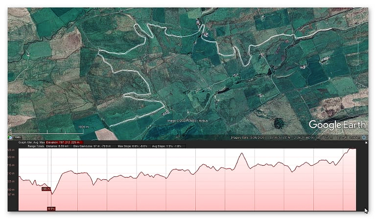
  • ISBN-13 ‏ : ‎ 979-8353488897
  • Dimensions ‏ : ‎ 15.24 x 1.3 x 22.86 cm
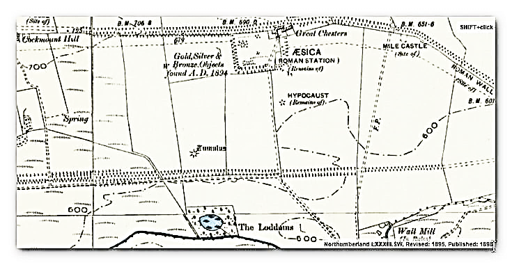
  • Illustrations: 85
  • Customer reviews: 5.0 out of 5 stars    1 rating

For more information about British Prehistory and other articles/books, go to our BLOG WEBSITE for daily updates or our VIDEO CHANNEL for interactive media and documentaries. The TRILOGY of books that ‘changed history’ can be found with chapter extracts at DAWN OF THE LOST CIVILISATION, THE STONEHENGE ENIGMA and THE POST-GLACIAL FLOODING HYPOTHESIS. Other associated books are also available such as 13 THINGS THAT DON’T MAKE SENSE IN HISTORY and other ‘short’ budget priced books can be found on our AUTHOR SITE or on our PRESS RELEASE PAGE. For active discussion on the findings of the TRILOGY and recent LiDAR investigations that is published on our WEBSITE you can join our FACEBOOK GROUP.

The Great Hadrian’s Wall Hoax

The Vallum was not built by the Roman’s but is a Reused Prehistoric Dyke – The Great Hadrian’s Wall Hoax

Conclusive and absolute evidence from the first ever detailed survey of the Vallum at Hadrian’s Wall proves that the Roman’s built upon an existing prehistoric ‘Dyke’ structure to move quarried materials and provide stone to Hadrian’s Wall. The details of the survey are contained in a New Book called ‘Ancient Prehistoric Canals (Dykes) – The Vallum’ now available on Amazon.

The Great Hadrian's Wall Hoax

Details of this survey can also be found in a Four Part Documentary available from our Video Channel or the links here:

Part 1 of 4
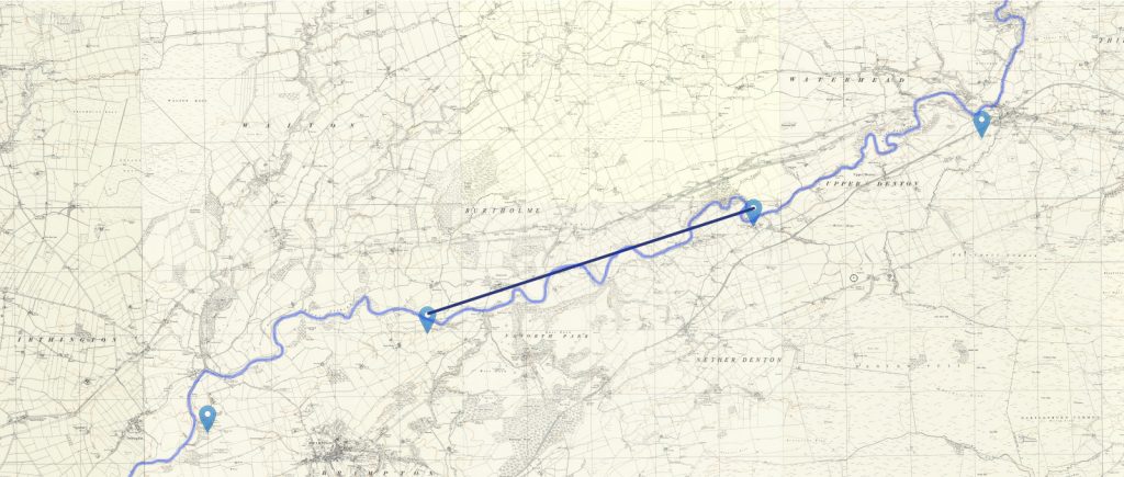
Part 2 of 4

Part 3 of 4

Part 4 of 4 – including conclusion

Traditional archaeologists and archaeological establishments like English Heritage suggest that:

The Vallum is a massive earthwork constructed shortly after Hadrian’s Wall itself and lying just south of it. Many visitors confuse the Vallum with Hadrian’s Wall itself because it’s such an obvious and impressive feature in the landscape. 

In fact, the Vallum is made up of several different elements – a ditch around 6 metres wide and 3 metres deep; two mounds either side of the ditch about 6 metres wide and 2 metres high and set back from the ditch by around 9 metres; and often a third mound on the southern edge of the ditch. The whole complex is around 36 metres across. Usually, the Vallum runs close behind the Wall but in the rocky and hilly central section the Vallum lies up to 700 metres from the Wall.

Crossing points seem to have been located south of each of the forts along Hadrian’s Wall and near several of the milecastles. Evidence from the excavated Vallum crossing at Benwell in Newcastle shows these crossing points had impressive monumental gateways.

The Vallum’s purpose is unclear. Many archaeologists think it marks the southern boundary of a military zone with the Wall itself forming the northern boundary. This would have helped protect the rear of the Wall and its associated military installations, with civilian access being closely controlled. The gateway at Benwell supports this idea. The numerous gateways along the Wall at forts and milecastles suggest that the frontier was intended as much to control movement as to provide a defensive line. Traders would have moved goods across the frontier but their movements would have been controlled and their goods taxed.

Relatively soon after it was constructed, some 20 to 30 years perhaps, the Vallum seems to have lost its function – the mounds were cut through and the ditch filled in at fairly regular intervals. It was out of use by the time the forts along the Wall were re-commissioned in the late second century AD following the return of the garrison from the Antonine Wall.

Sadly, these ideas that have been constructed over the last 200 years are somewhat questionable. Within the book we look at associated aspects of this area like Military Way which was supposed to be constructed to patrol the so-called ‘Military Zone’ – to find that:

That over 50% of Military Way does not exist as a separate road, as described by archaeologists. Instead, the perceived road is fragmented and only becomes ‘alive’ as an independent road when the Vallum separates from the wall at any distance. 

This might give us a clue to the function of this rough and wonky road, as the stone for the wall would have needed to be delivered by cart if the Vallum canal was not available.

As for the Stanegate that was supposed to connect to the main forts in the area as a ‘defensive shield’ we actual found that it is very little to no evidence of the ‘Stanegate Roman Road’, which (according to the current theory proposed by English Heritage) ‘consolidated as a frontier’ during the late first and early second century AD and helped crystallise Roman tactics and military expectations in the area.

This evidence is compounded when you release that of the 80mile border from coast to coast – Stonegate, at best, covers just 38.1 miles (47%) of the ‘defensive gap’, and hence suggestions of extension over and above the existing line existed (even without support from OS maps). Moreover, the research has shown the ‘raw’ Stanegate road without the ‘hidden’ parts below the B-roads – we are only looking at 20% of the declared road being visible on LiDAR maps.

Stanegate Road (when not part of an existing B-road system) is inconsistent in width and structure -moving from bank track to road with two ditches on each side to a ditch with two banks far from straight and usually starts and ends in ravens.

Most Forts and the Stanegate are not found to connect (with intersecting sub-roads) on only two occasions, and the rest show no connection.  Moreover, later ‘temporary’ camps also did not connect with the road – which questions whether (a defence line) was its purpose.  

Moreover, this would then question the ‘myth’ of using the Stanegate as a ‘boundary’ for withdrawing troops from Scotland in the first century AD is correct. And whether the River Tyne (which most of these Forts sit upon) was used as a more practical and effective boundary/defence.

This ‘myth buster’ will not surprise many in academia as it has been ‘hinted’ at for some time (but not acted upon it by updating the literature), as we see from Symonds et al.

“The question of whether a road even existed when the fortlets were founded is by default an existential one for the notion that they provided highway protection. But even if the metalled road does post-date the fortlets, a reasonably robust thoroughfare of some form must have existed from at least the mid AD 80s to service Vindolanda. The question is not whether there was a road, but whether it was metalled when the fortlets were founded.” Symonds, M. (2017). Hadrian’s Wall. In Protecting the Roman Empire: Fortlets, Frontiers, and the Quest for Post-Conquest Security (pp. 95-132)

Moreover, even if Stanegate was not built as suggested, it exists in parts, and it looks prehistoric (by design) as it relies heavily on ravens that start and end sections of the Stanegate sections; its sunken structure in parts is unfamiliar to traditional Roman Road design.

As for other famous ‘Roman Features Such as the Great Chesters Aqueduct, again we find not only is the origin questionable but as it located supposedly fully in ‘hostile territory – they its usefulness win conflict would be limited.

It is clear from the LiDAR research that the suspected Roman Aqueduct is not as it seems. This is not the first examination to spread doubt about the scale and origin of this feature in the landscape – MacKay, D. A. (1990). The Great Chesters Aqueduct: A New Survey. Britannia, 21, 285–289. Also shows an incomplete map of this aqueduct.

Mackey failed to find in their survey that the Aqueduct changed size, and the path suggested had no identifiable remains of the bridges required to make this Aqueduct work.

Our more detailed findings indicate that the topology of the aqueduct suggests that it would need to go uphill at several points without any powered assistance (like a siphon) and so is mechanically unsound. Our finding has found that the use of ‘Dykes’ in this area and some connecting to this Aqueduct feature is new. We have also shown that closer to the Fort it was supposed to supply, there were closed water sources which could be used and that the Fosse by the Wall was also a water supply.

We conclude that we found a prehistoric watercourse linked to their sophisticated ‘Dyke’ system. I would be bold to suggest that this was used for either agricultural purposes or maybe industrial, seeing the multiple sites of quarries associated and in the region of this feature.

When we look at the Conclusions and new data found about The Vallum we find that:

Total length found by LiDAR: 73,916m (45.93 miles) – 65% of the entire wall length

Total length Missing (by LiDAR): 42,339m (26.31 miles) – 35% of the Vallum length

Total number of Gaps in the Vallum – 49

Average Depth of the River Valleys (in gaps)  – 7.75m

The total length of Vellum (including gaps) 116,255m (72.24 miles)

In comparison, Hadrian’s Wall is reported as 80 Roman miles or 73 standard miles in length.

Features

Within the 72.24 miles of the Vallum, we have identified – within 200m of the construction:

46 Springs (as specified by the 1800 OS maps series)

54 Quarries

14 Prehistoric Ancient sites

To judge if the frequency of these features are standard or an anomaly of the Vallum – we have measured two roughly parallel lines to the Vallum, one five miles to the north and the other to the south.

This mathematical exercise will give us a comparative average for these features in the environment within the locality:

Northern Test Line (within 200m)

12 Springs

25 Quarries

1 Ancient site

Southern Test Line (within 200m)

10 Springs

30 Quarries

3 Ancient Sites

Results

46 v 10 Springs – Vallum has 460% more Springs, that the norm

54 v 30 Quarries – Vallum has 180% more Quarries, than the norm

14 v 2 Ancient Sites – Vallum has 700% more ancient sites, than the norm

So, Are we seeing the use of prehistoric Dykes (linear earthwork) banks being utilised for a new purpose?

In the book we show that there are many ‘quarry sites’ along Stanegate Road and an increased number of ‘temporary’ forts, some of which have these quarries inside. Therefore, have archaeologists missed the point of not only the ‘temporary’ forts but the purpose for the road use and, consequently, why Hadrian’s Wall was built?

When the Roman Empire decided to invade any country (contrary to the traditional myth), it was to possess more incredible wealth.  Britain was a wealthy (iron Age) island, perfect for conquest as it had rich commodities such as gold, silver, tin, lead, wheat, and enslaved people.  Some of this mineral trading wealth is found in the quarries that surround this area and has been exploited since the dawn of trading (prehistoric times).

This may explain why so many unscheduled Dykes are found in this area and why many start/terminate within the quarries.  Romans are the best adaptors in history when it comes to the assimilation of foreign assets, engineering and cultures – therefore, would it not have been prudent to take the existing infrastructure of Dykes and adapt them to make roads rather than starting from scratch? (we will see this in detail when examining the Roman Vallum).

These quarries needed a workforce to extract the minerals, housing, feeding facilities, and store the precious quarried materials.  We have seen how this has been done in history by lightly guarded fortifications (places with wooden walls and armed guards) and is this what we see alone on Stanegate Road with the ‘temporary’ fort camps?

Eventually, these ‘warehouses’ would have been a target for raiding and robbery – so would it not make sense to eventually build a more substantial defence against robbers (non-enslaved picts of Scotland?) and is this the real reason that the Romans built Hadrian’s Wall and why it was moved just after 40 years to incorporate the quarries that are currently north of the Wall?

For more information about British Prehistory and other articles/books, go to our BLOG WEBSITE for daily updates or our VIDEO CHANNEL for interactive media and documentaries. The TRILOGY of books that ‘changed history’ can be found with chapter extracts at DAWN OF THE LOST CIVILISATION, THE STONEHENGE ENIGMA and THE POST-GLACIAL FLOODING HYPOTHESIS. Other associated books are also available such as 13 THINGS THAT DON’T MAKE SENSE IN HISTORY and other ‘short’ budget priced books can be found on our AUTHOR SITE or on our PRESS RELEASE PAGE. For active discussion on the findings of the TRILOGY and recent LiDAR investigations that is published on our WEBSITE you can join our FACEBOOK GROUP.

The Great Hadrian's Wall Hoax

The Vallum @ Hadrian’s Wall – it’s Prehistoric!

The first ever detailed survey of the Vallum at Hadrian’s Wall proves conclusively that the Roman’s built of an existing ‘DyKE’ structure to move quarried materials and provide stone to Hadrian’s Wall. The details of the survey are contained in a New Book called ‘Ancient Prehistoric Canals (Dykes) – The Vallum’ now available on Amazon.

Traditional archaeologists and archaeological establishments like English Heritage suggest that:

The Vallum is a massive earthwork constructed shortly after Hadrian’s Wall itself and lying just south of it. Many visitors confuse the Vallum with Hadrian’s Wall itself because it’s such an obvious and impressive feature in the landscape. 

In fact, the Vallum is made up of several different elements – a ditch around 6 metres wide and 3 metres deep; two mounds either side of the ditch about 6 metres wide and 2 metres high and set back from the ditch by around 9 metres; and often a third mound on the southern edge of the ditch. The whole complex is around 36 metres across. Usually, the Vallum runs close behind the Wall but in the rocky and hilly central section the Vallum lies up to 700 metres from the Wall.

The Vallum
The Vallum

Crossing points seem to have been located south of each of the forts along Hadrian’s Wall and near several of the milecastles. Evidence from the excavated Vallum crossing at Benwell in Newcastle shows these crossing points had impressive monumental gateways.

The Vallum’s purpose is unclear. Many archaeologists think it marks the southern boundary of a military zone with the Wall itself forming the northern boundary. This would have helped protect the rear of the Wall and its associated military installations, with civilian access being closely controlled. The gateway at Benwell supports this idea. The numerous gateways along the Wall at forts and milecastles suggest that the frontier was intended as much to control movement as to provide a defensive line. Traders would have moved goods across the frontier but their movements would have been controlled and their goods taxed.

Relatively soon after it was constructed, some 20 to 30 years perhaps, the Vallum seems to have lost its function – the mounds were cut through and the ditch filled in at fairly regular intervals. It was out of use by the time the forts along the Wall were re-commissioned in the late second century AD following the return of the garrison from the Antonine Wall.

New Book

Sadly, these ideas that have been constructed over the last 200 years are somewhat questionable. Within the book we look at associated aspects of this area like Military Way which was supposed to be constructed to patrol the so-called ‘Military Zone’ – to find that:

That over 50% of Military Way does not exist as a separate road, as described by archaeologists. Instead, the perceived road is fragmented and only becomes ‘alive’ as an independent road when the Vallum separates from the wall at any distance. 

This might give us a clue to the function of this rough and wonky road, as the stone for the wall would have needed to be delivered by cart if the Vallum canal was not available.

Stanegate as portrayed by archaeologists

As for the Stanegate that was supposed to connect to the main forts in the area as a ‘defensive shield’ we actual found that it is very little to no evidence of the ‘Stanegate Roman Road’, which (according to the current theory proposed by English Heritage) ‘consolidated as a frontier’ during the late first and early second century AD and helped crystallise Roman tactics and military expectations in the area.

This evidence is compounded when you release that of the 80mile border from coast to coast – Stonegate, at best, covers just 38.1 miles (47%) of the ‘defensive gap’, and hence suggestions of extension over and above the existing line existed (even without support from OS maps). Moreover, the research has shown the ‘raw’ Stanegate road without the ‘hidden’ parts below the B-roads – we are only looking at 20% of the declared road being visible on LiDAR maps.

Stanegate Road (when not part of an existing B-road system) is inconsistent in width and structure -moving from bank track to road with two ditches on each side to a ditch with two banks far from straight and usually starts and ends in ravens.

Most Forts and the Stanegate are not found to connect (with intersecting sub-roads) on only two occasions, and the rest show no connection.  Moreover, later ‘temporary’ camps also did not connect with the road – which questions whether (a defence line) was its purpose.  

Moreover, this would then question the ‘myth’ of using the Stanegate as a ‘boundary’ for withdrawing troops from Scotland in the first century AD is correct. And whether the River Tyne (which most of these Forts sit upon) was used as a more practical and effective boundary/defence.

This ‘myth buster’ will not surprise many in academia as it has been ‘hinted’ at for some time (but not acted upon it by updating the literature), as we see from Symonds et al.

“The question of whether a road even existed when the fortlets were founded is by default an existential one for the notion that they provided highway protection. But even if the metalled road does post-date the fortlets, a reasonably robust thoroughfare of some form must have existed from at least the mid AD 80s to service Vindolanda. The question is not whether there was a road, but whether it was metalled when the fortlets were founded.” Symonds, M. (2017). Hadrian’s Wall. In Protecting the Roman Empire: Fortlets, Frontiers, and the Quest for Post-Conquest Security (pp. 95-132)

Moreover, even if Stanegate was not built as suggested, it exists in parts, and it looks prehistoric (by design) as it relies heavily on ravens that start and end sections of the Stanegate sections; its sunken structure in parts is unfamiliar to traditional Roman Road design.

As for other famous ‘Roman Features Such as the Great Chesters Aqueduct, again we find not only is the origin questionable but as it located supposedly fully in ‘hostile territory – they its usefulness win conflict would be limited.

It is clear from the LiDAR research that the suspected Roman Aqueduct is not as it seems. This is not the first examination to spread doubt about the scale and origin of this feature in the landscape – MacKay, D. A. (1990). The Great Chesters Aqueduct: A New Survey. Britannia, 21, 285–289. Also shows an incomplete map of this aqueduct.

Great Chesters by Mackey

Mackey failed to find in their survey that the Aqueduct changed size, and the path suggested had no identifiable remains of the bridges required to make this Aqueduct work.

Our more detailed findings indicate that the topology of the aqueduct suggests that it would need to go uphill at several points without any powered assistance (like a siphon) and so is mechanically unsound. Our finding has found that the use of ‘Dykes’ in this area and some connecting to this Aqueduct feature is new. We have also shown that closer to the Fort it was supposed to supply, there were closed water sources which could be used and that the Fosse by the Wall was also a water supply.

We conclude that we found a prehistoric watercourse linked to their sophisticated ‘Dyke’ system. I would be bold to suggest that this was used for either agricultural purposes or maybe industrial, seeing the multiple sites of quarries associated and in the region of this feature.

The Vallum - full of Water as it was constructed as a canal
The Vallum – full of Water as it was constructed as a canal

When we look at the Conclusions and new data found about The Vallum we find that:

Total length found by LiDAR: 73,916m (45.93 miles) – 65% of the entire wall length

Total length Missing (by LiDAR): 42,339m (26.31 miles) – 36% of the Vallum length

Total number of Gaps in the Vallum – 49

Average Depth of the River Valleys (in gaps)  – 7.75m

The total length of Vellum (including gaps) 116,255m (72.24 miles)

In comparison, Hadrian’s Wall is reported as 80 Roman miles or 73 standard miles in length.

Features

Within the 72.24 miles of the Vallum, we have identified – within 200m of the construction:

46 Springs (as specified by the 1800 OS maps series)

54 Quarries

14 Prehistoric Ancient sites

To judge if the frequency of these features are standard or an anomaly of the Vallum – we have measured two roughly parallel lines to the Vallum, one five miles to the north and the other to the south.

This mathematical exercise will give us a comparative average for these features in the environment within the locality:

Northern Test Line (within 200m)

12 Springs

25 Quarries

1 Ancient site

Southern Test Line (within 200m)

10 Springs

30 Quarries

3 Ancient Sites

Results

46 v 10 Springs – Vallum has 460% more Springs, that the norm

54 v 30 Quarries – Vallum has 180% more Quarries, than the norm

14 v 2 Ancient Sites – Vallum has 700% more ancient sites, than the norm

So, Are we seeing the use of prehistoric Dykes (linear earthwork) banks being utilised for a new purpose?

In the book we show that there are many ‘quarry sites’ along Stanegate Road and an increased number of ‘temporary’ forts, some of which have these quarries inside. Therefore, have archaeologists missed the point of not only the ‘temporary’ forts but the purpose for the road use and, consequently, why Hadrian’s Wall was built?

When the Roman Empire decided to invade any country (contrary to the traditional myth), it was to possess more incredible wealth.  Britain was a wealthy (iron Age) island, perfect for conquest as it had rich commodities such as gold, silver, tin, lead, wheat, and enslaved people.  Some of this mineral trading wealth is found in the quarries that surround this area and has been exploited since the dawn of trading (prehistoric times).

This may explain why so many unscheduled Dykes are found in this area and why many start/terminate within the quarries.  Romans are the best adaptors in history when it comes to the assimilation of foreign assets, engineering and cultures – therefore, would it not have been prudent to take the existing infrastructure of Dykes and adapt them to make roads rather than starting from scratch? (we will see this in detail when examining the Roman Vallum).

The Vallum a reused Prehistoric Canal like 'Offa' and 'Wansdyke'
The Vallum a reused Prehistoric Canal like ‘Offa’ and ‘Wansdyke’

These quarries needed a workforce to extract the minerals, housing, feeding facilities, and store the precious quarried materials.  We have seen how this has been done in history by lightly guarded fortifications (places with wooden walls and armed guards) and is this what we see alone on Stanegate Road with the ‘temporary’ fort camps?

Eventually, these ‘warehouses’ would have been a target for raiding and robbery – so would it not make sense to eventually build a more substantial defence against robbers (non-enslaved picts of Scotland?) and is this the real reason that the Romans built Hadrian’s Wall and why it was moved just after 40 years to incorporate the quarries that are currently north of the Wall?

For more information about British Prehistory and other articles/books, go to our BLOG WEBSITE for daily updates or our VIDEO CHANNEL for interactive media and documentaries. The TRILOGY of books that ‘changed history’ can be found with chapter extracts at DAWN OF THE LOST CIVILISATION, THE STONEHENGE ENIGMA and THE POST-GLACIAL FLOODING HYPOTHESIS. Other associated books are also available such as 13 THINGS THAT DON’T MAKE SENSE IN HISTORY and other ‘short’ budget priced books can be found on our AUTHOR SITE or on our PRESS RELEASE PAGE. For active discussion on the findings of the TRILOGY and recent LiDAR investigations that is published on our WEBSITE you can join our FACEBOOK GROUP.