
The Lost Shorelines of Oakley Down
The LiDAR investigation at Sixpenny Handley has revealed something potentially more significant than the apparent termination of the original Ackling Dyke.
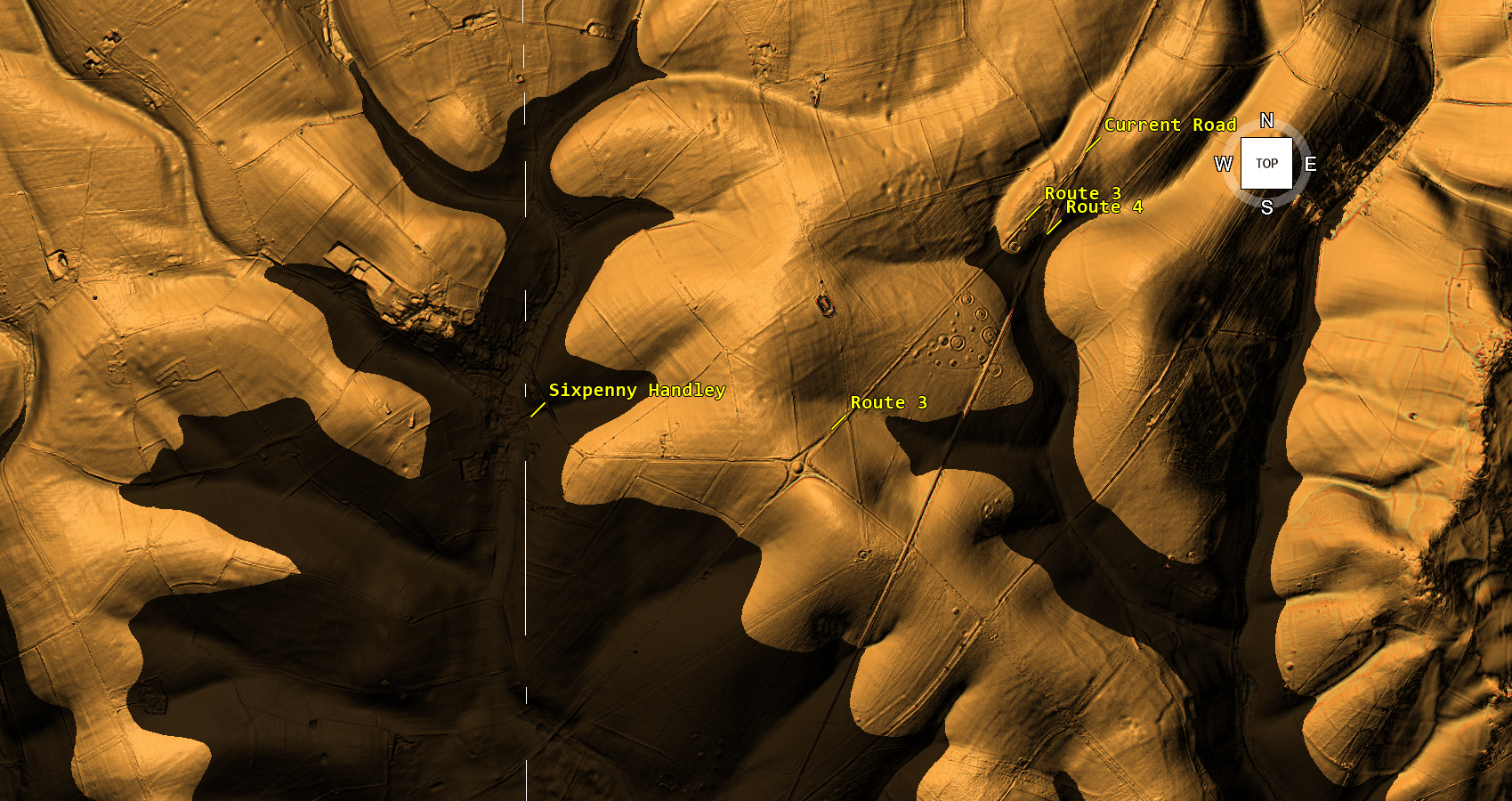
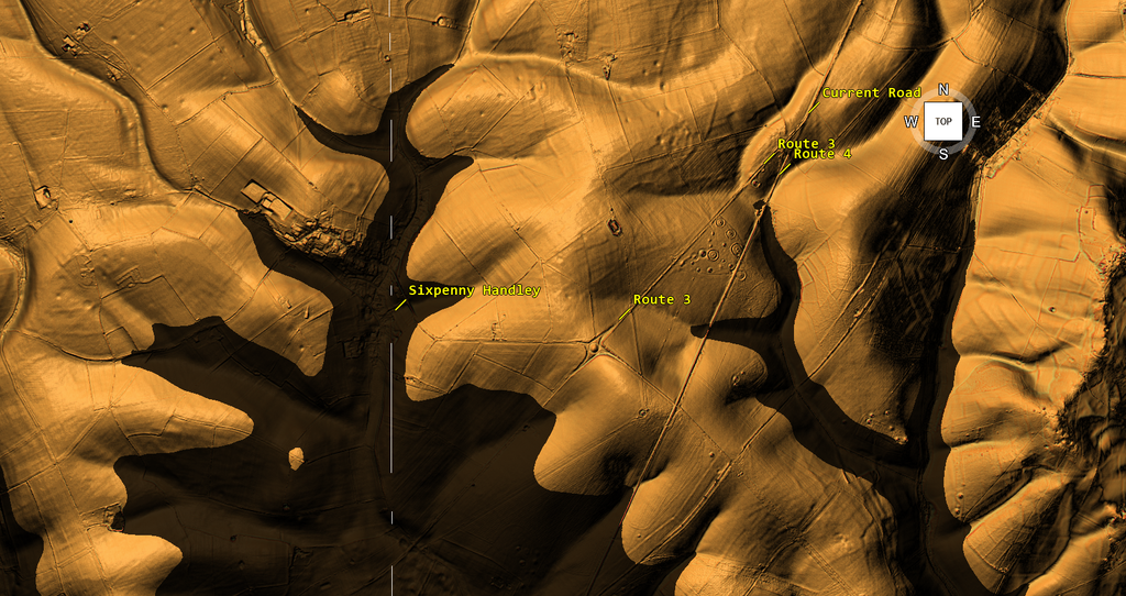
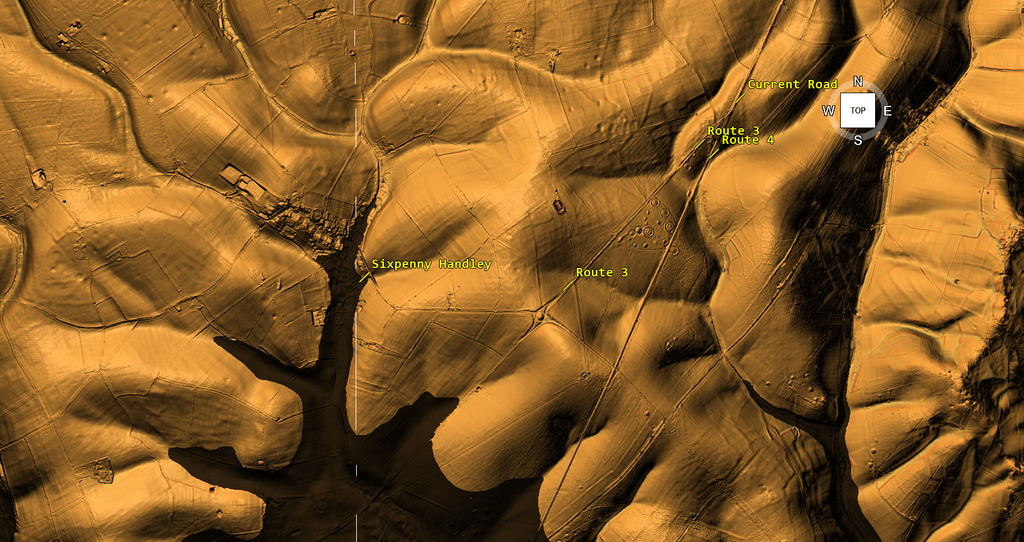
By reconstructing three successive water levels against the surrounding terrain, we can examine how an ancient transport system might have developed as the available waterways contracted.
The results suggest three distinct geographical conditions, each with consequences for the original dyke, its proposed harbour and the later route towards Gussage All Saints.
But perhaps the most interesting discovery concerns the prehistoric monuments of Oakley Down.
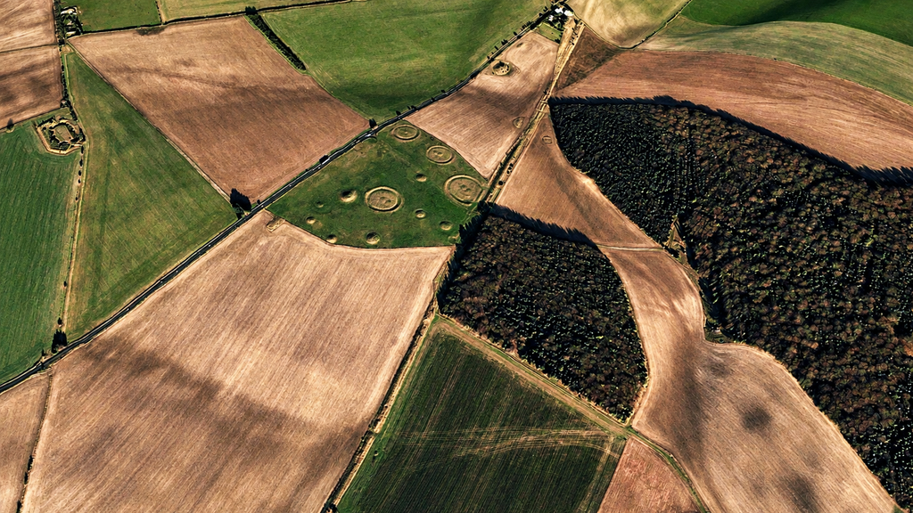
Today, the celebrated burial mounds occupy apparently isolated positions on the chalk downs.
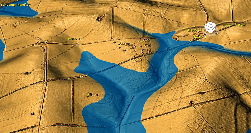
Under our highest-water reconstruction, however, these monuments occupy the margins of a substantial prehistoric waterway.
The Neolithic long barrow and the surrounding burial landscape would have overlooked the water rather than the predominantly dry valleys visible today.
Moreover, the alternative Route 4 alignment would have been inundated at this earlier proposed water level.
This is significant because our reconstruction does not simply propose that two different routes existed.
It suggests that the landscape conditions suitable for their use were fundamentally different.
1. Oakley Down — A Prehistoric Cemetery Beside the Water?
The round barrow cemetery on Oakley Down is one of the important prehistoric monument groups in Cranborne Chase.
Historic England records numerous burial mounds and associated ring ditches, with the cemetery forming part of a much wider concentration of Neolithic and Bronze Age monuments.
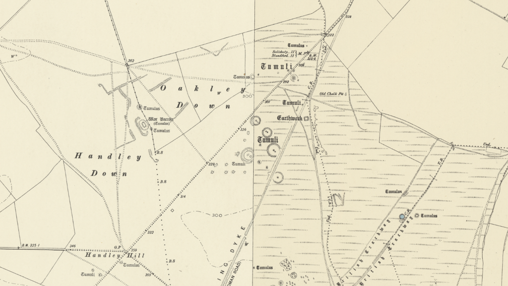
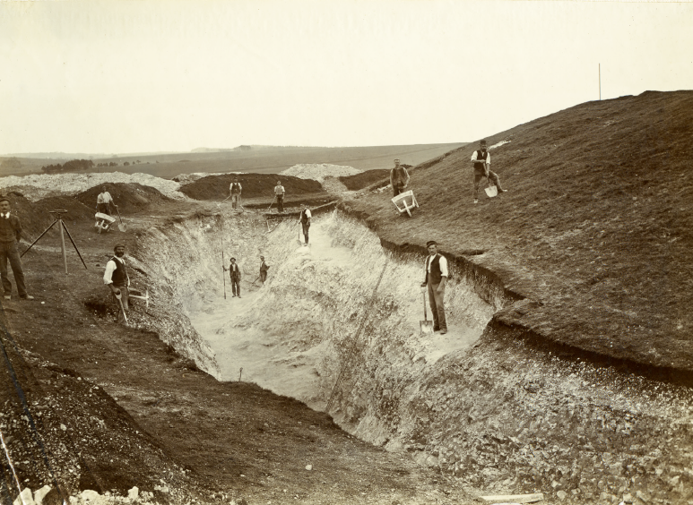
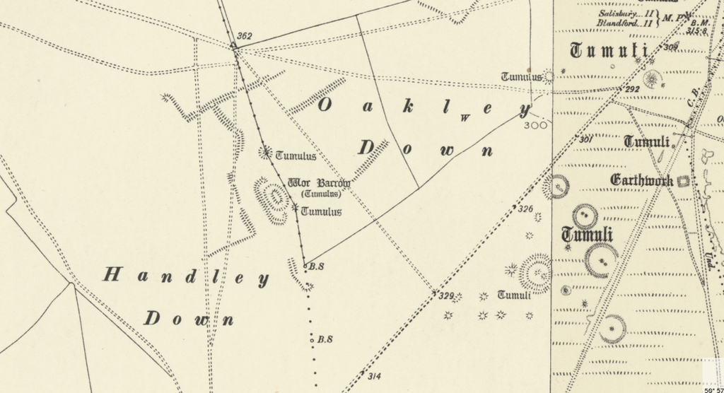
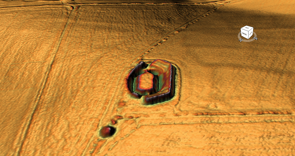
The surrounding landscape also contains Wor Barrow, the well-known Neolithic long barrow excavated by General Pitt-Rivers in 1893 and 1894.
Today, these monuments stand in open chalk countryside, distant from any substantial permanent waterway.
The conventional archaeological interpretation emphasises their prominent positions, funerary significance and relationships with other prehistoric monuments.
But our reconstruction adds a geographical context.
At the highest proposed water level, the surrounding valleys become extensive watercourses, with the burial monuments overlooking their margins.
The elevated ground occupied by the barrows becomes a series of prominent positions above the reconstructed shoreline.
This arrangement is particularly interesting because our wider investigation has repeatedly identified prehistoric burial monuments overlooking or approaching former waterway landscapes.
Under a waterborne transport interpretation, access to these sites would not necessarily have depended exclusively upon overland journeys across the downs.
Communities might have approached the surrounding valley system by boat before travelling the remaining distance to the monuments.
Such an arrangement could have provided practical access for people, materials and ceremonial activities.
The monument locations may therefore have possessed a relationship with prehistoric waterways that is no longer apparent in the modern landscape.
There is an important independent observation.
Historic England’s detailed research report on Wor Barrow describes its position on Handley Down, overlooking the dry valley north of Oakley Down.
This is precisely the kind of landscape relationship our reconstruction seeks to investigate.
The report also identifies a series of streams and winterbournes within the surrounding chalk valleys.
The archaeological record therefore establishes that the monuments were deliberately situated in a landscape shaped by former drainage systems.
Our reconstruction asks whether those drainage systems contained substantially more accessible water when the monuments were constructed.
The available evidence does not yet demonstrate that the barrows were built beside navigable water, but the modelled shoreline provides a specific proposition that can be checked against their elevations and dates.
2. The Long Barrow — A Chronological Reference Point
Wor Barrow is particularly valuable because its construction history has been investigated in considerable detail.
Pitt-Rivers excavated the monument, and subsequent scientific analysis has provided a more refined chronology for its Neolithic activity.
Historic England’s chronological modelling places the beginning of the mortuary enclosure at approximately 3720–3640 BCE, with the initial funerary phase ending around 3655–3605 BCE.
This gives us an important independent time reference.
If our highest-water reconstruction represents the landscape around the time Wor Barrow was constructed, the proposed shoreline should match water conditions during the fourth millennium BCE.
The surrounding Bronze Age round barrows introduce another chronological consideration.
Many were constructed well after the long barrow.
If they also occupied the same reconstructed shoreline during their original use, the proposed water system would need to have remained accessible, or changed in a way consistent with the locations of the later monuments.
This offers an opportunity to investigate how long the proposed higher-water conditions lasted.
Rather than treating every monument as contemporary, we can compare their different construction dates with the successive modelled shorelines.
The barrows provide archaeological dates. The LiDAR provides the terrain. Together, they allow us to test the proposed water history.
The hypothesis would be strengthened if independently reconstructed water conditions placed the monuments beside accessible shorelines during their construction and use.
This is potentially more informative than simply noting their proximity to the route.
NB. It’s not a Long Barrow
| Characteristic | West Kennet | Wor Barrow |
|---|---|---|
| Mound | Long, trapezoidal | Shorter, oval |
| Length | 104 m | Approx. 45 m |
| Ditches | Two flanking ditches | Four substantial segments |
| Burial chamber | Five stone chambers | Small timber mortuary box |
| Burial practice | Mainly incomplete skeletal remains | Articulated and disarticulated remains |
| Continued chamber access | Yes, for generations | Sealed beneath mound |
| Landscape | Below ridge crest, overlooking Kennet valley on it’s long side | Chalk spur overlooking dry valley on its narrow side |
3. Phase One — The Highest Water Level
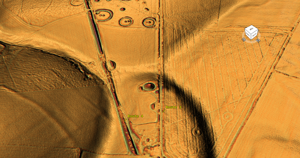
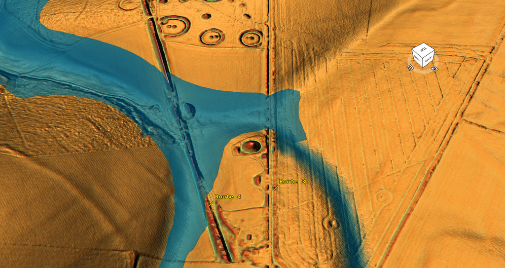
Our first reconstruction represents the most extensive of the three proposed water surfaces.
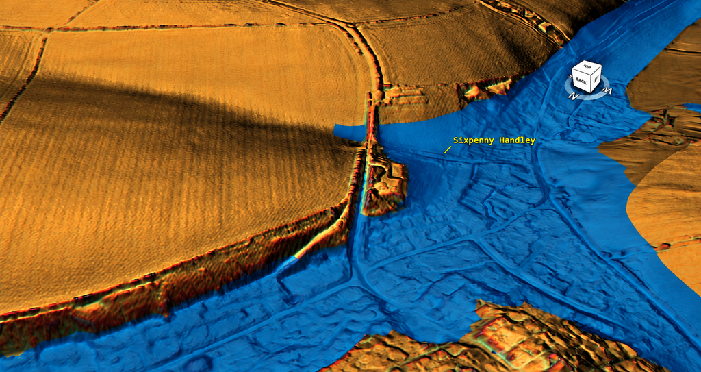
At this level, much of the Sixpenny Handley valley is inundated.
Water also occupies the eastern valley system adjoining the Ackling Dyke corridor.
The two valleys form a much larger water landscape than exists today.
The Oakley Down burial monuments overlook the reconstructed water margins, while the higher ground carrying the original dyke forms a prominent ridge between the valleys.
Under this model, Track 3 approaches a naturally available waterway.
If a sheltered valley already provided suitable water depth, there would be no need to excavate a large artificial harbour basin at the end of the dyke.
The original engineered channel would simply need to connect with the accessible water.
This may explain Track 3’s destination.
But the most important feature of this first reconstruction is Route 4’s position.
At the proposed highest water level, lower portions of the Route 4 alignment are submerged.
They could not have operated as a dry terrestrial road under those conditions.
Consequently, if the reconstructed water surface accurately represents the earlier landscape, the later terrestrial use of Route 4 must belong to a period when that water had receded.
This is a geographical constraint, not a conclusion derived from the angle between two roads.
Under Phase One conditions, the original Track 3 connection remains a plausible access route to the water, while Route 4 is not yet available as the later dry roadway.
That distinction is central to our proposed construction sequence.
4. Phase Two — Falling Water and Changing Access
The second reconstruction lowers the water surface.
The extensive watercourses contract and the shorelines retreat into the deeper parts of their valleys.
Ground previously submerged begins to emerge.
The eastern valley becomes less extensive as a waterway, while the main Sixpenny Handley valley continues to provide access to a larger body of water.
For an existing water-connected dyke, this change could have created a practical engineering problem.
A channel originally terminating at the higher shoreline might no longer reach water of sufficient depth.
The natural response would be to extend, deepen or modify the connecting infrastructure.
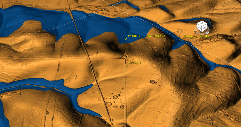
This may explain additional earthwork construction within the Sixpenny Handley landscape.
Rather than excavating an entirely new route, the original system could have been adapted to reach the water at its new position.
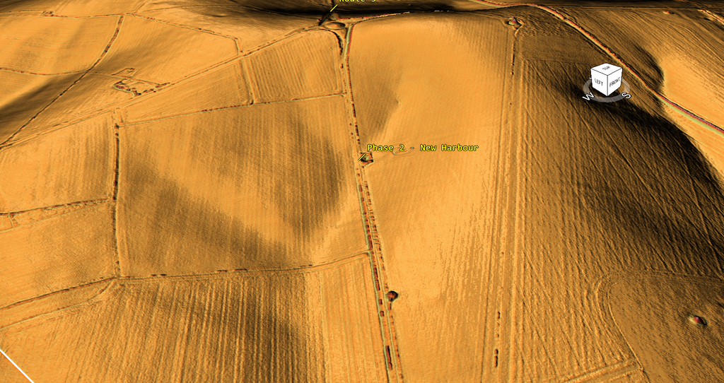
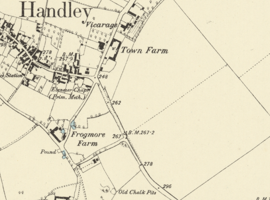
Our investigation has identified an additional substantial cutting running through the village landscape towards Frogmore Farm and the Old Chalk Pits.
This feature is particularly interesting because it appears in the historical Ordnance Survey mapping and survives as a pronounced cutting in the modern LiDAR.
Its relationship with the original Track 3 system remains to be established, but its position raises the possibility of a later connecting or access route.
Under the second water-level reconstruction, such modifications could have helped maintain access to the retreating shoreline.
The proposed second phase is therefore not the creation of an entirely new transport system, but the adaptation of an existing one to changing water conditions.
The model shows how this could have worked geographically. Determining whether an actual construction phase occurred then requires evidence from the earthworks.
5. Phase Three — The Eastern Waterway Becomes Dry
The third reconstruction shows the water at its lowest proposed level.
The eastern valley is now largely exposed.
Water remains concentrated within the deeper Sixpenny Handley valley system.
The former relationship between the route and the water has changed substantially.
Areas that would have been inundated under Phase One conditions are now available for terrestrial movement.
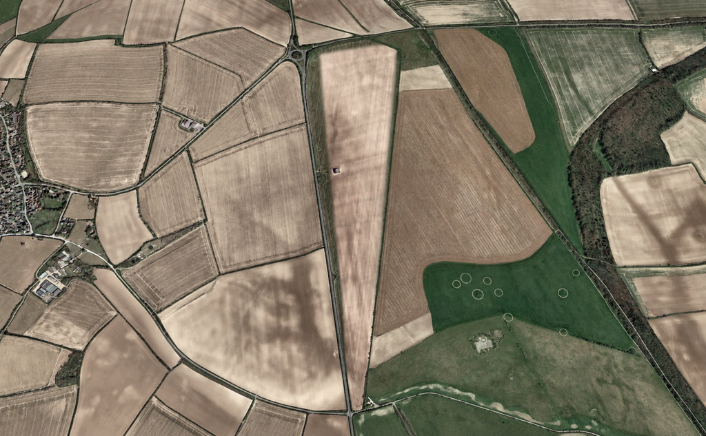
Under our hypothesis, this creates the opportunity for later road construction along the previously submerged corridor.
The alternative Route 4 alignment becomes increasingly practical as a dry route.
At the same time, the original Track 3 channel may have lost part of its earlier function.
If the water surface no longer reached the original channel terminal, the substantial excavation could become redundant as a waterway.
Its banks, however, would remain useful.
The channel floor might eventually be filled, levelled and adapted for wheeled traffic.
This may explain the unusual surviving form of Track 3.
A later road following the floor of an earlier substantial cutting would preserve the original route’s curvature and much of its bank-and-ditch morphology.
The feature would appear as a roadway today, even if it was originally built for a different purpose.
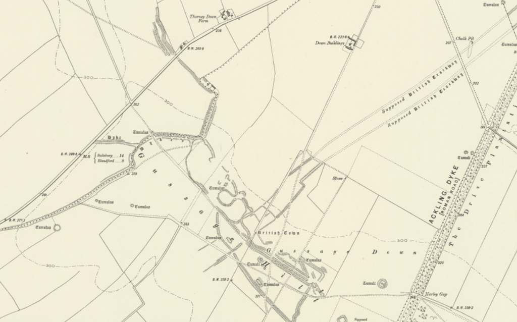
Such reuse is consistent with the wider problem identified at Woodyates, where Pitt-Rivers demonstrated genuine Roman road construction within a landscape containing much larger and more complicated earthworks.
The third phase therefore provides the geographical conditions under which the original dyke could have changed function, while Route 4 became available for later terrestrial use.
The Roman-period dating of that later use remains to be demonstrated from construction evidence, rather than from the inundation model alone.
6. The High Groundwater Table — Why a Dyke Could Have Worked Here
The proposed water-based function of Ackling Dyke requires a reliable water supply.
Sixpenny Handley is particularly interesting because its present hydrological behaviour provides independent evidence of substantial groundwater movement through the chalk.
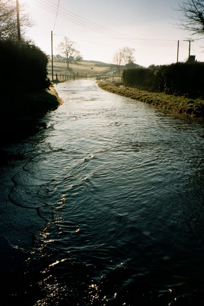
The parish council’s Flood Management Plan records repeated episodes of groundwater flooding.
During periods of elevated groundwater, water emerges through ancient valley gravels and geological boundaries, producing surface flows through roads and fields that are normally dry.
The recorded flow route passes through Garston Wood, Dean Lane and Frogmore Lane before continuing towards Manor Farm and Endless Pit.
The council also uses groundwater readings from the Woodyates borehole to anticipate flooding.
Its published flood plan identifies a groundwater elevation of 105 metres at that borehole as an alert threshold.
This monitoring provides an important input to our investigation.
The groundwater supply required by the proposed dyke is not entirely hypothetical. The local chalk aquifer still produces substantial surface-water emergence.
For an unlined channel excavated into chalk, the groundwater table depth would have been especially important.
If the original ditch intersected the saturated zone, groundwater could potentially have entered the excavation and helped maintain its water level.
The associated valley waterway would then provide the receiving system.
This makes the recorded groundwater behaviour directly relevant to our hydraulic interpretation.
The modern drainage problems around Sixpenny Handley and the substantial roadside excavations near Handley Hill Roundabout provide further reasons to investigate the area’s water-management history.
They do not, on their own, establish Neolithic or Bronze Age water levels.
Nevertheless, they demonstrate that the underlying geological system remains capable of supplying water to parts of the landscape that otherwise appear dry.
The next requirement is to compare the original ditch-bottom elevations with the groundwater levels and the proposed former shorelines.
That will determine whether a naturally sustained channel was physically possible.
7. What the Combined Evidence Suggests
The Sixpenny Handley investigation now brings together several different forms of evidence.
The LiDAR records substantial cuttings and a curved alignment approaching the valley.
The historical map independently records an additional engineered roadside feature near Frogmore Farm.
The prehistoric burial monuments occupy elevated positions overlooking the surrounding valleys.
Under our highest-water reconstruction, these monuments become prominent features beside the proposed shoreline.
The same reconstruction places lower parts of Route 4 beneath water, making its later operation as a dry roadway incompatible with that particular high-water condition.
As the modelled water levels decline, the natural access points change and the lower route becomes available.
Finally, the modern groundwater records demonstrate that the chalk aquifer remains capable of delivering significant quantities of water into the valley system.
Taken together, these observations produce a coherent, testable interpretation: an original water-connected dyke, modifications in response to reduced water access, and eventual adaptation of the corridor for terrestrial travel.
They also identify specific chronological tests.
Wor Barrow supplies a well-investigated fourth-millennium BCE reference point.
The Bronze Age burial cemetery provides later prehistoric monuments whose elevations can be compared with the proposed water surfaces.
The recognised Roman road also provides an opportunity to examine construction relationships between prepared road surfaces and earlier excavated features.
The major outstanding question is whether the reconstructed higher water levels can be independently established during the periods represented by those monuments.
If they can, the geographical association between the route, the barrows and the proposed natural harbour would become considerably more significant.
Conclusion — The Original Route Before the Roman Road
The significance of Sixpenny Handley is no longer confined to the apparent termination of Track 3.
The three LiDAR reconstructions reveal a possible sequence of changing water access across the surrounding valleys.
At the highest proposed level, the prehistoric burial monuments overlook extensive waterways, the original dyke approaches a natural harbour landscape, and lower sections of Route 4 are submerged.
As the water retreats, the original terminal becomes less accessible, and the surrounding transport infrastructure may require modification.
At the lowest proposed level, the eastern waterway is largely lost, while ground formerly inundated becomes available for later terrestrial routes.
This offers a geographical explanation for why an original dyke might follow one course and a later road another.
The key observation is that the two alignments would not necessarily have been usable for the same purpose under the same water conditions.
The archaeological monuments, surviving cuttings, original LiDAR, and independently documented groundwater system now provide several ways to investigate that proposition.
The next section follows Route 4 towards Gussage All Saints, where we will examine whether the later alignment reached an engineered harbour associated with the lower surviving waterway.
Additional References
[33] Historic England. Group of Round Barrows on Oakley Down. Scheduled Monument 1002674.
[34] Allen, M. J., Smith, M., Jay, M., Montgomery, J., Bronk Ramsey, C., Cook, G., and Marshall, P. (2016). Wor Barrow, Cranborne Chase, Dorset: Chronological Modelling. Historic England Research Report Series 9/2016.
[35] Historic England. Part of Ackling Dyke (Roman Road), Including Roman Road on Oakley Down. Scheduled Monument 1003309.
Existing references [4], [5], [7] and [29]–[32] remain as established in the preceding draft.
⬅️ Previous: 10. Wyke Down — Where the Route Splits
➡️ Next: 12. Gussage All Saints — Investigating the Roman Road/Dyke Alignment