
Traditionally, Ackling Dyke has been identified principally as the Roman road extending approximately 35 kilometres between Old Sarum and Badbury Rings. However, the archaeological designation has also been applied to the continuing route southwest towards Dorchester.
This broader use of the name is particularly evident in Martin Fletcher’s 2004 English Heritage investigation, The Ackling Dyke Roman Road in Puddletown Forest, Dorset, subsequently made available through Historic England’s research reports.
The road beyond Badbury Rings was not newly discovered in 2004. The Royal Commission’s 1975 inventory had already documented it separately as the Badbury Rings–Dorchester Roman road, Margary’s route 4e.
Fletcher’s publication nevertheless brings the Puddletown Forest earthworks explicitly within the Ackling Dyke designation, describing a much longer route connecting Old Sarum with Exeter.
This expanded geographical interpretation requires examination because the archaeological evidence does not necessarily demonstrate that the road southwest of Badbury Rings was constructed contemporaneously with the substantial earthworks northeast of the hillfort.
The investigation therefore continues towards Dorchester, beginning with the surviving evidence between Badbury Rings and Puddletown Forest.
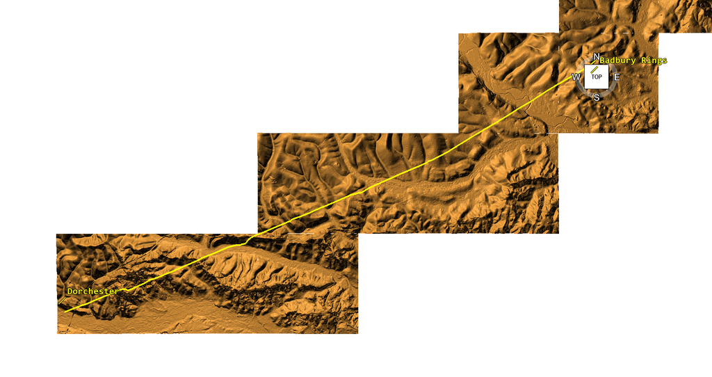
1. Badbury Rings — A Prehistoric Dyke Adapted as a Roman Road?
The high-resolution LiDAR investigation at Badbury Rings raises fundamental questions concerning the original construction of the substantial earthworks traditionally classified as a Roman road.
Papworth (2019) describes the Dorchester road as an agger up to 14 metres wide and 1.6 metres high, flanked by substantial ditches and outer banks. However, his interpretation of the relationship between the road and the hillfort’s outer rampart relies principally on aerial photography, earthwork surveys and LiDAR rather than excavation of the critical junction [1].
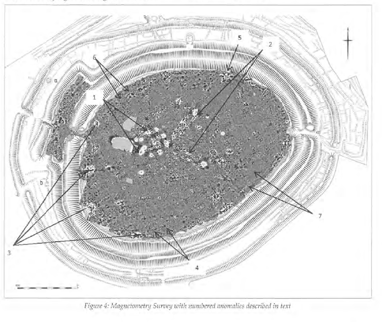
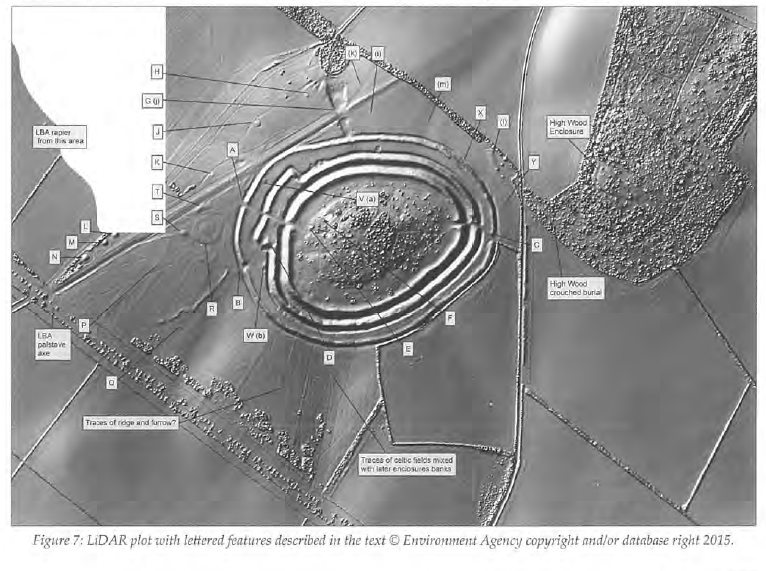
The limitations are apparent in the published illustrations. Figure 4 presents magnetometry results, while Figures 7 and 8 reproduce Environment Agency LiDAR at a scale that does not clearly resolve the intersections between the adjoining earthworks.
Comparison with the more detailed LiDAR visualisations used in this investigation reveals additional morphological relationships, including what appear to be two ditch alignments intersected by a later linear formation [2].
If stratigraphy confirms these intersections, they would show that both ditches preceded the intersecting construction, challenging interpretations that treat the entire surviving complex as contemporary Roman engineering.
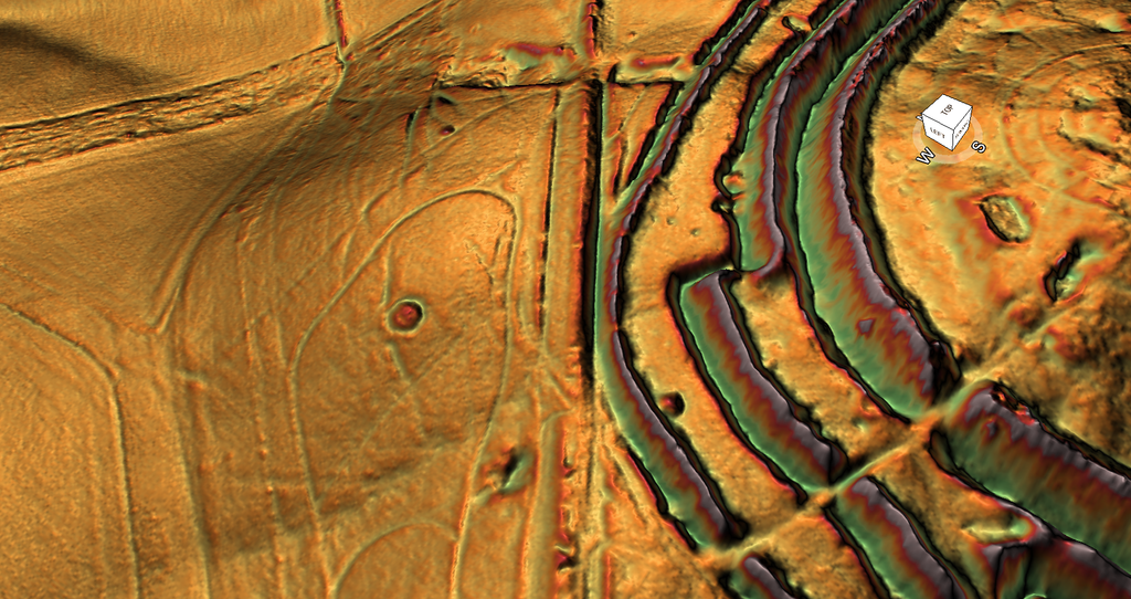
Papworth acknowledges uncertainty about the construction sequence, while Crawford and Keiller (1928) also recognised complex relationships between the road, quarrying, and surrounding earthworks [1,3].
The substantial linear dyke is additionally associated with the prehistoric landscape southwest of Badbury Rings, including neighbouring burial mounds. Papworth records instances where road construction cut or clipped barrow ring ditches, demonstrating that parts of this landscape predate at least one phase of road construction [1].
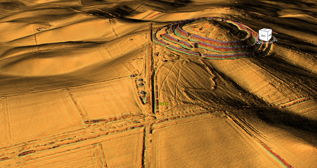
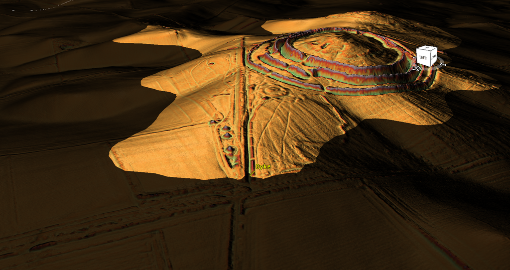
An alternative interpretation proposes that the original structure was a substantial prehistoric bank-and-ditch system, potentially associated with water management or transport.
Under the Post-Glacial Flooding Hypothesis, higher former groundwater levels could have supported a water-filled channel. Subsequent hydrological decline may have allowed its adjoining bank to be adapted as a terrestrial track or road, with narrower drainage features added during later construction.
The recognised road alignment also continues beyond the substantial surviving dyke, consistent with a later terrestrial extension, although uneven preservation of an originally continuous road remains an alternative.
The critical distinction is between the original earthwork and its subsequent use. Neither the published surveys nor the high-resolution LiDAR independently establishes a prehistoric hydraulic phase, but the newly identified relationships warrant archaeological investigation.
2. Crab Farm — Evidence of Later Road Construction
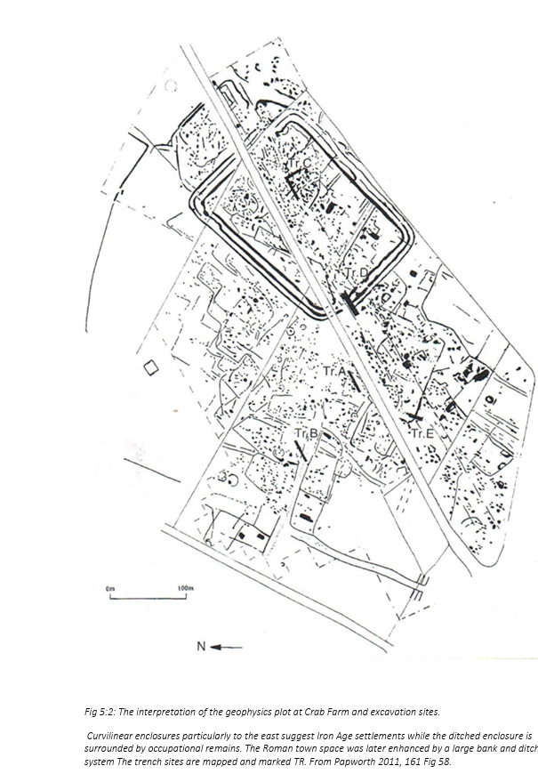
At Crab Farm, southwest of Badbury Rings, archaeological investigations undertaken in 1995 and 2004 provide evidence for successive phases of construction.
Fletcher (2004) records that the latest road formation overlaid backfilled ditches associated with a Roman fortification. Further excavation identified road material above a previously infilled feature interpreted as a well, containing fourth-century coins and pottery [4].
The overlying road construction must therefore postdate that infilling.
Geophysical surveys also suggested an earlier linear alignment beneath the later road formation.
Fletcher discusses Papworth’s interpretation that the road was realigned across an existing settlement after the second century AD, potentially replacing an earlier route with prehistoric origins [4].
Although the earlier route remains hypothetical, the excavations demonstrate that at least part of the recognised road represents later construction across an established archaeological landscape.
2a. Little Almer Wood — A Roman Road or a Substantial Dyke?
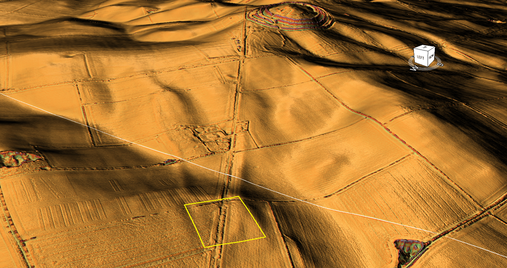
At Little Almer Wood, the recognised Roman-road alignment exhibits another substantial change in its surviving earthwork morphology.
The Royal Commission’s 1975 inventory describes an agger approximately 12.2 metres wide and 0.61 metres high, immediately north of the main woodland ride. This classification is reproduced in Dorset HER MDO6151 [5,6].
A more recent record, MDO46733, identifies about 1 km of associated linear earthworks between Little Almer Wood and the Mapperton road, plotted from Environment Agency LiDAR. That record reports no archaeological finds or excavated construction sequence [7].
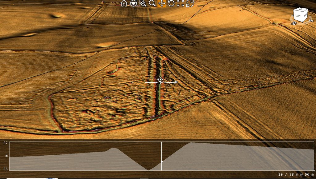
The high-resolution LiDAR cross-section examined in this investigation presents a different engineering problem.
Across a measured 58-metre terrain profile, the most conspicuous feature is a substantial V-shaped cutting, bordered by raised ground, rather than an identifiable flat or cambered carriageway [2].
The recorded 12.2-metre agger and the newly measured profile have not yet been established as precisely coincident locations. Nevertheless, the distinction between a raised road formation and a substantial excavated ditch requires examination.
The surrounding landscape contains extensive extraction hollows, including features classified as probable post-medieval chalk pits in Dorset HER records such as MDO46712 [8]. Those classifications do not, on their own, establish the construction date of the central linear ditch.
An alternative interpretation is that the surviving feature represents an earlier bank-and-ditch system, with a later terrestrial route occupying an adjoining bank after its original function had ceased.
Under the Post-Glacial Flooding Hypothesis, that earlier function could have involved water management or transport.
However, the V-shaped profile alone cannot establish a former watercourse, and a large roadside ditch or extraction-related cutting also requires investigation.
The critical missing evidence is an excavated relationship between the substantial cutting, its associated banks and any surviving metalled running surface.
3. Winterborne Kingston — The Disappearing Earthwork
Beyond Badbury Rings, the recognised route continues towards Winterborne Kingston.
The Royal Commission’s 1975 inventory records surviving earthworks near Abbot’s Court, where the alignment follows the lane known as East Street [5].
Further southwest, agricultural cultivation has reduced or removed much of the original formation.
Dorset Historic Environment Record MDO46745 identifies a surviving 185-metre section south of Abbot’s Court Farm, visible as low earthworks in Environment Agency LiDAR [6].
These observations demonstrate that archaeological features survive along the accepted route, but they do not establish identical construction characteristics or dates for the missing sections.
Distinguishing between a mapped alignment and surviving physical engineering remains is essential.
4. Bagwood Coppice and Bere Down — Excavated Road Construction
Near Bagwood Coppice, the Royal Commission recorded an agger about 12 metres wide and 1.2 metres high, with accompanying Romano-British settlement evidence [5].
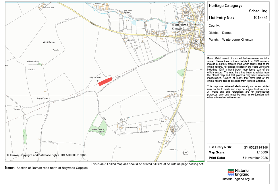
Historic England’s Scheduled Monument 1015351 identifies a surviving 158-metre section approximately 15 metres wide and 0.5 metres high north of the coppice [7].
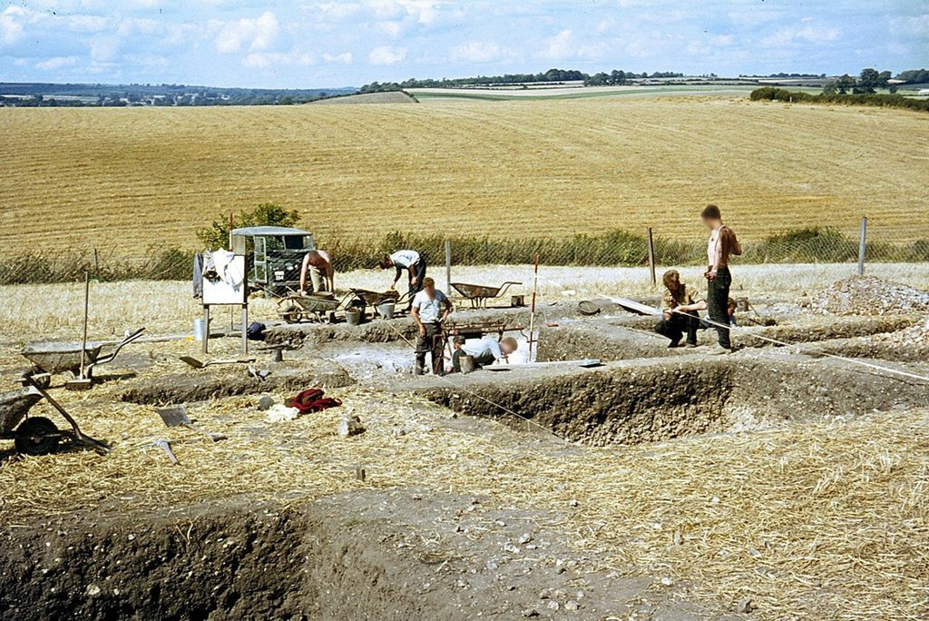
Further west, a 1949 excavation at Bere Down revealed a metalled surface about 6.1 metres wide, consisting of flints and small stones over sandy clay on natural chalk.
The associated shallow side ditches were approximately 17.9 metres apart, measured between their centres [4,5].
This excavation establishes a deliberately prepared terrestrial running surface.
However, the metalling was considerably narrower than the complete bank-and-ditch formations recorded elsewhere.
The road also crosses an earlier field system, providing another example of construction superimposed upon an established archaeological landscape.
These findings support Roman-period road engineering but do not show that every substantial adjoining earthwork originated in the same construction phase.
4a. Winterborne Kingston to Puddletown Forest — The Missing Roman Road
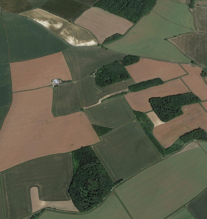
Our latest three-dimensional LiDAR investigation reveals a significant discrepancy between the recognised Roman-road alignment and the surviving landscape southwest of Winterborne Kingston.
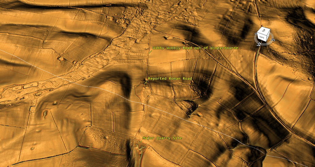
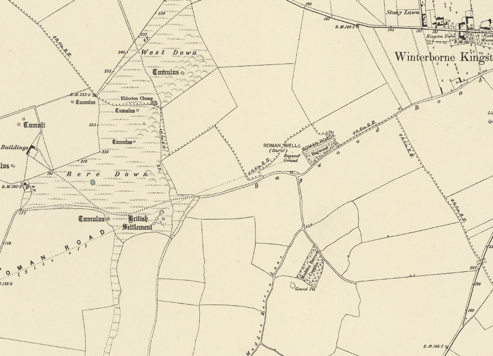
The visible route leaving the village is distinctly sinuous, following the natural contours rather than the relatively straight alignment represented on historical Ordnance Survey maps. More importantly, the examined LiDAR view identifies no continuous, substantial Roman-road earthwork alongside the surviving route [9].
This distinction matters because the Royal Commission’s 1975 inventory acknowledges that cultivation has destroyed much of the Roman road beyond Winterborne Kingston [5].
The archaeological record establishes surviving sections, including the 185-metre earthwork near Abbot’s Court and the 158-metre formation at Bagwood Coppice [6,7]. Archaeological observations during cable replacement in 1995 also recorded sections through the road fabric near Winterborne Kingston [11].
However, these observations do not establish an uninterrupted surviving engineered formation between them.
The adjacent quarry landscape introduces another complication.
Historical mapping identifies substantial irregular earthworks at Bere Down, previously interpreted as an ancient British settlement. Subsequent investigation suggested the area had been quarried, although it remains uncertain whether genuine settlement remains were destroyed [10].
A possible Iron Age or Romano-British terraced trackway was also recorded approaching this area [10].
Our LiDAR additionally identifies a substantial extraction site on the hillside, together with an irregular route whose relationship to the mapped Roman road is not immediately apparent [9].
Could some of these routes originally have served extraction sites or earlier waterways rather than forming one continuously constructed Roman road?
Alternatively, centuries of cultivation, quarrying, and later construction may have removed or concealed the recognised road.
The critical observation is that the historical alignment and the surviving physical engineering cannot be treated as identical evidence.
Excavated Roman road sections exist; the original construction sequence across the intervening landscape remains an archaeological question.
This distinction becomes particularly relevant as we approach Puddletown Forest, where English Heritage’s detailed survey reveals further changes in the scale and character of the surviving earthworks.
5. Approaching Puddletown Forest — Changing Engineering and Interpretation
The recognised route approaches Puddletown Forest through increasingly complicated terrain, containing substantial natural depressions, extraction features and surviving linear earthworks.
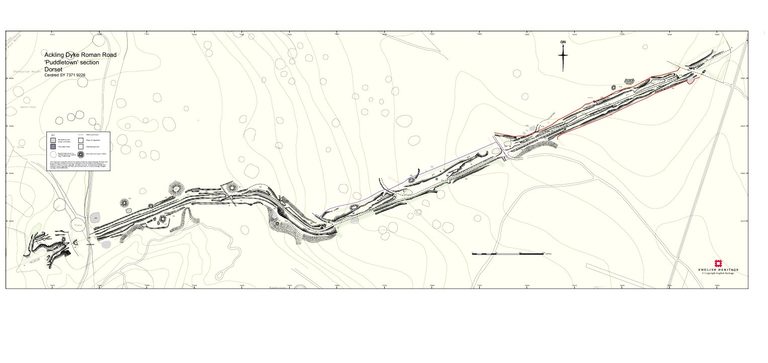
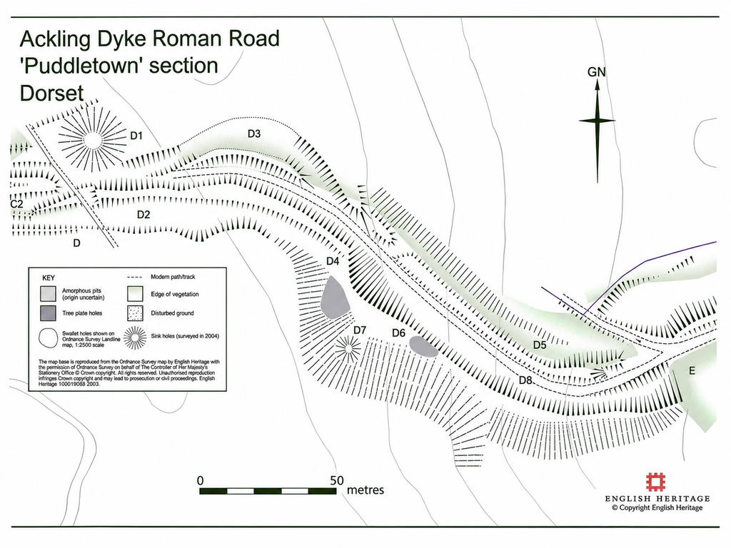
Fletcher’s 2004 English Heritage investigation examined approximately 1.75 kilometres of the route, dividing the surviving structures into seven principal sections, A–B through G–H [4].
The recorded engineering varies considerably.
Some sections preserve raised surfaces approximately 4–6 metres wide, while others form complexes measuring 26–34 metres across.
Elsewhere, quarrying, forestry activity, erosion, and later tracks prevent establishing the original width.
Fletcher also acknowledges that some adjoining banks cannot be confidently assigned an original function.
The report identifies substantial sinkholes and smaller depressions, some interpreted as extraction pits, although their chronological relationship to the road remains uncertain.
Importantly, Fletcher notes that the historical Ordnance Survey representation of the route was stylised, and some portions identified as continuous on mapping were already substantially disturbed or missing.
These observations raise the question of whether the entire earthwork complex represents one Roman engineering project or incorporates earlier structures subsequently adapted for terrestrial transport.
The detailed Puddletown Forest investigation provides an opportunity to test those competing interpretations.
Conclusion
Between Badbury Rings and Puddletown Forest, the archaeological evidence demonstrates substantial variation in earthwork morphology and construction chronology.
The Badbury Rings LiDAR suggests that a later route may intersect two earlier ditch alignments, while excavations at Crab Farm establish later road construction across an existing settlement landscape.
At Bere Down, a metalled running surface is demonstrated, but the much larger earthwork complexes encountered elsewhere require separate explanation.
These findings support investigating the route as a potentially multi-phase transport corridor.
The central archaeological question remains whether Roman engineers constructed the original bank-and-ditch systems or subsequently adapted earlier infrastructure, potentially following changes in the regional hydrological landscape.
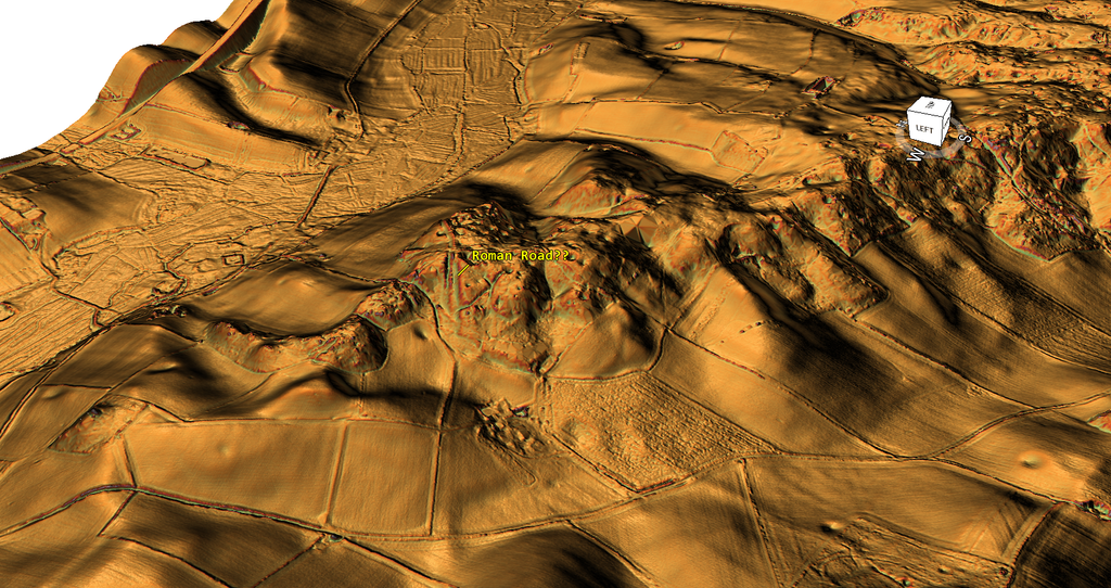
The presumed Roman road has largely disappeared into the landscape, except for this extraordinary section where a substantial cutting has been excavated through the hillside. The engineering makes little practical sense for a road, as the hill could have been avoided entirely by following the flatter surrounding terrain, saving considerable time and labour. Why undertake such an unnecessary excavation when a simpler route was readily available? Was this cutting originally built for a different purpose?
References
[1] Papworth, M. (2019). Excavation and Survey at Badbury Rings, Dorset. Proceedings of the Dorset Natural History and Archaeological Society, Volume 140, pp. 129–171. Particularly pp. 139–143 and Figures 4, 7 and 8.
[2] Prehistoric Britain (2026). Badbury Rings: Comparative High-Resolution LiDAR Analysis. Present-day terrain visualisations and proposed earlier water-level reconstruction accompanying this investigation.
[3] Crawford, O. G. S. and Keiller, A. (1928). Wessex from the Air. Oxford: Clarendon Press, pp. 58–61.
[4] Fletcher, M. (2004). The Ackling Dyke Roman Road in Puddletown Forest, Dorset. English Heritage Archaeological Investigation Report 37/2004; Historic England Research Report 103/2004.
https://historicengland.org.uk/research/results/reports/103-2004
[5] Royal Commission on Historical Monuments (England) (1975). An Inventory of Historical Monuments in the County of Dorset, Volume V: East Dorset. London: HMSO, pp. 33–34.
https://heritage.dorsetcouncil.gov.uk/Monument/MDO2789
[6] Dorset Historic Environment Record. MDO46745: Roman Road from Badbury Rings to Dorchester, Winterborne Kingston.
https://heritage.dorsetcouncil.gov.uk/Monument/MDO46745
[7] Historic England. Scheduled Monument 1015351: Section of Roman Road North of Bagwood Coppice, Winterborne Kingston.
https://historicengland.org.uk/listing/the-list/list-entry/1015351
[8] Dorset Historic Environment Record. MDO46712: Post-medieval Chalk Pit, Little Almer Wood, Sturminster Marshall. Extraction hollow identified from Environment Agency LiDAR during the Dorset Middle Stour Archaeological Interpretation and Mapping project.
https://heritage.dorsetcouncil.gov.uk/Monument/MDO46712
[9] Prehistoric Britain Research Project (2026). Ackling Dyke Investigation: Winterborne Kingston, Bagwood Close and Bere Down. Original three-dimensional LiDAR visualisations comparing the historical Roman-road alignment, surviving irregular routes and surrounding extraction landscape. Primary research supplied for this investigation.
[10] Dorset Historic Environment Record. MDO7162: Romano-British Settlement, Bere Regis. Records the former interpretation of the Bere Down earthworks as an ancient settlement, subsequent quarrying and a possible Iron Age or Romano-British terraced trackway. Includes references to Hutchins (1863) and the Royal Commission’s 1970 inventory.
https://heritage.dorsetcouncil.gov.uk/Monument/MDO7162
[11] Heaton, M. (1995). Winterborne Kingston, Dorset: SEB 11kV Mains Replacement. Wessex Archaeology, Report 39702.1. Archaeological observations during cable replacement, including sections through the Roman-road fabric near Winterborne Kingston. Dorset Historic Environment Record source SDO13967.
https://heritage.dorsetcouncil.gov.uk/Source/SDO13967
⬅️ Previous: Section 14. The Rookery to Badbury Rings — The Witchampton Alignment
➡️ Next: Section 16. Puddletown Forest — When a Roman Road Becomes an Assumption